Embed Size (px)
Citation preview
FINAL ENVIRONMENTAL ASSESSMENT
FOR
COMPACT POWER, INC. ELECTRIC DRIVE
VEHICLE BATTERY AND COMPONENT MANUFACTURING INITIATIVE
APPLICATION, HOLLAND, MICHIGAN
U.S. Department of Energy National Energy Technology Laboratory
May 2010
DOE/EA-1709


FINAL ENVIRONMENTAL ASSESSMENT
FOR
COMPACT POWER, INC. ELECTRIC DRIVE
VEHICLE BATTERY AND COMPONENT MANUFACTURING INITIATIVE
APPLICATION, HOLLAND, MICHIGAN
U.S. Department of Energy National Energy Technology Laboratory
May 2010
DOE/EA-1709

DOE/EA-1709 iii
COVER SHEET
RESPONSIBLE AGENCY: U.S. Department of Energy (DOE) TITLE: Final Environmental Assessment for Compact Power, Inc. Electric Drive Vehicle Battery and Component Manufacturing Initiative Application, Holland, Michigan CONTACT: For additional copies or more information concerning this environmental
assessment (EA), please contact:
Mr. Mark W. Lusk U.S. Department of Energy National Energy Technology Laboratory P.O. Box 880 3610 Collins Ferry Road Morgantown, WV 26507-0880 Telephone: (304) 285-4145 Email: [email protected].
ABSTRACT: DOE prepared this EA to evaluate the potential environmental consequences of providing an American Recovery and Reinvestment Act of 2009 (Recovery Act; Public Law 111-5, 123 Stat. 115) financial assistance grant to Compact Power, Inc. to facilitate the construction and operation of a high-volume manufacturing plant to build advanced lithium-ion cells and batteries. The cells and batteries would be for use in automotive applications including but not limited to hybrid electric, plug-in hybrid electric, pure electric vehicles for commercial purposes, and military hybrid vehicles, as well as for aviation, smart grid support, broadband backup power, and energy storage for renewable energy.
DOE’s Proposed Action is to provide $151 million in financial assistance in a cost-sharing arrangement with the project proponent, Compact Power, Inc. The total cost of the project is estimated at $303 million. Compact Power, Inc.’s proposed project would expand its domestic capacity to produce advanced lead-acid batteries for use in the transportation industry. Compact’s 850,000-square-foot facility would be built on vacant land located mostly in the City of Holland, Allegan County, Michigan, with a small portion of the proposed site located in the adjacent Fillmore Township.
This EA evaluates 14 resource areas and identifies no significant adverse impacts for the proposed project after consideration of the mitigation of impacts to wetlands. Beneficial impacts to the nation’s air quality and transportation could be realized from implementation of the proposed project. In addition, beneficial socioeconomic impacts would occur from increased employment opportunities and spending in the affected local communities.
Availability: A Notice of Availability was placed in the Holland Sentinel and Grand Rapids Press on January 8, 9, and 10, 2010. The Draft EA was made available for public review from
DOE/EA-1709 iv
January 8, 2009 through February 7, 2010 at the Herrick District Library, 300 S. River Avenue, Holland, Michigan.
The Draft EA was also available on the National Energy Technology Laboratory web site and was mailed to individuals and agencies listed in Appendix A. This Final EA is available on DOE’s National Energy Technology Laboratory web site at http://www.netl.doe.gov/publications/others/nepa/ea.html.
Contents
DOE/EA-1709 v
CONTENTS
Section Page
Summary ......................................................................................................................................S-1
1 Introduction .......................................................................................................................... 1-1
1.1 National Environmental Policy Act and Related Procedures .......................................... 1-2
1.2 Background...................................................................................................................... 1-2
1.3 Purpose and Need ............................................................................................................ 1-4
1.4 Consultations and Public Comment Response Process ................................................... 1-4
1.4.1 Consultations............................................................................................................ 1-4 1.4.2 Comment-Response Process.................................................................................... 1-5
2 DOE Proposed Action and Alternatives............................................................................... 2-1
2.1 CPI’s Proposed Project .................................................................................................... 2-1
2.2 No-Action Alternative ..................................................................................................... 2-6
2.3 DOE Alternative Actions................................................................................................. 2-6
3 Affected Environment and Environmental Consequences................................................... 3-1
3.1 Land Use .......................................................................................................................... 3-1
3.1.1 Affected Environment.............................................................................................. 3-1 3.1.2 Environmental Consequences.................................................................................. 3-2
3.1.2.1 Proposed Project ............................................................................................ 3-2 3.1.2.2 No-Action Alternative ................................................................................... 3-2
3.2 Air Quality ....................................................................................................................... 3-2
3.2.1 Affected Environment.............................................................................................. 3-2 3.2.1.1 Ambient Air Quality Conditions.................................................................... 3-2 3.2.1.2 Air Quality Conformity.................................................................................. 3-4 3.2.1.3 Greenhouse Gas Emissions............................................................................ 3-4
3.2.2 Environmental Consequences.................................................................................. 3-5 3.2.2.1 Proposed Project ............................................................................................ 3-5 3.2.2.2 No-Action Alternative ................................................................................... 3-5
3.3 Noise ................................................................................................................................ 3-6
Contents
DOE/EA-1709 vi
3.3.1 Affected Environment.............................................................................................. 3-6 3.3.2 Environmental Consequences.................................................................................. 3-6
3.3.2.1 Proposed Project ............................................................................................ 3-6 3.3.2.2 No-Action Alternative ................................................................................... 3-7
3.4 Aesthetics and Visual Resources ..................................................................................... 3-7
3.4.1 Affected Environment.............................................................................................. 3-7 3.4.2 Environmental Consequences.................................................................................. 3-7
3.4.2.1 Proposed Project ............................................................................................ 3-7 3.4.2.2 No-Action Alternative ................................................................................... 3-8
3.5 Geology and Soils ............................................................................................................ 3-8
3.5.1 Affected Environment.............................................................................................. 3-8 3.5.1.1 Geologic and Topographic Conditions .......................................................... 3-8 3.5.1.2 Soils................................................................................................................ 3-9 3.5.1.3 Prime Farmland.............................................................................................. 3-9
3.5.2 Environmental Consequences.................................................................................. 3-9 3.5.2.1 Proposed Project ............................................................................................ 3-9 3.5.2.2 No-Action Alternative ................................................................................. 3-10
3.6 Water Resources ............................................................................................................ 3-10
3.6.1 Affected Environment............................................................................................ 3-10 3.6.1.1 Surface Water............................................................................................... 3-10 3.6.1.2 Groundwater ................................................................................................ 3-11 3.6.1.3 Wetlands and Floodplains............................................................................ 3-11
3.6.2 Environmental Consequences................................................................................ 3-15 3.6.2.1 Proposed Project .......................................................................................... 3-15 3.6.2.2 No-Action Alternative ................................................................................. 3-17
3.7 Biological Resources ..................................................................................................... 3-17
3.7.1 Affected Environment............................................................................................ 3-17 3.7.1.1 Vegetation .................................................................................................... 3-18 3.7.1.2 Wildlife ........................................................................................................ 3-18 3.7.1.3 Sensitive Species.......................................................................................... 3-19 3.7.1.4 Wetlands ...................................................................................................... 3-22
3.7.2 Environmental Consequences................................................................................ 3-23 3.7.2.1 Proposed Project .......................................................................................... 3-23 3.7.2.2 No-Action Alternative ................................................................................. 3-24
3.8 Cultural Resources ......................................................................................................... 3-24
3.8.1 Affected Environment............................................................................................ 3-24 3.8.1.1 Prehistoric and Historic Background ........................................................... 3-24 3.8.1.2 Status of Cultural Resource Inventories and Section 106 Consultations..... 3-25
Contents
DOE/EA-1709 vii
3.8.1.3 Native American Resources......................................................................... 3-26 3.8.2 Environmental Consequences................................................................................ 3-26
3.8.2.1 Proposed Project .......................................................................................... 3-26 3.8.2.2 No-Action Alternative ................................................................................. 3-27
3.9 Socioeconomics ............................................................................................................. 3-27
3.9.1 Affected Environment............................................................................................ 3-27 3.9.1.1 Population and Unemployment.................................................................... 3-27 3.9.1.2 Industry and Occupations ............................................................................ 3-27 3.9.1.3 Income.......................................................................................................... 3-28 3.9.1.4 Housing ........................................................................................................ 3-28
3.9.2 Environmental Consequences................................................................................ 3-28 3.9.2.1 Proposed Project .......................................................................................... 3-28 3.9.2.2 No-Action Alternative ................................................................................. 3-29
3.10 Environmental Justice.................................................................................................... 3-29
3.10.1 Affected Environment............................................................................................ 3-29 3.10.1.1 Poverty Rate................................................................................................. 3-30 3.10.1.2 Demographics .............................................................................................. 3-30
3.10.2 Environmental Consequences................................................................................ 3-30 3.10.2.1 Proposed Project .......................................................................................... 3-30 3.10.2.2 No-Action Alternative ................................................................................. 3-30
3.11 Occupational Health and Safety..................................................................................... 3-30
3.11.1 Affected Environment............................................................................................ 3-30 3.11.2 Environmental Consequences................................................................................ 3-31
3.11.2.1 Proposed Project .......................................................................................... 3-31 3.11.2.2 No-Action Alternative ................................................................................. 3-33
3.12 Utilities, Energy, and Materials ..................................................................................... 3-33
3.12.1 Affected Environment............................................................................................ 3-33 3.12.1.1 Energy Sources ............................................................................................ 3-33 3.12.1.2 Water and Sewer .......................................................................................... 3-35 3.12.1.3 Storm Water System .................................................................................... 3-36 3.12.1.4 Hazardous Materials .................................................................................... 3-36
3.12.2 Environmental Consequences................................................................................ 3-36 3.12.2.1 Proposed Project .......................................................................................... 3-36 3.12.2.2 No-Action Alternative ................................................................................. 3-40
3.13 Waste.............................................................................................................................. 3-40
3.13.1 Affected Environment............................................................................................ 3-40 3.13.1.1 Hazardous Waste ......................................................................................... 3-40 3.13.1.2 Solid Waste .................................................................................................. 3-41

Contents
DOE/EA-1709 viii
3.13.2 Environmental Consequences................................................................................ 3-42 3.13.2.1 Proposed Project .......................................................................................... 3-42 3.13.2.2 No-Action Alternative ................................................................................. 3-43
3.14 Transportation ................................................................................................................ 3-43
3.14.1 Affected Environment............................................................................................ 3-43 3.14.1.1 Roadways..................................................................................................... 3-44 3.14.1.2 Aviation........................................................................................................ 3-44 3.14.1.3 Rail............................................................................................................... 3-44
3.14.2 Environmental Consequences................................................................................ 3-44 3.14.2.1 Proposed Project .......................................................................................... 3-44 3.14.2.2 No-Action Alternative ................................................................................. 3-45
3.15 The Relationship Between Local Short-Term Uses of the Environment and the Maintenance and Enhancement of Long-Term Productivity ....................................... 3-45
3.16 Irreversible and Irretrievable Commitments of Resources ............................................ 3-45
3.17 Unavoidable Adverse Impacts ....................................................................................... 3-46
4 Cumulative Impacts.............................................................................................................. 4-1
4.1 Past, Present, and Reasonably Foreseeable Actions ........................................................ 4-1
4.2 Cumulative Impacts Summary......................................................................................... 4-2
5 Conclusions .......................................................................................................................... 5-1
6 References ............................................................................................................................ 6-1
LIST OF TABLES
Table Page 3-1 National Ambient Air Quality Standards ........................................................................... 3-3 3-2 Summary of Michigan water quality and designated uses for surface waters in the area
of the project site .............................................................................................................. 3-12 3-3 Federally listed plant and animal species known to occur in Allegan County, Michigan 3-19 3-4 State-listed plant and animal species known to occur in Allegan County, Michigan ...... 3-20 3-5 Municipal solid waste disposal facilities within 50 miles of Holland, Michigan............. 3-41
Contents
DOE/EA-1709 ix
LIST OF FIGURES
Figure Page 2-1 Project location -- Holland, Michigan ................................................................................ 2-2 2-2 Proposed site plan – Compact Power, Inc. Lithium-Ion Battery Manufacturing Facility,
Holland, Michigan .............................................................................................................. 2-3 3-1 Wetlands at the proposed project site, Holland, Michigan............................................... 3-13
APPENDICES
Appendix A Distribution List .................................................................................................. A-1 Appendix B Consultations........................................................................................................B-1 Appendix C Part 303 Wetland Permit Application, Wetland Impact Assessment and
Compensatory Mitigation Proposal......................................................................C-1

ACRONYMS AND ABBREVIATIONS
BPW Board of Public Works
CFR Code of Federal Regulations
CO carbon monoxide
CPI Compact Power, Inc.
DOE U.S. Department of Energy (also called the Department)
EA environmental assessment
EPA U.S. Environmental Protection Agency
LiPF6 lithium hexafluorophosphate
NAAQS National Ambient Air Quality Standards
NEPA National Environmental Policy Act, as amended
NMP N-methylpyrrolidone
NO2 nitrogen dioxide
NOx nitrogen oxides
O3 ozone
Pb lead
PM10 particulate matter with an aerodynamic size less than or equal to 10 microns
PM2.5 particulate matter with an aerodynamic size less than or equal to 2.5 microns
SO2 sulfur dioxide
Stat. United States Statute at Large
U.S.C. United States Code
Note: Numbers in this EA generally have been rounded to two or three significant figures. Therefore, some total values might not equal the actual sums of the values.
Summary
DOE/EA-1709 S-1
SUMMARY
The U.S. Department of Energy (DOE) proposes to provide a grant to Compact Power, Inc. to construct and operate a high-volume manufacturing plant to build advanced lithium-ion cells and batteries for automotive applications including but not limited to hybrid electric, plug-in hybrid electric, pure electric vehicles for commercial purposes, and military hybrid vehicles, as well as for aviation, smart grid support, broadband backup power, and energy storage for renewable energy. DOE would provide $151 million in financial assistance in a cost-sharing arrangement with the project proponent, Compact Power, Inc. The total cost of the proposed project is estimated at $303 million. The 850,000-square-foot facility would be built on about 80 acres, mostly located in the City of Holland, Michigan, with a small portion of the proposed project site located in the adjacent Fillmore Township. Compact Power, Inc. would employ approximately 450 workers when the facility was fully operational. The manufacturing facility would contribute to President Obama’s commitment to accelerate the development of United States manufacturing capacity for batteries and electric drive components as well as the deployment of electric drive vehicles, helping to establish American leadership in creating the next generation of advanced vehicles.
In compliance with the National Environmental Policy Act (42 U.S.C. Section 4321 et seq.) and DOE’s National Environmental Policy Act implementing regulations (10 CFR Part 1021) and procedures, this environmental assessment examines the potential environmental impacts of DOE’s Proposed Action, Compact Power, Inc.’s proposed project, and the No-Action Alternative. The environmental assessment’s purpose is to inform DOE and the public of the potential environmental consequences of the proposed project and alternatives.
In this environmental assessment, DOE analyzed impacts to land use; air quality; noise; aesthetics and visual resources; geology and soils; water resources; biological resources; cultural resources; socioeconomics; environmental justice; occupational health and safety; utilities, energy, and materials; waste; and transportation.
The proposed facility would be built on agricultural land that is mostly zoned industrial and would be compatible with surrounding land use. The eastern portion the project site in Fillmore Township (about 11 of the 80 acres) would require a change in zoning from residential to industrial. Fillmore Township and the City of Holland are working together to change the zoning of this land to be compatible with the facility. Vehicular and construction equipment exhaust would be a source of pollutant emissions, but would have a negligible impact on air quality. DOE estimates that the facility would emit 4.83 tons of nitrogen oxides, 0.42 tons of carbon monoxide, and 3.61 tons of dust annually. Compact Power, Inc. would obtain all necessary air permits from the Michigan Department of Environmental Quality. High-volume output of lithium-ion batteries resulting from operations of the facility is expected to result in significant reductions in carbon dioxide generated across the nation; and thus, a significant beneficial impact to the nation’s air quality could be realized.

Summary
DOE/EA-1709 S-2
One residence at the southeastern boundary of the site on the south side of East 48th Street could be subject to minor, short-term adverse impacts from noise generated during the construction of the proposed facility. This residence would also experience increased traffic noise on East 48th Street from commuting workers and trucks traveling to the facility. Transportation impacts from increased traffic on East 48th Street would be lessened if the City of Holland widened this street. The City of Holland has plans in the developmental stages to expand East 48th Street from Waverly Road to the east city limit, a distance of approximately 3,700 feet. The road would be widened from the existing two lanes to three lanes with curbs and gutters; turning lanes may be added.
The proposed project site is visible from two residences, one on the south side of East 48th Street and one on the south side of East 40th Street. These residences would experience short-term visual impacts from construction activities and long-term visual impacts from the conversion of open, agricultural land to industrial use. However, the facility would be well-landscaped and would be compatible with surrounding developed areas to the west and northwest.
About 40 acres of “prime farmland if drained” and “farmland of local importance” would be converted to industrial use, consistent with the City of Holland’s zoning. This farmland is protected under the Farmland Protection Policy Act. Preliminary evaluation indicates the value of this farmland is low, based on zoning, the size of the farmland, and other factors. DOE has consulted with the Natural Resources Conservation Service regarding loss of this farmland. Due to area zoning and the small size of the parcel, the project site scored low in relative value of farmland.
Best management practices during construction would lessen impacts of soil erosion and Compact Power, Inc. would develop a storm water pollution prevention plan to protect surface water. With these measures in place, there is little potential for adverse impacts to soils and water resources. Minimal short-term impacts to wildlife using existing agricultural crops for forage would result from disturbance during construction of the proposed facility. No adverse impacts to any federally listed threatened or endangered species would occur, as no such species are known to occur on the proposed project site. DOE initiated consultation with the U.S. Fish and Wildlife Service and the Michigan Department of Natural Resources. No responses were received.
This Environmental Assessment includes a wetlands assessment, as required by DOE regulations for Compliance with Floodplain and Wetland Environmental Review Requirements (10 Code of Federal Regulations Part 1022). The proposed project would impact three wetland systems determined to be regulated by the Michigan Department of Natural Resources and Environment, and a permit would be required. The impacts to would affect approximately 2.21 acres of wetlands, requiring approximately 8,058 cubic yards of excavation and approximately 8,795 cubic yards of fill. Since greater than 0.3 acre of a wetland would be disturbed, compensatory mitigation measures, in the form of mitigation banking, would be required. Mitigating the impacted wetlands at the appropriate ratio would require no less than 3.32 acres of mitigation.
Summary
DOE/EA-1709 S-3
Compact Power, Inc. submitted a Part 303 Permit Application, which contains a Compensatory Mitigation Proposal, to the Michigan Department of Natural Resources and Environment. Compact Power, Inc., in conjunction with the City of Holland, selected a location in the VanRaalte Farm Park for the newly created wetland. Overall approximately 3.5 acres of wetland mitigation would be created at this location. Compensatory mitigation measures would ensure that wetlands impacts would not be considered significant.
Long-term beneficial socioeconomic impacts would occur from increased employment opportunities and spending in the local economy. Long-term benefits to the nation’s transportation industry would also occur from high-volume output of lithium-ion batteries by savings of fuel oil and greater use of plug-in hybrid electric vehicles.
Impacts to cultural resources are not expected. DOE initiated consultation with the Michigan State Historic Preservation Office and requested any additional information that office has developed or obtained on historic properties in the vicinity of the project site. DOE also sent a request to seven separate federally recognized tribes with interests in the area for information those tribes have, and are interested in sharing, on properties of traditional religious and cultural significance within the vicinity of the project site, and any comments or concerns they have on the potential for this project to affect those properties. A response from the State Historic Preservation Office supported DOE’s determination that no historic properties would be affected by the proposed project.
No adverse impacts to environmental justice, utility systems, hazardous and solid waste management, or occupational health and safety would occur.
Under the No-Action Alternative, DOE would not provide funds for the proposed project. For the purposes of the environmental assessment, DOE assumed that the project would not proceed or would be delayed without DOE funding. No impacts to the existing environment would occur. In addition, the beneficial impacts discussed above would not be realized. This assumption establishes a baseline against which the potential environmental impacts of the proposed project are compared.

Introduction
DOE/EA-1709 1-1
1. INTRODUCTION
Compact Power, Inc. (CPI) proposes to construct and operate a high-volume manufacturing plant to build advanced lithium-ion cells and batteries for automotive applications including but not limited to hybrid electric, plug-in hybrid electric, pure electric vehicles for commercial purposes, and military hybrid vehicles, as well as for aviation, smart grid support, broadband backup power, and energy storage for renewable energy. In order to facilitate this project, the U.S. Department of Energy (DOE or the Department) is considering providing CPI with a grant under Funding Opportunity Announcement DE-FOA 0000026 entitled Recovery Act – Electric Drive Vehicle Battery and Component Manufacturing Initiative. DOE will make its decision after evaluating the potential environmental impacts and other aspects of CPI’s proposed project.
As part of the American Recovery and Reinvestment Act of 2009 (Recovery Act; Public Law 111-5, 123 Stat. 115), as amended, the DOE’s National Energy Technology Laboratory, on behalf of the Office of Energy Efficiency and Renewable Energy’s Vehicle Technologies Program, will provide up to $2 billion in federal funding to competitively selected recipients for the construction (including increase in production capacity of current plants), of U.S. manufacturing plants that produce batteries and electric drive components. The funding of these projects, known as the Electric Drive Vehicle Battery and Component Manufacturing Initiative, requires compliance with the National Environmental Policy Act of 1969, as amended (NEPA; 42 United States Code [U.S.C.] 4321 et seq.), Council on Environmental Quality regulations (40 Code of Federal Regulations [CFR] Parts 1500 to 1508), and DOE NEPA implementing regulations (10 CFR Part 1021). Therefore, DOE prepared this Environmental Assessment for Compact Power, Inc. Electric Drive Vehicle Battery and Component Manufacturing Initiative Application, Holland, MI (EA) to evaluate the potential environmental consequences of providing grants under the initiative. In compliance with these laws and regulations, this EA examines the potential environmental consequences of DOE’s Proposed Action (that is, providing financial assistance) and No-Action Alternative (under which it is assumed that, as a consequence of DOE’s denial of financial assistance, CPI would not proceed with the project). The EA’s purpose is to inform DOE and the public of the potential environmental consequences of CPI’s proposed project and alternatives.
This chapter explains the background, purpose and need, and the scope of the DOE’s Proposed Action. Chapter 2 describes DOE’s Proposed Action, CPI’s proposed project, and the No-Action Alternative. Chapter 3 details the affected environment and potential environmental consequences of the proposed project and of the No-Action Alternative. Chapter 4 describes cumulative impacts, Chapter 5 provides DOE’s conclusions, and Chapter 6 identifies references cited in this EA. Appendix A contains the distribution list, Appendix B contains consultation information, and Appendix C contains CPI’s wetlands permit application, which includes a compensatory mitigation proposal, to the Michigan Department of Natural Resources and Environment.
Introduction
DOE/EA-1709 1-2
1.1 National Environmental Policy Act and Related Procedures
In accordance with its NEPA implementing regulations, DOE must evaluate the potential environmental impacts of its Proposed Action that may have a significant impact on human health and the environment, including decisions on whether to provide financial assistance to states and private entities. In compliance with these regulations and DOE’s procedures, this Final EA:
Examines the potential environmental impacts of CPI’s proposed project and the No-Action Alternative;
Identifies unavoidable adverse environmental impacts of the proposed project;
Describes the relationship between local short-term uses of the environment and the maintenance and enhancement of long-term productivity; and
Characterizes any irreversible and irretrievable commitments of resources that would be involved should DOE decide to implement its Proposed Action.
These requirements must be met before DOE decides whether to proceed with any proposed action that could cause adverse impacts to human health or the environment. This EA fulfills DOE’s obligations under NEPA and provides DOE with the information needed to make an informed decision about helping to finance CPI’s proposed project.
The proposed project considered in this EA constitutes a wetlands action as defined in 10 CFR Part 1022 “Compliance with Floodplain and Wetland Environmental Review Requirements.” To fully evaluate the potential impacts of the project on wetlands and methods that could be used to minimize those impacts, Chapter 3, Section 3.6 of this EA includes a wetlands assessment, as required by DOE regulations.
This EA evaluates the potential individual and cumulative impacts of the CPI proposed project. No other action alternatives are analyzed. For purposes of comparison, this EA also evaluates the impacts that would occur if DOE did not provide funding to support the construction and operation of a high-volume manufacturing facility to build advanced lithium-ion cells and batteries for military hybrid vehicles, aviation, smart grid support, broadband backup power, and energy storage for renewable energy (the No-Action Alternative), under which DOE assumes that CPI would not proceed with the project. This assumption may be incorrect—that is, CPI might proceed without federal assistance. However this assumption allows DOE to compare the impacts of an alternative in which expansion occurs with one in which it does not.
1.2 Background
DOE’s National Energy Technology Laboratory manages the research and development portfolio of the Vehicle Technologies Program for the Office of Energy Efficiency and Renewable Energy. A key objective of the Vehicle Technologies Program is accelerating the development
Introduction
DOE/EA-1709 1-3
and production of electric drive vehicle systems in order to substantially reduce the United States’ consumption of petroleum. Other goals of the Program include the development of production-ready batteries, power electronics, and electric machines that can be produced in volume economically so as to increase the use of electric drive vehicles.
Congress appropriated significant funding for the Vehicle Technologies Program in the Recovery Act in order to stimulate the economy and reduce unemployment in addition to furthering the existing objectives of the Vehicle Technologies Program. DOE solicited applications for this funding by issuing a competitive funding opportunity announcement (DE-FOA-0000026) entitled Recovery Act – Electric Drive Vehicle Battery and Component Manufacturing Initiative, on March 19, 2009. The announcement invited applications in seven areas of interest:
Area of Interest 1 – Projects that would build or increase production capacity and validate production capability of advanced automotive battery manufacturing plants in the United States.
Area of Interest 2 – Projects that would build or increase production capacity and validate production capability of anode and cathode active materials, components (e.g. separator, packaging material, electrolytes and salts), and processing equipment in domestic manufacturing plants.
Area of Interest 3 – Projects that combine aspects of Areas of Interest 1 and 2.
Area of Interest 4 – Projects that would build or increase production capacity and validate capability of domestic recycling or refurbishment plants for lithium-ion batteries.
Area of Interest 5 – Projects that would build or increase production capacity and validate production capability of advanced automotive electric drive components in domestic manufacturing plants.
Area of Interest 6 – Projects that would build or increase production capacity and validate production capability of electric drive subcomponent suppliers in domestic manufacturing plants.
Area of Interest 7 – Projects that combine aspects of Areas of Interest 5 and 6.
The application period closed on May 19, 2009, and DOE received 119 proposals across the seven areas of interest. DOE selected 30 projects based on the evaluation criteria set forth in the funding opportunity announcement. DOE gave special consideration to projects that promoted the objectives of the Recovery Act—job preservation or creation, and economic recovery—in an expeditious manner.
CPI’s proposed project in Holland, Michigan was one of the 30 projects DOE selected for funding. DOE’s Proposed Action under this funding opportunity is to provide $151 million in
Introduction
DOE/EA-1709 1-4
financial assistance in a cost-sharing arrangement with the project proponent, CPI. The total cost of the proposed project is estimated at $303 million.
1.3 Purpose and Need
The overall purpose and need for DOE’s Proposed Action under the Vehicle Technologies Program is to accelerate the development and production of various electric drive vehicle systems by building or increasing domestic manufacturing capacity for advanced automotive batteries, their components, recycling facilities, and electric drive vehicle components, in addition to stimulating the United States’ economy. This work will enable market introduction of various electric vehicle technologies by lowering the cost of battery packs, batteries, and electric propulsion systems for electric drive vehicles through high-volume manufacturing. DOE intends to further this purpose and satisfy this need by providing financial assistance under cost-sharing arrangements to this and the other 29 projects selected under this funding opportunity announcement.
This and the other selected projects are needed to reduce the United States’ petroleum consumption by investing in alternative vehicle technologies. Successful commercialization of electric drive vehicles would support the DOE's Energy Strategic Goal of “protect[ing] our national and economic security by promoting a diverse supply and delivery of reliable, affordable, and environmentally sound energy.” This proposed project will also meaningfully assist in the nation’s economic recovery by creating manufacturing jobs in the United States in accordance with the objectives of the Recovery Act.
1.4 Consultations and Public Comment Response Process
1.4.1 CONSULTATIONS
DOE initiated consultation with the U.S. Fish and Wildlife Service on November 19, 2009 and asked for its concurrence with DOE’s assessment that the proposed project would have no effect on federally listed species or habitats. A copy of this letter is included in Appendix B. On January 8, 2010, DOE sent the U.S. Fish and Wildlife Service a copy of the Draft EA. No responses or comments were received from the U.S. Fish and Wildlife Service.
DOE initiated consultation with the Michigan Department of Natural Resources on November 19, 2009 and asked for its concurrence with DOE’s assessment that the proposed project would have no effect on state or federally listed species. A copy of this letter is included in Appendix B. On January 8, 2010, DOE sent the Michigan Department of Natural Resources a copy of the Draft EA; no responses or comments were received.
DOE initiated consultation with the Michigan State Historic Preservation Office on November 12, 2009 and completed and submitted its Section 106 application on January 29, 2010. A copy of this letter and the Section 106 application are included in Appendix B. On January 8, 2010, DOE sent the Michigan State Historic Preservation Office a copy of the Draft EA. A letter dated
Introduction
DOE/EA-1709 1-5
February 25, 2010, from the State Historic Preservation Office supported DOE’s determination that no historic properties would be affected by the proposed project. A copy of this letter is included in Appendix B.
DOE initiated consultation with the Natural Resources Conservation Service on December 2, 2009 and asked for its concurrence with DOE’s assessment that the proposed project would have no effect on prime farmland. A copy of this letter is included in Appendix B. On January 5, 2010, the Natural Resources Conservation Service emailed a Farmland Conversion Impact Rating Form that it completed for the proposed project site. Due to area zoning and the small size of the parcel, the project site scored low in relative value of farmland. Copies of this form and the Natural Resources Conservation Service’s email are included in Appendix B. On January 8, 2010, DOE sent the Natural Resources Conservation Service a copy of the Draft EA. No comments were received by the Natural Resources Conservation Service.
On November 12, 2009, DOE sent a request to seven separate federally recognized tribes chosen according to the U.S. Department of Housing and Urban Development – Office of Community Planning and Development – Environmental Planning Division (Citizen Potawatomi Nation, Forest County Potawatomi Community, Hannahville Indian Community, Match-e-be-nash-she-wish Band of Potawatomi, Ottawa Tribe of Oklahoma, Pokagon Band of Potawatomi Indians, and the Prairie Band of Potawatomi Nation) for information those tribes have, and are interested in sharing, on properties of traditional religious and cultural significance within the vicinity of the project site, and any comments or concerns they have on the potential for this project to affect those properties. A copy of the DOE’s letter is included in Appendix B. On January 8, 2010, DOE sent the seven tribes copies of the Draft EA; no responses or comments were received.
1.4.2 COMMENT-RESPONSE PROCESS
DOE issued the Draft EA for comment on January 8, 2010, and advertised its release in the Holland Sentinel and Grand Rapids Press on January 8, 9, and 10, 2010. The Department sent copies for public review to the Herrick District Library in Holland, Michigan and to the persons and agencies listed in Appendix A of this EA and made the EA available on the National Energy Technology Laboratory Web site. The Department established a 30-day public comment period that began January 8, 2010, and ended February 7, 2010. The Department announced it would accept comments by mail, email, or facsimile. DOE received comments from 11 local agencies and individuals. Comments and DOE’s responses, if required, are summarized below.
City of Holland Kurt Dykstra, Mayor Comment: This is a project with tremendous opportunities for the City, and could, in fact impact the use of energy across the United States and around the globe. The City of Holland has been experiencing an average unemployment rate during 2009 and the early part of 2010 above 16%. This is by far the highest unemployment rate experienced by City residents in many decades.
Introduction
DOE/EA-1709 1-6
The potential economic benefits to this City and the region from the Compact Power project are substantial and could lead to ancillary growth that we could not even imagine at this point. The City will be working with Compact Power to widen 48th Street to accommodate the traffic changes, to resolve any wetland issues, and to approve a project site plan that will ensure that the project is compatible with the surrounding area. The City will also be considering tax incentives for this project such as a creation of a Renaissance Zone. The City of Holland is very supportive of this project and we are excited about the opportunities it presents for our community. John Fulenwider, Ph.D. EE Comment: Holland can provide the work force necessary to run the proposed battery plant. Holland does not need an expanded coal fired power plant to furnish the electricity to run it however. Holland should be denied the permit to build the battery plant UNLESS it agrees to provide the additional energy requirements from renewable sources, such as wind, solar, and biogas (for example derived from land fill or megafarm anaerobic digesters). Holland must lower its use of coal to produce electricity. Response: DOE appreciates your concern regarding use of renewable energy sources. However, CPI is relying on the City of Holland to supply the electricity to run the proposed facility. It should be noted that the Holland Board of Public Works (BPW) uses a combination of coal and natural gas along with two renewable energy sources, landfill gas and biomass, all of which would be used in combination to produce electricity for the CPI facility. It is recognized that the Holland BPW is considering expanding its power production capabilities through new or replacement facilities and that this has been a planning consideration that pre-dates the proposed CPI action. It is not within DOE's purview or within the scope of the CPI’s proposed project to direct how BPW runs its facilities and whether it should change from its current fuel source. Holland Area Chamber of Commerce Jane Clark, President Comment: The Holland Area Chamber of Commerce expresses enthusiastic support for this project.
Holland Hospital Dale Sowders, President and Chief Executive Officer Comment: Holland Hospital would like to communicate endorsement of the project and request DOE’s support as well. We are the only acute care facility in a 70-mile stretch along Western Michigan, directly west of Grand Rapids. As such, we are completely dependent upon the economic condition of our community. It is well documented that Michigan’s economy has been the poorest performing in the nation and many auto related jobs have been eliminated or moved out of the country. The current unemployment rate is approximately 12% and the opportunity to have a large employer like CPI is critical for the viability of this region. This would also
Introduction
DOE/EA-1709 1-7
strengthen the school system and other retail/commercial businesses which experienced significant hardship for the last few years. Philip J. Koning Executive Vice President Macatawa Bank Comment: I am writing to encourage and support financial assistance to the Compact Power, Inc. project in Holland, Michigan. This project will have a positive impact on our community. The Holland area has suffered under significant unemployment and financial stress which has had a negative economic, environmental, and social impact on our area. Individuals without jobs have difficulty maintaining their homes, commercial and industrial buildings stand empty and begin to deteriorate when not used and maintain, and the social and emotional toll on families under these stresses are evident everywhere. This project will create jobs, increase economic activity and investment, and provide a positive impact to the entire area. Also, this project will have the positive effect of reducing our country's dependence on foreign oil. Using batteries to power our cars instead of carbon fuels will have a positive environmental impact by reducing auto carbon emissions. From both an economic and energy policy standpoint, projects such as this one deserve our government's full support. Holland needs this project and I would support the approval of any financial and regulatory assistance by the United States Department of Energy that would get this project going as soon as possible. Lakeshore Advantage Randy Thelen, President Comment: Lakeshore Advantage supports the CPI project because of the direct and indirect positive economic impacts (private investments & new job creation) that will be associated with the implementation of this project. CPI is an industry that can benefit from the skills and talents of our area’s workforce. Lakeshore Advantage supports the project site because it is adjacent to existing industrial development; the close proximity of available public infrastructure; the development will be regulated through the permitting process; and the resulting environmental impacts can be mitigated. Sara Leeland, PhD (focus in ethics) Comment: As a Holland citizen concerned about the need to lower CO2 emissions from our coal-fired power plant, I think: 1. Holland does have a capable workforce that needs jobs. The battery plant is a plus for the jobs. 2. By encouraging electric car use, the technology is also an environmental positive.
Introduction
DOE/EA-1709 1-8
3. To also encourage lower CO2 emissions in Holland, please consider the need to recommend that Holland's BPW will establish: A. A rate-charge that will encourage charging electric batteries at night, especially in summer when peak electricity use drives up the amount of power HBPW needs to produce. B. The use of Holland's already-in-place natural gas fired turbines to produce electricity for making electric batteries; thus avoiding need to build larger coal-fired plant than now in place. C. Consultation with Michigan DEQ on point B. The DEQ is considering 'need' as a factor in a permit that would allow a double-sized coal-fired plant in Holland. These latter two points are essential if the electric-battery support is not to conflict with the need to lower use of coal-fired electricity. Response: Negotiation of power rate schedules to encourage nighttime charging of batteries is not within the scope of DOE's Proposed Action of providing financial assistance to CPI. It is recognized that Holland BPW has some flexibility in the fuel sources used in its power generating plants. However, BPW is already required to operate within existing air emission permits and it is not within DOE's purview or within the scope of CPI’s proposed project to direct how BPW runs its facilities and whether it should change from its current fuel source. BPW undoubtedly makes decisions on operating its power plants based on economics and best providing its customers with reliable power. As noted in the EA, BPW normally generates less power than required by its customers and relies on power from the regional grid to make up the remainder. It is also recognized that the Holland BPW is considering expanding its power production capabilities through new or replacement facilities and that this has been a planning consideration that pre-dates the proposed CPI action. Again, these are actions outside the scope of the activities addressed by this EA. DOE's analysis indicates that the CPI action would not have a significant effect on the capacity of the regional electrical grid to provide power and that the power requirements of the proposed CPI facility would be a tipping point for whether BPW "needs" additional power generating capacity. Ottawa County Economic Development Office, Inc. Kenneth J. Rizzio, Executive Director Comment: OCEDO supports the CPI project because of the direct and indirect positive economic impacts (private investments & new job creation) that will be associated with the implementation of this project. CPI is an industry that can benefit from the skills and talents of our area’s workforce. OCEDO supports the project site because it is adjacent to existing industrial development; the close proximity of available public infrastructure; the development will be regulated through the permitting process; and the resulting environmental impacts can be mitigated. Southeast Michigan Council of Governments Comment: Acknowledged receipt of the EA and stated additional time was needed for review.
Introduction
DOE/EA-1709 1-9
E. John Trimberger Comment: Please consider that Michigan has many vacant auto plants that could house the LG Chem battery plant without developing additional land, most likely prime agricultural land. All of those plants, including some in Grand Rapids, are closer to existing auto plants in the Lansing, Detroit and Flint than the proposed plant in Holland. Locating the proposed plant in an existing vacant facility closer to the auto plants would also result in considerable savings in transportation for fuel as well as wear and tear on roads, bridges, etc. and traffic. I would also suggest that politics should not be a part of the decision on location of the plant. Response: DOE appreciates your concern for re-using existing facilities; site selection was the business choice of CPI, a private enterprise. Jennifer B. Van Regenmorter Siebers Mohney Attorneys Comment: I strongly support this project and urge DOE to provide the $151 million in financial assistance in a cost-sharing arrangement with Compact Power. As an attorney, employer, and local business owner, I have seen first hand the devastating effects of the economic crisis within the State of Michigan and on its people, families, and businesses. Land is available for the Project in Holland, and the Holland area has a strong manufacturing background. Holland is also known for its strong talent in engineering and innovation. We also have many unemployed citizens who would welcome the opportunity for employment at a new local facility.

DOE Proposed Action and Alternatives
DOE/EA-1709 2-1
2. DOE PROPOSED ACTION AND ALTERNATIVES
This chapter describes DOE’s Proposed Action (Section 2.1), CPI’s proposed project (Section 2.2), the No-Action Alternative (Section 2.3), and the bases for not considering other alternatives (Section 2.4).
2.1 DOE’s Proposed Action
DOE’s Proposed Action is to provide a grant to partially fund expanded manufacturing of advanced lead-acid batteries at the proposed CPI facility in Holland, Michigan. DOE would award a Recovery Act grant to provide $151 million in financial assistance in a cost-sharing arrangement with CPI. The total cost of the proposed project is estimated to be $303 million.
2.2 CPI’s Proposed Project
CPI’s proposed project is to construct and operate an approximately 850,000-square-foot facility capable of manufacturing and delivery of high quantities of lithium-ion polymer battery cells. The battery cells would be manufactured and delivered to meet General Motor’s performance and production specifications for the Volt, General Motor’s first high volume production extended range electric vehicle or plug-in hybrid electric vehicle in the United States. The proposed project would provide a foundation for the emergence, growth, and success of extended range electric vehicles in the U.S. automobile market.
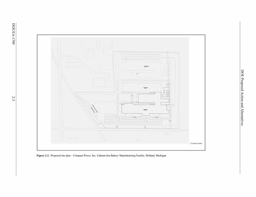
The site selected by CPI for the manufacturing facility is mostly located in the City of Holland, Allegan County, Michigan, with a small portion of the proposed project site located in the adjacent Fillmore Township. The 80-acre site is located northeast of the intersection of South Waverly Road and East 48th Street (Figure 2-1). Approximately half of the 80 acres would be used to construct and operate a two-story, 850,000 square-foot manufacturing facility. The proposed project includes construction of a building for manufacturing and office spaces, a detached storage building, a safety validation building, paved surface parking lots, above ground storage tank(s), a storm water detention pond, and one or two private access road(s). The City of Holland plans to widen the existing public road on frontage of the site (East 48th Street) from the existing two lanes to three lanes with curbs and gutters and possibly a turning lane. No demolition of existing structures is required. Figure 2-2 shows a proposed site layout.
The facility would make battery cells to supply General Motors for assembly into battery packs and full battery systems. More than 250 battery cells are required for each system. Construction would proceed in two phases. The first phase would involve construction of 580,000 square feet of space for assembly of the lithium-ion polymer cells and to install electrode-manufacturing capability for integrated production. The second phase would entail construction of the additional 260,000 square feet to add assembly lines to meet required customer volume. When in full production, the facility would create more than 450 jobs and would produce over 18

DOE Proposed Action and Alternatives
DOE/EA-1709 2-2
DO
E/E
A-1709
2-3
DO
E P
roposed Action and A
lternatives
DOE Proposed Action and Alternatives
DOE/EA-1709 2-4
million battery cells (3.75 Volt, 15 Ampere-hour) annually. The new facility would start assembly operations in 2012, and CPI would expand production capability through 2013 with the addition of more assembly lines.
CPI completed the design, development, and qualification of its lithium-ion polymer battery cell for use in the Chevy Volt. This cell features a spinel (LiMn2O4)-based mixed oxide cathode including a proprietary layered compound, the Safety Reinforcing Separator proprietary separator and laminated packaging, and demonstrates state-of-the-art performance, life and abuse-tolerance.
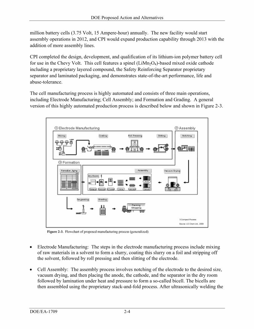
The cell manufacturing process is highly automated and consists of three main operations, including Electrode Manufacturing; Cell Assembly; and Formation and Grading. A general version of this highly automated production process is described below and shown in Figure 2-3.
Electrode Manufacturing: The steps in the electrode manufacturing process include mixing
of raw materials in a solvent to form a slurry, coating this slurry on a foil and stripping off the solvent, followed by roll pressing and then slitting of the electrode.
Cell Assembly: The assembly process involves notching of the electrode to the desired size, vacuum drying, and then placing the anode, the cathode, and the separator in the dry room followed by lamination under heat and pressure to form a so-called bicell. The bicells are then assembled using the proprietary stack-and-fold process. After ultrasonically welding the
DOE Proposed Action and Alternatives
DOE/EA-1709 2-5
tabs, the electrode assembly is placed in the “formed” laminated packaging, filled with the appropriate amount of electrolyte and then the cell is assembled.
Formation and Grading: The formation steps involve charging of the cells followed by an aging process for a certain period of time. Thereafter, the cells are de-gassed, graded, and are ready to be shipped.
Two toxic chemicals common to battery manufacturing would be used in the production process and stored at the CPI facility include N-methylpyrrolidone (NMP) and a lithium hexafluorophosphate (LiPF6)-based electrolyte. NMP is a liquid solvent that would be used in the manufacturing process and would also be used to periodically flush out process lines and for other cleaning purposes. CPI may store NMP on site in an above ground storage tank. LiPF6 is an inorganic chemical compound in the form of a white crystalline powder that would be dissolved in a solvent and used as an electrolyte in the lithium batteries. CPI could store LiPF6 in an above ground storage tank or in 55-gallon drums.
N-METHYLPYRROLIDONE (NMP)
NMP is a water-miscible organic solvent widely used in the petrochemical industry, in fabricating microelectronics, and in manufacturing of compounds such as pigments, cosmetics, pesticides, floor cleaners, and paint removers. NMP increasingly is used as a substitute for chlorinated hydrocarbons that are more toxic to the environment and human health.
NMP has low acute toxicity, is potentially irritating to the skin and eyes, and at high aerosol concentrations can cause respiratory tract irritation. It is readily absorbed through the skin and along with inhalation represents the primary exposure routes for humans. As with other organic solvents, breathing excessive amounts of NMP can affect the brain and result in temporary headaches, nausea, dizziness, clumsiness, drowsiness and other effects similar to being drunk. Testing on animals has not shown a link to cancer that can be related to human exposures. However, NMP has been shown to cause effects, such as delayed growth, to offspring of animals exposed during pregnancy. As a result of these types of test results, the State of California has identified NMP as a reproductive toxin and has established maximum allowable dose levels of 17,000 and 3,200 micrograms per day for dermal contact and inhalation exposures, respectively. Products that could result in daily exposures exceeding these levels must carry an appropriate label under California law.
LITHIUM HEXAFLUOROPHOSPHATE (LiPF6)
LiPF6 is a white crystalline powder that hydrolyzes readily in contact with water or moisture. It is very destructive to mucous membranes. LiPF6 is harmful if swallowed, inhaled, or absorbed through skin and causes burns through all exposure routes. LiPF6 is considered corrosive and can be dissolved in some organic solvents for use as an electrolyte in lithium batteries. Only the liquid electrolyte (LiPF6 dissolved in a solvent) would be managed at the CPI facility.
DOE Proposed Action and Alternatives
DOE/EA-1709 2-6
2.3 No-Action Alternative
Under the No-Action Alternative, DOE would not provide funds to the proposed project. As a result, this project would be delayed as CPI looks for other funding sources to meet its need, or abandoned if other funding sources could not be obtained. Furthermore, acceleration of the development and production of various electric drive vehicle systems would not occur or would be delayed. DOE’s ability to achieve its objectives under the Vehicle Technologies Program and the Recovery Act would potentially be impaired.
Although this and other selected projects might proceed if DOE decided not to provide financial assistance, DOE assumes for purposes of this EA that the project would not proceed without DOE assistance. If projects did proceed without DOE’s financial assistance, the potential impacts would be essentially identical to those under DOE’s action alternative (that is, providing assistance that allows the project to proceed). In order to allow a comparison between the potential impacts of a project as implemented and the impacts of not proceeding with a project, DOE assumes that if it decided to withhold assistance from this project, the project would not proceed.
2.4 DOE Alternative Actions
DOE’s alternatives to this project consist of the 45 technically acceptable applications received in response to the funding opportunity announcement, Recovery Act – Electric Drive Vehicle Battery and Component Manufacturing Initiative. Prior to selection, DOE made preliminary determinations regarding the level of review required by NEPA based on potentially significant impacts identified in reviews of acceptable applications. DOE conducted these preliminary environmental reviews pursuant to 10 CFR 1021.216 and a variance to certain requirements in that regulation granted by the Department’s General Counsel (74 Federal Register 30558; June 26, 2009). These preliminary NEPA determinations and reviews were provided to the selecting official, who considered them during the selection process.
Because DOE’s Proposed Action is limited to providing financial assistance in cost-sharing arrangements to projects submitted by applicants in response to a competitive funding opportunity, DOE’s decision is limited to either accepting or rejecting the selected projects as proposed by the proponents, including their proposed technologies and selected sites. DOE’s consideration of reasonable alternatives is therefore limited to the technically acceptable applications and a No-Action Alternative for each selected project.
Affected Environment and Environmental Consequences
DOE/EA-1709 3-1
3. AFFECTED ENVIRONMENT AND ENVIRONMENTAL CONSEQUENCES
The site selected by CPI for the manufacturing facility is mostly located in the City of Holland, Allegan County, Michigan, with a small portion of the proposed project site located in the adjacent Fillmore Township. Holland is a city in the western region of the Lower Peninsula of the U.S. state of Michigan. It is situated near the eastern shore of Lake Michigan on Lake Macatawa, which is fed by the Macatawa River (also known locally as the Black River). The city spans the Ottawa/Allegan county line, with 9.08 square miles in Ottawa and the remaining 8.13 square miles in Allegan.
In this chapter, DOE assesses the following resources: land use; air quality; noise; aesthetics and visual resources; geology and soils; water resources; biological resources; cultural resources; socioeconomics; environmental justice; occupational health and safety; utilities, energy, and materials; waste; and transportation. The “environmental baseline” for each of these resource areas is described first, followed by an assessment of the potential impacts of the proposed project and No-Action Alternative.
3.1 Land Use
3.1.1 AFFECTED ENVIRONMENT
This section describes existing land use conditions on and surrounding the proposed project site. The project would be located on 80 acres northeast of the intersection of South Waverly Road and East 48th Street (Figure 2-1). The site is currently agricultural land with no existing structures (Atwell-Hicks 2009a). It is surrounded by the CSX rail line to the west, agricultural land to the north and east, and 48th Street (146th Avenue) to the south. The surrounding area includes a sizable industrial park, including neighboring firms such as Haworth, Tiara Yachts, Sherwin Williams, USF Holland, Global Sourcing Solutions, and various industrial warehouse buildings (Figure 2-1).
The majority of the proposed project site is part of an area that was annexed in 2003 by the City of Holland from Fillmore Township. The City of Holland Master Plan Update South End Area identifies the project site’s planned land use as Industrial Park and the area to the south of 48th Street as General Industrial (City of Holland Planning Commission 2005). The eastern 11 acres of the project site remain part of Fillmore Township. The portion of the site in the City is zoned I-2 (Industrial Park) for industrial use. The portion of the site in Fillmore Township is zoned R-1 (Residential). The closest residence is located approximately 50 feet from the southern border of the site across East 48th Street (146th Avenue). Another residence, located on the south side of East 40th Street (147th Avenue), is approximately 500 feet from the northern property boundary.
Affected Environment and Environmental Consequences
DOE/EA-1709 3-2
3.1.2 ENVIRONMENTAL CONSEQUENCES
3.1.2.1 Proposed Project
The proposed project site is located where development meets rural land, and implementation of the proposed project would convert the land use of the proposed project site from agricultural use to industrial use. However, the majority of the proposed project site is planned and zoned for industrial use, and the facility would not conflict with zoning or the City of Holland Master Plan (City of Holland Planning Commission 2005). The portion the project site in Fillmore Township (eastern 11 acres of the site) is zoned Residential and a change in zoning would be required. Fillmore Township and the City of Holland are working together to change the zoning to I-2 (Industrial Park) to be compatible with the facility (Potter 2009). The facility would occupy approximately half of the 80-acre site, with the remaining acreage remaining in its natural state. The site plan is shown in Figure 2-2. The facility would not interfere with existing activities on adjacent land. Therefore, no adverse impacts to land use would occur.
3.1.2.2 No-Action Alternative
Under the No-Action Alternative, DOE would not provide funding to CPI and the facility would not be built. No changes to land use would occur.
3.2 Air Quality
3.2.1 AFFECTED ENVIRONMENT
This section describes the existing air quality conditions at and surrounding the project site. Ambient air quality conditions are discussed first, followed by a discussion of air quality conformity, and greenhouse gas emissions.
3.2.1.1 Ambient Air Quality Conditions
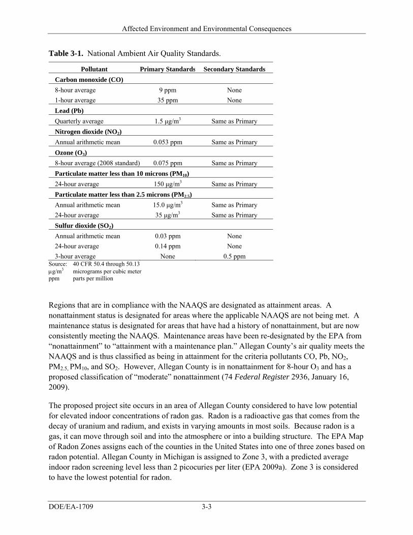
The ambient air quality in an area can be characterized in terms of whether it complies with the primary and secondary National Ambient Air Quality Standards (NAAQS). The Clean Air Act (42 U.S.C. 7401 et seq.) requires the U.S. Environmental Protection Agency (EPA) to set NAAQS for pollutants considered harmful to public health and the environment. National primary ambient air quality standards define levels of air quality which the EPA has determined as necessary to provide an adequate margin of safety to protect public health, including the health of “sensitive” populations such as children and the elderly. National secondary ambient air quality standards define levels of air quality deemed necessary to protect the public welfare, including protection against decreased visibility and damage to animals, crops, vegetation, and buildings. NAAQS have been established for six criteria pollutants: carbon monoxide (CO); lead (Pb); nitrogen dioxide (NO2); ozone (O3); particulate matter (which includes both particulate matter with an aerodynamic size less than or equal to 10 microns [PM10] and less than or equal to 2.5 microns [PM2.5]); and sulfur dioxide (SO2). Table 3-1 lists the NAAQS primary and secondary standards for each criteria pollutant.
Affected Environment and Environmental Consequences
DOE/EA-1709 3-3
Table 3-1. National Ambient Air Quality Standards.
Pollutant Primary Standards Secondary Standards
Carbon monoxide (CO)
8-hour average 9 ppm None
1-hour average 35 ppm None
Lead (Pb)
Quarterly average 1.5 μg/m3 Same as Primary
Nitrogen dioxide (NO2)
Annual arithmetic mean 0.053 ppm Same as Primary
Ozone (O3)
8-hour average (2008 standard) 0.075 ppm Same as Primary
Particulate matter less than 10 microns (PM10)
24-hour average 150 μg/m3 Same as Primary
Particulate matter less than 2.5 microns (PM2.5)
Annual arithmetic mean 15.0 μg/m3 Same as Primary
24-hour average 35 μg/m3 Same as Primary
Sulfur dioxide (SO2)
Annual arithmetic mean 0.03 ppm None
24-hour average 0.14 ppm None
3-hour average None 0.5 ppm Source: 40 CFR 50.4 through 50.13 g/m3 micrograms per cubic meter ppm parts per million
Regions that are in compliance with the NAAQS are designated as attainment areas. A nonattainment status is designated for areas where the applicable NAAQS are not being met. A maintenance status is designated for areas that have had a history of nonattainment, but are now consistently meeting the NAAQS. Maintenance areas have been re-designated by the EPA from “nonattainment” to “attainment with a maintenance plan.” Allegan County’s air quality meets the NAAQS and is thus classified as being in attainment for the criteria pollutants CO, Pb, NO2, PM2.5, PM10, and SO2. However, Allegan County is in nonattainment for 8-hour O3 and has a proposed classification of “moderate” nonattainment (74 Federal Register 2936, January 16, 2009).
The proposed project site occurs in an area of Allegan County considered to have low potential for elevated indoor concentrations of radon gas. Radon is a radioactive gas that comes from the decay of uranium and radium, and exists in varying amounts in most soils. Because radon is a gas, it can move through soil and into the atmosphere or into a building structure. The EPA Map of Radon Zones assigns each of the counties in the United States into one of three zones based on radon potential. Allegan County in Michigan is assigned to Zone 3, with a predicted average indoor radon screening level less than 2 picocuries per liter (EPA 2009a). Zone 3 is considered to have the lowest potential for radon.
Affected Environment and Environmental Consequences
DOE/EA-1709 3-4
3.2.1.2 Air Quality Conformity
Section 176(c)(1) of the Clean Air Act requires federal agencies to ensure that their actions conform to applicable implementation plans for the achievement and maintenance of the NAAQS for criteria pollutants. To achieve conformity, a federal action must not contribute to new violations of standards for ambient air quality, increase the frequency or severity of existing violations, or delay timely attainment of standards in the area of concern (for example, a state or a smaller air quality region). The EPA general conformity regulations (40 CFR 93, Subpart B) contain guidance for determination of whether a proposed federal action would cause emissions to be above certain levels in locations designated as nonattainment or maintenance areas.
The proposed project site in Allegan County, Michigan, is located in an area that has been designated as a nonattainment area for ozone (8-hour standard). Federal agencies prepare written Conformity Determinations for federal actions that are in or affect NAAQS nonattainment areas or maintenance areas when the total direct or indirect emissions of nonattainment pollutants (or their precursors in the case of ozone) exceed specified thresholds. Conformity with the EPA-approved state implementation plan is demonstrated if the project emissions fall below the threshold value de minimus emissions. The Michigan State Implementation Plan contains the regulations and other materials for meeting clean air standards and associated federal Clean Air Act requirements. The Clean Air Act conformity threshold values for Allegan County are 100 tons per year for the ozone precursor nitrogen oxides (NOx) or 100 tons per year for the ozone precursor volatile organic compounds (EPA 2009b). The proposed project is not expected to produce emissions greater than the threshold de minimus values for these pollutants. The estimated annual NOx emissions would be about 4.8 tons per year. The estimated annual emissions of volatile organic compounds would be minimal and therefore less than 100 tons per year (LG Chem Ltd. and CPI 2009a). As a result, the project falls into conformity with the EPA-approved Michigan State Implementation Plan and a written Conformity Determination is not required.
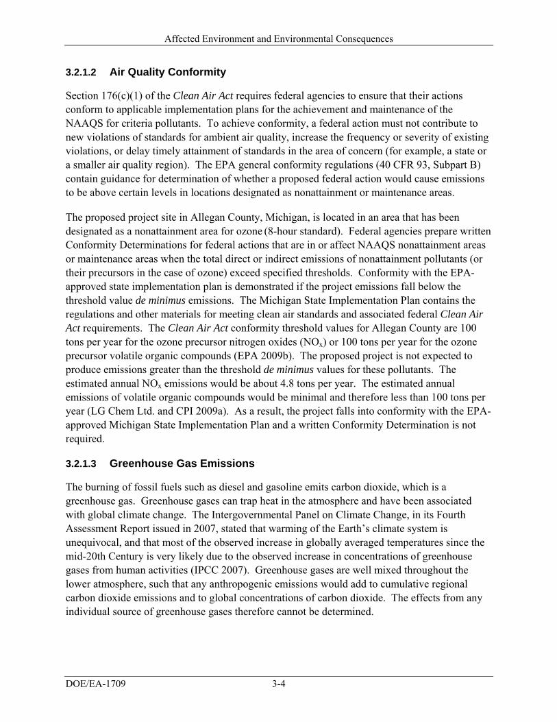
3.2.1.3 Greenhouse Gas Emissions
The burning of fossil fuels such as diesel and gasoline emits carbon dioxide, which is a greenhouse gas. Greenhouse gases can trap heat in the atmosphere and have been associated with global climate change. The Intergovernmental Panel on Climate Change, in its Fourth Assessment Report issued in 2007, stated that warming of the Earth’s climate system is unequivocal, and that most of the observed increase in globally averaged temperatures since the mid-20th Century is very likely due to the observed increase in concentrations of greenhouse gases from human activities (IPCC 2007). Greenhouse gases are well mixed throughout the lower atmosphere, such that any anthropogenic emissions would add to cumulative regional carbon dioxide emissions and to global concentrations of carbon dioxide. The effects from any individual source of greenhouse gases therefore cannot be determined.
Affected Environment and Environmental Consequences
DOE/EA-1709 3-5
3.2.2 ENVIRONMENTAL CONSEQUENCES
3.2.2.1 Proposed Project
Potential impacts to air quality from construction and operation of the proposed facility would not be significant. Using lithium-ion batteries from the CPI facility in electric vehicles is expected to result in significant reductions in carbon dioxide generated across the nation; and thus, a significant beneficial impact to air quality could be realized from decreased greenhouse gas emissions. Emissions of greenhouse gases from the energy required to operate the proposed facility should be offset by the reduction of gasoline consumption by electric and hybrid-electric vehicles using batteries produced at the facility.
Short-term air quality impacts would occur from construction activities associated with the movement of heavy equipment. Construction activities would be temporary and would occur in a localized area. Air emissions generated from construction would include particulate matter, vehicle emissions, and increased wind-borne dust (i.e. fugitive dust). Best management practices would be implemented for erosion control and fugitive dust mitigation. Vehicular and construction equipment exhaust would be a source of pollutant emissions, but would have a negligible impact on air quality. The emissions from construction activities and workers traveling to and from the site would be minor compared to the total existing vehicular emissions in the area.
Because Allegan County is in an attainment area for the criteria pollutants CO, Pb, NO2, PM2.5,
PM10, and SO2, long-term impacts associated with operation of the proposed facility are not likely to occur from the small emissions increase of those pollutants. CPI estimates the facility would emit 4.83 tons of NOx, 0.42 tons of CO, and 3.61 tons of dust annually (LG Chem Ltd. and CPI 2009a). CPI would obtain all necessary air permits from the Michigan Department of Environmental Quality. These permits would include an air permit review, a permit to install, a pollution tax exemption, and a renewable operating permit to comply with Title V of the federal Clean Air Act, if required. The proposed facility would have the potential to emit organic solvent vapors and other volatile organic compounds. However, the facility would employ emission reduction controls. For example, the facility would condense, recover, refine, and then recycle NMP as part of its process. The recovery and recycling system would result in a 98 percent reuse rate of the NMP and would generate only very minor air emissions because the 4 tons per year of the waste that could no longer be reused would be liquidized and disposed of as a liquid (Eun 2009). As described in Section 3.2.1.2 of this EA, the quantities of the ozone precursors nitrogen oxide (NOx) and volatile organic compounds would not be large enough to significantly increase ozone.
3.2.2.2 No-Action Alternative
Under the No-Action Alternative, DOE would not provide funding to CPI and the facility would not be built. No temporary air quality impacts, including particulate matter, vehicle emissions, and increased wind-borne dust, would occur due to construction and no new air emission sources
Affected Environment and Environmental Consequences
DOE/EA-1709 3-6
would occur. The potential beneficial impact of long-term reduction of carbon dioxide gases nationwide would also not be realized.
3.3 Noise
3.3.1 AFFECTED ENVIRONMENT
This section describes the existing noise conditions in the area of the project site. The project site is located in an area with substantial industrial development. The surrounding area includes neighboring firms such as Haworth, Tiara Yachts, Sherwin Williams, USF Holland, Global Sourcing Solutions, and various industrial warehouse buildings. The site is bordered by East 48th Street to the south, CSX railroad to the west, and agricultural land to the north and east. No data exist for ambient noise in the area. Sources of noise at the proposed project site include traffic and rail noise. Noise from farming the surrounding agricultural land is another potential source of noise at the site.
3.3.2 ENVIRONMENTAL CONSEQUENCES
3.3.2.1 Proposed Project
Potential noise impacts would not be significant. Minor adverse short-term noise impacts related to the construction of the facility would occur. One residence at the southeastern boundary of the site on the south side of East 48th Street would be subject to minor, short-term adverse impacts from noise generated during the construction of the proposed facility. Noise would be generated from large machinery such as bulldozers, graders, excavators, dump trucks, and cement trucks as well as from smaller tools such as jack hammers and nail guns. This type of construction equipment generates noise levels of about 85 dBA at 50 feet (Hanson et al. 2006). Noise and sound levels would be typical of new construction activities and would be intermittent. Effects of construction noise would be reduced by employing best management practices, such as confining construction activities to normal working hours and employing noise-controlled construction equipment to the extent possible. Traffic noise from an estimated 550 construction workers would also occur.
Once the facility becomes operational, adverse long-term noise effects would not be expected from its day-to-day use. Industrial processes performed at the facility would not present noise hazards or annoyances for the public (that is, would not add to ambient noise levels). Traffic noise from commuting workers as well as trucks for receiving and shipping materials would occur. An October 2009 traffic count indicated that there were 1,809 average daily trips on East 48th Street east of Waverly Road (Eun 2009). CPI estimates there would be 450 workers and 25 trucks daily at full capacity, which would represent a 25 percent increase in traffic. Facility workers would work in three shifts, thus the resulting traffic noise would be spread over a 24-hour period. The residence on East 48th Street would experience additional traffic noise from the commuters and trucks. This increase in traffic noise would not be considered significant, because the magnitude of the noise would not increase substantially over ambient conditions and
Affected Environment and Environmental Consequences
DOE/EA-1709 3-7
the road is located in an industrial/commercial use area. Section 3.14 discusses existing transportation infrastructure and potential impacts to transportation.
3.3.2.2 No-Action Alternative
Under the No-Action Alternative, DOE would not provide funding to CPI and the facility would not be constructed or operated. No new sources of noise at the proposed project site would occur.
3.4 Aesthetics and Visual Resources
3.4.1 AFFECTED ENVIRONMENT
This section describes the existing aesthetic and visual resource conditions in the area of the proposed project site. Visual resources include natural and manmade physical features that provide the landscape its character and value as an environmental resource.
The proposed project site is located in the far southeast section of the City of Holland where development meets rural land. The project site is currently used as agricultural land but the majority of the site is zoned and planned for industrial use. The surrounding area is industrial to the west and northwest and agricultural to the east, north, and south (Figure 2-1). Views to the west include the CSX rail line, SEMCO gas pipeline, and power lines. Views to the northwest include a manufacturing facility and semi-trucks in a fenced parking lot. Views to the north and east are of agricultural land. Views to the south include East 48th Street and agricultural land beyond. Two residences are visible from the site, one to the southeast on the south side of East 48th Street and the other to the north, located on the south side of East 40th.
3.4.2 ENVIRONMENTAL CONSEQUENCES
3.4.2.1 Proposed Project
Potential impacts to aesthetics and visual resources would not be significant. The proposed project site is surrounded by industrial development and agricultural land most of which is zoned and planned for industrial use. The proposed project would cause minor short-term visual impacts resulting from ground disturbance and the presence of workers, vehicles, and equipment and the generation of dust and vehicle exhaust associated with construction of the proposed facility. CPI estimates the construction period would last 26 months. Once construction is complete, the reclamation of disturbed areas would remove these visual impacts.
Construction of the facility would result in some long-term visual impacts to the site, most notably, the conversion of open, agricultural land to industrial/manufacturing use. In addition, CPI would reduce the amount of non-agricultural vegetation on the site with the removal of several of the tree species along the northern border and the interior of the property. However, the new facility would appear similar to the surrounding developed areas. The facility would be a modern, well-landscaped two-story, 850,000 square-foot manufacturing building. Landscaping
Affected Environment and Environmental Consequences
DOE/EA-1709 3-8
would include trees surrounding the project site on all sides for screening purposes. A berm would also be constructed along East 48th Street with streetscape planting of a tree every 30 feet. Low shrubs with intermittent deciduous and evergreen trees would provide screening of the parking lot. Foundation planting of mid-height shrubs with intermittent deciduous and evergreen trees would decrease the visual impacts of the building.
Operations at the facility would result in minor adverse aesthetic impacts, including increased traffic and nighttime light. The expected number of workers is approximately 450. CPI plans to install twenty 400-watt night lights surrounding the facility.
3.4.2.2 No-Action Alternative
Under the No-Action Alternative, DOE would not provide funding to CPI and the facility would not be built or operated. No changes to aesthetics or visual resources would occur.
3.5 Geology and Soils
3.5.1 AFFECTED ENVIRONMENT
This section describes the existing geology and soil conditions in the area of the proposed project site. Geologic and topographic conditions are discussed first, followed by soils, and prime farmland.
3.5.1.1 Geologic and Topographic Conditions
The project site is relatively flat but tends to slope to the southeast towards the North Branch of the Macatawa River. The topography and sandy soils of the site contribute to a drainage pattern that follows this southeast slope (Atwell-Hicks 2009b). The elevation of the site ranges from about 714 to 665 feet above mean sea level (Atwell-Hicks 2009c). The buried bedrock at the site is composed of Mississippian shale and secondary deposits of limestone that are overlain by Pleistocene glacial till.
Historical data of seismic activity indicate that damaging earthquakes in Michigan are rare. The first significant earthquakes felt in Michigan occurred in 1811 and 1812 and were from a series of shocks centered near New Madrid, Missouri. As many as nine tremors from the New Madrid earthquake series were reportedly felt in Detroit, approximately 180 miles east of Holland. Between 1872 and 1883 a number of moderate earthquakes were centered within Michigan. On February 6, 1872, three shocks lasting 30 seconds were reported near Wenona (modern day Bay City on Lake Huron); on August 17, 1877, a minor earthquake occurred near Detroit that frightened horses; and on February 4, 1883, an earthquake cracked windows and shook buildings in Kalamazoo, approximately 35 miles southeast of Holland. The most recent damaging earthquake centered within Michigan occurred on August 9, 1947. It was felt over a large area in south-central Michigan, cracked plaster and damaged chimneys, and affected a total area of about 50,000 square miles (USGS 2009).

Affected Environment and Environmental Consequences
DOE/EA-1709 3-9
3.5.1.2 Soils
The proposed project site is covered by soils represented by five mapping units. The Blount silt loam (1 to 4 percent slopes) covers approximately 48 percent of the site and is located primarily in the central and eastern portion of the site. This unit is characterized by somewhat poor drainage, a profile changing from silt loam at the surface to a silty clay loam at depth, a maximum calcium carbonate content of 30 percent, and no frequency for ponding or flooding (USDA NRCS 2009). The Corunna sandy loam covers approximately 27 percent of the site and occurs primarily in the central and eastern portions of the site. The unit is characterized by poor drainage, a profile changing from loamy sand at the surface to clay loam at depth, a maximum calcium carbonate content of 30 percent, a frequency for ponding, but no frequency for flooding. The Rimer loamy sand (0 to 4 percent slopes) covers approximately 25 percent of the site and is located in the southwestern portion of the site. The unit is characterized by somewhat poor drainage, a profile changing from loamy sand at the surface to a silty clay loam at depth, and no frequency for ponding or flooding. Both the Capac-Wixom complex (1 to 4 percent slopes) and the Granby loamy sand cover less than one percent of the site and are located along the western boundary of the site (USDA NRCS 2009).
3.5.1.3 Prime Farmland
Prime farmland is land with the best combination of physical and chemical characteristics for producing food, feed, forage, fiber, and oilseed crops, and is also available for these uses. Prime farmland could be cultivated land, pasture land, forest land, or other land, but it is not urban or built-up land or water areas (USDA NRCS 2009). Of the approximately 80 acres considered for the proposed site, approximately 76 percent is considered prime farmland if drained (USDA NRCS 2009). The remaining 24 percent is considered to be farmland of local importance. Prime farmland and farmland of local importance are covered by the Farmland Protection Policy Act (7 CFR Parts 657 and 658).
3.5.2 ENVIRONMENTAL CONSEQUENCES
3.5.2.1 Proposed Project
Potential impacts to geology and soils from the construction and operation of the proposed facility would not be significant. The site is in an area that is not normally impacted by seismic events and should not be affected by local geological hazards. However, risk from earthquakes that may result in damage should not be ignored. In order to avoid risks to buildings associated with earthquakes, the State of Michigan has adopted the International Building Code, 2006 Edition. The proposed facility would be constructed in accordance with the seismic requirements identified in the International Building Code.
The construction of the proposed facility would involve excavation, grading, and movement of heavy equipment at the proposed site. These activities would disturb the surface soil, thereby increasing the potential for soil erosion by wind and runoff. Wind and water erosion of soil
Affected Environment and Environmental Consequences
DOE/EA-1709 3-10
would be lessened by implementing best management practices such as using hay bales and silt fencing, as appropriate, to prevent the movement of soils into low-lying areas. Once the facility is operational and new vegetation is in place, additional erosion of topsoil would be minimal and would be limited or mitigated through adherence to a storm water management plan.
The total site improvements associated with the facility, including all phases, would cause about half of the site to be covered by impervious surfaces such as buildings, roads, and parking lots. The effect of this on regional infiltration in the vicinity of the site would not be significant because of the remaining open space near the facility and the creation of a storm water detention pond that would aid infiltration.
About 40 acres of “prime farmland if drained” and “farmland of local importance” would be converted to industrial use, consistent with the City of Holland’s zoning and Master Plan. This farmland is protected under the Farmland Protection Policy Act. Preliminary evaluation using the U.S. Department of Agriculture’s Farmland Conversion Impact Rating Form indicates the value of this farmland is low, based on zoning, the size of the farmland, and other factors. On December 2, 2009, DOE sent a letter to the Natural Resources Conservation Service to initiate consultation regarding loss of this farmland. DOE’s letter and the Farmland Conversion Impact Rating Form are provided in Appendix B. On January 5, 2010, the Natural Resources Conservation Service emailed a Farmland Conversion Impact Rating Form that it completed for the proposed project site. Due to area zoning and the small size of the parcel, the project site scored low in relative value of farmland. Copies of this form and the Natural Resources Conservation Service’s email are included in Appendix B. On January 8, 2010, DOE sent the Natural Resources Conservation Service a copy of the Draft EA. No comments were received from the Natural Resources Conservation Service.
3.5.2.2 No-Action Alternative
Under the No-Action Alternative, DOE would not provide funding to CPI and the facility would not be built or operated. No impacts to geology or soils would occur.
3.6 Water Resources
3.6.1 AFFECTED ENVIRONMENT
This section describes the existing water resources on and in the area of the project site. Surface water includes lakes, rivers, and streams while groundwater comprises the subsurface hydrogeologic resources of the physical environment. Wetlands and floodplains are also discussed.
3.6.1.1 Surface Water
The proposed project site is located within the drainage area or watershed of the North Branch of the Macatawa River. Based on the applicable U.S. Geological Survey 30 by 60 Minute Series
Affected Environment and Environmental Consequences
DOE/EA-1709 3-11
topographic map (that is, the map titled Holland, Michigan), the North Branch starts only 5 to 6 miles to the southwest of the project site and joins the Macatawa River just over 2 miles to the northeast of the project site. However, the total length of the North Branch with all its meandering is identified as about 31 miles (MDEQ 2008a). The Macatawa River then flows to the west-northwest into Lake Macatawa on the north side of the City of Holland. The watershed of the North Branch is part of the larger watershed designated the Black-Macatawa hydrologic unit and assigned the hydrologic unit code of 04050002 under the U.S. Geological Survey’s hierarchy of cataloging units. Within the larger unit, the North Branch of the Macatawa River is designated hydrologic unit code 040500020404. These numbers are used in many of the records of these surface waters and associated watersheds.
As required under Section 305(b) of the Clean Water Act, Michigan assessed the quality of its surface waters and developed a list of waters that do not support their designated uses or attain water quality standards. Table 3-2 presents a summary of the latest Michigan water quality and designated use information for the surface waters associated with the proposed project site. The table addresses the North Branch of the Macatawa River, the section of the Macatawa River between that junction point and Lake Macatawa, and finally, Lake Macatawa in the area of Holland.
As can be seen in Table 3-2, the rivers in the project area support designated uses of navigation, industrial water supply, and agriculture. However, other potential uses are either not assessed (due to lack of data) or are not supported. The high phosphorus and sediment problems that cause several of the designated uses to be not supported are typical of runoff from agricultural activities and such activity is heavy in the watershed outside of the city and community areas.
3.6.1.2 Groundwater
The proposed facility would involve no use of groundwater or discharges that could adversely affect groundwater. As described in Section 3.12, the CPI facility would obtain its water from the Holland water distribution system, which has Lake Michigan as its source (after treatment). Since there is no potential to impact groundwater, there is no basis for further discussion of groundwater as part of the affected environment.
3.6.1.3 Wetlands and Floodplains
3.6.1.3.1 Wetlands
DOE regulations at 10 CFR Part 1022, “Compliance with Floodplain and Wetland Environmental Review Requirements,” implement the requirements of Executive Order 11990, “Protection of Wetlands.” These regulations require, among other things, that the Department notify appropriate government agencies and interested parties of a proposed wetland action; conduct a wetlands assessment to evaluate the impacts of that action to wetlands in an EA or environmental impact statement; consider alternatives that would avoid or minimize impacts to
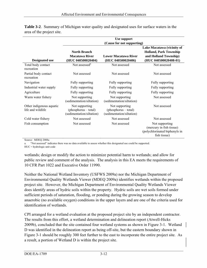
Affected Environment and Environmental Consequences
DOE/EA-1709 3-12
Table 3-2. Summary of Michigan water quality and designated uses for surface waters in the area of the project site.
Use support (Cause for not supporting)
Designated use
North Branch Macatawa River
(HUC 040500020404) Lower Macatawa River (HUC 040500020406)
Lake Macatawa (vicinity of Holland, Park Township and Holland Township) (HUC 040500020408-01)
Total body contact recreation
Not assesseda Not assessed Not assessed
Partial body contact recreation
Not assessed Not assessed Not assessed
Navigation Fully supporting Fully supporting Fully supporting
Industrial water supply Fully supporting Fully supporting Fully supporting
Agriculture Fully supporting Fully supporting Fully supporting
Warm water fishery Not supporting (sedimentation/siltation)
Not supporting (sedimentation/siltation)
Not assessed
Other indigenous aquatic life and wildlife
Not supporting (phosphorus – total)
(sedimentation/siltation)
Not supporting (phosphorus – total)
(sedimentation/siltation)
Not assessed
Cold water fishery Not assessed Not assessed Not assessed
Fish consumption Not assessed Not assessed Not supporting (mercury in fish tissue)
(polychlorinated biphenyls in fish tissue)
Source: MDEQ 2008a a. “Not assessed” indicates there was no data available to assess whether this designated use could be supported. HUC = hydrologic unit code
wetlands; design or modify the action to minimize potential harm to wetlands; and allow for public review and comment of the analysis. The analysis in this EA meets the requirements of 10 CFR Part 1022 and Executive Order 11990.
Neither the National Wetland Inventory (USFWS 2009a) nor the Michigan Department of Environmental Quality Wetlands Viewer (MDEQ 2009a) identifies wetlands within the proposed project site. However, the Michigan Department of Environmental Quality Wetlands Viewer does identify areas of hydric soils within the property. Hydric soils are wet soils formed under sufficient periods of saturation, flooding, or ponding during the growing season to develop anaerobic (no available oxygen) conditions in the upper layers and are one of the criteria used for identification of wetlands.
CPI arranged for a wetland evaluation at the proposed project site by an independent contractor. The results from this effort, a wetland determination and delineation report (Atwell-Hicks 2009b), concluded that the site contained four wetland systems as shown in Figure 3-1. Wetland D was identified in the delineation report as being off-site, but the eastern boundary shown in Figure 3-1 should be roughly 300 feet further to the east to incorporate the entire project site. As a result, a portion of Wetland D is within the project site.
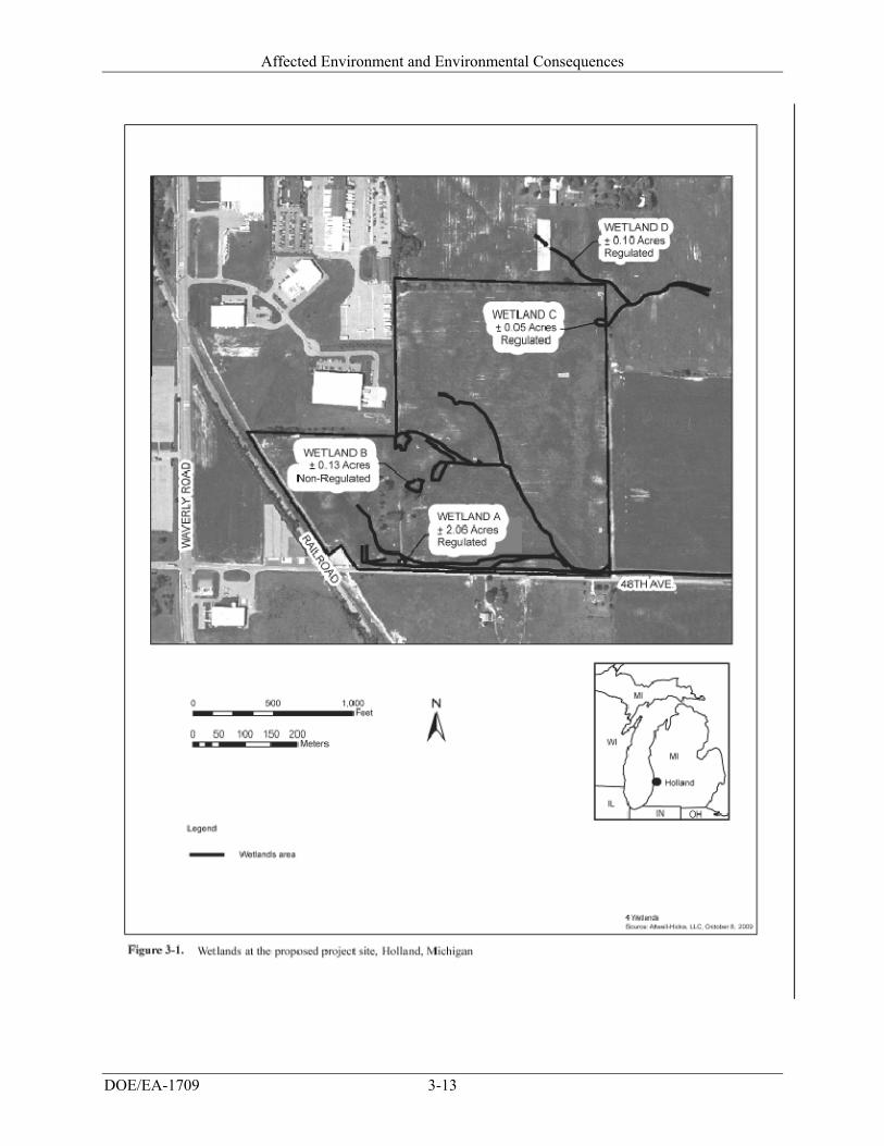
Affected Environment and Environmental Consequences
DOE/EA-1709 3-13
Affected Environment and Environmental Consequences
DOE/EA-1709 3-14
Wetland A consists of a 2.06 acre emergent wetland. The wetland extends through the subject property diagonally commencing from the southern portion of the property and extending to the north into the agricultural field. The wetland is considered very low quality due to highly intensive agricultural activities including plowing, fertilization/nutrient loading, and drainage practices. The continuous farming of the site has limited the establishment of wetland vegetation within portions of Wetland A. The wetland appears to receive hydrology from precipitation and runoff from adjacent upland. This wetland connects to the road side ditch which connects and outlets into the Macatawa River (North Branch) (Atwell 2010).
Wetland B consists of a small 0.13 acre isolated scrub-shrub wetland located in the central area of the property. The wetland appears to receive hydrology from precipitation and runoff from adjacent uplands (Atwell 2010).
Wetland C consists of a small emergent approximately 0.05 acre wetland in the northeast corner of the property. The wetland is considered very low quality due to highly intensive agricultural activities including plowing, fertilization/nutrient loading, and drainage practices. The wetland appears to receive hydrology from precipitation and runoff from adjacent uplands (Atwell 2010).
Wetland D consists of a 0.10 acre emergent wetland. The wetland extends across the northeastern corner of the subject property. The wetland is considered very low quality due to highly intensive agricultural activities including plowing, fertilization/nutrient loading, and drainage practices. The continuous farming of the site has limited the establishment of wetland vegetation within portions of Wetland D. The wetland appears to receive hydrology from precipitation and runoff from adjacent upland (Atwell 2010).
Wetlands A, C, and D are regulated by the Michigan Department of Natural Resources and Environment under Part 303, Wetlands Protection, of the Michigan Natural Resources and Environmental Protection Act, because they are connected with a regulated watercourse (i.e., the Macatawa River). Wetland B is an isolated wetland and is not regulated by the Michigan Department of Natural Resources and Environment (Atwell 2010). On January 28, 2010, CPI submitted a Part 303 Wetland Permit Application, which contains a compensatory mitigation proposal, to the Michigan Department of Natural Resources and Environment. The application and proposal are contained in Appendix C of this EA.
3.6.1.3.2 Floodplains
DOE was unable to find any evidence of flood evaluations that covered the proposed project site. Flood Insurance Rate Maps published by the U.S. Federal Emergency Management Agency show flood zone evaluations that cover most of the Holland, Michigan area. However, the map coverage stops at Waverly Road (shown as 120th Avenue on the U.S. Federal Emergency Management Agency map), which is the north-south road just to the west of the railroad tracks that border the southwest side of the project site (FEMA 2009). The flood map shows a small portion of land on the east side of Waverly Road as being included in the flood zone evaluation. This small portion of evaluated property is the built-up industrial area that borders the west side
Affected Environment and Environmental Consequences
DOE/EA-1709 3-15
of the project site. According to the flood map, all of these areas close to or immediately adjacent to the project site are designated “Zone X” meaning they are outside of the 500-year flood zone.
The proposed project site is closer to the North Branch of the Macatawa River than the described portion of Waverly Road, so there is potential that the flood zone associated with this surface water could extend for some distance toward the northwest and approach the project site. However, the portion of Waverly Road that is immediately to the south of East 48th Street is shown as being in Zone X and based on a topographic map appears to be at roughly the same elevation as the central part of the project site. Based on this information, it is unlikely that a flood zone associated with the North Branch of the Macatawa River would extend as far as the project site. This is consistent with the relatively small length of the river and the small size of the watershed that contributes to it. These physical characteristics would tend to reduce the magnitude of flooding in this area.
3.6.2 ENVIRONMENTAL CONSEQUENCES
3.6.2.1 Proposed Project
3.6.2.1.1 Surface Water
The proposed project would not significantly affect drainage and runoff from the proposed project site, which is currently an area of agricultural activity. Construction would be performed under terms required by a National Pollutant Discharge Elimination System permit for storm water discharge and as part of the permitting process CPI would be required to develop a storm water pollution prevention plan. The plan would provide detail on how storm water runoff would be managed so that the downgradient receiving stream would be protected. It is expected that storm water pollution prevention actions would include, as appropriate, measures such as silt fences, inlet filters, temporary and permanent seeding, street sweeping, and check dams. With such measures and precautions in place, there should be little potential for adverse impacts to area surface water as a result of construction.
The design of the facility would include measures for appropriate storm water management during the longer-term facility operations. In the area of the project site, storm water management is subject to requirements imposed by the Tulip Intercounty Drainage District, jointly run by Ottawa and Allegan counties. This Drainage District and the storm water management elements that would be incorporated into the design of the facility are addressed in Section 3.12 as a utility consisting of the area storm water system.
During operations, CPI would protect surface water by managing all hazardous liquids either inside the facility or in tanks or in closed containers stored within secondary containment structures. CPI has identified the solvent NMP and a LiPF6-based electrolyte as materials (Sections 2.1 and 3.11.2) that would be used in sufficient quantities to require storage capacity outside of the main manufacturing buildings. The NMP would be stored in an exterior tank and
Affected Environment and Environmental Consequences
DOE/EA-1709 3-16
the electrolyte (also a liquid) would either be stored in drums or another tank. In addition to secondary containment, these storage areas would be managed as dictated through a spill prevention, control and countermeasures plan. Facility operations would involve no discharges of liquids or wastes of any type to the ground and measures would be taken to prevent any accidental releases or spills to exterior areas that could then be transported by precipitation runoff. There would be no adverse impacts expected to surface waters from facility operations with the proposed project. Additional storm water management measures are described in Section 3.12.
3.6.2.1.2 Groundwater
As described in Section 3.6.1.2, there would be no impacts to groundwater from the proposed facility, as it would not involve use of groundwater or discharges that could adversely affect groundwater.
3.6.2.1.3 Wetlands and Floodplains
Wetlands Assessment of the site plan overlain on the wetlands locations shows impacts to all four wetland systems (Figure 3-1). Three of the wetland systems (Wetlands A, C, and D) have been determined to be regulated by the Michigan Department of Natural Resources and Environment, and a permit would be required. The wetlands would be impacted by the construction of the building, various parking lots, and access roads. The proposed impacts to these wetland systems consist of approximately 2.21 acres, requiring approximately 8,058 cubic yards of excavation and approximately 8,795 cubic yards of fill (Atwell 2010).
Since greater than 0.3 acre of a wetland would be disturbed, compensatory mitigation measures, in the form of mitigation banking would be required (Atwell-Hicks 2009b). The State of Michigan (Part 303, Wetlands Protection) requires mitigation ratios of 2.0 acres of mitigation for 1.0 acre of permitted impact to forested and coastal wetlands, and 1.5 acres of mitigation for 1.0 acre of permitted impact to all other wetlands, with the exception of wetland types that are rare or imperiled. The wetland fill proposed for the development includes filling 2.21 acres of emergent wetlands. Mitigating the impacted wetlands at the appropriate ratio would require no less than 3.32 acres of mitigation (Atwell 2010).
On January 28, 2010, CPI submitted a Part 303 Wetland Permit Application, which contains a compensatory mitigation proposal, to the Michigan Department of Natural Resources and Environment. The application and proposal are contained in Appendix C of this EA. The Michigan Department of Natural Resources and Environment published a public notice for this proposal on February 20, 2010. CPI proposes to compensate for the irreversible impacts to the existing wetlands as a result of the development by creating one wetland mitigation area at an offsite location. The continuous, emergent wetland would be created as a multi-functioning system and located within a City of Holland park where an existing wetland mitigation area
Affected Environment and Environmental Consequences
DOE/EA-1709 3-17
already exists. The wetland would then be placed under a conservation easement for the protection of the created wetland (Atwell 2010).
CPI, in conjunction with the City of Holland, selected a location in the VanRaalte Farm Park for the newly created wetland. The VanRaalte Farm Park consists of 160 acres of land between East 16th and East 24th Streets, approximately 1.5 miles north of the proposed project site. By creating an emergent wetland within this park, an additional ecological type would be provided as a natural and public resource that would be protected in perpetuity. Overall approximately 3.5 acres of wetland mitigation would be created at this location. A detailed wetland mitigation plan, including a wetland mitigation monitoring plan and performance standards, would be prepared and forwarded to the Michigan Department of Natural Resources and Environment for approval (Atwell 2010). Compensatory mitigation measures would ensure that wetlands impacts would not be considered significant.
From a standpoint of surface water resources, the wetland systems outside of the drainage ditch along the road are little more than drainage swales with only intermittent flowing water in response to precipitation events and these are areas that have already been affected by agricultural activities. Storm water runoff from the project site would be controlled with respect to discharge rates (Section 3.12), but would still be directed to the drainage ditch. There is no reason to suspect that filling or altering of these wetland areas on the proposed project site would cause any adverse impacts on surface water resources downstream from that area.
Floodplains The proposed project site has not been evaluated with respect to whether it includes any 100-year flood zones. However, property immediately to the west of the site has been evaluated and is shown in U.S. Federal Emergency Management Agency flood maps as being outside of the more extensive reach of any 500-year flood zones. Based on the relative elevations of the project site compared to those of the adjacent, evaluated property, it is unlikely that any 100-year flood zones reach into the project site. Accordingly, there is no reason to suspect the proposed facility would impact floodplains or be impacted by a 100-year flood.
3.6.2.2 No-Action Alternative
Under the No-Action Alternative, DOE would not provide funding to CPI and the facility would not be built or operated. No impacts to water resources would occur.
3.7 Biological Resources
3.7.1 AFFECTED ENVIRONMENT
This section describes existing biological resources at the proposed project site. It focuses on plant and animal species or habitat types that are typical or are an important element of the ecosystem, are of special category importance (of special interest due to societal concerns), or
Affected Environment and Environmental Consequences
DOE/EA-1709 3-18
are protected under state or federal law or statute regulatory requirement. Vegetation is discussed first, followed by wildlife, sensitive species, and wetlands.
Allegan County is located near the southwestern edge of Michigan’s Lower Peninsula and lies within the Southern Michigan/Northern Indiana Drift Plains Ecoregion (EPA 1999). The region is bordered on the west by Lake Michigan and is characterized by many lakes and marshes as well as an assortment of landforms, soil types, and land uses. Although not as heavily farmed as areas to the south, the ecoregion is well drained and contains nutrient soils conducive to growing feed grain and soybean. Woodlots, recreational development, quarries, livestock farming, and urban-industrial areas are common land uses within this ecoregion.
3.7.1.1 Vegetation
The landscape of Allegan County prior to widespread European settlement consisted mainly of beech-sugar maple forests and mixed hardwood swamp (MSU 2009a). By 1978, the area around the City of Holland was converted to agriculture and urban land use. The proposed project site is currently under agricultural crop production, most recently corn, and naturally occurring vegetation is limited to the treed hedgerow which borders portions of the site. Tree species that border the northern portion of the site and are found scattered in the landscaping near where a farmstead was once situated include: hawthorne (Crataegus sp.), northern red oak (Quercus rubra ), red mulberry (Morus rubra), American elm (Ulmus americana ), bitternut hickory (Carya cordiformis), apple (Malus pumila), Osage orange (Maclura pomifera), American basswood (Tilia americana), boxelder (Acer nigundo), silver maple (Acer sacchar), Austrian pine (Pinus niga), Eastern cottonwood (Populus deltoids), green ash (Fraxinus pennsylvanica), Northern catalpa (Catalpa speciosa) and red maple (Acer rubrum). Other upland vegetation found confined to the hedgerows and abandoned farmstead include tall goldenrod (Solidago altissima) (Atwell-Hicks 2009b). Small areas of wetland vegetation are also present on the site and are discussed below in Section 3.7.1.4.
3.7.1.2 Wildlife
Based on the proposed project site’s lack of natural habitat, lack of connection to intact natural habitats, current use as agricultural land, and its proximity to industrial disturbance, potential wildlife use of the site is low. Furthermore, most wildlife species are likely to be transients through the area. White-tailed deer (Odocoileus virginianus) can be found in the area most likely capitalizing on the available forage (crops). Other opportunistic species likely to exist in this agriculture-rural interface include: coyotes (Canis latrans), opossums (Didelphis virginiana), raccoons (Procyon lotor), red fox (Vulpes vulpes) and skunks (Mephitis mephitis). The constant disturbance of the site from agricultural use as well as the distance from any potential cover source for wildlife, reduce the potential of denning in the area and limit use to infrequent foraging.
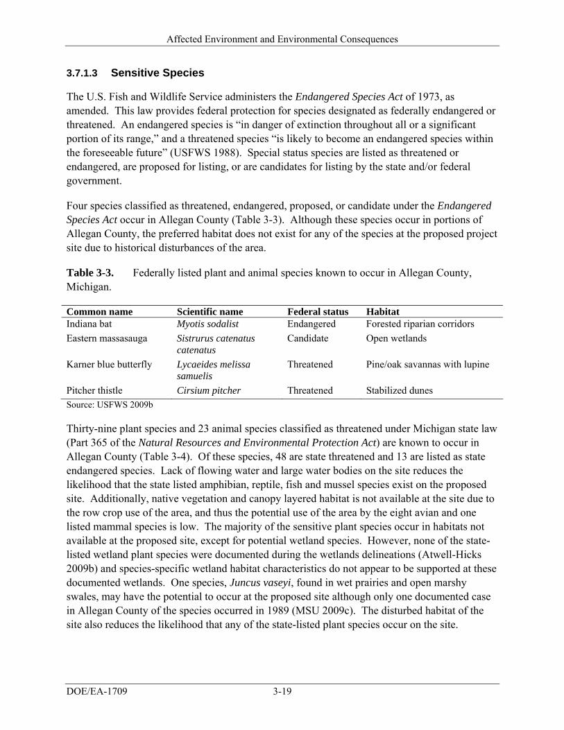
Affected Environment and Environmental Consequences
DOE/EA-1709 3-19
3.7.1.3 Sensitive Species
The U.S. Fish and Wildlife Service administers the Endangered Species Act of 1973, as amended. This law provides federal protection for species designated as federally endangered or threatened. An endangered species is “in danger of extinction throughout all or a significant portion of its range,” and a threatened species “is likely to become an endangered species within the foreseeable future” (USFWS 1988). Special status species are listed as threatened or endangered, are proposed for listing, or are candidates for listing by the state and/or federal government.
Four species classified as threatened, endangered, proposed, or candidate under the Endangered Species Act occur in Allegan County (Table 3-3). Although these species occur in portions of Allegan County, the preferred habitat does not exist for any of the species at the proposed project site due to historical disturbances of the area.
Table 3-3. Federally listed plant and animal species known to occur in Allegan County, Michigan.
Common name Scientific name Federal status Habitat Indiana bat Myotis sodalist Endangered Forested riparian corridors
Eastern massasauga Sistrurus catenatus catenatus
Candidate Open wetlands
Karner blue butterfly Lycaeides melissa samuelis
Threatened Pine/oak savannas with lupine
Pitcher thistle Cirsium pitcher Threatened Stabilized dunes Source: USFWS 2009b
Thirty-nine plant species and 23 animal species classified as threatened under Michigan state law (Part 365 of the Natural Resources and Environmental Protection Act) are known to occur in Allegan County (Table 3-4). Of these species, 48 are state threatened and 13 are listed as state endangered species. Lack of flowing water and large water bodies on the site reduces the likelihood that the state listed amphibian, reptile, fish and mussel species exist on the proposed site. Additionally, native vegetation and canopy layered habitat is not available at the site due to the row crop use of the area, and thus the potential use of the area by the eight avian and one listed mammal species is low. The majority of the sensitive plant species occur in habitats not available at the proposed site, except for potential wetland species. However, none of the state-listed wetland plant species were documented during the wetlands delineations (Atwell-Hicks 2009b) and species-specific wetland habitat characteristics do not appear to be supported at these documented wetlands. One species, Juncus vaseyi, found in wet prairies and open marshy swales, may have the potential to occur at the proposed site although only one documented case in Allegan County of the species occurred in 1989 (MSU 2009c). The disturbed habitat of the site also reduces the likelihood that any of the state-listed plant species occur on the site.
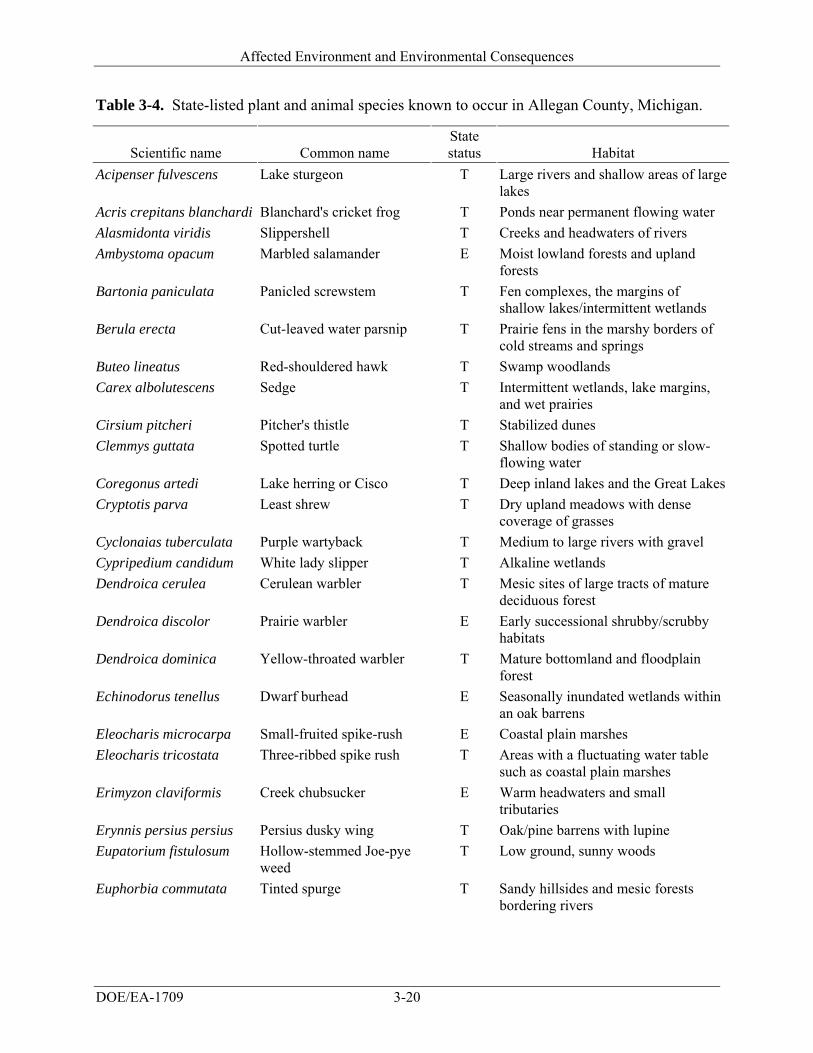
Affected Environment and Environmental Consequences
DOE/EA-1709 3-20
Table 3-4. State-listed plant and animal species known to occur in Allegan County, Michigan.
Scientific name Common name State status Habitat
Acipenser fulvescens Lake sturgeon T Large rivers and shallow areas of large lakes
Acris crepitans blanchardi Blanchard's cricket frog T Ponds near permanent flowing water
Alasmidonta viridis Slippershell T Creeks and headwaters of rivers
Ambystoma opacum Marbled salamander E Moist lowland forests and upland forests
Bartonia paniculata Panicled screwstem T Fen complexes, the margins of shallow lakes/intermittent wetlands
Berula erecta Cut-leaved water parsnip T Prairie fens in the marshy borders of cold streams and springs
Buteo lineatus Red-shouldered hawk T Swamp woodlands
Carex albolutescens Sedge T Intermittent wetlands, lake margins, and wet prairies
Cirsium pitcheri Pitcher's thistle T Stabilized dunes
Clemmys guttata Spotted turtle T Shallow bodies of standing or slow-flowing water
Coregonus artedi Lake herring or Cisco T Deep inland lakes and the Great Lakes
Cryptotis parva Least shrew T Dry upland meadows with dense coverage of grasses
Cyclonaias tuberculata Purple wartyback T Medium to large rivers with gravel
Cypripedium candidum White lady slipper T Alkaline wetlands
Dendroica cerulea Cerulean warbler T Mesic sites of large tracts of mature deciduous forest
Dendroica discolor Prairie warbler E Early successional shrubby/scrubby habitats
Dendroica dominica Yellow-throated warbler T Mature bottomland and floodplain forest
Echinodorus tenellus Dwarf burhead E Seasonally inundated wetlands within an oak barrens
Eleocharis microcarpa Small-fruited spike-rush E Coastal plain marshes
Eleocharis tricostata Three-ribbed spike rush T Areas with a fluctuating water table such as coastal plain marshes
Erimyzon claviformis Creek chubsucker E Warm headwaters and small tributaries
Erynnis persius persius Persius dusky wing T Oak/pine barrens with lupine
Eupatorium fistulosum Hollow-stemmed Joe-pye weed
T Low ground, sunny woods
Euphorbia commutata Tinted spurge T Sandy hillsides and mesic forests bordering rivers
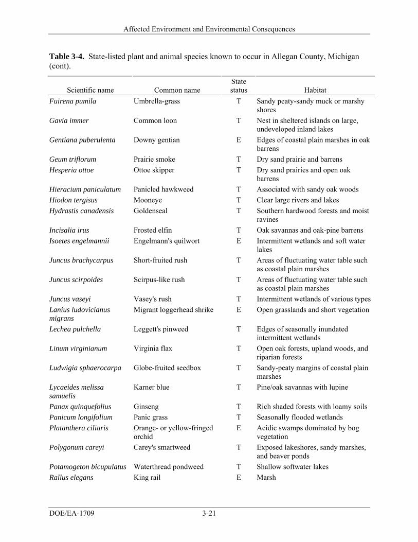
Affected Environment and Environmental Consequences
DOE/EA-1709 3-21
Table 3-4. State-listed plant and animal species known to occur in Allegan County, Michigan (cont).
Scientific name Common name State status Habitat
Fuirena pumila Umbrella-grass T Sandy peaty-sandy muck or marshy shores
Gavia immer Common loon T Nest in sheltered islands on large, undeveloped inland lakes
Gentiana puberulenta Downy gentian E Edges of coastal plain marshes in oak barrens
Geum triflorum Prairie smoke T Dry sand prairie and barrens
Hesperia ottoe Ottoe skipper T Dry sand prairies and open oak barrens
Hieracium paniculatum Panicled hawkweed T Associated with sandy oak woods
Hiodon tergisus Mooneye T Clear large rivers and lakes
Hydrastis canadensis Goldenseal T Southern hardwood forests and moist ravines
Incisalia irus Frosted elfin T Oak savannas and oak-pine barrens
Isoetes engelmannii Engelmann's quilwort E Intermittent wetlands and soft water lakes
Juncus brachycarpus Short-fruited rush T Areas of fluctuating water table such as coastal plain marshes
Juncus scirpoides Scirpus-like rush T Areas of fluctuating water table such as coastal plain marshes
Juncus vaseyi Vasey's rush T Intermittent wetlands of various types
Lanius ludovicianus migrans
Migrant loggerhead shrike E Open grasslands and short vegetation
Lechea pulchella Leggett's pinweed T Edges of seasonally inundated intermittent wetlands
Linum virginianum Virginia flax T Open oak forests, upland woods, and riparian forests
Ludwigia sphaerocarpa Globe-fruited seedbox T Sandy-peaty margins of coastal plain marshes
Lycaeides melissa samuelis
Karner blue T Pine/oak savannas with lupine
Panax quinquefolius Ginseng T Rich shaded forests with loamy soils
Panicum longifolium Panic grass T Seasonally flooded wetlands
Platanthera ciliaris Orange- or yellow-fringed orchid
E Acidic swamps dominated by bog vegetation
Polygonum careyi Carey's smartweed T Exposed lakeshores, sandy marshes, and beaver ponds
Potamogeton bicupulatus Waterthread pondweed T Shallow softwater lakes
Rallus elegans King rail E Marsh
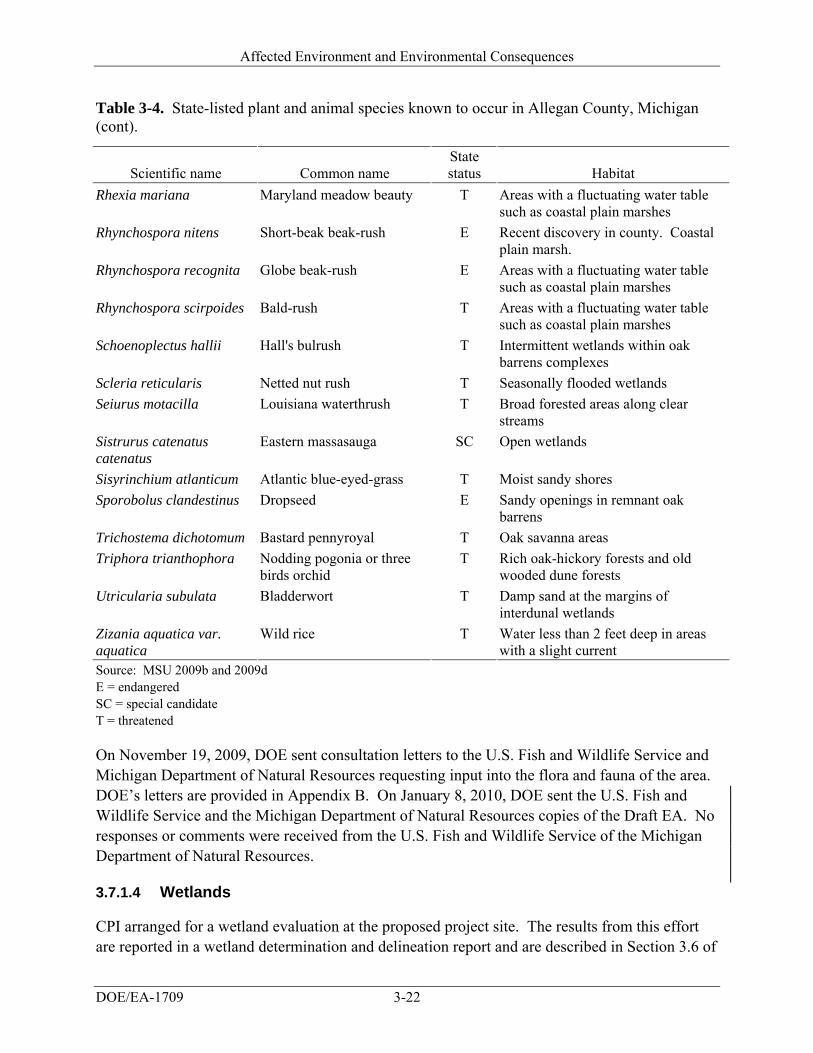
Affected Environment and Environmental Consequences
DOE/EA-1709 3-22
Table 3-4. State-listed plant and animal species known to occur in Allegan County, Michigan (cont).
Scientific name Common name State status Habitat
Rhexia mariana Maryland meadow beauty T Areas with a fluctuating water table such as coastal plain marshes
Rhynchospora nitens Short-beak beak-rush E Recent discovery in county. Coastal plain marsh.
Rhynchospora recognita Globe beak-rush E Areas with a fluctuating water table such as coastal plain marshes
Rhynchospora scirpoides Bald-rush T Areas with a fluctuating water table such as coastal plain marshes
Schoenoplectus hallii Hall's bulrush T Intermittent wetlands within oak barrens complexes
Scleria reticularis Netted nut rush T Seasonally flooded wetlands
Seiurus motacilla Louisiana waterthrush T Broad forested areas along clear streams
Sistrurus catenatus catenatus
Eastern massasauga SC Open wetlands
Sisyrinchium atlanticum Atlantic blue-eyed-grass T Moist sandy shores
Sporobolus clandestinus Dropseed E Sandy openings in remnant oak barrens
Trichostema dichotomum Bastard pennyroyal T Oak savanna areas
Triphora trianthophora Nodding pogonia or three birds orchid
T Rich oak-hickory forests and old wooded dune forests
Utricularia subulata Bladderwort T Damp sand at the margins of interdunal wetlands
Zizania aquatica var. aquatica
Wild rice T Water less than 2 feet deep in areas with a slight current
Source: MSU 2009b and 2009d E = endangered SC = special candidate T = threatened
On November 19, 2009, DOE sent consultation letters to the U.S. Fish and Wildlife Service and Michigan Department of Natural Resources requesting input into the flora and fauna of the area. DOE’s letters are provided in Appendix B. On January 8, 2010, DOE sent the U.S. Fish and Wildlife Service and the Michigan Department of Natural Resources copies of the Draft EA. No responses or comments were received from the U.S. Fish and Wildlife Service of the Michigan Department of Natural Resources.
3.7.1.4 Wetlands
CPI arranged for a wetland evaluation at the proposed project site. The results from this effort are reported in a wetland determination and delineation report and are described in Section 3.6 of
Affected Environment and Environmental Consequences
DOE/EA-1709 3-23
this EA (Atwell-Hicks 2009b). The largest delineated wetland (Figure 3-1, Wetland A) consists of emergent wetland dominated by field nut sedge (Cyperus esculentus), bigseed smartweed (Polygonum pensylvanicum), cattail (Typha latifolia), reed canary grass (Phalaris arundinacea), barnyard grass (Echinochloa crusgalli), New England aster (Aster novae-angliae), blue vervain (Verbena hastata), and sandbar willow (Salix exigua) (Atwell-Hicks 2009b).
A second wetland (Wetland B) consists of a small 0.13-acre isolated scrub-shrub wetland. The dominant species include field nut sedge, bigseed smartweed, barnyard grass, sandbar willow, and cottonwood saplings (Atwell-Hicks 2009b). The third wetland (Wetland C) is connected by agricultural drainage tile to a larger wetland that eventually drains into North Branch Macatawa River. The dominant vegetation includes barnyard grass, bigseed smartweed, and common cocklebur (Xanthium strumarium) (Atwell-Hicks 2009b).
A fourth wetland (Wetland D) was delineated in the northeast corner of the property. This linear emergent wetland is connected to Wetland C which eventually drains into the North Branch Macatawa River. Vegetation is sparse within the wetland; however, the dominant vegetation includes barnyard grass, bigseed smartweed, and common cocklebur (Atwell-Hicks 2009b).
Based on the information provided in the wetlands delineation report (Atwell-Hicks 2009b), a value and functions analyses was applied to each of the wetlands. Functions are self-sustaining properties of a wetland ecosystem that exist in the absence of society, where as values are benefits that derive from either one or more functions and the physical characteristics associated with a wetland (USACE 1999). Nutrient removal is considered a greater function and value of Wetland A along with groundwater recharge and production export. Wetland B also appeared to function mostly as a nutrient removal wetland with some value to wildlife due to the diversity of vegetation. The report contained limited information for analysis of some of the wildlife resource areas as well as for Wetland C.
3.7.2 ENVIRONMENTAL CONSEQUENCES
3.7.2.1 Proposed Project
Potential impacts to vegetation and wildlife resources from the proposed CPI facility would not be significant. The proposed project would entail a change in the allocation of the land resources from agriculture to industrial. The proposed project would reduce the amount of non-agricultural vegetation on the site with the removal of several of the tree species along the northern border and the interior of the property. Most of the trees along the northwest boundary of the property would remain and include osage orange, boxelder, black cherry, and American basswood. Tree species diversity would therefore decrease, and although potential cover for some wildlife species would also decrease, this impact would not be significant since tree species were sparsely distributed initially.
Wildlife currently using the agricultural crop for forage would be able to find other naturally occurring forage. Minimal short-term impacts to wildlife would result from disturbance from
Affected Environment and Environmental Consequences
DOE/EA-1709 3-24
construction of the proposed facility. No adverse impacts to any federally listed threatened or endangered species would occur, for no such species are known to occur on the proposed project site.
Although the proposed project would affect wetlands on the site, values and functions of the wetlands are very limited. Species-specific wetland habitat characteristics for the state-listed species in the county do not appear to be supported at these documented wetlands, and no listed species were documented in the wetland delineation. Additionally, Wetlands A, C and D are regulated wetlands since they are connected to the Macatawa River; however, elimination of this water source to the river would not negatively affect the river due to the wetlands’ negligible contribution as a water source. Mitigation measures, as described in Section 3.6.2.1.3, would reduce impacts by replicating wetlands at the VanRaalte Farm Park in Holland.
3.7.2.2 No-Action Alternative
Under the No-Action Alternative, DOE would not provide funding to CPI and the facility would not be built. No impacts to biological resources would occur.
3.8 Cultural Resources
3.8.1 AFFECTED ENVIRONMENT
This section describes the existing cultural resources in the area of the proposed project site. The area of potential effect for cultural resources includes the property within and immediately adjacent to the proposed project site that would be affected by the action, either during construction only or permanently. Cultural resources are defined as historic properties as defined by the National Historic Preservation Act, cultural items as defined by the Native American Graves and Repatriation Act, archeological resources as defined by Archaeological Resources Protection Act, sacred sites as defined in Executive Order 13007 to which access is afforded under the American Indian Religious Freedom Act, and collections and associated records as defined in 36 CFR 79. The prehistoric and historic background of the area is summarized first, followed by the status of cultural resource inventories and Section 106 consultations, and Native American resources.
3.8.1.1 Prehistoric and Historic Background
When French explorers first visited Michigan in the early seventeenth century, there were approximately 100,000 Native Americans living in the Great Lakes region and an estimated population of 15,000 living in what is now Michigan. Several tribes made the forests and river valleys their home. The main groups, sometimes referred to as “The Three Fires,” were the Chippewa (Ojibway), who lived mainly in the Upper Peninsula and the eastern part of the Lower Peninsula; the Ottawa, who resided along the western part of the Lower Peninsula; and the Potawatomi, who occupied part of southwestern Michigan after migrating from what is now eastern Wisconsin (Michigan Manual 2000). The Native Americans of the pre-European era in
Affected Environment and Environmental Consequences
DOE/EA-1709 3-25
Michigan left behind more than 1,000 burial mounds similar to those found in Ohio, Indiana, Illinois, and Missouri. Many mounds were discovered in the lower Grand River and Muskegon River valleys of west central Michigan (Michigan Manual 2000).
The first European inhabitants were the French and French-Canadians in the 1600s and early 1700s, followed by the British in the late 1700s. The great waves of immigration into Michigan began in the early 1800s, as New Englanders moved into Michigan's southern counties in large numbers. Attracted to the state's lumber, mining, and automobile industries, at least 40 national and ethnic groups arrived in sizeable numbers during the 19th and early 20th centuries. In the early years, the settlers knew that if Lake Michigan was to provide growth and development, it had to be made accessible by an adequate channel. The Hollanders took up shovels and dug the channel to allow shipping access to Lake Michigan (Holland Area Convention & Visitors Bureau 2008).
The beginning of the 20th century brought a number of industries to Holland. Soon, the city was noted not only for its furniture manufacturers, but also many other famous businesses such as the Holland Furnace company and the Bush and Lane Piano Company. After World War I, these and other businesses thrived, as did the tourist industry. The burgeoning resorts at Macatawa Park and Ottawa Beach attracted thousands of vacationers during the 1920s. Another draw was the Lakewood Farm with its greenhouses filled with rare plants and private zoo with exotic animals (Holland Area Convention & Visitors Bureau 2008). The industrial development that kept Holland’s economy vital for nearly a century continued in the post-war era.
Latino families began settling in Holland as farm workers during the 1940s. Holland still boasted of its ethnically homogeneous population, with 90 percent Dutch heritage. But during the Vietnam era, the city that had so successfully retained its traditional atmosphere also found itself a community in transition. New industries and the resultant population growth produced a building boom. Through the sponsorship of various churches, there was an influx of Southeast Asian refugees (Holland Area Convention & Visitors Bureau 2008). The 1990s brought continued revitalization to downtown with the restoration of the Amtrak Railroad Station, the conversion of the old Post Office into the Holland Museum, and Hope College’s restoration of the Knickerbocker Theatre.
3.8.1.2 Status of Cultural Resource Inventories and Section 106 Consultations
On November 12, 2009, DOE sent a letter to the Michigan State Historic Preservation Office to initiate consultation and request any additional information that office has developed or obtained on historic properties in the vicinity of the project site. As requested by the Michigan State Historic Preservation Office, DOE completed and submitted its Section 106 application on January 29, 2010. A copy of this letter and the Section 106 application are included in Appendix B. On January 8, 2010, DOE sent the Michigan State Historic Preservation Office a copy of the Draft EA. A letter dated February 25, 2010 from the State Historic Preservation Office
Affected Environment and Environmental Consequences
DOE/EA-1709 3-26
supported DOE’s determination that no historic properties would be affected by the proposed project. A copy of this letter is included in Appendix B.
DOE conducted a database search of the Michigan Historic Sites Online mapper and reviewed historic aerial photographs of the project site. There is one recorded national historic site and one recorded state historic site within 1 mile of the project site. The national historic site, called “Old Wing Mission” is 2,000 feet away and was built between 1844 and 1846 (Site Identification Number P22474). It was historically used as a single family home and is now used as a hotel. Its significance stems from being the oldest house in the Holland area, and the one-time home of the Reverend George N. Smith, founder of and missionary to the Ottawas. The state recorded site, called “Ebenezer Reformed Church” is located 4,500 feet from the proposed project site (Site Identification Number P22472). Members of the First Reformed Church in Holland founded this congregation in 1866 to provide a place of worship for the settlers living southeast of town. Three buildings have been used for worship at this location; the first church, dedicated in 1867, was destroyed by fire in 1883 and replaced immediately by a second structure. The third and present house of worship was dedicated in 1964. According to the online mapper, 17 sites are listed on the National Register of Historic Places and/or the State Register of Historic Sites in the central portion of the Town of Holland, northwest of the project site (Michigan Historic Sites Online Mapper 2009).
3.8.1.3 Native American Resources
No Native American concerns regarding the proposed project have been identified. On November 12, 2009, DOE sent a request to seven separate federally recognized tribes chosen according to the U.S. Department of Housing and Urban Development – Office of Community Planning and Development – Environmental Planning Division (Citizen Potawatomi Nation, Forest County Potawatomi Community, Hannahville Indian Community, Match-e-be-nash-she-wish Band of Potawatomi, Ottawa Tribe of Oklahoma, Pokagon Band of Potawatomi Indians, and the Prairie Band of Potawatomi Nation) for information those tribes have, and are interested in sharing, on properties of traditional religious and cultural significance within the vicinity of the project site, and any comments or concerns they have on the potential for this project to affect those properties. A copy of the DOE’s letter is included in Appendix B. On January 8, 2010, DOE sent copies of the Draft EA to the seven federally recognized tribes; no responses or comments were received.
3.8.2 ENVIRONMENTAL CONSEQUENCES
3.8.2.1 Proposed Project
DOE does not expect the CPI facility to affect historic properties or other cultural resources. The Phase I Environmental Site Assessment concluded that the majority of the subject site has been undeveloped agricultural land (row crops) since at least 1932 (Atwell-Hicks 2009a). A residential dwelling and associated outbuildings on the southern portion of the subject site (815 East 48th Street) were demolished in 1995. From 1995 through the present, the former
Affected Environment and Environmental Consequences
DOE/EA-1709 3-27
homestead has consisted of vacant land. No historic properties are known to occur on the project site. There are no historic structures on the site and soils have been disturbed in the past for agriculture. The national and state historic properties within a mile of the site, and all other known cultural and historic resources known to occur in Holland are distant from the project site and would not be affected.
In the event that cultural resources (such as, human remains, lithics, pottery, remnants of older construction) are discovered during construction of the CPI facility, work would cease in the area of the discovery, and the Office of the State Archaeologist would be notified. A qualified archaeologist or a designated representative of the State Archaeologist, Michigan Historical Center, would evaluate any such discovery, and, in consultation with the State Historic Preservation Office, implement appropriate mitigation measures before construction activities would resume.
3.8.2.2 No-Action Alternative
Under the No-Action Alternative, DOE would not provide funding to CPI and the facility would not be built. No impacts to historic properties or other cultural resources would occur.
3.9 Socioeconomics
3.9.1 AFFECTED ENVIRONMENT
This section describes the existing socioeconomic conditions, including population and unemployment, industry and occupations, income, and housing. The region of influence for this analysis includes all of Holland, Michigan. Because Holland lies in both Allegan and Ottawa counties, both counties are considered to be in the region of influence for socioeconomics.
3.9.1.1 Population and Unemployment
Allegan County, Michigan’s estimated population in 2008 was 112,975 people; Ottawa County’s population was 260,364 (U.S. Census Bureau 2009a); and the city of Holland had a population of 34,076 in 2008 (City-Data 2009). Preliminary statistics for the Holland-Grand Haven area indicate that the unemployment rate peaked at 14.0 percent during the period of April through September 2009 (BLS 2009b), compared to 4.5 percent during the 2006-2008 U.S. Census period (U.S. Census Bureau 2009b). Nationwide unemployment during September 2009 was 9.8 percent (BLS 2009b). In 2008, the unemployment rate for Allegan County was 6.9 percent and for Ottawa County, it was 5.6 percent (U.S. Census Bureau 2009b).
3.9.1.2 Industry and Occupations
The top three industry sectors in Allegan County and Ottawa County include: (1) manufacturing; (2) educational services, health care, and social assistance; and (3) retail trade (U.S. Census Bureau 2009b). The top three industry sectors in Holland include: (1) manufacturing; (2) educational services, health care, and social assistance; and (3) arts, entertainment, recreation,
Affected Environment and Environmental Consequences
DOE/EA-1709 3-28
accommodation, and food services (U.S. Census Bureau 2009b). The top three occupations in both Allegan County and Holland include: (1) management, professional, and related occupations; (2) production, transportation, and moving occupations; and (3) sales and office occupations (U.S. Census Bureau 2009b). In Ottawa County, the top three occupations include: (1) management, professional, and related occupations; (2) sales and office occupations; and (3) production, transportation, and moving occupations (U.S. Census Bureau 2009b).
3.9.1.3 Income
Per capita income statistics estimates from the 2006-2008 U.S. Census period indicate that the per capita income of Allegan County, Ottawa County, and Holland was $23,439, $25,933, and $21,276, respectively. Nationwide per capita income during this same period was higher, at $27,466. Median household incomes for 2006-2008 were significantly lower in Holland ($44,935) than in Allegan County ($52,401) and Ottawa County ($57,307), the state of Michigan ($49,694), and the United States ($52,175) (U.S. Census Bureau 2009b).
3.9.1.4 Housing
During the 2006-2008 U.S. Census period, there were 6,759 vacant housing units in Allegan County, equating to 14.0 percent of available housing. Ottawa County had 8,777, or 8.7 percent, vacant houses. In Holland, 12.1 percent of homes were vacant (U.S. Census Bureau 2009b). Of the occupied homes in Allegan County and Ottawa County, the owner-occupancy rates (83.1 percent and 81.7 percent, respectively) were significantly higher than the national owner-occupancy rate during that time (67.1 percent). Holland’s owner-occupancy rate (65.9 percent) was lower than the national owner-occupancy rate.
The median value of owner-occupied homes in Holland was $140,600, compared with the Allegan County median of $151,900, Ottawa County median of $165,000, and a state median of $152,600 during the 2006-2008 U.S. Census period (U.S. Census Bureau 2009b). These values are significantly lower than the national median home value of $192,400, and may be lower today as a result of depressed housing prices across the country.
3.9.2 ENVIRONMENTAL CONSEQUENCES
3.9.2.1 Proposed Project
The total workforce required to construct the proposed CPI facility is estimated at 550 workers during a 26-month period. During peak operations, the project would employ about 450 people. Overall, the increased employment would have a strong beneficial impact on the economies of Holland, Allegan County, Ottawa County, and the surrounding region, and would increase the tax base of the Holland, Allegan and Ottawa counties, and Michigan. However, the number of people to be employed would be small relative to the over 4,000 estimated unemployed people living in Holland-Grand Haven area (based on September 2009 data).
Affected Environment and Environmental Consequences
DOE/EA-1709 3-29
ENVIRONMENTAL JUSTICE TERMS Minority:
Hispanic, Black, Asian/Pacific Islander, American Indian/Eskimo, Aleut, and other nonwhite person.
Low income:
Below the poverty level as defined by the U.S. Bureau of the Census.
Because there is a large local pool of potential employees, it is likely that most people hired to work at the facility would already live near the site, and there would be very little migration of new employees into Holland and the surrounding communities. Any migration into the area would be limited and would not have an adverse impact on housing availability or prices, as there are a substantial number of vacant residential units in the area.
The police department, fire department, and other emergency service providers in Holland and Allegan County currently serve adjacent commercial/industrial facilities near the project site. Therefore, there would be no need to expand the training or capabilities of those organizations. Because it is likely that most people to be employed at the proposed facility would already live in the area, the facility would have little or no indirect impact on the local emergency service providers.
3.9.2.2 No-Action Alternative
Under the No-Action Alternative, DOE would not provide funding and the CPI facility would not be constructed. Beneficial economic impacts of increased employment and an increase in the tax base of local and state governments would not occur.
3.10 Environmental Justice
Executive Order 12898, Federal Actions to Address Environmental Justice in Minority Populations and Low-Income Populations, directs federal agencies to “promote nondiscrimination in Federal programs substantially affecting human health and the environment, and provide minority and low-income communities access to public information on, and an opportunity for public participation in, matters relating to human health or the environment.” Executive Order 12898 also directs agencies to identify and consider disproportionately high and adverse human health or environmental impacts of their actions on minority and low-income communities and American Indian tribes, as well as provide opportunities for community input to the NEPA process, which includes input on potential effects and mitigation measures. Executive Order 12898 and its associated implementing guidance establish the framework for characterization of the affected environment for environmental justice.
3.10.1 AFFECTED ENVIRONMENT
This section describes the low-income and minority populations in the City of Holland, Allegan County, and Ottawa County.
Affected Environment and Environmental Consequences
DOE/EA-1709 3-30
3.10.1.1 Poverty Rate
In 2006-2008, 12.0 percent of individuals in Holland, 11.1 percent of individuals in Allegan County, and 6.7 percent of individuals in Ottawa County were below poverty level, which is lower than the state’s poverty rate (U.S. Census Bureau 2009b). In 2006-2008, 14.0 percent of individuals in Michigan were below poverty level. In 2008, the poverty guideline for a family of four was an annual income of $21,200 in the 48 contiguous states and Washington, D.C.; for a family of three, it was $17,600 (Health and Human Services 2009).
3.10.1.2 Demographics
Based upon the 2006-2008 U.S. Census estimates, the state of Michigan included 20.4 percent minorities (U.S. Census Bureau 2009b). Holland’s minority population was comparable at 21.5 percent minority. Both Allegan County and Ottawa County had significantly lower minority populations (7.9 percent and 10.5 percent, respectively). The nationwide minority population at that time was 25.7 percent.
3.10.2 ENVIRONMENTAL CONSEQUENCES
Potential environmental justice impacts are considered significant if the project resulting from the proposed project would cause disproportionate impacts on low-income and/or minority populations.
3.10.2.1 Proposed Project
No high and adverse potential impacts to populations are anticipated from the proposed CPI facility. Further, no subsections of the population, including minority or low-income populations that would receive disproportionate impacts, have been identified. No unique exposure pathways, sensitivities, or cultural practices that would expose minority or low-income populations to disproportionately high and adverse impacts have been identified. Therefore, no disproportionately high and adverse impacts would occur from the project resulting from the proposed project.
3.10.2.2 No-Action Alternative
Under the No-Action Alternative, DOE would not provide funding to CPI and the facility would not be built. The beneficial impacts, such as increases in employment and economic growth, in the region would not be realized.
3.11 Occupational Health and Safety
3.11.1 AFFECTED ENVIRONMENT
Occupational health and safety is concerned with occupational and worker hazards during routine operations. The U.S. Department of Labor, Bureau of Labor Statistics, maintains
Affected Environment and Environmental Consequences
DOE/EA-1709 3-31
statistics on workplace injuries, illnesses, and fatalities. These statistics consider the potential for total recordable cases; days away from work, days of restricted work activity or job transfer; and worker fatalities in the work environment. The incidence rates (cases per 100 full-time workers for nonfatality statistics and cases per 100,000 full-time workers for fatality statistics) maintained by the Bureau of Labor Statistics are calculated separately for different industries based on the reported health and safety cases for that particular industry. A full-time worker is assumed to work 2,000 hours per year. The health and safety incident categories are defined as follows:
Total recordable cases. The total number of work-related deaths, illnesses, or injuries that result in the loss of consciousness, days away from work, restricted work activity or job transfer, or required medical treatment beyond first aid.
Days away from work, or days of restricted work activity or job transfer. Cases that involve days away from work, or days of restricted activity or job transfer, or both.
Worker fatality. Cases that involve the death of a worker.
In order to minimize the effect of industrial health and safety hazards, industries must comply with all applicable regulations that relate to industrial health and safety.
3.11.2 ENVIRONMENTAL CONSEQUENCES
3.11.2.1 Proposed Project
DOE estimated health and safety impacts to workers from industrial hazards by using incidence rates from the U.S. Department of Labor, Bureau of Labor Statistics, for 2008 for nonfatal occupational injuries and for 2007 for occupational fatalities.
For construction activities, DOE used the Bureau of Labor Statistics incidence rates from the category “non-residential building construction” for 2008. The total recordable cases incidence rate was 4.4 injuries per 100 full-time employees, and the days away from work, days of restricted work activity or job transfer incidence rate was 2.2 injuries per 100 full-time employees (BLS 2009a). CPI estimates that between 500 and 600 construction workers would be required and that construction would last for 26 months (Eun 2009). For this analysis, DOE conservatively assumed that 550 construction workers would be required during the entire 26 months of construction. DOE estimates that about 52 total recordable cases and about 26 days away from work would occur during the construction phase. Standard best management practices for the construction industry would be implemented to reduce risks to workers. This includes, but is not limited to, complying with Occupational Safety and Health Agency regulation “Safety and Health Regulations for Construction” (29 CFR Part 1926).
The fatality incidence rate for construction activities in 2007 (2008 data was not available) was 10.5 fatalities per 100,000 full-time employees (BLS 2008). For this analysis, DOE conservatively assumed that 550 construction workers would be required during the entire 26 months of construction. DOE estimates that about 0.13 fatalities would occur during the
Affected Environment and Environmental Consequences
DOE/EA-1709 3-32
construction phase. Based on these results, DOE believes that a fatality during construction would be unlikely.
For operation activities, DOE used the Bureau of Labor Statistics incidence rates from the category “battery manufacturing” for 2008. The total recordable cases incidence rate was 4.6 injuries per 100 full-time employees, and the days away from work, days of restricted work activity or job transfer incidence rate was 2.5 injuries per 100 full-time employees (BLS 2009a). Assuming an annual work force of 450 workers, DOE estimates that about 21 total recordable cases and about 11 days away from work would occur annually during operations. There would be no unusual or potentially unacceptable hazards or risks to workers, who would be trained to operate under a safety program and procedures.
The fatality incidence rate for operation activities in 2007 (2008 data was not available) was 2.0 fatalities per 100,000 full-time employees for chemical manufacturing (BLS 2008). For this analysis, DOE assumed an annual workforce of 450 workers. DOE estimates that about 0.0090 fatalities would occur annually during operations. Based on these results, DOE believes that a fatality during operations would be unlikely.
Two hazardous materials would be stored at the proposed facility: NMP and an electrolyte, in which LiPF6 is the acid substance. Each has its own toxicity concerns, as described in Section 2.1. Storage and use of these chemicals would require appropriate management to ensure the safety of workers and the public. However, neither of the materials is considered to present unusual or unreasonable risks for an industrial process. NMP’s primary concerns are associated with chronic exposures like those experienced in the work place. NMP has low acute toxicity, so the short-term exposure that would normally be associated with accident conditions, and which could involve the public, would also be considered low risk. LiPF6 would only be present at the CPI facility as the electrolyte salt in the liquid electrolyte that would be added to the batteries. Because of the LiPF6, the electrolyte can react with water to form hydrogen fluoride, or in its aqueous form, hydrofluoric acid, which can be very corrosive and hazardous, depending on its concentration. In the event of being involved in a fire, the presence of the electrolyte could result in hydrogen fluoride forming in the combustion gases. These are similar concerns that would be experienced with many industrial materials; for example, industrial materials containing chlorine are not uncommon and would pose similar hazards in fire conditions.
Given the characteristics of both NMP and the LiPF6-based electrolyte, any exposures to the public should be avoided or minimized, and CPI’s health and safety program would include measures to minimize the potential for accidents, including release of hazardous substances. As noted in Section 3.6, tanks or drums of these materials would be located within secondary containment structures to minimize the potential for accidental spills or releases to move any distance from the plant. Gases or vapors that could be transported by wind are not expected to be a problem during an accidental release of either material (provided, of course, there was no fire involved). The local fire department would be informed of the potential hazards associated
Affected Environment and Environmental Consequences
DOE/EA-1709 3-33
with the CPI facility should there ever be a fire at the facility. Response to any such fire would include the normal considerations for keeping the public out of any smoke plumes or vapors.
In order to minimize the number of injuries and fatalities, CPI would implement a worker safety program in compliance with the Occupational Health and Safety Administration’s 18001 Management Guideline. The safety program would provide the following: instruction on safety management for line managers, safe working procedures, identification of potential hazards, safety devices and protective equipment, chemical control (material safety data sheets), and yearly occupational health medical checkups. In addition, the employees of the plant would be educated in compliance with the company’s employee safety training program, which includes new employee safety training, special safety program for transferred and new employees, and more than two hours of regular monthly training (LG Chem Ltd. and CPI 2009b).
3.11.2.2 No-Action Alternative
Under the No-Action Alternative, DOE would not provide funding to CPI and the facility would not be built. No injuries or fatalities would occur.
3.12 Utilities, Energy, and Materials
3.12.1 AFFECTED ENVIRONMENT
This section describes the existing electric, natural gas, water, sewer, and storm water systems at the project site. CPI has not identified any materials required for construction or manufacturing operations that would be considered unique or limited resources. Therefore, this section addresses only those materials that would be used in relatively large quantities during the manufacturing process and that would present potential hazards to the environment or public health.
3.12.1.1 Energy Sources
3.12.1.1.1 Electricity
The proposed facility would obtain electricity from the Holland BPW, the community-owned utility providing electric, water, and wastewater treatment services to the Greater Holland area (BPW 2009a). BPW operates electric generating stations as well as the community distribution lines and in mid-2005 served about 27,000 electric customers. BPW’s three generating stations have a combined production capacity of about 220 megawatts of electricity (BPW 2005). BPW also owns shares of two other electrical generating plants in Michigan that are operated by other power companies (BPW 2009b) and also purchases additional power, as needed, from the grid. For example, during the one-year period ending June 30, 2005, BPW reported providing about 1.12 million megawatt-hours of electricity to their customers. Of this amount, about 60 percent was produced in generating stations they owned or partially owned and the remaining 40 percent was purchased from the grid (BPW 2005).
Affected Environment and Environmental Consequences
DOE/EA-1709 3-34
The BPW electrical distribution system is connected to the regional grid in the area that is serviced by Consumers Energy (MPSC 2008a). The Consumers Energy Company is considered a load serving entity, which means it provides electric service to end-users and wholesale customers. Although considered medium-sized, Consumers Energy provides electricity to about 1.8 million customers, maintains almost 6,700 miles of high-voltage transmission lines and 66,000 miles of distribution lines, and owns multiple power generation plants with a total generating capacity of about 6,500 megawatts (Consumers Energy 2008). Consumers Energy is a member of the ReliabilityFirst region under the North American Electric Reliability Corporation (formerly the North American Electric Reliability Council). The ReliabilityFirst region covers an area that includes all of Indiana, Ohio, Pennsylvania, West Virginia, New Jersey, Delaware, and Maryland; most of Michigan; and parts of Illinois, Wisconsin, Kentucky, and Virginia.
In its report, Electric Power Annual 2007 (DOE 2009a), the DOE compiled information on electric usage by North American Electric Reliability Corporation regions within the United States. During summer, 2005 through 2007, the ReliabilityFirst region had net internal electrical demands that averaged 182,000 megawatts and, during the same period, had capacity margins that ranged from 13.5 to 17.1 percent (DOE 2009a). Capacity margin is defined as the amount of unused available capacity of an electric power system at peak load as a percentage of capacity resources. In projecting future effects of actual and planned capacity resources, DOE estimates that summer net demands in the ReliabilityFirst region from 2007 through 2012 will average 185,000 megawatts, and the capacity margin will range from 12.3 to 17.1 percent (DOE 2009a). During the corresponding winters (extending into 2013), DOE estimates that the average net demand will be 146,000 megawatts with the capacity margin ranging from 30.9 to 33.5 percent (DOE 2009a). The significantly lower demand in the winter is consistent with heavy use of electricity for cooling in the summer and heavy use of natural gas in the winter for heating.
3.12.1.1.2 Natural Gas
The area around Holland, Michigan gets its natural gas from SEMCO Energy Gas Company (MPSC 2008b), a distributor for numerous areas dispersed throughout Michigan. In 2008, SEMCO Energy reported $737 million in gas sales (SEMCO 2009). At an average residential price in Michigan of $15 per thousand cubic feet (DOE 2009b), SEMCO Energy’s sales would represent about 49,000 million cubic feet of natural gas. A natural gas pipeline valve or metering site belonging to the SEMCO Energy Gas Company is located just outside the southwest boundary of the proposed project site, lying between the site boundary and the railroad tracks.
The state of Michigan has more natural gas reserves than any other state in the Great Lakes region and produces over three-tenths of its internal demand. Most of Michigan’s gas wells are located in the Antrim fields in the northern portion of the Lower Peninsula. The remainder of the state’s natural gas demand is met by deliveries through several major pipelines carrying product primarily from the Gulf States (DOE 2009b). Natural gas use in Michigan is high, with nearly four-fifths of households using natural gas as their primary energy source for heating. In 2007,
Affected Environment and Environmental Consequences
DOE/EA-1709 3-35
total natural gas consumption in the state was about 829,000 million cubic feet, which was about 3.6 percent of the overall amount used in the United States (DOE 2009b). Michigan also has the most underground natural gas storage capacity of any state in the nation and supplies gas to neighboring states during high-demand winter months.
3.12.1.2 Water and Sewer
The Holland BPW provides water and sewer services in the Holland area south of Lake Macatawa.
3.12.1.2.1 Water System
BPW maintains the community’s water distribution system, which includes about 230 miles of water mains with about 13,000 service connections. The mains are predominantly 6-, 8-, and 12-inch diameter lines, but some are as large as 36 inches in diameter. The system also includes four water storage tanks and five pump stations that support five pressure zones within the system (BPW 2009c).
Water in the Holland distribution system comes from the Holland Water Filtration Plant located about 7 miles northwest of the city near the shore of Lake Michigan. The plant draws its feed water from Lake Michigan and has a treatment capacity of 38.5 million gallons per day (BPW 2009d).
3.12.1.2.2 Sewer System
BPW maintains the sewer collection system located in Holland south of the Lake Macatawa and the Macatawa River (also known as the Black River). The system includes over 180 miles of sanitary sewer mains and 36 sewage lift stations. Most of the sewer system consists of 8-inch diameter lines, but some are as large as 36 inches in diameter (BPW 2009e). This sewer system carries wastewater to the Holland Wastewater Treatment Plant, located in the north-central portion of the city, in an industrial area near the eastern end of Lake Macatawa near where the Macatawa River joins the lake.
The treatment plant has a capacity of 12 million gallons per day and treated effluent from the plant is discharged into Lake Macatawa (MDEQ 2007). The discharge is regulated under a National Pollutant Discharge Elimination System permit (Permit No. MI0023108) issued by the Michigan Department of Environmental Quality. According to monitoring records accumulated under the permit, the treatment plant’s average daily discharge during the first 9 months of 2009 was 10.6 million gallons per day and the monthly maximum during that period averaged about 14.8 million gallons per day. These discharge quantities were up roughly 10 percent from 2008 when the comparable numbers were 9.8 and 13.4 million gallons per day, respectively (EPA 2009c). Assuming that the plant’s discharge rates are basically representative of the influent rates, average flow rates to the plant remain below its treatment capacity, but peak rates exceed
Affected Environment and Environmental Consequences
DOE/EA-1709 3-36
the capacity. Since the plant is meeting its discharge permit requirements, it is assumed the plant has sufficient surge capacity to handle the short periods of high flows.
3.12.1.3 Storm Water System
The proposed project site is not served by an underground storm water system. Rather the field area is currently served by a ditch that runs from west to east along the north side of East 48th Street, which borders the south side of the project site. This ditch runs to and drains into the North Branch of the Macatawa River where it crosses East 48th Street about 0.25 mile east of the project site.
Storm water discharges into ditches or drains, such as the one alongside East 48th Street, are regulated by applicable cities or counties. For example, Allegan County regulates drains that might consist of an open ditch, stream, underground pipe, retention pond or swale that carries storm water. The Allegan County Drain Commissioner designates such a feature as a county drain through a petition process by property owners or communities. Once designated, the Commissioner is then responsible for maintaining and inspecting the drains, as well as accounting for the costs of these efforts (Allegan 2009). Ottawa County regulates storm water drains in a similar manner (Ottawa 2009).
The proposed project site is located within the Tulip Intercounty Drainage District, which was established by Ottawa and Allegan counties to address the area drained by the North Branch of the Macatawa River and which includes both counties. A map of the District shows land on either side of a drainage feature designated the “Tulip Intercounty Drain,” which is the same watercourse as the North Branch of the Macatawa River. The District Board formed to administer the Drainage District performs the same role as the Drain Commissioners in the other portions of the counties. The objective of the District and its standards are to minimize flooding, property damage, erosion, and nuisances; and to improve drainage and water quality within the watershed (Ottawa 2005).
3.12.1.4 Hazardous Materials
The project site does not currently contain hazardous materials, with the possible exception of minor residues of fertilizers and pesticides that may have been used during past agricultural activities.
3.12.2 ENVIRONMENTAL CONSEQUENCES
3.12.2.1 Proposed Project
3.12.2.1.1 Energy Sources
Electricity The proposed facility would have an estimated peak electrical load of 10,000 kilowatts, or 10 megawatts and an average load of 7.5 megawatts (LG Chem Ltd. and CPI 2009a). The peak load
Affected Environment and Environmental Consequences
DOE/EA-1709 3-37
represents 4.5 percent of BPW’s generating capacity of 220 megawatts and the average load represents 3.4 percent of the local generating capacity. Operating 24 hours per day, 365 days per year, the average electric load would result in use of 65,700 megawatt hours of electricity, which would represent 5.9 percent of the 1.12 million megawatt hours of electricity delivered by BPW over a typical year ending in 2005. But, in comparison to electricity availability on the regional grid, the proposed facility’s average electrical demand would represent only 0.12 percent of the 6,500 megawatt generating capacity of Consumers Energy and only about 0.004 percent of the average electric demand of 182,000 megawatts within the ReliabilityFirst region. Further, it is projected that the capacity margins in the ReliabilityFirst region will remain above 12 percent into 2013.
On the local level, the electrical demand of the proposed facility would represent a notable increase (about 6 percent) on the existing electrical distribution system. However, the local system is connected to the regional grid and normally obtains a significant portion of its electrical power from the grid (as opposed to its own generating capacity). The electrical demand of the proposed facility would be minor in comparison to regional generating capacity and demand and would have no significant impact on the regional system.
Natural Gas The proposed facility would require about 33,200 cubic feet, of natural gas per hour when in full operation. Operating 24 hour per day, 365 days per year, natural gas use would be about 291 million cubic feet per year. This represents about 0.59 percent of the estimated 49,000 million cubic feet of natural gas delivered by SEMCO Energy Gas Company in Michigan in 2008. The proposed facility’s natural gas demand is also about 0.035 percent of the 829,000 million cubic feet of natural gas used in the entire state of Michigan during 2007. The increased natural gas demand would have no notable impact on the existing natural gas utility service.
3.12.2.1.2 Water and Sewer
Water CPI estimates that operation of the proposed facility would require up to 170,000 gallons of water per day. About 77 percent of this water demand would be for industrial processes; the remainder would be for domestic water needs. It is expected that this water would be obtained through connection to the Holland water distribution system. The existing water system has a 12-inch main running east and west on East 40th Street to the north of the proposed project site and a 16-inch main running east and west on East 48th Street, immediately south of the site. Both of these water mains are shown as being in a pressure district designated “Elevated Storage (High)” and there is a city water tower located on East 48th Street about 0.7 mile west of the property (BPW 2009f). It is anticipated that the facility connection would be to the larger, closer water main under East 48th Street, but the other main is not far away if necessary.
A daily water demand of 170,000 gallons represents 0.44 percent of the Holland Water Filtration Plant’s treatment capacity of 38.5 million gallons per day. This is a notable increase to be attributed to a single entity, but should be well within the capabilities of the treatment plant and
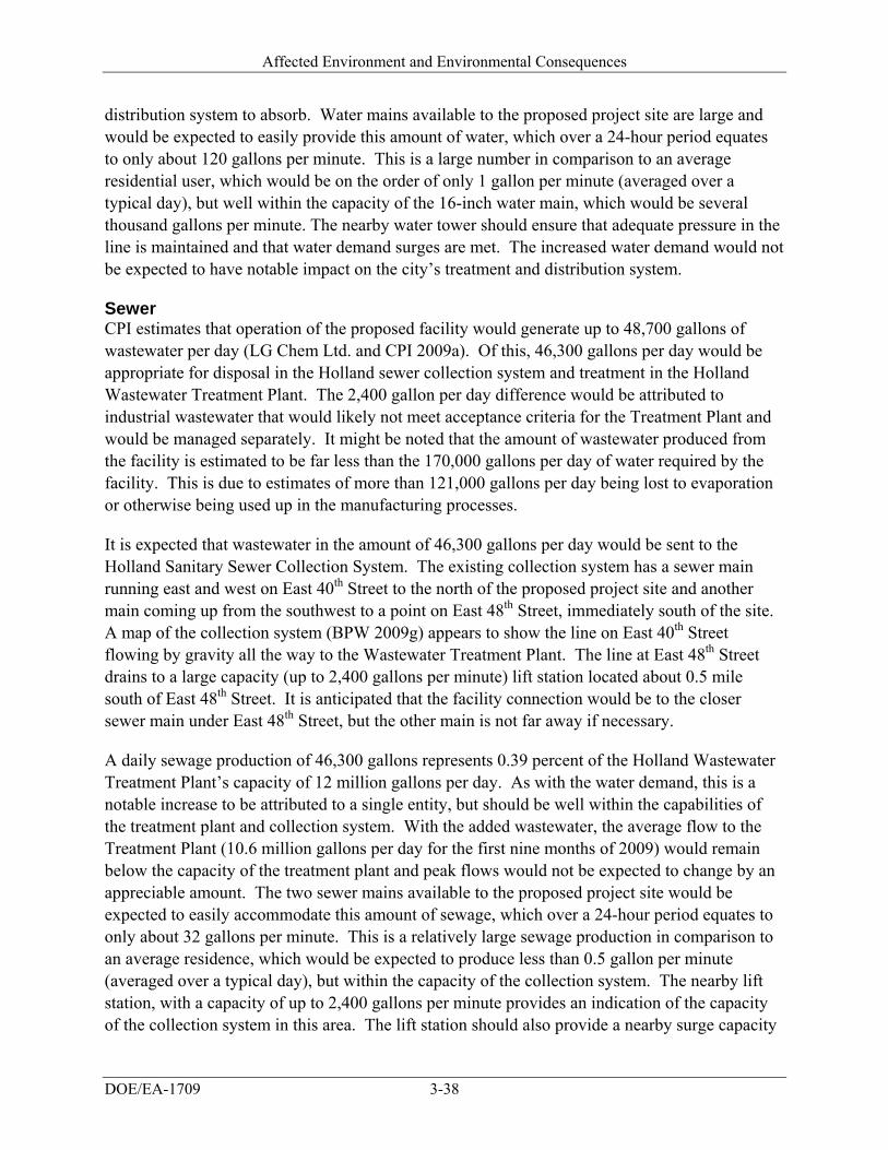
Affected Environment and Environmental Consequences
DOE/EA-1709 3-38
distribution system to absorb. Water mains available to the proposed project site are large and would be expected to easily provide this amount of water, which over a 24-hour period equates to only about 120 gallons per minute. This is a large number in comparison to an average residential user, which would be on the order of only 1 gallon per minute (averaged over a typical day), but well within the capacity of the 16-inch water main, which would be several thousand gallons per minute. The nearby water tower should ensure that adequate pressure in the line is maintained and that water demand surges are met. The increased water demand would not be expected to have notable impact on the city’s treatment and distribution system.
Sewer CPI estimates that operation of the proposed facility would generate up to 48,700 gallons of wastewater per day (LG Chem Ltd. and CPI 2009a). Of this, 46,300 gallons per day would be appropriate for disposal in the Holland sewer collection system and treatment in the Holland Wastewater Treatment Plant. The 2,400 gallon per day difference would be attributed to industrial wastewater that would likely not meet acceptance criteria for the Treatment Plant and would be managed separately. It might be noted that the amount of wastewater produced from the facility is estimated to be far less than the 170,000 gallons per day of water required by the facility. This is due to estimates of more than 121,000 gallons per day being lost to evaporation or otherwise being used up in the manufacturing processes.
It is expected that wastewater in the amount of 46,300 gallons per day would be sent to the Holland Sanitary Sewer Collection System. The existing collection system has a sewer main running east and west on East 40th Street to the north of the proposed project site and another main coming up from the southwest to a point on East 48th Street, immediately south of the site. A map of the collection system (BPW 2009g) appears to show the line on East 40th Street flowing by gravity all the way to the Wastewater Treatment Plant. The line at East 48th Street drains to a large capacity (up to 2,400 gallons per minute) lift station located about 0.5 mile south of East 48th Street. It is anticipated that the facility connection would be to the closer sewer main under East 48th Street, but the other main is not far away if necessary.
A daily sewage production of 46,300 gallons represents 0.39 percent of the Holland Wastewater Treatment Plant’s capacity of 12 million gallons per day. As with the water demand, this is a notable increase to be attributed to a single entity, but should be well within the capabilities of the treatment plant and collection system. With the added wastewater, the average flow to the Treatment Plant (10.6 million gallons per day for the first nine months of 2009) would remain below the capacity of the treatment plant and peak flows would not be expected to change by an appreciable amount. The two sewer mains available to the proposed project site would be expected to easily accommodate this amount of sewage, which over a 24-hour period equates to only about 32 gallons per minute. This is a relatively large sewage production in comparison to an average residence, which would be expected to produce less than 0.5 gallon per minute (averaged over a typical day), but within the capacity of the collection system. The nearby lift station, with a capacity of up to 2,400 gallons per minute provides an indication of the capacity of the collection system in this area. The lift station should also provide a nearby surge capacity
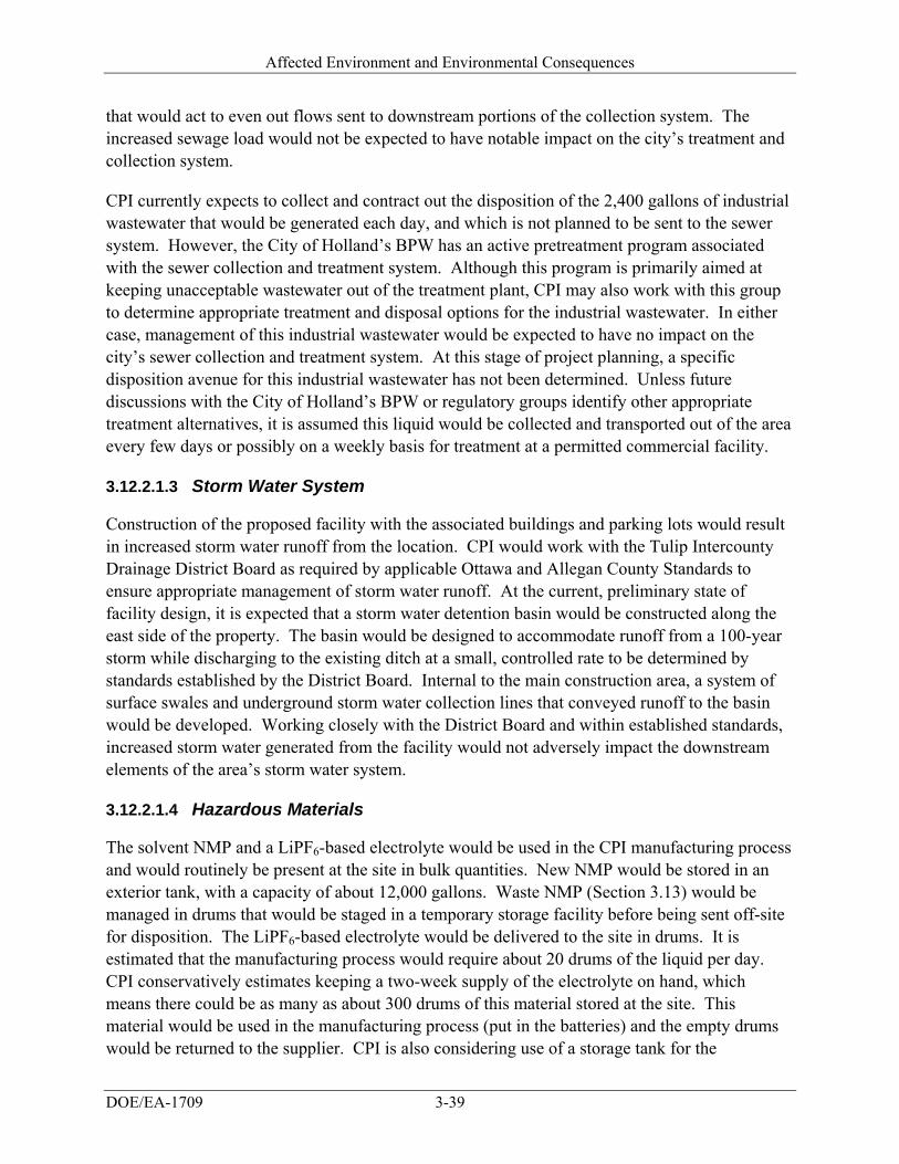
Affected Environment and Environmental Consequences
DOE/EA-1709 3-39
that would act to even out flows sent to downstream portions of the collection system. The increased sewage load would not be expected to have notable impact on the city’s treatment and collection system.
CPI currently expects to collect and contract out the disposition of the 2,400 gallons of industrial wastewater that would be generated each day, and which is not planned to be sent to the sewer system. However, the City of Holland’s BPW has an active pretreatment program associated with the sewer collection and treatment system. Although this program is primarily aimed at keeping unacceptable wastewater out of the treatment plant, CPI may also work with this group to determine appropriate treatment and disposal options for the industrial wastewater. In either case, management of this industrial wastewater would be expected to have no impact on the city’s sewer collection and treatment system. At this stage of project planning, a specific disposition avenue for this industrial wastewater has not been determined. Unless future discussions with the City of Holland’s BPW or regulatory groups identify other appropriate treatment alternatives, it is assumed this liquid would be collected and transported out of the area every few days or possibly on a weekly basis for treatment at a permitted commercial facility.
3.12.2.1.3 Storm Water System
Construction of the proposed facility with the associated buildings and parking lots would result in increased storm water runoff from the location. CPI would work with the Tulip Intercounty Drainage District Board as required by applicable Ottawa and Allegan County Standards to ensure appropriate management of storm water runoff. At the current, preliminary state of facility design, it is expected that a storm water detention basin would be constructed along the east side of the property. The basin would be designed to accommodate runoff from a 100-year storm while discharging to the existing ditch at a small, controlled rate to be determined by standards established by the District Board. Internal to the main construction area, a system of surface swales and underground storm water collection lines that conveyed runoff to the basin would be developed. Working closely with the District Board and within established standards, increased storm water generated from the facility would not adversely impact the downstream elements of the area’s storm water system.
3.12.2.1.4 Hazardous Materials
The solvent NMP and a LiPF6-based electrolyte would be used in the CPI manufacturing process and would routinely be present at the site in bulk quantities. New NMP would be stored in an exterior tank, with a capacity of about 12,000 gallons. Waste NMP (Section 3.13) would be managed in drums that would be staged in a temporary storage facility before being sent off-site for disposition. The LiPF6-based electrolyte would be delivered to the site in drums. It is estimated that the manufacturing process would require about 20 drums of the liquid per day. CPI conservatively estimates keeping a two-week supply of the electrolyte on hand, which means there could be as many as about 300 drums of this material stored at the site. This material would be used in the manufacturing process (put in the batteries) and the empty drums would be returned to the supplier. CPI is also considering use of a storage tank for the
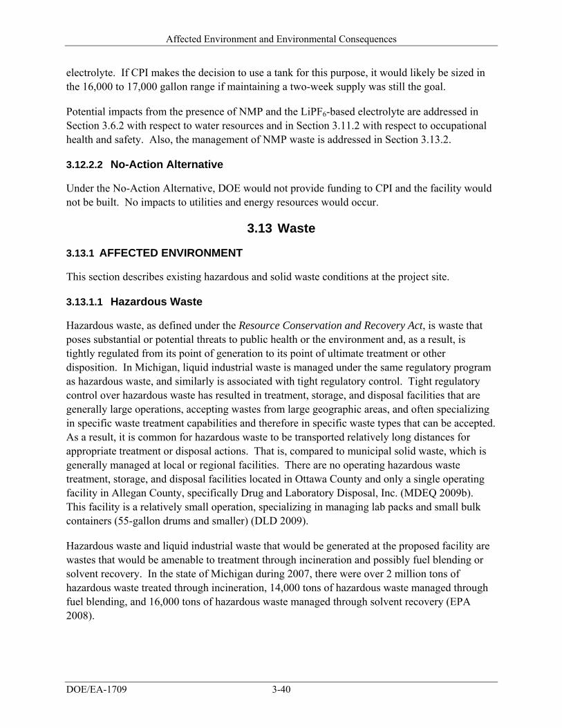
Affected Environment and Environmental Consequences
DOE/EA-1709 3-40
electrolyte. If CPI makes the decision to use a tank for this purpose, it would likely be sized in the 16,000 to 17,000 gallon range if maintaining a two-week supply was still the goal.
Potential impacts from the presence of NMP and the LiPF6-based electrolyte are addressed in Section 3.6.2 with respect to water resources and in Section 3.11.2 with respect to occupational health and safety. Also, the management of NMP waste is addressed in Section 3.13.2.
3.12.2.2 No-Action Alternative
Under the No-Action Alternative, DOE would not provide funding to CPI and the facility would not be built. No impacts to utilities and energy resources would occur.
3.13 Waste
3.13.1 AFFECTED ENVIRONMENT
This section describes existing hazardous and solid waste conditions at the project site.
3.13.1.1 Hazardous Waste
Hazardous waste, as defined under the Resource Conservation and Recovery Act, is waste that poses substantial or potential threats to public health or the environment and, as a result, is tightly regulated from its point of generation to its point of ultimate treatment or other disposition. In Michigan, liquid industrial waste is managed under the same regulatory program as hazardous waste, and similarly is associated with tight regulatory control. Tight regulatory control over hazardous waste has resulted in treatment, storage, and disposal facilities that are generally large operations, accepting wastes from large geographic areas, and often specializing in specific waste treatment capabilities and therefore in specific waste types that can be accepted. As a result, it is common for hazardous waste to be transported relatively long distances for appropriate treatment or disposal actions. That is, compared to municipal solid waste, which is generally managed at local or regional facilities. There are no operating hazardous waste treatment, storage, and disposal facilities located in Ottawa County and only a single operating facility in Allegan County, specifically Drug and Laboratory Disposal, Inc. (MDEQ 2009b). This facility is a relatively small operation, specializing in managing lab packs and small bulk containers (55-gallon drums and smaller) (DLD 2009).
Hazardous waste and liquid industrial waste that would be generated at the proposed facility are wastes that would be amenable to treatment through incineration and possibly fuel blending or solvent recovery. In the state of Michigan during 2007, there were over 2 million tons of hazardous waste treated through incineration, 14,000 tons of hazardous waste managed through fuel blending, and 16,000 tons of hazardous waste managed through solvent recovery (EPA 2008).

Affected Environment and Environmental Consequences
DOE/EA-1709 3-41
3.13.1.2 Solid Waste
The City of Holland has a mandatory recycling program for residents (Holland 2009). The program is operated in conjunction with routine waste pick-up, which is performed for the City under a contract to Chef Container, LLC (Hensley 2009). Residents have a curbside container in which they place normal municipal solid waste and any recyclable materials (plastics, office paper, newspaper, aluminum and tin cans, corrugated cardboard, etc.) are put in specially provided yellow bags, which are either placed along side the curbside container or inside it. Chef Container then picks up both the bags of recyclable materials and the refuse during a single stop. The waste pickup trucks then go to the Chef Container transfer station where recyclables are sorted and bailed for offsite shipment and refuse is transferred to transport trucks for hauling to a landfill (Chef Container 2009). The City of Holland sends approximately 8,750 tons of solid waste to the landfill per year after recyclable materials are removed (Hensley 2009). Assuming 300 to 500 pounds per cubic yard is a reasonable estimate for uncompacted solid waste (EPA 1993), this amounts to about 35,000 to 58,000 cubic yards per year.
Solid waste leaving the Chef Container transfer station is taken to one of several landfills located within a 50-mile radius, depending on which site is offering the best tipping fees at the time (Hensley 2009). Table 3-5 lists the municipal solid waste disposal facilities, from closest to farthest, located within about 50 miles of the City of Holland. Also shown in the table are the
Table 3-5. Municipal solid waste disposal facilities within 50 miles of Holland, Michigan.
Type II MSW Disposed in FY 2008 (cubic yards)
Landfill Name County
Distance to Holland, MI
(miles)a Total From Ottawa
County From Allegan
County
Years of Remaining Capacityb
Autumn Hills Recycling and Disposal Facility
Ottawa 8 751,000 383,000 92,000 20
South Kent Landfill Kent 19 612,000 0 6,300 22
Ottawa County Farms Landfill
Ottawa 22 706,000 214,000 1,800 20
County of Muskegon – Solid Waste Landfill
Muskegon 33 227,000 1,200 0 13
Orchard Hill Sanitary Landfill
Berrien 41 575,000 310 1,800 79
City Environmental Services Landfill of Hastings
Barry 41 109,000 0 2,500 37
Central Sanitary Landfill Moncalm 48 601,000 810 0 40
Pitsch Sanitary Landfill Ionia 50 36,000 0 0 12
Rounded Totals 3,617,000 599,000 104,000 Sources: MDEQ 2009c, MDEQ 2008b a. Distance from the disposal facility to Holland, Michigan, was estimated from the map in MDEQ 2008b and using the
scaling tool in GoogleTM Earth. b. MDEQ 2009c shows two different “years of remaining capacity” figures: one reported by the disposal facility and one
calculated by Michigan Department of Environmental Quality based on the volume of waste disposed during the year and the reported landfill volume remaining available. The value shown in the table is the one calculated by Michigan Department of Environmental Quality.
FY fiscal year MSW municipal solid waste

Affected Environment and Environmental Consequences
DOE/EA-1709 3-42
amounts of solid waste received for disposal at each of the facilities in fiscal year 2008 and, of those totals, the amounts received from Ottawa and Allegan counties. Although the primary portions of the City of Holland are in Ottawa County, the southern portion of the city, including the proposed project site, extends into Allegan County. As a result, municipal solid waste from both counties is shown in the table and both counties are totally encompassed by the 50-mile radius circle around Holland. As can be seen in Table 3-5, most municipal solid waste generated within Ottawa County stays in the county (that is, goes to the Autumn Hills and Ottawa County Farms facilities). The Autumn Hills facility, near the Ottawa-Allegan border, also receives more municipal solid waste from Allegan County than any of the other landfills.
3.13.2 ENVIRONMENTAL CONSEQUENCES
3.13.2.1 Proposed Project
3.13.2.1.1 Hazardous Waste
The proposed facility is expected to generate about 61 tons per year of both hazardous and liquid industrial waste. The primary component of the waste would be the solvent NMP, which is used in the battery manufacturing process. NMP may not qualify as hazardous waste because it is not a specifically listed hazardous waste chemical and its flash point is high enough (greater than 140 degrees Fahrenheit) that it does not exhibit the characteristic of ignitability. However, if the waste does not qualify as hazardous, it would still have to be managed as liquid industrial waste and the most likely management options for this waste would be incineration, fuel blending, or solvent recovery. The production and subsequent management of about 61 tons per year of hazardous or liquid industrial waste would represent very small percentages of the 2 million tons, 14,000 tons, and 16,000 tons of hazardous waste that are managed annually through incineration, fuel blending, and solvent recovery, respectively, at the state level. In addition, these wastes could be sent to permitted hazardous waste facilities located outside of Michigan, so the amount generated by CPI could be considered even smaller percentages of larger, multi-state treatment markets. There should be no problem or increased impacts associated with the proper management of the hazardous and liquid industrial waste that would be generated by the proposed facility. Production and management of the wastes would be tightly regulated and capacity of existing treatment facilities would not be affected by the relatively minor increases in waste quantity.
As the hazardous and liquid industrial waste was generated, it would be stored temporarily at the site until there were sufficient quantities to warrant its transport off-site to a commercial treatment, storage, and disposal facility (or as needed to keep storage times below regulatory limits for temporary storage). The temporary storage would be in closed containers and it is expected that it would be inside a storage structure constructed outside the main facility. This storage facility would be about 30 feet from the main building and would be about 110 feet by 80 feet in size. It would be designed to incorporate factors, as appropriate, for fire fighting, explosion, ventilation, and security. As a storage area for containers of hazardous liquid, the facility would also have appropriate secondary containment features.
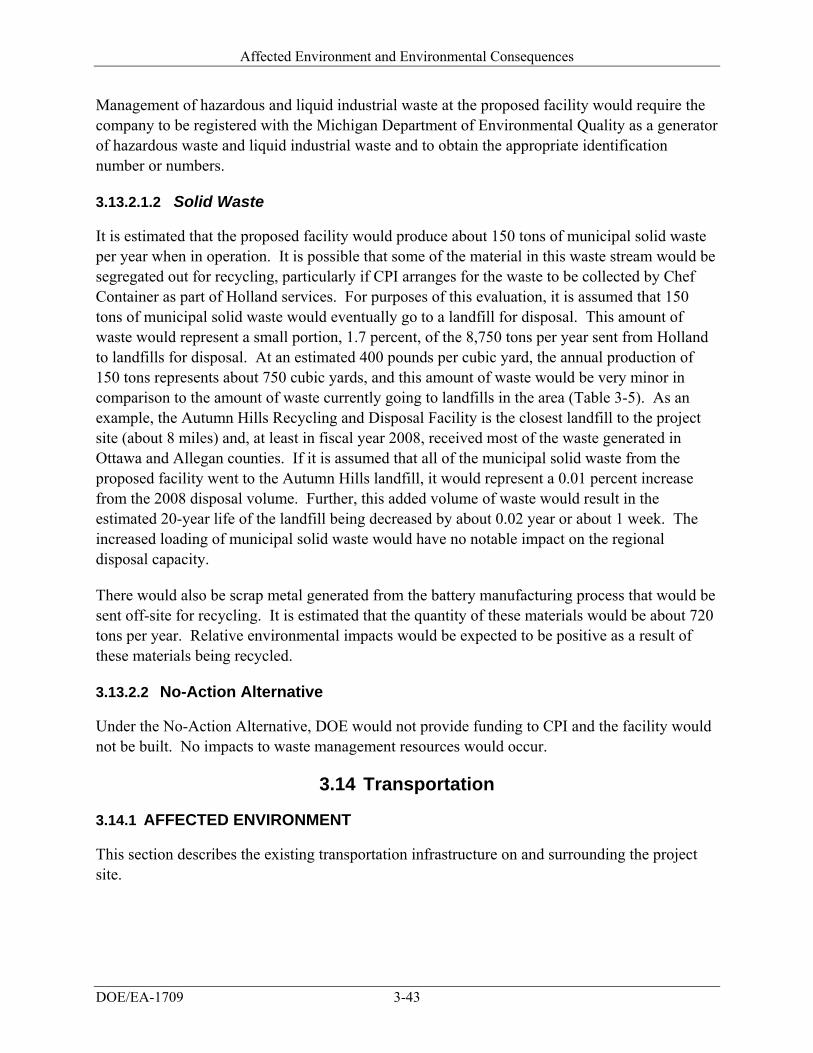
Affected Environment and Environmental Consequences
DOE/EA-1709 3-43
Management of hazardous and liquid industrial waste at the proposed facility would require the company to be registered with the Michigan Department of Environmental Quality as a generator of hazardous waste and liquid industrial waste and to obtain the appropriate identification number or numbers.
3.13.2.1.2 Solid Waste
It is estimated that the proposed facility would produce about 150 tons of municipal solid waste per year when in operation. It is possible that some of the material in this waste stream would be segregated out for recycling, particularly if CPI arranges for the waste to be collected by Chef Container as part of Holland services. For purposes of this evaluation, it is assumed that 150 tons of municipal solid waste would eventually go to a landfill for disposal. This amount of waste would represent a small portion, 1.7 percent, of the 8,750 tons per year sent from Holland to landfills for disposal. At an estimated 400 pounds per cubic yard, the annual production of 150 tons represents about 750 cubic yards, and this amount of waste would be very minor in comparison to the amount of waste currently going to landfills in the area (Table 3-5). As an example, the Autumn Hills Recycling and Disposal Facility is the closest landfill to the project site (about 8 miles) and, at least in fiscal year 2008, received most of the waste generated in Ottawa and Allegan counties. If it is assumed that all of the municipal solid waste from the proposed facility went to the Autumn Hills landfill, it would represent a 0.01 percent increase from the 2008 disposal volume. Further, this added volume of waste would result in the estimated 20-year life of the landfill being decreased by about 0.02 year or about 1 week. The increased loading of municipal solid waste would have no notable impact on the regional disposal capacity.
There would also be scrap metal generated from the battery manufacturing process that would be sent off-site for recycling. It is estimated that the quantity of these materials would be about 720 tons per year. Relative environmental impacts would be expected to be positive as a result of these materials being recycled.
3.13.2.2 No-Action Alternative
Under the No-Action Alternative, DOE would not provide funding to CPI and the facility would not be built. No impacts to waste management resources would occur.
3.14 Transportation
3.14.1 AFFECTED ENVIRONMENT
This section describes the existing transportation infrastructure on and surrounding the project site.
Affected Environment and Environmental Consequences
DOE/EA-1709 3-44
3.14.1.1 Roadways
The 80-acre project site is located at the intersection of East 48th Street, also known as East 146th Avenue, and the CSX rail line. This location is just east of the intersection of East 48th Street and South Waverly Road (Figure 2-1). State Highway 40, also known as Lincoln Road, has an interchange with Interstate 196, the Gerald R. Ford Freeway, about 0.75 mile south of the project site. North-bound State Highway 40 intersects South Waverly Road about 0.43 mile south of East 48th Street.
An October 2009 traffic count indicated average daily traffic on East 48th Street east of Waverly Road was 1,809 (Eun 2009). East 48th Street would provide access to the proposed facility.
3.14.1.2 Aviation
The City of Holland is serviced by two public general aviation airports, the Tulip City Airport (BIV) and the Park Township Airport (HLM), neither served by regularly scheduled commercial carriers. The Tulip City Airport is owned by the City of Holland and caters to corporate and charter jets. It is a modern all weather airport that has paved runways with taxiways, lighting, and taxiway identification, along with an instrument landing system approach to its 6,262-foot runway. The Park Township Airport is owned by Park Township and caters to smaller planes. It has a lighted paved strip.
Commercial airline service from seven airlines is available in Grand Rapids, Michigan, at Gerald R. Ford International Airport, about 35 miles northeast of Holland.
3.14.1.3 Rail
CSX Transportation provides rail services to the City of Holland with main rail line connections to Detroit, Michigan and Chicago, Illinois. A rail line from CSX occurs along the western boundary of the proposed project site.
The City of Holland offers regularly scheduled Amtrak service east to Grand Rapids, Michigan and west to Chicago, Illinois; where connections can be made to all points in the Amtrak system.
3.14.2 ENVIRONMENTAL CONSEQUENCES
3.14.2.1 Proposed Project
Traffic flow along East 48th Street, the only access road to the project site, would be impacted by the increased traffic associated with construction and operation of the proposed facility. During construction, an additional 550 workers would use East 48th Street daily to access the site. During operations, 450 persons would use the road daily. At full capacity, about 25 trucks per day would travel in and out of the facility for shipping of finished goods, receiving supplies and material, and for mail or package distribution. This worker and truck traffic would be in addition to the existing 1,809 average daily vehicles on the street and represents an increase in traffic of
Affected Environment and Environmental Consequences
DOE/EA-1709 3-45
25 percent. CPI would use two shifts during initial production and three shifts at full production, so the worker traffic would be split during the day and not occur at one time. No overlapping traffic should occur between shifts because all incoming workers would be at the facility before the shift hour begins and all outgoing workers would leave the facility after the shift hour ends.
The City of Holland has plans in the developmental stages to expand East 48th Street from Waverly Road to the east city limit, a distance of approximately 3,700 feet. CPI has submitted a road grant application to the Michigan Department of Transportation on behalf of the City of Holland for Category A funding (Frederick 2009). Category A funding is for road projects related to targeted industry development and for redevelopment opportunities. The design of the road expansion would be similar to improvements made to East 40th Street north of the project site. The road would be widened from the existing two lanes to three lanes with curbs and gutters. The City of Holland has not prepared the final design, but turning lanes might be provided if requested by CPI (Frederick 2009). The lane widening would occur within an existing city right of way.
3.14.2.2 No-Action Alternative
Under the No-Action Alternative, DOE would not provide funding to CPI and the facility would not be built. No impacts to transportation would occur.
3.15 The Relationship Between Local Short-Term Uses of the Environment and the Maintenance and Enhancement of
Long-Term Productivity
Council on Environmental Quality regulations that implement the procedural requirements of NEPA require consideration of “the relationship between short-term uses of man's environment and the maintenance and enhancement of long-term productivity” (40 CFR 1502.16). Construction and operation of the facility would require short-term uses of land and other resources. Short-term use of the environment, as used here, is that used during the life of the project, whereas long-term productivity refers to the period of time after the project has been decommissioned, the equipment removed, and the land reclaimed and stabilized. The short-term use of the project site for the proposed facility would not affect the long-term productivity of the area. If it is decided at some time in the future that the project has reached its useful life, the facility and foundations could be decommissioned and removed, and the site reclaimed and revegetated to resemble a similar habitat to the pre-disturbance conditions.
3.16 Irreversible and Irretrievable Commitments of Resources
There would be an irretrievable commitment of land required for construction and operation of the new facility; because other uses would be precluded during the time the land is being used for the proposed use. There would also be an irreversible commitment of energy and materials used to construct and operate the facility. The materials used for the project would include construction materials and materials used to manufacture lithium-ion batteries, such as cathode

Affected Environment and Environmental Consequences
DOE/EA-1709 3-46
materials, anode materials, separators, cans, and foils and chemicals such as NMP and LiPF6. DOE would also have expended the finances associated with the funding for the proposed project.
3.17 Unavoidable Adverse Impacts
Construction and operation of the proposed facility would cause unavoidable emissions of some criteria air pollutants. However, air pollutant concentrations would be regulated by the required permits from the Michigan Department of Environmental Quality and would not exceed the NAAQS. About 40 acres of “prime farmland if drained” and “farmland of local importance” would be converted to industrial use, consistent with the City of Holland’s zoning. This farmland is protected under the Farmland Protection Policy Act. Preliminary evaluation indicates the value of this farmland to be low, based on zoning, the size of the farmland, and other factors. One residence at the southeastern boundary of the site on the south side of East 48th Street would be subject to minor, short-term adverse impacts from noise generated during the construction of the proposed facility. This residence would also experience increased traffic noise on East 48th Street from commuting workers and trucks traveling to the facility. The need for construction materials, such as steel and concrete would be unavoidable, but would represent a small fraction of available materials. The generation of some solid wastes, construction debris, and hazardous wastes would be unavoidable. CPI would handle all wastes in accordance with applicable regulations, and would implement best management practices and pollution prevention/waste minimization programs.
Cumulative Impacts
DOE/EA-1709 4-1
4. CUMULATIVE IMPACTS
Council on Environmental Quality regulations stipulate that the cumulative effects analysis within an EA consider the potential environmental impacts resulting from the “incremental impacts of the action when added to other past, present, and reasonably foreseeable future actions regardless of what agency or person undertakes such actions” (40 CFR 1508.7). This chapter presents past, present, and reasonably foreseeable actions at the project site, followed by potential cumulative impacts.
4.1 Past, Present, and Reasonably Foreseeable Actions
Allegan County is mostly rural in nature. Extensive lumbering by early settlers cleared the way for farm production (Allegan 2008) and resulted in long-term adverse impacts to the land use, soils, and potentially the flora and fauna of the county. Allegan County is one of the fastest growing regions of the state as a result of an influx of technology and other light industries (Allegan 2008). The City of Holland South End Master Plan addresses the desired characteristics for growth in this area of the city to include a mix-used neighborhood area (City of Holland 2000).
The City of Holland recognizes one current and three future projects within the area of the proposed project site that are considered in the cumulative impacts analyses (Meyers 2009a). These projects, south of 24th Street and east of Washington, include a mixture of light industrial and residential development. Phase I of the mixed-use Kensington Development, consisting of commercial, residential and open space, is currently underway. A total of 84 acres of development is planned in the area with 19 acres under Phase I (Meyers 2009b). A central open space area, a community building and 20 of the 72 residential units are already completed (Meyers 2009b).
Approximately 2 miles west of the proposed project site is the proposed site for the Johnson Controls-Saft Advanced Power Solutions factory which will produce advanced lithium-ion cells for automotive applications (Anonymous 2009). The facility plans to begin supplying batteries for Ford’s plug-in hybrid electric vehicles by 2012 which will generate over 450 new jobs.
Lean Logistics, a transportation network, plans to re-use an existing vacant industrial building as a proposed call center. Lean Logistics would upgrade the current facility and add approximately 300 to 500 new jobs in the area, with approximately 114 jobs to be filled by the end of 2010 (Goodall 2009).
The final proposed future project in the south end area is the improvement of an existing city-owned parcel for an elementary school and park. The 20-acre parcel is south of the Kensington development; however, the city has no immediate schedule for the development (Meyers 2009b).
Cumulative Impacts
DOE/EA-1709 4-2
4.2 Cumulative Impacts Summary
Short-term cumulative impacts to the affected environment presented in Chapter 3 are mainly confined to the time frame during the construction of the site and the effects on land use, aesthetics, air quality, noise, hazardous waste, infrastructure, and transportation. Impacts from construction activities include increased exhaust emissions and noise from machinery, traffic, construction debris, soil erosion, and visual impacts of the construction site. These impacts would be temporary and best construction management practices would be used to lessen these impacts.
Long-term cumulative impacts would include the conversion of agricultural land to industrial, commercial, and residential uses. However, the development of this land is compatible with the future land use plans of the City of Holland (City of Holland 2000). Cumulative effects to biological and soil resources would be coupled with the change in land use. The proposed CPI facility would result in the conversion of at least 40 acres of “prime farmland if drained” and “farmland of local importance.” The present and future projects would also result in loss of prime farmland; however the impacts to prime farmland would not be significant due to the size of the area relative to the average size farms (172 acres) in Allegan County.
Cumulative impacts to aesthetics and visual resources would occur as buildings replace the once open landscape. In an effort to enhance the visual character of the I-196 corridor, which is a major gateway to the City of Holland, and convey the image of the “Tulip City,” corridor overlays will concentrate on enhancing the visual character of the area (City of Holland 2000). Development along the M40 and I-196 corridor will address the general character of the corridor, including the placement of the buildings, landscaping, signage, and access management to maintain the special character and aesthetics of the area and reduce cumulative impacts to visual resources (City of Holland 2000).
As the area becomes more developed, cumulative impacts to air quality, transportation, and noise would occur from increased traffic. The current configuration of East 48th Street is a narrow two-lane road with minimal shoulders and limited drainage, and will not hold up structurally to an increase in commercial traffic (Syens 2009). Cumulative impacts can be reduced with upgrades planned by the city (approximately 3,700 feet) entirely within the existing right-of-way. The upgrades will maintain the number of through lanes at two and add a center turn lane, storm sewer, and curb and gutter. If additional funding is available, and it were deemed necessary, the City may look at extending this same configuration to the small segment of East 48th Street between M-40 and Waverly Road (Syens 2009). Annual resurfacing programs by the City of Holland, and potentially the Michigan Department of Transportation resurfacing M-40 from I-196 to US-31, will also reduce cumulative impacts to traffic as roadways are improved for increase traffic volume.
The proposed CPI facility would impact three regulated wetlands and mitigation for these wetlands would be necessary as described in Section 3.6.2.1.3. Additionally, several freshwater
Cumulative Impacts
DOE/EA-1709 4-3
emergent wetlands, forested/shrub wetlands, and a large freshwater pond, most likely borrow pits remaining from highway construction (City of Holland 2000), exist on the sites of future proposed projects. Cumulative impacts to wetlands may occur if the current and future projects would impact these wetlands and further mitigation efforts may be necessary.
Long-term cumulative impacts to socioeconomics would be beneficial. The proposed CPI facility combined with the present and future planned development would increase employment, spending in the local economy, and the tax base of the City of Holland, Allegan County, and the State of Michigan.

Conclusions
DOE/EA-1709 5-1
5. CONCLUSIONS
The proposed facility would be constructed in the southeast part of Holland, Michigan. The facility would be built on agricultural land, the majority of which is zoned industrial, and would be compatible with surrounding land use. A small portion of the site, located in adjacent Fillmore Township, would require a zoning change from residential use to industrial use. Vehicular and construction equipment exhaust would be a source of pollutant emissions, but would have a negligible impact on air quality. DOE estimates that the facility would emit 4.83 tons of NOx, 0.42 tons of CO, and 3.61 tons of dust annually. CPI would obtain all necessary air permits from the Michigan Department of Environmental Quality. High-volume output of lithium-ion batteries resulting from operations of the facility is expected to result in significant reductions in carbon dioxide generated across the nation; and thus, a significant beneficial impact to air quality could be realized.
One residence at the southeastern boundary of the site on the south side of East 48th Street would be subject to minor, short-term adverse impacts from noise generated during the construction of the proposed facility. This residence would also experience increased traffic noise on East 48th Street from commuting workers and trucks traveling to the facility. Transportation impacts from increased traffic on East 48th Street would be lessened if the City of Holland widened this street. The City of Holland has plans in the developmental stages to expand East 48th Street from Waverly Road to the east city limit, a distance of approximately 3,700 feet. The road would be widened from the existing two lanes to three lanes with curbs and gutters; turning lanes may be added.
The proposed project site is visible from two residences, one on the south side of East 48th Street and one on the south side of East 40th Street. These residences would experience short-term visual impacts from construction activities and long-term visual impacts from the conversion of open, agricultural land to industrial use. However, the facility would be well-landscaped and would be compatible with surrounding developed areas to the west and northwest.
About 40 acres of “prime farmland if drained” and “farmland of local importance” would be converted to industrial use, consistent with the City of Holland’s zoning. This farmland is protected under the Farmland Protection Policy Act. The National Resources Conservation Service’s evaluation indicates the value of this farmland to be low, based on zoning, the size of the farmland, and other factors.
The proposed project would impact approximately 2.21 acres of regulated wetlands. Since greater than 0.3 acre of a wetland would be disturbed, compensatory mitigation measures, in the form of mitigation banking, would be required. CPI would mitigate the wetlands impact by replicating approximately 3.5 acres of wetlands at the VanRaalte Farm Park in Holland. Compensatory mitigation measures would ensure that wetlands impacts would not be considered significant.
Conclusions
DOE/EA-1709 5-2
Long-term beneficial socioeconomic impacts would occur from increased employment opportunities and spending in the local economy. Long-term benefits to the nation’s transportation industry would also occur from high-volume output of lithium-ion batteries by savings of fuel oil and greater use of plug-in hybrid electric vehicles.
No adverse impacts to water resources, environmental justice, utility systems, hazardous and solid waste management, geology and soils, biological resources, cultural resources, or occupational health and safety would occur.
Under the No-Action Alternative, DOE would not provide funding to CPI and it is assumed that the proposed facility would not be built. No impacts to the existing environment would occur. In addition, the potential beneficial impacts discussed above would not be realized.
References
DOE/EA-1709 6-1
6. REFERENCES
Allegan (Allegan County, Michigan). 2008. Holland Michigan History. Holland Area Convention and Visitors Bureau. Available at http://holland.org/locations/387-holland-history Accessed November 15, 2009.
Allegan (Allegan County, Michigan). 2009. “Allegan County, Drain Commission, Our Responsibilities.” Available at http://www.allegancounty.org/Government/DR/Index.asp?pt Accessed November 18, 2009.
Anonymous. 2009, April 15. Area Development Online News Desk. Four Companies Investing $1.7 Billion for Battery Projects in Michigan. Available at http://www.areadevelopment.com/newsItems/4-15-2009/michigan-advanced-battery-manufacturing-factories.shtml) Accessed November 15, 2009.
Atwell-Hicks. 2009a, November 13. Phase I Environmental Site Assessment Report for the Approximately 80-Acres of Undeveloped Land North Side of E. 48th Street, Holland, Michigan, 49423. Prepared for: Mr. Jim Renne, Rossetti, Two Town Square, Suite 200, Southfield, Michigan, 48076. Atwell-Hicks, LLC Project No. 09001770.
Atwell-Hicks. 2009b. Wetland Determination and Delineation Report for the ±69 Acre Property Located Northeast of the Intersection of S. Waverly Road & 48th Avenue Fillmore Township, Allegan County, Michigan. Prepared for Rossetti Architecture/Interiors/Graphics Planning, Two Town Square, Suite 200, Southfield, Michigan, 48076.
Atwell-Hicks. 2009c. ALTA/ASCM Land Title Survey and Topographic Survey, Sheet 2 of 3.
Atwell (Atwell, LLC). 2010, January 28. Wetland Impact Assessment and Compensatory Mitigation Proposal for: the ±69 Acre Property Located Northeast of the Intersection of S. Waverly Road & 48th Avenue Fillmore Township & the City of Holland, Allegan County, Michigan. Prepared for Rossetti Architecture/Interiors/Graphics Planning, Two Town Square, Suite 200, Southfield, Michigan, 48076. Project No. 09001770.
BLS (Bureau of Labor Statistics). 2008. “Fatal occupational injuries, employment, and rates of fatal occupational injuries by selected worker characteristics, occupations, and industries, 2007.”
BLS (Bureau of Labor Statistics). 2009a. “Table 1. Incidence rates of nonfatal occupational injuries and illnesses by industry and case types, 2008.”
BLS (Bureau of Labor Statistics). 2009b. “Economy at a Glance.” Available at http://www.bls.gov/eag/eag.mi_holland_msa.htm Accessed November 12, 2009.
BPW (Holland Board of Public Works). 2005. Holland Board of Public Works, a Report Highlighting Initiatives & Accomplishments, July 1, 2004 – June 30, 2005. Available at http://www.hollandbpw.com – Corporate Information – Reports – Corporate. Accessed November 10, 2009.
References
DOE/EA-1709 6-2
BPW (Holland Board of Public Works). 2009a. “Holland BPW Profile.” Corporate Information – Corporate Profile. Available at http://www.hollandbpw.com Accessed November 6, 2009.
BPW (Holland Board of Public Works). 2009b. “Electric Generation.” Utility Services – Electric Generation – General Info. Available at http://www.hollandbpw.com Accessed November 6, 2009.
BPW (Holland Board of Public Works). 2009c. “Holland Water Distribution System.” Utility Services – Water – Distribution – General Info. Available at http://www.hollandbpw.com Accessed November 11, 2009.
BPW (Holland Board of Public Works). 2009d. “Holland Water Treatment Plant.” Utility Services – Water – Water Filtration – General Info. Available at http://www.hollandbpw.com Accessed November 6, 2009.
BPW (Holland Board of Public Works). 2009e. “Sanitary Sewer Collection System.” Utility Services – Wastewater – Collection – General Info. Available at http://www.hollandbpw.com Accessed November 6, 2009.
BPW (Holland Board of Public Works). 2009f. “Holland Board of Public Works Water Service Area by Pressure District.” Utility Services – Water – Distribution – General Info. Available at http://www.hollandbpw.com Accessed November 11, 2009.
BPW (Holland Board of Public Works). 2009g. “Holland Board of Public Works Sanitary System by Collection District, September 2009.” Utility Services – Wastewater – Collection – General Info. Available at http://www.hollandbpw.com Accessed November 6, 2009.
Chef Container (Chef Container, LLC). 2009. “Step by Step Recycling.” Available at http://chefcontainer.com/html/ste_by_step_recycling.html Accessed November 16, 2009.
City-Data. 2009. Demographics for Holland, Michigan. Available at http://www.city-data.com/city/Holland-Michigan.html Accessed November 12, 2009.
City of Holland. 2000. The South End: A Master Plan for the Southern Area of the City of Holland formerly lying within Fillmore Township, as annexed on December 30, 1999.
City of Holland Planning Commission. 2005. City of Holland Master Plan Update South End Area. Adopted by the City of Holland Planning Commission on June 14, 2005. Adopted by the City of Holland City Council on July 6, 2005.
Consumers Energy. 2008. “Consumers Energy Electric Operations Statistics.” About Us – Electric Distribution – Statistics Available at http://www.consumersenergy.com/welcome.htm Accessed November 6, 2009.
DLD (Drug and Laboratory Disposal, Inc.). 2009. “About Us, Company Information.” Available at http://www.dld-inc.com/about.aspx Accessed November 17, 2009.
References
DOE/EA-1709 6-3
DOE (U.S. Department of Energy). 2009a. “Electric Power Annual 2007.” Energy Information Administration. DOE/EIA-0348(2007). Available at http://www.eia.doe.gov/cneaf/electricity/epa/epa_sum.html Accessed October 30, 2009.
DOE (U.S. Department of Energy). 2009b. “Michigan – State Energy Profile.” Energy Information Administration. Available at http://tonto.eia.doe.gov/state/state_energy_profiles.cfm?sid=MI Accessed November 6, 2009.
EPA (U.S. Environmental Protection Agency). 1993. Business Guide for Reducing Solid Waste, “Appendix D, Volume-to-Weight Conversion Table.” EPA/530-K-92-004. Washington D.C.
EPA (U.S. Environmental Protection Agency). 1999. Level III Ecoregions of Michigan. U.S. Environmental Protection Agency, National Health and Environmental Effects Research Laboratory. Available at http://newcrop.hort.purdue.edu/newcrop/cropmap/michigan/maps/MIeco3.html Accessed November 10, 2009.
EPA (U.S. Environmental Protection Agency). 2008. State Detail Analysis, The National Biennial RCRA Hazardous Waste Report (Based on 2007 Data). Available at http://www.epa.gov/epawaste/inforesources/data/biennialreport/index.htm Accessed November 2, 2009.
EPA (U.S. Environmental Protection Agency). 2009a. EPA Map of Radon Zones. Available at http://www.epa.gov/radon/zonemap/michigan.htm. Accessed November 12, 2009.
EPA (U.S. Environmental Protection Agency). 2009b. General Conformity De Minimis Levels. Available at http://www.epa.gov/air/genconform/deminimis.htm. Accessed November 12, 2009.
EPA (U.S. Environmental Protection Agency). 2009c. “Envirofacts, Water, Detail Reports – Holland WWTP (Wastewater Treatment Plant), NPDES Permit MI0023108.” Available at http://www.epa.gov/enviro/ Accessed November 17, 2009 and queried Water; Holland, MI (City, State); and MI0023108.
Eun, Kee. (LG Chem Ltd. and Compact Power, Inc.). 2009, November 13. “Responses to JAD Queries”, Email to Melissa Russ (JAD Environmental).
FEMA (U.S. Federal Emergency Management Agency). 2009. “Map Service Center, FEMA Issued Flood Maps.” Available at http://www.fema.gov/ Accessed through Quick Links, Flood Maps – Flood Maps – maps for Ottawa County Michigan. Accessed November 12, 2009.
Frederick, Brandon (LG Chem Ltd. and Compact Power, Inc.). 2009, November 24. “Answers”, Email to Melissa Russ (JAD Environmental).
Goodall, Andrea. 2009. Another 300 to 500 Jobs May be Headed to Holland. Available at http://www.grandhaventribune.com/paid/305232078449474.bsp Accessed November 15, 2009.
References
DOE/EA-1709 6-4
Hanson et al. (Hanson, C.E.; D.A. Towers, L.D. Meister). 2006. Transit Noise and Vibration Impact Assessment. U.S. Department of Transportation, Federal Transit Administration, Office of Planning and Environment. Washington, D.C. FTA-VA-90-1003-06
Health and Human Services. 2009. 2008 HHS Poverty Guidelines. Available at http://aspe.hhs.gov/poverty/08poverty.shtml Accessed November 24, 2009.
Hensley, M.A. (Recycle/Solid Waste Education Coordinator, City of Holland). 2009, November 16. “RE: Management of Municipal Solid Waste.” Email to Keith Davis (JAD Environmental).
Holland (City of Holland, Michigan). 2009. “Community & Neighborhood Services, Refuse & Recycling.” Available at http://www.cityofholland.com/Brix?pageID=129 Accessed November 16, 2009.
Holland Area Convention & Visitors Bureau. 2008. Official Holland Area Convention & Visitors Bureau website. Available at http://holland.org/locations/387-holland-history Accessed on November 18, 2009.
IPCC (Intergovernmental Panel on Climate Change). 2007. Climate Change 2007: Synthesis Report.
LG Chem Ltd. and CPI (Compact Power, Inc.). 2009a. Environmental Questionnaire.
LG Chem Ltd. and CPI (Compact Power, Inc.) 2009b. Project Narrative.
MDEQ (Michigan Department of Environmental Quality). 2007. “Permit No. MI0023108, State of Michigan Department of Environmental Quality, Authorization to Discharge Under the National Pollutant Discharge Elimination System.” Available at http://www.deq.state.mi.us/owis/Page/main/Home.aspx Accessed November 18, 2007 and queried for Permit No. MI0023108.
MDEQ (Michigan Department of Environmental Quality). 2008a. “Appendix B1 – Comprehensive list of assessment unit designated use support (HUCs 04010302 – 04050007” from Water Quality and Pollution Control in Michigan, 2008 Sections 303(d), 305(b), and 314 Integrated Report. Water Bureau, April 2008. Available at http://www.michigan.gov/deq/0,1607,7-135-3313_3686_3728-12711--,00.html Accessed November 11, 2009.
MDEQ (Michigan Department of Environmental Quality). 2008b. “Active Solid Waste Landfills, Part 115 of Act 451” (as of June 2008). Available at http://michigan.gov/deq/0,1607,7-135-3312_4123-9894--,00.html Accessed November 17, 2009.
MDEQ (Michigan Department of Environmental Quality). 2009a. “DEQ Wetlands Viewer, Michigan Department of Environmental Quality.” Available at http://www.mcgi.state.mi.us/wetlands/ Accessed November 11, 2009.
References
DOE/EA-1709 6-5
MDEQ (Michigan Department of Environmental Quality). 2009b. “Michigan Hazardous Waste Treatment, Storage, and Disposal Facilities Directory (TSD).” Available at http://www.deq.state.mi.us/tsd Accessed November 17, 2009.
MDEQ (Michigan Department of Environmental Quality). 2009c. Report of Solid Waste Landfilled in Michigan, October 1, 2007 – September 30, 2008 (dated January 30, 2009). Waste and Hazardous Materials Division, Storage Tank and Solid Waste Section, Lansing, Michigan. Available at http://www.michigan.gov/deq/0,1607,7-135-3312_4123-47581--,00.html Accessed November 12, 2009.
Meyers, Phillip (City of Holland, Director of Community and Neighborhood Services). 2009a, November 14. Personal communication with Dr. Wendy Arjo (JAD Environmental).
Meyers, Phillip (City of Holland, Director of Community and Neighborhood Services). 2009b, November 19. Personal communication with Dr. Wendy Arjo (JAD Environmental).
Michigan Historic Sites Online Mapper. 2009. Database search of the Michigan Historic Sites Online mapper. Available at http://www.mcgi.state.mi.us/hso/map.asp?action=zs&zs=6 Accessed November 16, 2009.
Michigan Manual. 2000. Volume 1999-2000, Chapter I, Michigan History, A Brief History of Michigan, page 3. Compiled and published by the Legislative Service Bureau. Available at http://www.legislature.mi.gov/(S(oy2d0nena2jstu55jbrv1mz5))/documents/publications/manual/1999-2000/1999-mm-0003-0011-History.pdf. Accessed April 29, 2009.
MPSC (Michigan Public Service Commission). 2008a. “Electric Utility Service Areas.” Available at http://www.dleg.state.mi.us/mpsc/electric/map.htm Accessed November 6, 2009.
MPSC (Michigan Public Service Commission). 2008b. “Gas Utility Service Areas.” Available at http://www.dleg.state.mi.us/mpsc/gase/servarea.htm Accessed November 6, 2009.
MSU (Michigan State University). 2009a. Michigan Natural Features Inventory. Vegetation Circa 1800 of Allegan County, Michigan: An Interpretation of the General Land Office survey. Michigan State University Extension, East Lansing, Michigan. Available at http://web4.msue.msu.edu/mnfi/data/index.cfm. Accessed November 10, 2009.
MSU (Michigan State University). 2009b. Michigan Natural Features Inventory. Michigan’s Special Animals and Rare Species Explorer. Michigan State University Extension, East Lansing, Michigan. Available at http://web4.msue.msu.edu/mnfi/data/specialplants.cfm Accessed November 10, 2009.
MSU (Michigan State University). 2009c. Michigan Natural Features Inventory. Michigan’s Special Plants and Rare Species Explorer. Michigan State University Extension, East Lansing, Michigan. Available at http://web4.msue.msu.edu/mnfi/data/specialanimals.cfm Accessed November 10, 2009
References
DOE/EA-1709 6-6
Ottawa (Ottawa County, Michigan). 2005. Ottawa County Standards & Specifications for Drain Commissioner’s Approval. Available at http://www.co.ottawa.mi.us/CoGov/Drain/devapproval.htm Accessed November 18, 2009.
Ottawa (Ottawa County, Michigan). 2009. “Drain Commissioner.” Available at http://www.co.ottawa.mi.us/CoGov/Drain/ Accessed November 18, 2009.
Potter, Keith (Fillmore Township, Supervisor). 2009, December 9. Personal communication with Tonya Bartels (JAD Environmental).
SEMCO (SEMCO Energy Gas Company). 2009. “SEMCO Energy Gas Company Service Territories.” Available at http://www.semcoenergygas.com/faq.php Accessed November 11, 2009.
Syens, J. (Director of Transportation Services, City of Holland). 2009, December 15. “RE: Compact Power EA.” Email to Dr. Wendy Arjo (JAD Environmental).
U.S. Census Bureau. 2009a. State and County Quick Facts. Available at http://quickfacts.census.gov/qfd/states/26/26005.html Accessed November 12, 2009.
U.S. Census Bureau. 2009b. Fact Sheets. Available at http://factfinder.census.gov Accessed November 12, 2009.
USACE (U.S. Army Corps of Engineers). 1999. The Highway Methodology Workbook Supplement – Wetland Functions and Values. New England District.
USDA NRCS (U.S. Department of Agriculture, Natural Resources Conservation Service). 2009. Web Soil Survey. Available at http://websoilsurvey.nrcs.usda.gov Accessed November 10, 2009.
USFWS (U.S. Fish and Wildlife Service). 1988. Endangered Species Act of 1973, as amended though the 100th Congress. U.S. Department of the Interior. Washington, D.C.
USFWS (U.S. Fish and Wildlife Service). 2009a. “National Wetlands Inventory, Wetlands Mapper.” Available at http://www.fws.gov/wetlands/ Accessed November 6, 2009.
USFWS (U.S. Fish and Wildlife Service). 2009b. Midwest Region Endangered Species Program – Technical Assistance Website. Available at http://www.fws.gov/midwest/Endangered/section7/s7process/7a2process.html. Accessed November 9, 2009.
USGS (U.S. Geological Survey). 2009. Michigan Earthquake History. Available at http://earthquake.usgs.gov/earthquakes/states/michigan/history.php. Accessed November 13, 2009.
Appendix A
DOE/EA-1709 A-1
APPENDIX A. DISTRIBUTION LIST
State and Local Offices
Herrick District Library 300 S. River Avenue Holland, MI 49423
Rebecca Humphries, Director Michigan Department of Natural Resources P.O. Box 30028 Lansing, MI 48909
Brian D. Conway, State Historic Preservation Officer Michigan State Historic Preservation Office Michigan Historical Center P.O. Box 30740 702 W. Kalamazoo Street Lansing, MI 48909
Governor of Michigan P.O. Box 30013 Lansing, MI 48909
William Parkus Coordinator, Regional Review Office Southeast Michigan Council of Governments 535 Griswold, Suite 300 Detroit, MI 48226
Keith Potter Fillmore Township--Supervisor 4219 52nd Street Holland, MI 49423
Gregory W. Robinson Holland Assistant City Manager City Hall 270 S. River Holland, MI 49423
Federal Offices
Craig Czarnecki, Field Supervisor U.S. Fish and Wildlife Service East Lansing Ecological Services Office 2651 Coolidge Road East Lansing, MI 48823
Appendix A
DOE/EA-1709 A-2
Tina Clemmons Allegan Conservation District USDA Natural Resources Conservation Service 1668 Lincoln Road (M-40) Allegan, MI 49010
Tribes
John Barrett, Chairman Citizen Potawatomi Nation 1601 South Gordon Cooper Drive Shawnee, OK 74801
Harold Frank, Chairman Forest County Potawatomi Community P.O. Box 340 Crandon, WI 54520
Kenneth Meshigaud, Chairman Hannahville Indian Community N14911 Hannahville B1 Road Wilson, MI 49896
David Sprague, Chairman Match-e-be-nash-she-wish Band of Potawatomi P.O. Box 218 Dorr, MI 49823
Charles Todd, Chief Ottawa Tribe of Oklahoma P.O. Box 110 Miami, OK 74355
John Miller, Chairperson Pokagon Band of Potawatomi Indians P.O. Box 180 Dowagiac, MI 49047
Steve Ortiz, Chairperson Prairie Band of Potawatomi Nation 16281 Q Road Mayetta, KS 66509 Others
Randy Thelen Lakeshore Advantage – President 201 W. Washington - Loft 410 Zeeland, MI 4946
Appendix B. Consultations
DOE/EA-1709 B-1
APPENDIX B. CONSULTATIONS
This appendix contains consultation correspondence between DOE and the Natural Resources Conservation Service, U.S. Fish and Wildlife Service, Michigan Department of Natural Resources, State Historic Preservation Office, and seven separate federally recognized tribes chosen according to the U.S. Department of Housing and Urban Development – Office of Community Planning and Development – Environmental Planning Division (Citizen Potawatomi Nation, Forest County Potawatomi Community, Hannahville Indian Community, Match-e-be-nash-she-wish Band of Potawatomi, Ottawa Tribe of Oklahoma, Pokagon Band of Potawatomi Indians, and the Prairie Band of Potawatomi Nation).

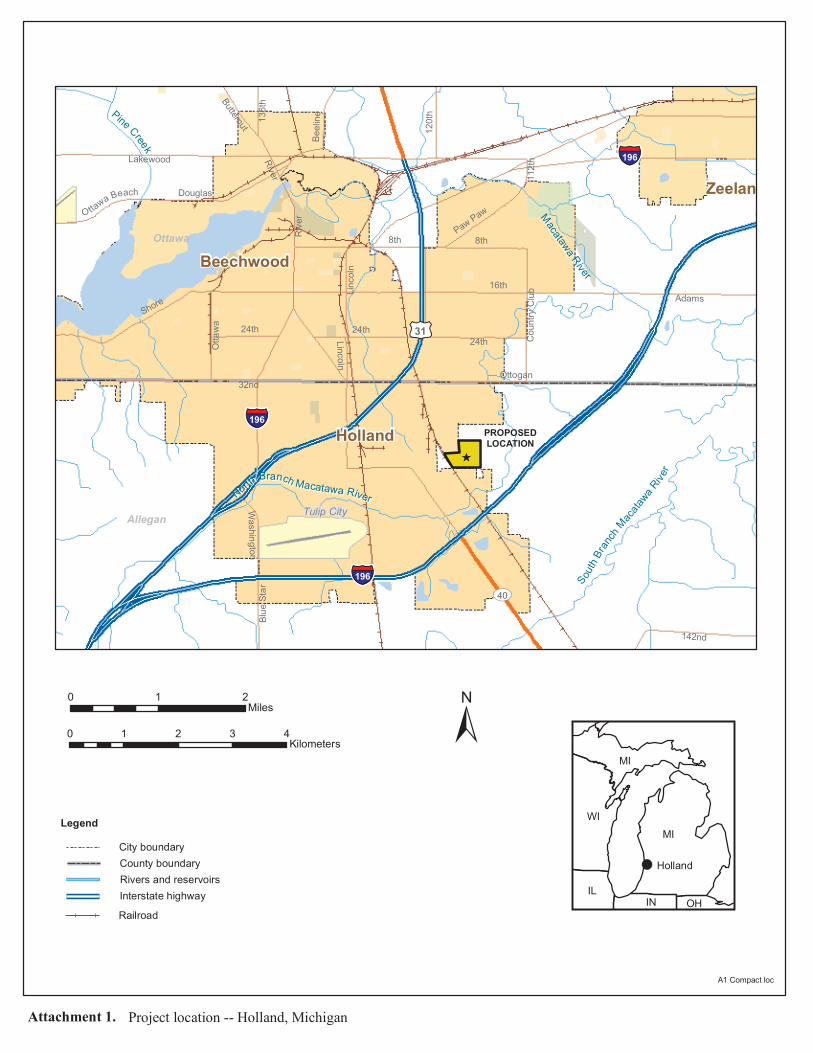
Holland
Beechwood
Zeeland
§̈¦196
§̈¦196
§̈¦196
£¤31
UV40
32nd
16th
Lakewood
8th
Adams
24thShore
142nd
Douglas
Linco
ln
120th
Ottaw
aPaw Paw
Coun
try C
lubRiver
Blue S
tar13
6th
Beeli
ne
O ttawa Beach
Butternut
112th
Washington
Ottogan
24th
8thRiver
24thLincoln
Ottawa
Allegan Tulip City
MMaaccaattaawwaa RRiivveerr
NN oo rr tt hh BB rraanncchh MMaaccaattaaww aa RRiivveerr
SS oo uu tt hh BB rr aa nn cc hh MM aa cc aa tt aa ww aa RR ii vv ee rr
PPiinnee CCrreeeekk
±
MIWI
MI
ILIN OH
LegendCity boundary
Rivers and reservoirs
0 1 2Miles
0 1 2 3 4Kilometers
Interstate highway
PROPOSEDLOCATION
A1 Compact loc
Attachment 1. Project location -- Holland, Michigan
_̂
Railroad
County boundary Holland


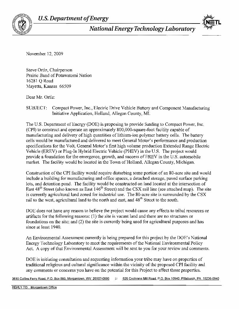
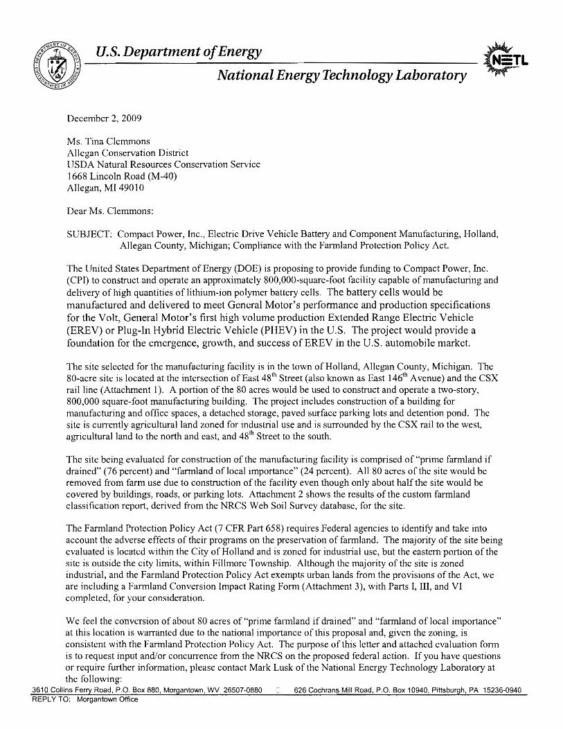
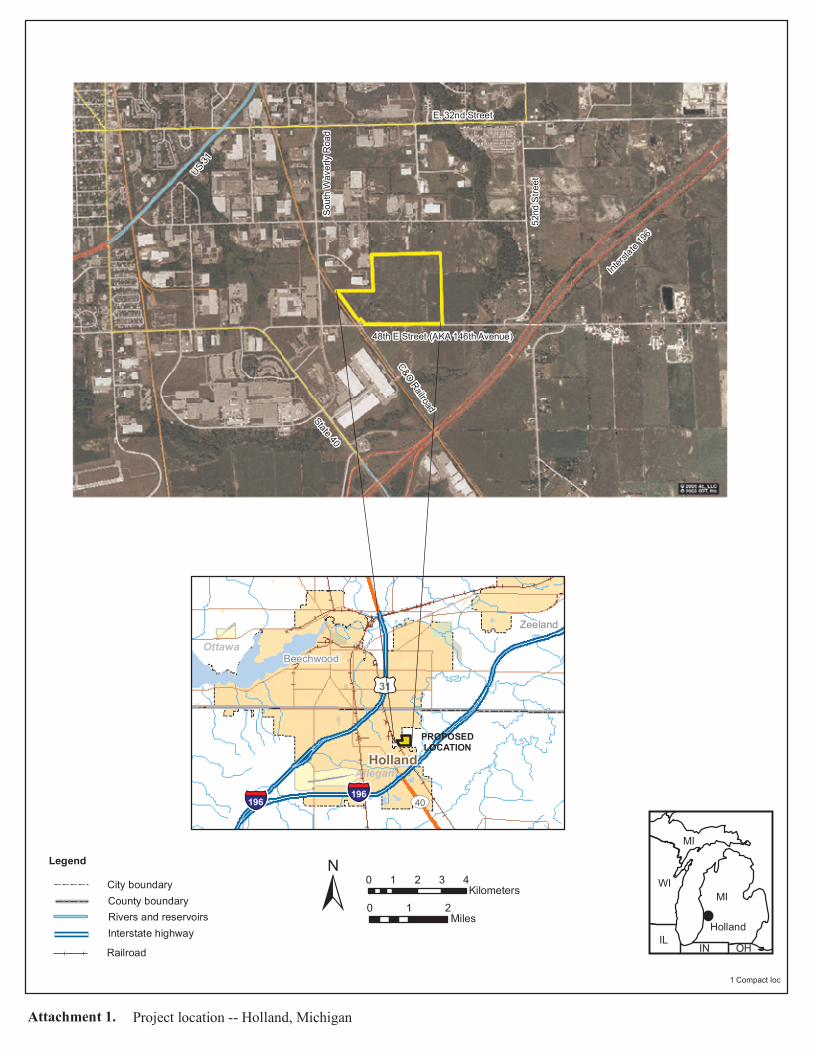
Holland
Zeeland
Beechwood
§̈¦196§̈¦196
£¤31
UV40
Ottawa
Allegan
± MIWI
MI
IL IN OH
LegendCity boundary
Rivers and reservoirs 0 1 2Miles
0 1 2 3 4Kilometers
Interstate highway
PROPOSEDLOCATION
1 Compact loc
Attachment 1. Project location -- Holland, Michigan
Railroad
County boundary
Holland
48th E Street (AKA 146th Avenue)
C&O Railroad
South
Wav
erly R
oad
Intersta
te 196
US 31
E. 32nd Street
52nd
Stre
et
State 40

146th Ave
Waverly Ct
41B
3628A
41B
36
39
21B
575600
575600
575700
575700
575800
575800
575900
575900
576000
576000
576100
576100
576200
576200
576300
576300
576400
576400
576500
576500
4734
000
4734
000
4734
100
4734
100
4734
200
4734
200
4734
300
4734
300
4734
400
4734
400
4734
500
4734
500
4734
600
4734
600
0 500 1,000 1,500250Feet
0 100 200 30050Meters
42° 45' 37''
86° 3
' 52''
42° 45' 15''
86° 3
' 53''
42° 45' 15''
42° 45' 37''86
° 4' 3
7''86
° 4' 3
6''
Map Scale: 1:4,760 if printed on A size (8.5" x 11") sheet.
Farmland Classification—Allegan County, Michigan
Natural ResourcesNatural ResourcesNatural ResourcesNatural ResourcesConservation ServiceConservation ServiceConservation ServiceConservation Service
Web Soil SurveyNational Cooperative Soil Survey
11/10/2009Page 1 of 3

MAP LEGEND MAP INFORMATION
Area of Interest (AOI)Area of Interest (AOI)
SoilsSoil Map Units
Soil RatingsNot prime farmland
All areas are primefarmlandPrime farmland if drained
Prime farmland ifprotected from flooding ornot frequently floodedduring the growing seasonPrime farmland if irrigated
Prime farmland if drainedand either protected fromflooding or not frequentlyflooded during the growingseasonPrime farmland if irrigatedand drainedPrime farmland if irrigatedand either protected fromflooding or not frequentlyflooded during the growingseason
Prime farmland ifsubsoiled, completelyremoving the rootinhibiting soil layerPrime farmland if irrigatedand the product of I (soilerodibility) x C (climatefactor) does not exceed 60Prime farmland if irrigatedand reclaimed of excesssalts and sodiumFarmland of statewideimportanceFarmland of localimportanceFarmland of uniqueimportanceNot rated or not available
Political FeaturesCities
Water FeaturesOceans
Streams and Canals
TransportationRails
Interstate Highways
US Routes
Major Roads
Local Roads
Map Scale: 1:4,760 if printed on A size (8.5" × 11") sheet.
The soil surveys that comprise your AOI were mapped at1:15,840.
Please rely on the bar scale on each map sheet for accurate mapmeasurements.
Source of Map: Natural Resources Conservation ServiceWeb Soil Survey URL: http://websoilsurvey.nrcs.usda.govCoordinate System: UTM Zone 16N NAD83
This product is generated from the USDA-NRCS certified data asof the version date(s) listed below.
Soil Survey Area: Allegan County, MichiganSurvey Area Data: Version 8, Jun 17, 2009
Date(s) aerial images were photographed: 6/6/2005
The orthophoto or other base map on which the soil lines werecompiled and digitized probably differs from the backgroundimagery displayed on these maps. As a result, some minor shiftingof map unit boundaries may be evident.
Farmland Classification–Allegan County, Michigan
Natural ResourcesConservation Service
Web Soil SurveyNational Cooperative Soil Survey
11/10/2009Page 2 of 3
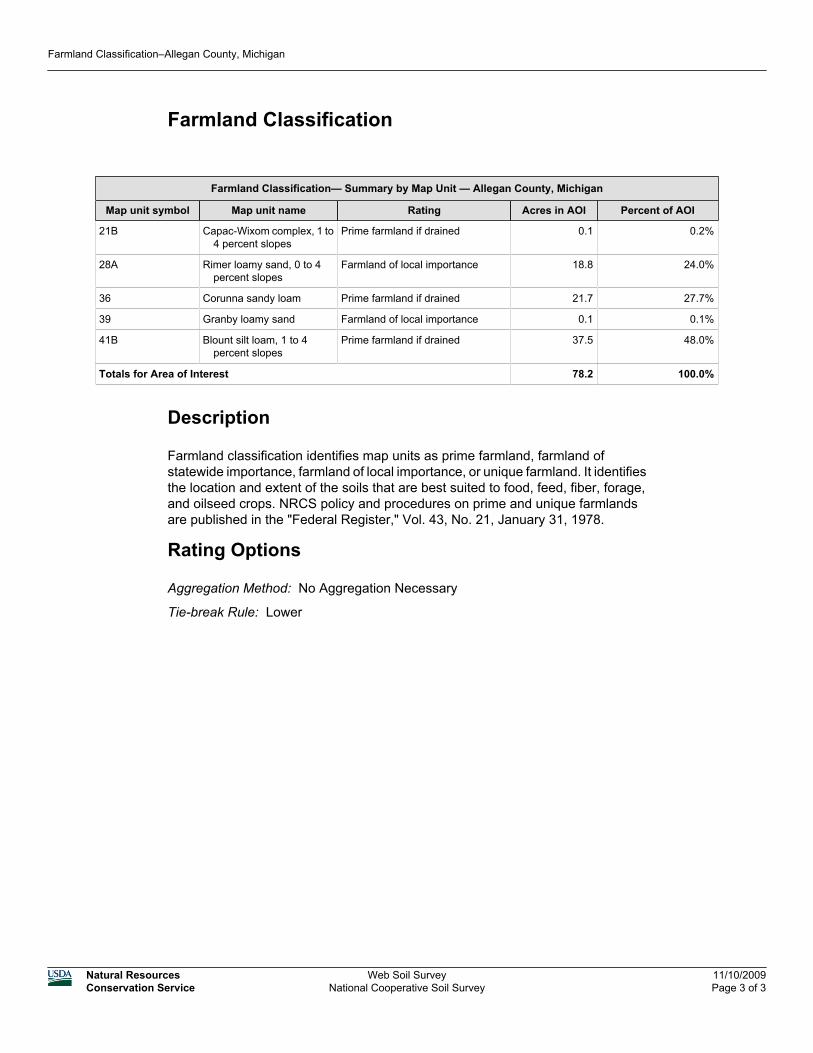
Farmland Classification
Farmland Classification— Summary by Map Unit — Allegan County, Michigan
Map unit symbol Map unit name Rating Acres in AOI Percent of AOI
21B Capac-Wixom complex, 1 to4 percent slopes
Prime farmland if drained 0.1 0.2%
28A Rimer loamy sand, 0 to 4percent slopes
Farmland of local importance 18.8 24.0%
36 Corunna sandy loam Prime farmland if drained 21.7 27.7%
39 Granby loamy sand Farmland of local importance 0.1 0.1%
41B Blount silt loam, 1 to 4percent slopes
Prime farmland if drained 37.5 48.0%
Totals for Area of Interest 78.2 100.0%
Description
Farmland classification identifies map units as prime farmland, farmland ofstatewide importance, farmland of local importance, or unique farmland. It identifiesthe location and extent of the soils that are best suited to food, feed, fiber, forage,and oilseed crops. NRCS policy and procedures on prime and unique farmlandsare published in the "Federal Register," Vol. 43, No. 21, January 31, 1978.
Rating Options
Aggregation Method: No Aggregation Necessary
Tie-break Rule: Lower
Farmland Classification–Allegan County, Michigan
Natural ResourcesConservation Service
Web Soil SurveyNational Cooperative Soil Survey
11/10/2009Page 3 of 3
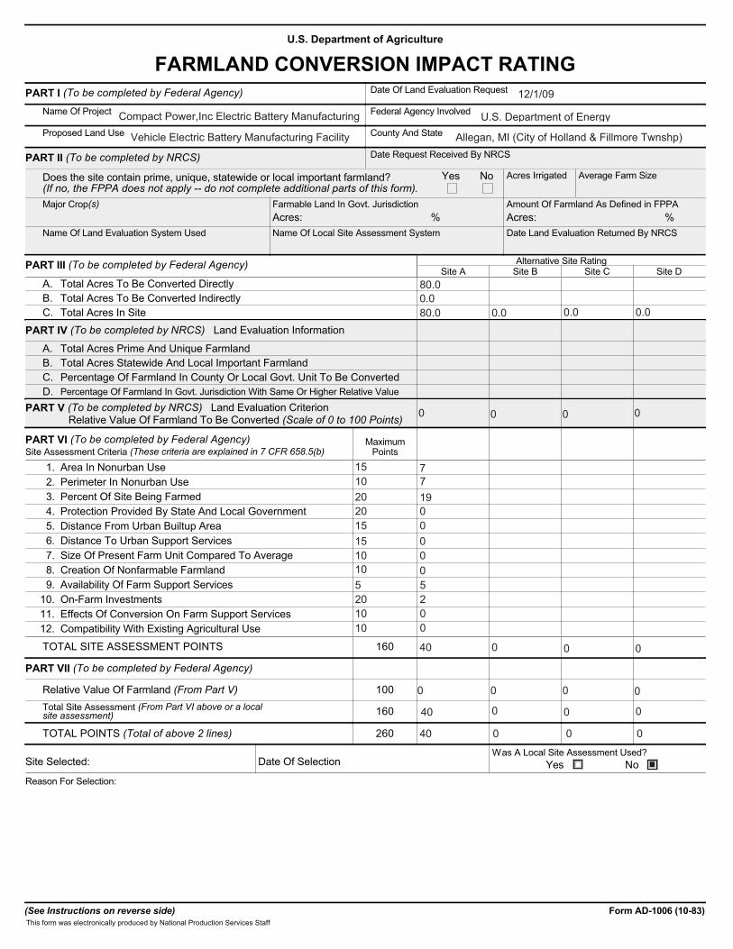
U.S. Department of Agriculture
FARMLAND CONVERSION IMPACT RATINGPART I (To be completed by Federal Agency) Date Of Land Evaluation Request
Name Of Project Federal Agency Involved
Proposed Land Use County And State
PART II (To be completed by NRCS) Date Request Received By NRCS
Does the site contain prime, unique, statewide or local important farmland?(If no, the FPPA does not apply -- do not complete additional parts of this form).
Acres Irrigated Average Farm Size
Major Crop(s) Farmable Land In Govt. Jurisdiction Amount Of Farmland As Defined in FPPA
Name Of Land Evaluation System Used Name Of Local Site Assessment System Date Land Evaluation Returned By NRCS
Yes No
Acres: % %Acres:
PART III (To be completed by Federal Agency) Alternative Site RatingSite A Site B Site C Site D
A. Total Acres To Be Converted DirectlyB. Total Acres To Be Converted IndirectlyC. Total Acres In Site
PART IV (To be completed by NRCS) Land Evaluation Information
A. Total Acres Prime And Unique FarmlandB. Total Acres Statewide And Local Important FarmlandC. Percentage Of Farmland In County Or Local Govt. Unit To Be ConvertedD. Percentage Of Farmland In Govt. Jurisdiction With Same Or Higher Relative Value
PART V (To be completed by NRCS) Land Evaluation Criterion Relative Value Of Farmland To Be Converted (Scale of 0 to 100 Points)
PART VI (To be completed by Federal Agency)Site Assessment Criteria (These criteria are explained in 7 CFR 658.5(b)
MaximumPoints
1. Area In Nonurban Use2. Perimeter In Nonurban Use3. Percent Of Site Being Farmed4. Protection Provided By State And Local Government5. Distance From Urban Builtup Area6. Distance To Urban Support Services7. Size Of Present Farm Unit Compared To Average8. Creation Of Nonfarmable Farmland9. Availability Of Farm Support Services
10. On-Farm Investments11. Effects Of Conversion On Farm Support Services12. Compatibility With Existing Agricultural Use
TOTAL SITE ASSESSMENT POINTS 160
PART VII (To be completed by Federal Agency)
Relative Value Of Farmland (From Part V) 100Total Site Assessment (From Part VI above or a localsite assessment) 160
TOTAL POINTS (Total of above 2 lines) 260
Site Selected: Date Of SelectionWas A Local Site Assessment Used?
Yes NoReason For Selection:
(See Instructions on reverse side) Form AD-1006 (10-83)This form was electronically produced by National Production Services Staff
12/1/09
Compact Power,Inc Electric Battery Manufacturing U.S. Department of Energy
Vehicle Electric Battery Manufacturing Facility Allegan, MI (City of Holland & Fillmore Twnshp)
80.00.080.0 0.0 0.0 0.0
0 0 0 0
15 710 720 1920 015 015 010 010 05 520 210 010 0
40
0
0 0 0 0
0 0
■
0 0 0
40
40 0 0 0
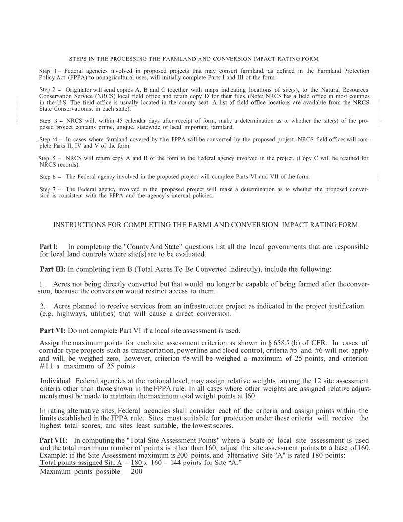
Step 1 Federal agencies involved in proposed projects that may convert farmland, as defined in the Farmland ProtectionPolicy Act (FPPA) to nonagricultural uses, will initially complete Parts I and III of the form.
Step 2 -
-
Originator will send copies A, B and C together with maps indicating locations of site(s), to the Natural Resources Conservation Service (NRCS) local field office and retain copy D for their files. (Note: NRCS has a field office in most counties in the U.S. The field office is usually located in the county seat. A list of field office locations are available from the NRCS State Conservationist in each state).
Step 3 - NRCS will, within 45 calendar days after receipt of form, make a determination as to whether the site(s) of the pro-posed project contains prime, unique, statewide or local important farmland.
. Step ‘4 - In cases where farmland covered by the FPPA will be converted by the proposed project, NRCS field offices will com-plete Parts II, IV and V of the form.
Step 5 - NRCS will return copy A and B of the form to the Federal agency involved in the project. (Copy C will be retained forNRCS records).
Step 6 - The Federal agency involved in the proposed project will complete Parts VI and VII of the form.
Step 7 - The Federal agency involved in the proposed project will make a determination as to whether the proposed conver-sion is consistent with the FPPA and the agency’s internal policies.
INSTRUCTIONS FOR COMPLETING THE FARMLAND CONVERSION IMPACT RATING FORM
Part I: In completing the "County And State" questions list all the local governments that are responsiblefor local land controls where site(s) are to be evaluated.
Part III: In completing item B (Total Acres To Be Converted Indirectly), include the following:
1 . Acres not being directly converted but that would no longer be capable of being farmed after the conver- sion, because the conversion would restrict access to them.
2. Acres planned to receive services from an infrastructure project as indicated in the project justification(e.g. highways, utilities) that will cause a direct conversion.
Assign the maximum points for each site assessment criterion as shown in § 658.5 (b) of CFR. In cases of :
and will, be weighed zero, however, criterion #8 will be weighed a maximum of 25 points, and criterion#11 a maximum of 25 points.
Individual Federal agencies at the national level, may assign relative weights among the 12 site assessment criteria other than those shown in the FPPA rule. In all cases where other weights are assigned relative adjust-ments must be made to maintain the maximum total weight points at l60.
Federal agencies shall consider each of the criteria and assign points within the limits established in the FPPA rule. Sites most suitable for protection under these criteria will receive thehighest total scores, and sites least suitable, the lowest scores.
Part VII: In computing the "Total Site Assessment Points" where a State or local site assessment is used points is other than 160, adjust the site assessment points to a base of160.
Example: if the Site Assessment maximum is 200 points, and alternative Site "A" is rated 180 points:Total points x 160 = 144 points for Site “A.”
STEPS IN THE PROCESSING THE FARMLAND A N D CONVERSION IMPACT RATING FORM
Part VI: Do not complete Part VI if a local site assessment is used.
projects such as transportation, powerline and flood control, criteria #5 and #6 will not applycorridor-type
In rating alternative sites,
and the total maximum number of
200 assigned Site A = 180
Maximum points possible
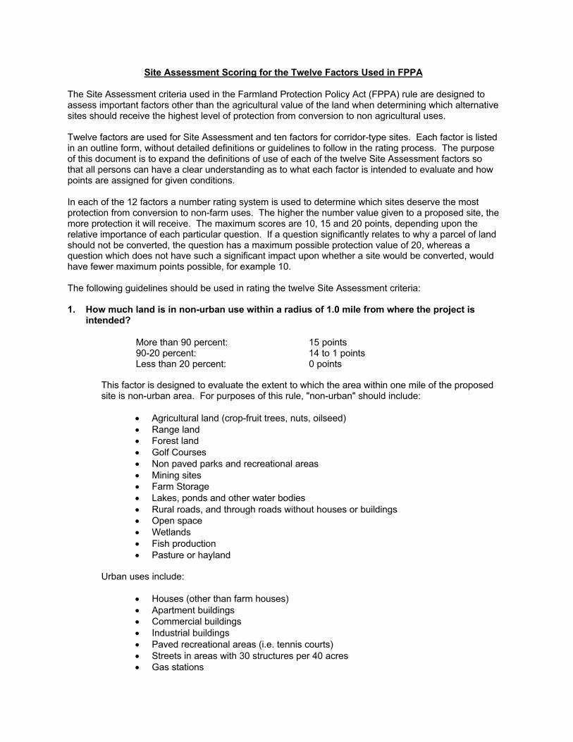
Site Assessment Scoring for the Twelve Factors Used in FPPA
The Site Assessment criteria used in the Farmland Protection Policy Act (FPPA) rule are designed toassess important factors other than the agricultural value of the land when determining which alternativesites should receive the highest level of protection from conversion to non agricultural uses.
Twelve factors are used for Site Assessment and ten factors for corridor-type sites. Each factor is listedin an outline form, without detailed definitions or guidelines to follow in the rating process. The purposeof this document is to expand the definitions of use of each of the twelve Site Assessment factors sothat all persons can have a clear understanding as to what each factor is intended to evaluate and howpoints are assigned for given conditions.
In each of the 12 factors a number rating system is used to determine which sites deserve the mostprotection from conversion to non-farm uses. The higher the number value given to a proposed site, themore protection it will receive. The maximum scores are 10, 15 and 20 points, depending upon therelative importance of each particular question. If a question significantly relates to why a parcel of landshould not be converted, the question has a maximum possible protection value of 20, whereas aquestion which does not have such a significant impact upon whether a site would be converted, wouldhave fewer maximum points possible, for example 10.
The following guidelines should be used in rating the twelve Site Assessment criteria:
1. How much land is in non-urban use within a radius of 1.0 mile from where the project isintended?
More than 90 percent: 15 points90-20 percent: 14 to 1 pointsLess than 20 percent: 0 points
This factor is designed to evaluate the extent to which the area within one mile of the proposedsite is non-urban area. For purposes of this rule, "non-urban" should include:
• Agricultural land (crop-fruit trees, nuts, oilseed)• Range land• Forest land• Golf Courses• Non paved parks and recreational areas• Mining sites• Farm Storage• Lakes, ponds and other water bodies• Rural roads, and through roads without houses or buildings• Open space• Wetlands• Fish production• Pasture or hayland
Urban uses include:
• Houses (other than farm houses)• Apartment buildings• Commercial buildings• Industrial buildings• Paved recreational areas (i.e. tennis courts)• Streets in areas with 30 structures per 40 acres• Gas stations
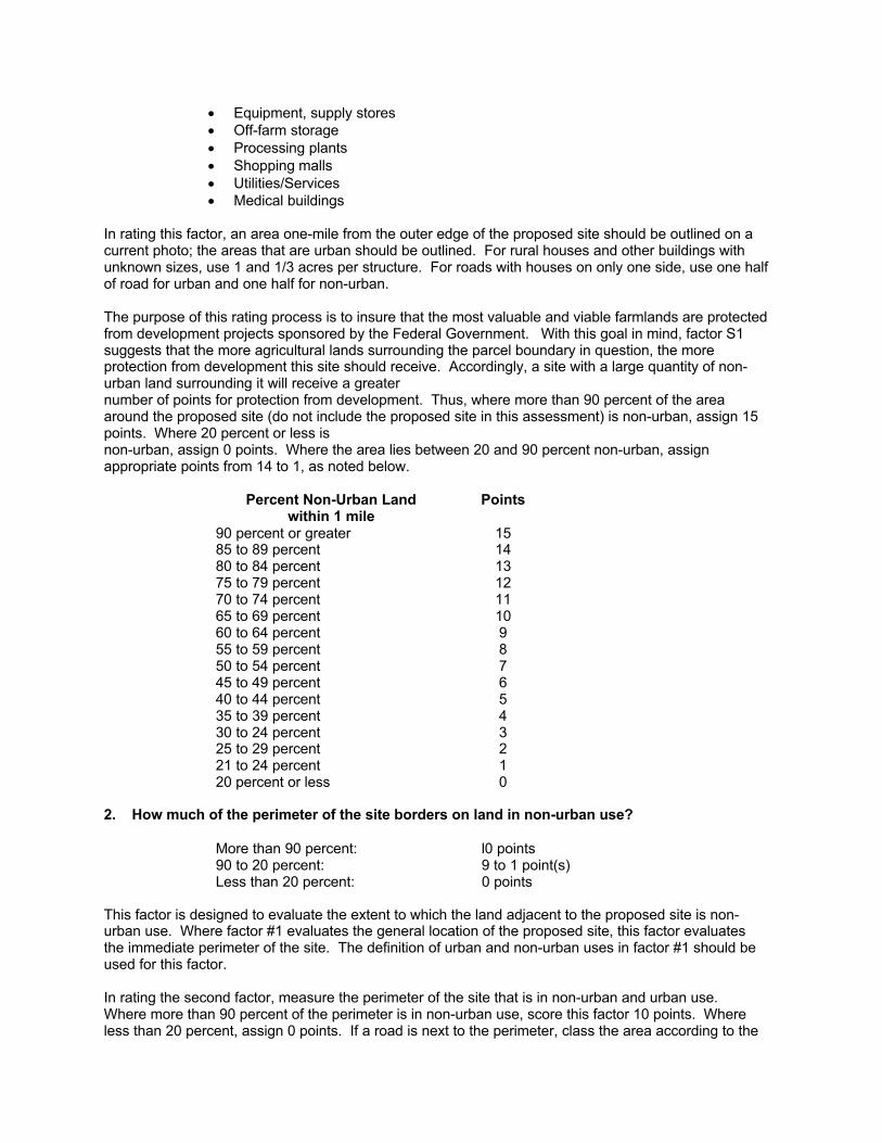
• Equipment, supply stores• Off-farm storage• Processing plants• Shopping malls• Utilities/Services• Medical buildings
In rating this factor, an area one-mile from the outer edge of the proposed site should be outlined on acurrent photo; the areas that are urban should be outlined. For rural houses and other buildings withunknown sizes, use 1 and 1/3 acres per structure. For roads with houses on only one side, use one halfof road for urban and one half for non-urban.
The purpose of this rating process is to insure that the most valuable and viable farmlands are protectedfrom development projects sponsored by the Federal Government. With this goal in mind, factor S1suggests that the more agricultural lands surrounding the parcel boundary in question, the moreprotection from development this site should receive. Accordingly, a site with a large quantity of non-urban land surrounding it will receive a greaternumber of points for protection from development. Thus, where more than 90 percent of the areaaround the proposed site (do not include the proposed site in this assessment) is non-urban, assign 15points. Where 20 percent or less isnon-urban, assign 0 points. Where the area lies between 20 and 90 percent non-urban, assignappropriate points from 14 to 1, as noted below.
Percent Non-Urban Landwithin 1 mile
Points
90 percent or greater 1585 to 89 percent 1480 to 84 percent 1375 to 79 percent 1270 to 74 percent 1165 to 69 percent 1060 to 64 percent 955 to 59 percent 850 to 54 percent 745 to 49 percent 640 to 44 percent 535 to 39 percent 430 to 24 percent 325 to 29 percent 221 to 24 percent 120 percent or less 0
2. How much of the perimeter of the site borders on land in non-urban use?
More than 90 percent: l0 points90 to 20 percent: 9 to 1 point(s)Less than 20 percent: 0 points
This factor is designed to evaluate the extent to which the land adjacent to the proposed site is non-urban use. Where factor #1 evaluates the general location of the proposed site, this factor evaluatesthe immediate perimeter of the site. The definition of urban and non-urban uses in factor #1 should beused for this factor.
In rating the second factor, measure the perimeter of the site that is in non-urban and urban use.Where more than 90 percent of the perimeter is in non-urban use, score this factor 10 points. Whereless than 20 percent, assign 0 points. If a road is next to the perimeter, class the area according to the
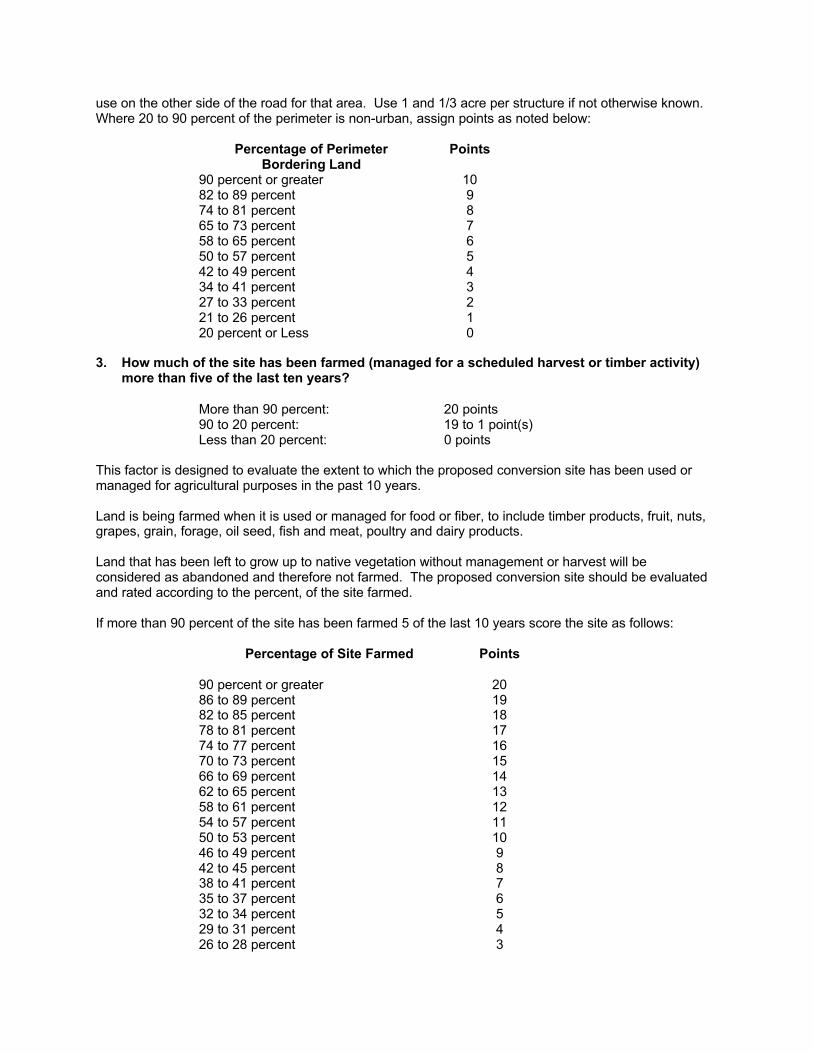
use on the other side of the road for that area. Use 1 and 1/3 acre per structure if not otherwise known.Where 20 to 90 percent of the perimeter is non-urban, assign points as noted below:
Percentage of PerimeterBordering Land
Points
90 percent or greater 1082 to 89 percent 974 to 81 percent 865 to 73 percent 758 to 65 percent 650 to 57 percent 542 to 49 percent 434 to 41 percent 327 to 33 percent 221 to 26 percent 120 percent or Less 0
3. How much of the site has been farmed (managed for a scheduled harvest or timber activity)more than five of the last ten years?
More than 90 percent: 20 points90 to 20 percent: 19 to 1 point(s)Less than 20 percent: 0 points
This factor is designed to evaluate the extent to which the proposed conversion site has been used ormanaged for agricultural purposes in the past 10 years.
Land is being farmed when it is used or managed for food or fiber, to include timber products, fruit, nuts,grapes, grain, forage, oil seed, fish and meat, poultry and dairy products.
Land that has been left to grow up to native vegetation without management or harvest will beconsidered as abandoned and therefore not farmed. The proposed conversion site should be evaluatedand rated according to the percent, of the site farmed.
If more than 90 percent of the site has been farmed 5 of the last 10 years score the site as follows:
Percentage of Site Farmed Points
90 percent or greater 2086 to 89 percent 1982 to 85 percent 1878 to 81 percent 1774 to 77 percent 1670 to 73 percent 1566 to 69 percent 1462 to 65 percent 1358 to 61 percent 1254 to 57 percent 1150 to 53 percent 1046 to 49 percent 942 to 45 percent 838 to 41 percent 735 to 37 percent 632 to 34 percent 529 to 31 percent 426 to 28 percent 3
23 to 25 percent 220 to 22 percent percent or Less 1Less than 20 percent 0
4. Is the site subject to state or unit of local government policies or programs to protectfarmland or covered by private programs to protect farmland?
Site is protected: 20 pointsSite is not protected: 0 points
This factor is designed to evaluate the extent to which state and local government and private programshave made efforts to protect this site from conversion.
State and local policies and programs to protect farmland include:
State Policies and Programs to Protect Farmland
1. Tax Relief:
A. Differential Assessment: Agricultural lands are taxed on their agricultural use value, ratherthan at market value. As a result, farmers pay fewer taxes on their land, which helps keep themin business, and therefore helps to insure that the farmland will not be converted tononagricultural uses.
1. Preferential Assessment for Property Tax: Landowners with parcels of land used foragriculture are given the privilege of differential assessment.
2. Deferred Taxation for Property Tax: Landowners are deterred from converting their landto nonfarm uses, because if they do so, they must pay back taxes at market value.
3. Restrictive Agreement for Property Tax: Landowners who want to receive DifferentialAssessment must agree to keep their land in - eligible use.
B. Income Tax Credits
Circuit Breaker Tax Credits: Authorize an eligible owner of farmland to apply some or all of theproperty taxes on his or her farmland and farm structures as a tax credit against the owner'sstate income tax.
C. Estate and Inheritance Tax Benefits
Farm Use Valuation for Death Tax: Exemption of state tax liability to eligible farm estates.
2. "Right to farm" laws:
Prohibits local governments from enacting laws which will place restrictions upon normallyaccepted farming practices, for example, the generation of noise, odor or dust.
3. Agricultural Districting:
Wherein farmers voluntarily organize districts of agricultural land to be legally recognizedgeographic areas. These farmers receive benefits, such as protection from annexation, inexchange for keeping land within the district for a given number of years.
4. Land Use Controls: Agricultural Zoning.
Types of Agricultural Zoning Ordinances include:
A. Exclusive: In which the agricultural zone is restricted to only farm-related dwellings, with, forexample, a minimum of 40 acres per dwelling unit.
B. Non-Exclusive: In which non-farm dwellings are allowed, but the density remains low, suchas 20 acres per dwelling unit.
Additional Zoning techniques include:
A. Slidinq Scale: This method looks at zoning according to the total size of the parcel owned.For example, the number of dwelling units per a given number of acres may change fromcounty to county according to the existing land acreage to dwelling unit ratio of surroundingparcels of land within the specific area.
B. Point System or Numerical Approach: Approaches land use permits on a case by casebasis.
LESA: The LESA system (Land Evaluation-Site Assessment) is used as a tool to helpassess options for land use on an evaluation of productivity weighed against commitment tourban development.
C. Conditional Use: Based upon the evaluation on a case by case basis by the Board ofZoning Adjustment. Also may include the method of using special land use permits.
5. Development Rights:
A. Purchase of Development Rights (PDR): Where development rights are purchased byGovernment action.
Buffer Zoning Districts: Buffer Zoning Districts are an example of land purchased byGovernment action. This land is included in zoning ordinances in order to preserve andprotect agricultural lands from non-farm land uses encroaching upon them.
B. Transfer of Development Rights (TDR): Development rights are transferable for use in otherlocations designated as receiving areas. TDR is considered a locally based action (notstate), because it requires a voluntary decision on the part of the individual landowners.
6. Governor’s Executive Order: Policy made by the Governor, stating the importance of agriculture,and the preservation of agricultural lands. The Governor orders the state agencies to avoid theunnecessary conversion of important farmland to nonagricultural uses.
7. Voluntary State Programs:
A. California's Program of Restrictive Agreements and Differential Assessments: TheCalifornia Land Conservation Act of 1965, commonly known as the Williamson Act, allowscities, counties and individual landowners to form agricultural preserves and enter intocontracts for 10 or more years to insure that these parcels of land remain strictly foragricultural use. Since 1972 the Act has extended eligibility to recreational and open spacelands such as scenic highway corridors, salt ponds and wildlife preserves. Thesecontractually restricted lands may be taxed differentially for their real value. One hundred-acre districts constitute the minimum land size eligible.
Suggestion: An improved version of the Act would state that if the land is convertedafter the contract expires, the landowner must pay the difference in the taxes betweenmarket value for the land and the agricultural tax value which he or she had been
paying under the Act. This measure would help to insure that farmland would not beconverted after the 10 year period ends.
B. Maryland Agricultural Land Preservation Program: Agricultural landowners withinagricultural districts have the opportunity to sell their development rights to the MarylandLand Preservation Foundation under the agreement that these landowners will notsubdivide or develop their land for an initial period of five years. After five years thelandowner may terminate the agreement with one year notice.
As is stated above under the California Williamson Act, the landowner should pay the backtaxes on the property if he or she decides to convert the land after the contract expires, inorder to discourage such conversions.
C. Wisconsin Income Tax Incentive Program: The Wisconsin Farmland Preservation Programof December 1977 encourages local jurisdictions in Wisconsin to adopt agriculturalpreservation plans or exclusive agricultural district zoning ordinances in exchange for creditagainst state income tax and exemption from special utility assessment. Eligible candidatesinclude local governments and landowners with at least 35 acres of land per dwelling unit inagricultural use and gross farm profits of at least $6.000 per year, or $18,000 over threeyears.
8. Mandatory State Programs:
A. The Environmental Control Act in the state of Vermont was adopted in 1970 by the VermontState Legislature. The Act established an environmental board with 9 members (appointedby the Governor) to implement a planning process and a permit system to screen mostsubdivisions and development proposals according to specific criteria stated in the law.The planning process consists of an interim and a final Land Capability and DevelopmentPlan, the latter of which acts as a policy plan to control development. The policies arewritten in order to:
• prevent air and water pollution;• protect scenic or natural beauty, historic sites and rare and irreplaceable
natural areas; and• consider the impacts of growth and reduction of development on areas of
primary agricultural soils.
B. The California State Coastal Commission: In 1976 the Coastal Act was passed to establisha permanent Coastal Commission with permit and planning authority The purpose of theCoastal Commission was and is to protect the sensitive coastal zone environment and itsresources, while accommodating the social and economic needs of the state. TheCommission has the power to regulate development in the coastal zones by issuing permitson a case by case basis until local agencies can develop their own coastal plans, whichmust be certified by the Coastal Commission.
C. Hawaii's Program of State Zoning: In 1961, the Hawaii State Legislature established Act187, the Land Use Law, to protect the farmland and the welfare of the local people ofHawaii by planning to avoid “unnecessary urbanization”. The Law made all state lands intofour districts: agricultural, conservation, rural and urban. The Governor appointed membersto a State Land Use Commission, whose duties were to uphold the Law and form theboundaries of the four districts. In addition to state zoning, the Land Use Law introduced aprogram of Differential Assessment, wherein agricultural landowners paid taxes on theirland for its agricultural use value, rather than its market value.
D. The Oregon Land Use Act of 1973: This act established the Land Conservation andDevelopment Commission (LCDC) to provide statewide planning goals and guidelines.
Under this Act, Oregon cities and counties are each required to draw up a comprehensiveplan, consistent with statewide planning goals. Agricultural land preservation is high on thelist of state goals to be followed locally.
If the proposed site is subject to or has used one or more of the above farmland protection programs orpolicies, score the site 20 points. If none of the above policies or programs apply to this site, score 0points.
5. How close is the site to an urban built-up area?
The site is 2 miles or more from anurban built-up area
15 points
The site is more than 1 mile but lessthan 2 miles from an urban built-up area
10 points
The site is less than 1 mile from, but isnot adjacent to an urban built-up area
5 points
The site is adjacent to an urban built-uparea
0 points
This factor is designed to evaluate the extent to which the proposed site is located next to an existingurban area. The urban built-up area must be 2500 population. The measurement from the built-up areashould be made from the point at which the density is 30 structures per 40 acres and with no open ornon-urban land existing between the major built-up areas and this point. Suburbs adjacent to cities orurban built-up areas should be considered as part of that urban area.
For greater accuracy, use the following chart to determine how much protection the site should receiveaccording to its distance from an urban area. See chart below:
Distance From Perimeterof Site to Urban Area
Points
More than 10,560 feet 159,860 to 10,559 feet 149,160 to 9,859 feet 138,460 to 9,159 feet 127,760 to 8,459 feet 117,060 to 7,759 feet 106,360 to 7,059 feet 95,660 to 6,359 feet 84,960 to 5,659 feet 74,260 to 4,959 feet 63,560 to 4,259 feet 52,860 to 3,559 feet 42,160 to 2,859 feet 31,460 to 2,159 feet 2760 to 1,459 feet 1Less than 760 feet (adjacent) 0
6. How close is the site to water lines, sewer lines and/or other local facilities and serviceswhose capacities and design would promote nonagricultural use?
None of the services exist nearer than3 miles from the site
15 points
Some of the services exist more thanone but less than 3 miles from the site
10 points
All of the services exist within 1/2 mileof the site
0 points

This question determines how much infrastructure (water, sewer, etc.) is in place which could facilitatenonagricultural development. The fewer facilities in place, the more difficult it is to develop an area.Thus, if a proposed site is further away from these services (more than 3 miles distance away), the siteshould be awarded the highest number of points (15). As the distance of the parcel of land to servicesdecreases, the number of points awarded declines as well. So, when the site is equal to or further than1 mile but less than 3 miles away from services, it should be given 10 points. Accordingly, if thisdistance is 1/2 mile to less than 1 mile, award 5 points; and if the distance from land to services is lessthan 1/2 mile, award 0 points.
Distance to public facilities should be measured from the perimeter of the parcel in question to thenearest site(s) where necessary facilities are located. If there is more than one distance (i.e. from site towater and from site to sewer), use the average distance (add all distances and then divide by thenumber of different distances to get the average).
Facilities which could promote nonagricultural use include:
• Water lines• Sewer lines• Power lines• Gas lines• Circulation (roads)• Fire and police protection• Schools
7. Is the farm unit(s) containing the site (before the project) as large as the average-sizefarming unit in the county? (Average farm sizes in each county are available from the NRCSfield offices in each state. Data are from the latest available Census of Agriculture, Acreageof Farm Units in Operation with $1,000 or more in sales.)
As large or larger: 10 pointsBelow average: Deduct 1 point foreach 5 percent below the average,down to 0 points if 50 percent or moreis below average
9 to 0 points
This factor is designed to determine how much protection the site should receive, according to its size inrelation to the average size of farming units within the county. The larger the parcel of land, the moreagricultural use value the land possesses, and vice versa. Thus, if the farm unit is as large or largerthan the county average, it receives the maximum number of points (10). The smaller the parcel of landcompared to the county average, the fewer number of points given. Please see below:
Parcel Size in Relation to Average CountySize
Points
Same size or larger than average (l00 percent) 1095 percent of average 990 percent of average 885 percent of average 780 percent of average 675 percent of average 570 percent of average 465 percent of average 360 percent of average 255 percent of average 150 percent or below county average 0
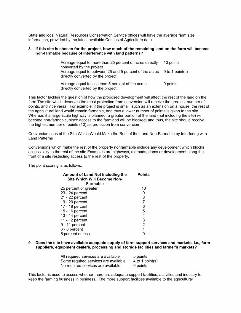
State and local Natural Resources Conservation Service offices will have the average farm sizeinformation, provided by the latest available Census of Agriculture data
8. If this site is chosen for the project, how much of the remaining land on the farm will becomenon-farmable because of interference with land patterns?
Acreage equal to more than 25 percent of acres directlyconverted by the project
10 points
Acreage equal to between 25 and 5 percent of the acresdirectly converted by the project
9 to 1 point(s)
Acreage equal to less than 5 percent of the acresdirectly converted by the project
0 points
This factor tackles the question of how the proposed development will affect the rest of the land on thefarm The site which deserves the most protection from conversion will receive the greatest number ofpoints, and vice versa. For example, if the project is small, such as an extension on a house, the rest ofthe agricultural land would remain farmable, and thus a lower number of points is given to the site.Whereas if a large-scale highway is planned, a greater portion of the land (not including the site) willbecome non-farmable, since access to the farmland will be blocked; and thus, the site should receivethe highest number of points (10) as protection from conversion
Conversion uses of the Site Which Would Make the Rest of the Land Non-Farmable by Interfering withLand Patterns
Conversions which make the rest of the property nonfarmable include any development which blocksaccessibility to the rest of the site Examples are highways, railroads, dams or development along thefront of a site restricting access to the rest of the property.
The point scoring is as follows:
Amount of Land Not Including theSite Which Will Become Non-
Farmable
Points
25 percent or greater 1023 - 24 percent 921 - 22 percent 819 - 20 percent 717 - 18 percent 615 - 16 percent 513 - 14 percent 411 - 12 percent 39 - 11 percent 26 - 8 percent 15 percent or less 0
9. Does the site have available adequate supply of farm support services and markets, i.e., farmsuppliers, equipment dealers, processing and storage facilities and farmer's markets?
All required services are available 5 pointsSome required services are available 4 to 1 point(s)No required services are available 0 points
This factor is used to assess whether there are adequate support facilities, activities and industry tokeep the farming business in business. The more support facilities available to the agricultural

landowner, the more feasible it is for him or her to stay in production. In addition, agricultural supportfacilities are compatible with farmland. This fact is important, because some land uses are notcompatible; for example, development next to farmland cam be dangerous to the welfare of theagricultural land, as a result of pressure from the neighbors who often do not appreciate the noise,smells and dust intrinsic to farmland. Thus, when all required agricultural support services are available,the maximum number of points (5) are awarded. When some services are available, 4 to 1 point(s) areawarded; and consequently, when no services are available, no points are given. See below:
Percent ofServices Available
Points
100 percent 575 to 99 percent 450 to 74 percent 325 to 49 percent 21 to 24 percent 1No services 0
10. Does the site have substantial and well-maintained on farm investments such as barns,other storage buildings, fruit trees and vines, field terraces, drainage, irrigation, waterways,or other soil and water conservation measures?
High amount of on-farm investment 20 pointsModerate amount of non-farminvestment
19 to 1 point(s)
No on-farm investments 0 points
This factor assesses the quantity of agricultural facilities in place on the proposed site. If a significantagricultural infrastructure exists, the site should continue to be used for farming, and thus the parcel willreceive the highest amount of points towards protection from conversion or development. If there is littleon farm investment, the site will receive comparatively less protection. See-below:
Amount of On-farm Investment PointsAs much or more than necessary tomaintain production (100 percent)
20
95 to 99 percent 1990 to 94 percent 1885 to 89 percent 1780 to 84 percent 1675 to 79 percent 1570 to 74 percent 1465 to 69 percent 1360 to 64 percent 1255 to 59 percent 1150 to 54 percent 1045 to 49 percent 940 to 44 percent 835 to 39 percent 730 to 34 percent 625 to 29 percent 520 to 24 percent 415 to 19 percent 310 to 14 percent 25 to 9 percent 10 to 4 percent 0
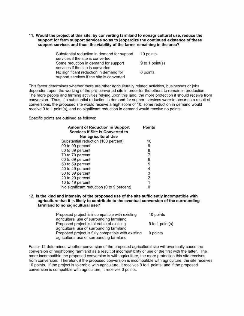
11. Would the project at this site, by converting farmland to nonagricultural use, reduce thesupport for farm support services so as to jeopardize the continued existence of thesesupport services and thus, the viability of the farms remaining in the area?
Substantial reduction in demand for supportservices if the site is converted
10 points
Some reduction in demand for supportservices if the site is converted
9 to 1 point(s)
No significant reduction in demand forsupport services if the site is converted
0 points
This factor determines whether there are other agriculturally related activities, businesses or jobsdependent upon the working of the pre-converted site in order for the others to remain in production.The more people and farming activities relying upon this land, the more protection it should receive fromconversion. Thus, if a substantial reduction in demand for support services were to occur as a result ofconversions, the proposed site would receive a high score of 10; some reduction in demand wouldreceive 9 to 1 point(s), and no significant reduction in demand would receive no points.
Specific points are outlined as follows:
Amount of Reduction in SupportServices if Site is Converted to
Nonagricultural Use
Points
Substantial reduction (100 percent) 1090 to 99 percent 980 to 89 percent 870 to 79 percent 760 to 69 percent 650 to 59 percent 540 to 49 percent 430 to 39 percent 320 to 29 percent 210 to 19 percent 1No significant reduction (0 to 9 percent) 0
12. Is the kind and intensity of the proposed use of the site sufficiently incompatible withagriculture that it is likely to contribute to the eventual conversion of the surroundingfarmland to nonagricultural use?
Proposed project is incompatible with existingagricultural use of surrounding farmland
10 points
Proposed project is tolerable of existingagricultural use of surrounding farmland
9 to 1 point(s)
Proposed project is fully compatible with existingagricultural use of surrounding farmland
0 points
Factor 12 determines whether conversion of the proposed agricultural site will eventually cause theconversion of neighboring farmland as a result of incompatibility of use of the first with the latter. Themore incompatible the proposed conversion is with agriculture, the more protection this site receivesfrom conversion. Therefor-, if the proposed conversion is incompatible with agriculture, the site receives10 points. If the project is tolerable with agriculture, it receives 9 to 1 points; and if the proposedconversion is compatible with agriculture, it receives 0 points.
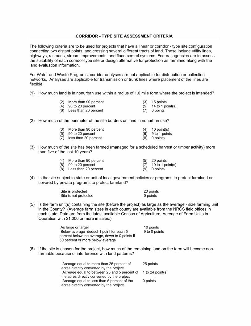
CORRIDOR - TYPE SITE ASSESSMENT CRITERIA
The following criteria are to be used for projects that have a linear or corridor - type site configurationconnecting two distant points, and crossing several different tracts of land. These include utility lines,highways, railroads, stream improvements, and flood control systems. Federal agencies are to assessthe suitability of each corridor-type site or design alternative for protection as farmland along with theland evaluation information.
For Water and Waste Programs, corridor analyses are not applicable for distribution or collectionnetworks. Analyses are applicable for transmission or trunk lines where placement of the lines areflexible.
(1) How much land is in nonurban use within a radius of 1.0 mile form where the project is intended?
(2) More than 90 percent (3) 15 points(4) 90 to 20 percent (5) 14 to 1 point(s).(6) Less than 20 percent (7) 0 points
(2) How much of the perimeter of the site borders on land in nonurban use?
(3) More than 90 percent (4) 10 point(s)(5) 90 to 20 percent (6) 9 to 1 points(7) less than 20 percent (8) 0 points
(3) How much of the site has been farmed (managed for a scheduled harvest or timber activity) morethan five of the last 10 years?
(4) More than 90 percent (5) 20 points(6) 90 to 20 percent (7) 19 to 1 point(s)(8) Less than 20 percent (9) 0 points
(4) Is the site subject to state or unit of local government policies or programs to protect farmland orcovered by private programs to protect farmland?
Site is protected 20 points Site is not protected 0 points
(5) Is the farm unit(s) containing the site (before the project) as large as the average - size farming unitin the County? (Average farm sizes in each county are available from the NRCS field offices ineach state. Data are from the latest available Census of Agriculture, Acreage of Farm Units inOperation with $1,000 or more in sales.)
As large or larger 10 points Below average deduct 1 point for each 5percent below the average, down to 0 points if50 percent or more below average
9 to 0 points
(6) If the site is chosen for the project, how much of the remaining land on the farm will become non-farmable because of interference with land patterns?
Acreage equal to more than 25 percent ofacres directly converted by the project
25 points
Acreage equal to between 25 and 5 percent ofthe acres directly convened by the project
1 to 24 point(s)
Acreage equal to less than 5 percent of theacres directly converted by the project
0 points
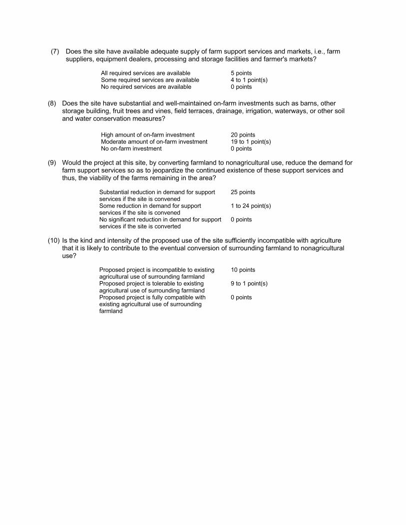
(7) Does the site have available adequate supply of farm support services and markets, i.e., farmsuppliers, equipment dealers, processing and storage facilities and farmer's markets?
All required services are available 5 points Some required services are available 4 to 1 point(s) No required services are available 0 points
(8) Does the site have substantial and well-maintained on-farm investments such as barns, otherstorage building, fruit trees and vines, field terraces, drainage, irrigation, waterways, or other soiland water conservation measures?
High amount of on-farm investment 20 points Moderate amount of on-farm investment 19 to 1 point(s) No on-farm investment 0 points
(9) Would the project at this site, by converting farmland to nonagricultural use, reduce the demand forfarm support services so as to jeopardize the continued existence of these support services andthus, the viability of the farms remaining in the area?
Substantial reduction in demand for supportservices if the site is convened
25 points
Some reduction in demand for supportservices if the site is convened
1 to 24 point(s)
No significant reduction in demand for supportservices if the site is converted
0 points
(10) Is the kind and intensity of the proposed use of the site sufficiently incompatible with agriculturethat it is likely to contribute to the eventual conversion of surrounding farmland to nonagriculturaluse?
Proposed project is incompatible to existingagricultural use of surrounding farmland
10 points
Proposed project is tolerable to existingagricultural use of surrounding farmland
9 to 1 point(s)
Proposed project is fully compatible withexisting agricultural use of surroundingfarmland
0 points
>>> "Vandenbosch, Bruce - Allegan, MI" <[email protected]> 1/5/2010 11:52 AM >>> Mark; I have completed and attached the Farmland Conversion Impact Rating form AD-1006 for the proposed Compact Power, Inc. (CPI) construction site in Holland, Allegan County, Michigan; for compliance with the Farmland Protection Policy Act. If you require further information please contact Bruce Van Den Bosch, NRCS District Conservationist Allegan, at the information below. Sincerely, Bruce Van Den Bosch USDA/NRCS Bruce Van Den Bosch District Conservationist 1668 Lincoln Rd. Allegan, MI 49010 PH: 269-673-6940 ext.3 FAX: 269-673-9671 email: [email protected] Helping People Help the Land
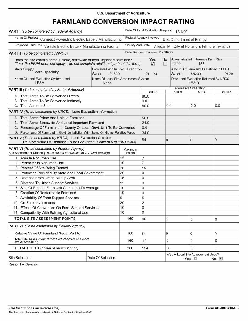
U.S. Department of Agriculture
FARMLAND CONVERSION IMPACT RATINGPART I (To be completed by Federal Agency) Date Of Land Evaluation Request
Name Of Project Federal Agency Involved
Proposed Land Use County And State
PART II (To be completed by NRCS) Date Request Received By NRCS
Does the site contain prime, unique, statewide or local important farmland?(If no, the FPPA does not apply -- do not complete additional parts of this form).
Acres Irrigated Average Farm Size
Major Crop(s) Farmable Land In Govt. Jurisdiction Amount Of Farmland As Defined in FPPA
Name Of Land Evaluation System Used Name Of Local Site Assessment System Date Land Evaluation Returned By NRCS
Yes No
Acres: % %Acres:
PART III (To be completed by Federal Agency) Alternative Site RatingSite A Site B Site C Site D
A. Total Acres To Be Converted DirectlyB. Total Acres To Be Converted IndirectlyC. Total Acres In Site
PART IV (To be completed by NRCS) Land Evaluation Information
A. Total Acres Prime And Unique FarmlandB. Total Acres Statewide And Local Important FarmlandC. Percentage Of Farmland In County Or Local Govt. Unit To Be ConvertedD. Percentage Of Farmland In Govt. Jurisdiction With Same Or Higher Relative Value
PART V (To be completed by NRCS) Land Evaluation Criterion Relative Value Of Farmland To Be Converted (Scale of 0 to 100 Points)
PART VI (To be completed by Federal Agency)Site Assessment Criteria (These criteria are explained in 7 CFR 658.5(b)
MaximumPoints
1. Area In Nonurban Use2. Perimeter In Nonurban Use3. Percent Of Site Being Farmed4. Protection Provided By State And Local Government5. Distance From Urban Builtup Area6. Distance To Urban Support Services7. Size Of Present Farm Unit Compared To Average8. Creation Of Nonfarmable Farmland9. Availability Of Farm Support Services
10. On-Farm Investments11. Effects Of Conversion On Farm Support Services12. Compatibility With Existing Agricultural Use
TOTAL SITE ASSESSMENT POINTS 160
PART VII (To be completed by Federal Agency)
Relative Value Of Farmland (From Part V) 100Total Site Assessment (From Part VI above or a localsite assessment) 160
TOTAL POINTS (Total of above 2 lines) 260
Site Selected: Date Of SelectionWas A Local Site Assessment Used?
Yes NoReason For Selection:
(See Instructions on reverse side) Form AD-1006 (10-83)This form was electronically produced by National Production Services Staff
12/1/09
Compact Power,Inc Electric Battery Manufacturing U.S. Department of Energy
Vehicle Electric Battery Manufacturing Facility Allegan,MI (City of Holland & Fillmore Twnshp)
✔ 9240 155
corn, specialty 401300 74 155200 29
LESA None 1/5/10
80.00.080.0 0.0 0.0 0.0
56.024.00.034.0
84 0 0 0
15 710 720 1920 015 015 010 010 05 520 210 010 0
40
0
84 0 0 0
0 0
■
0 0 0
40
124 0 0 0

Step 1 Federal agencies involved in proposed projects that may convert farmland, as defined in the Farmland ProtectionPolicy Act (FPPA) to nonagricultural uses, will initially complete Parts I and III of the form.
Step 2 -
-
Originator will send copies A, B and C together with maps indicating locations of site(s), to the Natural Resources Conservation Service (NRCS) local field office and retain copy D for their files. (Note: NRCS has a field office in most counties in the U.S. The field office is usually located in the county seat. A list of field office locations are available from the NRCS State Conservationist in each state).
Step 3 - NRCS will, within 45 calendar days after receipt of form, make a determination as to whether the site(s) of the pro-posed project contains prime, unique, statewide or local important farmland.
. Step ‘4 - In cases where farmland covered by the FPPA will be converted by the proposed project, NRCS field offices will com-plete Parts II, IV and V of the form.
Step 5 - NRCS will return copy A and B of the form to the Federal agency involved in the project. (Copy C will be retained forNRCS records).
Step 6 - The Federal agency involved in the proposed project will complete Parts VI and VII of the form.
Step 7 - The Federal agency involved in the proposed project will make a determination as to whether the proposed conver-sion is consistent with the FPPA and the agency’s internal policies.
INSTRUCTIONS FOR COMPLETING THE FARMLAND CONVERSION IMPACT RATING FORM
Part I: In completing the "County And State" questions list all the local governments that are responsiblefor local land controls where site(s) are to be evaluated.
Part III: In completing item B (Total Acres To Be Converted Indirectly), include the following:
1 . Acres not being directly converted but that would no longer be capable of being farmed after the conver- sion, because the conversion would restrict access to them.
2. Acres planned to receive services from an infrastructure project as indicated in the project justification(e.g. highways, utilities) that will cause a direct conversion.
Assign the maximum points for each site assessment criterion as shown in § 658.5 (b) of CFR. In cases of :
and will, be weighed zero, however, criterion #8 will be weighed a maximum of 25 points, and criterion#11 a maximum of 25 points.
Individual Federal agencies at the national level, may assign relative weights among the 12 site assessment criteria other than those shown in the FPPA rule. In all cases where other weights are assigned relative adjust-ments must be made to maintain the maximum total weight points at l60.
Federal agencies shall consider each of the criteria and assign points within the limits established in the FPPA rule. Sites most suitable for protection under these criteria will receive thehighest total scores, and sites least suitable, the lowest scores.
Part VII: In computing the "Total Site Assessment Points" where a State or local site assessment is used points is other than 160, adjust the site assessment points to a base of160.
Example: if the Site Assessment maximum is 200 points, and alternative Site "A" is rated 180 points:Total points x 160 = 144 points for Site “A.”
STEPS IN THE PROCESSING THE FARMLAND A N D CONVERSION IMPACT RATING FORM
Part VI: Do not complete Part VI if a local site assessment is used.
projects such as transportation, powerline and flood control, criteria #5 and #6 will not applycorridor-type
In rating alternative sites,
and the total maximum number of
200 assigned Site A = 180
Maximum points possible

Albany, OR • Morgantown, W V • Pi t tsburgh, PA
3610 Collins Ferry Road, P.O. Box 880, Morgantown, WV 26507
January 29, 2010
Environmental Review Coordinator State Historic Preservation Office Michigan Historical Center P.O. Box 30740 702 W. Kalamazoo St. Lansing, MI 48909-8240 SUBJECT: Compact Power, Inc. Battery Manufacturing Facility in Allegan County,
Michigan The U.S. Department of Energy (DOE) is submitting the attached Application for Section 106 Review for your review of the Compact Power, Inc. Battery Manufacturing Project as required by the National Historic Preservation Act. The Department is proposing to provide financial assistance to Compact Power, Inc. through the Electric Drive Vehicle Battery and Component Manufacturing Initiative of the American Reinvestment and Recovery Act. Funding to that company would be used to construct the Midland Battery Park, a facility for the manufacturing of advanced superior lithium polymer batteries for hybrid and electric vehicles. As further described in the application, the facility would be located in the City of Holland, Allegan County, Michigan. Please forward the results of your review and any requests for additional information to Mark Lusk of the Department’s National Energy Technology Laboratory using the contact information included in the application. Sincerely,
Mark Lusk NEPA Document Manager Attachments: Application for Section 106 Review (20 pages)
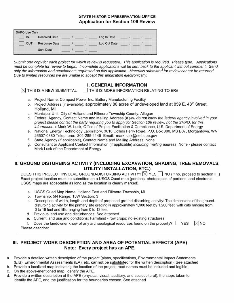
STATE HISTORIC PRESERVATION OFFICE Application for Section 106 Review
SHPO Use Only IN Received Date / / Log In Date / / OUT Response Date / / Log Out Date / / Sent Date / /
Submit one copy for each project for which review is requested. This application is required. Please type. Applications must be complete for review to begin. Incomplete applications will be sent back to the applicant without comment. Send only the information and attachments requested on this application. Materials submitted for review cannot be returned. Due to limited resources we are unable to accept this application electronically.
I. GENERAL INFORMATION THIS IS A NEW SUBMITTAL THIS IS MORE INFORMATION RELATING TO ER#
a. Project Name: Compact Power Inc. Battery Manufacturing Facility b. Project Address (if available): approximately 80 acres of undeveloped land at 859 E. 48th Street,
Holland, MI c. Municipal Unit: City of Holland and Fillmore Township County: Allegan d. Federal Agency, Contact Name and Mailing Address (If you do not know the federal agency involved in your
project please contact the party requiring you to apply for Section 106 review, not the SHPO, for this information.): Mark W. Lusk, Office of Project Facilitation & Compliance, U.S. Department of Energy
e. National Energy Technology Laboratory, 3610 Collins Ferry Road, P.O. Box 880, MS B07, Morgantown, WV 26507-0880 Telephone: 304-285-4145 Email: [email protected]
f. State Agency (if applicable), Contact Name and Mailing Address: None g. Consultant or Applicant Contact Information (if applicable) including mailing address: None - please contact
Mark Lusk of the Department of Energy
II. GROUND DISTURBING ACTIVITY (INCLUDING EXCAVATION, GRADING, TREE REMOVALS,
UTILITY INSTALLATION, ETC.) DOES THIS PROJECT INVOLVE GROUND-DISTURBING ACTIVITY? YES NO (If no, proceed to section III.) Exact project location must be submitted on a USGS Quad map (portions, photocopies of portions, and electronic USGS maps are acceptable as long as the location is clearly marked).
a. USGS Quad Map Name: Holland East and Fillmore Township, MI b. Township: 5N Range: 15W Section: 3 c. Description of width, length and depth of proposed ground disturbing activity: The dimensions of the ground-
disturbing activity for the primary site grading is approximately 1,900 feet by 1,200 feet, with cuts ranging from 0 to 19 feet and fills ranging from 0 to 13 feet.
d. Previous land use and disturbances: See attached e. Current land use and conditions: Farmland - row crops; no existing structures f. Does the landowner know of any archaeological resources found on the property? YES NO
Please describe:
III. PROJECT WORK DESCRIPTION AND AREA OF POTENTIAL EFFECTS (APE)
Note: Every project has an APE.
a. Provide a detailed written description of the project (plans, specifications, Environmental Impact Statements (EIS), Environmental Assessments (EA), etc. cannot be substituted for the written description): See attached
b. Provide a localized map indicating the location of the project; road names must be included and legible. c. On the above-mentioned map, identify the APE. d. Provide a written description of the APE (physical, visual, auditory, and sociocultural), the steps taken to
identify the APE, and the justification for the boundaries chosen. See attached
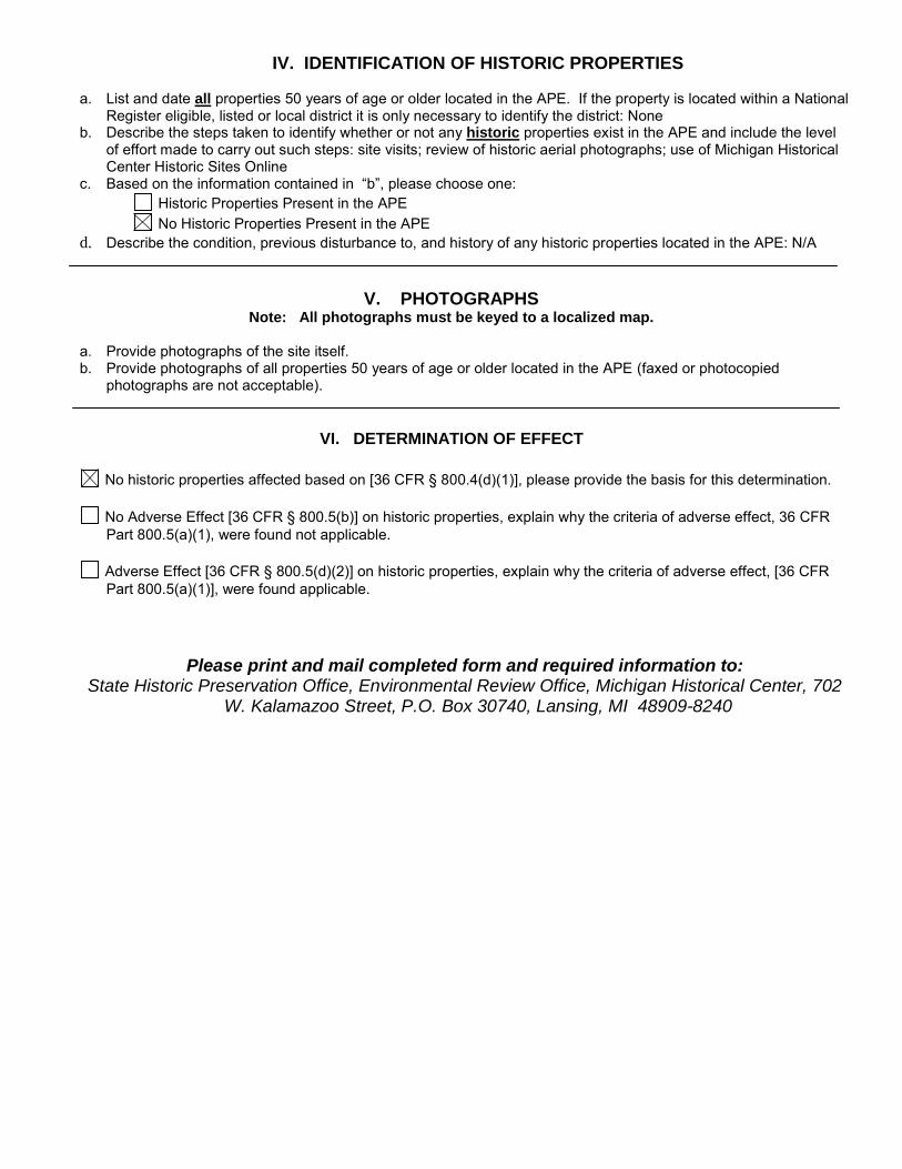
IV. IDENTIFICATION OF HISTORIC PROPERTIES
a. List and date all properties 50 years of age or older located in the APE. If the property is located within a National Register eligible, listed or local district it is only necessary to identify the district: None
b. Describe the steps taken to identify whether or not any historic properties exist in the APE and include the level of effort made to carry out such steps: site visits; review of historic aerial photographs; use of Michigan Historical Center Historic Sites Online
c. Based on the information contained in “b”, please choose one: Historic Properties Present in the APE No Historic Properties Present in the APE
d. Describe the condition, previous disturbance to, and history of any historic properties located in the APE: N/A
V. PHOTOGRAPHS
Note: All photographs must be keyed to a localized map.
a. Provide photographs of the site itself. b. Provide photographs of all properties 50 years of age or older located in the APE (faxed or photocopied
photographs are not acceptable).
VI. DETERMINATION OF EFFECT
No historic properties affected based on [36 CFR § 800.4(d)(1)], please provide the basis for this determination.
No Adverse Effect [36 CFR § 800.5(b)] on historic properties, explain why the criteria of adverse effect, 36 CFR Part 800.5(a)(1), were found not applicable.
Adverse Effect [36 CFR § 800.5(d)(2)] on historic properties, explain why the criteria of adverse effect, [36 CFR Part 800.5(a)(1)], were found applicable.
Please print and mail completed form and required information to: State Historic Preservation Office, Environmental Review Office, Michigan Historical Center, 702
W. Kalamazoo Street, P.O. Box 30740, Lansing, MI 48909-8240
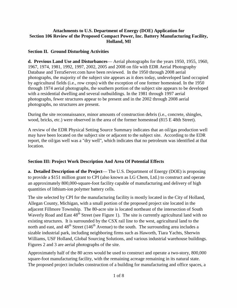
1 of 8
Attachments to U.S. Department of Energy (DOE) Application for Section 106 Review of the Proposed Compact Power, Inc. Battery Manufacturing Facility,
Holland, MI
Section II. Ground Disturbing Activities
d. Previous Land Use and Disturbances— Aerial photographs for the years 1950, 1955, 1960, 1967, 1974, 1981, 1992, 1997, 2002, 2005 and 2008 on file with EDR Aerial Photography Database and TerraServer.com have been reviewed. In the 1950 through 2008 aerial photographs, the majority of the subject site appears as it does today, undeveloped land occupied by agricultural fields (i.e., row crops) with the exception of one former homestead. In the 1950 through 1974 aerial photographs, the southern portion of the subject site appears to be developed with a residential dwelling and several outbuildings. In the 1981 through 1997 aerial photographs, fewer structures appear to be present and in the 2002 through 2008 aerial photographs, no structures are present.
During the site reconnaissance, minor amounts of construction debris (i.e., concrete, shingles, wood, bricks, etc.) were observed in the area of the former homestead (815 E 48th Street).
A review of the EDR Physical Setting Source Summary indicates that an oil/gas production well may have been located on the subject site or adjacent to the subject site. According to the EDR report, the oil/gas well was a "dry well", which indicates that no petroleum was identified at that location.
Section III: Project Work Description And Area Of Potential Effects
a. Detailed Description of the Project— The U.S. Department of Energy (DOE) is proposing to provide a $151 million grant to CPI (also known as LG Chem, Ltd.) to construct and operate an approximately 800,000-square-foot facility capable of manufacturing and delivery of high quantities of lithium-ion polymer battery cells.
The site selected by CPI for the manufacturing facility is mostly located in the City of Holland, Allegan County, Michigan, with a small portion of the proposed project site located in the adjacent Fillmore Township. The 80-acre site is located northeast of the intersection of South Waverly Road and East 48th Street (see Figure 1). The site is currently agricultural land with no existing structures. It is surrounded by the CSX rail line to the west, agricultural land to the north and east, and 48th Street (146th Avenue) to the south. The surrounding area includes a sizable industrial park, including neighboring firms such as Haworth, Tiara Yachts, Sherwin Williams, USF Holland, Global Sourcing Solutions, and various industrial warehouse buildings. Figures 2 and 3 are aerial photographs of the site.
Approximately half of the 80 acres would be used to construct and operate a two-story, 800,000 square-foot manufacturing facility, with the remaining acreage remaining in its natural state. The proposed project includes construction of a building for manufacturing and office spaces, a
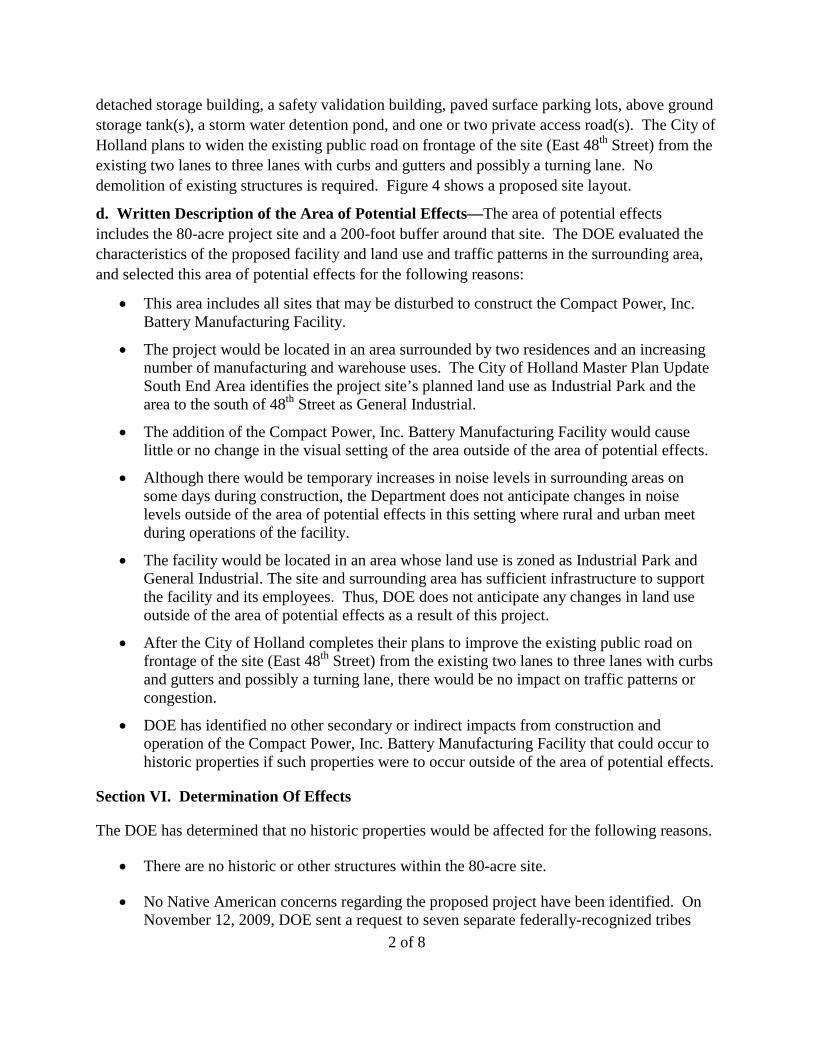
2 of 8
detached storage building, a safety validation building, paved surface parking lots, above ground storage tank(s), a storm water detention pond, and one or two private access road(s). The City of Holland plans to widen the existing public road on frontage of the site (East 48th Street) from the existing two lanes to three lanes with curbs and gutters and possibly a turning lane. No demolition of existing structures is required. Figure 4 shows a proposed site layout.
d. Written Description of the Area of Potential Effects—The area of potential effects includes the 80-acre project site and a 200-foot buffer around that site. The DOE evaluated the characteristics of the proposed facility and land use and traffic patterns in the surrounding area, and selected this area of potential effects for the following reasons:
• This area includes all sites that may be disturbed to construct the Compact Power, Inc. Battery Manufacturing Facility.
• The project would be located in an area surrounded by two residences and an increasing number of manufacturing and warehouse uses. The City of Holland Master Plan Update South End Area identifies the project site’s planned land use as Industrial Park and the area to the south of 48th Street as General Industrial.
• The addition of the Compact Power, Inc. Battery Manufacturing Facility would cause little or no change in the visual setting of the area outside of the area of potential effects.
• Although there would be temporary increases in noise levels in surrounding areas on some days during construction, the Department does not anticipate changes in noise levels outside of the area of potential effects in this setting where rural and urban meet during operations of the facility.
• The facility would be located in an area whose land use is zoned as Industrial Park and General Industrial. The site and surrounding area has sufficient infrastructure to support the facility and its employees. Thus, DOE does not anticipate any changes in land use outside of the area of potential effects as a result of this project.
• After the City of Holland completes their plans to improve the existing public road on frontage of the site (East 48th Street) from the existing two lanes to three lanes with curbs and gutters and possibly a turning lane, there would be no impact on traffic patterns or congestion.
• DOE has identified no other secondary or indirect impacts from construction and operation of the Compact Power, Inc. Battery Manufacturing Facility that could occur to historic properties if such properties were to occur outside of the area of potential effects.
Section VI. Determination Of Effects
The DOE has determined that no historic properties would be affected for the following reasons.
• There are no historic or other structures within the 80-acre site.
• No Native American concerns regarding the proposed project have been identified. On November 12, 2009, DOE sent a request to seven separate federally-recognized tribes

3 of 8
chosen according to the U.S. Department of Housing and Urban Development – Office of Community Planning and Development – Environmental Planning Division (Citizen Potawatomi Nation, Forest County Potawatomi Community, Hannahville Indian Community, Match-e-be-nash-she-wish Band of Potawatomi, Ottawa Tribe of Oklahoma, Pokagon Band of Potawatomi Indians, and the Prairie Band of Potawatomi Nation) for information those tribes have, and are interested in sharing, on properties of traditional religious and cultural significance within the vicinity of the project site, and any comments or concerns they have on the potential for this project to affect those properties. No responses have been received as of January 27, 2010.
• It is very unlikely that there are archeological sites within the project site that would be eligible for inclusion in the National Register of Historic Places because of the characteristics of the non-stratified surface soils in the area and because the site has been disturbed in the past for farming and oil well drilling.
Figure 1.

Figure 2.
Figure 3.
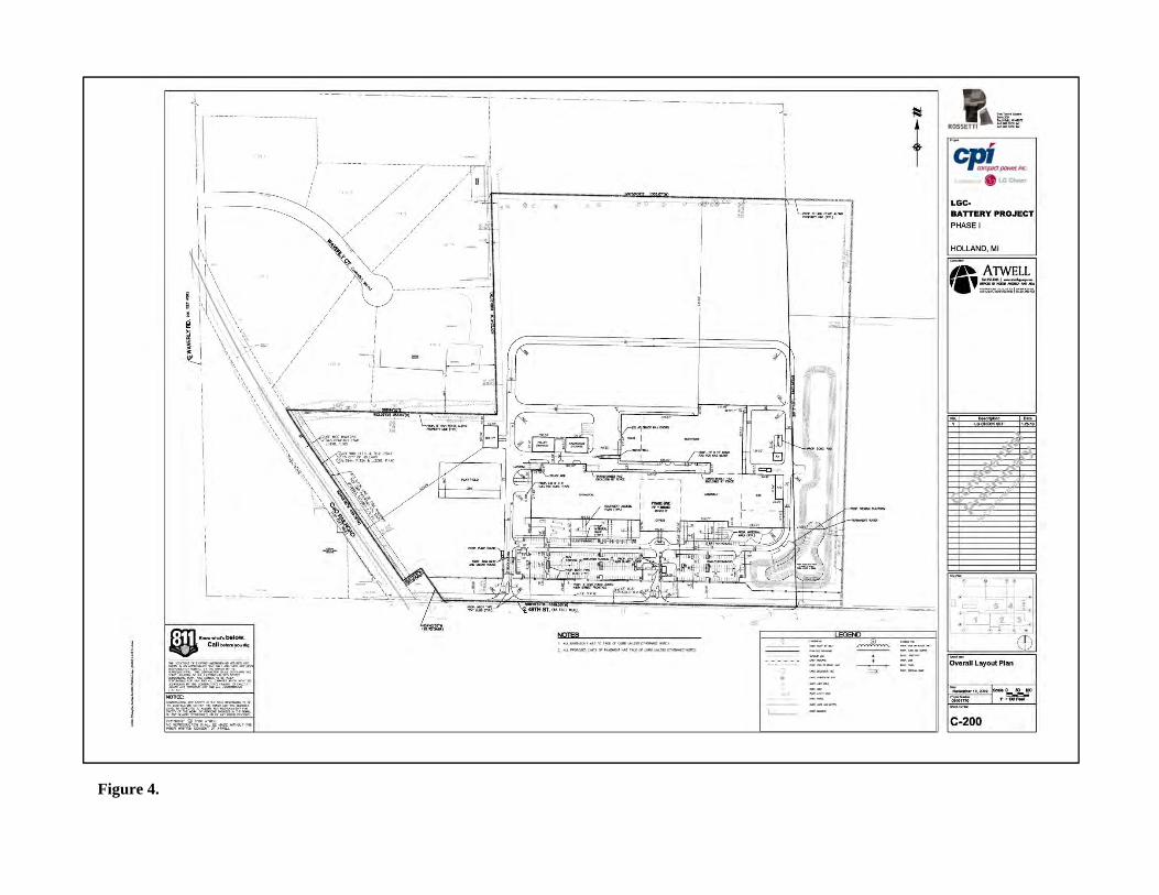
Figure 4.
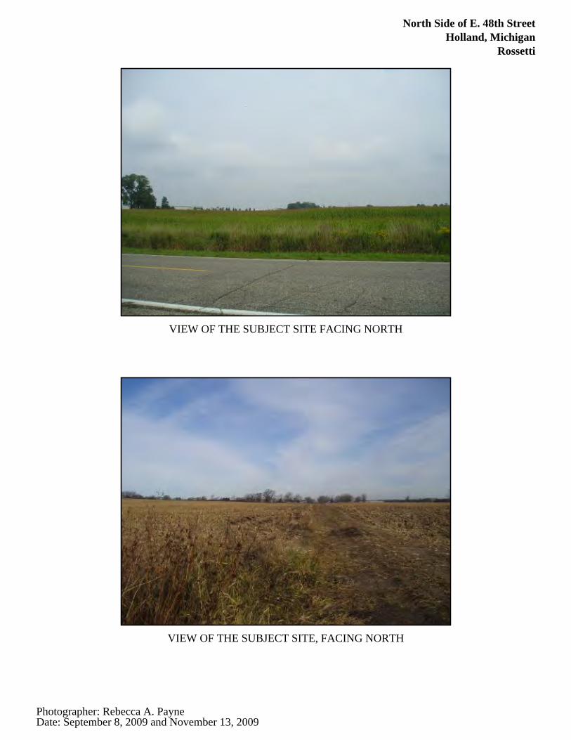
North Side of E. 48th StreetHolland, Michigan
Rossetti
VIEW OF THE SUBJECT SITE FACING NORTH
VIEW OF THE SUBJECT SITE, FACING NORTH
Photographer: Rebecca A. PayneDate: September 8, 2009 and November 13, 2009
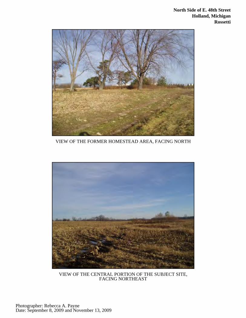
North Side of E. 48th StreetHolland, Michigan
Rossetti
VIEW OF THE FORMER HOMESTEAD AREA, FACING NORTH
VIEW OF THE CENTRAL PORTION OF THE SUBJECT SITE,FACING NORTHEAST
Photographer: Rebecca A. PayneDate: September 8, 2009 and November 13, 2009
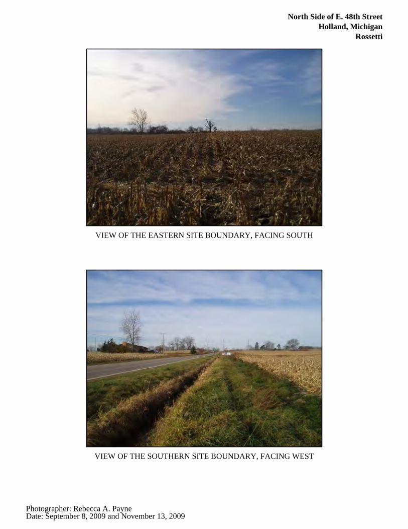
North Side of E. 48th StreetHolland, Michigan
Rossetti
VIEW OF THE EASTERN SITE BOUNDARY, FACING SOUTH
VIEW OF THE SOUTHERN SITE BOUNDARY, FACING WEST
Photographer: Rebecca A. PayneDate: September 8, 2009 and November 13, 2009
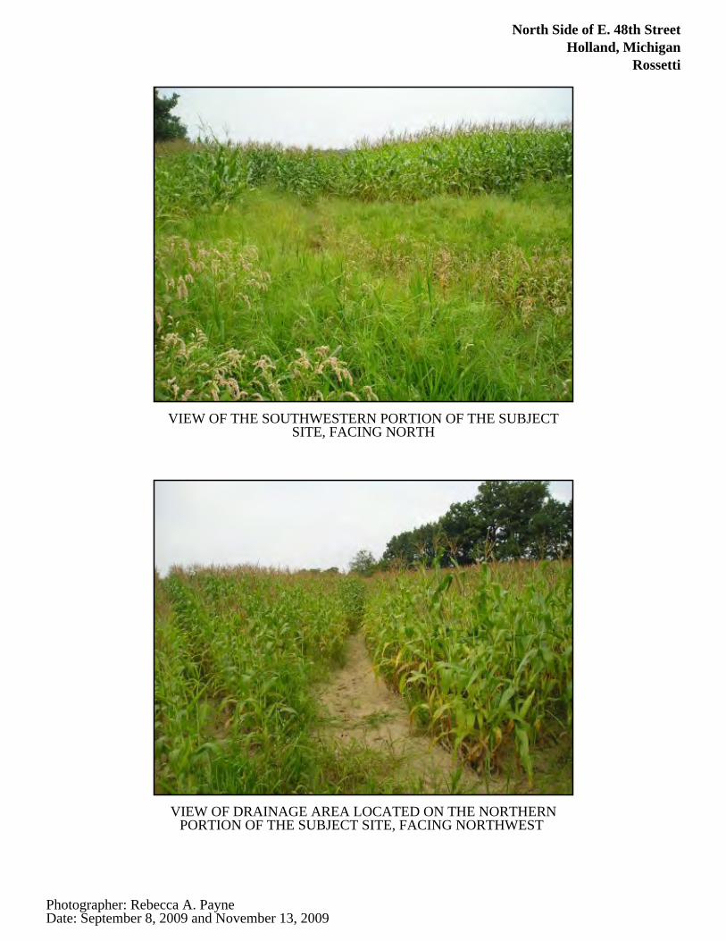
North Side of E. 48th StreetHolland, Michigan
Rossetti
VIEW OF THE SOUTHWESTERN PORTION OF THE SUBJECTSITE, FACING NORTH
VIEW OF DRAINAGE AREA LOCATED ON THE NORTHERNPORTION OF THE SUBJECT SITE, FACING NORTHWEST
Photographer: Rebecca A. PayneDate: September 8, 2009 and November 13, 2009
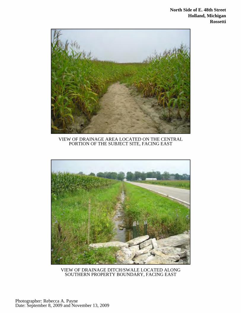
North Side of E. 48th StreetHolland, Michigan
Rossetti
VIEW OF DRAINAGE AREA LOCATED ON THE CENTRALPORTION OF THE SUBJECT SITE, FACING EAST
VIEW OF DRAINAGE DITCH/SWALE LOCATED ALONGSOUTHERN PROPERTY BOUNDARY, FACING EAST
Photographer: Rebecca A. PayneDate: September 8, 2009 and November 13, 2009
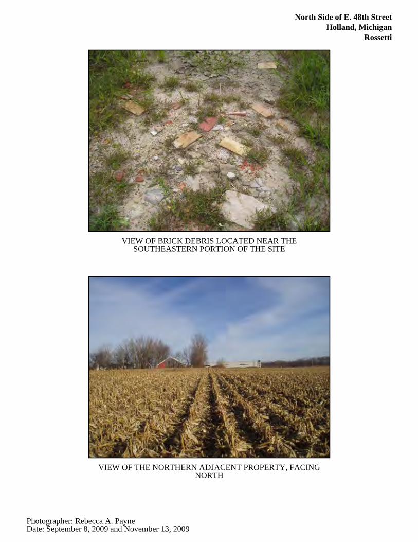
North Side of E. 48th StreetHolland, Michigan
Rossetti
VIEW OF BRICK DEBRIS LOCATED NEAR THESOUTHEASTERN PORTION OF THE SITE
VIEW OF THE NORTHERN ADJACENT PROPERTY, FACINGNORTH
Photographer: Rebecca A. PayneDate: September 8, 2009 and November 13, 2009
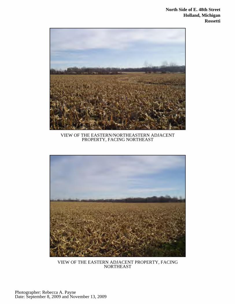
North Side of E. 48th StreetHolland, Michigan
Rossetti
VIEW OF THE EASTERN/NORTHEASTERN ADJACENTPROPERTY, FACING NORTHEAST
VIEW OF THE EASTERN ADJACENT PROPERTY, FACINGNORTHEAST
Photographer: Rebecca A. PayneDate: September 8, 2009 and November 13, 2009
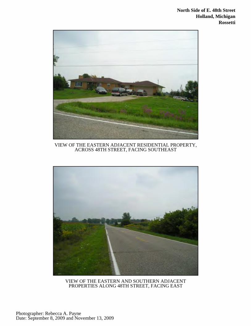
North Side of E. 48th StreetHolland, Michigan
Rossetti
VIEW OF THE EASTERN ADJACENT RESIDENTIAL PROPERTY,ACROSS 48TH STREET, FACING SOUTHEAST
VIEW OF THE EASTERN AND SOUTHERN ADJACENTPROPERTIES ALONG 48TH STREET, FACING EAST
Photographer: Rebecca A. PayneDate: September 8, 2009 and November 13, 2009
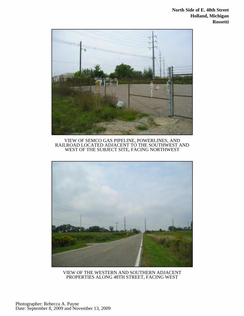
North Side of E. 48th StreetHolland, Michigan
Rossetti
VIEW OF SEMCO GAS PIPELINE, POWERLINES, ANDRAILROAD LOCATED ADJACENT TO THE SOUTHWEST AND
WEST OF THE SUBJECT SITE, FACING NORTHWEST
VIEW OF THE WESTERN AND SOUTHERN ADJACENTPROPERTIES ALONG 48TH STREET, FACING WEST
Photographer: Rebecca A. PayneDate: September 8, 2009 and November 13, 2009
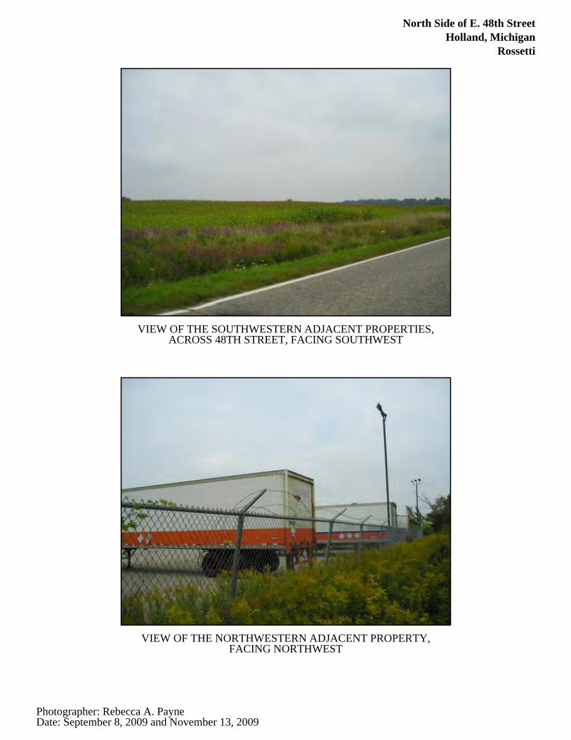
North Side of E. 48th StreetHolland, Michigan
Rossetti
VIEW OF THE SOUTHWESTERN ADJACENT PROPERTIES,ACROSS 48TH STREET, FACING SOUTHWEST
VIEW OF THE NORTHWESTERN ADJACENT PROPERTY,FACING NORTHWEST
Photographer: Rebecca A. PayneDate: September 8, 2009 and November 13, 2009
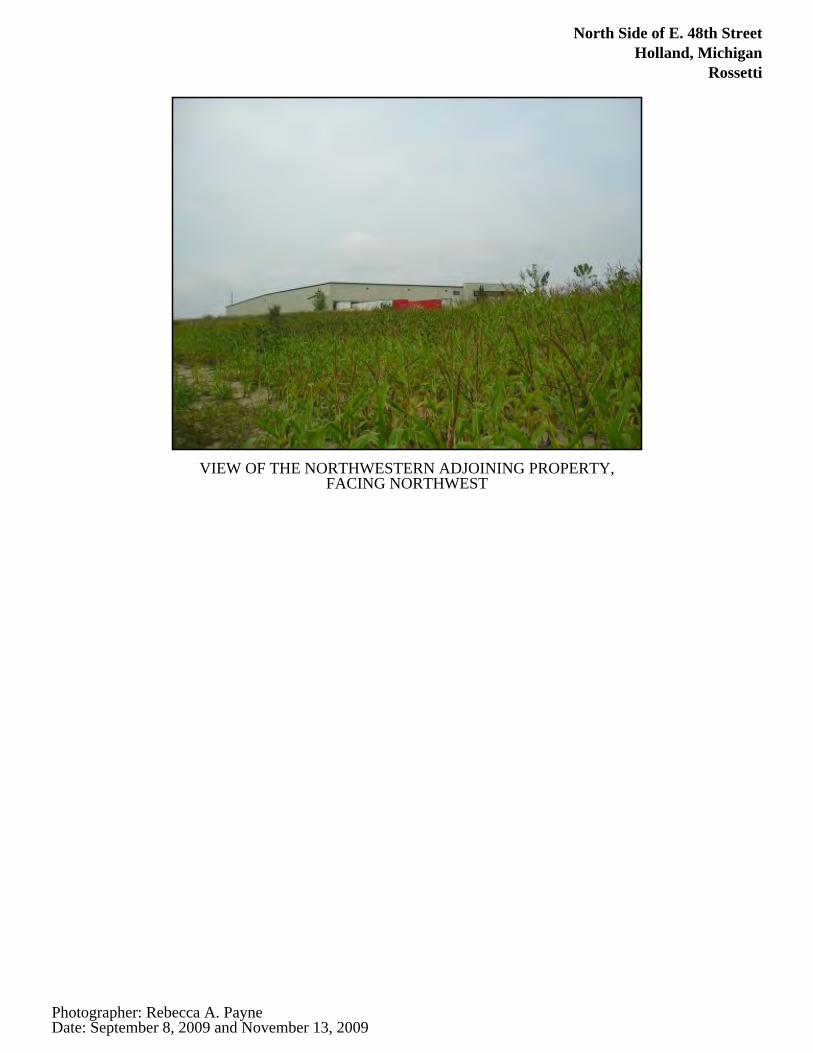
North Side of E. 48th StreetHolland, Michigan
Rossetti
VIEW OF THE NORTHWESTERN ADJOINING PROPERTY,FACING NORTHWEST
Photographer: Rebecca A. PayneDate: September 8, 2009 and November 13, 2009
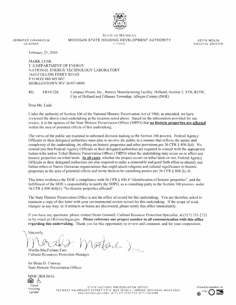
Appendix C. Part 303 Wetland Permit Application, Wetland Impact Assessment and Compensatory Mitigation Proposal
DOE/EA-1709 C-1
APPENDIX C. PART 303 WETLAND PERMIT APPLICATION, WETLAND IMPACT ASSESSMENT AND COMPENSATORY
MITIGATION PROPOSAL
On January 28, 2010, Compact Power, Inc. submitted a Part 303 Wetland Permit Application, which contains a compensatory mitigation proposal, to the Michigan Department of Natural Resources and Environment. The application and proposal are contained in this appendix.

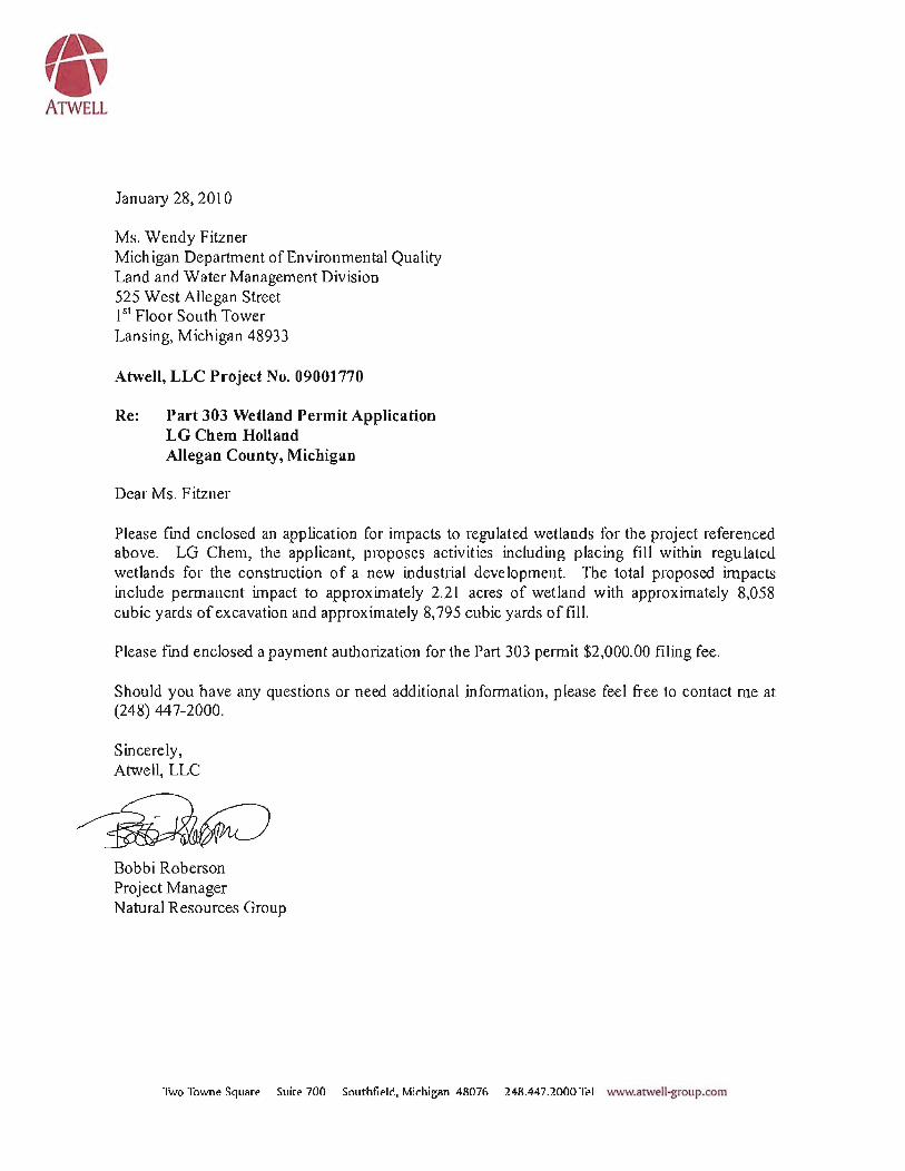
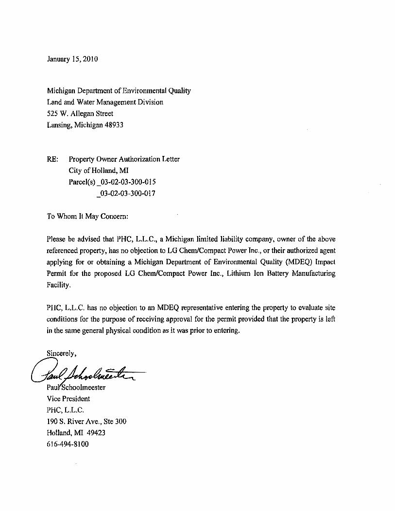

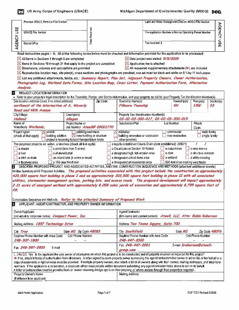
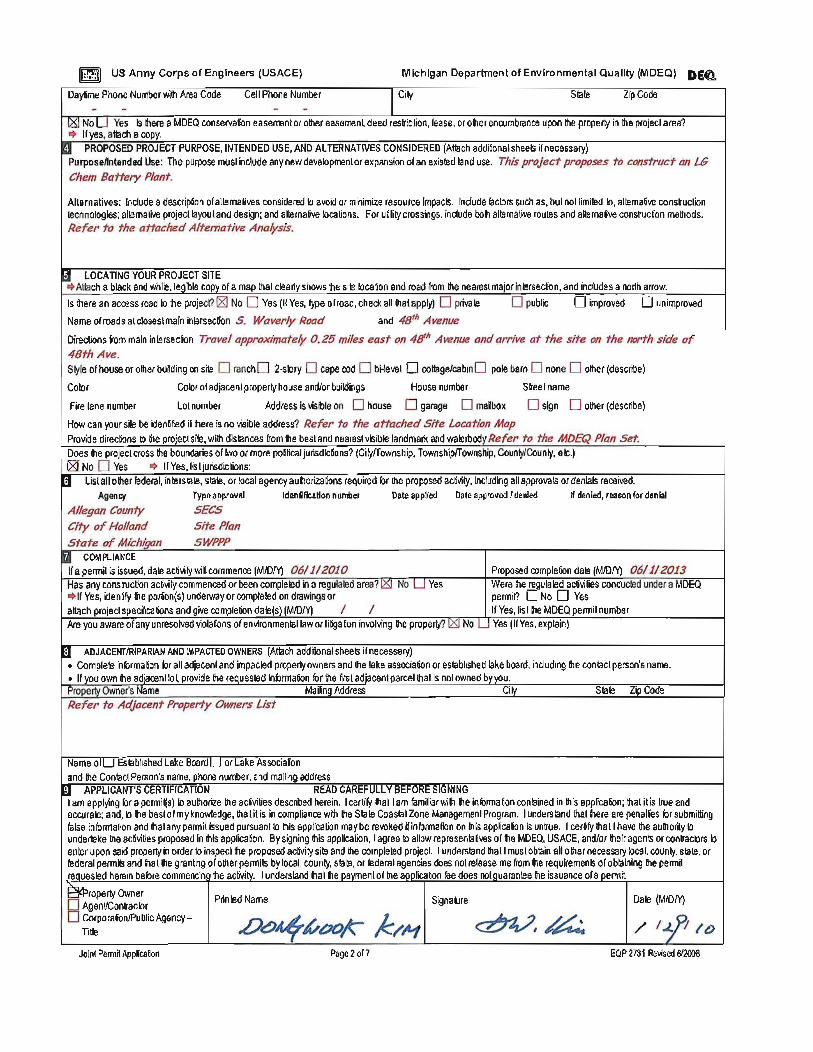
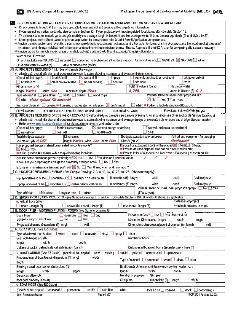
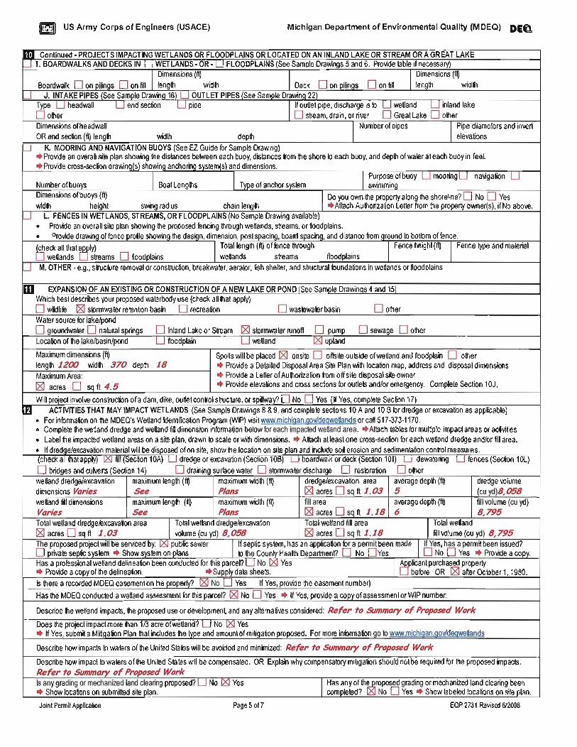
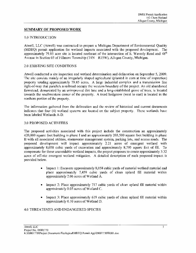

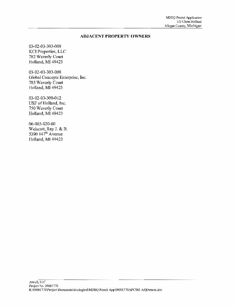
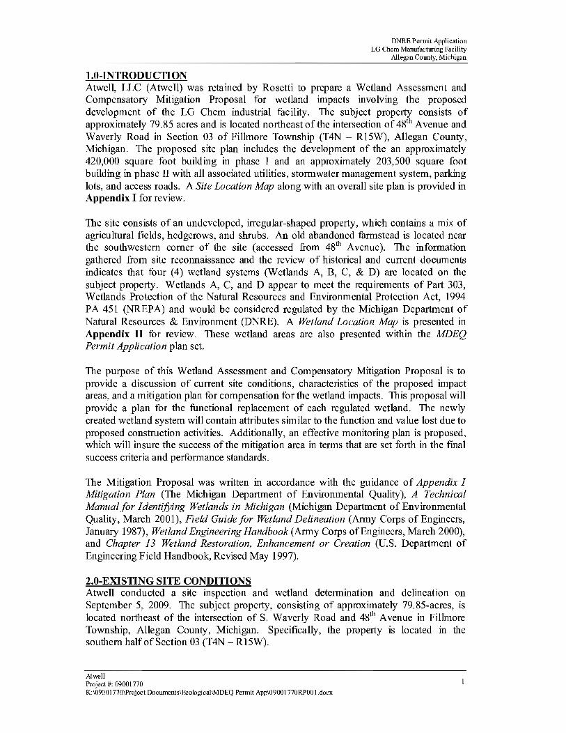


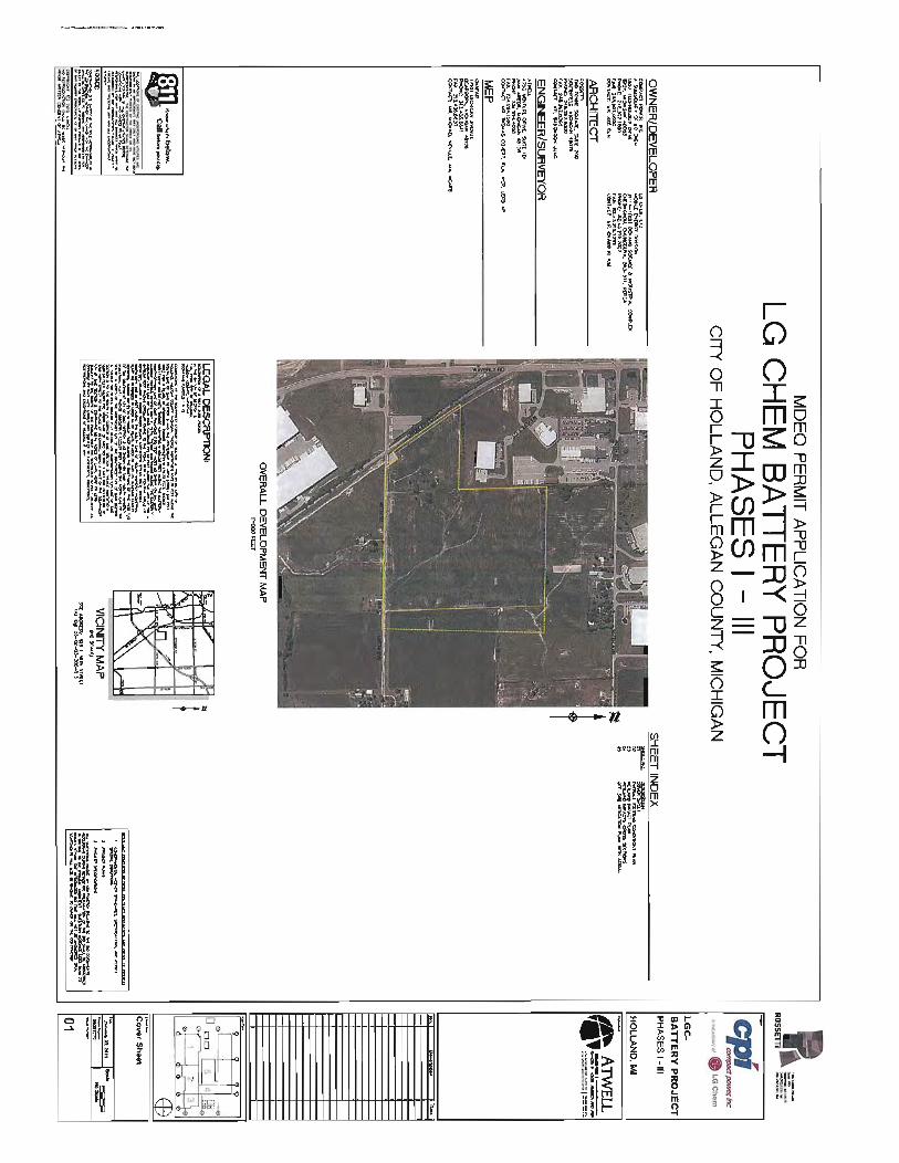
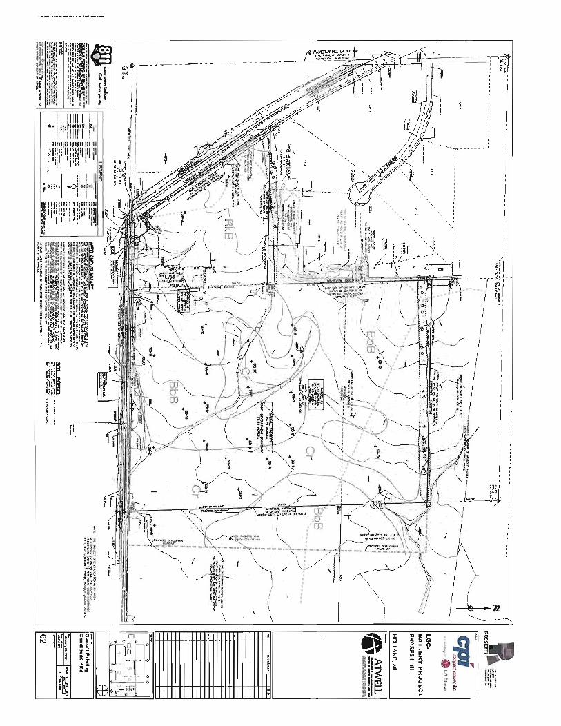


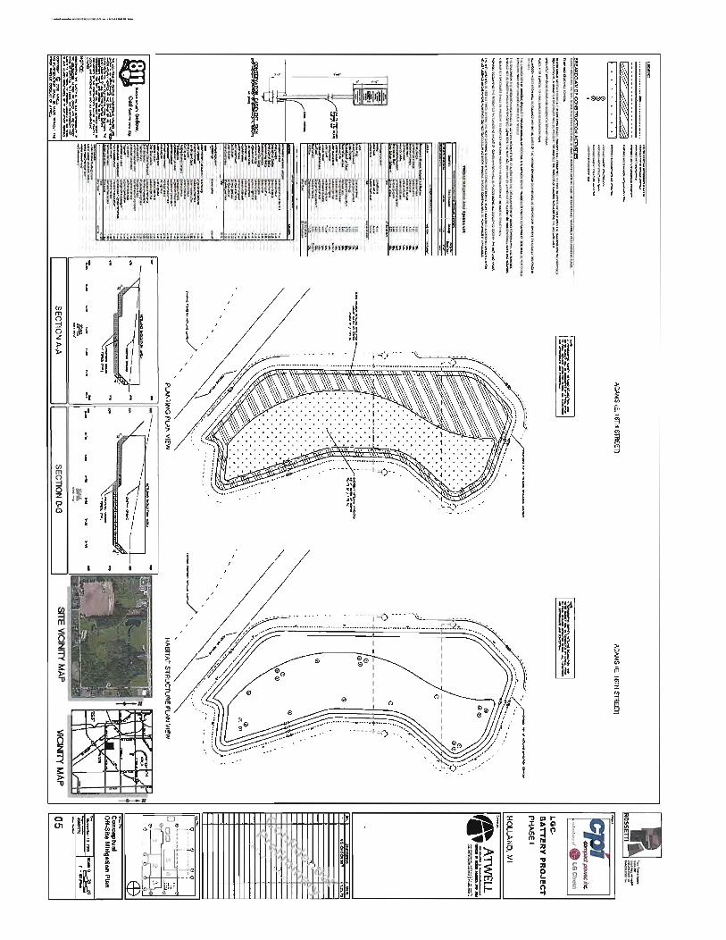

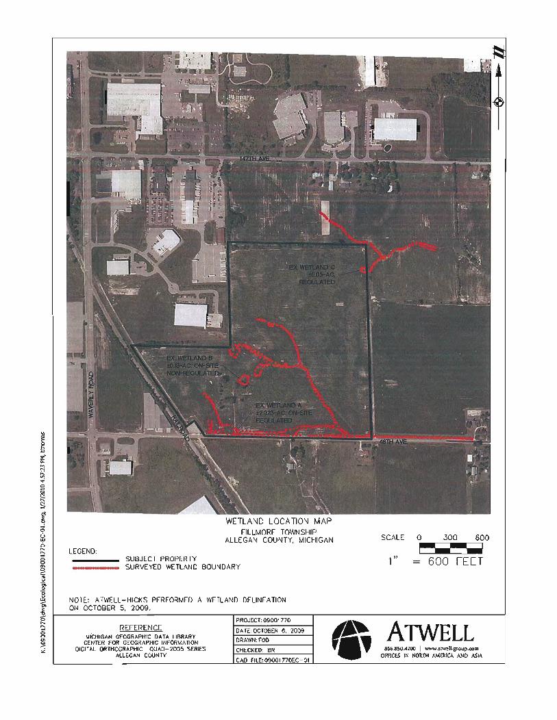

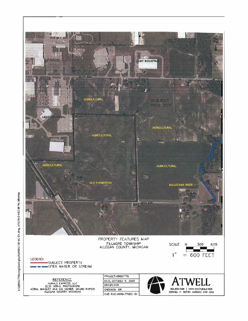
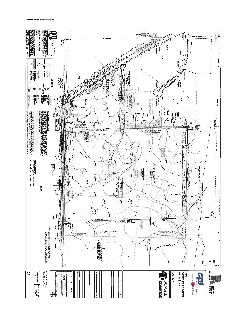

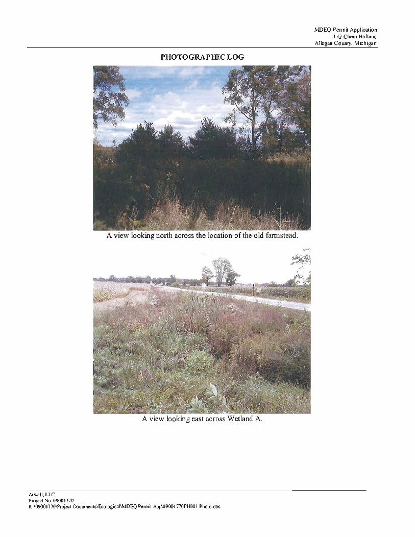
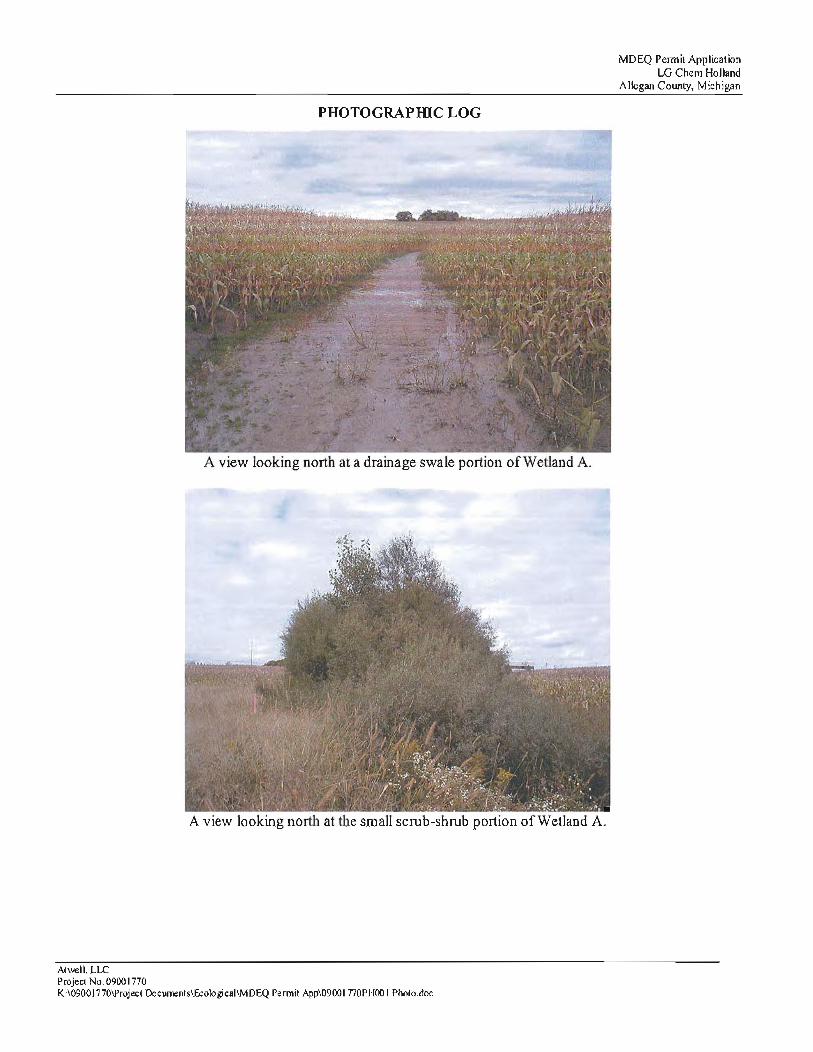
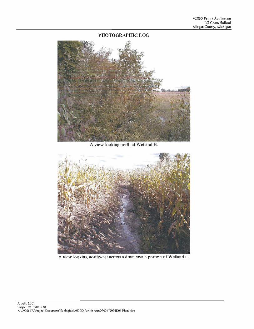
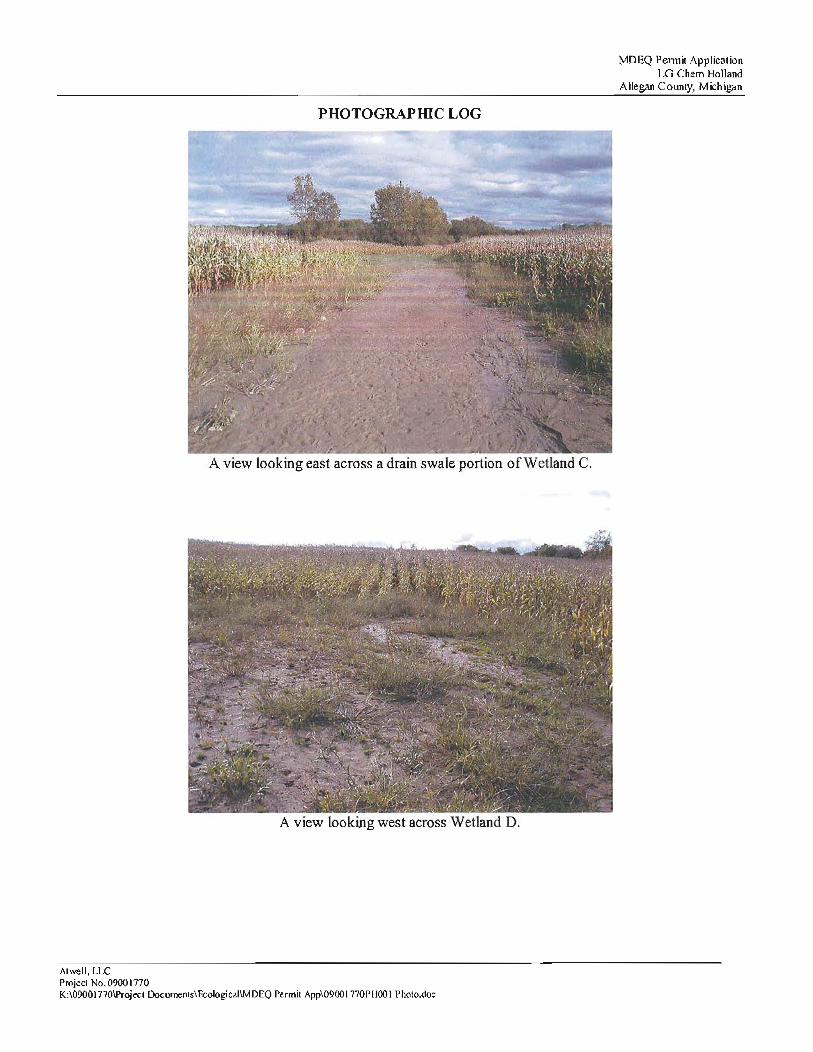

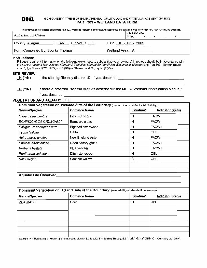
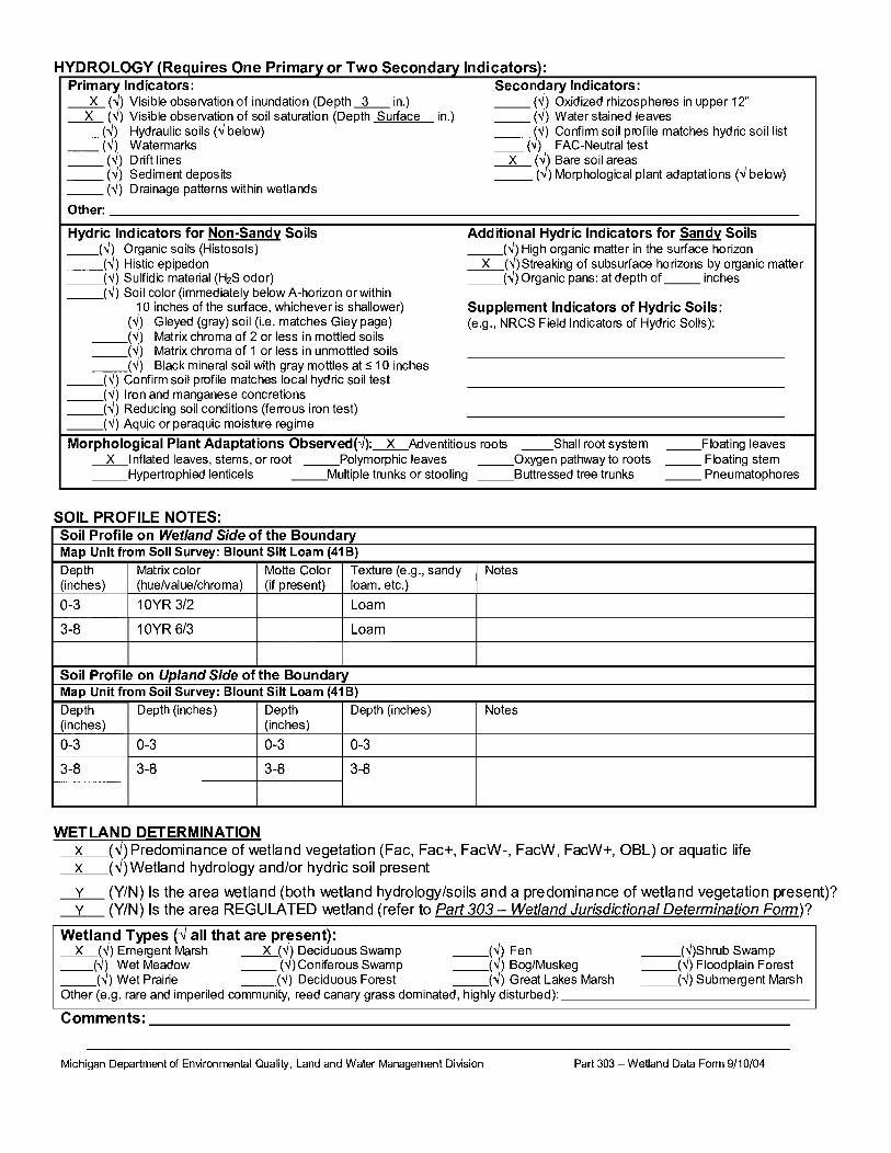
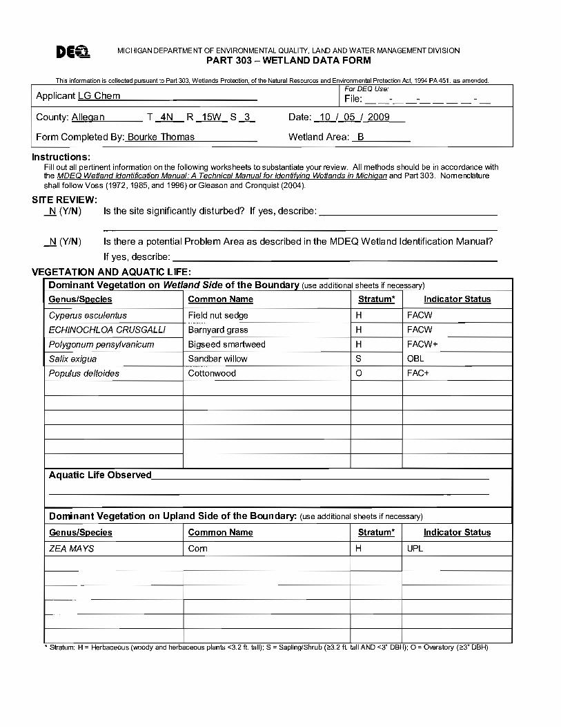
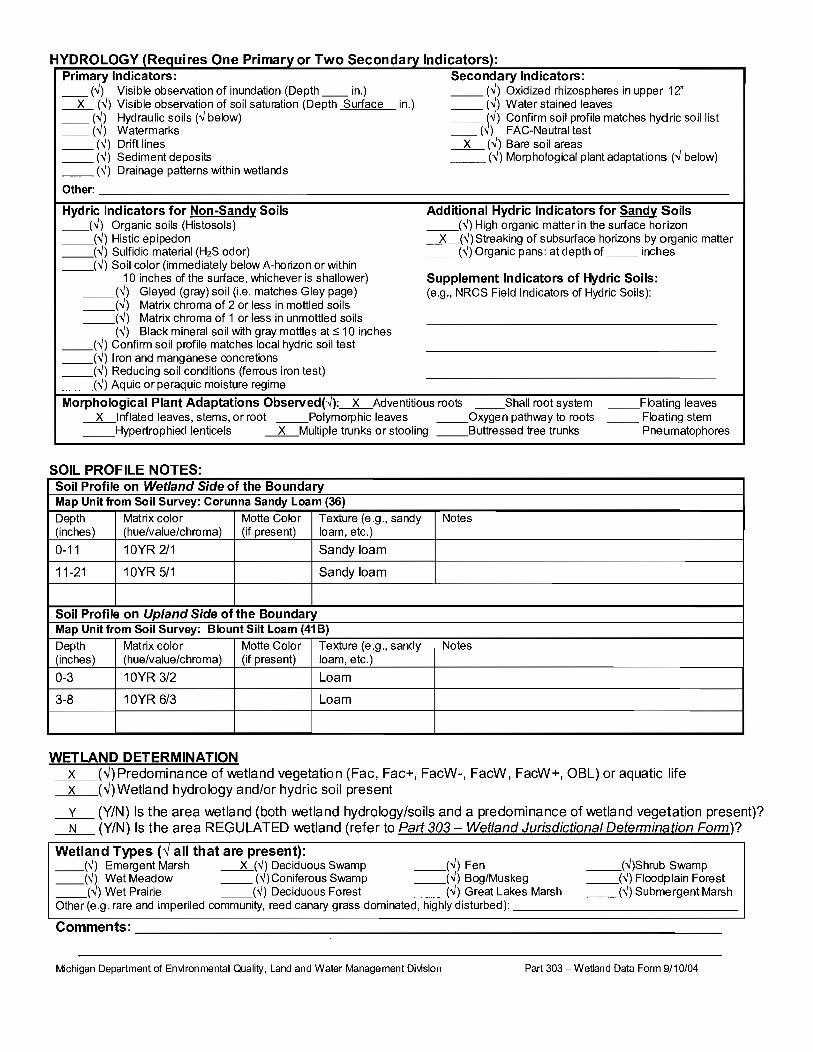
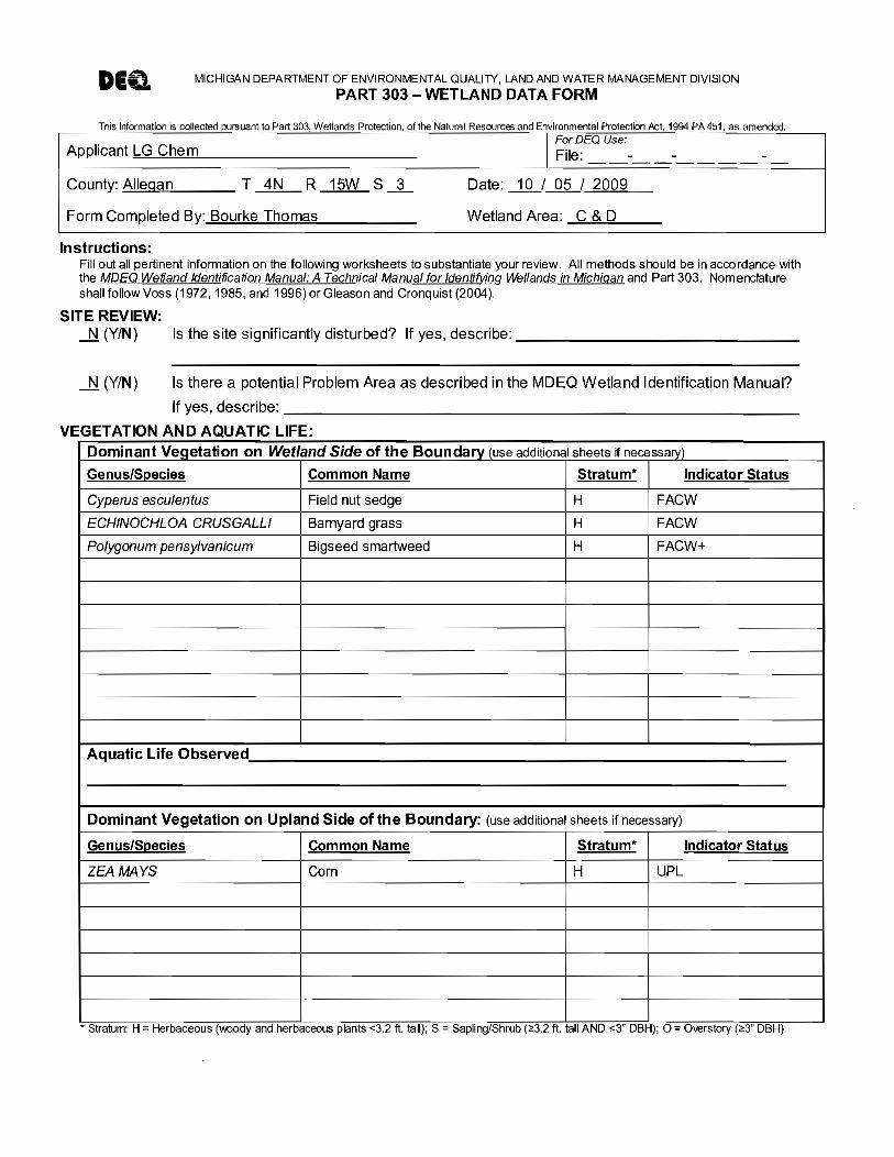
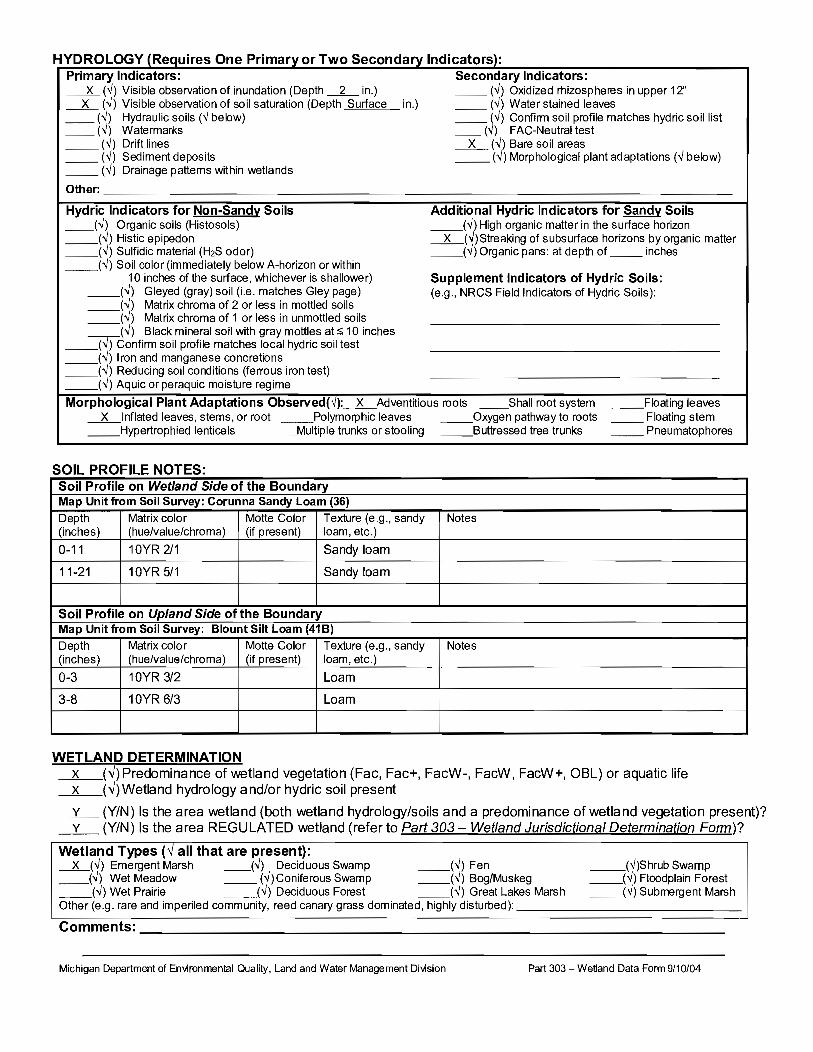
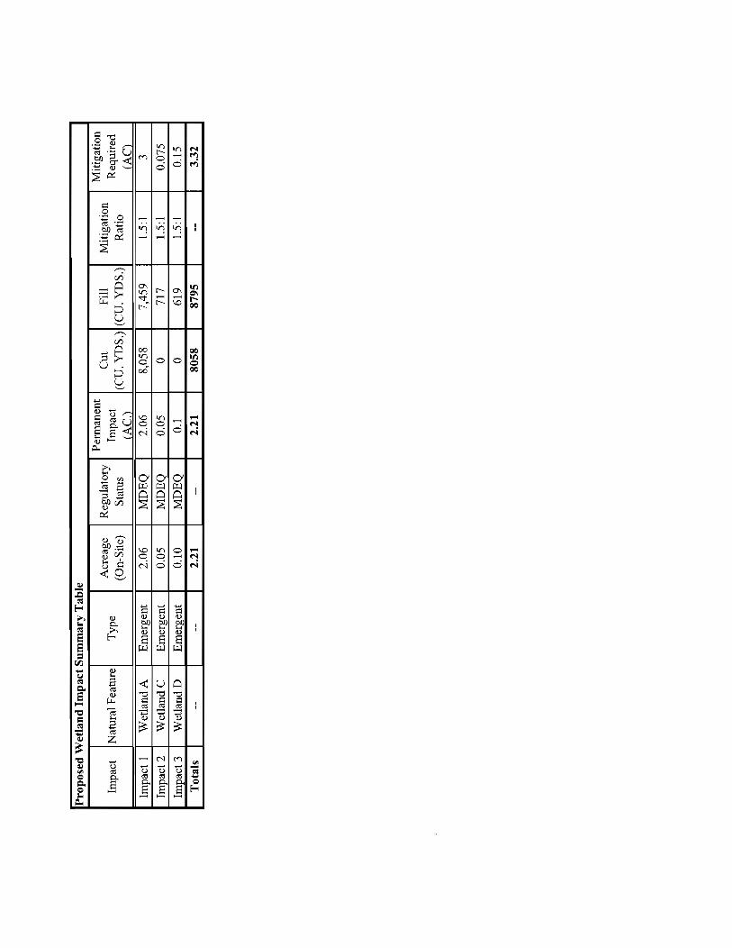
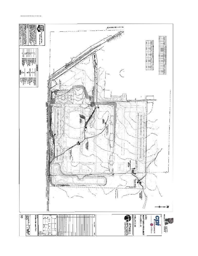
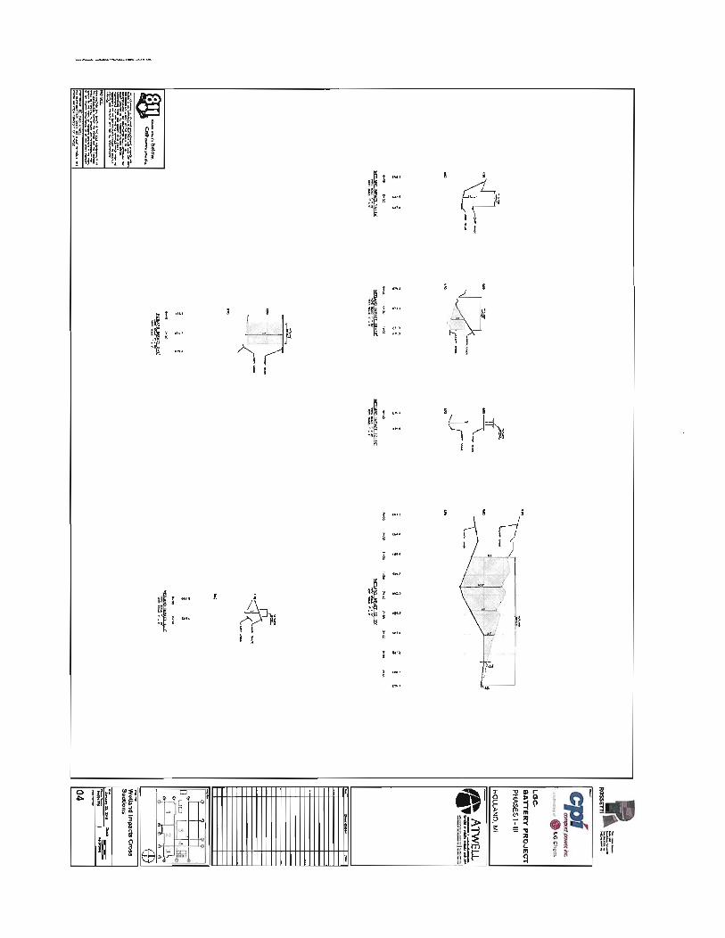

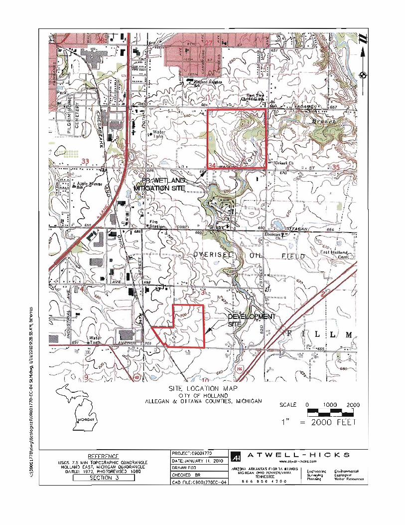

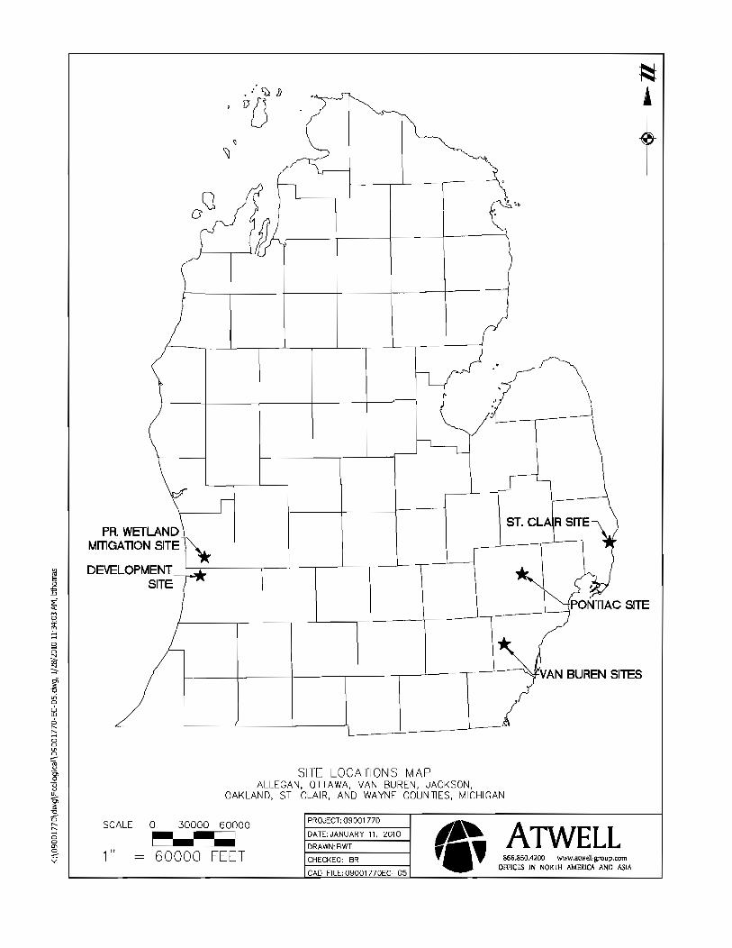

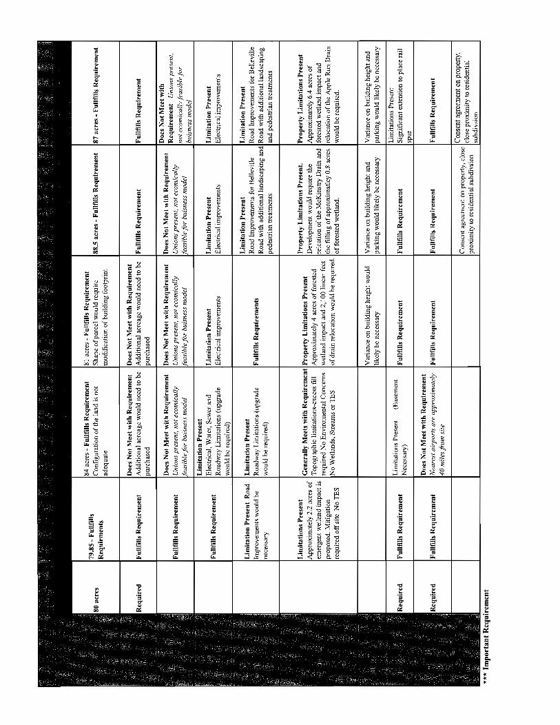

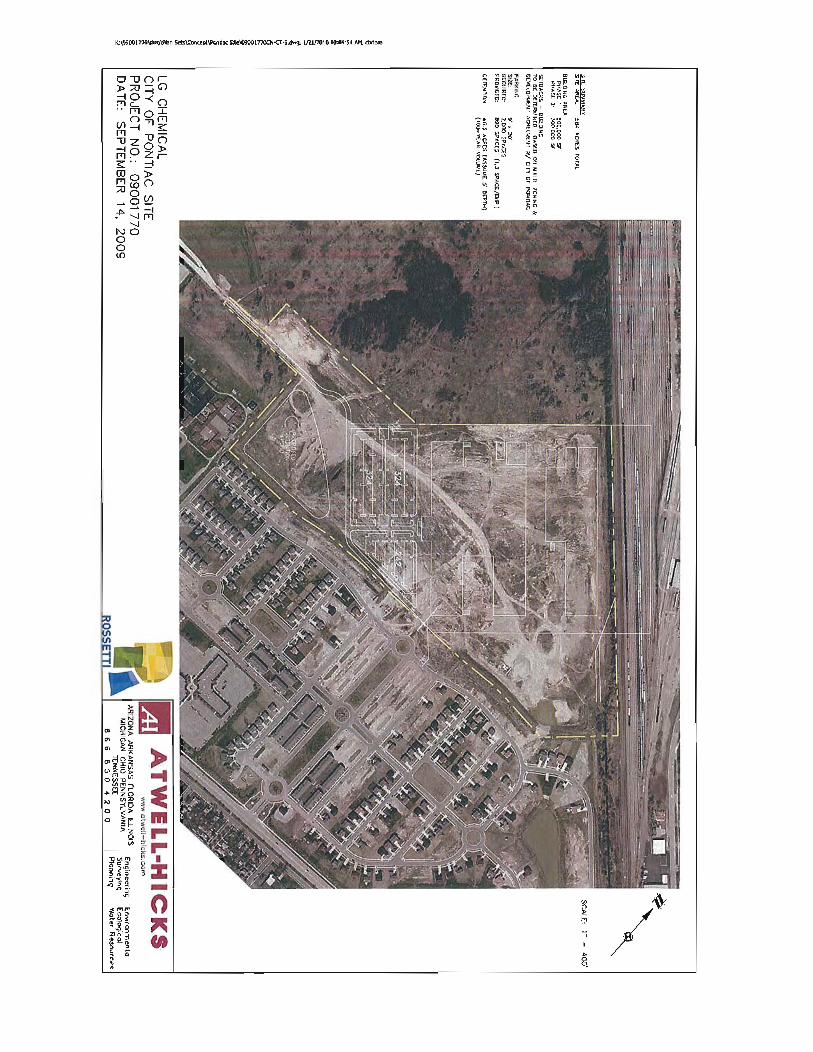

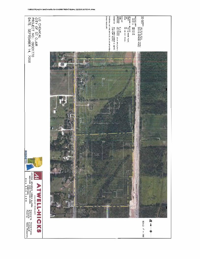

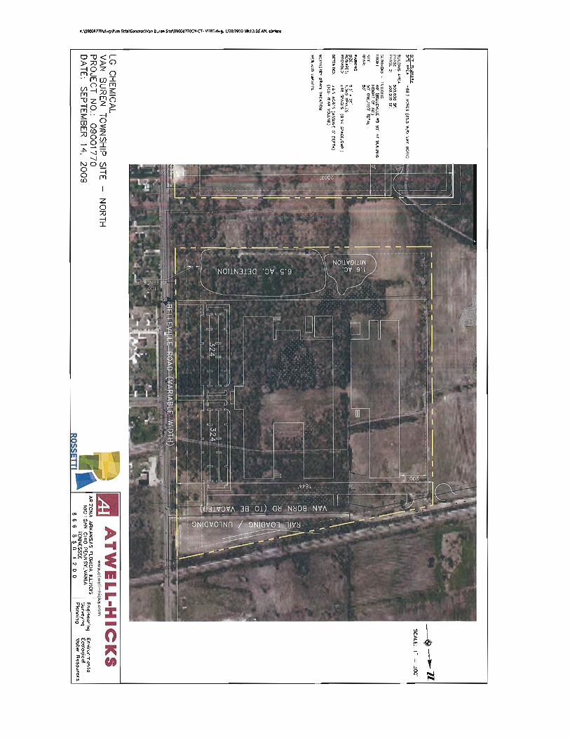
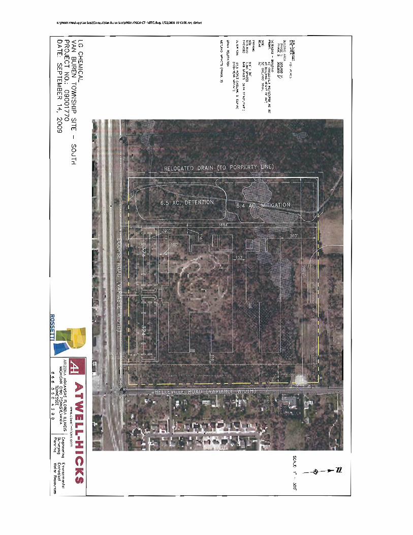
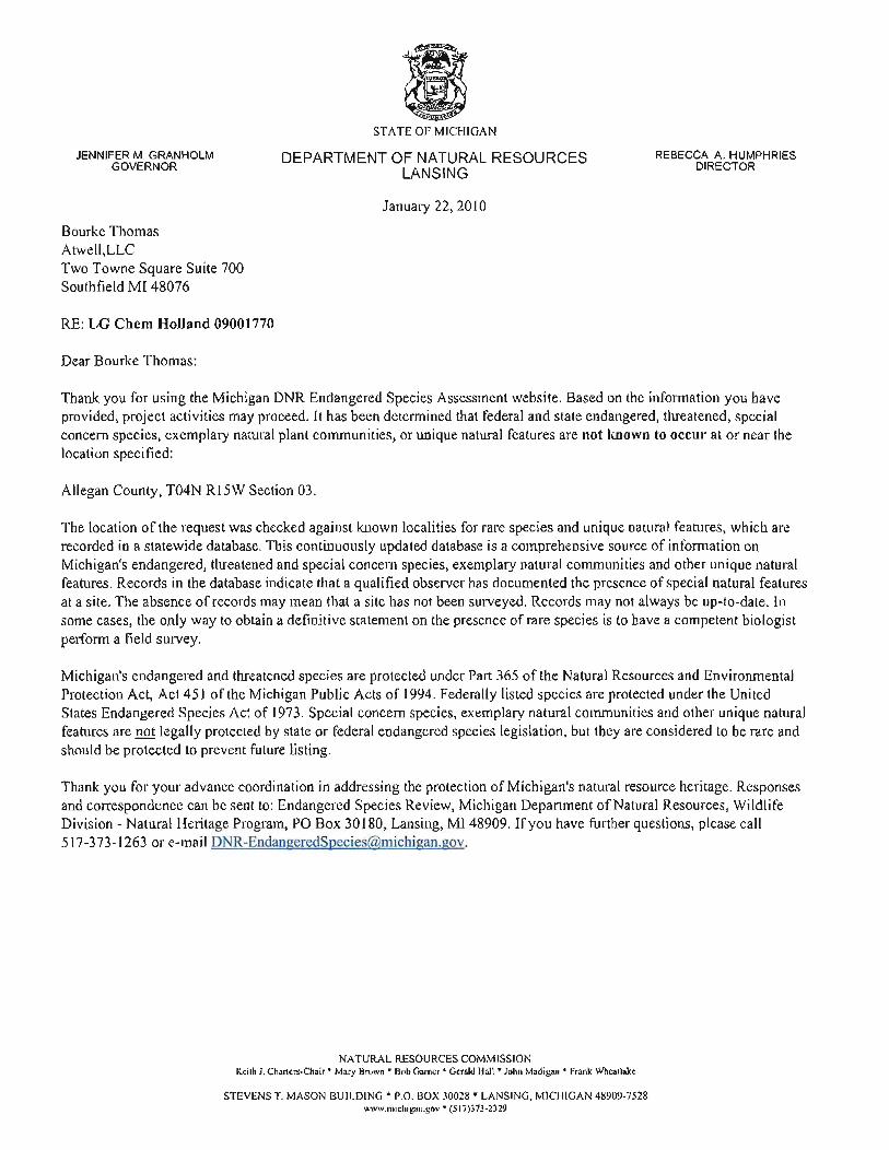
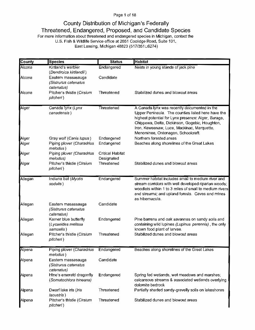

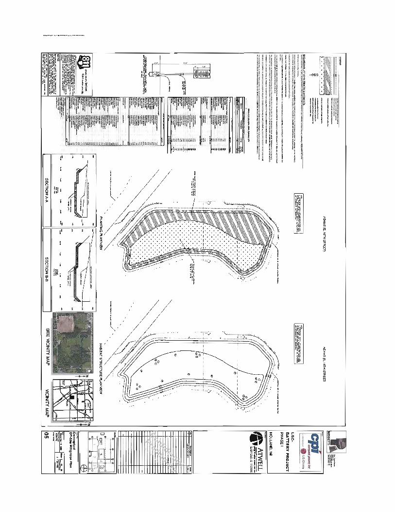

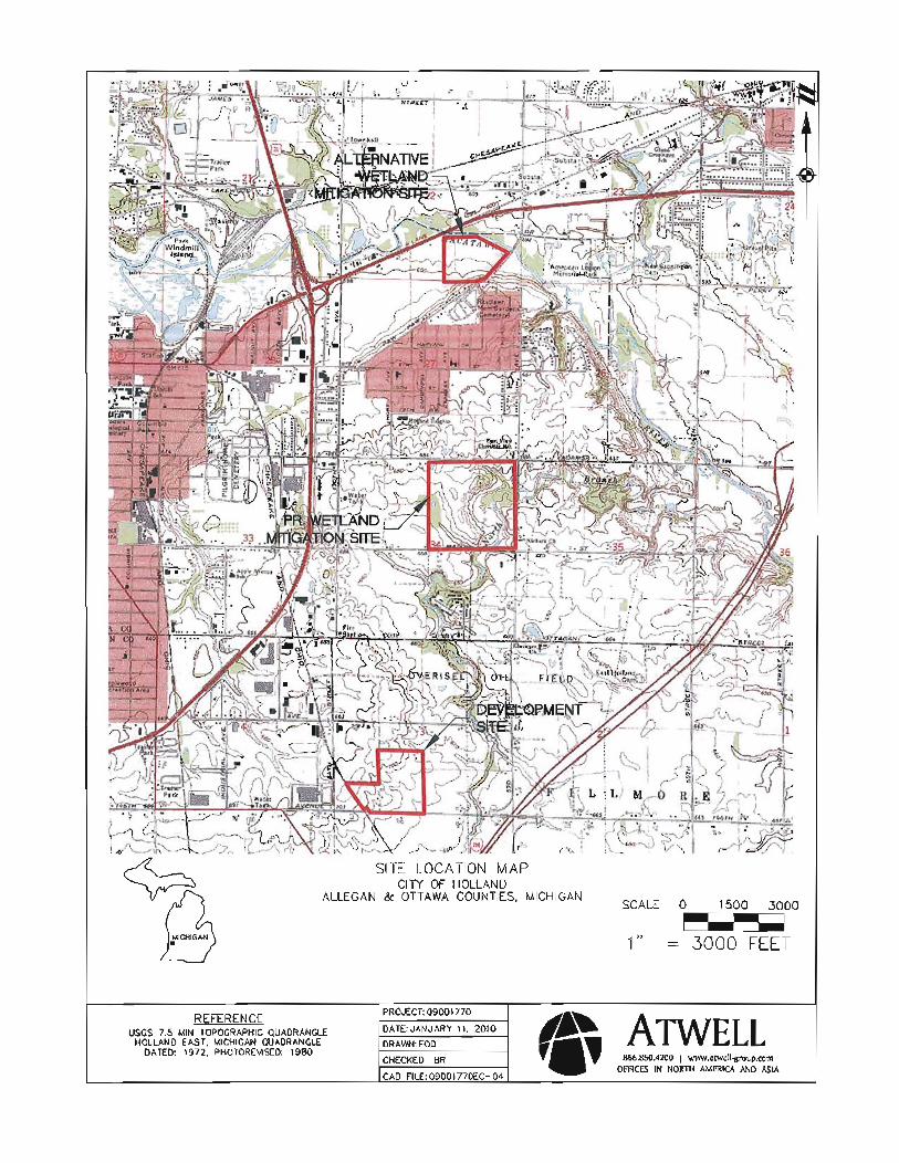
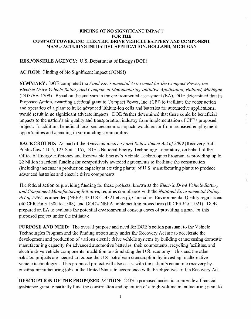


![COMPACT COMPONENT SYSTEM NX-PN7 - JVCresources.jvc.com/Resources/00/01/13/LVT1864-001A.pdf · COMPACT COMPONENT SYSTEM NX-PN7 INSTRUCTIONS LVT1864-001A [J] For customer use: Enter](https://img.pdfslide.us/doc/110x75/5ecedea9306e27216e53327f/compact-component-system-nx-pn7-compact-component-system-nx-pn7-instructions-lvt1864-001a.jpg)