Embed Size (px)
Citation preview
Committee on Ecology andTransportation Newsletter
Transportation Research Board Committee ADC30 Winter 2010-11
Tom Linkous, Chair
Following the stories in the papers makes it very evident that things in our world are changing in many ways. We are under-
going another political change in Washington and in most states. It is not clear what that means for ecological issues of interest to those of us working in the transportation world. One thing is for sure - most projects are not fading away and mitigation of construc-tion and operation impacts of these projects is still a priority. We are still in need of innovative and cost effective strategies to provide mitigation that will allow the fragmented ecosystems affected by these projects to function. Wildlife crossings are becoming more accepted as effective mitigation of fragmentation and barrier effects of linear facilities in many part of the US. Design of stream cross-ings to minimize barrier effects is also becoming accepted as a stan-dard way of doing business. Setting aside land to provide habitat for species displaced by projects is becoming a common way to offset losses to these same habitats nearby.
With all of these approaches to mitigation is there still more that we need to consider? The answer is a resounding YES! This approach fails to consider the large scale ecosystem effects of thousands of small blows from the transportation projects –
and associated development- we help deliver. In addition, there are much larger scale impacts of global climate change that are brewing from the additive impacts of each of these projects. Our approach is in effect a localized band-aid. It is time to step back and look at mitigation from the larger scale ecore-gion and even biome perspective. If the larger picture ecosys-tem management approaches of the federal and state agencies working to preserve ecological stability are underfunded and not being effectively implemented, maybe our extremely local-ized efforts should be reconsidered. Perhaps we should consider pooling our mitigation funds to move the mitigation agenda upward in scale. The efforts since the 1990s to “pool” mitiga-tion at regional scales may be a step in this direction Maybe the wildlife and ecosystem management agencies should also step back and redirect the mitigation they require to fulfill their own agencies’ large-scale, long-term management goals. Too often the project review personnel in these agencies have no connec-tion to the managers and planners working at the larger scale.
With global climate change and continuing population/development growth we all need to start thinking globally and acting globally. It’s not enough to act just locally anymore.
Are You Ready for Change?
AnnuAl Meeting 2011: ecology And trAnsportAtion sponsored sessions (All At the hilton – locAtions to be Announced)
• Workshop 187 ADC30 Sustainability Made Manifest: International Wildlife Crossing Infrastructure Design Competition Jan 23 2011 1:30PM-4:30PM
• Session 224: Ecology of Scale: Road Ecology Research and Practice Hilton Jan 24 2011 8:00AM- 9:45AM
• Poster Session 479: Current Environmental Issues in Transportation Hilton Jan 25 2011 9:30AM-12:00PM
• Session 656: Off the Beaten Path: Low-Volume Roads and Ecology Hilton Jan 26 2011 8:00AM-9:45AM
• Ecology and Transportation Committee Meeting: Jan 26 2011 2:30PM-6:00PM (Hilton)
Other ecologically-related sessions
• Session 254: SHRP 2 Capacity -- Results and Work in Progress Jan 24 2011 9:30AM- 12:00PM
• C06A Integration of Conservation, Highway Planning, and Environmental Permitting Using an Outcome-based Ecosystem Approach
• C06B Development of an Ecological Assessment Process and Credits System for Enhancements to Highway Capacity
2
Transportation Research Board Committee ADC30 Winter 2010-11
by Richard T. T. Forman, Harvard University, Graduate School of Design, Cambridge, MA 02138, USA
As the plane began descending at dawn I raised my window shade to an unforgettable sight…thousands of high-rise
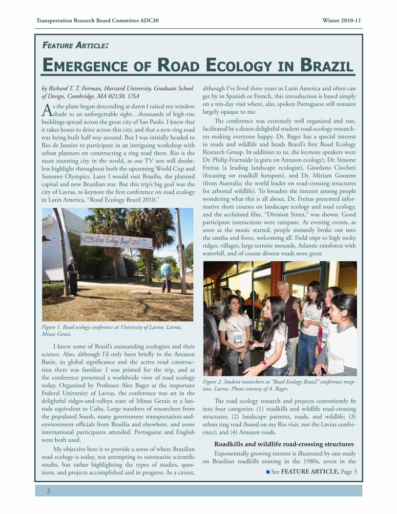
buildings spread across the great city of Sao Paulo. I knew that it takes hours to drive across this city, and that a new ring road was being built half way around. But I was initially headed to Rio de Janeiro to participate in an intriguing workshop with urban planners on constructing a ring road there. Rio is the most stunning city in the world, as our TV sets will doubt-less highlight throughout both the upcoming World Cup and Summer Olympics. Later I would visit Brasilia, the planned capital and new Brazilian star. But this trip’s big goal was the city of Lavras, to keynote the first conference on road ecology in Latin America, “Road Ecology Brazil 2010.”
Figure 1. Road ecology conference at University of Lavras. Lavras, Minas Gerais.
I knew some of Brazil’s outstanding ecologists and their science. Also, although I’d only been briefly in the Amazon Basin, its global significance and the active road construc-tion there was familiar. I was primed for the trip, and at the conference presented a worldwide view of road ecology today. Organized by Professor Alex Bager at the important Federal University of Lavras, the conference was set in the delightful ridges-and-valleys state of Minas Gerais at a lati-tude equivalent to Cuba. Large numbers of researchers from the populated South, many government transportation-and-environment officials from Brasilia and elsewhere, and some international participants attended. Portuguese and English were both used.
My objective here is to provide a sense of where Brazilian road ecology is today, not attempting to summarize scientific results, but rather highlighting the types of studies, ques-tions, and projects accomplished and in progress. As a caveat,
although I’ve lived three years in Latin America and often can get by in Spanish or French, this introduction is based simply on a ten-day visit where, alas, spoken Portuguese still remains largely opaque to me.
The conference was extremely well organized and run, facilitated by a dozen delightful student road-ecology research-ers making everyone happy. Dr. Bager has a special interest in roads and wildlife and heads Brazil’s first Road Ecology Research Group. In addition to us, the keynote speakers were Dr. Philip Fearnside (a guru on Amazon ecology), Dr. Simone Freitas (a leading landscape ecologist), Giordano Ciocheti (focusing on roadkill hotspots), and Dr. Miriam Goosem (from Australia; the world leader on road-crossing structures for arboreal wildlife). To broaden the interest among people wondering what this is all about, Dr. Freitas presented infor-mative short courses on landscape ecology and road ecology, and the acclaimed film, “Division Street,” was shown. Good participant interactions were rampant. At evening events, as soon as the music started, people instantly broke out into the samba and forro, welcoming all. Field trips to high rocky ridges, villages, large termite mounds, Atlantic rainforest with waterfall, and of course diverse roads were great.
Figure 2. Student researchers at “Road Ecology Brazil” conference recep-tion. Lavras. Photo courtesy of A. Bager.
The road ecology research and projects conveniently fit into four categories: (1) roadkills and wildlife road-crossing structures; (2) landscape patterns, roads, and wildlife; (3) urban ring road (based on my Rio visit, not the Lavras confer-ence); and (4) Amazon roads.
Roadkills and wildlife road-crossing structures Exponentially growing interest is illustrated by one study
on Brazilian roadkills existing in the 1980s, seven in the
See FEATURE ARTICLE, Page 3
FeAture Article:
eMergence oF roAd ecology in brAzil
3
Transportation Research Board Committee ADC30 Winter 2010-11
1990s, and about 70 today (based on journal articles, theses, and conference proceedings). Mammals, birds, reptiles, and frogs have been the primary focus. Methodology has evalu-ated roadkill detection rates relative to driving speed, though associated population estimates of wildlife in adjoining habi-tats seem to be rare. In an important park with many wildlife species radio-collared for study, a large cat (smaller than a jag-uar) was roadkilled; after careful calculation of the cat’s value, the driver was fined the equivalent of US$20,000.
Eight “rope passages” (tree canopies connected over roads by structures made of rope) were established near Porto Alegre in 2008 to facilitate crossings by howler monkeys, possums, and porcupines. Crossings have occurred and structures are being evaluated for success. Several underpasses (apparently not culverts) in the South were said to not work well. Culvert pipes and at least one underpass on a mid-coastal highway with frequent roadkills were used by wildlife. Twice fish move-ments relative to roads were reported, one comparing move-ment upstream versus downstream of a culvert, and the other evaluating different culvert characteristics for fish movement.
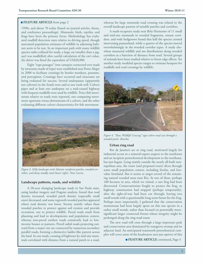
Figure 3. Hilly landscape with Atlantic rainforest patches, wooded cor-ridors, and dusty muddy road (lower right). Near Lavras.
Landscape patterns, roads, and wildlife
A 38-year changing landscape study in Sao Paulo state, using landsat imagery and Fragstat analysis, found that road density increased, wooded patch density (especially small ones) decreased, and some regrowth wooded patches appeared where road density was lower. Society mainly values these wooded patches to protect against soil erosion and provide recreation, not to protect wildlife. Paved roads result from planning and lead to developments and population centers, whereas non-paved earthen roads commonly lead to low-income houses or pastures. Paved radial roads projecting out-ward from a major city are connected by numerous secondary parallel roads, forming a distinctive ladder-like pattern across the land. In one study, crossing of highways by mid-size mam-mals correlated with distance from a natural patch to a road,
whereas for large mammals road crossing was related to the overall landscape pattern of suitable patches and corridors.
A mark-recapture study near Belo Horizonte of 11 small and mid-size mammals in wooded fragments, stream corri-dors, and wide hedgerows found that half the species crossed intervening pastureland, while a quarter of the species moved overwhelmingly in the wooded corridor types. A study else-where measured wildlife and ant distributions along wooded corridors as a function of distance from road. Several groups of animals have been studied relative to forest edge effects. Yet another study modeled species ranges to estimate hotspots for roadkills and road crossings by wildlife.
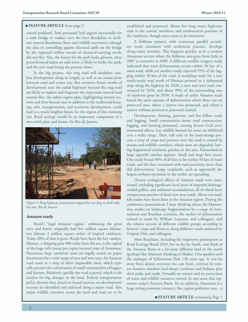
Figure 4. “Slow, Wildlife Crossing” signs where road cuts through a wooded patch. Brasilia.
Urban ring road Rio de Janeiro’s arc or ring road, motivated largely for
industrial access to a mineral-export seaport to the southwest and an incipient petrochemical development to the northeast, has just begun. Lying mainly outside the nearly all-built met-ropolitan area, the route (and proposed route) slices through some small population centers, including favelas, and low-value farmland. But it seems to target several of the remain-ing natural wooded areas near Rio. At one of these, perhaps 100 hectares in area, which we visited, a rare frog had been discovered. Conservationists fought to protect the frog, so highway construction had stopped (perhaps temporarily), after the right-of-way had been cut through, leaving two small woods with a questionable long-term future for the frog. Perhaps more importantly, I gathered that the conservation momentum had been largely spent on this one species in a rather small woods, rather than focused on potentially more-significant larger connected forests whose integrity might be prolonged along the ring-road route.
The new road will cross through a large important park and conservation area dominated by mangrove swamp and its adjacent land. An anticipated mammoth petrochemical com-plex will cover some of the headwaters area just upriver of this
FEATURE ARTICLE from page 2
FEATURE ARTICLE continued, Page 4
4
Transportation Research Board Committee ADC30 Winter 2010-11
coastal parkland. Park personnel had argued successfully for a wide bridge or viaduct over the river floodplain to facili-tate natural floodwater flows and wildlife movement (though the idea of controlling against chemical spills on the bridge by the expected endless stream of chemical-carrying trucks did not fly). Alas, the future for the park looks gloomy, since petrochemical-laden air and water is likely to bathe the park, and the new road brings the process closer.
In the big picture, this ring road will doubtless cata-lyze development along its length, as well as on connections between road and center city. But extensive broad swaths of development near the radial highways beyond the ring road are likely to replace and fragment the important natural land outside Rio. An urban region plan, highlighting natural sys-tems and their human uses in addition to the traditional hous-ing, jobs, transportation, and economic development, could lead to a much brighter future for the region of this stunning city. Road ecology would be an important component of a successful plan, and future, for Rio de Janeiro.
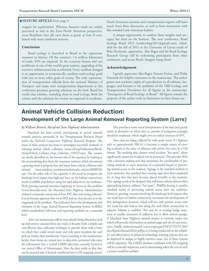
Figure 5. Ring highway construction stopped by rare frog on both sides. See text. Rio de Janeiro.
Amazon roads
Brazil’s “legal Amazon region,” embracing the great river and forest, originally had five million square kilome-ters (almost 2 million square miles) of tropical rainforest. Today 20% of that is gone. Roads have been the key catalyst. Manaus, a shipping port 800 miles from the sea, is the capital of the huge rich (mean per-capita income) state of Amazonas. Numerous large rainforest areas are legally zoned on paper documents for a wide range of uses and non-uses. An Amazon road starts as a strip of often impassable mud, which typi-cally permits the colonization of small communities of loggers and farmers. Relatively quickly the road is paved, which is the catalyst for big changes in the land. Federal transportation policy dictates that, based on faunal surveys, no-development sections be identified and enforced along a major road. Also major wildlife corridors across the land and road are to be
established and protected. About five long major highways exist in the central, northern, and southwestern portions of the rainforest, though more seem to be imminent.
A fishbone pattern, with numerous parallel second-ary roads consistent with settlement practice, develops along many stretches. This happens quickly, as in a western Amazonas section where the fishbone area grew from little in 2007 to extensive in 2009. A different satellite imagery study indicated that most deforestation occurs within 30 km of a main road, while yet another study reported 95% of the log-ging within 50 km of the road. A modeling study for a new north-south road south of Manaus pointed to a deforested strip along the highway by 2020, a new east-west road con-structed by 2030, and about 90% of the surrounding area of rainforest gone by 2050. A study of earlier Amazon roads found the same amount of deforestation where there was no protected area, where a reserve was protected, and where a reserve without protection personnel existed.
Development, farming, pastures, and fire follow roads and logging. Small communities house road construction, logging, and farming personnel, causing diverse local envi-ronmental effects, but wildlife hunted for meat are inhibited over a wider range. Then, still early in the land-change pro-cess, a strip of crops and pastures near the road is crossed by stream-and-wildlife corridors, which soon are degraded, leav-ing fragmented rainforest patches in the area. Pastureland in large squarish ranches appears. Small and large fires occur. One study found 90% of all fires to be within 50 km of main roads, and the fires correlated with road proximity more than did deforestation. Large croplands, such as apparently the largest soybean operation in the world, are spreading.
Diverse ecological effects of Amazon roads were men-tioned, including significant local areas of impeded drainage, eroded gullies, and sediment accumulation, all of which leave conspicuous patches of dead trees near roads. About ten road-kill studies have been done in the Amazon region. During the conference presentations I kept thinking about the Manaus-area studies on landscape fragmentation by a range of inter-national and Brazilian scientists, the studies of deforestation related to roads by William Laurance and colleagues, and the relative success of different wildlife groups according to farmers’ crops and finances along fishbone roads analyzed by Virginia Dale and colleagues.
Most Brazilians, including the impressive participants at Road Ecology Brazil 2010, live in the far South, and think of the Amazon Basin as a far-away different land to the north (perhaps like Atlantans thinking of Alaska). One speaker used the analogue of Yellowstone Park 130 years ago. It was far away from almost everyone (no cars then), overrun by min-ers, hunters, ranchers (and sheep), cowboys, and Indians, plus their paths and roads. Virtually no money and no protection of water and wildlife resources existed. In one sense that rep-resents today’s Amazon Basin. Yet in addition, Amazonas is a huge sitting economic resource, like a giant goldmine area…a
FEATURE ARTICLE from page 3
FEATURE ARTICLE continued, Page 5
5
Transportation Research Board Committee ADC30 Winter 2010-11
magnet for exploitation. Whereas Amazon roads are widely perceived as bad in the Euro-North American perspective, most Brazilians (not all) view them as good, at least if com-bined with some rainforest reserves.
Conclusion
Road ecology is launched in Brazil at the opportune moment in history. Of the country’s 1.6 million kilometers of roads, 92% are unpaved. As the economy booms and cars proliferate in one of the world’s great nations, upgrading of the extensive infrastructure has accelerated. Every roadbed changed is an opportunity to economically combine road ecology goals with one or more other goals of society. The wide representa-tion of transportation officials from the national Ministry of Transport and many state transportation departments at this conference promises growing solutions on the land. Brazil has world class scholars, including those in road ecology. Both the science and the solutions for society are expected to accelerate.
North American scientists and transportation experts will learn much from these discoveries, as well as from interaction with like-minded Latin American leaders.
A unique opportunity to catalyze these insights and syn-ergies has risen on the horizon. The next conference, Road Ecology Brazil 2011 ([email protected]), sched-uled for the fall of 2011 at the University of Lavras south of Belo Horizonte, approaches. Alex Bager and his Road Ecology Research Group will be welcoming participants from other continents, and across Brazil. Imagine being there!
Acknowledgement
I greatly appreciate Alex Bager, Simone Freitas, and Philip Fearnside for helpful comments on the manuscript. The author grants non-exclusive rights of reproduction in all editions, lan-guages, and formats to the publisher of the TRB Ecology and Transportation Newsletter for all figures in the manuscript, “Emergence of Road Ecology in Brazil.” All figures remain the property of the author with no limitation on their future use.
FEATURE ARTICLE from page 4
Animal Vehicle Collision Reduction: Development of the Large Animal Removal Reporting System (Larrs)by William Branch, Maryland State Highway Administration
Maryland has been actively participating in several national research projects sponsored by the Transportation Research Board under the National Cooperative Highway Research Program. The focus of these projects has been to investigate successful methods of reducing animal vehicle collisions. (www.trb.org/Publications/Blurbs/AnimalVehicle_Collision_Data_Collection_159423.aspx) The reasons are clearly identified on the human side of the equation by looking at the accumulating data from the insurance industry which documents a growing trend in property loss and injury from vehicle collisions with animals (www.statefarm.com/about/media/media_releases/20090928.asp). On the other side of the equation is the need to recognize the landscape level impact that highways have on the habitat connectivity needs of wildlife populations using the land adjacent to our roadways. With growing national attention beginning to focus on this problem (www.deercrash.com), the Maryland State Highway Administration initiated a statewide assessment of how AVC data were being collected. It soon became apparent that we at SHA had no clear picture as to the magnitude of the problem. This realization led to the development and initiation of the Large Animal Removal Reporting System (LARRS) which standardized collection and reporting methods on a statewide level.
Since our maintenance offices were already being directed to pick up and remove carcasses from our roads, it became both a simple and cost-effective data collection technique to provide them with a form on which they could record route and mile point locations for each pick up within their jurisdiction. Upon returning to the maintenance facility these forms are turned over to data entry personnel who enter the information into a central LARRS data base currently located at our central Office of Maintenance. Here the data reside so that they can be accessed and, if desired, transferred into a GIS mapping system.
This provides a more visual interpretation of the data and greatly assists in decisions on where best to consider if mitigation strategies should be employed, which might serve to reduce instances of AVC.
Since data are being collected by mile point (every 0.1 highway mile or approximately 500 ft.) it becomes a simple matter of view-ing accidents at the same or adjacent mile points over time in a GIS format. The resulting data clusters reveal accident “hot spots” where significantly numerous incidents can be portrayed. This provides SHA with a decision making tool that maximizes the cost/benefits of pro-viding methods to warn motorists of a potential hazard or prevent-ing animal access to the roadway. Signage is the standard method to warn motorists, but standard deer crossing signs have been employed for so long that they have become almost invisible to the motorist. New signage needs to be designed that will better inform drivers when approaching known collision “hot spots”. Wildlife fencing is another standard means of preventing animal access onto our roadways. However, growing concerns involving the landscape level impacts that our roads have on habitat connectivity necessitate the development of best management practices, which will not only prevent access onto our roads but also lead to sites along the road where connectivity to adjacent habitats is available. This may be at existing bridge struc-tures or smaller structures of sufficient size to allow animal passage. A Maryland State Highway research project is currently under way which will provide information on animal usage and size of such struc-tures. Finally, national research (www.oregon.gov/ODOT/TD/TP_RES/docs/Reports/AnimalVehicle.pdf?ga=t) is being conducted on the reliabil-ity and effectiveness of advanced technology warning systems that can be deployed in unique or highly sensitive areas. Use of these systems will be expensive. The LARRS database combined with GIS mapping will be a critically important tool in determining when the cost of such a system would be justified.
6
Transportation Research Board Committee ADC30 Winter 2010-11
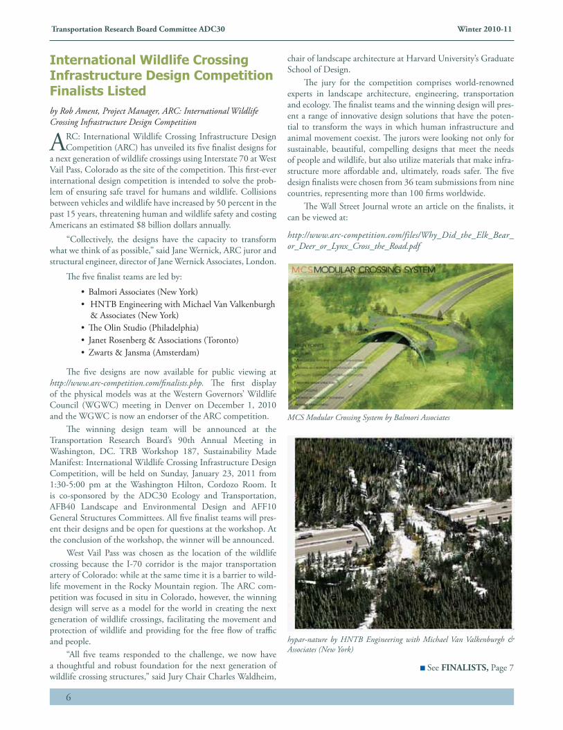
International Wildlife Crossing Infrastructure Design Competition Finalists Listedby Rob Ament, Project Manager, ARC: International Wildlife Crossing Infrastructure Design Competition
ARC: International Wildlife Crossing Infrastructure Design Competition (ARC) has unveiled its five finalist designs for
a next generation of wildlife crossings using Interstate 70 at West Vail Pass, Colorado as the site of the competition. This first-ever international design competition is intended to solve the prob-lem of ensuring safe travel for humans and wildlife. Collisions between vehicles and wildlife have increased by 50 percent in the past 15 years, threatening human and wildlife safety and costing Americans an estimated $8 billion dollars annually.
“Collectively, the designs have the capacity to transform what we think of as possible,” said Jane Wernick, ARC juror and structural engineer, director of Jane Wernick Associates, London.
The five finalist teams are led by:
• Balmori Associates (New York)• HNTB Engineering with Michael Van Valkenburgh
& Associates (New York)• The Olin Studio (Philadelphia)• Janet Rosenberg & Associations (Toronto)• Zwarts & Jansma (Amsterdam)
The five designs are now available for public viewing at http://www.arc-competition.com/finalists.php. The first display of the physical models was at the Western Governors’ Wildlife Council (WGWC) meeting in Denver on December 1, 2010 and the WGWC is now an endorser of the ARC competition.
The winning design team will be announced at the Transportation Research Board’s 90th Annual Meeting in Washington, DC. TRB Workshop 187, Sustainability Made Manifest: International Wildlife Crossing Infrastructure Design Competition, will be held on Sunday, January 23, 2011 from 1:30-5:00 pm at the Washington Hilton, Cordozo Room. It is co-sponsored by the ADC30 Ecology and Transportation, AFB40 Landscape and Environmental Design and AFF10 General Structures Committees. All five finalist teams will pres-ent their designs and be open for questions at the workshop. At the conclusion of the workshop, the winner will be announced.
West Vail Pass was chosen as the location of the wildlife crossing because the I-70 corridor is the major transportation artery of Colorado: while at the same time it is a barrier to wild-life movement in the Rocky Mountain region. The ARC com-petition was focused in situ in Colorado, however, the winning design will serve as a model for the world in creating the next generation of wildlife crossings, facilitating the movement and protection of wildlife and providing for the free flow of traffic and people.
“All five teams responded to the challenge, we now have a thoughtful and robust foundation for the next generation of wildlife crossing structures,” said Jury Chair Charles Waldheim,
chair of landscape architecture at Harvard University’s Graduate School of Design.
The jury for the competition comprises world-renowned experts in landscape architecture, engineering, transportation and ecology. The finalist teams and the winning design will pres-ent a range of innovative design solutions that have the poten-tial to transform the ways in which human infrastructure and animal movement coexist. The jurors were looking not only for sustainable, beautiful, compelling designs that meet the needs of people and wildlife, but also utilize materials that make infra-structure more affordable and, ultimately, roads safer. The five design finalists were chosen from 36 team submissions from nine countries, representing more than 100 firms worldwide.
The Wall Street Journal wrote an article on the finalists, it can be viewed at:
http://www.arc-competition.com/files/Why_Did_the_Elk_Bear_or_Deer_or_Lynx_Cross_the_Road.pdf
MCS Modular Crossing System by Balmori Associates
hypar-nature by HNTB Engineering with Michael Van Valkenburgh & Associates (New York)
See FINALISTS, Page 7
7
Transportation Research Board Committee ADC30 Winter 2010-11
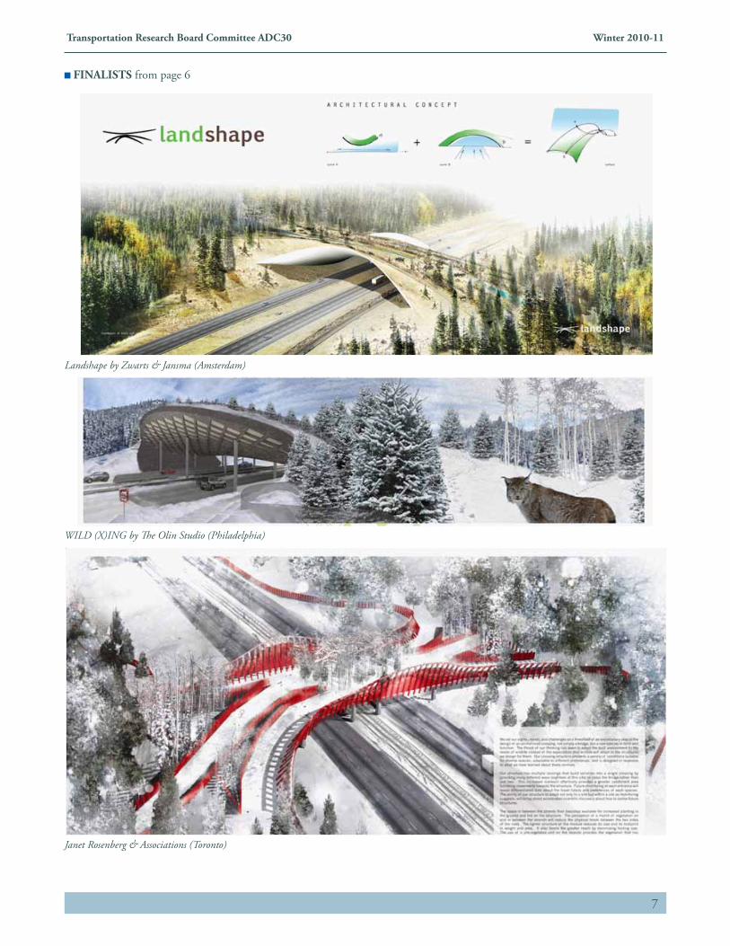
Landshape by Zwarts & Jansma (Amsterdam)
WILD (X)ING by The Olin Studio (Philadelphia)
Janet Rosenberg & Associations (Toronto)
FINALISTS from page 6
8
Transportation Research Board Committee ADC30 Winter 2010-11
by Bridget Donaldson, Virginia DOT
With more than 1 million deer-vehicle collisions in the U.S in 2009, removing animal carcasses from
the road and properly disposing of them is a necessary service. Carcass removal is important for driver safety and for minimizing the risk of pathogens from entering the soil, groundwater, and streams. The Virginia Depart-ment of Transportation (VDOT) is responsible for the removal and disposal of carcasses along its state road system. Some of the disposal methods available to many VDOT maintenance areas are becoming increasingly impractical and can create environmental risks. On-site burial is becoming a less viable disposal option for many maintenance areas as rural areas become more popu-lated. Yet driving the sometimes considerable distances to reach the nearest landfill facility can be inefficient in terms of time and labor, and landfill space is becoming increasingly scarce. As a result, many maintenance areas have a need for viable, environmentally compliant, and cost-effective alternative carcass management strategies. Composting animal carcasses at VDOT maintenance areas may be an effective approach, and offers promise for reducing the annual $4.4 million VDOT spends on carcass removal and disposal.
The Virginia Center for Transportation Innovation and Research (VCTIR) is conducting a study of windrow composting as a carcass management option for a DOT. Windrows are passively aerated static piles and, as such, do not require the materials turning needed in the cov-ered bin method. State environmental regulations cur-rently require compost piles to be constructed on a paved surface and all leachate to be drained or pumped to a
wastewater facility. The costs and labor required to satisfy these requirements would inhibit the implementation of windrow composting at VDOT maintenance areas. This study therefore entails a comprehensive analysis of pathogens and leachate concentrations from windrows to determine whether more flexible composting regulations (i.e. those that allow the filtration of leachate through soil beneath windrows) are justified.
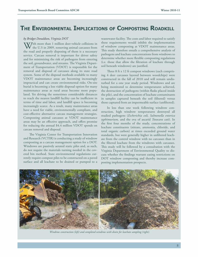
Three 8 ft x 12 ft compost windrows (each compris-ing 4 deer carcasses layered between woodchips) were constructed in the fall of 2010 and will remain undis-turbed for a one year study period. Windrows and are being monitored to determine temperatures achieved, the destruction of pathogens (within flasks placed inside the pile), and the concentration of leachate contaminants in samples captured beneath the soil (filtered) versus those captured from an impermeable surface (unfiltered).
In less than one week following windrow con-struction, high windrow temperatures destroyed all studied pathogens (Escherichia coli, Salmonella enterica typhimurium, and the ova of ascarid Toxocara cati). In the first four months of the study, concentrations of leachate constituents (nitrate, ammonia, chloride, and total organic carbon) at times exceeded ground water standards, but were generally higher in unfiltered leach-ate from the control windrow with no carcasses than in the filtered leachate from the windrows with carcasses. This study will be followed by a consultation with the Virginia Department of Environmental Quality to dis-cuss whether the findings warrant easing restrictions on DOT windrow composting and thereby increase com-posting implementation prospects.
the environMentAl iMplicAtions oF coMposting roAdkill
Windrow construction (left) and completed windrow with drain for leachate sampling (right).
9
Transportation Research Board Committee ADC30 Winter 2010-11
by Marie Venner, Venner Consulting
It is becoming widely recognized that the selection and implementation of compensatory mitigation and con-
servation projects must be strategic in order to achieve the highest ecological return on investment. In an ideal world, decisions about the type and location of mitigation to be performed are driven not just by the type of impact experienced, but also by the priority ecological needs, or goals, for the region in which they occur. Additionally, mitigation and conservation investment decisions are coordinated so they can be leveraged to create projects of true ecological significance, across multiple resources of concern.
Working in partnership with the resource agencies, Departments of Transportation (DOTs) are uniquely positioned to make meaningful contributions to regional mitigation and conservation goals as they seek to off-set unavoidable ecological impacts. This is because the approximate nature and extent of unavoidable impacts can be ascertained relatively early in the project plan-ning and development process. With the benefit of this forecasting ability, DOTs and resource agency partners should be able to plan ahead to ensure the provision of ecologically valuable mitigation well in advance of project development. This ability should also provide efficiencies that improve transportation project delivery, as mitiga-tion obligations can be identified and resolved before they become critical path issues. Costs can be managed, and risks can be reduced.
Although addressing mitigation and conservation obligations early, using an ecosystem-based approach, is ecologically preferable because it leads to better mitiga-tion with a higher likelihood of success, agency institu-tional and procedural barriers have traditionally been limiting factors. In order for early action to become a sus-tainable reality, questions such the following need to be answered: How can transportation agencies that invest in ecosystem-level action to minimize or mitigate impacts or restore resources be assured that they will get credit for their actions from regulatory agencies and the public? In
turn, regulatory agencies need the maximum assurance they can get that actions will in fact occur (performance years in advance helps address this issue) and satisfy regu-lations.
Eco-Logical: An Ecosystem Approach to Developing Infrastructure Projects (Eco-Logical) and other initia-tives laid a conceptual groundwork for an outcome-based ecosystem approach to transportation decision making. To discover why Eco-Logical and compatible initia-tives were slow to be embraced as a new way of doing business, in 2009, Phase I of SHRP2 project C06A: “Integration of Conservation, Highway Planning, and Environmental Permitting Using an Outcome-Based Ecosystem Approach,” took an in-depth look at barri-ers, interests, incentives, and solutions to implementing an ecosystem approach to transportation decision mak-ing. Approximately 150 practitioners in the permitting and consultation processes at state and federal agencies participated in surveys and/or interviews, some up to 2-3 hours in length. These provided detailed overviews for each agency of the barriers and interests agency partici-pants perceive related to implementation of ecosystem approaches, as well as incentives and suggested solutions on how such approaches may be successfully imple-mented. Agency staff may be interested to see what their colleagues said, as well as explore the top barriers, inter-ests, incentives, and solutions identified by other agencies, to better understand such obstacles and barriers, potential solutions, the parties involved and what motivates each. The project also explored vehicles for taking an ecosystem approach within existing law and regulation, and devel-oped an Integrated Ecological Framework to address mul-tiple resources in an integrated fashion, bringing together conservation and restoration planning and transportation planning. A guide to the latter, agency “business cases” for implementing ecosystem-based approaches, leading examples from various agencies, and a final report for the project will all be released in the first quarter of 2011. For more information, please contact [email protected].
updAte on phAse i oF shrp2 project c06A: “integrAtion oF conservAtion, highwAy plAnning, And environMentAl perMitting using An outcoMe-bAsed ecosysteM ApproAch”
10
Transportation Research Board Committee ADC30 Winter 2010-11
Wildlife Crossings Documented in Conservation Registry
by Megan Brown, Defenders of Wildlife
• The Conservation Registry (www.conservationregistry.org) is an online database that records, tracks and maps on-the-ground conservation projects. The purpose of the Registry is to help users understand the context, distribution and effectiveness of our collective efforts to protect and restore ecosystems. The Registry captures three types of projects. The first is a project designed to protect or restore habitat, fish and wildlife, or an ecological process. The second type is a change in land designation to enhance the focus on conservation management. The third category includes monitoring, research and education projects tied to a location.
This fall Defenders of Wildlife began placing wildlife crossings on the Registry to provide general information about these structures and their locations. Up until recently, wildlife crossings were not featured on the registry and were therefore missing from this collective conservation effort. The projects vary from fully completed crossings to those in the early planning stages and everything in between. When possible, photos, articles, documents and any other pertinent information are included on the site. Crossings that are currently on the Conservation Registry are helping protect animals such as elk, deer, bobcat, bears, bighorn sheep and the critically endangered Florida panther.
Current projects include:
• North Carolina I-64 (http://www.conservationregistry.org/projects/15462)• Florida Alligator Alley (http://www.conservationregistry.org/projects/15464) • Montana US 93 (http://www.conservationregistry.org/projects/15463)• California Harbor Boulevard (http://www.conservationregistry.org/projects/15657)• Wyoming Trappers Point (http://www.conservationregistry.org/projects/15654)• Idaho 21 (http://www.conservationregistry.org/projects/15649)• Wyoming US 30 (http://www.conservationregistry.org/projects/15514)• Vermont Bennington Bypass (http://www.conservationregistry.org/projects/15458)• Colorado ARC Competition (http://www.conservationregistry.org/projects/15468)• Utah US 6 (http://www.conservationregistry.org/projects/15474)• Arizona SR 260 (http://www.conservationregistry.org/projects/15466)• Washington I-90 Snoqualmie Pass (http://www.conservationregistry.org/projects/15501)• Nevada Highway 93 (http://www.conservationregistry.org/projects/15502)
This is an ongoing project with the ultimate goal of having all wildlife crossings in the United States on the site. The Registry is user friendly, making creating projects quite easy. If you have a wildlife crossing, or any other conservation project that you feel should be on the Registry, it’s as easy as signing up and inputting data. Create your account on the website then click “My Registry” to add a new proj-ect. Follow the prompts, publish and you’re done. The more people using the Registry will make this a more informative, and therefore effective, conservation tool.
For more information or to suggest a wildlife crossing for the Conservation Registry please contact Megan Brown at [email protected].
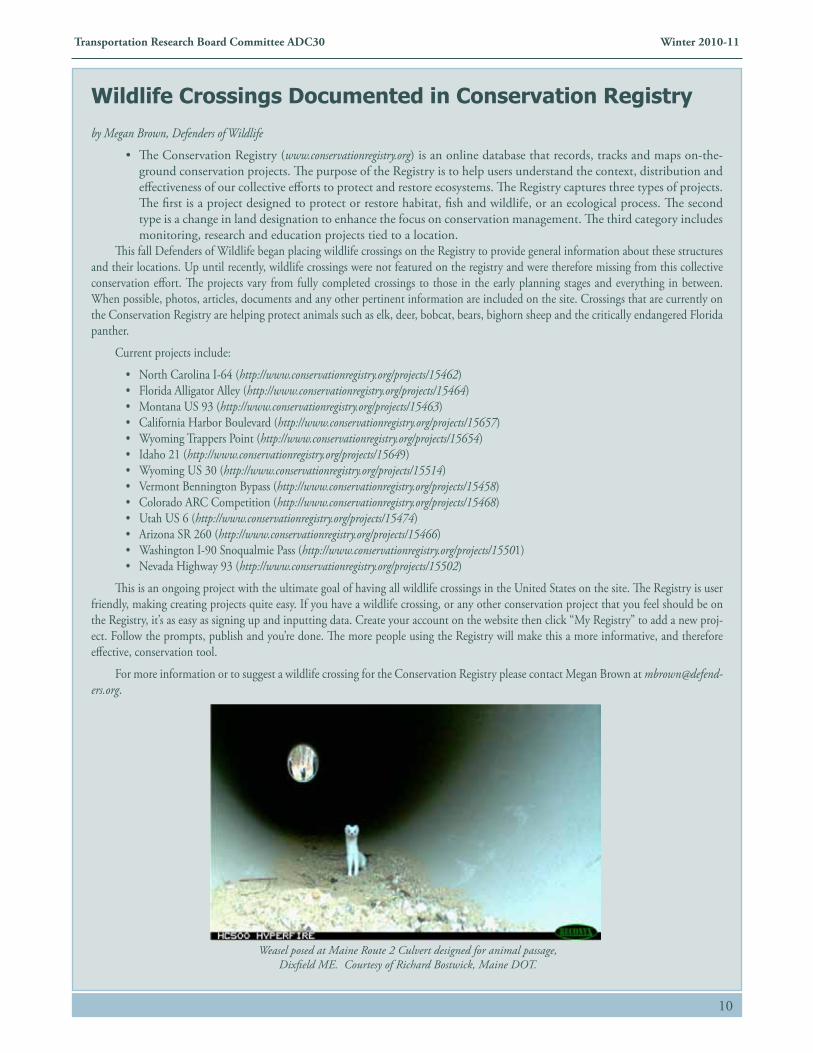
Weasel posed at Maine Route 2 Culvert designed for animal passage, Dixfield ME. Courtesy of Richard Bostwick, Maine DOT.
11
Transportation Research Board Committee ADC30 Winter 2010-11
The 2011 International Conference on Ecology & Transportation
Sustainability in Motion
Hosted by Washington State Department of Transportation
The International Conference on Ecology and Transportation (ICOET) invites submissions for presentations and facilitated sessions for its next conference to be held August 21-25, 2011, in Seattle, Washington, USA. The submission deadline is Monday, January 31, 2011.
Abstracts for technical paper and poster presentations may be submitted for consideration via the ICOET 2011 Abstract Submission website. Proposals for facilitated sessions may be submitted via the ICOET 2011 Facilitated Session Submission Form (PDF:551KB).
• Abstracts should describe current project or planning activities, research findings, emerging issues, or best practices related to the interface between ecology and transportation in aquatic and terrestrial environments. All abstracts should include aspects of both ecology and transportation.
• In keeping with the ICOET 2011 conference theme, "Sustainability in Motion," abstract authors should address the impli-cations of their work in the context of promoting and supporting greater ecological and transportation system sustainability.
Authors are encouraged to discuss not only the environmental but also the economic and social aspects of sustainability. For example, abstracts that discuss methodologies for collecting wildlife mortality data should move beyond reporting impacts to demonstrate how the data can meaningfully inform better mitigation or design strategies to reduce wildlife mortality.
• Abstracts on engineering design are specifically invited. Design-focused papers that describe how engineering design can support habitat connectivity and quality are welcome.
Addressing sustainability in transportation maintenance and operations, including balancing economics, social and environmental issues in asset management, are encouraged. Abstracts authored or co-authored by an engineer are of particular interest.
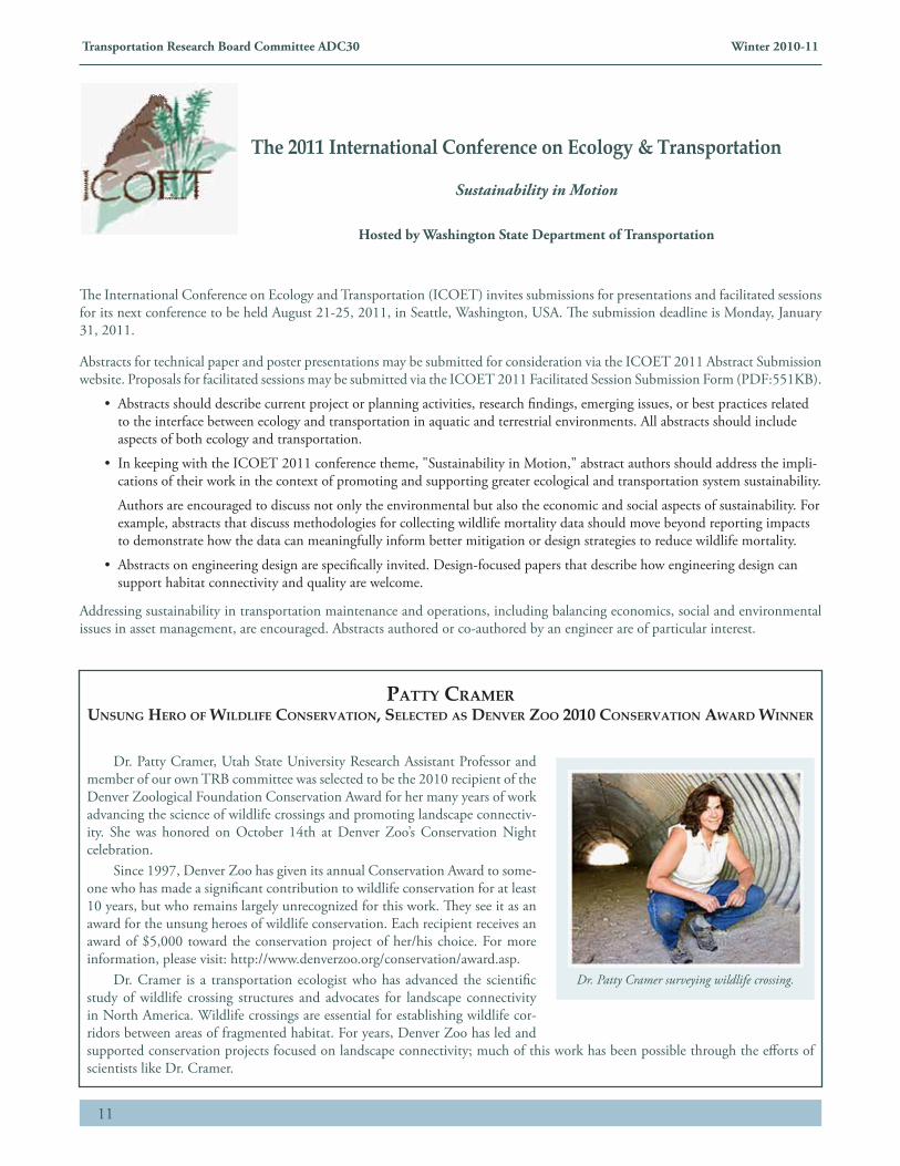
Dr. Patty Cramer, Utah State University Research Assistant Professor and member of our own TRB committee was selected to be the 2010 recipient of the Denver Zoological Foundation Conservation Award for her many years of work advancing the science of wildlife crossings and promoting landscape connectiv-ity. She was honored on October 14th at Denver Zoo’s Conservation Night celebration.
Since 1997, Denver Zoo has given its annual Conservation Award to some-one who has made a significant contribution to wildlife conservation for at least 10 years, but who remains largely unrecognized for this work. They see it as an award for the unsung heroes of wildlife conservation. Each recipient receives an award of $5,000 toward the conservation project of her/his choice. For more information, please visit: http://www.denverzoo.org/conservation/award.asp.
Dr. Cramer is a transportation ecologist who has advanced the scientific study of wildlife crossing structures and advocates for landscape connectivity in North America. Wildlife crossings are essential for establishing wildlife cor-ridors between areas of fragmented habitat. For years, Denver Zoo has led and supported conservation projects focused on landscape connectivity; much of this work has been possible through the efforts of scientists like Dr. Cramer.
Patty CramerUnsUng Hero of Wildlife Conservation, seleCted as denver Zoo 2010 Conservation aWard Winner
Dr. Patty Cramer surveying wildlife crossing.
12
Transportation Research Board Committee ADC30 Winter 2010-11
Editor: Marcia Bowen, Design: Linda CableNormandeau Associates, Inc.
By Megan Brown, Defenders of Wildlife Habitat and Highway Coordinator.
It was a decade ago when Defenders of Wildlife recognized the importance and urgency of addressing the impacts of high-ways on our nation’s wildlife. For the past ten years Defenders has worked with partners from government, the private sector, academia and other NGOs to reduce the negative impacts of roads and highways on wildlife. Together, we celebrate our vic-tories.
1. Building Bridges for Wildlife – In 1998, Defenders lobbied Congress to include funding for wildlife crossings in the Transportation Enhancements Program. To date, $12 million has been spent on various projects to restore habitat connectivity and help wildlife move safely across the landscape.
2. Protecting Panthers in Florida – Defenders worked with Florida DOT and the National Park Service to secure $675,000 in federal funds to install a state of the art detection system on the Big Cypress Preserve on US 41 with the hope to reduce the number of collisions on this deadly stretch of road.
3. Writing the Book on Wildlife and Highways – The Habitat and Highways program has produced five ground-breaking publications on wildlife and transportation, includ-ing Second Nature: Improving Transportation without Putting Nature Second and Getting Up to Speed: A Conservationist’s Guide to Wildlife and Highways. More than 30,000 copies have been distributed to transportation and wildlife agency staff and advocates in all 50 states and around the world.
4. Teaching Americans to Watch out for Wildlife – Every 26 seconds a wildlife-vehicle collision occurs somewhere in the country, with the number of accidents having increased by 50 percent in a 15-year period. Because these collisions are disastrous for both wildlife and humans, the Habitat and Highways program sponsors a “Watch Out for Wildlife” week every September to raise awareness and teach people how to drive more safely in wildlife areas.
5. Forging an Alliance for Wildlife – Several local and regional conservation organizations across the country are help-ing fight bad highway projects and advocating for safe passage for wildlife. These groups now work together in the TransWild Alliance, a coalition of conservation advocates dedicated to reducing the impacts of roads on wildlife. The Alliance now has 40 members and is continuing to grow.
6. Planning for Wildlife – In 2005, Defenders of Wildlife led a coalition who convinced Congress to require transportation agencies to work with wildlife agencies when they
are planning new and expanded roads. Wildlife is now one of the first things highway planners think about, rather than the last.
7. Creating Crossing Zones in Colorado – In early 2010, Defenders of Wildlife members in Colorado wrote to their representatives and helped pass a state law establishing wildlife crossing zones on the most dangerous stretches of highway. These zones will be equipped with special signs to alert drivers that they are in a dangerous area and reduce the speed limit.
8. Helping Jaguars on the Move in Mexico – The Mexican government is widening federal highway 186, which cuts through the critical jaguar habitat. With increased traffic, more jaguars will be killed on the highway or cut off from there essential habitat. In 2009, Defenders was invited to tour this area and advise the Mexican government on how to protect the jaguar and its habitat. The government is now considering building safe passages for the jaguar into the highway project.
9. Creating Safe Passages for Salamanders – Every spring, salamanders in the town of Monkton, Vermont attempt to migrate from their underground homes on the eastern side of the road to their wetland breeding pools on the western side. Some make it, but thousands are killed by passing cars. Thanks to the tireless efforts of local conservation organizations, the con-struction of two salamander tunnels will be complete by 2011.
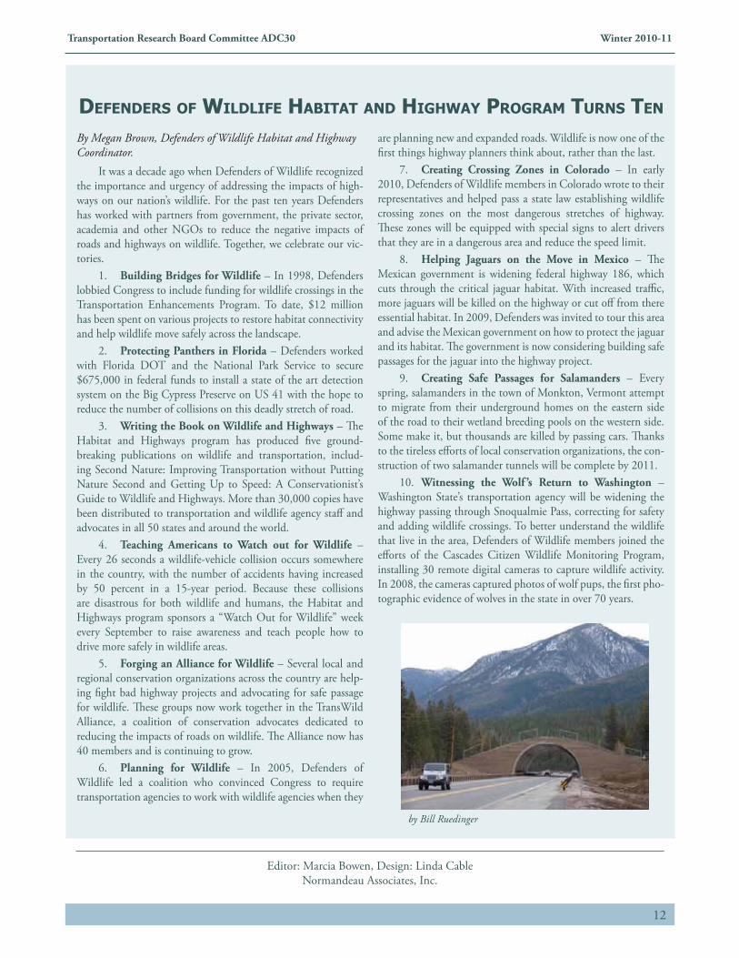
10. Witnessing the Wolf ’s Return to Washington – Washington State’s transportation agency will be widening the highway passing through Snoqualmie Pass, correcting for safety and adding wildlife crossings. To better understand the wildlife that live in the area, Defenders of Wildlife members joined the efforts of the Cascades Citizen Wildlife Monitoring Program, installing 30 remote digital cameras to capture wildlife activity. In 2008, the cameras captured photos of wolf pups, the first pho-tographic evidence of wolves in the state in over 70 years.
deFenders oF wildliFe hAbitAt And highwAy progrAM turns ten
by Bill Ruedinger