Embed Size (px)
Citation preview
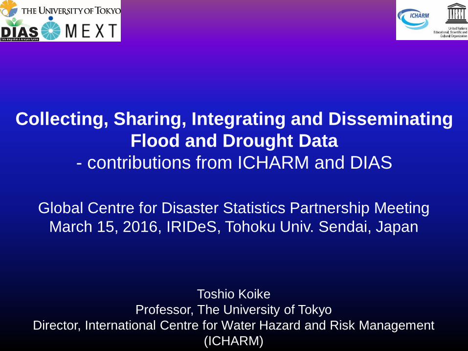
Collecting, Sharing, Integrating and Disseminating
Flood and Drought Data
- contributions from ICHARM and DIAS
Toshio Koike
Professor, The University of Tokyo
Director, International Centre for Water Hazard and Risk Management
(ICHARM)
Global Centre for Disaster Statistics Partnership Meeting
March 15, 2016, IRIDeS, Tohoku Univ. Sendai, Japan
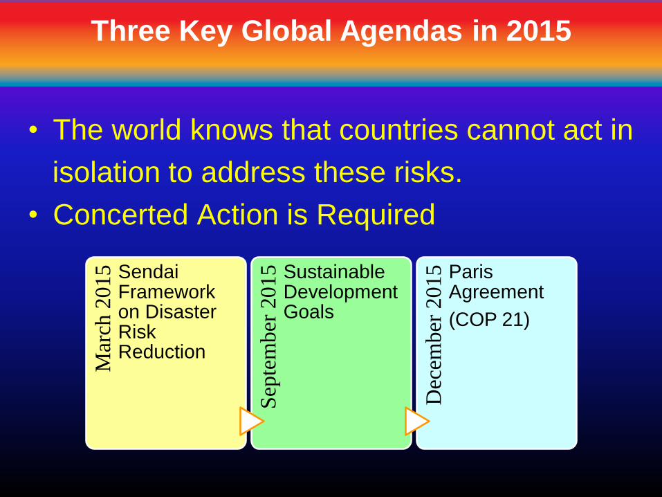
Mar
ch 2
015 Sendai
Framework on Disaster Risk Reduction
Sep
tem
ber
201
5 Sustainable Development Goals
Dec
ember
2015 Paris
Agreement
(COP 21)
• The world knows that countries cannot act in
isolation to address these risks.
• Concerted Action is Required
Three Key Global Agendas in 2015
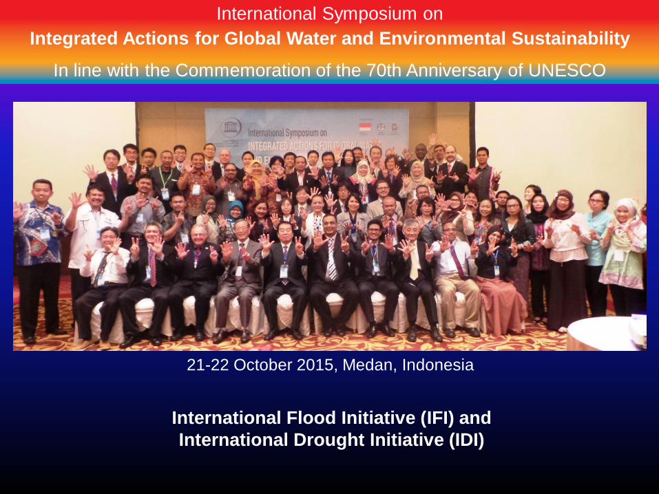
International Symposium on
Integrated Actions for Global Water and Environmental Sustainability
In line with the Commemoration of the 70th Anniversary of UNESCO
21-22 October 2015, Medan, Indonesia
International Flood Initiative (IFI) and
International Drought Initiative (IDI)
International Symposium on
Integrated Actions for Global Water and Environmental Sustainability
In line with the Commemoration of the 70th Anniversary of UNESCO
Implementation Now! How to Address?
Learn from and support to national and local platforms to practice evidence-based flood and drought risk reduction.
• Considering how to share best practice eg. WWF7 Implementation Road Map.
• Monitoring- Activities, progress, achievements
• Data Collection & Sharing, Statistics• Risk Monitoring• Early Warning and Risk Assessment• Financing mechanism• Capacity Building
Mobilize existing networks of scientific and research institutions, at national, regional and international levels.
• Synthesis• Advice to Stakeholders• Communication and Engagement
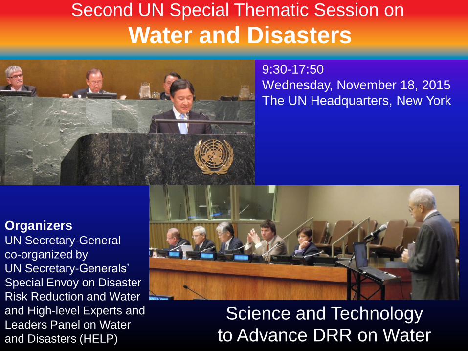
Second UN Special Thematic Session on
Water and Disasters
Science and Technology
to Advance DRR on Water
9:30-17:50
Wednesday, November 18, 2015
The UN Headquarters, New York
OrganizersUN Secretary-General
co-organized by
UN Secretary-Generals’
Special Envoy on Disaster
Risk Reduction and Water
and High-level Experts and
Leaders Panel on Water
and Disasters (HELP)
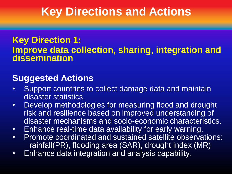
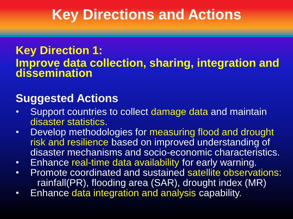
Key Directions and Actions
Key Direction 1: Improve data collection, sharing, integration and dissemination
Suggested Actions• Support countries to collect damage data and maintain
disaster statistics.• Develop methodologies for measuring flood and drought
risk and resilience based on improved understanding of disaster mechanisms and socio-economic characteristics.
• Enhance real-time data availability for early warning.• Promote coordinated and sustained satellite observations:
rainfall(PR), flooding area (SAR), drought index (MR)• Enhance data integration and analysis capability.

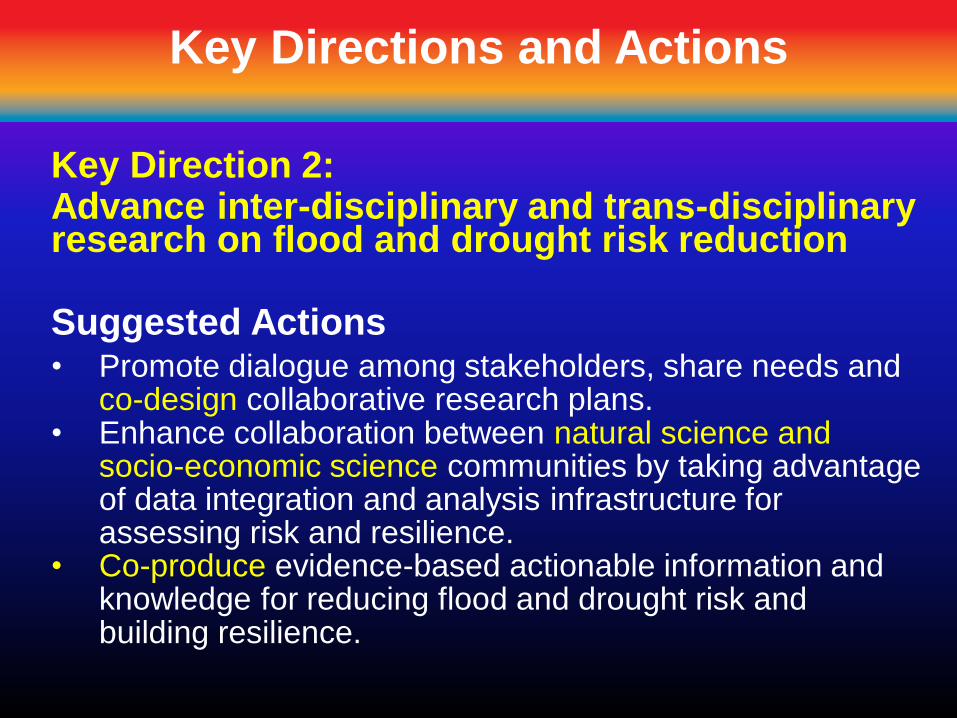
Key Directions and Actions
Key Direction 2: Advance inter-disciplinary and trans-disciplinary research on flood and drought risk reduction
Suggested Actions• Promote dialogue among stakeholders, share needs and
co-design collaborative research plans.• Enhance collaboration between natural science and
socio-economic science communities by taking advantage of data integration and analysis infrastructure for assessing risk and resilience.
• Co-produce evidence-based actionable information and knowledge for reducing flood and drought risk and building resilience.

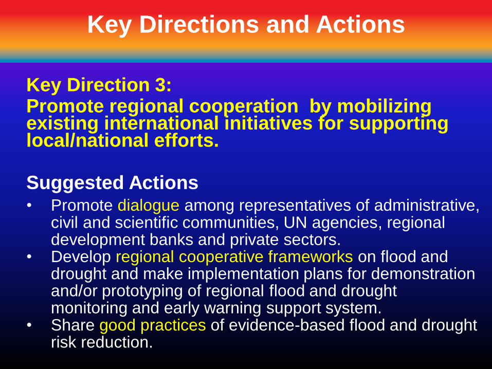
Key Directions and Actions
Key Direction 3: Promote regional cooperation by mobilizing existing international initiatives for supporting local/national efforts.
Suggested Actions• Promote dialogue among representatives of administrative,
civil and scientific communities, UN agencies, regional development banks and private sectors.
• Develop regional cooperative frameworks on flood and drought and make implementation plans for demonstration and/or prototyping of regional flood and drought monitoring and early warning support system.
• Share good practices of evidence-based flood and drought risk reduction.
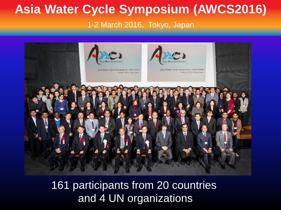
Asia Water Cycle Symposium (AWCS2016)1-2 March 2016, Tokyo, Japan
161 participants from 20 countries
and 4 UN organizations
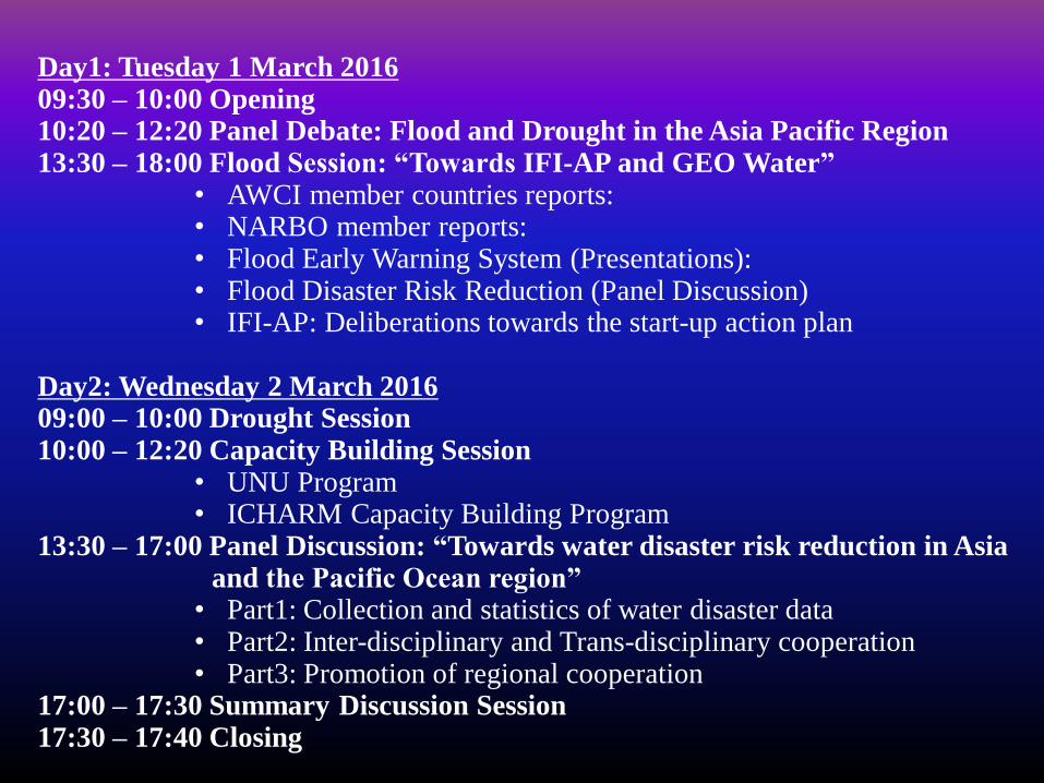
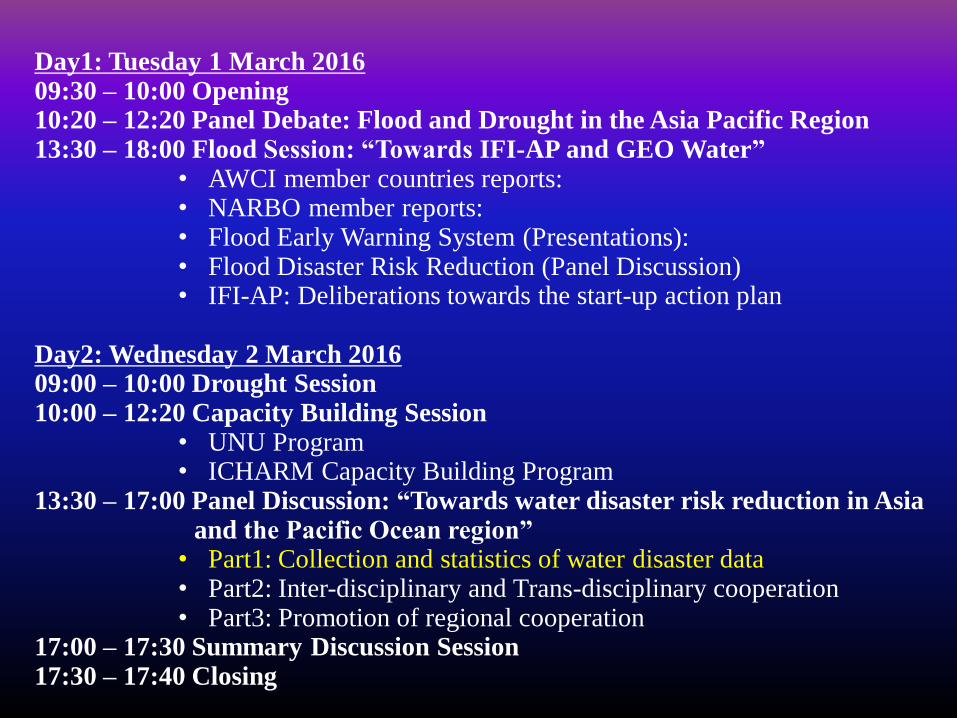
Day1: Tuesday 1 March 201609:30 – 10:00 Opening 10:20 – 12:20 Panel Debate: Flood and Drought in the Asia Pacific Region 13:30 – 18:00 Flood Session: “Towards IFI-AP and GEO Water”
• AWCI member countries reports: • NARBO member reports: • Flood Early Warning System (Presentations): • Flood Disaster Risk Reduction (Panel Discussion)• IFI-AP: Deliberations towards the start-up action plan
Day2: Wednesday 2 March 201609:00 – 10:00 Drought Session10:00 – 12:20 Capacity Building Session
• UNU Program• ICHARM Capacity Building Program
13:30 – 17:00 Panel Discussion: “Towards water disaster risk reduction in Asia and the Pacific Ocean region”
• Part1: Collection and statistics of water disaster data• Part2: Inter-disciplinary and Trans-disciplinary cooperation • Part3: Promotion of regional cooperation
17:00 – 17:30 Summary Discussion Session17:30 – 17:40 Closing
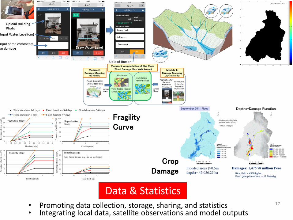
17
Data & Statistics• Promoting data collection, storage, sharing, and statistics• Integrating local data, satellite observations and model outputs
020406080
100
<0.2 0.2-1.0 >1.0 2
Per
centa
ge
of
yie
ld l
oss
(%
)
Flood depth (m)
Vegetative stage
Flood duration= 1-2 days Flood duration= 3-4 days Flood duration= 5-6 days
Flood duration= 7 days Flood duration >7 days
0
20
40
60
80
100
0 0.2 0.4 0.6 0.8 1 1.2 1.4 1.6 1.8 2
Per
centa
ge
of
yie
ld l
oss
(%
)
Flood depth (m)
Vegetative stage
Flood duration= 1-2 days
Flood duration= 3-4 days
Flood duration= 5-6 days
Flood duration= 7 days
Flood duration >7 days
0
20
40
60
80
100
0 0.5 1 1.5 2
Per
centa
ge
of
yie
ld l
oss
(%
)
Flood depth (m)
Reproductive stage
Flood duration= 1-2 days
Flood duration= 3-4 days
Flood duration= 5-6 days
Flood duration= 7 days
Flood duration >7 days
0
20
40
60
80
100
0 0.5 1 1.5 2
Per
centa
ge
of
yie
ld l
oss
(%
)
Flood depth (m)
Maturity stage
Flood duration= 1-2 days
Flood duration= 3-4 days
Flood duration= 5-6 days
Flood duration= 7 days
Flood duration >7 days
0
20
40
60
80
100
0 0.5 1 1.5 2
Per
cen
tage
of
yie
ld l
oss
(%
)
Flood depth (m)
Ripening stage
Flood duration= 1-2 days
Flood duration= 3-4 days
Flood duration= 5-6 days
Flood duration= 7 days
Flood duration >7 days
Vegetative Stage
Maturity Stage Ripening Stage
Note: Green line and blue line are overlapped
Reproductive
Stage
FragilityCurve
Crop Damage
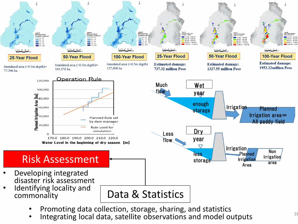
18
Data & Statistics
Risk Assessment
• Promoting data collection, storage, sharing, and statistics• Integrating local data, satellite observations and model outputs
• Developing integrated disaster risk assessment
• Identifying locality and commonality
GPM-Core
GSMaP
Hydrological Model
Rainfall Bias-Correction
Rain Gauge
Flood Prediction
MicrowaveRadiometer
Numerical Weather Prediction
Atmos. DataAssimilation
Land Surface Scheme
Land DataAssimilation
Soil Moisture
Vegetation Drought(Hydrology, Agriculture)
Monitoring & Prediction
Ground Water MonitoringGravity
Sensor
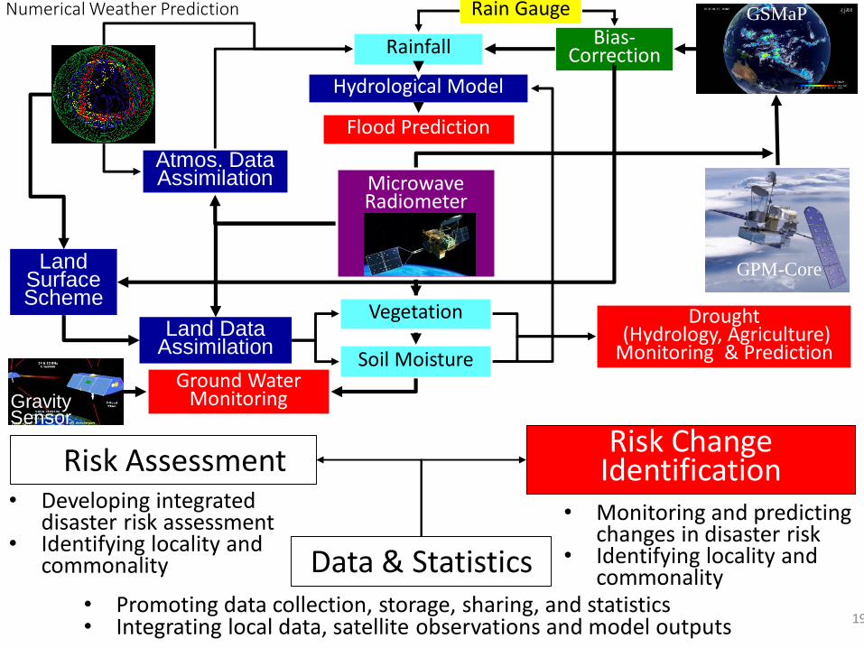
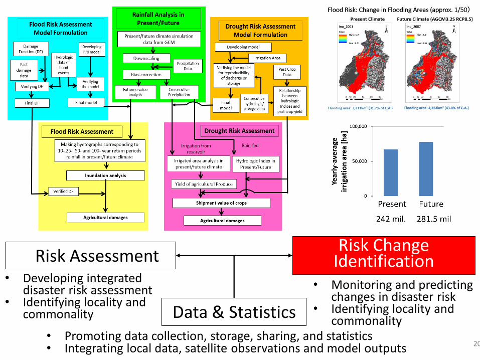
19
Data & Statistics
Risk AssessmentRisk Change
Identification
• Promoting data collection, storage, sharing, and statistics• Integrating local data, satellite observations and model outputs
• Developing integrated disaster risk assessment
• Identifying locality and commonality
• Monitoring and predicting changes in disaster risk
• Identifying locality and commonality
20
Data & Statistics
Risk AssessmentRisk Change
Identification
• Promoting data collection, storage, sharing, and statistics• Integrating local data, satellite observations and model outputs
• Developing integrated disaster risk assessment
• Identifying locality and commonality
• Monitoring and predicting changes in disaster risk
• Identifying locality and commonality
21
Data & Statistics
Risk AssessmentRisk Change
Identification
• Promoting data collection, storage, sharing, and statistics• Integrating local data, satellite observations and model outputs
• Developing integrated disaster risk assessment
• Identifying locality and commonality
• Monitoring and predicting changes in disaster risk
• Identifying locality and commonality
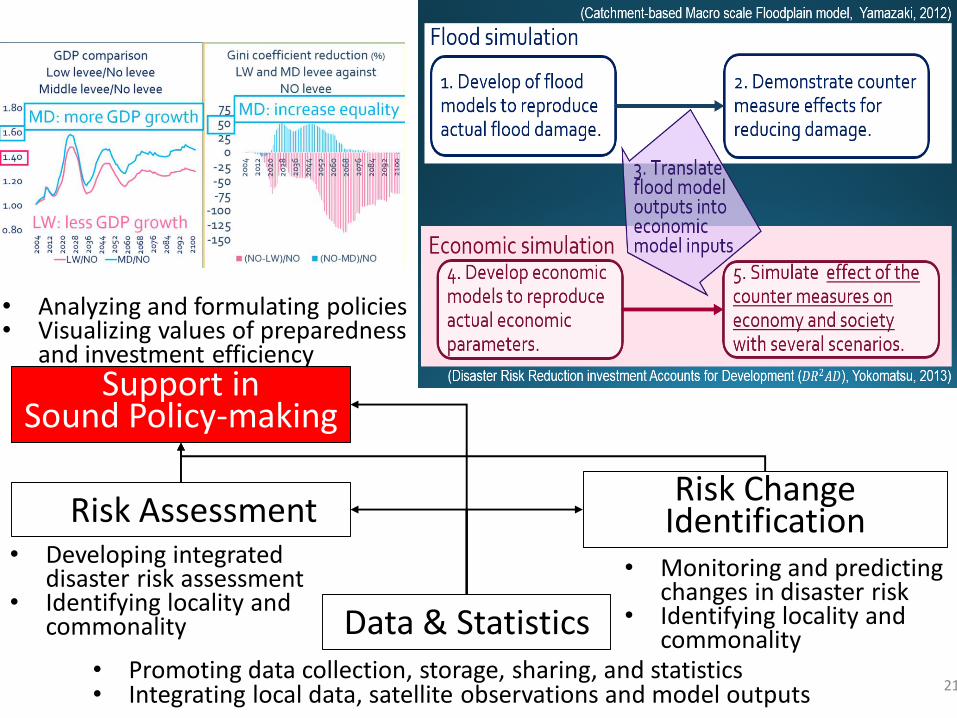
Support in Sound Policy-making
• Analyzing and formulating policies• Visualizing values of preparedness
and investment efficiency
22
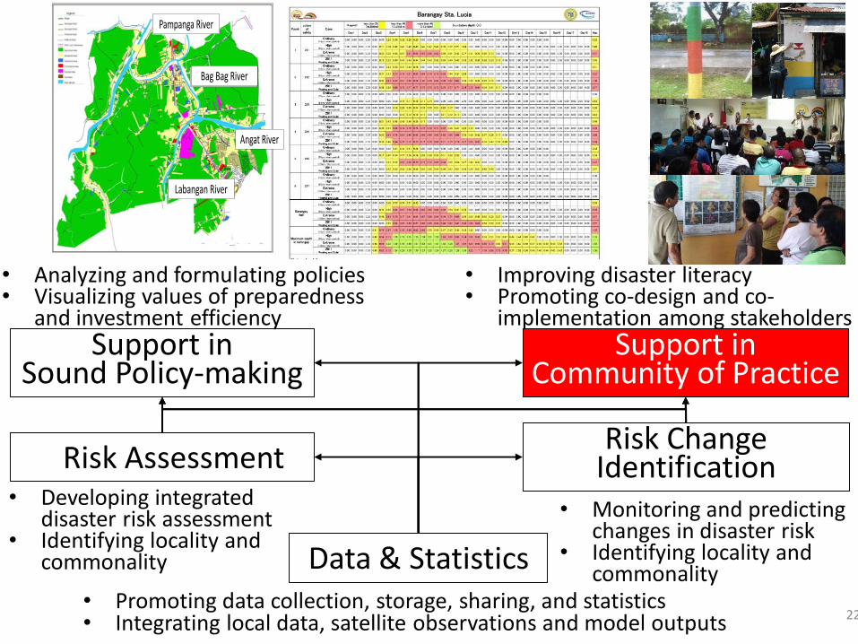
Data & Statistics
Risk AssessmentRisk Change
Identification
• Promoting data collection, storage, sharing, and statistics• Integrating local data, satellite observations and model outputs
• Developing integrated disaster risk assessment
• Identifying locality and commonality
• Monitoring and predicting changes in disaster risk
• Identifying locality and commonality
Support in Community of Practice
Support in Sound Policy-making
• Improving disaster literacy• Promoting co-design and co-
implementation among stakeholders
• Analyzing and formulating policies• Visualizing values of preparedness
and investment efficiency
Pampanga River
Labangan River
Angat River
Bag Bag River
Labangan River
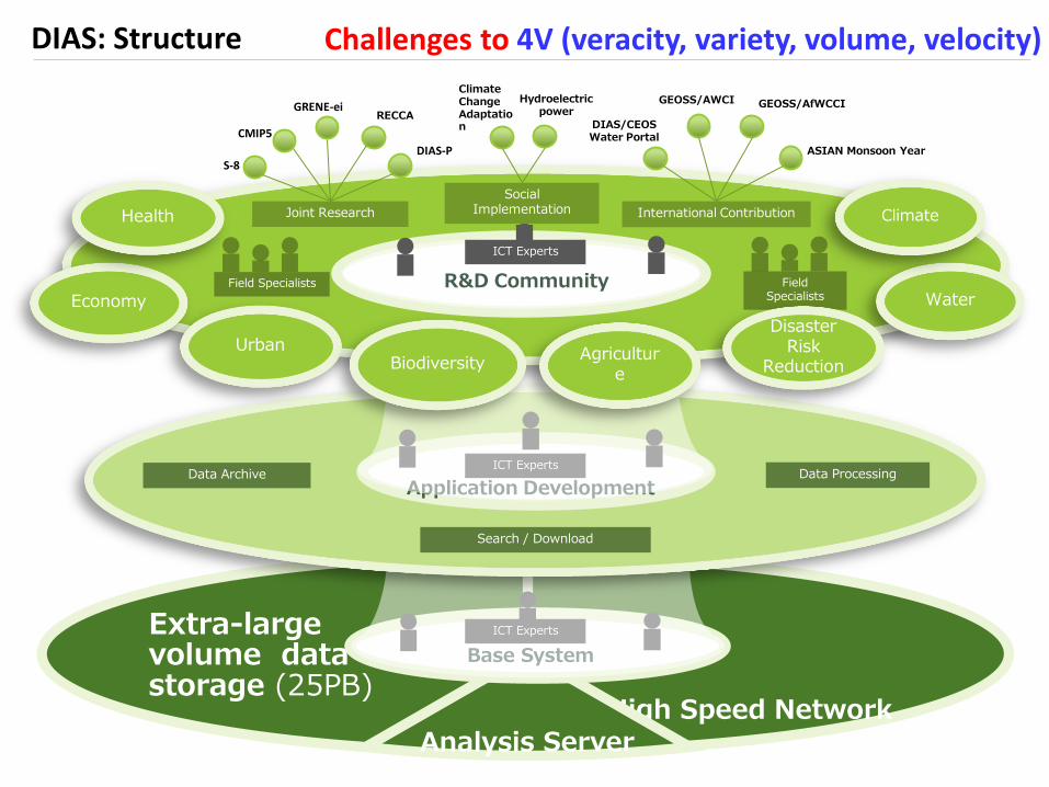
DIAS: Structure
High Speed NetworkAnalysis Server
Extra-large volume data storage (25PB)
Base System
ICT Experts
Data Archive
Search / Download
Data Processing
Application Development
ICT Experts
Field Specialists R&D Community
ICT Experts
Field Specialists Water
Disaster Risk
ReductionAgricultur
e
Urban
Economy
Biodiversity
Health Climate
Hydroelectric power
Social Implementation
Climate Change Adaptation
ASIAN Monsoon Year
International Contribution
DIAS/CEOSWater Portal
GEOSS/AWCI GEOSS/AfWCCI
Joint Research
S-8
CMIP5
GRENE-ei
DIAS-P
RECCA
Challenges to 4V (veracity, variety, volume, velocity)
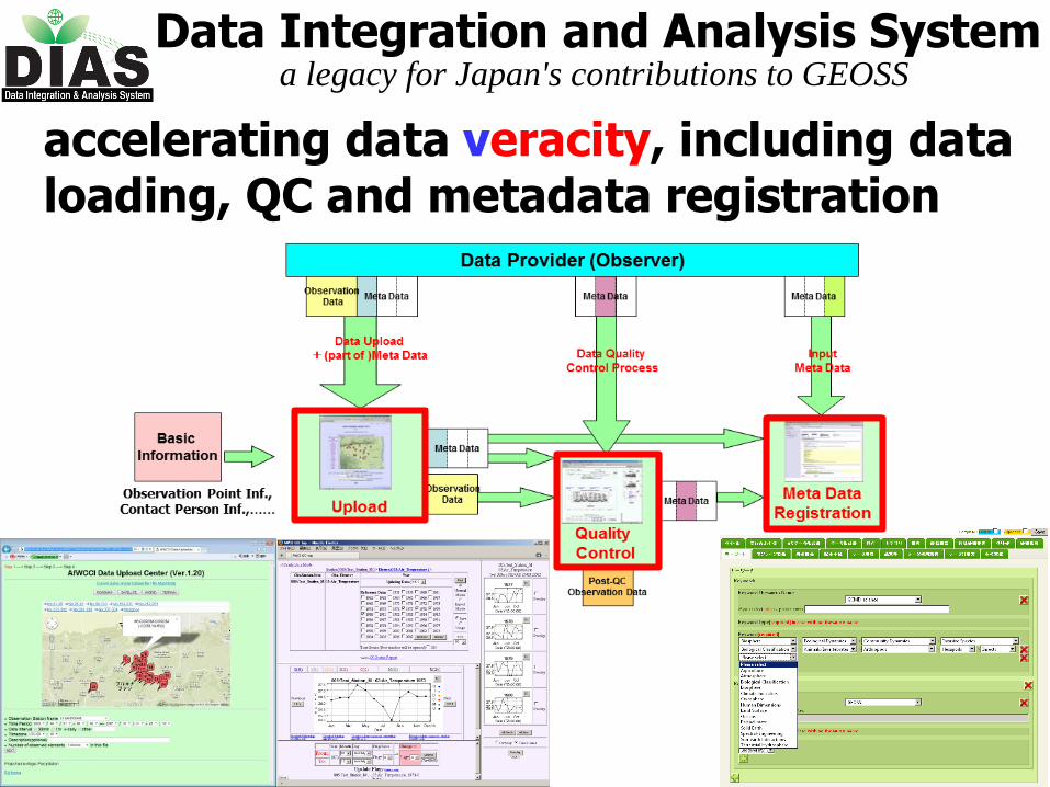
Data Integration and Analysis Systema legacy for Japan's contributions to GEOSS
accelerating data veracity, including data loading, QC and metadata registration
Data Integration and Analysis Systema legacy for Japan's contributions to GEOSS
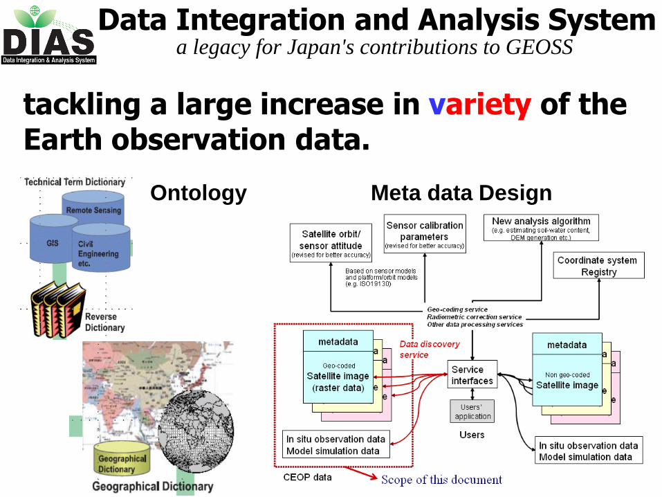
tackling a large increase in variety of the Earth observation data.
Ontology Meta data Design
0
2000040000
6000080000
100000120000
140000
160000
180000
2002/9/1 2004/1/14 2005/5/28 2006/10/10 2008/2/22 2009/7/6
QC開始日
QCデータ数(/日・人
)
CEOPAWCIJICA
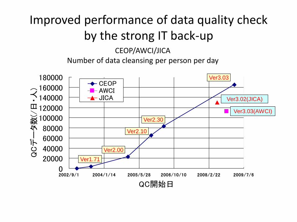
Improved performance of data quality checkby the strong IT back-up
CEOP/AWCI/JICANumber of data cleansing per person per day
Ver1.71
Ver2.00
Ver2.10
Ver2.30
Ver3.03
Ver3.02(JICA)
Ver3.03(AWCI)

0
2000040000
6000080000
100000120000
140000
160000
180000
2002/9/1 2004/1/14 2005/5/28 2006/10/10 2008/2/22 2009/7/6
QC開始日
QCデータ数(/日・人
)
CEOPAWCIJICA
Improved performance of data quality checkby the strong IT back-up
CEOP/AWCI/JICANumber of data cleansing per person per day
Ver1.71
Ver2.00
Ver2.10
Ver2.30
Ver3.03
Ver3.02(JICA)
Ver3.03(AWCI)
Data Integration and Analysis Systema legacy for Japan's contributions to GEOSS
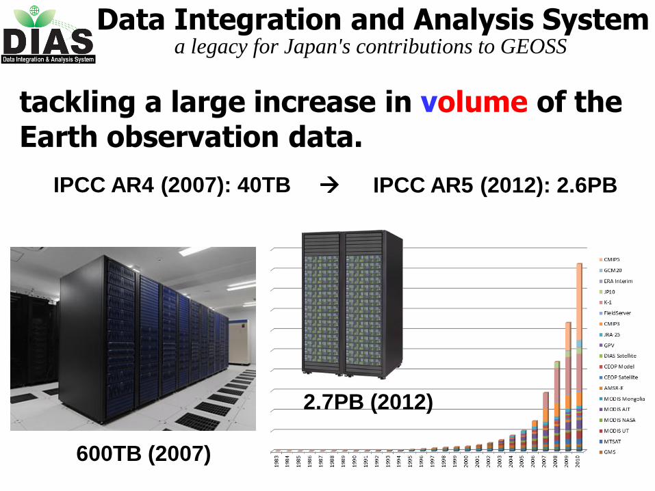
tackling a large increase in volume of the Earth observation data.
2.7PB (2012)
IPCC AR4 (2007): 40TB IPCC AR5 (2012): 2.6PB
600TB (2007)
Data Integration and Analysis Systema legacy for Japan's contributions to GEOSS
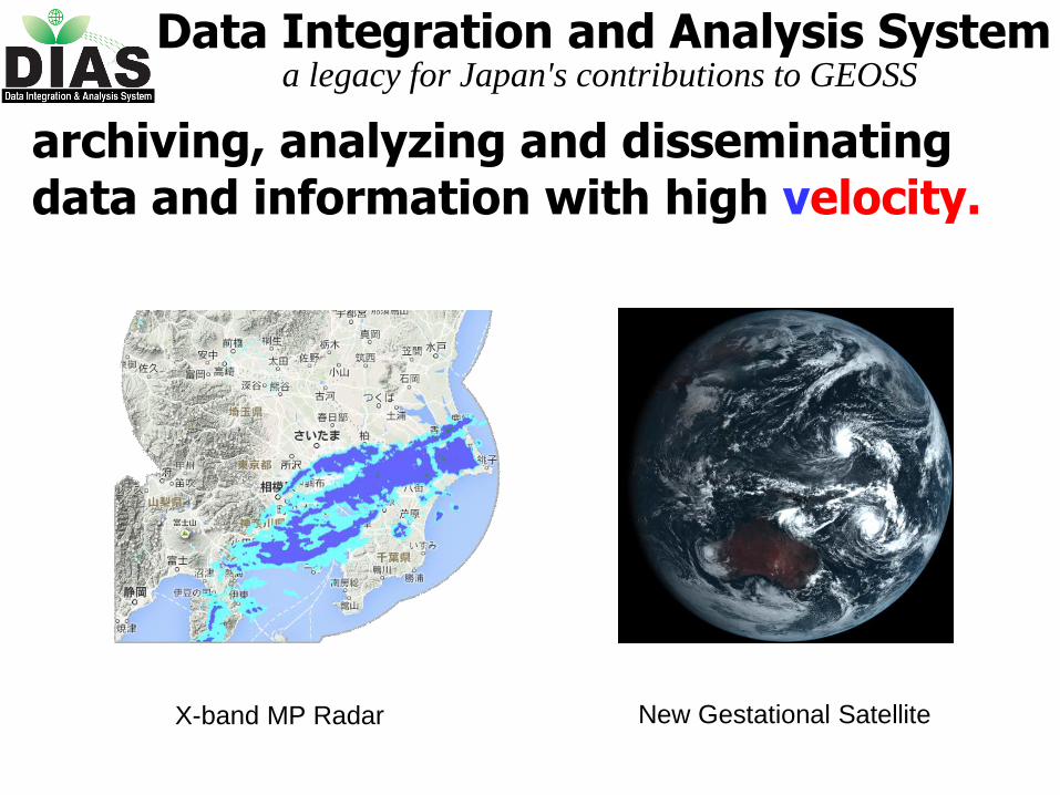
archiving, analyzing and disseminating data and information with high velocity.
X-band MP Radar New Gestational Satellite