Embed Size (px)
Citation preview
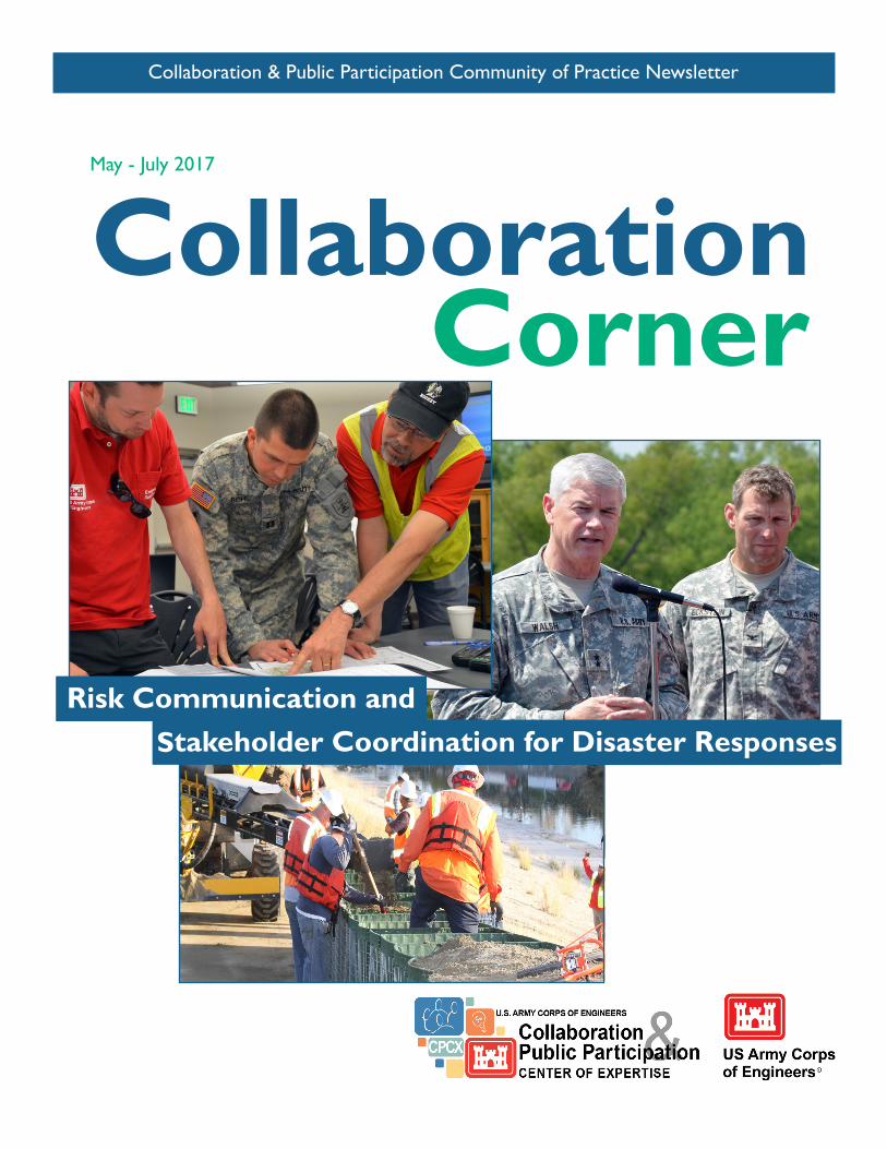
Collaboration & Public Participation Community of Practice Newsletter
CollaborationMay - July 2017
Corner
Risk Communication andStakeholder Coordination for Disaster Responses
VOLUME 6, ISSUE II
Contents32
5
6
7
4
8
9
“TAG-teaming” for tribal floodplain management in Utah
Announcements
Lessons from liaising between California and Sacramento District for the Oroville Spillway Emergency
Recent CoP Webinars & Course of Interest
Oroville Dam response emphasizes importance of risk communication
GEO-Shape - Streamlining partner collaboration for emergency response efforts
Pre-flood collaboration pays off during current Boise River historic flood
Ask Hal
This newsletter is produced by Team Wonky Thorn of the USACE Collaboration and Public Participation Center of Ex-pertise (CPCX), located at the Institute for Water Resources. For questions, comments, or to submit articles, contact Andrea Carson at [email protected]
In This Issue:This issue features articles highlighting innovative tools and programs the Corps is involved with in collaborating emergency response and risk communication.
Our goal with this issue was to equip each of you with awareness of tools, programs, and success stories related to emergency response, risk communication and community collaboration as we enter the natural disaster season (hurricanes, wildfires, floods, etc.).
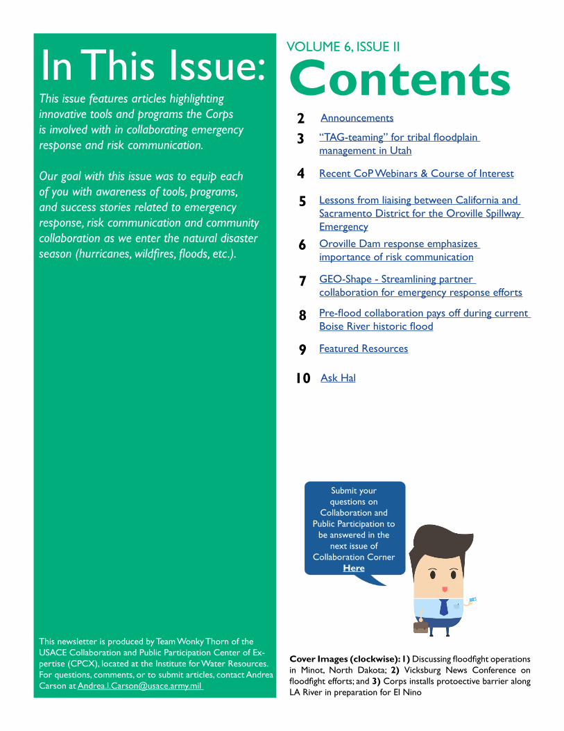
Cover Images (clockwise): 1) Discussing floodfight operations in Minot, North Dakota; 2) Vicksburg News Conference on floodfight efforts; and 3) Corps installs protoective barrier along LA River in preparation for El Nino
Submit your questions on
Collaboration and Public Participation to
be answered in the next issue of
Collaboration Corner Here
Featured Resources
10
Announcements
NOW
OCT
IDP
16-20Shepherdstown, WVRegister HERE by Aug 4th
USACE/FWS Training: Collaboration and Conflict Transformation in Multi-Party Processes
Look forTAKEAWAY TIPS
LOOK FOR THIS RED BOX IN EACH ARTICLE.
It will contain that ‘morsel’ or bit of information we want you to ‘chew on’ for
later.
SEPT
This could
be your
event!
Connect...We would like to hear about your stories, events, or announcements that would be of interest to our collaboration community.
Copy the CoP Calendar to your Outlook to stay connected!
SIGN UP FOR COURSES AND UPDATE YOUR IDP. See the most recent Keepin’ Up with the CoP for a full list of available courses
Now is the time to sign up for PROSPECT courses and update your IDP. Here is a cheat sheet to help you select a course related to communication, teambuilding, or public involvement:
383 - PROJECT TEAMBUILDING: Covers leadership styles, building and leading high-performing project teams; understanding communication styles and developing communication skills.91 - PUBLIC INVOLVEMENT - COMMUNICATION: Covers basic communications and group process techniques to enable Corps employees to more effectively interact with the public.407 - PUBLIC INVOLVEMENT AND TEAM BUILDING IN PLANNING: Covers developing a stakeholder engagement strategy in the context of the 6-step planning process, teaming, designing public meetings, and media training.104 - RISK COMMUNICATION AND PUBLIC PARTICIPATION:Covers strategic communication, risk communication and public participation principles and strategies relevant to any issue.
PROSPECT COURSES
SEPT
13-20
IAP2 Virtual Training: Social Media and Public ParticipationOnlineRegister HERE; IAP2 members $99, Non-members $109
“TAG-teaming” for tribal floodplain management in Utah
May - July 2017 | Volume 6, Issue II 3
By Hunter Merritt and Patricia Fontanet, Sacramento District Planning Division
Sacramento District and many other interagency partners are building a floodplain management plan (FMP) with the Skull Valley Goshute Tribe to help increase the tribe’s resilience to future floods. This task is accomplished through effective communication and collaboration, and it lays the necessary groundwork for both mitigation efforts and emergency response in the future. Floodplain Management Services, or FPMS, is the authority that makes it possible for the Corps to work on the plan. Funding for this interagency non-structural flood risk management proposal came through Silver Jackets, a state-chartered program that allows representatives to combine diverse resources, capabilities and authorities. The Skull Valley FMP is only the second Tribal FMP developed by the Corps.
The Skull Valley reservation, which lies south of the Great Salt Lake in Utah, has experienced increased flooding in recent years, causing damage to property and land. Chairwoman Candace Bear is heading up the effort with technical support from agencies to develop the FMP. The team includes members from USACE, the Federal Emergency Management Agency, the U.S. Forest Service, the Bureau of Indian Affairs, the Natural Resources Conservation Service, Utah Department of Emergency Management, the Shambip Conservation District, Tooele County, and others. The Technical Advisory Group (TAG) has been meeting regularly since December 2016 to develop the plan. When a final draft is produced, a Public Awareness Workgroup, or PAW, will
be given the draft to make comments and suggestions. The use of a TAG and PAW is not unique to Tribal FMPs, but Tribal work requires a different type of collaboration and communication. It is important to give deference to the tribe as to what goes into the FMP (for example, mapping of areas or description of historical sites), and to have this conversation before sharing the draft document with others.
One of the most difficult parts of developing this plan is the lack of written information about the historical flooding. The Corps team has been able to pull this information together by listening extensively to tribal members’ stories and asking other agencies. (continued onto next page)
TRIBAL FLOODPLAIN MANAGEMENT PLANS ARE DIFFERENT THAN OTHER FMPS. THERE OFTEN IS NOT AS MUCH INFORMATION, SO TEAMS MUST BE CREATIVE AND INNOVATIVE IN THEIR APPROACHES.
LISTEN. THIS IS THE MOST VALUABLE COLLABORATION TOOL IN THE TOOLBOX, AND IT IS EVEN MORE IMPORTANT WHEN WORKING WITH TRIBES.
THE TRIBE IS THE ULTIMATE OWNER OF THE PLAN, AND WE (THE CORPS AND OTHERS) ARE HERE TO ASSIST, NOT TO DECIDE THE BEST SOLUTIONS TO FLOODING PROBLEMS.
Several lessons learned included:
4
“TAG-teaming” for tribal floodplain management (continued)
CPP COPWEBINARSJuly 2017Holding Effective Virtual and In-Person Meetings
The USACE Public Involvement Specialists program is designed to improve USACE’s capacity to engage the public and agency partners at the local, state and federal levels. As part of that effort, this webinar, also available for delivery to districts as part of a collaborative capacity building brown bag series, will provide you with tools and tips for holding effective meetings whether in person or on a webinar. This webinar will also introduce you to the basics of facilitation.
If interested in a tailored delivery for your district, contact a PI Specialist in your division.
For recordings of these webinars visit: https://corpslakes.erdc.dren.mil/employees/facilitator/ex-change.cfm?Option=ArchiveSchedule&CoP=facilitator
COURSE OF INTEREST: RISK COMMUNICATION & PUBLIC PARTICIPATION
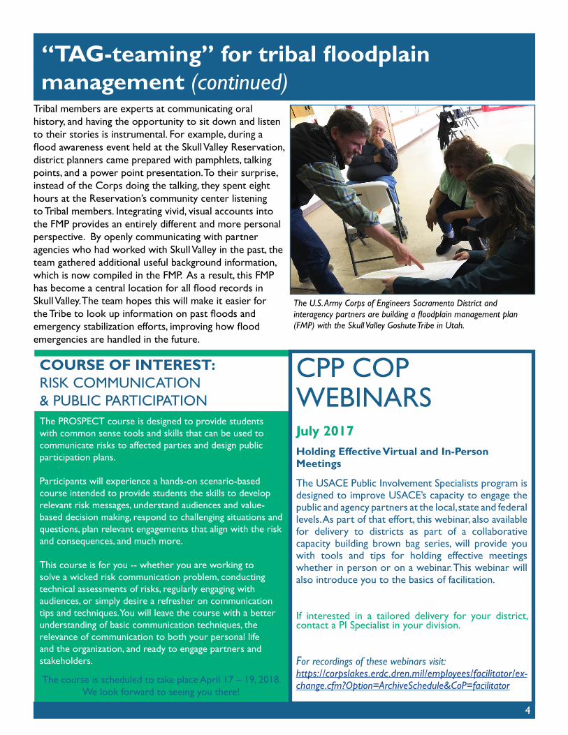
Tribal members are experts at communicating oral history, and having the opportunity to sit down and listen to their stories is instrumental. For example, during a flood awareness event held at the Skull Valley Reservation, district planners came prepared with pamphlets, talking points, and a power point presentation. To their surprise, instead of the Corps doing the talking, they spent eight hours at the Reservation’s community center listening to Tribal members. Integrating vivid, visual accounts into the FMP provides an entirely different and more personal perspective. By openly communicating with partner agencies who had worked with Skull Valley in the past, the team gathered additional useful background information, which is now compiled in the FMP. As a result, this FMP has become a central location for all flood records in Skull Valley. The team hopes this will make it easier for the Tribe to look up information on past floods and emergency stabilization efforts, improving how flood emergencies are handled in the future.
The U.S. Army Corps of Engineers Sacramento District and interagency partners are building a floodplain management plan (FMP) with the Skull Valley Goshute Tribe in Utah.
The PROSPECT course is designed to provide students with common sense tools and skills that can be used to communicate risks to affected parties and design public participation plans.
Participants will experience a hands-on scenario-based course intended to provide students the skills to develop relevant risk messages, understand audiences and value-based decision making, respond to challenging situations and questions, plan relevant engagements that align with the risk and consequences, and much more.
This course is for you -- whether you are working to solve a wicked risk communication problem, conducting technical assessments of risks, regularly engaging with audiences, or simply desire a refresher on communication tips and techniques. You will leave the course with a better understanding of basic communication techniques, the relevance of communication to both your personal life and the organization, and ready to engage partners and stakeholders.
The course is scheduled to take place April 17 – 19, 2018. We look forward to seeing you there!
of Water Resources requested technical assistance under PL 84-99 for emergency repair work at Oroville Dam and the downstream flood fight response. Melissa and Krystel developed a tracking system for requests from the State to the District, communicated the requirements for requests for assistance under PL 84-99, fielded questions from the state on the District’s flood fight response capabilities, and facilitated requests from the state to ensure a timely federal flood fight response.
Both Melissa and Krystel serve on the National Local Government Liaison (LGL) cadre and were well-prepared to serve in the same role for a local response. The LGL cadre is a national asset that deploys to facilitate Corps missions assigned during a federally declared disaster under the Robert T. Stafford Disaster Relief and Emergency Assistance Act, PL 100-707. To be effective as liaisons, they ensured information reported to District leadership and from the District to the state was accurate and timely. Through the annual training they receive as LGLs, they were well prepared to respond with short notice and to sustain a positive operating tempo to maximize support to the State. They also engaged with the USACE and FEMA team responding under the Stafford Act to provide information received from the State to support the federal response.
Lessons from liaising between California and Sacramento District for the Oroville Spillway Emergency
By Krystel Bell and Melissa Montag, Local Government Liaisons, Sacramento District
The Oroville Dam, located in Oroville, California, received damage to its service spillway on February 7, 2017, which led to a loss of a significant portion of the spillway chute and reduced the amount of available spillway capacity at the Oroville Dam. High inflows, reduced service spillway capacity, and the erosion at the emergency spillway resulted in a mandatory evacuation order for areas surrounding the Dam for 180,000 people. On February 12, 2017 Sacramento District deployed Krystel Bell and Melissa Montag to the California Governor’s Office of Emergency Services’ (CalOES) Emergency Operation Center to serve as USACE liaisons to the State of California’s Department of Water Resources. A Federal Disaster Declaration for Oroville and statewide flooding was issued on February 14, 2017.
Krystel and Melissa responded under the Flood Control and Coastal Emergency Act, Public Law 84-99, which allows USACE to supplement state and local flood fight efforts. As liaisons, they served as a critical conduit of information and requests for Federal assistance between the California Department of Water Resources and the Sacramento District. As the event unfolded, and high flood flows continue throughout the state, the California Department
May - July 2017 | Volume 6, Issue II 5
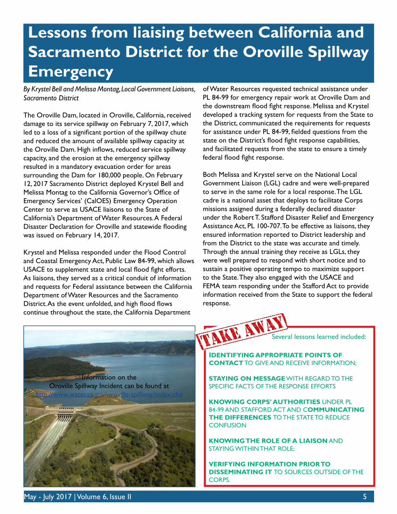
Information on the Oroville Spillway Incident can be found at
http://www.water.ca.gov/oroville-spillway/index.cfm
IDENTIFYING APPROPRIATE POINTS OF CONTACT TO GIVE AND RECEIVE INFORMATION;
STAYING ON MESSAGE WITH REGARD TO THE SPECIFIC FACTS OF THE RESPONSE EFFORTS
KNOWING CORPS’ AUTHORITIES UNDER PL 84-99 AND STAFFORD ACT AND COMMUNICATING THE DIFFERENCES TO THE STATE TO REDUCE CONFUSION
KNOWING THE ROLE OF A LIAISON AND STAYING WITHIN THAT ROLE;
VERIFYING INFORMATION PRIOR TO DISSEMINATING IT TO SOURCES OUTSIDE OF THE CORPS.
Several lessons learned included:
Oroville Dam response emphasizes importance of risk communication
By Melanie Ellis, Outreach Coordinator, Southwestern Division
The recent response at Oroville Dam capitalized on years of interagency working relationships and highlighted the importance of risk communication. In February 2017, over 180,000 people were ordered to evacuate as the gated and emergency spillways went into distress while making releases to lower the lake level. Oroville Dam, owned and operated by California Department of Water Resources (DWR), is an earthfill embankment dam on the Feather River east of the city of Oroville, California. At 770 feet high, it is the tallest dam in the U.S. and serves mainly for water supply, hydroelectricity generation, and flood control.
During the recent flood event, protecting the dam and the residents in and around Oroville was the number one priority for DWR. The Butte County Sheriff ’s office issued a mandatory evacuation and DWR immediately engaged USACE under the PL 84-99 emergency response program. After the mandatory evacuation was lifted and the immediate threat passed, USACE was able to continue assisting DWR using the Flood Plain Management Services (FPMS) program, as authorized under section 206 of the Flood Control Act of 1960. DWR was able to enlist USACE to help assess the risks associated with the dam and spillways. Engineers and geologists from the Sacramento District and the Risk Management Center provided advice and support to spillway operations, short term stabilization measures, direct support of drilling rigs for geology investigations, and expert review and advice on design considerations.
Having a long-standing working relationship with USACE ensured that DWR and other partners knew the capabilities and services USACE could provide. Following the response, an agreement was signed on March 10 to support the immediate stabilization of the Oroville Spillway and plan for recovery of the Oroville Dam facility and downstream along Feather River. Having an established Silver Jackets relationship was critical for this response effort. The Silver Jackets connection allowed USACE to develop a scope and sign an agreement with DWR, receive funding, and begin to work with DWR within 30 business days – which is a process that can sometimes take over a year. This quick process meant that USACE did not lose any continuity of service to DWR during the end of PL 84-99 funding/authority and the beginning of our FPMS work.
DWR utilized many different tools and electronic medias
to communicate the latest information to the public. Taking advantage of news releases, press conferences, websites, social media sites, text messaging, and public meetings, DWR broadcast information to the hundreds of thousands of people as quickly as possible. They also maintain a separate website so residents or anyone interested can get the latest information on Oroville Dam.
Check out this site for up-to-date information, pictures, videos, maps, public meeting announcements, and more.
http://www.water.ca.gov/oroville-spillway/index.cfm
Being able to communicate risks posed to the community was a critical need for DWR. The USACE team has gathered several key points, in the takeaway tips box below, to remember from this experience so that we can provide immediate assistance to our partners and improve our competency in risk assessment and communication.
6
COMMUNICATING RISKS TAKES A TEAM TO ENSURE THE COMMUNICATION IS TIMELY, ACCURATE, AND CLEARLY ARTICULATES THE SITUATION AT HAND. EVERYONE MUST HAVE AN UNDERSTANDING OF THEIR ROLE AND RESPONSIBILITY.
PARTNERSHIP – THE FPMS PROGRAM PROVIDES THE AUTHORITY FOR USACE PARTICIPATION AS A TECHNICAL ASSISTANT TO STATES OR LOCALS WHO ARE NEEDING SUPPORT, IN ALL PHASES OF THE RISK CYCLE.
PLANNING – A GREAT PLACE TO START CONVERSATIONS IN ADVANCE OF AN EMERGENCY IS WITH A STATE’S SILVER JACKETS TEAM. SOME OF THE BEST PRACTICES ARE TO DEVELOP TABLE TOP EXERCISES AND SUPPORT REGULAR ENGAGEMENTS WITH THE KEY PLAYERS IN A RESPONDER SCENARIO (E.G. FIRE DEPARTMENTS, SHERIFF’S OFFICES).
PRACTICE – TRAIN IN RISK COMMUNICATION WHENEVER POSSIBLE.
ENGAGE – OFTEN AND EARLY! CONTINUE OUTREACH TO AGENCIES AND PARTNERS DURING NON-EVENT TIMES SO THEY CLEARLY UNDERSTAND USACE CAPABILITIES AND SERVICES.
The key points to remember are:
All of the components of GeoSHAPE are open source and available for free on the Internet.
Details and additional information are available at geoshape.org and geogig.org.
By Robin Rodgers, Physical Scientist, U.S. Army Geospatial Research Laboratory
In the aftermath of the 2010 earthquake in Haiti, the need for a platform to facilitate collaboration among multiple organizations became readily apparent.
In 2012, the U.S. Army Engineer Research and Development Center’s Geospatial Research Laboratory initiated and led a project to develop an open source geospatial platform that would streamline collaboration on geospatial feature data among a wide range of partner organizations. Although the project officially concluded in 2014, the resulting capability, called GeoSHAPE (Geospatial capabilities for Security, Humanitarian Assistance, and Partner Engagement), continues to be actively used and improved.
GeoSHAPE consists of both web and mobile applications that were built on an open source foundation and meet open source standards. The web application allows organizations to create, edit, and share critical data on an integrated dynamic map in near real-time. The mobile application enables data and photo collection in the field. In a connected environment, the field data can frequently be pushed to the organization’s server and displayed on the web application map. Shared data and updates can also be synchronized with partner organizations anywhere in the world.
Since GeoSHAPE was developed with disaster relief and emergency response in mind, it was essential that the capabilities function in both connected and disconnected environments. GeoGig is the novel GeoSHAPE component
May - July 2017 | Volume 6, Issue II 7
GeoSHAPE – Streamlining partner collaboration for emergency response efforts
that enables disconnected operations. Inspired by the Git distributed version control system, GeoGig offers a distributed version control system for geospatial feature data. This means that users are able to clone a dataset or a subset of the dataset, go out in the field, make changes to the data, and then seamlessly merge their data back with the original dataset once they return to a connected environment. A history of the changes that are made is maintained, and users can revert to a previous version of the dataset, if necessary.
GeoSHAPE has been successfully demonstrated and evaluated by the Permanent Contingency Commission in Honduras (similar to FEMA) and the Civil Defense and National Emergency Commission in the Dominican Republic, both of which intend to continue to use the capabilities in their standard operations. A customized version of GeoSHAPE was developed for the International Association of Fire Fighters, and GeoSHAPE has also been deployed at the United Nations, the National Geospatial-Intelligence Agency, and U.S. Southern Command.
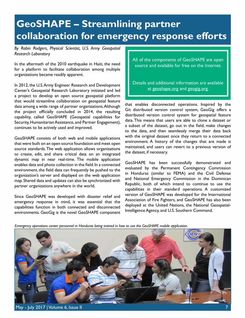
Emergency operations center personnel in Honduras being trained in how to use the GeoSHAPE mobile application.
By Tracy Schwarz, Flood Risk Manager, Walla Walla District
Walla Walla District experienced the second highest release from the federal dams on the Boise River since construction was completed in 1954. Three dams, one U.S. Army Corps of Engineers (USACE) and two U.S. Bureau of Reclamation (USBR), are operated as a system by USACE under Section 7 authorities of the Flood Control Act of 1944. Several collaborative flood risk preparation activities proved to be instrumental at enabling the success of this year’s flood response.
8
Pre-flood collaboration pays off during current Boise River historic flood
Risk Communication: The pre-event activities began after a minor 10-year flood event in 2006 that served as a wake-up call for the Boise River communities investing substantial resources to develop previously unoccupied floodplains. After this event the District Water Management and Planning Programs jointly reached out to the community with a public meeting to discuss flood risk in the valley and the concept of shared responsibility for flood risk. The most notable message of the engagement was that the operation of upstream reservoirs would not protect them from all possible floods. The district provided additional flood risk presentations to the state and local governments in 2009 and 2010.
TTX: A Table Top Exercise (TTX) in 2011 was instrumental in aligning the team and partners. The TTX included USACE Dam Safety, Water Management, Levee Safety, Flood Risk
Management, Silver Jackets, Emergency Management, as well as counterparts in USBR, State of Idaho, and local governments. One of the main benefits that came from the 2011 exercise that aided this year’s flood event was adding local Emergency Managers to the daily email sent from Water Management to the reservoir operators concerning event flow changes. The 2011 exercise also helped clarify the organizational structure, roles and responsibilities of USACE, and helped coordination for the current event. This was the first TTX led jointly by USACE Dam Safety, Water Management and EM and the combination of the three programs made for a more meaningful exercise.
Planning Studies: The USACE started a General Investigations study with the State of Idaho in 2010 to look at reducing flood risk in the valley. As a part of that study, flood risk maps were generated for the most densely populated portion of the basin. These maps were later utilized by the local county as a Planning Assistance to States study that developed multiple maps at different flow rates. These maps were posted on a National Weather Service website, a great resource for the public during this year’s event. This work was later leveraged and expanded by FEMA to make updated flood insurance rate maps for the community. Through each of these efforts, the state and local governments as well as the public became more risk aware and knowledgeable of the flood prone areas. (continued onto next page)
May - July 2017 | Volume 6, Issue II 9
Pre-flood collaboration pays off (continued)
Results: During this year’s flood response, coordination between EM/FCCE, Water Management and Levee Safety greatly improved. The relationships and communication channels established at the TTX and through interactions in the years after have improved internal and external communications as well as numerous FCCE responses during this year’s flood. In fact, the Idaho Silver Jackets Coordinator served as the USACE field monitoring representative working with local EM staff, state, and other federal agencies. The District and FEMA Region X have coordinated closely on recent mapping and community concerns that have been received by both offices during this year’s flood event.
KEEPING A COMMUNITY RISK AWARE IS PARAMOUNT TO THEIR SUCCESS AT BEING FLOOD RESILIENT. THIS REQUIRES ONGOING COMMUNITY CONTACT; IT IS NOT A ONETIME EVENT.
ENSURE INTERNAL USACE FLOOD RISK OFFICES ARE ACCUSTOMED TO WORKING TOGETHER AND WITH THE COMMUNITY. THIS WAS BEST ACCOMPLISHED BY THE TTX, AS WELL AS ROUTINE OPPORTUNITIES TO HAVE THE INTERNAL DISTRICT PROGRAMS WORK TOGETHER. IT IS IMPORTANT THAT THE COMMUNITY KNOWS WHO TO CONTACT WITHIN THE DISTRICT FOR SUPPORT.
HOLD INTERNAL DISTRICT FACE-TO-FACE FLOOD RISK MANAGEMENT MEETINGS WHEN THE FIRST LARGE SNOW PACK DEVELOPS AND DURING THE FLOOD TO ESTABLISH WHO IS TAKING ON WHICH ACTIVITIES AND TO MAKE SURE THERE ARE NO GAPS.
HAVE DISTRICT EM CONTACT THE COMMUNITIES AT RISK AS THEIR FLOOD RISK INCREASES TO ENSURE THEY KNOW THE PROCESSES TO OBTAIN TIMELY DISTRICT EMERGENCY RESPONSE SUPPORT.
Lessons learned from this year’s flood:
FEATURED RESOURCE:COMMUNICATION PLANNING PORTALIn the Communication Planning Portal, you can find a template for Communication Plans and a worksheet to determine the level of stakeholder engagement needed for your project.
When you put together your PMP it’s best to do a quick assessment using this worksheet so you can allocate the time and money needed to effectively engage your stakeholders, especially when your project has high visibility or is controversial!
Click here to explore the Communication Planning Portal: https://cops.usace.army.mil/sites/PA/CommPlan/default.aspx
FEATURED RESOURCE:PROBLEM SOLVING, COMMUNICATION, AND TEAMS(ONLINE TRAINING MODULE)
An online training module related to communication, teaming, and public involvement is now available!
This module is "Lesson 1: Course Themes - Problem Solving, Communication, and Teams" and is part of the Planning Essentials Course, the second course in the Planning Core Curriculum: https://gateway.erdc.dren.mil/plan/PlanningEssentials/index.cfm.
Watch this module to learn how to be an effective team member; the role of PDTs, Vertical Teams, and Review teams; define effective communication, practice active listening, use four communication methods commonly used in the Corps, and explain why and how we involve the public in our work.
Have other resources our CoP should know about? Let us know by emailing:
10
Ask Hal Dear Hal,
What are the best practices for communicating risk (and what are some tools I can use)?
Risk is by nature value-laden, and as a result, each communication effort is unique. However, there are still best practices and techniques that can help you prepare for discussing risk with affected parties. A critical place to start is to understand your audience and context. This means understanding how your audience is affected by a given risk: How familiar are they with it? How does it affect what they value? And, how much control did they have in creating/accepting to live near the risk?
A resident who chose to live next to a reservoir and experiences regular nuisance flooding will have different awareness and concerns than a resident below the dam who didn’t know they were at risk. Thus, understanding the audience helps to know what to expect so you can design your messages appropriately. Mentally put yourself in their situation and think about how you would feel related to these parameters. Whenever possible, talk to the community directly, through a selection of representatives, or a “gatekeeper,” a trusted and well-connected member of the community.
These three key factors of familiarity, values, and control can not only help identify concerns, but also are the keys to managing concerns and/or encouraging action. For example, for a community unaware of their flood risk, you could increase their concern through historic high water mark signs; remind them of all the things they value that are at risk; and focus on the actions they could take to mitigate their risk. For example, a community was fearful of a nuclear waste facility close by. Members toured the facility so it didn’t seem as scary (increased familiarity), were greatly involved in deciding the future of the site (control), and managed to balance protecting the community’s values with those of people who would be affected by relocating the material (values).
For successful risk communication, anticipate issues and openness to the message by considering the audience’s perspective; develop messages that address familiarity, values, and control; and practice, practice, practice.
The Corps Risk Analysis Gateway has a wealth of additional resources, including on-line Training and a Flood Risk Communication Toolbox.


![Interprofessional collaboration: effects of practice …ipls.dk/pdf-filer/ip_collaboration_cochrane.pdf · [Intervention Review] Interprofessional collaboration: effects of practice-based](https://img.pdfslide.us/doc/110x75/5b1f73977f8b9a34458b49dd/interprofessional-collaboration-effects-of-practice-iplsdkpdf-fileripcollaboration.jpg)