Embed Size (px)
Citation preview

STATE OF CALIFORNIA - NATURAL RESOURCES AGENCY EDMUND G. BROWN, JR., GOVERNOR
CALIFORNIA COASTAL COMMISSION South Coast Area Office 200 Oceangate, Suite 1000 Long Beach, CA 90802-4302 (562) 590-5071
May 6, 2013
ADDENDUM
TO: COMMISSIONERS AND INTERESTED PERSONS FROM: SOUTH COAST DISTRICT STAFF SUBJECT: ADDENDUM TO ITEM W13a, COASTAL COMMISSION PERMIT
APPLICATION NO. 5-12-191 (CITY OF HUNTINGTON BEACH) FOR THE COMMISSION MEETING OF WEDNESDAY, MAY 8, 2013
I. CHANGES TO STAFF REPORT Commission staff recommends modifications to Special Condition 2, and Special Condition 5. Deleted language is in strike through and new language is in bold underlined text, as shown below: A. Page 5 –The City has requested that Special Condition 2 be modified to ensure
consistency with other resource agency requirements. Revise Special Condition 2, Part C, as follows:
2. Avoidance of Sensitive Species … C. An appropriately trained biologist shall monitor the proposed development for disturbance to sensitive species or habitat area. At minimum, monitoring shall occur once a week during the breeding season, and once every two weeks during the non-breeding season, during any week in which construction occurs. Daily monitoring shall occur during development which could significantly impact biological resources such as construction that could result in disturbances to sensitive species. Based on field observations, the biologist shall advise the applicant regarding methods to avoid significant impacts which could occur to sensitive species or habitat areas.
B. Page 7 – Revise Special Condition 5 to allow for the removal of the proposed fence from the project plans if such removal would be consistent with the protection of biological resources.
5. Fence Design Alternatives A. Prior to commencement of construction, the applicant shall submit, for the review and approval of the Executive Director, two (2) sets of final revised project plans. The revised final project plans and project description shall reflect the following:
W13a

1. The fence shall be a post and cable fence as depicted in Exhibit 4 of the staff report dated April 18, 2013, or other similar, visually open design, consistent with the provisions of public safety, subject to the review and approval of the Executive Director. Alternative designs may be allowed if the Executive Director determines that such designs are consistent with the intent of this condition and serve to minimize adverse effects to public views.
2. The proposed fence shall be designed to be the minimum possible height that would be consistent with the requirements of the resource agencies and the provisions of public safety, but in no event shall be higher than 6 foot 1 inch. OR 3. The fence may be removed from the plan if upon further consultation with the resource agencies, removal of the fence would be consistent with the protection of biological resources.
B. The permittee shall undertake development in accordance with the approved final plans. Any proposed changes to the approved final plans shall be reported to the Executive Director. No changes to the approved final plans shall occur without a Commission amendment to this coastal development permit unless the Executive Director determines that no amendment is legally required.

STATE OF CALIFORNIA - NATURAL RESOURCES AGENCY EDMUND G. BROWN, JR., GOVERNOR
CALIFORNIA COASTAL COMMISSION South Coast Area Office 200 Oceangate, Suite 1000 Long Beach, CA 90802-4302 (562) 590-5071
W13a Filed: 12/11/2012 180th Day: 6/9/2013 Staff: JDA-LB Staff Report: 4/18/2013 Hearing Date: 5/8/2013
STAFF REPORT: REGULAR CALENDAR
Application No.: 5-12-191 Applicant: City of Huntington Beach Agent: Ultrasystems Environmental Location: Warner Avenue Bridge over Bolsa Chica Channel, Huntington
Beach, Orange County Project Description: Replacement of existing asphalt concrete portion of road bed,
removal and replacement of unsound concrete at bridge bents and columns, replace chain link fencing atop bridge rails, and restoration of a rock revetment by placement and/or retrieval of 310 cubic yards of 1/4 ton rock.
Staff Recommendation: Approval with Conditions
SUMMARY OF STAFF RECOMMENDATION: The Warner Avenue Bridge is located near Pacific Coast Highway, over Bolsa Chica Channel. The project involves fill of coastal waters, as the project proposes to restore an existing rock revetment to its original design limits and expand it by 103 square feet around the corners of the bridge abutments where erosion has occurred. However, this increase in fill would be offset by a reduction of 8” in the width of the revetment, reducing the area of the revetment by 110 square feet. Therefore, the project would decrease the area occupied by the revetment by 7 square feet and expand the area of soft bottom habitat. The applicant proposes to replace the existing chain link fence that sets atop the bridge rails on each side of the bridge with a new chain link fence of similar design. The existing and the proposed chain link fence result in impairment to public views from the bridge. However, as conditioned, the proposed chain link fence would be replaced with a more visually open fence, such as a post and cable fence, leading to an improvement of views from the bridge.

5-12-191 (City of Huntington Beach)
2
The project proposes to access the underside of the bridge and the banks of Bolsa Chica Channel through two construction access corridors, on each side of the channel, on the south side of the bridge. There is minimal access available to this area, and the construction access corridors would be located on and adjacent to areas vegetated with coastal sage scrub and southern tarplant. However the project, as proposed and conditioned, would avoid impacts to sensitive species and monitor construction activities to avoid disturbance to sensitive species or habitat. The work over the channel, including repairs to damaged concrete in the bridge abutments, piles, and replacement of bridge railings and the road deck, have the potential to result in negative impacts to water quality. However, as proposed and conditioned, the project would be subject to protective barriers between the work area and the channel, and construction BMPs to protect water quality. Therefore, staff is recommending APPROVAL of proposed permit 5-12-191 with EIGHT (8) SPECIAL CONDITIONS regarding 1) compliance with requirements of resource agencies; 2) monitoring to avoid impacts to sensitive species; 3) construction BMPs to protect water quality; 4) as-built plans for the proposed restoration of the rock revetment; 5) alternative fence designs; 6) submittal of a final habitat mitigation and monitoring program; 7) submittal of a construction staging and access plan; and 8) assumption of risk for the development The bridge is located within the City of Huntington Beach, which has a certified Local Coastal Program. However, the project contains development occurring over coastal waters, which is within an area of the Commission’s retained permit jurisdiction, and development located in the City’s jurisdiction. The applicant has exercised the consolidated permit provisions in Section 30601.3 of the Coastal Act, which allows the Commission to process a coastal development permit for development located in both its jurisdiction and the City’s jurisdiction. In such cases, the standard of review is Chapter 3 of the Coastal Act. Nonetheless, the City’s certified Local Coastal Program may be used as guidance.

5-12-191 (City of Huntington Beach)
3
TABLE OF CONTENTS I. MOTION AND RESOLUTION:........................................................................ 4
II. STANDARD CONDITIONS: ............................................................................. 4
III. SPECIAL CONDITIONS: .............................................................................. 5
IV. FINDINGS AND DECLARATIONS: ......................................................... 11 A. PROJECT LOCATION & DESCRIPTION .................................................................................... 11 B. WATER QUALITY / MARINE RESOURCES........................................................................... 12 C. BIOLOGICAL RESOURCES .................................................................................................. 15 D. VISUAL RESOURCES .......................................................................................................... 17 E. HAZARDS .......................................................................................................................... 17 F. PUBLIC ACCESS................................................................................................................. 19 G. LOCAL COASTAL PROGRAM (LCP) ................................................................................... 19 H. CALIFORNIA ENVIRONMENTAL QUALITY ACT (CEQA) .................................................... 20
APPENDICES Appendix A - Substantive File Documents EXHIBITS Exhibit 1 – Vicinity Map Exhibit 2 – Site Plan Exhibit 3 – Photographs Exhibit 4 – Potential Alternative Fence Design

5-12-191 (City of Huntington Beach)
4
I. MOTION AND RESOLUTION: Motion:
I move that the Commission approve Coastal Development Permit Application No. 5-12-191 pursuant to the staff recommendation.
Staff recommends a YES vote. Passage of this motion will result in approval of the permit as conditioned and adoption of the following resolution and findings. The motion passes only by affirmative vote of a majority of the Commissioners present. Resolution:
The Commission hereby approves a coastal development permit for the proposed development and adopts the findings set forth below on grounds that the development as conditioned will be in conformity with the policies of Chapter 3 of the Coastal Act and will not prejudice the ability of the local government having jurisdiction over the area to prepare a Local Coastal Program conforming to the provisions of Chapter 3. Approval of the permit complies with the California Environmental Quality Act because either 1) feasible mitigation measures and/or alternatives have been incorporated to substantially lessen any significant adverse effects of the development on the environment, or 2) there are no further feasible mitigation measures or alternatives that would substantially lessen any significant adverse impacts of the development on the environment.
II. STANDARD CONDITIONS: This permit is granted subject to the following standard conditions: 1. Notice of Receipt and Acknowledgment. The permit is not valid and development shall not
commence until a copy of the permit, signed by the permittee or authorized agent, acknowledging receipt of the permit and acceptance of the terms and conditions, is returned to the Commission office.
2. Expiration. If development has not commenced, the permit will expire two years from the
date on which the Commission voted on the application. Development shall be pursued in a diligent manner and completed in a reasonable period of time. Application for extension of the permit must be made prior to the expiration date.
3. Interpretation. Any questions of intent of interpretation of any condition will be resolved by
the Executive Director or the Commission. 4. Assignment. The permit may be assigned to any qualified person, provided assignee files with
the Commission an affidavit accepting all terms and conditions of the permit.

5-12-191 (City of Huntington Beach)
5
5. Terms and Conditions Run with the Land. These terms and conditions shall be perpetual, and it is the intention of the Commission and the permittee to bind all future owners and possessors of the subject property to the terms and conditions.
III. SPECIAL CONDITIONS: This permit is granted subject to the following special conditions: 1. Resource Agencies. The permittee shall comply with all requirements, requests and mitigation
measures from the California Department of Fish and Wildlife, Regional Water Quality Control Board, U.S. Army Corps of Engineers, and the U.S. Fish and Wildlife Service with respect to preservation and protection of water quality and the marine and terrestrial environment. Any change in the approved project that may be required by the above-stated agencies shall be submitted to the Executive Director in order to determine if the proposed change shall require a permit amendment pursuant to the requirements of the Coastal Act and the California Code of Regulations.
2. Avoidance of Sensitive Species
A. Nesting Birds. Prior to commencement of any construction activities between February 15 through August 31, a qualified biologist shall conduct a breeding behavior and nesting survey for birds protected by the United States Fish and Wildlife Service, California Department of Fish and Wildlife, the Migratory Bird Treaty Act, and California species of special concern within 300 feet of the project site (500 feet for raptors and owls). If any occupied nests of any sensitive species are discovered, construction activities within 300 feet of the nest (500 feet for raptors and owls) shall be monitored to ensure that construction noise levels do not exceed 65 dB peak within 100 feet of the nest until the nest is vacated and juveniles have fledged and there is no longer evidence of a second attempt at nesting. The applicant shall implement a larger buffer if the biologist recommends a larger buffer from the nest area. B. Sensitive Species Monitoring. Prior to undertaking any development including, but not limited to, construction, grading, or excavation, a qualified biologist shall survey the project site to determine whether sensitive bird species, including but not limited to Belding’s savannah sparrow, western snowy plover, brown pelican, light-footed clapper rail, black skimmer, and/or California least tern, are present within 100 feet of the project site, and whether sensitive plant species, including but not limited to wooly seablite, estuary seablite, Leopold’s rush, and/or southern tarplant are located within 25 feet of the project site. Any identified species shall be flagged for avoidance. C. An appropriately trained biologist shall monitor the proposed development for disturbance to sensitive species or habitat area. At minimum, monitoring shall occur once a week during any week in which construction occurs. Daily monitoring shall occur during development which could significantly impact biological resources such as construction that could result in disturbances to sensitive species. Based on field observations, the biologist shall advise the applicant regarding methods to avoid significant impacts which could occur to sensitive species or habitat areas.

5-12-191 (City of Huntington Beach)
6
D. If, prior to construction, the biologist identifies impacts to southern tarplant which cannot be avoided, a final seeding and salvage plan shall be submitted for the review and approval of the Executive Director. The seeding and salvage plan shall include a plan identifying the location of southern tarplant, the required width necessary for construction access, and measures for reseeding or salvage.
3. Construction Responsibilities and Debris Removal. The permittee shall comply with the
following construction related requirements: A. No demolition or construction materials, equipment, debris, or waste shall be placed or stored where it may enter sensitive habitat, receiving waters or a storm drain, or be subject to wave, wind, rain or tidal erosion and dispersion. B. Any and all debris resulting from demolition or construction activities, and any remaining construction material, shall be removed from the project site within 24 hours of completion of the project. C. Demolition or construction debris and sediment shall be removed from work areas each day that demolition or construction occurs to prevent the accumulation of sediment and other debris that may be discharged into coastal waters. D. Machinery or construction materials not essential for project improvements will not be allowed at any time in the intertidal zone. E. If turbid conditions are generated during construction a silt curtain will be utilized to control turbidity. F. Floating booms will be used to contain debris discharged into coastal waters and any debris discharged will be removed as soon as possible but no later than the end of each day. G. Non buoyant debris discharged into coastal waters will be recovered by divers as soon as possible after loss. H. All trash and debris shall be disposed in the proper trash and recycling receptacles at the end of every construction day. I. The applicant shall provide adequate disposal facilities for solid waste, including excess concrete, produced during demolition or construction. J. Debris shall be disposed of at a legal disposal site or recycled at a recycling facility. If the disposal site is located in the coastal zone, a coastal development permit or an amendment to this permit shall be required before disposal can take place unless the Executive Director determines that no amendment or new permit is legally required. K. All stock piles and construction materials shall be covered, enclosed on all sides, shall be located as far away as possible from drain inlets and any waterway, and shall not be stored in contact with the soil. L. Machinery and equipment shall be maintained and washed in confined areas specifically designed to control runoff. Thinners or solvents shall not be discharged into sanitary or storm sewer systems. M. The discharge of any hazardous materials into any receiving waters shall be prohibited. N. Spill prevention and control measures shall be implemented to ensure the proper handling and storage of petroleum products and other construction materials. Measures shall include a

5-12-191 (City of Huntington Beach)
7
designated fueling and vehicle maintenance area with appropriate berms and protection to prevent any spillage of gasoline or related petroleum products or contact with runoff. The area shall be located as far away from the receiving waters and storm drain inlets as possible. O. Best Management Practices (BMPs) and Good Housekeeping Practices (GHPs) designed to prevent spillage and/or runoff of demolition or construction-related materials, and to contain sediment or contaminants associated with demolition or construction activity, shall be implemented prior to the on-set of such activity. P. All BMPs shall be maintained in a functional condition throughout the duration of construction activity.
4. As-Built Plans. Within 60 days of completion of the project, the applicant shall submit two
copies of As-Built Plans, approved by the City of Huntington Beach, showing all development completed pursuant to this coastal development permit with all relevant property lines depicted. The As-Built Plans shall be consistent with the approved final project plans. The As-Built Plans shall include a graphic scale and all elevation(s) shall be described in relation to National Geodetic Vertical Datum (NGVD). The As-Built Plans shall include color photographs (in hard copy and jpg format) that clearly show all components of the as-built project, and that are accompanied by a site plan that notes the location of each photographic viewpoint and the date and time of each photograph. At a minimum, the photographs shall be from representative viewpoints along the Bolsa Chica Channel located directly upcoast, downcoast, and seaward of the project site, and show the entirety of the restored revetment and areas where vegetation was removed and subsequently replaced. The As-Built Plans shall be submitted with certification by a licensed civil engineer with experience in coastal structures and processes and by other relevant qualified licensed professionals to comply with this special condition, acceptable to the Executive Director, verifying that the development has been constructed in conformance with the approved final project plans.
If the as-built plans identify that the project has been constructed inconsistent with the approved final plans, the applicant shall submit an application for an amendment to this coastal development permit, or a new coastal development permit, if legally required, within 30 days of receiving the Executive Director’s notice that the as-built plans are inconsistent with the final approved plans for restoration of any impacts to coastal resources resulting from the identified unpermitted development.
5. Fence Design Alternatives
A. Prior to commencement of construction, the applicant shall submit, for the review and approval of the Executive Director, two (2) sets of final revised project plans. The revised final project plans and project description shall reflect the following:
1. The fence shall be a post and cable fence as depicted in Exhibit 4 of the staff report dated April 18, 2013, or other similar, visually open design, consistent with the provisions of public safety, subject to the review and approval of the Executive Director. Alternative designs may be allowed if the Executive Director determines that such designs are consistent with the intent of this condition and serve to minimize adverse effects to public views.

5-12-191 (City of Huntington Beach)
8
2. The proposed fence shall be designed to be the minimum possible height that would be consistent with the requirements of the resource agencies and the provisions of public safety, but in no event shall be higher than 6 foot 1 inch.
B. The permittee shall undertake development in accordance with the approved final plans. Any proposed changes to the approved final plans shall be reported to the Executive Director. No changes to the approved final plans shall occur without a Commission amendment to this coastal development permit unless the Executive Director determines that no amendment is legally required.
6. Final Habitat Mitigation and Monitoring Program
A. PRIOR TO ISSUANCE OF THIS COASTAL DEVELOPMENT PERMIT, the applicant shall develop, in consultation with the U.S. Fish and Wildlife Service and the California Department of Fish and Wildlife as appropriate, and submit for review and written approval of the Executive Director, a final detailed habitat mitigation and monitoring program to mitigate proposed temporary and permanent impacts to coastal sage scrub. A qualified biologist with coastal sage scrub restoration and monitoring experience shall design the coastal sage scrub mitigation and monitoring program. The mitigation and monitoring program shall at a minimum include the following:
1. Plans for site preparation and preservation of native seed bank; 2. Restoration plan including planting design, plant palette, source of plant material,
plant installation, watering, erosion control, soil fertilization and weed abatement; 3. Description of the monitoring program (quantitative sampling methods such as
quadrats, transects etc. and statistical analysis) that will be employed to determine the progress and ultimate success of the mitigation/restoration.
4. Final Success Criteria. The restoration will be considered successful if the overall
species composition and vegetative cover of the dominant coastal sage scrub species are similar (no more than 15% difference) to relatively undisturbed coastal sage scrub habitat in a nearby reference area (s) or as defined in the literature. Species composition shall be considered similar if all the dominant species and at least 70% of the non-dominant species at the reference site (or as defined in the literature) are present at the restored site.
5. Provisions assessing the initial biological and ecological status of the “as built”
restoration site within 30 days of establishment of the restoration site in accordance with the approved restoration program.
6. Provisions for monitoring and remediation of the restoration site in accordance with
the approved final restoration program for a period of three years or until it has been determined that success criteria have been met or have failed to be met, whichever comes first.

5-12-191 (City of Huntington Beach)
9
7. Provisions for submission of annual reports of monitoring results to the Executive
Director for the duration of the required monitoring period, beginning the first year after submission of the “as-built” assessment. Each report shall be a cumulative report that summarizes all previous reports. Each report shall document the condition of the restoration with photographs taken from the same fixed points in the same directions. Each report shall also include a “Performance Evaluation” section where information and results from the monitoring program are used to evaluate the status of the restoration project in relation to the performance standards.
8. Provisions for submission of a final monitoring report to the Executive Director at
the end of the reporting period. The final report must be prepared in conjunction with a qualified biologist. The report must evaluate whether the restoration site conforms to the goals, objectives, and performance standards set forth in the approved final restoration program. The report must address all of the monitoring data collected over the three-year period.
B. If the final report indicates that the restoration project has been unsuccessful, in part, or
in whole, based on the approved performance standards, the applicant shall submit within 90 days a revised or supplemental restoration program to compensate for those portions of the original program that were necessary to offset project impacts which did not meet the approved performance standards. The revised restoration program, if necessary, shall be processed as an amendment to this coastal development permit.
C. The permittee shall monitor and remediate the coastal sage scrub restoration site in
accordance with the approved monitoring program, including any revised restoration program approved by the Commission or its staff. Any proposed changes to the approved monitoring program shall be reported to the Executive Director. No changes to the approved monitoring program shall occur without a Commission amendment to this coastal development permit unless the Executive Director determines that no amendment is legally required.
7. Construction Access and Staging Plans. PRIOR TO COMMENCEMENT OF
CONSTRUCTION, the permittee shall submit a plan for the review and approval of the Executive Director which indicates that the construction staging area(s) and construction corridor(s)/access will avoid impacts to public access or sensitive habitat areas, except as specifically authorized in this coastal development permit.
1. The plan shall demonstrate that: (a) construction equipment or activity shall not occur outside the staging area and
construction corridor identified on the site plan required by this condition (b) Staging or storage areas shall not be located in or result in impacts to habitat
areas. (c) The construction staging/storage area shall not be located in public beach parking
areas during the peak summer period (Memorial Day to Labor Day). (c) The size of the construction staging/storage area will be minimized and will be
gradually be reduced as less materials and equipment are necessary

5-12-191 (City of Huntington Beach)
10
(d) The construction access corridor is the minimum width necessary, boundaries of the corridor have been flagged for avoidance of sensitive habitat and public accessways, and measures to protect the soil from disturbance such as temporary driving surfaces are utilized.
2. The plan shall include, at a minimum, the following components:
(a) A site plan that depicts: (1) limits of the staging area(s) (2) construction corridor(s) (3) construction site (4) location of construction fencing and temporary job trailers (b) Written documentation from the owner of the staging area site that the permittee is
authorized to use the site, as conditioned by the Coastal Commission, for the period the project is under construction or needed to complete post construction restoration work.
The permittee shall undertake development in accordance with the approved final plans. Any proposed changes to the approved final plans shall be reported to the Executive Director. No changes to the approved final plans shall occur without a Commission amendment to this coastal development permit unless the Executive Director determines that no amendment is legally required.
8. Assumption of Risk, Waiver of Liability and Indemnity Agreement Applicable to Applicant
A. By acceptance of this permit, the applicant, the City of Huntington Beach, acknowledges and agrees (i) that the site may be subject to hazards from wave and tidal action, flooding, erosion, sea level rise, geologic instability, or liquefaction; (ii) to assume the risks to the applicant, the City of Huntington Beach, and the property that is the subject of this permit of injury and damage from such hazards in connection with this permitted development; (iii) to unconditionally waive any claim of damage or liability against the Commission, its officers, agents, and employees for injury or damage from such hazards; (iv) to indemnify and hold harmless the Commission, its officers, agents, and employees with respect to the Commission’s approval of the project against any and all liability, claims, demands, damages, costs (including costs and fees incurred in defense of such claims), expenses, and amounts paid in settlement arising from any injury or damage due to such hazards.
B. Prior to any conveyance of the property interest(s) that is/are the subject of this Coastal Development Permit, the landowner shall execute and record an easement restriction or other restriction depending on the property interest involved in the conveyance, in a form and content acceptable to the Executive Director incorporating all of the above terms of subsection (A) of this condition. The restriction shall include a legal description of the applicant’s entire parcel. The easement restriction or other restriction depending on the property interest involved in the conveyance shall run with the land, binding all successors and assigns, and shall be recorded free of prior liens that the Executive Director determines may affect the enforceability of the restriction. This easement restriction or other restriction depending on the property interest

5-12-191 (City of Huntington Beach)
11
involved in the conveyance shall not be removed or changed without a Commission amendment to this Coastal Development Permit.
C. PRIOR TO ISSUANCE OF THE COASTAL DEVELOPMENT PERMIT, the City of Huntington Beach, as applicant, shall submit a written agreement, in a form and content acceptable to the Executive Director, incorporating all of the above terms of this condition.
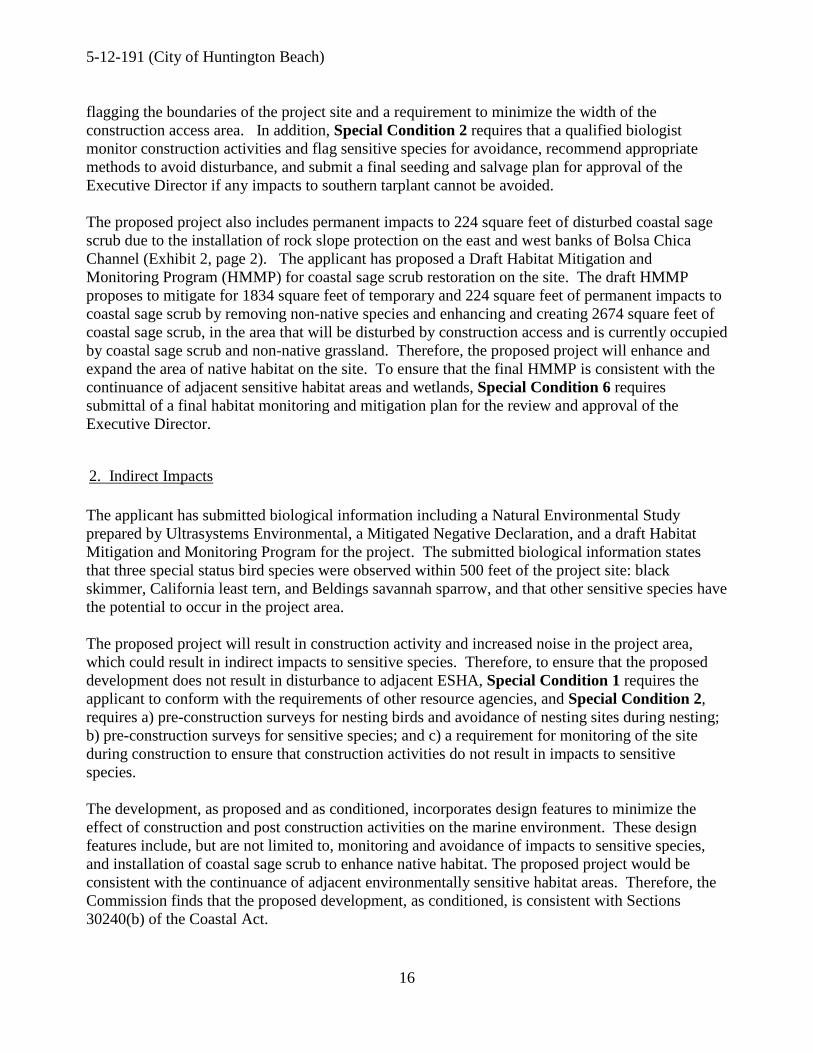
IV. FINDINGS AND DECLARATIONS: A. Project Location & Description The project site is located at the Warner Avenue Bridge in the City of Huntington Beach, between Pacific Coast Highway and Sceptre Lane. Huntington Harbor is located to the north and residential development lies to the northeast. The Bolsa Chica Ecological Reserve lies adjacent to the project site on the south side of Warner Avenue, and provides open space, public parking and nature paths. See Exhibit 1 for a vicinity map. The Warner Avenue Bridge was constructed pursuant to Coastal Development Permit No P-80-6476, which was approved on February 11, 1980, for:
Construction of the Warner Avenue Bridge over Bolsa Chica Channel, which will replace the existing timber structure that is structurally deficient and has necessitated the detouring of traffic to the southerly portion of the bridge. The new bridge will be replacement in-kind except that it will be pre-cast concrete elements and will be slightly longer and wider for safety. The new bridge will have the same carrying capacity (two travel lanes, and a bike lane in each direction, sidewalk along the north side and a 10 foot painted median).
Since the bridge’s construction in 1981, portions of the existing bridge have deteriorated due to wear from vehicular traffic and from tidal action of the Bolsa Chica Channel. Specifically, portions of the concrete vehicle barriers are cracked and spalled (pieces of concrete have broken off) and exposed internal reinforcing shows signs of corrosion, bridge columns and bent caps (tops of the bridge supports) have unsound concrete areas that require repair, and the asphalt-concrete on the bridge deck is cracked, resulting in roadway water leaking through the deck into the Channel. Additionally, a rock revetment placed at the toe of the existing bridge supports has degraded, resulting in erosion of the banks of the channel and undermining of the bridge abutments and weakening of the bridge substructure. The proposed project includes repairs to the existing bridge consisting of: 1) Removal and replacement of the existing 2’ 3” high concrete barrier and the 6’ 1” high chain link fence above the barrier on the north and south sides of the bridge. 2) Removal and replacement of existing asphalt concrete (AC) road overlay. 3) Removal of areas of unsound concrete and patching of concrete at the bridge bents and columns. 4) Restoration of revetments on the banks of the channel to within the original design limits of the revetment through excavation of 85 cubic yards of remaining debris and rock along the toe of the embankment, and installation of rock slope protection fabric and 310 cubic yards of one-quarter-ton rocks, 3 feet thick.
5-12-191 (City of Huntington Beach)
12
The majority of the project will be located within the limits of the revetment constructed for the original 1981 bridge design. However, an additional 103 square feet of revetment is proposed to protect the bridge in areas where the banks of Bolsa Chica Channel have eroded and receded from the time the bridge was originally constructed. These areas are shown in a cross-hatched pattern on Exhibit 2, page 2. To assure that the project does not result in a net impact to soft bottom habitat, the applicant proposes to reduce the area occupied by the revetment by 110 square feet by moving the revetment toe 8" landward, widening the base to 5 feet, and lowering the base of the revetment by 6". Thus, as proposed the project would result in an expansion of 7 square feet of soft bottom habitat. The estimated construction time for the project is 6 months: 0.5 months for replacement to road overlay, 0.5 months for repairs to bridge bents and columns, 2 months for work to the concrete barrier and chain link railing and 3 months for repairs to the existing rock slope protection. The bridge would remain open for public use through the construction period, but would require temporary closure of some traffic lanes to perform the required repairs. The City has tentatively proposed to use either 1) the private vacant parking lot and pier adjacent to the north side of the Warner Avenue Bridge or 2) the beach parking lot located approximately 900 feet to the west for construction staging/storage for the project. The final location would be selected by the contractor. Construction access is proposed from the south side of Warner Avenue, on both the east and west sides of the channel. B. Water Quality / Marine Resources Coastal Act Section 30230 states:
Marine resources shall be maintained, enhanced, and where feasible, restored. Special protection shall be given to areas and species of special biological or economic significance. Uses of the marine environment shall be carried out in a manner that will sustain the biological productivity of coastal waters and that will maintain healthy populations of all species of marine organisms adequate for long-term commercial, recreational, scientific, and educational purposes.
Coastal Act Section 30231 states:
The biological productivity and the quality of coastal waters, streams, wetlands, estuaries, and lakes appropriate to maintain optimum populations of marine organisms and for the protection of human health shall be maintained and, where feasible, restored through, among other means, minimizing adverse effects of waste water discharges and entrainment, controlling runoff, preventing depletion of ground water supplies and substantial interference with surface waterflow, encouraging waste water reclamation, maintaining natural vegetation buffer areas that protect riparian habitats, and minimizing alteration of natural streams.
Coastal Act Section 30233 states (in relevant part):
(a) The diking, filling, or dredging of open coastal waters, wetlands, estuaries, and lakes shall be permitted in accordance with other applicable provisions of this division, where there is no feasible less environmentally damaging alternative, and where feasible mitigation measures

5-12-191 (City of Huntington Beach)
13
have been provided to minimize adverse environmental effects, and shall be limited to the following:
(l) New or expanded port, energy, and coastal-dependent industrial facilities, including commercial fishing facilities. (2) Maintaining existing, or restoring previously dredged, depths in existing navigational channels, turning basins, vessel berthing and mooring areas, and boat launching ramps. (3) In open coastal waters, other than wetlands, including streams, estuaries, and lakes, new or expanded boating facilities and the placement of structural pilings for public recreational piers that provide public access and recreational opportunities. (4) Incidental public service purposes, including but not limited to, burying cables and pipes or inspection of piers and maintenance of existing intake and outfall lines. (5) Mineral extraction, including sand for restoring beaches, except in environmentally sensitive areas. (6) Restoration purposes. (7) Nature study, aquaculture, or similar resource dependent activities.
The proposed project would occur within and adjacent to wetlands. The project involves excavation, removal of rock, and installation of new rock within Bolsa Chica Channel. Additionally, the project is immediately adjacent to the Bolsa Chica Ecological Reserve, an area known to contain wetland habitat and to support sensitive habitat and species. 1. Wetland Fill Section 30233 of the Coastal Act limits the fill of open coastal waters to certain allowable purposes and also requires that any project which results in fill of open coastal waters provide adequate mitigation. One purpose for which fill is allowed is incidental public service purposes. The proposed project requires the installation of a rock revetment to protect the bridge abutments of the Warner Avenue Bridge in the Bolsa Chica Channel from tidal erosion. The majority of the project would result in the placement of riprap within the limits of the 1981 design configuration of the rock revetment. However, the east and west banks of the channel just south of the bridge have been subject to additional erosion since the bridge’s construction, and area that was once occupied by the channel banks is now below water level. Protection of the bridge abutments requires that further erosion of the channel banks be prevented. Therefore, the City proposes to install new rock slope protection within 103 square feet of coastal waters. However, to ensure that the project does not result in any net impacts to habitat within the channel, the City is also proposing to reduce the width of the existing revetment by a total of 8” along the length of the revetments on the east and west banks. This results in the removal of 110 square feet of fill, for a net reduction in 7 square feet of fill of coastal waters. The placement of rock within the channel is considered fill of coastal waters. This fill is necessary to maintain an existing bridge that provides an important public service by providing access between Pacific Coast Highway and inland Orange County. The fill is associated with maintaining the existing bridge in functional condition. No expansion of road capacity is created by the project.
5-12-191 (City of Huntington Beach)
14
Therefore, the fill is associated with an incidental public service and is therefore an allowable purpose under the Coastal Act. Although the proposed fill is an allowable type of fill, the project can only be found consistent with the Coastal Act if it is the least environmentally damaging feasible alternative and feasible mitigation measures have been provided to minimize environmental effects. The City considered four alternatives for protection of the channel banks: 1) replacing the rock slope protection, 2) concreted-rock slope protection, 3) concrete slope paving, and 4) gabions. After a review of the alternatives, the City found that the proposed rock slope protection is the only alternative that would ensure the long term stability of the bridge, and represents the least environmentally damaging alternative. The revetment has been reduced to the minimum amount of fill required to ensure protection of the bridge, resulting in the net reduction of fill of coastal waters by 7 square feet and expanding area of soft bottom habitat. Thus, the project as proposed is the least environmentally damaging alternative. To ensure that the proposed project does not result in impacts to coastal resources, the Commission imposes Special Condition 4, requiring the submittal of as-built plans at the end of construction. If the as-built plans show that the project has been built inconsistent with the approved final plans and resulted in impacts to coastal resources, the applicant is required to apply for an amendment to this permit or a new Coastal Development Permit for restoration of that area to address the unpermitted developement. The Commission finds that the proposed project involves wetland fill that is allowable as an incidental public service purpose, the proposed fill is the least environmentally damaging feasible alternative, and that mitigation measures, in the form of a net reduction in wetland fill, has been provided to minimize adverse environmental effects. Therefore, the proposed project, as conditioned, can be found consistent with Section 30233 of the Coastal Act. 2. Construction Impacts to Water Quality Construction will occur directly over and in coastal waters. As such, there is a possibility that construction phase activities could result in adverse water quality impacts. In addition, there is a possibility that improper staging and storage of equipment could have impacts on both water quality and nearby wetland habitat. Wetlands and other sensitive habitat are located within the footprint of the project and in the project vicinity. Potential construction phase impacts include improper storage or placement of construction materials, debris, or waste in a location subject to erosion and dispersion or in a manner which allows such materials to be discharged into the Bolsa Chica Channel and coastal waters via rain or urban runoff. These actions would result in adverse impacts upon the marine environment that would reduce the biological productivity of coastal waters. For instance, construction debris entering coastal waters may cover and displace soft bottom habitat. In addition, the use of machinery in coastal waters not designed for such use may result in the release of lubricants or oils that are toxic to marine life. Sediment discharged into coastal waters may cause turbidity, which can shade and reduce the productivity of foraging avian and marine species ability to see food in the water column. The proposed work will take place along the channel banks, both above and below the waterline. The applicant is proposing to use work platforms that remain suspended during construction and

5-12-191 (City of Huntington Beach)
15
fully enclosed protective covers to avoid impacts from construction materials on the channel. Work will be conducted during low tide conditions, thus minimizing the underwater work, and minimizing turbidity impacts. The applicant also proposes the use of silt curtains, to reduce impacts of work along the channel to turbidity. In order to assure that the proposed project does not result in any accidental or unanticipated discharges, spills or other activities that could harm marine resources and water quality, and to assure the applicant is aware of their responsibility to provide a debris catching device under this coastal development permit, the Commission imposes Special Condition 3, which requires the applicant to implement best management practices to protect water quality. As conditioned, the Commission finds that the development conforms with Sections 30230 and 30231 of the Coastal Act. C. Biological Resources Section 30240 (b) of the Coastal Act states (in relevant part):
(b )Development in areas adjacent to environmentally sensitive habitat areas and parks and recreation areas shall be sited and designed to prevent impacts which would significantly degrade those areas, and shall be compatible with the continuance of those habitat and recreation areas.
The project site is located within and directly adjacent to the right of way of Warner Avenue, and is subject to regular disturbance due to the presence of the roadway. Although the project would not be located within sensitive habitat areas, it would be located directly adjacent to environmentally sensitive habitat located within the Bolsa Chica Ecological Reserve. 1. Direct Impacts The project would result in temporary and permanent impacts to upland habitat. In order to undertake the proposed work, temporary access is needed to the areas on the south side of Warner Avenue Bridge and the area underneath it. There are no other feasible alternatives to access the work areas. Therefore, construction access is proposed from the south side of Warner Avenue down the east and west banks of Bolsa Chica Channel (Exhibit 2). The usage of the construction access corridor will result in temporary impacts to 1,834 square feet of disturbed Coastal Sage Scrub and 840 square feet of non-native grassland. The City proposes to construct a temporary driving surface to minimize impacts to the soil and seedbank on the site. An isolated, small (14 sq. ft.) area of southern tarplant is located on the boundary of the construction access corridor. Southern tarplant (Centromadia parryi ssp. Australis) is listed by the California Native Plant Society as a 1B.1 rare plant. The applicant is proposing to avoid the southern tarplant within the project limits. However, if prior to construction, southern tarplant individuals have expanded into the highly limited construction access area, the applicant proposes to undertake a seeding and salvage plan to collect seed from or transplant those plants that cannot be avoided. To ensure that impacts to southern tarplant are minimized, and to ensure that construction activities do not encroach into adjacent Environmentally Sensitive Habitat Area, Special Condition 7 requires submittal of a final construction staging and access plan that includes a requirement for
5-12-191 (City of Huntington Beach)
16
flagging the boundaries of the project site and a requirement to minimize the width of the construction access area. In addition, Special Condition 2 requires that a qualified biologist monitor construction activities and flag sensitive species for avoidance, recommend appropriate methods to avoid disturbance, and submit a final seeding and salvage plan for approval of the Executive Director if any impacts to southern tarplant cannot be avoided. The proposed project also includes permanent impacts to 224 square feet of disturbed coastal sage scrub due to the installation of rock slope protection on the east and west banks of Bolsa Chica Channel (Exhibit 2, page 2). The applicant has proposed a Draft Habitat Mitigation and Monitoring Program (HMMP) for coastal sage scrub restoration on the site. The draft HMMP proposes to mitigate for 1834 square feet of temporary and 224 square feet of permanent impacts to coastal sage scrub by removing non-native species and enhancing and creating 2674 square feet of coastal sage scrub, in the area that will be disturbed by construction access and is currently occupied by coastal sage scrub and non-native grassland. Therefore, the proposed project will enhance and expand the area of native habitat on the site. To ensure that the final HMMP is consistent with the continuance of adjacent sensitive habitat areas and wetlands, Special Condition 6 requires submittal of a final habitat monitoring and mitigation plan for the review and approval of the Executive Director. 2. Indirect Impacts The applicant has submitted biological information including a Natural Environmental Study prepared by Ultrasystems Environmental, a Mitigated Negative Declaration, and a draft Habitat Mitigation and Monitoring Program for the project. The submitted biological information states that three special status bird species were observed within 500 feet of the project site: black skimmer, California least tern, and Beldings savannah sparrow, and that other sensitive species have the potential to occur in the project area. The proposed project will result in construction activity and increased noise in the project area, which could result in indirect impacts to sensitive species. Therefore, to ensure that the proposed development does not result in disturbance to adjacent ESHA, Special Condition 1 requires the applicant to conform with the requirements of other resource agencies, and Special Condition 2, requires a) pre-construction surveys for nesting birds and avoidance of nesting sites during nesting; b) pre-construction surveys for sensitive species; and c) a requirement for monitoring of the site during construction to ensure that construction activities do not result in impacts to sensitive species. The development, as proposed and as conditioned, incorporates design features to minimize the effect of construction and post construction activities on the marine environment. These design features include, but are not limited to, monitoring and avoidance of impacts to sensitive species, and installation of coastal sage scrub to enhance native habitat. The proposed project would be consistent with the continuance of adjacent environmentally sensitive habitat areas. Therefore, the Commission finds that the proposed development, as conditioned, is consistent with Sections 30240(b) of the Coastal Act.

5-12-191 (City of Huntington Beach)
17
D. Visual Resources Coastal Act section 30251 states:
The scenic and visual qualities of coastal areas shall be considered and protected as a resource of public importance. Permitted development shall be sited and designed to protect views to and along the ocean and scenic coastal areas, to minimize the alteration of natural land forms, to be visually compatible with the character of surrounding areas, and, where feasible, to restore and enhance visual quality in visually degraded areas. New development in highly scenic areas such as those designated in the California Coastline Preservation and Recreation Plan prepared by the Department of Parks and Recreation and by local government shall be subordinate to the character of its setting.
Coastal Act Section 30251 requires the protection of scenic views, and where feasible, restoration of visual qualities in visually degraded areas. The subject site is located in a highly scenic area, with views of Huntington Harbor available to the north, and views of the Bolsa Chica wetlands to the south. These areas have also been identified as scenic view areas in the City’s certified Land Use Plan. The proposed project includes the removal of the existing 2’ 3” high concrete barrier and 6’ 1” high chainlink fence atop the barrier that runs along each side of the bridge, and the installation of a new concrete barrier and chainlink fence of the same heights. The new fence is proposed at the height of the old fence as a result of a Section 7 consultation with the US Department of Fish and Wildlife recommending that “Fencing will be of adequate height to direct birds over vehicle traffic.” However, the proposed chain link fence would result in obstruction of views of the surrounding area. Although it’s possible to see through a chainlink fence, the views are impaired, and there are alternative fence designs that have lesser visual impacts. To ensure that the project would, where feasible, restore and enhance visual quality as required in Coastal Act Section 30251, the Commission imposes Special Condition 5, requiring the applicant to submit alternative project plans which include a revised fence design, such as a post and cable fence (Exhibit 4), which meets the requirements of public safety and the resource agencies, but which minimizes impacts to scenic views. The proposed fence, and shall be designed to be the minimum possible height that would be consistent with the requirements of the resource agencies and the provisions of public safety but in no event shall be higher than 6 foot 1 inch. As conditioned, the proposed project would ensure that views from Warner Avenue to scenic areas are protected and enhanced, consistent with Coastal Act Section 30251. E. Hazards Coastal Act Section 30235 states (in relevant part):
Revetments, breakwaters, groins, harbor channels, seawalls, cliff retaining walls, and other such construction that alters natural shoreline processes shall be permitted when required to serve coastal-dependent uses or to protect existing structures or public beaches in danger from erosion, and when designed to eliminate or mitigate adverse impacts on local shoreline sand supply.

5-12-191 (City of Huntington Beach)
18
Coastal Act Section 30253 states: New development shall do all of the following: (a) Minimize risks to life and property in areas of high geologic, flood, and fire hazard. (b) Assure stability and structural integrity, and neither create nor contribute significantly to erosion, geologic instability, or destruction of the site or surrounding area or in any way require the construction of protective devices that would substantially alter natural landforms along bluffs and cliffs. (c) Be consistent with requirements imposed by an air pollution control district or the State Air Resources Board as to each particular development. (d) Minimize energy consumption and vehicle miles traveled. (e) Where appropriate, protect special communities and neighborhoods that, because of their unique characteristics, are popular visitor destination points for recreational uses.
Rock revetments require occasional repair and maintenance due to: the natural settling or subsidence of the rock structure over time and the inadvertent loss of rock material due to tidal erosion dislodging rock from the structure. The rock revetment placed at the toe of the existing bridge supports has degraded, resulting in erosion of the banks of the channel and undermining of the bridge abutments and weakening of the bridge substructure. Without protection, the channel banks would continue to erode, the supports for the bridge would be undermined, and the stability of the structure would be threatened. Therefore, the proposed revetment is necessary to protect the existing structure. The proposed project would result in the restoration of the rock revetment protecting the bridge substructure through 1) placement of rock to within the original design limits of the revetment and 2) placement of new rock protection within 103 square feet of coastal waters where additional bank erosion has occurred. The proposed revetment is the minimum width necessary to protect the bridge abutments, and the revetment has been placed as far landward as possible. The proposed revetment is not expected to have adverse impacts to the shoreline sand supply. The project is covering an embankment that was previously protected and was not contributing to the shoreline sand supply. Areas where additional protection would be added have been minimized, and are not expected to have contributed significantly to sediment supplies. Additionally, the project is located inside a bay, and is therefore not expected to directly impact the lateral flow of sand along the ocean. Therefore, the project would not have a significant adverse impact to the shoreline sand supply, consistent with the requirements of Coastal Act Section 30235. The proposed project involves installation of new slope protection and repairs to an existing bridge consisting of repairs to the bridge deck, railings, abutments, and pilings. The existing bridge is subject to tidal action from Bolsa Chica Channel. Development at such a location is inherently risky. Therefore, the Commission imposes Special Condition 8, requiring the applicant to assume the risk for the development. As conditioned, the applicant is notified that the project is being built in an area that is potentially subject to wave and tidal action, flooding, erosion, sea level rise, geologic instability, or liquefaction that can damage the applicant’s property. The applicant is also notified that the Commission is not liable for such damage as a result of approving the permit for development and is required to indemnify the Commission in the event of a lawsuit against it. Finally, the condition ensures that future owners of the property will be informed of the risks and the Commission’s immunity from liability.

5-12-191 (City of Huntington Beach)
19
Therefore, as conditioned, the Commission finds that the proposed project is consistent with Section 30235 and 30253 of the Coastal Act F. Public Access Coastal Act Section 30210 states:
In carrying out the requirement of Section 4 of Article X of the California Constitution, maximum access, which shall be conspicuously posted, and recreational opportunities shall be provided for all the people consistent with public safety needs and the need to protect public rights, rights of private property owners, and natural resource areas from overuse.
Coastal Act Section 30211 states:
Development shall not interfere with the public's right of access to the sea where acquired through use or legislative authorization, including, but not limited to, the use of dry sand and rocky coastal beaches to the first line of terrestrial vegetation.
The applicant proposes utilization of a traffic control plan to schedule and phase closures to minimize traffic disturbance. At least two traffic lanes and a pedestrian walkway will be maintained throughout the construction of the project. Additionally, the applicant proposes to schedule construction during the winter and early spring to avoid impacts to high-season beach traffic. The applicant has submitted a tentative plan to use either the paved parking lot located just northeast of the subject site or the beach parking lot located approximately 900 feet to the west. Parking supplies in coastal Orange County are limited, especially during the peak summer period. The temporary replacement of parking spaces with a construction staging area could result in impacts to the public's ability to access the beach. This raises an issue with Coastal Act Section 30210, which requires that maximum access be provided, and Coastal Act Section 30211, which requires that development shall not interfere with the public's right of access to the sea. Therefore, to ensure that the proposed project is consistent with the public access policies of the Coastal Act, the Commission imposes Special Condition 7, requiring the submittal of a final construction staging and access plan. The final construction staging plan shall demonstrate that the staging area is located outside of public parking areas during the peak summer period, and that the size of the staging area will be reduced throughout the construction period as less space is necessary. As conditioned the development will not affect the public’s ability to gain access to, and/or to use the coast and nearby recreational facilities. Therefore, as conditioned, the Commission finds that the proposed project is consistent with Sections 30210, and 30211 of the Coastal Act. G. Local Coastal Program (LCP) An LCP for the City of Huntington Beach was effectively certified in March 1985. However, the proposed development is occurring within an area that crosses jurisdiction with that of the Commission’s original permit jurisdiction.

5-12-191 (City of Huntington Beach)
20
Section 30601.3 of the Coastal Act provides for the issuance of coastal development permits directly by the Commission when the applicant, the local government and the Commission through its executive director consent to consolidate the permit action, provided that public participation is not substantially impaired by that review consolidation. In this case, the project site crosses jurisdictional boundaries, the applicant is the City, and the City submitted the coastal development permit application directly to the Commission, requesting a consolidated permit action by the Commission. Consequently, the standard of review is Chapter 3 of the Coastal Act and the City’s LCP is used only as guidance. As conditioned, the proposed development is consistent with Chapter 3 of the Coastal Act and with the certified LCP for the area. H. California Environmental Quality Act (CEQA) Section 13096(a) of the Commission's administrative regulations requires Commission approval of a Coastal Development Permit application to be supported by a finding showing the application, as conditioned by any conditions of approval, to be consistent with any applicable requirements of the California Environmental Quality Act (CEQA). Section 21080.5(d)(2)(A) of CEQA prohibits a proposed development from being approved if there are feasible alternatives or feasible mitigation measures available which would substantially lessen any significant adverse effect that the activity may have on the environment. The City of Huntington Beach is the lead agency for purposes of CEQA compliance. The City of Huntington Beach issued a Mitigated Negative Declaration for the project on September 6, 2012, pursuant to the provisions of CEQA. Mitigation measures included education of construction personnel on sensitive species in the area, biological monitoring during vegetation clearance, implementation of a Habitat Mitigation and Monitoring Plan, archaeological resources, and reduction of noise. The proposed project has been conditioned in order to be found consistent with the resource protection policies of the Coastal Act. As conditioned, the project has been found consistent with the hazard minimization, archaeological resources, marine resources, water quality, and public access policies of the Coastal Act. Mitigation measures to minimize adverse effects include: 1) the requirement to comply with the requirements of resource agencies; 2) monitoring to avoid impacts to sensitive species; 3) construction BMPs to protect water quality; 4) as-built plans for the proposed restoration of the rock revetment 5) alternative fence designs to improve views; 6) submittal of a final habitat mitigation and monitoring program; 7) submittal of a construction staging and access plan; and 8) assumption of risk for the development. As conditioned, there are no feasible alternatives or additional feasible mitigation measures available that would substantially lessen any significant adverse effect that the activity may have on the environment Therefore, the Commission finds that the proposed project, as conditioned to mitigate the identified impacts, is the least environmentally damaging feasible alternative and can be found consistent with the requirements of the Coastal Act to conform to CEQA.

5-12-191 (City of Huntington Beach)
21
Appendix A - Substantive File Documents - Natural Environment Study Warner Avenue Bridge Maintenance Project, dated March 2012 by Ultrasystems Environmental - Mitigated Negative Declaration dated 9/6/2012 - Draft Conceptual Habitat Mitigation and Monitoring Program dated March 2013 by Ultrasystems Environmental
ATTACHMENT 1 - FIGURES
Habitat Mitigation and Monitoring Plan March 2013 5787/Warner Avenue Bridge Preventive Maintenance Project Page 27
Figure 1: Warner Avenue Bridge Project Location Vicinity Map
Exhibit 4 Page 1 of 1

ATTACHMENT 2 - TABLES
Habitat Mitigation and Monitoring Plan March 2013 5787/Warner Avenue Bridge Preventive Maintenance Project Page 28
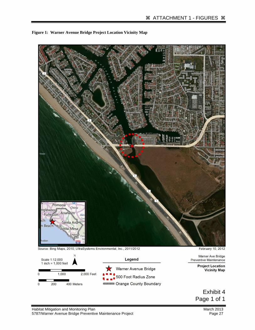
Figure 2: Project Impact Footprint
Exhibit 2 Page 1 of 6

l<'!gend·
-~~,,__ \ ~~-~.r:-,!.?J/'#!.1:?_ \
'ORr_.e.~--~
l .~ . I.
lndlt:.Jto.M;. 1-'ro~~d HOol1<. SIOj:X." 1-'mlcctlon
looir~1tes Ordinary High W,1terfiM
~-"' lm1ir~l!~ lmp:-.c1 llre.l!'. f'O &Jd4k()_ P w~n \..--
~ r.~ ~ R 6<.1<. S' Itt~ Pro-ret+: o 1\ Pe~impuH +a C tJ~ 1-J ftA.p fer-~
et....OPC. ~..otSC.-no...J C.LAOO VA- T0"-1 s Mff!Ha::::> • ~ ~~~------
/(/CJ7';!Rj'.'
1. e"X/$1"/.<119 8~/A~E .-'./C..V .::i'hVWA/ ,e. ,e"X/ST/,{/6' PILES N'OT ..5>¥0~V
~- 6£'£6 6E.CTIOIJ 'b·Htf 'c-c'' fleP..E.CJi.-1 4-. Ff::P... T'YP'fc..4'- 12_oc;k::_ PL.AC5Ml:?~ ~CI!OA./, bEe" e+-rr-: A.JO. 4 -
..;;_ ~ ~IIC»J --w-w' ~ 6J..Il"!!ET ~ 1 <:;; F~ SEC/ION ~X-X' SEE ::»~iiii'Er#7
..._ ~.-.·
" \ PtopO!.ed f!" le:!;...<;
\: ,.
than It~~: ong1nill d!:SI911
~ ~ ~ ~ ~ t.)
~~\ ~-·
~.,'
z 0 -~ u.; -::E
(.~ ~ 0 1'...':
~J~ ,~ , 9
~
w (.9
ct
. 7 C£.4-/E/VT SLV..tf'.I?Y" 80#./V.£> / A8UT..#'E/VT /VO. ~ /77 ...P'.A'Ef/E#T
Etf'OS/0/V ~/PCJ# ;?£>AL AC/70/V
.:\ .
~ f:J(~c~~~J ~~TON HEn-iOD ... A!
,\) r::'L-Q.CaME!-..ll .-
Pt..6CE< ~~~
•.Je..v lei G-.M .F". ~~~-·~
Ordmary l l ~gh
,. w.~rertine
.SOL $,4 C'#/C".4 C'#....;..VA/5L..
.s~ ..v 1SJ 'oo' oo··.k/
Exhibit 2 Page 2 of 6

Exhibit 2 Page 3 of 6

Exhibit 2 Page 4 of 6

Exhibit 2 Page 5 of 6
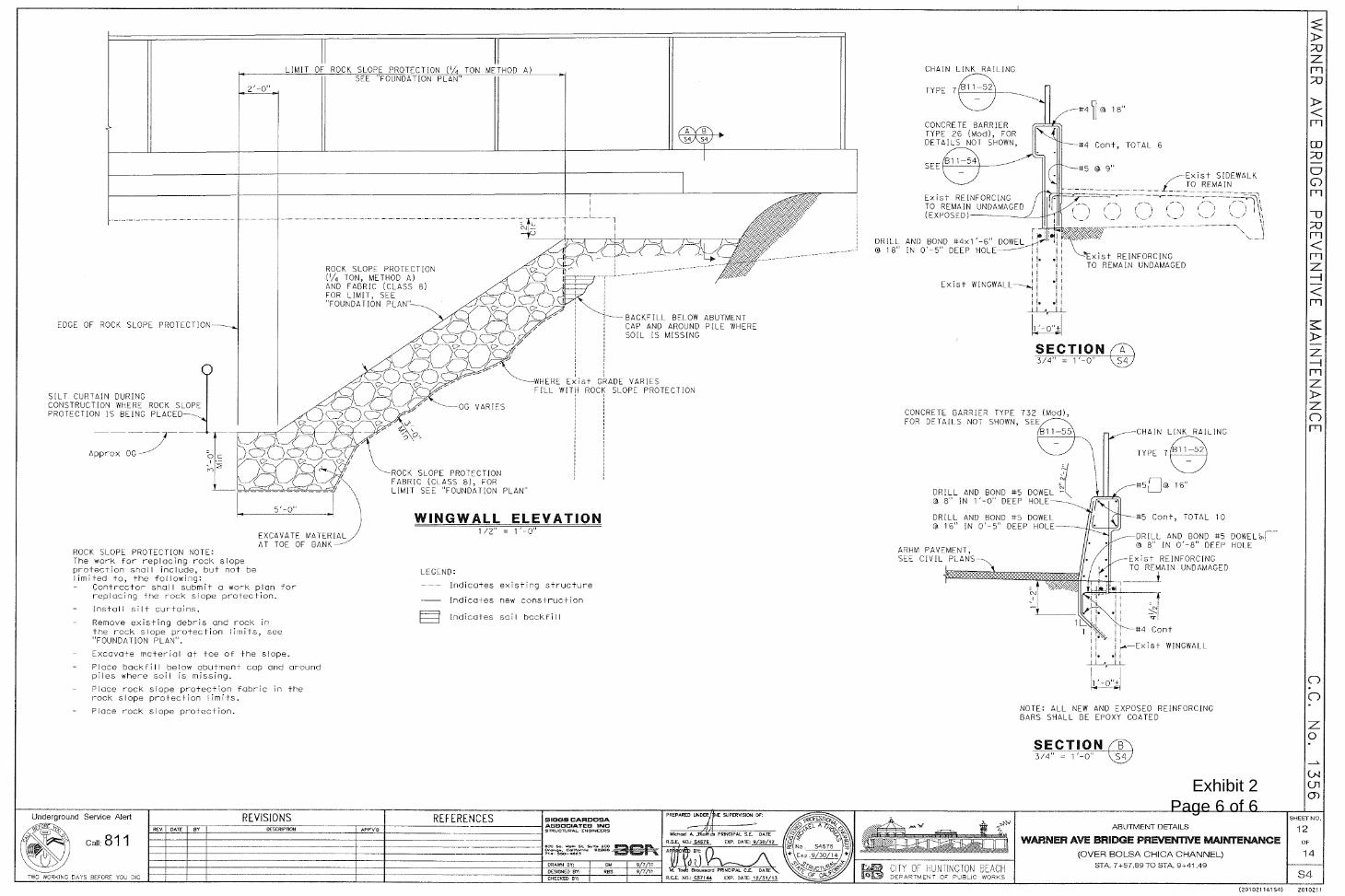
Exhibit 2 Page 6 of 6

Exhibit 3 Page 1 of 3

Exhibit 3 Page 2 of 3

Exhibit 3 Page 3 of 3

Exhibit 4 Page 1 of 1