Embed Size (px)
Citation preview
Climatic Zones p. 75-81
P. 75 fig. 5.1
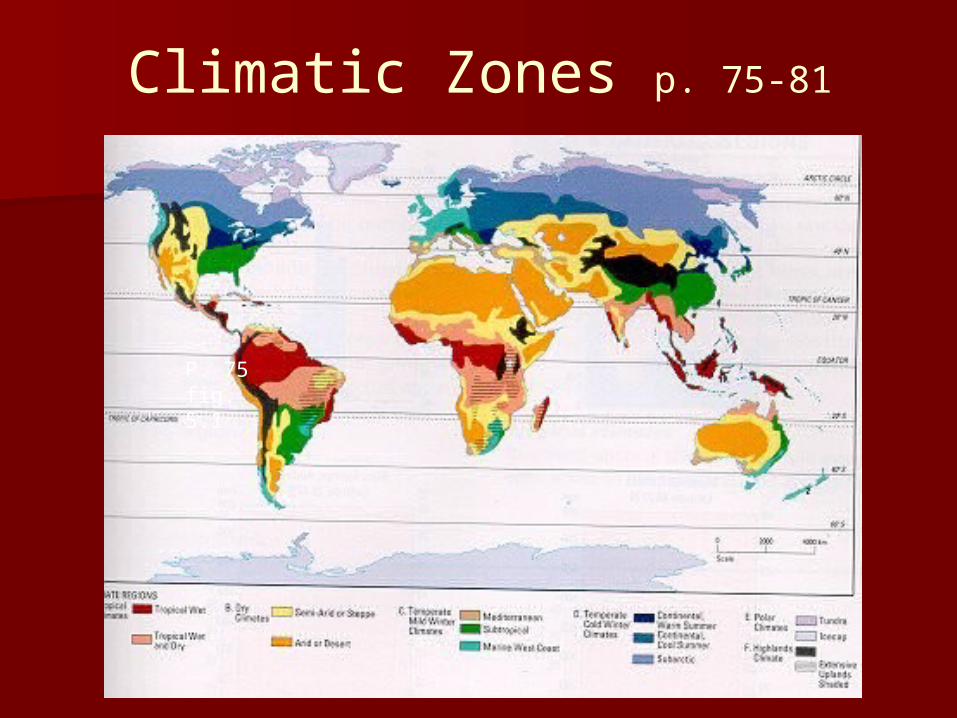
6 climate regions Each has sub-regions
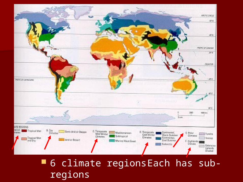
Tropical Climates - Common
Temp. over 180C every day
A relatively flat temperature line
Low latitude
Between the “Tropics!”
Warm ocean currents and
Prevailing winds.
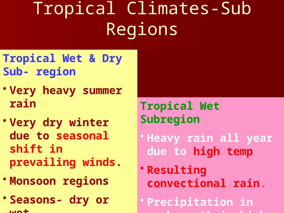
Tropical Climates-Sub Regions
Tropical Wet & Dry Sub- region
• Very heavy summer rain
• Very dry winter due to seasonal shift in prevailing winds.
• Monsoon regions
• Seasons- dry or wet
Tropical Wet Subregion
• Heavy rain all year due to high temp
• Resulting convectional rain.
• Precipitation in each month is high

Tropical Wet & Dry - Climate graphs
• Precipitation is very high in summer months and very low in winter months
• Relatively flat temperature line
• Temperature relatively constant & high (19-270C)
• Wet and dry seasons
• Wet and dry monsoons
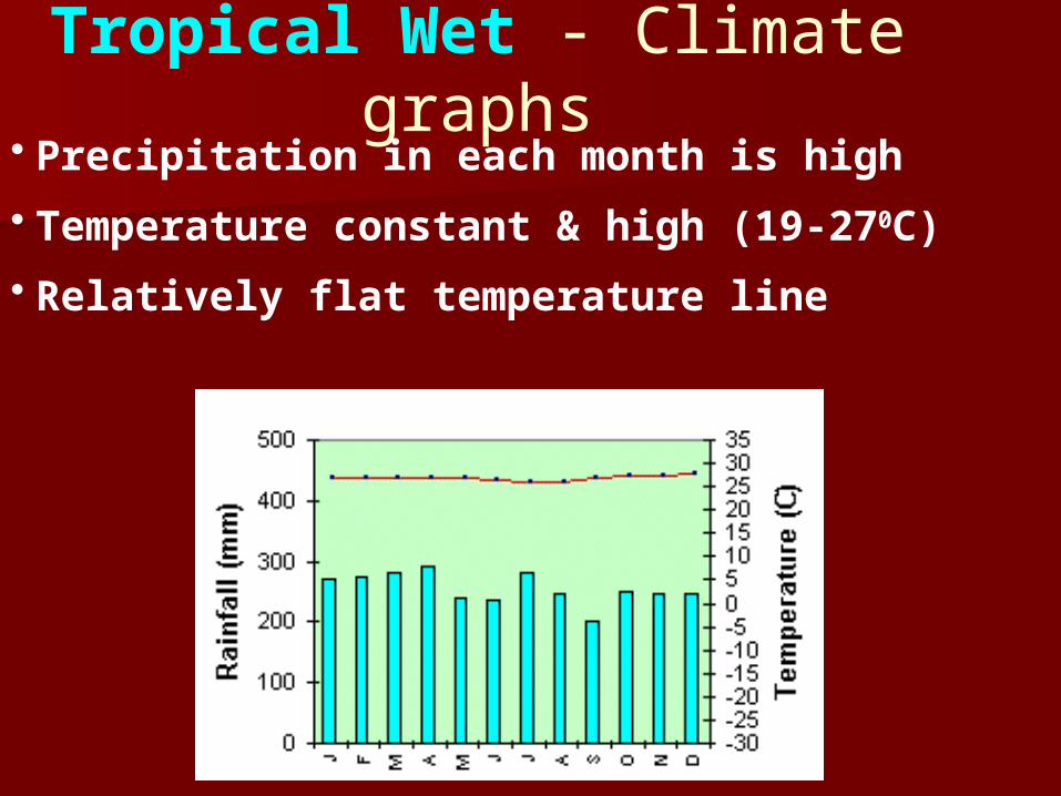
Tropical Wet - Climate graphs
• Precipitation in each month is high
• Temperature constant & high (19-270C)
• Relatively flat temperature line
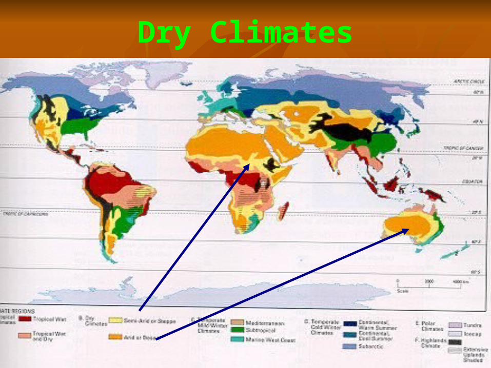
Dry Climates
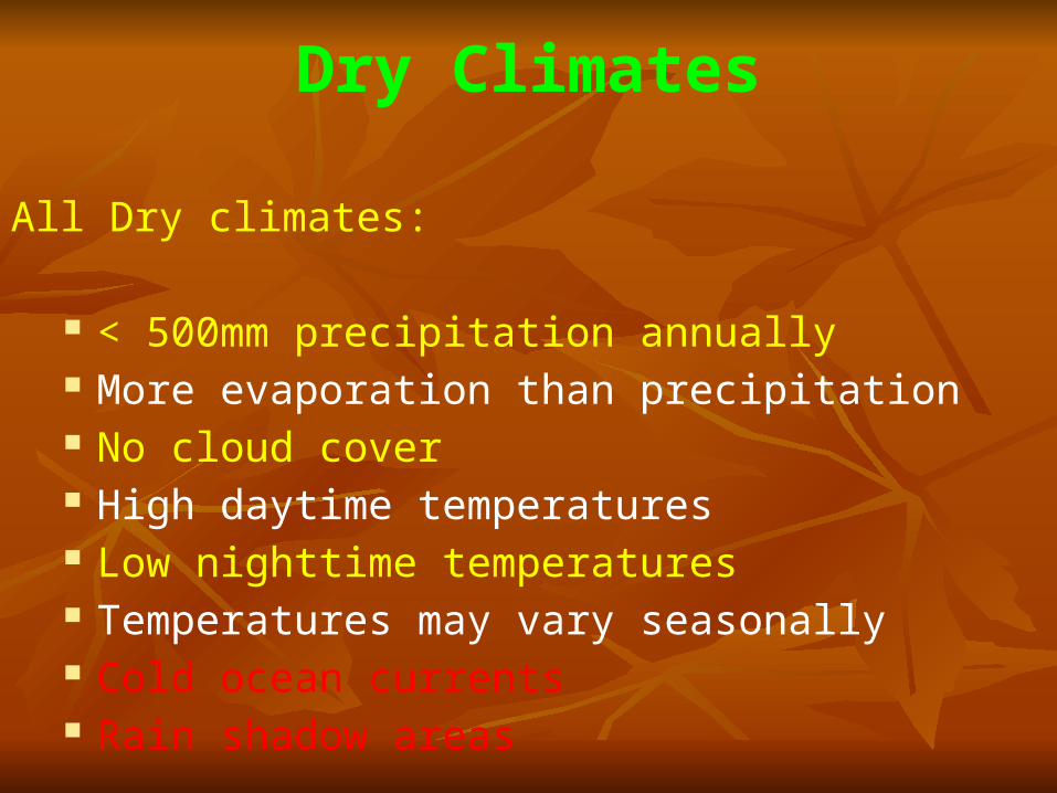
Dry Climates
All Dry climates:
< 500mm precipitation annually More evaporation than precipitation No cloud cover High daytime temperatures Low nighttime temperatures Temperatures may vary seasonally Cold ocean currents Rain shadow areas
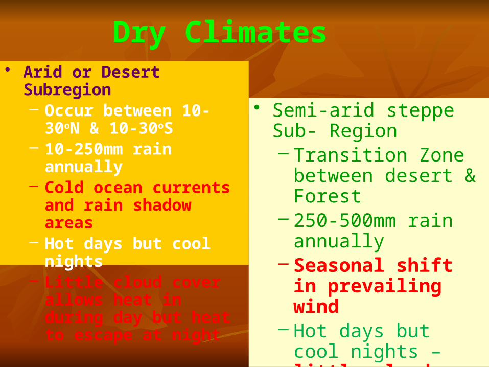
Dry Climates• Arid or Desert Subregion
– Occur between 10-30oN & 10-30oS
– 10-250mm rain annually– Cold ocean currents and
rain shadow areas– Hot days but cool nights– Little cloud cover allows
heat in during day but heat to escape at night
• Semi-arid steppe Sub- Region – Transition Zone
between desert & Forest
– 250-500mm rain annually
– Seasonal shift in prevailing wind
– Hot days but cool nights – little cloud cover
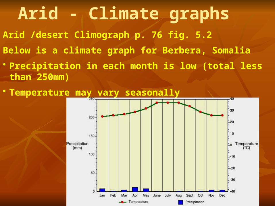
Arid - Climate graphsArid /desert Climograph p. 76 fig. 5.2
Below is a climate graph for Berbera, Somalia
• Precipitation in each month is low (total less than 250mm)
• Temperature may vary seasonally
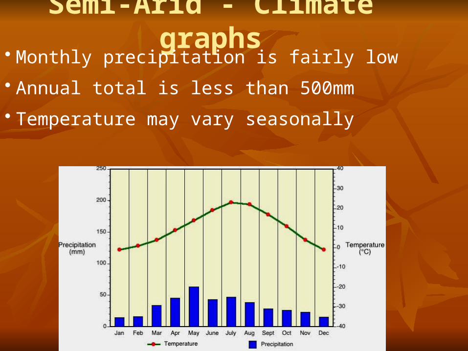
Semi-Arid - Climate graphs• Monthly precipitation is fairly low
• Annual total is less than 500mm
• Temperature may vary seasonally
REMEMBER!!!!
The main factor that characterizes the DRY climate zone is the amount of precipitation – there is not very much!
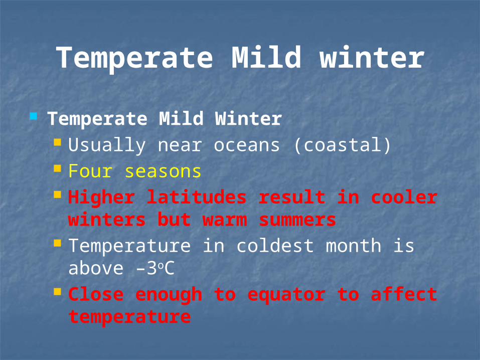
Temperate Mild winter
Temperate Mild Winter Usually near oceans (coastal) Four seasons Higher latitudes result in cooler
winters but warm summers Temperature in coldest month is above –
3oC Close enough to equator to affect
temperature
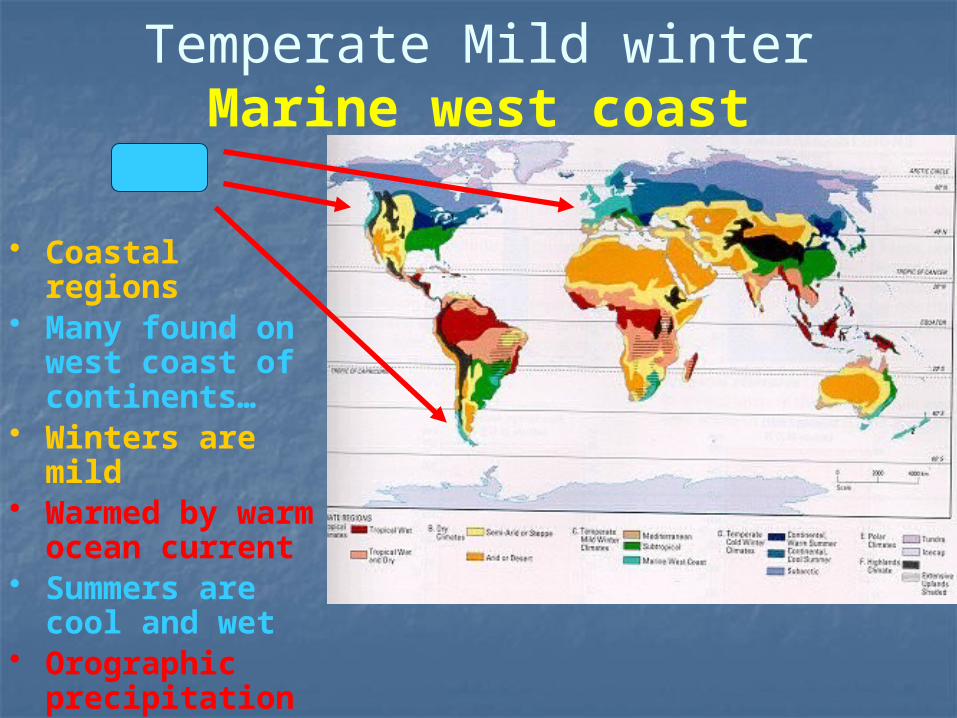
Temperate Mild winterMarine west coast
• Coastal regions• Many found on
west coast of continents…
• Winters are mild• Warmed by warm
ocean current• Summers are cool
and wet • Orographic
precipitation on mountains
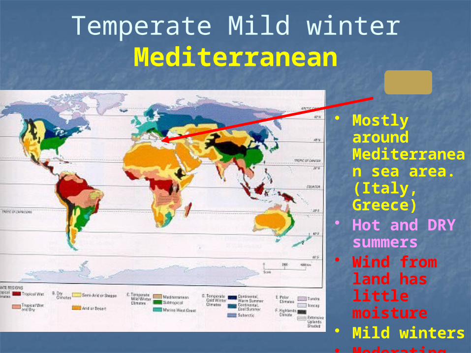
Temperate Mild winterMediterranean
• Mostly around Mediterranean sea area. (Italy, Greece)
• Hot and DRY summers
• Wind from land has little moisture
• Mild winters• Moderating
warm wind from the ocean
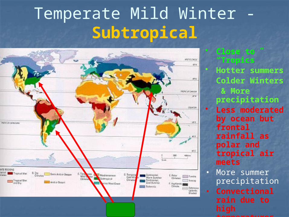
Temperate Mild Winter - Subtropical
• Close to “Tropics”
• Hotter summersColder Winters & More precipitation
• Less moderated by ocean but frontal rainfall as polar and tropical air meets
• More summer precipitation
• Convectional rain due to high temperatures
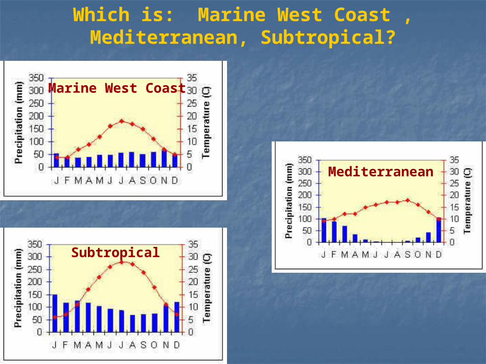
Which is: Marine West Coast , Mediterranean, Subtropical?
Mediterranean
Marine West Coast
Subtropical
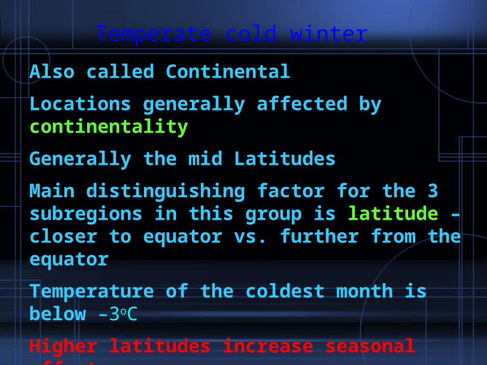
Temperate cold winter
Also called Continental
Locations generally affected by continentality
Generally the mid Latitudes
Main distinguishing factor for the 3 subregions in this group is latitude – closer to equator vs. further from the equator
Temperature of the coldest month is below –3oC
Higher latitudes increase seasonal affect.
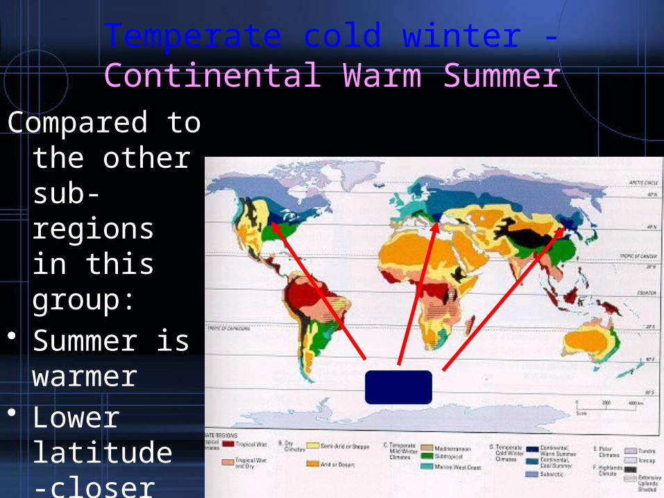
Temperate cold winter - Continental Warm Summer
Compared to the other sub-regions in this group:
• Summer is warmer
• Lower latitude -closer to the equator
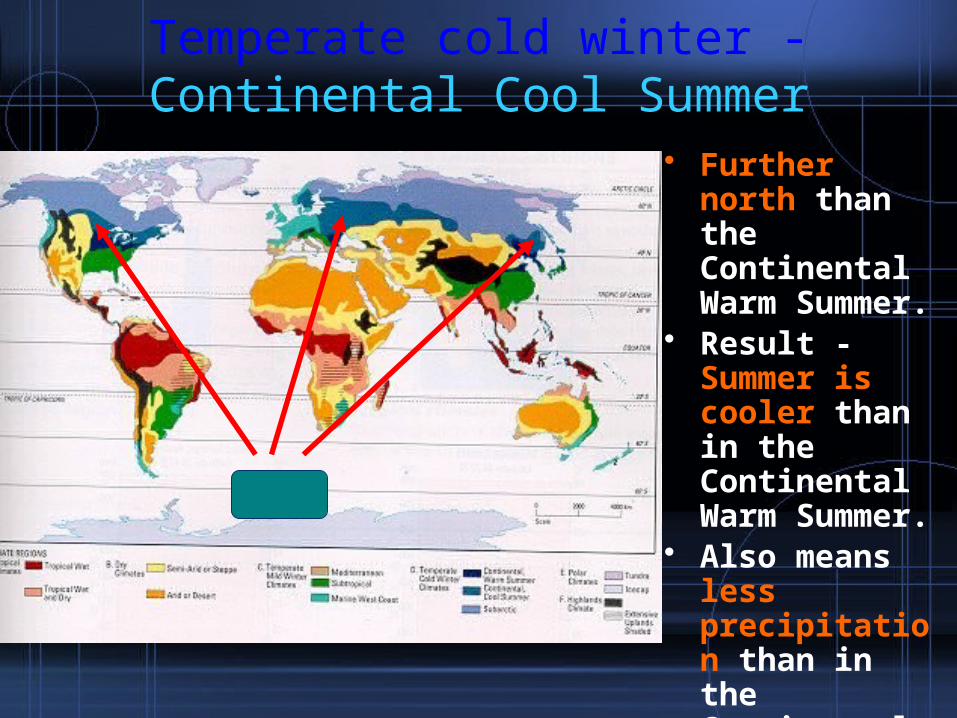
Temperate cold winter - Continental Cool Summer
• Further north than the Continental Warm Summer.
• Result - Summer is cooler than in the Continental Warm Summer.
• Also means less precipitation than in the Continental Warm Summer.
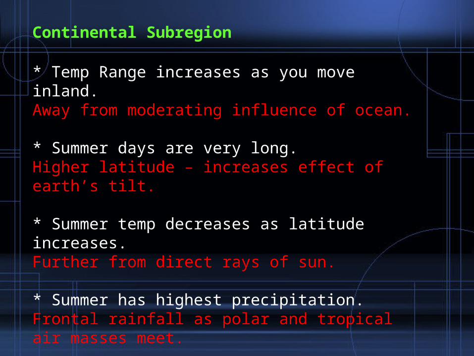
Continental Subregion
* Temp Range increases as you move inland.Away from moderating influence of ocean.
* Summer days are very long.Higher latitude – increases effect of earth’s tilt.
* Summer temp decreases as latitude increases.Further from direct rays of sun.
* Summer has highest precipitation.Frontal rainfall as polar and tropical air masses meet.
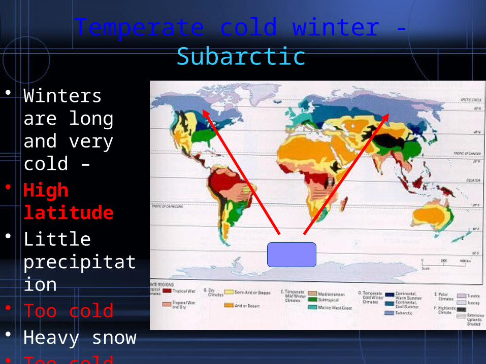
Temperate cold winter - Subarctic
• Winters are long and very cold –
• High latitude• Little
precipitation• Too cold• Heavy snow• Too cold for
snow to melt
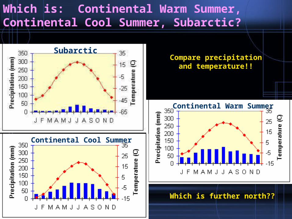
Subarctic
Continental Warm Summer
Continental Cool Summer
Which is: Continental Warm Summer, Continental Cool Summer, Subarctic?
Compare precipitation and temperature!!
Which is further north??
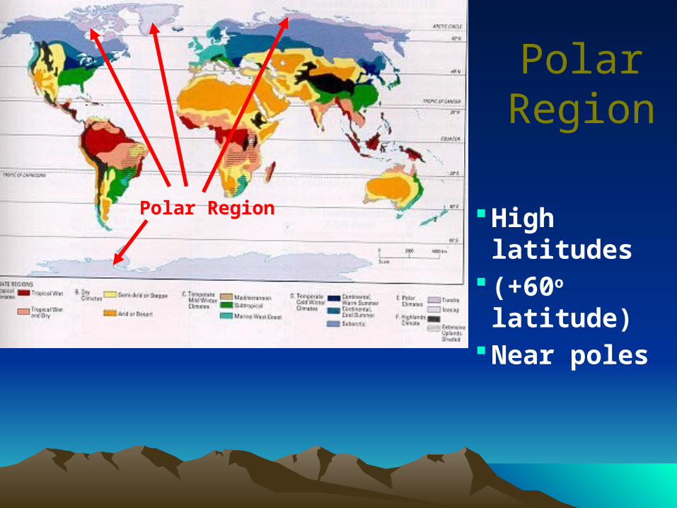
Polar Region High latitudes (+60o latitude)Near poles
Polar Region
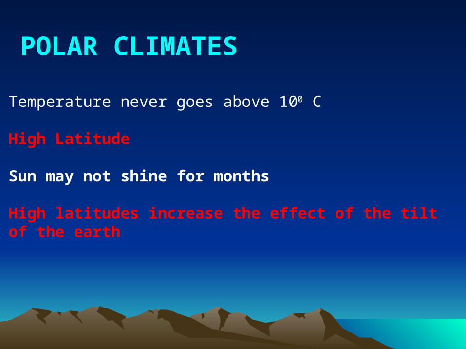
POLAR CLIMATES
Temperature never goes above 100 C
High Latitude
Sun may not shine for months
High latitudes increase the effect of the tilt of the earth
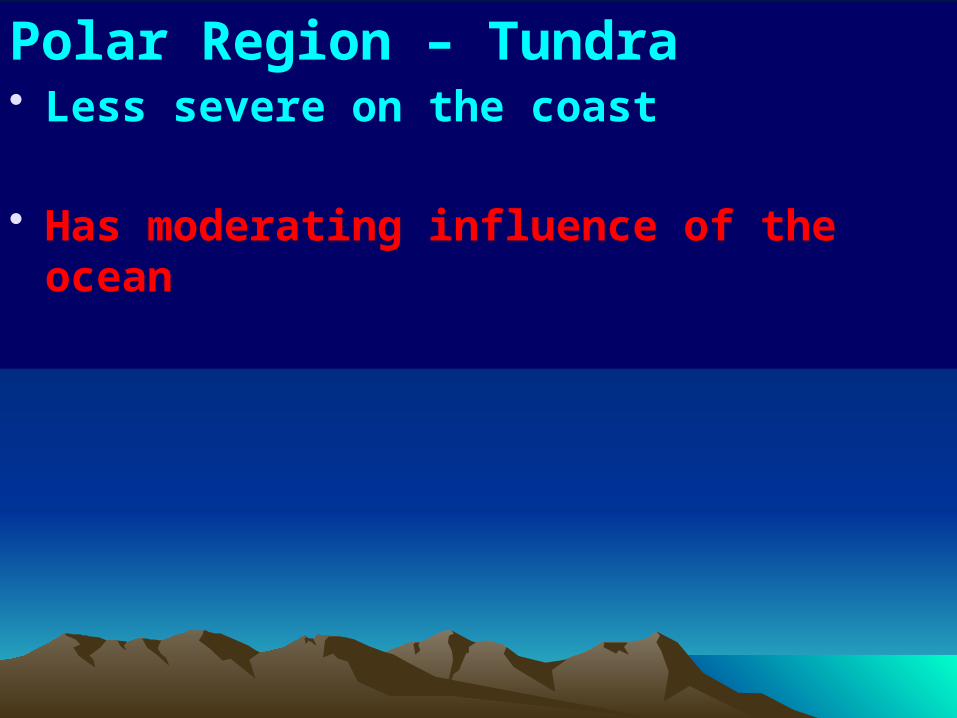
Polar Region – Tundra• Less severe on the coast
• Has moderating influence of the ocean
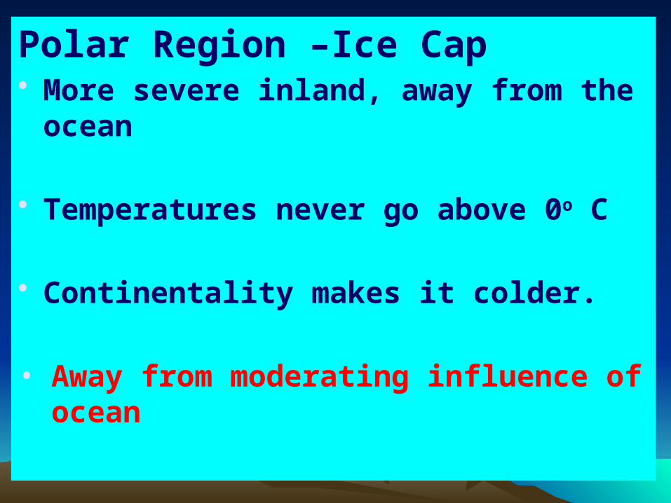
Polar Region –Ice Cap• More severe inland, away from the ocean
• Temperatures never go above 0o C
• Continentality makes it colder.
• Away from moderating influence of ocean
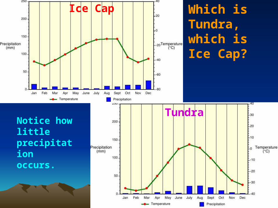
Which is Tundra, which is Ice Cap?
Ice Cap
TundraNotice how little precipitation occurs.
Highlands
• Elevations over 1000 m• Colder conditions than the lower lying
areas surrounding it.• Elevation decreases temperatures
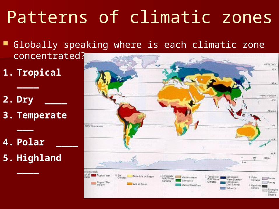
Patterns of climatic zones Globally speaking where is each climatic zone
concentrated?
1. Tropical ____
2. Dry ____
3. Temperate ___
4. Polar ____
5. Highland ____
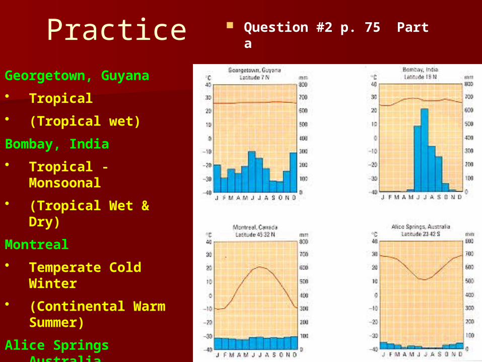
Practice Question #2 p. 75 Part a
Georgetown, Guyana
• Tropical
• (Tropical wet)
Bombay, India
• Tropical - Monsoonal
• (Tropical Wet & Dry)
Montreal
• Temperate Cold Winter
• (Continental Warm Summer)
Alice Springs Australia
• Dry (arid/semiarid)
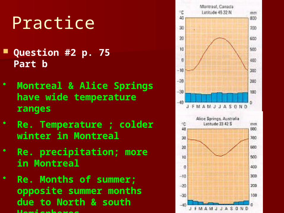
Practice Question #2 p. 75
Part b
• Montreal & Alice Springs have wide temperature ranges
• Re. Temperature ; colder winter in Montreal
• Re. precipitation; more in Montreal
• Re. Months of summer; opposite summer months due to North & south Hemispheres
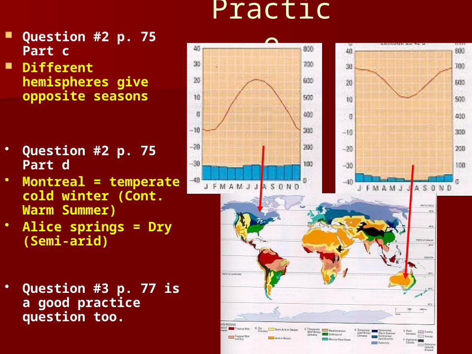
Practice Question #2 p. 75 Part c Different hemispheres
give opposite seasons
• Question #2 p. 75 Part d• Montreal = temperate cold
winter (Cont. Warm Summer)
• Alice springs = Dry (Semi-arid)
• Question #3 p. 77 is a good practice question too.