Embed Size (px)
Citation preview
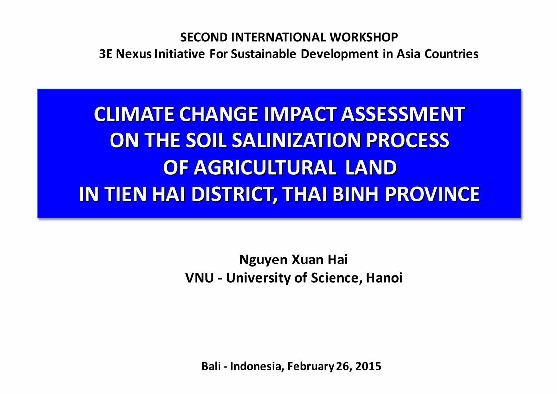
CLIMATE CHANGE IMPACT ASSESSMENT ON THE SOIL SALINIZATION PROCESS
OF AGRICULTURAL LAND IN TIEN HAI DISTRICT, THAI BINH PROVINCE
Nguyen Xuan HaiVNU -‐ University of Science, Hanoi
Bali -‐ Indonesia, February 26, 2015
SECOND INTERNATIONAL WORKSHOP3E Nexus Initiative For Sustainable Development in Asia Countries
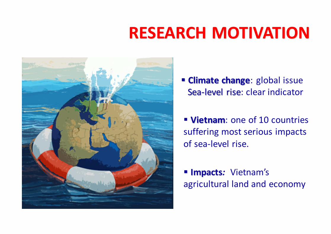
§ Climate change: global issueSea-‐level rise: clear indicator
§ Impacts: Vietnam’s agricultural land and economy
§ Vietnam: one of 10 countries suffering most serious impacts of sea-‐level rise.
RESEARCH MOTIVATION

Thai Binh province:• Primary granary (rice field) in the north•More than 50 km of the sea-‐shore
Tien Hai District = Coastal area
Serious impacts on the agriculture-‐soil environment-‐
Climate change Sea-‐level rise
Thai Binh Map

Sea-‐water intrusion
Irrigation water quality (*TSS )
Salt accumulation in soil
*TSS = Total soluble salt
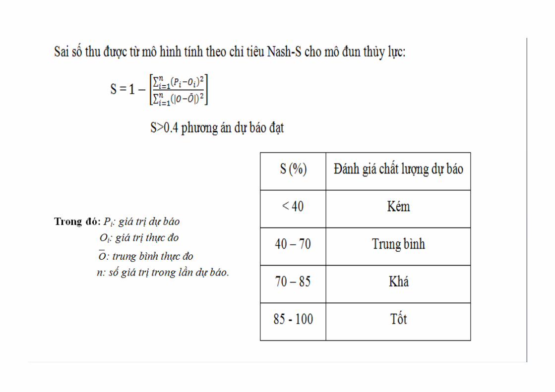
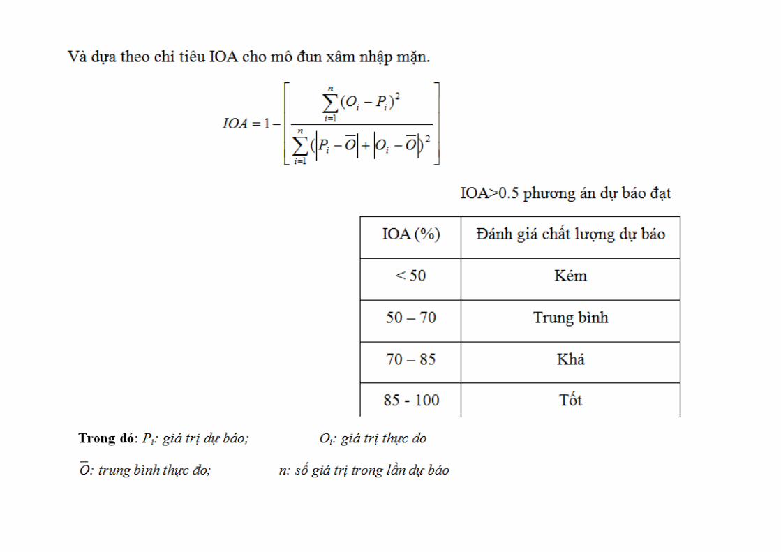
SALINIZATION PATHWAY
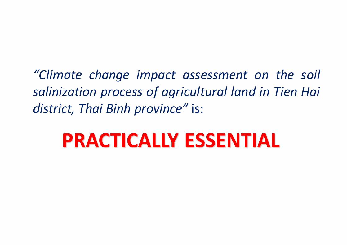
“Climate change impact assessment on the soilsalinization process of agricultural land in Tien Haidistrict, Thai Binh province” is:
PRACTICALLY ESSENTIAL

SEA-LEVEL RISE(Climate change)
Soil salinization process of
agricultural land in Tien Hai district
B2 scenario, MONRE 2009
OBJECTIVE 1:Sea-level rise impactassessment on the primary andsecondary soil salinization.
OBJECTIVE 2:Prediction for the soil salinitytrend up to 2100
Based on
Impacts of
I. OBJECTIVES

Climate change and Sea-‐level rise scenario, MONRE 2009
• B2 scenario = Medium emission scenario• Sea-‐level rise (in cm)
ScenarioTime scale of the 21st century
2050 2060 2070 2080 2090 2100
B2 30 37 46 54 64 75
The increase of sea-‐level (cm) in comparison with the period 1980 -‐ 1990
SCIENTIFIC BASIC
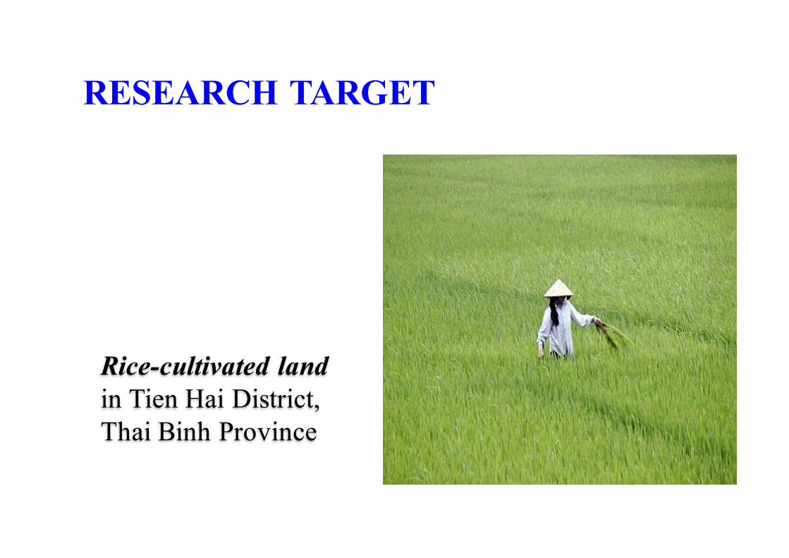
Rice-cultivated land in Tien Hai District, Thai Binh Province
RESEARCH TARGET

Objective 1:Primary & secondarysalinization assessment
Objective 2:Soil salinity trend
SURVEYObservation-based study: salic fluvisol (state, origin, use); economic conditions ….
DATA COLLECTION•Salic fluvisol, the salt intrusion•Social – economic conditions in Tien Hai district•Soil characteristics in Tiền Hải
MODEL APPLICATIONØMike 11: predicting irrigation water salinityØSaltmod: predicting soil salinity trend up to 2100
II. STUDY METHODS
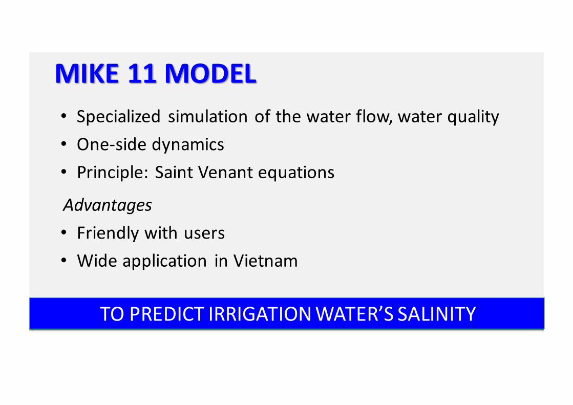
MIKE 11 MODEL• Specialized simulation of the water flow, water quality• One-‐side dynamics• Principle: Saint Venant equations
Advantages• Friendly with users• Wide application in Vietnam
TO PREDICT IRRIGATION WATER’S SALINITY
SALTMOD MODELAdvantages
• Simple operation for users• Input data: usually common/ possible estimation/easy calculation
Popularization• Common in Europe (Netherlands) and several nations (Egypt)• In Vietnam: new one
Yet being applied in some researches about the change of soil salinity in the aquaculture condition in Cuu Long River Delta
TO PREDICT SOIL SALINITY TREND UP TO 2100

III. RESULTS AND DISCUSSION1. Sea–level rise impact on the soil salinization of rice-‐cultivated land in
Tien Hai District§ Primary soil salinization§ Secondary soil salinization
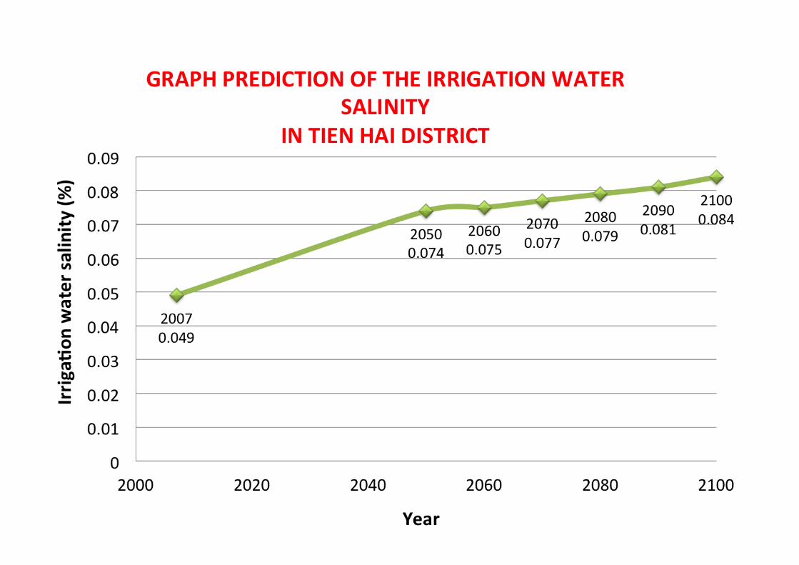
2. Forecasting the salinity trend of Tien Hai rice-‐cultivated land up to 2100§ Mike 11 application for the prediction of the irrigation water salinity§ Saltmod application for the prediction of the rice-‐cultivated land’s salinity trend

1. Sea–level rise impact on the soil salinization of rice-‐cultivated land in Tien Hai District
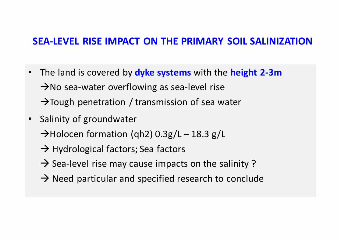
• The land is covered by dyke systems with the height 2-‐3màNo sea-‐water overflowing as sea-‐level riseàTough penetration / transmission of sea water
• Salinity of groundwateràHolocen formation (qh2) 0.3g/L – 18.3 g/Là Hydrological factors; Sea factorsà Sea-‐level rise may cause impacts on the salinity ?à Need particular and specified research to conclude
SEA-‐LEVEL RISE IMPACT ON THE PRIMARY SOIL SALINIZATION
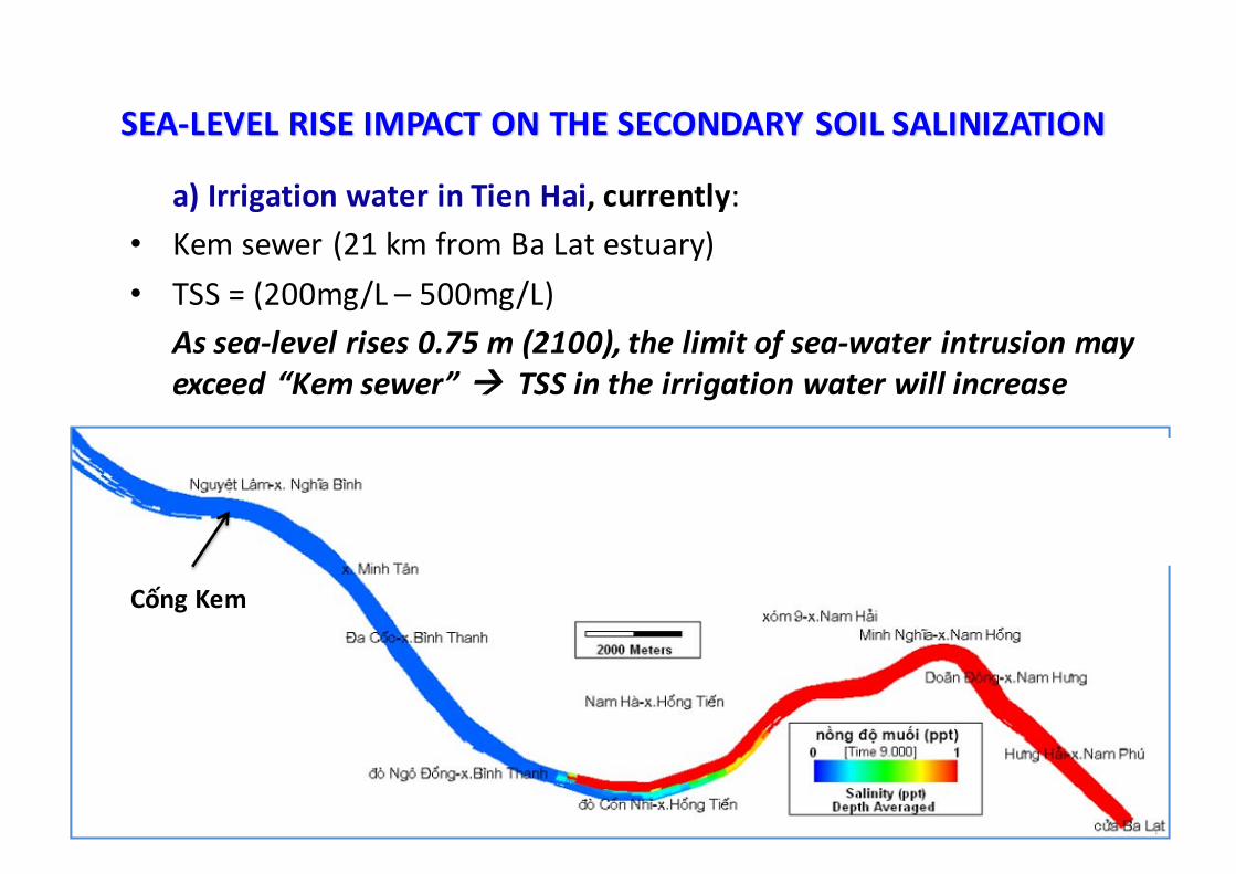
a) Irrigation water in Tien Hai, currently:• Kem sewer (21 km from Ba Lat estuary)• TSS = (200mg/L – 500mg/L)
As sea-‐level rises 0.75 m (2100), the limit of sea-‐water intrusion may exceed “Kem sewer” à TSS in the irrigation water will increase
SEA-‐LEVEL RISE IMPACT ON THE SECONDARY SOIL SALINIZATION
XNM sông Hồng ở điều kiện DCST và MNB hiện tại (mùa khô)
Cống Kem
Viện địa chất, Viện Khoa học và Công nghệ Việt Nam,
2010-2011
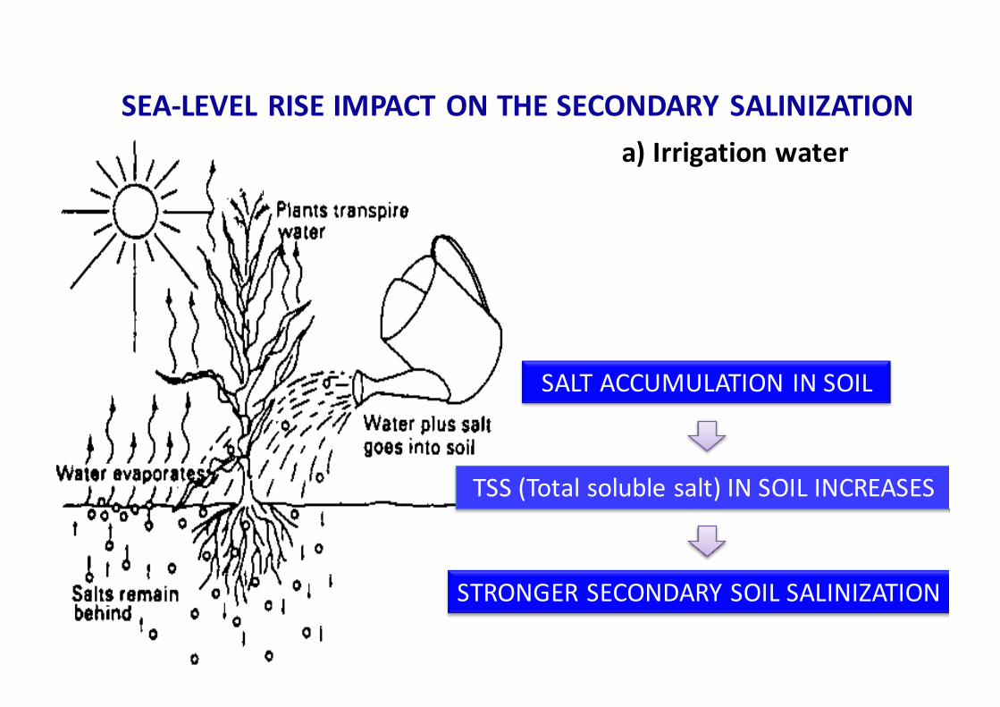
SALT ACCUMULATION IN SOIL
STRONGER SECONDARY SOIL SALINIZATION
TSS (Total soluble salt) IN SOIL INCREASES
SEA-‐LEVEL RISE IMPACT ON THE SECONDARY SALINIZATIONa) Irrigation water

SEA-‐LEVEL RISE IMPACT ON THE SECONDARY SOIL SALINIZATION
Increase the secondary soil salinization in Tien Hai District
AQUACULTURE
Sea-‐level rise àmore popular
b) Aquaculture

RESULT 1: Sea-level rise impact assessment on the soil salinization process of agricultural land in Tien Hai district, Thai Binh
SALINIZATION PROCESS
FACTORS CAUSING SALTY
IMPACTS(under Sea-‐level rise)
Primary salinization
Sea water overflowing No impacts
Percolation/ transmission from the outer to the inner of the dyke system
Negligible
Groundwater Maybe ? (need a particular research)
Secondary salinization
Irrigation water Stronger salinization
Aquaculture Increasing salinization
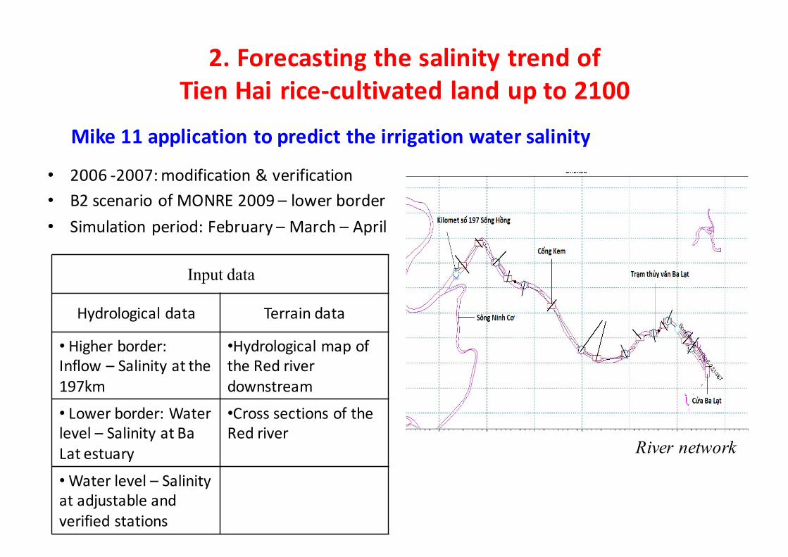
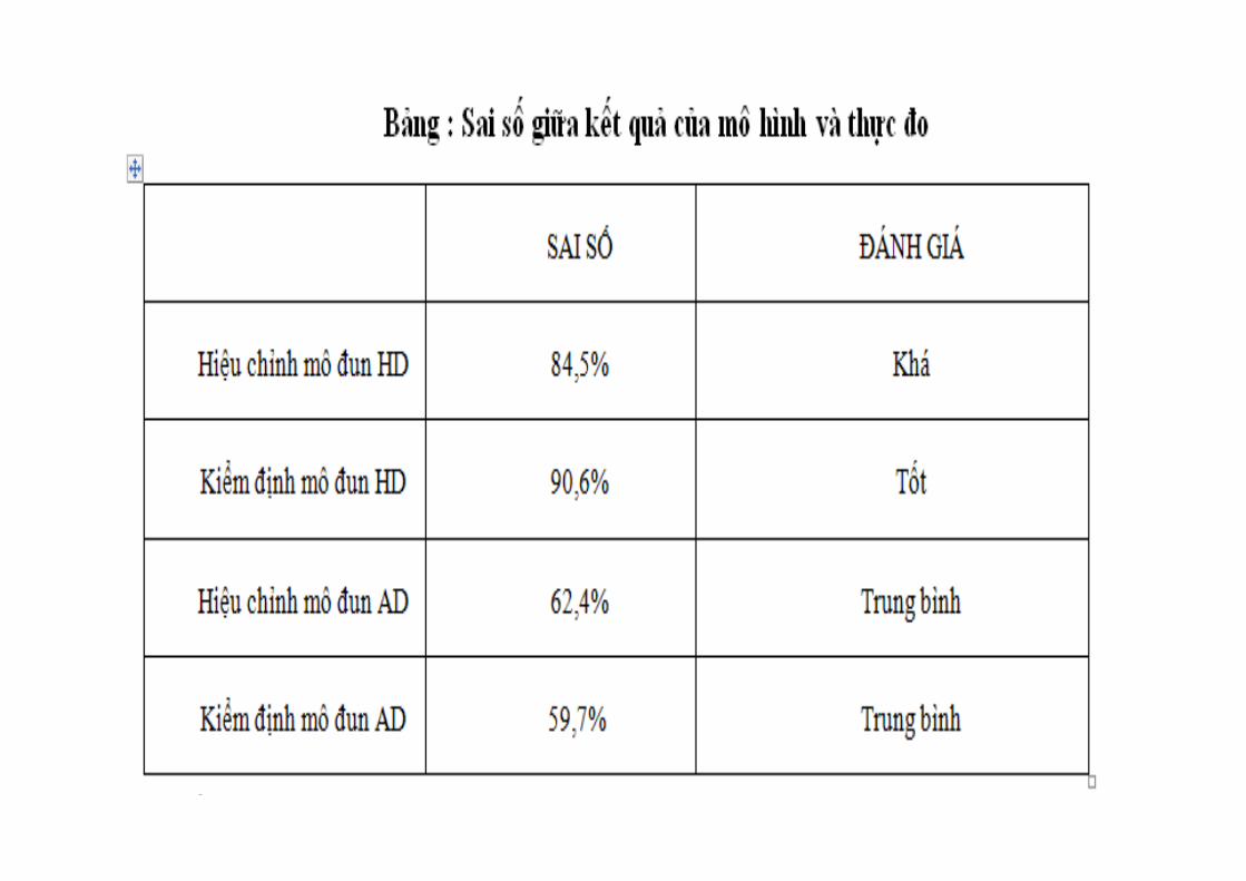
• 2006 -‐2007: modification & verification• B2 scenario of MONRE 2009 – lower border• Simulation period: February – March – April
River network
Mike 11 application to predict the irrigation water salinity
Input data
Hydrological data Terrain data
• Higher border: Inflow – Salinity at the 197km
•Hydrological map of the Red river downstream
• Lower border: Water level – Salinity at Ba Lat estuary
•Cross sections of the Red river
•Water level – Salinity at adjustable and verified stations
2. Forecasting the salinity trend of Tien Hai rice-‐cultivated land up to 2100
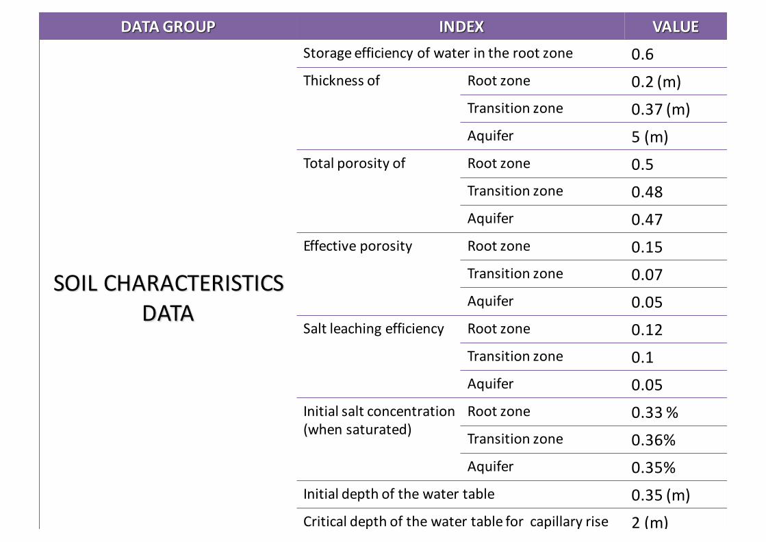
DATA GROUP INDEX VALUE
SOIL CHARACTERISTICS DATA
Storage efficiency of water in the root zone 0.6Thickness of Root zone 0.2 (m)
Transition zone 0.37 (m)Aquifer 5 (m)
Total porosity of Root zone 0.5Transition zone 0.48Aquifer 0.47
Effective porosity Root zone 0.15Transition zone 0.07Aquifer 0.05
Salt leaching efficiency Root zone 0.12Transition zone 0.1Aquifer 0.05
Initial salt concentration(when saturated)
Root zone 0.33 %Transition zone 0.36%Aquifer 0.35%
Initial depth of the water table 0.35 (m)Critical depth of the water table for capillary rise 2 (m)

DATA GROUP INDEX VALUE
HYDROLOGICAL DATA
Percolation loss from irrigation canal system 0Amount of irrigation water
Dry seasons 0.6 (m/season)
Rainy seasons 0.45 (m/season)
Incoming groundwater flow through the aquifer 8.693 l/s -‐km²
Surface runoff 0 (m/season)
Surface drainageDry seasons
Rainy seasons
PrecipitationDry seasons B2
scenario,2009Rainy seasons
Evapo-‐transpirationDry seasons
Rainy seasons
Salt concentration Groundwater 0.35%Rainwater 0.002 %
AGRONOMIC DATA
Area 8100 ha
Number of seasons 2 seasonsDuration of seasons in months
Dry seasons 2,3,4,5Rainy seasons 7,8,9,10

• Aspect: IRRIGATION WATER• Principles: Water balance and Salt balance• Seasonal Input data
SALTMOD application for the prediction of rice-‐cultivated land’s salinity trend
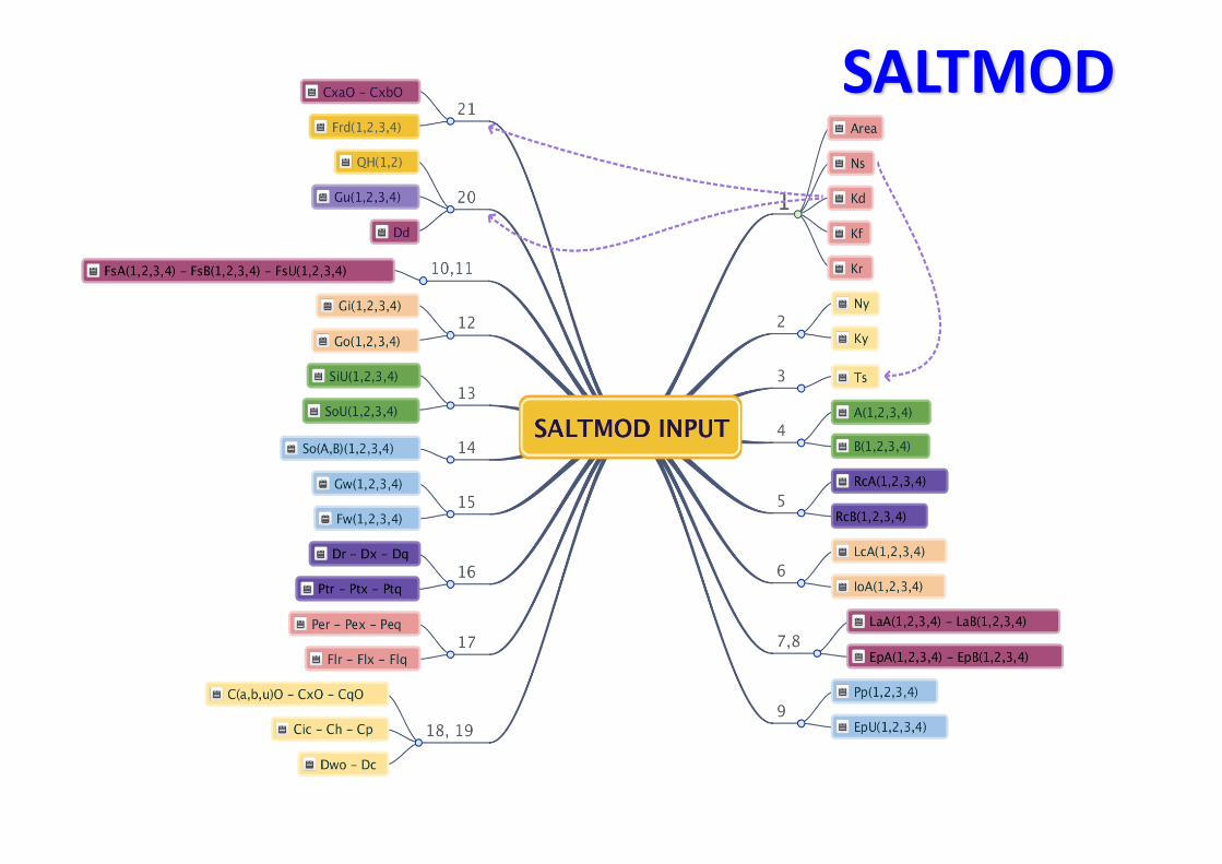
SALTMOD
0.000.050.100.150.200.250.300.350.400.450.500.550.600.650.700.750.800.850.900.951.00
2050 2055 2060 2065 2070 2075 2080 2085 2090 2095 2100
Root zone
transition zone
Aquifer
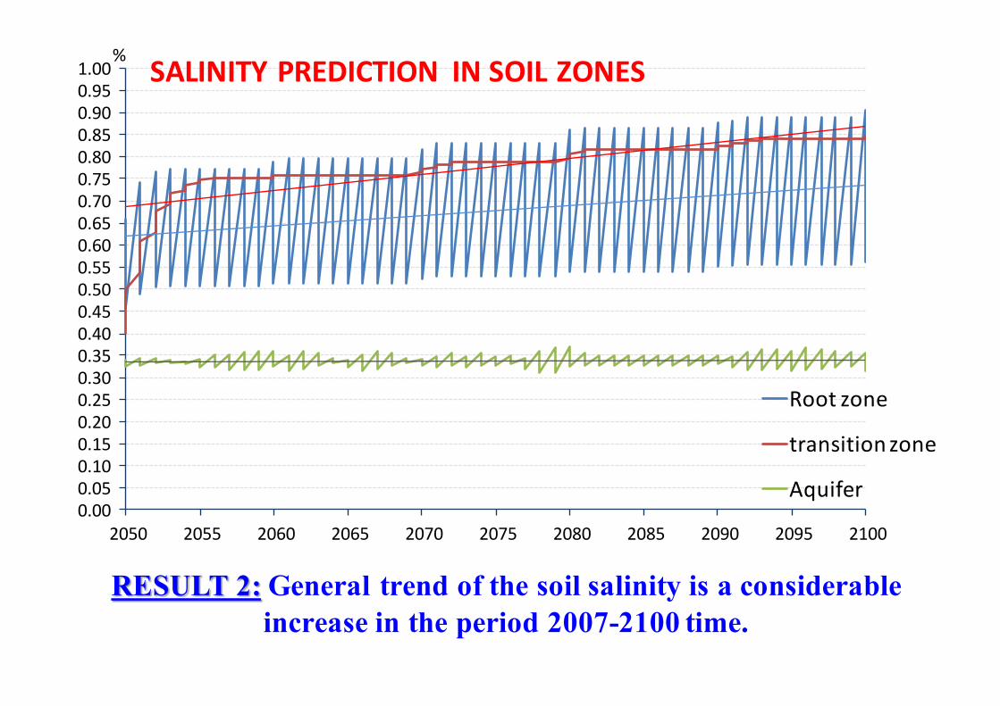
RESULT 2: General trend of the soil salinity is a considerable increase in the period 2007-2100 time.
SALINITY PREDICTION IN SOIL ZONES%

0
0.1
0.2
0.3
0.4
0.5
0.6
0.7
0.8
0.9
1
2050 2060 2070 2080 2090 2100
Root zone
Transition zone
Aquifer
RAINY SEASON% %
SOIL SALINITY TREND

CLIMATE CHANGE AND SEA-‐LEVEL RISE IMPACTS ON THE SOIL SALINITY OF THE RICE-‐CULTIVATED LAND IN TIEN HAI
DISTRICT, THAI BINH PROVINCEDRY SEASON
• Root zone salinity:0.33% (2007) to 0.91% (2100)
• Transition zone salinity:0.36% (2007) to 0.84% (2100)
• Aquifer salinity: nearly stable2 reasons:_Primarily governed by the groundwatersalinity 0.35%_Salt leaching efficiencies (Fl)Flr (root zone) = 0.12%Flx (transition zone) = 0.1%à Almost the soluble salts in the irrigationwater are captured in the 2 above zones.
RAINY SEASON• Desalinization time • Root zone salinity:
_Slightly decrease after each rainy season_General trend: the increasing salinity (0.23%)due to the small value of Flr.
• Transition zone salinity:_Slight increase after each rainy season. Possible reason: the removal salt from the root zone is accumulated thereFlx = 0.1%
• Aquifer salinity: slightly decrease from 0.35% to 0.31%.
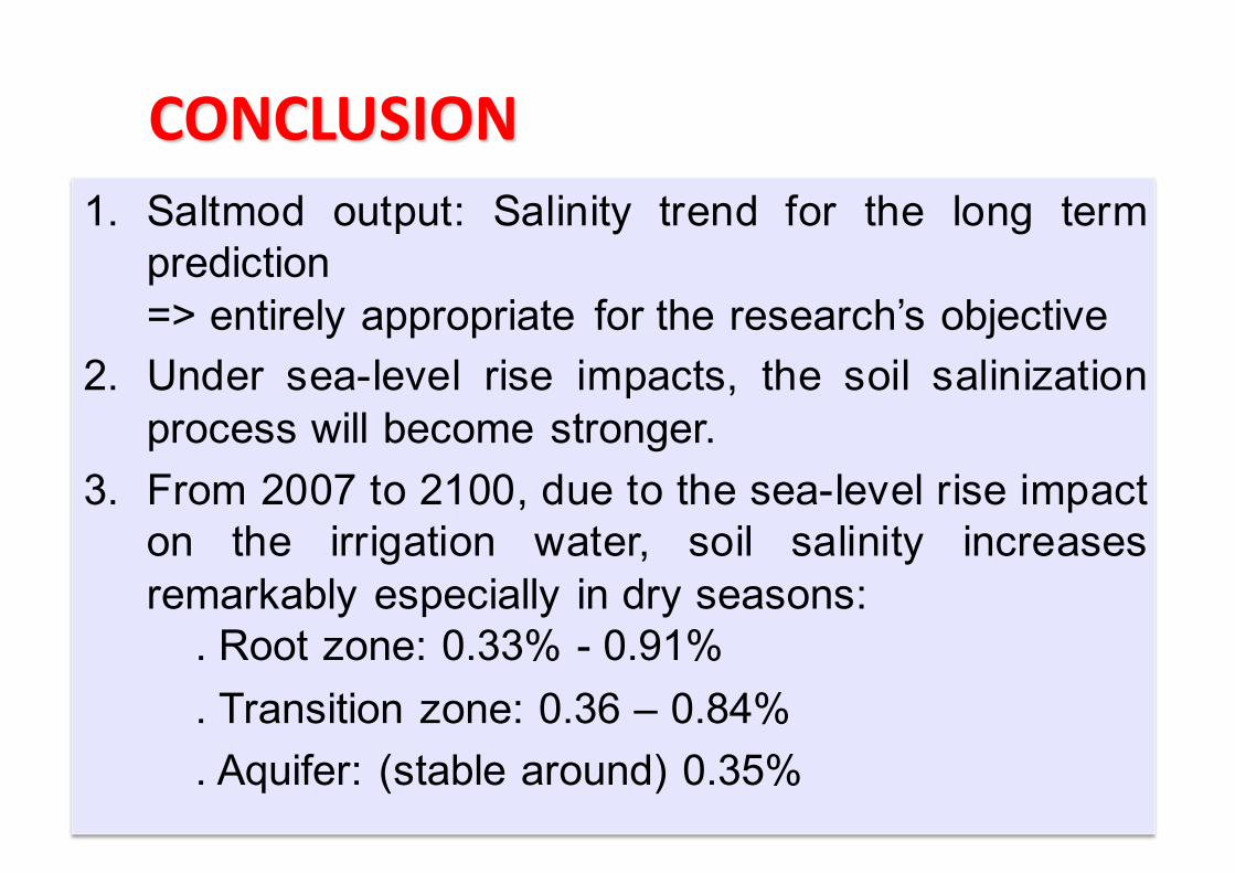
CONCLUSION1. Saltmod output: Salinity trend for the long termprediction=> entirely appropriate for the research’s objective
2. Under sea-level rise impacts, the soil salinizationprocess will become stronger.
3. From 2007 to 2100, due to the sea-level rise impacton the irrigation water, soil salinity increasesremarkably especially in dry seasons:. Root zone: 0.33% - 0.91%. Transition zone: 0.36 – 0.84%. Aquifer: (stable around) 0.35%
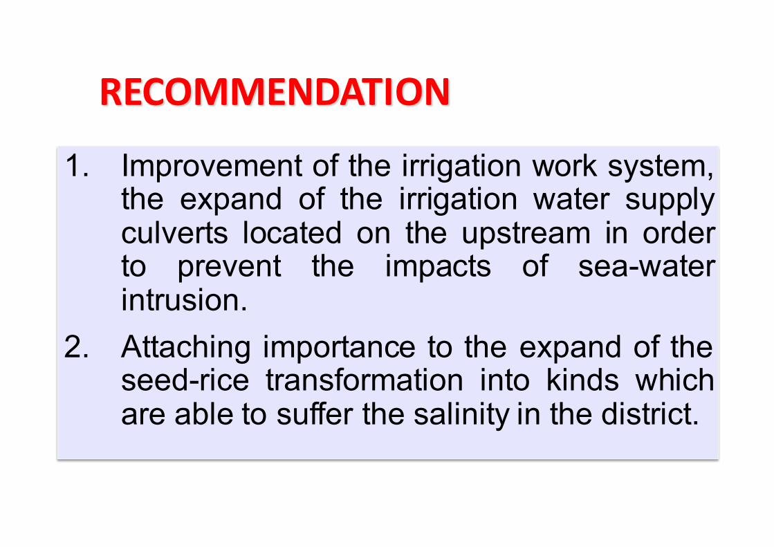
1. Improvement of the irrigation work system,the expand of the irrigation water supplyculverts located on the upstream in orderto prevent the impacts of sea-waterintrusion.
2. Attaching importance to the expand of theseed-rice transformation into kinds whichare able to suffer the salinity in the district.
RECOMMENDATION
REFERENCES1. Kịch bản Biến đổi khí hậu và nước biển dâng, Bộ Tài nguyên và Môi
trường, 20092. Nghiên cứu sự biến động đất mặn, đất phèn tỉnh Thái Bình và đề xuất
hướng sử dụng có hiệu quả; Luận văn Tiến Sĩ –Nguyễn Văn Đạo; Viện khoa học Nông nghiệp Việt Nam; 2012
3. Nghiên cứu sự biến đổi tính chất đất mặn huyện Tiền Hải tỉnh Thái Bình qua quá trình sử dụng; Luận văn thạc sĩ nông nghiệp –Đào Trọng Hùng; Trường Đại học Nông nghiệp Hà Nội; 2008
4. Nghiên cứu, đánh giá tác động của BĐKH tới tỉnh Thái Bình, đề xuất các giải pháp thích ứng, giảm thiểu thiệt hại; Nguyễn Văn Hoàng, Viện địa chất – Viện Hàn lâm Khoa học và công nghệ Việt Nam; 2010
5. Nghiên cứu đánh giá thực trạng xâm nhập mặn vào khu vực nội đồng các huyện ven biển tỉnh Thái Bình, đề xuất các giải pháp và định hướng quy hoạch cây trồng, vật nuôi phù hợp với thay đổi sinh thái; Viện địa lý –Viện Hàn lâm Khoa học và công nghệ Việt Nam; 2007
REFERENCES6. Niên giám thống kê huyện Tiền Hải năm 2000,2009,2010; Phòng TN&MT
huyện Tiền Hải 2010. 7. Thống kê, kiểm kê diện tích đất đai ban hành kèm theo thông tư số 08 của Bộ
TN&MT; Phòng TN&MT huyện Tiền Hải 2012.
8. Xây dựng chương trình dự báo xâm nhập mặn cho khu vực Đồng bằng sông Hồng – sông Thái Bình; Đoàn Thanh Hằng, KS; Viên khoa học Khí tượng thủy văn và môi trường; 2010
9. Crop evaporation – Guidelines for computing crop water requirement; FAO;1998
10. Evapotranspiration of rice fields in the red river delta; Ha Hoc Ngo andHuynh Ngoc Phien, Asian Institute of Technology Thailand; Southeast AsianStudies, Vol.20, No. 3, December 1982
11. Soil responses to Climate change; M.D.A Rounsewell P.J. Loveland, SoilSurvey and Land Research Centre Cranfield University; 1993
12. Saltmod Description of principles, user manual, and examples of application;R.J.Oosterbaan, International Institute for Land Reclamation andImprovement; 2002

THANK YOU FOR YOUR LISTENING
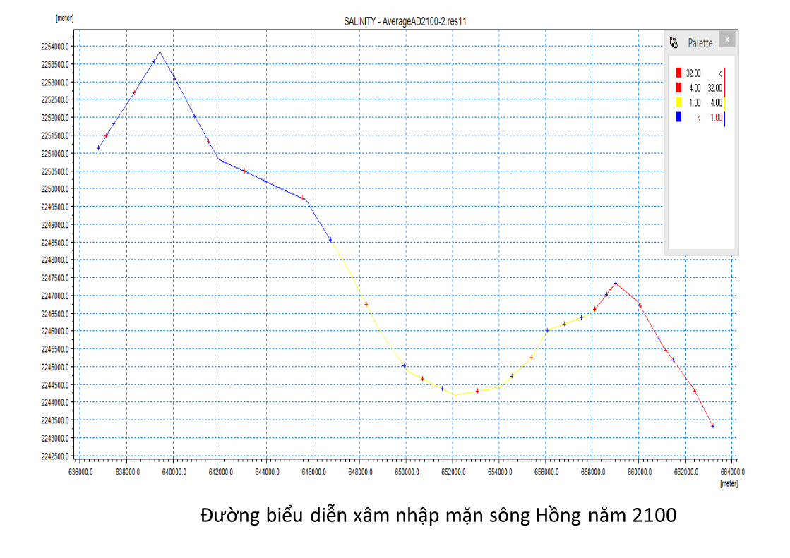
Đường biểu diễn xâm nhập mặn sông Hồng năm 2100