Embed Size (px)
Citation preview

Civil Aviation Department www.cad.gov.hk
Performance Based Navigation – The Implementation Plan for Hong Kong
Civil Aviation Departmentwww.cad.gov.hk

© Copyright Civil Aviation Department 2010 The information contained in this implementation plan may be subject to change without notice. For
full details of the operational requirements, please refer to the current rules and regulations and the Aeronautical Information Publications.

1
Preface The continuing growth of aviation increases demands on airspace capacity therefore emphasizing the need for optimum utilization of available airspace. With the support of advanced airborne equipment and satellite‐based navigation technologies, improved operational efficiency derived from the application of area navigation (RNAV) techniques has resulted in the development of the concept of “performance based navigation (PBN)” worldwide and for all phases of flight. In line with the International Civil Aviation Organization (ICAO) Asia‐Pacific Regional PBN Implementation Plan, the Hong Kong Civil Aviation Department (CAD) has adopted a 3‐phased approach for the implementation of PBN :
• Short Term (2008‐2012) • Medium Term (2013‐2016) • Long Term (Beyond 2016)
This implementation plan has been developed to provide our aviation partners and all those who will be involved with some general information on the concepts of PBN and the PBN implementation plan in Hong Kong. Should you have any comments or questions, please feel free to contact us. We remain committed to providing a safe and efficient air transport system in Hong Kong. Norman Lo Director‐General of Civil Aviation August 2010


3
Contents Preface 1
Contents 3
1. Background 5
2. Benefits of PBN 9
3. International Requirements 11
4. Regional and International Cooperation 13
5. Implementation of PBN in Hong Kong 15
6. Communications, Navigation and 18
Surveillance (CNS) Infrastructure
7. PBN Readiness of Hong Kong Register 20
Aircraft
8. Transition and Safety Assessment 21
9. Way Forward 22


5
1. Background The global aviation community is facing significant challenges in recent years. As demand for air transportation services continues to grow, we are faced with the challenge to safely increase capacity, efficiency and access to airports worldwide, particularly at terrain challenged airports. These constraints are largely a result of reliance upon conventional ground‐based navigation aids (e.g. VHF Omni‐directional Range (VOR), Non‐directional Beacon (NDB), Instrument Landing System (ILS)), which limit routes and procedures to the physical locations of ground‐based navigation aids. These ground‐based systems have served the aviation community well since introduction; however, they do not permit the flexibility of point‐to‐point operations available with PBN to meet the challenges of today and the future. To address these challenges, PBN is amongst the foremost efforts made by the aviation community worldwide.
This implementation plan also outlines the benefits of PBN, the international requirements, the ongoing regional and international activities in facilitating PBN implementation as well as the Hong Kong CAD’s PBN implementation plan.
ILS Localizer
VOR
NDB
6
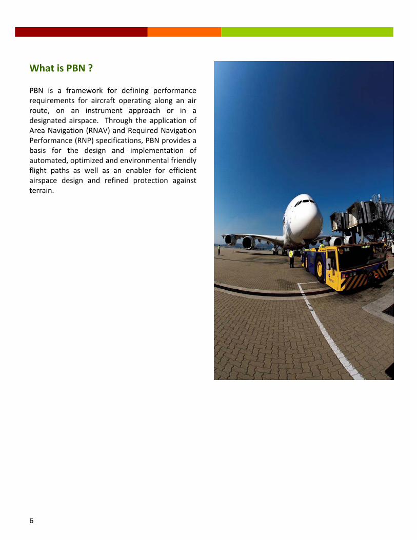
What is PBN ? PBN is a framework for defining performance requirements for aircraft operating along an air route, on an instrument approach or in a designated airspace. Through the application of Area Navigation (RNAV) and Required Navigation Performance (RNP) specifications, PBN provides a basis for the design and implementation of automated, optimized and environmental friendly flight paths as well as an enabler for efficient airspace design and refined protection against terrain.

7
RNAV RNAV enables aircraft to fly on any desired flight path within the coverage of ground‐ or space‐based navigation aids, within the limits of the capability of the self‐contained systems, or a combination of both capabilities. As such, RNAV aircraft have better access and flexibility for point‐to‐point operations.
RNP RNP is RNAV with the addition of an on‐board performance monitoring and alerting capability. A defining characteristic of RNP operations is the
ability of the aircraft navigation system to monitor the navigation performance it achieves and inform the crew if the requirement is not met during an operation. This onboard monitoring and alerting capability enhances the pilot’s situational awareness and can enable reduced obstacle clearance or closer route spacing without intervention by air traffic control. Certain RNP operations require advanced features of the onboard navigation function and approved training and crew procedures. These operations must receive approvals that are characterized as RNP Authorization Required (RNP AR) Operations.

8
The illustrations below depict the constraints associated with conventional, ground‐based sensor specific routes/procedures and the flexibility and benefits of performance‐based, non‐sensor specific navigation (both RNAV and RNP).
Once the required performance level is established, the capability of the different aircraft determines whether it can safely achieve the specified performance and qualify for the operation.
(with on‐board performance monitoring and alerting capability)
(with on‐board performance monitoring and alerting capability)

9
2. Benefits of PBN Since introduction, PBN is helping the global aviation community reduce aviation congestion, conserve fuel, protect the environment and maintain reliable, all‐weather operations. It also provides air operators with greater flexibility and better operating returns while increasing the safety of air transport systems.
PBN Increases Airspace Capacity • PBN increases airspace capacity through
the implementation of more precise and efficient flight paths and air routes that will foster smoother traffic flows.
• It also helps to reduce congestion and
delays in high‐density airspace and airports by means of parallel routes and additional arrival and departure points in terminal areas.
PBN Improves Accessibility and Operational Efficiency • PBN reduces fuel consumption through
shorter flight tracks, continuous descent procedures and fewer diversions. It enables more direct and closely spaced parallel tracks en route for increased fuel efficiency and reduced flight time variance.
• PBN improves the overall economic
benefits of the operations by reducing navigation infrastructure investment and operating costs.
• PBN alleviates ATC and pilot workload by
utilizing RNAV/RNP procedures and airborne capability and reducing the need for ground‐to‐air voice communications and radar vectoring.
• PBN creates new market opportunities by
providing safe access to terrain and weather challenged destinations.

10
PBN Improves Safety • PBN reduces the risk of Controlled Flight
Into Terrain (CFIT) accidents by providing a very precise lateral and vertical flight path.
• It increases airspace safety through the
implementation of continuous and stabilized descent procedures using vertical guidance.
• PBN also provides consistent, predictable
and stabilized approaches, and improves airport and airspace arrival paths in all‐weather operations.
PBN Is Environment‐Friendly • PBN reduces emissions by saving fuel
through shorter and vertically optimized PBN flight paths.
• PBN also reduces noise emission through
the use of continuous descent procedures that allow aircraft to descend from high altitudes to the airport at minimum thrust settings.

11
3. International Requirements To reap the benefits offered by PBN and to ensure a globally harmonized and coordinated transition to PBN, the 36th Session of the ICAO Assembly adopted a Resolution (A36‐23) to resolve that States and Planning and Implementation Regional Groups (PIRGs) should have in place a PBN implementation plan by 2009 to achieve : 1) implementation of RNAV and RNP
operations (where required) for en‐route and terminal areas according to established timelines and intermediate milestones; and
2) implementation of approach procedures
with vertical guidance (APV) (through barometric vertical navigation (Baro‐VNAV) and/or augmented Global Navigation Satellite System (GNSS)) for all instrument runway ends, either as the primary approach or as a back‐up for precision approaches by 2016 with intermediate milestones as follows: 30% by 2010, 70% by 2014.
In this connection, guidance materials have been developed by ICAO, with the aim of providing practical guidance to the aviation community on how to implement the various PBN applications.
Use and scope of navigation specifications by flight phases The table below shows the navigation specifications and their associated navigation accuracies published by ICAO for the various flight phases.
The above table also shows that for any particular PBN operation, it is possible that a sequence of RNAV and RNP applications may be used. For instance, a flight may commence in an airspace using a Basic‐RNP 1 Standard Instrument Departure (SID), transit through en‐route then oceanic airspace requiring RNAV 2 and RNP 4, respectively, and culminate with terminal and approach operations requiring RNAV 1 and RNP Approach (RNP APCH). The figure below is an example of an application of RNAV and RNP specifications to ATS routes and instrument procedures.

12
Operational Approval Process It should be noted that before an aircraft or operator may conduct an RNAV / RNP operation, it must demonstrate compliance with the associated airworthiness and operational requirements as promulgated by the State of Registry / State of Operator, through the established regulatory or approval mechanism. The following are amongst the areas requiring consideration and attention : • Aircraft qualification and equipment
capability • Operating procedures for the navigation
systems to be used • Operator’s navigation database • Pilot knowledge, training and certification • Operational approval process involved • Oversight of operators
For more detail please refer to the ICAO PBN Manual – Doc 9613 or your respective Flight Operations Inspector for the necessary approval or authorization required.

13
4. Regional and International Cooperation Asia‐Pacific PBN Task Force The implementation of PBN activities will require participation and the collaborative efforts of all stakeholders from the many disciplines involved. To facilitate coordination between the Asia‐Pacific States, a PBN Task Force was established in early 2008 to lead the region in the development of a regional PBN implementation plan and to address the various PBN implementation issues. The Task Force, comprising representatives from ICAO, civil aviation administrations, air navigation service providers, airline and pilot associations, flight procedure design and operations experts, holds regular meetings to review the progress of PBN implementation in the region.
The Task Force has been active and effective in assisting the Asia‐Pacific States in the implementation of PBN programmes and in ensuring the development of a regionally harmonized implementation plan. The Hong Kong CAD has been actively involved in The Task Force since its establishment.
ICAO Flight Procedure Programme (FPP) Office To further promote PBN implementation within the region and with the support and contribution of active participating States, Administrations and organizations, ICAO has, since March 2010, established an Asia‐Pacific Flight Procedure Programme (APAC FPP) Office in Beijing. The objective is to enhance the safety and efficiency of air transport operations in a cost‐effective manner, by enhancing the instrument flight procedure design capabilities of participating States or Administrations. In addition, the APAC FPP Office will also act as a regional forum to address the various instrument flight procedure design issues.

14
In support of this initiative of ICAO, Hong Kong has undertaken to participate in the ICAO APAC FPP as an “Active Participating State”. In addition, Hong Kong is also committed to make available two of our most experienced flight procedure designers to the new APAC FPP Office for the provision of technical support and training of PBN procedure designers of other States in the Region. Indeed the secondment arrangement is part of CAD’s ongoing efforts to enhance airspace efficiency within the Hong Kong Flight Information Region. It is believed that the secondment arrangement will not only broaden the exposure of our flight procedure designers to the development and application of the latest advanced technologies in instrument flight procedure design, but will also provide us with the opportunity and experience to further enhance our instrument flight procedures at the Hong Kong International Airport and consolidate Hong Kong’s position as an international and regional aviation hub.
Mr Mike Tam from the Hong Kong CAD speaking at the ICAO Asia‐Pacific PBN Implementation Seminar held in Hong Kong on 1‐2 February 2010. Under a secondment arrangement to the new ICAO APAC FPP Office, Mr Tam, who is an experienced air traffic controller and flight procedure designer, will provide technical support and training to PBN procedure designers of other States in the Asia‐Pacific region.
15
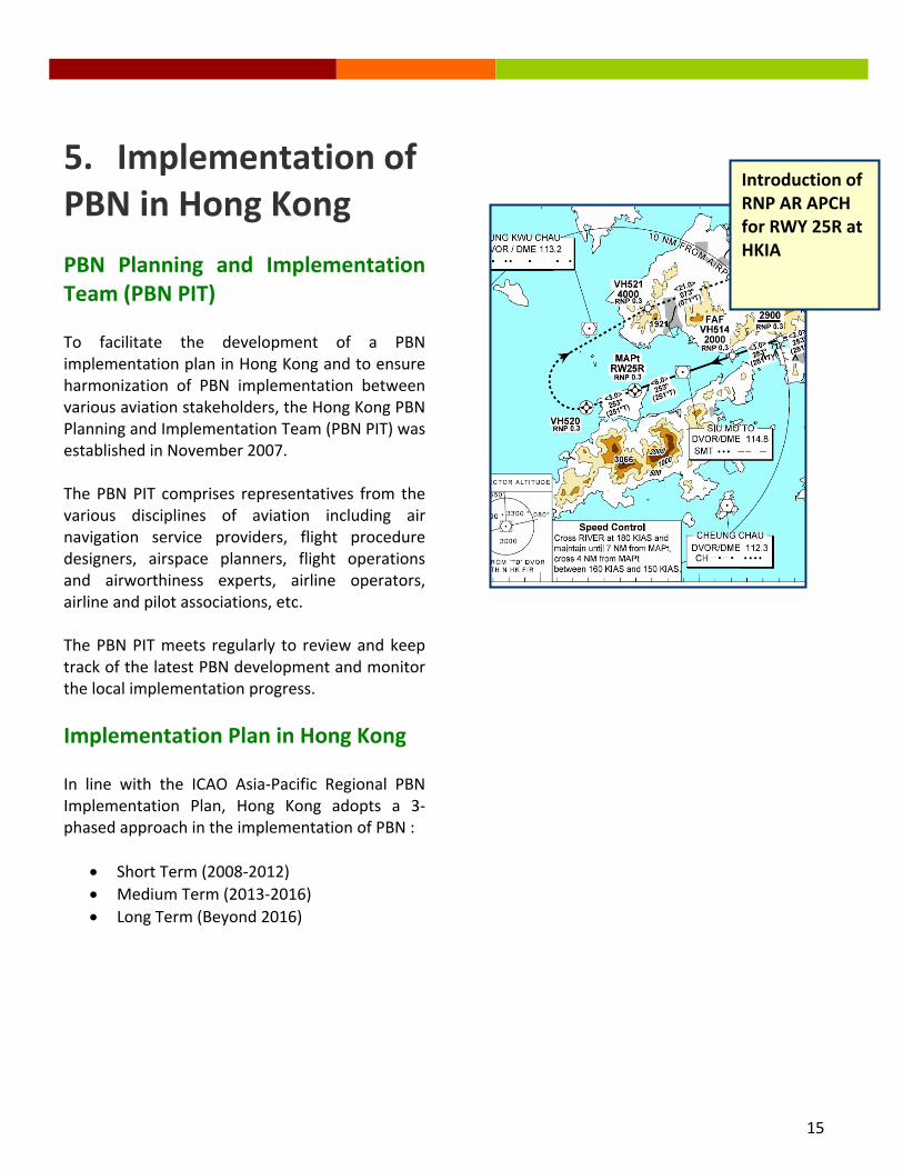
5. Implementation of PBN in Hong Kong
PBN Planning and Implementation Team (PBN PIT) To facilitate the development of a PBN implementation plan in Hong Kong and to ensure harmonization of PBN implementation between various aviation stakeholders, the Hong Kong PBN Planning and Implementation Team (PBN PIT) was established in November 2007. The PBN PIT comprises representatives from the various disciplines of aviation including air navigation service providers, flight procedure designers, airspace planners, flight operations and airworthiness experts, airline operators, airline and pilot associations, etc. The PBN PIT meets regularly to review and keep track of the latest PBN development and monitor the local implementation progress.
Implementation Plan in Hong Kong In line with the ICAO Asia‐Pacific Regional PBN Implementation Plan, Hong Kong adopts a 3‐phased approach in the implementation of PBN :
• Short Term (2008‐2012) • Medium Term (2013‐2016) • Long Term (Beyond 2016)
Introduction of RNP AR APCH for RWY 25R at HKIA

16
Short Term (2008‐2012) Within the Approach Airspace, Hong Kong aims at achieving 100% implementation of RNP AR APCH procedures by 2012. Whilst for the Terminal Airspace, Hong Kong will redefine all RNP 1 SIDs to RNAV 1 specification and aim to achieve 100% implementation of RNAV 1 Standard Terminal Arrival Routes (STARs) in the terminal airspace by 2012 after the successful implementation of RNP 1 SID in 2005. In the En‐route Airspace, Hong Kong aims at conducting trial operations for RNP4 on L642 and M771 by 2012 with an objective to implement RNP 4 by 2014. Within 2010, Hong Kong plans to issue a mandate for RNAV 1 and RNP 4 capability for the terminal airspace and the en‐route airspace respectively.
• Apply 50NM Longitudinal Separation on RNP10 Routes in 2008 [Implemented]
• Trial operation for RNP4 on L642 & M771 by 2012
• Within 2010, issue mandate for RNP4 capability within HK en‐route airspace by 2014
Enroute
• Redefine all RNP1 SID to RNAV1 specification in 2010 (RNP1 SIDs implemented in 2005)
• Implement RNAV1 STARs• Within 2010, issue mandate
for RNAV1 capability within HK TMA by 2013
Terminal (SID/STAR)
• Implement RNP AR APCH Procedure to North RWY by 2010 [Implemented]
• Implement RNP AR APCH Procedure to South RWY by 2012
• Feasibility study of GBAS
Approach
SHORT TERM (2008‐2012)AIRSPACE
Medium Term (2013‐2016) Within Approach Airspace, Hong Kong plans to issue a mandate for appropriate Navigation Specification, e.g. Advance RNP APCH, in 2013. Within the Terminal Airspace, Hong Kong plans to achieve 100% RNAV 1 application by 2013. For the En‐route Airspace, Hong Kong aims at achieving 100% RNP 4 implementation by 2014.
• Implement RNP4 within enroute airspace
• Mandate RNP4 application for aircraft operating within en‐route airspace by 2014
• Achieve 100% RNP4 within en‐route airspace
Enroute
• Implement RNAV1 application in TMA Airspace
• Mandate RNAV1 application for aircraft operating within TMA by 2013
• Achieve 100% RNAV1 SID/STAR in TMA
Terminal (SID/STAR)
• Trial of GBAS for capable aircraft/operators
• Consider use of appropriate Nav. Spec., e.g. Advance RNP APCH, within approach airspace
Approach
MEDIUM TERM (2013‐2016)AIRSPACE

17
Long Term (Beyond 2016) Within the Approach Airspace, Hong Kong aims at achieving 100% implementation of the Navigation Specification selected in Medium Term by 2016 or beyond. Within the En‐route Airspace, Hong Kong will consider mandate better navigation specification in accordance with the ICAO regional roadmap.
• Consider mandate better navigation specification in accordance with the ICAO regional roadmap, e.g. RNP2
Enroute
• Subject to satisfactory results of the trial, consider GBAS as backup to the ILS
• Consider use of other Nav. Spec. that suits the operation in HK.
• Consider mandate the Nav. Spec. selected for aircraft operating within approach airspace by 2016+
• Achieve 100% implementation of the Nav. Spec. selected within approach airspace
Approach
LONG TERM (BEYOND 2016)AIRSPACE
To date, Hong Kong has been following the Plan closely in moving forward the PBN project and the implementation progress is satisfactory. Hong Kong will continue its efforts in the implementation of PBN with a view to improving the overall operational efficiency and safety standards.

18
GroundBased AugmentationSystem
GBAS is airport based. One GBAS supports all runways within 23 miles.
6. Communications, Navigation and Surveillance (CNS) Infrasturcture The existing CNS Infrastructure and Future Plan Currently, Hong Kong utilizes VHF for ground‐to‐air communications between the air traffic controllers and pilots. For air navigation, the conventional ground‐based navigation aids, such
as the VOR, ILS and Distance Measuring Equipment (DME), are used to provide navigational guidance to aircraft. For surveillance, radar is the main surveillance system used in Hong Kong. Whilst VHF and radar will still remain as the main communication and surveillance system to be used in Hong Kong in conjunction with the implementation of PBN, Automatic Dependent Surveillance – Broadcast (ADS‐B) will be implemented to supplement the radar surveillance, for instance, in the en‐route airspace and also for low level airspace coverage. In respect of air navigation, GNSS will replace the conventional navigation aids and be used as the major navigation aid for aircraft navigation within the terminal area. A feasibility study will be

19
conducted in the near term to assess the applicability of Ground Based Augmentation System (GBAS) at the Hong Kong International Airport. Subject to the result of the feasibility study, the new generation of GBAS flight procedures will gradually be developed and introduced for operations into the Hong Kong International Airport.

20
7. PBN Readiness of Hong Kong Register Aircraft Aircraft Register As at March 31, 2009, the total number of civil aircraft in the Hong Kong Civil Aircraft Register was 223. Of which 199 were registered under Hong Kong AOC holders.
Hong Kong Operators PBN Approval Status
Aircraft Type Number Airbus A300 8 Airbus A320 10 Airbus A321 6 Airbus A330 48 Airbus A340 16 Boeing B737 8 Boeing B747 52 Boeing B777 27
Others 24
Distribution in the Hong Kong Civil Aircraft Register
A300, 4.02%
A320, 5.03%
A321, 3.02%
A330, 24.12%
A340, 8.04%
B737, 4.02%B747, 26.13%
B777, 13.57%
Others, 12.06%

21
8. Transition and Safety Assessment Transition to PBN Procedures During transition to PBN, sufficient ground infrastructure for conventional navigation systems will be available. After the implementation of new Navigation Specification, operators will be given reasonable notification time to allow them to equip appropriately to attain equivalent PBN‐based navigation performance. The removal of existing ground infrastructure will be done with caution to ensure that safety is not compromised. Safety assessments and consultation with other stakeholders will be conducted through the Hong Kong PBN Planning and Implementation Team (PIT). Safety Assessment Safety assessment will be conducted to ensure safety is not compromised before the implementation of new PBN flight procedure, air route, etc. In undertaking a safety assessment for the implementation of PBN, Hong Kong will:
1. Establish and maintain a database of PBN approvals;
2. Pre‐implementation – conduct safety assessments for PBN implementation in terminal and approach airspace;
3. Post‐implementation – conduct review, if necessary, after implementation of PBN procedures.

22
9. Way Forward We value your comments and cooperation In May 2009, CAD commenced the construction of our new Headquarters located at the southeast corner of the Airport Island. In the new Headquarters complex, there will be a new Air Traffic Control Centre that will accommodate a new state‐of‐the‐art air traffic management (ATM) system. Sustainability, environmental friendliness and centre of excellence in aviation training are the main design themes of the new CAD building.
With the state‐of‐the‐art ATM system, enhanced airspace management, efficient flight procedures and a competent and robust workforce, we shall be able to meet the foreseeable future demands of the rapidly growing aviation industry.
The goal towards building a seamless sky can only be achievable by the active collaboration and participation of all stakeholders. For this very reason, your cooperation and contributions are of vital importance to ensuring a regionally harmonized and coordinated transition to PBN. Should you have any questions or comments on the information contained in this implementation plan, please feel free to contact us via the following email address or fax number: Email : [email protected] Fax : (852) 2910 1655 Useful information on the development of PBN is also available on the following websites: ICAO : www.icao.int/pbn HK CAD : www.pbninfo.gov.hk/ We look forward to working with you to achieve successful implementation of PBN and a seamless sky in aviation. Thank you for your kind attention.
The new CAD Headquarters
The new Air Traffic Control Centre


Civil Aviation Departmentwww.cad.gov.hk August 2010