Embed Size (px)
Citation preview

Circulation
The Circulation Element offers mechanisms for making Morgan Hill a safe and efficient place to travel,
whether by train, bus, car, bike or foot. It contains goals, policies and actions aimed at making the existing
road network more efficient and user-friendly, implementing strategies to ensure safe and appropriate
operation of the transportation system, solving existing traffic and parking problems, and expanding transit
and non-motorized travel opportunities.
Circulation Goals
1. A balanced, safe and efficient circulation system for all segments of the community, meeting local
needs and accommodating projected regional and sub-regional traffic while protecting neighborhoods
2. Coordinated transportation planning efforts with local, regional, State and Federal agencies
3. A coordinated, continuous network of streets and roads
4. Emphasis on transportation improvements in the Butterfield, Hale/Santa Teresa, and Monterey
corridors
5. Adequate off-street parking
6. A safe and efficient transit system that reduces congestion by providing viable non-automotive modes
of transportation
7. A useable and comprehensive bikeway system that safely connects neighborhoods with workplaces and
community destinations
8. Expanded pedestrian transportation opportunities 9. A circulation system based on Smart Growth and Sustainable Communities strategies; reflecting a
balanced, safe, multi-modal transportation system, especially in Downtown where pedestrian, bicycle
and transit facilities will be emphasized along with vehicular facilities.
Traffic and Transportation
Housing and job growth in Morgan Hill and the region is projected to cause vehicle trips to increase by
approximately 50% in Morgan Hill by 2030 from 2007 base year levels. The roadway configurations in this
Circulation Element are intended to accommodate projected travel demands in the year 2030, including
local, sub-regional and regional traffic traveling through Morgan Hill. Congestion in Morgan Hill can be
substantially affected by regional traffic if Highway 101 capacity does not meet demand, as regional
travelers attempt to decrease travel times by using local roads. Prior to the 2003 completion of Highway
101 widening (from two to four lanes in each direction north of Cochrane Road, and from two to three
lanes in each direction south of Cochrane Road), local Morgan Hill roads experienced substantial
congestion from regional traffic, however congestion eased significantly after the widening. Morgan Hill
arterial and major collector street roadways will continue to serve some level of regional and subregional
travel demand into the future. However, substantial commuter traffic is anticipated to be accommodated by
Highway 101, which is projected to widen to four lanes in each direction south of Cochrane by 2030,
providing a full 8-lane configuration. Continued use of transit opportunities and transit capacity by
regional commuters will also continue to accommodate some commuter travel. The traffic modeling
completed for the 2010 Circulation Element Update maintained a similar split in 2030 between automobile
and transit usage as 2007 base year existing conditions, but policies of this Element support efforts to
facilitate increased use of alternate travel modes.

Planned Transportation System
The city transportation system is envisioned as a coordinated combination of public transit and private
vehicles, with the majority of trips continuing to be made by private automobile. A key focus during the
planning timeframe will be construction of new roadways and segments that will fill in “missing links” and
provide for increased connectivity of the roadway system. Examples include but are not limited to
completion of the missing Santa Teresa/Hale segments, completion of Butterfield South and Butterfield
North road extensions, completion of the Murphy/Mission View Corridor, and construction of a Madrone
Parkway Crossing as well as a Llagas Road Connection to link Hale/Santa Teresa to Monterey/Old
Monterey. There will also be an increased emphasis on providing for choices in travel mode, particularly
for pedestrian and bicycle travel within Morgan Hill.
In the past, Morgan Hill had considered 2-lane roads as collectors and 4-lane roads as arterials. In the 2010
Circulation Element Update, it was recognized that key north-south corridors functioned as arterials, and
yet 4-lane capacity was not required. New 2-lane arterial classifications have been incorporated into the
Circulation Plan. The “2-lane multi-modal arterial” configuration includes on-street bike lanes but also
incorporates a Class 1 bikeway/pedestrian path within a linear park in the right-of-way. A “2-lane minor
arterial” is also multi-modal but requires less right-of-way as bike lanes are only provided on-street and
standard sidewalks are provided rather than in a linear parkway.
Policies in this element reflect existing public transportation service, support retention and expansion of
CalTrain commuter service in the South County, and encourage other alternative transportation modes.
Expanded express bus service to employment centers and the CalTrain station will be encouraged, and
new bicycle and pedestrian facilities are encouraged. While some double-tracking of the Caltrain corridor
and expanded service is planned, extension of light rail service to Morgan Hill is not included in the 2035
Valley Transportation Plan.
As of February 2010 the California High Speed Rail (HSR) Authority is planning the location of a High
Speed Rail line, which is intended to serve inter-regional travel rather than local inter-city travel. If it is
implemented, it is anticipated that the line through Morgan Hill would be located primarily east of
Highway 101, although an alignment on or near the existing UPRR alignment is also being studied. It is
anticipated that a HSR station would be located in Gilroy and not in Morgan Hill. Timing of
implementation of the segment that includes South County is uncertain, and it is also unknown whether
the line would be at grade or elevated/grade-separated from existing and planned local roadways.
Travel forecasts show that substantial roadway improvements will be required in Morgan Hill, to provide
for both connectivity and capacity. The local road network will need to be improved to handle increases in
both regional travel passing through Morgan Hill and local traffic generated within the city. The city’s LOS
policies are designed to reduce the incentive for regional travel to be drawn off the freeway and onto local
streets, protect neighborhoods, promote a vital downtown, and focus transportation expenditures on priority
improvements offering high performance value. The Tiered LOS Policy, along with completion of planned
roadway improvements, are designed to ensure that traffic does not spillover into residential neighborhoods
onto streets which are not designed to accommodate sub-regional and regional traffic, as such spillover
would create safety and livability issues for local residents. The planned roadway system will
appropriately accommodate all travel demands and will avoid spillover traffic in neighborhoods.
The number of lanes on Highway 101 will have a substantial effect on the needed width of local roadways
in Morgan Hill. If the capacity of Highway 101 is not increased to meet the demand generated by increased
regional traffic, more vehicles will divert off of the freeway, resulting in congestion on local roads. Traffic
modeling with Highway 101 at 8 lanes indicates that this effect is not anticipated to the extent that
congestion would exceed the city’s applicable Tiered Level of Service standards.

This Circulation Element encourages the widening of Highway 101 to the extent needed to meet forecasted
future demand. However, possible right-of-way constraints may result in 10 lanes being the maximum
width of Highway 101, and only 8 lanes are assumed to exist by 2030 (2 HOV lanes are assumed to be
added to 6 lane freeway). The direct financial cost, the environmental impacts, and the cost of
environmental mitigation measures may make the widening of Highway 101 beyond 8 lanes difficult.
Therefore, right-of-way for the city roadway system is based on the assumption that Highway 101 will be 8
lanes wide through Morgan Hill by the 2030 planning timeframe. City road improvements would initially
be constructed assuming Highway 101 would be 8 lanes wide in 2030. Design of certain multi-modal
arterials will accommodate the possibility of converting some right-of-way to additional vehicular lanes in
the future in the event that Highway 101 is not widened to 8 or 10 lanes, and to accommodate road
capacities that may be determined to be needed in the years beyond 2030.
Major features of the future circulation system are shown on Map 4 and the planned classifications and
functions of these key roadways are summarized below.
North-South Roadways. The following is a summary description of major north-south roadways.
Highway 101. This Circulation Element encourages the widening of Highway 101 through
Morgan Hill to the extent needed to meet future demand. For 2030 an 8-lane freeway is assumed.
Monterey Road. The Circulation Plan shows Monterey Road as a four lane arterial, except that
between a point just north of Cochrane Road and the city limits it is planned to be widened to six
lanes (beginning where one southbound lane becomes an eastbound left-turn lane). The existing
segment of Monterey Road that is only 3 lanes as it passes under the railroad corridor is planned to
be widened to 4 lanes.
This Circulation Element also provides the option for the City of Morgan Hill to decide to narrow
Monterey Road from its existing 4 lanes to a 2-lane arterial through Downtown, as the Master EIR
for the Downtown Specific Plan and the EIR prepared for the 2010 Circulation Element Update
contain information about impacts and LOS conditions under both scenarios. In 2010/2011 the
City plans to carry out a streetscape design alternatives planning process, which will consider both
the 4-lane and 2-lane configurations prior to any City Council decision about number of lanes and
allocation of the right of way to purposes such as vehicular lanes, bicycle lanes, widened
sidewalks, on-street parking, median, bus turnouts and shelters, landscaping, and gateway
entrances.
Butterfield Boulevard. As of 2010, Butterfield Boulevard extends from Cochrane Road to
Tennant Avenue. North of Cochrane Road, it is planned to be a 2-lane arterial that connects to
Madrone Parkway. South of Cochrane Road, it is envisioned as a 4-lane arterial with no on-street
parking, with a grade-separated overcrossing of the railroad tracks at the south end to connect
with Watsonville Road. In the segment between Cochrane and Tennant, the arterial exists in a 4-
lane multi-modal configuration, with a separated Class 1 bikeway and pedestrian path. This
segment has sufficient right of way to enable a future 6-lane configuration, if needed. While not
analyzed or included in the Circulation Plan for 2030, future consideration should be given to
extending Butterfield north of Madrone to connect to Burnett Avenue, perhaps then curving
northwest to connect to Tilton Avenue.
Hale/Santa Teresa Corridor. The Hale/Santa Teresa Corridor, which includes Santa Teresa
Boulevard, Sunnyside Avenue, DeWitt Avenue, and Hale Avenue, is envisioned as a single
continuous route. New segments and improvements within Morgan Hill are planned as a 2-lane
multi-modal arterial, with a separated Class 1 bikeway and pedestrian path in a linear parkway.
The 2-lane multi-modal segments would have sufficient right of way to enable a future 4-lane
configuration, if needed. Existing segments should be improved to the 2-lane multi-modal standard
as funding allows; grants should be pursued to add sidewalks and bicycle facilities. The City will

work the County of Santa Clara to seek funding to improve the existing segments within the
County to better accommodate bicyclists and pedestrians.
Murphy Avenue/Mission View Drive Corridor. Murphy Avenue exists south of Diana
Avenue. This Circulation Element plans for a northern extension of Murphy Avenue to connect
with Mission View Drive, and designates the Murphy/Mission View Corridor as a 2-lane multi-
modal arterial (without the linear park component). While not analyzed or included in the
Circulation Plan for 2030, future consideration should be given to extending Mission View Drive
north to connect to Burnett Avenue.
Hill/Peet Road Corridor. Hill Road exists between East Main Avenue and Maple Avenue. This
Circulation Element encourages the northern extension of Hill Road to connect with Peet Road,
and designates the Hill Road Corridor as a 2-lane minor arterial.
Condit Road. This Circulation Element designates Condit Road as a 2-lane major collector.
East-West Roadways. The following is a summary description of major east-west roadways.
Cochrane Road. This Circulation Element designates Cochrane Road as a 6-lane major arterial
with no on-street parking from Monterey Road east across Highway 101 to Mission View Road,
with four lanes from there east to Peet Road.
Edmundson Avenue. This Circulation Element designates Edmundson Avenue as a 4-lane
arterial from Monterey Road to Piazza Way.
Madrone Parkway. This Circulation Element designates Madrone Parkway as a 2-lane minor
arterial from Hale Avenue to Butterfield Blvd. In the long term, it is planned to be grade-separated
from the Union Pacific Railroad tracks, however as an alternate or interim improvement the City
may pursue a 2-lane at-grade crossing in exchange for closing the existing 2-lane at-grade crossing
at San Pedro.
Main Avenue. This Circulation Element designates Main Avenue as a 2-lane arterial from Hale
Avenue to Hill Road, except that it is planned for 4 lanes between Depot Street and Butterfield
Boulevard. Where right-of-way allows, multi-modal improvements should be added as funding
allows.
Dunne Avenue. This Circulation Element designates Dunne Avenue as a 4-lane major arterial,
except that it is a 2-lane arterial between Del Monte Avenue and Peak Avenue.
Tennant Avenue. This Circulation Element designates Tennant Avenue as 6-lane major arterial
between US 101 ramps and Butterfield, and a 4-lane major arterial from Juan Hernandez to
Monterey Road and from US 101 ramps to Hill Road.
Watsonville Road. This Circulation Element designates Watsonville Road as a 4-lane arterial
from its connection with Butterfield Boulevard, over Monterey Road to La Alameda, and a 2-lane
arterial thereafter.

Level of Service
Level of Service (LOS) is a way of measuring how well a road is operating, based on average control
delay per vehicle, and in some analyses based on the ratio of the volume of traffic to the capacity of the
road. LOS A is a free flowing condition and LOS F is extreme congestion, with traffic volumes at or
over capacity.
The planned city circulation system is designed to operate at LOS D for most intersections and roadway
segments, except that in the Downtown LOS F is acceptable as defined by Policy 3d, and LOS E is
acceptable for certain intersections, freeway ramps/zones, and segments as identified by Policy 3d.
Definitions of the LOS levels that are used by Morgan Hill are the current industry standards described in
the Highway Capacity Manual (HCM) used by transportation engineers, as they currently or may later be
defined. The definitions in use are contained within the city’s “Guidelines for Preparation of
Transportation Impact Analyses”.
Goal 1: A balanced, safe and efficient circulation system for all
segments of the community, meeting local needs and
accommodating projected regional and sub-regional traffic
while protecting neighborhoods
Policies
1a. Plan, construct and maintain a coordinated and efficient system of local streets and highways
throughout the community, meeting local needs and accommodating projected regional and sub-
regional traffic while protecting neighborhoods from cut-through traffic.
1b. Plan for roadway system right-of-way based on the assumption that Highway 101 will be 8-lanes
wide through the city by 2030.
1c. Provide a balanced transportation system which assures access to all, and which integrates all
appropriate modes of transportation into an effectively functioning system, including such modes
as auto, ride sharing, public rail and bus transit, bicycling and walking. (SCJAP 11.00 & 11.01)
1d. Ensure compatibility of the transportation system with existing and proposed land uses, promoting
environmental objectives such as safe and uncongested neighborhoods, a pedestrian-friendly
vibrant downtown that emphasizes non-auto transportation modes, energy conservation, reduction
of air and noise pollution, and the integrity of scenic and/or hillside areas. (SCJAP 11.02)
1e. Implement strategies to ensure safe and appropriate operation of all components of the
transportation system, such as programs to lower crash rates and reduce the number of
transportation-related injuries in the city through education, enforcement, engineering strategies,
physical improvements, and operational systems. Prioritize strategies that improve safety for
students, pedestrians and bicyclists.
Action
1.1 Use techniques for ensuring that right-of-way for local roads is available at appropriate times and
locations to accommodate traffic conditions associated with an 8-lane configuration for Highway
101, such as traffic impact fees, use of redevelopment funds, pursuit of grants, and prioritizing
improvements through the Capital Improvement Program (CIP).

Goal 2: Coordinated transportation planning efforts with
local, regional, State and Federal agencies
Policies
2a. Work with the County, VTA and Caltrans to maintain a long-range coordinated regional
transportation system, using highways, commuter rail systems, High Occupancy Vehicle (HOV)
lanes on freeways, ramp metering, and other strategies.
2b. Work with the County and other
agencies to plan and develop an
effective sub-regional long-range
transportation system to link
Morgan Hill with areas to the north
and south without promoting
congestion in local neighborhoods,
particularly along Butterfield Blvd.
and Santa Teresa Blvd. Congestion
on Monterey Rd. in Downtown
Morgan Hill will be tolerated in
order to promote a pedestrian-
friendly character and favor transit-
oriented development.
2c. Work with the Santa Clara County
Valley Transportation Authority (VTA) toward relieving congestion in the city by improving
access to the freeway.
2d. Work with VTA and Caltrans to ensure widening of Highway 101 to 8 lanes by 2030 to
accommodate expected traffic volume, and to plan for and implement appropriate strategies such as
ramp metering, speed harmonization, tolling, using available transit and carpool lane capacity,
High Occupancy Toll Lanes, or other strategies. Consider encouraging VTA and Caltrans to plan
for 10-lanes as appropriate to accommodate future traffic volume beyond 2030.
2e. Integrate planning for land use and transportation development by insuring that the timing,
amount, and location of urban development is consistent with the development of the
transportation system capacity, and that land uses are designed to promote use of appropriate
transportation modes in a manner that supports smart growth and sustainable communities
principles. (SCJAP 11.05)
Actions
2.1 Support the VTA Long Term Transportation Planning efforts and actions.
2.2 In cooperation with the County, work with the Association of Bay Area Governments, the
Metropolitan Transportation Commission, VTA, Caltrans, and the U.S. Department of
Transportation to implement regional transportation plans and develop sustainable communities
strategies.
2.3 Work with the VTA to develop a Transit Management Plan addressing multiple transportation
modes as a means of reducing vehicle trips during peak traffic hours.
2.4 Ensure that the city’s transportation model is kept up to date to reflect development as it occurs,
and schedule Morgan Hill traffic model updates in conjunction with General Plan Updates and/or
to coincide with or incorporate VTA model updates. Approximately every 5 years, strive to update
the model with updated land use and circulation network projections, and to complete a
comprehensive Future Improvements Transportation Study to identify whether amendments to the
Circulation Plan are warranted, and to provide information about the priority and timing of needed
transportation improvements.
2.5 Improve coordination and cooperation between the South County Cities and the County on all
South County transportation planning. (SCJAP 11.07)

2.6 Conduct a study to identify techniques to accomplish the following objectives and incorporate the
techniques identified in the study into approvals for future private development and Capital
Improvement Planning.
1. Provide traffic calming on City streets as may be needed to enhance safety.
2. Move traffic with destinations outside of Morgan Hill to Highway 101 efficiently on major and
minor arterial streets, minimizing impacts on local neighborhood streets.
3. Implement strategies to encourage regional commuter traffic to use Highway 101 for access to
areas outside of Morgan Hill and to avoid using Morgan Hill local neighborhood streets for
the purpose of commuting between the south and the north of Morgan Hill.
4. Pursue grants and other funding opportunities to install sidewalks, bike lanes, and/or bicycle-
pedestrian paths or lanes where such improvements do not presently exist in developed areas
and along arterial streets, particularly for the Hale/Santa Teresa/DeWitt/Sunnyside corridor
west of US 101 and the Murphy/Mission View corridor east of US 101.
Goal 3: A coordinated, continuous
network of streets and roads
Policies
3a. Achieve and maintain an equitable, full-cost recovery funding and capital expenditure system to
ensure that roadways are constructed or improved when needed. Use a variety of sources to ensure
sufficient funding for roadways, including but not limited to impact fees, redevelopment funds,
grants, and revenues from federal and state sources. Ensure eligibility of arterials and collectors for
state and federal funding by updating the California Road System and other lists as appropriate.
3b. Avoid creating incomplete public improvements that create public safety hazards.
3c. Require developers to provide for the construction of their portions of arterial and collector streets
at the time of development.
3d. As the Level of Service (LOS) Policy and design criteria for roadway improvements, use a Tiered
LOS Standard as follows:
LOS F in the Downtown at Main/Monterey, along Monterey Road between Main and Fifth
Street, and along Depot Street at First through Fifth Streets; and
LOS D for intersections and segments elsewhere; except
Allow LOS E for identified freeway ramps/zones, road segments and intersections that (1)
provide a transition to and are located on the periphery of downtown; (2) are freeway zone
intersections; and/or (3) where achieving LOS D could result in interim intersection
improvements which would be “over-built” once the city’s circulation network has been
completed, and/or would involve unacceptable impacts on existing buildings or existing or
planned transportation facilities including roads, sidewalks, bicycle and transit facilities; and/or
would involve extraordinary costs to acquire land and existing buildings and build the
improvement in relation to benefits achieved; and/or the facility would be widened beyond
requirements to serve local traffic, in that the facility accommodates a significant component of
peak hour sub-regional and regional through traffic. In order to reduce the incentive for
regional travel to be drawn off the freeway and onto local neighborhood streets, protect
neighborhoods, avoid overbuilding intersections, and to create an incentive for using alternate
modes of travel, LOS E during peak hours of travel is acceptable for the following identified
freeway ramps, road segments and intersections:
Main Avenue and Del Monte Avenue
Main Avenue and Depot Street
Dunne Avenue and Del Monte Avenue
Dunne Avenue and Monterey Avenue
Dunne Avenue and Church Street; also until closed: Dunne Avenue and Depot Street
Cochrane Road and Monterey Road

Tennant Avenue and Monterey Road
Tennant Avenue and Butterfield Boulevard
Cochrane Road Freeway Zone: from Madrone Parkway/Cochrane Plaza to
Cochrane/DePaul Drive
Dunne Avenue Freeway Zone: from Walnut Grove/East Dunne to Condit/East Dunne
Tennant Avenue Freeway Zone: from Butterfield/Tennant to Condit/Tennant
Freeway Ramps
[Note that the transportation modeling completed for the 2010 Circulation Element Update
indicates that LOS E or F is not projected to actually occur at all of these areas in the 2030
timeframe analyzed, but LOS E or F will be considered acceptable in future traffic studies prepared
for future proposed developments: LOS E or F as identified to be acceptable by Policy 3d in this
Circulation Element will not be considered a significant impact, traffic studies will not need to
identify improvement(s) that would improve LOS to D, and development projects will not need to
mitigate their share of the impacts on these intersections. The City may elect to pursue
improvement projects at certain intersections, but developers and the City would not be required to
do so, and thus EIRs would not be required for future development projects that involve impacts to
intersections where no improvement is possible and the impacts cannot be mitigated to LOS D.
Findings made in conjunction with certification of the Final EIR prepared for the 2010 Circulation
Element Update has provided the CEQA clearance for the downtown LOS F areas and for the
below-identified ramps, road segments and intersections to operate at LOS E in the future.]
3e. To the maximum extent possible, fund those road improvements that are required to correct
existing deficiencies from general road fund revenues, redevelopment tax increment funds, and
grant sources that may be available.
3f. Require the following streets to be built to arterial standards in the locations and at the number of
lanes shown on the Circulation Element Map, and encourage the County to improve county
arterial roadways to appropriate arterial standards in unincorporated areas. As described by the
“Planned Transportation System (2030)” description of the major planned roads in this Circulation
Element, the nature of the arterials will range from a 2-lane minor arterial, 2-lane major arterial, 2-
lane multi-modal arterial, 4-lane or 6-lane major arterial, and 4-lane multi-modal arterial.
North/South Arterial Roadways
Butterfield Boulevard (Cochrane Road to Monterey Road)
Hill/Peet Road Corridor (Cochrane Road to Tennant Avenue)
Monterey Road (the current 4-lane arterial may be narrowed to a 2-lane arterial)
Murphy Avenue/Mission View Drive Corridor (Cochrane Road to Maple Avenue)
Santa Teresa/Hale Corridor
East/West Arterial Roadways
Cochrane Road (Monterey Road to Peet Road)
Dunne Avenue (Santa Teresa Corridor to Gallop Drive)
Edmundson Avenue (Santa Teresa Corridor to Monterey Road)
Main Avenue (Hale Avenue to Hill Road Corridor)
Madrone Parkway (west and east of Monterey Road)
Llagas Road Connection (Hale/Santa Teresa Corridor to Monterey/Old Monterey)
East Middle (Monterey Road to Murphy Avenue – outside City of Morgan Hill Sphere
of Influence)
Tennant Avenue (Monterey Road to Hill Road)
Watsonville Road (connected to Butterfield Corridor)
3g. As a good practice measure to support pedestrian safety and promote safe vehicular travel, the City
should carry out regular monitoring of the unsignalized intersections in the Downtown area,
especially those at Monterey/Fifth, Monterey/Fourth, and Monterey/Central, to evaluate the
possibility of restricting cross traffic movements or implementing other restrictions supportive of
safe travel downtown.
3h. The City should evaluate the traffic lights and controls at the Main/Monterey intersection, and
study not allowing left turns from Main to Monterey and to parking lots in either direction during
peak hours or all hours, and implement as feasible.
3i. The City, Redevelopment Agency and property owners of the existing banks on the southwest and
southeast corners of the Main/Monterey intersection should work together to explore the feasibility
of redevelopment of those properties in a manner that would allow for road and operational
improvements to improve traffic flow at that key intersection.
3j. In order to provide a continous north-south travel route to, from and within Downtown, the City
should re-route Depot Street south through the existing Community and Cultural Center parking lot
to connect to Church Street, and should explore the feasibility of extending Depot Street north to
curve over and connect to McGlaughlin through to Central Avenue.
3k. Require development that occurs along arterial streets to obtain access through a local street or
major entrance and not through curb cuts directly onto the arterial street wherever possible.
3l. Require Planned Developments (PDs) for commercial, office or industrial uses at the intersections
of Highway 101 and arterial streets (as designated on the Circulation Element Map) to take access
from a public street intersecting with the arterial street a minimum distance of 600 feet from the
freeway on and off ramps unless the City Engineer finds that direct access to the arterial street or
closer access will meet safety standards or that mitigating actions will be taken to ensure safe
access and minimum interference with traffic flows.
3m. Plan for the construction of grade-separated crossings of the Union Pacific railroad to improve
emergency vehicle response times, and minimize conflicts between railroad trains and on-road
vehicles. California Public Utilities Commission approval is required to modify an existing
highway rail crossing or to construct a new crossing. Grade-separated crossings should be
encouraged at the following locations:
Dunne Avenue (Depot Street to be re-routed through the existing Community and
Cultural Center parking lot to create an intersection with Church Street either prior to
or in conjunction with the grade separation project);
The future easterly extension of Watsonville Road to connect with Butterfield
Boulevard (as an overcrossing); and
Madrone Parkway Crossing north of Cochrane Road. In the long term, the Madrone
Parkway Crossing is planned to be a 2-lane arterial grade-separated from the Union
Pacific Railroad tracks, however as an alternate or interim improvement the City may
pursue a 2-lane at-grade crossing in exchange for closing the existing 2-lane at-grade
crossing at San Pedro.
3n. Give special consideration to the design of Monterey Road, balancing its functions as an arterial
street, a “main street” accommodating downtown activities, and as an access road to the downtown
and the major commercial areas of the city.
3o. Require arterial streets to minimize the use of fences and walls in adjacent developments wherever
possible. Strive to accommodate all modes of travel on arterial streets, and improve the Butterfield
Corridor, Monterey Road Corridor, and Hale/Santa Teresa Corridor to the extent feasible as well-
landscaped multi-modal boulevards.
3p. Continue to implement the program for planting street trees and landscaping arterial streets and
major intersections.

3q. Establish and maintain the right-of-way for two continuous arterial corridors east of Highway 101,
generally utilizing the existing alignments of Murphy Avenue/Mission View Drive and Hill/Peet
Roads, including a northerly new connection of Hill from Main Avenue to Half Road.
3r. Establish and maintain the right-of-way for three continuous arterial corridors west of Highway
101, generally utilizing the existing and planned alignments for Santa Teresa/Hale Corridor,
Monterey Road, and Butterfield Boulevard Corridor, with planned connections to Madrone
Parkway and Watsonville Road. These arterials will reflect different numbers of lanes and
improvement standards, but each will provide continuous, linked arterial transportation routes.
3s. Cooperate with the County in efforts to connect Murphy Avenue to Mission View Drive and
Burnett Avenue, and Hill Road to Peet Road.
3t. Obtain sufficient right-of-way for Hale/Santa Teresa Boulevard to accommodate on-street bike
lanes, off-street sidewalks and Class 1 Bikeway within a linear park, and medians with turn pockets
for new segments, as a multi-modal 2-lane arterial. Pursue funding to improve the unincorporated
and existing portions of Hale/Santa Teresa with appropriate pedestrian and bicycle improvements
as feasible.
3u. Periodically review speed limits on all city streets to ensure that appropriate rates are set as the road
network is improved, to avoid “speed traps”, and to support safe neighborhoods.
3v. Require the following streets to be built to collector standards in the locations designated on the
Circulation Element Map, and encourage the County to improve these roadways to collector
standards in unincorporated areas:
North/South Collector Roadways
Church Street (Dunne Avenue to Tennant Avenue)
Condit Road
Del Monte Street (Llagas Road to Wright Avenue, Dunne Avenue to Cosmo Avenue)
Depot Street
DeWitt Avenue (Dunne Avenue to Spring Avenue)
Foothill Avenue
La Alameda Drive
Murphy Avenue Corridor (north of Cochrane Road)
Old Monterey Road (Llagas Road to Monterey Road)
Olive Avenue
Olympic Drive
Peak Avenue
Saddleback Drive
Serene Drive - East Lane
Sutter Boulevard
Trail Drive
Vista de Lomas Avenue
Walnut Grove Drive / Juan Hernandez (Tennant Avenue to Diana Avenue)
East/West Collector Roadways
Barrett Avenue (Juan Hernandez Drive to Butterfield Boulevard and Church Street to
Monterey Road)
Burnett Avenue (Monterey Road to Vista de Lomas Avenue)
Central Avenue (Butterfield Boulevard to East Lane)
Cochrane Road (Peet Road to Malaguerra Drive)
Cosmo Avenue
Diana Avenue (Butterfield Boulevard to Laurel Road, Condit Road to Hill Road
Corridor)
East Dunne Avenue (Gallop Drive to Jackson Oaks Drive)

West Dunne Avenue (Santa Teresa Corridor to DeWitt Avenue)
Fountain Oaks Drive
Half Road (Condit Road to Hill Road Corridor)
Hill Road (Tennant Avenue to Maple Avenue)
La Crosse Drive
Llagas Road (Old Monterey Road to Woodland Acres)
Main Avenue (Hale Avenue to Peak Avenue)
Native Dancer Drive
San Pedro Avenue (Spring Avenue Connector to Laurel Road, Condit Road to Hill
Road)
Spring Avenue (Santa Teresa Corridor to San Pedro Avenue Connector)
Tennant Avenue (Hill Road to Foothill Avenue)
Vineyard Boulevard (La Crosse Drive to Tennant Avenue)
Wright Avenue (Monterey Road to Peak Avenue)
3w. Preserve options for future transportation facilities in advance of development by such means as
identification of routes, acquisition and/or reservation of rights-of-way, setback of development to
accommodate future width lines, and limiting of access along future major arterials. (SCJAP
11.06)
Actions
3.1 In accordance with the city’s Guidelines for Preparation of Transportation Impact Analyses,
require proposals to amend the General Plan that would result in an increase in traffic generation
to demonstrate that adopted applicable LOS standards would be maintained or that mitigation
measures are adequate to maintain acceptable LOS on the street system; unless an EIR is prepared
and a Statement of Overriding Considerations is adopted by the City which includes findings
about the unacceptable effects that would occur if the full mitigation measures were required (see
Policies and Actions under Goal 9) The Findings and Statement of Overriding Considerations
adopted with certification of the Final EIR for the 2010 Circulation Element Update in February
2010 meet this policy for establishing the Tiered LOS Standard for the Downtown and the road
segments, intersections and freeway ramps/zones identified in Policy 3d.
3.2 Develop an ongoing system of traffic counting and monitoring to determine whether or not service
levels are being maintained throughout the community and to ensure that the impacts of new
development are based on current traffic data.
3.3 Use the adopted Guidelines for Preparation of Transportation Impact Analyses in conjunction with
the Tiered LOS Policy Standard as the standards and thresholds used by applicants, consultants and
City staff in the preparation of traffic studies and application of the LOS standard.
3.4 Consult with transportation planners to determine the appropriate assumptions and methodology
for addressing traffic analysis for land uses with special analysis issues. These land uses include
schools, churches, and recreational facilities where certain transportation modes (e.g., bicycles or
pedestrians), or certain types of analyses (e.g., parking, off-peak periods, or weekend periods) are
important.
3.5 Maintain, regularly review, and update as necessary, the system of fees and assessments to cover
the cumulative impacts of new development and land acquisition and construction cost changes on
the overall road system.
3.6 Use the transportation studies and TIA included in the Environmental Impact Report prepared for
the 2010 Circulation Element Update to establish a list of priorities for roadway improvements and
establish funding mechanisms to ensure that roadway improvements can be built when needed.
3.7 Use financial mechanisms such as assessment districts and reimbursement districts for repayment
to developers for one-half street and other public improvements not normally required with the
development.
3.8 Use City capital funds, redevelopment tax increment funds, assessment district funds, and State and
Federal grant funds to complete those portions of arterial streets not upgraded by developers.

3.9 Assign all roadways in the city street system to a functional classification (some with sub-
classifications), and develop standard improvement designs for each classification and sub-
classification. The functional classification system designates the purpose and physical
characteristics of the roadways, and is composed of the following seven classifications, with the
noted sub-classifications:
State Freeway
2-Lane Arterial (minor, major and multi-modal)
4-Lane Arterial (major and multi-modal)
6-Lane Arterial
Commercial/Industrial Collector (major and minor)
Residential Collector (major and minor)
Local Street
3.10 Establish improvement projects as necessary through assessment districts, grants and other
appropriate sources; such as use of Redevelopment Agency funds for all or a portion of the costs of
the Tennant/101 Interchange, Hale/Santa Teresa Corridor, Butterfield Corridor and Watsonville
Road, and for Monterey Road/Downtown Morgan Hill.
3.11 Require parcels within 400 feet of each side of the Union Pacific Railroad right-of-way and
adjacent to arterial streets (as shown on the Circulation Element map) to develop in a manner that
minimizes interference with future grade separations of the railroad tracks and the arterial street.
3.12 Pursue funding sources for conversion of existing at-grade crossings to grade-separated crossings
with Union Pacific (e.g., as part of possible future track improvements), and the California Public
Utilities Commission (e.g., through CPUC Code Section 1202.5).
3.13 The planning and design of the Watsonville Road extension will include a grade-separated
overcrossing of the Union Pacific Railroad.
3.14 Where appropriate, the street design for Monterey Road should include a landscaped median with
left-turn pockets at intervals approved by the City; however in the downtown an alternate design
may be approved by the City Council as the result of a streetscape planning process to implement
Downtown goals.
3.15 Through the Design Permit process, strive to provide a coordinated design for improvements of
residential properties fronting on Dunne Avenue in order to maximize the potential for improved
landscaping and design.
3.16 Landscape and include street trees in the public right-of-way (exclusive of paved areas) and
medians.
3.17 Until such time that grade-separation funding is available for Madrone Parkway Crossing, the City
may pursue approval from Union Pacific and the California Public Utilities Commission to
establish a new at-grade crossing for a 2-lane Madrone Parkway Crossing north of Cochrane, in
exchange for closing the existing 2-lane San Pedro at-grade crossing, as an alternate or interim
improvement.
3.18 In cooperation with the County, determine what traffic facilities are needed south of Tennant
Avenue and the Hill Road area, with consideration to the location of the city’s Urban Limit Line
and regional growth projections.
3.19 Construct roadway extensions and connections to complete the roadway system.
3.20 Require preservation of rights-of-way between existing street portions in order to aid in completing
these streets.
3.21 Establish Murphy Avenue connecting to Mission View Drive as a 2-lane arterial north-south route.
Retain Condit Road as a 2-lane major collector.
3.22 Prepare alignment study for the Hill – Peet Road corridor to determine the most appropriate and
efficient way of connecting these discontinuous streets.

Goal 4: Emphasis on transportation improvements in the Butterfield, Hale/Santa
Teresa and Monterey corridors
Policies
4a. Establish, maintain and implement an adequate right-of-way for a major multi-modal arterial
along Butterfield Boulevard, with 4 lanes extending from Cochrane Road to its connection with
Watsonville Road at Monterey Road at the south end of town; and with 2 lanes extending north
of Cochrane Road to connect with Madrone Parkway. While not analyzed or included in the
Circulation Plan for 2030, future consideration should be given to extending Butterfield north of
Madrone to connect to Burnett Avenue, perhaps then curving northwest to connect to Tilton
Avenue.
4b. Connect Monterey Road to Butterfield Boulevard both at the north and south end of town -
generally in the vicinity of Cochrane Road at the north, and at Watsonville Road at the south.
4c. Provide for a new connection of Monterey Road to the Santa Teresa Corridor north of Cochrane
Road through the Madrone Parkway Crossing of the UP rail corridor, as well as through the
Llagas Road Connection between Old Monterey/Monterey and Hale/Santa Teresa.
4d. Provide for the extension of Watsonville Road east across Monterey Road to connect with
Butterfield Boulevard.
Action
4.1 Use Redevelopment Agency funds to assist with implementation of the Butterfield Boulevard
connection south of Tennant to Monterey/Watsonville Road; and take actions to preserve and/or
obtain right of way and funding to implement the Butterfield North connection to Madrone
Parkway and to establish the Madrone Parkway Crossing of Monterey Road and the UPRR
corridor to connect to the Santa Teresa/Hale Corridor. Study and possibly plan for a future
extension of Butterfield north of Madrone to connect to Burnett Avenue, perhaps then curving
northwest to connect to Tilton Avenue.
4.2 For the Monterey Corridor segments outside of Downtown, pursue grants, developer,
Redevelopment Agency and other funding sources to make streetscape improvements, including
but not limited to filling in missing sidewalks, undergrounding utilities, extending landscaped
medians between Dunne and Tennant Avenue, widening the Monterey Road underpass of the
UPRR bridge to accommodate 4 vehicular travel lanes along with pedestrian and bicycle facilities;
and connecting Old Monterey Road to the future Llagas Creek Drive Connection between
Monterey and Hale/Santa Teresa.
4.3 For the segment of Monterey Road through the Downtown, the City should carry out a streetscape
design alternatives planning process, and consider both the 4-lane and 2-lane configurations, prior
to any City Council decision about number of lanes and allocation of the right of way to purposes
such as vehicular lanes, bicycle lanes, widened sidewalks, on-street parking, median, bus turnouts
and shelters, landscaping, and gateway entrances.
4.4 Construct the missing segments and improve the Hale/Santa Teresa Corridor to provide a single
continuous route. New segments and improvements within Morgan Hill are planned as a 2-lane
multi-modal arterial, with a separated Class 1 bikeway and pedestrian path in a linear parkway.
The 2-lane multi-modal segments would have sufficient right of way to enable a future 4-lane
configuration, if needed. The City will work the County of Santa Clara to seek funding to improve
the existing segments within the County to better accommodate bicyclists and pedestrians.

Goal 5: Adequate off-street parking
Policies
5a. Ensure that all developments provide adequate and convenient parking (also see Policy CD-13f).
In the Downtown, implement the Parking Resources Supply and Management Strategy in order to
monitor and ensure provision of a public parking supply adequate to serve non-residential uses,
with no on-site requirement for non-residential development. Continue to identify and implement
policies and pricing strategies that encourage alternatives to single-occupant vehicle use.
5b. Design development projects with due consideration to linking off-street parking facilities, where
applicable.
Actions
5.1 Periodically review parking standards to ensure their adequacy.
5.2 Review the existing parking ordinance and amend where needed to provide for adequate on and off
street parking throughout the city.
5.3 Require cross-connection of parking lots, where feasible and practical, at the time of design review
for all commercial and industrial developments.
Goal 6: A safe and efficient transit system that reduces congestion by providing
viable non-automotive modes of transportation
Policies
6a. Coordinate with VTA to provide improved local bus service and to encourage people to ride the
bus for local as well as longer trips (e.g., to Gilroy and San Jose). The design of key arterial streets
such as Hale/Santa Teresa, the Butterfield Corridor and Monterey Road should consider
incorporating bus curb lanes or duckouts, enhanced stop amenities, transit signal priority, and
supporting pedestrian improvements.
6b. Work with VTA to increase commuter bus service to and from Morgan Hill, including to access
mass transit.
6c. Investigate the creation of an integrated transit transfer center that would provide convenient
transfer between bus, auto, bicycle and rail.
6d. Make existing and future commuter bus service convenient and accessible. Coordinate with the
Monterey Road streetscape planning process to plan for and implement optimal locations for bus
stops, shelters and turnouts in and near the Downtown area.
6e. Promote improved local transit service, including shuttle service through the downtown and major
shopping and employment centers.
6f. Support a Countywide car/vanpool matching program.
6g. Support Countywide programs to encourage employers to promote use of mass transportation.
6h. Encourage employers to provide a flexible set of working hours to ease traffic congestion.
6i. Use advanced technologies to enhance and improve safety and mobility.
6j. Expand public transit as needed to meet the changing needs of the area for local and regional
access, including such methods as bus, dial-a-ride, paratransit and rail, where appropriate. (11.04)
6k. Encourage opportunities for funding partnerships between the City, private enterprises, developers,
and VTA to provide enhanced transit services or infrastructure.
6l. Investigate opportunities for preparing and implementing Air Quality and Transportation Demand
Management Plans by employers and developers of new residential and non-residential
developments.
Actions
6.1 Encourage and support CalTrain service retention and expansion in Morgan Hill, including in the
reverse commute direction.

6.2 Work with VTA toward providing express and commuter bus service to connect Morgan Hill with
light rail stations.
6.3 Work with VTA in planning for maximizing the local road and multi-modal transportation
infrastructure to support land
uses in a manner consistent
with smart growth and
sustainable communities
principles; completing the
planned vehicular roadway
network while also supporting
policies and actions that
enhance access to and use of
alternate modes of travel.
6.4 Work with the Santa Clara
County Valley Transportation
Authority (VTA) to develop a
transit information center where bus schedules are shown and transfer information is given.
6.5 Work with the VTA to install enclosed bus shelters at major bus stops.
6.6 Require developers to install bus shelters compatible with City architectural standards, where
appropriate.
6.7 Investigate the possibility of locating park and ride facilities on the east side of Highway 101.
6.8 Investigate methods of working with employers to encourage 10 percent of employees to utilize
carpools, transit or other systems consistent with transportation demand management programs.
6.9 Investigate methods of encouraging or requiring employers with 10 or more employees to provide
parking with car and van pool spaces convenient to the employee entrance.
6.10 Prohibit long-term on-street parking in the industrial and commercial areas of the city.
6.11 Explore requiring all businesses with 100 or more employees to work with county and regional ride
sharing associations to coordinate ride sharing programs.
6.12 Work with VTA and the State to implement Transportation Demand Management technologies that
can improve the performance, reliability, and safety of the transportation system, such as signal
coordination, centralized traffic control, red-light and speed enforcement cameras, and real-time
travel information.
Bikeways
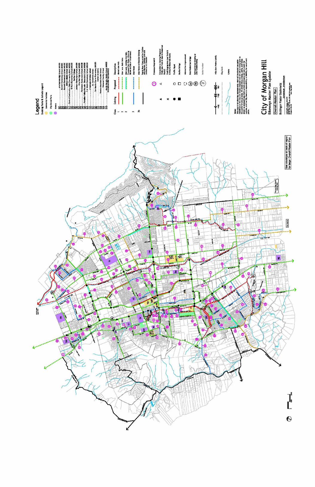
Morgan Hill provides an ideal environment for cycling. The City is on
relatively flat terrain and enjoys a moderate climate. As a small city,
virtually any area is accessible by bicycle. In addition, the City is blessed
with scenic surroundings, including many rural roads frequented by
recreational cyclists that lead to the adjacent hills and agricultural lands. The
City has adopted a Bikeways Master Plan to guide future implementation of
a citywide bikeway system (see Map 5).
Goal 7: A useable and comprehensive bikeway system
that safely connects neighborhoods with workplaces
and community destinations
Policies
7a. The bikeways system shall recognize and reflect the needs and abilities of cyclists with a diverse
range of age and experience, from children learning to ride bicycles to experienced adult commute
cyclists.

7b. Encourage increased use of bicycles for adults commuting to work and for students traveling to
school through a safe and efficient bikeways system, enhanced bicycle parking facilities, and
bicycle safety and promotion programs, including showers for bicycle commuters at places of
employment.
7c. Establish alternative routes, with direct routes on busy streets for experienced cyclists, and less
direct routes on bicycle paths and quieter streets for less experienced and recreational cyclists.
7d. Development of the bikeways system shall be coordinated with the Santa Clara Countywide Trails
Master Plan, the Santa Clara Countywide Bicycle Plan, the South County Joint Area Plan, the
Santa Clara County Bicycle Technical Guidelines, and the California Department of Transportation
Highway Design Manual.
7e. Where feasible, incorporate the Bicycle Technical Guidelines prepared by the Valley
Transportation Authority into City standards for bicycle facility planning and design,
including intersection striping, signalization, and railroad crossings.
7f. All multi-use bicycle/pedestrian trails shall comply with State and Federal accessibility codes and
standards, such as those established by the Americans with Disability Act (ADA) and California
Access Code (Title 24, California Code of Regulation).
7g. Private roads shall be designated as part of the bikeways plan only if there is an agreement between
the City and the appropriate owner for such a designation.
7h. Where feasible, implement the bikeways system concurrent with adjacent development.
Establish priorities for bikeways implementation based on improving safety and enhancing both
commute and recreational cycling. These priorities shall be considered in directing resources and
efforts to obtain funding for implementation. Priorities shall be regularly reviewed and updated as
implementation proceeds. Current priorities for implementation of the bikeways plan include the
following:
Live Oak High School Access
Little Llagas Creek Trail
Santa Teresa and Monterey Highway Corridor Improvements
East West Connection to Coyote Creek Trail
7i. Incorporate emergency services (fire and police) into the review process for new bikeways.
7j. Define safe pedestrian and bicycle routes to all new schools (public and private) during the
planning and design process so that these routes can be developed and in place prior to opening
the school.
7k. For multi-jurisdictional alignments, develop partnerships with Santa Clara County to plan,
finance, implement and maintain the bikeways system.
7l. Bicycle parking facilities shall be provided at all schools, parks, recreation facilities, commercial
centers, civic buildings (including the library), transit centers, and work places based on the
recommendations and standards in the Bikeways Master Plan.
7m. Where safety permits, improve connectivity by requiring pedestrian and bicycle public access from
a cul-de-sac to an adjacent public amenity, such as a park or school, or from a cul-de-sac to an
adjacent street.
7n. Implement and maintain the City’s bikeways system based on standards established in the
Bikeways Master Plan.
7o. Continue to encourage bicycle safety and promotion programs, in partnership with other agencies
and organizations.
7p. Promote extension of bicycle paths in conjunction with flood control efforts.

Actions
7.1 Actively pursue a variety of funding sources for implementation of the Bikeways Master Plan,
including development impact fees, incorporating improvements into larger transportation
projects, requiring improvements concurrent with development, grants, and joint projects with
other agencies. Grant applications shall be focused on priority projects where appropriate.
7.2 Coordinate with the Morgan Hill Unified School District (MHUSD) and other schools where
appropriate in applying for “Safe Routes to School” and other school-related grant programs to
improve bicycle connections to schools.
7.3 Establish a development review checklist for use by City staff to evaluate development
applications and their consistency with the Bikeways Master Plan, including bicycle parking
facilities and off-site improvements where appropriate, such as roadway striping, signage and
intersection improvements.
7.4 Develop a way-finding system for the City’s bikeways network, including signage along paths,
lanes and routes indicating key destination points, and a public bikeways map suitable for public
distribution.
7.5 Incorporate bikeways maintenance tasks, (such as street sweeping and lane re-striping), into
regularly-scheduled street maintenance cycles.
7.6 Actively pursue bicycle safety and promotion programs as outlined in the Bikeways Master Plan,
encouraging partnerships with the police department, MHUSD, bicycle clubs, and other interested
agencies and organizations.
Goal 8: Expanded pedestrian opportunities
Policies
8a. Ensure adequate pedestrian access in all developments, with special emphasis on pedestrian
connections in the downtown area, in shopping areas and major work centers, including sidewalks
in industrial areas in accordance with the Trails and Natural Resources Master Plan.
8b. Promote walking as an alternate transportation mode for its contribution to health and the reduction
of energy consumption and pollution. (SCJAP 11.03).
8c. The Trails and pedestrian system shall recognize and reflect the needs and abilities of pedestrians
with a diverse range of age and experiences.
8d. Development of the trails and pedestrian system shall be coordinated with the City’s Bikeways
Master Plan, City standard details, Santa Clara Countywide Trails Master Plan, the Santa Clara
Countywide Bicycle Plan, the South County Joint Area Plan, the Santa Clara County Bicycle
Technical Guidelines, and the California Department of Transportation Highway Design Manual.
8e. Trails shall comply with the Trail Guidelines included in the Trails and Natural Resources Master
Plan.
8f. All trails and pedestrian accesses shall comply with State and Federal accessibility codes and
standards, such as those established by the Americans with Disability Act (ADA) and California
Access Code (Title 24, California Code of Regulation).
8g. Where feasible, implement the trails and pedestrian system concurrent with adjacent developments.
8h. Incorporate emergency services (fire and police) into the review process for new trails.
8i. For multi-jurisdictional alignments, develop partnerships with Santa Clara County to plan, finance,
implement and maintain the trail system.
8j. Improve sidewalk connectivity, by installing new sidewalks where they do not exist, consistent
with the Trails and Natural Resources Master Plan.
8k. Implement and maintain the City’s trails system based on standards established in the Trails and
Natural Resources Master Plan.
8l. Promote new trails and extend existing trails in conjunction with flood control efforts.

Actions
8.1 Actively pursue a variety of funding sources for implementation of the Trails and Natural
Resources Master Plan, including the development of impact fees, incorporating improvements into
larger transportation projects, requiring improvements concurrent with development, grants, and
joint projects with other agencies. Grant applications shall be focused on projects that provide the
highest use and best value for the residents of Morgan Hill.
8.2 Establish a development review checklist for use by City staff to evaluate development applications
and their consistency with the Trails and Natural Resources Master Plan, including staging and
parking areas for trail access.
8.3 Incorporate pedestrian and trail maintenance tasks into regularly-scheduled maintenance cycles.
8.4 Actively encouraging partnerships with the police department, MHUSD, County of Santa Clara
and other interested agencies and local organizations to develop safe pedestrian access and trail
routes throughout the City.
Goal 9: A system based on Smart Growth and Sustainable Communities
strategies; reflecting a balanced, safe, multi-modal transportation
system, especially in Downtown where pedestrian, bicycle and transit
facilities will be emphasized along with vehicular facilities
Policies
9a. Use Smart Growth and Sustainable Communities principles throughout the City to create and
maintain a vibrant community with a balanced, multi-modal transportation system that offers viable
choices for residents, employees, customers, visitors and recreational users.
9b. Recognize the unique nature of and goals for Downtown Morgan Hill as the transit hub of the city
and as a center for shopping, business, entertainment, civic and cultural events, and higher-density,
mixed-use living opportunities; and exempt the Downtown core intersections from meeting
vehicular traffic level of service standard and from traffic mitigation requirements consistent with
Policy 3d. This exemption would not preclude the City, Redevelopment Agency, developers and
property owners from voluntarily implementing improvements and employing operational
strategies to improve level of service, especially at the Main/Monterey intersection if and when
land uses redevelop.
Actions
9.1 Establish a LOS “F” Policy standard for Downtown at Main/Monterey, along Monterey Road
between Main and Fifth Street, and along Depot Street at First through Fifth Streets (see Goal 3,
Policy 3d).
9.2 In order to provide a transition to intersections and road segments that have established Level of
Service standards of “E” or “F”, for freeway zone intersections, freeway ramps and the Downtown,
establish selected intersections and segments that are designed to an acceptable LOS “E” standard
for peak hours. (see Goal 3, Policy 3d) However, require projects to pay the city’s standard traffic
impact fees imposed on new developments in accordance with the adopted impact fee schedule.
9.3 In order not to overbuild intersections and segments on facilities which serve a significant
component of sub-regional and regional through traffic in peak hours, and to protect
neighborhoods, and to create an incentive for using alternate modes of travel, and to reduce the
incentive for regional travel to be drawn off of the freeway and onto local neighborhood streets,
establish a Level of Service “E” standard and design standard for selected intersections and
segments. (see Goal 3, Policy 3d)
9.4 For roadway transportation facilities, when future traffic studies determine that an intersection,
roadway segment, or freeway ramp/zone level of service will fall below its adopted standard, then
the transportation studies will identify appropriate mitigation measures to ensure that the applicable

level of service standard is attained. If a proposed traffic mitigation measure requires
improvements for vehicular transportation that are beyond the jurisdiction of the City of Morgan
Hill; and/or lead to an over-built intersection; and/or would have unacceptable impacts on existing
buildings, or existing or planned transportation facilities and/or alternate modes of transportation
including roads, sidewalks, bicycle and transit facilities; the City may (but would not be required
to) impose alternative mitigation measures that do not create the unacceptable impacts. If the
measures retain the “pre-project” level of service standard for the affected facilities then an
Environmental Impact Report may not be required. However, it may be necessary for the City to
prepare and certify an Environmental Impact Report, and adopt a Statement of Overriding
Considerations, if a project’s impacts cannot be mitigated in an acceptable manner but the City
determines to approve the project. In this situation, the City may still require feasible mitigation
measures and/or conditions of approval to require contributions to improving the city’s
transportation system.
9.5 The types of impacts from identified vehicular traffic mitigation measures that may be determined
by the City to be unacceptable include but are not limited to the following:
a. Those that would encourage substantial neighborhood or community cut-through traffic;
b. Those that would eliminate or reduce the width of a sidewalk below minimum city
standard, where there is not sufficient planned public right-of-way to relocate the sidewalk;
c. Those that would eliminating a bicycle lane or reduce its width below city standard, where
there is not sufficient planned public right-of-way to relocate the bicycle lane;
d. Those that would create unsafe pedestrian, bicycle or vehicular operating conditions
e. Those that would eliminate a bus stop or a parking lane that accommodates a bus stop,
which cannot be relocated
f. Those that would require acquisition of substantial existing buildings, and/or
extraordinarily high cost of land acquisition, or an extraordinarily high project cost in
relation to benefits achieved.
9.6 Alternate mitigation measures and/or conditions of approval may include but not be limited to
making improvements to other facilities that assist with maintaining or improving projected levels
of service, payment of an in-lieu fee to the city to be used to improve other components of the
city’s transportation system, developer installation of transportation improvements, and/or
incorporation of physical features and operational programs into a project that support Trip
Reduction/Travel Demand Management goals.
9.7 While mitigation measures may not be required because level of service would not fall below an
applicable LOS E or F standard, the City, Redevelopment Agency, developers, property owners
and others are not precluded from identifying and implementing improvements and strategies to
improve level of service and reduce congestion. The City should periodically monitor actual traffic
conditions and accident data and identify improvements and/or operational strategies that would
improve safety and congestion levels, as practical and cost-effective.
9.8 For unsignalized intersections in the downtown area and other key city locations, the City should
undertake regular or periodic monitoring of actual traffic conditions and accident data, and timely
re-evaluation of the full set of warrants to prioritize and program intersections for signalization, as
practical and cost-effective.
9.9 In order to prevent significant noise impacts on neighborhood residents which are related to
roadway extensions or construction of new roadways, the City shall require completion of a
detailed noise study during project-level design to quantify noise levels generated by projects such
as the Murphy Avenue extension to Mission View Drive and the Walnut Grove Extension to Diana
Avenue. The study limits should include noise sensitive land uses adjacent to the project alignment
as well as those along existing segments that would be connected to new segments. A significant
impact would be identified where traffic noise levels would exceed the “normally acceptable” noise
level standard for residential land uses and/or where ambient noise levels would be substantially
increased with the project. Project specific mitigation measures could include, but not be limited
to, considering the location of the planned roadway alignment relative to existing receivers in the
vicinity, evaluating the use of noise barriers to attenuate project-generated traffic noise, and/or

evaluating the use of “quiet pavement” to minimize traffic noise levels at the source. Mitigation
should be designed to reduce noise levels into compliance with “normally acceptable” levels for
residential noise and land use compatibility.
9.10 In order to prevent significant noise impacts on sensitive receptors and neighborhood residents
which are related to an at-grade Madrone Parkway Crossing of the UPRR tracks, during project-
level design, conduct a detailed noise study to calculate noise levels expected as a result of train
warning whistles and warning bells that would be sounded, and to calculate the increase in ambient
noise levels resulting from the project. The study limits should include noise sensitive land uses
north and south of the at-grade crossing as warning whistles would be expected up to one-quarter
mile in each direction. A significant impact would be identified where (it is likely that these
receivers are already exposed to noise levels above 60 dBA Ldn) where ambient noise levels would
be substantially increased with the project. Project specific mitigation measures should include,
but not be limited to, evaluating the use of noise barriers to attenuate the warning whistle/bell
noise, residential sound insulation, utilizing wayside horns, and/or establishing a train whistle quiet
zone per the Federal Railroad Administration’s Final Rule on the Use of Locomotive Horns at
Highway-Rail Grade Crossings. Mitigation should be designed to avoid a substantial permanent
increase in noise.
R:\PLANNING\KATHY\CITYWIDE TRAFFIC MODEL & CUMUL TIA\Circulation Element 2010 - FINAL ADOPTED BY CC 2-24-10.doc