Embed Size (px)
Citation preview
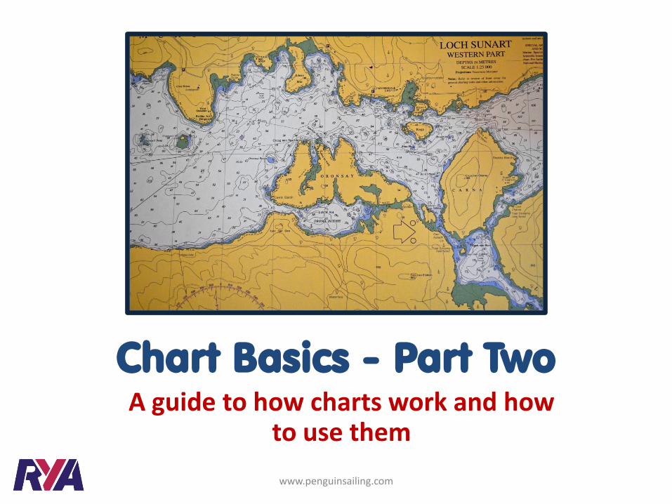
Chart Basics - Part Two A guide to how charts work and how
to use them
www.penguinsailing.com
Introduction
www.penguinsailing.com
This presentation looks at chart projections
and why we need to be aware of them
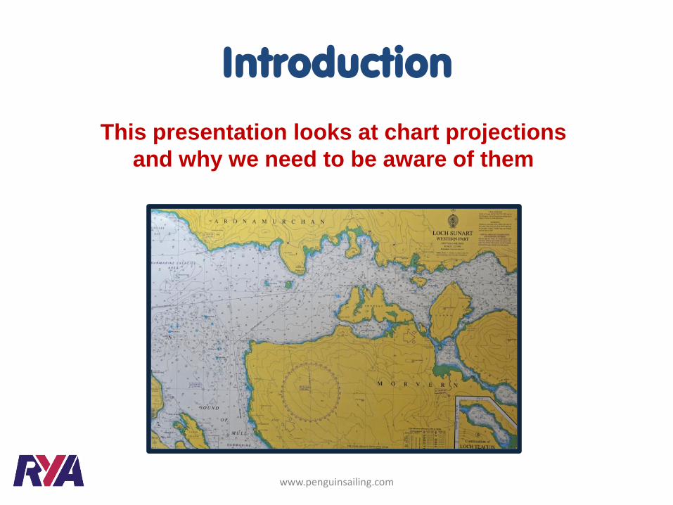
Lines of Longitude, called ‘Meridians’, run from pole to pole
dividing the earth into segments rather like an orange
Meridian of longitude
North Pole
Greenwich Meridian
Latitude and Longitude
www.penguinsailing.com
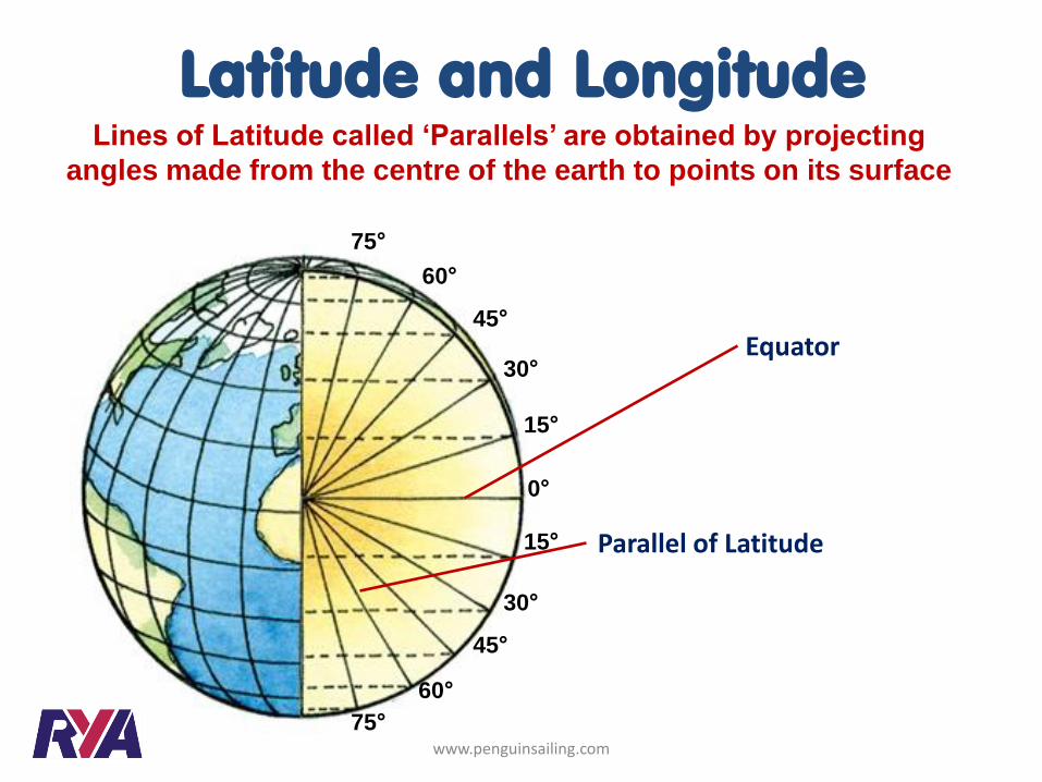
Lines of Latitude called ‘Parallels’ are obtained by projecting
angles made from the centre of the earth to points on its surface
0°
15°
15°
30°
45°
45°
60°
60°
75°
30°
75°
Latitude and Longitude
Equator
Parallel of Latitude
www.penguinsailing.com
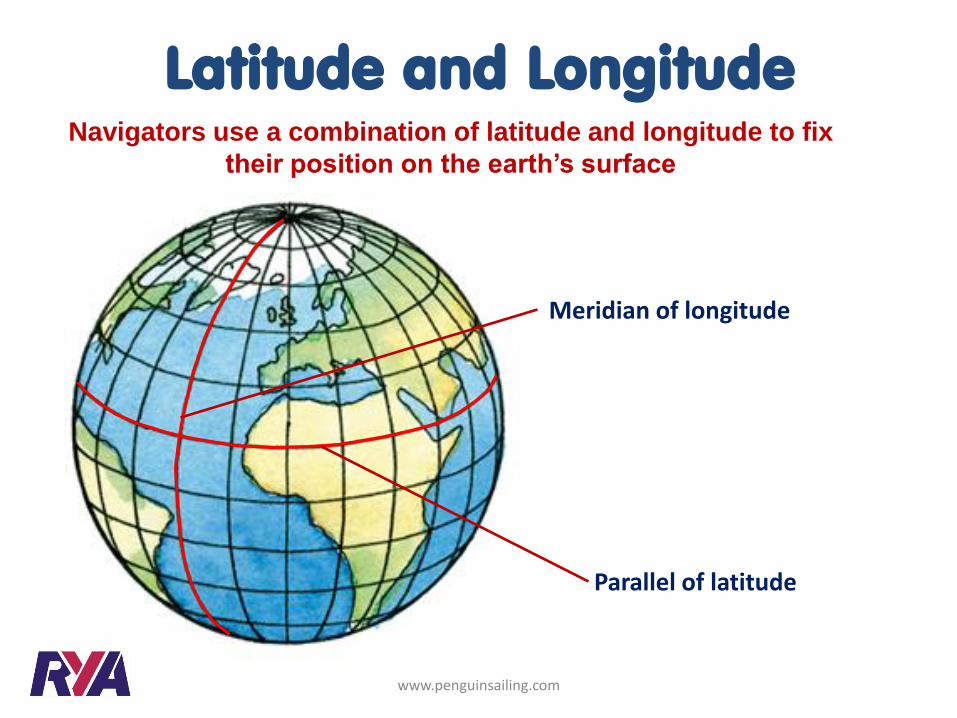
Navigators use a combination of latitude and longitude to fix
their position on the earth’s surface
Meridian of longitude
Latitude and Longitude
Parallel of latitude
www.penguinsailing.com
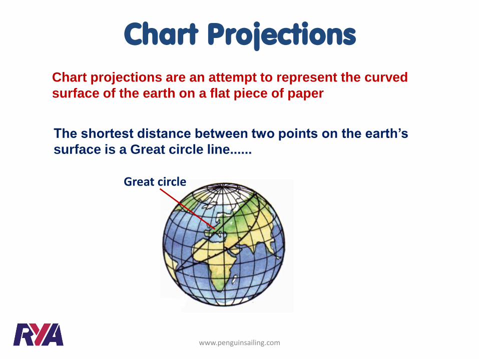
Chart projections are an attempt to represent the curved
surface of the earth on a flat piece of paper
Great circle
The shortest distance between two points on the earth’s
surface is a Great circle line......
Chart Projections
www.penguinsailing.com
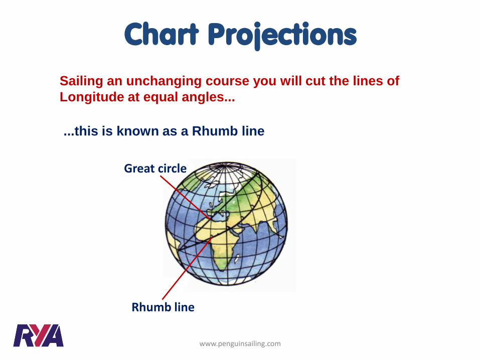
Great circle
Rhumb line
Sailing an unchanging course you will cut the lines of
Longitude at equal angles...
...this is known as a Rhumb line
Chart Projections
www.penguinsailing.com

Great circle
Rhumb line
Chart Projections
You sail a slightly longer distance using a Rhumb line, but
this is only really significant on long ocean passages
The most useful chart for practical use is one where a Rhumb
line is shown as a straight line
www.penguinsailing.com
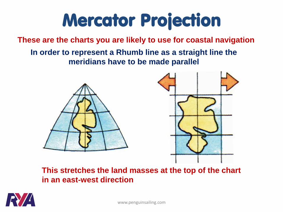
This stretches the land masses at the top of the chart
in an east-west direction
Mercator Projection These are the charts you are likely to use for coastal navigation
In order to represent a Rhumb line as a straight line the
meridians have to be made parallel
www.penguinsailing.com
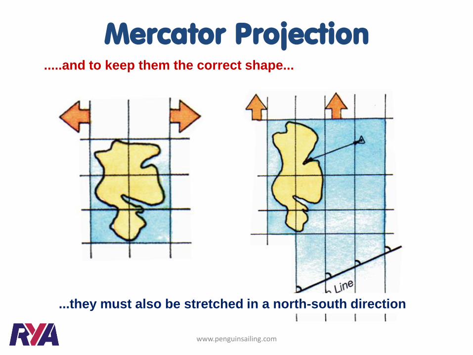
.....and to keep them the correct shape...
Mercator Projection
...they must also be stretched in a north-south direction
www.penguinsailing.com
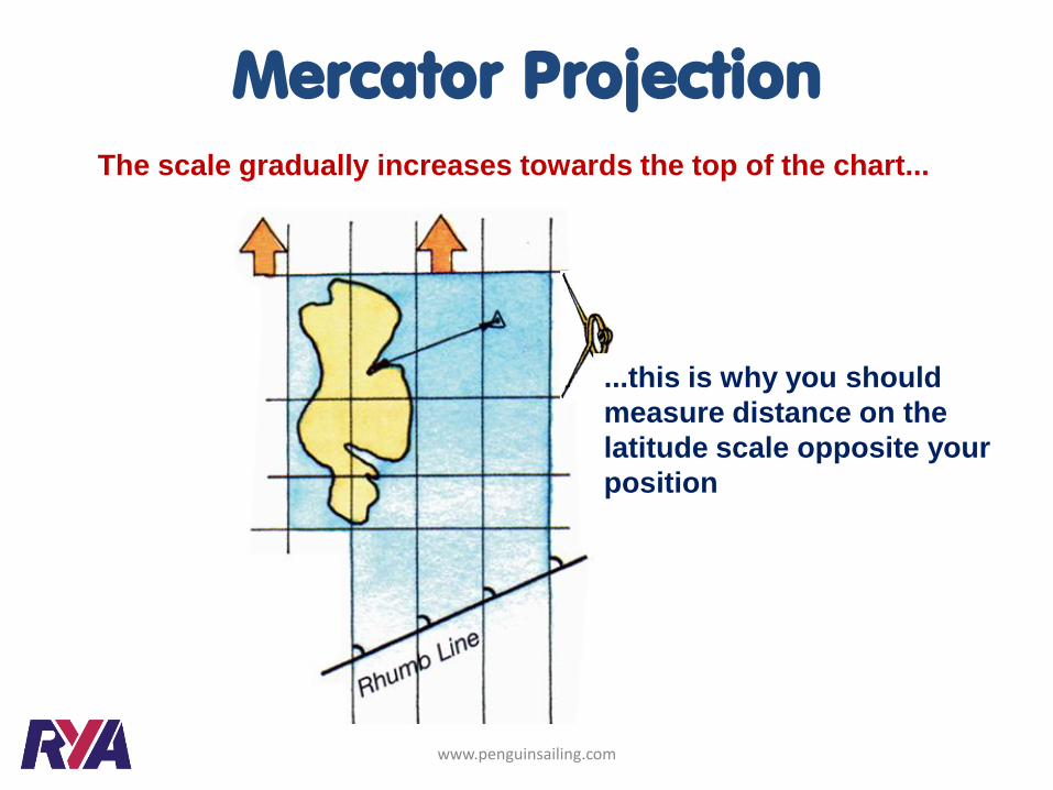
The scale gradually increases towards the top of the chart...
...this is why you should
measure distance on the
latitude scale opposite your
position
Mercator Projection
www.penguinsailing.com

Latitude and Longitude
Longitude scale
Latitude scale
www.penguinsailing.com
Plotting latitude and longitude on a chart
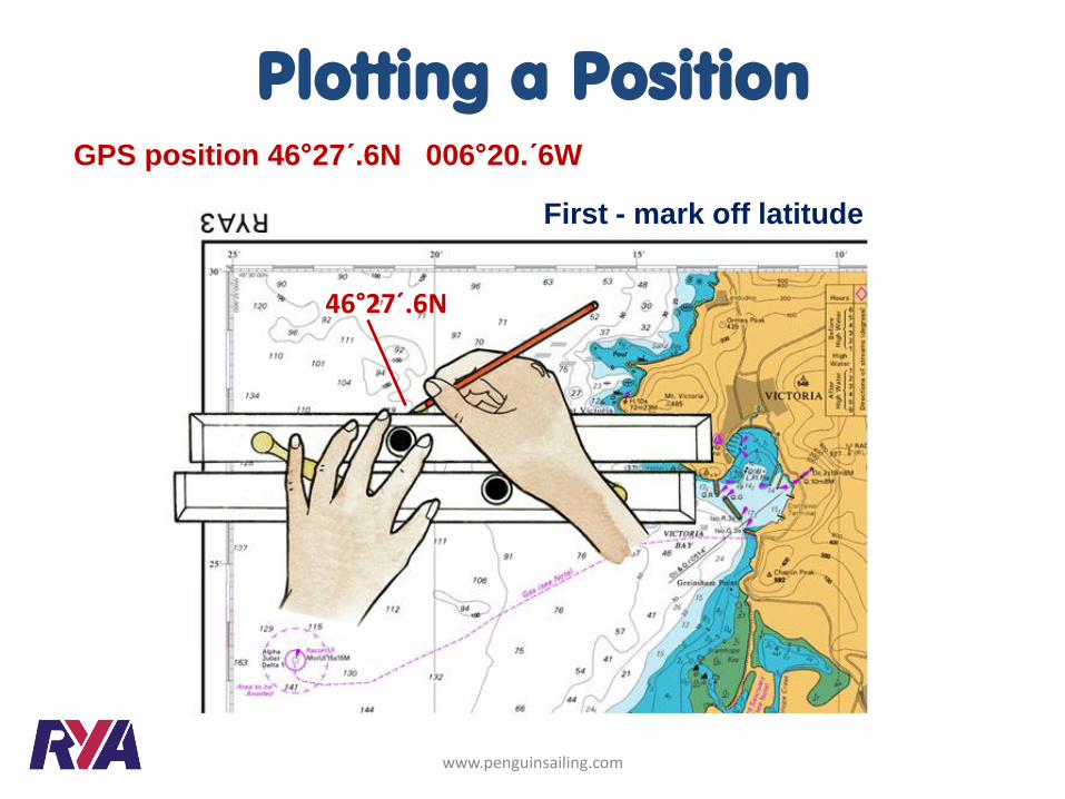
46°27´.6N
First - mark off latitude
Plotting a Position GPS position 46°27´.6N 006°20.´6W
www.penguinsailing.com
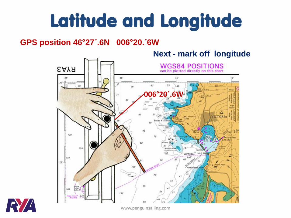
Next - mark off longitude
006°20´.6W
Latitude and Longitude GPS position 46°27´.6N 006°20.´6W
www.penguinsailing.com
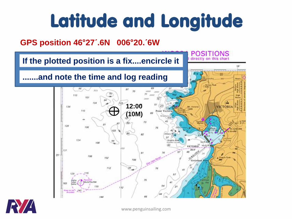
Mark off latitude Mark off longitude
12:00
(10M)
Latitude and Longitude GPS position 46°27´.6N 006°20.´6W
.......and note the time and log reading
If the plotted position is a fix....encircle it
www.penguinsailing.com
Further Reading
www.penguinsailing.com
We highly recommend Tim Bartlett’s
RYA Navigation Handbook (G6)
You can buy a copy of this book by visiting our on-line shop
This website helps support us and our families.
If you found this document useful please consider donating £3.50 to
the running of this website.
Thank you for your honesty.
CLICK HERE TO DONATE £3.50