Embed Size (px)
Citation preview
69USDA Forest Service Gen. Tech. Rep. RMRS-GTR-�75. 2006
Chapter �—The LANDFIRE Prototype Project Reference Database
Chapter 4
In: Rollins, M.G.; Frame, C.K., tech. eds. 2006. The LANDFIRE Prototype Project: nationally consistent and locally relevant geospatial data for wildland fire management. Gen. Tech. Rep. RMRS-GTR-175. Fort Collins: U.S. Department of Agriculture, Forest Service, Rocky Mountain Research Station.
Introduction ____________________ This chapter describes the data compilation process for the Landscape Fire and Resource Management Planning Tools Prototype Project (LANDFIRE Prototype Project) reference database (LFRDB) and explains the reference data applications for LANDFIRE Prototype maps and models. The reference database formed the foundation for all LANDFIRE tasks. All products generated by the LANDFIRE Prototype Project were developed from field-referenced data collected by resource professionals and screened for quality and consistency by the LFRDB team (Keane and Rollins, Chapter 3), ensuring that each LANDFIRE data layer could be recreated and improved upon with the availability of new data. Field-referenced data provided a means of assessing the accuracy of many LANDFIRE Prototype products. The LFRDB integrated field-referenced data collected for many separate projects that used different sampling methods and had varying sampling intensities. See appendix 2-A in Rollins and others, Ch. 2 for a table outlining, in part, the procedure used to build the LFRDB. Field-referenced data play a critical role in any mapping project involving remotely sensed data (Congalton and Biging 1992). Field-referenced data are used to generate, test, and validate maps and models. Field-referenced data provide important field-referenced information
The LANDFIRE Prototype Project Reference Database
John F. Caratti
that accurately describes that which is being remotely sensed or mapped, and field-referenced data points function as training sites in satellite imagery classifica-tions (Jensen 1998; Verbyla 1995). In the LANDFIRE Prototype Project, we used field-referenced data coupled with Landsat imagery to model and map cover types (CT), canopy closure, and height (Zhu and others, Ch. 8). Field-referenced data were also used to model and map biophysical settings and wildland fuel (Frescino and Rollins, Ch. 7; Keane and others, Ch. 12). In addition, field-referenced data serve another impor-tant purpose in the development of vegetation and fuel classifications. The distribution and occurrence frequen-cy of cover types across landscapes – both summarized in the LFRDB – were used in the LANDFIRE Prototype Project to refine the CT classification (Long and others, Ch. 6). The PVT classification was also refined based upon field-referenced data and the relationship between vegetation occurrence and biophysical settings (Long and others, Ch. 6). Furthermore, reference data were used to develop database tables relating PVT, CT, and SS to attributes relevant to wildland fire management, such as fire behavior fuel models, fire effects fuel models, and canopy fuel characteristics (Keane and others, Ch. 12). Reference data were also integral in the development of succession pathway models (Long and others, Ch. 9), which ultimately served as the foundation for creating maps of simulated historical fire regimes and fire regime condition class (Pratt and others, Ch. 10; Holsinger and others, Ch. 11). Finally, field-referenced data aid in both the quantitative and qualitative interpretation of maps and mapping clas-sifications and in identifying and explaining the associated inaccuracies or inconsistencies. A common way to assess

70 USDA Forest Service Gen. Tech. Rep. RMRS-GTR-�75. 2006
Chapter �—The LANDFIRE Prototype Project Reference Database
the accuracy of classified images and maps is to employ the reference data as a measure by which to assess the amount of the area that was classified correctly (Story and Congalton 1986). Reference data provided three measures of accuracy for most LANDFIRE data layers: 1) locational accuracy (the probability of a pixel being mapped correctly), 2) landscape accuracy (the accuracy of pixel summaries across large areas), and 3) model accuracy (the accuracy of statistical models used to build the maps) (Keane and Rollins, Ch. 3; Vogelmann, Ch. 13).
Reference Data Requirements All field data were georeferenced within reasonable locational accuracy, preferably 30 meters or less. To be useful in the LANDFIRE Prototype, reference data were required to have a minimum set of fields applicable to at least one of the various LANDFIRE mapping tasks. Field-referenced data suitable for the LANDFIRE Pro-totype could, for example, include species composition data needed to map cover type and structure, have fuel attributes for developing fuel models, or contain tree data needed to map canopy fuel. Table 1 lists some of the variables required for the LFRDB. A critical element in acquiring LANDFIRE data was obtaining these from field plots that were sufficiently representative of all land ownerships and ecosystems.
We acquired the data through three separate yet coordi-nated efforts. First, with cooperation and support from the Forest Inventory and Analysis (FIA) program, we obtained forest vegetation data collected on permanent FIA inventory plots (Gillespie 1999). We selected only FIA plots which occurred within one condition and used all subplot data (Interior West Forest Inventory and Analysis 2004). FIA plot variables used by the LFRDB included tree species, diameter at breast height (DBH), tree height, crown ratio, height to live crown base, and crown class. FIA data were stored in the database without geographic coordinates to preserve the confidentiality of the plot locations (Interior West Forest Inventory and Analysis 2004). Analyses requiring coordinates were conducted by FIA personnel stationed at the Missoula Fire Sciences Laboratory (Missoula, MT). A second data acquisition effort involved the circulation of a formal request letter to federal agencies, soliciting additional reference data from the LANDFIRE Proto-type mapping zones. In conjunction, the LFRDB team conducted an exhaustive search for existing field-refer-enced data relevant to LANDFIRE, relying heavily on cooperation from federal, state, and non-governmental organizations. Due to the diverse nature of field sampling methods and data storage procedures, the reference database team spent much time and effort converting these data into a common database structure. Third, even after obtaining FIA data and other existing field-referenced data, large areas of the prototype mapping zones were under-represented, particularly those in the shrublands and grasslands. In response, the LFRDB team collaborated with the Southwest Regional Gap Analysis Project (Southwest ReGAP) (Utah State University 2004) to collect additional field-referenced data in under sampled areas of the prototype mapping zones.
Methods _______________________ The LANDFIRE Prototype Project involved many sequential steps, intermediate products, and interdepen-dent processes. Please see appendix 2-A in Rollins and others, Ch. 2 for a detailed outline of the procedures followed to create the entire suite of LANDFIRE Pro-totype products. This chapter focuses specifically on the procedures followed to compile the LFRDB, which formed the foundation for nearly all modeling and map-ping tasks in the LANDFIRE Prototype Project.
Data Acquisition Zone 16—The three data sources for Zone 16 were FIA, Southwest ReGAP for the state of Utah, and the
Table 1—Examples of variables included in the LANDFIRE reference database.
Data type Attributes
Plot Georeferenced plot location Sampling date Digital plot photos Metadata
Vegetation Species list Cover by species Cover by life form (tree, shrub, herb) Height by species Heights of individual trees Crown ratios (individual trees) Crown classes (individual trees) Diameters (individual trees) Tree density
Fuel Fine (�-, �0-, and �00-hour) Coarse (�000-hour) Cover of live and dead shrubs Cover of live and dead herbs Base height of canopy fuel Height of shrubs Height of herbaceous vegetation

7�USDA Forest Service Gen. Tech. Rep. RMRS-GTR-�75. 2006
Chapter �—The LANDFIRE Prototype Project Reference Database
Southern Utah Fuels Management Demonstration Proj-ect (Southern Utah Project). Utah field-referenced data from Southwest ReGAP included both plant species cover estimates and height measurements for each plot. The Southern Utah Project data included plant species cover estimates, height measurements, downed woody fuel transects, and individual tree measurements for each plot. .FIA data included individual tree measure-ments for each plot and were acquired from the national FIA Database (Miles and others 2001) and the Interior West FIA program (Interior West Forest Inventory and Analysis 2004). Once all existing field-referenced data were acquired, we displayed the non-FIA plot locations for Zone 16 to identify obvious gaps in the reference data acquisition. Substantial portions of the central and northern areas of Zone 16 contained little or no reference data (fig. 1A). We contracted with Utah State field crews who, using the Southwest ReGAP field data collection protocols, collected additional field-referenced data in these areas (Utah State University 2004). These efforts helped fill gaps in data coverage, especially in non-forest vegeta-tion types.
Zone 19—We drew from several sources for Zone 19 data acquisition. These data sets included information from the FIA Database; United States Department of Agriculture (USDA) Forest Service Northern Region ecosystem inventory database (ECODATA) (Jensen and others 1993); Bureau of Land Management (BLM) Fuels database from the Salmon and Challis, Idaho field offices (Gollnick-Waid 2001); United States Geological Survey (USGS) ECODATA database from Glacier National Park; and the USDA Forest Service, Rocky Mountain Research Station, Missoula Fire Sciences Laboratory, Missoula, Montana (MFSL) ECODATA database. All ECODATA plot databases included plant species cover estimates and height measurements, downed woody fuel transects, and individual tree measurements for each plot. The BLM Fuels Survey data included information on dominant and codominant plant species by life form, life form cover, fuel loading, and fire hazard. Once all existing field-referenced data were acquired, we displayed the non-FIA plot locations within Zone 19 to determine deficiencies in the reference data acquisition for non-forested areas. Areas in the southern, eastern, and west-central portions of Zone 19 contained little or
Figure 1—Field plot locations for non-FIA reference data within zones �6 (A) and �9 (B).

72 USDA Forest Service Gen. Tech. Rep. RMRS-GTR-�75. 2006
Chapter �—The LANDFIRE Prototype Project Reference Database
no reference data (fig. 1B). Again, we contracted with Utah State University field crews who, using the South-west ReGAP field data collection protocols, collected additional field-referenced data in these areas (Utah State University 2004). As with Zone 16, these additional plot data filled in the data gaps, especially for non-forest vegetation types.
LANDFIRE Reference Database Structure The LFRDB was composed of three levels (fig. 2), each containing data processed at the preceding level. Each data set was stored in a separate directory in its original data format (Level 3). Each directory contained the original data, metadata documentation, and any exist-ing data-conversion queries or programs. We designed the data directory structure to follow the Fire Effects Monitoring and Inventory Protocol (FIREMON) plot identifier structure (Lutes and others, 2006; table 2). This
enabled us to track summary data in the LANDFIRE attribute tables back to the original data and identify problems in the data-conversion process. We then developed data-conversion routines for each data set that transformed all Level 3 data into a common database structure (Level 2) using the FIREMON data-base. FIREMON is a complete fire effects monitoring and inventory package that includes many field sampling methods designed to measure and describe vegetation and fuel. Most FIREMON field sampling methods are well-suited to conducting ecological inventory as well as monitoring fire effects. The FIREMON database contains a suite of tables that store collected plot data using a variety of standard vegetation and fuel sampling protocols. We used the database tables associated with the subset of FIREMON sampling methods relevant to LANDFIRE to store the LANDFIRE reference data (table 3). See appendix 4-A for a complete list of FIREMON tables and field descriptions used in the LFRDB. We then populated the LANDFIRE attribute tables (Level 1) with data from the FIREMON database using a set of database queries (fig. 2). The LANDFIRE at-tribute tables were linked to the FIREMON tables and stored plot data and summary data used to develop, test, model, and map many of the LANDFIRE data layers. Level 1 attribute data included the LANDFIRE map table, the LANDFIRE fuel table, and the LANDFIRE canopy fuel table (table 4). We used the LANDFIRE map table data to model and map cover type, poten-tial vegetation type, and structural stage; we used the LANDFIRE fuel table data to model and map fuel; and we used the LANDFIRE canopy fuel table data as input to the FUELCALC program (Keane and others, Ch. 12; Reinhardt and Crookston 2003). FUELCALC uses tree measurements and biomass equations to compute the vertical distribution of canopy biomass and uses an algorithm to calculate canopy base height (Reinhardt and Crookston 2003). FUELCALC output was used to
Figure 2—LANDFIRE reference database structure.
Table 2—LANDFIRE reference database data directory structure.
Directory name Contents
FIREMON Registration ID Subdirectories of data by major categories (such as agency)
FIREMON Project ID Original data tables, FIREMON and LANDFIRE attribute tables
Metadata Data conversion documents and sampling protocol documents

7�USDA Forest Service Gen. Tech. Rep. RMRS-GTR-�75. 2006
Chapter �—The LANDFIRE Prototype Project Reference Database
model and map canopy bulk density and canopy base height. See appendix 4-B for a complete list of LAND-FIRE map attribute tables and field descriptions.
Data-Conversion Process We compiled data collected from many different sampling methods into a common database structure so that vegetation and fuel data could be queried in a consistent manner. We acquired plant species data that had estimates of either relative or absolute cover. Some plant species data contained entire species lists, with cover and height values for each species, whereas other data recorded cover estimates for two to four dominant species by life form. We obtained tree data sampled on variable radius and fixed radius plots. Some tree data contained data only for mature trees, whereas other data included seedling and sapling measurements. All
of the surface fuel data we acquired were sampled using variations of the planar intersect method (Brown 1974). Although different sampling protocols were used for each data set, we distilled this information into basic vegetation and fuel data within a common database structure. The data-conversion process involved converting data from their original format into the formats of the FIREMON database tables and LANDFIRE attribute tables. This process involved four steps: 1) storing the original data sets in the LFRDB Level 3 directory structure; 2) populating a Microsoft Access database containing the original data tables plus the FIREMON and LANDFIRE attribute tables; 3) building a set of crosswalk tables, data format queries, and data append queries to convert the data and populate the FIREMON and LANDFIRE attribute tables; and 4) documenting the data-conversion process and populating the FIRE-MON metadata tables. Data directories—We created a directory for each data set to store the original data, any existing docu-mentation and metadata, the FIREMON data-conver-sion queries and tables, and the populated FIREMON tables. The naming convention for the directories and subdirectories followed the naming convention for the FIREMON plot identification key. The FIREMON plot identification key consists of four fields: Registration ID, Project ID, Plot ID, and Date. The Registration ID
Table 3—FIREMON sampling methods used in the LANDFIRE reference database.
FIREMON sampling method Type of data
Plot description (PD) Geographic coordinates Life form canopy cover (tree, shrub, herbaceous) Hyperlinked digital plot photos Plant species codes (NRCS plants)Species composition (SC) Plant species cover Plant species height Individual tree height Individual tree DBHTree data (TD) Individual tree live crown percent Individual tree crown class �-hr fuel �0-hr fuel �00-hr fuelFuel load (FL) �000-hr fuel Live/dead shrub cover and height Live/dead herbaceous cover and heightMetadata (MD) Metadata and comments Hyperlinked metadata documents
Table 4—LANDFIRE attribute tables.
Attribute table name Contents
LANDFIRE map Potential vegetation type, cover type, and structure
LANDFIRE fuel Fuel loading
LANDFIRE canopy fuel Canopy bulk density and canopy base height

7� USDA Forest Service Gen. Tech. Rep. RMRS-GTR-�75. 2006
Chapter �—The LANDFIRE Prototype Project Reference Database
and Project ID fields are used to define a directory and subdirectory for each data set. For example, the directory “mfsl” contains all data acquired from the Missoula Fire Sciences Laboratory. The subdirectories “sutah00” and “sutah01” contain field-referenced data collected for the Southern Utah Fuels Demonstration Project during the 2000 and 2001 field seasons. Original data tables—If the original data were not delivered in an Access database, we opened an empty Access database and imported the data tables, spread-sheets, or ASCII files. We then joined the tables within Access to maintain any relationships that existed between the data in their original format. We then imported empty FIREMON and LANDFIRE attribute tables into the Access database containing the
original data set. All FIREMON tables were prefixed with “_FM_” to distinguish them from the original data tables and to organize them for easier data management (fig. 3). LANDFIRE attribute table names were prefixed with a “_” for the same reasons (fig. 3). Only FIREMON tables compatible with the sampling methods used in the original data set were added to the Access database. The imported tables retained their relationships and maintained the referential integrity of the FIREMON database. This allowed for the identification of errors associated with invalid or duplicate plot keys and al-lowed for cascading deletions from and updates to the FIREMON and LANDFIRE attribute tables. These tables were then populated via data-conversion queries and subsequently used to error-check the data-conversion
Figure 3—FIREMONtableswithintheAccessdatabasecontainingtheSouthernUtahProjectyear2000fielddata.

75USDA Forest Service Gen. Tech. Rep. RMRS-GTR-�75. 2006
Chapter �—The LANDFIRE Prototype Project Reference Database
process. If errors were discovered, we emptied the FIREMON and/or LANDFIRE attribute tables, cor-rected the data-conversion queries, and repopulated the tables. Once the FIREMON and LANDFIRE attribute tables were loaded correctly, the data were added to the main LFRDB containing data from all data sets for that specific mapping zone. Data-conversion queries—We created crosswalk tables to convert local codes in the original data set to standard FIREMON codes. We generated these tables by querying each applicable field in the original tables for all unique codes, creating a table from the results, and then adding a column for the FIREMON code. We populated FIREMON codes in each data-conversion table through queries or data entry. We then linked these data-conversion tables with database queries to format data for each FIREMON table. All conversion tables were prefixed with “_cnv” for easy identification in the Access database. Figure 4 illustrates a landform data-conversion table that converts the landform codes in the Southern Utah Project year 2000 data to the FIREMON landform codes. The field names containing FIREMON codes were prefixed with “FM” to distinguish these field names from field names in the original data tables (fig. 4). Next we designed data format queries to format the original data for each FIREMON table. Each data for-mat query was prefixed with “_format” to easily locate
and identify these queries in the Access database. All necessary tables from the original data were joined with the appropriate data crosswalk tables so that the query results contained the standard FIREMON codes (fig. 5). Any numerical computations within fields, such as converting units or calculating new values, were incorporated as equations in the data format queries. Each data format query generated the FIREMON plot identifier fields plus any other relevant fields needed to populate the corresponding FIREMON table. The data format query results were then used to populate the corresponding FIREMON table (fig. 6). FIREMON and LANDFIRE attribute tables—We developed a set of append queries to add data from the data format queries into the appropriate FIREMON tables. We prefixed these query names with “_insert” to facilitate identification in the Access database. These queries used the Access Structured Query Language (SQL) INSERT INTO statement to append data from the data format query into the corresponding FIREMON table. Specifically, within each Access database, we de-signed a form with two command buttons. This form facilitated the deletion and addition of records from and to the FIREMON tables when changes were made to the data format queries and the FIREMON tables had to be updated. One button deleted all of the records in the FIREMON tables and one button added all of the
Figure 4—Data conversion table for landform codes in the Southern Utah Project year 2000 database.

76 USDA Forest Service Gen. Tech. Rep. RMRS-GTR-�75. 2006
Chapter �—The LANDFIRE Prototype Project Reference Database
Figure 5—Data formatqueryused topopulate theFIREMON treedata (TDTree) table in theSouthernUtahProject year 2000 database.
Figure 6—QueryresultsforthedataformatqueryusedtopopulatetheTDTreetableintheSouthernUtahProjectyear2000 database.

77USDA Forest Service Gen. Tech. Rep. RMRS-GTR-�75. 2006
Chapter �—The LANDFIRE Prototype Project Reference Database
records to all of the FIREMON tables. The Delete Re-cords button deleted all records from the FIREMON PD table, which then deleted all FIREMON records through cascading deletes. The Add Records button executed all the append queries in a sequence compatible with the referential integrity of the FIREMON tables.
Documentation and Metadata We documented the data-conversion process for each data set using a table that mapped all the applicable FIREMON table names and field names to the original table names and field names. This data mapping table keeps a permanent record of the data-conversion process and facilitates the writing of data format queries for the FIREMON database structure. This table contains columns for the FIREMON table and field names, the original data table and field names, and any data-conver-sion algorithm or constant values applied to the field. Appendix 4-C contains the data mapping table for the Southern Utah Project year 2000 data set. Instances in which data-conversion algorithms or constants were applied to this data set include times at which we added MFSL and SUtah00 to the FIREMON Registration ID and Project ID fields, converting log diameters and decay classes from a row format to a column format, using a data-conversion table to convert local plant species codes to the Natural Resources Conservation Service (NRCS) plant codes (NRCS PLANTS Database 2005), and calculating absolute canopy cover from relative canopy cover. Documents describing the field sampling protocols and the database structure for each data set were compiled as metadata for the LFRDB. We stored these documents in a metadata subdirectory for each data set. We also recorded any metadata pertaining to the data-conver-sion process in the FIREMON metadata tables (table 3). Metadata documents that were supplied with each data set were also stored in a documents directory associated with the main LFRDB
Quality Assurance and Quality Control (QA/QC) Inaccurate reference data may introduce systematic or random bias into any type of mapping effort (Congalton 1992). We therefore implemented a set of systematic quality control measures to assure a high confidence level in the maintenance of data quality and accuracy standards. We developed QA/QC procedures to test for potential errors inherent within the reference data and to assess the quality of the reference data. We targeted three
specific categories of QA/QC: 1) geospatial, 2) informa-tion content, and 3) land cover change detection. Geospatial—We recognized that many incorrect plot coordinates result from human data entry errors and from samplers, who, in order to save time, record geographic coordinates along a road instead of from the actual plot center. Such locational inaccuracies were identified and corrected before the field-referenced data were used. We displayed data points using ArcGIS to visually inspect the distribution of plot locations for obvious problems resulting from coordinate errors, such as points occur-ring well outside the known perimeter of a particular data set. Data points were displayed with road network and hydrology coverages to identify problems such as sample points recorded on roads and in bodies of water. We also calculated the distance of field plots from the nearest road and noted plots positioned within 90 meters of a road. Information content—We also identified errors re-lated to the information collected at each sample point as numerous errors occur within the plot data, such as fields left empty and data recorded incorrectly. We sorted data records and scanned fields for null values in required fields to ensure that all plot identifiers and plot locations were unique. In addition, we assessed the quality of plant species data and determined the level of information provided, such as whether the data contained full or partial plant species lists. We also noted whether heights were provided for each species, flagging plots with species heights exceeding the normal range. Land cover change detection—Plot data used for LANDFIRE Prototype Project were collected over a variety of dates ranging back to the late 1980s. Over time, land cover changes rendered some plot informa-tion obsolete. We therefore evaluated older data sets for land cover changes resulting from either natural or human causes. We used Landsat imagery from the Multi-Resolution Land Characteristics (MRLC) 1992 and 2001 projects and the 1992 National Land Cover Data Set (NLCD) (Vogelmann and others 2001) in this evaluation. MRLC 1992 and MRLC 2001 data consist of a col-lection of terrain-corrected Landsat imagery covering all of the United States. The 1992 NLCD is a classified Landsat product delineating land cover types across the conterminous United States. MRLC 2001 Landsat imagery and NLCD 1992 land cover data were used for the LANDFIRE vegetation classification, providing a means to visually evaluate field-referenced data for errors. Each reference point was selected by life form

78 USDA Forest Service Gen. Tech. Rep. RMRS-GTR-�75. 2006
Chapter �—The LANDFIRE Prototype Project Reference Database
(for example, forest, shrub, or herbaceous), overlaid onto both the 2001 Landsat imagery and the 1992 NLCD land cover data, and then visually interpreted for validity. This subjective point evaluation was adequate for identifying obvious plot errors, such as lodgepole pine-dominated plots situated in the middle of a large, homogeneous herbaceous area. To detect reference data errors due to land cover change, we compared the difference between the Normalized Difference Vegetation Index (NDVI) of the MRLC 1992 and the MRLC 2001 image data sets. NDVI is a widely used vegetation index calculated as a ratio between the measured reflectance in the red and near infrared spectral bands of the Landsat imagery. This index has been shown to be highly effective in provid-ing reliable quantification of vegetation cover (Goward and others 1991). The differencing of these NDVI data over time provides an excellent spatial representation of vegetation change. We extracted data values from the resultant images of the NDVI of MRLC 2001 Landsat data minus the NDVI of MRLC 1992 Landsat imagery. Changed areas within the differenced images assume strongly positive or negative values, especially when
the changes are great (for example, the clear-cutting of a forest, mortality caused by insect defoliation, or for-est regeneration). The differenced images were evalu-ated to determine the appropriate threshold values that depicted major change. The differenced NDVI values were extracted for each reference data point, and those points with values above the defined thresholds were flagged as areas of possible change. These points were then examined in greater detail by overlaying on the MRLC 2001 imagery, and a decision was made as to whether these points should be used in LANDFIRE analyses.
LANDFIRE Reference Database Content The LFRDB included a subset of tables from the FIREMON database plus the LANDFIRE attribute tables. The plot description (PD), tree data (TD), fuel load (FL), species composition (SC) and metadata (MD) tables comprise the FIREMON subset in the LFRDB (table 3). Figure 7 shows the relationships between the FIREMON tables and the LANDFIRE attribute tables.
Figure 7—LANDFIRE reference database relationships view showing FIREMON tables and LANDFIRE attribute tables.

79USDA Forest Service Gen. Tech. Rep. RMRS-GTR-�75. 2006
Chapter �—The LANDFIRE Prototype Project Reference Database
We linked FIREMON tables from each data set separately to the LFRDB. We then developed a set of append and update queries for data management pur-poses. Append queries insert the data from each linked FIREMON table into the appropriate LFRDB table. Each append query is prefixed with “_insert” followed by the table name to which it adds data. Update queries modify the LANDFIRE map table by assigning a PVT, CT, and SS to each plot. All update queries are prefixed with “_update” followed by the table and field in which they update. These queries are run only after the cover type program and PVT queries are executed (see below sections on cover type and potential vegetation type). Linked tables were deleted after all required append queries were run and the data were successfully ap-pended to the reference database tables. This procedure was repeated for each data set within a mapping zone until all plot data for the mapping zone were added.
Cover Type We assigned a cover type (for example, Ponderosa Pine, Douglas-fir, etc.) to each plot in the reference database using differing methods for FIA and non-FIA data. Plot data including plant species cover and height information were processed with a computer program to assign a LANDFIRE cover type based on the domi-nant overstory plant species. FIA plots were assigned a cover type based on the dominant tree species by basal area. Plant species cover and height data—A LANDFIRE cover type classification program was developed to as-sign a LANDFIRE cover type to each plot having plant species cover and height data. This program consists of a Windows graphical user interface (GUI) front-end (fig. 8) called covertypewin.exe and a console applica-tion called covertype.exe. These two programs are .NET
Figure 8—Covertypeclassificationprogramgraphicaluserinterface(GUI)–frontend.

80 USDA Forest Service Gen. Tech. Rep. RMRS-GTR-�75. 2006
Chapter �—The LANDFIRE Prototype Project Reference Database
executables and run under the Microsoft .NET Framework version 1.0 (Microsoft .NET 2005). Covertypewin.exe is the GUI portion of the package and invokes the console application covertype.exe, which then determines the cover type assignment for each plot. There are several user inputs to this program (fig. 8). Layer heights are used to specify the lower height of up to six vegetation strata (for example, <1 m, 1 to 3 m, etc.). Minimum relative cover by life form (RCLF) for dominant canopy layer specifies the minimum RCLF value, determining which stratum or combination of strata occupies the dominant canopy. For example, if this parameter is set to .20 (20 percent) and tree spe-cies in the upper stratum (>3 m) occupy only 10 percent RCLF, the next lower stratum is added to the dominant canopy layer. If tree species in these two strata occupy at least 20 percent RCLF, then these strata are consid-ered to occupy the dominant canopy (in other words, >1 m). This parameter is used primarily to determine the dominant canopy layer on forested plots where overstory and understory species coexist. Minimum absolute cover for dominant and codominant species specifies the cover threshold for determining dominant and codominant species. Maximum relative cover for mixed types specifies the relative cover value used to determine whether a plot falls in a mixed cover type (such as Pinyon – Juniper) or a single species cover type (such as Juniper). The Initialize output database tables checkbox indicates whether the program will delete the current contents of the output table before program execution. This program requires one configuration file, three lookup tables, two input data tables, and generates one output table. Two of the three lookup tables associate dominant and codominant plant species with a LAND-FIRE cover type. The other lookup table determines “tie-breakers,” based on successional development, when two or more cover types have equal cover. For example, a tie between Douglas-fir and Ponderosa Pine cover types went to the later successional cover type of Douglas-fir. The input data tables contain plot life form cover values (tree, shrub, and herbaceous) and individual plant species’ canopy cover and height values. The out-put table, cover type classification, is populated with the LANDFIRE cover type, dominant and codominant plant species, and their associated cover values. The configuration file sets the database paths for the input and output data tables. The LANDFIRE cover type classification program first determined the dominant life form on the plot based on the cover type classification rule set (Long
and others, Ch. 6). Next, the program determined the dominant canopy layer. We stratified canopy layers us-ing the FIREMON defaults of 0 to 1 m, 1 to 3 m, and greater than 3 m. Relative cover for each species in the dominant life form was totaled for each canopy layer until a minimum value was reached. We set this minimum value at 20 percent. The cover type was determined by totaling the canopy cover values for each species in the dominant layer by cover type and selecting the cover type that has the greatest canopy cover. Plots having cover types with equal cover in the dominant canopy layer were assigned the later successional cover type. For cover types based on codominance, such as Pin-yon – Juniper, the program calculated the relative cover of each codominant species to determine if both were greater than or equal to 25 percent. For example, in Zone 16, the Pinyon – Juniper cover type was distinguished from the Juniper cover type based on each species hav-ing at least 25 percent cover. This program also determined the dominant and co-dominant plant species on a plot. These plant species were within the dominant life form, typically within the assigned cover type and dominant canopy layer, and had the greatest absolute cover values. If there was only one species on the plot in the assigned cover type, the codominant species was determined as the species with the next greatest canopy cover within the dominant life form. Ties went to the later successional species. We set the minimum cover value at zero and reported a dominant and codominant plant species, when possible, and their associated cover values. FIA tree data—FIA tree data include tree species codes, DBH, and trees per acre. We developed Access queries to calculate the basal area for each species on a plot, calculated the basal area by LANDFIRE cover type, and assigned the cover type having the greatest basal area. Plots having cover types with equal basal area were assigned the later successional cover type. For cover types based on codominance, such as Pin-yon-Juniper, we calculated the relative basal area of the codominant species to determine if it is greater than or equal to 25 percent. For example, in Zone 16, mixed pinyon-juniper plots were distinguished from juniper-dominated plots. The criterion for distinguishing the Pinyon – Juniper cover type from the Juniper cover type was that pinyon and juniper must each have at least 25 percent relative cover. We then identified the dominant and codominant tree species as those having the greatest basal area within the LANDFIRE cover type. If there was only one species on the plot in the assigned cover type, the codominant

8�USDA Forest Service Gen. Tech. Rep. RMRS-GTR-�75. 2006
Chapter �—The LANDFIRE Prototype Project Reference Database
species was selected as the species with the next greatest basal area. Ties went to the later successional species for reasons described above.
Potential Vegetation Type The LANDFIRE potential vegetation type (PVT) clas-sifications (Long and others, Ch. 6) were based on two levels of indicator species, one associating plant species with each Level 2 PVT and one associating plant spe-cies with each Level 3 PVT. The indicator species were ordered in these tables by shade tolerance (more to less) within forest PVTs or by a moisture gradient (xeric to mesic) within shrubland or herbaceous PVTs (Long and others, Ch. 6). We developed a set of database queries for assigning LANDFIRE PVTs to plots based on the presence of these indicator species. The first set of database queries assigned a Level 2 PVT sequence number to each plot based on the PVT Level 2 indicator species list (Long and others, Ch. 6). First, each plant species that was in the PVT classification and present on a plot was assigned a Level 2 PVT sequence number. Then, the lowest sequence number on the plot determined the Level 2 PVT for the plot. A minimum cover percentage level for shrub indicator species (greater than or equal to 10 percent) was used to prevent plots with an herbaceous cover type from being assigned a shrubland PVT, such as in plots having shrub species present yet a total shrub cover of less than 10 percent.
The second set of database queries assigned a Level 3 PVT sequence number to each plot based on the PVT Level 3 indicator species list (Long and others, Ch. 6). Again, each plant species that was in the PVT classifica-tion and present on a plot was first assigned a Level 3 PVT sequence number. Then the lowest sequence number on the plot determined the Level 3 PVT for the plot. We then concatenated the Level 2 and Level 3 PVT labels to generate the proper PVT label.
Data Management and Summary Queries Data management queries involved appending data to the reference database tables and updating the LAND-FIRE map table with PVT, CT, and SS assignments for all plots. We created data summary queries to assist in the development of the potential vegetation classification, the cover type classification, succession pathway models, and fuel model classifications. These data summary queries included plot counts by CT, PVT / CT, and PVT / CT / SS; constancy cover tables by CT, PVT / CT, and PVT / CT / SS; and fuel loading by CT, PVT / CT, and PVT / CT / SS. We built a form within the LFRDB to automate the data management and data summary tasks (fig. 9). Automating these tasks facilitated database plot record updates as modifications were made to the PVT, CT or SS classifications.
Figure 9—Form for automating data management and data summary tasks.

82 USDA Forest Service Gen. Tech. Rep. RMRS-GTR-�75. 2006
Chapter �—The LANDFIRE Prototype Project Reference Database
FIREMON Database Application The FIREMON database application has two features that were applicable to the LFRDB: plot photo and metadata document hyperlinks. The FIREMON data-base application was connected to the LFRDB using the Configuration and Settings menu. This menu also set the directory path for the FIREMON documents and photos directories. The FIREMON plot description (PD) data entry form allowed the LANDFIRE team to view hyperlinked photos (fig. 10). For each mapping zone, we placed all acquired digital plot photos into a
photo directory. The digital image (photo) file names were added to the FIREMON PD photo fields during the data-conversion process. These photos could then be viewed via the plot photo hyperlink on the PD form. The FIREMON MD data entry form allowed the team to view hyperlinked documents (fig. 11). For each map-ping zone, we placed all associated metadata documents into a documents directory. The document file names were added to the MD table document link field in the LFRDB for each mapping zone. These documents could then be viewed via the document hyperlink.
Figure 10—FIREMON plot description form illustrating the plot photo hyperlink.

8�USDA Forest Service Gen. Tech. Rep. RMRS-GTR-�75. 2006
Chapter �—The LANDFIRE Prototype Project Reference Database
Figure 11—FIREMON metadata form illustrating the document hyperlink.
Results and Discussion __________
Reference Database Implementation The FIREMON database was designed to be flexible, and it proved to be fully capable of storing the primary data elements required for the LFRDB. One accom-modating feature of FIREMON is that many of the fire monitoring and ecosystem inventory sampling methods employ standard field sampling techniques The flexibility of the FIREMON database allowed customization of the core data tables to store data from a diverse set of field-referenced databases. For example, the FIA, ECODATA, and Southern Utah Project tree data were easily added to the FIREMON TD tables; The ECODATA, Utah field-referenced data from Southwest ReGAP, and Southern
Utah Project plant species composition and cover data were easily added to the FIREMON SC tables; The FIREMON PD table accommodated all locational in-formation and site data; and the FIREMON MD tables stored all metadata on field sampling protocols and the data-conversion process. Additional LANDFIRE attribute tables were easily integrated into the FIREMON database and linked to the FIREMON PD table. These tables were developed specifically for LANDFIRE modeling and mapping tasks and facilitated reference data dissemination to specific LANDFIRE teams. For example, data from the LANDFIRE map attribute table were used to model and map cover type and vegetation structure (Zhu and others, Ch. 8) and to model and map potential vegetation (Frescino and Rollins, Ch. 7). In addition, these data
8� USDA Forest Service Gen. Tech. Rep. RMRS-GTR-�75. 2006
Chapter �—The LANDFIRE Prototype Project Reference Database
were used to refine the existing and potential vegeta-tion classifications (Long and others, Ch. 6). Data in the LANDFIRE map attribute and fuel attribute tables were used to map fire behavior fuel models (Anderson 1982; Scott and Burgan 2005), fire effects fuel models (Keane and Rollins, Ch. 3; Keane and others, Ch 12; Lutes and others, in preparation; Sandberg and others 2004), and canopy fuel. These tables were used to map fire behavior and effects fuel models based on spatially explicit layers of PVT, CT, and SS. (Keane and others, Chapter 12). The LANDFIRE canopy fuel attribute table was also used as input to the FUELCALC program, and FUELCALC output was used to model and map canopy bulk density and canopy base height (Keane and others, Chapter 12). In addition to using the FIREMON database to store field-referenced data, we developed a simple and efficient data-conversion process. The Access Query Design Win-dow provided a relatively easy way for reference database team members to build the SQL statements required for the data-conversion process. This process was easy to teach resource personnel with limited database skills and was effective as a data migration and data cleaning tool. Our method proved adaptable enough to convert a wide range of data into a common database structure. In addition, our process provided an easy way to track plot records from the LANDFIRE attribute tables back to the original data stored in the data directories for each data set.
Reference Data Acquisition and Applications Zone 16—Approximately 11,000 plots were compiled in the LFRDB for Zone 16. The initial acquisition of existing data sets for Zone 16 produced only three viable data sets: FIA tree data, Southern Utah Project data, and Utah field-referenced data from Southwest ReGAP. Since FIA data is fairly extensive in forested areas, the limit-ing factor was the acquisition of non-forest vegetation data. The Southern Utah Project data adequately covered the southern portion of Zone 16. The initial Utah data acquired from Southwest ReGAP contained very little reference data for the northern and central portions of Zone 16. A strategic partnership between the Southwest ReGAP project and the LANDFIRE Prototype Project was crucial in obtaining additional field-referenced data for Zone 16. Concerning applications, all data sets acquired for Zone 16 included vegetation data used to model and map potential vegetation, cover type, and structure. In addition to use in mapping vegetation cover and structure, all FIA
tree data were used for modeling and mapping canopy fuel (canopy bulk density and canopy base height). A limited number of plots in the Southern Utah Project data set had tree data used for modeling and mapping canopy fuel and downed woody fuel transect data used for mapping fire behavior and effects fuel models. Zone 19—Approximately 12,500 plots were compiled in the reference database for Zone 19. The initial data acquisition for Zone 19 produced several viable data sets in addition to the FIA tree data, due in part to existing ECODATA plots from the USDA Forest Ser-vice Northern Region ecology program and USGS and MFSL research in and around Glacier National Park. We acquired data for thousands of BLM fuel inventory plots, as well; however, these were heavily concentrated around Salmon and Challis, Idaho. Moreover, many of the ECODATA plots were concentrated around the Flathead National Forest and Glacier National Park. We lacked field-referenced data for many non-forested areas in the southern and eastern portions of Zone 19. Therefore, it was crucial to contract with the Utah field crews from Southwest ReGAP for additional field-referenced data collection. All data sets for Zone 19 included vegetation data used to model and map potential vegetation, cover type, and structure. In addition to use in mapping vegetation and structure, all FIA tree data were used for modeling and mapping canopy fuel. All ECODATA data sets had tree data for modeling and mapping canopy fuel and downed woody fuel transect data for mapping fire behavior and effects fuel models.
Limitations of Acquired Data Some of the existing data sets obtained for the LAND-FIRE Prototype proved limited in utility. For example, the data sets acquired from research projects -- MFSL and USGS ECODATA plots for Glacier National Park -- provided the most accurate data for mapping existing and potential vegetation and fuel models, yet these data were geographically limited. Second, FIA tree data provided valuable plot data for forest ecosystems, including indi-vidual tree measurements used for modeling and mapping potential vegetation, cover type, canopy height, canopy cover, and canopy fuel. In order to maintain nationally consistent FIA data, however, we used only the FIADB data tables that are available nationally; we did not use FIADB seedling and understory vegetation data as these are not collected across the country. Third, the Utah data collected for Southwest ReGAP and for additional Zone 19 reference plots were useful for modeling and mapping

85USDA Forest Service Gen. Tech. Rep. RMRS-GTR-�75. 2006
Chapter �—The LANDFIRE Prototype Project Reference Database
potential vegetation, cover type and structure. However, because height data were not always collected for every plant species recorded, only a subset of data collected using the Southwest ReGAP sampling protocols could be used to model and map structure. Lastly, although there were approximately 4,000 data points in the BLM dominant and co-dominant species data sets, most of the data were tightly clustered geographically, limiting their utility for mapping vegetation and fuel across the entire extent of Zone 19.
Recommendations for National Implementation _________________
Cooperation with Outside Agencies Projects requiring extensive field-referenced data, such as LANDFIRE, must rely heavily on existing data sources since there is not enough time or money to col-lect new reference data. We initially solicited data via a formal data request letter sent to agency personnel, but this effort yielded only a few small and limited data sets. Nonetheless, a formal data request letter will be necessary for the national implementation of LANDFIRE and will likely generate some high-quality data sets. We do, however, caution against relying primarily on such a letter to generate the quantity and quality of data required for a project the size and scope of LANDFIRE. We discovered that the most efficient and effective way to obtain high-quality, well-distributed data is through cooperation with agencies that have already collected similar reference data. All major field-referenced data contributions for the LANDFIRE Prototype Project were obtained through new or existing relationships with outside agencies and research projects. It is of particular importance to have cooperation from FIA in light of the confidential nature of FIA plot locations. The Interior West FIA program provided the LANDFIRE Prototype Project with one part-time FIA employee to facilitate data acquisition and perform tasks requiring the use of FIA plot coordinates. In ad-dition, through this partnership we were able to acquire plot data other than those available from the FIADB. Furthermore, collaboration between LANDFIRE and the Southwest ReGAP Project gained the LFRDB team access to a wealth of data for Zone 16. Once we established a relationship with the Utah State Southwest ReGAP team, we were able to obtain all existing plot data as well as contract with their Utah field crews to acquire additional field-referenced data for zones 16 and 19. Contracting with other agencies’ field crews capital-
izes on their resources and expertise in field sampling, thereby saving investment in additional resources and training.
Data Triage Data triage is critical to the timely delivery of reference data. It is easy to become overwhelmed by too much data and too little time for processing. For this reason, it is essential to concentrate on large, high-quality data sets with wide geographic coverage containing data ele-ments pertinent to the LANDFIRE mapping tasks. We do not recommend spending much time on small data sets unless they have high quality data (such as certain data sets from intensive research projects) or until after the large data sets have been processed. Next, prior to data conversion, we recommend identifying all plot locations mistakenly recorded on roads, in water, or outside the known study area. Assessing the locations of existing reference data will also highlight areas in need of additional field data collection. Identifying these areas early in the process allows ample time to contract with field crews prior to the up-coming field season.
Keep it Simple Most of the data sets we acquired for the LANDFIRE Prototype Project contained many more variables than were necessary for our purposes. We initially converted all original data that could populate the FIREMON database fields and recommend this as the first step in data conversion since all data elements of the original data set exist in a common database for use in the pro-totype effort. When time is a limiting factor, however, it is practical to first convert only the fields required to populate the LANDFIRE attribute tables. If time allows, the data-conversion queries may be modified and plot records updated in the LFRDB. We did spend a substan-tial amount of time converting data that were never used for the LANDFIRE Prototype, yet the prototype nature of the project required that we had all data available while the LANDFIRE mapping processes were being developed. Because of the large quantity of field-referenced data and necessary distribution across LANDFIRE mapping teams, the LANDFIRE National will require a true multi-user relational database management system capable of accommodating more data than Microsoft Access and operating efficiently under a distributed computer net-work. Although a database with greater flexibility than that of Access should ultimately be used for LANDFIRE National, the Access reference database used in the
86 USDA Forest Service Gen. Tech. Rep. RMRS-GTR-�75. 2006
Chapter �—The LANDFIRE Prototype Project Reference Database
prototype effort proved satisfactory for our purposes. If, for LANDFIRE National, a separate LFRDB were built for each mapping zone, Access would be able to accommodate the large amount of plot data and the entire data-conversion process described in this chapter could be applied.
Conclusion _____________________ In conclusion, the use of existing databases to meet the broad-scale mapping objectives of the LANDFIRE Prototype Project worked well. Existing databases from both government and non-government sources provided excellent information for successfully completing the LANDFIRE mapped products. In this prototype ef-fort, however, we found that field data for non-forested areas were rare relative to those of forested areas. This scarcity of data for non-forested areas may pose more of a limitation in other areas of the United States than it did in the two study areas of the LANDFIRE Pro-totype Project. For this reason, it may be necessary to collect additional data in non-forested areas for national implementation of the LANDFIRE methods. For further project information, please visit the LAND-FIRE website at www.landfire.gov.
The Author _____________________ John F. Caratti is a Research Scientist with Systems for Environmental Management. Since 1988, Caratti has developed computer software for ecological data analysis and wildlife population modeling. His most recent work includes developing database applications for classifying and mapping vegetation and fuel and for monitoring fire effects. He received his B.A. degree in Ecology from the University of California, San Diego in 1988 and his M.S. degree in Wildlife Biology from the University of Montana in 1993. Caratti has worked as an Ecologist for the USDA Forest Service – Northern Region, The Nature Conservancy, and as an independent contractor.
Acknowledgments _______________ I would like to acknowledge Larry Gangi and Aimee Vitateau of Systems for Environmental Management for their valuable help in developing the reference database. I also wish to thank the individuals of Axiom IT Solutions in Missoula, Montana (www.axiom4.com) for their roles in developing the LANDFIRE cover type classification
program and the FIREMON database application. Fi-nally, I would like to recognize Tracy Frescino of the USDA Forest Service Rocky Mountain Research Station, Karen Short of Systems for Environmental Management, and Bradley G. Smith of the USDA Forest Service for their thoughtful reviews of this manuscript.
References _____________________Anderson, H. E. 1982. Aids to determining fuel models for esti-
mating fire behavior. Gen. Tech. Rep. INT-122. Ogden, UT: U.S. Department of Agriculture, Forest Service, Intermountain Forest and Range Experiment Station.
Brown, J. K. 1974. Handbook for inventorying downed woody material. Gen. Tech. Rep. GTR-INT-16. Ogden, UT: U.S. Depart-ment of Agriculture, Forest Service, Intermountain Forest and Range Experiment Station. 34 p.
Congalton, R. G.; Biging, G. S. 1992. A pilot study evaluating ground reference data collection efforts for use in forest inven-tory. Photogrammetric Engineering and Remote Sensing. 58(12): 1669-1671.
Gillespie, A. J. R. 1999. Rationale for a National Annual Forest Inventory Program. Journal of Forestry. 97(12): 16-20.
Gollnick-Waid, K. 2001. Idaho BLM State Office Fuels Data Dictionary. Unpublished paper on file at: U.S. Department of the Interior, Bureau of Land Management, Idaho State Office, Boise, ID. 43 p.
Goward, S. N; Markham, B.; Dye, D.G; Dulaney, W.; Yang, J. 1991. Normalized Difference Vegetation Index measurements from the Advanced Very High Resolution Radiometer. Remote Sensing of Environment. 35: 257-277.
Interior West Forest Inventory and Analysis. (2004, November 15–last update). Homepage of Interior West Forest Inventory and Analysis, U.S. Department of Agriculture, Forest Service, Rocky Mountain Research Station, [Online]. Available: http://www.fs.fed.us/rm/ogden/index.html/ [2004, November 15].
Jensen, J. R. 1998. Introductory digital image processing. Englewood Cliffs, NJ: Prentice Hall.
Jensen, M. E.; Hann, W.; Keane, R. E.; Caratti, J. F.; Bourgeron, P. S. 1993. ECODATA: A multiresource database and analysis system for ecosystem description and evaluation. In: Jensen, M. E.;Bourgeron, P. S., eds. Eastside Forest Ecosystem Health Assessment, Volume II, Ecosystem Management: Principles and Applications. Gen. Tech. Rep. PNW-GTR-318. Portland, OR: U.S. Department of Agriculture, Forest Service, Pacific Northwest Research Station. Pp. 249-265.
Keane, R. E.; Rollins, M. G.; McNicoll, C. H.; Parsons, R. A. 2002. Integrating ecosystem sampling, gradient modeling, remote sensing, and ecosystem simulation to create spatially explicit landscape inventories. Gen. Tech. Rep. RMRS-GTR-92. Fort Collins, CO: U.S. Department of Agriculture, Forest Service, Rocky Mountain Research Station. 61 p.
Long, D.; Mincemoyer, S.; Sutherland, S. [In preparation]. Field Sampling Methodology. In: Long, D.; Ryan, K., eds. The South-ern Utah Fuel Management Demonstration Project: Database Development. Gen. Tech. Rep. RMRS-GTR-XXX-vol 3. Fort Collins, CO: U.S. Department of Agriculture, Forest Service, Rocky Mountain Research Station. Chapter 8.
Lutes, D. C.; Keane, R. E.; Caratti, J. F.; Key, C. H.; Benson, N. C.; Sutherland, S.; Gangi, L. J. 2006. FIREMON: Fire effects monitoring and inventory system. Gen. Tech. Rep. RMRS-GTR-164-CD. Fort Collins, CO: U.S. Department of Agriculture, Forest Service, Rocky Mountain Research Station.

87USDA Forest Service Gen. Tech. Rep. RMRS-GTR-�75. 2006
Chapter �—The LANDFIRE Prototype Project Reference Database
Lutes, D.; Keane, R. E.; Caratti, J. [In preparation]. Fuel loading models: a national classification of wildland fuels for fire effects modeling. USDA Forest Service, Rocky Mountain Research Sta-tion, Missoula Fire Sciences Laboratory, Missoula, MT.
Microsoft .NET (2005, July 13 – last update). Homepage of Micro-soft .NET. [Online]. Available: http://www.microsoft.com/net/ [2005, July 13].
Miles, P. D.; Brand, G. J.; Alerich, C. L.; Bednar, L. F.; Woudenberg, S. W.; Glover, J. F.; Ezzell, E. N. 2001. The forest inventory and analysis database: database description and users manual version 1.0. Gen. Tech. Rep. NC-218. St. Paul, MN: U.S. Department of Agriculture, Forest Service, North Central Research Station. 130 p.
NRCS PLANTS Database. (2005, February 28 – last update). Homepage of the Natural Resources Conservation Service PLANTS Database. [Online]. Available: http://plants.usda.gov/ [2005, February 28].
Reinhardt, E. D.; Crookston, N. L., tech. eds. 2003. The Fire and Fuels Extension to the Forest Vegetation Simulator. Gen. Tech. Rep. RMRS-GTR-116. Fort Collins, CO: U.S. Department of Agriculture, Forest Service, Rocky Mountain Research Station. 218 p.
Rollins, M. G.; Keane, R. E.; Parsons, R. 2004. Mapping ecological attributes using gradient analysis and remote sensing. Ecological Applications. 14:75-95.
Sandberg, D. V.; Ottmar, R. D.; Cushon, G. H. 2001. Characterz-ing fuels in the 21st century. International Journal of Wildland Fire.10:381-387.
Scott, J. H.; Burgan, R. E. 2005. Standard fire behavior fuel models: a comprehensive set for use with Rothermel’s surface fire spread model. Gen. Tech. Rep. RMRS-GTR-153. Fort Collins, CO: U.S. Department of Agriculture, Forest Service, Rocky Mountain Research Station. 72 p.
Utah State University. 2004. (2004, Dec. 15 last update). Field Data Collection Protocols, by Utah Field Crews for the Southwest Regional Gap Analysis Project. [Online]. Available: http://earth.gis.usu.edu/swgap/trainingsites.html [2004, December 15].
Verbyla, David L. 1995. Satellite remote sensing of natural resources. Boca Raton, FL: Lewis Publishers, CRC Press. 198 p.
Vogelmann, J. E.; Howard, S. M.; Yang, L.; Larson, C. R.; Wylie, B. K.; Van Driel, N. 2001. Completion of the 1990s National Land Cover Data set for the conterminous United States from Landsat The-matic Mapper data and ancillary data sources. Photogrammetric Engineering and Remote Sensing. 67: 650-662.

88 USDA Forest Service Gen. Tech. Rep. RMRS-GTR-�75. 2006
Chapter �—The LANDFIRE Prototype Project Reference Database
Plot description (PD)Field name Description
RegID Unique4charactercodeforeachFIREMONuserProjID Unique8charactercodeforeachprojectPlotID UniquenumberforeachplotDate Sampling dateOrgCode� Organization code �OrgCode2 Organization code 2OrgCode� Organization code �OrgCode� Organization code �Examiner Name of FireMon crew boss or lead examinerUnits Units of measurement (english or metric)Radius Radius/length of the macroplot in feet (meters)Width Width of macroplot in feet (meters)PlotType Type of plot: C=Control, M=MeasuredSEvent Sampling event - reason why plot is being measured at this timeFireID Fire behavior database key-idMdId Metadata Key-IdLocType Type of Location L=Lat/Long, U=UTMLat Latitude of plot centerLong Longitude of plot centerNorthing UTM Northing of plot centerEasting UTM Easting of plot centerDatum GPS datumGPS_Error GPS error (meters or feet)GPS_Err_Units Units for GPS Error: ft = feet, m=metersUTM_Zone UTM zoneElev Elevation above mean sea level - feet (meters)Aspect Aspect of plot in azimuth - degreesSlope Average slope (rise/run)*�00 - percentLandform Landform codeVShape Shape of plot perpendicular to contourHShape Shape of plot parallel to contourGeol1 PrimarysurficialgeologycodeGeol2 SecondarysurficialgeologycodeSoilTex Soil textureEType Erosion typeESev Erosion severityTreeC Total tree cover - percentSeedC Seedling cover - percentSapC Sapling cover- percentPoleC Pole cover - percentMedC Medium tree cover - percentLTreeC Tree cover - percentVLTreeC Very large tree cover - percentShrubC Total shrub cover - percentLShrubC Low shrub cover - percentMShrubC Medium shrub cover - percentTShrubC Tall shrub cover - percentGramC Graminoid cover - percentForbC Forb cover - percentFernC Fern cover - percentMossC Moss and lichen cover - percentUSpp� Most dominant species in upper layerUSpp2 Second most dominant species in upper layerMSpp� Most dominant species in middle layerMSpp2 Second most dominant species in middle layer
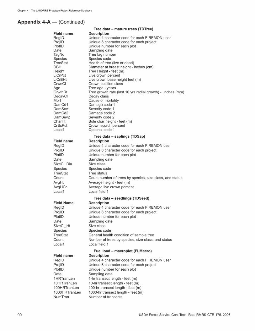
Appendix 4-A—FIREMON tables and fields in the landfire reference database ______________________

89USDA Forest Service Gen. Tech. Rep. RMRS-GTR-�75. 2006
Chapter �—The LANDFIRE Prototype Project Reference Database
LSpp� Most dominant species in lower layerLSpp2 Second most dominant species in lower layerPVTId Potential vegetation type codePotForm Potential life form codeBSoilGC Bare soil ground cover - percentGravelGC Gravel ground cover - percentRockGC Rock ground cover - percentDuffGC Duff and litter ground cover - percentWoodGC Wood ground cover - percentMossGC Moss and lichen ground cover - percentCharGC Charred ground cover - percentAshGC Ash ground cover - percentBVegGC Basal vegetation ground cover - percentWaterGC Water ground cover - percentFModel Fire behavior fuel model (Anderson �982)PhotoID Fuel photo seriesSHT Stand height: height of highest stratum which contains at least �0% of canopy cover - feet (meters)CBH Canopy fuel base height - feet (meters)CanopyC Percent canopy cover of forest canopy >6.5 feet - feet (meters)FLength Averageflamelength-feet(meters)SRate Spreadrate;averagespeedoffire-feet/min(meters/min)FBevPic PicturecodeforfirebehaviorpictureFSC Fire severity codeNorthPic Code for plot photo taken in direction of due northEastPic Code for plot photo taken in direction of due eastPhoto� Code for plot photo �Photo2 Code for plot photo 2Local� Local code �Local2 Local code 2Comments Comments about plot
Species composition – macroplot (SCMacro)Field name DescriptionRegID Unique4charactercodeforeachFIREMONuserProjID Unique8charactercodeforeachprojectPlotID UniquenumberforeachplotDate Sampling dateSppIDLevel PlantspeciesIDlevel;minimumcoverrecorded–percentRegID
Species composition (SCCover)Field name DescriptionRegID Unique4charactercodeforeachFIREMONuserProjID Unique8charactercodeforeachprojectPlotID UniquenumberforeachplotDate Sampling dateItem Item codeStatus Heath of species - (live or dead)SizeCl Size classCover Canopy cover - percentHeight Average height - feet (m)Local1 Optionalfield1Local2 Optionalfield2
Tree data – macroplot (TDMacro)Field name DescriptionRegID Unique4charactercodeforeachFIREMONuserProjID Unique8charactercodeforeachprojectPlotID UniquenumberforeachplotDate Sampling dateMacroPlotSize Macroplotsize-acres(squaremeters)MicroPlotSize Microplotsize-acres(squaremeters)SnagPlotSize Snagplotsize-acres(suqaremeters)BreakPntDia Break point diameter - inches (cm)
Appendix 4-A — (Continued)
90 USDA Forest Service Gen. Tech. Rep. RMRS-GTR-�75. 2006
Chapter �—The LANDFIRE Prototype Project Reference Database
Tree data – mature trees (TDTree)Field name DescriptionRegID Unique4charactercodeforeachFIREMONuserProjID Unique8charactercodeforeachprojectPlotID UniquenumberforeachplotDate Sampling dateTagNo Tree tag numberSpecies Species codeTreeStat Health of tree (live or dead)DBH Diameter at breast height - inches (cm)Height Tree Height - feet (m)LiCrPct Live crown percentLiCrBHt Live crown base height feet (m)CrwnCl Crown position classAge Tree age - yearsGrwthRt Tree growth rate (last �0 yrs radial growth) - inches (mm)DecayCl Decay classMort Cause of mortalityDamCd� Damage code �DamSev� Severity code �DamCd2 Damage code 2DamSev2 Severity code 2CharHt Bole char height - feet (m)CrScPct Crown scorch percentLocal� Optional code �
Tree data – saplings (TDSap)Field name DescriptionRegID Unique4charactercodeforeachFIREMONuserProjID Unique8charactercodeforeachprojectPlotID UniquenumberforeachplotDate Sampling dateSizeCl_Dia Size classSpecies Species codeTreeStat Tree statusCount Count number of trees by species, size class, and statusAvgHt Average height - feet (m)AvgLiCr Average live crown percentLocal1 Localfield1
Tree data – seedlings (TDSeed)Field Name DescriptionRegID Unique4charactercodeforeachFIREMONuserProjID Unique8charactercodeforeachprojectPlotID UniquenumberforeachplotDate Sampling dateSizeCl_Ht Size classSpecies Species codeTreeStat General health condition of sample treeCount Number of trees by species, size class, and statusLocal1 Localfield1
Fuel load – macroplot (FLMacro)Field name DescriptionRegID Unique4charactercodeforeachFIREMONuserProjID Unique8charactercodeforeachprojectPlotID UniquenumberforeachplotDate Sampling date�HRTranLen �-hr transect length - feet (m)�0HRTranLen �0-hr transect length - feet (m)�00HRTranLen �00-hr transect length - feet (m)�000HRTranLen �000-hr transect length - feet (m)NumTran Number of transects
Appendix 4-A — (Continued)

9�USDA Forest Service Gen. Tech. Rep. RMRS-GTR-�75. 2006
Chapter �—The LANDFIRE Prototype Project Reference Database
Fuel load – fine fuel, duff, and litter (FLFineDL)Field name DescriptionRegID Unique4charactercodeforeachFIREMONuserProjID Unique8charactercodeforeachprojectPlotID UniquenumberforeachplotDate Sampling dateTransect Line transect numberSlope Slope of transect (rise/run)*�00 - percent�hr Number of pieces 0 - 0.25 in. (0 - 0.6�5 cm) in diameter�0hr Number of pieces 0.25 - �.0 in. (0.6�5 - 2.5� cm) in diameter�00hr Number of pieces �- � in. (2.5� and 7.62 cm) in diameterD/LDep1 Depthofduff/litterprofile-inches(cm)LitterPct1 Proportionoftotalprofiledepththatislitter-percentD/LDep2 Depthofduff/litterprofile-inches(cm)LitterPct2 Proportionoftotalprofiledepththatislitter-percentLocal1 Localfield2
Fuel load – 1000-hr fuel (FL1000hr)Field name DescriptionRegID Unique4charactercodeforeachFIREMONuserProjID Unique8charactercodeforeachprojectPlotID UniquenumberforeachplotDate Sampling dateTransect Line transect numberLogNum Log numberDia Diameter of log at line intersection - inches (cm)DecayCl Log decay classLocal1 Localfield1
Fuel load – vegetation (FLVeg)Field name DescriptionRegID Unique4charactercodeforeachFIREMONuserProjID Unique8charactercodeforeachprojectPlotID UniquenumberforeachplotDate Sampling dateTransect Line transect numberLiShC� Live woody cover at point �DdShC� Dead woody cover at point �ShHt� Woody height at point �LiHeC� Live non-woody cover at point �DdHeC� Dead non- woody cover at point �HeHt� Non-woody height at point �LiShC2 Live woody cover at point 2DdShC2 Dead woody cover at point 2ShHt2 Woody height at point 2LiHeC2 Live non-woody cover at point 2DdHeC2 Dead non- woody cover at point 2HeHt2 Non-woody height at point 2
Metadata ID (MDID)Field name DescriptionMdId Metadata ID Metadata (MDComm)
MDID Metadata IDSubject Metadata subjectDocLink Hyperlink for metadata documen
Appendix 4-A — (Continued)

92 USDA Forest Service Gen. Tech. Rep. RMRS-GTR-�75. 2006
Chapter �—The LANDFIRE Prototype Project Reference Database
Appendix 4-B—LANDFIRE attribute tables __________ LANDFIRE mapField name Description
RegID Unique4charactercodeforeachFIREMONuserProjID Unique8charactercodeforeachprojectPlotID UniquenumberforeachplotDate Sampling dateAlbers_y Albers Northing of plot centerAlbers_x Albers Easting of plot centerDatum Datum of coordinate systemLF_Zone LANDFIRE zone - MRLC zone in which plot is locatedOrig_CoverType Cover type assigned in original data setLF_CoverType LANDFIRE cover typeLF_CoverTypeCode LANDFIRE cover type codeDomSpp Dominant plant speciesDomSppC Dominant plant species cover - percentCoDomSpp Codominant plant speciesCoDomSppC Codominant plant species cover - percentTreeC Tree cover - percentShrubC Shrub cover - percentHerbC Herbaceous cover - percentTreeHt Average tree height weighted by canopy cover (ft.)ShrubHt Average shrub height weighted by canopy cover (ft.)HerbHt Average herbaceous height weighted by canopy cover (ft.)Orig_StrucStage Structural stage assigned in original data setLF_StrucStage LANDFIRE structural stageLF_StrucStageCode LANDFIRE structural stage codeOrig_PVT Potential vegetation type assigned in original data setLF_PVT LANDFIRE potential vegetation typeLF_PVTCode LANDFIRE potential vegetation type codeSoilTex Soil texturePhotoID PlotphotofilenameidentifierReference Data referenceLoc_Meth Method for determining plot locationLoc_Acc Plot location accuracy (meters)DistToRoad Distance to nearest road (meters)NLCD_Code NLCD codeNLCD_Desc NLCD descriptionLifeFormCover_QAQC Codes for life form cover QA/QCSppCover_QAQC Codes for plant species data QA/QCSppHeight_QAQC Codes for plant species height QA/QC
LANDFIRE fuelField name DescriptionRegID Unique4charactercodeforeachFIREMONuserProjID Unique8charactercodeforeachprojectPlotID UniquenumberforeachplotDate Sampling dateContactSource Contact person for dataDataSource Source of dataDataSourceInfo Information about source of dataDataComments Data commentsID� Organization code �ID2 Organization code 2ID� Organization code �ID� Organization code �Units Measurement units (E or M)Albers_y Albers Northing of plot centerAlbers_x Albers Easting of plot centerDatum Datum of coordinate system

9�USDA Forest Service Gen. Tech. Rep. RMRS-GTR-�75. 2006
Chapter �—The LANDFIRE Prototype Project Reference Database
LF_Zone LANDFIRE zone - MRLC zone in which plot is locatedSlope Elevation above mean sea level - feet (meters)Aspect Aspect of plot in azimuth - degreesElevation Average slope (rise/run)*�00 - percentLocationComments Comments on plot locationLandfirePVT LANDFIREpotentialvegetationtypeCurrentLifeForm Current life form on plotPotLifeForm Potential life form on plotCoverType Land cover typeHabitatType Habitat typeBaileyProvince Bailey ProvinceICRBStructure ICRB stand structureVegDataFile VegetationdatafileOverSpecies� Dominant overstory speciesOverSpecies2 Codominant overstory speciesUnderSpecies� Dominant understory speciesUnderSpecies2 Codominant understory speciesGraminoid� Dominant graminoid speciesGraminoid2 Codominant graminoid speciesShrub� Dominant shrub speciesShrub2 Codominant shrub speciesForb� Dominant forb speciesForb2 Codominant forb speciesFuelbedDepth Fuelbed depthCarrier1 PrimaryfirecarrierCarrier2 SecondaryfirecarrierVegComments Vegetation commentsEvent Fire eventPre/post Pre/postfireeffectsActivityFuel Activity fuelEventComments Event comments�-hrBiomass �-hr fuel biomass�0-hrBiomass �0-hr fuel biomass�00-hrBiomass �00-hr fuel biomass�”<TotalBiomass �-�00-hr total fuel biomass�”>TotalBiomass �000-hr total fuel biomass�”>SndBiomass �000-hr sound fuel biomass�”>RotBiomass �000-hr rotten fuel biomass�”-9”SndBiomass �”-9” sound fuel biomass�”-9”RotBiomass �”-9” rotten fuel biomass9”-20”SndBiomass 9”-20” sound fuel biomass9”-20”RotBiomass 9”-20” rotten fuel biomass20”+SndBiomass 20” and larger sound fuel biomass20”+RotBiomass 20” and larger rotten fuel biomassDWMethod Downed woody sampling methodDWSource Downed woody sampling method sourceDWComments Downed woody commentsDuffBiomass Duff biomassDuffBulkDen Duff bulk densityDuffMethod Duff methodDuffSource Duff sourceDuffComments Duff commentsLitterBiomass Litter biomassLitterBulkDen Litter bulk densityLitterMethod Litter methodLitterSource Litter sourceLitterComments Litter commentsLiveHerbBiomass Live herbaceous biomassDeadHerbBiomass Dead herbaceous biomass
Appendix 4-B — (Continued)

9� USDA Forest Service Gen. Tech. Rep. RMRS-GTR-�75. 2006
Chapter �—The LANDFIRE Prototype Project Reference Database
HerbMethod Herbaceous sampling methodHerbSource Herbaceous sampling method sourceHerbComments Herbaceous commentsLiveShrubBiomass Live shrub biomassDeadShrubBiomass Dead shrub biomassShrubMethod Shrub sampling methodShrubSource Shrub sampling method sourceShrubComments Shrub commentsOtherBiomass Other biomassOtherMethod Other biomass sampling methodOtherSource Other biomass sampling method sourceOtherComments Other comments#ofTrans Number of transects�-hrLen �-hr transect length�0-hrLen �0-hr transect length�00-hrLen �00-hr transect length�000-hrLen �000-hr transect length1-hrQMD 1-hrfuelquadraticmeandiameter10-hrQMD 10-hrfuelquadraticmeandiameter100-hrQMD 100-hrfuelquadraticmeandiameterTransectComments Transect commentsDecayCl�Den Decay class � densityDecayCl2Den Decay class 2 densityDecayCl�Den Decay class � densityDecayCl�Den Decay class � densityDecayCl5Den Decay class 5 densityDecayClassComments Decay class comments
LANDFIRE canopy fuelField name DescriptionRegID UniquecodeforeachFIREMONuser(upto4characters)ProjID Uniquecodeforeachproject(upto8characters)PlotID UniquecodeforeachplotDate Sampling dateStandNum Stand numberTag Tree ID numberSpe Tree ID - 2 character codeDia Diameter at breast height (inches)Hgt Tree height (feet)C-HBC Height to base of live crown (feet)CC Crown class (code = D, C, I, S, E, G)TPA Tree density (trees/acre)
Appendix 4-B — (Continued)

95USDA Forest Service Gen. Tech. Rep. RMRS-GTR-�75. 2006
Chapter �—The LANDFIRE Prototype Project Reference Database
FIREMON table FIREMON field Sutah00 table Sutah00 field Conversion
FL�000hr RegID MFSLFL�000hr ProjID Sutah00FL�000hr PlotID Down Wood 2000 Plot#FL�000hr Date Veg data 2000 DateFL�000hr Transect Down Wood 2000 TransectFL1000hr LogNum Log1-17 Horiz–vertFL1000hr Dia Log1-17dia Horiz–vertFL1000hr DecayCl Log1-17dc Horiz–vertFL�000hr Local�
FLFineDL RegID MFSLFLFineDL ProjID Sutah00FLFineDL PlotID Down Wood 2000 Plot#FLFineDL Date Veg data 2000 DateFLFineDL Transect Down Wood 2000 TransectFLFineDL Slope Down Wood 2000 SlopeFLFineDL �hr Down Wood 2000 �HourFLFineDL �0hr Down Wood 2000 �0HourFLFineDL �00hr Down Wood 2000 �00HourFLFineDL D/LDep� Down Wood 2000 DuffLittDepth�0FLFineDL LitterPct�FLFineDL D/LDep2 Down Wood 2000 DuffLittDepth60FLFineDL LitterPct2FLFineDL Local�FLMacro RegID MFSLFLMacro ProjID Sutah00FLMacro PlotID Down Wood 2000 Plot#FLMacro Date Veg data 2000 DateFLMacro �HrTranLen 60FLMacro �0HrTranLen 60FLMacro �00HrTranLen 60FLMacro �000HrTranLen 60FLMacro NumTran 7
PD RegID MFSLPD ProjID Sutah00PD PlotID Site2000 Plot#PD Date Veg data 2000 DatePD OrgCode�PD OrgCode2PD OrgCode�PD OrgCode�PD ExaminerPD Units EPD Radius �7.2PD WidthPD PlotTypePD SEventPD FireIDPD MdIdPD LocTypePD LatPD LongPD Northing Location Data 2000 Northing
Appendix 4-C—FIREMON data conversion table for Southern Utah Project year 2000 data, which shows how fields from the Sutah Access database are mapped and converted to fields in the FIREMON access database_________
96 USDA Forest Service Gen. Tech. Rep. RMRS-GTR-�75. 2006
Chapter �—The LANDFIRE Prototype Project Reference Database
PD Easting Location Data 2000 EastingPD DatumPD GPS_ErrorPD GPS_Err_UnitsPD UTM_Zone �2PD Elev Location Data 2000 ElevationPD Aspect Site2000 AspectPD Slope Site2000 SlopePD Landform Site2000 Landform Table: _cnvLandformPD VShapePD HShapePD Geol�PD Geol2PD SoilTex Site2000 SoilPD ETypePD ESevPD TreeC Veg data 2000 Tot tree coverPD SeedCPD SapCPD PoleCPD MedCPD LTreeCPD VLTreeCPD ShrubC Veg data 2000 Shrub coverPD LShrubCPD MShrubCPD TShrubCPD GramC Veg data 2000 Gramm coverPD ForbC Veg data 2000 Forb coverPD FernCPD MossCPD USpp�PD USpp2PD MSpp�PD MSpp2PD LSpp�PD LSpp2PD PVTId Veg data 2000 PVT Sp�, 2, � PVT Sp� + PVT Sp2 + PVT Sp�PD PotFormPD BSoilGCPD GravelGCPD RockGCPD DuffGCPD WoodGCPD MossGCPD CharGCPD AshGCPD BVegGCPD WaterGCPD FModel Site 2000 FBFM norPD PhotoIDPD SHT Site 2000 Stand htPD CBH Site 2000 CbhPD CanopyC Site 2000 FARSITE ccPD FLengthPD SRatePD FBevPic
FIREMON table FIREMON field Sutah00 table Sutah00 field Conversion
Appendix 4-C — (Continued)
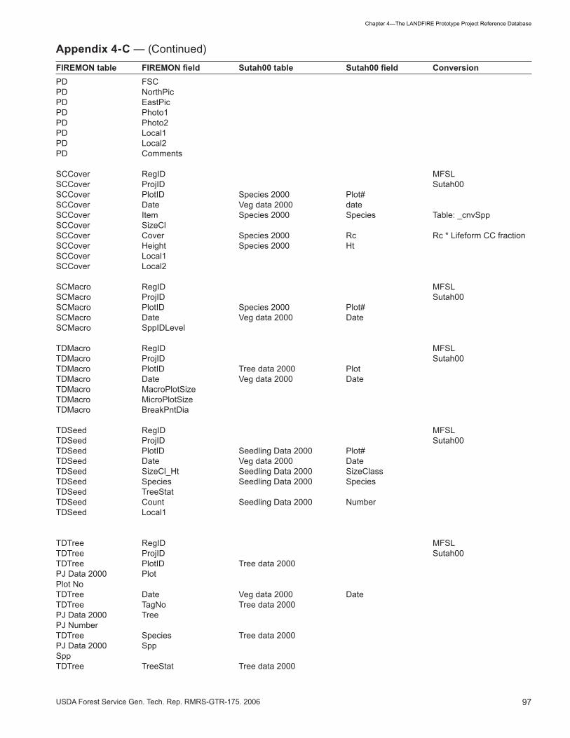
97USDA Forest Service Gen. Tech. Rep. RMRS-GTR-�75. 2006
Chapter �—The LANDFIRE Prototype Project Reference Database
PD FSCPD NorthPicPD EastPicPD Photo�PD Photo2PD Local�PD Local2PD Comments
SCCover RegID MFSLSCCover ProjID Sutah00SCCover PlotID Species 2000 Plot#SCCover Date Veg data 2000 dateSCCover Item Species 2000 Species Table: _cnvSppSCCover SizeClSCCover Cover Species 2000 Rc Rc * Lifeform CC fractionSCCover Height Species 2000 HtSCCover Local�SCCover Local2
SCMacro RegID MFSLSCMacro ProjID Sutah00SCMacro PlotID Species 2000 Plot#SCMacro Date Veg data 2000 DateSCMacro SppIDLevel
TDMacro RegID MFSLTDMacro ProjID Sutah00TDMacro PlotID Tree data 2000 PlotTDMacro Date Veg data 2000 DateTDMacro MacroPlotSizeTDMacro MicroPlotSizeTDMacro BreakPntDia
TDSeed RegID MFSLTDSeed ProjID Sutah00TDSeed PlotID Seedling Data 2000 Plot#TDSeed Date Veg data 2000 DateTDSeed SizeCl_Ht Seedling Data 2000 SizeClassTDSeed Species Seedling Data 2000 SpeciesTDSeed TreeStatTDSeed Count Seedling Data 2000 NumberTDSeed Local�
TDTree RegID MFSLTDTree ProjID Sutah00TDTree PlotID Tree data 2000PJ Data 2000 PlotPlot NoTDTree Date Veg data 2000 DateTDTree TagNo Tree data 2000PJ Data 2000 TreePJ NumberTDTree Species Tree data 2000PJ Data 2000 SppSppTDTree TreeStat Tree data 2000
FIREMON table FIREMON field Sutah00 table Sutah00 field Conversion
Appendix 4-C — (Continued)

98 USDA Forest Service Gen. Tech. Rep. RMRS-GTR-�75. 2006
Chapter �—The LANDFIRE Prototype Project Reference Database
PJ Data 2000 Tree statusStatusTDTree DBH Tree data 2000PJ Data 2000 DbhDbh (in)TDTree Height Tree data 2000PJ Data 2000 HeightHeight (ft)TDTree LiCrPct Tree data 2000PJ Data 2000 Crown ratioCrnratioTDTree LiCrBHtTDTree CrwnClTDTree Age Tree data 2000 AgeTDTree GrwthRtTDTree DecayClTDTree MortTDTree DamCd� Tree data 2000PJ Data 2000 Damcode�Damcode�TDTree SevCd� Tree data 2000PJ Data 2000 Sevcode�Sevcode�TDTree DamCd2 Tree data 2000 Damcode2TDTree SevCd2 Tree data 2000 Sevcode2TDTree CharHtTDTree CrScPctTDTree Local�
FIREMON table FIREMON field Sutah00 table Sutah00 field Conversion
Appendix 4-C — (Continued)


![Example of Change in a LANDFIRE Refresh 2008 · Example of Change in a LANDFIRE Refresh 2008 [1.1.0] Product Reflecting an Incorporated Disturbance LF 2001 Existing Vegetation Cover](https://img.pdfslide.us/doc/110x75/5d38958a88c99366578c81d7/example-of-change-in-a-landfire-refresh-2008-example-of-change-in-a-landfire.jpg)