Embed Size (px)
Citation preview
FLYWAY TRAIL FEASIBILITY STUDY | 67
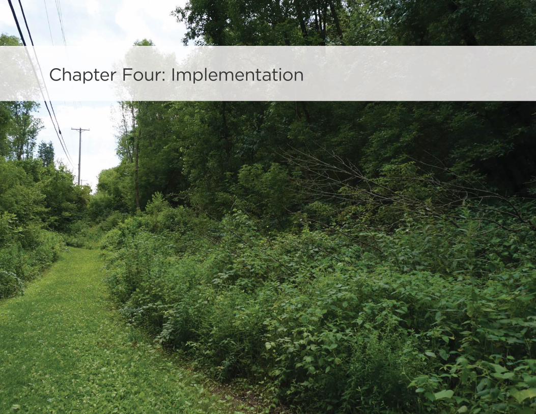
Chapter Four: Implementation
Th e Flyway Trail will off er area residents and visitors unique and diverse recreation and transportation experiences.
FLYWAY TRAIL FEASIBILITY STUDY | 69
Implementation
Introduction
The Flyway Trail Feasibility Study provides a comprehensive set of
recommendations for trail alignments along the Mississippi River
corridor that, once implemented, will fi rmly establish the Flyway
Trail as one of Wisconsin’s great bicycling trails. Implementing
the recommended alignments contained in this document
will require commitment, persistence, creativity, partnerships,
funding, and continued community support.
As Buff alo County and its local, state, and federal partners
work to bring the Flyway Trail to life, a clear, action-oriented
implementation strategy is necessary for success. This chapter
of the study provides guidance to assist with implementation
activities. The chapter begins with a set of fi ve early action items
to sustain momentum for the Flyway Trail as the young brand and
concept grows into a tangible destination and activity. A general
phasing strategy is provided to guide the allocation of resources
over a ten to fi fteen-year period. Cost estimates for the diff erent
trail typologies and recommended alignments are listed in this
chapter, as are various local and external funding sources to assist
with project fi nancing. The chapter concludes with a discussion
of administrative structure and responsibilities to maximize the
full capacities and resources of all parties involved in creating the
Flyway Trail.
Early Action Steps
The following early action steps provide lower-cost opportunities
to sustain momentum built by the Buff alo County Land & Trails
Trust during the course of this study and lay the foundation on
which the Flyway Trail can grow and evolve over time. These early
action steps are not listed in sequential order, but all are essential
to making the Trail a reality.
Establish an Administrative Structure
At fi rst glance, the number of potential partners involved with
the development of the Flyway Trail may seem intimidating. In
addition to the BCL&TT, local businesses and engaged citizens,
there are more than a dozen local, state, and federal agencies
and organizations that can play a role in shaping the Flyway Trail.
An administrative structure and accompanying responsibilities
for project partners should be established in order to develop
eff ective partnerships and utilize the resources and capacities of
Flyway Trail collaborators to the fullest extent possible. The end
of this chapter provides a potential administrative structure put
forth by the BCL&TT. It off ers guidance for creating a joint powers
administrative model. Such a model has worked successfully for
implementing and operating multi-jurisdictional trail projects
across the country.

70 | IMPLEMENTATION
Develop a Wayfi nding Plan
The placement of wayfi nding signs along the Flyway Trail
will indicate to bicyclists their direction of travel, location of
destinations, and the distance (and travel time by bike) to those
destinations, in turn increasing comfort, convenience and utility
of the bicycle network. Wayfi nding signs also provide a branding
element to raise the profi le of the Flyway Trail.
Buff alo County should create a Flyway Trail Wayfi nding Signage
Plan that identifi es:
• Sign locations along existing and planned bicycle routes
• Sign type – the information to include and the sign design
• Destinations to highlight on each sign – key destinations for
bicyclists
• Approximate distance and riding time to each destination
The wayfi nding system can integrate Flyway Trail branding
elements with guidance from the Federal Highway
Administration’s Manual for Uniform Traffi c Control Devices
(MUTCD) to identify regional and local trail facilities and
distinguish signature trail segments and elements.
Directory Map 1 Directional Wayfinding withwalk and bike distance/time
Directional Wayfinding Panels
with walk and bike distance/time4‘You are Here’ Orientation Sign 32
8 min
FLYWAY TRAIL (0.5 miles)
FLYWAY TRAIL (1.0 miles)
2 min
6 min 15 min6
Great Place 3 (.3 miles)5 min 2 min
Plac
Great Place 1 (1 miles)15 min 6 min
Placn
Great Place 2 (.3 miles)5 min 2 min
Plac
F LY WAY T R A I L
F LY WAY T R A I L
F LY WAY T R A I L
B U F FA L O C O U N T Y L A N D A N D T R A I L S T R U S T
B U F FA L O C O U N T Y L A N D A N D T R A I L S T R U S T
FLY
WA
Y T
RA
IL
1 mi.
B U F FA L O C O U N T Y L A N D A N D T R A I L S T R U S T
L
TT R U
Sample wayfi nding signage illustrations for the Flyway Trail, including a directory map, an orientation map, directional wayfi nding signs, and trail mile markers.
FLYWAY TRAIL FEASIBILITY STUDY | 71
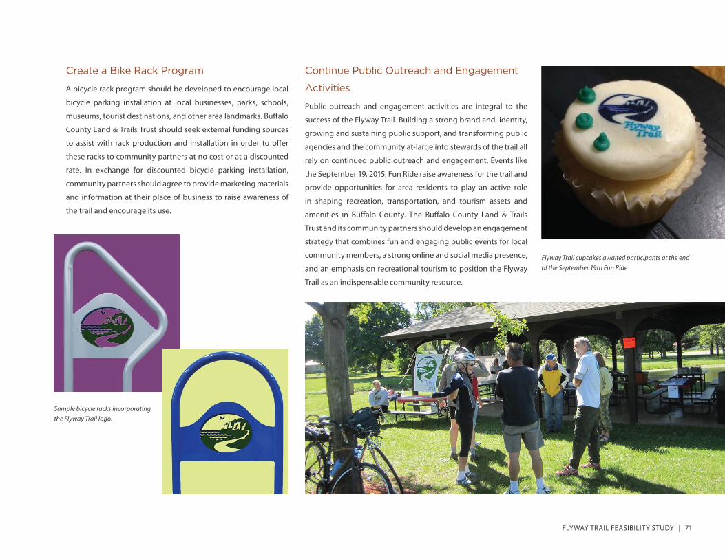
Create a Bike Rack Program
A bicycle rack program should be developed to encourage local
bicycle parking installation at local businesses, parks, schools,
museums, tourist destinations, and other area landmarks. Buff alo
County Land & Trails Trust should seek external funding sources
to assist with rack production and installation in order to off er
these racks to community partners at no cost or at a discounted
rate. In exchange for discounted bicycle parking installation,
community partners should agree to provide marketing materials
and information at their place of business to raise awareness of
the trail and encourage its use.
Continue Public Outreach and Engagement
Activities
Public outreach and engagement activities are integral to the
success of the Flyway Trail. Building a strong brand and identity,
growing and sustaining public support, and transforming public
agencies and the community at-large into stewards of the trail all
rely on continued public outreach and engagement. Events like
the September 19, 2015, Fun Ride raise awareness for the trail and
provide opportunities for area residents to play an active role
in shaping recreation, transportation, and tourism assets and
amenities in Buff alo County. The Buff alo County Land & Trails
Trust and its community partners should develop an engagement
strategy that combines fun and engaging public events for local
community members, a strong online and social media presence,
and an emphasis on recreational tourism to position the Flyway
Trail as an indispensable community resource.
Sample bicycle racks incorporating the Flyway Trail logo.
Flyway Trail cupcakes awaited participants at the end of the September 19th Fun Ride
72 | IMPLEMENTATION
Establish the Highway 35 Shoulder Bikeway
as the Spine of the Flyway Trail
Highway 35 is the backbone of the Flyway Trail. While parallel
shared-use paths, local bike routes, and scenic recreational routes
will add to the Flyway Trail experience, Highway 35 provides a
continuous and easily implementable foundation on which the
trail can grow and evolve over time. Through Buff alo County and
much of Wisconsin, this highway also doubles as the Mississippi
River Trail, a national bike route along the Mississippi River, and
the Great River Road National Scenic Byway, one the longest
and most important scenic byways in America. Buff alo County,
the Buff alo County Land & Trails Trust, the Wisconsin DOT, and
local project partners should coordinate eff orts to sign the entire
length of Highway 35 from the Chippewa River to the Great River
State Trail as the Flyway Trail using branded Flyway Trail route
signs in accordance with MUTCD standards.
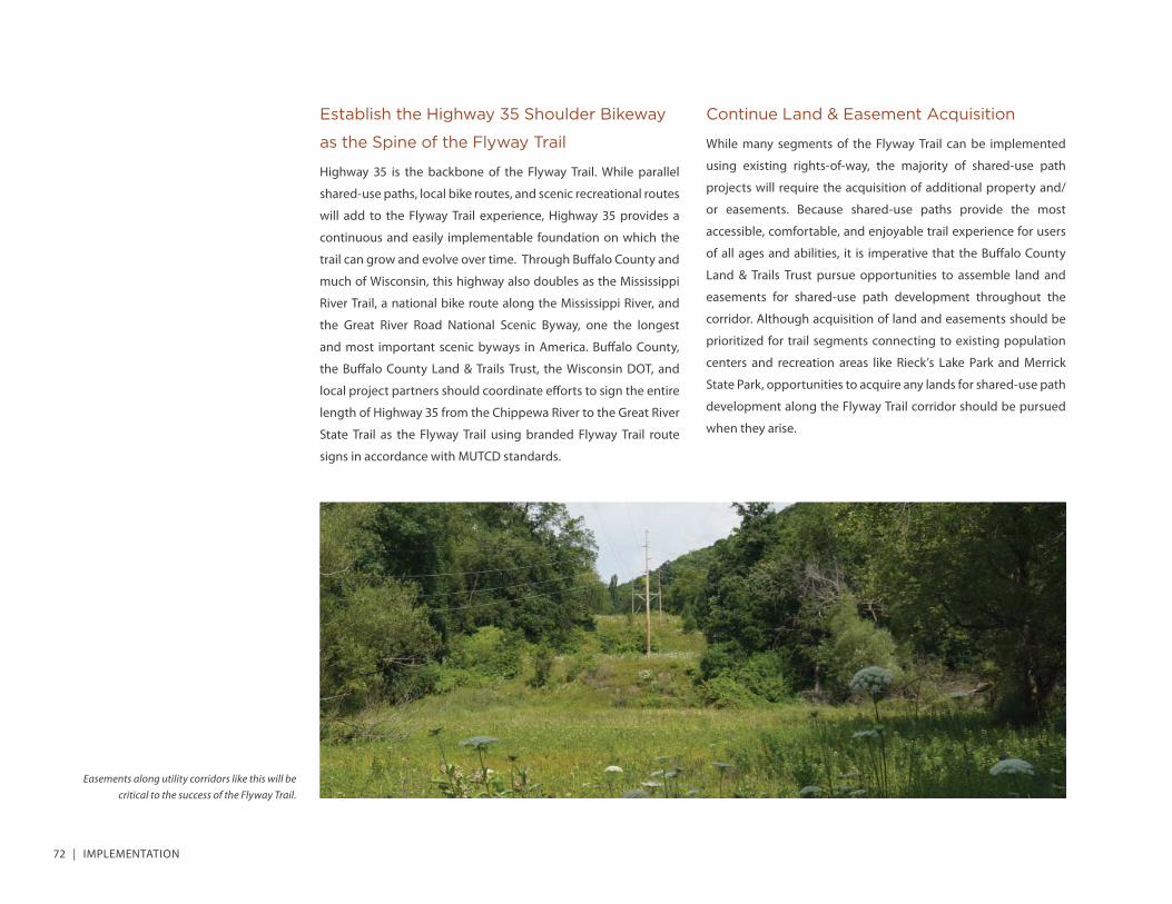
Continue Land & Easement Acquisition
While many segments of the Flyway Trail can be implemented
using existing rights-of-way, the majority of shared-use path
projects will require the acquisition of additional property and/
or easements. Because shared-use paths provide the most
accessible, comfortable, and enjoyable trail experience for users
of all ages and abilities, it is imperative that the Buff alo County
Land & Trails Trust pursue opportunities to assemble land and
easements for shared-use path development throughout the
corridor. Although acquisition of land and easements should be
prioritized for trail segments connecting to existing population
centers and recreation areas like Rieck’s Lake Park and Merrick
State Park, opportunities to acquire any lands for shared-use path
development along the Flyway Trail corridor should be pursued
when they arise.
Easements along utility corridors like this will be critical to the success of the Flyway Trail.
FLYWAY TRAIL FEASIBILITY STUDY | 73
General Phasing Strategy
Constructing the Flyway Trail is a long-term endeavor that will
require the proper alignment of political will, local, and external
funding, rights-of-way and easements, and community support.
In order to maximize the impact of the Flyway Trail’s growth
and development over time, the following phasing strategy
provides general guidance for project partners to implement the
recommended alignments. This phasing strategy consists of four
general themes that balance the need for short-term successes,
sustained momentum, and long-term realization of the Flyway
Trail as a premier recreation and transportation asset for Buff alo
County and the surrounding region.
Laying the Foundation on Highway 35
As described in the early action steps, Highway 35 is the spine of
the Flyway Trail. The establishment of Highway 35 as the primary
route for the Flyway Trail in the fi rst two years (by the end of 2017)
is essential to create an immediate physical presence for the trail,
sustain the momentum generated during the feasibility study
process, and provide a foundation for future trail development.
Expanding into Local Communities
There are numerous recommendations to provide additional
on-street routes through local communities within the corridor,
including Alma, Buff alo City, Cochrane, and Fountain City. These
on-street routes represent low-cost, easily implementable
projects that can expand the reach of the Flyway Trail and
continue to sustain interest in and support for the trail in its
beginning years. These on-street routes should be completed by
2020.
Changing Form, Changing Minds
Developing the fi rst shared-use path within the corridor will
be a signifi cant milestone in the evolution of the Flyway Trail.
This project will change the perception and use of the Flyway
Trail from a tourism and recreational bicycling amenity to a
community-wide asset that encourages walking, bicycling, and
other trail-related activities for people of all ages and abilities.
This fi rst shared-use path project should be selected based on
a variety of factors, including proximity to population centers
and recreation areas, ease of property and easement acquisition,
and topography. Because limited property ownership data was
available at the time of the feasibility study, the time frame for
this phase of project development is diffi cult to project; however,
completion of the fi rst shared-use path project should occur by
2022 to sustain project momentum, increase the diversity of trail
users, and change public perception of the trail from a tourism
asset to a community-wide, quality of life asset.
Ongoing Shared-Use Path Development
Land acquisition, easement procurement, engineering and
design, and project funding can be time consuming processes.
In order to facilitate continuous, incremental development of the
shared-use path segments of the Flyway Trail, the study team
recommends that the project partners pursue opportunities for
shared-use path development on an ongoing basis.
74 | IMPLEMENTATION
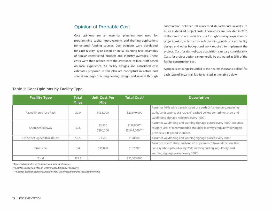
Opinion of Probable Cost
Cost opinions are an essential planning tool used for
programming capital improvements and drafting applications
for external funding sources. Cost opinions were developed
for each facility type based on initial planning-level examples
of similar constructed projects and industry averages. These
costs were then refi ned with the assistance of local staff based
on local experience. All facility designs and associated cost
estimates proposed in this plan are conceptual in nature and
should undergo fi nal engineering design and review through
coordination between all concerned departments in order to
arrive at detailed project costs. These costs are provided in 2015
dollars and do not include costs for right-of-way acquisition or
project design, which can include planning, public process, facility
design, and other background work required to implement the
project. Cost for right-of-way acquisition can vary considerably.
Costs for project design can generally be estimated at 25% of the
facility construction cost.
A project cost range (rounded to the nearest thousand dollars) for
each type of linear trail facility is listed in the table below.
Table 1: Cost Opinions by Facility Type
Facility Type Total Miles
Unit Cost Per Mile
Total Cost* Description
Paved Shared-Use Path 22.0 $935,000 $20,570,000
Assumes 10-ft wide paved shared use path, 2-ft shoulders, retaining
walls, landscaping, drainage, 4” dashed yellow centerline stripe, and
wayfi nding signage repeated every 1000’.
Shoulder Bikeway 39.6$3,500
$280,000
$139,000**
$5,544,000***
Assumes wayfi nding and warning signage placed every 1000’. Assumes
roughly 50% of recommended shoulder bikeways require widening to
provide a 5-ft paved shoulder.
On-Street Signed Bike Route 56.5 $3,500 $198,000 Assumes wayfi nding and warning signage placed every 1000’.
Bike Lane 3.4 $30,000 $102,000
Assumes one 6” stripe and one 4” stripe in each travel direction; Bike
Lane symbols placed every 250’, and wayfi nding, regulatory, and
warning signage placed every 1000’.
Total 121.5 $26,553,000
* Total costs rounded up to the nearest thousand dollars.** Cost for signage only for all recommended shoulder bikeways.*** Cost for addition of paved shoulders for 50% of recommended shoulder bikeways
FLYWAY TRAIL FEASIBILITY STUDY | 75
Funding Sources
Funding the Flyway Trail and its many recommended segments
will require a diverse and creative approach. While the funding
landscape at the federal level remains uncertain, the project
partners must still pursue federal transportation dollars through
the current extension of the transportation bill, yet be fl exible
and spontaneous enough to capitalize on partnerships, in-kind
matches, and other non-traditional opportunities to implement
the trail. The following section of this chapter provides an
overview of funding sources that project partners should utilize.
Federal Funding Sources
The federal government has numerous programs and funding
mechanisms to support bicycle and pedestrian projects, most of
which are administered by the US Department of Transportation
in cooperation with state and regional entities.
MAP-21
The Federal Highway Administration directs the current surface
transportation funding and authorization bill, Moving Ahead for
Progress in the 21st Century, commonly referred to as MAP-21.
Many of the funding programs from the previous transportation
bill, the Safe, Accountable, Flexible, Effi cient Transportation Equity
Act: A Legacy for Users (SAFETEA-LU), have been consolidated
and reorganized in a manner that allows for greater discretion
for state and local entities. The bill has been reauthorized several
times.
Transportation Alternatives Program (TAP)
MAP-21 divides TAP funding between statewide and local
agencies for allocation to transportation projects. According
to WisDOT, the agency awarded over 13 million dollars in TAP
funding for bicycle- and pedestrian-related projects for the
2014 through 2018 fi scal year cycle. The diverse array of selected
projects included a number of trail-oriented initiatives.
Congestion Mitigation and Air Quality Improvement
(CMAQ)
CMAQ funds transportation projects to reduce ozone and carbon
monoxide pollution and meet national ambient area air quality
standards (NAAQS) in Clean Air Act non-attainment areas. The
construction of pedestrian and bicycle facilities using CMAQ
funding must explicitly provide a transportation function.
CMAQ can provide funds for projects that bring sidewalks into
compliance with the Americans with Disabilities Act (ADA). Non-
construction projects such as printed materials related to safe
walking are eligible for CMAQ funds as well. These projects must
be geared towards walking primarily for transportation rather
than recreation and must be included in a plan developed by the
State and each Metropolitan Planning Organization.
Highway Safety Improvement Program (HSIP)
The Highway Safety Improvement Program (HSIP) is intended
to achieve signifi cant reduction in traffi c fatalities and serious
injuries on all public roads by funding projects, strategies and
activities consistent with a state’s Strategic Highway Safety Plan
(SHSP).
76 | IMPLEMENTATION
Surface Transportation Program (STP)
The Surface Transportation Program (STP) provides funding that
may be used by States and localities for projects to preserve and
improve the conditions on any Federal-aid highway, bridge and
tunnel projects, public road projects, pedestrian and bicycle
infrastructure, and transit capital projects. Bicycle and pedestrian
infrastructure projects include ADA sidewalk modifi cation,
recreational trails, bicycle transportation, on- and off -road trail
facilities for non-motorized transportation, and infrastructure
projects and systems that will provide safe routes for non-drivers,
including children, older adults and individuals with disabilities to
access daily needs.
Section 402 State and Community Highway Safety Grant
Program
Section 402 funds can be used to develop education, enforcement
and research programs designed to reduce traffi c crashes, deaths,
severity of crashes, and property damage. Eligible program
areas include reducing impaired driving, reducing speeding,
encouraging the use of occupant protection, improving
motorcycle safety, and improving bicycle and pedestrian safety.
Examples of bicycle and pedestrian safety programs funded by
Section 402 are comprehensive school-based pedestrian and
bike safety education programs, helmet distribution programs,
pedestrian safety programs for older adults, and general
community information and awareness programs.
TIGER Discretionary Grants Program
The Department of Transportation’s Transportation Investment
Generating Economic Recovery (TIGER) Discretionary Grants
Program was created as part of the American Recovery and
Reinvestment Act of 2009 with the purpose of funding road, rail,
transit and port projects that achieve critical national objectives,
including livability, economic competitiveness, environmental
sustainability, and safety. Applicants can apply for planning
or construction projects. Of the 39 projects awarded nearly
$500 million funding in 2015, sixteen of the projects explicitly
incorporate bicycle and/or pedestrian facilities as either a key
component of the project or the sole component of and singular
purpose for the project. These diverse projects will take place in
34 states. Several of the awards incorporate multiple states. FHWA
divides projects into three categories: safety projects, innovation
projects, and opportunity projects.
Land and Water Conservation Fund (LWCF)
The goal of the Land and Water Conservation Fund is the creation
and maintenance of high quality recreation resources through
the acquisition and development of public outdoor recreation
areas and facilities. LWCF grants are often combined with grants
from the Knowles-Nelson Stewardship Program. Interested
potential applicants can often access information about both
funds in the same materials. Towns, villages, cities, counties, tribal
governments, school districts or other state political subdivisions
are eligible to apply. Applications are due annually by May 1.
Community Development Block Grant Program (CDBG)
While not traditionally viewed as a source of funding for
bicycle and pedestrian projects, the Community Development
Block Grant (CDBG) program provides money for streetscape
revitalization and other improvements that can enhance walking
and bicycling. Federal Community Development Block Grant
grantees may “use Community Development Block Grants funds
for activities that include, but are not limited to: acquiring real

FLYWAY TRAIL FEASIBILITY STUDY | 77
property; reconstructing or rehabilitating housing and other
property; building public facilities and improvements, such as
streets, sidewalks, community and senior citizen centers and
recreational facilities; paying for planning and administrative
expenses, such as costs related to developing a consolidated plan
and managing Community Development Block Grants funds;
provide public services for youths, seniors, or the disabled; and
initiatives such as neighborhood watch programs.”
Recreational Trails Program (RTP)
The federally administered Recreational Trails Program (RTP)
uses federal gas excise taxes to fund recreational trails and their
facilities. Eligible projects may receive up to 50 percent of the total
project cost. RTP funds may be used to build new trails. Towns,
villages, cities, counties, tribal governing bodies, school districts,
state agencies, federal agencies or incorporated organizations
may apply for project funds. In Wisconsin, eligible incorporated
organizations must be incorporated under section 181.32 of
Wisconsin Statutes. These organizations promote, encourage, or
engage in outdoor recreation activities.
State Funding Sources
From 1993 to 2014, Wisconsin has distributed over $226 million in
state and federal funds for bicycle and pedestrian projects. Until
2015, when funding was cut by Governor Walker, Wisconsin was
one of 19 states with dedicated bicycle and pedestrian funding.
The Bicycle and Pedestrian Facilities Program dedicated $1 million
per year from year 2013 to 2015. The following section describes
bicycle and pedestrian funding provided by the Wisconsin
Department of Natural Resources (DNR).
Knowles-Nelson Stewardship Local Assistance Program
Wisconsin Department of Natural Resources (DNR) administers a
variety of subprograms under the Stewardship Program umbrella.
The two most relevant subprograms for potentially funding
the Flyway Trail are the Urban Rivers (UR) subprogram and the
Acquisition of Development Rights (ADR) subprogram. While the
subprogram emphasizes individual goals, each works towards
the major goal of supporting “nature-based outdoor recreation”.
Funds are acquired through state general obligation bonds. The
State raises money by selling bonds to investors and pays off the
debt over time.
Applicants may represent towns, villages, cities, counties or tribal
governments. Both subprograms described in the preceding
section require a local match. Specifi c rules and funding criteria
depend on the subprogram. Program funds may cover up to 50
percent of total project costs. Again, rules vary and should be
confi rmed by the applicant prior to submitting for funding.
Local Funding Sources
While external funding sources for bicycle and pedestrian projects
and programs continue to be in short supply and high demand,
local funds can often be the most reliable funding source to
get a project done or develop an encouragement or education
program. In addition, local funding is often required as match for
external funding sources. With this in mind, it is imperative that
Buff alo County and partnering local agencies explore, identify,
and pursue one or more of these local funding strategies as a
means of implementing the Flyway Trail.
78 | IMPLEMENTATION
Private and Foundation Funding Sources
People for Bikes Community Grants Program
People for Bikes is a national organization working to make
bicycling better throughout the United States through programs
and advocacy work. People for Bikes has funded numerous
infrastructure projects and education and encouragement
programs. Since it fi rst launched in 1999, the program has
awarded 341 grants in 49 states, including nine in the State of
Wisconsin. Seven of the projects focused on trail development or
were related to trail access. The most recent trail related project to
use this funding source was entitled “Moving Platteville Outdoors:
Improving and Extending the Rountree Branch Recreational Trail”
in 2014. The $10,000 grant was awarded to Platteville Community
Arboretum to provide trail upgrades and safe access to adjacent
destinations.
Community Foundations
Community and corporate foundations can play an important
role in funding bicycle and pedestrian infrastructure and
programs. With a growing evidence base highlighting the
connection between the built environment and community
health outcomes, health foundations throughout the country
have joined environmental foundations to support infrastructure
projects that increase opportunities for walking, bicycling and
physical activity. National, state, and local foundations have
funded initiatives to reduce obesity, increase physical activity,
and achieve other positive health-related outcomes.
Local Business Community
Businesses large and small recognize the benefi t of bicycling,
walking, and related infrastructure as economic drivers and
indicators of quality of life. Businesses and communities of
all sizes have expressed interest in investing in bicycle and
pedestrian infrastructure that fosters healthy and active
communities, creates recreation and transportation choices, and
improves quality of life. Support from the business community is
often the result of strong relationship-building eff orts and may
come in a variety of forms, from the funding of capital projects
or associated amenities to the provision of volunteers to assist in
trail maintenance activities.
FLYWAY TRAIL FEASIBILITY STUDY | 79
Administrative Structure and Responsibilities
Trail governance and administration can take a variety of
forms, usually determined by a multitude of factors, from the
length and location of the trail to the number of local agencies
and their capacities to administer and maintain the facility.
Clearly articulated and delegated roles and responsibilities for
each partner agency, organization, and group involved in trail
development and maintenance are critical to the long-term
success of any trail.
While it is common for trails within a single park or trails along an
abandoned railroad corridor to have a single managing agency,
many larger trails that cross multiple jurisdictions or utilize
roadway rights-of-way often require greater oversight and inter-
agency collaboration, acquisition, construction, maintenance
and operations tasks.
Two potential administrative structures were examined during
the course of this study for their potential application to the
Flyway Trail: a lead agency model and a joint powers model.
Unlike many trails managed and operated under the lead agency
model, the Flyway Trail lacks a contiguous corridor for trail
development, like an abandoned railroad. In addition, the trail will
consist of both on-road bikeways and off -street shared-use paths,
traversing public lands and rights-of-way owned and operated
by a multitude of federal, state and local jurisdictions. For these
reasons, the single-entity administrative model is not likely a
feasible option. The joint powers model, in comparison, provides
a more collaborative structure to facilitate trail management and
operations through a governing board with representation from
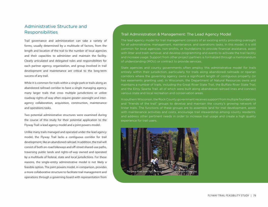
Trail Administration & Management: The Lead Agency ModelThe lead agency model for trail management consists of an existing entity providing oversight for all administrative, management, maintenance, and operations tasks. In this model, it is still common for local agencies, non-profi ts, or foundations to provide fi nancial assistance, assist with litter and trash removal, and develop programming and events to activate the trail facility and increase usage. Support from other project partners is formalized through a memorandum of understanding (MOU) or contract to provide services.
State agencies and county governments often employ this administrative model for trails entirely within their jurisdiction, particularly for trails along abandoned railroads or riparian corridors where the governing agency owns a signifi cant length of contiguous property (or has easements granting use). In Wisconsin, the Department of Natural Resources owns and maintains a number of trails, including the Great River State Trail, the Buff alo River State Trail, and the Elroy Sparta Trail, all of which were built along abandoned railroad lines and connect various state and local recreation and conservation areas.
In southern Wisconsin, the Rock County government receives support from multiple foundations and “friends of the trail” groups to develop and maintain the county’s growing network of linear trails. The functions of these groups are to assemble land for trail development, assist with maintenance activities and costs, encourage trail stewardship among county residents, and address other pertinent needs in order to increase trail usage and create a high quality experience for trail users.
The Great River State Trail (Source: Wisconsin Department of Tourism)
80 | IMPLEMENTATION
partner agencies and citizens from the community. This model
better accommodates the unique conditions along the study
corridor and is the recommended administrative structure to
govern the Flyway Trail.
Through a joint powers agreement and memoranda of
understanding, the participating agencies and organizations can
play an active role in securing funds, designing and constructing
the trail, and maintaining the facility as a valuable asset for the
region. The joint powers agreement can be amended to include
additional partners as the scope or scale of the project changes.
Potential entities to be included on the joint powers board
include:
• Buff alo County Land & Trails Trust
• Buff alo County
• Local Municipalities (Alma, Buff alo City, Cochrane, Fountain City, and Nelson)
• U.S. Army Corps of Engineers
• U.S. Fish and Wildlife Service
• Wisconsin Department of Transportation
• Wisconsin Department of Natural Resources
For those agencies that do not participate as members of
the joint powers board, involvement in the project should be
determined based on their interest, resources, and capacity. The
joint powers board should document such involvement through
a memorandum of understanding.
Trail Administration & Management: The Joint Powers ModelMany trails traverse multiple jurisdictions, run through public parks and open spaces, and utilize local roads and state highways where no off -street alternatives are available. In such instances where activities transcend jurisdictions and boundaries, municipalities, counties, local school districts, and other public authorities can exercise joint powers to provide a service, such as a regional trail. The regulations describing such intergovernmental cooperation are expressed in the Section 66.0301 and 66.0303 of the Wisconsin Statutes. As stated in the statutes, a commission created to plan and administer the joint powers of the participating entities “may fi nance the acquisition, development, remodeling, construction and equipment of land, buildings, and facilities for regional projects. Participating municipalities acting jointly or separately may fi nance the projects, or an agreed share of the cost of the projects.”
Joint powers boards and commissions have been particularly successful with trail development projects in Minnesota and California, where these intergovernmental agreements are more commonplace. Notable examples include the Cannon Valley Trail Joint Powers Board in Minnesota, the Honey Lake Valley Recreation Authority in Lassen County, California, the San Dieguito River Park Joint Powers Authority in San Diego County, California, and the Centennial Trail Joint Powers Board in Kootenai County, Idaho. Joint powers agreements for trail development and maintenance can vary signifi cantly in terms of content, delegation of responsibilities, administrative structure, and other characteristics that outline the nature of the agency and the terms to which all parties agree.
JOINT POWERS AGREEMENTROCORI Trail Construction Board
The parties to this Agreement are governmental units of the State of Minnesota. This Agreementis made pursuant to the authority conferred upon the parties by Minnesota Statute §471.59.
1. PURPOSEThe Cities of Rockville, Cold Spring and Richmond (collectively, “Cities” andindividually, by their common names) have been working together to design, constructand fund a regional trail connecting the terminus of the anticipated Glacial Lakes Trailoutside of Richmond, through Cold Spring, to the northern boundary of Rockville(“Project” or “ROCORI Trail”). Operating independently, the Cities have obtained grants