Embed Size (px)
Citation preview

Gaviota Coast Plan
Chapter Five – Land Use 5-1
Artist: John Iwerks
Chapter 5: Land Use
Physical Setting The Gaviota Coast Plan Area includes 101,199 acres within Santa Barbara County and is bounded by the western limit line of the Goleta Community Plan boundary to the east, Vandenberg Air Force Base to the west, the ridgeline of the Santa Ynez Mountains and Gaviota Creek watershed to the north, and the Pacific Ocean to the south. The 38-mile rural coastline has striking scenic beauty combined with rich biological and cultural resources that make it one of the most unique coastal areas in the western hemisphere. The Gaviota Coast serves as a transition zone between northern and southern California ecological provinces for both terrestrial and marine species, this transition zone contributes to the area's extraordinary biotic diversity. The Gaviota Coast is also a working rural agricultural landscape that has sustained and been sustained by generations of farmers and ranchers. Agriculture is the dominant land use with 77,820 acres of land (77%) zoned for agriculture within the Plan Area (Table 5-1).
Table 5-1 Land Use Acreage
Land Use Acreage Parcels Percentage
A-II-320 44,313 292 43.8
AC 23,007 104 22.7
MA-320 15,551 49 15.4
A-II-100 10,500 382 10.4
RECREATION/OPEN SPACE 5,562 61 5.5
TC 1,158 56 1.1
MA-100 896 4 0.9
COASTAL DEPENDENT INDUSTRY 100 3 0.1
NTS 57 18 0.05
RURAL RESIDENTIAL 42 32 0.04
EDUCATIONAL FACILITY 11 4 0.01
HIGHWAY COMMERCIAL 2 1 <0.01
Totals 101,199 1,006 100.000
In addition to the privately owned agricultural lands, public recreation, land conservancy, and coastal dependent industry are the principal land uses. The extent and location of state, federal, and county land ownership has a significant influence upon land use, resource protection and provision of services within the Plan Area (Table 5-2).

Gaviota Coast Plan
Chapter Five – Land Use 5-2
Table 5-2 Plan Area Statistics
Acres Percentage
Inland/Coastal
Inland Area 51,350 50.7
Coastal Zone 49,849 49.3
Total 101,199 100
Ownership
Private 76,506 75.6
Federal (Los Padres National Forest) 15,634 15.4
State 5,465 5.4
County 1,619 1.6
Rights of way (unparcelized) 1,093 1.1
Conservancy 810 0.8
District/Agency 22 <0.1
Total 101,199 100
Important Farmlands
Inland Area 2,689 83.9
Coastal Zone 515 16.1
Total 3,204 100
California Department of Parks and Recreation manages approximately 5,000 acres in the Plan Area including Gaviota State Park, and Refugio and El Capitan State Beaches. Recent additions to the state park holdings include approximately 2,500 acres north of El Capitan State Beach and the “Gaviota Village” parcels located north of Highway 101 near Mariposa Reina.
The U.S. Forest Service manages 15,634 acres within the Los Padres National Forest in the upper watershed of the Santa Ynez Mountains within the Plan Area. The adopted Forest Plan for this area emphasizes maintaining the rugged natural character of the landscape, protecting and enhancing wildlife species and habitat, managing vegetation and hazardous fuels, protecting cultural resources, and providing opportunities for outdoor recreation.
The County of Santa Barbara owns and manages the Jalama Beach County Park, the Tajiguas Landfill and adjoining Baron Ranch. Tajiguas Landfill has been in operation since 1967 and accepts waste generated by the City of Santa Barbara, unincorporated areas of southern Santa Barbara County, the Santa Ynez Valley and Cuyama Valley.
Residential development in the rural area is broadly dispersed with the exception of a small pocket of rural residential development at Arroyo Quemada, and developed smaller agricultural parcels at El Capitan Ranch and the upper reaches of Refugio Road near West Camino Cielo. There are 162 permitted single family dwellings within the Plan Area. Hollister Ranch covers approximately 14,500 acres, including eight and one half miles of shoreline, between Gaviota State Park and Point Conception.

Gaviota Coast Plan
Chapter Five – Land Use 5-3
Hollister Ranch was subdivided in 1971 to include 133 approximately one-hundred acre parcels owned by individuals, three parcels owned by all the owners in common of which two are beach parcels that run the length of the Ranch, and a parcel with the historic Hollister House, barns and employee housing. Approximately 84 homes have been built on Hollister Ranch since 1971.
a. Land Use and Zoning Designations Agriculture Land Use and Zoning A key goal of the Gaviota Coast Plan is to maintain the rural character of the area that is dominated by working agriculture and natural landscapes. Strong land stewardship of long-time ranching and farming families has played an important part in maintaining the area's rural agricultural character. The County has several mechanisms to protect agriculture: the Comprehensive Plan, Coastal Land Use Plan, agricultural zoning, and the Williamson Act. The 1980 Comprehensive Plan adopted an urban-rural boundary in western Goleta Valley that was later used to define the western limit of the City of Goleta. This boundary provides a stable delineation between urban land uses within the City of Goleta and rural and agricultural uses in the western portion of the Goleta Community Plan and the Gaviota Coast Plan Area. The County’s Comprehensive Plan and Coastal Land Use Plan contain strong agricultural protection policies that discourage conversion from agricultural to residential or urban uses.
The purpose of agricultural zoning is to provide standards that will support agriculture as a viable land use, to encourage maximum agricultural productivity, and to preserve these lands for long-term agricultural use. In the eastern Plan Area, agricultural lands are zoned AG-II-100 with minimum parcel sizes increasing as one moves from east to west. All agriculturally zoned land in the coastal zone west of El Capitan State Park is zoned AG-II-320 (320 acre minimum parcel size). Prior to any subdivision of agricultural lands, agricultural viability of the resulting parcels must be determined as required by the Comprehensive Plan.
The California Land Conservation Act, generally referred to as the Williamson Act, is a mechanism that provides tax incentives to preserve land in agricultural production or open space. Under this voluntary program, the land owner agrees to keep the land in agricultural production or open space for the term of the contract (10 years), or for longer 20-year contracts (Farmland Security Zone program). Seventy-seven percent (60,321 acres) of the agriculturally zoned land in the Plan Area is enrolled in the County’s agricultural preserve program. The Williamson Act is administered locally through the County’s Uniform Rules for Agricultural Preserves and Farmland Security Zones.
Artist: Chris Chapman
Gaviota Coast Plan
Chapter Five – Land Use 5-4
Artist: Chris Chapman
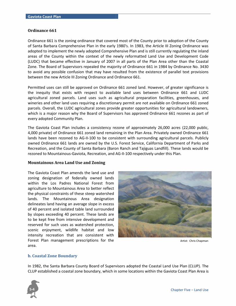
Ordinance 661 Ordinance 661 is the zoning ordinance that covered most of the County prior to adoption of the County of Santa Barbara Comprehensive Plan in the early 1980's. In 1983, the Article III Zoning Ordinance was adopted to implement the newly adopted Comprehensive Plan and is still currently regulating the inland areas of the County within the context of the newly reformatted Land Use and Development Code (LUDC) that became effective in January of 2007 in all parts of the Plan Area other than the Coastal Zone. The Board of Supervisors repealed the majority of Ordinance 661 in 1984 by Ordinance No. 3430 to avoid any possible confusion that may have resulted from the existence of parallel text provisions between the new Article III Zoning Ordinance and Ordinance 661. Permitted uses can still be approved on Ordinance 661 zoned land. However, of greater significance is the inequity that exists with respect to available land uses between Ordinance 661 and LUDC agricultural zoned parcels. Land uses such as agricultural preparation facilities, greenhouses, and wineries and other land uses requiring a discretionary permit are not available on Ordinance 661 zoned parcels. Overall, the LUDC agricultural zones provide greater opportunities for agricultural landowners, which is a major reason why the Board of Supervisors has approved Ordinance 661 rezones as part of every adopted Community Plan.
The Gaviota Coast Plan includes a consistency rezone of approximately 26,000 acres (22,000 public, 4,000 private) of Ordinance 661 zoned land remaining in the Plan Area. Privately owned Ordinance 661 lands have been rezoned to AG-II-100 to be consistent with surrounding agricultural parcels. Publicly owned Ordinance 661 lands are owned by the U.S. Forest Service, California Department of Parks and Recreation, and the County of Santa Barbara (Baron Ranch and Tajiguas Landfill). These lands would be rezoned to Mountainous-Gaviota, Recreation, and AG-II-100 respectively under this Plan.
Mountainous Area Land Use and Zoning The Gaviota Coast Plan amends the land use and zoning designation of federally owned lands within the Los Padres National Forest from agriculture to Mountainous Area to better reflect the physical constraints of these steep watershed lands. The Mountainous Area designation delineates land having an average slope in excess of 40 percent and isolated table land surrounded by slopes exceeding 40 percent. These lands are to be kept free from intensive development and reserved for such uses as watershed protection, scenic enjoyment, wildlife habitat and low intensity recreation that are consistent with Forest Plan management prescriptions for the area. b. Coastal Zone Boundary In 1982, the Santa Barbara County Board of Supervisors adopted the Coastal Land Use Plan (CLUP). The CLUP established a coastal zone boundary, which in some locations within the Gaviota Coast Plan Area is

Gaviota Coast Plan
Chapter Five – Land Use 5-5
inconsistent with the coastal zone boundary established by the Coastal Act and certified by the California Coastal Commission. The Gaviota Coast Plan land use map adjusts the County’s coastal zone boundary to conform it to the State’s boundary. The net result of these cumulative adjustments is a slight reduction (0.5%) in the total land area within the coastal zone from 50,439 acres to 49,849 acres (Table 5-2).
Planning Issues It has been over 30 years since the Santa Barbara County Comprehensive Plan and Local Coastal Plan policies were originally developed. One of the more complex land use issues facing the Gaviota Coast is how to best weigh future development potential with the continuation of viable agriculture and protection of environmentally sensitive areas. The Gaviota Coast Plan provides a local vision for lasting protection of the Gaviota Coast, in part, through the development of new policies, programs, and planning tools specific to the area that take into account resource protection, coastal access, continuation and enhancement of working agriculture and private property use. This vision includes respect for the rights and needs of property owners and the community. The Policies and Development Standards of the Gaviota Coast Plan shall be implemented in a manner that does not take private property for public use without just compensation as required by applicable law.

Gaviota Coast Plan
Chapter Five – Land Use 5-6
Page Intentionally Left Blank

ÙÙ ÙÙÙÙÙÙÙÙÙÙÙÙÙÙÙÙÙÙ ÙÙÙÙÙÙÙ
ÙÙÙÙÙÙÙÙÙÙÙÙÙÙÙÙÙÙÙÙÙÙÙÙÙÙÙÙÙÙÙÙÙÙÙÙÙÙÙÙÙÙÙÙÙÙÙÙÙÙÙÙÙÙÙÙÙÙÙÙÙÙÙÙÙ
ÙÙÙÙÙÙÙÙÙÙÙÙÙÙÙÙÙÙÙÙÙÙÙÙÙÙÙÙÙÙÙÙÙÙÙÙÙÙÙÙÙÙÙÙÙ ÙÙÙÙÙÙÙÙÙÙÙÙÙÙÙÙÙÙÙÙÙÙÙÙÙ ÙÙÙÙÙÙÙÙÙÙÙÙÙÙÙÙÙÙÙÙÙÙÙÙÙÙÙÙÙÙÙÙÙÙÙÙÙÙÙÙÙÙÙÙÙÙÙÙÙÙÙÙÙÙÙÙÙÙÙÙÙÙÙÙÙÙ
ÙÙÙÙÙÙÙÙÙÙÙÙÙÙÙÙÙÙÙÙÙÙÙÙÙÙÙÙÙ
ÙÙÙÙÙÙÙÙÙÙÙÙÙÙÙÙÙÙÙÙÙÙÙÙ
ÙÙÙÙÙÙÙÙÙÙÙÙÙÙ ÙÙÙÙÙÙÙÙÙÙÙÙÙÙÙÙÙÙÙÙÙÙÙÙÙÙÙÙÙÙÙÙÙÙÙÙÙÙÙÙÙÙÙÙÙÙÙÙÙÙÙÙÙÙÙÙÙÙÙÙÙÙÙÙÙÙÙÙ ÙÙÙÙÙÙÙÙÙÙÙÙÙÙÙÙÙÙÙÙÙÙÙÙÙÙÙÙÙÙÙÙÙÙÙÙÙÙÙÙÙÙÙÙÙÙÙÙ
ÙÙÙÙ ÙÙÙÙÙÙÙÙÙÙÙÙÙÙ ÙÙÙÙÙÙÙÙÙÙÙÙÙÙÙÙ ÙÙÙÙÙÙÙÙÙÙÙÙÙÙÙÙÙ ÙÙÙÙÙÙÙ
ÙÙÙÙÙÙÙÙÙÙÙÙ ÙÙÙÙÙÙÙÙÙÙÙ ÙÙÙÙÙÙÙÙÙÙÙÙÙÙ ÙÙÙÙÙÙÙÙÙÙÙÙ
ÙÙÙÙÙÙÙÙÙÙÙÙÙÙÙÙÙÙÙÙÙ ÙÙ ÙÙÙÙÙÙÙÙÙÙÙÙÙÙÙÙÙÙÙÙÙÙÙÙÙÙÙÙÙÙÙÙÙÙÙÙÙÙÙÙÙÙÙÙÙÙÙÙÙÙÙÙÙÙ ÙÙÙÙÙÙÙÙÙÙÙÙÙÙÙÙÙÙ ÙÙÙÙÙÙÙÙ ÙÙÙÙÙÙÙÙÙÙÙÙÙÙÙÙÙÙÙÙ
ÙÙÙÙÙÙÙÙÙÙÙÙÙÙÙÙÙÙÙÙÙÙÙÙÙÙÙÙ ÙÙÙÙÙÙÙÙÙÙÙÙÙÙÙÙÙÙÙÙÙÙÙÙÙ ÙÙÙÙÙÙÙÙÙ ÙÙÙÙÙÙÙÙÙÙÙÙÙÙÙÙÙÙÙÙÙÙÙÙÙÙÙÙÙÙÙÙÙÙÙÙÙÙÙÙÙÙÙÙÙÙÙÙÙÙÙÙÙÙÙÙÙÙÙÙÙÙÙÙÙÙÙÙÙÙÙÙÙÙÙÙÙÙÙÙÙÙÙÙÙÙÙÙÙ ÙÙÙÙÙÙÙÙÙÙÙÙÙÙÙÙÙÙÙÙÙÙ ÙÙÙ ÙÙÙÙÙÙÙÙÙÙÙÙÙÙÙÙÙÙÙÙÙÙÙÙÙÙÙÙÙÙÙÙÙÙÙÙÙÙÙÙÙÙÙÙ ÙÙÙÙ
ÙÙÙÙÙÙÙÙÙÙ ÙÙÙÙÙÙÙÙÙÙÙÙÙÙ ÙÙÙÙÙÙÙÙÙÙÙÙÙÙÙÙÙÙÙÙÙÙÙÙÙÙÙÙÙÙÙÙÙÙ ÙÙÙÙÙÙÙÙÙÙ ÙÙÙÙÙÙÙÙÙÙÙÙÙÙ
ÙÙÙÙÙÙÙÙÙÙ ÙÙÙÙÙÙ ÙÙÙÙÙÙÙÙÙÙÙÙÙÙÙÙÙÙÙÙÙ ÙÙÙÙ ÙÙÙ
ÙÙÙÙÙÙÙÙÙÙ ÙÙÙ ÙÙÙÙÙÙÙÙÙÙÙÙ ÙÙÙ ÙÙÙ
ÙÙÙÙÙÙÙÙÙ ÙÙÙÙÙÙÙÙÙÙÙ ÙÙÙÙÙÙÙÙÙÙ
ÙÙÙÙÙÙÙÙÙÙÙÙÙÙÙÙÙÙÙ
ÙÙÙÙ ÙÙÙÙÙÙÙÙÙÙÙÙÙÙÙÙÙ ÙÙÙÙÙÙÙÙÙÙ ÙÙÙÙÙÙÙÙÙÙÙÙÙ
ÙÙÙÙÙÙÙÙÙÙÙÙ ÙÙÙÙÙÙÙÙÙÙÙÙÙÙÙÙÙÙÙÙÙÙÙÙÙÙÙÙÙÙÙÙÙÙÙÙ ÙÙÙÙÙÙÙÙÙÙÙÙÙÙÙÙÙÙÙÙÙÙÙÙÙÙÙÙÙÙÙÙÙÙÙÙÙÙÙÙÙÙÙÙÙÙÙÙÙÙÙÙÙÙÙÙÙÙÙÙÙÙÙÙÙÙÙÙÙÙÙÙÙÙÙÙÙÙÙÙÙÙÙÙÙÙÙÙÙ ÙÙÙÙÙÙÙÙÙÙÙÙÙÙÙÙÙÙÙÙÙÙÙÙÙÙÙÙÙÙÙÙÙÙÙÙÙÙÙÙÙÙÙÙÙÙÙÙÙÙÙÙÙÙÙÙÙÙÙÙÙÙÙÙÙÙÙÙÙÙÙÙÙÙÙÙÙÙÙÙÙÙÙÙÙÙÙÙÙÙÙÙÙÙ ÙÙÙÙÙÙÙÙÙÙÙÙÙÙÙÙÙÙÙÙÙÙÙÙÙÙÙÙÙÙÙÙÙÙÙÙÙÙÙÙÙÙÙÙÙÙÙÙÙÙÙÙÙÙÙÙÙÙÙÙÙÙÙÙÙÙÙÙÙÙÙÙÙÙÙÙÙÙÙ ÙÙÙÙÙÙÙÙÙÙÙÙÙÙÙÙÙÙÙÙÙÙÙÙÙÙÙÙÙÙÙÙÙÙÙÙÙÙÙÙÙÙÙÙÙÙ ÙÙÙÙÙÙÙÙÙÙÙÙÙÙÙÙÙÙÙÙÙÙÙÙÙÙÙÙÙÙÙÙÙÙÙÙÙÙÙÙÙÙ ÙÙÙ ÙÙÙÙÙÙÙ ÙÙÙÙÙÙÙÙÙÙÙÙÙÙÙÙÙÙÙÙÙÙÙÙÙÙÙÙÙÙÙÙÙÙÙÙÙÙÙÙ
ÙÙÙÙÙÙÙÙÙÙÙÙÙÙÙÙÙÙ ÙÙ ÙÙÙÙÙÙÙÙÙÙÙÙÙÙÙÙÙÙÙÙÙÙÙÙÙÙÙÙÙÙÙÙÙ ÙÙ ÙÙÙÙÙÙÙÙÙÙÙÙÙÙÙÙÙÙÙÙÙÙÙÙÙÙÙÙ Ù ÙÙÙÙ ÙÙÙÙÙÙÙÙÙÙÙÙÙÙÙÙÙÙÙÙÙÙÙÙÙÙÙÙÙÙÙÙÙÙÙÙÙÙÙÙÙ
ÙÙÙÙ
``````````````````````````````````
`
``
````
```
`
```
``
``
``
``
``````
` ``
``
```
``
````
``
```
````
`````
`
``````````````````````
```
```
```````
`````
`
````
`
```
``
``
```
````
`
`
`
```````
````
``
```````
```
````
````
`
`
` ` ` `
``
``
``
``
``
`
````
``
``
``
``
``
`
``
````````````````````
```````````````
` ` ` ` ` ` ` ` ` `
````
`
` ` ` ``
``````````````
``
``
`` ` ` ` ` ` ` ` ```
``
````
``
``
`
```
`
``
``
`` ` `
```````````````
`
``
``
``
```
``
``
```
` ` ``
```
````
``
`
`
``
``
``
``
``
``
``
``
``
` ` ` ` ` ` `
``
``
``
``
``
``
``
``
```````
``
``
``
``
````````
``
```````````````````````````````````````````````````````````````````````````````````````````````````
`
````
``
``
```````````
``
``
`````````
````
``
```
````
``
````
````````````
``
`
` ` ` ` ` ``` ` ` `
`````
`` ` ` ` `
``````
` ```
``
``
``
``
`````
``
``
``
```````
``
`
`````````
``
``
`
` ` ` ` ` ` ``
``
``
``
``
``
``
``
`````````````
``
``
``
``
``
``
``
`````````
`
``
`````
`
``````````
```
```
``
``
````
`````````
``
```
``
````
``
``
````````
` `` ` ` ` ` ` `
```
``
` ` ` ` ` ` ` ` ` ` ` `
````````````
` ` ` ` ` ` ` ` ` ` ` ` ` ` ` ` ` ` ` ` ` ` ` ` ` ` ` ` ` ` ` ` ` ` ` ` ` ` ` ` ` ` ` ` ` ` ` ` ` ` ` ` ` ` ` ` ` ` ` ` ` ` ` ` ` ` ` ` `
` ` ` ` ` ` ` ` ` ` ` ` ` ` ` ` ` ` ` ` ` ` ` ` ` `` ` ` ` ` ` ` ` ` ` ` `` ` ` `
` ` ` `` ` ` `
`` ` `
` ` `` ` ` `` `` ` ` ` ` ` ` `
`` ` ` ` ` ` ` ` ` `
` ` ` ` ` ` ` ` ` ` ` ` ` ` ` ` `` ` ` ` ` ` ` `
` ` ` ` `` ` ` ` ` ` ` ` ` ` ` ` ` ` ` ` `
` ` ` ` ` ` ` `` ` ` ` `
` ` ` ` ` ` ` ` ` ` ` ` ` ` ` ` ` ` `` ` ` ` ` ` ` ` ` `
``
``
`````
`````
``
``
``
`
``
`````````
``
``
``
``
`` ` ` ` ` ` ` ` ` ` ` ` ` ` `
``
```
``
``
``
``
``
````
``
``` ` ` ` `
` ` ` ` ` `
``
``
`
````````
``
`
```````
``
```````
``
``
``
```````````
``
``
``
``
`
```````
``
```
`
``
``
``
` ` ``
` ` ` ` ` `
``
``
`` ` ` ` ` ``
``
``
`````
``
``
`
` ` ` ` `
`````
``
````````````
``
`
`
```````````
`````````````````
`````````````
```
`````
````
`````````````````
`````````````
`
`
`
`````````
`````
```
`` `
```
````
`
````
``
``
``
``
`
````````````````````````````````````
```````
`````````
````
````
`````````````````````
````
```
`̀``
``````
```
``````````
````````````````````````````````````````````````````````````````````````````````````````````````````
``
````
```````
`
````
````````` ` ` `
` ``
`
``
`` ` ` ` ` ` ``
`
`` ``
``` ` ` ` ` ` `
``````````
````````````
````
```````````
``````
` ` ` ` ` ` ` ` `` ` ` ` ` ` ` ` ` ` ` ` ` ` ` ` ` ` ` ` ` ` ` ` ` ```
`` `
`
` ` ` ` ` ` ` ` ` ``
` ` `` ```
``````````````````
`
```````````````````````````````````````````````
` ` ` ` `` ` ` ` ` ` ` ` `` ` ` ` ` ` ` ` ` ` ` ` ` ` ` ` ` ` ` ` ` ` ` ` ` ` ` ` ` ` ` ``
` ` ```
```
``
`` `` ``
` ` ```
` ``` ` `` ` ` ` ` ` ` ` ` ` ` ` `
``
` ` ```
``
``
``
``
``
``
``
``
``
``
````````````
``
``
````````````
``
``
``
``
`
`````````````
``
`
````````
``
`
` ` ` ` ` `
``
``
``
``
``
``
``
``
`
`````````````````````
`````````````````````````````````
````````````````
`
``````````
`
` `
``````````` ```````````
``
`
``` ``
``
``
``
``
``
``
``
``
``
``
``
`
`
````
````````````````
`
``
``
`````````````
``
```````````````````
````
`````````
```
`
``````````````````
`
``
``````````````````````
`````````````````````````````````````````````````````````````````````````````````````
`
````
````````````````````
````````````````````````````````````
```````````
````````````````````````````````````````````````
```
``
``````````````````````````````````
```
``
```
`
``
```
```
`````
``
``````
````
`````````
```````
``
```
````````
``
`
```````
` `
`
` ` ` ` ` ` ` ` ` ` ` ` ` ` ` ` `
``
`` `
`
` `` ``
``
````
```
``
```````
``
``
``
``
` `
``
``
``
`````
````
`
` ` ` ` ` ` ` ` ` ` ` ` ` ` ` ` ``
``
``
``
``
``
``
``
```
``
```
```
```
```
`
``
``
``
``
``
``
``
``
``
``
``
```````
``
``
``
``
`````
``
``
``
``
``
``
``
``
``
``
`
````````````
``
``
``
``
``
``
``
``
``
``
``
``
``
``
``
``
`
``````
``
`
``
`
`
```
`
``
``
``
``````
``
``
``
``
``
``
``
``
``````````````
```
``
`
`
`````
``
```
``
``
````
````
```
```
````
`
`
``
``
``
`
````
``````
`
````
` ` ` ` ` ` ` ` ` ` ` ` ` ` ` ` ` ` ` ` ` ` ` ` ` ` ` ` ` ` ` ` ` ` ` ` ` ` ` ` ` ` ` ` ` ` ` ` ` ` ` ` ` ` ` ` ` ` ` ` ` ` ` ` ` ` ` ` ` ` ` ` ` ` ` ` ` ` ` ` ` ` ` ` ` ` ` ` `
``````
``
``
```
``
```
``
``
```
```
```
``
`
`
```
``
`
```
`
`
``
``
``
``
``
` ` ` ` `
``
``
``
`` ` ` ` ` ` ` ` ` ` ` ` ` ` ` ` ` ` ` ` ` ` ` ` ` ```
` `` `
`````
` ` ` ` ` ` ` ` ` ``
``
````````````
` ` ` ` ` ` ` ` ` `
``
``
``
``
``
`
``````````
``
``
```
` ` ` ` ` ` ` ` ` ` ` ` ` ` ` ` ` ` ` ` ` ` ``
`
`` ` ` ` ` ` ` ` ` ` `
``
```
` ` ` ` ` ` ` ` ` ` ` ` ` ` ` ` ` ` ` ` ` ` ` ` ` ` ` ` ` ` ` ` ```` `
`
`` `
``
```
``
``
` ` ` ` `
``
``
``
``
``
``
``
``
``
` ` ` ` `
```
```
```
``
``
`
`
``
```
``` `
`
`
`
``` `
`` ` ` ` `
```` `` `
` ` `
`
`` `
` `
`
`
`
``
` `` `
`` `
`` ` `
` `` ` ` ` `` ` `
``
``
``` ` ` ` ``
``
``
`
` ` ` `
`
`
`
`
` ```
`
```
``` ```
` ` ` ` ` `` ` ` ` ` `
``
``
`
`````
``
``
``
``
``
``
``
``
``
``
``
``
``
``
` ` ` ` `` ```
````
`
` `````
`
``
` ` `` ``
`
``
` ` ` ` ` ` ` ` ` ` ` ` ` `` ` `
`` `
` ` `` `
``
` ` ` ` ` `` ` ` `
`
``
` ` ` ` ` ` ` ` ` ` ` ` ` `` ``
`
``
`` `
`
`` `
``
` ` ` ` `` ``
` ` ` ``` ` ` ` ``
`` ``
```` `` `` ` ` ` ` ` ` ` ``
`
`
` ``
`
` ` ` ` ` ` ` ` ` ` `
` `
` ` ` ` ` ` ` ` ` ` ` ` ` ` ` ` ``
``
``
``
`
` ` ` ` ` ` ` ` ` ` ` ` ` ` ` `
``
``
``
``
``` ` ` ` `
``
``
``
``
``
``
``
``
``
``
`
` ` ` ` ` ` ` ` ` ` ` ` ` ` ` ` ` ` ` ` ` ` ` ` ` ` ` ` ` ` ` ` ` ` ` ` ` ` ` ` ` ` ` ` ` ` ` ` ` ` ` `
` ` ` ` ` `
` ` ` ` ` `
``
``
`` ` ` ` ` ` ` ` ` ``
`
``
``
`
``
``
``
``
`````` ` ` ` `
```````````````
``
``
```````
``
``````̀``````````
````````
``````
```̀
````
``
` ` ` ` ` ` ` `
``
`
``
`` ` `
``
``
``
`
````
` ` ` ``
``
```
``
`
` `
``
``
``
`` ` ` ```
`
`
```
``
``
``
```
`
```
``
`
```
``
``
``
``
`
` ` ` ` ` `
``
````
``
`
``
``
`
`
``
``
``
``````
````
``
`
``
````
```
`
``
```
``
````
```
`````
```
``
`
````
```
`
``
`
```
``
``
`
``
` ```````` `
``` ` ` ` ` ``
``
``
`
```
``````
``
`````
` ` ` ` ` ```` `
`
`
`
``
`
` ``
``````
``
` `
``
```````
``
```
```
``
`
```
```
````````
``
```
```
````
`
``
```
`
` `
``
` `
``
```
````
``
````
``````````
`````````````
`
`
`
``
õ
õ
õ
õ
õ
õ
õ
õõõõõ
E
E
E
Solvang
Goleta
Alisal Rd
Camino Cielo
RefugioR
d
Old C
oast A
ve
£¤101
Ref
ug i
oR
d
Camino Cielo
£¤101
£¤101
£¤101
Aò
Lake Cachuma
Alisal Reservoir
Edwards Point
Gaviota
State
Park
LasCruces
Nojoqui FallsCounty Park
Gaviota
Tajiguas
ArroyoHondo
PreserveTajiguasLandfill
BaronRanch
Refugio State Beach El CapitanState Beach
NaplesBacaraResort
SandpiperGolf
Course
S.P.R.R.
S.P.R.R.
Las Flores CanyonOil & Gas
Processing Plant
TC
A-II-100
AC
A-II-100
TC
AC
A-II-100
A-II-100
A-II-100
A-II-100
A-II-100
A-II-100
A-II-100
A-II-100
A-II-100
A-II-100
A-II-100
A-II-100
REC
TC TC
REC
REC
TC
TC
TC
RRREC
A-II-100
A-II-320
A-II-320
AC
AC
A-II-100
A-II-100
AC
AC
AC
AC
AC
AC
AC
AC
A-II-100
REC
TC
M-CD
REC
TCTC
TC
REC
A-II-320
M-CD
ED
TC
REC
A-II-100
RR
REC
A-II-320
REC M-CD
RR
A-II-100
A-II-100
REC
A-II
-10
0
REC
REC
A-II-100
AC
A- I
I-1 0
0
REC
REC
TC
TCA-II-100
A-II-100
AC
AC
AC
AC
A-II-100
AC
A-II-100
A-II-320
AC
AC
A-II-100
A-II-100
AC
MA-320
AC
NTS
NTS
REC
A-I
I-10
0MA-320
MA-320
MA-100
MA-100
MA-100
MA-100
MA-100
MA-320
REC
MA-320
MA-320
REC
REC
REC
REC
REC REC
A-I
I-1 0
0 A-I
I-10
0
A-II-100 A-II
-10 0
MA-320
MA-320
A-II-100
A-II-100
RECREC
HWY.COMM.
` ` ` ` ` ` ` ` ` ` ` ` ` ` Land Use Designation Boundary
Coastal Zone Boundary
Rural Neighborhood
Gaviota Coast Plan Boundary
Los Padres National Forest Boundary
E Proposed Beach Access
õ Existing Beach Access (Adopted by Coastal Plan)
õ Proposed Beach Access (Adopted by Coastal Plan)
Environmentally Sensitive Habitat Overlay
ÙÙÙÙÙÙÙÙÙÙÙÙÙÙÙÙÙÙÙÙÙÙÙÙÙÙÙÙÙÙÙÙÙÙÙÙÙÙÙÙÙÙÙÙÙÙÙÙÙÙÙÙÙÙÙÙÙÙÙÙÙÙÙÙÙÙÙÙÙÙÙÙÙÙÙÙÙÙÙÙÙÙÙÙÙÙÙÙÙÙÙ
Flood Hazard Overlay
Proposed Public or Private Park/Recreational Facility
Petroleum Resource Industry Overlay
Waste Disposal Facility Overlay
Federal Ownership
State of California Ownership
Santa Barbara County Ownership
Land Trust for Santa Barbara County Ownership
Private Ownership With Conservation Easement
Incorporated City
July 5, 2016 ar14maps/Gaviota_Coast/GaviotaRegionalPlan/GaviotaPlan_LandUse_Proposed_11x17panels_PCfinal.mxd
0 3,000 6,000 9,000 12,000
Feet
.Scale: 1" = 6,000 Feet
Figure 5-1Gaviota Coast Plan - East Portion
Land Use Designations & Overlays

Gaviota Coast Plan
Chapter Five – Land Use 5-8
Page Intentionally Left Blank

õ
õ
õ
õ
õ
õ
õ
õõõõõ
E
E
E
Solvang
AG-II-100
MT-320
MT-320
REC
REC
AG-II-320
AG-II-100
AG-II-100
AG-II-100
AG-II-100
AG-II-100
CITY
REC
M-CR
AG-II-100
RECMT-100M-CD
TC
TC
REC
AG
-II-
40
REC
RR-40
NTS
M-CD REC
RECRR-40
M-CD
AG-II-320
REC
NTS
MT-100
AG-II-100
AG-II-100
AG-II-100
TCTCREC
RMZ-100 MT-320
AG-II-100
TC
TC
AG-II-100
REC
AG-II-320
MT-320
AG-II-100AG-II-100
AG-II-100
AG-II-100
AG-II-100
MT-320
REC
AG-II-100
AG-II-100
AG-II-100
AG
-II-
10
0
TC
TC
AG-II-100
REC TC
REC TC
AG-II-100
100-AG
TC
REC
TC
RES-100
TC
REC
RR-40
RES-100
RMZ-100
AG
-II -
10
0
AG-II-320
MT-320
MT-320
REC
REC
REC
REC
RECAG
-II-
10
0
AG-II-100REC
TC
REC
CH
Alisal Rd
Camino Cielo
RefugioR
d
Old C
oast A
ve
£¤101
Ref
ug i
oR
d
Camino Cielo
£¤101
£¤101
£¤101
Aò
Lake Cachuma
Alisal Reservoir
Edwards Point
Gaviota
State
Park
LasCruces
NojoquiFalls
CountyPark
Gaviota
Tajiguas
ArroyoHondo
PreserveTajiguasLandfill
BaronRanch
Refugio State Beach El CapitanState Beach
NaplesBacaraResort
SandpiperGolf
Course
S.P.R.R.
S.P.R.R.
Figure 5-2Gaviota Coast Plan - East Portion
ZoningZoning Boundary
Coastal Zone Boundary
Gaviota Coast Plan Boundary
Rural Neighborhood
E Proposed Beach Access
õ Existing Beach Access (Adopted by Coastal Plan)
õ Proposed Beach Access (Adopted by Coastal Plan)
Los Padres National Forest Boundary
Incorporated City
Federal Ownership
State of California Ownership
Santa Barbara County Ownership
Land Trust for Santa Barbara County Ownership
Private Ownership With Conservation Easement
June 27, 2016 ar14maps/Gaviota_Coast/GaviotaRegionalPlan/GaviotaPlan_Zoning_Proposed_11x17panels_PCfinal.mxd
0 3,000 6,000 9,000 12,000
Feet
.Scale: 1" = 6,000 Feet

Gaviota Coast Plan
Chapter Five – Land Use 5-10
Page Intentionally Left Blank

ÙÙÙÙÙÙÙÙÙÙÙÙÙÙÙÙÙÙÙÙÙÙÙÙÙÙÙÙÙÙÙÙÙÙÙÙÙÙÙÙÙÙÙÙÙÙÙÙÙÙÙÙÙÙÙÙÙÙÙÙÙÙÙÙÙÙÙÙÙÙÙÙÙÙÙÙÙÙÙÙÙÙÙÙÙÙÙÙÙÙÙÙÙÙÙÙÙÙÙÙÙÙÙÙÙÙÙÙÙÙÙÙÙÙÙÙÙÙÙÙÙÙÙÙÙÙÙÙÙÙÙÙÙÙÙÙÙÙÙÙÙÙÙÙÙÙÙÙÙÙÙÙÙÙÙÙÙÙÙÙÙÙÙÙÙÙÙÙÙÙÙÙÙÙÙÙÙÙÙÙÙÙÙÙÙÙÙÙÙÙÙÙÙÙÙÙÙÙÙÙÙÙÙÙÙÙÙÙÙÙÙÙÙÙÙÙÙÙÙÙÙÙÙÙÙÙÙÙ ÙÙÙÙÙÙÙÙÙÙÙÙÙÙÙÙÙÙÙÙÙÙÙÙÙÙÙÙÙÙÙÙÙÙÙÙÙÙÙÙÙÙÙÙÙÙÙÙÙÙÙÙÙÙÙÙÙÙÙÙÙÙÙÙÙÙÙÙÙÙÙÙÙÙÙÙÙÙÙÙÙÙÙÙÙÙÙÙÙÙÙÙÙÙÙÙÙÙÙÙÙÙÙÙÙÙÙÙÙÙÙÙÙÙÙÙÙÙÙÙÙÙÙÙÙÙÙÙÙÙÙÙÙÙÙÙÙÙÙÙÙÙÙÙÙÙÙÙÙÙÙÙÙÙÙÙÙÙÙÙÙÙÙÙÙÙÙÙÙÙÙÙÙÙÙÙÙÙÙÙÙÙÙÙÙÙÙÙÙÙÙÙÙÙÙÙÙÙÙÙÙÙÙÙÙÙÙÙÙÙÙÙÙÙÙÙÙÙÙÙÙÙÙÙÙÙÙÙÙÙÙÙÙÙÙÙÙÙÙÙÙÙÙÙÙÙÙÙÙÙÙÙÙÙÙÙ ÙÙÙÙÙÙÙÙÙÙÙÙÙÙÙÙÙÙÙÙÙÙÙÙÙÙÙÙÙÙÙÙÙÙÙÙÙÙÙÙÙÙÙÙÙÙÙÙÙÙÙÙÙÙÙÙÙÙÙÙÙÙÙÙÙÙÙÙÙÙÙÙÙÙÙÙÙÙÙÙÙÙÙÙÙÙÙÙÙÙÙÙÙÙÙÙÙÙÙÙÙÙÙÙÙÙÙÙÙÙÙÙÙÙÙÙÙÙÙÙÙÙÙÙÙÙÙÙÙÙÙÙÙÙÙÙÙÙÙÙÙÙÙÙÙÙÙÙÙÙÙÙÙÙÙÙÙÙÙÙÙÙÙÙÙÙÙÙÙÙÙÙÙÙÙÙÙÙÙÙÙÙÙÙÙÙÙÙÙÙÙÙÙÙÙÙÙÙÙÙÙÙÙÙÙÙÙÙÙÙÙÙÙÙÙÙÙÙ ÙÙÙÙÙÙÙÙÙÙÙÙÙÙÙÙÙÙÙÙÙÙÙÙÙÙÙÙÙÙÙÙÙÙÙÙÙÙÙÙ ÙÙÙÙÙÙÙÙÙÙÙÙÙÙÙÙÙÙÙÙÙÙÙÙÙÙÙÙÙÙÙÙÙÙÙÙÙÙÙÙÙÙÙÙÙÙÙÙÙÙÙÙÙÙÙÙÙÙÙÙÙÙÙÙÙÙÙÙÙÙÙÙÙÙÙÙÙÙÙÙÙÙÙÙÙÙÙÙÙÙÙÙÙÙÙÙÙÙÙÙÙÙÙÙÙÙÙÙÙÙÙÙÙÙÙÙÙÙÙÙÙÙÙÙÙÙÙÙÙÙÙÙÙÙÙÙÙÙÙÙÙÙÙÙÙÙÙÙÙÙÙÙÙÙÙÙÙÙÙÙÙÙÙÙÙÙÙÙÙÙÙÙÙÙÙÙÙÙÙÙÙÙÙÙÙÙÙÙÙÙÙÙÙÙÙÙÙÙÙÙÙÙÙÙÙÙÙÙÙÙÙÙÙÙÙÙÙ ÙÙÙÙÙÙÙÙÙÙÙÙÙÙÙÙÙÙÙÙÙÙÙÙÙÙÙÙÙÙÙÙÙÙÙÙÙÙÙÙÙÙ ÙÙÙÙÙÙÙÙÙÙÙÙÙÙÙÙÙÙÙÙÙÙÙÙÙÙÙÙÙÙÙÙÙÙÙÙÙÙÙÙÙÙÙÙÙÙÙÙÙÙÙÙÙÙÙÙÙÙÙÙÙÙÙÙÙÙÙÙÙÙÙÙÙÙÙÙÙÙÙÙÙÙÙÙÙÙÙÙÙÙÙÙÙÙÙÙÙÙÙÙÙÙÙÙÙÙÙÙÙÙÙÙÙÙÙÙÙÙÙÙÙÙÙÙÙÙÙÙÙÙÙÙÙÙÙÙÙÙÙÙÙÙÙÙÙÙÙÙÙÙÙÙÙÙÙÙÙÙÙÙÙÙÙÙÙÙÙÙÙÙ ÙÙÙÙÙ ÙÙÙÙÙÙÙÙÙÙÙÙÙÙÙÙÙÙÙÙÙÙÙÙÙÙÙÙÙÙÙÙÙÙÙÙÙÙÙ ÙÙÙÙÙÙÙÙÙÙÙÙÙÙÙÙÙÙÙÙÙÙÙÙÙÙÙÙÙÙÙÙÙÙÙÙÙÙÙÙÙÙÙÙÙÙÙ ÙÙÙÙÙÙÙÙÙÙÙÙÙÙÙÙÙÙÙÙÙÙÙÙÙÙÙÙÙÙÙÙÙÙÙÙÙÙÙÙÙÙÙÙÙÙÙÙÙÙÙÙÙÙÙÙÙÙÙÙÙÙÙÙÙÙÙÙÙÙÙÙÙÙÙÙÙÙÙÙÙÙÙÙÙÙÙÙÙÙÙÙÙÙÙÙÙÙÙÙÙÙÙÙÙÙÙÙÙÙÙÙÙÙÙÙÙÙÙÙÙÙÙÙÙÙÙÙÙÙÙÙÙÙÙÙÙÙÙÙÙÙÙÙÙÙÙÙÙÙÙÙÙÙÙÙÙÙÙÙÙÙÙÙÙÙÙÙÙÙ ÙÙÙÙÙÙ ÙÙÙÙÙÙÙÙÙÙÙÙÙÙÙÙÙÙÙÙÙÙÙÙÙÙÙÙÙÙÙÙ ÙÙÙÙÙÙÙÙÙÙÙÙÙÙÙÙÙÙÙÙÙÙÙÙÙÙÙÙÙÙÙÙÙÙÙÙÙÙÙÙÙÙÙÙÙÙÙÙÙÙÙÙÙÙÙÙÙÙÙÙÙÙÙÙÙÙÙÙÙÙÙÙ ÙÙÙÙÙÙÙÙÙÙÙÙÙÙÙÙÙÙÙÙÙÙÙÙÙÙÙÙÙÙÙÙÙÙÙÙÙÙÙÙÙÙÙÙÙÙÙÙÙ ÙÙÙÙÙÙÙÙÙÙÙÙÙÙÙÙÙÙÙÙÙÙÙÙÙÙÙÙÙÙÙÙÙÙÙÙÙÙÙÙÙÙÙÙÙÙÙÙÙÙÙÙÙÙÙÙÙÙÙÙÙÙÙÙÙÙÙÙÙÙÙÙÙÙÙÙÙÙÙÙÙÙÙÙÙÙÙÙÙÙÙÙÙÙÙÙÙÙÙÙÙÙÙÙÙÙÙÙÙÙÙÙÙÙÙÙÙÙÙÙÙÙÙÙÙ ÙÙÙÙÙ ÙÙÙÙÙÙÙÙÙÙÙÙÙÙÙÙÙÙÙÙÙÙÙ ÙÙÙÙÙÙÙÙÙÙÙÙÙÙÙÙÙÙÙÙÙÙÙÙÙÙÙÙÙÙÙÙÙÙÙÙÙÙÙÙÙÙÙÙÙÙÙÙÙÙÙÙÙÙÙÙÙÙÙÙÙÙÙÙÙÙÙÙÙÙÙÙÙÙÙÙÙÙÙÙÙÙÙÙÙÙÙÙÙÙÙÙÙÙÙÙÙÙÙÙÙÙÙÙÙÙÙÙÙÙÙÙÙÙÙÙÙÙÙÙÙÙÙÙÙÙÙÙÙÙÙÙÙÙÙÙÙÙÙÙÙÙÙÙÙÙÙÙÙÙÙÙÙÙÙÙÙÙÙÙÙÙÙÙÙÙÙÙÙÙÙÙÙÙÙÙÙÙÙÙÙÙÙÙÙÙÙÙÙÙÙÙÙÙÙÙÙÙÙÙÙÙÙÙÙÙÙ ÙÙÙÙÙÙÙÙÙÙÙÙÙÙÙÙÙÙÙÙÙÙÙÙ ÙÙÙÙÙ ÙÙÙÙÙÙÙÙÙÙÙÙÙÙÙÙÙÙÙÙÙÙÙÙÙÙÙÙÙÙÙÙÙÙÙÙÙÙÙÙÙÙÙÙÙÙÙÙÙÙÙÙÙÙÙÙÙÙÙÙÙÙÙÙÙÙÙÙÙÙÙÙÙÙÙÙÙÙÙÙÙÙÙÙÙÙÙÙÙÙÙÙÙÙÙÙÙÙÙÙÙÙÙÙÙÙÙÙÙÙÙÙÙÙÙÙÙÙÙÙÙÙÙÙÙÙÙÙÙÙÙÙÙÙÙÙÙÙÙÙÙÙÙÙÙÙÙÙÙÙÙÙÙÙÙÙÙÙÙÙÙÙÙÙÙÙÙÙÙÙÙÙÙÙÙÙÙÙÙÙÙÙÙÙ Ù ÙÙÙÙ ÙÙÙÙÙÙÙÙÙÙÙÙÙÙÙÙÙÙÙÙÙÙÙÙÙÙÙÙÙÙÙÙÙÙÙÙÙÙÙÙÙÙÙÙÙÙÙÙÙÙÙÙÙÙÙÙÙÙÙÙÙÙÙÙÙÙÙÙÙÙÙÙÙÙÙÙÙÙÙÙÙÙÙÙÙÙÙÙÙÙÙÙÙÙÙ
ÙÙÙÙÙÙÙÙÙÙÙÙÙÙÙÙÙÙÙÙÙÙÙÙÙÙÙÙÙÙÙÙÙÙÙÙÙÙÙÙÙÙÙÙÙÙÙÙÙÙÙÙÙÙÙÙ ÙÙ ÙÙÙÙ ÙÙ ÙÙÙÙÙÙÙÙÙÙÙÙÙÙÙÙÙÙÙÙÙÙÙÙÙÙÙÙÙÙÙÙÙÙÙÙÙÙÙÙÙÙÙÙÙÙÙÙÙÙÙÙÙÙÙÙÙÙÙÙÙÙÙÙÙÙÙÙÙÙÙÙÙÙÙÙÙÙÙÙÙÙÙÙÙÙÙÙÙÙÙÙÙÙÙÙÙÙÙÙÙÙÙÙÙÙÙÙ ÙÙÙÙÙÙÙÙÙÙÙÙ ÙÙÙÙ ÙÙÙÙÙÙÙÙÙÙÙÙÙÙÙÙÙÙÙÙÙÙÙÙÙÙÙÙÙÙÙÙÙÙÙÙÙÙÙÙÙÙÙÙÙÙÙÙÙÙÙÙÙÙÙÙÙÙÙÙÙÙÙÙÙÙÙÙÙÙÙÙÙÙÙÙÙÙÙÙÙÙÙ
ÙÙÙÙÙÙÙÙÙ ÙÙÙ ÙÙÙÙÙÙÙÙÙÙÙÙÙÙÙÙÙÙÙÙÙÙÙÙÙÙÙÙÙÙÙÙÙÙÙÙÙÙÙÙÙÙÙÙÙÙÙÙÙÙÙÙÙÙÙÙÙÙÙÙÙÙÙÙÙÙÙÙÙÙÙÙÙÙÙÙÙÙÙÙÙÙ ÙÙÙÙ ÙÙÙÙÙÙÙÙÙÙÙÙÙÙÙÙÙÙÙÙÙÙÙÙÙÙÙÙÙÙÙÙÙÙÙÙÙÙÙÙÙÙÙÙÙÙÙÙÙÙÙÙÙÙÙÙÙÙÙÙÙÙÙÙÙÙÙÙÙÙÙÙÙÙÙÙÙ ÙÙÙ ÙÙÙÙÙÙÙÙÙÙÙÙÙÙÙÙÙÙÙÙÙÙÙÙÙÙÙÙÙÙÙÙÙÙÙÙÙÙÙÙÙÙÙÙÙÙÙÙÙÙÙÙÙÙÙÙÙÙÙÙÙÙÙÙÙÙÙÙ ÙÙÙ ÙÙÙÙÙÙÙÙÙÙÙÙÙÙÙÙÙÙÙ ÙÙÙÙÙÙÙÙÙÙÙÙÙÙÙÙÙÙÙÙÙÙÙÙÙÙÙÙÙÙÙÙÙÙÙÙÙÙÙÙÙÙ ÙÙ ÙÙÙÙÙÙÙÙÙÙÙ Ù ÙÙÙÙÙÙÙÙÙÙÙÙÙÙÙÙÙÙÙÙÙÙÙÙÙÙÙ ÙÙ ÙÙÙÙÙÙÙÙÙÙÙÙÙÙÙ ÙÙ ÙÙÙÙÙÙÙÙÙÙÙÙ ÙÙÙÙÙÙÙÙÙÙÙÙÙÙÙÙÙÙÙ
ÙÙÙÙÙÙÙÙÙÙÙÙÙÙÙÙÙÙÙÙÙÙÙÙÙÙÙÙÙÙÙÙÙÙÙÙÙÙÙÙÙÙÙÙÙÙÙÙÙÙÙÙÙÙÙÙÙÙÙÙÙÙÙÙÙÙÙÙÙÙÙÙÙÙÙÙÙÙ
ÙÙÙÙÙÙÙÙÙÙÙÙÙÙÙÙÙÙÙÙÙÙÙÙÙÙÙÙÙÙÙÙÙÙÙÙÙÙÙÙÙÙÙÙÙÙÙÙÙÙÙÙÙÙÙÙÙÙÙÙÙÙÙÙÙÙÙÙÙÙ
ÙÙÙÙÙÙÙÙÙÙÙÙÙÙÙÙÙÙÙÙÙÙÙÙÙÙÙÙÙÙÙÙÙÙÙÙÙÙÙÙÙÙÙ
``````````
``````````
```````````````````````````````````````````
`````````
``````````````````
``
```
``````````̀
````
```
```````````
```
```````
` ```
```
```````````````````````````````
``````
``````
```````` ````````` ` `
```
````
```````
``
```````````````
````````````` ```
`
````
```````````````````
```````````````
````````````
`
`
`````
`
``````````````
``
``
`````````````````````````
````
``
``````````````````
````
````
`
````````````````````` `
`
``
````
`````
`````````````````````````````````````
`
```````````````````̀`````````````
```````````````````````````````````````````````````````````````````````````````````````````````````````````````````` ``````````````````````````````````````````````````````````````````````````````````````````
```````````````` ``````````````````````````` `̀` ` ```
````` ````````` ````````````
`` ```````````````````````````` ```̀ `` ``````` ````
```````````````
````` ``` ```
``````` ````````
````
`````` ``````
`̀ ```````` ``` ``````````` ```` ```
```````````̀ `` `````````````````
````````````````````````````````````````````````````````
`````````````````````````
``````````````
```````````````````````````````````````````````````````
`
```````````````````````
`
```````````````
`````````````````````````````````````````` ```````````` ``````` ` ``̀` ``````````````````````````` `````````````````````
``````
````````````````````````````````````````
```````````````````````````
`````````````````````````````````````````
````````````````````````
`````````````
`````````````````````````````````````````````````````````````````
`
``````````````````````````````````̀
````````````````````````````````````````````````````````````````````````````````````````````````````````````````````````````
```̀`
```
```
``````````````````````````````````````````````````````````````
```
``
````````` ```````
``````` ```````````````````` ````````````````````````````````````````````````````````````` ```````````````````````````````````````````````````````````````` ````````````````````````
```````````````
```````````
```````````````
`̀
````````
```
`
`` ```
õ õõõ
õõE õ õ
£¤101£¤101
S.P.R.R.
Gaviota State Park
Gaviota
Arroyo HondoPreserve Tajiguas
Landfill
TC
A-II-320
RR
REC
TC
REC
REC
TC TC
A-II-320
REC
RECM-CD
REC
TC
M-CD
RECA-II-320
REC
AC
M-CDREC
ED
A-II-320MA-100
A-II-320
MA-100
Ca ñad a A
l ca tra z
Ca ña d a d el M
o lin o
Cañ
ada
del L
eon
Arr
oyo
Hon
do
Cañ
ada
Sa n
Ono
fre
Cañada de la P
osta Ca ñ
a da
d e la
PilaC
añada del Cem
enterio
Cañ
ada
del B
arro
Cañ
a da
d e la
Hue
rta
Cañada de la G
alli na
ÙÙÙÙÙÙÙÙÙÙÙÙÙÙÙÙÙÙÙÙÙÙÙÙÙÙÙÙÙÙÙÙÙÙÙÙÙÙÙÙÙÙÙÙÙÙÙÙÙÙÙÙÙÙÙÙÙÙÙÙÙÙÙÙÙÙÙÙÙÙÙÙÙÙÙÙÙÙÙÙÙ ÙÙÙÙÙÙÙÙÙÙÙÙÙÙÙÙÙÙÙÙÙÙÙÙÙÙÙÙÙÙÙÙÙÙÙÙÙÙÙÙÙÙÙÙÙÙÙÙÙÙÙÙÙÙÙÙÙÙÙÙÙÙÙÙÙÙÙÙÙÙ ÙÙÙÙÙÙÙÙÙÙÙÙÙÙÙÙÙÙÙÙÙÙÙÙÙÙÙÙÙÙÙÙÙÙÙÙÙÙÙÙÙÙÙÙÙÙÙÙÙÙÙÙÙÙÙÙÙÙÙÙÙÙÙÙÙÙÙÙÙÙÙÙÙÙÙÙÙÙÙÙÙÙÙÙÙÙÙÙÙÙÙÙÙÙÙÙÙÙÙÙÙÙÙ ÙÙÙÙÙÙÙÙÙÙÙÙÙÙÙÙÙÙÙÙÙÙÙÙÙÙÙÙÙÙÙÙÙÙÙÙÙÙÙÙÙÙÙÙÙÙÙÙÙÙÙÙÙÙÙÙÙÙÙÙÙÙÙÙÙÙÙÙÙÙÙÙÙÙÙÙÙ ÙÙÙÙÙÙÙÙÙÙÙÙÙÙÙÙÙÙÙÙÙÙÙÙÙÙÙÙÙÙÙÙÙÙÙÙÙÙÙÙÙÙÙÙÙÙÙÙÙÙÙÙÙÙÙÙÙÙÙÙÙÙÙÙÙÙÙÙÙÙÙÙÙÙÙÙÙÙÙÙÙÙÙÙÙÙÙÙÙÙÙÙÙÙÙÙÙÙÙÙÙÙÙÙÙÙÙÙÙÙÙÙÙÙÙÙÙÙÙÙÙÙÙÙÙÙÙÙÙÙÙÙÙÙÙÙÙÙÙÙÙÙÙÙÙÙÙÙÙÙÙÙÙÙÙÙÙÙÙÙÙÙÙÙÙÙÙÙÙÙÙÙÙÙÙÙÙÙÙÙÙÙÙÙÙÙÙÙÙÙÙÙÙ ÙÙÙÙÙÙÙÙÙÙÙÙÙÙÙÙÙÙÙÙÙÙ
ÙÙÙÙÙÙÙÙÙÙÙÙÙÙÙÙÙÙÙÙÙÙÙÙÙÙÙÙÙÙÙÙÙÙÙÙÙÙÙÙÙÙÙÙÙÙÙÙÙÙÙÙÙÙÙÙÙÙÙÙÙÙÙÙÙÙÙÙÙÙÙÙÙÙÙÙÙÙÙÙÙÙÙÙÙÙÙÙÙÙÙÙÙÙÙÙÙÙÙÙÙÙÙÙÙÙÙÙÙÙÙÙÙÙÙÙÙÙÙÙÙÙÙÙÙÙÙÙÙÙÙÙÙÙÙÙÙÙÙÙÙÙÙÙÙÙÙÙÙÙÙÙÙÙÙÙÙÙÙÙÙÙÙÙÙÙÙÙÙÙÙÙÙÙÙÙÙÙÙÙÙÙÙÙÙÙÙÙÙÙÙÙÙÙÙÙÙÙÙÙÙÙÙÙÙÙÙÙÙÙÙÙÙÙÙÙÙÙÙÙÙÙÙÙÙÙÙÙÙÙÙÙÙÙÙÙÙÙÙÙÙÙ ÙÙÙÙ ÙÙÙÙÙÙÙÙÙÙÙÙÙÙÙÙÙÙÙÙÙÙÙÙÙÙÙÙÙÙÙÙÙÙÙÙÙÙÙÙÙÙÙÙÙÙÙÙÙÙÙÙÙÙÙÙÙÙÙÙÙÙÙÙÙÙÙÙÙÙÙÙÙÙÙÙÙÙÙÙÙÙÙÙÙÙÙÙÙÙÙÙÙÙÙÙÙÙÙÙÙÙÙÙÙÙÙÙÙÙÙÙÙÙÙÙÙÙÙÙÙÙÙÙÙÙÙÙÙÙÙÙÙÙÙÙÙÙÙÙÙÙÙÙÙÙÙÙÙÙÙÙÙÙÙÙÙÙÙÙ ÙÙÙÙÙÙÙÙÙÙÙÙÙÙÙÙÙÙÙÙÙÙÙÙÙÙÙÙÙÙÙÙÙÙÙÙÙÙÙÙÙÙÙÙÙÙÙÙÙÙÙÙÙÙÙÙÙÙÙÙÙÙÙÙÙÙÙÙÙÙÙÙÙÙÙÙÙÙÙÙÙÙÙÙÙÙÙÙÙÙÙÙÙÙÙÙÙÙÙÙÙÙÙÙÙÙÙÙÙÙÙÙÙÙÙÙÙÙÙÙÙÙÙÙÙÙÙÙÙÙ
ÙÙÙÙÙÙÙÙÙÙÙÙÙÙÙÙÙÙÙÙÙÙÙÙÙÙÙ ÙÙÙÙÙÙÙÙÙÙÙÙÙÙÙÙÙÙÙÙÙÙÙÙÙÙÙÙÙÙÙÙÙÙÙÙÙÙÙÙÙÙÙÙÙ ÙÙÙÙÙÙÙÙÙÙÙÙÙÙÙÙÙÙÙÙÙÙÙÙÙÙÙÙÙÙÙÙÙÙÙÙÙÙÙÙÙÙÙÙÙÙÙÙÙÙÙÙÙÙÙÙÙÙÙÙÙÙÙÙÙÙÙÙÙÙÙÙÙÙÙÙÙÙÙÙÙÙÙÙÙÙÙÙÙÙÙÙÙÙÙÙ ÙÙÙÙÙÙÙÙÙÙÙÙÙÙÙÙÙÙÙÙÙÙÙÙÙÙÙÙÙÙÙÙÙÙÙÙÙÙÙÙÙÙ ÙÙÙÙÙÙÙÙÙÙÙÙ ÙÙÙÙÙÙÙÙÙÙÙÙÙÙÙÙÙÙÙÙÙÙÙÙÙÙÙÙÙÙÙÙÙÙÙÙÙÙÙÙÙÙÙÙÙÙÙÙÙÙÙÙÙ
ÙÙÙÙÙÙÙÙÙÙÙÙÙÙÙÙÙÙÙÙÙÙÙ ÙÙÙÙÙÙÙÙÙÙÙÙÙÙÙÙÙÙÙÙÙÙÙÙÙÙÙÙÙÙÙÙÙÙÙÙÙÙ ÙÙÙÙÙ ÙÙÙÙÙÙÙÙÙÙÙÙÙÙÙÙÙÙÙÙÙÙÙÙÙÙÙÙÙÙÙÙÙÙÙÙÙÙÙÙÙÙÙÙÙÙÙÙÙÙÙÙÙÙÙÙÙÙÙÙÙÙÙÙÙÙÙÙÙÙ ÙÙÙÙÙÙÙÙÙÙÙÙÙÙÙÙÙÙÙÙÙÙÙÙÙÙÙÙÙÙÙÙÙÙ ÙÙÙÙÙÙÙÙÙÙÙÙÙÙÙÙÙÙÙÙÙÙÙÙÙÙÙÙÙÙÙÙÙÙÙÙÙÙÙÙÙÙÙÙ
ÙÙÙÙÙÙÙÙÙÙÙÙÙÙÙÙÙÙÙÙÙÙ ÙÙÙÙÙÙÙÙÙÙÙÙÙÙÙÙÙÙÙÙÙÙÙÙÙ ÙÙÙÙÙÙÙÙÙÙÙÙÙÙÙÙÙÙÙÙÙÙÙÙÙÙÙÙÙÙÙÙÙÙÙÙÙÙÙÙÙÙÙÙÙÙÙÙÙÙÙÙÙÙÙÙÙÙÙÙÙÙÙ ÙÙÙÙÙÙÙÙÙÙÙÙÙÙÙÙÙÙÙÙÙ ÙÙÙÙÙÙÙÙÙÙÙÙÙÙÙÙÙÙÙÙÙÙÙÙÙÙÙÙÙÙÙÙÙÙÙÙÙÙ
ÙÙÙÙÙÙÙÙÙÙÙÙÙÙÙÙÙÙÙÙÙÙ ÙÙÙÙÙÙÙÙÙÙÙÙÙÙÙÙÙÙ ÙÙÙÙÙÙÙÙÙÙÙÙÙÙÙÙÙÙÙÙÙÙÙÙÙÙÙÙÙÙÙÙÙÙÙÙÙÙÙÙÙÙÙÙÙÙÙÙÙÙÙÙÙÙÙÙÙ ÙÙÙÙÙÙÙÙÙÙÙÙÙÙÙÙ ÙÙÙÙÙÙÙÙÙÙÙÙÙÙÙÙÙÙÙÙÙÙÙÙÙÙÙÙÙÙÙÙÙÙÙÙÙÙÙÙÙÙÙÙÙÙÙÙÙÙÙÙÙÙ ÙÙÙÙÙÙÙÙÙÙÙÙÙÙ ÙÙÙÙÙÙÙÙÙÙÙÙ ÙÙÙÙÙÙÙÙ
ÙÙÙÙÙÙÙÙÙÙÙÙÙÙÙÙÙÙÙÙÙÙÙ ÙÙÙÙÙÙÙÙÙÙÙÙ ÙÙÙÙÙÙÙÙÙÙÙÙÙÙÙÙÙÙÙÙÙÙÙÙÙÙÙÙÙÙÙÙ ÙÙÙÙÙÙÙÙÙÙ ÙÙÙÙÙÙÙÙ
ÙÙÙÙÙÙÙÙÙÙÙÙÙÙÙÙÙÙÙÙÙÙÙ ÙÙÙÙÙÙÙÙÙ ÙÙÙÙÙÙÙÙÙÙÙÙÙÙÙÙÙÙÙÙÙÙÙÙÙÙÙÙÙÙÙ ÙÙÙÙÙÙÙÙ ÙÙÙÙÙÙÙÙÙÙÙÙÙÙÙÙÙÙÙÙÙÙÙÙÙÙÙÙÙÙÙ ÙÙÙÙÙÙÙ ÙÙÙÙÙÙ
ÙÙÙÙÙÙÙÙÙÙÙÙÙÙÙÙÙÙÙÙÙÙÙÙ ÙÙÙÙÙÙÙ ÙÙÙÙÙÙÙÙÙÙÙÙÙÙÙÙÙÙÙÙÙÙÙÙÙÙÙÙÙ ÙÙÙÙÙÙ ÙÙÙÙÙÙ
ÙÙÙÙÙÙÙÙÙÙÙÙÙÙÙÙÙÙÙÙÙ ÙÙÙÙÙÙ ÙÙÙÙÙÙÙÙÙÙÙÙÙÙÙÙÙÙÙÙÙÙÙÙÙÙÙ ÙÙÙÙÙ ÙÙÙÙÙ
ÙÙÙÙÙÙÙÙÙÙÙÙÙÙÙÙÙÙÙÙÙ ÙÙÙ ÙÙÙÙÙÙÙÙÙÙÙÙÙÙÙÙÙÙÙÙÙÙÙÙÙÙ ÙÙÙÙ
ÙÙÙÙÙÙÙÙÙÙÙÙÙÙÙÙÙÙÙÙÙ ÙÙÙÙÙÙÙÙÙÙÙÙÙÙÙÙÙÙÙÙÙÙÙÙÙ ÙÙÙÙÙÙÙÙÙÙÙÙÙÙÙÙÙÙÙÙÙÙÙÙ ÙÙÙ
ÙÙÙÙÙÙÙÙÙÙÙÙÙÙÙÙÙÙÙÙÙÙÙÙÙÙÙÙÙÙÙÙÙÙÙÙÙÙÙÙÙ
ÙÙÙÙÙÙÙÙÙÙÙÙÙÙÙÙÙÙÙÙÙÙÙÙÙÙÙÙÙÙÙÙÙÙÙÙÙÙÙÙÙ
ÙÙÙÙÙÙÙÙÙÙÙÙÙÙÙÙÙÙÙÙÙÙÙÙÙÙÙÙÙÙÙÙÙÙÙÙÙÙÙÙÙÙ
ÙÙÙÙÙÙÙÙÙÙÙÙÙÙÙÙÙÙÙÙÙÙÙÙÙÙÙÙÙÙÙÙÙÙÙÙÙÙÙÙÙÙÙÙ
ÙÙÙÙÙÙÙÙÙÙÙÙÙÙÙÙÙÙÙÙÙÙÙÙÙÙÙÙÙÙÙÙÙÙÙÙÙÙÙÙÙÙÙÙÙÙ
ÙÙÙÙÙÙÙÙÙÙÙÙÙÙÙÙÙÙÙÙÙÙÙÙÙÙÙÙÙÙÙÙÙÙÙÙÙÙÙÙÙÙÙÙÙÙÙÙÙ
ÙÙÙÙÙÙÙÙÙÙÙÙÙÙÙÙÙÙÙÙÙÙÙÙÙÙÙÙÙÙÙÙÙÙÙÙÙÙÙÙÙÙÙÙÙÙÙÙÙÙÙÙ
ÙÙÙÙÙÙÙÙÙÙÙÙÙÙÙÙÙÙÙÙÙÙÙÙÙÙÙÙÙÙÙÙÙÙÙÙÙÙÙÙÙÙÙÙÙÙÙÙÙÙÙÙÙÙÙ
ÙÙÙÙÙÙÙÙÙÙÙÙÙÙÙÙÙÙÙÙÙÙÙÙÙÙÙÙÙÙÙÙÙÙÙÙÙÙÙÙÙÙÙÙÙÙÙÙÙÙÙÙÙÙÙÙÙÙÙ
ÙÙÙÙÙÙÙÙÙÙÙÙÙÙÙÙÙÙÙÙÙÙÙÙÙÙÙÙÙÙÙÙÙÙÙÙÙÙÙÙÙÙÙÙÙÙÙÙÙÙÙÙÙÙÙÙÙÙÙÙÙÙÙ
ÙÙÙÙÙÙÙÙÙÙÙÙÙÙÙÙÙÙÙÙÙÙÙÙÙÙÙÙÙÙÙÙÙÙÙÙÙÙÙÙÙÙÙÙÙÙÙÙÙÙÙÙÙÙÙÙÙÙÙÙÙÙÙÙÙÙÙÙÙÙÙÙ
ÙÙÙÙÙÙÙÙÙÙÙÙÙÙÙÙÙÙÙÙÙÙÙÙÙÙÙÙÙÙÙÙÙÙÙÙÙÙÙÙÙÙÙÙÙÙÙÙÙÙÙÙÙÙÙÙÙÙÙÙÙÙÙÙÙÙÙÙÙÙÙ ÙÙÙÙÙÙÙÙÙÙÙÙÙÙÙÙÙÙÙÙÙÙÙÙÙÙÙÙÙÙÙÙÙÙÙ ÙÙÙÙÙÙÙÙÙÙÙÙÙÙÙÙÙÙÙÙÙÙÙÙÙÙÙÙÙÙÙÙÙ ÙÙÙÙÙÙÙÙÙÙÙÙÙÙÙÙÙÙÙÙÙÙÙÙÙÙÙÙÙ ÙÙÙÙÙÙÙÙÙÙÙÙÙÙÙÙÙÙÙÙÙÙÙÙÙÙ ÙÙÙÙÙÙÙÙÙÙÙÙÙÙÙÙÙÙÙÙÙÙÙÙÙÙÙÙÙÙÙÙÙÙÙÙÙÙÙÙÙÙÙÙÙÙÙÙÙÙÙÙÙÙ
`````````````
``````
``````` ``
`````````````
````
```
```
```
```
```
```
```
`````````
```̀
````
`
```
`
`````````````````````````````
```````
`````````````````````````````````````````````
``````
```
``````
````
````````
`
`
`````
```````````````
```````````````````````````````
```
``` `` `
`
``````
`````````````````
`````
````
``````
```````````
````````
```````````
``````````
`
` ``
`̀
`
`````
`
```````````````````````````
``````````````````````````````````````````````````````````````````````````````````````````````````````````````
````
``````````````
`````
`````
`````````````````
``````````````
```````````
````````````````````````````````````````̀```````````
`````````
````
```````````````
```
```
`````````````````
``
`````
````
``````
````
`````
```````````````````````
`
``````````````````
`
`````````````````````````````````````````````
`````
```
````````````````````````
``
``````````````
``````````````````````````````````
```````
``` `
``
`````
```̀ ` `
```
`````````````````
```
```
`
` ````````
````````````````````````````
``````````````````````````````
````````````````````````````````
`````
````````
`
````````````
`
``````
`````
```````
````
`
``
``````
`````
```````````````````````````
```````
````
`````````````
`````
````
````````````
````````````````````````````
``̀```
`
`̀```
`````
````
``
````
`
`̀``̀`````
```
````
`
````
````
``
``````
`
`
``````````````````````````````
`````````````````````
````
```
```````````````````````````````
``````̀```````
``````
`
```
````````
``
`
``````````````````````````````````````````````````````````````````````````````````````````````````````````````````````````````````````````````````````````
`````````````````````````
``
``````````````
``````````````````````````````````````````````````````````
`
``````````````````````````````````````````
```````````
````````````````````````````````````````````````````````````````` `
````
``
````````
````````````````````````````````````
````
```
``` ``````````````````````````````````````````````````````````````````````````````````````````````````
``````
`````
````
```̀ ``
``````````````
````````````````````````````
``̀
`
````````````````
`````
``````
``````````````````````````
` ```````` ``````` ``
``
```````````````
``````````````
````
`
``
`
` `
õõ
õ
Re
f ug
ioR
d
£¤101
£¤101
Tajiguas
BaronRanch
RefugioStateBeach
El CapitanState Beach
TajiguasLandfill
Las Flores CanyonOil & Gas Processing Plant
A-II-100
A-II-100
A-II-320
AC
REC
A-II-320
TC
REC
TCREC
AC
AC
A-II-320
TC
TC
REC
A-II-320
RR
RRA-II-100
RECTC
TCREC
A-II-100A-II-320
RRREC
REC
TC
REC
RE
C
REC
Tajig
uas
Cre
ek
Cañ
ada
del C
orra
lCañada del Venadito
Ar r
oyo
Que
ma d
o
ÙÙÙÙÙÙÙÙÙÙÙÙÙÙÙÙÙÙÙÙÙÙÙÙÙÙÙÙÙÙÙÙÙÙÙÙÙÙÙÙÙÙÙÙÙÙÙÙÙÙÙÙÙÙÙÙÙÙÙÙÙÙÙÙÙÙÙÙÙÙÙÙÙÙÙÙÙÙÙÙÙÙÙÙÙÙÙÙÙÙÙÙÙÙÙÙÙÙÙÙÙÙÙÙÙÙÙÙÙÙÙÙÙÙÙÙÙÙÙÙÙÙÙÙÙÙÙÙÙÙÙÙÙÙÙÙÙÙÙÙÙÙÙÙÙÙÙÙÙÙÙÙÙÙÙÙÙÙÙÙÙÙÙÙÙÙÙÙÙÙÙÙÙÙÙÙÙÙÙÙÙÙÙÙÙÙÙÙÙÙÙÙÙ
ÙÙÙÙÙÙÙÙÙÙÙÙÙÙÙÙÙÙÙÙÙÙÙÙÙÙÙÙÙÙÙÙÙÙÙÙÙÙÙÙÙÙÙÙÙÙÙÙÙÙÙÙÙÙÙÙÙÙÙÙÙÙÙÙÙÙÙÙÙÙÙÙÙÙÙÙÙÙÙÙÙÙÙÙÙÙÙÙÙÙÙÙÙÙÙÙÙÙÙÙÙÙÙÙÙÙÙÙÙÙÙÙÙÙÙÙÙÙÙÙÙÙÙÙÙ ÙÙÙÙÙÙÙÙÙÙÙÙÙÙÙÙÙÙÙÙÙÙÙÙÙÙÙÙÙÙÙÙÙÙÙÙÙÙÙÙÙÙÙÙÙÙÙÙÙÙÙÙÙÙÙÙÙÙÙÙÙÙÙÙÙÙÙÙÙÙÙÙÙÙÙÙÙÙÙÙÙÙÙÙÙÙÙÙÙ ÙÙÙÙÙÙÙÙÙÙÙÙÙÙÙÙÙÙÙÙÙÙÙÙÙÙÙÙÙÙÙÙÙÙÙÙÙÙÙÙÙÙÙÙÙÙÙÙÙÙÙ ÙÙÙÙÙÙÙÙÙÙÙÙÙÙÙÙÙÙÙÙÙÙÙ ÙÙÙÙÙÙÙÙÙÙÙÙÙÙÙÙÙÙÙÙÙÙÙÙÙÙÙÙÙÙÙÙÙÙÙÙÙÙÙÙÙÙÙÙÙÙÙÙÙÙÙÙÙÙÙÙÙÙÙÙÙÙ ÙÙÙÙÙÙÙÙÙÙÙÙÙÙÙÙÙÙÙÙÙÙÙÙÙÙÙÙÙÙÙÙÙÙÙÙ ÙÙÙÙÙÙÙÙ
ÙÙÙÙÙÙÙÙÙÙÙÙÙÙÙÙÙÙÙÙÙÙÙÙÙÙÙÙÙÙÙÙÙÙÙÙÙÙÙÙÙÙÙÙÙÙÙÙÙÙÙÙÙÙÙÙÙÙÙÙÙÙÙÙÙÙÙÙÙÙÙÙÙÙÙÙÙÙÙÙÙÙÙÙÙÙÙÙÙÙÙÙÙÙÙÙÙÙÙÙÙÙÙÙÙÙÙÙÙÙÙÙÙÙÙÙÙÙÙÙÙÙÙÙÙÙÙÙÙÙÙÙÙÙÙÙÙÙÙÙÙÙÙÙÙÙÙÙÙÙÙÙÙÙÙÙÙÙÙÙÙÙÙÙÙÙÙÙÙÙÙÙÙÙÙÙÙÙÙÙÙÙÙÙÙÙÙÙÙÙÙÙÙÙÙÙÙÙÙÙÙÙÙÙÙÙÙÙÙÙÙÙÙÙÙÙÙÙÙÙÙÙÙÙÙÙÙÙÙÙÙÙÙÙÙÙÙÙÙÙÙÙÙÙÙÙÙÙÙÙÙÙÙÙÙÙÙÙÙÙÙÙÙÙÙÙÙÙÙÙÙÙÙÙÙÙÙÙÙÙ
ÙÙÙÙÙÙÙÙÙÙÙÙÙÙÙÙÙÙÙÙÙÙÙÙÙÙÙÙÙÙÙÙÙÙÙÙÙÙÙÙÙÙÙÙÙÙÙÙÙÙÙÙÙÙÙÙÙÙÙÙÙÙÙÙ
ÙÙÙÙÙÙÙÙÙÙÙÙÙÙÙÙÙÙÙÙÙÙÙÙÙÙÙÙÙÙÙÙÙÙÙÙÙÙÙÙÙÙÙÙÙÙÙÙÙÙÙÙÙÙÙÙÙÙÙÙÙÙÙÙÙÙÙÙÙÙÙÙÙÙÙÙÙÙÙÙÙÙÙÙÙÙÙÙÙÙÙÙÙÙÙÙÙÙÙÙÙ
ÙÙÙÙÙÙÙÙÙÙÙÙÙÙÙÙÙÙÙÙÙÙÙÙÙÙÙÙÙÙÙÙÙÙÙÙÙÙÙÙÙÙÙÙÙÙÙÙÙÙÙÙÙÙÙÙÙÙÙÙÙÙÙÙÙÙÙÙÙÙÙÙÙÙÙÙÙÙÙÙÙÙÙÙÙÙÙÙÙÙÙÙÙÙÙÙÙÙÙÙÙÙÙÙÙÙÙÙÙÙÙÙÙÙÙÙÙÙÙÙÙÙÙÙÙÙÙÙÙÙÙÙÙÙÙÙÙÙÙÙÙÙÙÙÙÙÙÙÙÙÙÙÙÙÙÙÙÙÙÙÙÙ
ÙÙÙÙÙÙÙÙÙÙÙÙÙÙÙÙÙÙÙÙÙÙÙÙÙÙÙÙÙÙÙÙÙÙ
ÙÙÙÙÙÙÙÙÙÙÙÙÙÙÙÙÙÙÙÙÙÙÙÙÙÙÙÙÙÙÙÙÙÙÙÙÙÙÙÙÙÙÙÙÙÙÙÙÙÙÙÙÙÙ
ÙÙÙÙÙÙÙÙÙÙÙÙÙÙÙÙÙÙÙÙÙÙÙÙÙÙÙÙÙÙÙÙÙÙÙÙÙÙ
ÙÙÙÙÙÙÙÙÙÙÙÙÙÙÙÙÙÙÙÙÙÙÙÙÙÙÙÙÙÙÙÙÙÙÙÙÙÙ
ÙÙÙÙÙÙÙÙÙÙÙÙÙÙÙÙÙÙÙÙÙÙÙÙÙÙÙÙÙÙÙÙÙÙÙÙÙÙÙÙÙÙÙÙÙÙÙÙÙÙÙÙÙÙÙÙÙÙÙ
ÙÙÙÙÙÙÙÙÙÙÙÙÙÙÙÙÙÙÙÙÙÙÙÙÙÙÙÙÙÙÙÙÙÙÙÙÙÙÙ
ÙÙÙÙÙÙÙÙÙÙÙÙÙÙÙÙÙÙÙÙÙÙÙÙÙÙÙÙÙÙÙÙÙÙÙÙÙÙ
ÙÙÙÙÙÙÙÙÙÙÙÙÙÙÙÙÙÙÙÙÙÙÙ ÙÙÙÙÙÙÙÙÙÙÙÙÙÙÙÙÙÙÙ
ÙÙÙÙÙÙÙÙÙÙÙ ÙÙÙÙÙÙÙÙÙÙÙÙÙÙÙÙÙÙÙÙÙÙÙÙÙÙÙÙÙÙÙÙÙÙÙÙ ÙÙÙÙÙÙÙÙÙÙÙÙÙÙÙÙÙÙÙÙÙÙÙÙÙÙÙÙÙÙÙÙÙÙÙÙÙÙÙÙÙÙÙÙÙÙÙÙÙÙÙÙÙÙÙÙÙÙÙÙÙÙÙÙÙÙÙÙÙÙÙÙÙÙÙÙÙÙÙÙÙÙÙÙÙÙÙÙÙÙÙÙÙÙÙÙÙÙÙÙÙÙÙÙÙÙÙÙÙÙÙÙÙÙÙÙÙÙÙÙÙÙÙÙÙÙÙÙÙÙÙÙÙÙÙÙÙÙÙÙÙÙÙÙÙÙÙÙÙÙÙÙÙÙÙÙÙÙÙÙÙÙÙÙÙÙÙÙÙÙÙÙÙÙÙÙÙÙÙÙÙÙÙÙÙÙÙÙÙÙÙÙÙÙÙÙÙÙÙÙÙÙÙÙÙÙÙÙÙÙÙÙÙÙÙÙÙÙÙÙÙÙÙÙÙÙÙÙÙÙÙÙÙÙÙÙÙÙÙÙÙÙÙÙÙÙÙÙÙÙÙÙÙÙÙÙÙÙÙÙÙÙÙÙÙÙÙÙÙÙÙÙÙÙÙÙÙÙÙÙÙÙÙÙÙÙÙÙÙÙÙÙÙÙÙÙÙÙÙÙÙÙÙÙÙÙÙÙÙÙÙÙÙÙÙÙÙÙÙÙÙÙ ÙÙÙÙÙÙÙÙÙÙÙÙÙÙÙÙÙÙÙÙÙÙÙÙÙÙÙÙÙÙ ÙÙÙÙÙÙÙÙÙÙÙÙÙÙÙÙÙÙÙÙÙÙÙÙ ÙÙÙÙÙÙÙÙÙÙÙÙÙÙÙÙÙÙÙÙÙÙÙÙÙÙÙÙÙÙÙÙÙÙÙÙÙÙÙÙÙÙÙÙÙÙÙÙÙÙÙÙÙÙÙÙÙÙÙÙÙÙÙÙÙÙÙÙÙÙÙÙÙÙÙÙÙÙÙÙÙÙÙÙÙÙÙÙÙÙÙÙÙÙÙÙÙÙÙÙÙÙÙÙÙÙÙÙÙÙÙÙÙÙÙÙÙÙÙÙÙÙÙÙÙÙÙÙÙÙÙÙÙÙÙÙÙÙÙÙÙÙÙÙÙÙÙÙÙÙÙÙÙÙÙÙÙÙÙÙÙÙÙÙÙÙÙÙÙÙÙÙÙÙÙÙÙÙÙÙÙÙÙÙÙÙÙÙÙÙÙÙÙÙÙÙÙÙÙÙÙÙÙÙÙÙÙÙÙÙÙÙÙÙÙÙÙÙÙÙÙÙÙÙÙÙÙÙÙÙÙÙÙÙÙÙÙÙÙÙÙÙÙÙÙÙÙÙÙÙÙÙÙÙÙÙÙÙÙÙÙÙÙÙÙÙÙÙÙÙÙÙÙÙÙÙÙÙÙÙÙÙÙÙÙÙÙÙÙÙÙÙÙÙÙÙÙÙÙÙÙÙÙÙÙÙÙÙÙÙÙÙÙÙÙÙÙÙÙÙÙÙÙÙÙÙÙÙÙÙÙÙÙÙÙÙÙÙÙÙÙÙÙÙÙÙÙÙÙÙÙÙÙÙÙÙÙÙÙÙÙÙÙÙÙÙÙÙÙÙÙÙÙÙÙÙÙÙÙ
ÙÙÙÙÙÙÙÙ ÙÙÙÙÙÙÙÙÙÙÙÙÙÙÙÙÙÙÙÙÙÙÙÙÙÙÙÙ ÙÙÙÙÙÙÙÙÙÙÙÙÙÙÙÙÙÙÙÙÙÙÙÙÙÙÙÙÙÙÙ ÙÙÙÙÙÙÙÙÙÙÙÙÙÙÙÙÙÙÙÙÙÙÙÙÙÙÙÙÙÙÙÙ ÙÙÙÙÙÙÙÙÙÙÙÙÙÙÙ
ÙÙÙÙÙÙÙÙÙÙÙÙÙÙÙÙÙÙÙÙ ÙÙÙÙÙÙÙÙÙÙÙÙÙÙÙÙÙÙÙÙÙÙÙÙÙÙÙÙÙÙÙÙÙÙÙÙ ÙÙÙÙÙÙÙÙÙÙÙÙÙÙÙÙÙÙÙÙÙÙÙÙÙÙÙÙÙÙÙÙÙÙÙÙÙÙ ÙÙÙÙÙÙÙÙÙÙÙÙÙÙÙÙÙÙÙÙÙÙÙÙÙÙÙÙÙÙÙÙÙÙÙÙÙÙÙÙÙ ÙÙÙÙÙÙÙÙÙÙÙÙÙÙÙÙÙÙÙÙÙÙÙÙÙÙÙÙÙÙÙÙÙÙÙÙÙÙÙÙÙÙ ÙÙÙÙÙÙÙÙÙÙÙÙÙÙÙÙÙÙÙÙÙÙÙÙÙÙÙÙÙÙÙÙÙÙÙÙÙÙÙÙÙÙÙÙÙ ÙÙÙÙÙÙÙÙÙÙÙÙÙÙÙÙÙ
ÙÙÙÙÙÙÙÙÙÙÙÙÙÙÙÙÙÙÙÙÙÙÙÙÙÙÙÙÙÙ ÙÙÙÙÙÙÙÙÙÙÙÙÙÙÙÙÙÙÙÙÙÙÙÙÙÙÙÙÙÙÙÙÙÙÙÙÙÙÙÙÙÙÙÙÙÙÙÙÙ ÙÙÙÙÙÙÙÙÙÙÙÙÙÙÙÙÙÙÙÙÙÙÙÙÙÙÙÙÙÙÙÙÙÙÙÙÙÙÙÙÙÙÙÙÙÙÙÙÙÙÙ ÙÙÙÙÙÙÙÙÙÙÙÙÙÙÙÙÙÙÙ
ÙÙÙÙÙÙÙÙÙÙÙÙÙÙÙÙÙÙÙÙÙÙÙÙÙÙÙÙÙÙÙÙÙÙ ÙÙÙÙÙÙÙÙÙÙÙÙÙÙÙÙÙÙÙÙÙÙÙÙÙÙÙÙÙÙÙÙÙÙÙÙÙÙÙÙÙÙÙÙÙÙÙÙÙÙÙÙÙÙÙÙÙ ÙÙÙÙÙÙÙÙÙÙÙÙÙÙÙÙÙÙÙÙÙÙÙÙÙÙÙÙÙÙÙÙÙÙÙÙÙÙÙÙÙÙÙÙÙÙÙÙÙÙÙÙÙÙÙÙÙÙÙÙÙÙÙ ÙÙÙÙÙÙÙÙÙÙÙÙÙÙÙÙÙÙÙÙÙÙÙÙÙÙÙÙÙÙÙÙÙÙÙÙÙÙÙÙÙÙÙÙÙÙÙÙÙÙÙÙÙÙÙÙÙÙÙÙÙÙÙÙÙ ÙÙÙÙÙÙÙÙÙÙÙÙÙÙÙÙÙÙÙÙÙÙÙÙÙÙÙÙÙÙÙÙÙÙÙÙÙÙÙÙÙÙÙÙÙÙÙÙÙÙÙÙÙÙÙÙÙÙÙÙÙÙÙÙÙÙÙÙ ÙÙÙÙÙÙÙÙÙÙÙÙÙÙÙÙÙÙÙÙÙÙÙÙÙÙÙÙÙÙÙÙÙÙÙÙÙÙÙÙÙÙÙÙÙÙÙÙÙÙÙÙÙÙÙÙÙÙÙ ÙÙÙÙÙÙÙÙÙÙÙÙÙÙÙÙÙÙÙÙÙÙÙÙÙÙÙÙÙÙÙÙÙÙÙÙÙÙÙÙÙÙÙÙÙÙÙÙÙÙÙÙÙÙÙÙÙÙÙÙÙ ÙÙÙÙÙÙ ÙÙÙÙÙÙÙÙÙÙÙÙÙÙÙÙÙÙÙÙÙÙÙÙÙÙÙÙÙÙÙÙÙÙÙÙÙÙÙÙÙÙÙÙÙÙÙÙÙÙÙÙÙÙÙÙÙ ÙÙÙÙÙ ÙÙÙÙÙÙÙÙÙÙÙÙÙÙÙÙÙÙÙÙÙÙÙÙÙÙÙÙÙÙÙÙÙÙÙÙÙÙÙÙÙÙÙÙÙÙÙÙÙÙÙÙÙÙ ÙÙÙÙ ÙÙÙÙÙÙÙÙÙÙÙÙÙÙÙÙÙÙÙÙÙÙÙÙÙÙÙÙÙÙÙÙÙÙÙÙÙÙÙÙÙÙÙÙÙÙÙÙÙÙÙ ÙÙ ÙÙÙÙÙÙÙÙÙÙÙÙÙÙÙÙÙÙÙÙÙÙÙÙÙÙÙÙÙÙÙÙÙÙÙÙÙÙÙÙÙÙÙÙÙÙ ÙÙÙÙÙÙÙÙÙÙÙÙÙÙÙÙÙÙÙÙÙÙÙÙÙÙÙÙÙÙÙÙÙÙÙÙÙÙÙÙÙÙ ÙÙÙÙÙÙÙÙÙÙÙÙÙÙÙÙÙÙÙÙÙÙÙÙÙÙÙÙÙÙÙÙ ÙÙÙÙÙÙÙÙÙÙÙÙÙÙÙÙÙÙÙÙÙÙÙÙÙÙ
ÙÙÙÙÙÙÙÙÙÙÙÙÙÙÙÙÙÙÙÙÙÙÙÙÙÙÙÙÙÙÙÙÙÙÙÙÙ
ÙÙÙÙÙÙÙÙÙÙ
`````````````````````````````````````````
``````````````````````````````````````````
````
`````
``````
````
``````
`````````````
``````
``
``
`̀`
````
`
```
`````````````````
```````````````
`
``
`````````````````̀``
`````````````
``````````````````````
````````````
````
```````
``````
`
````````````````````````
``````````
```
``
``
`````
`
````````````````````
``````` ```` ``````````` `
`̀ ````````````````````````````````````````````````````` `
```̀
```````````
`
```````` ````````````````````` ```````` ```````````
```̀
``` `````
`̀``````````````````````````````````
`````````
``````
`````````````````````````````````````````````````````````````````````````````````````````````````````````````````````````````````````````
`````````````````
`````````````````````````````````````````````````` ````````````````````````````````````````````````````````````````````````````
`
````
````
````
``````````̀```````
`````````````````````````````````
````````````
```````````
``
```````````````````
``
``
````
`````````````````
```````````````````````````````````````````````` ``````````````````````````````
```````````````````````````````````````````````````````````````````````````````````````````
```````````
``````````
```````````
`````````
````````
`````
```````````````````````````````````````````````````````````````````````````````````````````````````````````````````````````````````````````
````````
`````
```
`
`
````````````````
````````````````````̀````````````
`̀`````````````````̀```````
``̀``````````````̀```
`````
`̀`
```
``
`
```
``````
`````
`````
```
``̀`
`
`
``
```````
``
```
`````
`````
```
``````
`
`
`````
`
`````````
```
````````
``````````
`````````````
`̀```````````
`
`````````
`````
``
``
``````````
``````
`
`
`
````````
`
```
``
```````
`
``
````````````````````
`````` `````
````````````````````````````````````````````````` ``
````````
``````
````
````````````````````
````
```````````````````````````````````````````````` `````````````````````````````````````````````````````````````````````
```````````
```````````
``````
``````````
```````````````
`̀``````````````````````````
``````````````````````````````````````````
```````
````
```
````
``````````
```````
``````````````
`
`
`````````````` `
`````
`̀`` ```` ``
```
`
``
```
```````````
``````` ```````````
`
õ
õ
õ
E
E
£¤101
£¤101
Edwards Point
El CapitanState Beach
Naples Goleta
A-II-100
A-II-100
A-II-100
A-II-100
TC
TC
A-II-100
A-II-100
A-II-100
A-II-100
A-II-100
TC
A-II-100
REC
A-II-100
A-II-100TC
NTS
NTS
A-II-100REC
AC
AC Eag
le C
any o
n
Dos
Pu e
blos
Ca n
y on
Gat
o C
anyo
n
Las
Var
as C
anyo
n
Tom
ate
Can
yon
Las
Llag
as C
anyo
n
Cañ
ada
del C
apita
n
Western Portion
Central Portion
Eastern Portion
0 1,000 2,000
Feet±
0 1,000 2,000
Feet
±
```````````````` Land Use Designation Boundary
Coastal Zone Boundary
Rural Neighborhood
Gaviota Coast Plan Boundary
Environmentally Sensitive Habitat Overlay
ÙÙÙÙÙÙÙÙÙÙÙÙÙÙÙÙÙÙÙÙÙÙÙÙÙÙÙÙÙÙÙÙÙÙÙÙÙÙÙÙÙÙÙÙÙÙÙÙÙÙÙÙÙÙÙÙÙÙÙÙÙÙÙÙÙÙÙÙÙÙÙÙÙÙÙÙÙÙÙÙÙÙÙÙÙÙÙÙÙÙ
Flood Hazard Overlay
Proposed Public or Private Park/Recreational Facility
Petroleum Resource Industry Overlay
E Proposed Beach Access
õ Existing Beach Access (Adopted by Coastal Plan)
õ Proposed Beach Access (Adopted by Coastal Plan)
State of California Ownership
Santa Barbara County Ownership
Land Trust for Santa Barbara County Ownership
Private Ownership With Conservation Easement
Incorporated City
0 1,000 2,000
Feet
±
July 5, 2016 GaviotaRegionalPlan/GaviotaPlan_LandUse_Proposed_CoastalStrip_PCfinal.mxd
Figure 5-3Gaviota Coast Plan - Coastal StripGaviota State Park to Eagle CanyonLand Use Designations and Overlays

Gaviota Coast Plan
Chapter Five – Land Use 5-12
Page Intentionally Left Blank

õ õõõ
õõE õ õ
REC
AG-II-320
AG-II-100REC
M-CD
TC
RECREC
M-CD REC
M-CD
RECAG-II-320
TCTC
REC
REC
TC
REC
RR-40
AG-II-320
TC
RES-100
RES-100
£¤101£¤101
S.P.R.R.
Gaviota State Park
Gaviota
Arroyo HondoPreserve Tajiguas
LandfillCa ñad a A
l ca tra z
Ca ña d a d el M
o lin oCa
ñad a
de l
Leo
n
Arr
oyo
Hon
do
Cañ
ada
Sa n
Ono
fre
Cañada de la P
osta Ca ñ
a da
d e la
PilaC
añada del Cem
enterio
Cañ
ada
del B
arro
Cañ
a da
d e la
Hue
rta
Cañada de la G
alli na
õõ
õ
REC
M-CR
RR-40
RECRR-40
AG-II-320
REC
TC
TC
AG-II-320
AG-II-100AG-II-100
RECTC
RECTC
TC
TC
AG-II-320
REC
TC
AG-II-100
AG-II-320
AG-II-100
AG-II-100
RR-40REC
REC
REC
REC
RE
CRe
f ug
ioR
d
£¤101
£¤101
Tajiguas
BaronRanch
RefugioStateBeach
El CapitanState Beach
TajiguasLandfill
Tajig
uas
Cre
ek
Cañ
ada
del C
orra
lCañada del Venadito
Ar r
oyo
Que
ma d
o
õ
õ
õ
E
E
AG-II-100
AG-II-100
AG-II-100
REC
AG-II-100
TCA
G-I
I-40
NTS
RECNTS
AG-II-100
AG-II-100
TC
TC
AG-II-100
AG-II-100
AG-II-100
AG-II-100
AG-II-100REC
TC
£¤101
£¤101
Edwards Point
El CapitanState Beach
Naples
Eag
le C
any o
n
Dos
Pu e
blos
Ca n
y on
Gat
o C
anyo
n
Las
Var
as C
anyo
n
Tom
ate
Can
yon
Las
Llag
as C
anyo
n
Cañ
ada
del C
apita
n
Western Portion
Central Portion
Eastern Portion
0 1,000 2,000
Feet±
0 1,000 2,000
Feet
±
Zoning Boundary
Coastal Zone Boundary
Rural Neighborhood
E Proposed Beach Access
õ Existing Beach Access (Adopted by Coastal Plan)
õ Proposed Beach Access (Adopted by Coastal Plan)
Gaviota Coast Plan Boundary
State of California Ownership
Santa Barbara County Ownership
Land Trust for Santa Barbara County Ownership
Private Ownership With Conservation Easement
City of Goleta
0 1,000 2,000
Feet
±
June 28, 2016 GaviotaRegionalPlan/GaviotaPlan_Zoning_Proposed_CoastalStrip_PCfinal.mxd
Figure 5-4Gaviota Coast Plan - Coastal StripGaviota State Park to Eagle CanyonZoning

Gaviota Coast Plan
Chapter Five – Land Use 5-14
Page Intentionally Left Blank

ÙÙÙÙÙÙÙÙÙÙÙ
ÙÙÙÙÙÙÙÙÙÙÙÙÙÙÙÙÙÙÙÙÙÙÙÙÙÙÙÙÙÙÙÙÙÙÙÙÙÙÙÙÙÙÙÙÙÙÙÙ ÙÙÙÙÙÙÙÙÙÙ ÙÙÙÙÙÙÙÙÙÙÙ ÙÙÙÙ
ÙÙÙÙÙ ÙÙÙÙÙÙ ÙÙÙÙÙÙÙÙÙÙÙÙÙÙÙÙÙÙÙÙÙÙ ÙÙÙÙÙÙÙÙÙÙÙÙÙÙÙÙÙÙÙÙÙÙÙÙ ÙÙÙÙÙÙÙÙ ÙÙÙÙÙÙÙÙÙÙÙÙÙÙÙÙÙÙÙÙÙÙÙÙÙ ÙÙÙÙÙÙÙÙ ÙÙÙÙÙÙÙÙÙÙÙÙÙÙÙÙÙÙÙÙÙÙÙÙÙÙÙÙ ÙÙÙÙÙÙÙÙÙ ÙÙÙÙÙÙÙÙÙÙÙÙÙÙÙÙÙÙÙÙÙÙÙÙÙÙÙÙÙÙÙÙ ÙÙÙÙÙÙÙÙÙÙÙÙÙÙÙÙÙÙÙÙÙÙÙÙÙÙÙÙÙÙÙÙÙÙÙÙÙ Ù ÙÙÙ ÙÙÙÙÙÙÙÙÙÙÙÙÙÙÙÙÙÙÙÙÙÙ ÙÙÙÙÙÙÙÙÙÙÙÙÙ ÙÙÙÙÙÙÙÙÙÙÙÙÙÙÙÙÙÙÙÙÙÙ ÙÙÙÙÙÙÙÙÙÙÙÙÙ ÙÙÙÙÙÙÙÙÙÙÙÙÙ ÙÙÙ ÙÙÙÙÙÙÙÙÙÙÙÙÙÙÙ ÙÙÙÙÙ ÙÙÙ ÙÙÙÙÙÙÙÙÙÙÙÙÙÙÙÙÙ ÙÙÙÙÙ ÙÙÙÙÙÙÙÙ ÙÙÙÙ ÙÙ ÙÙÙÙÙÙÙÙÙÙÙÙÙÙÙÙÙÙÙÙÙÙÙÙÙÙÙÙÙÙÙÙÙÙÙÙÙÙÙÙÙ ÙÙÙ ÙÙ ÙÙÙÙÙÙÙÙÙÙÙÙÙÙÙÙÙÙÙÙÙÙÙÙÙÙÙÙÙÙÙÙÙÙÙÙÙÙÙÙÙÙÙÙÙÙÙÙÙÙÙÙÙÙÙÙÙÙÙÙÙÙÙÙÙ ÙÙÙ ÙÙ ÙÙÙ ÙÙÙÙÙÙÙÙÙÙÙÙÙÙÙÙÙÙÙÙÙÙÙÙÙÙÙÙÙÙÙÙÙÙÙÙÙÙÙÙÙÙÙÙÙÙÙÙÙÙÙÙÙÙÙÙÙÙÙÙÙ ÙÙÙ ÙÙ ÙÙÙ ÙÙÙÙÙÙÙÙÙÙÙÙÙÙÙÙÙÙÙÙÙÙÙÙÙÙÙÙÙÙÙÙÙÙÙÙÙÙÙÙÙÙÙÙÙÙÙÙÙÙÙÙÙÙÙÙÙÙÙÙÙÙÙÙÙÙÙÙÙÙÙ ÙÙ ÙÙÙÙÙÙÙÙÙÙÙÙÙÙÙÙÙÙÙÙÙÙÙÙÙÙÙÙÙÙÙÙÙÙÙÙÙÙÙÙÙÙÙÙÙÙÙÙÙÙÙÙÙ ÙÙÙÙÙÙ ÙÙÙÙÙÙÙÙÙÙÙÙÙÙÙÙÙÙÙÙÙÙÙÙÙÙÙÙÙÙÙÙÙÙÙÙÙÙÙÙÙÙÙÙÙ ÙÙÙÙÙÙÙÙÙÙÙÙÙÙÙÙÙÙÙÙÙÙÙÙÙÙ ÙÙÙÙÙÙÙÙÙ ÙÙÙÙÙÙÙÙÙÙÙÙÙ ÙÙÙ ÙÙÙÙÙÙÙÙÙÙÙÙÙÙÙ ÙÙ ÙÙÙ ÙÙÙÙÙÙÙÙÙÙÙÙÙÙÙÙÙÙÙÙÙ ÙÙ ÙÙÙÙÙÙÙÙÙÙÙÙÙÙÙÙÙÙÙÙÙÙÙ ÙÙÙÙÙÙÙÙÙÙÙÙÙÙÙÙÙÙÙÙÙÙÙÙÙ ÙÙÙÙÙÙÙÙÙÙÙÙÙÙÙÙÙÙÙÙÙÙÙÙÙÙÙÙÙÙ ÙÙÙÙÙ ÙÙÙÙÙÙÙÙÙÙÙÙÙÙÙÙÙÙÙÙÙÙÙÙÙ ÙÙÙÙ ÙÙÙÙÙÙÙÙÙÙÙÙÙÙÙÙÙÙ ÙÙÙÙÙÙ ÙÙÙÙÙÙÙÙÙÙÙÙÙÙÙÙÙÙÙÙÙÙÙ ÙÙÙ ÙÙÙÙÙÙÙÙÙÙÙÙÙÙÙÙÙÙÙ ÙÙÙÙÙÙÙÙÙÙÙ ÙÙÙÙÙÙÙÙÙÙÙÙÙÙÙÙÙÙÙÙÙÙÙÙÙÙÙÙÙÙÙÙÙÙÙÙÙÙ ÙÙÙ ÙÙÙÙÙÙÙÙÙÙÙÙÙÙÙÙÙÙÙ ÙÙÙÙÙÙÙÙÙÙÙÙÙÙÙÙÙÙÙÙÙÙÙÙÙÙÙÙÙÙÙÙÙÙÙÙÙÙÙÙÙÙÙÙÙÙÙÙÙÙÙÙÙÙ Ù ÙÙÙÙ ÙÙÙÙÙÙÙÙÙÙÙÙÙ ÙÙÙÙÙÙÙÙÙÙÙÙÙÙÙÙÙÙÙÙÙÙÙÙÙÙÙÙÙÙÙÙÙÙÙÙÙÙÙÙÙÙÙÙÙÙÙÙÙÙÙÙÙÙÙÙÙÙ ÙÙÙÙÙÙÙÙÙÙÙÙÙÙÙÙÙÙÙÙÙÙÙÙÙÙÙ ÙÙ ÙÙÙÙ ÙÙÙÙÙÙ ÙÙÙÙÙÙÙÙÙÙÙÙÙÙÙÙÙÙÙÙÙÙÙÙÙÙÙÙÙÙÙÙÙÙÙÙÙÙÙÙ ÙÙÙÙÙÙÙÙÙÙÙÙÙÙÙÙÙÙÙÙÙÙÙÙÙÙÙÙÙÙÙÙÙÙÙÙÙÙÙÙÙÙÙÙÙÙÙÙÙÙÙÙÙÙÙÙÙÙÙÙÙ ÙÙÙ ÙÙÙÙÙÙÙ ÙÙÙÙÙÙÙÙÙÙÙÙÙÙ ÙÙÙÙÙÙÙÙÙÙÙÙ ÙÙÙÙÙÙÙÙÙÙÙÙÙÙÙÙÙÙÙÙÙÙÙÙÙÙÙÙÙÙÙÙÙÙÙÙÙÙÙÙÙÙÙÙÙÙÙÙÙÙ ÙÙÙÙ ÙÙÙÙÙÙÙÙÙÙÙÙÙÙÙÙÙÙ ÙÙÙ ÙÙÙÙÙÙÙÙÙÙÙÙÙÙÙÙÙÙÙÙÙÙÙÙÙÙÙÙÙÙÙÙÙÙÙÙÙÙÙÙÙÙÙÙÙÙÙÙÙ ÙÙÙ ÙÙÙÙÙÙÙÙÙÙÙÙÙÙÙ ÙÙÙÙÙÙÙÙÙÙÙÙÙÙÙÙÙÙÙÙÙÙÙÙ ÙÙÙÙÙÙ ÙÙÙ ÙÙÙÙÙÙÙÙÙÙÙÙ ÙÙÙÙÙÙÙÙ ÙÙÙ ÙÙÙÙÙÙÙÙÙ ÙÙÙÙÙÙÙÙ ÙÙÙ ÙÙÙÙÙÙÙÙ ÙÙÙ ÙÙÙÙÙÙÙÙ ÙÙ ÙÙÙÙÙÙÙÙ ÙÙÙÙÙÙÙ ÙÙÙÙÙÙ ÙÙÙÙÙÙ ÙÙÙÙÙÙÙ ÙÙÙÙÙÙÙÙÙ ÙÙÙÙÙÙÙÙ ÙÙÙÙÙÙÙ ÙÙÙÙÙÙÙ ÙÙÙÙÙÙÙÙÙÙÙÙÙÙÙÙÙÙÙÙÙÙÙÙÙÙÙÙÙÙÙÙÙÙÙÙÙÙÙÙÙÙÙÙÙÙÙÙÙÙÙÙÙÙÙÙÙÙÙÙÙÙÙÙÙÙÙÙÙÙÙÙÙÙÙÙÙÙÙÙÙÙÙÙÙÙÙÙÙÙÙÙÙÙÙÙÙÙÙÙÙÙÙÙÙÙÙÙÙÙÙÙÙÙÙÙÙÙÙÙÙÙÙÙÙÙÙÙÙÙÙÙÙÙÙÙÙÙÙÙÙÙÙ
ÙÙÙÙÙÙÙÙÙÙÙÙÙÙÙÙÙÙÙÙÙÙÙÙÙÙÙÙÙÙÙÙÙÙÙÙÙÙÙÙÙÙÙÙÙÙÙÙÙÙÙÙÙÙÙÙÙÙÙÙÙÙÙÙÙ
` ` ` ` `
```
```
`````
```
``
`
```````
````
``
````````
```
```
`
`
`
``
``
````
``
````
` ```
`
````
``
`````
````
``
```````````````````
````````````````
````````````````````````````````
````
``
`
`````````
``
``
```
`````````
`
`
````
````
````
`
`````
``````````
``
``
` ` ` ` ` ` `
``` ``
`````
` ` ` ` ``
``````
`
`
````````
``
`
`
````
`
`
``````````
``
``
``
```
```
``
````````
``
```
``
`
````
```
```
``````
`
`
` ` ` ` ` ` `
``
``
` ` ` ` ` ` ` ` `
````````
` ` ` ` ` ` ` ` `` ` ` ` ` ` ` `
` ` ` ` ` ` ` ` ` ` `
` ` ` ` ` ` ` ` ` ` ` ` ` ` ` ` ` ` ` ` ` ` ` ` ` ` ` ` `` ` ` ` ` ` `
`
` ` ` ` `
``
``
``
``
``
``
``
``
``
``
``
`````
``
``
``
``
``
``
```
``
``
``
``
``
``
``
``
``
``
``
```````````````````````````````````````````
```````
``````````
`````````````````
````````
```
```
````
````
````````````````````````
``
```
``
`````````````
``````````````````````````````````````````````````````````````````````````````````````````````````````````````````````````
`````````
```````````````````````````````````
``````````
`
`
`
```
``````
````
``````
`````````
``
``
``
``
``
```
``
```
``
``
```
``` ` `
`
` ` ` ` ` ` ` ` ` ` ` ` ` ` ` ` ` ` ` ` ` ` ` ` ` ` ` ` `` ` ` ` ` ` ` `
` ` ` ` `
``````````````````````````````````````````````````
````````
`````
``````````
````````
`````````
````
```
```
```````````````````
```````
``````````````````````````````````````````````````````````````````````````````````````````````````````````````````````````````````````````
``````````
`````````````````````
```````````````````
``````````
`````````
`````
``
````````
```
``
``
``
``
``
````
`
````
` ` ` ` ```` ` ` ` ` ` ` ` ` ` ` ` ` ` ` ` ` ` ` ` ` ` ` `` ` ` ` ` ` ` ` ` `
``````
````
```
``
````
```
`
``
``
``
``
``
`
` ` ` ` ` ``
`` ````
`
` `̀
``
` ```
`
```
`````
` `` `
` ` `
```
`` ` ` ` ` ` ` ` ` ` ` ` ` ` ` ` ` ` ` ` ` ` ` ` ` ` ` `
``
``
`
`` `` ` `
` ` ` ` ` ` ` ` ` ` ` ` ` ` ` ` ` ` ` ` ` ` ` ` ` ` ` ` ` ` ` ` ` ` ` ` ` `` ` ` ` ` ` ` ` ` ` ` ` ` ` ` ` ` ` ` ` ` ` ` ` ` ` ` ` ` ` ` ` `
`` ` ` ` ` ` ` ` ` ` ` ` ` ` ` ` ` `
` ` ` ` ` `
``
```
` ` ` ` ` ` ` ` ` ` ` ` ` ` ` ` ` `` `
`` ` ` ` ` ` ` ` ` `
` ` ` ` ` ` ` ``
```
`
`` `
` ` ` ` ` ` ` ` ` ` `` ` `
` ` ` ` `` ` ``` ` ` ` `
``` ` ` ` ` ` ` ` ` ` ` ` ` ` ` ` ` ` ` ` ` ` ` ` ` ` ` ` ` ` ` `
`
`
` ` ` ` ` ``
` ` ```
```
````````````````````````````
````````````````
`
```````````
``
` `
``````````` ```````````
``
```` ``
`
``
``
``
``
``
``
``
``
``
``
``
``
``
``
```
```
```
``
`
``
````
``
``
``
``
```
``
``
``
``
``
``
``
``
``
``
``
``
``
``
``
``
```````
````
``````````
``
``````
````
``
``
``
``
``
``
``
```
`
`
``
`
`` ` ` `
`
`
` ` ``
`
`
``
`` `
`
````
``
``
``
``
``
``
``
``
``
``
``
``
``
``
``
``
``
``
``
``
``
``
``
``
``
``
``
``
``
``
``
``
``
``
`
`
` ` ` ` ` ` ` `
`` ` ` ` ` `` ` `
````````
`````
`````````````
``````````````
``
``
``
```
`
``
`
``
` `` `
``
``
` ` ` ` ` ` ` `
``
``
``
``
```
``````````
` ` ` ` ` ` ` ` ` ` ` ` ` ` ` ` ` ` ` ` ` ` ` ` ` ``
` `
`` ` ` ` ` ` `
`
` ` ` ```
``
```
```
``
``
```
``
` ````````
``
``
``
``
````
` ` ` ` ` ` ` `` ` ` ` ` ` ` `
` ` ` ` ` ` ` ` ` ````
``````
```
` ` ` ` ` ` ` ` ` ` ` ` ` ` ` ` ` ` ` ` ` ` ` ```` ` ` ` ` ` ` ` ` ` ` ` ` ` ` ` ` ` ` ` ` `
`` ` ``
``
` ` ``` ` `` ` ` ` ` ` ``
`
` ` ` ` ```
` ` ` ```` ` ` ` `
``
``
`
` ``
``
``
``
``
``
````
``
```
``
```
``
````
```
```
``
`
`
`̀
`
````
``````
`
````
` ` ` ` ` ` ` ` ` ` ` ` ` ` ` ` ` ` ` ` ` ` ` ` ` ` ` ` ` ` ` `
õ
õ
E
?Ò Jalama R
d
San M iguelito
Canyo
n
£¤101
Jalama Rd ?Ò
£¤101
Point Conception
Government point
Cojo Bay
JalamaBeachCountyPark
Gaviota
State
Park
LasCruces
Gaviota
S.P
.R.R
.
S.P.R.R.
S.P.R.R.
A-II-320
A-II-320
A-II-320
A-II-320
A-II-320
AC AC
AC
AC
AC
A-II-100
A-II-320
TC
RECREC
TC
M-CD
REC
TCTC
TC
A-II-320
M-CD
ED
TC
A-II-320
TC
AC
AC
AC AC
AC
A-II-320
TC
TC
A-II-320
A-II-320
TC
A-II-100
REC
REC
REC
REC
M-CD
AC
A-II-100
REC
REC
REC
AC
A-II-320
A-II-320
REC
AC
MA-320
HWY.COMM.
`````````````````
``
`
``
`
AC
July 5, 2016 ar14maps/Gaviota_Coast/GaviotaRegionalPlan/GaviotaPlan_LandUse_Proposed_11x17panels_PCfinal.mxd
0 3,000 6,000 9,000 12,000
Feet
.Scale: 1" = 6,000 Feet
Figure 5-5Gaviota Coast Plan - West PortionLand Use Designations & Overlays
` ` ` ` ` ` ` ` ` ` ` ` ` ` Land Use Designation Boundary
Coastal Zone Boundary
Rural Neighborhood
Gaviota Coast Plan Boundary
Los Padres National Forest Boundary
E Proposed Beach Access
õ Existing Beach Access (Adopted by Coastal Plan)
õ Proposed Beach Access (Adopted by Coastal Plan)
Environmentally Sensitive Habitat Overlay
ÙÙÙÙÙÙÙÙÙÙÙÙÙÙÙÙÙÙÙÙÙÙÙÙÙÙÙÙÙÙÙÙÙÙÙÙÙÙÙÙÙÙÙÙÙÙÙÙÙÙÙÙÙÙÙÙÙÙÙÙÙÙÙÙÙÙÙÙÙÙÙÙÙÙÙÙÙÙÙÙÙÙÙÙÙÙÙÙÙÙÙ
Flood Hazard Overlay
Proposed Public or Private Park/Recreational Facility
Petroleum Resource Industry Overlay
Waste Disposal Facility Overlay
Federal Ownership (Los Padres N.F.)
State of California Ownership
Santa Barbara County Ownership
Land Trust for Santa Barbara County Ownership
Private Ownership With Conservation Easement
Vandenberg Air Force Base
Gaviota Coast Plan
Chapter Five – Land Use 5-16
Page Intentionally Left Blank

õ
õ
E
AG-II-320
REC
REC
AG-II-320
RECM-CD
TC
REC
REC
REC
M-CD REC
M-CD
TC
AG-II-320AG-II-320
AG-II-320
AG-II-320
AG-II-320
TC
AG-II-100
AG-II-100
AG-II-100
TC
AG-II-320AG-II-100
AG-II-100
AG-II-100
AG-II-100
AG-II-100
TCREC
TC
REC
AG-II-320
TC
AG-II-320
AG-II-100
RECAG-II-320
AG-II-320
AG-II-100
MT-320
CH
?Ò Jalama R
d
San M iguelito
Canyo
n
£¤101
Jalama Rd ?Ò
£¤101
Point Conception
Government point
Cojo Bay
JalamaBeachCountyPark
Gaviota
State
Park
LasCruces
Gaviota
S.P
.R.R
.
S.P.R.R.
S.P.R.R.S.P.R.R.
June 27, 2016 ar14maps/Gaviota_Coast/GaviotaRegionalPlan/GaviotaPlan_Zoning_Prop_11x17panels_PCfinal.mxd
0 3,000 6,000 9,000 12,000
Feet
.Scale: 1" = 6,000 Feet
Figure 5-6Gaviota Coast Plan - West Portion
ZoningZoning Boundary
Coastal Zone Boundary
E Proposed Beach Access
Gaviota Coast Plan Boundary
õ Existing Beach Access (Adopted by Coastal Plan)
õ Proposed Beach Access (Adopted by Coastal Plan)
Los Padres National Forest Boundary
Vandenberg Air Force Base
Federal Ownership (Los Padres N.F.)
State of California Ownership
Santa Barbara County Ownership
Land Trust for Santa Barbara County Ownership
Private Ownership With Conservation Easement

Gaviota Coast Plan
Chapter Five – Land Use 5-18
Page Intentionally Left Blank

Gaviota Coast Plan
Chapter Five – Land Use 5-19
Policies and Implementation a. Land Use Policies Policy LU-1: Gaviota Coast Plan Boundary. All pertinent countywide Comprehensive Plan policies apply within the Gaviota Coast Plan Boundary in addition to the specific policies and action items identified in this Plan. Countywide Coastal Land Use Plan and Coastal Zoning Ordinance provisions that are pertinent apply within the Coastal Zone area of the Gaviota Coast Plan. If any policy or provision of the Gaviota Coast Plan conflicts with any policy or provision of the Coastal Land Use Plan or Coastal Zoning Ordinance, the policy or provision that is most protective of coastal resources shall take precedence. The Gaviota Coast Plan Boundary shall not be moved except as part of a County-initiated update of the Plan. Policy LU-2: Policy Implementation. The Policies and Development Standards of the Gaviota Coast Plan shall be implemented in a manner that does not take private property for public use without just compensation as required by applicable law. Policy LU-3: Residential Development and Agricultural Use. The County shall ensure that lands designated for agriculture are protected to ensure long-term productivity of such lands as reflected in the Site Design Hierarchy. Policy LU-4: Development Siting of Non-Agricultural Development. Non-agricultural development shall be scaled, sited and designed to reduce impacts to resources such as environmentally sensitive habitat, agriculture and visual resources, and to respect site constraints such as steep slopes. Measures to reduce impacts to resources shall at a minimum include consideration of the following: color; reflectivity and height of structures; length of roads and driveways; number and size of accessory structures; configuration and size of development envelopes including concentrating development in existing developed areas close to existing roads; amount and location of grading; vegetation removal; and night lighting.
Policy LU-5: Development of Non-Agricultural Uses. Development of non-agricultural uses on land designated for agriculture, including land divisions and changes to a non-agricultural land use/zoning designation, shall only be permitted subject to all of the following:
1. Non-agricultural uses shall be compatible with continued existing agricultural use on the premises and on adjacent lands;
2. Non-agricultural uses shall avoid prime agricultural land or locate development contiguous with or in close proximity to existing developed areas able to accommodate the use;
3. Non-agricultural uses shall not have a significant adverse impact on biological resources, visual resources, and coastal resources (including public access, recreation and coastal dependent uses); and
4. For properties located in the Coastal Zone, the proposed non-agricultural use and proposed land divisions shall be consistent with Coastal Land Use Plan Policies 8-2, 8-3 and 8-4 and Coastal Act Sections 30241-30242.
Policy LU-6: Development of Agricultural Employee Housing Units. Support development of agricultural employee housing units in agricultural zones.
Policy LU-7: Climate Change Hazards. Support scientific studies that increase and refine the body of knowledge regarding potential climate change and related hazards including sea level rise and fire, and

Gaviota Coast Plan
Chapter Five – Land Use 5-20
possible responses with incentives for voluntary support by private landowners that could include access for scientists, contribution of lands and services, funding or other support.
Policy LU-8: Existing Legal Lots. Any existing lot that was legally established, except for fraction lots, zoned for agriculture shall be allowed all of the uses and structures allowed by the applicable zone regardless of lot size, subject to the provisions of the County Code.
Policy LU-9: Gaviota Marine Terminal Reuse. The county shall promote recreational and open space uses on the previous Gaviota Marine Terminal site including coastal access, public parking, completion of a segment of the California Coastal Trail, and potential visitor serving uses by coordinating with the landowner and interested public agencies on future reuse options.
Policy LU-10: Development Siting. Development shall be sited to the maximum extent possible to: 1) avoid environmentally sensitive habitat, 2) avoid visually prominent areas, 3) minimize infrastructure requirements and/or redundancy, and 4) minimize fragmentation of the landscape.
Policy LU-11: Rural Commercial Uses. Visitor-serving and other commercial uses as allowed by the Comprehensive Plan and Local Coastal Plan shall be of a low-intensity nature and compatible with and subordinate to the rural setting.
Policy LU-12: Land Use Incentives. The county shall promote voluntary programs whereby landowners provide public benefits in return for incentives responding to the landowner action(s).
b. Land Use Implementing Actions Action LU-1: Interagency Council. The county shall form an interagency council, composed of representatives of all public agencies with a presence or operations within the Plan Area, which would review any projects proposed by any public agency and function as a clearinghouse for proposed agency projects within the Plan Area and act to promote interagency coordination and engagement of public agencies. Action LU-2: Transfer of Development Rights Ordinance. Develop a transfer of development rights (TDR) ordinance including incentives to balance potential development rights with important coastal and inland land use issues. Potential public objectives include:
Maintain and preserve agricultural productivity;
Maintain and protect natural and visual resources;
Prevent fragmentation of the land;
Create open space;
Provide public benefits; and
Minimize infrastructure impacts.
The following approaches may be considered during the development of an ordinance:
Available to properties with multiple existing, and demonstrated development opportunities;
Determine minimum lot size appropriate to the rural character of the area;
Establish standards for the permanent disposition of land uses, including but not limited to agricultural, residential development, and open space; and
Provide for density bonus on an incentive basis.
Gaviota Coast Plan
Chapter Five – Land Use 5-21
Action LU-3: Rural Clustering Ordinance. Develop a rural clustering ordinance including incentives to encourage clustering of development to balance potential development rights with important coastal and inland land use issues. Potential public objectives include:
Maintain and preserve agricultural productivity;
Maintain and protect natural and visual resources;
Prevent fragmentation of the land;
Create open space;
Provide public benefits; and
Minimize infrastructure impacts.
The following approaches may be considered during the development of an ordinance:
Available to properties with multiple existing, and demonstrated development opportunities;
Determine minimum lot size appropriate to the rural character of the area;
Establish standards for the permanent disposition of land uses, including but not limited to agricultural, residential development, and open space; and
Provide for density bonus on an incentive basis.
Action LU-4: Land Use Incentive Program. Within three years of adoption of the Plan, develop a voluntary Land Use Incentive Program to support and increase agricultural viability, public access, enhance habitat preservation and restoration opportunities, and preserve rural character within the Gaviota Coast Plan area. The program should be structured based on the following core principles:
a. The program should be voluntary.
b. The program should substantially further Coastal Act and County goals and policies with respect to resource protection, habitat preservation and restoration, public access, viewshed protection, improved land management, and agricultural sustainability.
c. The program would be in addition to an individual project’s required actions to satisfy mitigation measures and conditions of approval required by agencies.
In addition to the core principles identified above, the following general principles should be considered for developing and structuring the program.
1. The landowner action(s) should be in proportion to the benefits granted to the landowner.
2. The landowner actions(s) should be a public benefit.
3. The required landowner action(s) shall be long-lasting, if not permanent.
4. The landowner action(s) should be associated with the premises or achieve a regional benefit.
5. The landowner action(s) shall be real, tangible, and funded.
6. Prioritize landowner actions and eligible incentives that can feasibly be implemented within the Plan area.
7. Consider development of in-lieu fee programs resulting in public benefits as an alternative.
Gaviota Coast Plan
Chapter Five – Land Use 5-22
Action LU-5 describes an initial list of voluntary landowner actions that should be considered when developing Phase I of the Land Use Incentive Program. Action LU-6 describes consideration of permitting requirements for Incentive Dwelling Units as incentives.
Action LU-5: Land Use Incentives Program – Phase I. The county shall develop ordinance language, consistent with Action LU-4, for the following initial landowner action priorities that warrant the ability to apply for a land use incentive on AG-II zoned land within the Plan area:
Action LU-5: Table 1.
Land Owner Actions Eligible Incentive
Dedicate Trail Easement for Coastal Trail Primary Route Alignment on Adopted PRT Map
Incentive Dwelling Unit1 (attached or detached)
+
One (1) attached Incentive Dwelling Unit
Dedicate Trail Easement for Proposed Trail Alignment on Adopted PRT Map
Incentive Dwelling Unit
Dedicate and/or Construct Public Trailhead Parking Area
Dedicate Permanent Agricultural, Conservation, or Scenic Viewshed Easement
Perform Habitat Restoration
Restore, Maintain, and/or Landmark an Historic Structure 1 For dedication of trail easement(s) for the Coastal Trail primary route alignment, as depicted on the Gaviota Coast Plan PRT map, landowners would be eligible to apply for the principal Incentive Dwelling Unit and a second attached Incentive Dwelling Unit.
Action LU-6: Incentive Dwelling Unit Housing Opportunities. Consider the following zoning requirements for permitting Incentive Dwelling Unit (IDU) as part of the voluntary land use incentive program:
An existing, legally permitted guesthouse or agricultural employee dwelling may be converted to an IDU;
Additional agricultural employee dwelling(s) may be permitted in addition to the converted or new IDU based on demonstrated need;
Only one IDU or guest house may be permitted per premises;
IDU conversions and new IDUs may be permitted with a LUP/CDP;
Detached IDUs shall be clustered with the principal dwelling;
IDU occupancy should not be restricted;
Consider the following maximum size of the IDU allowed in the Ag-II zone: o Parcel size: 10-40 acres 1,200 sq.ft. o Parcel size: 40-100 acres 1,600 sq.ft. o Parcel size: > 100 acres 2,000 sq.ft.
Conversion of a legally permitted agricultural employee dwelling unit to an IDU with a size greater than the maximum allowed IDU size may be permitted if the agricultural employee dwelling was permitted prior to the Board of Supervisors adoption of the Gaviota Coast Plan.

Gaviota Coast Plan
Chapter Five – Land Use 5-23
Action LU-7: Research and Respond to the Impacts of Climate Change Related Hazards on Gaviota’s Coastal Zone Shoreline.
1. The County shall continue to gather information on the effects of climate change and related hazards including sea level rise and fire, on Gaviota’s Coastal Zone shoreline including: identifying the most vulnerable areas, structures, facilities, and resources; specifically areas with priority uses such as public access and recreation resources, examples include the California Coastal Trail, Highway 101, the Union Pacific Railroad; identifying significant ESHA such as wetlands or wetland restoration areas, open space areas where future wetland migration would be possible; and existing and planned sites for critical infrastructure.
2. Based on information gathered over time, the County shall propose additional policies and other actions for inclusion in the Gaviota Coast Plan in order to address the impacts of climate change and related hazards including sea level rise and fire. As applicable, recommendations may include such actions as:
a. Relocation of existing or planned development to safer locations, working with entities that plan or operate infrastructure, such as Caltrans and State Parks;
b. Changes to Gaviota Coast Plan land uses, and siting and design standards for new development, to avoid and minimize risks;
c. Changes to standards for wetland, ESHA, and stream buffers and setbacks; d. Changes to standards for erosion rates; and e. Modifications to the Gaviota Coast Plan to ensure long term protection of the function and
connectivity of existing public access and recreation resources.
3. The County shall seek grant funding for projects and programs that address the impacts of climate change and related hazards including sea level rise and fire (e.g., sea level rise modeling, adaptation planning, LCP policy updates).
Action LU–8: Coastal Hazard Analysis. The County shall seek funds for a detailed coastal hazard analysis to identify threats upon public infrastructure and coastal access taking into account climate change and accelerated sea level rise. Propose to delete as action accomplished through the Santa Barbara County Coastal Resiliency Project.
Action LU–9: Delete Agriculture Residential Cluster (ARC) Overlay Zone. The County shall amend the Santa Barbara County Code, Chapter 35, to delete Section 35-99 (Article II) and Section 35.28.040 (LUDC). The County shall amend the Coastal Land Use Plan to delete Policy 8-8. Propose to delete as action accomplished with Board of Supervisors adoption and Coastal Commission Certification of the plan.
Action LU-10: Community Wildfire Protection Plans. The County shall encourage and support the development of Community Wildfire Protection Plans for at risk communities of the Gaviota Coast Plan Area in compliance with the Community Wildfire Protection Plan Development Process for Santa Barbara County, adopted on August 8, 2011.

Gaviota Coast Plan
Chapter Five – Land Use 5-24
c. Land Use Development Standards
Dev Std LU-1: Rural Commercial Uses. Within the Gaviota Coast Plan Area, development within the CH Zone shall be: 1) compatible with and subordinate to the surrounding landscape, and 2) sensitive to the rural character and historical context of the area.
Dev Std LU-2: Sea Level Rise and Coastal Hazards. Sea level rise and coastal hazard analyses shall be required for near-shore development. Using best available science, the coastal hazard analysis shall consider the impacts of sea level rise on the proposed development including vulnerability assessment, and identification of adaptive measures to reduce expected risk and increase resiliency to sea level rise. Near-shore development includes sites on and along the beaches, bluffs, tidally influenced water bodies and areas potentially subject to inundation given topography and proximity to the ocean.
Dev Std LU-3: Fire Protection. Development shall be sited to minimize exposure to fire hazards and reduce the need for grading, fuel modification (including thinning of vegetation and limbing of trees), and clearance of native vegetation to the maximum extent feasible. Building sites should be located in areas of a parcel’s lowest fire hazard, and should minimize the need for long and/or steep access roads and/or driveways.
Dev Std LU-4: Radon. Development proposed on Rincon Formation soils or within state-mapped elevated radon hazard zones shall be avoided to the extent feasible; if infeasible, development shall be subject to an evaluation of conformance to EPA radon gas exposure standards. For any sites exposed to radon gas levels exceeding acceptable health standards, incorporation of construction techniques, which reduce the interior radon gas concentrations to acceptable levels, shall be required.
Dev Std LU-5: Air Quality Siting and Design. Development that provides housing or care facilities shall establish adequate buffers from sources of air pollution. Future projects shall be designed to minimize exposure to roadway-related pollutants, and exposure shall be mitigated to the maximum extent feasible. Design features may include but not be limited to maximizing the distance between Highway 101 and sensitive receptors and locating air intake at the non-roadway facing sides of buildings.
Dev Std LU-6: Ventilation Systems. Ventilation systems that are rated at a Minimum Efficiency Reporting Value of “MERV13” or better for enhanced particulate removal efficiency shall be provided on all residential units located within 500 feet of Highway 101. The residents of these units shall also be provided information regarding filter maintenance/replacement.
Dev Std LU-7: Air Quality Disclosure Statement. Future project applicants of residential developments within 500 feet of Highway 101 shall be required to record a “Notice to Property Owner” that provides an Air Quality Disclosure Statement to potential buyers, summarizing the results of technical studies that reflect a health concern resulting from exposure of children to air quality emissions generated within 500 feet of Highway 101.