Embed Size (px)
Citation preview
Preparatory Survey for the Integrated Regional Development for
Ethnic Minorities in the South-East Myanmar
Final Report: Main Report
5-1
In this chapter, existing conditions of social services and facilities in the Southeast Myanmar are described with related data. For education and health care, related policies and institutions in Myanmar are reviewed first, followed by description of existing education and health services and facilities in the Southeast Myanmar based on related data. For the four sub-townships designated as candidate settlement areas, existing conditions are described in more detail. Also, education and health services available for refugees and migrants are outlined.
These social services are provided by many organizations in the Southeast Myanmar, and they are compiled for an overview. Based on these, issues for education and health services in the Southeast Myanmar are clarified, and directions for improvement are proposed.
5.1 Administration for Education and Health Care
5.1.1 Education
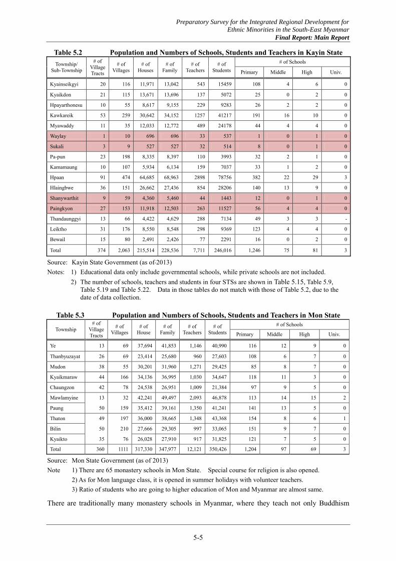
The Department of Basic Education, under the Ministry of Education, administers basic education in Myanmar from grade 1 through grade 11. Its organizational structure is shown in Figure 5.1. The Department of Basic Education No.1 is in charge of the southeastern part of Myanmar including Kayin and Mon States. It has a total of 7,711 teachers in Kayin State and 12,121 teachers in Mon State as of 2013. Numbers of students in Mon and Kayin States are 350,426 and 246,016, respectively as shown in Table 5.2 and Table 5.3.
Of the basic education, grade 1 through grade 5 constitutes primary education, grade 6 through grade 9 secondary, and grade 10 and grade 11 upper secondary. Duration of higher education varies for different subjects from three years for economics and computer science to seven years for dental, medicine, and health. Universities and colleges are also available after the basic education for four year courses usually or five years for law and first honor degrees. Master courses are available after the four year courses, followed by Doctorate courses.
CHAPTER 5 EXISTING CONDITIONS OF SOCIAL FACILITIES AND SERVICES IN SOUTHEAST MYANMAR
Preparatory Survey for the Integrated Regional Development for
Ethnic Minorities in the South-East Myanmar
Final Report: Main Report
5-2
National Education Committee
Ministry of Education
Basic Education CouncilBasic Education
Curriculum, Syllabus and Textbook Committee
Teacher Education Supervision
Department of Education Planning
and Training
Department of Basic Education No 1,2 and 3
Department of Myanmar Education Research Bureau
Myanmar Examination Board
Region and State Education Offices
20 Education Collages
District Education Offices(Established in near future)
Township Education Offices
Teachers
Region and State MinisterFor Social Affairs
Source: MOH WEB Site
(http://www.myanmar-education.edu.mm/education_structure.html)
Figure 5.1 Organization Chart for Basic Education Services
After grade 11, students take matriculation test to complete basic education. There are six subjects to take tests and each has 100 full score. Around 40% of the total score is a line to pass the test and generally 240 points are minimum score to pass. Courses that graduates can take in colleges or universities will be automatically decided by the score of the test. In Myanmar, casual labor or non-skill labor is only option for non-matriculated people to work.
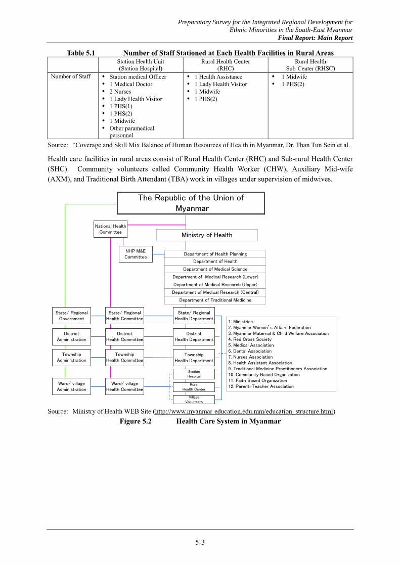
5.1.2 Health care
The health care system in Myanmar is illustrated in Figure 5.2. The Department of Health under the Ministry of Health has the following numbers of staff in Mon and Kayin States as of 2013 (Table 5.7). Mon State has 186 doctors, 347 nurses, 385 midwives and other health workers. Kayin State has 57 doctors, 429 nurses, 359 midwives and other health workers.
There are four types of hospitals in Myanmar: General Hospital with 200 beds, District Hospital with 50 beds, Township Hospital with 25 beds and Station Hospital with 16 beds. These hospitals are constructed at designated places with required roles. Staff members concerned with health care are categorized into seven classes: Doctor, Nurse, Health Assistant, Lady Health Visitor, Midwife, Public Health Supervisor (1) and Public Health Supervisor (2). Ordinary staff appointed at health facilities in rural areas is summarized in Table 5.1. It is not always that this appointed staffs are stationed there, but at least, those numbers of staff should be considered when staff dormitories are designed.
Preparatory Survey for the Integrated Regional Development for
Ethnic Minorities in the South-East Myanmar
Final Report: Main Report
5-3
Table 5.1 Number of Staff Stationed at Each Health Facilities in Rural Areas Station Health Unit
(Station Hospital) Rural Health Center
(RHC) Rural Health
Sub-Center (RHSC) Number of Staff Station medical Officer
1 Medical Doctor 2 Nurses 1 Lady Health Visitor 1 PHS(1) 1 PHS(2) 1 Midwife Other paramedical
personnel
1 Health Assistance 1 Lady Health Visitor 1 Midwife 1 PHS(2)
1 Midwife 1 PHS(2)
Source: “Coverage and Skill Mix Balance of Human Resources of Health in Myanmar, Dr. Than Tun Sein et al.
Health care facilities in rural areas consist of Rural Health Center (RHC) and Sub-rural Health Center (SHC). Community volunteers called Community Health Worker (CHW), Auxiliary Mid-wife (AXM), and Traditional Birth Attendant (TBA) work in villages under supervision of midwives.
National Health Committee
NHP M&ECommittee
State/ RegionalGovernment
DistrictAdministration
TownshipAdministration
Ward/ villageAdministration
State/ RegionalHealth Committee
DistrictHealth Committee
TownshipHealth Committee
Ward/ villageHealth Committee
State/ RegionalHealth Department
DistrictHealth Department
TownshipHealth Department
StationHospital
RuralHealth Center
VillageVolunteers
Department of Health Planning
Department of Health
Department of Medical Science
Department of Medical Research (Lower)
Department of Medical Research (Upper)
Department of Medical Research (Central)
Department of Traditional Medicine
Ministry of Health
The Republic of the Union of Myanmar
1. Ministries2. Myanmar Women’s Affairs Federation3. Myanmar Maternal & Child Welfare Association4. Red Cross Society5. Medical Association6. Dental Association7. Nurses Association8. Health Assistant Association9. Traditional Medicine Practitioners Association10. Community Based Organization11. Faith Based Organization12. Parent-Teacher Association
Source: Ministry of Health WEB Site (http://www.myanmar-education.edu.mm/education_structure.html)
Figure 5.2 Health Care System in Myanmar

Preparatory Survey for the Integrated Regional Development for
Ethnic Minorities in the South-East Myanmar
Final Report: Main Report
5-4
5.2 Education and Health Care situations in Southeast Myanmar
5.2.1 Education
(1) Organization and staffing
Organization of the education department of Kayin State is shown in Figure 5.3. The department is staffed with 21 officers, 65 other staff members and 771 teachers. Organization of the education department of Mon State is shown in Figure 5.4. The department staffed various officer and staff level personnel, but not assigned all the position yet.
Director
Assistant Director
(Planning/ Finances)
Deputy Director(Planning/Finance Budget)
Deputy Director(Education/Exam)
Deputy Director(Computer/Accountant)
Assistant Director(Staff)
Assistant Director
(Teaching/ Training)
Assistant Director(Exam)
Assistant Director
(Computer)
Assistant Director
(Planning/Finance)
22 staff 4 staff 6 staff 8 staff 17 staff 19 staff
Source: Kayin State educational department
Figure 5.3 Organization of Kayin State Education Department
Director
Assistant Director
(Planning/ Finances)
Deputy Director(Management/Finance) Deputy Director
(Education Inspector)
Deputy Director(Education Plans / Statistic
Computer)
Assistant Director/Inspector
Assistant Director
(Computer)
Assistant Director
(Planning/Finance)
Assistant Director/Inspector
Assistant Director/Inspector
Assistant Director/Inspector
Assistant Director/Education
Source: Interview of assistant director of Mon State educational department Figure 5.4 Organization of Mon State Education Department
(2) Teachers and students
Numbers of schools, teachers and students and other related data are summarized in Table 5.2 for Kayin State and Table 5.3 for Mon State.
Preparatory Survey for the Integrated Regional Development for
Ethnic Minorities in the South-East Myanmar
Final Report: Main Report
5-5
Table 5.2 Population and Numbers of Schools, Students and Teachers in Kayin State Township/
Sub-Township
# of Village Tracts
# of Villages
# of Houses
# of Family
# of Teachers
# of Students
# of Schools
Primary Middle High Univ.
Kyainseikgyi 20 116 11,971 13,042 543 15459 108 4 6 0
Kyaikdon 21 115 13,671 13,696 137 5072 25 0 2 0
Hpayarthonesu 10 55 8,617 9,155 229 9283 26 2 2 0
Kawkareik 53 259 30,642 34,152 1257 41217 191 16 10 0
Myawaddy 11 35 12,033 12,772 489 24178 44 4 4 0
Waylay 1 10 696 696 33 537 1 0 1 0
Sukali 3 9 527 527 32 514 8 0 1 0
Pa-pun 23 198 8,335 8,397 110 3993 32 2 1 0
Kamamaung 10 107 5,934 6,134 159 7037 33 1 2 0
Hpaan 91 474 64,685 68,963 2898 78756 382 22 29 3
Hlaingbwe 36 151 26,662 27,436 854 28206 140 13 9 0
Shanywarthit 9 59 4,360 5,460 44 1443 12 0 1 0
Paingkyon 27 153 11,918 12,503 263 11527 56 4 4 0
Thandaunggyi 13 66 4,422 4,629 288 7134 49 3 3 -
Leiktho 31 176 8,550 8,548 298 9369 123 4 4 0
Bewail 15 80 2,491 2,426 77 2291 16 0 2 0
Total 374 2,063 215,514 228,536 7,711 246,016 1,246 75 81 3
Source: Kayin State Government (as of 2013) Notes: 1) Educational data only include governmental schools, while private schools are not included. 2) The number of schools, teachers and students in four STSs are shown in Table 5.15, Table 5.9,
Table 5.19 and Table 5.22. Data in those tables do not match with those of Table 5.2, due to the date of data collection.
Table 5.3 Population and Numbers of Schools, Students and Teachers in Mon State
Township # of
Village Tracts
# of Villages
# of House
# of Family
# of Teachers
# of Students
# of Schools
Primary Middle High Univ.
Ye 13 69 37,694 41,853 1,146 40,990 116 12 9 0
Thanbyuzayat 26 69 23,414 25,680 960 27,603 108 6 7 0
Mudon 38 55 30,201 31,960 1,271 29,425 85 8 7 0
Kyaikmaraw 44 166 34,136 36,995 1,030 34,647 118 11 3 0
Chaungzon 42 78 24,538 26,951 1,009 21,384 97 9 5 0
Mawlamyine 13 32 42,241 49,497 2,093 46,878 113 14 15 2
Paung 50 159 35,412 39,161 1,350 41,241 141 13 5 0
Thaton 49 197 36,000 38,665 1,348 43,368 154 8 6 1
Bilin 50 210 27,666 29,305 997 33,065 151 9 7 0
Kyaikto 35 76 26,028 27,910 917 31,825 121 7 5 0
Total 360 1111 317,330 347,977 12,121 350,426 1,204 97 69 3
Source: Mon State Government (as of 2013) Note 1) There are 65 monastery schools in Mon State. Special course for religion is also opened. 2) As for Mon language class, it is opened in summer holidays with volunteer teachers. 3) Ratio of students who are going to higher education of Mon and Myanmar are almost same.
There are traditionally many monastery schools in Myanmar, where they teach not only Buddhism
Preparatory Survey for the Integrated Regional Development for
Ethnic Minorities in the South-East Myanmar
Final Report: Main Report
5-6
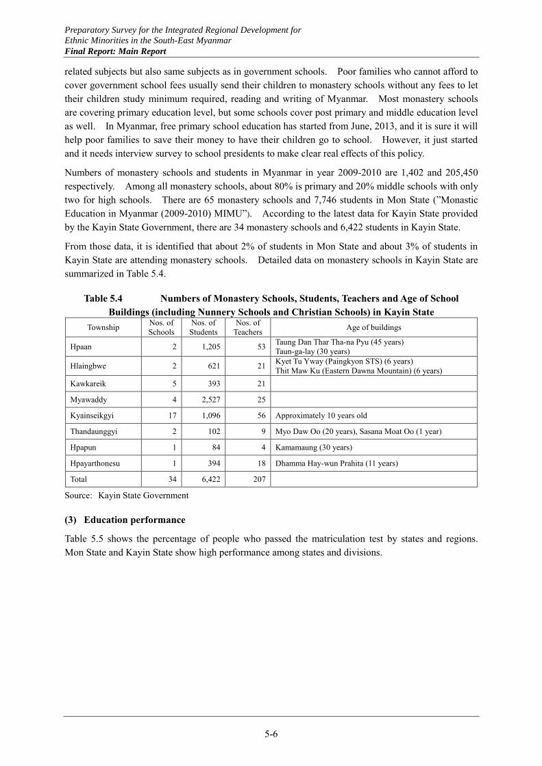
related subjects but also same subjects as in government schools. Poor families who cannot afford to cover government school fees usually send their children to monastery schools without any fees to let their children study minimum required, reading and writing of Myanmar. Most monastery schools are covering primary education level, but some schools cover post primary and middle education level as well. In Myanmar, free primary school education has started from June, 2013, and it is sure it will help poor families to save their money to have their children go to school. However, it just started and it needs interview survey to school presidents to make clear real effects of this policy.
Numbers of monastery schools and students in Myanmar in year 2009-2010 are 1,402 and 205,450 respectively. Among all monastery schools, about 80% is primary and 20% middle schools with only two for high schools. There are 65 monastery schools and 7,746 students in Mon State (”Monastic Education in Myanmar (2009-2010) MIMU”). According to the latest data for Kayin State provided by the Kayin State Government, there are 34 monastery schools and 6,422 students in Kayin State.
From those data, it is identified that about 2% of students in Mon State and about 3% of students in Kayin State are attending monastery schools. Detailed data on monastery schools in Kayin State are summarized in Table 5.4.
Table 5.4 Numbers of Monastery Schools, Students, Teachers and Age of School Buildings (including Nunnery Schools and Christian Schools) in Kayin State
Township Nos. of Schools
Nos. of Students
Nos. of Teachers Age of buildings
Hpaan 2 1,205 53 Taung Dan Thar Tha-na Pyu (45 years) Taun-ga-lay (30 years)
Hlaingbwe 2 621 21 Kyet Tu Yway (Paingkyon STS) (6 years) Thit Maw Ku (Eastern Dawna Mountain) (6 years)
Kawkareik 5 393 21
Myawaddy 4 2,527 25
Kyainseikgyi 17 1,096 56 Approximately 10 years old
Thandaunggyi 2 102 9 Myo Daw Oo (20 years), Sasana Moat Oo (1 year)
Hpapun 1 84 4 Kamamaung (30 years)
Hpayarthonesu 1 394 18 Dhamma Hay-wun Prahita (11 years)
Total 34 6,422 207
Source: Kayin State Government
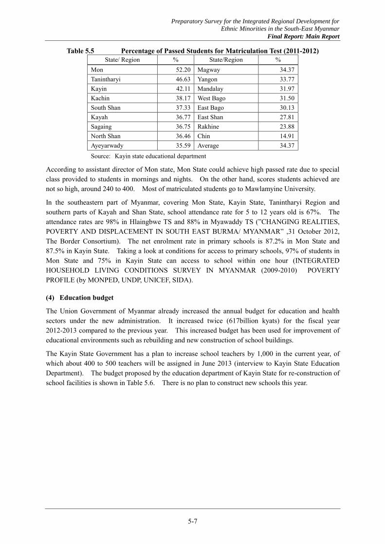
(3) Education performance
Table 5.5 shows the percentage of people who passed the matriculation test by states and regions. Mon State and Kayin State show high performance among states and divisions.
Preparatory Survey for the Integrated Regional Development for
Ethnic Minorities in the South-East Myanmar
Final Report: Main Report
5-7
Table 5.5 Percentage of Passed Students for Matriculation Test (2011-2012) State/ Region % State/Region %
Mon 52.20 Magway 34.37 Tanintharyi 46.63 Yangon 33.77 Kayin 42.11 Mandalay 31.97 Kachin 38.17 West Bago 31.50 South Shan 37.33 East Bago 30.13 Kayah 36.77 East Shan 27.81 Sagaing 36.75 Rakhine 23.88 North Shan 36.46 Chin 14.91 Ayeyarwady 35.59 Average 34.37 Source: Kayin state educational department
According to assistant director of Mon state, Mon State could achieve high passed rate due to special class provided to students in mornings and nights. On the other hand, scores students achieved are not so high, around 240 to 400. Most of matriculated students go to Mawlamyine University.
In the southeastern part of Myanmar, covering Mon State, Kayin State, Tanintharyi Region and southern parts of Kayah and Shan State, school attendance rate for 5 to 12 years old is 67%. The attendance rates are 98% in Hlaingbwe TS and 88% in Myawaddy TS (”CHANGING REALITIES, POVERTY AND DISPLACEMENT IN SOUTH EAST BURMA/ MYANMAR” ,31 October 2012, The Border Consortium). The net enrolment rate in primary schools is 87.2% in Mon State and 87.5% in Kayin State. Taking a look at conditions for access to primary schools, 97% of students in Mon State and 75% in Kayin State can access to school within one hour (INTEGRATED HOUSEHOLD LIVING CONDITIONS SURVEY IN MYANMAR (2009-2010) POVERTY PROFILE (by MONPED, UNDP, UNICEF, SIDA).
(4) Education budget
The Union Government of Myanmar already increased the annual budget for education and health sectors under the new administration. It increased twice (617billion kyats) for the fiscal year 2012-2013 compared to the previous year. This increased budget has been used for improvement of educational environments such as rebuilding and new construction of school buildings.
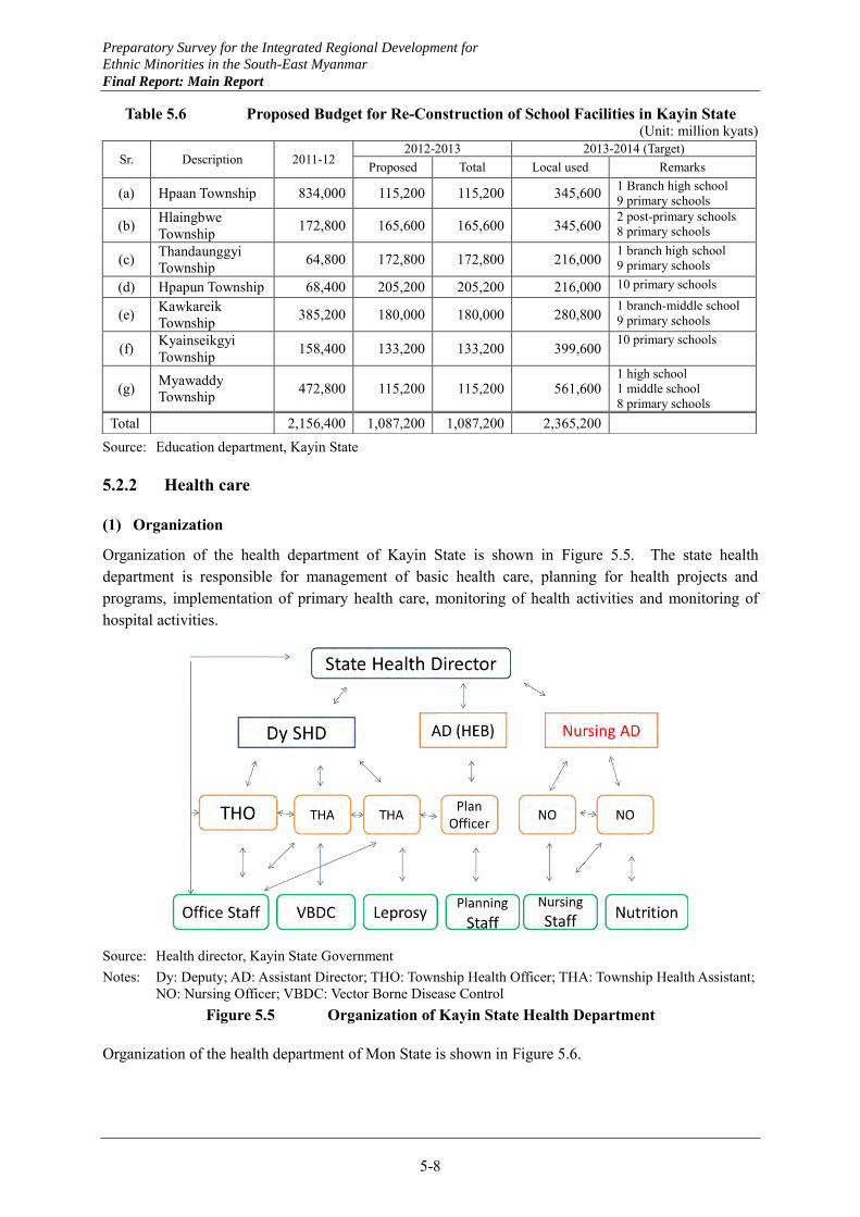
The Kayin State Government has a plan to increase school teachers by 1,000 in the current year, of which about 400 to 500 teachers will be assigned in June 2013 (interview to Kayin State Education Department). The budget proposed by the education department of Kayin State for re-construction of school facilities is shown in Table 5.6. There is no plan to construct new schools this year.
Preparatory Survey for the Integrated Regional Development for
Ethnic Minorities in the South-East Myanmar
Final Report: Main Report
5-8
Table 5.6 Proposed Budget for Re-Construction of School Facilities in Kayin State (Unit: million kyats)
Source: Education department, Kayin State
5.2.2 Health care
(1) Organization
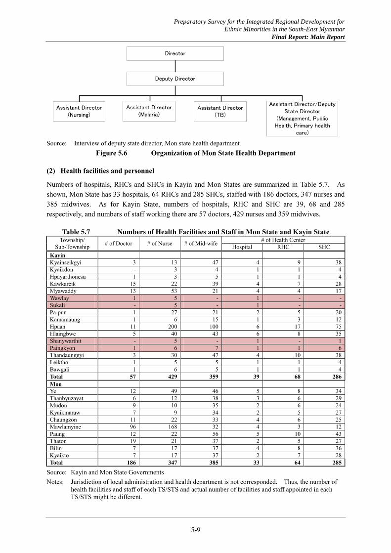
Organization of the health department of Kayin State is shown in Figure 5.5. The state health department is responsible for management of basic health care, planning for health projects and programs, implementation of primary health care, monitoring of health activities and monitoring of hospital activities.
Source: Health director, Kayin State Government Notes: Dy: Deputy; AD: Assistant Director; THO: Township Health Officer; THA: Township Health Assistant;
NO: Nursing Officer; VBDC: Vector Borne Disease Control Figure 5.5 Organization of Kayin State Health Department
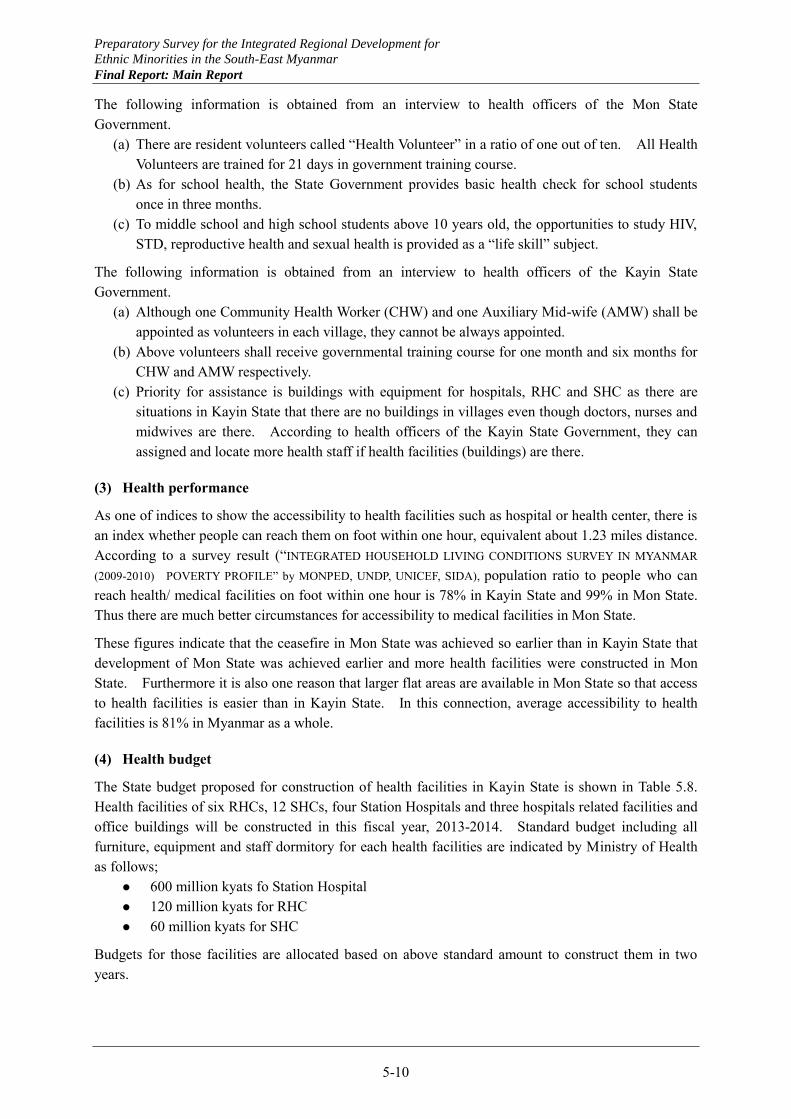
Organization of the health department of Mon State is shown in Figure 5.6.
Sr. Description 2011-12 2012-2013 2013-2014 (Target)
Proposed Total Local used Remarks
(a) Hpaan Township 834,000 115,200 115,200 345,600 1 Branch high school 9 primary schools
(b) Hlaingbwe Township 172,800 165,600 165,600 345,600
2 post-primary schools 8 primary schools
(c) Thandaunggyi Township 64,800 172,800 172,800 216,000 1 branch high school
9 primary schools
(d) Hpapun Township 68,400 205,200 205,200 216,000 10 primary schools
(e) Kawkareik Township 385,200 180,000 180,000 280,800
1 branch-middle school 9 primary schools
(f) Kyainseikgyi Township 158,400 133,200 133,200 399,600
10 primary schools
(g) Myawaddy Township 472,800 115,200 115,200 561,600
1 high school 1 middle school 8 primary schools
Total 2,156,400 1,087,200 1,087,200 2,365,200
Preparatory Survey for the Integrated Regional Development for
Ethnic Minorities in the South-East Myanmar
Final Report: Main Report
5-9
Director
Assistant Director(Nursing)
Assistant Director/Deputy State Director
(Management, Public Health, Primary health
care)
Assistant Director(Malaria)
Deputy Director
Assistant Director(TB)
Source: Interview of deputy state director, Mon state health department
Figure 5.6 Organization of Mon State Health Department
(2) Health facilities and personnel
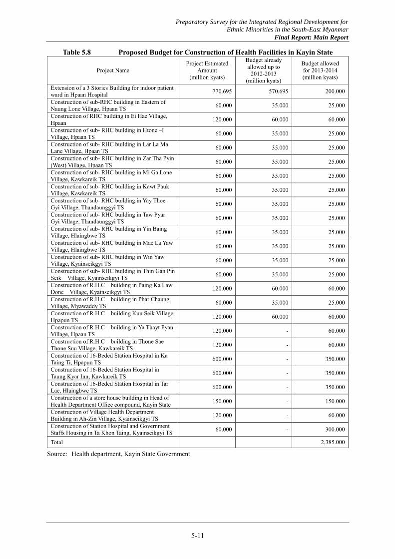
Numbers of hospitals, RHCs and SHCs in Kayin and Mon States are summarized in Table 5.7. As shown, Mon State has 33 hospitals, 64 RHCs and 285 SHCs, staffed with 186 doctors, 347 nurses and 385 midwives. As for Kayin State, numbers of hospitals, RHC and SHC are 39, 68 and 285 respectively, and numbers of staff working there are 57 doctors, 429 nurses and 359 midwives.
Table 5.7 Numbers of Health Facilities and Staff in Mon State and Kayin State Township/
Sub-Township # of Doctor # of Nurse # of Mid-wife # of Health Center Hospital RHC SHC
Kayin Kyainseikgyi 3 13 47 4 9 38 Kyaikdon - 3 4 1 1 4 Hpayarthonesu 1 3 5 1 1 4 Kawkareik 15 22 39 4 7 28 Myawaddy 13 53 21 4 4 17 Wawlay 1 5 - 1 - - Sukali - 5 - 1 - - Pa-pun 1 27 21 2 5 20 Kamamaung 1 6 15 1 3 12 Hpaan 11 200 100 6 17 75 Hlaingbwe 5 40 43 6 8 35 Shanywarthit - 5 - 1 - 1 Paingkyon 1 6 7 1 1 6 Thandaunggyi 3 30 47 4 10 38 Leiktho 1 5 5 1 1 4 Bawgali 1 6 5 1 1 4 Total 57 429 359 39 68 286 Mon Ye 12 49 46 5 8 34 Thanbyuzayat 6 12 38 3 6 29 Mudon 9 10 35 2 6 24 Kyaikmaraw 7 9 34 2 5 27 Chaungzon 11 22 33 4 6 25 Mawlamyine 96 168 32 4 3 12 Paung 12 22 56 5 10 43 Thaton 19 21 37 2 5 27 Bilin 7 17 37 4 8 36 Kyaikto 7 17 37 2 7 28 Total 186 347 385 33 64 285
Source: Kayin and Mon State Governments Notes: Jurisdiction of local administration and health department is not corresponded. Thus, the number of
health facilities and staff of each TS/STS and actual number of facilities and staff appointed in each TS/STS might be different.
Preparatory Survey for the Integrated Regional Development for
Ethnic Minorities in the South-East Myanmar
Final Report: Main Report
5-10
The following information is obtained from an interview to health officers of the Mon State Government.
(a) There are resident volunteers called “Health Volunteer” in a ratio of one out of ten. All Health Volunteers are trained for 21 days in government training course.
(b) As for school health, the State Government provides basic health check for school students once in three months.
(c) To middle school and high school students above 10 years old, the opportunities to study HIV, STD, reproductive health and sexual health is provided as a “life skill” subject.
The following information is obtained from an interview to health officers of the Kayin State Government.
(a) Although one Community Health Worker (CHW) and one Auxiliary Mid-wife (AMW) shall be appointed as volunteers in each village, they cannot be always appointed.
(b) Above volunteers shall receive governmental training course for one month and six months for CHW and AMW respectively.
(c) Priority for assistance is buildings with equipment for hospitals, RHC and SHC as there are situations in Kayin State that there are no buildings in villages even though doctors, nurses and midwives are there. According to health officers of the Kayin State Government, they can assigned and locate more health staff if health facilities (buildings) are there.
(3) Health performance
As one of indices to show the accessibility to health facilities such as hospital or health center, there is an index whether people can reach them on foot within one hour, equivalent about 1.23 miles distance. According to a survey result (“INTEGRATED HOUSEHOLD LIVING CONDITIONS SURVEY IN MYANMAR
(2009-2010) POVERTY PROFILE” by MONPED, UNDP, UNICEF, SIDA), population ratio to people who can reach health/ medical facilities on foot within one hour is 78% in Kayin State and 99% in Mon State. Thus there are much better circumstances for accessibility to medical facilities in Mon State.
These figures indicate that the ceasefire in Mon State was achieved so earlier than in Kayin State that development of Mon State was achieved earlier and more health facilities were constructed in Mon State. Furthermore it is also one reason that larger flat areas are available in Mon State so that access to health facilities is easier than in Kayin State. In this connection, average accessibility to health facilities is 81% in Myanmar as a whole.
(4) Health budget
The State budget proposed for construction of health facilities in Kayin State is shown in Table 5.8. Health facilities of six RHCs, 12 SHCs, four Station Hospitals and three hospitals related facilities and office buildings will be constructed in this fiscal year, 2013-2014. Standard budget including all furniture, equipment and staff dormitory for each health facilities are indicated by Ministry of Health as follows;
600 million kyats fo Station Hospital 120 million kyats for RHC 60 million kyats for SHC
Budgets for those facilities are allocated based on above standard amount to construct them in two years.
Preparatory Survey for the Integrated Regional Development for
Ethnic Minorities in the South-East Myanmar
Final Report: Main Report
5-11
Table 5.8 Proposed Budget for Construction of Health Facilities in Kayin State
Project Name Project Estimated
Amount (million kyats)
Budget already allowed up to
2012-2013 (million kyats)
Budget allowed for 2013-2014 (million kyats)
Extension of a 3 Stories Building for indoor patient ward in Hpaan Hospital 770.695 570.695 200.000
Construction of sub-RHC building in Eastern of Naung Lone Village, Hpaan TS 60.000 35.000 25.000
Construction of RHC building in Ei Hae Village, Hpaan 120.000 60.000 60.000
Construction of sub- RHC building in Htone –I Village, Hpaan TS 60.000 35.000 25.000
Construction of sub- RHC building in Lar La Ma Lane Village, Hpaan TS 60.000 35.000 25.000
Construction of sub- RHC building in Zar Tha Pyin (West) Village, Hpaan TS 60.000 35.000 25.000
Construction of sub- RHC building in Mi Ga Lone Village, Kawkareik TS 60.000 35.000 25.000
Construction of sub- RHC building in Kawt Pauk Village, Kawkareik TS 60.000 35.000 25.000
Construction of sub- RHC building in Yay Thoe Gyi Village, Thandaunggyi TS 60.000 35.000 25.000
Construction of sub- RHC building in Taw Pyar Gyi Village, Thandaunggyi TS 60.000 35.000 25.000
Construction of sub- RHC building in Yin Baing Village, Hlaingbwe TS 60.000 35.000 25.000
Construction of sub- RHC building in Mae La Yaw Village, Hlaingbwe TS 60.000 35.000 25.000
Construction of sub- RHC building in Win Yaw Village, Kyainseikgyi TS 60.000 35.000 25.000
Construction of sub- RHC building in Thin Gan Pin Seik Village, Kyainseikgyi TS 60.000 35.000 25.000
Construction of R.H.C building in Paing Ka Law Done Village, Kyainseikgyi TS 120.000 60.000 60.000
Construction of R.H.C building in Phar Chaung Village, Myawaddy TS 60.000 35.000 25.000
Construction of R.H.C building Kuu Seik Village, Hpapun TS 120.000 60.000 60.000
Construction of R.H.C building in Ya Thayt Pyan Village, Hpaan TS 120.000 - 60.000
Construction of R.H.C building in Thone Sae Thone Suu Village, Kawkareik TS 120.000 - 60.000
Construction of 16-Beded Station Hospital in Ka Taing Ti, Hpapun TS 600.000 - 350.000
Construction of 16-Beded Station Hospital in Taung Kyar Inn, Kawkareik TS 600.000 - 350.000
Construction of 16-Beded Station Hospital in Tar Lae, Hlaingbwe TS 600.000 - 350.000
Construction of a store house building in Head of Health Department Office compound, Kayin State 150.000 - 150.000
Construction of Village Health Department Building in Ah-Zin Village, Kyainseikgyi TS 120.000 - 60.000
Construction of Station Hospital and Government Staffs Housing in Ta Khon Taing, Kyainseikgyi TS 60.000 - 300.000
Total 2,385.000
Source: Health department, Kayin State Government
Preparatory Survey for the Integrated Regional Development for
Ethnic Minorities in the South-East Myanmar
Final Report: Main Report
5-12
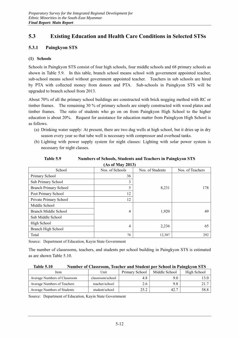
5.3 Existing Education and Health Care Conditions in Selected STSs
5.3.1 Paingkyon STS
(1) Schools
Schools in Paingkyon STS consist of four high schools, four middle schools and 68 primary schools as shown in Table 5.9. In this table, branch school means school with government appointed teacher, sub-school means school without government appointed teacher. Teachers in sub schools are hired by PTA with collected money from donors and PTA. Sub-schools in Paingkyon STS will be upgraded to branch school from 2013.
About 70% of all the primary school buildings are constructed with brick nogging method with RC or timber frames. The remaining 30 % of primary schools are simply constructed with wood plates and timber frames. The ratio of students who go on on from Paingkyon High School to the higher education is about 20%. Request for assistance for education matter from Paingkyon High School is as follows.
(a) Drinking water supply: At present, there are two dug wells at high school, but it dries up in dry season every year so that tube well is necessary with compressor and overhead tanks.
(b) Lighting with power supply system for night classes: Lighting with solar power system is necessary for night classes.
Table 5.9 Numbers of Schools, Students and Teachers in Paingkyon STS (As of May 2013)
School Nos. of Schools Nos. of Students Nos. of Teachers Primary School 36
8,231 178 Sub Primary School 3 Branch Primary School 5 Post Primary School 12 Private Primary School 12 Middle School
4 1,920 49 Branch Middle School Sub Middle School High School
4 2,236 65 Branch High School Total 76 12,387 292
Source: Department of Education, Kayin State Government
The number of classrooms, teachers, and students per school building in Paingkyon STS is estimated as are shown Table 5.10.
Table 5.10 Number of Classroom, Teacher and Student per School in Paingkyon STS Item Unit Primary School Middle School High School
Average Numbers of Classroom classroom/school 4.8 9.0 13.0 Average Numbers of Teachers teacher/school 2.6 9.8 21.7 Average Numbers of Students student/school 25.2 42.7 58.8
Source: Department of Education, Kayin State Government
Preparatory Survey for the Integrated Regional Development for
Ethnic Minorities in the South-East Myanmar
Final Report: Main Report
5-13
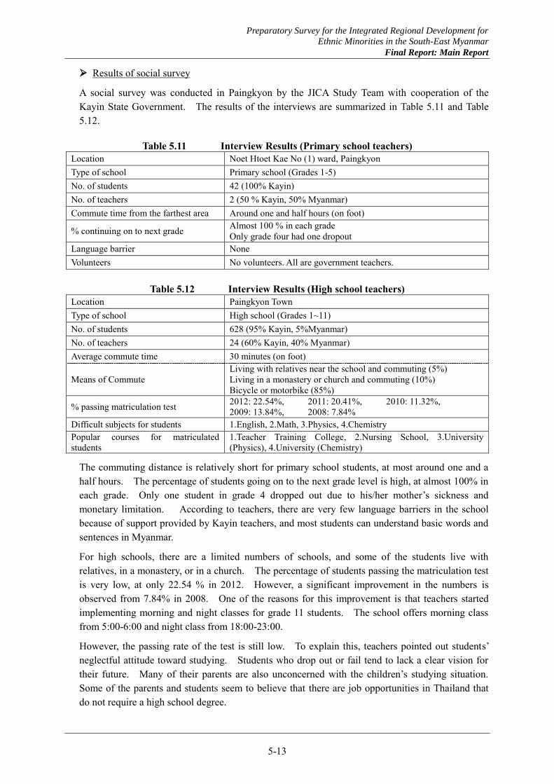
Results of social survey
A social survey was conducted in Paingkyon by the JICA Study Team with cooperation of the Kayin State Government. The results of the interviews are summarized in Table 5.11 and Table 5.12.
Table 5.11 Interview Results (Primary school teachers) Location Noet Htoet Kae No (1) ward, Paingkyon Type of school Primary school (Grades 1-5) No. of students 42 (100% Kayin) No. of teachers 2 (50 % Kayin, 50% Myanmar) Commute time from the farthest area Around one and half hours (on foot)
% continuing on to next grade Almost 100 % in each grade Only grade four had one dropout
Language barrier None Volunteers No volunteers. All are government teachers.
Table 5.12 Interview Results (High school teachers) Location Paingkyon Town Type of school High school (Grades 1~11) No. of students 628 (95% Kayin, 5%Myanmar) No. of teachers 24 (60% Kayin, 40% Myanmar) Average commute time 30 minutes (on foot)
Means of Commute Living with relatives near the school and commuting (5%) Living in a monastery or church and commuting (10%) Bicycle or motorbike (85%)
% passing matriculation test 2012: 22.54%, 2011: 20.41%, 2010: 11.32%, 2009: 13.84%, 2008: 7.84%
Difficult subjects for students 1.English, 2.Math, 3.Physics, 4.Chemistry Popular courses for matriculated students
1.Teacher Training College, 2.Nursing School, 3.University (Physics), 4.University (Chemistry)
The commuting distance is relatively short for primary school students, at most around one and a half hours. The percentage of students going on to the next grade level is high, at almost 100% in each grade. Only one student in grade 4 dropped out due to his/her mother’s sickness and monetary limitation. According to teachers, there are very few language barriers in the school because of support provided by Kayin teachers, and most students can understand basic words and sentences in Myanmar.
For high schools, there are a limited numbers of schools, and some of the students live with relatives, in a monastery, or in a church. The percentage of students passing the matriculation test is very low, at only 22.54 % in 2012. However, a significant improvement in the numbers is observed from 7.84% in 2008. One of the reasons for this improvement is that teachers started implementing morning and night classes for grade 11 students. The school offers morning class from 5:00-6:00 and night class from 18:00-23:00.
However, the passing rate of the test is still low. To explain this, teachers pointed out students’ neglectful attitude toward studying. Students who drop out or fail tend to lack a clear vision for their future. Many of their parents are also unconcerned with the children’s studying situation. Some of the parents and students seem to believe that there are job opportunities in Thailand that do not require a high school degree.
Preparatory Survey for the Integrated Regional Development for
Ethnic Minorities in the South-East Myanmar
Final Report: Main Report
5-14
Students are seen to perform the poorest in English. Although the interview results indicate that language barriers are not seen as a problem in primary school, some of the high school students can hardly understand classes taught in Myanmar. It can be expected that, especially in English classes, such students attempt to understand what the teachers say first in English, and then translate into Myanmar and Kayin languages. Thus, it is only natural that those students would tend to feel that English is their weakest subject. It can be said that middle and high school learning contents use more esoteric and advanced words in the classes than that of primary school, creating a language barrier.
As for popular courses amongst matriculated students, the teachers training college is by far the most in demand. It shows that a popular career path for the students is to become a teacher. Nursing school, physics and chemistry courses in universities are also popular, but those require high marks in matriculation tests and are thus very difficult to enroll into.
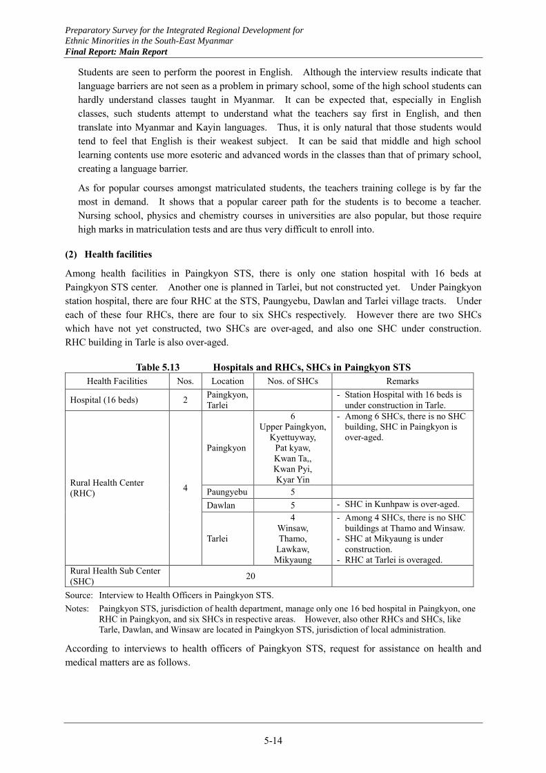
(2) Health facilities
Among health facilities in Paingkyon STS, there is only one station hospital with 16 beds at Paingkyon STS center. Another one is planned in Tarlei, but not constructed yet. Under Paingkyon station hospital, there are four RHC at the STS, Paungyebu, Dawlan and Tarlei village tracts. Under each of these four RHCs, there are four to six SHCs respectively. However there are two SHCs which have not yet constructed, two SHCs are over-aged, and also one SHC under construction. RHC building in Tarle is also over-aged.
Table 5.13 Hospitals and RHCs, SHCs in Paingkyon STS Health Facilities Nos. Location Nos. of SHCs Remarks
Hospital (16 beds) 2 Paingkyon, Tarlei - Station Hospital with 16 beds is
under construction in Tarle.
Rural Health Center (RHC) 4
Paingkyon
6 Upper Paingkyon,
Kyettuyway, Pat kyaw, Kwan Ta,, Kwan Pyi, Kyar Yin
- Among 6 SHCs, there is no SHC building, SHC in Paingkyon is over-aged.
Paungyebu 5
Dawlan 5 - SHC in Kunhpaw is over-aged.
Tarlei
4 Winsaw, Thamo,
Lawkaw, Mikyaung
- Among 4 SHCs, there is no SHC buildings at Thamo and Winsaw.
- SHC at Mikyaung is under construction.
- RHC at Tarlei is overaged. Rural Health Sub Center (SHC) 20
Source: Interview to Health Officers in Paingkyon STS. Notes: Paingkyon STS, jurisdiction of health department, manage only one 16 bed hospital in Paingkyon, one
RHC in Paingkyon, and six SHCs in respective areas. However, also other RHCs and SHCs, like Tarle, Dawlan, and Winsaw are located in Paingkyon STS, jurisdiction of local administration.
According to interviews to health officers of Paingkyon STS, request for assistance on health and medical matters are as follows.

Preparatory Survey for the Integrated Regional Development for
Ethnic Minorities in the South-East Myanmar
Final Report: Main Report
5-15
(a) Roads and bridges construction: To receive necessary health/ medical service equally for villagers when they need, all season type access roads which can be used even in rainy season is necessary in the STS.
(b) RHC and SHC buildings: SHC buildings at Thamo and Winsaw Village Tracts are necessary. RHCs at Paingkyon and Tarle are over-aged so that reconstruction of new buildings is necessary.
(c) Medical and health equipment in Paingkyon station hospital: Operation room at Paingkyon station hospital has no operation equipment so that operation cannot be carried out. Therefore improvement and introduction of medical equipment are necessary. For the delivery room, equipment is necessary as well.
(d) Results of interview survey: The JICA Study Team visited Upper Paingkyon SHC and interviewed mid-wives in the Upper Paingkyon and Kyaiktuywae SHC together with the health assistant in Paingkyon RHC. Results are summarized in Table 5.14.
Table 5.14 Social Survey Results (SHC facilities and health staffs) Location Upper Paingkyon Kyettuyway
Interviewees U Thet Naing Soe Health Assitant, Hla Hla Moe Mid-wife, Nan Nyo Myint Mid-wife No. of villages in the jurisdiction
11 villages 14 villages
Commuting time and number of outreach from SHC to each village
One and a half hours by motorbike: 5 villages Outreach: Once/ month
45 min by motorbike: 9 villages Outreach: Once / month
Two hours and 45 minutes by Htaw La Ji (kind of cultivator): 6 villages Outreach: Three times / year
One and a half hours by motorbike: 5 villages Outreach: Three times / year
Main diseases PRI, Diarrhea, Dysentery, Hypertension PRI, Diarrhea, Malaria Volunteers CHW : 5 ppl, 5 villages
AXM : 5 ppl, 5 villages TBA : 13ppl, 11 villages
CHW : 3 ppl, 14 villages AXM : 2 ppl, 14 villages TBA : 1 ppl/ village
The building of Upper Paingkyon SHC was constructed through donations from villagers, and doesn’t meet governmental standards. A delivery room is existed but unsanitary and not be used. The delivery bed is used as a closet. Thus, deliveries are conducted in each respective pregnant mother’s home.
Each SHC has more than 10 villages to manage, and only a limited number of villagers can access their nearest SHC due to remote locations. Thus, many villagers wait for outreach by mid-wife. Upper Paingkyon SHC manages five villages accessible by motorbike in one and a half hours, and Htawlaji manages six villages accessible in two hours and forty-five minutes. The former can be outreached once per month, but the latter can only be visited three times per year due to severe road conditions, especially during the rainy season. The Mid-wife in Upper Paingkyon SHC is scheduled to outreach six distant villages starting from 24th May, and they said they will have to commute to those villages on foot because some of the rains have started already.
Kyettuyway SHC also manages 14 villages. Nine villages can be accessed once per month, and five villages can be accessed three times per year.
Villages under Upper Paingkyon SHC and Kyettuyway SHC have community health volunteers, CHW, AXM and TBA, and they help their respective mid-wives. As shown in Table 5.14, some villages don’t have any CHW and AXM and are inaccessible for mid-wives. In case of delivery, these villages face difficulties. In case of Upper Paingkyon SHC, AXMs are in each village and they can help with deliveries. Some of them are very busy and don’t work as team with the mid-wife, and the

Preparatory Survey for the Integrated Regional Development for
Ethnic Minorities in the South-East Myanmar
Final Report: Main Report
5-16
number showed in the Table 5.14 does not include those AXM. At least TBAs are in each village, and they are helping with deliveries. Recently, some of pregnant mothers have chosen to go directly to the Paingkyon station hospital for their delivery. It is expected that this is only possible for people who can afford it financially. On the other hand, still some pregnant deliver without any specialized helper.
5.3.2 Shanywarthit STS
(1) Schools
Schools in Shanywarthit STS consist of one high school, no middle schools and twelve primary schools excluding one kindergarten and 15 private primary schools as shown in Table 5.15. The high school is just under construction. Numbers of total students is almost one tenth of 12,360 students in Paingkyon STS. However total numbers of teachers is only 49 for 14 schools and it is smaller numbers compared to 292 teachers for 69 schools in Paingkyon STS.
The number of schools in Shanywarthit STS is about one fourth of those in Paingkyon STS. Shanywarthit is bordering on Thailand, separated by the Dona mountain range. Most schools are located in flat plain areas, with only one primary school located in the mountainous area in the Noday village. The number of students there is only 10. About 85% of total primary school buildings are constructed with timber frame and wood plates. Other 2 schools are constructed by brick nogging with RC or timber frame. High school is under construction at moment by brick noggin with timber frame.
Table 5.15 Numbers of Schools, Students and Teachers in Shanywarthit STS (as of May 2013)
School Nos. of Schools
Nos. of Students Nos. of Teachers
Kindergarten 1 - - Primary School 5
1,403 33 Sub Primary School 2 Branch Primary School 3 Post Primary School 2 Private Primary School 15 - - High School 1 108 16 Source: Kayin State Education Department and NGO for private primary schools.
Request for assistance on education is as follows: (a) Furniture in classrooms: Desks and chairs for students and teachers are in sufficient. Notes and
pencils are also in short. (b) School uniform: Villagers are not afforded to purchase school uniforms. (c) Dug wells: Wells for drinking water for students is necessary. Stream water is used as drinking
water without any treatments at moment.
The number of classroom, teacher and student per school in in Shanywarthit STS are summarized in Table 5.16.
Preparatory Survey for the Integrated Regional Development for
Ethnic Minorities in the South-East Myanmar
Final Report: Main Report
5-17
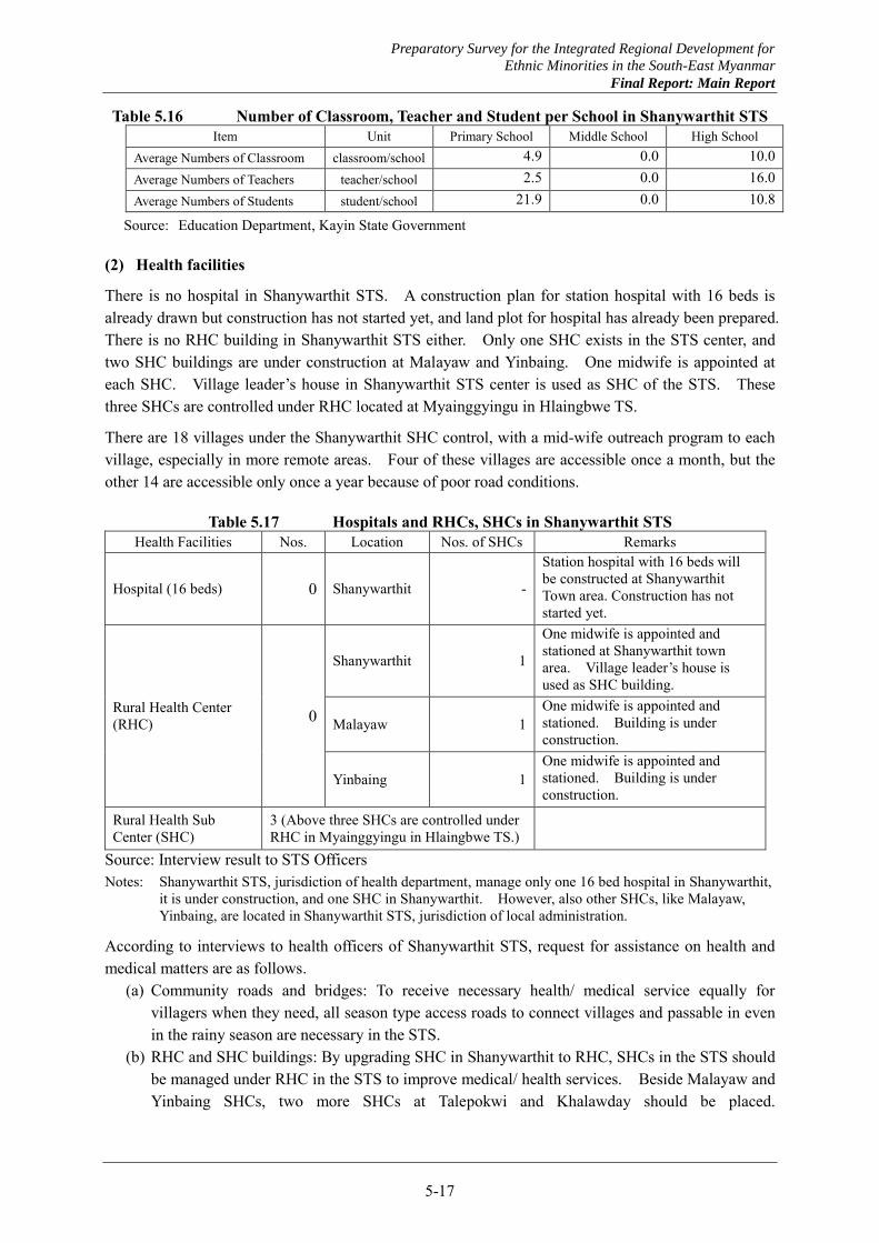
Table 5.16 Number of Classroom, Teacher and Student per School in Shanywarthit STS Item Unit Primary School Middle School High School
Average Numbers of Classroom classroom/school 4.9 0.0 10.0 Average Numbers of Teachers teacher/school 2.5 0.0 16.0 Average Numbers of Students student/school 21.9 0.0 10.8
Source: Education Department, Kayin State Government
(2) Health facilities
There is no hospital in Shanywarthit STS. A construction plan for station hospital with 16 beds is already drawn but construction has not started yet, and land plot for hospital has already been prepared. There is no RHC building in Shanywarthit STS either. Only one SHC exists in the STS center, and two SHC buildings are under construction at Malayaw and Yinbaing. One midwife is appointed at each SHC. Village leader’s house in Shanywarthit STS center is used as SHC of the STS. These three SHCs are controlled under RHC located at Myainggyingu in Hlaingbwe TS.
There are 18 villages under the Shanywarthit SHC control, with a mid-wife outreach program to each village, especially in more remote areas. Four of these villages are accessible once a month, but the other 14 are accessible only once a year because of poor road conditions.
Table 5.17 Hospitals and RHCs, SHCs in Shanywarthit STS Health Facilities Nos. Location Nos. of SHCs Remarks
Hospital (16 beds) 0 Shanywarthit -
Station hospital with 16 beds will be constructed at Shanywarthit Town area. Construction has not started yet.
Rural Health Center (RHC) 0
Shanywarthit 1
One midwife is appointed and stationed at Shanywarthit town area. Village leader’s house is used as SHC building.
Malayaw 1 One midwife is appointed and stationed. Building is under construction.
Yinbaing 1 One midwife is appointed and stationed. Building is under construction.
Rural Health Sub Center (SHC)
3 (Above three SHCs are controlled under RHC in Myainggyingu in Hlaingbwe TS.)
Source: Interview result to STS Officers Notes: Shanywarthit STS, jurisdiction of health department, manage only one 16 bed hospital in Shanywarthit,
it is under construction, and one SHC in Shanywarthit. However, also other SHCs, like Malayaw, Yinbaing, are located in Shanywarthit STS, jurisdiction of local administration.
According to interviews to health officers of Shanywarthit STS, request for assistance on health and medical matters are as follows.
(a) Community roads and bridges: To receive necessary health/ medical service equally for villagers when they need, all season type access roads to connect villages and passable in even in the rainy season are necessary in the STS.
(b) RHC and SHC buildings: By upgrading SHC in Shanywarthit to RHC, SHCs in the STS should be managed under RHC in the STS to improve medical/ health services. Beside Malayaw and Yinbaing SHCs, two more SHCs at Talepokwi and Khalawday should be placed.
Preparatory Survey for the Integrated Regional Development for
Ethnic Minorities in the South-East Myanmar
Final Report: Main Report
5-18
Construction of three buildings of RHC in Shanywarthit, SHC at Talepokwi and Khalawday is necessary with supply of necessary medical equipment.
(c) Water supply: Well construction, either tube well or dug well, is necessary to ensure access to safe drinking water. The water will be used for drinking water and medical treatment for RHCs and SHCs.
5.3.3 Wawlay STS
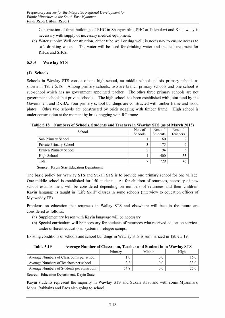
(1) Schools
Schools in Wawlay STS consist of one high school, no middle school and six primary schools as shown in Table 5.18. Among primary schools, two are branch primary schools and one school is sub-school which has no government appointed teacher. The other three primary schools are not government schools but private schools. The high school has been established with joint fund by the Government and DKBA. Four primary school buildings are constructed with timber frame and wood plates. Other two schools are constructed by brick nogging with timber frame. High school is under construction at the moment by brick nogging with RC frame.
Table 5.18 Numbers of Schools, Students and Teachers in Wawlay STS (as of March 2013) School Nos. of
Schools Nos. of
Students Nos. of
Teachers Sub Primary School 1 60 2 Private Primary School 3 175 6 Branch Primary School 2 94 5 High School 1 400 33 Total 7 729 46
Source: Kayin Stae Education Department
The basic policy for Wawlay STS and Sukali STS is to provide one primary school for one village. One middle school is established for 150 students. As for children of returnees, necessity of new school establishment will be considered depending on numbers of returnees and their children. Kayin language is taught in “Life Skill” classes in some schools (interview to education officer of Myawaddy TS).
Problems on education that returnees in Wallay STS and elsewhere will face in the future are considered as follows.
(a) Supplementary lesson with Kayin language will be necessary. (b) Special curriculum will be necessary for students of returnees who received education services
under different educational system in refugee camps.
Existing conditions of schools and school buildings in Wawlay STS is summarized in Table 5.19.
Table 5.19 Average Number of Classroom, Teacher and Student in in Wawlay STS Primary Middle High
Average Numbers of Classrooms per school 1.0 0.0 16.0 Average Numbers of Teachers per school 2.2 0.0 33.0 Average Numbers of Students per classroom 54.8 0.0 25.0
Source: Education Department, Kayin State
Kayin students represent the majority in Wawlay STS and Sukali STS, and with some Myanmars, Mons, Rakhains and Paos also going to school.
Preparatory Survey for the Integrated Regional Development for
Ethnic Minorities in the South-East Myanmar
Final Report: Main Report
5-19
Matriculation tests for migrant students
The first challenge was to provide migrant students the opportunity to take matriculation tests, and 56 students took the tests in Myawaddy town in 2013.
In order to realize this challenge, the Chief Minister of Kayin State, Camp Head of Education, and Township government discussed and 100,000~300,000 kyats scholarship are provided to the students. It is depicted in the results for the student interviews.
i) Place of origin The students are not only from Kayin State, but also from Mon State and Bago division.
In Kayin state, they mainly lived in Hpaan and Kawkareik TSs, in Mon State, they mainly lived in Thaton TS and Bilin TS. They live in Maesot now.
ii) Popular courses after matriculated Engineering courses such as civil engineering, electrical engineering and computer and
information engineering are popular amongst both males and females. Other options include economics, nursing, medicine, politics, teachers training colleges, and so on. Schools for migrant students offer some engineering classes, and students are familiar with these courses.
Very few students told us their ideal university to enroll in, but some of the students told us that Government Institute of Technology in Yangon and the Rajabhat Maesot University are their top choices.
Even if most of their parents are working as farmers, almost all students do not want to work as a farmer themselves.
The students speak in English fluently and can communicate in English without any difficulties. It suggests that a high quality of educations is offered in Thailand.
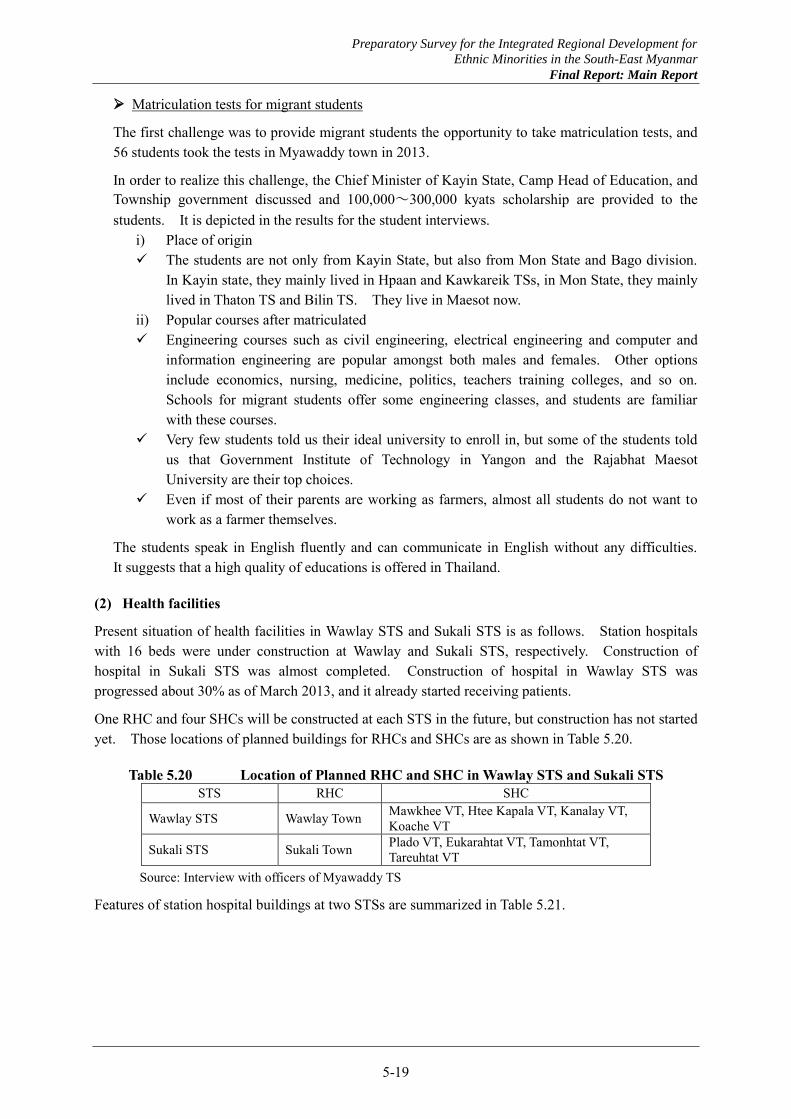
(2) Health facilities
Present situation of health facilities in Wawlay STS and Sukali STS is as follows. Station hospitals with 16 beds were under construction at Wawlay and Sukali STS, respectively. Construction of hospital in Sukali STS was almost completed. Construction of hospital in Wawlay STS was progressed about 30% as of March 2013, and it already started receiving patients.
One RHC and four SHCs will be constructed at each STS in the future, but construction has not started yet. Those locations of planned buildings for RHCs and SHCs are as shown in Table 5.20.
Table 5.20 Location of Planned RHC and SHC in Wawlay STS and Sukali STS STS RHC SHC
Wawlay STS Wawlay Town Mawkhee VT, Htee Kapala VT, Kanalay VT, Koache VT
Sukali STS Sukali Town Plado VT, Eukarahtat VT, Tamonhtat VT, Tareuhtat VT
Source: Interview with officers of Myawaddy TS
Features of station hospital buildings at two STSs are summarized in Table 5.21.

Preparatory Survey for the Integrated Regional Development for
Ethnic Minorities in the South-East Myanmar
Final Report: Main Report
5-20
Table 5.21 Features of Hospital Buildings in Wawlay STS and Sukali STS Items Wawlay Station Hospital Sukali Station Hospital
Nos. of Buildings 1 1 Buildings' age (Year of Constructed) 2013 2011 Building Size 120' x 80' 120' x 80' Nos. of Rooms 20 15 Room Size 22' x41' 22' x 41'
Type of Structure of the building RC frame with brick nogging
RC frame with brick nogging
Nos. of Stories 1 1 Nos. of Toilet Rooms 3 for men, 3 for women 3 for men, 3 for women Type of Toilet closed closed Availability of Water Tube-well Tube-well Pump-up Method hand-pump hand-pump Treatment as drinking water Portable with boiling Potable with boiling Availability of Electricity Own Generator - Source: Interview with officers of Myawaddy TS
5.3.4 Sukali
(1) Schools
Schools in Sukali STS consist of one high school, no middle schools and eight primary schools as shown in Table 5.22. The total numbers of student are 418, much smaller than 729 students in Wawlay STS. The total number of teachers, 47, is almost the same as 46 teachers in Wawlay STS. Five primary school buildings are constructed with timber frame and wood plates. Other 3 schools are constructed by brick nogging with RC or timber frame. High school is under construction at moment by brick noggin with RC frame.
Table 5.22 Numbers of Schools, Students and Teachers in Sukali STS (as of March 2013) School Nos. of
Schools Nos. of
Students Nos. of
Teachers Primary School 3 159 12 Branch Primary School 4 153 8 Sub Primary School 1 74 4 High School 1 32 23 Total 9 418 47
Source: Department of Education, Kayin State
The basic policy for preparation of school buildings is the same in Sukali STS as in Wawlay STS. Problems facing in education for returnees in the future are also the same as in Wawlay STS.
Average number of classroom, teacher, and student per school is estimated for Sukali STS as shown in Table 5.23.
Preparatory Survey for the Integrated Regional Development for
Ethnic Minorities in the South-East Myanmar
Final Report: Main Report
5-21
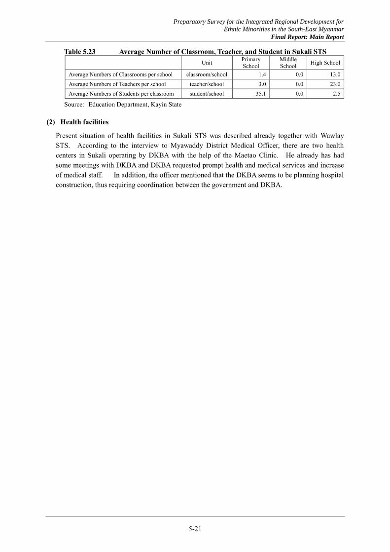
Table 5.23 Average Number of Classroom, Teacher, and Student in Sukali STS Unit Primary
School Middle School High School
Average Numbers of Classrooms per school classroom/school 1.4 0.0 13.0 Average Numbers of Teachers per school teacher/school 3.0 0.0 23.0 Average Numbers of Students per classroom student/school 35.1 0.0 2.5
Source: Education Department, Kayin State
(2) Health facilities
Present situation of health facilities in Sukali STS was described already together with Wawlay STS. According to the interview to Myawaddy District Medical Officer, there are two health centers in Sukali operating by DKBA with the help of the Maetao Clinic. He already has had some meetings with DKBA and DKBA requested prompt health and medical services and increase of medical staff. In addition, the officer mentioned that the DKBA seems to be planning hospital construction, thus requiring coordination between the government and DKBA.
Preparatory Survey for the Integrated Regional Development for
Ethnic Minorities in the South-East Myanmar
Final Report: Main Report
5-22
5.4 Education and Health Care Services Provided to IDPs, Refugees and Migrants
IDPs who escaped into mountain forests from armed conflicts, villagers living in areas under the control by peace groups, and refugees and migrants in Thailand are provided educational and health care services by peace groups or NGOs. Their system of such services is different from that of the Government.
5.4.1 Health care
The primary organizations providing health care services are located in Maesot, Thailand. The survey focused on the Kawthoolei Department of Health and Welfare (KDHW)、Back Pack Health Workers Team (BPHWT) and Mae Tao Clinic. Their activities are as shown below.
(1) Basic information and activities of KDHW
KDHW is a department under KNU, and working to “provide health for all through community-based primary health care.”
(2) Activities
Main activities are Karen Mobile Health Clinic (KMHC) Program, along with 13 other healthcare programs.
(3) Future plan of KDHW
KDHW is working towards promoting primary health care as their first priority, and now, in the process of peace talks, planning to broaden their activities to secondary health care including preventive and curative services paralleled with existed services.
(4) Preventive care
(a) Village Health Worker (Malaria, diarrhea, Acute Respiratory Tract Infection) (b) Village Tract Health Center: primary health care, OPD (common diseases), ER beds -refer
patients to sub-township hospital (c) Township Health Center
(5) Curative care
(a) Sub-township hospital (curative care) –16 beds (population 15,000) (b) Township hospital –25 beds (population 30,000) (c) Training hospital –50 beds (population 75,000)
This is just a tentative plan, and has yet to be budgeted for.
(6) BPHWT
BPHWT works from 1998 up to now around the border area and many places in Myanmar. Their services are community based, with more than 206,000 people as their target group. They train community members to become medical staff, and organize a back pack team with three health workers and seven TBAs. Currently, they manage 95 back pack teams.
Their main services are divided between the three programs shown below.
Preparatory Survey for the Integrated Regional Development for
Ethnic Minorities in the South-East Myanmar
Final Report: Main Report
5-23
1) Medical Care Program (MCP)
MCP objectives are as follows. Provide essential drugs for common diseases Strengthen patient referral systems Respond to disease outbreaks and emergency situations Improve health workers’ skills and knowledge
2) Community Health Education and Prevention Program (CHEPP)
CHEPP Objectives are as follows. Improve water and sanitation systems in the community to reduce the spread of
water-borne diseases Educate students and communities about health Reduce incidences of malnutrition and worm infestation Improve networking among community health organizations
3) Maternal and Child Healthcare Program (MCHP)
MCHP objectives are as follows. Increase maternal and child healthcare Improve the knowledge and skills of TBAs and MCHP supervisors Encourage positive community attitudes towards, and utilization of, family planning
methods Provide records of deliveries
In addition, they offer medical staff training.
(7) Maetao clinic
The Maetao clinic is located in Maesot and offers free medical services to refugees, migrant workers, and other individuals who make the journey across the border from Myanmar to Thailand. Dr. Cynthia, founder and director of Maetao clinic, is famous for her marvelous activities. The clinic is receiving supports from all over the world.
The Maetao clinic cooperates with KDHW and BPHWT to offer a higher standard of health care services. Some people prefer to take consultation at this clinic despite the long travels necessary to get there.
The Maetao clinic also takes on the important role of providing training for health workers.
5.4.2 Education
Karen Education Department, Community School Program by the Maetao clinic and other NGOs are working to provide educational services in areas near the border and under peace group control.
(1) Karen Education Department (KED)
KED is a department under KNU, established to provide educational services. Their main activities are curriculum development, providing textbooks to students, and teacher training.

Preparatory Survey for the Integrated Regional Development for
Ethnic Minorities in the South-East Myanmar
Final Report: Main Report
5-24
(2) Other NGOs
1) Burmese Migrant Workers Education Committee (BMWEC)
BMWEC is one of the leading NGOs organizing and providing educational support for migrant students in Maesot. Daw Naw Paw Ray, Chair Person of BMWEC, has discussed migrant students’ educational matters with leaders from Myanmar and Thailand.
Their main activities include constructing schools, maintaining security, providing textbooks, educational materials, salaries for teachers, and teachers’ trainings. They manage fifteen primary schools in Kayin State, Myanmar, and twenty-five primary schools in Thailand. Eleven schools out of the twenty-five in Thailand have student dormitories.
Before, graduates of these primary schools could not receive certifications because the schools were not certified by the Myanmar government. From 2012, through negotiations with the government, the graduates became certified students and can now go on to higher levels of education.
2) Minmahaw school
The Minmahaw school offers Post 10 courses targeting high school graduates, taught by native English speaker teachers. The program offers three classes in English during June to March.
i) Academic program ii) Vocational training program (computer, teacher, business) iii) Applied English
Students are from all over Myanmar and the Maesot area, and are not only Kayin, but also Myanmar, Mon, Rakhine, etc. Minmahaw accepts any students regardless of races. Minmahaw now only has forty-five students, even though they wanted to accept sixty. Twenty students out of the forty-five came from Myanmar, as they received information regarding Minmahaw by word of mouth. There were around 400 applicants last year.
Minmahaw recently opened the Minmahaw Higher Education Program (MHEP) in 2007, for students pursuing admission into foreign universities. It offers class for General Education Development (GED) tests and assists students in finding scholarships and enrolling in universities.
Minmahaw is an independent organization with the goal of broadening their students’ futures through international standards quality of classes in English, so they use their own curriculum.
3) Parami school
The Parami school was founded in 1999 to provide education for migrant students. There are 573 students and 31 teachers, and offers courses from the nursery to the high school level. The size of the school is around 100 m2, and students and teachers grow and feed livestock, fish, and vegetables. These are sold for earning money for the school, or can be eaten for lunch by the students.
Students are mainly Kayin and Myanmar from Kayin State, and some are Mon, Rakhine and Muslims. There are no students from refugee camps and around 60% of the students live with their parents. The other 40% of students are living in the school dormitory. The school is offering a standard 10 class (equivalent to the grade 11 in Myanmar educational system) starting

Preparatory Survey for the Integrated Regional Development for
Ethnic Minorities in the South-East Myanmar
Final Report: Main Report
5-25
this year. 80% of graduates tend to work and 20% of them tend to go to higher level. Students often get a job from the same company as their parents.
Preparatory Survey for the Integrated Regional Development for
Ethnic Minorities in the South-East Myanmar
Final Report: Main Report
5-26
5.5 Donor Activities and Coordination by Government
5.5.1 Donors activities in Mon and Kayin States
Donors’ activities on education and health projects in Kayin and Mon States are shown in Table 5.24. Five donors (organizations) for education and 12 for health are doing some activities in Kayin State as of 8th October. In Mon State, seven donors (organizations) for education and 15 for health were in action as well. In addition, four donors in Kayin State and five donors in Mon State are involved in the respective water and sanitation sectors.
Table 5.24 Donors (organizations) in Action in Mon and Kayin States (as of 8th October, 2012) State Education Health WASH
Kayin BC, NRC, SC, UNICEF, WV
BIM, CDA, HAI, KBC, MANA, PSI, SC, UNDP, UNICEF, UNHCR, UNFPA,WV
Malteser, UNDP, UNICEF, UNHCR
Mon AFXB, CWS, SDC, UNICEF, UNHCR, WV, YF
MRCS & IFRC, AFXB, BIM, CARE, IHA, MSI, PSI, SDC, UNDP, UNICEF, UNHCR, WC, WFP, WV
BAJ, UNDP, UNHCR, WC, WV
Source: Quoted and edited by author from “Who, What, Where – Myanmar – Organization Presence at State/ Region Level by Sector as of 8 October 2012 (Projects Under Implementation)”
5.5.2 Donors activities in four STSs
Donors’ activities in four selected STSs are shown in Table 5.25.
Table 5.25 Donors (organizations) in Action in Four Selected STSs (as of 8th October, 2012) STS Nos. of Villages under
Implementation of Project Nos. of Donors/ Organizations
under Implementation Sectors
Paingkyon 62 6 (SC, CDA, NRC, PSI, Malteser, ADRA)
Health, Wash, Education,, Protection, Non-Agricultural Livelihoods
Infrastructures Shanywarthit 4 3 (CDA, Malteser, PSI) Health, Wash
Wawlay 10 1 (SC) Health
Sukali 9 1 (SC) Health
Source: Quoted and edited by author from “Who, What, Where – Myanmar – Organization Presence at State/ Region Level by Sector as of 8 October 2012 (Projects under Implementation)”
As shown in the tables, several projects, mainly health related projects, are carried out at 62 villages in Paingkyon STS, four villages in Shanywarthit STS, 10 villages in Wawlay STS and nine villages in Sukali STS. Thus donors’ activities are overwhelmingly concentrated in Paingkyon STS, because Paingkyon STS is close to Hlaingbwe and access from Hpaan is also easier. Also there are large land area not belonging to peace groups. Therefore it is considered that obtaining approvals for trips for projects from Myanmar Government side are relatively easy.
On the other hand, viewing from sector wise, assistance projects for health related are overwhelming many. It is considered that villagers living in such areas in STSs usually have so much difficulty to access the health/medical services that needs of villagers for health related of projects are very high.
The information of major assistance project by Malteser and ADRA was obtained, that will be carried out in 2013 in Hpaan TS and Hlaingbwe TS including Paingkyon STS and Shanywarthit STS.
The outline of the project is as follows (interviews to Malteser and ADRA).
Preparatory Survey for the Integrated Regional Development for
Ethnic Minorities in the South-East Myanmar
Final Report: Main Report
5-27
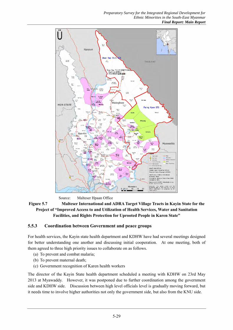
(a) Project title : “Improved Access to and Utilization of Health Services, Water and Sanitation Facilities, and Rights Protection for Uprooted People in Karen State”
(b) Locations of the Projects : totally 84 villages in Hpaan TS and Hlaingbwe TS (c) Implementing agency : Malteser International (d) Implementation partners: ADRA (Adventist Development & Relief Agency) –Myanmar (e) Project duration : 36 months (Plan: 01February2013 to 31 January 2016) (Approval from Kayin
State Government is not obtained yet as of May 2013) (f) Project budget: € 3,130,000- (g) Beneficiaries: 95,700 people of 15,000 households in Hpaan Township and Hlaingbwe
Township (h) Contents of the Project
i) Health education and training to Community Health Workers: CHWs ii) Mobile health clinic iii) Education and training on maternal and child health care to AMWs (Auxiliary Midwives)
and TBAs (Traditional Birth Attendants) iv) Water supply facilities to 50 villages, water supply facilities, construction of latrines and
sanitary education to schools in 26 villages (WASH) v) Human and citizen rights training, Acquisition of household registration certificate, mine
risk education and support to landmine victims
Area for the project in village tract unit is shown in Figure 5.7.
As another projects for the four STSs (Paingkyon, Shanywarthit, Wawlay, Sukali), UNDP has planned and submitted their project proposal to Kayin State Government for assistance of electricity and water supply to rural area in the four STSs as shown in Table 5.26.
Preparatory Survey for the Integrated Regional Development for
Ethnic Minorities in the South-East Myanmar
Final Report: Main Report
5-28
Table 5.26 Electricity and Water Supply Projects for 4 STSs and 1 TS by UNDP
STS Year
Nos. of Villages/ Locations Electricity Supply Water Supply
Solar System Hydro Power System
Generator (Diesel)
4-6 inch diameter Tube Well 180-200 feet deep
Paingkyon
2013-2014 72 3 10 45 2014-2015 49 - 1 35 2015-2016 21 - - 12
Total 142 3 11 92
Shanywarthit
2013-2014 15 - 1 41 2014-2015 17 - - 8 2015-2016 30 - - 86
Total 62 0 1 135
Wawlay
2013-2014 4 - - 4 2014-2015 3 - - 3 2015-2016 3 - - 4 2016-2017 - - - 2
Total 10 0 0 13
Sukali
2013-2014 2 - 1 4 2014-2015 3 - - 3 2015-2016 3 - - 3 2016-2017 - - - 2
Total 8 0 1 12
Myawaddy TS excluding Wawlay and Sukali STS
2013-2014 15 1 1 29 2014-2015 13 1 1 20 2015-2016 9 - - 12 2016-2017 - - - 19
Total 37 2 2 80 Grand Total 259 5 15 332
Source: Kayin State Development Committee
Furthermore, not only international NGOs but also Karen organizations such as KED, KDHW, BPHWT, etc., have been in action for long time in STSs areas. Therefore good coordination with Karen organizations is also necessary to achieve effective and smooth project activities.
Preparatory Survey for the Integrated Regional Development for
Ethnic Minorities in the South-East Myanmar
Final Report: Main Report
5-29
Source: Malteser Hpaan Office
Figure 5.7 Malteser International and ADRA Target Village Tracts in Kayin State for the Project of “Improved Access to and Utilization of Health Services, Water and Sanitation
Facilities, and Rights Protection for Uprooted People in Karen State”
5.5.3 Coordination between Government and peace groups
For health services, the Kayin state health department and KDHW have had several meetings designed for better understanding one another and discussing initial cooperation. At one meeting, both of them agreed to three high priority issues to collaborate on as follows.
(a) To prevent and combat malaria; (b) To prevent maternal death; (c) Government recognition of Karen health workers
The director of the Kayin State health department scheduled a meeting with KDHW on 23rd May 2013 at Myawaddy. However, it was postponed due to further coordination among the government side and KDHW side. Discussion between high level officials level is gradually moving forward, but it needs time to involve higher authorities not only the government side, but also from the KNU side.
Preparatory Survey for the Integrated Regional Development for
Ethnic Minorities in the South-East Myanmar
Final Report: Main Report
5-30
Also, KDHW requested Kayin State health department to share curriculum for health workers’ trainings. The health department has already granted this request.
For educational services, state educational department seems not to discuss with peace groups yet. But, cooperation with DKBA or BGF, the government has constructed school facilities, and appointed teachers where DKBA or BGF operating.
Preparatory Survey for the Integrated Regional Development for
Ethnic Minorities in the South-East Myanmar
Final Report: Main Report
5-31
5.6 Issues and Directions for Education and Health Care Services Improvement
5.6.1 Issues
Based on the survey results mentioned above, there are three challenges worth noting: (a) Poor accessibility to educational and health care services for villages in the four targets STSs, (b) Quality gaps within the educational and health care services between inside the Kayin state and
the border area, and (c) Coordination of educational and health care services between the government and peace
groups.
(1) Poor accessibility to educational and health care services for villages in the four target STSs
1) Health care
Based on the survey, the lack of educational and health care facilities and staff is apparent. It is of high urgency to construct and allocate enough facilities and staff members. However, the construction of facilities and allocation of staff is not enough to improve the “accessibility” for villagers.
First, poor road conditions make it very difficult for villagers to access health care facilities. Some villages under the control of SHCs are located in remote areas which have steep hills and many rivers without permanent or sturdy bridges. For Upper Paingkyon SHC, such remote villages can be visited only three times per year. This issue must be addressed as soon as possible.
Second, it should be considered that villagers rarely understand the importance and effects of health care. Some villages might mistrust government health care services. For some villagers, traditional medicines are most familiar and of ‘proven’ reliability. Thus, they feel a strong opposition to chemical medicine. It is necessary to work with villagers to have them fully understand the importance and effects of health care through continuous health education. We should also take the villagers’ basic educational level into consideration.
On the other hand, the health care facilities the government currently offers are not in sanitary conditions, and the offered services are limited. It is therefore understandable that some villagers might prefer to visit higher health care facilities directly. Pregnant mothers often directly go to the station hospital in town to deliver in a safer environment. Besides, governmental health workers are sent all over Myanmar, and sometimes non-Kayin health workers are assigned to villages in the Kayin state. In that case, they sometimes cannot speak in Kayin, and they do not have a firm understanding of what Kayin villages are like. It is important to keep a good relationship with the villagers.
2) Educational facilities
Villagers voluntarily donate and construct simple school buildings and collect salaries for community teachers in the case that the government cannot provide such services, especially for primary schools. There exist also a limited number of teachers for a large number of students. Some grades are probably integrated together and are offering classes.
Preparatory Survey for the Integrated Regional Development for
Ethnic Minorities in the South-East Myanmar
Final Report: Main Report
5-32
For middle and high school, quite a few number of school facilities and students commute to town to take classes. Middle and high school educational opportunities are very limited for eligible students.
In the meantime, there are students who dropped out and failed grades or matriculation tests despite being provided with educational opportunities. There are various reasons for this, and a social safety net must be implemented to support these students. To explain the low passing rate of the matriculation exam in Paingkyon high school, language barrier and lack of a clear vision by students of their future. It needs more detailed survey to demonstrate other causes of this matter. It should be expected of parents, teachers, and the community to provide an adequate studying environment to the students in need of monetary and mentally.
(2) Quality gaps of educational and health care services between inside the Kayin state and the border area
As for educational services, many NGOs are working in Mae sot without strict limitation for their activities. For example, Minmahaw School tries to provide international standards of educational quality to broaden students’ future to all over the world. It is very high and advanced educational services, and it is beyond a level of basic education generally governments offer. It is supposed that demands of such school will be increased hereafter.
For health care services, Mae Tao Clinic offers safety high quality medical services for free, and some villagers come for a consultation despite long distances.
Mentioned above, the services provided in border area in Thailand is better quality than that of Kayin state. Especially, school and health care facilities should be constructed or renovated urgently.
(3) Coordination of educational and health care services between the government and ethnic groups
As mentioned above, educational and health care services in some areas are provided by KED and KDHW, which are Karen organizations with a different system from that of the government. It can be said that discussions involving how these two systems can be coordinated for effective and efficient service provision to communities is highly necessary in the process of peace talks. KED, KDHW and other NGOs also have much experience, and are able to maintain good relationships with communities through community-based service provision
For educational services, two points, KED curriculum and trained teacher by KED are expected to be focused on discussion between the government and peace groups and NGOs. Also, students taught by KED train teachers should be considered when they study in Myanmar curriculum.
For health care services, also health staff trained by KDHW or other NGOs and organization should be considered. It should be established health care system together with existed trained health staff in the field for efficient and effective service provision.
High level officers at the policy implementation level have started to discuss further coordination and cooperation. Decision makers from concerned ministries and KNU executive board need to become involved as well. It needs much time to discuss and find best solution for both.
(4) Directions
Based on the survey, there are many problems and challenges which need urgent attention such as the
Preparatory Survey for the Integrated Regional Development for
Ethnic Minorities in the South-East Myanmar
Final Report: Main Report
5-33
construction of facilities. However, it is a time of transition for Myanmar, and deliberative discussion is needed to maintain security. Thus, “to build mutual trust among communities, ethnic groups, and the government through proper, effective and efficient educational and health care services” should be at the center of the social development agenda.
Needless to say, this is very important, and enough time must be given to discuss peace with the government and ethnic groups. On the other hand, in order to build a relationship of mutual trust with communities in the villages, it is necessary to provide continuous and proper services to communities while engaging in productive discussion. NGOs, ethnic groups and the government have already experienced human resources and CBOs to provide such services. In order to execute effective and efficient service provision, it is necessary to mobilize all available resources. The processes of activities and the accumulation of results promote mutual trust among them, and encourage IDPs and refugees to return and resettle.
5.6.2 Tentative list of proposed programs and projects
In line with the directions of education and health development, tentative projects have been suggested below. To plan project details like area, scale, and contents, social surveys involving all stakeholders is necessary.
(1) Construction of primary, middle and high schools
Shortages of school buildings limit students’ educational opportunities. Especially, there are fewer middle and high schools in village areas than in towns. Provision of furniture, water supply system including water filtration and staff dormitories should be included in the projects.
(2) Vocational training for adults and students who dropped out of basic education
To decide courses of vocational training, a detailed survey is required in accordance with the regional development plan. From observations made in each STS, the primary source of work is agriculture. Thus, training for adding value to related products seems to be in demand. Deputy Director of Kayin State educational department told that practical training is better to apply the work directory.
(3) Construction of RHC and SHC with improvement of community roads and bridges
To ease accessibility to health care, construction of buildings as well as an improvement of roads and bridges is necessary. Provision of furniture, water supply system including water filtration and staff dormitories should be included in the projects.
(4) Provision of health care services based on RHC and SHC cooperation with CBOs, peace groups, and the government
In village areas, governmental mid-wife, and health staff trained by KDHW or other NGOs works together to offer health services to villages based on RHC or SHC. State health department and KDHW are discussing farther cooperation at this moment, and this support can be one of the models of cooperation among the government, peace group, NGOs and communities. It requires much coordination among them, but it is necessary to provide efficient and effective health care services to villagers by utilized existed resources.
Preparatory Survey for the Integrated Regional Development for
Ethnic Minorities in the South-East Myanmar
Final Report: Main Report
5-34
(5) PR of activities by newsletter
Progress of each support is to be made public as newsletter and shared at the Returnee Empowerment Center, refugee camps, NGOs support to IDPs etc. It can help to understand current situation of Kayin State and promote IDPs and refugees to return.

Preparatory Survey for the Integrated Regional Development for
Ethnic Minorities in the South-East Myanmar
Final Report: Main Report
6-1
This chapter presents results of rapid development diagnosis by township in Karen and Mon States constituting the Southeast Myanmar. For each township, existing conditions are described in a balanced way, constraints to development identified, and main prospects for further development suggested.
In conducting the rapid development diagnosis, existing data and information were compiled and analyzed, and each township was visited to have a session with officers and other representatives of the township. Also, surveys during the field visits are reflected in the analysis. In each township, data and information on existing conditions were confirmed and updated as necessary, and development constraints and prospects were discussed with the township participants based on working hypotheses.
For candidate projects proposed in Chapter 10 for possible support by JICA and other donors, contents and areas have been determined by reflecting the rapid development diagnosis presented in this chapter.
6.1 Rapid Development Diagnosis by Township in Kayin State
6.1.1 Thandaunggyi TS
(1) Existing conditions
Thandaunggyi TS is dominantly mountainous and access to the interior is poor (Figure 6.1). This may be one of factors that prevented the advance of the Myanmar military and allowed KNU to continue its resistance activities. KNU is still continuing limited resistance based in the mountainous areas of the township. Due to decades long resistance activities by KNU, road conditions have degraded without maintenance and improvement, and economies have been generally stagnant. Population growth in the township has been very low in recent years.
Water supply is provided in the TS and STS centers by using spring water and creeks as sources, but water is becoming scarce as population increases. This situation will aggravate and significant expansion of water supply will be necessary especially as many refugees and IDPs are coming back. Service coverage by water supply is about half of 469 households in the Leiktho STS center, about one-third of 1,233 households in the Thandaung STS center, and about one-third of some 400 households in the Bawgali STS center.
Power supply in the township depends largely on independent diesel generators, except the Thandaunggyi STS center served from the national grid. Household electrification rate is very low:
CHAPTER 6 RAPID DEVELOPMENT DIAGNOSIS BY TOWNSHIP
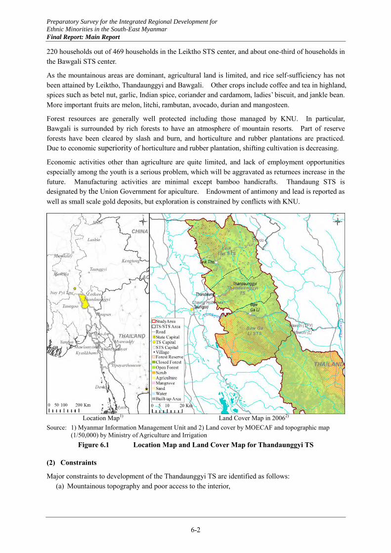
Preparatory Survey for the Integrated Regional Development for
Ethnic Minorities in the South-East Myanmar
Final Report: Main Report
6-2
220 households out of 469 households in the Leiktho STS center, and about one-third of households in the Bawgali STS center.
As the mountainous areas are dominant, agricultural land is limited, and rice self-sufficiency has not been attained by Leiktho, Thandaunggyi and Bawgali. Other crops include coffee and tea in highland, spices such as betel nut, garlic, Indian spice, coriander and cardamom, ladies’ biscuit, and jankle bean. More important fruits are melon, litchi, rambutan, avocado, durian and mangosteen.
Forest resources are generally well protected including those managed by KNU. In particular, Bawgali is surrounded by rich forests to have an atmosphere of mountain resorts. Part of reserve forests have been cleared by slash and burn, and horticulture and rubber plantations are practiced. Due to economic superiority of horticulture and rubber plantation, shifting cultivation is decreasing.
Economic activities other than agriculture are quite limited, and lack of employment opportunities especially among the youth is a serious problem, which will be aggravated as returnees increase in the future. Manufacturing activities are minimal except bamboo handicrafts. Thandaung STS is designated by the Union Government for apiculture. Endowment of antimony and lead is reported as well as small scale gold deposits, but exploration is constrained by conflicts with KNU.
Location Map1) Land Cover Map in 20062)
Source: 1) Myanmar Information Management Unit and 2) Land cover by MOECAF and topographic map (1/50,000) by Ministry of Agriculture and Irrigation
Figure 6.1 Location Map and Land Cover Map for Thandaunggyi TS
(2) Constraints
Major constraints to development of the Thandaunggyi TS are identified as follows: (a) Mountainous topography and poor access to the interior,
Preparatory Survey for the Integrated Regional Development for
Ethnic Minorities in the South-East Myanmar
Final Report: Main Report
6-3
(b) Continued resistance by KNU in some areas hindering road improvement and other development activities,
(c) Limited land suitable for agriculture and need to sacrifice some reserve forests to increase agricultural land,
(d) Limited water and power supply and shortages of existing water sources, (e) Limited employment opportunities without any significant manufacturing and mining activities,
and (f) Constraint to operation of health and education facilities due to poor access.
(3) Prospects
Areas along the road from Taungoo, through Leiktho to Yardo on the border with Shan State appear to be calm without visible effects of the decades-long conflicts. This road through Kayah State constitutes part of a future north-south artery that links near Taunggyi where an east-west artery has a junction to link Kengtung of Shan State and Meiktila of Mandalay Region. The latter artery through mountainous areas will provide an important alternative to the Muse – Lashio - Mandalay artery to link Myanmar with the Yunnan province of China.
The forest resources in this township are generally very well protected, and it is an essential condition for the township to pursue development without undermining these forests. Conversion from shifting cultivation to horticulture has been proceeding and this should be further promoted. Horticulture in the TS may be strengthened by emphasizing spices such as chilli, cardamom, coriander, turmeric and others existing in the township as specialty products.
Coffee can be expanded by utilizing forests as it is a shade crop. To market the local coffee in the international market, brand development and improvement of vacuum packing are necessary conditions. In view of the international market conditions for robusta coffee, a more realistic marketing strategy may be to aim at the international tourism market. That is, the local coffee is to be enjoyed by international tourists visiting the production areas.
Resort tourism on highland may be promising in the medium to long terms. Taungoo in Bago Region may be the tourism gateway for Thandaunggyi, and tour routes should be established that link Leiktho, Thandaunggyi and Bawgali for eco-tourism in combination with artificial attractions such as a Lipton tea museum and tea picking tourism. Recreation facilities at the Thaukyegat reservoir may also be combined.
Apiculture in the Thandaung STS may be promoted by a national program to establish an apiculture industrial cluster for a larger area beyond the township and the Southeast Myanmar. Since it is already established as an export industry, product diversification by clustering with propolis, royal jelly and beeswax will enhance the comparative advantage.
In view of limited employment opportunities and future increase of returnees, establishment of manufacturing industries is indispensable. High value products based on spices and other specialty products produced already should be pursued such as medical, pharmaceutical and health products, which fit to the Myanmar culture.
Improvement of the road linking Bawgali to the east up to Mawchi in Kayah State, currently constrained by the control of KNU, holds another key for the township development as a whole. In particular, for tourism and mineral resources development in the area near the border with Kayah State, agreement with the Union Government should be pursued for ownership and development right of land and related resources even before the comprehensive agreement between KNU and the Union
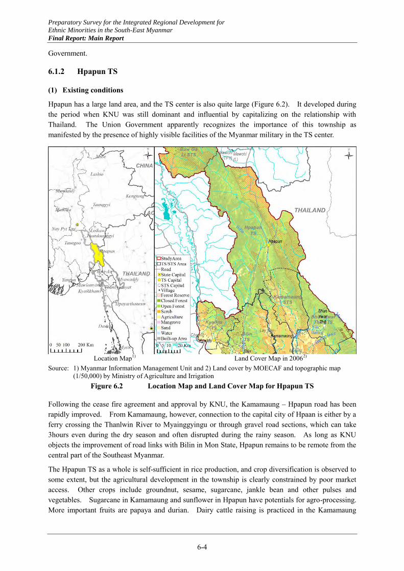
Preparatory Survey for the Integrated Regional Development for
Ethnic Minorities in the South-East Myanmar
Final Report: Main Report
6-4
Government.
6.1.2 Hpapun TS
(1) Existing conditions
Hpapun has a large land area, and the TS center is also quite large (Figure 6.2). It developed during the period when KNU was still dominant and influential by capitalizing on the relationship with Thailand. The Union Government apparently recognizes the importance of this township as manifested by the presence of highly visible facilities of the Myanmar military in the TS center.
Location Map1) Land Cover Map in 20062)
Source: 1) Myanmar Information Management Unit and 2) Land cover by MOECAF and topographic map (1/50,000) by Ministry of Agriculture and Irrigation
Figure 6.2 Location Map and Land Cover Map for Hpapun TS
Following the cease fire agreement and approval by KNU, the Kamamaung – Hpapun road has been rapidly improved. From Kamamaung, however, connection to the capital city of Hpaan is either by a ferry crossing the Thanlwin River to Myainggyingu or through gravel road sections, which can take 3hours even during the dry season and often disrupted during the rainy season. As long as KNU objects the improvement of road links with Bilin in Mon State, Hpapun remains to be remote from the central part of the Southeast Myanmar.
The Hpapun TS as a whole is self-sufficient in rice production, and crop diversification is observed to some extent, but the agricultural development in the township is clearly constrained by poor market access. Other crops include groundnut, sesame, sugarcane, jankle bean and other pulses and vegetables. Sugarcane in Kamamaung and sunflower in Hpapun have potentials for agro-processing. More important fruits are papaya and durian. Dairy cattle raising is practiced in the Kamamaung
Preparatory Survey for the Integrated Regional Development for
Ethnic Minorities in the South-East Myanmar
Final Report: Main Report
6-5
STS in a small scale.
Forest resources are generally well protected, but in Kamamaung, some farmers live within reserve forests. To re-settle them, some reserve forests will have to be sacrificed. Shifting cultivation is still practiced as subsistent agriculture.
Manufacturing activities are almost non-existent except furniture making from hardwood such as teak and ironwood. A small scale antimony mine is operated in Kamamaung by a private enterprise, and ores are exported to China without even concentration. Small gold mines are also operated by both the government and the private sector.
Hpapun TS has a large number of health and education facilities including 25 beds hospital and 70 schools. Their operation, however, tends to be constrained by poor access such as transfer of serious patients and recruitment of sufficient number of teachers.
In Kamamaung, both the Myanmar military and BGF are stationed side by side, while in Hpapun, KNU has been still negotiating with the Union Government for substantiation of cease fire agreement. Improvement of roads to Bilin and Thailand, as requested by residents and TS officials, is uncertain subject to the negotiation with KNU.
(2) Constraints
Major constraints to development of the Hpapun TS are identified as follows: (a) Existence of conflict affected areas hindering improvement of some roads, (b) Presence of some facilities in conflict affected areas suppressing the development momentum, (c) Remoteness and poor access from the capital city of Hpaan and neighboring areas, (d) Suppressed incentive for agricultural diversification and agro-processing due to constraints in
marketing, (e) Operation of health and education facilities constrained by remote location, and (f) Security and land mines remaining to be problems.
(3) Prospects
Hpapun is a large township developed through strong relationships with Thailand historically. It is very important for the development of Kayin State to strengthen the ties with the capital city of Hpaan. In view of the present policy and activities of KNU, however, the ties between Hpapun and Hpaan should be strengthened carefully in steps. Improvement of the ferry services between Kamamaung and Myainggyingu may be undertaken immediately. A bridge between these locations is a must, but the timing of construction should be examined carefully. Symbolically, this bridge will effectively link two ethnic groups.
The improvement of road link between Hpapun and Bilin of Mon State would hold another key for the development of this township. From the Bilin TS point of view, expansion of water supply, power supply and irrigated agriculture by comprehensive development and management of the Bilin river basin would be essential for the medium and long term development of the Bilin TS. For early planning for the water resources development and management of the Bilin river basin, agreement with the Union Government should be pursued for ownership and development right of land and related resources even before the comprehensive agreement between KNU and the Union Government.
Strengthening links from the Hpapun TS center to Thailand and Bilin will satisfy a necessary
Preparatory Survey for the Integrated Regional Development for
Ethnic Minorities in the South-East Myanmar
Final Report: Main Report
6-6
condition for development of agro-processing industries significantly by improving the market access and providing incentive for production increase and products diversification. Expansion of oil crops production including sunflower and manufacturing of edible oils, and revival of sugarcane production and sugar manufacturing would be realized. Since dairy cattle raising is practiced in Kamamaung at present, livestock and edible oils industrial cluster may be worth serious considerations.
As the road access is improved, suburban agriculture will also establish to supply fresh vegetables and fruits to urban markets of the Hpapun TS center and Hpaan, and population concentration centers in Bilin and other areas along the coast. Fresh milk and dairy products will also find expanding urban markets.
Other than antimony and gold currently extracted, other mineral resources are expected to be endowed in this township. Exploration should be undertaken after the confirmation of ownership and development rights for the resources.
6.1.3 Hlaingbwe TS
(1) Existing conditions
Hlaingbwe TS, excluding Shanywarthit STS and Paingkyon STS, has the second highest population density, next only to Hpaan TS, although it is largely rural. Hlaingbwe TS is expected to receive the largest number of refugees and IDPs mainly in its rural areas of Shanywarthit STS and Paingkyon STS. This is presumably due to relatively favorable access, except in areas in and beyond the Dawna mountains, availability of land and association with refugees in the Maela and the Beklo camps on the Thai side.
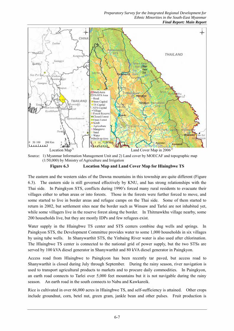
Preparatory Survey for the Integrated Regional Development for
Ethnic Minorities in the South-East Myanmar
Final Report: Main Report
6-7
Location Map1) Land Cover Map in 20062)
Source: 1) Myanmar Information Management Unit and 2) Land cover by MOECAF and topographic map (1/50,000) by Ministry of Agriculture and Irrigation
Figure 6.3 Location Map and Land Cover Map for Hlaingbwe TS
The eastern and the western sides of the Dawna mountains in this township are quite different (Figure 6.3). The eastern side is still governed effectively by KNU, and has strong relationships with the Thai side. In Paingkyon STS, conflicts during 1990’s forced many rural residents to evacuate their villages either to urban areas or into forests. Those in the forests were further forced to move, and some started to live in border areas and refugee camps on the Thai side. Some of them started to return in 2002, but settlement sites near the border such as Winsaw and Tarlei are not inhabited yet, while some villagers live in the reserve forest along the border. In Thitmawkhu village nearby, some 200 households live, but they are mostly IDPs and few refugees exist.
Water supply in the Hlaingbwe TS center and STS centers combine dug wells and springs. In Paingkyon STS, the Development Committee provides water to some 1,000 households in six villages by using tube wells. In Shanywarthit STS, the Yinbaing River water is also used after chlorination. The Hlaingbwe TS center is connected to the national grid of power supply, but the two STSs are served by 100 kVA diesel generator in Shanywarthit and 80 kVA diesel generator in Paingkyon.
Access road from Hlaingbwe to Paingkyon has been recently tar paved, but access road to Shanywarthit is closed during July through September. During the rainy season, river navigation is used to transport agricultural products to markets and to procure daily commodities. In Paingkyon, an earth road connects to Tarlei over 5,000 feet mountains but it is not navigable during the rainy season. An earth road in the south connects to Nabu and Kawkareik.
Rice is cultivated in over 66,000 acres in Hlaingbwe TS, and self-sufficiency is attained. Other crops include groundnut, corn, betel nut, green gram, jankle bean and other pulses. Fruit production is

Preparatory Survey for the Integrated Regional Development for
Ethnic Minorities in the South-East Myanmar
Final Report: Main Report
6-8
small and only for local consumption, represented by durian, pomelo and pineapple.
Manufacturing industries and handicrafts are almost non-existent other than quarrying of sand and gravels. In Paingkyon, antimony reserve exists near the Dawna mountains and private business plans to explore it.
Several reserve forests exist in the township, but they have been degraded by slash and burn practices by returnees. In Paingkyon, five villages exist in forests inhabited by about 1,000 villagers, of which four are in reserve forests. The villagers cultivate tapioca, corn and pulses as well as rubber.
(2) Constraints
Major constraints to development of the Hlaingbwe TS are identified as follows: (a) Poor road access to the interior closer to the Dawna Mountains, (b) Extensive flooding during the rainy season, (c) Deprived power supply in the interior, (d) Lack of lucrative employment opportunities, (e) Need to negotiate with KNU for the development of the areas on the eastern side of the Dawna
mountains, and (f) Dominance of poor villages in the interior and inn reserve forests.
(3) Prospects
Hlaingbwe TS is expected to receive a large number of refugees and IDPs, and this should be taken positively for expanding opportunities for the development of the township. A very careful approach, however, is necessary to take measures to facilitate the returns of refuges and IDPs. In particular, improvement of access to designated settlement sites in and beyond the Dawna mountains should be examined carefully in consultation with KNU dominating the eastern side of the mountains.
In the near future, the areas on the eastern side of the Dawna mountains should be developed by making effective use of the relationship with the Thai side. Involvement of Thai investors and the Thai Government is preferable. One possibility is to undertake joint agricultural development by utilizing the water resources of the border river and its tributaries. Agricultural products may be marketed mainly to the Thai market. Access from the Thai side to border areas and links between border areas on the Myanmar side through roads on the Thai side may facilitate the cooperative development of the border areas.
While the development of the border areas beyond the Dawna mountains is undertaken separately, the development of the Hlaingbwe TS may be centering on the TS center, where service functions should be strengthened to serve agriculture in its hinterland. Major crops other than rice and rubber may be expanded and agro-processing expanded in the Hlaingbwe center. Promising crops include oil crops and sugarcane. The TS center may also be promising for suburban agriculture supplying fresh vegetables to the urban market of Hpaan.
As increasing number of refuges and IDPs are coming back, rice production should continue to be expanded to maintain self-sufficiency. Also, the agricultural development in the settlement sites should be taken as opportunities to expand tree crops such as fruits and cashew trees, which will expand the base for agro-processing in the future.
To expand employment opportunities significantly for returnees and residents, manufacturing industries should be established such as agro-processing. As prerequisites, water and power supply
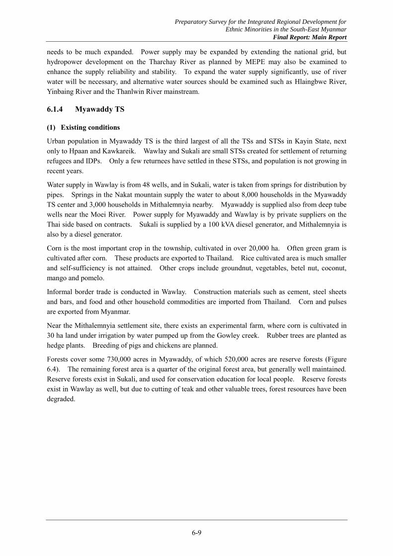
Preparatory Survey for the Integrated Regional Development for
Ethnic Minorities in the South-East Myanmar
Final Report: Main Report
6-9
needs to be much expanded. Power supply may be expanded by extending the national grid, but hydropower development on the Tharchay River as planned by MEPE may also be examined to enhance the supply reliability and stability. To expand the water supply significantly, use of river water will be necessary, and alternative water sources should be examined such as Hlaingbwe River, Yinbaing River and the Thanlwin River mainstream.
6.1.4 Myawaddy TS
(1) Existing conditions
Urban population in Myawaddy TS is the third largest of all the TSs and STSs in Kayin State, next only to Hpaan and Kawkareik. Wawlay and Sukali are small STSs created for settlement of returning refugees and IDPs. Only a few returnees have settled in these STSs, and population is not growing in recent years.
Water supply in Wawlay is from 48 wells, and in Sukali, water is taken from springs for distribution by pipes. Springs in the Nakat mountain supply the water to about 8,000 households in the Myawaddy TS center and 3,000 households in Mithalemnyia nearby. Myawaddy is supplied also from deep tube wells near the Moei River. Power supply for Myawaddy and Wawlay is by private suppliers on the Thai side based on contracts. Sukali is supplied by a 100 kVA diesel generator, and Mithalemnyia is also by a diesel generator.
Corn is the most important crop in the township, cultivated in over 20,000 ha. Often green gram is cultivated after corn. These products are exported to Thailand. Rice cultivated area is much smaller and self-sufficiency is not attained. Other crops include groundnut, vegetables, betel nut, coconut, mango and pomelo.
Informal border trade is conducted in Wawlay. Construction materials such as cement, steel sheets and bars, and food and other household commodities are imported from Thailand. Corn and pulses are exported from Myanmar.
Near the Mithalemnyia settlement site, there exists an experimental farm, where corn is cultivated in 30 ha land under irrigation by water pumped up from the Gowley creek. Rubber trees are planted as hedge plants. Breeding of pigs and chickens are planned.
Forests cover some 730,000 acres in Myawaddy, of which 520,000 acres are reserve forests (Figure 6.4). The remaining forest area is a quarter of the original forest area, but generally well maintained. Reserve forests exist in Sukali, and used for conservation education for local people. Reserve forests exist in Wawlay as well, but due to cutting of teak and other valuable trees, forest resources have been degraded.
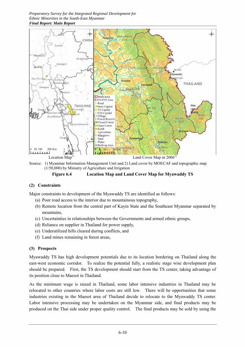
Preparatory Survey for the Integrated Regional Development for
Ethnic Minorities in the South-East Myanmar
Final Report: Main Report
6-10
Location Map1) Land Cover Map in 20062)
Source: 1) Myanmar Information Management Unit and 2) Land cover by MOECAF and topographic map (1/50,000) by Ministry of Agriculture and Irrigation
Figure 6.4 Location Map and Land Cover Map for Myawaddy TS
(2) Constraints
Major constraints to development of the Myawaddy TS are identified as follows: (a) Poor road access to the interior due to mountainous topography, (b) Remote location from the central part of Kayin State and the Southeast Myanmar separated by
mountains, (c) Uncertainties in relationships between the Governments and armed ethnic groups, (d) Reliance on supplier in Thailand for power supply, (e) Underutilized hills cleared during conflicts, and (f) Land mines remaining in forest areas,
(3) Prospects
Myawaddy TS has high development potentials due to its location bordering on Thailand along the east-west economic corridor. To realize the potential fully, a realistic stage wise development plan should be prepared. First, the TS development should start from the TS center, taking advantage of its position close to Maesot in Thailand.
As the minimum wage is raised in Thailand, some labor intensive industries in Thailand may be relocated to other countries where labor costs are still low. There will be opportunities that some industries existing in the Maesot area of Thailand decide to relocate to the Myawaddy TS center. Labor intensive processing may be undertaken on the Myanmar side, and final products may be produced on the Thai side under proper quality control. The final products may be sold by using the

Preparatory Survey for the Integrated Regional Development for
Ethnic Minorities in the South-East Myanmar
Final Report: Main Report
6-11
same marketing channels established already in Thailand.
To realize this potential by the model described above, the Myawaddy area may be designated as a free trade zone (FTZ). As prerequisites, infrastructure facilities in the Myawaddy TS center should be much improved including water supply and power supply to compete against similar facilities elsewhere.
The border at Wawlay with Thailand is expected to be opened formally in the near future. Then, the development momentum should be guided to the interior beyond Sukali. This will be facilitated by improving the road link to Kyaikdon first. This will also help Sukali to make an initial breakthrough for development. At present, Sukali is located at almost a dead end so that refugees and IDPs may not feel comfortable in coming back there, even if the access from the Myawaddy TS center is improved.
Once the border at Wawlay is formally opened, it is in fact easier to make access from the Myawaddy TS center to Wawlay and Sukali through the road on the Thai side. The road from Wawlay and Sukali to Kyaikdon will be extended further to Kyainseikgyi and reach Mudon in Mon State to establish a new east-west economic corridor in the upper southern part of the Southeast Myanmar.
Along the road from the Myawaddy TS center to Wawlay and Sukali, most hills have been cleared by slash and burn, and not been used for productive purposes. Productive re-forestation should be initiated in the nearest future on these hills with fruits ad Cashew trees. The same tree species should be introduced in the settlement areas of Wawlay and Sukali so that returnees come back in a massive scale, the trees will be already harvested.
Small scale water resources development should be undertaken along the road from the Myawaddy TS center to Wawlay and Sukali to extend cropping season and enhance productivity by supplemental irrigation. Joint development and management of river basin of the border river of Moei should be undertaken in cooperation with Thailand.
6.1.5 Kawkareik TS
(1) Existing conditions
Population of Kawkareik is about 290,000 and increasing by about 7,000 annually or at the rate of 2% per annum, according to the TS officers. Population density is the third largest in Kayin State, following Hpaan and Hlaingbwe, and the urbanization ratio is relatively high at 19.0%. Out-migration from the township is mostly to Thailand other than those working in rubber plantations. The TS also receives in-migrants for rice growing.
Water supply is by dug wells, and quantity is sufficient. Power supply is by two units of diesel generators of 500 kVA each to serve 2 hours daily from 6 to 8 PM. Out of some 5,000 households in the TS center, about 1,500 households are covered. The TS administration expects that the TS will be connected to the national grid in 2014/15, but in reality the connection will be delayed.
Tar roads extend for 51 miles from Myawaddy to the Gyaing River and 38 miles from the Gyaing River to Hpaan. The Eindu-Kawkareik road is expected to be improved by ADB support in one and a half years (Figure 6.5).
Paddy production in Kawkareik far exceeds its self-sufficiency level. Excess rice is exported to Thailand, but it is not treated as quality rice as broken rice is included. Cultivation of second crops is significant as represented by pulses, groundnut and sesame. Of various fruits produced in the TS,
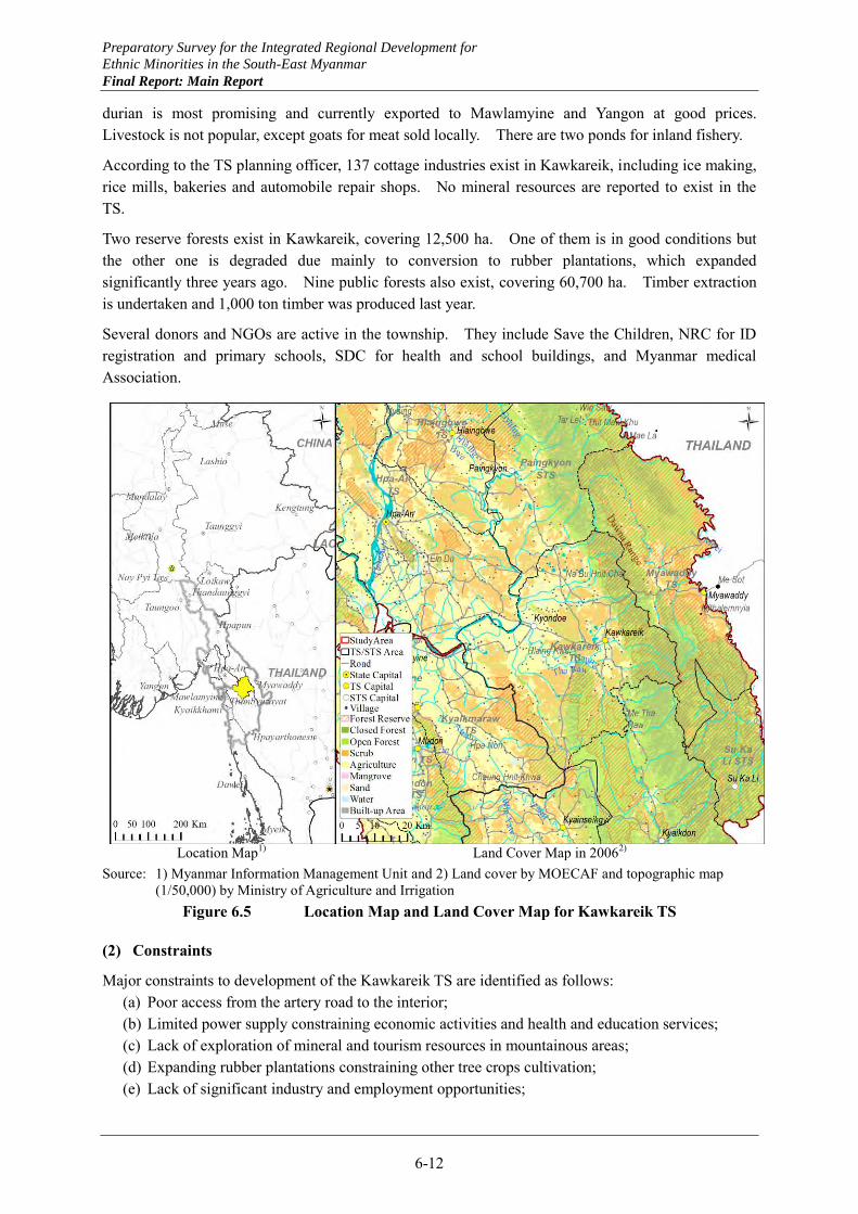
Preparatory Survey for the Integrated Regional Development for
Ethnic Minorities in the South-East Myanmar
Final Report: Main Report
6-12
durian is most promising and currently exported to Mawlamyine and Yangon at good prices. Livestock is not popular, except goats for meat sold locally. There are two ponds for inland fishery.
According to the TS planning officer, 137 cottage industries exist in Kawkareik, including ice making, rice mills, bakeries and automobile repair shops. No mineral resources are reported to exist in the TS.
Two reserve forests exist in Kawkareik, covering 12,500 ha. One of them is in good conditions but the other one is degraded due mainly to conversion to rubber plantations, which expanded significantly three years ago. Nine public forests also exist, covering 60,700 ha. Timber extraction is undertaken and 1,000 ton timber was produced last year.
Several donors and NGOs are active in the township. They include Save the Children, NRC for ID registration and primary schools, SDC for health and school buildings, and Myanmar medical Association.
Location Map1) Land Cover Map in 20062)
Source: 1) Myanmar Information Management Unit and 2) Land cover by MOECAF and topographic map (1/50,000) by Ministry of Agriculture and Irrigation
Figure 6.5 Location Map and Land Cover Map for Kawkareik TS
(2) Constraints
Major constraints to development of the Kawkareik TS are identified as follows: (a) Poor access from the artery road to the interior; (b) Limited power supply constraining economic activities and health and education services; (c) Lack of exploration of mineral and tourism resources in mountainous areas; (d) Expanding rubber plantations constraining other tree crops cultivation; (e) Lack of significant industry and employment opportunities;
Preparatory Survey for the Integrated Regional Development for
Ethnic Minorities in the South-East Myanmar
Final Report: Main Report
6-13
(f) Degrading forest resources due to expansion of rubber plantations and divided management responsibilities between the State Government and KNU.
(3) Prospects
Kawkareik has an advantage locating along the major artery road linking Myawaddy, through Hpaan to Yangon. This strategic position will be strengthened once the new road is completed providing better connection between Myawaddy and Kawkareik. This new road link may facilitate exports of local products to the Myawaddy area and Thailand, but at the same time may encourage residents to migrate out to these areas.
Kawkareik needs to diversify its economy to produce goods that may be exported to the Myawaddy area and Thailand. At the same time, Kawkareik should create characteristic crops and industries to enhance its attractiveness to visitors. They may be some fruits, agro-processing industries and cottage industries producing unique goods based on local resources and products.
Agricultural productivity in Kawkareik should be enhanced not by high input- high yield paddy production but rather by mixed farming combining paddy with field crops and integrated farming combining crop cultivation with livestock or poultry. This will expand the basis for establishing export products and processing industries.
Further expansion of rubber plantations should proceed carefully to protect the remaining reserve forests in good conditions. Rubber trees should not be encouraged in slope land, where fruit trees and cashew trees should be planted.
Improvement of power supply by connecting to the national grid is a pre-requisite to developing these economic activities as well as improving health and education services. While quantity of water appears to be sufficient in the TS for the foreseeable future, a piped water supply system should be developed to ensure sufficient and stable supply of water to new economic activities.
Tourism development may deserve serious consideration for medium to long term development of Kawkareik. Resort development in the mountainous areas may be combined with artificial tourism objects in and around the TS center.
6.1.6 Kyainseikgyi TS
(1) Existing conditions
This township as a whole is an out-migrating area mainly to Thailand due to limited employment opportunities. Consequently, population is decreasing in recent years in the Kyainseikgyi TS and the Hpayarthonesu STS. Also, many workers commute from Hpayarthonesu to the Thai side.
From the Kyainseikgyi TS center to the border areas, severe conflicts took place after 1997 due to the offence by the Myanmar military against KNU. Forests were extensively cleared by slash and burn in the process. The deforested hills have been re-planted with rubber trees thereafter.
Water supply in the township relies on creeks, dug wells and tube wells. Dug wells in the Kyainseikgyi TS center experience water shortages during the dry season. Expansion of public water supply is planned for the Hpayarthonesu STS to utilize spring water and tube wells. Power supply in the border area relies on power purchase from Thailand by private enterprises for 24 hours daily supply. Power supply in the Kyainseikgyi TS center is by a 300 kVA diesel generator for 2 hours per day. Possibilities exist for strengthening power supply by using small hydropower generation.
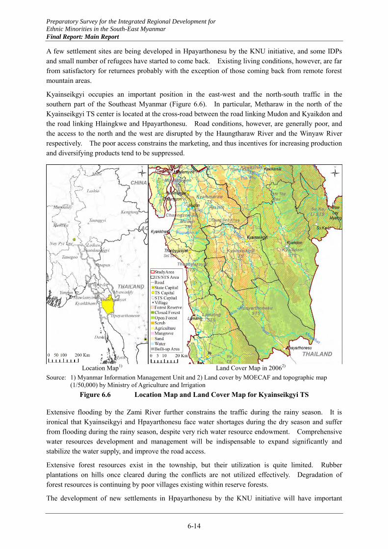
Preparatory Survey for the Integrated Regional Development for
Ethnic Minorities in the South-East Myanmar
Final Report: Main Report
6-14
A few settlement sites are being developed in Hpayarthonesu by the KNU initiative, and some IDPs and small number of refugees have started to come back. Existing living conditions, however, are far from satisfactory for returnees probably with the exception of those coming back from remote forest mountain areas.
Kyainseikgyi occupies an important position in the east-west and the north-south traffic in the southern part of the Southeast Myanmar (Figure 6.6). In particular, Metharaw in the north of the Kyainseikgyi TS center is located at the cross-road between the road linking Mudon and Kyaikdon and the road linking Hlaingkwe and Hpayarthonesu. Road conditions, however, are generally poor, and the access to the north and the west are disrupted by the Haungtharaw River and the Winyaw River respectively. The poor access constrains the marketing, and thus incentives for increasing production and diversifying products tend to be suppressed.
Location Map1) Land Cover Map in 20062)
Source: 1) Myanmar Information Management Unit and 2) Land cover by MOECAF and topographic map (1/50,000) by Ministry of Agriculture and Irrigation
Figure 6.6 Location Map and Land Cover Map for Kyainseikgyi TS
Extensive flooding by the Zami River further constrains the traffic during the rainy season. It is ironical that Kyainseikgyi and Hpayarthonesu face water shortages during the dry season and suffer from flooding during the rainy season, despite very rich water resource endowment. Comprehensive water resources development and management will be indispensable to expand significantly and stabilize the water supply, and improve the road access.
Extensive forest resources exist in the township, but their utilization is quite limited. Rubber plantations on hills once cleared during the conflicts are not utilized effectively. Degradation of forest resources is continuing by poor villages existing within reserve forests.
The development of new settlements in Hpayarthonesu by the KNU initiative will have important
Preparatory Survey for the Integrated Regional Development for
Ethnic Minorities in the South-East Myanmar
Final Report: Main Report
6-15
impact on the development of the township as a whole. Keys for the success are generation of employment opportunities as well as provision of adequate infrastructure. The FTZ planned by the State Government should also be effectively utilized to generate related employment opportunities for residents in the new settlements.
(2) Constraints
Major constraints to development of the Kyainseikgyi TS are identified as follows: (a) Poor access from neighboring townships and constrained use of roads during the rainy season, (b) Lack of incentives to increase agricultural production and diversify products due to poor
market access, (c) Limited employment opportunities and resultant out-migration, (d) Lack of proper water resources development and management of the Zami river basin, and
under-utilization of rich water resource endowment, (e) Lack of health and education personnel in Hpayarthonesu, and (f) Existence of border problems with Thailand.
(3) Prospects
Hpayarthonesu on border with Thailand and Kyainseikgyi at cross-roads of the east-west and the north-south traffic remain to be an out-migrating area with limited employment opportunities despite high development potentials. Keys for realizing the potentials are improvement of access by roads and bridges and proper water resources development and management.
The improvement of the Hpayarthonesu – Thanbyuzayat road, currently studied at a pre-feasibility level, will enhance the position of Hpayarthonesu significantly in the development of the TS and the Southeast Myanmar as a whole. It is important to determine the alignment of this road in such a way to improve the access to Kyainseikgyi as well even in a marginal way.
The development of new settlement sites along and around this road by the KNU initiative will have a significant meaning for the development of this township. Water supply and power supply for the settlements, and improvement of health and education facilities and services in Hpayarthonesu with branch facilities for the settlements should be supported.
To support the livelihood in the settlements, productive re-forestation should be initiated in the nearest future with cashew and fruit trees. Land use planning should be undertaken involving residents supported by KNU and the State Government for each settlement. Land use plans should incorporate rice cultivation areas designated in view of topography and natural water courses, integrated farming combining crop production and livestock raising including goats, home gardens, cashew and fruits production in surrounding hills and mixed farming combining field crops to realize high productivity rural settlements.
Once the settlements start to develop rapidly as planned, increasing number of migrant workers will come back and settle in these areas as they observe the development during their trip to and from Thailand. The FTZ planned by the State Government will provide additional employment opportunities to migrant workers directly and indirectly.
To reduce extensive flooding in Kyainseikgyi, comprehensive water resources development and management should be initiated, starting with tributaries of the Zami River. The first step may be taken for the Megathat creek, where hydropower development and water supply for the Hpayarthonesu STS center are conceived. Also, development of small hydropower and sources of water supply
Preparatory Survey for the Integrated Regional Development for
Ethnic Minorities in the South-East Myanmar
Final Report: Main Report
6-16
should be examined to serve the settlement sites as well.
The FTZ planned by the State Government should contribute to expanding employment opportunities for residents in the settlements as well. In general, export processing type manufacturing activities do not much induce indigenous industries, but by promoting vertical industrial clusters based on primary products, indigenous industries may be linked to export market. Rubber and cashew related manufacturing fit to this model very well.
Kyainseikgyi will hold an important position in the medium to long term in the new east-west economic corridor from Wawlay STS and Sukali STS, through Kyaikdon, all the way to Mudon in Mon State. Its alignment should be examined in the way consistent with stage wise development of water resources in the Zami river basin.
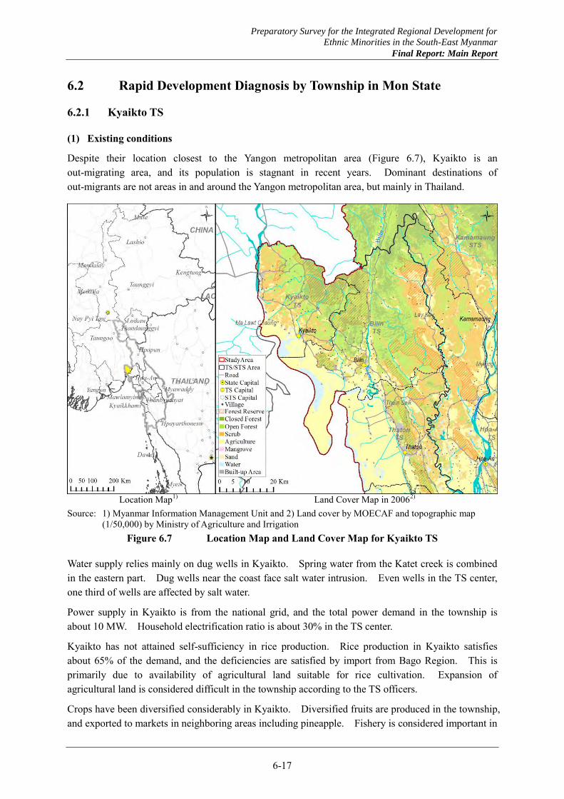
Preparatory Survey for the Integrated Regional Development for
Ethnic Minorities in the South-East Myanmar
Final Report: Main Report
6-17
6.2 Rapid Development Diagnosis by Township in Mon State
6.2.1 Kyaikto TS
(1) Existing conditions
Despite their location closest to the Yangon metropolitan area (Figure 6.7), Kyaikto is an out-migrating area, and its population is stagnant in recent years. Dominant destinations of out-migrants are not areas in and around the Yangon metropolitan area, but mainly in Thailand.
Location Map1) Land Cover Map in 20062)
Source: 1) Myanmar Information Management Unit and 2) Land cover by MOECAF and topographic map (1/50,000) by Ministry of Agriculture and Irrigation
Figure 6.7 Location Map and Land Cover Map for Kyaikto TS
Water supply relies mainly on dug wells in Kyaikto. Spring water from the Katet creek is combined in the eastern part. Dug wells near the coast face salt water intrusion. Even wells in the TS center, one third of wells are affected by salt water.
Power supply in Kyaikto is from the national grid, and the total power demand in the township is about 10 MW. Household electrification ratio is about 30% in the TS center.
Kyaikto has not attained self-sufficiency in rice production. Rice production in Kyaikto satisfies about 65% of the demand, and the deficiencies are satisfied by import from Bago Region. This is primarily due to availability of agricultural land suitable for rice cultivation. Expansion of agricultural land is considered difficult in the township according to the TS officers.
Crops have been diversified considerably in Kyaikto. Diversified fruits are produced in the township, and exported to markets in neighboring areas including pineapple. Fishery is considered important in
Preparatory Survey for the Integrated Regional Development for
Ethnic Minorities in the South-East Myanmar
Final Report: Main Report
6-18
these townships, but at present only small scale coastal and inland fishery activities are undertaken.
A few small manufacturing industries exist including coconut oil and fruit jam in Kyaikto as well as bamboo handicrafts. Crude coconut oil is sent to Yangon for refining. Small gold mines are operated in the TS.
The golden pagoda on the rock is a famous tourist attraction in Kyaikto. Other tourism resources include a stupa at Malawtchaung, Hundred Wells and other religious objects in Kyaikto.
Kyaikto has large reserve and public forest areas, but they are decreasing by expansion of rubber plantations. In reserve forests of Kyaikto, poor villages exist, and the TS administration plans to relocate them, but settlement sites will have to be established by sacrificing part of reserve forests. While the population is stagnant, further degradation of forest resources is a serious concern in the TS.
UNDP is active in the TS supporting health services, providing quality seed for paddy and groundnut and rubber seedlings, and educating farmers for good farm practices.
(2) Constraints
Major constraints to development of the Kyaikto TS are identified as follows: (a) Difficulty in expanding agricultural land due to narrow land between mountains and the coast, (b) Out-migration of working age population due to limited employment opportunities other than
agriculture, (c) Threat to water supply by salt water intrusion in lowland along the coast where population is
concentrated, (d) Limited opportunities for water resources development with rivers having small catchment
areas, (e) Subsistent fishery without motivation for expansion and processing, and (f) Degrading forest resources.
(3) Prospects
Kyaikto is expected to become a tourism sub-base complementary to the regional tourism base of Mawlamyine in the Southeast Myanmar. To realize the potential, additional tourist attractions should be developed in areas around the golden pagoda. Also, specialty products should be developed for visitors to enjoy such as high quality cashew nut and fruit jams.
Agro-processing industries are expected to develop including fruit jams and compotes together with their canning and bottling. Other than existing alcohol production from cracked rice, various rice based processing products may deserve serious consideration.
Fishery will become more important in the economies of the township. Coastal fishery may be strengthened by organizing fishermen and providing supports to the organizations. Comprehensive support packages may be provided similar to those provided by JICA for inland fishery in Kayin State, encompassing fishing and processing technologies and financing.
Diversification of latex derivative products holds a key for rubber industrial cluster development in the Southeast Myanmar. Kyaikto TS and Bilin TS are expected to lead the way to this products diversification.
Preparatory Survey for the Integrated Regional Development for
Ethnic Minorities in the South-East Myanmar
Final Report: Main Report
6-19
6.2.2 Bilin TS
(1) Existing conditions
Population of Bilin is increasing slowly in recent years. It has reached 150,000 in 2013, and increased 1.1% annually in the past year. Out-migration is mainly to Ye and Thailand.
Water supply relies mainly on dug wells. In Bilin, the Development Committee has established rain water collection tanks along the coast, and spring water is supplied by pipes after sedimentation in the eastern part closer to Kayin State. Dug wells near the coast face salt water intrusion. Power supply in Bilin depends on a gas turbine generator for the demand of about 3 MW.
Bilin is a significant rice producer, exporting to neighboring areas. Crops have been diversified considerably in Bilin. In particular, Bilin is the top producer of groundnut and pulses of all the TSs in Mon State. Diversified fruits are produced in Bilin. Fishery is considered important in Bilin, but at present only small scale coastal and inland fishery activities are undertaken.
There exists a large automobile tires factory in Bilin, but its products are only for domestic markets. A few small manufacturing industries exist including potteries and palm jiggery in Bilin as well as bamboo handicrafts. An alcohol manufacturing from cracked rice also exists in the TS. Small gold mines are operated by private enterprises.
A famous mountain exists in Bilin, which may be a potential tourism resource. Some religious sites are also considered possible tourism resources.
Bilin has large reserve and public forest areas (Figure 6.8), but they are degrading by expansion of rubber plantations. In reserve forests, poor villages exist undertaking rubber plantations, horticulture and bamboo extraction. The TS administration plans to relocate them, but settlement sites will have to be established by sacrificing part of reserve forests. Shifting cultivation is practiced in areas of Bilin near the border with Kayin State.
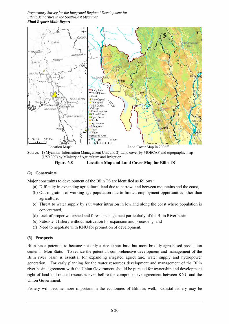
Preparatory Survey for the Integrated Regional Development for
Ethnic Minorities in the South-East Myanmar
Final Report: Main Report
6-20
Location Map1) Land Cover Map in 20062)
Source: 1) Myanmar Information Management Unit and 2) Land cover by MOECAF and topographic map (1/50,000) by Ministry of Agriculture and Irrigation
Figure 6.8 Location Map and Land Cover Map for Bilin TS
(2) Constraints
Major constraints to development of the Bilin TS are identified as follows: (a) Difficulty in expanding agricultural land due to narrow land between mountains and the coast, (b) Out-migration of working age population due to limited employment opportunities other than
agriculture, (c) Threat to water supply by salt water intrusion in lowland along the coast where population is
concentrated, (d) Lack of proper watershed and forests management particularly of the Bilin River basin, (e) Subsistent fishery without motivation for expansion and processing, and (f) Need to negotiate with KNU for promotion of development.
(3) Prospects
Bilin has a potential to become not only a rice export base but more broadly agro-based production center in Mon State. To realize the potential, comprehensive development and management of the Bilin river basin is essential for expanding irrigated agriculture, water supply and hydropower generation. For early planning for the water resources development and management of the Bilin river basin, agreement with the Union Government should be pursued for ownership and development right of land and related resources even before the comprehensive agreement between KNU and the Union Government.
Fishery will become more important in the economies of Bilin as well. Coastal fishery may be
Preparatory Survey for the Integrated Regional Development for
Ethnic Minorities in the South-East Myanmar
Final Report: Main Report
6-21
strengthened by organizing fishermen and providing supports to the organizations. Inland fishery, particularly in the Bilin river basin may also be important. Comprehensive support packages may be provided similar to those provided by JICA for inland fishery in Kayin State, encompassing fishing and processing technologies and financing.
To prevent further degradation of forest resources, shifting cultivation in Bilin should be converted to horticulture in settlements. A system to entrust management of forest resources to residents nearby should be introduced and strengthened by allowing extraction of non-wood forest resources by them.
Diversification of latex derivative products holds a key for rubber industrial cluster development in the Southeast Myanmar. Kyaikto TS and Bilin TS are expected to lead the way to this products diversification.
6.2.3 Thaton TS
(1) Existing conditions
Thaton TS is located along the main artery between Hpaan and Yangon, and its population, 221,000 in 2013, is increasing at a modest rate in recent years. The township receives in-migrants mainly from Bago Region, but some people have moved out to Thailand and other townships.
For water supply, spring water is tapped by the Waba dam, pumped to a nearby mountain and distributed by gravity after iron contents are reduced by aeration. There are also some 4,000 dug wells and over 20 tube wells. The water supply system covers 65% of the TS population, and the rest relies on wells. A new town is planned in the south of the existing TS center, and expansion of water supply with additional dug wells is planned.
Thaton TS is connected to the national grid of power supply, but a gas turbine unit of 45 MW capacity is also available. Out of the total of some 40,000 households, 11,000 households are supplied with electricity.
Main roads serving the TS are the Yangon-Myeik road (26 miles asphalt paved within the TS), the Thaton-Hpaan road (8 miles asphalt paved within the township), and the Theinseik-Laykay road. The Theinseik-Laykay road consists of three sections: 30 miles tar, 40 miles gravel and 8 miles earth sections.
Monsoon paddy is cultivated in 48,600 ha, and quality paddy in 14,000 ha. Cultivation of summer rice is significant with 6,500 ha, irrigated mostly by local streams. Winter crops are dominated by green gram, followed by groundnut and limited sesame. Of various fruits produced in the TS, durian is considered most important commercially. Fishery is undertaken with 200 small motored fishing boats, and its products are mostly sent to Yangon.
Thaton TS has a large tire factory operated by both the Government to produce tires for tractors and small cars and a joint venture with the private sector. Bamboo baskets and hats, and pottery to produce small bowl for rubber sap collection are cottage industries in the township. Gold and antimony deposits exist, for which private enterprises have obtained permissions from the Ministry of Mines through the State Government.
There exist three reserve forests in Thaton with a total area of 9,700 ha, which have been partly converted to rubber plantations (Figure 6.9). Public forests cover only 240 ha, and no timber extraction is practiced.
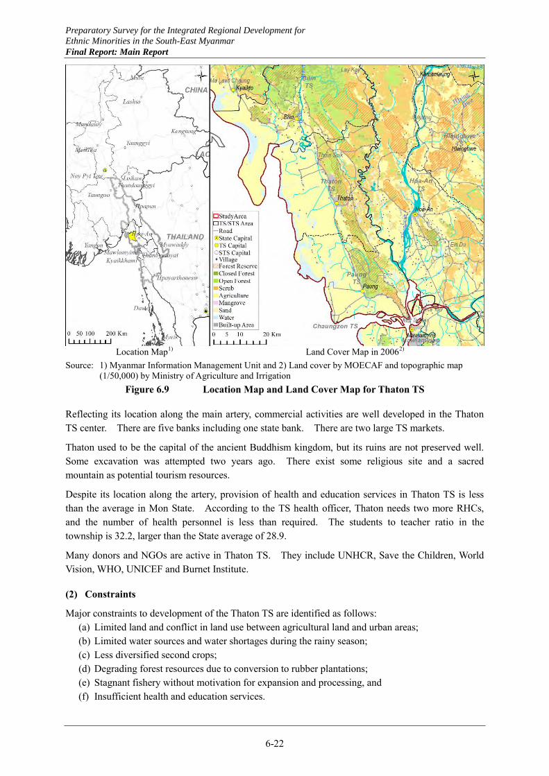
Preparatory Survey for the Integrated Regional Development for
Ethnic Minorities in the South-East Myanmar
Final Report: Main Report
6-22
Location Map1) Land Cover Map in 20062)
Source: 1) Myanmar Information Management Unit and 2) Land cover by MOECAF and topographic map (1/50,000) by Ministry of Agriculture and Irrigation
Figure 6.9 Location Map and Land Cover Map for Thaton TS
Reflecting its location along the main artery, commercial activities are well developed in the Thaton TS center. There are five banks including one state bank. There are two large TS markets.
Thaton used to be the capital of the ancient Buddhism kingdom, but its ruins are not preserved well. Some excavation was attempted two years ago. There exist some religious site and a sacred mountain as potential tourism resources.
Despite its location along the artery, provision of health and education services in Thaton TS is less than the average in Mon State. According to the TS health officer, Thaton needs two more RHCs, and the number of health personnel is less than required. The students to teacher ratio in the township is 32.2, larger than the State average of 28.9.
Many donors and NGOs are active in Thaton TS. They include UNHCR, Save the Children, World Vision, WHO, UNICEF and Burnet Institute.
(2) Constraints
Major constraints to development of the Thaton TS are identified as follows: (a) Limited land and conflict in land use between agricultural land and urban areas; (b) Limited water sources and water shortages during the rainy season; (c) Less diversified second crops; (d) Degrading forest resources due to conversion to rubber plantations; (e) Stagnant fishery without motivation for expansion and processing, and (f) Insufficient health and education services.
Preparatory Survey for the Integrated Regional Development for
Ethnic Minorities in the South-East Myanmar
Final Report: Main Report
6-23
(3) Prospects
Thaton has a high potential for commercial development capitalizing on its location along the main artery road, which will be upgraded with widening. As the existing TS center is already densely built, a bypass needs to be constructed. Since the township has limited land for future urbanization and conflicts exist between urban and agricultural land uses, town planning should be carefully undertaken based on land suitability for agriculture.
To take advantage of the artery road upgrading for the TS development fully, access roads should be improved from the interior to the main road. Improved access to markets will encourage diversification of second crops, and possibly establishment of agro-processing industries. Suburban agriculture may develop to supply fresh vegetables and meat products to the growing urban market. Commercial livestock and poultry activities may also develop to supply the urban market.
Fishery will become more important in the TS economies. Coastal fishery may be strengthened by organizing fishermen and providing supports to the organizations. Fish products will be supplied increasingly to the local market rather than sent to Yangon as currently done.
The ruins of the ancient capital of the Buddhism kingdom are potential assets that may be utilized for tourism purposes. Systematic excavation works should be planned in association with an international institute specialized in archeology. Hotels and restaurants will be developed as the artery roads are upgraded and through traffic increases.
6.2.4 Paung TS
(1) Existing conditions
Population of Paung TS is increasing at 1.4~1.8% annually in recent years according to the TS planning officer. It reached 235,000 in 2013. Some people, especially youth, are migrating out to Thailand.
Water supply by the TS Development Committee taps spring water in the eastern mountain to serve about 60% of the TS population. The remaining 40% relies on private water supply based on tube wells and spring water. Water price is 30 kyat per 50 liter unit. The public water supply has sufficient quantity of water, except small shortages in March. Areas along the coast experiences water shortages and rain water catchment with ponds are used as water from wells is salty.
Power supply is from the national grid, and the total demand is 7 MW. Out of some 30,000 households in the TS center, 14,000 households are covered by power supply. Except the main road, most roads from the main road to coastal areas and the coastal roads are earth roads. Exceptions are a road to former salt industry and a coastal road serving rich families.
Paung has the largest paddy cultivated area in Mon State in 2013. Cultivation of summer paddy is also significant and attained 3,600 ha this year, while the capacity is over 4,000 ha. Cultivated areas under second crops are relatively small in Paung, and vegetables are produced in the eastern part. Commercial chicken and duck breeding is undertaken. Fishery is practiced by 3,000-4,000 fishermen with about 300 powered boats. Fish products are mostly marketed in Mawlamyine.
Reserve forests cover 11,600 ha in the Paung TS (Figure 6.10). They are degrading as rubber plantations are increasing.
A soap manufacturing is operated by the Myanmar Economic Holding. State owned dock yards exist at Mottama on the Thanlwin River to serve civilian ships. No commercial handicrafts exist.
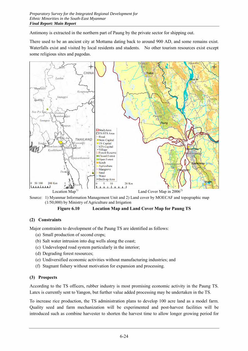
Preparatory Survey for the Integrated Regional Development for
Ethnic Minorities in the South-East Myanmar
Final Report: Main Report
6-24
Antimony is extracted in the northern part of Paung by the private sector for shipping out.
There used to be an ancient city at Mottama dating back to around 900 AD, and some remains exist. Waterfalls exist and visited by local residents and students. No other tourism resources exist except some religious sites and pagodas.
Location Map1) Land Cover Map in 20062)
Source: 1) Myanmar Information Management Unit and 2) Land cover by MOECAF and topographic map (1/50,000) by Ministry of Agriculture and Irrigation
Figure 6.10 Location Map and Land Cover Map for Paung TS
(2) Constraints
Major constraints to development of the Paung TS are identified as follows: (a) Small production of second crops; (b) Salt water intrusion into dug wells along the coast; (c) Undeveloped road system particularly in the interior; (d) Degrading forest resources; (e) Undiversified economic activities without manufacturing industries; and (f) Stagnant fishery without motivation for expansion and processing.
(3) Prospects
According to the TS officers, rubber industry is most promising economic activity in the Paung TS. Latex is currently sent to Yangon, but further value added processing may be undertaken in the TS.
To increase rice production, the TS administration plans to develop 100 acre land as a model farm. Quality seed and farm mechanization will be experimented and post-harvest facilities will be introduced such as combine harvester to shorten the harvest time to allow longer growing period for
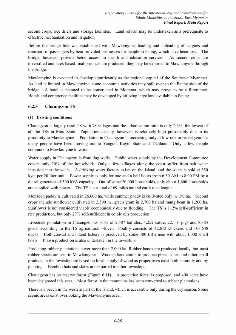
Preparatory Survey for the Integrated Regional Development for
Ethnic Minorities in the South-East Myanmar
Final Report: Main Report
6-25
second crops, rice driers and storage facilities. Land reform may be undertaken as a prerequisite to effective mechanization and irrigation
Before the bridge link was established with Mawlamyine, loading and unloading of cargoes and transport of passengers by boat provided businesses for people in Paung, which have been lost. The bridge, however, provide better access to health and education services. As second crops are diversified and latex based final products are produced, they may be exported to Mawlamyine through the bridge.
Mawlamyine is expected to develop significantly as the regional capital of the Southeast Myanmar. As land is limited in Mawlamyine, some economic activities may spill over to the Paung side of the bridge. A hotel is planned to be constructed in Mottama, which may prove to be a forerunner. Hotels and conference facilities may be developed by utilizing large land available in Paung.
6.2.5 Chaungzon TS
(1) Existing conditions
Chaungzon is largely rural TS with 78 villages and the urbanization ratio is only 2.3%, the lowest of all the TSs in Mon State. Population density, however, is relatively high presumably due to its proximity to Mawlamyine. Population in Chaungzon is increasing only at low rate in recent years as many people have been moving out to Yangon, Kayin State and Thailand. Only a few people commute to Mawlamyine to work.
Water supply in Chaungzon is from dug wells. Public water supply by the Development Committee covers only 20% of the households. Only a few villages along the coast suffer from salt water intrusion into the wells. A drinking water factory exists on the island, and the water is sold at 350 kyat per 20 liter unit. Power supply is only for one and a half hours from 6:30 AM to 8:00 PM by a diesel generator of 500 kVA capacity. Out of some 20,000 households, only about 1,600 households are supplied with power. The TS has a total of 69 miles tar and earth road length.
Monsoon paddy is cultivated in 26,600 ha, while summer paddy is cultivated only in 150 ha. Second crops include sunflower cultivated in 2,500 ha, green gram in 2,700 ha and mung bean in 1,200 ha. Sunflower is not considered viable economically due to flooding. The TS is 112% self-sufficient in rice production, but only 27% self-sufficient in edible oils production.
Livestock population in Chaungzon consists of 2,587 baffalos, 4,252 cattle, 22,116 pigs and 8,383 goats, according to the TS agricultural officer. Poultry consists of 42,613 chickens and 108,648 ducks. Both coastal and inland fishery is practiced by some 300 fishermen with about 1,000 small boats. Prawn production is also undertaken in the township.
Producing rubber plantations cover more than 2,000 ha. Rubber bands are produced locally, but most rubber sheets are sent to Mawlamyine. Wooden handicrafts to produce pipes, canes and other small products in the township are based on local supply of wood as proper trees exist both naturally and by planting. Bamboo hats and slates are exported to other townships.
Chaungzon has no reserve forest (Figure 6.11). A protection forest is proposed, and 400 acres have been designated this year. Most forest in the mountains has been converted to rubber plantations.
There is a beach in the western part of the island, which is accessible only during the dry season. Some scenic areas exist overlooking the Mawlamyine area.
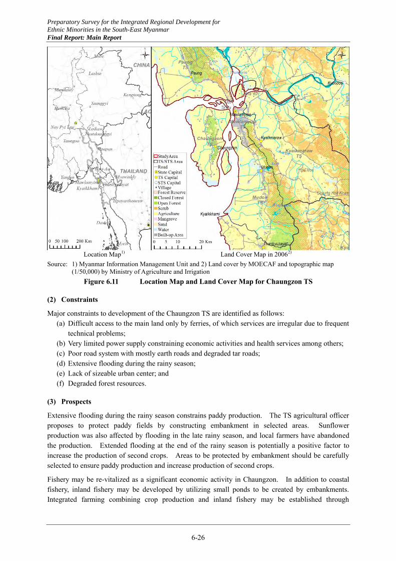
Preparatory Survey for the Integrated Regional Development for
Ethnic Minorities in the South-East Myanmar
Final Report: Main Report
6-26
Location Map1) Land Cover Map in 20062)
Source: 1) Myanmar Information Management Unit and 2) Land cover by MOECAF and topographic map (1/50,000) by Ministry of Agriculture and Irrigation
Figure 6.11 Location Map and Land Cover Map for Chaungzon TS
(2) Constraints
Major constraints to development of the Chaungzon TS are identified as follows: (a) Difficult access to the main land only by ferries, of which services are irregular due to frequent
technical problems; (b) Very limited power supply constraining economic activities and health services among others; (c) Poor road system with mostly earth roads and degraded tar roads; (d) Extensive flooding during the rainy season; (e) Lack of sizeable urban center; and (f) Degraded forest resources.
(3) Prospects
Extensive flooding during the rainy season constrains paddy production. The TS agricultural officer proposes to protect paddy fields by constructing embankment in selected areas. Sunflower production was also affected by flooding in the late rainy season, and local farmers have abandoned the production. Extended flooding at the end of the rainy season is potentially a positive factor to increase the production of second crops. Areas to be protected by embankment should be carefully selected to ensure paddy production and increase production of second crops.
Fishery may be re-vitalized as a significant economic activity in Chaungzon. In addition to coastal fishery, inland fishery may be developed by utilizing small ponds to be created by embankments. Integrated farming combining crop production and inland fishery may be established through
Preparatory Survey for the Integrated Regional Development for
Ethnic Minorities in the South-East Myanmar
Final Report: Main Report
6-27
experimentation.
Handicrafts of wood works are attractive economic activities of Chaungzon, but they may not grow into a major industry as raw materials are limited and there are only a few skilled craftsmen. Production of pipes, canes and other goods from rosewood should be regarded as traditional cultural heritage rather than the indigenous industry. To preserve the heritage and use it as tourism resource, a rosewood museum with a shop may be established to collect and display the traditional handicrafts. A workshop tour, pony-driven cart ride, and a restaurant with rosewood furniture and ornaments may be additional tourist attractions.
To enhance the tourism value of Chaungzon, a story of ogre (Bi-lu-kyun) island may be featured by local people together with festivities. A beach resort and scenic mountain trails may also be added to the tourist attractions. Hotels and other accommodations should be provided on the island. Rural tourism featuring farming activities and rural life may be another prospect, taking advantage of the proximity from Mawlamyine.
A bridge link to Mawlamyine is an option to be considered in the long term, but environmental effects on waterway as well as adverse effects of spill over urbanization should be carefully examined.
6.2.6 Mudon TS
(1) Existing conditions
Population in Mudon is increasing in recent years to reach almost 180,000. The urbanization ratio is 25.3% in 2013, the second highest next only to Mawlamyine. The township is an in-migrating area as reflected by high labor force coefficient, but some people also move out to Thailand, Malaysia and Singapore as well as other regions in Myanmar.
Water supply for the township takes spring water by the Azin dam and distribute by gravity after treatment with sand filter (Figure 6.12). In the TS center, the water supply system serves 2,000 households by individual connections and 130 public standpipes, covering 78% of the households. Practically all the households have their own dug wells as well. Water quality is tested every month at State facilities. Wells in the coastal areas suffer from salt water intrusion.
Mudon is connected to the national grid of power supply with 4 MW supply capacity. The total power demand is estimated to be 8 MW by the TS administration. Out of the total of 31,000 households, 10,963 households are served by power supply.
Sections within the TS of the Yangon- Myeik road and the Mudon-Myawaddy roads are tar paved as well as Mudon-Kyaikmaraw road of 2 miles. Other road sections are gravel or earth, and not navigable during the rainy season. Most bridges have been destroyed or damaged.
Mudon is more than self-sufficient in paddy production, and the excess is exported to Ye and Kayin State. Production of second crops is very limited. Summer paddy is produced by irrigation water from the Azin and the Winpanon dams. Of various fruits produced in the township, durian and rambutan are considered most promising by the TS officers. There exist commercial poultry farms with a total of 2.3million chickens. Livestock population in Mudon consists of 5,741 goats, 45,000 pigs and 2,434 baffallos and cattle. Fishery is not important as there are only about 100 fishermen in the township.
There are cottage industries in Mudon to produce woven products such as blankets and sheets, which are exported to all over the Country. Chalks and some ceramics are produced from white clay
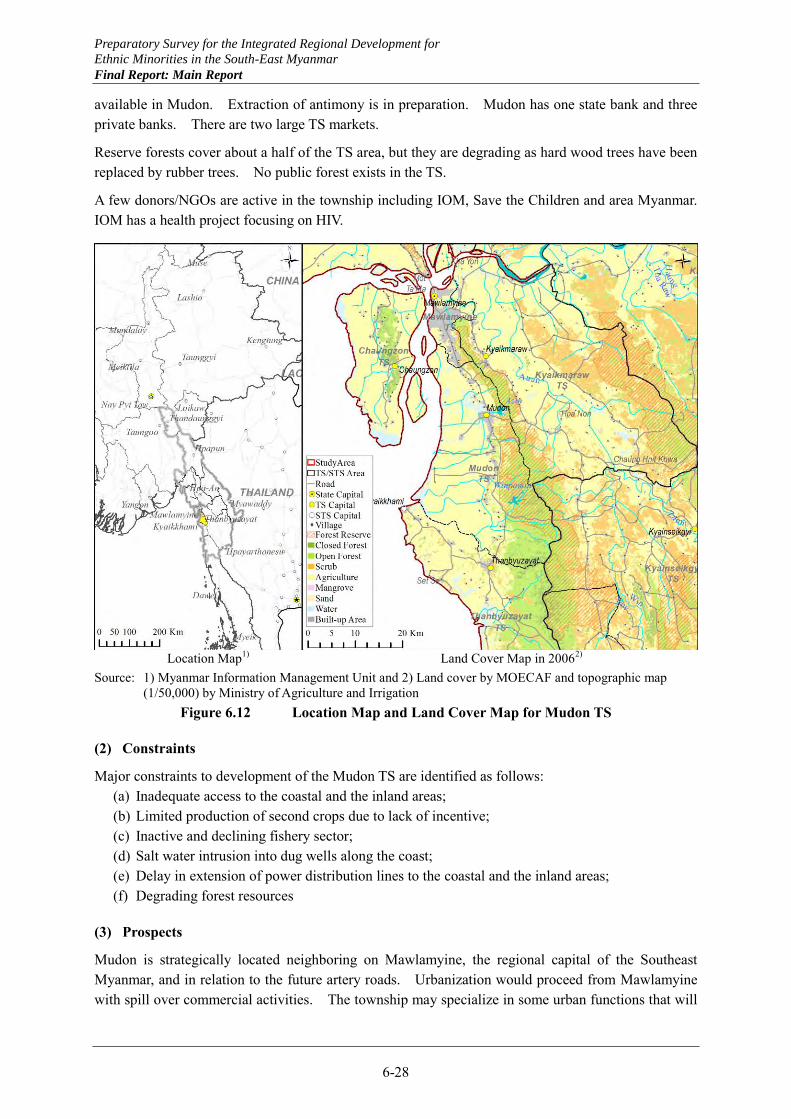
Preparatory Survey for the Integrated Regional Development for
Ethnic Minorities in the South-East Myanmar
Final Report: Main Report
6-28
available in Mudon. Extraction of antimony is in preparation. Mudon has one state bank and three private banks. There are two large TS markets.
Reserve forests cover about a half of the TS area, but they are degrading as hard wood trees have been replaced by rubber trees. No public forest exists in the TS.
A few donors/NGOs are active in the township including IOM, Save the Children and area Myanmar. IOM has a health project focusing on HIV.
Location Map1) Land Cover Map in 20062)
Source: 1) Myanmar Information Management Unit and 2) Land cover by MOECAF and topographic map (1/50,000) by Ministry of Agriculture and Irrigation
Figure 6.12 Location Map and Land Cover Map for Mudon TS
(2) Constraints
Major constraints to development of the Mudon TS are identified as follows: (a) Inadequate access to the coastal and the inland areas; (b) Limited production of second crops due to lack of incentive; (c) Inactive and declining fishery sector; (d) Salt water intrusion into dug wells along the coast; (e) Delay in extension of power distribution lines to the coastal and the inland areas; (f) Degrading forest resources
(3) Prospects
Mudon is strategically located neighboring on Mawlamyine, the regional capital of the Southeast Myanmar, and in relation to the future artery roads. Urbanization would proceed from Mawlamyine with spill over commercial activities. The township may specialize in some urban functions that will
Preparatory Survey for the Integrated Regional Development for
Ethnic Minorities in the South-East Myanmar
Final Report: Main Report
6-29
complement the urban functions of Mawlamyine such as advanced education and high grade health services.
Production of second crops may be expanded and diversified possibly under supplemental irrigation. Small irrigation schemes may be suitable to produce vegetables as well as pulses to supply the expanding urban market. Commercial poultry may also expand to produce both meat and eggs for the urban market.
Protection of reserve forests by watershed management is important to ensure sufficient water for irrigation from small rivers with short channels. Rubber plantations should not be expanded especially on mountain slopes to prevent landslides and other disasters.
As a regional port is established at Kyaikkhami, service activities may develop along the artery from Thanbyuzayat to Mudon for cargo trucks and other vehicles. Also, some industries may be located in the township supplying parts and intermediate products to large industries to be established in the port hinterland.
6.2.7 Kyaikmaraw TS
(1) Existing conditions
Kyaikmaraw TS is located adjacent to Mawlamyine, but it is largely rural. The urbanization ratio is only 6.8% as of 2013. Population is increasing very slowly in recent years.
Public water supply based on tube wells serves about 500 households with supply capacity of 35,000 gallon per day. Small scale water supply is available by the private sector. There are many individually owned dug wells as well. Power supply is from the national grid. From the Mawlamyine sub-station, power is supplied for 2 MW to the industrial estate, 1.5 MW to the TS center, and 3.5 MW to rural areas. Household electrification rate is about 25% in the TS center.
Rice is cultivated in 70,000 acres during the rainy season and 4,000 acres during the summer season. Self-sufficiency is attained, and a quarter of excess rice is exported to neighboring townships. Other crops include pulses, groundnut and sesame. Sunflower is cultivated in small area. Vegetables are produced for local consumption. As a characteristic crop in the township, toddy palm is planted to make unique landscape.
No manufacturing industries exist other than rubber sheets production and rice mills. Handicrafts are mainly bamboo baskets and mats. A joint venture between the private sector and the Ministry of Mining extracts marble and process it into tiles and blocks. Deposits of phosphate and antimony are reported.
Three reserve forests exist in the township covering 80,000 acres. Of these, some 40,000 acres have already been converted to rubber plantations. There exist many residents within the reserve forests, including migrants from Ayeyarwady and Bago, and victims of the Nargis as well as local people.
Potential tourism resources include the Kyaikmaraw pagoda, limestone caves at Khayon and Hpanon, and hot spars near Chaunghnitkhwa (Figure 6.13). The Khayon cave is said to be the third largest in the world.
During the rainy season, flooding by the Attran River extends for two weeks to one month, but no serious damage is experienced as residents are well adapted to the situation. A major flood is experienced once in four years.
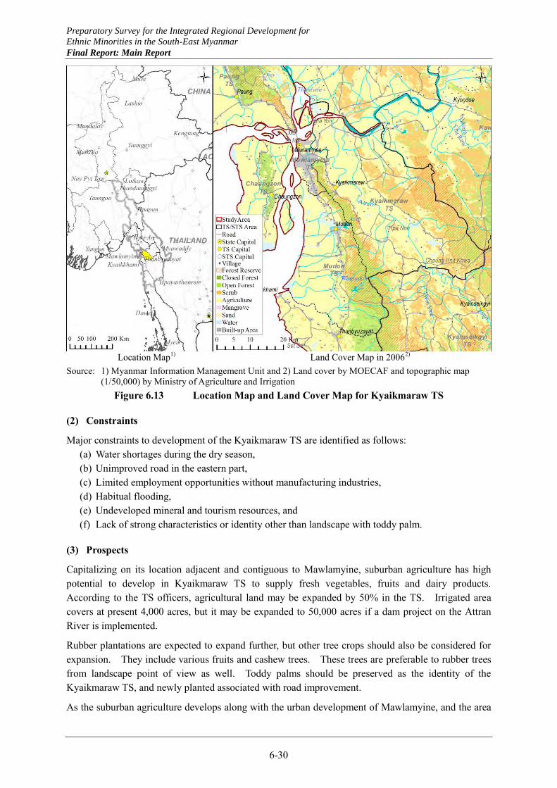
Preparatory Survey for the Integrated Regional Development for
Ethnic Minorities in the South-East Myanmar
Final Report: Main Report
6-30
Location Map1) Land Cover Map in 20062)
Source: 1) Myanmar Information Management Unit and 2) Land cover by MOECAF and topographic map (1/50,000) by Ministry of Agriculture and Irrigation
Figure 6.13 Location Map and Land Cover Map for Kyaikmaraw TS
(2) Constraints
Major constraints to development of the Kyaikmaraw TS are identified as follows: (a) Water shortages during the dry season, (b) Unimproved road in the eastern part, (c) Limited employment opportunities without manufacturing industries, (d) Habitual flooding, (e) Undeveloped mineral and tourism resources, and (f) Lack of strong characteristics or identity other than landscape with toddy palm.
(3) Prospects
Capitalizing on its location adjacent and contiguous to Mawlamyine, suburban agriculture has high potential to develop in Kyaikmaraw TS to supply fresh vegetables, fruits and dairy products. According to the TS officers, agricultural land may be expanded by 50% in the TS. Irrigated area covers at present 4,000 acres, but it may be expanded to 50,000 acres if a dam project on the Attran River is implemented.
Rubber plantations are expected to expand further, but other tree crops should also be considered for expansion. They include various fruits and cashew trees. These trees are preferable to rubber trees from landscape point of view as well. Toddy palms should be preserved as the identity of the Kyaikmaraw TS, and newly planted associated with road improvement.
As the suburban agriculture develops along with the urban development of Mawlamyine, and the area
Preparatory Survey for the Integrated Regional Development for
Ethnic Minorities in the South-East Myanmar
Final Report: Main Report
6-31
under tree crops expands, various agro-processing industries may be established. Also, rubber based processing plants are expected to be established to diversify latex derivative products by introducing technologies.
Tourism resources should be developed to contribute to diversification of tour routes centering on Mawlamyine as the regional tourism base. Limestone caves and unique rural landscape with toddy palm and other tree crops are particularly promising. Further forest degradation should be prevented to maintain the tourism value of the landscape as well.
A systematic exploration should be planned for mineral resources endowed in the township. This may be part of a comprehensive mineral resources exploration in Mon State as a whole.
6.2.8 Thanbyuzayat TS
(1) Existing conditions
Thanbyuzayat TS is a relatively small township, and its urban population constituting 18% of the total population concentrates in the TS center near the border with Mudon closest to Mawlamyine. Population is growing slowly in recent years. There are many seasonal workers in the township.
Water supply is from individual dug wells and tube wells. Water quality is good, but water shortages are experienced during summer. Small scale water supply is also available by private suppliers with trucks. Power supply is from the national grid. The total power demand is about 5 MW. Household electrification rate is about 40% in the TS center.
Rice is cultivated in 16,000 ha, and rice production is close to the self-sufficiency level. Cultivated areas are all small for other crops. In addition to groundnut and pulses traditionally cultivated, cultivation of vegetables, formerly imported from Bago, started recently but only for local consumption. Fruit include durian, rambutan, mangosteen, mango and ladies’ biscuit. Goat raising is commonly practiced. Rubber trees cover some 60,000 acres, of which 48,000 acres are producing. Fishery has become less popular as fishery resources decreased. Many fishermen have converted to rubber plantations, and some 3,000 fishermen remain.
Reserve forests have been practically all converted to rubber plantations. No public forests exist either (Figure 6.14). Modest reforestation has been practiced under the national program.
No manufacturing industries exist except rubber sheets production. Handicraft to produce bamboo hats was popular some 70 years ago but ceased to exist. Deposits of antimony are reported in areas between Thanbyuzayat and Kyainseikgyi, but no exploration has been done. Low quality amethyst is available.
The Setse beach is a popular resort due to its proximity from Mawlamyine, but degradation of water quality is a concern. Other tourism resources include the British cemetery and a pagoda established by Japanese soldiers.
KNU and NMSP are freely entering the TS, although they don’t have their offices in the township. Security conditions are good due partly to the presence of the Infantry Training Center. Mon State realized the cease fire early, and the State Government has good relationships with KNU and NMSP. Mon State is known for high education levels. These are favorable conditions to pursue development.
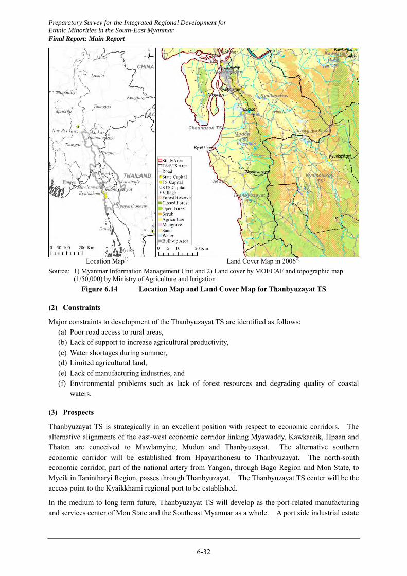
Preparatory Survey for the Integrated Regional Development for
Ethnic Minorities in the South-East Myanmar
Final Report: Main Report
6-32
Location Map1) Land Cover Map in 20062)
Source: 1) Myanmar Information Management Unit and 2) Land cover by MOECAF and topographic map (1/50,000) by Ministry of Agriculture and Irrigation
Figure 6.14 Location Map and Land Cover Map for Thanbyuzayat TS
(2) Constraints
Major constraints to development of the Thanbyuzayat TS are identified as follows: (a) Poor road access to rural areas, (b) Lack of support to increase agricultural productivity, (c) Water shortages during summer, (d) Limited agricultural land, (e) Lack of manufacturing industries, and (f) Environmental problems such as lack of forest resources and degrading quality of coastal
waters.
(3) Prospects
Thanbyuzayat TS is strategically in an excellent position with respect to economic corridors. The alternative alignments of the east-west economic corridor linking Myawaddy, Kawkareik, Hpaan and Thaton are conceived to Mawlamyine, Mudon and Thanbyuzayat. The alternative southern economic corridor will be established from Hpayarthonesu to Thanbyuzayat. The north-south economic corridor, part of the national artery from Yangon, through Bago Region and Mon State, to Myeik in Tanintharyi Region, passes through Thanbyuzayat. The Thanbyuzayat TS center will be the access point to the Kyaikkhami regional port to be established.
In the medium to long term future, Thanbyuzayat TS will develop as the port-related manufacturing and services center of Mon State and the Southeast Myanmar as a whole. A port side industrial estate
Preparatory Survey for the Integrated Regional Development for
Ethnic Minorities in the South-East Myanmar
Final Report: Main Report
6-33
will develop in Kyaikkhami, and related services will develop in the TS center.
With these developments to be realized, environmental management will be vitally important. In addition to water shortages and degrading quality of coastal waters existing already, various environmental problems may arise associated with the developments. As water demand increases significantly by industrial and related services development, new water sources need to be developed. To secure sufficient water of good quality, surface water needs to be used in combination with groundwater. Proper management of watershed and conjunctive use of surface water and groundwater will be of utmost importance for sustainable development.
Proper treatment of wastewater from industrial areas and port operation as well as urban areas is essential to maintain coastal environment and to support fishery development. Also, tree planting should be more proactively undertaken in association of development of industrial areas and related infrastructure. Re-forestation should also be promoted to protect upper basins of rivers having short courses to prevent flush floods as well.
The Setse beach should be upgraded to more than a weekend resort for local people. It should be incorporated in tour itineraries from Mawlamyine combining both mountain and beach resorts and other attractions. As a prerequisite, coastal environment of the beach needs to be much improved by preventing littering of wastes and controlling establishment of private and commercial facilities.
Agriculture in the TS should aim at high productivity not by increasing the use of agricultural chemicals and artificial fertilizer, but by mixed farming combining crops and integrated farming with livestock, capitalizing on the proximity to the growing urban and tourism markets. Specialty products may be developed for the tourism market such as high quality vegetables and fruits and dairy products.
6.2.9 Ye TS
(1) Existing conditions
Ye TS is a receiving area for migrants from the northern townships of Mon State, and at the same time many residents out-migrate to Thailand. Population in the township is growing only slowly in recent years. Out-migrants to Thailand constitute a significant portion of the TS population.
The township occupies a narrow land between the mountains on the east and the coast on the west. Most rivers have short courses, and thus despite favorable endowments, the use of water resources is difficult. Water supply is mainly by dug wells, and water shortages are experienced from late April to the beginning of the rainy season. The Development Committee established a supply system with dug wells and storage tank to distribute water by gravity to 1,500 households. A private cooperative has started water supply with springs to serve 2,000 households eventually. Power supply is by a diesel generator to meet the present demand of 2 MW.
Rice production is almost exclusively during the rainy season, and self-sufficiency is attained. Crop diversification has been least developed, and other crops include betel nut, durian and mangosteen, although they are partly exported to Thailand. Poultry of chickens and ducks is commonly practiced. Rubber plantations cover some 150,000 acres in the township, planted and managed mostly by individual farmers owning on an average 50 acres. The Government supports them with provision of seedlings at costs and technical extension. Both coastal and deep sea fishery are important in the township, and about 5% of working age population is engaged. Fish processing is also undertaken for dried fish, fish source and crustacean crackers.
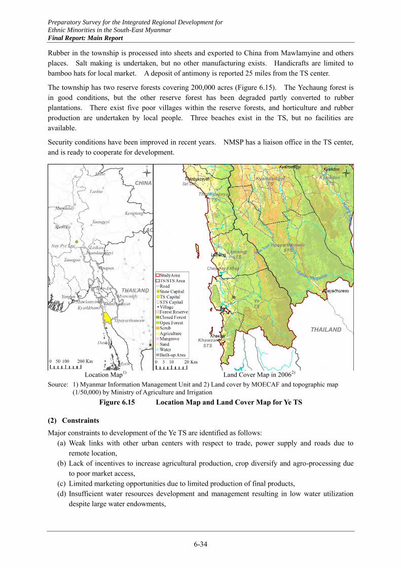
Preparatory Survey for the Integrated Regional Development for
Ethnic Minorities in the South-East Myanmar
Final Report: Main Report
6-34
Rubber in the township is processed into sheets and exported to China from Mawlamyine and others places. Salt making is undertaken, but no other manufacturing exists. Handicrafts are limited to bamboo hats for local market. A deposit of antimony is reported 25 miles from the TS center.
The township has two reserve forests covering 200,000 acres (Figure 6.15). The Yechaung forest is in good conditions, but the other reserve forest has been degraded partly converted to rubber plantations. There exist five poor villages within the reserve forests, and horticulture and rubber production are undertaken by local people. Three beaches exist in the TS, but no facilities are available.
Security conditions have been improved in recent years. NMSP has a liaison office in the TS center, and is ready to cooperate for development.
Location Map1) Land Cover Map in 20062)
Source: 1) Myanmar Information Management Unit and 2) Land cover by MOECAF and topographic map (1/50,000) by Ministry of Agriculture and Irrigation
Figure 6.15 Location Map and Land Cover Map for Ye TS
(2) Constraints
Major constraints to development of the Ye TS are identified as follows: (a) Weak links with other urban centers with respect to trade, power supply and roads due to
remote location, (b) Lack of incentives to increase agricultural production, crop diversify and agro-processing due
to poor market access, (c) Limited marketing opportunities due to limited production of final products, (d) Insufficient water resources development and management resulting in low water utilization
despite large water endowments,
Preparatory Survey for the Integrated Regional Development for
Ethnic Minorities in the South-East Myanmar
Final Report: Main Report
6-35
(e) Lack of incentives for investment into fishery and fish processing despite high fishery potentials, and
(f) Limited opportunities to increase income levels for in-migrating people resulting in out-migration to Thailand.
(3) Prospects
The Ye TS center will continue to be the center of Southern part of Mon State, and it is necessary to strengthen its urban functions and improve road links with other urban centers. As part of this, water supply and power supply need to be much expanded in the township. Water supply will have to combine multiple sources, and thus comprehensive development and management of water resources should be planned centering on the Ye river basin.
The township has a long coast line and productive paddy fields extend in coastal lowland, where cashew trees create bright and pleasant landscape. On the other hand, rubber trees tend to make the landscape darker and closed images. Further expansion of rubber plantations should be prevented to protect remaining forests from further degradation. Degraded forests, combined with rivers of short courses, make settlements urban and rural vulnerable to flash floods and other natural disasters. The poor villages in the reserve forests should be relocated, and more urban-oriented employment opportunities should be created.
Urban development of the TS center will provide an opportunity to revitalize agriculture in the township as a whole. Suburban agriculture supplying fresh vegetables, fruits and dairy products will encourage crop diversification and establishment of agro-processing industries as well.
Fishery development including fish processing may hold another key for the long term development of the Ye TS. For the development of deep sea fishery, use of larger size boats is necessary. As prerequisites, fishermen should be organized, and fish landing facilities should be improved. To expand and diversify marketing channels, sea routes with neighboring townships should be strengthened and fish processing promoted.
Tourism may provide another direction for the TS development. Considering the distance from the tourism gateway of Mawlamyine, however, attractiveness of beach resorts and other tourism resources need to be realistically assessed. The bright and pleasant landscape along the coast as mentioned above should be an important factor in planning for tourism development in the township.
High value processing of rubber is another direction for the township to pursue. Final products should be produced for export to Thailand taking advantage of free access to the Thai side under the effective management by NMSP.
Preparatory Survey for the Integrated Regional Development for
Ethnic Minorities in the South-East Myanmar
Final Report: Main Report
7-1
In this chapter, development potentials that the Southeast Myanmar has are presented from a macroscopic point of view. As summarized in Section 1.2, the Southeast Myanmar is located in a strategic position to link the advanced region of the Yangon metropolitan area and Thanintharyi Region, and also in relation to the economic corridors of the continental Southeast Asia designated by ADB. The regional development potentials of the Southeast Myanmar due to this strategic position are presented as economic corridors development.
As shown in Chapter 2, the Southeast Myanmar has very large annual precipitation and despite this fact, a distinct dry season with practically no precipitation. These characteristics are reflected in the dominant form of agriculture, which is the main stay of the Southeast Myanmar. Specifically, the Southeast Myanmar is not regarded as the prime agricultural area in the national context of Myanmar, and in particular the Region is not favorable for paddy production as clarified in Chapter 3. It is comparatively more important to combine field crops and tree crops as well as livestock with paddy cultivation to enhance agricultural productivity in the Southeast Myanmar.
The development potentials with economic corridors will be substantiated by manufacturing and related services development. To combine these development potentials with the agricultural development suggested above for regional development of the Southeast Myanmar, it will be quite effective to promote vertical industrial clusters based on primary products. For instance, the existing rubber and cashew trees may be effectively utilized to diversify their processed products and cultivate some of them into export industries. The development potentials with economic corridors will be substantiated by establishing such industrial clusters encompassing indigenous and export industries as well as livelihood activities.
To realize the Southeast Myanmar regional development by combining the economic corridors development and the industrial clusters development, related infrastructure should be developed. In particular, infrastructure for free trade zones (FTZs) and industrial estates capitalizing on the strategic location of the Region, and infrastructure to strengthen urban functions should be much improved.
In this chapter, the economic corridors development, industrial clusters promotion, development of FTZs and industrial estates, and urban development as outlined above are presented as necessary conditions to realize the development potentials of the Southeast Myanmar, and factors to describe a macro vision of the regional development are clarified. Existing conditions and potentials by sector are presented in Chapter 2 through Chapter 5, and existing conditions and potentials by township are indicated in Chapter 6 as a rapid development diagnosis by township. Guidelines and procedures for the Southeast Myanmar to realize its vision by planned development are examined in detail in Chapter 9.
CHAPTER 7 REGIONAL DEVELOPMENT POTENTIALS OF SOUTHEAST MYANMAR
Preparatory Survey for the Integrated Regional Development for
Ethnic Minorities in the South-East Myanmar
Final Report: Main Report
7-2
7.1 Economic Corridors Development
7.1.1 East-west economic corridors
(1) Original alignment
The east-west economic corridor in the Southeast Asia as designated by ADB as the Asian Highway No.1 links the Danang port of Vietnam, through Laos and the northern Thailand, to Yangon. It enters the Southeast Myanmar at Myawaddy, passes through Kawkareik, Hpaan and Thaton, turns to the north and the northwest entering Bago Region and reaches Yangon. From the national point of view of Myanmar, this is a national artery, but from the regional development point of view, it may only serve marginally to the development of the Southeast Myanmar.
(2) Alternative alignments
To serve the regional development of the Southeast Myanmar better, a few alternative alignments of the original east-west economic corridor are conceived (Figure 7.1). All of them will improve the access from the original corridor to the city of Mawlamyine, the regional capital of the Southeast Myanmar, either directly or through the neighboring cities of Mudon or Thanbyuzayat. In the south of Mawlamyine, a new regional port is conceived at Kyaikkhami. Therefore, these alternative alignments will constitute new economic corridors having major ports at both ends of the routes, once a regional port is established at Kyaikkhami.
A1 route improves the link between Kyarkalay on the original east-west economic corridor to Zarthapyin and connects to Mawlamyine (Figure 7.2). A2 route improves the link from Hlaingkwe on the original corridor, crosses the Haungtharaw River by a new bridge to be constructed, through Winka, Hparthein and Kadar, to Mudon. A3 route improves the link also from Hlaingkwe, through Winka and Methawaw, crossing the Attran River by a new bridge to be constructed, passes Setthwei and reaches Thanbyuzayat. This route may be linked through Kadar to A2 route as well to reach Mudon.
A2 route may be extended from Mudon to Kyaikkhami to provide an apparently shortest link from the original corridor to the new regional port. This extension route, however, will have to cross the Wagaru canal excavated along the existing access road, and the canal width is about 350m near Kyaikkhami. The canal may be crossed near Kunthat where the canal width is about 150m, but this location is close to Thanbyuzayat so that the distance of access road will not be much reduced.
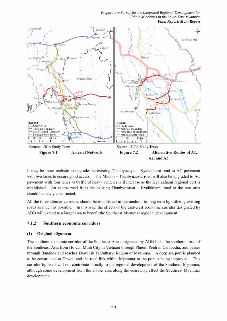
Preparatory Survey for the Integrated Regional Development for
Ethnic Minorities in the South-East Myanmar
Final Report: Main Report
7-3
Source: JICA Study Team
Figure 7.1 Arterial Network Source: JICA Study Team
Figure 7.2 Alternative Routes of A1, A2, and A3
It may be more realistic to upgrade the existing Thanbyuzayat - Kyaikkhami road to AC pavement with two lanes to ensure good access. The Mudon – Thanbyuzayat road will also be upgraded to AC pavement with four lanes as traffic of heavy vehicles will increase as the Kyaikkhami regional port is established. An access road from the existing Thanbyuzayat – Kyaikkhami road to the port area should be newly constructed.
All the three alternative routes should be established in the medium to long term by utilizing existing roads as much as possible. In this way, the effects of the east-west economic corridor designated by ADB will extend to a larger area to benefit the Southeast Myanmar regional development.
7.1.2 Southern economic corridors
(1) Original alignment
The southern economic corridor of the Southeast Asia designated by ADB links the southern areas of the Southeast Asia from Ho Chi Minh City in Vietnam through Phnom Penh in Cambodia, and passes through Bangkok and reaches Dawei in Tanintharyi Region of Myanmar. A deep sea port is planned to be constructed at Dawei, and the road link within Myanmar to the port is being improved. This corridor by itself will not contribute directly to the regional development of the Southeast Myanmar, although some development from the Dawei area along the coast may affect the Southeast Myanmar development.
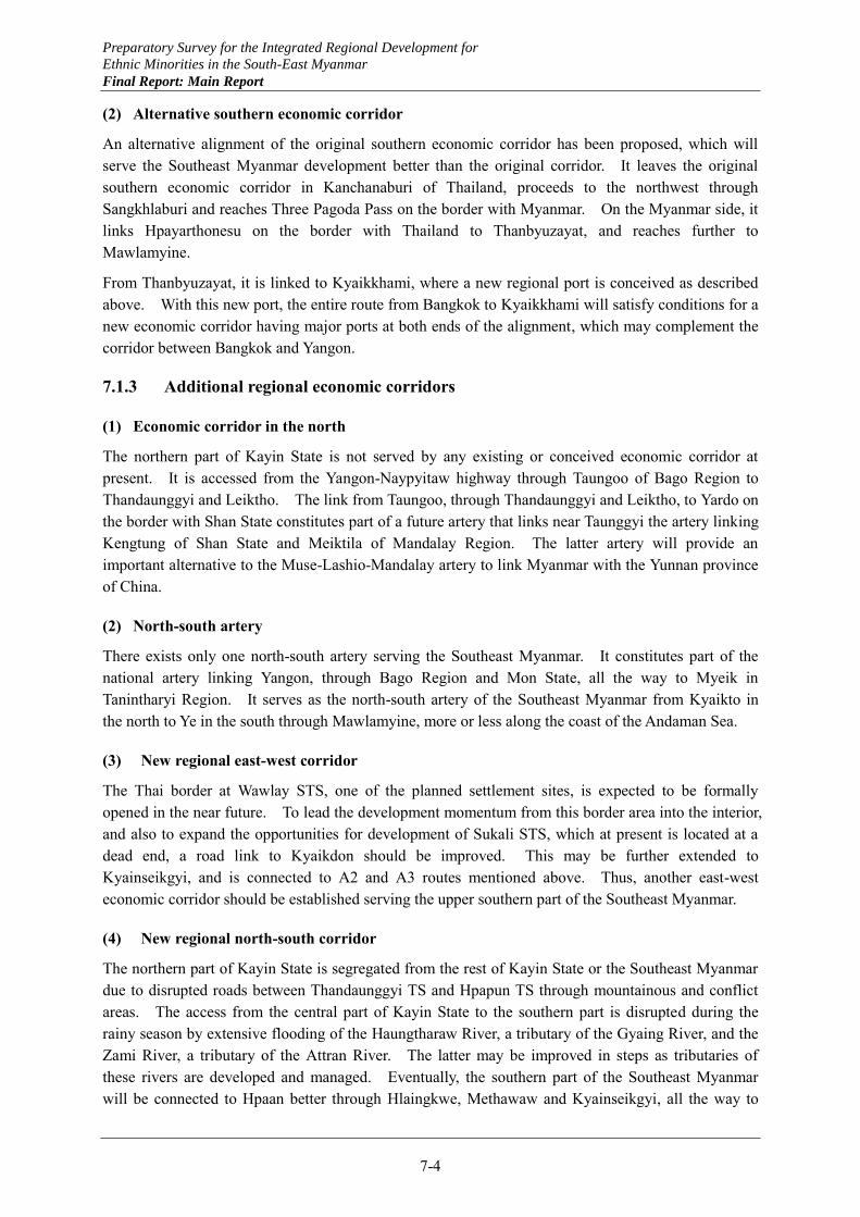
Preparatory Survey for the Integrated Regional Development for
Ethnic Minorities in the South-East Myanmar
Final Report: Main Report
7-4
(2) Alternative southern economic corridor
An alternative alignment of the original southern economic corridor has been proposed, which will serve the Southeast Myanmar development better than the original corridor. It leaves the original southern economic corridor in Kanchanaburi of Thailand, proceeds to the northwest through Sangkhlaburi and reaches Three Pagoda Pass on the border with Myanmar. On the Myanmar side, it links Hpayarthonesu on the border with Thailand to Thanbyuzayat, and reaches further to Mawlamyine.
From Thanbyuzayat, it is linked to Kyaikkhami, where a new regional port is conceived as described above. With this new port, the entire route from Bangkok to Kyaikkhami will satisfy conditions for a new economic corridor having major ports at both ends of the alignment, which may complement the corridor between Bangkok and Yangon.
7.1.3 Additional regional economic corridors
(1) Economic corridor in the north
The northern part of Kayin State is not served by any existing or conceived economic corridor at present. It is accessed from the Yangon-Naypyitaw highway through Taungoo of Bago Region to Thandaunggyi and Leiktho. The link from Taungoo, through Thandaunggyi and Leiktho, to Yardo on the border with Shan State constitutes part of a future artery that links near Taunggyi the artery linking Kengtung of Shan State and Meiktila of Mandalay Region. The latter artery will provide an important alternative to the Muse-Lashio-Mandalay artery to link Myanmar with the Yunnan province of China.
(2) North-south artery
There exists only one north-south artery serving the Southeast Myanmar. It constitutes part of the national artery linking Yangon, through Bago Region and Mon State, all the way to Myeik in Tanintharyi Region. It serves as the north-south artery of the Southeast Myanmar from Kyaikto in the north to Ye in the south through Mawlamyine, more or less along the coast of the Andaman Sea.
(3) New regional east-west corridor
The Thai border at Wawlay STS, one of the planned settlement sites, is expected to be formally opened in the near future. To lead the development momentum from this border area into the interior, and also to expand the opportunities for development of Sukali STS, which at present is located at a dead end, a road link to Kyaikdon should be improved. This may be further extended to Kyainseikgyi, and is connected to A2 and A3 routes mentioned above. Thus, another east-west economic corridor should be established serving the upper southern part of the Southeast Myanmar.
(4) New regional north-south corridor
The northern part of Kayin State is segregated from the rest of Kayin State or the Southeast Myanmar due to disrupted roads between Thandaunggyi TS and Hpapun TS through mountainous and conflict areas. The access from the central part of Kayin State to the southern part is disrupted during the rainy season by extensive flooding of the Haungtharaw River, a tributary of the Gyaing River, and the Zami River, a tributary of the Attran River. The latter may be improved in steps as tributaries of these rivers are developed and managed. Eventually, the southern part of the Southeast Myanmar will be connected to Hpaan better through Hlaingkwe, Methawaw and Kyainseikgyi, all the way to
Preparatory Survey for the Integrated Regional Development for
Ethnic Minorities in the South-East Myanmar
Final Report: Main Report
7-5
Hpayarthonesu.
In view of its location and magnitude of the city of Hpapun, it is very important for the development of Kayin State and the Southeast Myanmar to establish and strengthen the link between Hpaan and Hpapun. Due to the existing security conditions and presence of different armed ethnic groups on both sides of the link, a careful approach would be necessary to providing direct links between the two cities. First, a ferry connection may be improved between Kamamaung and Myainggyingu. Eventually, a bridge should be established at the site to strengthen the link.
Preparatory Survey for the Integrated Regional Development for
Ethnic Minorities in the South-East Myanmar
Final Report: Main Report
7-6
7.2 Development of FTZ and Industrial Estates
Just linking cities and areas by conceived transport arteries would not make economic corridors. Economic activities should be encouraged to develop along the conceived arteries. In particular, free trade zones (FTZs) may be established at border towns, and industrial estates may be located in other cities.
(1) Free trade zones
As the minimum wage is raised in Thailand, some labor intensive industries in Thailand may be relocated to other countries where labor costs are still low. Myanmar will have to compete with these countries with low labor costs in attracting such industries for relocation. It is highly likely that some industries existing in the Maesot area of Thailand utilizing inexpensive labor from Myanmar decide to relocate to areas on the Myanmar side.
Labor intensive processing may be undertaken on the Myanmar side, and final products may be produced on the Thai side to ensure product quality. The final products may be sold by using the established marketing channels. To facilitate the establishment of this model, the Myawaddy area may be designated as a free trade zone. As prerequisites, infrastructure facilities in Myawaddy should be much improved including water supply and power supply.
The model to be applied to Maesot and Myawaddy may apply also to Three Pagoda Pass on the Thai side and Hpayarthonesu on the Myanmar side. The border area disputed between Myanmar and Thailand may be designated as a free trade zone and jointly managed by the two countries for mutual benefits. The Kayin State Government, however, prefers to establish a FTZ on the Myanmar side. Manufacturing industries to locate in the FTZ and to be induced by them should be examined to determine the location of the FTZ.
It is expected that industries to be located in the FTZ in Hpayarthonesu and associated industries outside the FTZ would provide many and diversified employment opportunities for returning refugees and IDPs in the settlement areas that are being prepared in the Hpayarthonesu STS. Increasing number of migrant workers are also expected to come back to work there.
(2) Industrial estates
Once the Kyaikkhami regional port is established, possibilities will be enhanced for “import processing” type industries to be located in the Southeast Myanmar. This type of industries process imported raw materials and intermediate goods into final products for marketing in the regional, domestic and even the Thai market. Examples include production of plastic household goods from imported synthetic resins, processing of imported steel sheets and bars into final construction materials. These industries will effectively utilize the strategic location of the Southeast Myanmar in relation to other regions and Thailand.
This model may be established both in the immediate hinterland of the Kyaikkhami port and in other industrial estates as well. For instance, those manufacturing industries producing for regional and domestic market may be located in the port hinterland, and other industries producing for the Thai market may be located in the industrial estate in Hpaan. The “import processing” type industries associated with the Kyaikkhami regional port will enjoy distinction against “export processing” industries that are expected to be established in association with the Dawei deep sea port.
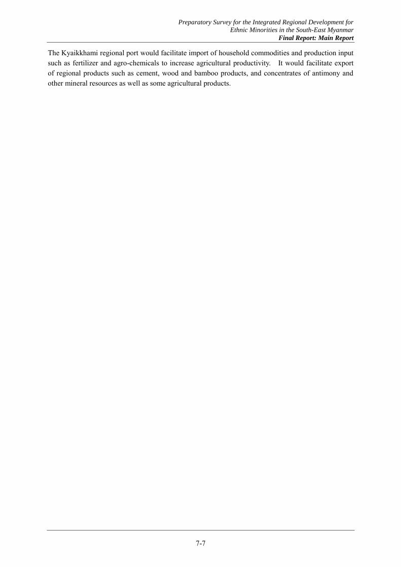
Preparatory Survey for the Integrated Regional Development for
Ethnic Minorities in the South-East Myanmar
Final Report: Main Report
7-7
The Kyaikkhami regional port would facilitate import of household commodities and production input such as fertilizer and agro-chemicals to increase agricultural productivity. It would facilitate export of regional products such as cement, wood and bamboo products, and concentrates of antimony and other mineral resources as well as some agricultural products.
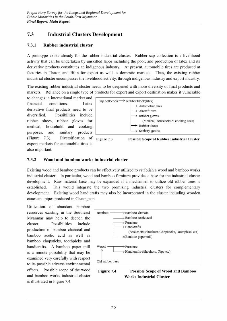
Preparatory Survey for the Integrated Regional Development for
Ethnic Minorities in the South-East Myanmar
Final Report: Main Report
7-8
7.3 Industrial Clusters Development
7.3.1 Rubber industrial cluster
A prototype exists already for the rubber industrial cluster. Rubber sap collection is a livelihood activity that can be undertaken by unskilled labor including the poor, and production of latex and its derivative products constitutes an indigenous industry. At present, automobile tires are produced at factories in Thaton and Bilin for export as well as domestic markets. Thus, the existing rubber industrial cluster encompasses the livelihood activity, through indigenous industry and export industry.
The existing rubber industrial cluster needs to be deepened with more diversity of final products and markets. Reliance on a single type of products for export and export destination makes it vulnerable to changes in international market and financial conditions. Latex derivative final products need to be diversified. Possibilities include rubber shoes, rubber gloves for medical, household and cooking purposes, and sanitary products (Figure 7.3). Diversification of export markets for automobile tires is also important.
7.3.2 Wood and bamboo works industrial cluster
Existing wood and bamboo products can be effectively utilized to establish a wood and bamboo works industrial cluster. In particular, wood and bamboo furniture provides a base for the industrial cluster development. Raw material base may be expanded if a mechanism to utilize old rubber trees is established. This would integrate the two promising industrial clusters for complementary development. Existing wood handicrafts may also be incorporated in the cluster including wooden canes and pipes produced in Chaungzon.
Utilization of abundant bamboo resources existing in the Southeast Myanmar may help to deepen the cluster. Possibilities include production of bamboo charcoal and bamboo acetic acid as well as bamboo chopsticks, toothpicks and handicrafts. A bamboo paper mill is a remote possibility that may be examined very carefully with respect to its possible adverse environmental effects. Possible scope of the wood and bamboo works industrial cluster is illustrated in Figure 7.4.
Figure 7.3 Possible Scope of Rubber Industrial Cluster
Figure 7.4 Possible Scope of Wood and Bamboo Works Industrial Cluster
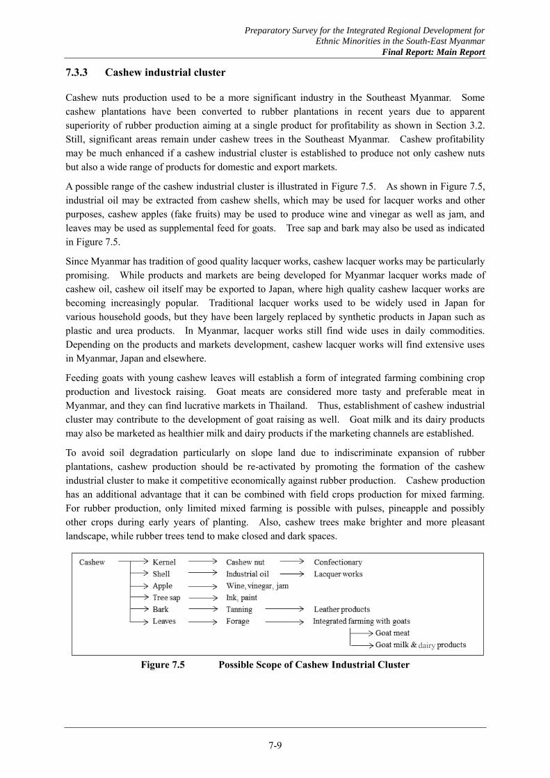
Preparatory Survey for the Integrated Regional Development for
Ethnic Minorities in the South-East Myanmar
Final Report: Main Report
7-9
7.3.3 Cashew industrial cluster
Cashew nuts production used to be a more significant industry in the Southeast Myanmar. Some cashew plantations have been converted to rubber plantations in recent years due to apparent superiority of rubber production aiming at a single product for profitability as shown in Section 3.2. Still, significant areas remain under cashew trees in the Southeast Myanmar. Cashew profitability may be much enhanced if a cashew industrial cluster is established to produce not only cashew nuts but also a wide range of products for domestic and export markets.
A possible range of the cashew industrial cluster is illustrated in Figure 7.5. As shown in Figure 7.5, industrial oil may be extracted from cashew shells, which may be used for lacquer works and other purposes, cashew apples (fake fruits) may be used to produce wine and vinegar as well as jam, and leaves may be used as supplemental feed for goats. Tree sap and bark may also be used as indicated in Figure 7.5.
Since Myanmar has tradition of good quality lacquer works, cashew lacquer works may be particularly promising. While products and markets are being developed for Myanmar lacquer works made of cashew oil, cashew oil itself may be exported to Japan, where high quality cashew lacquer works are becoming increasingly popular. Traditional lacquer works used to be widely used in Japan for various household goods, but they have been largely replaced by synthetic products in Japan such as plastic and urea products. In Myanmar, lacquer works still find wide uses in daily commodities. Depending on the products and markets development, cashew lacquer works will find extensive uses in Myanmar, Japan and elsewhere.
Feeding goats with young cashew leaves will establish a form of integrated farming combining crop production and livestock raising. Goat meats are considered more tasty and preferable meat in Myanmar, and they can find lucrative markets in Thailand. Thus, establishment of cashew industrial cluster may contribute to the development of goat raising as well. Goat milk and its dairy products may also be marketed as healthier milk and dairy products if the marketing channels are established.
To avoid soil degradation particularly on slope land due to indiscriminate expansion of rubber plantations, cashew production should be re-activated by promoting the formation of the cashew industrial cluster to make it competitive economically against rubber production. Cashew production has an additional advantage that it can be combined with field crops production for mixed farming. For rubber production, only limited mixed farming is possible with pulses, pineapple and possibly other crops during early years of planting. Also, cashew trees make brighter and more pleasant landscape, while rubber trees tend to make closed and dark spaces.
Figure 7.5 Possible Scope of Cashew Industrial Cluster
dairy
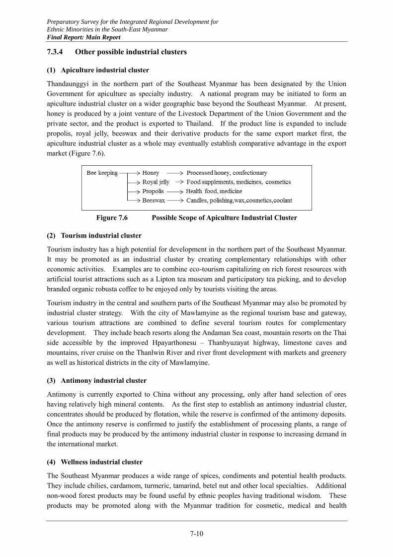
Preparatory Survey for the Integrated Regional Development for
Ethnic Minorities in the South-East Myanmar
Final Report: Main Report
7-10
7.3.4 Other possible industrial clusters
(1) Apiculture industrial cluster
Thandaunggyi in the northern part of the Southeast Myanmar has been designated by the Union Government for apiculture as specialty industry. A national program may be initiated to form an apiculture industrial cluster on a wider geographic base beyond the Southeast Myanmar. At present, honey is produced by a joint venture of the Livestock Department of the Union Government and the private sector, and the product is exported to Thailand. If the product line is expanded to include propolis, royal jelly, beeswax and their derivative products for the same export market first, the apiculture industrial cluster as a whole may eventually establish comparative advantage in the export market (Figure 7.6).
Figure 7.6 Possible Scope of Apiculture Industrial Cluster
(2) Tourism industrial cluster
Tourism industry has a high potential for development in the northern part of the Southeast Myanmar. It may be promoted as an industrial cluster by creating complementary relationships with other economic activities. Examples are to combine eco-tourism capitalizing on rich forest resources with artificial tourist attractions such as a Lipton tea museum and participatory tea picking, and to develop branded organic robusta coffee to be enjoyed only by tourists visiting the areas.
Tourism industry in the central and southern parts of the Southeast Myanmar may also be promoted by industrial cluster strategy. With the city of Mawlamyine as the regional tourism base and gateway, various tourism attractions are combined to define several tourism routes for complementary development. They include beach resorts along the Andaman Sea coast, mountain resorts on the Thai side accessible by the improved Hpayarthonesu – Thanbyuzayat highway, limestone caves and mountains, river cruise on the Thanlwin River and river front development with markets and greenery as well as historical districts in the city of Mawlamyine.
(3) Antimony industrial cluster
Antimony is currently exported to China without any processing, only after hand selection of ores having relatively high mineral contents. As the first step to establish an antimony industrial cluster, concentrates should be produced by flotation, while the reserve is confirmed of the antimony deposits. Once the antimony reserve is confirmed to justify the establishment of processing plants, a range of final products may be produced by the antimony industrial cluster in response to increasing demand in the international market.
(4) Wellness industrial cluster
The Southeast Myanmar produces a wide range of spices, condiments and potential health products. They include chilies, cardamom, turmeric, tamarind, betel nut and other local specialties. Additional non-wood forest products may be found useful by ethnic peoples having traditional wisdom. These products may be promoted along with the Myanmar tradition for cosmetic, medical and health

Preparatory Survey for the Integrated Regional Development for
Ethnic Minorities in the South-East Myanmar
Final Report: Main Report
7-11
products. They may be promoted collectively in the form of wellness industrial cluster.
Preparatory Survey for the Integrated Regional Development for
Ethnic Minorities in the South-East Myanmar
Final Report: Main Report
7-12
7.4 Urban Development
7.4.1 Regional cities development
Development of larger cities holds a key for self-reliant development of any region, since such cities are where the regional economy meets the global economy. These cities may be called regional cities. Reduction of economic transaction costs by improved infrastructure in regional cities is a necessary condition for any region to compete in the global economy. In the Southeast Myanmar, the city of Mawlamyine will serve as the regional capital, but its urban functions may be much strengthened by complementary development with the city of Hpaan.
Mawlamyine may be specialized in tourism and related services and industrial development in the existing industrial estate and the Kyaikkhami port hinterland. Hpaan may be specialized more in indigenous resource based industrial development including rubber processing, cement manufacturing, mineral resources processing and agro-processing. Port side industrial development in Mawlamyine may induce indigenous industrial development in Hpaan for complementary development. Tourism provides another opportunity for their complementary development.
Existing road link between Mawlamyine and Hpaan should be further strengthened by upgrading the road section between Eindu and Zarthapyin. Two bridges over the Gyaing River and the Attran River will have to be re-built in the medium term future. A river port may be constructed on the Thanlwin River to serve the industrial estate in Hpaan in the immediate future, followed by the regional port development at Kyaikkhami to be used by industries in both Hpaan and Mawlamyine. A new international airport may be developed between the cities of Hpaan and Mawlamyine to serve the both cities within easy access.
The cities of Hpaan and Mawlamyine combined should be equipped with some higher order urban service functions as the regional city such as advanced research and education such as specialized health care and some specialized functions. In view of its functions as the regional tourism base and gateway, an international hotel school may be established in Mawlamyine. An advanced research institute may be located in Hpaan specialized in technologies to support alternative socio-economic activities
7.4.2 Border towns development
As the globalization proceeds and borders are opened for free trade between neighboring countries, the disadvantage of peripheries would become an advantage. To promote cross-border trade, border towns should be developed capitalizing on the development momentum on both sides of the borders. In the Southeast Myanmar, border towns should be developed at Myawaddy and Hpayarthonesu.
Myawaddy may take advantage of the existing industries and other socio-economic activities in Maesot on the Thai side, and realize more concentrated urban development in the limited territory. Urban development in Hpayarthonesu may take a more dispersed form in extensive land available. For both border towns, networking with urban centers on the Thai side will be important for complementary development.
7.4.3 Urban hierarchy and city networking
To provide various urban services to all the residents in the region effectively, a hierarchical structure
Preparatory Survey for the Integrated Regional Development for
Ethnic Minorities in the South-East Myanmar
Final Report: Main Report
7-13
of urban centers should be established, where any urban center should provide a set of services designated at each level of the hierarchy. This is examined in Chapter 9 at a preliminary level. Also, for complementary development of larger urban centers, higher order service functions may be shared by them through the city networking. Such city networking often extends beyond the borders in the globalizing world. Mawlamyine, Hpaan and a few other larger urban centers in the Southeast Myanmar should be strengthened for higher order urban functions by networking with cities outside the Region including cities in Thailand as well.
Preparatory Survey for the Integrated Regional Development for
Ethnic Minorities in the South-East Myanmar
Final Report: Main Report
8-1
In this chapter, existing conditions in the Southeast Myanmar related to refugees and IDPs are described in a comprehensive way, and prospects of their return and support measures are suggested. As part of the existing conditions, existing community development and local administration are overviewed in reference to the Southeast Myanmar. Also, results of a household survey conducted as part of the initial study are summarized. Existing conditions of refugees, IDPs and migrants are described, return and settlement supports by donors and NGOs are summarized, and issue for return and settlement are discussed.
Based on all these, prospects and strategy for community development are discussed in reference to return and settlement, a framework and principles for return and settlement planning are proposed. The framework defines three types of conflict affected areas classified by existing conditions, and the approach to development to promote peace for each type of areas. The principles are proposed that should be observed in planning and implementing development activities to contribute to the peace process.
8.1 Existing Conditions of Rural Community Development
8.1.1 Administration for rural development
Top-down decision making and development were practiced for some 50 years under the military regime in Myanmar, and voices of people were not reflected in the development in the past. However, the new administration led by President U Thein Sein has taken a fundamental policy shift to participatory development in order to reflect people’s voices in development. ”Framework for Economic and Social Reforms”, which is a document prepared by the new administration, summarizes policy priorities for 2012-15 towards the long-term goals of the national comprehensive development plan. The document identifies ”effective implementation of people-centered development through community-driven, participatory approaches to improvement in education, health and living standards” as one of policy priorities out of four.
Although the Government has moved to decentralization in planning and budgeting, the long-lived centralized system still persists. Governmental officials at the state/region, district, township (TS) and sub-township (STS) levels are basically all officials of line ministries in the center. They are rotated every two to four years in the whole country, and they do not stay and work in a particular state/region, district or township for a long time.
Officials working at the STS level are rotated for a shorter interval, sometimes for six months to a year, due to the poor-living conditions of STSs. They are usually rotated at the same administrative level,
CHAPTER 8 EXISTING CONDITIONS AND PROSPECTS FOR RETURN AND SETTLEMENT OF REFUGEES AND IDPS IN SOUTHEAST MYANMAR
Preparatory Survey for the Integrated Regional Development for
Ethnic Minorities in the South-East Myanmar
Final Report: Main Report
8-2
but they are sometimes promoted from a district to a state or a STS to a TS office. Only non-technical staff such as secretaries, divers and security guards can be hired locally and work for a long time. This makes it difficult to make a development plan with appropriate needs in the area, and familiarity with the area as experience and knowledge of human resources is not accumulated efficiently.
Village tract clerks work at the village tract level, appointed by the general administration department of townships. They undertake clerical works for their own village tract and support the general administration department of townships. They also support a village tract administration and a village tract development committee as explained below.
8.1.2 Shifts in rural administration
One of the new shifts to people centered development is the introduction of the Ward and Village Tract Administration Law in 2012. Based on this law, people now have the right to choose and elect their ward and village tract administrators. The administrators are elected from those who live in the ward and village tract, and allowance is paid to them from the Union Government. These ward and village tract administrators existed before but they were appointed by the township offices and no allowance was paid.
Every ten households are divided into a group and each group chooses one leader. Villagers elect one administrator from all the selected leaders. This procedure is monitored by five representatives from the area. The functions of the administrator are to keep security in the area, prevent crimes, supervise social activities and lead in preparing a village tract development plan. It is expected that they will discuss and make a practical development plan by listening to voices of community members since the administrators are selected by local residents and they know their areas.
The next shift is the establishment of village tract development committees by a Presidential Decree of 2013. Five members of a village tract development committee (chairman, secretary and other three members) are also elected by local residents. The committee supports their village tract administrator, discusses and makes a village tract development plan, and submits the development plan to the township office. Village tract development committees are established in all the village tracts in Mon State and some in Kayin State according to the respective state governments.
The last shift is the establishment of a new department called the Department of Rural Development (DRD) under the Ministry of Border Affairs and Security in 2012. DRD exists only in Naypyitaw and they are not established under the state/regional level. There are the State/Township Development Committees (SDC/TDC) in charge of construction of roads and bridges, water supply, rural electrification and so on. DRD is also in charge of construction of roads and bridges, water supply, rural electrification as well as microfinance and support for livelihood which are new tasks as a part of the government’s national rural development and poverty alleviation program (The World Bank “The Republic of the Union of Myanmar, National Community Driven Development Project” Oct, 2012).
It is planned that SDC will be in charge of urban development in towns and wards and DRD will be in charge of rural development in villages after establishment of DRD. The World Bank will start the Community Driven Development Project in 2013 with DRD as a counterpart organization. The World Bank will hire consulting firms or NGOs to provide technical assistance to and develop capacity of DRD at townships. DRD is expected in this project to support community members to develop a village tract development plan and implement a community projects funded by the World
Preparatory Survey for the Integrated Regional Development for
Ethnic Minorities in the South-East Myanmar
Final Report: Main Report
8-3
Bank. It is necessary to follow up how DRD will cover participatory approach and livelihood improvement in addition to construction of infrastructure.
8.1.3 Situation in Southeast Myanmar
The situation in Kayin and Mon States are different from what has been described above in that there are considerably large areas controlled by ethnic minorities’ groups without formal administration system of social service delivery operating by the Government. Administrative services are provided in these areas controlled by Democratic Karen Benevolent Army (DKBA) in consultation with the Government. As Karen National Union (KNU) is a large group having long history of controlling these areas, they have different state and district boundaries compared to those for government’s controlled areas. KNU also has a president, congress, decision making body and ministries (called department). KNU provides their own social services, in particular the health and education sectors in the KNU controlled areas.
The government’s shifts to people centered development will not be materialized in the control areas of the ethnic minorities groups unless the peace agreement is made between the Union Government and the ethnic minorities groups. According to a liaison officer of KNU, some departments carry out their duties but there is no KNU department responsible for state development. People centered development is not common in KNU control areas according to Karen community based organizations (CBOs). However, in the future, their attitude may be affected by the government’s shift or supporting donor/NGO’s participatory approach in some ways.
Karen CBOs implement many kinds of activities to support Karen refugees in the refugee camps in Thailand and internally displaced persons (IDPs) and other communities in the Southeast Myanmar.
These CBOs have their bases in Thailand for easy access to the border areas. Major ones are Karen Women’s Organization (KWO), Karen Youth Organization (KYO), Karen Office of Relief and Development (KORD), and Karen Environment and Social Action Network (KESAN). These CBOs have experience in leadership training and implementation of projects with community participation in Karen communities. They also know better about Karen communities than government organizations, in particular, in the areas where the ethnic minorities’ groups control. The CBOs can be partners and advisers for new projects to be initiated in Kayin and Mon States. According to international organizations or NGOs which have already started their operations in Kayin and Mon States, there are often some CBOs such as elder groups, youth groups and women’s groups as entry points for community development.
Preparatory Survey for the Integrated Regional Development for
Ethnic Minorities in the South-East Myanmar
Final Report: Main Report
8-4
8.2 Conditions of Refugees and IDPs
8.2.1 Current issues on return and settlement
(1) Classification of returnees
There can be three types of prospective returnees in the context of the Southeast Myanmar, namely (1) refugees, (2) internally displaced persons and (3) migrants. In case of the Southeast Myanmar, the definition of those three categories of people may vary among the stakeholders because of long lasting complicated situations. The definitions used in this chapter are as follows.
1) Refugees
Refugees are those who were forced to leave their original living places in the Southeast Myanmar due to conflicts, and are currently living in refugee camps in Thailand. Although there are registered and unregistered refugees, they all can have more support from international NGOs than the other two categories of people.
There are nine refugee camps along Thai-Myanmar borders areas on the Thai side. The Thai government officially calls the camps as temporary shelter areas.
2) IDPs
IDPs are those who are still living domestically, usually hiding in remote areas, after they were displaced from their original living places. The reasons why they were displaced are not only conflicts but also any development project such as dams, mining sites, or plantations.
3) Migrants
There are two types of migrants in the context of the Southeast Myanmar: (i) those who voluntarily left their homeland to Thailand mainly for economic reasons, i.e. to seek jobs, and (ii) those who were forced to leave their original living places in the Region to Thailand but decided not to live in the refugee camps. The latter are quasi refugees, but they enjoy differences from refugees such as being able to have access to employment, even informally, and also not controlled by any authorities.
(2) Procedure for return of refugees
There are many issues to be considered by, and coordinated between the Myanmar and the Thai Governments toward the return of refugees such as re-entry / custom procedure and issuing of IDs for returnees. There is still no official agreement between the two governments on these and related issues. UNHCR is requesting the both governments to discuss those issues with involvement of UNHCR as the third party and to sign on a tripartite agreement. The third party’s participation is necessary to ensure transparency of the dialogue. Such an agreement has to be reached as early as possible; otherwise confusion on returns would aggravate if and when massive returns occur at early stage.
In addition, the Myanmar Government has no official function or mechanism to collect information on the needs of refugees and to disseminate the information to prospective returnees living in Thailand. Such function and mechanism are prerequisite to truly voluntary repatriation. The mechanism will have to be established by the cooperation among not only the Myanmar and the Thai Governments but
Preparatory Survey for the Integrated Regional Development for
Ethnic Minorities in the South-East Myanmar
Final Report: Main Report
8-5
also relevant ethnic groups. The detail will be discussed later in this chapter.
(3) Related organizations
Main governmental organizations related to return and settlement issues are NATALA (Progress of Border Areas and National Races Department) and Myanmar Peace Center (MPC). NATALA, under the Ministry of Border Affairs and Security, deals with the development issues including donor coordination in the border areas where many ethnic minorities reside. NATALA has regional offices at state level and also coordinates the regional development issues in ethnic minority areas together with the general administration office in each state.
MPC does not directly deal with the return and settlement programs. However, MPC’s role is to collect information related to peace issues and to facilitate international organizations, donors, and NGOs as well as ethnic groups on the issues related to the peace process. MPC’s coordination role is important because return and settlement issues are highly related with peace process.
8.2.2 Existing conditions of refugees and migrants
(1) Current situation in refugee camps
The population data of refugees in Thailand are presented in Figure 8.1. The refugees in the camps usually have access to some basic infrastructures such as common water taps and electricity, although some camps are deprives of them. There are clinics and schools, up to high school, in the camps as well. It is said that the education level of the schools at the camps is higher than in Myanmar. However, the curriculum in the school is not based on Myanmar or Thai official curriculum, and therefore the graduates cannot have access to higher education.
There are also many grocery shops in the camps. Those shops are usually run by Muslim people with a help of their relatives living in Thailand. The roads in the camps are not paved, but motorbikes are frequently running on the roads. The refugees can have food supply such as rice, beans, and fish paste, once a month. The camps inside seems like an ordinary but high density community, not like a typical image of a refugee camp as a poverty stricken community. The livelihood in the camps might be better than that of rural communities away from cities or main roads in Myanmar.
As shown in Table 8.8, some NGOs are conducting activities within the camps. Especially, ADRA is operating vocational training courses in various subjects. In the Maela camp, the training seems to be based more on practice. However, the term of the training is only for three months, so it may be too short for the trainees to gain confidence in each field. Also the trainers are sometimes the former trainees without full practical experience.

Preparatory Survey for the Integrated Regional Development for
Ethnic Minorities in the South-East Myanmar
Final Report: Main Report
8-6
Source: TBC (http://theborderconsortium.org/camps/populations.htm)
Figure 8.1 Refugee and IDP Camp Populations in March 2013
Photo 8.1 Inside of Mae La Refugee Camp
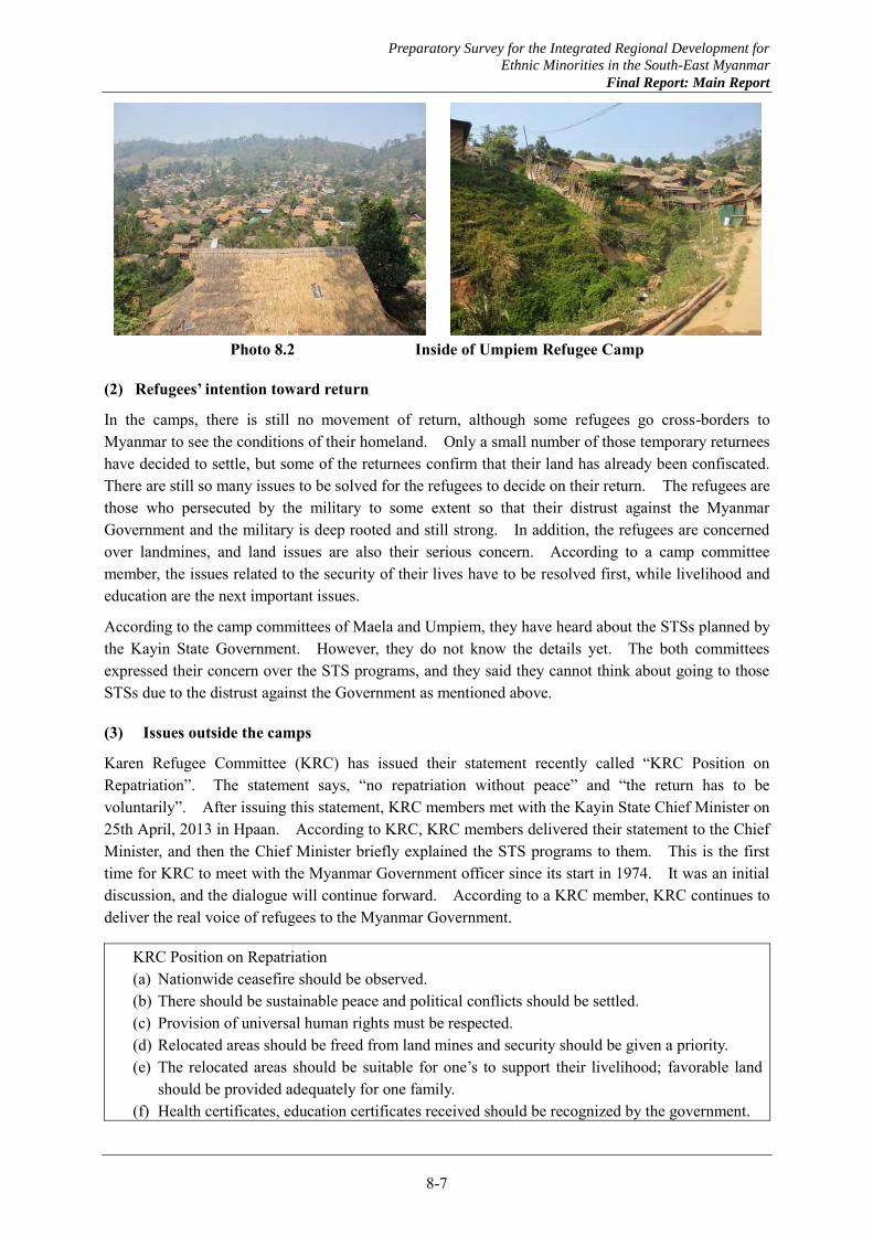
Preparatory Survey for the Integrated Regional Development for
Ethnic Minorities in the South-East Myanmar
Final Report: Main Report
8-7
Photo 8.2 Inside of Umpiem Refugee Camp
(2) Refugees’ intention toward return
In the camps, there is still no movement of return, although some refugees go cross-borders to Myanmar to see the conditions of their homeland. Only a small number of those temporary returnees have decided to settle, but some of the returnees confirm that their land has already been confiscated. There are still so many issues to be solved for the refugees to decide on their return. The refugees are those who persecuted by the military to some extent so that their distrust against the Myanmar Government and the military is deep rooted and still strong. In addition, the refugees are concerned over landmines, and land issues are also their serious concern. According to a camp committee member, the issues related to the security of their lives have to be resolved first, while livelihood and education are the next important issues.
According to the camp committees of Maela and Umpiem, they have heard about the STSs planned by the Kayin State Government. However, they do not know the details yet. The both committees expressed their concern over the STS programs, and they said they cannot think about going to those STSs due to the distrust against the Government as mentioned above.
(3) Issues outside the camps
Karen Refugee Committee (KRC) has issued their statement recently called “KRC Position on Repatriation”. The statement says, “no repatriation without peace” and “the return has to be voluntarily”. After issuing this statement, KRC members met with the Kayin State Chief Minister on 25th April, 2013 in Hpaan. According to KRC, KRC members delivered their statement to the Chief Minister, and then the Chief Minister briefly explained the STS programs to them. This is the first time for KRC to meet with the Myanmar Government officer since its start in 1974. It was an initial discussion, and the dialogue will continue forward. According to a KRC member, KRC continues to deliver the real voice of refugees to the Myanmar Government.
KRC Position on Repatriation (a) Nationwide ceasefire should be observed. (b) There should be sustainable peace and political conflicts should be settled. (c) Provision of universal human rights must be respected. (d) Relocated areas should be freed from land mines and security should be given a priority. (e) The relocated areas should be suitable for one’s to support their livelihood; favorable land
should be provided adequately for one family. (f) Health certificates, education certificates received should be recognized by the government.
Preparatory Survey for the Integrated Regional Development for
Ethnic Minorities in the South-East Myanmar
Final Report: Main Report
8-8
(g) We will not tolerate forced repatriation; it should be one’s own decision or voluntary return. (h) Adequate preparation should be given to return. (i) Right should be given to the Committee concerned regarding repatriation and allow them to
inspect location and collect necessary information. (j) The repatriation can only take place when the concerned organizations, KRC, INGOs,
NGOs, UNHCR, and CBOs agree that there is genuine peace in Burma.
The third country resettlement program by the US government will finish in June 2013. The US has accepted 90% of third country resettlement since 2005. Although it is still unclear whether this may affect the movement of refugees, the refugees may have to consider more seriously returning to Myanmar after they lose their option to go to the US.
(4) Existing conditions of migrants
It is said that there are about three million Myanmar migrant workers in Thailand. Most of them do not have official passports. Those migrants are 1) holding “temporary passport” valid only for two years, or 2) staying and working illegally without any document. According to an organization supporting Myanmar migrant workers in Thailand, they often face violation of minimum wage or working hours by their employers. Such migrant workers usually reside at company’s dormitories, and thus their lives are somehow controlled by the employer. Therefore, there are some organizations in Thailand that try to protect the Myanmar migrants. Those organizations also issue their request to the Myanmar Government to improve the law and policy for labor issues.
In Maesot, Thailand, there are some migrants’ communities around the town. Migrant schools and clinics also exist around those communities. In migrant schools, they use Myanmar language in the class and teach Thai language in the curriculum. When students finish the final grade of migrant high school, they are entitled to take GED examination of the US to prove internationally they finished particular level of education.
The migrants are usually those who left their native land for economic reasons. However, in case of Myanmar migrants, they sometimes left their country not only for economic reasons but also for political reasons. Those people did not choose to go to refugee camps and decided to stay at a town or village and to work even if it is illegal.
(5) Issues to be considered
The refugees’ intention toward their return might be getting stronger than before after the ceasefire agreement. However, there are so many concerns among the refugees in considering the return. They include: 1) peace to be ensured, 2) landmines, 3) conditions of their homeland or resettlement sites, and 4) livelihood after return. In order to clear these concerns, it is important to have access to reliable information about conditions and options related to returns. There is no information sharing mechanism between the Government and ethnic groups, or the Myanmar side and the Thai side. The refugees might be sensitive about the reliability of information on return and settlement so that the information should be released through official channels such as the Governments of Myanmar and Thailand, ethnic groups, or groups like KRC.
The ways of return could be 1) repatriation to their original places, 2) resettlement in Myanmar, 3) third country resettlement or 4) resettlement in Thailand (this option is all up to the Thai government). If the profile survey by UNHCR/Mar Fah Luang Foundation proceeds as planned, the results will reveal the refugees’ intention to some extent. Such data should be reflected in planning for the return

Preparatory Survey for the Integrated Regional Development for
Ethnic Minorities in the South-East Myanmar
Final Report: Main Report
8-9
and settlement, but still consultation process with related stakeholders is important to avoid further conflicts in the process of return.
The migrants are also facing difficulties in Thailand. They can have access to education and medical services to some extent, but their living conditions are usually poor. Also, it is very difficult to understand the intention of migrants because they are not under control by any authorities unlike refugees. If their reasons to come to Thailand were only economic, they would return as the economy in Myanmar improves. However, the migrants may also have some political reasons. They can be called quasi refugees in that sense. The number of migrants is much larger than refugees, so any return and settlement plan should consider the movement of migrants as well.
8.2.3 Existing conditions of IDPs
(1) IDPs in Myanmar/Thai borders and cross-border supports
On the Myanmar side of the border areas in the Southeast Myanmar, there are some areas controlled by ethnic groups. Conflict affected IDPs moved to such areas to seek protection by ethnic minorities groups such as KNU or New Mon State Party (NMSP). As for the number and locations of IDPs in the Region, TBC, UNHCR, and UNICEF have conducted surveys respectively through their partner organizations such as Myanmar Red Cross, Faith-based groups, or local CBOs. Also, Joint IDP Profiling Service (JIPS) based in Geneva is planning to conduct a survey in some states in Myanmar for the necessity of further survey on IDPs. Despite their efforts, however, there exist still no comprehensive and fully trustable data about IDPs.
The areas where IDPs are found are usually in remote areas controlled by ethnic groups, and not everyone can access to those places. Some are living in IDP camps, but usually the camps have been lasting for 10-20 years and become like normal villages with social facilities. On the other hand, some IDPs are said to be living in small communities deep in forests with almost no social infrastructure. The IDPs living in forests are occasionally moving from place to place, making it more difficult to know where they are.
According to NMSP, there are approximately 2,100 displaced people affected by conflicts in the Mon State side of Myanmar-Thai borders near Sangkhlaburi. The fight between the Union army and NMSP became intensified in 1990-1993, and then quite a number of Mon people escaped from the southern part of Mon State, mostly from Ye township to the Thai side and became refugees. After the ceasefire agreement in 1995, many of them returned to the Myanmar side, but they still remain in NMSP controlled area. Places called Halockhani (Figure 8.1) and Blaidoonphike are the communities supported by NMSP where those conflict affected people are living. Those people have been virtually settled in those communities, so there is a discussion whether they are the IDPs. These people still hope to return to their original places, and NMSP intends to support the return in the process of peace talk with the Government.
The IDP camps have schools and clinics built and operated by NMSP. NMSP is keen on education, especially promoting Mon curriculum to make a point of Mon language. NMSP has operating schools, up to high school, not only in IDP camps but also in villages of their areas. All the schools are using Mon curriculum.
The Nippon Foundation is delivering rice and medicines to those IDP camps. Since the areas are controlled by NMSP, the access to the IDP camps from the Myanmar side is difficult, restricted by NMSP. Therefore, the Foundation delivers the goods cross-borders from the Thai side. There is a
Preparatory Survey for the Integrated Regional Development for
Ethnic Minorities in the South-East Myanmar
Final Report: Main Report
8-10
border gate set by the agreement between the Thai government and NMSP. This activity is recognized by MPC on the Myanmar side and also by the Thai government.
Also, Thai Japan Education Development Foundation based in Chiang Mai, Thailand, which is an implementation partner of Nippon Foundation for cross-border delivery, is operating agricultural training centers on the Myanmar side of the border areas, namely Shan, Kayah, Mon, and Kayin (under preparation) for IDPs and returnees. The centers are in the areas controlled by ethnic groups, and the staff makes access to the centers from the Thai side.
They plan to make each center a model for a settlement area for returnees, a farming oriented community organized by ethnic minorities. This foundation has agreed on MOU with MPC for this activity, and so it means the Myanmar Government authorizes their activity. This can be an important model to directly support returnees and ethnic minorities with recognition of the Myanmar Government. It can also contribute to peace building and trust building between the Government and ethnic minorities.
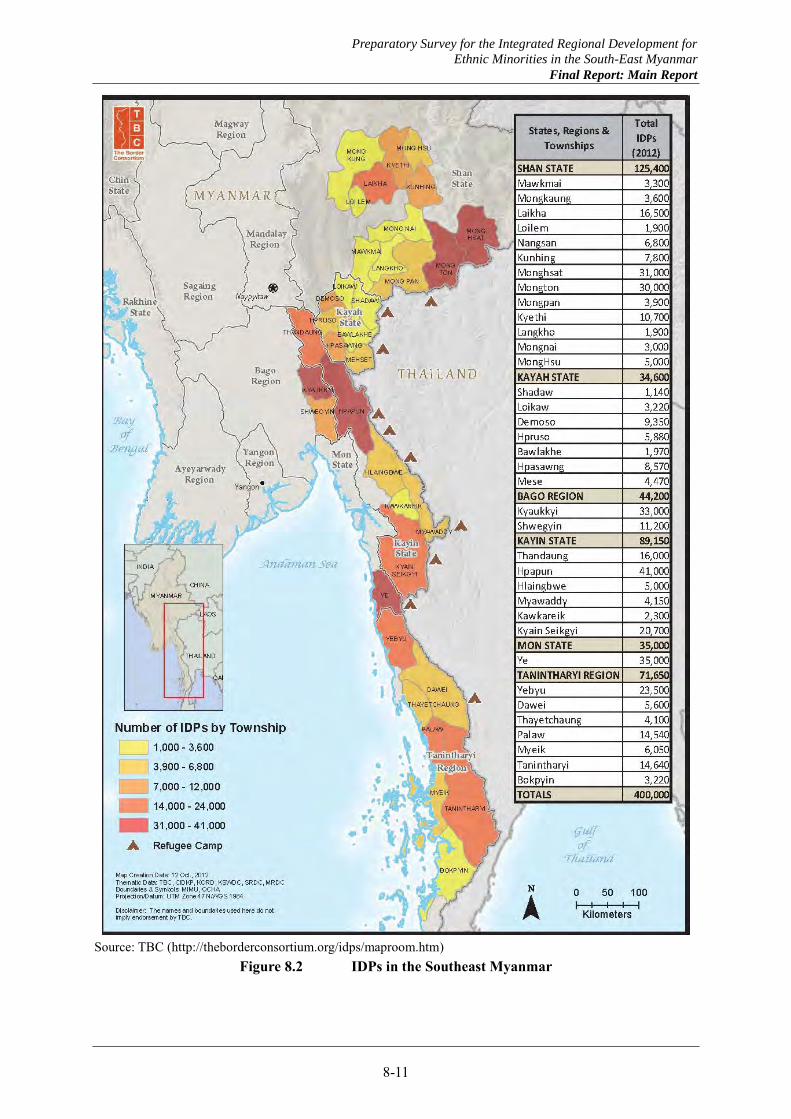
Preparatory Survey for the Integrated Regional Development for
Ethnic Minorities in the South-East Myanmar
Final Report: Main Report
8-11
Source: TBC (http://theborderconsortium.org/idps/maproom.htm)
Figure 8.2 IDPs in the Southeast Myanmar
Preparatory Survey for the Integrated Regional Development for
Ethnic Minorities in the South-East Myanmar
Final Report: Main Report
8-12
(2) Issues to be addressed
IDPs are usually living in remote areas where ethnic groups control, and not every person can have access to those places. Therefore, it is very difficult to understand their living conditions. Also the IDPs in the camps have been living there for nearly 20 years. Those camps have become almost like normal villages, and IDPs have practically settled there. Some still hope to return to their homeland, but others may wish to stay.
There will be a discussion whether or not those “protracted IDPs” are indeed real IDPs. In any case, the early return of those protracted IDPs is not a realistic scenario at the moment. In case of protracted IDPs, their movement will spontaneously occur to seek jobs or to prefer town life as peace building and economic development in Myanmar proceed. The support to protracted IDPs should not necessarily be based on the premise that they will return. Longer term supports to improve their livelihood or skill development are probably more preferable than settlement program which needs political commitment.
However, the situation is totally different for IDPs who are still hiding in the jungles. Their living conditions may be the poorest and almost no access to any social infrastructure or services. Their return may occur at early stage if minimum living conditions and security are guaranteed in their homeland or any settlement areas.
IDPs in ethnic group controlled areas have access to minimum social services. However, there are needs of assistance for more and better education and health facilities, and agricultural skill development or livelihood improvement. In terms of support for agricultural or livelihood skills, it is an option to build skill development centers.
The progress of peace process and more consultation between the Government and ethnic groups is necessary to realize the improvement. This process itself would greatly contribute to the trust building.
Preparatory Survey for the Integrated Regional Development for
Ethnic Minorities in the South-East Myanmar
Final Report: Main Report
8-13
8.3 Existing Plans for Return and Settlement
8.3.1 Existing plans for return and settlement
(1) State programs
The Kayin State Government is now planning to develop nine STSs for returnees, namely Leiktho, Bawgali, Kamamaung, Paingkyon, Shanywarthit, Wawlay, Sukali, Kyaikdon and Hpayarthonesu. Those STSs used to be villages where former refugees/IDPs were living, and then recently designated by the State Government as STSs. The reason why the State Government chose these nine is mainly their geographical locations according to an officer of the State. The JICA Study Team has focused on the four STSs out of nine, Paingkyon, Shanywarthit, Wawlay and Sukali, by the request of State Government.
The plan for return and settlement of returnees prepared by the Kayin State Government is summarized in Table 8.1.
Table 8.1 Total Plan for Repatriation of Returnees in Kayin State Item Unit Quantity
Households household 32,000 Returnees person 160,000
Lands for residence acre 8,000 Agriculture lands acre 160,000
Source: Presentation Material Obtained from Kayin State
Both the Union Government and the State Government respect and advocate voluntary return and decisions of IDPs and refugees as to where and when to return. The State Government has a plan to develop six townships and nine STSs by constructing infrastructure and providing livelihood support intensively to facilitate smooth return as shown in Table 8.2 and Table 8.3.
Table 8.2 Plan for Repatriation of Returnees by Township in Kayin State (Unit: acres)
Township
Reserved Lands for Residents
Lands for Agriculture
Cultivable Crops Total
Rubber Tea Leaf Coffee Fruit
Tree Maize Green Gram
1 Hlaingbwe 100 2,000 2,000 0 0 0 0 0 4,100 2 Hpapun 1,650 33,000 28,500 0 0 4,500 0 0 67,650 3 Thandaunggyi 50 1,000 0 400 600 0 0 0 2,050 4 Kawkareik 100 2,000 2,000 0 0 0 0 0 4,100 5 Kyainseikgyi 50 1,000 900 0 0 100 0 0 2,050 6 Myawaddy 150 3,000 1,400 0 0 600 800 200 6,150 Total 2,100 42,000 34,800 400 600 5,200 800 200 86,100
Source: Presentation Material Obtained from Kayin State
Preparatory Survey for the Integrated Regional Development for
Ethnic Minorities in the South-East Myanmar
Final Report: Main Report
8-14
Table 8.3 Plan for Repatriation of Returnees by STS in Kayin State (Unit: acres)
Sub-township Reserved Lands for Residents
Lands for Agriculture
Cultivable Crops Total
Rubber Tea Leaf Coffee Fruit
Tree Maize Green Gram
1 Paingkyon 1,300 26,000 24,000 0 0 1,700 200 100 53,300 2 Shanywarthit 1,200 24,000 22,300 0 0 1,700 0 0 49,200 3 Kamamaung 100 2,000 2,000 0 0 0 0 0 4,100 4 Bawgali 50 1,000 200 200 600 0 0 0 2,050 5 Leiktho 50 1,000 200 300 500 0 0 0 2,050 6 Kyaikdon 400 8,000 6,500 0 0 1,500 0 0 16,400 7 Hpayarthonesu 400 8,000 8,000 0 0 0 0 0 16,400
8 Wawlay 1,200 24,000 0 0 0 1,000 16,000 7,000 49,200 9 Sukali 1,200 24,000 0 0 0 1,500 20,000 2,500 49,200 Total 5,900 118,000 63,200 500 1,100 7,400 36,200 9,600 241,900
Source: Presentation Material Obtained from Kayin State
The basic information of the nine STSs is summarized in Table 8.4 and Table 8.5.
Table 8.4 Basic Information of Nine STSs (1)
STS Population (2013) No. of Wards No. of Village
Tracts No. of
Villages 1 Paingkyon 75,841 5 27 153
2 Shanywarthit 30,049 4 9 59
3 Kamamaung 43,774 4 10 107
4 Bawgali 13,215 4 15 80
5 Leiktho 40,442 6 31 176
6 Kyaikdon 82,261 6 21 115
7 Hpayarthonesu 52,123 4 10 55
8 Wawlay 3,522 2 1 10
9 Sukali 2,652 1 3 9
Total 343,879 36 127 764
Source: Presentation Material Obtained from Kayin State
Table 8.5 Basic Information of Nine STSs (2)
STS Area (acres)
Area (square miles)
Current Land Use (acres) Cultivated
Land Virgin
/Wood Land Reserved
Forest Uncultivated
Land 1 Paingkyon 418,774 654 85,792 105,459 76,255 151,268
2 Shanywarthit 319,722 500 6,755 47,674 5,598 259,695
3 Kamamaung 299,395 468 19,150 180,707 78,034 21,504
4 Bawgali 366,528 573 10,675 48,608 254,806 52,439
5 Leiktho 335,390 524 32,070 139,661 50,479 113,180
6 Kyaikdon 759,177 1,186 50,278 446,308 255,603 6,988
7 Hpayarthonesu 841,833 1,315 65,003 675,853 97,827 3,150
8 Wawlay 121,296 190 1,252 61,591 58,361 92
9 Sukali 196,372 307 1,125 82,769 112,332 146
Total 3,658,487 5,717 272,100 1,788,630 989,295 608,462
Source: Presentation Material Obtained from Kayin State
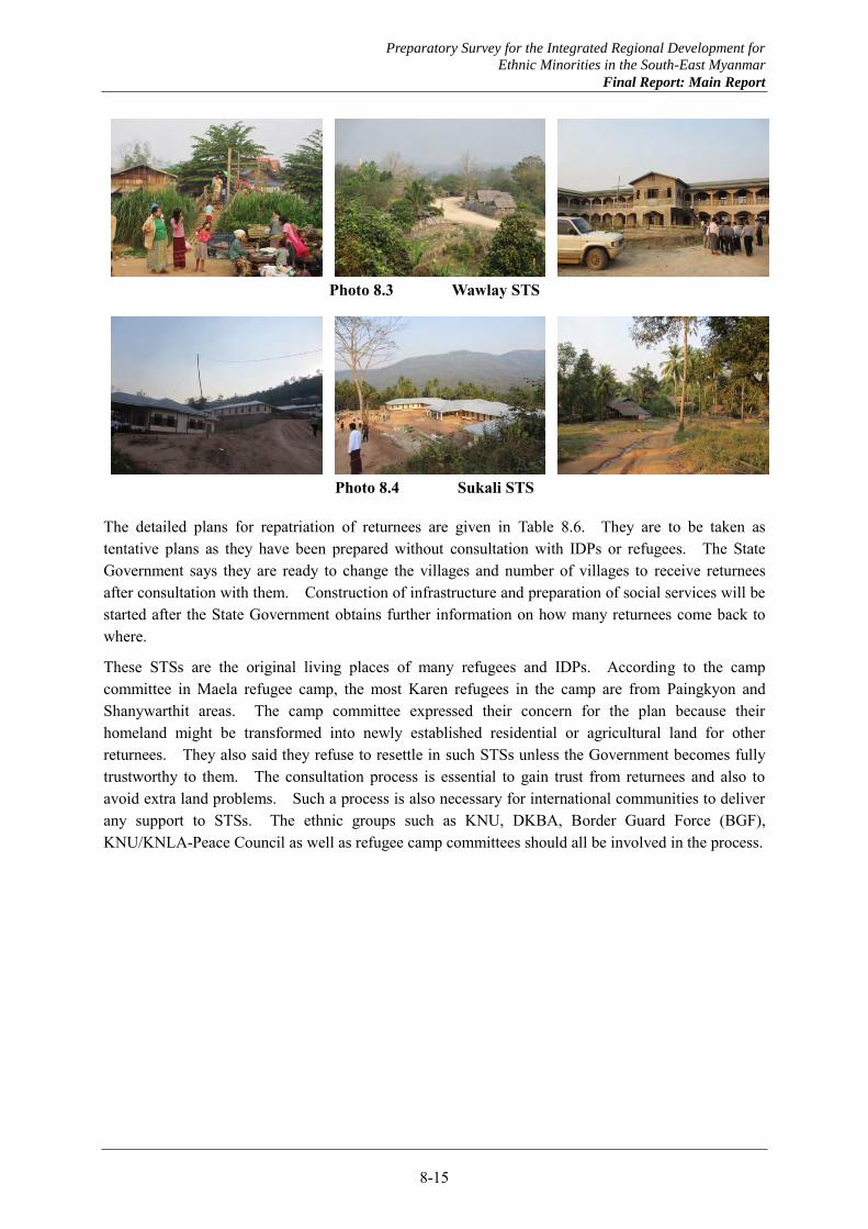
Preparatory Survey for the Integrated Regional Development for
Ethnic Minorities in the South-East Myanmar
Final Report: Main Report
8-15
Photo 8.3 Wawlay STS
Photo 8.4 Sukali STS
The detailed plans for repatriation of returnees are given in Table 8.6. They are to be taken as tentative plans as they have been prepared without consultation with IDPs or refugees. The State Government says they are ready to change the villages and number of villages to receive returnees after consultation with them. Construction of infrastructure and preparation of social services will be started after the State Government obtains further information on how many returnees come back to where.
These STSs are the original living places of many refugees and IDPs. According to the camp committee in Maela refugee camp, the most Karen refugees in the camp are from Paingkyon and Shanywarthit areas. The camp committee expressed their concern for the plan because their homeland might be transformed into newly established residential or agricultural land for other returnees. They also said they refuse to resettle in such STSs unless the Government becomes fully trustworthy to them. The consultation process is essential to gain trust from returnees and also to avoid extra land problems. Such a process is also necessary for international communities to deliver any support to STSs. The ethnic groups such as KNU, DKBA, Border Guard Force (BGF), KNU/KNLA-Peace Council as well as refugee camp committees should all be involved in the process.
Preparatory Survey for the Integrated Regional Development for
Ethnic Minorities in the South-East Myanmar
Final Report: Main Report
8-16
Table 8.6 Plan of Return and Settlement in Nine STSs
STS S/N
Reserved Lands for Residents
(acres)
Reserved Lands for
Agriculture (acres)
No of Households
to be received
No of Villages to
receive returnees
Location of Villages
1 Paingkyon 1 100 2,000 400 2 Paingkyon - Mi Kyong - Tarle road
2 50 1,000 200 3 Mi Gyoung - Hti Lar road 3 600 12,000 2,400 12 Tarle – Matt Kae road 4 200 4,000 800 7 Tarle - Ka Hta road 5 350 7,000 1,400 12 Mi young - Mae Pa Ra road
Total 1,300 26,000 5,200 36 2 Shanywarthit 1 300 6,000 1,200 7 Shanywarthit - Methawaw road
2 400 8,000 1,600 8 Myainggyingu - Methawaw road
3 500 10,000 2,000 10 Hlaingbwe - Shanywarthit road Total 1,200 24,000 4,800 25
3 Kamamaung 1 50 1,000 200 1 Kamamaung - Hpapun road 2 50 1,000 200 1 Noe Hta - Mae Pa Li road
Total 100 2,000 400 2 4 Bawgali 1 30 600 120 3 Thandaung - Bawgali - Mawchi
road 2 20 400 80 1 Border of Bago Region
Total 50 1,000 200 4 5 Leiktho 1 20 400 80 2 Leiktho - Yardo road
2 30 600 120 1 Leiktho - Thandaunggyi road Total 50 1,000 200 3
6 Kyaikdon 1 50 1,000 200 2 Kyainseikgyi - Kyaikdon road 2 100 2,000 400 2 Kyaikdon – Ahzin road 3 75 1,500 300 2 Ahzin – Paing Ka Lan road 4 75 1,500 300 2 Paing Ka Lan - Taung Kalay -
Hpayarthonesu road 5 100 2,000 400 2 Kyainseikgyi - Mar Ta Khat –
Hpayarthonesu road Total 400 8,000 1,600 10
7 Hpayarthonesu 1 200 4,000 800 3 Hpayarthonesu - Mat Ka Thar - Kyaikdon road
2 200 4,000 800 5 Hpayarthonesu – Thanbyuzayat road
Total 400 8,000 1,600 8 8 Wawlay 1 250 5,000 1,000 6 Wawlay – Maw Khee road
2 450 9,000 1,800 10 Maw Khee – Ka nae Lay road 3 450 9,000 1,800 9 Wawlay – Hti tar Pa Lar road 4 50 1,000 200 1 Wawlay – Lawkaw road
Total 1,200 24,000 4,800 26 9 Sukali 1 300 6,000 1,200 5 Myawaddy - Sukali road
2 250 5,000 1,000 4 Sukali - Tar Oak road 3 250 5,000 1,000 4 Sukali – Kyaikdon road 4 300 6,000 1,200 4 Sukali – Sa Khan Thit road 5 100 2,000 400 2 Mae Ka Lar – Tar oak road
Total 1,200 24,000 4,800 19 Source: Presentation Material Obtained from Kayin State
(2) NATALA’s programs
NATALA coordinates some development projects in Kayin and Mon States such as road construction, shelter construction for returnees, and social facility construction together with donors/NGOs, public works department or military engineers as implementation agencies.
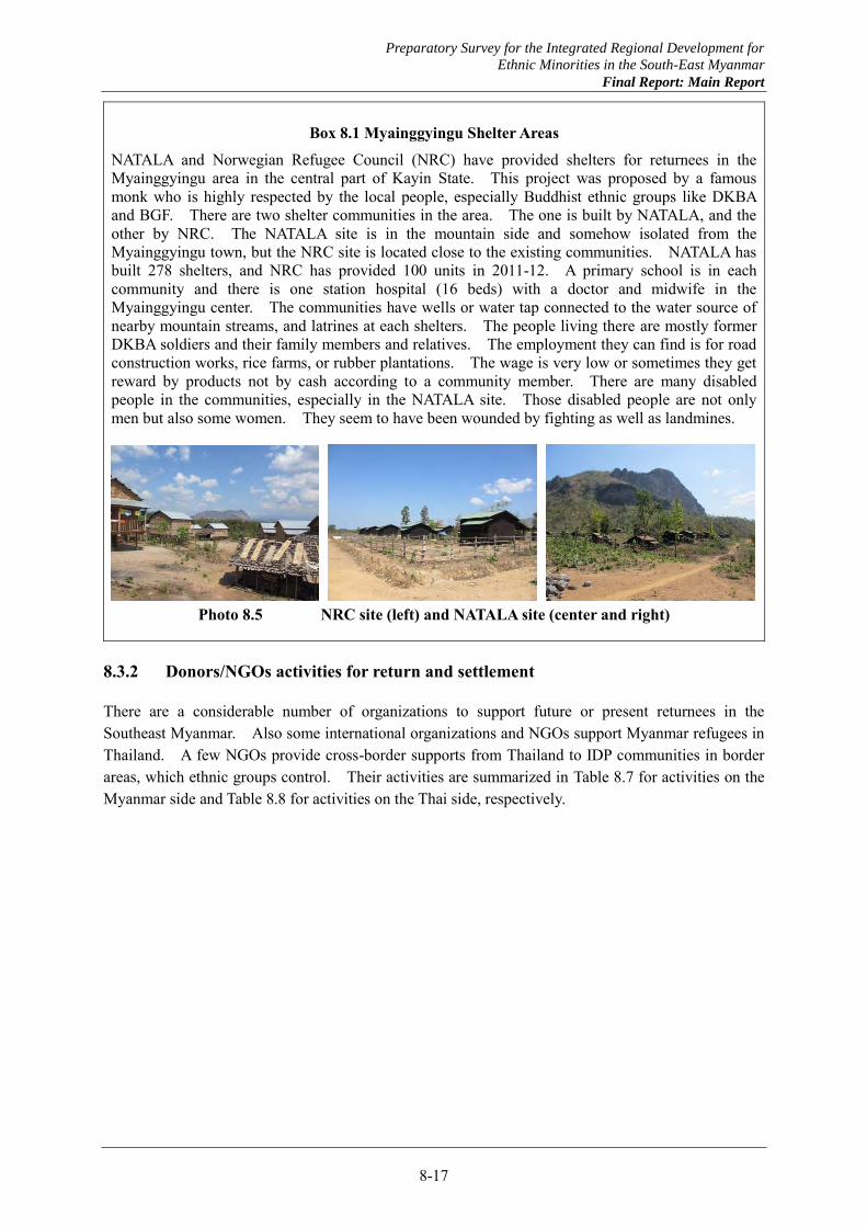
Preparatory Survey for the Integrated Regional Development for
Ethnic Minorities in the South-East Myanmar
Final Report: Main Report
8-17
Box 8.1 Myainggyingu Shelter Areas
NATALA and Norwegian Refugee Council (NRC) have provided shelters for returnees in the Myainggyingu area in the central part of Kayin State. This project was proposed by a famous monk who is highly respected by the local people, especially Buddhist ethnic groups like DKBA and BGF. There are two shelter communities in the area. The one is built by NATALA, and the other by NRC. The NATALA site is in the mountain side and somehow isolated from the Myainggyingu town, but the NRC site is located close to the existing communities. NATALA has built 278 shelters, and NRC has provided 100 units in 2011-12. A primary school is in each community and there is one station hospital (16 beds) with a doctor and midwife in the Myainggyingu center. The communities have wells or water tap connected to the water source of nearby mountain streams, and latrines at each shelters. The people living there are mostly former DKBA soldiers and their family members and relatives. The employment they can find is for road construction works, rice farms, or rubber plantations. The wage is very low or sometimes they get reward by products not by cash according to a community member. There are many disabled people in the communities, especially in the NATALA site. Those disabled people are not only men but also some women. They seem to have been wounded by fighting as well as landmines.
Photo 8.5 NRC site (left) and NATALA site (center and right)
8.3.2 Donors/NGOs activities for return and settlement
There are a considerable number of organizations to support future or present returnees in the Southeast Myanmar. Also some international organizations and NGOs support Myanmar refugees in Thailand. A few NGOs provide cross-border supports from Thailand to IDP communities in border areas, which ethnic groups control. Their activities are summarized in Table 8.7 for activities on the Myanmar side and Table 8.8 for activities on the Thai side, respectively.
Preparatory Survey for the Integrated Regional Development for
Ethnic Minorities in the South-East Myanmar
Final Report: Main Report
8-18
Table 8.7 Activities of International Organizations and NGOs in Southeast Myanmar Name of Organization Brief of their activities
UNHCR
UNHCR have offices in Mawlamyine and Hpaan (under preparation) in the southeast. Issued “Framework for Voluntary Repatriation, Refugees from Myanmar in Thailand” in 2012. Establishing refugee monitoring system including basic information collection and training its
field staff to deliver protection to returnees. Have been conducting village profile survey in Kayin, Mon, and Tanintharyi for nearly 10 years
with Myanmar Red Cross Society. Chairing southeast inter-agency meeting in every month.
UNICEF UNICEF have office in Mawlamyine. Conducting informal assessment on IDPs in Kayin, Mon, and Tanintharyi, to collect basic
information and their access to social services. UNICEF work together with faith-based organizations.
IOM Offices in Myawaddy, Thaton, Mawlamyine, Ye in the southeast. Supporting community level development in border areas.
WFP
Planning relief assistance in the southeast- livelihood support such as food for work or cash for work.
Initiating Protracted Relief and Recovery Operations to reducing food Insecurity and under nutrition among the most vulnerable populations. Its target includes IDPs in Kayin and Mon states, and also disaster affected populations.
Myanmar Peace Support Initiative (MPSI)
Participated by NPA, AusAid, DFID, SDC, EU, UN, World Bank. NPA take coordination roles. MPC is their counterpart. Proposing programs to contribute peace process between government and ethnic groups. Also planning projects to meet the needs of conflict affected communities.
Norwegian Refugee Council (NRC)
Operating shelter project and ID card project. Constructed 100 shelters in Myainggyingu area and 38 in Paingkyon town in 2011-12. Paingkyon shelters are fully occupied by IDPs and refugees from Mae La camp. Their support includes school building and vocational training. ID card project targets 15-20% population of targeted townships. The project has provided ID card to 50,074 people since 2011. The ID card provided by NRC is
equivalent to National Registration Card issued by Immigration Department.
Norwegian People’s Aid (NPA)
Coordinating MPSI. Operating IDP support project in Kyaukpyu in Bago district together with CIDKP (Committee
for Internal Displaced Karen People) as their implementation partner. Targeting 1,600 IDPs to give food aid, commodity supply, and education/health support. Considering future livelihood support when those IDPs return to their homeland.
ADRA ADRA is Christian (Adventist) NGO. Operating humanitarian assistance in conflict affected communities since 2007, such as mobile
clinic operation, clinic construction, mine risk education, health education. They are targeting Hpapun TS, Hlaingbwe TS and Paingkyon STS.
Swiss Agency for Development and Cooperation (SDC)
SDC have office in Mawlamyine. Supporting education and health facilities construction in Mon and Kayin state. Closely working with New Mon State Party (NMSP) to build/renew primary schools in southern
Mon and Kayin state where NMSP control. SDC also work together with NATALA for their activities.
CARE International CARE is Faith-based organization and have office in Mawlamyine. Operating IDP support program in Ye, Bilin, and Thaton for education, health, and livelihood.
Karuna Social Services
Karuna is also faith-based organization and have office in Mawlamyine and Hpaan. Operating IDP support program and livelihood support program. They provide food, medicines, and stationeries for IDPs, especially for the children. Also providing training for agriculture and animal husbandry to communities. They utilize church network to reach community leaders.
Nippon Foundation
Japanese private foundation. They signed MOU with MPC. Delivering rice and medicines directly to the ethnic communities through consultation with MPC
and UNFC (United Nationalities Federal Council). The rice and medicines are also delivered cross-border from Thailand to some communities
which are in the area controlled by ethnic groups.
Bridge Asia Japan
Japanese NGO and implementing partner of UNHCR. Operating basic infrastructure project such as construction of bridges, roads, and schools, and
water sanitation project. BAJ have an experience to conduct a project in Paingkyon. Preparing a vocational training center in Hpaan Industrial Zone.
Japan Platform Joint platform of NGOs based in Japan. The member NGOs are planning to start their project in the southeast.
Preparatory Survey for the Integrated Regional Development for
Ethnic Minorities in the South-East Myanmar
Final Report: Main Report
8-19
Table 8.8 Activities of International Organizations and NGOs in Thai Side Name of Organization Brief of their activities
UNHCR
UNHCR have offices in Maesot, Maesariang, Maehongson, and Kanchanaburi in the border areas.
Preparatory stage rather than planning stage Conducting profile survey at all nine refugee camps with Mae Fah Luang Foundation as
implementation partner (see below)
The Border Consortium
TBC is a non-profit, non-governmental organization, is an alliance of 10 international NGOs to address humanitarian needs and to support community driven solutions in pursuit of peace and development for conflict affected people in the southeast.
Supporting refugees in the camps such as food provision, education/health training Collecting information on IDPs together with CIDKP and KORD (Karen Office for Relief and
Development). TBC issued a report on IDP, “Changing Realties, Poverty and Displacement in South East Burma/Myanmar”. The data on this report is the most comprehensive IDP data in the southeast available at the moment.
ADRA
Supporting refugees in the camps since 1984, mostly education sectors Conducting vocational trainings in seven camps since 2011, 1) cooking and bakery, 2) sewing
for men, 3) basic mechanic, 4) basic electric, 5) hair cutting, 6) sewing for woman, 7) hair dressing, 8) basic massage, 9) child & elderly care, and 10) additionally PC and agricultural trainings.
The curriculum of the vocational school is based on Thai standard. They tie-up with four vocational schools in Thailand and dispatch trainers from those schools to camps.
Shanti Volunteer Association (SVA) Operating library in seven refugee camps.
Mae Tao Clinic Providing medical service for Myanmar migrants in the border area Constructing schools in Kayin state as “community school program”. The targeting area is
where many refugees and IDPs have left. Thai Japan Education Development Foundation
Operating agricultural training facilities in the area under control of ethnic groups in Shan, Kayah, and Mon states. Under preparation in Kayin state.
The foundation has signed MOU with MPC including cross-border assistance.
Karen Refugee Committee (KRC)
KRC manage the camp committee in seven camps where the majority is Karen people. The committee members are elected in every three years. The last election was in
February-March 2013. KRC issued their statement “KRC position on repatriation” in March 2013. KRC members recently met with Kayin state chief minister in 25th April, for the first time in its
history since 1974. They discussed repatriation/resettlement issues. Committee for Internally Displaced Karen People (CIDKP)
Supporting and collecting information on IDPs in Myanmar side. Using field workers in Myanmar and deliver assistance to IDPs
Back Pack Health Workers Team
Delivering medical services in remote IDP communities in the southeast Core activities are 1) Medical care program, 2) Community health education and prevention
program, 3) Maternal and child care program Providing training to the field workers who voluntarily applied to be a worker and dispatch to
the remote communities Karen Human Rights Group
Collecting information on human rights issues of Karen people including forced labor, torture, land confiscation, landmines.
Preparatory Survey for the Integrated Regional Development for
Ethnic Minorities in the South-East Myanmar
Final Report: Main Report
8-20
Box 8.2 Profile survey at refugee camps by UNHCR/Mae Fah Luang Foundation
The refugee profile survey is going to cover all households in all the nine camps. This survey is funded and planned by UNHCR and implemented Mae Fah Luang Foundation, the Thai royal foundation. The survey is planned to clarify 1) where they would like to go, 2) what skills they have, 3) what they would like to do for the future. The surveyors are all recruited from refugees in each camp and they are volunteers to be selected to meet the criteria. The surveyors have several training such as communication, leadership and GPS/tablet handling. Each surveyor is expected to cover 100 households. The survey has started from the Mae La camp and will finish by June 2013. Then the survey moves to another camp to cover all the nine one by one. The overall result is expected to be made available sometime in 2014.
Box 8.3 Support from Swiss Agency for Development and Cooperation (SDC)
SDC has been conducting their activities in the southeast since 2011. They have close relationship with NMSP, and they have been supporting school/health clinic construction or renovation in the NMSP controlled area. SDC also coordinate with Mon State NALATA for their activities. SDC’s policy is “to include all parties”, and their activities are highly appreciated by both Mon State and NMSP. Such effort to build partnership with both the state government and ethnic group to meet their needs can be a good model for JICA.
Preparatory Survey for the Integrated Regional Development for
Ethnic Minorities in the South-East Myanmar
Final Report: Main Report
8-21
8.4 Existing Socio-economy in Target Areas
8.4.1 Results of past household surveys
Household surveys conducted in the past in Myanmar were reviewed to grasp the living conditions and living standards in the target areas. The most recent and comprehensive household survey, the Integrated Household Living Conditions Survey in Myanmar (IHLCS), was conducted by UNDP and the Union Government between 2009 and 2010 targeting 18,660 households in all the states and regions. The results of the survey by state/region are summarized in Table 8.9.
The survey results show that Kayin State is lower than the national average in average agriculture land size per household, access to credit for agriculture, and access to primary schools within one-hour walking distance. Mon State is lower than the national average in access to credit for agriculture. Both states are not so much in poor living conditions as in Rakhine.
Another household survey conducted in the southeastern part of Myanmar is the Poverty and Displacement in South East Burma/Myanmar by the Border Consortium (TBC), which covered Shan, Kayah, Kayin, Bago, Mon and Tanintharyi during the three consecutive years of 2010-2012. The results of the survey are shown in Table 8.10. The number of target households was 4,073. As it can be seen, not all the townships were targeted in Mon State and there is a lot of variation in the data by township. It might represent the situation of the target villages in each township as the sample size of villages was small.
Overall, the living conditions in the survey by TBC are worse than those of IHLCS. TBC says the sample households were not selected from the areas with difficult access nor in the mountainous areas and in forests. Thus, it can be imagined that the living standards of the communities or IDPs who live in the deep mountains are much worse.
Whether ID card is issued is one of the concerns of IDPs and refugees for free movement and access to higher education. About one third of the samples in Kayin State have no ID, according to the TBC’s survey. However, Norwegian Refugee Council (NRC) has been implementing a project to support the issuance of an ID with the Department of Immigration and National Registration since 2012. NRC has almost finished the ID issue project in Kayin State.
The other main results of TBC’s survey are as follows. For the access to agriculture lands, the total percentage of landless households and households having lands smaller than 2.0acres is over 50%, excluding Hlaingbwe TS. It seems difficult for them to produce sufficient rice or obtain enough cash income. For the household income, the percentages of casual laborers or those without income is higher than those depending on income from the sale of agriculture products. One of the reasons is that the survey was conducted in May and June during early rainy season. The highest ratio of expenditure is for foods. The percentage of the households having debts is high except in Hlaingbwe. No township produces sufficient rice for self-consumption and they buy rice. As seen above, the overall living standards are low.
Preparatory Survey for the Integrated Regional Development for
Ethnic Minorities in the South-East Myanmar
Final Report: Main Report
8-22
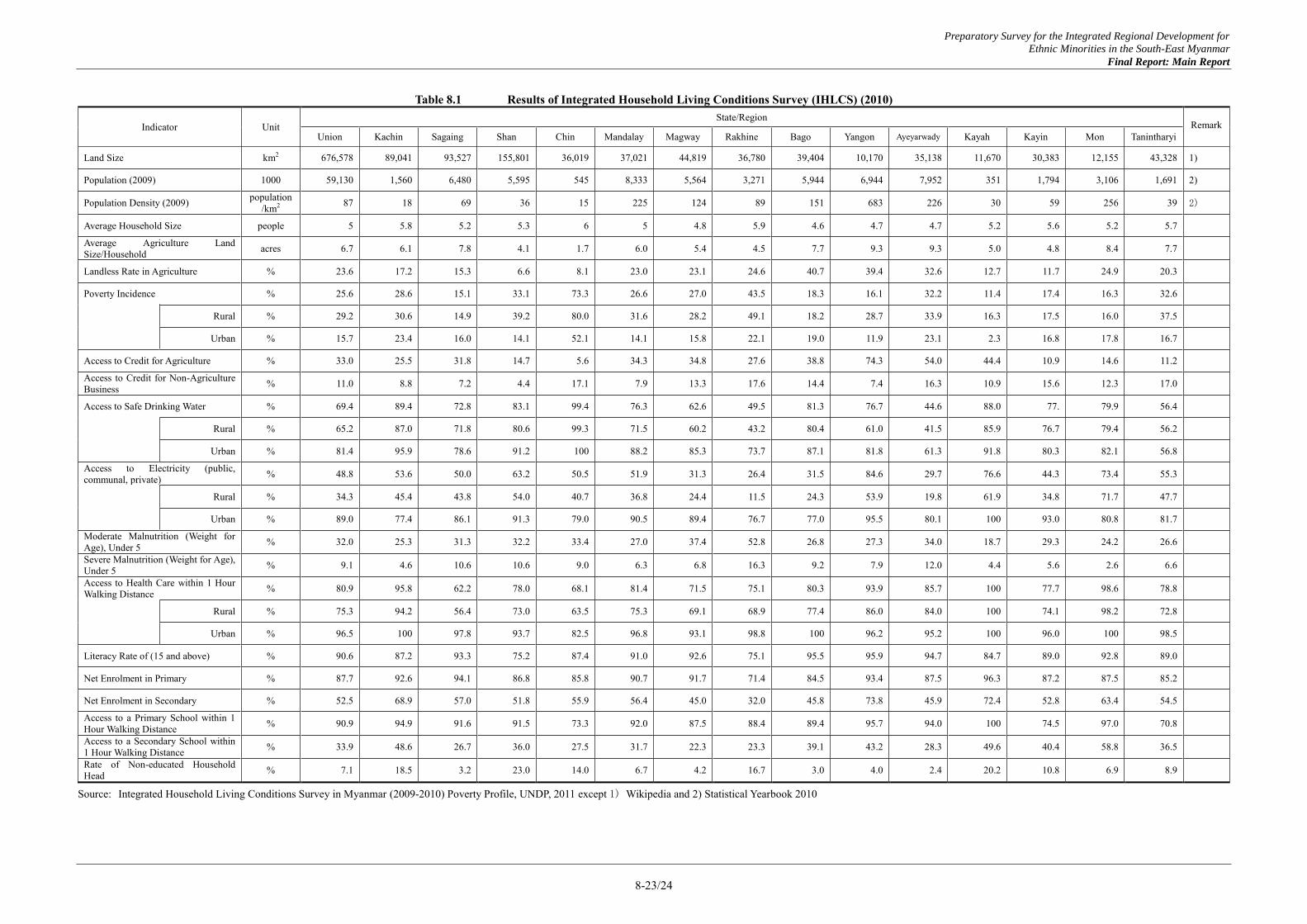
Preparatory Survey for the Integrated Regional Development for
Ethnic Minorities in the South-East Myanmar
Final Report: Main Report
8-23/24
Table 8.1 Results of Integrated Household Living Conditions Survey (IHLCS) (2010)
Indicator Unit State/Region
Remark Union Kachin Sagaing Shan Chin Mandalay Magway Rakhine Bago Yangon Ayeyarwady Kayah Kayin Mon Tanintharyi
Land Size km2 676,578 89,041 93,527 155,801 36,019 37,021 44,819 36,780 39,404 10,170 35,138 11,670 30,383 12,155 43,328 1)
Population (2009) 1000 59,130 1,560 6,480 5,595 545 8,333 5,564 3,271 5,944 6,944 7,952 351 1,794 3,106 1,691 2)
Population Density (2009) population /km2 87 18 69 36 15 225 124 89 151 683 226 30 59 256 39 2)
Average Household Size people 5 5.8 5.2 5.3 6 5 4.8 5.9 4.6 4.7 4.7 5.2 5.6 5.2 5.7
Average Agriculture Land Size/Household acres 6.7 6.1 7.8 4.1 1.7 6.0 5.4 4.5 7.7 9.3 9.3 5.0 4.8 8.4 7.7
Landless Rate in Agriculture % 23.6 17.2 15.3 6.6 8.1 23.0 23.1 24.6 40.7 39.4 32.6 12.7 11.7 24.9 20.3
Poverty Incidence % 25.6 28.6 15.1 33.1 73.3 26.6 27.0 43.5 18.3 16.1 32.2 11.4 17.4 16.3 32.6
Rural % 29.2 30.6 14.9 39.2 80.0 31.6 28.2 49.1 18.2 28.7 33.9 16.3 17.5 16.0 37.5
Urban % 15.7 23.4 16.0 14.1 52.1 14.1 15.8 22.1 19.0 11.9 23.1 2.3 16.8 17.8 16.7
Access to Credit for Agriculture % 33.0 25.5 31.8 14.7 5.6 34.3 34.8 27.6 38.8 74.3 54.0 44.4 10.9 14.6 11.2
Access to Credit for Non-Agriculture Business % 11.0 8.8 7.2 4.4 17.1 7.9 13.3 17.6 14.4 7.4 16.3 10.9 15.6 12.3 17.0
Access to Safe Drinking Water % 69.4 89.4 72.8 83.1 99.4 76.3 62.6 49.5 81.3 76.7 44.6 88.0 77. 79.9 56.4
Rural % 65.2 87.0 71.8 80.6 99.3 71.5 60.2 43.2 80.4 61.0 41.5 85.9 76.7 79.4 56.2
Urban % 81.4 95.9 78.6 91.2 100 88.2 85.3 73.7 87.1 81.8 61.3 91.8 80.3 82.1 56.8
Access to Electricity (public, communal, private) % 48.8 53.6 50.0 63.2 50.5 51.9 31.3 26.4 31.5 84.6 29.7 76.6 44.3 73.4 55.3
Rural % 34.3 45.4 43.8 54.0 40.7 36.8 24.4 11.5 24.3 53.9 19.8 61.9 34.8 71.7 47.7
Urban % 89.0 77.4 86.1 91.3 79.0 90.5 89.4 76.7 77.0 95.5 80.1 100 93.0 80.8 81.7
Moderate Malnutrition (Weight for Age), Under 5 % 32.0 25.3 31.3 32.2 33.4 27.0 37.4 52.8 26.8 27.3 34.0 18.7 29.3 24.2 26.6
Severe Malnutrition (Weight for Age), Under 5 % 9.1 4.6 10.6 10.6 9.0 6.3 6.8 16.3 9.2 7.9 12.0 4.4 5.6 2.6 6.6
Access to Health Care within 1 Hour Walking Distance % 80.9 95.8 62.2 78.0 68.1 81.4 71.5 75.1 80.3 93.9 85.7 100 77.7 98.6 78.8
Rural % 75.3 94.2 56.4 73.0 63.5 75.3 69.1 68.9 77.4 86.0 84.0 100 74.1 98.2 72.8
Urban % 96.5 100 97.8 93.7 82.5 96.8 93.1 98.8 100 96.2 95.2 100 96.0 100 98.5
Literacy Rate of (15 and above) % 90.6 87.2 93.3 75.2 87.4 91.0 92.6 75.1 95.5 95.9 94.7 84.7 89.0 92.8 89.0
Net Enrolment in Primary % 87.7 92.6 94.1 86.8 85.8 90.7 91.7 71.4 84.5 93.4 87.5 96.3 87.2 87.5 85.2
Net Enrolment in Secondary % 52.5 68.9 57.0 51.8 55.9 56.4 45.0 32.0 45.8 73.8 45.9 72.4 52.8 63.4 54.5
Access to a Primary School within 1 Hour Walking Distance % 90.9 94.9 91.6 91.5 73.3 92.0 87.5 88.4 89.4 95.7 94.0 100 74.5 97.0 70.8
Access to a Secondary School within 1 Hour Walking Distance % 33.9 48.6 26.7 36.0 27.5 31.7 22.3 23.3 39.1 43.2 28.3 49.6 40.4 58.8 36.5
Rate of Non-educated Household Head % 7.1 18.5 3.2 23.0 14.0 6.7 4.2 16.7 3.0 4.0 2.4 20.2 10.8 6.9 8.9
Source: Integrated Household Living Conditions Survey in Myanmar (2009-2010) Poverty Profile, UNDP, 2011 except 1) Wikipedia and 2) Statistical Yearbook 2010
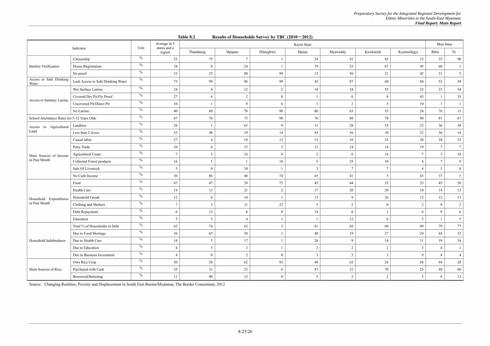
Preparatory Survey for the Integrated Regional Development for
Ethnic Minorities in the South-East Myanmar
Final Report: Main Report
8-25/26
Table 8.2 Results of Households Survey by TBC (2010-2012)
Indicator Unit Average in 5 states and a
region
Kayin State Mon State
Thandaung Hpapun Hlaingbwe Hpaan Myawaddy Kawkareik Kyainseikgyi Bilin Ye
Identity Verification
Citizenship % 53 75 7 1 24 41 45 13 35 90
House Registration % 34 0 24 1 79 23 67 45 60 1
No proof % 33 25 88 99 12 56 21 42 21 5 Access to Safe Drinking Water Lack Access to Safe Drinking Water % 73 99 96 99 43 87 60 84 52 58
Access to Sanitary Latrine
Wet Surface Latrine % 24 4 12 2 18 34 55 23 23 54
Covered Dry Pit/Fly Proof % 27 6 2 0 1 0 8 43 1 35
Uncovered Pit/Direct Pit % 10 1 9 0 1 2 5 10 1 1
No Latrine % 40 89 78 98 80 63 33 24 76 11
School Attendance Rates for 5-12 Years Olds % 67 76 73 98 76 88 78 90 81 67
Access to Agricultural Land
Landless % 28 1 63 9 31 28 55 32 36 38
Less than 2 Acres % 35 48 19 14 43 36 10 52 36 14
Main Sources of Income in Past Month
Casual labor % 27 4 18 12 12 10 33 20 38 52
Petty Trade % 10 4 15 3 11 14 14 19 7 7
Agricultural Crops % 7 5 16 0 2 0 14 7 3 18
Collected Forest products % 16 1 1 10 5 25 10 4 7 9
Sale Of Livestock % 5 0 10 1 3 7 7 4 3 0
No Cash Income % 30 86 40 74 65 41 5 43 37 3
Household Expenditures in Past Month
Food % 47 47 39 75 45 44 35 33 45 50
Health Care % 14 13 21 2 17 20 20 10 14 13
Household Goods % 12 8 14 1 13 9 26 12 12 13
Clothing and Shelters % 7 3 11 22 5 2 0 2 8 2
Debt Repayment % 6 12 8 0 14 0 1 6 9 6
Education % 5 5 4 1 1 12 6 5 1 5
Household Indebtedness
Total % of Households in Debt % 62 74 62 3 81 42 60 49 79 77
Due to Food Shortage % 36 65 38 1 40 19 27 24 44 32
Due to Health Care % 14 5 17 1 26 9 14 11 19 34
Due to Education % 4 5 3 1 3 2 2 3 4 1
Due to Business Investment % 4 0 2 0 3 5 3 9 4 4
Main Sources of Rice
Own Rice Crop % 50 28 62 92 48 63 26 68 44 28
Purchased with Cash % 35 31 23 6 47 32 70 25 48 60
Borrowed/Bartering % 11 40 15 0 5 2 2 5 6 12
Source: Changing Realities, Poverty and Displacement in South East Burma/Myanmar, The Border Consortium, 2012
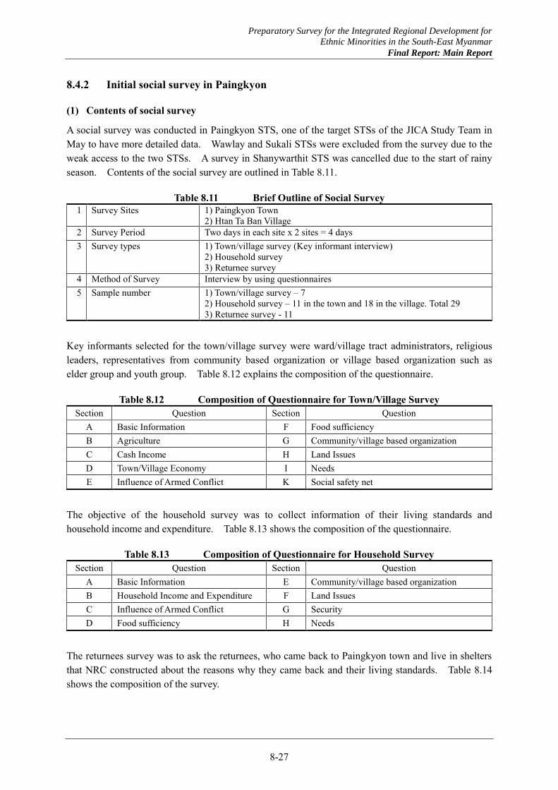
Preparatory Survey for the Integrated Regional Development for
Ethnic Minorities in the South-East Myanmar
Final Report: Main Report
8-27
8.4.2 Initial social survey in Paingkyon
(1) Contents of social survey
A social survey was conducted in Paingkyon STS, one of the target STSs of the JICA Study Team in May to have more detailed data. Wawlay and Sukali STSs were excluded from the survey due to the weak access to the two STSs. A survey in Shanywarthit STS was cancelled due to the start of rainy season. Contents of the social survey are outlined in Table 8.11.
Table 8.11 Brief Outline of Social Survey 1 Survey Sites 1) Paingkyon Town
2) Htan Ta Ban Village 2 Survey Period Two days in each site x 2 sites = 4 days 3 Survey types 1) Town/village survey (Key informant interview)
2) Household survey 3) Returnee survey
4 Method of Survey Interview by using questionnaires 5 Sample number 1) Town/village survey – 7
2) Household survey – 11 in the town and 18 in the village. Total 29 3) Returnee survey - 11
Key informants selected for the town/village survey were ward/village tract administrators, religious leaders, representatives from community based organization or village based organization such as elder group and youth group. Table 8.12 explains the composition of the questionnaire.
Table 8.12 Composition of Questionnaire for Town/Village Survey Section Question Section Question
A Basic Information F Food sufficiency B Agriculture G Community/village based organization C Cash Income H Land Issues D Town/Village Economy I Needs E Influence of Armed Conflict K Social safety net
The objective of the household survey was to collect information of their living standards and household income and expenditure. Table 8.13 shows the composition of the questionnaire.
Table 8.13 Composition of Questionnaire for Household Survey Section Question Section Question
A Basic Information E Community/village based organization B Household Income and Expenditure F Land Issues C Influence of Armed Conflict G Security D Food sufficiency H Needs
The returnees survey was to ask the returnees, who came back to Paingkyon town and live in shelters that NRC constructed about the reasons why they came back and their living standards. Table 8.14 shows the composition of the survey.
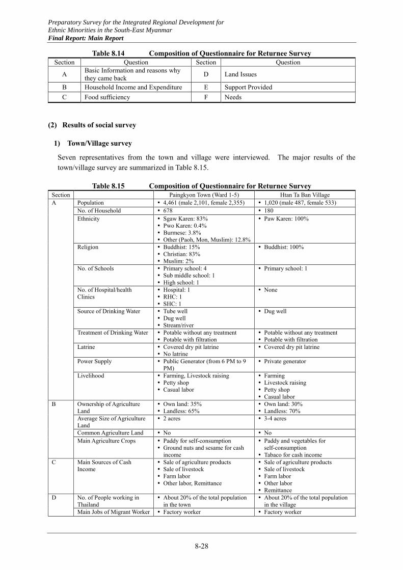
Preparatory Survey for the Integrated Regional Development for
Ethnic Minorities in the South-East Myanmar
Final Report: Main Report
8-28
Table 8.14 Composition of Questionnaire for Returnee Survey Section Question Section Question
A Basic Information and reasons why they came back D Land Issues
B Household Income and Expenditure E Support Provided C Food sufficiency F Needs
(2) Results of social survey
1) Town/Village survey
Seven representatives from the town and village were interviewed. The major results of the town/village survey are summarized in Table 8.15.
Table 8.15 Composition of Questionnaire for Returnee Survey Section Paingkyon Town (Ward 1-5) Htan Ta Ban Village A Population 4,461 (male 2,101, female 2,355) 1,020 (male 487, female 533)
No. of Household 678 180 Ethnicity Sgaw Karen: 83%
Pwo Karen: 0.4% Burmese: 3.8% Other (Paoh, Mon, Muslim): 12.8%
Paw Karen: 100%
Religion Buddhist: 15% Christian: 83% Muslim: 2%
Buddhist: 100%
No. of Schools Primary school: 4 Sub middle school: 1 High school: 1
Primary school: 1
No. of Hospital/health Clinics
Hospital: 1 RHC: 1 SHC: 1
None
Source of Drinking Water Tube well Dug well Stream/river
Dug well
Treatment of Drinking Water Potable without any treatment Potable with filtration
Potable without any treatment Potable with filtration
Latrine Covered dry pit latrine No latrine
Covered dry pit latrine
Power Supply Public Generator (from 6 PM to 9 PM)
Private generator
Livelihood Farming, Livestock raising Petty shop Casual labor
Farming Livestock raising Petty shop Casual labor
B Ownership of Agriculture Land
Own land: 35% Landless: 65%
Own land: 30% Landless: 70%
Average Size of Agriculture Land
2 acres 3-4 acres
Common Agriculture Land No No Main Agriculture Crops Paddy for self-consumption
Ground nuts and sesame for cash income
Paddy and vegetables for self-consumption
Tabaco for cash income C Main Sources of Cash
Income Sale of agriculture products Sale of livestock Farm labor Other labor, Remittance
Sale of agriculture products Sale of livestock Farm labor Other labor Remittance
D No. of People working in Thailand
About 20% of the total population in the town
About 20% of the total population in the village
Main Jobs of Migrant Worker Factory worker Factory worker
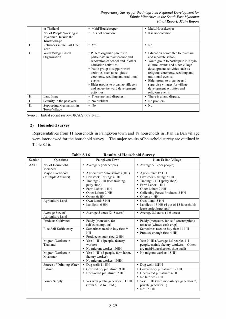
Preparatory Survey for the Integrated Regional Development for
Ethnic Minorities in the South-East Myanmar
Final Report: Main Report
8-29
in Thailand Maid/Housekeeper Maid/Housekeeper No. of People Working in Myanmar Outside the Town/Village
It is not common. It is not common.
E Returnees in the Past One Year
Yes No
G Ward/Village Based Organization
PTA to organize parents to participate in maintenance and renovation of school and in other education activities
Youth group to support ward activities such as religious ceremony, wedding and traditional events
Elder groups to organize villagers and supervise ward development activities
Education committee to maintain and renovate school
Youth group to participate in Kayin cultural events and other village development activities such as religious ceremony, wedding and traditional events.
Elder group to organize and supervise villages for village development activities and religious events
H Land Issue There are land disputes. There is a land dispute. I Security in the past year No problem No problem K Supporting Mechanism in
Town/Village No No
Source: Initial social survey, JICA Study Team
2) Household survey
Representatives from 11 households in Paingkyon town and 18 households in Htan Ta Ban village were interviewed for the household survey. The major results of household survey are outlined in Table 8.16.
Table 8.16 Results of Household Survey Section Questions Paingkyon Town Htan Ta Ban Village A&D No. of Household
Members Average 5 (2-8 people) Average 5.3 (3-9 people)
Major Livelihood (Multiple Answers)
Agriculture: 6 households (HH) Livestock Raising: 4 HH Trading: 2 HH (rice training,
petty shop) Farm Labor: 1 HH Other Labor: 2 HH Others 6: HH
Agriculture: 12 HH Livestock Raising: 5 HH Trading: 2 HH (petty shop) Farm Labor: 1HH Other Labor: 2 HH Collecting Forest Products: 2 HH Others: 4 HH
Agriculture Land Own Land: 5 HH Landless: 6 HH
Own Land: 5 HH Landless: 13 HH (4 out of 13 households
lease agriculture land) Average Size of Agriculture Land
Average 5 acres (2- 8 acres) Average 2.9 acres (1-6 acres)
Products Cultivated Paddy (monsoon, for self-consumption)
Paddy (monsoon, for self-consumption) tobacco (winter, cash crop)
Rice Self-Sufficiency Sometimes need to buy rice: 9 HH
Produce enough rice: 2 HH
Sometimes need to buy rice: 14 HH Produce enough rice: 4 HH
Migrant Workers in Thailand
Yes: 1 HH (1people, factory worker)
No migrant worker 10HH
Yes: 9 HH (Average 1.5 people, 1-4 people, mainly factory workers. Others are maid/housekeeper, shop staff)
Migrant Workers in Myanmar
Yes: 1 HH (3 people, farm labor, factory worker)
No migrant worker: 10HH
No migrant worker: 18HH
Source of Drinking Water Dug well: 11 HH Dug well: 18HH Latrine Covered dry pit latrine: 9 HH
Uncovered pit latrine: 2 HH Covered dry pit latrine: 12 HH Uncovered pit latrine: 4 HH No latrine: 2 HH
Power Supply Yes with public generator: 11 HH (from 6 PM to 9 PM )
Yes: 3 HH (with monastery's generator 2, private generator 1)
No: 15 HH
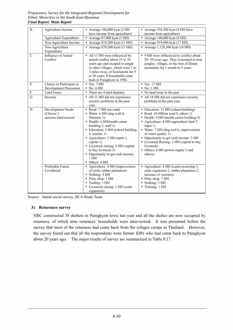
Preparatory Survey for the Integrated Regional Development for
Ethnic Minorities in the South-East Myanmar
Final Report: Main Report
8-30
B Agriculture Income Average 180,000 kyat (2 HH have income from agriculture)
Average 554,500 kyat (9 HH have income from agriculture)
Agriculture Expenditure Average 87,000 kyat (3 HH) Average 140,000 kyat (8 HH) Non-Agriculture Income Average 818,500 kyat (11 HH) Average 919,000 kyat (17 HH) Non-Agriculture Expenditure
Average 879,500 kyat (11 HH) Average 1,128,500 kyat (18 HH)
C Influence of Armed Conflict
All 11 HH were influenced by armed conflict about 25 to 38 years ago and escaped to jungle or other villages, which were 1 to 3 miles away, or Kawkareik for 5 to 20 years. 8 households came back in Paingkyon in 1994.
9 HH were influenced by conflict about 20- 30 years ago. They evacuated to near jungles, villages, or the foot of Donar mountains for 1 month to 5 years.
E Chance to Participate in Development Discussion
Yes: 7 HH No: 4 HH
Yes: 17 HH No: 1 HH
F Land Issues There are 4 land disputes. No land issue in the past G Security All 11 HH did not experience
security problems in the past year.
All 18 HH did not experience security problems in the past year.
H Development Needs (Choose 3 answers/interviewee)
Road: 7 HH (tar road) Water: 6 HH (dug well 4,
filtration 2) Health: 6 HH(health center
building 5, staff 1) Education: 5 HH (school building
4, teacher 1) Agriculture: 2 HH (input 1,
capital 1) Livestock raising: 2 HH (capital
to buy livestock 2) Opportunity to get cash income:
1 HH Others: 4 HH
Education: 11 HH (school building) Road :10 HH(tar road 9, others 1) Health: 9 HH (health center building 9) Agriculture: 8 HH (agriculture land 7,
input 1) Water: 7 HH (dug well 6, improvement
of water quality 1) Opportunity to get cash income: 3 HH Livestock Raising: 2 HH (capital to buy
livestock) Others: 4 HH (power supply 2 and
others)
Preferable Future Livelihood
Agriculture: 4 HH (improvement of yield, rubber plantation)
Nothing: 4 HH Petty shop: 1 HH Trading: 1 HH Livestock raising: 1 HH (scale
expansion)
Agriculture: 8 HH (Land ownership 3, scale expansion 2, rubber plantation 2, increase of varieties)
Petty shop: 7 HH Nothing: 2 HH Training: 1 HH
Source: Initial social survey, JICA Study Team
3) Returnees survey
NRC constructed 38 shelters in Paingkyon town last year and all the shelter are now occupied by returnees, of which nine returnees’ households were interviewed. It was presumed before the survey that most of the returnees had come back from the refugee camps in Thailand. However, the survey found out that all the respondents were former IDPs who had come back to Paingkyon about 20 years ago. The major results of survey are summarized in Table 8.17.

Preparatory Survey for the Integrated Regional Development for
Ethnic Minorities in the South-East Myanmar
Final Report: Main Report
8-31
Table 8.17 Results of Returnee Survey Section Questions Answers A&C Major Livelihood (Multiple Answers) Agriculture: 6 HH
Livestock raising: 4 HH Fishing: 3 HH Farm Labor :3 HH Others: 2 HH
Agriculture Land Own land: 5 HH Landless: 4 HH
Average Size of Agriculture Land Average 2.6 acres (1-5 acres) Products Cultivated Paddy (monsoon& winter for self-consumption)
Vegetables (monsoon& winter for self-consumption) Rice Self-Sufficiency Sometimes need to buy rice: 6 HH
Produce enough rice: 3 HH Lived in Paingkyon before Evacuation Yes: 9 HH Where to Evacuate Villages which are 2 to 5 miles away from the town: 8 HH
Kawkareik: 1 HH Evacuation Period Average 14 years (6-17 years) Year to Come Back in Paingkyon Before 1994 Whether You Came Back to See the Situation before deciding Their Return
Yes: 6 HH No: 3 HH
Reasons for Return Security is improved: 9 HH There is a health center: 8 HH There is a school: 6 HH Shelter is provided: 5 HH Relatives or friends live near the town: 4 HH
B Agriculture Income Average 195,000 kyat (3 HH have income from agriculture) Agriculture Expenditure Average 45,000 kyat (5 HH) Non-Agriculture Income Average 335,000 kyat (11 HH) Non-Agriculture Expenditure Average 777,000 kyat (11 HH)
D Land Issues 8 HH did not experience any land issues (in case they used to have land rights, they can still use the land. On the other hand, if they did not have land rights, they are still landless).
There was a case that other people build a house on the lands one of the returnees used to use in the past.
E Assistance Provided after Return All 9 HH received a water filter pot, a solar system, mosquito net(s) and a shelter from NRC.
1 HH received fruits tree from the state agriculture department.
F Development Needs (3 answers per interviewee)
Water: 7 HH (dug well 7) Opportunity to get cash income: 4 HH (factory 4, others 1) Health: 3 HH (medicine 3) Livestock Raising: 3 HH (capital to by livestock 3) Agriculture: 2 HH (input 1, extension service 1, agriculture
land 1) Road: 2 HH Education: 1HH (school building and school expense)
Difficulties Faced after Return Nothing: 5 HH. The other 4 HH answered insufficient income to buy food,
no job opportunity, no agriculture land, no money to buy agriculture input.
Preferable Feature Livelihood Petty shop: 4 HH Livestock raising: 2 HH Sewing & motor bike repair & agriculture: 1 HH
Channel to Convey Your Requests to the Government
No: 9 HH
Chance to Participate in Development Discussion
Yes 9 HH, but they also included religious activities for such a chance
Relation with the Host Community All 9 HH said the relation is good.
Source: Initial social survey, JICA Study Team

Preparatory Survey for the Integrated Regional Development for
Ethnic Minorities in the South-East Myanmar
Final Report: Main Report
8-32
(3) Major findings
There are differences in levels of infrastructure development, but there is a no big difference in livelihood between Paingkyon town and Htan Ta Ban village. Major livelihood is agriculture and livestock raising and other livelihood activities are limited. Regarding agriculture, the ratio of the households which do not have agriculture land is high compared to the results of the IHLCS’s and the TBS’s survey. Many households interviewed cultivate paddy for self-consumption, but only 20% answered they were able to produce enough rice and the rest of 80% answered they sometimes needed to buy rice. Even though the major livelihood is agriculture, it is difficult for them to survive with dependency only on agriculture. The ratio of households which have debt is about 40% in Paingkyon town and 60% in Htan Ta Ban village. Therefore, it is very common to send a family member(s) to Thailand as a migrant worker and have them to send remittance, usually over 1 million kyat per year. Migrant workers in Thailand and their remittance cannot be disregarded. It is essential to make a supporting plan for diversification of livelihood as well as for provision of agriculture land and agriculture assistance not only to future returnees but also to host communities.
It turned out that some of the returnees in Paingkyon town came back from the refugee camps in Thailand but most of them are former IDP who came back in Paingkyon town area about 20 years ago. Their income is considerably low compared to those of the household survey in Paingkyon town as one of the conditions to move in the NRC shelters was poverty. This is why they prefer assistance to provide them cash income such as opportunity to work at factory or run a petty shop. It is difficult to define IDP, for instance, whether former IDPs who came back to their original places for decades ago should be regarded as IDPs too. What is important is how to assist those who live difficult lives too in a comprehensive manner when promoting return of refugees and IDPs and making a community development plan for them.
Preparatory Survey for the Integrated Regional Development for
Ethnic Minorities in the South-East Myanmar
Final Report: Main Report
8-33
8.5 Issues Related to Rural Community Development and Return and Settlement
8.5.1 Issues for rural community development
(1) People-centered development
As explained in Section 8.1, the new administration has shifted its basic policy from the previous top down development toward the bottom up development through introduction of the new measures for community participation. The establishment of village tract development committees is a major change in view of the recent history of Myanmar. It is expected that a newly established village tract development committee composed of representatives of the village tract is expected to be instrumental for participatory development
Since this is a new approach, however, government officials do not have experience in participatory development. It will be difficult for government officials to guide the committees and provide necessary training. The same goes with village tract administrators. They are in a good position to listen to needs from communities as they are also a member of the community and community members respect the administrator as their representative. Nonetheless, it is the first experience for them to lead the village tract development committee and prepare a village tract development plan. It is necessary to provide them with appropriate training on how to make a development plan or how to practice participatory approach. Once the new administrative system with village tract development committees and village tract administrators starts functioning, it may be effectively utilized for a project for participatory community development.
The new government system will not be introduced in the areas controlled by non-state ethnic groups unless the political situation allows. Still, they can learn from this new movement. Successful administration with the new system would provide a good opportunity for them also to think about participatory development.
(2) Integration with existing Karen system
KNU has a president, congress and 14 departments based in Thai-side. Karen Department of Health and Welfare and Karen Department of Education have been providing social services in KNU control areas. They sometimes come to Hpaan to discuss with the State Government and donors.
Back Pack Health Workers Team (BPHWT) based also in Maesot supports and trains community members in Karen communities, and as medical staff, provide medical services covering some 200,000 people, particularly in poor villages in the mountains and IDP evacuated areas in Kayin State.
KNU and BPHWT request the Union Government and donors that the existing Karen system and accumulated experience should be respected and the government system should not be applied in a uniform way. Not only the systems of the government but also the systems and organizations of the ethnic groups should be examined to propose such systems best fit to Karen communities. The donors can support discussion between both sides to consider how to integrate the systems of both sides when necessary.
(3) Resolution of land issues
IDPs and refugees have left the places they originally had lived. One of their concerns is whether
Preparatory Survey for the Integrated Regional Development for
Ethnic Minorities in the South-East Myanmar
Final Report: Main Report
8-34
they can have the right to use the lands they used to use in the original places after their return, according to Karen Refugee Committee and Karen CBOs. There was also a case in the social survey that land which one returnee had used was taken by others during evacuation. Land titles provide a serious issue in the peace negotiation between the Government and KNU.
Some Karen people practice shifting cultivation in the mountains. They usually use the lands under the customary law and villagers know which land is used by whom. KNU has urged villagers to register their lands in KNU controlled areas with the land record department of KNU to protect their right to use lands and to be accepted by the Government. The Union Government is required to consult with IDPs, refuges or Karen CBOs representing Karen people how to resolve land issues and present a policy before IDPs and refuges return their original places on a full scale.
8.5.2 Issues for return and settlement
(1) Trust building and information sharing
First of all, it is crucial to understand how deep the refugees’ and IDPs’ distrust is against the Myanmar Government and the military. The security has to be guaranteed for refugees and IDPs as a prerequisite to their return without worry. Also, efforts for information sharing and trust building are indispensable on the Government side. Any assistance for return and settlement has to contribute to the peace process, and this effort itself will be an important step for trust building. The STS program in Kayin State will need more extensive consultation among stakeholders and future returnees in this sense.
For information sharing and trust building, it will be better to have an information center for this purpose jointly operated by the Government and ethnic groups with help of donors and NGOs. Myawaddy and Hpayarthonesu will be preferable locations for easier access by returnees. Another option is to expand the function of KNU liaison offices, already existing in Myawaddy and Hpayarthonesu, and to integrate them into the information center for supporting return and settlement with participation of liaison officer or equivalent staff from other related ethnic groups. It will help refugees and IDPs to consider their voluntary repatriation and resettlement by providing reliable information. Functions like registration or counseling as well as disseminating information of vocational training and livelihood supports can be added at those facilities.
Those options require the participation of various stakeholders, and thus it can offer one-stop service for donors and NGOs to consult easily with related stakeholders including the Government and ethnic groups. It can directly connect those who need support and those who want to give assistance. In other words, this is also a local version of MPC, which should be truly neutral.
For sustainable return and settlement, maintaining peace and security is a necessary condition. At the same time, such conditions should be satisfied as 1) necessary and reliable information to be provided by the Government, 2) refugees / IDPs to become self-reliant in livelihood, 3) solving land issues, and 4) to be accessible to basic infrastructure. Of these conditions, 1) - 3) need direct approach to the returnees and can be supported or facilitated by the information center mentioned above.
Information to be provided by the Government and shared with ethnic groups should be 1) latest information of peace process, 2) landmine hazard map and provision of mine risk education, 3) latest information of the areas where many refuges and IDPs left, and 4) latest situation of planned settlement areas. Such information should be disseminated as much as political situation allows. Using movies or videos of settlement areas or interviews of returnees will help to ease worries of
Preparatory Survey for the Integrated Regional Development for
Ethnic Minorities in the South-East Myanmar
Final Report: Main Report
8-35
future returnees. UNHCR, donors or NGOs can provide such soft supports. Also similar supports can be delivered to IDPs through CIDKP or ethnic groups.
(2) Livelihood supports
In addition, the livelihood support will be needed for returnees to be self-reliant, and the support has to be based on the realities of returning places. For example, the agricultural training should be for crops which the returnees are going to grow in their areas, not just for general training. Also the refugees are dependent on food provision to some extent, and they have not needed to manage their income for long time. The livelihood support for refugees should include not only income generation skills but also for saving and managing their income.
The Government should make use of these opportunities for the preparation of STSs. They can also understand what returnees need through the consultation process. It also makes it easier for the Government to coordinate with donors and NGOs for livelihood support at community level. Such a process itself will give good impression to the returnees.
However, in terms of IDPs, returning to their original places is not necessarily a precondition. There are protracted IDPs who have been living in a camp or same place for 10-20 years. In case such people can be regarded as “settled”, the assistance should be for improving livelihood or access to social services at that place.
8.5.3 Issues for coordination
Up to now almost all the supporting activities by both foreign and local agencies for relief and development in the Southeast Myanmar have been controlled by the State/ Union Governments with limited planning discretion on the support implementing side.
Considering the administrative management system of the State Governments or the Union Government, the State Governments may suppress accurate and precise information regarding recently completed and currently ongoing supporting activities.
Although the supporting activities are utilized in dealing with ethnic groups as incentives, they could be assessed as proper contributions to the peace-building in the Southeast Myanmar. Proper assessment of degrees of the contribution in peace-building as well as in alleviation of general development problems is dependent on the availability of related objective data and information.
Creation of open thorough database regarding the external and local supporting activities in the Southeast Myanmar based on provision side data and information must be an appropriate initiating point for comprehensive information sharing among all the stakeholders. At present, the State Government in association with the State NATALA as well as the Union NATALA is generally reluctant for the information disclosure.
(1) Key organizations for coordination
1) MPC
MPC intends to complete Joint Peace-building Needs Assessment (JPNA) covering nation’s entire conflict affected areas by the end of 2013. To support assessment of the eligibility of needs acquired through documents and field investigations together with local consultations, a database on the completed and on-going supporting activities is planned to be established in association with

Preparatory Survey for the Integrated Regional Development for
Ethnic Minorities in the South-East Myanmar
Final Report: Main Report
8-36
or as part of MIMU (Myanmar Information Management Unit under UN) database. The practically usable database with open access should be utilized properly for supporting activity coordination according to MPC
2) UNHCR
UNHCR has been making efforts to establish coordination functions for supporting activities by itself or in cooperation with other entities. Its efforts have not been materialized for several reasons. It seems that missing efforts to establish the database of supporting activities might be a critical reason. UNHCR seems to commence pursuing this data/ information driven coordinating efforts.
(2) Possible improvement of coordination
The new JICA initiative for integrated regional development starting with master planning may provide in-operation prototype of the supporting activity databases for Kayin and Mon States, which are well connected with the national database (probably MIMU’s). Practical ways of the database utilization including activities for immediate actions toward establishing coordination mechanism for proper supporting activities may be essential output of the master planning with practical activity coordination in association with MPC and UNHCR.
For avoiding duplications and unnecessary competitions, coordination activities for the State activity database design with relating organizations may be required in early stage of the forthcoming master planning.
Preparatory Survey for the Integrated Regional Development for
Ethnic Minorities in the South-East Myanmar
Final Report: Main Report
8-37
8.6 Strategy and Possible Measures
8.6.1 Directions and strategy
(1) Administration under new rural community development system
It is necessary to develop capacity and enhance functions of the village tract administrators and village tract development committee to promote rural development through participatory approach. Returnees should be included in the process and participate in development of new settlements or existing communities.
The village tract development committee is a sign of commitment by the Government to the bottom up development, as they are comprised of community representatives. To avoid functional failures of the committee due to limited capacity of the administrator, they should equip with necessary skills and knowledge on how to hold a participatory workshop with community members to identify needs, and how to make a development plan as well as other subjects such as financial management, group management through training and implementation of pilot projects. Then people’s voices can be reached and reflected in the planning process.
To effect the bottom up development, cooperation is necessary with already existing community based organizations such as elder groups and youth groups. This is also the first time for the Government to prepare a development plan with bottom-up approach. It is yet not clear whether states or township offices can manage all the development needs and plans submitted from the lower administrative level, respectively. There are issues to be considered such as what format should be used to prepare a village tract development plan, and how precise plans and budget should be. Donors can support state, district and township offices to consider these issues and to establish a mechanism for smooth and effective coordination among village tract, township, district and state.
(2) Pilot community development for settlements
Community development with the involvement of the Government and ethnic groups is required for reconciliation and stability of the Southeast Myanmar. Four new settlements for returnees in Hpayarthonesu along the road between Hpayarthonesu and Thanbyuzayat are now being developed by KNU1. Development of the settlements has been agreed between KNU and the State Government. They expect returnees to settle in the new settlements after the start of the rainy season in 2013, but development of even basic infrastructure has not been completed yet.
Returnees should create a community here in the new settlements where there are no other villagers who have been living. In case where returnees lived in a same village or they have lived in a same place for evacuation, it may be easier to establish a community. It will take time to create a community if returnees come back on an individual basis. Supporting them in the new settlements to create a community is required by establishing a community based organization or committee to discuss a resettlement and development of the new settlements on their own.
Several Karen organizations are not satisfied very much with the attitude of the Government in planning for settlements for the following reasons. In making the plan of the Government to develop
1 This information was given by a person who calls himself as KNU officer. However, KNU headquarter has not
recognized these communities yet. Those who prepare these communities might be former KNU members or KNU associate members, not by KNU itself. Further assessment is necessary to understand the details.
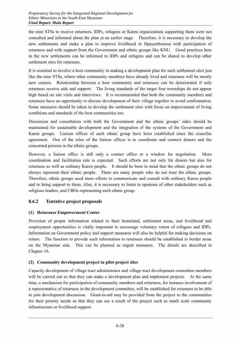
Preparatory Survey for the Integrated Regional Development for
Ethnic Minorities in the South-East Myanmar
Final Report: Main Report
8-38
the nine STSs to receive returnees, IDPs, refugees or Karen organizations supporting them were not consulted and informed about the plan at an earlier stage. Therefore, it is necessary to develop the new settlements and make a plan to improve livelihood in Hpayarthonesu with participation of returnees and with support from the Government and ethnic groups like KNU. Good practices here in the new settlements can be informed to IDPs and refugees and can be shared to develop other settlement sites for returnees.
It is essential to involve a host community in making a development plan for such settlement sites just like the nine STSs, where other community members have already lived and returnees will be mostly new comers. Relationship between a host community and returnees can be deteriorated if only returnees receive aids and support. The living standards of the target four townships do not appear high based on site visits and interviews. It is recommended that both the community members and returnees have an opportunity to discuss development of their village together to avoid confrontation. Some measures should be taken to develop the settlement sites with focus on improvement of living conditions and standards of the host communities too.
Discussion and consultation with both the Government and the ethnic groups’ sides should be maintained for sustainable development and the integration of the systems of the Government and Karen groups. Liaison offices of each ethnic group have been established since the ceasefire agreement. One of the roles of the liaison offices is to coordinate and connect donors and the concerned persons in the ethnic groups.
However, a liaison office is still only a contact office or a window for negotiation. More coordination and facilitation role is expected. Such efforts are not only for donors but also for returnees as well as ordinary Karen people. It should be born in mind that the ethnic groups do not always represent their ethnic people. There are many people who do not trust the ethnic groups. Therefore, ethnic groups need more efforts to communicate and consult with ordinary Karen people and to bring support to them. Also, it is necessary to listen to opinions of other stakeholders such as religious leaders, and CBOs representing each ethnic group.
8.6.2 Tentative project proposals
(1) Returnees Empowerment Center
Provision of proper information related to their homeland, settlement areas, and livelihood and employment opportunities is vitally important to encourage voluntary return of refugees and IDPs. Information on Government policy and support measures will also be helpful for making decisions on return. The function to provide such information to returnees should be established in border areas on the Myanmar side. This can be planned as urgent measures. The details are described in Chapter 10.
(2) Community development project in pilot project sites
Capacity development of village tract administrator and village tract development committee members will be carried out so that they can make a development plan and implement projects. At the same time, a mechanism for participation of community members and returnees, for instance involvement of a representative of returnees in the development committee, will be established for returnees to be able to join development discussion. Grant-in-aid may be provided from the project to the communities for their priority needs so that they can see a result of the project such as small scale community infrastructure or livelihood support.
Preparatory Survey for the Integrated Regional Development for
Ethnic Minorities in the South-East Myanmar
Final Report: Main Report
8-39
(3) Community development project in the settlement sites
A committee for settlement development will be established to discuss by returnees themselves how to develop the settlement such as infrastructure development, livelihood support, land use planning, productive reforestation, and home gardens. The project will give necessary support to them and grant-in-aid to the communities for their priority needs may be provided so that they can see a result of the project such as small scale community infrastructure or livelihood support.
(4) Capacity development project for local governments on community development
Training on participatory development for the state and township governmental officials will be provided to facilitate the planning process of a settlement plan for returnees and a state development plan with the bottom-up approach. Development of formats for development plans at each administrative level and building of a coordination mechanism among state, township, STS and village tract will also be supported in line with the cycle of development planning.
(5) Activity database and use in planning, coordination and implementation management
Establishment of the database on the supporting activities may require intensive and extensive efforts including re-delineation of VT boundaries by appropriate human resources with GIS system. Establishment of a key operational system for utilization of the database such as planning, coordination and implementation management based on the proper database management system is indispensable.
(6) Capacity development project for database management and use
A capacity development project for the database management and its use is recommended as a following up project by JICA to ensure the database functions and subsequent effects to be sustained.
Preparatory Survey for the Integrated Regional Development for
Ethnic Minorities in the South-East Myanmar
Final Report: Main Report
8-40
8.7 Planning for Return and Settlement
8.7.1 Planning framework
The Kayin State Government started to prepare for return and settlement of refugees and IDPs and designated nine STSs for the purpose. The State Government has been providing basic government and social facilities such as government offices and education and health facilities and nominating government personnel to serve each STS expected to receive returnees. Since the cease fire agreement between KNU and the Union Government was reached relatively recently after decades-long conflicts, however, there still exists some skepticism on the part of KNU peace groups for the intention of the Union Government, and limited resistance persists in some areas.
In Mon State, where the cease fire was agreed much earlier between NMSP and the Union Government, the Mon State Government has been working already closely with ethnic groups of NMSP and KNU having strong influence in some areas of the State. The good relationships between them were demonstrated by the first stakeholders’ meeting for peace and development successfully conducted on April 24, 2013. At the meeting, the ethnic groups and the State Government expressed their shared needs for development.
Through the discussions with various stakeholders including ethnic groups, State Governments, donors and NGOs as well as field surveys and data analyses, three types of areas have been identified, where different approaches may be taken to promote peace through development as shown in Figure 8.3. The recommended approach by type of areas is described below.
The first type areas are such areas that used to be sensitive due to dominance by armed ethnic groups but are now stable under the respective peace groups having good relationships with the respective State Governments. These areas include: 1) the southern area bordering on Thailand encompassing the southern part of Hpayarthonesu in Kayin State and the southeastern part of Ye in Mon State, 2) the area around the Myawaddy TS center, 3) the area between the Bilin TS center in Mon State and the border with Kayin State, and 4) the area in Thandaunggyi TS in Kayin State between Leiktho and the border with Kayah State.
The second type areas are such areas that are still sensitive and close consultation with ethnic groups are required to promote development activities. These areas include: 1) the border area in the north of Myawaddy TS center between the Dawna mountain range and the Thai border, 2) the area extending from Wawlay STS through Sukali STS to Kyaikdon, and 3) the border area to the east and the northeast of
Source: JICA Study Team Figure 8.3 Area by Development Approach
Preparatory Survey for the Integrated Regional Development for
Ethnic Minorities in the South-East Myanmar
Final Report: Main Report
8-41
the Hpapun TS center.
The third type areas are such areas that are still conflict-stricken, and any development activities may not been undertaken for the time being except limited development activities supported by NGOs. These areas include: 1) the area in Thandaunggyi TS from Bawgali STS to the border with Kayah State, 2) the area between Bawgali STS to the Hpapun TS center, and 3) the area extending from the Hpapun TS center to the border with Mon State and Kamamaung STS in Kayin State.
8.7.2 Development directions to promote peace
(1) First type areas
Development in the first type areas may be promoted by cooperation of respective ethnic groups and the State Governments. The following supports may be provided for these areas:
(a) Support of settlement areas initiated by the peace groups including the settlements in Hpayarthonesu initiated by KNU and the border areas in Ye initiated by NMSP;
(b) Improvement of access to the area in Thandaunggyi TS in Kayin State between Leiktho and the border with Kayah State, together with provision of social facilities;
(c) Improvement of access to the interior between the Bilin TS center in Mon State and the border with Kayin State, together with provision of social facilities; and
(d) Provision of information function on the Myanmar side for refugees and IDPs to learn conditions of settlement areas and livelihood and employment opportunities, starting with one in Myawaddy.
(2) Second type areas
Development in the second type areas may be promoted by utilizing existing relationships with the Thai side. The following supports may be effective:
(a) Improvement of access by roads on the Thai side and rivers along the Thai border; (b) Improvement of access from the Thai side and provision of utilities to facilitate investments
through cooperation between Myanmar and Thai investors; (c) Improvement of social facilities on the Myanmar side possibly supported by the Thai
government.
Access to these areas from the interior or the central part of Myanmar or the Southeast Myanmar should not be undertaken in the near future until the border areas develop and establish stable peace conditions on their own.
(3) Third type areas
Development of the third type areas may be undertaken very carefully and rather slowly by the initiative of respective peace groups supported by NGOs and possibly with limited support by the Kayin State Government. In the meantime, ownership for land and other resources should be clarified for these areas, while comprehensive agreements are sought between KNU and the Union Government.
8.7.3 Principles for development for peace
While political dialogues are proceeding for peace agreements between ethnic groups and the Union Government, development activities should be promoted to facilitate the process. Comprehensive
Preparatory Survey for the Integrated Regional Development for
Ethnic Minorities in the South-East Myanmar
Final Report: Main Report
8-42
peace agreements should not be taken as a prerequisite to development activities, but rather such development activities that will contribute to peace should be implemented in parallel with the political dialogues. To plan and implement such development activities that will contribute to the peace process, the following principles should apply.
(1) Settlement areas development
In anticipation of return of refugees from Thailand following the cease fire agreement, the State Government has been preparing settlement areas in the nine designated areas. At the same time, the State Government clarifies on various occasions that the return should be voluntary and any returnees are free to choose when and where to return. These efforts and policy by the State Government are commendable. Settlement areas, however, should be prepared in anticipation of return not only of refugees but also of IDPs and migrant workers as well.
Those IDPs, who had been forced to live deep in mountain forests, may return to planned settlements earlier if minimum living conditions are satisfied, while it may take longer time and more favorable living conditions to be satisfied before the refugees on the Thai side decide to come back. As any settlement sites start to develop, increasing number of refugees and migrant workers will come back. It is important to plan and develop settlement areas in steps starting with settlement of IDPs.
(2) Provision of information
It is vitally important to provide proper information to refugees and IDPs to encourage their voluntary return. Important information covers opportunities for settlement and livelihood in settlement areas and other places such as industrial estates as well as policy and material supports by the Governments for returnees. Function to provide such information to returnees should be established in border areas on the Myanmar side.
Refugees on the Thai side should be allowed to come back even temporarily at their own wills to obtain the information. Some of them may decide to move to other places for settlement including their original villages, but others may return to the Thai side. The information will be disseminated by those temporary visitors as well and more voluntary return may be promoted. It is important that refugees and IDPs are provided with proper information, and their return is left to their own voluntary decisions.
The main role of the State Governments is to prepare land, facilities and services for returnees in anticipation of their return and to be ready to provide guidance and material supports when needed by returnees such as transportation and initial food provision. Skill training and other supports to prepare returnees for livelihood and employment are additional roles of the State Governments directly or in cooperation with donors and NGOs.
(3) Border areas development
In some border areas, ethnic groups are effective in serving the people including provision of social services from the Thai side. These areas may be developed initially by utilizing the existing relationships with the Thai side. The road links from the Thai side and within the border areas should be improved, while the improvement of road links from the interior or central part of Myanmar and Kayin State should be undertaken more carefully. Development activities may be undertaken by cooperation between the Myanmar and the Thai investors, possibly supported by the Thai government. Even joint development and management of water resources in the border river basins may be
Preparatory Survey for the Integrated Regional Development for
Ethnic Minorities in the South-East Myanmar
Final Report: Main Report
8-43
undertaken.
(4) Issue based dialogues between peace groups and State Government
Critical issues between ethnic groups and the Union Government have been discussed in political dialogues to pursue comprehensive agreements between them. This will inevitably take a long time. While pursuing such comprehensive agreements, issue based dialogues may be undertaken between ethnic groups and the State Governments. Probably, the most critical issue is related to the ownership of land and other resources. Once this issue is resolved at the State level, the process to pursue comprehensive peace agreements will be substantively facilitated.
Preparatory Survey for the Integrated Regional Development for
Ethnic Minorities in the South-East Myanmar
Final Report: Main Report
9-1
In this chapter, initial works of planning for regional development of the Southeast Myanmar are presented. The purpose is to show principles and procedure for regional development planning, and specific outcomes should be regarded at this moment only as a reference. By utilizing the Southeast Myanmar as a case study region, the following subsections illustrate i) examination of development objectives and strategy, ii) meaning, possible contents and methods of development frameworks formulation and iii) meaning and possible contents of development scenario in order for all the stakeholders to deepen understanding of these subjects and prepare for the next stage.
In the next stage, an integrated regional development plan for the Southeast Myanmar will be prepared by a participatory approach, involving a wide range of stakeholders including the State Government officials. At the beginning of the next stage, various problems facing the Southeast Myanmar will be analyzed. Development objectives and strategy will be established through discussions between stakeholders.
Of the development frameworks, a socio-economic framework will be worked out by examining existing data on population, GDP, GRDP and others, and the projection will be made through discussions between stakeholders. For spatial frameworks, discussions will be facilitated by GIS thematic maps. Land use, urban development and other spatial aspects will be planned by a participatory approach.
The development scenario and vision will be described, reflecting ideas and aspirations of a wide range of stakeholders rather than those of specific donors, government organizations or ethnic groups. This chapter as a whole presents a base for these processes for participatory planning.
9.1 Objectives, Basic Strategy and Vision
9.1.1 Problem structure analysis
(1) Analytical procedure
The existing conditions in the Southeastern Region of Myanmar consisting of Kayin and Mon States have been analyzed by sector as reported in Chapter 2 through Chapter 5. The position and characteristics of the Southeastern Myanmar have been clarified as summarized in Section 1.2. Some positive characteristics of the Southeastern Myanmar are noted in relation to other regions. Still, the Southeastern Myanmar faces various problems, which combined would work as constraints to the regional development.
Many of these problems are interrelated to cause undesirable phenomena as observed at present. A
CHAPTER 9 PLANNING FOR REGIONAL DEVELOPMENT OF SOUTHEAST MYANMAR
Preparatory Survey for the Integrated Regional Development for
Ethnic Minorities in the South-East Myanmar
Final Report: Main Report
9-2
problem structure analysis is a method to clarify these interrelationships in a macroscopic way. The analysis, usually undertaken during the initial stage of the development planning, would allow a broad perspective without getting into details to identify more essential factors and major problems to be alleviated through planned development efforts. The analysis is used here to define development objectives and basic strategy for the Southeastern Myanmar regional development.
First, problems facing the Southeastern Myanmar are enumerated. Some specific problems may be combined to define a major problem so that the analysis would not lapse into too much detail. Most problems are expressed in generic terms to imply related sector problems. All the major problems thus identified are listed in Table 9.1 classified by broad sector.
With all the major problems identified, a problem structure has been constructed as shown in Figure 9.1. In the figure, more important problem factors and phenomena are shown, expressed in generic terms to imply many detailed or sector specific problems. The figure also shows causal relationships between the identified problems, focusing only on main interrelationships.
(2) Problem factors and phenomena
1) Problem factors
As shown in Figure 9.1, problem factors are classified into three kinds. Inherent natural problems consist of mountainous topography, elongated territory, and extreme mal-distribution of water resources. Insufficient local governance capacity is a transitional problem due to the fact that localization of governance is a relatively recent phenomenon in Myanmar. Three other problem factors are results of decades-long conflicts between the Union Government and armed ethnic groups.
2) Problem phenomena
Three broad problems may be identified, which should be alleviated through planned development efforts: economic, social and environmental problems. The economic problems are represented by limited indigenous industries, resultant insufficient employment problems, and associated low income levels.
The social problems in the Southeastern Myanmar are associated with out-migration. They have their own structure as outlined. First, out-migration not only causes social disruption, but also over reliance on remittances on the one hand, and labor shortages on the other. These problems combined results in lack of incentives to increase production, and inactive local communities.
The environmental problems have two aspects: forest resources and water resources. Forest resources have been degrading due to lack of proper environmental management, allowing deforestation by slash and burn practices, illegal timber extraction, indiscriminate conversion to rubber plantations and other inadequate practices. Due to extreme seasonal mal-distribution of water resources, the Southeaster Myanmar experiences extensive flooding during the rainy season, while during the dry season, water shortages are observed in many places. Overall, the water resources in the Region are under-utilized.
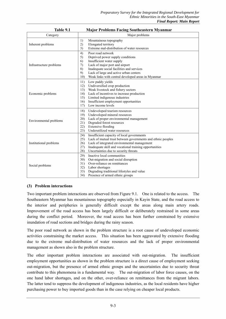
Preparatory Survey for the Integrated Regional Development for
Ethnic Minorities in the South-East Myanmar
Final Report: Main Report
9-3
Table 9.1 Major Problems Facing Southeastern Myanmar
(3) Problem interactions
Two important problem interactions are observed from Figure 9.1. One is related to the access. The Southeastern Myanmar has mountainous topography especially in Kayin State, and the road access to the interior and peripheries is generally difficult except the areas along main artery roads. Improvement of the road access has been largely difficult or deliberately restrained in some areas during the conflict period. Moreover, the road access has been further constrained by extensive inundation of road sections and bridges during the rainy season.
The poor road network as shown in the problem structure is a root cause of undeveloped economic activities constraining the market access. This situation has been aggravated by extensive flooding due to the extreme mal-distribution of water resources and the lack of proper environmental management as shown also in the problem structure.
The other important problem interactions are associated with out-migration. The insufficient employment opportunities as shown in the problem structure is a direct cause of employment seeking out-migration, but the presence of armed ethnic groups and the uncertainties due to security threat contribute to this phenomena in a fundamental way. The out-migration of labor force causes, on the one hand labor shortages, and on the other, over-reliance on remittances from the migrant labors. The latter tend to suppress the development of indigenous industries, as the local residents have higher purchasing power to buy imported goods than in the case relying on cheaper local products.
Category Major problems
Inherent problems 1) Mountainous topography 2) Elongated territory 3) Extreme mal-distribution of water resources
Infrastructure problems
4) Poor road network 5) Deprived power supply conditions 6) Insufficient water supply 7) Lack of major port and airport 8) Inadequate social facilities and services 9) Lack of large and active urban centers 10) Weak links with central developed areas in Myanmar
Economic problems
11) Low paddy yields 12) Undiversified crop production 13) Weak livestock and fishery sectors 14) Lack of incentives to increase production 15) Limited indigenous industries 16) Insufficient employment opportunities 17) Low income levels
Environmental problems
18) Undeveloped tourism resources 19) Undeveloped mineral resources 20) Lack of proper environmental management 21) Degraded forest resources 22) Extensive flooding 23) Underutilized water resources
Institutional problems
24) Insufficient capacity of local governments 25) Lack of mutual trust between governments and ethnic peoples 26) Lack of integrated environmental management 27) Inadequate skill and vocational training opportunities 28) Uncertainties due to security threats
Social problems
29) Inactive local communities 30) Out-migration and social disruption 31) Over-reliance on remittances 32) Labor shortages 33) Degrading traditional lifestyles and value 34) Presence of armed ethnic groups

Preparatory Survey for the Integrated Regional Development for
Ethnic Minorities in the South-East Myanmar
Final Report: Main Report
9-4
The labor shortages combined with the difficulties in market access as shown in the problem structure results in the lack of incentives to increase production. This, in turn, tends to lead to the inactive local communities as shown also in the problem structure. The degrading traditional lifestyles and value and the inadequate social facilities and services shown in the problem structure also contribute to this.
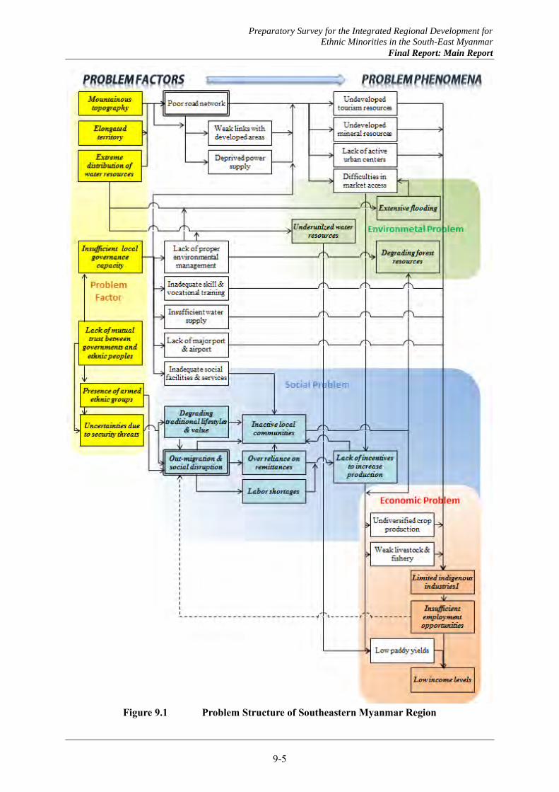
Preparatory Survey for the Integrated Regional Development for
Ethnic Minorities in the South-East Myanmar
Final Report: Main Report
9-5
Figure 9.1 Problem Structure of Southeastern Myanmar Region
Preparatory Survey for the Integrated Regional Development for
Ethnic Minorities in the South-East Myanmar
Final Report: Main Report
9-6
9.1.2 Objectives and basic strategy for regional development of Southeastern Myanmar
(1) Objectives for regional development of Southeastern Myanmar
Three problem phenomena have been identified by the problem structure analysis. Corresponding to these, three objectives may be defined for regional development of Southeastern Myanmar. They are proposed to be expressed as follows.
(a) Economic objective: To diversify employment and income opportunities to improve livelihood, increase local capital accumulation, and enhance competitiveness of regional economy in the globalizing economy;
(b) Social objective: To revitalize local communities to initiate new economic activities, effect better environmental management, and enhance local governance capacity; and
(c) Environmental objective: To protect and enhance the environmental quality to ensure sustainable economic development, safeguard the traditional lifestyles and value, and ensure lasting peace.
(2) Basic Strategy for Regional Development of Southeastern Myanmar
Basic strategy for regional development of the Southeastern Myanmar may be established in reference to the problem factors at the root of many interrelated problems analyzed by the problem structure analysis. They are: 1) security problems exist together with lack of mutual trust between governments and ethnic peoples; 2) localization policy newly introduced by the Union Government has not been effected yet locally; and 3) reflecting this, environmental and resources management is inadequate and rich resources have not been effectively utilized. Therefore, the following area proposed as three components of the basic strategy.
(a) Improving security conditions through sharing development and security related information with all stakeholders to cultivate mutual trust among them,
(b) Establishing mechanism for broad-based participation of all stakeholders in the process of development planning and implementation, and
(c) Promoting alternative socio-economic activities, which are less resource intensive and environment friendly, combining traditional practices and modern technology.
9.1.3 Vision for regional development of Southeastern Myanmar
A vision should be established for regional development of the Southeastern Myanmar that can be shared by all the stakeholders including local residents, ethnic groups, supporters of the regional development such as donors and NGOs, and officers and experts of the State Governments. The following vision is proposed, reflecting the characteristics of the Region with rich natural and cultural resources and in line with the regional development objectives defined above.
Vision for Regional Development of Southeast Myanmar
Realization of robust and resilient socio-economy adapting to changing world and open to the global society supported by abundant natural resources, diverse economic activities and rich cultural heritage.
This vision will be represented by:
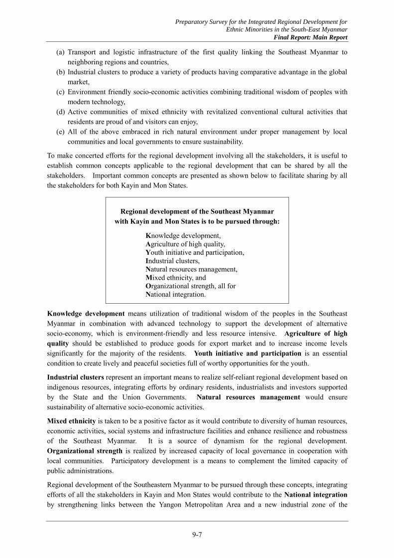
Preparatory Survey for the Integrated Regional Development for
Ethnic Minorities in the South-East Myanmar
Final Report: Main Report
9-7
(a) Transport and logistic infrastructure of the first quality linking the Southeast Myanmar to neighboring regions and countries,
(b) Industrial clusters to produce a variety of products having comparative advantage in the global market,
(c) Environment friendly socio-economic activities combining traditional wisdom of peoples with modern technology,
(d) Active communities of mixed ethnicity with revitalized conventional cultural activities that residents are proud of and visitors can enjoy,
(e) All of the above embraced in rich natural environment under proper management by local communities and local governments to ensure sustainability.
To make concerted efforts for the regional development involving all the stakeholders, it is useful to establish common concepts applicable to the regional development that can be shared by all the stakeholders. Important common concepts are presented as shown below to facilitate sharing by all the stakeholders for both Kayin and Mon States.
Regional development of the Southeast Myanmar with Kayin and Mon States is to be pursued through:
Knowledge development,
Agriculture of high quality, Youth initiative and participation,
Industrial clusters, Natural resources management,
Mixed ethnicity, and Organizational strength, all for
National integration.
Knowledge development means utilization of traditional wisdom of the peoples in the Southeast Myanmar in combination with advanced technology to support the development of alternative socio-economy, which is environment-friendly and less resource intensive. Agriculture of high quality should be established to produce goods for export market and to increase income levels significantly for the majority of the residents. Youth initiative and participation is an essential condition to create lively and peaceful societies full of worthy opportunities for the youth.
Industrial clusters represent an important means to realize self-reliant regional development based on indigenous resources, integrating efforts by ordinary residents, industrialists and investors supported by the State and the Union Governments. Natural resources management would ensure sustainability of alternative socio-economic activities.
Mixed ethnicity is taken to be a positive factor as it would contribute to diversity of human resources, economic activities, social systems and infrastructure facilities and enhance resilience and robustness of the Southeast Myanmar. It is a source of dynamism for the regional development. Organizational strength is realized by increased capacity of local governance in cooperation with local communities. Participatory development is a means to complement the limited capacity of public administrations.
Regional development of the Southeastern Myanmar to be pursued through these concepts, integrating efforts of all the stakeholders in Kayin and Mon States would contribute to the National integration by strengthening links between the Yangon Metropolitan Area and a new industrial zone of the

Preparatory Survey for the Integrated Regional Development for
Ethnic Minorities in the South-East Myanmar
Final Report: Main Report
9-8
Tanintharyi region centering on Dawei, and substantiating the economic corridors passing through the Southeast Myanmar.
Preparatory Survey for the Integrated Regional Development for
Ethnic Minorities in the South-East Myanmar
Final Report: Main Report
9-9
9.2 Frameworks for Regional Development
9.2.1 National frameworks
(1) Long term development policies and plans
The Union Government of Myanmar prepared a long term national development plan for 2000/01~2030/31, called the Grand Plan. Under the new administration, the Ministry of National Planning and Economic Development (MNP&ED) has given directions to Ministries and State and Region governments to prepare five-year plans and annual plans in line with the Grand Plan. Further, the Union Government, under its localization policy, has given directions to State and Region governments to prepare reform plans complementary to the respective five-year plans as part of the economic structure reform in response to economic globalization.
The existing Grand Plan and reform plans in preparation provide national frameworks for the regional development of the Southeastern Myanmar. The latter plans are still in preparation in Kayin and Mon States. After their preparation, the plans may be modified through their integration into the National Plan and its approval at the Parliament. In the meantime, the Union Government prepared a document titled “Framework for Economic and Social Reform – Policy Priorities for 2012-15 towards the Long-term Goals of the National Comprehensive Development Plan” and presented it donors at to the First Myanmar Development Cooperation Forum on January 14, 2013. This document is taken as a national framework for the regional development of the Southeastern Myanmar. Its main contents are summarized below as they are related to the regional development of the Southeastern Myanmar.
(2) Framework for Economic and Social Reform
1) Position of FESR
As the President announced a “second stage of reforms” in May 2012, Framework for Economic and Social Reform (FESR) was developed in consultation with senior officials of ministries and departments of the Union Government to substantiate the President’s vision and guidelines. FESR was revised through further consultation by January 2013, when the revised document was presented to the First Myanmar Development Cooperation Forum.
The revised FESR outlines policy priority of the Government in the next three years, and provides “a reform bridge linking the ongoing programs of the Government to the National Comprehensive Development Plan, a 20-year long-term plan.” It provides a framework for preparing more detailed development plans by sector and by region. It serves also as a basic reference and guide for donors and NGOs to provide coherent and consistent supports in line with the government policy.
2) Vision
The Government emphasizes the importance of agricultural growth to improve the income and welfare of rural families as reform and growth measures are taken. Key interventions for improving agricultural performance focus on 1) improving productivity of rice sector, 2) promoting dry season diversification into high-value horticulture, fruit production, poultry and small livestock by small farmers and landless, 3) improving water management at the farm level through low-cost
Preparatory Survey for the Integrated Regional Development for
Ethnic Minorities in the South-East Myanmar
Final Report: Main Report
9-10
micro-irrigation, and 4) expanding micro-finance activities in rural areas to improve access to inputs and reduce dependence on money lenders.
To realize his vision for the “second stage of reforms,” the President called for development of policies and reform strategies which can achieve:
i) people-centered development, ii) civic participation and human resources development, iii) effective and transparent use of public financial resources, iv) sustainable regional development, v) decentralization and greater autonomy for local government, and vi) poverty alleviation.
The vision for Myanmar in the twenty-first century is expressed as follows: i) to achieve greater integration with the international community by 2020, and ii) to become a modern developed and democratic nation by 2030 that meets the aspiration of
its people for a better life.
Principles underlying the vision are pride and respect for mixed ethnicity with rich culture and traditions, which are considered to be in harmony with modernization and progress.
Several national imperatives have been established by FESR to give Myanmar national direction and purpose in pursuing the vision. They are: 1) maintaining peace and stability, 2) strengthening national unity, 3) ensuring economic and social security, and 4) perpetuating independence and sovereignty.
3) Policy priority for reform
FESR emphasizes changes in fundamental approach to development from a socialistic planned economy to a market-oriented economy, from top-down to bottom-up planning, and from direct to indirect levers of government policy. Along these lines, FESR identifies the following areas of policy priority:
i) Sustainable industrial development in balance with agricultural reforms, poverty alleviation and rural development;
ii) Equitable sharing of resources among regions and states, while promoting foreign and local investments for regional development;
iii) People-centered development through community-driven, participatory approaches to improve education, health and living standards; and
iv) Establishment of reliable statistical data and other information for better policy formulation and dissemination.
4) Targets
In accordance with the reform framework, the Government has set the following targets for GDP growth, poverty reduction and related aspects in the next three years:
i) Average annual growth of GDP at 7.7%, ii) Increase in GDP share of industrial sector from 26% to 32% together with an associated
growth of the service sector, and iii) Per capita GDP growth by 30-40% from the base year of 2010 to help to attain the first
Millennium Development Goal of reducing the poverty incidence by a half over the period of 2000-15.
Preparatory Survey for the Integrated Regional Development for
Ethnic Minorities in the South-East Myanmar
Final Report: Main Report
9-11
5) Policy emphasis on rural sector
Under FESR, broader development of rural sector is pursued through: i) cash for work in public projects such as rural road construction, ii) community-driven development projects, iii) employment-guarantee schemes for poorest rural households, iv) land reclamation services, v) promotion of one-village-one-product schemes for small enterprise development, vi) cooperative societies, and vii) promotion of micro, small and medium sized enterprises in rural areas through
microfinance and other measures.
6) Policy emphasis on SMEs
FESR reflects the Government’s recognition on the importance of SMEs for industrialization. Policies for SME development include:
i) establishing one-stop centers for business start-ups to help reduce red-tape, ii) supporting provision of land use rights, iii) improving access to credit, and iv) helping to build enterprise capacity for finance, marketing and other aspects.
Introduction of new institutions for SMEs will facilitate cluster formation between existing industrial zones across the Country and regional technological universities, computer institutes, technical colleges and vocational schools.
7) Policy emphasis on railways
The Government emphasizes improving railway sections that connect important economic centers in the Country. They include the Yangon-Mandalay-Myitkyina, and the Bago-Mawlamyine sections. This emphasis, according to FESR, will strengthen the previous strategy of developing railroads that connect various parts of the Country to the economic centers for the objective of regional equity.
8) Policy emphasis on industrial development
The Government emphasizes that industrial development will be undertaken along with agricultural development in a complementary manner. Manufacturing and agro-processing industries will develop into clusters and value chains together with related service and other activities. These industrial and commercial centers will concentrate mainly in Yangon and Mandalay initially, but other industrial centers should develop throughout the Country for balanced development of the national territory.
9) Policy emphasis on spatial development
FESR foresees other secondary growth centers to develop subsequently: 1) Pathein–Sittwe- Kyaukpyu, 2) Mawlamyine-Dawei, 3) Naypyitaw–Pyinmana-Taungoo, 4) Pyay–Magway-Monywa, 5) Myingyan-Meiktila, and 6) Taunggyi-Lashio-Muse. That is, Ayeyarwady Valley, Sittaung Valley and Thanlwin Valley, and Shan State and Southeast Corridor may become an industrial belt.
Yangon and Ayeyarwady Delta are considered ideal location for industries of higher technology due to availability of manpower and transport facilities and easy access to other countries through
Preparatory Survey for the Integrated Regional Development for
Ethnic Minorities in the South-East Myanmar
Final Report: Main Report
9-12
airport and sea port facilities. Two industrial zones, one in Kyaukpyu of western Rakhine State and the other in Dawei of southern Tanintharyi region, may serve as gateways to neighboring economies and the global markets. FESR considers Lashio and Mawlamyine as two regional hubs that connect the gateways to two major growth poles, Mandalay and Yangon, respectively. FESR concedes, however, that Myanmar will have to constantly review connectivity and spatial strategies in the light of changing regional economic situations as well as domestic growth trends.
(3) Myanmar’s GDP and employment
Data on the gross domestic product (GDP) of Myanmar are taken from the Statistical Yearbook, and expressed consistently in the 2010 constant prices as shown in Table 9.2. The Myanmar’s GDP increased at the annual average rate of 12.9% during 2000/01-2005/06, and 9.9% during 2005/06-2010/11 according to the official statistics. The per capita GDP reached Ky.666,600 or US$630 at the exchange rate of Ky.803 per US$.
According to the statistical data on working age population, labor force coefficient in Myanmar is 69.8% for male and 71.3% for female. Also from the statistical data, labor participation rate in Myanmar is 92.2% for male and 55.2% for female. The value is very high particularly for male, and probably it is assumed that all the male population in working age is assumed working in rural areas.
To estimate employment by sector, male and female population in urban and rural areas is used, and first, male and female working age population is calculated in rural and urban areas. Then, the male and female working age population in rural and urban areas is converted to male and female labor force by applying male and female labor participation rate in rural areas assumed to be 100% and 65%, respectively. Finally, employment by broad sector is estimated by assuming service inducement factor of agriculture and industry at 0.33 and 1.20, respectively. The data used for this calculation are summarized in Table 9.3.
The GDP and employment by broad sector thus estimated are summarized in Table 9.4. Based on these estimates, total factor labor productivity by sector is calculated as shown also in Table 9.4. As seen from the table, there exist wide variance in labor productivity by sector naturally: Ky.835,000, Ky.3,092,000 and Ky.1,546,000 per employment, respectively for agriculture, industry and services.
All the estimates presented above are based on the official statistics on population, GDP, GRDP and others, which are considered to have limited reliability. Nevertheless, they are useful in making broad judgment on the existing socio-economy.
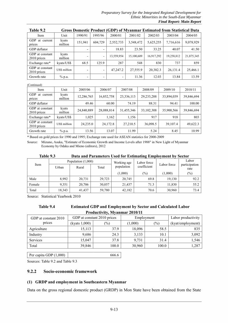
Preparatory Survey for the Integrated Regional Development for
Ethnic Minorities in the South-East Myanmar
Final Report: Main Report
9-13
Table 9.2 Gross Domestic Product (GDP) of Myanmar Estimated from Statistical Data Item Unit 1990/91 1995/96 2000/01 2001/02 2002/03 2003/04 2004/05
GDP at current prices
kyats million 151,941 604,729 2,552,733 3,548,472 5,625,255 7,716,616 9,078,929
GDP deflator - - 18.83 23.50 33.25 40.07 41.50 GDP at constant 2010 prices
kyats million - - 13,559,954 15,100,609 16,917,292 19,258,812 21,875,345
Exchange rate* kyats/US$ 68.5 125.9 287 548 830 737 859 GDP at constant 2010 prices US$ million - - 47,247.2 27,555.9 20,382.3 26,131.4 25,466.1
Growth rate % p.a. - - - 11.36 12.03 13.84 13.59 (Continued)
Item Unit 2005/06 2006/07 2007/08 2008/09 2009/10 2010/11 GDP at current prices
kyats million 12,286,765 16,852,758 23,336,113 29,233,288 33,894,039 39,846,694
GDP deflator 49.46 60.00 74.19 88.31 94.41 100.00 GDP at constant 2010 prices
kyats million 24,840,889 28,088,814 31,455,346 33,102,308 35,900,566 39,846,694
Exchange rate* kyats/US$ 1,025 1,162 1,156 917 918 803 GDP at constant 2010 prices US$ million 24,235.0 24,172.8 27,210.5 36,098.5 39,107.4 49,622.3
Growth rate % p.a. 13.56 13.07 11.99 5.24 8.45 10.99
* Based on gold prices for 1990 and 1995; Exchange rate used for ASEAN statistics for 2000-2009 Source: Mizuno, Asuka, "Estimate of Economic Growth and Income Levels after 1988" in New Light of Myanmar
Economy by Odaka and Mieno (editors), 2012
Table 9.3 Data and Parameters Used for Estimating Employment by Sector
Item Population (1,000) Working age
population Labor force coefficient Labor force
Labor participation
rate Urban Rural Total
(1,000) (%) (1,000) (%) Male 8,992 20,731 29,723 20,745 69.8 19,130 92.2 Female 9,351 20,706 30,057 21,437 71.3 11,830 55.2 Total 18,343 41,437 59,780 42,182 70.6 30,960 73.4
Source: Statistical Yearbook 2010
Table 9.4 Estimated GDP and Employment by Sector and Calculated Labor Productivity, Myanmar 2010/11
GDP at constant 2010 prices
GDP at constant 2010 prices Employment Labor productivity (kyats 1,000) (%) (1,000) (%) (kyat/employment)
Agriculture 15,113 37.9 18,096 58.5 835 Industry 9,686 24.3 3,133 10.1 3,092 Services 15,047 37.8 9,731 31.4 1,546 Total 39,846 100.0 30,960 100.0 1,287 Per capita GDP (1,000) 666.6
Sources: Table 9.2 and Table 9.3
9.2.2 Socio-economic framework
(1) GRDP and employment in Southeastern Myanmar
Data on the gross regional domestic product (GRDP) in Mon State have been obtained from the State
Preparatory Survey for the Integrated Regional Development for
Ethnic Minorities in the South-East Myanmar
Final Report: Main Report
9-14
Government for both the present value in 2010/11 and projection up to 2015/16 as shown in Table 9.5. Data on the GRDP projection in Kayin State for years 2010/11, 2011/12 and 2012/13 have been obtained from the State Government as shown in Table 9.6. Based on these data, the per capita GRDP is calculated to be Ky.535,000 in Mon State in 2010/11 and Ky.375,490 in Kayin State in 2011/12. The calculated per capita GRDP correspond to 80.3% and 56.3% of the per capita GDP, respectively.
Original estimates are attempted for the GRDP in Kayin and Mon States following the same procedure used to estimate the employment structure of Myanmar. Due to the lack of data specific to these states, national data are used for labor force coefficients, labor participation rates and service inducement factors. The total factor labor productivity is assumed by sector and by state reflecting the reality in the respective states in relation to the national averages derived above.
Assumed labor productivity, estimated employment and GRDP by broad sector are summarized in Table 9.7. As shown in Table 9.7, the per capita GRDP is estimated to be Ky.466,000 in Kayin State in 2010/11 corresponding to 69.9% of the per capita GDP and Ky.637,700 in Mon State in 2010/11 corresponding to 95.7% of the per capita GDP. The combined GRDP of the Southeastern Myanmar is Ky.2,848,169 million accounting for 7.1% of the Myanmar’s GDP. The per capita GRDP is Ky.575,000 in the Southeast Myanmar corresponding to 86.3% of the per capita GDP of Myanmar.
(2) Projection
In the subsequent stage, the GRDP and employment in the Southeast Myanmar will be projected by broad sector in a mutually consistent way to set a socio-economic framework for the regional development. The following conditions will be incorporated in the projection.
(a) The GRDP growth in the Southeast Myanmar should generally exceed the GDP growth to decrease the existing gap between the per capita GRDP and the per capita GDP; the gap should be dissolved in 10-15 years;
(b) The economic structure would change in favor of the industrial sector, whose share in the GRDP should increase from smaller than 20% at present to over 25% in 10-15 years;
(c) The share of the services sector in the GRDP should become the largest and reach 45% more or less in 15 years;
(d) The GRDP share of the agricultural sector would decrease significantly to slightly over 30%, while the agricultural productivity would increase significantly;
(e) Population growth would accelerate as increasing number of migrant workers, refugees and IDPs will be coming back in the next few decades; and
(f) Even with the increased population, the per capita GRDP would increase at the average rate higher than 5% per annum over extended period to attain higher than twice the present level in 15 years.
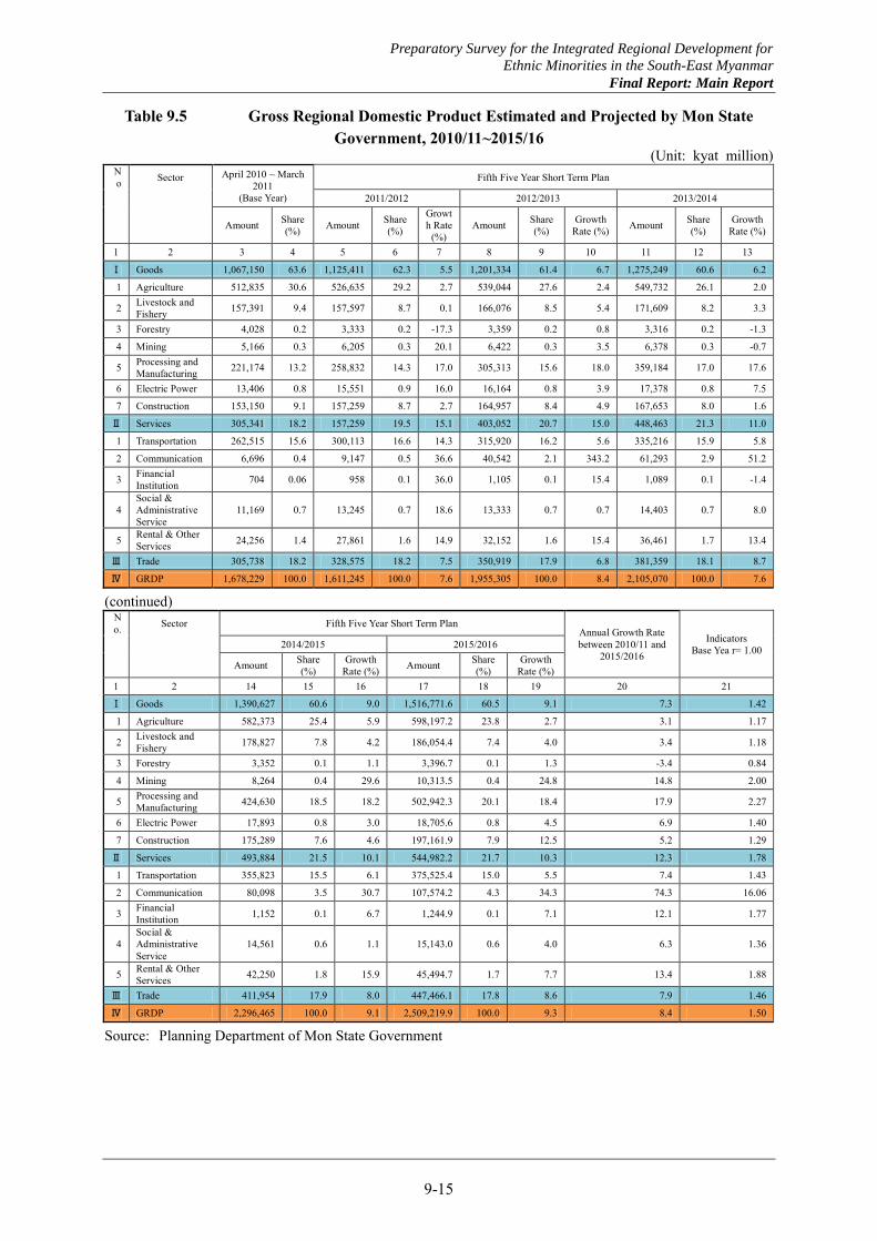
Preparatory Survey for the Integrated Regional Development for
Ethnic Minorities in the South-East Myanmar
Final Report: Main Report
9-15
Table 9.5 Gross Regional Domestic Product Estimated and Projected by Mon State Government, 2010/11~2015/16
(Unit: kyat million) No Sector April 2010 ~ March
2011 (Base Year)
Fifth Five Year Short Term Plan
2011/2012 2012/2013 2013/2014
Amount Share (%) Amount Share
(%)
Growth Rate
(%) Amount Share
(%) Growth
Rate (%) Amount Share (%)
Growth Rate (%)
1 2 3 4 5 6 7 8 9 10 11 12 13
Ⅰ Goods 1,067,150 63.6 1,125,411 62.3 5.5 1,201,334 61.4 6.7 1,275,249 60.6 6.2
1 Agriculture 512,835 30.6 526,635 29.2 2.7 539,044 27.6 2.4 549,732 26.1 2.0
2 Livestock and Fishery 157,391 9.4 157,597 8.7 0.1 166,076 8.5 5.4 171,609 8.2 3.3
3 Forestry 4,028 0.2 3,333 0.2 -17.3 3,359 0.2 0.8 3,316 0.2 -1.3
4 Mining 5,166 0.3 6,205 0.3 20.1 6,422 0.3 3.5 6,378 0.3 -0.7
5 Processing and Manufacturing 221,174 13.2 258,832 14.3 17.0 305,313 15.6 18.0 359,184 17.0 17.6
6 Electric Power 13,406 0.8 15,551 0.9 16.0 16,164 0.8 3.9 17,378 0.8 7.5
7 Construction 153,150 9.1 157,259 8.7 2.7 164,957 8.4 4.9 167,653 8.0 1.6
Ⅱ Services 305,341 18.2 157,259 19.5 15.1 403,052 20.7 15.0 448,463 21.3 11.0
1 Transportation 262,515 15.6 300,113 16.6 14.3 315,920 16.2 5.6 335,216 15.9 5.8
2 Communication 6,696 0.4 9,147 0.5 36.6 40,542 2.1 343.2 61,293 2.9 51.2
3 Financial Institution 704 0.06 958 0.1 36.0 1,105 0.1 15.4 1,089 0.1 -1.4
4 Social & Administrative Service
11,169 0.7 13,245 0.7 18.6 13,333 0.7 0.7 14,403 0.7 8.0
5 Rental & Other Services 24,256 1.4 27,861 1.6 14.9 32,152 1.6 15.4 36,461 1.7 13.4
Ⅲ Trade 305,738 18.2 328,575 18.2 7.5 350,919 17.9 6.8 381,359 18.1 8.7
Ⅳ GRDP 1,678,229 100.0 1,611,245 100.0 7.6 1,955,305 100.0 8.4 2,105,070 100.0 7.6
(continued) No. Sector Fifth Five Year Short Term Plan
Annual Growth Rate between 2010/11 and
2015/2016
Indicators Base Yea r= 1.00 2014/2015 2015/2016
Amount Share (%)
Growth Rate (%) Amount Share
(%) Growth
Rate (%) 1 2 14 15 16 17 18 19 20 21
Ⅰ Goods 1,390,627 60.6 9.0 1,516,771.6 60.5 9.1 7.3 1.42
1 Agriculture 582,373 25.4 5.9 598,197.2 23.8 2.7 3.1 1.17
2 Livestock and Fishery 178,827 7.8 4.2 186,054.4 7.4 4.0 3.4 1.18
3 Forestry 3,352 0.1 1.1 3,396.7 0.1 1.3 -3.4 0.84
4 Mining 8,264 0.4 29.6 10,313.5 0.4 24.8 14.8 2.00
5 Processing and Manufacturing 424,630 18.5 18.2 502,942.3 20.1 18.4 17.9 2.27
6 Electric Power 17,893 0.8 3.0 18,705.6 0.8 4.5 6.9 1.40
7 Construction 175,289 7.6 4.6 197,161.9 7.9 12.5 5.2 1.29
Ⅱ Services 493,884 21.5 10.1 544,982.2 21.7 10.3 12.3 1.78
1 Transportation 355,823 15.5 6.1 375,525.4 15.0 5.5 7.4 1.43
2 Communication 80,098 3.5 30.7 107,574.2 4.3 34.3 74.3 16.06
3 Financial Institution 1,152 0.1 6.7 1,244.9 0.1 7.1 12.1 1.77
4 Social & Administrative Service
14,561 0.6 1.1 15,143.0 0.6 4.0 6.3 1.36
5 Rental & Other Services 42,250 1.8 15.9 45,494.7 1.7 7.7 13.4 1.88
Ⅲ Trade 411,954 17.9 8.0 447,466.1 17.8 8.6 7.9 1.46
Ⅳ GRDP 2,296,465 100.0 9.1 2,509,219.9 100.0 9.3 8.4 1.50
Source: Planning Department of Mon State Government
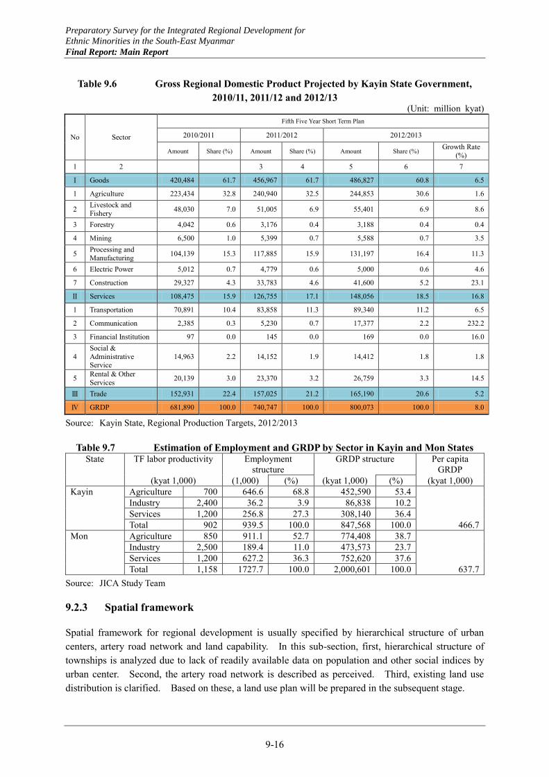
Preparatory Survey for the Integrated Regional Development for
Ethnic Minorities in the South-East Myanmar
Final Report: Main Report
9-16
Table 9.6 Gross Regional Domestic Product Projected by Kayin State Government, 2010/11, 2011/12 and 2012/13
(Unit: million kyat)
No Sector
Fifth Five Year Short Term Plan
2010/2011 2011/2012 2012/2013
Amount Share (%) Amount Share (%) Amount Share (%) Growth Rate (%)
1 2 3 4 5 6 7
Ⅰ Goods 420,484 61.7 456,967 61.7 486,827 60.8 6.5
1 Agriculture 223,434 32.8 240,940 32.5 244,853 30.6 1.6
2 Livestock and Fishery 48,030 7.0 51,005 6.9 55,401 6.9 8.6
3 Forestry 4,042 0.6 3,176 0.4 3,188 0.4 0.4
4 Mining 6,500 1.0 5,399 0.7 5,588 0.7 3.5
5 Processing and Manufacturing 104,139 15.3 117,885 15.9 131,197 16.4 11.3
6 Electric Power 5,012 0.7 4,779 0.6 5,000 0.6 4.6
7 Construction 29,327 4.3 33,783 4.6 41,600 5.2 23.1
Ⅱ Services 108,475 15.9 126,755 17.1 148,056 18.5 16.8
1 Transportation 70,891 10.4 83,858 11.3 89,340 11.2 6.5
2 Communication 2,385 0.3 5,230 0.7 17,377 2.2 232.2
3 Financial Institution 97 0.0 145 0.0 169 0.0 16.0
4 Social & Administrative Service
14,963 2.2 14,152 1.9 14,412 1.8 1.8
5 Rental & Other Services 20,139 3.0 23,370 3.2 26,759 3.3 14.5
Ⅲ Trade 152,931 22.4 157,025 21.2 165,190 20.6 5.2
Ⅳ GRDP 681,890 100.0 740,747 100.0 800,073 100.0 8.0
Source: Kayin State, Regional Production Targets, 2012/2013
Table 9.7 Estimation of Employment and GRDP by Sector in Kayin and Mon States State TF labor productivity Employment
structure GRDP structure Per capita
GRDP (kyat 1,000) (1,000) (%) (kyat 1,000) (%) (kyat 1,000) Kayin Agriculture 700 646.6 68.8 452,590 53.4 Industry 2,400 36.2 3.9 86,838 10.2 Services 1,200 256.8 27.3 308,140 36.4 Total 902 939.5 100.0 847,568 100.0 466.7 Mon Agriculture 850 911.1 52.7 774,408 38.7 Industry 2,500 189.4 11.0 473,573 23.7 Services 1,200 627.2 36.3 752,620 37.6 Total 1,158 1727.7 100.0 2,000,601 100.0 637.7
Source: JICA Study Team
9.2.3 Spatial framework
Spatial framework for regional development is usually specified by hierarchical structure of urban centers, artery road network and land capability. In this sub-section, first, hierarchical structure of townships is analyzed due to lack of readily available data on population and other social indices by urban center. Second, the artery road network is described as perceived. Third, existing land use distribution is clarified. Based on these, a land use plan will be prepared in the subsequent stage.
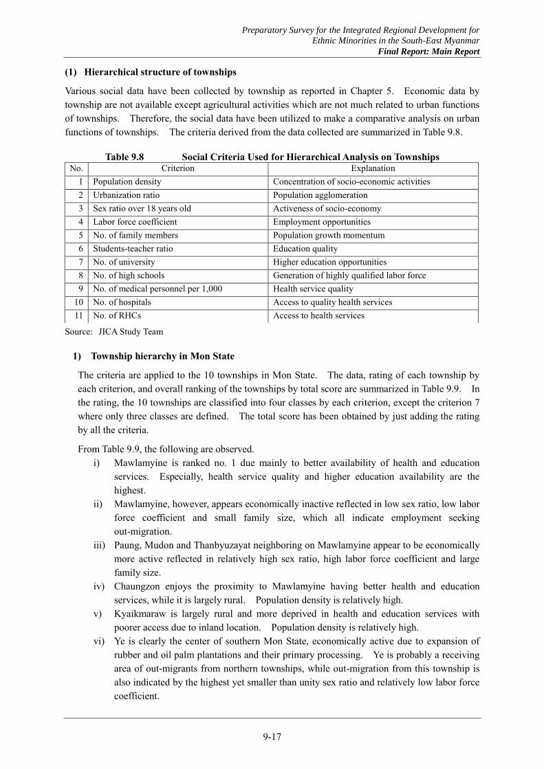
Preparatory Survey for the Integrated Regional Development for
Ethnic Minorities in the South-East Myanmar
Final Report: Main Report
9-17
(1) Hierarchical structure of townships
Various social data have been collected by township as reported in Chapter 5. Economic data by township are not available except agricultural activities which are not much related to urban functions of townships. Therefore, the social data have been utilized to make a comparative analysis on urban functions of townships. The criteria derived from the data collected are summarized in Table 9.8.
Table 9.8 Social Criteria Used for Hierarchical Analysis on Townships
Source: JICA Study Team
1) Township hierarchy in Mon State
The criteria are applied to the 10 townships in Mon State. The data, rating of each township by each criterion, and overall ranking of the townships by total score are summarized in Table 9.9. In the rating, the 10 townships are classified into four classes by each criterion, except the criterion 7 where only three classes are defined. The total score has been obtained by just adding the rating by all the criteria.
From Table 9.9, the following are observed. i) Mawlamyine is ranked no. 1 due mainly to better availability of health and education
services. Especially, health service quality and higher education availability are the highest.
ii) Mawlamyine, however, appears economically inactive reflected in low sex ratio, low labor force coefficient and small family size, which all indicate employment seeking out-migration.
iii) Paung, Mudon and Thanbyuzayat neighboring on Mawlamyine appear to be economically more active reflected in relatively high sex ratio, high labor force coefficient and large family size.
iv) Chaungzon enjoys the proximity to Mawlamyine having better health and education services, while it is largely rural. Population density is relatively high.
v) Kyaikmaraw is largely rural and more deprived in health and education services with poorer access due to inland location. Population density is relatively high.
vi) Ye is clearly the center of southern Mon State, economically active due to expansion of rubber and oil palm plantations and their primary processing. Ye is probably a receiving area of out-migrants from northern townships, while out-migration from this township is also indicated by the highest yet smaller than unity sex ratio and relatively low labor force coefficient.
No. Criterion Explanation 1 Population density Concentration of socio-economic activities 2 Urbanization ratio Population agglomeration 3 Sex ratio over 18 years old Activeness of socio-economy 4 Labor force coefficient Employment opportunities 5 No. of family members Population growth momentum 6 Students-teacher ratio Education quality 7 No. of university Higher education opportunities 8 No. of high schools Generation of highly qualified labor force 9 No. of medical personnel per 1,000 Health service quality
10 No. of hospitals Access to quality health services 11 No. of RHCs Access to health services
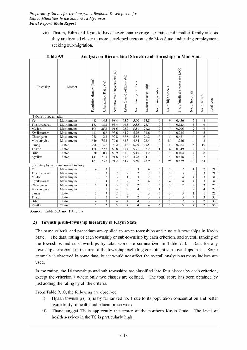
Preparatory Survey for the Integrated Regional Development for
Ethnic Minorities in the South-East Myanmar
Final Report: Main Report
9-18
vii) Thaton, Bilin and Kyaikto have lower than average sex ratio and smaller family size as they are located closer to more developed areas outside Mon State, indicating employment seeking out-migration.
Table 9.9 Analysis on Hierarchical Structure of Townships in Mon State
Township District Po
pula
tion
dens
ity (/
km)
Urb
aniz
atio
n R
atio
(%)
Sex
ratio
ove
r 18
year
s old
(%)
Labo
r for
ce C
oeffi
cien
t (%
)
No.
of f
amily
mem
bers
Stud
ent-t
each
er ra
tio
No.
of u
nive
rsiti
es
No.
of h
igh
scho
ols
No.
of m
edic
al p
erso
ns p
er 1
,000
No.
of h
ospi
tals
No.
of R
HC
s
Tota
l sco
re
(1)Date by social index Ye Mawlamyine 83 14.3 98.4 63.5 5.60 35.8 0 9 0.456 5 8 Thanbyuzayat Mawlamyine 183 18.1 93.4 66.8 5.85 28.7 0 7 0.323 3 6 Mudon Mawlamyine 198 25.3 91.6 75.3 5.51 23.2 0 7 0.306 2 6 Kyaikmaraw Mawlamyine 413 6.8 93.6 64.7 5.76 33.6 0 3 0.235 2 5 Chaungzon Mawlamyine 238 2.3 92.8 68.8 5.82 21.2 0 5 0.421 4 6 Mawlamyine Mawlamyine 1,640 75.4 79.6 63.3 4.84 22.4 2 15 1.236 4 3 Paung Thaton 208 13.8 93.2 62.8 6.00 30.5 0 5 0.383 5 10 Thaton Thaton 158 22.3 89.8 61.4 5.71 32.2 1 6 0.349 2 5 Bilin Thaton 70 10.7 89.9 61.0 5.15 33.2 0 7 0.404 4 8 Kyaikto Thaton 147 21.1 91.8 61.6 4.98 34.7 0 5 0.438 2 7 167 23.3 91.2 64.7 5.50 28.9 3 69 0.479 33 64 (2) Rating by index and overall ranking Ye Mawlamyine 4 3 1 3 3 4 3 2 2 1 2 28 Thanbyuzayat Mawlamyine 3 3 2 2 2 2 3 2 3 3 3 28 Mudon Mawlamyine 3 2 3 1 3 2 3 2 4 4 3 30 Kyaikmaraw Mawlamyine 2 4 2 2 2 4 3 4 4 4 3 34 Chaungzon Mawlamyine 2 4 3 2 2 1 3 3 2 2 3 27 Mawlamyine Mawlamyine 1 1 4 3 4 2 1 1 1 2 4 24 Paung Thaton 2 3 2 3 1 3 3 3 3 1 1 25 Thaton Thaton 3 2 4 4 2 3 2 3 3 4 3 33 Bilin Thaton 4 3 4 4 4 3 3 2 2 2 2 33 Kyaikto Thaton 3 2 3 4 4 4 3 3 3 4 2 35
Source: Table 5.3 and Table 5.7
2) Township/sub-township hierarchy in Kayin State
The same criteria and procedure are applied to seven townships and nine sub-townships in Kayin State. The data, rating of each township or sub-township by each criterion, and overall ranking of the townships and sub-townships by total score are summarized in Table 9.10. Data for any township correspond to the area of the township excluding constituent sub-townships in it. Some anomaly is observed in some data, but it would not affect the overall analysis as many indices are used.
In the rating, the 16 townships and sub-townships are classified into four classes by each criterion, except the criterion 7 where only two classes are defined. The total score has been obtained by just adding the rating by all the criteria.
From Table 9.10, the following are observed. i) Hpaan township (TS) is by far ranked no. 1 due to its population concentration and better
availability of health and education services. ii) Thandaunggyi TS is apparently the center of the northern Kayin State. The level of
health services in the TS is particularly high.
Preparatory Survey for the Integrated Regional Development for
Ethnic Minorities in the South-East Myanmar
Final Report: Main Report
9-19
iii) Kyainseikgyi TS and Myawaddy TS are centers of the southern and the eastern parts of Kayin State, respectively. Myawaddy TS has the highest urbanization ratio of all the TSs and sub-townships in Kayin State, while Kyainseikgyi TS has no distinct characteristics, rated more or less in the middle by all the criteria.
iv) The nine sub-townships designated by the State Government for settlement of returning refugees and IDPs are ranked relatively low except Kamamaung. Of them, Wawlay and Sukali are ranked higher due to better availability of teachers and medical personnel.
v) Kamamaung sub-township (STS) is ranked high due probably to its proximity to the central area as indicated by high urbanization ratio and large number of RHCs.
vi) Hpapun TS has relatively high rank despite its low urbanization ratio and low population density as it has a large rural area. The Hpapun TS center is the center of upper central part of Kayin State
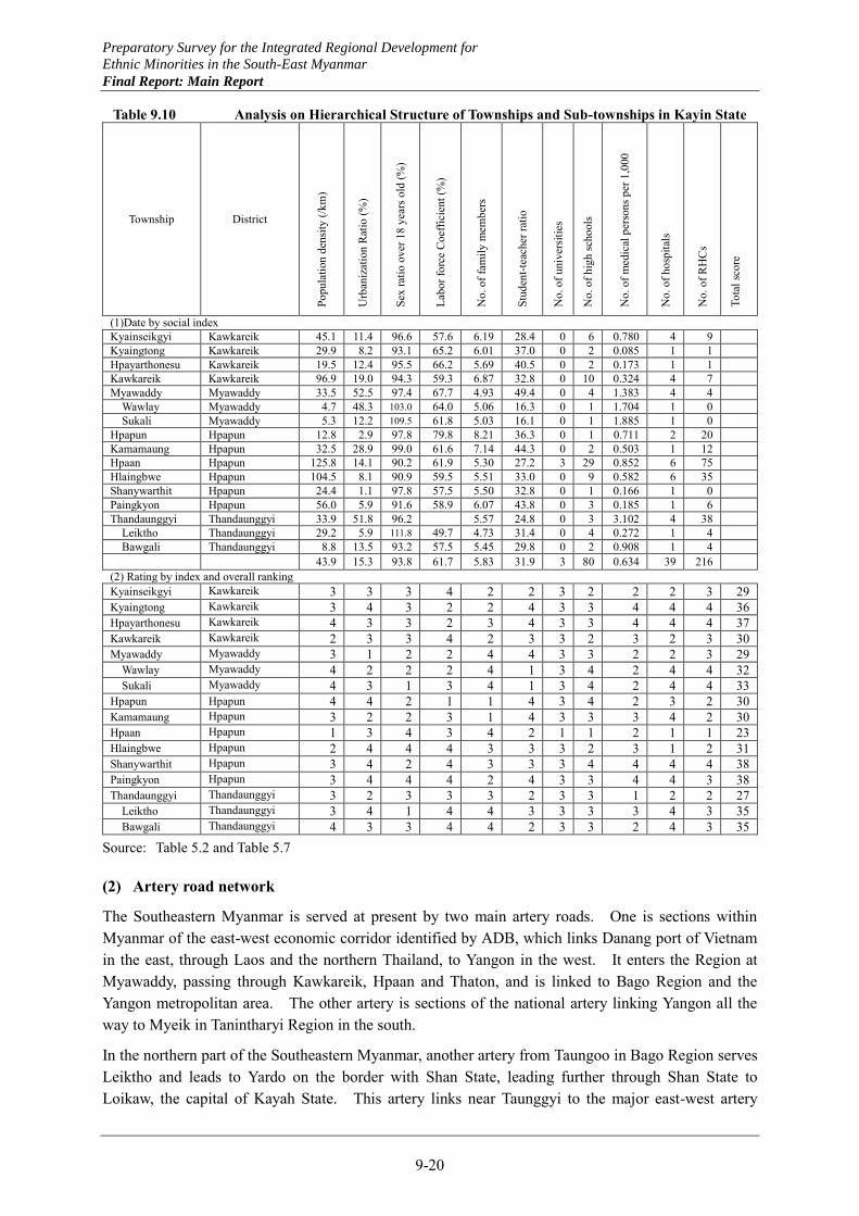
Preparatory Survey for the Integrated Regional Development for
Ethnic Minorities in the South-East Myanmar
Final Report: Main Report
9-20
Table 9.10 Analysis on Hierarchical Structure of Townships and Sub-townships in Kayin State
Township District
Popu
latio
n de
nsity
(/km
)
Urb
aniz
atio
n R
atio
(%)
Sex
ratio
ove
r 18
year
s old
(%)
Labo
r for
ce C
oeffi
cien
t (%
)
No.
of f
amily
mem
bers
Stud
ent-t
each
er ra
tio
No.
of u
nive
rsiti
es
No.
of h
igh
scho
ols
No.
of m
edic
al p
erso
ns p
er 1
,000
No.
of h
ospi
tals
No.
of R
HC
s
Tota
l sco
re
(1)Date by social index Kyainseikgyi Kawkareik 45.1 11.4 96.6 57.6 6.19 28.4 0 6 0.780 4 9 Kyaingtong Kawkareik 29.9 8.2 93.1 65.2 6.01 37.0 0 2 0.085 1 1 Hpayarthonesu Kawkareik 19.5 12.4 95.5 66.2 5.69 40.5 0 2 0.173 1 1 Kawkareik Kawkareik 96.9 19.0 94.3 59.3 6.87 32.8 0 10 0.324 4 7 Myawaddy Myawaddy 33.5 52.5 97.4 67.7 4.93 49.4 0 4 1.383 4 4
Wawlay Myawaddy 4.7 48.3 103.0 64.0 5.06 16.3 0 1 1.704 1 0 Sukali Myawaddy 5.3 12.2 109.5 61.8 5.03 16.1 0 1 1.885 1 0
Hpapun Hpapun 12.8 2.9 97.8 79.8 8.21 36.3 0 1 0.711 2 20 Kamamaung Hpapun 32.5 28.9 99.0 61.6 7.14 44.3 0 2 0.503 1 12 Hpaan Hpapun 125.8 14.1 90.2 61.9 5.30 27.2 3 29 0.852 6 75 Hlaingbwe Hpapun 104.5 8.1 90.9 59.5 5.51 33.0 0 9 0.582 6 35 Shanywarthit Hpapun 24.4 1.1 97.8 57.5 5.50 32.8 0 1 0.166 1 0 Paingkyon Hpapun 56.0 5.9 91.6 58.9 6.07 43.8 0 3 0.185 1 6 Thandaunggyi Thandaunggyi 33.9 51.8 96.2 5.57 24.8 0 3 3.102 4 38
Leiktho Thandaunggyi 29.2 5.9 111.8 49.7 4.73 31.4 0 4 0.272 1 4 Bawgali Thandaunggyi 8.8 13.5 93.2 57.5 5.45 29.8 0 2 0.908 1 4
43.9 15.3 93.8 61.7 5.83 31.9 3 80 0.634 39 216 (2) Rating by index and overall ranking Kyainseikgyi Kawkareik 3 3 3 4 2 2 3 2 2 2 3 29 Kyaingtong Kawkareik 3 4 3 2 2 4 3 3 4 4 4 36 Hpayarthonesu Kawkareik 4 3 3 2 3 4 3 3 4 4 4 37 Kawkareik Kawkareik 2 3 3 4 2 3 3 2 3 2 3 30 Myawaddy Myawaddy 3 1 2 2 4 4 3 3 2 2 3 29
Wawlay Myawaddy 4 2 2 2 4 1 3 4 2 4 4 32 Sukali Myawaddy 4 3 1 3 4 1 3 4 2 4 4 33
Hpapun Hpapun 4 4 2 1 1 4 3 4 2 3 2 30 Kamamaung Hpapun 3 2 2 3 1 4 3 3 3 4 2 30 Hpaan Hpapun 1 3 4 3 4 2 1 1 2 1 1 23 Hlaingbwe Hpapun 2 4 4 4 3 3 3 2 3 1 2 31 Shanywarthit Hpapun 3 4 2 4 3 3 3 4 4 4 4 38 Paingkyon Hpapun 3 4 4 4 2 4 3 3 4 4 3 38 Thandaunggyi Thandaunggyi 3 2 3 3 3 2 3 3 1 2 2 27
Leiktho Thandaunggyi 3 4 1 4 4 3 3 3 3 4 3 35 Bawgali Thandaunggyi 4 3 3 4 4 2 3 3 2 4 3 35
Source: Table 5.2 and Table 5.7
(2) Artery road network
The Southeastern Myanmar is served at present by two main artery roads. One is sections within Myanmar of the east-west economic corridor identified by ADB, which links Danang port of Vietnam in the east, through Laos and the northern Thailand, to Yangon in the west. It enters the Region at Myawaddy, passing through Kawkareik, Hpaan and Thaton, and is linked to Bago Region and the Yangon metropolitan area. The other artery is sections of the national artery linking Yangon all the way to Myeik in Tanintharyi Region in the south.
In the northern part of the Southeastern Myanmar, another artery from Taungoo in Bago Region serves Leiktho and leads to Yardo on the border with Shan State, leading further through Shan State to Loikaw, the capital of Kayah State. This artery links near Taunggyi to the major east-west artery
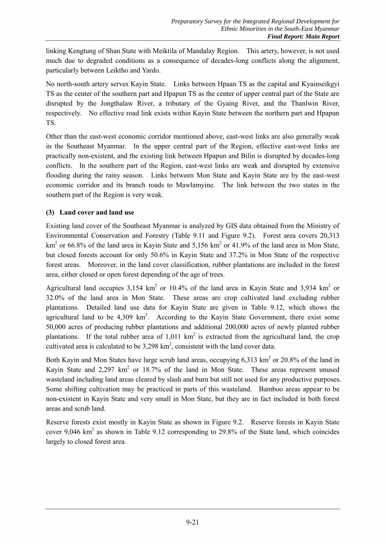
Preparatory Survey for the Integrated Regional Development for
Ethnic Minorities in the South-East Myanmar
Final Report: Main Report
9-21
linking Kengtung of Shan State with Meiktila of Mandalay Region. This artery, however, is not used much due to degraded conditions as a consequence of decades-long conflicts along the alignment, particularly between Leiktho and Yardo.
No north-south artery serves Kayin State. Links between Hpaan TS as the capital and Kyainseikgyi TS as the center of the southern part and Hpapun TS as the center of upper central part of the State are disrupted by the Jongthalaw River, a tributary of the Gyaing River, and the Thanlwin River, respectively. No effective road link exists within Kayin State between the northern part and Hpapun TS.
Other than the east-west economic corridor mentioned above, east-west links are also generally weak in the Southeast Myanmar. In the upper central part of the Region, effective east-west links are practically non-existent, and the existing link between Hpapun and Bilin is disrupted by decades-long conflicts. In the southern part of the Region, east-west links are weak and disrupted by extensive flooding during the rainy season. Links between Mon State and Kayin State are by the east-west economic corridor and its branch roads to Mawlamyine. The link between the two states in the southern part of the Region is very weak.
(3) Land cover and land use
Existing land cover of the Southeast Myanmar is analyzed by GIS data obtained from the Ministry of Environmental Conservation and Forestry (Table 9.11 and Figure 9.2). Forest area covers 20,313 km2 or 66.8% of the land area in Kayin State and 5,156 km2 or 41.9% of the land area in Mon State, but closed forests account for only 50.6% in Kayin State and 37.2% in Mon State of the respective forest areas. Moreover, in the land cover classification, rubber plantations are included in the forest area, either closed or open forest depending of the age of trees.
Agricultural land occupies 3,154 km2 or 10.4% of the land area in Kayin State and 3,934 km2 or 32.0% of the land area in Mon State. These areas are crop cultivated land excluding rubber plantations. Detailed land use data for Kayin State are given in Table 9.12, which shows the agricultural land to be 4,309 km2. According to the Kayin State Government, there exist some 50,000 acres of producing rubber plantations and additional 200,000 acres of newly planted rubber plantations. If the total rubber area of 1,011 km2 is extracted from the agricultural land, the crop cultivated area is calculated to be 3,298 km2, consistent with the land cover data.
Both Kayin and Mon States have large scrub land areas, occupying 6,313 km2 or 20.8% of the land in Kayin State and 2,297 km2 or 18.7% of the land in Mon State. These areas represent unused wasteland including land areas cleared by slash and burn but still not used for any productive purposes. Some shifting cultivation may be practiced in parts of this wasteland. Bamboo areas appear to be non-existent in Kayin State and very small in Mon State, but they are in fact included in both forest areas and scrub land.
Reserve forests exist mostly in Kayin State as shown in Figure 9.2. Reserve forests in Kayin State cover 9,046 km2 as shown in Table 9.12 corresponding to 29.8% of the State land, which coincides largely to closed forest area.
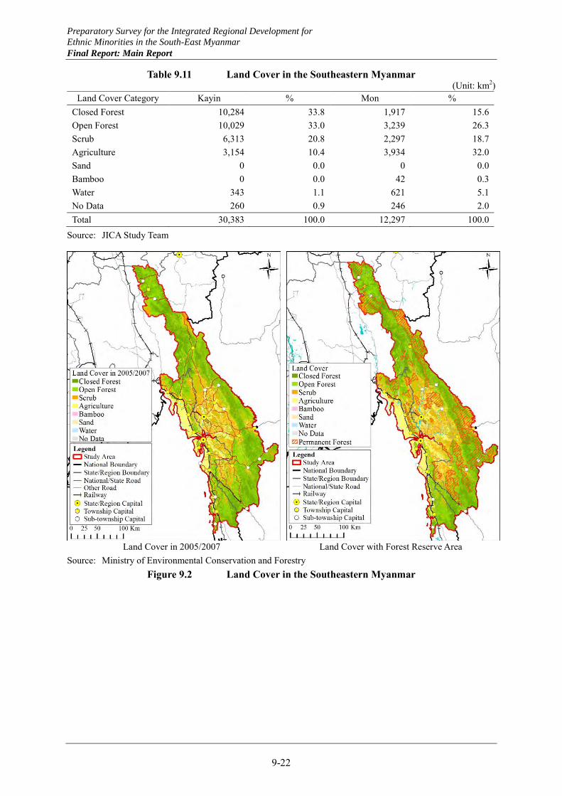
Preparatory Survey for the Integrated Regional Development for
Ethnic Minorities in the South-East Myanmar
Final Report: Main Report
9-22
Table 9.11 Land Cover in the Southeastern Myanmar (Unit: km2)
Source: JICA Study Team
Source: Ministry of Environmental Conservation and Forestry Figure 9.2 Land Cover in the Southeastern Myanmar
Land Cover Category Kayin % Mon % Closed Forest 10,284 33.8 1,917 15.6 Open Forest 10,029 33.0 3,239 26.3 Scrub 6,313 20.8 2,297 18.7 Agriculture 3,154 10.4 3,934 32.0 Sand 0 0.0 0 0.0 Bamboo 0 0.0 42 0.3 Water 343 1.1 621 5.1 No Data 260 0.9 246 2.0 Total 30,383 100.0 12,297 100.0
Land Cover in 2005/2007 Land Cover with Forest Reserve Area
Preparatory Survey for the Integrated Regional Development for
Ethnic Minorities in the South-East Myanmar
Final Report: Main Report
9-23
Table 9.12 Existing Land Use in Kayin State
No. Township/ Sub-township
Farm Land Net Cultivated Area Fallow
Land Total Lowland Upland Deposited
Land Garden Land
Sloping Land Total
1 Hpaan 64,536 251 2,953 32,836 3,589 104,166 3,894 108,060 2 Hlaingbwe 32,392 52 1,424 9,927 634 44,429 506 44,935 3 Paingkyon 21,302 626 376 4,790 4,462 31,555 63 31,618 4 Shanywarthit 1,275 25 345 858 2,504 2,504 5 Hpapun 3,334 83 186 3,586 3,554 10,743 60 10,803 6 Kamamaung 2,386 25 266 2,133 2,007 6,817 40 6,857 7 Thandaunggyi 44 59 6,866 1,341 8,310 8,310 8 Leiktho 721 77 10,158 2,053 13,009 13,009 9 Bawgali 297 257 133 7,484 749 8,919 8,919
10 Kawkareik 51,608 36 125 28,452 1,389 81,610 59 81,668 11 Kyainseikgyi 18,848 76 97 20,323 340 39,684 2,024 41,708 12 Kyaikdon 5,089 125 9,913 2,689 17,816 17,816 13 Hpayarthonesu 3,775 17,487 2,723 23,985 11 23,996 14 Myawaddy 3,248 24 351 8,573 10,650 22,847 22,847 15 Wawlay 317 2,527 2,698 5,541 5,541 16 Sukali 84 639 1,587 2,310 2,310
Total of Kayin State 209,257 1,564 6,060 166,040 41,325 424,246 6,657 430,903
6.9% 0.1% 0.2% 5.5% 1.4% 14.0% 0.2% 14.2% (Continued)
No. Township/ Sub-township Reserved Forest Other Forest Cultivable
Waste Land Others Total
1 Hpaan 27,974 87,975 20,154 36,833 280,996 2 Hlaingbwe 38,368 20,723 55 29,850 133,931 3 Paingkyon 30,860 42,200 479 61,218 166,375 4 Shanywarthit 2,266 19,255 38 105,099 129,162 5 Hpapun 163,804 348,348 6,245 22,507 551,707 6 Kamamaung 31,580 70,499 2,633 8,703 120,272 7 Thandaunggyi 3,602 42,273 28,172 82,356 8 Leiktho 20,429 56,521 45,804 135,763 9 Bawgali 103,120 19,672 21,222 152,933
10 Kawkareik 61,949 9,595 4,965 17,852 176,030 11 Kyainseikgyi 64,865 18,274 7,102 3,002 134,952 12 Kyaikdon 103,443 180,621 2,828 304,708 13 Hpayarthonesu 39,591 273,518 1,275 338,380 14 Myawaddy 143,624 25,432 3,467 195,370 15 Wawlay 23,619 24,926 37 54,123 16 Sukali 45,461 33,497 59 81,326
Total of Kayin State 904,555 1,273,328 41,671 387,926 3,038,384
29.8% 41.9% 1.4% 12.8% 100.0%
9.2.4 Institutional framework
(1) Overview of national government structure
The existing national government structure is described here extracted from the Constitution of the Republic Union of Myanmar 2008 for related articles as interpreted.
1) State structure
The Republic of the Union of Myanmar comprises seven Regions, seven States and the Union Territory of the Union Capital Naypyitaw. The seven Regions are 1) Sagaing, 2) Tanintharyi, 3) Bago, 4) Magway, 5) Mandalay, 6) Yangon and 7) Ayeyarwady. The seven States are 1) Kachin, 2) Kayah, 3) Kayin, 4) Chin, 5) Mon, 6) Rakhine, and 7) Shan.
Preparatory Survey for the Integrated Regional Development for
Ethnic Minorities in the South-East Myanmar
Final Report: Main Report
9-24
The Region or State is constituted by Districts; District comprises Townships (TS); Township consists of Town/ Ward and/ or Village Tracts (VT); Wards are organized as Town or Township; Villages are organized as Village Tract. Self-administered Zone in the Region or State is at the same level as District. Self-administered Division in the State accommodates Districts.
It has to be noted that Sub-Township (STS) is a special administrative arrangement outside the Constitution aiming to provide residents in remote areas improved access to the governmental public services. STS arrangement is a necessity oriented ad hoc arrangement.
The sovereign power of the Myanmar is separated by three: legislative power, executive power, and judicial power. The three branches of powers are reciprocal and have "checks and balances" over each other.
The three powers are shared among the Union and the Region or State, and Self-administered Zone and Self-administered Division. Each of the Union, Regions, and States has own legislature called Hluttaw, executive Government and judicial Court. Self-administered Divisions and Self-administered Zones within the territories of the Regions and the States accommodate the same governing system.
The Union is headed by the President with two Vice Presidents elected by the Presidential Electoral College consisting of the Union Hluttaw members. Term of the President and Vice Presidents is five years.
2) Legislature
The Union Hluttaw comprises Pyithu Hluttaw consisting of 330 elected township based representatives and 110 representatives of Defense Services personnel appointed by the Commander-in-Chief of the Defense Services, and Amyotha Hluttaw consisting of 168 elected representatives from the seven Regions and the seven States in an equal number of 12 and the 56 representatives of Defense Services personnel appointed by the Commander-in-Chief of the Defense Services.
The Region or the State Hluttaw consists of the elected township representatives in an equal number of two from each township, the elected representatives of national races whose population in respective territory equal or exceed 0.1 percent of the total proportions of the Union other than the territory’s majority national race, and the representatives of Defense Services personnel appointed by the Commander-in-Chief of the Defense Services in equal number of a half of the total number of township and national races representatives.
Terms of all the representatives of the Union Hluttaw, the Region Hluttaw and the State Hluttaw are identical five years.
3) Executives of governments
The Union Government comprises the President, Vice-Presidents, Ministers of the Union, and the Attorney General of the Union. The Union Ministers and the Attorney General of the Union are appointed by the President.
The Region and the State Governments comprises the Chief Minister, Ministers of the Region or State, and the Advocate-General of the Region or State. The numbers of the Region or State Ministries and Ministers are specified by the President.
Preparatory Survey for the Integrated Regional Development for
Ethnic Minorities in the South-East Myanmar
Final Report: Main Report
9-25
The Chief Minister is appointed by the President from the representatives of the Region or State Hluttaw. The Region or State Ministers including ordinary Ministers (responsible Ministers for nine sectors), the Chairpersons of Leading Bodies of the Self-Administered Division or the Self-Administered Zone and Hluttaw representatives elected to carry out the affairs of National races in the Region or State concerned (Minister(s) for Ethnic Affairs) are appointed by the President based on the list prepared by the Chief Minister. Among them the Region or State Minister responsible for Security and Border Affairs is nominated from Defense Services personnel by the Commander-in-Chief of the Defense Services.
The Government of the Region or State is entitled to collect particular taxes listed in Schedule Five for its discretion, while its budget which has to be approved by the Region or State Hluttaw is based on the annual Union Budget.
(2) State government structure
1) Kayin and Mon State Governments
Kayin State comprises four Districts with seven TSs (Figure 9.3). Of the four Districts, two accommodate one TS. There are nine STSs in Kayin State’s five Districts.
General Administration Department of the State (Deputy Director General w/ Deputy Director)
Chief Minister9 Ministers
Security & B
order A
ffairs
Transportation
Agriculture &
Livestock
Planning & Econom
ic D
evelopment
Finance & R
evenue
Forest & M
ining
City D
evelopment
Social Affair
Electricity & Industry
State Government
Office(Deputy Director)
General Administration
Office(Deputy Director)
Parliament Office
(Deputy Director)
70 Department Level Entities
Hpa-an(Deputy Director)
Kawkareik(Deputy Director)
Myawaddy (Deputy Director)
Pa-pun(Deputy Director)
Hpa-an
(Asst D
irector)
Hlaingbw
e(A
sst Director)
Thadaunggy(A
sst Director)
Kaw
kareik(A
sst Director)
Kyainsekkyi
(Asst D
irector)
Myaw
addy(A
sst Director)
Pa-pun(A
sst Director)
Payingkyon
PayathonezuK
yaikdon
Shanywathit
Leiktho
Baw
gali
Wallay M
yaing
Sukali
Kam
amaung
Districts
Townships
Sub-Townships
Necessary Service Departments (26)
Essential Service Departments (18)
Union Government
Coordination
Coordination CoordinationAdmin. Management
State Parliament State High Court
Ministers for Ethnic
Minorities
Advocate-G
eneral
Auditor-G
eneral
Figure 9.3 Organization Structure of Kayin State
Mon State comprises two Districts with 10 TSs (Figure 9.4). There are two STSs in Mon State which are embraced by one TS.
Preparatory Survey for the Integrated Regional Development for
Ethnic Minorities in the South-East Myanmar
Final Report: Main Report
9-26
General Administration Department of the State (Deputy Director General w/ Deputy Director)
Chief Minister9 Ministers
Security & B
order A
ffairs
Transportation
Agriculture &
Livestock
State Planning &
Economic D
evelopment
Finance & R
evenue
Forest & M
ining
City D
evelopment
Social Affair
Electricity & Industry
State Government
Office(Deputy Director)
General Administration
Office(Deputy Director)
Parliament Office
(Deputy Director)
91 Department Level Entities
Mawlamyaing(Deputy Director)
Thaton(Deputy Director)
Chaungzon
(Asst D
irector)
Mudon
(Asst D
irector)
Ye
(Asst D
irector)
Bilin
(Asst D
irector)
Kyaiktoo
(Asst D
irector)
Maw
la-m
yaing(A
sst Director)
Khaw
zar
Lamine
Districts
Townships
Sub-Townships
Necessary Service Departments (26-40)
Essential Service Departments (18)
Union Government
Coordination
Coordination Coordination
Thaton(A
sst Director)
Paung(A
sst Director)
Kyaik-
mayaw
(Asst D
irector)
Thanphyu-zayat
(Asst D
irector)
Admin. Management
State High CourtState Parliament
Ministers for Ethnic
Minorities
Advocate-G
eneral
Auditor-G
eneral
Figure 9.4 Organization Structure of Mon State
2) General Administration Department of State
The General Administration Department (GAD) of the State is a focal entity in execution of administrative functions of the State. Each level of District, TS and STS is administered by GAD at respective level.
The Head of the GAD of the State possesses a rank of Deputy Director General in national civil service officer classification. Instead of its formal position name “the Head of the GAD” described in the Constitute, he is usually called “State Secretary” which is the official name of the identical position under the former constitution or “State Commissioner” or “Commissioner” which might be much older title of the identical position. The Deputy Head called “Deputy Commissioner” is Deputy Director’s position.
The State GAD consists of three offices; State Government Office (SGO), General Administration Office (GAO) and Parliament Office (PO). Deputy Directors are assigned to their responsible positions. The Heads of District GADs are also Deputy Directors called "District Administrator”, “District Commissioner” or “Deputy Commissioner”. The Heads of Township GADs are Assistant Directors called “Township Administrator” or “Township Commissioner”. STSs are administered by officers to assist the Head of Township GAD.
GAO is in charge of: 1) budgeting, treasuring, and human and general affairs of all the GAD offices, 2) administrative data and information collection and compilation, and report to the Union GAD, and 3) secretariat for Land Use Management Committee (LUMC). Administrative data and information are widely diversified as number of residents, land use conditions, numbers of schools and health centers/ hospitals, numbers of students and patients, physical conditions of the State territory, condition of public service provisions, security situation, and so on. The data and information are reported to the Union GAD. LUMC system starts from VT level with officials of
Preparatory Survey for the Integrated Regional Development for
Ethnic Minorities in the South-East Myanmar
Final Report: Main Report
9-27
Settlement and Land Use Department and relating Departments. Application relating to land use passed through TS and District LUMCs is finally approved by the State LUMC.
SGO coordinates activities of other executing State Departments and lower level GADs, and communicate with the Union Government as well as the Chief Minister and the State Secretary.
Administrative services including national registration related services, residential registration relating services, temporary stay registration relating services, dispute settlement functions, and real estate registration and usage related services are provided through TS GAD office to the residents with supportive activities of Ward and VT Administrators and clerks. GAD at each level compiles all the administration and development related data and information.
All the officers are selected through the Civil Service Board and assigned by the Union GAD, the Ministry of Home Affairs. Their assignment shifts are nationwide in basic while Deputy Directors shifts are tend to be limited within the Region or State.
3) State departments and ministers
There are numerous state departments including same level entities as department other than GAD for providing public services. Kayin State embraces 70 Departments and Mon State holds 91 of them. A list of state department level entities in Mon State is attached to this section. Officers and budgets of state departments used to be fully under the control of respective Union Departments including the same level governmental entities. From 2012/13 up to 24 state departments have become the state budget departments while officer appointments are still controlled by the Union entities. There are 20 state budget departments in Mon State.
Due to the strong connection of executing state departments with the Union Departments, project implementation and service provisions are conducted accordingly to the Union Departments’ instructions in principle although the Chief Minister’s intention is strongly reflected in budget applications. GAD coordinates all the other state departments for the Chief Minister in budget preparation and in implementations which require collaboration between/ among the state departments.
It has to be noted that the rank of responsible officials of the state departments is usually Deputy Director while at least some of the state budget departments have received new Heads ranked as Director.
Nine line Ministers except the Minister for Security and Border Affairs who possesses military status are usually proletarian as government officials and getting accustomed to their roles and responsibilities. It must be very challenging for them to direct more than several state departments especially for the initial period.
4) New township level arrangements
By Presidential Decree 27/2012, 26 February 2013, two TS level committees of Township Municipal Affairs or Social Prosperity and Township Development Assistant/ Support (TDAC) are required to be established. Although accurate functions of the committees are yet to be figured out, at least TDAC may be involved in planning process according to our interview with Government Officials.
Preparatory Survey for the Integrated Regional Development for
Ethnic Minorities in the South-East Myanmar
Final Report: Main Report
9-28
The other committee called Township Social (Municipal) Prosperity/ Affairs Committee chaired by the Head of the Township Social (Municipal) Prosperity/ Affairs Department has to be established by the Decree. Functions of both the Committee and the state department are yet to be figured out
It seems that the same Presidential Decree requires to establish Township Management Committee administrative chaired by Township Administrator for capacity enhancement. UNDP is initiating the TS level enhancement since this year and supposed to be involved in enhancement activities in administrative and planning capacities by establishment of committees.
(3) Planning system
1) State development plans
Each Region or State has to prepare Five-Year Short Term Plan (STP) and Long Term Plan (LTP) targeting the year 2030. Although there are fifth Five-year STP covering 2011/12 to 2015/16 in both Kayin and Mon States, no LTP has materialized in Myanmar.
Both plans have to be prepared by bottom-up approach starting from the VT level. The bottom-up planning procedure, which has to be followed by Planning and Implementation Committee (PIC) in each administration level down to TS, however, is not realized mainly due to lack of human resources who can conduct the processes especially in lower administrative levels down from District. Planning activities in VT level are assumed to be carried out by Village Tract Development Committee.
Planning of the Five-Year STP is based on the GRDP calculation. National GDP is calculated by production value in 14 economic sectors, while the GRDP for Kayin and Mon States' economic sectors are 13 since there is no Energy Sector activities. The fourteen economic sectors comprise: a) Production Sector, 1) Agriculture, 2) Livestock & Fisheries, 3) Forestry, 4) Mining & Minerals, 5) Energy, 6) Processing and Manufacturing, 7) Electric Power, 8) Construction; b) Service Sector, 9) Transportation, 10) Communication, 11) Financial, 12) Social and Administration, 13) Rental, Settlements & Other Services; c) Trading Sector, 14) Trading.
The Five-Year STP for Kayin and Mon States were prepared mainly by the State Planning Department. Economic planning GRDP objective indicated by the Union Government is adjusted with sector oriented GRDP objectives by the State Planning Department in coordination with relating economic State Departments. Sector GRDP objectives are supported by production projection and associating project lists.
2) National development plans
Same as the Region and State, the Union Government has been aiming to prepare Five-Year STP and LTP targeting the year 2030 by bottom up approach. Although the efforts by the Union Government have yet to bear intended fruit, Framework for Economic and Social Reforms was well prepared for First Myanmar Development Cooperation Forum in January 2013 which was successfully managed by the Union Government. The efforts for the plan preparations are continued for completing preparatory work for the Plans by the end of this year.
The identical approach is adopted by the Union Planning Department for preparation of the GDP based fifth Five-year STP covering 2011/12 to 2015/16. Indication of the objective GRDP to the Region or State is conducted based on the Plan.
Preparatory Survey for the Integrated Regional Development for
Ethnic Minorities in the South-East Myanmar
Final Report: Main Report
9-29
3) External assistance
UNDP has been supporting the Union Planning Department since beginning of 2013, and is going to provide two expatriate experts and two local experts to support the Union and the Region or State development planning activities from the middle of the year. At the same time, UNDP has been conducting TS level capacity development both in administrative management and in planning process.
Bottom-up approach planning process promotion activities by UNDP in association with UNCDF (Capital Development Fund) covers both TS and VT planning activities. They intend to develop management capacity of community development fund in TS level administrative bodies including assessment of VT prepared community development project plans. They support the Union GAD, Ministry of Home Affairs and Union Planning Department, Ministry of National Planning and Economic Development as well as TS level administrative bodies in Mon and Chin States.
4) Joint peace-building needs assessment
Peace Donor Support Group (PDSG) and Myanmar Peace Center (MPC) have agreed recently to conduct a Joint Peace-building Needs Assessment (JPNA). JPNA is to conduct needs survey of conflict affected areas nationwide by documents and field investigations, and needs verification by consultation with the Government, NSAs and people. It is expected to start soon at least for the south-eastern Myanmar including Kayin and Mon States.
Volume of the activities for and nature of the results of JPNA varies significantly depending on the degree of importance placed on and characteristics of the consultations. MPC intends to utilize the results for quick implementation of supporting activities in the areas for the purpose of trust building among the Government, NSAs and people. Consequently the consultations for needs identification and/or verification may become needs hearing type of activities, which may not be effective in attaining proper representation of people.
Although MPC desires to attain long term development planning result necessary for development of the areas for sustained peace by JPNA, it is a little too much expectation for JPNA consultations to reach the mutually agreed future visions among the stakeholders, which are necessary for the long term development planning for the respective areas. It is recommendable to hold development planning consultation among the stakeholders after trust building is achieved or at least agreeable alternative ideas of a future vision are prepared for proper facilitation of the planning consultation.
5) Imperative needs for coordination
The new JICA program for integrated regional development to support the ethnic peoples in Kayin and Mon States has to coordinate with the supporting activities by UNDP and UNCDF, and MPC’s JPNA mentioned above. All the above mentioned UNDP and UNCDF supporting activities require at least close coordination and information sharing among the JICA Study Team and the UNDP and UNCDF related experts in supporting the Government. Concerted activities may be applicable to the VT and TS level planning process.
Activities, processes, recommendation, and/or results of the JICA Study Team could be the model practices for standardizing the planning processes and quality. For JPNA, the JICA Study Team is able to provide data/information regarding local needs, and current and ongoing supporting activities in the areas for their assessment.
Preparatory Survey for the Integrated Regional Development for
Ethnic Minorities in the South-East Myanmar
Final Report: Main Report
9-30
9.3 Development scenario
9.3.1 Development phasing
A series of activities to be undertaken and events to take place over the planning period up to 2035/36 is described in this section as the development scenario for the Southeast Myanmar. To describe the Southeast Myanmar regional development scenario, the planning period is divided into phases and activities and events in each phase are described. The following phasing is defined:
(a) Preparatory phase: up to 2014/15, (b) Phase 1: 2015/16-20/21, (c) Phase 2: 2021/22-25/26, and (d) Phase 3: 2026/27-35/36.
9.3.2 Preparatory phase: up to 2014/15
(1) Overview
The integrated regional development master plan for the Southeast Myanmar will be completed in 2014, and urgent projects to prepare for the early return of refugees and IDPs will also be started. One of the urgent projects will facilitate returnees to obtain proper information related to options and opportunities available on the Myanmar side as well as installation supports. Based on the master plan, improvement of infrastructure and public facilities in several planned settlement areas will be started. Supported by the provision of proper information, initial return of refugees and IDPs will begin on a voluntary base.
Local government capacity should be enhanced steadily during this phase. As part of it, participatory mechanism to plan and implement community facilities should be pilot implemented to activate local communities. Such a mechanism may be established for planned settlement sites first.
(2) Socio-economy
Preparatory works will be initiated to establish new economic activities in agriculture and industry. In agriculture, productive reforestation will be actively carried out with fruit and cashew trees on many hills and slope land cleared by slash and burn practices. Mixed farming combining tree crops and field crops will be expanded in areas where water availability is relatively favorable. Integrated farming combining crop cultivation and livestock raising will also be expanded, including cashew cultivation and goat raising. These activities should take advantage of expanding export markets in Thailand.
In industry, skill training will be started for new products that may be produced by mixed farming and integrated farming activities. They include cashew based products such as lacquer works, cashew apple wine and vinegar. New products may develop based on abundant bamboo resources such as bamboo charcoal and bamboo acetic acid. Improvement of existing handicrafts will also be conducted selectively aiming at export or other specific target markets.
Local and domestic tourism will develop steadily as access to some tourism sites is improved by initial improvement of selected roads. Investment to tourism facilities in Mawlamyine, Hpaan and a few other locations will increase steadily. Proactive marketing for international tourism may be started by some travel agents linked with international agents.
Preparatory Survey for the Integrated Regional Development for
Ethnic Minorities in the South-East Myanmar
Final Report: Main Report
9-31
(3) Spatial development
Urgent improvement of key artery roads will be initiated, including the Hpayarthonesu ~ Thanbyuzayat road and sections of the east-west economic corridor linking Myawaddy, Hpaan and Thaton. Access roads to selected settlement sites will be improved. Feasibility studies for major facilities constituting the future transport and logistic network will be initiated including the Kyaikkhami regional port. Initial dialogues with Thailand will be undertaken on joint development of border areas with joint water resources development and management.
Urban infrastructure will be improved selectively in Mawlamyine and Hpaan. In Mawlamyine, restoration of some historical districts should be planned to enhance tourism value. In Hpaan, some recreational and amenity facilities may be introduced to improve the conditions for industrial location in the existing industrial estate as well as for residents. A link between Hpaan and Hpapun should be strengthened first by improved roads and ferry services on the Thanlwin River.
9.3.3 Phase 1: 2015/16-20/21
(1) Overview
Development administration will be further devolved to local governments. Priority should be accorded to Kayin and Mon States having the integrated regional development master plan of their own prepared in the previous phase.
During this phase, returns of refugees and IDPs will accelerate, supported by fully operational information and installation services established during the preparatory phase. Participatory planning and implementation will be continued and expanded for public facilities in settlement and other communities. Such a mechanism will be institutionalized and community development committees or community based organizations will be established in steps throughout the Region.
(2) Socio-economy
Productive reforestation initiated during the preparatory phase will be continued and expanded. New plant species may also be introduced in line with land suitability. The new mixed farming and integrated farming pilot implemented in the preparatory phase will expand, and proactive marketing of products of these activities will be undertaken.
Rubber based final products will diversify such as rubber gloves for household and cooking uses, rubber shoes and sanitary rubber products, and the rubber industrial cluster will be established with a variety of export goods. Skills for cashew based manufacturing as well as mechanism for raw materials collection will be established, and a cashew industrial cluster will start to be formed. Bamboo and wood works industrial cluster will also start to be formed. As part of national program, apiculture in Thandaunggyi may diversify its products for export and constitute a part of the national apiculture industrial cluster.
A free trade zones will be designated in Myawaddy and Hpayarthonesu to capitalize on low labor costs. The existing industrial estates in Hpaan and Mawlamyine will develop with increasing number of manufacturing industries.
Domestic travel agents will associate directly with international travel agents to develop a variety of tour products for international tourism. Mawlamyine will establish as the tourism gateway and the regional tourism base. Sightseeing boat tours between Mawlamyine and Hpaan will resume, and associated facilities will be provided along the Thanlwin River.
Preparatory Survey for the Integrated Regional Development for
Ethnic Minorities in the South-East Myanmar
Final Report: Main Report
9-32
(3) Spatial development
Major facilities in the transport and logistic network of the Southeast Myanmar will start to be implemented during this phase. The east-west economic corridor will be strengthened with improvement of bridges and some road sections. Alternative branch arteries to Mawlamyine will be improved. A feasibility study of the first stage development of the Kyaikkhami regional port will be completed, followed by detailed design, and the construction of the first stage will start toward the end of this phase.
With the improvement of artery roads, access to settlement sites will be further improved. As the eastern part of the Dawna mountains will develop and stabilize, access to the settlement sites from the western side of the Dawna mountains will start to be improved. The border with Thailand at Wawlay will be formally opened, and the improvement of road from Sukali to Kyaikdon will start to bring the development momentum to the interior. An agreement with Thailand will be made on joint development and management of the border river in Myawaddy District.
Urban hierarchy will start to develop first with strong urban functions of Mawlamyine and Hpaan. A few additional urban centers will start to develop rapidly. A link between Hpaan and Hpapun should be strengthened with a new bridge across the Thanlwin River.
9.3.4 Phase 2: 2021/22-25/26
(1) Overview
The number of returning refugees and IDPs will reach a peak at the beginning of this phase, but returns of migrant workers will continue as the Southeast Myanmar develops rapidly. Consequently, the Southeast Myanmar will become a net in-migrating region. More broad based participatory planning and implementation will be undertaken as part of localization of development administration covering the entire Region.
(2) Socio-economy
Production from the productive reforestation areas with various fruit and cashew trees will increase rapidly as trees reach productive ages. The cashew industrial cluster will be fully established with quality cashew nuts and lacquer works for export market, and other products for local markets. Goat meat and milk products will establish as export goods mainly for Thailand. The bamboo and wood works industrial cluster will also be fully developed. Other industrial clusters will start to develop based on tourism and wellness industries utilizing characteristic products in the Southeast Myanmar.
The free trade zones in Myawaddy and Hpayarthonesu will develop utilizing not only low cost labor but also locally available raw materials such as cement, rubber, antimony and other mineral resources. The industrial estates in Hpaan and Mawlamyine will develop fully with light industries. As a new port develops at Kyaikkhami, an industrial estate will start to develop in its hinterland with “import processing” type industries processing imported raw materials and intermediate goods into final products for domestic market. Those processing for export market in Thailand may locate in the Hpaan industrial estate.
(3) Spatial development
The artery roads will be fully upgraded, and access to settlement sites will be further improved accordingly. The transport and logistic network will be fully established with the completion of
Preparatory Survey for the Integrated Regional Development for
Ethnic Minorities in the South-East Myanmar
Final Report: Main Report
9-33
major facilities including the Kyaikkhami regional port, FTZs in Myawaddy and Hpayarthonesu, and industrial estates in Hpaan and Mawlamyine as well as the port hinterland.
Urban hierarchy will be further developed with clear functional division between major urban centers. Mawlamyine, Hpaan and a few other urban centers may be equipped with some higher order functions. Mawlamyine will be specialized in international tourism related services and port based industries. Hpaan may be a center of advanced education and research. Other higher order functions may include specialized health care, wellness industries and alternative technology development.
Based on the agreement with Thailand, the joint development and management of river basin on the border may be initiated as a pilot case of joint development and management of border areas under the management of local governments. Physical integration of the Southeast Myanmar will be largely attained by resolution of missing links such as links between the northern part to the rest of the Region. Tributaries of major rivers will be developed and managed to reduce flooding along middle and downstream reaches, and road conditions will be further improved accordingly.
9.3.5 Phase 3: 2026/27-35/36
(1) Overview
Returns of refugees, IDPs and migrant workers will be completed at the beginning of this phase, and all the returnees are comfortably settled, accommodated in respective settlement and other communities. Mechanism and practices of participatory planning and implementation will be established throughout the Region and fully operational as integral part of development administration.
(2) Socio-economy
Export products of agriculture are diversified with fruits, cashew products, goat meat and milk products, bamboo products, and specialty products characteristic of the Southeast Myanmar such as spices and condiments, health products, cosmetic and medical products as well. Additional industrial clusters will be established based on mineral resources to produce final goods for export. Some export products will establish fame in the global market.
(3) Spatial development
The transport and logistic network will be fully operational linked with neighboring regions and countries as major economic corridors of the Southeast Asia. The Southeast Myanmar will be physically integrated with resolution of all the missing links including the link between the northern part to the rest. With the water resources development and management of river tributary basins, major flooding will be reduced to manageable magnitude to improve further links between different areas in major river basins.
The urban hierarchy will be extended to neighboring regions and countries to form a city network, in which higher order urban functions are shared for mutually complementary development. Joint development and management of border areas will be continued as model development cooperation applicable to other regions in Myanmar.
(4) Ultimate image
The Southeast Myanmar will be characterized by the following by the year 2035/36.
Preparatory Survey for the Integrated Regional Development for
Ethnic Minorities in the South-East Myanmar
Final Report: Main Report
9-34
(a) In-migrating region having the average income higher than the national average with diversified employment opportunities,
(b) Model region for alternative socio-economic activities, which are less resource intensive and environment friendly, characterized by many viable industrial clusters and sustainable resource utilization and management by participation of peoples,
(c) Tourism center of Myanmar with a variety of tourism resources and tour itineraries for both international and domestic tourists, embracing rich cultural heritage of ethnic peoples, supported by the gateway function of Mawlamyine with renovated heritage districts and an international hotel school,
(d) Center for alternative technology with advanced education and research facilities including an alternative technology research center in Hpaan,
(e) Agricultural area specialized in mixed farming combining tree crops and field crops and integrated farming combining crop production and livestock raising to attain high productivity without relying much on high use of agro chemicals, fertilizer and other external input,
(f) Regional society open to the global society characterized by the logistic networks linked to neighboring regions and countries, city networking to share higher order urban functions, cosmopolitan atmosphere accommodating peoples of diverse socio-cultural backgrounds, and bright and pleasant landscape provided by rich forest resources and productive greenery,
(g) Self-reliant region based on the utilization of indigenous resources by and for the benefit of local peoples under the effective development administration by public-private partnership.
Preparatory Survey for the Integrated Regional Development for
Ethnic Minorities in the South-East Myanmar
Final Report: Main Report
10-1
The projects and programs described in this chapter have been proposed by the JICA Study Team only as candidates for possible implementation. They should be discussed with stakeholders including ethnic minority groups as well as local residents, and their implementation will be subject to the result of the discussions. It is necessary to solicit opinions about this chapter widely and consider continuously in next phase.
On the basis of outcome of this initial study, subsequent projects will be planned and implemented within the overall framework of integrated regional development to support the ethnic minorities in the Southeast Myanmar as shown in Figure 1.1. Immediately following the present study, two planning projects are expected to be undertaken by JICA: 1) full scale integrated regional development master planning for the Southeast Myanmar, and 2) return and settlement planning for refugees and IDPs in the Southeast Myanmar. Both planning projects may be undertaken with pilot implementation of urgent measures.
Other projects identified or proposed by the present study will be implemented in parallel with these planning projects. The Hpayarthonesu – Thanbyuzayat road development project is expected to be implemented earlier after upgrading of the pre-feasibility study conducted as part of the initial study. The Kyaikkhami regional port development project surveyed at a preliminary level as part of the initial study will be examined further in the integrated regional development master planning for its stage wise development. A feasibility study is expected to follow for its first stage development.
Additional projects may be planned and implemented partly in parallel with these projects. Candidate projects that may be implemented by the Government, possibly supported by JICA and other donors are proposed in this chapter (Figure 10.1). Correspondence between the proposed projects and their locations is shown in Table 10.1 for Kayin State and Table 10.2 for Mon State.
CHAPTER 10 RECOMMENDATION FOR SUBSEQUENT STAGE
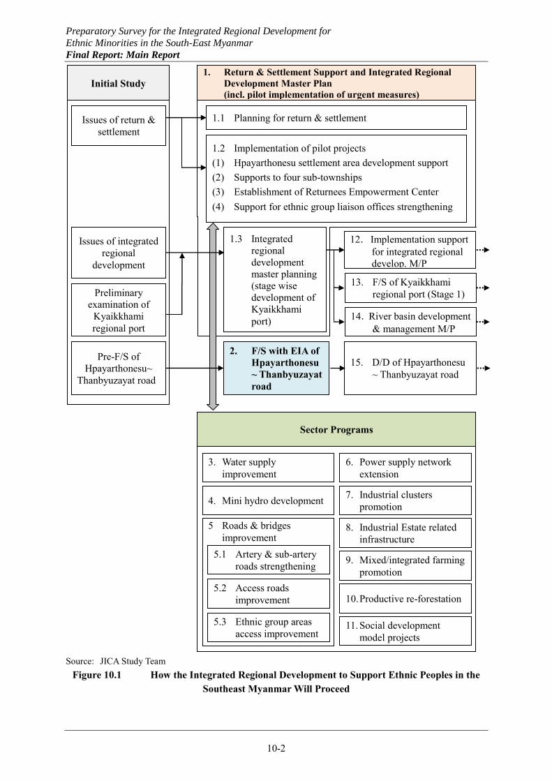
Preparatory Survey for the Integrated Regional Development for
Ethnic Minorities in the South-East Myanmar
Final Report: Main Report
10-2
Source: JICA Study Team
Figure 10.1 How the Integrated Regional Development to Support Ethnic Peoples in the Southeast Myanmar Will Proceed
Initial Study 1. Return & Settlement Support and Integrated Regional
Development Master Plan (incl. pilot implementation of urgent measures)
(緊急支援のパイロット実施を含む) 1.1 Planning for return & settlement
1.2 Implementation of pilot projects (1) Hpayarthonesu settlement area development support (2) Supports to four sub-townships (3) Establishment of Returnees Empowerment Center (4) Support for ethnic group liaison offices strengthening
2. F/S with EIA of Hpayarthonesu ~ Thanbyuzayat road
3. Water supply improvement
4. Mini hydro development
5 Roads & bridges improvement
6. Power supply network extension
7. Industrial clusters promotion
8. Industrial Estate related infrastructure
9. Mixed/integrated farming promotion
10. Productive re-forestation
11. Social development model projects
12.Implementation support for integrated regional develop. M/P
13. F/S of Kyaikkhami regional port (Stage 1)
15. D/D of Hpayarthonesu ~ Thanbyuzayat road
14.River basin development & management M/P
5.1 Artery & sub-artery roads strengthening
5.2 Access roads improvement
5.3 Ethnic group areas access improvement
Issues of return & settlement
Preliminary examination of
Kyaikkhami regional port
Sector Programs
1.3 Integrated regional development master planning (stage wise development of Kyaikkhami port)
Issues of integrated regional
development
Pre-F/S of Hpayarthonesu~
Thanbyuzayat road
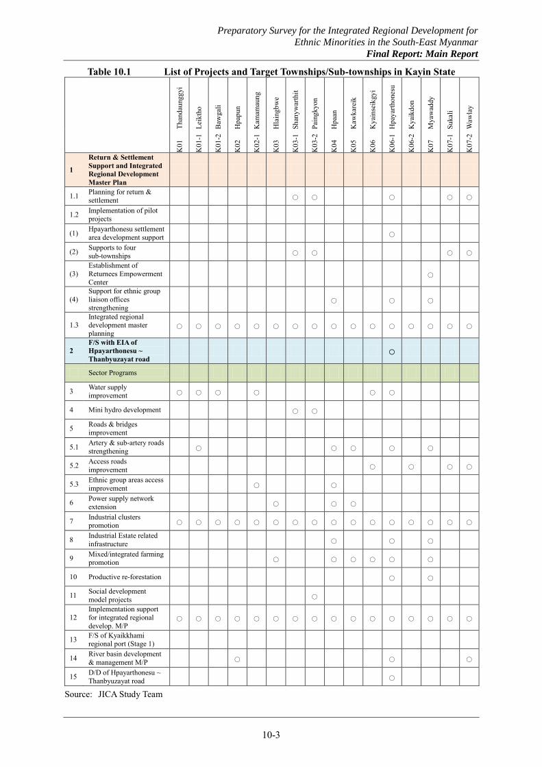
Preparatory Survey for the Integrated Regional Development for
Ethnic Minorities in the South-East Myanmar
Final Report: Main Report
10-3
Table 10.1 List of Projects and Target Townships/Sub-townships in Kayin State
Than
daun
ggyi
Leik
tho
Baw
gali
Hpa
pun
Kam
amau
ng
Hla
ingb
we
Shan
ywar
thit
Pain
gkyo
n
Hpa
an
Kaw
kare
ik
Kya
inse
ikgy
i
Hpa
yarth
ones
u
Kya
ikdo
n
Mya
wad
dy
Suka
li
Waw
lay
K01
K01
-1
K01
-2
K02
K02
-1
K03
K03
-1
K03
-2
K04
K05
K06
K06
-1
K06
-2
K07
K07
-1
K07
-2
1
Return & Settlement Support and Integrated Regional Development Master Plan
1.1 Planning for return & settlement ○ ○ ○ ○ ○
1.2 Implementation of pilot projects
(1) Hpayarthonesu settlement area development support ○
(2) Supports to four sub-townships ○ ○ ○ ○
(3) Establishment of Returnees Empowerment Center
○
(4) Support for ethnic group liaison offices strengthening
○ ○ ○
1.3 Integrated regional development master planning
○ ○ ○ ○ ○ ○ ○ ○ ○ ○ ○ ○ ○ ○ ○ ○
2 F/S with EIA of Hpayarthonesu ~ Thanbyuzayat road
○
Sector Programs
3 Water supply improvement ○ ○ ○ ○ ○ ○
4 Mini hydro development ○ ○
5 Roads & bridges improvement
5.1 Artery & sub-artery roads strengthening ○ ○ ○ ○ ○
5.2 Access roads improvement ○ ○ ○ ○
5.3 Ethnic group areas access improvement ○ ○
6 Power supply network extension ○ ○ ○
7 Industrial clusters promotion ○ ○ ○ ○ ○ ○ ○ ○ ○ ○ ○ ○ ○ ○ ○ ○
8 Industrial Estate related infrastructure ○ ○ ○
9 Mixed/integrated farming promotion ○ ○ ○ ○ ○ ○
10 Productive re-forestation ○ ○
11 Social development model projects ○
12 Implementation support for integrated regional develop. M/P
○ ○ ○ ○ ○ ○ ○ ○ ○ ○ ○ ○ ○ ○ ○ ○
13 F/S of Kyaikkhami regional port (Stage 1)
14 River basin development & management M/P ○ ○ ○
15 D/D of Hpayarthonesu ~ Thanbyuzayat road ○
Source: JICA Study Team
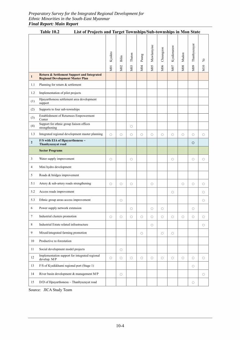
Preparatory Survey for the Integrated Regional Development for
Ethnic Minorities in the South-East Myanmar
Final Report: Main Report
10-4
Table 10.2 List of Projects and Target Townships/Sub-townships in Mon State
Kya
ikto
Bili
n
That
on
Paun
g
Maw
lam
yine
Cha
ungz
on
Kya
ikm
araw
Mud
on
Than
byuz
ayat
Ye
M01
M02
M03
M04
M05
M06
M07
M08
M09
M10
1 Return & Settlement Support and Integrated Regional Development Master Plan
1.1 Planning for return & settlement
1.2 Implementation of pilot projects
(1) Hpayarthonesu settlement area development support
(2) Supports to four sub-townships
(3) Establishment of Returnees Empowerment Center
(4) Support for ethnic group liaison offices strengthening ○
1.3 Integrated regional development master planning ○ ○ ○ ○ ○ ○ ○ ○ ○ ○
2 F/S with EIA of Hpayarthonesu ~ Thanbyuzayat road ○
Sector Programs
3 Water supply improvement ○ ○ ○ ○ ○
4 Mini hydro development
5 Roads & bridges improvement
5.1 Artery & sub-artery roads strengthening ○ ○ ○ ○ ○ ○ ○
5.2 Access roads improvement ○ ○
5.3 Ethnic group areas access improvement ○ ○
6 Power supply network extension ○ ○ ○ ○
7 Industrial clusters promotion ○ ○ ○ ○ ○ ○ ○ ○ ○ ○
8 Industrial Estate related infrastructure ○ ○
9 Mixed/integrated farming promotion ○ ○ ○
10 Productive re-forestation
11 Social development model projects ○
12 Implementation support for integrated regional develop. M/P ○ ○ ○ ○ ○ ○ ○ ○ ○ ○
13 F/S of Kyaikkhami regional port (Stage 1) ○
14 River basin development & management M/P ○ ○
15 D/D of Hpayarthonesu ~ Thanbyuzayat road ○
Source: JICA Study Team
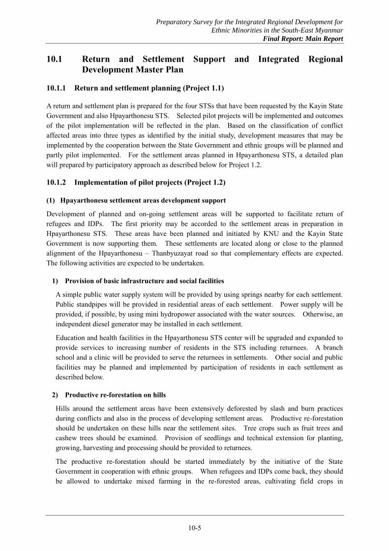
Preparatory Survey for the Integrated Regional Development for
Ethnic Minorities in the South-East Myanmar
Final Report: Main Report
10-5
10.1 Return and Settlement Support and Integrated Regional Development Master Plan
10.1.1 Return and settlement planning (Project 1.1)
A return and settlement plan is prepared for the four STSs that have been requested by the Kayin State Government and also Hpayarthonesu STS. Selected pilot projects will be implemented and outcomes of the pilot implementation will be reflected in the plan. Based on the classification of conflict affected areas into three types as identified by the initial study, development measures that may be implemented by the cooperation between the State Government and ethnic groups will be planned and partly pilot implemented. For the settlement areas planned in Hpayarthonesu STS, a detailed plan will prepared by participatory approach as described below for Project 1.2.
10.1.2 Implementation of pilot projects (Project 1.2)
(1) Hpayarthonesu settlement areas development support
Development of planned and on-going settlement areas will be supported to facilitate return of refugees and IDPs. The first priority may be accorded to the settlement areas in preparation in Hpayarthonesu STS. These areas have been planned and initiated by KNU and the Kayin State Government is now supporting them. These settlements are located along or close to the planned alignment of the Hpayarthonesu – Thanbyuzayat road so that complementary effects are expected. The following activities are expected to be undertaken.
1) Provision of basic infrastructure and social facilities
A simple public water supply system will be provided by using springs nearby for each settlement. Public standpipes will be provided in residential areas of each settlement. Power supply will be provided, if possible, by using mini hydropower associated with the water sources. Otherwise, an independent diesel generator may be installed in each settlement.
Education and health facilities in the Hpayarthonesu STS center will be upgraded and expanded to provide services to increasing number of residents in the STS including returnees. A branch school and a clinic will be provided to serve the returnees in settlements. Other social and public facilities may be planned and implemented by participation of residents in each settlement as described below.
2) Productive re-forestation on hills
Hills around the settlement areas have been extensively deforested by slash and burn practices during conflicts and also in the process of developing settlement areas. Productive re-forestation should be undertaken on these hills near the settlement sites. Tree crops such as fruit trees and cashew trees should be examined. Provision of seedlings and technical extension for planting, growing, harvesting and processing should be provided to returnees.
The productive re-forestation should be started immediately by the initiative of the State Government in cooperation with ethnic groups. When refugees and IDPs come back, they should be allowed to undertake mixed farming in the re-forested areas, cultivating field crops in
Preparatory Survey for the Integrated Regional Development for
Ethnic Minorities in the South-East Myanmar
Final Report: Main Report
10-6
combination with tree crops. This will facilitate returnees to establish livelihood, attaining higher productivity. Terraced paddy production and rubber plantations are not recommendable on hills.
3) Land use planning
A land use plan for settlement and surrounding areas should be prepared through joint efforts by KNU and the State Government working with residents in respective settlements. The land use plan should cover residential lots with home gardens, paddy cultivation areas along water courses on flat and gently sloping land, productive re-forestation areas, and protection areas with water sources.
4) Community development
Community development in settlement areas by the KNU initiative will be supported. A community development committee or community based organization (CBO) will be established in each settlement by participation of residents. The community based organization or committee should be established in the immediate future with early settlers and will develop as more people are coming back. Selection of tree species to be planted for productive re-forestation and also in home gardens may be among the subjects to be discussed in the community based organization or at the committee.
Participatory land use planning as mentioned above may also provide opportunities to strengthen the settlement communities. Additional social and public facilities may be planned by participatory approach and implemented by mobilizing community resources at least partly, supported by KNU and the State Government.
(2) Support to four STSs
Other settlement areas may also be selected for early support based on the agreement with relevant ethnic groups working closely with the State Government. In particular, limited support will be provided to the four STSs selected by the Kayin State Government for early implementation: viz. Shanywarthit, Paingkyon, Wawlay and Sukali. Possible supports for these STSs are suggested as follows:
(a) Water supply expansion and/or community facilities for Wawlay and Sukali, (b) Water supply expansion with spring water and/or mini hydro power for Shanywarthit, (c) Access improvement from the Thai side to Winsaw and Tarle and social facilities for Paingkyon,
and (d) Improvement of river navigation with boat clinic, postal service boat, jetties and others for all
the four STSs.
(3) Establishment of Returnees Empowerment Center (REC)
Provision of proper information related to settlement areas and livelihood and employment opportunities is vitally important to encourage voluntary return of refugees and IDPs. Information on Government policy and support measures, and available supports by donors/NGOs will also be helpful for making decisions on return. The function to provide such information to returnees should be established in border areas on the Myanmar side.
Refugees on the Thai side should be allowed to come back even temporarily at their own wills to obtain the information. Some of them may decide to move to other places for settlement supported by the State Government, but others may return to the Thai side. The information will be
Preparatory Survey for the Integrated Regional Development for
Ethnic Minorities in the South-East Myanmar
Final Report: Main Report
10-7
disseminated by those temporary visitors as well and more voluntary return may be promoted. It is desirable that some skill training will be provided also to prepare returnees for livelihood or employment activities after their return.
For these purposes, facilities called tentatively Returnees Empowerment Center (REC) should be established first in Myawaddy. The center may be established at existing facilities initially for the information function. As it may be expanded to provide the function to facilitate skill training, new facilities may be constructed. Stage-wise development, ownership and operation of the REC involving ethnic groups are proposed below.
1) Provision of information
The information to be provided to returnees includes the following: i) Updated information of the peace process, ii) Landmine hazard maps and available mine risk education, iii) Latest information of areas that refugees and IDPs used to live, iv) Latest situations of planned settlement areas v) Procedure on return (immigration/ID issues) vi) Available support from international organization, donors, and NGOs vii) Employment opportunities of industrial estate in Myawaddy, Hpaan or other places
Information of (a) and (b) may be disclosed to a limited extent as it can be sensitive. More information can be disseminated as the peace process progresses.
The following measures are useful to deliver the information to the people in need: i) Utilization of existing media such as radio, ii) Newsletters to be delivered to refugee camps as well as IDP communities, iii) Guided tours to settlement sites or industrial estates, and iv) Counseling for those who consider return.
Such information provision and various activities should be jointly conducted by the government and ethnic groups, supported also by the third parties such as UNHCR. The State Government is expected to dispatch appropriate staff to the center, and also staff from ethnic groups such as liaison officers should station at the center. This will facilitate the coordination process. For example, the newsletter or radio program can be jointly created by the staff. Such a coordination process can give good impression to prospective returnees, and thus accelerate the trust building.
2) Facilitation of skill training and other support activities
The REC can facilitate communications between those who wish to support and the people in need. This facilitation function is useful for any international organizations, donors, and NGOs. They can easily obtain the latest information on return and settlement and also the returnee’s needs. It helps them to decide what kind of support should be provided and in where. It will highly contribute to the donor coordination to avoid aid redundancy.
The same approach can be applied to employment and skill training. Not only the returnees but also private companies can get benefits from the REC. Their recruitment activities may be effectively undertaken through the center. Skill training will be provided by many donors and NGOs. In addition, those private companies based on the Myawaddy or the Hpaan industrial estate can provide practical skill training to the returnees in association with the REC. It may help
Preparatory Survey for the Integrated Regional Development for
Ethnic Minorities in the South-East Myanmar
Final Report: Main Report
10-8
those companies to recruit workers suitable for their needs and also to contribute to the local society to some extent.
3) Ownership and operating responsibilities
The ownership of the REC may stay with the State Government as a formal institution, but its operation should be entrusted effectively to relevant ethnic groups that are in the position to work with refugees and IDPs to encourage their return and settlement. To make this model operational, a joint committee may be established by the State Government and ethnic groups.
The stationed staff from the government to the center may be state/district/TS officer who have a work experience in related fields. Liaison officers or equivalent staff from related ethnic groups may be the right person to station at the center. The liaison offices of ethnic groups may be strengthened as proposed below for the REC to perform its functions effectively. Also the third parties such as UNHCR and CBOs (KRC, CIDKP) may be involved in one way or another.
4) Possible supports to be provided
To facilitate the establishment of the REC, the following supports may be provided: i) Provision of audio-visual equipment, computers and associated facilities, ii) Support for preparation of promotion materials for the nine settlement areas, other
settlement areas planned and partly developed, industrial estates in Myawaddy, Hpaan and other places, policy and support activities by the State Government including registration, guidance, transportation, and installation supports including rice and other materials etc., and
iii) Capacity development for the staff such as providing communication and leadership training.
(4) Ethnic group liaison offices strengthening
Liaison offices of ethnic groups have been opened one after another as a center to coordinate development activities by various stakeholders. They are potentially in the best position to collect and provide updated information on existing conditions in their respective jurisdictions including on-going and planned development activities. They may provide information on existing settlement areas, livelihood and employment opportunities, donor supports and other conditions useful for refugees and IDPs.
Existing and future liaison offices of ethnic groups should be networked with the REC so that proper information will be produced and disseminated widely to prospective returnees. Some support activities proposed for the REC may be effectively provided to liaison offices such as provision of audio-visual equipment, computers and associated facilities, preparation of promotion materials, and facilitation of skill training.
10.1.3 Integrated regional development master planning (Project 1.3)
An integrated regional development master plan is prepared for the Southeast Myanmar combining Kayin and Mon States for the target year of 2030/31 with a vision to 2035/36 in line with the target year of the long-term national comprehensive development plan and the national comprehensive development vision. At the early stage of the master planning, the development vision, objectives and basic strategy proposed by the initial study will be discussed with
Preparatory Survey for the Integrated Regional Development for
Ethnic Minorities in the South-East Myanmar
Final Report: Main Report
10-9
the State Governments, ethnic groups and other stakeholders. The basic agreement on these would create momentum to pursue the regional development by concerted efforts by all the stakeholders.
The development scenario proposed by the initial study will be examined through consultation with stakeholders with respect to procedure of the regional development and timing of implementation of specific projects. A better development scenario, which will be consistent and realistic, will be prepared through joint works of the stakeholders, reflecting their aspirations as well. Development frameworks will be formulated also through joint works of the stakeholders. In formulating a socio-economic framework, the population data and GRDP estimates provided by the respective State Governments will be examined, and their projections will be made.
Specific projects proposed by the initial study will be formulated in more detail, and additional projects may be formulated as necessary. Those projects judged to be of high priority may be promoted separately for early implementation without waiting for the completion of the master planning.
Through the master planning involving the State Government, ethnic groups and other stakeholders, the relationships between them would be strengthened, and the ownership for the master plan is expected to be cultivated. This would facilitate the regional development by the State Government initiatives under the guidance of the Union Government. It is another important aspect of the integrated regional development master planning as a model to contribute to the establishment of such a new mechanism of development planning and administration by the local initiative in line with the Union Government policy.

Preparatory Survey for the Integrated Regional Development for
Ethnic Minorities in the South-East Myanmar
Final Report: Main Report
10-10
10.2 Feasibility Study of Hpayarthonesu - Thanbyuzayat Road with EIA (Project 2)
As mentioned, the Hpayarthonesu – Thanbyuzayat road development project studied at the pre-feasibility level as part of the present study may be taken up by JICA for early implementation. While initial implementation proceeds by PW, the pre-feasibility study will be upgraded and detailed design will follow. Comprehensive environmental impact assessment (EIA) will be carried out as part of the F/S following the JICA guidelines as well as international standards. Its implementation is expected to be realized in the shortest time possible by the Japanese Government.
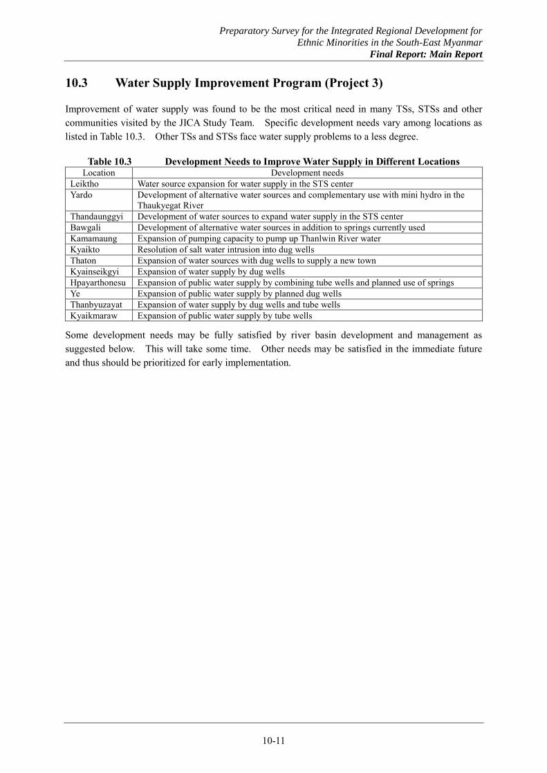
Preparatory Survey for the Integrated Regional Development for
Ethnic Minorities in the South-East Myanmar
Final Report: Main Report
10-11
10.3 Water Supply Improvement Program (Project 3)
Improvement of water supply was found to be the most critical need in many TSs, STSs and other communities visited by the JICA Study Team. Specific development needs vary among locations as listed in Table 10.3. Other TSs and STSs face water supply problems to a less degree.
Table 10.3 Development Needs to Improve Water Supply in Different Locations Location Development needs
Leiktho Water source expansion for water supply in the STS center Yardo Development of alternative water sources and complementary use with mini hydro in the
Thaukyegat River Thandaunggyi Development of water sources to expand water supply in the STS center Bawgali Development of alternative water sources in addition to springs currently used Kamamaung Expansion of pumping capacity to pump up Thanlwin River water Kyaikto Resolution of salt water intrusion into dug wells Thaton Expansion of water sources with dug wells to supply a new town Kyainseikgyi Expansion of water supply by dug wells Hpayarthonesu Expansion of public water supply by combining tube wells and planned use of springs Ye Expansion of public water supply by planned dug wells Thanbyuzayat Expansion of water supply by dug wells and tube wells Kyaikmaraw Expansion of public water supply by tube wells
Some development needs may be fully satisfied by river basin development and management as suggested below. This will take some time. Other needs may be satisfied in the immediate future and thus should be prioritized for early implementation.
Preparatory Survey for the Integrated Regional Development for
Ethnic Minorities in the South-East Myanmar
Final Report: Main Report
10-12
10.4 Mini Hydro Power Development Program (Project 4)
There exist many potential sites for hydro power development throughout the Southeast Myanmar. Larger potentials may be developed only after planning for river basin development and management as proposed above. Mini hydro power development may be undertaken without detailed studies to serve small communities respectively.
Possible sites identified include a tributary of Thaukyegat river to serve Yardo village, Yenbay river upstream to serve Shanywarthit, and a few sites to serve settlements for returnees. Also, MOEP has a plan to develop the Tharchay River with 25 MW to serve Paingkyon.

Preparatory Survey for the Integrated Regional Development for
Ethnic Minorities in the South-East Myanmar
Final Report: Main Report
10-13
10.5 Roads and Bridges Improvement Program
10.5.1 Artery and sub-artery roads strengthening project (Project 5.1)
Many road sections and bridges along artery and sub-artery roads identified by the initial study for improvement will be implemented to strengthen the artery road system of the Southeast Myanmar. They may be packaged by artery or sub-artery road, and a feasibility study may be conducted separately for each road, followed by detailed design. Implementation of these artery and sub-artery roads may be supported by concessional loans.
10.5.2 Access roads improvement project (Project 5.2)
Road sections and small bridges to serve the interior rural areas will be improved to ensure better access to artery and sub-artery roads for marketing of agricultural products as well as for daily use by residents. Some of them may be implemented by grant-in-aid assistance. Some others may be earmarked as subject road sections to be improved by the provision of road construction machinery and equipment by grant-in-aid.
10.5.3 Ethnic group areas access improvement project (Project 5.3)
For such areas that used to be dominated by armed ethnic groups but are now stable and planned to be developed by cooperation between the ethnic groups and the respective State Governments, access should be improved as the priority. Access improvement should be followed by improvement of water supply, power supply and provision of social facilities. The following road sections should be covered as a matter of urgency in association with respective ethnic groups:
(a) Theinseik – Laykay, about 34miles including new pavement of 20miles, in association with KNU;
(b) Ye – Joohaproud, about 37miles in association with NMSP; (c) Leiktho – Yardo, about 30miles in association with KNU; and (d) Kamamaung – Myainggyingu, improvement of ferry services with a new ship and landing
facilities, in association with KNU on the Kamamaung side and KNU and DKBA-BGF on the Myainggyingu side.
Preparatory Survey for the Integrated Regional Development for
Ethnic Minorities in the South-East Myanmar
Final Report: Main Report
10-14
10.6 Power Supply Network Expansion Program (Project 6)
Power supply has not been covered by the initial study, but projects identified by earlier studied have been reviewed and a project list is proposed. These projects will be evaluated for priority by the integrated regional development master planning, and high priority projects will be identified. They would be supported for implementation in steps.
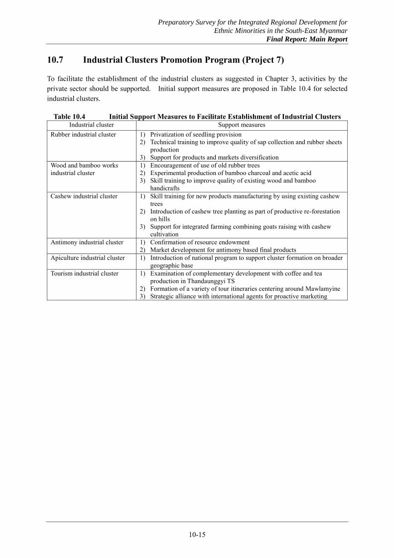
Preparatory Survey for the Integrated Regional Development for
Ethnic Minorities in the South-East Myanmar
Final Report: Main Report
10-15
10.7 Industrial Clusters Promotion Program (Project 7)
To facilitate the establishment of the industrial clusters as suggested in Chapter 3, activities by the private sector should be supported. Initial support measures are proposed in Table 10.4 for selected industrial clusters.
Table 10.4 Initial Support Measures to Facilitate Establishment of Industrial Clusters Industrial cluster Support measures
Rubber industrial cluster 1) Privatization of seedling provision 2) Technical training to improve quality of sap collection and rubber sheets
production 3) Support for products and markets diversification
Wood and bamboo works industrial cluster
1) Encouragement of use of old rubber trees 2) Experimental production of bamboo charcoal and acetic acid 3) Skill training to improve quality of existing wood and bamboo
handicrafts Cashew industrial cluster 1) Skill training for new products manufacturing by using existing cashew
trees 2) Introduction of cashew tree planting as part of productive re-forestation
on hills 3) Support for integrated farming combining goats raising with cashew
cultivation Antimony industrial cluster 1) Confirmation of resource endowment
2) Market development for antimony based final products Apiculture industrial cluster 1) Introduction of national program to support cluster formation on broader
geographic base Tourism industrial cluster 1) Examination of complementary development with coffee and tea
production in Thandaunggyi TS 2) Formation of a variety of tour itineraries centering around Mawlamyine 3) Strategic alliance with international agents for proactive marketing
Preparatory Survey for the Integrated Regional Development for
Ethnic Minorities in the South-East Myanmar
Final Report: Main Report
10-16
10.8 Industrial Estates Related Infrastructure Development (Project 8)
In the Southeast Myanmar, the Mawlamyine industrial estate has been operating, and the Hpaan and the Myawaddy industrial estates have also started operation partly. Further, new industrial estates are planned in Hpayarthonesu, Ye and Mawlamyine as well. Early supports are necessary for the Hpaan industrial estate and the Myawaddy industrial estate where transfer of factories existing in Maesot on the Thai side is expected.
In Myanmar, development of industrial estates is generally entrusted to developers, who develop respective sites and sell individual lots. Development of related infrastructure is not included in the developers’ contracts, and thus tends to be delayed. For the Hpaan industrial estate, jetties on the Thanlwin River and the access road need to be improved. For the Myawaddy industrial estate, power supply needs to be improved as a matter of urgency.
Preparatory Survey for the Integrated Regional Development for
Ethnic Minorities in the South-East Myanmar
Final Report: Main Report
10-17
10.9 Mixed and Integrated Farming Promotion Program (Project 9)
The Southeast Myanmar is not considered high priority agricultural region in the national context, and in particular, its comparative advantage for rice production is rather low. Still, the Southeast Myanmar as a whole has attained rice self-sufficiency, and production increase is possible to maintain the self-sufficiency even with the increasing population including returning refugees and IDPs in the foreseeable future.
A unique cropping pattern has been established in the Southeast Myanmar, adapting to the very large annual rainfall on the one hand and the distinct dry season on the other. A typical cropping cycle is production of paddy during the rainy season, followed by cultivation of field crops such as pulses and oil crops as second crops by utilizing residual soil moisture after the rainy season. To cope with the harsh climatic conditions, tree crops and livestock are comparatively more important to reduce the risk of flooding and droughts.
The Union Government policy to increase paddy production promotes a high input-high yield model, which may not be suitable to the climatic conditions in the Southeast Myanmar. As the Region has a distinct dry season with practically no precipitation despite the large annual rainfall, double cropping of paddy would require significant irrigation development, which may not be undertaken in the near future.
To increase the agricultural production under these situations, mixed farming combining paddy and field crops and integrated farming combining crop production and livestock are comparatively more important in the Southeast Myanmar. Such models of mixed and integrated farming should be established through ingenious experiments. It is considered an important issue for the regional development of the Southeast Myanmar to pursue alternative socio-economic activities, which are not resources-intensive but environment friendly.
To establish proper models of mixed and integrated farming suitable to the Southeast Myanmar through experiments, a technical cooperation implementation project may be undertaken. Technical issues to be addressed include diversification of second crops, partial introduction of farm mechanization, and small scale supplemental irrigation.
Preparatory Survey for the Integrated Regional Development for
Ethnic Minorities in the South-East Myanmar
Final Report: Main Report
10-18
10.10 Productive Re-forestation Program (Project 10)
In the Southeast Myanmar, there exist hills that have been cleared during the conflict and left unused, opened areas in reserve forests for rubber plantations and horticultural activities, areas cleared for settlement by slash and burn. These areas should be re-forested as a matter of urgency, and in principle, productive re-forestation should be undertaken by planting with fruit trees and cashew trees. Planting with rubber trees is not recommendable on slope land as rubber trees with shallow root zone tend to induce to top soil erosion.
Productive re-forestation would contribute to the return and settlement of refugees and IDPs. If the re-forestation is started immediately, the trees will grow to productive age during five years or so, when the return is accelerated and initial supports by the Government continues. The productive re-forestation should be undertaken by the Government, and once returnees settle, the management of re-forested areas should be entrusted to the returnees and mixed farming may be practiced there with tree crops to allow them to establish their economic activities.
The productive re-forestation may be first undertaken in the area along the road from Myawaddy to Wawlay and Sukali, and the area around the settlement sites in Hpayarthonesu. The former will contribute to the expansion of the existing settlement in Mithalemnyia, and the latter should be undertaken as part of Project 1.2 (1) described above.
Preparatory Survey for the Integrated Regional Development for
Ethnic Minorities in the South-East Myanmar
Final Report: Main Report
10-19
10.11 Social Development Model Project (Project 11)
It is important that the regional development of the Southeast Myanmar will benefit not only returnees but local people widely including the poor so that nobody will be left out of the development. To ensure this, model projects for social development will be formulated and implemented. For initial implementation, such areas in Kayin and Mon States will be selected that are considered to be relatively poverty stricken. To ensure success of the initial projects, however, so that the model implementation would be continued and expanded, areas having relatively better access should be selected.
As candidate areas for the model projects, Paingkyon STS in Kayin State and Bilin TS in Mon State are suggested. Paingkyon STS was affected by decades-long conflict, but some refugees have started to return. Common social facilities to be shared by both existing residents and returnees may be provided. The interior of Bilin TS used to be dominated by KNU, but is now stable for development jointly with the State Government. The access road will be improved by Project 5.2, but an area of relatively good access should be selected for the initial model project.
Each model project may cover school, clinic, community hall and other public facilities, water supply, power supply and other infrastructure facilities.
Preparatory Survey for the Integrated Regional Development for
Ethnic Minorities in the South-East Myanmar
Final Report: Main Report
10-20
10.12 Implementation Support for Integrated Regional Development Master Plan (Project 12)
Once the integrated regional development master plan is prepared, its implementation should be promoted and management of project implementation should be supported to realize the development as planned. Also the participatory approach to development that will be pilot implemented during the master planning should be institutionalized. Such a participatory mechanism should constitute part of the development administration complementing the State Government administration, and strengthen the local administration.
This new mechanism would substantiate the localization policy of the Union Government, and serve as a model for development planning and administration to other regions as well. These follow up activities may be undertaken by a technical cooperation implementation project.
Preparatory Survey for the Integrated Regional Development for
Ethnic Minorities in the South-East Myanmar
Final Report: Main Report
10-21
10.13 Feasibility Study of Kyaikkhami Regional Port Stage 1 (Project 13)
The Kyaikkhami regional port development project will be further examined by the forthcoming integrated regional development master planning (Project 1.3) and its stage wise development will be planned. This may be followed by a comprehensive feasibility study for the first stage development with environmental impact assessment during 2014-15. Depending on the results of the feasibility study, detailed design may be undertaken during 2016-18. Construction works for the first stage development may be undertaken during 2019-22 so that the port operation will start in 2023 as envisioned. This is considered the earliest possible case for the Kyaikkhami regional port development.
Preparatory Survey for the Integrated Regional Development for
Ethnic Minorities in the South-East Myanmar
Final Report: Main Report
10-22
10.14 River Basin Development and Management Master Plan (Project 14)
The Southeast Myanmar suffers from major floods during the rainy season, which disrupt access to many areas in the Thanlwin River and its tributary basins. Major river basins should be developed and managed starting from upper catchment areas to alleviate flooding and use rich water resources to improve living conditions.
Five river basins have been studied at a preliminary level by the initial study. These basins contain conflict affected areas, areas where multiple ethnic groups are active, a basin with a large dam planned, and border areas with Thailand. Early implementation of significant development is difficult, and careful planning should be undertaken first. Existing plans, on-going activities and intention of ethnic groups should be examined as part of the integrated regional development master planning, and priority for development should be assessed.
The river basins covered by the initial study are listed below together with related ethnic groups: (a) Megathat River, a tributary of the Zami River, for water supply, mini hydro power, and flood
mitigation in association with KNU; (b) Bilin River for water supply, hydro power development, irrigation and watershed management
in association with KNU; (c) Donthami River for water supply, mini hydro power, and watershed management in association
with KNU; (d) Ye River for water supply and mini hydro power in association with NMSP; and (e) Megala River, a tributary of the Moei River, for water supply, irrigation and mini hydro power
in association with DKBA-BGF.
Of these river basins, the Megathat River basin located in the upstream of the Zami River is expected to be a source of water supply to Hpayarthonesu, and its development and management would contribute to the improvement of road access in the downstream areas by alleviating floods of the Zami River. The Bilin River basin contains former conflict affected areas and a large dam is planned. A complete review of the existing plan will be necessary as the planned dam would necessitate a large number of people to be relocated. The Malaga River is a tributary of the Moei River on the border with Thailand, and therefore negotiation with the Thai side would be necessary for the development and management of the river basin.
Preparatory Survey for the Integrated Regional Development for
Ethnic Minorities in the South-East Myanmar
Final Report: Main Report
10-23
10.15 D/D of Hpayarthonesu – Thanbyuzayat Road (Project 15)
Following the F/S (Project 2), detailed design will be undertaken for the Hpayarthonesu – Thanbyuzayat road, to be followed by implementation with a concessional loan.

APPENDIX 1 PRELIMINARY DESIGN DRAWINGS AND
PRELIMINARY COST ESTIMATE FOR PRIMARY SCHOOL (5 CLASSROOMS)
A1-1
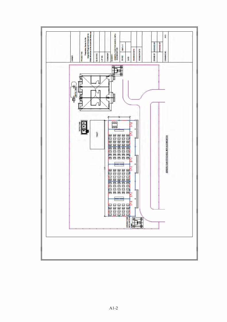
A1-2
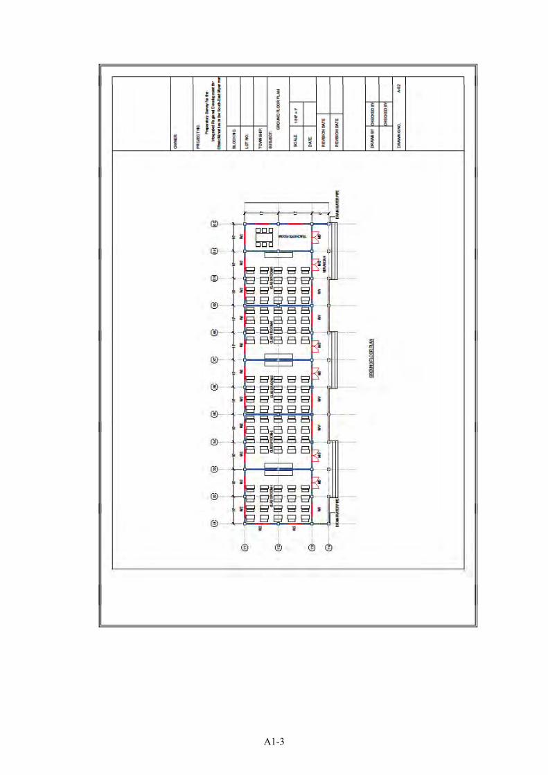
A1-3
A1-4
A1-5
A1-6
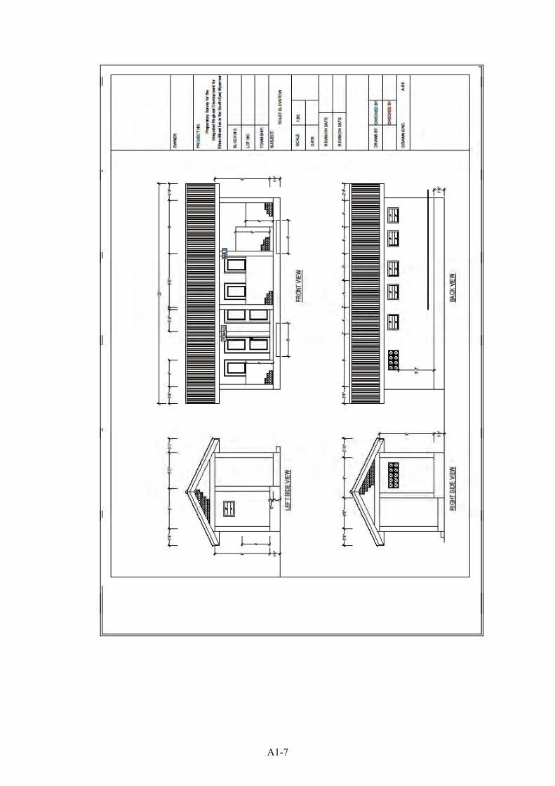
A1-7
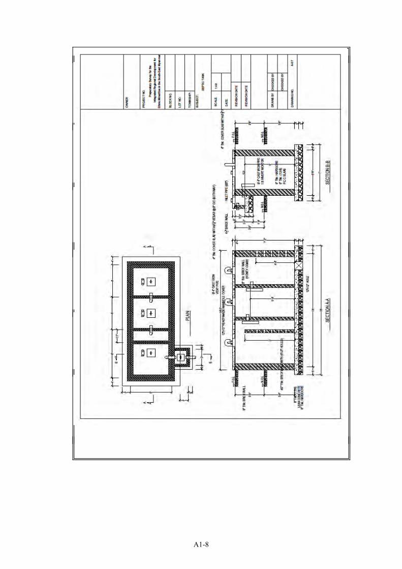
A1-8
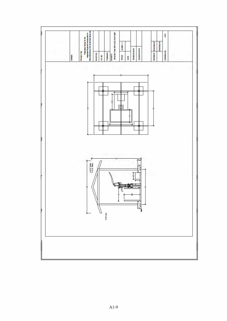
A1-9
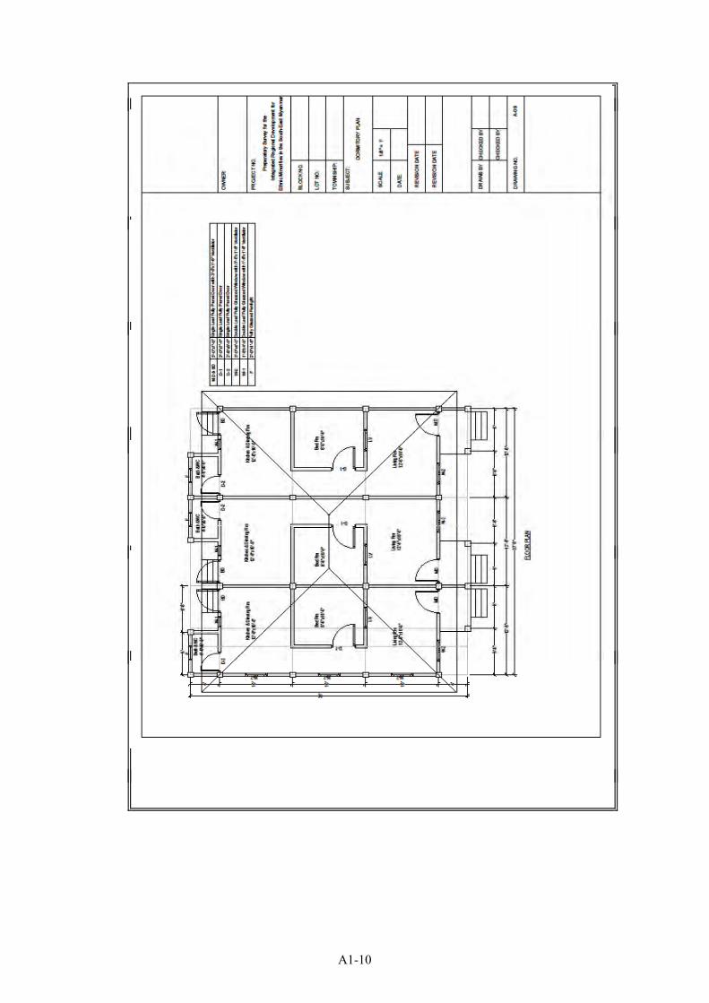
A1-10
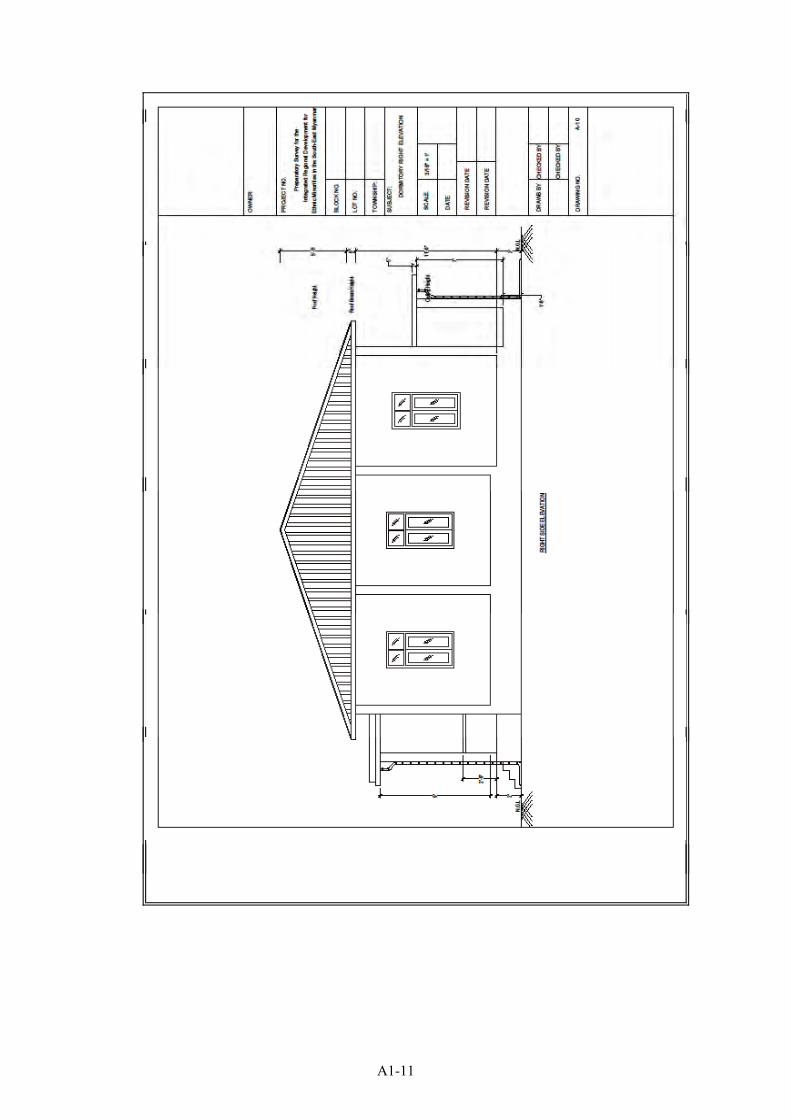
A1-11
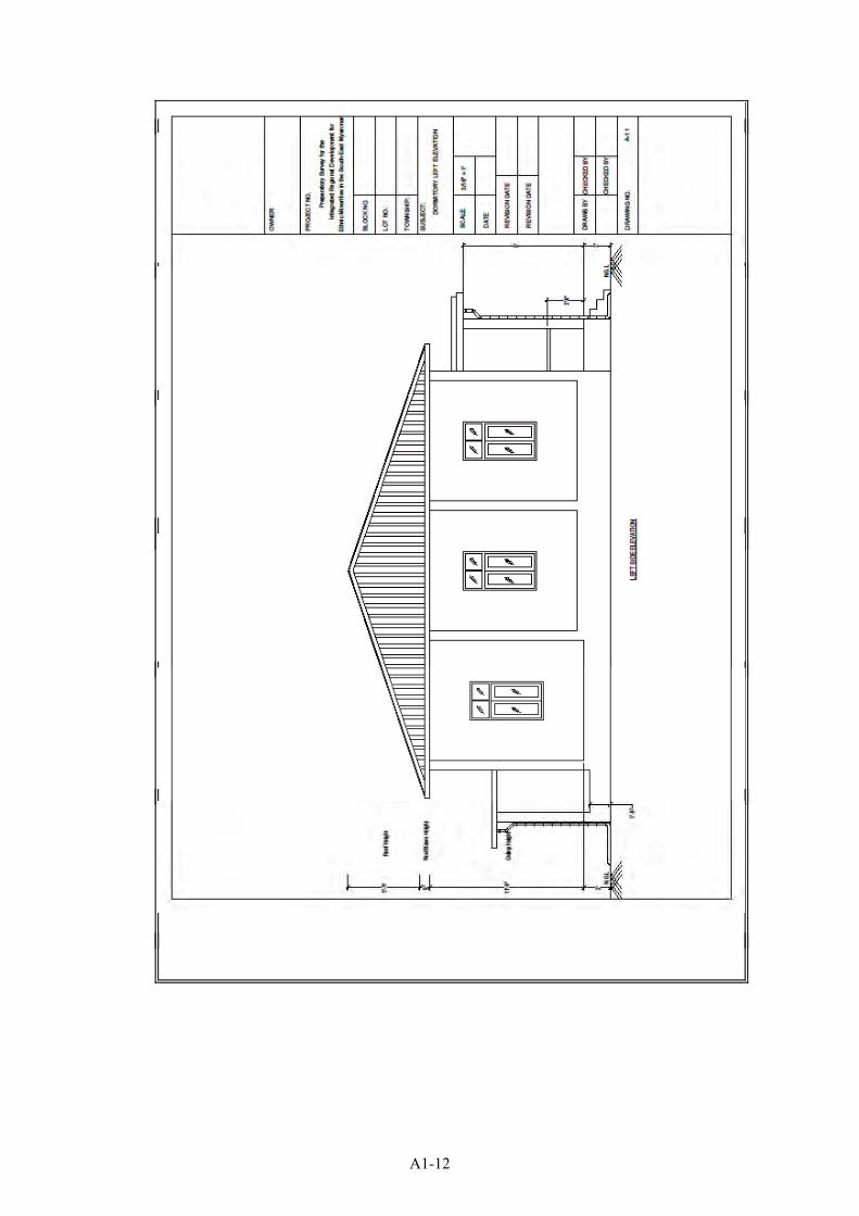
A1-12
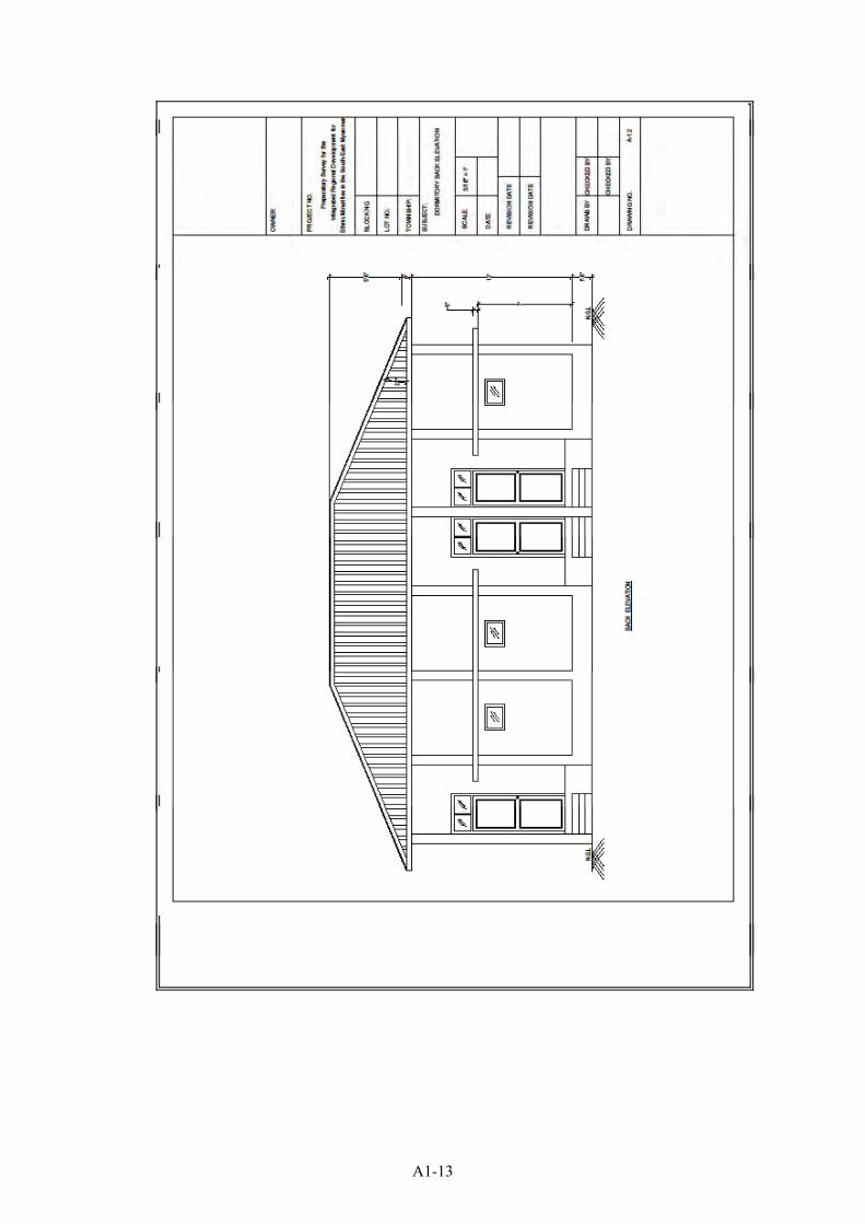
A1-13
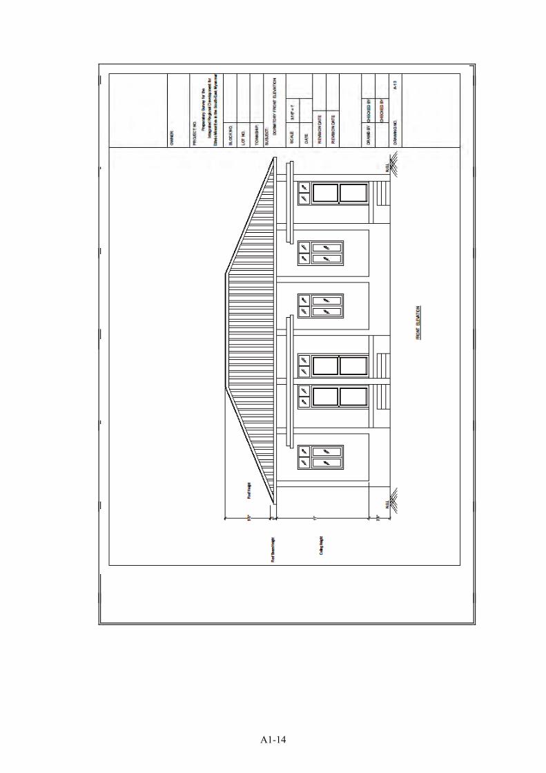
A1-14

A1-15
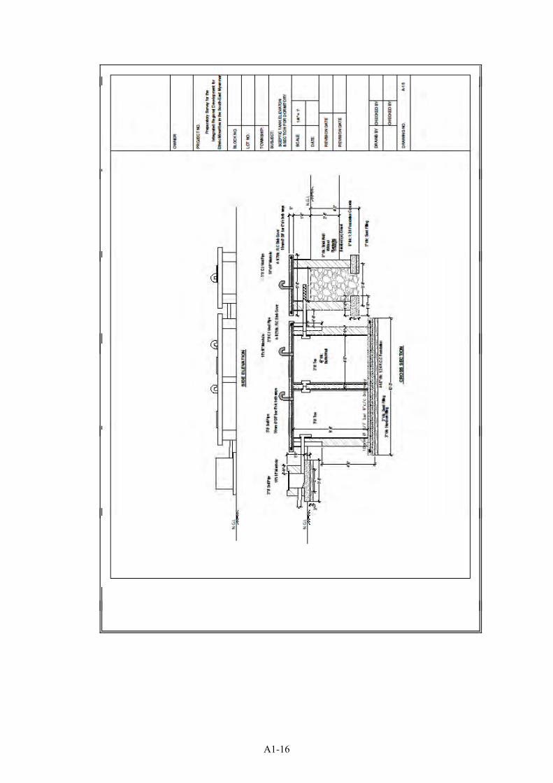
A1-16
Project Cost Summary for Primary School
DESCRIPTION COSTMain Building 60'X30' 47,127,262Main Building 50'X30' 40,241,014Furniture 8,152,234Stair 1,026,456Toilet 12,030,872Tube Well 9,741,813Ground Tank (1.5m3) 730,420Water Supply & Sanitation 773,103Taacher's Dormitry (3 rooms) 41,188,472Others 1,361,100
GRAND TOTAL 162,372,744
(5 Class Rooms with Teacher's Dormitry)
A1-17
Project Name:Project Location:Name of Work: Main Building 60'X30'
Sr. Particular Quantity Unit Rate Per AmountI. Materials1 1/2"x1/2" Beading 1000.00 Rft. 40 Rft. 40,0002 2"x12" Lx1/4" thick MS Bracket 45.00 Nos. 1,950 Nos. 87,7503 3 in diameter PVC pipe 180.60 Rft. 1,560 Rft. 281,7364 3" Elbow 12.00 Nos. 3,315 Nos. 39,7805 3"x2" Hardwood 1.93 Tons. 1,300,000 Tons. 2,509,0006 3" Pipe Bracket 60.20 Nos. 150 Nos. 9,0307 4-Angle Colour Sheet 1229.65 Rft. 1,100 Rft. 1,352,6158 5 Plywood 96.45 Shts. 9,200 Shts. 887,3409 5/8" dia.Bolt & Nut 90.00 Nos. 1,105 Nos. 99,450
10 5"x2" Hardwood 2.81 Tons. 1,300,000 Tons. 3,653,00011 5"x3" Hardwood 0.02 Tons. 1,300,000 Tons. 26,00012 6"x2" Hardwood 0.11 Tons. 1,300,000 Tons. 143,00013 8"x1" Hardwood 0.31 Tons. 1,300,000 Tons. 403,00014 Bamboo 120.00 Nos. 600 Nos. 72,00015 Binding Wire 108.56 Lbs. 350 Lbs. 37,99616 Brick 11269.22 Nos. 50 Nos. 563,46117 Brush 31.90 Nos. 1,000 Nos. 31,90018 Cement 583.94 Bags. 5,000 Bags. 2,919,70019 Chowket Bracket 200.00 Nos. 150 Nos. 30,00020 Coal Tar 5.00 Gals. 3,500 Gals. 17,50021 Coinyan 30.00 Viss 2,000 Viss 60,00022 Colour Sheet Ridge Cover 138.60 Rft. 1,150 Rft. 159,39023 Concrete Block(8"x8") 322.52 Nos. 1,235 Nos. 398,31224 Door Lock 3.00 Nos. 5,800 Nos. 17,40025 Emulsion Paint 86.62 Gals. 8,100 Gals. 701,62226 Enamel Paint 9.09 Gals. 10,000 Gals. 90,90027 Fuel 53.21 Gals. 3,900 Gals. 207,51928 Gasoline 8.29 Gals. 3,800 Gals. 31,50229 Glass 3mm 135.00 Sft. 850 Sft. 114,75030 Gravel 20.48 Suds. 70,000 Suds. 1,433,60031 Gutter Bracket 137.78 Nos. 350 Nos. 48,22332 Handle 14.00 Nos. 1,800 Nos. 25,20033 Hardcore 2.71 Suds. 30,000 Suds. 81,30034 Hinge 4" 60.00 Nos. 1,800 Nos. 108,00035 2"x2" Hard Wood 0.89 Rft. 1,300,000 Rft. 1,157,00036 Louver with Frame & Grass 131.25 Sft. 3,010 Sft. 394,99737 Primary Board (4' x 4') moisture proof 162.36 Shts. 9,500 Shts. 1,542,42038 Putty 10.21 Gals. 5,500 Gals. 56,15539 Ready made door 84.00 Sft. 5,800 Sft. 487,20040 Ready made guter 275.55 Rft. 700 Rft. 192,88541 Ready made window 128.00 Sft. 3,500 Sft. 448,00042 Rebar 16mm 2.67 Tons. 700,000 Tons. 1,869,00043 Rebar 12mm 1.58 Tons. 670,000 Tons. 1,058,60044 Rebar 10mm 0.72 Tons. 670,000 Tons. 482,40045 Rebar 6mm 0.45 Tons. 763,750 Tons. 343,68846 Paint Roller 57.75 Nos. 1,500 Nos. 86,62547 Roof Screw 2-1/2" 1778.13 Nos. 32 Nos. 56,90048 Sand 17.69 Suds. 7,000 Suds. 123,83049 Sand Paper 255.22 Nos. 250 Nos. 63,80550 Timber Soft wood 10.14 Tons. 400,000 Tons. 4,056,00051 Tower bolt 6" 22.00 Nos. 1,500 Nos. 33,00052 Wire Nail 181.11 Lbs. 701 Lbs. 127,012
Abstruct of Cost
A1-18
53 Wood Screw 3528.54 Nos. 20 Nos. 70,57154 X-met 2706.29 Rft. 58 Rft. 156,965
Material Cost 29,489,029Transportation Charge 3.00 % 884,671
Total Material Cost 30,373,700II. Labour Charge1 Carpenter 434.96 Psn. 7000 Psn. 3,044,7202 Mason 181.09 Psn. 7000 Psn. 1,267,6303 Operator 28.69 Psn. 5000 Psn. 143,4504 Painter 130.54 Psn. 7000 Psn. 913,7805 Piumber 5.00 Psn. 7000 Psn. 35,0006 Steel Fixer 81.42 Psn. 7000 Psn. 569,9407 Worker 1539.19 Psn. 5000 Psn. 7,695,950
Labor Cost 13,670,470Total Cost (Materials + Labours) 44,044,170
Supervision Charge 7.00 % 3,083,092Total Project Cost 47,127,262
A1-19
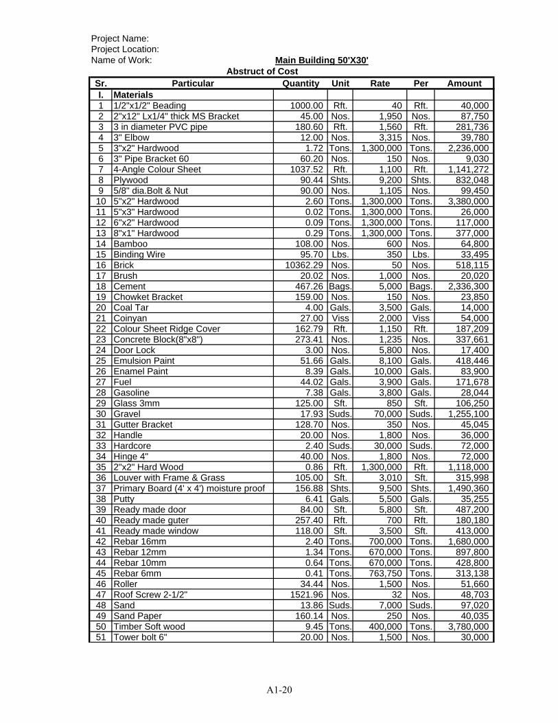
Project Name:Project Location:Name of Work: Main Building 50'X30'
Sr. Particular Quantity Unit Rate Per AmountI. Materials1 1/2"x1/2" Beading 1000.00 Rft. 40 Rft. 40,0002 2"x12" Lx1/4" thick MS Bracket 45.00 Nos. 1,950 Nos. 87,7503 3 in diameter PVC pipe 180.60 Rft. 1,560 Rft. 281,7364 3" Elbow 12.00 Nos. 3,315 Nos. 39,7805 3"x2" Hardwood 1.72 Tons. 1,300,000 Tons. 2,236,0006 3" Pipe Bracket 60 60.20 Nos. 150 Nos. 9,0307 4-Angle Colour Sheet 1037.52 Rft. 1,100 Rft. 1,141,2728 Plywood 90.44 Shts. 9,200 Shts. 832,0489 5/8" dia.Bolt & Nut 90.00 Nos. 1,105 Nos. 99,45010 5"x2" Hardwood 2.60 Tons. 1,300,000 Tons. 3,380,00011 5"x3" Hardwood 0.02 Tons. 1,300,000 Tons. 26,00012 6"x2" Hardwood 0.09 Tons. 1,300,000 Tons. 117,00013 8"x1" Hardwood 0.29 Tons. 1,300,000 Tons. 377,00014 Bamboo 108.00 Nos. 600 Nos. 64,80015 Binding Wire 95.70 Lbs. 350 Lbs. 33,49516 Brick 10362.29 Nos. 50 Nos. 518,11517 Brush 20.02 Nos. 1,000 Nos. 20,02018 Cement 467.26 Bags. 5,000 Bags. 2,336,30019 Chowket Bracket 159.00 Nos. 150 Nos. 23,85020 Coal Tar 4.00 Gals. 3,500 Gals. 14,00021 Coinyan 27.00 Viss 2,000 Viss 54,00022 Colour Sheet Ridge Cover 162.79 Rft. 1,150 Rft. 187,20923 Concrete Block(8"x8") 273.41 Nos. 1,235 Nos. 337,66124 Door Lock 3.00 Nos. 5,800 Nos. 17,40025 Emulsion Paint 51.66 Gals. 8,100 Gals. 418,44626 Enamel Paint 8.39 Gals. 10,000 Gals. 83,90027 Fuel 44.02 Gals. 3,900 Gals. 171,67828 Gasoline 7.38 Gals. 3,800 Gals. 28,04429 Glass 3mm 125.00 Sft. 850 Sft. 106,25030 Gravel 17.93 Suds. 70,000 Suds. 1,255,10031 Gutter Bracket 128.70 Nos. 350 Nos. 45,04532 Handle 20.00 Nos. 1,800 Nos. 36,00033 Hardcore 2.40 Suds. 30,000 Suds. 72,00034 Hinge 4" 40.00 Nos. 1,800 Nos. 72,00035 2"x2" Hard Wood 0.86 Rft. 1,300,000 Rft. 1,118,00036 Louver with Frame & Grass 105.00 Sft. 3,010 Sft. 315,99837 Primary Board (4' x 4') moisture proof 156.88 Shts. 9,500 Shts. 1,490,36038 Putty 6.41 Gals. 5,500 Gals. 35,25539 Ready made door 84.00 Sft. 5,800 Sft. 487,20040 Ready made guter 257.40 Rft. 700 Rft. 180,18041 Ready made window 118.00 Sft. 3,500 Sft. 413,00042 Rebar 16mm 2.40 Tons. 700,000 Tons. 1,680,00043 Rebar 12mm 1.34 Tons. 670,000 Tons. 897,80044 Rebar 10mm 0.64 Tons. 670,000 Tons. 428,80045 Rebar 6mm 0.41 Tons. 763,750 Tons. 313,13846 Roller 34.44 Nos. 1,500 Nos. 51,66047 Roof Screw 2-1/2" 1521.96 Nos. 32 Nos. 48,70348 Sand 13.86 Suds. 7,000 Suds. 97,02049 Sand Paper 160.14 Nos. 250 Nos. 40,03550 Timber Soft wood 9.45 Tons. 400,000 Tons. 3,780,00051 Tower bolt 6" 20.00 Nos. 1,500 Nos. 30,000
Abstruct of Cost
A1-20
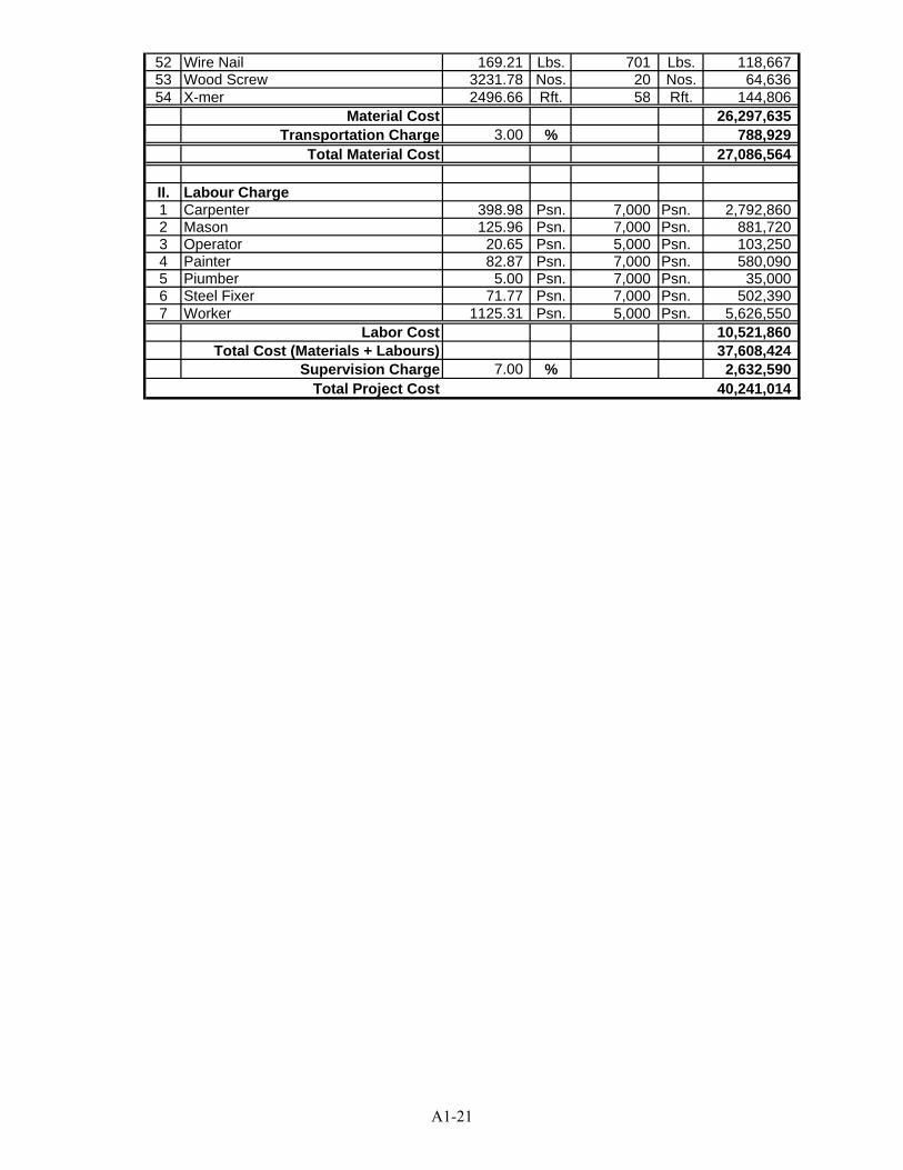
52 Wire Nail 169.21 Lbs. 701 Lbs. 118,66753 Wood Screw 3231.78 Nos. 20 Nos. 64,63654 X-mer 2496.66 Rft. 58 Rft. 144,806
Material Cost 26,297,635Transportation Charge 3.00 % 788,929
Total Material Cost 27,086,564
II. Labour Charge1 Carpenter 398.98 Psn. 7,000 Psn. 2,792,8602 Mason 125.96 Psn. 7,000 Psn. 881,7203 Operator 20.65 Psn. 5,000 Psn. 103,2504 Painter 82.87 Psn. 7,000 Psn. 580,0905 Piumber 5.00 Psn. 7,000 Psn. 35,0006 Steel Fixer 71.77 Psn. 7,000 Psn. 502,3907 Worker 1125.31 Psn. 5,000 Psn. 5,626,550
Labor Cost 10,521,860Total Cost (Materials + Labours) 37,608,424
Supervision Charge 7.00 % 2,632,590Total Project Cost 40,241,014
A1-21
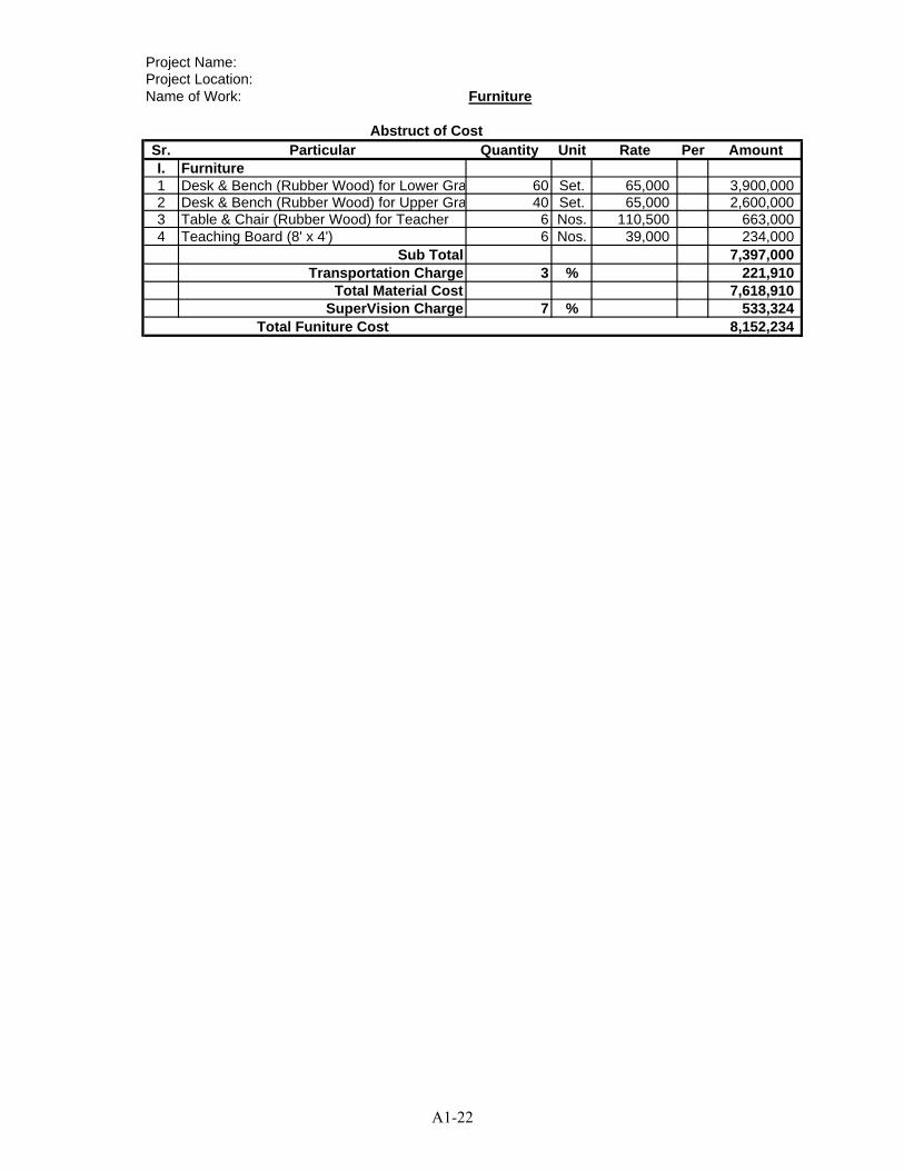
Project Name:Project Location:Name of Work: Furniture
Sr. Particular Quantity Unit Rate Per AmountI. Furniture1 Desk & Bench (Rubber Wood) for Lower Gra 60 Set. 65,000 3,900,0002 Desk & Bench (Rubber Wood) for Upper Gra 40 Set. 65,000 2,600,0003 Table & Chair (Rubber Wood) for Teacher 6 Nos. 110,500 663,0004 Teaching Board (8' x 4') 6 Nos. 39,000 234,000
Sub Total 7,397,000Transportation Charge 3 % 221,910
Total Material Cost 7,618,910SuperVision Charge 7 % 533,324
Total Funiture Cost 8,152,234
Abstruct of Cost
A1-22
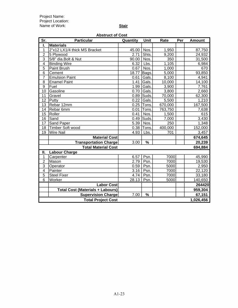
Project Name:Project Location:Name of Work: Stair
Sr. Particular Quantity Unit Rate Per AmountI. Materials1 2"x12 LX1/4 thick MS Bracket 45.00 Nos. 1,950 87,7502 5 Plywood 2.71 Shts. 9,200 24,9323 5/8" dia.Bolt & Nut 90.00 Nos. 350 31,5004 Binding Wire 6.32 Lbs. 1,105 6,9845 Paint Brush 0.67 Nos. 1,000 6706 Cement 18.77 Bags. 5,000 93,8507 Emulsion Paint 0.61 Gals. 8,100 4,9418 Enamel Paint 1.41 Gals. 10,000 14,1009 Fuel 1.99 Gals. 3,900 7,761
10 Gasoline 0.70 Gals. 3,800 2,66011 Gravel 0.89 Suds. 70,000 62,30012 Putty 0.22 Gals. 5,500 1,21013 Rebar 12mm 0.25 Tons. 670,000 167,50014 Rebar 6mm 0.01 Tons. 763,750 7,63815 Roller 0.41 Nos. 1,500 61516 Sand 0.49 Suds. 7,000 3,43017 Sand Paper 5.39 Nos. 250 1,34818 Timber Soft wood 0.38 Tons. 400,000 152,00019 Wire Nail 4.93 Lbs. 701 3,457
Material Cost 674,645Transportation Charge 3.00 % 20,239
Total Material Cost 694,884II. Labour Charge1 Carpenter 6.57 Psn. 7000 45,9902 Mason 2.79 Psn. 7000 19,5303 Operator 0.59 Psn. 5000 2,9504 Painter 3.16 Psn. 7000 22,1205 Steel Fixer 4.74 Psn. 7000 33,1806 Worker 28.13 Psn. 5000 140,650
Labor Cost 264420Total Cost (Materials + Labours) 959,304
Supervision Charge 7.00 % 67,151Total Project Cost 1,026,456
Abstruct of Cost
A1-23
Project Name:Project Location:Name of Work: Toilet
Sr. Particular Quantity Unit Rate Per AmountI. Materials1 1/2"x1/2" Beading 416.00 Rft. 40 Rft. 16,6402 Rebar 6.5mm 0.11 Tons. 763,750 Tons. 84,0133 Rebar 10mm 0.07 Tons. 670,000 Tons. 46,9004 Rebar 16mm 0.13 Tons. 700,000 Tons. 91,0005 Rebar 12mm 0.34 Tons. 670,000 Tons. 227,8006 4" Butthinge 12 Nos. 504 Nos. 6,0537 5” Buthinge 30 Nos. 530 Nos. 15,9128 Glass 3mm 18.00 Sft. 850 Sft. 15,3009 2"x2" Hardwood 0.207 Tons. 1,300,000 Tons. 269,10010 3"x2" Hardwood 0.265 Tons. 1,300,000 Tons. 344,50011 4"x2" Hardwood 0.221 Tons. 1,300,000 Tons. 287,30012 5"x2" Hardwood 0.383 Tons. 1,300,000 Tons. 497,90013 8"x1" Hardwood 0.136 Tons. 1,300,000 Tons. 176,80014 Gravel (Aggregate) 3.72 Suds. 70,000 Suds. 260,40015 Bamboo 196.00 Nos. 600 Nos. 117,60016 Binding Wire 13.00 Lbs. 350 Lbs. 4,55017 Bolt & Nut 143.00 Nos. 464 Nos. 66,36618 Bracket (1.5) 16.00 Nos. 1,000 Nos. 16,00019 Brick 11980.00 Nos. 50 Nos. 599,00020 Ceiling Sheet (4'x4') 40.00 Shts. 7,956 Shts. 318,24021 Cement 233.00 Bags. 5,000 Bags. 1,165,00022 Chowket 166.00 Rft. 1,923 Rft. 319,16823 Chowket Bracket 166.00 Nos. 1,000 Nos. 166,00024 Coal Tar 2.00 Tin 3,500 Tin 7,00025 Coinyan 11.00 Viss 2,000 Viss 22,00026 Colour Sheet Ridge Cover 36.00 Rft. 1,150 Rft. 41,40027 Colour Sheet Ridge Cover 285.00 Rft. 1,250 Rft. 356,25028 Door Leaf 73.00 Sft. 4,243 Sft. 309,75429 Earlain 48.00 Nos. 66 Nos. 3,18230 Emulsion Paint 12.00 Gals. 8,100 Gals. 97,20031 Enamel Paint 3.00 Gals. 10,000 Gals. 30,00032 Fuel 9.00 Gals. 3,900 Gals. 35,10033 Glass Beading 90 Rft. 20 Rft. 1,75534 Handle 6.00 Nos. 1,800 Nos. 10,80035 Hook & Eye 12 Nos. 663 Nos. 7,95636 Redoxide 3 Gals. 15,912 Gals. 47,73637 Nails & Spikes 10 Viss 3,315 Viss 33,15038 Plastic Sheet (6' wide) 47 Rft. 3 Rft. 12239 Putty 2.00 Gals. 5,500 Gals. 11,00040 Paint Roller 8.00 Nos. 1,500 Nos. 12,00041 Roof Screw 2-1/2" 240.00 Nos. 32 Nos. 7,68042 Sand 9.56 Suds. 7,000 Suds. 66,92043 Sand Paper 5.00 Doz 250 Doz 1,25044 Silicon 3.00 Tin 3,381 Tin 10,14445 Silicon Gun 1.00 Nos. 1,989 Nos. 1,98946 5 Plywood 12.00 Shts. 9,200 Shts. 110,40047 4" φP.V.C Pipe (8.5) 2.00 Nos. 46,410 Nos. 92,82048 1" φP.V.C Pipe (8.5) 2.00 Nos. 3,845 Nos. 7,69149 IWC 5.00 Nos. 17,238 Nos. 86,19050 4" Pipe Bracket 11.00 Nos. 150 Nos. 1,650
Abstruct of Cost
A1-24
51 4" φP.V.C elbow 90 (8.5)Pipe (8.5) 2.00 Nos. 4,906 Nos. 9,81252 4" φP.V.C Tee (8.5) 3.00 Nos. 5,039 Nos. 15,11653 4"-2" φP.V.C Tee) 2.00 Nos. 11,934 Nos. 23,86854 4"-2" φP.V.C Y-Tee 2.00 Nos. 13,260 Nos. 26,52055 2" φP.V.C Pipe (8.5) 1.00 Nos. 5,967 Nos. 5,96756 2" Pipe Bracket 6.00 Nos. 56 Nos. 33557 Seal Tape 10 Coil 26 Coil 26058 Concrete Nail 101 Nos. 13 Nos. 1,31359 1" Pipe Bracket (Saddle) 23 Nos. 100 Nos. 2,30260 1" φP.V.C elbow 90 15 Nos. 265 Nos. 3,97861 1" φP.V.C Tee 6 Nos. 398 Nos. 2,38762 1" φP.V.C Socket 3 Nos. 199 Nos. 59763 3/4" φ Water Tap 6 Nos. 2,122 Nos. 12,73064 Timber Scantling 1.02 Tons. 477,360 Tons 486,90765 Tower Bolt 12 Nos. 1,061 Nos. 12,73066 U Clip 16 Nos. 1,061 Nos. 16,97367 X-met 1091 Rft. 58 Rft. 63,27868 Mixer 2 Day 30,000 Day 60,00069 Vibrator 1 Day 35,000 Day 35,00070 Wood Screw 1015.00 Nos. 20 Nos. 20,300
Material Cost 7,325,054Transportation Charge 3.00 % 219,752
Total Material Cost 7,544,806II. Labour Charge1 Carpenter 101.00 Psn. 7,000 Psn. 707,0002 Mason 89.00 Psn. 7,000 Psn. 623,0003 Operator 2.00 Psn. 5,000 Psn. 10,0004 Painter 49.00 Psn. 7,000 Psn. 343,0005 Smith 13.00 Psn. 7,000 Psn. 91,0006 Worker 385.00 Psn. 5,000 Psn. 1,925,0007 Piumber 18.00 Psn. 7,000 Psn. 126,000
Labor Cost 3,699,000Total Cost (Materials + Labours) 11,243,806
Supervision Charge 7.00 % 787,066Total Project Cost 12,030,872
A1-25

Project Name:Project Location:Name of Work: Tube Well
Sr. Particular Quantity Unit Rate Per Amount1 Driring
Driring of 10' dia Hole 60.00 m 22,572 1,354,320
2 Instaration of casing pipeLowering of 4" PVC Pipes and scree 10.00 1x6m 2,160 21,600Gravel Packing 10.00 m 1,080 10,800Bentonite ceiling 50.00 m 2,160 108,000Making and Fixing of Tube well 0.00 no 6,480 0Pilnth for tube well nead 0.00 LS 5,400 0
3 Well developing , Pumping out 24hHiring of compressor 3.00 day 41,040 123,120Operatrion cost 12.00 hour 11,880 142,560
4 Water Quality TestOne 4" well 1.00 no 17,280 17,280
5 Pumping Test noFitting for pumping test 0.00 day 23,760 0Hiring of submersible pump 0.00 LS 23,760 0Pumping and Recovery test for 14 h 0.00 set 162,000 0
6 Instalation of Suction Pump 1.00 LS 88,560 88,560
7 Transportation charge 1.00 LS 291,600 291,600
8 MaterialsM1 4"dia PVCpipe 10.00 1x6m 100,429 1,004,292M2 4"dia PVC faucet socket & valve 2.00 set 5,400 10,800M3 4"GI Pipe 2.00 no 194,940 389,880M4 4" dia GI socket 2.00 no 9,720 19,440M5 Glue 1.00 tin 2,160 2,160M6 Rivet 1.00 pack 8,640 8,640M7 4" Screen 1.00 1x6m 400,000 400,000M8 Adapter for Screen 1.00 no 9,720 9,720M9 Hand Pump 1.00 unit 700,000 700,000M10 2" dia GI Pipe 1.00 no 40,014 40,014M11 2" dia GI Socket 1.00 no 1,080 1,080M12 River shingle 1.00 sud 106,628 106,628M13 Bentnite 3.00 bag 6,804 20,412
Total Cost 4,870,906
Abstruct of Cost
A1-26

Project Name:Project Location:Name of Work: Ground Tank (1.5m3)
Sr. Particular Quantity Unit Rate Per AmountI. Material Charge1 1-1/2" dia Ms Pipe (1' length) 1.00 Nos 5,200 5,2002 1-1/2" dia PVC Gate Valbe 1.00 Nos 3,250 3,2503 Brick 470.00 Nos 50 23,5004 Cement 12.70 Bag 5,000 63,5005 Fuel 1.33 Gal 3,800 5,0546 Sand 0.72 Sud 15,000 10,8007 Broken Brick 0.38 Sud 47,775 18,1558 River Shingle 0.34 Sud 88,725 30,1679 Mixer 0.78 Day 30,000 23,400
10 X-Met 98.00 Rft 58 5,68411 3/8" DF Bar 0.08 Ton 670,000 53,60012 Binding Wire 1.58 Lb 350 553
Material Cost 242,862Transportation Charge 3 % 7,286
Total Material Cost 250,148
II. Labour Charge1 Machine Driver 0.50 Psn 5,000 2,5002 Mason 4.81 Psn 7,000 33,6703 Worker 11.00 Psn 5,000 55,000
Labour Cost 91,170Total Cost ( Material + Labour) 341,318
SuperVvsion Charge 7 % 23,892Total Project Cost 365,210
Abstruct of Cost
A1-27
Project Name:Project Location:Name of Work: Water Supply & Sanitation
Sr. Particular Quantity Unit Rate Per AmountI. Materials1 3/4" φP.V.C Pipe (13.5) 3.0 Nos. 4,680 14,0402 1" φP.V.C Pipe (13.6) 5.0 Nos. 7,410 37,0503 1 1/4" φP.V.C Pipe (13.7) 4.0 Nos. 9,620 38,4804 2" φP.V.C Pipe (13.8) 1.0 Nos. 19,110 19,1105 3" φP.V.C Pipe (13.9) 2.0 Nos. 35,750 71,5006 4" φP.V.C Pipe (13.10) 2.0 Nos. 27,755 55,5107 1/2" G.I Tee 2.0 Nos. 208 4168 3/4" Tee 3.0 Nos. 273 8199 1"X 3/4"Tee 6.0 Nos. 637 3,822
10 4" G.I Tee 4.0 Nos. 13,780 55,12011 4" Cross Tee 1.0 Nos. 18,850 18,85012 3/4" Elbow 10.0 Nos. 1,950 19,50013 1" X 3/4 Elbow 1.0 Nos. 494 49414 3/4" Elbow 6.0 Nos. 195 1,17015 1" Elbow 11.0 Nos. 358 3,93316 1 1/4" Elbow 10.0 Nos. 605 6,04517 4" φElbow 6.0 Nos. 5,915 35,49018 3" φElbow1”Cap Plug 5.0 Nos. 3,315 16,57519 1" Cap Plag 1.0 Nos. 273 27320 1" φP.V.C Ball Valve 2.0 Nos. 2,600 5,20021 1/2”X3/4" Nipple 5.0 Nos. 1,105 5,52522 1/2" Nipple 5.0 Nos. 130 65023 1"R.C Nail 12.0 Doz. 455 5,46024 2" Strainer 2.0 Nos. 2,600 5,20025 3/4" P.V.C Tap 5.0 Nos. 650 3,25026 4" Pipe Cap 1.0 Nos. 4,550 4,55027 4" Saddle 12.0 Nos. 260 3,12028 3" Saddle 3.0 Nos. 234 70229 2" φP.V.C Socket 5.0 Nos. 754 3,77030 3" φP.V.C Valve Socket 15.0 Nos. 715 10,72531 2"X1/4" Socket 2.0 Nos. 780 1,56032 4"X2" Socket 1.0 Nos. 3,705 3,70533 OCI Glue (500gm) 1.0 Tin 3,900 3,90034 Seal Tape 10.0 Nos. 325 3,25035 Hand-Pumped Tube-Well 0.0 Set 520,000 0
Material Cost 458,764Transportation Charge 3 % 13762.905
Total Material Cost 472,526
II. Labour Charge1 Piumber 25 Psn. 7000 175,0002 Worker 15 Psn. 5000 75,000
Labor Cost 250,000Total Cost (Materials + Labours) 722,526
Supervision Charge 7 % 50,577Total Project Cost 773,103
Abstruct of Cost
A1-28
Project Name:Project Location:Name of Work: Teacher's Dormitry (3 rooms)
Sr. Particular Quantity Unit Rate Per AmountI. Materials1 1/2"x1/2" Glass Beading 504.0 Rft. 60 Rft. 30,2402 2"x12" Lx1/4" thick MS Bracket 148.0 Nos. 840 Nos. 124,3203 5"x1/4"x18" ms flat 30.0 Rft. 2,835 Rft. 85,0504 1/4" M.S Join between rafter & purlin 357.0 Nos. 63 Nos. 22,4915 5/8" dia. Bolt & Nut 120.0 Tons. 630 Tons. 75,6006 3"x2" Hardwood 1.3 Nos. 1,155,000 Nos. 1,466,3587 4-Angle Colour Roofing Sheet 1163.0 Rft. 1,365 Rft. 1,587,5538 5 Plywood 86.1 Shts. 10,500 Shts. 903,7229 5/8" dia. Bolt & Nut 100.0 Nos. 525 Nos. 52,50010 5"x2" Chowket 362.5 Tons. 1,900 Tons. 688,75011 Hardwood 2.1 Tons. 860,000 Tons. 1,832,84312 Bamboo 69.3 Tons. 550 Tons. 38,11513 Binding Wire 84.0 Tons. 578 Tons. 48,51914 Brick 27270.5 Nos. 89 Nos. 2,433,89215 Cement 683.1 Lbs. 6,510 Lbs. 4,446,71116 Chowket Bracket 204.0 Nos. 158 Nos. 32,13017 Coal Tar 5.0 Nos. 3,675 Nos. 18,37518 Coinyan 17.3 Bags. 1,470 Bags. 25,46819 Colour Sheet Ridge Covering 60.5 Nos. 1,103 Nos. 66,70120 Door Lock 12.0 Gals. 5,250 Gals. 63,00021 Emulsion Paint (UPG) 140.0 Viss 6,300 Viss 881,83122 Enamel Paint (UPG) 7.8 Rft. 11,340 Rft. 88,14023 Diesel 54.3 Nos. 3,990 Nos. 216,51224 Gasoline 12.1 Nos. 4,200 Nos. 50,74925 Glass 5mm 184.1 Gals. 840 Gals. 154,63026 Gravel 16.8 Gals. 30,000 Gals. 503,59427 Gutter Bracket 60.5 Gals. 473 Gals. 28,58628 Door & Window Handle (6") 39.0 Gals. 788 Gals. 30,71329 Hardcore 4.0 Sft. 25,000 Sft. 100,00030 4" Butt Hinge 117.0 Suds. 368 Suds. 42,99831 Primer Board (4'x4') moisture proof 30.5 Nos. 5,775 Nos. 176,22832 Plastic sheet 644.4 Nos. 263 Nos. 169,16533 Putty 15.8 Suds. 4,200 Suds. 66,19034 Ready made door 201.9 Nos. 3,675 Nos. 742,04435 Sliding Bolt 3.0 Rft. 3,150 Rft. 9,45036 Hook & eye 39.0 Sft. 420 Sft. 16,38037 Ready made gutter 121.0 Shts. 525 Shts. 63,52538 16 mm Ø M.S DF Bar 1.3 Gals. 510,000 Gals. 679,20839 10 mm Ø M.S DF Bar 0.9 Sft. 560,000 Sft. 518,90140 12 mm Ø M.S DF Bar 1.7 Rft. 530,000 Rft. 899,62341 6 mm Ø M.S Plain Bar 0.2 Sft. 630,000 Sft. 154,33842 Paint Roller 56.0 Tons. 1,155 Tons. 64,66843 Roof Screw 2-1/2" 1611.2 Tons. 34 Tons. 54,13744 Sand 19.5 Tons. 15,000 Tons. 292,31245 Sand paper 394.0 Tons. 189 Tons. 74,464
Abstruct of Cost
A1-29
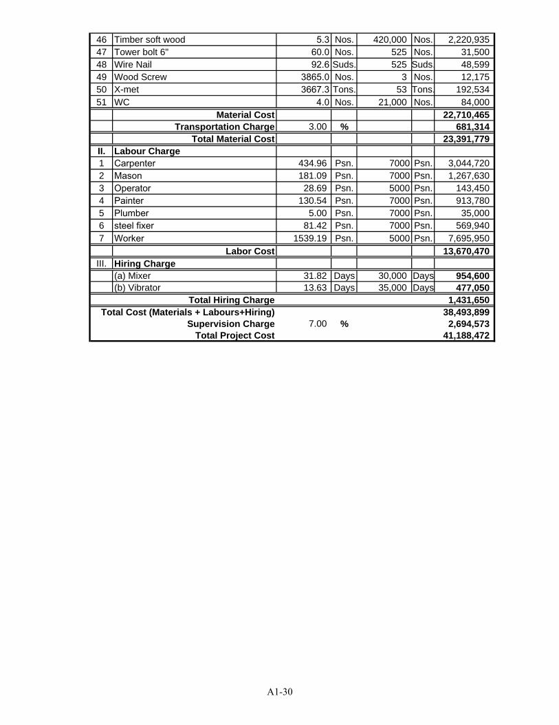
46 Timber soft wood 5.3 Nos. 420,000 Nos. 2,220,93547 Tower bolt 6" 60.0 Nos. 525 Nos. 31,50048 Wire Nail 92.6 Suds. 525 Suds. 48,59949 Wood Screw 3865.0 Nos. 3 Nos. 12,17550 X-met 3667.3 Tons. 53 Tons. 192,53451 WC 4.0 Nos. 21,000 Nos. 84,000
Material Cost 22,710,465Transportation Charge 3.00 % 681,314
Total Material Cost 23,391,779II. Labour Charge1 Carpenter 434.96 Psn. 7000 Psn. 3,044,7202 Mason 181.09 Psn. 7000 Psn. 1,267,6303 Operator 28.69 Psn. 5000 Psn. 143,4504 Painter 130.54 Psn. 7000 Psn. 913,7805 Plumber 5.00 Psn. 7000 Psn. 35,0006 steel fixer 81.42 Psn. 7000 Psn. 569,9407 Worker 1539.19 Psn. 5000 Psn. 7,695,950
Labor Cost 13,670,470III. Hiring Charge
(a) Mixer 31.82 Days 30,000 Days 954,600(b) Vibrator 13.63 Days 35,000 Days 477,050
Total Hiring Charge 1,431,650Total Cost (Materials + Labours+Hiring) 38,493,899
Supervision Charge 7.00 % 2,694,573Total Project Cost 41,188,472
A1-30
Project Name:Project Location:Name of Work: Others
Sr. Particular Quantity Unit Rate Per AmountI. Hiring Charge
(a) Mixer 2.14 Month 390,000 834,600(b) Vibrator 0.70 Month 195,000 136,500
II. Electrical Work for Site Use 1.00 Lot. 130,000 130,000III. Watersupply for Site Use 1.00 Lot. 130,000 130,000IV. Site Office & Warehouse 1.00 Lot. 130,000 130,000
Total Cost 1,361,100
Abstruct of Cost
A1-31

APPENDIX 2 PRELIMINARY DESIGN DRAWINGS AND
PRELIMINARY COST ESTIMATE FOR PRIMARY SCHOOL (3 CLASSROOMS)
A2-1
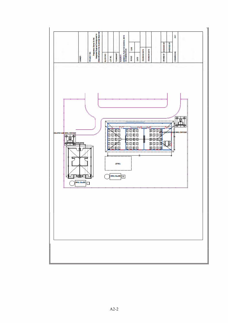
A2-2
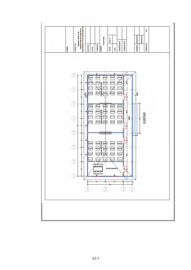
A2-3
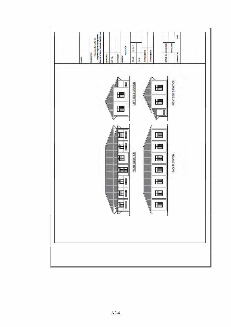
A2-4
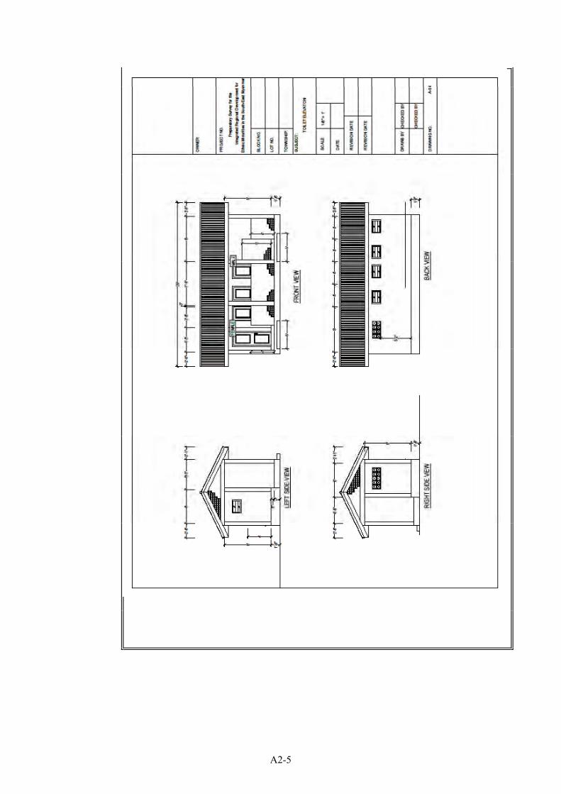
A2-5
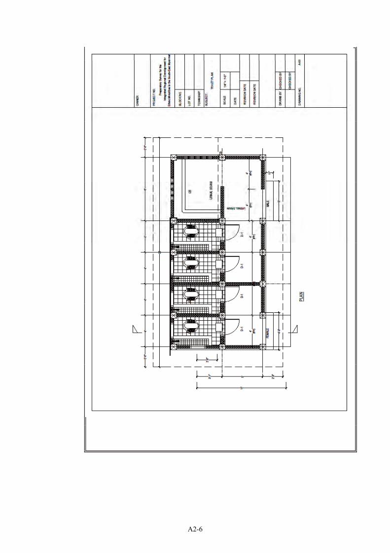
A2-6
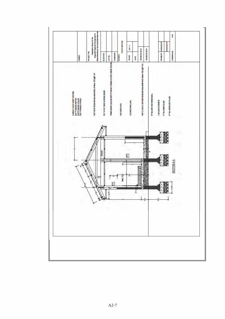
A2-7
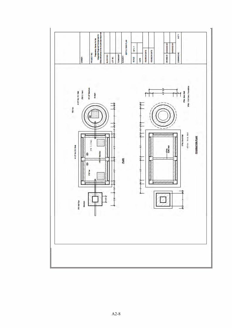
A2-8
A2-9
A2-10

A2-11
A2-12
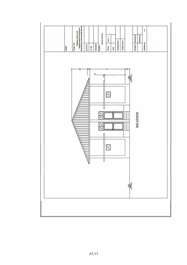
A2-13
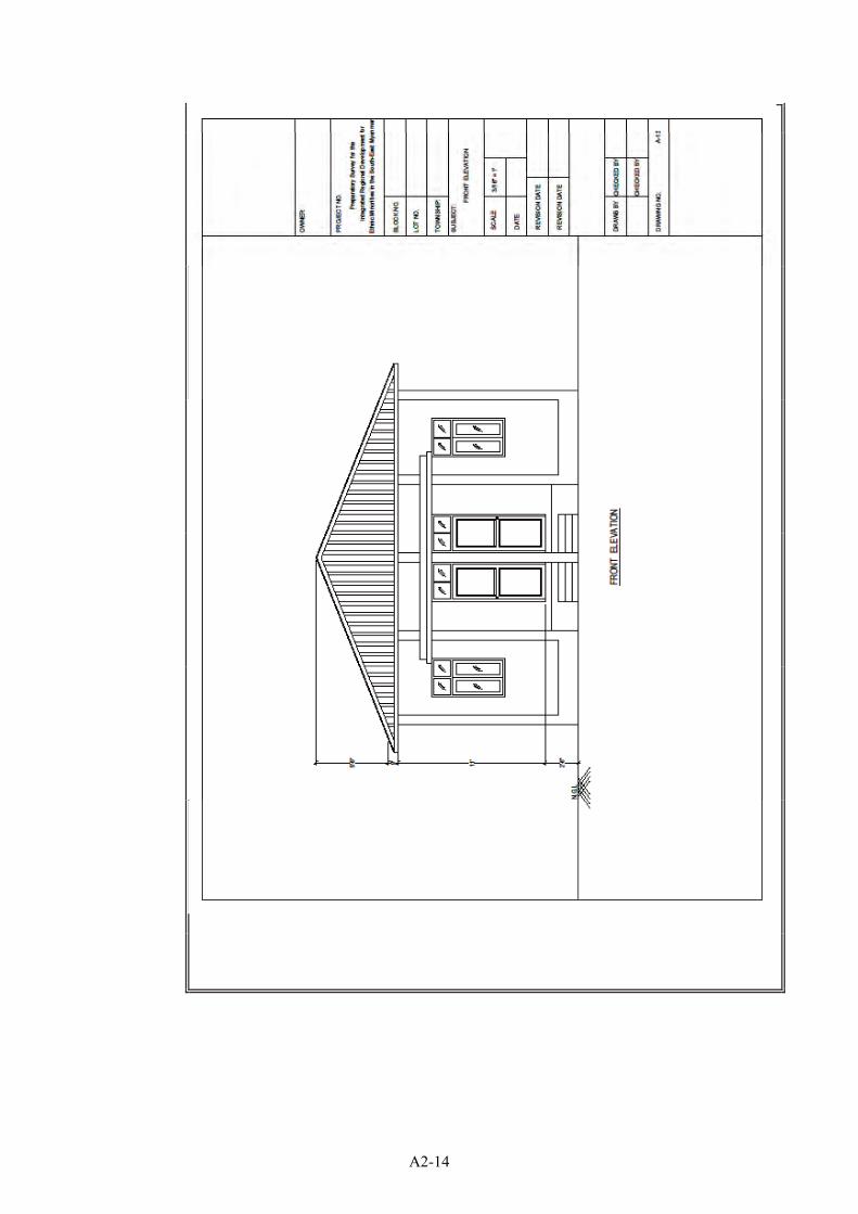
A2-14
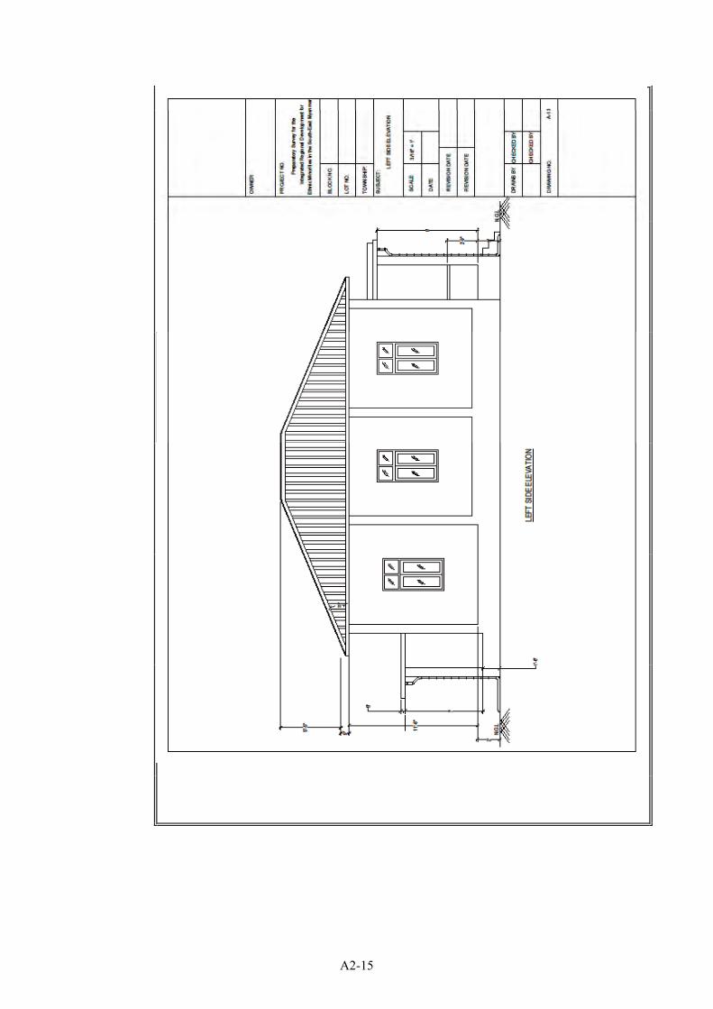
A2-15

DESCRIPTION COST
Main Building 60'X30' 31,289,648Stair 1,026,456Furniture 4,792,482Tube Well 9,741,813Ground Tank (1.5m3) 730,420Toilet 12,030,872Water Supply & Sanitation 773,103Teacher's Dormitry (2 rooms) 40,243,273Others 1,361,100
GRAND TOTAL 101,989,166
Project Cost Summary for Primary School(3 Class Rooms with Teacher Room)
A2-16
Project Name:Project Location:Name of Work: Main Building
Sr. Particular Quantity Unit Rate Per AmountI. Materials1 1/2"x1/2" Glass Beading 690.0 Rft. 40 27,6002 2"x12" Lx1/4" thick MS Bracket 89.0 Nos. 840 74,7603 5"x1/4"x18" MS Flat 30.0 Nos. 2,500 75,0004 1/4" MS Joint between rafter & purlin 357.0 Nos. 63 22,4915 5/8" dia.Bolt & Nut 120.0 Nos. 420 50,4006 3" dia PVC Pipe 130.2 Rft. 1,260 164,0527 3" dia PVC Elbow 12.0 Nos. 1,050 12,6008 3"x2" Hard Wood 0.7 Tons. 1,300,000 910,0009 3" Pipe Bracket 43.4 Nos. 150 6,51010 4 Angle Colour Roofing Sheet 1343.8 Rft. 1,150 1,545,37011 5 Plywood 54.7 Shts. 9,200 503,24012 5/8" dia.Bolt & Nut 90.0 Nos. 525 47,25013 5"x2" Chowket 501.0 Rft. 150 75,15014 5"x3" Hardwood 0.0 Tons. 1,300,000 015 6"x2" Hardwood 0.0 Tons. 1,300,000 016 8"x1" Hardwood 4.1 Tons. 1,300,000 5,330,00017 Bamboo 90.0 Nos. 600 54,00018 Binding Wire 69.0 Lbs. 350 24,15019 Brick 24200.6 Nos. 50 1,210,03020 Paint Brush 23.5 Nos. 1,000 23,50021 Cement (Thailand) 585.3 Bags. 6,300 3,687,39022 Chowket Bracket 140.0 Nos. 150 21,00023 Coal Tar 5.0 Gals. 3,500 17,50024 Coinyan 22.5 Viss 2,000 45,00025 Colour Sheet Ridge Cover 155.0 Rft. 1,150 178,25026 Colour Sheet Flushing 65.0 Rft. 1,150 74,75027 Concrete Block(9"x9") 69.5 Nos. 998 69,36128 Door Lock 3.0 Nos. 5,800 17,40029 Emulsion Paint 61.2 Gals. 8,100 495,72030 Enamel Paint 9.4 Gals. 10,000 94,00031 Diesel 51.9 Gals. 3,900 202,41032 Gasoline 6.4 Gals. 3,800 24,32033 Glass 5mm 171.0 Sft. 850 145,35034 Gravel 20.0 Suds. 70,000 1,400,00035 Gutter Bracket 148.5 Nos. 350 51,97536 Door & Window Handle (6") 26.0 Nos. 1,800 46,80037 Hardcore 14.4 Suds. 30,000 432,00038 4" Butt Hinge 64.0 Nos. 1,800 115,20039 Impremp 5.0 Lbs. 950 4,75040 2"x2" Hard Wood 0.9 Tons. 1,300,000 1,170,00041 Primary Board (4' x 4') moisture proof 164.7 Shts. 15,000 2,470,50042 Plastic Sheet 1800.0 Sft. 37 66,60043 Putty 7.5 Gals. 5,500 41,25044 Ready made door 84.0 Sft. 5,800 487,20045 Ready made louver with Glass 46.0 Sft. 1,000 46,00046 Sliding Bolt 3.0 Nos. 2,100 6,30047 Hook & Eye 26.0 Nos. 600 15,600
Abstruct of Cost
A2-17
48 Ready made guter 297.0 Rft. 700 207,90049 Ready made window 180.0 Sft. 3,500 630,00050 Rebar 16mm DF Bar 1.7 Tons. 700,000 1,190,00051 Rebar 12mm DF Bar 1.0 Tons. 670,000 670,00052 Rebar 10mm DF Bar 0.5 Tons. 670,000 335,00053 Rebar 6mm Plain Bar 0.3 Tons. 763,750 229,12554 Paint Roller 24.5 Nos. 1,100 26,95055 Roof Screw 2-1/2" 1946.7 Nos. 34 66,18856 Sand 31.4 Suds. 15,000 471,00057 Sand Paper 188.2 Nos. 250 47,05058 Timber Soft wood 4.8 Tons. 400,000 1,920,00059 Tower bolt 6" 26.0 Nos. 1,500 39,00060 Wire Nail 183.9 Lbs. 525 96,54861 Wood Screw 3741.0 Nos. 15 56,11562 X-mer 2874.2 Rft. 58 166,704
Material Cost 27,734,308Transportation Charge 3.0 % 832,029
Total Material Cost 28,566,337
II. Labour Charge1 Carpenter 320.5 Psn. 7,000 2,243,5002 Mason 191.8 Psn. 7,000 1,342,6003 Operator 28.3 Psn. 5,000 141,5004 Painter 97.3 Psn. 7,000 681,1005 Piumber 5.0 Psn. 7,000 35,0006 Steel Fixer 51.7 Psn. 7,000 361,9007 Worker 1106.5 Psn. 5,000 5,532,500
Labor Cost 10,338,100Total Cost (Materials + Labours) 38,904,437
Supervision Charge 7.0 % 2,723,311
Total Project Cost 31,289,648
A2-18
Project Name:Project Location:Name of Work: Stair
Sr. Particular Quantity Unit Rate Per AmountI. Materials1 2"x12 LX1/4 thick MS Bracket 45.00 Nos. 1,950 87,7502 5 Plywood 2.71 Shts. 9,200 24,9323 5/8" dia.Bolt & Nut 90.00 Nos. 350 31,5004 Binding Wire 6.32 Lbs. 1,105 6,9845 Paint Brush 0.67 Nos. 1,000 6706 Cement 18.77 Bags. 5,000 93,8507 Emulsion Paint 0.61 Gals. 8,100 4,9418 Enamel Paint 1.41 Gals. 10,000 14,1009 Fuel 1.99 Gals. 3,900 7,761
10 Gasoline 0.70 Gals. 3,800 2,66011 Gravel 0.89 Suds. 70,000 62,30012 Putty 0.22 Gals. 5,500 1,21013 Rebar 12mm 0.25 Tons. 670,000 167,50014 Rebar 6mm 0.01 Tons. 763,750 7,63815 Roller 0.41 Nos. 1,500 61516 Sand 0.49 Suds. 7,000 3,43017 Sand Paper 5.39 Nos. 250 1,34818 Timber Soft wood 0.38 Tons. 400,000 152,00019 Wire Nail 4.93 Lbs. 701 3,457
Material Cost 674,645Transportation Charge 3.00 % 20,239
Total Material Cost 694,884II. Labour Charge1 Carpenter 6.57 Psn. 7000 45,9902 Mason 2.79 Psn. 7000 19,5303 Operator 0.59 Psn. 5000 2,9504 Painter 3.16 Psn. 7000 22,1205 Steel Fixer 4.74 Psn. 7000 33,1806 Worker 28.13 Psn. 5000 140,650
Labor Cost 264420Total Cost (Materials + Labours) 959,304
Supervision Charge 7.00 % 67,151Total Project Cost 1,026,456
Abstruct of Cost
A2-19
Project Name:Project Location:Name of Work: Furniture
Sr. Particular Quantity Unit Rate Per AmountI. Furniture1 Desk & Bench (Rubber Wood) for Lower Gra 40 Set. 65,000 2,600,0002 Desk & Bench (Rubber Wood) for Upper Gra 20 Set. 65,000 1,300,0003 Table & Chair (Rubber Wood) for Teacher 3 Nos. 110,500 331,5004 Teaching Board (8' x 4') 3 Nos. 39,000 117,000
Sub Total 4,348,500Transportation Charge 3 % 130,455
Total Material Cost 4,478,955SuperVision Charge 7 % 313,527
Total Funiture Cost 4,792,482
Abstruct of Cost
A2-20
Project Name:Project Location:Name of Work: Tube Well
Sr. Particular Quantity Unit Rate Per Amount1 Driring
Driring of 10' dia Hole 60.00 m 22,572 1,354,320
2 Instaration of casing pipeLowering of 4" PVC Pipes and scree 10.00 1x6m 2,160 21,600Gravel Packing 10.00 m 1,080 10,800Bentonite ceiling 50.00 m 2,160 108,000Making and Fixing of Tube well 0.00 no 6,480 0Pilnth for tube well nead 0.00 LS 5,400 0
3 Well developing , Pumping out 24hHiring of compressor 3.00 day 41,040 123,120Operatrion cost 12.00 hour 11,880 142,560
4 Water Quality TestOne 4" well 1.00 no 17,280 17,280
5 Pumping Test noFitting for pumping test 0.00 day 23,760 0Hiring of submersible pump 0.00 LS 23,760 0Pumping and Recovery test for 14 h 0.00 set 162,000 0
6 Instalation of Suction Pump 1.00 LS 88,560 88,560
7 Transportation charge 1.00 LS 291,600 291,600
8 MaterialsM1 4"dia PVCpipe 10.00 1x6m 100,429 1,004,292M2 4"dia PVC faucet socket & valve 2.00 set 5,400 10,800M3 4"GI Pipe 2.00 no 194,940 389,880M4 4" dia GI socket 2.00 no 9,720 19,440M5 Glue 1.00 tin 2,160 2,160M6 Rivet 1.00 pack 8,640 8,640M7 4" Screen 1.00 1x6m 400,000 400,000M8 Adapter for Screen 1.00 no 9,720 9,720M9 Hand Pump 1.00 unit 700,000 700,000M10 2" dia GI Pipe 1.00 no 40,014 40,014M11 2" dia GI Socket 1.00 no 1,080 1,080M12 River shingle 1.00 sud 106,628 106,628M13 Bentnite 3.00 bag 6,804 20,412
Total Cost 4,870,906
Abstruct of Cost
A2-21
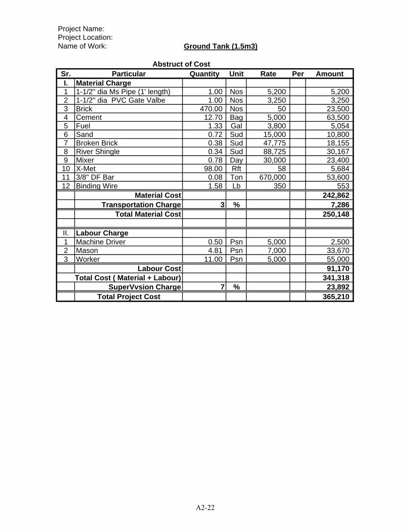
Project Name:Project Location:Name of Work: Ground Tank (1.5m3)
Sr. Particular Quantity Unit Rate Per AmountI. Material Charge1 1-1/2" dia Ms Pipe (1' length) 1.00 Nos 5,200 5,2002 1-1/2" dia PVC Gate Valbe 1.00 Nos 3,250 3,2503 Brick 470.00 Nos 50 23,5004 Cement 12.70 Bag 5,000 63,5005 Fuel 1.33 Gal 3,800 5,0546 Sand 0.72 Sud 15,000 10,8007 Broken Brick 0.38 Sud 47,775 18,1558 River Shingle 0.34 Sud 88,725 30,1679 Mixer 0.78 Day 30,000 23,400
10 X-Met 98.00 Rft 58 5,68411 3/8" DF Bar 0.08 Ton 670,000 53,60012 Binding Wire 1.58 Lb 350 553
Material Cost 242,862Transportation Charge 3 % 7,286
Total Material Cost 250,148
II. Labour Charge1 Machine Driver 0.50 Psn 5,000 2,5002 Mason 4.81 Psn 7,000 33,6703 Worker 11.00 Psn 5,000 55,000
Labour Cost 91,170Total Cost ( Material + Labour) 341,318
SuperVvsion Charge 7 % 23,892Total Project Cost 365,210
Abstruct of Cost
A2-22
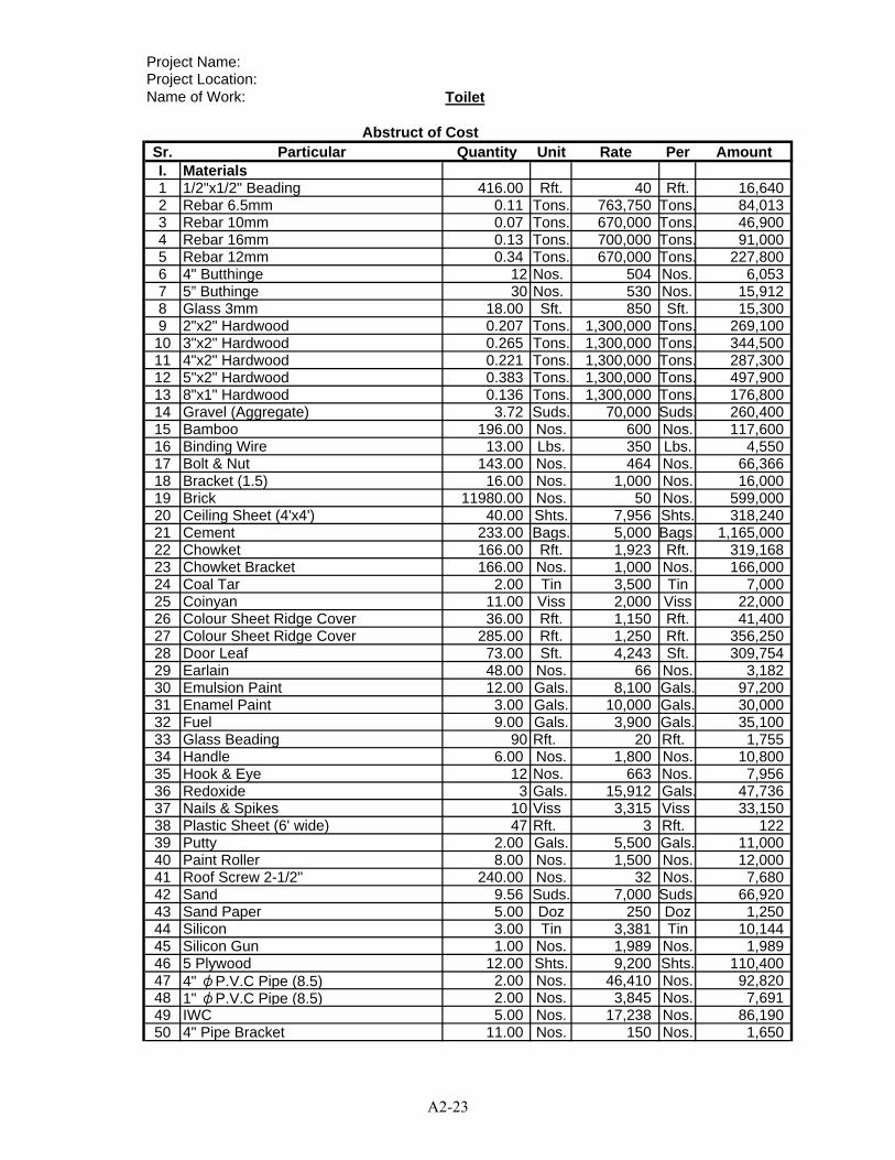
Project Name:Project Location:Name of Work: Toilet
Sr. Particular Quantity Unit Rate Per AmountI. Materials1 1/2"x1/2" Beading 416.00 Rft. 40 Rft. 16,6402 Rebar 6.5mm 0.11 Tons. 763,750 Tons. 84,0133 Rebar 10mm 0.07 Tons. 670,000 Tons. 46,9004 Rebar 16mm 0.13 Tons. 700,000 Tons. 91,0005 Rebar 12mm 0.34 Tons. 670,000 Tons. 227,8006 4" Butthinge 12 Nos. 504 Nos. 6,0537 5” Buthinge 30 Nos. 530 Nos. 15,9128 Glass 3mm 18.00 Sft. 850 Sft. 15,3009 2"x2" Hardwood 0.207 Tons. 1,300,000 Tons. 269,10010 3"x2" Hardwood 0.265 Tons. 1,300,000 Tons. 344,50011 4"x2" Hardwood 0.221 Tons. 1,300,000 Tons. 287,30012 5"x2" Hardwood 0.383 Tons. 1,300,000 Tons. 497,90013 8"x1" Hardwood 0.136 Tons. 1,300,000 Tons. 176,80014 Gravel (Aggregate) 3.72 Suds. 70,000 Suds. 260,40015 Bamboo 196.00 Nos. 600 Nos. 117,60016 Binding Wire 13.00 Lbs. 350 Lbs. 4,55017 Bolt & Nut 143.00 Nos. 464 Nos. 66,36618 Bracket (1.5) 16.00 Nos. 1,000 Nos. 16,00019 Brick 11980.00 Nos. 50 Nos. 599,00020 Ceiling Sheet (4'x4') 40.00 Shts. 7,956 Shts. 318,24021 Cement 233.00 Bags. 5,000 Bags. 1,165,00022 Chowket 166.00 Rft. 1,923 Rft. 319,16823 Chowket Bracket 166.00 Nos. 1,000 Nos. 166,00024 Coal Tar 2.00 Tin 3,500 Tin 7,00025 Coinyan 11.00 Viss 2,000 Viss 22,00026 Colour Sheet Ridge Cover 36.00 Rft. 1,150 Rft. 41,40027 Colour Sheet Ridge Cover 285.00 Rft. 1,250 Rft. 356,25028 Door Leaf 73.00 Sft. 4,243 Sft. 309,75429 Earlain 48.00 Nos. 66 Nos. 3,18230 Emulsion Paint 12.00 Gals. 8,100 Gals. 97,20031 Enamel Paint 3.00 Gals. 10,000 Gals. 30,00032 Fuel 9.00 Gals. 3,900 Gals. 35,10033 Glass Beading 90 Rft. 20 Rft. 1,75534 Handle 6.00 Nos. 1,800 Nos. 10,80035 Hook & Eye 12 Nos. 663 Nos. 7,95636 Redoxide 3 Gals. 15,912 Gals. 47,73637 Nails & Spikes 10 Viss 3,315 Viss 33,15038 Plastic Sheet (6' wide) 47 Rft. 3 Rft. 12239 Putty 2.00 Gals. 5,500 Gals. 11,00040 Paint Roller 8.00 Nos. 1,500 Nos. 12,00041 Roof Screw 2-1/2" 240.00 Nos. 32 Nos. 7,68042 Sand 9.56 Suds. 7,000 Suds. 66,92043 Sand Paper 5.00 Doz 250 Doz 1,25044 Silicon 3.00 Tin 3,381 Tin 10,14445 Silicon Gun 1.00 Nos. 1,989 Nos. 1,98946 5 Plywood 12.00 Shts. 9,200 Shts. 110,40047 4" φP.V.C Pipe (8.5) 2.00 Nos. 46,410 Nos. 92,82048 1" φP.V.C Pipe (8.5) 2.00 Nos. 3,845 Nos. 7,69149 IWC 5.00 Nos. 17,238 Nos. 86,19050 4" Pipe Bracket 11.00 Nos. 150 Nos. 1,650
Abstruct of Cost
A2-23
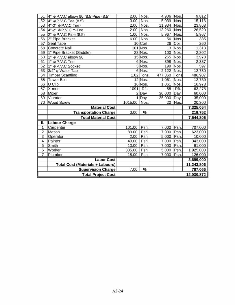
51 4" φP.V.C elbow 90 (8.5)Pipe (8.5) 2.00 Nos. 4,906 Nos. 9,81252 4" φP.V.C Tee (8.5) 3.00 Nos. 5,039 Nos. 15,11653 4"-2" φP.V.C Tee) 2.00 Nos. 11,934 Nos. 23,86854 4"-2" φP.V.C Y-Tee 2.00 Nos. 13,260 Nos. 26,52055 2" φP.V.C Pipe (8.5) 1.00 Nos. 5,967 Nos. 5,96756 2" Pipe Bracket 6.00 Nos. 56 Nos. 33557 Seal Tape 10 Coil 26 Coil 26058 Concrete Nail 101 Nos. 13 Nos. 1,31359 1" Pipe Bracket (Saddle) 23 Nos. 100 Nos. 2,30260 1" φP.V.C elbow 90 15 Nos. 265 Nos. 3,97861 1" φP.V.C Tee 6 Nos. 398 Nos. 2,38762 1" φP.V.C Socket 3 Nos. 199 Nos. 59763 3/4" φ Water Tap 6 Nos. 2,122 Nos. 12,73064 Timber Scantling 1.02 Tons. 477,360 Tons 486,90765 Tower Bolt 12 Nos. 1,061 Nos. 12,73066 U Clip 16 Nos. 1,061 Nos. 16,97367 X-met 1091 Rft. 58 Rft. 63,27868 Mixer 2 Day 30,000 Day 60,00069 Vibrator 1 Day 35,000 Day 35,00070 Wood Screw 1015.00 Nos. 20 Nos. 20,300
Material Cost 7,325,054Transportation Charge 3.00 % 219,752
Total Material Cost 7,544,806II. Labour Charge1 Carpenter 101.00 Psn. 7,000 Psn. 707,0002 Mason 89.00 Psn. 7,000 Psn. 623,0003 Operator 2.00 Psn. 5,000 Psn. 10,0004 Painter 49.00 Psn. 7,000 Psn. 343,0005 Smith 13.00 Psn. 7,000 Psn. 91,0006 Worker 385.00 Psn. 5,000 Psn. 1,925,0007 Piumber 18.00 Psn. 7,000 Psn. 126,000
Labor Cost 3,699,000Total Cost (Materials + Labours) 11,243,806
Supervision Charge 7.00 % 787,066Total Project Cost 12,030,872
A2-24

Project Name:Project Location:Name of Work: Water Supply & Sanitation
Sr. Particular Quantity Unit Rate Per AmountI. Materials1 3/4" φP.V.C Pipe (13.5) 3.0 Nos. 4,680 14,0402 1" φP.V.C Pipe (13.6) 5.0 Nos. 7,410 37,0503 1 1/4" φP.V.C Pipe (13.7) 4.0 Nos. 9,620 38,4804 2" φP.V.C Pipe (13.8) 1.0 Nos. 19,110 19,1105 3" φP.V.C Pipe (13.9) 2.0 Nos. 35,750 71,5006 4" φP.V.C Pipe (13.10) 2.0 Nos. 27,755 55,5107 1/2" G.I Tee 2.0 Nos. 208 4168 3/4" Tee 3.0 Nos. 273 8199 1"X 3/4"Tee 6.0 Nos. 637 3,822
10 4" G.I Tee 4.0 Nos. 13,780 55,12011 4" Cross Tee 1.0 Nos. 18,850 18,85012 3/4" Elbow 10.0 Nos. 1,950 19,50013 1" X 3/4 Elbow 1.0 Nos. 494 49414 3/4" Elbow 6.0 Nos. 195 1,17015 1" Elbow 11.0 Nos. 358 3,93316 1 1/4" Elbow 10.0 Nos. 605 6,04517 4" φElbow 6.0 Nos. 5,915 35,49018 3" φElbow1”Cap Plug 5.0 Nos. 3,315 16,57519 1" Cap Plag 1.0 Nos. 273 27320 1" φP.V.C Ball Valve 2.0 Nos. 2,600 5,20021 1/2”X3/4" Nipple 5.0 Nos. 1,105 5,52522 1/2" Nipple 5.0 Nos. 130 65023 1"R.C Nail 12.0 Doz. 455 5,46024 2" Strainer 2.0 Nos. 2,600 5,20025 3/4" P.V.C Tap 5.0 Nos. 650 3,25026 4" Pipe Cap 1.0 Nos. 4,550 4,55027 4" Saddle 12.0 Nos. 260 3,12028 3" Saddle 3.0 Nos. 234 70229 2" φP.V.C Socket 5.0 Nos. 754 3,77030 3" φP.V.C Valve Socket 15.0 Nos. 715 10,72531 2"X1/4" Socket 2.0 Nos. 780 1,56032 4"X2" Socket 1.0 Nos. 3,705 3,70533 OCI Glue (500gm) 1.0 Tin 3,900 3,90034 Seal Tape 10.0 Nos. 325 3,25035 Hand-Pumped Tube-Well 0.0 Set 520,000 0
Material Cost 458,764Transportation Charge 3 % 13,763
Total Material Cost 472,526
II. Labour Charge1 Piumber 25 Psn. 7,000 175,0002 Worker 15 Psn. 5,000 75,000
Labor Cost 250,000Total Cost (Materials + Labours) 722,526
Supervision Charge 7 % 50,577Total Project Cost 773,103
Abstruct of Cost
A2-25

Project Name:Project Location:Name of Work: Teacher's Dormitry (2 rooms)
Sr. Particular Quantity Unit Rate Per AmountI. Materials1 1/2"x1/2" Glass Beading 718.0 Rft. 60 Rft. 43,0802 2"x12" Lx1/4" thick MS Bracket 148.0 Nos. 840 Nos. 124,3203 5"x1/4"x18" ms flat 30.0 Rft. 2,835 Rft. 85,0504 1/4" M.S Join between rafter & purlin 357.0 Nos. 63 Nos. 22,4915 5/8" dia. Bolt & Nut 120.0 Tons. 630 Tons. 75,6006 3"x2" Hardwood 0.9 Nos. 1,155,000 Nos. 1,047,7197 4-Angle Colour Roofing Sheet 1226.8 Rft. 1,365 Rft. 1,674,6348 5 Plywood 68.0 Shts. 10,500 Shts. 713,7879 5/8" dia. Bolt & Nut 100.0 Nos. 525 Nos. 52,500
10 5"x2" Chowket 411.3 Tons. 1,900 Tons. 781,53311 Hardwood 2.1 Tons. 860,000 Tons. 1,832,84312 Bamboo 75.6 Tons. 550 Tons. 41,58013 Binding Wire 96.6 Tons. 578 Tons. 55,79514 Brick 24178.3 Nos. 89 Nos. 2,157,91615 Cement 581.1 Lbs. 6,510 Lbs. 3,782,64816 Chowket Bracket 260.0 Nos. 158 Nos. 40,95017 Coal Tar 5.0 Nos. 3,675 Nos. 18,37518 Coinyan 18.9 Bags. 1,470 Bags. 27,78319 Colour Sheet Ridge Covering 55.0 Nos. 1,103 Nos. 60,63820 Door Lock 16.0 Gals. 5,250 Gals. 84,00021 Emulsion Paint (UPG) 64.3 Viss 6,300 Viss 404,94822 Enamel Paint (UPG) 10.0 Rft. 11,340 Rft. 113,04123 Diesel 51.7 Nos. 3,990 Nos. 206,21224 Gasoline 13.6 Nos. 4,200 Nos. 57,23725 Glass 5mm 426.6 Gals. 840 Gals. 358,30726 Gravel 18.9 Gals. 30,000 Gals. 566,86727 Gutter Bracket 55.0 Gals. 473 Gals. 25,98828 Door & Window Handle (6") 48.0 Gals. 788 Gals. 37,80029 Hardcore 4.0 Sft. 25,000 Sft. 100,00030 4" Butt Hinge 144.0 Suds. 368 Suds. 52,92031 Primer Board (4'x4') moisture proof 33.1 Nos. 5,775 Nos. 191,00832 Plastic sheet 726.8 Nos. 263 Nos. 190,79233 Putty 7.9 Suds. 4,200 Suds. 33,26234 Ready made door 323.9 Nos. 3,675 Nos. 1,190,29235 Sliding Bolt 3.0 Rft. 3,150 Rft. 9,45036 Hook & eye 48.0 Sft. 420 Sft. 20,16037 Ready made gutter 110.0 Shts. 525 Shts. 57,75038 16 mm Ø M.S DF Bar 1.4 Gals. 510,000 Gals. 702,14839 10 mm Ø M.S DF Bar 1.1 Sft. 560,000 Sft. 592,91440 12 mm Ø M.S DF Bar 2.1 Rft. 530,000 Rft. 1,138,657
Abstruct of Cost
A2-26
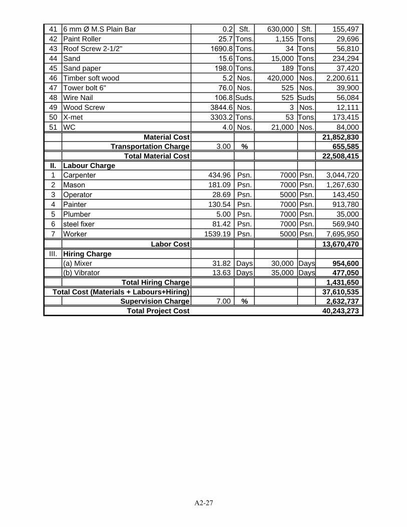
41 6 mm Ø M.S Plain Bar 0.2 Sft. 630,000 Sft. 155,49742 Paint Roller 25.7 Tons. 1,155 Tons. 29,69643 Roof Screw 2-1/2" 1690.8 Tons. 34 Tons. 56,81044 Sand 15.6 Tons. 15,000 Tons. 234,29445 Sand paper 198.0 Tons. 189 Tons. 37,42046 Timber soft wood 5.2 Nos. 420,000 Nos. 2,200,61147 Tower bolt 6" 76.0 Nos. 525 Nos. 39,90048 Wire Nail 106.8 Suds. 525 Suds. 56,08449 Wood Screw 3844.6 Nos. 3 Nos. 12,11150 X-met 3303.2 Tons. 53 Tons. 173,41551 WC 4.0 Nos. 21,000 Nos. 84,000
Material Cost 21,852,830Transportation Charge 3.00 % 655,585
Total Material Cost 22,508,415II. Labour Charge1 Carpenter 434.96 Psn. 7000 Psn. 3,044,7202 Mason 181.09 Psn. 7000 Psn. 1,267,6303 Operator 28.69 Psn. 5000 Psn. 143,4504 Painter 130.54 Psn. 7000 Psn. 913,7805 Plumber 5.00 Psn. 7000 Psn. 35,0006 steel fixer 81.42 Psn. 7000 Psn. 569,9407 Worker 1539.19 Psn. 5000 Psn. 7,695,950
Labor Cost 13,670,470III. Hiring Charge
(a) Mixer 31.82 Days 30,000 Days 954,600(b) Vibrator 13.63 Days 35,000 Days 477,050
Total Hiring Charge 1,431,650Total Cost (Materials + Labours+Hiring) 37,610,535
Supervision Charge 7.00 % 2,632,737Total Project Cost 40,243,273
A2-27
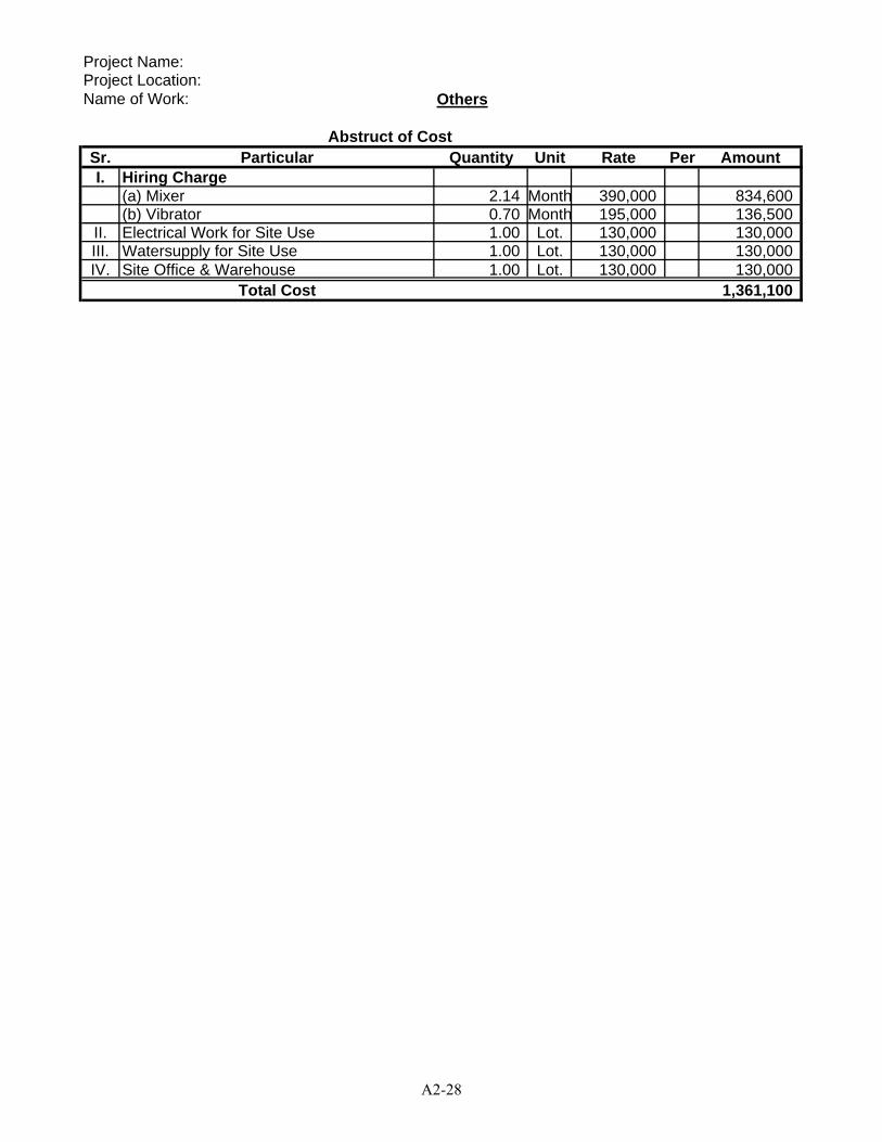
Project Name:Project Location:Name of Work: Others
Sr. Particular Quantity Unit Rate Per AmountI. Hiring Charge
(a) Mixer 2.14 Month 390,000 834,600(b) Vibrator 0.70 Month 195,000 136,500
II. Electrical Work for Site Use 1.00 Lot. 130,000 130,000III. Watersupply for Site Use 1.00 Lot. 130,000 130,000IV. Site Office & Warehouse 1.00 Lot. 130,000 130,000
Total Cost 1,361,100
Abstruct of Cost
A2-28
APPENDIX 3 PRELIMINARY DESIGN DRAWINGS AND
PRELIMINARY COST ESTIMATE FOR RURAL HEALTH CENTER
A3-1
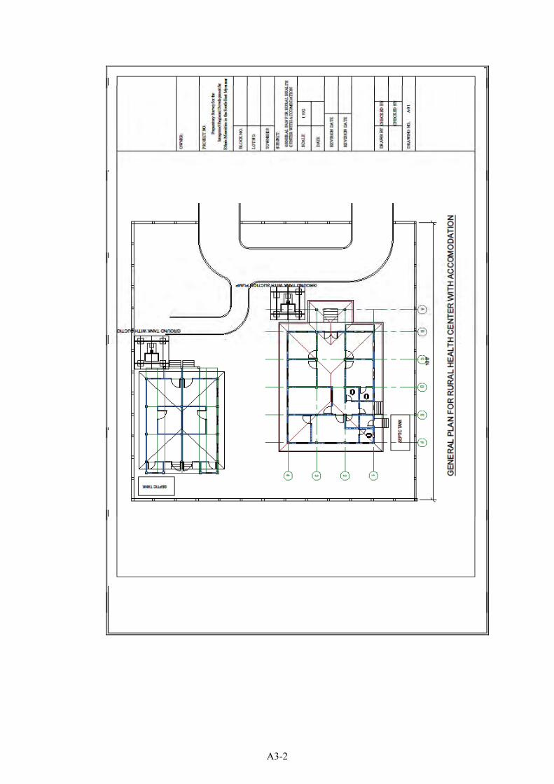
A3-2
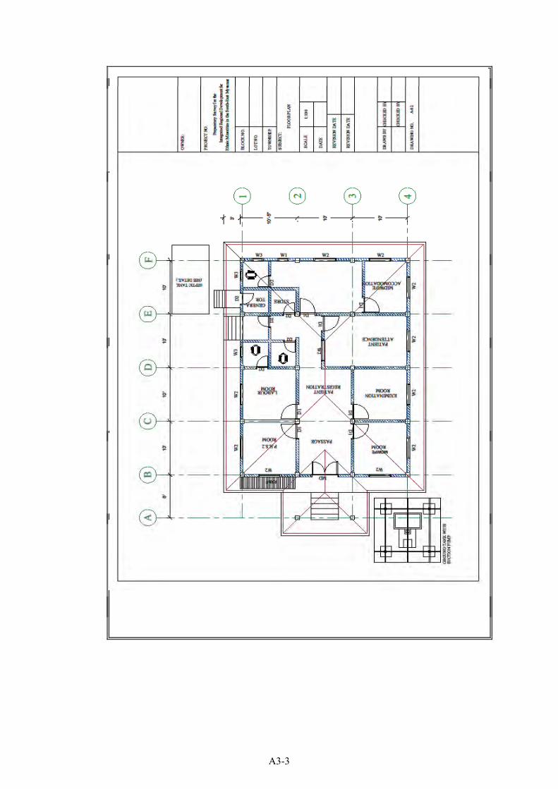
A3-3
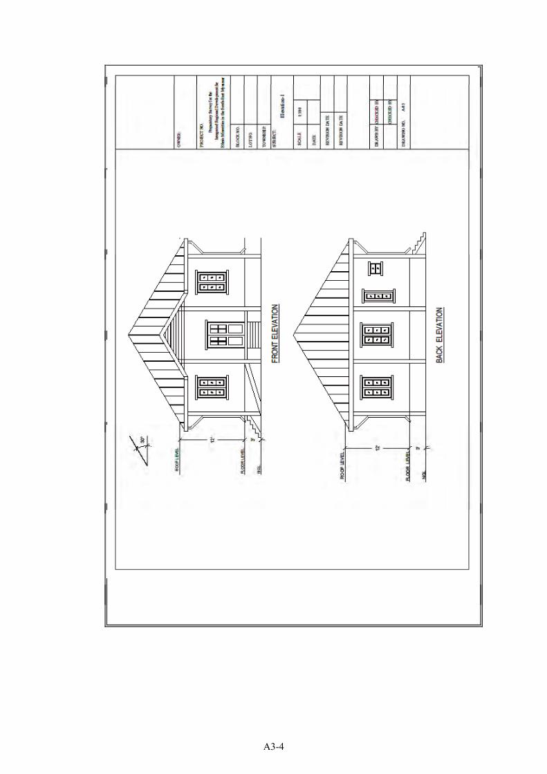
A3-4
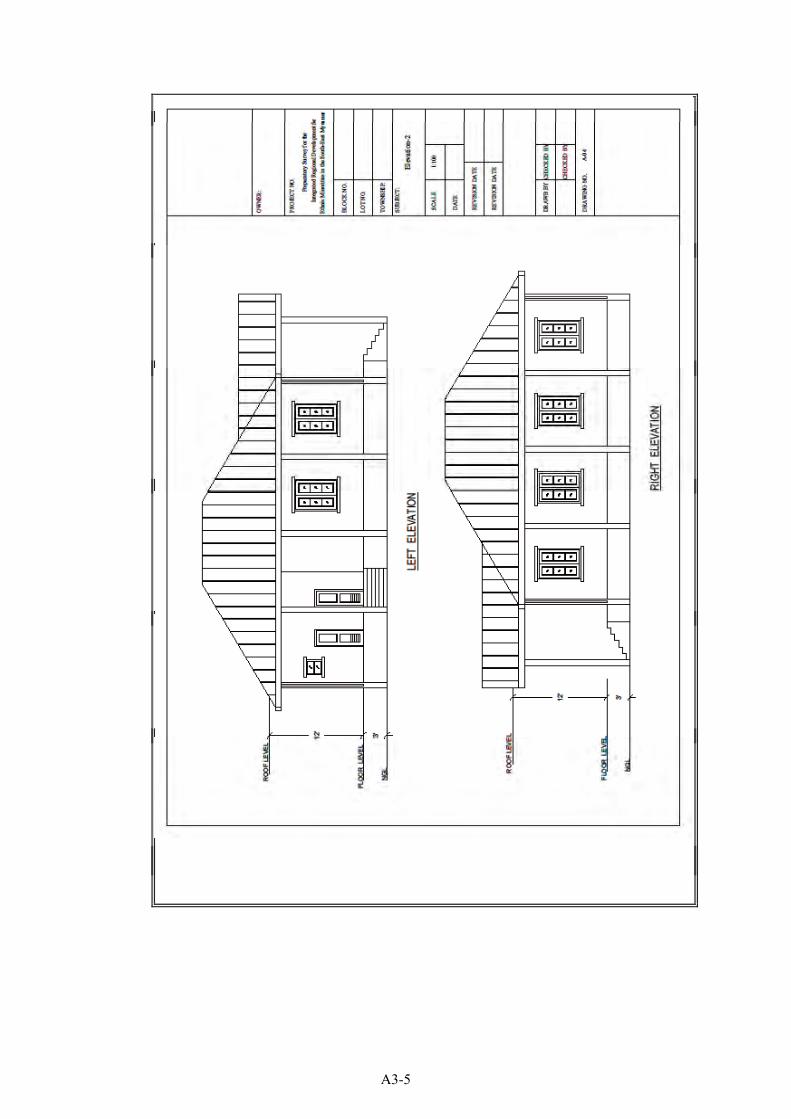
A3-5
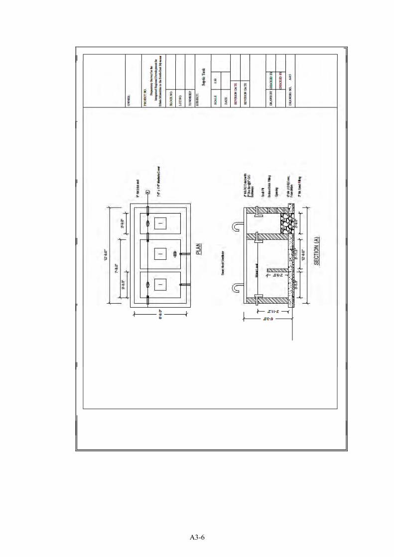
A3-6
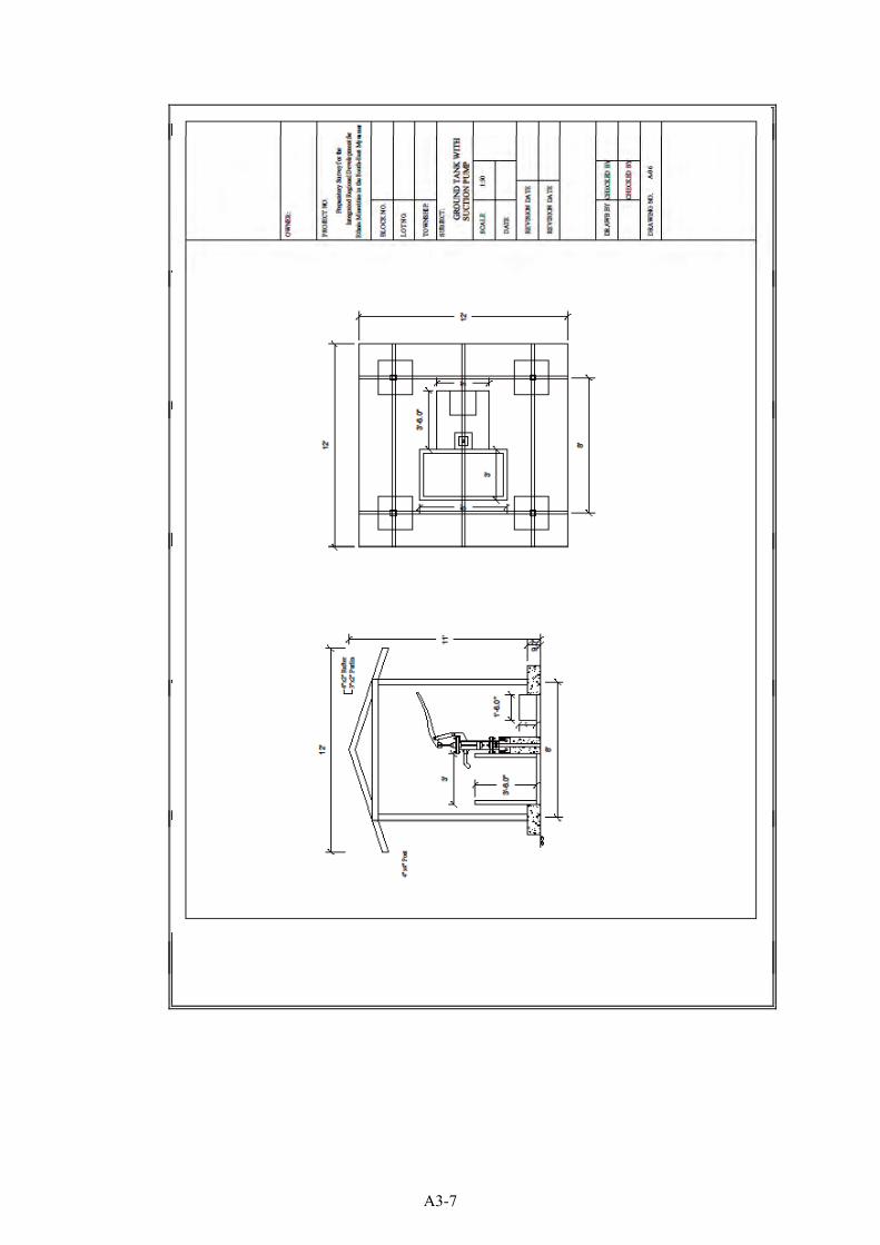
A3-7
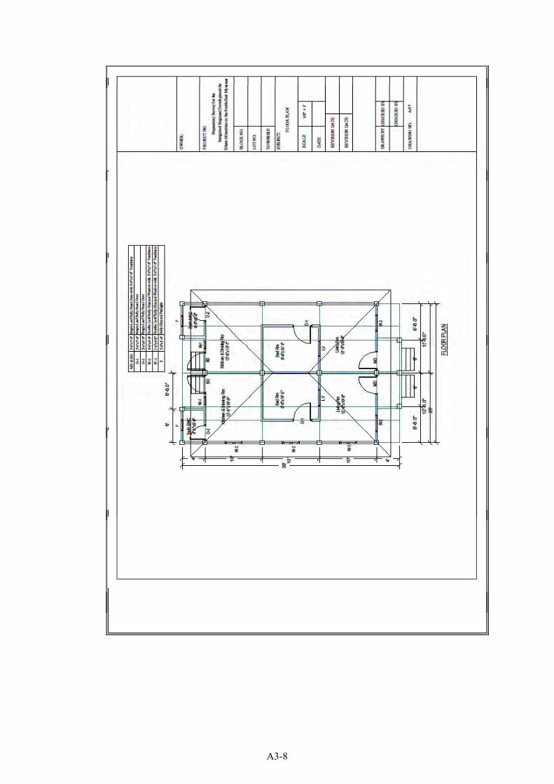
A3-8
A3-9
A3-10
A3-11
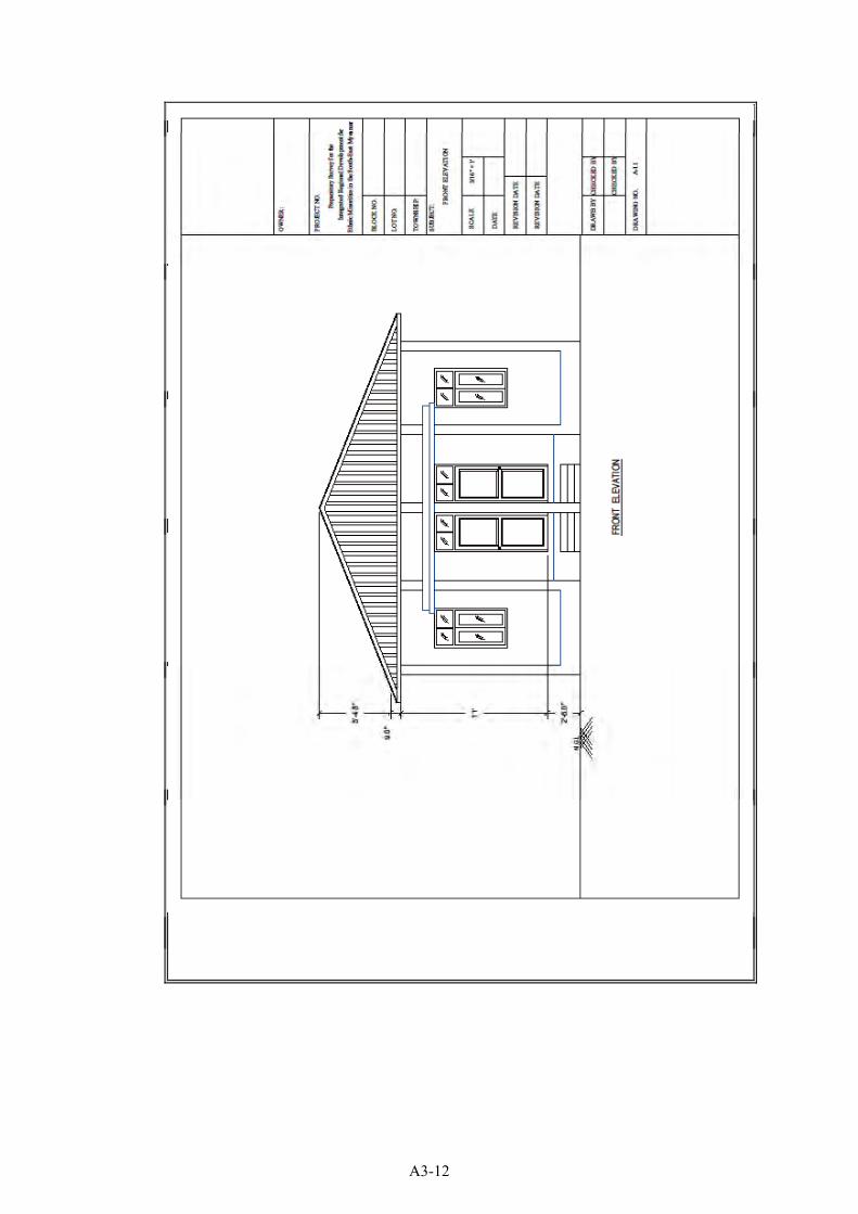
A3-12
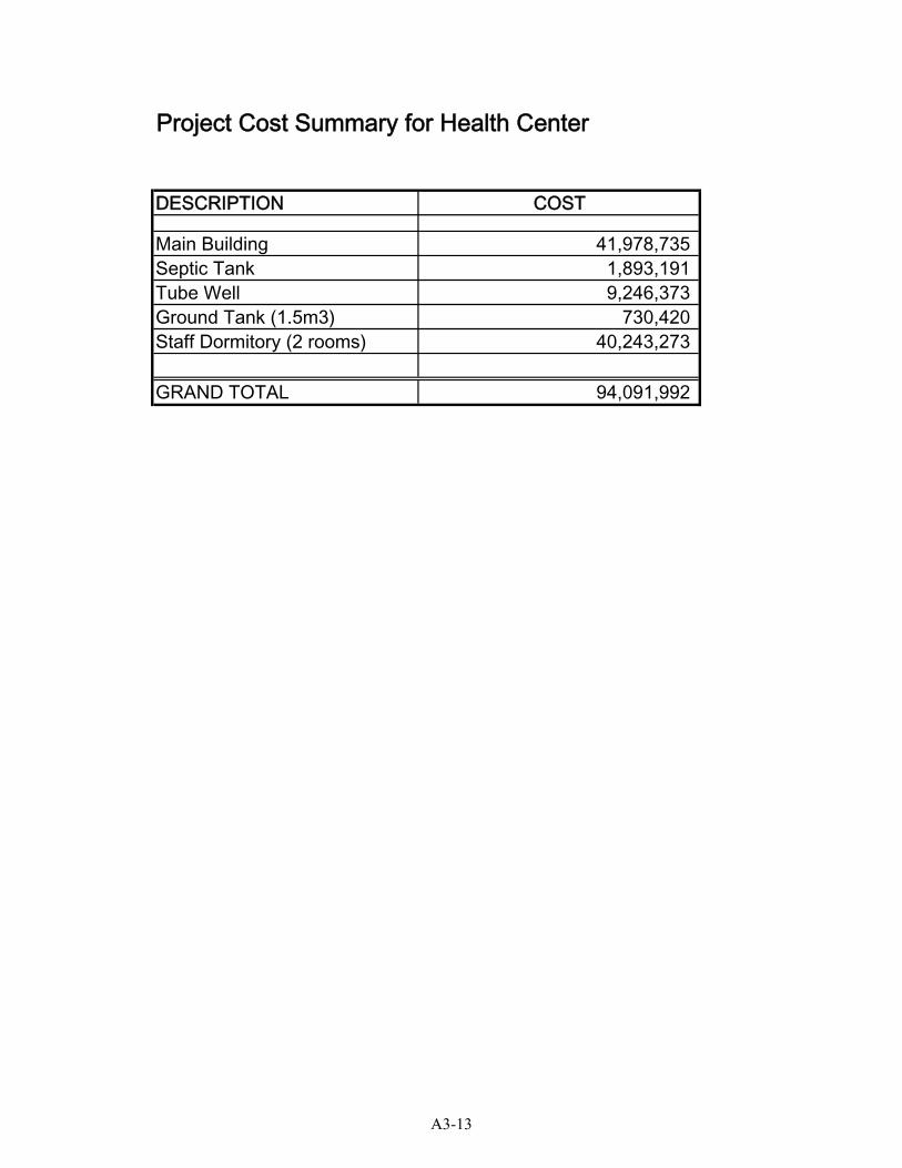
Project Cost Summary for Health Center
DESCRIPTION COST
Main Building 41,978,735Septic Tank 1,893,191Tube Well 9,246,373Ground Tank (1.5m3) 730,420Staff Dormitory (2 rooms) 40,243,273
GRAND TOTAL 94,091,992
A3-13
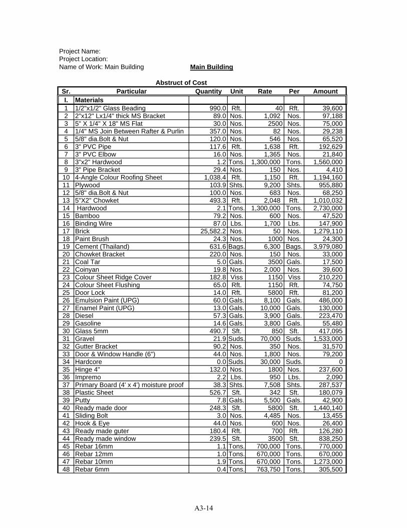
Project Name:Project Location:Name of Work: Main Building Main Building
Sr. Particular Quantity Unit Rate Per AmountI. Materials1 1/2"x1/2" Glass Beading 990.0 Rft. 40 Rft. 39,6002 2"x12" Lx1/4" thick MS Bracket 89.0 Nos. 1,092 Nos. 97,1883 5" X 1/4" X 18" MS Flat 30.0 Nos. 2500 Nos. 75,0004 1/4" MS Join Between Rafter & Purlin 357.0 Nos. 82 Nos. 29,2385 5/8" dia.Bolt & Nut 120.0 Nos. 546 Nos. 65,5206 3" PVC Pipe 117.6 Rft. 1,638 Rft. 192,6297 3" PVC Elbow 16.0 Nos. 1,365 Nos. 21,8408 3"x2" Hardwood 1.2 Tons. 1,300,000 Tons. 1,560,0009 3" Pipe Bracket 29.4 Nos. 150 Nos. 4,410
10 4-Angle Colour Roofing Sheet 1,038.4 Rft. 1,150 Rft. 1,194,16011 Plywood 103.9 Shts. 9,200 Shts. 955,88012 5/8" dia.Bolt & Nut 100.0 Nos. 683 Nos. 68,25013 5"X2" Chowket 493.3 Rft. 2,048 Rft. 1,010,03214 Hardwood 2.1 Tons. 1,300,000 Tons. 2,730,00015 Bamboo 79.2 Nos. 600 Nos. 47,52016 Binding Wire 87.0 Lbs. 1,700 Lbs. 147,90017 Brick 25,582.2 Nos. 50 Nos. 1,279,11018 Paint Brush 24.3 Nos. 1000 Nos. 24,30019 Cement (Thailand) 631.6 Bags. 6,300 Bags. 3,979,08020 Chowket Bracket 220.0 Nos. 150 Nos. 33,00021 Coal Tar 5.0 Gals. 3500 Gals. 17,50022 Coinyan 19.8 Nos. 2,000 Nos. 39,60023 Colour Sheet Ridge Cover 182.8 Viss 1150 Viss 210,22024 Colour Sheet Flushing 65.0 Rft. 1150 Rft. 74,75025 Door Lock 14.0 Rft. 5800 Rft. 81,20026 Emulsion Paint (UPG) 60.0 Gals. 8,100 Gals. 486,00027 Enamel Paint (UPG) 13.0 Gals. 10,000 Gals. 130,00028 Diesel 57.3 Gals. 3,900 Gals. 223,47029 Gasoline 14.6 Gals. 3,800 Gals. 55,48030 Glass 5mm 490.7 Sft. 850 Sft. 417,09531 Gravel 21.9 Suds. 70,000 Suds. 1,533,00032 Gutter Bracket 90.2 Nos. 350 Nos. 31,57033 Door & Window Handle (6") 44.0 Nos. 1,800 Nos. 79,20034 Hardcore 0.0 Suds. 30,000 Suds. 035 Hinge 4" 132.0 Nos. 1800 Nos. 237,60036 Impremo 2.2 Lbs. 950 Lbs. 2,09037 Primary Board (4' x 4') moisture proof 38.3 Shts. 7,508 Shts. 287,53738 Plastic Sheet 526.7 Sft. 342 Sft. 180,07939 Putty 7.8 Gals. 5,500 Gals. 42,90040 Ready made door 248.3 Sft. 5800 Sft. 1,440,14041 Sliding Bolt 3.0 Nos. 4,485 Nos. 13,45542 Hook & Eye 44.0 Nos. 600 Nos. 26,40043 Ready made guter 180.4 Rft. 700 Rft. 126,28044 Ready made window 239.5 Sft. 3500 Sft. 838,25045 Rebar 16mm 1.1 Tons. 700,000 Tons. 770,00046 Rebar 12mm 1.0 Tons. 670,000 Tons. 670,00047 Rebar 10mm 1.9 Tons. 670,000 Tons. 1,273,00048 Rebar 6mm 0.4 Tons. 763,750 Tons. 305,500
Abstruct of Cost
A3-14
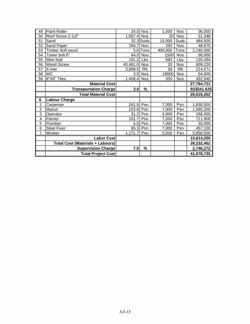
49 Paint Roller 24.0 Nos. 1,500 Nos. 36,00050 Roof Screw 2-1/2" 1,567.4 Nos. 20 Nos. 31,34851 Sand 32.3 Suds. 15,000 Suds. 484,50052 Sand Paper 194.7 Nos. 250 Nos. 48,67553 Timber Soft wood 5.6 Tons. 400,000 Tons. 2,240,00054 Tower bolt 6" 64.0 Nos. 1500 Nos. 96,00055 Wire Nail 191.2 Lbs. 683 Lbs. 130,49456 Wood Screw 40,461.0 Nos. 20 Nos. 809,22057 X-mer 3,699.5 Rft. 58 Rft. 214,57158 WC 3.0 Nos. 18000 Nos. 54,00059 8"X8" Tiles 1,408.4 Nos. 350 Nos. 492,940
Material Cost 27,784,721Transportation Charge 3.0 % 833541.625
Total Material Cost 28,618,262II. Labour Charge1 Carpenter 261.5 Psn. 7,000 Psn. 1,830,5002 Mason 223.6 Psn. 7,000 Psn. 1,565,2003 Operator 31.2 Psn. 5,000 Psn. 156,0004 Painter 101.7 Psn. 7,000 Psn. 711,9005 Piumber 5.0 Psn. 7,000 Psn. 35,0006 Steel Fixer 65.3 Psn. 7,000 Psn. 457,1007 Worker 1,171.7 Psn. 5,000 Psn. 5,858,500
Labor Cost 10,614,200Total Cost (Materials + Labours) 39,232,462
Supervision Charge 7.0 % 2,746,272Total Project Cost 41,978,735
A3-15

Project Name:Project Location:Name of Work: Septic Tank
Sr. Particular Quantity Unit Rate Per Amount1 Site Clearing & Leveling 216.00 Sft. 18 3,931
2 Earthwork Excavation 666.02 Cu-ft 36 24,243
3 Sand Filling Work 26.64 Cu-ft 200 5,333
4 Broken Brick Lating Work 28.88 Cu-ft 592 17,083
5 1:3:6 Lean Concrete Work 53.28 Cu-ft 1,911 101,818
6 Reinforcing Concrete Work(a) 1:2:4 Cement Concrete Work 28.66 Cu-ft 2,248 64,419(b) DB10 0.09 Ton 877,167 78,945
7 Brick Work(a) Brick Work (1:3 Motar) 173.68 Cu-ft 1,556 270,263(b) 4"1/2 Tk. Brick Wall 18.56 Sq-ft 2,038 37,833
8 1:3 Plastering Work 342.31 Sq-ft 693 237,240
9 Timber Form Work 51.75 Sq-ft 2,038 105,487Total Cost 946,596
Abstruct of Cost
A3-16
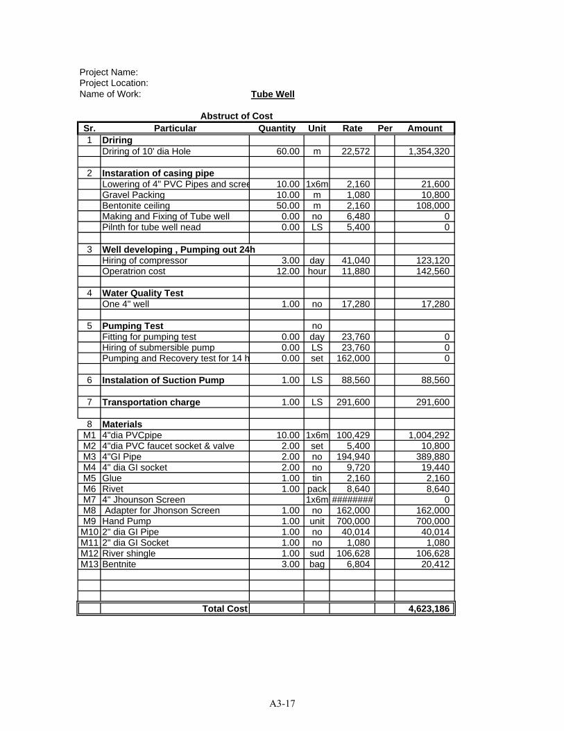
Project Name:Project Location:Name of Work: Tube Well
Sr. Particular Quantity Unit Rate Per Amount1 Driring
Driring of 10' dia Hole 60.00 m 22,572 1,354,320
2 Instaration of casing pipeLowering of 4" PVC Pipes and scree 10.00 1x6m 2,160 21,600Gravel Packing 10.00 m 1,080 10,800Bentonite ceiling 50.00 m 2,160 108,000Making and Fixing of Tube well 0.00 no 6,480 0Pilnth for tube well nead 0.00 LS 5,400 0
3 Well developing , Pumping out 24hHiring of compressor 3.00 day 41,040 123,120Operatrion cost 12.00 hour 11,880 142,560
4 Water Quality TestOne 4" well 1.00 no 17,280 17,280
5 Pumping Test noFitting for pumping test 0.00 day 23,760 0Hiring of submersible pump 0.00 LS 23,760 0Pumping and Recovery test for 14 h 0.00 set 162,000 0
6 Instalation of Suction Pump 1.00 LS 88,560 88,560
7 Transportation charge 1.00 LS 291,600 291,600
8 MaterialsM1 4"dia PVCpipe 10.00 1x6m 100,429 1,004,292M2 4"dia PVC faucet socket & valve 2.00 set 5,400 10,800M3 4"GI Pipe 2.00 no 194,940 389,880M4 4" dia GI socket 2.00 no 9,720 19,440M5 Glue 1.00 tin 2,160 2,160M6 Rivet 1.00 pack 8,640 8,640M7 4" Jhounson Screen 1x6m ######## 0M8 Adapter for Jhonson Screen 1.00 no 162,000 162,000M9 Hand Pump 1.00 unit 700,000 700,000
M10 2" dia GI Pipe 1.00 no 40,014 40,014M11 2" dia GI Socket 1.00 no 1,080 1,080M12 River shingle 1.00 sud 106,628 106,628M13 Bentnite 3.00 bag 6,804 20,412
Total Cost 4,623,186
Abstruct of Cost
A3-17
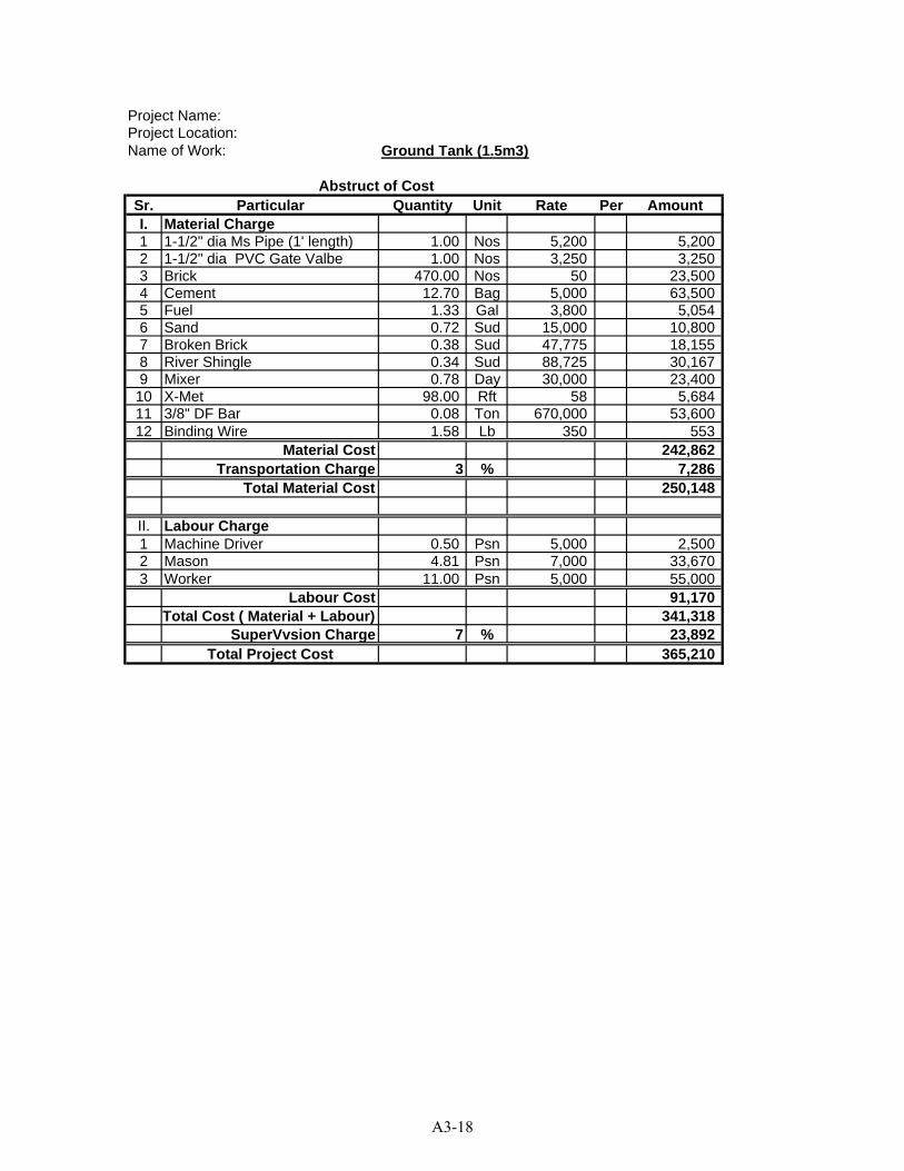
Project Name:Project Location:Name of Work: Ground Tank (1.5m3)
Sr. Particular Quantity Unit Rate Per AmountI. Material Charge1 1-1/2" dia Ms Pipe (1' length) 1.00 Nos 5,200 5,2002 1-1/2" dia PVC Gate Valbe 1.00 Nos 3,250 3,2503 Brick 470.00 Nos 50 23,5004 Cement 12.70 Bag 5,000 63,5005 Fuel 1.33 Gal 3,800 5,0546 Sand 0.72 Sud 15,000 10,8007 Broken Brick 0.38 Sud 47,775 18,1558 River Shingle 0.34 Sud 88,725 30,1679 Mixer 0.78 Day 30,000 23,40010 X-Met 98.00 Rft 58 5,68411 3/8" DF Bar 0.08 Ton 670,000 53,60012 Binding Wire 1.58 Lb 350 553
Material Cost 242,862Transportation Charge 3 % 7,286
Total Material Cost 250,148
II. Labour Charge1 Machine Driver 0.50 Psn 5,000 2,5002 Mason 4.81 Psn 7,000 33,6703 Worker 11.00 Psn 5,000 55,000
Labour Cost 91,170Total Cost ( Material + Labour) 341,318
SuperVvsion Charge 7 % 23,892Total Project Cost 365,210
Abstruct of Cost
A3-18
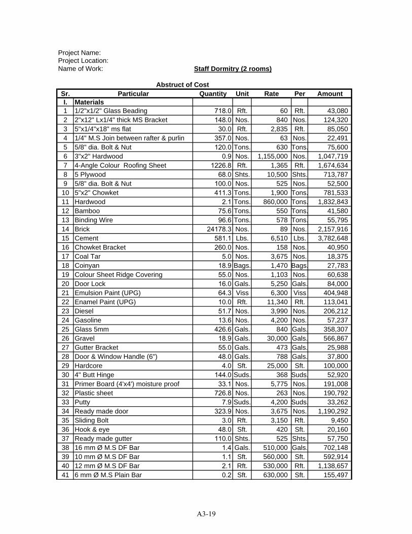
Project Name:Project Location:Name of Work: Staff Dormitry (2 rooms)
Sr. Particular Quantity Unit Rate Per AmountI. Materials1 1/2"x1/2" Glass Beading 718.0 Rft. 60 Rft. 43,0802 2"x12" Lx1/4" thick MS Bracket 148.0 Nos. 840 Nos. 124,3203 5"x1/4"x18" ms flat 30.0 Rft. 2,835 Rft. 85,0504 1/4" M.S Join between rafter & purlin 357.0 Nos. 63 Nos. 22,4915 5/8" dia. Bolt & Nut 120.0 Tons. 630 Tons. 75,6006 3"x2" Hardwood 0.9 Nos. 1,155,000 Nos. 1,047,7197 4-Angle Colour Roofing Sheet 1226.8 Rft. 1,365 Rft. 1,674,6348 5 Plywood 68.0 Shts. 10,500 Shts. 713,7879 5/8" dia. Bolt & Nut 100.0 Nos. 525 Nos. 52,50010 5"x2" Chowket 411.3 Tons. 1,900 Tons. 781,53311 Hardwood 2.1 Tons. 860,000 Tons. 1,832,84312 Bamboo 75.6 Tons. 550 Tons. 41,58013 Binding Wire 96.6 Tons. 578 Tons. 55,79514 Brick 24178.3 Nos. 89 Nos. 2,157,91615 Cement 581.1 Lbs. 6,510 Lbs. 3,782,64816 Chowket Bracket 260.0 Nos. 158 Nos. 40,95017 Coal Tar 5.0 Nos. 3,675 Nos. 18,37518 Coinyan 18.9 Bags. 1,470 Bags. 27,78319 Colour Sheet Ridge Covering 55.0 Nos. 1,103 Nos. 60,63820 Door Lock 16.0 Gals. 5,250 Gals. 84,00021 Emulsion Paint (UPG) 64.3 Viss 6,300 Viss 404,94822 Enamel Paint (UPG) 10.0 Rft. 11,340 Rft. 113,04123 Diesel 51.7 Nos. 3,990 Nos. 206,21224 Gasoline 13.6 Nos. 4,200 Nos. 57,23725 Glass 5mm 426.6 Gals. 840 Gals. 358,30726 Gravel 18.9 Gals. 30,000 Gals. 566,86727 Gutter Bracket 55.0 Gals. 473 Gals. 25,98828 Door & Window Handle (6") 48.0 Gals. 788 Gals. 37,80029 Hardcore 4.0 Sft. 25,000 Sft. 100,00030 4" Butt Hinge 144.0 Suds. 368 Suds. 52,92031 Primer Board (4'x4') moisture proof 33.1 Nos. 5,775 Nos. 191,00832 Plastic sheet 726.8 Nos. 263 Nos. 190,79233 Putty 7.9 Suds. 4,200 Suds. 33,26234 Ready made door 323.9 Nos. 3,675 Nos. 1,190,29235 Sliding Bolt 3.0 Rft. 3,150 Rft. 9,45036 Hook & eye 48.0 Sft. 420 Sft. 20,16037 Ready made gutter 110.0 Shts. 525 Shts. 57,75038 16 mm Ø M.S DF Bar 1.4 Gals. 510,000 Gals. 702,14839 10 mm Ø M.S DF Bar 1.1 Sft. 560,000 Sft. 592,91440 12 mm Ø M.S DF Bar 2.1 Rft. 530,000 Rft. 1,138,65741 6 mm Ø M.S Plain Bar 0.2 Sft. 630,000 Sft. 155,497
Abstruct of Cost
A3-19
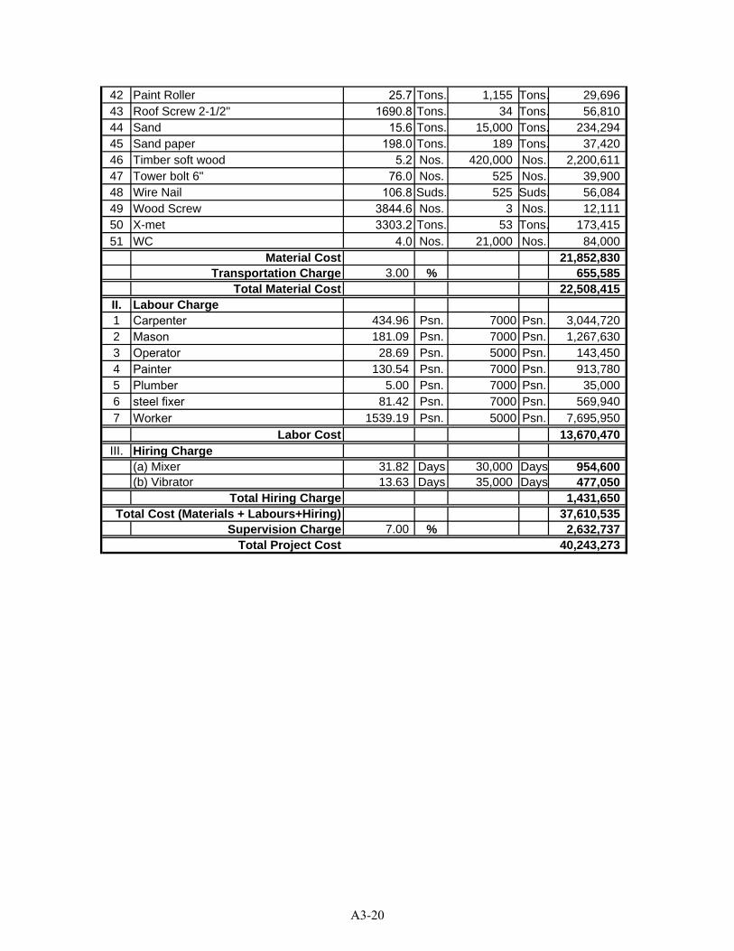
42 Paint Roller 25.7 Tons. 1,155 Tons. 29,69643 Roof Screw 2-1/2" 1690.8 Tons. 34 Tons. 56,81044 Sand 15.6 Tons. 15,000 Tons. 234,29445 Sand paper 198.0 Tons. 189 Tons. 37,42046 Timber soft wood 5.2 Nos. 420,000 Nos. 2,200,61147 Tower bolt 6" 76.0 Nos. 525 Nos. 39,90048 Wire Nail 106.8 Suds. 525 Suds. 56,08449 Wood Screw 3844.6 Nos. 3 Nos. 12,11150 X-met 3303.2 Tons. 53 Tons. 173,41551 WC 4.0 Nos. 21,000 Nos. 84,000
Material Cost 21,852,830Transportation Charge 3.00 % 655,585
Total Material Cost 22,508,415II. Labour Charge1 Carpenter 434.96 Psn. 7000 Psn. 3,044,7202 Mason 181.09 Psn. 7000 Psn. 1,267,6303 Operator 28.69 Psn. 5000 Psn. 143,4504 Painter 130.54 Psn. 7000 Psn. 913,7805 Plumber 5.00 Psn. 7000 Psn. 35,0006 steel fixer 81.42 Psn. 7000 Psn. 569,9407 Worker 1539.19 Psn. 5000 Psn. 7,695,950
Labor Cost 13,670,470III. Hiring Charge
(a) Mixer 31.82 Days 30,000 Days 954,600(b) Vibrator 13.63 Days 35,000 Days 477,050
Total Hiring Charge 1,431,650Total Cost (Materials + Labours+Hiring) 37,610,535
Supervision Charge 7.00 % 2,632,737Total Project Cost 40,243,273
A3-20
APPENDIX 4 PRELIMINARY DESIGN DRAWINGS AND
PRELIMINARY COST ESTIMATE FOR TUBE WELL
(Drilling of 4” Ø, Tube Well with GI Pipe (600 feet depth), Installation of Submersible Pump and Construction of (5,000 gallons) Water
Collection Tank)
A4-1
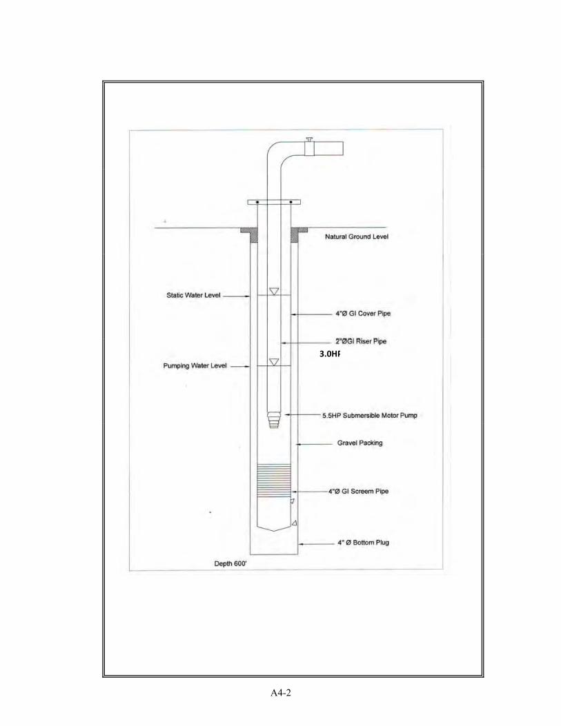
3.0HP
A4-2
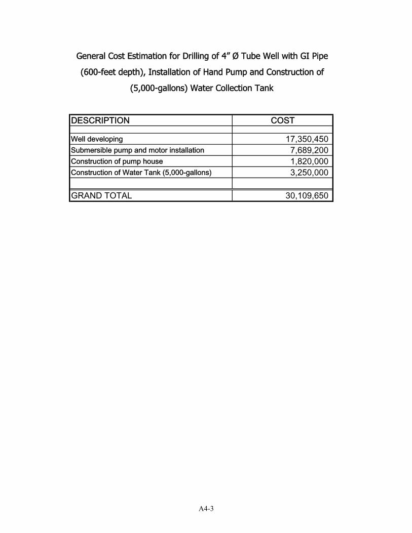
DESCRIPTION COST
Well developing 17,350,450Submersible pump and motor installation 7,689,200Construction of pump house 1,820,000Construction of Water Tank (5,000-gallons) 3,250,000
GRAND TOTAL 30,109,650
General Cost Estimation for Drilling of 4” Ø Tube Well with GI Pipe
(600-feet depth), Installation of Hand Pump and Construction of
(5,000-gallons) Water Collection Tank
A4-3
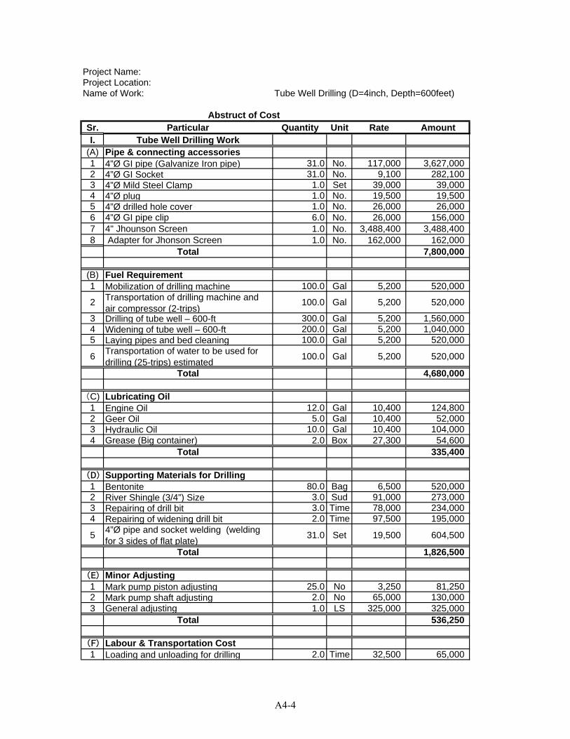
Project Name:Project Location:Name of Work: Tube Well Drilling (D=4inch, Depth=600feet)
Sr. Particular Quantity Unit Rate AmountI. Tube Well Drilling Work
(A) Pipe & connecting accessories1 4ӯ GI pipe (Galvanize Iron pipe) 31.0 No. 117,000 3,627,0002 4ӯ GI Socket 31.0 No. 9,100 282,1003 4ӯ Mild Steel Clamp 1.0 Set 39,000 39,0004 4ӯ plug 1.0 No. 19,500 19,5005 4ӯ drilled hole cover 1.0 No. 26,000 26,0006 4ӯ GI pipe clip 6.0 No. 26,000 156,0007 4" Jhounson Screen 1.0 No. 3,488,400 3,488,4008 Adapter for Jhonson Screen 1.0 No. 162,000 162,000
Total 7,800,000
(B) Fuel Requirement1 Mobilization of drilling machine 100.0 Gal 5,200 520,000
2 Transportation of drilling machine and air compressor (2-trips)
100.0 Gal 5,200 520,000
3 Drilling of tube well – 600-ft 300.0 Gal 5,200 1,560,0004 Widening of tube well – 600-ft 200.0 Gal 5,200 1,040,0005 Laying pipes and bed cleaning 100.0 Gal 5,200 520,000
6Transportation of water to be used for drilling (25-trips) estimated
100.0 Gal 5,200 520,000
Total 4,680,000
(C) Lubricating Oil1 Engine Oil 12.0 Gal 10,400 124,8002 Geer Oil 5.0 Gal 10,400 52,0003 Hydraulic Oil 10.0 Gal 10,400 104,0004 Grease (Big container) 2.0 Box 27,300 54,600
Total 335,400
(D) Supporting Materials for Drilling1 Bentonite 80.0 Bag 6,500 520,0002 River Shingle (3/4”) Size 3.0 Sud 91,000 273,0003 Repairing of drill bit 3.0 Time 78,000 234,0004 Repairing of widening drill bit 2.0 Time 97,500 195,000
54ӯ pipe and socket welding (welding for 3 sides of flat plate)
31.0 Set 19,500 604,500
Total 1,826,500
(E) Minor Adjusting1 Mark pump piston adjusting 25.0 No 3,250 81,2502 Mark pump shaft adjusting 2.0 No 65,000 130,0003 General adjusting 1.0 LS 325,000 325,000
Total 536,250
(F) Labour & Transportation Cost1 Loading and unloading for drilling 2.0 Time 32,500 65,000
Abstruct of Cost
A4-4
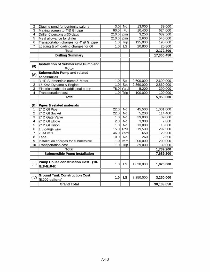
2 Digging pond for bentonite salurry 3.0 No 13,000 39,0003 Making screen to 4”Ø GI pipe 60.0 Ft 10,400 624,0004 Driller 6 persons x 30-days 210.0 psn 3,250 682,5005 Meal allowance for driller 210.0 psn 2,600 546,0006 Transportation charges for 4” Ø GI pipe 1.0 Trip 195,000 195,0007 Loading & off loading charges for GI 1.0 LS 20,800 20,800
Total 2,172,300Drilling Summary 17,350,450
(II)Installation of Submersible Pump and
Motor
(A)Submersible Pump and related accessories
1 3-HP Submersible pump & Motor 1.0 Set 2,600,000 2,600,0002 15-KVA Dynamo & Engine 1.0 Set 2,860,000 2,860,0003 Electrical cable for additional pump 75.0 Yard 5,200 390,0004 Transportation cost 1.0 Trip 100,000 100,000
Total 5,950,000
(B) Pipes & related materials1 2” Ø GI Pipe 22.0 No 45,500 1,001,0002 2” Ø GI Socket 22.0 No 5,200 114,4003 2” Ø Gate Valve 1.0 No 39,000 39,0004 2” Ø GI Elbow 2.0 No 3,900 7,8005 2” Ø GI Union 1.0 No 13,000 13,0006 1.5 gauge wire 15.0 Roll 19,500 292,5007 7044 wire 46.0 Yard 650 29,9008 Tape 10.0 No 260 2,6009 Installation charges for submersible 1.0 Item 200,000 200,000
10 Transportation cost 1.0 Trip 39,000 39,000Total 1,739,200
Submersible Pump Installation 7,689,200
(III)Pump House construction Cost (10-ftx8-ftx8-ft)
1.0 LS 1,820,000 1,820,000
(IV)Ground Tank Construction Cost (5,000-gallons)
1.0 LS 3,250,000 3,250,000
Grand Total 30,109,650
A4-5
A5-1
APPENDIX 5 PRELIMINARY COST ESTIMATE FOR
DUG WELL
(Construction of 10' Ø Dug Well (40 feet depth), Installation of Hand Pump and Construction of Ground
Tank (1.5 m3))
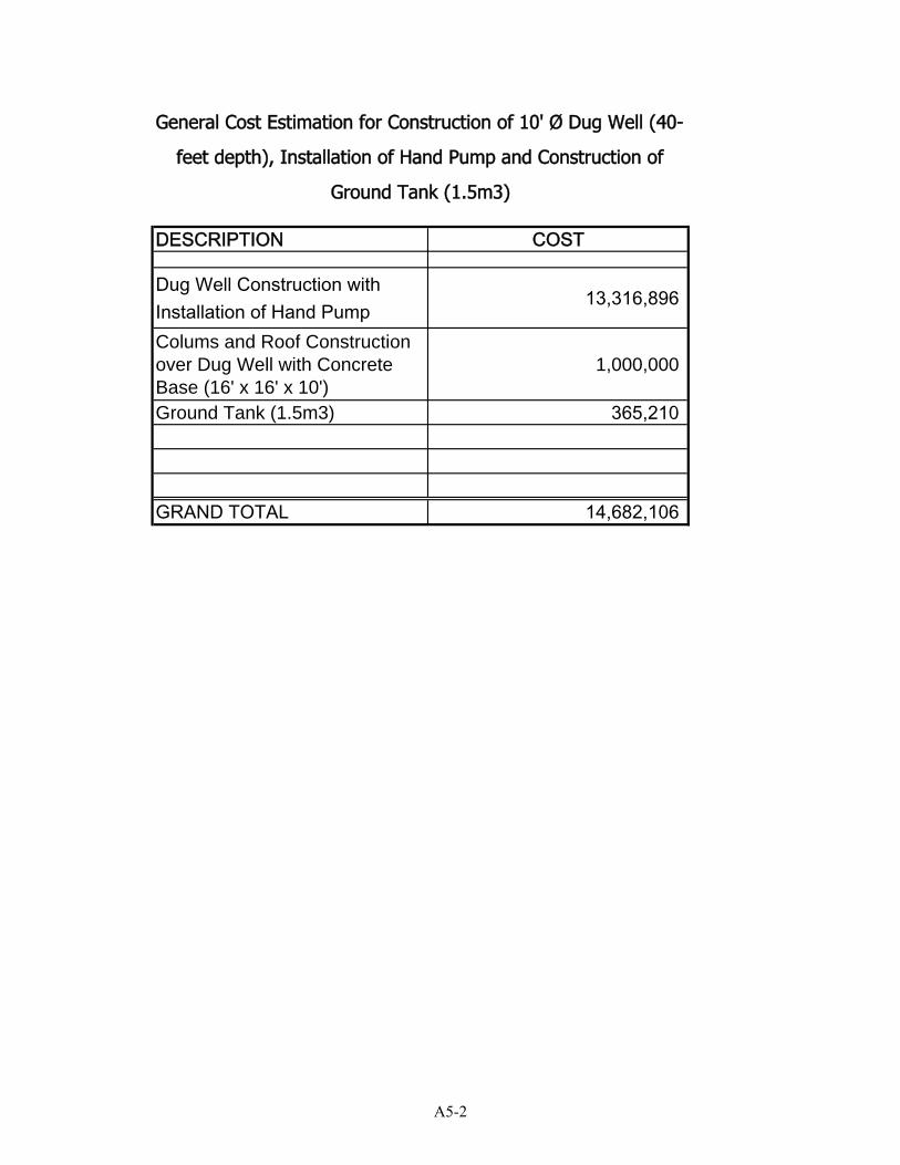
DESCRIPTION COST
Dug Well Construction with Installation of Hand Pump
13,316,896
Colums and Roof Construction over Dug Well with Concrete Base (16' x 16' x 10')
1,000,000
Ground Tank (1.5m3) 365,210
GRAND TOTAL 14,682,106
General Cost Estimation for Construction of 10' Ø Dug Well (40-
feet depth), Installation of Hand Pump and Construction of
Ground Tank (1.5m3)
A5-2
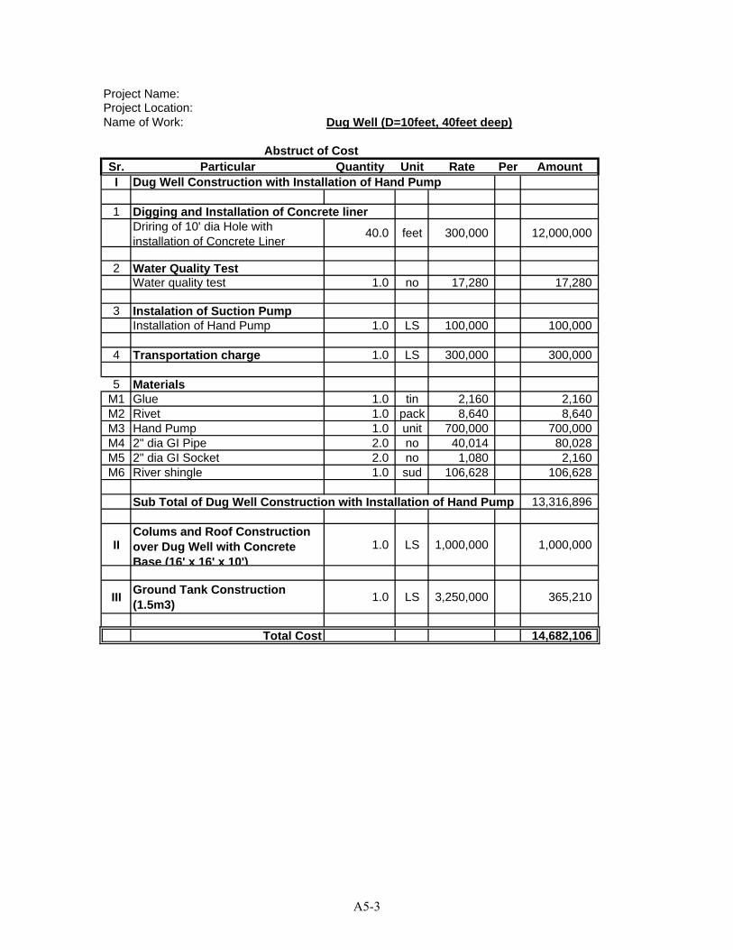
Project Name:Project Location:Name of Work: Dug Well (D=10feet, 40feet deep)
Sr. Particular Quantity Unit Rate Per AmountI Dug Well Construction with Installation of Hand Pump
1 Digging and Installation of Concrete linerDriring of 10' dia Hole with installation of Concrete Liner
40.0 feet 300,000 12,000,000
2 Water Quality TestWater quality test 1.0 no 17,280 17,280
3 Instalation of Suction PumpInstallation of Hand Pump 1.0 LS 100,000 100,000
4 Transportation charge 1.0 LS 300,000 300,000
5 MaterialsM1 Glue 1.0 tin 2,160 2,160M2 Rivet 1.0 pack 8,640 8,640M3 Hand Pump 1.0 unit 700,000 700,000M4 2" dia GI Pipe 2.0 no 40,014 80,028M5 2" dia GI Socket 2.0 no 1,080 2,160M6 River shingle 1.0 sud 106,628 106,628
Sub Total of Dug Well Construction with Installation of Hand Pump 13,316,896
IIColums and Roof Construction over Dug Well with Concrete Base (16' x 16' x 10')
1.0 LS 1,000,000 1,000,000
IIIGround Tank Construction (1.5m3)
1.0 LS 3,250,000 365,210
Total Cost 14,682,106
Abstruct of Cost
A5-3