Embed Size (px)
Citation preview
1
Plate TectonicsChapter 2
Interactions at plate boundaries depend on the direction of relative plate motion and the type of crust.
Which kind of plate boundary is associated with Earthquake activity?
A. Divergent BoundaryB. Convergent BoundaryC. Transform-fault BoundaryD. All of the above
Interactions at plate boundaries depend on the direction of relative plate motion and the type of crust.
Which kind of plate boundary is associated with Earthquake activity?
A. Divergent BoundaryB. Convergent BoundaryC. Transform-fault Boundary
D. All of the above
At which kind of plate boundary is new oceanic lithosphere formed?
A. Oceanic transform boundaryB. Oceanic divergent boundaryC. Ocean-ocean convergent boundaryD. Ocean-continent convergent boundary
Interactions at plate boundaries depend on the direction of relative plate motion and the type of crust.
At which kind of plate boundary is new oceanic lithosphere formed?
A. Oceanic transform boundary
B. Oceanic divergent boundaryC. Ocean-ocean convergent boundaryD. Ocean-continent convergent boundary
Interactions at plate boundaries depend on the direction of relative plate motion and the type of crust.
Plate Tectonics:Learning Goals
• Scientific Method– Development of Plate Tectonics Theory
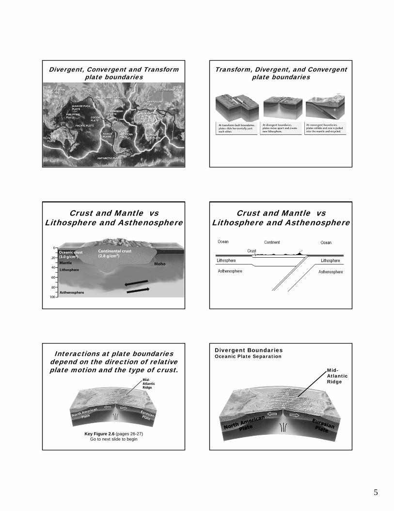
• Lithosphere vs Asthenosphere• Crust vs Mantle• Plates contain continent and ocean• Plate boundaries (where the action is)
– Convergent Boundaries– Divergent Boundaries– Transform Boundaries
2
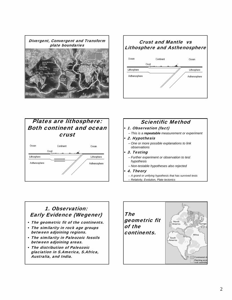
Divergent, Convergent and Transformplate boundaries
Crust and Mantle vsLithosphere and Asthenosphere
Plates are lithosphere:Both continent and ocean
crust
Scientific Method• 1. Observation (fact)
– This is a repeatable measurement or experiment
• 2. Hypothesis– One or more possible explanations to link
observations
• 3. Testing– Further experiment or observation to test
hypothesis
– Non-testable hypotheses also rejected
• 4. Theory– A grand or unifying hypothesis that has survived tests
– Relativity, Evolution, Plate tectonics
1. Observation:Early Evidence (Wegener)
• The geometric fit of the continents. • The similarity in rock age groups
between adjoining regions. • The similarity in Paleozoic fossils
between adjoining areas. • The distribution of Paleozoic
glaciation in S.America, S.Africa, Australia, and India.
The geometric fit of the continents.
3
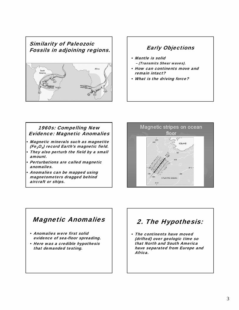
Similarity of Paleozoic Fossils in adjoining regions. Early Objections
• Mantle is solid – (Transmits Shear waves).
• How can continents move and remain intact?
• What is the driving force?
1960s: Compelling New Evidence: Magnetic Anomalies
• Magnetic minerals such as magnetite (Fe3O4) record Earth’s magnetic field.
• They also perturb the field by a small amount.
• Perturbations are called magnetic anomalies.
• Anomalies can be mapped using magnetometers dragged behind aircraft or ships.
Magnetic Anomalies
• Anomalies were first solid evidence of sea-floor spreading.
• Here was a credible hypothesis that demanded testing.
2. The Hypothesis:• The continents have moved
(drifted) over geologic time so that North and South America have separated from Europe and Africa.
4
3. Test the Hypothesis• The hypothesis makes several predictions
that allow it to be tested by further observation.– Rocks in adjoining parts of Africa and South
America should be similar in age and type.– Rocks on Atlantic floor should get younger
toward the mid-ocean ridge.– New bathymetric measurements define the
continental crust boundary. Do South America and Africa still fit together?
– If crust is being created at mid-ocean ridges, it should also be consumed. Where is the crust consumed?
– There needs to be a driving force.
3. Test the Hypothesis• Rocks in adjoining parts of Africa and South
America were age-dated using new radio-isotopic methods: they matched perfectly.
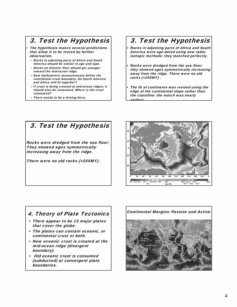
• Rocks were dredged from the sea floor: they showed ages symmetrically increasing away from the ridge. There were no old rocks (>250MY) .
• The fit of continents was revised using the edge of the continental slope rather than the coastline: the match was nearly perfect.
Rocks were dredged from the sea floor:They showed ages symmetrically increasing away from the ridge.
There were no old rocks (>250MY).
3. Test the Hypothesis
4. Theory of Plate Tectonics• There appear to be 13 major plates
that cover the globe. • The plates can contain oceanic, or
continental crust or both. • New oceanic crust is created at the
mid-ocean ridge (divergent boundary).
• Old oceanic crust is consumed (subducted) at convergent plate boundaries.
Continental Margins: Passive and Active
5
Divergent, Convergent and Transformplate boundaries
Transform, Divergent, and Convergent plate boundaries
Crust and Mantle vsLithosphere and Asthenosphere
Crust and Mantle vsLithosphere and Asthenosphere
Interactions at plate boundaries depend on the direction of relative plate motion and the type of crust.
Key Figure 2.6 (pages 26-27)Go to next slide to begin
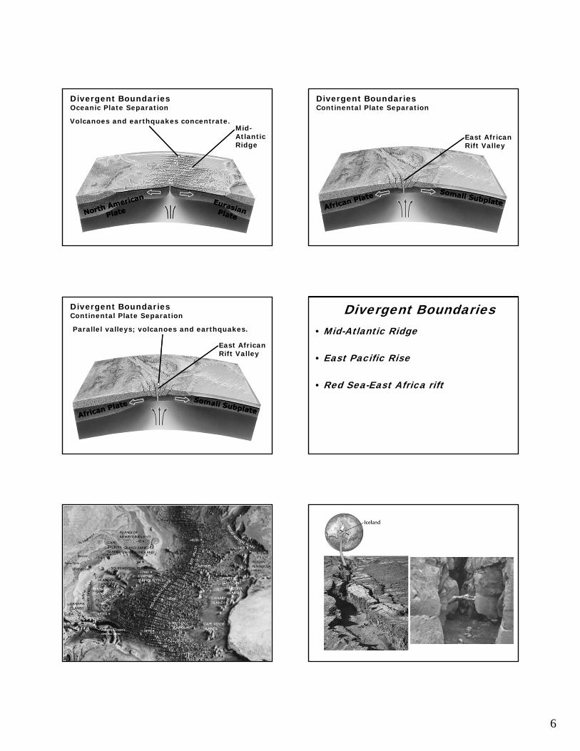
Divergent BoundariesOceanic Plate Separation
Mid-AtlanticRidge
6
Divergent BoundariesOceanic Plate Separation
Mid-AtlanticRidge
Volcanoes and earthquakes concentrate.
Divergent BoundariesContinental Plate Separation
East AfricanRift Valley
Divergent BoundariesContinental Plate Separation
East AfricanRift Valley
Parallel valleys; volcanoes and earthquakes.
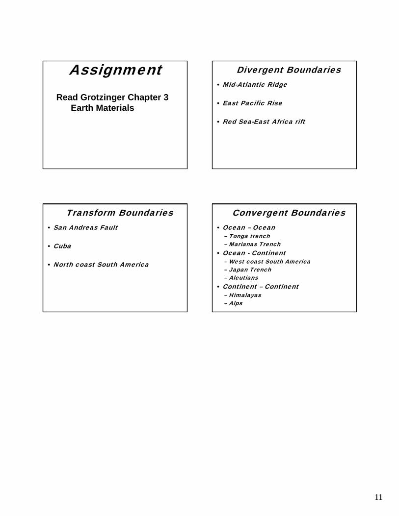
Divergent Boundaries• Mid-Atlantic Ridge
• East Pacific Rise
• Red Sea-East Africa rift
7
Divergent, Convergent and Transformplate boundaries
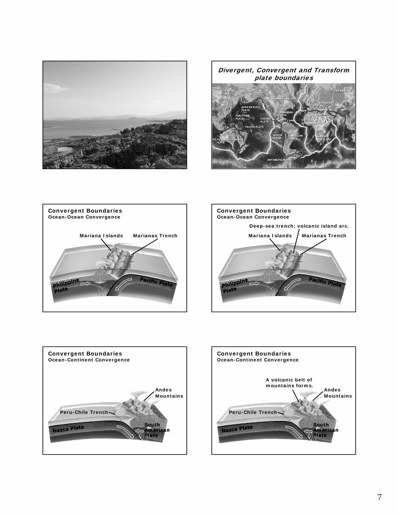
Convergent BoundariesOcean-Ocean Convergence
Mariana Islands Marianas Trench
Convergent BoundariesOcean-Ocean Convergence
Mariana Islands Marianas Trench
Deep-sea trench; volcanic island arc.
Convergent BoundariesOcean-Continent Convergence
AndesMountains
SouthAmericanPlate
SouthAmericanPlate
Peru-Chile Trench
Convergent BoundariesOcean-Continent Convergence
AndesMountains
SouthAmericanPlate
SouthAmericanPlate
Peru-Chile Trench
A volcanic belt ofmountains forms.
8
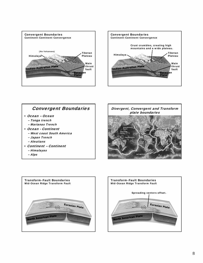
Convergent BoundariesContinent-Continent Convergence
(No Volcanoes)
Mainthrustfault
TibetanPlateau
EurasianPlateEurasianPlate
Himalaya
Convergent BoundariesContinent-Continent Convergence
Himalaya
Mainthrustfault
TibetanPlateau
EurasianPlateEurasianPlate
Crust crumbles, creating highmountains and a wide plateau.
Convergent Boundaries• Ocean – Ocean
– Tonga trench– Marianas Trench
• Ocean - Continent– West coast South America– Japan Trench– Aleutians
• Continent – Continent– Himalayas– Alps
Divergent, Convergent and Transformplate boundaries
Transform-Fault BoundariesMid-Ocean Ridge Transform Fault
Transform-Fault BoundariesMid-Ocean Ridge Transform Fault
Spreading centers offset.

9
Transform-Fault BoundariesContinental Transform Fault
Transform-Fault BoundariesContinental Transform Fault
Offset continental crust.
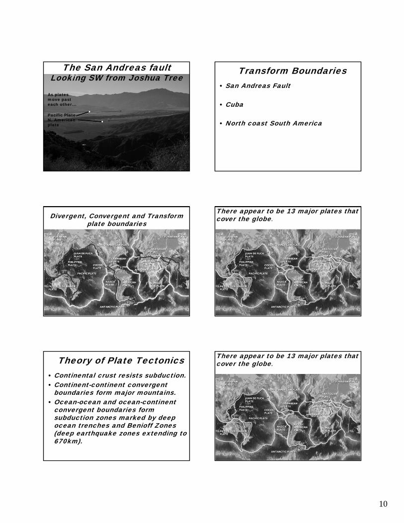
The San Andreas faultAs platesmove past each other...
The San Andreas fault
As platesmove past each other...
…creek beds are offset
The San Andreas faultAs platesmove past each other...
…creek beds are offset
SanFrancisco
Los Angeles
The San Andreas fault
10
As platesmove past each other...
Pacific Plate N. American plate
The San Andreas faultLooking SW from Joshua Tree
Transform Boundaries• San Andreas Fault
• Cuba
• North coast South America
Divergent, Convergent and Transformplate boundaries
There appear to be 13 major plates that cover the globe.
Theory of Plate Tectonics• Continental crust resists subduction. • Continent-continent convergent
boundaries form major mountains. • Ocean-ocean and ocean-continent
convergent boundaries form subduction zones marked by deep ocean trenches and Benioff Zones(deep earthquake zones extending to 670km).
There appear to be 13 major plates that cover the globe.
11
Read Grotzinger Chapter 3Earth Materials
Assignment Divergent Boundaries• Mid-Atlantic Ridge
• East Pacific Rise
• Red Sea-East Africa rift
Transform Boundaries• San Andreas Fault
• Cuba
• North coast South America
Convergent Boundaries• Ocean – Ocean
– Tonga trench– Marianas Trench
• Ocean - Continent– West coast South America– Japan Trench– Aleutians
• Continent – Continent– Himalayas– Alps