Embed Size (px)
DESCRIPTION
CalNex Forecast. Prepared Monday 31 May 2010. Anticipated Platform Activities. WP-3D Mon Down Day - No flight Tue possible night flight: SJV or LA? Wed possible night flight SJV or LA? NOAA Twin Otter - PowerPoint PPT Presentation
Citation preview
CalNex Forecast
Prepared Monday
31 May 2010
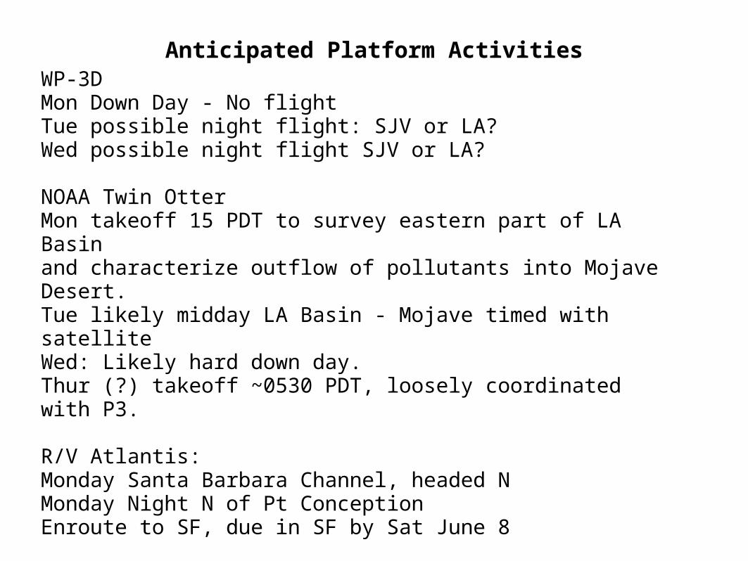
Anticipated Platform Activities
WP-3DMon Down Day - No flightTue possible night flight: SJV or LA?Wed possible night flight SJV or LA? NOAA Twin Otter Mon takeoff 15 PDT to survey eastern part of LA Basin and characterize outflow of pollutants into Mojave Desert.Tue likely midday LA Basin - Mojave timed with satellite Wed: Likely hard down day. Thur (?) takeoff ~0530 PDT, loosely coordinated with P3. R/V Atlantis: Monday Santa Barbara Channel, headed NMonday Night N of Pt ConceptionEnroute to SF, due in SF by Sat June 8
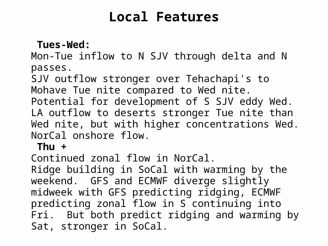
Local Features
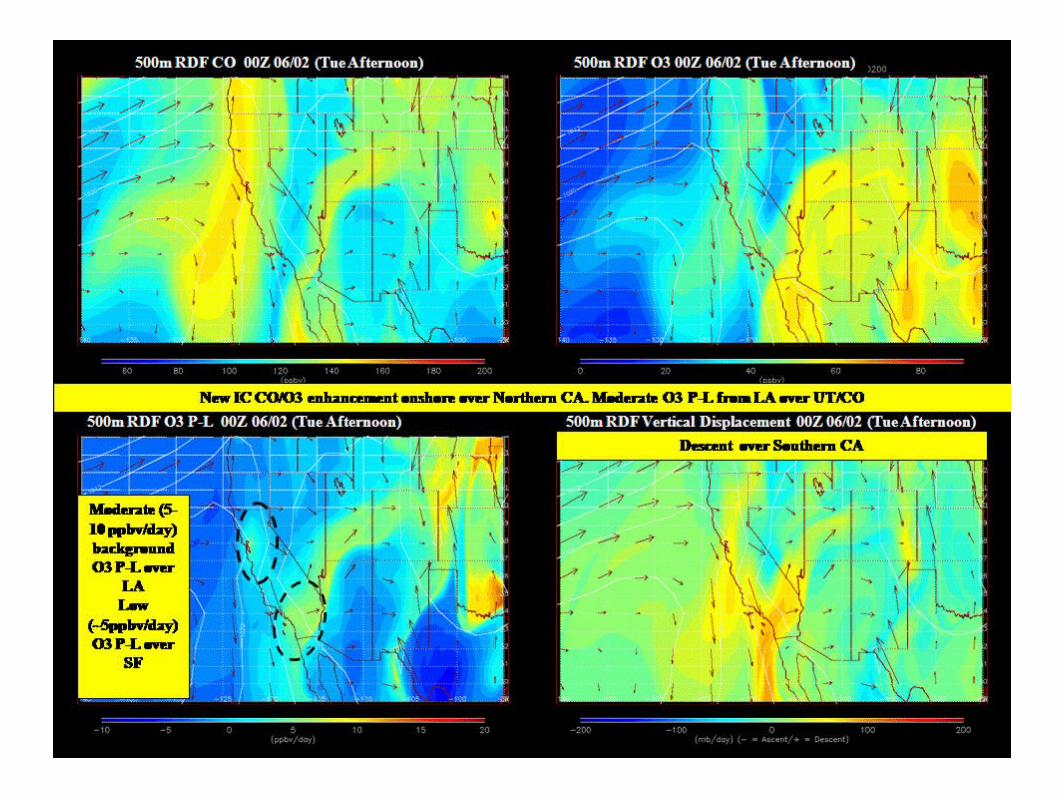
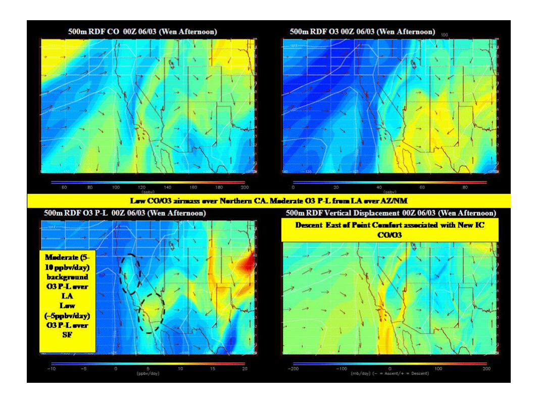
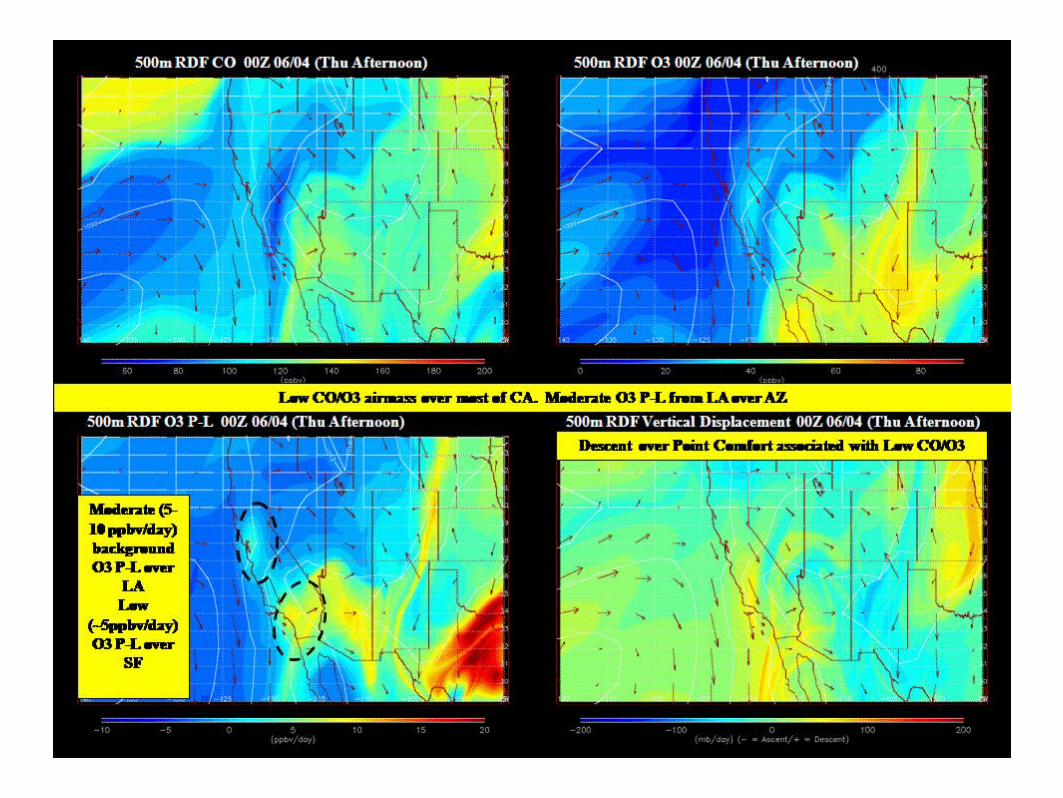
Tues-Wed: Mon-Tue inflow to N SJV through delta and N passes. SJV outflow stronger over Tehachapi's to Mohave Tue nite compared to Wed nite. Potential for development of S SJV eddy Wed.LA outflow to deserts stronger Tue nite than Wed nite, but with higher concentrations Wed. NorCal onshore flow. Thu + Continued zonal flow in NorCal. Ridge building in SoCal with warming by the weekend. GFS and ECMWF diverge slightly midweek with GFS predicting ridging, ECMWF predicting zonal flow in S continuing into Fri. But both predict ridging and warming by Sat, stronger in SoCal.
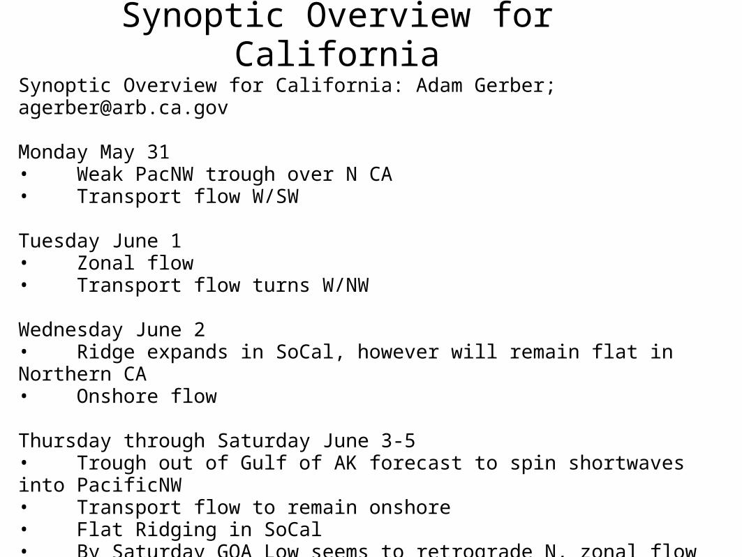
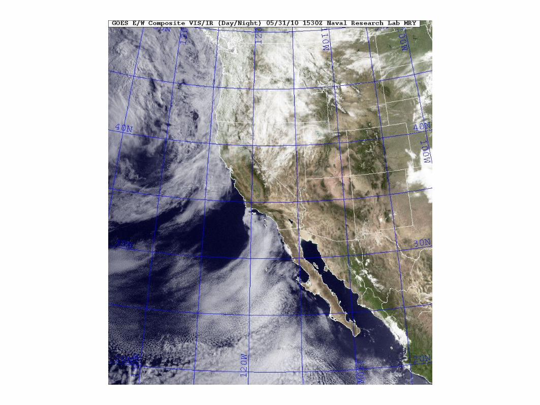
Synoptic Overview for CaliforniaSynoptic Overview for California: Adam Gerber; [email protected]
Monday May 31 • Weak PacNW trough over N CA• Transport flow W/SW
Tuesday June 1 • Zonal flow• Transport flow turns W/NW
Wednesday June 2• Ridge expands in SoCal, however will remain flat in Northern CA• Onshore flow
Thursday through Saturday June 3-5• Trough out of Gulf of AK forecast to spin shortwaves into PacificNW• Transport flow to remain onshore• Flat Ridging in SoCal• By Saturday GOA Low seems to retrograde N, zonal flow to continue
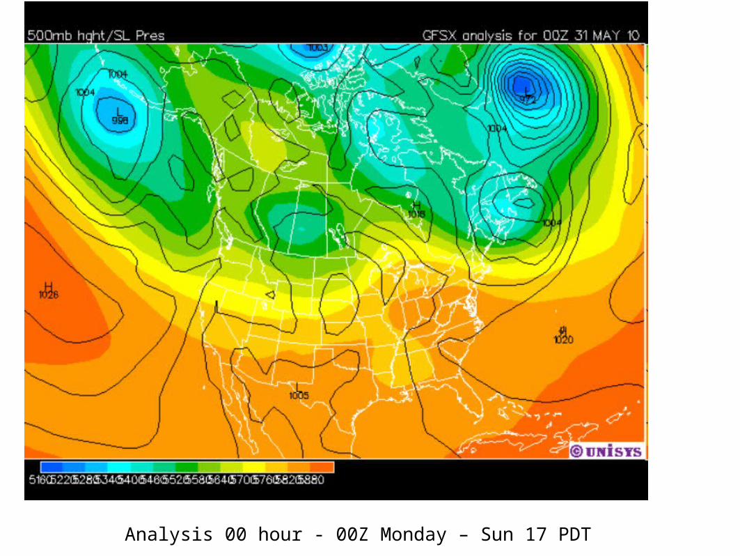
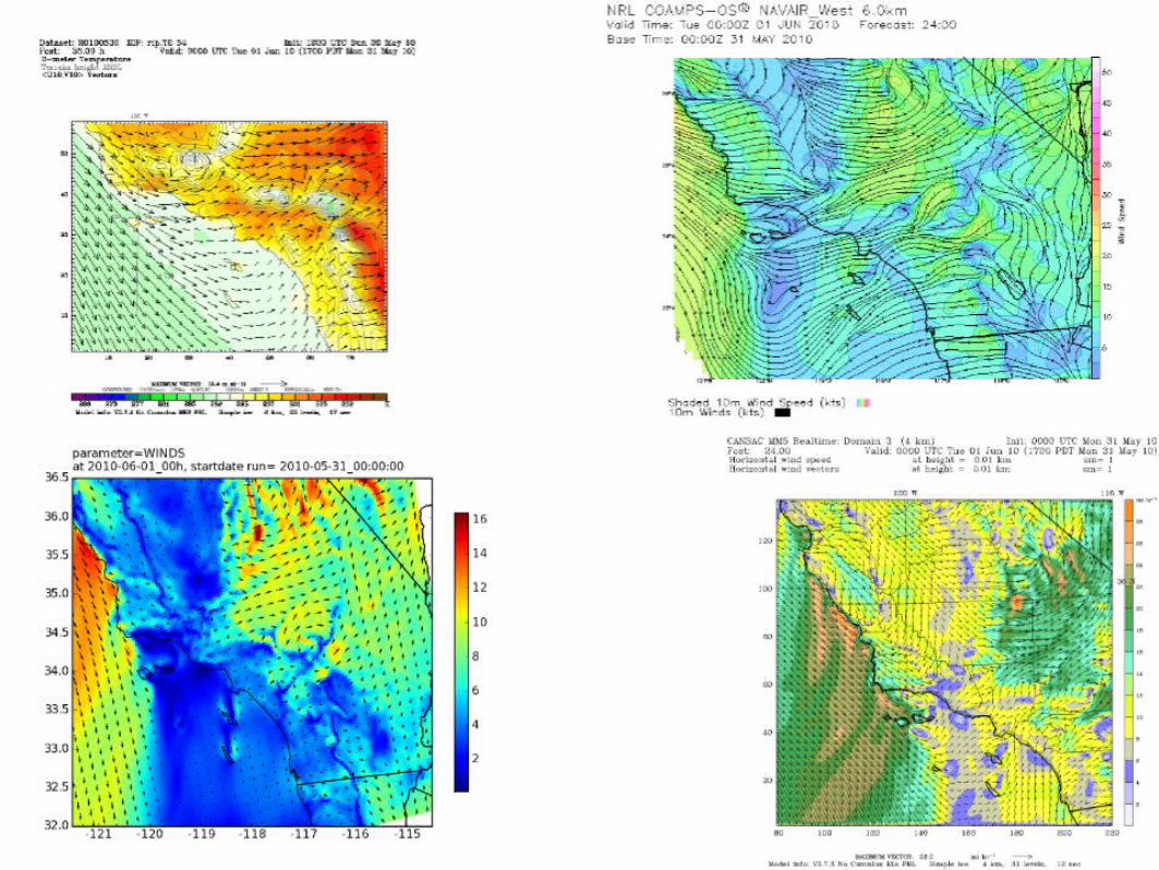
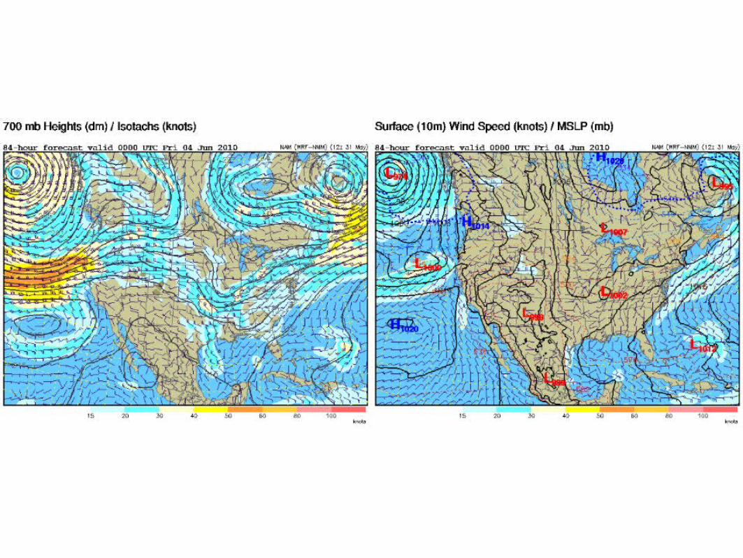
Analysis 00 hour - 00Z Monday – Sun 17 PDT
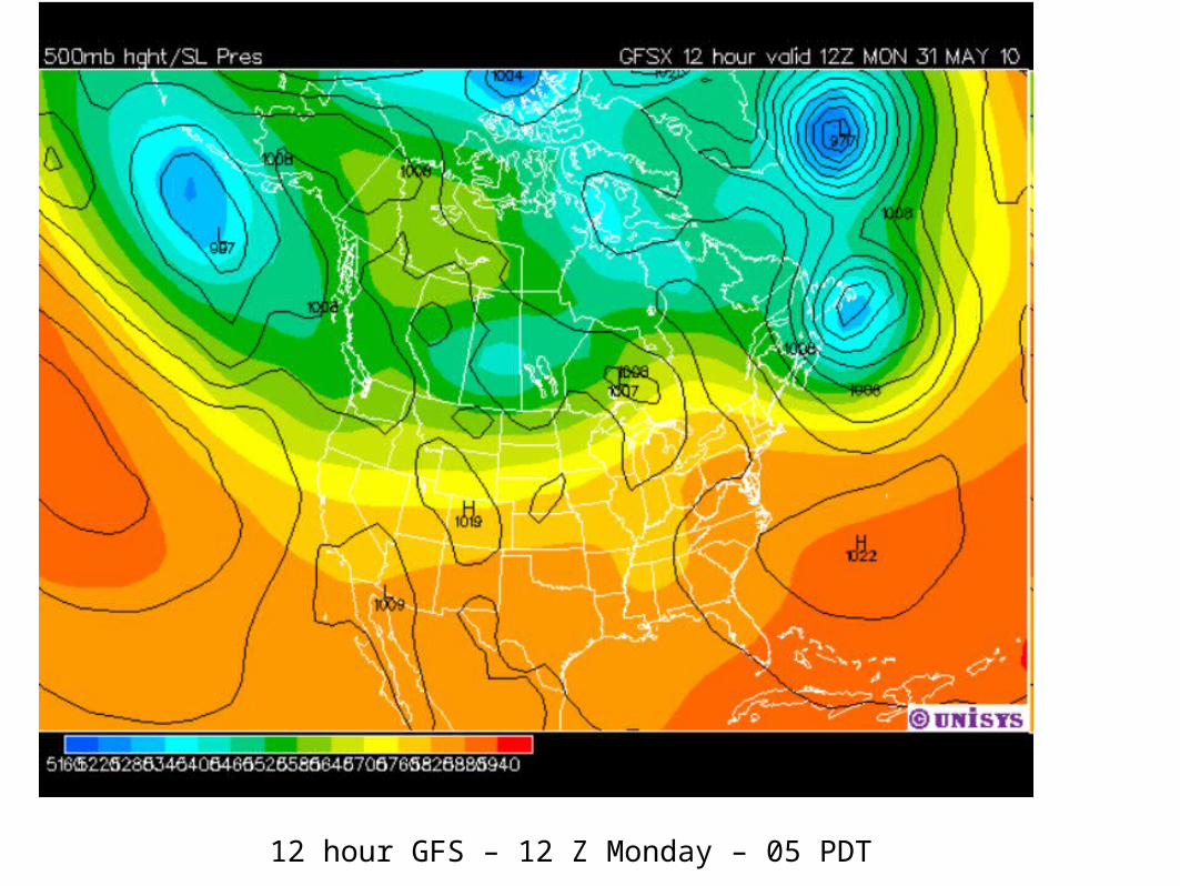
12 hour GFS – 12 Z Monday – 05 PDT

24 hour GFS – 00 Z Tuesday – Mon 17 PDT
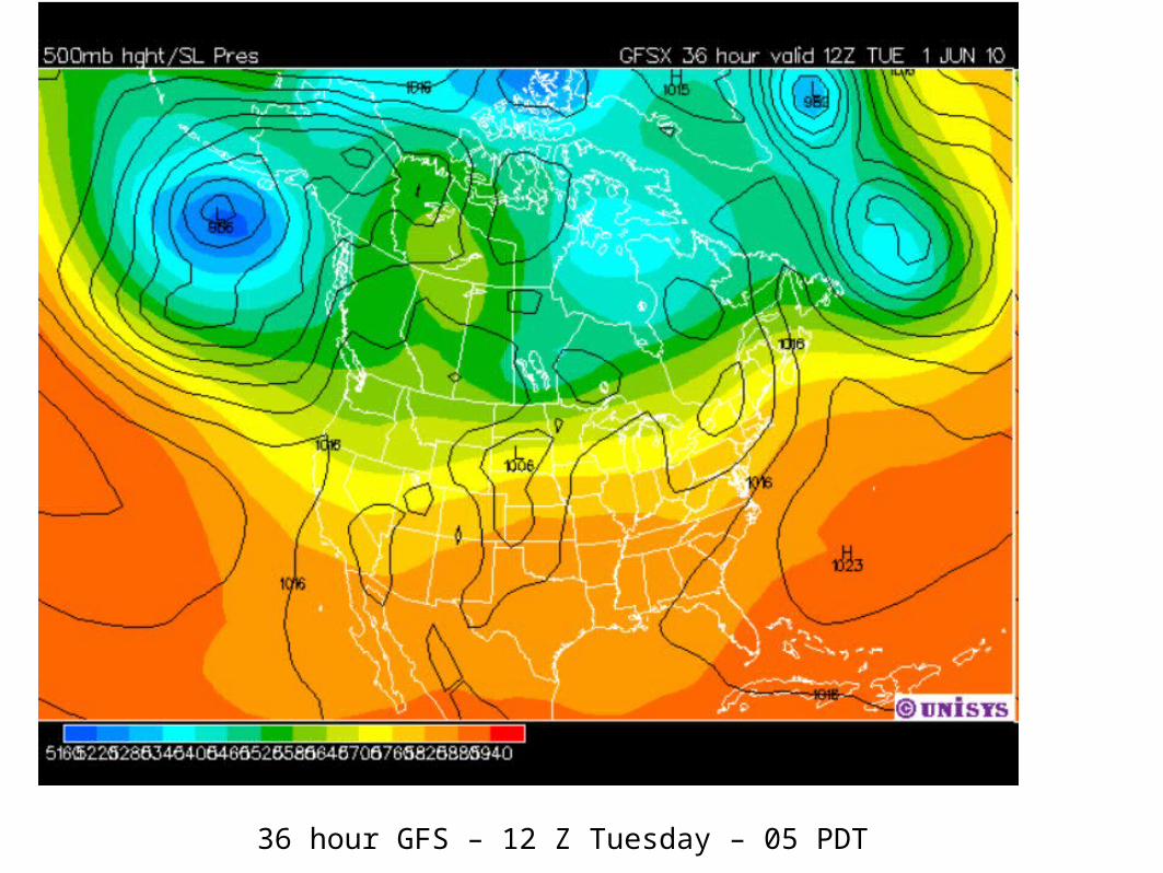
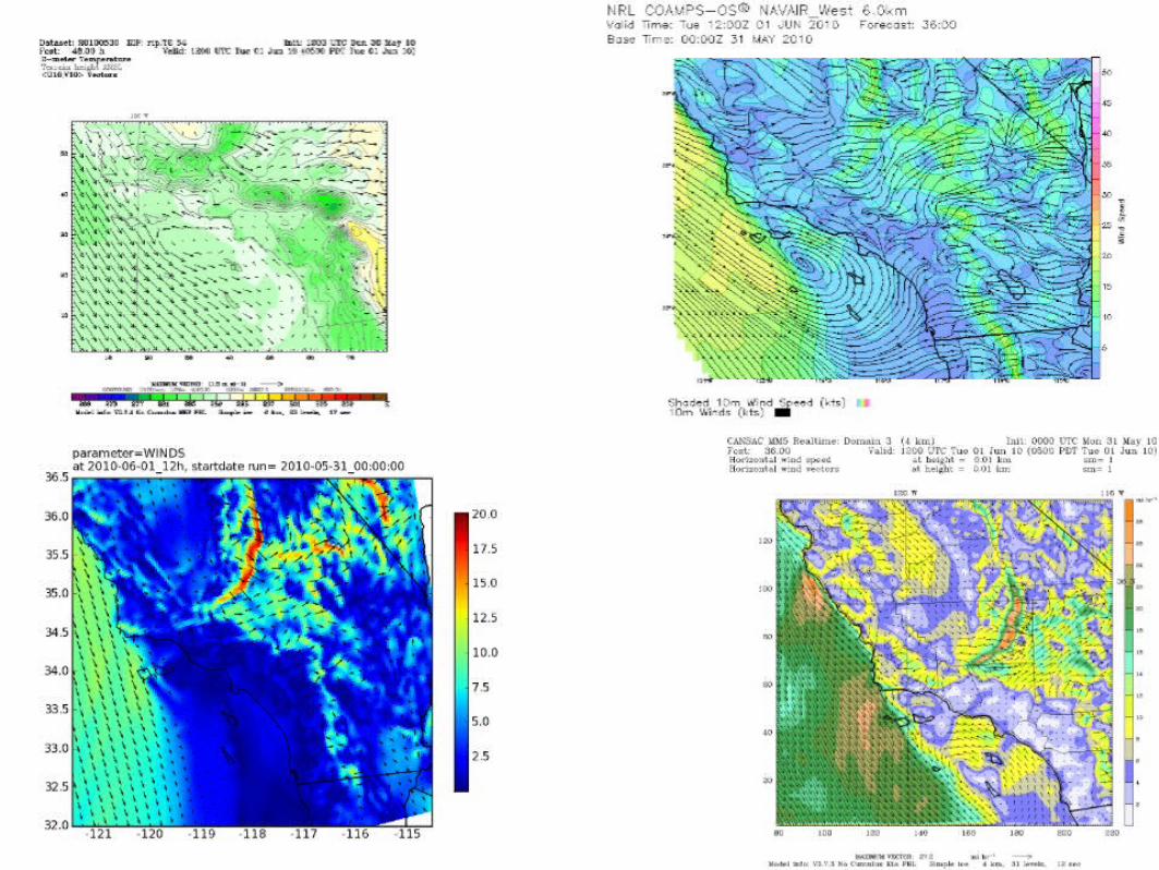
36 hour GFS – 12 Z Tuesday – 05 PDT
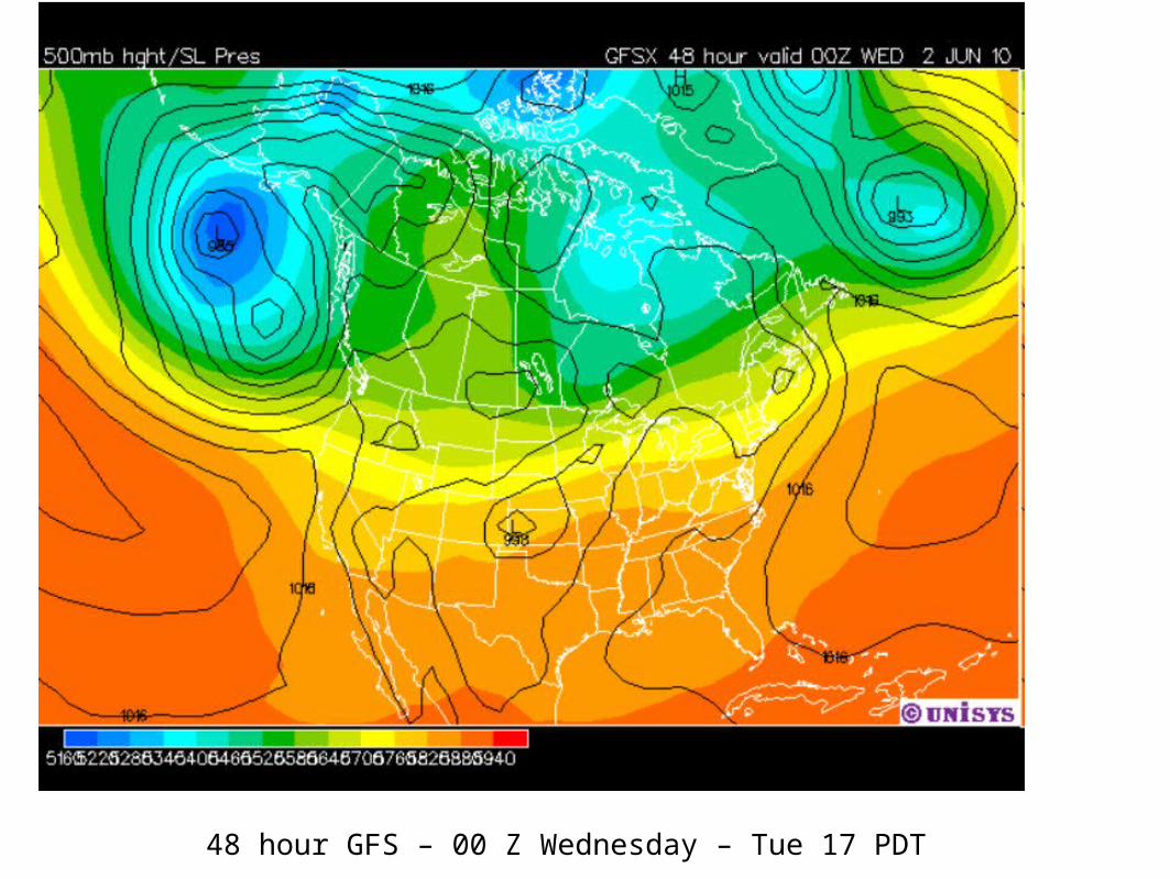
48 hour GFS – 00 Z Wednesday – Tue 17 PDT
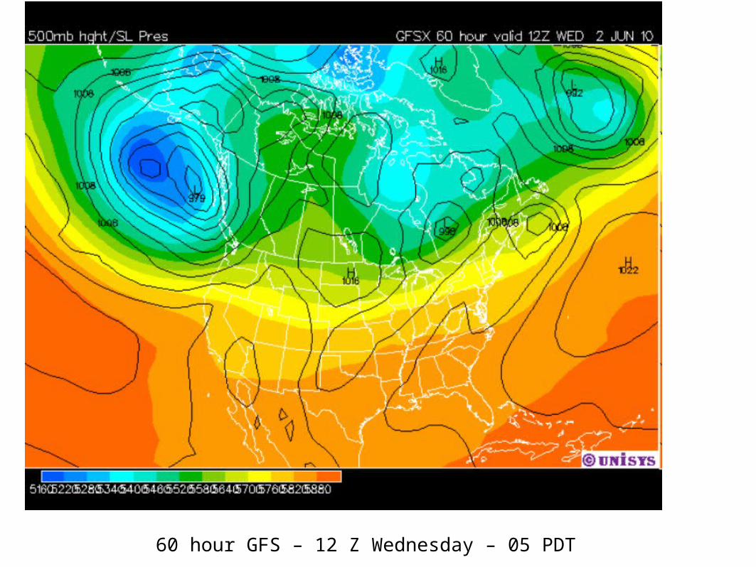
60 hour GFS – 12 Z Wednesday – 05 PDT
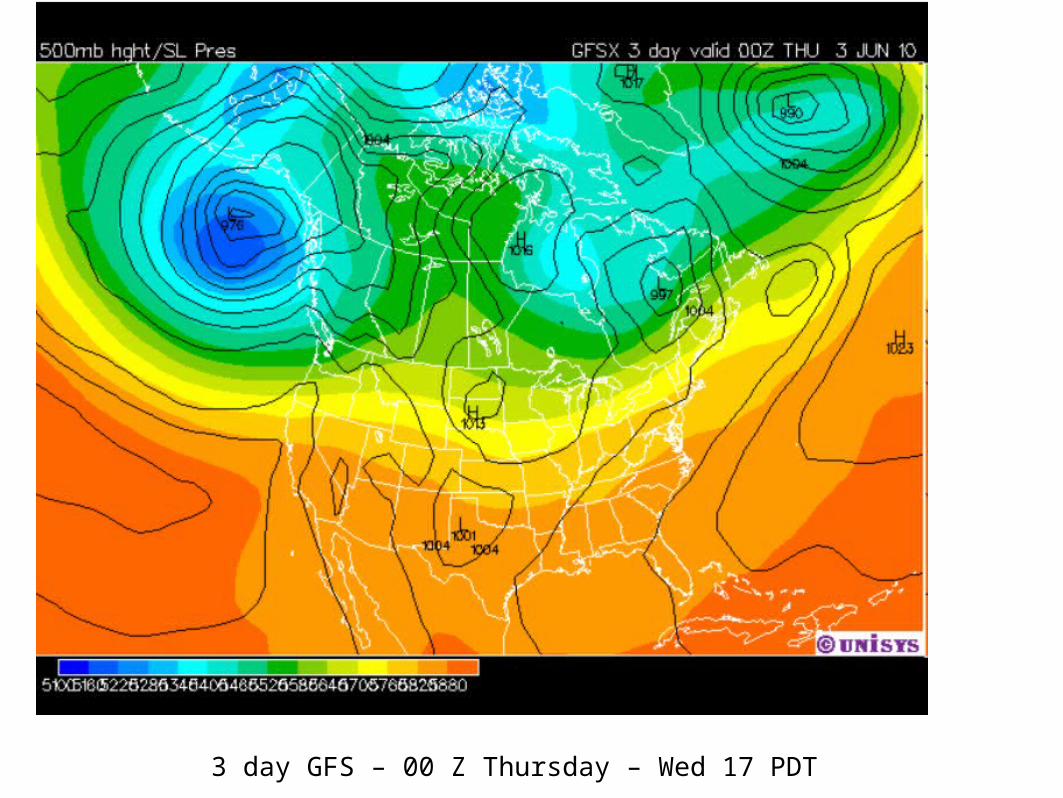
3 day GFS – 00 Z Thursday – Wed 17 PDT
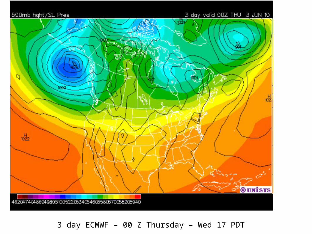
3 day ECMWF – 00 Z Thursday – Wed 17 PDT
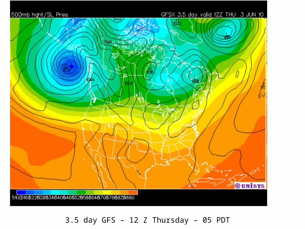
3.5 day GFS – 12 Z Thursday – 05 PDT
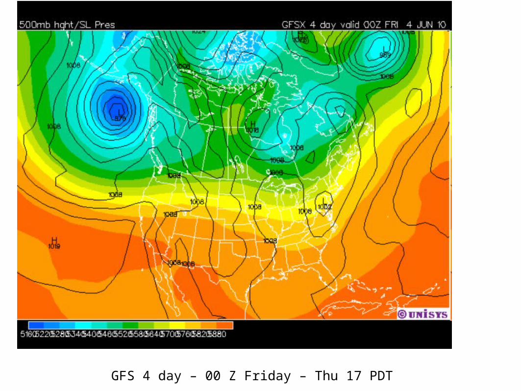
GFS 4 day – 00 Z Friday – Thu 17 PDT
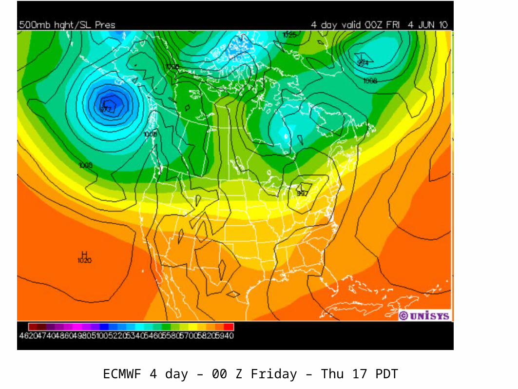
ECMWF 4 day – 00 Z Friday – Thu 17 PDT
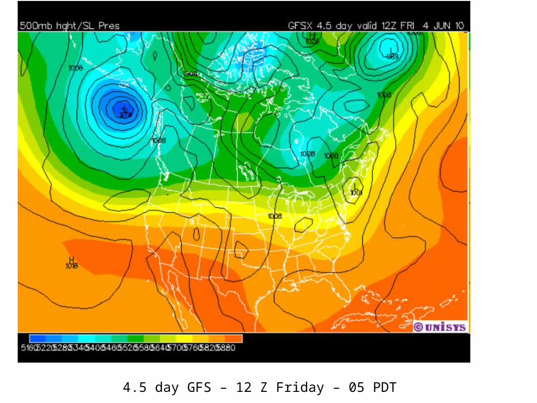
4.5 day GFS – 12 Z Friday – 05 PDT
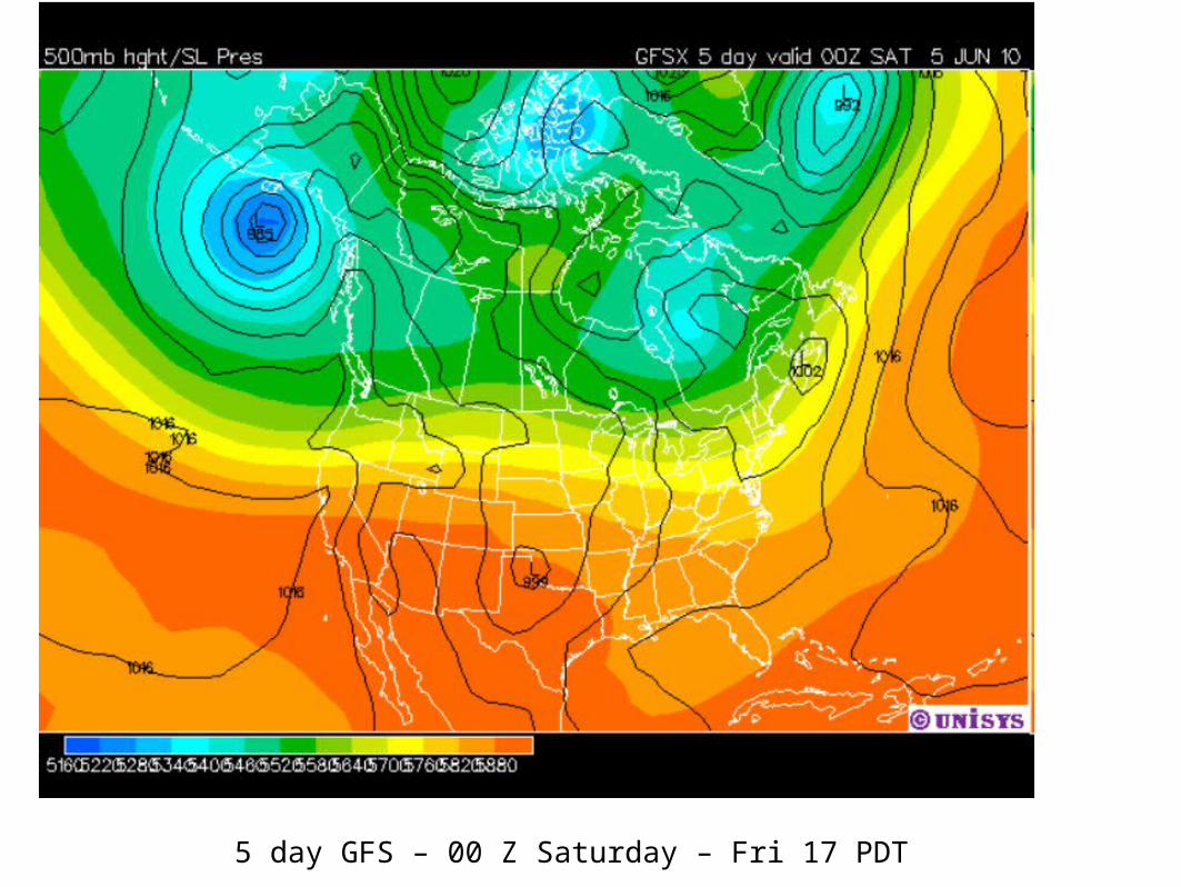
5 day GFS – 00 Z Saturday – Fri 17 PDT
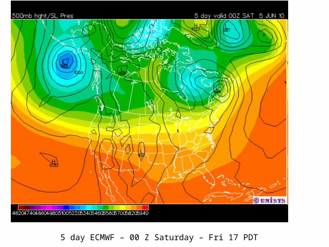
5 day ECMWF – 00 Z Saturday – Fri 17 PDT
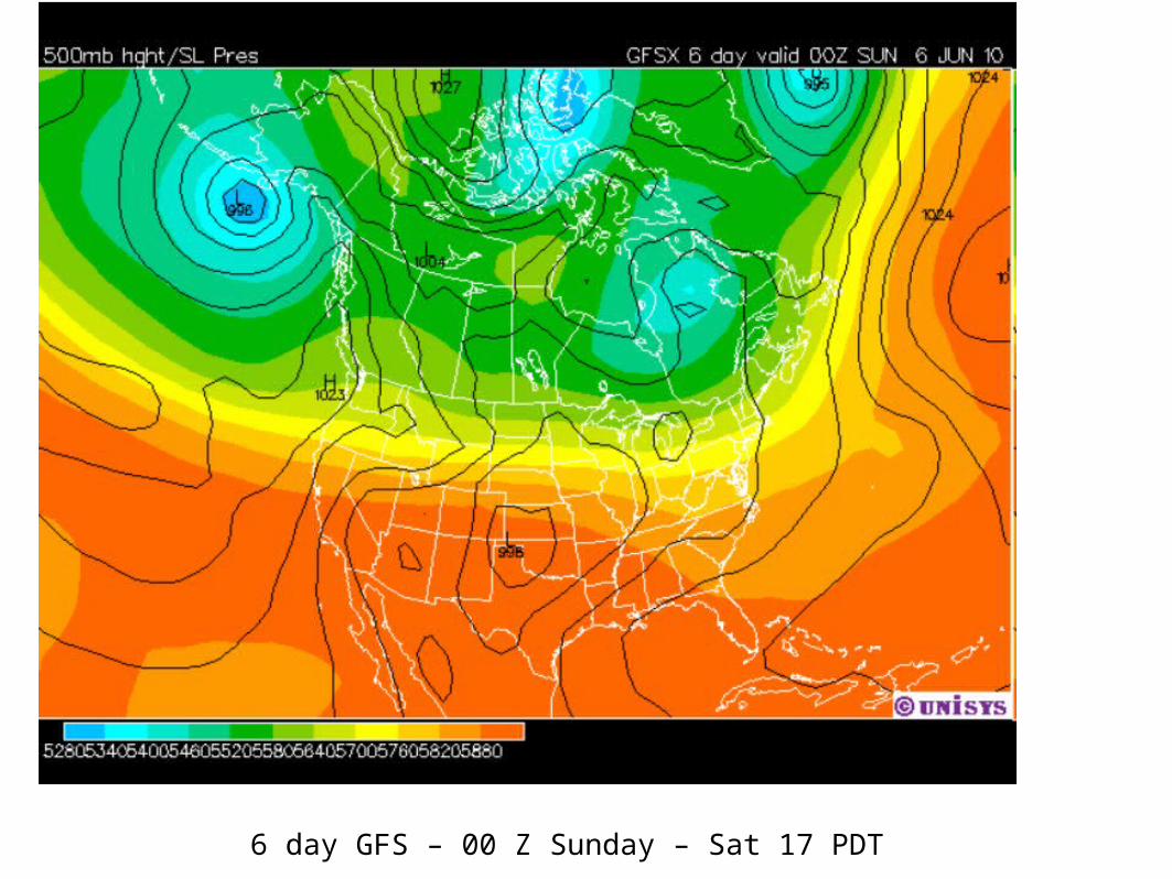
6 day GFS – 00 Z Sunday – Sat 17 PDT
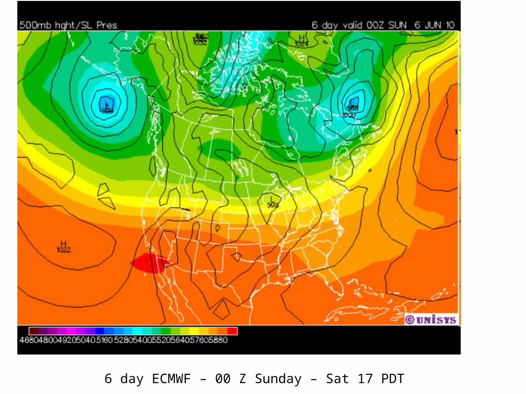
6 day ECMWF – 00 Z Sunday – Sat 17 PDT
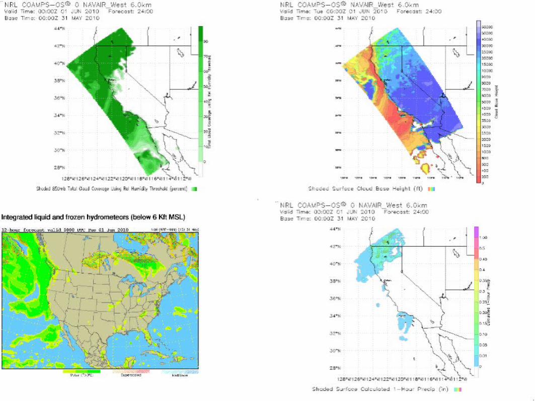
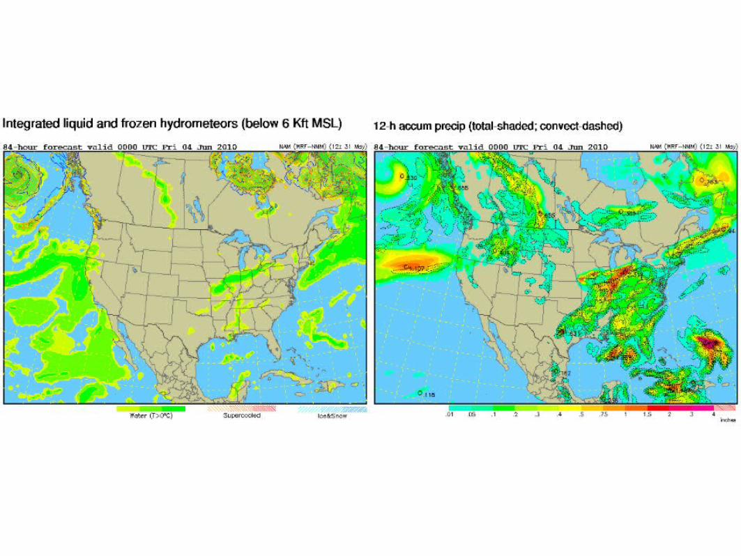
Large Scale Transport
RAQMS FX updated Mon, May 31th
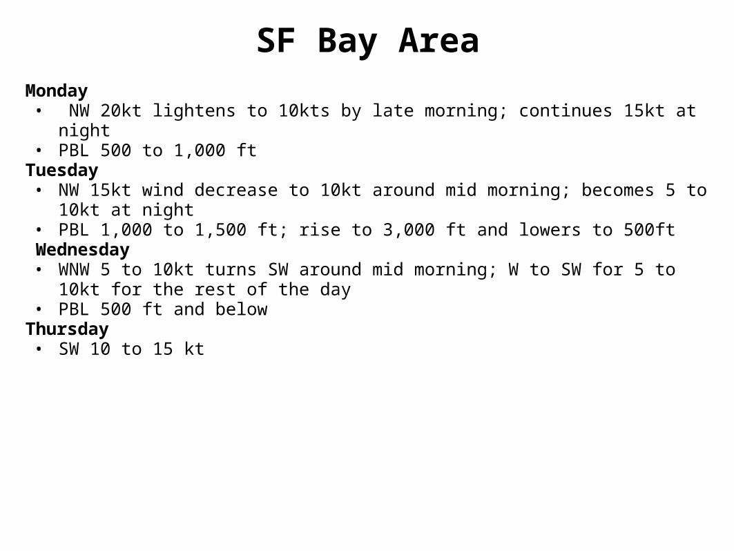
SF Bay AreaMonday• NW 20kt lightens to 10kts by late morning; continues 15kt at night• PBL 500 to 1,000 ft
Tuesday• NW 15kt wind decrease to 10kt around mid morning; becomes 5 to 10kt at night• PBL 1,000 to 1,500 ft; rise to 3,000 ft and lowers to 500ft
Wednesday• WNW 5 to 10kt turns SW around mid morning; W to SW for 5 to 10kt for the rest of
the day• PBL 500 ft and below
Thursday• SW 10 to 15 kt
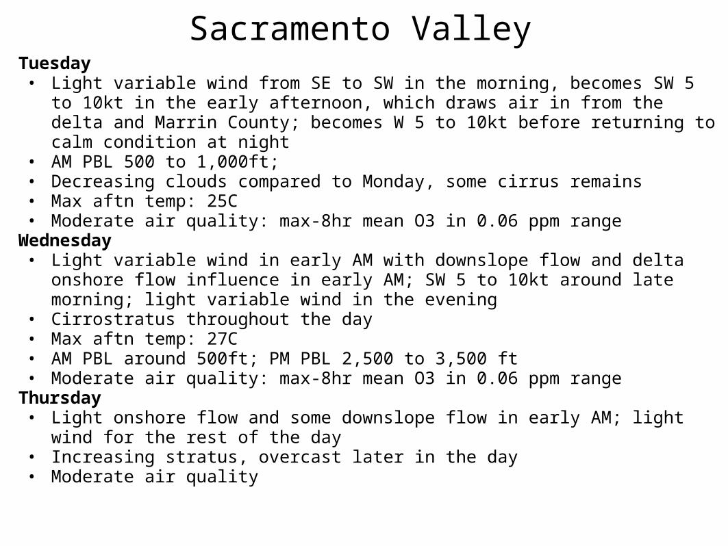
Sacramento ValleyTuesday• Light variable wind from SE to SW in the morning, becomes SW 5 to 10kt in the early
afternoon, which draws air in from the delta and Marrin County; becomes W 5 to 10kt before returning to calm condition at night
• AM PBL 500 to 1,000ft; • Decreasing clouds compared to Monday, some cirrus remains• Max aftn temp: 25C• Moderate air quality: max-8hr mean O3 in 0.06 ppm range
Wednesday• Light variable wind in early AM with downslope flow and delta onshore flow influence in
early AM; SW 5 to 10kt around late morning; light variable wind in the evening• Cirrostratus throughout the day• Max aftn temp: 27C• AM PBL around 500ft; PM PBL 2,500 to 3,500 ft• Moderate air quality: max-8hr mean O3 in 0.06 ppm range
Thursday• Light onshore flow and some downslope flow in early AM; light wind for the rest of the
day• Increasing stratus, overcast later in the day• Moderate air quality
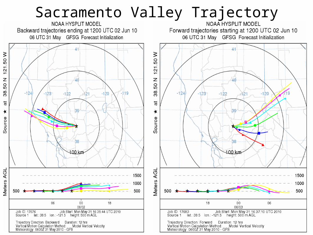
Sacramento Valley Trajectory
San Joaquin Valley
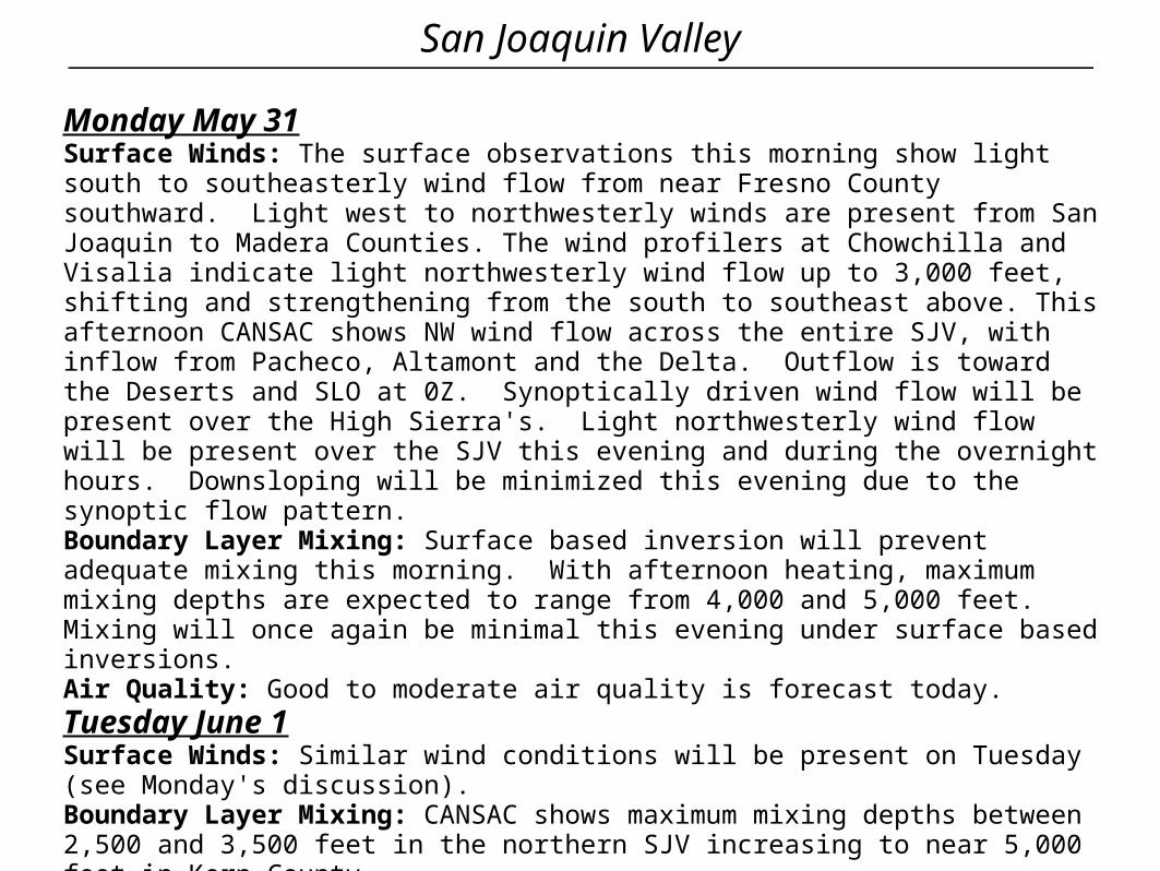
Monday May 31Surface Winds: The surface observations this morning show light south to southeasterly wind flow from near Fresno County southward. Light west to northwesterly winds are present from San Joaquin to Madera Counties. The wind profilers at Chowchilla and Visalia indicate light northwesterly wind flow up to 3,000 feet, shifting and strengthening from the south to southeast above. This afternoon CANSAC shows NW wind flow across the entire SJV, with inflow from Pacheco, Altamont and the Delta. Outflow is toward the Deserts and SLO at 0Z. Synoptically driven wind flow will be present over the High Sierra's. Light northwesterly wind flow will be present over the SJV this evening and during the overnight hours. Downsloping will be minimized this evening due to the synoptic flow pattern. Boundary Layer Mixing: Surface based inversion will prevent adequate mixing this morning. With afternoon heating, maximum mixing depths are expected to range from 4,000 and 5,000 feet. Mixing will once again be minimal this evening under surface based inversions. Air Quality: Good to moderate air quality is forecast today.Tuesday June 1Surface Winds: Similar wind conditions will be present on Tuesday (see Monday's discussion). Boundary Layer Mixing: CANSAC shows maximum mixing depths between 2,500 and 3,500 feet in the northern SJV increasing to near 5,000 feet in Kern CountyAir Quality: Air quality is expected to be in the good to moderate AQI.
San Joaquin Valley
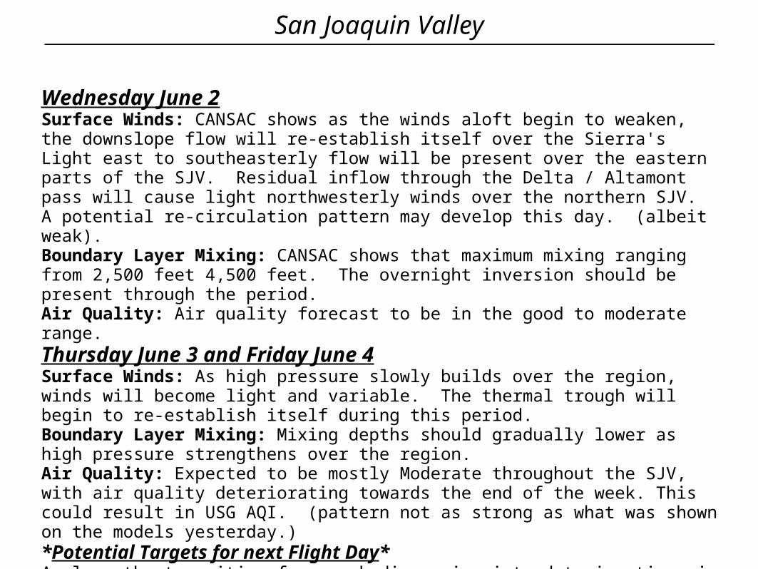
Wednesday June 2Surface Winds: CANSAC shows as the winds aloft begin to weaken, the downslope flow will re-establish itself over the Sierra's Light east to southeasterly flow will be present over the eastern parts of the SJV. Residual inflow through the Delta / Altamont pass will cause light northwesterly winds over the northern SJV. A potential re-circulation pattern may develop this day. (albeit weak). Boundary Layer Mixing: CANSAC shows that maximum mixing ranging from 2,500 feet 4,500 feet. The overnight inversion should be present through the period. Air Quality: Air quality forecast to be in the good to moderate range. Thursday June 3 and Friday June 4Surface Winds: As high pressure slowly builds over the region, winds will become light and variable. The thermal trough will begin to re-establish itself during this period. Boundary Layer Mixing: Mixing depths should gradually lower as high pressure strengthens over the region. Air Quality: Expected to be mostly Moderate throughout the SJV, with air quality deteriorating towards the end of the week. This could result in USG AQI. (pattern not as strong as what was shown on the models yesterday.)*Potential Targets for next Flight Day*Analyze the transition from weak dispersion into deteriorating air quality conditions.
Central CoastPrepared 5/26/2010 – 1:30 pm PST
Southern Coastal Waters
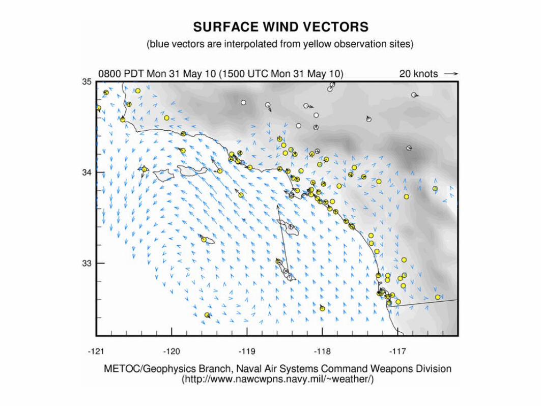

South Coast
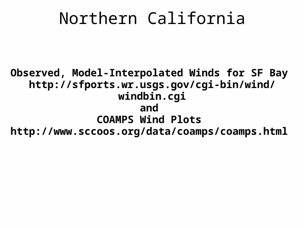
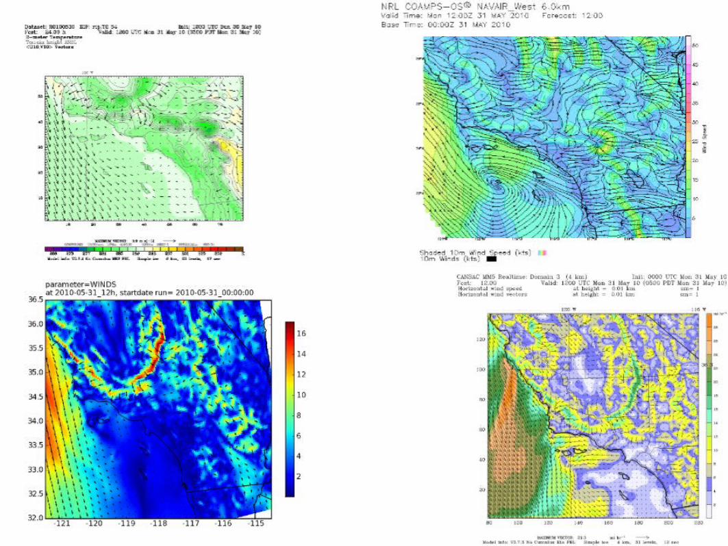
Northern California
Observed, Model-Interpolated Winds for SF Bay http://sfports.wr.usgs.gov/cgi-bin/wind/windbin.cgi
and COAMPS Wind Plots
http://www.sccoos.org/data/coamps/coamps.html