Embed Size (px)
Citation preview
-1-
CALENDAR ITEM
INFORMATIONAL
116 A 72 04/23/15
W 25306 J. Trout S 34 W. Hall
MULTI-YEAR REPORT UPDATE ON THE BIOLOGICAL, PHYSICAL, AND BEACH MONITORING FOR
THE BOLSA CHICA LOWLANDS RESTORATION PROJECT NEAR HUNTINGTON BEACH, ORANGE COUNTY,
FOR YEARS 4 THROUGH 7 (2010-2013)
The Bolsa Chica Lowlands Restoration Project (Project) has been intensively monitored since a new ocean inlet was opened in 2006. Monitoring is conducted to meet permit requirements from the California Coastal Commission, Department of Fish and Wildlife, and U.S. Army Corps of Engineers and to determine the Project’s success. This report update highlights the monitoring completed for the period from October 2010 through December 2013. A more complete summary is attached as Exhibit B.
As background, the Commission and its staff have been actively involved with Bolsa Chica starting with the first boundary settlement discussions in 1970 and title settlement in 1973. In 1996, the Commission and seven other state and federal agencies (the U.S. Army Corps of Engineers, the U.S. Fish and Wildlife Service (FWS), the U.S. Environmental Protection Agency, the National Marine Fisheries Service, the California Resources Agency, the California Coastal Conservancy, and the California Department of Fish and Wildlife) signed an interagency agreement to buy, plan, design, construct, and operate the Bolsa Chica wetlands to mitigate adverse impacts of fill at the ports of Long Beach and Los Angeles.
The ports contributed more than $102 million for the purchase and restoration. Additional funding came from Proposition 40 and 50 grant funds as well as from the Coastal Conservancy and FWS. Funding of the Project from all sources is more than $151 million to date. These funds were placed in trust in the Kapiloff Land Bank Fund for the purpose of completing and operating the Project. The Project has been directed by a steering committee of representatives from each of the agencies listed above. Monitoring has been conducted in three major fields: Biological Monitoring, Physical Monitoring and Beach Monitoring. These were further broken down into tasks, and the
CALENDAR ITEM NO. 116 (CONT’D)
-2-
findings regarding each, for the report period, are outlined below. The complete 2010-2013 Monitoring Report is available at https://www.bolsachicarestoration.org/reports.php?id=2. Water Quality – All parameters remained well within acceptable ranges for developing high value fish, invertebrate and vegetative communities. Water quality in the Muted Tidal Basins (MTBs) was less than ideal due to the muting of the Full Tidal Basin (FTB) and likely will remain so until the muting conditions can be alleviated. Nevertheless fish were existing in these areas.
Vegetative Habitat – The most notable changes in habitat distribution observed during 2011 (five years post-restoration) were the changes in coastal salt marsh distribution in the MTBs, the expansion of eelgrass and cordgrass habitat in the FTB, and the expansion of non-native weeds on the avian nesting sites. Eelgrass transplanted from other sites had expanded to cover 105.4 acres and cordgrass is expected to fill in between transplant locations. By mid-2011, inundation conditions in the MTBs had moved closer to those envisioned by the original restoration design. Non-native plants on the nest sites were being removed with herbicide applications and hand weeding.
Fish Community – More than 30,000 fish were captured, evaluated and released, and represented 52 species. More adult fish were captured in this period indicating a rapidly maturing fish community. The MTBs population is limited to those hardy species that survive in less than optimum conditions.
Benthic Community – Monitoring of the benthic community indicated expected conditions with no problems indicated.
Avian Community – In 2011, species richness ranged from 72 to 99 species per survey and was highest during February and April. A total of 129 species were observed in 2011, for a grand total of 159 species observed since the start of the monitoring period (12 surveys from October 2007 to August 2011). Avian abundance was fairly consistent for each survey period with the exception of the June survey, when counts were notably lower. This was due to the seasonal absence of many shorebirds and wintering ducks. Targeted species of concern – Belding’s savannah sparrow, western snowy plover and California least tern – occupied most of the area available to them. Belding’s sparrow utilized the pickleweed areas where they exist on the site. Snowy plover and least terns, while numerous, have yet to adapt fully to the new areas created for them.
Inlet Sand Shoal – The sand shoal accumulated about 303,000 cubic meters since the last dredging. This was again removed by dredging in the spring of 2011. Excavated sandy material was deposited on the beach downcoast from the inlet jetties. Dredging
CALENDAR ITEM NO. 116 (CONT’D)
-3-
has proven to be only a transitory solution, with siltation reoccurring within six months. An alternative solution may be to use a small dredge to work all winter while birds are not nesting and shut down during nesting season.
Tidal Monitoring – Accretion of sand within the flood shoal of the FTB continues to be the most important factor causing tidal lag and muting. Tidal monitoring provides a means of tracking the lag and muting and providing information necessary to determine the need for dredging to ensure proper physical and ecological system functioning.
Beach Monitoring – One concern for the Project is that the inlet jetties might cause erosion of the downcoast sandy beach. This has not occurred. Beach profile data were obtained and compared to historic data. The beach width remained well above minimum width throughout the period. It appears that erosion here is unlikely to trigger a need for additional material. However, during the spring 2011 dredging work, excavated material was again placed on the beach downcoast from the jetties. Dredging only appears to be effective for 6-8 months before the inlet is again silted in. Beach monitoring has been discontinued based on the above results. Nevertheless, particular vigilance is warranted in monitoring the flood shoal accumulation rates following the recent dredging activities to understand if the high sedimentation rates documented during the first two years were transitory or will be repeated. Monitoring will be resumed if visual observation reveals the need.
Ongoing Management – Pursuant to the Commission’s previous approvals, staff has overseen continued operation of the Project with participation from the multi-agency steering committee and the assistance of the on-site manager, the Department of Fish and Wildlife, which operates the Project as part of the Bolsa Chica Ecological Reserve. Water management and sand shoal management within the Bolsa Chica Lowlands continue to be the most complex and costly elements of ongoing operations. The focus of the steering committee in recent years has been on development of optimal methods to address these management issues. The monitoring report summarized above contains numerous recommendations that will be implemented as appropriate and as funding allows to adaptively manage the Project to continue functioning to meet established goals.
At present, there is approximately $5 million unencumbered and available for ongoing management held in the Kapiloff Land Bank Fund. Depending primarily on the frequency of needed dredging, this amount is expected to last less than four years. An additional $2.5 million is being held for restoration of an additional full tidal area in a future phase. The steering committee agency representatives continue to look for additional sources of funding to ensure continued operation of the Project.

CALENDAR ITEM NO. 116 (CONT’D)
-4-
EXHIBITS: A. Site and Location Map B. Monitoring Report Executive Summary
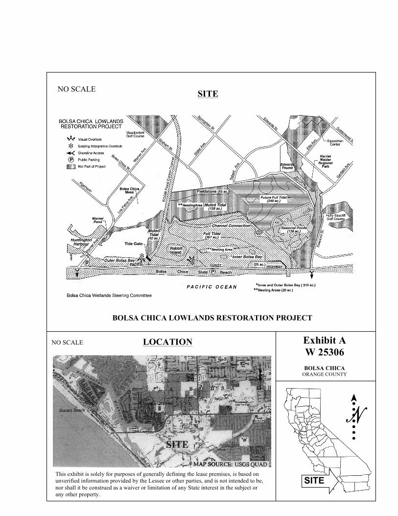
This exhibit is solely for purposes of generally defining the lease premises, is based on unverified information provided by the Lessee or other parties, and is not intended to be, nor shall it be construed as a waiver or limitation of any State interest in the subject or any other property.
Exhibit A W 25306
BOLSA CHICA
ORANGE COUNTY
NO SCALE
LOCATION
SITE
BOLSA CHICA LOWLANDS RESTORATION PROJECT
NO SCALE
SITE
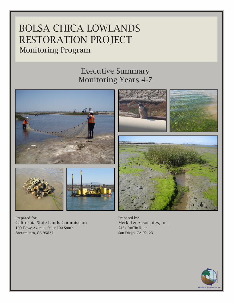
Executive Summary Monitoring Years 4-7
Prepared for:
California State Lands Commission100 Howe Avenue, Suite 100 South
Sacramento, CA 95825
Prepared by:
Merkel & Associates, Inc.5434 Ruffin Road
San Diego, CA 92123
Merkel & Associates, Inc
BOLSA CHICA LOWLANDSRESTORATION PROJECTMonitoring Program
Bolsa Chica Lowlands Restoration Monitoring 2013 Annual Report
Merkel & Associates, Inc. 1
BOLSA CHICA LOWLANDS RESTORATION PROJECT Monitoring Program
Annual Report 2010 to 2013 Monitoring Years 4 through 7
EXECUTIVE SUMMARY
The construction phases of the Bolsa Chica Lowlands Restoration Project were principally complete by the end of 2006, including the opening of the Full Tidal Basin (FTB) to the ocean in August 2006. This report presents the biological and physical monitoring program data through 2013 focusing on the last four years post-restoration. Prior reports document earlier monitoring.
The biological, physical, and beach monitoring programs reported in this report were conducted following the Bolsa Chica Lowland Restoration Project Biological Monitoring and Follow-up Plan and the Bolsa Chica Lowlands Restoration Project Beach Monitoring Plan, both prepared by the U.S. Fish and Wildlife Service in 2001. The monitoring team included Merkel & Associates, Moffat & Nichol Engineers, Coastal Frontiers, and Chambers Group, Inc. The findings are summarized in the following sections.
VEGETATION/HABITAT
The distribution of vegetation communities and unvegetated habitats was monitored in 2011 (Year 5) through the use of aerial photography and re-survey of transects established during Year 2. Habitats were delineated from the photographs and groundtruthed to create a habitat map, which was then compared to the Years 2 and 3 maps to examine changes in important vegetation communities and evaluate the restoration project effects on those communities. The most notable changes in habitat distribution observed between earlier monitoring and 2011 were the continuing shifts in the proportions of open water and salt marsh in the MTBs, the expansion of eelgrass (Zostera marina) and cordgrass (Spartina foliosa) in the FTB, and the expansion of non-native weeds on the avian nesting sites.
The 2011 habitat mapping documented the continued conversion of the Muted Pocket Marsh (MPM) and MTB salt marsh to open water, a process that began in 2006 with introduction of tidal influence to the MPM and in 2008 with the opening of the west MTB to tidal influence. Some degree of salt marsh loss was anticipated, as salt marsh habitat at the lowest elevations experienced prolonged or permanent inundation periods. By 2011 the MPM supported less than half (1.9 ha) as much salt marsh as it did in 2008 (4.6 ha). It is expected that the MPM has reached equilibrium and will show minimal further losses of salt marsh in the coming years. With the impaired functioning of the MTBs, salt marsh at all but the highest elevations gradually died and eventually turned to open water. There was roughly half as much salt marsh/disturbed salt marsh in 2011 as in 2008 in the MTBs, a greater loss than was anticipated.
When evaluating the functionality of the MTB marsh in light of the possible shortfall of coastal salt marsh coverage, it is important to recall that a central goal of the MTB creation was to provide ample nesting habitat for the state endangered Belding’s Savannah sparrow, which nests exclusively in coastal salt marsh, primarily pickleweed. Consecutive years of breeding season surveys for Belding’s Savannah sparrow have documented that despite the increased inundation and continued conversion of some nesting habitat to open water each year, the number of
Bolsa Chica Lowlands Restoration Monitoring 2013 Annual Report
Merkel & Associates, Inc. 2
breeding territories in the MTBs markedly rose or remained fairly stable from year to year post-restoration. This would suggest that the inundation, although reducing nesting habitat area, may have enhanced the suitability or viability of remaining habitat.
Management actions that have been taken to improve the condition of coastal salt marsh habitat site-wide include culvert repairs between cells of the Seasonal Ponds and implementation of a water management plan, which uses the Freeman Creek pump to quickly lower water levels as needed following heavy or long rain events. Despite these efforts, the site still faces significant challenges relative to water management for the sake of habitat development and maintenance. From a habitat standpoint, the FTB inlet must be maintained to alleviate tidal muting, allowing the FTB to experience low tides below 0.3 meters NAVD88 on a regular basis. The MTBs would then have some capacity to be operated as intended. However, based on the early history of sand shoal development and tidal muting, it is anticipated that the MTBs should be operated differently than initially contemplated given the expectation that the lower elevations of the central and east MTBs would rarely allow for full gate operations, even with an aggressive shoal maintenance program.
A transplant of cordgrass into the FTB in August 2007 was intended to accelerate the development of low salt marsh habitat. However, due to the considerable tidal muting, transplant areas at lower elevations suffered from the prolonged inundation periods, leaving only the cordgrass planted at higher elevations. The high wind wave conditions and heavy goose browsing on the cordgrass shelf also hampered its success. The permanent losses of transplanted cordgrass at the lower elevations on the cordgrass shelf reflect the reality that much of the shelf will never be suitable for cordgrass without a significant improvement of tidal drainage to achieve more inundation frequencies more typical of full tidal systems. Fortunately, all persisting stands of cordgrass began producing seed early on, allowing it the opportunity to disperse to and establish within higher locations of the FTB. Between the first year post-transplant (2008) and 2011, transplanted areas expanded from 196 m2 to 765 m2.
Another habitat goal of the restoration was the establishment of eelgrass in the FTB. A 2007 transplant was successful, more than doubling in size after one year (to 0.8 ha [2.0 acres] in June 2008), and reaching 42.7 ha (105.4 acres) by June 2011.
FISH COMMUNITY
The Year 5 fish community sampling was conducted in October 2010, January 2011, April 2011, and July 2011 in the Full Tidal Basin, Muted Pocket Marsh, and the Muted Tidal Basins. Sampling equipment included an otter trawl, purse seine, and beach seines as appropriate for the station depth and accessibility. Captured fish were identified, counted, measured, and weighed. A total of 41 fish species were captured in Year 5, bringing the total number of species captured during the monitoring program (12 sampling events from 2007-2011) to 52.
The Year 5 monitoring documented that the FTB provides habitat for a well-balanced ratio of fish guilds that has remained nearly the same since shortly after monitoring began in Year 2 post-restoration and the introduction of eelgrass as a habitat structuring element in 2007. Since that time, the basin has maintained a relatively stable distribution of demersal, open water, and structure-associated species, despite the rapid shift of great expanses of habitat from bare mud bottom to eelgrass beds. The captured species represented the full spectrum of trophic levels, from small juvenile schooling fish to adult predatory species. The most notable finding was the
Bolsa Chica Lowlands Restoration Monitoring 2013 Annual Report
Merkel & Associates, Inc. 3
capture of large numbers of northern anchovy (Engraulis mordax) in January, April, and July 2011. In the previous nine sampling events since 2007, only 25 northern anchovy were captured. This is an important prey species for nesting birds at Bolsa Chica.
The northern portion of the basin is similar to other back-bay environments, with a soft mud bottom, limited vegetation, and higher summer water temperatures. However, unlike other back bays, it is well flushed and mixed by wind and thus experiences less extreme fluctuations in water quality than typically seen in back-bay environments. In recent years, the fish community has been dominated by northern anchovy, California grunion (Leuresthes tenuis) and topsmelt (Atherinops affinis). The southern portion of the FTB (Station 2) is largely vegetated with dense eelgrass and has developed a fish community typical of well-circulated waters and structured habitats, with species such as croaker, surfperch, kelpfish, and bass being common. Despite the great extents of eelgrass, sufficient habitat was available to support demersal species such as flatfish and sharks, commercially desirable species such as white seabass (Atractoscion nobilis) and California halibut (Paralichthys californicus), and ecologically important open water species of anchovy and atherinids.
The creation of the FTB has increased the availability of important bay habitat, improving southern California fisheries resources. Nearly every fish species captured was represented by juvenile size classes (and usually adults as well), demonstrating the role of the basin as nursery habitat for spawning or post-larval settlement and rearing. The type and size of fish captured also reflect the extensive eelgrass meadows, which increase the complexity of the system by supporting resident fish species, providing egg-laying substrate and protection for breeding species, and forming the basis of detritus-based and grazing-based food webs. The marine life supported by the FTB also benefits offshore marine communities as some species leave the basin, and supports other ecological communities within the system through consumption by avian and mammalian consumers.
In the MTBs, restricted tidal influence and periodic water quality extremes limited the fish community to a small number of hardy species. The west MTB was the only basin receiving daily tidal flushing, where nine species in Year 5, dominated by California killifish (Fundulus parvipinnis) and juvenile topsmelt. Eight species were captured in the central MTB, which received occasional tidal influence. California killifish, longjaw mudsucker (Gillichthys mirabilis), and juvenile topsmelt were the most abundant. Only four species were captured in the east MTB, which was never open to the FTB and received water only through gate leakage or surface flows.
The Muted Pocket Marsh (not hydrologically connected to the FTB of Bolsa Chica) was generally found to be low in diversity but high in abundance of a few species, primarily California killifish and topsmelt. A total of 12 species has been captured in the MPM since monitoring was initiated, with nine captured during Year 5. These abundant small fish are a food source for the many piscivorous birds that use the marsh including terns, grebes, and wading birds.
BENTHIC COMMUNITY
Year 5 assessments of benthic infauna and epifauna were conducted in January and July 2011 at three stations in the FTB that were established during the first monitoring in Year 2. To sample the benthic infauna, three replicate sediment cores were collected from the +0.3-m (+1-foot)
Bolsa Chica Lowlands Restoration Monitoring 2013 Annual Report
Merkel & Associates, Inc. 4
NAVD elevation and from the -0.6-m (–2-foot) NAVD elevation and the infauna identified to the lowest practical taxonomic level, counted, and weighed. Epibenthic invertebrates were assessed using 1-m2 quadrat at the same locations. All epifaunal organisms were identified and counted. Additionally, during the completion of fish studies described above, the incidental by-catch of epibenthic invertebrates was collected, identified, and counted to further enhance the detection of epibenthic organisms.
As expected, high variability was observed in the benthic infaunal community due to the limited replication and frequency of sampling, variations in sediment type within and between stations, and the patchiness that is characteristic of infaunal communities in general. However, the findings during the fifth year post-restoration documented the persistence of benthic food resources available to birds, fish, and other invertebrates in the FTB. The created basin was found to support eleven phyla of infauna, with polychaetes and amphipods being the dominant taxa. Densities were similar at both tidal elevations. Comparisons between stations and with the Year 2 findings found high variability between all parameters with no clear seasonal or annual patterns between stations or elevations.
The quadrat sampling to characterize epibenthic communities did not provide a good representation of the invertebrates present. Most epibenthic organisms are highly mobile and had vacated the mudflat shoreline during the low tides targeted for the survey work. However the tracking of epibenthic invertebrates in the fishing gear documented considerably more diversity due the greater area and depth range sampled. All taxa were marine species typical in bays and estuaries. FTB species seen in high numbers in Year 5 were the California green shrimp (Hippolyte californiensis), kelp humpback shrimp (Hippolyte clarki), and bubble snail (Bulla gouldiana). Four nearly ubiquitous non-native species were also identified in the FTB. In the MPM, various tunicates and California horn snail (Cerithidea californica) were the dominant invertebrates. In the central and west MTBs, invertebrates were more limited, with tunicates, bubble snails, and shore crabs were the primary taxa captured.
WATER QUALITY
Water quality monitoring was conducted quarterly in Year 5 using both tended and untended continuous recording instrumentation. The tended instruments were deployed during the fisheries monitoring to document current water quality. The untended instruments were deployed for one month each quarter. As detailed in the Year 2 report, considerable data collection failures occurred as a result of the long-term deployment, lack of instrument redundancy, and failure-prone instrumentation (Hydrolab Datasonde 5). The monitoring program was therefore modified in Year 5 to include mid-deployment instrument servicing, backup instrument deployment, and a switch to an alternate leading instrument manufacturer (YSI).
The deployed units recorded water depth, temperature, dissolved oxygen (DO), turbidity, and salinity at 20-minute intervals for 30 days at two stations within the FTB: at the north and south end of the basin. The data collected evidenced the tidal marine influence that persists in the basin, reflecting the daily and monthly tidal fluctuations seen in the open ocean. All parameters were within acceptable ranges to support the fish, invertebrate, and vegetation communities in the FTB, and were indicative of a well-flushed marine environment.
Bolsa Chica Lowlands Restoration Monitoring 2013 Annual Report
Merkel & Associates, Inc. 5
In the April and July months, the waters at the northern end of the basin had higher water temperatures because of increased solar heating. The better circulated waters of the southern portion of the basin were more influenced by cooler oceanic water, maintaining lower temperatures during the warmer months. Very little difference in temperature was seen between the two stations during the January sampling. These are temperature conditions typical of coastal embayments in the region.
Dissolved oxygen levels were within the expected range and reflected the strong influence of diurnal tidal flow. Although DO frequently fell below 5 mg/L (a concentration which is typically considered the lower end of a range adequate to support biological organisms), this typically occurred only for a few hours at a time and quickly returned to higher levels. Many species are well adapted to survive brief periods of extremely low or even no DO by either physiologic or behavioral responses. There was no evidence from the fish and invertebrate monitoring work that hypoxia is a problem in the basin.
The salinity data available reflected the absence of significant freshwater input into the FTB, with salinities similar to typical oceanic salinities for most of the year and rising somewhat during the summer months due to evaporative concentration. Turbidity was generally low at both stations, though interference with the sensor by fouling invertebrates and algae affected the acceptability of much of the data.
There is concern that restrictions in the basin inlet could lead to partial or full closure of the basin and loss of any tidal circulation. In one instance, a brief inlet closure event was noted in the tidal data, followed by a self-breaching recovery of tidal exchange. On-going physical monitoring of the condition of the inlet and the flood shoal is key to foreseeing a full closure before it occurs.
AVIAN COMMUNITY
Year 5 saturation surveys of the avian community in the restoration area were conducted in October and December 2010, and February, April, June, and August 2011. Avian abundance was highest during the winter surveys and lowest during the June surveys, when many shorebirds and wintering ducks were absent. Species counts ranged from 72 to 99 species and were highest during the December and February surveys. A total of 129 species were observed. This brings the grand total species observed since the start of post-restoration monitoring in October 2007 to 159.
Overall, the ten most abundant species observed in recent monitoring were western sandpiper (Calidris mauri) (30.3% of the total), followed by California gull (Larus californicus) (7.1%), black-bellied plover (Pluvialis squatarola) (7.0%), American coot (Fulica americana) (3.8%), dowitcher (Limnodromus spp.) (3.6%), northern shoveler (Anas clypeata), (3.6%), Belding’s Savannah sparrow (2.6%), elegant tern (2.3%), least sandpiper (Calidris minutilla) (1.7%), and northern pintail (Anas acuta) (1.8%). The high abundance of California gull was largely due to wintering gulls observed loafing in the Full Tidal Basin during the December 2010 survey.
The habitats with the highest bird densities were intertidal sand shoal, inundated salt panne, and intertidal mudflat. In the winter there were large numbers of shorebirds, gulls, and pelicans loafing on the intertidal sand shoals and mudflats and a large number of shorebirds foraging on the mudflats. In the early spring there were migrating ducks and shorebirds using the inundated
Bolsa Chica Lowlands Restoration Monitoring 2013 Annual Report
Merkel & Associates, Inc. 6
salt panne and mudflats to rest and forage. Species richness was highest in the salt marsh (90 species), open water (79 species), inundated salt panne (72 species), and mudflat (62 species).
Surveys for the state endangered Belding's Savannah sparrow were performed annually in Year 4 (2010), Year 5 (2011), Year 6 (2012), and Year 7 (2013). Two surveys were done in Years 4 and 5, and only one survey was done in Years 6 and 7 once it had been determined that duplicate surveys were not yielding significant additional benefit for the cost. A total of 237 and 199 territories were recorded in 2010 surveys, 259 and 264 territories in 2011, 310 in 2012, and 217 in 2013. It is believed that the 2013 numbers are an undercount based on additional subsampling that was performed. The count is only an estimate of the actual population, and detection of territories could fluctuate with weather conditions or breeding status. The highest number of territories was mapped in the first year post-restoration (2007), possibly due to displacement of birds arising from the removal of FTB salt marsh moving into the adjacent marsh. In the following years numbers fluctuated, then increased each year from 2010 to 2012, followed by the decrease in 2013 attributed to the survey being conducted prior to the peak in territorial activity.
The largest proportion of the Belding's Savannah sparrow territories is located in the MTBs. An overall increase in usage each year occurred despite the continued decline in the amount of pickleweed-dominated marsh and an increase in the amount of open water as the MTBs adapt to continuing changes in inundation. The flooding of much of the marsh in the MTBs may have improved the quality of remaining pickleweed habitat through the control of weeds, reduction of predators, more reliable moisture, improved foraging conditions, and higher quality breeding habitat. Although increased marsh vigor is not evident in the spatial extent data, this hypothesis is supported by the stable number of territories throughout the MTBs and visible increased stature of remaining shrubs.
Annual monitoring of the state and federally endangered California least tern (Sternula antillarum browni) continued in Years 4, 5, 6, and 7. The number of nests in 2010, 2011, 2012, and 2013 was highly variable: 446, 167, 305, and 157, respectively. The fate of these nests as measured by the number of fledglings produced was determined by the degree of predation of eggs and chicks each year. In 2010 an estimated range of only 67-114 fledglings were produced following a major loss of nearly the entire colony on Nest Site 1 (NS1) to a family of coyotes. In 2011 an estimated range of 66-95 fledglings were produced, with high nest predation and some abandonment. In 2012, despite a substantial increase in nests from the year before, only 16 fledglings were produced due to very high nest predation by coyotes and corvids. The record low number of nests in 2013 produced 35-67 fledglings, again with high predation by gulls, raptors, and corvids.
Following the considerable losses in 2010 despite record high nesting, additional effort was put into protecting nesting species and preparing their sites. To deter coyotes, fences were extended on NS1 and installed at Nest Site 2 (NS2) prior to the 2013 nesting season to protect the nests from coyotes and other mammalian predators. Overall, reproductive success post-restoration (2007-2013) (as fledglings/pair) has not yet reached the high levels seen in 2005 prior to the creation of the new nest sites and in 2006, when the three nest sites had been completed (one nest site was utilized). Reported predation in these successful years was notably low.
Annual monitoring of breeding western snowy plovers was continued in Years 4, 5, 6, and 7. In 2010, there were a total of 64 western snowy plover nests producing 63 fledglings. In 2011,

Bolsa Chica Lowlands Restoration Monitoring 2013 Annual Report
Merkel & Associates, Inc. 7
there were 73 nests producing 62 fledglings. In 2012, there were 68 nests producing 77 fledglings. In 2013, there were 66 nests producing 37 fledglings.
The number of western snowy plover nests and adult pairs was stable from year to year, but reproductive success reached its lowest point since 2007 in 2013, despite large efforts made to prepare NS1 prior to nesting season. The site was scraped to remove the weeds and new sand was added to the site. Predation of adults and chicks remained the primary cause of low reproductive success. It should be noted that a portion of the reproductive success in 2010 through 2013 was attributable to the highly successful rearing and release of fledglings that were raised at the Huntington Beach Wetlands and Wildlife Care Center from rescued abandoned eggs and chicks at Bolsa Chica. It is likely that these eggs or chicks had been abandoned due to the depredation of one or both adults.
The restoration project included the creation of three nest sites targeting both least terns and snowy plovers. While NS1 has been heavily used by both terns and plovers since it was completed in 2006, California least tern did not expand to nest on NS2 and Nest Site 3 (NS3) until 2010. In 2010, reproductive success on these sites was low due to nest predation on NS2 and both egg and chick predation on NS3. In 2011, most of the least tern fledglings came from NS2, while NS3, with the greatest number of least tern nests at Bolsa Chica, yielded a very low fledging rate per nest. In 2012 and 2013 there were no fledglings produced at NS3 by the least terns nesting there. On NS2 nesting terns produced no fledglings in 2012, but between 34 and 66 in 2013. The snowy plover has used NS2 since 2009 and NS3 since 2006, with varying success.
INLET FLOOD SHOAL
Following the development of a large shoal in the FTB inlet after its opening to the ocean, a maintenance dredging event was undertaken from January to April 2009. Monitoring of the flood shoal resumed after the dredging to examine the rate at which the shoal began to reform. That monitoring continued in 2010, with surveys in January and July. A second maintenance dredging was performed from January to April 2011, with follow-up survey performed in April, May and June 2011 to again track the re-accretion of the shoal.
The surveys documented the rapid accretion in the inlet following the first dredge event of early 2009, followed by re-accretion at a similar rate in the first half of 2010, but distributed over a wider area, with the sand pushing further into the basin. The main shoal continued to accrete in the second half of 2010 leading up to a second maintenance dredging event. Following the completion in April 2011, there was a very rapid re-accumulation of sand in the inlet.
The second dredging event in 2011 involved the excavation of a large sand trap (to the originally designed basin depth) that was not done during the initial site construction or first maintenance dredging. This sand trap was intended to capture the initial rapid influx of sand following the dredging, allowing the basin more capacity to accept addition sand input over the following years. There was a rapid infill of the basin by littoral sediments followed by a decline in accretion rates. The sand trap was also intended to extend the period of improved tidal circulation in the basin, with the goal of greater system functionality. The trap served its function to provide sand storage capacity and thus curb the extent to which the flood shoal extended inward from the inlet mouth. However, the sand trap did not substantively assist in curbing the tidal muting within the FTB due to the fact that muting is principally the result of
Bolsa Chica Lowlands Restoration Monitoring 2013 Annual Report
Merkel & Associates, Inc. 8
shoal development immediately inside the flare of the FTB as the basin widens out from the inlet channel.
TIDAL MONITORING
Accretion of sand within the flood shoal of the FTB continues to be the most important factor causing tidal lag and muting. Tidal monitoring provides a means of tracking the lag and muting and is the primarily means of determining the need for maintenance dredging to ensure proper physical and ecological system functioning. Tidal monitoring was initiated in the FTB in December 2006 and has been continuous since then with data collected at 6-minute intervals. The collected data are analyzed to determine tidal lag and muting in the FTB.
The tidal lag and muting analyses by tidal event illustrate that they are not similar among tidal events. Tidal lag (the amount of time between achievement of a particular tide event at Los Angeles Outer Harbor [LAOH] and the FTB) was most notable during lower low tides, almost negligible during higher high tides, and intermediate for low tides and high tides. The maximum observed lag in the FTB for 2010 (the year prior to dredging) was 234 minutes behind LAOH, observed during a lower low tide on July 10, 2010. In 2011, following the dredge event, the maximum lag was 193 minutes, observed on December 23, 2011. For comparison, the prior maximum lag in the FTB was 186 minutes, observed January 9, 2009, just days prior to the first maintenance dredging event.
The tidal muting analysis comparing the FTB tide data against LAOH found that the FTB does not completely drain to local oceanic sea levels during outgoing tides. Tidal muting is most significant during lower low tides. The maximum tidal muting in the FTB for 2010 (the year prior to dredging) was 1.06 m at the lower low tide on July 11, 2010. In 2011, following the dredge event, the maximum muting was 0.99 m, observed on November 25, 2011. For comparison, the prior maximum muting in the FTB was 0.91 minutes, observed January 10, 2009.
Spring tides refer to the exceptionally high and low tides that occur monthly at the time of the new or full moon; the greatest spring tides occur during the autumnal and vernal equinoxes. Analysis of the lowest spring tides illustrated when tidal muting was the most severe and can be used as a tool to direct management actions relative to functionality of the muted tidal basins. Spring lower low tide muting was relatively small (less than 0.4 m NAVD) for the first year (2007) following the opening of the FTB. Muting then increased slightly in Fall 2007 and was again steady until Spring 2008. In spring 2008, muting increased significantly and remained high until the 2009 dredging. Following the 2009 dredging, muting was reduced but still higher than the original post-dredge conditions. In 2010, muting steadily increased, reaching a maximum of 1.06 m NAVD. Muting improved temporarily following the 2011 dredging, but returned to pre-dredge conditions within seven months.
The chronic tidal muting experienced in the FTB since late 2007, despite maintenance dredging efforts, meant that FTB water levels limited the functioning of the Muted Tidal Basins. For most of 2010 and 2011, the EMTB was not functional, except for a very brief period immediately following the 2011 maintenance dredging. The CMTB was able to drain for only several months post-dredge. The WMTB did not drain in 2010, but was restored to some functionality post-dredge in 2011. For the majority of time high FTB water levels prevented all of the MTBs from draining out on falling tides.

Bolsa Chica Lowlands Restoration Monitoring 2013 Annual Report
Merkel & Associates, Inc. 9
It is unlikely that the CMTB and EMTB will ever achieve a muted tidal condition through connection to the FTB. Culverts have been installed between the basins, flowing from west to east and ultimately into Freeman Creek, which will allow for greater control over water levels, however these culverts remain at levels that are not optimal for achieving hydrologic control within the MTBs. The basins are typically flooded by gate leakage from the FTB, flow from the WMTB, and inflow of groundwater to surface water through porous sediments, mostly along relictual stream channels that cross the site.
Given the lack of drainage control that can be achieved by gravity through the CMTB and EMTB gates, it is recommended that interior spill weirs between MTBs be modified to provide adjustable spill elevations. This would allow waters to be drained through the MTBs to Freeman Creek where the pump station may be used to lift waters and return them back to the FTB. The value of this surface water control within the MTBs cannot be overstated as the level of water within the MTBs effects many aspects of the system function and such control would allow for drainage of pools to control vector issues, seasonal drainage of water to promote availability of nesting habitat and to protect established nests from inundation. In addition, the ability to move water between MTBs at a lower overall elevation would open up greater seasonal capacity to absorb stormwater in the MTBs, while water is slowly drained out via the pump station at Freeman Creek.
BEACH MONITORING
Beach width measurements were collected monthly in 2010 and compared to previous measurements. During the period between the January 2007 and December 2010 observations, the Mean Seal Level (MSL) beach width decreased at two of the seven sites and increased at remaining five locations. The shoreline gains were confined to the area immediately north of the FTB entrance channel, with the greatest shoreline advance measuring 43 meters. The greatest shoreline retreat, 31 meters, occurred at the north end of the study area. Shoreline change rates during the four-year period ranged from -5.5 m/yr to +4.3 m/yr.
Subaerial volume changes were similar to the beach width changes. Volume gains prevailed at each of the three transects located north of the FTB entrance channel. Volume losses occurred at three of the sites located south of the FTB entrance channel. It is not possible to quantitatively assess shorezone volume changes during the recent four-year period (the October 2005 profile does not extend below the waterline). However, a general trend of shorezone volume loss prevailed at six of the transects in the study area between January 2007 and October 2010. The highest rate of volume loss occurred in the northern portion of the study area. This may be attributable to the dispersal and redistribution of the ebb bar and natural erosion between Surfside-Sunset nourishment intervals
Approximately 198,000 m3 of sediment was deposited in the lagoon during the initial 17-month period following the establishment of tidal exchange (August 2006 to January 2008; equivalent to approximately 140,000 m3/year). Sedimentation was reduced substantially during the second year (11-month period between January 2008 and December 2008) to approximately 36,000 m3 or 39,000 m3/year. During the 10-month period following the dredging operations, approximately 43,000 m3 of sediment was deposited within the FTB (April 2009 to January 2010; equivalent to approximately 52,000 m3/year). Additional shoaling of approximately 49,000 m3 (49,000 m3/year) occurred between January 2010 and January 2011. The second maintenance dredging episode was conducted in January. While a small fraction of this material
Bolsa Chica Lowlands Restoration Monitoring 2013 Annual Report
Merkel & Associates, Inc. 10
may have resulted from redistribution of basin sediments or aeolian processes, nearly all of the sediment has entered the basin from the ocean.
It is possible that the high shoaling rate during the initial 17-month period was a transient effect attributable to inlet stabilization, and increased propensity for sedimentation due to the proximately of the pre-filled ebb bar and widened beaches adjacent to the inlet. The reduced shoaling rate during the second year is likely attributable to a reduced tidal prism due to high initial shoaling rates and the stabilization of the aforementioned local sediment sources (nourished beaches and ebb bar). The shoaling rate during the entire 28-month period between the establishment of tidal exchange (August 2006) and the initial maintenance dredging episode (December 2009) was approximately 100,000 m3/year. A substantially lower shoaling rate (53,000 m3/year) prevailed during the 21-month period following the initial maintenance dredging operations and leading up to the second dredging operation (January 2011). The reduction in shoaling following the initial dredging suggests that the high first-year shoaling rates may have been attributable to the initial stabilization of the inlet and surrounding beaches. Alternatively, the reduced shoaling rates also could be explained by a reduced tidal prism relative to the initial condition, given that the 2009 maintenance dredging removed only a portion of the accumulated material from the FTB (234,000 m3 accumulated vs. 180,000 m3 removed). Nevertheless, particular vigilance is warranted in monitoring the flood shoal accumulation rates following the 2011 dredging activities to confirm that the high sedimentation rates experienced during the first year were transitory, and to understand how the shoaling rates change in response to the eminent arrival of the recent Surfside-Sunset nourishment material to the Bolsa Chica area and the continued sediment accumulation and shoreline advance on the north side of the inlet.
MAINTENANCE DREDGING
In light of the rapid return of considerable tidal muting within seven months of the completion of the 2009 dredging, project plans for the second maintenance dredging included dredging a sand trap near the inlet to capture incoming sand and extend the post-dredge period of improved tidal conditions. This sand trap was dredged to the permitted depth of the final engineering design. The dredge work commenced in mid-January 2011 following a December 2010 mobilization. From January 11 to April 17, 2011, approximately 303,000 cubic meters of sand were dredged from the inlet and placed on the beach south of the inlet.
As discussed above, the shoal again reformed quite rapidly, with highly muted conditions and the resultant lack of function of the central and east MTBs occurring within six months of the completion of dredging. As a result, the Steering Committee began exploring options for more functionally efficient and cost effective techniques for maintaining the inlet. It is possible that there are no feasible options that will allow all three MTBs to operate as originally envisioned. As a result, exploration of MTB operations has been focused on changes in the basin coupling weirs that would allow for an alternative water management program within the MTBs to be undertaken.
Water management and flood shoal management within the Bolsa Chica Lowlands continue to be the most complex and costly elements of the long-term maintenance program. The focus of the Steering Committee in recent years has been on development of optimal methods to address these management issues.