Embed Size (px)
Citation preview

Building Great Android App UIs and UXs
Will CrickDan O’Neill
Sabine BarreraRama Chintapalli
March 8–11, 2016 | Palm Springs, CA
Esri Developer Summit

What we will cover
• Material design• Good UI/UX process• Building a map focused app• Searching for data• Working with your portal• Providing location based alerts
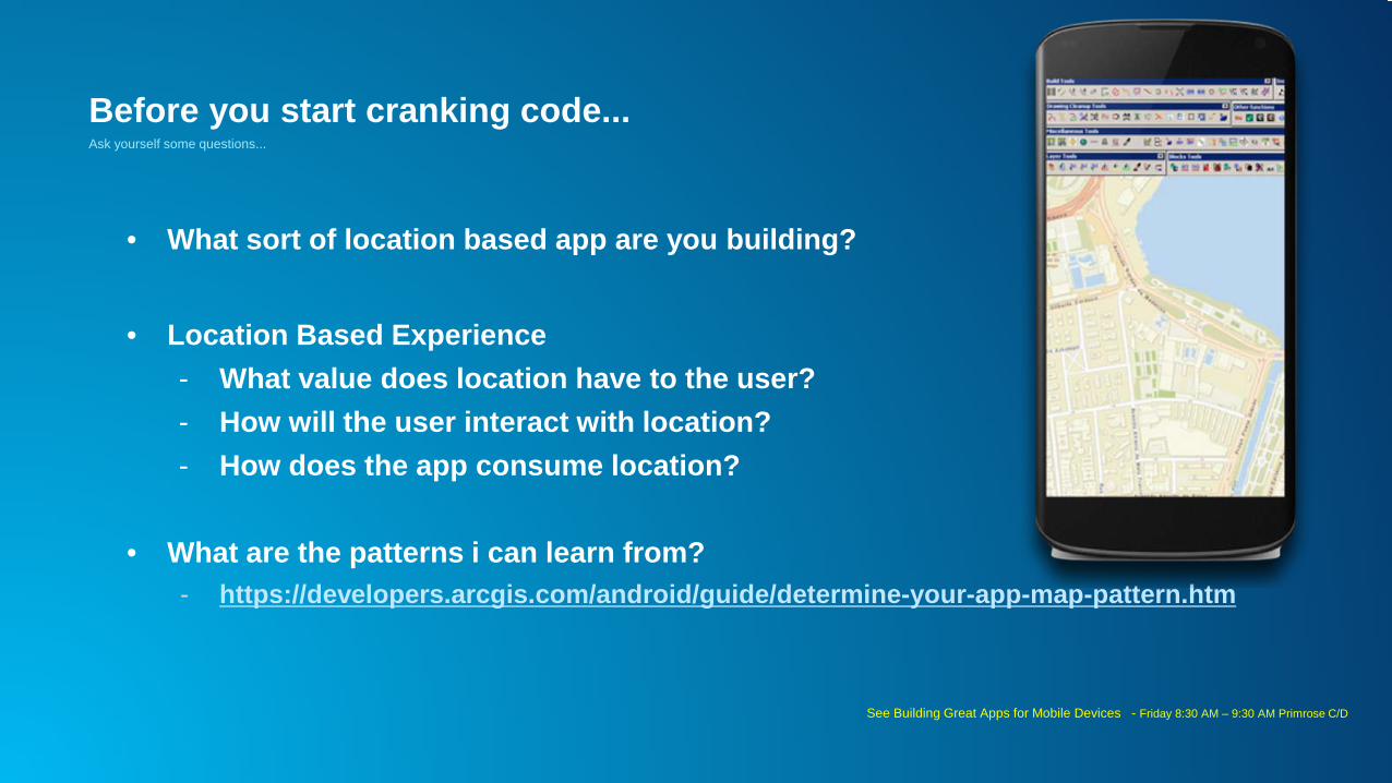
Before you start cranking code...
• What sort of location based app are you building?
• Location Based Experience- What value does location have to the user?- How will the user interact with location?- How does the app consume location?
• What are the patterns i can learn from?- https://developers.arcgis.com/android/guide/determine-your-app-map-pattern.htm
Ask yourself some questions...
See Building Great Apps for Mobile Devices - Friday 8:30 AM – 9:30 AM Primrose C/D

Material design?

Google’s answer to Apple’s design dominance…
“…a visual language for our users that synthesizes the classic principles of good design with the innovation and possibility of technology and science.”
Unified experience across platforms, device sizes and human computer interaction (touch, voice, mouse & keyboard)
Creating a Google brand AND an Android brand
From: http://www.google.com/design/spec/material-design/introduction.html#

Principles
Material is the metaphor – modern tech inspired by paper and ink(not skeuomorphic – does not replicate)
Bold, graphic, intentional – print based design guides visual treatment
Motion provides meaning – user actions initiate movement

Structure
• 3d layering of content- Elevation of elements important – conveyed by shadows
• Movement of surfaces under each other- Grouping of objects, siblings should move the same
• Floating action buttons

Layout and color
• Sizing of components - toolbars = 56dp / 64dp
• Never split sheets with another sheet!
• Grids and templates – take care of your dp!!!
• Cards for related data (not homogenous content)
• Color & Themes - material theme- 3 from primary, one from accent palette
- https://www.materialpalette.com/
• Chips, Snackbars and Toasts, Tasty…
• Imagery - don’t use stock images- Use Hero images!
• Maximise your content, take up the screen real estate
• http://www.google.com/design/spec/style/imagery.html#imagery-best-practices

Meaningful transitions
• Content grows/shrinks from its source to destination• Help organize the information architecture of the app

Interaction feedback
• Highlight/selection of paper
• Effects
- Surface reaction – touch ripple
- Material response – lift up when touched
• Helps guide user in what to do next

Animations
• Authentic motion and consistent choreography
- http://www.google.com/design/spec/animation/authentic-
motion.html#authentic-motion-mass-weight
• Delightful details
- http://www.google.com/design/spec/animation/delightful-
details.html

Iconography
Simple, flat, consistentLongest page in the spec, so beware….

Take reasonable opportunities to do somethinginteresting.

SABINE
What is a good design process?

PrototypeIdea
Esri’s apps project processWORKFORCE CASE
Research
Test

Esri’s apps project process - detailed
launchidea plan codedesign
WORKFORCE CASE
kickoffmeeting
needsassessment
personas
research wireframes
site code app code
visualdesign usability regression
testingtesting
localization &globalization
doclaunch
support
usability
mid-reswireframes
flowcharts
design studio

Defining Personas


Kickoff Meeting - Design Studio

Design Studio - Backoffice Web App

Design Studio - Mobile App

Mid-res Backoffice - Navigation DesignDetails, assignment creation & editing

Backoffice Web App

App’s Navigational StructureTABLET
PHONE

PHONE - Mid-res Mobile App

Location Services - Flowchart

Material Design - Metrics & Keylines
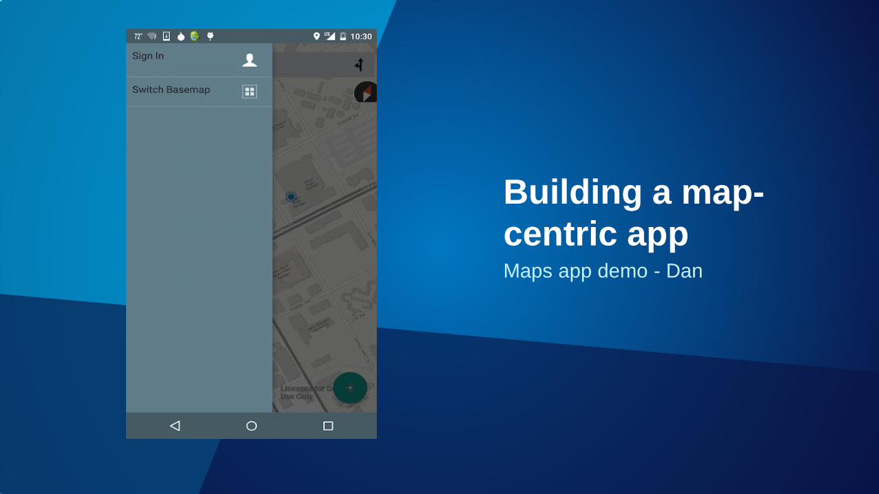
Maps app demo - Dan
Building a map-centric app
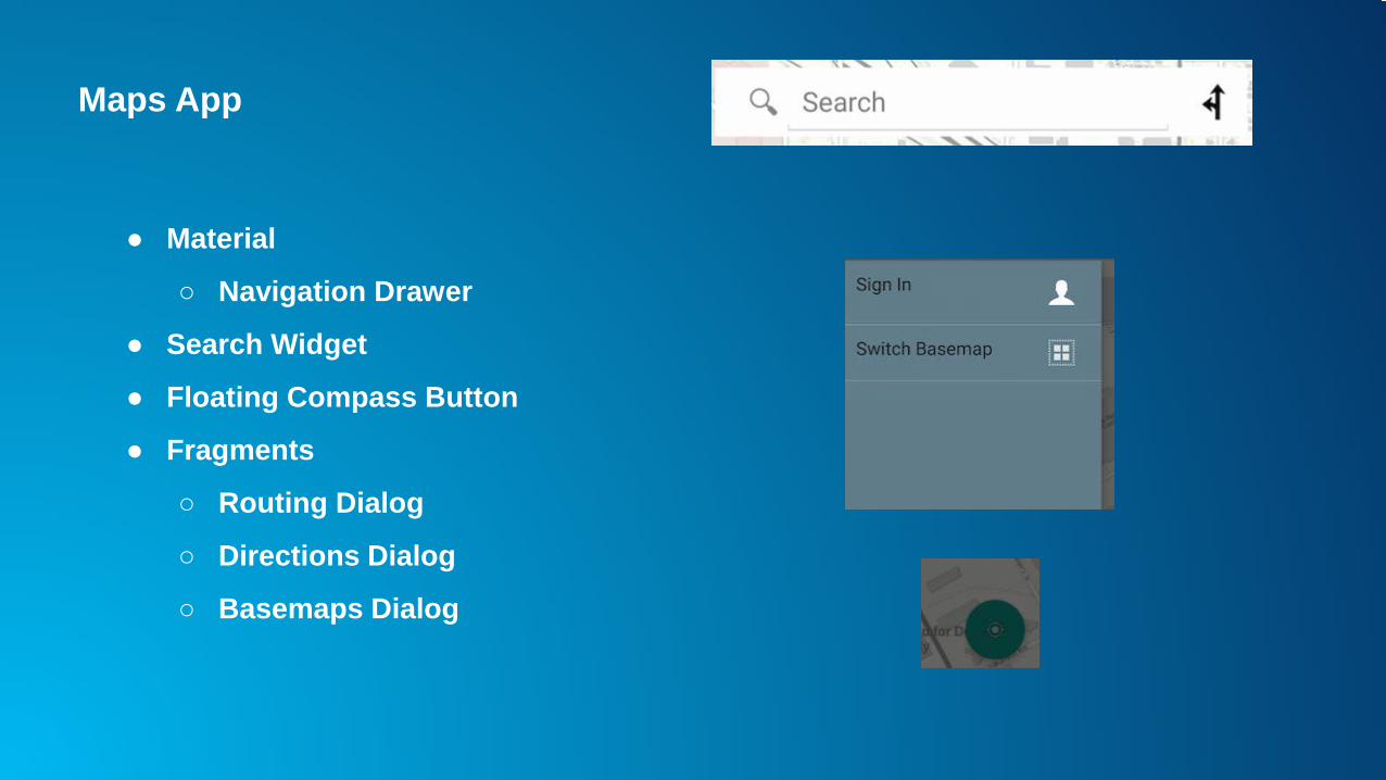
Maps App
● Material
○ Navigation Drawer
● Search Widget
● Floating Compass Button
● Fragments
○ Routing Dialog
○ Directions Dialog
○ Basemaps Dialog
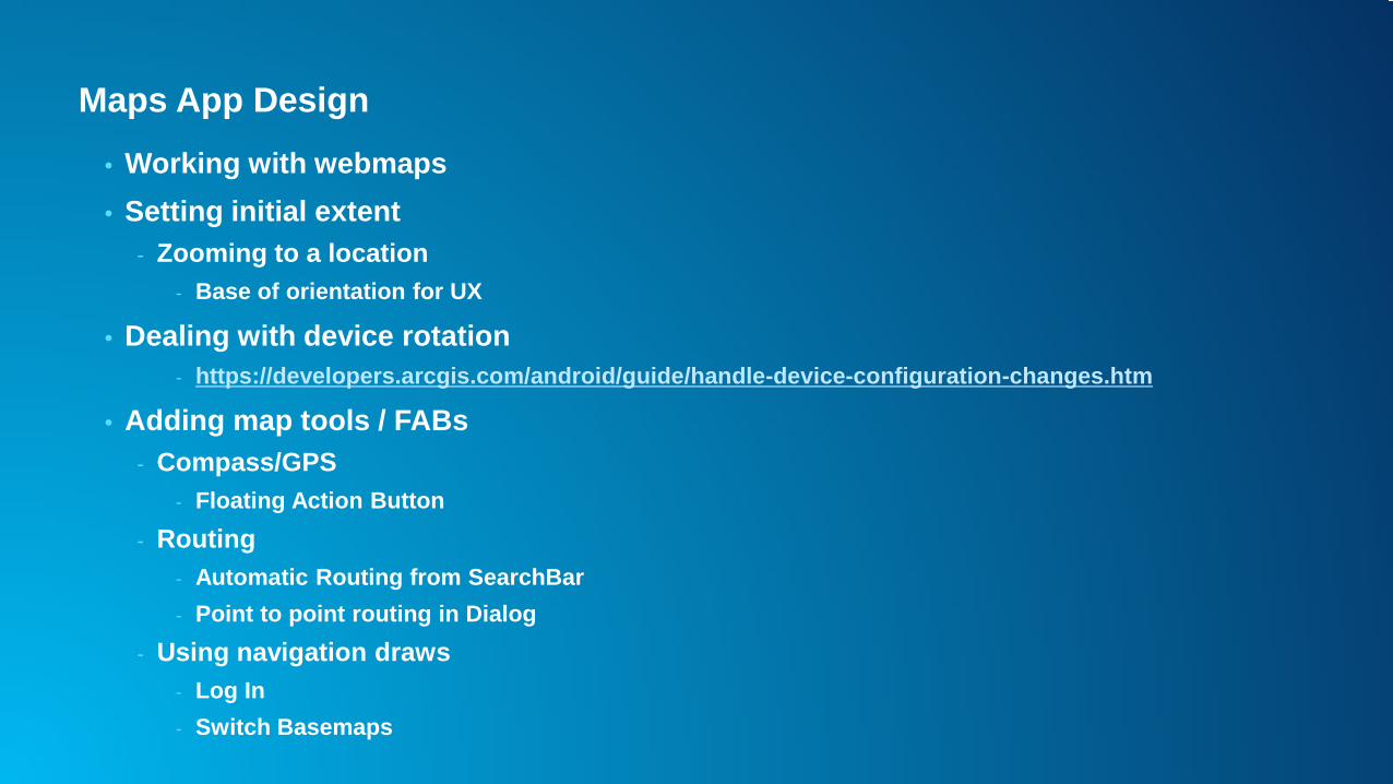
Maps App Design
• Working with webmaps• Setting initial extent
- Zooming to a location- Base of orientation for UX
• Dealing with device rotation- https://developers.arcgis.com/android/guide/handle-device-configuration-changes.htm
• Adding map tools / FABs - Compass/GPS
- Floating Action Button- Routing
- Automatic Routing from SearchBar- Point to point routing in Dialog
- Using navigation draws - Log In- Switch Basemaps

Working with webmaps
• Webmaps are an interactive display of geographic information- Basemap- Set of data layers
- Can include popup windows for information about data- Extent
• Hosted and shared through ArcGIS Online- Layers and basemaps can be referenced externally

Dealing with device rotation
• Patterns- Retain Fragment instance
- Use fragments to hold views in your app- setRetainState prevents fragment from being destroyed- Recommended only if you do not use WebMaps
- Handle configuration changes yourself- Smooth transition- MapViews do not need to be recreated- Only way with WebMaps
- Recreate all objects- Create new mapping data objects each time an activity is created- Most straightforward option- Worst user experience
- MapView must be entirely recreated- Fetch data from server every time recreated

Maps App - Fragments Basemap
• Basemap Dialog is a fragment
- Floats on top of Activity Window
• Backed by a Basemaps Adapter
- Registers the listener for clicks on thumbnails
• Listens for Click Events
- Opens the Basemap

Maps App - Basemap Fragment
• Inflate layout
• Create View
• Register listener
• Set title

Maps App - Configurable Measure Tool
• Measure Tool provided by ArcGIS Android Toolkit• Contextual action bar• Works in map centric apps• Easy to integrate into your own app• Customizable

Maps App - Configurable Measure Tool

Maps App - Configurable Measure Tool

Maps App on GitHub
• https://github.com/Esri/maps-app-android• Get involved• Report Issues• Contribute Code
- Fork it- Clone it- Configure remotes- Send pull requests

Will
Searching for features

GeocodingUX• Use in Map Centric apps
• Android search widget or custom widget
• Use in map-less apps• Location first apps, use location and geocode results to
drive the rest of the app
API• Geocode using the LocatorTask
- Using an ArcGIS Geocode Service or local Locator (from ArcGIS Desktop/Pro)
• Geocode point from address or POI• Reverse geocode a point to an address• Supports suggestions

Code to know: Locators
• Use ArcGIS Online World Locator
• Can find:- Street addresses- Administrative
place names- Postal / zip codes- Points of interest - Businesses
• Locator.find
• Locator.suggest

Maps App - Search Widget• MapFragment - Search widget is an instance of SearchView
Ref: https://github.com/Esri/maps-app-android

Searching for featuresUX• Search widget in a map centric app• List driven app• MapView interaction (onSingleTapListener)
API1. Search for features in a feature layer - Using FeatureTable.query()
- Use when you have a feature layer in your map
2. Search for features using the QueryTask- Use when you don’t have a map- Use for sublayers in an ArcGISMapServiceLayer or ArcGISTiledLayer
3. Select features in feature layers and graphics layers using fl.getFeatureIds() or gl.getGraphicIds()
- Hit test or identify for features
- Use when you have screen interaction

Sabine – use of FeatureTable query
Searching for features in explorer

Sabine – use of QueryTask
Searching for features in Workforce

Code to know: FeatureTable queries• Set up QueryParameters• Execute with callback or an AsyncTask (or your preferred async pattern)• ServiceFeatureTable example below uses a callback
Ref: https://github.com/Esri/arcgis-runtime-samples-android/tree/master/FeatureServiceTableQuery

Code to know: QueryTask
• Use QueryTask within AsyncTask.doInBackground()
• Show results in a list from onPostExecute()
Ref: https://github.com/Esri/arcgis-runtime-samples-android/tree/master/QueryTask

Code to know: feature and graphic selection
• Set MapView.setOnSingleTapListener
• Use parameters to find graphics/features at screen coordinates and select them
• Use attributes to show information

DanShow feature data

Showing feature data
UX• Over the map• In a separate view from the map
API• Callout• Popup• On your own… ;)

SabineExplorer demo

Callout Pattern Workflow
• Create an XML style file- Specific callout style attributes available- Set the title color, text size, background color
• Create an Android Layout- Define text and image elements
• Set the style and content of callout- Inflate the layout- Populate it with info retrieved from Graphic- Set layout of callout

Popups Pattern workflow
• Display information using pop-ups- Instantiate PopupContainer- Create a Popup and add it to the PopupContainer- Display PopupContainerView
• Handle user interaction• Edit information using pop-ups• Customize UI

Rama Chintapalli
Location-as-alertsLocal Geofence app demo & code
https://github.com/Esri/arcgis-runtime-demos-android/tree/master/2016-DS/LocalGeofence

Location as alertsUX• No map required!• Notifications for the user run in the background
API• Option 1: DIY
- Androids LocationServices- Geometry engine- Geodatabase and FeatureTable
• Option 2: Android Geofencing API- Android LocationServices- Android GeofencingAPI- Geodatabase and FeatureTable

Rama
Local geofencedemo

Local Geofence App
• Uses offline geodatabase to store geofence features• Notifications for alerting user when entering or exiting a polygon geofence
- Always available, outside app- User can control priority, sensitivity (lock screen)
• Service for monitoring location updates- Combines Google Fusion API and GeometryEngine- Increase update frequency when close by
• Activity based UX allows user to choose fence- Recycler View, Card View, Floating Action Button, Snack Bar

Geofence app process
PendingIntent
GeofenceService
Google Location API
NotificationFence calculation
Required update speed
ACTION_CHECK_LOCATION
FusedLocationApi.requestLocationUpdates

Code to know: GeometryEngine
• Proximity2DResult gets nearest location on fence boundary
• geodesicDistance
• within
• project of fencefeature to WGS84

Code to know: Notifications
• Build and send notification using Feature attribute
• Notification API changes within SDK supported SDK versions