Embed Size (px)
Citation preview
EPM 40
BUHI AGROECOSYSTEM ANALYSIS WORKSHOP REPORT
Preliminary Visit July 1985
Gordon Conway July 1985

This document was produced for the Environmental Planning and Management Project of the
International Institute for Environment and Development under the
Resource Assessment Contract No. RA-7
The Environmental Planning and Management Project is a cooperative agreement between the International Institute for Environment and Development and the U.S. Agency for International Development to respond to requests for assistance from developing countries in a variety of environmental and natural resource management problems.
Single copies of this document are available free from:
International Institute for Environment and Development 1717 Massachusetts Ave. N.W.
Washington, D.C. 20036 (202) 462-0900

MEMORANDUM Date: July 25, 1985
TO : Douglas J. Clark, Chief, ORAD
THRU : James W. Dawson, Chief, Rural Development Division, ORAD
FROM : Gordon Conway, Centre for Environmental Technology Imperial College of Science and Technology, London1
SUBJECT: Buhi Agroecosystem Analysis Workshop Report of Preliminary Visit, July 1985
The purpose of my visit, as laid out in the contract from lIED and in theearlier specification of Will Knowlarid, is to plan the Buhi Agroecosystem Analysis Workshop.
The report is in three parts.
1. A brief overview and commentary on the environmental issues of the Lake Buhi area
2. A proposal for the workshop, drafted in collaboration with the Program on Environmental Science and Management, UPLB
3. A set of tasks for the workshop preparation
Attached also in an Appendix is an itinerary of my visit.
cc: Stephen Berwick Molly Kux Will Knowland Michael Philley Percy Sajise
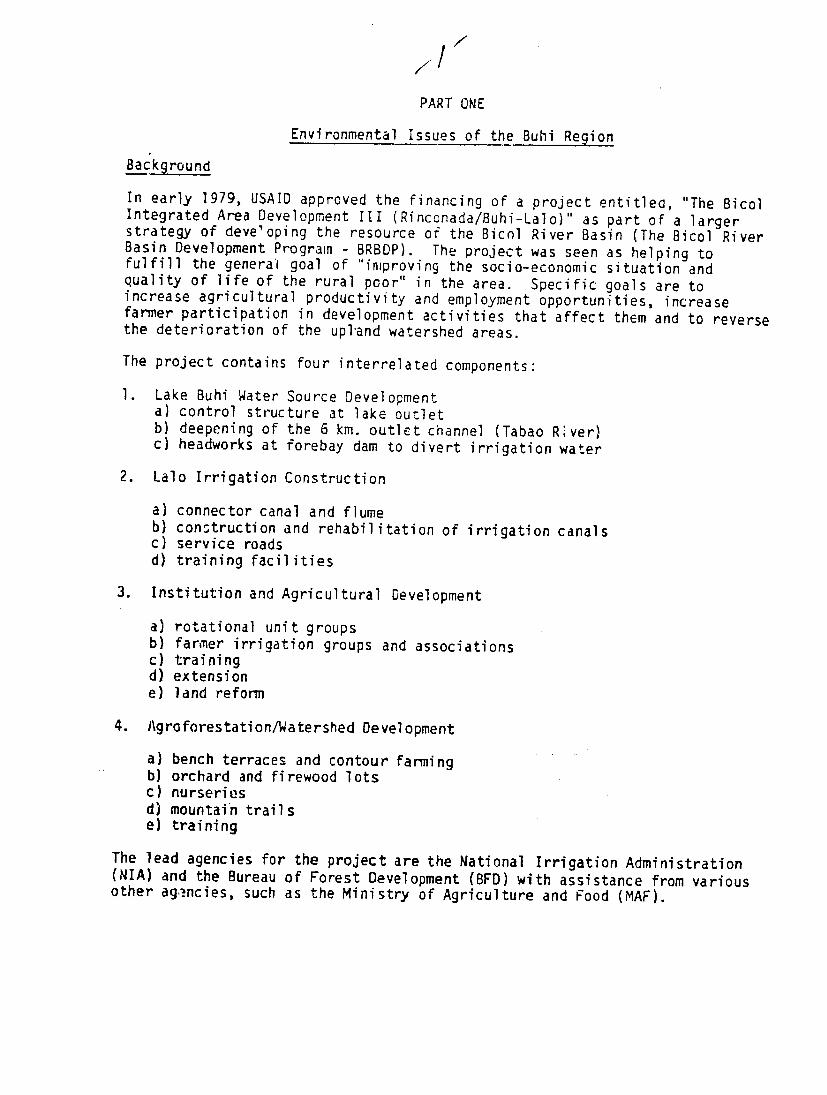
PART ONE
Environmental Issues of the Buhi Region Background
In early 1979, USAID approved the financing of a project entitlea, "The Bicol Integrated Area Development III (Rinconada/Buhi-Lalo)" as part of a larger strategy of developing the resource of the Bicol River Basin (The Bicol RiverBasin Development Program - BRBDP). The project was seen as helping to fulfill the general goal of "improving the socio-economic situation and quality of life of the rural poor" in the area. Specific goals are to increase agricultural productivity and employment opportunities, increase farmer participation in development activities that affect them and to reverse the deterioration of the upland watershed areas.
The project contains four interrelated components:
1. Lake Buhi Water Source Development a) control structure at lake outlet b) deepening of the 6 km. outlet channel (Tabao River) c) headworks at forebay dam to divert irrigation water
2. Lalo Irrigation Construction
a) connector canal and flume b) construction and rehabilitation of irrigation canals c) service roads d) training facilities
3. Institution and Agricultural Development
a) rotational unit groupsb) farmer irrigation groups and associations c) training d) extension e) land reform
4. Agroforestation/Watershed Development
a) bench terraces and contour farming b) orchard and firewood lots c) nurseries d) mountain trails e) training
The lead agencies for the project are the National Irrigation Administration (NIA) and the Bureau of Forest Development (BFD) with assistance from various other ag,.ncies, such as the Ministry of Agriculture and Food (MAF).

-2-Environmental Issues The construction phase of the project began in late 1979. Most of theactivities have had few, if any, adverse consequences. Indeed in engiieeringterms, the project has target and
been highly satisfactory with completions aheadunder cost, although ofthe watershed development component has beenless than satisfactory in meeting objectives. However, in 1983, the construction of the control structure and the deepeningof the Tabao River channel below the lake beganconsequences on to have a number of adversethe livelihood of residents of the area. To begin with, itwas thought that most of these were termporary problems associated with theconstruction phase and would go away on completion.however, it has become apparent that several
In the last few months, remain and will serious problems are likely torequire long-term solutions. It has also become clear thatthe area, in particular the watershed and the lake itself,large number of environmental is suffering from aproblems of long standing (see particularly theconsultancy report of Malcolm Beveridge).solutions but also have These, too, require long-terman inmediate significance ininterpretation and resolution of the problems associated with the projectitself. As
that they complicate the with many environmental issues, the chain from causecomplex and many factored. Some problems to effects is
construction while in other cases are wrongly ascribed to the projectthe construction may be guilty ofcompounding an already existing problem.
My own reading of the various reports and my brief visit toclassification of issues along the following lines: the area suggest a
I. Temporary Problems associated with Construction Phase
A. Unexpected rises in lake water level
1. Flooding of rice fields
B. Unexpected drops in lake water level
2. Drying out of fish cages
In each case these may be partly solved by regularization andpredictability of drawdown operations. II. Permanent Problems associated with Control Structure Operations
A. Use of full water level capacity of lake (83.b m)
1. Periodic flooding ot dwellings
potential solutions: a) compensation b) relocation c) operate to less than full capacity

2. Periodic flooding of cropped land
potential solutions: as 1. above
B. Use of low water level capacities of iake (below 81.5 m)
3. Periodic drying out of fish cages
potential solutions: as in 1. above plus d) floating fish cages
4. Drying up of shallow groundwater wells in Buhi municipality(possibly a temporary problem, exacerbated by 1982/83 drougnt but likelihood that it is permanent)
Potential solutions: a) redrilling b) new wells c) operate to less than full capacityd) new water system based on supply from
Itbog falls
5. Drying up of dock at Poblacion
potential solutions: a) new dock b) new roads around lake
6. Loss of lake transport capacity
potential solutions: a) new roads around lake
7. Drying up of Buhi Fishwater Demonstration Fish Farm potential solutions: a) relocation
8. Drying out of spawning grounds at Barangay and around lake generally
potential solutions: a) intensive rearing and stocking annually b) operate to less than full capacity
9. Health problems from domestic refuse exposed in drawdown
potential solution: a) improved sanitation
C. Deepening of Tabao River
IU. Loss of fish cages in Tabao River and East channel
potential solutions: a) relocation b) compensation c) alternative livelihood
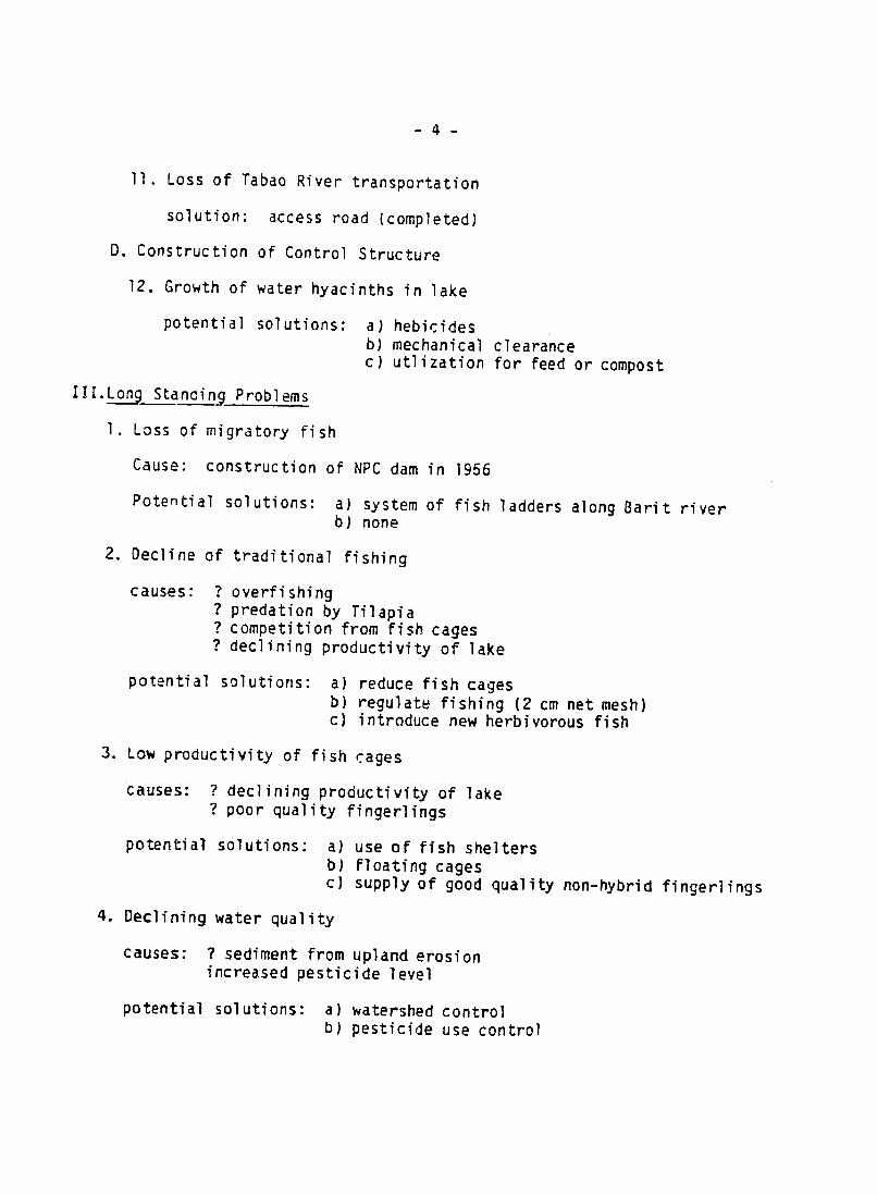
-4
11. Loss of Tabao River transportation
solution: access road (completed)
D. Construction of Control Structure
12. Growth of water hyacinths in lake
potential solutions: a) hebicides b) mechanical clearance c) utlization for feed or compost
III.Long Standing Problems
1. Loss of migratory fish
Cause: construction of NPC dam in 1956
Potential solutions: a) system of fish ladders along Barit river b) none
2. Decline of traditional fishing
causes: ? overfishing ? predation by Tilapia ? competition from fish cages ? declining productivity of lake
potential solutions: a) reduce fish cages b) regulate fishing (2 cm net mesh) c) introduce new herbivorous fish
3. Low productivity of fish cages
causes: ? declining productivity of lake ? poor quality fingerlings
potential solutions: a) use of fish shelters b) Floating cages c) supply of good quality non-hybrid fingerlings
4. Declining water quality
causes: ? sediment from upland erosion increased pesticide level
potential solutions: a) watershed control b) pesticide use control

-5
5. Sulphur upwellings
causes: high sulphur content in inflow decay of natural alga blooms wind induced breakdown of lake stratification
potential solutions: a) relocate fish cages b) maintain high water level
6. Decline to near extinction of Sinarapan (world's smallest conmercial fish)
causes: ? overfishing? predation by Tilapia ? shrimp competition ? anchor v;urm infestation
potential solutions: a) remove all introduced fish b) none
7. Typhoon damage
causes: exposed and fragile structures
potential solution: a) floating fish cages
8. Erosion and sedimentation
causes: deforestation to cropping and illegal logging
potential solutions: a) control of logging b) agroforestry c) terracing d) improved land tenure
9. Declining yields on Mt. Iriga and spread of cogon grass
cause: overcropping
potential solutions: a) agroforestry b) terracing c) improved land tenure
Although all of these problems have been in existence for the last twentyyears and more and will continue, a significant number may be excerbated bythe operation of the control structure when it is fully functional.

-6-
In particular
a) traditional fish productivity may further decline because of periodic loss of spawning grounds
b) fish productivity, in general, may decline due to poorer water nutrient levels and to earlier and more frequent upwelling of sulphur and oxygen poor water, all due to more frequent reversals of stratification caused bylow water levels.
Alongside these problems, it should also be stressed that the project has or will provide a number of benefits to the immediate Buhi area.
1. No more flooding in Tabao river
2. Water for rice cultivation beside Tabao river
3. Bridge over control structure
4. Eventual commercial prosperity to Buhi from Lalo irrigation system producti vity
5. Irrigation water for some residents of Buhi municipality
6. Improved livelihood in watershed.
Environmental Impact Analysis
The occurrence of problems such as these in a multipurpose lake regulationproject raises a number of questions concerning the nature, scope and-usefulness of environmental impact analysis. This report is not the appropriateplace to discuss these fully. Such a discussion should await the full ex-postenvironmental impact analysis that is proposed and should, perhaps, beconducted within a much wider review of environmental asessment procedures as they are commissioned and applied by USAID. However, I have read allpre-project studies and feel it
the is worthwhile to make a number of preliminary
observations.
The relevant documents are:
1. BRBDP, 1919, Rinconada Integrated Development Area Feasibility Study.TAMS-TAE Joint Venture. Bicol River Basin Development Program Office,Pili, Camarines Sur. Vols: 1: Summary
2: Fisheries Development 3: Irrigation and Drainage Improvements3a: Watershed Protection/Management 6: Municipal Water Supply
In each of these volumes are chapters on impact on natural environments and social soundness analysis.

-7
2. Inter3gency Committee on Ecological Studies, 1978, Environmental Assessment of the Bicol River Basin Development Project. .ianila, Vols. 1 and 2.
These constitute the pre-project environmental analysis and generally conclude that the "environmental and socio-economic benefits to be derived from the project will far outweigh any avoidable adverse effects." Howe'-ver, these weregeneral studies dealing with the much larger proposed programs: in the caseof 1 with the whole Rinconada project including Lake Bato and Lake Bula-Baao and in the case of 2 1,ith the total Bicol River Development Program. The LakeBuhi regulation was only seen as one small part of these larger programs and consequently gets relatively little mention in the environmental and social soundness analyses.
Fishery development, in the TAMS-TAE study, for example, concentrates on the other lakes. The potential at Buhi is seen as very limited, fish pens beingof restricted value and likely to be uneconomic. The main use for Buhi was seen as a site for a hatchery for the whole Rinconada area. Itwas conceded that the drawdown could affect fish production. But this was assessed aslikely to be nominal. Any losses could be offset by a stocking policy and byretention of high water levels for a few weeks following the wet season.(There is no mention of fish cages in the report since these were onlyintroduced to the area subsequent to the study.)
There is also no mention of drying up of groundwater wells, save that several of the public wells were not functioning, nor was there mention of any of theother problems listed in my review above, except for the erosion in the watershed. The watershed development was seen as generally beneficial, the one potential adverse consequence being the loss of quail following -reclamation of the cogon land.
The ICES study mentions that improvement at Buhi could increase the nutrient levels and hence produce algal blooms. 9ut otherwise the report pinpoints no other adverse consequences for the Buhi area as such.
The social soundness analyses of the TAMS-TAE study ignores the Buhi area,except to suggest that higher productivity of the irrigation schemes could be of commercial benefit to the Buhi market. Otherwise, the social soundness analysis concentrates solely on the benefits to the downstream farmers.
These criticisms, of course, are made with the benefit of hindsight. Mygeneral impression is that the studies were fairly ccmpetent assessments at the scale they were addressing. They were sufficient to justify the overal program of development but inevitably carried out on too coarse a scale to be used as assessments of specific components such the Buhi-Lalo project. Ifas separate assessments of the components had been conducted, then a significantnumber of potential problems should have shown up, particularly if the essess.ments had been directed to also include a review of existing environmental problems.

-8-
The' final question concerns the methodologies used. My own impression of environmental assessments, generally, is that they tend to ignore the important dynamics of the impacted systems. They usually take the form, as in the present studies, of single, static "snapshots" of the existing situation with a number of anticipated developments summarized in matrix form. In my view this approach is inadequate to cope with such complex dynamic phenomena as declining fish productivity, lake stratification and sulphur upwellings and the impact of drawdown on fish and agricultural production. These can only be handled by skilled analysis using qualitative and quantitative modelling and I would like to see more use of such techniques in the formal envirunmental assessment procedures.
Agroecosystem Analysis
The proposed ex-post environmental impact analysis should provide a more detailed basis for this kind of the discussion and lead to firmer recommendations for improvement in future environmental assessment procedures. In the meantime, however, there are a significant number of environmental problems in the Buhi area which need addressing by all the agencies and individuals who are involved. The proposal for an Agroecosystem Analysis Workshop is intended to satisfy this need and to provide a focus for the ex-post environmental assessment.
The Agroecosystem Analysis technique has been developed over the past seven years as a technique for multidisciplinary analysis of man-managed ecosystems. It consists of a structured but fairly flexible workshop procedurewhich allows participants to interact freely and productively with one another. The outputs are an agreed set of key questions for research and development of the systems beingstudied and also a set of priorities for action based on agreed guidelines and working hypotheses for development.
Details of the procedure are to be found in various published papers and in the subseqL.ent parts of this report. It should be stressed, however, that the technique is still in many senses experimental. This will be the first occasion in which it is applied to a lake system. The workshop will also be a test of the capacity of the technique to take on a mediation function since participants will include not only the executing agencies but also representatives of the farmers and fishermen who are most affected. There appears to be a general agreement, among those I have spoken to, that many of the problems of the Buhi area are greatly compounded by lack of information and misinformation. it is anticipated that at least in this respect the workshop will prove of value.

PART TWO
BUHI AGROECOSYSTEM ANALYSIS WORKSHOP
PROP 0 SAL
Rationale
Pressures for a higher standard of living and the increase of population continuously require more food, energy, raw materials and various services. Increased utilization of available but limited resources is inevitable in order to cope with increasing demands for the satisfaction of these basic human needs.
However, the use of these resources often results in the depletion and misuse of resources, alteration of natural ecosystem processes and degradation of the natural environment. If we are concerned to maintain the ecological stability of our environment we require an optimal and efficient use of our natural resources.
The present deteriorating condition of Lake Buhi and its environs has been attributed to improper landuse, exploitative use of forest areas, and unsound agricultural practices in the area. The uplands, the lowlands and Lake Buhi itself comprise a whole ecosystem, so that any alteration or modification in one component will yield corresponding effects on the other components.
In the light of the many activities in the Lake Buhi watershed, an Ex-post Environmental Impact Assessment of the Lake Buhi Hydraulic Control Structure and related projects under the Rinconada-Buhi/Lalo Integrated Area Development Project is proposed. The study will provide environmental and natural resource management information important in the resource planning and the efficient operation as well as sustainability of the said water resource project. The assessment will be based primarily on the review and evaluation of the environmental impacts to date. As part of this proposal a workshop on agroecosystem analysis of the Lake Buhi ecosystem is hereby proposed to convene the various research disciplines, government and private groups engaged or interested in Lake Buhi. The purpose of the workshop will be to define the framework of analysis for the proposed ex post assessment and gather relevant information for the study.
Objectives:
-- To define the major features, components and dynamic properties of the agroecosystems in the Buhi area;
-- To collate all existing information with a view understanding of the Buhi agroecosystems;
toward obtaining a better
-- To define the key questions for research in the area;
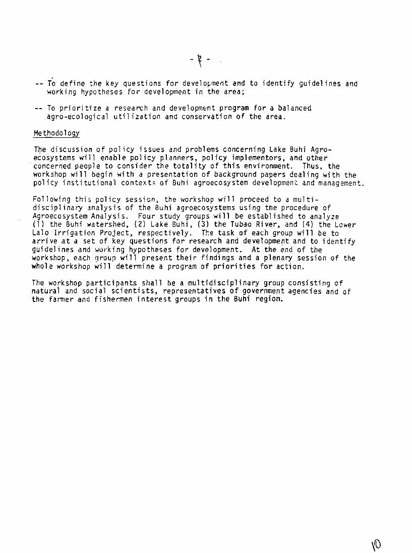
-- To define the key questions for development and to identify guidelines and working hypotheses for development in the area;
-- To prioritize a research and development program for a balanced agro-ecological utilization and conservation of the area.
.Methodology
The discussion of policy issues and problems concerning Lake Buhi Agroecosystems will enable policy planners, policy implementors, and other concerned people to consider the totality of this environment. Thus, the workshop will begin with a presentation of background papers dealing with the policy institutional context: of Buhi agroecosystem development and management.
Following this policy session, the workshop will proceed to a multidisciplinary analysis of the Buhi agroecosystems using the procedure of Agroecosystem Analysis. Four study groups will be established to analyze (1) the Buhi watershed, (2) Lake Buhi, (3) the Tubao River, and (4) the Lower Lalo Irrigation Project, respectively. The task of each group will be to arrive at a set of key questions for research and development and to identify guidelines and working hypotheses for development. At the end of the workshop, each nroup will present their findings and a plenary session of the whole workshop will determine a program of priorities for action.
The workshop participants shall be a multidisciplinary group consisting of natural and social scientists, representatives of government agencies and of the farmer and fishermen interest groups in the Buhi region.

BUHI AGROECOSYSTEM ANALYSIS
WORKSHOP
DATES: Thursday, November 13 - Monday, November 17, 1985
VENUE: Aristocrat Hotel, Naga City
ORGANIZERS: Program on Environmental Science and Management University of the Philippines, Los Banos
HOST INSTITUTION:
Bicol River Basin Development Program, Naga
COORDINATOR/CHAIRMAN:
Dr. Percy Sajise
WORKSHOP ADVISER:
Dr. Gordon Conway
GENERAL LOGISTICS ORGANIZER:
(?)
HOST INSTITUTION LOGISTICS ORGANIZER:
Mr. Nathan Santos
CASE STUDIES TEAM LEADER:
(?)
EDITORS: Dr. Percy Sajise Dr. Gordon Conway
FINANCIAL OFFICER:(?)

-4-
BUHI AGROECOSYSTEM ANALYSIS
WORKSHOP
November 13 - 17, 1985
Tentative Timetable
14ednesday, Nov. 12 Participants arrive
Thursday, Nov. 13 Plenary Session Chairman: Mr. Carrnelo Villacorta
A.M. 1. Welcome Mr. Carmelo Villacorta
2. Introduction of Participants; Objectives of Workshop; Review ofTimetable Dr. Percy Sajise
3. History of Bicol River Basin Development Program and Integrated Area Development Project - Rinconada/Buhi-Lalo Dr. Fred Olano
4. Policy and goals papers agencies
(a) BRBDP Mr. Carmelo Villacorta(b) NIA Mr. Virgilio Brusas (c) BFD (d) BFAR (e)MAF (f) NPC
5. Discussion
P.M. 6. Policy and goals papers - local inhabitants
(g) Buhi Municipality Mayor C. Mercurio (h) Buhi Fishermen's
Organization (i) Upland Farmers Assn. (j) Irrigation Association
7. Discussion
8. Distribution of study group materials

Friday, Nov. 14 Plenary Session
A.M. Chairman: Dr. Percy Sajise
1. Agroecosystems of Buhi Dr. Gordon Conway
2. Agroecosystems Analysis Dr. Gordon Conway
Coffee
A.M./P.M. Group Sessions Break into four study groups:
A. Buhi Watershed B. Lake Buhi C. Tabao River D. Lower Lalo and Barit/Baao/
Pili Irrigation Scheme
Tasks:
System Hierarchies Pattern Analysis: Space, time,
flows, decisions System Properties: Productivity,
stability, sustainability, equitability
Saturday, Nov. 15 Plenary Session
Chairman: Dr. Percy Sajise
Presentations by four study groups
P.M. Group Sessions
Four study groups: Tasks:
Key questions for research Key questions for development Guidelines for development Working hypothesis for development
Sunday, Nov. 16 Plenary Session
A.M. Chairman: Dr. Gordon Conway
Presentations by four study groups
P.M. Plenary Session
Discussion of key questions, guidelinesand working hypotheses
Innovation assessment

Monday, Nov. 17 Plenary Session Chairman: Mr. Car-relo Villacorta
Program priorities Review of workshop Closing address
P.M. Participants depart.

NPC
I Southern Region Manager
MAR
MPWH
1
KKK
1
CSAC
UNC
1
ICLARM
Dr. Smith +1
Buhi Munic.ipal ity
Mayor Crispin Mercurio Development Officer
Fisiermen's Organization
2
Upland Farmers Association
2
Irrigators Association
1
Tabao River Association
1
Asian Development Bank
Mr. Colin Rees +I
PESAM/UPLB
8

-9-
BUHI AGROECOSYSTEM ANALYSIS
WORKSHOP
Approxinate Budget
Pesos
1. Data Acquisition in Field 85,700
2. Workshop 47,500
3. Report Publication 40,000
175,000 = $9,500
Contractor: UPLB Development Foundation, Inc. University of the Philippines, Los Banos College, Laguna, Philippines
Team Leader: Dr. Percy Sajise Program Environmental Science and Management University of the Philippines, Los Banos College, Laguna, Philippines
GConway:lmr ORAD 7/25/85

PART THREE
BUHI AGROECOSYSTEM ANALYSIS WORKSHOP
TASKS
RESPONSIBILITIES
Coordinator/Chairman - Dr. Percy Sajise
Responsibility for coordinating the preparations for the workshop.
Workshop Adviser - Dr. Gordon Conway
Responsibilities include:
a) Advising on preliminary data collection b) Planning the workshop timetable c) Introducing the method to the workshop participantsd) Guiding the workshop
General Logistics Organizer- ?
Responsibilities include:
a) Invitations to workshopb) Facilities c) Transport d) Background documentation
Host Institution Logistics Organizer- Mr. Nathan Santos
Responsibilities include:
a) Local facilities b) Local transport c) Local supplies
Case Studies Team Leader - ?
Responsibilities include:
a) Organizing teams to produce initial data on case studies b) Assembling relevant secondary data c) Preparation of reports on data for workshop
Editors - Dr. Percy Sajise and Dr. Gordon Conway
Responsible for production of final report following the workshop
A Financial Officer - ?
Responsible for budget of workshop

-2-
PLANNING
Shared responsibility of Organizer/Chairman and Workshop Adviser
Workshop
1. Plan timetable
Invitations
1. Arrange for sending of official invitations to participants (at least two months before workshop). Minimum of 20, maximum of 40.
2. Send out special invitations to those requested to make formal presentations at the workshop.
3. Send out special invitations to selected dignitaries for opening session or
other days of workshop as appropriate.
4. Invite individuals to be chairmen of sessions.
5. Assign participants to study groups each with one rapporteur and one facilitator from PESAM.
LOGISTICS
Shared responsibility of General Logistics Organizer and Host Institution Logistics Organizer and Financial Officer.
Facil ities
1. Book meeting hall at hotel. This should be big enough to hold all participants in preliminary session and as working groups. It should be equipped with tables and chairs that can be rearranged as required.
2. Organize accommodation and meals at hotel.
3. Arrange transport between hotel and airport.
Workshop Supplies
1. 4 overhead projectors and screens (at least one per case study)
2. 4 white boards (at least one per case study)
3. Transparency sheets (at least 200)
4. Tra,,parency pens (at least four packets)

-3
5. White board pens (at least four packets)
6. Graph paper (at least 50 sheets)
7. Writing pcads and pens (one per participant)
8. Slide projector
9. Public address system.
10. Photocopying facilities
11. Secretarial and typing facilities
Reference Material for Workshop
1. Library of relevant books and reports in meeting hall
2. Photocopies of case study data (one set for each case study group participant)
3. Photocopies of invited presentations
4. Photocopies of agroecosystem procedure and concepts paper
CASE STUDIES
Responsibilities of Case Studies Organizer with advice from Workshop'Adviser.
1. Form case study teams.
2. Assemble secondary data on region and case study areas from governmentreports and government offices and any other sourcesfrom that are available (e.g. USAID).
3. Visit case study areas
4. Obtain data from local government officials and local leaders.
5. Carry out farm surveys - stratify by farm size or income or agroecological zones.
Suggest following information:
a) Size, age and education of family
b) Land holding and individual parcels by land type

-4
c) Crops and cropping systems for each parcel plus yields
d) Livestock holdings
e) Diagram of home garden
f) Inputs (amounts and costs) - labor, seed fertilizer, fuel, pesticides, etc.
g) Credit - how much, from where, interest and use
h) Income by sources (include non-agricultural income)
i) Perceived problems - soils, pests, diseases, credit, administration, etc.
NB. Survey both "farners" and "fishermen" and combinat ons.
6. Prepare basic data. NB all diagrams should be simple sketches.
BUHI REGION
1. Prepare simple maps of Buhi region containing case study sites. Showzones, topography, settlements, rivers, canals, roads, irrigation systems(TAMS:TAE Vol. 3, Figure 16 updated)
,2. Prepare historical diagram showing major events - formation of lake, new roads, irrigation systems, etc.
3. Prepare long term.graphs of population change (birth rates, death rates, migration, etc.)
4. Simple flow diagram of water through Buhi system and allocations (by cubic meters and by hectarage supplied)
5. Seasonal calendar for climate of region (rainfall and standard deviations;temperature, maximum and minimum; humidity; incidence of typhoons).Prepare on 18-month cycle - January to December to July.
BUHI WATERSHED
1. Hierarchy of systems
2. Maps of watershed - (based on FORI 80 maps)
a) topography, rivers b) soils c) erosion potential d) zones
1/

-5
3. Several transects of watershed - slopes, land use, erosion potential, probl ems
4. Transects of typical home gardens and fields
5. Seasonal calendar: crop sequences - planting to harvesting perennial and wild crop harvests livestock - births, rearing and sales non-farm activities - off-farm employment, fishing labor requirements - land preparation, planting and
harvesting (;male and female) capital requirements monthly prices income
6. Bar diagrams - Proportions of income by source for sampled farnmers
7. Flow diagrams
a) Erosion - causes and consequences b) Coconut production and marketing c) Corn production and marketing
8. Decision tree
* Different livelihood systems
9. Venn diagram
Institutions and decision makers involved in watershed land use
10. Also include mini-analysis of lakelets in watershed.
LAKE BUHI
.1. Hierarchy of systems
2. Maps of lake
a) inflows b) drawdown area and depths c) zones - sanctuary, kanuba, fish cages, etc.
3. Several transects of lake
slopes, drawdown, depths, fishery resources, problems
4. Transects of fish cages

-6
5. Seasonal calendar
Past pattern of inflows plus standard deviations Natural lake levels plus standard deviations Proposed regulation Fish sequences in lake - spawning, harvesting by species Fish sequences in fish cages - spawning, harvesting Drawdown cropping sequences - planting and harvesting Kanubu, inversions, etc. Labor requirements - traditional fishing, fish cages Capital requirements Monthly prices for fish Income
6. Bar diagrams
Source of income for fishermen
7. Flow diagrams
a) water flows b) causes of kanubu, inversions, upwellings, etc. (see Beveridge) c) production .nd marketing of fish
8. Decision tree
Different livelihood systems on lake
9. Venn diagran
Institutions and decision makers involved in lake management
TABAO RIVER
1. Hierarchy
2. Maps of river and adjacent land
a) topography b) land use
3. 2 transects of river and adjacent land
topography, land use, problems
4. Transects of fields, home gardens
-7
5.. Seasonal calendar
proposed river flows crops livestock non-farm activities lkbor capital prices income
6. Bar diagram
sources of income
7. Flow diagrams
river-land interaction
8. Decision tree
different livelihood systems
9. Venn diagram
Institutions and decision makers involved Tabaoin river management
LOWER LALO IRRIGATION
1. Hierarchy
2. Maps of irrigation scheme
a) topography, canals b) existing and proposed land use
3. 2 Transects of scheme
topography, land use, problems
4. Transects of home gardens, fields
5. Seasonal calendar
proposed water flows crops livestock non-farm activities labor capital prices income

-8
6. Bar diagram
sources of income
7. Flow diagram
a) production and marketing of rice b) other crops
8. Decision tree
different livelihood systems
9. Venn diagram institutions and decision makers involved in managing Lower Lalo irrigation
REPORT
1. Appoint editorial assistant
2. Editors collect case study reports and diagrams as they are provided. File in ringbinder.
3. Editors collect manuscript of invited papers
4. Draft report
Tentative Contents
Executive Sumary
1. Introduction 2. History of Bicol River Program 3. Policy and goals paper 4. Agroecosystems paper 5. Buhi Watershed 6. Lake Buhi 7. Tabao River 8. Lower Lalo Irrigation 9. The Buhi system 10. Discussion
Appendices
References Participants Timetable Glossary of acronyms
(72

Thursday, July 11
Friday, July 12
Saturday, July 13
Monday, July 15
Tuesday, July 16
Wednesday July 17
Thursday, July 18
Friday, July 19
Appendix
Buhi Agroecosystem Analysis Workshop
Planning Visit - July 11-26, ,185 Gordon R. Conway
9:45 a.m. Depart Washington, D.C.
9:05 p.m. Arrive Manila
a.m./p.m. Reading background documents
a.m. Briefing Mr. J. Dawson, Mr. L. Dayao - USAID
p.m. Briefing Mr. D. Clark, Chief, ORAD - USAID
a.m. Reading Feasibility Studies
p.m. Meeting PESAM staff - UP Los Banos Dr. Ike Pacardo, Dr. Felicio Lansigan and teamaccompaiied by Mr. J. Dawson and Mr. L. Dayao
a.m. Reading Feasibility Studies
p.m. Meeting ADB, Irrigation & Rural Dev. Dept.Mr. Richard Bradley, Manager, Division IIMr. Saiyod Ali Nagri, Senior Project Engineer
Depart Manila for Legaspi by air with Mr. J. Dawson
Legaspi to Naga by road
a.m. Meeting - Bicol River Basin Dev. Board
Mr. Carmelo Villacorta, Program Director Dr. Fred Olano, Ms. Tess Javier, Mr. Nathan Santos, Ms. Beth Eduardo
p.m. Visit to TabaoBuhi, River & Lalo Irrig. Proj.
Meeting - National Irrigation Administration Mr. Virgilio Baras, Chief, Field Engineer
a.m. Meeting - Rainfed Resources Development Project MAF, Pili
Mr. Inocencio Bolo, Farming Systems Spec.
Meeting - Buhi Municipality Mayor Crispin Mercurio

-2-
Friday, July 19 p.m. Visit to Buhi watershed (Cont'd)
Buhi to Legaspi
Legaspi to Manila (overnight bus)
Saturday, July 20 a.m. Arive Manila
a.m./p.m. Report preparation
Sunday, July 21 a.m./p.m. Report preparation
Monday, July 22 a.m. Meeting PESAM, UP Los Banos Dr. Percy Sajise, Chairman
p.m. Introductory Seminar Agroecosystem Analysis
Seminar
Mountain agroecosystems of.Pakistan
Tuesday, July 23 a.m./p.m. Planning meeting for workshop at UPLB
Wednesday, July 24 a.m. Meeting - National Irrigation Administration Engr. Ticao, Asst. Administrator for
Operations and Management Engr. Arsenio Pagaduan, Head of Magat
Watershed ProjectEngr. Abelardo Armentia,
Study Division Head of Feaibility
p.m. Meeting - Mr. Frederick W. Schieck,
Director, USAID
Thursday, July 25 a.m. Report preparation
p.m. Meeting - ADB Mr. Saiyid Ali Naqui Mr. Mannan
Friday, July 26 p.m. Depart Manila for London


![Elfen Lied vol 07 []](https://img.pdfslide.us/doc/110x75/55c78247bb61eb561b8b4580/elfen-lied-vol-07-wwwreina-animeblogspotcom.jpg)
![Elfen Lied vol 01 []](https://img.pdfslide.us/doc/110x75/55c78255bb61eb561b8b4584/elfen-lied-vol-01-wwwreina-animeblogspotcom.jpg)


![Elfen Lied vol 11 []](https://img.pdfslide.us/doc/110x75/55c782f0bb61eb501b8b45e0/elfen-lied-vol-11-wwwreina-animeblogspotcom.jpg)

![Elfen Lied vol 09 []](https://img.pdfslide.us/doc/110x75/55cc8c3abb61ebe0568b461d/elfen-lied-vol-09-wwwreina-animeblogspotcom.jpg)