Embed Size (px)
Citation preview
BioCarbon Fund REDD Projects BioCarbon Fund REDD Projects in Tranche 1in Tranche 1
February 7, 2008
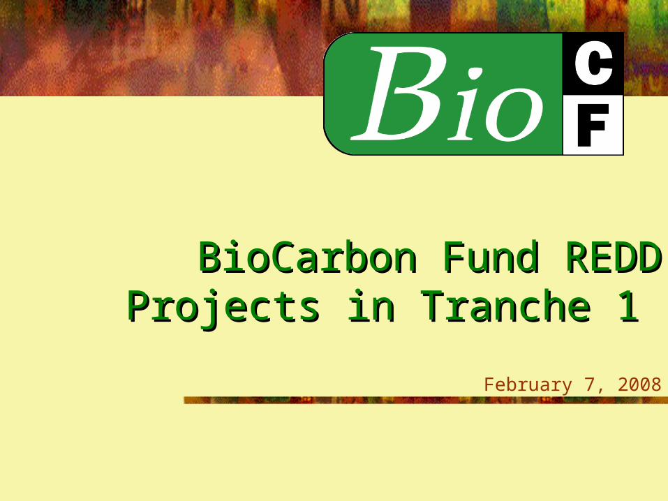
Two WindowsTwo Windows
Second Window
Explore “beyond Kyoto”
CDM: Forest management, revegetation, agricultural land management
No carbon credits
First Window
Kyoto-compatible
CDM: Afforestation /Reforestation + Biofuels
Carbon credits to meet Kyoto obligations
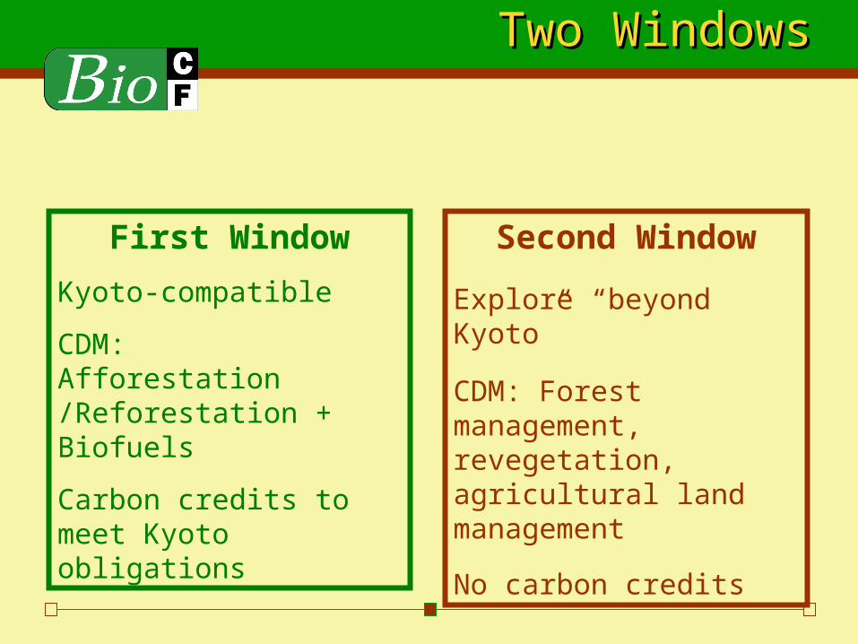
The mountainous Pico Bonito National Park hugs the north coast of Honduras near coastal town of La Ceiba, where its buffer zone is the focus of this project
Honduras Pico Bonito Honduras Pico Bonito ProjectProject
Honduras Pico Bonito ProjectHonduras Pico Bonito Project
Reforest/afforest 3153 ha Restore vulnerable landscapes & water catchment areas
through reforestation/afforestation of degraded lands in buffer zone of Pico Bonito National Park, Honduras
Pico Bonito National Park encompasses 265,000 acresPico Bonito National Park encompasses 265,000 acres
Provides vital connectivity to MesoAmerican Biological CorridorProvides vital connectivity to MesoAmerican Biological Corridor
17 upland watersheds and 200 rivers and streams17 upland watersheds and 200 rivers and streams
Home to many threatened and endangered speciesHome to many threatened and endangered species
Park is home to 24,000 people from 82 communitiesPark is home to 24,000 people from 82 communities
Implement small pilot investments at the community level to restore & manage degraded lands
Commercial reforestation for FSC certified timber
Avoided Deforestation ComponentAvoided Deforestation Component
Avoided Deforestation1550 ha Marginal agricultural and clear cutting practices leave landscape
irregularly and disproportionately barren Local deforestation rate of 10% is higher than country’s average rateLocal deforestation rate of 10% is higher than country’s average rate
New imminent threat from encroaching agriculture and deforestation Thin strip of pristine old growth forest (“The Throat”) connects
western section to rest of Park Local landowners threatening to clear-cut forests or sell strategic land located Local landowners threatening to clear-cut forests or sell strategic land located
within this areawithin this area Overlap with Park’s core preservation zone, makes land parcel even more crucial Overlap with Park’s core preservation zone, makes land parcel even more crucial
than the land that is preservedthan the land that is preserved Location of land risks complete destruction if action is not taken quickly!Location of land risks complete destruction if action is not taken quickly!
Roughly 500,000 tCO2e

Location of “The Throat”Location of “The Throat”
Source: Ecologic
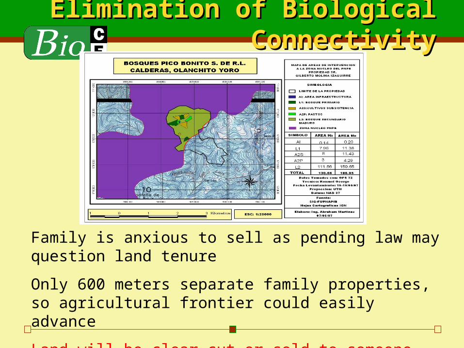
Park Division / Elimination Park Division / Elimination of Biological Connectivityof Biological Connectivity
Family is anxious to sell as pending law may question land tenure
Only 600 meters separate family properties, so agricultural frontier could easily advance
Land will be clear-cut or sold to someone who will
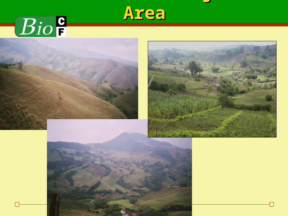
San Nicolás Project AreaSan Nicolás Project Area
Colombia San NicolasColombia San Nicolas
Restore abandoned pastures 1,310 ha Establishment of different forestry systems in area
surrounding Medellin – eastern part of Antioquia Silvopastoral systems, agroforestry, and plantations San Nicolas region provides services to 250,000 inhabitants in
9 municipalities Rio Negro supplies drinking water, 33% of country’s electricity,
and water for agriculture Overgrazing and erosion have left only 25% or original area
Maintain and promote remaining forest relics in Valley for Window 2
Avoided deforestation 76,694 tCO2e
Types of Issues to Think AboutTypes of Issues to Think About
National accounting is different from project level accounting
Determining deforestation rate – Honduras Ex Local deforestation rate can be higher than regional or country
rate Valleys and steep slopes in the same project area have very
different deforestation rates
Proving that land would actually have been deforested in the absence of the project
Cost effectiveness of monitoring