Embed Size (px)
Citation preview
G r e e n s b o r o • G u i l f o r d C o u n t y • O a k R i d g e • P l e a s a n t Ga
rd
en
• S
ed
alia
• S
to
ke
sd
ale
• S
um
me
rf
ield
•
Greensboro • Guilford County • Oak Ridge • Pleasant G
ar
de
n •
Se
da
lia
• S
to
ke
sd
ale
• S
um
me
rf
ield
•
BiPedG R E E N S B O R O U R B A N A R E A
M E T R O P O L I TA N P L A N N I N G O R G A N I Z AT I O N
BiPedG R E E N S B O R O U R B A N A R E A
M E T R O P O L I T A N P L A N N I N G O R G A N I Z A T I O N
BiPedG R E E N S B O R O U R B A N A R E A
M E T R O P O L I TA N P L A N N I N G O R G A N I Z AT I O N
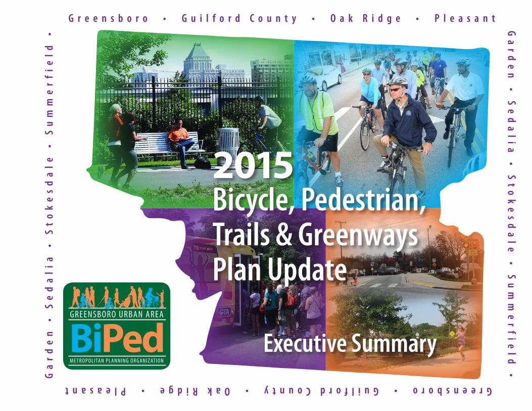
2015Bicycle, Pedestrian,Trails & Greenways Plan Update
Executive Summary

PAGE E-1
Executive Su
mm
ary B
iPed
Plan
Up
date
Table of ContentsPurpose and Context of the Plan E-3
Vision and Goals E-3
Plan Development Process E-4
Organization of the BiPed Plan Update E-4
Chapter 2: Bicycle Plan Executive Summary Infrastructure E-7 Safety E-8 Policies and Programs E-9
Chapter 3: Pedestrian Plan Executive Summary Infrastructure E-13 Safety E-15 Policies and Programs E-15
Chapter 4: Trails & Greenways Plan Executive Summary Infrastructure E-21 Safety E-22 Policies and Programs E-23
PAGE E-2
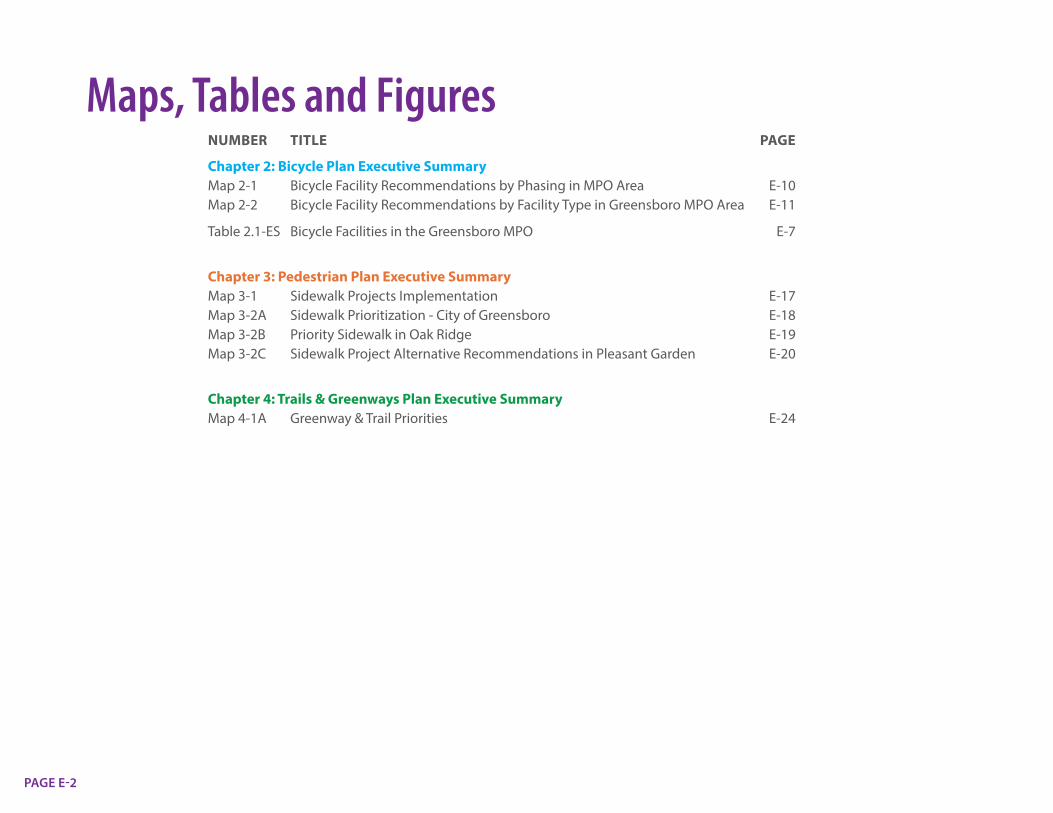
Maps, Tables and FiguresNUMBER TITLE PAGE
Chapter 2: Bicycle Plan Executive SummaryMap 2-1 Bicycle Facility Recommendations by Phasing in MPO Area E-10 Map 2-2 Bicycle Facility Recommendations by Facility Type in Greensboro MPO Area E-11
Table 2.1-ES Bicycle Facilities in the Greensboro MPO E-7
Chapter 3: Pedestrian Plan Executive SummaryMap 3-1 Sidewalk Projects Implementation E-17Map 3-2A Sidewalk Prioritization - City of Greensboro E-18Map 3-2B Priority Sidewalk in Oak Ridge E-19Map 3-2C Sidewalk Project Alternative Recommendations in Pleasant Garden E-20
Chapter 4: Trails & Greenways Plan Executive SummaryMap 4-1A Greenway & Trail Priorities E-24

PAGE E-3
Executive SummaryPURPOSE AND CONTEXT OF THE PLAN
The Greensboro Urban Area Metropolitan Planning Organization developed and adopted the Greensboro Urban Area Bicycle, Pedestrian, and Greenways Plan Update (BiPed) after an intensive analysis and public outreach effort in 2015. The plan supports efforts by the MPO, the City of Greensboro, and other member governments’ efforts to improve conditions for walking and bicycling in the area. At approximately 300 pages, the plan provides extensive details and recommendations. This Executive Summary provides a high level overview of this document and its key findings and recommendations.
The first BiPed Plan was adopted in 2006. Covering the entire Greensboro MPO area including the City of Greensboro, the Towns of Oak Ridge, Pleasant Garden, Sedalia, Stokesdale, Summerfield, and much of unincorporated Guilford County, the plan provided the vision for a focused effort to develop and maintain an integrated bicycle, pedestrian, and greenway network; improve transportation safety for pedestrians and cyclists; promote public health and wellness and access to outdoor landscapes; and promote community goals for land use, enhanced livability, and economic competitiveness. As the BiPed SCORECARD indicates, much has been accomplished since 2006.
The 2015 BiPed Plan Update thoroughly reworks the original BiPed document to create an up to date vision and implementation plan that factors in the substantial amount of bicycle and pedestrian facility improvements made since 2006. The plan inventories existing bicycle, pedestrian, trail, and greenway facilities and prioritizes future infrastructure improvements in light of current data and updated community priorities and needs. The plan accounts for changes in demographics and socioeconomic factors, facility designs, and new analytical methods and capabilities including more detailed analysis of safety trends and issues and technologies for counting bicyclists and pedestrians. The plan also provides guidance for innovations in infrastructure, safety, programs, and policies to help improve walking and bicycling conditions throughout the region. The BiPed Plan Update seeks to continue the substantial progress in installation of bicycle and pedestrian facilities since 2006 by recommending hundreds of miles of additional facilities over the long term. These needs are prioritized and grouped by timeframe and priority level. Highlights include over 100 miles sidewalks currently in preconstruction, a goal for installing 75 miles of bike lanes within five years, and 13.3 miles trails and greenways proposed for construction in the next five to seven years. The Plan also identifies and prioritizes paved shoulder installation needs on roadways outside the City, including the 35 miles most needed to support rural bicycling and walking needs.
VISION AND GOALSThe 2015 BiPed Plan Update was developed to elaborate on and promote implementation of the bicycle and pedestrian modal elements in the 2040 Metropolitan Transportation Plan (2040 MTP). The 2040 MTP is a broad document encompassing all the transportation modes in the Greensboro MPO, including automobiles, transit, rail, bicycling, and pedestrians. The vision of the 2040 MTP calls for a balanced transportation system and emphasizes
B i P e d P l a n U p d a t e
BiPed SCORECARD
PROGRESS MADE SINCE 2006
RESOURCES COMMITTED$134
$9
$20
MILLION
MILLION
MILLION
2008 Greensboro Transportation Bond
Independent sidewalk construction from bond
Federal funding leveraged for sidewalk and greenways as of 2015
All road projects include sidewalks on both sides
Sidewalk Construction
Other On-Street Bicycle Facilities
Bicycle Lanes
Paved Greenways
133.3 miles
8.4 miles
11.9 miles
7.0 milesUnpaved Trails
16.0 miles
BiPedG R E E N S B O R O U R B A N A R E A
M E T R O P O L I TA N P L A N N I N G O R G A N I Z AT I O N
BiPedG R E E N S B O R O U R B A N A R E A
M E T R O P O L I T A N P L A N N I N G O R G A N I Z A T I O N
BiPedG R E E N S B O R O U R B A N A R E A
M E T R O P O L I TA N P L A N N I N G O R G A N I Z AT I O N
PAGE E-4
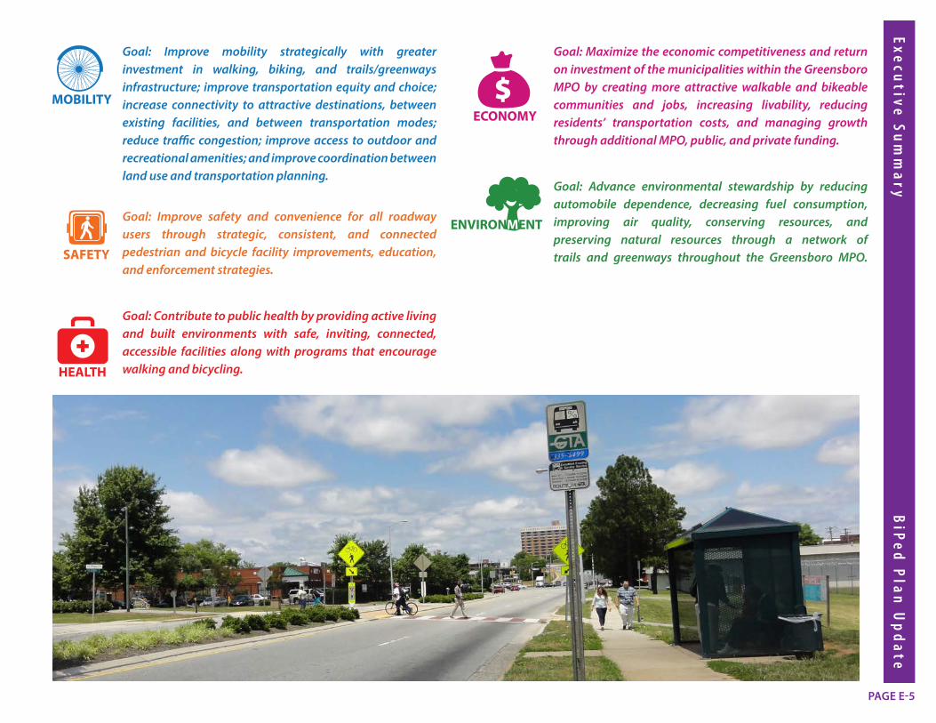
the importance of enhancing and integrating pedestrian and bicycle networks in the Greensboro Metropolitan Area. From this vision five themes can be drawn out: Mobility, Safety, Health, Economy, and Environment. BiPed Plan Update implementation goals were developed for each of these themes.
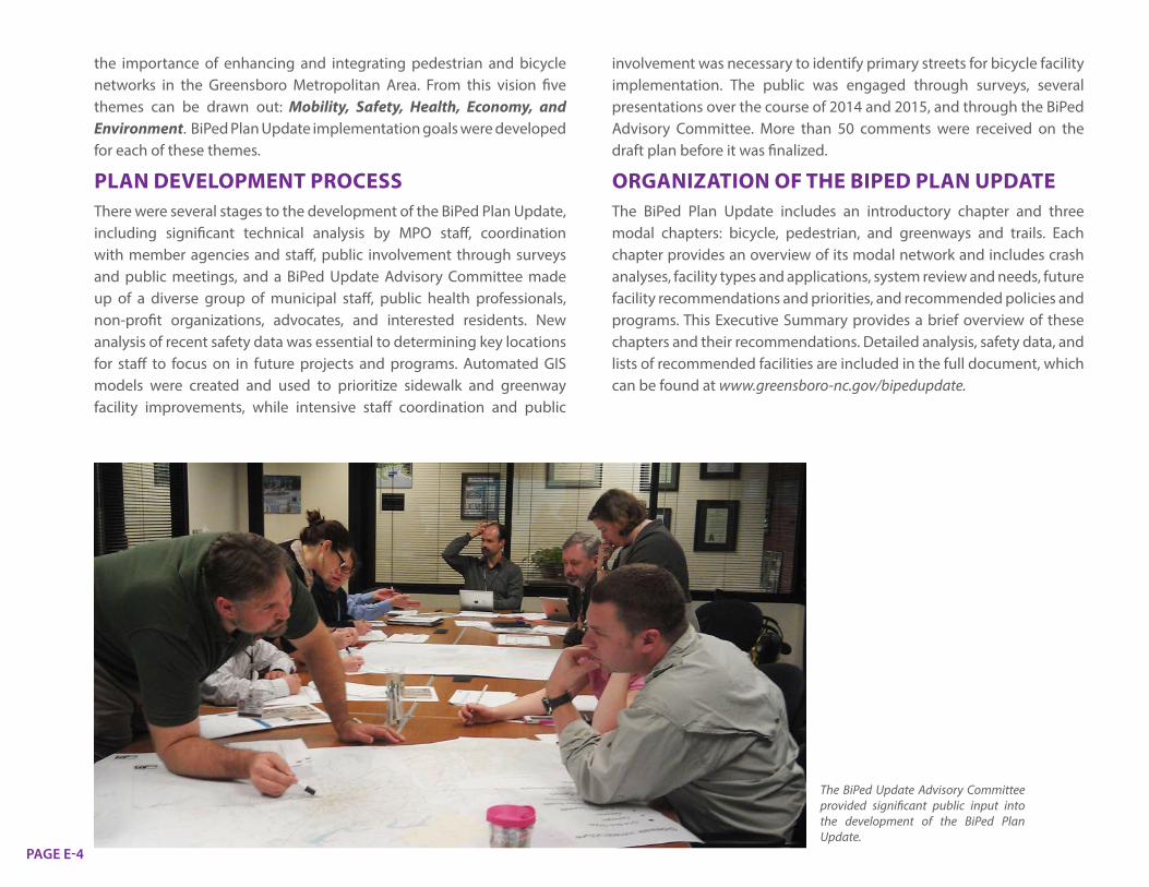
PLAN DEVELOPMENT PROCESSThere were several stages to the development of the BiPed Plan Update, including significant technical analysis by MPO staff, coordination with member agencies and staff, public involvement through surveys and public meetings, and a BiPed Update Advisory Committee made up of a diverse group of municipal staff, public health professionals, non-profit organizations, advocates, and interested residents. New analysis of recent safety data was essential to determining key locations for staff to focus on in future projects and programs. Automated GIS models were created and used to prioritize sidewalk and greenway facility improvements, while intensive staff coordination and public
involvement was necessary to identify primary streets for bicycle facility implementation. The public was engaged through surveys, several presentations over the course of 2014 and 2015, and through the BiPed Advisory Committee. More than 50 comments were received on the draft plan before it was finalized.
ORGANIZATION OF THE BIPED PLAN UPDATEThe BiPed Plan Update includes an introductory chapter and three modal chapters: bicycle, pedestrian, and greenways and trails. Each chapter provides an overview of its modal network and includes crash analyses, facility types and applications, system review and needs, future facility recommendations and priorities, and recommended policies and programs. This Executive Summary provides a brief overview of these chapters and their recommendations. Detailed analysis, safety data, and lists of recommended facilities are included in the full document, which can be found at www.greensboro-nc.gov/bipedupdate.
The BiPed Update Advisory Committee provided significant public input into the development of the BiPed Plan Update.
PAGE E-5
Executive Su
mm
ary B
iPed
Plan
Up
date
Goal: Improve mobility strategically with greater investment in walking, biking, and trails/greenways infrastructure; improve transportation equity and choice; increase connectivity to attractive destinations, between existing facilities, and between transportation modes; reduce traffic congestion; improve access to outdoor and recreational amenities; and improve coordination between land use and transportation planning.
Goal: Improve safety and convenience for all roadway users through strategic, consistent, and connected pedestrian and bicycle facility improvements, education, and enforcement strategies.
Goal: Contribute to public health by providing active living and built environments with safe, inviting, connected, accessible facilities along with programs that encourage walking and bicycling.
Goal: Maximize the economic competitiveness and return on investment of the municipalities within the Greensboro MPO by creating more attractive walkable and bikeable communities and jobs, increasing livability, reducing residents’ transportation costs, and managing growth through additional MPO, public, and private funding.
Goal: Advance environmental stewardship by reducing automobile dependence, decreasing fuel consumption, improving air quality, conserving resources, and preserving natural resources through a network of trails and greenways throughout the Greensboro MPO.
SAFETY
SAFETY
MOBILITY
MOBILITY
ECO N O MY
H E A LT H
EN
VIR O N MENT
SA F E T Y
MO BILITY
ECO N O MYH E A LT H
EN
VIR O N MENT
SA F E T Y
MO BILITY
HEALTH
ECONOMY
ENVIRONMENT
SAFETY
HEALTH
ECONOMY
ENVIRONMENT
SAFETY
MOBILITY
MOBILITY
MOBILITY
SAFETY
SAFETY
MOBILITY
MOBILITY
ECO N O MY
H E A LT H
EN
VIR O N MENT
SA F E T Y
MO BILITY
ECO N O MY
H E A LT H
EN
VIR O N MENT
SA F E T Y
MO BILITY
HEALTH
ECONOMY
ENVIRONMENT
SAFETY
HEALTH
ECONOMY
ENVIRONMENT
SAFETY
MOBILITY
MOBILITY
MOBILITY
SAFETY
SAFETY
MOBILITY
MOBILITY
ECO N O MY
H E A LT H
EN
VIR O N MENT
SA F E T Y
MO BILITY
ECO N O MY
H E A LT H
EN
VIR O N MENT
SA F E T Y
MO BILITY
HEALTH
ECONOMY
ENVIRONMENT
SAFETY
HEALTH
ECONOMY
ENVIRONMENT
SAFETY
MOBILITY
MOBILITY
MOBILITY
SAFETY
SAFETY
MOBILITY
MOBILITY
ECO N O MY
H E A LT H
EN
VIR O N MENT
SA F E T Y
MO BILITY
ECO N O MY
H E A LT H
EN
VIR O N MENT
SA F E T Y
MO BILITY
HEALTH
ECONOMY
ENVIRONMENT
SAFETY
HEALTH
ECONOMY
ENVIRONMENT
SAFETY
MOBILITY
MOBILITY
MOBILITY
SAFETY
SAFETY
MOBILITY
MOBILITY
ECO N O MY
H E A LT H
EN
VIR O N MENT
SA F E T Y
MO BILITY
ECO N O MY
H E A LT H
EN
VIR O N MENT
SA F E T Y
MO BILITY
HEALTH
ECONOMY
ENVIRONMENT
SAFETY
HEALTH
ECONOMY
ENVIRONMENT
SAFETY
MOBILITY
MOBILITY
MOBILITY

PAGE E-6
This page is intentionally left blank.
2CH.
Bicycle P
lan Execu
tive Sum
mary
BiP
ed P
lan U
pd
ate
PAGE E-7
CHAPTER 2: BICYCLE PLANINTRODUCTIONBicycling is an essential component of any transportation system. The successful promotion and growth of bicycling in a community improves the health of its residents, creates safer travel for all users, betters the environment, and improves the quality of life. A municipality can maximize economic competitiveness and return on transportation investment by creating bikeable communities that are accessible and attractive.
The 2006 BiPed Plan was the first document produced by the City of Greensboro or MPO to make specific bicycle facility recommendations and outline their implementation. Before the development of the BiPed Plan, there were no dedicated bike lanes in the City or MPO, and there was no plan for a systematically connected on-street bicycle network. The BiPed Plan Update and the Bicycle Chapter build upon the trailblazing work of the 2006 BiPed Plan to create a more bike-friendly MPO and connect the non-motorized network.
Table 2.1-ES displays the considerable progress that has been made in the Greensboro MPO to install bicycle facilities since the 2006 BiPed Plan. About 12 miles of bike lanes have been implemented since 2006, along with 45 miles of other on-road facilities. Other on-road facilities include edgelines, shared lane markings, and signed bike routes. The City of Greensboro has also instituted a bicycle parking program which has installed approximately 100 bicycle racks since 2006.
INFRASTRUCTURETo build on this progress to create a more bikeable City and MPO, the BiPed Plan Update recommends 334 bike-lane miles of urban facilities, ranging from traditional bike lanes, protected bike lanes, and shared lane markings. Although traditional bicycle lanes are the most common urban facilities for bicycling, new facilities such as protected bike lanes are recommended because they have features that better accommodate bicycle users that are less confident riding in shared lanes with vehicle traffic. 20 bike-lane miles of protected bike lanes are recommended for Church Street in downtown Greensboro, the west side of Murrow
STATUS OF BICYCLE FACILITIES (measured in centerline miles)
BICYCLE LANES
PROTECTED BICYCLE LANES
BICYCLE PARKING LOCATIONS
PAVED SHOULDERS (4’ OR MORE)
OTHER ON-ROAD FACILITIES*
Proposed in 2006 BiPed Plan 131.8 0 Not Specified 532.7 54.3
Implemented since 2006 BiPed Plan 11.9 0 ~100 0 45.1
New facilities proposed in 2015 BiPed Plan Update 134 10 100+ over five years 498 20.5
TABLE 2.1-ES Bicycle Facilities in the Greensboro MPO
Urban Bike FacilityRECOMMENDATIONSMiles of Bicycle Lanes
Miles of Shared Lane Markings
Miles of Protected Bicycle Lanes/ Cycletracks
Miles of Roadways That Require Future Study
268 bike-lane134 centerline
41 bike-lane/20.5 centerline
20 bike-lane/10 centerline
5 bike-lane/2.5 centerline
TOTAL:
334BIKE -LANE
MILES
167CENTERLINE
MILES
*Other on-road facilities include edgelines, shared pavement markings, and signed bike routes.

PAGE E-8
Boulevard, Yanceyville Street, Randleman Road, Grandover Parkway, and Holden Road. Within five years of the adoption of this plan, the City intends to install an additional 75 bike-lane miles of bicycle facilities throughout the city to achieve 100 bike-lane miles. Details about short-term bicycle improvements can be found in the Summary section of the Bicycle Chapter of the BiPed Plan Update.
Paved shoulders at least four foot wide are essential improvements for both bicyclists and pedestrians in more rural areas with narrow, high-speed roadways. Few paved shoulders have been implemented in the Greensboro MPO since the 2006 BiPed Plan. This is due to myriad physical, institutional, and financial challenges. However, during the process of updating
the BiPed Plan, MPO staff in consultation with the BiPed Advisory Committee developed a list of roadways for top priority paved shoulder projects: Lake Brandt Road, North Church Street, NC 150, and McConnell Road. The MPO and member agencies will continue to study this issue and find opportunities to complete these projects.
Other recommended infrastructure improvements to encourage and promote bicycle transportation include increasing the amount of bicycle parking, improving support services for bicyclists, and making signalization and intersection improvements for bicycling. Bicycle parking allows users to secure their bicycles outside or inside key destinations such as schools, parks, employment centers, and other locations. The City plans to install more than 100 additional public bicycle parking racks to increase the total number past 200 bicycle racks in the next five years as part of implementing this plan. Support services, such as changing rooms, showers, and repair stations provide additional encouragement and incentive
for commuters and other bicycle users. Signalization and intersection treatments improve user compliance with traffic laws, heighten awareness of bicycle positioning in intersections, and provide better guidance to users.
Good maintenance of roadways and bicycle facilities makes a big difference in the comfort and predictability of bicycle users. Poor pavement conditions create hazards for bicyclists in the form of potholes, uneven pavement, and roadside debris. Regular road resurfacing is also necessary to more quickly implement bicycle facilities, as installing new roadway marking configurations are easier, more cost-effective, and longer-lasting after a road has been completely resurfaced. Unfortunately, City resurfacing funds have diminished over the past decade, slowing bicycle facility implementation and creating unsafe pavement conditions. Resurfacing funds must be increased to meet the goal of installing 75 bike-lane miles in five years.
SAFETYMaking streets safer for bicyclists is one of the most important goals of the BiPed Plan Update. NCDOT bicycle crash data for the MPO area from 2007-2012 was analyzed for this plan. 288 bicycle crashes were reported in the Greensboro MPO with an average of 48 crashes annually. The highest-crash intersections in the City
MLK Jr. Drive and Florida Street, Greensboro.
Bicycle parking in Downtown Greensboro installed in the sidewalk right-of-way.

2CH.
Bicycle P
lan Execu
tive Sum
mary
BiP
ed P
lan U
pd
ate
PAGE E-9
were along Spring Garden Street at Kenilworth Street and at S. Chapman Street, as well as at S. Davie Street and W. McGee Street in downtown Greensboro. A quarter of all crashes took place in the afternoon (3-6 PM), with Monday having the highest percentage of all crashes and October being the peak month for crashes. Failure to yield, on the part of the motorist or the bicyclist, was cited as the most frequent reason for the crash occurring.
To improve safety for bicycle users, the BiPed Plan uses a five-pronged approach to evaluate countermeasures and identify implementation strategies and recommendations, known as the “Five E’s”: Engineering, Education, Enforcement, Encouragement, and Evaluation. Engineering refers to the infrastructure and network of bicycle facilities that provide safe traveling spaces for cyclists. The implementation of 75 bike-lane miles in the City of Greensboro and the high priority paved shoulder projects will improve bicycle safety. Education on safe bicycle practices to users, and bicycle laws and safe driving practices around cyclists to motorists, improves safety by raising awareness of the issues for all road users. Public education campaigns such as GSO Shares the Road and Watch For Me NC help get out the message about how to keep cyclists safe. Proper enforcement of existing traffic laws increases traffic law compliance for motorists and bicyclists and improves safety for all road users. Encouragement programs and annual events such as Bike Month are needed to inspire people that are interested but concerned to try bicycling for the first time or to bicycle more frequently. Finally, evaluation is important to monitor the effectiveness of the other elements and provide data that can be reviewed and acted upon.
POLICIES AND PROGRAMSThe long-term success of the bicycle network depends on the use and support of bicycle facilities. Supporting policies such as Complete
Streets and land use that allows for safe and efficient bicycle trips will encourage bicycle usage among all residents. Bicycle facility ordinances and street design standards help to integrate considerations for bicycling at various levels of street design and re-design, ensuring that bicycling is accommodated through various processes. Different programs promote bicycle usage and cover aspects of education, encouragement, and enforcement to increase safety and raise awareness for all road users. These programs include Safe Routes to School, Let’s Go NC!, National Bike Month and Bike to School Day, Watch For Me NC, the Bicycle Friendly America program, and bike share. Additional efforts include the development of an updated local bicycle map, the creation of a Bicycle and Pedestrian Advisory Committee, and increasing local governmental staffing to work on bicycle-related issues.
Watch For Me NC kick-off event at City Market in Downtown Greensboro.
Encouragement activities like Open Streets provide an opportunity for all ages to bicycle.

PAGE E-10

PAGE E-11

This page is intentionally left blank.PAGE E-12
3CH.
Ped
estrian P
lan Execu
tive Sum
mary
BiP
ed P
lan U
pd
ate
PAGE E-13
CHAPTER 3: PEDESTRIAN PLAN INTRODUCTIONWalking is a very important form of transportation. For example, the great majority of transit trips start as walk trips. Also, walking is crucial for people with limited mobility, those who do not or cannot drive, and for those who choose to walk for transportation or recreational exercise purposes to support their health and fitness. While for some, walking is or can be a necessity, and for others it is a choice, at one time or another we are all pedestrians.
The key point is that conditions for walking are greatly impacted by roadside environments. Properly designed and installed pedestrian facilities make the roadway accessible to all users, while the lack of such facilities can make it impossible for those with mobility limitations to travel along the roadway. Sidewalks and other pedestrian facilities improve pedestrian safety and reduce pedestrian crash rates. Roadside environments that support walking encourage walking activities and are clearly linked to an increase in walk trips. Roadway environments without proper pedestrian facilities are in turn linked to increased crash rates and a reduced amount of walking activity.
For these reasons, the BiPed Plan emphasizes the importance of pedestrian infrastructure, makes many recommendations for future improvements, and details the substantial effort that the City of Greensboro and the Greensboro MPO have done to improve pedestrian infrastructure, increase the comfort and safety of pedestrians, and encourage walking activity for transportation, recreation, fitness, and health.
The 2006 BiPed Plan built off of earlier momentum and set in motion a very significant effort to improve pedestrian transportation in the City of Greensboro and the Greensboro MPO area. Earlier momentum is linked back to the 2000 Transportation Bond which provided dedicated funding for pedestrian improvements and the Greensboro Walkability Policy (2002) which established a framework of action and a commitment by the City to ongoing sidewalk construction, strengthened sidewalk ordinance requirements, crossing improvements, education and encouragement programs, and other actions. For the MPO area towns
and Guilford County it represented the first effort to identify future pedestrian facility improvement needs. For all area governments, the plan provided a helpful basis on which to work with NCDOT on pursuing pedestrian improvement needs on NCDOT roadways. In recent years the towns have begun planning for pedestrian improvements within their jurisdictions, in particular Oak Ridge, Pleasant Garden, and Sedalia.
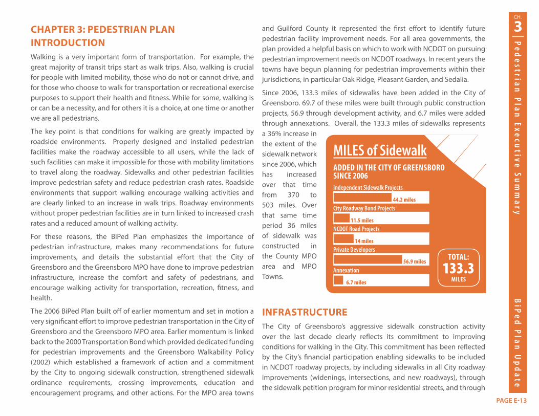
Since 2006, 133.3 miles of sidewalks have been added in the City of Greensboro. 69.7 of these miles were built through public construction projects, 56.9 through development activity, and 6.7 miles were added through annexations. Overall, the 133.3 miles of sidewalks represents a 36% increase in the extent of the sidewalk network since 2006, which has increased over that time from 370 to 503 miles. Over that same time period 36 miles of sidewalk was constructed in the County MPO area and MPO Towns.
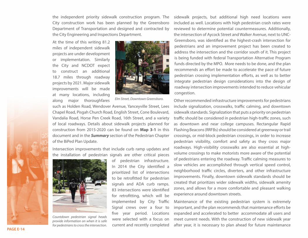
INFRASTRUCTUREThe City of Greensboro’s aggressive sidewalk construction activity over the last decade clearly reflects its commitment to improving conditions for walking in the City. This commitment has been reflected by the City’s financial participation enabling sidewalks to be included in NCDOT roadway projects, by including sidewalks in all City roadway improvements (widenings, intersections, and new roadways), through the sidewalk petition program for minor residential streets, and through
MILES of SidewalkADDED IN THE CITY OF GREENSBORO SINCE 2006Independent Sidewalk Projects
Annexation
NCDOT Road Projects
City Roadway Bond Projects
Private Developers
44.2 miles
6.7 miles
14 miles
11.5 miles
56.9 milesTOTAL:
133.3MILES
PAGE E-14
the independent priority sidewalk construction program. The City construction work has been planned by the Greensboro Department of Transportation and designed and contracted by the City Engineering and Inspections Department.
At the time of this writing 81.2 miles of independent sidewalk projects are under development or implementation. Similarly the City and NCDOT expect to construct an additional 18.7 miles through roadway projects by 2021. Major sidewalk improvements will be made at many locations, including along major thoroughfares such as Holden Road, Wendover Avenue, Yanceyville Street, Lees Chapel Road, Pisgah Church Road, English Street, Cone Boulevard, Vandalia Road, Horse Pen Creek Road, 16th Street, and a variety of local roadways. Details about sidewalk projects planned for construction from 2015-2020 can be found on Map 3-1 in this document and in the Summary section of the Pedestrian Chapter of the BiPed Plan Update.
Intersection improvements that include curb ramp updates and the installation of pedestrian signals are other critical pieces
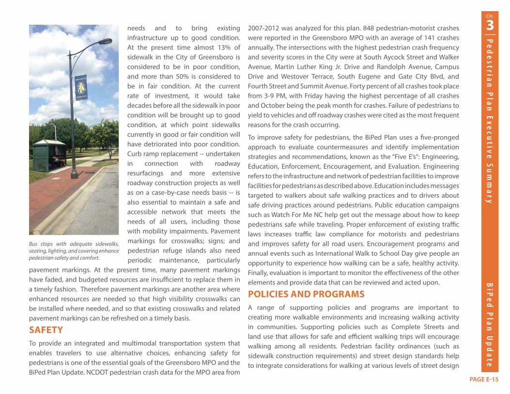
of pedestrian infrastructure. In 2014 the City identified a prioritized list of intersections to be retrofitted for pedestrian signals and ADA curb ramps. 83 intersections were identified for retrofitting, which will be implemented by City Traffic Signal crews over a four to five year period. Locations were selected with a focus on current and recently completed
sidewalk projects, but additional high need locations were included as well. Locations with high pedestrian crash rates were reviewed to determine potential countermeasures. Additionally, the intersection of Aycock Street and Walker Avenue, next to UNC-Greensboro, was identified as the highest-crash intersection for pedestrians and an improvement project has been created to address the intersection and the corridor south of it. This project is being funded with federal Transportation Alternative Program funds directed by the MPO. More needs to be done, and the plan recommends an effort be made to accelerate the pace of future pedestrian crossing implementation efforts, as well as to better integrate pedestrian design considerations into the design of roadway intersection improvements intended to reduce vehicular congestion.
Other recommended infrastructure improvements for pedestrians include signalization, crosswalks, traffic calming, and downtown sidewalk standards. Signalization that puts a priority on pedestrian traffic should be considered in pedestrian high-traffic zones, such as downtown and near college campuses. Rectangular Rapid Flashing Beacons (RRFBs) should be considered at greenway or trail crossings, or mid-block pedestrian crossings, in order to increase pedestrian visibility, comfort and safety as they cross major roadways. High-visibility crosswalks are also essential at high-volume crossings to make motorists more aware of the potential of pedestrians entering the roadway. Traffic calming measures to slow vehicles are accomplished through vertical speed control, neighborhood traffic circles, diverters, and other infrastructure improvements. Finally, downtown sidewalk standards should be created that prioritizes wider sidewalk widths, sidewalk amenity zones, and allows for a more comfortable and pleasant walking experience around downtown streets.
Maintenance of the existing pedestrian system is extremely important, and the plan recommends that maintenance efforts be expanded and accelerated to better accommodate all users and meet current needs. With the construction of new sidewalk year after year, it is necessary to plan ahead for future maintenance
Elm Street, Downtown Greensboro.
Countdown pedestrian signal heads provide information on when it is safe for pedestrians to cross the intersection.
3CH.
Ped
estrian P
lan Execu
tive Sum
mary
BiP
ed P
lan U
pd
ate
PAGE E-15
needs and to bring existing infrastructure up to good condition. At the present time almost 13% of sidewalk in the City of Greensboro is considered to be in poor condition, and more than 50% is considered to be in fair condition. At the current rate of investment, it would take decades before all the sidewalk in poor condition will be brought up to good condition, at which point sidewalks currently in good or fair condition will have detriorated into poor condition. Curb ramp replacement -- undertaken in connection with roadway resurfacings and more extensive roadway construction projects as well as on a case-by-case needs basis -- is also essential to maintain a safe and accessible network that meets the needs of all users, including those with mobility impairments. Pavement markings for crosswalks; signs; and pedestrian refuge islands also need periodic maintenance, particularly
pavement markings. At the present time, many pavement markings have faded, and budgeted resources are insufficient to replace them in a timely fashion. Therefore pavement markings are another area where enhanced resources are needed so that high visibility crosswalks can be installed where needed, and so that existing crosswalks and related pavement markings can be refreshed on a timely basis.
SAFETYTo provide an integrated and multimodal transportation system that enables travelers to use alternative choices, enhancing safety for pedestrians is one of the essential goals of the Greensboro MPO and the BiPed Plan Update. NCDOT pedestrian crash data for the MPO area from
2007-2012 was analyzed for this plan. 848 pedestrian-motorist crashes were reported in the Greensboro MPO with an average of 141 crashes annually. The intersections with the highest pedestrian crash frequency and severity scores in the City were at South Aycock Street and Walker Avenue, Martin Luther King Jr. Drive and Randolph Avenue, Campus Drive and Westover Terrace, South Eugene and Gate City Blvd, and Fourth Street and Summit Avenue. Forty percent of all crashes took place from 3-9 PM, with Friday having the highest percentage of all crashes and October being the peak month for crashes. Failure of pedestrians to yield to vehicles and off roadway crashes were cited as the most frequent reasons for the crash occurring.
To improve safety for pedestrians, the BiPed Plan uses a five-pronged approach to evaluate countermeasures and identify implementation strategies and recommendations, known as the “Five E’s”: Engineering, Education, Enforcement, Encouragement, and Evaluation. Engineering refers to the infrastructure and network of pedestrian facilities to improve facilities for pedestrians as described above. Education includes messages targeted to walkers about safe walking practices and to drivers about safe driving practices around pedestrians. Public education campaigns such as Watch For Me NC help get out the message about how to keep pedestrians safe while traveling. Proper enforcement of existing traffic laws increases traffic law compliance for motorists and pedestrians and improves safety for all road users. Encouragement programs and annual events such as International Walk to School Day give people an opportunity to experience how walking can be a safe, healthy activity. Finally, evaluation is important to monitor the effectiveness of the other elements and provide data that can be reviewed and acted upon.
POLICIES AND PROGRAMSA range of supporting policies and programs are important to creating more walkable environments and increasing walking activity in communities. Supporting policies such as Complete Streets and land use that allows for safe and efficient walking trips will encourage walking among all residents. Pedestrian facility ordinances (such as sidewalk construction requirements) and street design standards help to integrate considerations for walking at various levels of street design
Bus stops with adequate sidewalks, seating, lighting, and covering enhance pedestrian safety and comfort.
PAGE E-16
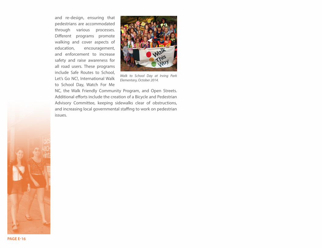
and re-design, ensuring that pedestrians are accommodated through various processes. Different programs promote walking and cover aspects of education, encouragement, and enforcement to increase safety and raise awareness for all road users. These programs include Safe Routes to School, Let’s Go NC!, International Walk to School Day, Watch For Me NC, the Walk Friendly Community Program, and Open Streets. Additional efforts include the creation of a Bicycle and Pedestrian Advisory Committee, keeping sidewalks clear of obstructions, and increasing local governmental staffing to work on pedestrian issues.
Walk to School Day at Irving Park Elementary, October 2014.

PAGE E-17

PAGE E-18

PAGE E-19

PAGE E-20
PAGE E-21
4CH.
Trails and
Green
ways P
lan Execu
tive Sum
mary
BiP
ed P
lan U
pd
ateCHAPTER 4: TRAILS AND GREENWAYS PLANINTRODUCTION Trails and greenways are very important assets in the Greensboro MPO region. Residents and visitors alike are drawn to Greensboro area greenways and trails and these facilities are a key part of the image of the city and region. Greenways are non-motorized transportation facilities with recreational benefits and uses. They are paved facilities intended to accommodate large numbers of pedestrians and bicyclists, complementing the sidewalk and on-road bicycle network and attracting different kinds of users that prefer greater separation from automobile traffic. Trails are unpaved, of a natural surface, minimally developed, and are often located in environmentally sensitive areas. Greenways and trails encourage active transportation and outdoor recreation, promote physical fitness and healthy lifestyles, strengthen
the local economy, and preserve environmental, cultural, and historically valuable areas. Greenways and trails can also have a substantial impact on land development and redevelopment. The Downtown Greenway is a very notable example of this, with over $200 million in private development activity having occurred adjacent to or near the Downtown Greenway by mid-2014, with substantially more development activity currently in progress.
The City of Greensboro has been building greenways and trails since the 1970s. In 1997, the City enacted a Parks & Recreation Master Plan, a forerunner of the BiPed Plan. Both the 2000 and 2008 Transportation Bonds provided dedicated funding for greenway construction, which helped provide momentum for greenway system expansion. The Greensboro Department of Transportation became actively involved in planning and construction of greenways in this timeframe as well. Another key factor in the current momentum has been the
excellent and ongoing contributions of volunteer assistance from local clubs. Their efforts have contributed greatly to the construction and maintenance of many of the trails, bridges, and boardwalks that are currently in place. Guilford County began developing greenways in the 1990s with the planning and passage of a bond referendum for construction of the Bicentennial Greenway. In addition, Guilford County owns seven regional parks that have internal or regionally connected trails and greenways for hiking and biking. MPO area towns have recently started to plan for future trail and greenway facilities as well.
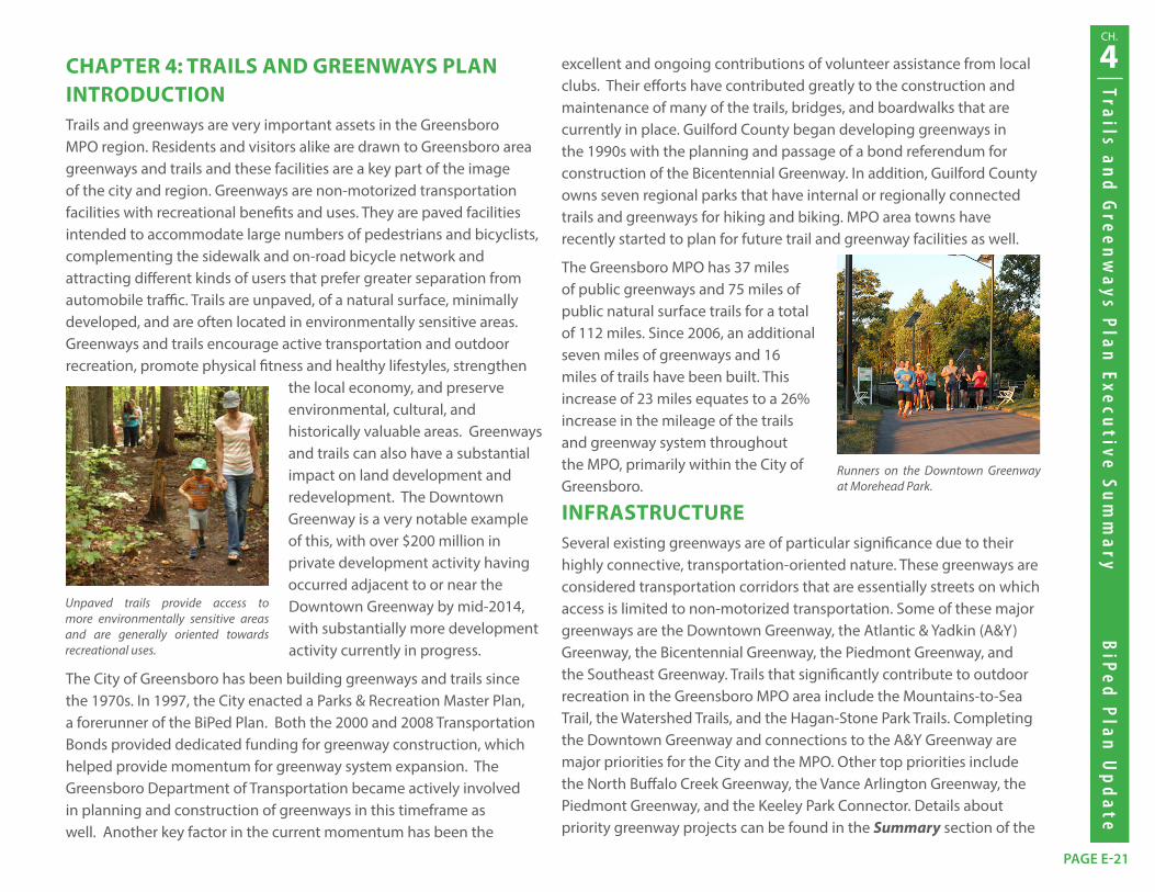
The Greensboro MPO has 37 miles of public greenways and 75 miles of public natural surface trails for a total of 112 miles. Since 2006, an additional seven miles of greenways and 16 miles of trails have been built. This increase of 23 miles equates to a 26% increase in the mileage of the trails and greenway system throughout the MPO, primarily within the City of Greensboro.
INFRASTRUCTURESeveral existing greenways are of particular significance due to their highly connective, transportation-oriented nature. These greenways are considered transportation corridors that are essentially streets on which access is limited to non-motorized transportation. Some of these major greenways are the Downtown Greenway, the Atlantic & Yadkin (A&Y) Greenway, the Bicentennial Greenway, the Piedmont Greenway, and the Southeast Greenway. Trails that significantly contribute to outdoor recreation in the Greensboro MPO area include the Mountains-to-Sea Trail, the Watershed Trails, and the Hagan-Stone Park Trails. Completing the Downtown Greenway and connections to the A&Y Greenway are major priorities for the City and the MPO. Other top priorities include the North Buffalo Creek Greenway, the Vance Arlington Greenway, the Piedmont Greenway, and the Keeley Park Connector. Details about priority greenway projects can be found in the Summary section of the
Unpaved trails provide access to more environmentally sensitive areas and are generally oriented towards recreational uses.
Runners on the Downtown Greenway at Morehead Park.
PAGE E-22
Trails and Greenways Chapter of the BiPed Plan Update.
Other recommendations to improve, enhance, and coordinate the greenway and trail network are to consolidate the naming of some existing and proposed greenways and to provide adequate staffing for the planning, maintenance, promotion, and oversight of the system. Corridors that are linked by several existing and proposed greenways can be consolidated under one name to highlight their regional importance and connectivity across communities. Two examples of greenways that are recommended for consolidation with their existing counterparts are the North Buffalo Creek Greenway (Arboretum Greenway, Lake Daniel & Latham Park Greenways, and the Northeast Community Trail) and the South Buffalo Creek Greenway (Southeast Greenway, Bluford Loop Connector, Barber Park Trail, and Hillsdale Greenway). Demands on administrative staff are growing as the mileage of trails and greenways continues to increase. As a result, it is recommended to increase staff capacity in order to separate out and more effectively manage tasks such as planning, development, marketing, and promotion.
Although greenway and trail maintenance is similar to the maintenance of other bicycle and pedestrian facilities, there are distinct maintenance challenges that are not commonly found in roadway environments such as public art, difficult to access locations, and extensive landscaping. Major maintenance items
such as repaving and pavement repair are outside of the typical operating budget of the Parks and Recreation Department. The Greensboro MPO has been able to help fill some gaps by allocating federal funds towards repaving in recent years, but a local funding source is still needed to address future facility obsolescence and replacement. Facilities with
more intensive maintenance needs, in particular the Downtown Greenway, also must be considered. Creating a greenways and trails conditions index, developing a trail maintenance handbook, and increasing maintenance staff are key recommendations from the BiPed Plan.
SAFETYOff-road areas like greenways and trails can have automobile conflicts where they cross streets and driveways. They can also have issues regarding collisions between bicyclists and pedestrians on shared paths. Lighting in urban areas, emergency access in remote areas, and preventing criminal activities are all elements of promoting safety on greenways and trails. According to data provided by the NCDOT Bicycle and Pedestrian Division, between 2007 and 2012 eight bicycle and pedestrian crashes occurred at seven locations where greenways and trails cross roads. Six of the crossing locations had one crash per location (either a bicycle or pedestrian crash), while the A&Y Greenway corridor between Cotswold Avenue and Cotswold Terrace had two bicycle crashes. Reviewing existing greenway and trail road crossings to ensure all needed safety measures are being taken is an important recommendation in the BiPed Plan.
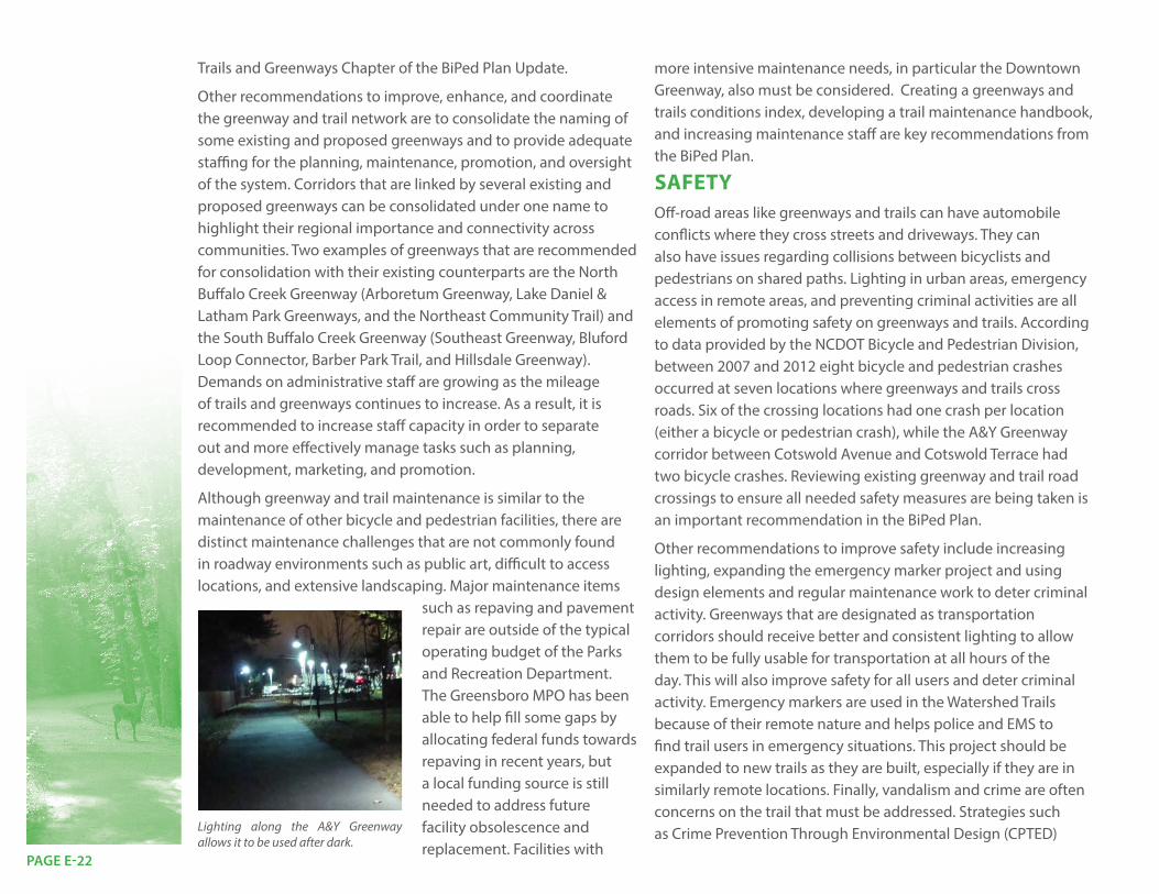
Other recommendations to improve safety include increasing lighting, expanding the emergency marker project and using design elements and regular maintenance work to deter criminal activity. Greenways that are designated as transportation corridors should receive better and consistent lighting to allow them to be fully usable for transportation at all hours of the day. This will also improve safety for all users and deter criminal activity. Emergency markers are used in the Watershed Trails because of their remote nature and helps police and EMS to find trail users in emergency situations. This project should be expanded to new trails as they are built, especially if they are in similarly remote locations. Finally, vandalism and crime are often concerns on the trail that must be addressed. Strategies such as Crime Prevention Through Environmental Design (CPTED) Lighting along the A&Y Greenway
allows it to be used after dark.

PAGE E-23
4CH.
Trails and
Green
ways P
lan Execu
tive Sum
mary
BiP
ed P
lan U
pd
ateare essential to deter criminal activity, as is timely maintenance of vegetation, lighting, and other details. Regular police officer patrols on urban greenways are also important to increase safety and reduce the likelihood of crime and vandalism.
POLICIES AND PROGRAMSThe BiPed Plan makes recommendations for greenway and trail-supportive policies and programs. These recommendations include enhanced maintenance of the system, promotion of greenway-oriented development, promotion of trail-supportive development, and celebration of the network.
The Parks & Recreation Department has an Adopt-A-Trail Program to encourage volunteers to assist with the maintenance of adopted trails, and has had a long and successful relationship with the Greensboro Fat Tire Society to help build and maintain mountain biking trails. Additional promotional and encouragement programs include National Trails Day, National Bike Month, and Parks and Recreation Month. Continuation and expansion
of such steps is recommended to help engage the public with the greenway and trail network and become invested in its maintenance, operations, and expansion.
The BiPed Plan also recommends enhancements to the City’s Land Development Ordinance to better accommodate greenway-oriented developments and to encourage trail-supportive development. This is a timely recommendation given the substantial interest evident in the development community and the public for greenway-oriented development. This interest has been demonstrated very clearly downtown, where Downtown Greenway-related development had exceeded $200 million in value by mid-2014, with the ultimate value expected to rise considerably higher than that. Similar interest has
been expressed in connection with the A&Y greenway connection to Downtown and the North Buffalo Creek Greenway near Revolution Mills.
Other essential components of a trail and greenway system are good mapping, wayfinding, and signage for users to navigate the system. The BiPed Plan makes recommendations for continuing and strengthening such policies and programs in the future.
National Trails Day includes programs for children to get them out on trails and interacting with nature.

PAGE E-24