Embed Size (px)
Citation preview
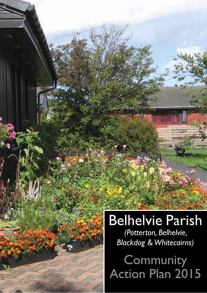
Belhelvie Parish(Potterton, Belhelvie,
Blackdog & Whitecairns)
CommunityAction Plan 2015

2
Community Action PlanMap
Fig 1: Map OfBelhelvie Parish
3
Community Action Plan
I. Introduction & Background
This Community Action Plan has been produced by and for Belhelvie Community Council with the assistance of the Formartine Partnership, the Formartine Community Planning Officer and Aberdeenshire Council’s Community Learning and Development Service, using the Planning for Real® methodology (www.planningforrreal.org.uk/what-is-pfr/). It covers the communities of Potterton, Belhelvie, Whitecairns and Blackdog.
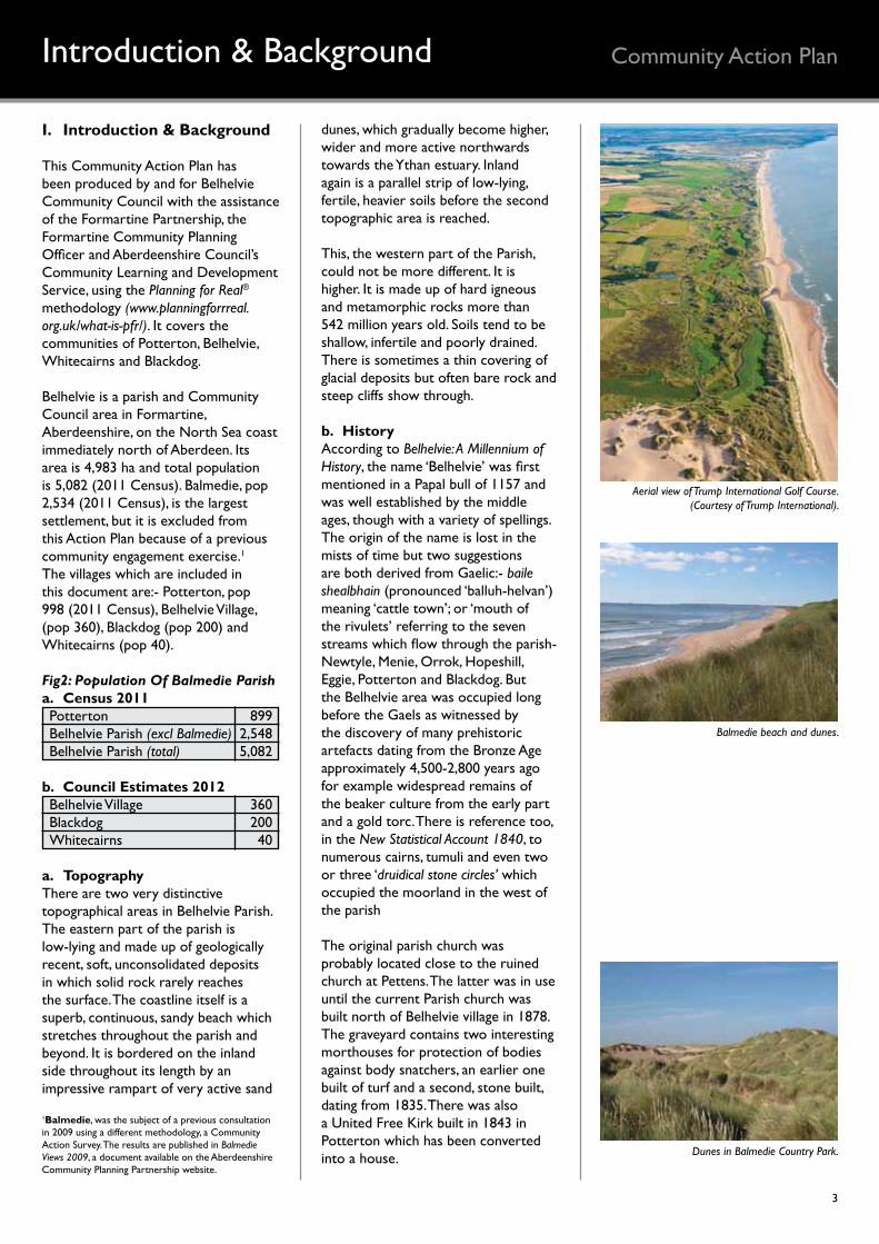
Belhelvie is a parish and Community Council area in Formartine, Aberdeenshire, on the North Sea coast immediately north of Aberdeen. Its area is 4,983 ha and total population is 5,082 (2011 Census). Balmedie, pop 2,534 (2011 Census), is the largest settlement, but it is excluded from this Action Plan because of a previous community engagement exercise.1 The villages which are included in this document are:- Potterton, pop 998 (2011 Census), Belhelvie Village, (pop 360), Blackdog (pop 200) and Whitecairns (pop 40).
Fig2: Population Of Balmedie Parisha. Census 2011Potterton 899Belhelvie Parish (excl Balmedie) 2,548Belhelvie Parish (total) 5,082
b. Council Estimates 2012Belhelvie Village 360Blackdog 200Whitecairns 40
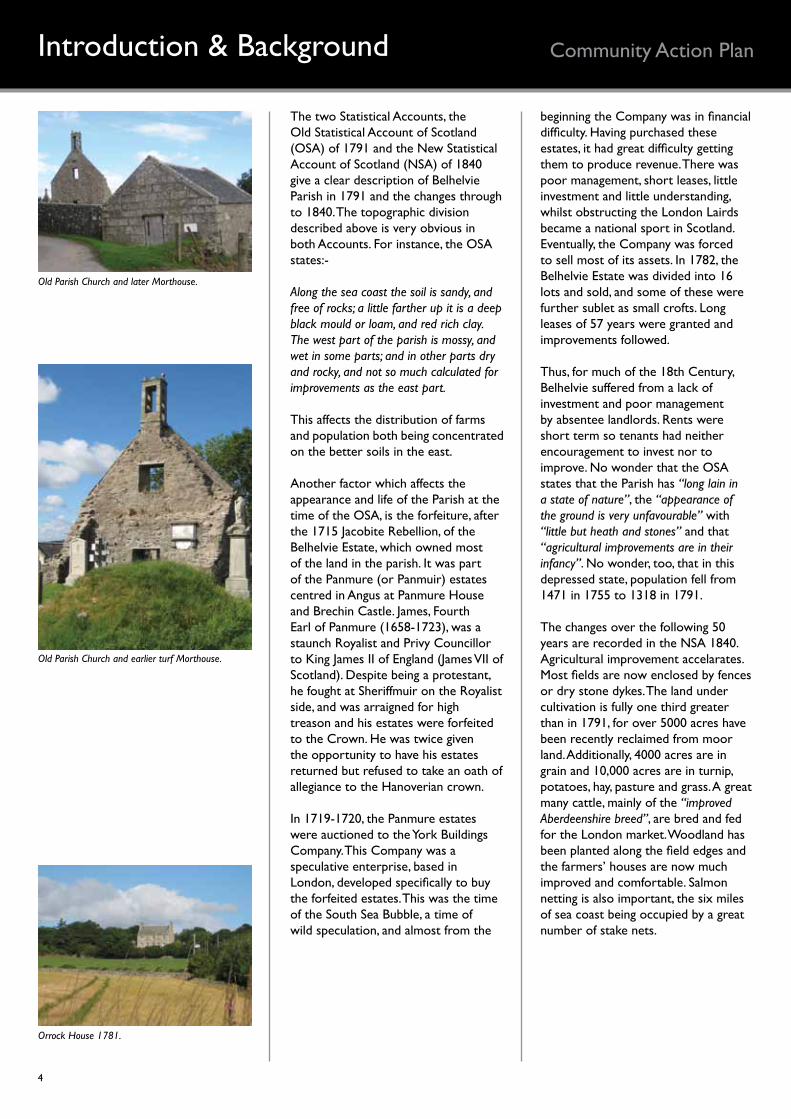
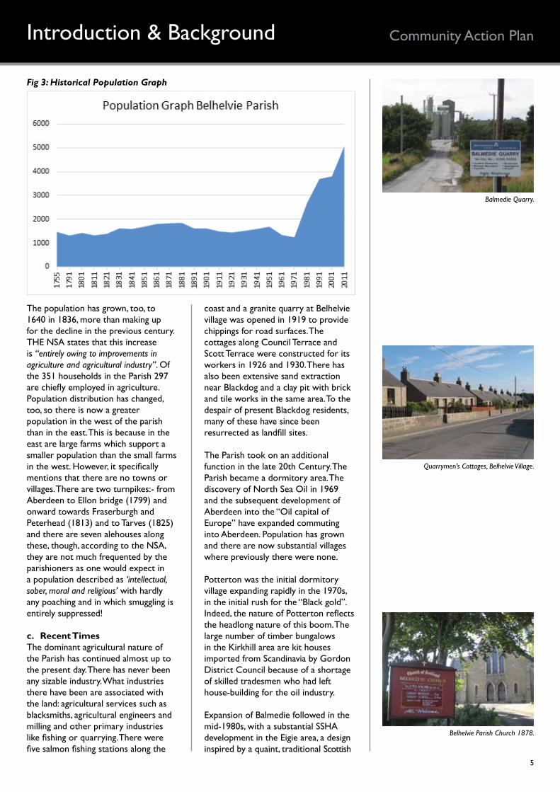
a. TopographyThere are two very distinctive topographical areas in Belhelvie Parish. The eastern part of the parish is low-lying and made up of geologically recent, soft, unconsolidated deposits in which solid rock rarely reaches the surface. The coastline itself is a superb, continuous, sandy beach which stretches throughout the parish and beyond. It is bordered on the inland side throughout its length by an impressive rampart of very active sand
Introduction & Background
dunes, which gradually become higher, wider and more active northwards towards the Ythan estuary. Inland again is a parallel strip of low-lying, fertile, heavier soils before the second topographic area is reached.
This, the western part of the Parish, could not be more different. It is higher. It is made up of hard igneous and metamorphic rocks more than 542 million years old. Soils tend to be shallow, infertile and poorly drained. There is sometimes a thin covering of glacial deposits but often bare rock and steep cliffs show through.
b. HistoryAccording to Belhelvie: A Millennium of History, the name ‘Belhelvie’ was first mentioned in a Papal bull of 1157 and was well established by the middle ages, though with a variety of spellings. The origin of the name is lost in the mists of time but two suggestions are both derived from Gaelic:- baile shealbhain (pronounced ‘balluh-helvan’) meaning ‘cattle town’; or ‘mouth of the rivulets’ referring to the seven streams which flow through the parish- Newtyle, Menie, Orrok, Hopeshill, Eggie, Potterton and Blackdog. But the Belhelvie area was occupied long before the Gaels as witnessed by the discovery of many prehistoric artefacts dating from the Bronze Age approximately 4,500-2,800 years ago for example widespread remains of the beaker culture from the early part and a gold torc. There is reference too, in the New Statistical Account 1840, to numerous cairns, tumuli and even two or three ‘druidical stone circles’ which occupied the moorland in the west of the parish
The original parish church was probably located close to the ruined church at Pettens. The latter was in use until the current Parish church was built north of Belhelvie village in 1878. The graveyard contains two interesting morthouses for protection of bodies against body snatchers, an earlier one built of turf and a second, stone built, dating from 1835. There was also a United Free Kirk built in 1843 in Potterton which has been converted into a house.
Aerial view of Trump International Golf Course. (Courtesy of Trump International).
1Balmedie, was the subject of a previous consultation in 2009 using a different methodology, a Community Action Survey. The results are published in Balmedie Views 2009, a document available on the Aberdeenshire Community Planning Partnership website.
Balmedie beach and dunes.
Dunes in Balmedie Country Park.
4
Community Action PlanIntroduction & Background
The two Statistical Accounts, the Old Statistical Account of Scotland (OSA) of 1791 and the New Statistical Account of Scotland (NSA) of 1840 give a clear description of Belhelvie Parish in 1791 and the changes through to 1840. The topographic division described above is very obvious in both Accounts. For instance, the OSA states:-
Along the sea coast the soil is sandy, and free of rocks; a little farther up it is a deep black mould or loam, and red rich clay. The west part of the parish is mossy, and wet in some parts; and in other parts dry and rocky, and not so much calculated for improvements as the east part.
This affects the distribution of farmsand population both being concentratedon the better soils in the east.
Another factor which affects the appearance and life of the Parish at the time of the OSA, is the forfeiture, after the 1715 Jacobite Rebellion, of the Belhelvie Estate, which owned most of the land in the parish. It was part of the Panmure (or Panmuir) estates centred in Angus at Panmure House and Brechin Castle. James, Fourth Earl of Panmure (1658-1723), was a staunch Royalist and Privy Councillor to King James II of England (James VII of Scotland). Despite being a protestant, he fought at Sheriffmuir on the Royalist side, and was arraigned for high treason and his estates were forfeited to the Crown. He was twice given the opportunity to have his estates returned but refused to take an oath of allegiance to the Hanoverian crown.
In 1719-1720, the Panmure estates were auctioned to the York Buildings Company. This Company was a speculative enterprise, based in London, developed specifically to buy the forfeited estates. This was the time of the South Sea Bubble, a time of wild speculation, and almost from the
beginning the Company was in financial difficulty. Having purchased these estates, it had great difficulty getting them to produce revenue. There was poor management, short leases, little investment and little understanding, whilst obstructing the London Lairds became a national sport in Scotland. Eventually, the Company was forced to sell most of its assets. In 1782, the Belhelvie Estate was divided into 16 lots and sold, and some of these were further sublet as small crofts. Long leases of 57 years were granted and improvements followed.
Thus, for much of the 18th Century, Belhelvie suffered from a lack of investment and poor management by absentee landlords. Rents were short term so tenants had neither encouragement to invest nor to improve. No wonder that the OSA states that the Parish has “long lain in a state of nature”, the “appearance of the ground is very unfavourable” with “little but heath and stones” and that “agricultural improvements are in their infancy”. No wonder, too, that in this depressed state, population fell from 1471 in 1755 to 1318 in 1791.
The changes over the following 50 years are recorded in the NSA 1840. Agricultural improvement accelarates. Most fields are now enclosed by fences or dry stone dykes. The land under cultivation is fully one third greater than in 1791, for over 5000 acres have been recently reclaimed from moor land. Additionally, 4000 acres are in grain and 10,000 acres are in turnip, potatoes, hay, pasture and grass. A great many cattle, mainly of the “improved Aberdeenshire breed”, are bred and fed for the London market. Woodland has been planted along the field edges and the farmers’ houses are now much improved and comfortable. Salmon netting is also important, the six miles of sea coast being occupied by a great number of stake nets.
Old Parish Church and later Morthouse.
Old Parish Church and earlier turf Morthouse.
Orrock House 1781.
5
Community Action PlanIntroduction & Background
Fig 3: Historical Population Graph
The population has grown, too, to 1640 in 1836, more than making up for the decline in the previous century. THE NSA states that this increase is “entirely owing to improvements in agriculture and agricultural industry”. Of the 351 households in the Parish 297 are chiefly employed in agriculture. Population distribution has changed, too, so there is now a greater population in the west of the parish than in the east. This is because in the east are large farms which support a smaller population than the small farms in the west. However, it specifically mentions that there are no towns or villages. There are two turnpikes:- from Aberdeen to Ellon bridge (1799) and onward towards Fraserburgh and Peterhead (1813) and to Tarves (1825) and there are seven alehouses along these, though, according to the NSA, they are not much frequented by the parishioners as one would expect in a population described as ‘intellectual, sober, moral and religious’ with hardly any poaching and in which smuggling is entirely suppressed!
c. Recent TimesThe dominant agricultural nature of the Parish has continued almost up to the present day. There has never been any sizable industry. What industries there have been are associated with the land: agricultural services such as blacksmiths, agricultural engineers and milling and other primary industries like fishing or quarrying. There were five salmon fishing stations along the
coast and a granite quarry at Belhelvie village was opened in 1919 to provide chippings for road surfaces. The cottages along Council Terrace and Scott Terrace were constructed for its workers in 1926 and 1930. There has also been extensive sand extraction near Blackdog and a clay pit with brick and tile works in the same area. To the despair of present Blackdog residents, many of these have since been resurrected as landfill sites.
The Parish took on an additional function in the late 20th Century. The Parish became a dormitory area. The discovery of North Sea Oil in 1969 and the subsequent development of Aberdeen into the “Oil capital of Europe” have expanded commuting into Aberdeen. Population has grown and there are now substantial villages where previously there were none.
Potterton was the initial dormitory village expanding rapidly in the 1970s, in the initial rush for the “Black gold”. Indeed, the nature of Potterton reflects the headlong nature of this boom. The large number of timber bungalows in the Kirkhill area are kit houses imported from Scandinavia by Gordon District Council because of a shortage of skilled tradesmen who had left house-building for the oil industry.
Expansion of Balmedie followed in the mid-1980s, with a substantial SSHA development in the Eigie area, a design inspired by a quaint, traditional Scottish
Balmedie Quarry.
Quarrymen’s Cottages, Belhelvie Village.
Belhelvie Parish Church 1878.
6
Community Action PlanLocal Development Plan
fishing village. Since then each settlement has absorbed further housing development and many rural cottages have been modernised and extended for commuters.
The beautiful coast has also been recognised for its superb quality. Firstly, in 1983, the Balmedie Country Park was established in the dune belt as a recreation area. Secondly, the Menie Links, in the north of the parish, became part of the Foveran Links SSSI, established in 1984, which extends continuously northwards beyond the parish to join with Sands of Forvie National Nature Reserve. The links were designated because of their biological and geomorphological interest particularly the extremely active dune systems. Finally, in 2008 Trump International was given outline permission to construct a world class golf resort on the Menie Estate. The proposal is for a golf resort comprising:- two 18-hole courses, a clubhouse and ancillary facilities, a 450-room hotel with conference centre and spa, 950 holiday apartments in 4 blocks, 36 ‘golf villas’, 500 houses for sale, accommodation for 400 staff, road access and parking. A subsequent Planning Enquiry (2008) summarised its impact on the coast:-
The applicant aims to create a world-class golf course capable of hosting major championships. This requires part of the course to be sited within the SSSI, where the dune topography is at its most dramatic. . . . Stabilisation of major areas of mobile sand dune would be unavoidable. The consequent loss of considerable geomorphological interest is acknowledged.
There have never been any railways in Belhelvie. The two turnpike roads became, respectively, the A90 to Peterhead and B999 to Tarves. The former is a dual carriageway through much of the Parish from Aberdeen as far as Balmedie and the dual carriageway will shortly be extended to Ellon. The Aberdeen Western Peripheral Road, bypassing Aberdeen, will enter the Parish south of Potterton and join the A90 at Blackdog making this a key strategic point for development. Indeed, the whole route from Aberdeen to Peterhead, the Energetica Corridor, (www.energetica.uk.com) is envisaged as the key strategic development
corridor for Aberdeen City and Shire for the post-oil era. It is intended to strengthen the region’s current and future position as a global energy hub, building on its rich oil and gas heritage with opportunities for carbon capture and storage, hydrogen, and onshore and offshore renewable energy.
II. The Planning Context: a. Aberdeenshire Local
Development Plan 2012Three clear types of development area are identified for planning purposes:• Strategic growth areas. They
include Aberdeen City and the major transport routes between the city and Huntly; Laurencekirk; and Peterhead. Over 75% of all growth is expected to take place in these areas.
• Local growth and diversification areas. In these areas growth in local communities is allowed to meet local needs.
• Regeneration Areas. Areas where improving the economy and environmental quality have a special role.
Belhelvie Parish includes the Strategic growth area along the A90 to Peterhead and this is enhanced by its designation as the Energetica Corridor, aimed at attracting high quality, innovative, energy-related companies. Blackdog is identified as a growth hub in this Strategic growth area. The Aberdeen Western Peripheral Road joins the A90 corridor close by. The Development Plan allocates 600 new dwellings to Blackdog, along with new community facilities, particularly a primary school, employment opportunities, a major retail facility and a park and ride scheme.
There are also two zones which have special controls on development:- the Aberdeen Greenbelt and the Coastal Zone. There is a presumption against development which could erode the nature of both of these areas. Belhelvie Parish includes part of both special zones: the Greenbelt is located along its southern edge curving round to exclude Potterton but including Blackdog and the Coastal Zone extends north-south throughout the Parish east of the A90, again including Blackdog.
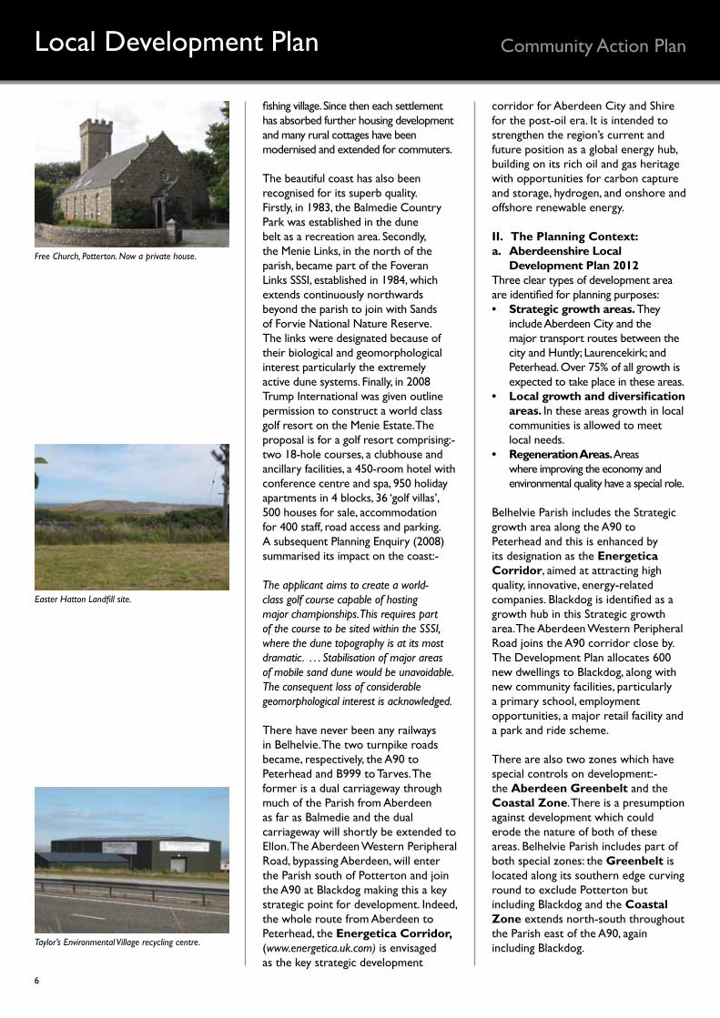
Free Church, Potterton. Now a private house.
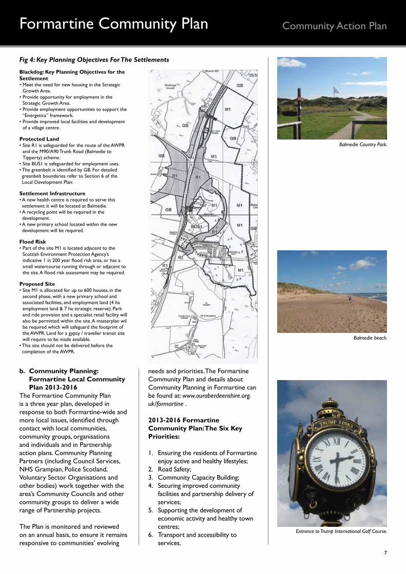
Easter Hatton Landfill site.
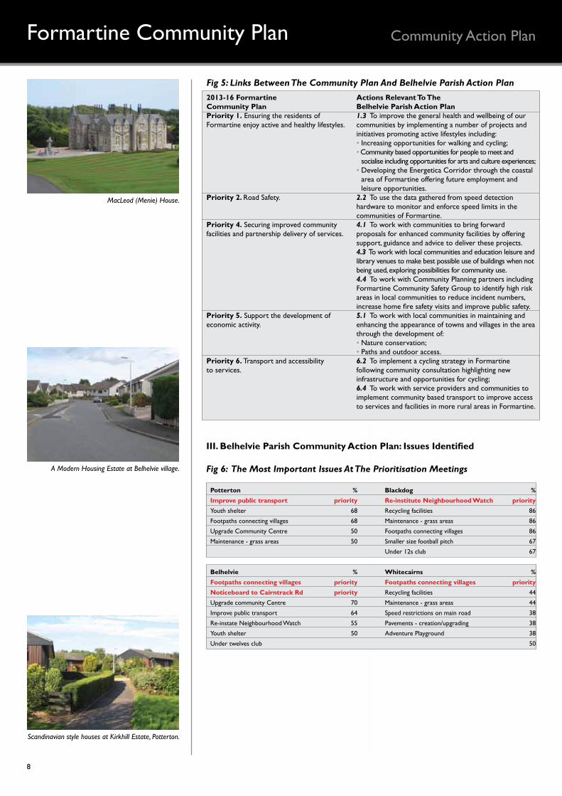
Taylor’s Environmental Village recycling centre.
7
Community Action Plan
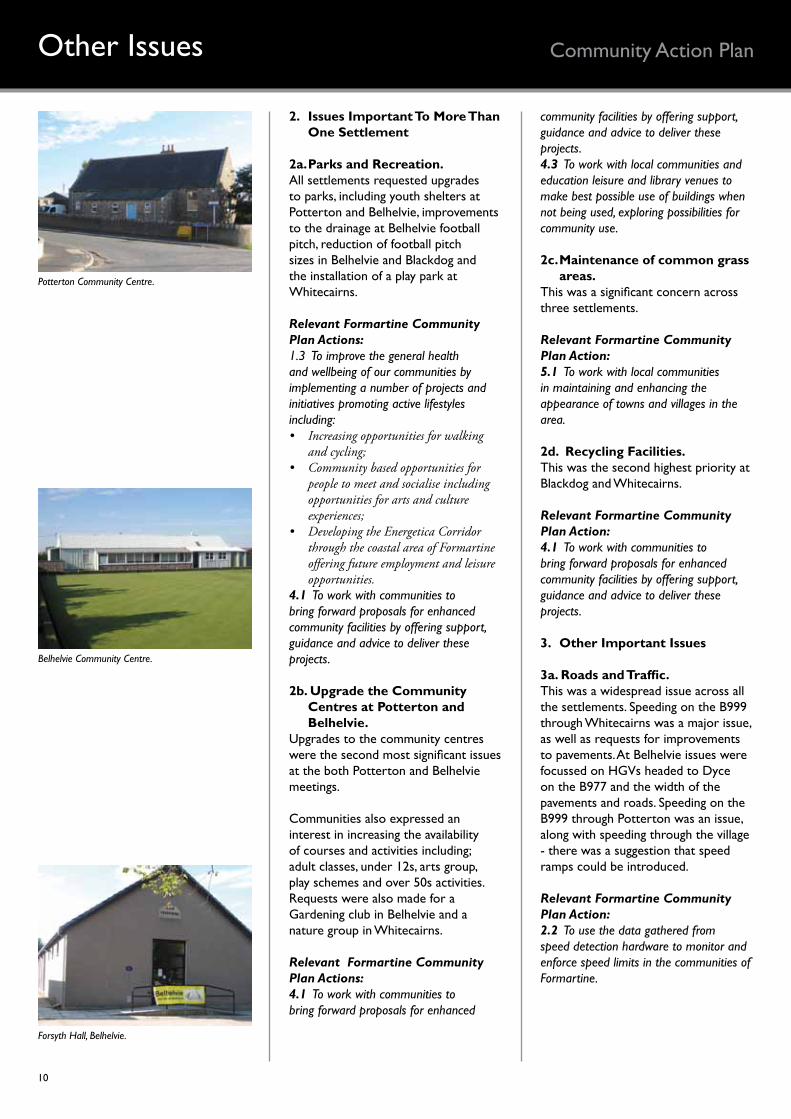
Fig 4: Key Planning Objectives For The Settlements
Formartine Community Plan
b. Community Planning: Formartine Local Community Plan 2013-2016
The Formartine Community Plan is a three year plan, developed in response to both Formartine-wide and more local issues, identified through contact with local communities, community groups, organisations and individuals and in Partnership action plans. Community Planning Partners (including Council Services, NHS Grampian, Police Scotland, Voluntary Sector Organisations and other bodies) work together with the area’s Community Councils and other community groups to deliver a wide range of Partnership projects.
The Plan is monitored and reviewed on an annual basis, to ensure it remains responsive to communities’ evolving
needs and priorities. The Formartine Community Plan and details about Community Planning in Formartine can be found at: www.ouraberdeenshire.org.uk/formartine .
2013-2016 Formartine Community Plan: The Six Key Priorities:
1. Ensuring the residents of Formartine enjoy active and healthy lifestyles;
2. Road Safety;3. Community Capacity Building;4. Securing improved community
facilities and partnership delivery of services;
5. Supporting the development of economic activity and healthy town centres;
6. Transport and accessibility to services.
Balmedie Country Park.
Balmedie beach.
Entrance to Trump International Golf Course.
Blackdog: Key Planning Objectives for the Settlement• Meet the need for new housing in the Strategic
Growth Area.• Provide opportunity for employment in the
Strategic Growth Area.• Provide employment opportunities to support the
“Energetica” framework.• Provide improved local facilities and development
of a village centre.
Protected Land• Site R1 is safeguarded for the route of the AWPR
and the M90/A90 Trunk Road (Balmedie to Tipperty) scheme.
• Site BUS1 is safeguarded for employment uses.• The greenbelt is identified by GB. For detailed greenbelt boundaries refer to Section 6 of the Local Development Plan:
Settlement Infrastructure• A new health centre is required to serve this settlement; it will be located at Balmedie.
• A recycling point will be required in the development.
• A new primary school located within the new development will be required.
Flood Risk• Part of the site M1 is located adjacent to the
Scottish Environment Protection Agency’s indicative 1 in 200 year flood risk area, or has a small watercourse running through or adjacent to the site. A flood risk assessment may be required.
Proposed Site• Site M1 is allocated for up to 600 houses, in the
second phase, with a new primary school and associated facilities, and employment land (4 ha employment land & 7 ha strategic reserve). Park and ride provision and a specialist retail facility will also be permitted within the site. A masterplan wil be required which will safeguard the footprint of the AWPR. Land for a gypsy / traveller transit site will require to be made available.
• This site should not be delivered before the completion of the AWPR.
8
Community Action PlanFormartine Community Plan
MacLeod (Menie) House.
A Modern Housing Estate at Belhelvie village.
Scandinavian style houses at Kirkhill Estate, Potterton.
2013-16 Formartine Actions Relevant To TheCommunity Plan Belhelvie Parish Action PlanPriority 1. Ensuring the residents of 1.3 To improve the general health and wellbeing of ourFormartine enjoy active and healthy lifestyles. communities by implementing a number of projects and
initiatives promoting active lifestyles including: • Increasing opportunities for walking and cycling; • Community based opportunities for people to meet and • socialise including opportunities for arts and culture experiences; • Developing the Energetica Corridor through the coastal
• area of Formartine offering future employment and • leisure opportunities.Priority 2. Road Safety. 2.2 To use the data gathered from speed detection
hardware to monitor and enforce speed limits in the communities of Formartine.
Priority 4. Securing improved community 4.1 To work with communities to bring forwardfacilities and partnership delivery of services. proposals for enhanced community facilities by offering
support, guidance and advice to deliver these projects. 4.3 To work with local communities and education leisure and
library venues to make best possible use of buildings when not being used, exploring possibilities for community use.
4.4 To work with Community Planning partners including Formartine Community Safety Group to identify high risk areas in local communities to reduce incident numbers, increase home fire safety visits and improve public safety.
Priority 5. Support the development of 5.1 To work with local communities in maintaining andeconomic activity. enhancing the appearance of towns and villages in the area
through the development of: • Nature conservation; • Paths and outdoor access.Priority 6. Transport and accessibility 6.2 To implement a cycling strategy in Formartineto services. following community consultation highlighting new
infrastructure and opportunities for cycling; 6.4 To work with service providers and communities to
implement community based transport to improve access to services and facilities in more rural areas in Formartine.
Fig 5: Links Between The Community Plan And Belhelvie Parish Action Plan
III. Belhelvie Parish Community Action Plan: Issues Identified
Fig 6: The Most Important Issues At The Prioritisation Meetings
Potterton % Blackdog %Improve public transport priority Re-institute Neighbourhood Watch priorityYouth shelter 68 Recycling facilities 86
Footpaths connecting villages 68 Maintenance - grass areas 86
Upgrade Community Centre 50 Footpaths connecting villages 86
Maintenance - grass areas 50 Smaller size football pitch 67
Under 12s club 67
Belhelvie % Whitecairns %Footpaths connecting villages priority Footpaths connecting villages priorityNoticeboard to Cairntrack Rd priority Recycling facilities 44
Upgrade community Centre 70 Maintenance - grass areas 44
Improve public transport 64 Speed restrictions on main road 38
Re-instate Neighbourhood Watch 55 Pavements - creation/upgrading 38
Youth shelter 50 Adventure Playground 38
Under twelves club 50

9
Community Action PlanPriority Issues
1. The Priority Issues
1a. Footpaths connecting villages. This was voted the highest priority issue at Belhelvie and Whitecairns and had the highest individual score at Blackdog and second highest at Potterton.
It would address issues such as: Safer pedestrian and cycling routes to the Primary School and other amenities in Balmedie; Routes to Balmedie Country Park; and Wider requests for nature trails and woodlands walks near all the villages.
Aberdeenshire Council’s Core Path’s plan includes a Core Path from Blackdog to Balmedie Country Park and a proposed new path from Belhelvie to Balmedie. The dualling of the A90 north of Balmedie, the construction of the AWPR and the Master plans for Blackdog and Balmedie may give further opportunities for the development of footpaths and cycle ways using the existing and new infrastructure.
Relevant Formartine Community Plan Actions:1.3 To improve the general health and wellbeing of our communities by implementing a number of projects and initiatives promoting active lifestyles including:• Increasingopportunitiesforwalking
andcycling;• Communitybasedopportunitiesfor
peopletomeetandsocialiseincludingopportunitiesforartsandcultureexperiences;
• DevelopingtheEnergeticaCorridorthroughthecoastalareaofFormartineofferingfutureemploymentandleisureopportunities.
5.1 To work with local communities in maintaining and enhancing the appearance of towns and villages in the area through the development of:• Natureconservation;• Pathsandoutdooraccess.6.2 To implement a cycling strategy in Formartine following community consultation highlighting new infrastructure and opportunities for cycling;
1b. Improve public transport locally and in Aberdeen City.
This was the priority issue at Potterton and the third highest at Belhelvie. Complaints were raised about fares, frequency, punctuality and routes. Public transport to and within Aberdeen is provided by two local service providers - Stagecoach and First Aberdeen and the Formartine Area Bus Forum meets regularly to discuss local transportation issues.
It was not an issue at Blackdog possibly because this is the only settlement on the Buchan Link trunk route along the A90 to Ellon, Peterhead and Fraserburgh.
Relevant Formartine Community Plan Action:6.4 To work with service providers and communities to implement community based transport to improve access to services and facilities in more rural areas in Formartine.
1c. Re-instate Neighbourhood Watch Schemes in each village.
This was a priority issue at Blackdog and also important at Belhelvie. Since the PFR event, a Neighbourhood Watch Scheme is now in existence in Belhelvie
Relevant Formartine Community Plan Action:4.4 To work with Community Planning partners including Formartine Community Safety Group to identify high risk areas in local communities to reduce incident numbers, increase home fire safety visits and improve public safety.
1d. Move Belhelvie Village Noticeboard to Cairntrack Road.
Move the noticeboard from its existing position to a more visible location at Cairntrack Road to improve community relations.
Planning for Real® Public Exhibition.
Entrance to Balmedie Country Park.
Planning for Real® Public Exhibition.
10
Community Action PlanOther Issues
2. Issues Important To More Than One Settlement
2a. Parks and Recreation.All settlements requested upgrades to parks, including youth shelters at Potterton and Belhelvie, improvements to the drainage at Belhelvie football pitch, reduction of football pitch sizes in Belhelvie and Blackdog and the installation of a play park at Whitecairns.
Relevant Formartine Community Plan Actions: 1.3 To improve the general health and wellbeing of our communities by implementing a number of projects and initiatives promoting active lifestyles including:• Increasingopportunitiesforwalking
andcycling;• Communitybasedopportunitiesfor
peopletomeetandsocialiseincludingopportunitiesforartsandcultureexperiences;
• DevelopingtheEnergeticaCorridorthroughthecoastalareaofFormartineofferingfutureemploymentandleisureopportunities.
4.1 To work with communities to bring forward proposals for enhanced community facilities by offering support, guidance and advice to deliver these projects.
2b. Upgrade the Community Centres at Potterton and Belhelvie.
Upgrades to the community centres were the second most significant issues at the both Potterton and Belhelvie meetings.
Communities also expressed an interest in increasing the availability of courses and activities including; adult classes, under 12s, arts group, play schemes and over 50s activities. Requests were also made for a Gardening club in Belhelvie and a nature group in Whitecairns.
Relevant Formartine Community Plan Actions:4.1 To work with communities to bring forward proposals for enhanced
community facilities by offering support, guidance and advice to deliver these projects. 4.3 To work with local communities and education leisure and library venues to make best possible use of buildings when not being used, exploring possibilities for community use.
2c. Maintenance of common grass areas.
This was a significant concern across three settlements.
Relevant Formartine Community Plan Action:5.1 To work with local communities in maintaining and enhancing the appearance of towns and villages in the area.
2d. Recycling Facilities.This was the second highest priority at Blackdog and Whitecairns.
Relevant Formartine Community Plan Action:4.1 To work with communities to bring forward proposals for enhanced community facilities by offering support, guidance and advice to deliver these projects.
3. Other Important Issues
3a. Roads and Traffic.This was a widespread issue across all the settlements. Speeding on the B999 through Whitecairns was a major issue, as well as requests for improvements to pavements. At Belhelvie issues were focussed on HGVs headed to Dyce on the B977 and the width of the pavements and roads. Speeding on the B999 through Potterton was an issue, along with speeding through the village - there was a suggestion that speed ramps could be introduced.
Relevant Formartine Community Plan Action:2.2 To use the data gathered from speed detection hardware to monitor and enforce speed limits in the communities of Formartine.
Potterton Community Centre.
Belhelvie Community Centre.
Forsyth Hall, Belhelvie.
11
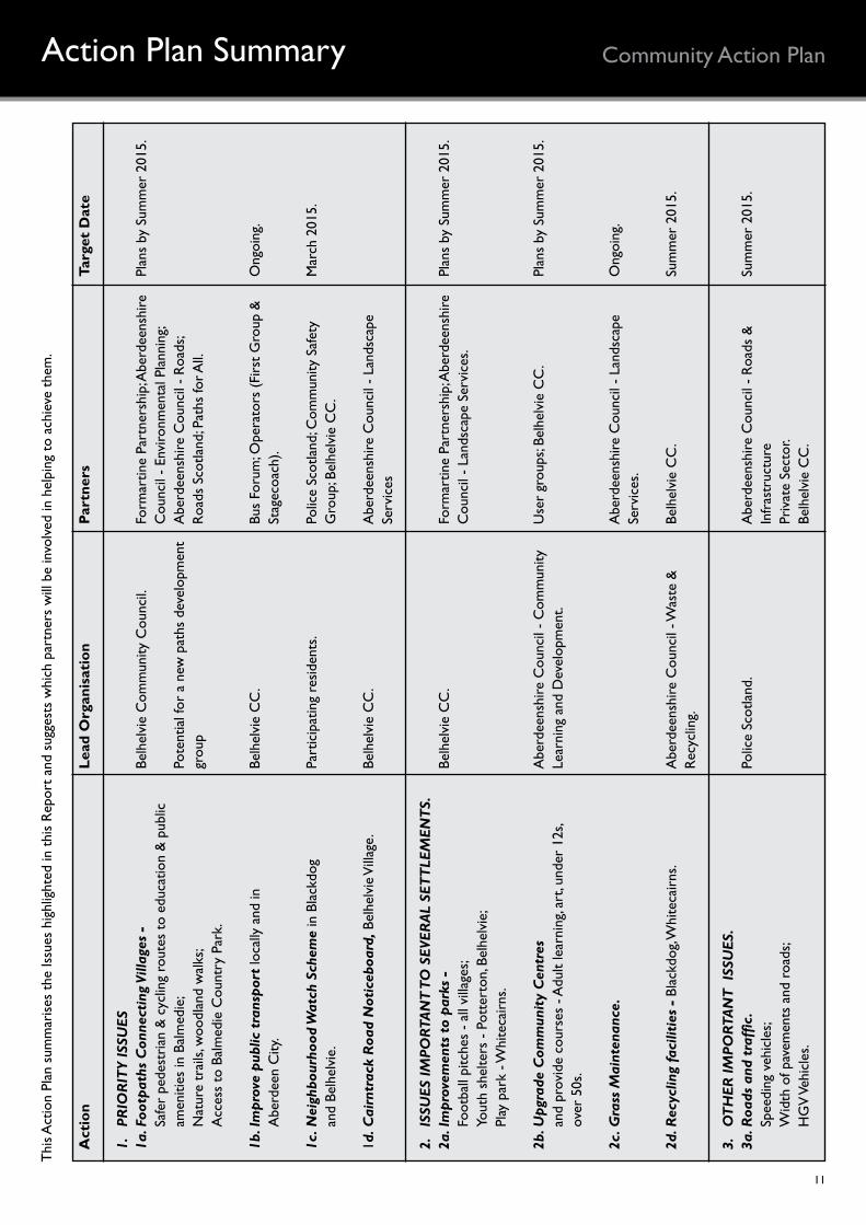
Community Action PlanAction Plan SummaryT
his A
ctio
n Pl
an s
umm
aris
es t
he Is
sues
hig
hlig
hted
in t
his
Rep
ort
and
sugg
ests
whi
ch p
artn
ers
will
be
invo
lved
in h
elpi
ng t
o ac
hiev
e th
em.
Act
ion
Lead
Org
anis
atio
n Pa
rtne
rs
Targ
et D
ate
1.
PRIO
RIT
Y IS
SUES
1a. F
ootp
aths
Con
nect
ing
Villa
ges
- Be
lhel
vie
Com
mun
ity C
ounc
il. Fo
rmar
tine
Part
ners
hip;
Abe
rdee
nshi
re
Plan
s by
Sum
mer
201
5.
Safe
r pe
dest
rian
& c
yclin
g ro
utes
to
educ
atio
n &
pub
lic
C
ounc
il -
Envi
ronm
enta
l Pla
nnin
g;
amen
ities
in B
alm
edie
; Po
tent
ial f
or a
new
pat
hs d
evel
opm
ent
Abe
rdee
nshi
re C
ounc
il -
Roa
ds;
N
atur
e tr
ails
, woo
dlan
d w
alks
; gr
oup
Roa
ds S
cotla
nd; P
aths
for A
ll.
Acc
ess
to B
alm
edie
Cou
ntry
Par
k.
1b. I
mpr
ove
publ
ic t
rans
port
loca
lly a
nd in
Be
lhel
vie
CC
. Bu
s Fo
rum
; Ope
rato
rs (
Firs
t G
roup
&
Ong
oing
.
Abe
rdee
n C
ity.
St
agec
oach
).
1c. N
eigh
bour
hood
Wat
ch S
chem
e in
Bla
ckdo
g Pa
rtic
ipat
ing
resi
dent
s. Po
lice
Scot
land
; Com
mun
ity S
afet
y
Mar
ch 2
015.
an
d Be
lhel
vie.
Gro
up; B
elhe
lvie
CC
.
1d. C
airn
trac
k R
oad
Not
iceb
oard
, Bel
helv
ie V
illag
e.
Belh
elvi
e C
C.
Abe
rdee
nshi
re C
ounc
il -
Land
scap
e
Serv
ices
2.
ISSU
ES IM
PORT
AN
T T
O S
EVER
AL
SET
TLE
MEN
TS.
2a. I
mpr
ovem
ents
to
park
s -
Belh
elvi
e C
C.
Form
artin
e Pa
rtne
rshi
p; A
berd
eens
hire
Pl
ans
by S
umm
er 2
015.
Foot
ball
pitc
hes
- al
l vill
ages
;
Cou
ncil
- La
ndsc
ape
Serv
ices
.
Yout
h sh
elte
rs -
Pot
tert
on, B
elhe
lvie
;
Pl
ay p
ark
- Whi
teca
irns
.
2b. U
pgra
de C
omm
unit
y C
entr
es
Abe
rdee
nshi
re C
ounc
il -
Com
mun
ity
Use
r gr
oups
; Bel
helv
ie C
C.
Plan
s by
Sum
mer
201
5.
and
prov
ide
cour
ses
- Adu
lt le
arni
ng, a
rt, u
nder
12s
, Le
arni
ng a
nd D
evel
opm
ent.
ov
er 5
0s.
2c. G
rass
Mai
nten
ance
.
Abe
rdee
nshi
re C
ounc
il -
Land
scap
e O
ngoi
ng.
Se
rvic
es.
2d. R
ecyc
ling
faci
litie
s -
Blac
kdog
, Whi
teca
irns
. A
berd
eens
hire
Cou
ncil
- Was
te &
Be
lhel
vie
CC
. Su
mm
er 2
015.
Rec
yclin
g.
3.
OT
HER
IMPO
RTA
NT
ISS
UES
.3a
. Roa
ds a
nd t
raffi
c.
Polic
e Sc
otla
nd.
Abe
rdee
nshi
re C
ounc
il -
Roa
ds &
Su
mm
er 2
015.
Sp
eedi
ng v
ehic
les;
In
fras
truc
ture
W
idth
of p
avem
ents
and
roa
ds;
Pr
ivat
e Se
ctor
.
HG
V V
ehic
les.
Be
lhel
vie
CC
.
12
Community Action PlanMaking It Real
www.ouraberdeenshire.org.uk
This booklet is one of a series produced by Local Rural Partnerships together with the community under the banner Community Action Plan.
The initiative is sponsored by Aberdeenshire Community Planning Partnership and run by Aberdeenshire Community Economic Development Co-ordinators Forum. The aim is to provide community action plans in an attractive, easy to read, professionally printed format.
For most communities, the content of each community
FORMARTIne PARTneRShIP29 BRIDge STReeT • eLLOn • AB41 9AA
T: 01358 720584 • e: [email protected]
plan is based on the results of Planning for Real® exercises carried out by the communities themselves, together with any other available reports. This process ensures that the plans are truly community-led.
This information can now guide the community and Community Planning Partners in drawing up detailed action plans to implement the top priorities as well as addressing the other issues which have been identified. For each priority or issue this will involve agreeing who should be involved, what
resources will be needed and target dates for completion. It is hoped that this process will be driven by representatives of the community with support - moral, technical and financial - from the relevant partners.
It is important that this booket is seen by all concerned as an account of the community’s views at the time of the latest consultation, and that it will have to be regularly reviewed and updated. As some projects are completed, other issues will arise and take their place in future versions of the community plan.
Thanks are due to:
Belhelvie Community Council
Formartine Partnership LtdFormartine Community
Planning GroupFormartine Area
Committee OfficersEllon Community Learning
& Development
Des
ign
by
Janu
ary
2015
Community Action Plan