Embed Size (px)
Citation preview

BE AMAZED!
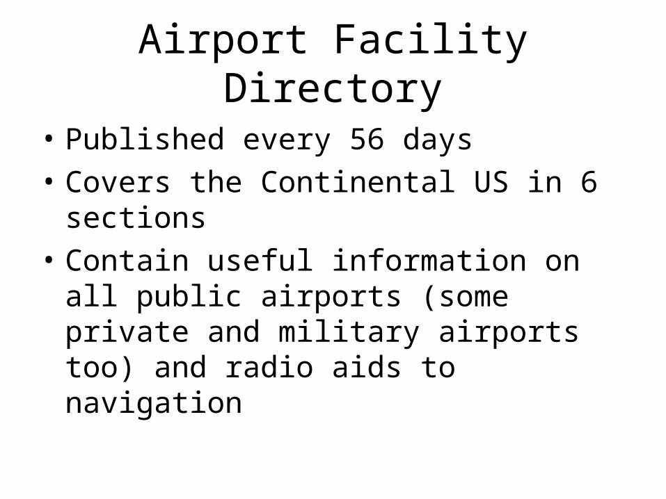
Airport Facility Directory
• Published every 56 days
• Covers the Continental US in 6 sections
• Contain useful information on all public airports (some private and military airports too) and radio aids to navigation
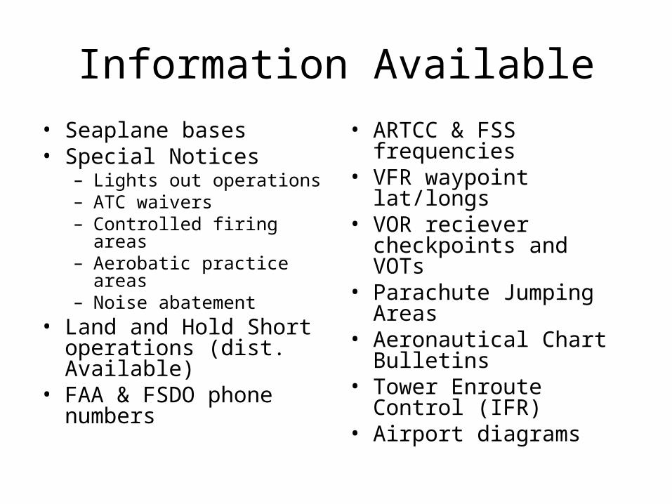
Information Available
• Seaplane bases• Special Notices
– Lights out operations– ATC waivers– Controlled firing areas– Aerobatic practice areas– Noise abatement
• Land and Hold Short operations (dist. Available)
• FAA & FSDO phone numbers
• ARTCC & FSS frequencies
• VFR waypoint lat/longs• VOR reciever
checkpoints and VOTs• Parachute Jumping Areas• Aeronautical Chart
Bulletins• Tower Enroute Control
(IFR)• Airport diagrams
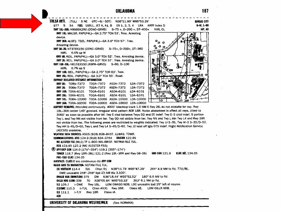
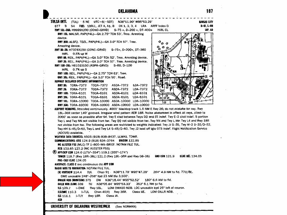
(TUL)Airport Identifier
5 NE5 miles North East of nearest town/city
UTC-6(-5DT)Time Zone
N36o11.90’ W95o53.29’
Latitude/Longitude
677Airport
Elevation
BAirport Beacon
S4Major Powerplant
Major Airframe
Types of Fuel
Types of Oxygen for pressurization
systemsLandingRightsAirport
Airport Rescue and Fire Fighting
Level
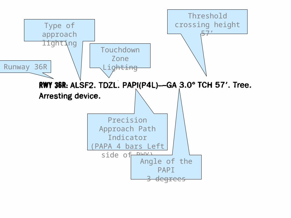
Runway 36R
Type of approach lighting
Touchdown Zone Lighting
Precision Approach Path Indicator
(PAPA 4 bars Left side of RWY)
Angle of the PAPI3 degrees
Threshold crossing height 57’
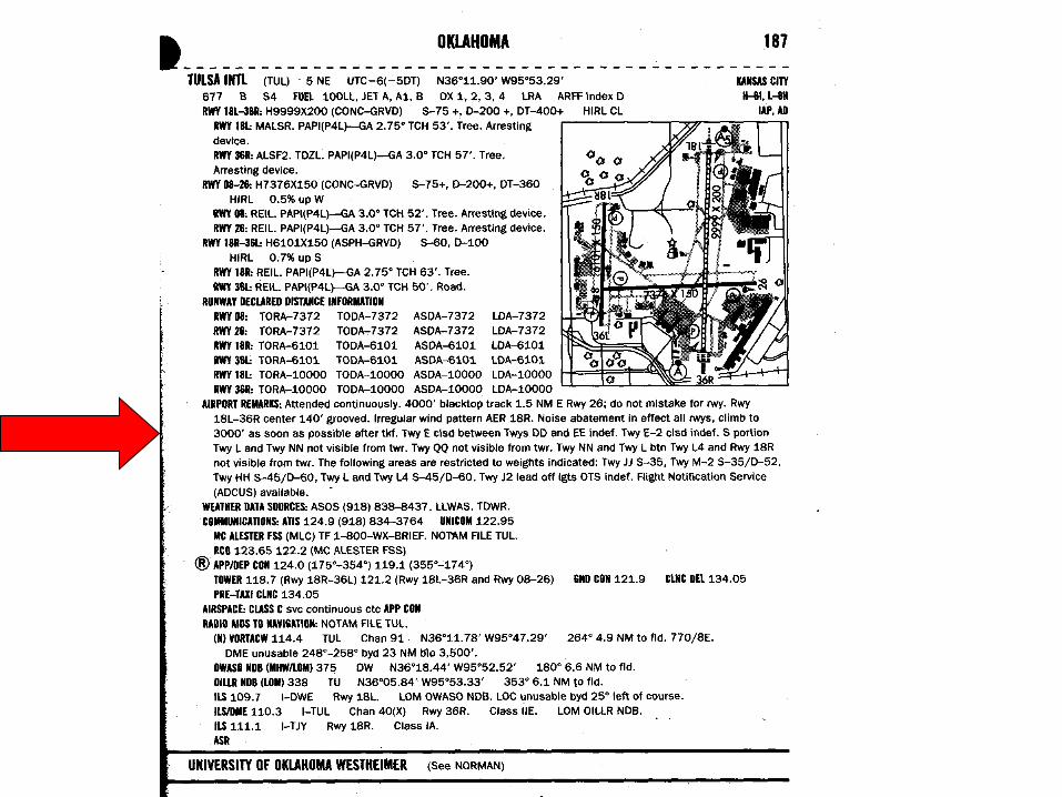

In the remarks you can find non-standard traffic pattern altitudes, hours of operation, and any airport additional information
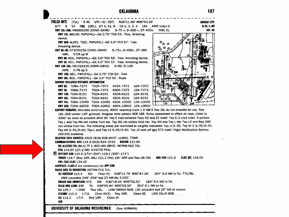

Clearance Delivery
App/ Dep have Radar
Remote Communications outlet freq. and #
Terminal Doppler Weather Radar
Automated weather info
Low Level Wind Shear Alert System
Ground Control
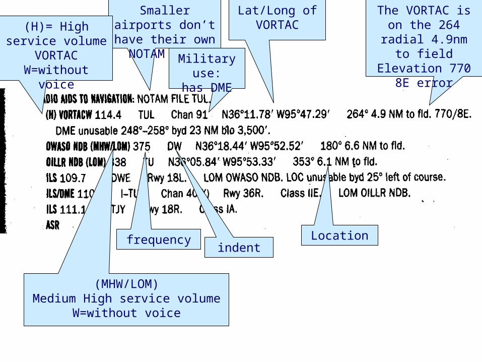
Smaller airports don’t have their own NOTAM file
The VORTAC is on the 264 radial 4.9nm to field
Elevation 770 8E error
Lat/Long of VORTAC
Military use:has DME
(H)= High service volume
VORTAC W=without voice
(MHW/LOM)Medium High service volume
W=without voice
frequencyindent
Location
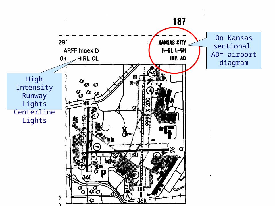
On Kansas sectional
AD= airport diagram
High Intensity Runway Lights
Centerline Lights
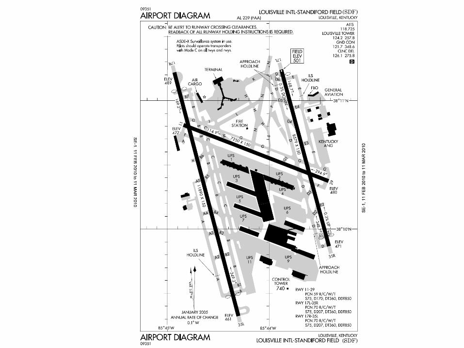
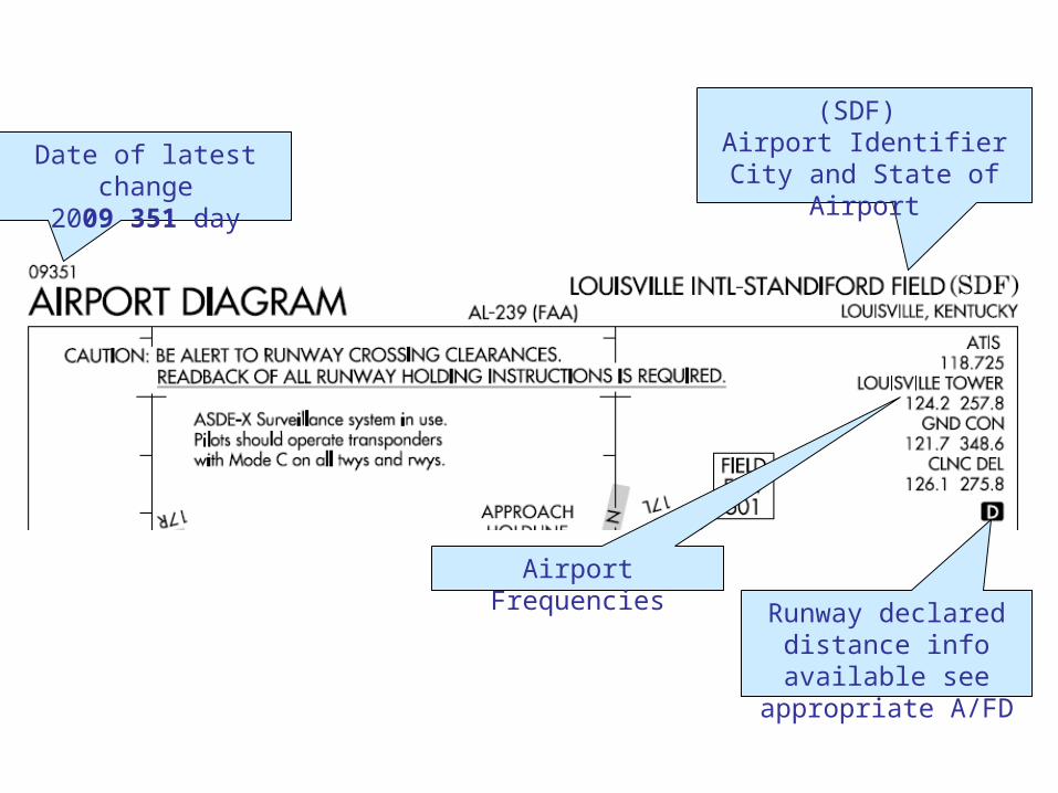
Date of latest change2009 351 day
(SDF) Airport Identifier
City and State of Airport
Runway declared distance info available see appropriate A/FD
Airport Frequencies
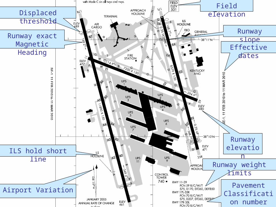
Displaced threshold
Runway exact Magnetic Heading
Airport Variation
ILS hold short line
Pavement Classification
number
Runway weight limits
Effective dates
Runway slope
Runway elevation
Field elevation

Want to go see the Blue Angels?
• Special Notices:– 2009 U.S. & Canadian military Aerial
Aircraft/Parachute Demonstrations– Dates & Locations of
• Thunderbirds• Blue Angels• Canadian Snowbirds• USA Golden Knights
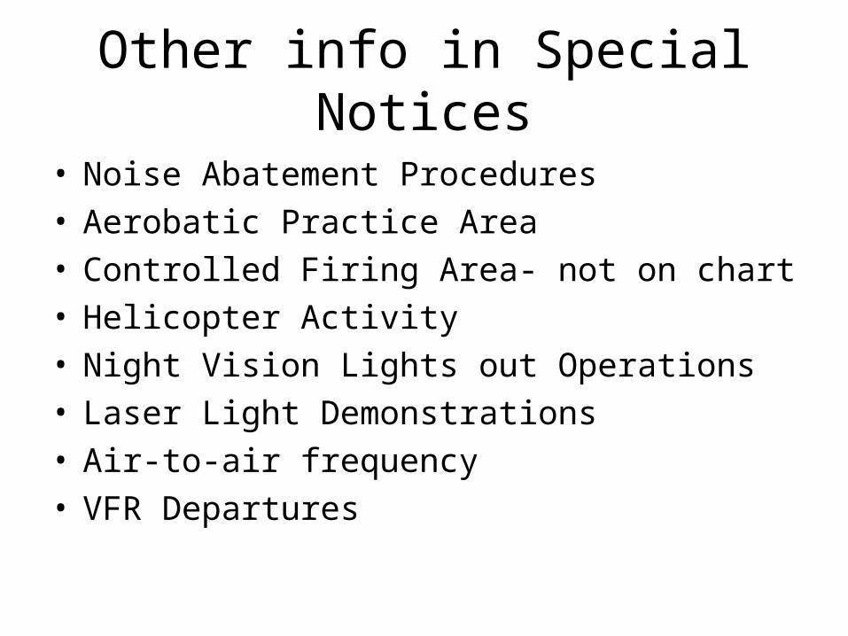
Other info in Special Notices
• Noise Abatement Procedures• Aerobatic Practice Area• Controlled Firing Area- not on chart• Helicopter Activity• Night Vision Lights out Operations• Laser Light Demonstrations• Air-to-air frequency• VFR Departures
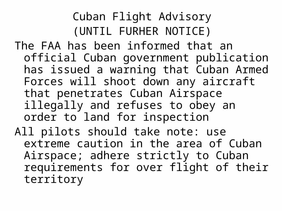
Cuban Flight Advisory(UNTIL FURHER NOTICE)
The FAA has been informed that an official Cuban government publication has issued a warning that Cuban Armed Forces will shoot down any aircraft that penetrates Cuban Airspace illegally and refuses to obey an order to land for inspection
All pilots should take note: use extreme caution in the area of Cuban Airspace; adhere strictly to Cuban requirements for over flight of their territory
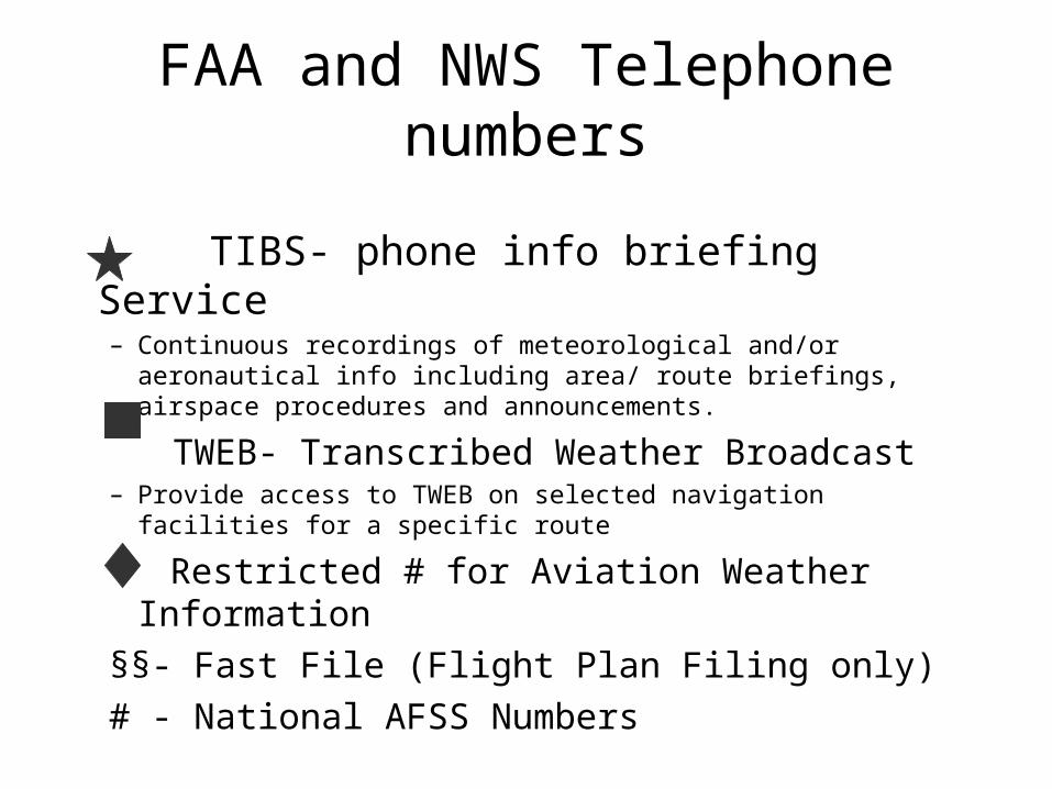
FAA and NWS Telephone numbers
TIBS- phone info briefing Service– Continuous recordings of meteorological and/or aeronautical info
including area/ route briefings, airspace procedures and announcements.
TWEB- Transcribed Weather Broadcast– Provide access to TWEB on selected navigation facilities for a
specific route
Restricted # for Aviation Weather Information
§§- Fast File (Flight Plan Filing only)
# - National AFSS Numbers
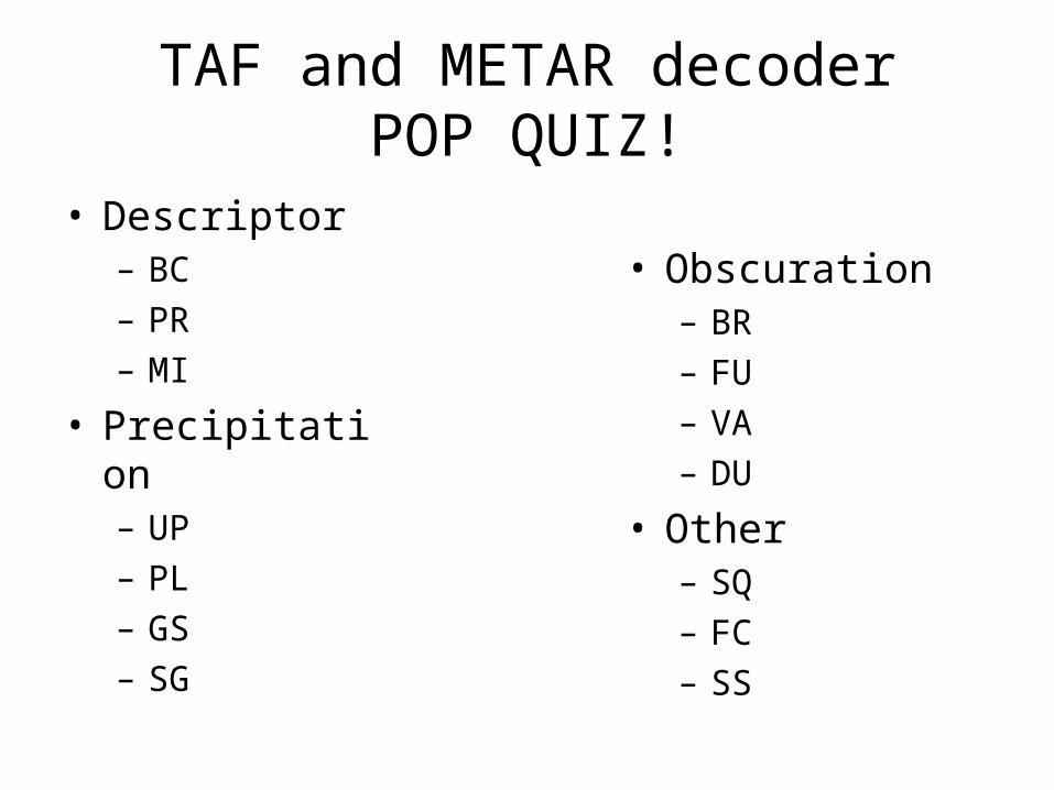
TAF and METAR decoderPOP QUIZ!
• Descriptor– BC– PR– MI
• Precipitation– UP– PL– GS– SG
• Obscuration– BR– FU– VA– DU
• Other– SQ– FC– SS
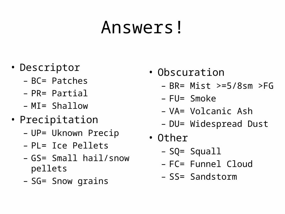
Answers!
• Descriptor– BC= Patches– PR= Partial– MI= Shallow
• Precipitation– UP= Uknown Precip– PL= Ice Pellets– GS= Small hail/snow pellets– SG= Snow grains
• Obscuration– BR= Mist >=5/8sm >FG– FU= Smoke– VA= Volcanic Ash– DU= Widespread Dust
• Other– SQ= Squall– FC= Funnel Cloud– SS= Sandstorm
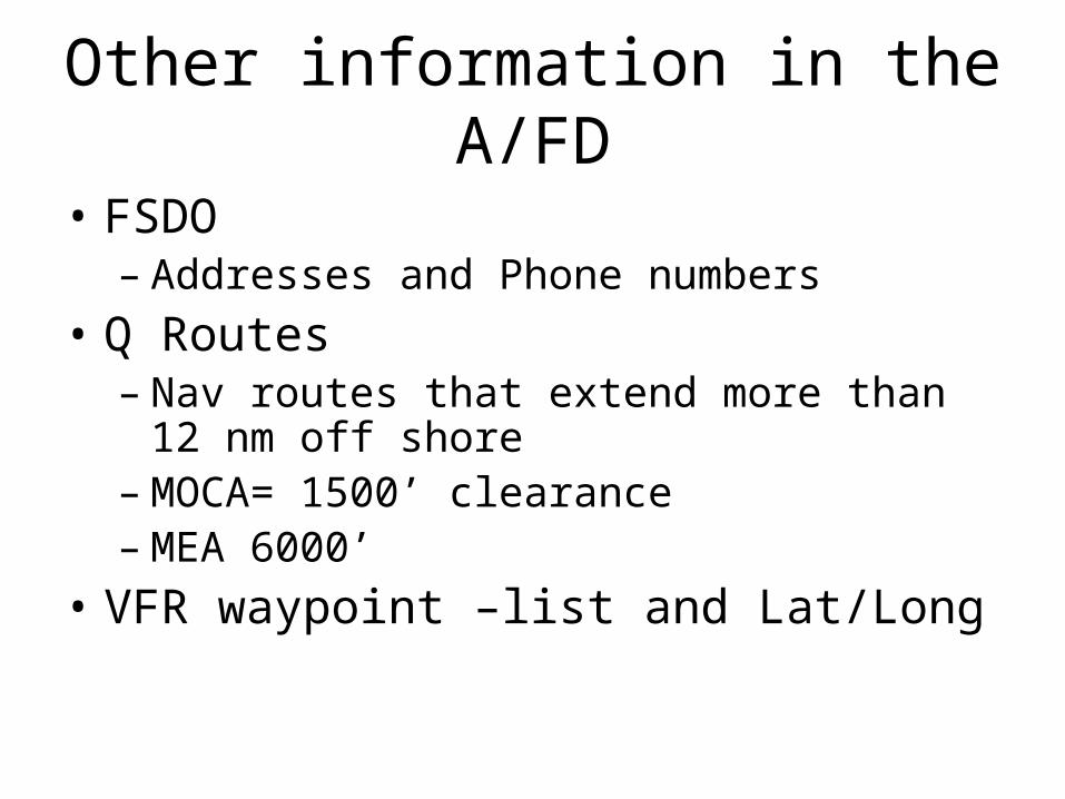
Other information in the A/FD
• FSDO – Addresses and Phone numbers
• Q Routes– Nav routes that extend more than 12 nm off
shore– MOCA= 1500’ clearance– MEA 6000’
• VFR waypoint –list and Lat/Long
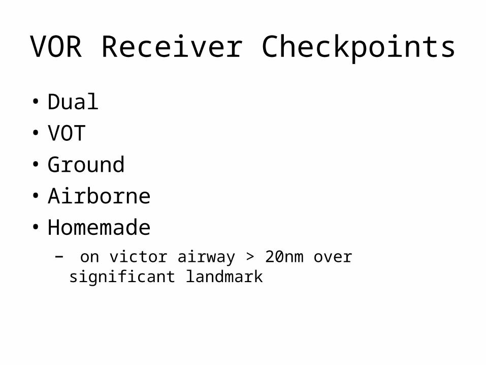
VOR Receiver Checkpoints
• Dual
• VOT
• Ground
• Airborne
• Homemade– on victor airway > 20nm over significant landmark
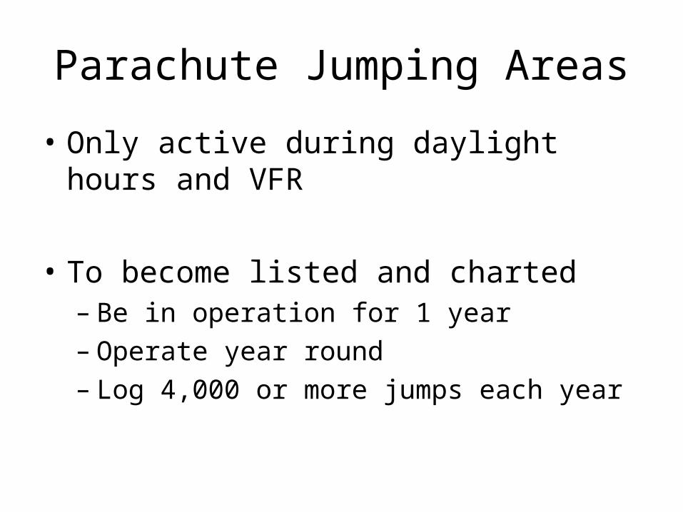
Parachute Jumping Areas
• Only active during daylight hours and VFR
• To become listed and charted– Be in operation for 1 year– Operate year round– Log 4,000 or more jumps each year
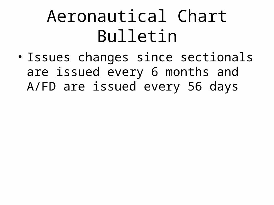
Aeronautical Chart Bulletin
• Issues changes since sectionals are issued every 6 months and A/FD are issued every 56 days
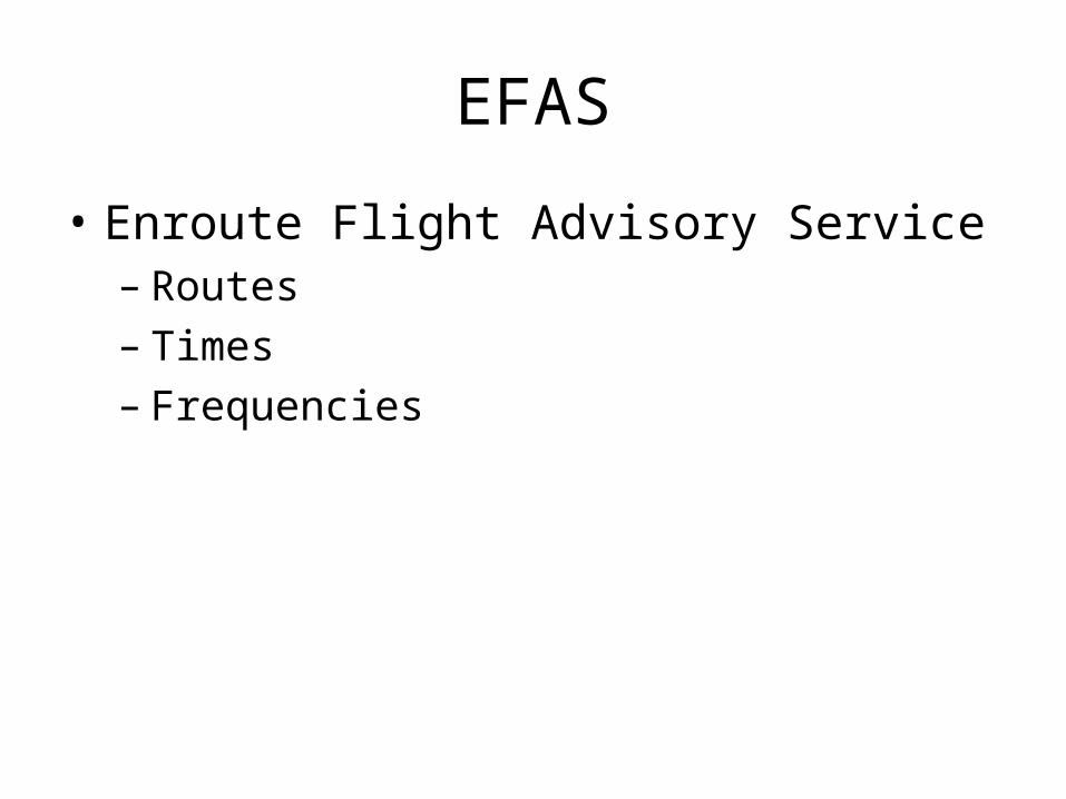
EFAS
• Enroute Flight Advisory Service– Routes– Times– Frequencies