Embed Size (px)
Citation preview

Service Assessment
Baltimore Inner Harbor Thunderstorm Event March 6, 2004
U.S. DEPARTMENT OF COMMERCE National Oceanic and Atmospheric Administration National Weather Service Silver Spring, Maryland

Cover: BWI TDWR 0.5 degree reflectivity data (0.5 degree antenna elevation) at 3:21 p.m. EST March 6, 2004 (Courtesy of the FAA).

Service Assessment
Baltimore Inner Harbor Thunderstorm Event March 6, 2004 June 2005
NOAA’s National Weather Service David L. Johnson Brigadier General, USAF (Ret.) Assistant Administrator for Weather Services

ii
Preface At approximately 4:00 p.m. local time on March 6, 2004, a cluster of thunderstorms moved through the Baltimore metropolitan area producing wind gusts of 40 to 55 mph. A water taxi loaded with 25 people in Baltimore’s Inner Harbor capsized in the thunderstorm winds and five passengers lost their lives. These were the first water taxi fatalities since the taxies began operating in the Inner Harbor in the late 1970s. Due to the tragic nature of the event, the National Oceanic and Atmospheric Administration’s (NOAA) National Weather Service (NWS) has assessed its performance during the event. This assessment evaluates the performance of the NWS prior to and during the event and provides recommendations to improve services in the future. The lead agency on a separate accident investigation was the National Transportation Safety Board (NTSB). The NWS and U.S. Coast Guard were partners with the NTSB in the formal accident investigation. This service assessment, however, examines issues directly related to NWS services. It does not determine probable cause of the accident or address issues related to the water taxi and operating procedures of mariners in Baltimore's Inner Harbor. NWS service assessments significantly enhance ongoing efforts to improve the quality and timeliness of NWS products and services. Findings of this assessment will further the NWS goal of improving forecast techniques and information provided to the American public.
David L. Johnson Brigadier General, USAF (Ret.) Assistant Administrator for Weather Services June 2005

iii
Table of Contents Preface................................................................................................................................. ii Service Assessment Team.................................................................................................. iv Acronyms........................................................................................................................... vi EXECUTIVE SUMMARY ................................................................................................ 1 Meteorological Conditions.................................................................................................. 3
Figure 1. .......................................................................................................................... 4 Meteorological Data............................................................................................................ 4
Figure 2. .......................................................................................................................... 5 Figure 3. .......................................................................................................................... 7 Figure 4. .......................................................................................................................... 7 Figure 5. .......................................................................................................................... 8
System and Equipment Performance ................................................................................ 10 Staffing.............................................................................................................................. 10 Products and Services ....................................................................................................... 11 Conclusion ........................................................................................................................ 13 Appendix A..................................................................................................................... A-1

iv
Service Assessment Team NOAA’s National Weather Service formed a service assessment team on March 15, 2004. The team initially met in the Baltimore-Washington area Sunday, March 21, 2004 and departed Friday, March 26, 2004. During this time, the team received briefings from personnel at NWS headquarters and the Weather Forecast Office (WFO) Baltimore-Washington. Team members also visited Baltimore Harbor and various meteorological sensor locations. In addition, face-to-face interviews were conducted with staff members from WFO Baltimore-Washington, water taxi operators, fire fighters involved in the rescue, other individuals who work around Baltimore Harbor, experts from the National Severe Storms Laboratory (NSSL), and staff members from WFO Norman, OK, who have exceptional experience using Terminal Doppler Weather Radar (TDWR) data similar to that available at WFO Baltimore-Washington. Telephone interviews were also conducted with officials from the Forecast Systems Laboratory (FSL) in Boulder, CO. Team Members: Stephen Brueske Team Leader, Meteorologist-in-Charge (MIC),
WFO Great Falls, MT Matthew Strahan MIC, WFO Key West, FL Bryan Tilley Lead Forecaster, Marine Focal Point and WSR-88D Focal
Point, WFO Detroit, MI Other valuable contributors include: Dennis McCarthy Director, Office of Climate, Water, and Weather Services,
(OCWWS), NWS, Silver Spring, MD Aimee Devaris NWS, OCWWS, Silver Spring, MD Wayne Presnell NWS, OCWWS, Silver Spring, MD William Lerner NWS, OCWWS, Silver Spring, MD

v
The team would like to thank the following individuals who provided assistance. NWS Personnel Staff, WFO Baltimore-Washington Mike Foster, MIC, and Dave Andra, Science and Operations Officer (SOO), WFO Norman, OK Staff, WFO Great Falls, MT Staff, NWS Headquarters (WSH) Staff, NWS Eastern Region Headquarters (ERH) Donald Burgess, National Severe Storms Laboratory (NSSL) Federal Agency Personnel Patricia Miller, Forecast Systems Laboratory (FSL) Gregory Salottolo, National Transportation Safety Board (NTSB) Staff, Fort McHenry National Monument Lieutenant Junior Grade (LTJG) Timothy Balunis, Jr. and Steven Rodgers, U.S. Coast Guard Other Institutions and Organizations Members of Baltimore’s Fire Department Marine Station Water taxi captains and the staff of Ed Kane’s Water Taxi Copies of this report can be obtained from the Office of Climate, Water, and Weather Services of NOAA’s National Weather Service by calling Aimee Devaris, Performance Branch Chief, at 301-713-0090 extension 133.

vi
Acronyms ACARS Aircraft Communications Addressing and Reporting System AFB Air Force Base AFD Area Forecast Discussion ASOS Automated Surface Observing System AWIPS Advanced Weather Interactive Processing System BWI Baltimore-Washington International Airport CWF Coastal Waters Forecast CWA County Warning Area DCA Ronald Reagan National Airport DOC Department of Commerce DOD Department of Defense DOT Department of Transportation EST Eastern Standard Time FAA Federal Aviation Administration GOES Geostationary Operational Environmental Satellite IAD Dulles International Airport MIC Meteorologist-in-Charge NCEP National Centers for Environmental Prediction NOAA National Oceanic and Atmospheric Administration NTSB National Transportation Safety Board NWR NOAA Weather Radio, All Hazards NWS National Weather Service OCWWS Office of Climate, Water, and Weather Services PC Personal Computer SCA Small Craft Advisory SMW Special Marine Warning SOO Science and Operations Officer SPC Storm Prediction Center TDWR Terminal Doppler Weather Radar UTC Coordinated Universal Time WDTB Warning Decision Training Branch WFO Weather Forecast Office WSR-88D National Weather Service Doppler Radar, 1988 ZFP Zone Forecast Product

1
EXECUTIVE SUMMARY
At approximately 4:00 p.m. EST, Saturday, March 6, 2004, a cluster of thunderstorms moved east-southeast through the Baltimore metropolitan area, producing wind gusts of 40 to 55 mph. A water taxi loaded with 25 passengers on Baltimore’s Inner Harbor capsized in the thunderstorm winds. Fortunately, firefighters from Baltimore’s fireboat unit and U.S. Navy reservists on a training exercise were within a few hundred yards of the vessel when it overturned. Their immediate rescue operation saved many lives. Unfortunately, five lives were lost.
Local forecast and warning services for the Baltimore area are provided by the Baltimore-Washington Weather Forecast Office (WFO) located in Sterling, Virginia. Staff at the WFO has access to the full complement of NOAA data from systems such as the Weather Surveillance Radar-88 Doppler (WSR-88D), Automated Surface Observing System (ASOS), and Geostationary Operational Environmental Satellite (GOES). Forecast and warning information is disseminated through a variety of means, including directly on NOAA Weather Radio All-Hazards (NWR).
Forecasters issued a Small Craft Advisory (SCA) Friday morning, March 5, for all of Chesapeake Bay, and continued it through Saturday, March 6. Wind criteria for the SCA are 25 to 33 knots along the near-shore, 20 knots in a harbor. On the afternoon of March 6, the ASOS unit at Baltimore-Washington International Airport (BWI) observed wind gusts from 25 to 33 knots (27 to 38 mph) from just before 2:00 to 3:30 p.m. When forecasters received reports just before 4:00 p.m. of wind gusts to 41 knots (47 mph) at BWI and 46 knots (53 mph) at Reagan National Airport (DCA), they issued a Special Marine Warning (SMW) at 4:05 p.m. Wind criteria for SMWs are 34 knots (39 mph) or greater. Although forecasters did not realize it at the time, the SMW was issued just after the water taxi capsized.
In addition to surface observations from ASOS, forecasters observed the advancing thunderstorms on WSR-88D radars located at the WFO in Sterling, Virginia, and at neighboring sites near State College, Pennsylvania, and at Dover Air Force Base, Delaware. Storms were moving toward the east-southeast at speeds of 40 to 50 mph. In a cooperative effort between Department of Commerce (NOAA) and the Department of Transportation (Federal Aviation Administration), forecasters at WFO Baltimore-Washington could also access data from the Federal Aviation Administration (FAA) BWI Terminal Doppler Weather Radar (TDWR). The TDWR data could not be integrated with other data on NWS workstations but could be accessed from a forecast office PC.
Staffing at WFO Sterling was at a normal Saturday level and sufficient to manage this event. Equipment and communication systems performed well.
The impact of the Inner Harbor thunderstorm event was covered widely among national and large-market media, especially in the Baltimore-Washington area. Attention was focused on weather information available to the water taxi pilot and data available to NWS forecasters. Some interest was focused specifically on complementary wind

2
observations from non-NWS public and private surface observing systems located throughout the area. Some of the complementary data were available to forecasters at WFO Baltimore-Washington, but in many cases, issues such as timeliness, format, instrument location, and proprietary policies limited the data’s utility for forecast and warning purposes during this event.
This report addresses services provided by NWS prior to and during the Baltimore Inner Harbor thunderstorm event. The lead agency for the official water taxi accident investigation was the NTSB. The NWS and U.S. Coast Guard were partners with NTSB in that investigation. Members of the NWS Service Assessment Team reviewed data available to forecasters, interviewed NWS staff on duty the day of the event, and interviewed other individuals associated with the event and Baltimore Inner Harbor operations. Based on results of this NWS assessment, services provided met established requirements during this event. A Small Craft Advisory was in effect for Baltimore Harbor on the afternoon of March 6. Short Term Forecasts and a Special Marine Warning were issued as forecasters became aware of high winds. The team determined, however, that a more aggressive and efficient approach by forecasters in analyzing the evolving weather conditions could have increased their concern for thunderstorm development and associated potential for high winds. Through midday, forecasters judged the environment to be conducive to development of showers, but potential for thunderstorms, especially severe thunderstorms with winds at least 58 mph, was judged to be low. As atmospheric conditions evolved to become more unstable during early afternoon, forecasters’ attention was divided between assessing the evolving situation and production of routine forecast products. Relying mainly on the earlier evaluation of atmospheric conditions, unaware of wind gusts exceeding 35 mph along Interstate 70 between Frederick and Baltimore, and with no reports of wind damage along the I-70 corridor, evening shift forecasters were in a reactive mode when thunderstorms reached Baltimore.

3
BACKGROUND AND METEOROLOGICAL CONDITIONS
During the morning of March 6, 2004, two periods of showers, one before sunrise and the other later in the morning, helped cool and stabilize the air mass over central and eastern Maryland. Temperatures were in the lower 60s Fahrenheit (F) and surface humidity was high. A cold front stretched from southwest to northeast along the Appalachian Mountains. It was expected to push east during the day, reaching the Atlantic Coast by evening. Assessing observed data and output from NWS computer models during the morning, forecasters at WFO Baltimore-Washington expected scattered showers to precede and accompany the advancing cold front. They also expected winds to shift from southerly to westerly and increase to around 20 mph.
The basis for this forecast was the expectation that an influx of dry air at upper
levels of the atmosphere and dry, westerly, down-slope winds (from the mountains to the coastal plain) at lower levels would create an environment unfavorable for thunderstorm development. These conditions were expected to overcome instability forecast in computer models for early afternoon and eventually created by surface heating as cloud cover dissipated. This scenario was supported by thunderstorm outlook information from the NWS Storm Prediction Center (SPC), an element of the National Centers for Environmental Prediction (NCEP). Even though SPC included Maryland in its outlook for general thunderstorms during the afternoon, SPC forecaster discussion mentioned a weakening upper level low pressure trough approaching the mid-Atlantic region, poor mid-level lapse rates, and little potential buoyancy during the afternoon. These conditions further reduced any concern that storms would become severe over Maryland (producing wind gusts of at least 58 mph).
By early afternoon, satellite imagery available on workstations at the WFO confirmed the influx of cool, dry air at middle levels of the atmosphere. This new air cooled the middle levels of the atmosphere and dispersed enough cloud cover so the sun could heat the surface quickly. Data from Aircraft Communications Addressing and Reporting System (ACARS) soundings, providing vertical profiles of temperature and wind, showed significant warming of the lower portion of the atmosphere. This combination (low-level warming and mid-level cooling) destabilized the atmosphere over central Maryland from early to mid afternoon more than expected.
As forecast, showers began developing ahead of the advancing cold front, supported by the low pressure trough in the upper atmosphere. As the atmosphere became less stable through mid afternoon, some showers gradually intensified to low top thunderstorms as they advanced into central Maryland and northern Virginia, moving toward the east-southeast at speeds from 40 to 50 mph. One cluster of stronger storms advanced directly toward Baltimore along the Interstate-70 corridor (Figure 1).

4
Figure 1. Reflectivity data from the WFO Baltimore-Washington WSR-88D at 3:49 p.m. EST, showing a cluster of storms moving toward Baltimore. Finding 1: Atmospheric conditions evolved rapidly during the early to mid afternoon hours over central Maryland, becoming more unstable than forecasters expected. This supported development of showers and thunderstorms, which moved east-southeast into the Baltimore area. Recommendation 1a: The WFO Baltimore-Washington Meteorologist In Charge (MIC) and Science and Operations Officer (SOO) should engage all WFO forecasters in a detailed analysis of the evolution of atmospheric conditions on March 6, 2004, related to events of the day at the start of the 2005 convective season. This effort should be conducted as a local training exercise/workshop. Recommendation 1b: A related local exercise during or after the activity in recommendation (a) is for WFO management to document local techniques to facilitate operational analysis at the WFO throughout the process of routine forecast development and formulation.
METEOROLOGICAL DATA Forecasters at NWS WFOs use a variety of observational data to diagnose and assess current meteorological conditions and the state of the atmosphere. They merge this assessment with output from computer models run at NCEP, and they collaborate on forecast decisions with forecasters at neighboring WFOs and NCEP/SPC.

5
Standard observational data are integrated and displayed on Advanced Weather Interactive Processing System (AWIPS) workstations at all NWS WFOs. These data include basic surface observations from ASOS and similar Automated Weather Observing System (AWOS) sites at many airports; radar data from WSR-88D systems; observations of basic parameters measured through upper parts of the atmosphere by balloon soundings; temperature and wind from aircraft observations (ACARS); and satellite imagery from NOAA’s GOES. All WFOs also receive reports of severe weather through various means, such as spotter networks, law enforcement agencies, emergency managers, etc. Typically, these reporting networks focus on established criteria related to severe storms, winter storms, and flooding. Nearest ASOS and AWOS locations to Baltimore Harbor with statute mile distance from Baltimore Harbor in parentheses, include Baltimore-Washington International (KBWI) Airport (7), Reagan National (KDCA) Airport (37), Frederick, MD (KFDK) Municipal Airport (42), York, PA (KTHV) Airport (47), Aberdeen Proving Ground (KAPG) (26), Martin State (KMTN) Airport (10), and the U.S. Naval Academy (KNAN) (25). Figure 2 shows these locations. The ASOS program is a joint program between the Department of Commerce (DOC), the Department of Transportation (DOT), and the Department of Defense (DOD). AWOS is primarily a DOT program.
Figure 2. Locations of automated surface observing systems (ASOS) sites nearest to Baltimore Harbor.
Radar (WSR-88D) sites nearest Baltimore Harbor include the WFO Baltimore-Washington site near Sterling (VA), the Dover Air Force Base site (DE), and the central Pennsylvania site just northwest of State College. These radars are 52, 70, and 135 miles, respectively, from Baltimore Harbor. The Sterling WSR-88D is located at the Baltimore-Washington WFO, but forecasters have access to data from neighboring sites in their

6
workstations and can monitor multiple sites concurrently and through mosaic images. The WSR-88D program is a joint program among DOC, DOD, and DOT. In addition to the data mentioned above, common to most NWS WFOs, forecasters at WFO Baltimore-Washington have some access to radar data from other observing systems. As part of an ongoing program between NWS and FAA, data from FAA Terminal Doppler Weather Radars (TDWRs) are being made available to some WFOs and eventually will be integrated with other data sets in WFO workstations provided resources are available. In March 2004, data from the BWI TDWR were available to forecasters at WFO Baltimore-Washington via the Internet through a separate PC. Information from the TDWR was somewhat useful to forecasters, especially because of the radar’s location relative to the approaching storms, even though data were not integrated into the AWIPS workstations. At approximately 3:20 p.m. EST, both the WFO Baltimore-Washington WSR-88D and the BWI TDWR indicated a small cluster of thunderstorms about 30 miles west-northwest of Baltimore Harbor between Frederick, Maryland (KFDK), and the Baltimore Washington International Airport (KBWI) moving toward the east-southeast. At 3:31 p.m. EST, the WSR-88D from WFO Baltimore-Washington did not indicate any velocities greater than 34 knots in this cluster of thunderstorms (Figure 3), while at 3:33 p.m. EST, velocity data from the BWI TDWR (Figure 4) indicated a large area of winds in the same cluster of thunderstorms exceeding 34 knots (39 mph). At these distances from the respective radars, this data is representative of wind approximately 1,500 feet above the ground. Display limitations of the TDWR data preclude specific determination of higher wind speeds, but contouring suggests the presence of winds considerably higher than 39 mph, within the wide range of 34 to 74 knots (39 to 85 mph). Data from the BWI TDWR was more representative of the actual winds in the cluster of thunderstorms because the cluster was moving directly toward the BWI TDWR, parallel to the radial of the radar beam, and moving away at an angle from the WFO’s WSR-88D, more perpendicular to the radial of the radar beam (Figure 4).

7
Figure 3. WFO Baltimore-Washington’s WSR-88D (radar location indicated by + sign near KIAD) base velocity data at 3:31 p.m. EST with radial velocities less than 34 knots removed. Light blue (toward the radar) and light yellow (away from the radar) indicate radial velocities of 34 to less than 40 knots. Dark blue and orange indicate radial velocities greater than or equal to 40 knots. Storms were moving toward the east-southeast (lower right of image). The circled areas indicate the maximum velocities detected. Notice there is no velocity of 34 knots or greater moving toward the Baltimore Inner Harbor (about 10 miles northeast of KBWI).
Figure 4. BWI TDWR velocity data from 3:33 p.m. EST superimposed over the WFO Baltimore-Washington WSR-88D velocity data. The TDWR data revealed higher velocities due to the storm moving toward the TDWR, parallel to the radar beam radial and perpendicular to the WFO radar beam radial. The white arrow indicates storm motion (toward the east-southeast). Radar locations are indicated by the + signs.
2033Z: >34-74 kts
Storm motion parallel to
TDWR radial

8
Data from the WSR-88D at Dover Air Force Base (AFB) were also available to forecasters, integrated with other data in their AWIPS workstations. This radar is 18 miles farther from Baltimore Harbor than the WFO Baltimore-Washington WSR-88D, and even farther from the storms approaching from the west. Given the distance and the fact, the WSR-88D is located at the WFO; the natural tendency was for forecasters to focus more on the WFO’s WSR-88D data. In this case, however, thunderstorms were crossing the radial from the WFO WSR-88D but tracking along the radial from the Dover AFB WSR-88D. This would make velocity data more reliable from Dover in spite of the added distance and greater height of the radar beam relative to the ground (Figure 5).
Figure 5. Velocity data from the WSR-88D located at Dover, DE taken at 2031Z (3:31 p.m. EST) March 5, 2004, about 30 minutes before the accident. Even though the Dover, DE radar is almost 50 miles farther away from the storms than the radar located at the WFO Baltimore-Washington, it gives a better indication of the stronger winds since the storms were moving along the radial of the Dover radar and crossing the radial of the WFO radar.
Forecasters also had access to some complementary surface observation data. A
network of observing systems located primarily at schools throughout Maryland generates surface observations every 15 minutes. Observations of average wind speed and direction from these systems can be displayed on WFO workstations, but wind gust data cannot be displayed. Utility of the data produced by this network, especially in a fast-breaking thunderstorm event, was limited by timeliness and lack of gust data. Processing limitations on the WFO’s AWIPS workstations restricted availability of new data to every half hour rather than 15 minutes. Also, from experience, forecasters had a general concern about the quality of these data, especially related to sensor location at some sites. Finding 2a. During this event, forecasters relied mainly on data available in their AWIPS workstations. New data sources take time and resources to integrate into AWIPS. Accessing and integrating data from an adjacent PC can be cumbersome and precludes optimum use of these data during fast-breaking events.

9
Finding 2b. Forecasters were able to make only limited use of the complementary surface observations along the Interstate 70 corridor as thunderstorms moved through that area. Even though observations from these private and non-Federal sites were taken every 15 minutes, only half-hourly data were available to NWS forecasters through their AWIPS workstations. Also, NWS forecasters have noticed issues with the accuracy, availability, and reliability of the data from some of these complementary data sources. Recommendation 2a. NOAA’s National Weather Service should review its procedures and capabilities for integrating complementary data into AWIPS to achieve optimum use of the data available. Special efforts should be made to incorporate all available data and information, including data from government (Federal, state, and local), private sector and academic networks.1 Recommendation 2b. NOAA’s National Weather Service should explore ways to make maximum use of complementary data sources during high-impact, especially hazardous events, and to work with potential partners to improve the quality and availability of such data.2 Finding 3: Forecasters were unable to validate velocities observed on radar with ground-truth reports. The impact of high winds along the Interstate-70 corridor was minimal, resulting in no reports of damage from spotters or law enforcement officials. Timely wind gust information from complementary data sources was not available to forecasters. Recommendation 3: WFO Baltimore-Washington management should plan a local training program/workshop for WFO staff focused on improving integration of ground-truth in short-term forecast and warning operations. Finding 4: Forecasters relied mainly on data from their collocated WSR-88D at the WFO Baltimore-Washington. While they did interrogate some TDWR data on a separate PC, they worked less with the Dover AFB WSR-88D. The Dover 88D was farther away, but in this specific set of circumstances, it was better situated to depict base velocity data. Recommendation 4: Eastern Region Headquarters should support a local training exercise for the WFO Baltimore-Washington staff between the WFO MIC, SOO, and NWS Warning Decision Training Branch (WDTB) based on this event to address optimum use of data from multiple radars. Finding 5: In spite of display limitations, TDWR data showed excellent potential for integration into WFO short term forecast and warning operations.
1 On September 29, 2004, NOAA and AWS Technologies, Incorporated signed a memorandum of agreement to use complementary AWS surface observation data for homeland security purposes and weather warning and prediction. 2 Data essential to the NWS mission is obtained from official sources. Various data from complementary sources are obtained to provide additional information to aid NWS forecasters.

10
Recommendation 5: NOAA/NWS should consider ways to accelerate the current NWS-FAA TDWR data integration project, providing WFOs data from TDWRs within their areas of responsibility. Finding 6: Complementary data from non-NOAA/NWS observation networks could help in the forecasting and warning process. Recommendation 6: The NWS should explore options for getting timely, accurate complementary data from non-Government sources.
SYSTEM AND EQUIPMENT PERFORMANCE
All observing and communications systems used by forecasters at the Baltimore-Washington WFO performed normally throughout the thunderstorm event on March 6, 2004. There were no interruptions in service among the federally maintained equipment, such as ASOS, WSR-88Ds, NWR, upper air balloon sounding equipment, and AWIPS workstations. There were no interruptions in the normal flow of observational or computer model data. Access to some other data sets, such as complementary surface observations and TDWR data, was limited by the need to access them through PC and Internet interfaces. Forecasters could not obtain complete data from all complementary surface observing systems, and they were not confident about quality of all the data (See Finding/Recommendation 2).
STAFFING Forecast and warning services for most of Maryland, including the entire Baltimore metropolitan area, are the responsibility of WFO Baltimore-Washington. On March 6, 2004, staffing of the WFO was at normal operational levels for a Saturday, consisting of two forecasters and a hydro-meteorological technician for both the day shift and evening shift. One day-shift forecaster worked from 7:00 a.m. to 3:00 p.m. and the other from 8:00 a.m. to 4:00 p.m. Evening shift forecasters overlapped one hour each with day shift forecasters, one working from 2:00 p.m. to 10:00 p.m. and the other from 3:00 p.m. to 11:00 p.m.
As in many WFOs, forecasters at the WFO Baltimore-Washington typically distribute workload between a short-term and long-term focus. In this operational scenario, one forecaster focuses on observational data and the near-term portion of computer forecast model data; the other focuses on computer model data through the full seven days of the forecast period. At WFO Baltimore-Washington, the two forecasters routinely combine their efforts to produce a daily primary suite of forecast products around the 3:00 p.m. time frame. Because they did this on March 6, forecasters’ attention was divided between assessing evolving atmospheric conditions leading to thunderstorm development/intensification and production of routine forecast products scheduled for mid-afternoon distribution.

11
Had there been concern about intensification or potential for severe weather from the storms advancing toward Baltimore the afternoon of March 6, staff from the day shift would have remained on duty into the evening shift. This is a common practice at all NWS WFOs: an efficient and effective way to augment staffing to handle significant events. In this case, however, a lack of reports combined with expectations for weakening of the pre-frontal showers contributed to the decision for day-shift staff to depart at approximately the usual end time of their shifts. Evening shift staffing was sufficient to manage the thunderstorm event during the late afternoon and early evening of March 6. As they adjusted to a situation significantly different from what had been briefed to them and what they expected, forecasters issued short-term forecast and warning products based on observations received. They were operating in a reactive mode as thunderstorms moved through both the Baltimore and Washington metropolitan areas. Under this set of circumstances, evening shift forecasters expected little potential for conditions meeting severe storm criteria. Finding 7: While staffing was at normal levels for a Saturday and sufficient to manage events of the day, had day-shift forecasters been more concerned about potential impact of the advancing storms and remained on duty, the additional staff might have been able to retrieve additional ground-truth information. Recommendation 7: WFO Baltimore-Washington should investigate slight adjustments in shift times, especially focused on midday workload during the convective season and when indicated by specific environmental conditions.
PRODUCTS AND SERVICES All Baltimore area forecasts issued through early afternoon from WFO Baltimore-Washington for March 6, 2004, mentioned scattered showers and an increase and shift in the wind. Forecasters issued a Small Craft Advisory Friday morning, March 5, and kept it in effect on March 6 for the potential of 20 knot winds and three-foot waves in the Baltimore Inner Harbor by late afternoon. These forecasts were based on the reasoning discussed earlier and the expectation that showers would not intensify as they pushed through the Baltimore area.
The public forecast for the afternoon mentioned a 50 percent chance of showers and south winds 10 to 15 mph, becoming west 15 to 20 mph. It was issued at 11:00 a.m. EST. The next public forecast, issued at 2:55 p.m. EST for the “tonight” period, included a 30 percent chance of evening showers and west winds 15 to 20 mph and gusty, diminishing after midnight. See Appendix A for a chronological listing of NWS products related to this event. A short-term forecast issued at 2:30 p.m. EST included “heavy showers…moving southeast at about 40 mph…” One of the evening shift forecasters issued a short-term forecast at 3:49 p.m. It was based on radar and lightning data and observations of 30 to 35 mph wind gusts at BWI from 2:00 to 3:00 p.m. It contained scattered showers,
12
isolated thunderstorms, and wind gusts to 35 mph. Just eleven minutes later at 4:00 p.m., the forecaster issued another short-term forecast, raising the wind gust forecast to 45 mph. At 4:05 p.m., forecasters issued a Special Marine Warning to warn mariners of “…wind gusts to near 50 knots…high waves…dangerous lightning and heavy downpours…” Boaters were advised to “…seek safe harbor immediately until this storm passes.” The warning was based on radar data and wind gust observations at BWI and DCA of 47 mph and 53 mph respectively just before 4:00 p.m. These observations were available in the forecasters’ workstations within a few minutes after the hour. All forecast and warning information was disseminated through usual communications systems from WFO Baltimore-Washington, including NOAA Weather Radio, All Hazards (NWR). Dissemination through NWR is automatic and virtually instantaneous once a warning is generated from a WFO’s AWIPS workstation. Broadcast coverage for the Baltimore-Washington-Chesapeake Bay area is excellent. Most marine radios can receive NWR broadcasts and many modern versions of the receivers are equipped with alert features. The extent of NWR use by mariners in Baltimore Harbor is not completely known, but members of the assessment team did establish that some water taxi captains carry their own personal NWR receivers. The extent of rebroadcast and other second-tier dissemination of NWS forecasts and warnings around Baltimore Harbor are unknown, but the assessment team did find that U.S. Coast Guard rebroadcast of marine forecast and warning information via radio can take up to an hour. Finding 8a: Prior to 3:49 p.m., there was no forecast of thunderstorms or wind gusts exceeding 25 mph for the Baltimore area. Forecasts were based on the expectation showers would not intensify in an air mass characterized by a drying trend and down-slope winds. Finding 8b: Beginning with a short-term forecast at 3:49 p.m. through the Special Marine Warning at 4:05 p.m., forecasters were in a reactive mode, working from radar data and observations from ASOS sites at BWI and DCA. Finding 8c: Even with automated dissemination of forecast and warning information and excellent NWR coverage of the Baltimore area, short-term forecasts of 45 mph gusts, and a Special Marine Warning were not available to mariners before winds exceeded 45 mph in the harbor. A Small Craft Advisory had been in effect since the previous day. Recommendation 8: As part of local training exercises/workshops relative to this event contained in recommendations 1, 3, and 4, the WFO MIC and SOO should engage WFO staff in establishing operational practices aimed at improved and more frequent event-driven products and information. Finding 9: Rebroadcast of NWS marine forecast and warning information via local U.S. Coast Guard radio can take up to an hour.

13
Recommendation 9: Baltimore-Washington WFO staff should work with local Coast Guard officials to develop techniques to improve timely delivery of marine advisory and warning information on USCG radio in the Baltimore Harbor area.
CONCLUSION
Forecasters at the NWS Baltimore-Washington WFO issued a Small Craft Advisory on Friday morning, March 5, 2004. They kept it in effect through Saturday, March 6, in anticipation of shifting and increasing winds accompanying an advancing cold front. Forecasters beginning an evening shift late Saturday afternoon began their shift with low expectations for thunderstorm development. They reacted appropriately by issuing a Special Marine Warning for the Baltimore Inner Harbor when they observed thunderstorms on the WSR-88D moving east-southeast at 40 to 50 mph toward Baltimore and received reports of wind gusts near 50 mph. The warning was issued after the unfortunate capsizing of a water taxi in the Baltimore Inner Harbor.
Products and services prior to and during the Baltimore Harbor thunderstorm event met established requirements. However, it is likely a more aggressive and more efficient approach by forecasters to analyze the evolving weather conditions could have increased their concern regarding potential for high winds. This could have resulted in more timely and more complete information being provided in forecast and warning services. When implemented, the recommendations of this assessment could improve forecast and warning products and services.

A-1
Appendix A Baltimore Inner Harbor Thunderstorm Event
Saturday, March 6, 2004
WFO Baltimore/Washington Chronological Product Highlights
Note: Format of following paragraphs will be as follows: Valid time (EST) Product issued or Severe Report Area/Counties Affected Remarks
Valid Time Product Issued/ Area/Counties (EDT) Severe Report Affected FRIDAY (3/5/04) 3:48 p.m. AFD (Correction) WFO Baltimore-Washington County Warning Area Short term...Tonight/Saturday. Next thing to turn attention to will be cold front coming through Saturday afternoon. Ahead of the front both ETA and AVN show strong vorticity maximum coming out of the Gulf states around 06Z tonight. This will be the focus for rain showers/isolated thunderstorms with rain showers tonight. Front should be off the coast by 00Z Sunday... possibly some instability rain showers in the post-frontal environment...
Tidal Potomac and Chesapeake Bay
Correction to add Small Craft Advisory to the 1:50 p.m. issuance of the AFD. Small Craft Advisory issued for the tidal Potomac and Chesapeake Bay. 4:30 p.m. CWF Chesapeake Bay from Pooles (Issued 3:35 p.m.) Island to Sandy Point, MD Small Craft Advisory headline. Tonight... Southeast wind 10 to 15 knots...becoming southwest and increasing to 15 to 20 knots. Waves 1to 2 feet. Showers likely with a chance of thunderstorms developing after mid-evening. Saturday... Southwest wind 15 to 20 knots…becoming west 20 knots late. Waves 1 to 2 feet. Showers likely... mainly in the morning. 8:30 p.m. AFD Tidal Potomac and Chesapeake
Bay Small Craft Advisory for the tidal Potomac and Chesapeake Bay.

A-2
8:45 p.m. ZFP Baltimore Saturday…Mostly cloudy. Morning showers likely... then a chance of showers in the afternoon. Highs in the middle 60s. West winds 10 to 20 mph. Chance of rain 60%. 9:30 p.m. CWF Chesapeake Bay from Pooles
Island, MD to Sandy Point, MD Small Craft Advisory headline Saturday...Southwest wind 15 to 20 knots...becoming west 20 knots late. Waves 3 feet. Showers likely...mainly in the morning. SATURDAY (3/6/04) 12:46 a.m. SWODY1 East of Blue Ridge Mountains in
Maryland and mid-Atlantic States General thunderstorms, no severe thunderstorms forecast...activity is expected to weaken as it crosses the mountains and encounters downslope regime and marginal thermodynamic profiles…but may increase again as it approaches eastern North Carolina into eastern Virginia where potential for an isolated damaging wind gust or two may exist. 2:56 a.m. AFD WFO Baltimore-Washington County Warning Area The more sun we get today the windier things will be as there is some fairly high speed air just off the surface. For now will keep the gusts limited to around 25 knots as mixing today not expected to be all that aggressive. Small Craft Advisory for all marine zones. Tidal Potomac and Chesapeake
Bay 3:00 a.m. ZFP Baltimore Today…Occasional showers...ending this afternoon. Highs in the middle 60s. West winds 15 to 20 mph. 3:06 a.m. EOL Baltimore Greater Metropolitan
Area Today...Occasional showers...ending this afternoon. Highs in the middle 60s. West winds 15 to 20 mph. 3:30 a.m. HWO WFO Baltimore-Washington County Warning Area Periods of heavy rainfall remain possible through early this morning.
A-3
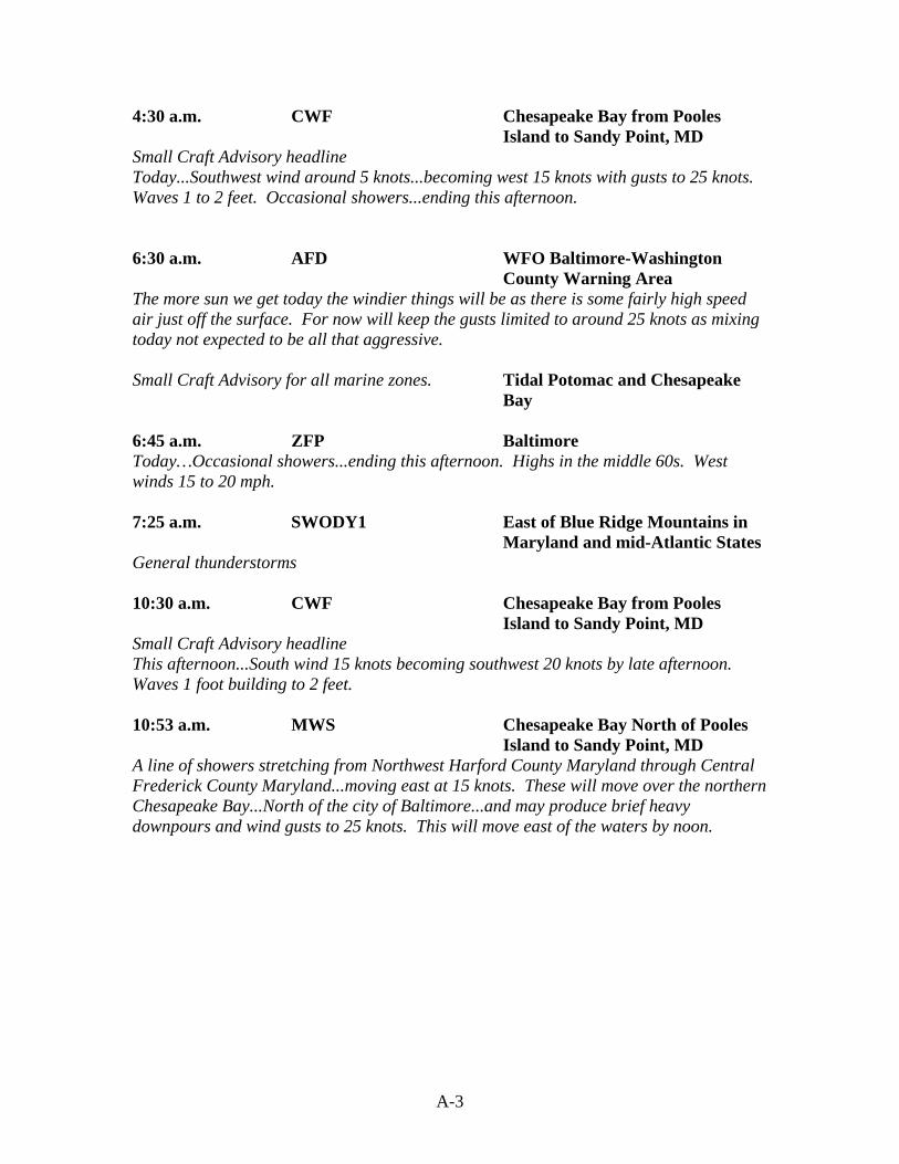
4:30 a.m. CWF Chesapeake Bay from Pooles Island to Sandy Point, MD
Small Craft Advisory headline Today...Southwest wind around 5 knots...becoming west 15 knots with gusts to 25 knots. Waves 1 to 2 feet. Occasional showers...ending this afternoon. 6:30 a.m. AFD WFO Baltimore-Washington County Warning Area The more sun we get today the windier things will be as there is some fairly high speed air just off the surface. For now will keep the gusts limited to around 25 knots as mixing today not expected to be all that aggressive. Small Craft Advisory for all marine zones. Tidal Potomac and Chesapeake
Bay 6:45 a.m. ZFP Baltimore Today…Occasional showers...ending this afternoon. Highs in the middle 60s. West winds 15 to 20 mph. 7:25 a.m. SWODY1 East of Blue Ridge Mountains in
Maryland and mid-Atlantic States General thunderstorms 10:30 a.m. CWF Chesapeake Bay from Pooles
Island to Sandy Point, MD Small Craft Advisory headline This afternoon...South wind 15 knots becoming southwest 20 knots by late afternoon. Waves 1 foot building to 2 feet. 10:53 a.m. MWS Chesapeake Bay North of Pooles
Island to Sandy Point, MD A line of showers stretching from Northwest Harford County Maryland through Central Frederick County Maryland...moving east at 15 knots. These will move over the northern Chesapeake Bay...North of the city of Baltimore...and may produce brief heavy downpours and wind gusts to 25 knots. This will move east of the waters by noon.

A-4
10:55 a.m. AFD WFO Baltimore-Washington County Warning Area The air mass still has some instability. So will leave mention of a chance of showers in the forecast for remainder of this afternoon. New 12Z ETA continues to also show decent upward forcing for bands of precipitation across mainly the northern half of the county warning area through the afternoon hours. Winds will become breezy from the West this afternoon...but it will depend on how much clearing...if any...we experience. Right now...it looks like it will remain cloudy through most of the afternoon hours. Marine...will keep Small Craft Advisory up for winds this afternoon. Small Craft Advisory for all marine zones. Tidal Potomac and Chesapeake
Bay
11:00 a.m. ZFP Baltimore This afternoon...Mostly cloudy with a 50% chance of showers. Highs in the lower 60s. South winds 10 to 15 mph...becoming west 15 to 20 mph in the afternoon. Tonight... partly cloudy. Lows in the lower 40s. West winds 10 to 15 mph. 11:15 a.m. EOL Baltimore Greater Metropolitan
Area This afternoon...Mostly cloudy with a 50 percent chance of showers. Highs 61 to 66. South winds 10 to 15 mph...becoming west 15 to 20 mph. 11:20 a.m. HWO WFO Baltimore-Washington County Warning Area No hazardous weather is expected at this time. 11:20 a.m. ZFP (Correction) Baltimore Corrected temperature and wind on ZFP issued at 11:00 a.m. 11:35 a.m. SWODY1 East of Blue Ridge Mountains in
Maryland and mid-Atlantic States General thunderstorms, no severe thunderstorms forecast …a few strong wind gusts may accompany a line of showers/isolated thunderstorms along…the synoptic front across Maryland/Delaware/New Jersey…but the severe threat appears to be too marginal to warrant a slight risk.
2:30 p.m. NOW Anne Arundel, Prince Georges, Charles, Calvert Counties, MD plus 2 VA counties
“Heavy showers moving southeast across lower southern Maryland” headline. A broken line of showers located from Woodbridge…east to southern sections of Annapolis... is moving southeast at about 40 mph. By 3 p.m....this line is expected to stretch from Ironsides…northeast to La Plata and Huntingtown. A short period of heavy rain is expected with this line.

A-5
2:53 p.m. SWODY1 East of Blue Ridge Mountains in Maryland and mid-Atlantic States
Given the already strong gradient winds…one or two thunderstorms may produce gusty winds...but overall severe probabilities are low. Thunderstorms will diminish and/or move off the coast later this evening. 2:55 p.m. AFD WFO Baltimore-Washington County Warning Area … upper-level trough that will swing through late this afternoon and early evening. This is helping kick off a line of showers out to the west over West Virginia. Marine...westerly winds late this afternoon into this evening will be quite breezy for some time after sunset before diminishing by midnight. Will keep Small Craft Advisory up for this afternoon and evening.
Tidal Potomac and Chesapeake Bay
Small Craft Advisory tidal Potomac and Chesapeake Bay. 2:55 p.m. ZFP Baltimore Tonight…Partly cloudy with a 30% chance of evening showers. Lows in the lower 40s. West winds 15 to 20 mph and gusty this evening...becoming Northwest around 10 mph after midnight. 3:15 p.m. EOL Baltimore Greater Metropolitan
Area Tonight...Partly cloudy with a 30 percent chance of evening showers. Lows in the lower 40s. Northwest winds 15 to 20 mph. 3:49 p.m. NOW Baltimore, plus numerous other
counties Expect scattered showers and isolated thunderstorms through sunset. Wind gusts to 35 mph will occur in the strongest storms. Up to one half inch of rain will fall in the heaviest showers. 4 p.m. NOW Baltimore, plus numerous other
counties Expect scattered showers and isolated thunderstorms through sunset. Wind gusts to 45 mph will occur in the strongest storms. Up to 1/2 inch of rain will fall in the heaviest showers.

A-6
4:05 p.m. SMW Chesapeake Bay from Pooles Island, MD southward to Drum Point, MD
At 4:05 p.m....National Weather Service Doppler radar indicated a strong thunderstorm 9 miles west of Churchton...or about 11 miles northwest of North Beach...moving east at 50 mph. Other strong storms were located near Baltimore...and near Cove Point....moving east as well. Mariners can expect wind gusts to near 50 knots…high waves...dangerous lightning and heavy downpours. Boaters should seek safe harbor immediately until the storm passes. Mariners should seek safe harbor immediately. Take the necessary precautions to safeguard life and property. 4:30 p.m. CWF Chesapeake Bay from Pooles
Island to Sandy Point, MD Small Craft Advisory headline Tonight...West wind 15 to 20 knots...becoming Northwest and decreasing to around 10 knots. Waves 1 to 2 feet. A chance of showers in the evening.