Embed Size (px)
Citation preview
1
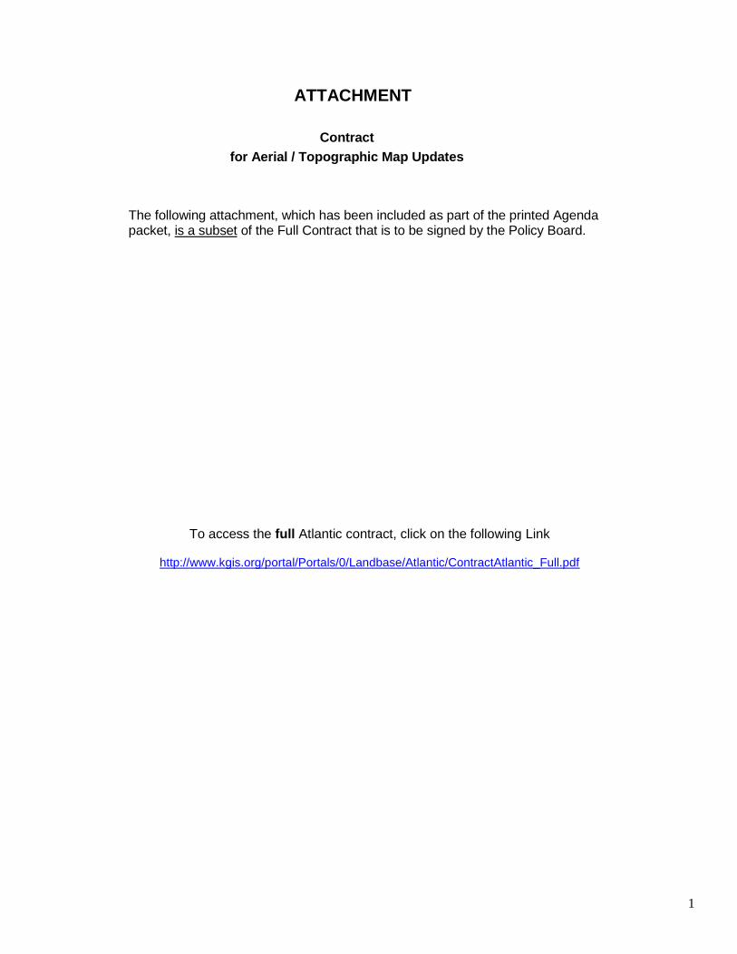
ATTACHMENT
Contract
for Aerial / Topographic Map Updates
The following attachment, which has been included as part of the printed Agenda packet, is a subset of the Full Contract that is to be signed by the Policy Board.
To access the full Atlantic contract, click on the following Link
http://www.kgis.org/portal/Portals/0/Landbase/Atlantic/ContractAtlantic_Full.pdf
2
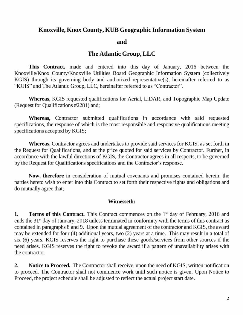
Knoxville, Knox County, KUB Geographic Information System
and
The Atlantic Group, LLC
This Contract, made and entered into this day of January, 2016 between the
Knoxville/Knox County/Knoxville Utilities Board Geographic Information System (collectively
KGIS) through its governing body and authorized representative(s), hereinafter referred to as
“KGIS” and The Atlantic Group, LLC, hereinafter referred to as “Contractor”.
Whereas, KGIS requested qualifications for Aerial, LiDAR, and Topographic Map Update
(Request for Qualifications #2281) and;
Whereas, Contractor submitted qualifications in accordance with said requested
specifications, the response of which is the most responsible and responsive qualifications meeting
specifications accepted by KGIS;
Whereas, Contractor agrees and undertakes to provide said services for KGIS, as set forth in
the Request for Qualifications, and at the price quoted for said services by Contractor. Further, in
accordance with the lawful directions of KGIS, the Contractor agrees in all respects, to be governed
by the Request for Qualifications specifications and the Contractor’s response.
Now, therefore in consideration of mutual covenants and promises contained herein, the
parties hereto wish to enter into this Contract to set forth their respective rights and obligations and
do mutually agree that;
Witnesseth:
1. Terms of this Contract. This Contract commences on the 1st day of February, 2016 and
ends the 31st day of January, 2018 unless terminated in conformity with the terms of this contract as
contained in paragraphs 8 and 9. Upon the mutual agreement of the contractor and KGIS, the award
may be extended for four (4) additional years, two (2) years at a time. This may result in a total of
six (6) years. KGIS reserves the right to purchase these goods/services from other sources if the
need arises. KGIS reserves the right to revoke the award if a pattern of unavailability arises with
the contractor.
2. Notice to Proceed. The Contractor shall receive, upon the need of KGIS, written notification
to proceed. The Contractor shall not commence work until such notice is given. Upon Notice to
Proceed, the project schedule shall be adjusted to reflect the actual project start date.
3
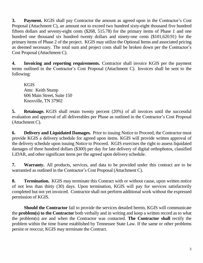
3. Payment. KGIS shall pay Contractor the amount as agreed upon in the Contractor’s Cost
Proposal (Attachment C), an amount not to exceed two hundred sixty-eight thousand five hundred
fifteen dollars and seventy-eight cents ($268, 515.78) for the primary items of Phase 1 and one
hundred one thousand six hundred twenty dollars and ninety-one cents ($101,620.91) for the
primary items of Phase 2 of the project. KGIS may utilize the Optional Items and associated pricing
as deemed necessary. The total sum and project costs shall be broken down per the Contractor’s
Cost Proposal (Attachment C).
4. Invoicing and reporting requirements. Contractor shall invoice KGIS per the payment
terms outlined in the Contractor’s Cost Proposal (Attachment C). Invoices shall be sent to the
following:
KGIS
Attn: Keith Stump
606 Main Street, Suite 150
Knoxville, TN 37902
5. Retainage. KGIS shall retain twenty percent (20%) of all invoices until the successful
evaluation and approval of all deliverables per Phase as outlined in the Contractor’s Cost Proposal
(Attachment C).
6. Delivery and Liquidated Damages. Prior to issuing Notice to Proceed, the Contractor must
provide KGIS a delivery schedule for agreed upon items. KGIS will provide written approval of
the delivery schedule upon issuing Notice to Proceed. KGIS exercises the right to assess liquidated
damages of three hundred dollars ($300) per day for late delivery of digital orthophotos, classified
LiDAR, and other significant items per the agreed upon delivery schedule.
7. Warranty. All products, services, and data to be provided under this contract are to be
warrantied as outlined in the Contractor’s Cost Proposal (Attachment C).
8. Termination. KGIS may terminate this Contract with or without cause, upon written notice
of not less than thirty (30) days. Upon termination, KGIS will pay for services satisfactorily
completed but not yet invoiced. Contractor shall not perform additional work without the expressed
permission of KGIS.
Should the Contractor fail to provide the services detailed herein, KGIS will communicate
the problem(s) to the Contractor both verbally and in writing and keep a written record as to what
the problem(s) are and when the Contractor was contacted. The Contractor shall rectify the
problem within the time frame established by Tennessee State Law. If the same or other problems
persist or reoccur, KGIS may terminate the Contract.
4
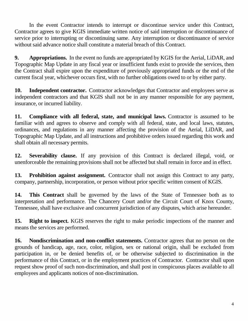
In the event Contractor intends to interrupt or discontinue service under this Contract,
Contractor agrees to give KGIS immediate written notice of said interruption or discontinuance of
service prior to interrupting or discontinuing same. Any interruption or discontinuance of service
without said advance notice shall constitute a material breach of this Contract.
9. Appropriations. In the event no funds are appropriated by KGIS for the Aerial, LiDAR, and
Topographic Map Update in any fiscal year or insufficient funds exist to provide the services, then
the Contract shall expire upon the expenditure of previously appropriated funds or the end of the
current fiscal year, whichever occurs first, with no further obligations owed to or by either party.
10. Independent contractor. Contractor acknowledges that Contractor and employees serve as
independent contractors and that KGIS shall not be in any manner responsible for any payment,
insurance, or incurred liability.
11. Compliance with all federal, state, and municipal laws. Contractor is assumed to be
familiar with and agrees to observe and comply with all federal, state, and local laws, statutes,
ordinances, and regulations in any manner affecting the provision of the Aerial, LiDAR, and
Topographic Map Update, and all instructions and prohibitive orders issued regarding this work and
shall obtain all necessary permits.
12. Severability clause. If any provision of this Contract is declared illegal, void, or
unenforceable the remaining provisions shall not be affected but shall remain in force and in effect.
13. Prohibition against assignment. Contractor shall not assign this Contract to any party,
company, partnership, incorporation, or person without prior specific written consent of KGIS.
14. This Contract shall be governed by the laws of the State of Tennessee both as to
interpretation and performance. The Chancery Court and/or the Circuit Court of Knox County,
Tennessee, shall have exclusive and concurrent jurisdiction of any disputes, which arise hereunder.
15. Right to inspect. KGIS reserves the right to make periodic inspections of the manner and
means the services are performed.
16. Nondiscrimination and non-conflict statements. Contractor agrees that no person on the
grounds of handicap, age, race, color, religion, sex or national origin, shall be excluded from
participation in, or be denied benefits of, or be otherwise subjected to discrimination in the
performance of this Contract, or in the employment practices of Contractor. Contractor shall upon
request show proof of such non-discrimination, and shall post in conspicuous places available to all
employees and applicants notices of non-discrimination.
5
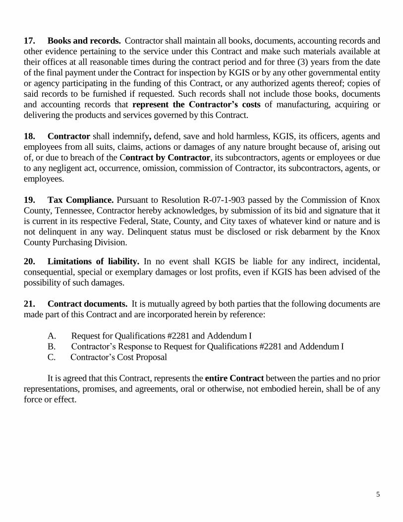
17. Books and records. Contractor shall maintain all books, documents, accounting records and
other evidence pertaining to the service under this Contract and make such materials available at
their offices at all reasonable times during the contract period and for three (3) years from the date
of the final payment under the Contract for inspection by KGIS or by any other governmental entity
or agency participating in the funding of this Contract, or any authorized agents thereof; copies of
said records to be furnished if requested. Such records shall not include those books, documents
and accounting records that represent the Contractor’s costs of manufacturing, acquiring or
delivering the products and services governed by this Contract.
18. Contractor shall indemnify, defend, save and hold harmless, KGIS, its officers, agents and
employees from all suits, claims, actions or damages of any nature brought because of, arising out
of, or due to breach of the Contract by Contractor, its subcontractors, agents or employees or due
to any negligent act, occurrence, omission, commission of Contractor, its subcontractors, agents, or
employees.
19. Tax Compliance. Pursuant to Resolution R-07-1-903 passed by the Commission of Knox
County, Tennessee, Contractor hereby acknowledges, by submission of its bid and signature that it
is current in its respective Federal, State, County, and City taxes of whatever kind or nature and is
not delinquent in any way. Delinquent status must be disclosed or risk debarment by the Knox
County Purchasing Division.
20. Limitations of liability. In no event shall KGIS be liable for any indirect, incidental,
consequential, special or exemplary damages or lost profits, even if KGIS has been advised of the
possibility of such damages.
21. Contract documents. It is mutually agreed by both parties that the following documents are
made part of this Contract and are incorporated herein by reference:
A. Request for Qualifications #2281 and Addendum I
B. Contractor’s Response to Request for Qualifications #2281 and Addendum I
C. Contractor’s Cost Proposal
It is agreed that this Contract, represents the entire Contract between the parties and no prior
representations, promises, and agreements, oral or otherwise, not embodied herein, shall be of any
force or effect.
6
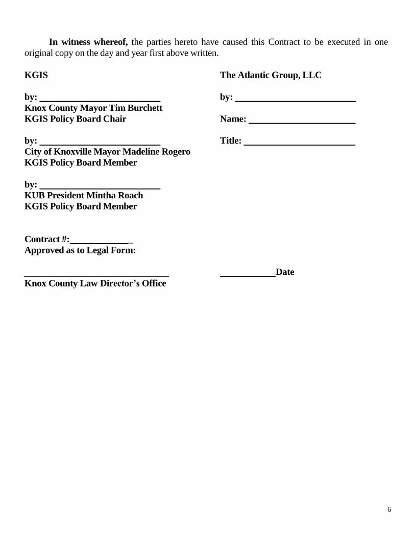
In witness whereof, the parties hereto have caused this Contract to be executed in one
original copy on the day and year first above written.
KGIS The Atlantic Group, LLC
by:
Knox County Mayor Tim Burchett
by:
KGIS Policy Board Chair Name:
by:
City of Knoxville Mayor Madeline Rogero
KGIS Policy Board Member
by:
KUB President Mintha Roach
KGIS Policy Board Member
Contract #: _
Approved as to Legal Form:
Title:
Knox County Law Director’s Office
Date
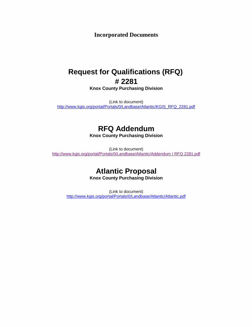
Incorporated Documents
Request for Qualifications (RFQ)
# 2281 Knox County Purchasing Division
(Link to document)
http://www.kgis.org/portal/Portals/0/Landbase/Atlantic/KGIS_RFQ_2281.pdf
RFQ Addendum Knox County Purchasing Division
(Link to document)
http://www.kgis.org/portal/Portals/0/Landbase/Atlantic/Addendum I RFQ 2281.pdf
Atlantic Proposal Knox County Purchasing Division
(Link to document)
http://www.kgis.org/portal/Portals/0/Landbase/Atlantic/Atlantic.pdf
2223 Drake Avenue SW, Suite 200, Huntsville, AL 35805 • P 256.971.9991 F 256.971.1154 • www.theatlgrp.com
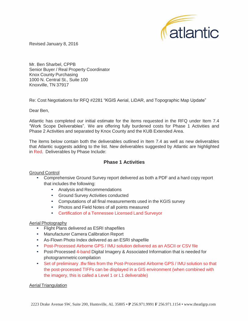
Revised January 8, 2016
Mr. Ben Sharbel, CPPB Senior Buyer / Real Property Coordinator Knox County Purchasing 1000 N. Central St., Suite 100 Knoxville, TN 37917
Re: Cost Negotiations for RFQ #2281 “KGIS Aerial, LiDAR, and Topographic Map Update”
Dear Ben,
Atlantic has completed our initial estimate for the items requested in the RFQ under Item 7.4 “Work Scope Deliverables”. We are offering fully burdened costs for Phase 1 Activities and Phase 2 Activities and separated by Knox County and the KUB Extended Area.
The items below contain both the deliverables outlined in Item 7.4 as well as new deliverables that Atlantic suggests adding to the list. New deliverables suggested by Atlantic are highlighted in Red. Deliverables by Phase Include:
Phase 1 Activities
Ground Control • Comprehensive Ground Survey report delivered as both a PDF and a hard copy report
that includes the following:
• Analysis and Recommendations
• Ground Survey Activities conducted
• Computations of all final measurements used in the KGIS survey
• Photos and Field Notes of all points measured
• Certification of a Tennessee Licensed Land Surveyor
Aerial Photography • Flight Plans delivered as ESRI shapefiles
• Manufacturer Camera Calibration Report
• As-Flown Photo Index delivered as an ESRI shapefile
• Post-Processed Airborne GPS / IMU solution delivered as an ASCII or CSV file
• Post-Processed 4-band Digital Imagery & Associated Information that is needed for
photogrammetric compilation
• Set of preliminary .tfw files from the Post-Processed Airborne GPS / IMU solution so that
the post-processed TIFFs can be displayed in a GIS environment (when combined with
the imagery, this is called a Level 1 or L1 deliverable)
Aerial Triangulation
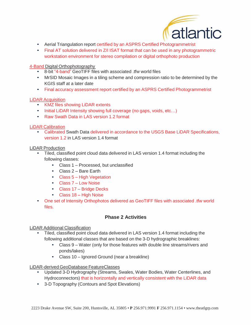
2223 Drake Avenue SW, Suite 200, Huntsville, AL 35805 • P 256.971.9991 F 256.971.1154 • www.theatlgrp.com
• Aerial Triangulation report certified by an ASPRS Certified Photogrammetrist
• Final AT solution delivered in Z/I ISAT format that can be used in any photogrammetric
workstation environment for stereo compilation or digital orthophoto production
4-Band Digital Orthophotography • 8-bit “4-band” GeoTIFF files with associated .tfw world files
• MrSID Mosaic Images in a tiling scheme and compression ratio to be determined by the
KGIS staff at a later date
• Final accuracy assessment report certified by an ASPRS Certified Photogrammetrist
LiDAR Acquisition • KMZ files showing LiDAR extents
• Initial LiDAR Intensity showing full coverage (no gaps, voids, etc…)
• Raw Swath Data in LAS version 1.2 format
LiDAR Calibration • Calibrated Swath Data delivered in accordance to the USGS Base LiDAR Specifications,
version 1.2 in LAS version 1.4 format
LiDAR Production • Tiled, classified point cloud data delivered in LAS version 1.4 format including the
following classes:
• Class 1 – Processed, but unclassified
• Class 2 – Bare Earth
• Class 5 – High Vegetation
• Class 7 – Low Noise
• Class 17 – Bridge Decks
• Class 18 – High Noise
• One set of Intensity Orthophotos delivered as GeoTIFF files with associated .tfw world
files.
Phase 2 Activities
LiDAR Additional Classification • Tiled, classified point cloud data delivered in LAS version 1.4 format including the
following additional classes that are based on the 3-D hydrographic breaklines:
• Class 9 – Water (only for those features with double line streams/rivers and
ponds/lakes)
• Class 10 – Ignored Ground (near a breakline)
LiDAR-derived GeoDatabase FeatureClasses • Updated 3-D Hydrography (Streams, Swales, Water Bodies, Water Centerlines, and
Hydroconnectors) that is horizontally and vertically consistent with the LiDAR data
• 3-D Topography (Contours and Spot Elevations)
2223 Drake Avenue SW, Suite 200, Huntsville, AL 35805 • P 256.971.9991 F 256.971.1154 • www.theatlgrp.com
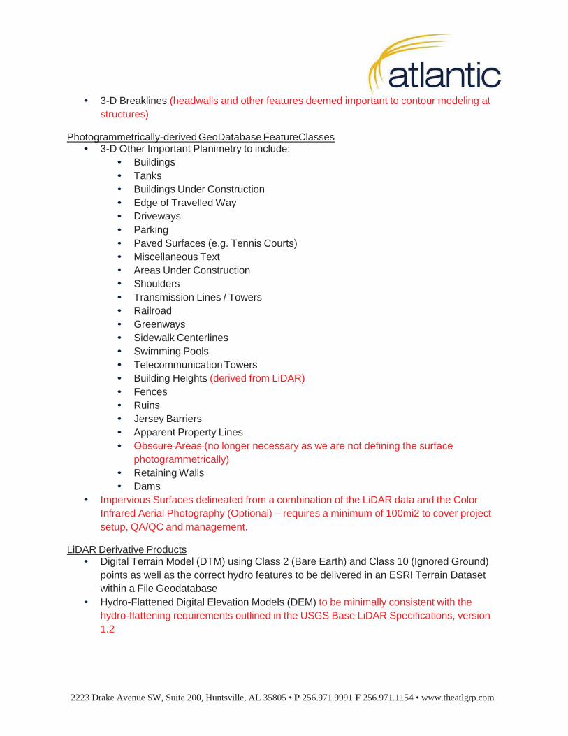
• 3-D Breaklines (headwalls and other features deemed important to contour modeling at
structures)
Photogrammetrically-derived GeoDatabase FeatureClasses • 3-D Other Important Planimetry to include:
• Buildings
• Tanks
• Buildings Under Construction
• Edge of Travelled Way
• Driveways
• Parking
• Paved Surfaces (e.g. Tennis Courts)
• Miscellaneous Text
• Areas Under Construction
• Shoulders
• Transmission Lines / Towers
• Railroad
• Greenways
• Sidewalk Centerlines
• Swimming Pools
• Telecommunication Towers
• Building Heights (derived from LiDAR)
• Fences
• Ruins
• Jersey Barriers
• Apparent Property Lines
• Obscure Areas (no longer necessary as we are not defining the surface
photogrammetrically)
• Retaining Walls
• Dams
• Impervious Surfaces delineated from a combination of the LiDAR data and the Color
Infrared Aerial Photography (Optional) – requires a minimum of 100mi2 to cover project
setup, QA/QC and management.
LiDAR Derivative Products • Digital Terrain Model (DTM) using Class 2 (Bare Earth) and Class 10 (Ignored Ground)
points as well as the correct hydro features to be delivered in an ESRI Terrain Dataset
within a File Geodatabase
• Hydro-Flattened Digital Elevation Models (DEM) to be minimally consistent with the
hydro-flattening requirements outlined in the USGS Base LiDAR Specifications, version
1.2
2223 Drake Avenue SW, Suite 200, Huntsville, AL 35805 • P 256.971.9991 F 256.971.1154 • www.theatlgrp.com
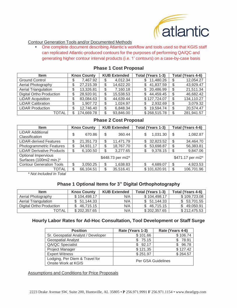
Contour Generation Tools and/or Documented Methods • One complete document describing Atlantic’s workflow and tools used so that KGIS staff
can replicated Atlantic-produced contours for the purposes of performing QA/QC and
generating higher contour interval products (i.e. 1’ contours) on a case-by-case basis
Phase 1 Cost Proposal
Item Knox County KUB Extended Total (Years 1-3) Total (Years 4-6)
Ground Control $ 7,467.92 $ 4,012.34 $ 11,480.26 $ 12,054.27
Aerial Photography $ 27,215.39 $ 14,622.20 $ 41,837.59 $ 43,929.47
Aerial Triangulation $ 13,326.81 $ 7,160.18 $ 20,486.99 $ 21,511.34
Digital Ortho Production $ 28,920.91 $ 15,538.53 $ 44,459.45 $ 46,682.42
LiDAR Acquisition $ 83,084.63 $ 44,639.44 $ 127,724.07 $ 134,110.27
LiDAR Calibration $ 1,907.72 $ 1,024.97 $ 2,932.69 $ 3,079.32
LiDAR Production $ 12,746.40 $ 6,848.34 $ 19,594.74 $ 20,574.47
TOTAL $ 174,669.78 $ 93,846.00 $ 268,515.78 $ 281,941.57
Phase 2 Cost Proposal
Item Knox County KUB Extended Total (Years 1-3) Total (Years 4-6)
LiDAR Additional Classification
$ 670.86 $ 360.44 $ 1,031.30 $ 1,082.87
LiDAR-derived Features $ 21,351.73 $ 11,471.79 $ 32,823.52 $ 34,464.70
Photogrammetric Features $ 34,931.17 $ 18,767.70 $ 53,698.87 $ 56,383.81
LiDAR Derivative Products $ 6,100.50 $ 3,277.65 $ 9,378.15 $ 9,847.06
Optional Impervious Surfaces (100mi2 min.)*
$448.73 per mi2* $471.17 per mi2*
Contour Generation Tools $ 3,050.25 $ 1,638.83 $ 4,689.07 $ 4,923.53
TOTAL $ 66,104.51 $ 35,516.41 $ 101,620.91 $ 106,701.96
* Not Included In Total
Phase 1 Optional Items for 3” Digital Orthophotography
Item Knox County KUB Extended Total (Years 1-3) Total (Years 4-6)
Aerial Photography $ 104,498.17 N/A $ 104,498.17 $ 109,723.08
Aerial Triangulation $ 51,144.33 N/A $ 51,144.33 $ 53,701.55
Digital Ortho Production $ 46,715.15 N/A $ 46,715.15 $ 49,050.91
TOTAL $ 202,357.65 N/A $ 202,357.65 $ 212,475.53
Hourly Labor Rates for Ad-Hoc Consultation, Tool Development or Staff Surge
Position Rate (Years 1-3) Rate (Years 4-6)
Sr. Geospatial Analyst / Developer $ 101.66 $ 106.74
Geospatial Analyst $ 75.15 $ 78.91
QA/QC Specialist $ 92.17 $ 96.78
Project Manager $ 121.35 $ 127.42
Expert Witness $ 251.97 $ 264.57
Lodging, Per Diem & Travel for Onsite Work at KGIS
Per GSA Guidelines
Assumptions and Conditions for Price Proposals
2223 Drake Avenue SW, Suite 200, Huntsville, AL 35805 • P 256.971.9991 F 256.971.1154 • www.theatlgrp.com
1. Atlantic will hold our rates constant for Years 1-3 of the agreement. For the optional 3
year period, Atlantic requests a 5% escalation fee to cover increases in fuel, GSA Per
Diem rates, staff labor rates, Atlantic equipment rates and adjustments to our business
overhead.
2. Atlantic assumes that any of the line items above that require a mobilization from
Huntsville to Knox County (ground control, aerial photography acquisition and LiDAR
acquisition) will be selected by both Knox County and KUB. Our aerial mobilization
costs, survey mobilization costs, production setup, project management, etc… are
spread proportionally across both lines. Should either entity elect to not participate on a
billing line, this would have an adverse effect on Atlantic and we reserve the right to re-
negotiate that line item based on the final participants.
3. Atlantic’s costs are fully burdened with Project Management, QA/QC, Profit and all
Administrative Costs necessary to successfully complete this project.
Payment Terms The Consultant may secure payment for a percentage complete by Phase and by Billing Line (as displayed on the pricing shown on the previous page) on a monthly work-in-progress basis or for the full amount of monies allocated to individual tasks or milestones by submitting to the County the following:
A. A dated invoice showing the amount of the claimed payment with a brief description of the
work complete for the amount being claimed. Invoices may be submitted on a monthly percent complete basis or as individual tasks or milestones are completed. Invoices may be sent by email, fax or U.S. Postal Service regular mail.
B. County will have seven (7) days from receipt of Consultant’s invoice to notify Consultant of any discrepancies in such invoice. Consultant’s invoice will be deemed approved by County if Consultant is not notified by County of a discrepancy within the seven (7) day period.
C. Unless otherwise noted in this agreement, the County shall pay within thirty calendar (30) days of receipt of all payment claims submitted by the Consultant, meeting all of the above requirements, and not formally disputed by the County within the timeframe noted above. All payment claims not paid within thirty (30) days or disputed by the County may be considered overdue by the Consultant. The County shall not use the dispute of one payment claim as a reason for disputing or not paying on time any other payment claim, unless the disputed claim materially affects the usability of any other part, portion or phase of the work contemplated by this Contractual Agreement.
D. Work-In-Progress Billing: Consultant may bill up to 40% of the total cost of each billing line item that is worked on during the billing period. Billing shall not exceed 40% of any single line item until the consultant makes delivery of the items shown on pages 1-4 of this cost proposal.
E. Successful Delivery Billing: Consultant may bill up to 40% additional percent of the total cost of each billing line item that is complete during the billing period. Total billing for any single line item may not exceed 80% of the billing line total once successful delivery is made. Successful delivery is defined as a complete deliverable on working media of the items shown on pages 1-4 of this cost proposal.
2223 Drake Avenue SW, Suite 200, Huntsville, AL 35805 • P 256.971.9991 F 256.971.1154 • www.theatlgrp.com
F. Retainage: The Consultant will not be allowed to invoice the remaining 20% of any billing line until the successful evaluation and approval of all Phase deliverables (defined as Phase 1 and Phase 2 on pages 1-4 of this cost proposal).
G. Review Period: The County shall have sixty (60) calendar days to inspect, review and accept all Phase and line item deliverables. Failure to accept items within sixty (60) days shall result in an acceptance of those deliverables but shall not remove the warranty and obligation for corrections to those items by the Consultant. Consultant shall promptly address all rejected items and shall re-deliver said items no later than sixty (60) calendar days after receipt of rejected items.
Warranties 1. The Contractor warrants that the professional services and resultant data to be provided
throughout this contract shall meet minimum acceptance criteria outlined by KGIS and the Contractor within this contract document and during the kick-off meeting. The contractor also warrants the data to be complete at the time of data acquisition.
2. Where no quality measure is specified, the data shall minimally meet what can be defined as industry best practices for said data type and be free from defects in workmanship, materials and design where it is the responsibility of the Contractor.
3. If at any time after the expiration of the KGIS acceptance or designated sixty (60) day review period, KGIS finds that the data does not confirm to the acceptance criteria of the contract, then upon Notice to Contractor by KGIS within a period of this contract term plus one (1) additional year, the Contractor shall promptly repair, replace, correct or re-perform such data until it meets the acceptance criteria of the contract at no additional cost to KGIS.
4. In no event shall the Contractor be responsible for repairing items that were corrupt, deleted or changed by the KGIS staff after delivery. Repairs would be made only to the Contractor’s version of the data.
KGIS Participation
Atlantic’s goal is to create minimal work for the KGIS staff but provide ample opportunities for involvement, to provide critical feedback and to offer final acceptance of the data. Atlantic realizes an integral piece of achieving project successes is through frequent, detailed communication and status reporting with our clients. Throughout the lifecycle of the project, Atlantic’s Assigned Project Manager (Justin Henderson, PMP) will provide KGIS with regular verbal status updates via phone through each week of production in addition to a scheduled, emailed status report that will be sent at least once per month or more frequently, if requested by KGIS. These status reports aim to address the percentages of tasks completed, estimated completion of project milestones, as well regular assessments of overall project deliverables set forth by the Kick-Off Meeting held in person with the client.
Atlantic’s ultimate goal is to provide KGIS with an informed, well-planned and effectively communicated project experience. Additionally, Atlantic will also provide access to “a-Track” – a real-time project status reporting application accessible to KGIS through Atlantic’s server so that data tracking is available 24/7 in either ArcGIS desktop software or via the web. How frequently KGIS staff access the site or require status updates is up to KGIS but consuming that information should require minimal effort by KGIS.

2223 Drake Avenue SW, Suite 200, Huntsville, AL 35805 • P 256.971.9991 F 256.971.1154 • www.theatlgrp.com
Atlantic will require KGIS participation in the following meetings that were referenced in Section 2.B.6 of Atlantic’s proposal dated October 7, 2015.
1. Client Kick-Off Meeting: Atlantic proposes to conduct a Kick-off Meeting with key members
of the KGIS technical staff as soon as possible after notification of the award. The purpose of this meeting is to walk through the KGIS specific objectives, in addition to each of the technical items of the project so that all parties begin with the same set of expectations, goals and objectives. This meeting will also help to define and implement the project structure that will reiterate defined roles and responsibilities for each party. At a minimum, the Atlantic Management Team will organize a meeting KGIS’s convenience to discuss and review:
• Purpose and Goal of Overall Project • Project Details (Scope, Technical Requirements, Special Requests, etc.) • Finalize Acceptance Criteria for Aerial Photography and LiDAR – sample criteria were
submitted in Sections 2.A.15 and 2.A.25 of Atlantic’s proposal dated October 7, 2015. • Finalize Project Schedule for all Phase 1 Deliverables • Communication Protocols and Procedures • Final Deliverables
2. Pilot Review: Atlantic proposes to conduct another in-person meeting approximately 2
weeks after the delivery of the KGIS pilot data deliverables (a pilot study is something we recommend to ensure that all parties are on the same page before production of the full county project area is completed). The two week period should be sufficient for the key members of the KGIS technical staff and their internal clients to review the deliverables and provide any feedback necessary. The purpose of this meeting is to walk through each of the areas within the pilot deliverables that need adjustment or modification before the full data production proceeds at Atlantic. This meeting can happen in either Knoxville or Huntsville. We often find it beneficial to all parties to host this meeting at Atlantic’s office so that a broader set of technical staff can be involved in making recommendations for options, should they be requested by the KGIS staff. At a minimum, the Atlantic Management Team will organize a meeting at KGIS’s convenience to discuss and review:
• Review deliverables submitted to review:
o Completeness o Omissions o Errors
• Discuss adjustments needed in Atlantic’s production process, if necessary, to successfully complete the project in accordance with the KGIS needs and expectations.
3. Project Wrap-Up: Atlantic proposes to conduct a final meeting with the KGIS key technical and contractual stakeholders at the conclusion of acceptance of all data products. The purpose of this meeting is to make certain that all work is deemed complete and accepted by all parties. This meeting is also a great opportunity to offer a “lessons learned” environment for Atlantic’s staff from the KGIS and its key participants to discuss any steps that should be documented or noted to make certain future projects are able to be conducted more effectively and efficiently. Once again, at a minimum, the Atlantic Management Team will organize a meeting at KGIS’s convenience to discuss and review:
2223 Drake Avenue SW, Suite 200, Huntsville, AL 35805 • P 256.971.9991 F 256.971.1154 • www.theatlgrp.com
• Project Review • Discuss and Document any Lessons Learned • If any additional tasks are needed, develop a schedule to implement and complete
those tasks immediately.
Project Scheduling and Resource Allocation
Even though formal award has not taken place, Atlantic has already reserved aerial photography and LiDAR acquisition resources to ensure the KGIS project is successfully collected in the Spring of 2016 and before vegetative conditions persist.
Aerial acquisition is significantly impacted by variables such as the climate, winds, sun angle and vegetation so Atlantic cannot guarantee specific dates of capture. However, we are prepared to offer a commitment with a range of dates that would be ideal for capture considering the variables above and the other commitments that Atlantic has on its books for 2016. Table 1.D.3 of Atlantic’s proposal dated October 7, 2015 contains a list of significant projects committed by Atlantic.
Atlantic has the in-house staff, equipment and efficient procedures to perform over $7,000,000 of work annually without adding additional staff resources. We have a total of 98,384 man hours available for production per year and has more than is required of uncommitted man hours to support the KGIS project. The overall effort for the KGIS project is between 3,772.4 and 5,512.1 man hours depending on whether or not the KUB extended service area option is chose.
Per the request of KGIS, we have included a detailed schedule for the field-related activities that will take place in Phase 1 of this project. The office post-processing tasks except those related to acquisition are not included and will be discussed with KGIS during the project kick-off meeting.
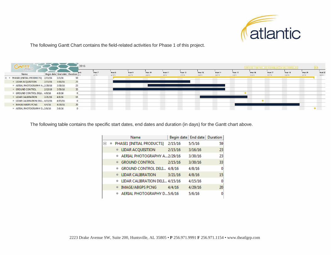
The following Gantt Chart contains the field-related activities for Phase 1 of this project.
The following table contains the specific start dates, end dates and duration (in days) for the Gantt chart above.
2223 Drake Avenue SW, Suite 200, Huntsville, AL 35805 • P 256.971.9991 F 256.971.1154 • www.theatlgrp.com
In order to successfully complete all field activities outlined in Phase 1, Atlantic needs a formal NTP (Notice To Proceed) no later than Friday February 1, 2016. We will work with the KGIS staff to negotiate a mutually agreeable schedule to all parties upon acceptance of pricing, terms and issuance of the NTP.
On behalf of Atlantic, we appreciate the opportunity to work with you and the KGIS participants during the negotiation of this contract. If you have any questions, please contact me at [email protected] or at (256) 971-9991. Thank you.
Sincerely,
Brian Mayfield President & COO
2223 Drake Avenue SW, Suite 200, Huntsville, AL 35805 • P 256.971.9991 F 256.971.1154 • www.theatlgrp.com