Embed Size (px)
Citation preview
COOPERATIVE LAKES MONITORING PROGRAMTRAINING FOR
Aquatic Plant Identification
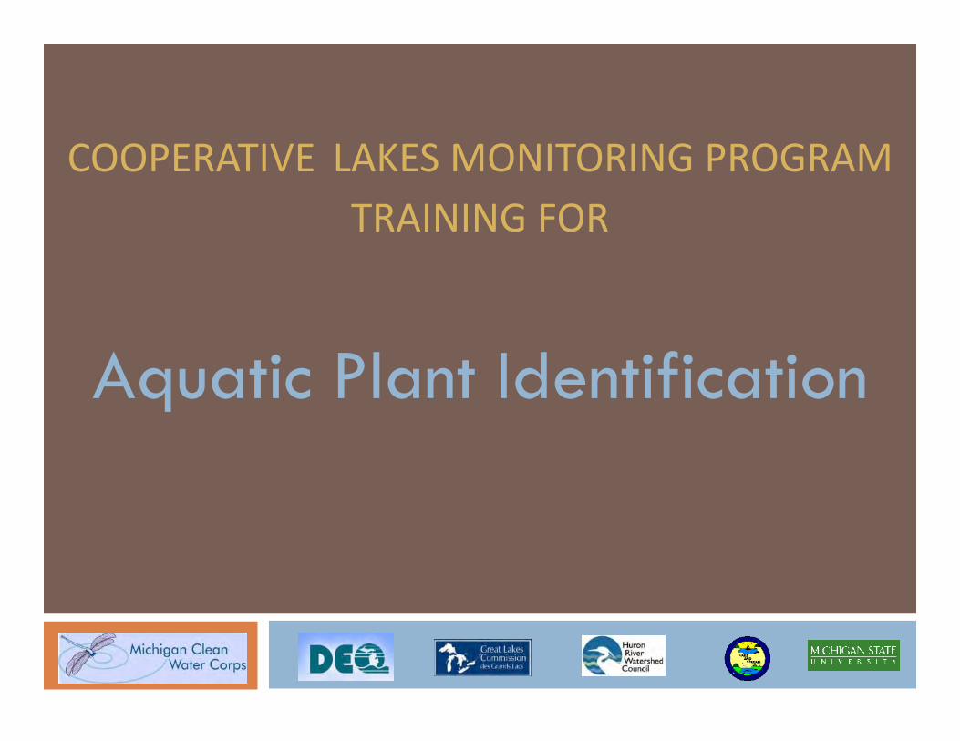
Paul Skawinski
Wisconsin Citizen Lake Monitoring Network Coordinator
University of Wisconsin –Stevens Point
Outline for Today
9:00 – 10:15 Learn to identify aquatic plants
10:15 – 10:45 Break
10:45 – 11:15 How to make a plant collection
11:15 – Noon CLMP’s Aquatic Plant Mapping: How to map
your lake’s plants

Session 2
Developing the Management Plan Securing public inputWhat do citizens perceive as the problems and the solutions?
Control strategiesWhat are the pros and cons of the available control tools?
Developing the plan Step-by-step process of developing the written plan.
Permitting requirementsWhen and where is a DEQ permit required?
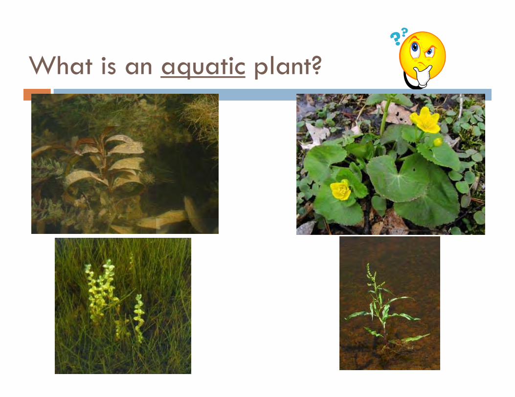
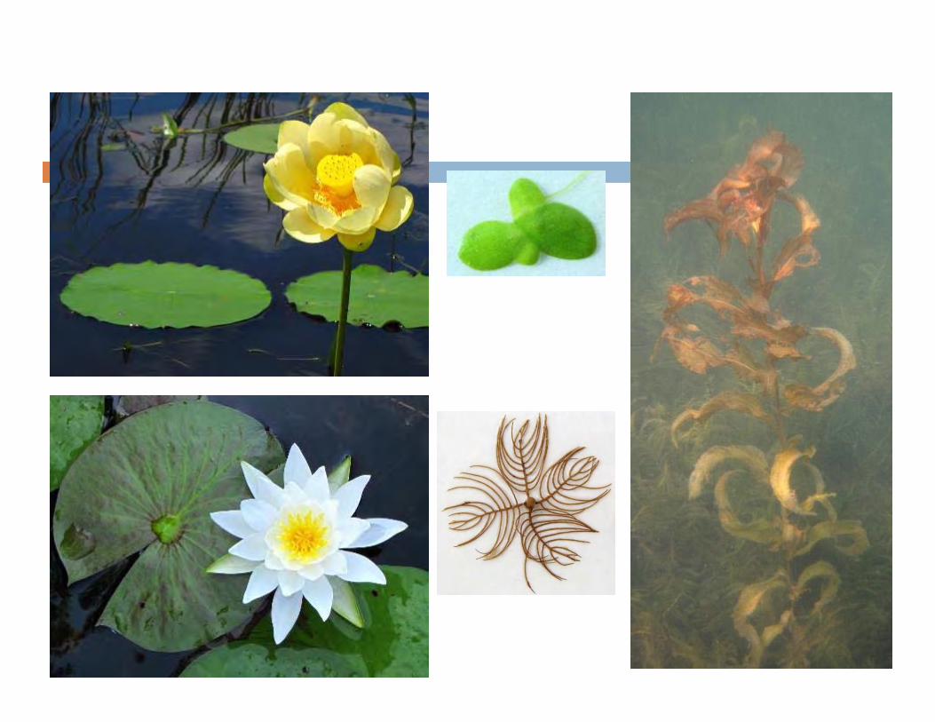
What is an aquatic plant?
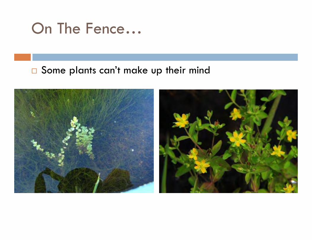
On The Fence…
Some plants can’t make up their mind
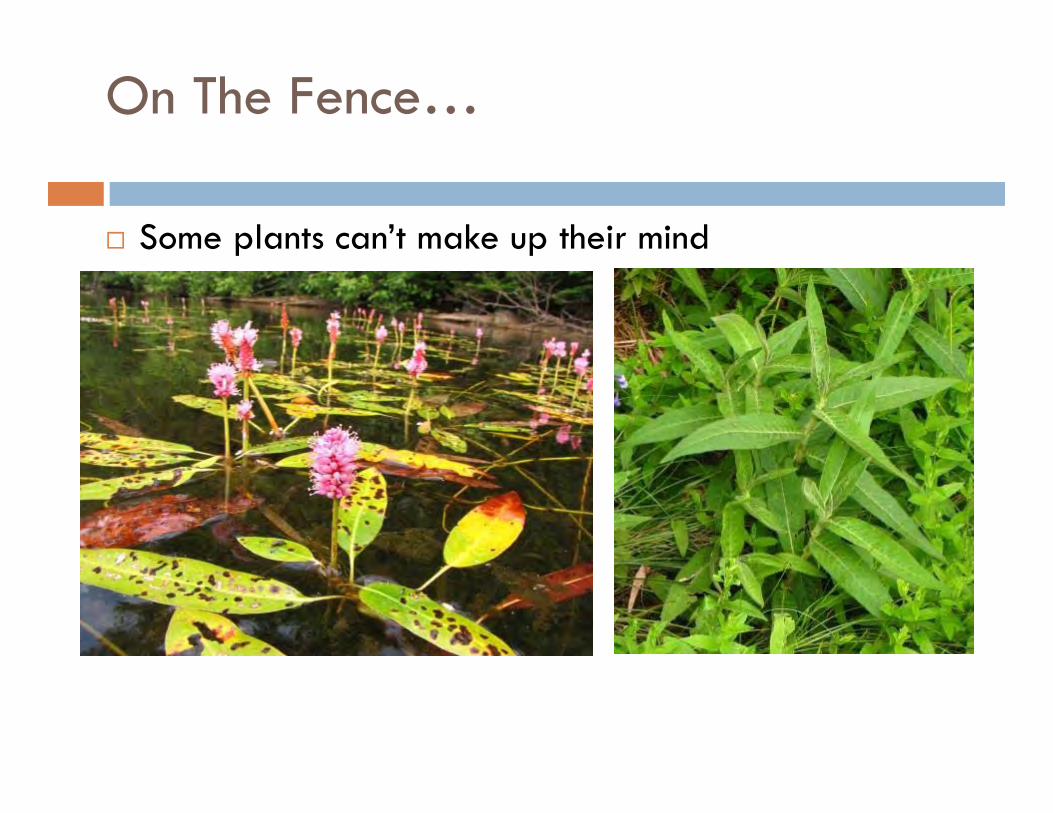
On The Fence…
Some plants can’t make up their mind
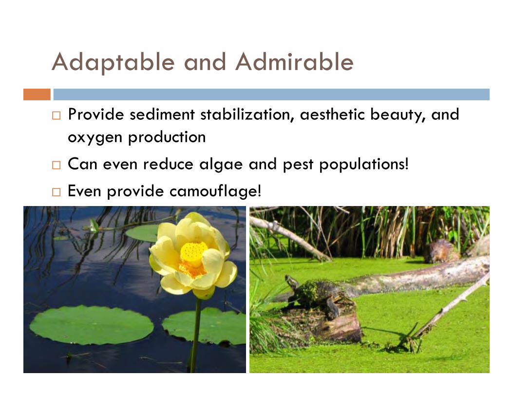
Adaptable and Admirable
Provide sediment stabilization, aesthetic beauty, and oxygen production
Can even reduce algae and pest populations! Even provide camouflage!
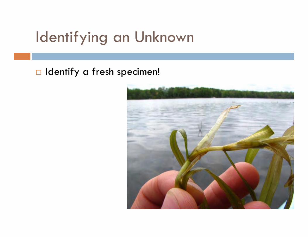
Identifying an Unknown
Identify a fresh specimen!
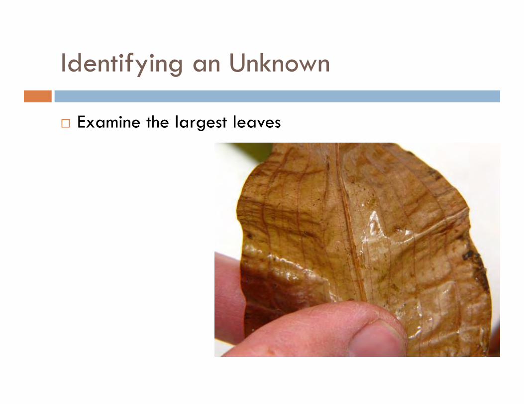
Identifying an Unknown
Examine the largest leaves
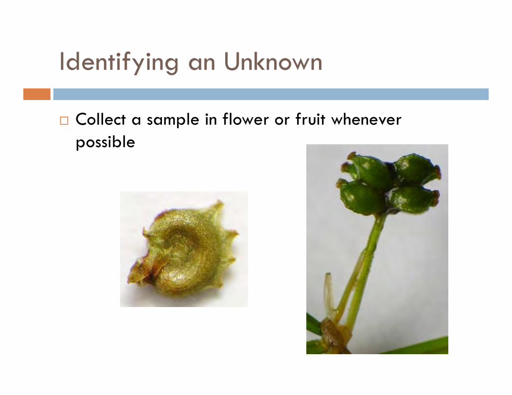
Identifying an Unknown
Collect a sample in flower or fruit whenever possible
Identifying an Unknown
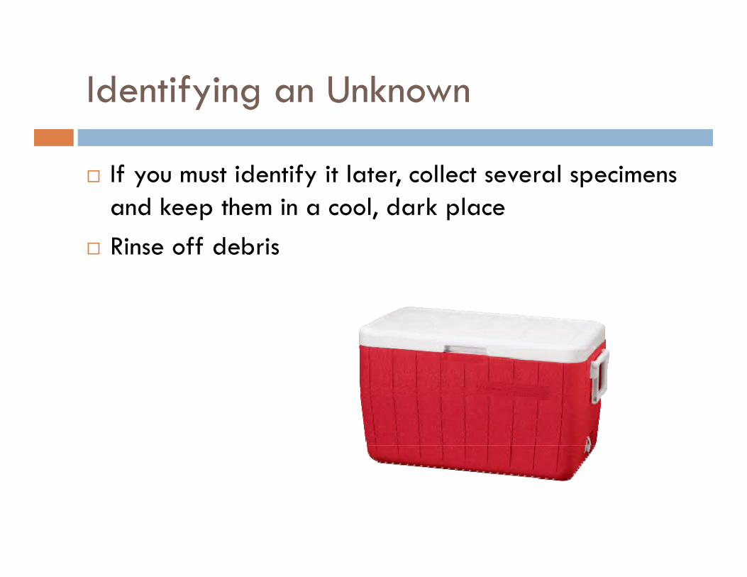
If you must identify it later, collect several specimens and keep them in a cool, dark place
Rinse off debris
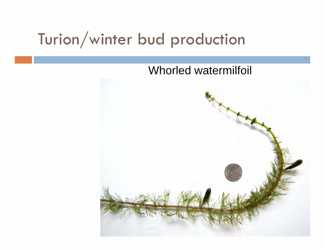
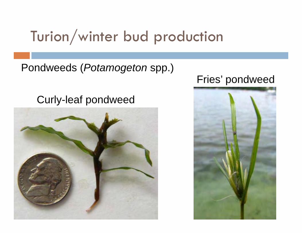
Turion/winter bud production
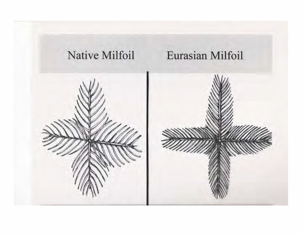
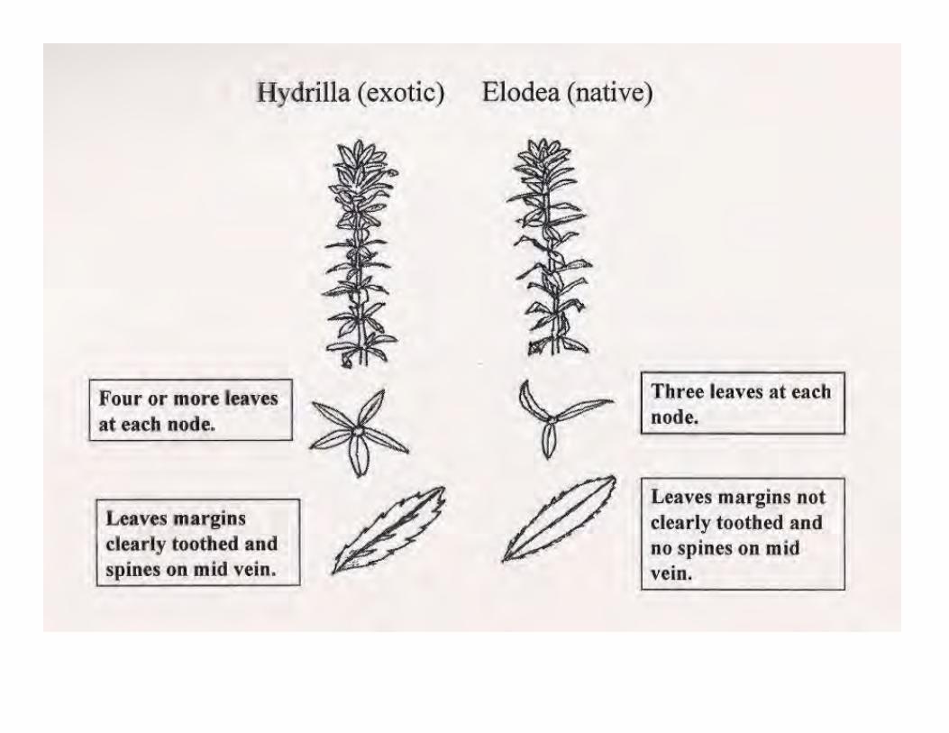
Whorled watermilfoil
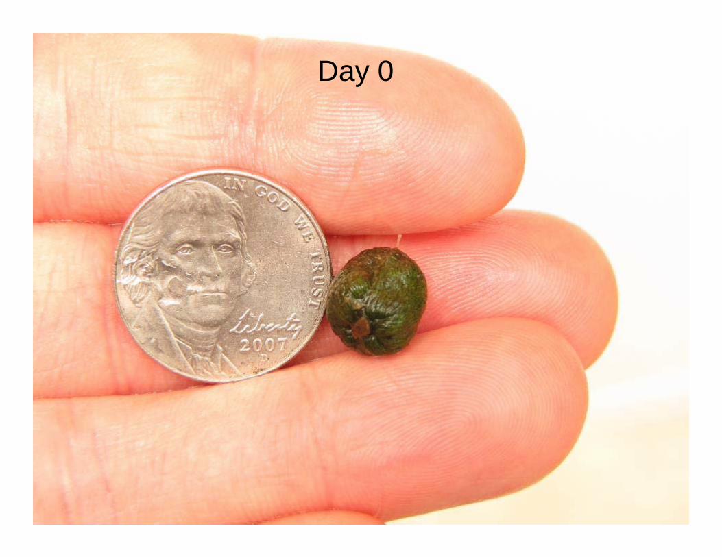
Day 0
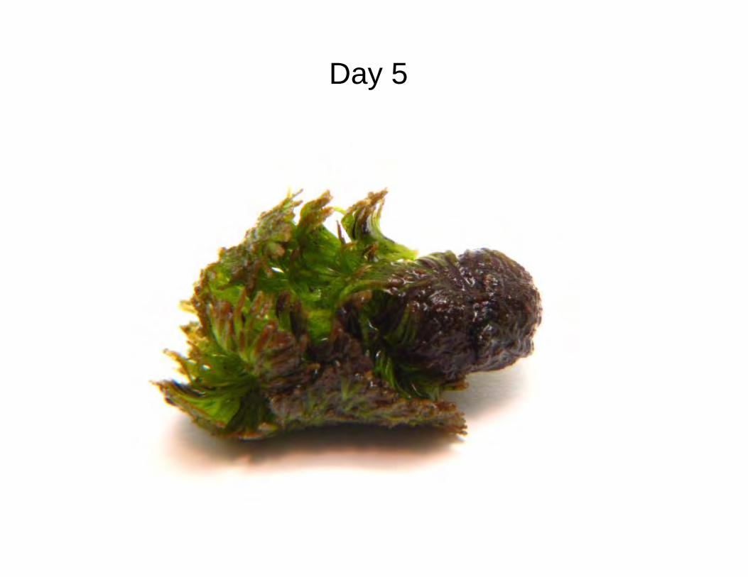
Day 5
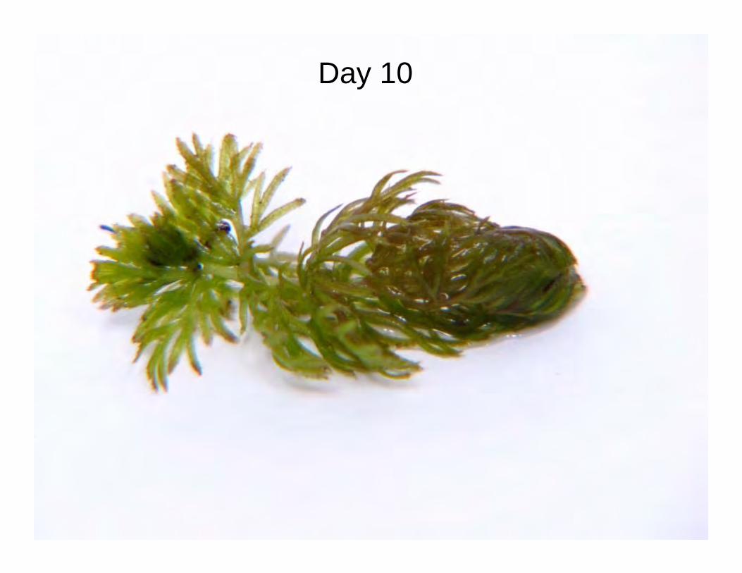
Day 10
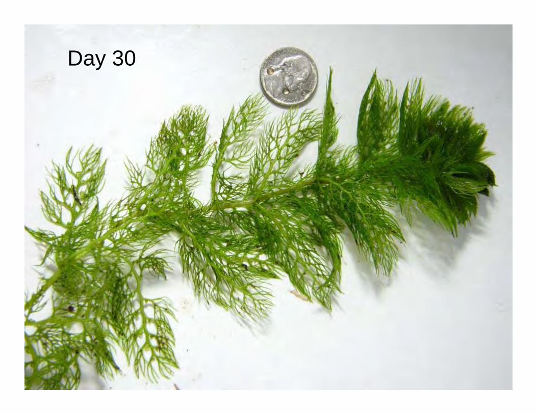
Day 30
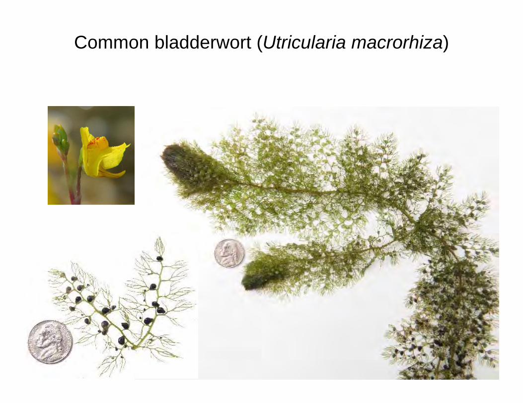
Common bladderwort (Utricularia macrorhiza)
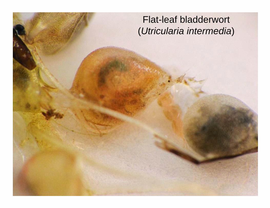
Flat-leaf bladderwort (Utricularia intermedia)
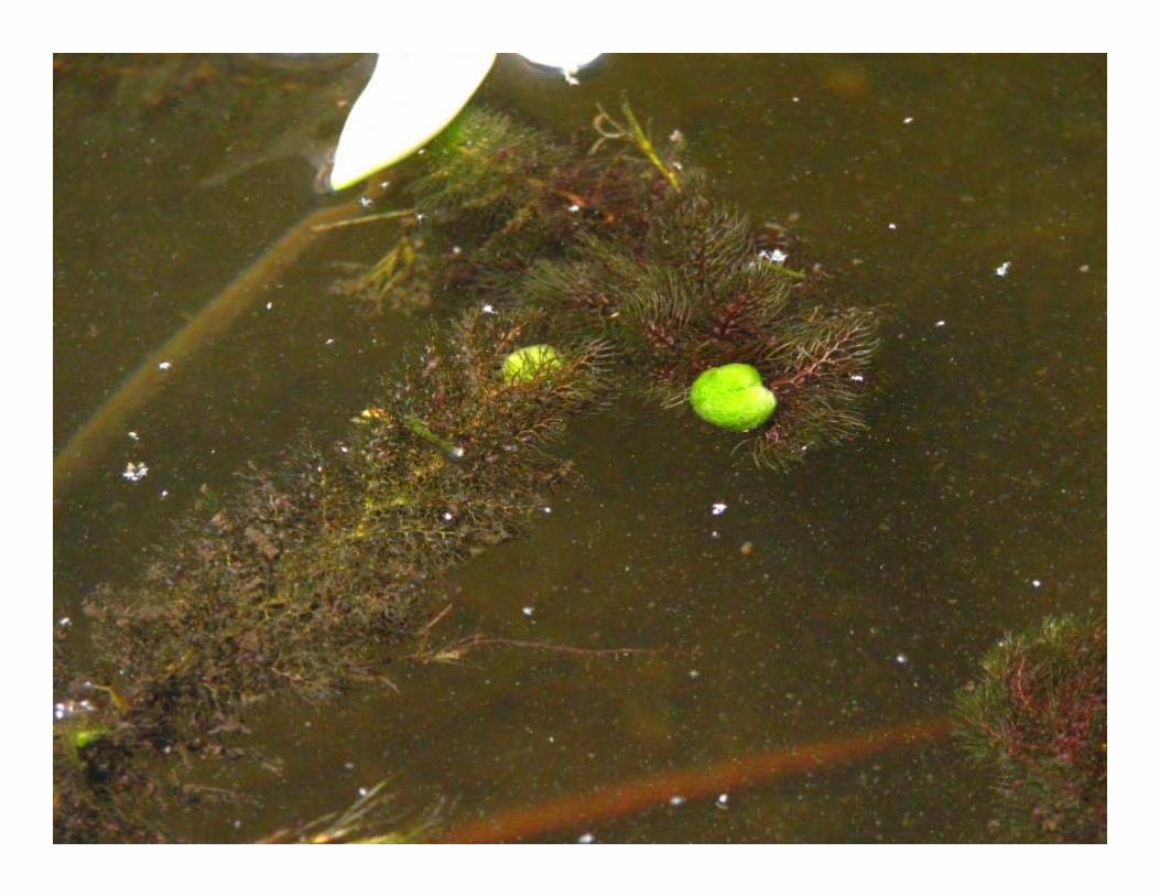
Turion/winter bud production
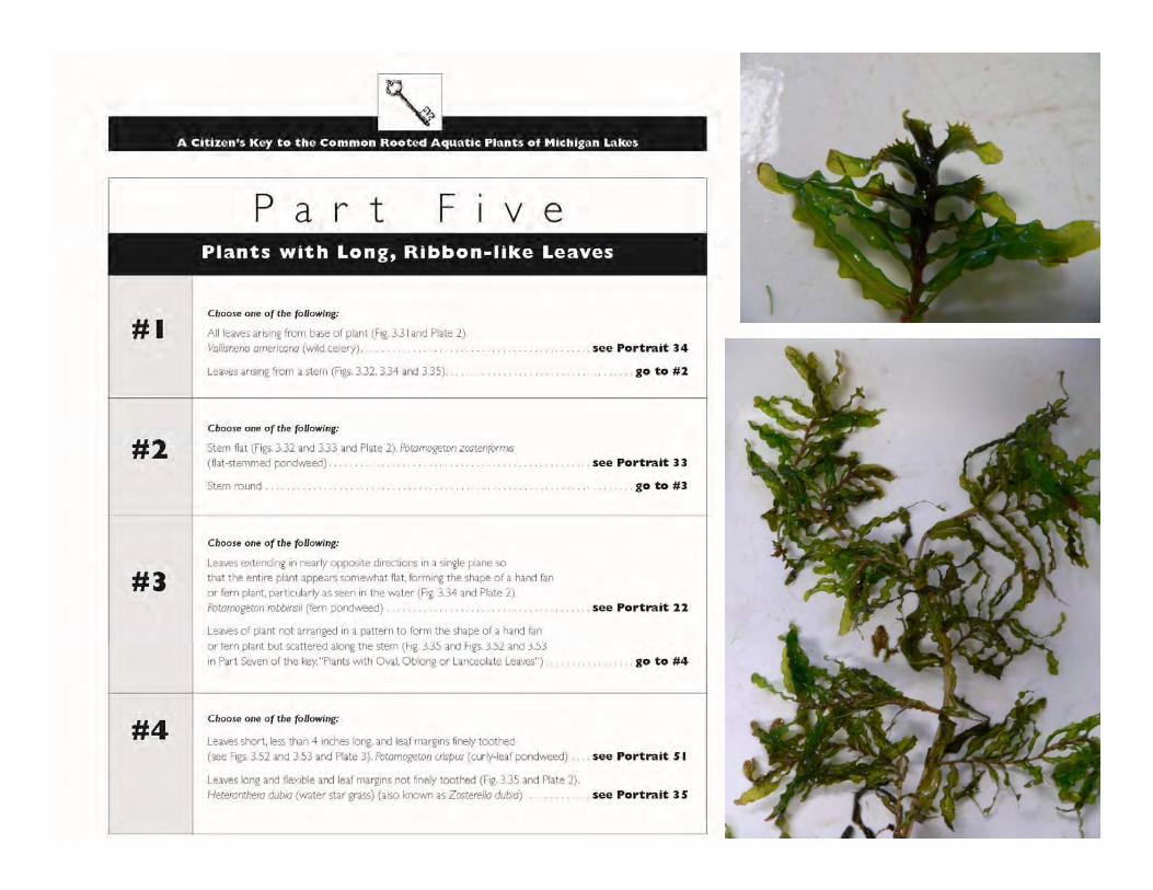
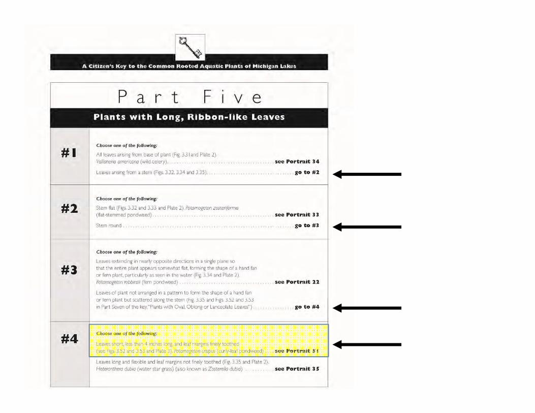
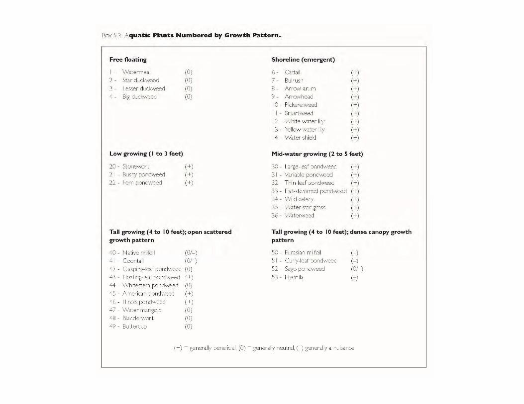
Pondweeds (Potamogeton spp.)
Curly-leaf pondweed
Fries’ pondweed
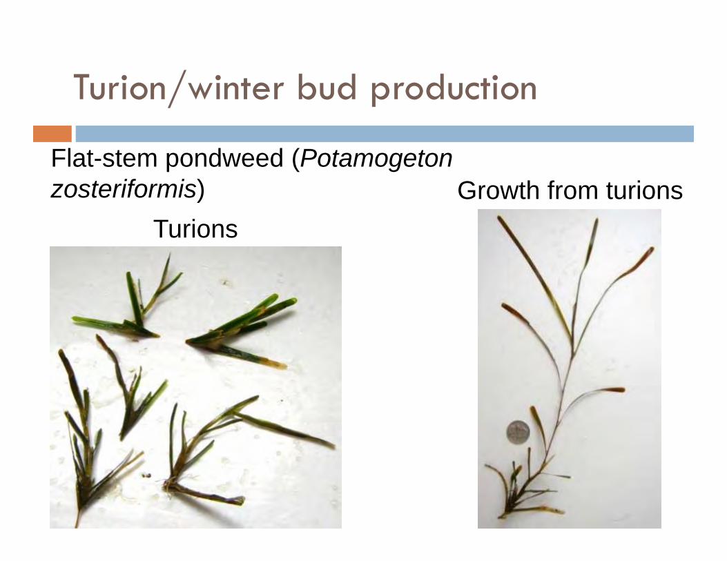
Turion/winter bud production
Flat-stem pondweed (Potamogeton zosteriformis)
TurionsGrowth from turions

Bulbil vs. TURION
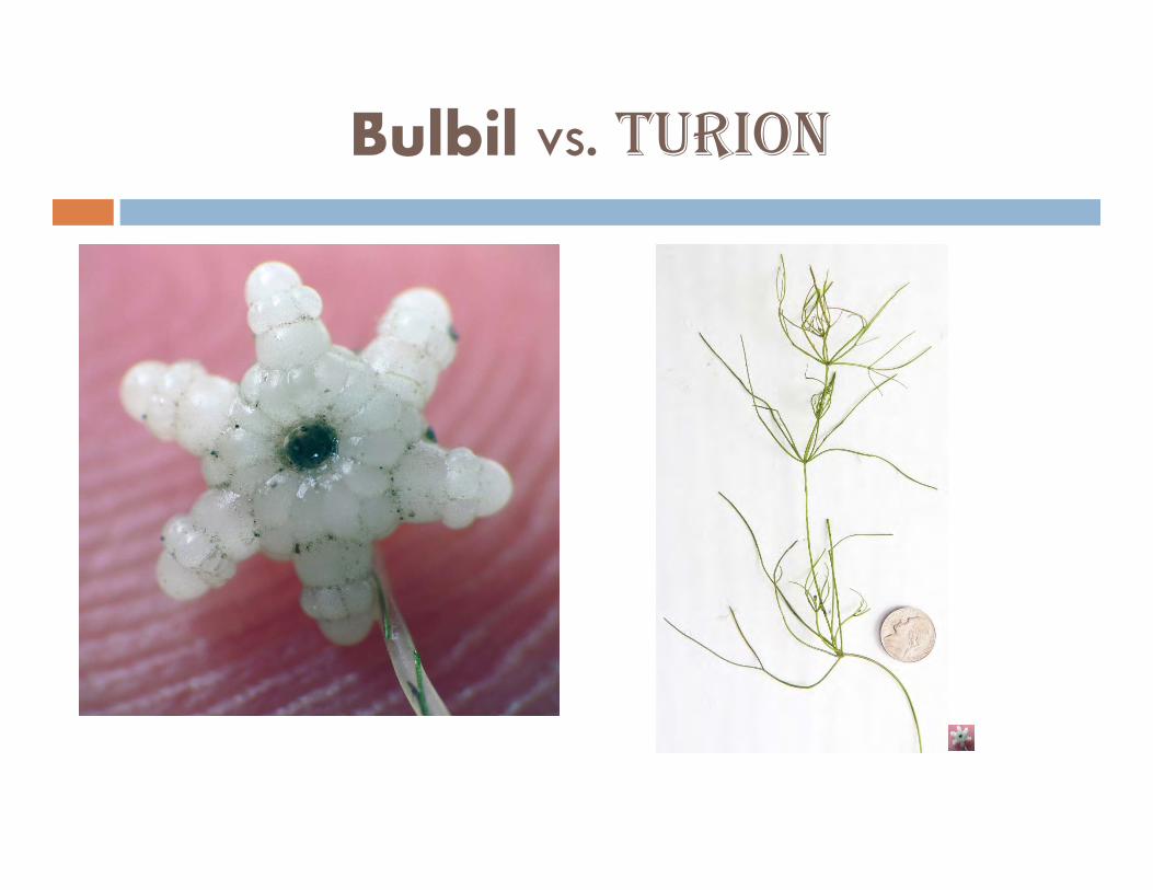
Bulbil vs. TURION
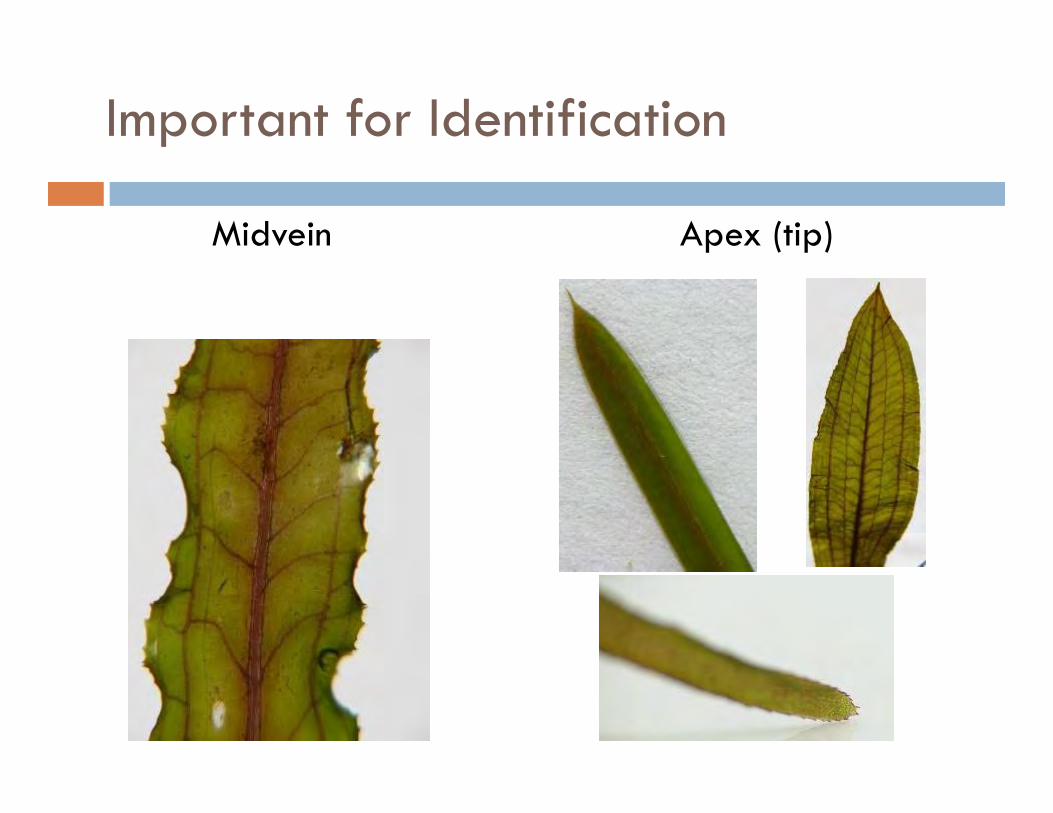
Important for Identification
Midvein Apex (tip)
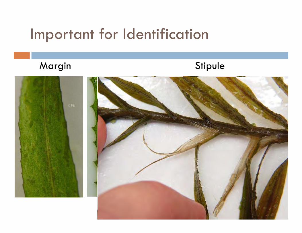
Important for Identification
Margin Stipule
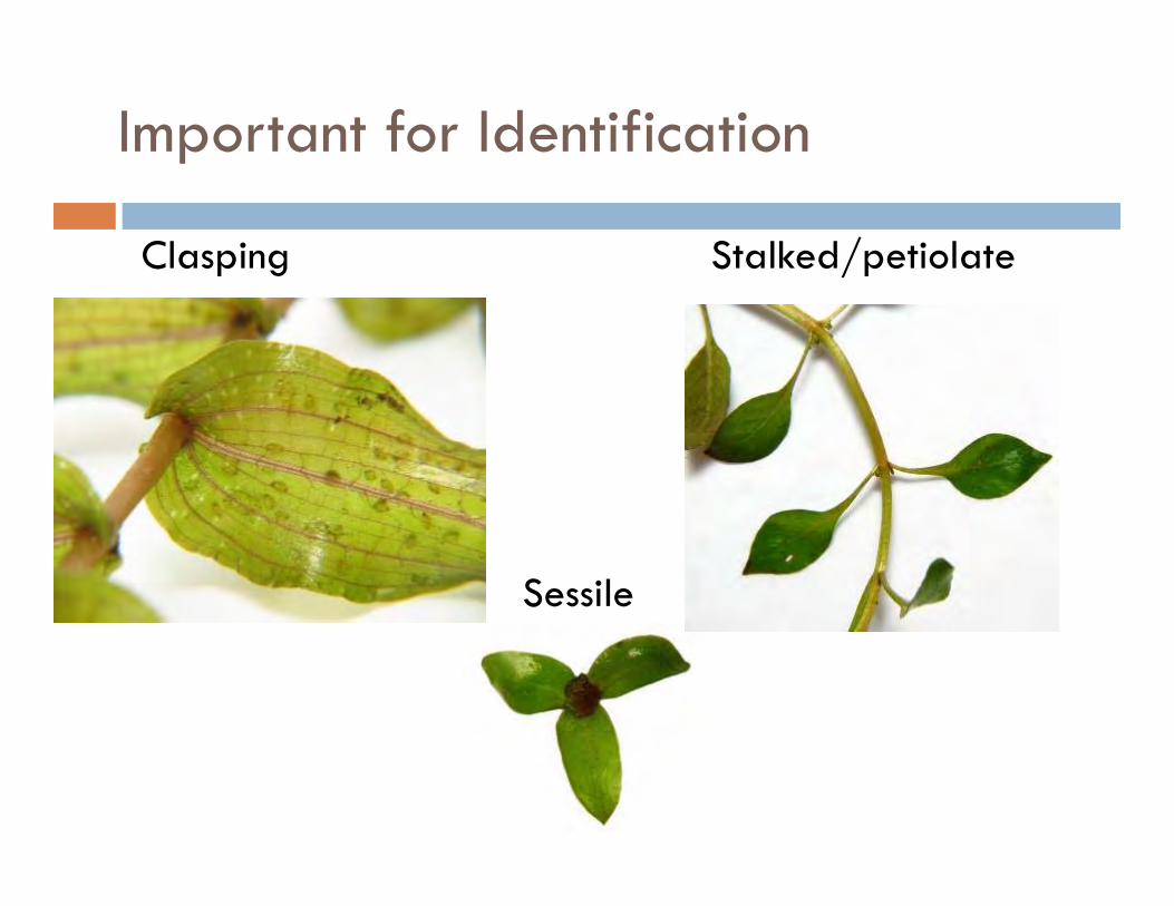
Important for Identification
Clasping Stalked/petiolate
Sessile
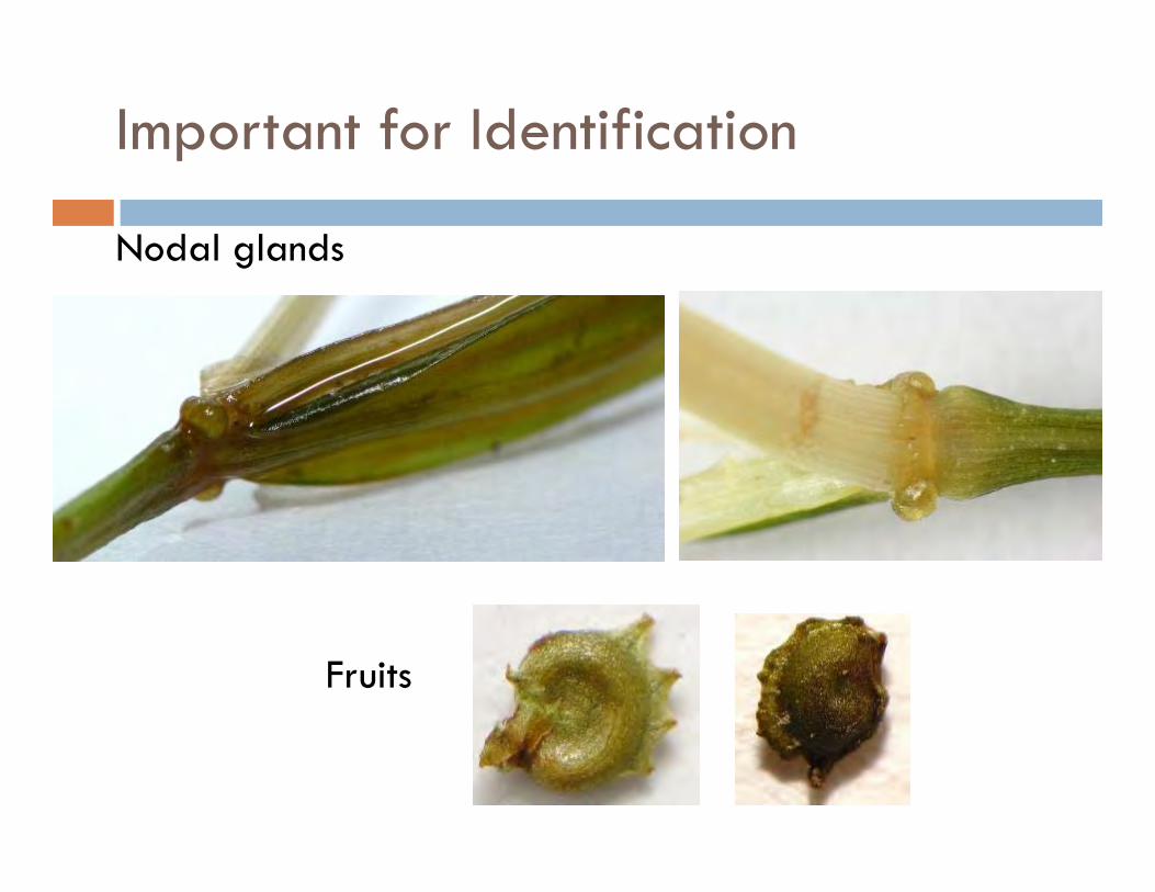
Important for Identification
Nodal glands
Fruits
Important for Identification
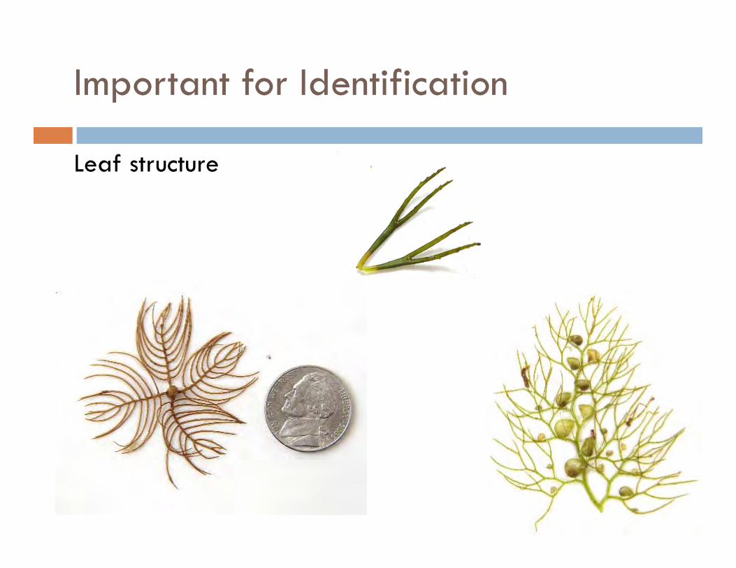
Leaf structure
Terminology Review
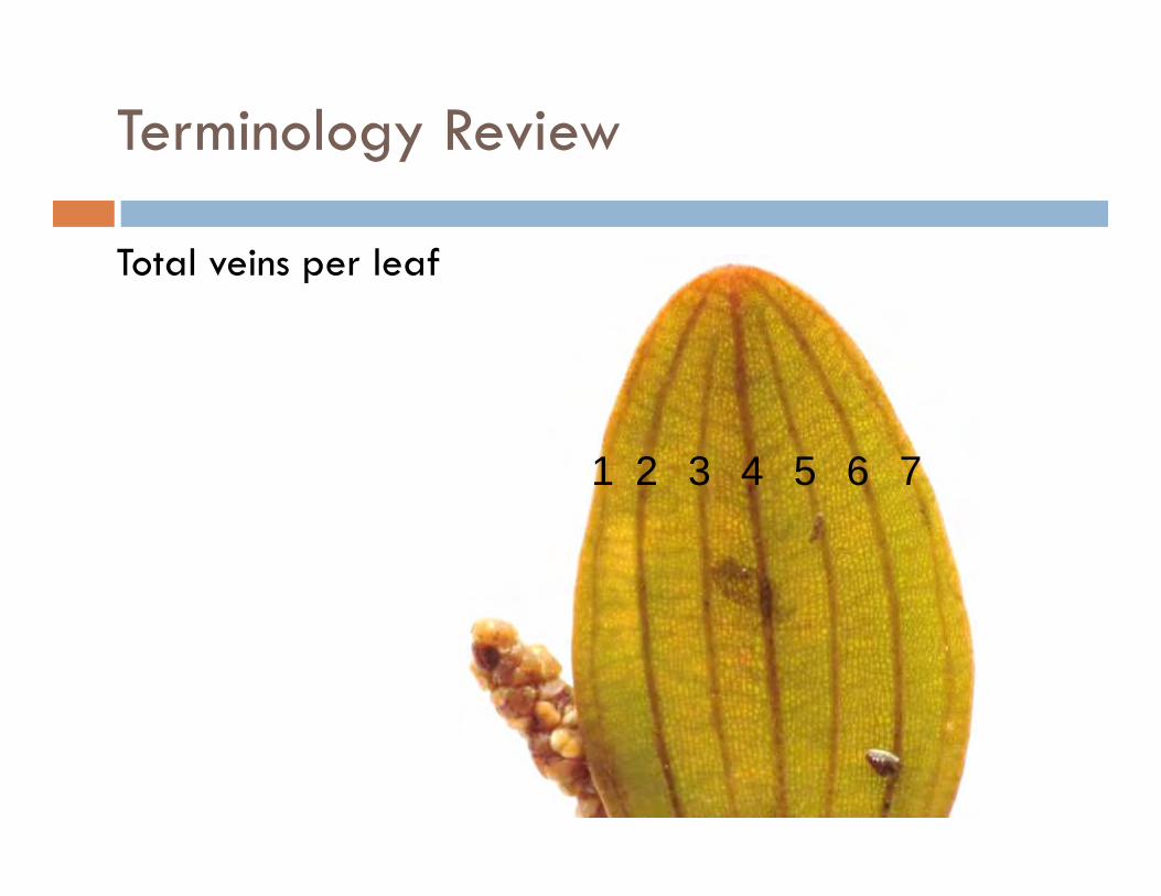
Total veins per leaf
1 2 3 4 5 6 7
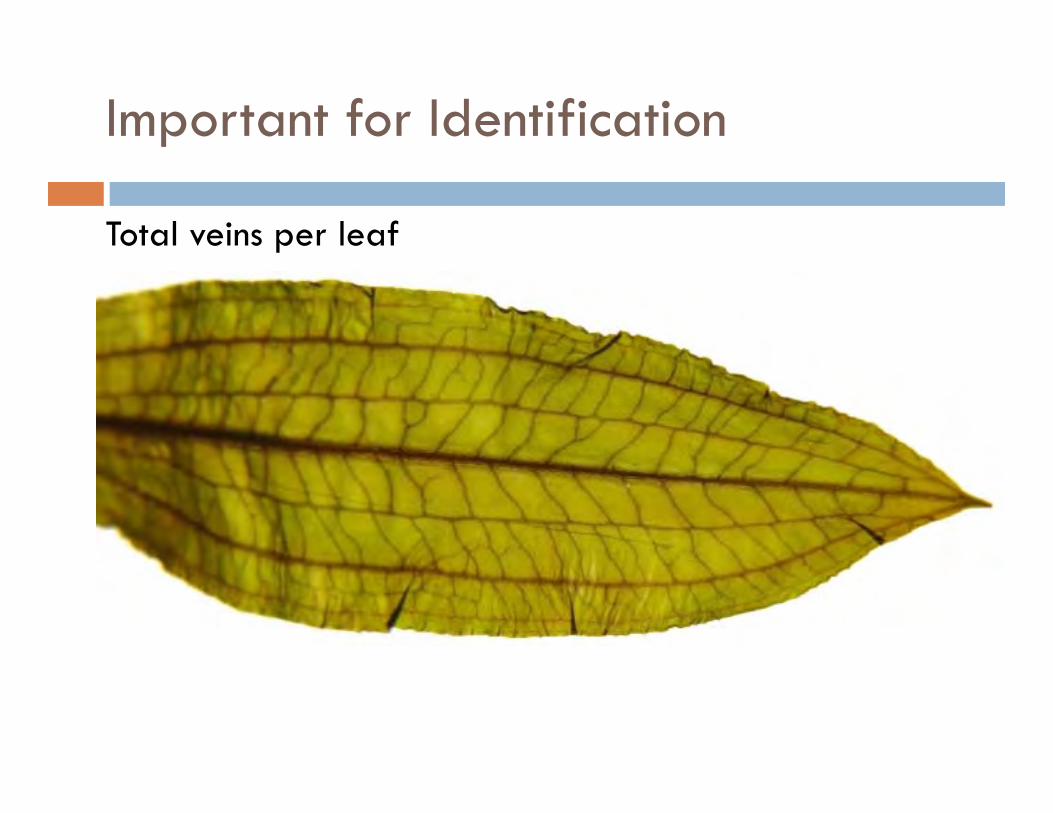
Important for Identification
Total veins per leaf

1 23 456
78
+8
+18+8+1 = 17 total veins

Available Resources

MSU Extension WQ-55

Additional copies available for $10 through the
MSU Extension Bookstore
http://shop.msu.edu
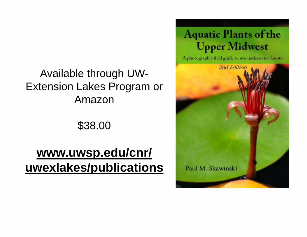
Available through UW-Extension Lakes Program or
Amazon
$38.00
www.uwsp.edu/cnr/uwexlakes/publications

Available through UW-Extension Lakes Program or
Amazon
$35.00
www.uwsp.edu/cnr/uwexlakes/publications
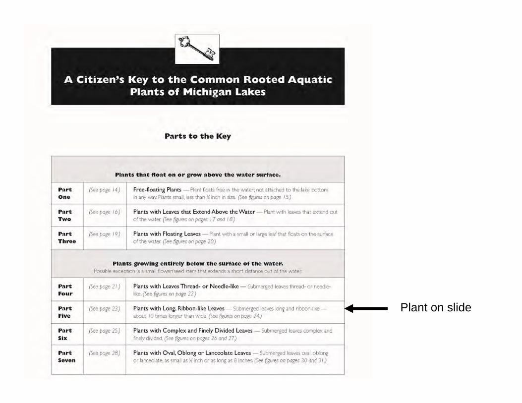
Plant on slide

Practice with Plants!
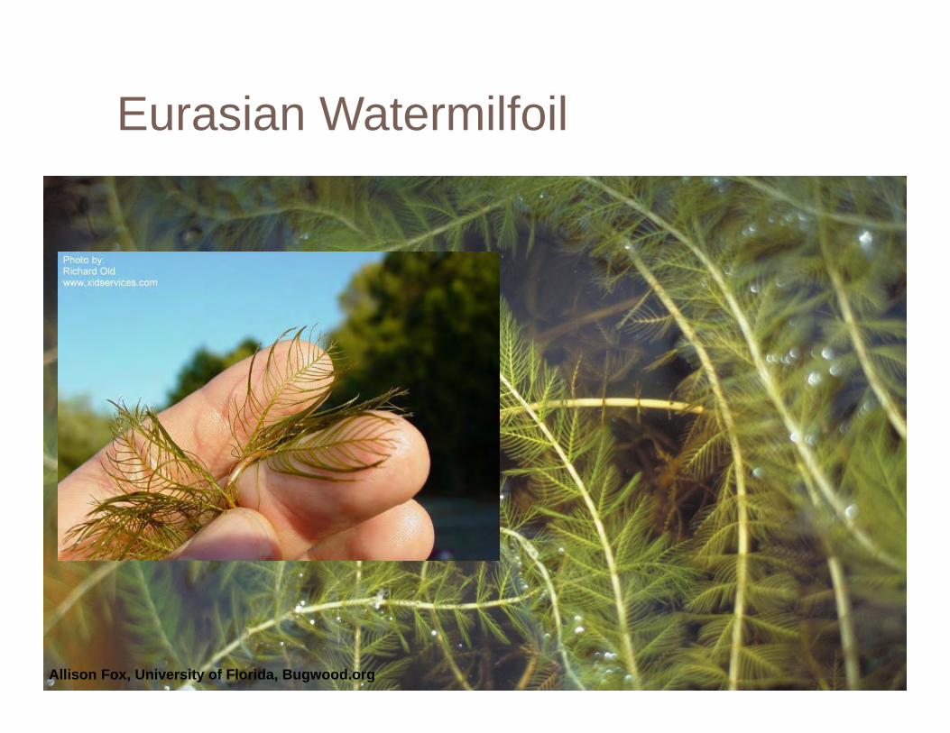
Eurasian Watermilfoil
Allison Fox, University of Florida, Bugwood.org
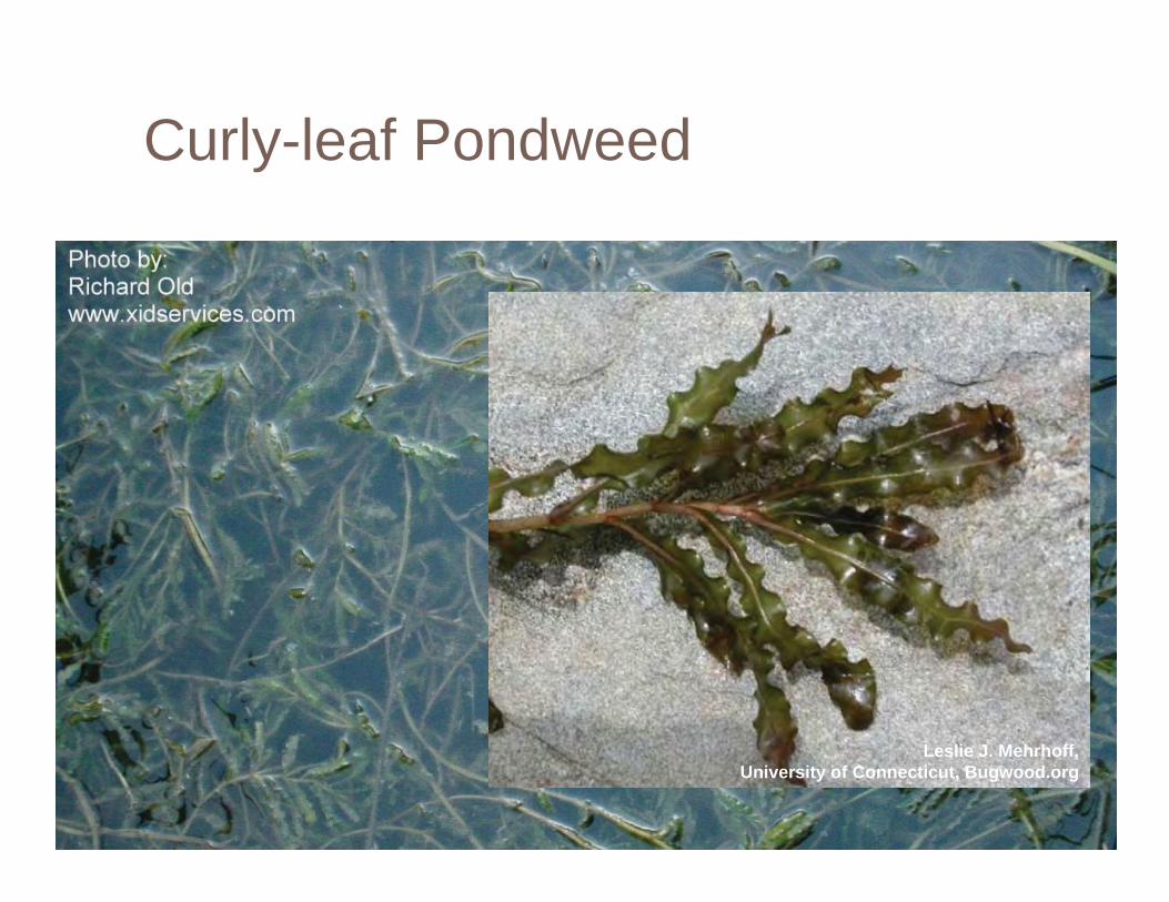
Curly-leaf Pondweed
Leslie J. Mehrhoff, University of Connecticut, Bugwood.org
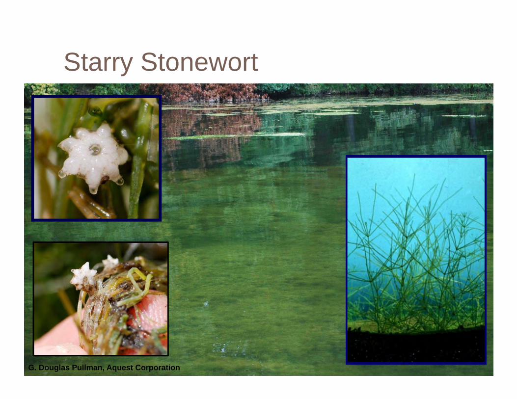
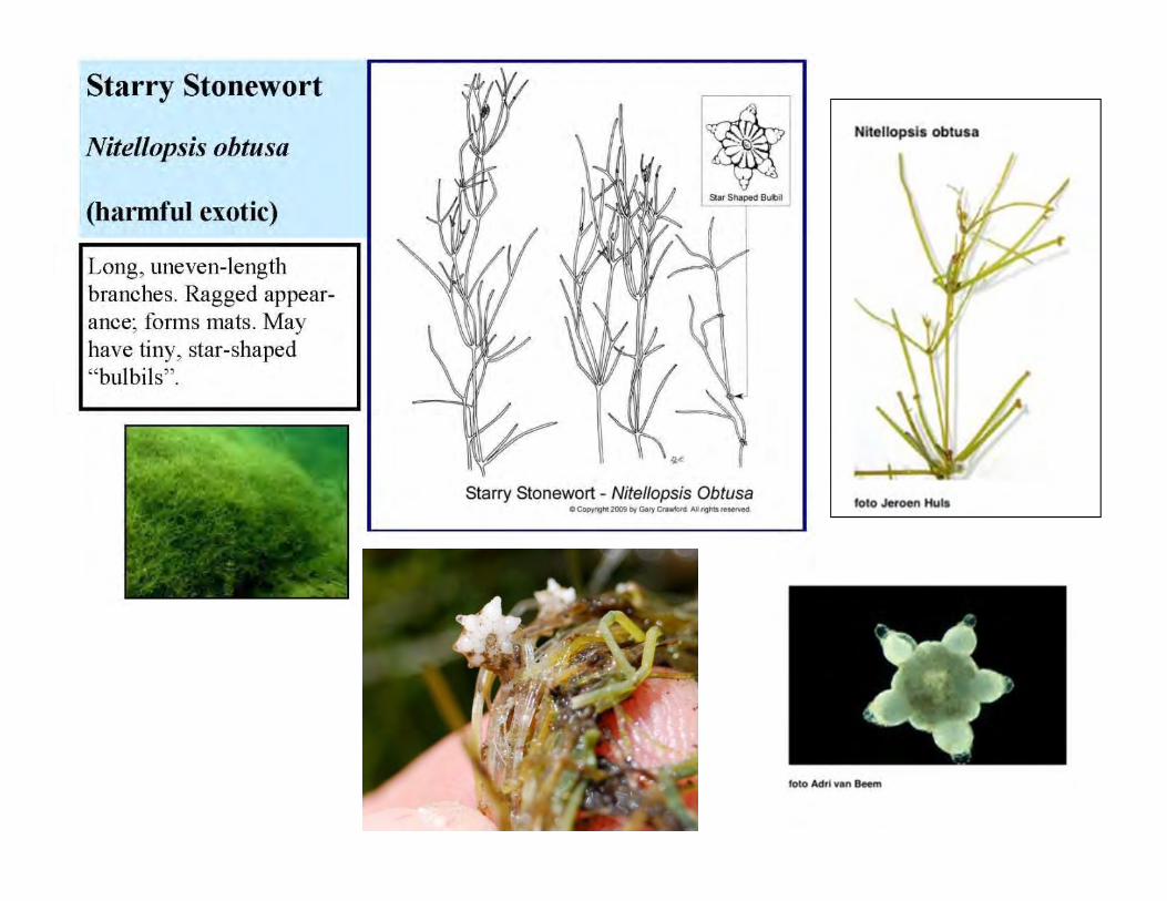
Starry Stonewort
G. Douglas Pullman, Aquest Corporation
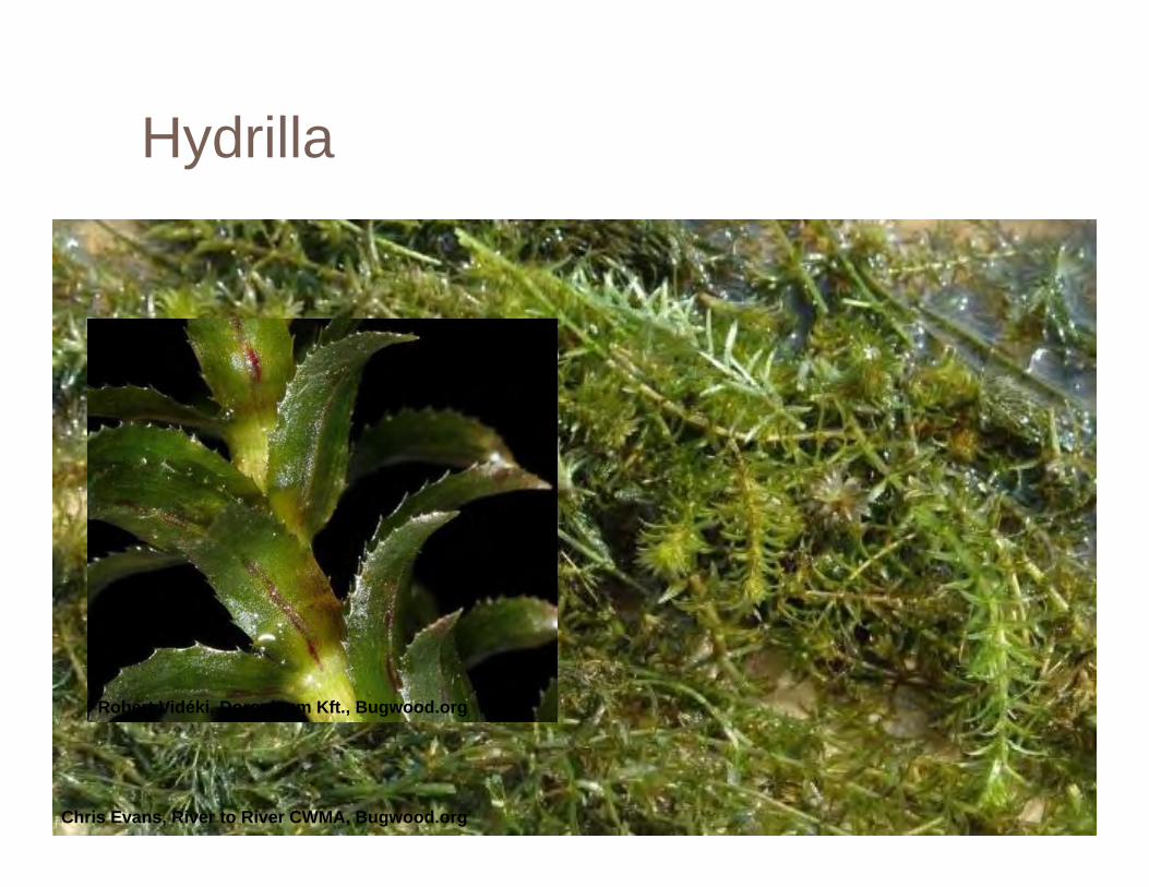
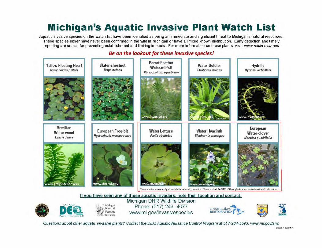
Hydrilla
Chris Evans, River to River CWMA, Bugwood.org
Robert Vidéki, Doronicum Kft., Bugwood.org

Making a Plant Collection
Helps with identification when mapping the lake
Educational tool for your community or lake association
Can be a reference for future work

COOPERATIVE LAKES MONITORING PROGRAMTRAINING FOR
Aquatic Plant Identification and Mapping
MAPPING AQUATIC PLANTS IN THE LAKE
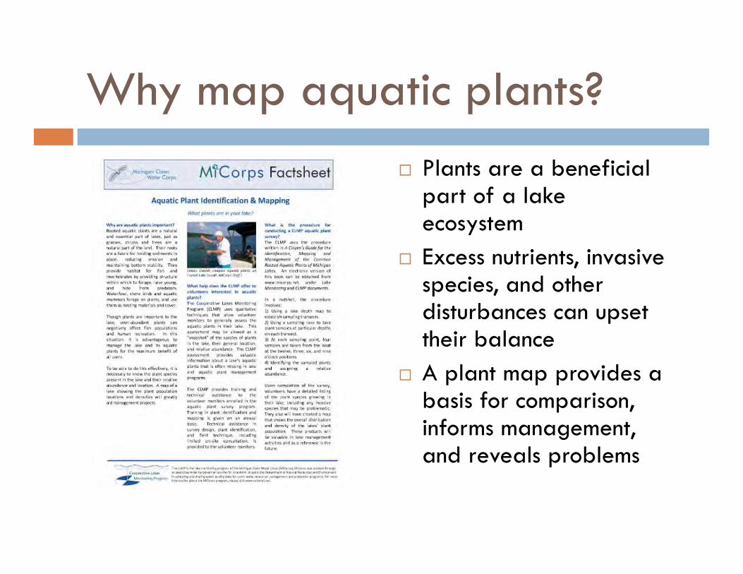
Why map aquatic plants? Plants are a beneficial
part of a lake ecosystem
Excess nutrients, invasive species, and other disturbances can upset their balance
A plant map provides a basis for comparison, informs management, and reveals problems
Benefits of enrolling in the CLMP Aquatic Plant Identification and Mapping program
Standard procedure Hands-on training One day of field assistance from MiCorps staff Ongoing assistance with plant ID, field procedures,
and data reporting Data are shared with DEQ Baseline information for future lake management 2016 enrollment cost – only $250
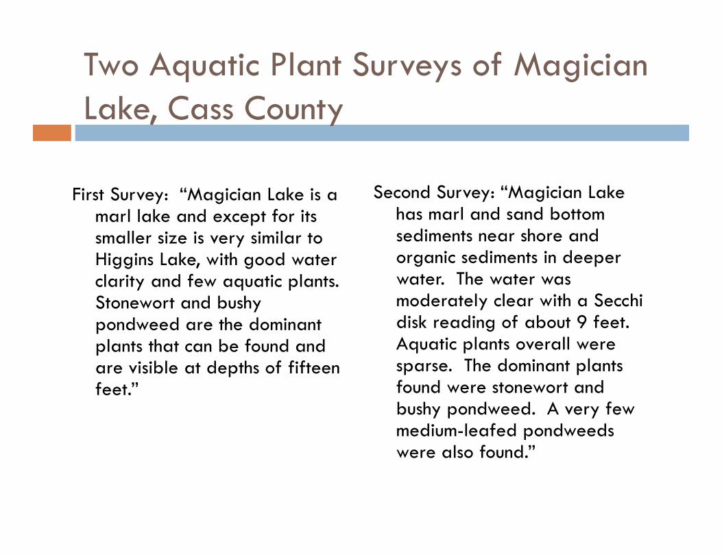
Two Aquatic Plant Surveys of Magician Lake, Cass County
First Survey: “Magician Lake is a marl lake and except for its smaller size is very similar to Higgins Lake, with good water clarity and few aquatic plants. Stonewort and bushy pondweed are the dominant plants that can be found and are visible at depths of fifteen feet.”
Second Survey: “Magician Lake has marl and sand bottom sediments near shore and organic sediments in deeper water. The water was moderately clear with a Secchidisk reading of about 9 feet. Aquatic plants overall were sparse. The dominant plants found were stonewort and bushy pondweed. A very few medium-leafed pondweeds were also found.”
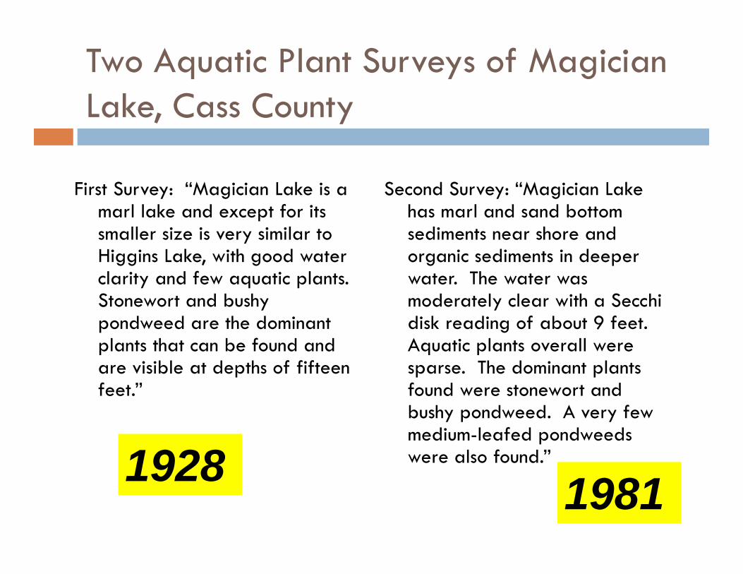
Two Aquatic Plant Surveys of Magician Lake, Cass County
First Survey: “Magician Lake is a marl lake and except for its smaller size is very similar to Higgins Lake, with good water clarity and few aquatic plants. Stonewort and bushy pondweed are the dominant plants that can be found and are visible at depths of fifteen feet.”
Second Survey: “Magician Lake has marl and sand bottom sediments near shore and organic sediments in deeper water. The water was moderately clear with a Secchidisk reading of about 9 feet. Aquatic plants overall were sparse. The dominant plants found were stonewort and bushy pondweed. A very few medium-leafed pondweeds were also found.”1928 1981
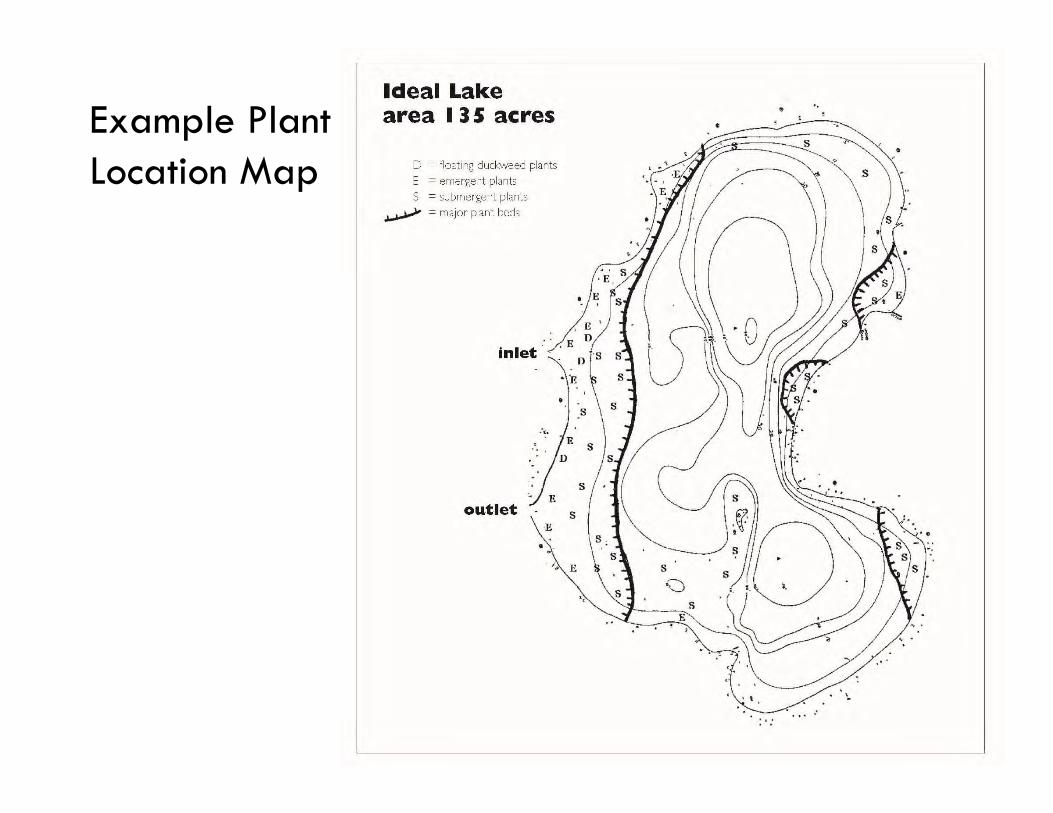
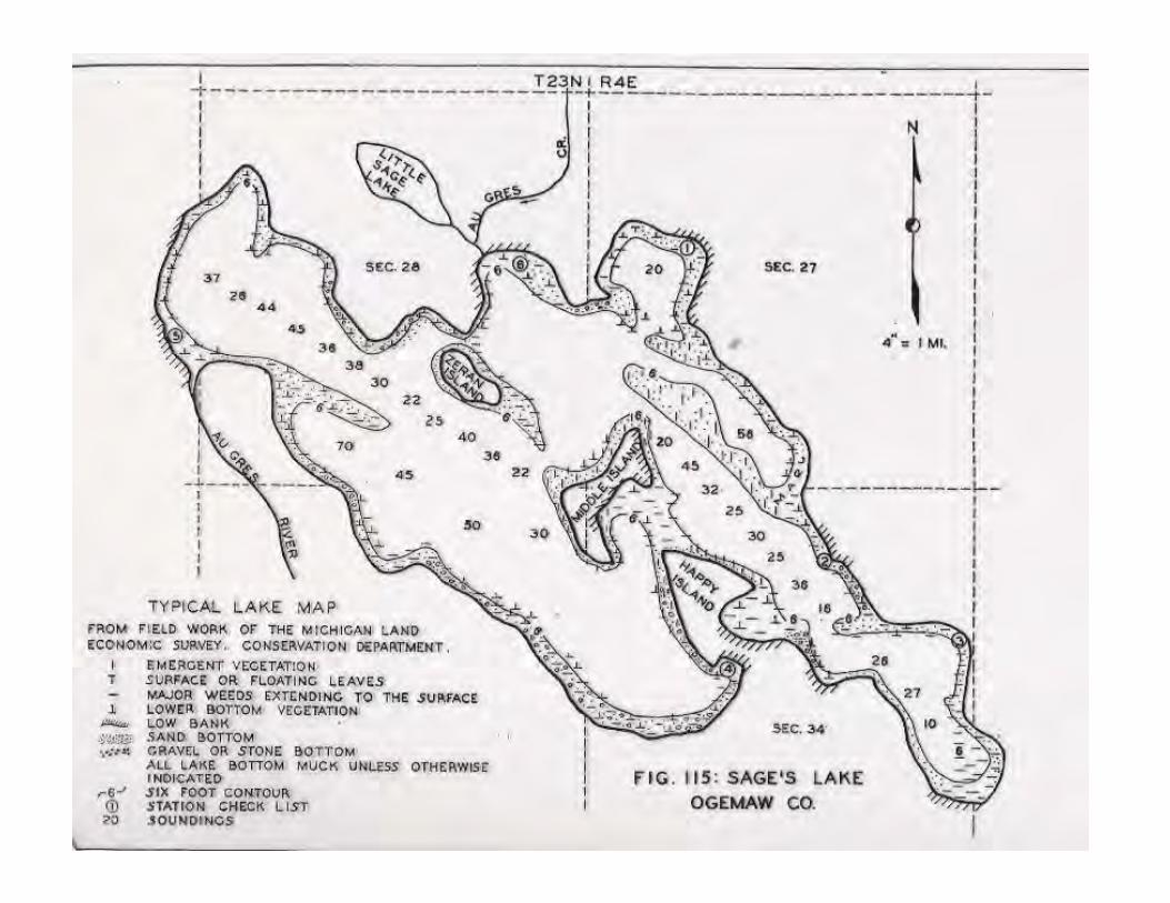
Example Plant Location Map
When to sample?
July - August Northern lakes can begin later
Can spread effort out over the course of several days/weeks
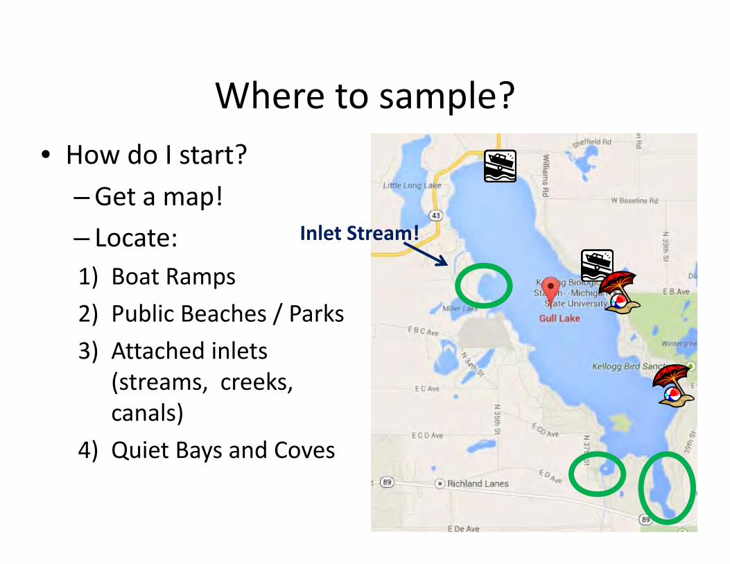
Where to sample? • How do I start?
–Get a map! – Locate: 1) Boat Ramps 2) Public Beaches / Parks 3) Attached inlets
(streams, creeks, canals)
4) Quiet Bays and Coves
Inlet Stream!
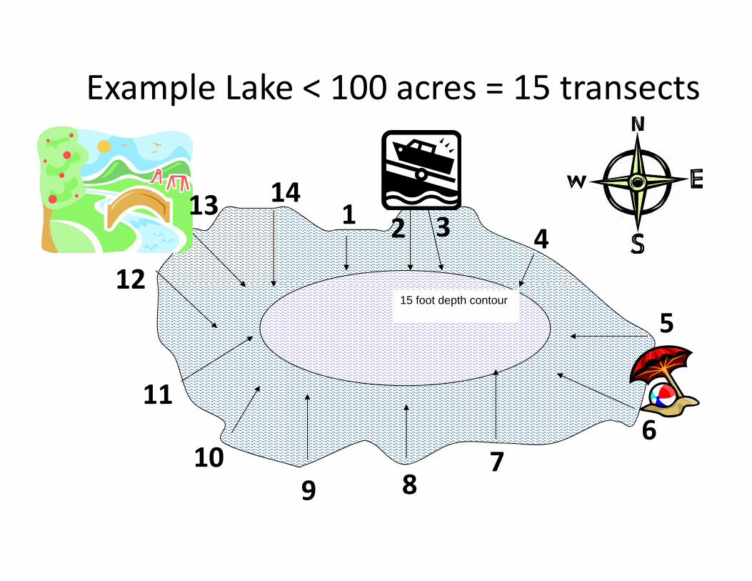
Example Lake < 100 acres = 15 transects
15 foot depth contour12
2
11
5
1
10
43
9 87
6
13 14
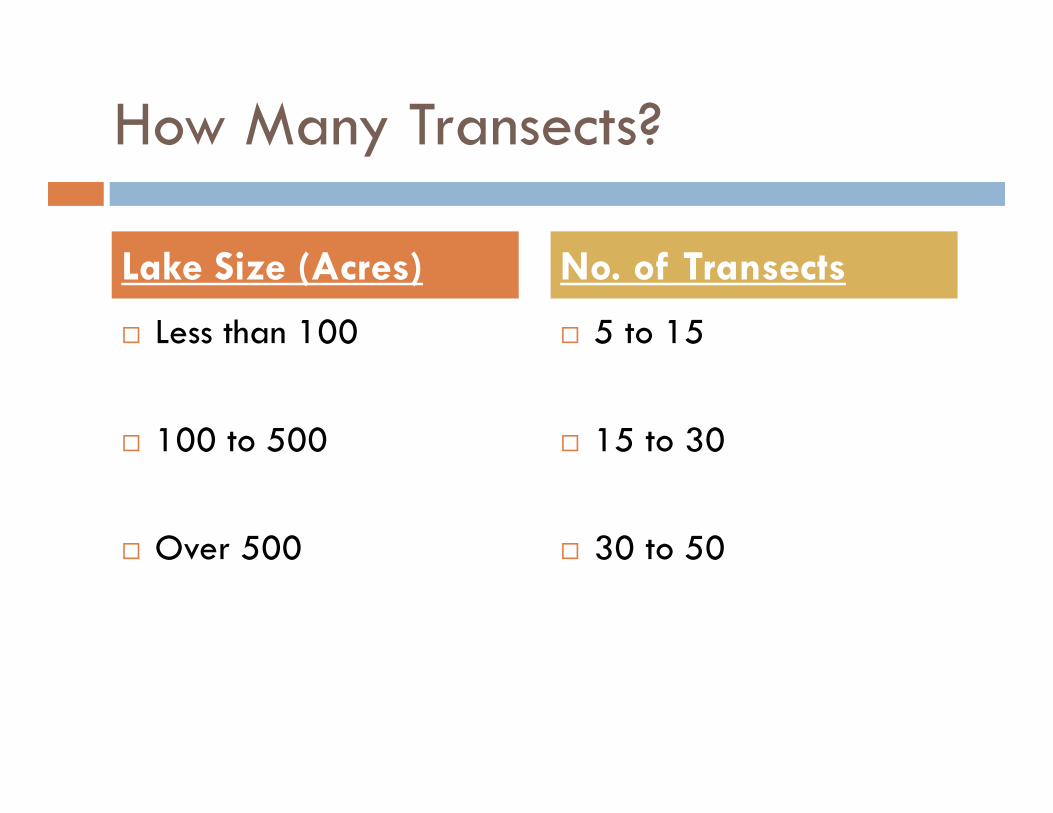
How Many Transects?
Less than 100
100 to 500
Over 500
5 to 15
15 to 30
30 to 50
Lake Size (Acres) No. of Transects
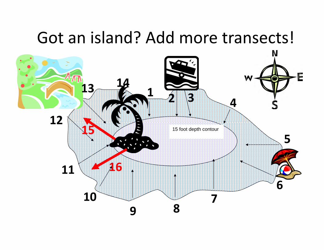
Got an island? Add more transects!
15 foot depth contour12
2
11
5
1
10
43
9 87
6
13 14
15
16
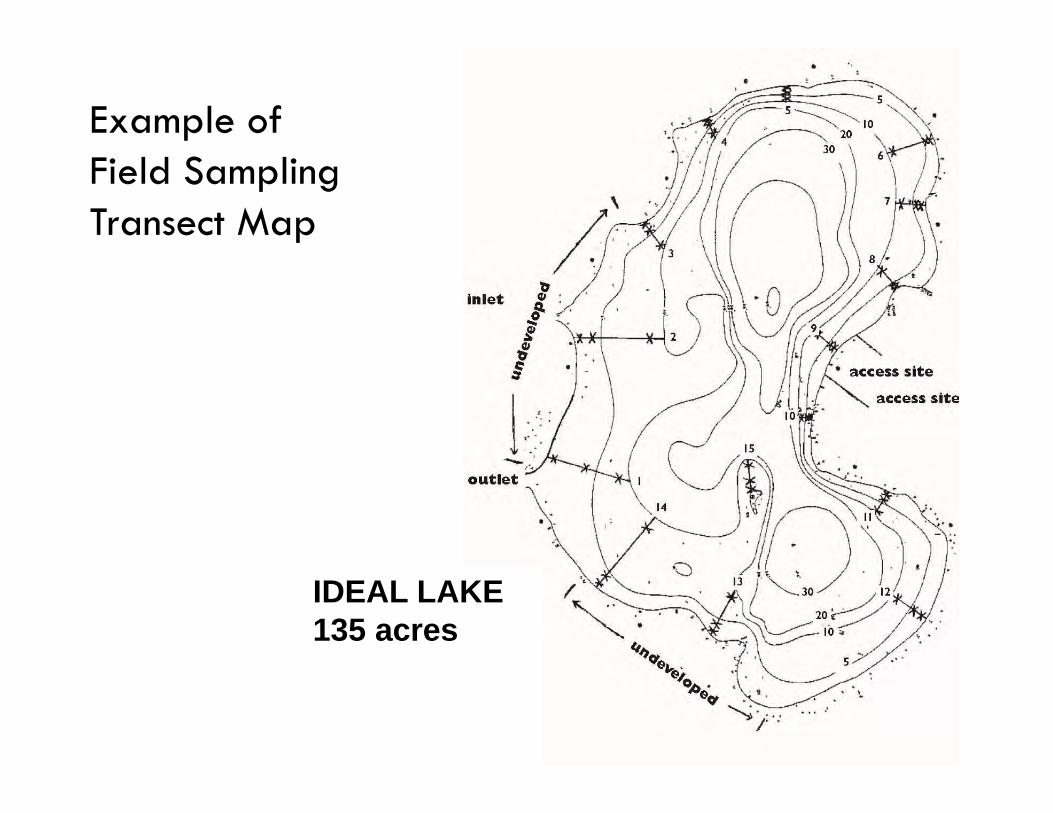
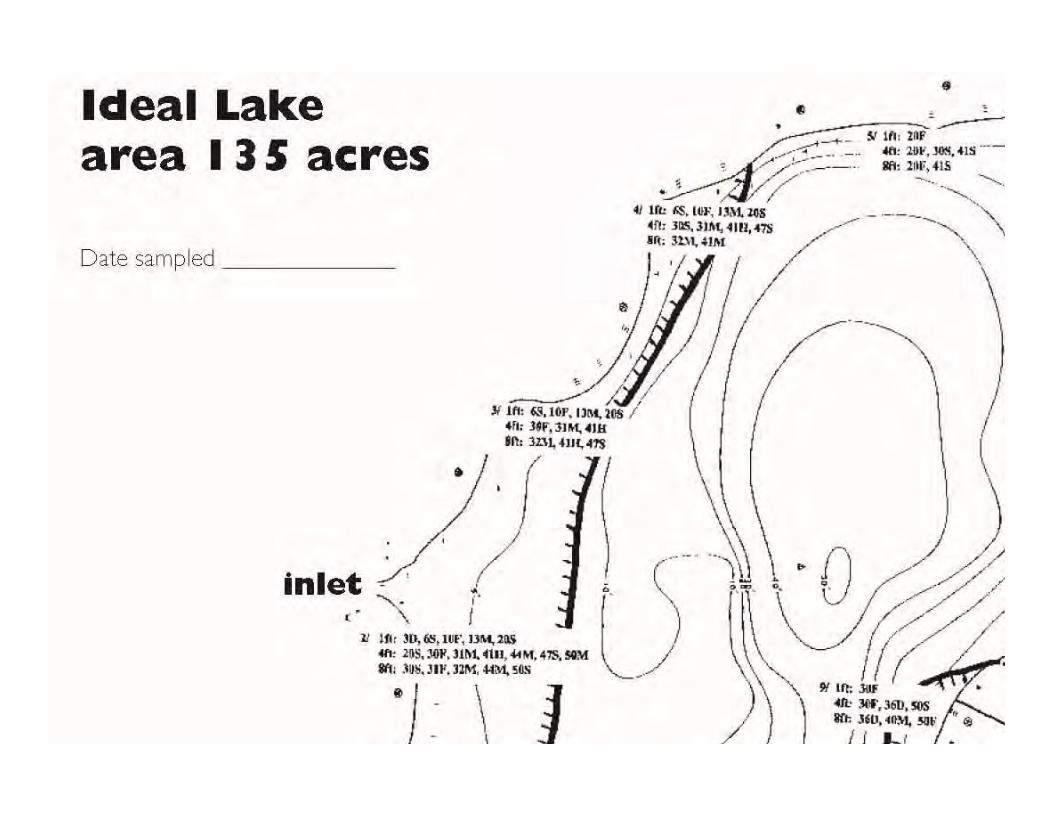
Example of Field Sampling Transect Map
IDEAL LAKE135 acres
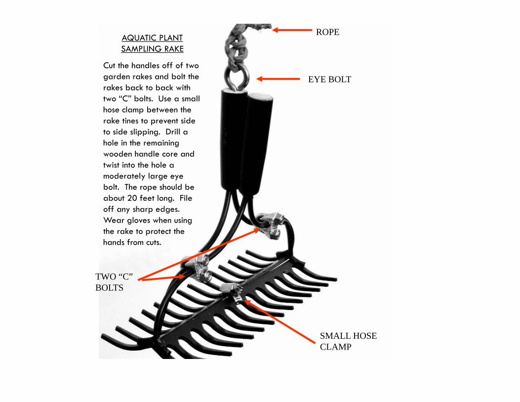
AQUATIC PLANT SAMPLING RAKE
Cut the handles off of two garden rakes and bolt the rakes back to back with two “C” bolts. Use a small hose clamp between the rake tines to prevent side to side slipping. Drill a hole in the remaining wooden handle core and twist into the hole a moderately large eye bolt. The rope should be about 20 feet long. File off any sharp edges. Wear gloves when using the rake to protect the hands from cuts.
ROPE
EYE BOLT
TWO “C” BOLTS
SMALL HOSE CLAMP
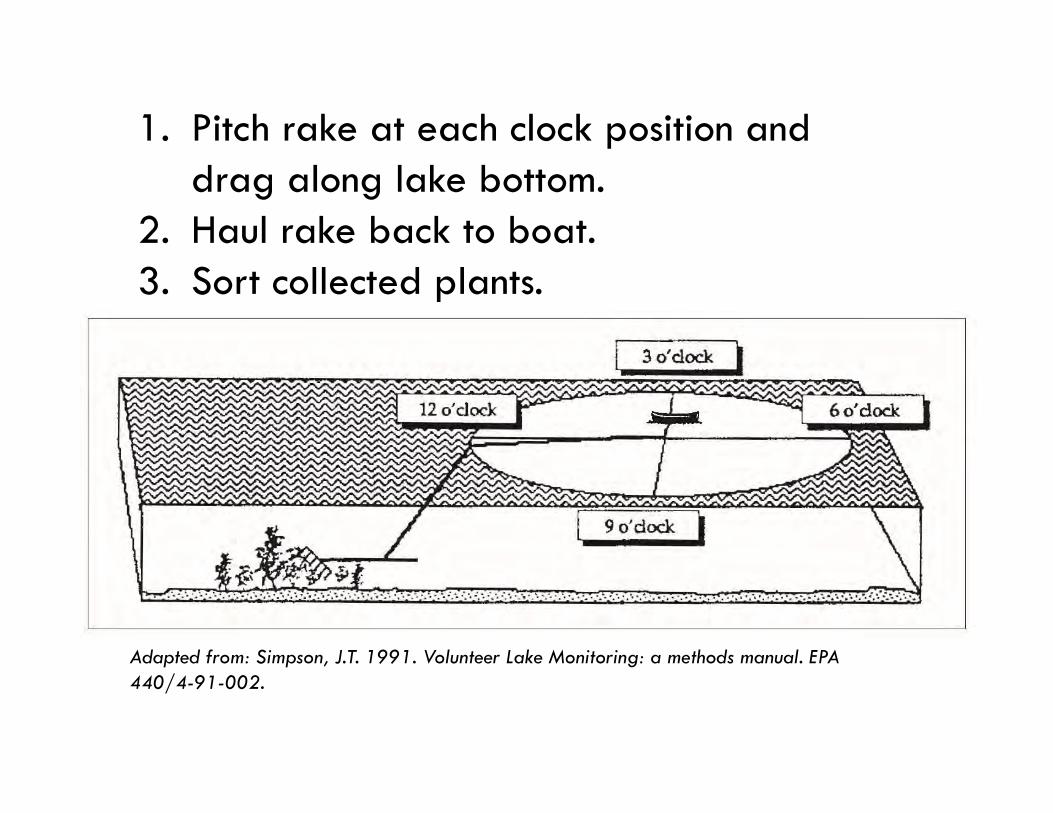
1. Pitch rake at each clock position and drag along lake bottom.
2. Haul rake back to boat.3. Sort collected plants.
Adapted from: Simpson, J.T. 1991. Volunteer Lake Monitoring: a methods manual. EPA 440/4-91-002.
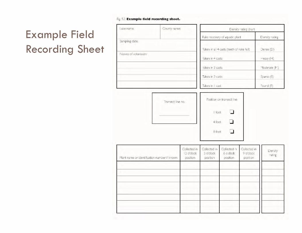
Example Field Recording Sheet
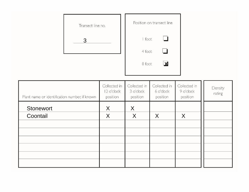
Stonewort XX
XX X XCoontail
3
x
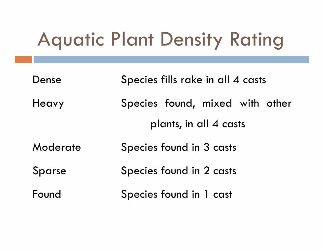
Aquatic Plant Density Rating
Dense Species fills rake in all 4 casts
Heavy Species found, mixed with other
plants, in all 4 casts
Moderate Species found in 3 casts
Sparse Species found in 2 casts
Found Species found in 1 cast
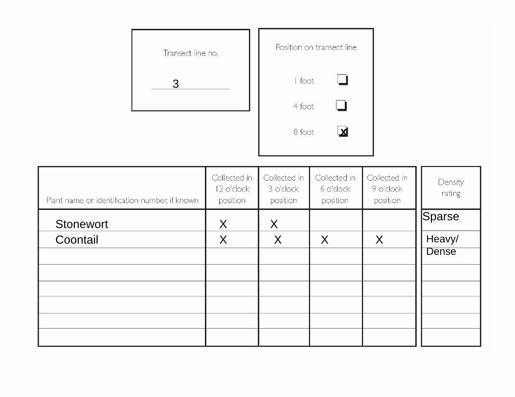
Stonewort XX
XX X XCoontail
3
x
Sparse
Heavy/ Dense
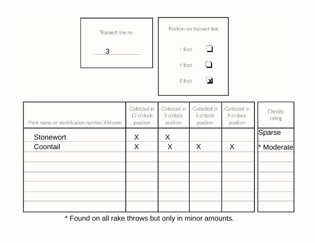
Stonewort XX
XX X XCoontail
3
x
Sparse
* Moderate
* Found on all rake throws but only in minor amounts.
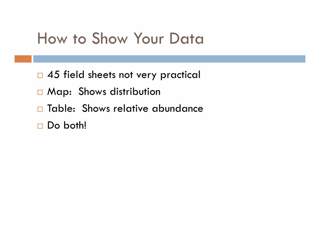
How to Show Your Data
45 field sheets not very practical Map: Shows distribution Table: Shows relative abundance Do both!
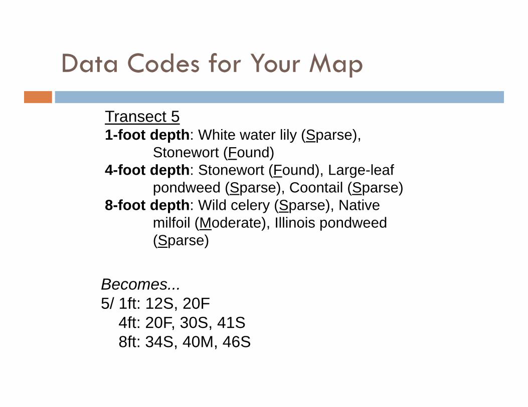
Becomes...5/ 1ft: 12S, 20F
4ft: 20F, 30S, 41S8ft: 34S, 40M, 46S
Transect 51-foot depth: White water lily (Sparse),
Stonewort (Found)4-foot depth: Stonewort (Found), Large-leaf
pondweed (Sparse), Coontail (Sparse)8-foot depth: Wild celery (Sparse), Native
milfoil (Moderate), Illinois pondweed (Sparse)
Data Codes for Your Map
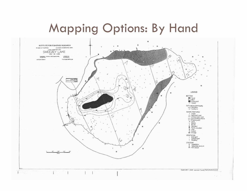
Mapping Options: By Hand
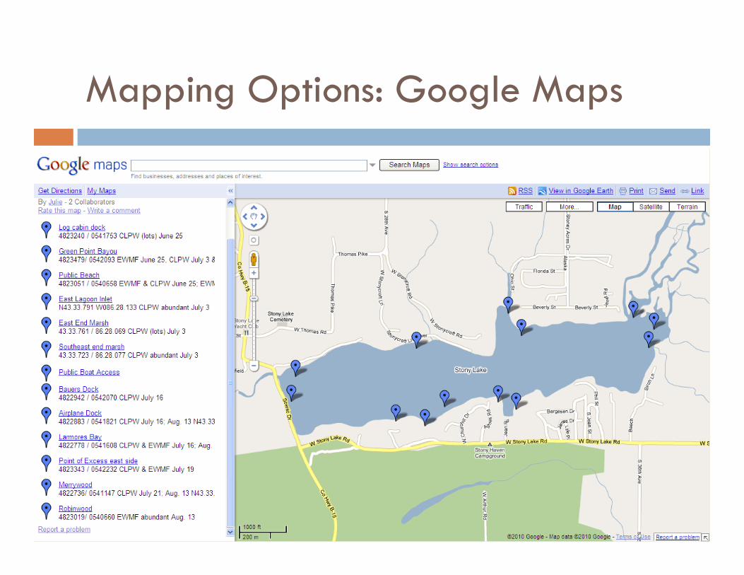
Mapping Options: Google Maps
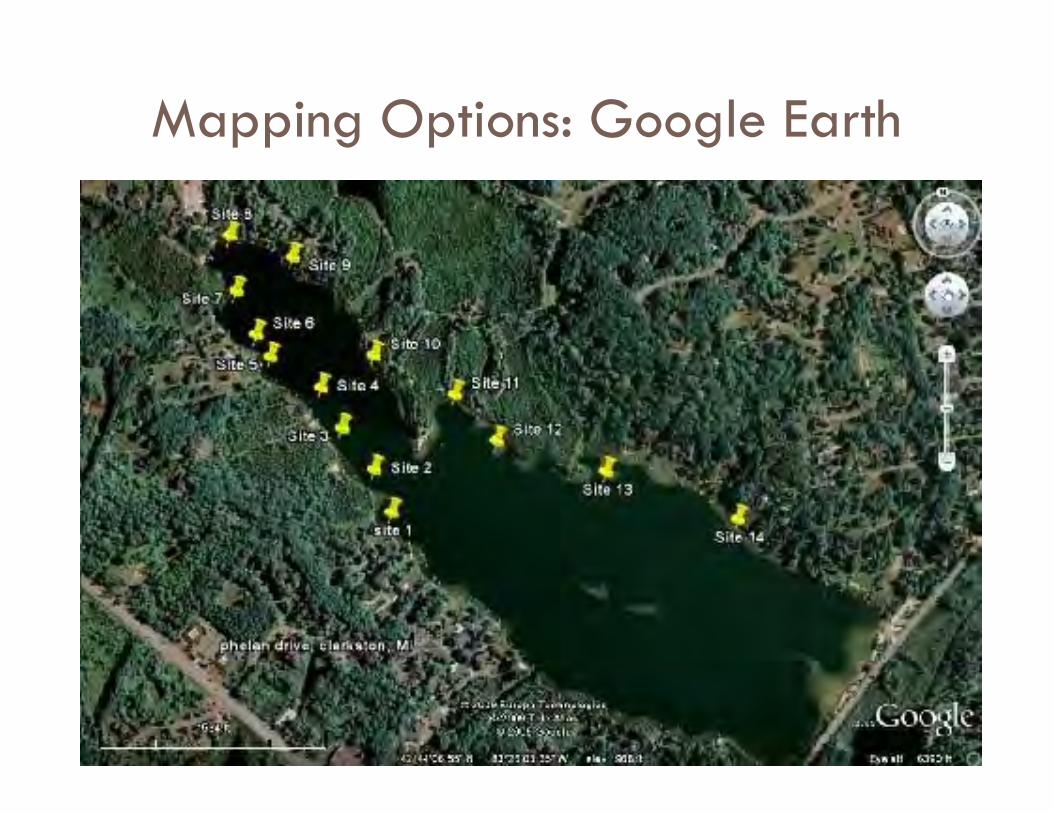
Mapping Options: Google Earth
Mobile Mapping Applications
Interested in using a tablet or smart phone to map your survey efforts?
We’ve developed some clever methods – stick around for a few minutes after training to learn more!
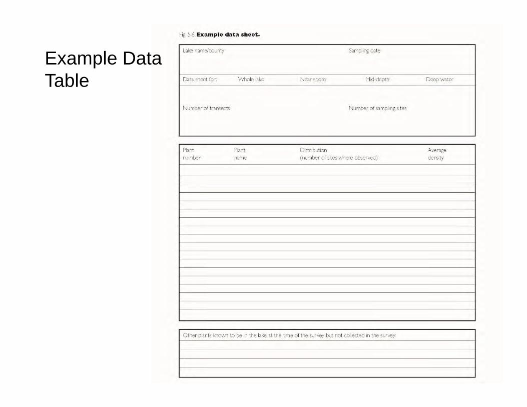
Example Data Table
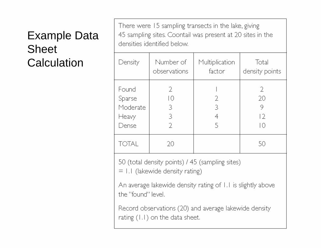
Example Data Sheet Calculation
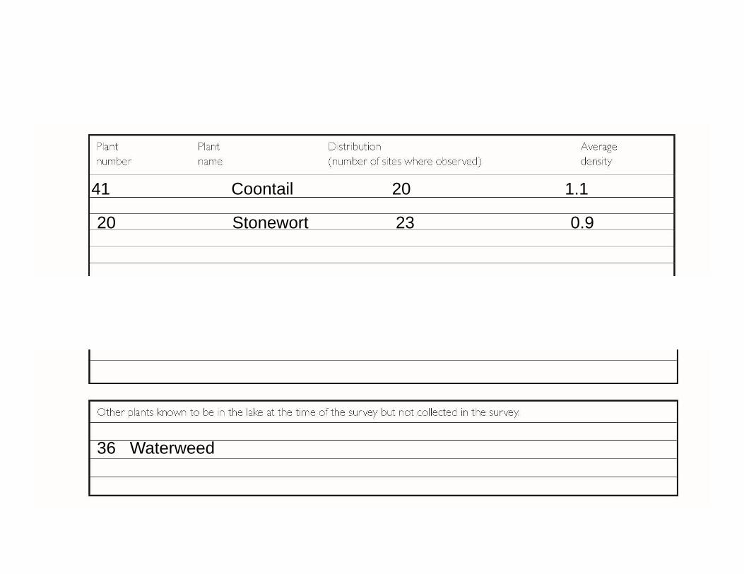
41 Coontail 20 1.1
20 Stonewort 23 0.9
36 Waterweed
Field plant ID photography
Rules for useful Plant ID photos TAKE lots of pictures even if you think there are TOO many!
Delete blurry photos pretty much useless
Photos MUST show key characteristics For example, milfoil leaflets
Size & Scale is essential Location is essential
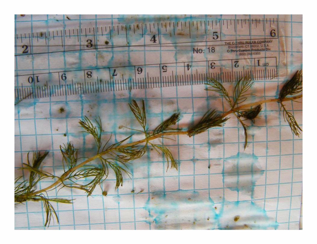
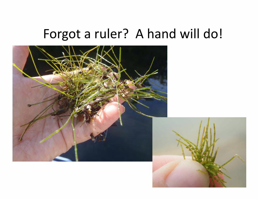
Forgot a ruler? A hand will do!
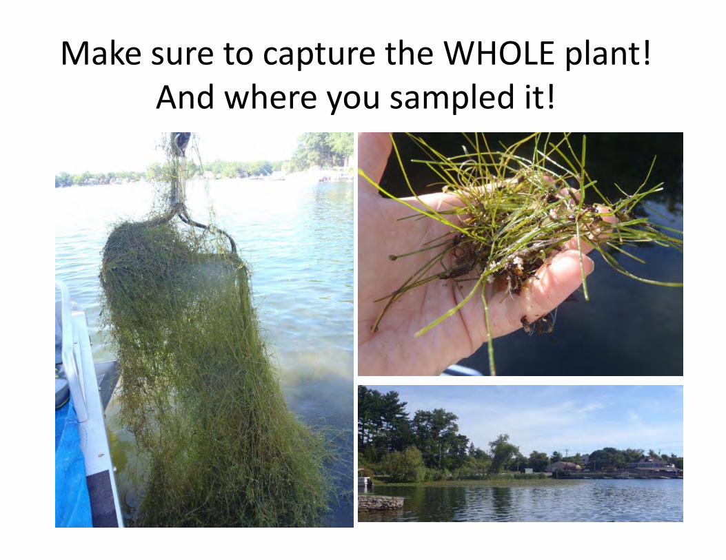
Make sure to capture the WHOLE plant!And where you sampled it!

Submitting Your Data
1. Make copies of your data for your records.2. Enter your data into the online MiCorps Data
Exchange (www.micorps.net) by October 30.3. Send complete report to Jo Latimore at MSU
a. Completed report and mapb. Any photographs
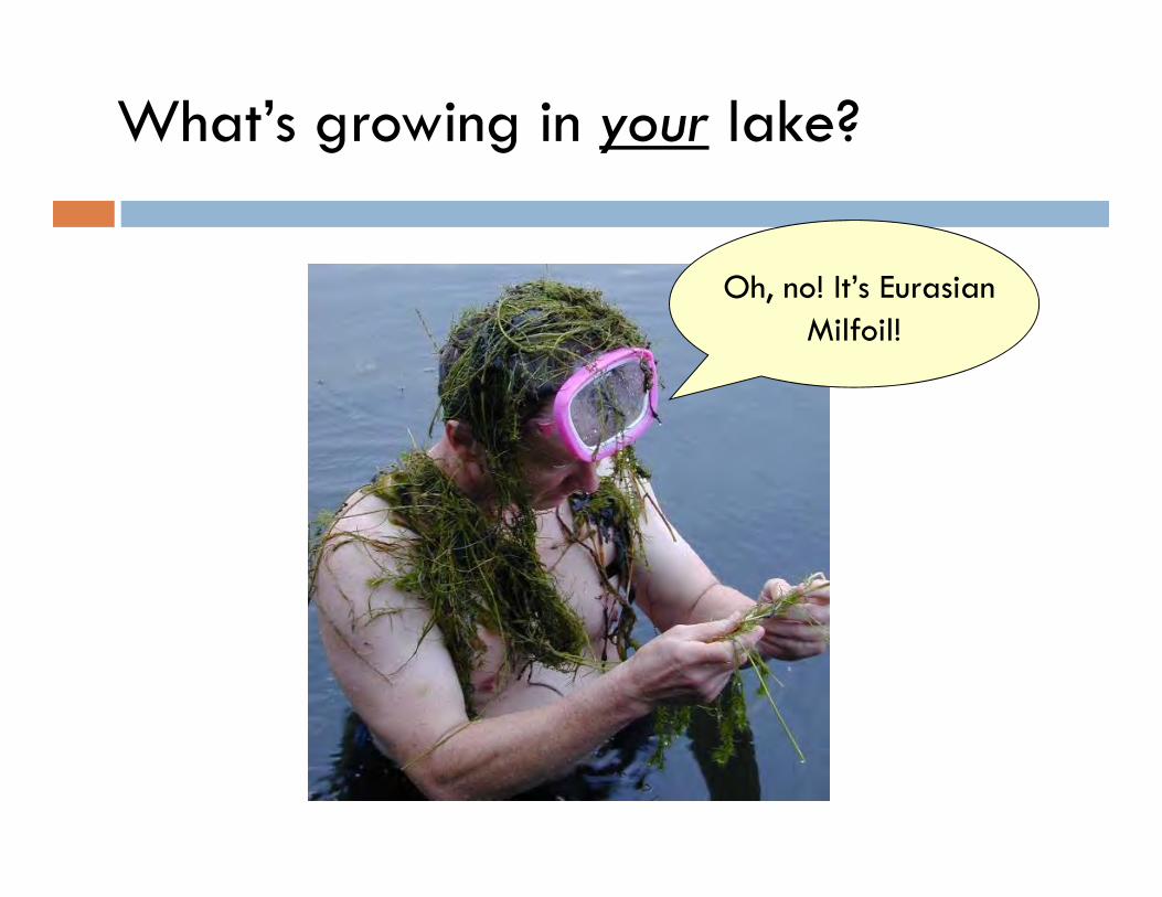
Oh, no! It’s EurasianMilfoil!
What’s growing in your lake?