Embed Size (px)
Citation preview
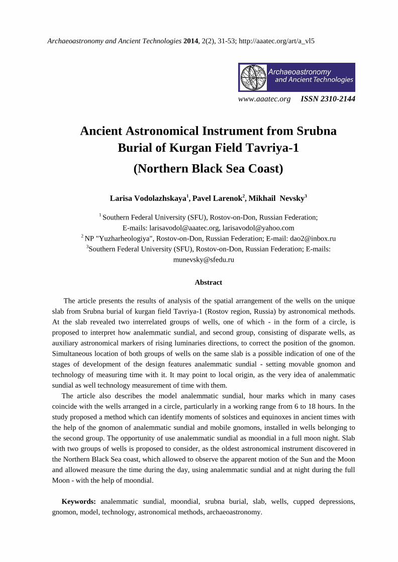
Archaeoastronomy and Ancient Technologies 2014, 2(2), 31-53; http://aaatec.org/art/a_vl5
www.aaatec.org ISSN 2310-2144
Ancient Astronomical Instrument from Srubna
Burial of Kurgan Field Tavriya-1
(Northern Black Sea Coast)
Larisa Vodolazhskaya1, Pavel Larenok2
, Mikhail Nevsky3
1 Southern Federal University (SFU), Rostov-on-Don, Russian Federation;
E-mails: [email protected], [email protected] 2 NP "Yuzharheologiya", Rostov-on-Don, Russian Federation; E-mail: [email protected] 3Southern Federal University (SFU), Rostov-on-Don, Russian Federation; E-mails:
Abstract
The article presents the results of analysis of the spatial arrangement of the wells on the unique
slab from Srubna burial of kurgan field Tavriya-1 (Rostov region, Russia) by astronomical methods.
At the slab revealed two interrelated groups of wells, one of which - in the form of a circle, is
proposed to interpret how analemmatic sundial, and second group, consisting of disparate wells, as
auxiliary astronomical markers of rising luminaries directions, to correct the position of the gnomon.
Simultaneous location of both groups of wells on the same slab is a possible indication of one of the
stages of development of the design features analemmatic sundial - setting movable gnomon and
technology of measuring time with it. It may point to local origin, as the very idea of analemmatic
sundial as well technology measurement of time with them.
The article also describes the model analemmatic sundial, hour marks which in many cases
coincide with the wells arranged in a circle, particularly in a working range from 6 to 18 hours. In the
study proposed a method which can identify moments of solstices and equinoxes in ancient times with
the help of the gnomon of analemmatic sundial and mobile gnomons, installed in wells belonging to
the second group. The opportunity of use analemmatic sundial as moondial in a full moon night. Slab
with two groups of wells is proposed to consider, as the oldest astronomical instrument discovered in
the Northern Black Sea coast, which allowed to observe the apparent motion of the Sun and the Moon
and allowed measure the time during the day, using analemmatic sundial and at night during the full
Moon - with the help of moondial.
Keywords: analemmatic sundial, moondial, srubna burial, slab, wells, cupped depressions,
gnomon, model, technology, astronomical methods, archaeoastronomy.

Archaeoastronomy and Ancient Technologies 2014, 2(2), 31-53 32
Introduction
In 1991-1992 the Taganrog archaeological expedition under the leadership of P.A. Larenok
were conducted archaeological research of kurgan field Tavriya - 1 of Neklinovsky district of
Rostov region near the farm Tavrichesky [1]. During excavations in the Srubna burial 2 of
kurgan 1 of kurgan field Tavriya - 1 was found unique slab, which were knocked out two
circles of wells (Figure 1). Thanks to these circles of wells the slab was been classified as
altar. Then E.I. Bespaly and P.A. Larenok were first suggested to the astronomical
appointment of wells circles.
Figure 1. Kurgan field Tavriya - 1, kurgan 1, burial 2, slab with the wells on-site detection.
View from the North (photo by Larenok P.A., 1991).
Kurgan 1 was a round in plan, slightly elongated in the meridional direction, up the hill
with a diameter of about 20-30 m and a height of approximately 2.2 m. Kurgan was built on a
natural elevation above two burials of the Bronze Age, in the overlap of one of them - the
burial 2 - slab with wells was found. Depth of burial 2 was 3.55 m. Burial pit was closed of
complex cluster of stones, which was traced with a depth of 2 - 2.15 m. Cluster was wrong
oval: 2.5 x 1.8 m. It was the long axis oriented NE - SW. Cluster consisted of a central slab,
overlapping grave pit. Its dimensions are approximately: 1.45 x 1.0 x 0.15 m. Along the
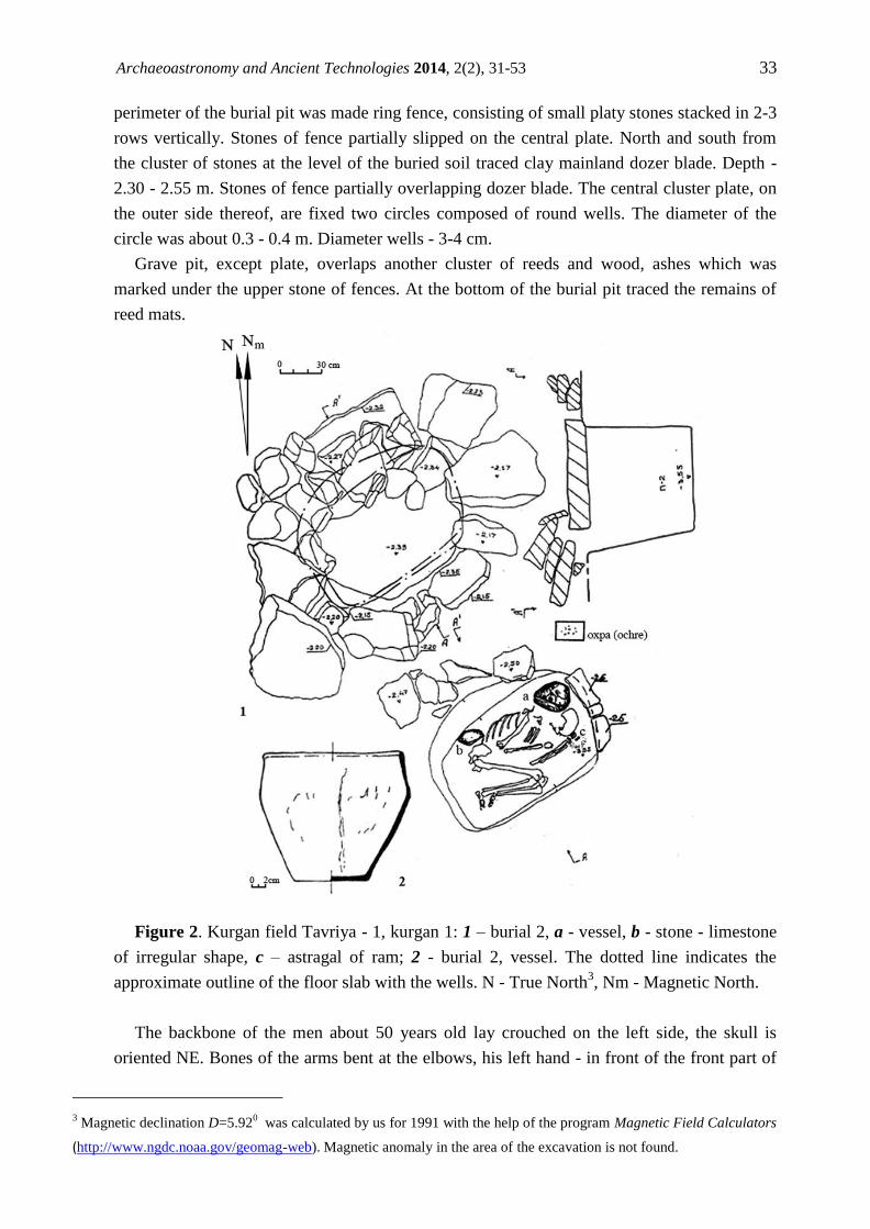
Archaeoastronomy and Ancient Technologies 2014, 2(2), 31-53 33
perimeter of the burial pit was made ring fence, consisting of small platy stones stacked in 2-3
rows vertically. Stones of fence partially slipped on the central plate. North and south from
the cluster of stones at the level of the buried soil traced clay mainland dozer blade. Depth -
2.30 - 2.55 m. Stones of fence partially overlapping dozer blade. The central cluster plate, on
the outer side thereof, are fixed two circles composed of round wells. The diameter of the
circle was about 0.3 - 0.4 m. Diameter wells - 3-4 cm.
Grave pit, except plate, overlaps another cluster of reeds and wood, ashes which was
marked under the upper stone of fences. At the bottom of the burial pit traced the remains of
reed mats.
Figure 2. Kurgan field Tavriya - 1, kurgan 1: 1 – burial 2, a - vessel, b - stone - limestone
of irregular shape, c – astragal of ram; 2 - burial 2, vessel. The dotted line indicates the
approximate outline of the floor slab with the wells. N - True North3, Nm - Magnetic North.
The backbone of the men about 50 years old lay crouched on the left side, the skull is
oriented NE. Bones of the arms bent at the elbows, his left hand - in front of the front part of
3 Magnetic declination D=5.92
0 was calculated by us for 1991 with the help of the program Magnetic Field Calculators
(http://www.ngdc.noaa.gov/geomag-web). Magnetic anomaly in the area of the excavation is not found.

Archaeoastronomy and Ancient Technologies 2014, 2(2), 31-53 34
the skull, right hand - on the chest in front of the skull. Bones of the legs are bent to the left.
Per skull with NW lay vessel (Fig. 2a). Surface is grayish-brown, dark and sooty. Potsherd in
a kink is black, shallow fireclay and limestone inclusions are in the test. On edge of the vessel
- an ornament in the form of a horizontal row of finger impressions. Ashes of burnt organic
mass traced in a vessel. Astragals of ram were found in the left hand from the south (see Fig.
2c). One more astragal was in filling the grave pit. Over the bones of the pelvis to the NW
was a stone - limestone of irregular shape (Fig. 2b). Ochre stains were noted at the bottom of
the burial pit: under vessel, under the brush of his left hand. Just brown spots of decay were
observed under the bones.
Slab of light gray sandstone is irregular weakly expressed V - shaped, with chipped,
roughly rounded corners. The largest slab size 85 x 164 cm, thickness about 20 cm. Wells
located on one side of the plate. Initially, the surface of the slab were knocked two circles
from the wells. However, because of the storage slab out of premises, a large part of one of
the circles, unfortunately, has been lost, and the plate got a crack. Plate was in a protected area
of the Archaeological Museum "Tanais", so it is protected from minor damages that could
inflict ordinary visitors. The occurrence of cracks was associated with random collisions on
the plate of the car, and a large circle was damaged (scraped off) in an unsuccessful
maneuvering the tractor close to the plate. Now we can see large circle of wells only on the
photo 1991 (see Fig. 1). Spite of the damages, many of the wells on the slab are well enough
distinguish and amenable to analysis (see Fig. 3).
The aim of our study was to analyze the spatial arrangement of the wells on the slab of
Srubna burial 2 of kurgan 1 of kurgan field Tavriya – 1 by astronomical methods.
Figure 3. Kurgan field Tavriya - 1, kurgan 1, burial 2, slab with the wells (photo by
Vodolazhsky D.I., 2014).

Archaeoastronomy and Ancient Technologies 2014, 2(2), 31-53 35
The relevance of the study is related to the uniqueness of the detected plate having a
complex set of the wells on its surface.
As a result of our study was identified relationship surviving circular group the wells and
groups wells arranged linearly, as well as their relationship with astronomically significant
directions. We have proposed a model analemmatic sundial describing wells arranged in a
circle, as well as the technology of determining moments of the solstices and equinoxes using
gnomon of analemmatic sundial and additional moving gnomons installed in wells, belonging
to the second group.
Analemmatic sundial
Cupped signs – wells, inflicted, including, in a circle, find on all continents. However, so
far there is no consensus about their interpretation. Cupped signs are often found on slabs of
cysts, passage graves, dolmens and ancient cemeteries. The wells are located in a circle,
reminiscent of marks of sundial, and in European countries, there is still an ancient tradition to
place sundial on the graves [2].
a

Archaeoastronomy and Ancient Technologies 2014, 2(2), 31-53 36
b
Figure 4. Kurgan field Tavriya - 1, kurgan 1, burial 2, slab with the wells: a - the result of
"gluing" photo-fragments; b – drawing of the surface of the slab.
It is known that the image of a sundial was found in the tomb of Seti I (around 1300 BC) in
Egypt [3]. In the Valley of the Kings in 2013 have been found vertical sundial dating from the
XIII century BC [4], which have been marked in accordance with the division of the day at
the 24 hour equal duration [5], [6].
a

Archaeoastronomy and Ancient Technologies 2014, 2(2), 31-53 37
b
Figure 5. Kurgan field Tavriya - 1, kurgan 1, burial 2, slab with the wells: a - ellipse of the
wells with X and Y axes for analemmatic sundial; b – slab with wells oriented according to
sides of the world in line with the axes X and Y. N - True North.
Plate from Tavriya-1dates from the XV-XIII century BC - the time close dating sundial in
Egypt. Therefore, we can assume that into said era could exist transfer ("migration") of
technology of sundial markup among the peoples, inhabiting coast of the Mediterranean and
Black Seas. For the XIII century BC were characterized by processes of migration of the
peoples of the Balkans and Asia Minor up to Egypt, have received the name Sea Peoples
migration [7]. However, the preponderance of evidence of participation of the population of
the Northern Black Sea coast in these migration processes still were not found. As positive
evidence can be considered mention of participation of the Amazons, placed by Herodotus in
the Northern Black Sea coast in the "three days' journey from Tanais" (Herodotus. History IV,
110 - 116), in the Trojan War (Scholiast on Homer, Iliad. XXIV. 804; Apollodorus , Epitome
5.1; Proclus, Chrestomathy 2, Aethiopis), participation in which taking the Sea Peoples [8].
Wells on the slab from Tavriya-1 were arranged in a circle, so we assumed that they could
be the hour markers of analemmatic sundial similarly slab with wells from Popov Yar [9].
For the proof that the find is indeed a sundial, we have conducted interdisciplinary research
with the help of natural science methods. In recent decades, the complex interdisciplinary
studies are widely used in history and archeology. They led to the emergence of new scientific
fields such as archaeoastronomy, historical informatics, etc. [10 - 15].

Archaeoastronomy and Ancient Technologies 2014, 2(2), 31-53 38
With the help of the camera Pentax K-50, we performed photographing surface of the slab
with respect to squares 40 x 60 cm with a height of one and half meters at an angle of lens 900
to the surface. Selected parameters of photography helped to minimize the distortions that do
not exceed 0.5 cm for every 60 cm. Next, in the graphical editor, we performed "gluing"
photo-fragments into one seamless image (see Fig. 4).
Circle of the wells on the slab from Tavriya-1 has two protrusions - "cat ears". We
assumed that they were made to determine the axis of symmetry. In accordance with this
assumption, we conducted a vertical axis Y between these two protrusions. Thus, the axis
passed through a central the wells of circle. Having taken it for a possible center of
analemmatic sundial, which was mounted gnomon at the equinoxes, we conducted there
through horizontal axis X. Since the working part of analemmatic "the dial" must be an
ellipse, we related the "cat ears" with its southern part - not a working part (see Fig. 5).
To the upper part of the ellipse the measured semi-major axis of the ellipse (East), is
M119 cm on the inner edge of the well and M222 cm on the outer edge of the well.
Measurement of semi-minor axis interfered crack. Measured semi-minor axis (North) is
m112.5 cm on the inner edge of the well and m214.8 cm on the outer edge of the well. In
analemmatic sundial these quantities are related. Knowing the semi-major axis of the ellipse
M, we can calculate by the formula 1 the semi-minor axis m. For the semi-major axis M =
19.0 cm calculated semi-minor axis is m = 14.0 cm. This value is approximately equal to the
measured value, that the testifies in favor of that wells on the slab from Tavriya-1 could be the
hour markers of analemmatic sundial.
Coordinates of the hour marks and the coordinates of the gnomon for analemmatic sundial,
marked in accordance with the division day to 24 hours of equal duration, are calculated as
follows [16]:
sin Mm , (1)
HMx sin , (2)
HMy cossin , (3)
cos wsws tgMZ, (4)
cos ssss tgMZ, (5)
sin/ tgH
arctgH, (6)
12150 tH
where x - coordinate of a point on the X axis for analemmatic sundial, y - coordinate of the
point on the Y axis for analemmatic sundial, M≈19 cm - measured semi-major axis of the
ellipse, φ - latitude of location, H - hour angle of the Sun, H /
- angle between the meridian
line and the hour line on the sundial, δws =-ε - declination of the Sun at the winter solstice, δss
= ε - declination of the Sun at the summer solstice, y = Zws – in the winter solstice, y = Zss – in
the summer solstice (Fig. 6 ).

Archaeoastronomy and Ancient Technologies 2014, 2(2), 31-53 39
Figure 6. The coordinate plane with the hour markers from 6 to 18 hours. M - semi-major
axis of the ellipse, m - minor semi axis of the ellipse, O - center of the ellipse, Ows - the
position of the gnomon at the winter solstice on analemmatic sundial, Oss - the position of the
gnomon at the summer solstice for analemmatic sundial. N - True North.
The results of our calculations of the coordinates x and y of the hour marks of analemmatic
sundial by formulas 2 and 3 for geographic coordinates of Tavriya-1 Lat=47°17'N
Long=38°37'E are given in Table 1. Calculated according to the formula 4 of gnomon
position at the winter solstice Zws=-5.7 cm calculated by the formula 5 of gnomon position at
the summer solstice Zss=5.7 cm. The gnomon is at the center of coordinates at the equinox.
For comparison the location of the wells with analemmatic sundial with semi-major axis of
the same length M19 cm, but for other latitudes, we have calculated the hour markers for
latitudes Lat = 41°00' N (tab. 2) and Lat = 35°00' N (tab. 3). The location of all the calculated
hour markers relatively the wells slabs is shown in Figure 7.
Table 1. Coordinates of the hour marks of analemmatic sundial for Lat = 47°17' N. H – the
hour angle of the Sun, H'- angle between the meridian line and the hour line on the sundial, t -
time, x - coordinate of the mark on the axis X, y - coordinate of the mark on the axis Y.
t, (hour)
6 7 8 9 10 11 12 13 14 15 16 17 18
H, (0) -90.0 -75.0 -60.0 -45.0 -30.0 -15.0 0.0 15.0 30.0 45.0 60.0 75.0 90.0
H', (0) -90.0 -78.9 -67.0 -53.7 -38.2 -20.0 0.0 20.0 38.2 53.7 67.0 78.9 90.0
x, (cm) -19.0 -18.4 -16.5 -13.4 -9.5 -4.9 0.0 4.9 9.5 13.4 16.5 18.4 19.0
y, (cm) 0.0 3.6 7.0 9.9 12.1 13.5 14.0 13.5 12.1 9.9 7.0 3.6 0.0

Archaeoastronomy and Ancient Technologies 2014, 2(2), 31-53 40
Table 2. Coordinates of the hour marks of analemmatic sundial for Lat = 41°00' N. H – the
hour angle of the Sun, H'- angle between the meridian line and the hour line on the sundial, t -
time, x - coordinate of the mark on the axis X, y - coordinate of the mark on the axis Y.
t, (hour)
6 7 8 9 10 11 12 13 14 15 16 17 18
H, (0) -90.0 -75.0 -60.0 -45.0 -30.0 -15.0 0.0 15.0 30.0 45.0 60.0 75.0 90.0
H', (0) -90.0 -80.0 -69.3 -56.7 -41.3 -22.2 0.0 22.2 41.3 56.7 69.3 80.0 90.0
x, (cm) -19.0 -18.4 -16.5 -13.4 -9.5 -4.9 0.0 4.9 9.5 13.4 16.5 18.4 19.0
y, (cm) 0.0 3.2 6.2 8.8 10.8 12.0 12.5 12.0 10.8 8.8 6.2 3.2 0.0
Table 3. Coordinates of the hour marks of analemmatic sundial for Lat = 35°00' N. H – the
hour angle of the Sun, H'- angle between the meridian line and the hour line on the sundial, t -
time, x - coordinate of the mark on the axis X, y - coordinate of the mark on the axis Y.
t, (hour)
6 7 8 9 10 11 12 13 14 15 16 17 18
H, (0) -90.0 -75.0 -60.0 -45.0 -30.0 -15.0 0.0 15.0 30.0 45.0 60.0 75.0 90.0
H', (0) -90.0 -81.3 -71.7 -60.2 -45.2 -25.0 0.0 25.0 45.2 60.2 71.7 81.3 90.0
x, (cm) -19.0 -18.4 -16.5 -13.4 -9.5 -4.9 0.0 4.9 9.5 13.4 16.5 18.4 19.0
y, (cm) 0.0 2.8 5.4 7.7 9.4 10.5 10.9 10.5 9.4 7.7 5.4 2.8 0.0
Hour lines of analemmatic sundial, according to calculated angles and markers (tab. 1),
were applied to the drawing of fragment of slab with wells (Fig. 7). Center of the hour lines is
the site of the gnomon attachment in the equinox and corresponds to the center of the ellipse -
the point O with coordinates (0;0). Analemmatic sundial gnomon is a vertical rod which is
moved along the Y axis, between the points Ows and Oss. This gnomon was easily interchanged
as a chess piece.Hour lines for equinox highlighted in red in Figure 7. Coordinates of the ends
of these lines – red points - have coordinates calculated hour markers for latitude Tavriya-1
(Tab. 1). The dotted lines in Figure 7 are hypothetical hour lines in the range from 18 to 6 am,
because this time range is not working in the equinox. In figure 7 orange dots noted the
location of hour markers for latitude Lat = 41°00' N and yellow dots – for latitude Lat =
35°00' N.
In Figure 7 shows that the hour marks corresponding to the latitude of the detection slab
Lat = 47°17' N good coincide (primarily in the working range from 6 to 18 hours on true solar
time4) with wells on the slab and coincide much better than marks calculated for the more
southerly latitudes. This coincidence also confirms the assumption that wells on the slab from
Tavriya-1 are hour markers of analemmatic sundial made at the latitude of detection slab.
4 Local true solar time does not coincide with the official time of a country or an area.

Archaeoastronomy and Ancient Technologies 2014, 2(2), 31-53 41
Figure 7. Kurgan field Tavriya - 1, kurgan 1, burial 2, slab with the wells: fragment with
wells with applied hour lines of analemmatic sundial of latitude Tavriya-1 for equinox (red
color). Hour markers for latitude 41°00' N are marked in orange color, and for the latitude
35°00' N – yellow color. N - True North .
For proper operation of analemmatic sundial for the latitude 47°17' N at the summer
solstice the gnomon of analemmatic sundial must be installed on the line SS, passing through
the point Oss (0; 5.7), and at the winter solstice - on line WS, passing through point Ows (0; -
5.7) (see Fig. 6). Daylength in the summer is the biggest, so hour lines include a maximum
time range - from 4 to 20 hours. Daylength in winter shorter, therefore hour lines will cover a
smaller time range - from about 8 to 16 hours (see Fig. 8).

Archaeoastronomy and Ancient Technologies 2014, 2(2), 31-53 42
Figure 8. Kurgan field Tavriya - 1, kurgan 1, burial 2, slab with the wells: fragment with
wells with applied hour lines of analemmatic sundial of latitude Tavriya-1; blue line - hour
line at the winter solstice, the green line - hour line at the summer solstice. N - True North.
In the case of a slab from Tavriya-1 line, passing through the point Ows, almost touches
the second round well located inside the ellipse. Thus, this well (southern edge) serves as a
marker for the line, passing through the point Ows, in which must be installed gnomon of
analemmatic sundial in the winter solstice. Such a coincidence is also evidence in favor of the
interpretation of the circular wells on the plate from Tavriya-1 as analemmatic sundial.
Astronomical markers
To the east of the circle of wells on the surface of the slab can be discerned still few
scattered wells, most of which located linear. We assumed that these wells were connected
with astronomically important directions and performed the auxiliary function with respect to
analemmatic sundial.
The point of intersection of the Moon orbit with the Ecliptic (in the projection of the
celestial sphere) - the nodes of the lunar orbit, constantly shifted along the Ecliptic, describing

Archaeoastronomy and Ancient Technologies 2014, 2(2), 31-53 43
a full circle in 18.6 years. Declination of the Moon changes during the sidereal month5
between the two extremes values. When the ascending node of the lunar orbit (where the
Moon passes from the southern part of the sky to the north) is the same with the point of the
vernal equinox, the declination of the Moon can reach ±δ=ε+i (High Moon). It happens once
in 18.6 years. In the middle of this interval, when the descending node of the lunar orbit
(where the Moon passes from the northern to the southern sky) coincides with the point of the
vernal equinox, the declination of the Moon can reach ±δ=ε-i (Low Moon). For example,
High or Low Moon on a full moon in the winter in moment of culmination can occupy more
or less high position above the horizon, respectively [17], [18].
Declination of High Moon at the full moon near the summer solstice take δ=ε+i, near the
winter solstice δ=-ε-i, near the equinox δ=i. Declination of Low Moon at the full moon near
the summer solstice take δ=ε-i, near the winter solstice δ=-ε+i, near the equinox δ=-i.
Azimuth calculation of sunrise and sunset were made by the formulas [19]:
h
hAr
coscos
sinsinsincos
, (7)
rs AA 0360 , (8)
where Ar - azimuth of rise, measured from north to east (surveyor), As - azimuth of set, δ -
declination, h - altitude, φ - latitude. Calculations are made on the upper edge of the disk:
pRh , (9)
where R - 1/2 angular size, ρ - refraction at the horizon, p - horizontal parallax [20]. For the
Sun and the Moon R=16/, ρ=35
/ [21]. For the Sun l=1.496 × 10
11 м, p=8.8''. For the Moon
l=3.844 × 10⁸ m, p=57
/ [22].
During summer solstice the Sun declination equal to angle of ecliptic inclination to
celestial equator ε, which is calculated using the formula [23]:
32////0 001813.000059.08150.4643929111.23 TTT (10)
100
2000
yT (11)
where T - the number of Julian centuries, that separates this age from noon of the 1 of
January 2000, y - year of required age. During winter solstice the Sun declination δ =-ε, and
during equinoxes δ = 0. The Moon orbit plane is inclined to ecliptic at angle i≈5.1450.
Calculated by us according to the formula 10 tilt angle of the ecliptic to the celestial
equator ε=23050'20'' for 1200 BC. The results of our calculations of the azimuth of sunrise
5 The time interval between two successive returns of the Moon in the same (relative to the stars) the place of the
celestial sphere.

Archaeoastronomy and Ancient Technologies 2014, 2(2), 31-53 44
and sunset according to the formulas 7 - 9 for astronomically important events are shown in
Table 4.
Table 4. Azimuths of the Sun at sunrise (sunset) at the equinoxes and solstices, calculated
on the top edge of the visible disk of the Sun; h - height of the Sun, δ - declination of the Sun,
A - the azimuth of the Sun.
phenomenon h, (0) δ, (0) A, (0) The letter designation 6
summer solstice, sunrise -0.85 23.84 52.27 -
equinox, sunrise -0.85 0.00 89.08 A1
winter solstice, sunrise -0.85 -23.84 125.44 A21, A22
summer solstice, sunset -0.85 23.84 307.73 -
equinox, sunset -0.85 0.00 270.92 -
winter solstice, sunset -0.85 -23.84 234.56 A3
The results of calculations of azimuths of rise and set of High and Low Moon according to
the formulas 7 - 9 are shown in Table 5.
Table 5. Azimuths of High and Low Moon at the time of Moon rise ( Moon set),
calculated at the center of the visible disk of the Moon; h - height of the Moon, δ - declination
of the Moon, A - the azimuth of the Moon.
phenomenon h, (0) δ, (0) A, (0) The letter
designation
northern major standstill moonrise 0.35 28.99 44.94 B1
southern major standstill moonrise 0.35 -28.99 136.14 B3
northern minor standstill moonrise 0.35 18.69 62.24 C1
southern minor standstill moonrise 0.35 -18.69 118.62 C3
northern major standstill moonset 0.35 28.99 315.06 -
southern major standstill moonset 0.35 -28.99 223.86 -
northern minor standstill moonset 0.35 18.69 297.76 -
southern minor standstill moonset 0.35 -18.69 241.38 -
equinox major standstill moonrise 0.35 5.15 82.78 B2
equinox minor standstill moonrise 0.35 -5.15 97.99 C2
equinox major standstill moonset 0.35 5.15 277.22 -
equinox minor standstill moonset 0.35 -5.15 262.01 -
For fixation direction always requires two gnomons (viewfinders). We assumed that the
role of one of the viewfinder could perform gnomon of analemmatic sundial installed in the
central the well corresponding placement of the gnomon at the equinoxes (point O). The
second viewfinder could be subject similar to the gnomon, that is installed directly into the
wells located east analemmatic sundial. Lines corresponding to the calculated astronomically
6 The letter designation in Figure 9.

Archaeoastronomy and Ancient Technologies 2014, 2(2), 31-53 45
important directions (Table. 4, Tab. 5), were shown emanating from a central point O,
corresponding to the first gnomon, in Figure 9.
a
b

Archaeoastronomy and Ancient Technologies 2014, 2(2), 31-53 46
c
Figure 9. Kurgan field Tavriya - 1, kurgan 1, burial 2, slab with the wells: a – photo of
fragment of slab with wells (view from NE), b – drawing of slab with surface defects and
marked astronomically important directions, c – drawing of fragment of slab with wells and
astronomically important directions. N - True North.
In Figure 9 index A1 designated well corresponding to the azimuth of sunrise at the
equinox, A21 - sunrise at the winter solstice, A22 - sunrise at the winter solstice, A3 - sunset at
the winter solstice (the sunrise at the summer solstice), O - the place of installation of
analemmatic sundial gnomon at the equinox (one of the viewfinder), B1 - the northernmost
rise of High Moon, B2 - rise of High Moon at the equinox, B3 - the southernmost rise of High
Moon, C1 - the northernmost rise of Low Moon, C2 – rise of Low Moon at the equinox, C3 -
the southernmost rise of Low Moon, D1, and D2 - wells that have no correlation with the rise
/ set of luminaries. Astronomically important directions related to the Sun are marked in
orange color, associated with the High Moon – green color, associated with the Low Moon –
yellow color, with no connection to the rising luminaries - blue color.
Almost all of the lines, corresponding to the calculated us astronomically important
directions and associated with the eastern sector of the sky, passing through wells located east
of wells arranged in a circle. An exception is the line corresponding to the direction associated
with the rising of the Sun near the summer solstice. However, approximately on continuing
this line, but in the western sector of analemmatic sundial located well A3, which we
compared with the direction of the sunset at the winter solstice. The line passing through the

Archaeoastronomy and Ancient Technologies 2014, 2(2), 31-53 47
point Ows, where it is necessary to establish the gnomon of analemmatic sundial in the winter
solstice, touches the edge of the well A3. This fact is further evidence of our interpretation of
wells arranged in a circle on the slab as analemmatic sundial and auxiliary wells as
astronomical markers.
By setting the second viewfinder to well A3, with a small margin of error, it is possible to
observe objects in both directions: a sunset on the winter solstice (OA3) and sunrise at the
summer solstice (A3O) (Fig. 9).
Wells A21 and A22 is less than the rest of the wells and their diameter does not exceed 1
cm. Line corresponding to the sunrise at the winter solstice, and passing through the center of
analemmatic sundial, passes between the wells (see Fig. 9 c). At the expense of the shadows
cast by gnomons, when installed in these wells at the time of sunrise on the slab will appear
thin lighted strip passing through the center sundial. We believe that this feature could be used
to select and original marking of the center sundial.
Because daylength in winter is the smallest and the height of the Sun in the upper
culmination is minimal, the small size of these wells could symbolize the "little" Sun - the
Sun - "grain", which began to grow (increase the height of the Sun in the upper culmination)
and increase (increase light day) from the winter solstice. It is interesting that in the
countryside among the Slavic peoples still widespread tradition of "sowing" - sprinkle by
grain or oats on New Year or Christmas Day (December 25), which in time almost coincides
with the winter solstice (December 21-22) .
Large well A3, correlated with the rising of the sun in the summer solstice (A3O), due to its
location in the western sector (associated with the set of luminaries) may also symbolize the
maximum height of the Sun in the upper culmination, and the maximum length of daylight
that begin to decrease with the summer solstice, i.e. symbolize the beginning of "dying" of the
Sun.
Figure 10. Kurgan field Tavriya - 1, kurgan 1, burial 2, slab with the wells, wells
associated with the direction of the rise High (B1, B2, B3) and Low (C1, C2, C3) Moon. The
white lines are rough contours of the wells.

Archaeoastronomy and Ancient Technologies 2014, 2(2), 31-53 48
Well A1 associated with the sunrise at the equinox reminds short groove. Most likely, this
is due to the rapid apparent motion of the Sun near the date of the equinox and, as a
consequence, the difficulty in determining the time in practice (days) equinox and,
accordingly, the exact azimuth of sunrise on the day of the equinox.
Wells crossed the lines associated with the High Moon, remind, from our point of view, in
the form of a half moon. Wells associated with Low Moon are circular (see Fig. 10). It is
unclear why a crescent shape compared with High Moon, but such a division in the form
wells can be seen as further evidence of the existence of concepts of High and Low Moon
among Srubna population.
During the study, we found that two wells D1 and D2 are not associated with any of the
calculated astronomical directions. However, together with the adjacent wells, correlated with
the astronomically important directions, they are arranged in a clearly visible line that, from
our point of view, the evidence and their astronomical appointment.
Except the rising and setting luminaries, the brightest and most easily noticeable
astronomical phenomenon is the change in the height of the Sun in the upper culmination of
during a year. To test the hypothesis about the possible connection wells with this
phenomenon, we measure an azimuth wells D1 and D2: AD1≈710, AD2≈109
0 and analyzed the
height of the Sun at the top of culmination in the days when the azimuth of sunrise coincides
with the azimuths of these wells (Table. 6). For dates with a given azimuth of sunrise were
calculated heights of the Sun at the top of the culmination. The calculations were performed
for the 1200 BC and 2014 AD using astronomical program RedShift-7 Advanced for
geographic coordinates of Tavriya-1.
Table 6. Height of the Sun at the top of the culmination. A - the azimuth of sunrise, h -
height of the Sun at the top of the culmination.
Ai, (0) h, (0) astronomical event date
for 1200 BC
date
for 2014 AD
1 125.44 18.9 winter solstice 31.12 22.12
2 109.00 29.7 - 25.02 14.02
3 89.08 42.8 vernal equinox 01.04 20.03
4 71.00 55.0 - 04.05 23.04
5 52.27 66.5 summer solstice 04.07 21.06
6 71.00 55.0 - 02.09 21.08
7 89.08 43.0 autumnal equinox 04.10 23.09
8 109.00 29.3 - 07.11 28.10
Analyzing the calculated height of the sun in the upper culmination, we identify patterns
associated with the wells D1 and D2. Height of the Sun at the top of culmination, in the days
when the Sun rises in the direction with an azimuth of wells D1 and D2, is equal to the
average value between the heights of the nearest preceding and succeeding the solstice and
equinox with an error ≈10.

Archaeoastronomy and Ancient Technologies 2014, 2(2), 31-53 49
For example, 02/25/1200 BC (14/02/2014 AD) Sun in the upper culmination has a
height hD2=29.70, height of the Sun in the upper culmination of the winter solstice
hws=18.90, and the vernal equinox heq=42.8
0. Then (hws+heq)/2=30.9
0≈hD2. And at
04/05/1200 BC (23/04/2014 AD) Sun in the upper culmination has a height hD1=550.
Height of the Sun in the upper culmination of the summer solstice hss=66.50, and at the
spring equinox heq=42.80. Then (heq+ hss)/2=54.7
0≈ hD1.
Accommodation in immediate proximity to analemmatic sundial associated with it the
group of markers of sunrise luminaries could be used to determine the direction of
movement of the gnomon of analemmatic sundial for it proper functioning during the year.
For example, the time of the summer solstice could be determined using wells A3 and O. In
this case, if at 6 am at the equinox (the azimuth of the Sun A = 89.080) the shadow of the
gnomon, installed at the point O, fell to the well of the 6 hours, then in the summer solstice
at 6 am (azimuth of the Sun A = 73.270) the shadow of the gnomon has fallen between
wells 4 and 5 hours (see Fig. 11). In order to sundial shows the correct time, it was
necessary to move the gnomon to the point Oss. Similar movements of the gnomon were
necessary to carried on throughout the year.
Figure 11. Kurgan field Tavriya - 1, kurgan 1, burial 2, drawing of fragment of slabs
with wells. The solid lines indicate the direction to the azimuth of the Sun at 6 am at the
day of the equinox (orange line) and the summer solstice (pink line). Dotted lines indicate
the shade of gnomons the same time. N - True North.

Archaeoastronomy and Ancient Technologies 2014, 2(2), 31-53 50
Simultaneous placement group of wells, associated with a sundial, and a group of
wells - markers of astronomically significant directions on one plate can be considered
as an interim stage of development analemmatic sundial and, therefore, as possible
evidence of local origin and the very idea of analemmatic sundial, and measurement
technology time with it.
Detection on the slab including astronomical markers wells associated with apparent
motion of the Moon, may also be evidence of an attempt to use wells arranged in a
circle, as the moondial. However, the simplest moondial, based on analemmatic sundial,
can show the correct time on the night of the full moon, while moving the gnomon to
the point Ows near the summer solstice, to the point Oss near the winter solstice, and to
the point O - near the equinox, only. In this case the wells in the work part of the "dial"
will fit to not by day, but night hours. Well of 6 hours corresponds to 18 hours, well 12
hours - 24 hours, as well of 18 hours - 6 hours. All lunar direction marked wells -
astronomical markers at the slab, connected with the rising of the Moon during the full
moon, which can be considered as evidence for the assumption that the use of a slab
from Tavriya-1 as moondial.
The wells of the second circle, clearly visible on the image of slab in 1991 (see Fig.
1) were not interpreted. This is due to the fact that modern extent of damage of the
appropriate the slab edge are not allowed to make them reliable analysis. Could not we
compare with astronomical directions and three large bowl-shaped pits on the opposite
edge of the slab. Despite their good state of preservation, the line on which they are
located, does not coincide with sufficient accuracy with calculated astronomical
directions. About it can be compared with the direction to the sunrise at the summer
solstice and sunset at the winter solstice. In many traditions these periods were
considered as holidays, so perhaps three large wells functioned as containers for festive
sacrifices.
Conclusion
Thus, as a result of our study was analyzed the spatial arrangement of wells on the
slab of Srubna burial of kurgan field Tavriya-1. During research identified two interrelated
groups of wells. The first group of wells was interpreted by us as analemmatic sundial,
which could work as a moondial at the night of the full moon, and the second group - as
markers of astronomically significant directions, support and for sundial, and for
moondial. We have developed and described the way in which in ancient times could
determine the moments of solstices and equinoxes using analemmatic sundial gnomon
and mobile gnomons installed in wells belonging to the second group. The slab with
wells from Tavriya-1 allows following the movement of the Moon and the Sun, to
determine the time of the solstices and equinoxes, to measure the time during the day
using analemmatic sundial and at night under a full moon with the help of moondial.
Communication wells on the slab from Tavriya-1 with astronomically important
directions and the definition of time by analemmatic sundial and moondial, allows us to

Archaeoastronomy and Ancient Technologies 2014, 2(2), 31-53 51
determine the slab with wells from Tavriya-1 as the oldest astronomical instrument, the
main part of which is a sundial.
Acknowledgements
The authors are sincerely thank to Vera Alekseevna Larenok and Valery Fedorovich
Chesnok for the support of research, and we wish to thank to administration and
employees of the Archaeological Museum "Tanais" for storing many years of unique
slab from kurgan field Tavriya-1.
References
1. Larenok, P.A. Kurgannye mogil'niki Tavriya 1 – 3. [Barrows Tavriya 1 – 3].
Kurgany Severo-Vostochnogo Priazov'ya: Katalog: (Neklinovskij i
Matveevo-Kurganskij rajony Rostovskoj oblasti). Materialy i issledovaniya
Taganrogskoj arxeologicheskoj e'kspedicii. [Mounds North Eastern Azov:
Catalog: (Neklinovskiy and Matveyev Kurgan district of Rostov region).
Materials and Research Taganrog archaeological expedition]. Vyp. III,
TLIAMZ. TAE' - Rostov n/D, 1998, p. 62.
2. Pipunyrov, V.N. Istoriya chasov s drevnejshix vremen do nashix dnej.
[Story hours from ancient times to the present day]. Moscow: Nauka, 1982,
p.69.
3. Pipunyrov, V.N. Istoriya chasov s drevnejshix vremen do nashix dnej.
[Story hours from ancient times to the present day]. Moscow: Nauka, 1982,
p. 21.
4. Bickel, S.; Gautschy, R. Eine ramessidische Sonnenuhr im Tal der Könige.
Zeitschrift für Ägyptische Sprache und Altertumskunde 2014, Volume 96,
Issue 1, pp. 3-14.
5. Vodolazhskaya, L.N. Reconstruction of ancient Egyptian sundials.
Archaeoastronomy and Ancient Technologies 2014, 2(2), 1-18.
6. Vodolazhskaya, L.N. Reconstruction of vertical and L-shaped ancient
Egyptian sundials and methods for measuring time. arXiv 2014,
http://arxiv.org/ftp/arxiv/papers/1408/1408.0987.pdf (accessed on
29.09.2014).
7. Yasur-Landau, A. The Philistines and Aegean Migration at the End of the
Late Bronze Age. New York, 2010, p. 1.
8. Safronov, A. V. The Sea Peoples and Cyprus: history and legendary
tradition. Indo-European lingvistics and classical philology - XVIII (Joseph
M. Tronsky memorial Conference). Proceedings of the International
Conference, St. Perersburg, 23–25 June, 2014 / edited by Nikolai N.
Kazansky. St.Perersburg: Nauka, 2014. pp. 831 – 841.

Archaeoastronomy and Ancient Technologies 2014, 2(2), 31-53 52
9. Vodolazhskaya, L.N. Analemmatic and horizontal sundials of the Bronze
Age (Northern Black Sea Coast). Archaeoastronomy and Ancient
Technologies 2013, 1(1), 68-88.
10. Ponomarenko, V.O.; Sarychev, D.; Vodolazhskaya, L.N. Primenenie
rentgenofluorescentnogo analiza dlya issledovaniya ximicheskogo sostava
amfornoj keramiki. [The use of X-ray fluorescence analysis for the study of
the chemical composition amphorae ceramic]. Vestnik Yuzhnogo
Nauchnogo Centra RAN. [Bulletin of the Southern Scientific Center,
Russian Academy of Sciences]. 2012, vol. 8, No 1, pp. 9-17.
11. Vodolazhskaya, L.N.; Vodolazhsky, D.I.; Ilyukov, L.S. Metodika
komp'yuternoj fiksacii graficheskogo materiala arxeologicheskix raskopok
na primere Karataevskoj kreposti. [Technique of of computer fixing graphic
material of archaeological excavations on the example Karataevo fortress].
Informacionnyj byulleten' Associacii Istoriya i komp'yuter. [Association
Newsletter History and Computer], 2003, No 31, pp. 248-258
12. Vodolazhskaya, L.N.; Larenok, V.A. Arhaeoastronomical analysis of
Levinsadovka sacrificial complex (South Russia). Archaeoastronomy and
Ancient Technologies 2013, 1(1), 5-25.
13. Vodolazhskaya, L.N.; Larenok, V.A. Arhaeoastronomical analysis of
Levinsadovka sacrificial complex (South Russia). arXiv 2013,
http://arxiv.org/ftp/arxiv/papers/1303/1303.1153.pdf (accessed on
29.09.2014).
14. Vodolazhskaya, L.N.; Nevsky, M.Yu. Russian meteorite of the Bronze Age
(rock record). Archaeoastronomy and Ancient Technologies 2013, 1(2), 18-
32.
15. Vodolazhskaya, L.N.; Nevsky, M.Yu. Russian meteorite of the Bronze Age
(rock record). arXiv 2013,
http://arxiv.org/ftp/arxiv/papers/1308/1308.6178.pdf (accessed on
29.09.2014).
16. Waugh A. E. Sundials: Their Theory and Construction. Dover Publications,
Inc.: New York, USA, 1973; pp. 108-116.
17. Potemkina, T. M.; Yurevich, V. A. Iz opyta arxeoastronomicheskogo
issledovaniya arxeologicheskix pamyatnikov (metodicheskij aspekt). [From
the experience of archaeoastronomical studies of archaeological sites
(methodological aspect)]. M.: IA RAN, 1998, p. 21.
18. Thom, A. Megalithic lunar observatories. Oxford University Press, 1971, p.
18.
19. Kelley, D.; Milone, E. Exploring Ancient Skies: An Encyclopedic Survey of
Archaeoastronomy. New York: Springer-NY, 2005, p. 21.
20. Potemkina, T. M.; Yurevich, V. A. Iz opyta arxeoastronomicheskogo
issledovaniya arxeologicheskix pamyatnikov (metodicheskij aspekt). [From

Archaeoastronomy and Ancient Technologies 2014, 2(2), 31-53 53
the experience of archaeoastronomical studies of archaeological sites
(methodological aspect)]. M.: IA RAN, 1998, p. 19.
21. Abalakin, V.K. Astronomicheskij kalendar'. Postoyannaya chast'.
[Astronomical calendar. Permanent part]. M.: Nauka, 1981, p. 44.
22. Montenbruk, O.; Pfleger, T. Astronomiya na personal'nom komp'yutere.
[Astronomy on the personal computer]. SPb.: Piter, 2002, p. 33.
23. Montenbruk, O.; Pfleger, T. Astronomiya na personal'nom komp'yutere.
[Astronomy on the personal computer]. SPb.: Piter, 2002, p. 35.
© This article is an open access article distributed under the terms and conditions of the
Creative Commons Attribution license (http://creativecommons.org/licenses/by/3.0/).