Embed Size (px)
Citation preview
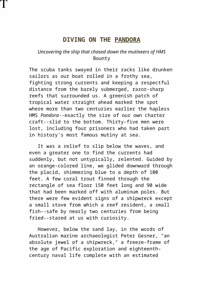
DIVING ON THE P ANDORA
Uncovering the ship that chased down the mutineers of HMS Bounty
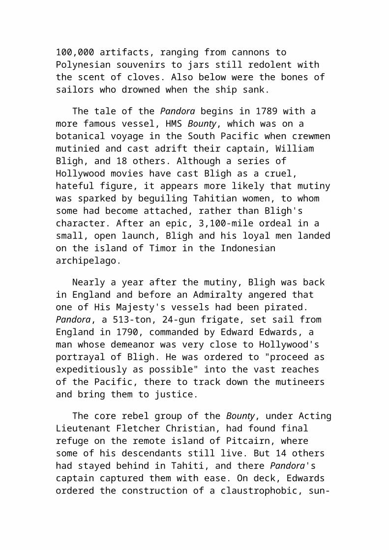
The scuba tanks swayed in their racks like drunken sailors as our boat rolled in a frothy sea, fighting strong currents and keeping a respectful distance from the barely submerged, razor-sharp reefs that surrounded us. A greenish patch of tropical water straight ahead marked the spot where more than two centuries earlier the hapless HMS Pandora--exactly the size of our own charter craft--slid to the bottom. Thirty-five men were lost, including four prisoners who had taken part in history's most famous mutiny at sea.
It was a relief to slip below the waves, and even a greater one to find the currents had suddenly, but not untypically, relented. Guided by an orange-colored line, we glided downward through the placid, shimmering blue to a depth of 100 feet. A few coral trout finned through the rectangle of sea floor 150 feet long and 90 wide that had been marked off with aluminum poles. But there were few evident signs of a shipwreck except a small stove from which a reef resident, a small fish--safe by nearly two centuries from being fried--stared at us with curiosity.
However, below the sand lay, in the words of Australian marine archaeologist Peter Gesner, "an absolute jewel of a shipwreck," a freeze-frame of the age of Pacific exploration and eighteenth-century naval life complete with an estimated 100,000 artifacts, ranging from cannons to Polynesian souvenirs to jars still redolent with the scent of cloves. Also below were the bones of sailors who drowned when the ship sank.
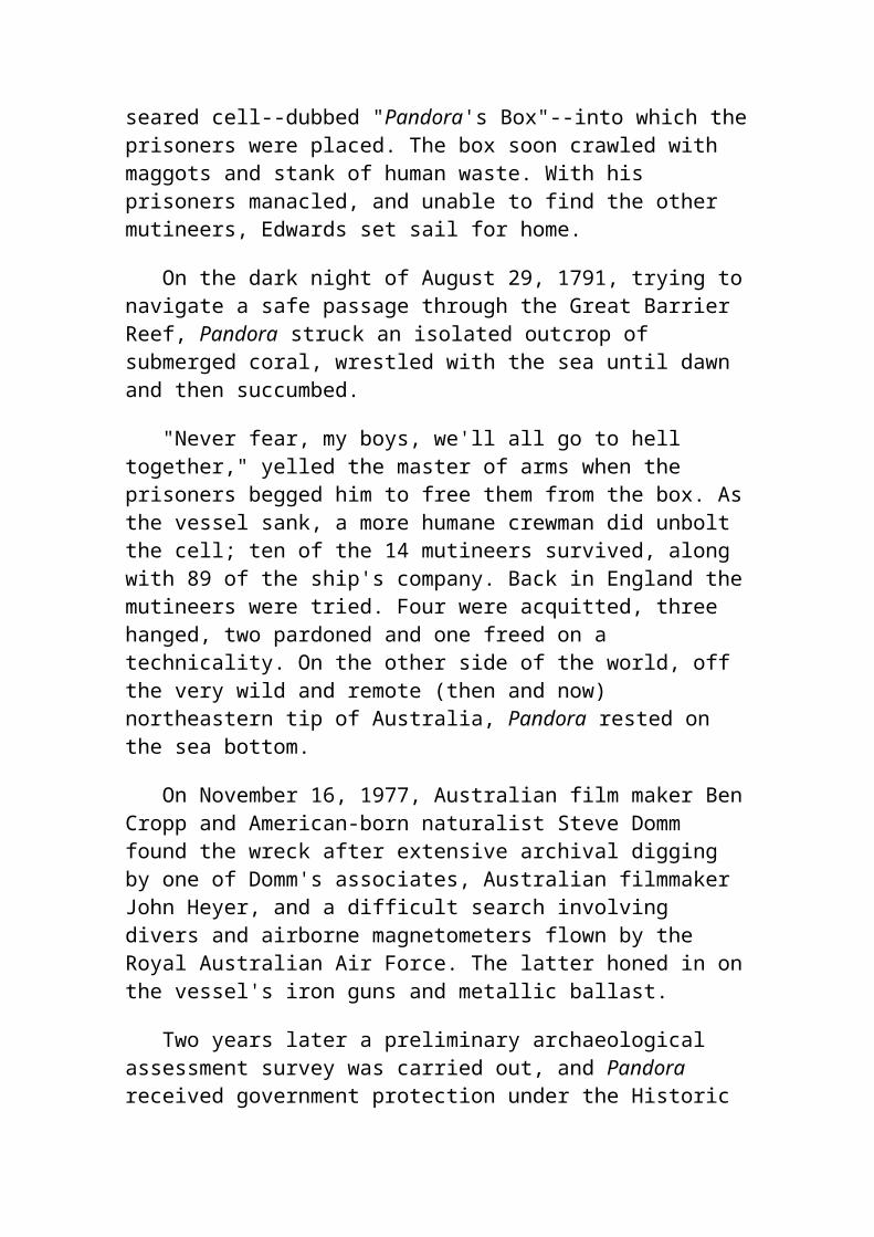
The tale of the Pandora begins in 1789 with a more famous vessel, HMS Bounty, which was on a botanical voyage in the South Pacific when crewmen mutinied and cast adrift their captain, William Bligh, and 18 others. Although a series of Hollywood movies have cast Bligh as a cruel, hateful figure, it appears more likely that mutiny was sparked by beguiling Tahitian women, to whom some had become attached, rather than Bligh's character. After an epic, 3,100-mile ordeal in a small, open launch, Bligh and his loyal men landed on the island of Timor in the Indonesian archipelago.
Nearly a year after the mutiny, Bligh was back in England and before an Admiralty angered that one of His Majesty's vessels had been pirated. Pandora, a 513-ton, 24-gun frigate, set sail from England in 1790,
commanded by Edward Edwards, a man whose demeanor was very close to Hollywood's portrayal of Bligh. He was ordered to "proceed as expeditiously as possible" into the vast reaches of the Pacific, there to track down the mutineers and bring them to justice.
The core rebel group of the Bounty, under Acting Lieutenant Fletcher Christian, had found final refuge on the remote island of Pitcairn, where some of his descendants still live. But 14 others had stayed behind in Tahiti, and there Pandora's captain captured them with ease. On deck, Edwards ordered the construction of a claustrophobic, sun-seared cell--dubbed "Pandora's Box"--into which the prisoners were placed. The box soon crawled with maggots and stank of human waste. With his prisoners manacled, and unable to find the other mutineers, Edwards set sail for home.
On the dark night of August 29, 1791, trying to navigate a safe passage through the Great Barrier Reef, Pandora struck an isolated outcrop of submerged coral, wrestled with the sea until dawn and then succumbed.
"Never fear, my boys, we'll all go to hell together," yelled the master of arms when the prisoners begged him to free them from the box. As the vessel sank, a more humane crewman did unbolt the cell; ten of the 14 mutineers survived, along with 89 of the ship's company. Back in England the mutineers were tried. Four were acquitted, three hanged, two pardoned and one freed on a technicality. On the other side of the world, off the very wild and remote (then and now) northeastern tip of Australia, Pandora rested on the sea bottom.
On November 16, 1977, Australian film maker Ben Cropp and American-born naturalist Steve Domm found the wreck after extensive archival digging by one of Domm's associates, Australian filmmaker John Heyer, and a difficult search involving divers and airborne magnetometers flown by the Royal Australian Air Force. The latter honed in on the vessel's iron guns and metallic ballast.
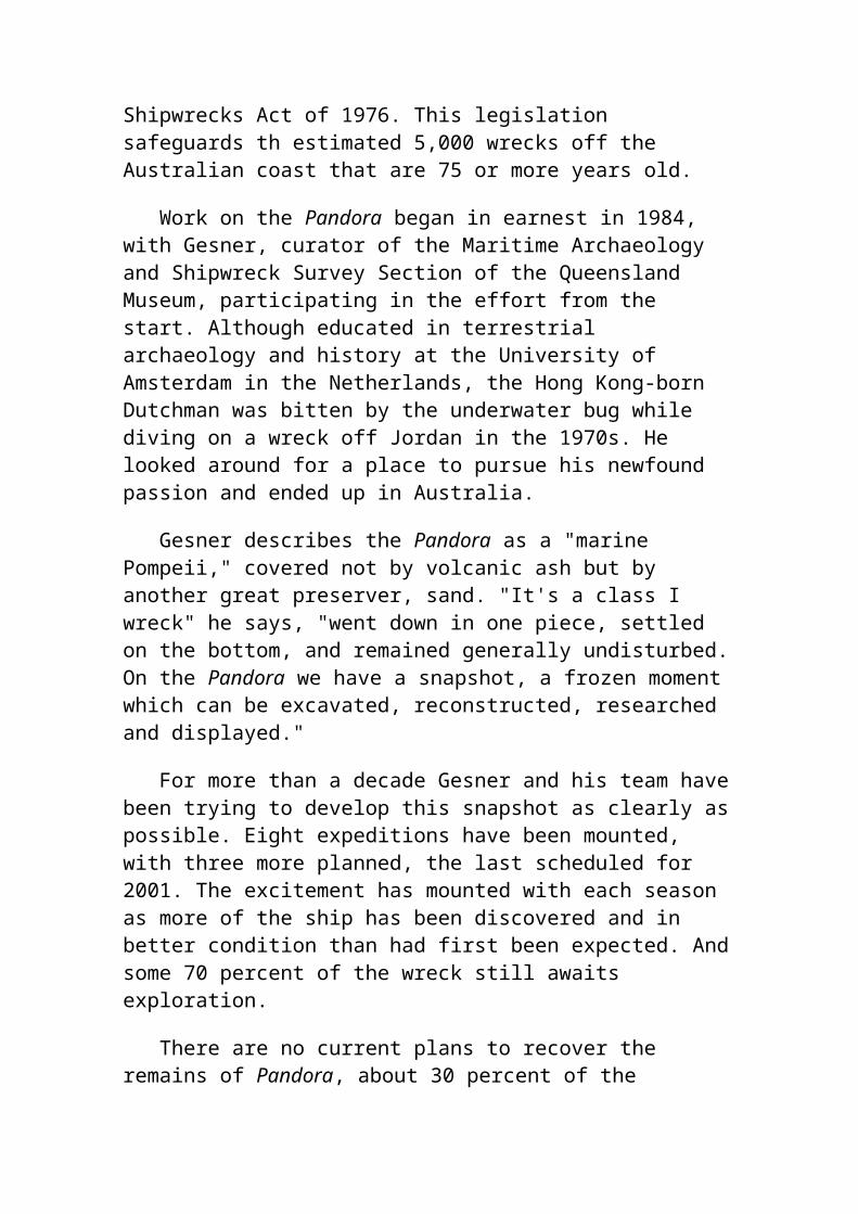
Two years later a preliminary archaeological assessment survey was carried out, and Pandora received government protection under the Historic Shipwrecks Act of 1976. This legislation safeguards th estimated 5,000 wrecks off the Australian coast that are 75 or more years old.
Work on the Pandora began in earnest in 1984, with Gesner, curator of the Maritime Archaeology and Shipwreck Survey Section of the Queensland Museum, participating in the effort from the start. Although educated in terrestrial archaeology and history at the University of
Amsterdam in the Netherlands, the Hong Kong-born Dutchman was bitten by the underwater bug while diving on a wreck off Jordan in the 1970s. He looked around for a place to pursue his newfound passion and ended up in Australia.
Gesner describes the Pandora as a "marine Pompeii," covered not by volcanic ash but by another great preserver, sand. "It's a class I wreck" he says, "went down in one piece, settled on the bottom, and remained generally undisturbed. On the Pandora we have a snapshot, a frozen moment which can be excavated, reconstructed, researched and displayed."
For more than a decade Gesner and his team have been trying to develop this snapshot as clearly as possible. Eight expeditions have been mounted, with three more planned, the last scheduled for 2001. The excitement has mounted with each season as more of the ship has been discovered and in better condition than had first been expected. And some 70 percent of the wreck still awaits exploration.
There are no current plans to recover the remains of Pandora, about 30 percent of the original structure, but with enough funds--possibly as much as $60 million--the copper-sheathed hull could be brought to the surface and put on display like the seventeenth-century Swedish warship Vasa or England's sixteenth-century Mary Rose.
"Pandora should be raised to become Australia's Mary Rose," one visitor wrote after seeing an exhibition which has traveled through the country since 1995. Assembled to educate the public, the show includes a number of the ship's artifacts, 14 photographic panels and a video.
The exhibition also helped raise some of the $2 million the recently formed Pandora Foundation has on hand to complete retrieval and conservation of the ship's contents by 2001. A new wing of the Museum of Tropical Queensland in Townsville in North Queensland, scheduled to open several months before the Sydney Olympics in September 2000, will serve as a permanent repository for the artifacts-- just over 2,000 of which have been recovered and registered to date--along with associated research material.
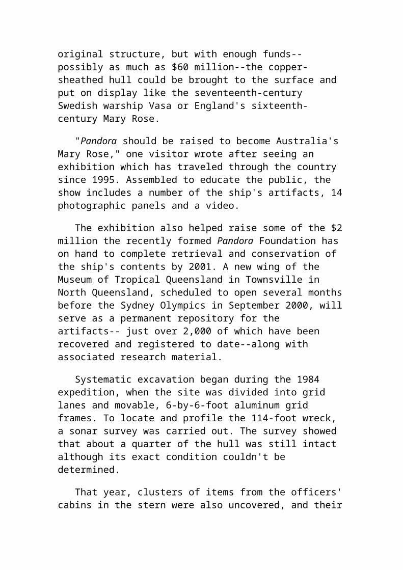
Systematic excavation began during the 1984 expedition, when the site was divided into grid lanes and movable, 6-by-6-foot aluminum grid frames. To locate and profile the 114-foot wreck, a sonar survey was carried out. The survey showed that about a quarter of the hull was still intact although its exact condition couldn't be determined.
That year, clusters of items from the officers' cabins in the stern were also uncovered, and their locations recorded to the nearest quarter-inch like all other objects subsequently found on the wreck and surrounding sea floor.
It soon became clear that much of the vessel had been quickly sealed with sand and did not appear to have been attacked by borers, sedimentary bacteria, or man. Over the years, the forecastle, quarterdeck and upper deck rotted away but the rest of the hull--the lower and platform decks--had lodged itself, layer upon layer, beneath the sand.
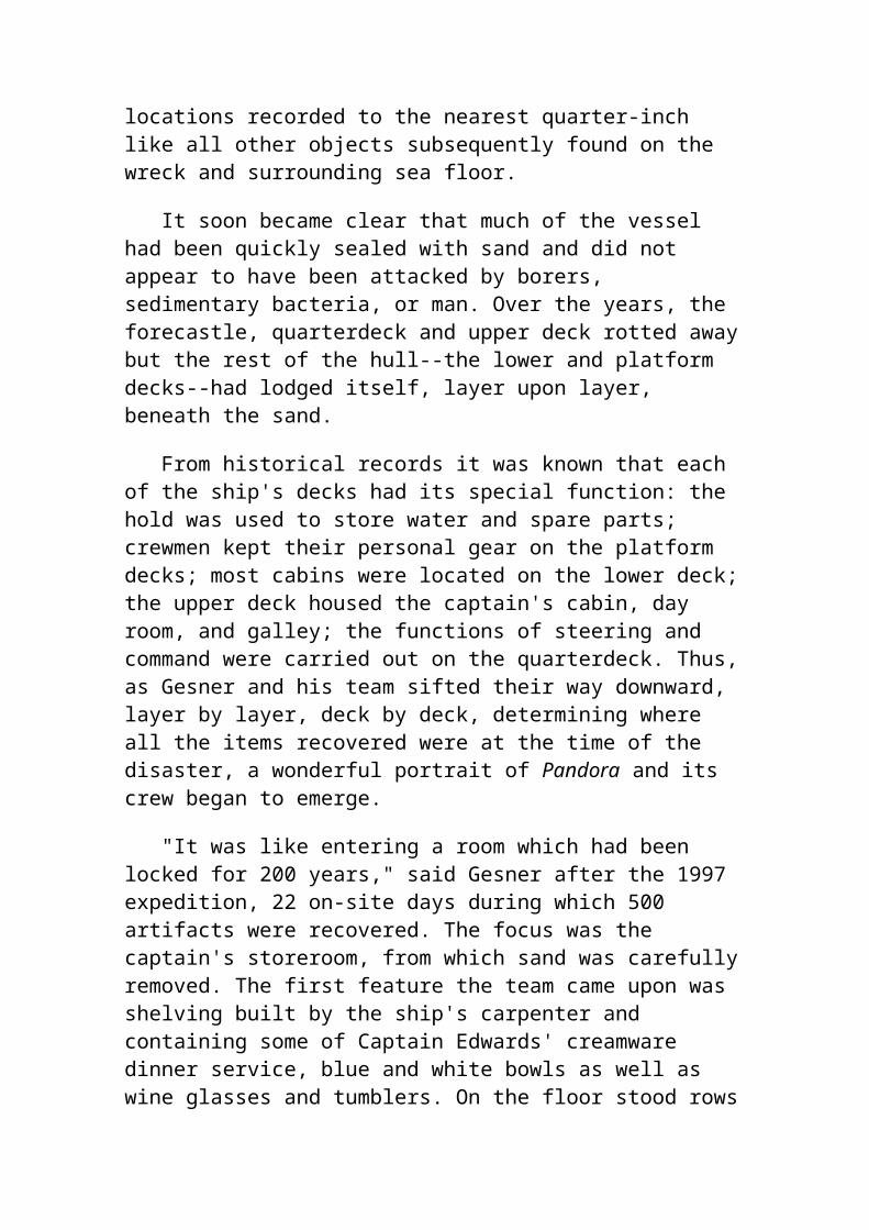
From historical records it was known that each of the ship's decks had its special function: the hold was used to store water and spare parts; crewmen kept their personal gear on the platform decks; most cabins were located on the lower deck; the upper deck housed the captain's cabin, day room, and galley; the functions of steering and command were carried out on the quarterdeck. Thus, as Gesner and his team sifted their way downward, layer by layer, deck by deck, determining where all the items recovered were at the time of the disaster, a wonderful portrait of Pandora and its crew began to emerge.
"It was like entering a room which had been locked for 200 years," said Gesner after the 1997 expedition, 22 on-site days during which 500 artifacts were recovered. The focus was the captain's storeroom, from which sand was carefully removed. The first feature the team came upon was shelving built by the ship's carpenter and containing some of Captain Edwards' creamware dinner service, blue and white bowls as well as wine glasses and tumblers. On the floor stood rows of ceramic jars, many still corked and packed in sawdust. They had probably contained essence of spruce, used to brew "spruce beer," used for preventing scurvy in the eighteenth century. Checking the ship's logs against finds, Gesner's team believes the some 100 jars recovered were among the 343 "pots of essence of spruce" taken aboard.
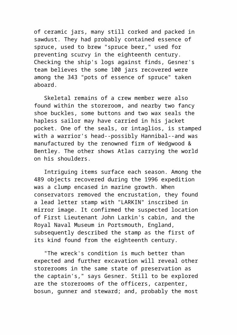
Skeletal remains of a crew member were also found within the storeroom, and nearby two fancy shoe buckles, some buttons and two wax seals the hapless sailor may have carried in his jacket pocket. One of the seals, or intaglios, is stamped with a warrior's head--possibly Hannibal--and was manufactured by the renowned firm of Wedgwood & Bentley. The other shows Atlas carrying the world on his shoulders.
Intriguing items surface each season. Among the 489 objects recovered during the 1996 expedition was a clump encased in marine growth. When conservators removed the encrustation, they found a lead letter stamp with "LARKIN" inscribed in mirror image. It confirmed the suspected location
of First Lieutenant John Larkin's cabin, and the Royal Naval Museum in Portsmouth, England, subsequently described the stamp as the first of its kind found from the eighteenth century.
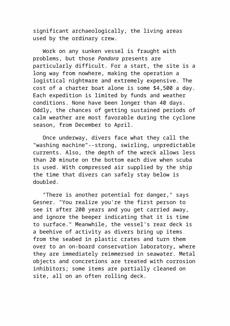
"The wreck's condition is much better than expected and further excavation will reveal other storerooms in the same state of preservation as the captain's," says Gesner. Still to be explored are the storerooms of the officers, carpenter, bosun, gunner and steward; and, probably the most significant archaeologically, the living areas used by the ordinary crew.
Work on any sunken vessel is fraught with problems, but those Pandora presents are particularly difficult. For a start, the site is a long way from nowhere, making the operation a logistical nightmare and extremely expensive. The cost of a charter boat alone is some $4,500 a day. Each expedition is limited by funds and weather conditions. None have been longer than 40 days. Oddly, the chances of getting sustained periods of calm weather are most favorable during the cyclone season, from December to April.
Once underway, divers face what they call the "washing machine"--strong, swirling, unpredictable currents. Also, the depth of the wreck allows less than 20 minute on the bottom each dive when scuba is used. With compressed air supplied by the ship the time that divers can safely stay below is doubled.
"There is another potential for danger," says Gesner. "You realize you're the first person to see it after 200 years and you get carried away, and ignore the beeper indicating that it is time to surface." Meanwhile, the vessel's rear deck is a beehive of activity as divers bring up items from the seabed in plastic crates and turn them over to an on-board conservation laboratory, where they are immediately reimmersed in seawater. Metal objects and concretions are treated with corrosion inhibitors; some items are partially cleaned on site, all on an often rolling deck.
Should some generous benefactor come up with the sums needed to bring up, conserve, and display the Pandora's hull, a mini-armada of barges, cranes and workers would have to make their way to the remote Cape York waters. One imaginative, but probably impractical proposal, is to envelop the entire site in a caisson-like container, bring it up and excavate the hull on land with water still inside the container while videotaping the entire process.
Despite handicaps, work on the Pandora has already yielded artifacts that are more important than the hull itself. "`It's such a meaty wreck," Gesner
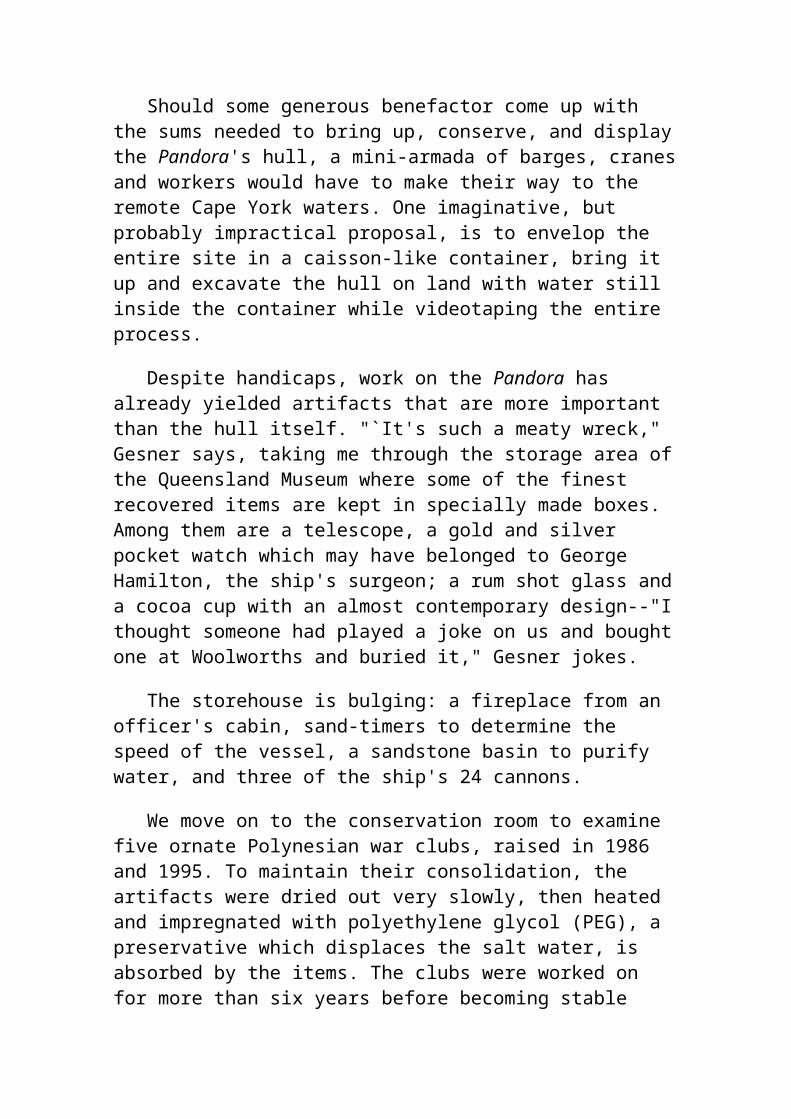
says, taking me through the storage area of the Queensland Museum where some of the finest recovered items are kept in specially made boxes. Among them are a telescope, a gold and silver pocket watch which may have belonged to George Hamilton, the ship's surgeon; a rum shot glass and a cocoa cup with an almost contemporary design--"I thought someone had played a joke on us and bought one at Woolworths and buried it," Gesner jokes.
The storehouse is bulging: a fireplace from an officer's cabin, sand-timers to determine the speed of the vessel, a sandstone basin to purify water, and three of the ship's 24 cannons.
We move on to the conservation room to examine five ornate Polynesian war clubs, raised in 1986 and 1995. To maintain their consolidation, the artifacts were dried out very slowly, then heated and impregnated with polyethylene glycol (PEG), a preservative which displaces the salt water, is absorbed by the items. The clubs were worked on for more than six years before becoming stable enough to be handled with gloves. A heavily encrusted brass field telescope will take at least 1,000 hours of conservation work.
Conservation is painstaking, but the hardest part is the interpretation. "The final analysis of it all will probably take 20 years," Gesner says.
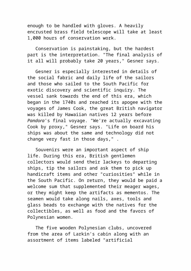
Gesner is especially interested in details of the social fabric and daily life of the sailors and those who sailed to the South Pacific for exotic discovery and scientific inquiry. The vessel sank towards the end of this era, which began in the 1740s and reached its apogee with the voyages of James Cook, the great British navigator was killed by Hawaiian natives 12 years before Pandora's final voyage. "We're actually excavating Cook by proxy," Gesner says. "Life on board his ships was about the same and technology did not change very fast in those days," .
Souvenirs were an important aspect of ship life. During this era, British gentlemen collectors would send their lackeys to departing ships, tip the sailors and ask them to pick up handicraft items and other "curiosities" while in the South Pacific. On return, they would be paid a welcome sum that supplemented their meager wages, or they might keep the artifacts as mementos. The seamen would take along nails, axes, tools and glass beads to exchange with the natives for the collectibles, as well as food and the favors of Polynesian women.
The five wooden Polynesian clubs, uncovered from the area of Larkin's cabin along with an assortment of items labeled "artificial curiosities," were
almost certainly from Tonga where either sharks' teeth or iron nails were used in the eighteenth century to produce intricate surface carvings on the clubs, which were probably used for ceremonial purposes.
Gesner says that even at the Bernice P. Bishop Museum in Hawaii most of the great Polynesian collection is not securely dated. But artifacts off Pandora, like the clubs, can be pinpointed in time. So can the tourniquet clamp, syringes for treatment of venereal disease and other items from the doctor's medicine chest, which add to knowledge about health and hygiene aboard His Majesty's vessels.
It's not easy keeping up with the material that must be cataloged, photographed, researched and conserved. Gesner is also worried about someone damaging the Pandora with an errant anchor or pilfering its treasures." A wreck is like a 1,000-page book. If somebody comes along and tears out a few pages for the illustrations, nobody coming afterwards can read it in its entirety," he says.
Its remoteness offers perhaps the best protection. And, there are rules about dropping anchors in its vicinity, while a special permit, difficult to obtain, is required to dive on the site.
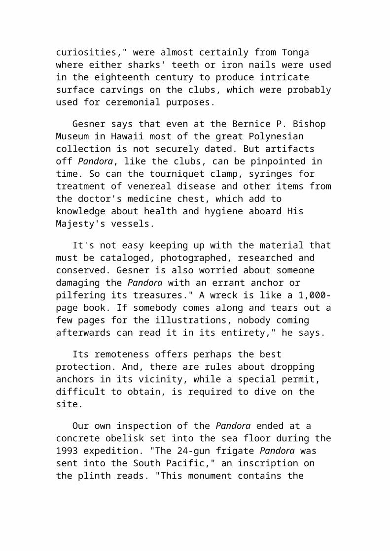
Our own inspection of the Pandora ended at a concrete obelisk set into the sea floor during the 1993 expedition. "The 24-gun frigate Pandora was sent into the South Pacific," an inscription on the plinth reads. "This monument contains the skeletal remains of one of Pandora's crew who perished."
These remains, three-quarters of a skeleton found in 1986, are believed to be those of one of two crewmen killed as the ship was rolling on the reef. One was struck by a falling beam, the other by a gun carriage. The remains appear to have been wrapped up with some material, and it is thought that the victim was taken to a lower deck to preserve morale until he could be buried.
As we began our slow ascent from the plinth, I saluted, both the unknown sailor and those bringing the Pandora back to life.
Bermuda Triangle Stargate?
A CONNECTION TO ATLANTIS?
Do Newly Mapped Magnetic Anomalies Point to the Stars?
(Please be patient while the maps load)
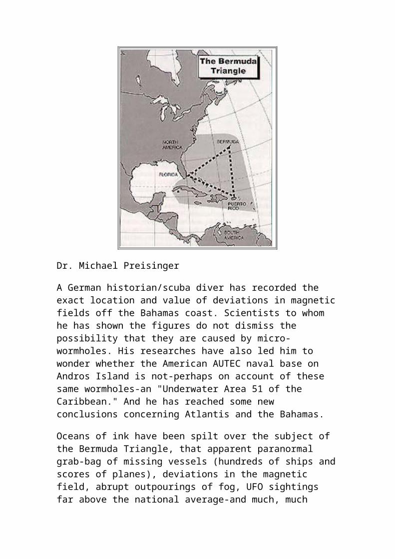
Dr. Michael Preisinger
A German historian/scuba diver has recorded the exact location and value of deviations in magnetic fields off the Bahamas coast. Scientists to whom he has shown the figures do not dismiss the possibility that they are caused by micro-wormholes. His researches have also led him to wonder whether the American AUTEC naval base on Andros Island is not-perhaps on account of these same wormholes-an "Underwater Area 51 of the Caribbean." And he has reached some new conclusions concerning Atlantis and the Bahamas.
Oceans of ink have been spilt over the subject of the Bermuda Triangle, that apparent paranormal grab-bag of missing vessels (hundreds of ships and scores of planes), deviations in the magnetic field, abrupt outpourings of fog, UFO sightings far above the national average-and much, much more. A vast amount of pure speculation has accompanied these reports, the most controversial being that the Bahamas archipelago is comprised of the mountaintops and higher areas of the lost continent of Atlantis, sunk beneath these waters millennia ago.
As a practicing historian, with a doctorate in history and sociology from the German Sports University in Cologne-and therefore with a vigorous
training in avoiding speculation-I certainly never expected to have anything to contribute to this controversy, which I tended to entirely dismiss.
Pure happenstance changed all that. I am also a trained scuba diving instructor; and, in 1995, I was sent by my company on a six-month stint to Nassau, Bahamas, with my wife and children. My German customers were the travel companies Inter Airlines and Aeroplane. My task was to develop tourist programs for scuba divers and help customers who were already there.
In the course of my work, I heard persistent reports of persons on boats who had experienced sudden deviations in their compass readings which had put them right off course. My curiosity as a historian got the better of me (and, besides, it would make for an unusual diving experience): I decided to look for magnetic field anomalies in the places where the deviations had been noted, and try to bring back exact figures for those deviations.
Based on the stories I'd heard, I chose more than half-a-dozen points at which to dive: Fish Hotel, Lyford Cay, and White Hole, near Nassau; Lost Blue Hole, about an hour by boat from Nassau; Dogleg Reef, an hour by boat from Marathon, in the Florida Keys; the "Atlantis Wall," near Bimini; and Sunken Train, near Eluthera.
Fellow scuba divers Al Miller, an American, and Joel Green, a Jamaican, accompanied me on these expeditions. Over the course of several weeks, we carried out one to seven dives a week, depending on the time we had available.
Dressed in our scuba gear, and singly or in pairs, we dove at each location several times, usually descending to a depth of no more than a few dozen feet. The dives lasted 60 to 75 minutes; sometimes we made them from cheap inflatables, other times from rented boats.
We found clear evidence of deviations at four locations: Fish Hotel, Lyford Cay, White Hole, near Nassau; and Dogleg Reef, near Marathon, in South Florida.
In the course of our dives, we recorded precise figures for what the compass readings were as compared to what they normally should have been.
Over the next few months, I communicated these figures to a number of physicists around the world. To a one, they told me that such magnetic field
anomalies could be caused by briefly-appearing micro-wormholes. They could think of no other explanation for the deviations. Prof. John Wheeler, of Princeton University, in Princeton, NJ, has given the name of "wormhole" to what he believes may be "transit tunnels" between different dimensions of reality. According to Wheeler, these wormholes may be only a giga-fraction of a square inch in size-the number one preceded by 33 zeroes, preceded by a decimal point. Wheeler says these mini-black holes, constantly blinking in and out of the geometry of space, are thought to be bits of "virtual matter;" that is, they can exist for a limited time only. Their counterparts-so-called mini-white holes-are virtual anti-matter. Whenever these two kinds of virtual matter build up to any extent, they immediately destroy themselves. Wheeler can offer no explanation as to why mini-holes appear, disappear, then reappear.
Regarding my magnetic field anomaly readings, here are some typical responses, from some of the scientists-usually quantum physicists-to whom I spoke:
Dr. Werner Muller, physicist, Karlruhe, Germany, in a 1995 phone interview: "According to the figures you provided and the fact that no natural source was found in the bottom of the sea, there are just the quantum physical theories left to explain the phenomenon."
Professor Tsung-Min Gung, physicist, Tokyo, Japan, 1995; phone interviews: "If the theories of inter-dimensional connections are not completely wrong and can develop in the way I am expecting them to, the strong interdependencies with gravitation and the earth's magnetic field may be a way to track them down."
Grazyna Fosar, physicist, Berlin, Germany, in a radio discussion together with myself, in 1997: "From the physicist's point of view, gates to hyperspace can be the only reasonable explanation for these mysterious deviation fields."
These startling results led me to investigate, tentatively at first, then with growing interest, some of the other "Bermuda Triangle" phenomena associated with the Bahamas area. I knew that the theory of compass deviations as being caused by "stargates" went back some way (though, as far as I knew, I was the first to come up with any figures); I was now told that the extremely high incidence of UFO sightings in the Bahamas archipelago had been associated by some researchers with these stargates.
I was further told that many of the sightings took place near the Atlantic Undersea Test and Evaluation Center (AUTEC), the American naval base
on the Bahamas island of Andros, and that some researchers believed AUTEC might be an underwater "Area 51"- a place where secret research was being carried out on UFOs by the American government, and which, from time to time, was even visited by UFOs.
I decided, as a historian, to try to get to the bottom of these extraordinary speculations. The Atlantic Undersea Test and Evaluation Center (AUTEC) possesses unique resources, including an underwater range for testing and research on acoustic equipment. It is located 177 miles southeast of West Palm Beach, Florida, at Andros Island and the Tongue of the Ocean, in Bahamas. The Andros Island AUTEC test facility-access to which must be obtained beforehand - covers only one square mile on land, but actually comprises 1,670 square miles of the surrounding Caribbean. This ocean area is a steep-sided deep-water embayment 100 miles long and 20 miles wide, with depths varying from 700 fathoms at the "rim" to 1,100 fathoms (more than a mile) at the northern end. By any reckoning, this is a huge amount of underwater space.
I learned from more than one source that the Andros base has an ultra-top secret caliber of security. Here is an illustration. In 1997, a group of duck-hunters-who, admittedly, had walked right by a PROHIBITED AREA sign less than a mile from the base-suddenly found themselves confronting an unusually thick wall of foliage. At that very moment, they were knocked off their feet and their faces thrust into the ground.
The hapless duck-hunters quickly discovered that the foliage contained sailors in heavy camouflage, and that other sailors, leaping out of the foliage behind them, had hurled them to the ground. Taken to a nearby tent, they were grilled by a colonel for hours, until they were certain they would be thrown into prison. Then, abruptly, the officer released them, declaring, "I believe your story."
In the waters off Andros island, strange craft have been seen from time to time which not only resemble UFOs, but which display the same unbelievable swiftness of motion and execute the same incredibly sharp turns. A Viennese businessman told me that, once, when he was yachting off the coast of Andros, he glimpsed, two miles away (it was a very clear day), in waters over a mile-and-a-half deep, a motionless object he thought was a whale. Coming to within almost half-a-mile of the object-which was now gleaming oddly-the yachter observed that it was some kind of man-made craft of ultramodern design.
Suddenly, the craft took off in a southerly direction at what my informant described as a "lunatic speed." It sped along the surface of the water. Then, abruptly, it disappeared beneath the waves, not to be seen again.
I have been told of conspiracy and suppression theories of a very dark nature which have been burgeoning around the subject of AUTEC as an "underwater Area 51," just as they have been around the subject of the real "Area 51."
Here is an example, passed along to me by an informant whom I interviewed in November, 1998, at NASA headquarters at Cape Kennedy, Florida.
I was told that highly respected and world-class British scuba diver Rob Palmer, who had been director of a "blue holes" research center in Bahamas for a number of years, had failed to surface after a dive in the Red Sea, in Israel, in mid-July, 1997, and was presumed dead. Blue holes are small underwater caves, apparently formed from within, which are found predominately in the area of the Bahamas archipelago. I think it possible that blue holes may, perhaps, have been formed by the popping in and out of existence of micro-wormholes.
Rob Palmer, apparently, had entertained a roughly analogous theory. In addition, he believed blue holes might be the transit points for UFOs arriving here from other dimensions-and his investigations were taking him closer and closer to the AUTEC base on Andros Island, where there is a very great proliferation of blue holes. My informant told me there was a rumor that Palmer might have been murdered by officials at AUTEC, probably because he knew too much, and possibly by a post-hypnotic suggestion which caused him to take his own life while he was under the waters of the Red Sea.
As a professional historian, I don't care to indulge in such lurid speculations. But their existence suggests there might well be significant clandestine activity taking place at the Andros island AUTEC facility.
Since so much of the far-fetched material I had investigated had turned out to have some basis in reality, however indirect, I now decided to investigate the story that the area of the Bahamas is the site of the (not completely sunken) continent of Atlantis.
Many have long believed that Bimini is a remnant of Atlantis. The idea was first mooted by trance-medium Edgar Cayce, who claimed that many of the people to whom he gave readings had lived past lives on Atlantis. Using
the latest technology, scientists from the British Government's Building Research Establishment have even discovered tiny amounts of coal and gold in apparently man-made stone found on the seabed at Bimini.
As a historian interested in primary rather than secondary sources, I decided to read the single text upon which all of the thousands of books on Atlantis are based: the dialogue called the Critias, by the Greek philosopher Plato.
Moreover, I decided to read the dialogue, not, as so many have, as myth or metaphor, but as historical fact. And I bypassed most of Plato"s detailed account of the splendors of this ancient kingdom, concentrating instead on its dimensions as reported by Plato: What shape did Atlantis have? How long and wide was it?
I learned something intriguing: that if you were to take the present-day Bahamas archipelago and raise the entire land-mass by 300 feet-or, to put it another way, lower the water level surrounding Bahamas by 300 feet (its level during the last Ice Age)-you would end up with a country that closely matched, in shape and size, the ancient Atlantis of Plato: The philosopher wrote in the Critias that the continent was larger than Egypt (as it was then known); that the center of the island, not far from the sea, was formed by a plain surrounded by shallow mountains to a distance of six miles; and that these mountains themselves were located in a large plain, surrounded by high mountains to a distance of 200 miles.
My conclusions regarding the so-called Bimini Wall, thought by many to be a remnant of Atlantis, were not nearly so "New Age." I believe that some of the stones making up the wall appear to be man-made, not because they came from Atlantis, but because they were left there during the American Civil War.
In those days, a great many ships ran the Union blockade to bring trade to Confederate harbors. Pursued by Union ships, these vessels often escaped into the shallow Bahamas waters where the big man-o-wars couldn"t follow.
To navigate over the reefs that filled these waters, they frequently had to jettison weight so as to ride higher in the water. What easier way to do this than by dumping granite stones from the ship"s ballast? That, I think, may account for a good many of the granite stones now found at such places as Bimini.
I pursued my investigations in a number of other areas. I found out, for instance, that Bahamas has its own legends of mysterious little monkey-like creatures that are almost never seen: the "chickcharnies". I discovered there are numerous "ghost stories" associated with Bahamas, and that the shamans of the area are reputed to have almost godlike-powers. I came away with the impression - one that can scarcely be proven scientifically - that there is high degree of psychic, even "interdimensional," energy in the Bahamas archipelago.
My attention, though, keeps returning to the "underwater stargates of the Caribbean," which I discovered with my friends Al Miller and Joel Green. I continue to wonder what might be the next step in researching these "stargates." I have a proposal. It would be interesting to actually try to enter one of these "stargates"-except that they are usually microscopic to an extreme degree, and they tend to fluctuate in and out of existence.
Therefore, I would like to suggest that one or a number of psychics descend to the sites of some of these underwater anomalies, perhaps those near Nassau, which are shallow, and not far from shore-and not far from the Bahamas capitol, which could make an excellent host to a world press tempted to attend this unusual "Underwater Splashdown to the Stargates of the Caribbean." Jeanne Dixon may be too old for such a venture; but there must be many youngish, athletic and gifted psychics who could be persuaded to don scuba diving gear and venture to the bottom of the ocean to see what telepathic feelings and messages they might be able to pick up, filtering ever so briefly through these on-again, off-again, underwater micro-wormholes.
My proposal may seem outlandish. But I and my scuba diving colleagues would be glad to train as divers any prospective psychics, and descend with them to the ocean bottom off Bahamas. We could do it during the coolest month of the year in Bahamas-January. January 1, 2000, seems like a propitious date. Do I have any takers?
Dr. Michael Preisinger may be contacted at :P.O. Box 1462, 88620 Pfullendorf, Germany, FAX (+49/0) 7552-97805.
He is the author of Das Bermuda Rötsel Gelöst, published in 1997.
Copyright - 1996-1999 Atlantis Rising. All Rights Reserved
END
The Weather In the Triangle
It's no accident that many ships, especially before the 1950s, sunk in that area. The reason can be found in the weather patterns that affect that area. A perfect example of the volatile weather in that area came in the form of Hurricane Andrew. This devastating hurricane passed right through the heart of the Bermuda Triangle, and caused incredible amounts of damage in the northernmost Bahamas, and also in south Florida.
Many other devastating hurricanes have passed through this area over the past 30 years, and have caused several ships to sink, even in modern times. Storm systems exiting the United States usually strengthen in the Bermuda Triangle during the fall and winter because the very warm water in that area helps to develop those storms very quickly and sometimes without warning.
The legend of the Bermuda Triangle actually started in the 1500s during the height of trading between Spain and the Americas. The peak trading season was between June and October, which is also during Hurricane Season in the Atlantic Ocean. Many ships, loaded with gold and jewels for Spain, would set out into the Bermuda Triangle, and would either never return, or would arrive in Spain badly mauled by terrible storms, which the people on the ships claimed were attacked by sea monsters. Actually, many of the ships sunk because the captains had no idea how powerful hurricanes could be, or how quickly storms could develop in that area. Today, with weather satellites, advanced radar, reconnaissance planes, and other observation methods, hurricanes and other storms are much more detectable and predictable. Ships can be turned away from them before they get into trouble.
BERMUDA TRIANGLE:
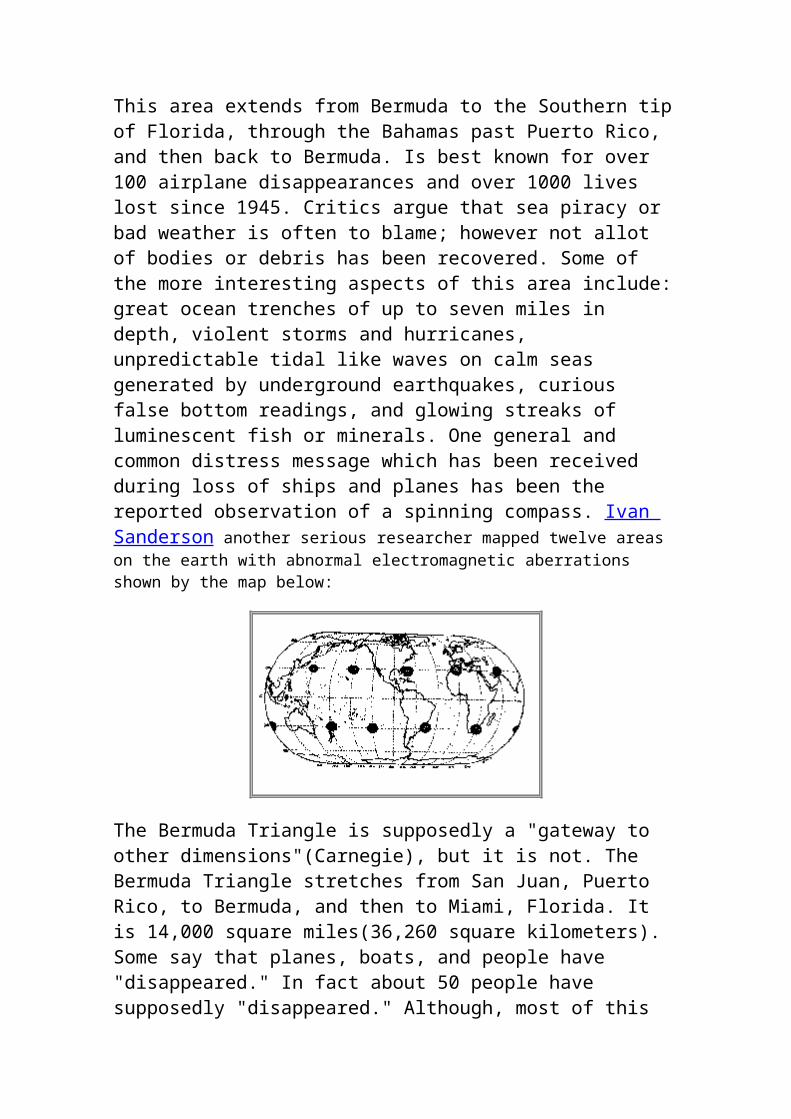
This area extends from Bermuda to the Southern tip of Florida, through the Bahamas past Puerto Rico, and then back to Bermuda. Is best known for over 100 airplane disappearances and over 1000 lives lost since 1945. Critics argue that sea piracy or bad weather is often to blame; however not allot of bodies or debris has been recovered. Some of the more interesting aspects of this area include: great ocean trenches of up to seven miles in depth, violent storms and hurricanes, unpredictable tidal like waves on calm seas generated by underground earthquakes, curious false bottom readings, and glowing streaks of luminescent fish or minerals. One general and common distress message which has been received during loss of ships and planes has been the reported observation of a spinning compass. Ivan

Sanderson another serious researcher mapped twelve areas on the earth with abnormal electromagnetic aberrations shown by the map below:
The Bermuda Triangle is supposedly a "gateway to other dimensions"(Carnegie), but it is not. The Bermuda Triangle stretches from San Juan, Puerto Rico, to Bermuda, and then to Miami, Florida. It is 14,000 square miles(36,260 square kilometers). Some say that planes, boats, and people have "disappeared." In fact about 50 people have supposedly "disappeared." Although, most of this can be explained by waterspouts, extreme air turbulence, electromagnetic storms, and powerful ocean currents, there are two major occurrences that started the myth: the major one, Flight 19, and the minor one, Mary Celeste.
A Brief History of the Devil's Triangle Limbo of the Lost. The Twilight Zone. Hoodoo Sea. The Devil's Triangle. The vast three-sided segment of the Atlantic Ocean bordered by Bermuda, Puerto Rico and Fort Lauderdale, Florida, did not receive its most famous nickname until 1964, but reports of bizarre happenings there, or nearby, have been recorded for centuries. In fact, many claim that Christopher Columbus bore witness to the Bermuda Triangle's weirdness.
As the Nina, the Pinta and the Santa Maria sailed through the area in 1492, it is reported that Columbus's compass went haywire and that he and his crew saw weird lights in the sky, but these events have mundane explanations. From the account in Columbus's journal, it is thought that his compass's slight inaccuracy stemmed from nothing more than the discrepancy between true north and magnetic north. As for the lights, Columbus wrote of seeing "a great flame of fire" that crashed into the ocean -- probably a meteor. He saw lights in the sky again on October 11, which, of course, was the day before his famous landing. The lights, brief flashes near the horizon, were spotted in the area where dry land turned out to be.
Supposedly five Navy Avengers and one Martin Mariner flight-bo disappeared without a trace. After that people started to blame the Bermuda Triangle, thinking, "Twenty-seven men lost in the Bermuda Triangle. This cannot be a coincidence. Also, isn't that the place where Mary Celeste was abandoned. This is weird." So, that is mainly how the rumor got started. In fact, the Martin Mariner flight-bo was never lost. It actually blew up 23 minutes after it took off, but still, they sent some more planes out to look for them.
Now here is some more about the myth. Supposedly, all the pilots were experienced. It was a "clear" day when Flight 19 took off. Their route was "160 miles east, 40 miles north, and 120 miles straight." Each plane took three people, but one person did not come. There were five planes. Five times three equals fifteen, minus one equals fourteen men. Twenty-seven minus fourteen equals thirteen. That means that about thirteen men went searching for fourteen men, and never came back, or so we think.
Here are some more facts. Lt. Charles Taylor was the Patrol leader of Flight 19. He was the only experienced pilot on the flight. He was leading the flight, and also had a hangover. So, when his compass went out, he thought he would fly by "Pilotage," and "dead reckoning." Later he thought he saw the Florida Keys, but it was actually an island of the Bahamas. So, then he flew north. It was raining, and after an hour he said to fly east. He had though that they were above the Gulf of Mexico, but they were heading to a very deep part of the Atlantic Ocean. Taylor also refused to switch to an emergency radio channel. By now the rain had turned into a huge storm. The planes could float for two minutes, if you had a perfect landing. You might even be able to get out of the planes, but that is only if the sea is calm. Flight 19 probably sank over the Continental Shelf, which is over thousands of feet deep. It is very hard to find practically anything in that water.
Mary Celeste
Mary Celeste was a boat from the 1870's. It was abandoned, and no one, even to this day, knows why. It is supposed that the captain thought that there was going to be a huge storm, launched the lifeboat, and left. It supposedly was in the Bermuda Triangle, but it really was not anywhere near the Bermuda Triangle. It has been over 100 years, and still no one knows why, they just guess.
Other Disappearances
1609: mate Henry Ravens sailed in a long boat with a volunteer crew of 7 men. never made it to his destination
1812: the ship Patriot and its main passenger Theodosia Burr Alston, wife of the Governor Joseph Alston of South Carolina and daughter of the Former Vice President Aaron Burr.
1814: US Navy vessel the Wasp, commanded by Johnston Blakely.
1918: The USS Cyclops, captained by the eccentric Lieutenant Commander George W. Worley who frequented the bridge of the ship wearing long underwear and a bowler hat, left Barbados on March 4, 1918 to Baltimore. On March 13, when the ship was long overdue, a massive search ensued but no trace of the largest ship in the Navy or the 300 people on board were ever found.
1941: In late November and early December 1941, two the USS Cyclops's sister ships, Proteus and Nereus both vanished on separate runs from the Virgin Islands to the USA.
1945- Flight 19, 5 Navy Torpedo Bombers, 14 crewmen disappeared without a trace. A rescue plane with 13 crewmen was sent out and also disappeared without a trace.
1945: at Cecil Field in Jacksonville, Florida 24 skilled pilots A few hours later 10 planes returned out of the 12.
1947: Army C-45 Superfort vanishes 100 miles off Bermuda.
1948: Four-engined Tudor IV luxury liner lost with 31 lives. On January 30, 1948 the aircraft Star Tiger disappeared without a trace en route to Bermuda with 31 people on board, moments later the pilot radioed to ground crew that they would be shortly arriving on schedule.
1948: DC-3 lost with 32 passengers and crew. On December 28, 1948, a DC-3 carrying 35 people from Puerto Rico also disappeared shortly after the pilot radioed a similar message that it was just 80 kms south of Miami.
1949: Second Tudor IV vanishes. Almost to the year, on January 17, 1949, the Star Tiger's sister, the Star Ariel, was about to switch from radio contact with its departure point in Bermuda to radio contact with its destination Jamaica, when it vanished. The pilot had reported perfect weather.
1949: a DC-3 carrying 30 men and women and 2 babies,

1950: Giant US Air Force Globemaster lost.
1950: American freighter, SS Sandra, 350 ft long, sinks without trace. The vessel and her 28-man crew were never heard from again.
1951- C-124 Globemaster with 53 passengers
1952: British York transport plane lost with 33 aboard.
1954: US Navy Lockheed Constellation vanishes with 42 aboard.
1956: US Navy seaplane, Martin P5M, disappears with crew of ten.
1962: US Air Force KB-50 tanker plane lost. A giant air force tanker took off from Langley Air Force Base in Virginia and never came back.
1963: Marine Sulphur Queen, 425-ft-long American freighter, vanishes with entire crew. No Mayday signals and no wreckage ever found. Two US Air Force giant stratotankers disappear on simple exercise. She routinely radioed her position and was not heard from again. Only one life jacket was found from the disappearance. C-132 Cargomaster also vanishes.
1967: Military YC-122, converted to cargo plane, lost.
1970: French freighter Milton Iatrides disappears.
1972: German freighter Anita, 20,000 tons, lost with crew of 32.
1973: the 33,000 ton German freighter
*An area called the "Devil's Sea" by Japanese and Filipino seamen, located off the East Coast of Japan, also exhibits the same magnetic characteristics. It is also known for its mysterious disappearances.
These were just a few of the disappearances that have been reported over the Bermuda Triangle but even if one were to accept the reasonable explanations purported about mutinies and bad weather and accidents and poor navigation, other occurrences in the same region are more hard to explain. For instance, a National Airlines 727 passenger flight disappeared from radar screens at Miami International Airport for 10 minutes. On arrival the crew denied that anything odd had happened to them except that they had flown through a light fog for 10 minutes. All the timepieces on the plane were ten minutes slow though they had matched up in a time check with the airport shortly before their disappearance. Several other pilots
have related experiences of gaining impossible time after flying through sudden hazes.
Which of course, gives rise to other explanations, and ones that might better explain the Bermuda Triangle mystery, even if they go contrary to the natural laws of physics. That of an aberrant energy field that creates time warps or gaps. Another case that strengthens this theory is of a less fortunate pilot called Carolyn Casico and her passenger. Carolyn, a licensed pilot, took a charter flight to Turk Island in the Bermuda triangle. As she approached the island, ground staff saw her circling aimlessly. The airport manager received no response to radio contact, when he heard her exchange words with her passenger. "I can’t understand it. This should be Grand Turk but there is nothing there. It’s the right place on the map, the shape is right, but this island looks uninhabited - no buildings... roads ...nothing”. After a few more circles, she turned back and flew away. Carolyn and her passenger were never seen or heard from again ......
Also known as the "Devil's Triangle", this unexplained phenomena has provided an ample battlefield for a fierce controversy that has raged since the early 60's.
First reported as an AP dispatch in 1950 by E.V.W. Jones as a side note to the many ships lost in the area, and reiterated two years later in an Fate magazine article, by George X. Sand. Books on UFOs in the late 50's also spoke of the triangle, suggesting that it was alien in nature. The term "Bermuda Triangle" was not coined until 1964, when it was brought to light as "The Deadly Bermuda Triangle", an article in Argosy magazine by Vincent H. Gaddis. Bermuda Triangle fever peaked in 1974, with a number of books (mostly just re-written versions of the older books) getting national press.
Some believe that the Bermuda Triangle Phenomena is caused by the Lost City of Atlantis, sunk thousands of feet below the water's surface. The advanced state of Atlantis at the time of it's submersion, relied on the power of energy crystals. It is possible that these crystals are still at the bottom of the ocean, in a somewhat altered state, sending out rays of energy that either confuses the instrumentation of vehicles, or disintegrates them all together.
Lastly, many believe the Bermuda Triangle to be a man-made energy field using Tesla based technologies. A VLF-Resonance transmitter (a technology many believe to be in use by the North American Air Defense Command, or NORAD) would have an antipode directly in the middle of the Bermuda Triangle. This hypothetical system would be capable of
recharging speculated secret electric-powered submarine classes, and would definitely provide enough interference to scramble signals that airplanes and boats rely upon.
The Lost Blue Hole
Perhaps the most unusual dive site in the Bahamas, this natural hole extends about 100' across, drops to about 200', with its perimeter, dotted with isolated coral heads, starting at a depth of 40'. Most shops permit a maximum 80' depth. Along the perimeter divers may see large schools of reef fish, including Chromis, Angelfish, and Sergeant Majors, each circling around each coral head. Also found nearby will be large Groupers, giant Southern Stingray, eels and numerous sharks.
Nearby are these:
The Shark Buoy / Deer Island Buoy - used by the U.S. Navy for submarine exercises, tethered in 6,000 feet of water. Its mass floating on the surface attracts a wide variety of pelagic marine life such as Dolphinfish, jacks, Rainbow Runner, and Silky Sharks. Visibility usually in excess of 150 feet, offering great u/w photography.
The Vulcan Bomber - used in "Thunderball", is now a simple framework draped with a kaleidoscope of colorful gorgonians and sponges.
Tears of Allah - wrecked freighter where James Bond eluded the Tiger Shark in "Never Say Never, Again"; sits in 40 feet of water; good u/w photography site.
Tunnel Wall - network of crevices and tunnels, starts in 30 feet, exits along the vertical precipice at 70 or 80 feet.
Cay Sal Bank
There are few places in the world that can equal the diving you will find in Cay Sal. With pristine water and unparalleled wall diving it's no wonder so many people going there every year. Typically these trips last seven days, although six days trips can be arranged.
Upon clearing Bahamian Customs & Immigration in Bimini we journey south, diving as we go. Stopping at sites like Tuna Alley, Victory Reef, Hogfish City and finishing with Wanyes Shark Hole where it is not unusual to find sleeping reef sharks, or a pod of spotted dolphins
The Captains drive late into the night making way to remote Cay Sal. Anchoring at the Blue Hole, starting at 25 to 30 feet deep this hole cuts back then opens into huge bowl.which extends beyond sight. The Red Hole, another dive site, is small enough to swim around and has an interesting cave off to one side. After a day of blue hole diving you head for Elbow Cay. where lush wall dives await you. You will spend the next few days doing wall dives, exploring deserted islands, enjoying super snorkeling with all the swim throughs and hidden caves. The Fire Demon is one such cave; viewed at the right time of day pillars of fire appear to dance across the cave floor.
But the walls are why you came. Elephant Rock, Eagle, Last Rock & The Chimney, wall dives that are teaming with marine life. This is no accident; because the gulf stream passes so close by there is a constant supply of fresh water circulating. This clean water also produces 150' plus visibility. Beginning at 65' these walls then drop off to ? ? ? Often you will find the wall to be inverted, so lush is the overgrowth. As you drift along the wall be sure to watch for eagle rays, sharks, tuna or even mammals like ocean dolphins off in the distance. Amongst the coral you will find colorful tropical fish, eels, and huge lobster. Take time to explore the many chimneys that start at the top of the reef and open somewhere on the wall.
THE ATLANTIS CONNECTION?
Edgar Cayce, who was know as a healer and psychic, and also as the father of holistic medicine, claimed that he was, in a former life, a citizen of Atlantis. Cayce told of an advanced civilization, with all the inventions of our modern day life including weapons of mass destruction. The most notable weapon being the "death ray". Death rays came in all sizes, but a giant death ray machine, which was the largest of all their weapons is said to be the weapon that destroyed Atlantis. Cayce also predicted that the western ridge of Atlantis would be discovered off the coast of the Bimini islands. In The 1960's a startling discovery was made in that same place. It was that of an ancient roadway built out of large stones which was under the ocean off the coast of Bimini. Could this be an ancient highway of Atlantis?
THE SCOTT STONES
The possible accuracy of Aaron Du Val’s claims about the "Scott Stones" near Bimini certainly appears to fit this criteria quite nicely. If the Edgar Cayce readings are correct, the sinking of the West Coast will rise this area above sea level in due course, making the ruins much easier to explore.
Before Du Val, Charles Berlitz had already given pictorial and radar – based evidence for submerged step pyramids, megalithic walls and walkways, as well as a fantastic – sized tower, which Hermann believes to be the Tower of Ilta that is referred to in the Edgar Cayce readings.
The ruins of temples dated at 12,000 years old have been found near Bimini, Bahamas. Preliminary analysis has revealed that the original structures, although smaller in size than the Great Pyramid of Giza, appear to have been more advanced. Casing stones have been measured which are of the same unique angle as those at the Great Pyramid.
The ruins are megalithic and bear a remarkable resemblance to ancient sites in Egypt. So called "quarry marks" found in the Aswan quarries and also on the Great Pyramid, itself, appear to be identical matches with those found on the Bimini temple stones. Other characteristics closely match features at megalithic sites in Peru, the Yucatan, Ireland and Scandinavia. The stones are already drawing international attention and aggressive research and analysis projects are being set up which hope to commence more involved investigations shortly.
Analysis of these enigmatic ancient temples built near Bimini over 12,000 years ago has only just begun. Although many maps of the heavenly realm adorn various walls of these mysterious Bimini temples, there is an almost complete lack of other markings. Of the limited glyphs that do exist, however, several match those found in the famous Altamira Cave in Spain which contains the well-known bison painting. In addition, there are exact orbital plots of the planets and what seem to have been intricate star shafts, metal-coated walls, and intermingled stones of various colors. (including red, white, and black.)
Preliminary analysis has revealed that the original structures, although smaller in size, appear to have been more advanced than the Great Pyramid of Giza. Casing stones have been measured which are of the same unique angle as those at the Great Pyramid.
Other characteristics either closely match or are identical to features at megalithic sites in Peru, Mexico, the Yucatan, Ireland, and Scandinavia.
It appears that the most important or revered numbers associated with these ruins were the numbers five and nine. These numbers were also of great significance to the ancients of Egypt and Mesoamerica. Evidence indicates that a "checkerboard" calculator system was being used. Examples of this system were found on top of the Great Pyramid and were long used for numerical calculations in Mesoamerica. This same checkerboard pattern
shows up on the lintel stones of temples built by Celts of Iberian origin. Also, according to some astronomers, this pattern served as a calendar regulator to measure the sunrise and sunset directions on solstices and equinoxes.
Although many maps of the heavenly realm adorn various walls of these mysterious Bimini temples, there is an almost complete lack of other markings - just as found in the pyramids at Giza. Of the limited glyphs that do exist, however, strangely enough, several match those found in the famous Altamira Cave (known as the Sistine Chapel of pre-history) which contains the well-known bison painting.
The major concern of the mysterious ancient civilization that produced these heavenly maps seems to have been Saturn and Jupiter -- with the oldest records reflecting and emphasis on Saturn.
The stones are already drawing international attention and aggressive research and analysis projects are being set up which hope to commence more involved investigations shortly. The unnamed discoverers have given the temple ruins the title of "The Scott Stones" -- in honor of the Professor who laid down the clues which made the discovery possible.
The exact location of the site is being withheld, for the present, until the proper government officials and museums can be notified.
To begin with, the area in which they were built, geologists tell us, has been underwater for about 12,000 years. There are also instances in which lava has flowed in between some of the temple stones which may give scientists an approximate date when submitted to testing. The antiquity of the stones almost leaps out at you upon first glance. There are hollows which have been left in certain broken stones which have undergone such an extensive amount of crystal growth upon their inner surfaces that they now look like the inside of a geode! In many cases, the cement that once held the huge stones together is now completely crystallized. Even more telling is the fact that, some of the massive granite blocks, themselves, now exhibit significant portions which have metamorphosed over the ages to the point where they are no longer even granite.
But perhaps, the most significant of all is the fact that organic matter has been found within an hermetic seal; along with unrusted, worked iron. The iron began to rust soon after the seal was opened, however; which would indicate that the seal had prevented the entry of oxygen for thousands of years. The organic matter was in pristine condition and should prove to be
an interesting target for dating procedures. Other hermetic seals, which have yet to be opened, are known to exist, as well.
EXACTLY how old are the Scott Stones? will this ancient megalithic site be one of the first to yield an accurate account of its true age? Did men work iron before the Iron Age? We may soon know!
On the 23rd of September, 1998, by carefully following guidelines laid out by Professor Scott, the explorers were finally able to vault a formidable barrier, making it possible to begin deciphering an ancient form of writing which apparently goes all the way back to Atlantis, itself! The explorers say they are "thrilled, awed, and humbled" by the information they are recovering. They warn, however, that there may be many who will see this information as quite "shocking or up-setting."
The explorers also say that the unthinking and inconsiderate attitudes of some, to both the revelance and the fragility of these discoveries (not to mention the inevitable complications involved with governmental entanglements) leave them little room to reveal much more at this time and still insure the responsible protection of these sites. It is for this most obvious reason that the exact location of both of these sites MUST, for the time being, remain a secret; pending the institution of proper protection and supervision. Until such time, the explorers who discovered these matching sets of ancient records say they will continue to decode them and leave the rash and irresponsible thrill-seekers to their frantic antics of helpless envy.
As progress continued in translating an ancient form of writing found in Egypt, it was realized, to the surprise (and joy) of the explorers, that at some point in time, a SIMILAR SET OF RECORDS had actually been carried to the area of the Yucatan! A full explanation of how this was determined from actual records in Egypt will have to wait. But the important news, for now, is that by matching the available clues, the explorers were able to locate (on the 23rd of October) a MATCHING SET OF RECORDS IN THE YUCATAN AREA! This latest find is very exciting; and the explorers say that as translations continue, it may be possible to locate other sites with matching records, as well.
Records which have been translated, so far, deal with prophecy, historical events, dimensional shifts in time, and the religion of Atlantis. It is estimated that a full translation of records found, to date, could take years to accomplish. But the fact that the very same information is found in both hemispheres can only be seen as a RESOUNDING VERIFICATION as to the authenticity and intention of these records.
According to the explorers, however, without the actual records which were discovered at the Scott Stones site, these current researchers stand little to no chance of being able to locate the Egyptian set of records which has proven so helpful. Also, they say that without the Egyptian set of records, it will be virtually impossible to locate the matching set of records in the Yucatan area. The explorers explain that these three sets of records, though NOT identical, ARE intricately and indisputably linked; and they DO absolutely corroborate each other!! What's more, the explorers (although independent and having no connections whatsoever with the A.R.E.) are saying that: "It cannot even be debated (probably much to the rancor or chagrin of some) that the actual INFORMATION contained in these records *DOES* POSITIVELY CONFIRM things which Edgar Cayce supposedly saw, including: startling new information concerning a predicted RETURN!"
Pyramid Found Under The Sea
SOURCE: Janet Ann Spencer extracts from "The Planetary Connections", British Edition, distributed by Roger Brown of "Fountain Adelaide", Issue No. 6, Winter 1994/5--
Newsweek reports the discovery of a pyramid under the Bermuda Triangle. "And not, just any pyramid, sonar tracing has mapped the pyramid's outline, and shows it rising to a height of some 780 feet from the otherwise flat ocean floor 1,200 feet below the surface of the Atlantic.
The discovery was made and then confirmed by Captain Don Henry, who discovered the puzzling phenomenon while making sonar tracings of the sea floor in an area of the Atlantic between South Bimini Island and the north end of the Cay Sal Bank. He was staggered when he realized that this undersea pyramid was some three hundred feet higher than the Cheops Pyramid, with a base of a thousand feet square.
Dr. J. Manson Valentine, anthropologist and zoologist at the Miami Museum of Science, is convinced and points out that the area where the pyramid is located was once dry sand. The area has long been suggested as the site of Atlantis.
Christopher Dunn reports - I was intrigued by this report and immediately called DuVal to get more information. Surprised when DuVal answered the phone, I was more surprised when he immediately recognized who I was, having read my articles in Atlantis Rising and on the Internet. He stated emphatically that the quarry marks he had witnessed on the stones were
identical to those I had taken in Egypt and published in my article. I asked him if there was evidence of precision machining with small corner radii where a tool was used. He responded that the radius on the stone he had seen was larger than the one I had published. He told me about petal-shaped holes that were drilled through 12 feet of granite. He claimed emphatically that if I came to Florida, I wouldn't be disappointed. He said that if anyone should view this site, I should. Upon further questioning he said that the stones were not a part of a recognizable structure, and wouldn't answer when asked if they were in their original location.
I asked DuVal where the site was located, but he refused to reveal its whereabouts, saying that the site needed to be protected. He also wouldn't tell me what kind of transportation I would take to get to the site. He did say that people have not recognized it for what it truly is. I told him I couldn't make it to his conference on July 25th, because I was moving into a new house. I told him I could probably make it at an earlier date.
After e-mailing the information to Atlantis Rising editor Doug Kenyon, I followed up with a telephone call. We both agreed that if DuVal's analysis of the site could be verified, it might indeed be a remarkable discovery. Doug had already talked to DuVal and, while keeping an open mind, he had his own reservations. He then told me about Richard Wingate, another researcher, and friend of his, who had worked in that area. One premise put forward by Wingate was that the Moselle Shoals (formerly the Moselle Reef) near Bimini are the ruins of a prehistoric structure. Many of the blocks of stone that make up the First Street Jetty and others in Miami were taken from the Moselle Reef and brought over on barges in the 1920s. In support of his premise that these are the stones of Atlantis, Wingate described petal-shaped holes drilled through 12 feet of granite,a feat that he says would require sonic drills (see picture at beginning of this article).
Even though skeptical of DuVal, I was mindful of the experience I had while in Egypt in 1995. I came across and was able to inspect evidence of advanced methods of machining granite. The item I studied on the Giza Plateau had been overlooked for centuries, with thousands of tourists passing it by. Doug and I agreed that it may be worth checking out, and if I was shown an ancient artifact that was identified as being 12,000 years old with the same precision as the stones in Egypt, then we may have indications of a prehistoric advanced culture. We were both exceedingly curious, but suspicious that DuVal's discovery was actually the jetties in Miami.
On July 13 I received the following e-mail from DuVal.
Mr. Dunn, We have decided that it would be good for you to see the Scott Stones right away. We would be most pleased to spend 2 - 3 days in showing them to you, if that would give you enough time to get the pictures and measurements you might need. The best time for us would be anytime between 15 July and 21 July. Please make a short call to us, if this might be suitable for you. Or e-mail us if you would like to set a different date-time.
Thank you for your interest in this matter, Aaron Du Val.
When I called DuVal again, he extended his hospitality and offered accommodation if I would come to Miami. He stated emphatically that I would not be disappointed by what I saw. The following day, Tuesday, July 15th, I booked a flight to Miami for July 18th and called DuVal with my arrival time. He promised to pick me up at the airport.
We then talked further about the site and I told him I was going to write an article for Atlantis Rising on my visit. He said that they would probably reveal the location of the site at the conference, because once the photographs and video were shown, the site might be recognized. I asked if the site was on the mainland. He didn't answer. I asked him if the site was indeed one of the jetties in Miami, and described to him Richard Wingate's research. Again there was silence. He wanted me to promise two things: that I would not reveal the location of the site and that credit for the discovery of the site would go to Professor Scott, who laid the groundwork for their discovery. I assured him that I would not reveal the location of any site he showed me that had not been similarly identified in the past and that credit would most certainly go where it is deserved.
On July 16, 1997, at 10:30 P.M. I received a call from DuVal. He nervously apologized and informed me that he couldn't show me the site as planned. I told him I had already bought the plane ticket and on such short notice I couldn't get a refund. He indicated that he would reimburse me and asked how much it was. He gulped when I told him and said he would send me an e-mail the following day.
Needless to say, I received no e-mail or reimbursement, but I did have an enjoyable weekend in Miami. I spent quite a bit of time clambering over the rocks in the Miami jetties seeking evidence of advanced machining technology. I know there are people who would like to believe that eventually some hard evidence would be found to support Edgar Cayce's prediction that Atlantis would be found in the Bahamas, but I couldn't find it.
Interestingly, on this great Atlantean caper, I did locate much of what Mr. DuVal describes in his several press releases. The concrete curbs taken from the streets and thrown on the jetty were made up of red and white concrete. They also had the large radius that DuVal described. One large piece of concrete had a piece of steel running through a channel. There were many blocks of granite that had intriguing hole patterns drilled into them. I suppose with a little imagination, one could make something of them. I was looking for precision, and couldn't find it. The quarry marks were nothing like the quarry marks found in Egypt.
I stopped in the Miami Museum on the way back from Coral Castle in Homestead, and learned that the Egyptology Society was indeed scheduled to give a presentation on July 25th. I also learned that they are not affiliated with the museum as Mr. DuVal claimed, but meet periodically in their auditorium.
Just as anyone can rent a hall, anyone can publish on the Internet. All you need is a PC, a modem, access to an Internet service and, suddenly, you are an instant author! Is this a bad thing? Not necessarily, as it allows for greater freedom of expression. With this freedom, though, comes responsibility. We are responsible for how we influence others, as well as how we permit ourselves to be influenced. Obviously, after this experience, our major concern should be how other authors influence us.
The Egyptology Society of Miami still has not presented their findings to the public. Their originally scheduled date of July 25, 1997, was, to the disappointment of attendees, rescheduled for August 8, 1997. On September 27, 1997 DuVal apologized for treating me rudely and told me that they are waiting for lab results before revealing anything to the public, expressing, again, a concern for the protection of the site. Given that I specifically gave DuVal the opportunity to deny that the site was the jetties in Miami and he didn't, I can only conclude, by what I have observed, and given the circumstances leading up to my observations, that this may be the case.
If my assumptions are incorrect, Doug Kenyon, I'm sure, will give him some space and the opportunity to identify the correct site so that his claims can be checked and verified.
Let's not forget the story about the boy who cried wolf. Unsubstantiated reports such as these can harm serious researchers who accept the evidence that prove advanced civilizations existed in prehistory. They tend to muddy the water and give strength to the orthodox status quo.

Sunken Cement Barrels
Atlantis Debunked
by D. TrullEnigma Editor
The island of Bimini in the Bahamas has long been a favorite hotspot in the search for Atlantis. Speculation has centered around a supposed "Bimini Road" (or "Bimini Wall"), a structure often said to have been paved on the ocean floor by Atlanteans, which is actually a natural formation of limestone. There have also been unfounded reports of stone columns and giant pyramids in the island's waters. Now another claim has surfaced of a great discovery at Bimini, and it appears that it will prove just as insubstantial as the Atlantis theories that have come and gone before.
Aaron Du Val, president of the Miami-based Egyptology Society, recently announced that a team of underwater explorers has found the ruins of 12,000-year-old temples off the coast of Bimini. Du Val claimed the structures bear markings and architectural specifications that match well-known megaliths in Egypt, South America and other parts of the world. The noted similarities to Egyptian ruins included distinctive quarry marks on the rocks and the same geometric angles present in the Great Pyramid of Giza. Other markings were said to match the Altamira cave paintings of Spain. To make his claims even more fantastic, Du Val said the Bimini ruins contained "exact orbital plots of the planets and what seem to have been intricate star shafts, metal-coated walls, and intermingled stones of various colors."
In the initial press release, dated July 6, 1997, Du Val made no specific reference to Atlantis. Later, in an interview conducted by a new age
organization called New Heaven New Earth, he stopped short of claiming that these ruins were evidence of the legendary sunken city, although he seemed to relish the possibility.
"Atlantis is a pretty touchy subject," Du Val said. "Maybe this will be the trigger to bring more people forth to explore ideas that have been taboo in the past. Megalithic structures are not supposed to be in the Bahamas. These are closer to what you would find at Giza than what you would find in Mexico or Peru, which is very strange. People are saying unbelievable things like it could force the re-interpretation of the course of human history."
Du Val was quick to agree when the interviewer noted how his announcement seemed to fulfill the predictions of alleged prophet Edgar Cayce, one of the top Atlantis advocates of all time.
"This discovery fits right with his predictions," Du Val said. "Now we are not saying it is Atlantis, but it sure is strange how these findings not only match Cayce's predictions but Plato's writings as well, even to the metal-coated walls."
In fact, Cayce actually prophesied -- among other things -- that Atlantis would rise again to the surface in 1968 or 1969. Plato's description of Atlantis was most likely a reference to the Minoan island of Santorini, near Crete, which was devastated by a volcano.
Du Val remained tight-lipped on crucial details of the Bimini ruins, including the exact location of the findings and the names of the explorers who found them. He explained that he needed to work out arrangements with museums and the Bahamian government to protect the site before its location was made public. Du Val planned a press conference for July 25, promising full disclosure and presentation of video tapes and photographs of the ruins. He also stated that he had never claimed the ruins were Atlantis, apparently to combat the "Atlantis fever" word of his announcement had triggered on the Internet.
Du Val's claims garnered a stern rebuke from Dr. Paul Pettennude, an underwater archaeologist with the Maya Underwater Research Center, who is intimately familiar with the waters around Bimini. In a statement issued to New Heaven New Earth, he listed several reasons why nothing like the ruins Du Val describes could possibly exist. Among the points of Pettennude's argument:
-- "Bimini is not the lost world. It is a very, very popular resort destination and thousands of divers visit it every year. Every available reef is dived frequently and nothing else has turned up."
-- Equipment used by the Harbor Branch Oceanographic Institute of Melbourne, Florida, and the Rosenteil School of Oceanography at the University of Miami "is very sophisticated and there is nothing but known wrecks being found."
-- "In 1986, NASA had the Navy scour everything north of Cuba to north of North Carolina looking for pieces of the exploded Challenger shuttle. Every square foot of bottom down to 6,000 feet was examined and every piece of the wreck larger than a dinner plate was recovered."
-- "The U.S. Navy maintains a system called SOSUS which cost $16 billion to secure the ocean floor from foreign subs. It paints a picture of everything from the bottom up."
-- "The reefs off Bimini from 300 feet up to the surface are less than 14,000 years old. This is the level to which the water rose at the end of the last ice age. There could not be a sunken city because the Bahama Islands are not shrinking but actually growing inches per year. This would have made any ancient city unstable."
-- "Divers could not have found a city below 250 feet without special diving gases. ... There are only a handful of people in the world trained and certified to dive these research blends. I am one of them and the group is a close knit family. No one has any knowledge nor has been asked to find an ancient city."
Pettennude also mentioned the spurious "Bimini Road" and noted that the man who discovered it in 1968, J. Manson Valentine, was one of his professors at the University of Miami. Another red herring that has thrown off Atlantis seekers at Bimini are stone pillars on the ocean floor that resemble shattered marble columns. These artifacts were actually formed by barrels of cement and similar materials that sunk from ships and hardened underwater, leaving stone casts after the wood staves of the barrels rotted away.
The weight of the evidence certainly seems to be stacked against Du Val. As it turned out, he canceled the July 25th, 1997 press conference at the last minute. He indicated that more time was necessary to ensure the safety of the ruins, lest they fall victim to looters and vandals. Du Val rescheduled
the press conference for August 8, '97 but it was postponed a second time.
After extensive research, ParaScope has found no further information on this supposed discovery or any subsequent public remarks from Du Val. Obviously, the mass media has made no announcement on the discovery of Atlantis. The only news outlet that seems to be following the story is the web site of New Heaven New Earth, whose news bulletins are available to members only -- at a cost of $100 a year. News concerning the Bimini discovery is to be posted by NHNE "four weeks after our subscribers have received it." At ParaScope, where we believe the news should always be free for everyone, we may have more to report on this story after all the details have surfaced.
Extract from Plato's Timaeus and Critias
This extract from the work of Plato (circa 427 - 347 BC) is the first appearance in classical literature of the Atlantis myth. It is supposed to be part of a story told by Plato's great grandfather (Critias), who heard it from
his great-grandfather (Dropides), who heard it from an Athenian traveller (Solon). The narrator is an Egyptian priest talking to Solon. It is supposed to describe a historical war between the ancient Athenians and the legendary Atlantis.
'Our records show how your city checked a great power which arrogantly advanced from its base in the Atlantic Ocean to attack the cities of Europe and Asia. For in those days the Atlantic was navigable. There was an island opposite the strait which you call the Pillars of Hercules (Straits of Gibraltar), an island larger than Libya (Africa) and Asia combined; from it travellers could in those days reach the other islands, and from them the whole opposite continent which surrounds what can truly be called the ocean. For the sea within the strait we were talking about is like a lake with a narrow entrance (the Mediterranean sea); the outer ocean is the real ocean and the land which entirely surrounds it is properly termed continent. On this island of Atlantis had arisen a powerful and remarkable dynasty of kings, who ruled the whole island, and many other islands as well and parts of the continent; in addition it controlled, within the strait, Libya up to the borders of Egypt and Europe as far as Tyrrhenia (Italy). This dynasty, gathering its whole power together, attempted to enslave, at a single stroke, your country and ours and all the territory within the strait. It was then, Solon, that the power and courage and strength of your city became clear for all men to see. Her bravery and military skill were outstanding; she led an alliance of the Greeks, and then when they deserted her and she was forced to fight alone, after running into direst peril, she overcame the invaders and celebrated a victory; she rescued those not yet enslaved from the slavery threatening them, and she generously freed all others living within the Pillars of Hercules. At a later time there were earthquakes and floods of extraordinary violence, and in a single dreadful day and night all your fighting men were swallowed up by the earth, and the island of Atlantis was similarly swallowed up by the sea and vanished; this is why the sea in that area is to this day impassable to navigation, which is hindered by mud just below the surface, the remains of the sunken island'
Translation by Sir Desmond Lee, first published 1965, Penguin Classics.
Although Plato describes Atlantis as an island in the Atlantic Ocean, and some Canarian writers have associated Atlantis with the Canaries, it is now generally believed that the Atlantis myth is a memory of Minoan Crete, a civilisation which was overwhelmed by the volcanic explosion of the Mediterranean island of Santorini in the fifteenth century BC.
Ivan Sanderson
The professional biologist who founded the Society for the Investigation of the Unexplained in Columbia, New Jersey, wrote "The Twelve Devil’s Graveyards Around the World" for Saga magazine in 1972. Reprinted in Paradox, by Nicholas R. Nelson, Dorrance & Co., Ardmore, Penn. 1980.
"... with several associates, he set out to 'pattern the mysteries' by taking full advantage of modern communication technology and statistical data analysis. His success was startling. "The Twelve Devil’s Graveyards Around the World," plotted ship and plane disappearances worldwide, focusing attention on 12 areas, equally spaced over the globe, in which magnetic anomalies and other energy aberrations were linked to a full spectrum of strange physical phenomena.
Highest on Sanderson’s statistical priority list was a lozenge-shaped area east of Miami, in the Bahamas, on the western tip of the infamous Bermuda Triangle. This area’s "high profile" of strange events, Sanderson concluded, was mostly due to the enormous flow of air/ sea traffic in the area. Other zones of anomaly, though less familiar, were equally rich in disappearances and space-time shift occurrences. ...
Another area of continuing disappearances and mysterious time-warps is the Devil’s Sea located east of Japan between Iwo Jima and Marcus Island. Here events have become so sinister that the Japanese government has officially designated the area a danger zone. Sanderson theorized that the tremendous hot and cold currents crossing his most active zones might create the electromagnetic gymnastics affecting instruments and vehicles. His theory is now being balanced against several."
THE ATLANTIS MYSTERY
Excerpted from Mysteries of the Lost Lands by Eleanor Van Zandt and Roy Stemmancirca - 1976
The riddle of Atlantis is among the greatest of the world's unsolved mysteries. Where, for a start, was the exact site of this huge island civilization? did it really, as early historians reported, vanish from the earth in a day and a night? Small wonder that since the earliest times scholars, archaeologists, historians, and occultists have kept up an almost ceaseless search for its precise whereabouts. Beginning with the Greek philosopher Plato's first description of the lost land that was apparently "the nearest
thing to paradise on Earth," this chapter examines in detail the basic evidence for the existence and cataclysmic destruction of Atlantis.
(Note: Plato was not the first one to know about Atlantis. He was the first to describe it in detail. Pythagoras taught Plato what he knew)
Of all the world's unsolved mysteries, Atlantis is probably the biggest. Said to have been a huge island continent with an extraordinary civilization, situated in the Atlantic Ocean, it is reported to have vanished from the face of the earth in a day and a night. So complete was this devastation that Atlantis sank beneath the sea, taking with it every trace of its existence. Despite this colossal vanishing trick, the lost continent of Atlantis has exerted a mysterious influence over the human race for thousands of years. It is almost as though a primitive memory of the glorious days of Atlantis lingers on in the deepest recesses of the human mind. The passage of time has not diminished interest in the fabled continent, nor have centuries of skepticism by scientists succeeded in banishing Atlantis to obscurity in its watery grave. Thousands of books and articles have been written about the lost continent. It has inspired the authors of novels, short stories, poems, and movies. Its name has been used for ships, restaurants, magazines, and even a region of the planet Mars. Atlantean societies have been formed to theorize and speculate about a great lost land. Atlantis has come to symbolize our dream of a once golden past. It appeals to our nostalgic longing for a better, happier world; it feeds out hunger for knowledge of mankind's true origins; and above all it offers the challenge of a genuinely sensational detective story.
Today the search for evidence of the existence of Atlantis continues with renewed vigor, using 20th century man's most sophisticated tools in the hope of discovering the continent that is said to have disappeared around 11,600 years ago. did Atlantis exist, or is it just a myth? Ours may be the generation that finally solves this tantalizing and ancient enigma.
Atlantis is said to have been the nearest thing to paradise that the earth has seen. Fruits and vegetables grew in abundance in its rich soil. Fragrant flowers and herbs bloomed n the wooded slopes of its many beautiful mountains. All kinds of tame and wild animals roamed its meadows and magnificent forests, and drank from its rivers and lakes. Underground streams of wonderfully sweet water were used to irrigate the soil, to provide hot and cold fountains and baths for all the inhabitants. - There were even baths for the horses. The earth was rich in precious metals, and the Atlanteans were wealthier than any people before or after with gold, silver, brass, tin, and ivory, and their principal royal palace was a marvel of size and beauty. Besides being skilled metallurgists, the Atlanteans were
accomplished engineers. A huge and complex system of canals and bridges linked their capital city with the sea and the surrounding countryside, and there were magnificent docks and harbors for the fleets of vessels that carried on a flourishing trade with overseas countries.
Whether they lived in the city or the country, the people of Atlantis had everything they could possibly want for their comfort and happiness. They were a gentle, wise, and loving people, unaffected by their great wealth and prizing virtue above all things. In time, however, their noble nature became debased. No longer satisfied with ruling their own great land of plenty, they set about waging war on others. Their vast armies swept through the Strait of Gibraltar into the Mediterranean region, conquering large areas of North Africa and Europe. The Atlanteans were poised to strike against Athens and Egypt when the Athenian army rose up, drove them back to Gibraltar, and defeated them. Hardly had the Athenians tasted victory when a terrible cataclysm wiped out their entire army ina single day and night, and caused Atlantis to sink forever beneath the waves. Perhaps a few survivors were left to tell what happened. At all events, the story is said to have been passed down through many generations until, more than 9200 years later, it was made known to the world for the first time.
The man who first committed the legend to paper was the Greek philosopher Plato, who in about 355 B.C. wrote about Atlantis in two of his famous dialogues, the Timaeus and the Critias. Although Plato claimed that the story of the lost continent was derived from ancient Egyptian records, no such records have ever come to light, nor has any direct mention of Atlantis been found in any surviving records made before Plato's time. Every book and article on Atlantis that has ever been published has been based on Plato's account; subsequent authors have merely interpreted or added to it.
Plato was a master storyteller who put his philosophical ideas across in the form of apparently real-life events with well-known characters, and his Atlantis story might well have been firmly relegated to the realms of fiction. The very fact that it is still widely relegated as a factual account 2300 years after he wrote it shows the extraordinary power of Plato's story. It has inspired scholars to stake their reputation on the former existence of the lost continent, and explorers to go in search of its remains. Their actions were prompted not by the Greek story alone, bit also by their own discoveries, which seemed to indicate that there must once have been a great landmass that acted as a bridge between our existing continents.
Why, ask the scholars, are there so many remarkable similarities between the ancient cultures of th Old and New Worlds? Why do we find the same
plants and animals on continents thousands of miles apart when there is no known way for them to have been transported there? How did the primitive peoples of many lands construct technological marvels, such as Stonehenge in Britain, the huge statues of Easter Island in the Pacific and the strange sacred cities of the Andes? Were they helped by a technically sophisticated race that has since disappeared? Above all, why do the legends of people the world over tell the same story of an overwhelming natural disaster and the arrival or godlike beings who brought with them a new culture from a far? could the catastrophe that sank Atlantis have sent tidal waves throughout the glove, causing terrible havoc and destruction? And were the 'gods' the remnants of the Atlantean race - the few survivors who were not on or near the island continent when it was engulfed?
Even without Plato's account, the quest for answers to these mysteries might have led to the belief by some in a 'missing link' between the continents - a land-bridge populated by a highly evolved people in the distant past. Nevertheless, it is the Greek philosopher's story that lies at the heart of all arguments for or against the existence of such a lost continent.
Plato intended writing a trilogy in which the Atlantis story plays an important part, but he completed only one of the works, Timaeus, and part of the second, Critias. Like Plato's other writings, they take the form of dialogues or playlets in which a group of individuals discuss various political and moral issues. Leading the discussion is Plato's old teacher, the Greek philosopher Socrates. His debating companions are Timaeus, an astronomer from Italy, critias, a poet and historian who was a distant relative of Plato, and Hermocrates, a general from Syracuse. Plato had already used the same cat of real-life characters in his most famous dialogue, The Republic, written some years previously, and he planned his trilogy as a sequel to that debate, in which the four men had talked at some length about ideal government.
Plato set the meeting of the four men in Critia's house in June 421 B.C. Timaeus begins on the day following the debate recorded in The Republic, and the mens tart by recalling their previous conversation. Then Hermocrates mentions "a story derived from ancient tradition" that Critias knows. Pressed for details, Critias recalls how, a century and a half earlier, the great Athenian statesman Solon had visited Egypt (Solan was a real person and he did visit Egypt, although his trip took place around 590 B.C., so 20 years earlier than the date given b Plato.) Critias says that while Solon was in Sais, an Egyptian city having close ties with Athens, a group of priests told him the story of Atlantis - "a tale that, though strange, is certainly true." Solon made notes of the conversation, and intended
recording the story for posterity, but he did not do so. Instead he told it to a relative, Dropides, who passed it on to his son, Critias the elder, who eventually told his grandson, another Critias - the man who features in Plato's dialogues.
In Timaeus Critias gives a brief account of what the priests had told Solon. According to ancient Egyptian records there had been a great Athenian empire 9000 years earlier (that is, in about 9600 B.C.) At the same time there had been a mighty empire of Atlantis based on an island or continent west of the Pillars of Hercules (the Strait of Gibraltar) that was larger than North Africa and Asia Minor combined. Beyond it lay a chain of islands that stretched across the ocean to another huge continent.
The Atlanteans ruled over their central island and several others, and over parts of the great continent on the other side of the ocean. Then their armies struck eastward into the Mediterranean region, conquering North Africa as far as Egypt and southern Europe up to the Greek borders. "This vast power, gathered into one, endeavored to subdue at one blow our country and yours," said the Egyptian priests, "and the whole of the region within the strait. . ."Athens, standing alone, defeated the Atlanteans. "But afterward there occurred violent earthquakes and floods; and in a single day and night of destruction all your warlike men in a body sank into the earth, and the island of Atlantis in a like manner disappeared in the depths of the sea. For which reason the sea in those parts is impassable and impenetrable, because there is so much shallow mud in the way, caused by the subsidence of the island."
Socrates is delighted with Critias' story, which as "the very great advantage of being a fact and not a fiction." However, the rest of Timaeus is taken up with a discourse on science, and the the story of Atlantis is continued in Plato's next dialogue, the Critias, where Critias gives a much fuller description of the island continent. He goes back to the island's very beginning when the gods were apportioned parts of the earth, as is usual in ancient histories. Poseidon, Greek god of the sea and also of earthquakes, was given Atlantis,a nd there he fell in loe with a mortal maiden called Cleito. Cleito dwelled on a hill in Atlantis, and to prevent anyone reaching her home, Poseidon encircled the hill with alternate rings of land and water, "two of land and three of water, which he turned as with a lathe." He also laid on abundant supplies of food and water to the hill, "bringing up two springs of water from beneath the earth, one of warm water and the other of cold, and making every variety of food to spring up abundantly from the soil."
Poseidon and Cleito produced 10 children - five pairs of male twins - and Poseidon divided Atlantis and its adjacent islands among these 10 sons to rule as a confederacy of kings. the first born of the eldest twins, Atlas (after whom atlantis was named), was made chief king. The kinds in turn had numerous children, and their descendants ruled for many generations.
Ass the population of Atlantis grew and developed, the people accomplished great feats of engineering and architecture. They accomplished great feats of engineering and architecture. The built palaces and temples, harbors and docks, and reaped the rich harvest of their agricultural and mineral resources. The kings and their descendants built the city of Atlantis around Cleito's hill on the southern coast of the island continent. It was a circular city, about 11 miles in diameter, and Cleito's hill, surrounded by its concentric rings of land and water, formed a citadel about three miles in diameter, situated at the very center of the impressive city.
The kings built bridges to connect the land rings, and tunnels through which ships could pass from one ring of water to the next. The rings of land were surrounded by stone walls plated with precious metals, and another wall ran around the entire city. The outermost ring of water became a great harbor, crowded with shipping.
A huge canal, 300 feet wide and 100 feet deep, linked the great harbor with the sea at the southern end, and joined the city to a vast irrigated plain, sheltered by lofty mountains, which lay beyond the city walls in the north. This rectangular plain, measuring 230 by 340 miles, was divided into 60,000 square lots, assigned to farmers. The mountains beyond housed "many wealthy villages of country folk, and rivers, and lakes, and meadows, supplying food for every animal, wild or tame, and much wood of various sorts, abundant for each and every kind of work." the inhabitants of the mountains and of the rest of the country were "a vast multitude having leaders to whom they were assigned according to their dwellings and villages." These leaders and the farmers on the plane were each required to supply men for the Atlantean army, which included light and heavy infantry, cavalry, and chariots.
Plato and Critias paint a vivid picture of Atlantean engineering and architecture with an attention to detail that bears the hallmark of a very factual account. Critias tells how the stone used for the city's buildings was quarried from beneath the island (Cleito's hill) and from beneath the outer and inner circles of land. "One kind of stone was white, another black, and third red, and as they quarried they at the same time hollowed out docks within, having roofs formed of the native rock. Some of their buildings
were simple, but in others they put together different stones, which they intermingled for the sake of ornament, to be a natural source of delight." But it was into their magnificent temples that the Atlanteans poured their greatest artistic and technical skills. In the center of the citadel was a holy artistic and technical skills. In the center of the citadel was a holy temple dedicated to Cleito and Poseidon and this was surrounded by an enclosure of gold. Nearby stood Poseidon's own temple, a superb structure covered in silver, with pinnacles of gold. The roof's interior was covered with ivory, and lavishly decorated with gold, silver, and orichate - probably a fine grade of brass or bronze - which "glowed like fire." Inside the temple was a massive gold statue of Poseidon driving a chariot drawn by six winged horses and surrounded by 100 sea nymphs on dolphins. This was so high that its head touched the temple roof. Gold statues of Atlantis' original 10 kings and their wives stood outside the temple.
Critias tells of the beautiful buildings that were constructed around the warm and cold fountains in the center of the city. Trees were planted between the buildings, and cisterns were designed - some open to the heavens, others roofed over - to be used as baths. "There were the kinds' baths, and the baths of private persons, which were kept apart; and there were separate baths for women, and for horses and cattle , and to each of them they gave as much adornment as was suitable. Of the water that ran off they carried some to the grove of Poseidon, where were growing all manner of trees of wonderful height and beauty, owing to the excellence of the soil, while the remainder was conveyed by aqueducts along the bridges to the the outer circles; and there were many temples built and dedicated to many gods; also gardens and places of exercise, some for men, and others for horses in both of the two islands formed by the zones (rings of water) ; and in the c enter of the larger of the two there was set apart a racecourse of a stadium (about 607 feet) in width, and in length allowed to extend all around the island, for horses to race in.
At alternate intervals of five and six years the 10 kings of Atlantis met in the temple of Poseidon to consult on matters of government and to administer justice. During this meeting a strange ritual was enacted. After offering up prayers to the gods, the kings were required to hunt bulls, which roamed freely within the temple, and to capture one of them for sacrifice, using only staves and nooses. The captured animal was led to a bronze column in the temple, on which the laws of Atlantis were inscribed, and was slain so that its blood ran over the sacred inscription. After further ceremony, the kings partook of a banquet and when darkness fell they wrapped themselves in beautiful dark-blue robes. sitting in a circle they gave their judgements, which were recorded at daybreak on tablets of gold.
In the course of time, the people of Atlantis began to lose the love of wisdom and virtue that they had inherited from Poseidon. As their divine nature was diluted and human nature got the upper hand, they became greedy, corrupt, and domineering. Whereupon, says Plato, "Zeus, the god of gods, who rules by law, and is able to see into such things, perceiving that an honorable race was ina most wretched state, and wanting to punish them that they might be chastened and improve, collected all the gods into his most holy abode, which, being placed into his most holy abode, which, being placed in the center of the universe, sees all things that partake of generation. And when he had called them together he spoke as follows..."
And there, enigmatically, and frustratingly, Plato's story of Atlantis breaks off, never to be completed. Some regard the Critias dialogue as a rough draft that Plato abandoned. Others assume he intended to continue the story in the third part of his trilogy, but he never even started that work. He went on, instead, to write his last dialogue, The Laws.
Controversy has raged over Plato's story ever since he wrote it 2300 years ago. Was his account fact, part-fact, or total fiction? Each explanation has its inherents, and each has been hotly defended over the centuries. Plato's story certainly presents a number of problems. Critics of the Atlantis theory claim that these invalidate the story as a factual account. Supporters maintain that they can be accepted as poetic license, exaggeration, or understandable mistakes that have crept in during the telling and retelling of the story over many centuries before Plato reported it.
The greatest stumbling block is the date that the Greek philosopher gives for the destruction of Atlantis. The Egyptian priests are said to have told Solon that Atlantis was destroyed 9000 years before his visit, in about 9600 B.C., which is far earlier than any known evidence of civilization. Supporters of Atlantis point out that modern discoveries are constantly pushing back the boundaries of human prehistory and we may yet discover that civilization is far older than we think. However, Plato makes it clear that in 9600 B.C., Athens was also the home of a mighty civilization that defeated the Atlanteans. ARchaeologists claim that their knowledge of Greece in the early days of its development is sufficiently complete to rule out the possibility of highly developed people in that country as early as 9600 B.C. Their evidence suggests that either Plato's story is an invention or he has the date wrong.
Assuming that Plato's facts are right but his date wrong, what evidence do we have to support his account of the origin of the Atlantis story? Bearing in mind that the war was principally between Atlantis and Athens, it seems odd that there were no Greek records of the battle, and that the account
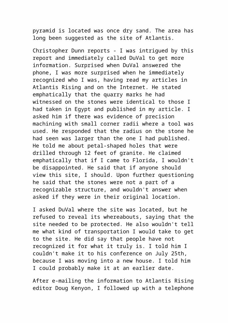
would have originated in Egypt. However Plato has an explanation for this. The Egyptian priests are said to have told Solon that a series of catastrophes had destroyed the Greek records, whereas their own had been preserved. The problem here is that if the Egyptian disappeared as completely as Atlantis itself.
Supposing that Solon did hear about Atlantis during his Egyptian trip, is it credible that such a detailed story could have been passed down through the generations as Plato asks us to believe? This is not impossible, because the art of accurate oral transmission was highly developed in the ancient world. Moreover, Solon is said to have taken notes of his conversation with the priests, and Critias claims that these were handed down to his relatives. However, here again we encounter a difficulty. For whereas in one place Critias states that he is still in possession of Solon's notes, in another he declares that he lay awake all night ransacking his memory for details of the Atlantis story that his grandfather had told him. Why didn't he simply refresh his memory from Solon's notes? And why didn't he show the notes to his three companions as incontrovertible proof of the truth of his rather unlikely story?
Yet another problem is that Plato dates the meeting of Socrates, Timaeus, Critias, and Hermocrates, during which Atlantis is discussed, as 421 B.C. Plato may have been present during their conversation, but as he was only six years old at the time, he could hardly have taken in much of their discussion, let alone made detailed notes of it. Either his account is based on records made my someone else, or the date is wrong, or this part of his story at least is an invention.
Critics of the Atlantis story believe that it is simply a myth invented to put across the great philosopher's views on war and corruption. Plato used real people in his other dialogues, and put his words into their mouths, too, as a dramatic device to present his ideas. There is no reason say the detractors, to assume that Timaeus and critias are different in this respect. but Plato seems to expect his readers to draw different conclusions. He is at great pains to stress the truth of his account, tracing it back to Solon, a highly respected statesman with a reputation for being 'straight-tongues," and having Critias declare that the Atlantis story, "though strange, is certainly true." And why, if his sole intention was to deliver a philosophical treatise, did Plato fill his account with remarkable detail and then stop abruptly at the very point where we would expect the "message" to be delivered? In spite of the errors and contradictions that have found their way into Plato's account, his story of Atlantis can still be viewed as an exciting recollection of previously unrecorded events.
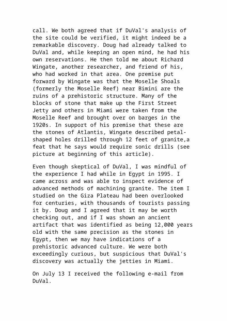
History provides us with many examples of supposedly mythical places and subsequently being discovered. For example, Homer wrote about the Trojan War and subsequent research has shown that it was based on real historical events. Troy has since been found and dug up. In 1871, the German archaeologist Heinrich Schlieman excavated in Hissarlik and uncovered Troy just where Homer had placed it over 1000 years previously in his epic poems the Iliad and the Odyssey. As the Irish scholar J.V. Luce observes in his book The End of Atlantis; "classical scholars laughed at Schlieman when he set out with Homer in one hand and a spade in the other. but he dug up Troy and thereby demonstrated the inestimable value of folk memory Sir Arthur Evans did much the same thing when he found the labyrinthine home of the Minotaur at Knossos." Indeed, sir Arthur Evans revealed that a highly advanced European civilization had flourished on the island of Crete long before the time of Homer, some 4500 years ago.
This should be justification enough to keep an open mind on Plato's account. The problem is that whereas Troy and Knossos were simply buried. Atlantis could be submerged hundred or even thousands of feet beneath the waves. And the force of the destruction may have destroyed the remains beyond recognition. However, if Plato's account is based on fact, then we know that the Atlanteans traded with their neighbors.. In this case there would be some evidence of their influence and culture in lands that survived the catastrophe. Believers in Atlantis have furnished us with a formidable array of such "proofs". Certainly there are scattered around the glove to lend support to the idea of a highly advanced, Atlantean-type civilization that was responsible.
Although Plato appears to place Atlantis in the Atlantic Ocean and early cartographers did likewise, numerous scholars and other Atlantis enthusiasts have since scoured the globe for more likely sites. Surprisingly, these have not always been in the ocean. The lost kingdom of Atlantis has been "found" at various times in the Pacific Ocean, the North Sea, the Sahara desert, Sweden, southern Spain, Palestine, Cyprus, Crete, the West Indies, and Peru, but to name a few.
THE ATLANTIS MYSTERY DEEPENS
In 1940 the American psychic healer and prophet Edgar Cayce predicted that Atlantis would 'rise again' in 1968 or 19969. So, in 19968, when it seemed that the site of the world's most famous lost land had finally been located in the eastern Mediterranean, news that underwater vast building off the Bahamas shook Atlantist everywhere. The question of Atlantis was reopened. Could this be Poseidia, described by Cayce as the 'western'
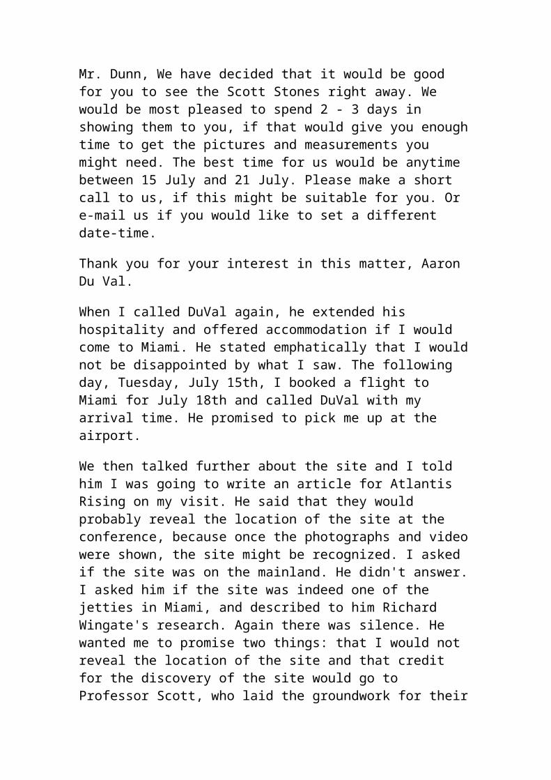
section of Atlantis? Were Plato and the other Atlantists right after all when they placed their lost civilization way out in the Atlantic Ocean?
In 19968 two commercial pilots flying over the Bahamas spotted what appeared to be several underwater buildings coming to the surface. The pilots made their sightings just off the coast of Bimini and photographed the underwater formations from the air. Their discovery was immediately hailed by some as the fulfillment of a 28 year-old prophecy concerning the reappearance of Atlantis. Indeed one of the pilots had been keeping a lookout for underwater structures while flying his regular assignments because he believed Atlantis was about to reemerge from the Atlantic in this very area.
The man concerned is a member of the Association for Research and Enlightenment, an organization based in Virginia Beach, VA, which is dedicated to the study of the teachings and "psychic readings" of the late Edgar Cayce, the "sleeping prophet" and psychic healer. Between 1923 and 1944 Cayce made numerous references to Atlantis in the course of trance interviews concerning the alleged former lives of the people who consulted him. These interviews were recorded verbatim, and much of the material about Atlantis has been published in a book called Edgar Cayce on Atlantis, by Cayce's son Edgar Cayce. It includes this prediction, made in June 1940: "Poseidia will be among the first portions of Atlantis to rise again. Expect it in ''68 and '69; not so far away!"
According to the Cayce readings, Poseidia was the "western section of Atlantis," and the area off Bimini is the highest point of this sunken land.
So the A.R.E. is naturally delighted about the underwater find in the Bahamas, just where and when the famous prophet said something would appear. Until this and similar discoveries have been thoroughly explored, we have to admit that There may yet have an equally plausible rival for the title of Atlantis, right where most people always considered the long-lost continent to be - in the Atlantic.
In his book 'The Mystery of Atlantis' Charles Berlitz comments that "Other underwater ruins have subsequently been found near other Caribbean islands, including what appears to be an entire city submerged off the coast of Haiti, and still another at the bottom of a lake. What appears to be an underwater road (or perhaps a series of plazas or foundations) was discovered in 1968 off north Bimini beneath several fathoms of water. From these numerous findings, it would appear that par of the continental shelf of the Atlantic and Caribbean was once dry land, sunk or flooded during a period when man was already civilized.
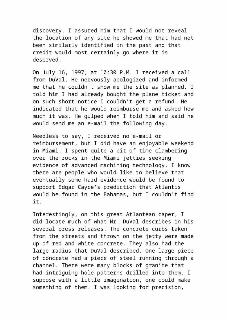
Not everyone accepts these underwater features as being of man-made origin. The so-called "Bimini road" is dismissed by skeptics as nothing more than beach rock that just happens to have produced an unusual effect. Berlitz and Dr. Manson Valentine, the American archaeologist and oceanographer who discovered the "road", do not agree. "It should be pointed out." writes Berlitz, "that beach rock does not form great blocks which fit together in a pattern, that haphazardly splitting rock does not make 90- degree turns, nor does it normally have regularly laid-out passageways running between sections of it. Nor, above all, are 'natural' beach rocks, lying on the ocean floor, likely to be found supported by stone pillars precisely placed beneath them!"
Other sightings made off Bimini, at distances up to 100 miles from the shore, include what appear to be vertical walls, a great arch, and pyramids or bases for pyramids under the sea. some 10 miles north of Andros, another island in the Bahamas, pilots have photographed formations on the seabed that look like great circles of standing stones, reminiscent of Stonehenge. Off the coasts of eastern Yucatan and British Honduras seemingly man-made roads stretch far out to sea, and off Venezuela a 100-mile 'wall' runs along the ocean bottom. However, geologists have declared many of these to be natural features, and deem the Venezuelan wall "too big to be considered man-made". According to Berlitz, the Russians have explored an underwater building complex covering over 10 acres of the sea floor north of Cuba, and the French bathyscape Archimede has reported sighting flights of steps carved in the steep continental shelf off northern Puerto Rico.
Do these intriguing finds indicate that Atlantis was, after all, in the Atlantic? it seems we must keep an open mind until they have been investigated more thoroughly. Meanwhile, let us take a fresh look at the Atlantic Ocean to see if the theory of continental drift might still leave room for a missing continent there. When a computer was used to reassemble the continental jigsaw, the fit across the Atlantic was found, with some adjustment, to be fairly satisfactory. but that picture does not take account of a fascinating underwater feature known as the mid-Atlantic Ridge. This mountainous ridge, nearly two miles high and hundreds of miles wide, runs in an S-curve down the Atlantic midway between the Americas and Africa and Europe, following the contours of those continents and marking its course above water with a number of islands, such as the Azores, Ascension Island, and Tristan da Cunha.
As early as 1883 Ignatius Donnelly suggested that the mid-Atlantic Ridge was a remnant of Atlantis. But most modern geologists and oceanographers
consider that, far from being the relic of a continent that sank beneath the sea, the ridge was forced upward from the ocean floor, probably by volcanic activity. One theory is that as the continents drifted apart they produce a huge fault line that is a center of earthquake and produce a huge fault line that is a center of earthquake and volcanic action. Some of the earth's molten center has erupted through this crack and built up into a ridge, even rising above the waves in several places. However, there is evidence that this explanation may have to reviewed before too long.
Seabed cores taken from the mid-Atlantic Ridge in 1957 brought up freshwater plants from a depth of two miles. And in one of the deep valleys, known as Romanche, sands have been found that appear to have been formed by weathering when that part of the ridge was above water level. In a 1969 a Duke University research expedition dredged 50 sites along an underwater ridge running from Venezuela to the virgin Islands, and brought up granitic rocks, which are normally found only on continents. Commenting on this discovery, Dr. Bruce Heezen of the Lamont Geological Observatory said: "Up to now, geologists generally believed that light granitic or acid igneous rocks are confined to the continents and that the crust of the earth beneath the sea is composed of heavier, dark-colored basaltic rock. . . Thus, the occurrence of light-colored granitic rocks may support an old theory that a continent formerly existed in the region of the eastern Caribbean and that these rocks may represent the core of a subsided, lost continent.
A recent report on the nature of the Atlantic seabed appears to confirm that there is at least part of a former continent lying beneath the ocean. Under the heading "Concrete Evidence for Atlantis?" the British Journal New Scientist of June 5, 1975 reported, "Although they make no such fanciful claim from their results as to have discovered the mythical mid-Atlantic landmass, an international group of oceanographers has now convincingly confirmed preliminary findings that a sunken block of continent lies in the middle of the Atlantic Ocean. The discovery comes from analyzing dredge samples taken along the line of the Vema offset fault, a long east-west fracture zone lying between aFrica and South America close to latitude 11 degrees "N".
The report goes on to state that in 1971 two researchers from the University of Miami recovered some shallow-water limestone fragments from deep water in the area. Minerals in the limestone indicated that they came from a
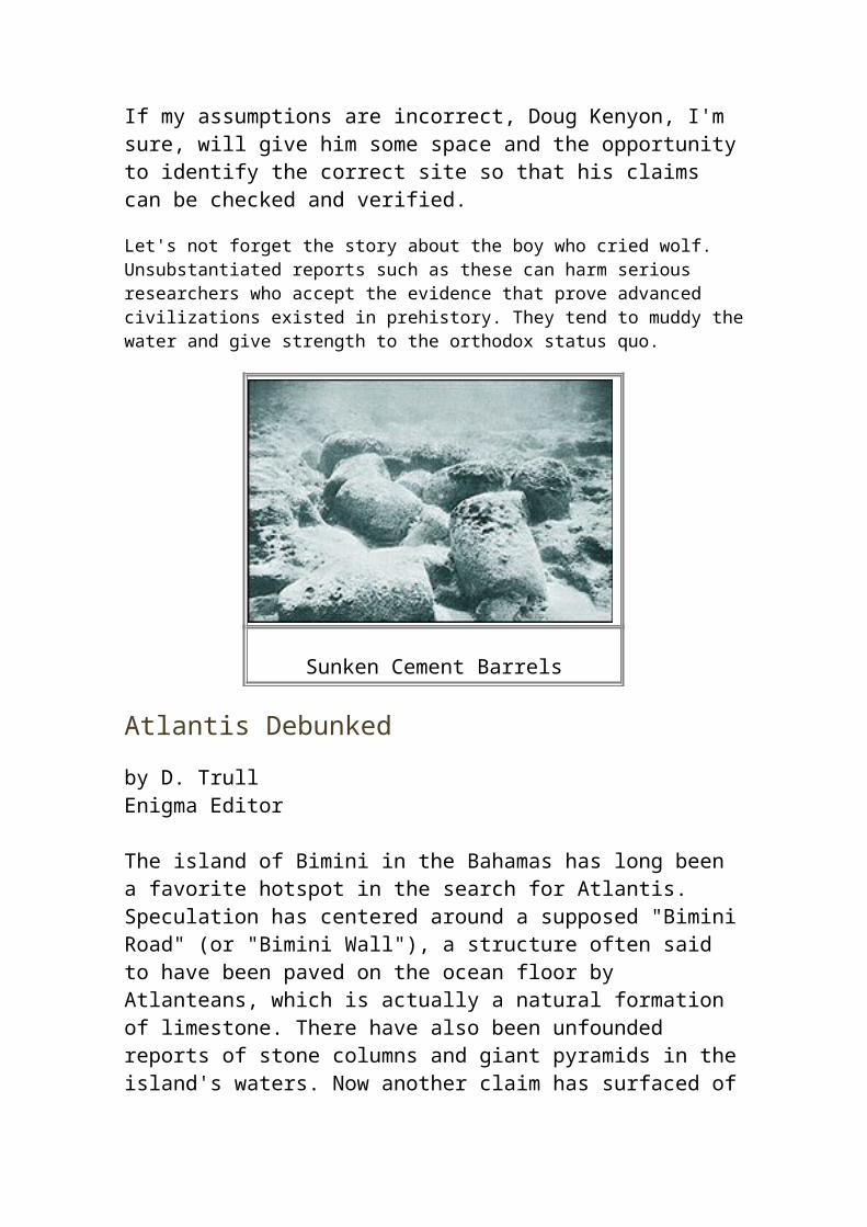
nearby source of granite that was unlikely to occur on the ocean floor. More exhaustive analysis of the dredge samples revealed that the limestones included traces of shallow-water fossils, implying formation in very shallow water indeed, a view confirmed by the ratios of oxygen and carbon isotopes found in the fragments. One piece of limestone was pitted and showed evidence of tidal action.
The researchers believe that the limestone dates from the Mesozoic era (between 70 and 220 million years ago) and forms a cap "on a residual continental block left behind as the Atlantic spread out into an ocean." the New Scientist observes that "the granitic minerals could thus have come from the bordering continents while the ocean was still in it infancy. Vertical movements made by the block appear to have raised it above sea level at some period during it's history.
It would therefore seem that there is a lost continent in the Atlantic, but unfortunately for Atlantists, it evidently disappeared long before man appeared on earth. Most scientist remain convinced that there is no likelihood of finding the Atlantis described by Plato in the area of the mid-Atlantic Ridge. As L. Sprague de Camp comments in his Lost Continents, nearly all of the ridge, except for the small and mountainous Azores region, is under two or three miles of water, "and there is no known way to get a large island down to that depth in anything like the 10,000 years required to fit in with Plato's date for the sinking of Atlantis." He also points to a report published in 1967 by Dr. Maurice Ewing of Columbia University, who announced that "after 13 years of exploring the mid-Atlantic Ridge, he had "found no trace of sunken cities."
Atlantists reply that Dr. Ewing could have been looking in the wrong places, or perhaps too close to the center of the destructive forces that plunged Atlantis into the ocean. Some Atlantists have suggested that the original Atlantic landmass broke up into a least two parts, one of which sank long after the other. Perhaps Plato's Atlantis was a remnant of the continent that oceanographers now appear to have detected in the Atlantic, and perhaps it was not submerged until very much more recent times. The bed of the Atlantic is,after all, an unstable are and one that has given birth to numerous islands, then swallowed them up again. In 1811, for example, volcanic activity in the Azores resulted in the emergence of a new island called Sammrina, which shortly sank back again into the sea. In our own time, the island of Surtsey, 20 miles southwest of Iceland, has slowly risen from the ocean. Surtsey was formed during a continuous underwater eruption between 1963 and 1966.
If Atlantis did exist in the Atlantic above the great fault line that runs between the present continents, it would certainly have been plagued by earthquakes and volcanic eruptions. Is it mere coincidence that Plato should have situated his lost continent in an ocean that does apparently contain such a continent, and in an area subject to the very kind of catastrophe he describes? Atlantists think not.
On the other hand, there are some Atlantists who believe that the destruction of Atlantis was brought about not by geological events but by a man-made disaster, such as a nuclear explosion. According to the Cayce readings, the Atlanteans achieved an astonishingly high level of technology before the continent sank, around 10,000 B.C. They invented the laser, aircraft, television, death rays, atomic energy, and cybernetic control of human beings, and it was the misuse of the tremendously powerful natural forces they had developed that caused their destruction.
Cayce is best-known for his apparent ability to diagnose illness even in people whom he had never met. This ability was tested by a group of physicians from Hopkinsville and Bowling Green, Kentucky. They discovered that when Cayce was in a state of trance, it was sufficient to give him the name and address of a patient for him to supply a wealth of information about that person, often drawing attention to medical conditions of which the physicians were then unaware, but that subsequent tests on the patient proved to be correct. This work alone would appear to justify the description of Cayce as America's most talented psychic. And if one aspect of his clairvoyant powers could prove so successful, it seems reasonable to give a fair hearing to other psychic statements he made, however, fantastic.
Cayce's sons, who help run the organization set up to study his work, admit that their life would be far simpler if Edgar Cayce had never mentioned Atlantis. Hugh Lynn Cayce comments; "It would be very easy to present a very tight evidential picture of Edgar Cayce's psychic ability and the helpfulness of his readings if we selected only those which are confirmed and completely validated. This would not be fair in total, overall evaluation of his life's work. My brother and I know that Edgar Cayce did not read Plato's material on Atlantis, or books on Atlantis, and that he, so far as we know, had absolutely no knowledge of this subject. If his unconscious fabricated this material or wove it together from existing legends and stories in print or the minds of persons dealing with the Atlantis theory." Edgar Evans Cayce makes the comment that "unless proof of the existence of Atlantis is one day discovered, Edgar Cayce is in a very unenviable position. On the other hand, if he proves accurate on this score he may
become as famous an archaeologist or historian as he was a medical clairvoyant."
If, as his sons and thousands of followers believe, Edgar Cayce's readings were supernormal and not the product of reading the works of others, it is certainly an intriguing case. There are, for example, some fascinating similarities between Cayce's descriptions of Atlantis and those of occultists such as Madame Blavatsky, Rudolf Steiner, and W. Scott-Elliott, including references to the Atlanteans telepathic and other supernormal powers, their advanced technology, their moral disintegration, and the civil strife and misuse of their powers that finally caused their demise. Cayce's readings also mention Lemuria, or Mu. Either Cayce was psychically readings the works of these earlier writers, or he - the they - really were 'tuning in' to the past.
Whatever the result of future investigations around the splendid temples and palaces of Crete, or in the depths of the Thera basin, there will still be people who continue to look for convincing case for the identification of Plato's Atlantis with the Minoan civilization of the Aegean, but their opponents argue that the existence of such a civilization - however striking it similarities with Atlantis - does not preclude the existence of an even great civilization in the Atlantic. The finds in the Bahamas remain to be verified, and the discovery of what appears to be a submerged continent in the Atlantic adds a new dimension to the Atlantis mystery.
Whatever prompted Plato to write about Atlantis, he could never have dreamed that he would start a worldwide quest for the lost continent. Perhaps, as his pupil Aristotle hinted, "he who invented it, also destroyed it." Yet through a fortuitous accident - or a canny understanding of the human spirit - Plato hit upon a story that has struck a responsive chord in people's minds and hearts down the centuries. Whether his story was fact or fiction, a distorted version of real events or a fable that just happened to tie in with reality, it has managed to enchant, baffle, and challenge mankind for over 2000 years.
The persistence of the Atlantis legend is almost as intriguing as the lost continent itself. What is it that keeps the Atlantis debate alive? Is it a longing for reassurance that men and women once knew the secret of happiness, and really did inhabit a Garden of Eden? Is it the thrill of the search - the hope of finding a master key to unlock the secrets of the past? Or is it simply man's thirst for mystery itself - for something grand and inexplicable, larger than himself? Certainly popular interest in the mystical side of Atlantis is always most intense when the life of the spirit is in the
greatest disarray - during the latter half of the 19th Century, in the aftermath of Darwin's bombshell, for example, and during our own time.
The day may yet come when the key is found and the mystery of Atlantis is solved once and for all. The solution may be simple or complex. It could be sensational or disappointingly dull. We may already suspect the answer, or it may surprise us. Either way, it would rob the world of one of its most fascinating enigmas. Atlantis has intrigued and inspired people for a very long time. Perhaps, for the time being, we should be glad that the answer has not yet been found, and that Plato's lost continent remains just beyond our grasp.
Michel Nostradamus
Introduction
Everything proceeds from the divine power of almighty God, from whom all goodness emanates.
Michel Nostradamus
He was a little under medium height, of robust body, nimble and vigorous. He had a large and open forehead, a straight and even nose, gray eyes which were generally pleasant, but which blazed when he was angry. By nature he was taciturn, thinking much and saying little, though speaking very well in the proper time and place. He slept only four to five hours per night. He praised and loved freedom of speech, and showed himself joyous and facetious, as well as biting, in his joking. He approved of the ceremonies of the Roman Church and held to the Catholic faith and religion. I do not
want to forget to say that he engaged willingly in fasts, prayers, alms, and patience; he abhorred vice and chastised it severely. I can remember his giving to the poor, towards whom he was very liberal and charitable.
James Chavingy
View online The Centuries or consider getting some of many books written about Nostradamus and his prophecies.
Michel Nostradamus (1503-1566) was a 16th century French physician and astrologer. His modern followers see him as a prophet. His prophecies have a magical quality for those who study them: they are muddled and obscure before the predicted event, but become crystal clear after the event has occurred.
Prophetic vision of Nostradamus is contained in 942 cryptic poems called The Centuries. Nostradamus wrote four-line verses (quatrains) in groups of 100 (called centuries). They have enthralled generation after generation of readers. He was often referred to as the prophet of doom because of the visions he had involving death and war. His followers say he predicted the Great Fire of London (1666), the French Revolution, the birth and rise to power of Hitler, the
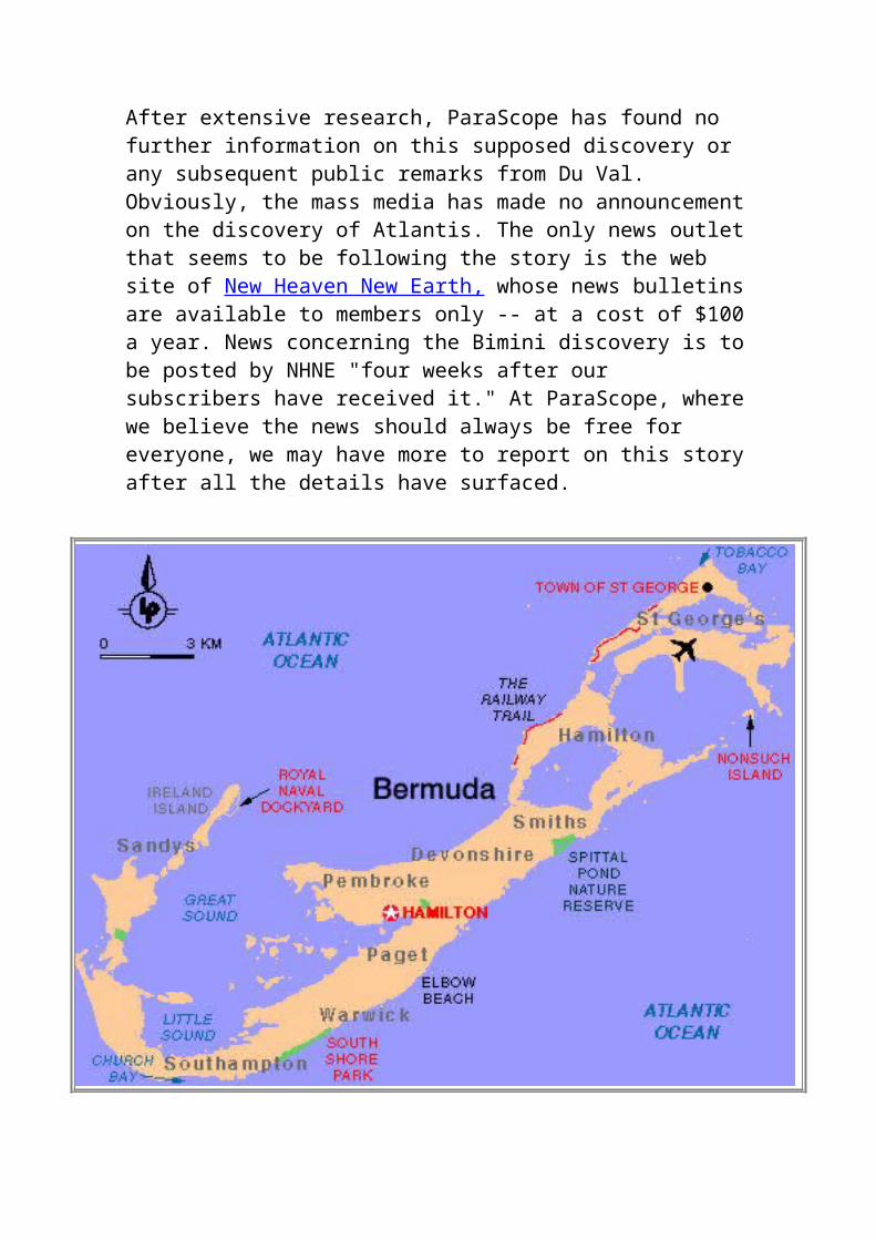
assassination of John F. Kennedy, and the destruction of the space shuttle Challenger.
Biography
1503
Michel de Nostradame was born on December 14, 1503 (11 years after Christopher Columbus discovered the New World) in St. Remy, Provence, France. Nostradamus came from a long line of Jewish doctors and scholars. His family had converted from Judaism to Christianity in 1502, as a result of persecution on the ascension of Louis the XII (it was the age of the Inquisition).
Nostradamus was the oldest son, and had four brothers; of the first three we know little; the youngest, Jean, became Procureur of the Parliament of the Provence. His father, James, was a notary. Nostradamus' grandfather, Jean, inspired him to study astrology and the celestial sciences when he was very young. It was then that Nostradamus was introduced to Latin, Greek, Hebrew, Mathematics, Astronomy and Astrology. He upheld the Copernican theory that the world was round and circled around the sun more than 100 years before Galileo was prosecuted for the same belief.
1522
In 1522, at the age of nineteen, Nostradamus decided to study medicine and enrolled at Mont Pellier (the most famous school of medicine in France). He graduated with a bachelor degree and was soon licensed to practice medicine. As a healer, he was active in treating the victims of the "Black Plague" and developed unique and effective
methods of treatment which helped to lessen the suffering of many people.
1529
On 23rd October 1529, at 26, Nostradamus returned to Mont Pellier to complete his Doctor's degree. The academic skill he displayed while working towards his doctorate won him praise and admiration from the whole college. He was recruited as an instructor after his graduation and taught for about a year. Nostradamus had some trouble in explaining his unorthodox remedies and treatments he used in the countryside. Nevertheless his learning and ability could not be denied and he obtained his doctorate. He remained teaching at Montpellier for a year but by this time his new theories, for instance his refusal to bleed patients, were causing trouble and he set off upon another spate of wandering.
1534
While practising in Toulouse he received a letter from Julius-Cesar Scaliger, the philosopher considered second only to Erasmus throughout Europe. Apparently Nostradamus' reply so pleased Scaliger that he invited him to stay at his home in Agen. This life suited Nostradamus admirably, and circa 1534 he married a young girl 'of high estate, very beautiful and admirable', whose name was lost to us. He had a son and a daughter by her and his life seemed complete.
1538
Then a series of tragedies struck. The plague came to Agen and, despite all his efforts, killed Nostradamus' wife and two children. The fact that he was unable to save his own family had a disastrous effect on his practice. The he quarrelled with Scaliger and lost his friendship. His late wife's family tried to sue him for the return of her dowry and as the final straw, in 1538, he was accused of
heresy because of a chance remark made some years before. To a workman casting a bronze statue of the Virgin, Nostradamus had commented that he was making devils. His plea that he was only describing the lack of aestheticappeal inherent in the statue was ignored and the Inquisitors sent for him to go to Toulouse.
Nostradamus, having no wish to stand trial, set out on his wandering again and kept well clear of the Church authorities for the next six years. We know little of this period. From references in later books we know he travelled in the Lorraine and went to Venice and Sicily. Legends about Nostradamus' prophetic powers also start to appear at this time.
1546
Over time, circumstances reversed with the Inquisitors. After traveling through Italy and France for six years, Nostradamus returned to his native turf where he was employed by the city of Aix in 1546. For a period of three years he again fought the plague. His services were viewed as invaluable by both his patients and his peers.
1554
By 1554 Nostradamus had settled in Marseilles. In November that year, the Provence experienced one of the worst floods of its history. The plague redoubled in virulence, spread by the waters and the polluted corpses. Nostradamus worked ceaselessly. Once the city had recovered, Nostradamus moved on to Salon de Croux, which he found so pleasant a town that he determined to settle there for the rest of his life. In November he married Anne Ponsart Gemelle, a rich widow. The house in which he spent the remainder of his days can still be seen off the Place de la Poissonnerie. It was during this period of his life that he acquainted himself with the apothecaries and healers of the area in order to include them in his book Traite des Fardmens, the

world's first medical directory, which listed the names, location and specialties of physicians and healers practicing in Europe.
Nostradamus began to write his prophetic verses in the city of Salon, in 1554. They are divided into ten sections called Centuries (which refers to the number of verses in each section, not to a unit of 100 years).
1555
The Centuries were published in 1555 and 1558, and have been in print continuously ever since. By 1555 Nostradamus had finished the first phase of his book that would contain his prophecies. Upon its publication, Nostradamus' fame quickly spread throughout Europe. The book contained only the first three Centuries and part of the fourth. His book became very popular among the literate and educated Europeans of the day, so much so that the French Queen, Catherine de' Medici, summoned Nostradamus to her court in Paris in 1556..
One could only wish that there had been a witness to record their meeting. Nostradamus and the Queen spoke together for two hours. She is reputed to have asked him about the quatrain concerning the king's death and to have been satisfied with Nostradamus' answer. Certainly she continued to believe in Nostradamus' predictions until her death. The king, Henri II, granted Nostradamus only a brief audience and was obviously not greatly interested.
Two weeks later the queen sent for him a second time and now Nostradamus was faced with the delicate and difficult task of drawing up the horoscopes of the seven Valois children, whose tragic fates he had already revealed in the centuries. All he would tell Catherine was that all of her sons would be kings, which is slightly inaccurate since one of them, Francois, died before he could inherit.
Soon afterwards Nostradamus was warned that the Justices of Paris were inquiring about his magic practices, and he swiftly returned to Salon. From this time on, suffering from gout and arthritis, he seems to have done little except draw up horoscopes for his many distinguished visitors and complete the writing of the Prophecies. Apparently he allowed a few manuscript copies to criculate before publication, because many of the predictions were understood and quoted before the completed book came off the printing press in 1568, two years after his death.
1559
On June 28, 1559, quatrain # 1-35 which predicted the accidental death of an "old lion" (an allusion to Henri -- the King of France) came true. Some people were upset with Nostradamus, others amazed. His fame grew even more. Nostradamus remained in Salon for a number of years, and continued to work on his writings. He was visited by many people of nobility and distinction during those days.
1564
In 1564 Catherine, now Queen Regent, decided to make a Royal Progress through France. While travelling she came to Salon and visited Nostradamus. They dined and Catherine gave Nostradamus the title of Physician in Ordinary, which carried with it a salary and other benefits.
1565-66
In 1565-66, Nostradamus' health began to be troubled with gout and arthritis. His health continued to worsen and he wrote his will on June 17, 1566. Nostradamus is said to have predicted his own death. When his assistant wished him goodnight on July 1, 1566, Nostradamus reputedly pronounced, "You will not find me alive at sunrise."
He was found dead on July 2, 1566.
It was rumored that a very secret document existed in his coffin, that would decode his prophecies. In 1700, the coffin was moved to a prominent wall of the Church. Careful not to disturb his body a quick look inside revealed an amulet on his skeleton, with the year 1700 on it.
One night in 1791 during the French Revolution, soldiers from Marseilles broke into the church, in search of loot. However, Nostradamus had the last laugh. In Century 9, Quatrain 7, he had written:
The man who opens the tomb when it is foundAnd who does not close it immediately,Evil will come to himThat no one will be able to prove.
Reputedly, the soldiers who desecrated his tomb for the final time were ambushed by Royalists on their way back to base and killed to the last man.
View online The Centuries or consider getting some of many books written about Nostradamus and his prophecies.
Prophecies and Predictions of Nostradamus
During Nostradamus' lifetime the Black Death (today known as the bubonic plague) wiped out over a quarter of Europe. It is no wonder that a sense of apocalyptic terror fills Nostradamus' quatrains. Nostradamus can indisputably be said to have been ahead of his time, at least in terms of medical practice. His treatment of the Black Death involved removal of the infected corpses, fresh air
and unpolluted water for the healthy, a herbal preparation rich in Vitamin C, and (in contravention of contemporary medical practise) not bleeding his patients.
Nostradamus had the visions which he later recorded in verse while staring into water or flame late at night, sometimes aided by herbal stimulants, while sitting on a brass tripod. The resulting quatrains (four line verses) are oblique and elliptical, and use puns, anagrams and allegorical imagery. Most of the quatrains are open to multiple interpretations, and some make no sense whatsoever. Some of them are chilling, literal descriptions of events, giving specific or near-specific names, geographic locations, astrological configurations, and sometimes actual dates. It is this quality of both vagueness and specificity which allows each new generation to reinterpret Nostradamus.
After his death, his son Caesar gathered the remaining prophecies which had been unpublished up to that point, and published them in 1568, two years after Nostradamus passed away.
Nostradamus referred to the ten chapters of his famous book, The Centuries, as "centuries", although they have nothing to do with 100 year cycles. Each of the centuries (or chapters) contain 100 prophetic quatrains, except for Century VII, which has 42, for a total of 942 prophecies.
The rhymed quatrains of Nostradamus were written mainly in French with a bit of Italian, Greek, and Latin thrown in. He intentionally obscured the quatrains through the use of symbolism and metaphor, as well as by making changes to proper names by swapping, adding or removing letters. The obscuration is claimed to have been done to avoid his being tried as a magician.
Nostradamus intentionally confused the
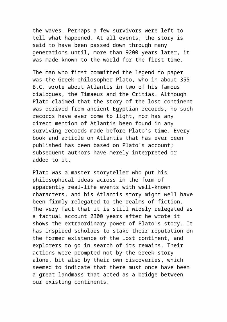
chronological order of his quatrains (a four line prophetic stanza which constitutes one of his prophecies) as a way to make the interpretation of future events slightly more difficult. The interpretation of some quatrains are very specific, others more general in nature. The clearly stated quatrains speak for themselves, requiring little interpretation. Most quatrains, however, require a detailed examination.Some readers might discover that it takes time to get a feel for reading the quatrains. The more you read them however, the easier it is to make sense of them.Most readers might be shocked by the perceived contents of some quatrains, for in many ways The Centuries reads like a book of 1,001 future disasters.Nostradamus stated in the Epistle, that as time goes on, he perceived his prophecies to carry more weight. This is interesting and seemingly correct, especially considering that as time passes, with a little hindsight, we can see the past from a clearer perspective.In the preface ( a letter dedicated to his son Caesar), Nostradamus stated that his prophetic quatrains were covered with a veil cloud, but are clear enough to be comprehended by men of good intelligence.Some quatrains were written in a manner that suggests a chronology of time from the beginning of the quatrain to its end. The first line or two of this type of quatrain may pertain to one given period of time, while the lines following it may apply to a time frame later than the lines before it. While this chronological rule does not apply to all quatrains, it seems to apply to some.The majority of the quatrains pertain to the geographical regions of France, Europe, the Mediterranean, North Africa, the Middle East and Asia. A few quatrains pertain to the New World, one pertains to the Moon, and a few others make references to outer space.
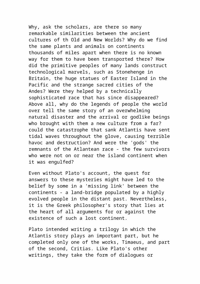
View online The Centuries or consider getting some of many books written about Nostradamus and his prophecies.
NOSTRODAMUS 2000 by Doug Yurchey
The name Nostrodamus evokes everything from reverence, mystery and the occult to total skepticism. It is easy to be a skeptic. It is far more difficult to truly understand. A man from the 16th Century should NOT have been able to write about these 20th Century things:
* Hitler. * U.S. & its Eagle symbol. * Free America to the west. * Napoleon.* Mussolini. * Franco. * Roosevelt. * Pasteur. * Atlantis. * U.S., French & Russian revolutions. * WWI & WWII. * The atomic bomb. * Air warfare; 'flying boats and galleys.' * The submarine. * Motors & antennae. * Man-made mountains.
'Nostrodamus often mentions exact specifics such as 'Franco' and 'Pasteur.' Even a hardcore skeptic must soften when they realize that somehow...modern events were published in the 1672 edition: 'The
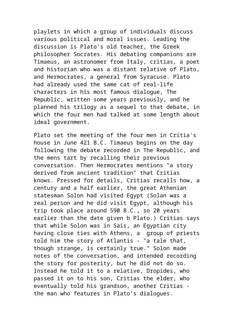
True Prophecies and Prognostications of Michael Nostrodamus.' In 1946, Henry C. Roberts wrote as he read the 1672 edition: 'I had perused but a few pages when I was struck by the sense of familiarity that these verses seemed to hold for me. Words that that the author claimed held no significance for him, took on for me a definite meaning, became clearly focused into patterns of events - past, present and future.'
Seer to French kings, Nostrodamus was careful not to be too specific. He understood that this could trouble powerful people in his own time. The result is 4-lined quatrains that serve as enigmatic puzzles. Nostrodamus wrote: 'They would condemn that which future ages shall find and know to be true...(quatrains) are perpetual prophecies from this year to the year 3797, at which some perhaps will frown, seeing so large an extension of time...'
The following verses are some of the most extraordinary. At times, the seer is very specific and the quatrains are not a matter of interpretation. How did Nostrodamus predict? We may never know. Although in the very first two quatrains, the prophet described his source of knowledge:
I / 1 Seated at night in my secret study, Alone, reposing over the brass tripod, A slender flame leaps out of the solitude, Making me pronounce that which is not in vain.
His nightly preparations and visitations seem like a para-normal experience in an occult setting.
I / 2 With divining rod in hand, I wet the limb and foot, Set in the middle of the
He employs a divining rod; used for dowsing. Clearly, Nostrodamus trembled in fear
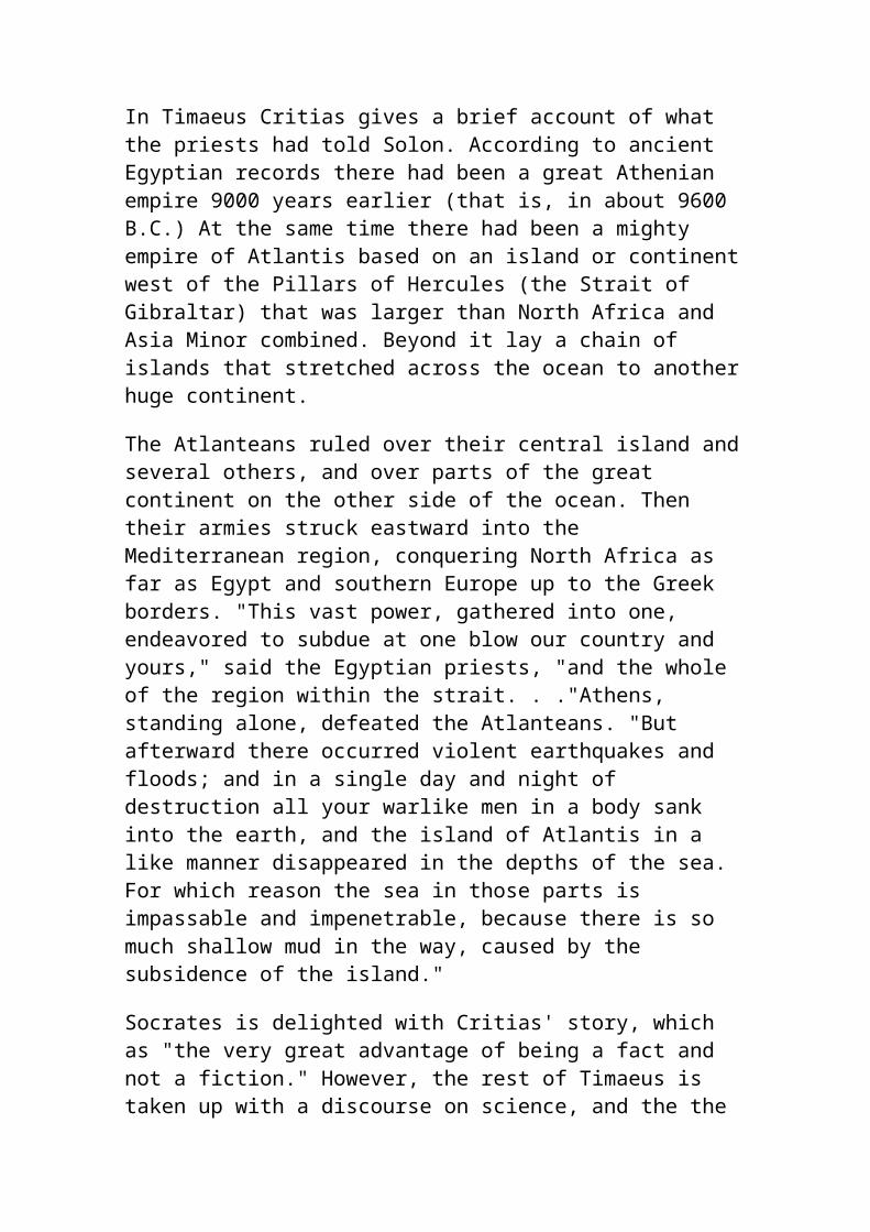
branches. Fearsome awe trembles my hand, I await, Heavenly Splendor! The Divine Genius sitteth by.
during these encounters. As to precisely what 'Genius sitteth by' him, we can only imagine.
X / 66 The chief of London by rule of America, The Island of Scotland shall be tempered by frost, Kings and Priests shall have one, who is a false Anti-Christ Who will put them altogether in discord.
This remarkable quatrain states that British & USA leaders will empower a dictator. An Anti-Christ will betray the leaders & peoples of both countries. The French prophet should not have written 'L'Americh,' but he did in X/66.
VI / 33 His last hand bloody through all U.S. Shall not save him by sea, Between two rivers he shall fear the military hand,The black and wrathful one shall be repentant.
Here Nostrodamus actually writes of the U.S.; similar to the previous verse. A number of quatrains speak of the 'Black One' which refers to the leader of the Black Shirts; Mussolini.
VIII / 1 Pau, nay, loron, more in fire their blood shall be, Seen to swim, great ones shall run to their surreys,The aggassas shall refuse the entry,Pampon, Durance shall keep them enclosed.
This odd quatrain is actually a play on words. If 'Pau, nay, loron' is switched around, it becomes Nay, pau, loron or Napoleon.
III / 35 Out of the deepest part of the
Hitler (Anti-Christ #2) was born in
west of Europe,From poor people a young child shall be born, Who with his tongue shall seduce many people,His fame shall increase in the Eastern Kingdom.
Austria& in poverty. With his powers of speech&mob-control, he seduced many. Hitler's influence was even felt in the Eastern Empire of Japan.
VIII / 71 The number of Astronomers shall grow so great, Driven away, banished, books censured, The year one thousand six hundred and and seven years by Glomes, That none shall be secure in sacred places.
Nostrodamus dates all events starting with the Council of Nicaea; A.D. 325. With a given date, 325 must be added. 1607 + 325 = 1932. In January 1933,Hitler became Chancellor of Germany; banishing & burning books.
VI / 49 By the project of Mammon, high priest, They shall subjugate the borders of the Danube, They shall pursue crosses of iron, topsy-turvy,Slaves, gold, jewels, more than a hundred thousand rubles.
'Crosses of iron, topsy-turvy' is certainly a description of the Nazi Swastika. Hitler & his men also wore the Iron Cross. Subjugating the lands around the Danube was foreseen as well.
II / 22 The Camp Ascop shall go from Europe, And shall come near the submerged Island, From Arton shall a phalange go by sea and land By the navel of the world, a greater voice shall be subrogated.
Classic interpretations of this quatrain attribute it to Atlantis (Arton). Nostrodamus did not speak of fantasy-lands, but real history. Atlantis was the 'navel of the world' and spread out
to all corners of the Earth.
I / 69 The great mountain encompasses seven stadia, After peace, war, famine, and inundation, Shall tumble a great way, sinking great countries, Even ancient houses and their great foundations.
Could the 'great mountain' be a very large pyramid? This quatrain could speak of the Atlantean destruction. A great tumble might be the Fall of Man. The sinking of the continent is the reference. The great foundations could be massive monoliths that compose the ancient structures.
I / 91 The Gods shall make it appear to mankind,That they are the authors of a great war, The sky that was serene shall show sword and lance, On the left hand the affliction shall be greater.
Does 'Gods' refer to an advanced technology sometime in our far future? Are the sword & lance hi-tech weapons like lasers & EMPs.
VI / 34 The contraption of flying fire, Shall trouble so much the captain of the besieged, And within shall be so much rioting, That the besieged shall be in despair.
The word 'contraption' could mean your basic flying-machines. The rest of the verse seems to describe the destruction airplanes have caused in the World Wars.
IV / 92 The head cut off of the valiant Captain, Shall be thrown down before
Here is a remarkable quatrain because of the modern word: 'antenna.' Henry C.
his adversary, His body hanged from the ship's antenna, Confused, they shall fly with oars against the wind.
Roberts interpreted this to mean radio. Roberts wrote before the age of UFOs. A 'ship's antenna' could mean a flying saucer topped with a power/receiver-type of antenna.
III / 67 A new sect of Philosophers shall rise, Despising death, gold, honors and riches, They shall be near the mountains of Germany,They shall have abundance of others to support and follow them.
This quatrain appears to describe the origin of the Secret Society known as the Illuminati. In Bravaria of 1776,the Order of the Enlightened planned to take over the world by deposing Imperial rule.
IV / 27 Salon, Mansol, Tarascon of six arches Where is still standing the pyramids, Shall come to deliver the Prince of a Denmark, A shameful ransom shall be paid into the temple of Artemis.
Could the 'shameful ransom' be the killing of Princess Diana? She died in France, not far from the Louve where glass pyramid stands. Artemis is the Greek goddess that in Roman mythology was called Diana. Around where she died is a garden devoted to the goddess Diana.
On the Internet, under Nostrodamus, you can read
where he predicted 9/11. They have posted that Nostrodamus wrote of the destruction of the 'twins.' This is not exactly true. On line never gives you the quatrain # where you could look it up in his completed works. The following quatrains could refer to 9/11. They are actual Nostrodamus verses that any reader can verify...
I / 87 Ennosigee, fire of the center of the earth, Shall make an earthquake of the New City, Two great rocks shall long time war against each other, After that, Arethusa shall color red the fresh river.
VI / 97 The heaven shall burn at five and forty degrees, The fire shall come near the great new city, In an instant a great flame dispersed shall burst out,When they shall make a trial of the Normans.
V / 8 The fire shall be left burning, the dead shall be hid,Within the globes terrible and fearful,By night the fleet shall shoot against the city,The city shall be on fire, the enemy shall be favorable to it.
I / 41 A siege laid to a city, and assaulted by night, A few shall escape to fight not far from the sea, A woman swoons for joy to see her son returned,A poison hidden in the fold of letters.
'Assulted by night' could mean the WTC attack was first initiated at night or mean by dark forces. New York is not far from the sea & some escaped the tragedy. The POISON hidden in the fold of letters is an obvious reference
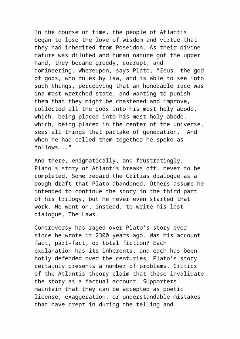
to the anthrax scare that hit D.C. & the rest of the country.
X / 96 Religion of the name of the seas shall come, Against the Sect of Caitifs of the Moon, The deplorably obstinate sect, shall be afraid, Of the two wounded by A. and A.
'Caitifs of the Moon' translates to the Arab nation. 'A. and A.' is an incredible reference to America. Nostrodamus might be describing the U.S. and its21st Century war with Afganistan.
X / 67 The earthquake shall be so great in the month of May,Saturn, Caper, Jupiter, Mercury in Taurus,Venus also, Cancer, Mars in Zero, Then shall hail fall bigger than an egg.
Confirmation of a previous prophecy (IX/83) of a May 10th destruction of the 'great theatre.'
VI / 2 In the year five hundred eighty more or less,There shall be a strange age, In the year seven hundred and three (witness heaven) Many kingdoms, one to five shall be changed.
Adding 325 to 1589, we arrive at 1914or WWI; a very critical time in our history. 325 added to 1703 is 2028;where powerful nations war and realign.
Refer to the end of the Farshores article 'More on the World Wireless' and find a Nostrodamus prediction whereby Tesla Technology creates a grand, new age in the far future. Not all of the seer's predictions for the future are grim, negative and bloodied. Some are positive.
IX / 66 The classic
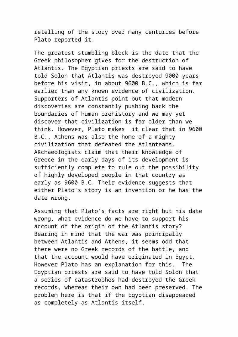
Peace, union, shall be and profound changes, Estates, offices, the low high and the high very low, A journey shall be prepared for, the first fruit, pains, Wars shall cease, also civil processes and strife.
interpretation is that a 'Utopian age' shall come to be; but not without much pain. Is this when the meek inherits the Earth?
X / 72 In the year 1999 and seven months, From the skies shall come an alarmingly powerful king, To raise again the great King of the Jacquerie,Before and after, Mars shall reign at will.
This is one of Nostrodamus' most famous predictions and the reason Prince wrote his 1999 song. Does999 mean 666? Could it possibly foretell of a Martian invasion in the year 2324?
The following two verses predict an End of the World! In 7000 years, will the sun expand and consume the Earth as in I / 48?
I / 48 Twenty years of the reign of the moon having passed, Seven thousand years another shall hold his monarchy, When the sun shall resume his days past,Then is fulfilled and ends my prophecy.
X / 74 The year seven of the great number being past, There shall be seen the sports of the ghostly sacrifice, Not far from the great age of the millennium,
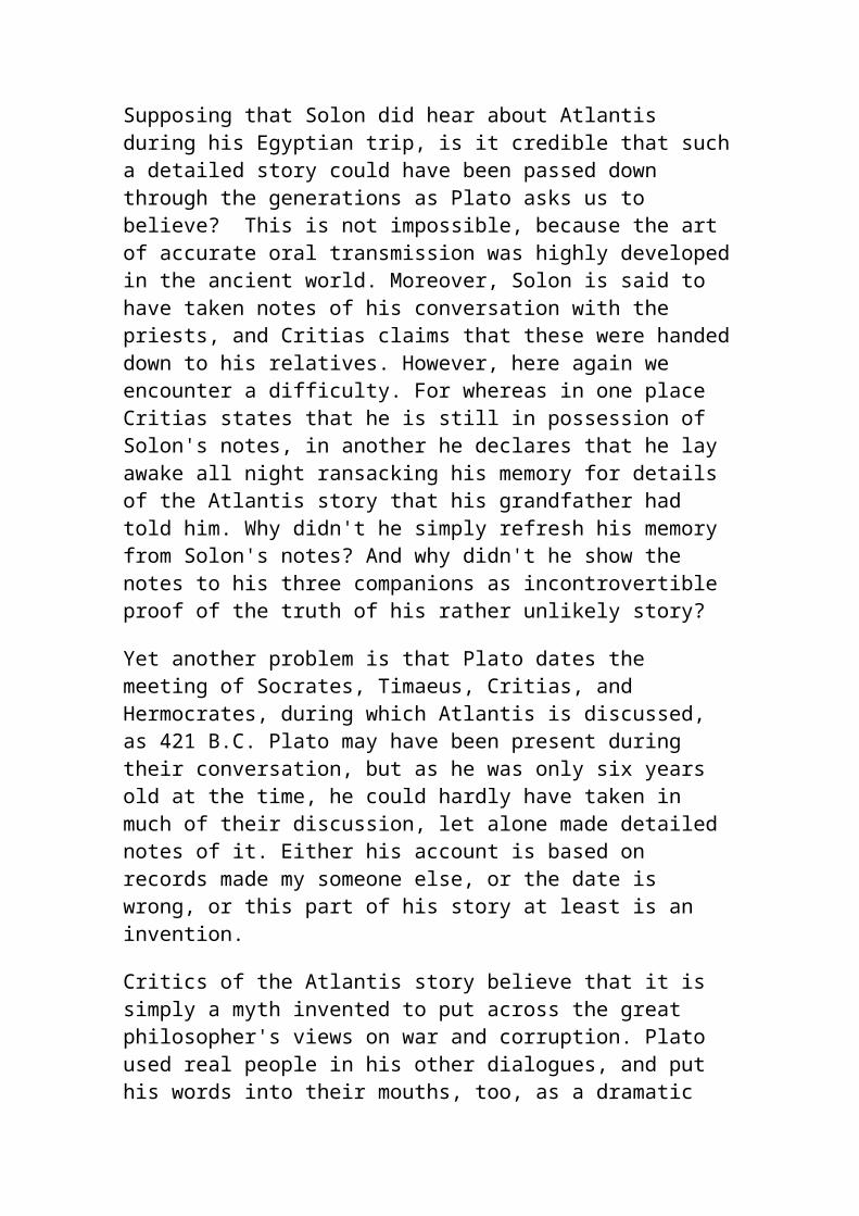
That the buried shall come out of their graves.
EPILOG:
Skeptics should think again before they criticize Nostrodamus. Investigate the prophecies yourself. Recommended reading: The Complete Prophecies of Nostrodamus by Henry C. Roberts. Recommended viewing: The Man Who Saw Tomorrow; hosted by Orson Welles. Somehow, Nostrodamus knew the future. What other quatrains will suddenly become understandable due to current events?
© 2002 - Doug Yurchey
The Mayan Prophecies Short Overview.
The authors demonstrate how the Mayan Holy Number 1,366,560 days, known as the birth of Venus and the basis of their calendar, indicates ancient knowledge of sun spot cycles and their effect on the human race. They explore the popular myth of Quetzalcoatl and its origins in Maya ideas concerning the sun cycle.
They show the links between the pre-Columbian civilizations of Central America and the Old World, in particular Egypt. Examining the archaeological record, they find further evidence for linking the origins of Mayan civilization with the mythical lost continent of Atlantis, which according to Plato was destroyed in a series of catastrophes.
They reveal that the Mayan calendar prophesies the end of our own "Age of the Jaguar", the fifth and final "sun" in 2012 AD. This, according to Cotterell's sun-spot theories, will be brought about by a sudden reversal in the earth's magnetic field.
The book is lavishly illustrated with 40 colour plates as well as many black and white pictures and diagrams. It is a book full of startling discoveries not only about the past and the seemingly remote civilization of the Maya but ourselves and the destiny of the human race.
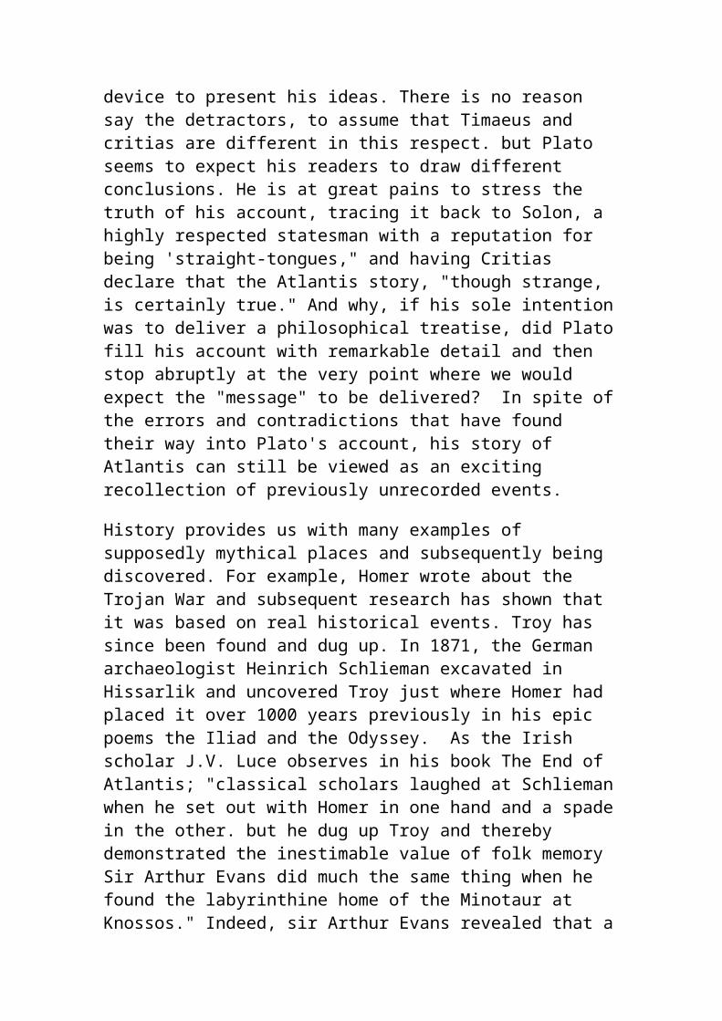
Introduction
Mexico is a strange country that contains many secrets. On March 4 1519 Hernan Cortes, with 11 ships, 600 foot soldiers, 16 horses and some artillery landed on the coast near what was to become Vera Cruz. By August 13 1521 he had conquered the Aztec Empire, the most powerful state in all of the Americas. Part of the reason for his success was a case of mistaken identities, the Indians believing that he was a god named Quetzalcoatl whose return had long been prophesied.
The Spanish for their part were both fascinated and appalled by what they found in this 'New World'. To them the indigenous religion, which included human sacrifice on a grand scale, was both barbarous and satanic. Accordingly they set about destroying it without trace. Whole libraries of colourful bark-books were burnt and those natives who did not die from disease, hunger and over-work were forcibly converted to Catholicism.
Fortunately not all the Spanish were as unsympathetic towards the Indians as Cortes. A few, such a friar named Bernadino Sahagun, made friends with the natives and attempted to record for posterity their traditional beliefs and ideas. He discovered that central to their philosophy was a belief in the cyclical nature of time and an awesome fear that one day, possibly sooner rather than later, their world would come to an end. It seems that they believed that the sun, which they nourished with their sacrifices, would one day no longer send its life force, thereby bringing to an end the fifth and last age of man. They counted the days according to two calendars, one a "vague" year of 365 days and the other a shorter cycle of 260 days. Every day had two names, one according to each calendar so that the same combination of names would not recur for 52 years. When one of these 52 year time periods, known as an Aztec century, came to an end they would leave their cities and, going up into the surrounding hills, anxiously watch the stars. The sign they were looking for was the Pleiades star-group, symbolising for them a cosmic snake's rattle, crossing the southern meridian at midnight. This, they believed, meant that the heavens had not stopped turning and the sun would rise again. The Aztecs celebrated the birth of this new 'century' with rejoicing and the lighting of fires, symbolising the rebirth of the world.
Most native Meso-American documents were destroyed in the early years of the Spanish occupation but a few priceless books and relics did survive the destruction, either having been hidden by the Indians or exported back to Europe as presents for the King. The most important of these was what is now called the Dresden Codex, named after the town in whose library it
was lodged. This strange book, inscribed with unknown hieroglyphs, was written by Maya Indians who once ruled over much of Central America, the ruins of their once grand civilization littering the jungle. In 1880 a brilliant, German scholar, who was working as a librarian in Dresden, turned his attention to this codex. By a process of extraordinary detective work he cracked the code of the Mayan calendar making it possible for other scholars and explorers to translate the many dated inscriptions to be found on buildings, stelae and other ancient Mayan artefacts. He discovered that the Dresden Codex itself was concerned with astronomy providing detailed tables of lunar eclipses and other phenomenon. These were so accurate that they put our own calendar to shame. He also found evidence for a curious "magic number"- 1,366,560 days, which could be factorised in a number of ways and which harmonised the cycles of Venus and Mars with two "yearly" cycles also used by the Maya: the sacred tzolkin of 260 days and the Haab of 365 days. However, he also found that they had another system of counting the days relative to a starting date, called the Birth of Venus and now known to be 13 August 3114 BC. This calendar was divided into "months" or uinals of twenty days, "years" or tuns of 360 days and longer periods of 7200 days, the katun and 144,000 days, the baktun. The number 13 was magically important to them and they believed that, starting from the Birth of Venus, after 13 of these longest periods, or baktuns, the world would come to an end. Working from their start date this Mayan Prophecy points to a date in our own time, 22 December 2012.
In 1986 Maurice Cotterell put forward a revolutionary theory concerning astrology and sun cycles. He had for some years suspected that the sun's variable magnetic field had consequences for life on earth. The sun has a complex field which loops and twists itself into knots. It has long been suspected that these loops give rise to sunspots, which are dark blemishes on the sun's skin. The number, size and location of sunspots are constantly changing and as a former Radio Officer, Cotterell was well aware that they have profound effects upon the earth's magnetic envelope, the magnetosphere. Whilst working as Head of Electrical and Communications Engineering (Estates) at Cranfield Institute of Technology, he devised a program that would compute the relationship between the sun's magnetic field and the Earth. As expected his model predicted that there should be a sunspot cycle of roughly eleven and a half years, closely corresponding to what has been observed over several centuries. However, he also found graphic evidence for longer cycles including a period of 1,366,040 days. His work took a new turn when he read about the Mayan super number from the Dresden Codex: 1,366,560 days. This was exactly two 260 day cycles larger than his theoretical sunspot period. He therefore proposed that
the two were related. As his earlier work on what he called Astrogenetics indicated that human fertility was dependent on the presence of sunspots, he now had evidence that the Mayan calendar was not arbitrary but was based on a knowledge of the effects of sunspots. This explained the near obsession they had for long cycles of time and their belief in the rise and fall of four previous ages of man.
Travelling in Mexico, Cotterell extended his ideas and gave them a public airing on television. After giving a lecture at the Voluntary Cultural society, he was awarded a medal by the wife of the President. By now his work included some very esoteric investigations into the 'Lid of Palenque', a mysterious sarcophagus cover made famous in the 1960s by Eric von Däniken, who believed it showed the picture of an ancient astronaut. Cotterell now identified the lid as a graphic representation of Mayan philosophy and as containing many hidden messages and codes.
In 1994 he met up with Adrian Gilbert, who had recently co-authored a book on the Egyptian pyramids called The Orion Mystery. Gilbert too went to Mexico and was fascinated to discover the extent to which the ancient Mexicans venerated the rattlesnake. He discovered some curious cultural similarities between the early Maya and the ancient Egyptians, even though their civilizations are separated by millennia. Whereas the Egyptians studied the movements of the Hyades, Orion and its companion star Sirius, the Maya were more interested in the nearby Pleiades star-cluster. They viewed it as the warning rattle of a great cosmic serpent, which seems to have corresponded to the ecliptic. The head of this serpent was the sun and they believed that it was the source of all life on earth.
The Maya, like the Aztecs, believed there had been four ages prior to our own. Gilbert was able to relate the first of these to Atlantis and investigated certain prophecies relating to this fabled civilization. It seems that the serpent religion, which the early Spanish conquistadors attempted to eradicate, may well owe its origins to survivors of this lost race, some of whom went to Egypt and some to Central America. The original Quetzalcoatl, whose name means 'plumed serpent' and who was identified with the planet Venus, probably lived at the start of the fourth age, around 3114 BC and initiated a highly ethical religion of penance. This later degenerated into human sacrifice: physical hearts instead of emotions being offered to the sun. Other prophets of the same name lived later and Cortes was mistaken for his reincarnation. The Mayan calendar points to 22 December 2012 as being the end of our present age. Changes around that time to the sun's magnetic field could have consequences for us all. Perhaps we are already witnessing the beginnings of this change with the
desertification of more and more land. This seems to have happened in a more localised way at the time of another sun spot minima, leading to the collapse of the Mayan civilization. Their ruined, jungle cities are a warning to us all.
About the authors
Adrian Gilbert, Cotterell's co-author for the Mayan Prophecies, is the co-author of the number one international best-seller The Orion Mystery, regarded by many as the greatest breakthrough in Egyptian, pyramid research this century. He is currently working on a new book, provisionally entitled "Magi: quest for a secret tradition", which will be published by Bloomsbury next autumn. He has his own Web site.
Maurice Cotterell, is an internationally acclaimed writer, Engineer, and Independent Scientist, author of Astrogenetics (1988), The Amazing Lid of Palenque (1993), The Mosaic Mask of Palenque (1994), and The Mural of Bonampak (1995).
His new book, The Supergods (1997), builds up Velikovsky's work and explains how ice ages are caused, why the mammoth disappeared, how the Maya encoded secret knowledge into their art, Architecture and carvings, and how the intellectual ascent of man is punctuated by outside intevention just as geological evolution is punctuated by catastrophes. He may be contacted by fax (UK) on 01752 840945. his co-author for The Mayan Prophecies
Ancient AmericaThe Pacific Ocean is bounded by America on its eastern side, stretching from 70degrees North to 55 degrees south. As trade winds and equatorial ocean currents travel in a westerly direction, it would be foolish to assume that America did not play a part in the populating of the Pacific. Therefore, to ascertain the complexities of human migration in the Pacific region, we need to understand fully how America was populated.It appears that there have been some gross inaccuracies and misunderstandings that have led scientists to accept an oversimplified model of human entry into America via the Bering land bridge during the height of the last ice age. No consideration to the possibility that ocean
crossings played a significant part in the populating of the Americas, has been given. Recent studies of the tool kits of the first Americans suggest an entry from Spain and not from Siberia. Not only this, but paleolithic Caucasian genes appear to form the basal layer of the genetic makeup of many native Americans, helping to confirm a trans-Atlantic entry into Central America between 18,000 and 12,000 years ago. Recent discoveries of three 13,000 year old Cro magnon man skeletons in an underwater cave in the Bahamas suggests that the above is true and correct.Almost all archaeology to date has been based on the discovery of sites that are above sea level. Sea levels rose to present day levels about 6,000 years ago, therefore there has to be a great deal hidden underwater prior to this event, distorting the picture of early habitation of our planet. Factors that determined human settlement 20,000 years ago were much the same as they are today, as a result the preferred sites for towns and cities would have been on the coast. The sea provided unhindered passage to other towns for trade (no mountains, canyons, powerful river currents, jungles, deserts or hostile tribes to interfere with ones passage). Not only that, but boats were the trucks of the olden days, transporting large cargoes for trade. The availability and choice of food is also more diverse along a coastline, as both land and marine produce can be obtained. Temperatures are less extreme and the likelihood of life giving rain is also much greater. Therefore almost all ancient towns of any consequence would have been by the sea and so, the great majority of towns and cities prior to 6,000 years ago are all underwater from sea level rises since the last ice age.Many megalithic monuments around the world are made from rocks that have been transported hundreds of kilometres away from their source, suggesting that large sailing boats were in use 6,000 years ago and possibly as early as 18,000 years ago. Boats were one of the earliest forms of communal transport invented by man, seaworthy boats would have expanded mans horizons immeasurably. As a result of him using the 'highways of the sea', his desire to determine where he was going, fueled a revolution in astronomy, mathematics, trigonometry and ultimately world trade. The Polar meltdown between 7,000 and 5,500 years ago talked about later in this chapter would not only have produced a rapid rise in sea level, but also, the iso static rebound would have caused earthquakes, volcanic eruptions and tsunamis, resulting in the devastation of coastal towns and the decimation of all seafaring nations around the world. Not only did it destroy the people of this time, but also much of the knowledge they possessed.This was not the only catastrophic rise in sea level that early man has had to deal with, there were others - 14,000, 11,600, 8,200 and 6,000 years ago. It was after these events that we find the survivors taking an interest in
swamp agriculture around lakes and on highland plateaus without fear of inundation. Such areas that were chosen were , Lake Chad, Lake Titicaca, New Guinea Highlands, Highlands of Luzon, the Nile, the Tigris, the Indus, the Upper Amazon, the Mississippi, the Mekong, the Yangtze and so on. With these few survivors, they would have retained only the bare essentials and much of the old technology was lost or forgotten. It appears that archaeologists may have mistaken this regrouping of man after the final floods as the beginning of agriculture and civilization. Discoveries of cities around India, Yonaguni and an underwater city in 700m of water off Cuba indicate that archaeologists have grossly misunderstood their findings and have merely scratched the surface of human prehistory.
Dr Muck, an archaeologist, describes archeological sites in Pennsylvania, Virginia, and Southern Carolina, dating back 15,000-18,000 years which demonstrate that the ocean-going Solutreans may have first entered America by sailing across the Atlantic.The notion that Clovis originated in or spread throughout North America from a point of origin in the Northern Plains (within an ice-free corridor between the continental glaciers) is not supported by the distribution of finds. Clovis may actually have dispersed into North and South America from the Caribbean and Central America, much of which is now submerged, making it difficult to ascertain the exact time of entry into America.
Underwater caves off Yucatan yield three old skeletons—remains date to 13,000 years ago.by Dr. Greg LittleSeptember 10, 2004"At the international "Early Man in America Seminar" in Mexico City on September 9, 2004, an archaeological team from Mexico's National Institute of Anthropology and History reported one of the most significant finds ever made in American archaeological history. Three well-preserved skeletons were discovered in underwater caves off the Caribbean coast of Yucatan during dives during 2001 and 2002. The skeletons were found in 65-foot-deep water. The University of California in Riverside carbon-dated charcoal samples found with one of the skeletons to over 13,000 calendar years ago—11,000 B.C. The find represents the oldest carbon date associated with any human bone remains found in the Americas. Mexican archaeologist Arturo Gonzalez led the dive team.Gonzalez noted that during the last Ice Age, sea levels were much lower, but as we reported in our book and video documentary, "The ARE's Search for Atlantis," archaeologists from Florida State University's Underwater Archaeology Department (FSU) found that in the area "of the Bahamas in
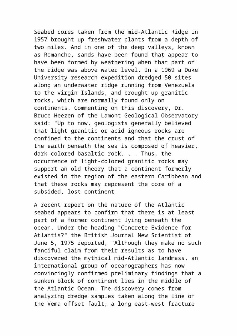
10,500 B.C., the water levels were about 100 feet lower than today. But areas of human occupation on these ancient shores tend to cluster at depths around the 45-foot level."The new discovery of Yucatan remains dated to 11,000 B.C. comes as we are completing the video documentary, "The Yucatan Hall of Records," scheduled for release at the ARE's Annual Ancient Mysteries Conference. The discovery has been incorporated into the video and confirms several statements made by Andrew Collins, which were made during a videotaped interview for the documentary. Collins, author of the best selling, "Gateway to Atlantis," tells the story of Votan, the Guatemalan highlands version of Itzamna. In both the stories of Itzamna and Votan, related in Maya codices, the founder of the Maya culture was said to have come from an island in the east. Collins stated that substantial research has shown that Votan's origin was definitely Cuba. Both Itzamna and Votan carried written records with them. According to Collins, Votan landed on the shores of the Yucatan coast and gradually moved north. We believe that Cerritos Island, which we visited in August 2004, may have been the initial landing site of Iltar/Itzamna/Votan."
The Clovis - Solutrean connectionDr. Stanford an archaeologist of the highest caliber, turned away from the Bering route and looked elsewhere for the first migration. His thinking evolved over three decades. In the '60s Stanford, like most of his colleagues, believed that Clovis came from Asia. It wasn't until the '70s that he began to believe that Clovis was a New World development and that evidence of pre-Clovis would be found in the Arctic. "But I wasn't seeing evidence," he recalls, "and after a while it started not to make sense. Everything I found in Alaska that was fluted was post-Clovis in age." There was no technology he considered pre-Clovis. He hoped at the time that once Siberia was opened up to Western scientists we would find the missing evidence. But the end of the Cold War didn't provide the solution for Stanford and his co-theorist, lithics expert Bruce Bradley. Stanford and Dr. Bradley independently looked at the evidence and arrived at the same conclusion. They inspected late-Pleistocene sites and scoured museum collections in Siberia, Russia, and northern China, seeking pre-Clovis technology. Instead, what they found was a totally different method of making tools and weapons. The Clovis fluted point is knapped from stone, flaked on both sides (bifacial) and shaped into a beautiful thin, flat killing instrument; the base
is thinned and relieved into a concave recess so that the point can be securely hafted onto a foreshaft or shaft. The Asian upper-Paleolithic weapons that Stanford and Bradley found, however, were made using a microblade technology, where tiny blades struck from wedge-shaped cores of stone were inset into long, narrow rods of bone, antler, or ivory. When Far East craftsmen tried to make bifacial tools, the result was relatively crude implements (quite thick in cross section, compared with exquisitely thin Clovis points) and frequently bi-pointed.
Nowhere in Asia did Stanford and Bradley find the ancestor of the Clovis point. They reasoned that if the first immigrants were Asian, they must have brought with them their inset-microblade manufacturing process, in which case there must exist evidence of a transition to Clovis technology. So far, however, nothing resembling an intermediate form between inset microblades and a knapped biface has been found in North America. Stuck at a dead end, Stanford and Bradley took up a fresh trail. The roots of Clovis, they reasoned, must lie in the Paleolithic Old World outside of Asia. They took up the search for a parent technology that specialized in making thin, flat bifacial projectile points, knives and other biface implements, and other artifacts of stone and bone similar to those of the Clovis culture. They found only one Paleolithic culture whose technology met their criteria, the Solutrean people. Named for the French town of Solutré, the culture spread across much of France and the Spanish Peninsula. They were highly efficient hunters. Full bellies gave them leisure time, which they used to decorate the walls of their caves with fabulous surrealistic paintings of bison and horses and ibex that continue to awe us today. They were carvers, too, for art's sake. "They had the only upper-Paleolithic biface technology going in Western Europe," Stanford points out. They were the first to heat-treat flint, and the first to use pressure flaking--removing flakes by pressing with a hardwood or antler tool, rather than by striking with another stone. "In northern Spain, their technology produced biface projectile points with concave bases that are basally thinned," he notes, not bothering to say he could just as well be describing Clovis points. The pressure flakes Solutrean knappers removed are so long it's almost a fluting technique--"almost," he's careful to say, but not quite. The parallels between Solutrean and Clovis flintknapping techniques seem endless. The core technology, "the way they were knocking off big blades and setting up their core platforms," he explains, "is very similar to the Clovis technique, if not identical." They perfected the outre passé --overshot--flaking technique later seen in Clovis, which removes a flake across the entire face of the tool from margin to margin. It's a complicated
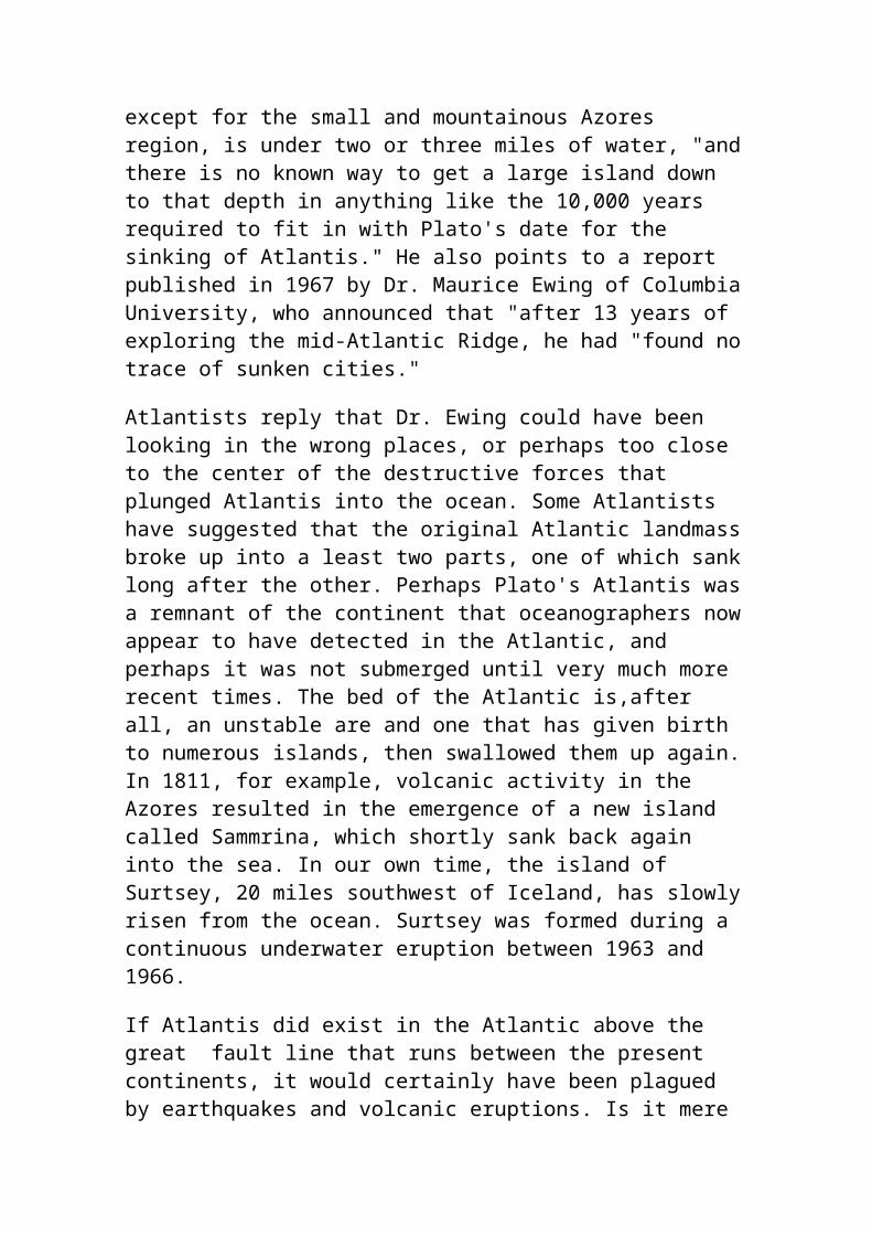
procedure, he emphasizes, that has to be set up and steps followed precisely in order to detach regular flakes predictably. The Solutreans set up platforms and followed the technique through to the end, exactly as we see in Clovis. "No one else in the world does that," Stanford insists. "There is very little in Clovis--in fact, nothing--that is not found in Solutrean technology," he declares. Archaeologist Kenneth Tankersley of Kent State University seconds Stanford and Bradley's opinion: "There are only two places in the world and two times that this technology appears--Solutrean and Clovis." On and on the similarities pile up. We find carved tablets in Clovis sites remarkably similar to Solutrean specimens. Both cultures cached toolstone and finished implements. Stanford and Bradley know of about 20 instances of caches at Solutrean sites; in North America, by comparison, according to Stanford, "we're up to about nine or ten." Just like Clovis knappers, Solutreans used flakes detached by outre passé to make scrapers and knives. Clovis bone projectile points bear an uncanny resemblance to ones made by Solutreans. When French archaeologists saw the cast of a wrench used by Clovis craftsmen at the Murray Springs site in Arizona to straighten spear shafts, they declared it remarkably similar to one found at a Solutrean site. Proof that Solutreans were also mariners was in the discovery in 1992 of Le Cosquer cave near Marseilles by diver Henri Cosquer. Among the rock art figures are depictions of seals impaled by harpoons as well as flounder and halibut - deep-sea fish! Clearly Solutreans learned how to exploit marine resources, possibly in hide boats made from mammoth ribs. At some stage either by accident or on purpose, they caught the northern Equatorial current and favourable trade winds, to find themselves in the heart of a magnificent Archipelago of uninhabited islands. Here they flourished, discovering new plants, animals in abundance and minerals. These people have been called the Clovis hunters in America.
Dr Stanford and Dr Bradley point out the discoveries in genetics by researchers at Emory University and the Universities of Rome and Hamburg. Mitochondrial DNA (mtDNA), which is inherited exclusively from the mother, normally contains four markers called haplogroups, labeled A, B, C, and D. These four are shared by 95 percent of Native Americans. Recently, however, the genetics team identified a fifth haplogroup, called X, which is present in about 20,000 Native Americans and has also been found in several pre-Columbian populations. A most interesting fact is that haplogroup X is also present in European populations but absent from Asians. The geneticists' research suggests the marker appears to have arrived in the Americas 12,000 to 34,000 years ago, not from Asia, but from Europe.
As well as the Caucasian Marker X in North America, the Araucanians of Chile also have significant Paleolithic Caucasian genes in them, most likely arriving from Spain between 18,000 and 12,000 years ago. It is common for them to have curly reddish brown hair and green eyes.The red haired Caucasian Paracas mummies of Peru is also proof that Caucasians were part of the indigenous culture of America. I also found that in 1892 the Easter Island scripts were deciphered by A.Carroll, M.A., M.D., but have been ignored. They are a detailed history of tribal conflict in South America, leading up to the exodus to Easter Island! They mention tribes from the ancient land of Tulapin (Turtle Island), the Eagle Clan and the Children of the sun or Ra. They were all Caucasians.
Genetic similarities between Europeans and American Indians
Archaeologists are just beginning to realize that to understand European prehistory, American prehistory must also be considered. The Solutreans of Spain are now believed to have crossed the Atlantic using the southern Equatorial current and entered the Caribbean and Central America between 18,000 and 12,000 years ago to become known as the Clovis hunters of America. Recent genetic findings suggest that the people now known as Gaelic speaking Celts (including Irish, Welsh, Scots, Basques and Berbers) are a remnant of a group of people who also left Spain 12,000 years ago and spent 6,000 years isolated from Europe before returning, bringing the Megalithic culture to coastal Europe.
Geneticist Prof Steve Jones says: "The Welsh and the Irish are among the most homogenous people in the world. He and colleagues at University College, London, have spent years creating a genetic map of the Y chromosome, which is passed by males from generation to generation. The results show that the Welsh are related to the Basques of northern Spain and southern France and to native Americans. "There has been much less interbreeding in Wales than you might expect. Wales and Ireland have the most homogenous group of males of anywhere in the world, from the research that's been done so far." The genes of Scottish males betrayed considerable inter-mixing with outsiders. Prof Jones, who recently published a book called Y - The Descent of Man, said genetics provided more reliable clues to the distant past than language did. "Most native Americans have the same one."
James Wilson and Prof David Goldstein of University College London, with colleagues at Oxford University and the University of California, found that Welsh and Irishmen are genetic blood-brothers of the Basque people. The findings provide the first direct evidence of a close relationship between the people known as Celts and the Basques. The gene patterns of three races passed down through the male line are all strikingly similar, researchers concluded. Basques can trace their roots back to the Stone Age and are one of Europe's most distinct people, fiercely proud of their ancestry and traditions. The team looked for similarities between the Y chromosomes (which are only carried by men) they sampled DNA from; 88 “Celtic fringe” individuals from Anglesey, North Wales, 146 from Ireland with Irish Gaelic surnames, and 150 Basques, revealing “remarkable' similarities. On the other hand, he and his colleagues compared Celtic and Norwegian populations and found them to be quite different. The Celts carried the early Y chromosome, which provides the first clear evidence of a close relationship in the paternal heritage of Basque and Celtic speaking populations. “They were statistically indistinguishable', we also noticed that there's something quite striking about the Celtic populations, and that is that there's not a lot of genetic variation on the male Y-chromosome, We conclude that both the Basques and Celts are reflecting pre-farming Europe," said Prof Goldstein.Somehow these people have remained in isolation from the rest of Europe up until the Bronze age where their genes begin to indicate an influx of female genes from mainland Europe.
Barry Fell, author of 'America B.C.' is an accomplished decipherer of ancient scripts and has managed to identify a great deal of Celtic, Phoenician, Iberian, Egyptian, Berber, Libyan and Viking scripts in America, indicating that a great deal of trade contact occurred during and after the Bronze Age, but ceasing around the time of the beginning of the Roman Empire. Apparently these great ocean navigators after the destruction of Carthage, decided to withhold all information on navigating to the Americas from the Romans and by the end of the Roman Empire and the onset of the dark ages, much was forgotten about trans Atlantic navigation and the Americas.Barry Fell has identified Ogham script that has come from Ireland, Spain and Africa that goes back to at least 800BC. Early Egyptian scripts were used by the Micmac right up to the arrival of Missionaries. He also identifies many early style Celtic Megalithic monuments on the east coast of America, in particular New England, New Hampshire, Vermont and Woodstock, they take the form of Dolmens, Phallic menhir, Men-a-tol,
massive stone Druid's chairs, megalithic chambers, Solstice and Equinox viewing chambers and burial mounds. These all parallel similar structures in Celtic Europe, especially on the Dingle peninsular, Brittany and some sites in Spain. As usual this work has been ignored by the Eurocentric 'No one before Columbus' fraternity. Although Barry Fell did not go further than assert that most Celtic connections occurred around the Bronze Age. He was not aware of the more ancient genetic connections the Celts had with the proto-American Indians. With further studies done, more accurate dating of the Dolmens and other megalithic monuments will possibly show that some American megaliths may actually predate the arrival of Celts on the Dingle peninsular in Ireland.
New England's Celtic Place NamesFrom; America B.C. by Barry Fell“I was surprised to find many Amerindian place names had somehow survived the onslaught of colonists, rivers and geographical features, it would seem, tend to keep their old names despite the invasions of foreign conquerors. Modern Gaelic preserves many spelled letters that are no longer pronounced, but when pronounced in the ancient Gaulish or ancestral tongue of the Celts and Basques, one finds a striking similarity to the Algonquian language. For example; the Algonquian word for ‘one who takes small fish' is Amoskeag. In Gaelic Ammo-iasgag means ‘small fish stream'. In Algonquian Ammonoosuc means ‘small fishing river' and in Gaelic, Am-min-a-sugh means; ‘small river for taking out fish'. In Algonquian Coos and cohas mean ‘pine tree' and in Gaelic, ghiuthas means ‘pine tree'. Merrimack River in Algonquian means ‘deep fishing'. In Gaelic Mor-riomach means ‘of great depth'. Kaskaashadi another Algonquian name for the Merrimack River sounds similar to Guisgesiadi, which in Gaelic means ‘slow flowing waters' Nashaway River in Algonquian means ‘land between' and in Gaelic naisguir means ‘land connecting'. Piscataqua River means ‘white stone' and in Gaelic, Pioscatacua means ‘pieces of snow white stone'. Seminenal River means ‘grains of rock', which in Gaelic is; semenaill Quechee matches the Gaelic work Quithe meaning pit or chasm. Ottauquechee River flows through a 162 feet deep gorge is similar to the Gaelic word Otha-Cuithe which means; ‘waters of the gorge'.
Cabassauk River in Algonquian means place of Sturgeon. The Sturgeon fish have unfortunately fallen victim to environmental degradation. Similar to Gaelic Cabach-sugh. Attilah means blueberries and in Gaelic Aiteal means juniper berries. Munt means people and in Gaelic muintear means people. Monad means mountain and in Gaelic monadh means mountain. The suffix - nock is used in New England to denote hills and mountains. Cnoc in Gaelic means hill or rocky outcrop. Wadjak means on top, in Gaelic the word is uachdar. Monomonock Lake means 'island lookout place' and in Gaelic Moine-managh-ach 'means boggy lookout place'.Pontanipo Pond means cold water and in Gaelic Punntaine-pol means ‘numbingly cold pool' Natukko means cleared place (land) and in Gaelic Neo-tugha means not covered (by vegetation). Asquam Lake means ‘pleasant watering place' and in Gaelic Uisge-amail means ‘seasonable waters'. These names which have stuck, through many changes over the past 300 years, are not names left by Bronze Age European traders who have sporadicly visitored America. These are names given to these places by the indigenous Amerindians. As the Gaelic language is unrelated to any Indo-European languages, this can mean only one thing - that the Gaelic language was the original mother tongue of many Amerindians. It stands to reason that anyone speaking Gaelic related languages in Europe were originally from America. The native name of Brittany in France is Armorica, another big hint as to their origins.
Stonehenge construction in Southwestern England, 2,900 B.C. is very similar to constructions in South America of the same vintage. Photo, Maxine Marsh
Anasazi cup, man and spirals compared to spirals on a rock marking the entrance to a Celtic tomb.
More early Celtic designs compared to an Anasazi design
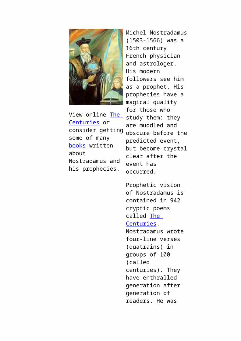
Anasazi Gazelles, compared to a Celtic petroglyph
Here are a few examples of Amerindians; Shoshone, Mohave, Crow, Crow and Zuni, showing that the Boundaries between people on the either side of the Atlantic is not as great as some would like to make out.
Oldest Known North American Mummy From Enigma - 05/15/96

The "discovery" of the oldest known mummy in North America. The mummy, named the Spirit Cave man, was found on the shelves of the Nevada State Museum. Discovered in Nevada in 1940 it was originally thought to be 2000 years old. Recent radiocarbon dating has pushed its age back to 9,400 years (7,400 BC). The most intriguing facts is that the mummy was wearing moccasins and shrouds of woven marsh plants. The weave of the shrouds indicates that it was made on a loom. If these findings turn out to be true it would mean that the there were people in North America more than 9,000 years ago with the knowledge and technology to weave cloths on looms. Such a level of sophistication again pushes back the dates of early civilization and should makes us question some long held assumptions about the primitiveness of ancient people. DNA and other tests are being undertaken.
Another genetic marker indicating that Caucasians were in America are the Araucanians of Chile. They have significant Paleolithic Caucasian genes in them. They are in effect a relic of the people of Atlantis. Other studies show that Mayans, Incas and Auracanians are all virtually 100% group O, with 5-20% of the population being rhesus negative. this was the blood of the original Europeans, traditionally called the blood of royalty (blue blood) and stems from Cro Magnon man. The races that possess this blood are races of the Americas, the Canary Islands, the Basques, Scandinavians, Celts, as well as some Polynesians.When the Rhesus positive Asians arrived in America 5,500 years ago, they inevitably interbred with the Rhesus negative Red Heads. This would have proved disasterous, for the already decimated population of Red Heads, as a rhesus negative mother who gives birth to a rhesus positive baby develops antibodies against rhesus positive blood and is then unable to succesfully have any more children without the help of modern medicine. Not only this, but blue eyes, blonde and red hair are all recessive genes and so the European heritage of American Indians was masked by the genes of the new comers. One dominant genetic trait reveals the Cro Magnon man heritage is hidden in American Indians is their tallness. Gigantism, common in America is also a genetic throwback to a time that once was, when 'size did matter' for survival, when hunting mammoths and sabre toothed tigers was a part and parcel of daily activities.
Age of the White Haired Giants
Aztec and Toltec history identifies that 17,608 years ago was the beginning of "The Age of the First Sun" or the "Age of White Haired Giants", or in Inca history - the Age of Viracochas - the “White and Bearded Gods”.
According to European archaeology, Cro Magnon man was quite tall, had pale skin, blonde hair and was capable of growing beards. It sounds to me like cultures on either side of the Atlantic are describing the same breed of man. Archaeological finds in America appear to confirm the existence of very tall people being the base layer of the Native American cultures. A skeleton estimated as being 10,000 years old was found in the ‘tomb of Palli Aike' in Tierra del Fuego in 1969-70 and has been identified as Cro-Magnon, which indicates that these people also spread to South America. In the book, The Natural and Aboriginal History of Tennessee, author John Haywood describes; "very large" bones in stone graves found in Williamson County, Tennessee, in 1821. In White County, Tennessee, an "ancient fortification" contained skeletons of gigantic stature averaging at least 7 feet in length.In February and June of 1931, large skeletons were found in the Humboldt lake bed near Lovelock, Nevada. The first of these two skeletons found measured 8 1/2 feet tall and appeared to have been wrapped in a gum-covered fabric similar to the Egyptian manner. The second skeleton was almost 10 feet long.(Review - Miner, June 19, 1931).George W. Hill, M.D., dug out a skeleton "of unusual size" in a mound of Ashland County, Ohio. In 1879, a nine-foot, eight-inch skeleton was excavated from a mound near Brewersville, Indiana(Indianapolis News, Nov 10, 1975)In 1875 workmen were constructing a bridge near the mouth of Paw Paw Creek at Rivesville. While digging through heavy clay soil they were astonished to uncover three giant skeletons strands of reddish hair clinging to the skulls. A local doctor was called to examine the remains and was able ascertain after careful measurement, the skeletons had supported people approximately 8 feet tall.Just as black haired Greeks had an earlier past of taller blonde and red haired people (the Titans), so did the Amerindians.
The Golden Age
13,600 years ago In Aztec legends, was the beginning of the Age of the Second Sun - the “Golden Age” and is remembered in Incan legends as the “Age of Giants”. This Age lasted 4,010 years, it began with the Biblical and Sumerian Great Flood, followed by the Deluge and ended with a calamity involving the Wind Serpent. The demise of Atlantis was somewhere in the middle of this.European legends from Ireland, Brittany, Spain and North Africa and Egypt talk of their legendary homeland being on the other side of the Atlantic Ocean, and in some legends it was called Atlantis. It is no
coincidence that many Central American place names are also derived from the fabled city of Atlantis. Aztlan, Azatlan, Atlanta, Tlan, Tolan, Tulan, and Tenochtitlan are all linguistically similar. The most likely site for the civilization of Atlantis appears to be in the Caribbean, centred around Cuba and the Grand Bahama Banks - a shallow area of sea that 10,000 years ago would have been an island as big as Ireland. So far 60 sites have been found exhibiting remnants of buildings and ring structures. A Hexagonally tiled floor has been uncovered as well as numerous stone roads. There appear to be numerous sites on the southern side of the Bahama banks, adjacent to Cuba, which also has many underwater ruins along its northern shore, including stone Quarries in 10-20 metres of water. When comparing Platos story to this area it all fitted except for talk of horses and elephants in the city. I then looked up mammal extinctions in North America, to find that Mastodons and horses became extinct approximately 11,000 years ago! This correlates perfectly with the Clovis hunters and the time of Atlantis.Archaeological evidence shows that the Clovis people multiplied and spread across North America from the Gulf of Mexico about 13,000 years ago. This period abruptly ended with the demise of the megafauna of North America, along with end of the Clovis people and Atlantis 11,600years ago. The comet impact in North America around this time - as evidenced by the 500,000 craters known as the Carolina Bays (see Catastrophes Chapter) could possibly have been the cause of this abrupt end to an Era in America.
The green area is presently underwater but would have been exposed during the last ice age when sea levels were 140m lower. The Grande Bahama Bank would have been a large island up until about 6,000 years ago.Six of over sixty discovered archaeological sites are marked here. The red spot marks the approximate position of a city recently found in approximately 700m deep water, suggesting a subsidence of the whole Cuban tectonic plate. Mountains in Cuba would have been correspondingly higher, as marked. The red rectangle depicts the possible site of Atlantis. This area meets all the criteria of the city's location. Gold dust amongst the beach sand of this bay could quite possibly be from the gold used to decorate the buildings of Atlantis.Modern side scanning sonar has recently picked up what appears to be the ruins of a city on a 7sq mile plateau in 2300 feet of water, just off the edge of this shallow bay. Cuba is in a tectonically active area, with a deep oceanic trench (subduction zone) south of it. If Atlantis was destroyed
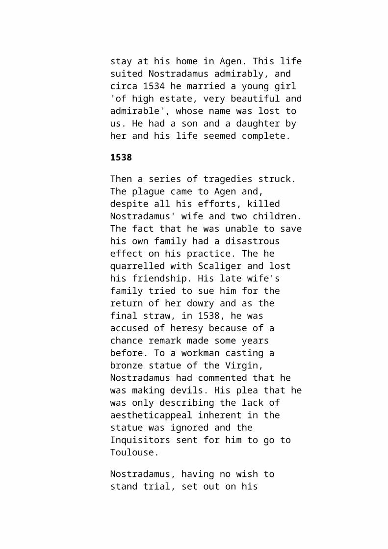
11,600 years ago then this means this plateau has been dropping at a rate of ~2" every year. This is totally plausible in geological terms. Not only this, but sea levels world wide have risen ~300 feet during this time.
Artists impression of what has been sited in 2000feet off the western end of Cuba.Image from Atlantisite.com.
Other sites of towns appear to be on the Grand Bahama Banks– a shallow area of sea that 6,000 years ago would have been an island 600x200 miles.Pottery ~6000 years old has been found amongst these ruins. So far 60 sites have been found exhibiting remnants of buildings and ring structures. A Hexagonally tiled floor, each tile, 6 foot across and 4" thick have been uncovered as well as numerous stone roads. There appears to be numerous sites on the southern side of the Bahama banks, adjacent to Cuba, which also has many underwater ruins along its northern shore, including stone Quarries in 10-20 metres of water.This period of development, starting 7,590 B.C. is remembered in Aztec legends as the beginning of the Age of the Third Sun - “The Age of the Red Haired People. These people are most likely a reformed fragment, from the survivors of Atlantis. Ther have been many assertions that Atlantis was in: Spain, the Azores, South America, Western Africa and the Antarctic, not to mention other more outlandish suggestions that ignore a basic fact that it was outside the Pillars of Hercules (the Straits of Gibraltar) and have postulated that it was in Taiwan, Indonesia and the Black Sea. The Minoan civilization of Crete was another suggestion, but this culture is only 5,000 years old, therefore, if it does have any parallels with the ancient Atlantian culture, then it is from wayward settlers from the ancient American civilization of Atlantis.Whether Atlantis was in the Azores or the Caribbean, products of this civilization show the greatest amount of evidence in America. Atlantis was said to be on an island, one of 10 kingdoms that spanned a country as big as Africa and Asia together (N&S America). If these people
were travelling back to Europe to fight the people of the Mediterranean, I am sure that islands of the Central Atlantic and coastal Spain would most certainly have been controlled by these people also. Even Lixus city on the West Coast of Africa was most likely active at this time too.
Use of Metals in ancient times
There is an ancient copper mine in Michigan that was used by these people and later by the Phoenicians and Berbers who exported about 500,000 tons of copper from this mine back to Europe, either via the St Lawrence River and down the Mississippi. In the bay at the western end of Cuba, where the main city of Atlantis was meant to have been situated, the sandy beach contains minute grains of gold. 11,600 years of erosion would easily reduce sheets of gold into minute grains. People have suggested this gold, which does not come from a motherload in the area, is from gold looted from the Aztecs and Incas on a Spanish wreck in the bay. It would not be possible for a cache of gold to be reduced to such fine specks in only 300 years.Plato also talks of Orichalcum and Gold. He says they hammered out great sheets of these metals and covered large stone structures marking the entrance to great harbours. Is it possible that such early use of metals has been hidden from archaeologists eyes? The earliest use of copper in the world was in Michigan. So far copper artefacts ~8000 years old have been found .Gold has also been found associated with ancient copper artefacts. Both Copper and Gold can be found in nature as pure nuggets, the simple process of hammering it into sheets would not have been a terribly difficult concept to grasp. I suspect that the date for the earliest use of metals will be pushed back to the time of Atlantis - 11,500BP.Sometime after 11600years ago a god like person named Anu helped transform the primitive Sumerians into farmers. This can only be an individual representing the Anu, which are better known as the Veda of India. Then a 600 years later a group of white faced, purple clothed people with golden wings appear in the Sumerian historical records. They are seen as educators in the humanities, medicine and astronomy. These can only be individuals representing the people of Atlantis. As the cities of the Veda and the cities associated with Atlantis are all in at least 40m of water, little can be ascertained about the cultural development of these people until an actual city site is found. The cultural development of the Sumerians may give us some idea what these cultures were like.
Catastrophes and Prehistory
Now that we have a better picture of the people who became 'the Polynesians', let us look at the bigger picture, of how humans have changed over time. The general consensus of geneticists is that the present species of humans - Homo Sapiens began in Africa 150,000 years ago. This has been spelled out fairly clearly by Bryan Sykes in his book 'The Seven Daughters of Eve'. Despite this, we must not forget that there have been many species of humans or bipetal hominids with opposing thumbs that have populated the world before us. The Leaky family did extensive studies in Africa on a 3 million year old bipetal hominid they called Lucy. Recently a 7 million year old bipetal hominid (human) skull was unearthed in Chad by professor Michel Brunet of the University of Poitiers in France. There is also Java man, Peking man and Australopithecus, to name a few, some were less than a metre tall others were over four metres tall. With their opposing thumbs, they were all capable of using tools such as hammers, axes and spears. Large 20kg axe heads have been found associated with 60cm footprints in New South Wales, which indicates the size and technological development of these people. The tools are thought to have been made by 'Java Man', as similar tools have been found in Indonesia. Just as we see a great range of body sizes in the canine species, from Great Danes to Chihuahuas, it is only logical to assume there has been a similar variation with humans. When Sabre toothed tigers, Diprotodons, Woolly Mammoths and other large and powerful beasts were in the environment, large and powerful people would have had a better chance of survival. On the other hand, smaller people would have had a better chance of survival after a natural catastrophe, such as a comet impact, where dust was thrown up into the atmosphere, dimming the earth for a few years, causing massive droughts and a scarcity of food. The locality of impacts, eruptions and tsunamis would have played a big part in who the survivors were. Rather than 'survival of the fittest', chance, had a much bigger part to play in determining who the survivors were. Recent studies in Indonesia have unearthed 'the Hobbit' a very small human, from about 13,000 years ago. The skeleton was about one metre tall. In the book, The Natural and Aboriginal History of Tennessee, author John Haywood describes; "very large" bones in stone graves found in Williamson County, Tennessee, in 1821. In White County, Tennessee, an "ancient fortification" contained skeletons of gigantic stature averaging at least 7 feet in length.In February and June of 1931, large skeletons were found in the Humboldt lake bed near Lovelock, Nevada. The first of these two skeletons found measured 8 1/2 feet tall and appeared to have been wrapped in a gum-covered fabric similar to the Egyptian manner. The second skeleton was
almost 10 feet long.(Review - Miner, June 19, 1931).George W. Hill, M.D., dug out a skeleton "of unusual size" in a mound of Ashland County, Ohio. In 1879, a nine-foot eight-inch skeleton was excavated from a mound near Brewersville, Indiana(Indianapolis News, Nov 10, 1975)In 1875 workmen were constructing a bridge near the mouth of Paw Paw Creek at Rivesville. While digging through heavy clay soil they were astonished to uncover three giant skeletons strands of reddish hair clinging to the skulls. A local doctor was called to examine the remains and was able ascertain after careful measurement, the skeletons had supported people approximately 8 feet tall.Gigantism often found in America, is not an abberant mutation, but a genetic throwback to a 'time that was'. As variations in the environment put pressure on these groups, whether it be large predators or famine, numbers dwindled in the populations less suited to the environment. This eventually led to the situation today where most humans are between five foot and six foot 6inches.
The first migration of Homo sapiens spread out from Africa between 80 and 100,000 years ago across India into S.E. Asia and across to America. It is believed from genetic markers in remnant populations around the world, that these people were dark skinned, short, with very frizzy, almost woolly hair. Relic populations of these pygmies can still be found in the; Congo Basin, Andaman Islands, the Highlands of New Guinea and the Phillipines. It has been confirmed by geneticists that there are specific DNA markers that indicate without a doubt that The Highlanders of New Guinea are directly related to the Pygmies of the Congo Basin, albeit 100,000 years ago. Skeletons of these people have been found in Brazil and Tierra del Fuego, indicating that they constituted a major pan global population that was crushed by a major natural catastrophe 75,000 years ago when Lake Toba exploded, creating a massive caldera in the highlands of Sumatra. Dust from this massive explosion would have dimmed the planet, cooling it down and creating droughts and famine that may have lasted for over 10 years. Survivors of this world population of Pygmies can still be found in the Congo, Andaman Islands, Phillippines, New Guinea highlanders and some Aborigines of North Queensland. Even Polynesians have traces of this ancestry in their DNA through contact with Melanesians 11,500 years ago.It is interesting to note that these genetically related people all appear to have the bow and arrow as a hallmark of their culture. It is quite likely that they had this technology 100,000 years ago.
1. Pygmy skull found in Holliston Mills, East Tennessee. They were 3-4 feet tall and their cranium size was equivelant to a 7 year old child. From America B.C. by Barry Fell. A significant population of these people lived in this area between 40,000 and 3,000 years ago. 2. Andamaneseii from the Andaman Islands.Photo; Steve Sailer website (See links).
Their passage to New Guinea from Africa can also be traced by the Malaria parasite Plasmodium falciparum that they brought with them. Recent studies on the Malaria parasite gene have shown that; "Plasmodium falciparum appeared in Africa and spread around the world with migrating
populations, as much as 100,000 years ago. Both the parasite and the mosquito underwent rapid evolutions about 10,000 years ago, forming Plasmodium vivax, which ranges widely through Asia, Africa, Melanesia and the Americas. Their coincidence with the development of settled agricultural societies in tropical regions seems to be a telling clue to the history of the disease and the movement of man around the world". As malaria is a tropical disease, it is highly unlikely that it travelled between continents via the Polar Ice caps, therefore; trans oceanic voyages in the tropics must have been undertaken 10,000 years ago. This is the only way this disease could have spread from Africa to Panama. This disease needs to have a significant population of people living close together in order to survive, therefore, this parasite was brought not by some wayward fisherman, but by a whole fleet of ships, carrying hundreds of people. It must be logical to assume that because they had boats seaworthy enough to cross the Atlantic, and they knew how to utilize equatorial currents and the trade winds, there would be nothing stopping them from giving the Pacific Ocean a go. Malaria in New Guinea bears testament to their curiosity. When they crossed the narrow isthmus of Central America, they found another ocean beckoning them. The islands of Melanesia are in the exact place boats from the Panama region would end up, it would have been a case of 'going with the flow' letting the wind take them to a new land over the horizon. From this, we can only assume that Melanesians originated from a number of different migrations at different times from Africa. The Blue Black Solomon Islanders bear testament to a separate migration to the Papuans from Africa. Once again 'isolationism' has marked comparison of African to Melanesian genes a no go area for research.
The second wave of humans to leave Africa after the Toba disaster were the Anu. The age of the Pygmy was over and a new balance of human genes spread across the planet. This time they were taller, had wavy black hair and beards. In Africa they were called the Anu, in India - the Veda, in Japan - the Ainu, in Lake Toba - the Batak and in Australia, numerous tribes went under many different names.
Japanese Ainu, racially similar to the Indian Veda and Australian Aborigines, These people once populated Asia, Australia and America 50,000 years ago
Genetic studies indicate that Cro Magnon man and the Veda separated ~28,000 years ago. Cro Magnon man lived in the colder areas of Eurasia, had pale skin, blonde hair and a beard, he was very tall, averaging 6 to 10 feet. The Veda were also tall and had beards, but living in the tropics they developed a darker skin for protection against the damaging rays of the sun. These people saw the sea levels around the planet, recede to 140m below their present level. They are bound to have witnessed many natural catastrophes. Needless to say a significant pocket of Veda/Anu survived in India and carried on to begin Western civilization in the Middle East as we know it today.In Biblical records, Lord Anu was the culture bringer to the Sumerians. According to Hebrew texts, this occurred 10,000 years ago. In other words, knowledgeable survivors of the Veda/Anu civilizations of India, decided to resurrect their civilization amongst the Sumerian tribesmen. According to Christian O'Brien, in his book "The Genius of the Few" The great 'Lord Anu' decided to 'plant a garden in Eden' which was a fertile valley
overlooking fertile plains in Lebanon where a village named Ehdin still exists. Then 600 years later the "Shining ones" - white faced, purple robed people with gold wings came and gave them incredible scientific knowledge. These people were obviously survivors of the pan Atlantic culture that also gave rise to the purple robed, red haired Phoenicians, the blue robed copper culture of the Tuaregs, the seafaring Berbers, Celts, Basques, Toltecs, Anasazi and Araucano. Therefore we have a Veda bringing knowledge of agriculture and a Caucasian American bringing science to the Sumerians to start Western civilization as we know it today. It would only be natural, that the survivors of a global catastrophe, regardless of their origins, would have pooled together their recources to start anew.
So what was this global catastrophe that ended these civilizations? In Plato's Critias, The wise Egyptian priest in talking to Solon, gives a fairly good picture of what has happened in the past; " There have been and will be again, many destructions of mankind arising out of many causes, the greatest have been brought about by the agency of fire (comets) and water (ice age meltdown), and other lesser ones by innumerable other causes (volcanoes, earthquakes, tsunamis)."The declination of bodies moving in the heavens around the earth, and a great conflagration of things upon the earth (comet/asteroid impacts), which recurs after long intervals; at such times those who live upon the mountains and in the dry lofty places are more liable to destruction than those who dwell by the rivers or on the sea shore. When on the other hand, the gods purge the earth with a deluge of water, the survivors will be those who dwell up on the mountains, as the water always having a tendancy to come up from below (Tsunamis and sea level rises)." He also says "that wherever the extremity of winter frost (Ice ages) or of summer sun (climatic change and drought after volcanic eruptions) does not prevent mankind to exist, sometimes in greater, sometimes in lesser numbers." These disasters "leaves only those of you who are destitute of letters and education, and so to begin all over again like children, and know nothing of what happened in ancient times."
Catastrophic events such as massive volcanic eruptions, comet or meteor impacts as well as associated earthquakes and tsunamis have not been given enough consideration when assessing the forces that have shaped the development of man. The earths ancient geological history is full of evidence of such catastrophes. For example; 256 million years ago a large celestial body impacted the planet south of South Africa, the reverberations around the planet met in Siberia, rupturing the earth's surface, creating a massive 12,000 feet thick lava flow, this catastrophe ended the 'Age of Amphibians' and almost wiped out all life on Earth. 210 million years ago
another meteor impacted the planet in Canada - the Manicouagan Crater - 100km wide. This meteor brought to an end the Triassic period. Then 65 million years ago at the end of the Cretaceous period a meteor impacted the Yucatan Peninsular, once again, the opposite side of the planet ruptured, creating the Deccan in India, a 5,000 foot thick lava flow. This catastrophe brought to an end the 'Age of the Dinosaurs'. The Atherton Tablelands in Queensland is a 2,000 foot thick lava flow that formed about 1 million years ago in a geologically stable area. A meteor impact in the North Atlantic would most likely have been the perpetrator of this catastrophe.
During human history, similar, but smaller events have occurred. The cave system in Malta called the Hypogoeum was filled with 7,000 bodies, soil and debris washed in from a massive tsunami, possibly from a meteor impact in the Mid Atlantic. On the other side of the Atlantic, the island which is now the Bahama banks, also appears to have been devastated by a tsunami at about the same time. This island that was once as big as Ireland was known as Tulapin or Turtle Island and according to legend was the homeland of many native American tribes. Numerous floors and foundations under the sand indicate that a large city was devastated by a massive tsunami ~7,000 years ago when the sea level was over 10metres lower.The underwater ruins around Yonaguni and India are also testament to rapid sea level rises within the last 20,000 years. Scientists are beginning to realise that the 140metre rise in sea level since the last ice age was not necessarily gradual, but may have occured in steps, as massive ice shelves broke off the Polar ice cap and drifted into tropical waters, melting within the year. Rapid rise in sealevel is also believed to have been caused by massive lakes forming on top of the ice sheets as the ice melted, then in one terrible moment the ice holding back the water would break and this huge body of water would gather all the other lakes in its path, resulting in a massive sheet of water punching into the ocean causing a tsunami and contributing to a rise in sea level of a couple of metres. From this we can see that catastrophic events have occurred repeatedly in the past and have most definitely played a big part in the evolution of species on our planet. Charles Darwin in his 'Evolution of the Species' did not put enough emphasis on the effects of catastrophes and the part that random chance played in determining who the survivors were. The most obvious example of random chance changing the course of history is the meteor that ended the reign of the large and powerful dinosaurs allowing smaller mammals to freely develop, without predators.It is obvious that no massive meteors have impacted the planet since the end of the age of the dinosaurs, but thousands smaller ones have.
Such catastrophic events have by random chance repeatedly crushed the dominant world population of humans, allowing a small pocket of survivors to multiply and repopulate the planet with a new mix of genes.Here is just one example of the destruction caused by a comet in human history. Andrew Collins in Gateway to Atlantis talks about this event in detail.This event is thought to have occured around the time that the civilization of Atlantis ended.
USA showered by a watery comet ~11,000 years ago, ending the Golden Age of man in America.
Approximately 11,000 years ago a variety of animals went extinct across North America. These were mostly mammals larger than approximately 44 kg. Some of the animals that went extinct are well known (like sabre toothed cats, mammoths and mastodons). Others were less well known animals (like the short-faced skunk, giant sloth and the giant beaver). Some animals went extinct in North America but survived elsewhere (like horses and tapirs). Before this extinction the diversity of large mammals in North America was similar to that of modern Africa. As a result of the extinction, relatively few large mammals are now found in North America. The possibility that a comet destroyed the mega fauna and human population of North America is highly likely.
Photos from George A. Howard website (see Links)
Carolina Bays - 11,000 year old Impact sites, caused by bullets of water from a disintegrating comet.Direct evidence of a cataclysmic event around the time of the Clovis hunters of America.
The geological formation of the oval shaped depressions termed Carolina Bays, which number in total, 500,000 litter the SW corner of North America. Their orientation across the landscape is in a NW to SE direction, with earth piled up on the SE rim up to 25 feet high. Carolina Bays tend to become more elliptical with increasing size - up to 10km long. This is consistent with a large body of water taking longer to dissipate as it travels at speed across the landscape. Large bays tend to be deeper than small bays and they tend to occur either in linear arrays or in complex clusters. The consistent repition of shape and alignment can mean only one thing. Comet impact. It is believed that these depressions were not caused by a rocky comet as no
heavy metals have been found in the craters, but by bullets of water hitting the ground from a disintegrating comet. There has been some disbelief that such a catastrophic event could have occured in human times, people have tried desperately to think of some other way that these depressions could have occured. The fact is that these depressions occur in sand, mud, soil, upland gravel, but not on any rocky outcrops. The only mechanism for similar shaped depressions to occur in a diverse range of sediments is by a massive body of water, travelling at a high velocity at a low trajectory and dumped upon the earth. All the craters show a similar amount of weathering and infilling, therefore they must be all of the same age. It has also been noted that there are two oval shaped craters on the bottom of the ocean, just north of the Grand Bahaman banks.Their orientation is consistent with a NW to SE trajectory comet impact. It is believed that these impact sites are associated with the Carolina Bays. Whether or not there are any craters on the bottom of the ocean, the nature of a disintegrating comet entering the atmosphere is that small pieces of debris break off first, the largest remaining piece/s travels the furthest. Therefore as there are 500,000 small craters along the Atlantic coast, one must assume that a significantly large body impacted the Atlantic Ocean, resulting in a massive tsunami. Core samples indicate the Carolina Bay formations was between 11-15,000 years ago, a more accurate date for their formation has not been ascertained as yet. Pollen samples indicate a pine forest prior to their formation changed to a deciduous forest after their formation. This change is seen in the core samples either side of a layer of sandy blue clay, devoid of pollen. This marks the time of creation of the lakes, and the resultant settling of dust after impact. The change in forest type after these depressions were formed indicates that they precipitated a radical climate change. Whoever was living in America at the time would have found this event totally devastating as shown in the following accounts of tribes from the area. Whether it was this, or a later event that destroyed Atlantis is yet to be determined.
The Anasazi have a legend that talks of a fiery sky serpent destroying the civilizations on the islands of the Carribean, or more specifically Tulapin (Turtle Island), their homeland. One can imagine an elongate meteor, rotating as it enters the atmosphere, creating a wiggly, snake like trail. The speed at which a meteor enters the atmosphere also gives the visual impression of the speed of a striking snake.From Andrew Collins book; "Gateway to Atlantis" we get the following interesting information. Many native American traditions tell of:…a moon fell out of the sky, onto the earth. During it's passage through the sky it looked like a feiry snake,
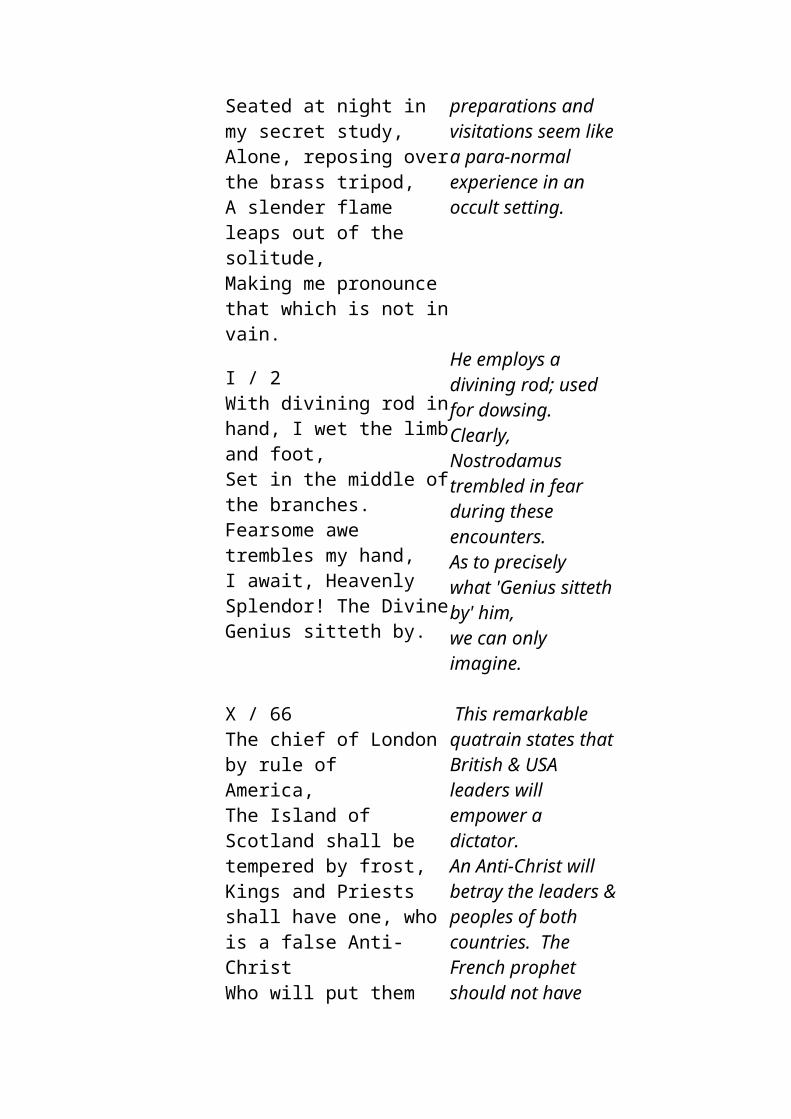
there were terrible earth quakes and the day turned into night, there was a gigantic flood and a formidable rain that lasted many days, many people died. This most likely describes the impact of the comet that created the Carolina Bays.
"The water having poured over the land (2km thick ice sheet collapses into the sea), human dwellings disappeared. The wind carried them away. They fastened several boats to one another. The waves traversed the Rocky Mountains. A great wind drove them. Presently the moon and the sun disappeared (atmospheric dust, post impact). Men died of a terrible heat (firestorms post impact). They also perished in the waves. Men bewailed what happened. Uprooted trees floated about in the waves. Men having fastened boats together trembled with cold. The above translation is attributed to the native tribe called the Esquimaux of Canada. Just one of hundreds of flood traditions that many scholars have collected. Also from further south in the Carolinas we have the following very interesting tradition: "a star fell to the earth, and rain soon followed (oceanic impact, causing vast amounts of water to evaporate). Days and days of rain quenched the fire. Great holes burned in the earth by the fire were filled, forming a great inland sea. A number of cultures retained stories of impact induced winter. Most telling of such lore this author has read are these amazingly informative tales of the Yakuts: . . . is said to be "the daughter of the Devil and to have had a tail in the early days". If it approaches the earth, it means destruction, storm and frost, even in the summer; . . . , the daughter of the Devil is a beautiful girl ... she is the bride and the sweetheart of Satan's son ÜRGEL (Pleiades). When these two stars come close to one another, it is a bad omen; their eager quivering, their discontinuous panting cause great disasters: storms, blizzards, gales. When they unite, fathom deep snow will fall even in the summer, and all living beings, men, animals and trees will perish . . .
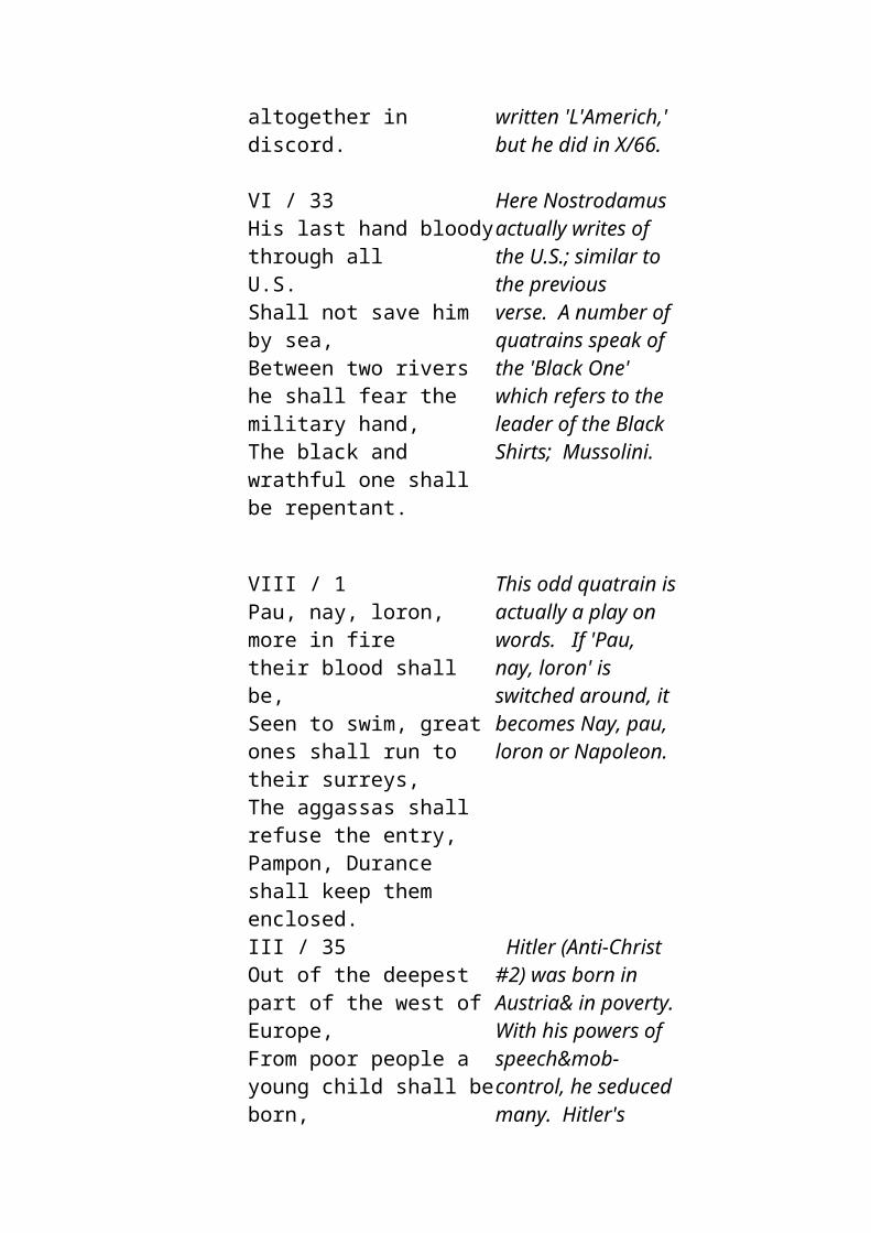
…… five planets went out of their courses. In the night, stars fell like rain. The earth shook. The E and Loh became dry. What is remarkable about these particular tales is the conjunction of several pieces of information. From these lines we gather that a comet with a tail came close enough to influence weather on Earth--i.e. deadly storms, frost and deep snow in summer. Also, we are told that this is most likely to occur if the comet appears close to the Pleiades. In short, these legends accurately describe what can now be inferred from astronomical data on comet Encke and the ring of debris its progenitor strew about the Sun, according to the above information; into five significant chunks. "Stars falling like rain" indicates a large amount of debris entering the atmosphere, "the earth shook" suggests a sizable impact. As the above example suggests, contemporary researchers need to be wary of assuming our predecessors' folk memories of astral events relate to bodies familiar to our time. There is considerable reason to suspect that the majority of the planets namesakes were comets--probably of the Encke family. Human belief systems have been greatly influenced by the phenomena attending the progressive break-up, over thousands of years, of this large comet. The idea of a wrathful sky god or star positions influencing events on Earth are legacies of this influence.
Recent studies on ice cores in the Antarctic have found numerous Iridium layers during the last 100,000 years. Often these layers of Iridium are mixed with Volcanic ash, confusing the origin of the Iridium. Iridium is commonly found in meteors, but is an extremely rare mineral on Earth. This mixing suggests that the impact of a Comet or Meteor precipitated volcanic eruptions. Scientists have also found a direct correlation between Iridium layers and the beginning of many ice age events suggesting that the combined effect of a comet impact and the resultant volcanic eruptions had a big part to play in turning points in human history.
Comets are not the only cause of major changes in the earths population over the last 15,000 years. It appears that sea level rises since the end of the last Ice Age have not been as gradual as previously believed. Sudden sea level rises appear to have happened a number of times in the past, destroying coastal trading ports causing a shift in surviving populations.
Antarctic ice sheet key to sudden sea level rise
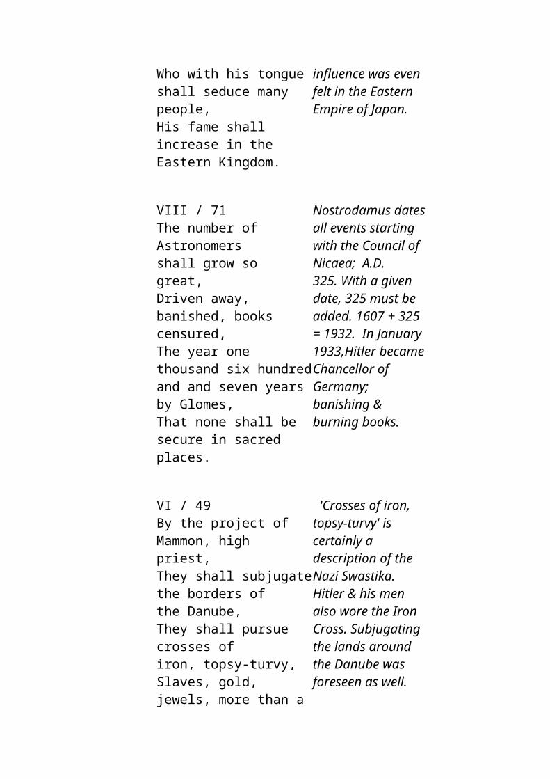
Researchers show Antarctic ice sheets may not be as stable as previously thought.
by Janet Wong
March 28, 2002 -- Physicists from Canada, the United States and Britain have concluded that a massive and unusually abrupt rise in sea level about 14,000 years ago was caused by the partial collapse of ice sheets in Antarctica, solving a mystery scientists have been heatedly debating for more than a decade. Near the end of the last Ice Age, the Earth's sea level abruptly rose over 20 metres - four times faster than usual for that time period and at least 20 times faster than sea levels are rising now, report geophysicists Jerry Mitrovica of the University of Toronto, Peter Clark of Oregon State University , Glenn Milne of the University of Durham in the U.K. and Mark Tamisiea, a post-doctoral fellow at U of T, in the March 29 issue of Science . The cause of this event - called the global meltwater pulse 1A, first identified in 1989 - has been unknown until now. The scientists say their research not only pinpoints the source of the meltwater pulse as coming from West Antarctica. It also makes the case that significant climatic events can occur very rapidly and unpredictably.
Ancient Mangrove Forests Found Under Reef
North Queensland marine researchers have opened a window into the past by exposing ancient mangrove forests entombed beneath the Great Barrier Reef.Dr Dan Alongi from the Australian Institute of Marine Science says they have unearthed 9,000-year-old mangroves in old river channels that were swamped when sea levels rose after the last ice age.He says the relic mangroves show an abrupt rise in the sea level, 20 times faster than previously thought."Material was very much intact, it didn't even have time to fully decompose when it was buried, so it does tell us that when climate change happened at least when it happened in the past it was comparatively quick," he said.
A cold event 8,200 years agoNature 22 July 1999
A cold event occurred between 8,400 and 8,000 years ago which affected Europe, North Africa and North America causing significant climate changes. It is believed to have been triggered by global warming which caused a catastrophic drainage of the Laurentide lakes in Canada. This cooling event was forced by a massive outflow of fresh water from the Hudson Strait. The glacial lakes Agassiz and Ojibway were originally dammed by a remnant of the Laurentide ice sheet and drained catastrophically 8,470 calendar years ago. The sudden increase in freshwater, reduced sea surface salinity and altered ocean circulation, thereby initiating the most abrupt and widespread cold event to have occurred in the past 10,000 years.
Antarctic mud reveals ancient evidence of global climate changeBy Mark Shwartz
In 1998, ODP scientists extracted a 150-foot-long sediment core from the muddy bottom of the Palmer Deep - a submerged section of the continental shelf along the west Antarctic Peninsula about 3,000 feet below sea level. The sediment sample was loaded with the shells of microscopic creatures called diatoms dating back some 10,000 years to the beginning of the Holocene - the most recent geologic epoch."The Antarctic Peninsula is an ideal region to investigate climate change at decadal to millennial time scales due to its location in one of the Earth's most dynamic climate systems," noted Dunbar. "The ODP sample gives us the first continuous, high-resolution Holocene sediment record from the Antarctic continental margin." The sediment sample revealed higher concentrations of diatom shells during the mid-Holocene, roughly 5,500 to 7,000 years ago, which indicates that the waters surrounding the Antarctic Peninsula were more biologically productive then. According to Dunbar, higher productivity suggests that sea ice was less abundant during the mid-Holocene - a further indication that temperatures were higher. "We think it was quite a bit warmer then," he observed, noting that geochemical analysis of the sediment also revealed higher levels of nitrogen during the mid-Holocene. "Warmer temperatures appear to have produced freshwater streams that fed nitrogen and other nutrients into coastal waters," he explained.During this warm period, sea levels rose from approximately 10m below the present sea level to approximately 1.7m higher than present day levels.Legends around the Caribbean tell of a heavy rain falling for many days and many were drowned. It was this deluge that separated their islands from the mainland.
Little by little subsequent tempests submerged the lands of the Bahamas, separating the people from one another by arms of the sea.
Future studies of archaeological remains on the Bahama Banks will most likely prove that this strategically placed large island at the end of the Northern Equatorial current and at the beginning of the Gulf Stream was not only the homeland of Many American tribes, but was also the homeland of many European tribes such as the Basques and Celts.
Conclusion
Outriggers, Suva harbour, Beqa in the background. Photo L. Marsh
The populating of the Pacific Rim and hence the Pacific, has been a very complex affair with tribal inputs stemming from ancient civilizations in Asia, America, Africa and the Mediterranean. It appears that the ancient civilizations in India, S.E.Asia, South America and the the Carribean, were much more ancient and much greater civilizations than anyone has ever imagined. Most of the evidence lies under many metres of sediment and coral. Catastrophic events such as comet impacts, Tsunamis and massive Volcanic eruptions have changed the course of man's history many times in the past and will continue to do so in the future. Such catastrophic events would have changed the genetic balance of the population by random chance and each time the emergent population would have had different qualities, unique to the lucky survivors. The survivors would have been
fragmented, eventually regrouping to form a variety of new population bases. The new cultures would be reinvented according to the surviving knowledge, genes and needs of the people in their new environment. It should also be noted that if the core of a civilization is destroyed much technology can be lost. The old adage that the 'meek shall inherit the earth' and the 'Phoenix shall rise from the ashes' has happened many times in the past. The idea that there has always been a slow upward trend in the development of civilization since the days of the cave man, is a rather simplistic picture of our past. There have been many rapid developments, followed by a hiatus, then slowly it all begins again. It may even be found that previous species of humans may well have had periods of development far more advanced than previously thought. There are many archaeological enigmas that abound around the world that can be answered by this process involving natural calamities on a global scale. There is no need to have these mysteries answered by aliens arriving from another planet, they are merely previous peaks in mans development, prior to destruction by mother nature. If one doubts the rate of development possible from early man, one just needs to look at how rapid the development of technologies has been over the last 200 years.Can we really be so bold as to assume that we are so much more special than our ancestors. Apparently our intelligence has not changed significantly in the last 20,000 years.
Not only have natural catastrophes changed the course of history, but there is much that has been lost to conquering tribes. This is not to say the defeated did not contribute to the resultant culture. Their language and history may have been lost, but genetic and cultural elements of that pre-existing culture remain. The victorious tribe does not make an effort to tell the history of the vanquished, but they glean what they can use and trash the rest. Therefore when attempting to use language to trace the history of man, we must remember it will only tell us half the story.
The Polynesians are the product of many encounters, with tribes of differing backgrounds, that is why their early history has so many conflicting stories. It is also why they are culturally rich. They did not come from one place, but they came from many places. They as a culture were created in the Pacific. The Polynesians are a combination of fragments of civilizations from both east and west, with a history going back a very long way. The Hawaiian genealogy goes back to Lai Lai who existed 16,000 years ago, but unfortunately such stories have, sadly, been passed off as mere folklore.Due to their isolation, people on the scattered isles of the Pacific have retained cultural traits from their ancestral civilizations. Isolated island
communities are in some ways veritable time capsules of past civilizations, with certain belief systems dating back over 12,000 years. By comparing cultural traits throughout the region and identifying what they have in common, we can start to build up a picture of what these ancient civilizations were once like. To ignore these connections is to ignore a veritable treasure trove of information. I have merely scratched the surface in this article and much work is yet to be done. Unfortunately 140m of water, tens of metres of sediments and the passage of time make it very hard to piece together this most interesting period of human prehistory.
Not only this, but there has been a disturbing tendancy in recent times to attribute many supposedly 'un-Polynesian traits' within Polynesia, to recent cultural contact in the last 500years. To suggest that the ancient genealogies and depth of Polynesian culture is a recent concoction of cultures, is an absolute insult to any self respecting Polynesian.Some examples of theories that are an insult to Polynesian heritage are contained in;1.Gavin Menzie's '1421The Year The Chinese Discovered The World', where he asserts that the Taiwanese genes in Maori must be from Chinese voyagers less than 600 years ago - with no mention that these Taiwanese genes show a separation from Taiwan 6,000 years ago! I do not doubt that the Chinese explored the world, but many of his assertions of cultural diffusion from the Chinese sailors is questionable.2.Robert Langdon's 'The Lost Caravel Revisited' asserts that the Basque genes of the red headed Easter Islanders prove that they are descendants of an early Portuguese shipwreck in the 15th Century. He makes no mention of the fact that the Moai were built between 1100AD and 1400AD - well before any possible arrival of Portuguese sailors. The Moai depict long skulled Caucasian features similar to the surviving Red Heads of the island. Unfortunately Robert had no idea that the same Basque genes were also in relic native American populations, such as the Araucanians, whose origins also came from the Atlantes people. To suggest that these wretched sailors squirmed their way into many of the chiefly families of Polynesia and then concocted an ancient Polynesian genealogy that bears no resemblance to their Portuguese past is absolutely preposterous.3.Martin Doutre's "Ancient Celtic New Zealand" does mention many examples of seemingly un Polynesian characteristics, but once again he is forgetting that both the Celts of Europe and the native Americans from Peru all originated from the same ancient civilization that existed in America and carried with them many common characteristics. Not only this, but there is mounting evidence that proves that Austronesians were actively trading with Europe 4,000 years ago, remnants of these people can
be found in the remains of the Etruscan culture, archaeological evidence on Malta, numerous tombs with round headed Austronesian skeletons throughout coastal Europe and outrigger petroglyphs in Norway. Red slipped pottery was a hallmark of these Austronesian traders, stretching from Borneo, around Africa, across to South America and into the Mediterranean. 4.An obscure New Zealand scientist recently asserted that the Rongo Rongo tablets were merely created by the hands of idle islanders attempting to mimmick the writing of the early Spanish explorers - what total drivel! This certainly does not explain why Rapa script bears many similarities to the Ha'Rapa script of India.This most appalling 'scientific' paper was a poor attempt to discredit and belittle Polynesian heritage. A racist motive can only be assumed. We must stop this Eurocentric mindset. Europe is not the centre of the universe. Keep in mind that Europe was under ice during the last ice age and therefore has no ancient heritage, so to suggest that they were the ones to bring culture to the world is nonsense. The dogma of isolationism is also an ingrained belief system that has not allowed scientists the freedom to compare and contrast cultural similarities of civilizations that are geographically separated by oceans. Uniformitarianism has also limited scientists scope in understanding how natural catastrophes have shaped humankind.It is high time all scientists took a long hard look at all the evidence, especially those artifacts that do not fit into the presently accepted models of prehistory. So much has been destroyed, hidden away or ignored because the scientists do not understand it's place in prehistory. Diffusion of ideas between cultures has always been happening and will continue to happen. Without it we would stagnate and become very narrow minded.
Early man has moved around the world sharing ideas far more than previously thought and oceanic voyages have played a big part in this. Early man was far more adventurous than todays average European, not only that, but because of their intricate knowledge of mother nature, they were far more able to survive in what Europeans would call a hostile environment.My hat goes off to people like Tim Severin and Thor Heyerdahl who dare to step outside the square of "normal thinking", who put their lives on the line to prove that long distance sea voyages in ancient times was possible and therefore played an important part in the development civilizations around the world.
The Author (at 10 yrs), with father, Brian and chief in 1964 after a walk to Wainivundi Falls to view ancient Lycopodium noded grass.Photo by Loisette Marsh
As a child I was immersed in cultures totally different to my European heritage; in particular; Fijian, Hindu, Chinese and Polynesian. I realised at an early age that what was right in one culture, was often wrong in another culture. I also found that the European explanation for 'the way things were' was often tainted with hidden agendas, either religious or developmental. I therefore tried to keep an open mind when hearing legends and stories from the islanders and did my best to filter out the Eurocentric dogma that pervaded colonial Fiji. Since travelling around the central Pacific as a child, I have been weighing up the evidence on how the Polynesians entered the Pacific, and have found some of the hypotheses 'wanting' in their logical reasoning. I have to admit that the treatment Thor Heyerdahl got from the academics used to anger me, as he seemed to have a much better grasp on the reality of the situation in the Pacific. Thor was highly respected by the islanders to the point that he was made an honorary chief of Rapa nui. This would never happen to an 'academic' spouting off hypotheses about fast trains, slow trains, express trains and entangled banks, in fact quite the opposite, he would be the laughing stock of the village.
It is high time we put an end to the many Euro-centric ideas that have tainted our thought processes when trying to build up a picture of how the world once was. Lets listen to the oral history of these people, and may the inner spirit of these culturally rich people soar once again.It may be too late, but someone, somewhere may still have some writings from early scholars who have taken heed of Polynesian oral history, describing early voyages, especially details outlining the interactions that occurred around Ra'iatea, Tonga and Samoa so we can better understand the order of events and ultimately how the Pacific was populated.If so, please email me at the address; [email protected]
Mysteries of the
PolynesiansDid the Peoples of the
Pacific Originate on a Lost Continent?
byDavid Hatcher Childress
The settlement of the Pacific remains a mystery to this day. The vastness of the Pacific as well as the lack of concern by historians has made tracing the origin of the Polynesians, at best, difficult. While anthropologists agree that there are at least three races in the Pacific region, they have not agreed on where they came from or when the Pacific was settled.
Evidence now suggests that man may have ventured out into the Pacific over 30,000 years ago. New discoveries in partially submerged caves in New Ireland, a long narrow island east of New Guinea, are proving that man reached these islands tens of thousands of years ago.
In his book The Fragile South Pacific, Andrew Mitchell says "Until recently archaeologists who worked in the Bismarcks and the Solomons were unable to find any evidence of occupation by man older than 4,500 years. This seems odd, for man appears to have been in mainland New Guinea for at least 40,000 years; indeed, some
believe that agriculture originated in the highlands of New Guinea so old are the cultures that have been discovered there. What took man so long to reach these nearest major islands? ...In 1985, Jim Allen and Chris Gosden from La Trobe University in Melbourne, excavated Matenkupkum cave in New Ireland and found human artifacts 33,000 years old deep in the earth deposits. These finds are set to revolutionize theories about the movement of man into the Pacific."
According to Maori tradition, the first Maori to come to New Zealand was the warrior Kupe, a powerful man and a legendary navigator of Pacific. Kupe was fishing near his island home Hawai'iki, when a great storm arose and blew him far down to the south, where he sighted Aotearoa, "the land of the long white cloud." The legend says that Kupe eventually made the return voyage to his homeland, and told them of his discovery. Many researchers believe that this happened as late as 950 A.D. but other theories place it much longer ago than that.
It is generally accepted that Maoris are Polynesians. But the location of Hawai'iki is open to considerable interpretation. Most anthropologists who write about the Maori do not believe that Hawai'iki is the same as modern-day Hawaii. Rather, accepted belief usually places Hawai'iki at either Tahiti or in the Marquesas Islands east of Tahiti.
Carbon dating in New Zealand places settlements there at least about the ninth century A.D. In addition, according to tradition, New Zealand was already inhabited by another race of people before the Maoris. a group of people called the Moriori. The Moriori were driven out of New Zealand and lived only on the remote Chatham Islands, which are more than 500 miles to the east of New Zealand.
Early observers to New Zealand considered the Maoris and Morioris to be different ethnic groups, though today prevailing theory is that they were part of different waves of "Polynesian" migration, the Morioris being part of the earliest migratory waves. Today, with the discovery of the Kaimanawa Wall in the Taupo district of the North Island, there are indications of even earlier settlers in New Zealand than the Morioris.
Since archaeologists admit that nearby islands to New Zealand such as Tonga, Fiji and New Caledonia were colonized at least 3000 years ago, it seems that these same navigators would have reached
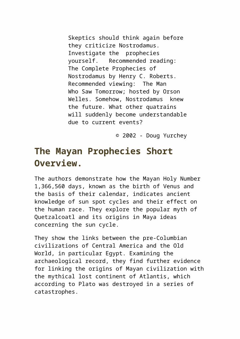
New Zealand as well. The history of New Zealand, and many Pacific islands, would seem to need some radical revision.
EARLY THEORIES ON THE POLYNESIANS
The origin of the Polynesians perplexed early explorers in the Pacific from the very start. The Dutch Navigator Jacob Roggeveen said that the Polynesians were descended from Adam though "human understanding was powerless to comprehend by what means they could have been transported to the Pacific." Such doubts also afflicted James Cook and his men.
Prior to the publication of Darwin's The Origin of the Species, it was generally believed (by Europeans anyway) that the races of man were descended from the sons of Noah, Shem, Japheth and Ham. Darker races were considered the sons of Ham, while lighter races, such as American Indians and Polynesians, were considered the sons of Shem.
Early on, a Malaysian origin for the Polynesians was speculated. The second edition of pioneer anthropologist J.F. Blumenback's book Natural Varieties of Mankind (1781) added a fifth race to his originally speculated four of Caucasian, Asiatic, American and Ethiopian. This fifth race was Malaysian, which included the Polynesians.
With the arrival of missionaries in the Pacific came other theories, such as that the Maoris "had sprung from some dispersed Jews," thereby making them one of the lost tribes of Israel. We now have the notion that Maoris, and Polynesians in general, are Semites. The Book of Mormon also follows this theory, stating that the Polynesians were descended from American Indian Semites who first landed in Hawaii in 58 B.C. after voyaging in Mexico and South America. Thor Heyerdahl has sought to provide some evidence of this hypothesis in a number of his expeditions. Heyerdahl is not a Mormon, but does believe that there was contact between Polynesia and the Americas. Heyerdahl has stated that voyagers in the Pacific came from both the shores of Asia and the Americas. Many critics of Heyerdahl have believed that he advocates the American contact theory exclusively, which is wrong.
Archaeologists admit that there is evidence that the Polynesians were in contact with North and South America, especially such islands
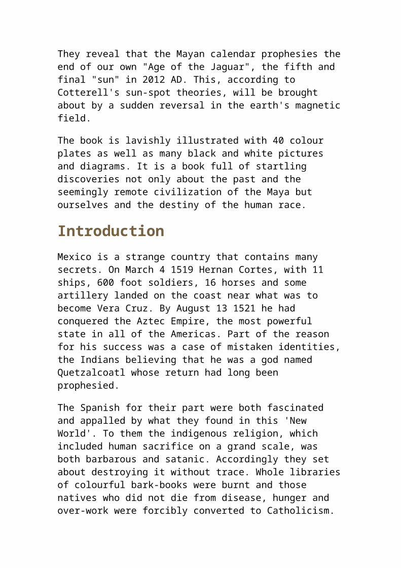
or groups as the Marquesas, Rapa Nui and Hawaii. The sweet potato plant, or yam, is originally from South America and was known to have been cultivated on many Pacific islands before European discovery. The South American sweet potato was cultivated in ancient New Zealand and the Maoris called it Kumara.
However, contact with the Americas does not necessarily mean that the Polynesians originated there and the prevailing theory of the late 1800s and early l900s was that the Polynesians were actually an Indo-European group who came to the Pacific via India. Linguistic evidence was usually cited, such as the detection of Sanskrit words in Polynesian vocabularies. In the days when racism was a common fact of life, one reason for such a theory was partly political: to prove that a fellowship existed between Maoris and Europeans. The main contributor to this theory was a book entitled The Aryan Maori, by Edward Tregear, published in 1885.
A more important scholar who supported Aryan Maoris was John Macmillan Brown who had studied at Glasgow and Oxford before taking up the Chair of English, History, and Political Economy at Canterbury University College in 1874. Brown retired from his chair in 1895 and spent much of the remaining forty years of his life traveling the Pacific in pursuit of his intellectual hobbies, including the origin of the Maori. Brown settled in New Zealand and published his first book Maori and Polynesian in 1907.
A leading philologist of his day, Brown stressed that the "true classification of linguistic affinities is not by their grammar, but by the phonology." Unlike earlier philologists, Brown admitted that the phonology of the Polynesian dialects differs by a whole world from that of all the languages to the west of it-that is, the language of Melanesia, Indonesia, and Malaysia. How then did the Aryan forbears of the Polynesians come into the Pacific?
Brown believed that they had come by several routes from the Asian mainland. Some had come through South East Asia, having been driven on by a Mongol influx, others had come in a northern arc through Micronesia. This northern migration had passed over the Bering Strait into the Americas before doubling back to colonize eastern Pacific islands like Easter Island. The Polynesian language that eventually emerged was a combination of several primitive Aryan tongues. In Maori and Polynesian, Brown suggested that the amalgam was formed in Indonesia, but later he shifted his ground. In his 1920
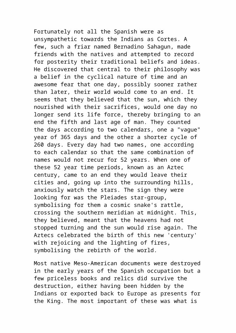
thesis, The Languages of the Pacific, Brown argued that "the linguistic attitude" of the Polynesians faced "north towards Japanese and Ainu." What had induced Brown to change his mind was the discovery of Tocharish, a "primeval" Aryan language, as Brown called it, in a manuscript found at Dunhuang in the Gobi Desert in 1911. This famous cache of ancient texts, some written in unknown languages that have never been deciphered, was to provide a gold mine for those scholars who took interest in them.
Said Brown. "The main features of the Polynesian tongue... go back to the old stone age in Europe....We must conclude that the Aryan language started on its career from twenty to twenty-five thousand years ago, and that philological students of Latin and Greek and the modern European languages must study Polynesian in order to see the type from which these sprung." Brown went on become Chancellor of the University of New Zealand, and enthusiastically championed unorthodox theories on the origin of the Polynesians, even to the point of advocating a lost continent in the Pacific which a few years later was called "Mu" by Colonel James Churchward. Brown found Greek, Celtic, and especially Scandinavian models for Polynesian gods.
Brown had traveled widely throughout the Pacific, something most anthropologists and historians had not done, and was awed by the many megalithic remains he had seen. He believed that he could trace the footsteps of the Aryans into and through the Pacific from their megaliths. Brown claimed that the megalithic remains at Coworker and Atiamuri in New Zealand were evidence of Aryan occupation.
Brown's magnum opus on the Pacific startled many people. His final book, The Riddle of the Pacific, published in 1924, claimed that there was once a continent in the Pacific that was now mostly submerged. This continent, of which most Pacific islands were the last remnants, had been founded by Aryans from America. Here was the Chancellor of the University of New Zealand advocating a sunken civilization in the Pacific and not without reason. Brown may have first become convinced of a lost Pacific continent when he was introduced to the ancient texts at Dunhuang. One of the ancient papers allegedly contained a fragment of a map which showed a sunken continent (see my book, Lost Cities of China, Central Asia & India). Brown had also been to Easter Island where the local tradition has it that natives are from a sunken land called Hiva. He was convinced that an advanced culture once existed throughout the Pacific and that
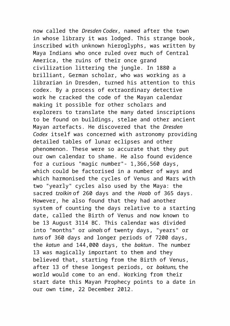
sudden cataclysms had submerged most of the land causing a collapse of the civilization.
Despite the fact that geologists of his time discounted any rapid geological change in the Pacific it is a fact that the flat-topped guyots throughout the Pacific must have been formed above the water. These wind-blown mesas, similar to those in the American southwest, need thousands of years of blowing sand to flatten their tops. Similarly, large atoll archipelagos such as the Tuamotus, Kiribati or the Ha'apai group of Tonga would become mini-continents if the ocean levels were dropped only a few hundred feet. Today, geology remains divided as to slow geological change and sudden geological catastrophes that occasionally take place. Most geologists now favor both theories and admit that occasional catastrophes do take place, just how often is the usual question.
EGYPTIANS IN THE PACIFIC
The late Professor Barry Fell. a former Harvard Professor and native New Zealander popularized the theory that the Pacific was settled in second millennium B.C. by the Egyptians. He is well known for advocating Egyptian, Libyan, Celtic and Phoenician ancestry for American Indians, and applies his epigraphic (the study of ancient writing) research to Polynesians.
Fell believed that the Polynesians were descended from Libyans in the service of Egypt, working as sailors to Egyptian gold mines in Sumatra, and even Australia and elsewhere. He also believes that many Melanesians are the descendants of Negro slaves used as workers in the gold mines. Fell even goes on to call the dialect used by the Zuni Indians of the American south-west as Mauri script and maintains that the Maoris may be related to the Zuni Indians and their "Mauri" language.
Phoenician and Libyan rock inscriptions have been discovered in Indonesia. A letter in the January 21, 1875 issue of the magazine Nature spoke of Phoenician script in Sumatra. Writes the author. J. Park Harrison: "In a short communication to the Anthropological Institute in December last (Nature, Vol. XI. p. 199), Phoenician characters were stated by me to be still in use in South Sumatra. As many of your readers may be glad to have more information of the subject, I write to say that the district above alluded to includes Rejang, Lemba, and Passamah, between the second and fifth parallels
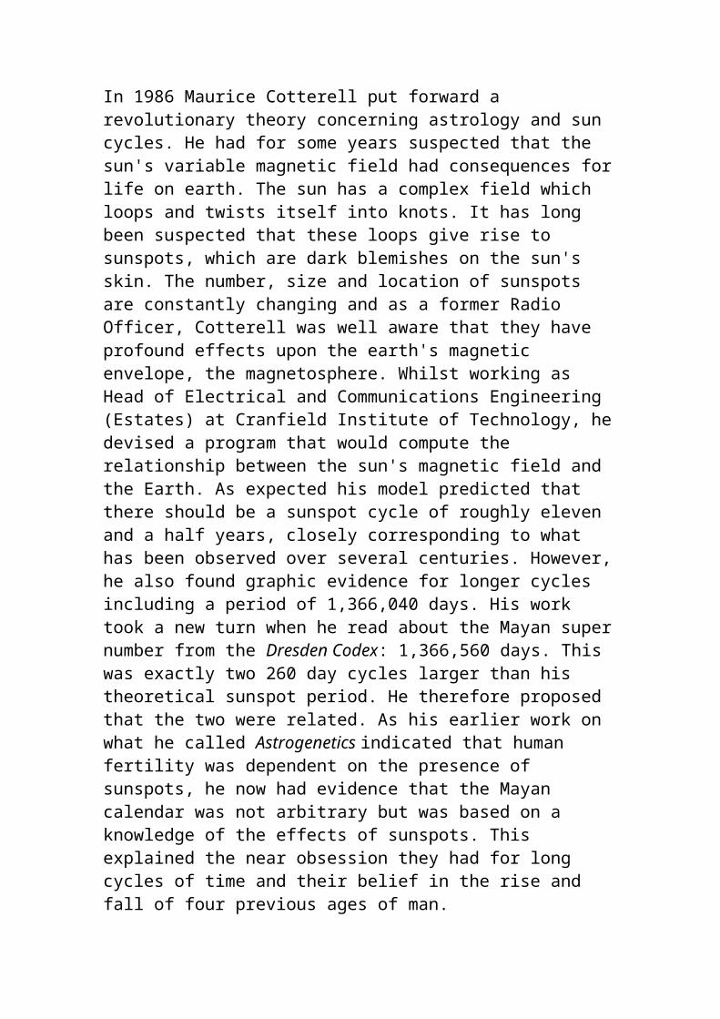
of south latitude.
One clear link between Australia and Egypt is that the Torres Straits Islanders, between New Guinea and Northern Queensland, use the curious practice of mummification of the dead. The Macleay Museum at Sydney University has a mummified corpse of a Darnley Islander (Torres Strait), prepared in a fashion that has been compared to that practiced in Egypt between 1090 and 945 B.C.
It was reported in Australian newspapers circa 1990 that a team of Marine archaeologists from the Queensland Museum had discovered extensive cave drawings on many of the Torres Straits Islands. Some of the cave drawings, on isolated Booby Island, were of a Macassan prau which is a unique vessel with telltale double rudders and triangular sails used by beche de mer (sea cucumber) fishermen out of the Indonesian island of Sulewesi. The archaeologists declared the Torres Islands the "crossroads of civilizations" and were quoted as saying "Now it's a new ball game in an archaeological sense."
In 1875 the Shevert Expedition found similarities in Darnley Island boats and ancient trans-Nile boats. Island boats were used to row corpses to sea and leave on a coral reef. Egyptian practice was to ferry corpses across or down the Nile for desert burial.
Similarly, it was pointed out by the Kenneth Gordon McIntyre in his book The Secret Discovery of Australia (Picador, 1977) that the island of Mir in the Torres Strait was similar to the Egyptian word for pyramid, "mir" and even that the name for Egypt is "Misr." Another similarity with the Torres Strait Islanders, as well as in the Solomon Islands, Fiji and Polynesia, a wooden headrest was used. This carved headrest was used to slightly elevate the head, while the subject slept on his back. It is unusual to ancient Egypt and certain Pacific Islands around New Guinea that these headrests are used.
Curiously, on the island of Pohnpei (formerly called Ponape), the new capital of the Federated States of Micronesia. an ancient Egyptian word is important in the government. Pohnpei island is divided into five districts and the governor of a district is called a Nan marche in the language of Pohnpei. Similarly, in ancient Egypt, a district was known as a nome, and a district governor was known as a nome-marche. Here we have the exact same word meaning the exact same thing in ancient Egyptian and modern Pohnpei dialect. A coincidence?
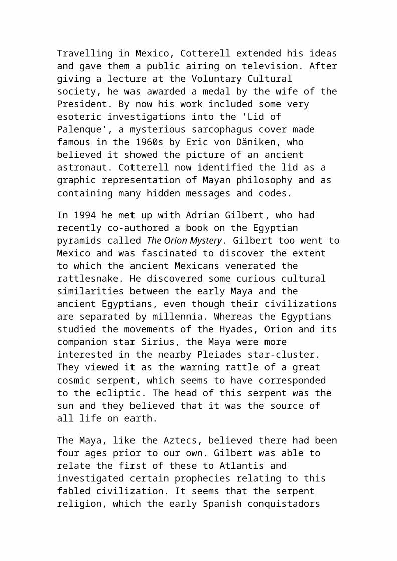
Excerpted and edited with permission from Ancient Tonga & the Lost City of Mu'a by David Hatcher Childress (Adventure Unlimited Press).
PROF WEI CHU-HSIEN &"CHINA AND AMERICA"
This section is to explore ancient China's contacts with the American Continent. In this section, I will transcribe Wei Chu-Hsien's studies. Prof Wei Chu-Hsien, a student of Wang Guo-wei, Liang Qi-chao, Chen Yin-ko and Li Chi in 1926's Tsing-Hwa University of Beijing, had published a book called China and America -Volume One in March of 1982 via Taiwan's shuo wen shu dian bookstore. As Wei Chu-Hsien noted, he had been tormented by the fact that it was difficult to find translators who knew and understood ancient classics good enough to translate his book into English. Similarly, I felt often intimidated by the strenuous task ahead of me at the sight of the high-rising volumes of ancient Chinese history; I am also torn by a split exertion of my efforts to ancient history or to modern history, with a stubborn cognizance that ancient history could not buy a living while modern history might not self-strength China which is now ruled by self-destructing communists. In "China and America -Volume One", Prof Wei Chu-Hsien stated that he, first coming across in 1961 a Confucius' passage on 6 birds which flew backward as recorded in Spring and Autumn Annals, had linked the 'yi' bird to America's hummingbirds. For the next ten years, he began to compile 81 essays, totalling 1.4 million characters, on ancient China's contacts with America which was
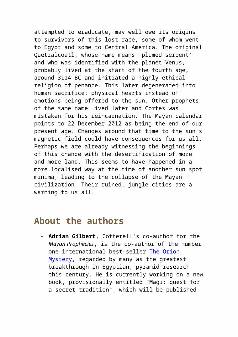
separated from each other by a 56 mile stripe of the Bering Straits but with two Diomede Islands in the middle. Wei Chu-Hsien met Prof Lau Tun-li of SUNY in 1970 and began to exchange opinions as to American Indian's heritage such as i) praying for rain, ii) ancestral stone worshipping, and iii) Chinese inscriptions found in America. In 1969, a HK publishing house first published a table of contents about the book which was entitled "The Chinese Discovered America !" Wei Chu-Hsien stated that he had to use the subscription fees from some donators for sustaining his impoverished 'filling lines with characters' career. Wei Chu-Hsien, in his Backword, felt that his theory had been vindicated by the discovery of stone anchors near California coast in Nov 1982. Wei Chu-Hsien spent considerable time reading into ancient classics and excavated interesting points covering more than the American continents: Wei Chu-Hsien pointed to Chu Ci (i.e., Chu Principality poems) and Wai Guo Tu (i.e., foreign country maps) for records of a land similar to Australia where the weather was hot in winter and cold in summer and where the grass died away in summer and grew in winter; Wei Chu-Hsien further validated records of southern hemisphere by pointing out two incidents of sun eclipse as recorded in Spring and Autumn Annals; and Wei Chu-Hsien emphasized the cross emblem on the tombstones of nobles of Southern Dynasties in Nanking for the spread of Christianity in China 1500 years ago. Wei Chu-Hsien analyzed the character 'long' for dragon and derived a conclusion that it was originally in the form of 'king snake' which the ancient Indian circus people brought over to Shang China. Wei Chu-Hsien also analyzed the character for phoenix to derive a conclusion that ancient Indonesians had brought 'jile-niao' peacock kind of red bird to China. (Dragon totem could also be a lizard. Wei Chu-Hsien mentioned that 'Shang Ruins' had produced 4-leg and 1-tail lizard which Shang Chinese treated as dragon and that ancient emissary to Korea mentioned that ancient Ryukyu people treated lizard as dragon, too. On the oracle bones, dragon, in a third form, could be seen as similar to sea-horses.)
Dao-yi (Island Alien) Designation, & Fu-sang Sima Qian's Shi Ji stopped at Wudi's overthrow of Wei Man Choson; in descriptions of Xu Fu's elixir-seeking journey, Sima Qian did repeat ancient Chinese legends about the islands of Peng-Lai, Fang-Zhang and Ying-Zhou (land in the sea). Chen Shou's San Guo Zhi covered the island of Japan and grouped the early Japanese in the section on Dongyi (Eastern Yi). Later history records referred to Japanese as Dao-yi (Island Alien).
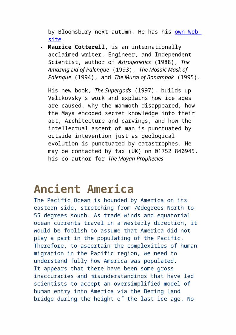
Ancient Chinese had different terms for barbarians in four directions. Dongyi or Yi-of-the-East will include peoples in Manchuria, Korea and Japan. In early times, the Yi was associated with the word 'niao' for bird, and there were eight to nine different 'niao-yi' people in the east. Shang Dynasty people, considered a group of Yi people, were recorded to have treated 'Xuan Niao' (i.e., Black bird, possibly sparrow) as their totem. Manchurian legends as to the birth of their founder had something to do with birth-mother swallowing the red fruit dropped by a bird. Toba Wei Dynasty, in return for being called the nickname of 'suo lu' (pigtailed enemies), would call southern Chinese by the derogatory name of 'niao yi' (i.e., bird aliens) for possibly southern Chinese pitched accents or generic kind of name for southeastern Chinese and islanders. In later times, the Yi designation would be associated with a word 'dao' for island, pointing to the barbarian peoples in East China Seas. (Both the character 'niao' and 'dao' looked quite close and might have corrupted consecutively during the course of history.) Yi is more an inclusive word to mean aliens. The big Korean school of thought, touched on in prehistory section, claimed that the Koreans were true descendants of the Dongyi people. Island Statelets Beyond Japan:
Chen Shou's San Guo Zhi recorded dozens of statelets on the Japanese islands, including Queen Beimihu (Himiko) Wa Statelet, Gounu-guo statelet under a king in the south, and a pygmy statelet to the south of Wa etc. Also recorded would be two statelets to the southeast of Japan, i.e., Luo-guo (naked body) statelet and Heichi-guo (black teeth) statelet, which could be reached by travelling for one year on boat. Some Japanese historians speculated that the two statelets to the southeast of Japan must have been located in Central or South Americas. Yao Silian's Liang Shu (History of Southern Liang Dynasty) further mentioned that the two statelets of Luo-guo and Heichi-guo were 4,000 Chinese li distance to the southeast of Japan or 1-year sea journey by boat. (Conflict: 4,000 Chinese li distance or one-year boat travel, in my opinion, could not match with the distance of 7000 li between South Korea and Japan. http://www.os.xaxon.ne.jp/~sinkodai/efuruta/esss.html stated that "San-kuo-shih or Three Country Record does not use the distance unit of li to be 435 meters as used during the Chin or Han dynasty Period but rather it uses the unit adopted by the Wei and Western Chin dynasties, which is that one li is approximately 77 meters." Note ancient chronicles usually built upon previous dynasty's records via direct paragraph by paragraph citation.) Liang Shu also recorded an island 10,000 li to the southwest of Japan where people, of black body and white eyes, were said to have delicious meat on their body; it said that travellers would shoot to kill those islanders for eating them. To the northeast of Japan, Liang Shu recorded a Wen-
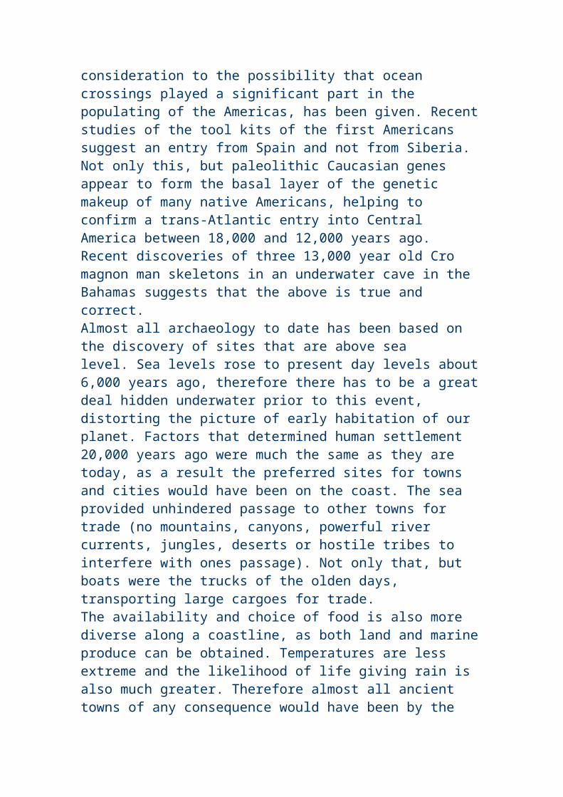
shen-guo (tattoo) statelet that was located 7,000 Chinese li distance away from Japan; 5000 li to the east of Wen-shen-guo would be Da-han-guo statelet. (In my opinion, Wen-shen-guo would be somewhere near Hokkaido, while Da-han-guo statelet would be likely in Bering Straits, Aleutian Islands & Alaska.) Bei Shi (History of Northern Dynasties) recorded a big island statelet called Dan-mou-luo-guo statelet to the south of Paekche. It said that the island, having a span of over 1000 li distance south-north and several hundred li east-west, could be reached by boat after three months' travel, that it had lots of deers, and that it was a vassal of Paekche. (Conflict: Three months' travel would probably lead to Southeast Islands or Australia.) Since Bei Shi separately described the Liuqiu (Ryukyu) island, Dan-mou-luo-guo might not be the same as Ryukyu. Liuqiu (Ryukyu) island was recorded to be reacheable after 5 days of boat travelling.
Fu-sang Statelet:
Liang Shu was noted for its record of Fu-sang Statelet to the east. The word 'fusang' would later be used by Chinese for designating Japan in poems; Wei Chu-Hsien validated a separate identity of Fusang from Japan by citing ancient records in regards to the usage of iron in Japan but not in Fusang. The more exact mapping would be to measure distance between statelets in between: a Wen-shen-guo (tattoo) statelet (near Hokkaido?) was located 7,000 Chinese li distance to the northeast of Japan; 5000 li to the east of Wen-shen-guo would be Da-han-guo statelet (near Bering Straits, Aleutian Islands & Alaska?). Fu-Sang (Fusang) Statelet was located 20,000 Chinese li distance to the east of Da-han-guo, somewhere near British Columbia or Oregon. Here, we could see an apparent linkage from China, to Korea, to Japan, to "tattoo body" country, to "Great Han" country, and to Fu-sang.
"Great Han" -------------- Fu-sang / country / /"tattoo body" / country / / China ---- Korea ---- JapanBoth Chinese websites and American websites, e.g.,
http://www.geocities.com/EnchantedForest/Tower/1217/asia.htmlhttp://ussers.wi.net/~maracon/index.html http://www.uh.edu/engines/epi1028.htm
had mentioned Monk Huishen and the Kingdom of Fu-Sang (Fusang). Popular belief is that Fusang was located in today's Mexico. Liang Shu stated that during the first year of the Yongyuan Era of Southern Qi Dynasty, i.e., AD 499, a monk by the name of Hui-shen (Huishen or Hui Shen) arrived at Jingzhou prefecture from the Fu-Sang (Fusang) Statelet. Hui-shen claimed that Fu-Sang (Fusang) was to the east of China; that it was located 20,000 li distance from Da-han-guo statelet; that it was a land full of Fu-Sang (Fusang) wood (speculated to be North American corn by Chinese or cactus-like agave by Americans); that Fu-Sang (Fusang) leaf was similar to Tong-tree leaf; that Fu-Sang (Fusang) looked similar to bamboo shoots at early stage; that Fu-Sang (Fusang) people ate it for food; that Fu-Sang (Fusang) appeared to be of red color and tasted like pear; that Fu-Sang (Fusang) surface could be used for cloth or cotton. Hui-shen further stated that Fu-Sang (Fusang) people had log cabins but no cities; that Fu-Sang (Fusang) had written language and used Fu-Sang (Fusang) skin for paper; that Fu-Sang (Fusang) had no army or weapons; that Fusang did not treasure gold or silver; that Fu-Sang (Fusang) had two prisons, with minor offence going to north while serious offence going to south prison; that amnesty went to north prison, only; that king possessed drums and wore different color robe for different seasons; that Fu-Sang (Fusang) people used buffalo horns for holding stuff; that Fu-Sang (Fusang) possessed horse (?) carts, buffalo carts and deer carts; that Fu-Sang (Fusang) people used deer milk for cheese; that Fu-Sang (Fusang) was abundant with walnuts; that Fu-Sang (Fusang) had copper but no iron; that Fu-Sang (Fusang) previously had no buddhism but a five member monk team, headed by Monk Biqiu, arrived at Fu-Sang (Fusang) from Libin-guo statelet (Kabul of Afghanistran) during the 2nd year reign of Daming Era of Liu Song Dynasty, i.e., AD 458, and propogated buddhism there. Note that most of secondary records had errors in regards to the five monk team. Hui-shen or Hoei-shin did not take part in the AD 458 journey to Fusang, and he merely returned to China in AD 499. My speculation is that the trips from China to ancient America was frequent enough for Hui-shen to return to China on a different ship. Should Monk Fa-Shien had returned to China from India by ship at the timeframe, why would it not be possible that Monk Hui-shen and etc could have travelled to ancient America? I picked up Prof Wei's book again and found out that Prof had listed abundant written texts, from ancient Chinese chronicles, about the existence of i) 'Deep Sea Valley' beyond Japan, ii) 'Feather Mountain' island in possibly Pacific Northeast, iii) 'Brown Bear' stories, and iv) the Redwood Trees. Prof Wei had citations of dozens of entries about the Redwood Tree, which was known to Chinese as the 'Fu-sang' in Chinese
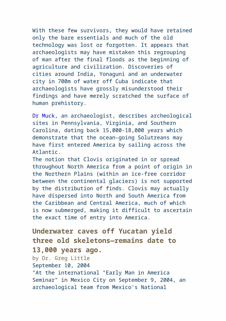
texts prior to BC eras. Apparently, ancient Chinese in AD eras, i.e., Monk Hui-shen of 5th century, had mutated the ancient term 'Fu-sang' to mean something different from the Redwood tree. Prof Wei Juxian validated that though America had no iron, ancient Peruvians had imported iron from ancient China for cutting the stones for the palace construction. Also, Prof Wei Juxian validated ancient Chinese texts [prior to BC eras] as to the abundance of silver and gold in ancient America that the American natives did not treasure the metals as recorded in "Liang Shu"
After the nomadic rampage of 4th century, Tuoba Wei Dynasty & Southern Chinese Dynasty, respectively, renewed historical contacts with the rest of the world, i.e., Japan to the east, ancient Burma/Indochina/India/Ceylon to the south, Central Asia to the west, and Arab/Persia/Roman further away. Nevertheless, Japan's history in Fourth Century became forever "mysterious" as a result of Northern China's disintegration. With Tuoba Wei China developing the northern Silk Road, Liang Dynasty of southern China underwent a prosperous sea route exchange with the rest of the world. Monk Fa-Shien's return trip from India had been widely analyzed to infer a possible blowaway to Mexico coastline before going the opposite direction to China. Often researched upon by scholars would be a drawing by Liang Dynasty's Emperor Yuandi, entitled "zhi [duty or post] gong [tribute] tu [picture]" [Liang chih-kung-t'u]. Liang chih-kung-t'u, whose original drawing possibly destroyed together with 140,000 volumes of books at the time of Emperor Yuandi's death, was supposed to be a recollection works of the emissaries who had visited Jingzhou the garrison city where Yuandi had stationed throughout dozens of years. The point to make here is that Liang Dynasty had apparently received delegations from 2-3 dozen statelets covering the countries mentioned earlier. The drawing's minute details about the ancient countries in today's Afghanistan and Iran and their emissaries absolutely corroborated the facts that China's linkage with Central Asia was live and frequent, yielding substantial validity to the person of Monk Hui-shen and his story of the trip to the American continent.
Hui-shen also stated that over 1000 li distance to the east of Fusang would be a country called Nü-guo (women statelet). Nü-guo was speculated by Minhua Zhang to be the Amazon statelet in South America. Nü-guo women were said to have lighter skin, hairy body, and long hair that dangled to the floor. Liang Shu further cited a personal account stating that a Jin'an area traveller was blown to an island of women during the 6th year of Tianjian Era (i.e., AD 507).
Prof Wei Chu-Hisen's Expositions On Symbols & Characters 1) Nude goddess excavated by Corde de Gugui on Mt Truillo in northern Peru in 1865
Wei Chu-Hsien received pictures of findings with ancient Chinese characters from scholars from US, Peru, Mexico and Uruguay after getting in touch with Prof Lau Tun-li in 1970. Peru had been the place where most of the potteries, and jade / silver articles carrying Chinese characters had been located. Most notable would be a silver artifact of a nude goddess excavated by Corde de Gugui on Mt Truillo in northern Peru in 1865. Wei Chu-Hsien pointed that the sunflower goddess, sitting on a turtle with snake winding arount it, had two plates in her hands, with Chinese characters 'wu-dang shan' or Mt Wudang-shan inscribed and that in Wudang area of China's northern
Hubei Prov, the snake-turtle coupling was treated as a divine spirit called 'xuan-wu' during China's south-north dynasty time period. Ancient classics Wu-zi (military strategist Wu Qi of Warring State time period) listed 'xuan-wu' together with three other divine spirits of 'qing long' (green dragon which was speculated to be sea-horse by Wei), 'bai hu' (white tiger which used to exist in China 2000 years ago but now available in India only), and 'zhu que' (red bird). Artifacts of four divine spirits were also
found on stone coffins excavated in Korea and Manchuria. Wei Chu-Hsien pointed out that the southside
spirit of red-bird and northside spirit of snake-turtle coupling were both imports since snakes and
turtles rarely existed in deep
north of China. [Wei Chu-Hsien stated that Shang Chinese, on basis of oracle words feng (phoenix people) lu (surrender) bai (hundred), had at one time received hundreds of turtles from ancient Indonesians and Malasians as tributaries and later used the turtle shell for incribing oracle characters.] Wei Chu-Hsien cited numerous records stating that 'xuan-wu' was not a spirit born in China, but an import. Wei Chu-Hsien came to a natural conclusion that ancient Chinese, more than 2500-3700 years ago, had contacts with Central America's tropical tribesmen who adored snake-turtle as a spirit. 2) Chinese characters of a name inscribed on a high mountain in Peru Wei Chu-Hsien received, via HK consul Marto F. Rbatde Azva, pictures taken by Prof Daniel Ruzo of inscriptions on Marcahuasi Plateau which was about 3800-4000 meters above sea level. Wei Chu-Hsien recognized 6 characters and a picture of a man with three eyes. The 6 characters would be 'Mu (wood, a surname) Wu-Ben (given name, meaning martial principle), Sui (hence) Wei (made into) Ji (a record)'. The picture of thee eye man was speculated by Wei Chu-Hsien to have relation to the legendary one-arm and three-eye Qigong-guo statelet as recorded in Shan Hai Jing. Wei Chu-Hsien cited the claim of Guo Pu of Jinn Dynasty that Qigong-guo people had visited first Shang Dynasty overlord in 18th century BC. Later legendary novel Feng Shen Bang wrote about three eye god. Wei Chu-Hsien, by examing the font of the characters, concluded that someone called Mu Wuben visited Peru in the 1st century AD in search of the legendary Qigong-guo and left his name on the high mountain.
3) 23 Chinese characters of 'ya' inscribed on a pottery excavated in Mexico Wei Chu-Hsien explained that the Mexico pottery had 23 'ya' characters inscribed because the base of the pottery was too small to fill up another two characters to make a total of 25 which would be symbolic of twenty-five clans of Huangdi the Yellow Lord. Wei Chu-Hsien cited Jinn Yu section of ancient classics Guo Yu to translate the original meaning of 'ya' as lineage, something to mean that Huangdi's 25 sons had established their
independent clans. As to the reason that the pottery was excavated in Mexico, Wei Chu-Hsien cited the ancient dynastic transition of Shang-Zhou as the possible cause. Wei Chu-Hsien rephrased the Shang-Zhou story as follows: Last Shang Lord King Zhouwang campaigned against 'Ren-fang-guo' statelet on Shandong Peninsula. After defeating Ren-fang-guo, Zhouwang led a few soldiers back to the capital of Chaoge for lunar new year celebration. Upon hearing of Zhouwang's return with a light force, Zhou Lord Wuwang marched towards Shang capital within six days and nights and encountered Zhouwang at the outskirts of Muye where Zhou army defeated Shang's drunken soldiers. Shang King Zhouwang committed suicide. Zhou Lord Wuwang made Shang Prince Lufu inherit the Shang heritage and then went back to the west. After Wuwang died, Zhou Duke Zhougong assumed the post of a regent for Zhou King Chengwang. In old Shang capital area, Shang Prince Lufu died. Shang Prince Lufu's son, Prince Wugeng, conspired with the brothers of Zhou Wuwang in rebelling against Zhou Regent Zhougong. Zhougong defeated the rebellion and furthermore campaigned against Shang remnants who were left by Shang Lord Zhouwang on Shandong Peninsula's Ren-fang-guo statelet. Shang remnants hence fled towards two directions, one branch to Taiwan Island and the other branch to North America via the Bering Straits. Those Shang people who arrived in North America stationed two chieftans on the east and west sides of the Bering Straits and conferred onto the two chieftans the titles of east-sea and north-sea kings. The east-sea and north-sea kings would become the gods in revised book Shan Hai Jing.
http://members.tripod.com/%7Ekon_artz/cultures/olmshang.htm
4) The Chinese character of 'fan' (sail or wind) inscribed on a pottery excavated in Lima, Peru Prof Wei Chu-Hisen's Expositions On Plants & Animals
Prof Wei Chu-Hisen's Expositions On Metals & Precious Stones
TO BE CONTINUED !
Written by Ah Xiang
CHINESE AND AMERICA JADES
A Mayan green nephrite jade depicts the bust of a priest over 800 years old
JADE EBAY AUCTIONS | CHRONOLOGICAL HISTORY | ABOUT ME Missing Link Revealed | Q & A | CONTACT ME
Olmec Jade Earpools (900 B.C.) Bei"(Jade) Longshan Jade Discs (2000 B.C.)
Olmec Jade Ritual Sharpener (900 - 600 B.C.) Liangzhu Jade Ritual "Cong" (2000 B.C.)
Olmec Stone Statues
Aztec Stone Statue (A.D. 1000 - 500)
Shang Jade Statue (1600 - 1200 B.C.)
Olmec Cleft-head Motif Ancient Chinese Cleft-head Motif(900 - 600 B.C.) (4000 B.C.)
Olmec Motifs Shang Writing Modern Character / English
Olmec Motifs Shang Writing Modern Character / English
Olmec Motifs Shang Writing Modern Character / English
Olmec Ritual symbols Abstract Tao Tie Dragon Face
Shang Ritual Symbols Liangzhu Ritual Symbols
Altar symbol for both sites of the Pacific?
When artifacts of the ancient Americans are examined side by side with ancient Chinese artifacts from the contemporary cultures it becomes evident that there are striking similarities. Perhaps, the strongest evidence of these ancient cultural ties comes from a study of ancient jades and the lapidary workmanship, motifs and shapes. It is an exciting exploration to journey down the Jade Road to discover that our early ancestors were not primitive people, but on the contrary sophisticated people who traveled the ancient world. -Ian (Fung Gen Qua)
The Age of the Red Heads According to the Aztecs, 7,590 B.C. or 9,500 years ago was the beginning of the Age of the Third Sun also called the“Age of the Red Haired People. These people were the survivors of the second age who had come by ship from the east to the New World, settling in the area he called Botonchan; they encountered there giants who also survived the second age, and became enslaved by them. Not only did the Age of Red heads end in America and Begin in Europe at this time, but it also marks the massive genetic bottleneck in East Asia when the Thais, Tibetans, Tlingit, Haida and Hawaiians dispersed from the Taiwanese people.Many people seem to think that Celts influenced American culture and ancient petroglyphs and megalithic monuments may seem to suggest this,
but what one is seeing here is a dispersal of culture not to America, but from America.After the final sea level rises 6,000 years ago, wiping the Bahama Banks clean of any civilization, there was a major shift in world populations. Remnants of this culture of Red Heads went their separate ways.The Celts took the Gulf stream back to their ancestral homeland of Europe, wheras the Anasazi, Hopi, Zuni, Algonquian and Auracano, just to name a few remained in mainland America and began to mix with incoming Asians who had suffered a similar catastrophe of Sea level rises on the East Asian coastline.There are also suggestions that the Celts were in New Zealand before the Maori. This is not strictly true, they too along with the Red Heads of Rapa nui were also fragments of the Age of the Red Heads in America. The Picts of Scotland were probably from a similar tribe to the the Tattooed Red Heads of the Pacific.
This design is from a plate from Panama, with the cross and swirls, it would not look out of place in a museum on ancient Celtic art. It would also not be out of place in a book on Maori art.The bird motif is beginning to look like a Taniwha. The turtle is a from Central America, and signifies
the importance of the turtle in many of these ancient cultures, including Rapa nui.
Maps of The Ancient Sea Kings
It appears from various scources of evidence that the Red Heads were the major population in America and the Caribbean up to about 6,000 years ago. We know from their megalithic monuments that they were keenly interested in Astronomy, not just for determining the seasons, but for navigation and mapping. It therefore stands to reason that they were the people responsible for mapping the coastline of South America and the Antarctic during a particularly warm perion of the earths history, between 7,000 and 5,500 years ago. Core sampling aroun the Antarctica shows that there was very little sea ice during this time, making it possible for them to map a coastlinewhich is now under more than 1km of ice. This global meltdown would have caused a rapid ries in sea levels, ultimately engulfing the seafaring towns of the world. Isostatic rebalancing as the load of ice was released from the poles would have caused major earthquakes, which in turn would have produced tsunamis, devastating coastal civilizations around the world. As a result there remains very little evidence of these once great civilizations now underwater. Their buildings have been levelled in places such as the Bahamas and only rare snippets of information survive such as the map below, to prove their seafaring prowess.On the Front of Professor charles Hapgood's book "Maps of the Ancient Sea Kings" (Turnstone books, London 1979,) is the famous Piri Reis Map, drawn on a gazelle skin. It was found by a group of historians in 1929.Research showed that it was a genuine document drawn in 1513 by Piri Reis, a famous admiral of the Turkish fleet in the sixteenth century. His passion was cartography. His high rank within the Turkish navy allowed him to have privileged access to the Imperial Library of Constantinople.The Turkish admiral admits in a series of notes on the map that he compiled and copied the data from a large number of ource maps, some of which dated back to the fourth century BC or earlier.
The map on the left is by Piri Reis, who admitted that the map is a compilation of a number of maps.The island marked on the North Eastern part of the map with its bays, correlates very closely with Taiwan.It appears that Piri Reis also thought that there was only one ocean and confused the western seaboard of the Atlantic with the western seaboard of the Pacific.A compilation map such as this could well have been what misled Chistopher
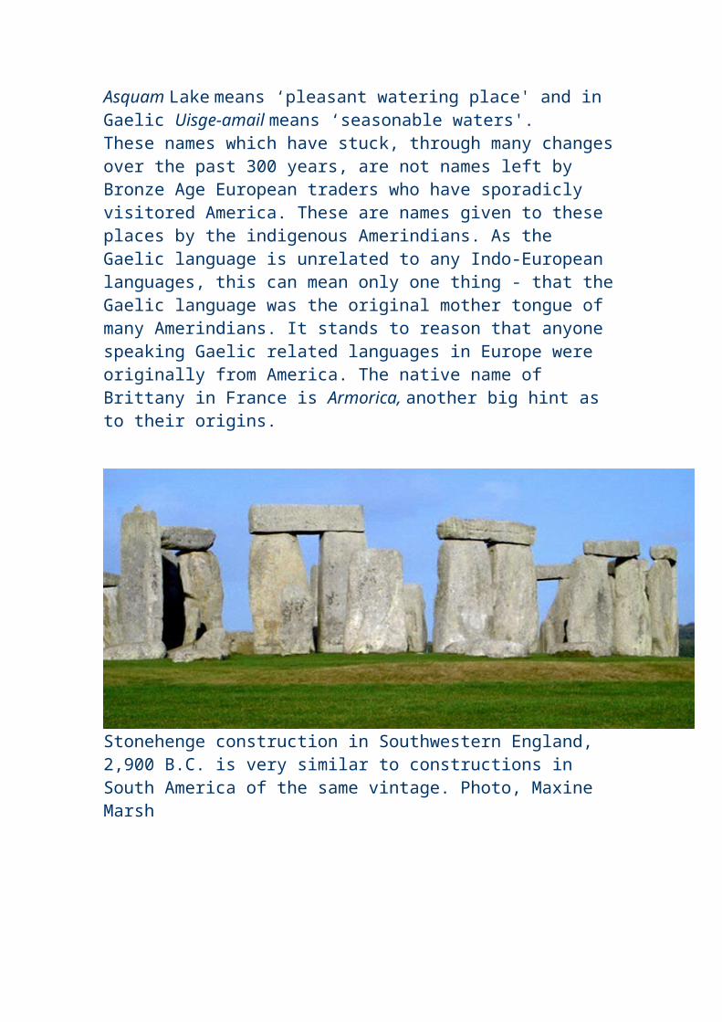
Columbus into thinking that by crossing the Atlantic he could get to the East Indies. The map on the right is by Oronteus Finaeus and was drawn in 1532. It has been placed on the world map at too large a scale, showing it to be too close to Africa and South America, this also suggests that it is a compilation map from an earlier source. The curious thing is that it depicts the Antarctic coastline without ice very accurately. The mountain ranges are accurate and rivers marked entering the Ross Sea are where glaciers exist today. This strongly suggests that people with accurate timepieces - albeit hour glasses accurate to within a miniute were busy mapping the world between 5,500 and 7,000 years ago when the Antarctic was free of ice.
Professor Hapgood claimed that the lower part of the map portrayed the Princess Martha Coast of Queen Maud Land, Antarctic, and the Palmer Peninsular. The geographical detail shown in the lower part of the map agrees very remarkably with the results of the seismic profile made across the top of the ice-cap by the Swedish-British Antarctic Expedition of 1949.This indicates the coastline had been mapped before it was covered by the ice-cap, which is presently one mile thick.Dr. Charles Hapgood, in his book, said that:"It appears that accurate information has been passed down from people to people. It appears that the charts must have originated with a people unknown and they were passed on, perhaps by the Minoans and the Phoenicians, who were, for a thousand years and more, the greatest sailors of the ancient world. We have evidence that they were collected and studied in the great library of Alexandria (Egypt) and the compilations of them were made by the geographers who worked there.Piri Reis had probably come into possession of charts once located in the Library of Alexandria, the well-known most important library of the ancient times.According to Hapgood's reconstruction, copies of these documents and some of the original source charts were transferred to other centers of learning, and among them to Constantinople. Then in 1204, year of the fourth crusade, when the Venetians entered Constantinople, those maps begun to circulate among the European sailors.In fact Piri Reis himself admitted he based his map on way older charts; and those older charts had been used as sources by others who have drawn different maps still of great precision.Impressive is the "Dulcert's Portolano", year 1339, where the latitude of Europe and North Africa is perfect, and the longitudinal coordinates of the Mediterranean and of the Black sea are approximated of half degree.An even more amazing chart is the "Zeno's chart", year 1380. It shows a big area in the north, going up to Greenland; Its precision is flabbergasting.
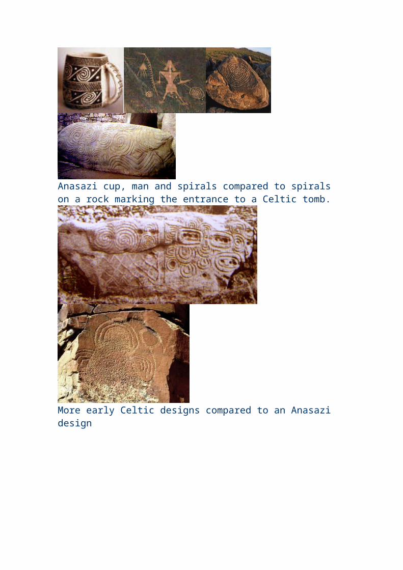
"It's impossible" says Hapgood "that someone in the fourteenth century could have found the exact latitudes of these places, not to mention the precision of the longitudes..." Another amazing chart is the one drawn by the Turkish Hadji Ahmed, year 1559, in which he shows a land strip, about 1600 Km. wide, that joins Alaska and Siberia. Such a natural bridge has been covered by water for almost 10,000 years.Oronteus Fineus was another one who drew a map of incredible precision. He too represented the Antarctic with no ice-cap, year 1532.There are maps showing Greenland as two separate islands, as it was confirmed by a polar French expedition which found out that there is an ice cap quite thick joining what it is actually two islands.Not only this but most of the old Greenland maps show the coastline without ice and they depict rivers in the valleys, not glaciers, suggesting this area was mapped during a warmer period of the Earth's history.As well as maps of the Mediterranean and Atlantic coastlines, he found a copy of a map carved on a rock column in China, from 1137. It showed the same high level of technology of the other western charts, the same grid method, the same use of spheroid trigonometry. It has so many common points with the western ones that it makes one think that there had to be a common source: They seem to be pieces of a very ancient world wide map, drawn by unknown people who were able to use mathematics, trigonometry and the most baffling of all, had acess to accurate timekeeping equipment.When human beings were supposed to live in a primitive manner, someone "put on paper" the whole geography of the earth. And this common knowledge somehow fell into pieces, then gathered here and there by several people, who had lost the technical knowledge, so just copied what they could find in libraries, bazaars, markets and all kind of places.This evidence of a lost technology suggested by these ancient maps will support and give credence to many of the other hypotheses that have been brought forward of a lost civilization in remote times. Scholars have been able to dismiss most of those evidences as mere myth, but here we have evidence that cannot be dismissed. The evidence requires that all the other evidences that have been brought forward in the past should be re-examined with an open mind."Graham Hancock in his book Underworld, also points out that the Island of Hy Brasil marked on many of these ancient maps lies directly on top of Porcupine Banks a shallow area that would have been an island during the last ice age. He also points out that ancient maps of India and the Maldives depict the coastline as it was 15-20,000 years ago when sea levels were approximately 80m lower.
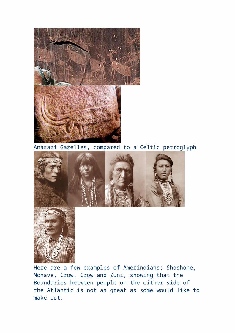
The following information indicates that conditions were favourable for mapping both Greenland and the Antarctica without ice, from 7,000 to 5,500 years ago, in other words during the Age of the Red Heads in America. As it is known from numerous archaeological sites around the Atlantic and in especially in America around areas such as the Yucatan, Lake Titicaca and Nevada, that these people were avid astronomers, it stands to reason that it was these native Americans were the great mappers of the world.
Antarctic ice sheet key to sudden sea level rise
Researchers show Antarctic ice sheets may not be as stable as previously thought by Janet Wong March 28, 2002 -- Physicists from Canada, the United States and Britain have concluded that a massive and unusually abrupt rise in sea level about 14,000 years ago was caused by the partial collapse of ice sheets in Antarctica, solving a mystery scientists have been heatedly debating for more than a decade. Near the end of the last Ice Age, the Earth's sea level abruptly rose over 20 metres - four times faster than usual for that time period and at least 20 times faster than sea levels are rising now, report geophysicists Jerry Mitrovica of the University of Toronto, Peter Clark of Oregon State University , Glenn Milne of the University of Durham in the U.K. and Mark Tamisiea, a post-doctoral fellow at U of T, in the March 29 issue of Science . The cause of this event - called the global meltwater pulse 1A, first identified in 1989 - has been unknown until now. The scientists say their research not only pinpoints the source of the meltwater pulse as coming from West Antarctica. It also makes the case that significant climatic events can occur very rapidly and unpredictably.
Antarctic mud reveals ancient evidence of global climate change By Mark Shwartz In 1998, ODP scientists extracted a 150-foot-long sediment core from the muddy bottom of the Palmer Deep - a submerged section of the continental
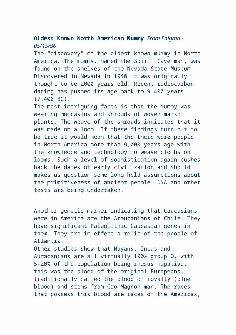
shelf along the west Antarctic Peninsula about 3,000 feet below sea level. The sediment sample was loaded with the shells of microscopic creatures called diatoms dating back some 10,000 years to the beginning of the Holocene - the most recent geologic epoch. "The Antarctic Peninsula is an ideal region to investigate climate change at decadal to millennial time scales due to its location in one of the Earth's most dynamic climate systems," noted Dunbar. "The ODP sample gives us the first continuous, high-resolution Holocene sediment record from the Antarctic continental margin." The sediment sample revealed higher concentrations of diatom shells during the mid-Holocene, roughly 5,500 to 7,000 years ago, which indicates that the waters surrounding the Antarctic Peninsula were more biologically productive then. According to Dunbar, higher productivity suggests that sea ice was less abundant during the mid-Holocene - a further indication that temperatures were higher. "We think it was quite a bit warmer then," he observed, noting that geochemical analysis of the sediment also revealed higher levels of nitrogen during the mid-Holocene. "Warmer temperatures appear to have produced freshwater streams that fed nitrogen and other nutrients into coastal waters," he explained. During this warm period, sea levels rose from approximately 20m below the present sea level to approximately 1.7m higher than present day levels. Legends around the Caribbean tell of a heavy rain falling for many days and many were drowned. It was this deluge that separated their islands from the mainland. Little by little subsequent tempests submerged the lands of the Bahamas, separating the people from one another by arms of the sea. These legends most likely tell of the polar meltdown around 6,000 years ago described above, separating and isolating the red heads living on what is now the Bahaman banks. Thus giving rise to the Anasazi and Celts.
Next was the Age of the Black Haired people, which according to Aztec and Toltec history began 5,514years ago, and was called the Age of the Fourth Sun. This was the time of arrival of the East Asian civilization into America, via the Kuroshio current from submerged cities
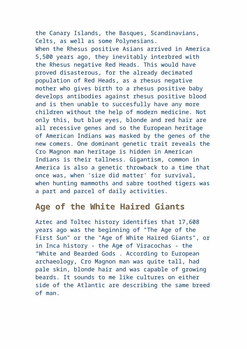
North and South of Taiwan. Genetics indicates that the actual genetic bottleneck (or ocean voyage) occurred 6,000 years ago. The peace loving Kukul Khan (Kukulcan)- the Mayan culture hero was obviously Asian.
Other Civilizations around the time of Atlantis
9,500 year old City Found Underwater off IndiaDiscovery in Bay of Cambay Will Force Western Archaeologists to Rewrite History
Marine scientists in India, have discovered archaeological remains of a lost city 36 metres (120 feet) underwater in the Gulf of Cambay off the western coast of India. Carbon dating indicates that the city is 9,500 years old.
According to the BBC's Tom Housden, reporting on the Cambay find: The vast city which is five miles long and two miles wide. It is believed to predate the oldest known remains in the subcontinent by more than 5,000 years. The site was discovered by chance last year by oceanographers from India's National Institute of Ocean Technology, who were conducting a survey of pollution. Using sidescan sonar, which sends a beam of sound waves down to the bottom of the ocean, they identified huge geometrical structures at a depth of 120 feet. Debris recovered from the site, including construction material, pottery, sections of walls, beads, sculpture, and human bones and teeth has been carbon dated and found to be nearly 9,500 years old (BBC article). Several reports confirm this estimate. Housden added, "The whole model of the origins of civilisation will have to be remade from scratch." Unheard-of Scope of Cambay Ruins The BBC article tells us that the remains of this ancient city stand upon "enormous foundations." Marine archaeologists discovered them with a
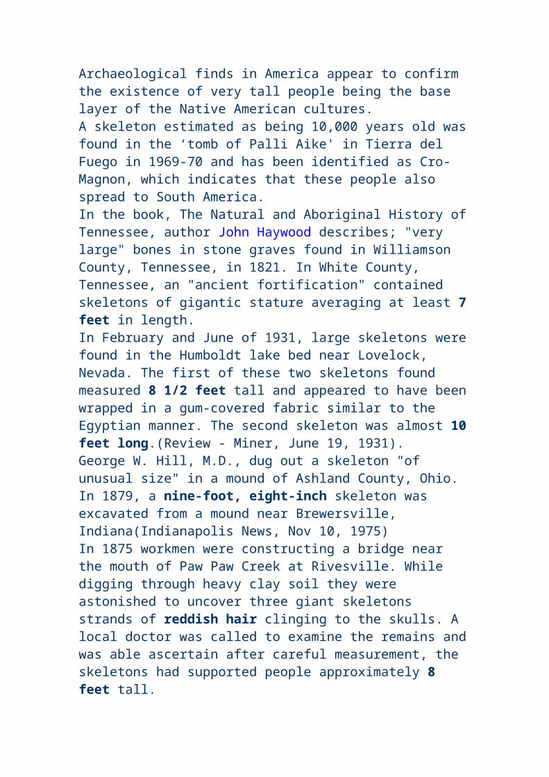
technology known as "sub-bottom profiling." in 130 feet of water, they recieved sonar images of square and rectangular shapes with 90-degree angles off the northwestern coast of India in the Gulf of Khambhat (Cambay). The Indian Minister of Science and Technology ordered that the site be dredged. What was found has surprised archaeologists around the world" The Find Includes Human Remains Linda Moulton Howe, who investigates occurrences of this type worldwide, interviewed Michael Cremo about this new discovery. Cremo is a researcher and author of the book Forbidden Archaeology. Cremo, Howe said, has visited India and attended local meetings about the Cambay site. "Within the past few months," Cremo told her, "the engineers began some dredging operations there and they pulled up human fossil bones, fossil wood, stone tools, pieces of pottery, and many other things that indicated that it indeed was a human habitation site that they had. And they were able to do more intensive sonar work there and were able to identify more structures. They appeared to have been laid out on the bank of a river that had been flowing from the Indian subcontinent out into that area." According to Howe: Even if we don't know what the cultural background of the people is, if it does happen to be a city that is 9500 years old, that is older than the Sumerian civilization by several thousand years. It is older than the Egyptian, older than the Chinese. So it would radically affect our whole picture of the development of urban civilization on this planet. Now, if it further happens that additional research is able to identify the culture of the people who lived in that city that's now underwater. If it turns out they are a Vedic people, which I think is quite probable given the location of this off the coast of India, I think that would radically change the whole picture of Indian history which has basically been written by Western archaeologists.
It has often been said that the Hindu religion is one of the most ancient religions of the world, it is also said that the English language has it's origins in India, now we know why. From previous chapters we learnt that the Anu were a people from which the Ainu and Veda are descended from. In Biblical records, Lord Anu was the culture bringer to the Sumerians. According to Hebrew texts, from which the bible was written, occurred 10,000 years ago. In other words, knowledgeable survivors of the civilizations of India, decided to resurrect their civilization amongst the Sumerian tribesmen. This began western civilization as we know it in the history books. According to Christian O'Brien, in his book "The Genius of the Few" The great 'Lord Anu' decided to 'plant a garden in Eden' which was a fertile valley overlooking fertile
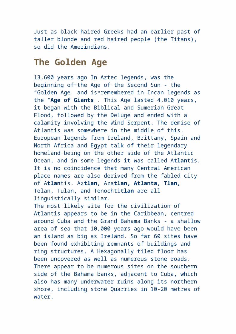
plains in Lebanon where a village named Ehdin still exists. Then 600 years later the "Shining ones" - white faced, purple robed people with gold wings came and gave them incredible scientific knowledge. These people were obviously survivors of the pan Atlantic culture (Cro Magnon man) that also gave rise to the purple robed, red haired Phoenicians, the blue robed copper culture of the Tuaregs, the seafaring Berbers, Celts, Basques, Toltecs, Anasazi and Araucano. It would only be natural, that the survivors of the global catastrophe that occured 11,600 years ago, regardless of their origins, would have pooled together their recources to start anew.In the Hebrew chronicles of Enoch it says; "I awoke to find in my room, two very tall men, different from any that I have seen in the lowlands. Their faces shone like the Sun and their eyes burned like lamps; and the breath from their mouths was like smoke (tobacco or hashish). Their clothes were remarkeable - being purplish, with the appearance of feathers; and on their shoulders were things which I can only describe as 'like golden wings'. ......the men brought me to the sixth haven, and there I saw seven groups of 'Angels'. Some of these 'Angels' study the movements of the Stars, the Sun and the Moon and record the peacful order of the World. Other 'Angels' there, undertake teaching and give instruction in clear and melodious voices. Others are responsible for recording the fauna and flora in both the Highlands and the Lowlands.There are 'Angels' who record the seasons and the years, others who study the rivers and the seas, others who study the fruits of the lowlands and the plants and herbs which give nourishment to men and beasts. And there are 'Angels' who study mankind and record the behaviour of men and how they live.
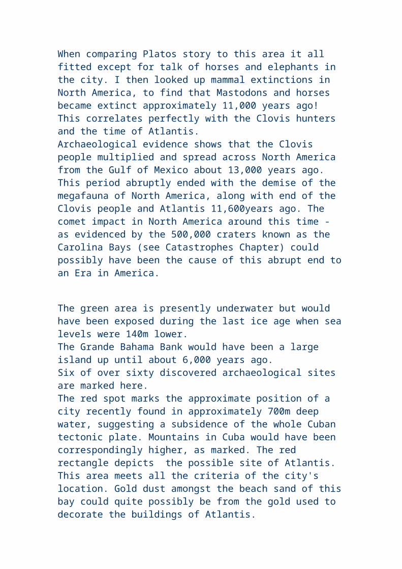
These are petroglyphs are from Nevada and California and depict theIrish god Ogma Grian Aineac, 'meaning Ogma the Sun Faced'
who precided over the occult and was the inventor of Ogam writing.The Ogam symbols in his left hand spell his name 'Ogam'.
In his right hand is a druids wand. From; America B.C. by Barry Fell.

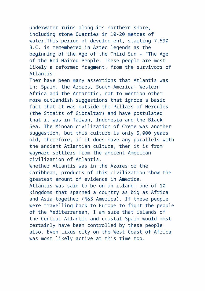
Ogam writing is found on many megalithic monuments in America and has often been passed off as marks from ploughs, despite the fact that such inscriptions are on walls of tombs. Their answer to this is that early settlers must have built these 'bunkers' out of rocks in the field after repeated ploughing to cause such a multitude of scratches. Once again the intelligence of so called scientists is called into question.
It appears that Cro Magnon man was much more than a dirty unshaven bloodthirsty barbaric troglodite who hunted animals and dragged women around by the hair. It seems that there was once a highly sophistocated civilization that influenced many cultures around the world before it was destroyed by the hand of nature. Ogam writing, often assumed to be idle scratches in rock was their writing system. It was a simple method easily taught using the fingers. This writing system is based on sounds and has no connection to the modern alphabet. Although mainstream scientists deny that this writing system was around before 1000BC, bone tools from 20,000 years ago have been found with grooves cut in them similar to ogam writing. We should keep our minds and eyes open to the meaning of ancient inscriptions, they may teach us a lot about our ancestors.
Pages extracted from America B.C. by Barry Fell. Other styles of writing are quite common in America, suggesting a thriving trans Atlantic trade during the Bronze Age.Micmac writing, once thought to be the brainchild of an over zealous missionary, turns out to be closely related to an ancient Egyptian script that was unknown by westerners, let alone - deciphered, until more recent times.
excerpt from Archeological Coverups by David Hatcher ChiPerhaps the most amazing suppression of all is the excavation of an Egyptian tomb by the Smithsonian itself in Arizona. A lengthy front page story of the PHOENIX GAZETTE on 5 April 1909 (follows this article), gave a highly detailed report of the discovery and excavation of a rock-cut vault by an expedition led by a Professor S.A. Jordan of the Smithsonian. The Smithsonian, however, claims to have absolutely no knowledge of the discovery or its discoverers.
The World Explorers Club decided to check on this story by calling the Smithsonian in Washington, D.C., though we felt there was little chance of getting any real information. After speaking briefly to an operator, we were transferred to a Smithsonian staff archaeologist, and a woman's voice came on the phone and identified herself.
I told her that I was investigating a story from a 1909 Phoenix newspaper article about the Smithsonian Institution's having excavated rock-cut vaults in the Grand Canyon where Egyptian artefacts had been discovered, and whether the Smithsonian Institution could give me any more information on the subject.
"Well, the first thing I can tell you, before we go any further," she said, "is that no Egyptian artefacts of any kind have ever been found in North or
South America. Therefore, I can tell you that the Smithsonian Institute has never been involved in any such excavations." She was quite helpful and polite but, in the end, knew nothing. Neither she nor anyone else with whom I spoke could find any record of the discovery or either G.E. Kinkaid and Professor S.A. Jordan. While it cannot be discounted that the entire story is an elaborate newspaper hoax, the fact that it was on the front page, named the prestigious Smithsonian Institution, and gave a highly detailed story that went on for several pages, lends a great deal to its credibility. It is hard to believe such a story could have come out of thin air. Is the Smithsonian Institution covering up an archaeological discovery of immense importance? If this story is true it would radically change the current view that there was no transoceanic contact in pre-Columbian times, and that all American Indians, on both continents, are descended from Ice Age explorers who came across the Bering Strait. (Any information on G.E. Kinkaid and Professor S.A. Jordan, or their alleged discoveries, that readers may have would be greatly appreciated.....write to Childress at the World Explorers Club at the above address.)
Is the idea that ancient Egyptians came to the Arizona area in the ancient past so objectionable and preposterous that it must be covered up? Perhaps the Smithsonian Institution is more interested in maintaining the status quo than rocking the boat with astonishing new discoveries that overturn previously accepted academic teachings.
Historian and linguist Carl Hart, editor of WORLD EXPLORER, then obtained a hiker's map of the Grand Canyon from a bookstore in Chicago. Poring over the map, we were amazed to see that much of the area on the north side of the canyon has Egyptian names. The area around Ninety-four Mile Creek and Trinity Creek had areas (rock formations, apparently) with names like Tower of Set, Tower of Ra, Horus Temple, Osiris Temple, and Isis Temple. In the Haunted Canyon area were such names as the Cheops Pyramid, the Buddha Cloister, Buddha Temple, Manu Temple and Shiva Temple. Was there any relationship between these places and the alleged Egyptian discoveries in the Grand Canyon?
We called a state archaeologist at the Grand Canyon, and were told that the early explorers had just liked Egyptian and Hindu names, but that it was true that this area was off limits to hikers or other visitors, "because of dangerous caves."
Indeed, this entire area with the Egyptian and Hindu place names in the Grand Canyon is a forbidden zone - no one is allowed into this large area. We could only conclude that this was the area where the vaults were
located. Yet today, this area is curiously off-limits to all hikers and even, in large part, park personnel.
I believe that the discerning reader will see that if only a small part of the "Smithsoniangate" evidence is true, then our most hallowed archaeological institution has been actively involved in suppressing evidence for advanced American cultures, evidence for ancient voyages of various cultures to North America, evidence for anomalistic giants and other oddball artefacts, and evidence that tends to disprove the official dogma that is now the history of North America.
The Smithsonian's Board of Regents still refuses to open its meetings to the news media or the public. If Americans were ever allowed inside the 'nation's attic', as the Smithsonian has been called, what skeletons might they find?
--------------------------------------------------------------------
from the front page of THE PHOENIX GAZETTE of April 5th, 1909 EXPLORATIONS IN GRAND CANYON
Mysteries of Immense Rich Cavern being brought to light
Jordan is enthused Remarkable finds indicate ancient people migrated from Orient
The latest news of the progress of the explorations of what is now regarded by scientists as not only the oldest archeological discovery in the United States, but one of the most valuable in the world, which was mentioned some time ago in the Gazette, was brought to the city yesterday by G.E. Kinkaid, the explorer who found the great underground citadel of the Grand Canyon during a trip from Green River, Wyoming, down the Colorado, in a wooden boat, to Yuma, several months ago.
According to the story related to the Gazette by Mr. Kinkaid, the archaelogists of the Smithsonian Institute, which is financing the expeditions, have made discoveries which almost conclusively prove that the race which inhabited this mysterious cavern, hewn in solid rock by human hands, was of oriental origin, possibly from Egypt, tracing back to Ramses. If their theories are borne out by the translation of the tablets engraved with heiroglyphics, the mystery of the prehistoric peoples of North America, their ancient arts, who they were and whence they came, will be solved. Egypt and the Nile, and Arizona and the Colorado will be
linked by a historical chain running back to ages which staggers the wildest fancy of the fictionist.
A Thorough Examination
Under the direction of Prof. S. A. Jordan, the Smithsonian Institute is now prosecuting the most thorough explorations, which will be continued until the last link in the chain is forged. Nearly a mile underground, about 1480 feet below the surface, the long main passage has been delved into, to find another mammoth chamber from which radiates scores of passageways, like the spokes of a wheel.
Several hundred rooms have been discovered, reached by passageways running from the main passage, one of them having been explored for 854 feet and another 634 feet. The recent finds include articles which have never been known as native to this country, and doubtless they had their origin in the orient. War weapons, copper instruments, sharp-edged and hard as steel, indicate the high state of civilization reached by these strange people. So interested have the scientists become that preparations are being made to equip the camp for extensive studies, and the force will be increased to thirty or forty persons.
Mr. Kinkaid's Report
Mr. Kinkaid was the first white child born in Idaho and has been an explorer and hunter all his life, thirty years having been in the service of the Smithsonian Institute. Even briefly recounted, his history sounds fabulous, almost grotesque.
"First, I would impress that the cavern is nearly inaccessible. The entrance is 1,486 feet down the sheer canyon wall. It is located on government land and no visitor will be allowed there under penalty of trespass. The scientists wish to work unmolested, without fear of archeological discoveries being disturbed by curio or relic hunters. A trip there would be fruitless, and the visitor would be sent on his way. The story of how I found the cavern has been related, but in a paragraph: I was journeying down the Colorado river in a boat, alone, looking for mineral. Some forty-two miles up the river from the El Tovar Crystal canyon, I saw on the east wall, stains in the sedimentary formation about 2,000 feet above the river bed. There was no trail to this point, but I finally reached it with great difficulty. Above a shelf which hid it from view from the river, was the mouth of the cave. There are steps leading from this entrance some thirty yards to what was, at the time the cavern was inhabited, the level of the river. When I saw
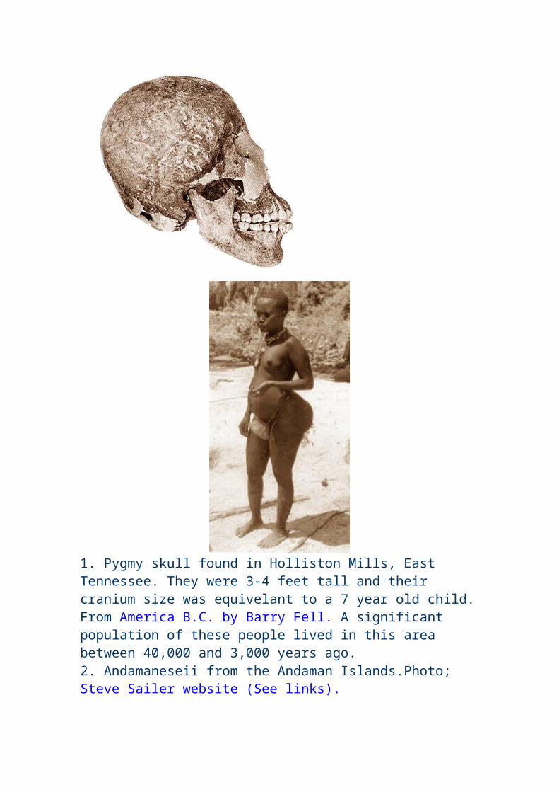
the chisel marks on the wall inside the entrance, I became interested, securing my gun and went in. During that trip I went back several hundred feet along the main passage till I came to the crypt in which I discovered the mummies. One of these I stood up and photographed by flashlight. I gathered a number of relics, which I carried down the Colorado to Yuma, from whence I shipped them to Washington with details of the discovery. Following this, the explorations were undertaken.
The Passages
"The main passageway is about 12 feet wide, narrowing to nine feet toward the farther end. About 57 feet from the entrance, the first side-passages branch off to the right and left, along which, on both sides, are a number of rooms about the size of ordinary living rooms of today, though some are 30 by 40 feet square. These are entered by oval-shaped doors and are ventilated by round air spaces through the walls into the passages. The walls are about three feet six inches in thickness.
The passages are chiseled or hewn as straight as could be laid out by an engineer. The ceilings of many of the rooms converge to a center. The side-passages near the entrance run at a sharp angle from the main hall, but toward the rear they gradually reach a right angle in direction.
The Shrine
"Over a hundred feet from the entrance is the cross-hall, several hundred feet long, in which are found the idol, or image, of the people's god, sitting cross-legged, with a lotus flower or lily in each hand. The cast of the face is oriental, and the carving this cavern. The idol almost resembles Buddha, though the scientists are not certain as to what religious worship it represents. Taking into consideration everything found thus far, it is possible that this worship most resembles the ancient people of Tibet.
Surrounding this idol are smaller images, some very beautiful in form; others crooked-necked and distorted shapes, symbolical, probably, of good and evil. There are two large cactus with protruding arms, one on each side of the dais on which the god squats. All this is carved out of hard rock resembling marble. In the opposite corner of this cross-hall were found tools of all descriptions, made of copper. These people undoubtedly knew the lost art of hardening this metal, which has been sought by chemicals for centureis without result. On a bench running around the workroom was some charcoal and other material probably used in the process. There is also slag and stuff similar to matte, showing that these ancients smelted
ores, but so far no trace of where or how this was done has been discovered, nor the origin of the ore.
"Among the other finds are vases or urns and cups of copper and gold, made very artistic in design. The pottery work includes enameled ware and glazed vessels. Another passageway leads to granaries such as are found in the oriental temples. They contain seeds of varous kinds. One very large storehouse has not yet been entered, as it is twelve feet high and can be reached only from above. Two copper hooks extend on the edge, which indicates that some sort of ladder was attached. These granaries are rounded, as the materials of which they are constructed, I think, is a ver hard cement. A gray metal is also found in this cavern, which puzzles the scientists, for its identity has not been established. It resembles platinum. Strewn promiscuously over the floor everywhere are what people call "cats eyse', a yellow stone of no great value. Each one is engraved with the head of the Malay type.
The Hieroglyphics
"On all the urns, or walls over doorways , and tablets of stone which were found by the image are the mysterious hieroglyphics, the key to which the Smithsonian Institute hopes yet to discover. The engraving on the tables probably has something to do with the religion of the people. Similar hieroglyphics have been found in southern Arizona. Among the pictorial writings, only two animals are found. One is of prehistoric type.
The Crypt
"The tomb or crypt in which the mummies were found is one of the largest of the chambers, the walls slanting back at an angle of about 35 degrees. On these are tiers of mummies, each one occupying a separate hewn shelf. At the head of each is a small bench, on which is found copper cups and pieces of broken swords. Some of the mummies are covered with clay, and all are wrapped in a bark fabric.
The urns or cups on the lower tiers are crude, while as the higher shelves are reached, the urns are finer in design, showing a later stage of civilization. It is worthy of note that all the mummies examined so far have proved to be male, no children or females being buried here. This leads to the belief that this exterior section was the warriors' barracks.
"Among the discoveries no bones of animals have been found, no skins, no clothing, no bedding. Many of the rooms are bare but for water vessels.
One room, about 40 by 700 feet, was probably the main dining hall, for cooking utensils are found here. What these people lived on is a problem, though it is presumed that they came south in the winter and farmed in the valleys, going back north in the summer.
Upwards of 50,000 people could have lived in the caverns comfortably. One theory is that the present Indian tribes found in Arizona are descendants of the serfs or slaves of the people which inhabited the cave. Undoubtedly a good many thousands of years before the Christian era, a people lived here which reached a high stage of civilization. The chronology of human history is full of gaps. Professor Jordan is much enthused over the discoveries and believes that the find will prove of incalculable value in archeological work.
"One thing I have not spoken of, may be of interest. There is one chamber of the passageway to which is not ventilated, and when we approached it a deadly, snaky smell struck us. Our light would not penetrate the gloom, and until stronger ones are available we will not know what the chamber contains. Some say snakes, but other boo-hoo this idea and think it may contain a deadly gas or chemicals used by the ancients. No sounds are heard, but it smells snaky just the same. The whole underground installation gives one of shaky nerves the creeps. The gloom is like a weight on one's shoulders, and our flashlights and candles only make the darkness blacker. Imagination can revel in conjectures and ungodly daydreams back through the ages that have elapsed till the mind reels dizzily in space."
An Indian Legend
In connection with this story, it is notable that among the Hopi Indians the tradition is told that their ancestors once lived in an underworld in the Grand Canyon till dissension arose between the good and the bad, the people of one heart and the people of two hearts. Machetto, who was their chief, counseled them to leave the underworld, but there was no way out. The chief then caused a tree to grow up and pierce the roof of the underworld, and then the people of one heart climbed out. They tarried by Paisisvai (Red River), which is the Colorado, and grew grain and corn.
They sent out a message to the Temple of the Sun, asking the blessing of peace, good will and rain for people of one heart. That messenger never returned, but today at the Hopi villages at sundown can be seen the old men of the tribe out on the housetops gazing toward the sun, looking for the messenger. When he returns, their lands and ancient dwelling place will be
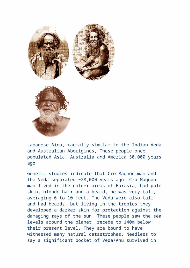
restored to them. That is the tradition.
Among the engravings of animals in the cave is seen the image of a heart over the spot where it is located. The legend was learned by W.E. Rollins, the artist, during a year spent with the Hopi Indians.
There are two theories of the origin of the Egyptians. One is that they came from Asia; another that the racial cradle was in the upper Nile region.
Heeren, an Egyptologist, believed in the Indian origin of the Egyptians. The discoveries in the Grand Canyon may throw further light on human evolution and prehistoric ages.
The Phoenician coin presumed to contain a map of the ancient world
If Mark McMenamin is correct, neither Columbus nor the Vikings were the first non-natives to set foot on the Americas. McMenamin, the Mount Holyoke geologist who last year led an expedition that discovered the oldest animal fossil found to date, may have made another discovery--one that sheds radical new light on present conceptions of the Classical world and on the discovery of the New World.
Working with computer-enhanced images of gold coins minted in the Punic/Phoenician city in North Africa of Carthage between 350 and 320 BC, (please see sketch of coin right and where the world map is supposed to have been inscribed) McMenamin has interpreted a series of designs appearing on these coins, the meaning of which has long puzzled scholars. McMenamin believes the designs represent a map of the ancient world, including the area surrounding the Mediterranean Sea and the land mass representing the Americas.
If this is true, these coins not only represent the oldest maps found to date, but would also indicate that Carthaginian explorers had sailed to the New World.
In fact, it was his interest in the Carthaginians as explorers that led McMenamin to study the coins. The Carthaginians were closely linked to the Phoenicians of the Middle East in terms of origin, culture, language, and naval enterprise. Both peoples are widely credited with significant sailing exploits through the Mediterranean, to the British Isles, and along the coast of Africa.
This detail of a gold coin shows what McMenamin believes is a map of the Mediterranean area, surrounded by Europe, Britain, Africa, and (at left) the Americas. The image appears on coins minted in Carthage between 350 and 320 BC. The enhanced and colorized version is based on the illustrations courtesy of Mark McMenamin.
In one of the coins studied by McMenamin, a horse stands atop a number of symbols at the bottom of the coin. For many years, scholars interpreted these symbols as letters in Phoenician script. When that theory was discounted in the 1960s, it left scholars baffled. Working over the past few months, McMenamin was able to interpret the design as a representation of the Mediterranean, surrounded by the land masses of Europe and Africa, with, to the upper left, the British Isles. To the far left of the representation of the Mediterranean is what the geologist believes is a depiction of the Americas.
A number of classical texts bolster this theory. For example, in the first century bc, Diodorus of Sicily wrote "...in the deep off Africa is an island of considerable size...fruitful, much of it mountainous.... Through it flow navigable rivers....The Phoenicians had discovered it by accident after having planted many colonies throughout Africa."
"I was just the lucky person who had the geologic and geographic expertise to view these coins in a new light," McMenamin notes. "I have been interested in the Carthaginians as the greatest explorers in the history of the world."
McMenamin's interest in Carthage led him to master the Phoenician language. He has published two pamphlets on his work regarding the Carthaginian coins. One is written in ancient Phoenician, representing probably the first new work in that language in 1500 years.
He has submitted a paper on his theory to The Numismatist, a leading journal in the study of coins, which has accepted McMenamin's paper on the theory for publication. At the same time, the scholar is trying to gain access to a number of coins --or casts of their impressions-- currently held in European collections. These impressions will further aid him, he hopes, in proving the world map theory's validity. "If I had the time and the money," McMenamin observes, only half-kidding, "I'd be in North Africa with my metal detector trying to find Carthaginian coins to further confirm my hypothesis."
Additional study may well reveal that it was Punic explorers not Europeans who "discovered" the New World. At the very least, McMenamin hopes his theory will focus new scholarly attention on ancient Carthaginian culture.
A study researched, translated and presented by kind courtesy of Mr. Christian da C. Karam, Student of Archaeology, Porto Alegre, Brazil
Phoenician Colonization
About 11,000 years ago (9500 B. C.) our planet was hit by a huge cataclysm when a good part of the Andes Cordillera was raised. The big lake where today the Sahara desert is dried out, the limits of the Mediterranean sea were altered, and the very large continent- island that existed in the middle of the Atlantic ocean, known as Atlantis, sank.
The causes of the catastrophe are not completely known yet but it is believed that one of its probable causes was the arrival of a huge mass of a celestial body that might have passed near Earth provoking tremendous tensions in the internal magma of the planet. Those real magma "tides" have submitted the thin solid crust of the planet into stronger pressures than it could support. In many points the soil became distended and in others it wrinkled. There were furthermore sinking and rises in some other parts of soil.
Atlantis was the main victim of those cataclysms that caused the fall of its powerful civilization. It is enough to say that various ancient texts state that after the continent- island's sinking, its survivors went on to Africa.
Plato tells us about the fights that they had with the Egyptians and Greeks and how they finally were defeated. However, they left indelible marks on the ancient people's culture such as in the Phoenician civilization that was their successor in the sea trade.
The Phoenicians inhabited the Mediterranean coasts, the narrow and fertile strip located between the sea and the mountains of Lebanon and Anti- Lebanon. Their small territory, the presence of powerful neighbours and the existence of much cedar wood (quite good for naval construction) in the mountain forests may have been the additional elements that guided the Phoenician civilization towards the exploration of the seas.
They built numerous and powerful fleets. They also visited the north African coasts and all the European south, traded in Italy, entered the Black Sea and left the Mediterranean Sea by crossing the Pillars of Hercules (today's Strait of Gibraltar and previously called the Pillars of Melqart) reaching the Atlantic ocean's African coast, and finally arrived at the Tin Islands in England. Always trading, the Phoenicians built marts and warehouses along their routes. When they could, they stole a little but always trying not to provoke powerful enemies who they preferred to weaken with gold products, instead of doing it by the sword or by fighting. The Phoenician agents and diplomats were familiar with almost every war fought at that time and they used to take advantage of it. They navigated the African continental coast in order to follow the opposite way that would be traced by Vasco da Gama much later. And more evidence seems to confirm that the Phoenicians used to cross the Atlantic Ocean to visit the "New Continent". The Phoenicians navigated by using the technique of stars orientation, the sea flows and through the winds courses. So, by following those factors their captains covered huge distances with precision. They were already influential about the year 2000 BC but their power grew with Abibaal's (in 1020 BC) and Hiram's leadership. Byblos, Sidon and Tyre were successive capitals of a state- city trading empire, united before anything else by ties of interest, habits and religion instead of a more rigid political structure.
Phoenicians in Brazil
Brazil is full of vestiges that corroborate the Phoenician presence in its lands and everything indicates that they concentrated their occupation in the northeastern region. A little away from the Longá and Parnaiba rivers' confluence, in Piaui state, there is a lake where Phoenician shipyards and a harbour with a place reserved to tie the "Carpássios" (old long traveling ships) were discovered.
By navigating the Mearim river up north, in Maranhão state, when arriving in the Pindaré and Grajaú rivers' confluence we can find the Pensiva lake before known as Maracu. In that lake's borders there can be found shipyards made of petrified wood containing thick nails and bronze dowels. Researcher Raimundo Lopes, born in Maranhão State, excavated that location at the end of the twenties and discovered typically Phoenician tools.
In Rio Grande do Norte state, after roaming a 11 km canal, the Phoenician boats used to anchor in the Extremoz lake. The Austrian professor Mr. Ludwig Schwennhagen studied the place's subterranean parts and the embankments carefully and also some others that exist near the village of Touro where the Phoenician navigators anchored after roaming about 10 km of a canal. The same professor Schwennhagen tells us that he found Phoenician inscriptions in the Amazon in which there were references to many kings of Sidon and Tyre (887 to 856 BC).
Schwennhagen believes that the Phoenicians used Brazil as a base during 800 years at least, leaving here, besides material evidences, an important linguistic influence among the natives.
In the rivers Camocim (Ceará State), Parnaiba (Piaui State) and Mearim (Maranhão state) entrance accesses there are stone and lime walls built by the ancient Phoenicians.
Apollinaire Frot, a French researcher, traveled all over the Brazilian countryside in order to collect Phoenician inscriptions in the Minas Gerais, Goiás, Mato Grosso and Bahia sierras. The inscriptions that he put together are so many that "they would fill uncountable volumes if they were ever published", according to Frot's statements.
The translation of those inscriptions refers to Phoenician works in Brazil, to their trade activity practiced in those distant lands and to the sinking of Atlantis. Some inscriptions reveal that because of the geological shocks that hit Atlantis, its survivors went to the north of Africa to found the empire of Egypt and many other nations of the region known today as the "Middle East". Those inscriptions still mention the biblical flood that, according to them, was not a universal catastrophe but only a local cataclysm in the Mesopotarmia region. This is a fact that scientists accept as veridical nowadays.
The economic leadership condition, on whose trade others depended, gave Phoenicia a kind of stability that allowed its existence to last so long without having strong armed forces. Phoenicia survived the Egyptian, the
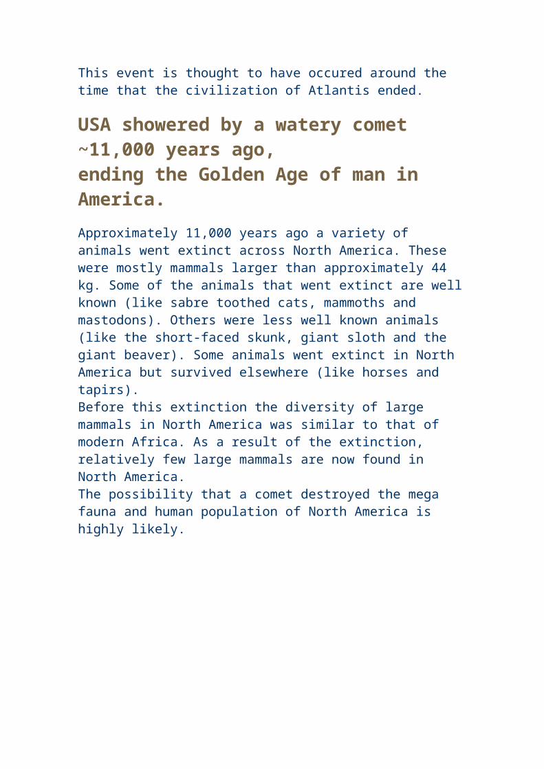
Syrian and the Assyrian hegemonies and even the Persian domination. Finally a strange racial element appeared the invaders from Europe. Thus Phoenicia trembled, at first under the Greek invasion headed by Alexander the Great and later under the power of the Roman legions.
With such a war the trading practices were interrupted and the far away colonies and marts now abandoned, started to be destroyed by local populations. The inhabitants of those regions, too far from the metropolis, withdrew into a primitive status. Although these are just theories, it would explain the blond hair and the diverse physical constitutions of savages that can be found among some Brazilian Indian tribes in the Amazon. It would also explain the light skin and the big number of Phoenician expressions and words used by the Tiriós Indians.
Carthage, the largest of the Phoenician colonies, survived and prospered when it inherited the sea trade from its ancient colonizing cities. It is Herodotus, the famous Greek historian, who tells us that "the Carthaginian senate published a decree in order to forbid -under penalty of death -- to organize or to take trips to the other side of the Atlantic ocean because the frequent coming of men and resources were emptying the capital".
Finally there is the famous inscription in the "Pedra da Gávea" (Gavea's Rock) in Rio de Janeiro which states: "Here Badezir, King of Tyre, Jetbaal's oldest son".
There is no scientific or cultural work in Brazil that has affirmative data about the Phoenician coming to its territory. However, there are in some foreign material references to the Phoenecian navigators in Brazilian lands before its European discovery. Although that information may seem unreal, legendary and fictitious, I want to believe that it is really true.
Phoenician inscriptions found in Tyre, known today as Sur (its name in Arabic), are on tombstones, which are now in London. They mention an expedition of a Phoenician navigator to a region beyond the Strait of Moloch (today's Gibraltar) where "the sea penetrated into the land..." a place where there was an abundance of food and lots of wood.
There still is another --fact: in excavations that took place in Sidon, French archaeologists found in 1860 many wooden artifacts that only could have been taken from Brazil, according to archaeological tests. It is the famous "quebracho" or "quebra machado" (the "ax breaker") as it its known in the Brazilian countryside. Besides that kind of wood a red coloured one was found whose denomination today in Arabic remains the same as the one in Phoenician times: "Shajarat Ahmar" -- known in Portuguese as Pau- Brasil.
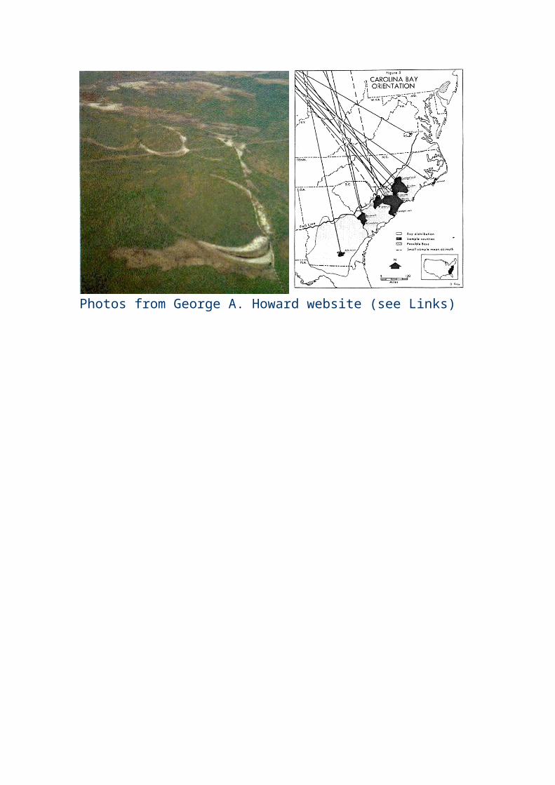
By the way, what is the origin of the name, which is given to the Amazon River after its source?
The answer to that question is in the Louvre Museum archives, in the Royal Museum of London and also in Vatican and Lisbon historic documents that state the Solimões River's name came from its primitive denomination, which might be "Sulaiman". So, it would be in honour of the great King of Israel -- Sulaiman (Salomon) -- given by his vassals who arrived in those regions guided by the Phoenicians, a few years before the Christian Era.
All the cuneiform inscriptions discovered in the Amazon region, in the Ararí area, as well as in French Guyana and Surinam such as hieroglyphs and rock characters demonstrate clearly its origin from Aramaic, Syriac and even Sanskrit scripts.
In the National Historic Museum many photographs show us huge inscriptions that are widely spread from the Solimões River up to the point where its name changes to Amazon River (from Ararí to Madeira River). Those inscriptions demonstrate just a little of the greatness of the others that exist all over Brazil.
Someone has already tried to show in Rio de Janeiro that the Maya people might have written the Gavea's Rock inscriptions. Nevertheless they are hieroglyphic inscriptions mixed with the Phoenician alphabet and originally engraved by Phoenician navigators. Other evidences are four Phoenician characters (signs) engraved on the peak of a big rock known as "Pão de Açúcar" (The Sugar Loaf).
There are various confirmations that say Brazil was already known by many sailors from the Near East even before its discovery by the Portuguese. The first European navigator to be familiar with this land was the Roman Severus Pompeus, whose documents related to that fact is in the Vatican archives. He obtained from a "Syrian" slave a report and a confirmation of the existence of others lands. What is ignored is why that navigator did not try to verify those stories by himself.
The Phoenician explorers were not interested in lands. They were really interested in its native products. So, they were not a colonizing people but a trading one.
Columbus, the great navigator from Genoa, had never been to the lands of which he used to talk so much. However, he had an itinerary, a map and other real documents concerning those distant lands. How did he get them? Some ancient historians tell the following tale about that: "One day, at his
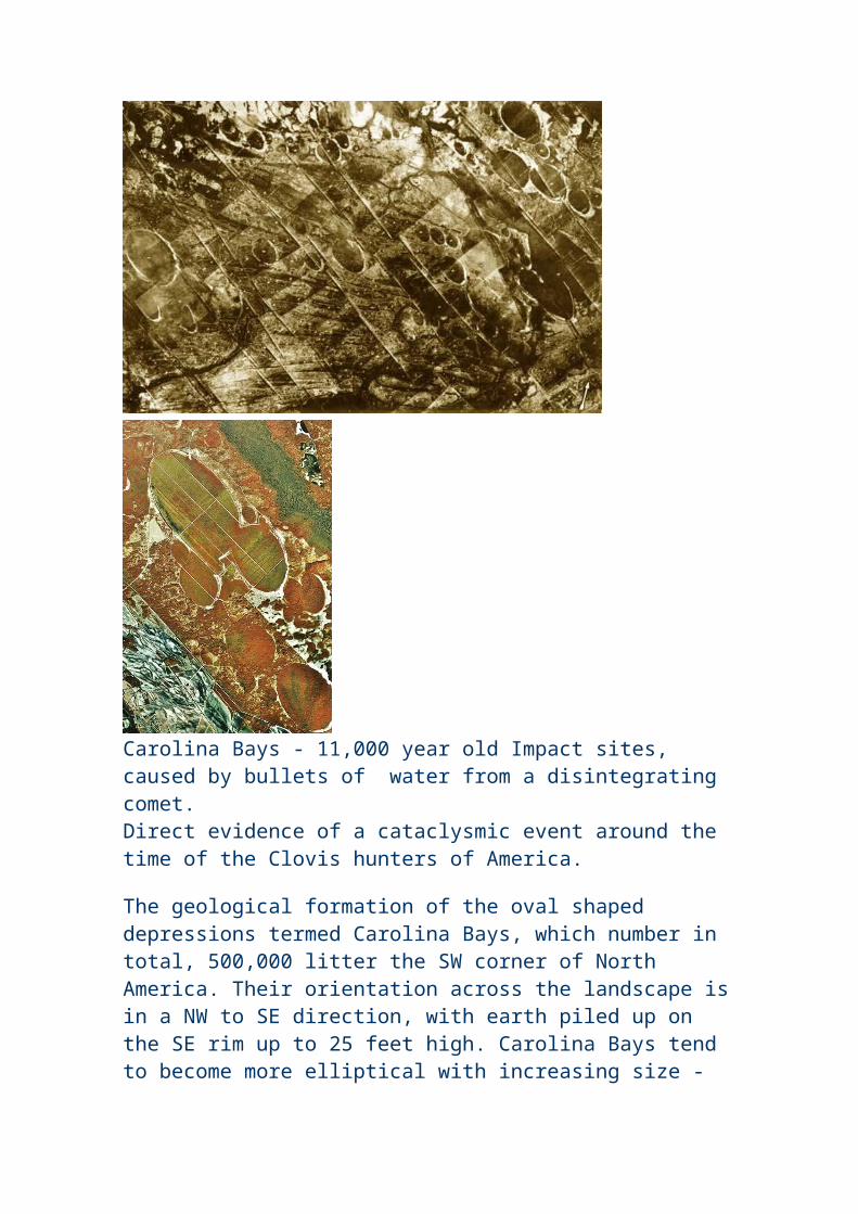
house, without anything to do, Columbus realized that in his residential area there was something buried in the ground. So, he started digging quickly and he found a rotten wooden box. Inside it there was many human bones (even a skull) and among those bones Columbus found some papyri documents. Because he already had some nautical knowledge- he was quite a good sailor- he became intrigued with the discovery and went to look for information with an uncle of his whom belonged to a religious institution and who also was a very respected person in the Spanish Royalty. Columbus gave his uncle what he had found, and he took them to one of his colleagues. Then both of them verified that those papers were descriptive maps made by a sailor from Tripoli (Trabulus) which had been buried many centuries before the fifteenth century when the place where Columbus' house was had been the sea's border.
Afterwards, Columbus got an opinion from a very important cartographer about those exceptional findings. He declared that region as being a huge territory located beyond the Pillars of Hercules (Strait of Gibraltar). He also said that its wealth was so great and there were such valuable treasures kept in that place that he who could dominate it would be considered "the Lord of the World".
Then from that day on and protected by his uncle, Columbus started to visit the Portuguese and the Spanish courts in order to obtain concession, financing and support to be the "Lord of the World".
It is said that such a report is a legend but I believe it is true: Columbus came and discovered the American continent.
In the "sambaquís" spread throughout Brazil many objects and rock inscriptions have been found. Some writers, based on paleontology material, have been writing that its origin is Indian. Other paleontologists who searched and penetrated into thousands of caves, grottos and lime cesspools declared that it its neither possible to define the exact geological erosion of the Brazilian lands nor to determine an ancient settlement in Brazil before its European discovery.
Nevertheless the Maya, the Toltec and the Aztec civilizations predominated all over the American continent. Those populations did not spring from the ground and only two other peoples could be their ancestors: the Phoenicians or the Chinese. From the Phoenicians, because they dominated the western seas and from the Chinese because they dominated the Far East seas. However, those basis are uncertain and imperfect just because until today historians were not able to elucidate such a vulnerable fact about the American pre-civilization History.
When Baron von Humboldt, at the end of the eighteenth century, took research trips to explore the Brazilian countryside, he reached the Orenoco slopes and was surprised by the greatness that Maya, Inca and Aztec civilizations offered to anyone's eyes and mind. He verified that the legends about the existence of the Amazon women- whose name was given to the river- were true.
Beuchat cites the important Inca influence in the South American civilization as well as the Aztec influence in Mexico and in Central American societies.
We can still hear about the lost cities in the Brazilian countryside region, the petrified cities such as the one known as "Sete Cidades" (Seven Cities) in the state of Piaui and others in wild zones like the states of Mato Grosso, Goiás and Amazonas.
From São Luis dos Cáceres up to the north in the state of Mato Grosso, there are places that show the existence of buried cities that are the remains of a millenarian civilization very well.
Doctor Peter W. Lund, a great Danish scholar, came up with the theory of a precivilization in Brazil and the Phoenician contribution in its formation.
The Brazilian Indians, known as Carajás and Carajá-ís, have on their names the etymology of the words whose Phoenician origin can be found in today's Arabic language. Some other Brazilian Indian tribes such as the Guaranis, the Tupis, the Guajajaras, the Chambicás, the Anajás, the Carijós, etc., have in their vocabulary thousands of Arabian words whose origin is Phoenician.
Maya and Aztec civilizations differ little from the Phoenicians. Their merchants, governors, administration, clans and their moral education clearly show us the ethnology of their civil way of life.
The Indians who deal with oil, in the north of Brazil, and who still today execute the Marajoaras work perfectly, adopt the same systems used by the Phoenician workers with oil who mixed wood and vine ashes with mud (clay) in order to produce ceramics. The resemblance among these drawings, the pots' shapes, the small statues and other Indian works and the Phoenician artifacts is noteworthy.
The same Phoenician burial ritual -- the one that buried the dead with all the objects that belonged to them -- also was adopted by almost all Brazilian Indian tribes.
The Phoenicians had a factory or a mart in a region, legendarily known as Atlantis that in their language meant -- according to the Phoenician term "Al- Atlantic"--: huge, large, extensive, vast, endless. And in Arabic "Al- Atlantic" means giant, majestic.
When I went on some trips into the Brazilian countryside, I saw some coins that had been found in Brazilian ground whose origin is completely unknown. Making a comparison among these coins and Paraguayan, Bolivian and Peruvian coins their resemblance to coins from Sidon and Tyre is very great.
In the Rio de Janeiro National Museum there exist tombstones with Phoenician, Syriac and Sanskrit inscriptions found in the Brazilian countryside.
Edmund Bleibel, a distinguished Lebanese historian, in his books "General History of Lebanon", published in Beirut, states: "when the Phoenicians were established in Africa, and Gibraltar was the limit of their empire, they planned to cross the huge ocean towards the unknown".
Then Ilu of Jbail (Byblos) and his wife Harmonia (Harmony) prepared a big fleet and navigated the enormous sea looking for the "Eternal Islands" (Canary Islands) but they disappeared forever. It was said that their souls embodied two serpents, which meant that their lives had been renewed by god, Baal's will.
Later it was corroborated that they had crossed the huge ocean and discovered the region where today is South America. So, that happened 3,000 years before Christopher Columbus.
They gave the first new land they discovered the name of "Barr Ilu" which means "The Continent of God". When the nation was formed and its administration was organized, the chosen queen to rule that place was Mirinieh Mirubieh known as "Queen of the Amazones" which means "Queen of the Warriors". That queen was sent to Lebanon to save Ilu of Jbail (Byblos) who was in a critical situation.
The "Queen of the Amazons" called "The Big Ocean" the ocean known before as 'Mirubi Ocean" which today is the Atlantic Ocean. This last denomination was in honour of Atlas, the great Phoenician king of Lybia
Cadmus, the great navigator of Tyre, left his city -- Cadamiat -- on a scientific mission in order to study the Cuchite language spoken in Brazil.
A few historians have been investigating the origin of such a language and they found many evidences that confirm the Phoenician's coming to Brazil bringing with them some Greek workers before any other people. The historian Deodoro told the way they might have arrived here. That fact was confirmed by Plutarch and was mentioned by the great Brazilian historian Rui Barbosa, as well as by other Brazilian poets who sang on their lyres the Phoenician and their monuments on the Brazilian soil.
Each fleet that left Sidon, Jbail and Tyre had 200 or 300 boats that headed to Brazil. The smallest one was used to bring the members of the crew with their support material and equipment. They usually stopped to rest and also to buy supplies in Tunis and at the Canary Islands.
Among the Phoenician civilization monuments in Brazil there is a city that was called "Airo", today completely lost in the admirable immensity of this country. Its ancient inhabitants were proud of belonging to the Phoenician lineage just like the Irish people. They used to say that they were Tyrian descendants who, during King Hiram's time, came to take gold. They took this precious metal to Tyre and to King Salomon of Jerusalem from the land of Ofir, where this mineral was very abundant. It is located in the Amazon River borders.
Finally we verify that truth is clear and positive. I wish the Brazilian honourable governors could help twentieth century dedicated scientists to research, in the Brazilian entrails, for its pre- historic reality, the one of its archaic civilization, and maybe we would have even surpassed the Greek and the Roman civilizations.
References:1. Excertos do livro de: Lisboa, Luiz C. e Andrade, Roberto P.
"Grandes Enigmas da Humanidade " - Capítulo 5: "Os que antecederam Colombo" páginas 96- 100. Círculo do Livro S.A. Editorial. São Paulo, 1969.
2. Excerpts from the book by: Lisboa, Luiz C. and Andrade, Roberto P. "Great Enigmas of Mankind" - Chapter 5: "Columbus antecessors" pages 96- 100. Círculo do Livro Press. São Paulo, 1969.
3. Excertos do livro de: Bastaní, Tanus Jorge "0 Líbano e os Libaneses no Brasil" -Parte oitava: "Indícios da vinda dos Fenícios ao Brasil" páginas 155- 159. Edição independente. Rio de Janeiro, 1945.
Excerpts from the book by: Bastani, Tanus Jorge "Lebanon and the Lebanese in Brazil" -- Eighth part: "Traces of the Phoenician arrival in Brazil" pages 155-159 Independent edition. Rio de Janeiro, 1945.
by Dennis Price, Netheravon, England� 2004
"For Jack and Tanith"
"All men dream, but not equally. Those who dream by night in the dusty recesses of their minds wake in the day to find that it was vanity: but the dreamers of the day are dangerous men, for they may act their dream with open eyes, to make it possible."
T. E. Lawrence from "The Seven Pillars of Wisdom"
I was born in a Western country and raised in Western culture with Western values. I'm proud to be a Welshman and in case there is any doubt, or anyone feels it to be relevant, I'm a white Caucasian. I'm interested in and proud of my ancestry, and I'm naturally proud of my nation as a whole.
When I was a child and then a young man, I learned of an ancestor of mine who fought at Rorke's Drift, the almost legendary battle that took place on January 22nd 1879. In this engagement, 1,500 Welshmen, who were mainly from the Regiment of the South Wales Borderers, fought and defeated 4,000 Zulus. It was the greatest ever defeat inflicted on a native force by a colonial force, while 11 Victoria Crosses were won at Rorke's Drift, the most such awards won in any single action in British military history. I also learned of another ancestor who was the ship's carpenter on board Nelson's flagship the Victory. One of my grandfathers fought in and lived through the First World War, while another began his service in the Second World War by surviving Dunkirk.
I'm not a military historian, but such accounts naturally fascinated me. I later read of the Welsh archers who were instrumental in defeating the French at the famous Battle of Agincourt in 1415, where a vastly outnumbered and exhausted British army faced the flower of French chivalry and brought them low. Before that, Owen Glendower and his men fought a bloody rebellion against two English kings in an insurrection that lasted for fifteen years. The few people outside Wales who have read of Glendower's rebellion are given the impression by most history books that it was largely a guerrilla war, but Glendower fought and defeated King Henry IV in at least three pitched battles on Welsh soil. One of Glendower's detractors, William Shakespeare, grudgingly noted these victories when he put the famous speech into Glendower's mouth, in his play Henry IV.
"Three times hath Bolingbrook made head against my power. Three times, from the banks of the Wye and sandy-bottomed Severn, have I sent him bootless home and weather-beaten back."
Before Glendower's rebellion, King Edward I, Hammer of the Scots, fought a long and terrible campaign against the native Welsh Princes. He won, but at a great cost, while as a direct result of his need to subjugate the Welsh, Wales now possesses more castles per square mile of country than any other western European nation.
I was extremely fortunate to receive a classical education and so it was I came to study Latin, Greek and Ancient History. Through this, I learned that the famous King Caratacus fled from Kent and from the invading Romans to seek the assistance of the Silures, the ancient tribe that once lived in the region that is now my homeland. It took the Romans over 40 years to finally subdue the Silures, and this in a relatively small island, long after the other British tribes had been vanquished. I also learned that the greatest defeat ever inflicted on the Romans in Britain was when an entire legion under Manlius Valens was devastated by the Silures, who launched a massive counter offensive against the Roman invaders in around 55-53 AD. The XX Legion suffered a major defeat and the Silures broke out as far east and north as Gloucester.
The next governors of Britain, Gallus and Veranius, fought tirelessly against the Silures between 53-58 to redeem the situation. In 59 AD, the XX legion was removed to fight a campaign in North Wales, but the Silures, however, were far from beaten. When Paulinus was attempting to put down the revolt of Boudicca in 60 AD that threatened the entire province of Britain, the II Augusta legion remained in the south west. So wary were they of antagonising the Silures that not even an event of the

magnitude of Boudicca's revolt could persuade them to offer assistance to their fellows.
I have no love whatever for war, but perhaps you can imagine the satisfaction I had as I learned of my military legacy against an invader? While studying history, I learned of Britain's other exponents of the art of war, men such as Wellington, Nelson, Cromwell, King Henry V, King Alfred the Great and of course the renowned King Arthur, whose true identity lies perhaps forever hidden by the mists of time. My study of Latin, Greek and Ancient History led me to Rome and to the terrible foes faced over the centuries by the Romans, men such as Attila the Hun, Mithridates, Pyrrhus, Spartacus, the Caledonian King Calgacus and of course the Warrior Queen Boadicea. I read of numerous Gallic, Germanic and Eastern warriors who had inflicted crushing defeats on the Romans, while I also read of the Greeks, the Persians and the mighty Alexander. I studied and marvelled over their exploits, but to my mind, no general who has ever lived can bear comparison to the awe-inspiring Hannibal of Carthage, a man who stands alone.
I shall leave it to others to examine, if they will, the precise record of Hannibal. For my part, I've made clear my background and loyalties, so what is it about Hannibal that has excited such admiration from me? My principal trade is as a writer of stories, so I am accustomed to trying to put myself into the place of other characters, whether they be fictional or historical. I make no pretence that what follows should be a cold, clinical examination of all the facts, so as such, I am happy to write in another vein entirely, to try to convey to a casual reader in an unashamedly personal account why it is that of all men in military history, Hannibal should receive my heartfelt and eternal admiration.
As Hannibal grew up as a young man, he would have learned of Rome, the brooding enemy of Carthage, lurking to the north across the Mediterranean. He would have discovered that the ingenious and determined Romans had countered the superior naval skills of the Carthaginians by equipping their ships with grappling hooks, or corvi, which enabled Roman marines to storm the fettered Carthaginian warships.
He would doubtless have been impressed by the succession of Roman naval victories against a natural maritime force such as Carthage and by the undoubted sheer resilience of the Roman army. He would have learned of the successful campaigns by the Roman army against Carthaginian forces in both Africa and Sicily, and he would certainly have studied previous Roman military achievements. He would have seen an emergent, highly disciplined force that had already had innumerable victories to its credit,
while it had also sprung back from many grave defeats. For a young man such as Hannibal to even contemplate attacking such a formidable adversary in the light of the humiliating defeat and terms of the First Punic War was brave enough, but for him to actually embark on such an undertaking was truly heroic.
As everyone knows, he decided against sailing to Italy and instead decided to march his army through North Africa and across the Straits of Gibraltar. This would have been an ambitious enough scheme at any time for any military commander, but there was also the sheer logistical problem of how to transport not only men and horses across the sea, but also a troop of elephants and provisions for the beasts. Hannibal would presumably have outlined his plan at some point before his army set off, so consider the other problems. He would have had to utterly convince his men that he would succeed, and he would have had to prepare them for the terrible hardships ahead, a long, long way from their homes.
Aside from the issue of gaining their loyalty, there was the linguistic problem. He would have had to address a mixed army of Nubians, Carthaginians and Spaniards, then later Celts and insurgent Italians. Whether Hannibal was conversant with all these tongues and dialects, or whether he was assisted by translators, it was still in itself an astonishing feat to address and command such a mixed group. In modern times, the British commander Major Tim Collins made a famous & inspiring speech before the invasion of Iraq, but he was aided by addressing a far smaller number of troops who all spoke the same language. He was also greatly assisted by modern technology in spreading the words of his speech outside their immediate circle, but Hannibal had no recourse to tape recorders, radio or the internet.

Once he'd achieved the almost literally Herculean task of crossing his army into Spain, Hannibal faced even greater and escalating problems. He had to retain the loyalty of his men and ensure that they were fed and watered. At the same time, he was leading them ever further away from home, through hostile Gallic territory and unfamiliar terrain, towards an end they could not know. All that was certain was that if they ever completed their marathon trek into a hostile land, they would eventually be facing the massed ranks of the most disciplined and successful army the world had ever seen, on their home ground.
The details of Hannibal's march through southern Gaul is well-known, but I still marvel at his ability to fight against hostile tribes and cross difficult ground, which to many commanders would have been a successful and praiseworthy end in itself. Let us not forget that in Britain, we regard Dunkirk as a victory of sorts, inasmuch as a whole army was evacuated across the English Channel in the face of unrelenting attacks from German forces. To my mind, Hannibal achieved broadly the same thing with his march into Italy, but he was actually marching further into danger, whereas the British Expeditionary Force in 1940 was being taken away from combat.
My second edition of the Oxford Classical Dictionary, a highly authoritative source, informs me that Hannibal left Carthago Nova in Spain in April 218 BC. He had under his command 35,000-40,000 men, but after crossing the Alps, this number had been reduced to 26,000 men, while his task was made more difficult by the early autumn snow of that year. There are few images that have a global and timeless resonance and fewer still
that have been bequeathed to us from prehistory or antiquity. One perhaps, is the construction of Stonehenge, whose ruins sit just a few miles away from where I write this. Another might be the construction of the pyramids, while yet another could be Moses crossing the Red Sea. Our modern era, possessing as it does cameras and other technologies capable of recording instant images, has recorded countless memorable moments in the last century, many of them of a terrible nature, but few with a truly global resonance.
So it is that we have had to rely on our imaginations to provide us with an illustration of Hannibal's heroic journey across the Alps, but it is nonetheless one of the most powerful and enduring images known to man. We each of us see a different picture in our individual mind's eye, but whether you are a layman or a historian trying to envisage the terror and chaos of snowstorms, screaming elephants, landslides and hostile tribesmen hurling a deadly rain of missiles down from mountain crags, the fact remains that Hannibal lost something like 14,000 men and most of his elephants during the course of that terrible crossing. Whichever way you look at it, 14,000 men represents over a third of his original force, while he must have been counting on his elephants to make a huge difference in Italy, or else he simply would not have taken them with him. There must have been many moments when all seemed utterly lost, in a frozen wasteland a world away from home, but somehow Hannibal rallied his men, lifted their morale and retained their loyalty, a feat which eventually defeated even Alexander the Great at the end of his epic journey into the East. Alexander by this time had many victories and spoils to share, but Hannibal had less than nothing to offer his men, yet still he led them and still they followed him into the heartland of the enemy. Every time I think of this near-miraculous feat, I find myself shaking my head in silent wonderment and admiration.
Shortly after entering Italy, Hannibal defeated Publius Cornelius Scipio in a cavalry engagement at the Battle of Ticinus in northern Italy in November 218. To defeat the Romans on their home soil was impressive and satisfying enough, but the Romans must have been absolutely stunned to see their enemy emerging in numbers from literally the last place on Earth they expected to see him, from what they had always considered the natural and impassable barrier of the Alps. Again, I find myself cheering this innovation and success, while I find myself hard put to think of any comparable parallels. Just before the First World War, the Russian Fleet sailed around Europe and Africa and on into the Pacific, only to be severely defeated by the Japanese Fleet. Hannibal suffered no such humiliation at the end of his journey. T.E Lawrence, or Lawrence of Arabia, struggled
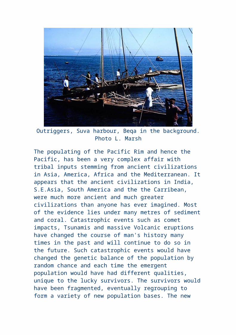
through the southern desert of Palestine during World War I to take the strategic Turkish-held port of Aqaba from the rear, so perhaps this is a comparable feat. Incidentally, Thomas Edward (T.E.) Lawrence was born on August 16, 1888 at Tremadoc in North Wales.
After the Battle of Ticinus, Hannibal fought and defeated the combined forces of Scipio and Titius Sempronius at the Battle of Trebia in December 218. Again, to defeat the Romans on their home ground was no small achievement in itself, but the victory at Trebia came about as a result of vision, ingenuity and meticulous planning, not to mention bravery. The details of this battle are easily available elsewhere, so I'll simply deal with the bare bones.
Hannibal was aware that the Romans preferred to engage in set-piece battles on open ground and at the time of their own choosing. As a result, Hannibal ensured that his men were well fed and rested during the night, then he sent out a force to attack the Roman camp and provoke them into attacking. The Romans, alarmed by an almost unheard-of night offensive, hungry and bleary-eyed with sleep, unwisely forded a freezing winter stream in an attempt to engage their enemy. They were outflanked and cut to pieces, partly because Hannibal had possessed the foresight and artifice to make his cavalrymen lie their horses down among shrubs and bushes in ambush.
In 217 BC, Hannibal fought and destroyed the Roman army of Gaius Flaminius at the Battle of Lake Trasimene. Hannibal cut off the Roman force in a defile by the lake after having concealed his own men in the trees on the slopes and among the billowing fronds of mist. In an attack whose nature presaged the later destruction of a Roman army at the Teutoberger Wald in Germany, where three legions were destroyed in AD 9 by Arminius, Hannibal attacked on three fronts, leaving the hungry waters of the lake the only course of retreat open to the fleeing Roman legionaries. In this disaster for Rome, two Roman legions perished at the Battle of Lake Trasimene, but much worse was to follow.
In the following year, in 216, there took place what was to be Hannibal's crowning masterpiece, the Battle of Cannae in southern Italy. Again, much has been written about this pivotal engagement, so I'll confine myself to what I believe are some salient observations. After the first three defeats by Hannibal, the Romans had wisely withheld from giving battle on the advice of Fabius, the Cunctator or Delayer, but by 216, they had gathered a massive army of ten legions, or something in the region of 100,000 trained fighting men with which to finally crush the Carthaginian interloper.
Let us dwell for a moment on the matter of the figures. Many ancient sources provide notoriously unreliable figures, such as when Herodotus calculated the size of an invading Persian army to number in the millions, but the Romans were just as guilty of over-estimating the size of the enemy forces and under-estimating their own, so as to make victory smell all the sweeter. For example, Tacitus wrote that in AD 61, the Roman General Suetonius Paulinus led 10,000 men into battle against a force in excess of 100,000 commanded by Boadicea, or Boudicca. There is no question that Paulinus triumphed, but Tacitus claims that 80,000 Iceni and confederates under Boudicca's command perished, against a mere 400 Roman casualties.
This means that each Roman solider effectively killed eight Britons, while it took no less than two hundred and fifty Britons to kill a single Roman legionary. Now, stranger things have happened, for example at the Battle of Dupplin Moor in 1332, where there is no question that 1,500 English troops faced a Scottish army 40,000 strong and utterly defeated it in a pitched battle. It might not be a standard historical method, but I am going to give Hannibal the benefit of the doubt, for reasons that will become clearer towards the end of this piece.
So, at Cannae, Hannibal led an army of something in the region of 30,000 men, perhaps, against something in the region of 100,000 Romans, or ten legions and their support. There are many stories told about Cannae and it is even thought that Hannibal arranged matters so that the wind blew dust into the faces of the advancing Romans, to give himself every single advantage possible. What is certain is that during the night, Hannibal had planned the forthcoming battle down to the minutest detail, while the unsuspecting Romans could barely believe their luck.
The Roman army always preferred to face its enemy in a set-piece battle on open ground and to clearly defeat it, rather than engage in any long-running guerrilla war. So here at Cannae, the dreaded Roman legions with their disciplined infantry faced an adversary on open ground, an enemy that was outnumbered by as many as three to one. Furthermore, the Carthaginian forces were thought to be inferior in quality to the Roman infantry in almost every respect.
Hannibal's demonstrable genius at Cannae was to realise that it did not matter so much how many men you brought to the battlefield, but how many of your men you could get to actually engage the enemy. Firstly, he ensured that his superior cavalry under the command of his brother Hasdrubal destroyed the opposing Roman cavalry and drove it from the field, which is what happened. However, cavalry have always been notoriously unreliable in warfare because of their tendency to lose their
heads, disperse and chase a retreating and beaten foe. One of the miracles of Cannae was that Hasdrubal not only defeated the Roman cavalry, but then rallied his entire force and returned to the battle to execute his brother's precise orders, while it was to be over eighteen hundred years before any cavalry force would show such iron discipline. Oliver Cromwell, tired of seeing his Parliamentarian horse routed as a matter of course by Prince Rupert's Cavaliers in the First English Civil War, welded his cavalry into the now infamous Ironsides and crushed the Royalists at the Battle of Marston Moor in 1644. Cromwell's horse troops went from being the whipping-boys of England into the most effective and feared cavalry on the continent of Europe, and so it was at Cannae.
Another miracle took place at Cannae, when Hannibal placed what were arguably his most unreliable troops to the fore, to face the relentless Roman juggernaut. The Iberian and Celtic swordsmen were fantastically brave but extremely unpredictable, yet Hannibal induced them to face the Roman steamroller in a convex arc. Rather than break before the machine-like onslaught from the Roman legions, the Celts and Spaniards simply gave ground, against their nature, and retreated into a concave bow. The Romans were successfully
advancing, but the Carthaginian army was also successfully enveloping
Major Battles:
- Ticinus 218- Trebia 218- Lake Trasimene 217- Cannae 216 - 1st of Nola 216- 2nd of Nola 215- 3rd of Nola 214- Capua 212- Silarus 212- 1st of Herdonia 212- 2nd of Herdonia 210- Numistro 210
Hannibal invaded Italy in 218 BC and left in 202 BC. During those 16 memorable years in a hostile foreign country, the homeland of the world's mightiest empire and most formidable army, Hannibal was never once defeated.
them. The formidable heavy Libyan infantry and remaining cavalry of Hannibal's flanks stood fast and overlapped the advancing Roman line, which was by now more of a tight mass that had been deliberately funnelled together by the press from the sides and by the seeming retreat of the Celts and Spaniards at the front.
The Libyans then moved to encircle the tightly-packed Roman legions, while Hasdrubal completed the manoeuvre by smashing into the helpless formation from the rear. Thus, with a vastly inferior force, Hannibal had succeeded in surrounding a numerically superior enemy and effectively nullified its fighting ability. Of the 100,000 or so Romans in this compact mass, only the comparatively few on the outside could engage the enemy, while the Carthaginians could bring all their forces to bear and outnumber the entire Roman perimeter. Not only that, but they could hurl stones, javelins and any weapon to hand into the static and largely impotent throng before them, certain that they could not miss.
It would be wrong to say that the Romans were anything but brave, yet there must have been tens of thousands of them who could do nothing more than stand still, packed together like sardines in a tin for literally hours while the outside of their formation was gradually hacked away. These men must have heard the screams of their dying fellows and would have had no choice other than to wait for death to strike from above, in the form of a missile, or from the side in the form of a bloodied sword or spear. They must each have died a thousand deaths before the final one mercifully arrived.
Cannae was the greatest defeat the Romans had ever known, but it is only with the passing of long centuries that its true significance has become known, illuminating in the process Hannibal's genius for warfare. It was undeniably the first ever battle of annihilation and as such, military commanders have striven through the ages to emulate Hannibal's stunning success, but to no avail. The reason for this will become apparent when we put the death toll at Cannae into some kind of historical perspective.
Given the Romans' known propensity for frankly lying about figures, many of those who have studied Hannibal believe that it is entirely possible that somewhere in the region of 100,000 Romans died that day, certainly enough to earn the site of the engagement the notorious title of 'The Field of Blood'. Given the size of the Roman forces in the field and given the undeniably overwhelming victory that Hannibal won, a figure of 100,000 Roman dead is not out of the question. What can we compare this to?
In the First Gulf War, the American General Norman Schwarzkopf admitted to trying to emulate Hannibal's success at Cannae when he attacked the Iraqi ground forces, but there is not the remotest suggestion that anything remotely like 100,000 men died, let alone in a single day. I must emphasise that it is not a pleasant procedure to compare lists of dead, but it is my purpose here to demonstrate just how lethal and effective this Carthaginian was, over eighteen hundred years ago, long before the advent of weapons of mass destruction such as machine guns and cluster bombs.
The Eastern King Mithridates ordered the death of every Roman citizen in Asia Minor and it is said by some sources that 70,000 Romans were killed in a single day as a result. The total American casualties in Vietnam amounted to 58,202 dead, according to official government sources. Even in the titanic Battle of Chalons in 451 AD, not even Attila the Hun with his vast army came close to killing as many of his Roman and allied adversaries as did Hannibal. The first day of the Battle of the Somme in 1916 claimed something in the region of 30,000 casualties and this was as a result of British soldiers wading through knee-deep mud for hundreds of yards towards waiting German machine-gun emplacements.
Again, comparisons in such a grim affair may be invidious, but the official American government figures for the initial death toll at Hiroshima was 65,000, although that figure varies greatly. Seen in this context, Hannibal's strategy at Cannae was more deadly than even a nuclear bomb; no military figure has ever exceeded the terrible toll he exacted from his enemy back in 216 BC.
In most histories of the Punic Wars, the story of Hannibal versus Rome pretty much ends there, although every authority admits that Hannibal remained undefeated in Italy for a further fourteen years, or sixteen years in total. Again, I find this absolutely stunning, that Hannibal was able to wander Italy, the heartland of the Roman Empire, unbeaten for sixteen years until he decided to return home. However, this is far from being the whole story and so I feel it's worth quoting once more from my Second Edition of the Oxford Classical Dictionary.
The Phoenician world is highlighted with purple in the map beginning in th east with Phoenicia, the motherland, and the Phoenician colonies & settlements in the western Mediterranean and the Atlantic.
"In 216 at Cannae (q.v.5) he inflicted on the Romans the worst defeat they had known. Capua and many towns in Campania and south Italy went over to him, but as the Romans refused to acknowledge defeat and central and northern Italy remained loyal to them, he had to devise a wider strategy to force them to dissipate their strength (see Punic Wars), while in Italy he vainly tried to provoke another pitched battle."
The italics at the end are mine. History is written by the victors or by those sympathetic to the victors and of course, the Roman Empire survived for many long centuries after Hannibal's death. However, I was always puzzled to read that after the Battle of Cannae in 216 BC, there should have been no further significant battles on Italian soil while Hannibal remained there. The truth emerged after some research, while the reader is welcome to look up the facts and sources for themselves. After all, I've stressed from the start that this is a personal account and not an attempt to pen an academic document.
To put it bluntly, the truth is that in 216 BC, after the Battle of Cannae, the Roman general Marcus Claudius Marcellus held off an attack by Hannibal in the First Battle of Nola. None of the accounts actually state that Hannibal was defeated, so I'd personally be inclined to read this Roman version of events as Hannibal winning and the Romans narrowly escaping an utter massacre. In 215 BC, we learn the bare details that during the Second Battle of Nola, Marcellus again repulsed an attack by Hannibal. If after Cannae, a Roman general again repulsed an attack by this mighty warrior, then I'd have expected to read details of the Carthaginians being put to flight with great swathes left dead, but it doesn't seem to be the case. Again, I'm personally inclined to give Hannibal the benefit of any doubt and conclude that he secured another victory.
In 214 BC, we read that during the Third Battle of Nola, Marcellus fights an inconclusive battle with Hannibal. At the risk of repeating my views about Roman historians, I'm truly inclined to think that the only inconclusive thing about it was the scale of the Roman defeat, because the account doesn't state that the Romans actually won, something they'd have trumpeted from the rooftops if it had been the case.
In 212 BC, it is recorded that Hannibal defeated the Consuls Q. Fulvius Flaccus and Appius Claudius in the First Battle of Capua, but that the Roman army escaped. Call me biased, but it sounds like yet another resounding Carthaginian victory to me, although again, the Romans must be given all credit for their sheer resilience and bravery against such a terrifying adversary. I've discovered that in the same year, in the Battle of the Silarus, Hannibal destroyed the army of the Roman Praetor M.
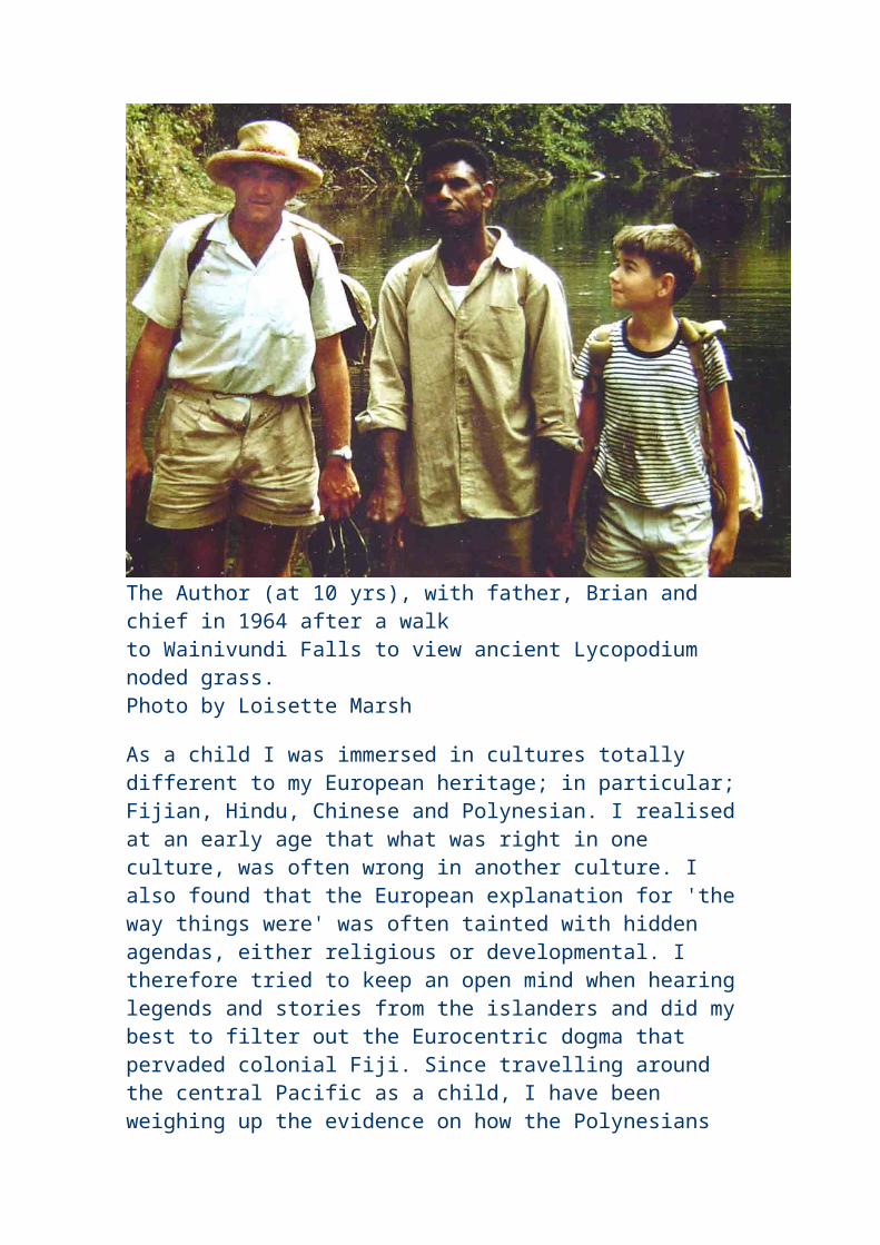
Centenius Penula, but I've not been able to find any reliable figures for Roman casualties. Still, who's counting?
Also in 212 BC, I've ascertained from the written histories (Roman, of course), that Hannibal destroyed the army - not the legion, but the army - of the praetor Gnaeus Fulvius, leaving at least 16,000 Romans dead on the field after the Battle of Herdonia. In 211 BC, Hannibal's brother Hasdrubal fought the Romans at the Battle of the Upper Baetis, killing both Publius and Gnaeus Cornelius Scipio, but as this wasn't one of Hannibal's battles, it doesn't really count. On to 210 BC, and we discover that in the Second Battle of Herdonia, Hannibal killed Fulvius Centumalus and destroyed yet another Roman army, while at the later Battle of Numistro, Hannibal defeated Marcellus once more. I suspect that a true and full contemporary account of this campaign would add even more superlatives to Hannibal's reputation, but for the time being, the bare bones are enough for me. Never
forget that Hannibal's victories were no shallow affairs, but they were full engagements with the greatest, most disciplined and most determined army the ancient world had ever known.
Such a list of achievements would surely be enough for any man, but the story still doesn't end there, far from it. After his eventual defeat at Zama by Scipio, Hannibal fought on, always keeping faith with the vow he had made to his father never to be a friend to Rome. He was betrayed by his political enemies
in Carthage and fled to King Antiochus of Syria, where he tried to raise another army to invade Italy. Had he succeeded, I have little doubt that the Romans would have suffered another sixteen years of continuous defeats at the hands of this utterly unique man.
As it was, Hannibal took a small part in some wars in Asia Minor and fought a small naval engagement off Side, where he was defeated by a Rhodian fleet commanded by Eudamus in 190 BC. In the process, Hannibal is credited with another first in military history, inventing biological warfare, due to his idea of hurling baskets and pots filled with venomous snakes at opposing ships.
The mighty Hannibal was relentlessly pursued by the Romans until he was finally surrounded and cornered in Bythinia. At the very end, he denied the Romans their triumph, as he chose to take his own life. Livy writes that he had poison in readiness and states that Hannibal's final words were as follows: "Let us ease the Romans of their continual dread and care, who think it long and tedious to await the death of a hated old man." Despite a
life of extreme hardship and personal danger in battle, Hannibal lived from 247 BC to 182 BC, a truly astonishing age for anyone in those times, let alone for a person who had risked and endured so much. It is my personal belief that he took his own life simply because he was bored, yet centuries later, Roman mothers would still frighten their badly-behaved children with what were still the ominous words "Hannibal ad portas" or " Beware! Hannibal's at the gates!" Has the world ever seen his like? I think not.
As we know, Hannibal could ultimately trace his ancestry back to what is now modern Lebanon. All things change in time, but it never ceases to fascinate me how certain parts of the world flourish and bloom in different seasons and for different reasons, then retreat quietly back into history, content that they have contributed to the immutable way of things in some great, small or else ongoing way. The rise and fall of empires continues to this day and when we study the empire, we often forget the humble hearth and home that once gave birth to the Emperor or Warrior King.
Attila emerged from somewhere out of the Russian steppes, while Alexander the Great was born in the hills of Macedonia. Genghis Khan rose up from the bleak wastes of what is now modern Mongolia, while Napoleon Bonaparte was born in a poor part of Corsica, not a place that immediately springs to mind as possessing a vast empire. Owen Glendower fought two English Kings to a standstill for fifteen blood-ravaged, fiery years and advanced further into England with an invading army than anyone has done since 1066, yet he was born in a humble farmhouse in North Wales. And so it is that whenever my children or anyone else asks me who the mightiest warrior in history was, and where the Land of his forefathers lay, I shall immediately name the incomparable Hannibal, produce a map and unhesitatingly point out to them the shores and groves of the Lebanon.
Hannibal (247 - 182 BC)by Mary Holtby
He'll be coming down the mountain when he comesIn the bitter wind that batters and benumbs
He'll be coming down the mountain and I see the vultures counting,They'll be counting up the corpses as he comes.
He was born a Carthaginian and his DadWas anxious to indoctrinate the lad
So he took him into battle and informed his offspring : 'That'llShow you something of the hassle that we've had.
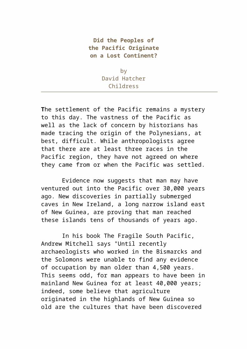
Here's an altar and before I let you go,You must swear undying hatred to the foe!'
So for all the Roman nation he declared his detestationWhich in later life he had the chance to show:
Fought bravely under Hasdrubal in SpainAnd himself at last conducted the campaign.
To restore some sort of order Rome set Ebro as a border,For a peaceable division of terrain;
But Saguntum, on the Carthaginian side,The Romans in their arrogance denied.
This Hannibal found shocking, so he gave the town a knockingAnd began to plan his celebrated ride.
For the Romans had declared the Punic War,And Hannibal remembered what he swore.
'Now that Rome has tried to burke us we shall treat her to a circusOf a kind she's not experienced before.'
So he settles on the Alps for his Big TopWhere his elephants go dancing till they drop;
At sour wine his clowns may grumble but it makes the rockface crumbleAnd in Italy the hissing has to stop.
He beat Scipio, the first upon the scene;Lured Flaminius to his fate at Trasimene;
And at Cannae (somewhat later, thanks to Fabius Cunctator)Threw a spanner in the Roman war machine.
But alas! This was the highlight of the show;His country is in trouble - he must go,
And the end of all the drama is the battlefield of Zama,Where he can't escape the scourge of Scipio.
Defeated, he still rules his native state,But the Romans want his blood and will not wait;
He flees and raises forces, but exhausting his resourcesHe eventually fixes his own fate.
Though for cruelty the Romans curse his nameAnd palpitating pachyderms may claim
That they hold the same opinion, this ingenious CarthaginianWas a hero who deserves eternal fame.
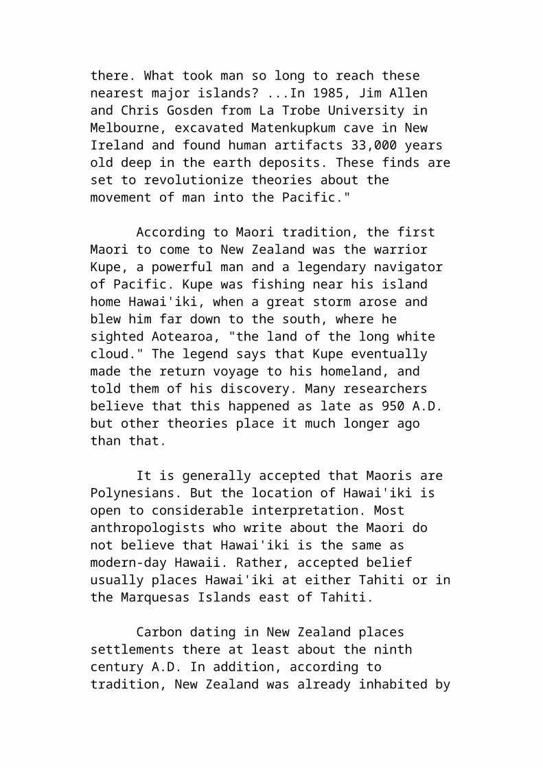
— Dennis Price, Netheravon, England Dennis Price is a classical scholar and writer
In August 1990, in what he very much hopes is a Hannibalic parallel, Dennis Price became the first western knight (in centuries?) to cross Europe and Scandinavia to take part in a mediaeval jousting tournament, in the city that was at the time named Leningrad, but which is now St Petersburg.
History of the Phoenician Canaanites
3000 B.C. to 634 A.D., Invasions, Sieges and Plunders
The Phoenicians of the Iron Age (first millennium B.C.) descended from the original Canaanites who dwelt in the region during the earlier Bronze Age (3000-1200 H.C.), despite classical tradition to the contrary. There is archaeological evidence for a continuous cultural tradition from the Bronze to the Iron Age (1200 -333 s.c.) at the cities of Tyre and Z araphath. In the Amarna age (fourteenth century B.C.) many letters to Egypt emanated from King Rib-Addi of Byblos, King Abi-Milki of Tyre, and King Zimrida of Sidon, and in other New Kingdom Egyptian texts there are references to the cities of Beirut Sidon, Zaraphath, Ushu, Tyre, and Byblos. Additionally there is a thirteenth-century B.C. letter from the king of Tyre to Ugarit, and a Ugaritic inscription has turned up at Zaraphath. Despite these facts showing that the coastal cities were occupied without interruption or change in population, the term "Phoenician" is now normally applied to them in the Iron Age (beginning about the twelfth century B.C.) onward when the traits that characterize Phoenician culture evolved: long-distance seafaring, trade and colonization, and distinctive elements of their material culture, language, and script.
The Phoenicians, whose lands corresponds to present-day Lebanon and coastal parts of Israel and Syria, probably arrived in the region in about
3000 B.C. They established commercial and religious connections were established with Egypt after about 2613 BC and continued until the end of the Egyptian Old Kingdom and the invasion of Phoenicia by the Amorites (c. 2200 BC).
Other groups invading and periodically controlling Phoenicia included the Hyksos (18th century BC), the Egyptians of the New Kingdom (16th century BC), and the Hittites (14th century BC). Seti I (1290-79 BC) of the New Kingdom reconquered most of Phoenicia, but Ramses III (1187-56 BC) lost it to invaders from Asia Minor and Europe. The roster of Phoenician cities changed during the near millennium-long period beginning in 1200 B.C., reflecting the waxing and waning of their individual fortunes and the impinging historical events of the Near East. At the beginning of the Iron Age, as part of the invasion of the Sea Peoples (groups from the Greek islands, especially Crete), the Philistines occupied the coastal area south of Mt. Carmel, including Dor, Ashdod, Ashkelon, and Gaza. By the eighth century B.C., however, the material culture of the Phoenicians extended southward, and Sidon controlled Dor and Joppa during the Persian period (539-333 B.C). The Achaemenians, an Iranian dynasty under the leadership of Cyrus II, conquered the area in 538 B.C. Sidon became a principal coastal city of this empire. The history of Tyre and Sidon is intertwined (indeed they were only twenty-two miles [35 km.] apart). Classical tradition suggests that Sidon was the more powerful at first but by the tenth century B.C. Tyre dominated. Tyre's kings ruled a stretch of the coast that included Sidon and often they were referred to as kings of the Sidonians (1 Kings 16:31).
This Monument at Nahr el Kalb (Dog River) served, across the ages, as the s visitors' register or depository of "business" cards of invaders. The hill that rises directly from the sea contains engravings and inscriptions of invaders of Phoenicia for thousands of years. There
are ancient inscription such as those made by Pharaohs or the Allied Forces of the First and Second World Wars.
There were no major Phoenician cities north of Arvad, but Phoenician influence extended into Cilicia in the ninth and eighth centuries B.C. Obscurity surrounds the emergence of Phoenician culture during the twelfth and eleventh centuries B.C. In a foray, the Assyrian king Tiglathpileser I (1114-1076 B.C.) sojourned at Arvad and received tribute from Byblos and
Sidon, and there are archaeological data from Tyre and Zaraphath for this period. The Egyptian Tale of Wenamun, dating to the mid-eleventh century B.C., graphically portrays the decline of Egyptian prestige and power in the Levant. This was due in part to the invasions of the Sea Peoples and the general disruptions of Late Bronze Age cultures throughout the eastern Mediterranean, with the collapse of Mycenaean and Hittite cultures and the destruction of city-states in the Levant. Trade was severely affected. In the aftermath of the disruptions and the power vacuum a new order emerged in which flourishing Phoenician settlements replaced such destroyed centers as Ugarit on the coast of northern Syria. Instead of the Levant being the recipient of Aegean wares, Phoenician cities began exporting goods and services.
In the 10th century B.C. the city state of Tyre rose to hegemony among Phoenician states and founded colonies throughout the Mediterranean region. During the same time, Tyre strengthened its influence over the northern kingdom of Israel. Phoenician influence is also to be seen in the region of Cilicia at Zinjirli where King Kilamuwa, probably Aramaean in origin, chose the Phoenician language and script for a long inscription at the front of his palace. Other Phoenician inscriptions come from the same region in the following centuries Azitiwada marked the rebuilding of his city with bilingual inscriptions in Phoenician and hieroglyphic Hittite at Karatepe. The strong Phoenician influence in Cilicia may be due to trading activities in a network including Urartu, the northern rival of Assyria in the ninth and eighth centuries B.C.
The pace of Assyrian activity in Phoenicia quickened in the ninth century B.C. when Ashurnasirpal II, Shalmaneser III, and Adadnirari III exacted tribute and taxes from Sidon, Tyre, and other Phoenician cities. Assyria was gradually extending its control over the Levant. As a result of the far-reaching reorganization of the Assyrian Empire by Tiglathpileser III (744-727 B.C.), the nature of the impact on Phoenicia changed from one of occasional demands by raiding armies to incorporation as vassals into the
empire. Many cities lost their autonomy altogether and became part of Assyrian provinces administered by governors; for example, an Assyrian province of Simyra was established by Tiglathpileser III.
During Sennacherib's reign (705-681 B.C.) he crushed a serious revolt by coastal cities in 701 B.C. and forced Luli (Elulaeus), king of Tyre, to flee to Cyprus (see graphic depicting escape to Cyprus), where he died. Later Sidon revolted against the Assyrian ruler Esarhaddon (681-669 B C.) who in 676 B.C. sacked and destroyed it and in its place built a governor's residence, called Kar-Esarhaddon, for a new Assyrian province. He also made a treaty with Baal, king of Tyre. Ashurbanipal (668-627 B.C.) laid siege to Tyre and Nebuchadnezzar besieged it for thirteen years (586-573 B.C.; Ezek. 26-28: 19).
Sidon reemerged as the dominant city of Phoenicia in the Persian period (539-333 B.C.) and led a Phoenician contingent in the Persian wars of the early fifth century B.C., helping bridge the Hellespont and fighting at Salamis.
Herodotus and Phoenician historyby Nina Jidejian
Everyone, at some time or another, has read about the Greek and Persian wars fought during the sixth to fourth centuries B.C. What he perhaps does not know is that the Phoenicians played an important role in this great historical drama.
The reason is simple.
Persia is not a sea power and is land locked in Asia Minor and on the East Mediterranean coast with a formidable array of soldiers from many nations.
The Phoenicians, on the other hand, have the fleets, the navigators, the seamen and the "know-how". Guided by the stars they sail at night over dark, dangerous, uncharted waters, guided only by the stars. An arrangement is therefore reached with the kings of the Phoenician cities to furnish a fleet to the Persians provided they are not bothered by them at home.
Soon after Greece is invaded by Xerxes, the Persian "King of Kings". Bloody battles on land and sea follow. Sporadic fighting spreads to the Greek islands and Cyprus.
Then in 333 B.C. Alexander the Great at the head of his Macedonian phalanxes crosses the Hellespont in pursuit of Darius Codamannus, the Persian king, thus bringing the war into Asia. City after city go over to him.
Alexander's conquest of the East ushurs in the Hellenistic Age. With the spread of Greek culture and ideas, a new political and social order arises and travels to the farther reaches of his empire contributing to fashion the course of the modern world in which we live.
The Greek and Persian Wars550 to 330 B.C.
Herodotus is a Greek born during the fifth century B.C. in Halicarnassus, southwest Asia Minor. Centuries before his time the Greeks abandon their homes on the mainland, put their families and belongings in ships and sail eastwards across the Aegean. Some settle for good on the islands, others found a number of Greek cities all along the coast of Asia Minor.
As a young man Herodotus, intelligent and inquisitive, displays a great gift for story-telling. He wanders freely throughout a large part of the great Persian empire recording all he sees and hears. He is the world's authority on the Greek and Persian wars that shook the ancient world so long ago.
This is his story.
Soon after his conquest of the empire of the Medes, Cyrus, king of Persia, is attacked by a coalition of the other great powers of the day: Babylon, Egypt and Lyclia who come to fear him, joined by Sparta, the greatest military power of Greece. In the spring of 546 B.C. the richest and most powerful man in the world, Croesus, king of Lydia, advances into Cappadocia, Asia Minor while the other kings are still feverishly gathering their troops for battle. But Cyrus cleverly attacks first, marches one thousand miles overland, even through the outlying provinces of Babylon. He defeats Croesus and follows him to his capital city. In the autumn of 546 Cyrus storms Sardis and orders that Croesus be taken alive. The Lydian kingdom henceforth becomes a province of Persia.
The gateway to Greece and the Near East now lies open before the Persian king. The Ionian Creek cities of Asia Minor, the Carians, the Lycians and the king of Cilicia humbly acknowledge Persian supremacy.
War with Babylon is inevitable. In a single swift campaign, Cyrus destroys the mighty kingdom. The army of King Nabonidus is defeated and Babylon surrenders without resistance in October 539.
In Sidon at this time Mapen and his sister Myrra live in a little stone house near the port. Their father, Elibar, is a carpenter and is greatly respected for his ability and his skill. Not only does he saw heavy logs of wood with precision for sea-faring galleys but he can also carve smaller bits of wood
into various objects: luxury boxes to hold jewelry, plain boxes to hold precious spices, wooden toys with which children can play: a cow, a horse, a dog and even a small doll for Myrra. Children follow him closely when he walks through the streets of Sidon, hoping for a toy.
Mapen and Myrra not only love their father but are very proud of him. They love their mother too, because she keeps the little stone house spic and span. She also welcomes her children's friends with warmth at any time.
Life is peaceful in Sidon. At nightfall around the fire their parents talk about what is happening in Babylon. But all this is so far away.
Then one day the mighty king of Babylon is no more. The king of Persia from afar assumes sovereignty over Babylon's possessions on the east Mediterranean seaboard. Thus Sidon, Tyre, Byblos, Beirut, Arvad (Ruad) and the other port cities are left to themselves to enjoy a period of freedom and peace.
Great excitement spreads in Sidon and Tyre when news arrives that all displaced persons by order of Cyrus can now return to their homelands. The Jews taken to Babylon by Nebuchadnezzar are allowed to proceed to Jerusalem. Cyrus grants a royal concession of Phoenician timber to the Jews to rebuild Jerusalem and their temple. Phoenician artisans make their way to Jerusalem to take part in the reconstruction of the city. In the Old Testament, Ezra (3.7) infers that Jews and Phoenicians renew commercial relations:
"So they gave money to the masons and the carpenters and food, drink and oil to the Sidonians and Tyrians to bring cedar trees from Lebanon to the sea to Joppa, according to the grant that they had from Cyrus, king of Persia."
Cedar trees are cut on the mountains of Lebanon and rolled down the slopes. Logs are tied one to the other and dragged by teams of oxen to the port of Byblos. There they are lashed together with heavy ropes into rafts and floated down the coast.
From afar Mapen and Myrra see the logs arriving. There is a frightening sound as they collide against each other. In the port there is a large galley
ready to carry the carpenter and stone masons. Elibar hugs his wife and children tight to his bosom and embarks for Tyre to pick up more artisans and then sails further south.
A year goes by . . . The children miss their father. Then one day from afar, a galley is seen slowly approaching the port. Mapen and Myrra rush to the shore. They are overjoyed to see their father once again. He has worked hard, has been well-paid and has a leather pouch full of gold pieces. But he is glad to return to the little stone house in the port. There the family receives relatives and friends who eagerly listen to the stories Elibar tells them about Jerusalem, the temple and other unfamiliar sights.
Peace reigns in the region. Trade prospers. Herodotus (1.143) tells us that the Ionian Greeks too and those living on the Greek islands in the Aegean have nothing to fear from the Persians. For the Phoenicians alone control the sea routes and are free to come and go. The Persians are not seamen nor do they have a fleet.
The situation however soon changes. Egypt alone remains unconquered by the king of Persia. In 529 B.C. Cyrus dies and is succeeded by his son, Cambyses. The conquest of Egypt is necessary if Persia is to dominate the east Mediterranean world. The Mediterranean seaboard must be taken but first an understanding reached with the kings of the Phoenician cities to supply Persia with the necessary ships and crews.
An arrangement is therefore made whereby the kings of the city-states place their fleets at the disposal of the Persian monarch. In return the cities are not occupied and are allowed to retain their native kings. All during the Persian period of domination (550 to 330 B.C.) the kings of the Phoenician cities command their naval contingents and are treated as friends and allies.
In 525 B.C. Cambyses captures Pelusium in the Delta. The fall of Memphis completes the Persian conquest of Egypt.
When Cambyses plans a campaign against Carthage, the Phoenicians refuse to sail because they consider the city is a colony of Tyre. Cambyses abandons the expedition. Herodotus (3.19-20) explains:
"Cambyses did not think fit to bring pressure to bear because the Phoenicians had taken service under him of their free will and his whole naval power was dependent on them."
Cambyses dies. The year 521 B.C. marks the accession of Darius Hystaspis. Darius believes that the greatest danger to the Persian empire is
a rebellion in a distant province. To prevent power being held by one man, he appoints three officials in each province: a satrap, a general and a secretary of state. independent of each other they spy on each other and report to the king direct.
Herodotus (3.91) lists the twenty satrapies of the Persian empire and the taxes paid by each. Phoenicia is united with Syria, Cyprus and Palestine in the Fifth Satrapy and is taxed lightly compared to the others.
Darius is the first Persian king to coin money. The Maric", a gold coin weighing 130 grains, soon becomes the gold currency of the old World. Herodotus (4.168) tells us that silver coinage, also called Maric% is subsequently minted by a Persian satrap in Egypt.
Darius realizes the importance of good communications to hold his empire together. He orders that a royal highway with one hundred and eleven post houses link Sardis in Lydia to Susa in southern Persia. Herodotus (4.52-56) travels on this royal road. At the post houses tired horses are exchanged for fresh steeds for the onward journey. Royal courriers find shelter and the much needed rest.
But trouble is now brewing in the provinces. The Ionian cities in Asia Minor revolt against Persia. The revolt spreads to Caria and the island of Cyprus. Darius orders the Phoenician cities to assemble a fleet. Ships are sent to Cilicia to transport Persian troops to Cyprus. The fleet anchors in the bay opposite Salamis, Cyprus, facing the Ionian fleet already there. This is the very first encounter at sea between Phoenicians and Greeks. The Phoenicians lose the battle but Persian land forces gain a victory over the Cypriotes. Hatred flares up between the Phoenicians and the Greeks for the Greeks in the Aegean are a serious threat to Phoenician domination of the commercial sea lanes.
A series of rebellions follow. Sardis is taken and burned to the ground by Athenian and Ionian forces.
Next the Creek cities in Asia Minor rebel against Persia. Herodotus (5.106) tells us that in his anger Darius commands one of his attendants to repeat to him three times whenever he sits down to dine: Waster, remember the Athenians".
A great clash is in the offing. The decisive battle between the Ionian Greeks and Persia occurs at sea In the naval battle of 494 near the island of Lade opposite Miletus, the Persians with the Phoenician fleet defeat the Ionian Greeks of Asia Minor.
Darius is pleased with the outcome of the battle and realizes that the conquest of mainland Greece will not present much difficulty. He decides to lead his army through Thrace and Macedonia with the ultimate goal of punishing Athens. Herodotus (3.136) tells us that he has already sent a spying mission of Persian nobles in Phoenician ships to the coast of Greece.
The Phoenician cities furnish a large part of the fleet led by the Persian general Mardonius in the year 492 But heavy losses occur when the ships are dashed against the rocks of Mount Athos and most of the fleet sinks.
Then comes the Persian setback at Marathon in 490 B.C. The Persian archers are cut down by the Greek phalanx of hoplites.
In 485 Darius dies and with the accession to the throne in 481 of his son Xerxes we are about to witness the greatest expedition of all times.
Forces are drawn from every quarter of the Persian empire. Two bridges are thrown across the Hellespont, the narrow strait that divides Europe from Asia (called the Dardanelles today).
At Abydos on the Propontis a lofty seat of white stone is carved out on the hilltop to enable Xerxes to look down on the seashore where his army and fleet are assembled. A race of ships is organized in his honor and the ships of Sidon win, to the king's great pleasure. Xerxes shows a marked preference for Phoenician vessels, the Sidonian ones in particular.
Riding in his chariot, the king drives past the men of each nation, foot soldiers and cavalry, questioning them while his scribes write down the answers. Then the king alights from his chariot and, according to Herodotus (7.100) boards a ship of Sidon, sitting under a golden canopy. He sails past the prows of all the ships assembled before him, questioning the seamen and ordering that their answers be written down.
The loss of the fleet in the previous expedition off the rocky coast of Mount Athos prompts Xerxes to order that a canal be dug through the isthmus to allow his ships to pass in safety. No sooner this is done, however, the sides cave in. Phoenician engineers, Herodotus (7.23) writes, rescue the project.
in the section of the canal allotted to them, the Phoenicians dig a trench double the width at the top than at the canal level thus preventing wall collapse. The other engineers follow the Phoenicians'. example.
Xerxes, at the head of his army, marches into Thessaly and quarters his troops at Therma, Macedonia. There he embarks on a ship of Sidon to reconnoiter by sea. After the Persian victory at Thermopylae, Xerxes gives orders to proceed to Artemisium, where the Greeks await him. A fierce battle ensues. The Athenians and Sidonians fight bravely.
But the decisive battle is yet to come. Before throwing his troops into battle at Salamis, Greece, Xerxes holds a council of war. His high esteem for the king of Sidon is seen by the place assigned to him at the meeting. Herodotus (8.67) tells us "First in place is the king of Sidon and next the king of Tyre." Among the kings and princes of Phoenicia who sail with Xerxes, Herodotus (7.98) records, are Tetramnestus, son of Anysus of Sidon, and Matten, son of Sirom (Hiram) of Tyre.
Xerxes has one woman admiral. She is Artemesia, a widow, in command of the naval contingents of Halicarnassus, Cos, Nisyra and Calydna in Asia Minor. She is the only one to object to plans for a battle at sea, claiming that the Greeks are far superior to the Persians in naval matters.
On Mount Aegaleos Xerxes surveys the naval engagement from his silver footed throne. The narrowness of the straits at Salamis and the fact the Greeks are fighting in home waters leads to the defeat and flight of the Phoenician ships. When some of the captains appear before him to furnish explanations, Xerxes has them executed on the spot. Other Phoenician commanders become so alarmed that they desert the fleet and sail away.
This is perhaps the reason why for the next fifteen years there is no record of Phoenician contingents in the service of Persia's kings. In 465, however, the victorious Athenians threaten Cyprus. The Phoenician fleet appears in support of the Persians once again as many of the cities of Cyprus are Phoenician colonies. From 465 to 390 B.C. they protect Cyprus from the Athenians and more than once fight them off.
During the Persian period Phoenicians find the time to do a bit of business on the side and exploit mines on the island of Thasos. Herodotus (6.47)

claims to have seen them: "A whole mountain has been turned upside down in the search of gold."
In the early fourth century B.C. a very important political development takes place. Tripolis in north Lebanon is founded by Aradus, Sidon and Tyre. These cities are united by federal bonds. A historian living in the first century B.C., Diodorus Siculus (16.41.1-2) records that they convene a common council or "parliament" in Tripolis, the first to be held in the East Mediterranean world.
In the meantime, the pharaohs of the Twenty-ninth and Thirtieth dynasties stir rebellions in Cyprus against the Persians. Repeated attempts by the Persian king to regain Egypt, conquered earlier by Cambyses, fail. The Phoenicians and the kings of Cyprus now show open contempt of the Persians. In 366 the Phoenician cities join dissident satraps who wish to break away from the empire. In 358 Artaxerxes Ill (Ochus) ascends the throne of Persia. He feels he cannot deal with any rebellion until he conquers Egypt. His failure to do so brings forth the great Phoenician revolt led by Tennes, king of Sidon.
The Persian king's satraps and generals dwell in Sidon. Nearby is a beautiful royal park, where the kings of Persia hunt called the paradeisos in Creek (from the old Persian term pardes, meaning "garden"). This Greek word has been passed on from one generation to another to mean "paradise" in our days, a place of beauty and delight.
The first hostile act of the Sidonians is to cut down and destroy the royal park, then they burn the fodder for the horses. Next they arrest Persian officials.
Ambassadors are sent to Egypt to seek aid from the pharaoh. In return, King Tennes receives four thousand Creek mercenaries. Adding these men to his own forces, Tennes defeats the satraps and drives them out of Phoenicia.
The year is 351 B.C. Artaxerxes 111 is in Babylon and hastily assembles a large army. News of its great size reaches Tennes. Fearing that his forces cannot hold them off, the king of Sidon treacherously decides to come to secret terms with the Persians in order to save his own life.
Without the knowledge of his people, Tennes sends Thettalion, a faithful attendant, to the Persians with a promise he will betray Sidon. Tennes will also assist the Persian king defeat Egypt, for according to Diodorus (16.43.2), he is familiar with the topography of Egypt as well as the

landing-places along the Nile. Thettalion returns to Sidon and reports on the success of his mission.
The conquest of Egypt at this point is of great importance. Persian envoys are sent to the cities of Greece for reinforcements. Thebes despatches one thousand men, Argos sends three thousand and the Ionian Greeks of Asia Minor send six thousand. Artaxerxes does not wait for them to arrive and, at the head of his troops, marches on Sidon.
The Sidonians dig triple ditches and raise high fortifications. They store up food, armor and missiles. In wealth and resources Sidon by far excels her sister-cities. There is an important number of Greek mercenaries available ready to fight. More important still is the fact that Sidon possesses over one hundred triremes and quinqeremes.
All this feverish activity raises the suspicion of young Straton, the son of a respected palace official. For some time now his father has remained at court all the time and has not come home at night. From an upstairs window Straton can easily see who enters and leaves through the palace gates. He begins to fear for his father's life.
In those days it was usual for a king to hire foreign mercenaries to swell the ranks of his army. These men are paid generously for their services. Since they love money, adventure and the dangers of warfare, they are proud of their condition and insolently swagger through the streets of Sidon. Straton does not trust them, nor does he like them. After all, a man who is paid for his services can easily switch to another master if the pay is better.
Tennes in secret confides to Mentor, the commander of the Greek mercenaries in Sidon, that he plans to hand over the city to the Persians. Leaving him in control behind, the king at the head of five hundred citizens, leaves the city pretending he is going to meet with the kings of other Phoenician cities to plan a united strategy. On this pretext he also takes with him one hundred of the city's most distinguished citizens to serve as advisors. Among them is the father of Straton.
Upon approaching the Persian camp, Tennes and the one hundred Sidonians are suddenly seized and handed over to the king. Artaxerxes welcomes Tennes as a friend but has the dignitaries executed as the instigators of the plot. Then come the five hundred Sidonian notables carrying olive branches as suppliants. They too one by one are shot down and fall to the ground.
Tennes assures the Persian king that he will now deliver Sidon to him. He leads the way and approaches the part of the fortifications held by Mentor and the Greek mercenaries. They allow the Persians inside the city walls. Thus Sidon, by Tennes' betrayal, is secretly delivered to the Persians. Now that Tennes is of no further use to him, Artaxerxes at once has him put to death.
Unaware of their king's betrayal, the Sidonians in the meantime take many precautions to defend their city. They burn all their ships so that the townspeople will remain to fight off the Persians and cannot secretly sail away.
Diodorus (16.45.3-6) tells us that when the Sidonians see the myriads of soldiers entering the city and swarming over the city walls, they shut themselves, their wives, children and servants in their houses. Straton and his mother do the same. Once the doors and windows are bolted securely, they set their homes on fire. Plumes of dust and smoke rise over the city. About forty thousand perish in the flames. A vast amount of silver and gold is melted down by the fire. This treasure is gathered up and later sold by the Persian king for many talents.
News of the disaster that has destroyed Sidon spreads far and wide. The remaining Phoenician cities, panicstricken, go over to the Persians. After the destruction of Sidon and the arrival of his Greek mercenaries, Artaxerxes marches towards Egypt. The pharaoh picks up all his possessions and flees to Ethiopia. Artaxerxes installs a Persian satrap in Egypt and. starts the long march back to Babylon. The year is 350 B.C.
Alexander the Great356-323 B.C.
Far away in Macedon Philip 11 (382-336 B.C.) becomes king. He gathers together a large force of infantry and the phalanx to support his cavalry and looks eastward, fired by ambition, to free Asia Minor of the Persian king.
He marries Olympias, the wild, witch-like daughter of the king of Epirus. According to Plutarch in his Life of Alexander (2.3-4) when newly wed, Philip comes upon his wife asleep with a serpent by her side. He is filled with revulsion and fears her as an enchantress.
Alexander, born of their union, is a fair-skinned handsome youth, quick to anger. He studies under Aristotle, the most celebrated philosopher of his time and has Leonidas as a tutor, a man of stern temperament. Alexander
thus becomes a great lover of all kinds of knowledge and always puts Homer's Iliad with his dagger under his pillow when he sleeps.
Alexander's faithful companion in both battle and the hunt is his horse Bucephalus. Plutarch (6.1-4) records that Alexander, barely fifteen years of age, tames this tempestuous and unruly steed. Bucephalus is brought before Philip by a Thessalian who demands an exorbitant sum of thirteen talents in exchange. No sooner does an attendant attempt to mount him, the horse rears up and tosses him to the ground. As the horse is being led away, Alexander exclaims that he is able to mount him. Philip mocks his son and asks him what sum will he pay in case he is unhorsed. Alexander replies that he will pay his father the full price of the horse. The king and his attendants burst out into loud laughter. Unabashed, Alexander runs to the horse and turns him directly towards the sun, for the youth had observed that Bucephalus is afraid of the motion of his own shadow. He then leads the horse forward, stroking him gently, and with one nimble leap, mounts him, lets him go at full speed and gallops away. Philip and his attendants look on in wonder. When Alexander dismounts, according to Plutarch (6.5), Philip embraces him and says: "0, my son, look thee out a kingdom equal to and worthy of thyself for Macedonia is too small for thee."
In the following years Philip's estrangement from Alexander's mother, Olympias, leads to other marriages. At his wedding to the youthful Cleopatra, Attalus, the bride's uncle in a drunken fit implores the gods to give the couple a lawful heir to the kingdom. Alexander is outraged by this affront and throws his drinking cup at Attalus' head. When Philip rises in anger with his sword drawn to attack his son, his foot slips and he falls to the ground. Plutarch (9.4-5) records that Alexander says insultingly: "See there, the man who makes preparations to pass out of Europe into Asia, overturned in passing from one seat to another."
After this incident Alexander and his mother withdraw from Philip's court. The sullen and jealous queen travels to Epirus, Alexander to Illyria. Friends of the family bring about a reconciliation, although short lived.
After subjugating his neighbors, Philip crosses into central Greece. In 337 he is in the Peloponnesus where he holds a congress of the Greek states at the Isthmus. A Hellenic league is organized that acknowledges Philip in the military command and furnishes contingents for an expedition against Persia.
In 336 Philip is murdered during the marriage festivities of his daughter in Aegae, Macedon. He leaves behind him a kingdom beset by troubles, but at
the same time, the Macedonian army that enables his son within ten years to change the face of the old World.
Alexander is barely twenty years old when Philip is murdered. The countries surrounding Macedonia want to free themselves of its rule. The Greek cities are on the verge of rebellion. Alexander puts down the revolts and at the general assembly at the Isthmus, the Greek cities agree to join him in the war against Persia and proclaim him their general.
Public officials and philosophers come from all parts of the land to congratulate Alexander -- all but Diogenes of Sinope who is living at the time in Corinth. According to Plutarch (14.1-2) he does not even bother to leave Cranium, the suburb where Alexander finds him lying in the sun. When the philosopher sees so much company about him, he raises himself a little and glances at Alexander who asks him kindly whether he wants anything. "Yes", Diogenes replies, "I would have you stand from between me and the sun." Alexander is struck by this answer and is so impressed by the man that, as he goes away, he tells his followers were he not Alexander, he would choose to be Diogenes.
Alexander's aim is to strike at the heart of the Persian empire and ultimately conquer the entire East. He crosses the Hellespont into Asia and at Troy sacrifices to Athena, goddess of wisdom, and honors the memories of the heroes buried there.
The Persian advance guard is encamped on the further bank of the Granicus river. Except for a few hand-picked soldiers and a body of Greek mercenaries, the Persian king depends upon oriental recruits, large in number but weak in fighting power. Alexander crosses the river on horseback and is met by a shower of arrows. He charges, horse against horse with his raised lance. While the horsemen are thus engaged, the Macedonian phalanx crosses the river. The Persians take fright and flee leaving the high roads of Asia Minor open to the young Macedonian conqueror.
News of this military disaster reaches Darius. At the head of a large force he marches toward Cilicia to engage Alexander in battle. Their armies meet at Issus (near modern Alexandretta) in October 333. Alexander fights in the foremost ranks while his army closes in on the Persians, putting them to flight. Darius narrowly escapes, leaving behind his queen, his daughters and court officials.
Now the gates of the Near East lay open before Alexander. However he does not pursue Darius. It is of strategic importance for Alexander to
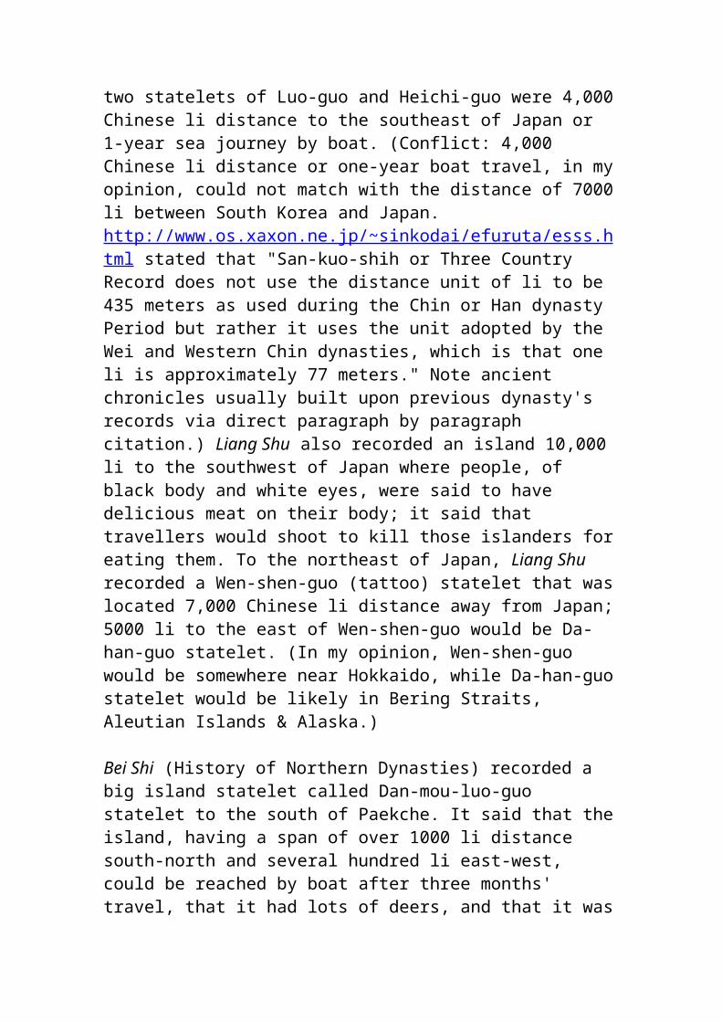
control the naval bases from which the Persian fleet operates. So he marches instead on to Phoenicia.
Eye witness accounts of the daring exploits of Alexander unfortunately do not exist. What we know about him comes from secondary sources. Arrian (first century B.C.) refers to the works of Ptolemy, a general of Alexander, and Aristobolus, whose writings are lost. Diodorus Siculus (first century B.C.) and Quintus Curtius (first century A.D.) no doubt had access to earlier histories that have been destroyed.
Surprisingly enough, very few likenesses of the young Macedonian conqueror have come down to us. Plutarch (4.1) records that the finest statues of Alexander were made by Lysippus for he was the only sculptor tolerated by the young man. Even the inclination of Alexander's head a little on one side towards his left shoulder was reproduced in marble and was imitated afterwards by the generals who succeed him in an effort to emulate him. Coins minted during Alexander's reign have on the obverse the head of the god Heracles wearing the lion skin. Portraits of Alexander only appear later on the third century B.C. coins of Lysimachus, king of Thrace. Here Alexander appears as a god wearing the sacred horns of Ammon.
As Alexander moves down the coast, the Phoenician cities are panic-stricken. The Persian fleet is manned by Phoenician crews and the kings of the Phoenician cities are at the time at sea with the fleet.
Independent of each other, each city adopts a position that suits it best. Aradus (Ruad) is the most northern of the Phoenician city states. The king's son Straton, according to Arrian (2.13.7-8), hastens to welcome him and lays on his head a golden crown. He yields to Alexander the island of Aradus and Marathus, a great and prosperous city which lies opposite on the mainland (modern Tartous).
Byblos (Gebal) surrenders without resistance. The king ruling at the time is called Ayinel. He is away sailing with the Persian fleet. Alexander leaves Byblos behind him and marches on to Sidon.
Sidon was dealt a severe blow in 351 when Artaxerxes took the city. Many Sidonians perished in the flames and the memory of this disaster lives on. The city is ruled at the time by a puppet of the Persians and Alexander is determined to get rid of him.
Hephaestion, the trustworthy companion-in-arms of Alexander, is given the mission to choose a new king. He finds two Sidonians, each one is worthy
to rule. However it is the custom in Sidon that the king should come from royal stock, so the choice falls upon a man, distantly related to the royal family. This man, modest and poor, lives in the suburbs of Sidon where he cultivates a small garden.
Hephaestion delegates the two Sidonians to bring him before Alexander. They find him, Abdalonymous by name, in his garden plucking weeds. As he stands up to greet them, the two men dismount from their horses and hail him as king. They give him royal garments to wear and accompany him to Alexander in his camp.
Gazing at him steadily, Alexander tells Abdalonymous that after all the years he has lived in poverty and privation, he will now become powerful and rich. Quintus Curtius (4.1.24-28) records that the new king of Sidon puts out his grimy, work-worn hands and replies: "These hands having nothing, I lack nothing." Alexander is impressed by these words and leaving him to rule Sidon, he marches south to Tyre.
The king of Tyre is at sea with the Persian fleet. So a delegation headed by the king's son and noblemen comes out to meet the invader. It is of strategic importance for Alexander to take Tyre as the city is an important base for the Persians.
Alexander uses the pretext that he wishes to enter Tyre in order to sacrifice to Heracles, for the kings of Macedon hold they are descended from the god. Once Tyre is his, Alexander believes, all the Phoenician ships will desert the Persian king and come over to his side.
Confident in the fortifications of their island city, the Tyrians object. They realize the danger is great should Alexander enter their city. So they send envoys to Alexander telling him that there is a temple of Heracles on the mainland at Palaetyrus (old Tyre), suggesting that he offer sacrifices to the god there.
Alexander's face reddens with anger at this affront. He threatens to join the island fortress to the mainland by an artificial isthmus, turn Tyre into a peninsula and bring his powerful siege engines up to the city's walls.
That night Alexander falls asleep and has a dream. He sees Heracles stretching out his right hand to him to lead him into the city. The seers are summoned by him at once. Tyre would be taken with great toil and difficulty, they predict, for toil is the mark of Heracles' achievements.
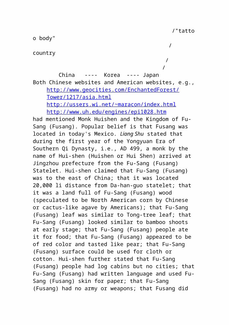
It takes Alexander seven months before he can enter Tyre. A strait of four stadia separates the island city from the mainland and is especially exposed to southwest winds. Alexander orders that large stones and tree trunks from the mountains of Lebanon be brought down to the coast and cast into the sea. As long as the building of the mole is near the mainland, work goes on smoothly enough but as his men get into deeper water and nearer the city, a volley of arrows fall around them shot by archers positioned on the walls. Tyrians sail up on either side, mocking and harassing them.
Alexander orders that two towers be built on the mole equiped with siege engines. Hides and skins cover the towers so they can not be pelted with fire darts. The Tyrians fill a large horse-transport ship with dry boughs and other combustible materials. They fix two masts on the prow, each with a projecting arm from which is suspended a cauldron filled with bitumen, sulphur and other highly inflammable materials. The stern of the vessel is loaded with stone and sand and is thus depressed. In this way the prow is elevated so it can easily glide over the mole and reach the towers. The Tyrians wait for a wind blowing towards the mole and tow the ship astern with triremes. Running the "fire-ship" at full speed upon the mole, they set torches to the combustible materials. They dash the ship violently against the mole and the cauldrons scatter the fiery mass in all directions. The crew of the burning ship easily swim away to safety.
The kings of Aradus and Byblos hear that their cities are in Alexander's hands. They promptly desert the Persian fleet and arrive with their contingents and Sidonian triremes to side with Alexander. The kings of Cyprus learn that Darius has been defeated at Issus and sail to Sidon with one hundred and twenty ships. Triremes arrive from Rhodes, Soli, Mallos, Lycia and a fifty-oar from Macedon.
Arrian (2.20.3) records: "To all these Alexander let bygones be bygones supposing that it was rather from necessity than choice that they had joined naval forces with the Persians."
While all the ships are being prepared for battle and his siege engines fitted for the final assault, Alexander with some of his archers and cavalry march to the Anti-Lebanon. He conquers part of the country, others readily surrender.
The Tyrians have no choice but to go on the offensive before Alexander attacks. The enemy fleet must be sunk, including the ships of their sister-cities. This is not an easy task because ships from Cyprus are blocking the mouth of the "Sidonian" port, so-called because it faces north towards Sidon. Plans must be made in secret. So sails are spread before the entrance
of the harbor to hide their preparations. At midday when the Cypriote sailors are not on their guard, the Tyrians set sail with their bravest seafighting men and attack the surprised enemy, sinking several ships.
Alexander is infuriated by this setback. He orders his ships at once to sea to blockade the harbor. Those on the walls of Tyre see this and try with shouts and gestures to beckon their men to turn back. It is too late. Wheeling their ships about, the Tyrians attempt to sail back to the harbor. A few manage to get to safety but Alexander's naval forces put most of them out of action. Some of the crew jump overboard and swim to land. This victory allows the Macedonians easier access to Tyre's city walls. The battery rams are brought up against the walls. The fortifications on the mole are so high the Macedonians are unable to scale them.
Alexander is forced to turn south to the "Egyptian" port -- that facing Egypt -- testing the walls on his way. There, a part of the city's fortifications have broken down. Bridges are thrown over the walls but the Tyrians repulse the attack.
A great fear now arises in Tyre. Quintus Curtius (4.3.22) tells us that a rumor spreads like wildfire that the god Apollo is about to leave the city. The Tyrians bind the statue of Apollo with a chain of gold to its base and attach the chain to the altar of Heracles, their patron god, hoping that he will hold Apollo back.
Alexander has another dream. In it he sees a satyr mocking him at a distance and eluding his grasp when he tries to catch him. Finally after much coaxing, the satyr surrenders. Plutarch (24.5) records that the seers are called in and dividing the word satyros into two parts, say to Alexander plausibly enough: "Tyre (Tyros in Greek) is to be thine."
The final assault is frightening. Triremes are ordered to sail both to the "Sidonian" and "Egyptian" ports in an effort to force an entrance. Alexander's ships close in on the city from all sides and bridges are thrown over the walls from the vessels. Crossing over and advancing through breaches in the walls, the Macedonians now easily fight off the Tyrians. Both harbors are forced and the Tyrian ships are captured.
A large number of Tyrians desert the walls and barricade themselves in the Shrine of Agenor. This monument is particularly revered by the people of Tyre for, in legendary tradition, Agenor is their king, the father of Cadmus and Europa. According to Arrian (2.24.2) it is there that Alexander attacks them with his bodyguards. There is a bloody massacre. The Macedonians are infuriated, Seeing themselves at last masters of the city, they fall

mercilessly on the Tyrians. They are also determined to avenge the death of their companions, who when sailing from Sidon earlier, are captured by the Tyrians. These men are dragged up on the walls, executed in full view of Alexander's forces and flung into the sea.
Quintus Curtius (4.2.10-12) tells us that at this time a Carthaginian delegation is in Tyre to celebrate the annual festival of Melkart-Heracles. The king of Tyre, Azemilcus, the chief magistrates and the Carthaginian embassy take refuge in the temple of Heracles. To them Alexander grants full pardon but he severely punishes the people of Tyre. Some thirty thousand are sold into slavery. Two thousand Tyrians, according to Quintus Curtius (4.4.17) are nailed to crosses along a great stretch of the shore.
Alexander offers a sacrifice to Heracles and holds a procession of his armed forces in the city. A naval review is also held in the god's honor. The siege has lasted seven months. Diodorus Siculus (17.46.5-6) ends his account of the dramatic siege of Tyre by telling us that Alexander solemnly removes the golden chains and fetters from Apollo and orders that henceforth the god be called Apollo "Philalexander". He rewards his men who have distinguished themselves and gives a lavish funeral for his dead.
Alexander leaves Tyre. With the fall of Gaza to the south, the way lies open to Egypt. Upon his arrival there, Alexander consults the oracle of Zeus Ammon and is hailed by the high priest as the son of the god.
He founds the city of Alexandria at the mouth of the Nile destined to be the new commercial and intellectual center of the East Mediterranean world.
In the spring of 331 B.C. Alexander leaves the Mediterranean to strike into the heart of the Persian empire. It is near Nineveh that Darius awaits him with a large army, hastily assembled. At the battle of Arbela Darius is defeated and flees into Media.
Alexander follows the Tigris River into Babylonia, the central seat of the Persian empire and its richest region. From there he proceeds to Susa, then to the royal city of Persepolis with its enormous treasure. There he destroys the palace by fire according to the geographer Strabo (15.6), ostensibly as revenge for the burning of Greek temples by Xerxes during the Graeco-Persian wars. Plutarch (38.1-4) gives another version saying that the fire is started during a drunken revelry but is then extinguished by order of Alexander who regrets the deed.
What we see next is a king being chased by another king. From Ecbatana Alexander pursues Darius to the Caspian. The Persian empire is crumbling,
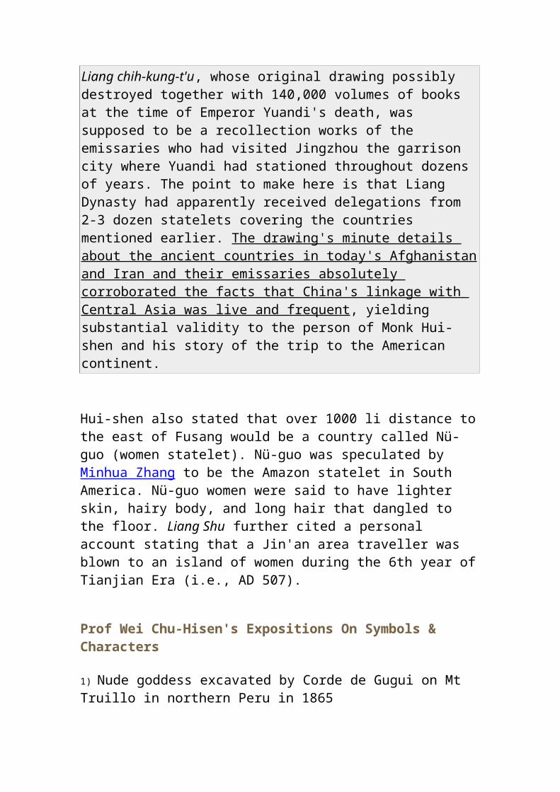
Darius is deserted by his generals one by one and by his troops. His cousin, Bessus, seizes this opportunity to rid himself once and for all of the Persian king. At night he and a few followers burst into Darius' tent, tie him up with ropes and carry him to his chariot and on to Bactria. He hopes eventually to offer the Persian king as a hostage in exchange for Alexander's recognition of him as ruler of the eastern satrapies. Alexander follows Darius in hot pursuit. Seeing he cannot escape, Bessus suddenly gallops up to the royal chariot, stabs Darius to death and gets away. When Alexander finally catches up with his rival, he comes into possession only of his corpse. Alexander looks down on his fallen foe with compassion, and covers his body with his purple cloak.
Eventually Bessus is captured and put in chains. Due to the nature of the crime, Alexander has him sentenced by Persian judges, not by himself. Bessus is found guilty of rebellion against his king. The sentence is cruel. Bessus' nose and ears are cut off and he is led to Ecbatana where he is crucified on a tree.
Alexander marches through Bactria and Sogdiana putting down rebellions and founding Greek cities. Then he crosses the Hindu Kush and proceeds to India. One of the principalities, situated between the Hydaspes and Ascenines, is ruled by Porus. Alexander crosses the Hydaspes, Porus holds the opposite bank with a powerful force and two hundred elephants. During the battle Porus is wounded and falls into Alexander's hands. However Alexander gains the fallen king as a friend.
It is at this time, Plutarch (61.1) tells us that Bucephalus dies, wounded in battle. Others relate that the horse dies of fatigue and old age. Alexander is overcome with grief. On the banks of the Hydaspes River he builds a city on the tomb of his horse which he names Bucephalia in his memory. When he reaches the Hyphasis River (Beas) the Macedonian army refuses to go farther although Alexander believes he has not much more to go to reach the ocean and the eastern limit of the inhabited world. He is obliged to give way and the return begins.
In the spring of 323 he returns to Babylon. There he makes plans for the construction of a great fleet and the opening of a route by sea from Babylon to Egypt around Arabia. In Babylon he falls ill, consumed by a raging fever that does not leave him. He dies towards evening on June 13, 323 at the age of thirty-three.
His. son by Roxana, the beautiful daughter of Oxyartes, king of Bactria, is born a short time later. The child, named Alexander "Aegus", is accepted by the Macedonian generals as joint king with Alexander's half-brother,
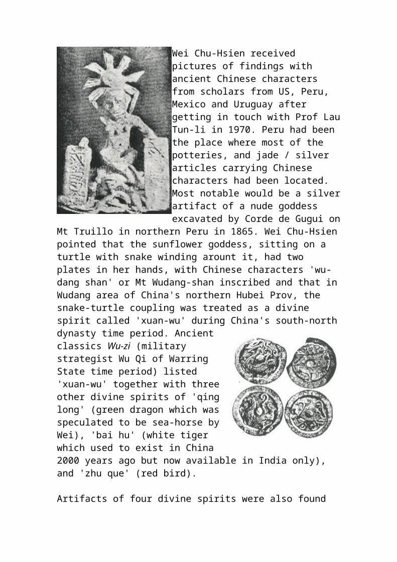
Philip Arrhidaeus, mentally unfit to rule. Alexander's successors use these two pathetic figures as a symbol of legitimacy to cover up their own ambitions. The day is now nearing when they can carve out a kingdom for themselves on the ruins of Alexander's empire.
The two kings, a child and one feeble of mind, are put under the guardianship and protection of Perdiccas, Peithon and Antipater, in succession. Upon the death of Antipater, Roxana flees with her child to Epirus seeking the protection of Olympias, Alexander's mother. She is taken there by Polyperchon, an officer close to Alexander to whom Antipater had delegated his power. From there Polyperchon accompanies Olympias, Roxana and the boy to Macedonia. All three fall into the hands of Antipater's son, Cassander, whose ambition knows no bounds. Olympias is put to death, young Alexander and his mother are kept under close arrest. They are murdered in 310-309 by order of Cassander. Thus the dynasty of Alexander the Great comes to an end with the death of Alexander IV Aegus, his son, barely twelve years of age.
The Hellenistic Age [please also see below Hellenistic Phoenicia (Review by Nigel Pollard)]
330 to 64 B.C.
The generals who succeed Alexander are Antigonus Cyclops or Monophthalmus, so-called because he lost an eye in battle, and his son Demetrius Poliocertes, Antipater and his son Cassander, Seleucus, Ptolemy, Eumenes and Lysimachus. They argue bitterly among themselves for each is determined to build a Hellenistic or Greek monarchy on the ruins of Alexander's empire.
Ptolemy, son of a Macedonian nobleman and the most trusted of Alexander's generals, was among the seven bodyguards attached to his person. In the division of the empire, Ptolemy takes Egypt as the safest and farthest place to establish a dynasty. He even manages to carry off the body of Alexander from Babylon to Egypt in order to bury him in Alexandria and thus enhance his own position.
Later Ptolemy mints a gold coin at Alexandria on which we see a car drawn by four elephants. Perhaps this is an attempt made by him to represent Alexander's funeral cortege that included elephants.
Antipater establishes himself in Macedon. He dies soon after and is succeeded by Cassander, his son.
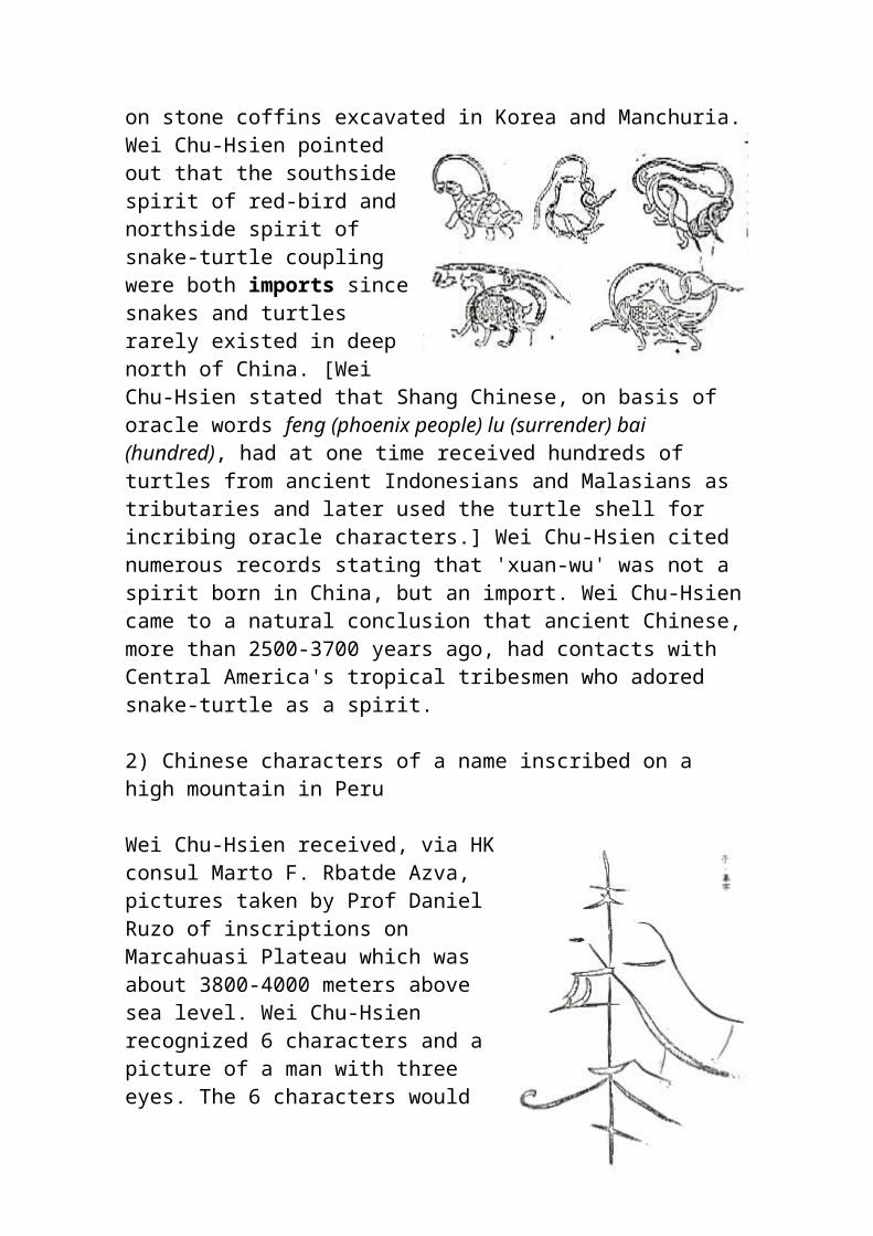
Seleucus Nicator, a youth of twenty-three of age when he accompanies Alexander to Asia, wins distinction in the Indian campaign. Seleucus is given the government of the Babylonian satrapy.
Antigonus defeats Eumenes, installed as satrap of Cappadocia, and has him put to death. He thus gets rid of his most dangerous rival. Ostensibly Antigonus and his son Demetrius Poliocertes hope to reunify Alexander's collapsing empire but for their own purposes. Antigonus also controls parts of Greece, Asia Minor and Syria.
Lysimachus sets himself up in Thrace.
Military clashes eventually occur as each tries to encroach on the other's territory. Ptolemy annexes Phoenicia to his possessions and places garrisons in the Phoenician port cities. Antigonus too decides to enlarge his territory and set himself up as king of Asia Minor.
Returning from successful wars in Babylonia, Antigonus easily takes over the cities of Phoenicia but meets with firm resistance from Tyre. Seventeen years have passed since Alexander took Tyre and the city has recovered rapidly. Antigonus has few ships as Ptolemy is holding all Phoenician vessels and their crews in Egypt, so he decides to build a fleet of his own. He camps before Tyre, summons all the kings of the Phoenician cities and the viceroys of Syria and demands them to assist him in building ships.
Antigonus blockades Tyre by land. He establishes three shipyards, one at Tripolis, one at Byblos, one at Sidon. Diodorus Siculus records that Antigonus collects wood-cutters, sawyers and shipwrights from all regions and has wood carried from the mountains of Lebanon to the sea. Eight thousand men are employed to cut and saw the timber; one thousand pairs of draught animals are used to transport it. "This mountain range", Diodorus (19.58.3-5) writes, "extends along the territory of Tripolis, Byblos and Sidon and is covered with cedar and cypress trees of wonderful beauty and size." We thus have a description of the extent of the luxuriant forests covering the mountains of Lebanon about two thousand three hundred years ago.
After a siege of fifteen months, Tyre is taken by Antigonus. He allows Ptolemy's garrison to leave and establishes his own in the city.
In order to enhance their personal prestige, Alexander's successors strike their own coins. On the obverse of his early silver coinage, Ptolemy has engraved the head of the newly deified Alexander with the sacred ram's
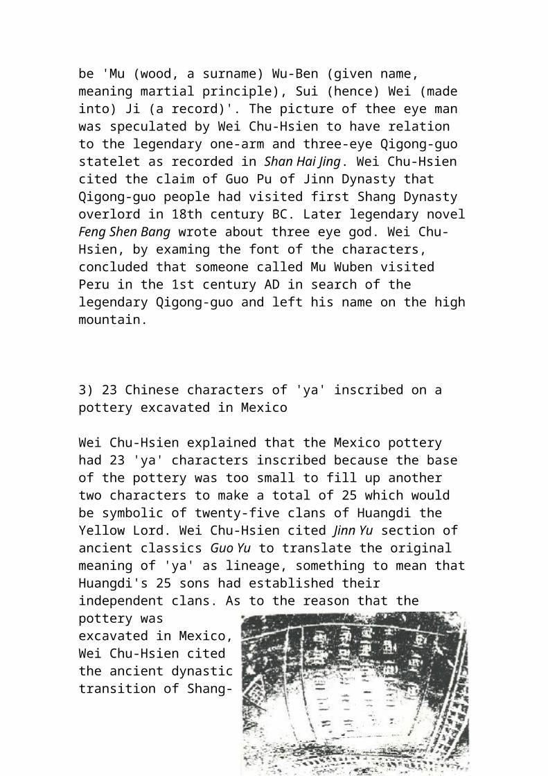
horns of Ammon and an elephant headdress. Alexander's name, not his, appears on the reverse of his coins.
On the coins of Seleucus, Alexander is portrayed as the god Dionysus wearing a helmet covered with panther skin adorned with a bull's ear and horns.
Lysimachus in his turn presents on his coins the diademed head of Alexander, deified, wearing the sacred horns of Ammon. When Alexander conquered Egypt, he was hailed by the high-priest of Ammon as the son of the god and Alexander's generals are determined to let no one forget it.
In 305 B.C. Antigonus and his son Demetrius assume the title of king. Ptolemy, Cassander, Lysimachus and Seleucus react to the challenge by doing the same. Henceforth the effigies of these men, wearing the Macedonian diadem, appear on their gold and silver coins. Their patron gods appear on the reverse. This ushurs in the age of royal portraiture.
The battle of lpsus in Phrygia in 301, called the "battle of the kings", signals the great military clash between Alexander's generals. The war elephant plays an important role in the outcome of this battle and is the symbol of military strength. The armies of Seleucus and Lysimachus with one hundred and fifty elephants cut off the infantry of Antigonus, left mortally wounded on the battlefield.
Notwithstanding, his son Demetrius rules Phoenicia until 287 when it once again passes back to Ptolemy. It remains a dependency of the Ptolemies for nearly seventy years. In the year 285 Alexander's empire is neatly divided between three of his former generals, Ptolemy in Egypt, Seleucus in Syria, Lebanon and Palestine, and Lysimachus in Thrace.
At his death at the age of eight-four Ptolemy leaves behind him a well organized kingdom and the great library at Alexandria. He is succeeded by his son, Ptolemy 11 Philadelphus (285-246).
The persistent lug of war between Ptolemies and Seleucids over Phoenicia, Syria and Palestine also results in great cultural changes in the region. Phoenician is discarded as a literary language and is replaced by Greek. Greek religious practices and beliefs take root but at the same time a Phoenician god travels south to Egypt and is honored with great pomp in Alexandria.
Byblos is the center for the worship of Adonis, a youth of great beauty, loved by Aphrodite. In legendary tradition, Adonis is hunting the wild boar
one day in the company of Aphrodite at Afka, the source of a river high up in the mountains of Lebanon. The boar turns on him and gores his thigh. Adonis dies of the wound as his blood flows into the river turning the waters red and the anemones in the river valley scarlet. Aphrodite appeals to Zeus, king of the gods, to bring her lover back to life. Zeus pities the youth and allows him to pass part of the year on earth, the other part underground in Hades. His death is mourned annually at Byblos. He returns in the spring time to the upper world and there is great rejoicing. Adonis in Phoenician means "lord" and is the title given to the young god of vegetation.
Theocritus, a Greek poet born in Syracuse c. 315 B.C., lived in Alexandria in the time of Ptolemy if Philadelphus. In his Idyll 15 he describes how the Festival of Adonis is celebrated in the city. On the first day a great procession forms as women and children pour out into the crowded streets to watch. Adonis has come back to life for a brief reunion with Aphrodite and there is great rejoicing. The second day is one of mourning as the women bewail the god's departure once again for the underworld.
In Alexandria, Adonis is represented by a graceful statue reclining on a silver couch in a temporary bower ornamented with birds and cupids. He is portrayed as a beautiful youth and the women cluster around him as he is carried through the streets in the procession. The crowd enters the royal palace as part of the ceremony is performed there. Praises are sung to Queen Berenice, the mother of Philadelphus and Arsinoë, his sister-wife, one way of eulogizing the family of Ptolemy who patronize the festival.
On the second day the women lament the departure of the youthful god. At the end of the festival the statue of Adonis is carried outside the city and flung into the sea amidst the wailing and weeping of the women.
The years roll by...
In Egypt descendants of Ptolemy rule at Alexandria, one after the other. In Syria a line of Seleucid kings, usurpers and imposters alike, sit on the throne of Antioch.
The Seleucid king Antiochus III the Great (223-187) makes Phoenicia a battlefield in his wars against the Ptolemies. Antiochus III drives the forces of Ptolemy IV Philopator out of Syria, takes Tyre and Acre (Ptolemais) and even threatens Egypt. In the following years the cities of Phoenicia pass back and forth between the two powers. In 196 B.C. Phoenicia and Coele Syria (the Bekaa valley) pass into the possession of the Seleucid kings. The
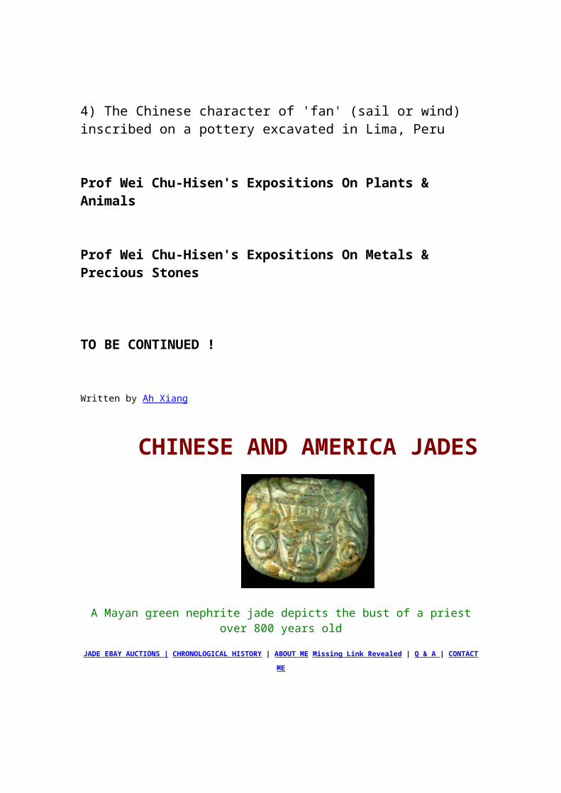
Phoenician cities welcome the change, for the establishment and commercial expansion of Alexandria is a threat to their commerce.
The discovery in 1897 of several painted funerary stelae in a garden south of Sidon point to the presence of Greek mercenaries in the armies of the Seleucids during the second century B.C. These soldiers of fortune from the Greek mainland and cities of Asia Minor died here while on active duty and were laid to rest forever in foreign land. The stelae today are exposed in the Archaeological Museum, Istanbul.
The Seleucid monarchy is now in a state of chronic civil war. In the struggle to seize the throne between the usurper Tryphon and Antiochus VII Sidetes during the latter part of the second century B.C., the situation becomes so unbearable that merchants of Beirut desert the city and open commercial establishments on the Greek island of Delos where they conduct a flourishing business.
But in the West the rise of Rome presents a danger. The Italian wars of 91-83 B.C. keep the Romans at home. The chaotic conditions in Syria permit Tigranes 11 the Great, king of Armenia, to overrun Cappadocia and expel one of the last feeble representatives of the Seleucid monarchy. By 83 B.C. Tigranes sits on the throne at Antioch and his frontier extends to Mount Lebanon.
In 69 B.C. the Roman general Lucullus arrives in the East, crosses the Euphrates in pursuit of Tigranes and invades Armenia. However his army does not support him so he withdraws to Asia Minor.
Pompey replaces Lucullus in 66 B.C. Syria is taken out of the hands of the Seleucids once and for all on the ground that they have virtually ceased to rule. Pompey turns the districts of the Seleucid territory, including Phoenicia, Syria and Palestine into a new province named "Syria". Although this political move consolidates Roman authority in the East and increases the annual revenue of the Roman treasury, in return a measure of security is given to the peoples of the region that they had not enjoyed since the conquests of Alexander. Anarchy and piracy is brought under control and the cities of Phoenicia turn to the sea and trade.
Hellenistic Phoenicia Review by Nigel Pollard
John Grainger's second book, Hellenistic Phoenicia, follows remarkably closely on the heels of his first, The Cities of Seleukid Syria (Oxford University Press, 1990), and deals with the same region and the same

period. Both deal with the impact of Graeco-Macedonian expansion into the Near-East. While in his earlier volume, G. dealt with the imposition of an entirely new Graeco-Macedonian urban network on Syria, in this second book he considers the manner in which the cities of Phoenicia, which existed and partook of a distinctive culture before the arrival of Alexander, survived through Macedonian conquest and Ptolemaic and Seleucid rule.
In his Introduction, G. refers to three important themes. The first is the Phoenician cities' "methods of survival, the compromises they made to do so, and their varying responses to Greek and Macedonian power." The second theme is the fascinating issue of the cultural relationship between Phoenician and Graeco-Macedonian. To what degree did Phoenicia preserve a distinctive cultural identity? Does the concept of "Hellenistic Phoenicia" have any meaning at all beyond the purely geographic and chronological definition? The final theme is the economy of Phoenicia in the Hellenistic period, a question raised by the reputation of Phoenicians as traders.
The organisation of the book is generally chronological rather than thematic, and given the extremely limited nature of the evidence G. is dealing with, this tends to weaken his ability to tackle these key problems. However, this arrangement works well enough for a study of the political and military impact between the Graeco-Macedonians and Phoenicians. 360-287 B.C.was a period of tremendous upheaval in Phoenicia, with the revolt of Sidon against Achaemenid rule in 345 B.C. and its subsequent destruction (though G. suggests, sensibly enough, that the latter was not as severe as implied by Diodorus' account) and the arrival of Alexander in 333-2 B.C.G. illustrates the varied responses of the Phoenician cities to Alexander. The ruler of Aradus submitted, the king of Sidon was overthrown (perhaps by Alexander or perhaps by his own people) and replaced by a pro-Macedonian (and perhaps more popular) appointee. Tyre, of course, resisted and was captured after a prolonged siege. Alexander is supposed to have executed 2000 leading citizens but maintained the king in power, and G. suggests (p.36-7) that he showed a preference for monarchs and popular control, as opposed to some form of oligarchy, which the 2000 executed men may have represented. After the siege of Tyre, no Phoenician city seems to have resisted occupation, despite the shifting control of the area by Ptolemaic and Antigonid/Seleucid armies in the following decades. G. suggests (p.50-51) that the sacks of Sidon and Tyre had taught the value of cooperation and compromise with conquerors.
The years 287-225 B.C.saw the Ptolemies gain and maintain control of the cities (except for Aradus), and the disappearance of the Phoenician
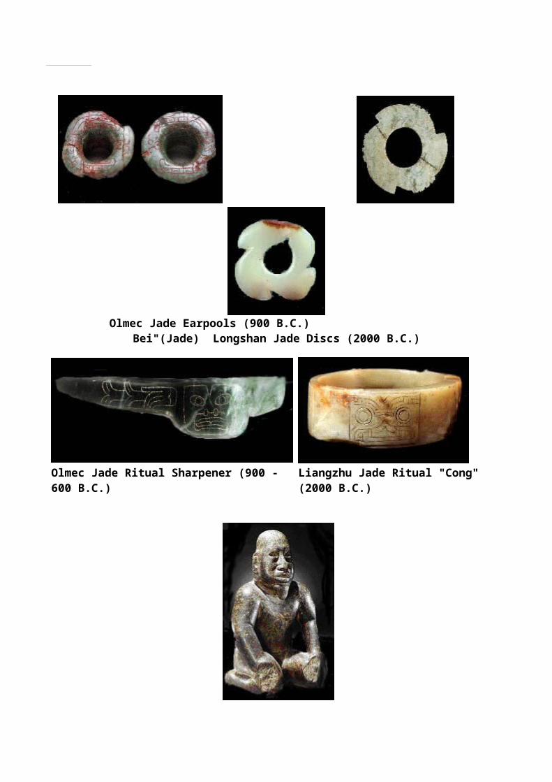
monarchies. G. suggests (p.58) that in some cases the depositions were carried out by Graeco-Macedonian rulers because the kings had failed to change sides swiftly enough in the period of rapidly changing hegemony early in the century. They were replaced by nominally republican constitutions of "the Tyrians" and "the Sidonians," with epigraphic formulae (in Greek) suggesting similarities to the boule and demos combination of contemporary Greek cities in the area. Little is known about civic magistrates or the franchise, and the only possible expression of something untypical of Hellenistic cities in general is the use of the Greek term dikastes for a Sidonian magistrate in an inscription, a usage which may reflect the Phoenician title shofet (p.65-6; 81). However, just as in Seleucid northern Syria, (p.66) "real power, military power lay in the hands of the king, Ptolemaic or Seleukid." Thus there is little evidence of any major political distinction between the "Phoenician" cities and the "Greek" foundations of the Hellenistic world.
The Seleucids gained control of Phoenicia early in the second century, but from late in that same century there is evidence of increased assertion of local independence in the Phoenician cities as royal control broke down. This phenomenon occurred in other geographically marginal areas of the Seleucid kingdom too, notably those controlled by the Palmyrene, Ituraean and Emesene neighbours of Phoenicia. As before the Macedonian conquest, in Phoenicia this independence focused on the autonomy of individual cities, not some wider political and cultural entity of that name.
Thus G. provides a good survey and discussion of the limited evidence regarding the political histories of the cities of Hellenistic Phoenicia in the Hellenistic period. But what of his second theme, that of cultural identity? Regarding the violence and shifting control of the period 360-287 B.C.G. raises the pessimistic possibility (p.51) that the "cultural heritage (of the Phoenician cities) was also surely mutilated beyond repair, leaving an impoverishment which Greek culture could hope to fill." As noted above, there is little to distinguish the Phoenician cities from "Greek" Hellenistic cities in terms of political situation and institutions. Likewise the ruling classes are known to have engaged in Greek philosophy, Greek athletics and to have set up inscriptions in Greek. In contrast, Grainger refers us to sites away from the major urban centres, such as the cult centre of Astarte at Wasta and the rural community and cult centre of Umm elAmed. The former (p.78) "remains resolutely local, Phoenician and traditional" in terms of the names of worshippers, the languages they employed and the cult symbolism employed. The latter (p.81-82) includes inscriptions in Phoenician (and only in Phoenician), and, according to Grainger, the material culture such as pottery shows little evidence of external influence,
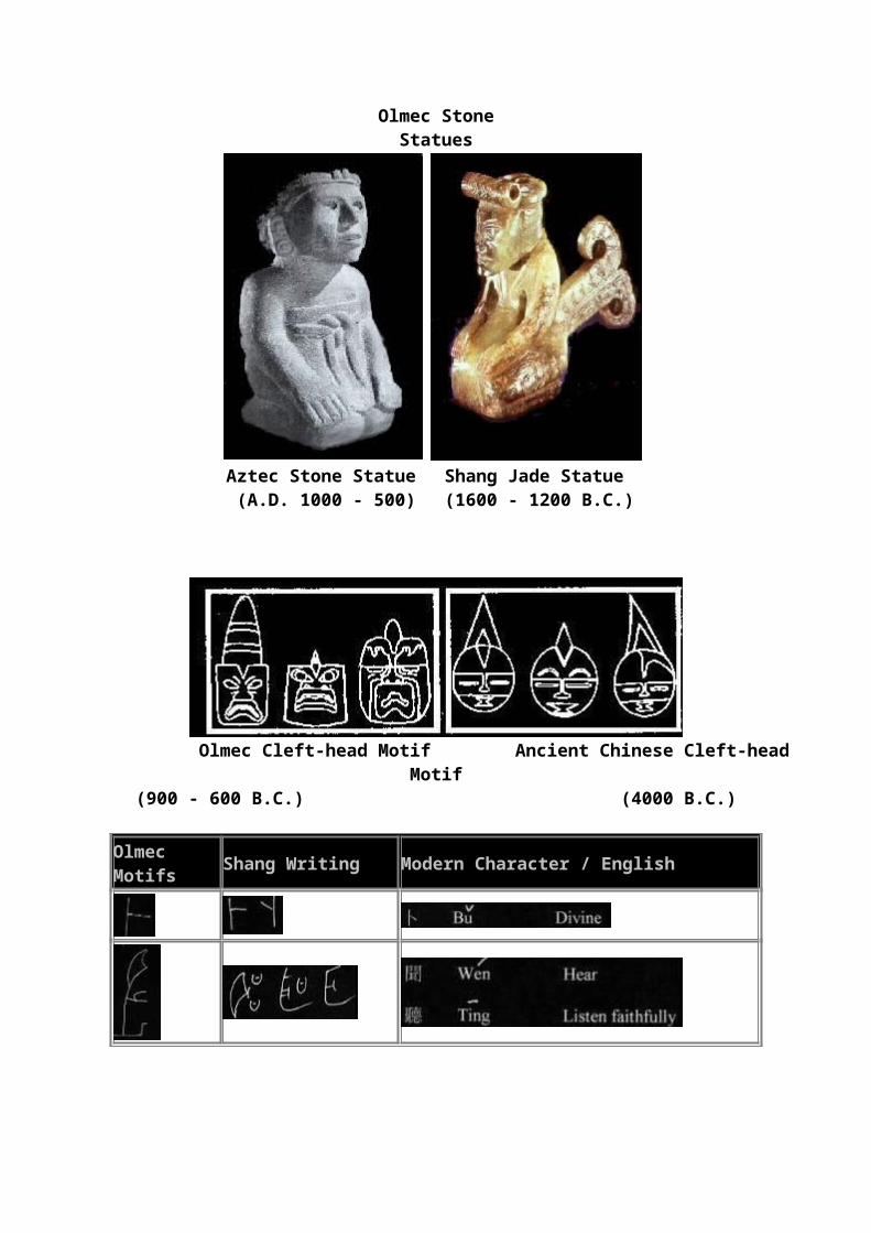
except for imported Rhodian amphorae. "Yet of Hellenization there is no sign" (p.81) he claims of Umm el-Amed. Examination of the excavation report suggests that this assertion is an unfortunate over-generalization. Certainly the inscriptions are Phoenician, and the courtyard plans of the temples on the site owe much more to Near Eastern antecedents than to contemporary Greek planning. However, the details of those temples, such as the architectural mouldings and the forms of column capitals and bases show very strong Greek influences. As G. indicates, there are fragments of imported Rhodian amphorae. But the report indicates that there were significant quantities of characteristically Hellenistic black slipped wares and some red-slipped "Hellenistic Pergamene" (Eastern Sigillata). On a more fundamental level, the bulk of the pottery from the site, which the excavators suggest was of local production and which G. dismisses as "the usual local type," displays strong evidence of the influence of the wider Hellenistic world. The forms of most of those vessels, incurved rim bowls, everted rim bowls, fish-plates, fusiform unguentaria and even a lagynos and an amphoriskos, would be at home at just about any site in the Hellenistic world. Certainly these are not "Phoenician" in origin. The inhabitants of the site may not have been importing much pottery from Greece, but local potters were copying shapes from Greece and elsewhere in the Hellenistic world. The significance, nature and chronology of this "Hellenization" of the material culture of the site are all open to dispute, but it deserves more careful consideration than G. gives them. This tends to weaken the dichotomy between the "Hellenized elite culture" of the urban centres and the supposedly "more traditional" culture of the rural population.
In addition, one must take issue with some of G.'s comments regarding what one might describe as "pan-Semitic" cultural sympathies (such as his description, on p.145 of Tyre and the Jews under John Hyrcanus as "both-self-consciously Semitic"), which manifested themselves as occasional political cooperation between Phoenicians, Jews and Ituraeans in the late Hellenistic period. The evidence of such cooperation is slim enough, and there is plenty of evidence for conflict between "Semites" too, as G. himself documents (cf. p.153f., between Phoenicians and Ituraeans). What cooperation existed surely was based on immediate and practical considerations. Even if those responsible for policy-making in Phoenician cities at that time (the "hellenized" urban elite discussed above) had any conception of themselves as "Semitic," surely it was as Phoenician or Tyrian rather than "Semitic" in any general sense which included Jews and Ituraeans too.

The third topic considered in the book is the economy of Hellenistic Phoenicia. Of course, Phoenicians are, and were, known as traders, but at a more basic level it might be interesting to consider the contribution of local agricultural resources to the development of Hellenistic Phoenicia. Unfortunately there is little evidence. We do not have a clear idea of the rural hinterland controlled by the individual cities at specific times, and we lack archaeological survey data. However, G. does marshal some of the scattered evidence for the rural economy, including olive oil production at Umm el-Amed and Sarepta (p.67-69) and the possible Phoenician involvement in the development of villages in the hinterland (p.114). For the most part G. focuses on trade and traders, since that was how Phoenicians appeared to the Greeks and Romans to whom we owe most of our evidence. Much of what G. says is reasonable. However, when he tries to make a case for the Phoenicians as the developers of trade routes eastwards in the Achaemenid and Hellenistic periods, to the Red Sea, Arabia and India, by way of Syria and the Euphrates, he does seem to be stretching some very tenuous evidence too far. If Phoenicians were important in trade east along the Euphrates, one might expect to find evidence of their presence at Dura Europos, for example, along with the Palmyrenes who are attested there, albeit in the later Hellenistic and Roman period.
Roman Phoenicia
In 64 BC Phoenicia was incorporated into the Roman province of Syria though Aradus, Sidon, and Tyre retained self-government. Berytus (Beirut), relatively obscure to this point, rose to prominence by virtue of Augustus' grant of Roman colonial status and by the lavish building program financed by Herod the Great (and in turn by his grandson and great-grandson). Under the Severan dynasty (A.D. 193-235) Sidon, Tyre, and probably Heliopolis (Baalbek) also received colonial status.
Emperors embracing Christianity protected the area during the later Roman and Byzantine periods (c. AD 300-634). A 6th-century Christian group fleeing persecution in Syria settled in what is now northern Lebanon, absorbed the native population, and founded the Maronite Church.
More to come...
In 608-609 the Persian king Khosrow II pillaged Syria and Lebanon and reorganized the area into a new satrapy, excluding only Phoenicia Maritima. Between 622 and 629 the Byzantine emperor Heraclius mounted an offensive and restored Syria-Lebanon to his empire. This success was
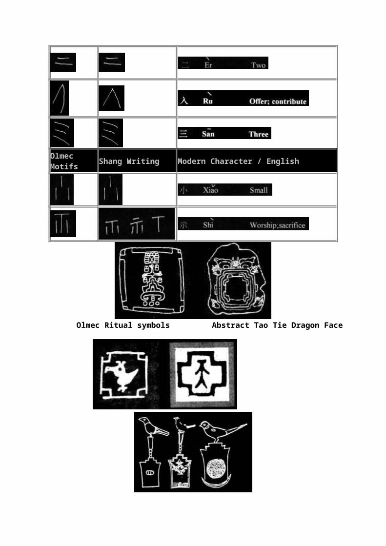
short-lived; in the 630s Muslim Arabs conquered the old Phoenician that cities offered only token resistance to the invader.
The geographical location of Phoenicia at the cross-roads of the Eastern Mediterranean made it a fertile ground for invading armies as indicated earlier. Hence, the Phoenicians were influenced in many ways by the invaders. Also, the Phoenicians as a people did not remain pure Semites. With this in mind, references to individuals as Phoenicians need to be seen in this light.