Embed Size (px)
Citation preview
AVIATION OPERATIONAL MEASURES FOR FUEL AND EMISSIONS REDUCTION WORKSHOP
Air Traffic ManagementInitiatives
Ross BowieDirector, ANS Service Design
NAV CANADA
Air Traffic Management PanelMontreal, 20-21 September 2006

2
Introduction
Who We Are
Customers’ Goals
Initiatives to Reduce Fuel Burn
The Way Ahead
How to Reach Us
3
Who We Are
• Owner and operator of Canada’s civil air navigation system (ANS) since Nov. 1, ‘96
• Private, non-share capital corporation; not for profit• Revenue from aircraft operators; no government funding• Stakeholder Board• 4 founding “Members” have Board representation
– Airlines– Business Aviation– Government– Employees
4
Customers’ Goals
• safety• schedule• efficiency (fuel savings = reduced emissions)• value
• safety is expected and is our first priority• the price of fuel is a strong motivator to improve
efficiency• we are working closely with our customers on
ways to improve efficiency
5
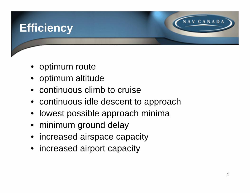
Efficiency
• optimum route• optimum altitude• continuous climb to cruise• continuous idle descent to approach• lowest possible approach minima• minimum ground delay• increased airspace capacity• increased airport capacity
6
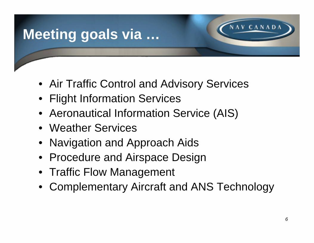
Meeting goals via …
• Air Traffic Control and Advisory Services• Flight Information Services• Aeronautical Information Service (AIS)• Weather Services• Navigation and Approach Aids• Procedure and Airspace Design• Traffic Flow Management• Complementary Aircraft and ANS Technology
7
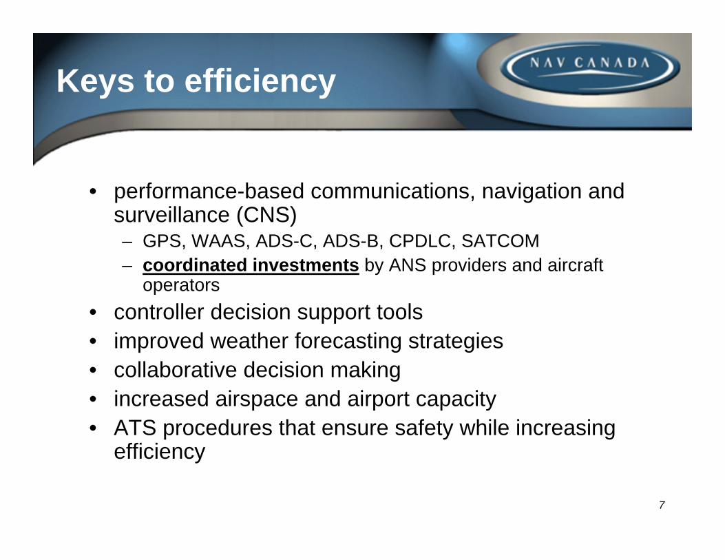
Keys to efficiency
• performance-based communications, navigation and surveillance (CNS)– GPS, WAAS, ADS-C, ADS-B, CPDLC, SATCOM– coordinated investments by ANS providers and aircraft
operators• controller decision support tools• improved weather forecasting strategies• collaborative decision making• increased airspace and airport capacity• ATS procedures that ensure safety while increasing
efficiency
8
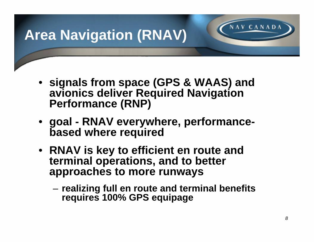
Area Navigation (RNAV)
• signals from space (GPS & WAAS) and avionics deliver Required Navigation Performance (RNP)
• goal - RNAV everywhere, performance-based where required
• RNAV is key to efficient en route and terminal operations, and to better approaches to more runways– realizing full en route and terminal benefits
requires 100% GPS equipage
9
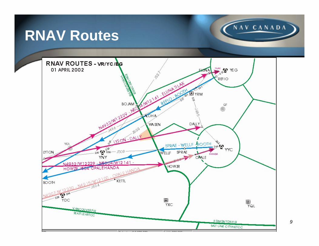
RNAV Routes
10
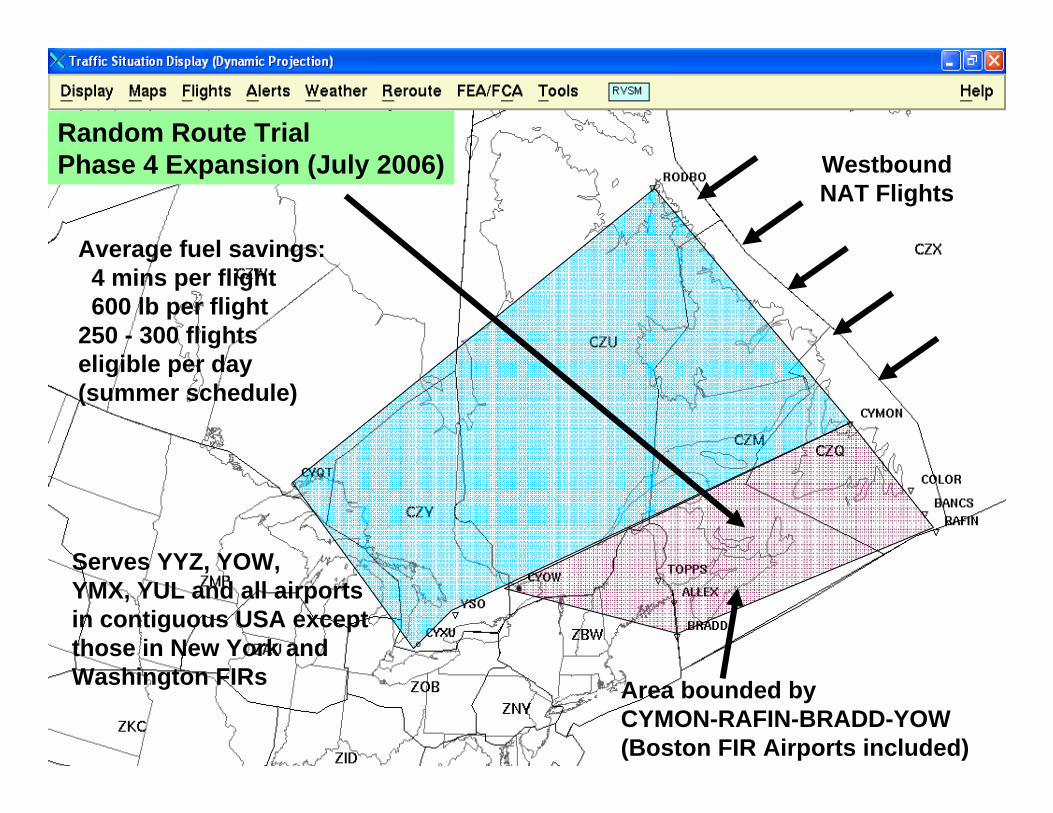
Random Route TrialPhase 4 Expansion (July 2006)
Area bounded byCYMON-RAFIN-BRADD-YOW(Boston FIR Airports included)
Average fuel savings:4 mins per flight600 lb per flight
250 - 300 flights eligible per day(summer schedule)
Serves YYZ, YOW,YMX, YUL and all airports in contiguous USA except those in New York and Washington FIRs
Westbound NAT Flights
11
RNAV STARs
• RNAV STARS in use for over 10 years at major airports– idle descent saves fuel– no RNAV performance requirement; ATC monitors
conformance and altitudes are at or above minimum altitudes; allows use of DME-DME
• emerging avionics capability (radius to fix (RF) leg) being incorporated to serve capable aircraft
• need to move to 100% GPS equipage• near-term goal is to eliminate conventional STARs
12
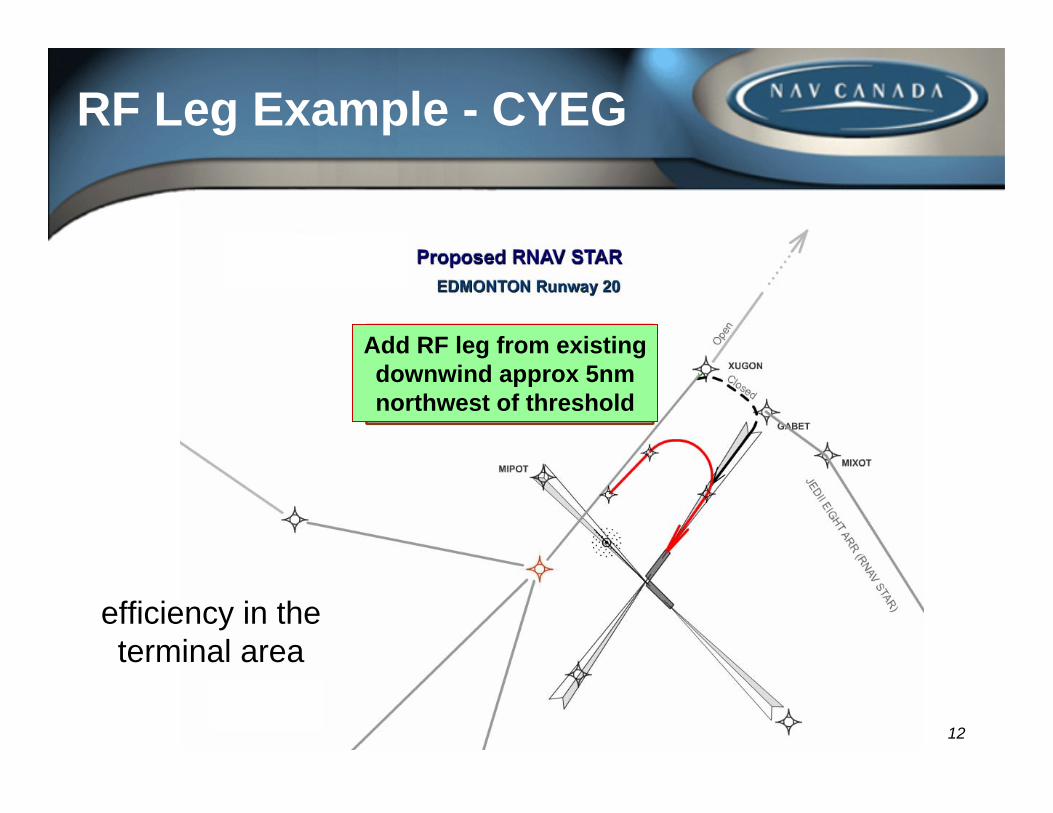
RF Leg Example - CYEG
efficiency in the terminal area
Add RF leg from existing downwind approx 5nm northwest of threshold
13
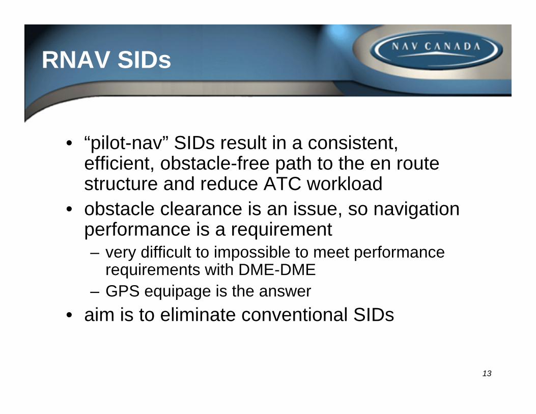
RNAV SIDs
• “pilot-nav” SIDs result in a consistent, efficient, obstacle-free path to the en route structure and reduce ATC workload
• obstacle clearance is an issue, so navigation performance is a requirement– very difficult to impossible to meet performance
requirements with DME-DME– GPS equipage is the answer
• aim is to eliminate conventional SIDs

14
RNAV Approaches
• RNAV(GPS) approaches provide lower minima at over 400 runways in Canada– fewer diversions, delays, overflights, cancellations– fuel savings due to no requirement for procedure turn– safety benefits via eliminating circling approaches,
enhanced situational awareness• ILS-like WAAS approaches will support a 250 ft
height above touchdown (HAT) minimum at over 90% of qualifying runways, 200 ft HAT at some with precision approach lighting– WAAS signals available throughout southern Canada– vertical guidance provides significant safety benefit
15
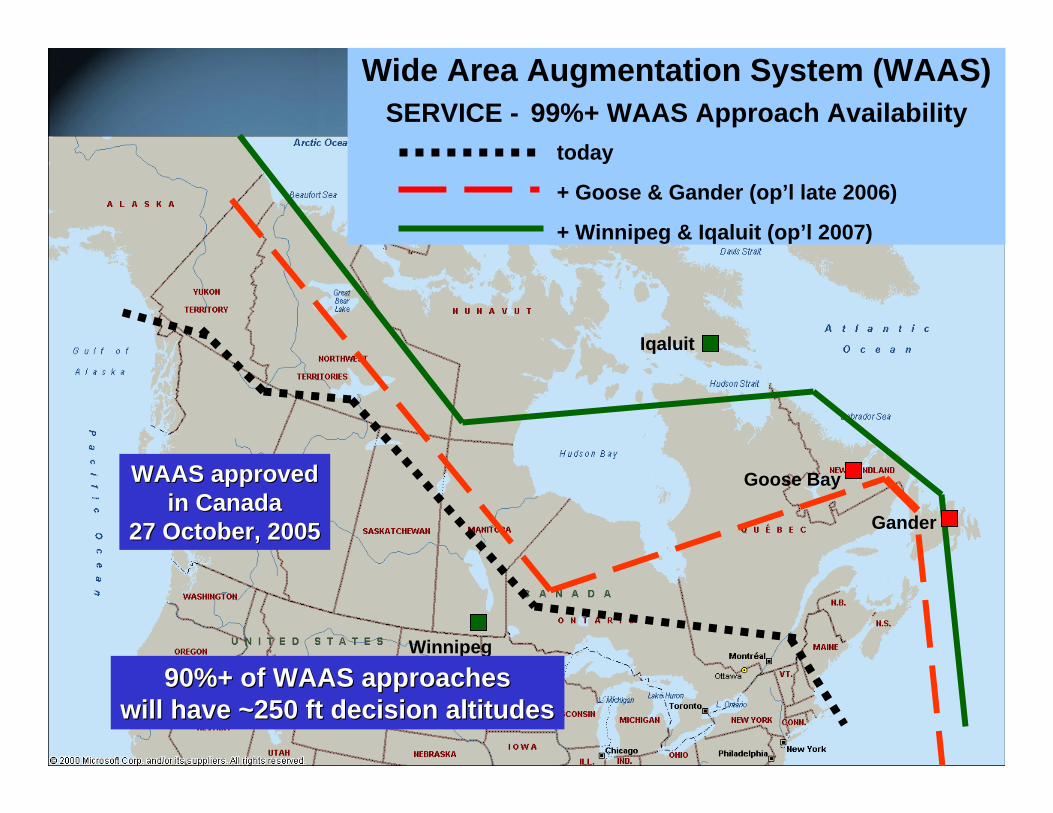
Winnipeg
Goose Bay
Gander
Iqaluit
Wide Area Augmentation System (WAAS)SERVICE - 99%+ WAAS Approach Availability
today
+ Winnipeg & Iqaluit (op’l 2007)
+ Goose & Gander (op’l late 2006)
90%+ of WAAS approaches90%+ of WAAS approacheswill have ~250 ft decision altitudeswill have ~250 ft decision altitudes
WAAS approvedWAAS approvedin Canadain Canada
27 October, 200527 October, 2005
16
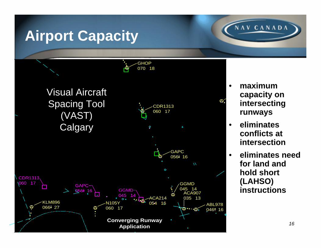
Airport Capacity
• maximum capacity on intersecting runways
• eliminates conflicts at intersection
• eliminates need for land and hold short (LAHSO) instructions
CDR1313060 17
CDR1313060 17
GHOP070 18
GGMD045 14GGMD
045 14 ACA907035 13
N105Y060 17
KLM896066 27
GAPC056 16
GAPC056 16
ABL978046 16
ACA214054 16
Converging RunwayApplication
Visual AircraftSpacing Tool
(VAST)Calgary
17
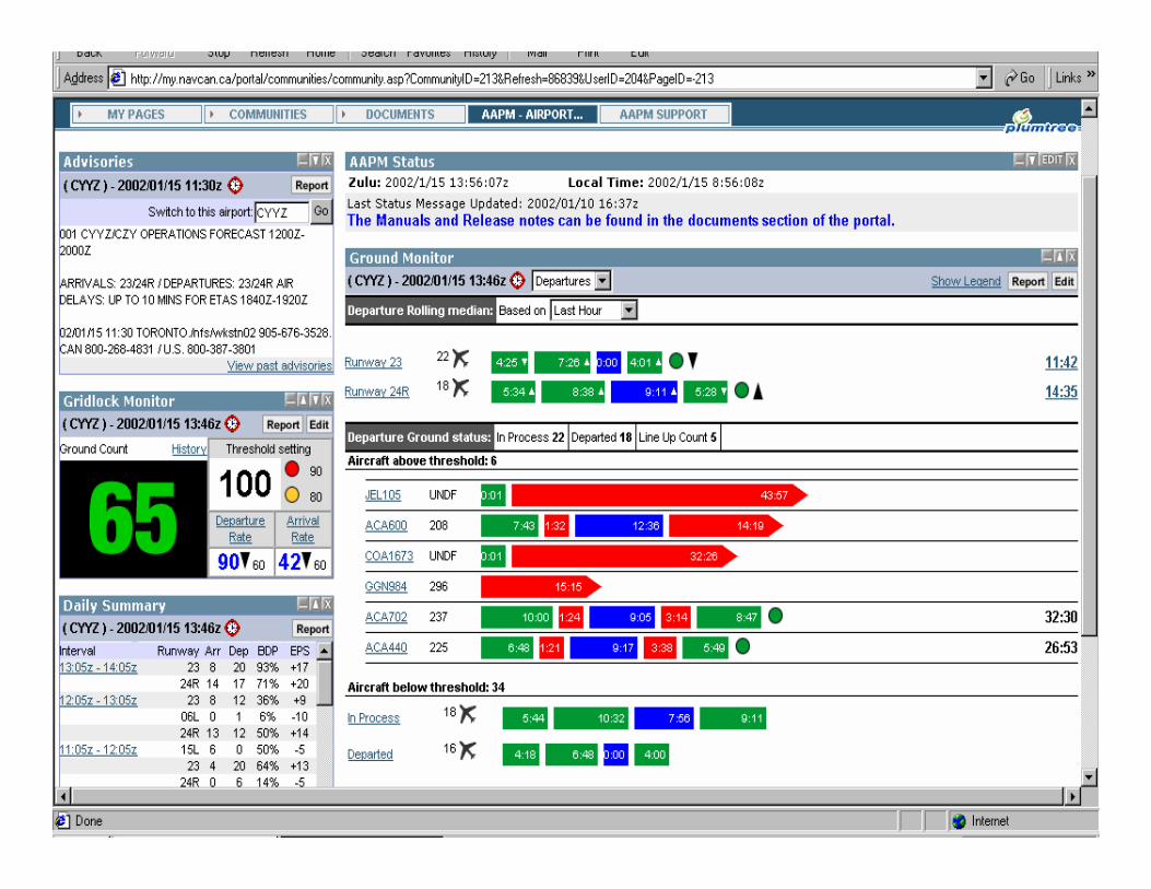
Airport Performance Monitor
• APM provides airlines and airport personnel with up-to-the-minute analysis of airport performance, including such events as time on the ground taxiing, de-icing, holds for departure separation etc.
• The analysis of APM data allows airline personnel to better plan for the scheduled departure times of their aircraft. Additionally it allows NAV CANADA to recognize the potential for gridlock early, reducing airline operating costs and undue travel delays
18
19 191919
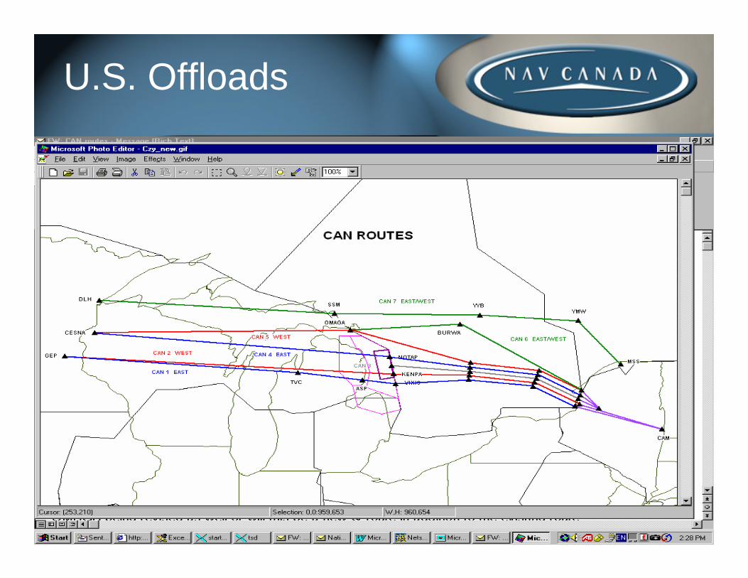
U.S. Offloads
20
Weather & Flow Management
• NAV CANADA’s National Operations Centre (NOC) currently uses:• the Collaborative Convective Forecast Product (CCFP)
• a seasonal thunderstorm forecast product tailored to the specific requirements of air traffic flow management
• the Canadian and North Atlantic Turbulence Forecast• We are evaluating the contribution that aviation
meteorologists could make to efficient air traffic flow management; two forecasters worked with NOC staff during August 2006
• exploring the value-added services that could be provided by a direct consultation service
21
Aerodrome Forecast (TAF) Accuracy and Efficiency
• the TAF is the principal tool for deciding how much fuel to upload for an IFR flight– but users cannot assess the meteorologist’s
degree of confidence in a TAF because formatting rules do not allow such flexibility
– a higher than necessary fuel load means more fuel burn and less payload/revenue
– the same fuel upload decision is taken even though the forecaster’s level of confidence could be anywhere from 50% to 100%
– would probabilistic forecasts provide benefits?
22
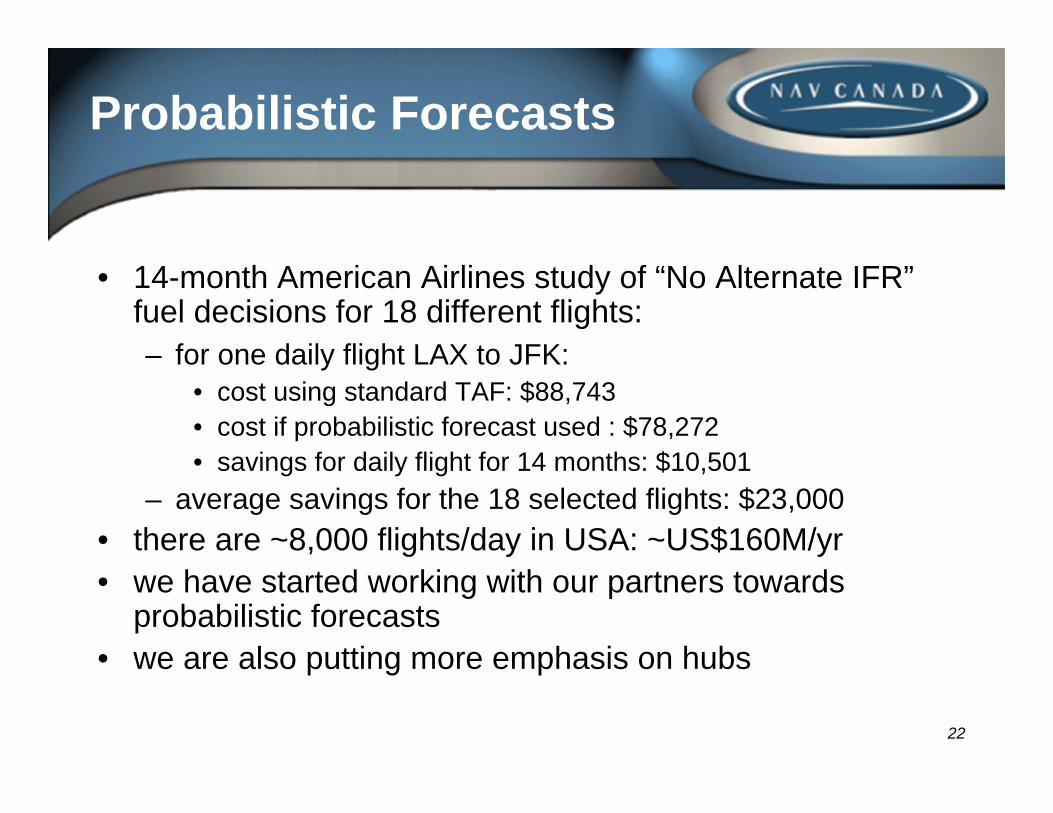
Probabilistic Forecasts
• 14-month American Airlines study of “No Alternate IFR”fuel decisions for 18 different flights:– for one daily flight LAX to JFK:
• cost using standard TAF: $88,743• cost if probabilistic forecast used : $78,272• savings for daily flight for 14 months: $10,501
– average savings for the 18 selected flights: $23,000• there are ~8,000 flights/day in USA: ~US$160M/yr• we have started working with our partners towards
probabilistic forecasts• we are also putting more emphasis on hubs
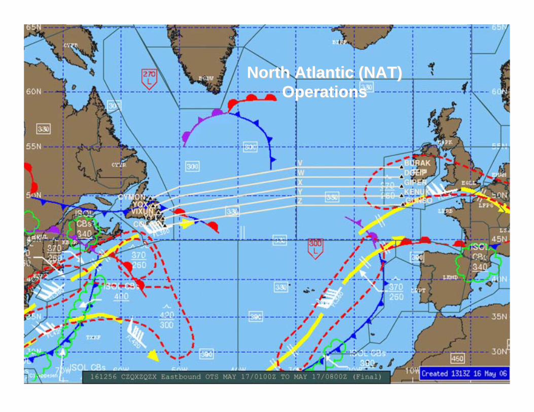
23
North Atlantic (NAT)North Atlantic (NAT)OperationsOperations
24
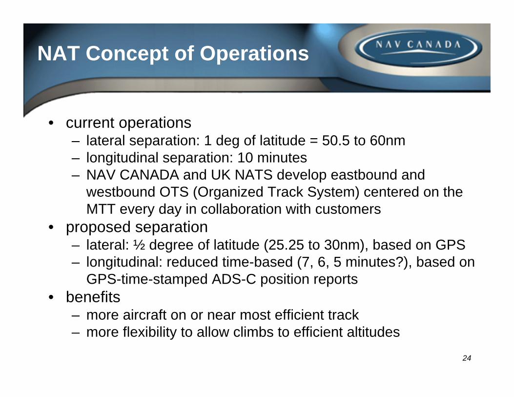
NAT Concept of Operations
• current operations– lateral separation: 1 deg of latitude = 50.5 to 60nm – longitudinal separation: 10 minutes– NAV CANADA and UK NATS develop eastbound and
westbound OTS (Organized Track System) centered on the MTT every day in collaboration with customers
• proposed separation– lateral: ½ degree of latitude (25.25 to 30nm), based on GPS– longitudinal: reduced time-based (7, 6, 5 minutes?), based on
GPS-time-stamped ADS-C position reports• benefits
– more aircraft on or near most efficient track– more flexibility to allow climbs to efficient altitudes
25
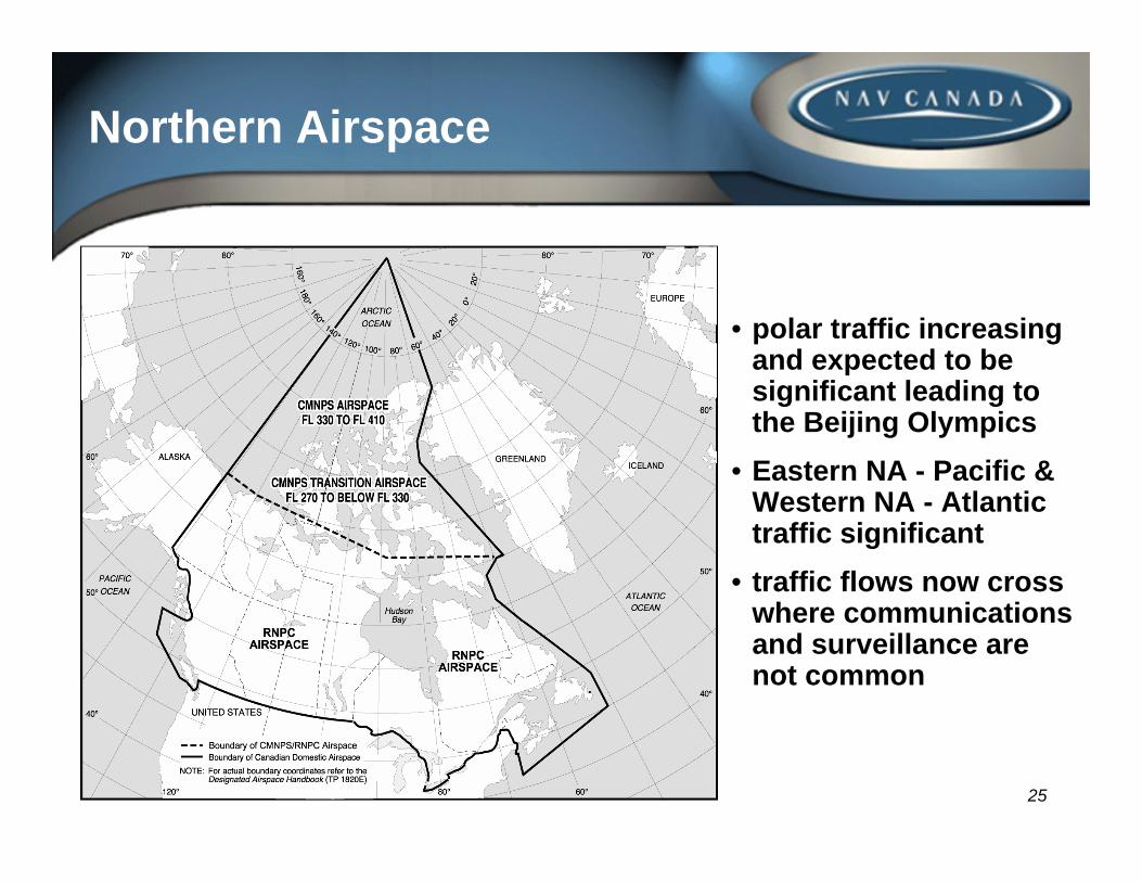
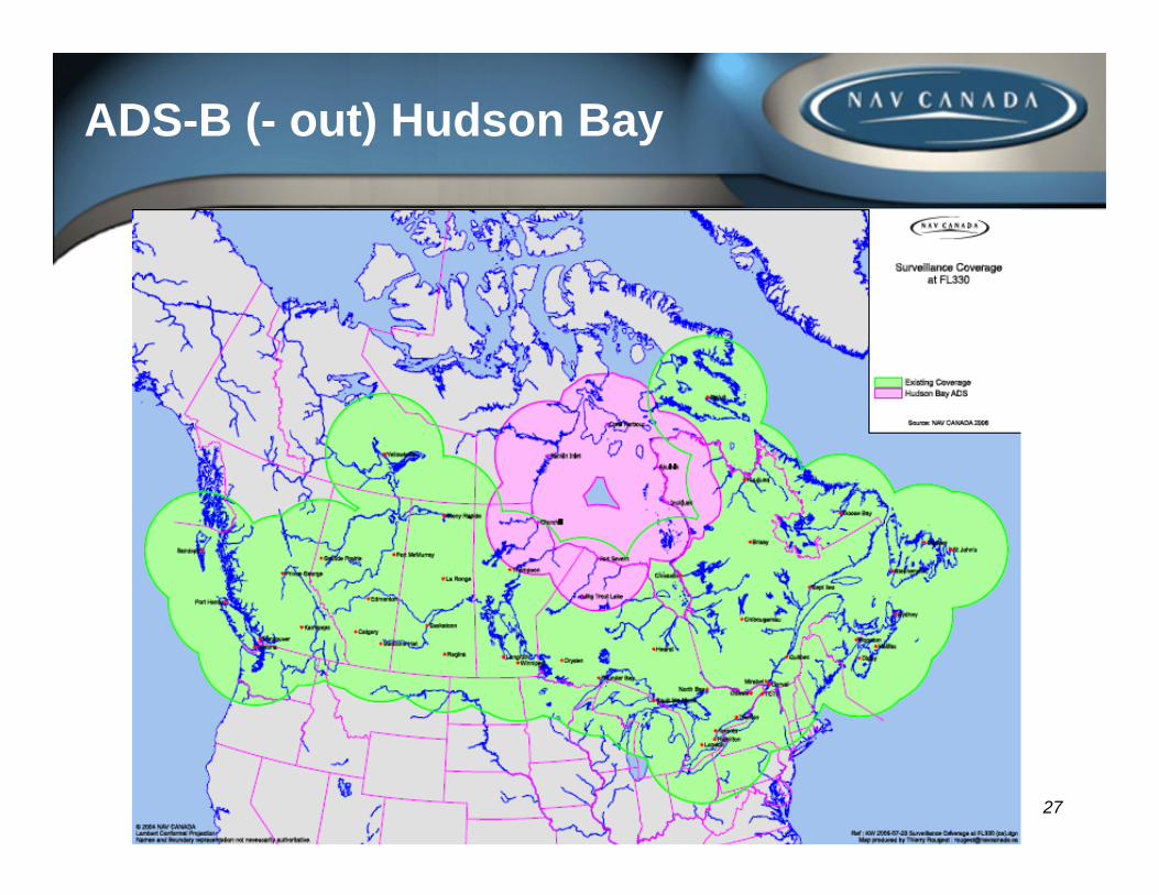
Northern Airspace
• polar traffic increasing and expected to be significant leading to the Beijing Olympics
• Eastern NA - Pacific & Western NA - Atlantic traffic significant
• traffic flows now cross where communications and surveillance are not common
26
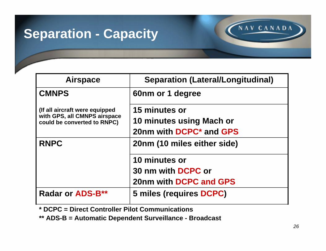
Separation - Capacity
* DCPC = Direct Controller Pilot Communications** ADS-B = Automatic Dependent Surveillance - Broadcast
5 miles (requires DCPC)Radar or ADS-B**
10 minutes or30 nm with DCPC or20nm with DCPC and GPS
20nm (10 miles either side)RNPC
15 minutes or10 minutes using Mach or20nm with DCPC* and GPS
60nm or 1 degreeCMNPS
(If all aircraft were equipped with GPS, all CMNPS airspace could be converted to RNPC)
Separation (Lateral/Longitudinal)Airspace
27
ADS-B (- out) Hudson Bay
28
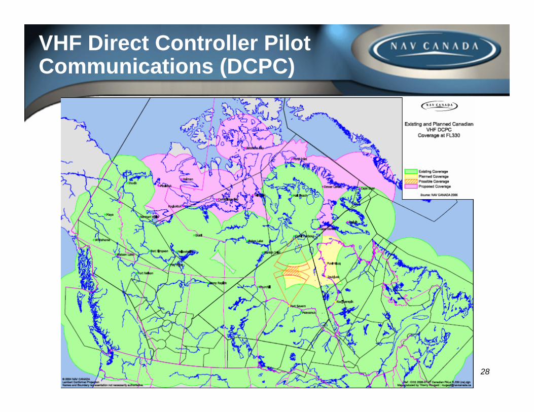
VHF Direct Controller Pilot Communications (DCPC)
29
Northern Concept of Operations
• near term CONOPS (2006 – 2008)– expanded flow management capability– Northern Organized Track System (NOR OTS)
• IATA estimates US$6M/yr savings for NAT traffic alone– expanded VHF COM (DCPC); 15 new ground stations– Hudson Bay ADS-B (ADS-B (out))
• 60% aircraft equipage; segregate airspace vertically; decide with customers on appropriate level and timing of eventual FL290 lower limit
• medium term CONOPS (2009 – 2011)– expand ADS-B and DCPC throughout north– SATCOM voice to augment and possibly replace HF– enhanced ADS-C and CPDLC for the far north
30
The Way Ahead
• we can increase efficiency via:– emerging CNS, ATM and weather technology– collaborative decision making
• more and more, ANS providers and aircraft operators have to coordinate investments, so we have to work closely together
• aircraft equipage is an issue that requires segregating airspace to provide benefits to equipped aircraft while encouraging others to equip; there will be an eventual requirement for a mandate
AVIATION OPERATIONAL MEASURES FOR FUEL AND EMISSIONS REDUCTION WORKSHOP
Thank You
Air Traffic Management PanelMontreal, 20-21 September 2006