Embed Size (px)
Citation preview

Aim 20: Today we will explore how latitude and
longitude allow us to locate points on a map
Do Now: Why do you think we call the equator the equator?
HW: Latitude/Longitude practice ws
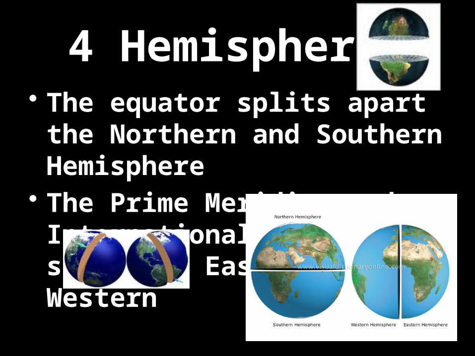
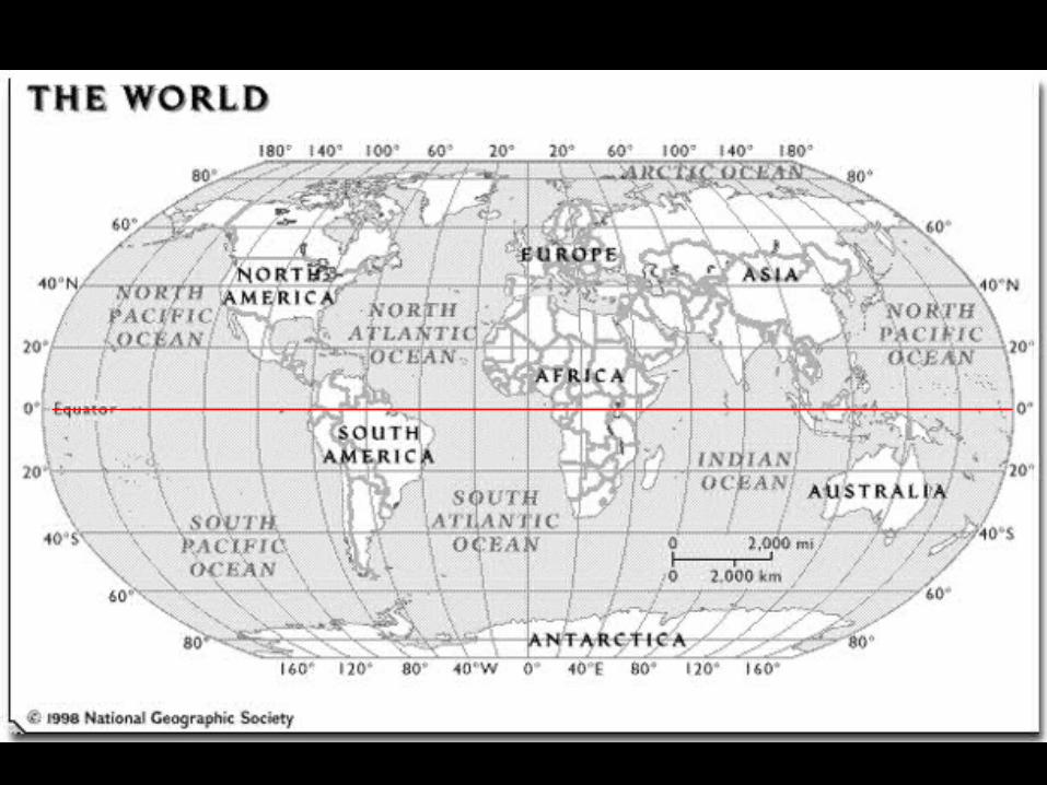
4 Hemispheres• The equator splits apart the Northern and Southern Hemisphere
• The Prime Meridian and International Date Line split the Eastern and Western
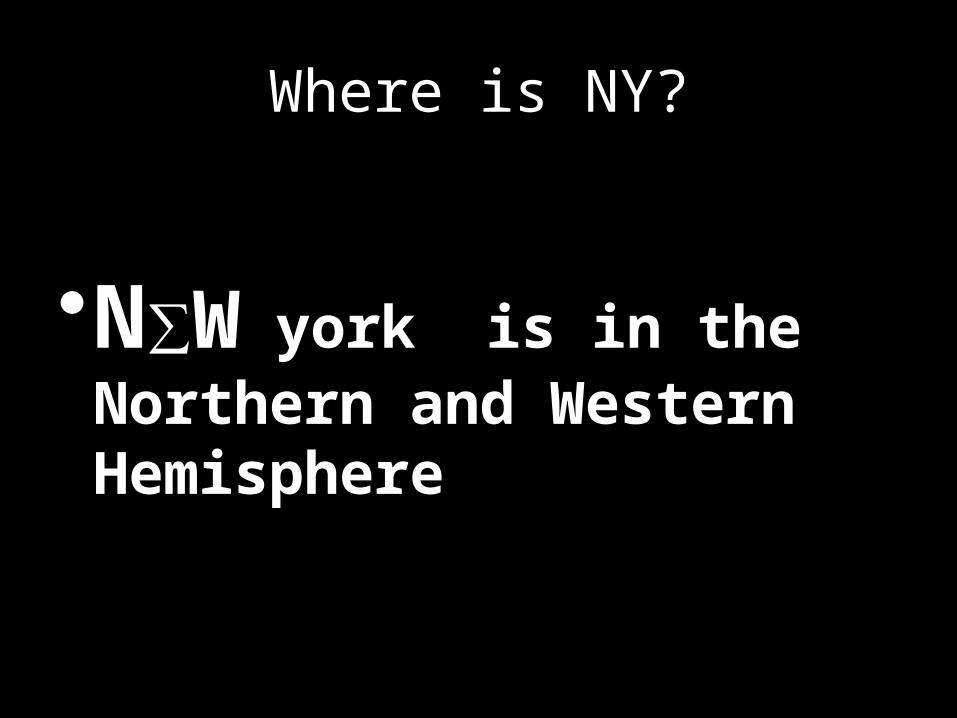
Where is NY?
•N∑W york is in the Northern and Western Hemisphere

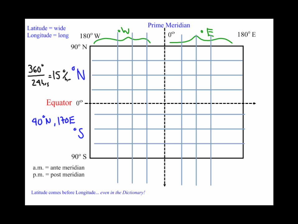
1) Latitude
• Runs horizontal• Runs East and West• Measured North and South of the Equator
– Use degrees N or S• Parallel lines that never touch
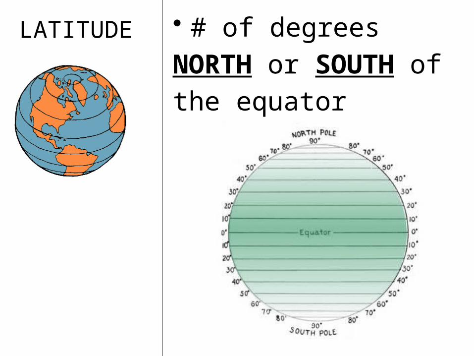
LATITUDE • # of degrees NORTH or SOUTH of the equator
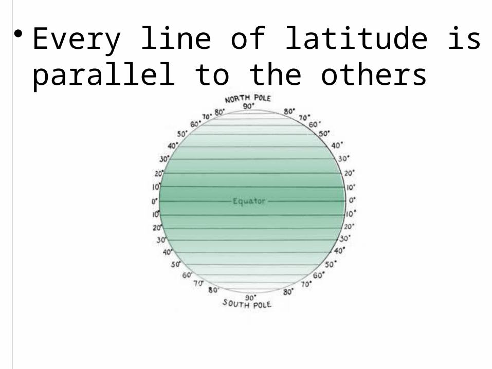
• Every line of latitude is parallel to the others

•Equator = 0° runs along middle
of Earth

• North Pole = 90° N • South Pole = 90° S
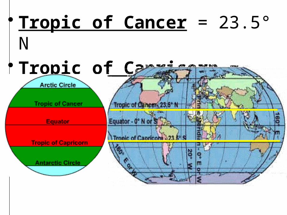
• Tropic of Cancer = 23.5° N• Tropic of Capricorn = 23.5° S
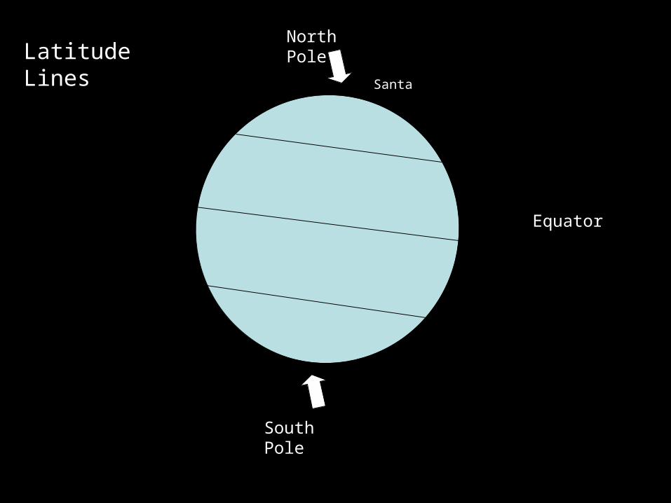
Latitude Lines
Equator
North Pole
South Pole
Santa
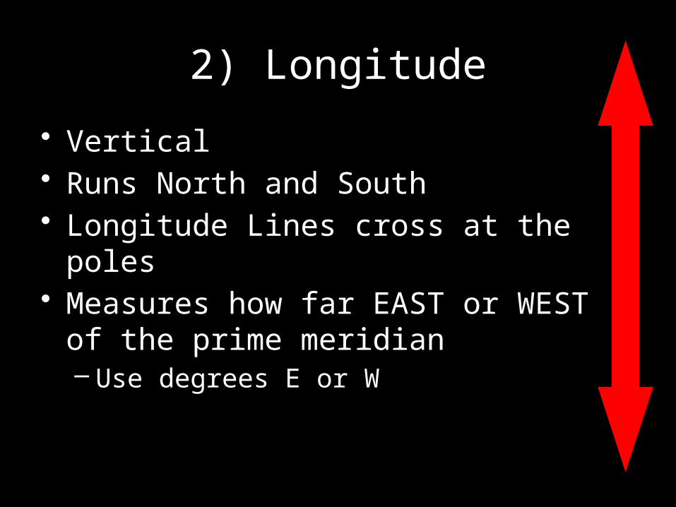
2) Longitude
• Vertical• Runs North and South• Longitude Lines cross at the poles• Measures how far EAST or WEST of the
prime meridian– Use degrees E or W
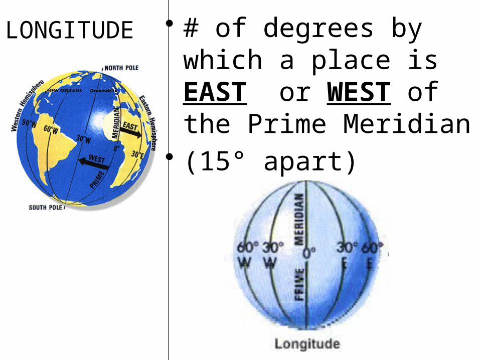
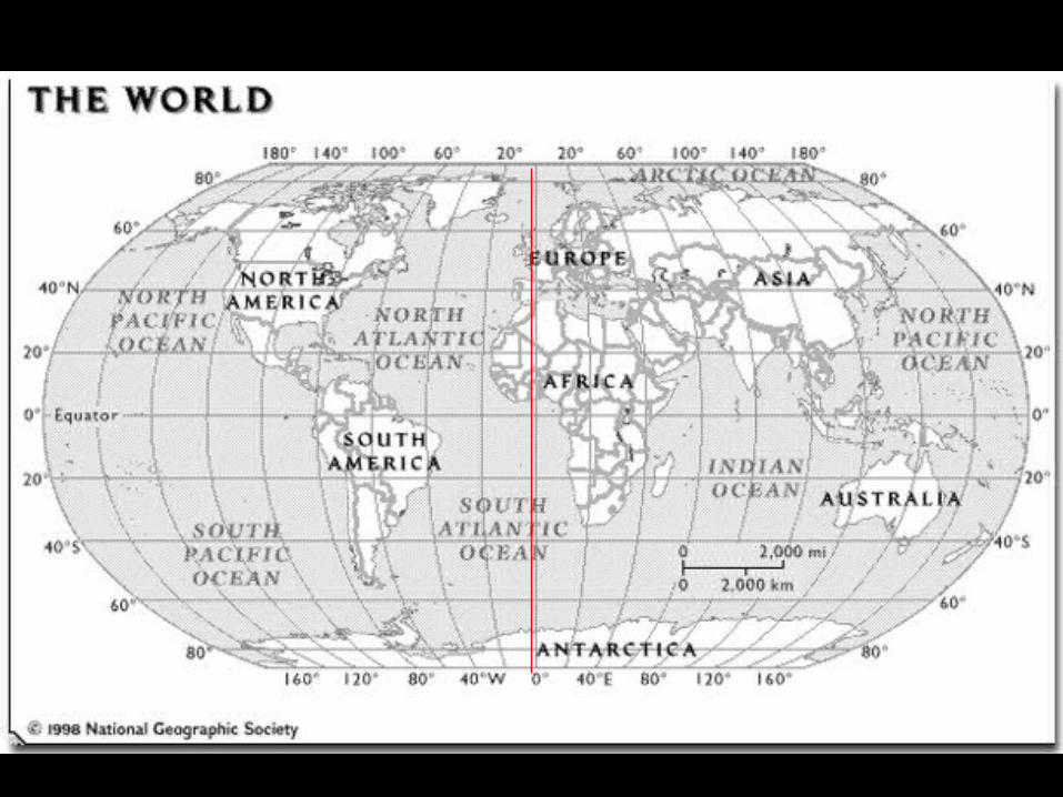
LONGITUDE • # of degrees by which a place is EAST or WEST of the Prime Meridian
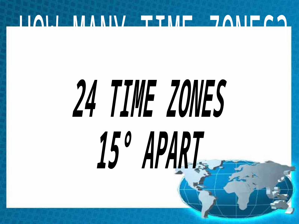
• (15° apart)

Prime Meridian
• Runs through Greenwich, England
Eastern
Hemisphere
Western
Hemisphere
Prime Meridian
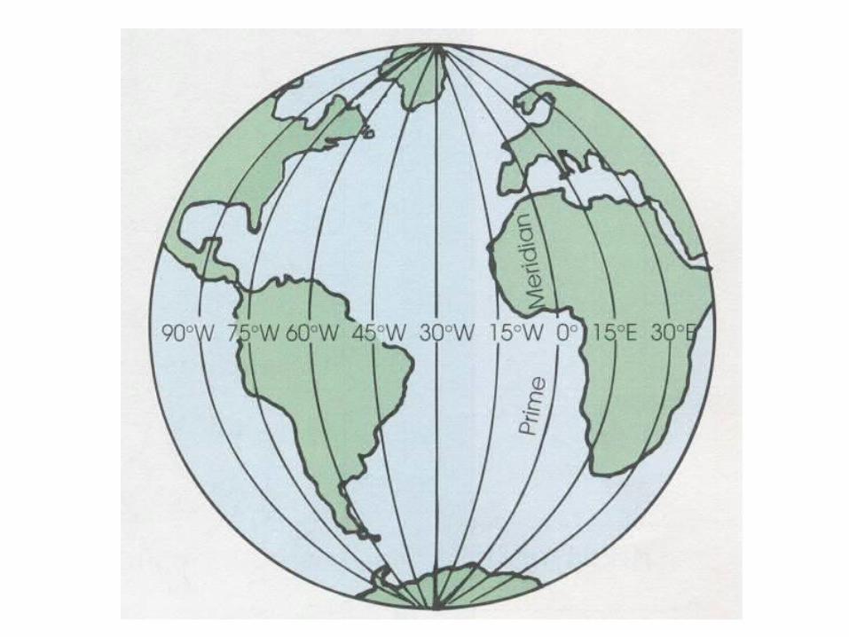

• Prime Meridian = 0°
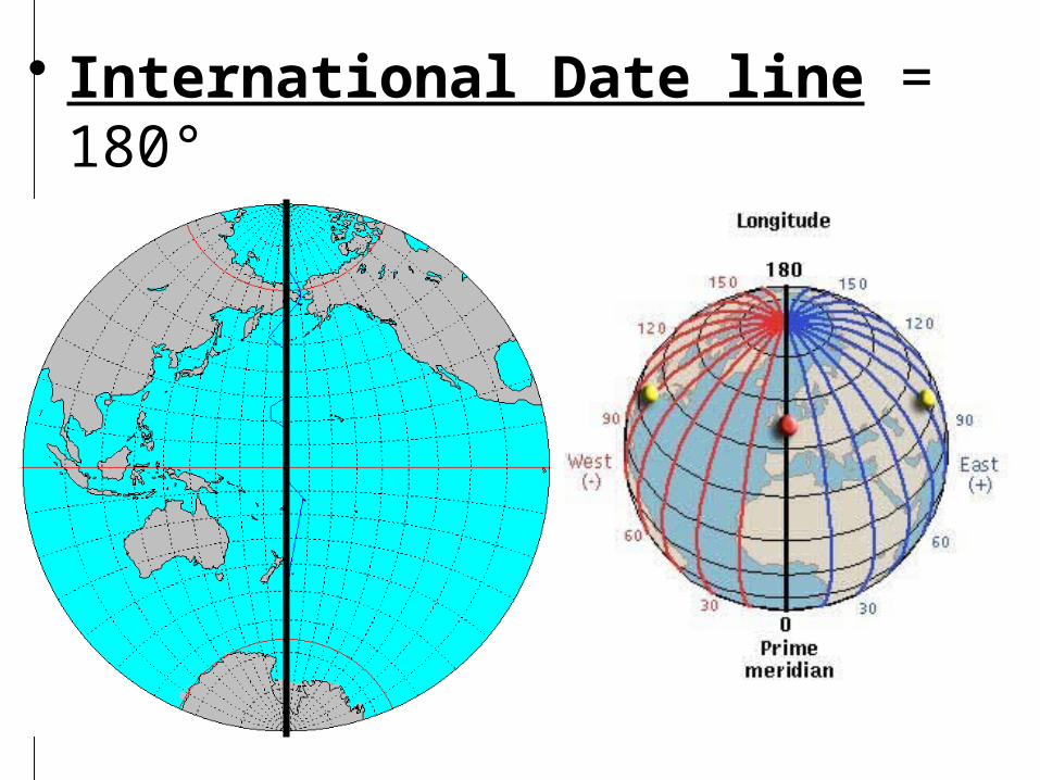
• International Date line = 180°
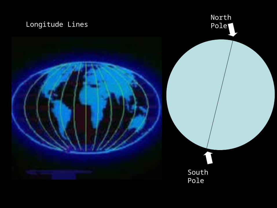
Longitude LinesNorth Pole
South Pole

20°N 20°E
20°S 40°W
40°N 60°E
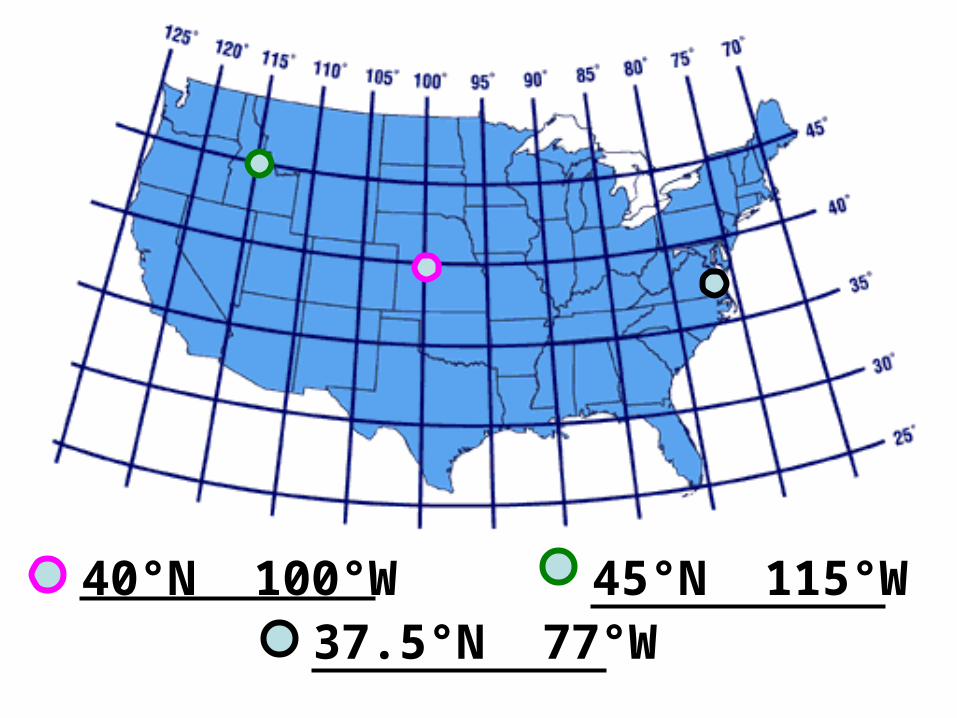
40°N 100°W 45°N 115°W37.5°N 77°W

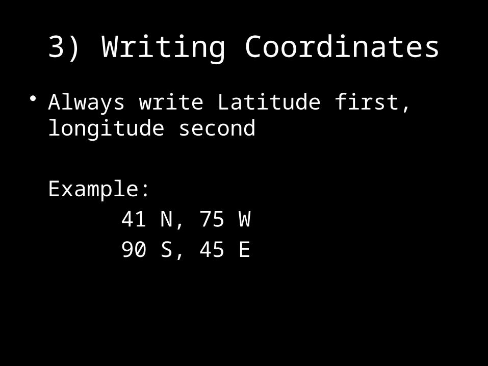
3) Writing Coordinates
• Always write Latitude first, longitude second
Example:
41 N, 75 W
90 S, 45 E

PRACTICE
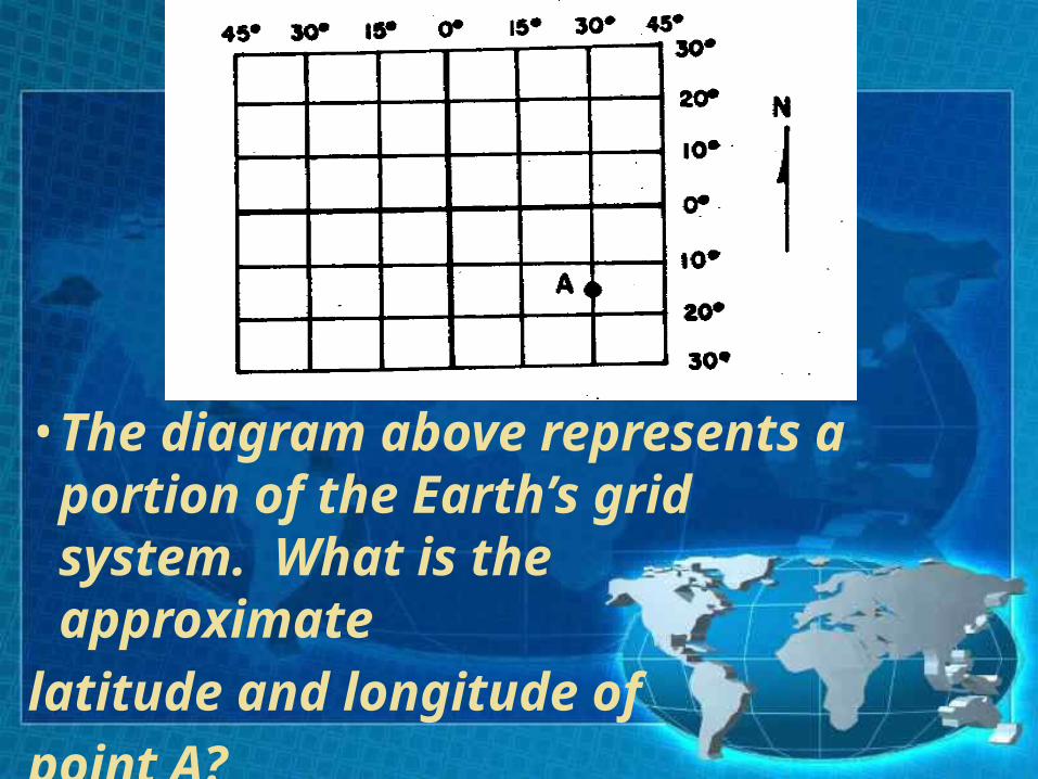
• The diagram above represents a portion of the Earth’s grid system. What is the approximate
latitude and longitude of point A?
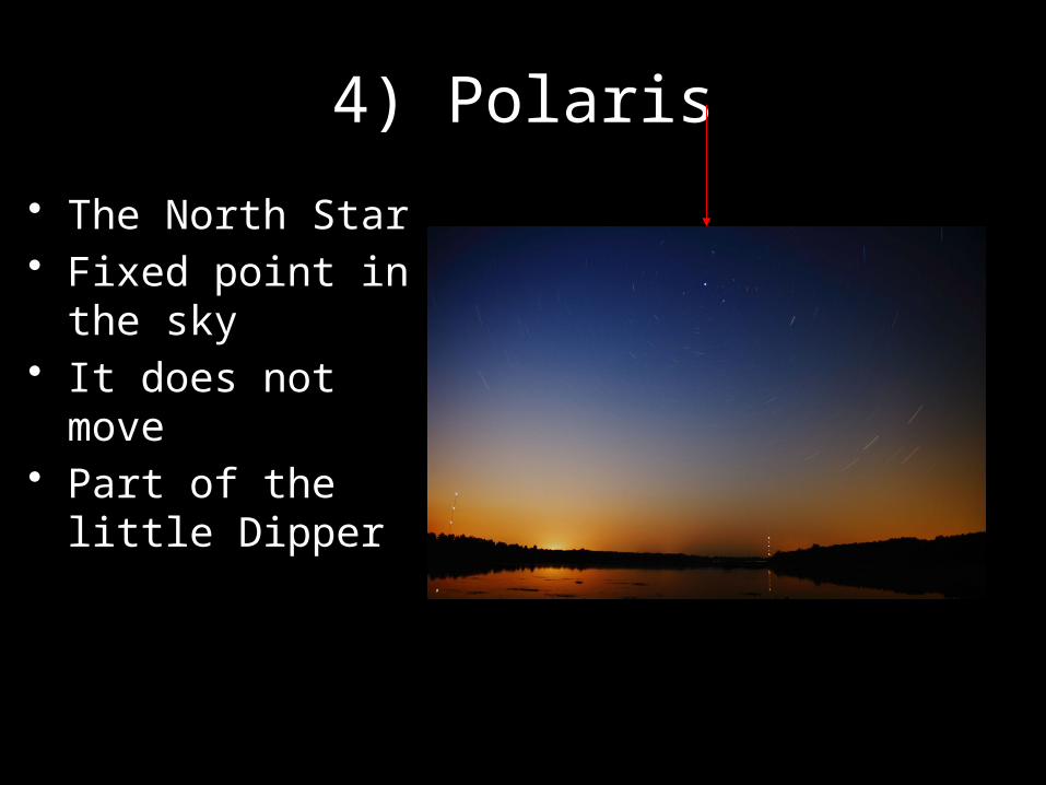
4) Polaris
• The North Star• Fixed point in the
sky• It does not move• Part of the little
Dipper


5) Altitude of a star
• The angle between the horizon and a star
Horizon
Measure this angle
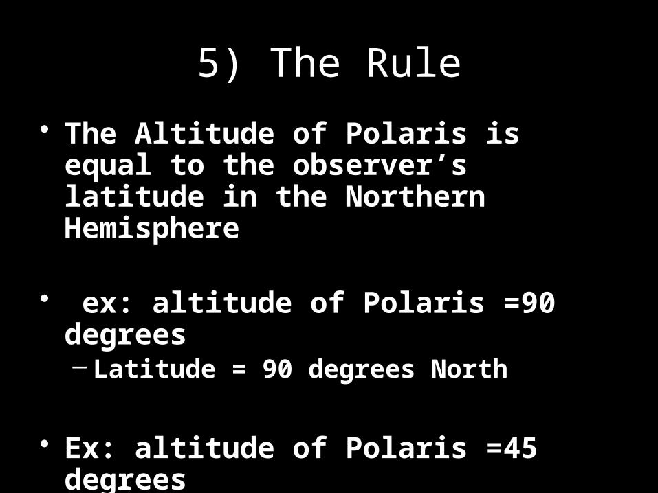
5) The Rule
• The Altitude of Polaris is equal to the observer’s latitude in the Northern Hemisphere
• ex: altitude of Polaris =90 degrees– Latitude = 90 degrees North
• Ex: altitude of Polaris =45 degrees– Latitude = 45 degrees North

6) Why?
• Earth is nearly spherical in shape
• Polaris is located directly above the Northern Hemisphere
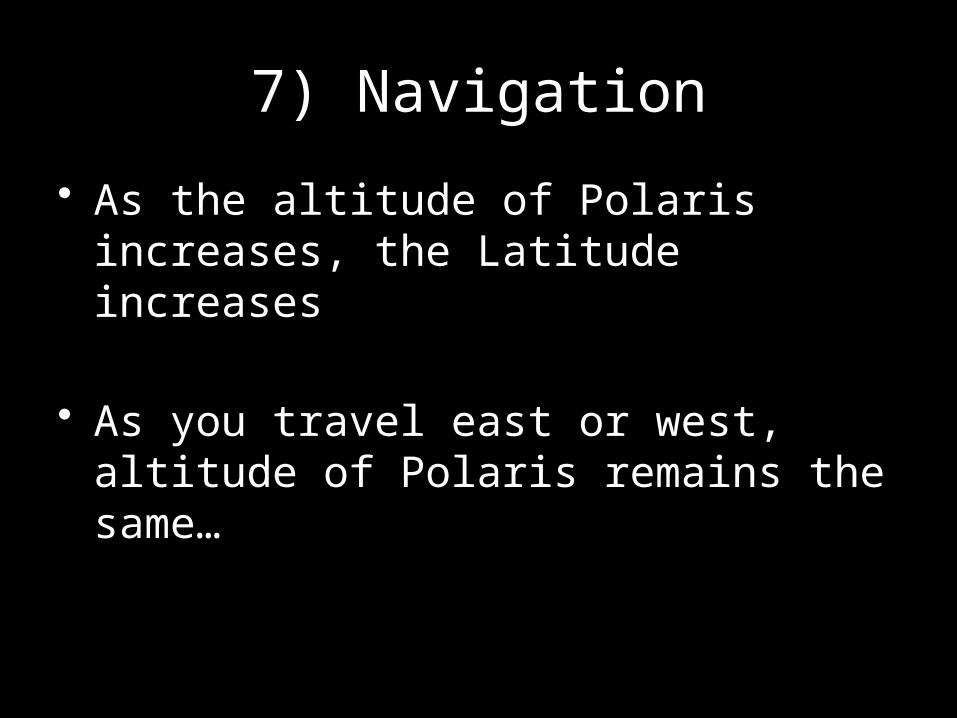
7) Navigation
• As the altitude of Polaris increases, the Latitude increases
• As you travel east or west, altitude of Polaris remains the same…

Let’s Review
• Where on Earth will the altitude of Polaris be 90 degrees?
• Where on Earth will the altitude of Polaris be on the horizon?
• What will happen to the alitutde of Polaris as you walk from the equator to the North Pole?

Aim 20b: Latitude Longitude Lan
Do Now: Pick Up Lab and begin
HW: Latitude Longitude connect the dots ws

Aim 20c: Today we will practice our latitude
longitude skills with a game of battleship
Do Now: pick up battleship worksheet and read through directions
HW: test corrections

Rules of the game• Each board has 5 ships.
One – 6 spaced ship
Two – 5 spaced ships
Two – 4 spaced ships
You are to takes turns calling out coordinates and marking it on your coordinate world sheet. Your opponent will tell you “hit” or “miss”
If you miss, it is your opponents turn. If you hit, you keep going until you miss.
Opponents should mark every call you make on their game sheet.

• One player should always mark the coordinates you call out on your coordinate world map
• The other team member should mark every coordinate called out by your opponents on your lettered map
• You are to takes turns calling out coordinates Your opponent will tell you “hit” or “miss”If you miss, it is your opponents turn. If you hit,
you keep going until you miss.
• The winner sinks all your battleships
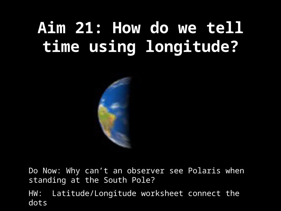
Aim 21: How do we tell time using longitude?
Do Now: Why can’t an observer see Polaris when standing at the South Pole?
HW: Latitude/Longitude worksheet connect the dots
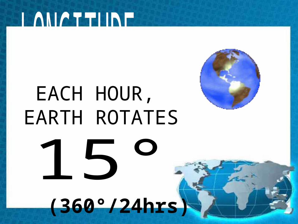
EACH HOUR, EARTH ROTATES
(360°/24hrs)


• A) Find the difference in longitude
• B) Divide that number by 15
• Example:• 75 degrees – 30 degrees = 45 degrees
• Divide 45 by 15 = 3 • Answer: 3 hours
HOW TO FIND DIFFERENCE IN TIME BETWEEN 2 LOCATIONS.
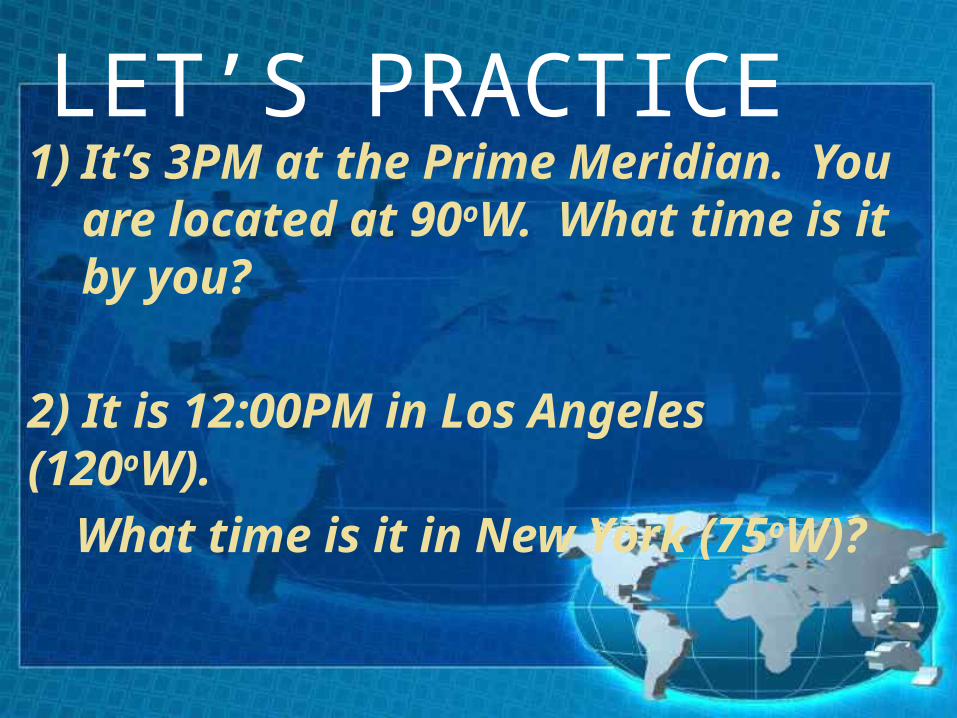
LET’S PRACTICE1)It’s 3PM at the Prime
Meridian. You are located at 90oW. What time is it by you?
2) It is 12:00PM in Los Angeles (120oW).
What time is it in New York (75oW)?

• A) Find the difference in time
• B) Multiply the difference by 15
Example:• NY time 4:00 pm• California time 1:00 pm• Difference = 3 hours• 3 X 15 = 45• Answer: 45 degree difference
HOW TO FIND THE DIFFERENCE IN LONGITUDE USING TIME
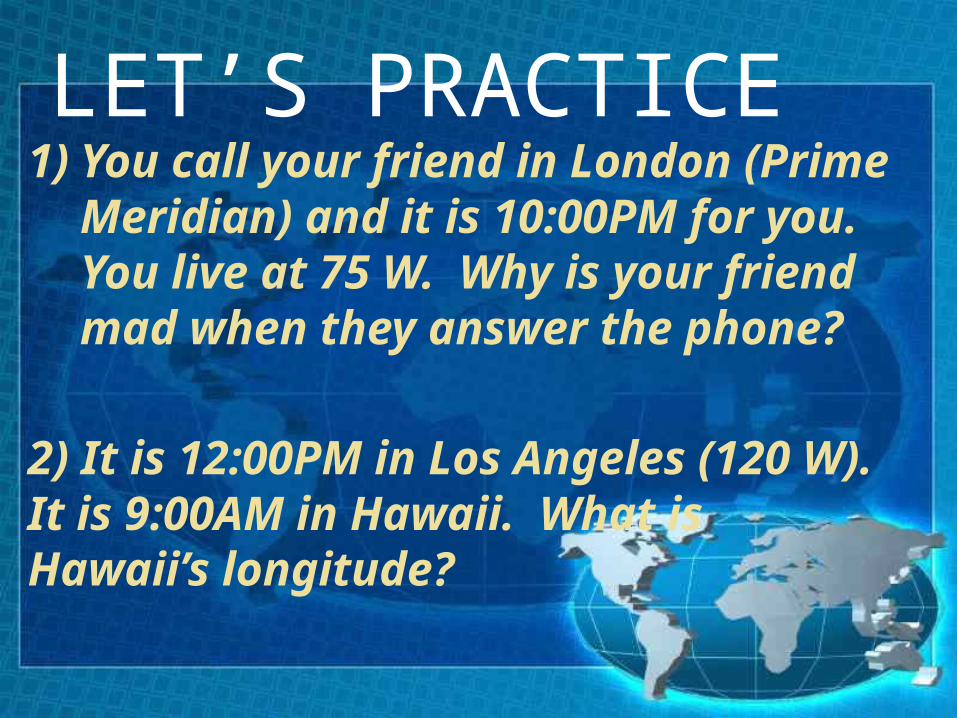
LET’S PRACTICE1)You call your friend in London
(Prime Meridian) and it is 10:00PM for you. You live at 75 W. Why is your friend mad when they answer the phone?
2) It is 12:00PM in Los Angeles (120 W). It is 9:00AM in Hawaii. What is Hawaii’s longitude?
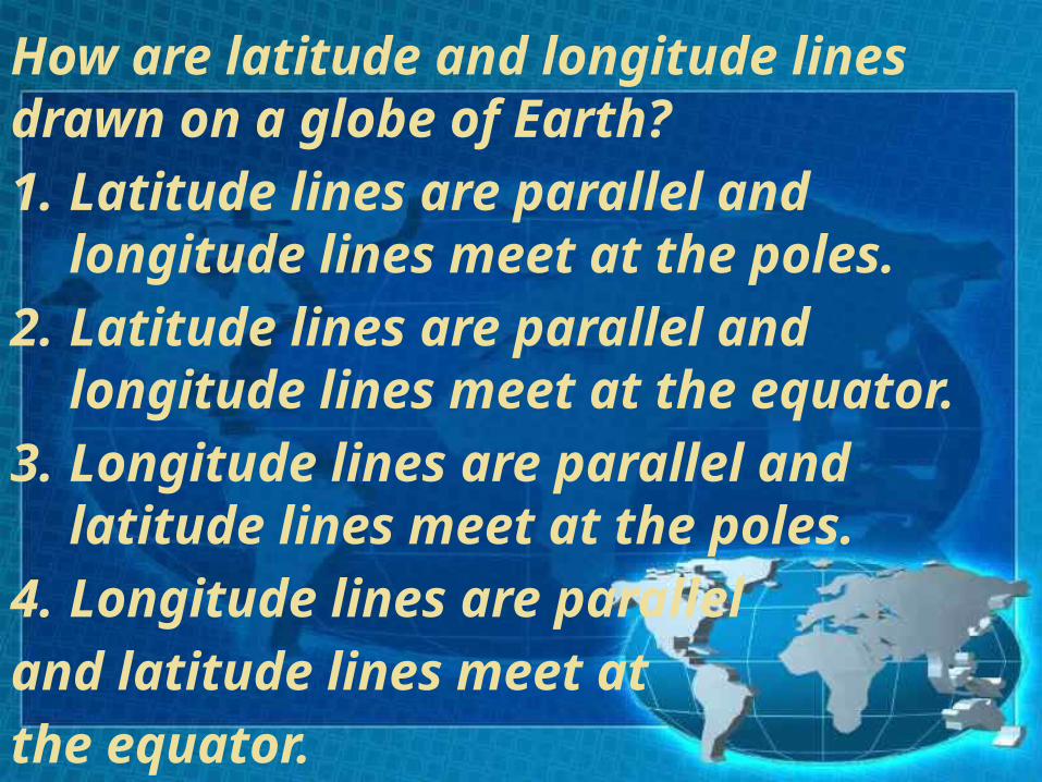
How are latitude and longitude lines drawn on a globe of Earth?1.Latitude lines are parallel and
longitude lines meet at the poles.
2.Latitude lines are parallel and longitude lines meet at the equator.
3.Longitude lines are parallel and latitude lines meet at the poles.
4.Longitude lines are parallel and latitude lines meet at the equator.