Embed Size (px)
Citation preview
Ad-hoc Processing with the CoastWatch Utilities
Peter Hollemans, Terrenus Earth Sciences Consultant for NOAA/NESDIS
CoastWatch Operations Managers Meeting, June, 2007
Peter Hollemans, Terrenus Earth Sciences Consultant for NOAA/NESDISJune, 2007
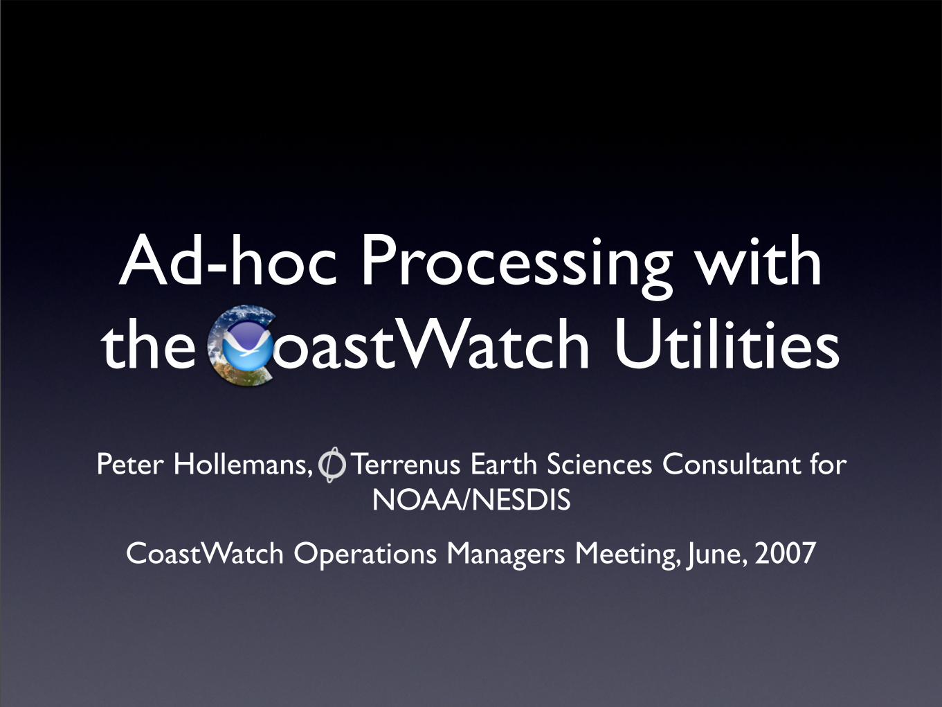
Talk Outline
• Extracting Information
• Data Processing
• Custom Code
2
Extracting Information
Data Processing
Custom Code
Peter Hollemans, Terrenus Earth Sciences Consultant for NOAA/NESDISJune, 2007
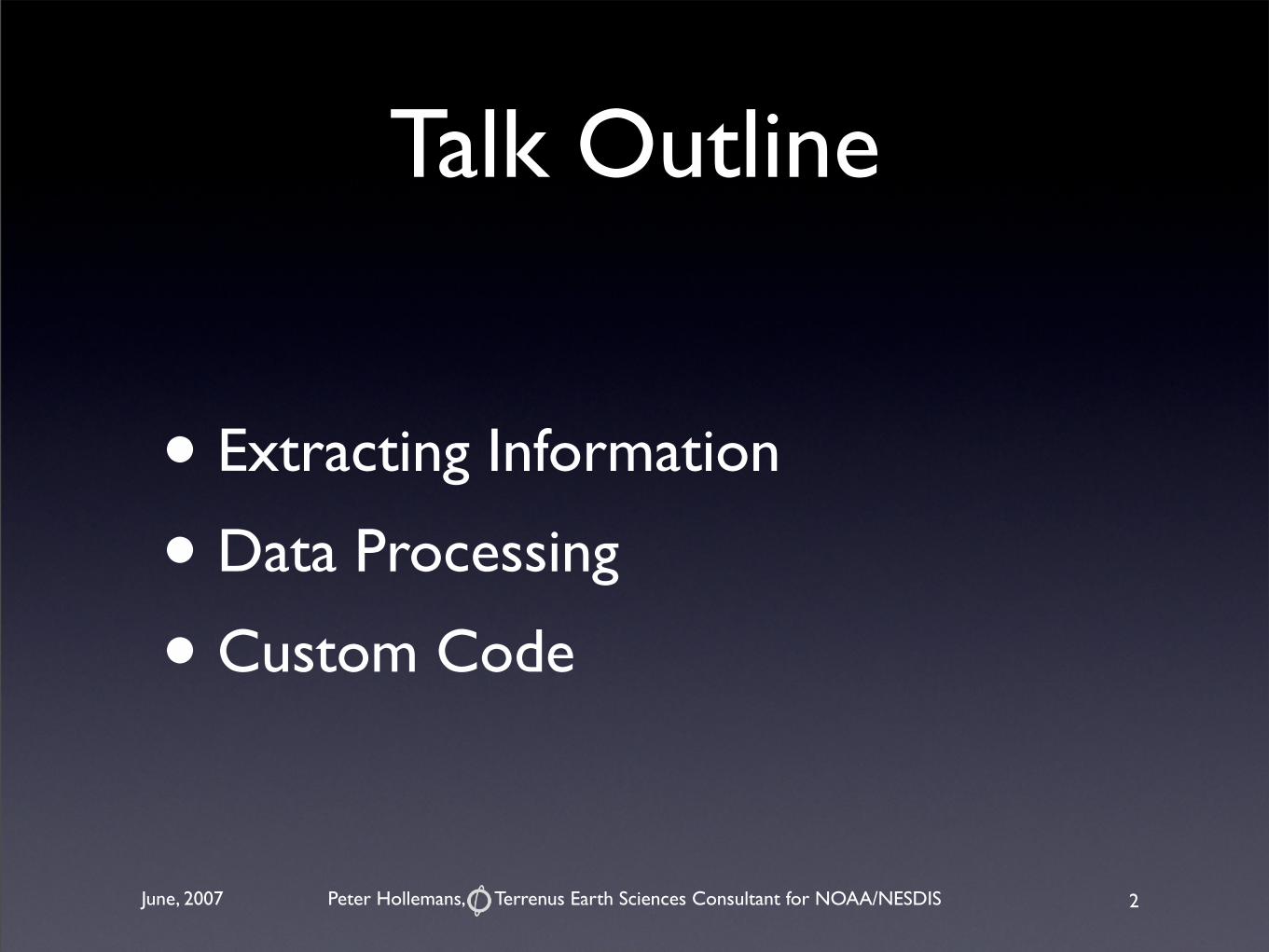
File Contents
• Dump file contents with the cwinfo tool
• Extract raw metadata values from HDF files with the hdatt tool
3
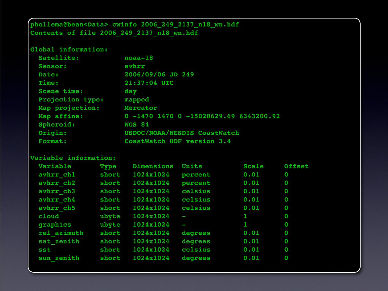
phollema@bean<Data> cwinfo 2006_249_2137_n18_wn.hdf Contents of file 2006_249_2137_n18_wn.hdf
Global information: Satellite: noaa-18 Sensor: avhrr Date: 2006/09/06 JD 249 Time: 21:37:04 UTC Scene time: day Projection type: mapped Map projection: Mercator Map affine: 0 -1470 1470 0 -15028629.69 6343200.92 Spheroid: WGS 84 Origin: USDOC/NOAA/NESDIS CoastWatch Format: CoastWatch HDF version 3.4
Variable information: Variable Type Dimensions Units Scale Offset avhrr_ch1 short 1024x1024 percent 0.01 0 avhrr_ch2 short 1024x1024 percent 0.01 0 avhrr_ch3 short 1024x1024 celsius 0.01 0 avhrr_ch4 short 1024x1024 celsius 0.01 0 avhrr_ch5 short 1024x1024 celsius 0.01 0 cloud ubyte 1024x1024 - 1 0 graphics ubyte 1024x1024 - 1 0 rel_azimuth short 1024x1024 degrees 0.01 0 sat_zenith short 1024x1024 degrees 0.01 0 sst short 1024x1024 celsius 0.01 0 sun_zenith short 1024x1024 degrees 0.01 0
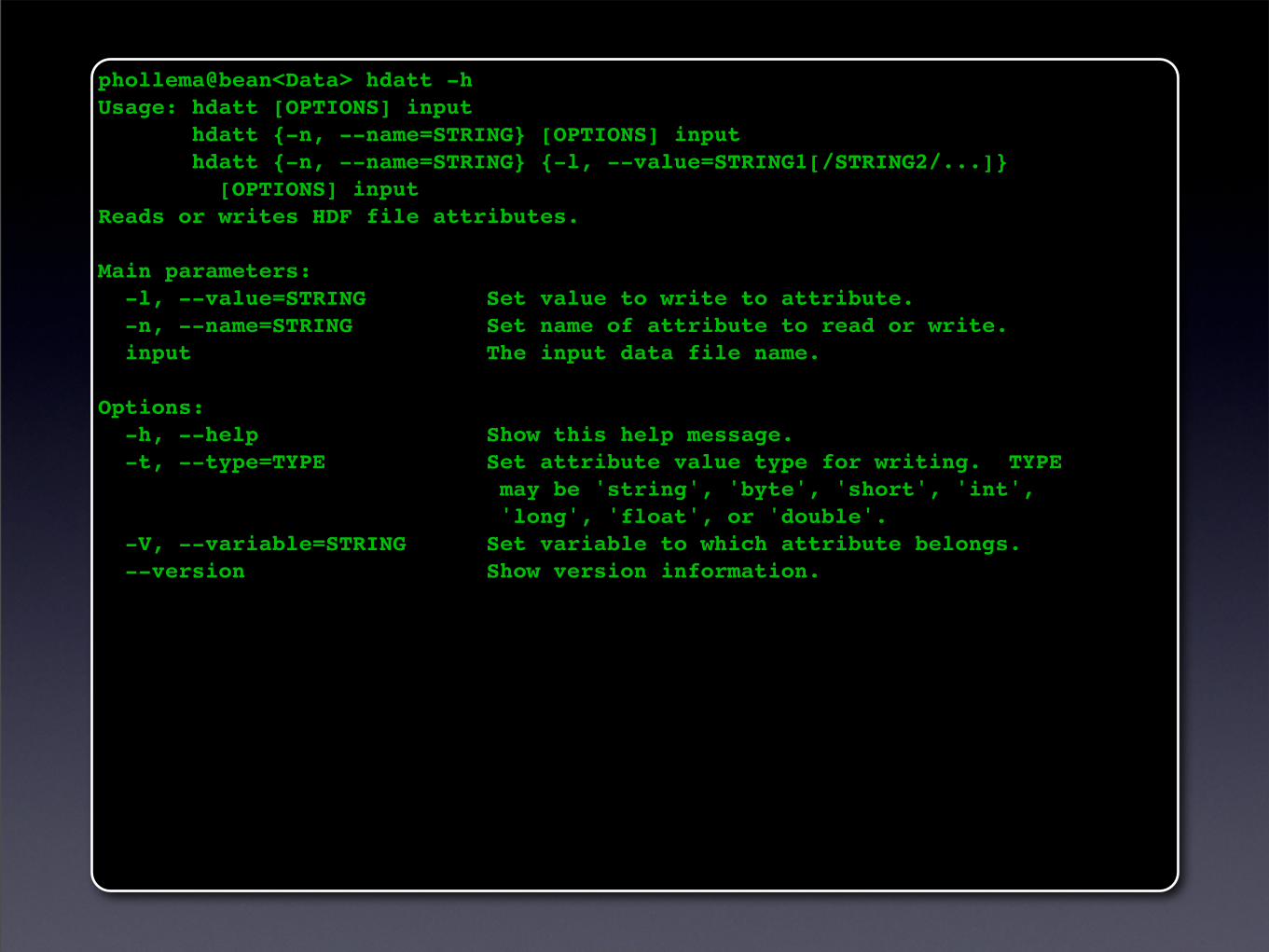
phollema@bean<Data> hdatt -hUsage: hdatt [OPTIONS] input hdatt {-n, --name=STRING} [OPTIONS] input hdatt {-n, --name=STRING} {-l, --value=STRING1[/STRING2/...]} [OPTIONS] inputReads or writes HDF file attributes.
Main parameters: -l, --value=STRING Set value to write to attribute. -n, --name=STRING Set name of attribute to read or write. input The input data file name.
Options: -h, --help Show this help message. -t, --type=TYPE Set attribute value type for writing. TYPE may be 'string', 'byte', 'short', 'int', 'long', 'float', or 'double'. -V, --variable=STRING Set variable to which attribute belongs. --version Show version information.
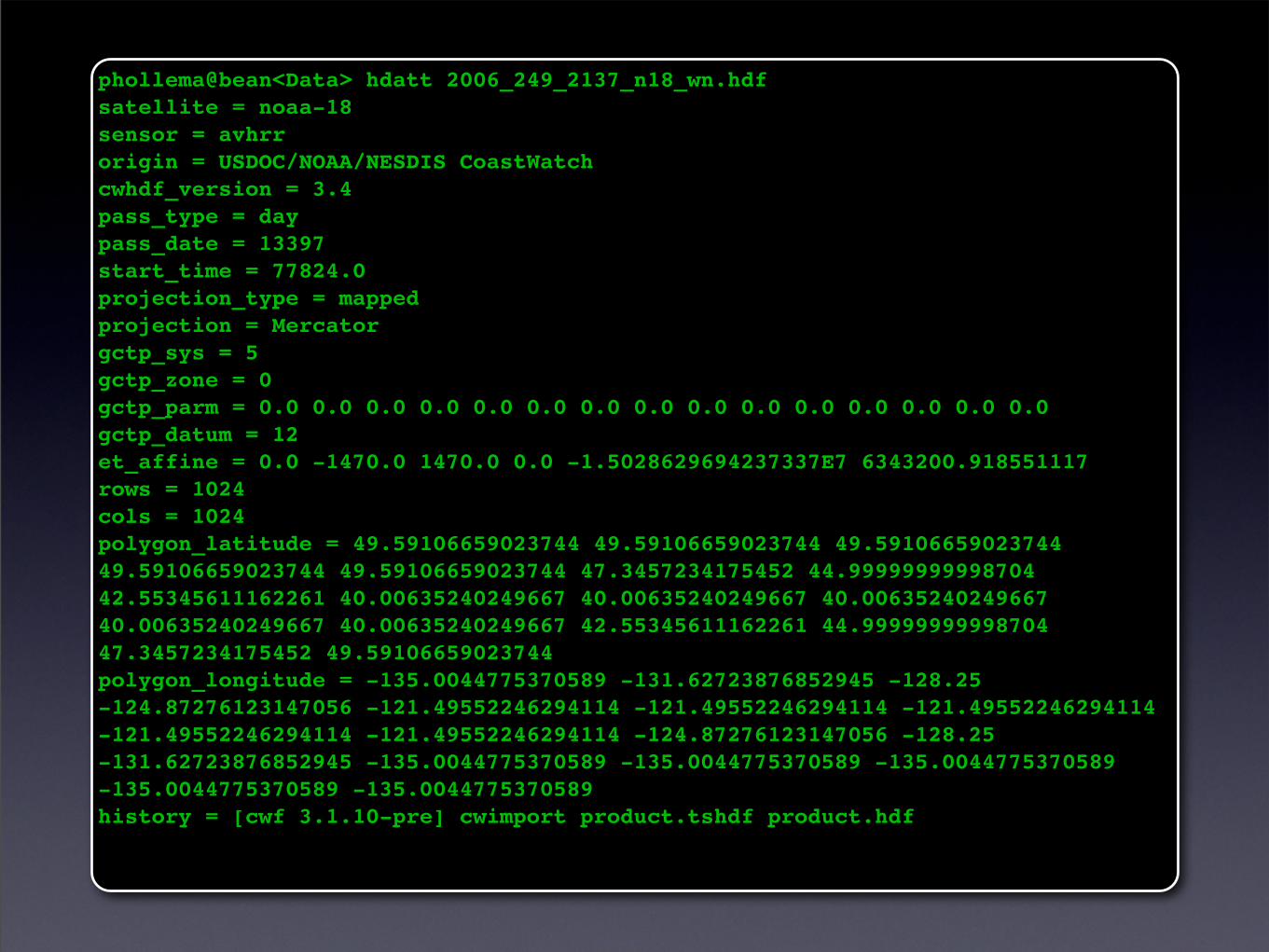
phollema@bean<Data> hdatt 2006_249_2137_n18_wn.hdfsatellite = noaa-18sensor = avhrrorigin = USDOC/NOAA/NESDIS CoastWatchcwhdf_version = 3.4pass_type = daypass_date = 13397start_time = 77824.0projection_type = mappedprojection = Mercatorgctp_sys = 5gctp_zone = 0gctp_parm = 0.0 0.0 0.0 0.0 0.0 0.0 0.0 0.0 0.0 0.0 0.0 0.0 0.0 0.0 0.0gctp_datum = 12et_affine = 0.0 -1470.0 1470.0 0.0 -1.5028629694237337E7 6343200.918551117rows = 1024cols = 1024polygon_latitude = 49.59106659023744 49.59106659023744 49.59106659023744 49.59106659023744 49.59106659023744 47.3457234175452 44.99999999998704 42.55345611162261 40.00635240249667 40.00635240249667 40.00635240249667 40.00635240249667 40.00635240249667 42.55345611162261 44.99999999998704 47.3457234175452 49.59106659023744polygon_longitude = -135.0044775370589 -131.62723876852945 -128.25 -124.87276123147056 -121.49552246294114 -121.49552246294114 -121.49552246294114 -121.49552246294114 -121.49552246294114 -124.87276123147056 -128.25 -131.62723876852945 -135.0044775370589 -135.0044775370589 -135.0044775370589 -135.0044775370589 -135.0044775370589history = [cwf 3.1.10-pre] cwimport product.tshdf product.hdf
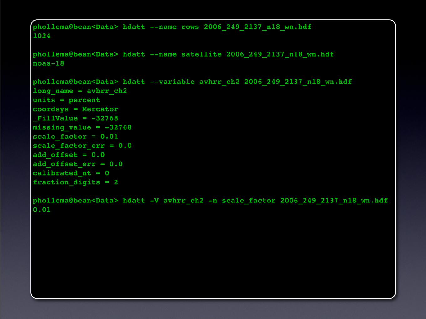
phollema@bean<Data> hdatt --name rows 2006_249_2137_n18_wn.hdf1024
phollema@bean<Data> hdatt --name satellite 2006_249_2137_n18_wn.hdfnoaa-18
phollema@bean<Data> hdatt --variable avhrr_ch2 2006_249_2137_n18_wn.hdflong_name = avhrr_ch2units = percentcoordsys = Mercator_FillValue = -32768missing_value = -32768scale_factor = 0.01scale_factor_err = 0.0add_offset = 0.0add_offset_err = 0.0calibrated_nt = 0fraction_digits = 2
phollema@bean<Data> hdatt -V avhrr_ch2 -n scale_factor 2006_249_2137_n18_wn.hdf0.01
Extracting Information
Data Processing
Custom Code
Peter Hollemans, Terrenus Earth Sciences Consultant for NOAA/NESDISJune, 2007
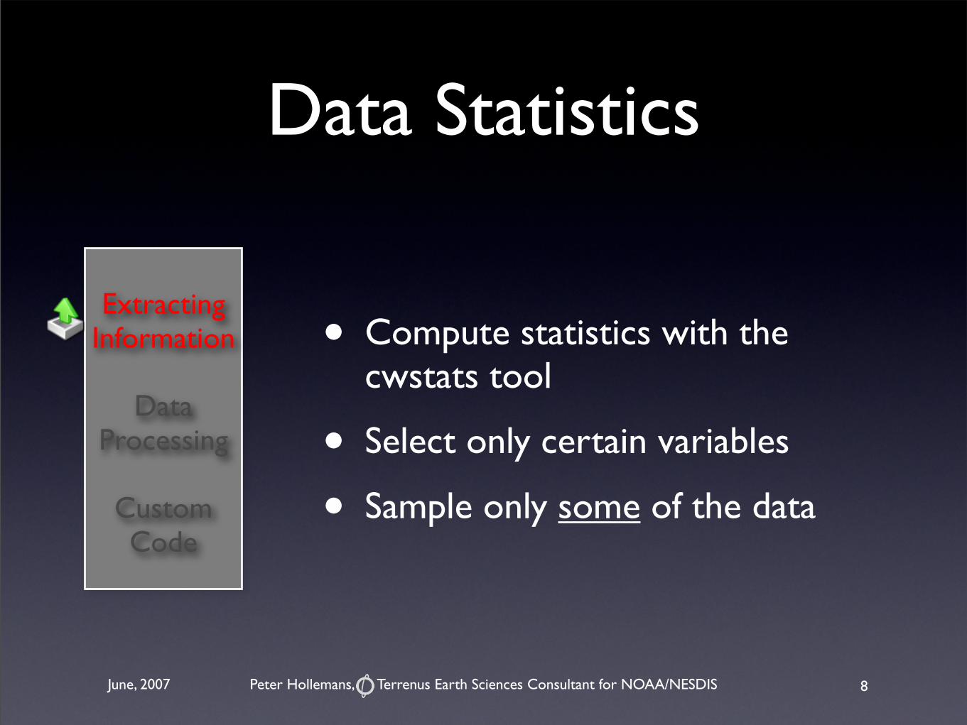
• Compute statistics with the cwstats tool
• Select only certain variables
• Sample only some of the data
Data Statistics
8
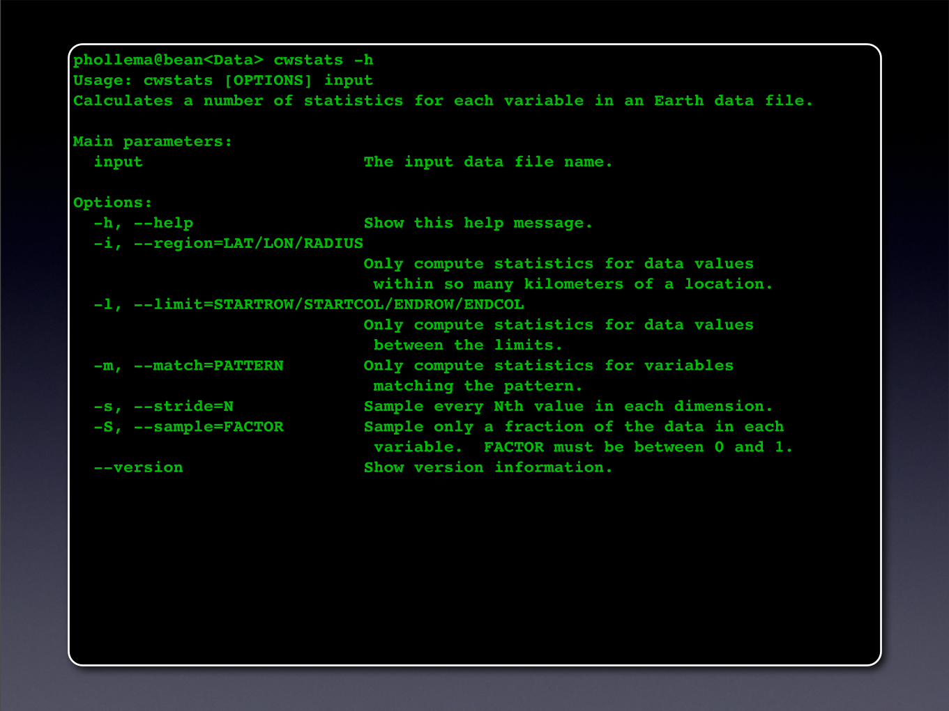
phollema@bean<Data> cwstats -hUsage: cwstats [OPTIONS] inputCalculates a number of statistics for each variable in an Earth data file.
Main parameters: input The input data file name.
Options: -h, --help Show this help message. -i, --region=LAT/LON/RADIUS Only compute statistics for data values within so many kilometers of a location. -l, --limit=STARTROW/STARTCOL/ENDROW/ENDCOL Only compute statistics for data values between the limits. -m, --match=PATTERN Only compute statistics for variables matching the pattern. -s, --stride=N Sample every Nth value in each dimension. -S, --sample=FACTOR Sample only a fraction of the data in each variable. FACTOR must be between 0 and 1. --version Show version information.
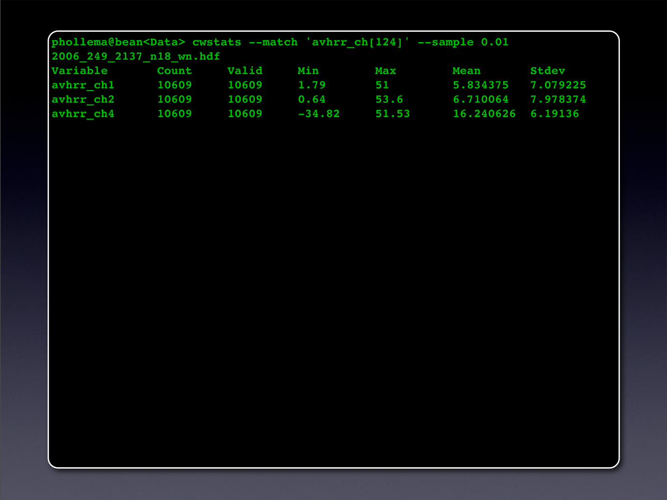
phollema@bean<Data> cwstats --match 'avhrr_ch[124]' --sample 0.01 2006_249_2137_n18_wn.hdfVariable Count Valid Min Max Mean Stdev avhrr_ch1 10609 10609 1.79 51 5.834375 7.079225 avhrr_ch2 10609 10609 0.64 53.6 6.710064 7.978374 avhrr_ch4 10609 10609 -34.82 51.53 16.240626 6.19136
Extracting Information
Data Processing
Custom Code
Peter Hollemans, Terrenus Earth Sciences Consultant for NOAA/NESDISJune, 2007
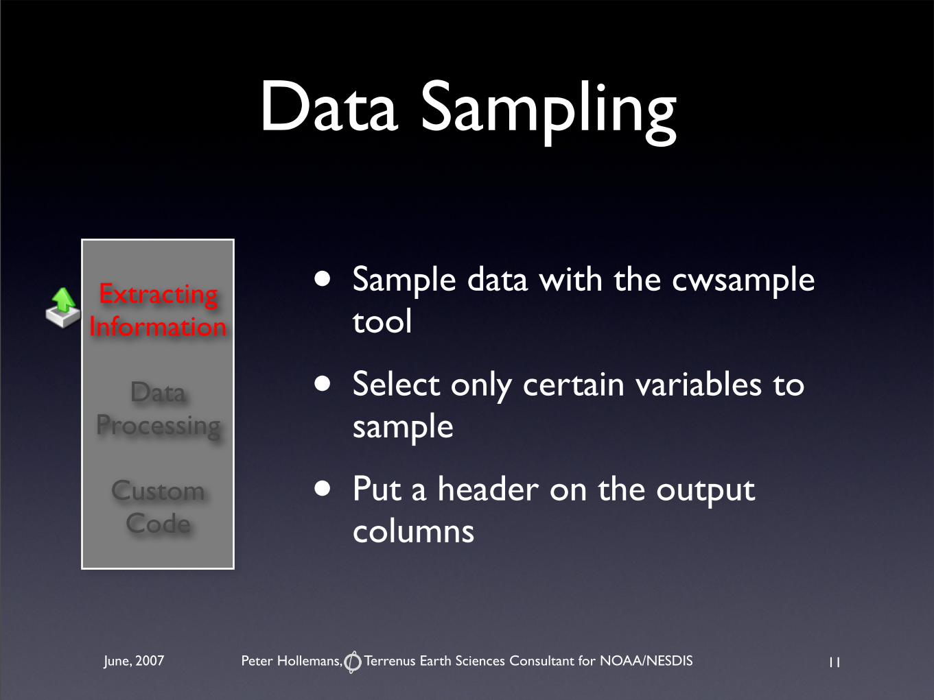
• Sample data with the cwsample tool
• Select only certain variables to sample
• Put a header on the output columns
Data Sampling
11
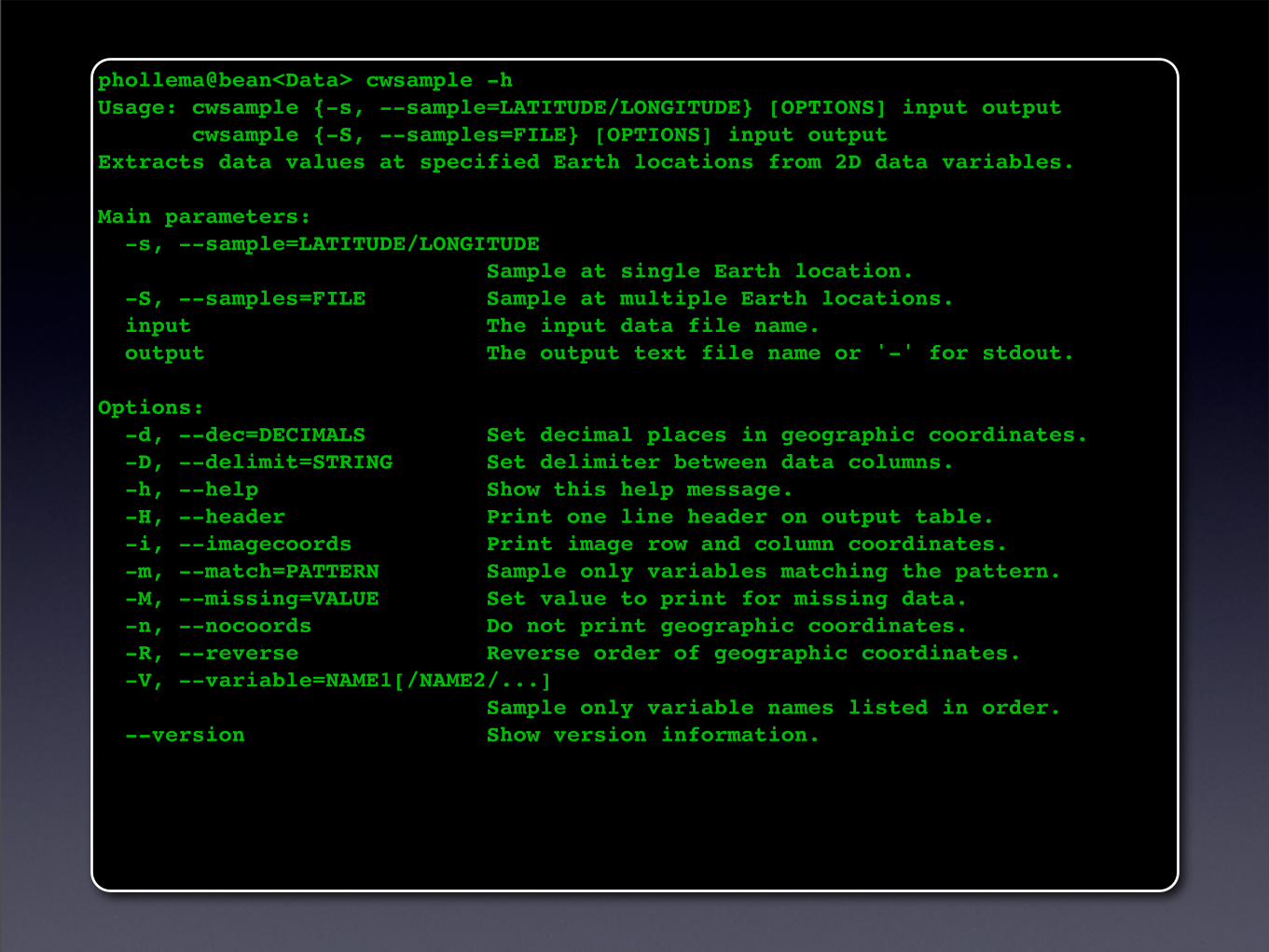
phollema@bean<Data> cwsample -hUsage: cwsample {-s, --sample=LATITUDE/LONGITUDE} [OPTIONS] input output cwsample {-S, --samples=FILE} [OPTIONS] input outputExtracts data values at specified Earth locations from 2D data variables.
Main parameters: -s, --sample=LATITUDE/LONGITUDE Sample at single Earth location. -S, --samples=FILE Sample at multiple Earth locations. input The input data file name. output The output text file name or '-' for stdout.
Options: -d, --dec=DECIMALS Set decimal places in geographic coordinates. -D, --delimit=STRING Set delimiter between data columns. -h, --help Show this help message. -H, --header Print one line header on output table. -i, --imagecoords Print image row and column coordinates. -m, --match=PATTERN Sample only variables matching the pattern. -M, --missing=VALUE Set value to print for missing data. -n, --nocoords Do not print geographic coordinates. -R, --reverse Reverse order of geographic coordinates. -V, --variable=NAME1[/NAME2/...] Sample only variable names listed in order. --version Show version information.
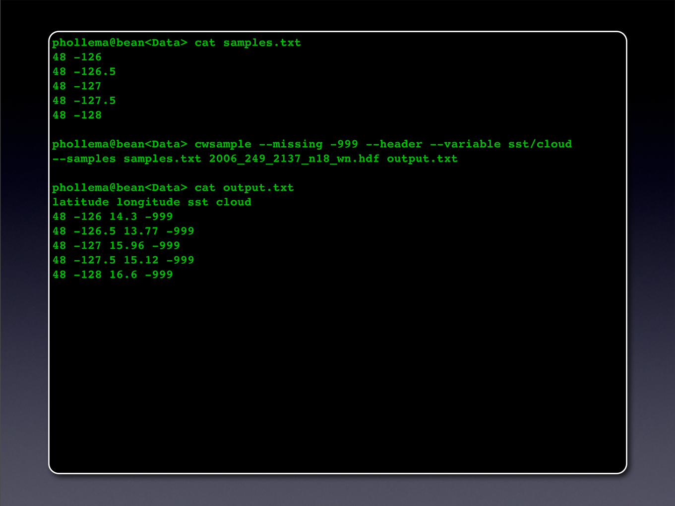
phollema@bean<Data> cat samples.txt 48 -12648 -126.548 -12748 -127.548 -128
phollema@bean<Data> cwsample --missing -999 --header --variable sst/cloud --samples samples.txt 2006_249_2137_n18_wn.hdf output.txt
phollema@bean<Data> cat output.txt latitude longitude sst cloud48 -126 14.3 -99948 -126.5 13.77 -99948 -127 15.96 -99948 -127.5 15.12 -99948 -128 16.6 -999
Peter Hollemans, Terrenus Earth Sciences Consultant for NOAA/NESDISJune, 2007
Extracting Information
Data Processing
Custom Code
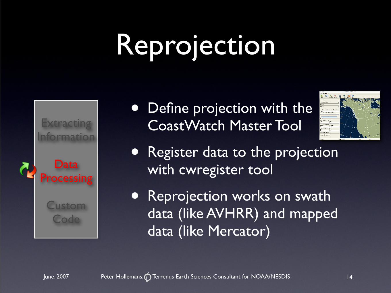
Reprojection
• Define projection with the CoastWatch Master Tool
• Register data to the projection with cwregister tool
• Reprojection works on swath data (like AVHRR) and mapped data (like Mercator)
14
Peter Hollemans, Terrenus Earth Sciences Consultant for NOAA/NESDISJune, 2007
Extracting Information
Data Processing
Custom Code
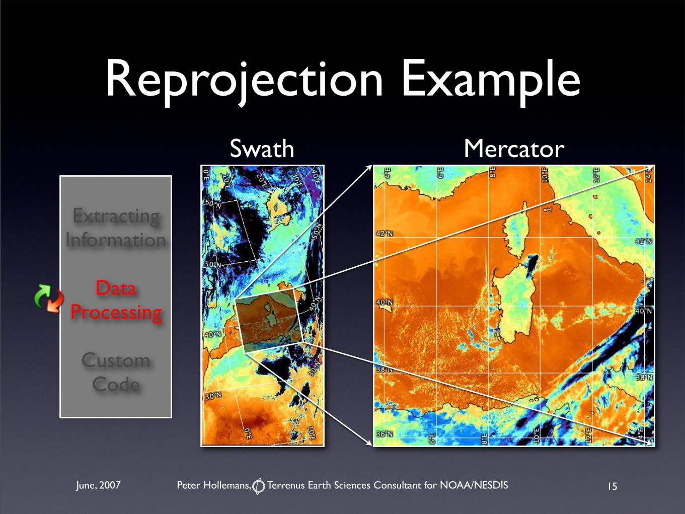
MercatorSwath
Reprojection Example
15
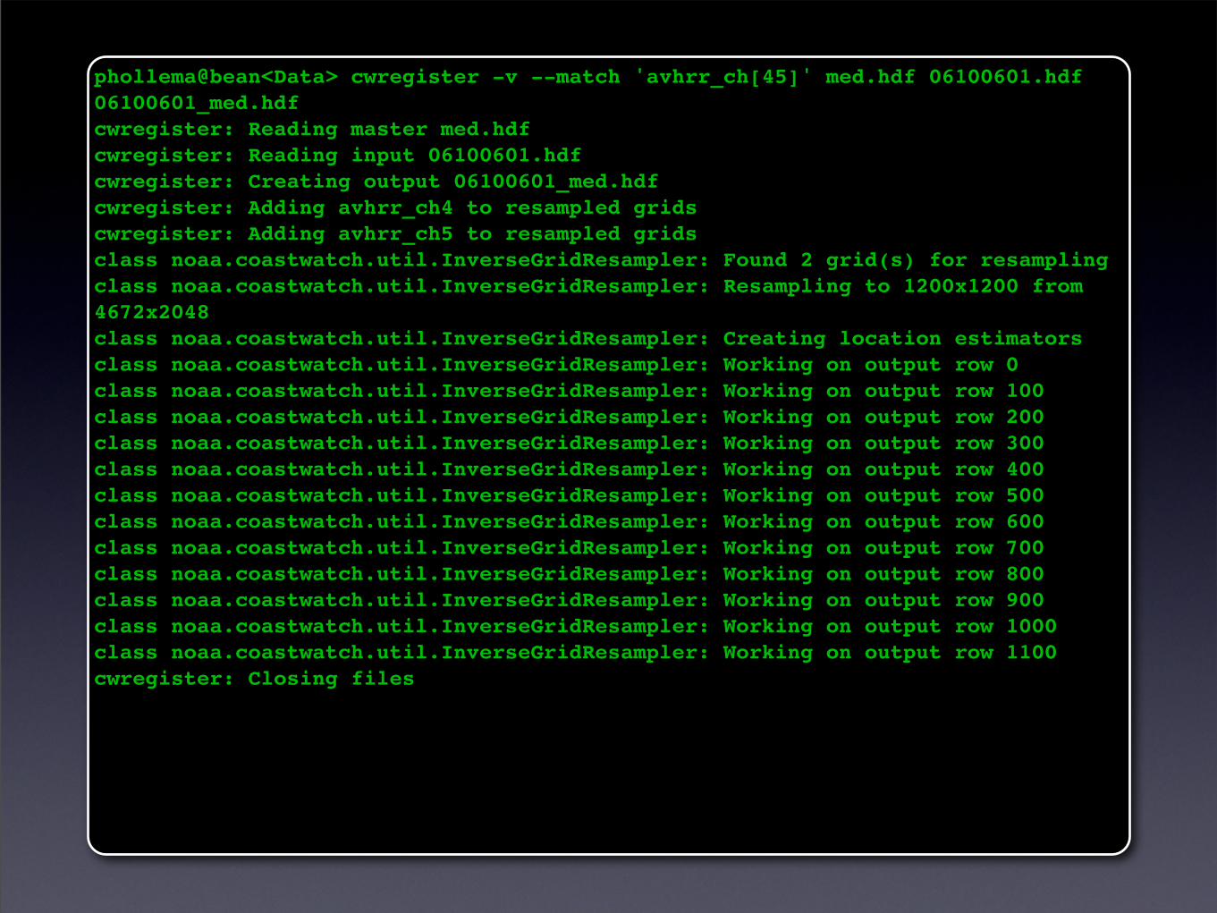
phollema@bean<Data> cwregister -v --match 'avhrr_ch[45]' med.hdf 06100601.hdf 06100601_med.hdfcwregister: Reading master med.hdfcwregister: Reading input 06100601.hdfcwregister: Creating output 06100601_med.hdfcwregister: Adding avhrr_ch4 to resampled gridscwregister: Adding avhrr_ch5 to resampled gridsclass noaa.coastwatch.util.InverseGridResampler: Found 2 grid(s) for resamplingclass noaa.coastwatch.util.InverseGridResampler: Resampling to 1200x1200 from 4672x2048class noaa.coastwatch.util.InverseGridResampler: Creating location estimatorsclass noaa.coastwatch.util.InverseGridResampler: Working on output row 0class noaa.coastwatch.util.InverseGridResampler: Working on output row 100class noaa.coastwatch.util.InverseGridResampler: Working on output row 200class noaa.coastwatch.util.InverseGridResampler: Working on output row 300class noaa.coastwatch.util.InverseGridResampler: Working on output row 400class noaa.coastwatch.util.InverseGridResampler: Working on output row 500class noaa.coastwatch.util.InverseGridResampler: Working on output row 600class noaa.coastwatch.util.InverseGridResampler: Working on output row 700class noaa.coastwatch.util.InverseGridResampler: Working on output row 800class noaa.coastwatch.util.InverseGridResampler: Working on output row 900class noaa.coastwatch.util.InverseGridResampler: Working on output row 1000class noaa.coastwatch.util.InverseGridResampler: Working on output row 1100cwregister: Closing files
Peter Hollemans, Terrenus Earth Sciences Consultant for NOAA/NESDISJune, 2007
Extracting Information
Data Processing
Custom Code
Computation
• Compute math expressions with with the cwmath tool:
- data masking
- solar zenith angle correction
- NDVI, SST, etc
• Combine data files with the cwcomposite tool
17
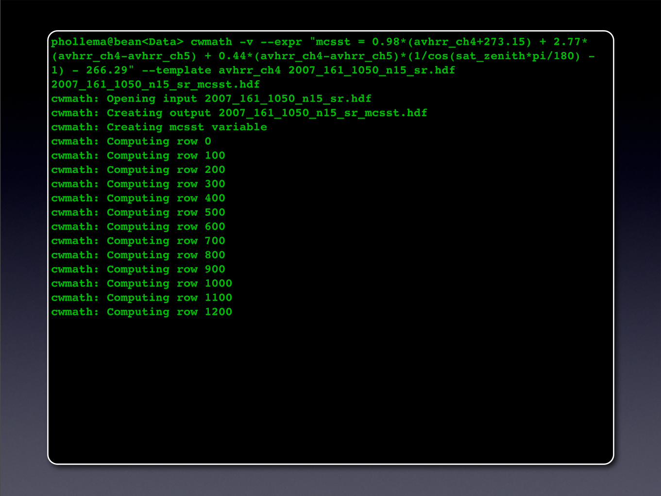
phollema@bean<Data> cwmath -v --expr "mcsst = 0.98*(avhrr_ch4+273.15) + 2.77*(avhrr_ch4-avhrr_ch5) + 0.44*(avhrr_ch4-avhrr_ch5)*(1/cos(sat_zenith*pi/180) - 1) - 266.29" --template avhrr_ch4 2007_161_1050_n15_sr.hdf 2007_161_1050_n15_sr_mcsst.hdfcwmath: Opening input 2007_161_1050_n15_sr.hdfcwmath: Creating output 2007_161_1050_n15_sr_mcsst.hdfcwmath: Creating mcsst variablecwmath: Computing row 0cwmath: Computing row 100cwmath: Computing row 200cwmath: Computing row 300cwmath: Computing row 400cwmath: Computing row 500cwmath: Computing row 600cwmath: Computing row 700cwmath: Computing row 800cwmath: Computing row 900cwmath: Computing row 1000cwmath: Computing row 1100cwmath: Computing row 1200
Peter Hollemans, Terrenus Earth Sciences Consultant for NOAA/NESDISJune, 2007
Extracting Information
Data Processing
Custom Code
Data Interfaces
• Call command line tools from a scripting language: Bash, Perl, Python
• Use the Java API for direct access to data
19
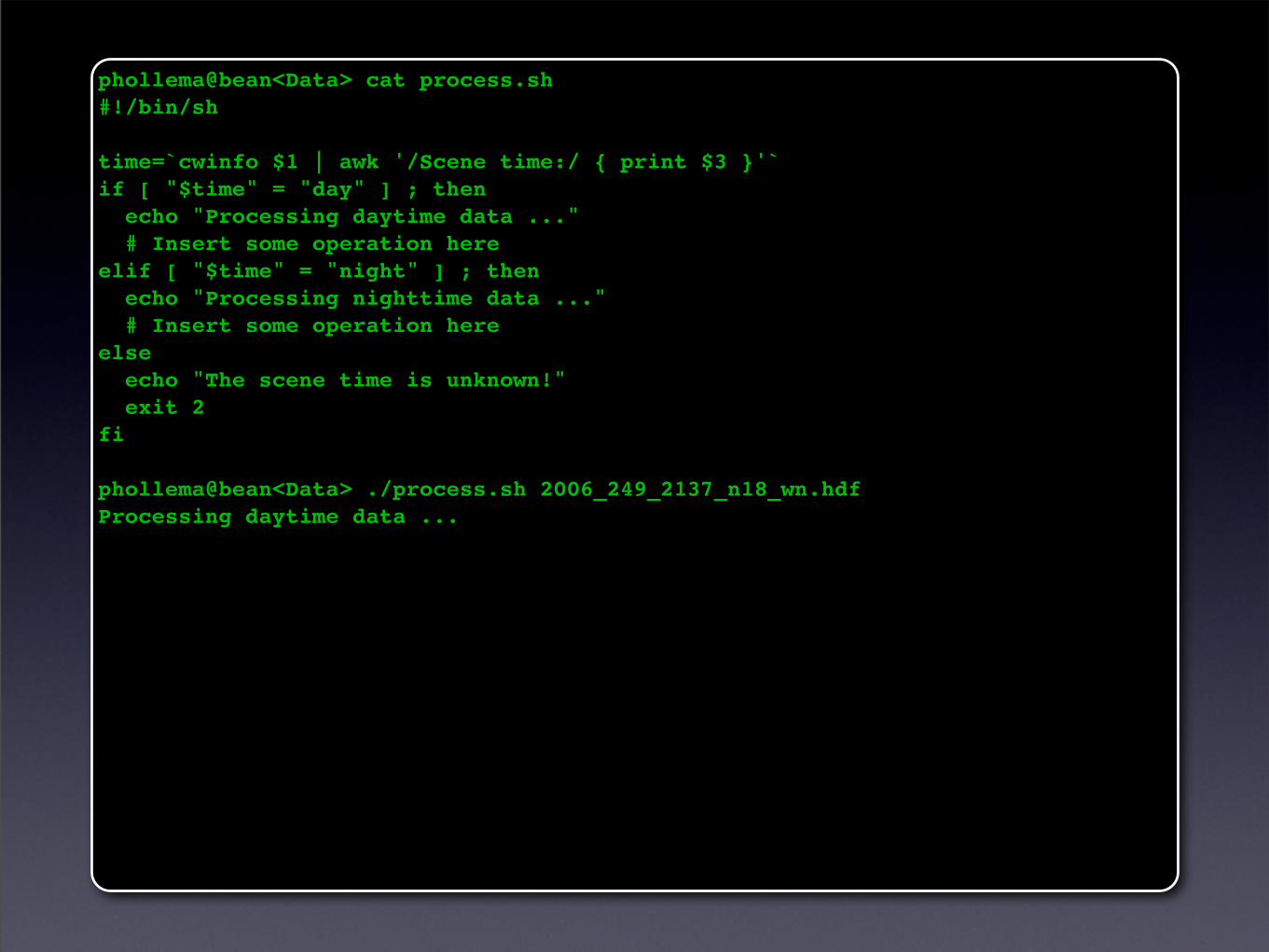
phollema@bean<Data> cat process.sh #!/bin/sh
time=`cwinfo $1 | awk '/Scene time:/ { print $3 }'`if [ "$time" = "day" ] ; then echo "Processing daytime data ..." # Insert some operation hereelif [ "$time" = "night" ] ; then echo "Processing nighttime data ..." # Insert some operation hereelse echo "The scene time is unknown!" exit 2fi
phollema@bean<Data> ./process.sh 2006_249_2137_n18_wn.hdfProcessing daytime data ...
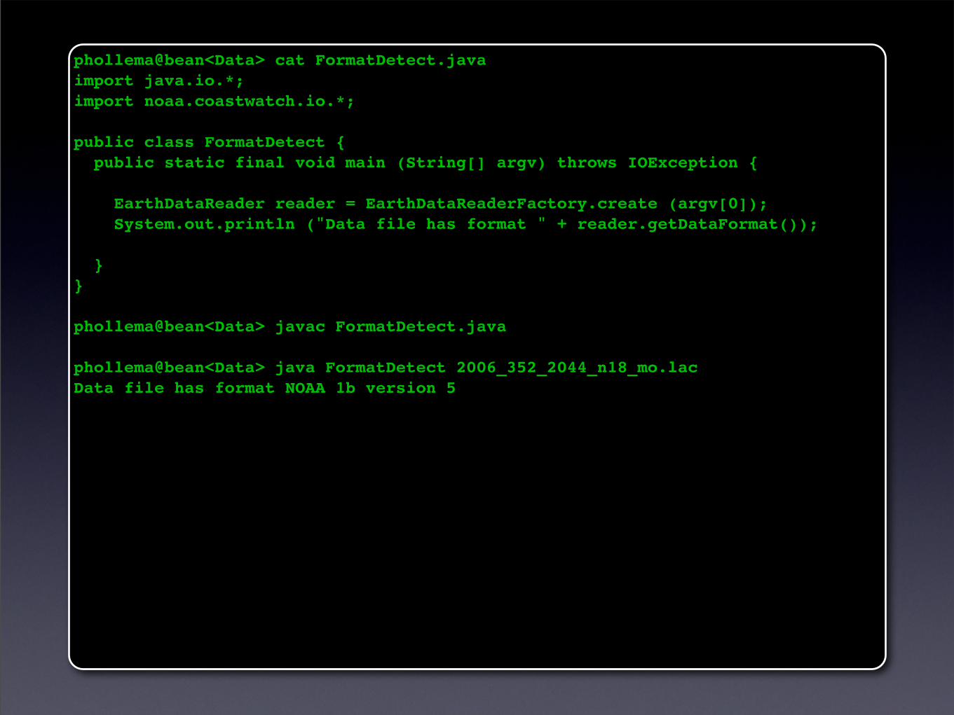
phollema@bean<Data> cat FormatDetect.java import java.io.*;import noaa.coastwatch.io.*;
public class FormatDetect { public static final void main (String[] argv) throws IOException {
EarthDataReader reader = EarthDataReaderFactory.create (argv[0]); System.out.println ("Data file has format " + reader.getDataFormat());
}}
phollema@bean<Data> javac FormatDetect.java
phollema@bean<Data> java FormatDetect 2006_352_2044_n18_mo.lacData file has format NOAA 1b version 5
Peter Hollemans, Terrenus Earth Sciences Consultant for NOAA/NESDISJune, 2007
Extracting Information
Data Processing
Custom Code
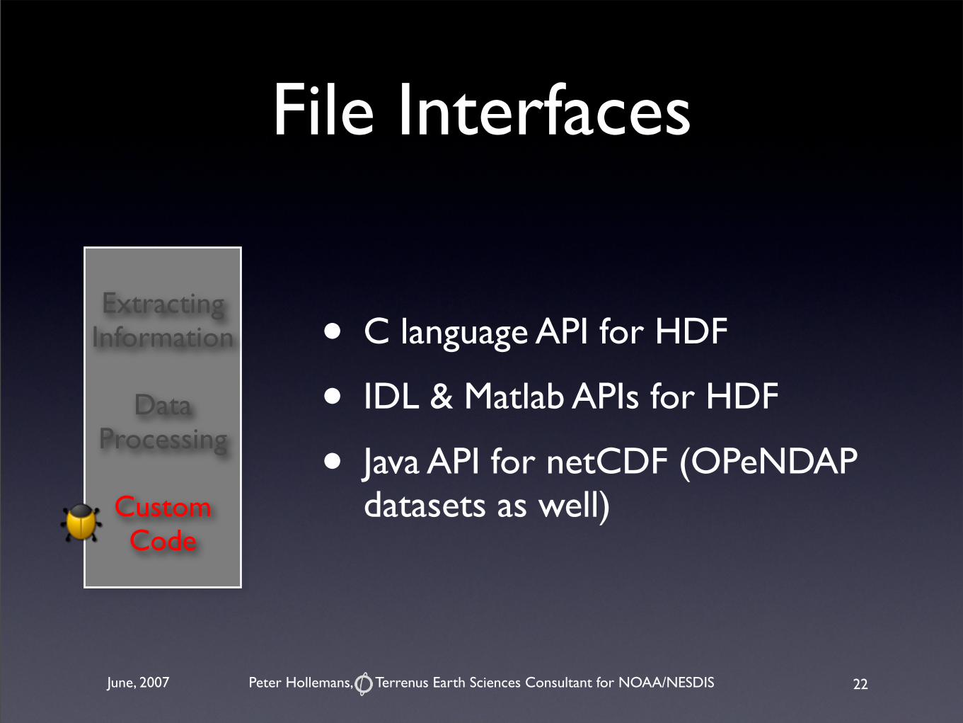
File Interfaces
• C language API for HDF
• IDL & Matlab APIs for HDF
• Java API for netCDF (OPeNDAP datasets as well)
22
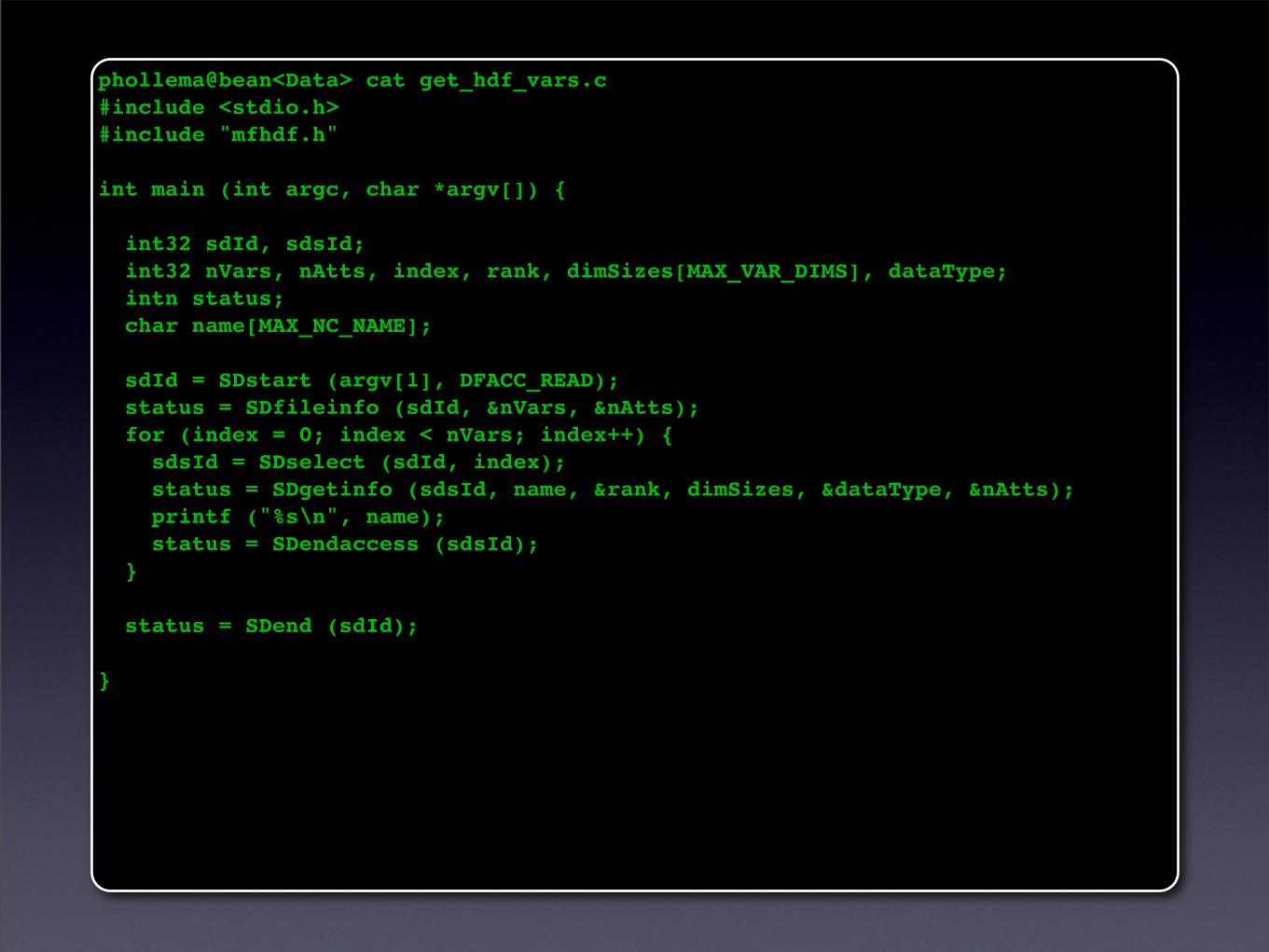
phollema@bean<Data> cat get_hdf_vars.c #include <stdio.h>#include "mfhdf.h"
int main (int argc, char *argv[]) {
int32 sdId, sdsId; int32 nVars, nAtts, index, rank, dimSizes[MAX_VAR_DIMS], dataType; intn status; char name[MAX_NC_NAME];
sdId = SDstart (argv[1], DFACC_READ); status = SDfileinfo (sdId, &nVars, &nAtts); for (index = 0; index < nVars; index++) { sdsId = SDselect (sdId, index); status = SDgetinfo (sdsId, name, &rank, dimSizes, &dataType, &nAtts); printf ("%s\n", name); status = SDendaccess (sdsId); }
status = SDend (sdId);
}
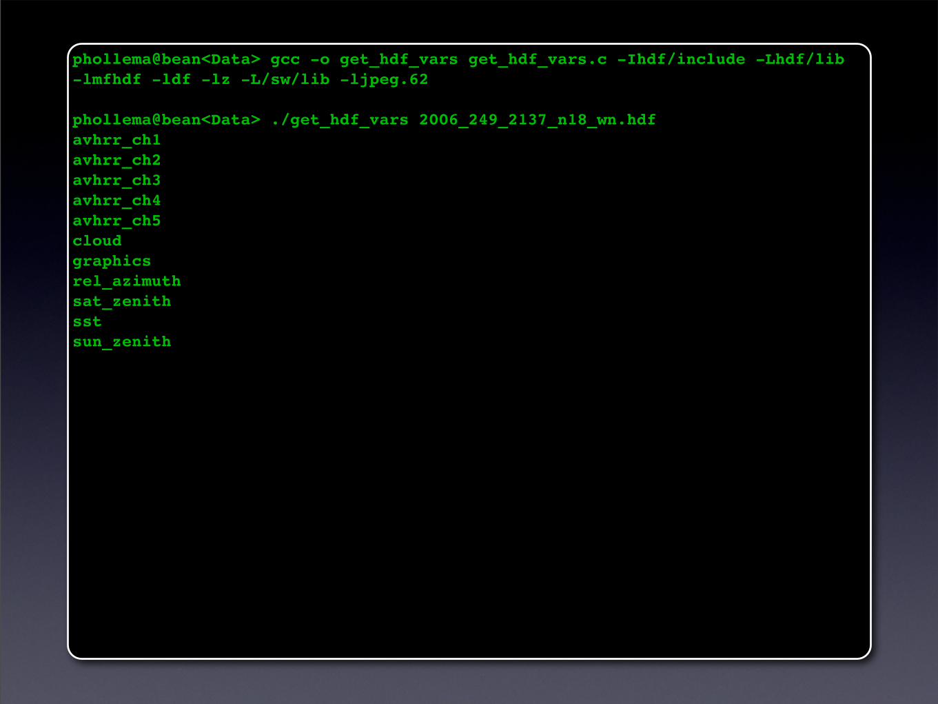
phollema@bean<Data> gcc -o get_hdf_vars get_hdf_vars.c -Ihdf/include -Lhdf/lib-lmfhdf -ldf -lz -L/sw/lib -ljpeg.62
phollema@bean<Data> ./get_hdf_vars 2006_249_2137_n18_wn.hdfavhrr_ch1avhrr_ch2avhrr_ch3avhrr_ch4avhrr_ch5cloudgraphicsrel_azimuthsat_zenithsstsun_zenith
Peter Hollemans, Terrenus Earth Sciences Consultant for NOAA/NESDISJune, 2007
Summary
• Extracting Information: file contents, data statistics and sampling
• Data Processing: reprojection, computation
• Custom Code: data and file interfaces
25
Peter Hollemans, Terrenus Earth Sciences Consultant for NOAA/NESDISJune, 2007
Acknowledgements
• CoastWatch node and central operations staff
• CoastWatch data users
26