Embed Size (px)
Citation preview

ABOVE THE FALLS REGIONAL PARK MASTER PLANMinneapol is Park & Recreat ion Board
PARK MASTER PLAN PAGE 1-1
SECTION 1Planning Framework
MPR
B, 2
012

ABOVE THE FALLS REGIONAL PARK MASTER PLAN Minneapol is Park & Recreat ion Board
PARK MASTER PLAN PAGE 1-2
INTENTThe purpose of this Above the Falls Regional Park Master Plan (2019 ATF Park Plan) is to guide the Park’s development, preservation, management, and improvement. The ATF Regional Park is part of the upper Mississippi riverfront generally located on both sides of the river between N Plymouth Avenue/8th Street NE and the Camden Bridge (43rd Avenue N/37th Avenue NE). The ATF Regional Park stretches 2.75 miles between North Mississippi Regional Park and the Central Mississippi Riverfront Regional Park. Community leaders and residents have recognized the opportunity in this area to celebrate the Mississippi River, and seek through this master plan to enhance connections to one of the great rivers of the country. Continued acquisition and development of the ATF Regional Park will create a continuous regional park along Minneapolis Mississippi River frontage. Ultimately, the vision is to provide recreational opportunities within an ecologically-functioning framework. The combined Minneapolis and Saint Paul riverfront park system is one of the most significant linear riverfront parks in the nation.
This master plan provides guidance and direction on the acquisition, development, management, and operation of the ATF Regional Park. Approximately 3.1 miles of the total linear riverfront along the upper River is currently owned by public agencies, more than half of the total riverfront within the Regional Park. This plan shows how these parcels can eventually be linked to create a continuous park system that provides a new destination for park visitors, expands access to the river, and enhances natural resource quality. Consistent with MN Statute 473.313 the Metropolitan Council requires a master plan to be developed and updated regularly for each regional park, park reserve, trail and special recreation feature. This plan was crafted to meet the requirements of the Metropolitan Council’s 2030 Regional Parks Policy Plan, and has been updated to meet the Council’s standards for their 2040 Plan. For more information, visit http://www.metrocouncil.org/parks/parks.htm.
PLANNING AGENCIES
METROPOLITAN REGIONAL PARKS AND OPEN SPACE SYSTEMRegional parks are developed in the Twin Cities Metropolitan Area to preserve green space for wildlife habitat and provide a wide-range of natural resource-related recreational opportunities. Established in 1974, the Regional Parks and Open Space System is overseen by the Metropolitan Council in partnership with cities, counties, and special park districts. While the operation of the system is the responsibility of cities, counties, and special park districts, the Metropolitan Council supports it with planning, funding, and advocacy. In 2012, the system includes 51 regional parks and park reserves, 308 miles of 38 regional trails, and seven special recreation features.
MPRB’s planning time frame for this ATF Parks Plan is through the year 2030, corresponding with the Metropolitan Council’s (Met Council) 2030 Regional Parks Policy Plan. To maintain accuracy and relevancy, the ATF Parks Plan should be updated at least every 10 years. This Master Plan is consistent with both the 2030 and 2040 Regional Parks Policy Plans. Plan approval by the Met Council
Regional Parks2030
Policy Plan Amended July 25, 2012
Met
ropo
litan
Cou
ncil

ABOVE THE FALLS REGIONAL PARK MASTER PLANMinneapol is Park & Recreat ion Board
PARK MASTER PLAN PAGE 1-3
Figure 1.1 The Metropolitan Council Regional Park Map showing Above the Falls Plan Area
Central AnokaCounty Regional
Trail
Scott CountyWest RegionalTrailMinnesota Valley
State RecreationArea
Minnesota ValleyState Recreation
Area
MississippiRiver
Regional Trail
Luce LineState Trail
Dakota RailRegional
Trail
SouthwestRegional
Trail
Lake Minnetonka LRTRegional Trail
MinnesotaRiver GreenwayRegional Trail
Point DouglasRegional Trail
Coon CreekRegional Trail
Twin LakesRegional Trail
MN River Bluffs LRTRegional Trail
East Anoka Co.Regional Trail
Sam MorganRegional Trail
Lake MinnetonkaRegional Park
(Big Island)
Rice Creek NorthRegional Trail
North CreekGreenwayRegional Trail
KellerRegional
Park
Lake MinnetonkaLRT Regional
Trail
Crystal LakeRegional Trail
LakeIndependence
RegionalTrail
Luce LineRegional
Trail
Dakota RailRegional
Trail
Rush CreekRegional Trail
Bassett CreekRegional
Trail
Shingle CreekRegional Trail
Nine MileCreek
Regional Trail
Cedar LakeLRT Regional
Trail
Medicine LakeRegional Trail
NE DiagonalRegional Trail
Bruce VentoRegionalTrail
Birch LakeRegionalTrail
North CedarLake Regional
Trail
Highway 96Regional Trail
VictoryMemorial Parkway
Regional Trail
HardwoodCreekRegionalTrail
MinnehahaParkway
Regional Trail
KenilworthRegional Trail
River to RiverGreenway
Regional Trail
Ridgway Pkwy.Regional Trail
MN River BluffsRegional Trail
Nokomis -Minnesota River
Regional Trail
SouthwestRegional
Trail
MississippiRiver
Regional Trail
Central AnokaCounty Regional
Trail
ColumbiaPkwy.
RegionalTrail
MississippiRiver RegionalTrail
Chain of Lakes- Otter LakeRegional Trail
MN River BluffsRegional Trail
TroutBrook
RegionalTrail
Lake LinksRegional
Trail
Sugar HillsRegional
Trail
Rice Creek WestRegional Trail
BunkerHills/Chain of Lakes
Regional Trail
St. Anthony Pkwy.Regional Trail
Rice Creek NorthRegional Trail
Rum RiverRegional Trail
Big RiversRegionalTrail
Scott CountyWest RegionalTrail
CedarLake Regional
Trail
Stinson Pkwy.Regional Trail
Rice CreekChain of LakesPark Reserve
Martin-Island-Linwood LakesRegional Park
Lake GeorgeRegional Park
Rum River CentralRegional Park
Mississippi WestRegional Park
Bunker HillsRegional Park
Coon RapidsDam Regional
Park
CarverPark
Reserve
Lake MinnewashtaRegional Park
LebanonHills
Regional Park
Whitetail WoodsRegional Park
MiesvilleRavine Park
Reserve
Lake ByllesbyRegional
Park
Bryant LakeRegional Park
Lake RebeccaPark Reserve
NoerenbergGardens
ElmCreekPark
Reserve
Eagle LakeRegional
Park
TheodoreWirth Regional
Park
Hyland-Bush-Anderson
LakesPark Reserve
Crow-HassanPark
Reserve
MississippiGorge
Regional Park
BakerPark
Reserve
Fish LakeRegional
Park
Gale WoodsFarm
Lake MinnetonkaRegional Park
Nokomis-HiawathaRegional
Park
FrenchRegional
Park
Silverwood
MinneapolisChain of LakesRegional Park
Bald Eagle-Otter LakesRegional Park
Vadnais-SnailLakes Regional
Park
SnailLake Marsh
Battle CreekRegional
ParkHidden
Falls-CrosbyFarm
Regional Park
ComoRegional Park,
Zoo & Conservatory Indian MoundsRegional
Park
Lilydale-HarrietIsland-Cherokee Hts.
Regional Park
Tony SchmidtRegional Park
Murphy-HanrehanPark Reserve
Lake WaconiaRegional
Park
Cleary LakeRegional
Park
Pine PointRegional
Park
Lake ElmoPark
Reserve
St.Croix Bluffs
Regional Park
Big Marine ParkReserve
SpringLake ParkReserve
Cedar Lake FarmRegional Park
TheLanding
CottageGrove RavineRegional Park
Kingswood
Long LakeRegional
Park
Spring LakeRegional
Park
BaylorRegional
Park
Anoka CountyRiverfrontRegional Park
Above theFalls
RegionalPark
MinnehahaRegional Park
NorthMississippiRegional
Park
Central Miss. RiverfrontRegional Park
PhalenRegional
Park
BruceVentoNature
Sanctuary
SquareLake
AnokaCounty
BloomingtonCarverCounty
DakotaCounty
Minneapolis
RamseyCounty
ScottCounty
St. Paul
Three RiversPark District
(Hennepin County)
WashingtonCounty
Minnesota ValleyNational Wildlife
Refuge
Minnesota ValleyNational Wildlife
Refuge
Minnesota ValleyNational Wildlife
Refuge
Minnesota ValleyNational Wildlife
Refuge
MinnesotaValley State
Recreation Area
WilliamO'Brien
State Park
AftonStatePark
FortSnelling
State Park
Afton
Andover
Anoka
AppleValley
ArdenHills
BayportBaytown
Twp.
BellePlaine
Bethel
BirchwoodVillage
Blaine
BrooklynCenter
BrooklynPark
Nowthen
Burnsville
CedarLakeTwp.
Centerville
Champlin
CirclePines
Coates
ColumbiaHts.
Columbus
CoonRapids
CottageGrove
CreditRiverTwp.
Crystal
Dayton
Deephaven
DenmarkTwp.
DouglasTwp.
Eagan
EastBethel
EdenPrairie
Edina
Elko NewMarket
EurekaTwp.
Excelsior
FalconHeights
Farmington
ForestLake
Fort Snelling(unorg.)
Fridley
GemLake
GoldenValley
Grant
Greenfield
GreenvaleTwp.
Greenwood
Ham Lake
Hampton
HamptonTwp.
Hanover
Hilltop
Hopkins
Hugo
Independence
InverGrove
Heights
JacksonTwp.
LakeElmo
Lakeland
LakelandShores
Lake St.Croix Beach
Lakeville
Landfall
Lauderdale
Lexington
Lilydale
LinoLakes
LinwoodTwp.
LittleCanada
LongLake
Loretto
LouisvilleTwp.
Mahtomedi
MaplePlain
Maplewood
Marine onSt. Croix
MarshanTwp.
May Twp.
MedicineLake
Mendota
MendotaHeights
Miesville
Minnetonka
MinnetonkaBeachMinnetrista
Mound
MoundsView
NewBrighton
NewHope
Newport
NewPrague
Scandia
NewTrier
NiningerTwp.
Northfield
NorthOaks
NorthSt. Paul
Oakdale
OakGrove
Oak Park Heights
Orono
Osseo
PineSpringsPlymouth
Ramsey
Randolph
RandolphTwp.
RavennaTwp.
Richfield
Robbinsdale
Rockford
Rosemount
Roseville
St. Anthony
St.Bonifacius
St.Francis
St. Louis Park
St. MarysPoint
St.PaulPark
Savage
SciotaTwp.
Shakopee
Shoreview
Shorewood
SouthSt. Paul
SpringLakePark
SpringPark
SunfishLake
Tonka Bay
VadnaisHeights
Vermillion
VermillionTwp.
WaterfordTwp.
Wayzata
WestLakeland
Twp.
WestSt.
Paul
White BearTwp.
WhiteBear Lake
Woodland
Woodbury
Jordan
SandCreekTwp.
St.Lawrence
Twp.
Willernie
EmpireTwp.
HelenaTwp.
BellePlaineTwp.
CastleRock Twp.
GreyCloud
Island Twp.
BlakeleyTwp.
NewMarketTwp.
Medina
Corcoran
MapleGrove
PriorLake
Chanhassen
SanFrancisco
Twp.
Hamburg
DahlgrenTwp.
BentonTwp.
CologneYoung
AmericaTwp.
Carver
NorwoodYoung
America
Chaska
WaconiaCamden
Twp.Victoria
NewGermany
Watertown
WatertownTwp.
HollywoodTwp.
HancockTwp.
Rogers
Hastings
Stillwater
DellwoodStillwater
Twp.
WaconiaTwp.
Mayer
LaketownTwp.
SpringLake Twp.
GatewayStateTrail
MinnesotaValley
State Trail
Browns CreekState Trail
Luce LineState Trail
MinnesotaZoo
U of MLandscapeArboretum
Midtown Greenway
494
35
694
35E
35E
35W
394494
35W
94
35E
35
36
32
37
101
42
21
169
10
212
52
61
169
61
61
8
52
10
10
61
12
55
316
610
5
13
55
100
62
36
62
101
55
62
55
77
41
252
65
7
CarlosAvery WMA
Cannon
Rum
Vermillion
Otter
PeltierGeorgeWatch
Centerville
Marshan
Rice
Reshanau
Baldwin
Amelia
Rondeau
Howard
Crossways
Linwood
Martin
Coon
Netta
Ham
Neds
Deer
FishMinard
Crooked
Round
George
Itasca
Pickerel
Riley
Lotus
Lucy
Minnewashta
Ann
Hazeltine
Virginia
Rapids
Schutz
Bavaria
Miller
Zumbra-Sunny
Parley
Lundsten
Auburn
Steiger
WassermannPiersons
Marsh
Maria
Waconia
Assumption
Patterson
Hydes
Goose
Oak
Mud
Swede
Berliner
TigerBarnes
Eagle
Mud Hen
Byllesby
Chub
Alimagnet
Marion
Crystal
Orchard
Gun Club Rogers
BlackDog
LongMeadow
Harriet
Nokomis
Calhoun(Bde Maka Ska)
Lake ofthe Isles
Twin
Bush
Anderson
Bryant
Mitchell
Staring
Grass
Gleason
Bass
Medicine
Eagle/Pike
Weaver
Diamond
French
Hayden
Minnetonka
Mooney
Christmas
Katrina
Long
Sylvan
Independence
Ox Yoke
Dutch
Langdon
Whaletail
Robina
SarahRebecca
Normandale\Nordmyr
BaldEagle
Pigs Eye
Gervais
Phalen
BirchGilfillan
Vadnais
Pleasant
OwassoJosephine
MarsdenTurtle
Snail
Johanna
Cleary
Kane
LowerPrior
St.Catherine
Bradshaw
Lennon
Cynthia
Spring
UpperPrior
Dean
FisherBlue
Cedar
O'Dowd
Geis
Thole/Schneider
Clarks
LouisvilleSwamp
LittleCarnelian
Terrapin
Square
BigCarnelian
BigMarine
Bone
German
WhiteRock
BattleCreek
DeMontreville
Jane
Elmo
EaglePoint
PineTree
Horseshoe
Oneka
Egg
NorthSchoolSection
South SchoolSection
Sunset
Forest
Clear
WhiteBear
STILLWATER BLVD N
66TH ST E
CLE
VE
L AN
DAV
EN
LAKE DR
CE
NTR
AL
A VE
NE
HIAWATHA AVE
BUSH
LAKE
RDE
80TH ST E
NO
RTH
WE
STBL
VD
6TH AVE N
HIGHWAY 55
CLIFF RD
LEX
ING
TON
AV
E N
HIGHWAY 7
FOLE
YB
LVD
NW
BROADWAY ST NE
TRO
YLN
N
ELM ST
98TH ST W
SH
AD
YO
AKRD
WAYZATA BLVD W
CED
AR A
VE
RADI
O DR
HIGHWAY 55
CO
UN
T YR
OA
D11
42ND ST E
HO
PK
I NS
XRD
HIGHWAY 13 W
SAINT
CR
OIX
TRL
NPARK
AVE
PEN
N A
VE
N
DIA
MO
ND
PATH
RA
DIO
DR
LEX
ING
TON
AV
E S
INW
OO
DAV
EN
HIGHWAY 13 W
DIFFLEY RD
LAKE DR
COUNTY ROAD 24
CE
DA
RAV
E
ROSELAWN AVE W
DA
KO
TAAV
E
DIFFLEY RD
DAKOTAAV
E
185TH ST W
60TH ST N
INW
OO
D A
VE
N
65TH ST S
CO
UN
TYR
OAD
33
LOWRY AVE N
COUNTY ROAD C W
ASH ST
JAC
KS
ON
ST
34TH ST N
DO
DD
RD
COMO AVE
HIG
HW
AY 1
3
CONCORDST
N
185TH ST W
215TH ST W
RAM
SEY
BLVD
NW
HIGHWAY 55BO
TTINEAUBLVD
VALLEY VIEW RD
HAN
SON
BLVD
NW
CO
UNTY
ROAD
101
DODD BLVD
202ND ST W
212TH ST W
DIFFLEY RD
EGAN DR
170TH ST W
212TH ST W
UNIVERSITY AVE W
160TH ST W
CONSTANCE BLVD NE
46TH ST E
125TH AVE NE
JEFFERSON
TRLW
CLA
YTO
N A
VE
ED
EN
PR
AIR
IE R
D
EA
GLE
CR
EE
KAV
EN
E
LEX
ING
TON
AV
E
YANKEE DOODLE RD
COUNTY ROAD 42 W
RO
UN
DL A
KE
BL V
DN
W
CLIFF RD E
GE
RM
AN
RD
VIC
TOR
IAST
N
181ST AVE NW
HIG
HW
AY 5
VERNON AVE S
10TH ST N
EAGLE CREEK BLVD
BROOKLYNBLVD
140TH ST NE
ELM
CR
EEK
BLVD
N
GA
LPIN
BLV
D
XE
NIU
MLN
N
HIGHWAY 13 E
93RD AVE N
85TH AVE N
PO
WE
RS
BLV
D
10TH ST N
195TH ST W
190TH ST E
BLAKELEY TRL
COUNTY ROAD 24
200TH ST E
DAL
ES T
N
CO
UN
TY R
OA
D 1
31
PAR
TRID
GE
RD
N
COUNTY ROAD 6
221ST AVE NE
237TH AVE NE
IDE
AL
AVE
N
CROSSTOWN BLVD NE
COUNTY ROAD 20
DO
UG
LAS
DR
N
CO
UN
TYR
OAD
101
LAN
GFO
RD
AVE
LAK
EE
LMO
AVE
N
HIGHWAY 5
BUNKER LAKE BLVD NE
ANDOVER BLVD NE
11TH AVE SW
COUNTY ROAD F E
EDG
ER
TON
ST
HU
MB
OLD
T AV
E N
225TH ST W
75TH ST N
HA
MLI
NE
AVE
N
TEX
AS
AVE
PIL
OT
KNO
BR
D
STIL
LWAT
ERBL
VDN
OLI
ND
ATR
LN
CR
OSS
TOW
NBL
VD
NW
CO
UN
TYR
OA
D10
1N
MAIN
ST DAYTON RD
POR
TLAN
D A
VE
NININGERRD
SIMS RD NE
VIKING BLVD NE
205TH ST E
DO
DD
BLV
D
FRA
NC
E A
VE
S
66TH ST W
COUNTY ROAD B E
HIG
HW
AY 4
7
PLY
MO
UTH
RD
69TH AVE N
NORTH RD
BRO
CK
TON
LN
N
122ND ST N
DELLWOOD AVE
CO
UN
TY R
OA
D 4
3
SIMS RD NW
62ND ST W
LOWRY AVE NE
HIGHWAY 96 E
LONE OAK RD
250TH ST W
BAYSIDE RD
129TH AVE N
26TH
AVE
S
SIBLEY MEMORIAL HWY
13TH ST E
70TH ST E70TH ST E
W
EST BROADWAY AVE
WEST RIVERRD
N
HIGHWAY 5
YOR
K AV
E S
SHO
RE
LINEDR
GE
NE
VA A
VE
N
POLK
AV
E
JON
ATHA
N C
AR
VE
R P
KWY
BRO
WN
RD
S
TOW
NLI
NE
AVE
SHADYWOOD RD
DO
NN
ELL
Y AV
E
COUNTY ROAD B E
230TH ST E
138TH ST E
18TH ST
WIN
NE
TKA
AVE
N
LOCK BLVD
DEL
AWA
RE
AV
E
HAR
LOW
AV
E
LAKE
DR
NE
LYDIA AVE E
ESS
EX
AV
E
RO
AN
OK
E S
T N
W
FER
NB
RO
OK
LNN
SAIN
TC
RO
IXTR
LS
PIONEER TRL
RADI
SSO
NRD
NE
292ND ST E
215TH ST W
HIGHWAY 7
AR
MS
TRO
NG
BL V
DN
W
145TH ST E
UNION TRL
HIG
HW
AY 2
5
MA
I NS
TN
7TH ST W
145TH ST E
150TH ST W
3RD
STS
SQUARE LAKE TRL N
CLIFF RD E
HIG
HW
AY 252
FLYI
NG
CLOUD DR
COMO AVE
XEO
N A
VE
HIG
HW
AY 1
00
COUNTY ROAD 101
154TH ST NW
240TH ST E
RO
BER
TTR
LS
ROCKFORD RD
HU
GO
RD
BASS LAKE RD
260TH ST E
SOUTH AVE E
HIGHWAY 36 W
MAIN ST
ASH ST
MCCOLL DR
INN
OVA
TIO
NRD
260TH ST E
RIC
ES T
BOTTINEAU BLVD
WH
ITE
BEAR
AVE
MAIN ST S
4TH
AV
E
MAIN ST E
ZAC
HA
RY
LN N
NORRIS LAKE RD NW
FAIR
LAW
N A
VE
42ND AVE N
260TH ST E
117TH ST N
CED
AR A
VE
S
LAN
GFO
RD
AVE
237TH AVE NW
77TH AVE N
125TH ST W
MARSHALL AVE
COUNTY ROAD 11
PIONEER TRL
CO
NC
OR
D B
LVD
DIAMOND LAKE RD N
BASS LAKE RD
HIGHWAY 36 W
COUNTY ROAD C E
50TH ST W
RIC
E S
T
HIGHWAY 110
COUNTY ROAD 140
FRA
NC
E A
VE
S
LAKE ST ESN
ELL
ING
AV
E S
FRANKLIN AVE E
LAKE ST W
HIG
HW
AY 1
00 S
WH
ITE
BE
AR
AV
E N
NE
AL
AVE
N
STILLWATER RD
AFTON
BLVD
S
AMBASSADOR BLVD NW
140TH ST NE
COUNTY ROAD B W
BELL
AIR
E A
VE
COUNTY ROAD 26
MA
NN
ING
AV
E S
RU
MR
IVE
RB
L VD
NW
LEX
ING
TON
AV
E N
E
ZAN
EAV
EN
157TH AVE NW
ALTA
AV
E
MINNEHAHA AVE E
CREEK RD
7TH
AVE
NW
HO
GA
N A
VE
HIG
HW
AY 1
00
CARVER AVE
HIGHWAY 13
RO
BER
TTR
LS
NO
WTH
EN
BL V
DN
W
STATE ST W
HIGHWAY 62
220TH ST E
SCANDIA TRL N
NIG
HTI
NG
ALE
ST
NW
3RDST
N
WIN
NE
TKA
AVE
N
BUNKER LAKE BLVD NW
OLD SHAKOPEE RD W
COON RAPIDS BLVD NWC
ON
CO
RD
ST S
160TH ST SE
HIG
HW
AY28
0
215TH LN NE
DODDR
D
179TH LN NW
GR
EAT
PL A
INS
BLV
D
UN
IVE
RS
ITY
AVE
NE
DELLWOOD RD N
HIG
HW
A Y65
NE
HO
DG
SO
N R
D
SCANDIA TRL N
WO
OD
BU
RY
DR
50TH ST N
DEN
MA
RK
AV
E
BONAIRE PATH W
FROST AVE
HIG
HW
AY 2
84
KEAT
S A
VE
N
205TH ST W
PIL
OT
KN
OB
RD
255TH ST W
PIO
NE
ER
TR
L
COUNTY ROAD D E
SHEPARD RD
TULI
P S
T N
W
210TH ST W
COUNTYROAD
40
HIG
HW
AY 47
HOLLOWAY AVE
CHASKA BLVD
NORTH SHORE TRL N
DO
DD
RD
COU
NTY
RO
AD19
N
KENWO
OD
TRL
120TH ST N
COON RAPIDS BLVD NW
240TH ST E
141ST AVE N
EA
ST
RIV
ER
RD
NW
161ST AVE NW
RA
DIS
SO
N R
D N
E
267TH ST W
COUNTY ROAD 110 W
HIGHWAY 55
COUNTY ROAD 101
SPR
ING
RD
70TH ST S
COUNTY ROAD 30
CO
UN
TY R
OA
D 1
16
EXCELSIOR BLVD
HE
MLO
CK
LNN
UN
IVE
RS
ITY
AVE
NE
ALTA
AV
E
EGAN DR
LARPENTEUR AVE E
DU
RAN
TST
NE
170TH ST N
160TH ST E
DO
DD
BLV
D
COU
NTY
RO
AD110
N LAK
E E
LMO
AV
E N
PIL
OT
KN
OB
RD
SNE
LLIN
G A
VE
N
280TH ST E280TH ST W
CLIFF RD
RIC
E S
T
LAKE ST W
NO
RE
LL A
VE
N
COUNTY ROAD 30
COUNTY ROAD B2 W
30TH ST
COUNTY ROAD 10
4TH
AV
E
COUNTY ROAD D E
COUNTY ROAD 30
VALL
EYDR
NW
LONE OAK RD
NO
REL
LA V
EN
MAI
NST
PO
TOM
AC
ST
NE
CE
DA
R D
R N
W
KOE
PER
AV
E
HIG
HWAY
5
SUGARBUSH
RDNW
AKR
ON
AV
E
SUN
SET
AVE
PAN
AM
A AV
E
295TH ST W
MAIN ST
NASON HILL RDN
192N
D A
VE
W
KIM
BR
OAV
EN
BABC
OC
K TR
L
CH
EST
NU
T S
T N
CEN
TRA
L AV
E N
E
A UD
UBO
NR
D
HIG
HW
AY 6
5 N
E
225TH ST E
HENNEPIN AVE E
VE
RD
IN S
T N
W
EXCELSIO
RBLV
D
181ST AVE NW
MA
NN
ING
AV
E N
COUNTY ROAD 42 E
EAGLE CREEK BLVD
HAM
LIN
E A
VE
N
KE
ATS
AVE
S
FORD PKWY
MINNETONKA BLVD
XER
XE
S A
VE
S
PEN
N A
VE
S
BEAM AVE
VALLEY CREEK RD VALLEY CREEK RD
ME
RID
IAN
AV
E
BAS
ELI
NE
AV
E
110TH ST S
FLE
TCH
ER
LN
HIGHW
AY252
CO
UN
TY RO
AD
5
ANDOVER BLVD NW
COUNTY ROAD 50
WE
ST
BR
OA
DW
AY
BA
RN
ES
AVE
HIGHWAY 610
MAIN ST NW
HAMEL RD
HIGHWAY5
CO
UN
TYRO
AD 123
HIGHWAY 36 E
DO
GW
OO
D S
T
250TH ST W
229TH AVE NW
OLD
BRIC
KYA
RD
RD
CO
UN
TYR
OAD
33
PAR
K D
R
MINNEHAHA AVE
DR
EXE
L AV
E
150TH ST W
DO
UG
LAS
DR
N
BIRCH ST
MA
NN
ING
TR
L N
FAIR
VIE
W A
VE
N
CO
UN
TYRO
AD
43
CEN
TUR
Y AV
E S
INDUSTRIAL BLVD
HIG
HW
AY 7
7
HIAWATHA
AVE
COUNTY ROAD 47
MA
RS
CH
ALL
RD
S
MCGINTY RD W
280TH ST E
DAYTON RIVER RD
BROADWAY AVE NE
280TH ST E
NOBL
EP
KW
YN
CO
UN
TY R
OA
D 1
27
MILL ST
FRA
NC
E A
VE
S
CREDITRIVER BLVD
201ST AVE NW
BAILEY RD
202ND ST N
110TH ST W
HIGHWAY 610
CLE
AR
YR
DN
W
COUNTYROAD
155
HIGHWAY 55
280TH ST W
PAUL
AVE
N
COUNTY ROAD 52
CO
UN
TY R
OA
D 1
9
HIG
HW
AY77
78TH ST W 78TH ST W
ENGLER BLVD
HIGH
WAY
100
FLYING CLOUD DR
250TH ST E
217TH ST E
ARBORETUM BLVD
MU
SH
T OW
NR
D
JAM
AC
AAV
EN
40TH ST N
6TH AVE N
SUN
FIS
HLA
KEBL
VDN
W
COUNTY ROAD 10
HIGHWAY 36 E
245TH ST E
162ND ST W
109TH AVE N
MCKUSICKRD
WES
TFR
EEW
AYD
RN
E
20TH
AVE
S
BAILEY RD
HIGHWAY 36
120TH ST N
MA
NN
ING
AV
E N
COUNTY ROAD 38
OA
KG
RE
EN
AVE
N
85TH AVE NE
70TH ST W
152ND ST N
NORT
HFIE
LD B
LVD
OTC
HIPW
EAV
EN
220TH ST E
VIKING BLVD NW
LOFT
ON
AVE
N
HIG
HW
AY65
NE
L AN
GF O
RD
AVE
RED WING BLVD
MISSISSIPPI T
RL
93RD AVE N
HELENABLVD
OLD HIGHWAY 169 BLVD
STA
GE
CO
AC
HTR
LS
TYPO
CR
EE
KD
RNE
WATERTOWN RD
125TH AVE NE
CLIFF RD
HIGHWAY 62
SAINT
CROIXTR
LN
200TH ST N
CEN
TER
VIL
LER
D
LYMAN BLVD
137TH ST N
210TH ST W
CO
UN
TY R
OA
D 9
0
1ST AVE E
CO
UN
TYR
OAD
19
OSTRUM TRL N
170TH ST W
60TH ST N
WO
OD
BU
RY
DR
COUNTY ROAD30
BAK
ERR
D
NAT
CH
EZ
AVE
CEN
TRA
L AV
E N
E
ABE
RD
EE
N A
VE
LAK
E G
EO
RG
E B
LVD
NW
BAU
GH
ST
NW
MIC
HA
EL
AVE
DE
LAW
AR
EAV
E
CO
UN
TY R
OA
D 9
2 N
UN
IVE
RS
ITY
AVE
NE
20TH
AV
E N
220TH ST E
CO
UN
TY R
OA
D 3
3
HAN
SON
BLV
D N
W
APOLLO
DR
MA
RY
STO
WN
RD
COUNTRY TRL W
COUNTY ROAD 20
RICHVALLEY
BLVD
140TH ST NW
KEY
STO
NE
AV
E N
NIC
OLA
I AV
E
200TH ST E
DAH
OM
EY
AVE
HIGHWAY 110
SUN
RIS
ER
DNE
LUCERNE BLVD
160TH ST E
ARBORETUM BLVD
NIC
OLA
I AV
E
VALLEY FOR
GE R
D
109TH AVE NE
COUNTY ROAD 140
CO
UN
TY R
OA
D 9
2 N
COURTHOUSE BLVD
COUNTY ROAD 15
CO
UN
TYR
OAD
10N
HICKORYBLVD
REV
ER
E A
VE
240TH ST E
RAVENNA TRL
160TH ST W
STA
GE
CO
AC
HTR
LN
CO
UN
TY R
OA
D 4
1
FLAG
TRL
OAKHILL RD N
FLA
MIN
GO
ST
NW
260TH ST E
EAS
TBE
THEL
BLVD
NE
CO
UN
TYR
OA D
1 51
MILITARY RD
150TH ST
EME
RY
AVE
BUR
NS
PKW
Y NW
190TH ST E
CANNON RIVER BLVD
280TH ST E
150TH ST W
220TH ST W
190TH ST E
220TH ST W
185TH ST E
330TH ST W
220TH ST W
TERRITORIAL RD
35TH AVE
PAU
L AV
E S
COUNTY ROAD 50
ZAC
HA
RY
AVE
WOODLAND TRL
REB
ECCAPARK TRL
VER
NO
N A
VE
200TH ST W
145TH ST W
REBECCA PARK TRL
CO
UN
TY R
OA
D 5
1
COUNTY ROAD 34
BIS
CAY
NE
AV
E
FAWN LAKE DR NE
40TH ST S
330TH ST E
GO
OD
WIN
AV
E
132ND ST E
MA
LIB
U A
VE
230TH ST W
CANNON RIVER BLVD
SA
INT
FRA
NC
ISB
LVD
NW
235TH ST W
PILL
SB
UR
Y AV
E
COUNTY ROAD 20
HILL N DALE DR NW
CO
UN
TY R
OA
D 2
1
CH
IPP
EN
DA
LE A
VE
W
130TH ST W
COUNTY ROAD 152
220TH ST E
COUNTY ROAD 24
260TH ST W
HIG
HW
AY25
330TH ST W
COUNTY ROAD 32
CO
UN
TY R
OA
D 3
1
NE
ALA V
ES
229TH AVE NE
UNIONHILL
BLVD
210TH ST E
GA
LAX
I EAV
E
200TH ST W
280TH ST W 280TH ST E
KETTLE RIVER BLVD
NE
320TH ST W
260TH ST W
245TH ST E
HIG
HV
IEW
AV
E
230TH ST E
EAGLE CREEK PKWY
COUNTYR
OAD
33
CH
ATFI
ELD
DR
MY
ERO
NRD
N
JOA
N A
VE
ROCHESTER BLVD
240TH ST W
CH
IPP
EN
DA
LE A
VE
W
263RD ST E
CH
UR
CH
AV
E
200TH ST W
90TH ST S
ARK
AN
SA
S A
VE
FOLI
AG
E A
VE
COUNTY ROAD 122
110TH ST
OR
LAN
DO
AV
E
DEL
MA
R A
VE
UPT
ON
RD
ING
A AV
E
RE
DW
I NG
A VE
CO
UN
TY R
OA
D 1
35
CO
UN
TY R
OA
D 1
53
BLA
INE
AV
E
CO
UN
T YR
OA
D92
250TH ST W
160TH ST W
230TH ST W
80TH ST E
CANNO
NFA
LLS
BLV
D
228TH ST W
270TH ST E
260TH ST E
270TH ST W
BONAIRE PATH E
290TH ST E
JEFF
RE
Y AV
E N
CH
IPPE
ND
ALE
AVE
A
B
C
D
E
F
G
H
I
J
K
1 2 6 7 8 9 10 113 4 5
0 5 10 15 20
Miles
Regional Parks, Reserves and Special Recreation FeaturesState Parks and Carlos Avery Wildlife Management Area (State Land)MN Valley National Wildlife Refuge (Federal Land)Park EntrancesRegional TrailsState Trails
Public Water Access Sites
Carry-In
Trailer Launch
REGIONAL PARKS, PARK RESERVES, AND SPECIAL RECREATION FEATURES
H6
* Map LocationUse the letters and numbers to find a
location on the map. Example above: H6
Map Location *
Anoka County Parks (763)757-3920 www.anokacountyparks.com
D6 Anoka County Riverfront Regional ParkC6 Bunker Hills Regional ParkC6 Coon Rapids Dam Regional ParkA6 Lake George Regional ParkA8 Martin-Island-Linwood Lakes Regional ParkB5 Mississippi West Regional ParkC8 Rice Creek Chain-of-Lakes Park Reserve (Wargo Nature Center)B6 Rum River Central Regional ParkAnoka County Regional Trails: Bunker Hills-Chain of Lakes (C7), Central Anoka County (B5-B7), Coon Creek (C6), East Anoka County (C7), Mississippi River (C5-D7), Rice Creek North (C8), Rice Creek West (D7), Rum River (A6)
City of Bloomington Parks (952) 563-8877 www.bloomingtonmn.gov
G6 Hyland-Bush-Anderson Lakes Park Reserve
Carver County Parks (952) 563-8877 www.co.carver.mn.us/parks
G1 Baylor Regional ParkF4 Lake Minnewashta Regional ParkG3 Lake Waconia Regional ParkCarver County Regional Trails: Dakota Rail (F1-F2), MN River Bluffs (G4-H4), Southwest (G3-G4)
Dakota County Parks (952) 891-7000 www.co.dakota.mn.us/parksK9 Lake Byllesby Regional ParkG8 Lebanon Hills Regional ParkJ10 Miesville Ravine Park ReserveH9 Spring Lake Park ReserveI8 Whitetail Woods Regional Park
Dakota County Regional Trails: Big Rivers (F8), Minnesota River (G7), Mississippi River (F8-H10), North Creek (H7), River to River (F8)
Minneapolis Park and Recreation Board (612) 230-6400 www.minneapolisparks.org
E7 Above the Falls Regional ParkE7 Central Mississippi Riverfront Regional ParkF6 Minneapolis Chain-of-Lakes Regional ParkF7 Minnehaha Regional ParkF7 Mississippi Gorge Regional ParkF7 Nokomis-Hiawatha Regional ParkD6 North Mississippi Regional Park (MPRB part)E6 Theodore Wirth Regional ParkMinneapolis Park and Recreation Board Regional Trails: Cedar Lake (E6-E7), Columbia Parkway (E7), Kenilworth (E6), Luce Line (E6), Minnehaha Parkway (F6-F7), NE Diagonal (E7), Ridgway Parkway (E7), St. Anthony Parkway (E7), Shingle Creek (E6), Victory Memorial (E6)
Map Location *
Three Rivers Park District (763) 559-9000 www.threeriversparks.org
E4 Baker Park Reserve F5 Bryant Lake Regional Park G3 Carver Park Reserve (Lowry Nature Center) C6 Coon Rapids Dam Regional Park C4 Crow-Hassan Park Reserve D5 Eagle Lake Regional Park C5 Elm Creek Park Reserve (Eastman Nature Center) D5 Fish Lake Regional Park E5 French Regional ParkF3 Gale Woods Farm G6 Hyland-Bush-Anderson Lakes Park Reserve (Richardson Nature Ctr) F3 Kingswood F3 Lake Minnetonka Regional Park D3 Lake Rebecca Park Reserve E4 Noerenberg Gardens D6 North Mississippi Regional Park (Three Rivers part) D7 SilverwoodG5 The Landing
Three Rivers Park District Regional Trails: Bassett Creek (E5-E6), Cedar Lake LRT (F6), Dakota Rail (E4-F3), Lake Independence (D4-E4), Lake Minnetonka LRT (F3-F5), Luce Line (E5-E6), Medicine Lake (C5-E5), MN River Bluffs LRT (F5-G4), Nine Mile Creek (F5-G7), Nokomis-MN River (F7-G7), North Cedar Lake (F6), NE Diagonal (E7), Rush Creek (C5-C6), Twin Lakes (E6), Shingle Creek (D6-E6)
Washington County Parks (651) 430-8368 www.co.washington.mn.us/parks
C10 Big Marine Park ReserveG10 Cottage Grove Ravine Regional ParkE10 Lake Elmo Park ReserveD10 Pine Point Regional ParkG10 St. Croix Bluffs Regional ParkC11 Square Lake
Washington County Regional Trails: Hardwood Creek (B9-C9), Point Douglas (H10)
Minnesota Department of Natural Resources (651) 296-6157 www.dnr.state.mn.us
F11 Afton State ParkF7 Fort Snelling State ParkH4, I3 Minnesota Valley State Recreation Area
B11 William O’Brien State Park
Minnesota State Trails: Brown’s Creek (D10), Gateway (D10-E8), Luce Line (E1-E5), Minnesota Valley (G5-J3)
Arch
ery
Biki
ng
Boat
ing
Cam
ping
Disc
Gol
f
Fish
ing
Hiki
ng
Hors
e Tr
ails
Mou
ntai
n Bi
king
Off L
eash
Dog
Padd
ling
Picn
ic A
rea
Play
grou
nd
Swim
min
g
Visit
or C
ente
r
XC S
kiin
g
Ski S
now
boar
d
Ice
Fish
ing
Sled
ding
Snow
mob
iling
Snow
shoe
ing
Tran
sit
Map Location *
Ramsey County Parks and Recreation (651) 748-2500 www.ramseycounty.us/parks
D9 Bald Eagle-Otter Lakes Regional Park (Tamarack Nature Center) F9 Battle Creek-Indian Mounds Regional Park (Battle Creek part)D7 Long Lake Regional ParkE8 Phalen-Keller Regional Park (Keller part) D7 Tony Schmidt Regional ParkD8 Vadnais-Snail Lakes Regional Park
Ramsey County Regional Trails: Birch Lake (D8), Bruce Vento (E8), Highway 96 (D7-D9), Rice Creek North (D7), Rice Creek West, (D7), Trout Brook (E8)
Saint Paul Parks and Recreation (651) 266-6400 www.stpaul.gov/parks
F9 Battle Creek & Indian Mounds Regional Park (Indian Mounds part)E8 Como Regional Park, Zoo & ConservatoryF7 Hidden Falls-Crosby Farm Regional ParkF8 Lilydale-Harriet Island & Cherokee Heights Regional ParkF7 Mississippi Gorge Regional ParkE8 Phalen-Keller Regional Park (Phalen part)
Saint Paul Regional Trails: Bruce Vento (E8), Sam Morgan (F7-F8), Trout Brook (E8)
Scott County Parks (763) 559-9000 www.scottcountymn.gov (Operated in partnership with Three Rivers Park District)
J4 Cedar Lake Farm Regional Park I6 Cleary Lake Regional ParkI6 Murphy-Hanrehan Park Reserve I5 Spring Lake Regional Park
Scott County Regional Trails: Scott County West (G4-H5)
Arch
ery
Biki
ng
Boat
ing
Cam
ping
Disc
Gol
f
Fish
ing
Hiki
ng
Hors
e Tr
ails
Mou
ntai
n Bi
king
Off L
eash
Dog
Padd
ling
Picn
ic A
rea
Play
grou
nd
Swim
min
g
Visit
or C
ente
r
XC S
kiin
g
Ski S
now
boar
d
Ice
Fish
ing
Sled
ding
Snow
mob
iling
Snow
shoe
ing
Tran
sit
Arch
ery
Biki
ng
Boat
ing
Cam
ping
Disc
Gol
f
Fish
ing
Hiki
ng
Hors
e Tr
ails
Mou
ntai
n Bi
king
Off L
eash
Dog
Padd
ling
Picn
ic A
rea
Play
grou
nd
Swim
min
g
Visit
or C
ente
r
XC S
kiin
g
Ski/S
now
boar
d
Ice
Fish
ing
Sled
ding
Snow
mob
iling
Snow
shoe
ing
Tran
sit
University of Minnesota Landscape Arboretum (952) 443-1400 www.arboretum.umn.edu
National Park Service
Mississippi National River & Recreation Area (MNNRA) (651) 290-4160 www.nps.gov/miss
St. Croix National Scenic Riverway (715) 483-2274 www.nps.gov/sacn
United States Fish and Wildlife ServiceMinnesota Valley National Wildlife Refuge www.fws.gov/refuge/minnesota_valley
Refuge Headquarters and Visitor Center (G7), Bloomington, MN (952) 854-5900
Rapids Lake Visitor Center (H4), Carver, MN (952) 361-4500
For information about accessibility at each facility, please contact the individual agency listed above.
Map Advisory:This map is published for general reference purposes. Although reasonably detailed and believed to be accurate, the regional park boundaries depicted on this map are intended only to reflect the general location of the park boundaries. Park users should be aware of the boundaries and limits of the regional parks, park reserves, and trails while visiting or using those facilities. Changes to regional park boundaries may have occurred since the publication of this map.
Activities
TWIN CITIES METROPOLITAN REGIONAL PARKS SYSTEM

ABOVE THE FALLS REGIONAL PARK MASTER PLAN Minneapol is Park & Recreat ion Board
PARK MASTER PLAN PAGE 1-4
is necessary to be eligible for regional parks system capital funding for land acquisition and development. Required plan elements addressed in this master plan include:
• Boundaries and acquisition costs
• Plan for stewardship
• Demand forecast
• Development concept
• Conflicts
• Public services
• Operations
• Citizen participation
• Public awareness
• Accessibility
• Natural resources management
MINNEAPOLIS PARK AND RECREATION BOARDThe Minneapolis Park and Recreation Board manages one of the most extensive urban park systems in the United States. The Minneapolis Park System has grown to over 6,800 acres of land and water in 180 park properties, including local and regional parks, playgrounds, golf courses, gardens, picnic areas, biking and walking paths, and nature sanctuaries. The system includes the 55-mile Grand Rounds National Scenic Byway. It is overseen by a nine-member Board of Commissioners which is an independently elected, semi-autonomous body responsible for maintaining and developing the system. MPRB provides planning, programming, maintenance, and police protection for the park and recreational facilities in its jurisdiction. The MPRB works cooperatively with the Metro Council, the Metropolitan Parks and Open Space Commission, State Legislature and nine other implementing agencies to operate the regional park system.
The Minneapolis Park and Recreation Board was created in 1883 by an act of the Minnesota State Legislature and vote by Minneapolis residents. The mission of the MPRB is to permanently preserve, protect, maintain, improve and enhance its natural resources, parkland and recreational opportunities for current and future generations. The MPRB exists to provide places and recreation opportunities for all people to gather, celebrate, contemplate, and engage in activities that promote health, well-being, community, and the environment.
The 2007-2020 MPRB Comprehensive Plan sets the vision and direction for the park and recreation system. A key implementation strategy is to “Continue to expand physical access to the Mississippi River in a manner that is aesthetically compatible with the riverfront and sensitive to ecological function, giving priority to implementing the Above the Falls Master Plan” (p. 24). This 2019 Above the Falls Regional Park Master Plan is an important step in realizing that strategy.
MPRB SySteM:• 6,809 acres of land and
water
• 180 park properties
• 55-mile Grand Rounds National Scenic Byway
• Ranked annually since 2013 as the #1 park system in the nation by The Trust for Public Land

ABOVE THE FALLS REGIONAL PARK MASTER PLANMinneapol is Park & Recreat ion Board
PARK MASTER PLAN PAGE 1-5
PREVIOUS PLANNING PARK BOUNDARY EVOLUTIONIt has been nineteen years since the Above the Falls Regional Park was created and codified with the original master plan in 2000 (Figure 1.2). In the convening years, the regional park boundary has evolved in minor but important ways from the original by means of several amendments adopted by the MPRB and approved by the Metropolitan Council (Figure 1.3). With this 2019 master plan update, the park boundary is further refined as shown in Figure 1.4. Boundary adjustments reflect changed circumstances in land use, realities in land acquisition, and refinements in redevelopment/park development strategies.
Because of the Above the Falls’ urban setting and the ambition expressed through the master plan to transform the upper river corridor from private land to public park, the activity of land protection (through acquisition, easement or other means) is an ongoing effort and will be for years to come. An important word or concept related to this issue is “inholding”. Inholding refers to lands inside the defined boundary of the regional park that are, at present, privately held. In 2000, there was a greater share of upland (non-river) within the ATF Regional Park boundary that was inholding than land in which the MPRB held a legal interest. Through successful land acquisition and easement activities, the balance has shifted to more than 50% of upland within the park boundary in which the MPRB holds a legal interest and a minority share still in the category of “inholding”. See Table 7.1 in Chapter 7 for a tabulation of current ATF Regional Park inholdings and associated land protection value.
ABOVE THE FALLS MASTER PLAN (2000)Above the Falls: A Master Plan for the Upper River in Minneapolis (2000 ATF Plan) articulates the city’s vision for the upper Mississippi River. The plan was adopted in 2000 by both the City Council and the Minneapolis Park and Recreation Board (MPRB). Among other goals, the plan envisioned the development of the upper Mississippi riverfront into a regional park amenity. The plan was approved by the Metropolitan Council to establish Above the Falls Regional Park in 2000. The 2000 plan addresses more than park and open spaces; it seeks complementary redevelopment of areas adjacent to ATF Regional Park to capitalize on the River’s charms which are currently relatively unavailable to area residents and visitors. The 2000 ATF Plan articulated the following objectives:
• Provide public access to the river through a continuous system of riverfront parks and trails
• Create a system of Riverway Streets to link the adjacent neighborhoods to the river
• Enhance the ecological function of the river corridor
• Link the upper River to the Grand Rounds National Scenic Byway
• Realize the area’s potential for economic development
• Establish urban design guidelines for future development
Figure 1.2 Above the Falls Master Plan adopted by City of Minneapolis and MPRB in 2000
ABOVE THE FALLS REGIONAL PARK MASTER PLAN Minneapol is Park & Recreat ion Board
PARK MASTER PLAN PAGE 1-6
Figure 1.3 Above the Falls Regional Park Boundary prior to 2019 Master Plan Update
SCHERERBROTHERS SITE
§̈¦94
1720 MarshallPark Board Property
COLUMBIAPARK / GOLF
FARVIEWPARK
ST ANTHONYPARKWAY
BOOM ISLANDPARK
WEBBERPARK
BF NELSONPARK
NORTH MISSISSIPPIPARK
WEST RIVERPARKWAY
HALLPARK
BOTTINEAUPARK
HIVIEWPARK
GLUEKPARK
PERKINSHILL
MARSHALL TERRACEPARK
Olson Park
MPRBHEADQUARTERS
DICKMANPARK
EDGEWATERPARK
SHERIDANMEMORIAL PARK
SHINGLE CREEKPARK
PIONEERTRIANGLE
2ND
ST N
LYN
DA
LE A
VE
N
MA
RS
HA
LL ST N
E
WA
SH
ING
TON
AV
E N
UN
IVE
RS
ITY
AV
E N
E
2ND
ST
NE
26TH AVE N
13TH AVE NE
WA
SH
ING
TON
ST
NE
8TH AVE NE
BROADWAY ST NE
LOWRY AVE NE
PLYMOUTH AVE N
PAC
IFIC
ST
42ND AVE N
27TH AVE NE
37TH AVE NE
LOWRY AVE N
WEST BROADWAY AVE
MAIN ST NE
DOWLING AVE N
10TH AVE N
EAST
RIV
ER R
D N
E
SIBLEY ST NE
1ST AVE NE
WEBBER PKWY
41ST AVE N
37TH AVE NE
Legend
Above the Falls RegionalPark Boundary as of 2012Minneapolis Parkand Recreation Board
°
0.5Miles

ABOVE THE FALLS REGIONAL PARK MASTER PLANMinneapol is Park & Recreat ion Board
PARK MASTER PLAN PAGE 1-7
Figure 1.4 Above the Falls Regional Park Boundary (2019)
SCHERERBROTHERS SITE
§̈¦94
COLUMBIAPARK / GOLF
FARVIEWPARK
ST ANTHONYPARKWAY
BOOM ISLANDPARK
WEBBERPARK
BF NELSONPARK
NORTH MISSISSIPPIPARK
WEST RIVERPARKWAY
HALLPARK
BOTTINEAUPARK
HIVIEWPARK
GLUEKPARK
PERKINSHILL
MARSHALL TERRACEPARK
Olson Park
MPRBHEADQUARTERS
DICKMANPARK
EDGEWATERPARK
SHERIDANMEMORIAL PARK
SHINGLE CREEKPARK
PIONEERTRIANGLE
UN
IVE
RS
ITY
AV
E N
E
BROADWAY ST NE
37TH AVE NE
WEST BROADWAY AVE
42ND AVE N
1ST AVE NE
WEBBER PKWY
37TH AVE NE
LYN
DA
LE A
VE
N
MA
RS
HA
LL ST N
E
WA
SH
ING
TON
AV
E N
EA
ST
RIV
ER
RD
NE
8TH AVE NE
LOWRY AVE NE
PLYMOUTH AVE N
LOWRY AVE N
MAIN ST NE
7TH ST N
45TH AVE N
3RD
ST N TO
NB
I94LYN
DA
LE A
VE
N
Legend
Above the Falls RegionalPark Boundary as of 2012Minneapolis Parkand Recreation Board
°
0.5Miles
Upper Harbor Terminal parcels (excluded from the park boundary)
(2019)

ABOVE THE FALLS REGIONAL PARK MASTER PLAN Minneapol is Park & Recreat ion Board
PARK MASTER PLAN PAGE 1-8
IMPLEMENTATIONSince 2000, significant progress has been made towards achieving the original Above the Falls vision, particularly in the areas of park and trail improvements. These are illustrated in Figure 1.5, and include:
• Trail and park construction in 2007 and 2008 on the west bank between Plymouth Avenue and the Burlington Northern Santa Fe (BNSF) railroad bridge north of Broadway
• Extension of West River Road North to the BNSF railroad bridge, with parks development of the adjacent riverbank land
• The construction of Edgewater Park in 2006 with funding support from the Mississippi Watershed Management Organization (MWMO)
• Acquisition, environmental remediation and park development of Gluek Park and Sheridan Memorial Park on the east bank
• Acquisition and environmental remediation of the Scherer Bros. Lumber site on 8th Avenue NE
• Ongoing acquisition of riverbank properties to expand ATF Regional Park, with recent progress made on the east bank
NEED FOR A PLAN UPDATEIn 2009, the Minneapolis City Council renewed its commitment to this area by directing City planning staff to pursue a review and update of the 2000 ATF Plan. Led by the Department of Community Planning and Economic Development, the City’s Above the Falls Master Plan Update was adopted by City Council in 2013. At the same time, the Minneapolis Park and Recreation Board initiated a high-profile and ambitious initiative to refresh the park vision for the same area, resulting in RiverFirst: A Park Design Proposal and Implementation Plan for the Minneapolis Upper Riverfront (RiverFirst). These combined efforts (along with subsequent implementation and developments since then) have informed the MPRB’s creation of this Above the Falls Regional Park Plan.
THE 2013 CITY OF MINNEAPOLIS ABOVE THE FALLS MASTER PLAN UPDATEThe City’s 2013 ATF Update renewed the vision of the original 2000 ATF Plan, focusing on guiding land use while “developing the Mississippi riverfront into a regional park amenity in north and northeast Minneapolis.” The plan supports new investment and improved environmental quality - leveraging the unique and valuable asset that is the Mississippi River.
The 2013 ATF Update differs from the original 2000 ATF Plan in some areas by recommending changes to land use guidance based on extensive market-feasibility analysis and community engagement. The plan affirmed a renewed appreciation for some uses that were initially dismissed in the original plan. It also articulated a more robust implementation section strategy with clearer action steps. The plan recognized that the vision must be realistic and achievable within a given time frame. While the City’s 2013 ATF Plan Update supported the long-term view of the original 2000 ATF Plan, it focused more attention on near-term implementation, some of which has already been accomplished.
ABOVE THE FALLS MASTER PLAN UPDATE
CITY OF MINNEAPOLIS CPED – LONG RANGE PLANNING DIVISION
105 5TH AVENUE SOUTH, SUITE 200MINNEAPOLIS, MN 55401
ADOPTED BY CITY COUNCIL JUNE 14, 2013

ABOVE THE FALLS REGIONAL PARK MASTER PLANMinneapol is Park & Recreat ion Board
PARK MASTER PLAN PAGE 1-9
Figure 1.5 Implementation steps and other development completed since the 2000 ATF plan
Park Acquisition Since 2000
§̈¦94
2ND
ST
N
LYN
DA
LE A
VE N
MAR
SHALL ST NE
WA
SH
ING
TON
AV
E N
UN
IVE
RS
ITY
AVE
NE
WA
SH
ING
TON
ST
NE
SAINT ANTHONY PKWY
BROADWAY ST NE
LOWRY AVE NE
PLYMOUTH AVE N
8TH AVE NE
PAC
IFIC
ST
42ND AVE N
LOWRY AVE N
MAIN ST NE
WEST BROADWAY
35TH AVE N
WE
ST RIVE
R R
D N
DOWLING AVE N
10TH AVE N
CA
LIFO
RN
IA S
T N
E
1ST ST N
CO
LUM
BIA
AVE
RA
ND
OLP
H S
T N
E
41ST AVE N
ISLAND AVE E
WEBBER PKWY
1ST ST N
22ND AVE N
3RD
ST
N
MA
IN S
T N
E
LegendAbove the Falls RegionalPark Boundary (2019)Parkland Added After 2000New or Improved BuildingNon-Parkland ImprovementMinneapolis Parkand Recreation Board
°
0.5Miles
1
34
5
6
7
10
11
11
12
12
13
214
1
2
3
4
5
6
7
8
9
10
11
12
13
14
Above the Falls Regional Park Boundary (2000)
Lowry Avenue Bridge Reconstruction
Ole Olson Park
Minneapolis Park and Recreation Board (MPRB) Headquarters
ATF Phase 1 Parkway
Coloplast Headquarters
Scherer Site Purchase
Graco Expansion and Trail Easement
Grain Belt Complex,Bottineau Library,RSP Architects
Parkland Acquisitions and Clean-up
New Restaurants
Edgewater Park
Mississippi Watershed Management Organization (MWMO) Headquarters
9
8
ABOVE THE FALLS REGIONAL PARK MASTER PLAN Minneapol is Park & Recreat ion Board
PARK MASTER PLAN PAGE 1-10
RIVERFIRST RiverFirst is a long-term vision for transformation of the Mississippi River in Minneapolis beyond its historically industrial roots to address contemporary opportunities including new forms of recreation that engage the river, ecological stewardship, mobility, and a green economy that employs local residents. Within this sweeping vision is a set of design recommendations for phased parks development, in particular along the upper Mississippi River.
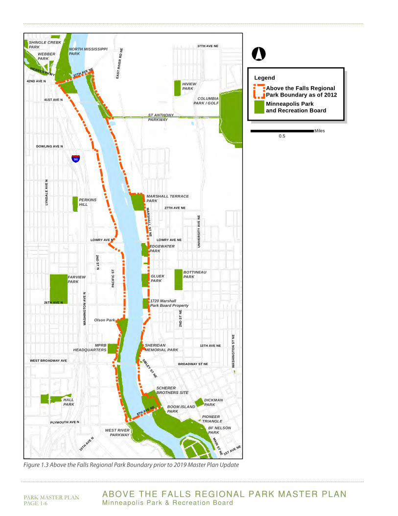
The RiverFirst vision for parks along the upper Mississippi was approved by the Minneapolis Park and Recreation Board on March 14, 2012, following an international design competition and subsequent visioning process led by design team TLS/KVA in 2011. This gave rise to the RiverFirst Initiative, an interagency partnership of MPRB, the City of Minneapolis and the Minneapolis Parks Foundation focused on realizing the RiverFirst vision by implementing priority projects.
Since initiating RiverFirst, there has been some justifiable confusion about the relationship between it and the Above the Falls Regional Park Master Plan. The ATF Regional Park Master Plan (like other regional park master plans) is adopted policy of the MPRB used to guide the organization’s actions and investments within the park’s boundary. RiverFirst is the brand of an ongoing community call-to-action for transforming Minneapolis’ upper riverfront from private shoreline to public parkland with adjacent redevelopment. It suggests park and other public space investments across two regional parks (ATF and Central Riverfront) and investments within but also beyond regional park boundaries.
Figure 1.6 shows RiverFirst’s long-term vision, which goes beyond parks, stormwater management and trails to address larger urban design issues by envisioning the growth of creative industries, commercial amenities, and residential communities in a way that reinforces both the RiverFirst initiatives and the City’s redevelopment goals.
Figure 1.7 summarizes RiverFirst’s near-term vision for parks, stormwater management, and trails -- particularly those within the ATF Regional Park boundary.
Many components of the RiverFirst park vision have been integrated with elements from the 2000 ATF Plan to inform this updated 2019 ATF Park Plan Update.
RiverFIRST: A Park Design Proposal and Implementation Framework for the Minneapolis Upper Riverfront
March 15, 2012
The RiverFirst vision was approved by MPRB in March, 2012, following an international design competition and many months of community engagement.

ABOVE THE FALLS REGIONAL PARK MASTER PLANMinneapol is Park & Recreat ion Board
PARK MASTER PLAN PAGE 1-11
Figure 1.6 RiverFirst long-term urban design vision (2012)
This expansive vision extends far beyond the ATF Regional Park boundary, and addresses many urban development issues in addition to park development.
1
3
4
5
6
7
8
9
10
11
12
13
2
1
2
3
4
5
6
7
8
9
10
11
13
12
Webber Parkway
West River Parkway
N 2nd Street Development
Lowry Business Hub
Riverfront Development
Farview Creative Industry Core
Broadway River District Corridor
Sibley Street Development
Marshall Avenue Develop-ment
Rain Garden Street
Lowry Commercial Center
Riverfront Trail System
Columbia Park Restoration Project
UN
IVE
RS
ITY
AV
E N
E
BROADWAY ST NE
37TH AVE N
E
WEST BROADWAY AVE
SAINT ANTHONY PKWY
42ND AVE N
1ST AVE NE
WEBBER PKWY
37TH AVE NE
LYN
DA
LE A
VE
N
MA
RS
HA
LL ST N
E
WA
SH
ING
TON
AV
E N
UNIVERSITY AVE NE
EA
ST
RIV
ER
RD
NE
8TH AVE NE
LOWRY AVE NE
PLYMOUTH AVE N
LOWRY AVE N
MARSH
ALL ST NE
MAIN ST NE
7TH ST N
45TH AVE N
3RD
ST N TO
NB
I94LYN
DA
LE A
VE
N
LegendAbove the Falls RegionalPark Boundary as of 2012New or Improved BuildingNon-Parkland ImprovementParkland
°
0.5Miles
Marshall St NE redevelopment

ABOVE THE FALLS REGIONAL PARK MASTER PLAN Minneapol is Park & Recreat ion Board
PARK MASTER PLAN PAGE 1-12
Components of this near-term parks vision have been integrated with this 2019 ATF Park Plan.
Figure 1.7 RiverFirst 5-year vision for parks development (2012)
1
3
4
5
6
2
1
2
3
4
5
6
Northside Wetland Park
Lowry Connector
West River Road Extension
Scherer Park District
Sheridan Park
Riverfront Trail System
UN
IVE
RS
ITY
AV
E N
E
BROADWAY ST NE
37TH AVE N
E
WEST BROADWAY AVE
SAINT ANTHONY PKWY
42ND AVE N
1ST AVE NE
WEBBER PKWY
37TH AVE NE
LYN
DA
LE A
VE
N
MA
RS
HA
LL ST N
E
WA
SH
ING
TON
AV
E N
UNIVERSITY AVE NE
EA
ST
RIV
ER
RD
NE
8TH AVE NE
LOWRY AVE NE
PLYMOUTH AVE N
LOWRY AVE N
MARSH
ALL ST NE
MAIN ST NE
7TH ST N
45TH AVE N
3RD
ST N TO
NB
I94LYN
DA
LE A
VE
N
LegendAbove the Falls RegionalPark Boundary as of 2012New or Improved BuildingNon-Parkland ImprovementParkland
°
0.5Miles