Embed Size (px)
Citation preview

A Very Brief Tutorial on the A Very Brief Tutorial on the Use of GPS on Self-Propelled Use of GPS on Self-Propelled
OutingsOutings
How Does GPS Function the Way it DoesHow Does GPS Function the Way it Does&&
What Good is It?What Good is It?
Roger A. Jenkins
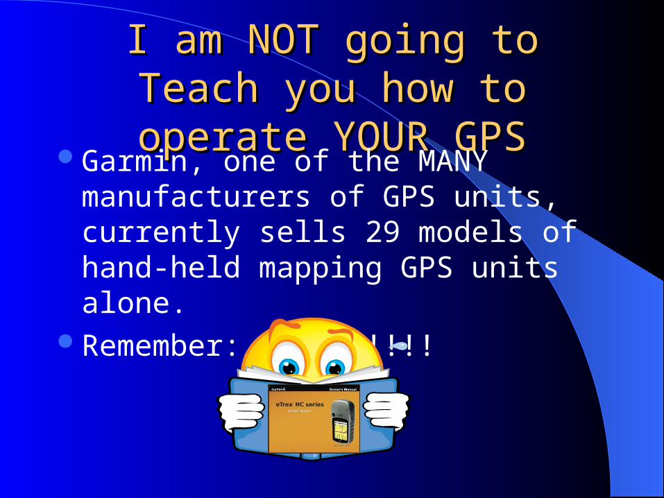
I am NOT going to Teach you I am NOT going to Teach you how to operate YOUR GPShow to operate YOUR GPS
Garmin, one of the MANY manufacturers of GPS units, currently sells 29 models of hand-held mapping GPS units alone.
Remember: RTFM!!!!!
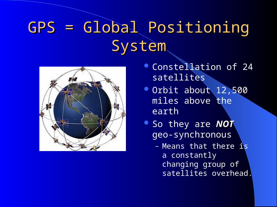
GPS = Global Positioning SystemGPS = Global Positioning System
Constellation of 24 satellites
Orbit about 12,500 miles above the earth
So they are NOTNOT geo-synchronous– Means that there is a
constantly changing group of satellites overhead.

A GPS is a A GPS is a One-WayOne-Way Satellite Satellite ReceiverReceiver

In Answer to the Question: Where Am I?In Answer to the Question: Where Am I?I could use a street addressI could use a street address
588 Evening Star Lane, Bozeman, Montana

Other Ways to Describe LocationOther Ways to Describe Location
8.26 miles from Ross Peak
5.49 miles from Airport Control Tower
Note House
5.92 miles from Barnes and Noble
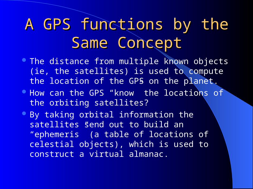
A GPS functions by the Same A GPS functions by the Same ConceptConcept
The distance from multiple known objects (ie, the satellites) is used to compute the location of the GPS on the planet.
How can the GPS “know” the locations of the orbiting satellites?
By taking orbital information the satellites send out to build an “ephemeris” (a table of locations of celestial objects), which is used to construct a virtual almanac.

Fundamental PrincipleFundamental Principle
Light and radio signals travel at 186,282 miles per second.
Signal traveling from satellite 12,500 miles away will take about 67 milliseconds (67/1000) to travel the distance.
Knowing position to within 25 feet requires a time resolution of 25 billionths of a second.

Effectively, this is What HappensEffectively, this is What Happens
Satellite says: “I am GPS satellite #17 and I sent this signal at exactly 10:00 am.”
GPS thinks: “Hmm, I just got a signal from satellite #17. He saidhe sent it at 10:00 am, but I got the signal at 10:00:00.0724896 seconds.Therefore, Satellite #17 must be 13,503.5 miles from me.

Your Point on the Planet is Your Point on the Planet is Determined from the Time (Distance) Determined from the Time (Distance)
from 4 Satellitesfrom 4 Satellites
3 Satellites provide position, and the 4th provides time verification

I was TOLD there would NONO MATH!!!
But YOU Don’t have to do this But YOU Don’t have to do this math to use a GPS!!math to use a GPS!!
All you have to do is be able to count to FOUR

If you have Four Satellites with a good If you have Four Satellites with a good signal, you are likely to have an accurate signal, you are likely to have an accurate
positionposition
Example screen capture from a real GPS
Circles denote the horizon and 45 degrees above the horizon
These little icons give relative position of satellites above your head
This bar graph shows that you have four satellites with strong signals and two more with weaker signals
This shows your position
This shows the uncertainty in your position

The Bottom LineThe Bottom Line In most cases,
modern hand held GPS units (12 Channel) typically are good to within 30 feet.
Exception: interference from steep walled slopes or under wet leaves during rain.
I’m not sure if I am sitting here or over where Susie is.
Whydoes hecare??

GPS Can Provide Position Determination GPS Can Provide Position Determination in Many Different Coordinate Systemsin Many Different Coordinate Systems
Latitude/Longitude in Degrees, minutes, seconds Latitude/Longitude in Degrees and decimal
minutes. But the most useful for self propelled outdoors But the most useful for self propelled outdoors
people is UTM, or people is UTM, or Universal Transverse MercatorUniversal Transverse Mercator Note: Most GPS units are setup in the factory Note: Most GPS units are setup in the factory
for Lat/Long, so you will likely have to change to for Lat/Long, so you will likely have to change to UTMUTM

Why UTM?Why UTM?
Quick Question: About how far is 2 minutes 36.25 seconds of
longitude at 46° North Latitude? Answer: I don’t know either, and that is my point: There is no inherent, constant There is no inherent, constant
relationship between latitude/longitude relationship between latitude/longitude and distance: it is and distance: it is dependentdependent on on where where you are on the planetyou are on the planet..

Actually, that is not quite trueActually, that is not quite trueYou COULD solve these equations in the fieldYou COULD solve these equations in the field

How Do UTM Coordinates Work?How Do UTM Coordinates Work?
Earth is divided into 60 zones (6 degrees wide),In orange-slice like wedges, north to south
Each slice is projected on to a flat mapArbitrarily set the central median of the zone to500,000 meters Easting.
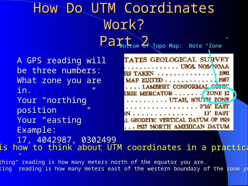
How Do UTM Coordinates Work?How Do UTM Coordinates Work?Part 2Part 2
Here is how to think about UTM coordinates in a practical way:
The “northing” reading is how many meters north of the equator you are.The “easting” reading is how many meters east of the western boundary of the zone you are in
A GPS reading will be three numbers:What zone you are in.Your “northing” positionYour “easting”Example:17, 4042987, 0302499
Bottom of Topo Map: Note “Zone”

Where are Those UTM Coordinate Grids Where are Those UTM Coordinate Grids on a Map?on a Map?
Northing: 4149 km Easting: 543 km
Hint: Don’t cut the sides off your topo maps until you have copied your coordinates to the inside

Real World WaypointsReal World WaypointsIf I tell you that BZNHOM is our home just north of If I tell you that BZNHOM is our home just north of
Bozeman, can you tell me anything about where these Bozeman, can you tell me anything about where these other places are?other places are?
TOPO! GPS Data Format UTM NAD27
Name Zone Easting Northing
BAKERRIV 10U 606962 5402099
BZNHOM 12T 496532 5066757
BearMdw 5V 448231 6493115
BkrLKCmp 12T 612905 4981798
Bobs Bald 16S 772447 3918107
CHATU 11U 554290 5696305
CasaANSU 13S 320058 4124079
Gilliland 12T 587565 4986743
Hotel 30U 694933 5710556
SEEBRK 33T 312197 5311692
Hint: BZNHOM is about 943 km (ca. 589 miles) north of CasaANSU
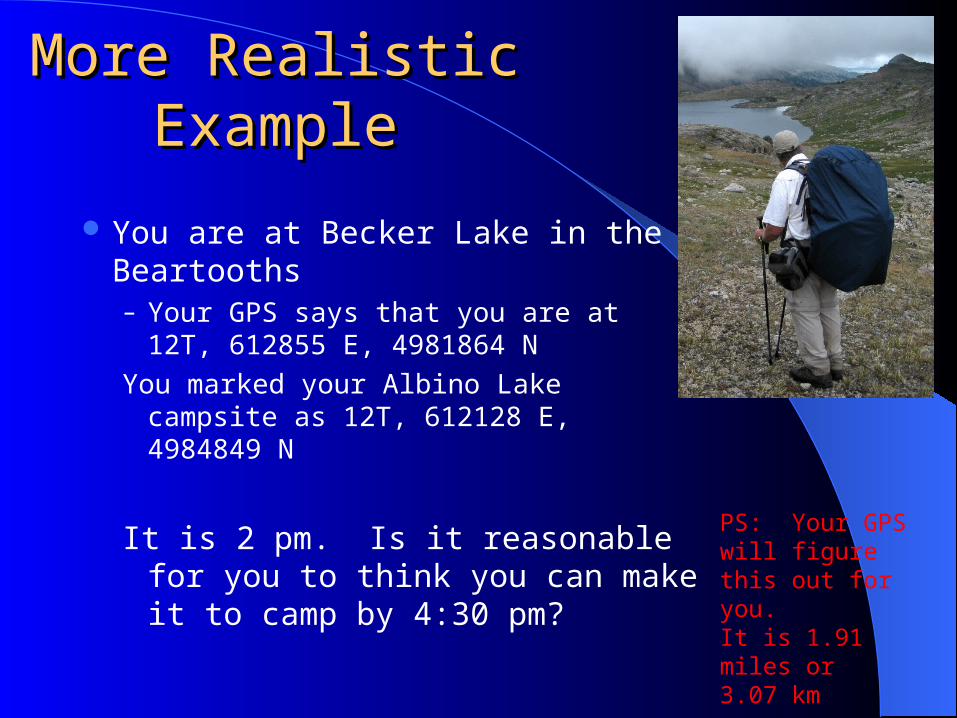
More Realistic More Realistic ExampleExample
You are at Becker Lake in the Beartooths– Your GPS says that you are at 12T,
612855 E, 4981864 NYou marked your Albino Lake campsite
as 12T, 612128 E, 4984849 N
It is 2 pm. Is it reasonable for you to think you can make it to camp by 4:30 pm?
PS: Your GPS will figure this out for you. It is 1.91 miles or 3.07 km

What Do I Do with a GPS What Do I Do with a GPS Reading?Reading?
Part 1Part 1Where Am I?Where Am I?

Figure your Position on a MapFigure your Position on a Map542,760 Easting
4,149,075Northing
You are here

Figure Position on a Customized Figure Position on a Customized Map from Digital Mapping SoftwareMap from Digital Mapping Software
So if your GPS reports your Position as: 12T 502294 5082854You have only climbed to here.
Note
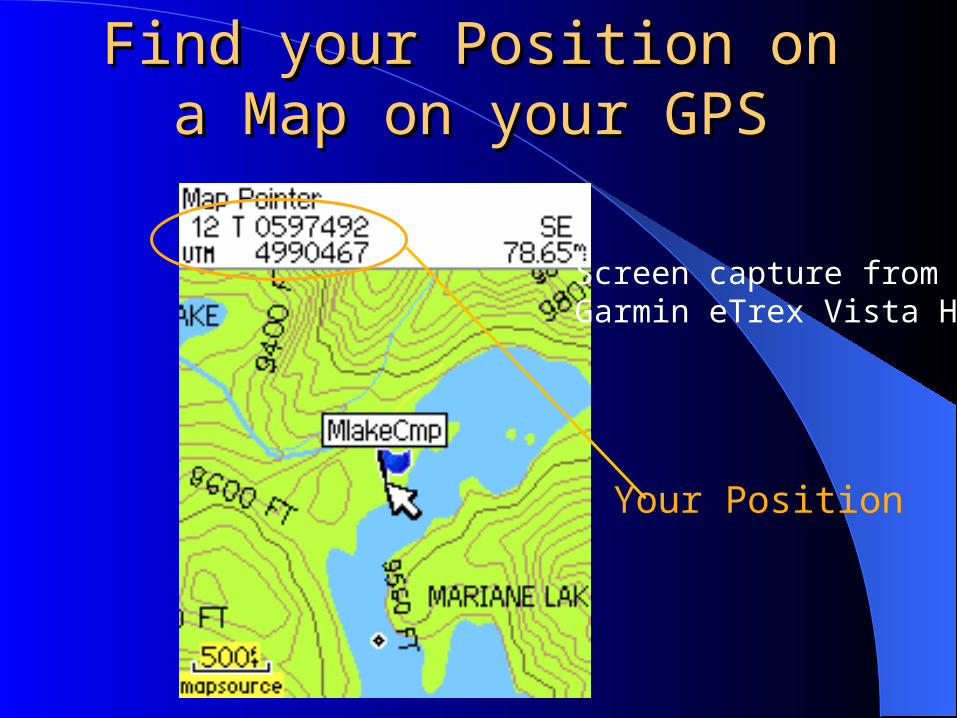
Find your Position on a Map Find your Position on a Map on your GPSon your GPS
Screen capture from Garmin eTrex Vista HCx
Your Position
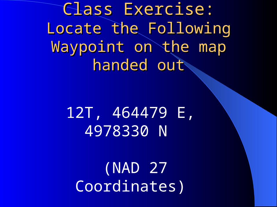
Class Exercise:Class Exercise:Locate the Following Waypoint Locate the Following Waypoint
on the map handed outon the map handed out
12T, 464479 E, 4978330 N
(NAD 27 Coordinates)

Part 2: WaypointsPart 2: WaypointsWhere Do You WANT to be?Where Do You WANT to be?
Definition: A waypoint is simply a spot on the land (or sea) for which you have the position

Two Kinds of WaypointsTwo Kinds of Waypoints#1 The waypoint you ADD to a map and/or load on
your GPS for use in the field
OR….

Two Kinds of WaypointsTwo Kinds of Waypoints#1 The waypoint you ADD to a map and/or load on your GPS for use in the field – WHY?? Example #1:
In a maize of olds roads and trails, knowing on which one to turn can be critical to a successful snowshoe hike.

Two Kinds of WaypointsTwo Kinds of Waypoints#1 The waypoint you ADD to a map and/or load on your GPS for use in the field – WHY?? Example #2
Maybe you REALLY want to find that interesting hot spring complex that is a bit off the beaten path on your day hike.
So you look on your map for the complex, figure out its location, and add a waypoint to your GPS.
Hint: doing this with computerized maps that are VASTLY cheaper than paper USGS topo maps, might take 30 seconds, IF you are really slow.

Two Kinds of WaypointsTwo Kinds of Waypoints#2 The waypoint you MARK (on your GPS) in the field for future reference.
Why??
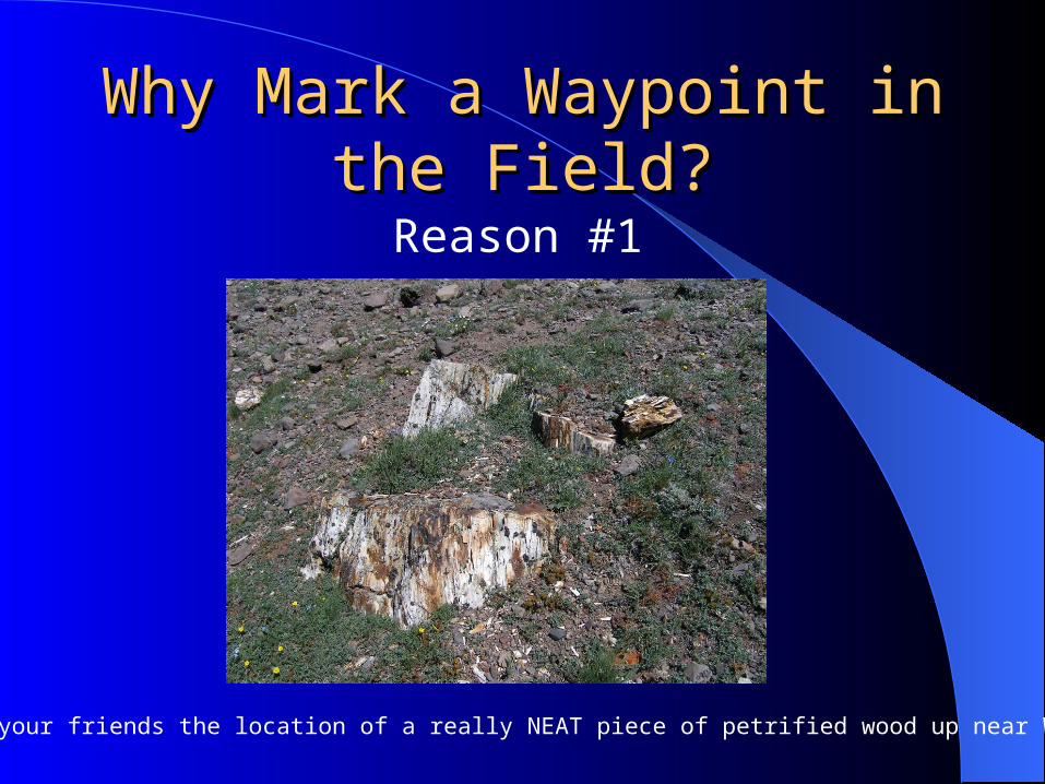
Why Mark a Waypoint in the Why Mark a Waypoint in the Field?Field?
Reason #1
Share with your friends the location of a really NEAT piece of petrified wood up near Windy Pass

Why Mark a Waypoint in the Field?Why Mark a Waypoint in the Field?Reason #2
Find your vehicle in a blinding snow storm, in May, in Southern Utah

Why Mark a Waypoint in the Field?Why Mark a Waypoint in the Field?Reason #3
Provide location of injured hiker to search and rescue team

Part 2: How Far is it to Where Part 2: How Far is it to Where I Want to be?I Want to be?
Pre-determined “waypoints”
I am here
0.43 miles
0.55 miles
Note that GPS provides straight line distances.Such may “trick” you into thinking you are closerthan you really are.

Part 3: Where Have I Been?Part 3: Where Have I Been?
Example: There currently are no accurate renderings of the Rocky Flats trail in the Citico Wilderness. A GPS track provides that information for mapping.

DemonstrationDemonstration
Define Waypoints on a map and upload to GPS
Download a field track from GPS to a computer.

Where Have I Been?: Neat thing to doWhere Have I Been?: Neat thing to do
Download a GPS Track to Google Earth, to see where you have been
Brackett Creek Ski April 4th
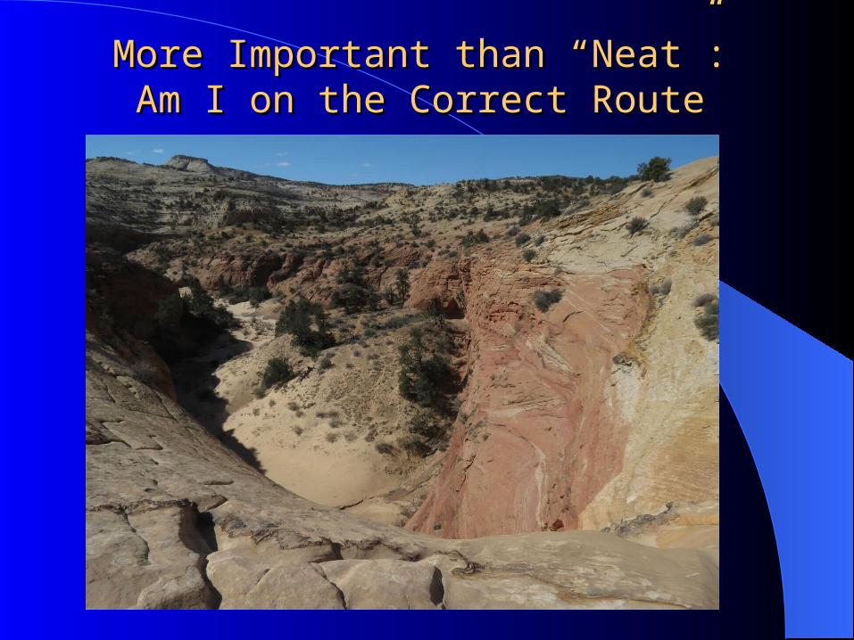
More Important than “Neat”:More Important than “Neat”:Am I on the Correct RouteAm I on the Correct Route
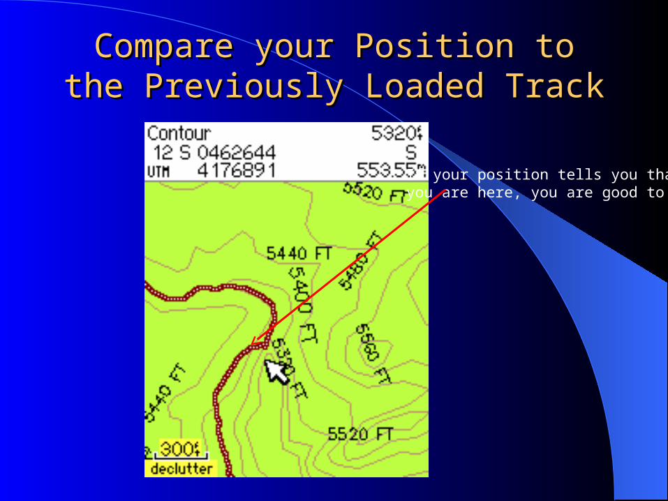
Compare your Position to the Compare your Position to the Previously Loaded TrackPreviously Loaded Track
If your position tells you thatyou are here, you are good to go

Where would you get a track?Where would you get a track?Example 1Example 1

Where would you get a track?Where would you get a track?Example 2Example 2

Bottom LineBottom Line
GPS can be very useful for assistingassisting in figuring out where you are.– You should be using it to confirmconfirm where you
thought you were already.Without a map to provide some context, a
GPS will be of minimum utility.– Knowing where you are in a tangle of
vegetation, or a deep forest, does not, in itself, help you very much.

Signal Bounce Can Throw you Signal Bounce Can Throw you OffOff
Most direct signal attenuated by tree.72.4896 milliseconds
Because the signal path is longer, the signal takes 72.5057 millisecs to arrive
So GPS calculates that you are 13,506.5 miles from Satellite #20, rather than the true 13,503.5 miles

Signal Bounce Can be a Significant Signal Bounce Can be a Significant Problem in Some TerrainProblem in Some Terrain
We KNEW we were here
But the GPS said we were here

This JUST doesn’t happen in Canyons: This JUST doesn’t happen in Canyons: Great Smoky Mtns National ParkGreat Smoky Mtns National Park
We KNEW we were here
But the GPS said we were here
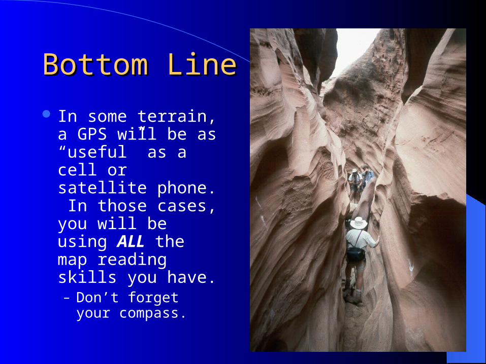
Bottom Line IIBottom Line II
In some terrain, a GPS will be as “useful” as a cell or satellite phone. In those cases, you will be using ALL the map reading skills you have.– Don’t forget your
compass.

ResourcesResources
Manufacturer Web Sites for Firmware, and software updates.
Maps to load on your GPS: – www.miscjunk.org

Interactive DiscussionInteractive Discussion
QuestionsReal world examples
– How far did I get on a trail– Real world trip planning for ski day
Discussion of resourcesPlan for field exercise