Embed Size (px)
Citation preview

GPS and IFTA/IRPDiana Kay (FL)Jeff Hood (IN)
Robert Weber (CT)Hoa Quach (AB)
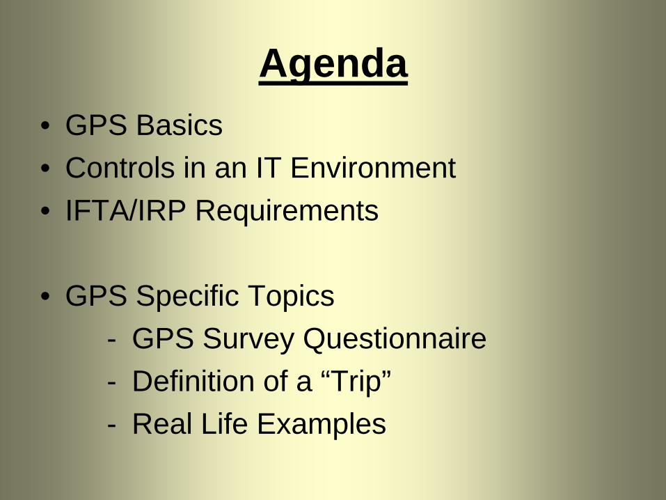
Agenda• GPS Basics• Controls in an IT Environment• IFTA/IRP Requirements
• GPS Specific Topics- GPS Survey Questionnaire- Definition of a “Trip”- Real Life Examples

How does GPS work?
• 24 + satellites orbit the earth searching for GPS receivers
• When a receiver is in contact with three or more satellites, the location of the receiver is determined
• This location is expressed in Latitude and Longitude and is stored along with the precise time of its calculation

How does GPS work?
• The GPS receiver is attached to a micro computer which takes the information, interprets it, then stores it or passes it on to a communication device.
• The GPS data is sent to a computer (perhaps a server) and is available for calculating distance reports for use in Tax and Licensing.

How does GPS work?• These GPS points can be calculated as
frequently as once per second which allows a precise calculation of speed and direction of travel
• In most systems, not all of these points are stored. The recording interval could be from two minutes up to an hour.
• The shorter the interval, the larger the number of points and the greater the accuracy.

Accuracy of GPS• Generally accuracy should be within 15 meters (50 feet)• Accuracy can be improved through the use of Differential
GPS (DGPS) and Wide Area Augmentations System (WAAS), these can increase accuracy to within 1-3 meters (3 – 10 feet)
• Filters and algorithms have been developed to minimize distortions in the data
• Accuracy in measuring routes of travel increases with the frequency of recording
• For example, if points are recorded every 5 minutes it is more accurate than every 30 minutes

• Use the continuous distance calculation (every second) and accumulate distance which can be added to recorded points.
• Calculate straight-line distances between recorded points.
• Get distances from an external source such as an odometer or a “Miler” program
Methods of Calculating Distance

Distance Calculation
• If straight-line calculations are used with infrequent data records, the distance may be under reported
• If continuous calculations are used (every second), then the frequency of recording is less important.
FrequentData Records
InfrequentData

Assigning Distances to Jurisdictions

Assigning distance to Jurisdictions
• Data could be run through a Miler program which assigns the distance to each jurisdiction.
• Distribution of distances can be done by the use of “Geofencing”.
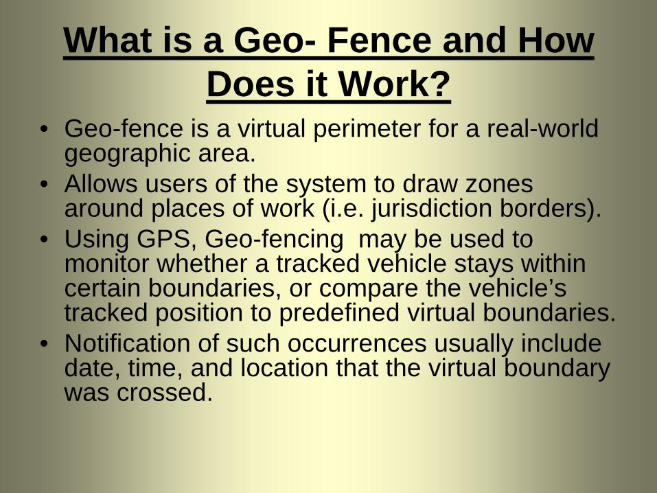
What is a Geo- Fence and How Does it Work?
• Geo-fence is a virtual perimeter for a real-world geographic area.
• Allows users of the system to draw zones around places of work (i.e. jurisdiction borders).
• Using GPS, Geo-fencing may be used to monitor whether a tracked vehicle stays within certain boundaries, or compare the vehicle’s tracked position to predefined virtual boundaries.
• Notification of such occurrences usually include date, time, and location that the virtual boundary was crossed.

Use of Geo-Fencing
• Describe a polygon using Lat and Long• Use an algorithm to determine when a
truck enters or leaves a polygon• Set up all states and provinces as
contiguous polygons• Calculate the distance traveled in each
jurisdiction (polygon)

Use of Geo-Fencing

IT Controls
• Subset of enterprise’s internal controls.• Objective is confidentiality, integrity,
availability of the data.
a) General Controlsb) Application Controls

General Controls:
1. Change management procedures
2. Security Policies, Standards and Processes
3. Disaster Recover
Application Controls:
1. Completeness Checks.
2. Validity Checks3. Authorization4. Input Controls

IRP 502 & IFTA P620(Printed Reports)
• Printed reports must be produced which replace handwritten trip reports.
• Retained for audit
• Vehicle and fleet summaries.

IRP 504 & IFTA P660(Minimum Device Requirements)• Manufacturer certification.• Security – tamperproof and prevent
altering of information.• Functionality – warnings if devices quits.• Date and time stamping.• Automatic update a life-to-date odometer
or operator enters odometer.

IRP 505 & IFTA P640(Data Collection Requirements)
• Distance (IFTA and IRP)
• Fuel (IFTA)

IRP 506 & IFTA P650(Reporting Requirements)
• Trip Reports• Individual Vehicle Reports• Summary Reports (Monthly, Quarterly,
Annual)• Exception Reports• Calibration Reports

GPS Survey Questionnaire
• Purpose is to help the auditor gain an understanding of the carrier’s system.
• Seek information on the system from the carrier’s personnel to provide sufficient knowledge to conduct the audit.

What Information Should be Obtained?
- General System Information- Internal Controls - System Reporting capabilities- Data Retention

General System Information
• Type of GPS System• How often are pings transmitted?
– Are all pings recorded?• What data is recorded by the system?• Does the system record odometer
readings?– If it does at what points are they captured?

General System Information (cont’d)
• Are other software programs used in addition to the GPS to calculate fuel/distance?– If yes, what is the other software and its
function?

Internal Controls• Can exception reports be generated & printed?• Is GPS data being edited?
– Why?– What is being edited?
• Can the driver defeat or tamper with the GPS?• Does the GPS rely on the truck’s battery for
power?• How would you know if a truck was being
towed? (moving but not accruing distance)

Internal Controls (cont’d)
• Are you alerted when the GPS is not receiving a signal from a unit or there is a problem with the signal?
• What procedures or policies are in place for recording distance information if GPS were to malfunction?
• Are there units not equipped with GPS?– Request a listing of those units by unit #.

Internal Controls (cont’d)
• If units are operating without GPS what records are kept for those units?
• Are there any other functions/Internal Controls that would help in understanding the system?
System Reporting Capabilities
• Can the following reports be produced?– Fleet Distance (Total & Jurisdictional distance
per unit and the fleet)– Unit Distance Summaries (Total &
Jurisdictional distances)– Total & Jurisdictional distance per trip– Routes of travel (detail of GPS location points)
by trip

System Reporting Capabilities (cont’d)
• What other reports are available that are useful for a distance/fuel audit?
• What reports are used to prepare IFTA returns?
• What reports are used to prepare IRP renewals?

Data Retention
• How long are printed GPS reports retained?
• How long does the system store and allow retrieval of prior period printed/non-printed reports?

Required Trip DataP640 – Data Collection Requirements- Date of Trip (starting and ending);- Trip origin and destination (location code is acceptable);- Routes of travel or latitude/longitude positions used in lieu thereof
(may be waived by base jurisdiction). - Beginning and ending odometer or hubodometer reading of the trip
(may be waived by base jurisdiction);- Total trip distance;- Distance by jurisdiction;- Power unit number or vehicle identification number;- Vehicle fleet number; and- Registrant's name.


GPS CSI