Embed Size (px)
Citation preview

A MODEL FOR FUZZY DATA CORREALATION
OF AIS AND RADAR
1Liu Chang
1Cao Ming-zhi
1Han Feng
12Shi Gui-ming and
1Liu Ren-jie
1 Dalian Maritime University Information Science and Technique College
Dalian China 116026
2Dalian Institute of Science and Technology Dalian China 116032
Emails liuchang20080123sinacom
Submitted Aug5 2012 Accepted Sep9 2012 Published Dec1 2012
Abstract- With the development of Automatic Identification System (AIS) more and more vessels are
equipped with AIS device which is a new tool for vessel monitoring and marine safety In this paper
we compared the function of AIS and radar the traditional tool for Vessel Traffic Service (VTS) And
then we discussed the necessity of data fusion of the same target from the two sensors of AIS and radar
According to the characteristic and the difference of tracking performance of AIS and radar we
proposed a fuzzy correlation method for target tracking and data fusion The experiment shows that the
proposed method is correct and efficient and it can improve the performance and the stability of VTS
Index terms Data fusion fuzzy correlation target tracking Automatic Identification System (AIS) radar
INTERNATIONAL JOURNAL ON SMART SENSING AND INTELLIGENT SYSTEMS VOL 5 NO 4 DECEMBER 2012
843
I INTRODUCTION
VTS (Vessel Traffic Service) is a system of collecting and processing the traffic data and
providing vessels with service Up to now many VTS systems have been established in world-
wide ports In China there have been 22 VTS systems covering with most of water area VTS
played an important role in traffic safety efficiency and environment protection
In VTS radar is the main tool for tracking vessel targets and collecting the navigation data With
the establishment of shore-based AIS [1-3] VTS can get target data such as dynamic static and
navigation information For the administration of VTS covered by multiple radars the cross
section data can be collected by near radars [4-7] When the shore-based AIS used in the
processing the track data can be got not only by radar but by AIS For such a condition we need
a multiple sensors processing of data fusion method [8-11] It can correlate the data from
different sensors and establish the target tracking [12-18] which can improve the tracking
performance of VTS
In this paper we discuss the fuzzy correlation and the data fusion of radar and AIS The paper is
organized into seven parts The first part is introduction The second part discusses tracking
performance difference between radar and AIS The third part discusses difference of target data
category and precision of radar and AIS The forth part discusses the time calibration of target
data The fifth part studies the correlation method and the target data fusion The sixth part
presents the experiment and the result analysis The final part provides the conclusion
II DIFFERENCE OF TARGET TRACKING PERFORMANCE OF RADAR AND AIS
The main differences of target tracking between radar and AIS are shown as follows
a Automatic identification function
Radar can not identify the targets automatically Its tracking method is based on the echo video
signal from receiver which includes detection of target estimation of location calculation and
saving of dynamic parameters track extrapolation and fusion But AIS can automatically identify
the target It can receive the MMSI (Marine Mobile Service Identified) dynamic and navigation
related data [4] It can realize the tracking target automatically
Liu Chang Cao Ming-zhi Han Feng Shi Gui-ming and Liu Ren-jie A Model for Fuzzy Data Correlation of AIS and Radar
844
b Target data
The target data by multiple radars has the problem of time asynchronous The precision of
coordinate and measurement are different which causes the change of the data from the same
target VTS center should make the data fusion to keep target tracking For shore-based AIS the
data are received from the same equipment So the problem of time asynchronous does not exist
But the problems of coordinate and precision should be resolved too
c Reliability of target tracking
Target data collected by radar is influenced by the sea clutter the false echo and the low tracking
resolution So the problems of radar target tracking exist such as false-tracking no-tracking lost-
tracking and cross-tracking In AIS tracking such conditions do not exist The automatic
identification can improve the reliability of tracking performance
d Range of target tracking
Within radar detection range all targets can be detected In AIS coverage area only the targets
equipped with AIS can be tracked Additionally the communication capacity of AIS network is
limited [2]
From the analysis above AIS has a better tracking performance than radar in VTS AIS data can
be considered as the basis in the fusion processing of target tracking
III DIFFENRENCES OF DATA CATEGORY AND PRECISION
a Differences of data category
AIS can get more target data than radar The collected data is the static dynamic and navigation
related data etc Radar gets only dynamic data It can not obtain the static data or the navigation
related data
b Differences of the location data
AIS target data comes from ship-borne GPS which is the position of GPS antenna Radar target
data comes from radar echo by AD conversion and detection processing The precision of AIS is
INTERNATIONAL JOURNAL ON SMART SENSING AND INTELLIGENT SYSTEMS VOL 5 NO 4 DECEMBER 2012
845
superior to radar which is better than 10 meters The precision of radar becomes much lower
when the distance between radar and target is longer AIS data is expressed by longitude and
latitude Radar is expressed by polar coordinate
c Differences of course speed and other data
AIS get the speed course and heading data of targets from ship-borne GPS and compass Vessel
size data and the position of GPS antenna are input manually The course and speed of radar is
got by course extrapolation which is associated with the history data and may have a time-delay
The size data output from radar is calculated by target plotting which has bigger error than the
real size This error changes with the vessel navigation state
Besides the collection of target dynamic data of radar and AIS is asynchronous [19-21] The
updating period of data is different The period of radar is 3 seconds but the period of AIS is
changed from 2 seconds to 3 minutes according to the different navigation states of the target
According to the difference and characteristic of radar and AIS analyzed above in the calibration
and correlation of target data we take the AIS target data as the reference data for the calculation
Meanwhile we take the target position data as the most basic correlated data and the next is the
data of speed and course The fuzzy correlation is the premise of the multi-sensor fusion
IV CALIBRATION OF TARGET DATA
The multi-sensor fusion in the VTS belongs to the characteristic level target status data fusion
[22-24] The calibration and correlation processing to the multi-sensor target information is the
basis of the fusion The function of data calibration is to unify the time and space reference point
of various sensors which is the premise of data correlation The function of data correlation is to
judge whether the data (existing deviation) of various sensors comes from the same target If the
data correlates we can judge the data belonging to the same target and can be made fusion
Generally we used UTC from GPS as the unification time reference The unification earth
coordinate is WGS-84 The sampling time at which each sensor gathers the target position data
is different and probably the coordinate is different All the gathering position data must be
changed into the WGS-84 coordinate and must use the extrapolation the interpolation or other
means to correct the corresponding time of the dynamic data such as target location And then we
Liu Chang Cao Ming-zhi Han Feng Shi Gui-ming and Liu Ren-jie A Model for Fuzzy Data Correlation of AIS and Radar
846
make correlated processing of the characteristic data There are many methods of time
calibration such as the linear time calibration (twice interpolation) with the interpolation the
throwing time calibrating w the interpolation (three times of interpolation) the Lagrange time
calibrating at the interpolation (n times of interpolation) the Newtonian time calibrating at the
interpolation and so on According to the target information characteristic of AIS and the radar
here we used the extrapolation method considering the AIS data as the datum
In VTS the scanning period of radar is 3 s and the data updating period of AIS is from 2 to 10 s
In other words the biggest difference of updating period of radar and AIS cannot exceed 10 s
Within this period the value of target positions changes in a certain range and they should be
calibrated with a unique clock But for the vessels of which the data of speed and course is not
changed very much may be considered as the uniform linear motion According to the analysis
above we adopted the extrapolation equation to calibrate the data time
Suppose the gathering data of longitude latitude speed and course of radar target in t1 is
respectively LoR1 LaR1 VR1 and CR1 The data of longitude latitude speed course of AIS target
in t2 is respectively LoA2 LaA2 VA2 and CA2 And we suppose t1 gt t2 The differenceΔt of t1 and t2
is defined as in (1)
Δt = (t1-t2) (1)
In Δt the data of speed and course of target is invariable At the time of t1 LoA1 and LaA1 of AIS
target position are expressed as follows in (2) and (3)
LoA1=LoA2+VA2Δt sin CA2 (2)
LaA1=LaA2+VA2Δt cosCA2 (3)
For the vessel targets of large or middle scale the supposition of the data of speed and course is
invariable and generally it may not cause a big error But the vessel targets of small size may
have a good maneuverability When the changing rate of speed and course changes a lot it may
cause a certain error For this condition we may judge those small ships by identifying them
according to the data of vessel size collected from AIS And we calculate the changing rate of
speed and course to revise the equation (2) and (3)
The position data gathered by AIS is the position of GPS antenna on the ship In order to make
the correlated processing with the radar position data we also need to transform the above
INTERNATIONAL JOURNAL ON SMART SENSING AND INTELLIGENT SYSTEMS VOL 5 NO 4 DECEMBER 2012
847
extrapolation target of the GPS antenna position into the center position data of the target
according to the size data and the position data of GPS antenna of the vessel
The discussion above is only according to the condition of one target For the multi-target we
need to establish a data set of target position obtained by AIS and then make correlation
processing with the radar target data set
V FUZZY CORRELATION MODEL OF THE TARGETS
In real-time tracking of multiple targets the data collected by multi-sensor from the same source
always has some similar physical characteristics But because of the differences of influence and
interference of the sensors performance these characteristics are not identical Correlation data
processing makes use of such similar characteristic of data to judge whether the data comes from
the same target The data collected by the shore-based AIS which can be used for the fuzzy
correlation including the dynamic information of target-ship such as position speed course and
the size of ship as well as the position of the GPS antenna In the processing between the two
targets of AIS and radar we make a group of data Usually we take the calibrated data of
longitude latitude speed and course of the target as the basis data of the correlation processing
Because the target data of length width and course outputting from radar has a lot of differences
from the real-time information we divided the targets into three categories of large medium and
small
The multi-group of fusion data can use the fuzzy correlation to achieve the same target from
radar and AIS The method of fuzzy correlation of position speed and course will be discussed as
follows First the data of longitude latitude heading and speed of the target which has been
calibrated makes up of a group of input vectors waiting to be judged track (lat lon crs spd) By
the correlation function we count the membership of the two vector groups g (gisin[01] ) and the
correlation membership shows the degree of correlation of the data The more close is the data
the higher is the value of the correlation membership We established the different equations of
the correlation membership for the different vector And how to establish the correlation
functions of the data of latitude longitude speed and course will be discussed in the following
The fuzzy correlation of latitude and longitude can establish geometric models as shown in figure
1 because of the high precision of the position data from radar and AIS The x-axis denotes the
Liu Chang Cao Ming-zhi Han Feng Shi Gui-ming and Liu Ren-jie A Model for Fuzzy Data Correlation of AIS and Radar
848
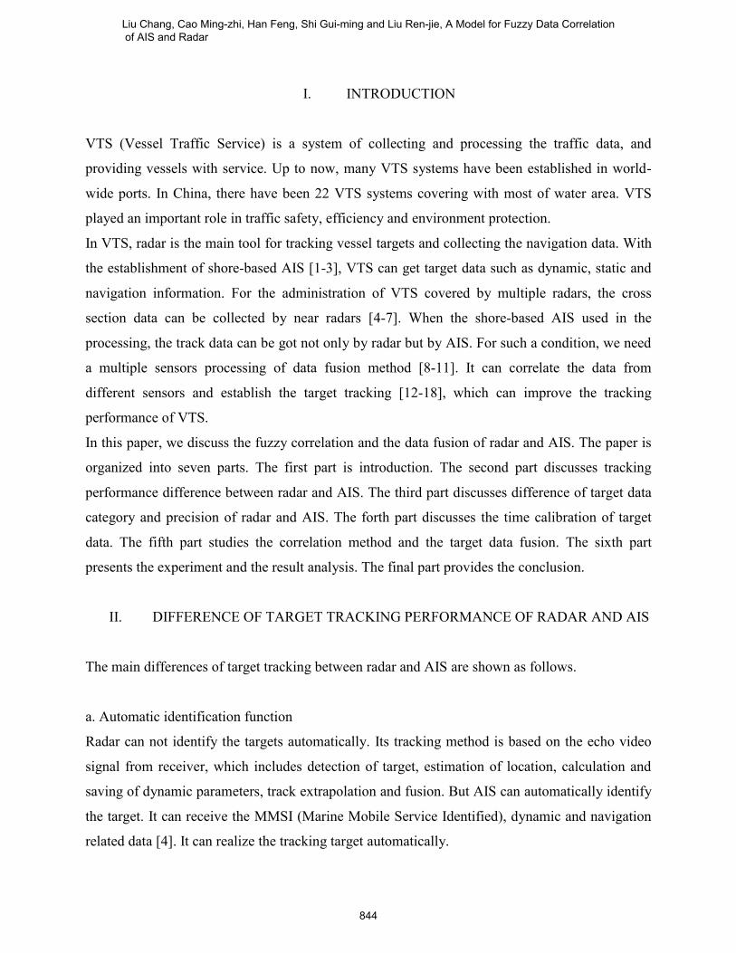
difference between the two parameters of longitude the y-axis denotes the correlation
membership of g It shows that the correlation membership of the two groups of data reach the
maximum value only when the longitudes (or latitude) are equal When the precision of the data
is not high enough we can put the triangular spire into flat-roofed For other information of
course and speed the precision of radar is not very high enough so we adopt the membership
functions as shown in figure 2 and figure 3 The flat-roofed part and the slope of bias in the figure
are correlated with the precision and the change of the speed
Figure1 Correlation equation of lon and lat Figure 2 Correlation equation of course
Figure 3 Correlation equation of speed
Figure 4 is the principle frame of fuzzy correlation system As shown in figure 4 the input is the
vector g (glat glan gcrs gspd) of the two targets Firstly we calculate the correlation membership g
of each vector and then compare with the threshold go When the correlation membership of data
is all satisfied with the condition of fuzzy arbiter the two tracking data can be judged as from the
same target But the fact should be noticed that the correlation membership of these two kinds of
data is ldquoaddrdquo
-500 0 5000
02
04
06
08
1
meters
g
-10 -5 0 5 100
05
1
15
2
knots
g
-50 0 5004
05
06
07
08
09
1
degreeg
INTERNATIONAL JOURNAL ON SMART SENSING AND INTELLIGENT SYSTEMS VOL 5 NO 4 DECEMBER 2012
849
The process of the judgment is described as follows Firstly the fuzzy model decides whether the
fusion level of longitude and latitude glat glan is satisfied with the equations of glat gtgo and glongtgo
And then it makes the judgment of course and speed according to the equations of gcrs gtgo and
gspdgtgo If all the conditions cannot be satisfied the output value is 0 We get the conclusion that
the track information of the two targets is not correlated that is they are not the same target and
can not be fusion Otherwise when the conditions of glat gtgo and glongtgo and gcrs gtgo and
gspdgtgo are all satisfied the output value is 1 And we can conclude that the two targets are
correlated and they are the same vessel and can be fused
glon
glat
gcrs
gspeed
Input tracks from AIS and radar
glat
gtgo
AND glon
gtgo AND g
crse gtg
o AND g
spdgtg
o
Output
(0 not correlated 1correlated)
Figure 4 Block of fuzzy correlation theory
Use the correlation algorithm above we can get the track information from different sensors of
the same target the one is AIS and the other is radar The MMSI code is obtained from the AIS
track information Compared with the track-information of the target we can appoint the new
data report to one of the data collection following
Liu Chang Cao Ming-zhi Han Feng Shi Gui-ming and Liu Ren-jie A Model for Fuzzy Data Correlation of AIS and Radar
850
(1)A data collection of new targets to establish a report of new targets which are not be detected
up to now A new data collection will be created and the new report will be saved in it
(2)A data collection of existed targets tracking it means to establish a tracking report of existed
targets which have been detected The data report should be saved in this collection
(3)A false alarm that is to assume a false target detected by the sensor and then delete the report
according to the improved study
Besides the fuzzy correlation algorithm can be expanded by adding the types of tracking data
into the vector set
VI EXPERIMENT AND ANALYSIS
In the experiment we select three vesselsrsquo data synchronously from JRC-radar and SAAB AIS
Figure 5 shows the experimental set-up of JRC radar and figure 6 shows the shore-based SAAB
AIS The targets collected by radar and AIS display in figure 7 and figure 8 And the
experimental data is shown in table 1 Suppose the position of local radar is (N 38deg520249prime E
121deg31214prime) shown as in figure 7 The calculated position data from radar is shown in table 2
And then we obtain the result of g (glat glan gcrs gspd) of each target by the experiment The result
value of the correlation memberships are shown in table 3
INTERNATIONAL JOURNAL ON SMART SENSING AND INTELLIGENT SYSTEMS VOL 5 NO 4 DECEMBER 2012
851
Figure 5 JRC- radar
Figure 6 SAAB AIS of BS 410
Liu Chang Cao Ming-zhi Han Feng Shi Gui-ming and Liu Ren-jie A Model for Fuzzy Data Correlation of AIS and Radar
852
Figure 7 Display of targets collected by radar
Figure 8 Display of targets on ECDIS collected by AIS
Table 1 Collected ship data from AIS and radar
Target data By Radar By AIS
Ship 1 Target Position N 38deg45prime0906PrimeE 121deg47prime0326Prime
Position of
local radar Radar targets
Display of
AIS targets
on ECDIS
Data of AIS
targets
Data of radar
targets
INTERNATIONAL JOURNAL ON SMART SENSING AND INTELLIGENT SYSTEMS VOL 5 NO 4 DECEMBER 2012
853
Course 1513deg 1480deg
Speed(knot) 151 150
Bearing 1189deg
Range(n mile) 14
Ship 2
Target Position N 38deg43prime3924PrimeE 121deg52prime2112Prime
Course 1535deg 1452deg
Speed(knot) 87 80
Bearing 1171deg
Range(n mile) 184
Ship 3
Ship Position N38deg44prime2957PrimeE121deg53prime0170Prime
Course 3303deg 3309deg
Speed(knot) 957 100
Bearing 1142deg
Range(n mile) 187
Table 2 Calculated ship position from radar
Target Lat Lon
Ship 1 N 387541deg E 1217821deg
Ship 2 N 387270deg E 1218700deg
Ship 3 N 387389deg E 1218845deg
In the experiment we supposed the go as 05 From table 3 we can see obviously that glat gtgo and
glongtgo and gcrs gtgo and gspdgtgo So the result of the fuzzy correlation is tested to be correct And
then we made data fusion of the target of ship 1 as an example Figure 5-8 are respectively the
fusion result of range bearing course and speed of ship1 According to the results of the
experiment we can conclude that the method of fuzzy correlation we proposed is tested to be
correct and efficient
Liu Chang Cao Ming-zhi Han Feng Shi Gui-ming and Liu Ren-jie A Model for Fuzzy Data Correlation of AIS and Radar
854
Table 3 Result of correlation experiment
Target glat glon gcrs gspd
Ship 1 08126 06358 09844 1
Ship 2 09295 05662 09004 1
Ship 3 06946 08439 09928 1
Figure 9 Range fusion result of ship 1 Figure 10 Bearing fusion result of ship 1
Figure 11 Course fusion result of ship 1 Figure 12 Speed fusion result of ship 1
VII CONCLUSION
0 50 100 1501
2
3
4
5
6
7
8
9
10
11
time(s)
dis
tan
ce
(n m
ile
)
fusion
AIS
radar
0 50 100 150 200145
150
155
160
165
170
175
time(s)
co
urs
e(
dg
ree)
radar
AIS
fusion
0 10 20 30 40 50145
150
155
160
165
170
175
180
185
190
time(s)
be
ari
ng
(de
gre
e)
fusion
AIS
radar
0 50 100 150 200 250 300145
15
155
16
165
17
175
18
185
19
time(s)
sp
ee
d(K
n)
AIS
fusion
radar
INTERNATIONAL JOURNAL ON SMART SENSING AND INTELLIGENT SYSTEMS VOL 5 NO 4 DECEMBER 2012
855
The fusion of radar and AIS makes an important role in the targets tracking in VTS This paper
emphasizes on the problem of fusing the AIS data based on the fuzzy correlation algorithm The
method of estimating the position is according to the target tracking of AIS and radar The
proposed method realized the correlation of radar and AIS targets and it is tested to be reliable
and efficient
The advanced study should be how to utilize the other information of AIS such as the size type
gauge and other navigation information in target tracking and data fusion There will be more
correlated condition for the judgment and the result will be more precise For example when the
latitude longitude course and speed the four parameters are very close an additional judgment
condition of the size or the heading of the ships will make the result more reliable and precise
The size of the ship can be estimated by the information output from the radar tracking and AIS
statistic data
REFERENCES
[1] Andy Norris ldquoAIS Implementation-Success or Failurerdquo Journal of Navigation Vol60 No1
2007 pp 1-10
[2] Ingo Harre ldquoAIS Adding New Quality to VTS Systemsrdquo Journal of Navigation Vol53 No3
2000 pp 527-539
[3] N Sawano ldquoCurrent Situation of Digitalized Ship Navigation System for Safetyrdquo Proc
AINAW 2008 pp1134-1137 Japan March 25-28 2008
[4] David K Barton ldquoRadar System Analysis and Modelingrdquo Artech House London 2004
[5] Nick Ward ldquoCollision Avoidance in the e-Navigation Environmentrdquo Proc 17th
IALA
Conference pp 4ndash10 South Africa March 22-27 2010
[6] Alexander Lee Schwehr Zetterberg ldquoEstablishing an IALA AIS Binary Message Register
Recommended Processrdquo Proc 17th
IALA Conference pp 108ndash115 South Africa March 22-27
2010
[7] Li Yuanhui ldquoStudy of the AIS Application for Maritime Administration in Inland Waterrdquo
Proc 17th
IALA Conference pp 37ndash39 South Africa March 22-27 2010
[8] N Eidenberger B G Zagarldquo Capacitive Sensor Design Utilizing Conformal Mapping
Liu Chang Cao Ming-zhi Han Feng Shi Gui-ming and Liu Ren-jie A Model for Fuzzy Data Correlation of AIS and Radar
856
Methodsldquo International Journal of Smart Sensing and Intelligent System Vol 5 No 1 2012 pp
36-56
[9] Jen-Hao L Yu-Fan C Tzu-Shiang L Chia-Pang C Po-Tang Cn Tzai-Hung W Chih-
Hong S Jehn-Yih J and Joe-Air Jiang ldquoAn Air Quality Monitoring System for Urban Areas
Based on the Technology of Wireless Sensor Networksrdquo International Journal of Smart Sensing
and Intelligent System Vol 5 No 1 2012 pp 191-214
[10] Edward Waltz and James Llinas ldquoMulti Sensor Data Fusionrdquo Artech House Radar Library
1990
[11] Yaakov Bar-Shalom and William Dale Blair ldquoMultitargetMultisensor Tracking
Applications and advances-Volume IIIrdquo Artech House Radar Library 2000
[12] BB Chaudhuri A Bhattacharya ldquoOn correlation between two fuzzy setsrdquo Fuzzy Sets and
Systems vol 118 2001 pp 447-456
[13] NANCY P LIN HAO-EN CHUEH ldquoFuzzy Correlation Rules Miningrdquo Proc ICACS
2007 pp13-18 China April 15-17 2007
[14] M De Cock C Cornelis EE Kerre ldquoElicitation of fuzzy association rules from positive
and negative examplesrdquo Fuzzy Sets and Systems Vol 149 2005 pp73-85
[15] M Delgado N Mariacuten D Saacutenchez and M Vila ldquoFuzzy Association Rules General Model
and Applicationsrdquo IEEE Transactions on Fuzzy Systems Vol 11 No 2 2003 pp214-225
[16] D Dubois E Hullermeier and H Prade ldquoA Note on Quality Measures for Fuzzy
Association Rulesrdquo Proc IFSA 2003 pp346-353 Turkey June 30-July 2 2003
[17] X Wu C Zhang S Zhang ldquoEfficient mining of both positive and negative association rulesrdquo
ACM Transactions on Information Systems Vol 22 No3 2004 pp381-405
[18] Hao-En Chueh ldquoMining Target-Oriented Fuzzy Correlation Rules to Optimize Telecom
Service Managementrdquo International Journal of Computer Science amp Information Technology
(IJCSIT) Vol 3 No 1 2011 pp 74-83
[19] Torkild Eriksen Gudrun Hoslashye Bjoslashrn NarheimBente Jensloslashkken Meland ldquoMaritime traffic
monitoring using a space-based AIS receiverrdquo Acta Astronautica Vol 58 No 10 2006 pp
537-549
[20] D Danu A Sinha T Kirubarajan ldquoFusion of Over-the-Horizon Radar and Automatic
Identification Systems or Overall Maritime Picturerdquo Proceedings of 10th
International
Conference on Information Fusion pp1-8 Canada July 9-12 2007
INTERNATIONAL JOURNAL ON SMART SENSING AND INTELLIGENT SYSTEMS VOL 5 NO 4 DECEMBER 2012
857
[21] L Chang S Xiaofei ldquoStudy of Data Fusion of AIS and Radarrdquo Proc SOCPAR 2009
pp674-677 Malaysia December 4-7 2009
[22] S Jidong L Xiaoming ldquoFusion of Radar and AIS Datardquo Proceeding of 7th International
Conference on Signal Processing pp2604-2607 China July15-18 2004
[23] L ChangchuanD Fang ldquoAIS Information Decoding and Fuzzy Fusion Processing with
Marine Radarrdquo Proc Wicom 2008 pp1-5 China October12-14 2008
[24] Yangping Ou Changchuan lin Jianwen Zhou ldquoStudy on the target association arithmetic of
the marine radar and AISrdquo Proc ICEMI 2009 pp 815-818 China August 16-18 2009
Liu Chang Cao Ming-zhi Han Feng Shi Gui-ming and Liu Ren-jie A Model for Fuzzy Data Correlation of AIS and Radar
858
I INTRODUCTION
VTS (Vessel Traffic Service) is a system of collecting and processing the traffic data and
providing vessels with service Up to now many VTS systems have been established in world-
wide ports In China there have been 22 VTS systems covering with most of water area VTS
played an important role in traffic safety efficiency and environment protection
In VTS radar is the main tool for tracking vessel targets and collecting the navigation data With
the establishment of shore-based AIS [1-3] VTS can get target data such as dynamic static and
navigation information For the administration of VTS covered by multiple radars the cross
section data can be collected by near radars [4-7] When the shore-based AIS used in the
processing the track data can be got not only by radar but by AIS For such a condition we need
a multiple sensors processing of data fusion method [8-11] It can correlate the data from
different sensors and establish the target tracking [12-18] which can improve the tracking
performance of VTS
In this paper we discuss the fuzzy correlation and the data fusion of radar and AIS The paper is
organized into seven parts The first part is introduction The second part discusses tracking
performance difference between radar and AIS The third part discusses difference of target data
category and precision of radar and AIS The forth part discusses the time calibration of target
data The fifth part studies the correlation method and the target data fusion The sixth part
presents the experiment and the result analysis The final part provides the conclusion
II DIFFERENCE OF TARGET TRACKING PERFORMANCE OF RADAR AND AIS
The main differences of target tracking between radar and AIS are shown as follows
a Automatic identification function
Radar can not identify the targets automatically Its tracking method is based on the echo video
signal from receiver which includes detection of target estimation of location calculation and
saving of dynamic parameters track extrapolation and fusion But AIS can automatically identify
the target It can receive the MMSI (Marine Mobile Service Identified) dynamic and navigation
related data [4] It can realize the tracking target automatically
Liu Chang Cao Ming-zhi Han Feng Shi Gui-ming and Liu Ren-jie A Model for Fuzzy Data Correlation of AIS and Radar
844
b Target data
The target data by multiple radars has the problem of time asynchronous The precision of
coordinate and measurement are different which causes the change of the data from the same
target VTS center should make the data fusion to keep target tracking For shore-based AIS the
data are received from the same equipment So the problem of time asynchronous does not exist
But the problems of coordinate and precision should be resolved too
c Reliability of target tracking
Target data collected by radar is influenced by the sea clutter the false echo and the low tracking
resolution So the problems of radar target tracking exist such as false-tracking no-tracking lost-
tracking and cross-tracking In AIS tracking such conditions do not exist The automatic
identification can improve the reliability of tracking performance
d Range of target tracking
Within radar detection range all targets can be detected In AIS coverage area only the targets
equipped with AIS can be tracked Additionally the communication capacity of AIS network is
limited [2]
From the analysis above AIS has a better tracking performance than radar in VTS AIS data can
be considered as the basis in the fusion processing of target tracking
III DIFFENRENCES OF DATA CATEGORY AND PRECISION
a Differences of data category
AIS can get more target data than radar The collected data is the static dynamic and navigation
related data etc Radar gets only dynamic data It can not obtain the static data or the navigation
related data
b Differences of the location data
AIS target data comes from ship-borne GPS which is the position of GPS antenna Radar target
data comes from radar echo by AD conversion and detection processing The precision of AIS is
INTERNATIONAL JOURNAL ON SMART SENSING AND INTELLIGENT SYSTEMS VOL 5 NO 4 DECEMBER 2012
845
superior to radar which is better than 10 meters The precision of radar becomes much lower
when the distance between radar and target is longer AIS data is expressed by longitude and
latitude Radar is expressed by polar coordinate
c Differences of course speed and other data
AIS get the speed course and heading data of targets from ship-borne GPS and compass Vessel
size data and the position of GPS antenna are input manually The course and speed of radar is
got by course extrapolation which is associated with the history data and may have a time-delay
The size data output from radar is calculated by target plotting which has bigger error than the
real size This error changes with the vessel navigation state
Besides the collection of target dynamic data of radar and AIS is asynchronous [19-21] The
updating period of data is different The period of radar is 3 seconds but the period of AIS is
changed from 2 seconds to 3 minutes according to the different navigation states of the target
According to the difference and characteristic of radar and AIS analyzed above in the calibration
and correlation of target data we take the AIS target data as the reference data for the calculation
Meanwhile we take the target position data as the most basic correlated data and the next is the
data of speed and course The fuzzy correlation is the premise of the multi-sensor fusion
IV CALIBRATION OF TARGET DATA
The multi-sensor fusion in the VTS belongs to the characteristic level target status data fusion
[22-24] The calibration and correlation processing to the multi-sensor target information is the
basis of the fusion The function of data calibration is to unify the time and space reference point
of various sensors which is the premise of data correlation The function of data correlation is to
judge whether the data (existing deviation) of various sensors comes from the same target If the
data correlates we can judge the data belonging to the same target and can be made fusion
Generally we used UTC from GPS as the unification time reference The unification earth
coordinate is WGS-84 The sampling time at which each sensor gathers the target position data
is different and probably the coordinate is different All the gathering position data must be
changed into the WGS-84 coordinate and must use the extrapolation the interpolation or other
means to correct the corresponding time of the dynamic data such as target location And then we
Liu Chang Cao Ming-zhi Han Feng Shi Gui-ming and Liu Ren-jie A Model for Fuzzy Data Correlation of AIS and Radar
846
make correlated processing of the characteristic data There are many methods of time
calibration such as the linear time calibration (twice interpolation) with the interpolation the
throwing time calibrating w the interpolation (three times of interpolation) the Lagrange time
calibrating at the interpolation (n times of interpolation) the Newtonian time calibrating at the
interpolation and so on According to the target information characteristic of AIS and the radar
here we used the extrapolation method considering the AIS data as the datum
In VTS the scanning period of radar is 3 s and the data updating period of AIS is from 2 to 10 s
In other words the biggest difference of updating period of radar and AIS cannot exceed 10 s
Within this period the value of target positions changes in a certain range and they should be
calibrated with a unique clock But for the vessels of which the data of speed and course is not
changed very much may be considered as the uniform linear motion According to the analysis
above we adopted the extrapolation equation to calibrate the data time
Suppose the gathering data of longitude latitude speed and course of radar target in t1 is
respectively LoR1 LaR1 VR1 and CR1 The data of longitude latitude speed course of AIS target
in t2 is respectively LoA2 LaA2 VA2 and CA2 And we suppose t1 gt t2 The differenceΔt of t1 and t2
is defined as in (1)
Δt = (t1-t2) (1)
In Δt the data of speed and course of target is invariable At the time of t1 LoA1 and LaA1 of AIS
target position are expressed as follows in (2) and (3)
LoA1=LoA2+VA2Δt sin CA2 (2)
LaA1=LaA2+VA2Δt cosCA2 (3)
For the vessel targets of large or middle scale the supposition of the data of speed and course is
invariable and generally it may not cause a big error But the vessel targets of small size may
have a good maneuverability When the changing rate of speed and course changes a lot it may
cause a certain error For this condition we may judge those small ships by identifying them
according to the data of vessel size collected from AIS And we calculate the changing rate of
speed and course to revise the equation (2) and (3)
The position data gathered by AIS is the position of GPS antenna on the ship In order to make
the correlated processing with the radar position data we also need to transform the above
INTERNATIONAL JOURNAL ON SMART SENSING AND INTELLIGENT SYSTEMS VOL 5 NO 4 DECEMBER 2012
847
extrapolation target of the GPS antenna position into the center position data of the target
according to the size data and the position data of GPS antenna of the vessel
The discussion above is only according to the condition of one target For the multi-target we
need to establish a data set of target position obtained by AIS and then make correlation
processing with the radar target data set
V FUZZY CORRELATION MODEL OF THE TARGETS
In real-time tracking of multiple targets the data collected by multi-sensor from the same source
always has some similar physical characteristics But because of the differences of influence and
interference of the sensors performance these characteristics are not identical Correlation data
processing makes use of such similar characteristic of data to judge whether the data comes from
the same target The data collected by the shore-based AIS which can be used for the fuzzy
correlation including the dynamic information of target-ship such as position speed course and
the size of ship as well as the position of the GPS antenna In the processing between the two
targets of AIS and radar we make a group of data Usually we take the calibrated data of
longitude latitude speed and course of the target as the basis data of the correlation processing
Because the target data of length width and course outputting from radar has a lot of differences
from the real-time information we divided the targets into three categories of large medium and
small
The multi-group of fusion data can use the fuzzy correlation to achieve the same target from
radar and AIS The method of fuzzy correlation of position speed and course will be discussed as
follows First the data of longitude latitude heading and speed of the target which has been
calibrated makes up of a group of input vectors waiting to be judged track (lat lon crs spd) By
the correlation function we count the membership of the two vector groups g (gisin[01] ) and the
correlation membership shows the degree of correlation of the data The more close is the data
the higher is the value of the correlation membership We established the different equations of
the correlation membership for the different vector And how to establish the correlation
functions of the data of latitude longitude speed and course will be discussed in the following
The fuzzy correlation of latitude and longitude can establish geometric models as shown in figure
1 because of the high precision of the position data from radar and AIS The x-axis denotes the
Liu Chang Cao Ming-zhi Han Feng Shi Gui-ming and Liu Ren-jie A Model for Fuzzy Data Correlation of AIS and Radar
848
difference between the two parameters of longitude the y-axis denotes the correlation
membership of g It shows that the correlation membership of the two groups of data reach the
maximum value only when the longitudes (or latitude) are equal When the precision of the data
is not high enough we can put the triangular spire into flat-roofed For other information of
course and speed the precision of radar is not very high enough so we adopt the membership
functions as shown in figure 2 and figure 3 The flat-roofed part and the slope of bias in the figure
are correlated with the precision and the change of the speed
Figure1 Correlation equation of lon and lat Figure 2 Correlation equation of course
Figure 3 Correlation equation of speed
Figure 4 is the principle frame of fuzzy correlation system As shown in figure 4 the input is the
vector g (glat glan gcrs gspd) of the two targets Firstly we calculate the correlation membership g
of each vector and then compare with the threshold go When the correlation membership of data
is all satisfied with the condition of fuzzy arbiter the two tracking data can be judged as from the
same target But the fact should be noticed that the correlation membership of these two kinds of
data is ldquoaddrdquo
-500 0 5000
02
04
06
08
1
meters
g
-10 -5 0 5 100
05
1
15
2
knots
g
-50 0 5004
05
06
07
08
09
1
degreeg
INTERNATIONAL JOURNAL ON SMART SENSING AND INTELLIGENT SYSTEMS VOL 5 NO 4 DECEMBER 2012
849
The process of the judgment is described as follows Firstly the fuzzy model decides whether the
fusion level of longitude and latitude glat glan is satisfied with the equations of glat gtgo and glongtgo
And then it makes the judgment of course and speed according to the equations of gcrs gtgo and
gspdgtgo If all the conditions cannot be satisfied the output value is 0 We get the conclusion that
the track information of the two targets is not correlated that is they are not the same target and
can not be fusion Otherwise when the conditions of glat gtgo and glongtgo and gcrs gtgo and
gspdgtgo are all satisfied the output value is 1 And we can conclude that the two targets are
correlated and they are the same vessel and can be fused
glon
glat
gcrs
gspeed
Input tracks from AIS and radar
glat
gtgo
AND glon
gtgo AND g
crse gtg
o AND g
spdgtg
o
Output
(0 not correlated 1correlated)
Figure 4 Block of fuzzy correlation theory
Use the correlation algorithm above we can get the track information from different sensors of
the same target the one is AIS and the other is radar The MMSI code is obtained from the AIS
track information Compared with the track-information of the target we can appoint the new
data report to one of the data collection following
Liu Chang Cao Ming-zhi Han Feng Shi Gui-ming and Liu Ren-jie A Model for Fuzzy Data Correlation of AIS and Radar
850
(1)A data collection of new targets to establish a report of new targets which are not be detected
up to now A new data collection will be created and the new report will be saved in it
(2)A data collection of existed targets tracking it means to establish a tracking report of existed
targets which have been detected The data report should be saved in this collection
(3)A false alarm that is to assume a false target detected by the sensor and then delete the report
according to the improved study
Besides the fuzzy correlation algorithm can be expanded by adding the types of tracking data
into the vector set
VI EXPERIMENT AND ANALYSIS
In the experiment we select three vesselsrsquo data synchronously from JRC-radar and SAAB AIS
Figure 5 shows the experimental set-up of JRC radar and figure 6 shows the shore-based SAAB
AIS The targets collected by radar and AIS display in figure 7 and figure 8 And the
experimental data is shown in table 1 Suppose the position of local radar is (N 38deg520249prime E
121deg31214prime) shown as in figure 7 The calculated position data from radar is shown in table 2
And then we obtain the result of g (glat glan gcrs gspd) of each target by the experiment The result
value of the correlation memberships are shown in table 3
INTERNATIONAL JOURNAL ON SMART SENSING AND INTELLIGENT SYSTEMS VOL 5 NO 4 DECEMBER 2012
851
Figure 5 JRC- radar
Figure 6 SAAB AIS of BS 410
Liu Chang Cao Ming-zhi Han Feng Shi Gui-ming and Liu Ren-jie A Model for Fuzzy Data Correlation of AIS and Radar
852
Figure 7 Display of targets collected by radar
Figure 8 Display of targets on ECDIS collected by AIS
Table 1 Collected ship data from AIS and radar
Target data By Radar By AIS
Ship 1 Target Position N 38deg45prime0906PrimeE 121deg47prime0326Prime
Position of
local radar Radar targets
Display of
AIS targets
on ECDIS
Data of AIS
targets
Data of radar
targets
INTERNATIONAL JOURNAL ON SMART SENSING AND INTELLIGENT SYSTEMS VOL 5 NO 4 DECEMBER 2012
853
Course 1513deg 1480deg
Speed(knot) 151 150
Bearing 1189deg
Range(n mile) 14
Ship 2
Target Position N 38deg43prime3924PrimeE 121deg52prime2112Prime
Course 1535deg 1452deg
Speed(knot) 87 80
Bearing 1171deg
Range(n mile) 184
Ship 3
Ship Position N38deg44prime2957PrimeE121deg53prime0170Prime
Course 3303deg 3309deg
Speed(knot) 957 100
Bearing 1142deg
Range(n mile) 187
Table 2 Calculated ship position from radar
Target Lat Lon
Ship 1 N 387541deg E 1217821deg
Ship 2 N 387270deg E 1218700deg
Ship 3 N 387389deg E 1218845deg
In the experiment we supposed the go as 05 From table 3 we can see obviously that glat gtgo and
glongtgo and gcrs gtgo and gspdgtgo So the result of the fuzzy correlation is tested to be correct And
then we made data fusion of the target of ship 1 as an example Figure 5-8 are respectively the
fusion result of range bearing course and speed of ship1 According to the results of the
experiment we can conclude that the method of fuzzy correlation we proposed is tested to be
correct and efficient
Liu Chang Cao Ming-zhi Han Feng Shi Gui-ming and Liu Ren-jie A Model for Fuzzy Data Correlation of AIS and Radar
854
Table 3 Result of correlation experiment
Target glat glon gcrs gspd
Ship 1 08126 06358 09844 1
Ship 2 09295 05662 09004 1
Ship 3 06946 08439 09928 1
Figure 9 Range fusion result of ship 1 Figure 10 Bearing fusion result of ship 1
Figure 11 Course fusion result of ship 1 Figure 12 Speed fusion result of ship 1
VII CONCLUSION
0 50 100 1501
2
3
4
5
6
7
8
9
10
11
time(s)
dis
tan
ce
(n m
ile
)
fusion
AIS
radar
0 50 100 150 200145
150
155
160
165
170
175
time(s)
co
urs
e(
dg
ree)
radar
AIS
fusion
0 10 20 30 40 50145
150
155
160
165
170
175
180
185
190
time(s)
be
ari
ng
(de
gre
e)
fusion
AIS
radar
0 50 100 150 200 250 300145
15
155
16
165
17
175
18
185
19
time(s)
sp
ee
d(K
n)
AIS
fusion
radar
INTERNATIONAL JOURNAL ON SMART SENSING AND INTELLIGENT SYSTEMS VOL 5 NO 4 DECEMBER 2012
855
The fusion of radar and AIS makes an important role in the targets tracking in VTS This paper
emphasizes on the problem of fusing the AIS data based on the fuzzy correlation algorithm The
method of estimating the position is according to the target tracking of AIS and radar The
proposed method realized the correlation of radar and AIS targets and it is tested to be reliable
and efficient
The advanced study should be how to utilize the other information of AIS such as the size type
gauge and other navigation information in target tracking and data fusion There will be more
correlated condition for the judgment and the result will be more precise For example when the
latitude longitude course and speed the four parameters are very close an additional judgment
condition of the size or the heading of the ships will make the result more reliable and precise
The size of the ship can be estimated by the information output from the radar tracking and AIS
statistic data
REFERENCES
[1] Andy Norris ldquoAIS Implementation-Success or Failurerdquo Journal of Navigation Vol60 No1
2007 pp 1-10
[2] Ingo Harre ldquoAIS Adding New Quality to VTS Systemsrdquo Journal of Navigation Vol53 No3
2000 pp 527-539
[3] N Sawano ldquoCurrent Situation of Digitalized Ship Navigation System for Safetyrdquo Proc
AINAW 2008 pp1134-1137 Japan March 25-28 2008
[4] David K Barton ldquoRadar System Analysis and Modelingrdquo Artech House London 2004
[5] Nick Ward ldquoCollision Avoidance in the e-Navigation Environmentrdquo Proc 17th
IALA
Conference pp 4ndash10 South Africa March 22-27 2010
[6] Alexander Lee Schwehr Zetterberg ldquoEstablishing an IALA AIS Binary Message Register
Recommended Processrdquo Proc 17th
IALA Conference pp 108ndash115 South Africa March 22-27
2010
[7] Li Yuanhui ldquoStudy of the AIS Application for Maritime Administration in Inland Waterrdquo
Proc 17th
IALA Conference pp 37ndash39 South Africa March 22-27 2010
[8] N Eidenberger B G Zagarldquo Capacitive Sensor Design Utilizing Conformal Mapping
Liu Chang Cao Ming-zhi Han Feng Shi Gui-ming and Liu Ren-jie A Model for Fuzzy Data Correlation of AIS and Radar
856
Methodsldquo International Journal of Smart Sensing and Intelligent System Vol 5 No 1 2012 pp
36-56
[9] Jen-Hao L Yu-Fan C Tzu-Shiang L Chia-Pang C Po-Tang Cn Tzai-Hung W Chih-
Hong S Jehn-Yih J and Joe-Air Jiang ldquoAn Air Quality Monitoring System for Urban Areas
Based on the Technology of Wireless Sensor Networksrdquo International Journal of Smart Sensing
and Intelligent System Vol 5 No 1 2012 pp 191-214
[10] Edward Waltz and James Llinas ldquoMulti Sensor Data Fusionrdquo Artech House Radar Library
1990
[11] Yaakov Bar-Shalom and William Dale Blair ldquoMultitargetMultisensor Tracking
Applications and advances-Volume IIIrdquo Artech House Radar Library 2000
[12] BB Chaudhuri A Bhattacharya ldquoOn correlation between two fuzzy setsrdquo Fuzzy Sets and
Systems vol 118 2001 pp 447-456
[13] NANCY P LIN HAO-EN CHUEH ldquoFuzzy Correlation Rules Miningrdquo Proc ICACS
2007 pp13-18 China April 15-17 2007
[14] M De Cock C Cornelis EE Kerre ldquoElicitation of fuzzy association rules from positive
and negative examplesrdquo Fuzzy Sets and Systems Vol 149 2005 pp73-85
[15] M Delgado N Mariacuten D Saacutenchez and M Vila ldquoFuzzy Association Rules General Model
and Applicationsrdquo IEEE Transactions on Fuzzy Systems Vol 11 No 2 2003 pp214-225
[16] D Dubois E Hullermeier and H Prade ldquoA Note on Quality Measures for Fuzzy
Association Rulesrdquo Proc IFSA 2003 pp346-353 Turkey June 30-July 2 2003
[17] X Wu C Zhang S Zhang ldquoEfficient mining of both positive and negative association rulesrdquo
ACM Transactions on Information Systems Vol 22 No3 2004 pp381-405
[18] Hao-En Chueh ldquoMining Target-Oriented Fuzzy Correlation Rules to Optimize Telecom
Service Managementrdquo International Journal of Computer Science amp Information Technology
(IJCSIT) Vol 3 No 1 2011 pp 74-83
[19] Torkild Eriksen Gudrun Hoslashye Bjoslashrn NarheimBente Jensloslashkken Meland ldquoMaritime traffic
monitoring using a space-based AIS receiverrdquo Acta Astronautica Vol 58 No 10 2006 pp
537-549
[20] D Danu A Sinha T Kirubarajan ldquoFusion of Over-the-Horizon Radar and Automatic
Identification Systems or Overall Maritime Picturerdquo Proceedings of 10th
International
Conference on Information Fusion pp1-8 Canada July 9-12 2007
INTERNATIONAL JOURNAL ON SMART SENSING AND INTELLIGENT SYSTEMS VOL 5 NO 4 DECEMBER 2012
857
[21] L Chang S Xiaofei ldquoStudy of Data Fusion of AIS and Radarrdquo Proc SOCPAR 2009
pp674-677 Malaysia December 4-7 2009
[22] S Jidong L Xiaoming ldquoFusion of Radar and AIS Datardquo Proceeding of 7th International
Conference on Signal Processing pp2604-2607 China July15-18 2004
[23] L ChangchuanD Fang ldquoAIS Information Decoding and Fuzzy Fusion Processing with
Marine Radarrdquo Proc Wicom 2008 pp1-5 China October12-14 2008
[24] Yangping Ou Changchuan lin Jianwen Zhou ldquoStudy on the target association arithmetic of
the marine radar and AISrdquo Proc ICEMI 2009 pp 815-818 China August 16-18 2009
Liu Chang Cao Ming-zhi Han Feng Shi Gui-ming and Liu Ren-jie A Model for Fuzzy Data Correlation of AIS and Radar
858
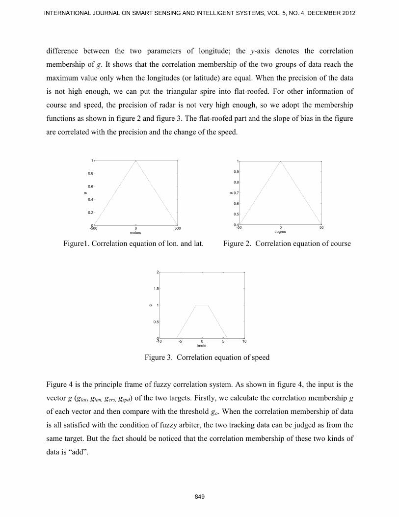
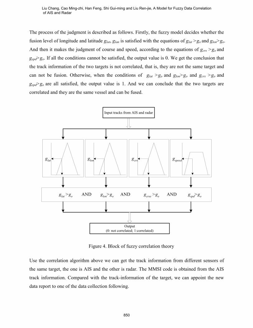
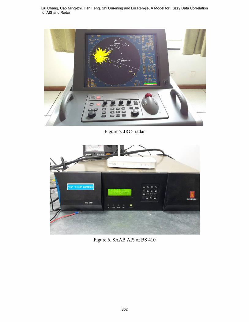