Embed Size (px)
Citation preview

1
A Localized Landmark model based on OSM data for Socialized Landmark based
Navigation System
Dhanajaya Thathsara, Pasindu Chandrasekara, Thejaka Mahaulpatha, Irendra Janithra, Nimalika Fernando
Sri Lanka Institute of Information Technology, Sri Lanka
17/09/2015 FOSS4G Souel 2015

FOSS4G Souel 2015 2
Motivation
17/09/2015

FOSS4G Souel 2015 3
Motivation
17/09/2015
Regular societal practice Vs guidance given by navigation aids

FOSS4G Souel 2015 4
Anything missing?
• Navigation tool : “Turn slightly to left to 7.1 km to Anuradhapura –trincomalee road”
• In –person:“turn to left near Anuradhapura Junction, it’s a four way junction , there ‘s a big Na-tree towards left side , there’s a small tea shop too, you will not miss it “
17/09/2015

FOSS4G Souel 2015 517/09/2015

FOSS4G Souel 2015 6
Landmarks for path planning for local context
Source: http://www.sundaytimes.lk/130120/news/people-power-saves-dambadeniya-era-geta-kumbuk-from-the-electric-saw-29536.html
Source: http://www.greatmirror.com/index.cfm?navid=982
Sri Lanka – strong cultural and social significance for landmarks
17/09/2015

FOSS4G Souel 2015 7
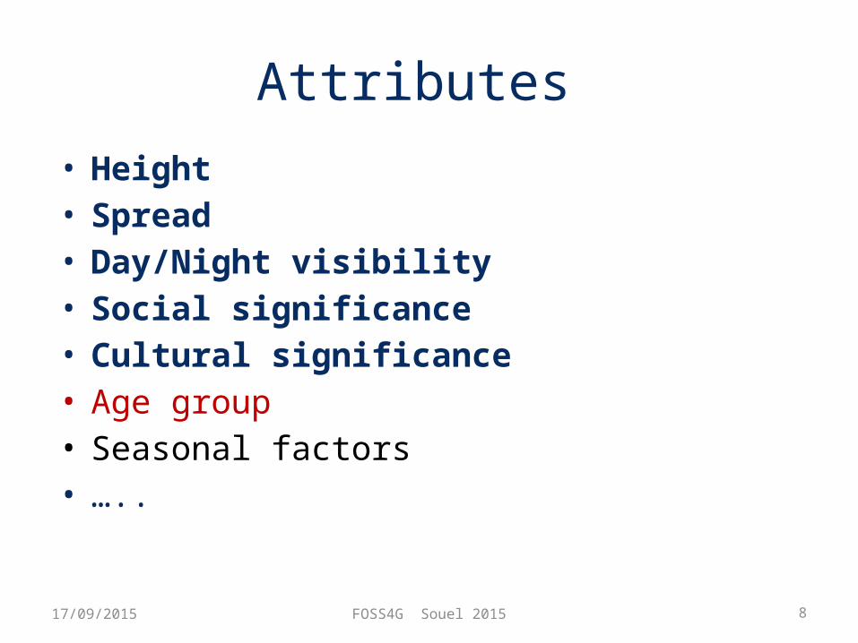
How to model landmarks ?
• Significance of landmarks– Prominence – Familiarity/Social background– Age– Day /night/ seasonal visibility– ….
• Point Location + attributes
17/09/2015
FOSS4G Souel 2015 8
Attributes • Height• Spread• Day/Night visibility• Social significance• Cultural significance• Age group• Seasonal factors • …..
17/09/2015

FOSS4G Souel 2015 9
Height
TallMediumShort
Image Source: http://www.panoramio.com/photo/52483667
Khan clock tower, Colombo, Sri Lanka
17/09/2015

FOSS4G Souel 2015 10
Spread
YesNo
17/09/2015

FOSS4G Souel 2015 11
Day/Night Visibility
Source : http://www.mygola.com/akkaraipattu-d1122069/temple
17/09/2015
DayNightBoth

FOSS4G Souel 2015 12
Cultural Significance
17/09/2015
Place of worship: BuddhismPlace of worship: MuslimPlace of worship: HinduPlace of worship: ChristianStatue: BuddhismTree : Religious

FOSS4G Souel 2015 13
Social Significance
Amenity: Restaurant
Amenity: place of
hangout
Amenity: Shopping
complex http://imagessrilanka.blogspot.kr/search/label/Banana-leaf
%20shaped%20bus%20halt%20shelter
17/09/2015
FOSS4G Souel 2015 14
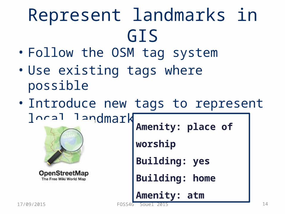
Represent landmarks in GIS• Follow the OSM tag system• Use existing tags where possible • Introduce new tags to represent local
landmarks
17/09/2015
Amenity: place of worship
Building: yes
Building: home
Amenity: atm

FOSS4G Souel 2015 1517/09/2015
<node id="64638681" version="4" timestamp="2013-08-05T17:20:27Z" uid="1294392" user="lkmapper" changeset="17230788" lat="6.0494692" lon="80.2151194"> <tag k="amenity" v="school"/> <tag k="name" v="Mahinda College"/> <tag k="opening_hours" v="Mo-Fr 07:30-13:30"/> <tag k="url" v="http://www.mahindacollege.lk"/></node>
<node id="64638681" version=“1" timestamp="2013-04-11T07:20:30Z" uid="1294" user=“Pasindu" changeset="17230790" lat="6.1432876" lon="80.5678980"> <tag k=“place of worship" v=“buddhism"/> <tag k=“statue" v=“yes"/></node>
FOSS4G Souel 2015 16
How to collect landmarks?
• Landmarks are social concepts• Better let community collect them• Social application
17/09/2015

FOSS4G Souel 2015 17
Social application for landmark collection
• User registration• Add friends/ groups• Add, edit landmarks• Search people based
on proximity• Path planning based
on landmarks17/09/2015

FOSS4G Souel 2015 1817/09/2015

FOSS4G Souel 2015 19
Our final Solution
• Localized Landmark ModelStore Landmarks
• Landmark based path planning
Use landmarks to aid navigation
• Linear MapClutter Free Map
• VGI & Geo-SocializingCollect Landmarks
Landmark based Mobile Navigation
Application
Cross -platform
FOSS based
17/09/2015

FOSS4G Souel 2015 20
Acknowledgement & Credits
• The participation at FOSS4G is supported by a travel grant.
• This is a study initiated by Geo-informatics research group & OSGeoLab of SLIIT and now being supported by a SLIIT Research Grant.
17/09/2015

FOSS4G Souel 2015 21
Thank You !
17/09/2015