Embed Size (px)
Citation preview

04/18/23
Examination of the low level polarimetric radar parameters associated with the Aug 20 2009 southern Ontario tornadic supercells
Mike LeducSudesh Boodoo
Cloud Physics and Severe Weather Research King City ON
04/18/23
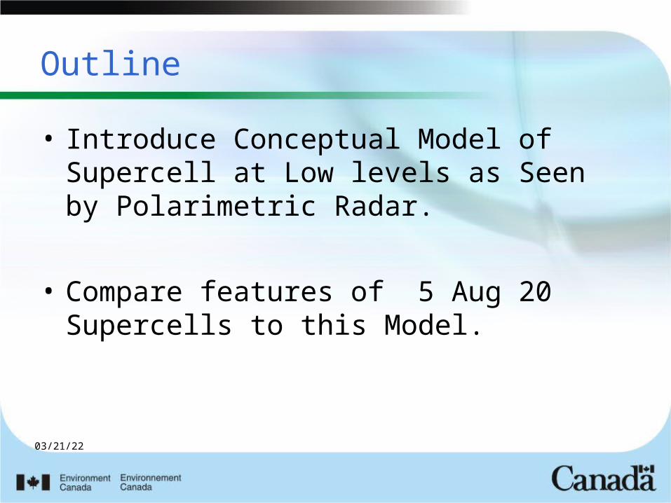
Outline
• Introduce Conceptual Model of Supercell at Low levels as Seen by Polarimetric Radar.
• Compare features of 5 Aug 20 Supercells to this Model.

04/18/23

04/18/23
04/18/23
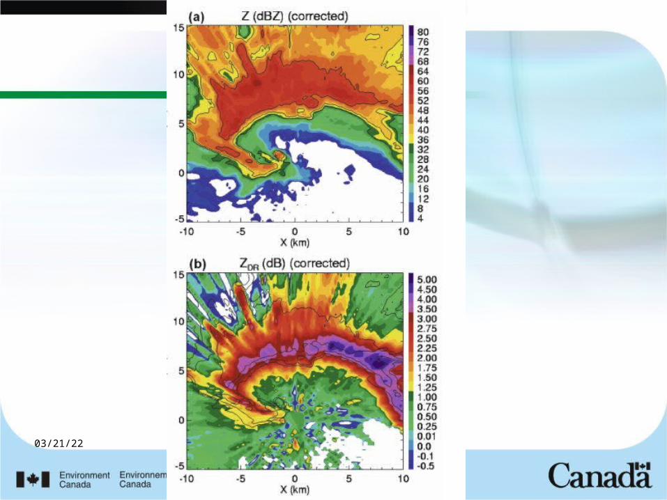
Polarimetric Conceptual Model of Supercells
Low levels of Storm

04/18/23
ZDR and KDP
• ZDR compares Z(H) and Z(V) can distinguish big drops from small drops
• KDP rainfall estimates proportional to D**3 – Compared with Z (D**6) can provide
valuable information

04/18/23
Romine et al 2008
(Arc)

04/18/23
ZDR arc
• Ryzkhov – size sorting due to environmental shear.– Area nearer inflow ends up with fewer
but larger drops hence higher zdr– Not only hypothesis for this effect.
• Claim it’s measure of strength of circulation of supercell. (?)
04/18/23
04/18/23
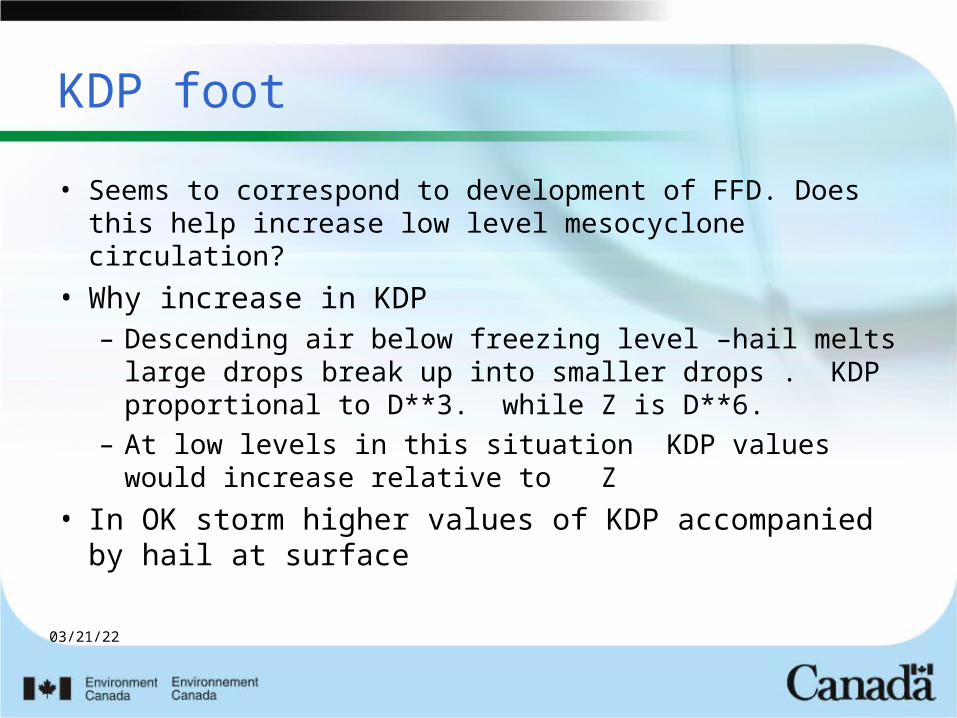
KDP foot
• Seems to correspond to development of FFD. Does this help increase low level mesocyclone circulation?
• Why increase in KDP– Descending air below freezing level –hail melts
large drops break up into smaller drops . KDP proportional to D**3. while Z is D**6.
– At low levels in this situation KDP values would increase relative to Z
• In OK storm higher values of KDP accompanied by hail at surface

04/18/23
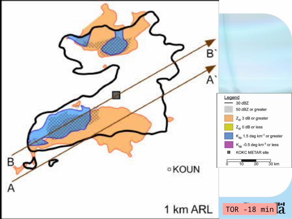
Evolution of Kdp Foot as tornado develops
May 8 2003 OK tornadic supercell
04/18/23
TOR -18 min

04/18/23
TOR-12min

04/18/23
TOR-6min

04/18/23
TOR touchdown

04/18/23
TOR +6

04/18/23
How Does Aug 20 compare at Low Levels
• Look for “sharpness” of zdr shield • Relationship of kdp foot to zdr shield • Can we see expansion of kdp foot and
cyclonic rotation as touchdown approaches – 3 tornadic supercells – 2 Non tornadic supercells

04/18/23
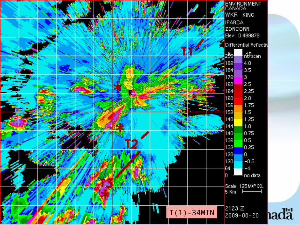
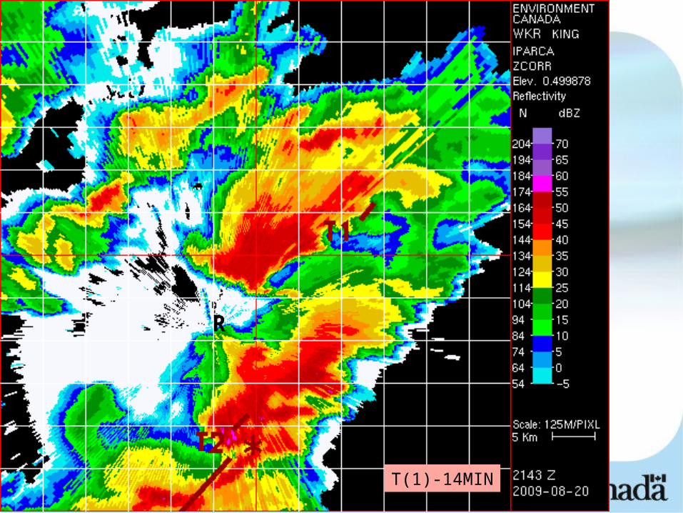
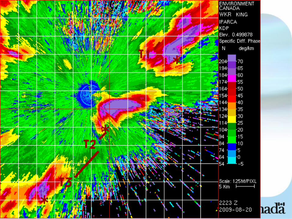
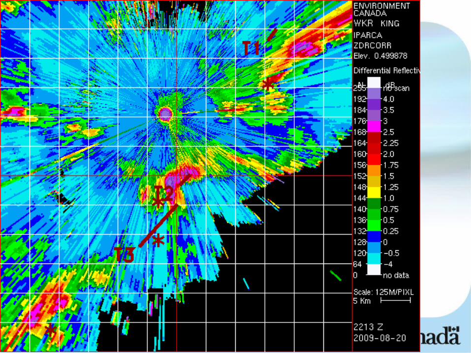
Tornado 1
The Newmarket Storm

04/18/23
R
T(1)-34 MIN
04/18/23
T(1)-34MIN
R

04/18/23
R
T(1)-34MIN
04/18/23
R
T(1)-14MIN

04/18/23
R
T(1)-14MIN

04/18/23
R
T(1)-14MIN

04/18/23
T(1)-4MIN
R

04/18/23
R
T(1)-4MIN

04/18/23
R
(T1)-4MIN
R
04/18/23
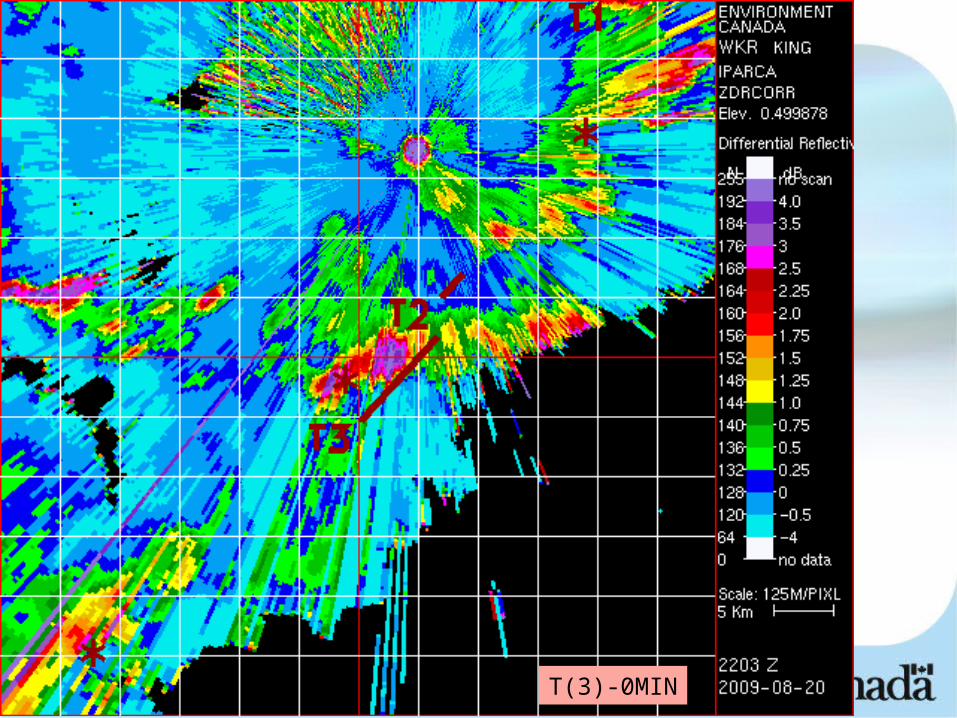
Woodbridge Tornado

04/18/23
T(3)-0 MIN
R
04/18/23
T(3)-0MIN

04/18/23
T(3)-0MIN
R

04/18/23
Time Series of KDP with Woodbridge Storm

04/18/23

04/18/23

04/18/23

04/18/23
04/18/23

04/18/23
New Lowell

04/18/23
T-17 MIN
04/18/23

04/18/23

04/18/23
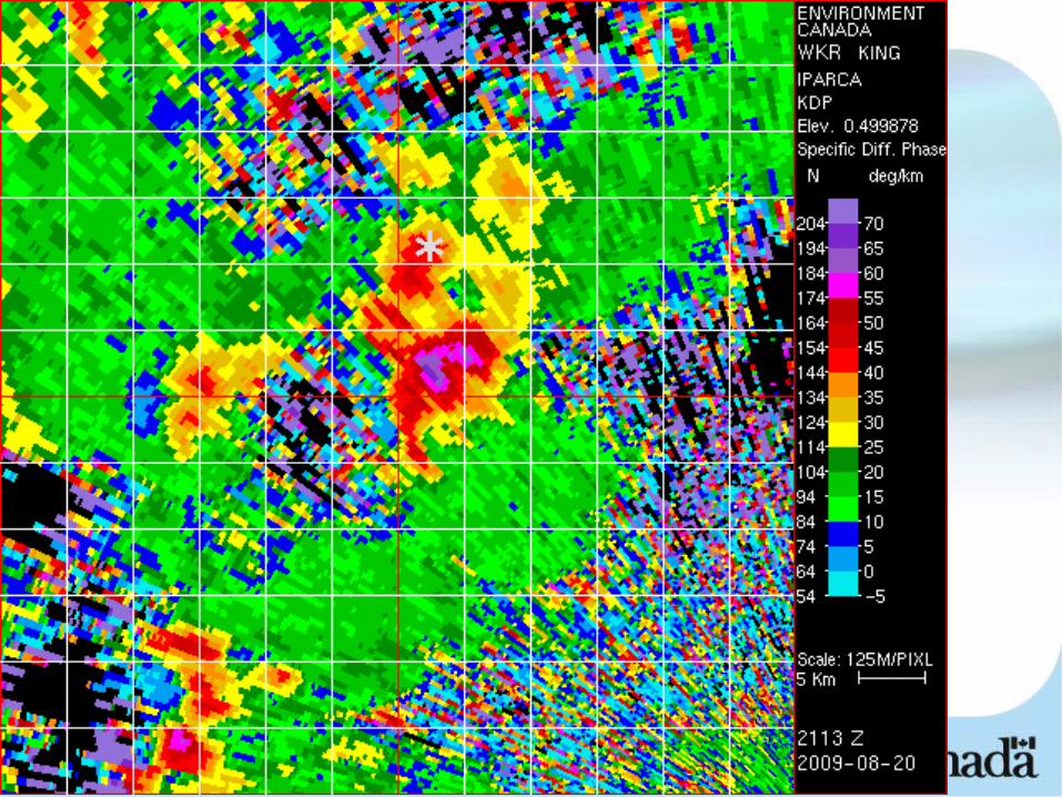
KDP foot and FFD
An example

04/18/23
04/18/23

04/18/23
Comparing Tornadic and Non tornadic storms

04/18/23

04/18/23
KDP foot conclusions
• Subjectively appears that foot does expand and that cyclonic curvature of foot occurs with tornadic storms.
• Again subjectively foot corresponds with FFD as defined by Doppler (divergent signature tripping micro algorithm)

04/18/23
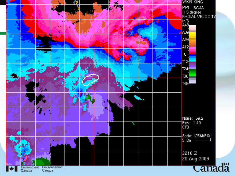
Hook Echoes
• Indicative of RFD. – Higher Values of ZDR
• Smaller particles have evaporated– stronger cold pool greater chance of gusting out.
• Ryzhkov hypothesized tornadic supercells would have lower values of ZDR in hooks.
• His study 4 tornadic 5 non tornadic storms looking just prior to touchdown.– Slight evidence for hypothesis but not
statistically significant.

04/18/23
04/18/23

04/18/23

04/18/23
ZDR
10 cm vs 5 cm radar– Comparing apples and oranges here.– Further study needed on appropriate
thresholds to use.
04/18/23
Conclusions• 5 significant supercells within 60 km of
polarimetric radar on Aug 20 2009• Comparison with preliminary conceptual
models using polarimetric parameters.• Only lowest portion of storm examined.• Some “intriguing” results re potential of
polarimetric radar to distinguish tornadic from non tornadic supercells
• Many more cases needed. • Adapting conceptual models for 5 cm radar is
going to be challenging.
04/18/23
References
• A dual-polarization radar based assessment of the 8May 2003 Oklahoma City Area tornadic supercell;– Glen S. Romine1, Donald W. Burgess2 and Robert B. Wilhelmson3;
MWR August 2008• Microphysical differences between tornadic and non tornadic
supercell rear flank downdrafts revealed by dual polarization radar measurements– Matthew R Kumjian, Alexander V. Ryzhkov; 24th Conference on Severe
Local Storms, Savannah Georgia, October 2008
• Polarimetric Signatures in Supercell Thunderstorms– Matthew R Kumjian, Alexander V. Ryzhkov; Journal of Applied
Meteorology and Climatology July 2008• The Operational Recognition of Supercell Thuderstorm
Environments and Storm Structures– Allan Moller, Charles Doswell, Michael Foster, Gary Woodall;
Weather and Forecasting September 1994

04/18/23
THE END