Embed Size (px)
Citation preview

7/31/2019 602dev
http://slidepdf.com/reader/full/602dev 1/20
CONTRACT FOR PLANNING CONSULTANT SERVICES
AIRPORT NAME (airport name)
PROJECT NUMBER (project#)
Between the
OWNER : (owner), WisconsinRepresented by: SECRETARY OF TRANSPORTATION, Agent for the Owner
and
CONSULTANT: (consultant)(consultant address)
This Contract made and entered into by and between the (airport owner), Wisconsin represented by itsduly authorized agent, SECRETARY OF TRANSPORTATION, Bureau of Aeronautics (BOA), inaccordance with Chapter 114.32, Wisconsin Statutes, hereinafter called the Owner and (consultant),hereinafter referred to as the Consultant.
The Owner proposes to: (description)
ALL SERVICES
The Consultant represents it is in compliance with the laws and regulations relating to the professionof engineering and is willing and able to do the Consultant services required in the proposed work inaccordance with this contract.
It is expressly understood and agreed that the lump sum amount totals $ , the actual costs shallnot exceed and in no event will the total compensation and reimbursement paid hereunder exceed the maximum combined sum of $ for all of the services required under this contractexcept by amendment to this contract.
The Consultant representative is whose telephone is .
The Owner representative is (BOA project manager) whose telephone number is .
The Disadvantaged Business Enterprise goal on this Contract is %.
Attached and made part of this Planning Contract are the General Provisions and SPECIALPROVISIONS. This Contract incorporates and the parties agree to all of the CONSULTANTSERVICES GENERAL PROVISIONS DATED October 14, 2003.
Page 1 of 2 Project No. (project number)

7/31/2019 602dev
http://slidepdf.com/reader/full/602dev 2/20
This Contract has been agreed to and signed on the dates shown. Effective date of the Contract is thelatter of the two dates.
AS AGENT FOR OWNER CONSULTANT
By: _____________________________ By: _____________________________ David M. Greene, Director Signature
Bureau of AeronauticsTitle: _____________________________ SS#/FEIN: _______________________
Date: _____________________________ Date: _____________________________
Airport: ______________________________________________________________________
Page 2 of 2 Project No. (project number)
7/31/2019 602dev
http://slidepdf.com/reader/full/602dev 3/20
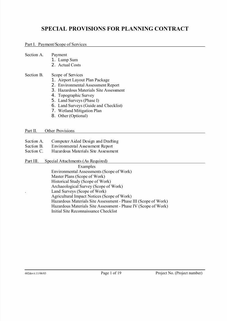
SPECIAL PROVISIONS FOR PLANNING CONTRACT
Part I. Payment/Scope of Services
Section A. Payment1. Lump Sum2. Actual Costs
Section B. Scope of Services1. Airport Layout Plan Package2. Environmental Assessment Report3. Hazardous Materials Site Assessment4. Topographic Survey5. Land Surveys (Phase I)6. Land Surveys (Guide and Checklist)
7. Wetland Mitigation Plan8. Other (Optional)
Part II. Other Provisions
Section A. Computer Aided Design and DraftingSection B. Environmental Assessment ReportSection C. Hazardous Materials Site Assessment
Part III. Special Attachments (As Required)
ExamplesEnvironmental Assessments (Scope of Work)Master Plans (Scope of Work)Historical Study (Scope of Work)Archaeological Survey (Scope of Work)
. Land Surveys (Scope of Work)Agricultural Impact Notices (Scope of Work)Hazardous Materials Site Assessment - Phase III (Scope of Work)Hazardous Materials Site Assessment - Phase IV (Scope of Work)Initial Site Reconnaissance Checklist
602dev/r.11/06/03 Page 1 of 19 Project No. (Project number)

7/31/2019 602dev
http://slidepdf.com/reader/full/602dev 4/20
Part I. Payment/Scope of Services
Attached to and made a part of the Consultant Planning Services Contract:
Airport Name:Project Number:
Section A. Payments
1. Lump Sum - The owner agrees to pay the Consultant as compensation for professionalservices furnished under Section B and in accordance with the General Provisions, a lump sumfor each unit of work performed as follows:
Completion Time (1)
Unit Preliminary Final Fee
Airport Layout Plan Package $Environmental Assessment Report $Topographic Surveys $
Land Surveys (Phase I) $Wetland Mitigation Plan $Land Surveys $
$$$
TOTAL LUMP SUM AMOUNT $1 Completion time is in calendar days or the date for completion is specified.
2. Actual Costs
The owner agrees to pay the Consultant for the following services a reimbursement rate basedon actual costs, including overhead and profit. For services of the Consultant’s staff engageddirectly on the following portion of the project, the Compensation will be an amount equal tothe Consultant’s direct labor cost times a factor of *, plus reimbursable expenses notincluded in the Consultant’s overhead rate.* factor = (1 + overhead rate) x profit
a. Meetings
Meeting costs will be paid for only on an occurrence basis if ordered by the Owner and if the meetings are actually held. If the Consultant requires more than one (1) person at ameeting, approval, prior to the meeting for more than one (1) must be obtained from the project manager, Bureau of Aeronautics, or charges for more than one (1) may bedisallowed.
602dev/r.11/06/03 Page 2 of 19 Project No. (Project number)

7/31/2019 602dev
http://slidepdf.com/reader/full/602dev 5/20
b. Other
Hazardous Material Site Assessment and Testing
Unit Actual Cost (NTE)Initial site ReconnaissancePhase 1 (Reconnaissance and Record Search)Phase 2 (Environmental Sampling)
Phase 3 (Remediation Planning)Phase 4 (Remediation)Total Actual Cost Amount for this Unit: $
Total Actual Costs (All Units) $ Maximum Combined Amount (Lump Sumand Actual Costs) $
Section B. Scope of Services. The Consultant agrees to perform the following services:
Units as Checked to beIncluded in this Contract
Number of Preliminary Copies
Number of FinalCopies
Airport Layout Plan (ALP)Package
Environmental AssessmentReport (EA)
Topographic SurveysLand Surveys (Phase I)Land SurveysWetland Mitigation Plan
1. Airport Layout Plan Package
a. The ALP package will be prepared in accordance with the current AC 150/5300-13 andBOA ALP Development Guide/Checklist.
b. List of ALP sheets as checked will be included in this contract.
Title sheet Yes NoAirport layout sheet(s) (number __) Yes NoTerminal area sheets (number ) Yes NoApproach sheets (Rwy's , , , , , ) Yes NoAirport property map (Land inventory map) Yes NoLand use plan Yes NoLand acquisition plan Yes NoAirport airspace drawing Yes NoALP to be prepared using CADDS (SEE Part II, Section A) Yes NoElectronic File Yes No
c. ALP Narrative Report Yes No
602dev/r.11/06/03 Page 3 of 19 Project No. (Project number)
7/31/2019 602dev
http://slidepdf.com/reader/full/602dev 6/20
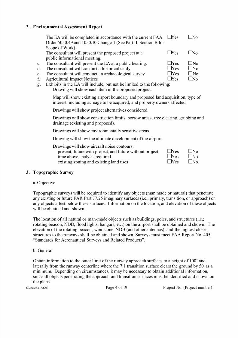
2. Environmental Assessment Report
The EA will be completed in accordance with the current FAAOrder 5050.4Aand 1050.10 Change 4 (See Part II, Section B for Scope of Work).
Yes No
The consultant will present the proposed project at a
public informational meeting.
Yes No
c. The consultant will present the EA at a public hearing. Yes Nod. The consultant will conduct a historical study Yes Noe. The consultant will conduct an archaeological survey Yes Nof. Agricultural Impact Notices Yes Nog. Exhibits in the EA will include, but not be limited to the following:
Drawing will show each item in the proposed project.
Map will show existing airport boundary and proposed land acquisition, type of interest, including acreage to be acquired, and property owners affected.
Drawings will show project alternatives considered.
Drawings will show construction limits, borrow areas, tree clearing, grubbing anddrainage (existing and proposed).
Drawings will show environmentally sensitive areas.
Drawing will show the ultimate development of the airport.
Drawings will show aircraft noise contours: present, future with project, and future without project Yes Notime above analysis required Yes Noexisting zoning and existing land uses Yes No
3. Topographic Survey
a. Objective
Topographic surveys will be required to identify any objects (man made or natural) that penetrateany existing or future FAR Part 77.25 imaginary surfaces (i.e.; primary, transition, or approach) or any objects 5 feet below these surfaces. Information on the location, and elevation of these objectswill be obtained and shown.
The location of all natural or man-made objects such as buildings, poles, and structures (i.e.;rotating beacon, NDB, flood lights, hangars, etc.) on the airport shall be obtained and shown. Theelevation of the rotating beacon, wind cone, NDB (and other antennas), and the highest closest
structures to the runways shall be obtained and shown. Surveys must meet FAA Report No. 405,“Standards for Aeronautical Surveys and Related Products”.
b. General
Obtain information to the outer limit of the runway approach surfaces to a height of 100’ andlaterally from the runway centerline where the 7:1 transition surface clears the ground by 50' as aminimum. Depending on circumstances, it may be necessary to obtain additional information,since all objects penetrating the approach and transition surfaces must be identified and shown onthe plans.
602dev/r.11/06/03 Page 4 of 19 Project No. (Project number)

7/31/2019 602dev
http://slidepdf.com/reader/full/602dev 7/20
Roads, railroads, and waterways are considered obstructions. Obtain the runway centerlinestation at the intersection of the centerline of the road, railroad, or waterways. Obtain elevation of the road or railroad at its intersection with the runway centerline extended and at the point of intersection with the edges of the runway approach surface or primary surface. Roads areassumed to be objects 15' high, interstate highways 17' high, railroads 23' high, and as high as thehighest craft utilizing a waterway. In addition, the elevations at any other point(s) along a road or
railroad to accurately show the critical clearances must be shown.
The location and elevation of the "controlling object" in each approach must be obtained andshown.
c. Ground Contours
Contours required for terminal area Yes No
Contours required for airport layout Yes No
Contours required for approaches Yes No
Runway approach ___, , ,
Interval required for terminal area __1' 2' 5'
Interval required for airport layout __1' 2' 5'
Interval required for approaches __1' 2' 5'
4. Land Surveys (Phase I) Preliminary Work: Research prior to Land Surveys for fee simpleacquisition and/or easement acquisition.
The Bureau of Aeronautics will make available for the land surveyor inspection and use, anyrecords on previous land surveys and title information it has available. The land surveyor will begiven instructions by the Bureau of Aeronautics on the location and approximate size of parcels to be acquired in fee simple or easement. This will be done wherever the extent of acquisition can bedefined. If the extent of acquisition is dependent on determining obstructions and the extentthereof prior to setting definitive lines for acquisition, then the obstruction surveys will be performed first. (Obstruction Surveys provided for separately in the Contract.) The land surveyor is expected to research records of deeds of the property to be surveyed including adjacent properties and to determine by field reconnaissance what difficulties will be encountered in performing the land survey work and what monuments are expected to be used. A check with theCounty Surveyor and other local surveyors for usable information would be considered advisable
at this stage.
Following the completion of the research and reconnaissance work above, the consultant shall prepare and submit a mapped record of properties and usable points for discussion with theBureau of Aeronautics to confer on the best procedure to follow in completing the land surveysand descriptions. The fee for "Land Surveys" (Phase I) is intended to represent payment only for the research and reconnaissance and mapped record described above.
602dev/r.11/06/03 Page 5 of 19 Project No. (Project number)
7/31/2019 602dev
http://slidepdf.com/reader/full/602dev 8/20
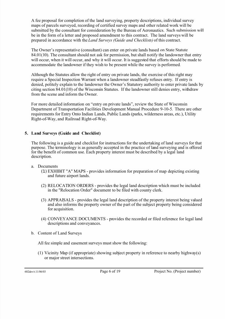
A fee proposal for completion of the land surveying, property descriptions, individual surveymaps of parcels surveyed, recording of certified survey maps and other related work will besubmitted by the consultant for consideration by the Bureau of Aeronautics. Such submission will be in the form of a letter and proposed amendment to this contract. The land surveys will be prepared in accordance with the Land Surveys (Guide and Checklists) of this contract.
The Owner’s representative (consultant) can enter on private lands based on State Statute
84.01(10). The consultant should not ask for permission, but shall notify the landowner that entrywill occur, when it will occur, and why it will occur. It is suggested that efforts should be made toaccommodate the landowner if they wish to be present while the survey is performed.
Although the Statutes allow the right of entry on private lands, the exercise of this right mayrequire a Special Inspection Warrant when a landowner steadfastly refuses entry. If entry isdenied, politely explain to the landowner the Owner’s Statutory authority to enter private lands byciting section 84.01(10) of the Wisconsin Statutes. If the landowner still denies entry, withdrawfrom the scene and inform the Owner.
For more detailed information on “entry on private lands”, review the State of WisconsinDepartment of Transportation Facilities Development Manual Procedure 9-10-5. There are other requirements for Entry Onto Indian Lands, Public Lands (parks, wilderness areas, etc.), UtilityRight-of-Way, and Railroad Right-of-Way.
5. Land Surveys (Guide and Checklist)
The following is a guide and checklist for instructions for the undertaking of land surveys for that purpose. The terminology is as generally accepted in the practice of land surveying and is offeredfor the benefit of common use. Each property interest must be described by a legal landdescription.
a. Documents(1) EXHIBIT "A" MAPS - provides information for preparation of map depicting existingand future airport lands.
(2) RELOCATION ORDERS - provides the legal land description which must be includedin the "Relocation Order" document to be filed with county clerk.
(3) APPRAISALS - provides the legal land description of the property interest being valuedand also informs the property owner of the part of the subject property being consideredfor acquisition.
(4) CONVEYANCE DOCUMENTS - provides the recorded or filed reference for legal land
descriptions and conveyances.
b. Content of Land Surveys
All fee simple and easement surveys must show the following:
(1) Vicinity Map (if appropriate) showing subject property in reference to nearby highway(s)or major street intersections.
602dev/r.11/06/03 Page 6 of 19 Project No. (Project number)

7/31/2019 602dev
http://slidepdf.com/reader/full/602dev 9/20
(2) A legal land description of each parcel citing distances and bearings of property boundary.
(3) Section corners.
(4) The subject land and all contiguous lands held by the same owner.
(5) Number each property line. Identify each boundary leg crossing a runway centerline or
extended centerline as two legs (such as 1 and 1a). Provide the state plane (or county)coordinates of the intersection point and runway station.
(6) The state plane (or county) coordinates of at least one corner of the survey as tied to a point within the existing airport lands. Show the station and state plane coordinates of theend of the runway.
(7) Monument property corners and property line/runway center-line intersection points (if directed to do so).
(8) Existing easements of record including: utility easements, existing avigation easementsand access or other easements.
(9) Land areas in both square feet to nearest hundredth and acres to nearest thousandth. Showgross land areas including highway or railroad right-of-way lands and net lands excludingright-of-way lands.
(10)Improvements such as buildings, wells, septic fields, underground storage tanks (if known)and prominent land and landmark features.
(11)Per Trans 233 (WI Admin Code) for the division of land abutting a state trunk highway or connecting road, show the minimum set backs for new improvements.
602dev/r.11/06/03 Page 7 of 19 Project No. (Project number)
7/31/2019 602dev
http://slidepdf.com/reader/full/602dev 10/20
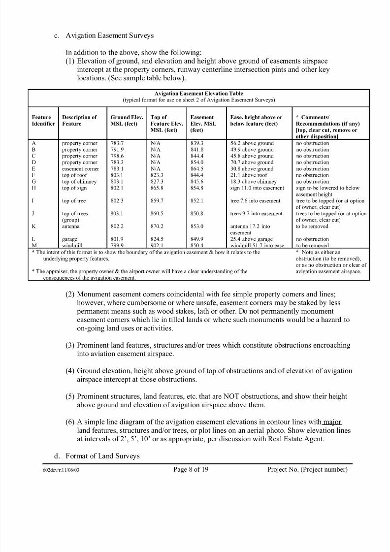
c. Avigation Easement Surveys
In addition to the above, show the following:(1) Elevation of ground, and elevation and height above ground of easements airspace
intercept at the property corners, runway centerline intersection pints and other keylocations. (See sample table below).
Avigation Easement Elevation Table(typical format for use on sheet 2 of Avigation Easement Surveys)
Feature
Identifier
Description of
Feature
Ground Elev.
MSL (feet)
Top of
Feature Elev.MSL (feet)
Easement
Elev. MSL(feet)
Ease. height above or
below feature (feet)
* Comments/
Recommendations (if any)[top, clear cut, remove or
other disposition]
A property corner 783.7 N/A 839.3 56.2 above ground no obstructionB property corner 791.9 N/A 841.8 49.9 above ground no obstructionC property corner 798.6 N/A 844.4 45.8 above ground no obstructionD property corner 783.3 N/A 854.0 70.7 above ground no obstructionE easement corner 783.1 N/A 864.5 30.8 above ground no obstructionF top of roof 803.1 823.3 844.4 21.1 above roof no obstructionG top of chimney 803.1 827.3 845.6 18.3 above chimney no obstructionH top of sign 802.1 865.8 854.8 sign 11.0 into easement sign to be lowered to below
easement heightI top of tree 802.3 859.7 852.1 tree 7.6 into easement tree to be topped (or at option
of owner, clear cut)J top of trees
(group)803.1 860.5 850.8 trees 9.7 into easement trees to be topped (or at option
of owner, clear cut)K antenna 802.2 870.2 853.0 antenna 17.2 into
easementto be removed
L garage 801.9 824.5 849.9 25.4 above garage no obstructionM windmill 799.9 902.1 850.4 windmill 51.7 into ease. to be removed
* The intent of this format is to show the boundary of the avigation easement & how it relates to theunderlying property features.
* The appraiser, the property owner & the airport owner will have a clear understanding of theconsequences of the avigation easement.
* Note as either anobstruction (to be removed),or as no obstruction or clear ofavigation easement airspace.
(2) Monument easement corners coincidental with fee simple property corners and lines;however, where cumbersome or where unsafe, easement corners may be staked by less permanent means such as wood stakes, lath or other. Do not permanently monumenteasement corners which lie in tilled lands or where such monuments would be a hazard toon-going land uses or activities.
(3) Prominent land features, structures and/or trees which constitute obstructions encroachinginto aviation easement airspace.
(4) Ground elevation, height above ground of top of obstructions and of elevation of avigationairspace intercept at those obstructions.
(5) Prominent structures, land features, etc. that are NOT obstructions, and show their heightabove ground and elevation of avigation airspace above them.
(6) A simple line diagram of the avigation easement elevations in contour lines with major land features, structures and/or trees, or plot lines on an aerial photo. Show elevation linesat intervals of 2’, 5’, 10’ or as appropriate, per discussion with Real Estate Agent.
d. Format of Land Surveys
602dev/r.11/06/03 Page 8 of 19 Project No. (Project number)

7/31/2019 602dev
http://slidepdf.com/reader/full/602dev 11/20
Appropriate to serve purpose:
Note - Regulatory authorities within each county set forth specific procedures and/or limitations on filing and/or recording of these surveys. The surveyor shall become familiar with the procedures established for the county where property is located. The surveyor is toadvise and recommend the appropriate survey type.
(1) CERTIFIED SURVEY MAP (C.S.M.) - [size of 8 1/2" x 14", must meet requirements of ss236.34 Recording of certified survey map; use in changing boundaries; use inconveyances., recorded with register of deeds]. A C.S.M. is appropriate when a property isto be conveyed, in part or in whole. When used for conveyances of part or whole of the property to be added to existing airport lands, the county register of deeds will generallyaccept such C.S.M. documents for recording without the extended review and approval process. The register of deeds records the C.S.M. in a bound volume. Upon suchrecording, the parcels of land in the C.S.M. shall be described by reference to the number of the C.S.M. and the volume and page where recorded for conveyance purposes.
(2) SURVEY PLAT - [size of 8 1/2" x 14" preferred, must be filed with county surveyor, may
be recorded with register of deeds]. Generally appropriate when county procedures for C.S.M. require extensive regulatory review for subdivision approval. Such extensiveregulatory review is not needed for airport lands acquisition.
(3) PLAT OF SURVEY - [may be of any size ranging up to full plan sheet size, may or maynot be filed and/or recorded with county surveyor or register of deeds]. Usuallyappropriate to show large land area including several parcels.
(4) PROPERTY SURVEY - [may be any size, usually a recently created survey used as meansof legal land description on recent conveyance document]. This survey may be used as isor used as the basis for creating any of the above-listed surveys (C.S.M., Survey Plat or Plat of Survey) or any of the below-listed surveys (Easement Survey or ObstructionSurvey).
(5) EASEMENT SURVEY - [8 1/2" x 14" or larger size if needed]. To be used when avigationairspace is to be depicted. In addition to the basic survey information noted above, specialinformation which may be included in an easement survey include elevation of grade at property corners, ground elevation and elevation and height above ground of easementairspace intercept.
[Note: a sample of a typical EASEMENT SURVEY is attached.]
(6) OBSTRUCTION SURVEY - [8 1/2" x 14" or larger size if needed]. In addition to the basicsurvey and special information shown on the easement survey, this survey is to show prominent obstructions (manmade and/or natural) by symbol, ground elevation and heightabove ground of top of obstruction and elevation of avigation airspace intercept.
602dev/r.11/06/03 Page 9 of 19 Project No. (Project number)

7/31/2019 602dev
http://slidepdf.com/reader/full/602dev 12/20
e. Certification Requirement For All Land Surveys
Authorization Certificate - it is acceptable to use the following “Authorization certificate”for compliance with Wisconsin Statures s.236.21 (1) and (2).
I, (surveyor), Land Surveyor, do hereby certify that I have surveyed, monumented and
mapped the above-described land.
I hereby certify that I have been authorized, under the direction of(sponsor), to survey,monument, map and describe the land shown on this (plat/map/survey).
I further certify that this (plat/map/survey) is a correct representation of all the exterior boundaries of the land surveyed and the subdivision of it, and that I have fullycomplied with the provisions of Chapter 236 of the Wisconsin Statutes and (county of locale) Subdivision Control Ordinance in surveying, dividing and mapping the land.
Surveyor name Registration/stampCompany name
Project no. Date ___ ____
f. Access To Properties And Right Of Entry
(1) Surveying and related inspections of privately held lands, by municipalities or their agents,is authorized under one or more of the following Wisconsin statures:
• 84.01(10) Right of entry• 114.31(2) Studies, investigations, airport development plan• 114.32(5) Local projects and funds, Secretary of Transportation functions
(2) If entry for land survey or inspection purposes is refused, contact real estate agent assignedto project. For further information on Right of Entry, review State of WisconsinDepartment of Transportation Facilities Development Manual Procedure 9-10-5.
(3) Refer to FDM Procedure 9-10-10, in case of damage to private property.
6. Wetland Mitigation PlanPrepare Conceptual Wetland Mitigation plan adequate for FAA.
602dev/r.11/06/03 Page 10 of 19 Project No. (Project number)

7/31/2019 602dev
http://slidepdf.com/reader/full/602dev 13/20
PART II. OTHER PROVISIONS
Section A. Computer Aided Design & Drafting (CADD)
This procedure describes the requirements for preparation and recording of maps and plans utilizingComputer Aided Design and Drafting Systems.
1. General
All maps and plans shall be developed using as a guide the Bureau of Aeronautics Airport LayoutPlan Development Check List (ALPDCL Manual) as appropriate. When CADD systems areutilized to develop maps and plans and the contract is completed or terminated, a magnetic tape or diskette copy (compatible with the DOT MICROSTATION CADD System) of the maps, plansand files shall be delivered to and become the property of the Bureau of Aeronautics. Finaldrawings for Airport Layout Plans will be 22" x 34" unless otherwise directed. Provide electronicdrawing files for airport Layout Plans and other projects when included in the Contract.
2. Plan Development
Plan document requirements and standards are the same as for manually prepared documents.Except as follows:
a. Lines and Art Work - Line weights and symbols for CADD development will conform to theALPDCL Manual.
b. Lettering - Lettering size is based on the final product. Minimum size lettering desired on thefinal product is to be equal to a 100 Leroy on a 22" x 34" drawing, whenever possible, letteringshall be vertical gothic. Font type shall be Type 1 (MICROSTATION).
3. CADD Files
a. File - All files must end with the suffix .DGN (example sheet 2, airport layout plan for DaneCounty is DANEALP.DGN).
b.Reference Files - DO NOT DETACH any reference file(s) used in the creation of any designfile, even if copied to the Active Design File.
NOTE: This does not apply to files that make up the stereo plotted area. When creating a stereo plotted file it may be necessary to use a number of reference files in its creation. Thesereference files should be merged, copied, or detached as appropriate from the active stereo plot design file. When all the files of the stereo plotted area have been completed, the bureau prefers to merge all these files into one large file and therefore only the final product is used as
a reference file for the airport layout plans.
c. Design File Levels Level assignment will conform to the ALPDCL Manual. Any levels thatare not assigned in the active design file can be used for information not previouslyincorporated and should be brought to the attention of the Bureau.
d. Design Files Any personal computer based format such as CD-Rom and floppy diskette or Internet based such as e-mail or FTP can be used. Design file working units shall be 1:1000:1.Global origin (0,0) of design files shall be the lower left corner of the design plane.
602dev/r.11/06/03 Page 11 of 19 Project No. (Project number)

7/31/2019 602dev
http://slidepdf.com/reader/full/602dev 14/20
4. State Plane Coordinate System
Property lines and centerlines shall be tied into the "State Plane Coordinate System"Yes No
Property lines and centerlines shall be tied into the “County Coordinate System”
Yes No
Section B. Environmental Assessment Report
1. General
a. The Environmental Assessment will be completed in accordance with the current FAA Order 5050.4A and 1050.10 Change 4 and Chapter Trans 400, Wisconsin Administrative Code onfederally funded Contracts.
b. The Environmental Assessment will be completed in accordance with Chapter Trans 400,Wisconsin Administrative Code on non-federally funded Contracts.
c. By the execution of this Contract, the Consultant does hereby specify in accordance withdisclosure statement requirements of 40 CFR 1506.5 (c) and 28 CFR 771.123 (d) that theConsultant has no financial or other interest in the outcome of this project.
d. If the review of the environmental document by the Owner, DTID Bureau of Equity &Environmental Services, and FAA indicates that changes to this document are necessary, allsuch changes shall be made by the Consultant at no additional cost when subject matter to bechanged is provided in the Scope of Work.
e. The general procedures of the Environmental Assessment process are outlined in the Bureau
of Aeronautics Policy and Procedure Manual Procedures AES-10 and AES-11.
Section C. Hazardous Material Site Assessment
The scope of work associated with each phase is as follows:
1. Phase I Work Scope- Initial Site Reconnaissance & Record Search
a. Introduction
The purpose of this phase is to identify those properties which may be contaminated andgive a preliminary indication of the type of contamination which might be present.
The Initial Site Reconnaissance Investigation and Record Search is to narrow the field of potentially contaminated sites that may require the involvement of a specialty consultant andsubsequent phases of investigation. The Consultant will complete an initial sitereconnaissance investigation in order to make more informed decisions on where additionalinvestigation by specialty consultants is needed.
602dev/r.11/06/03 Page 12 of 19 Project No. (Project number)
7/31/2019 602dev
http://slidepdf.com/reader/full/602dev 15/20
b. Investigation
The Consultant shall conduct an Initial Site Reconnaissance & Record Search of each parcelwhich is expected to be acquired or where significant excavation is necessary. Theseinvestigations will be conducted on proposed alignments and may be conducted onalternative alignments.
In many cases, the Initial Site Reconnaissance & Record Search will be all that is necessaryto determine whether further work is needed.
c. Activities
The Consultant shall maintain records of the Initial Site Reconnaissance & Record Search by using the Initial Site Reconnaissance Checklist (form attached in Phase III SpecialAttachments) for each parcel as required. The Consultant will write a summary describingall parcels for which the reconnaissance checklists evidence clearly shows thatcontamination is not an issue. This summary should be placed in the projects files todocument the completion of reconnaissance investigations.
The Owner shall determine if the following activities are necessary for each site:
(1)Records check of federal, state, and local health and regulatory agencies (e.g. old right of way plats or company records). The investigator would check registrations and locationsof UST's (underground storage tanks) and reports of known contamination - spills, leaks,landfills, super fund sites, etc. Lists have been provided to each district for spills,landfills, and super fund sites. UST's may be located by county, municipality, and streetaddress by using the MARK IV program in Panvalet Library on the Hill Farms RegionalCenter (HFRC) mainframe computer or at the Highway District Offices.
(2)Examination of aerial photographs. The investigator would obtain aerial photos of the
land being evaluated. The more series of photos for different years available, the greater are the chances of finding evidence of contamination. Stereoscopic evaluation of reasonable quality photos can identify sources of potential contamination, such as:landfills, lagoons, storage areas, drums, tanks, landscaping, ground staining from spillsand distressed vegetation. The evaluation of aerial photos can identify potential problemareas that are difficult to see from ground level.
(3) Interview of local residents/officials. Neighbors or long-time local residents often haveknowledge of present and past situations or problems that could indicate potentialcontamination. Offices which could be helpful are city/county engineer, water utility,electric utility, fire chief, telephone company, etc. Questions about the location of
former gas stations, dry cleaners, foundries, land fills, dumps, etc. should be asked of appropriate persons.
(4) Identification of other potential sources of site contamination. This could includeasbestos in buildings, lead based paint on structures, chemicals used in industry, pesticides, fertilizers, and herbicides used in farm operations, etc. Asbestos inspectionsmust be contracted to companies specializing in this work.
602dev/r.11/06/03 Page 13 of 19 Project No. (Project number)

7/31/2019 602dev
http://slidepdf.com/reader/full/602dev 16/20
(5) Field review. During field visits to the project, each parcel to be affected by the projectmust be viewed to verify or refute the potential for contamination. These parcels should be photographed to help record the information for future use. There are many visibleindicators of contamination such as apparent changes to the ground surface, distressedvegetation, ground staining, standing liquids, odors, sink holes, ventilation pipes, drums,or containers.
A search of land use records (from recorder of deeds offices, fire insurance maps in libraries,etc.) should be conducted to confirm or refute evidence which indicates that a parcel mayhave previously held a high risk business. Care should be exercised to determine whether this work might not be done more efficiently and comprehensively by a specialty consultant.
If no evidence of potential contamination is found in the Initial Site Reconnaissance &Record Search, the Initial Site Reconnaissance Checklists shall be signed by the Consultant,sent to the Owner and filed in the project files along with any photographs of a parcel.
d. Further study needed
(1) If the Initial Site Reconnaissance & Record Search has found evidence of potentialcontamination, the project should be re-examined to determine if the property can be avoided.If the Owner concurs that avoidance at this point is not feasible, then a specialty consultant can be hired to conduct a Phase 2 Investigation.
(2) The following outline describes steps in the specialty consultant selection process and gives anestimate of the time required to complete the process.
(i) The Owner will review the consultant’s recommendation to hire a specialty consultantand request proposals from the specialty consultants.
(ii) Specialty consultant reviews site characteristics and prepares a proposal with costestimates.
(iii)BOA reviews proposal, negotiates contract, approves and notifies consultant.
(iv)Consultant completes field work and record search.
(v) Consultant assesses data, prepares report, and delivers to the Owner.
(vi)The Owner reviews report and distributes copies to sponsor and DNR. The total timenecessary to complete the above process is estimated not to exceed four (4) months.
(vii) If at any stage of the Phase 1 the consultant discovers evidence of contaminants, theconsultant will notify the Owner so that the project can be reevaluated. If the Owner concurs that avoidance at this point is not feasible, then the consultant will be directed toeither conclude the Phase 1 or go directly to a Phase 2 investigation.
2. Work Scope For Phase 2
a. Environmental Sampling
602dev/r.11/06/03 Page 14 of 19 Project No. (Project number)

7/31/2019 602dev
http://slidepdf.com/reader/full/602dev 17/20
(1) The second phase of site investigation is termed Phase 2 Environmental Sampling. This phase is conducted by a specialty consultant to determine whether contamination is presentand to provide a preliminary indication of the type of contamination present.
(2) With the Owner’s approval, the consultant may conduct these investigations or subcontractfor them for projects assigned to them. This will be negotiated as an amendment to the
scope of work.
(3) The specialty consultant, after consulting with the Owner, will be responsible for notifyingeach property owner of the proposed work to be done. Written notification shall includeinformation about the nature and purpose of the Phase 2 investigation, the potential for theOwner’s responsibility to clean up potential contamination, and notice that a specialtyconsultant will enter the property to conduct the Phase 2 investigation.
(4) The Owner’s representative (consultant) can enter on private lands based on State Statute84.01(10). The consultant should not ask for permission, but shall notify the landowner thatentry will occur, when it will occur, and why it will occur. It is suggested that efforts should be made to accommodate the landowner if they wish to be present while the sampling is performed.
Although the Statutes allow the right of entry on private lands, the exercise of this right mayrequire a Special Inspection Warrant when a landowner steadfastly refuses entry. If entry isdenied, politely explain to the landowner the Owner’s Statutory authority to enter privatelands by citing section 84.01(10) of the Wisconsin Statutes. If the landowner still deniesentry, withdraw from the scene and inform the Owner.
(5) The consultant, if different from the specialty consultant, should visit the site of a Phase 2investigation to provide information that will help the specialty consultant determine the placement of borings.
(6) The consultant will be responsible for providing a location for storage of drummed wastematerials (soil boring tailings, etc.) from sampling.
(7) The consultant will assume ownership of drummed waste materials left over fromsampling. The consultant will be responsible for proper disposal (including documentationsuch as Hazardous Waste Manifesting).
(8) Special Consultant Activities
(i) Phase 2 Field Work •
The Phase 2 investigation will be conducted by a specialty consultant and willnormally consist of the following activities:
♦Regulatory background review;
♦Site representative (owner) interview;
♦Site inspection;
♦Surface soil samples; and
602dev/r.11/06/03 Page 15 of 19 Project No. (Project number)

7/31/2019 602dev
http://slidepdf.com/reader/full/602dev 18/20
♦ Soil borings for the collection of subsurface soil samples and groundwater samples.
• The analysis of soil or water samples will vary depending on site history. Thefollowing example is what would be analyzed for a service station site:
♦ Field screening of samples for volatile organic compounds with hot ionizationmeter;
♦ Chemical analysis of soil samples for gasoline (tph), diesel (tph), heating oil(tph), and waste oil (tph);
♦ Chemical analysis of groundwater samples for PVOG’s;
♦ Analysis of soil and groundwater for other contaminants likely to be presentdue to prior use of the site (determined by specialty consultant).
(ii) Report Preparation• The specialty consultant shall prepare a report addressing the methods and results of
Phase 2 investigations and their recommendations. This report should be preparedwithin 45 days of the close of the field work. The Consultant shall review the specialtyconsultant’s work and progress in the field as staff time permits. The specialtyconsultant will send a copy of the report to the Owner, the consultant, the propertyowner, and the appropriate DNR office.
• If contamination is present, the Owner, with the consultant, shall determine whether toavoid the property or request a Phase 3 investigation. At this point, avoidance is still thedesirable option unless the risk of involvement with the contaminated property can be
justified from an engineering, social, economic, or environmental standpoint.Proceeding to Phase 3 is often very expensive due to the extensive sampling, analysis,and engineering required.
• The Owner will negotiate with a specialty consultant to conduct Phase 3 investigationsafter reviewing the specialty consultant’s Phase 2 report.
• The State of Wisconsin Department of Transportation Facilities Development ManualProcedure 21-35-10 “Phase 2 Environmental Sampling” may be used as a guide for thescope of work.
3. Phase 3 Work Scopea. Remediation Planning
When the Phase 3 work is required, a special scope of work for each parcel of land will bein writing. The State of Wisconsin Department of Transportation Facilities DevelopmentManual Procedure 21-35-15 “Defining Full Extent of Contamination” and Procedure 21-35-12 “Phase 2.5 - Remediation Planning Necessary for Construction of a HighwayProject” should be used as a guide for the scope of work.
602dev/r.11/06/03 Page 16 of 19 Project No. (Project number)

7/31/2019 602dev
http://slidepdf.com/reader/full/602dev 19/20
4. Phase 4 Work Scope
a. Remediation
When this Phase 4 work is required, a special scope of work for each parcel of land will bein writing. The State of Wisconsin Department of Transportation Facilities DevelopmentManual Procedure 21-35-20 Phase 4 - Remediation should be used as a guide for the scopeof work.
602dev/r.11/06/03 Page 17 of 19 Project No. (Project number)

7/31/2019 602dev
http://slidepdf.com/reader/full/602dev 20/20
Part IIISpecial Attachment
INITIAL SITE RECONNAISSANCE CHECKLIST
All blanks must be completed. Use NI for not investigated, NA for not applicable.
WisDOT Project _____________________________ Termini ____________________________________ County _____________________________________
Property Address _____________________________ ____________________________________________ Owner Address ______________________________ (if different) _________________________________
Proposed Activities/Right-of-WayPurchase YES ____ NO ____ Excavate YES ____ NO ____ Relocate Utilities YES ____ NO ____ Easements YES ____ NO ____ Type _______________________________________
Land UseCurrent Land Use ____________________________ Previous Land Use ___________________________ Adjacent Land Use ___________________________ Other ______________________________________ Comments __________________________________
Visual Inspection - Evidence of the FollowingCurrent (or previous USTs) ____________________ Aboveground Tanks __________________________
Disposal Pipes, Drums ________________________ Filled Areas _________________________________ Ponds, Basins, Sumps _________________________ Other ______________________________________
Contamination:Ground Surface _____________________________
Surface Water ______________________________ Odors _____________________________________ Stressed Vegetation _________________________ Other _____________________________________
Record SearchCounty Assessor _____ DILHR (UST) _____ Fire Dept. _____ DNR _____ Plat Books _____ County Hwy. _____ Reg. of Deeds _____ Town _____ Cty. Eng./DPW _____ Aerial Photos _____
SCS _____ Spills List _____ DOT _____ Reg. of Waste Sites _____ USEPA _____ UST Registration _____ USGS _____ Business Directory _____ CERCLIS _____ _________________ _____
Evidence of AsbestosLocation ____________________________________
Type _______________________________________ Source of Evidence __________________________
Potential Migration of ContaminantsTo Existing R/W YES _____ NO _____
To Proposed R/W YES _____ NO _____ To/From Adj. Property YES _____ NO _____
AttachmentsF Aerial Photos F UST RegistrationF Photographs F Spills ReportF Site Map F CERCLIS List
F _________________________________________ F _________________________________________ F _________________________________________
Prepared by: Date:
________________________________________________ ____________________________________
Based on the above information, I recommend: NO FURTHER ACTION FURTHER ACTION
Name: Date:
________________________________________________ ____________________________________
602dev/r.11/06/03 Page 18 of 19 Project No. (Project number)


