Embed Size (px)
Citation preview
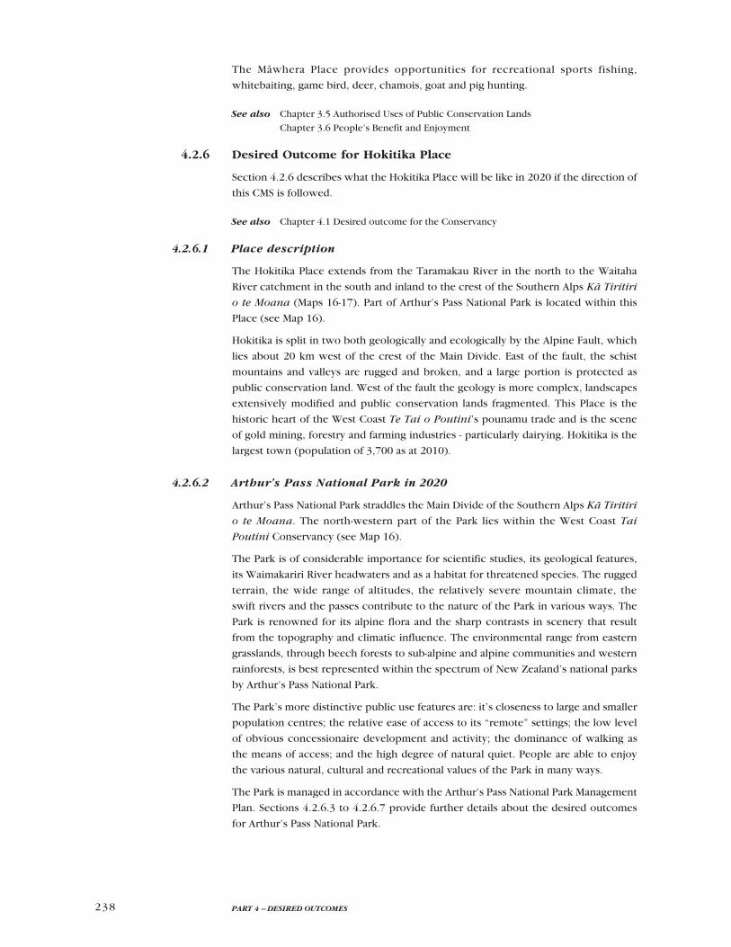
238 PART 4 – DESIRED OUTCOMES
The Mäwhera Place provides opportunities for recreational sports fishing,
whitebaiting, game bird, deer, chamois, goat and pig hunting.
See also Chapter 3.5 Authorised Uses of Public Conservation Lands
Chapter 3.6 People’s Benefit and Enjoyment
4.2.6 Desired Outcome for Hokitika Place
Section 4.2.6 describes what the Hokitika Place will be like in 2020 if the direction of
this CMS is followed.
See also Chapter 4.1 Desired outcome for the Conservancy
4.2.6.1 Place description
The Hokitika Place extends from the Taramakau River in the north to the Waitaha
River catchment in the south and inland to the crest of the Southern Alps Kä Tiritiri
o te Moana (Maps 16-17). Part of Arthur’s Pass National Park is located within this
Place (see Map 16).
Hokitika is split in two both geologically and ecologically by the Alpine Fault, which
lies about 20 km west of the crest of the Main Divide. East of the fault, the schist
mountains and valleys are rugged and broken, and a large portion is protected as
public conservation land. West of the fault the geology is more complex, landscapes
extensively modified and public conservation lands fragmented. This Place is the
historic heart of the West Coast Te Tai o Poutini’s pounamu trade and is the scene
of gold mining, forestry and farming industries - particularly dairying. Hokitika is the
largest town (population of 3,700 as at 2010).
4.2.6.2 Arthur’s Pass National Park in 2020
Arthur’s Pass National Park straddles the Main Divide of the Southern Alps Kä Tiritiri
o te Moana. The north-western part of the Park lies within the West Coast Tai
Poutini Conservancy (see Map 16).
The Park is of considerable importance for scientific studies, its geological features,
its Waimakariri River headwaters and as a habitat for threatened species. The rugged
terrain, the wide range of altitudes, the relatively severe mountain climate, the
swift rivers and the passes contribute to the nature of the Park in various ways. The
Park is renowned for its alpine flora and the sharp contrasts in scenery that result
from the topography and climatic influence. The environmental range from eastern
grasslands, through beech forests to sub-alpine and alpine communities and western
rainforests, is best represented within the spectrum of New Zealand’s national parks
by Arthur’s Pass National Park.
The Park’s more distinctive public use features are: it’s closeness to large and smaller
population centres; the relative ease of access to its “remote” settings; the low level
of obvious concessionaire development and activity; the dominance of walking as
the means of access; and the high degree of natural quiet. People are able to enjoy
the various natural, cultural and recreational values of the Park in many ways.
The Park is managed in accordance with the Arthur’s Pass National Park Management
Plan. Sections 4.2.6.3 to 4.2.6.7 provide further details about the desired outcomes
for Arthur’s Pass National Park.

Map 16 – Hokitika Place conservation outcomes

Map 17 – Hokitika Place recreation outcomes

241 4.2 Desired Outcomes for Places within the Conservancy
4.2.6.3 Geodiversity, landforms and landscapes in 2020
The overall character of geodiversity, landforms and landscapes in Hokitika Place is
maintained in its 2010 condition, a summary of which is presented below.
East of the Alpine Fault the Southern Alps Kä Tiritiri o te Moana are composed
of eroding sedimentary greywacke and schists. Granite outcrops occur extensively
immediately west of the Alpine Fault (e.g. in Mounts Turiwhate, Tuhua and
Rangitoto). Away from the ranges younger sedimentary rocks (limestone, sandstone,
siltstone) provide much of the lowland hill country between the Taramakau River
and Hokitika. An isolated occurrence of basalt is found on Mount Camelback. The
Arahura and Taramakau riverbeds are a significant source of pounamu, which
derives from geologic processes occurring along the Alpine Fault. Extensive alluvial
gold deposits derive mainly from the ancient greywacke ranges located south of the
Hokitika River (centred on Mount Greenland).
Close to the Main Divide are numerous narrow steep-sided gorged alpine valleys.
The northernmost glaciers in the South Island occur near the headwaters of the
Taramakau River, with glaciers becoming more frequent further south.
Large Ice Age glaciers issued from the Taramakau and Hokitika catchments and
deposited vast heaps of morainic debris west of the Alpine Fault, creating extensive
lowland landscapes. In this process many large lakes were created when valleys
and basins were dammed by moraine, including Lake Kaniere and the coastal Lake
Mahinäpua.
See also Section 3.3.4 Geodiversity and Landscapes
4.2.6.4 Indigenous biodiversity
Threats to indigenous biodiversity as at 2010
Freshwater habitat and water quality is at risk from discharges from activities such
as mining, timber milling, farming or other land development and/or infestation
by aquatic and riparian weeds. Didymo is present in the Arahura, Hokitika and
Kakapotahi Rivers. The spread of plantation tree species also pose a threat to
indigenous biodiversity and alters the natural character of landscapes in some areas,
especially Blue Spur, Purcell (Kakapotahi), Blue Bottle and Falls Creek forests. Animal
pests include chamois, hares, red deer and possums, many of which are widespread.
Goats are present in some places including Kaniere Scenic Reserve and Vine Creek.
The tahr range extends as far north as the Hokitika catchment, although there are
occasional incursions beyond into the mountains further north. Predators, especially
stoats, impact on great spotted kiwi roroa, blue duck whio and many other native
species. Possums predate on Powelliphanta snails at Mt Tuhua and Mt Greenland.
See also Section 3.3.1 Biodiversity values and threats
Conservation General Policy 2005, Policy 4.2(a)
Indigenous biodiversity in 2020
At the Otira, Styx/Arahura, Kaniere, Mahinäpua and Mikonui priority sites (see Map
16) natural heritage values are maintained and, where practicable, protected and
enhanced. Elsewhere in Hokitika Place, natural heritage values are maintained to at
least the same condition they were in as at 2010.
242 PART 4 – DESIRED OUTCOMES
A prominent feature of the forest communities in this Place is the absence of beech
tawai. Although beech forest resumes again in the Päringa River catchment (in Te
Wähi Pounamu Place), a number of other forest species from the northern parts of
the Conservancy reach their southern limits in the Hokitika area, including nïkau,
northern rätä, and känuka.
In the absence of beech tawai, montane forests are dominated by kämahi, quintinia
tawherowhero, southern rätä and Hall’s totara with rimu increasingly present at
lower altitudes. Nearer the coast, rimu is usually dominant on those glacial outwash
surfaces that retain their natural cover. Kahikatea is found on wetter lowland alluvial
sites where forest is regenerating. Other podocarps, miro, mataï and tötara, and a
wide diversity of broadleaf species are common components of both original and
regenerating lowland forests. Specialised podocarp communities of silver pine
kopara, pink pine and yellow-silver pine are found on the wetter, colder or less
fertile sites. Reserves such as Lake Kaniere Scenic Reserve, Shamrock Creek Amenity
Area and the Doctor Hill and Mount Greenland Ecological Areas continue to protect
some of the remaining lowland podocarp/broadleaf forest. Mananui Bush, a five
hectare remnant of coastal sand plain forest near Hokitika, adequately maintains a
scientifically valuable soil sequence of increasing age and decreasing fertility from
the sea beach towards Lake Mahinäpua.
Preserving and improving the natural heritage values of Arthur’s Pass National Park
remains a key focus, particularly within the Otira priority site (see Map 16). The
slopes of the Otira valley turn red in summer when southern rätä blooms. Rätä
flowers and the flowers and fruit of other species such as Hall’s tötara, mountain
five-finger and fuchsia kötukutuku provide a rich source of food for the abundant
native invertebrates and birds. The valley floors of the upper Deception, Rolleston
and Taramakau are virtually free of invasive weeds such as gorse and broom.
In areas of high ecological and recreational values (such as the river flats of the upper
Taramakau and upper Styx valleys), shrublands and forest stands are recovering from
a history of grazing.
All geothermal sites and surrounding landscapes retain their natural character and
are not irreversibly altered in any way (see Section 3.6.4.8).
A representative sample of lowland forest and wetland remnants is legally protected
within public conservation lands or via other mechanisms such as covenants and/
or District Plans (see Section 3.8.3). The natural character of these remnants is
improving.
The numerous lowland lakes, swamps and associated waterways in the Hokitika
Place remain important habitat for rarer water birds and native freshwater fish. The
former includes crested grebe kämana, Australasian bittern matuku, marsh crake,
spotless crake and white heron kötuku. Native freshwater fish include inanga,
giant kökupu taiwharu and shortfin eels tuna present in coastal lagoons and lakes
(e.g. Totara Lagoon, Lake Mahinäpua), shortjaw and banded kökopu which inhabit
lowland streams flowing under forest cover, brown mudfish in areas of swampy
forest or pakihi, and koaro in alpine streams. Survey and monitoring work is focused
on freshwater habitat and species (with particular focus on inanga, brown mudfish
and shortjaw and giant kökopu taiwharu).
The wetlands of the Hokitika lowlands, including: Totara Lagoon, the Mahinäpua
wetland complex, Groves Swamp and Backcreek Swamp (Mahinäpua priority site);

243 4.2 Desired Outcomes for Places within the Conservancy
Lake Kaniere (Kaniere priority site); and Shearers Swamp (Mikonui priority site),
are functioning naturally. Native species dominate the vegetation. The Department
has worked in partnership with Papatipu Rünanga, Fish and Game West Coast and
the local community to control aquatic weeds such as water lilies in Lakes Kaniere
and Mahinäpua, and viable populations of rare aquatic plants such as Myriophyllum
robustum are maintained. The linkages between Bold Head, Shearers Swamp and
Fergusons Bush Scenic Reserve are maintained (see Mikonui priority site on Map
16).
Large and relatively undisturbed river systems, including the Hokitika River, have
retained connectivity to their floodplains. Some of the best surviving sequences of
floodplain kahikatea forests and riverine-wetland systems (e.g. Hokitika-Groves and
Harman Swamps – wetlands of international importance: Cromarty and Scott 1996)
continue to be maintained. Streams within this Place retain their status as national
strongholds for giant kökupu taiwharu, shortjaw kökopu and long-finned eels tuna.
These populations are critical to the long-term survival of these species. Headwater
catchments continue to provide important habitat for blue duck whio.
Riparian management continues to improve with the assistance and support of
landowners, the local community and local authorities, enhancing the connectivity,
viability and life-supporting capacity of the area’s ecosystems, including whitebait
spawning habitat. Where practical, riparian margins throughout much of the Hokitika
Place are fenced to exclude livestock. Knowledge about the effects of land use on
threatened freshwater fish species is improved and advocacy for protection of
their habitats (see Section 3.8.3) is successful. Indigenous freshwater fish habitat,
particularly for shortjaw kökopu, giant kökopu taiwharu and brown mudfish, is
enhanced throughout Hokitika Place. Containment and/or treatment of pollutant
discharges, along with restoration of freshwater fish habitats, result in no further
degradation of aquatic ecosystems.
Rock wren and kea are present in the subalpine and alpine habitats of Hokitika
Place. Viable populations of the locally endemic land snails Powelliphanta rossiana
rossiana and P. fletcheri are found in the subalpine habitats of Mounts Greenland
(Mikonui priority site) and Tuhua (Kaniere priority site), respectively. A viable
population of blue duck whio is maintained in the Styx/Arahura catchments (see Styx/
Arahura priority site on Map 16). The range of western weka does not contract and
their abundance does not reduce. New Zealand falcon kärearea, South Island käkä,
käkäriki and native bats pekapeka populations continue to exist. The southernmost
populations of great spotted kiwi roroa are found in Arthur’s Pass National Park. A
viable population of the greenhood orchid Pterostylis cernua is maintained. The
Mount Cook lily, the alpine buttercup Ranunculus godleyanus, the native broom
Carmichaelia arborea and other species that are palatable to mammalian browsers
continue to regenerate, flower and fruit as a result of wild animal control work. Tahr
are prevented from expanding their range north of the Hokitika catchment.
Invasive weeds, including old man’s beard, banana passionfruit, aluminium plant,
kahili ginger and Asiatic knotweed, are rarely found and are prevented from
spreading further southward into Te Wähi Pounamu Place. Formerly logged areas
on public conservation land are regenerating. Exotic trees are rarely found in public
conservation lands.
Recreational and commercial hunting contribute to controlling deer, tahr and goats,
thereby contributing to goals for the conservation of indigenous biodiversity and

244 PART 4 – DESIRED OUTCOMES
improved ecosystem health. Goat control operations prevent dispersal to goat free
areas. Regular surveillance prevents new populations of unwanted wild animals
establishing. The Department is aided by local communities, businesses and other
people and organisations in its efforts to control predators, animal pests, invasive
weeds and unwanted organisms throughout Hokitika Place.
See also Section 3.3.3 Ecosystem management
4.2.6.5 Human history
Human occupation of the Hokitika Place can be traced by Makaawhio back over
1000 years to the time that ancient iwi, such as Waitaha, Rapuwai, Ngäti Mamoe
and Ngäti Wairaki, were known to have lived in the South Island. Tribal wars to gain
control of treasured pounamu led to Ngäti Waewae and Käti Mähaki gaining tribal
authority on the West Coast Te Tai o Poutini.
Mäori settlements were located at sites such as Taramakau, Waimea (Goldsborough),
Arahura, Hokitika, Kokatahi and Mananui. The forests, lakes, swamps and coast
provided abundant supplies of birds and fish. The most significant natural resource
of this region was the pounamu (greenstone) found in the beds of the Taramakau
and Arahura rivers. The presence of pounamu made this part of the West Coast
Te Tai o Poutini a centre for trade in Aotearoa. It led to ‘greenstone trails’ being
established across the Southern Alps Kä Tiritiri o te Moana, especially across Amuri,
Noti Taramakau (Harper) and Noti Raureka (Browning) Passes. The Arahura River
is culturally significant to Poutini Ngäi Tahu, particularly to Ngäti Waewae, as one
of the main sources of pounamu. It is also unique as a river that is wholly in private
Mäori ownership under legislation.
European exploration of the region began with the coastal journey of Charles
Heaphy, Thomas Brunner and guide Kehu in 1846 and continued with Brunner’s
extended second visit, again with Kehu in 1847-8. In 1857 Leonard Harper crossed
the Southern Alps Kä Tiritiri o te Moana to the West Coast Te Tai o Poutini via Noti
Taramakau (Harper Pass). The area was further explored by surveyor John Rochfort
in 1859 and geologist Julius von Haast in 1860. The first European crossing in 1863
via Rakaia Wai Pakahi (the Whitcombe Pass) was by George Henry Whitcombe and
Jakob Lauper.
Payable gold was discovered in the Totara valley, Ross in late 1864. By the end of
1865 thousands of miners were working the alluvial gravels and sands from north of
Greymouth to Haast. Hokitika was one of New Zealand’s busiest ports at this time.
A coach road over Arthur’s Pass, constructed in 1865, also provided access from
the east. The main phase of alluvial mining was followed by large-scale sluicing in
the 1870s and 1880s and dredges worked the rivers, lakes and terraces in the early
decades of the 20th century.
Sawmills began operating in the 1860s to supply the widespread goldfields. As early
as 1868, kahikatea was being exported to Australia from the West Coast Te Tai o
Poutini. Since then timber milling has been an important industry with a major
boost being provided by the opening of the Arthur’s Pass rail link in 1923. Exotic
plantations were introduced in a small way in the 1920s and more extensively
in the 1960s, and continue to be logged in the Hokitika Place today. Logging of
indigenous forests on Crown land ceased by 2002, when lands formerly managed
by Timberlands West Coast Ltd were gazetted as public conservation lands. Farming

245 4.2 Desired Outcomes for Places within the Conservancy
expanded considerably in the 20th century with places like Kokatahi-Kowhitirangi
area and Waitaha valley providing excellent pasture. As in other parts of the West
Coast Te Tai o Poutini, tourism has now become a major industry: roads have
improved, opportunities and facilities for travellers have increased, and information
on the full range of recreational attractions has become widely available.
Historical and cultural heritage in 2020
Comprehensive research is undertaken about the history of gold mining, the timber
industry and wild animal control work in Hokitika Place.
A schedule of Mäori archaeological sites located within public conservation lands is
maintained and updated. These sites remain free of unauthorised human disturbance.
The Department works in partnership with Te Rünanga o Ngäti Waewae and Te
Rünanga o Makaawhio to monitor and mitigate (where appropriate) threats to
archaeological sites, to actively manage specific sites, to increase knowledge about
the Mäori history of the area, and to ensure that appropriate mechanisms are in place
to protect wähi tapu and wähi taonga values (see Section 3.1.2.5 and 3.1.2.6).
All actively managed historic places in public conservation lands (such as the historic
rail bridge over the Mahinäpua Creek Tüwharewhare and the Price Flat Hut – see Map
16) are maintained in their 2010 condition or better. More information is obtained
on the range of historic heritage remaining in Hokitika Place, to ensure the actively
managed sites are the best representative examples of the different types of historic
places found in this area. Some huts in the backcountry are maintained in their
original condition to represent the early wild animal control era. A comprehensive
network of huts and bridges, originally established for this purpose, continues to be
used by trampers and hunters today. Nineteenth century exploration and pack track
construction is preserved by a representative range of actively managed historic
places. Actively managed historic places are monitored for any adverse effects,
including cumulative effects, arising from visitation and appropriate mechanisms
are in place to ensure their continued protection. The Department enjoys a strong
partnership with the Ross community in the management of the Ross Historic
Goldfields. Hokitika is a central location for West Coast Te Tai o Poutini archives
and other resources associated with historic places.
The Waitaiki Historic Reserve is managed by the Mäwhera Incorporation. The
Department supports the Mäwhera Incorporation in the preparation and
implementation of a management plan for the Reserve (see Section 3.4.2.4) and
continues to maintain the huts and other structures within the Reserve, in accordance
with the Ngäi Tahu Claims Settlement Act 1998 (see Appendix 3).
See also Chapter 3.4 Historical and Cultural Heritage Conservation
4.2.6.6 Cultural values of significance to Poutini Ngäi Tahu/Ngäi Tahu in 2020
Cultural values of significance to Poutini Ngäi Tahu/Ngäi Tahu are protected
throughout Hokitika Place. The Arahura River remains the most important source of
pounamu for Ngäti Waewae. Other significant cultural values of the Hokitika Place
246 PART 4 – DESIRED OUTCOMES
include (but are not limited to 58): Te Ao Turoa (the natural world); wai (water)
and waiwera (hot springs); mahinga kai (cultural materials e.g. kiekie, mussels and
the places these are gathered); landscapes, maunga (mountains e.g. Tuhua) and
other wähi taonga; landforms (e.g. landmark rocks at the top of the Otira viaduct);
rakau rangatira (trees of significance); rongoä (medicinal plants); oral histories of:
settlement of areas, travel, pathways, hïkoi; stories of how Hokitika got its name and
of significant battle sites (e.g. at Mahinäpua); early pa and kainga (e.g at Taramakau,
Arahura and Hokitika); urupä (burial ground); wähi tapu; and ingoa wähi (place
names).
Each of the cultural redress sites identified in the Ngäi Tahu Claims Settlement Act
1998 (see Map 4 and Appendix 3) is managed in accordance with that Act, ensuring
the protection of their significant Ngäi Tahu values (see Section 3.1.3). A Statutory
Acknowledgement and Deed of Recognition is established for the Taramakau River
and Lake Kaniere (see Section 3.1.3.3). Ownership of the bed of Lake Mahinäpua is
returned to Te Rünanga o Ngäi Tahu, who also has the role of Statutory Adviser for
this lake (see Section 3.1.3.2). Nohoanga Entitlements are granted for single sites at
the Taramakau River and Lake Kaniere and for two sites at the Mikonui River (see
Section 3.1.3.4). Some land is vested in the Mawhera Incorporation in fee simple in
the lower Arahura valley and Te Rünanga o Ngäi Tahu in fee simple at Lake Kaniere
and Lake Mahinäpua. In the upper Arahura valley the Waitaiki Historic Reserve is
created and vested in the Mawhera Incorporation.
See also Chapter 3.1 Working in Partnership with Tangata Whenua
Appendix 1 – Poutini Ngäi Tahu Association with the West Coast Te Tai o Poutini
4.2.6.7 People’s benefit and enjoyment in 2020
Categories59 of recreational opportunities available in the Hokitika Place (Map 17)
include:
frontcountry sites located adjacent to formed and maintained • roads;
backcountry-• remote zones;
• remote zones; and
the gazetted Mt Adams • Wilderness Area (see Maps 17 and 19a – note that the
majority of this area is located within Te Wähi Pounamu Place).
Hokitika Place provides a number of scenic and historic walks, a range of opportunities
associated with its rivers and larger lakes (especially Lakes Kaniere and Mahinäpua),
and a comprehensive network of backcountry facilities (almost all the valleys of the
backcountry contain tracks, huts and bridges).
Concessionaires provide recreational opportunities that complement those
provided by the Department and/or enhance people’s enjoyment, understanding
and appreciation of natural, historical or cultural values. Concession activities are
generally of low impact and are sympathetic to, and in keeping with, the conservation
values of the particular site.
58 This is not a comprehensive list of all values of cultural significance to Poutini Ngäi Tahu/Ngäi
Tahu in this Place; such information is held by the relevant Papatipu Rünanga. In addition to
Appendix 1 of this CMS, two documents (which were in draft form as at 2010) provide further
details about the cultural values of the Hokitika place: Te Rünanga o Ngäti Waewae Natural
Resource Management Plan and Te Rünanga o Makaawhio Natural Resource Management Plan.
59 Section 3.6.2 includes a description of each ‘recreation outcome zone’ category.

247 4.2 Desired Outcomes for Places within the Conservancy
Frontcountry sites
The striking scenic and natural values of Lakes Mahinäpua and Kaniere make both
lakes popular destinations for boating, fishing, swimming, picnicking, camping
and walking. These lakes are an important focus of the Department’s provision and
development of services and facilities.
At Lake Mahinäpua picnicking, walking, camping and boating activities take place
in a peaceful natural setting, dominated by uninterrupted views of tall podocarp
forests on the lake margins and beyond to the Southern Alps Kä Tiritiri o te Moana.
Poutini Ngäi Tahu/Ngäi Tahu values are strongly evident in the interpretation themes
at this site, which acknowledge the cultural significance of the site. Water and
wetland values are the focus of other interpretation themes. Recreational facilities
are progressively improved, in keeping with the values of the site. The Department
successfully advocates for no high speed motorised boats and minimal overnight
mooring on Lake Mahinäpua (see Section 3.6.4.12). Several walking opportunities are
available on the north-western side of the Lake, including the Mahinäpua Walkway
which follows the route of an historic bush tramway.
At Lake Kaniere, the Department provides low-key camping and day-use facilities.
Several short walks and longer tramping tracks are also provided, including the
Kaniere Water Race Track. Ngäi Tahu Whänui have access to, and regularly use, the
nohoanga site and associated facilities located adjacent to Hans Bay. Recreational
activities on and adjacent to this lake are limited to those that are in keeping with
protection of the lake’s scenic character and Poutini Ngäi Tahu cultural values60,
and maintenance of the natural setting and environmental quality. There are no new
moorings on Lake Kaniere (see Section 4.2.5.6, Frontcountry sites). Concession
opportunities are in keeping with the protection of scenic natural character,
environmental quality and recreational use by local communities.
Other important frontcountry sites include those in the western part of Arthur’s Pass
National Park (e.g. Cockayne Nature Walk), the Hokitika Gorge and the historic gold
mining settlements of Kumara, Goldsborough Waimea and Ross:
At Hokitika Gorge, people can easily • access the spectacular gorge scenery
and its quiet natural setting and the Department’s presence and investment in
recreational facilities remains low key.
Sites around Lake Kaniere and at Goldsborough • Waimea provide people with
recreational opportunities such as camping, walking, picnicking and water-based
activities. Existing recreational facilities are maintained.
The history of the Ross goldfields is the basis for interpretive themes at the •
small historic reserve and on the adjacent walkway. The Ross community and
the Department work together to progressively improve recreational facilities,
enabling people to appreciate and understand the historic themes relevant to the
area.
Recreational gold fossicking opportunities are available at Shamrock Creek and •
Jones Creek (see Table 6).
Within the Hokitika Place, mountain biking (see Section 3.6.4.9) and horse riding
(see Section 3.6.4.3) are possible on some roads (e.g. Wainihinihi forestry roads;
Totara Valley Road to Old Mikonui Valley Homestead). Other roads are also available
60 Lake Kaniere is a Deed of Recognition site under the Ngäi Tahu Claims Settlement Act 1998. In
addition, a nohoanga site is located adjacent to Hans Bay.

248 PART 4 – DESIRED OUTCOMES
for four-wheel driving (see Section 3.6.4.17) (e.g. Taipo Valley access road; Mt
Greenland). Four-wheel drive use will continue until such time as these roads
become hazardous or unsuitable for vehicle use. Many of these roads cross lands of
other tenure. Additional mountain biking opportunities are also available on some
tracks or routes (e.g. the Kaniere Water Race track and the Lake Kaniere Walkway).
Backcountry-remote zone, remote zone and gazetted wilderness areas
New Zealanders continue to regard the extensive Hokitika backcountry as the
country’s backcountry adventurer ‘capital’, because of the comprehensive network
of backcountry tracks, routes and huts. Opportunities range from multi-day valley and
trans-alpine tramping via remote and challenging terrain, to day tramps and weekend
trips to accessible huts or natural hot pools (the latter are found in several valleys,
including at Cedar Flats and in the Taipo valley; see Section 3.6.4.8). A number
of tramping tracks and historic huts are associated with historic routes across the
Southern Alps Kä Tiritiri o te Moana, especially Harper Pass Noti Taramakau,
Browning Pass Noti Raureka and Whitcombe Pass Rakaia Wai Pakahi. Numerous
opportunities exist for extended north to south traverses utilizing routes and passes
into the Newton Saddle, Mikonui, Tuke, Mungo and Waitaha catchments. Circuitous
routes are also available, such as the Scamper-Torrent circuit up the Waitaha Valley
and down the Smyth Range. Recreational facilities are generally concentrated on
valley floors along the more popular tramping and traditional access routes. However
there are several huts, ridge routes and a few bridges specifically sited to maximise
‘non-tracked’ linkages between valleys. Such facilities include Bluff Hut, Sir Robert
Hut, Moonbeam Hut, County Stream Hut, County Junction swing bridge, Price Basin
Hut and Ivory Lake Hut.
Part of Arthur’s Pass National Park is within the Hokitika Place and is managed in
accordance with the Arthur’s Pass National Park Management Plan. The backcountry
corridor through the Otira valley and the classic backcountry tramps to Lake
Kaurapataka and up the Deception and Taramakau valleys are within this part of the
Park. There are also challenging routes to the open tops and remote huts and bivvys,
including links to the popular ‘Three Pass’ route. Most of the Park is the ‘Arthur’s
Pass remote zone’ (see dark green area on Map 17), with few facilities, requiring
people to be self-sufficient. Much of the opportunity in this area is challenging,
remote and on nature’s terms. Maintained huts and bivvys include: Carroll Hut,
Pfeifer Biv, Otehake Hut, Koropuku Hut and Townsend Hut, some of which are
reached via marked routes only.
The Minga/Deception tramping track is a classic east-west traverse of the Main
Divide crossing over Goat Pass.
Maintained routes within short proximity of State Highway 73 include those in the
Rolleston valley and up Barrack Creek and Mt Barron. There are tramping tracks
into the upper Otira Valley and to Carroll Hut, providing people with access to
challenging backcountry terrain.
The Taramakau Valley Track provides access through Harper Pass to the Hurunui
valley, via the historic Locke Stream Hut. It is a multi-day tramp in backcountry with
many river crossings. Group sizes of concessionaire-guided parties travelling over
Harper Pass into Canterbury Conservancy do not exceed 15 people (see Section
3.6.1.4).

249 4.2 Desired Outcomes for Places within the Conservancy
‘Classic’ backcountry tramps available include the ‘Three Pass’ circuit, the Browning
Pass Noti Raureka, the tramp along the Toaroha Valley across Frew Saddle and
the Whitcombe valley linkage to Canterbury. Concessionaire-guided party size on
the Arahura – Styx circuit do not exceed 15 people, while east of the Arahura/Styx
junction party size does not exceed 8 people (see Section 3.6.1.4). Group sizes
of concessionaire-guided parties travelling over the Main Divide into Canterbury
Conservancy via the Three Pass trip or elsewhere further south, do not exceed 8
people (see Section 3.6.1.4).
Hokitika is a world-renowned rafting and whitewater kayaking destination. The Styx,
Toaroha and Kakapotahi rivers and Totara Lagoon are maintained as key places for
kayaking that are free from high numbers of other users during kayaking trips (see
Section 3.6.4.10).
Aircraft landings within Arthur’s Pass National Park are managed in accordance
with the Arthur’s Pass National Park Management Plan. A 500 m wide ‘restricted
aircraft landing’ buffer zone is maintained along the ridgeline bordering Arthur’s
Pass National Park, for the purpose of protecting the natural quiet values of the Park.
Aircraft landings for scenic flights, heli-skiing, heli-hiking or positioning recreationists
should not be permitted in this buffer zone. See also Section 3.6.4.2.
Irregular or occasional aircraft landing concessions may be granted throughout the
backcountry-remote zone and the remote zone (see Map 17). Concessions may be
granted for regular aircraft landings within the backcountry-remote zone where
adverse effects on conservation values, recreational users, remote or wilderness
values can be avoided or otherwise minimised. Regular landings may occur for the
purpose of positioning backcountry recreationists (including hunters, rafters and
kayakers) or for scenic landings (including scenic snow landings). Regular landing
concession conditions specify restrictions on landing sites and frequency of landings.
(See Section 3.6.4.2).
The Hokitika Place provides opportunities for recreational sports fishing, whitebaiting,
game bird, deer, tahr and goat hunting.
See also Chapter 3.5 Authorised Uses of Public Conservation Lands
Chapter 3.6 People’s Benefit and Enjoyment
4.2.7 Desired Outcome for Te Wahi Pounamu Place
Section 4.2.7 describes what Te Wähi Pounamu Place will be like in 2020 if the
direction of this CMS is followed.
See also Chapter 4.1 Desired outcome for the Conservancy
4.2.7.1 Place description
The northern boundary of Te Wähi Pounamu Place runs west along the Smyth Range
to Pukekura, then north up State Highway 6 to the Waitaha River and out to the
Waitaha River mouth (Maps 18-19). The southern boundary begins at Awarua Point
(at the northern end of Big Bay Tïhei Mauri Ora), and follows the boundary inland
between the West Coast Te Tai o Poutini and Southland Conservancies. Much of the
eastern boundary follows the Main Divide.
Te Wähi Pounamu Place encompasses all the land within the West Coast Tai Poutini
Conservancy designated as the Te Wähipounamu South-West New Zealand World