Embed Size (px)
Citation preview
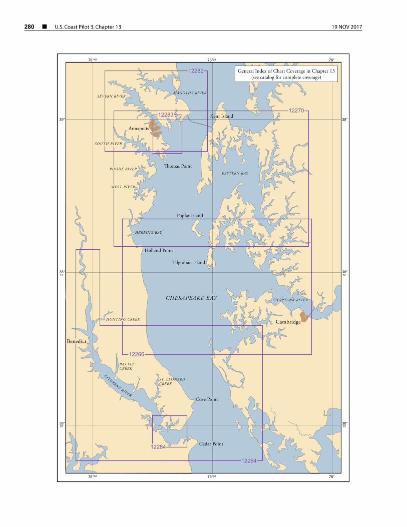
280 ¢ U.S. Coast Pilot 3, Chapter 13 19 NOV 2017
39°39°
CHOPTANK RIVER
ST. LEONARDCREEK
BATTLECREEK
HUNTING CREEK
12282
12283
12266
12284
12264
12270
Benedict
Cambridge
Cedar Point
Cove Point
Holland Point
� omas Point
Annapolis
Tilghman Island
Poplar Island
Kent Island
CHESAPEAKE BAY
HERRING BAY
EASTERN BAY
SOUTH RIVER
SEVERN RIVERMAGOTHY RIVER
RHODE RIVER
WEST RIVER
General Index of Chart Coverage in Chapter 13(see catalog for complete coverage)
76°40'
76°40'
76°20'
76°20'
76°
76°
38° 40'
38° 40'
38° 20'
38° 20'
PATUXENT RIVER
19 NOV 2017 U.S. Coast Pilot 3, Chapter 13 ¢ 281
Chesapeake Bay, Patuxent and Severn Rivers(1) This chapter describes the western shore of
Chesapeake Bay from Point Lookout, on the north side of the entrance to Potomac River, to Mountain Point, the northern entrance point to Magothy River. Also described are Patuxent River, Herring Bay, West River, South River, Severn River, and Magothy River, the bay’s principal tributaries; the ports of Solomons Island, Benedict, Chesapeake Beach, Shady Side, Galesville, and Annapolis; and several of the smaller ports and landings on these waterways.
(2) COLREGS Demarcation Lines
(3) The lines established for Chesapeake Bay are described in 33 CFR 80.510, chapter 2.
(4) Charts 12230, 12263, 12273
(5) From Potomac River to Patuxent River, the western shore of Chesapeake Bay is mostly low, although the 100-foot elevation does come within 1 mile of the water midway between the two rivers. Above Patuxent River, the ground rises and 100-foot elevations are found close back of the shore along the unbroken stretch northward to Herring Bay. Above Herring Bay, the 100-foot contour is pushed back by the tributaries. Except for the developed areas, the shore is mostly wooded.
(6) The bay channel has depths of 50 feet or more, and is well marked by lights and buoys.
(7) The fishtrap areas that extend along this entire section of the western shore are marked at their outer limits and are shown on the charts.
(8) Ice
(9) Ice is encountered in the tributaries, particularly during severe winters. When threatened by icing conditions, certain lighted buoys may be replaced by lighted ice buoys having reduced candlepower or by unlighted buoys, and certain unlighted buoys may be discontinued.
(10) Chart 12230
(11) The danger zone of an aerial firing range and target area begins off Point Lookout and extends northward to Cedar Point. (See 33 CFR 334.200, chapter 2, for limits and regulations.) The target areas in the danger zone are marked by lighted buoys.
(12) A middle ground with depths of 10 to 18 feet is about 8 miles eastward of Point Lookout; the area is about 7 miles long in a north-south direction and 2 miles wide. The stranded wreck near the middle of the shoal is marked a light.
(13) A fish haven is about 4.4 miles north-northeast of Point Lookout in about 38°06'28"N., 76°17'57"W.
(14) Chart 12233
(15) St. Jerome Creek, 5 miles north of Point Lookout, is entered through a channel marked by lights, daybeacons, and bush stakes to a basin about 0.5 mile above the entrance, thence northward into the creek. In 2008, the controlling depths were 2.1 feet in the entrance channel and 5.5 feet in the basin, thence 5.5 feet in the channel above the basin. In 1998, severe shoaling was reported in the vicinity of St. Jerome Creek Daybeacon 3. The creek is used principally as an anchorage for oyster and fishing boats.
(16) There are several small wharves along St. Jerome Creek. A landing is at Airedele, on the south side of the creek just above the entrance; gasoline is available. In 2006, the dredged channel leading south from St. Jerome Creek into Southern Prong had a controlling depth of 4.9 feet. Private daybeacons mark the channel to a marina in Southern Prong. Berths with electricity, gasoline, water, ice, a launching ramp, a 40-foot marine railway, and partial hull repairs are available.
(17) Point No Point, on the west side of Chesapeake Bay 6 miles north of Point Lookout, has no prominent natural marks. Point No Point Light (38°07'41"N., 76°17'25"W.), 52 feet above the water, is shown from a white octagonal brick dwelling on a brown cylinder, in depths of about 22 feet, 1.6 miles southeastward of the point. The light is 1.7 miles due west of a point on the bay ship channel 76.4 miles above the Capes.
(18) Hooper Island Light (38°15'23"N., 76°14'59"W.), 63 feet above the water, is shown from a white conical tower on a brown cylindrical base, in depths of 18 feet near the outer edge of the shoals, 3 miles westward from Hooper Islands. The light is 2.8 miles due east of a point on the bay ship channel 84.4 miles above the Capes.
(19) Chart 12264
(20) The enclosed naval seaplane basin 8.5 miles north-northwestward of Point No Point and 2 miles southwestward of Cedar Point has depths of about 10 feet.
282 ¢ U.S. Coast Pilot 3, Chapter 13 19 NOV 2017
The entrance to the basin is between two breakwaters, each marked at their outer ends by a light.
(21) Cedar Point (38°17.9'N., 76°22.5'W.) is 10 miles north-northwest of Point No Point. The ruins of an abandoned lighthouse are on the tiny islet 0.3 mile off the point. The shoal extending 0.5 mile eastward from the islet is marked at its outer end by a lighted bell buoy. A fish haven is 0.6 mile northwestward of Cedar Point.
(22) Charts 12264, 12284
(23) Patuxent River empties into the west side of Chesapeake Bay 89.3 miles above the Virginia Capes. Commercial traffic consists chiefly of shellfish and shells, and petroleum products. Drafts of vessels using the river are mostly 7 feet or less and seldom exceed 12 feet.
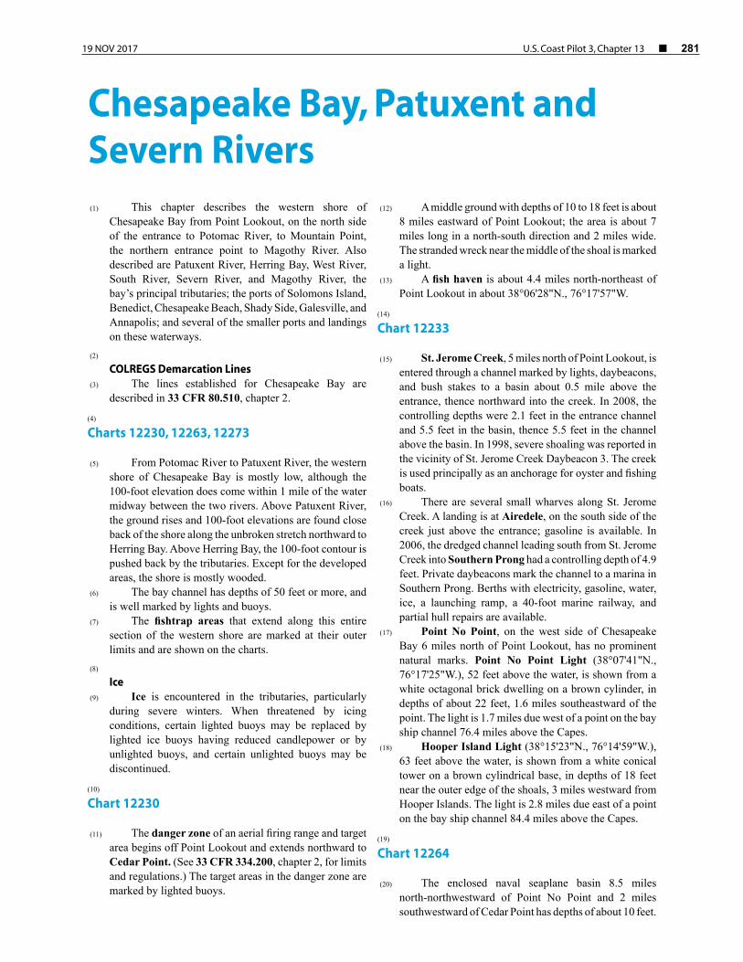
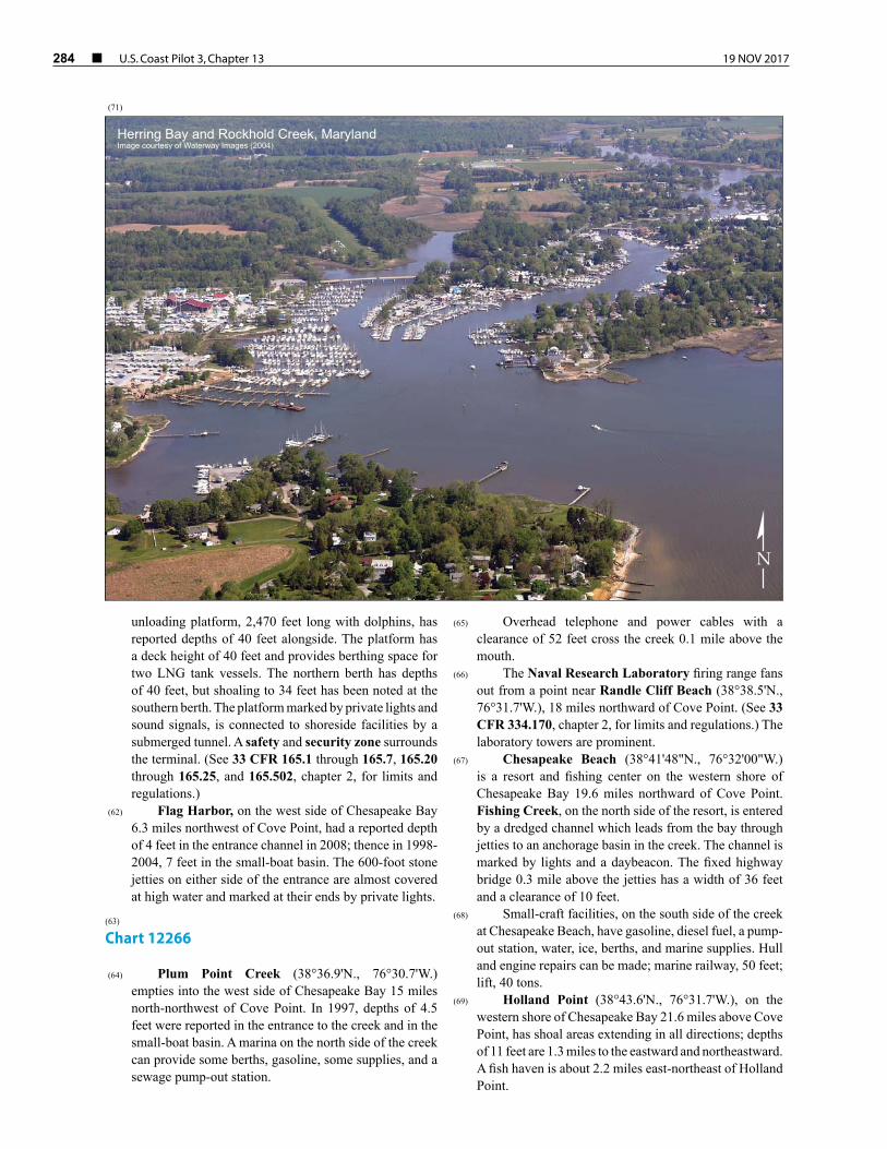
(24) The river has natural depths of 25 to 30 feet in the approach, 30 to over 100 feet for 16 miles upstream, thence 23 feet to the Benedict highway bridge 19 miles above the mouth, thence 10 feet for 12 miles to within 2 miles of Nottingham, thence 6 feet for 5 miles, and thence 3 feet to Hills Bridge, 40 miles above the mouth. The channel is not difficult to follow as far as the Benedict bridge, and the principal shoals are marked by lights and daybeacons; the channel above the bridge is narrow in places and is marked for about another 2.5 miles.
(25) Anchorage can be had off the mouth of Patuxent River; shelter from westerly winds is found in depths of 20 to 30 feet close to shore on the north side of the approach. Shelter from easterly winds is found in depths of 30 to 50 feet in the channel about 1.5 miles above the entrance.
(26) Bottom in Patuxent River channel is mostly soft as far as the Benedict highway bridge, and vessels can anchor where convenient. Small vessels anchor in the creeks back of Solomons Island, but there is little swinging room. St. Leonard Creek is a good small-vessel anchorage in any weather.
(27) The current velocity is 0.4 knot in the entrance to Patuxent River off Drum Point. Ice closes the river to near the mouth in severe winters.
(28) Marine supplies and complete hull and machinery repairs are available along the Patuxent River. Principal locations are in the creeks behind Solomons Island, i.e., Back Creek and Mill Creek. Facilities are also available in Town Creek, Cuckold Creek, Island Creek, and at Benedict.
(29) Patuxent River empties into the head of the bight between Cedar Point and Cove Point, 5 miles to the northward. Cove Point Light (38°23'11"N., 76°22'54"W.), 45 feet above the water, is shown from a white tower on the point. The light is 1 mile west of a point on the bay ship channel 92.6 miles above the Capes. The high bluffs on Little Cove Point, 1.5 miles to the southward, are prominent.
(30) The entrance to Patuxent River is between Drum Point and Fishing Point, 0.9 mile to the southward. The
shoals that extend off Fishing Point and Hog Point, 1 mile to the east-northeastward, are marked at their outer ends by lights. A fish haven is about 1 mile east-southeastward of Patuxent River Light 3. A light is just off Drum Point.
(31) Mileages on Patuxent River, shown as Mile 8W, 11E, etc., are the nautical miles above the midchannel point on a line drawn between Drum and Fishing Points. The letters N, S, E, and W following the numerals denote by compass points the side of the river where each feature is located.
(32) The Patuxent River Naval Air Station is along the south side of the entrance. The inclosed seaplane basins, East Patuxent Basin at Mile 0.8S, and West Patuxent Basin at Mile 1.35S have depths of 12 feet and 11 to 15 feet, respectively. Lights mark the entrance points to West Patuxent Basin. A restricted area off the air station begins about 2.4 miles south of Cedar Point and extends north to the mouth of Patuxent River, thence upstream for about 2.5 miles. (See 33 CFR 334.180, chapter 2, for limits and regulations.)
(33) SolomonsIsland, Mile 1.8N, is joined to the mainland on the northwest by a causeway. The shoal that extends 500 yards southward from Sandy Point, at the south end of the island, is marked at its outer end by a light. Solomons, is the village on the island. The pier of the Chesapeake Biological Laboratory on the east side of the island has depths of 8 feet at the outer end and is marked by a private light.
(34) Back Creek and Mill Creek have a common entrance between Solomons Island and the mainland 200 yards to the north-northeastward. The marked main approach, between the island and the shallow middle ground to the eastward, has depths of 20 to 25 feet. The second marked approach, between the middle ground and the mainland to the northward, has depths of 12 feet.
(35) The two creeks separate just above the entrance. Mill Creek goes eastward of a shallow spit with a small islet at the southern end, and Back Creek goes westward; the spit and the islet are marked by lights.
(36) There are many small-craft facilities in Back Creek, Mill Creek, and along the northern side of Solomons Island. Lifts to 50 tons, a synchro-lift and a marine railway are available for complete repairs. Complete hull and machinery services, gasoline, diesel fuel, and pump-out station services are available.
(37) The Back Creek cove between the islet and the inner side of Solomons has general depths of 15 feet and is used as an anchorage by many yachts and fishing boats.
(38) Back Creek has depths of 12 feet for 0.7 mile above the cove, thence 10 to 6 feet for another 0.5 mile.
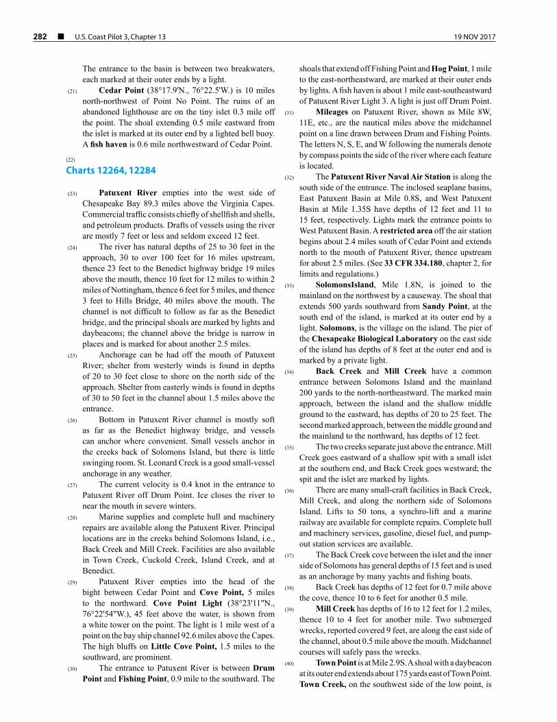
(39) Mill Creek has depths of 16 to 12 feet for 1.2 miles, thence 10 to 4 feet for another mile. Two submerged wrecks, reported covered 9 feet, are along the east side of the channel, about 0.5 mile above the mouth. Midchannel courses will safely pass the wrecks.
(40) Town Point is at Mile 2.9S. A shoal with a daybeacon at its outer end extends about 175 yards east of Town Point. Town Creek, on the southwest side of the low point, is
19 NOV 2017 U.S. Coast Pilot 3, Chapter 13 ¢ 283
used by fishing and oyster boats, and recreational craft. The creek, marked at the entrance by a light, is entered about 0.5 mile south-southwestward of Town Point. The entrance light also marks the outer end of a shoal that extends southward from the northern entrance point. Submerged wrecks are reported in the southwestern arm of the creek. Several small-craft facilities are on Town Creek.
(41) State Route 4 fixed highway bridge with a clearance of 30 feet at the west span and 35 feet at the east span crosses Town Creek about 0.3 mile above the entrance light. An overhead power cable with a clearance of 55 feet crosses the north arm of the creek about 0.45 mile above the entrance light.
(42) Thomas Johnson Memorial (State Route 4) Bridge, has a fixed span with a vertical clearance of 140 feet and crosses the Patuxent River between Town Point and the north shore. The area in the immediate vicinity of the bridge is subject to unpredictable and sudden changes in wind conditions. Mariners under sail should exercise caution while navigating in the area.
(43) Point Patience at Mile 3.9N, is marked at the outer end by a lighted buoy. The current is reported to be especially strong within 25 yards of the light. The long piers used by the Government on the east and west sides of the point are within a restricted area. (See 33 CFR 334.180, chapter 2, for limits and regulations.)
(44) Cuckold Creek and Mill Creek have a common entrance at Mile 4.7W. Lights and daybeacons mark the entrance channel. Gasoline and some supplies are available at Clarks Landing, on the peninsula between the two creeks. Depths at the fuel pier are about 6 feet.
(45) Cuckold Creek, which extends northwestward from the entrance, has depths of 15 to 11 feet for 1 mile, thence 10 to 4 feet into the several arms. Three marinas are on the south side of the creek 0.6 mile, 0.8 mile, and 0.9 mile above the entrance, respectively. Gasoline, diesel fuel, and some supplies are available. Hull and engine repairs can be made; marine railway, 60 feet; lift, 10 tons.
(46) Hellen Creek enters Patuxent River at Mile 5.3E. In 1990, the reported controlling depth was 7 feet across the bar at the entrance; thence in 1980, depths of 5 feet were reported available for 1 mile into the creek; the deeper water favors the east side of the entrance. The creek is used principally as a small-boat harbor.
(47) St. Leonard Creek, Mile 7E, has depths of 15 to 10 feet for 2 miles, then shoals gradually to 1 foot at the head, 3.5 miles above the entrance. Safe anchorage in any weather is available in depths of 15 to 21 feet, 0.5 mile above the entrance. An overhead power cable with a reported clearance of 50 feet crosses the creek about 3.4 miles above the mouth. Gasoline and diesel fuel are available at a marina on the east side, 2 miles above the mouth. The shoal that extends 0.4 mile southward from Petersons Point, on the northwest side of the entrance, is marked at its outer end.
(48) Broomes Island, which is not an island but a mainland peninsula, is at Mile 9.5N. A light marks the
limit of the shoal area that extends 0.2 mile southward of the peninsula.
(49) Island Creek, which empties into Patuxent River along the east side of Broomes Island, has depths of 8 to 10 feet for 1 mile, but there are unmarked shoals, particularly along the west side of the entrance; a light marks the east side of the entrance.
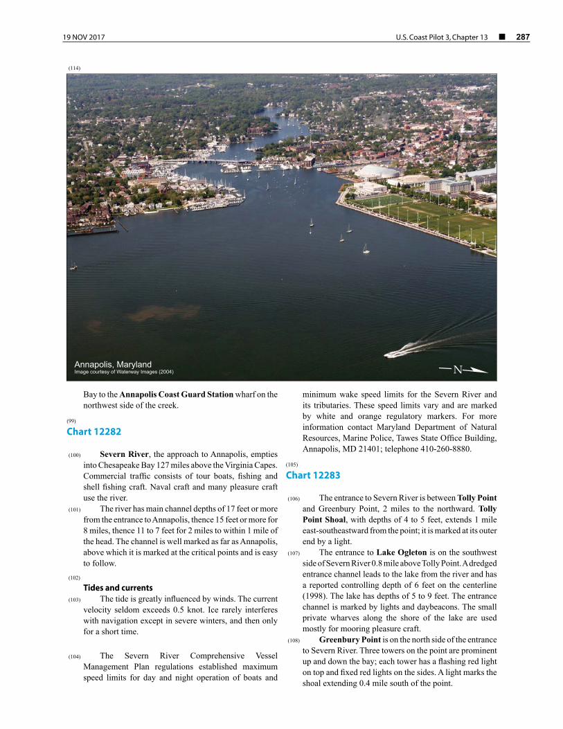
(50) The village of Broomes Island is on the west side of Island Creek about 1 mile from the outer end of the peninsula. Gasoline and some supplies are available at the crab and oyster piers.
(51) Nan Cove, on the west side of Broomes Island, is entered by a unmarked dredged channel which leads to a turning basin in the upper end of the east arm. In 2010, the midchannel controlling depth was 1.8 feet in the channel and 4 feet in the basin.
(52) A private channel, marked by private buoys, leads to a marina at the entrance of Cat Creek at Mile 12.6 W. In 1997, the channel had a reported depth of 5 feet. Gasoline, diesel fuel, some supplies, berths, a sewage pump-out station and a 10-ton lift are available; minor repairs can be made.
(53) Battle Creek, Mile 13.2E, has depths of 10 to 7 feet for 1.5 miles. Private daybeacons mark the channel through the shoals just above the entrance. A shoal which extends 0.3 mile southwestward from the point on the east side of the entrance is marked at its outer end by a warning daybeacon.
(54) The highway bridge over Patuxent River at Mile 18.8, from Town Point on the west side to Hallowing Point on the east side, has a 49-foot swing span with a clearance of 16 feet. (See 33 CFR 117.1 through 117.59 and 117.567,chapter 2, for drawbridge regulations.)
(55) Benedict, a village just below the west end of the highway bridge, is the head of commercial navigation on Patuxent River. A marina at the south end of Benedict can provide gasoline, berths, and some supplies. Minor repairs can be made; marine railway, 32 feet.
(56) Navigation on Patuxent River above Benedict is difficult because of the numerous fishtraps and stakes.
(57) Overhead power cables with a clearance of 60 feet over the main channel cross Patuxent River at Mile 20.9. The supporting towers are marked by private lights.
(58) An overhead power cable across Patuxent River at Mile 25.5, a mile above Holland Cliff, has a clearance of 53 feet.
(59) Lower Marlboro is a village at Mile 28.3E. The State landing has depths of 12 feet at the face.
(60) Nottingham, a village at Mile 32.8W, has a landing with depths of 13 feet at the face. In 1980, a draft of 5 feet could be carried with local knowledge to the Maryland Route 4 fixed highway bridge at Upper Marlboro, about 10 miles above Nottingham.
(61) On the west side of Chesapeake Bay north of Cove
Point is a liquefied natural gas unloading terminal of the Dominion Cove Point LNG, LP., The offshore
284 ¢ U.S. Coast Pilot 3, Chapter 13 19 NOV 2017
unloading platform, 2,470 feet long with dolphins, has reported depths of 40 feet alongside. The platform has a deck height of 40 feet and provides berthing space for two LNG tank vessels. The northern berth has depths of 40 feet, but shoaling to 34 feet has been noted at the southern berth. The platform marked by private lights and sound signals, is connected to shoreside facilities by a submerged tunnel. A safety and security zone surrounds the terminal. (See 33 CFR 165.1 through 165.7, 165.20 through 165.25, and 165.502, chapter 2, for limits and regulations.)
(62) Flag Harbor, on the west side of Chesapeake Bay 6.3 miles northwest of Cove Point, had a reported depth of 4 feet in the entrance channel in 2008; thence in 1998-2004, 7 feet in the small-boat basin. The 600-foot stone jetties on either side of the entrance are almost covered at high water and marked at their ends by private lights.
(63) Chart 12266
(64) Plum Point Creek (38°36.9'N., 76°30.7'W.) empties into the west side of Chesapeake Bay 15 miles north-northwest of Cove Point. In 1997, depths of 4.5 feet were reported in the entrance to the creek and in the small-boat basin. A marina on the north side of the creek can provide some berths, gasoline, some supplies, and a sewage pump-out station.
(65) Overhead telephone and power cables with a clearance of 52 feet cross the creek 0.1 mile above the mouth.
(66) The Naval Research Laboratory firing range fans out from a point near Randle Cliff Beach (38°38.5'N., 76°31.7'W.), 18 miles northward of Cove Point. (See 33 CFR 334.170, chapter 2, for limits and regulations.) The laboratory towers are prominent.
(67) Chesapeake Beach (38°41'48"N., 76°32'00"W.) is a resort and fishing center on the western shore of Chesapeake Bay 19.6 miles northward of Cove Point. Fishing Creek, on the north side of the resort, is entered by a dredged channel which leads from the bay through jetties to an anchorage basin in the creek. The channel is marked by lights and a daybeacon. The fixed highway bridge 0.3 mile above the jetties has a width of 36 feet and a clearance of 10 feet.
(68) Small-craft facilities, on the south side of the creek at Chesapeake Beach, have gasoline, diesel fuel, a pump-out station, water, ice, berths, and marine supplies. Hull and engine repairs can be made; marine railway, 50 feet; lift, 40 tons.
(69) Holland Point (38°43.6'N., 76°31.7'W.), on the western shore of Chesapeake Bay 21.6 miles above Cove Point, has shoal areas extending in all directions; depths of 11 feet are 1.3 miles to the eastward and northeastward. A fish haven is about 2.2 miles east-northeast of Holland Point.
Herring Bay and Rockhold Creek, MarylandImage courtesy of Waterway Images (2004)
N
(71)

19 NOV 2017 U.S. Coast Pilot 3, Chapter 13 ¢ 285
(70) Herring Bay, between Holland Point and the marsh 3 miles to the northward, has general depths of 14 to 7 feet. Long Bar, with depths of 2 to 5 feet, extends from the north side of the bay to within 1 mile of Holland Point, and is marked at its south end by a light.
(72) Herrington Harbour, 0.6 mile westward of Holland Point, is entered through a jettied private channel from the south side of Herring Bay. The channel is marked by a 199° lighted range and other private aids. In 2008, the channel had a reported controlling depth of 7 feet. The channel is very narrow and must be followed closely to carry the best water. A small-craft facility is on the east side of the harbor just inside the entrance. Gasoline, diesel fuel, water, berths with electricity, and repairs are available.
(73) Rockhold Creek, at the northwest corner of Herring Bay, has good shelter for small boats. A dredged channel leads from the bay to a turning basin just below the fixed highway bridge at Deale. Above the bridge, depths of 2 to 3 feet can be carried for about 0.4 mile. The dredged channel is marked with lights, buoys and daybeacons midway to the bridge. A light marks the outer end of two breakwaters at the entrance. The fixed highway bridge 1 mile above the entrance has a horizontal clearance of 47 feet and a vertical clearance of 14 feet. The fixed highway bridge 1.8 miles above the entrance has a horizontal
clearance of 41 feet with a vertical clearance of 10 feet (See Chart 12270.)
(74) Tracys Creek, branching west from Rockhold Creek at Deale, is crossed by a fixed bridge with a horizontal clearance of 46 feet and a vertical clearance of 11 feet. An overhead power cable at the bridge has a clearance of 37 feet.
(75) A 6 m.p.h. speed limit is enforced in Rockhold Creek.
(76) There are extensive small-craft facilities on both sides of Rockhold Creek below the first bridge, and on the east side of the creek between the first and second bridges.
(77)
No-Discharge ZoneThe State of Maryland, with the approval of the Environmental Protection Agency, has established a No-Discharge Zone (NDZ) in Herring Bay. The area covered includes tidal waters west of a line connecting Holland Point and the north shore of Parkers Creek (See chart 12270 for limits). Within the NDZ, discharge of sewage, whether treated or untreated, from all vessels is prohibited. Outside the NDZ, discharge of sewage is regulated by 40 CFR 140 (See chapter 2).
South River, MarylandImage courtesy of Waterway Images (2004) N
(87)

286 ¢ U.S. Coast Pilot 3, Chapter 13 19 NOV 2017
(78) Chart 12270
(79) West River, 8.5 miles above Holland Point, empties into the west side of Chesapeake Bay north of Curtis Point (38°51.1'N., 76°29.9'W.). A fish haven is off the entrance. The river has depths of 14 to 7 feet for about 4 miles, then shoals gradually to less than 3 feet in the tributaries. The river channel approach is marked by lighted buoys, and by lights and daybeacons to Galesville, on the west side of the river 2.5 miles above the entrance light. A yacht club is on the east side of the river at Avalon Shores, opposite Galesville. Several small-craft facilities are at Galesville.
(80) Parish Creek, on the south side of West River 0.5 mile westward of Curtis Point, is entered by a marked dredged channel which leads to an anchorage basin, and thence to Shady Side at the head of the south fork. In 2010, the midchannel controlling depth was 8 feet to the anchorage basin, thence 5.9 feet in the basin, thence 4.3 feet in the channel in south fork. Depths of 4.3 to 5.5 feet were in the anchorage basin. A 6 m.p.h. speed limit is enforced.
(81) Small-craft facilities on the north side of Parish Creek and at Shady Side can provide gasoline, diesel fuel, water, electricity, a pump-out facility, berths, and marine supplies. Hull and engine repairs can be made. Largest haul-out capabilities: marine railway, 35 feet; lift, 25 tons.
(82) Rhode River empties into the north side of West
River 1.1 miles westward of West River Entrance Light 2. The river, marked at the entrance by a light, has depths of 11 to 9 feet for 2 miles. The critical shoals extending off the points are marked.
(83) Cadle Creek, on the east side of Rhode River 1 mile above the entrance light, has depths of 4 to 7 feet. The entrance to the creek is marked by daybeacons. Mayo is a town on the east side of the creek.
(84) Bear Neck Creek, on the north side of Rhode River 1.5 miles above the entrance light, has depths of 9 to 5 feet for 1 mile. The entrance is marked by daybeacons.
(85) Small-craft facilities are on Cadle Creek and Bear Neck Creek.
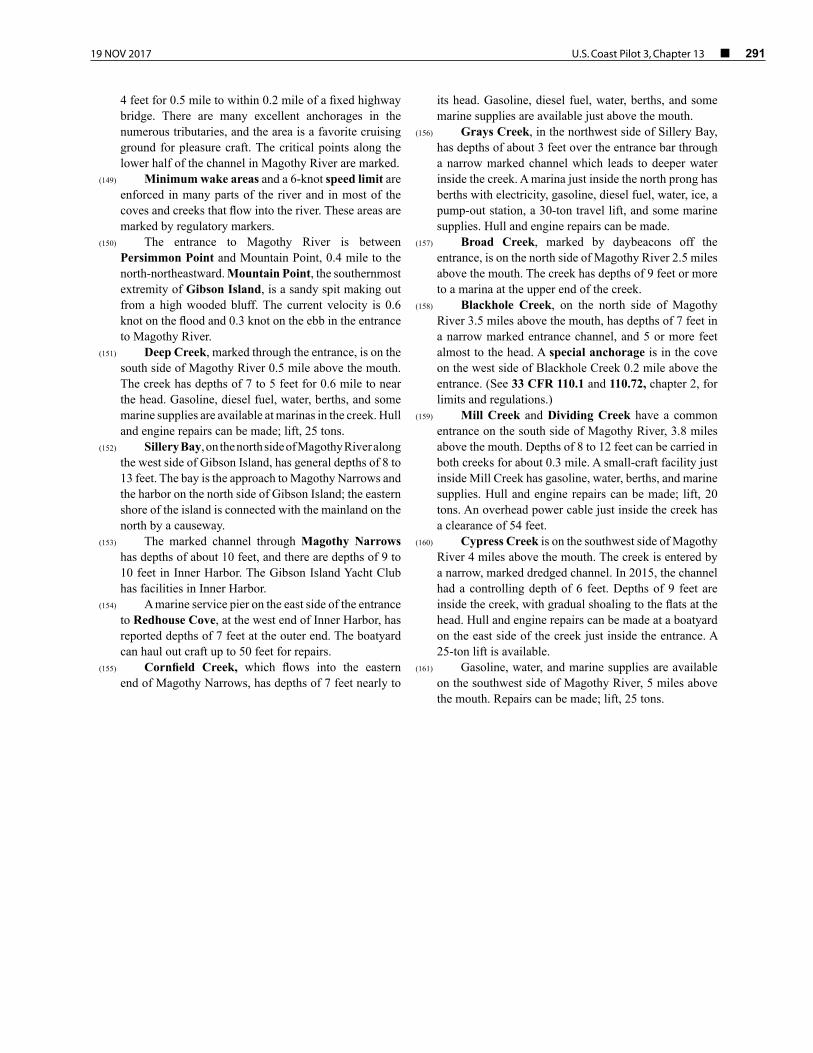
(86) South River, just north of West River, has channel depths of 14 feet or more to the second bridge, 6 miles above the mouth, then shoals gradually to 2 feet at the bridge near the head, 8.5 miles above the mouth. The river channel is marked to a point about 0.3 mile below the second bridge. Several of the creeks that flow into the river have good depths and are used extensively by local yachts and motorboats. Most of these tributaries are reported to provide good anchorage. There are commercial facilities above and below the first bridge.
(88) Minimum wake areas and a 6-knot speed limit are enforced in many parts of the river and in most of the coves and creeks that flow into the river. These areas are marked by regulatory markers.
(89) The entrance to South River is between Saunders Point and Thomas Point, 1.8 miles to the northeastward. Thomas Point Shoal Light (38°53'56"N., 76°26'09"W.), 43 feet above the water, is shown from a white hexagonal tower on piles, in depths of 5 feet near the outer end of the shoal 1.2 miles east-southeastward of the point; a sound signal is at the light. The light is 1.5 miles due west of a point on the bay ship channel 124.2 miles above the Capes.
(90) Selby Bay, on the southwest side of South River 1.7 miles above the mouth, has general depths of 8 to 11 feet. The south end of the bay is shallow. The channel to Selby Beach, on the northwest side of the bay, is marked by lights and a daybeacon. Ramsay Lake has a narrow entrance from the south end of Selby Bay; in 1998, a depth of 5.5 feet was reported in the entrance, thence 7 to 8 feet in the lake. The fixed highway bridge over the Selby Bay entrance to the lake has a width of 22 feet and a clearance of 14 feet.
(91) Small-craft facilities are on the south and west sides of Selby Bay and in Ramsey Lake.
(92) Brewer Creek, on the southwest side of South River 3 miles above the mouth, has depths of 12 feet in the entrance, and 4.5 feet reported through the narrows 0.2 mile above the entrance. The narrows connect Brewer Creek with Pocahontas Creek to the southward. Gasoline, water, berths, and limited marine supplies are available in Pocahontas Creek; hull and engine repairs can be made.
(93) Glebe Bay, on the southwest side of South River 3.5 miles above the mouth, has general depths of 13 to 15 feet. Care should be taken to avoid the 2-foot shoal near midbay and the 2-foot shoals along the northwest and southeast sides of the bay. Glebe Creek, with depths of 11 to 7 feet for about 0.4 mile, empties into the southwest side of the bay. Gasoline, water, and berths are available in the cove on the north side of the bay just inside the entrance.
(94) State Route 2 fixed highway bridge at Edgewater, 5 miles above the mouth of South River has a clearance of 53 feet.
(95) Gingerville Creek, on the north side of South River, extends along the westerly side of Edgeater. The creek has depths of 6 feet for 0.7 mile, nearly to the head.
(96) There are small-craft facilities at Edgewater, and in Warehouse Creek, on the south side of the river opposite Edgewater.
(97) Beards Creek, on the south side of South River 5.7 miles above the mouth, has depths of 15 to 8 feet for 1 mile; a shallow spit extends halfway across the entrance from the point on the northwest side. In 1978, a submerged piling was reported in Beards Creek in about 38°56.6'N., 76°34.6'W. The highway bridge at Riva, 6 miles above the mouth of South River, has a fixed span with a clearance of 25 feet.
(98) Fishing Creek, immediately northward of the entrance to South River, has depths of 7 to 4 feet. A privately dredged channel leads from the Chesapeake
19 NOV 2017 U.S. Coast Pilot 3, Chapter 13 ¢ 287
Bay to the Annapolis Coast Guard Station wharf on the northwest side of the creek.
(99) Chart 12282
(100) Severn River, the approach to Annapolis, empties into Chesapeake Bay 127 miles above the Virginia Capes. Commercial traffic consists of tour boats, fishing and shell fishing craft. Naval craft and many pleasure craft use the river.
(101) The river has main channel depths of 17 feet or more from the entrance to Annapolis, thence 15 feet or more for 8 miles, thence 11 to 7 feet for 2 miles to within 1 mile of the head. The channel is well marked as far as Annapolis, above which it is marked at the critical points and is easy to follow.
(102) Tides and currents
(103) The tide is greatly influenced by winds. The current velocity seldom exceeds 0.5 knot. Ice rarely interferes with navigation except in severe winters, and then only for a short time.
(104) The Severn River Comprehensive Vessel
Management Plan regulations established maximum speed limits for day and night operation of boats and
minimum wake speed limits for the Severn River and its tributaries. These speed limits vary and are marked by white and orange regulatory markers. For more information contact Maryland Department of Natural Resources, Marine Police, Tawes State Office Building, Annapolis, MD 21401; telephone 410-260-8880.
(105) Chart 12283
(106) The entrance to Severn River is between Tolly Point and Greenbury Point, 2 miles to the northward. Tolly Point Shoal, with depths of 4 to 5 feet, extends 1 mile east-southeastward from the point; it is marked at its outer end by a light.
(107) The entrance to Lake Ogleton is on the southwest side of Severn River 0.8 mile above Tolly Point. A dredged entrance channel leads to the lake from the river and has a reported controlling depth of 6 feet on the centerline (1998). The lake has depths of 5 to 9 feet. The entrance channel is marked by lights and daybeacons. The small private wharves along the shore of the lake are used mostly for mooring pleasure craft.
(108) Greenbury Point is on the north side of the entrance to Severn River. Three towers on the point are prominent up and down the bay; each tower has a flashing red light on top and fixed red lights on the sides. A light marks the shoal extending 0.4 mile south of the point.
Annapolis, MarylandImage courtesy of Waterway Images (2004) N
(114)

288 ¢ U.S. Coast Pilot 3, Chapter 13 19 NOV 2017
(109) A naval deep-draft anchorage is southeast of Greenbury Point, and several smaller naval anchorages and prohibited anchorages are west and northwest of the point. (See 33 CFR 110.1 and 110.159, chapter 2, for limits and regulations.)
(110) The entrance to Carr Creek is northwest of Greenbury Point. The creek has depths of 9 feet over the unmarked entrance bar and deeper water through a narrow channel inside. In 1998, shoaling was reported in about 38°58'59"N., 76°27'27"W. A naval rifle range is on the west side of the entrance to the creek. Mariners are warned to keep out of the creek when the red flag is flying from Carr Point or the next point southward. Floating breakwaters are in the entrance to Carr Creek, south of Carr Point.
(111) Back Creek, on the southwest side of Severn River 0.7 mile above the mouth, has depths of 7 to 9 feet for most of its 1-mile length. A light marks the outer end of the breakwater on the south side of the entrance, and lights and daybeacons mark the narrow entrance channel. The creek is used by fishing boats and pleasure craft. Berthing and repair facilities are located on the north side of the creek at Eastport, and on the south side of the creek. Diesel fuel and gasoline are available on the south side of the creek.
(112) Spa Creek is on the southwest side of the Severn River, 1.4 miles above the mouth. Vessels using the creek have drafts of 10 feet or less. The Spa Creek highway
bridge, about 0.4 mile above the entrance, has a 40-foot bascule span with a clearance of 15 feet. The bridgetender monitors VHF-FM channel 16 (156.80 MHz) and works on channels 13 and 68; contact by phone at 410–974–3840. (See 33 CFR 117.1 through 117.59 and 117.571, chapter 2, for drawbridge regulations.) Gasoline, diesel fuel, berths, electricity, pump-out station, water and ice are available on the north side of the creek just east of the bridge.
(113) Annapolis, the capital of Maryland, is on the north side of Spa Creek. The U.S. Naval Academy occupies the entire northeastern part of the city between Spa Creek and College Creek, 0.7 mile to the northwestward.
(116) Quarantine, customs, immigration, and agricultural quarantine
(117) (See chapter 3, Vessel Arrival Inspections, and appendix for addresses.)
(118) Quarantine is enforced in accordance with regulations of the U.S. Public Health Service. (See Public Health Service, chapter 1.)
(119) Annapolis is a customs port of entry. (120)
Harbor Regulations(121) The harbormaster has an office on the north side of
Market Slip and enforces city regulations for the harbor.
Annapolis, MarylandImage courtesy of Waterway Images (2004) N
(115)
19 NOV 2017 U.S. Coast Pilot 3, Chapter 13 ¢ 289
The harbormaster also controls municipal rental berths and mooring available in the harbor. A speed limit of 6 m.p.h. is enforced.
(122) The Naval Academy Santee Basin, on the Severn
River side of Annapolis has reported depths of 15 feet. The basin and seawall are within a restricted area. (See 33 CFR 334.160,chapter 2, for limits and regulations.)
(123) Spa Creek waterfront has depths of 4 to 10 feet reported alongside the bulkhead and wharves almost to Market Slip, 250 yards below the north end of the Spa Creek highway bridge. Market Slip is 250 yards long and 40 yards wide, with depths of 8 to 10 feet; the slip is open to the public and is used extensively by small craft.
(124) Extensive marine facilities are on both sides of Spa Creek above and below the bridge. Most of the boatyards are on the south, or Eastport, side of Spa Creek.
(125) The U.S. Navy Marine Engineering Laboratory extends from Carr Creek along the eastern shore of Severn River for about 1 mile to Ferry Point. Naval restricted areas surround the small boat basin, 0.4 mile westward of Carr Creek, and Dungan and Worthington Basins just to the west. (See 33 CFR 334.150 and 334.155, chapter 2, for limits and regulations.)
(126) College (Dorseys) Creek, on the southwest side of Severn River 2.1 miles above the mouth, has depths of 11 to 8 feet for most of its 1-mile length; the best water in the entrance is along the south side. A footbridge, two bascule bridges, an overhead pipeline and a fixed bridge cross the creek from Annapolis on the southeast bank to West Annapolis on the northwest bank. The drawspans of the bascule bridges are secured in a fixed position. (See 33 CFR 117.555, chapter 2, for drawbridge regulations.) The bridges and overhead pipeline have a minimum width of 40 feet and clearance of 5 feet.
(127) The highway bridge, 2.4 miles above the mouth of Severn River has a fixed span with a clearance of 75 feet. A large fishing pier is above and adjacent to the highway bridge on the east of the Severn River.
(128) Chart 12282
(129) Weems Creek (39°00.0'N., 76°30.1'W.), on the southwest side of Severn River 3.2 miles above the mouth, has depths of 13 feet for 0.8 mile, thence 11 to 7 feet for 0.3 mile to near the head. A shoal extends 300 yards eastward from the point on the north side of the entrance, and is marked by a daybeacon. The highway bridge 0.5 mile above the entrance has a swing span with a width of 28 feet and a clearance of 8 feet. (See 33 CFR 117.1 through 117.59 and 117.577, chapter 2, for drawbridge regulations.) The fixed highway bridge about 500 feet above the drawbridge has a clearance of 28 feet. A private special purpose buoy at the mouth of Weems Creek marks a speed controlled area.
(130) U.S. Route 50/301 fixed highway bridge over Severn River, 3.5 miles above the mouth, has a clearance of 80 feet at the center span.
(131) Round Bay, an expansion of Severn River beginning 6 miles above the mouth and continuing for 2 miles, has depths of 17 to 23 feet and is traveled extensively by motorboats. Little Round Bay, west of Round Bay, has depths of 17 to 19 feet, and is marked by daybeacons. Depths of 4 feet can be carried to a boatyard in Browns Cove, behind St. Helena Island. Berths, electricity, gasoline, diesel fuel, water, ice, launching ramp, pump-out station, storage and some marine supplies can be obtained. A 35-ton lift is available for hull and engine repairs.
(132) Forked Creek, on the north side of Severn River 9 miles above the mouth, has depths of 16 to 10 feet for most of its 0.4 mile length. Marine services are on the creek with 4 to 6 feet available alongside. Berths, electricity, water, ice and a launching ramp are available. A marine railway can handle crafts to 50 feet; lift to 9 tons for hull and engine repairs.
(133) There is a small-boat basin on the east side of Severn River, 11 miles above the mouth. The controlling depth to the basin is about 3 feet.
(134) Charts 12283, 12282
(135) Whitehall Bay, on the west side of Chesapeake Bay, is between Greenbury Point (38°58.5'N., 76°27.3'W.) and Hackett Point, 1.5 miles to the northeastward. The bay has general depths of 13 to 6 feet. The entrance channel is about 300 yards wide between Whitehall Flats on the west and North Shoal on the east, both with depths of 3 to 4 feet; a light marks the western limit of North Shoal. A lighthouse is on Sharps Point, on the west side of the entrance to Whitehall Creek.
(136) Mill Creek, which empties into the northwest corner of Whitehall Bay, is entered through a privately dredged entrance channel marked by a light and daybeacons; in 1998, the reported controlling depth was 7 feet. The depths above the dredged channel are 7 to 14 feet for 1.5 miles to near the head of the creek. Gasoline is available at a pier 0.7 mile above the entrance. A marine railway, 1.3 miles above the entrance, can handle boats up to 40 feet. Gasoline and water are available just west of the railway.
(137) Whitehall Creek, which empties into the northeast corner of Whitehall Bay, has depths of 9 to 13 feet for 1.5 miles, then shoals gradually to 1-foot at the head 0.5 mile farther up. The narrow, crooked entrance channel is marked by daybeacons. In 1998, shoaling to 6 feet was reported in the channel between daybeacons 4 and 5. A 35-ton lift is available on the east side of the creek, 1 mile above the mouth.
(138) Meredith Creek, in the northeast corner of Whitehall Bay just eastward of Whitehall Creek, has depths of about 2 feet in a very narrow entrance, thence 10 to 7 feet for

290 ¢ U.S. Coast Pilot 3, Chapter 13 19 NOV 2017
0.7 mile, then shoals gradually to 1 foot at the head, 0.6 mile farther up. Local knowledge is necessary to carry more than 2 feet through the entrance.
(139) A fish haven, marked by a buoy, is about 1 mile eastward of Hackett Point.
(140) The two spans of the William P. Lane Jr. Memorial Bridge (Chesapeake Bay Bridge) are 3.7 miles long from shore to shore and 130 miles above the Virginia Capes. The western end is 0.5 mile southwestward of Sandy Point and the eastern end is 4 miles south-southwestward of Love Point. There are two main channel spans along the length of the bridge, Chesapeake Channel and Eastern Channel.
(142) The suspension spans over Chesapeake Channel 1.4 miles from the western end of the bridge have a horizontal clearance of 1,500 feet and a vertical clearance of 182 feet. Flashing red aerolights are mounted on top of the two suspension towers. Three fixed white lights are mounted vertically over fixed green range lights, at the center of Chesapeake Channel spans. Sound signals are mounted on the south and north sides of the bridge at the center of Chesapeake Channel spans. Lighted buoys mark Chesapeake Channel on either side of the bridge.
(143) The fixed spans over Eastern Channel, 1.2 miles from the eastern end of the bridge have a horizontal clearance of 690 feet and a vertical clearance of 58 feet. The center of the spans are marked by a range of two green lights. A sound signal is at the span center.
(144) A privately marked channel leads to a marina and yacht club at the eastern end of the bridge. In 2004, the reported approach depth was 6 feet. Gasoline, diesel fuel, a pump-out station, electricity, water, ice, marine supplies, dry storage, a launching ramp, and hull, engine, and electronic repairs are available; lift to 70 tons.
(145) Sandy Point State Park is just north of the west end of the bridges. In 1998, the reported controlling depth was 5.5 feet in the State-maintained entrance channel and basin at Mezick Ponds. The channel and basin are marked by private daybeacons. Slow no-wake signs are posted in the entrance channel and in the basin. Gasoline, diesel fuel, water, ice, a pump-out station and some marine supplies are available; overnight mooring is prohibited except in an emergency.
(146) Sandy Point Shoal Light (39°00'57"N., 76°23'04"W.), 51 feet above the water, is shown from a red brick house with a white roof, on a brown cylindrical pier about 0.4 mile northeastward of Sandy Point. The light is about 0.5 mile west of a point on the bay ship channel 131.5 miles above the Capes.
(147) Baltimore Light (39°03'33"N., 76°23'56"W.), 52 feet above the water, is shown from a white, octagonal house on a brown cylindrical pier, in depths of 22 feet, 2.5 miles north of Sandy Point.
(148) Magothy River (see also chart 12278), on the west side of Chesapeake Bay 1.7 miles westward of Baltimore Light, has depths of 10 feet or more for 6 miles, thence
William P. Lane, Jr. Memorial (Chesapeake Bay) Bridge, MarylandImage courtesy of Waterway Images (2006)
N
(141)
19 NOV 2017 U.S. Coast Pilot 3, Chapter 13 ¢ 291
4 feet for 0.5 mile to within 0.2 mile of a fixed highway bridge. There are many excellent anchorages in the numerous tributaries, and the area is a favorite cruising ground for pleasure craft. The critical points along the lower half of the channel in Magothy River are marked.
(149) Minimum wake areas and a 6-knot speed limit are enforced in many parts of the river and in most of the coves and creeks that flow into the river. These areas are marked by regulatory markers.
(150) The entrance to Magothy River is between Persimmon Point and Mountain Point, 0.4 mile to the north-northeastward. Mountain Point, the southernmost extremity of Gibson Island, is a sandy spit making out from a high wooded bluff. The current velocity is 0.6 knot on the flood and 0.3 knot on the ebb in the entrance to Magothy River.
(151) Deep Creek, marked through the entrance, is on the south side of Magothy River 0.5 mile above the mouth. The creek has depths of 7 to 5 feet for 0.6 mile to near the head. Gasoline, diesel fuel, water, berths, and some marine supplies are available at marinas in the creek. Hull and engine repairs can be made; lift, 25 tons.
(152) Sillery Bay, on the north side of Magothy River along the west side of Gibson Island, has general depths of 8 to 13 feet. The bay is the approach to Magothy Narrows and the harbor on the north side of Gibson Island; the eastern shore of the island is connected with the mainland on the north by a causeway.
(153) The marked channel through Magothy Narrows has depths of about 10 feet, and there are depths of 9 to 10 feet in Inner Harbor. The Gibson Island Yacht Club has facilities in Inner Harbor.
(154) A marine service pier on the east side of the entrance to Redhouse Cove, at the west end of Inner Harbor, has reported depths of 7 feet at the outer end. The boatyard can haul out craft up to 50 feet for repairs.
(155) Cornfield Creek, which flows into the eastern end of Magothy Narrows, has depths of 7 feet nearly to
its head. Gasoline, diesel fuel, water, berths, and some marine supplies are available just above the mouth.
(156) Grays Creek, in the northwest side of Sillery Bay, has depths of about 3 feet over the entrance bar through a narrow marked channel which leads to deeper water inside the creek. A marina just inside the north prong has berths with electricity, gasoline, diesel fuel, water, ice, a pump-out station, a 30-ton travel lift, and some marine supplies. Hull and engine repairs can be made.
(157) Broad Creek, marked by daybeacons off the entrance, is on the north side of Magothy River 2.5 miles above the mouth. The creek has depths of 9 feet or more to a marina at the upper end of the creek.
(158) Blackhole Creek, on the north side of Magothy River 3.5 miles above the mouth, has depths of 7 feet in a narrow marked entrance channel, and 5 or more feet almost to the head. A special anchorage is in the cove on the west side of Blackhole Creek 0.2 mile above the entrance. (See 33 CFR 110.1 and 110.72, chapter 2, for limits and regulations.)
(159) Mill Creek and Dividing Creek have a common entrance on the south side of Magothy River, 3.8 miles above the mouth. Depths of 8 to 12 feet can be carried in both creeks for about 0.3 mile. A small-craft facility just inside Mill Creek has gasoline, water, berths, and marine supplies. Hull and engine repairs can be made; lift, 20 tons. An overhead power cable just inside the creek has a clearance of 54 feet.
(160) Cypress Creek is on the southwest side of Magothy River 4 miles above the mouth. The creek is entered by a narrow, marked dredged channel. In 2015, the channel had a controlling depth of 6 feet. Depths of 9 feet are inside the creek, with gradual shoaling to the flats at the head. Hull and engine repairs can be made at a boatyard on the east side of the creek just inside the entrance. A 25-ton lift is available.
(161) Gasoline, water, and marine supplies are available on the southwest side of Magothy River, 5 miles above the mouth. Repairs can be made; lift, 25 tons.


![Series 1 240 VAC · OUTPUT SPECIFICATIONS (5) Description 10A 25A 50A 75A 90A 110A 125A Operating Voltage (47-440Hz) [Vrms] (6) 24-280 24-280 24-280 24-280 24-280 24-280 24-280 Transient](https://img.pdfslide.us/doc/110x75/60173c54b92f36193224a030/series-1-240-output-specifications-5-description-10a-25a-50a-75a-90a-110a-125a.jpg)


![José Patrício | 280 Dominoes · 2018-11-01 · 280 Dominoes, 2000 7.840 pieces of domino (resin) 312 x 312 cm/122.8 x 122.8 in 280 dominós [280 dominoes] 280 dominós [280 dominoes]](https://img.pdfslide.us/doc/110x75/5f0dac977e708231d43b85c9/jos-patrcio-280-dominoes-2018-11-01-280-dominoes-2000-7840-pieces-of-domino.jpg)