Embed Size (px)
Citation preview
2020 Participant Statistical Areas Program(PSAP)
2018 New York State Data Center Affiliates Meeting13 September 2018
Web Adams, Geography DivisionU.S. Census Bureau

Participant Statistical Areas Program (PSAP)
• Once a decade, voluntary opportunity for invited participants to:
o Review and update selected Census Bureau statistical geography.
o Coordinate with interested stakeholders.
2
https://www.census.gov/programs-surveys/decennial-census/about/psap.html

Statistical Geographies
• Standard statistical geographies.o Census tracts.o Block groups.o Census designated places (CDPs).o Census county divisions (CCDs) in
select states.
• Tribal statistical geographies.o Tribal census tracts.o Tribal block groups.o Census designated places (CDPs).o Alaska Native village statistical areas
(ANVSAs).o Oklahoma tribal statistical areas
(OTSAs).o OTSA tribal subdivisions.o Tribal designated statistical areas
(TDSAs).o State designated tribal statistical areas
(SDTSAs).
3

Importance of PSAP Participation
• Data needs not always met by legal areas alone.
• Statistical geography can help provide data.
o For example, CDPs are used to create boundaries for a concentration of population where no legal boundaries exist.
• Cities or communities without legal boundaries.
• Neighborhoods.
• State-recognized tribal areas.
• Data for these statistical geographies are often used as criteria in grant applications or programs (e.g., Opportunity Zones Program).
4
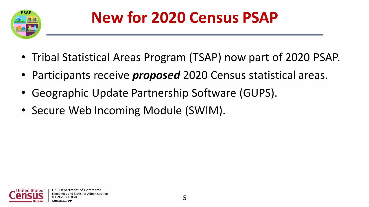
New for 2020 Census PSAP
• Tribal Statistical Areas Program (TSAP) now part of 2020 PSAP.
• Participants receive proposed 2020 Census statistical areas.
• Geographic Update Partnership Software (GUPS).
• Secure Web Incoming Module (SWIM).
5
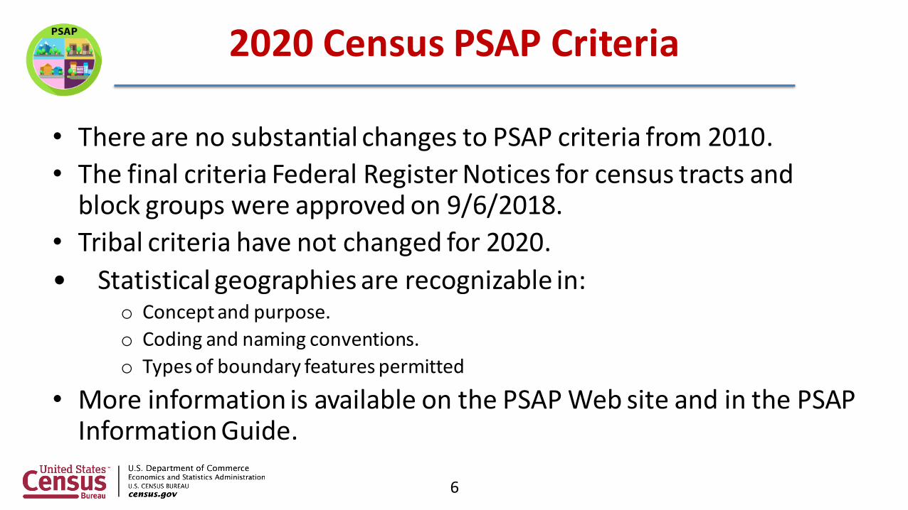
2020 Census PSAP Criteria
• There are no substantial changes to PSAP criteria from 2010.
• The final criteria Federal Register Notices for census tracts and block groups were approved on 9/6/2018.
• Tribal criteria have not changed for 2020.
• Statistical geographies are recognizable in:o Concept and purpose.
o Coding and naming conventions.
o Types of boundary features permitted
• More information is available on the PSAP Web site and in the PSAP Information Guide.
6

• The Census Bureau mailed Invitation Phase packets in August/September 2018 to:o Federally recognized tribes.o Tribal-designated statistical areas.o State recognized tribes.o Alaska Native Villages.o Oklahoma Tribal Statistical Areas.o Regional Planning Associations.o Councils of Governments.o Counties.o State Data Centers.o Puerto Rico
7
Invitation Phase
• The Census Bureau is processing registrations now.
• The Census Bureau will mail reminder letters –September/October 2018.
• Regional Geographers will assist with non-response follow-up to increase registration.
• October 31, 2018 is the registration deadline.
8
Invitation Phase
• Census Bureau will finalize the PSAP universe – November through December 2018.
• Census Bureau will create and distribute materials to participants – January 2019.
• Registered participants will have the following options:o Accept the Census Bureau’s 2020 Census proposed statistical areas defined
during PreSAP.o Update the 2020 Census proposed statistical areas.o Use the 2010 Census statistical area geography as a base to make updates.
• Participants will have 120 days from receipt of their materials to submit updates.
• The Census Bureau will mail a Delineation Phase close-out letter - July 2019.
9
Delineation Phase

Census Tracts
• Thresholds:
• Minimum: 1,200 population, 480 HU.
• Maximum: 8,000 population, 3,200 HU.
• OPTIMUM: 4,000 population, 1,600 HU.
• Use 2010 Census population counts for tract review in most cases.
• HU counts for seasonal communities.
• Maintain existing tract boundaries when possible.
10

2020 Pre-SAP Census Tract Review
Tract 0820.12: A tract in Maricopa County, AZ is an example of where using legal boundaries is preferred to using visible features to define statistical boundaries.
11
Red: Incorporated place boundaryPurple: Census tract boundary

Special Use Census Tracts
• Uses:
• Characterize unique populations (prisons, universities).
• Denote nonresidential areas (large parks, major airports).
• Define tracts encompassing concentrations of employment.
• Thresholds:
• Area measurement: At least comparable in land area to surrounding census tracts.
• Employment: Suggested minimum of 1,200 workers or jobs.
12

Special Use Census Tracts
13
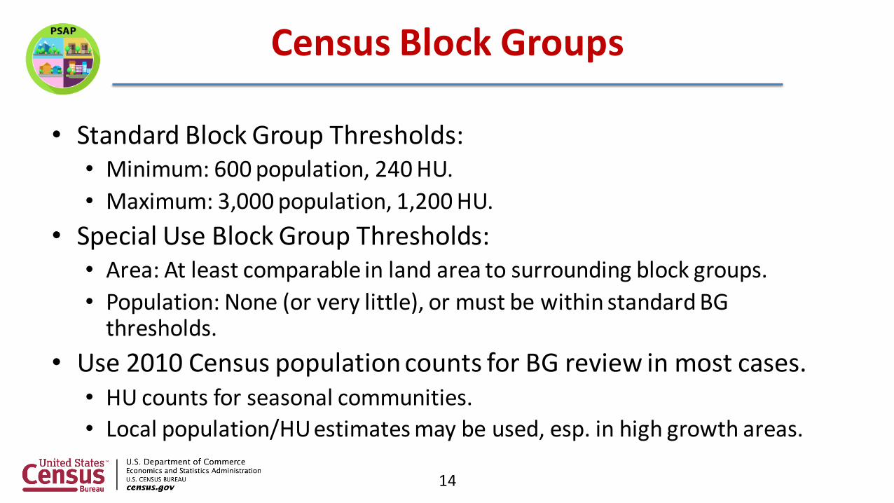
Census Block Groups
• Standard Block Group Thresholds:• Minimum: 600 population, 240 HU.
• Maximum: 3,000 population, 1,200 HU.
• Special Use Block Group Thresholds:• Area: At least comparable in land area to surrounding block groups.
• Population: None (or very little), or must be within standard BG thresholds.
• Use 2010 Census population counts for BG review in most cases.• HU counts for seasonal communities.
• Local population/HU estimates may be used, esp. in high growth areas.
14

Census Designated Places (CDPs)
• Census Bureau Places.o Incorporated Places.
• Legally bounded entity.
• Cities and villages in New York State.
• 62 cities, 539 villages currently in New York.
o Census Designated Places.• Statistical entity within MCDs (Towns in New York).
• Unincorporated community with a concentration of population, housing, identifiable by name, but not within an incorporated place.
• 580 CDPs currently in New York.
15
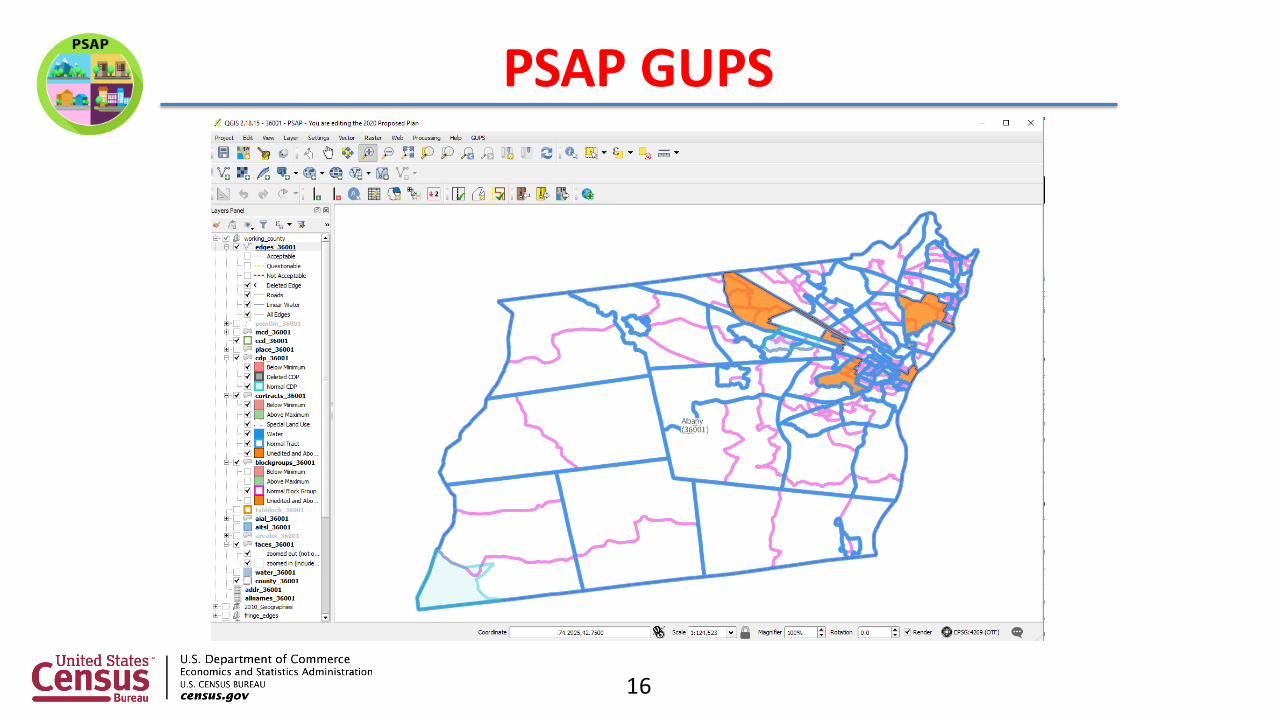
PSAP GUPS
16

Unedited Census Tracts
17

Above/Below Threshold Census Tracts
18

Split Tract by Block Group
19
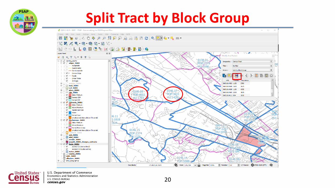
Split Tract by Block Group
20

Add Faces to Census Tract
21
You Are Here

Add Faces to Census Tract
22

Below Threshold Census Tracts
23
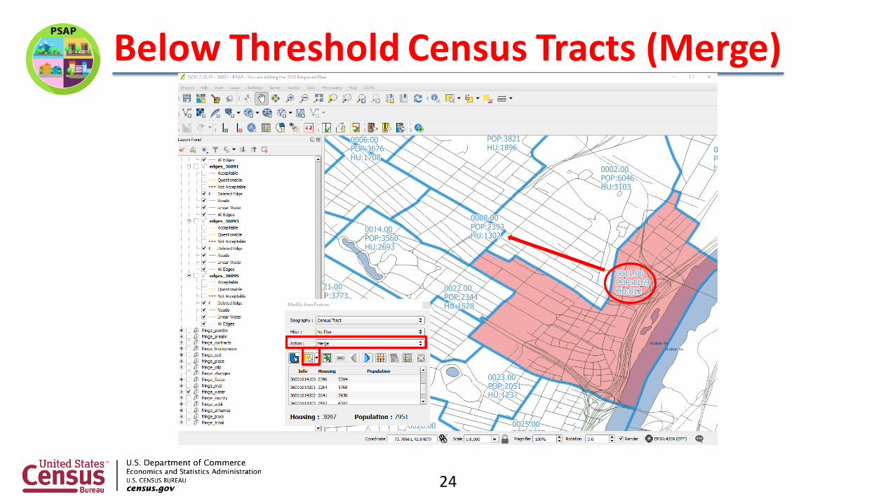
Below Threshold Census Tracts (Merge)
24

Below Threshold Census Tracts (Merge)
25

Above/Below Threshold Block Groups
26
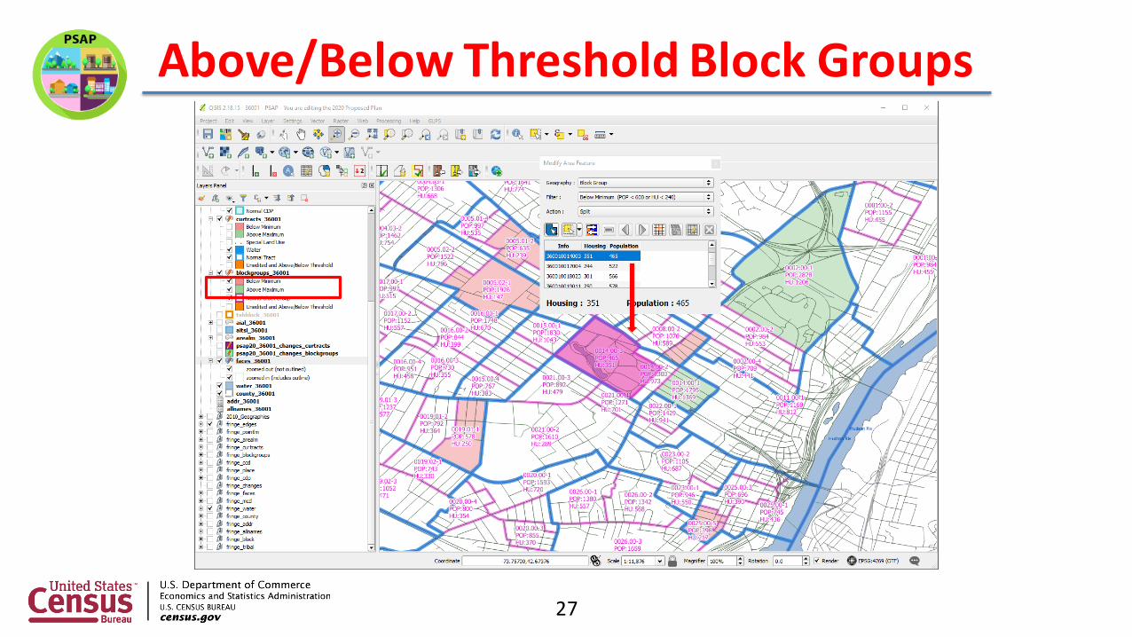
Above/Below Threshold Block Groups
27

CDP Expansion
28

CDP Expansion
29

CDP Expansion
30

CDP Expansion
31

Rename a CDP
32

Rename a CDP
33

• Headquarters will conduct training webinars with assistance from Regional Geographers.
• The recorded webinars and scripts will be posted on PSAP Web site.
• Webinars begin week after delineation phase materials are mailed in January 2019.
34
Training Webinars

• Census Bureau reviews and implements participant updates by:
• Reviewing and updating while enforcing thresholds for census tracts and block groups.
• Reviewing, maintaining, and updating boundaries for CCDs.
• Reviewing and updating CDP boundaries.
• Reviewing and updating all tribal statistical boundaries.
35
Submission Processing

• Verification phase materials will be mailed – January 2020.
• Participants will have 90 days to submit updates.
36
Verification Phase

2020 Census PSAP Schedule
37
38
Contact Information
• E-mail: [email protected]
• Phone: 1.844.788.4921
• Web site: https://www.census.gov/programs-surveys/decennial-census/about/psap.html

39
College of Charleston
Nov. 2016