Embed Size (px)
Citation preview

Montanapolicy review
A P u b l i c A t i o n o f t h e l o c A l G o v e r n m e n t c e n t e r
f A l l 2 0 1 1
Volume 15, No. 2
| community resiliency and the built environment:
Innovations and Policy Issues in Montana
Montana Policy Review is published by Montana State University Extension. Copyright © 2011 by Montana State University. All rights reserved. Excerpts from this magazine may be reprinted with permission from the Managing Editor. Please provide appropriate credit to Montana State University Extension and supply copies of printed materials to the editor. Opinions expressed herein are those of the individual authors and do not necessarily reflect the views of the university administration. Montana State University Extension is an ADA/EO/AA/Veteran’s Preference Employer and Provider of Educational Outreach.
f A l l 2 0 1 1
Editors
Paul lachapellecathy costakis
Dan clark
contributing authors
Layout
David Ashcraft
The Montana State University Local Government Center is an educational outreach organization whose purpose is to strengthen the capacities of Montana’s local governmental units to deliver essential services efficiently and to provide training, technical assistance, and research to local officials, (MCA 20-25-237).
tA b L e o fcontentspolicy review
Montana
rebecca beloucathy costakis
David Kacklewis Kelley
Sam Korsmoe Kathleen laurintaylor lonsdalelinda mccarthy
chris mehlchris naumannbruce newellGreg oliverray rasker
beth ShumateJohn robert Smith
Kristin SmithShelly SutherlandGene townsend
meg traci
introduction ............................................................ 1
new interactive mapping opportunities increase communication efforts and improve Access ............ 2
comprehensive Planning critical to Success: the Downtown bozeman improvement Plan as a case Study ...................................................... 4
Against the odds: Protecting lakes in lincoln county ........................................................ 8
the value of Downtown master Plans: case Study in missoula, montana ......................... 11
the three forks headwaters trail Project: improving Accessibility through community input and trail Assessment ................................... 15
how to Acquire Quality Parks and trails for Your community .................................................... 20
Park Acquisition in bozeman, montana: encouraging civic vitality through Development ordinances ...... 24
Get on the bus: connecting Small communities on montana’s hi-line ............................................ 27
improving Quality of life by Providing transportation options .......................................... 29
transportation triage: rebuilding a 20th century System While Preparing for the 21st ...................... 32
Safe routes to School .......................................... 36
Getting the economics right: helping montanans improve land use Planning and economic Development ......................................... 39
Six man towns ...................................................... 42

fAll 2011 | 1
Introductionwe have three co-editors of the Montana Policy review all working together on this issue titled, Community resiliency and the built environment: innovations and Policy issues in Montana. with so many exciting community resiliency and built environment policies, programs and projects, we felt it important to highlight the many innovative initiatives currently being designed and implemented across Montana.
The built environment refers to the human-made physical structures and supporting infrastructure that provide the setting for human activity. in Montana, these surroundings shape our economic, social, environmental, and public health outcomes. Citizens and local government leaders from all types of communities—from urban to rural to tribal—want to achieve the best possible outcomes while making the most effective use of limited resources. Policy decisions regarding transportation, land use, and community design influence many aspects of daily living: the distances people travel to work, school, parks, shops, and other destinations; the choice of transportation and housing options; the convenience of purchasing (or growing) healthy foods; the safety and attractiveness of neighborhoods for active living; and the economic and environmental resiliency of the local economy and place.
in Montana, there are many unique case studies that showcase how the built environment influences quality of life and economic prosperity. This issue of the Montana Policy review presents a series of articles on this topic and identifies best practices, policies and strategies to help communities build safe, healthy and resilient places. More importantly, we offer this issue on-line so that readers can click web links, view and download maps and pictures, and disseminate the publication to a far-wider audience than possible in the past. Go to: msulocalgov.org/publications to download this current issue.
in the 13 articles that follow, you will read about community resiliency and the built environment from the people who coordinated or actively participated in all or many facets of the community programs and initiatives. with personal insights and professional learning and wisdom, the stories, narratives, and academic pieces that follow provide the most complete analysis to date of built environment initiatives in Montana from the people who have designed, developed, and delivered the programs and plans.
The first few articles (Shumate and Newell; Naumann; Smith; oliver and McCarthy) present an overview of specific programs related to mapping, master plans, and related land use planning that provides a vision and framework for healthy active communities; these are followed by a set of articles (traci, Costakis, Sutherland, and Laurin; Corday; belou) examining issues associated with building and maintaining parks and trails in, near or connecting communities as an economic development and public health strategy; next are a set of articles (Kack; Kelley; Smith and townsend; Lonsdale) on the role of transportation in building safe, healthy, and resilient communities with specific case examples of the processes and policy outcomes affecting people and places in the state; the last two articles (rasker and Mehl; Korsmoe) provide insight on the economics of the built environment with tools and techniques for planning for and funding community initiatives.
we are again thrilled to be able to bring you this current collection of articles that we can only hope, will provide insight, inspiration, and ideas regarding what is possible when individuals and communities work together to address change.
Paul Lachapelle Community Development Specialist
MSU extension
Cathy Costakis Active Living Coordinator
Montana Nutrition and Physical Activity Program
Dan Clark Director
Local Government Center
July 31, 2011

2 | Montana policy review
New Interactive Mapping Opportunities Increase Communication Efforts and Improve Access
by Beth Shumate and Bruce Newell
The Helena Livability Group, a group initially convened by Montana fish, wildlife, and Parks, is comprised of a group of diverse organizations, professionals and concerned citizens. The group was created to: enhance and protect the quality of life and local economy of rural and urban communities; support integrated regional planning; and promote livable communities by cultivating partnerships throughout Lewis and Clark County. The idea of providing multi-agency, online, interactive trail maps was initially discussed in a summer 2010 Helena Livability meeting. Those attending were discussing possible strategies for improving the quality of life in Helena through cooperation between government entities and organizations and groups involved with outdoor recreation, parks, land-use management, healthcare, and education.
Parks, recreation sites and trails are significant community assets that provide opportunities for people to lead healthier lifestyles and create more active, vibrant communities across Montana. However, in order to increase visitation and outdoor recreational pursuits, people need better access to helpful information concerning trail routes, parks and management agencies. People often experience difficulty in identifying trail routes or trailhead locations since land is typically owned in a checkerboard fashion and trail users are required to purchase various maps to determine land ownership, trail connections and seasonal closures.
Introduction and Basis for Project Developmentoften times it is difficult to know how to access a trail or to determine if a trail is open at certain times of the year due to a patchwork of land-managing agencies that all provide various types of maps that are often expensive and outdated. Concerned about these issues, a mapping sub-committee formed out of the original Livability Group to consider approaches to maximize communication and accessibility. The mapping sub-committee discussed the importance of local trails, the challenges managers face in managing and maintaining trails and trail systems, and trail user’s desire to access an updated online map that displays all Helena-area managed trails.
Goals and Methodologyoverall, the primary mission of the mapping sub-committee is to provide information services and create an interactive online map that allows community members, organizations, local citizens and tourists access to a user-friendly mapping system providing greater access to resources, recreational attributes and local opportunities.
one of the key goals of the sub-committee was to develop an information “clearing house”, allowing users to query a variety of information such as area trail and recreation maps, commuter and transit routes, current events and links to other entities or organizations involved in promoting enhanced livability.
by utilizing innovative strategies and incorporating advanced technological methods, an interactive clearing house of information was developed as a cooperative pilot project, based in Lewis and Clark County, Montana. A number of agencies cooperated to create this map including: City of Helena, Lewis & Clark County, Prickly Pear Land trust (PPLt), Helena National forest (USfS), Montana fish, wildlife, and Parks (fwP), Montana State Library, Montana Geographic information Clearing House, Montana Department of Administration base Map Service Center (MtbMSC), Adventure Cycling Association, broadwater County, and Jefferson County.
The pilot Helena Area trails Mapping Project focuses on maintained paths within 30-40 miles of Helena, an area bordered by the Continental Divide to the west, i-15 near basin to the south, the big belt Mountains to the east, and Stemple Pass to the north. Lewis and Clark County officials compiled trail and trail head data from the various agencies: City of Helena; PPLt; USfS; fwP; and, MtbMSC. This spatial trail data was then over-layed to existing web services representing topography, aerial imagery, and street level base maps. The spatial representations of trails are combined with current available metadata which includes trail descriptions and features, access information and seasonal limitations.
Leveraging an existing web mapping application at the County, the online trail maps were implemented (in beta version) following three or four meetings

fAll 2011 | 3
attended by trail managers and geographical information system (GiS) providers. Helena’s Parks and recreation Department generously donated employees’ time and services, enabling the Helena trails Map to be made available and managed by the City of Helena’s and Lewis & Clark County’s joint information technology Services Department. Lewis and Clark County GiS Coordinator eric Spangenberg, and Parks and recreation Department’s Greta Dige were key players in developing the interactive map. These meetings were distinguished by the willingness of trail-managers to collaborate and share trails data and cooperatively provide an integrated online map. The Helena trails map site was announced to the public in May, 2011 and is available online.1
Outcomes and Future PlansThe first phase of the interactive map is available online and currently offers a new Microsoft Silverlight version that includes more latitude/longitude viewing options.2 Alternatively, access is available through the non-Silverlight version map.3 This online one-stop-shop for Helena-area trails supplements existing printed maps and guidebooks. The online interactive map provides hikers, runners, cyclists, and equestrians with a free, online map of nearby non-motorized trails. included on the online topographical base map are hundreds of trails managed by the City of Helena, Prickly Pear Land trust, the Helena National forest, and Montana fish, wildlife and Parks. trailheads are identified, as well as all city streets and bike routes. The overarching goal is for the least experienced recreationist to be able to enjoy and benefit from the content available within the interactive trails map.
The interactive online map will potentially provide the end-user with destination information while providing
1 http://helenair.com/lifestyles/article_12ea5500-8cdf-11e0-b6ca-001cc4c03286.html
2 http://www.co.lewis-clark.mt.us/departments/information-technology/gis-maps/wwwhelenamontanamapsorg/launch-map-viewers-services.html
3 http://helenamontanamaps.org/trails
an efficient means to find trails, recreational sites and trail-related information throughout the greater Helena area. As the project expands, the committee hopes to incorporate various end-user needs so anyone can access detailed information and discover the true sense of the Helena region and all that it has to offer. The final phase of the interactive mapping project will provide a GPS-enabled trails map guide that has the potential to incorporate detailed metadata informing the inquirer of seasonal closures, trail conditions, availability of trailhead and trailside amenities, and trail use types. eventually, the goal is to allow users to interact with the site by rating the trails, communicating with other commuters for routes and drop-off locations and incorporating additional metadata.
Ultimately, the map project could lead to a statewide interactive map that allows the end-user to access a user-friendly mapping service providing information on: local and regional recreation-based activities; social events and area activities; commuter routes; and links on ways to become more involved with local livability-focused groups. Providing accurate and timely information to interested users regarding public lands and trail systems could increase visitation and public involvement, and is likely to increase community support for parks and trails, boost local economies, and promote healthier and more active communities.
beth r. Shumate is a trails Coordinator for Montana fish, wildlife & Parks, in Helena, Montana. Correspondence can be directed to: [email protected].
bruce Newell is a retired librarian and an active volunteer within the Helena community. Correspondence can be directed to [email protected].
Interactive mapping sites page from the Montana Lewis and Clark County website, www.co.lewis-clark.mt.us
4 | Montana policy review
Comprehensive Planning Critical to Success:
the DoWntoWn bozemAn imProvement PlAn AS A cASe StuDY
by Chris Naumann
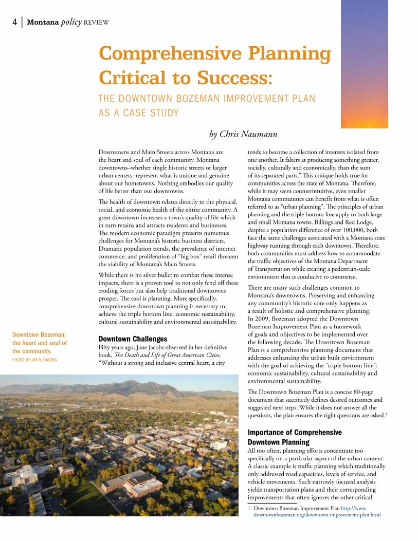
Downtowns and Main Streets across Montana are the heart and soul of each community. Montana downtowns–whether single historic streets or larger urban centers–represent what is unique and genuine about our hometowns. Nothing embodies our quality of life better than our downtowns.
The health of downtown relates directly to the physical, social, and economic health of the entire community. A great downtown increases a town’s quality of life which in turn retains and attracts residents and businesses. The modern economic paradigm presents numerous challenges for Montana’s historic business districts. Dramatic population trends, the prevalence of internet commerce, and proliferation of “big box” retail threaten the viability of Montana’s Main Streets.
while there is no silver bullet to combat these intense impacts, there is a proven tool to not only fend off these eroding forces but also help traditional downtowns prosper. The tool is planning. More specifically, comprehensive downtown planning is necessary to achieve the triple bottom line: economic sustainability, cultural sustainability and environmental sustainability.
Downtown Challengesfifty years ago, Jane Jacobs observed in her definitive book, The Death and Life of Great American Cities, “without a strong and inclusive central heart, a city
tends to become a collection of interests isolated from one another. it falters at producing something greater, socially, culturally and economically, than the sum of its separated parts.” This critique holds true for communities across the state of Montana. Therefore, while it may seem counterintuitive, even smaller Montana communities can benefit from what is often referred to as “urban planning”. The principles of urban planning and the triple bottom line apply to both large and small Montana towns. billings and red Lodge, despite a population difference of over 100,000, both face the same challenges associated with a Montana state highway running through each downtown. Therefore, both communities must address how to accommodate the traffic objectives of the Montana Department of transportation while creating a pedestrian-scale environment that is conducive to commerce.
There are many such challenges common to Montana’s downtowns. Preserving and enhancing any community’s historic core only happens as a result of holistic and comprehensive planning. in 2009, bozeman adopted the Downtown bozeman improvement Plan as a framework of goals and objectives to be implemented over the following decade. The Downtown bozeman Plan is a comprehensive planning document that addresses enhancing the urban built environment with the goal of achieving the “triple bottom line”: economic sustainability, cultural sustainability and environmental sustainability.
The Downtown bozeman Plan is a concise 80-page document that succinctly defines desired outcomes and suggested next steps. while it does not answer all the questions, the plan ensures the right questions are asked.1
Importance of Comprehensive Downtown PlanningAll too often, planning efforts concentrate too specifically on a particular aspect of the urban context. A classic example is traffic planning which traditionally only addressed road capacities, levels of service, and vehicle movements. Such narrowly focused analysis yields transportation plans and their corresponding improvements that often ignores the other critical
1 Downtown bozeman improvement Plan http://www.downtownbozeman.org/downtown-improvement-plan.html
Downtown Bozeman: the heart and soul of the community. Photo bY Jim r. hArriS

fAll 2011 | 5
elements of circulation: pedestrian, bicycle, and even public transportation modes. when undertaking comprehensive downtown planning, the various elements—traffic, parking, land-use, and economic development—must not be analyzed within their independent silos. rather all aspects must be taken in consideration of the greater context. The desired vision is a plan that stipulates the community’s goals and objectives compliment one another—the outcome will therefore be larger than the sum of the parts.
Planning for the Triple Bottom LineComprehensive downtown planning should strive to achieve the triple bottom line of economic sustainability, cultural sustainability, and environmental sustainability. Any investment in downtown will increase the livability, attractiveness, and value of the entire community. but strategic, coordinated investments in the economic viability, cultural vibrancy, and environmental integrity will benefit the community ten fold.
Most Montana communities do not have the financial tools to directly pursue economic sustainability such as establishing revolving loan funds or redevelopment agencies to actively retain, expand and recruit business. without well-funded economic development programs, the emphasis should be on making a downtown attractive and vibrant in turn business will follow. in other words, focusing on socio-cultural and environmental sustainability will drive economic sustainability.
Cultural SustainabilitySocio-cultural sustainability involves preserving a unique sense of place, providing social opportunities, and adding cultural amenities. Nothing is more valuable than a community’s unique sense of place which can be preserved and enhanced by education programs regarding the cultural and economic benefits of historic preservation. if possible, some financial resources should be dedicated to historic facade and signage preservation work.
Montana downtowns and Main Streets have historically been the center of social and cultural activities. Communities should take steps to ensure their downtowns remain the heart and soul of town. organizing a variety of events to attract people downtown and bring neighbors together is an effective method to this end. The Downtown bozeman Association has a long history of hosting successful events such as the Music on Main summer concert series, the Cruisin’ on Main Car Show, a popular summer Art walk series, and the Christmas Stroll holiday gathering.2
when and where possible, towns should add cultural amenities to their Main Street district. Communities can develop historic walking tours to highlight significant historic architecture and events. incorporating public art into the downtown streetscape 2 Downtown bozeman events http://www.downtownbozeman.
org/events.php
adds interest and aesthetic to any Main Street. Downtown bozeman benefits from both a historic walking tour and over 40 pieces of public art.3
Environmental Sustainabilityenvironmental sustainability can be divided into three distinct parts: the built environment, the business environment, and the natural environment. The built environment consists of public infrastructure and private investment. both play a crucial role in a healthy downtown. Central to any comprehensive downtown plan is designing and building all-inclusive streets for all users: pedestrians, bicyclists, public transit and vehicle users. The role of “complete streets” in building safe, healthy, and resilient communities cannot be overlooked or underemphasized.
Strategic public infrastructure projects will in turn leverage and attract private investment and economic development. while not an iron-clad “build it and they will come” guarantee, public infrastructure investments signal a confident community commitment to the private sector. for instance, private investment, whether building renovation, new construction, or business start-ups, is encouraged by an attractive streetscape that can include new sidewalks, pedestrian-scale lighting, benches, bike racks, planters, and trash receptacles.
Considering many Montana Main Streets are state highways, the Montana Department of transportation (MDt) can be a constructive partner in comprehensive downtown planning. Downtown bozeman completed a major streetscape improvement project in 2002 and collaborated with MDt on a Main Street overlay project in 2007. in conjunction, these two undertakings completely transformed bozeman historic Main Street to be more “complete.”4
3 bozeman Main Street Historic walking tour http://www.bozemancvb.com/main-street-walking-tour.php; Downtown Public Art tour http://www.gallatinartcrossing.com
4 National Complete Streets Coalition http://www.completestreets.org; bozeman Complete Streets http://www.mdt.mt.gov/publications/docs/brochures/bozeman_tranplan_study_chap6.pdf
Preliminary framework concepts of the Downtown Bozeman Improvement Plan.
6 | Montana policy review
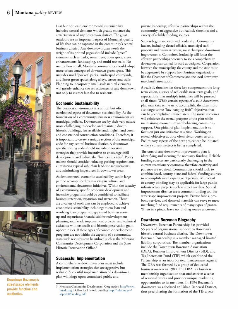
Last but not least, environmental sustainability includes natural elements which greatly enhance the attractiveness of any downtown district. The great outdoors are an important aspect of Montana’s quality of life that can be captured in the community’s central business district. Any downtown plan worth the weight of its printed pages should include “green” elements such as parks, street trees, open space, creek enhancements, landscaping, and multi-use trails. No matter how small, Montana communities should adopt more urban concepts of downtown green space. This includes small “pocket” parks, landscaped courtyards, and linear green spaces along alleys, streets and trails. Planning to incorporate small-scale natural elements will greatly enhance the attractiveness of any downtown not only to visitors but also to residents.
Economic SustainabilityThe business environment is a critical but often overlooked aspect of downtown sustainability. At the foundation of a community’s business environment are municipal policies. Downtowns are by their very nature more challenging to develop and maintain due to historic buildings, less available land, higher land costs, and constrained construction conditions. Therefore, it is important to create a unique section of the municipal code for any central business district. A downtown-specific zoning code should include innovative strategies that provide incentives to encourage infill development and reduce the “barriers to entry”. Policy makers should consider reducing parking requirements, eliminating typical suburban land-use requirements, and minimizing impact fees in downtown areas.
As demonstrated, economic sustainability can in large part be accomplished by investing in cultural and environmental downtown initiatives. within the capacity of a community, specific economic development and incentive programs should be considered to facilitate business retention, expansion and attraction. There are a variety of tools that can be employed to achieve economic sustainability including: micro-loan and revolving loan programs to gap-fund business start-up and expansions; financial aid for redevelopment planning and facade improvement projects; and technical assistance with tax credit and historic preservation grant opportunities. if these types of economic development programs are not within the capacity of a community, state-wide resources can be utilized such as the Montana Community Development Corporation and the State Historic Preservation office.5
Successful ImplementationA comprehensive downtown plan must include implementation strategies that are aggressive but realistic. Successful implementation of a downtown plan will hinge upon committed public and
5 Montana Community Development Corporation http://www.mtcdc.org; Dollars for Historic funding http://mhs.mt.gov/shpo/HPfunding.pdf
private leadership; effective partnerships within the community; an aggressive but realistic timeline; and a variety of reliable funding sources.
Success begins and ends with leadership. Community leaders, including elected officials, municipal staff, property and business owners, must champion downtown improvements. Committed leadership will foster the effective partnerships necessary to see a comprehensive downtown plan carried forward as designed. Cooperation between the municipality, the county and the state must be augmented by support from business organizations like the Chamber of Commerce and the local downtown merchant’s association.
A realistic timeline has three key components: the long-term vision, a series of achievable near-term goals, and expectations that multiple initiatives will be pursued at all times. while certain aspects of a solid downtown plan may take ten years to accomplish, the plan must also target some “low-hanging fruit” objectives that can be accomplished immediately. The initial successes will reinforce the overall purpose of the plan while maintaining momentum and bolstering community support. one pitfall of plan implementation is to focus on just one initiative at a time. working on several objectives at once often yields better results. Preliminary aspects of the next project can be initiated while a current project is being completed.
The crux of any downtown improvement plan is identifying and securing the necessary funding. reliable funding sources are particularly challenging in the current recessionary economy, therefore creativity and patience are required. Communities should look to combine local, county, state and federal funding sources to accomplish more expensive objectives. Municipal or county bonding may be applicable for large public infrastructure projects such as street overlays. Special improvement districts are a common funding tool for streetscape improvement projects. Private funds, pro-bono services, and donated materials can serve to meet matching fund requirements of many types of grants. when in a pinch, leave no funding source uncovered.
Downtown Bozeman BiographyDowntown bozeman Partnership has provided 55 years of organizational support to bozeman’s historic central business district. The Downtown bozeman Partnership is a member managed limited liability corporation. The member organizations include the Downtown bozeman Association (DbA), business improvement District (biD), and tax increment fund (tif) which established the Partnership as an incorporated management agency. The DbA was formed by a group of dedicated business owners in 1980. The DbA is a business membership organization that orchestrates a series of seasonal events and provides unique marketing opportunities to its members. in 1994 bozeman’s downtown was declared an Urban renewal District, thus precipitating the formation of the tif a year
Downtown Bozeman’s streetscape elements provide function and aesthetics.

fAll 2011 | 7
later. The tif reinvests the incremental growth in the taxable value of downtown in infrastructure projects with the intent of spurring additional private investment. The biD was created in 2000 by the majority of the downtown property owners. The biD oversees a variety of initiatives that enhance the visual appeal of downtown such as graffiti and trash removal plus summer flower basket and holiday decoration programs.
Downtown bozeman Partnership has a long history of comprehensive planning—1995 Downtown Urban renewal Plan, 1998 Downtown improvement Plan, 2009 Downtown improvement Plan. These “master plans” have been in turn supported by more specific disciplinary studies such as the 2003 Downtown traffic Study and the 2011 Downtown Parking Study. Downtown bozeman has and continues to benefit from no less than five planning documents over a sixteen year period, during which time over $20 million of public infrastructure projects have been implemented. Correspondingly, from 1996 to 2009, significant private investment resulted in a 53 percent growth in Downtown bozeman’s taxable value. for more information visit the Downtown bozeman Partnership website.6
6 Downtown bozeman Partnership http://www.downtownbozeman.org/about-us.html
Final improvement opportunities from the Downtown Bozeman Improvement Plan.
References❖❖ Jacobs, Jane. 1961. The Death and Life of Great
American Cities. random House, inc. New York.
Chris Naumann is the executive Director of the Downtown bozeman Partnership. Correspondence can be directed to [email protected].

8 | Montana policy review
Against the Odds:
ProtectinG lAKeS in lincoln countY
by Kristin Smith
IntroductionAs i was loading the perennial public meeting paraphernalia (pens, pads, easels, sticky notes, 3x5 cards, posters with painstakingly illustrative graphics, and of course, the proverbial “we know who you are” sign-in sheet) into the County rig, i thought to myself, “Am i ready for the attack that i am about to face?” i knew that, as a newcomer to a community, it tends to be much easier to identify areas of “opportunity”, without a full understanding of the history, culture or politics of a place. Lincoln County, in the northwestern-most corner of Montana, presented itself to me in just such a fashion – full of opportunity (along with a little excitement and trepidation about what i might be getting into). Upon entering the county, one is greeted with a sign that proclaims “rich, remote, rare”; indeed it is one of the most beautiful areas in the state.
The purpose of the meeting i was about to enter was to solicit, one last time, comments from the public on the proposed changes to the County’s Lakeshore Protection regulations. This effort began seven months prior in the spring of 2010. The County’s existing regulations dated back to January 1976 and had been enacted a mere 6 months after the state adopted the pivotal Lakeshore Protection Act.1 Montana was one of several states during this era to enact such laws following the national Clean water Act. with the population of Montana at just under 700,000 in 1975, this legislation was truly remarkable, and given today’s political climate, would likely face extreme difficulty receiving the same support. only a small handful of counties in Montana have adopted regulations governing activities along lakeshores, quite simply because so few counties have lakes within their borders to regulate.
The goals of the updated regulations were twofold. The first initiative was to protect the lakes of Lincoln County by adopting management practices that had been developed in other lake-rich jurisdictions around the country, such as Minnesota and wisconsin. Just as importantly, these regulations needed to promote the public health and safety of its citizens. Approximately 78 percent of the geographic area of the County’s 3,673 square miles is publicly owned, leaving the human populations to inhabit the remaining 22 percent of the land. Although home to only 20,000 people, Lincoln County is the 10th most populous county in the state. However, it persistently ranks the highest in unemployment. Despite that notoriety, Lincoln County became very popular for second-
1 Montana Code Annotated, http://data.opi.mt.gov/bills/mca/75/7/75-7-201.htm
home buyers from other parts of the US and Canada during the mid-2000s – jumping 109 percent since 2000, making it the second highest gain in the state.2 The “discovery” of the area and the more than 200 lakes within its borders – from the smallest pothole in the Cabinet wilderness to the 90-mile long Lake Koocanusa – steadily increased pressure on those lakes containing private land along their shores.
Backgroundwhile there was no specific indication that the quality of Lincoln County’s lakes had deteriorated or was imminently at risk, there was anecdotal information from lakefront property owners that the private shorelines around several lakes had been significantly altered. Historically, the lakeshore construction permitting process in the County had been very loosely administered. Several key practices that i observed in my first year as Planning Director made it clear that there was insufficient information being provided and a prior level of experience in the department and County that did not solicit more details during the required project review. in fact, it became evident there was a lack of public awareness that a lakeshore permitting program even existed in the County at all.
Through the regulatory revision process, the County learned that some activities that had previously been permitted were not beneficial to the lakes, their natural scenic value or aquatic habitat. Some of the activities i observed being permitted were removal of all native vegetation and planting Kentucky bluegrass, or other maintenance-intensive grass, right to the water’s edge; hardening the shoreline with rip-rap, concrete walls and terraces to effectively extend land lake-ward and purportedly “stabilize the shoreline”; and bringing in material for the creation of artificial beaches. See photos thoughout this article.
one of the fundamental problems with the 1976 regulations under which the County had been operating was a total lack of specificity regarding standards for materials or performance by which to measure a particular proposal against the undefined statutory criteria. without clear regulatory language and oversight for property owners to follow, decision-making was potentially an arbitrary action by the County.
There is significant research to support the connection between unregulated development activities near lakes and the impacts such development has on water
2 The flathead beacon: http://www.flatheadbeacon.com/articles/article/vacation_homes_skyrocket_in_western_montana/23231/

fAll 2011 | 9
quality and subsequently aquatic habitat, fisheries and ultimately, human health. The most notable example in the western states is Lake tahoe, in the trans-boundary area of California and Nevada. its history of resource development and increasingly intensive resort use necessitated the creation of a regional planning association in the late 1960s to better manage activities that had clearly been having detrimental impacts on the lake. further studies point to a causal relationship between water quality and lakeshore property values. it is commonly known that point source impacts such as septic systems and fertilizers directly lead to increased phosphorous and nitrate levels, which in turn can lead to algae blooms causing human health problems, as well as ecosystem disturbance. in fact, approximately one-fifth of all the lakes in the United States are considered to be in poor biological condition, although investments in wastewater treatment and other pollution control activities in recent decades appear to have made a difference despite increased population.
The ProcessLincoln County, like much of Montana, has historically not been heavily regulated by its local government – a situation which has both benefits and consequences to the residents who live within its borders. other county officials and i knew we would be facing some contentious meetings, such as had been the experience just a few years prior when the County was working to adopt its Growth Policy. The staff and commissioners at that time were met with fierce opposition, though in small, but vociferous numbers. Lincoln County’s remoteness has long been attractive to people on both ends of the political spectrum for getaways and very limited government regulation and oversight. The high anti-government sentiment also contributed to: a) flagrant refusal of property owners to obtain permits in the first place, citing the supremacy of private property rights above all else; and b) the lack of enforcement mechanisms and support on the part of the County.
The typical planning process consists of the preparation of a draft document with stakeholder input; presentation of said draft in a series of public meetings, typically with a planning board; soliciting input; revisions to the draft based on said input; and presentation of a revised draft in a series of follow-up meetings for more public comment. rounding out the process is typically a mandatory public hearing on the matter with the governing body, in this case the board of County Commissioners. A variation to the first stage of this process is sometimes employed, whereby the public is invited to prepare the initial draft. There are pros and cons to both steps. in the former, the public tends to criticize the staff because they were not involved at the very beginning; in the latter, the public criticizes the staff because without some recommendations to review, they feel there is a lack of information for which to provide adequate comment. Due to some of the technical language associated with lakeshore
development activities we decided to start with a handful of public stakeholders, specifically, other state agencies with influence over the public waters of Montana (Department of environmental Quality; fish, wildlife and Parks; Natural resources and Conservation).
Preparation of the draft included research into what policies were being employed by other jurisdictions in Montana, and best management practices adopted around the country. Montana State law requires all lakeshore applications to be reviewed by the Planning board and as such, regulatory revisions shall also include the Planning board’s recommendations.3 to keep citizens current, the Planning Department published notice in big block ads as opposed to the obligatory too-small-to-read notices and kept our website current. in addition, we set up an e-mail list to keep people informed about meetings and changes to the draft. five public meetings were held in different parts of the county and ended with a public hearing with the commissioners in early December. At each meeting, between 25 and 40 citizens (some of whom actually owned lakeshore property) were in attendance and used their time to speak to lodge personal attacks and cite political and philosophical rhetoric. At each meeting, we showed how the document had changed based on the handful of legitimate comments that had been received at the previous meeting. one important factor to everyone – citizens, staff and elected officials – was not to seek retroactive permits for existing projects that did not meet the new regulations, provided they were previously permitted or had been in existence prior to 1976. we attempted to tailor the document to fit the greater community’s desires for some sideboards of equity, without overreaching into the minutiae of lakeshore development. This was partially driven by the limited staff and experience to administer and enforce the regulations.
Planning is decidedly political despite tireless efforts at objectivity based on factual information. However, the Planning board was overwhelmed by the extremely negative tone of the public meetings and stripped down the staff’s recommendations such that the revisions scarcely resembled anything different than the 1976 regulations. Placed in a difficult professional situation,
3 Montana Code Annotated, http://data.opi.mt.gov/bills/mca/75/7/75-7-211.htm

10 | Montana policy review
i decided to present the governing body with the research-based standards that the staff had initially prepared, as well as the Planning board’s significantly trimmed-down version.
The staff’s recommendations were ultimately adopted by the County Commissioners with some minor modifications based on a handful of specific and valid comments from the public. while not the gold standard, the new regulations are a marked improvement over what had previously been utilized.4
Conclusions and Outcomesto say the proceedings were heated might be an understatement. The most frequent theme at the public meetings on the revised regulations was “we escaped the overly burdensome regulations of X- state and don’t want them here!” As a result, the regulatory revision process became a whipping post for these citizens whose energized movement across the country found a welcome presence in Lincoln County. The Planning Department’s e-mail list was hijacked by these new activists to promote the theories about the proposal’s (and therefore my) supposed role in an international conspiracy to implement the UN Agenda 21, which they believe to be a “plot to curtail private property rights and deprive Americans of their precious constitutional freedoms.”
The pervasiveness of this activism has evolved to such a state that the virginia Chapter of the American Planning Association issued a short paper on the matter. Similarly, Mother Jones published an article earlier this year, titled, “we Don’t Need None of That Smart-Growth Communism.” Planning appears to be serving as a lightning rod for the issues at the heart of the activism – an overreaching federal government and the fear of diminished property rights. Politically, the timing of our efforts was a challenge in light of the upcoming mid-term elections – the public atmosphere was charged. Similar scenarios played out in ravalli County, Montana in 20085 and the current “building the wyoming we want” efforts are being threatened.6
i was trained to believe that a good process results in a good product. in other words, even if the product, in this case regulations that captured better management practices for shoreline activity, was adopted, if the process was perceived to be flawed, the product was not necessarily a success. However, the ubiquitous use of anonymous blogging by angry citizens and the proliferation of propaganda e-mail chains contributed greatly to an increasingly hostile public and no amount of reasoned dispassionate explanation was going to have an impact on this utter lack of civil discourse that was
4 Lakeshore Protection regulations for Lincoln County, Mt, http://www.lincolncountymt.us/planning/Docs/LakeshoreConstruction/information/Lakeshoreregulations_final_120810.pdf
5 New west blog, http://www.newwest.net/topic/article/ravalli_county_campaign_groups_draw_scrutiny1/C559/L559/
6 wyofile, http://wyofile.com/2011/06/high-plains-showdown-land-planning-seen-as-threat-to-property-rights/
dominating the process. i was somewhat relieved to know that i was not alone in being verbally attacked and that it was a burgeoning atmosphere around the country. i failed in conveying the value that planning provides to the efforts of building great communities.
There is a body of literature on consensus-building and participatory planning that provides a “bounty of tactics but no gimmicks.”7 Had we started with a small sub-committee to review the existing regulations (that process worked very well when we re-vamped the subdivision regulations the year prior) we may have had a better time diffusing the vitriol. Perhaps. Such an effort could have led to work sessions to really highlight the negative effects of some shoreline activity, by getting some of the lakeshore residents to the table. As it was, those that supported the County’s efforts were dissuaded from attending the meetings due to their very negative tone.
in the end, Lincoln County’s lakes, one of the many natural resources that attract both new and long-term residents, have a little better protection for all to continue to enjoy. while there have only been a handful of applications since the new regulations went into effect, they have been permitted differently than before and hopefully there will be sustained ecological benefits as a result.
References❖❖ engel, S. and J.L. Pederson, Jr. 1998. The
construction, aesthetics, and effects of lakeshore development: a literature review. Wisconsin Department of Natural Resources Research Report 177.
❖❖ Homewood, George M. 2011. Dealing with the new activists – what planners should know. Virginia Chapter of the American Planning Association 2011 Spring Conference.
❖❖ Krysel, C., e.M. boyer, C. Parson and P. welle. 2003. Lakeshore property values and water quality: evidence from property sales in the Mississippi headwaters region. Mississippi Headwaters Board and Bemidji State University.
❖❖ Mencimer, Stephanie. 2011, March/April. we don’t need none of that smart-growth communism. Mother Jones.
❖❖ Sierra Nevada ecosystem Project. 1996. final report to Congress. University of California, Centers for Water and Wildland Resources.
❖❖ United States environmental Protection Agency. 2010. National Lake Assessment.
Kristin Smith, AiCP, is the immediate Past-President of the Montana Association of Planners. Correspondence can be directed to [email protected].
7 bleiker institute for Participatory Management and Planning, http://www.ipmp.com/blog/

fAll 2011 | 11
The Value of Downtown Master Plans:
cASe StuDY in miSSoulA, montAnA
by Greg Oliver and Linda McCarthy
Introductionone of the primary characteristics of a healthy community is a vibrant downtown. on a smaller scale, healthy towns need a solid and engaged Main Street. There are many benefits linked to vibrant downtowns including economic, social, civic, health, environmental and more.
Keeping downtowns alive and well is an ongoing challenge for most places in the United States. However, current budget constraints, due to the latest economic downturn, are causing city governments and downtowns particularly hard times. The forces that compete with and undermine downtowns are legion including competition with larger national chain stores located out of the downtown areas. Good planning processes and strategic plans are important, if not critical, to protecting and effectively developing downtowns.
better urban design in the 21st Century calls for sophisticated public/private partnerships and conditions supportive of them. resistance, confusion and lack of a common vision reduce the chance of strategic projects occurring and achieving important returns on investment.
This article describes a period of time (2004-2011) in Montana during which the City of Missoula produced its first Downtown Master Plan. in 2007, the Missoula Downtown Association (a private, non-profit, membership-based organization) and the City of Missoula united to investigate the options of developing a long-term vision (25 years) for downtown. Goals, plan elements, study area, and stakeholders were identified. Crandall Arambula, a team of professional planning consultants from Portland, oregon, was selected to help lead this community through a visioning process to shape the future of Downtown Missoula and to provide a clear understanding of how to accomplish the goals for Downtown Missoula. The Downtown business improvement District (biD), the Missoula Parking Commission (MPC), the Missoula redevelopment Agency (MrA), the Missoula Area economic Development Corporation (MAeDC) and the Missoula Downtown Association (MDA), along with a significant number of private property and business owners, partnered together to help fund and guide the planning effort.
Downtown plans aren’t new to Montana. There are several including:• billings 1997• whitefish 2005• red Lodge Downtown Assessment & Action
Plan 2006• Helena Downtown business improvement District
(date unknown)• bozeman Downtown improvement Plan 2009• Great falls is currently working on one.
This document provides a brief overview of how Missoula approached the planning process and how those efforts have led to major dividends in the areas of policy, resources and the environment. Some results have been anticipated, some unexpected. This case study focuses on the process of developing the plan and the outcomes since its adoption in August of 2009, but not on the plan itself. The Downtown Missoula Master Plan is available online at www.missouladowntown.com/about/downtown-master-plan/.
As a case study, this document outlines circumstances that led to the decision to develop a plan, elements that impacted the planning process itself, progress to date, and future steps. it’s important to acknowledge that the plan and its successes would not have happened without some remarkable key leaders to see it through and keep it moving forward.
vital public/private partnerships and investments are built and flourish when there is a shared common vision in which stakeholders feel ownership and even pride. Special attention and efforts must be directed to who is included, who is engaged, who is sought out, interests that are recognized, and how meetings and teams are structured and utilized. There must be time to analyze new ideas to take root, to reach out, to work with resistance, conduct presentations and consult with every stakeholder one can imagine.
Conditions Leading to the Plan (2004-2006)in some ways, there was a perfect storm of challenges in downtown Missoula that helped many parties feel urgency and agree that pursuing a strategic plan made sense. Downtown businesses felt in jeopardy. They began to acknowledge that without a plan they would not have influence or be able to move forward with major development projects. Some of the primary issues were:

12 | Montana policy review
• A controversial “road diet” that narrowed an important gateway arterial from 4 lanes to 3 lanes.
• Plans already in existence in significant bordering neighborhoods influencing policy decisions.
• Growing impact from transients & the homeless shelter located downtown.
• Mixed use development proposals for multiple-story buildings adjacent to two-story residential homes.
• interest in pursuing funding to build a performing arts center at an edge of downtown and a sense that this might not be the best use or location.
• City and county officials looking to move major elements of local government out of the urban core.
• Longstanding effective downtown urban renewal program sun-setting in 2005 with no clarity about who would carry the torch for downtown.
• The Missoula Art Museum seeking to build a new addition on its Historical Carnegie Library building, wanting to stay downtown, but running into resistance with its design.
• “infill”, the process of increasing density nearer the urban core, was becoming a lightning rod in Missoula.
• Confusion about what to do with the gateways into downtown, as well as how to deal with a large development planned for a brownfield area (a former industrial site requiring cleanup) across the river.
Key Factors Influencing the Planning Process (2007-2009)• MDA representatives attended the international
Downtown Association conference, while the Mayor of Missoula and the Director of the Missoula redevelopment Agency attended a national City Leadership conference. All returned convinced that Missoula needed a strategic plan for downtown.
• The City of Missoula was supportive but had no funding to develop a plan.
• The MDA spearheaded the development of a Steering Committee to develop a list of needs, a study boundary, plan elements, process and more.
• Missoula’s new Planning Director and redevelopment Director both had experience developing master plans and working with national consultants who specialize in planning development and implementation.
• The Steering Committee raised $450,000 to hire professional consultants to assist with the planning process and documentation. The group met its financial fundraising goals through 75 financial contributions. A request for Qualifications (rfQ) and, subsequently, a request for Proposals (rfP) were developed and distributed nationwide. There were 50 responses resulting in 36 proposals. eight members of the Steering Committee interviewed the six finalists and selected Crandall Arambula to the position. Crandall Arambula came to the table with several sub-contractors with specific expertise in the areas of economic development, housing,
parking, retail, tourism and transportation.• MDA took a leadership role in this process and
stepped up into a more complex, demanding role than the organization had played in the past.
• Crandall Arambula staff members made four week-long public visits to Missoula and hosted four major community workshops. During each visit, they further developed ideas for the plan and tested those with hundreds of interested parties.
• MDA coordinated 85 stakeholder group meetings and 25-30 public presentations on the planning process and its outcomes.
• residents south of the Clark fork river expressed opposition to the Master Plan Study area, but the Steering Committee was steadfast in its decision-making on the boundary line, following the original Urban redevelopment District boundary from 1978 which also included this area of Missoula as being part of the downtown.
• opposition was raised on the resulting plan recommendation to modify Higgins Avenue from a four- lane roadway to a three-lane roadway and build protected bike lanes (or cycle tracks are they are often referred to), inspired by european communities.
• The Steering Committee opted to delay adoption of some of the more controversial issues (parking and zoning, for example) by the Missoula City Council in an effort to address the issues first before seeking adoption.
• Some elements of the plan were taken to other entities and organizations for approval. for example, the tourism strategy was unanimously adopted by the Missoula Convention & visitors bureau.
• october 2008 saw the national economy and stock market crash into a major recession that severely impacted business as usual and some major components of the plan.
Resulting Policy, Resource and Built Environment Changes (2009-2011)The Missoula City Council unanimously approved the Downtown Master Plan in August 2009 following unanimous approval by the Missoula Consolidated Planning board. Unanimous votes by Missoula’s 12-person council are rare. Downtown constituents actively pursued Master Plan goals in the envision Missoula Urban fringe Development Plan and the Long-range transportation Plan, as well as the Missoula Zoning Code rewrite.1
two new six-story Class A office buildings were built. before the planning process, the first interstate bank building is in the retail “hot spot” area and will benefit from the construction of a new parking structure next door. first interstate was considering a major relocation out of downtown, but opted to maintain its urban core location due to the Master Plan and tax increment financing. today, all but one floor has been purchased and occupied. The Garlington, Lohn & robinson
1 http://www.co.missoula.mt.us/opgweb/Urbaninitiative/index.htm
Example of a cycle track in Indianapolis, Indiana.

fAll 2011 | 13
building was completed in January 2011 and was the first to utilize New Markets tax Credits in Montana. The law firm’s decision to build a new building across the street from the Missoula County Courthouse paved the way for the county to purchase the old building and retain its services in the urban core.
A four-block section of the central downtown corridor (i.e. Higgins Avenue) was upgraded with Complete Street elements and was completed in the fall of 2010. with significant revisions to an earlier (2005) Street improvement Plan, this portion of the plan was “shovel ready,” opening the door to access $1.5 million dollars of American recovery and reinvestment Act economic stimulus funds. During the work, a 60-year old sewer line and a 40-year old water line were both replaced. The work included vehicle lane reconfigurations, protected bike lanes, sidewalk bulb-outs and American Disability Act ramps, pedestrian-scale lighting, landscaping (trees, bushes, and flowers) and controlled access to surface parking lots. in addition, the corridor was resurfaced and the Montana Department of transportation compromised and allowed narrowed driving lanes which made room for bike lanes to be striped in. business owners and property owners did not have to contribute any dollars to this major streetscape improvement.
The construction of a new 325-space parking garage has commenced this spring after a long negotiation process with multiple property owners. while the garage won’t hold the 400-600 spaces the Master Plan calls for, the structure is a catalyst for several other portions of the plan.
one of the crowning achievements is that both the City and the County have committed to staying downtown, abandoning plans to relocate on the urban fringe. The County has purchased two downtown buildings for expansion, and the City will seek a future bond for a new police station adjacent to City Hall.
Caras Park, Missoula’s city-center riverside park which hosts more than 75 major community events per year, is seeing some major capital improvements with fundraising and implementation led by the Missoula Downtown Association. A three-year capital campaign is underway to update and improve the area, and Phase i improvements (a new stage, canopy, electrical and irrigation systems) were completed this spring. in addition, a local non-profit organization assembled a fourth Missoula public market which has been added to the summer schedule and generates more opportunities for vendors and small business owners.
The Downtown business improvement District, created in 2005 for a mere five years, was renewed for a 10- year period in 2010. Supported by assessments on properties within the district, the work of the biD and the Downtown Master Plan led to a 75 percent approval (and zero protest) for renewal by signed petition of property owners.
The Missoula Downtown foundation, a 501c3 foundation, was created to help implement components of the Downtown Master Plan by increasing
opportunities to seek grant funding for projects and to offer tax incentives for contributors.
Downtown Missoula was designated as a Historic Downtown District (Missoula’s 9th), opening the door for the use of Historic tax Credits and earning state-sponsored historic signage on interstate 90.
federal appropriations requests have been submitted for conversion of one-way streets to two-way streets, downtown street lighting, and a street car study. The Missoula Urban transportation District is taking on the street car feasibility study in its strategic planning for 2011, plus it has re-centered its focus to providing better service inside the core of the community as opposed to developing service in the more rural areas of the region.
The City of Missoula has set aside funding to assist with a process on downtown zoning and design guidelines. The first step will be to educate the community on form-based codes and determine if they’re valuable for zoning Downtown Missoula.
Macy’s, Missoula’s downtown anchor store, shuttered its store in March of 2010 just six month after the plan was adopted. This was part of a national downsizing of Macy’s with many stores being closed. while retaining Macy’s was the number-one goal of the retail strategy, it was not to be. because Downtown Missoula had a Master Plan, an out-of-state developer that specializes in renovation of buildings on the National trust for Historic Places purchased the Historic Missoula Mercantile building (formerly owned by Macy’s) within 12 months of the closure. octagon Partners will begin renovation of this community asset this fall.
transportation impact fees were reduced by 33 percent for development in the Downtown Master Plan study area. An application for federal tiGer ii (transportation investment Generating economic recovery) grant funds was submitted for street, trail and park completion in a major brownfield site in the study area.
Higgins Avenue bridge improvements are in the work plan for the Montana Department of transportation, and the downtown constituents will need to communicate and advocate for special amenities such as wider sidewalks, separated bike lanes and pedestrian-scale lighting.
The proposed improvements to add recreational access to the river and significantly increase interest and use are underway. A parking lot was completed in the summer of 2010. A boat ramp was constructed, and strategic trail connections tying into the City’s extensive riverfront system are nearly finished.
A comprehensive building & business inventory commenced in the fall of 2010 and should be completed this fall. The inventory will help downtown advocates understand things like lease rates, occupancy rates, vacancy rates, business clusters, building improvement needs and more. The results of the inventory will help inform and guide a community-wide economic
14 | Montana policy review
development strategy developed by the new Missoula economic Partnership that is focused on creating 2,500 new jobs that pay at least $37,000 annually.
The downtown community continues to advocate for The University of Montana to build its Montana Museum of Art and Culture in the cultural district of Downtown Missoula, rather than take up valuable parking spaces on campus. The downtown location will provide more access, increased visitation, shared parking, stronger synergy with Missoula’s other museums and gives downtown another major cultural destination. in addition, the Missoula Public Library commenced a long-term strategic planning process and has committed to remaining on its current site in the cultural district of downtown, in large part because of the Master Plan. Shared parking is another strong component in that strategic decision.
A Homelessness Needs Assessment was conducted in November 2010, and Missoula’s homeless shelter and soup kitchen are considering relocating out of the urban core to the edge of downtown.
Destination Missoula – the official Convention & visitors bureau – and Glacier Country regional tourism Commission have relocated to the heart of Downtown Missoula from a fringe business development center to better serve their constituents and provide more visibility for the organizations. The Missoula osprey Professional baseball team has also relocated from the fringe to the core, purchasing a building and partnering with the tourism entities to make it reasonably priced for everyone.
Most importantly, the downtown business environment has thrived despite the recession: 45 new businesses have opened in Downtown Missoula between the adoption of the plan in 2009 and today. That compares with 28 businesses that have closed during that same time period in the downtown area.
The Downtown Master Plan implementation team meets monthly to keep the plan alive and active. it has developed work committees to focus on special projects such as the one-way street conversions, way-finding, zoning and more. it also presents regularly to service groups and government bodies on progress and hurdles.
ConclusionDeveloping a comprehensive vision for Downtown is vital to the development and preservation of a healthy vibrant community. A well-thought-out plan reduces uncertainty and resistance, helps community insiders andoutsiders see the future for its urban core, and opens the door for investors to seize opportunities to accomplish community-driven goals. A plan that engages all stakeholders and focuses on significant community outreach can help a city’s downtown (or a town’s Main Street) thrives despite economic uncertainties. Missoula’s Downtown Master Plan has led to focused efforts for improvements, an increased tax base, and renewed interest in investing in western Montana’s largest commercial center.
Greg oliver is a consultant in Missoula, Montana who retired from a thirty year community health career in 2011. Correspondence can be directed to [email protected].
Linda McCarthy is director of the Missoula Downtown Association. Correspondence can be directed to [email protected].
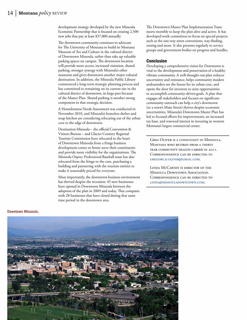
Downtown Missoula.

fAll 2011 | 15
The Three Forks Headwaters Trail Project: imProvinG AcceSSibilit Y throuGh communit Y inPut AnD trAil ASSeSSment
by Meg Traci, Cathy Costakis, Shelly Sutherland, and Kathleen Laurin
All across the nation, and here in Montana, communities are working to create safer, healthier and more economically vibrant places for people to live, work, learn, and play. The desire for “healthy communities” (e.g., Giles, Holmes-Chavez and Collins, 2009) stems from the knowledge that Americans are on an unsustainable course when it comes to our health and well being and that improvements to communities require policy, systems, and environmental changes that will benefit all members of a community. for the 20 percent of Montanans living with disability or functional limitations, this means that community changes result in environments that are accessible, have positive social attitudes and norms, and reflect inclusive policies and services (brooks, 2011). This paper outlines a participatory approach for achieving these outcomes in a rural town through the involvement of the aging and disability communities in community development processes (e.g., traci & Seekins, 2011).
The latest data from the Montana behavioral risk factor Surveillance System (brfSS) show that nearly two thirds of adult Montanans are at an unhealthy weight, with significantly more adult Montanans with disabilities at an unhealthy weight than those without disabilities (71 percent v. 61 percent, respectively). The proportions of adult Montanans engaging in regular, moderate physical activity are nearly one in four Montanans with disabilities (23 percent) and one in two adult Montanans without disabilities (48 percent) (Licitra, traci, Zimmerman & oreskovich, 2011).
At the same time, Montanans are suffering from one of the greatest economic downturns of our time combined with high energy, high food prices, and increasing health care costs. These economic hardships are experienced disproportionately by the same populations experiencing health disparities and may serve to widen health disparities in the near future. for example, persons with disabilities are more likely to go without needed medical care due to cost than persons without disabilities (Licitra et al., 2011). This difference is likely to grow as a result of significantly higher job loss rates among the disabled population (Kaye, 2010).
Communities across the US are also experiencing a loss of community and “sense of place” due to an environment largely built around the needs of the automobile. in many cases, newly developed places
look identical from one community to the next, with big box stores, strip commercial centers, and sprawling residential housing developments. Streets are wide and often unsafe for pedestrians and bicyclists. These patterns can be seen in large and small communities across our state and many others.
in the article titled “Six Man towns” included in this Montana Policy review, the author talks about small towns and the need to capitalize on their unique assets to be successful. That is exactly what Mayor townsend and citizens of the small town of Three forks, Montana have done. two of Three forks’ unique assets are the historic Sacajawea Hotel and the Missouri Headwaters State Park. Another asset is one that Mayor townsend and the City of Three forks have created over the years, the Headwaters trail System.
A history buff himself, Mayor townsend has had a dream to connect the unique historic assets of his town and his community through trails. He also dreams of connecting his community with other communities across the state—again, through trails. The mayor’s first dream came true this year on June 4, National trails Day, when he cut the ribbon and dedicated a 140 foot The historic Sacajawea Hotel,
Three Forks, Montana.

16 | Montana policy review
accessible, bicycle and pedestrian bridge across the Madison river to connect Three forks to the Missouri Headwaters State Park. This paper describes how the mayor is working to realize improved accessibility of the trail to all Three forks community members.
Background of the Projectin early 2008, the Montana Nutrition and Physical Activity Program (Mt NAPA) staff met Mayor townsend and through our conversations became aware of his desire to ensure that the Headwaters trail System is fully accessible and safe for all Montana citizens. Three forks, like many small rural communities across the state, is home to a high percentage of older adults, many with chronic conditions and mobility issues. The project described in this paper was funded through a small grant from Mt NAPA, and in-kind staff support from the Montana Disability and Health program. it built on the capacity of both programs and their partners to support community involvement in public planning processes.
in the fall of 2008, Mt NAPA and the Montana Disability and Health Program (MtDH) collaborated to conduct a series of three group interviews to identify potential barriers to access and use of community trails for older adults and adults with disabilities. information gained from the group interviews was used by the mayor and city council of Three forks to improve their community trail system. in conjunction with the group interviews, a technical assessment of the Headwaters trail was conducted. Prominent themes or suggestions from the interviews were used to pinpoint areas from the technical assessment report that are priorities for improvement, from the perspective of community members. The information from the group interviews was also used to develop promotional materials and campaigns to increase use of the trail among local residents.
ProceduresA total of 20 people from Three forks and the surrounding region (butte, Helena, and bozeman) participated in the interviews. Participants included older adults and adults representing a range of disabilities. other participants were recruited from the broader disability community through the Montana independent Living Project (MiLP), which serves
residents throughout south central Montana. The participants had a wide range of experience with the Headwaters trail. Some had extensive involvement in developing and using the trail system, while others had never visited the trail prior to the interview.
During the interviews, participants were asked to describe their perceptions of physical activity in general, their experiences in using walking trails, and any specific suggestions for improving the Headwaters trail System. The participants voiced many suggestions on how improvements to the trails could enhance their use and overall quality of experience.
Positive Aspects of Physical ActivityParticipants identified positive aspects of physical activity, which include the health benefits of maintaining muscular strength, preventing disease, improving recuperation following illness or surgery, and maintaining an overall sense of health, wellness, and a positive emotional state. other positive aspects include a connection to nature and the natural environment for overall psychological well-being; an opportunity for social interaction with friends and family members; and a sense of independence, societal acceptance of people living with disabilities, and community involvement.
Participants described a wide range of physical activities that they enjoy. walking was mentioned most frequently. other preferred activities include bicycling, swimming, basketball, skiing, horseback riding, gardening, structured activity events (community and group events), playing with children and dogs, and indoor fitness activities.
Factors Limiting Physical ActivityParticipants identified factors that limit their physical activity, which include accessibility issues: difficulty reaching safe activity areas because of heavily trafficked local roadways with narrow and unmaintained shoulders; and impossible or unsafe wheelchair travel because of limited and poorly designed sidewalks, ineffective curb cuts, unmaintained sidewalks, and poor intersection design (particularly for people with visual limitations). They also mentioned a lack of appropriate public transportation (such as paratransit and accessible buses) or limited hours of public transportation to accommodate after-work or weekend recreational outings; lack of parking lots for vans and buses at recreational areas; and lack of accessible parking spots and/or an accessible route from the parking area to the trailhead or venue.
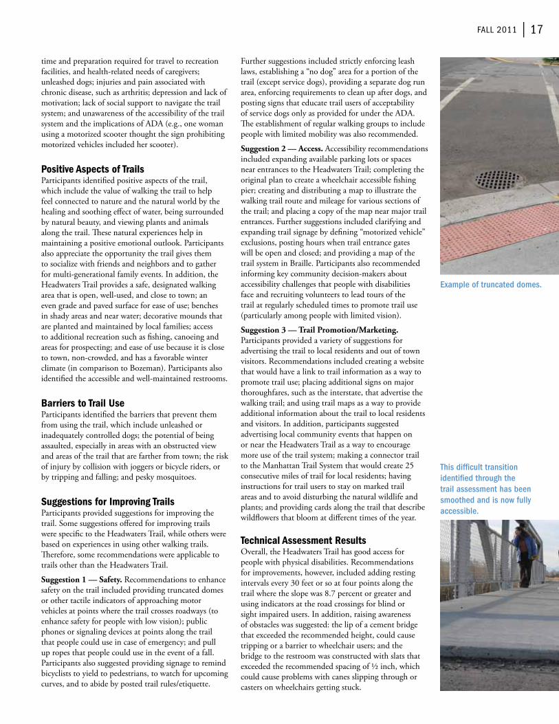
Additional accessibility issues include difficult to negotiate public walkways or trails due to loose, uneven, or rough surface composition; steep slopes; and bridges or boardwalks with wide spacing between boards. inaccessible signage and lack of wheelchair accessible restrooms were also mentioned.
further hindrances include limited time available for physical activity because of inconsistent schedules,
New bike/pedestrian bridge over the Madison and the Headwaters Trail System.
fAll 2011 | 17
time and preparation required for travel to recreation facilities, and health-related needs of caregivers; unleashed dogs; injuries and pain associated with chronic disease, such as arthritis; depression and lack of motivation; lack of social support to navigate the trail system; and unawareness of the accessibility of the trail system and the implications of ADA (e.g., one woman using a motorized scooter thought the sign prohibiting motorized vehicles included her scooter).
Positive Aspects of TrailsParticipants identified positive aspects of the trail, which include the value of walking the trail to help feel connected to nature and the natural world by the healing and soothing effect of water, being surrounded by natural beauty, and viewing plants and animals along the trail. These natural experiences help in maintaining a positive emotional outlook. Participants also appreciate the opportunity the trail gives them to socialize with friends and neighbors and to gather for multi-generational family events. in addition, the Headwaters trail provides a safe, designated walking area that is open, well-used, and close to town; an even grade and paved surface for ease of use; benches in shady areas and near water; decorative mounds that are planted and maintained by local families; access to additional recreation such as fishing, canoeing and areas for prospecting; and ease of use because it is close to town, non-crowded, and has a favorable winter climate (in comparison to bozeman). Participants also identified the accessible and well-maintained restrooms.
Barriers to Trail UseParticipants identified the barriers that prevent them from using the trail, which include unleashed or inadequately controlled dogs; the potential of being assaulted, especially in areas with an obstructed view and areas of the trail that are farther from town; the risk of injury by collision with joggers or bicycle riders, or by tripping and falling; and pesky mosquitoes.
Suggestions for Improving TrailsParticipants provided suggestions for improving the trail. Some suggestions offered for improving trails were specific to the Headwaters trail, while others were based on experiences in using other walking trails. Therefore, some recommendations were applicable to trails other than the Headwaters trail.
Suggestion 1 — Safety. recommendations to enhance safety on the trail included providing truncated domes or other tactile indicators of approaching motor vehicles at points where the trail crosses roadways (to enhance safety for people with low vision); public phones or signaling devices at points along the trail that people could use in case of emergency; and pull up ropes that people could use in the event of a fall. Participants also suggested providing signage to remind bicyclists to yield to pedestrians, to watch for upcoming curves, and to abide by posted trail rules/etiquette.
further suggestions included strictly enforcing leash laws, establishing a “no dog” area for a portion of the trail (except service dogs), providing a separate dog run area, enforcing requirements to clean up after dogs, and posting signs that educate trail users of acceptability of service dogs only as provided for under the ADA. The establishment of regular walking groups to include people with limited mobility was also recommended.
Suggestion 2 — Access. Accessibility recommendations included expanding available parking lots or spaces near entrances to the Headwaters trail; completing the original plan to create a wheelchair accessible fishing pier; creating and distributing a map to illustrate the walking trail route and mileage for various sections of the trail; and placing a copy of the map near major trail entrances. further suggestions included clarifying and expanding trail signage by defining “motorized vehicle” exclusions, posting hours when trail entrance gates will be open and closed; and providing a map of the trail system in braille. Participants also recommended informing key community decision-makers about accessibility challenges that people with disabilities face and recruiting volunteers to lead tours of the trail at regularly scheduled times to promote trail use (particularly among people with limited vision).
Suggestion 3 — Trail Promotion/Marketing. Participants provided a variety of suggestions for advertising the trail to local residents and out of town visitors. recommendations included creating a website that would have a link to trail information as a way to promote trail use; placing additional signs on major thoroughfares, such as the interstate, that advertise the walking trail; and using trail maps as a way to provide additional information about the trail to local residents and visitors. in addition, participants suggested advertising local community events that happen on or near the Headwaters trail as a way to encourage more use of the trail system; making a connector trail to the Manhattan trail System that would create 25 consecutive miles of trail for local residents; having instructions for trail users to stay on marked trail areas and to avoid disturbing the natural wildlife and plants; and providing cards along the trail that describe wildflowers that bloom at different times of the year.
Technical Assessment Resultsoverall, the Headwaters trail has good access for people with physical disabilities. recommendations for improvements, however, included adding resting intervals every 30 feet or so at four points along the trail where the slope was 8.7 percent or greater and using indicators at the road crossings for blind or sight impaired users. in addition, raising awareness of obstacles was suggested: the lip of a cement bridge that exceeded the recommended height, could cause tripping or a barrier to wheelchair users; and the bridge to the restroom was constructed with slats that exceeded the recommended spacing of ½ inch, which could cause problems with canes slipping through or casters on wheelchairs getting stuck.
Example of truncated domes.
This difficult transition identified through the trail assessment has been smoothed and is now fully accessible.
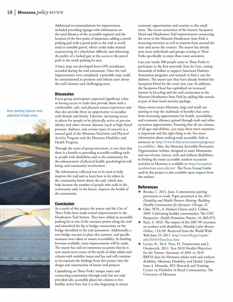
18 | Montana policy review
Additional recommendations for improvement included providing signage with information on the total distance of the accessible segment and the location of the first point of departure; adding a paved parking pad with a paved path to the trail to avoid mud or unstable gravel, which could make manual maneuvering of a wheelchair difficult; and informing the public of a locked gate at the access to the paved path in the south parking lot area.
A basic map was developed from GPS coordinates recorded during the trail assessment. once the trail improvements were completed, a printable map could be commissioned to promote and inform users about the trail’s features and challenging areas.
Discussionfocus group participants expressed significant value in having access to trails that provide them with a comfortable, safe, and pleasant nature experience and that also provide them an opportunity to socialize with friends and family. Likewise, increasing access to places for people to be physically active to prevent obesity and other chronic diseases (such as high blood pressure, diabetes, and certain types of cancers) is a mutual goal of the Montana Nutrition and Physical Activity Program and the Montana Disability and Health Program.
Through the series of group interviews, it was clear that there is a benefit to providing accessible walking trails to people with disabilities and to the community for the enhancement of physical health, psychological well-being, and community involvement.
The information collected was to be used to help improve the trail and to learn how to let others in the community know about the trail, which may help increase the number of people who walk in the community and, in the future, improve the health of the community.
ConclusionAs a result of this project the mayor and the City of Three forks have made several improvements to the Headwaters trail System. They have added an accessible parking lot at one of the entrance points along the trail and smoothed the lip to bridge connections on the bridge identified in the trail assessment. Additionally, a new bridge was put in place this summer, and specific measures were taken to ensure accessibility. As funding becomes available, more improvements will be made. The mayor has said on numerous occasions that he is now much more aware of the needs of older adults and citizens with mobility issues and has and will continue to incorporate the findings from this project into the design and construction of future trail projects.
Capitalizing on Three forks’ unique assets and connecting community through trails has not only provided safe, accessible places for citizens to live healthy active lives, but it is also beginning to attract
economic opportunities and tourism to this small town. The recent restoration of the historic Sacajawea Hotel and Headwaters trail improvements connecting the town to the Missouri Headwaters State Park is attracting attention as well as tourism from around the state and across the country. The mayor has already seen more individuals and groups coming to Three forks specifically to enjoy these town amenities.
Last year nearly 300 people came to Three forks to participate in the first statewide tour de Cure, raising thousands of dollars to support American Diabetes Association programs and research to find a cure for diabetes. The mayor says they have already booked the Sacajawea Hotel for the event next year. in addition, the Sacajawea Hotel has capitalized on increased interest in bicycling and the trail connection to the Missouri Headwaters State Park by adding bike rentals as part of their hotel amenity package.
Many towns across Montana, large and small, are starting to reap the multitude of benefits that come from increasing opportunities for health, accessibility, and economic vibrancy gained through trails and other recreation opportunities. ensuring that all our citizens, of all ages and abilities, can enjoy these town amenities is important and the right thing to do. for more information about making trails accessible, link to resources at: http://www.fs.fed.us/recreation/programs/accessibility/. Also, the Montana Accessible recreation opportunities website, designed to assist Montanans and out-of-state visitors, with and without disabilities, in finding the many accessible outdoor recreation activities in Montana is available at: http://recreation.ruralinstitute.umt.edu/mt/. The focus Group Guide used in this project is also available upon request from the authors.
References❖❖ brooks, C. 2011, June. Communities putting
prevention to work. Paper presented at the 2011 Disability and Health Partners Meeting: Building Healthy Communities for Everyone, Chicago, IL.
❖❖ Giles, w.H., A. Holmes-Chaves and J. Collins. 2009. Cultivating healthy communities: The CDC Perspective. Health Promotion Practice, 10, 86S-87S.
❖❖ Kaye, S. 2010. The impact of the 2007-09 recession on workers with disabilities. Monthly Labor Review Online, 133(10). retrieved from the world wide web June 25, 2011: http://www.bls.gov/opub/mlr/2010/10/art2exc.htm
❖❖ Licitra, r., M.A. traci, H. Zimmerman and J. oreskovich. 2011. Year 2010 Health objectives for the Nation: Summary of 2001 to 2010 brfSS data for Montana adults with and without disability. Montana Disability and Health Update, issue 4. Missoula, Mt: research and training Center on Disability in rural Communities, The University of Montana.
New parking spaces and adjusted bridge entry.

fAll 2011 | 19
❖❖ Montana Department of Public Health and Human Services, Montana behavioral risk factor Surveillance System Prevalence Data. 2009 & 2010. Retrieved from http://74.205.72.25/Data/data_index.php
❖❖ traci, M.A. and t. Seekins. 2011. Using Participatory Action research to Promote Self-Advocacy and Self-Determination of People with Disabilities: Consumer involvement in Shaping Montana State and Local Public Health Policy and Practice. National Gateway to Self-Determination, 1, 27-32.
❖❖ traci, M.A., S. Sutherland, b. Moore, C. Costakis, J. Jurica, K. Laurin, r. troutwine, D. ware, K. borgen, b. Maffit, and S. McNicol. 2009. The Three forks Headwaters trail Project: identifying the possibilities through community input and trail assessment.
The information provided in this publication was supported by Cooperative Agreement Number 5U58DP001484 & Number 5U59DD000287 from the Centers for Disease Control and Prevention (CDC). The contents are solely the responsibility of the authors and do not necessarily represent the official views of CDC.
Meg traci is the Project Director of the Montana Disability and Health Program, research and training Center on Disability in rural Communities at the University of Montana rural institute, Missoula, Mt. Correspondence can be directed to [email protected].
Cathy Costakis is the Active Living Coordinator for the Montana Nutrition and Physical Activity Program at Montana State University, bozeman, Mt. Correspondence can be directed to [email protected].
Shelly Sutherland is a Program evaluation Consultant in Hardin, Mt. Correspondence can be directed to [email protected].
Kathleen Laurin is a Program Director with the University of Montana rural institute. Correspondence can be directed to [email protected].
Bike rentals are now part of Sacajawea Hotel’s amenity packages.

20 | Montana policy review
How To Acquire Quality Parks and Trails For Your Community
by Jacquelyn Corday
i joined the City of Missoula Parks & recreation Department as the open Space Program Manager in 2004 in the midst of the year-long process to draft the first comprehensive Master Parks & recreation Plan (MPP). As a former planner for Missoula office of Planning and Grants, i often felt frustrated by the City and County’s subdivision regulations that did not adequately define standards for parkland dedication or how cash-in-lieu should be determined. As a result, developers often proposed dedication land for their parkland that included steep ravines, detention ponds, or small pocket parks surrounded by backyards. Dedications such as these represent a lost opportunity to provide citizens with parkland that functions for places of play and social interaction. functional parks are more important than ever considering the obesity epidemic among other health problems. See for example: Solving the Problem of Childhood obesity: increasing Physical Activity: Community recreation venues: Parks and Playgrounds from the white House task force on Childhood obesity (2010)1 and also Parks, Playgrounds, and Active Living from Active Living research (february, 2010).2
This article provides a case study of how the City of Missoula examined their regulatory framework and community planning strategies to facilitate the acquisition of better quality/functional parks and trails.
1 white House task force on Childhood obesity, http://www.letsmove.gov/white-house-task-force-childhood-obesity-report-president
2 Active Living research, www.activelivingresearch.org
Adopt a Master Parks Plan (MPP)The adoption of the MPP was a critical and necessary step that provided the foundation for amending and improving City ordinances related to parks and trails in addition to providing the documented support for numerous future park and trail projects. The planning boundaries for the MPP included the entire city and the surrounding semi-urban area (an approximately 3 mile donut area), thus the plan needed to be adopted by both the City Council and County Commissioners as an amendment to the Growth Policy. The City/County partnership was and is an important part of planning and preserving opportunities for future parks as the city grows outward.
This link takes you to the page with the pdf links to the MPP for the City of Missoula. 3 The main elements of the MPP are:• Comprehensive parkland inventory & recreation
survey to determine citizens’ needs; this plan provides a baseline inventory of parks & services and a blueprint for what the community desires for the future.
• Maps that show the level of parkland service for each neighborhood (acres of developed parkland/per 1000 people) and recommended locations for future parks based upon current and projected population data. (see Map on pg. 21)
• Standards for dedication of neighborhood parks — these standards were later incorporated into the subdivision regulations.
• Goals, Policies, and implementation Actions that aim to increase the quality and quantity of urban parks and trails.
• example Goal: “Provide 2.5 acres of Neighborhood Parks and 4.5 acres of Community Parks for every 1,000 residents.” “Neighborhood Parks” are defined as parks that are about 2-5 acres in size intended to serve residents in the surrounding neighborhood– generally within a 1/2 mile radius. Community parks are larger multi-purpose parks that serve the entire community.
for smaller towns that may not have the resources to hire a consultant to help draft a MPP, there are now two other Montana cities that have adopted MPPs that can serve as good templates:
3 City of Missoula, http://www.ci.missoula.mt.us/index.aspx?nid=174
Missoula’s Lafray Park Grand Opening.

fAll 2011 | 21
• bozeman http://www.bozeman.net/Departments-%281%29/Park--rec-Cemetery/Parks/Home
• Kalispell http://www.kalispell.com/parks_and_recreation/parks.php
An important element of preparing a MPP is conducting a survey of residents to determine their current and desired recreational needs. The University of Montana bureau of business and economic research is a great resource that can perform this type of service.4
Review and Revise Your Subdivision RegulationsAfter adoption of the MPP, i began working on amending the city’s subdivision regulations in order to improve the quantity and quality of parkland dedication. There were two fundamental changes that i believe could have universal application for cities and counties in Montana.
Require an Appraisal for Cash-in-lieu DeterminationMontana state law, MCA 76-3-621, allows developers to offer to pay cash instead of dedicating land (the governing body makes the final decision). for example, if the 11 percent land dedication for a hypothetical subdivision equals .60 acres, the developer may pay the local government the value of the .60 acres instead of dedicating it in fee title. because many development projects in or near the city involve small acreage parcels, cash-in-lieu of parkland dedication is often preferred when the 11 percent dedication equals less than 1 acre because small pocket parks generally are more expensive to maintain on a per acre basis and their size limits their utility for recreation. MCA 76-3 621(10) (a) does not set forth a required method for determining “fair market value of the unsubdivided, unimproved land” for cash-in-lieu purposes.
for many years, cash-in-lieu for both City of Missoula and Missoula County subdivisions was determined by the Montana Department of revenue (Dor). when a developer gave the office of Planning & Grants (oPG) notice that they were ready to record their final plat, oPG would submit a request to the Dor to give an estimate of value. Unfortunately, the Dor would base that value on how the land was currently classified for tax purposes, which was often agriculture land. So, for example, while developers were paying around $80-100,000/acre for land that would be annexed into the city and rezoned for 4-6 dwelling units/acre, the Dor would come up with a value of around $10-20,000/acre. Thus, the City was often receiving less than 1/4 of the fair market value to base the cash-in-lieu determination upon. Not only was this unfair to citizens, it was contrary to state law that requires “fair market value.”
in order to change this situation, i began researching
4 bureau of business and economic research, University of Montana, http://www.bber.umt.edu
how other cities in Montana determined land value for cash-in-lieu purposes. Some had the same procedure as Missoula, but others had adopted a requirement in their subdivision regulations that developers must submit a current land appraisal (e.g. bozeman, Gallatin, Lewis & Clark, and flathead Counties). based upon those examples and my own experience in working with appraisers, i drafted a proposed regulation and took it through the long public process of adoption. Ultimately, both the County and the City adopted the following:
Cash donation in-lieu of land dedication shall be equal to the fair market value of the amount of land that would have been statutorily required to be dedicated. For the purpose of these regulations, the fair market value is the value of the unsubdivided, unimproved land based upon the zoning designation that will apply to the proposed subdivision (i.e. the existing zoning, if the subdivision application is not accompanied by a rezoning request or the new proposed zoning if the subdivision application is accompanied by a rezoning request). Fair market value must be determined by a Montana State certified general real estate appraiser (as provided under MCA 37-54-201 et seq) hired and paid for by the subdivider. For purposes of this Regulation, appraisals are valid if prepared within six (6) months of the date of the submittal of an application to the Office of Planning and Grants for final plat approval.
The Master Parks and Recreation Plan for the greater Missoula area.
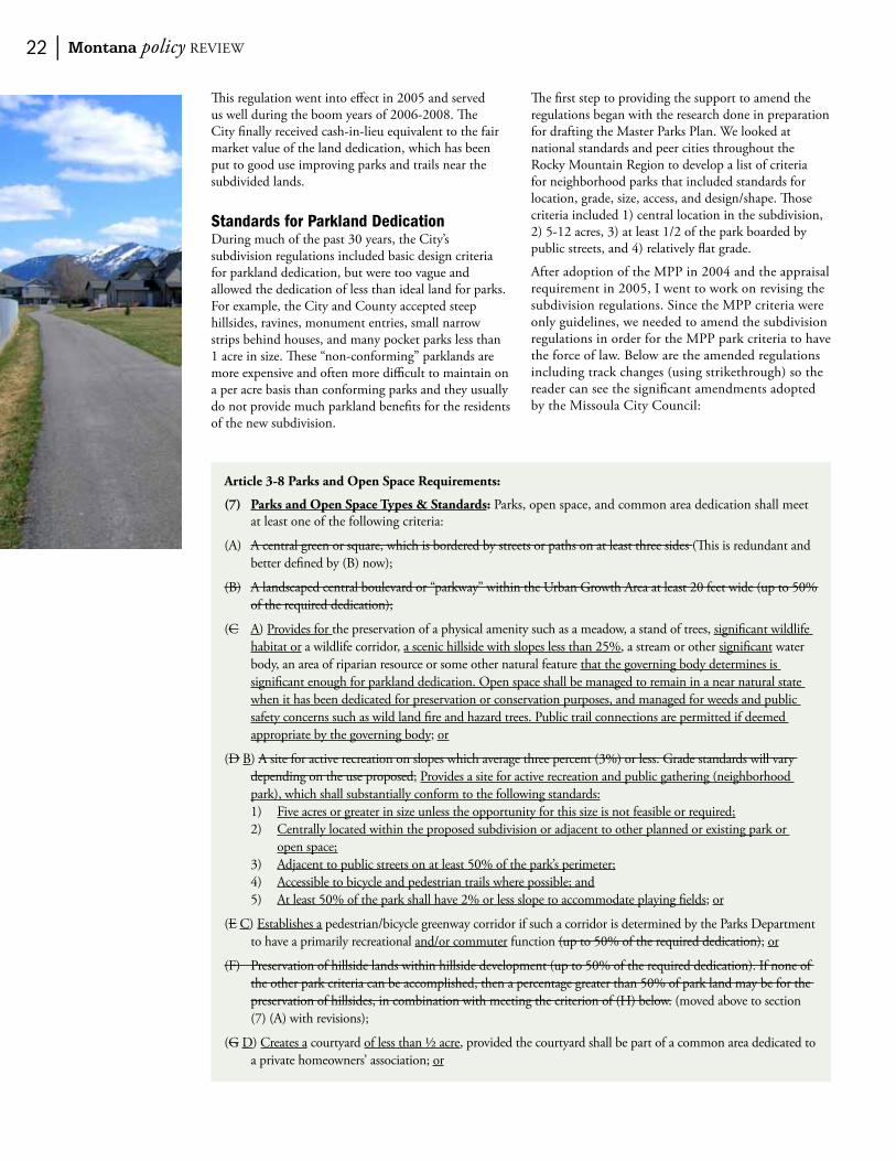
22 | Montana policy review
This regulation went into effect in 2005 and served us well during the boom years of 2006-2008. The City finally received cash-in-lieu equivalent to the fair market value of the land dedication, which has been put to good use improving parks and trails near the subdivided lands.
Standards for Parkland DedicationDuring much of the past 30 years, the City’s subdivision regulations included basic design criteria for parkland dedication, but were too vague and allowed the dedication of less than ideal land for parks. for example, the City and County accepted steep hillsides, ravines, monument entries, small narrow strips behind houses, and many pocket parks less than 1 acre in size. These “non-conforming” parklands are more expensive and often more difficult to maintain on a per acre basis than conforming parks and they usually do not provide much parkland benefits for the residents of the new subdivision.
The first step to providing the support to amend the regulations began with the research done in preparation for drafting the Master Parks Plan. we looked at national standards and peer cities throughout the rocky Mountain region to develop a list of criteria for neighborhood parks that included standards for location, grade, size, access, and design/shape. Those criteria included 1) central location in the subdivision, 2) 5-12 acres, 3) at least 1/2 of the park boarded by public streets, and 4) relatively flat grade.
After adoption of the MPP in 2004 and the appraisal requirement in 2005, i went to work on revising the subdivision regulations. Since the MPP criteria were only guidelines, we needed to amend the subdivision regulations in order for the MPP park criteria to have the force of law. below are the amended regulations including track changes (using strikethrough) so the reader can see the significant amendments adopted by the Missoula City Council:
Article 3-8 Parks and Open Space Requirements:
(7) Parks and Open Space Types & Standards: Parks, open space, and common area dedication shall meet at least one of the following criteria:
(A) A central green or square, which is bordered by streets or paths on at least three sides (This is redundant and better defined by (b) now);
(b) A landscaped central boulevard or “parkway” within the Urban Growth Area at least 20 feet wide (up to 50% of the required dedication);
(C A) Provides for the preservation of a physical amenity such as a meadow, a stand of trees, significant wildlife habitat or a wildlife corridor, a scenic hillside with slopes less than 25%, a stream or other significant water body, an area of riparian resource or some other natural feature that the governing body determines is significant enough for parkland dedication. open space shall be managed to remain in a near natural state when it has been dedicated for preservation or conservation purposes, and managed for weeds and public safety concerns such as wild land fire and hazard trees. Public trail connections are permitted if deemed appropriate by the governing body; or
(D b) A site for active recreation on slopes which average three percent (3%) or less. Grade standards will vary depending on the use proposed; Provides a site for active recreation and public gathering (neighborhood park), which shall substantially conform to the following standards:1) five acres or greater in size unless the opportunity for this size is not feasible or required;2) Centrally located within the proposed subdivision or adjacent to other planned or existing park or
open space;3) Adjacent to public streets on at least 50% of the park’s perimeter;4) Accessible to bicycle and pedestrian trails where possible; and5) At least 50% of the park shall have 2% or less slope to accommodate playing fields; or
(e C) establishes a pedestrian/bicycle greenway corridor if such a corridor is determined by the Parks Department to have a primarily recreational and/or commuter function (up to 50% of the required dedication); or
(f) Preservation of hillside lands within hillside development (up to 50% of the required dedication). if none of the other park criteria can be accomplished, then a percentage greater than 50% of park land may be for the preservation of hillsides, in combination with meeting the criterion of (H) below. (moved above to section (7) (A) with revisions);
(G D) Creates a courtyard of less than ½ acre, provided the courtyard shall be part of a common area dedicated to a private homeowners’ association; or
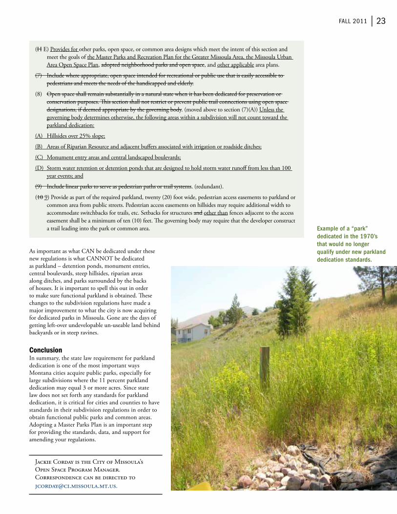
fAll 2011 | 23
(H e) Provides for other parks, open space, or common area designs which meet the intent of this section and meet the goals of the Master Parks and recreation Plan for the Greater Missoula Area, the Missoula Urban Area open Space Plan, adopted neighborhood parks and open space, and other applicable area plans.
(7) include where appropriate, open space intended for recreational or public use that is easily accessible to pedestrians and meets the needs of the handicapped and elderly.
(8) open space shall remain substantially in a natural state when it has been dedicated for preservation or conservation purposes. This section shall not restrict or prevent public trail connections using open space designations, if deemed appropriate by the governing body. (moved above to section (7)(A)) Unless the governing body determines otherwise, the following areas within a subdivision will not count toward the parkland dedication:
(A) Hillsides over 25% slope;
(b) Areas of riparian resource and adjacent buffers associated with irrigation or roadside ditches;
(C) Monument entry areas and central landscaped boulevards;
(D) Storm water retention or detention ponds that are designed to hold storm water runoff from less than 100 year events; and
(9) include linear parks to serve as pedestrian paths or trail systems. (redundant).
(10 9) Provide as part of the required parkland, twenty (20) foot wide, pedestrian access easements to parkland or common area from public streets. Pedestrian access easements on hillsides may require additional width to accommodate switchbacks for trails, etc. Setbacks for structures and other than fences adjacent to the access easement shall be a minimum of ten (10) feet. The governing body may require that the developer construct a trail leading into the park or common area.
As important as what CAN be dedicated under these new regulations is what CANNot be dedicated as parkland – detention ponds, monument entries, central boulevards, steep hillsides, riparian areas along ditches, and parks surrounded by the backs of houses. it is important to spell this out in order to make sure functional parkland is obtained. These changes to the subdivision regulations have made a major improvement to what the city is now acquiring for dedicated parks in Missoula. Gone are the days of getting left-over undevelopable un-useable land behind backyards or in steep ravines.
Conclusionin summary, the state law requirement for parkland dedication is one of the most important ways Montana cities acquire public parks, especially for large subdivisions where the 11 percent parkland dedication may equal 3 or more acres. Since state law does not set forth any standards for parkland dedication, it is critical for cities and counties to have standards in their subdivision regulations in order to obtain functional public parks and common areas. Adopting a Master Parks Plan is an important step for providing the standards, data, and support for amending your regulations.
Jackie Corday is the City of Missoula’s open Space Program Manager. Correspondence can be directed to [email protected].
Example of a “park” dedicated in the 1970’s that would no longer qualify under new parkland dedication standards.
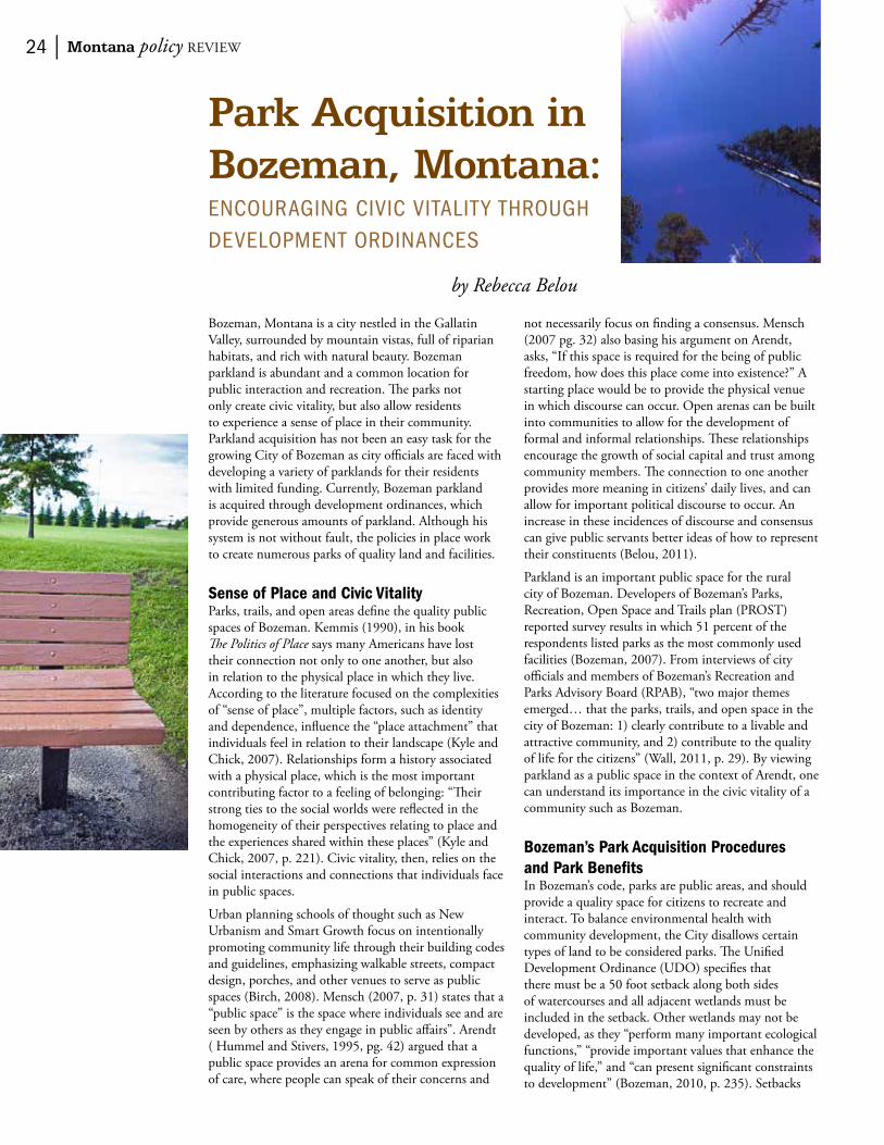
24 | Montana policy review
Park Acquisition in Bozeman, Montana:
encourAGinG civic vitAlit Y throuGh DeveloPment orDinAnceS
by Rebecca Belou
bozeman, Montana is a city nestled in the Gallatin valley, surrounded by mountain vistas, full of riparian habitats, and rich with natural beauty. bozeman parkland is abundant and a common location for public interaction and recreation. The parks not only create civic vitality, but also allow residents to experience a sense of place in their community. Parkland acquisition has not been an easy task for the growing City of bozeman as city officials are faced with developing a variety of parklands for their residents with limited funding. Currently, bozeman parkland is acquired through development ordinances, which provide generous amounts of parkland. Although his system is not without fault, the policies in place work to create numerous parks of quality land and facilities.
Sense of Place and Civic VitalityParks, trails, and open areas define the quality public spaces of bozeman. Kemmis (1990), in his book The Politics of Place says many Americans have lost their connection not only to one another, but also in relation to the physical place in which they live. According to the literature focused on the complexities of “sense of place”, multiple factors, such as identity and dependence, influence the “place attachment” that individuals feel in relation to their landscape (Kyle and Chick, 2007). relationships form a history associated with a physical place, which is the most important contributing factor to a feeling of belonging: “Their strong ties to the social worlds were reflected in the homogeneity of their perspectives relating to place and the experiences shared within these places” (Kyle and Chick, 2007, p. 221). Civic vitality, then, relies on the social interactions and connections that individuals face in public spaces.
Urban planning schools of thought such as New Urbanism and Smart Growth focus on intentionally promoting community life through their building codes and guidelines, emphasizing walkable streets, compact design, porches, and other venues to serve as public spaces (birch, 2008). Mensch (2007, p. 31) states that a “public space” is the space where individuals see and are seen by others as they engage in public affairs”. Arendt ( Hummel and Stivers, 1995, pg. 42) argued that a public space provides an arena for common expression of care, where people can speak of their concerns and
not necessarily focus on finding a consensus. Mensch (2007 pg. 32) also basing his argument on Arendt, asks, “if this space is required for the being of public freedom, how does this place come into existence?” A starting place would be to provide the physical venue in which discourse can occur. open arenas can be built into communities to allow for the development of formal and informal relationships. These relationships encourage the growth of social capital and trust among community members. The connection to one another provides more meaning in citizens’ daily lives, and can allow for important political discourse to occur. An increase in these incidences of discourse and consensus can give public servants better ideas of how to represent their constituents (belou, 2011).
Parkland is an important public space for the rural city of bozeman. Developers of bozeman’s Parks, recreation, open Space and trails plan (ProSt) reported survey results in which 51 percent of the respondents listed parks as the most commonly used facilities (bozeman, 2007). from interviews of city officials and members of bozeman’s recreation and Parks Advisory board (rPAb), “two major themes emerged… that the parks, trails, and open space in the city of bozeman: 1) clearly contribute to a livable and attractive community, and 2) contribute to the quality of life for the citizens” (wall, 2011, p. 29). by viewing parkland as a public space in the context of Arendt, one can understand its importance in the civic vitality of a community such as bozeman.
Bozeman’s Park Acquisition Procedures and Park Benefitsin bozeman’s code, parks are public areas, and should provide a quality space for citizens to recreate and interact. to balance environmental health with community development, the City disallows certain types of land to be considered parks. The Unified Development ordinance (UDo) specifies that there must be a 50 foot setback along both sides of watercourses and all adjacent wetlands must be included in the setback. other wetlands may not be developed, as they “perform many important ecological functions,” “provide important values that enhance the quality of life,” and “can present significant constraints to development” (bozeman, 2010, p. 235). Setbacks

fAll 2011 | 25
and wetlands are no longer allowed to be included in the area set aside for park development in subdivisions, enhancing the quality and usability of the parkland itself while providing ecological preservation to the important riparian habitats.
because the Parks, recreation, and Cemetery Department of bozeman has limited funding to acquire its own land, other methods of park creation and development have been explored. The main way in which new parks in bozeman are now created, is through the policies of subdivision development. As of 2000, bozeman’s UDo and ProSt plan require all new subdivision developments to set aside 0.03 acres per lot of dedicated community parkland in each phase of development. These areas are designated public space, with a required 100 percent street frontage for parking convenience and visible access, making the park obviously open and freely available to the community to enjoy (bozeman, 2007; bozeman, 2010). Public parks add value to private land, providing an incentive for developers to embrace the UDo and ProSt plans.
Currently, bozeman has over 750 acres of parkland, ranging from open space to sports facilities (wall, 2011). The parkland comes in a variety of sizes, habitats, and recreational opportunities, which are all important to the quality of life of bozeman citizens. bozeman is a city full of outdoors enthusiasts, and parks act as a venue for a public outdoor space. whether the park is an active or passive park, it can offer the opportunity for peace of mind (r. Pertzborn, personal communication, May 13, 2011). At any size, a park is beneficial to the community; small parks are a good gathering place for smaller communities while large parks provide a venue for the greater community.
As stated in the ProSt plan, bozeman’s vision is to see “an active community with parks, recreation facilities and programs, trails, and open spaces that are ample in quantity and outstanding in quality to meet the needs of all our citizens” (bozeman, 2007, p. 12). Different citizens, however, have different needs. The variety of parks in bozeman created by the ProSt and UDo afford citizens the opportunity to recreate in whichever fashion they choose. The number and variety of parks in and around the city enhance the active lifestyle of bozeman citizens.
A Critique of Policy and Recommendations: The Case of Miller Parkbozeman already has a progressive parkland acquisition policy in place, but it is not without faults. So what is the problem? There is the lack of fields for soccer games. There is the plan to create Miller Park, as discussed later, in which the creation of interim parks has developed. There is the lack of funds for the city to buy and protect parkland.
The City of bozeman is facing a supply and demand problem, falling behind in need for large parks to serve as venues for sporting events and tournaments. Large
parks are easy for the city to maintain although difficult to aggregate. instead of one big park, bozeman’s ordinances have been helpful in creating many small parks or large parks incorporating waterways and forested areas. There is a lack of flat, green parkland that can be utilized for organized sports. Availability of such land could provide revenue and an economic boost to the City of bozeman, if the city was allowed to host sporting events and festivals in these venues.
A case example of an issue with the UDo and ProSt plans is the proposed Miller Park– a large, multi-use park off 19th Avenue. bozeman’s rPAb summarized the issue in their meeting minutes:
Meadow Creek Subdivision has been dissolved and now is in the foreclosure process; new ownership passing to four independent groups. Phase one is proceeding under its new ownership with their parkland dedication requirement having been met. The Planning Department will meet with the new ownership of the other three parcels to try to resolve parkland issues. The main park, Miller Park, was essential to the overall park plan, but now resides in the parcel with the smallest parkland requirement. it is essential that none of the three remaining owner groups proceed in developing under the original plan without the development of Miller Park. (bozeman recreation and Parks Advisory board [rPAb], 2011, p. 1).
The rPAb would like to see the bank and the developers work together to keep the original plan for the large Miller Park, which now includes setting aside a few residential lots as “interim parks” with playground equipment that can be relocated to Miller Park in the future when these lots are converted to
Site map detailing Phase 1 and 2 of Meadow Creek Subdivision.

26 | Montana policy review
residential properties. one of the challenges is making sure that people who buy lots adjacent to “temporary” parks are informed at the time of purchase that those parks are not permanent.
As of february 10, 2011, the bozeman rPAb supported the request, believing it will buy time to work out a deal on Miller Park: “However the committee sees the interim park concept as a good faith effort from the developers to recognize their future dedication obligation and is not too concerned about the details of a park everyone hopes will never be built” (rPAb, 2011, p. 2). if the City of bozeman wants to be able to regulate the type of parks built, however, they must specify it in their codes – they should think of their ideal park first, and build policy around it. if they tell developers they want a certain percentage of parkland to be a “flat, green space” for sports fields, the developers will have to comply (r. Pertzborn, personal communication, May 13, 2011). in any case, bozeman residents are fortunate to have the open space and recreational facilities they do, and have the City of bozeman to thank for their current UDo and ProSt plans.
Although codes allow for abundant parkland to be acquired, the City does not have the budget to purchase lots for city parks. The recreation and Parks Advisory board does not often accept in-lieu fees, as appraisals of land can be biased for the developer – even though in-lieu fees would provide the ability for the Parks, recreation, and Cemetery Department to purchase plots of land to become parks (r. Dingman, personal communication, May 13, 2011). even with the Gallatin County open Space bonds, passed in 2000 and 2004 to preserve open space in Gallatin County by purchasing land and conservation easements for recreation and preservation, the county is reluctant to disburse the money for parkland. often, the open Space bond money is used for conservation easements which remain private lands even after conserved. in these cases, public money is used for things not useable by the public.
bozeman officials and board members have begun discussing the idea that parks should be considered infrastructure in planning. As they are an integral part of the civic vitality and the sense of place that citizens experience, parks are an amenity that cannot be denied. The problem with the lack of sports fields is not easily solved if the Parks, recreation, and Cemetery Department of bozeman are unable to find and purchase the land themselves. A ballot referendum or applying for grant funds could be other ways to finance park acquisition.
overall, bozeman has a great policy in place that creates much valuable and diverse parkland throughout the city. The accessibility of public space is vital for the community to maintain a healthy and quality lifestyle. Although the City may not be getting the exact parks it wants from its ordinances, it is getting plenty of quality parkland. The developers and the City of bozeman can find common ground through looking at the big
picture and realizing that through their policies, parks already are infrastructure and an important part of the built environment. The parks allow for citizens to develop social capital and gain trust among their community, as well as provide locations for recreation, leisure, and physical activity. Although bozeman’s policies are not without fault, the number and variety of parks serve to meet the definitions in the City of bozeman’s vision statement and enhance the citizens’ quality of life.
References❖❖ belou, r. M. 2011. Trails and social capital:
public space in a rural environment. Unpublished manuscript. Department of Political Science. Montana State University, bozeman, Montana.
❖❖ bozeman, City of. 2007. Parks, Recreation, Open Space and Trails Plan. City of bozeman, Montana.
❖❖ bozeman, City of. 2010. Unified Development Ordinance. City of bozeman, Montana
❖❖ bozeman recreation & Parks Advisory board. 1/14/2011. Minutes of the recreation & Parks Advisory board. City of bozeman, Montana
❖❖ bozeman recreation & Parks Advisory board. 2/10/2011. Minutes of the Recreation & Parks Advisory Board. City of bozeman, Montana
❖❖ Centers for Disease Control and Prevention. 2011. National diabetes surveillance system. retrieved from http://apps.nccd.cdc.gov/DDtStrS/default.aspx.
❖❖ Hummel, r. P. and C. Stivers. 1995. Government isn’t us: the possibility of democratic knowledge in representative government. in: C. King & C. Stivers (eds.), Government is us: public administration in an anti-government era (pp. 28-48). Thousand oaks, CA: Sage.
❖❖ Kemmis, D. 1990. Community and the politics of place. Norman, oklahoma: University of oklahoma Press.
❖❖ Kyle, G.and G. Chick. 2007. The social construction of a sense of place. Leisure Sciences, 29(3), 209-225.
❖❖ Mensch, J. 2007. Public space. Continental Philosophy Review, 40(1), 31-47.
❖❖ wall, r. P. 2011. A study of a special district for park maintenance in Bozeman, Montana. Unpublished manuscript. Department of Political Science. Montana State University, bozeman, Montana.
rebecca belou is a graduate student at Montana State University, working to finish her Master’s of Public Administration degree in the spring of 2012. Correspondence can be directed to [email protected].
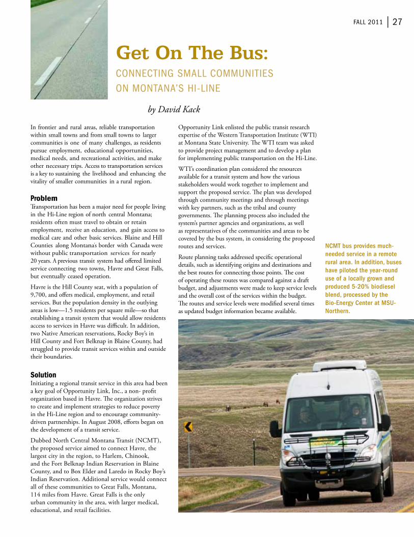
fAll 2011 | 27
Get On The Bus:
connectinG SmAll communitieS on montAnA’S hi-line
by David Kack
in frontier and rural areas, reliable transportation within small towns and from small towns to larger communities is one of many challenges, as residents pursue employment, educational opportunities, medical needs, and recreational activities, and make other necessary trips. Access to transportation services is a key to sustaining the livelihood and enhancing the vitality of smaller communities in a rural region.
Problemtransportation has been a major need for people living in the Hi-Line region of north central Montana; residents often must travel to obtain or retain employment, receive an education, and gain access to medical care and other basic services. blaine and Hill Counties along Montana’s border with Canada were without public transportation services for nearly 20 years. A previous transit system had offered limited service connecting two towns, Havre and Great falls, but eventually ceased operation.
Havre is the Hill County seat, with a population of 9,700, and offers medical, employment, and retail services. but the population density in the outlying areas is low—1.5 residents per square mile—so that establishing a transit system that would allow residents access to services in Havre was difficult. in addition, two Native American reservations, rocky boy’s in Hill County and fort belknap in blaine County, had struggled to provide transit services within and outside their boundaries.
Solutioninitiating a regional transit service in this area had been a key goal of opportunity Link, inc., a non- profit organization based in Havre. The organization strives to create and implement strategies to reduce poverty in the Hi-Line region and to encourage community-driven partnerships. in August 2008, efforts began on the development of a transit service.
Dubbed North Central Montana transit (NCMt), the proposed service aimed to connect Havre, the largest city in the region, to Harlem, Chinook, and the fort belknap indian reservation in blaine County, and to box elder and Laredo in rocky boy’s indian reservation. Additional service would connect all of these communities to Great falls, Montana, 114 miles from Havre. Great falls is the only urban community in the area, with larger medical, educational, and retail facilities.
opportunity Link enlisted the public transit research expertise of the western transportation institute (wti) at Montana State University. The wti team was asked to provide project management and to develop a plan for implementing public transportation on the Hi-Line.
wti’s coordination plan considered the resources available for a transit system and how the various stakeholders would work together to implement and support the proposed service. The plan was developed through community meetings and through meetings with key partners, such as the tribal and county governments. The planning process also included the system’s partner agencies and organizations, as well as representatives of the communities and areas to be covered by the bus system, in considering the proposed routes and services.
route planning tasks addressed specific operational details, such as identifying origins and destinations and the best routes for connecting those points. The cost of operating these routes was compared against a draft budget, and adjustments were made to keep service levels and the overall cost of the services within the budget. The routes and service levels were modified several times as updated budget information became available.
NCMT bus provides much-needed service in a remote rural area. In addition, buses have piloted the year-round use of a locally grown and produced 5-20% biodiesel blend, processed by the Bio-Energy Center at MSU-Northern.
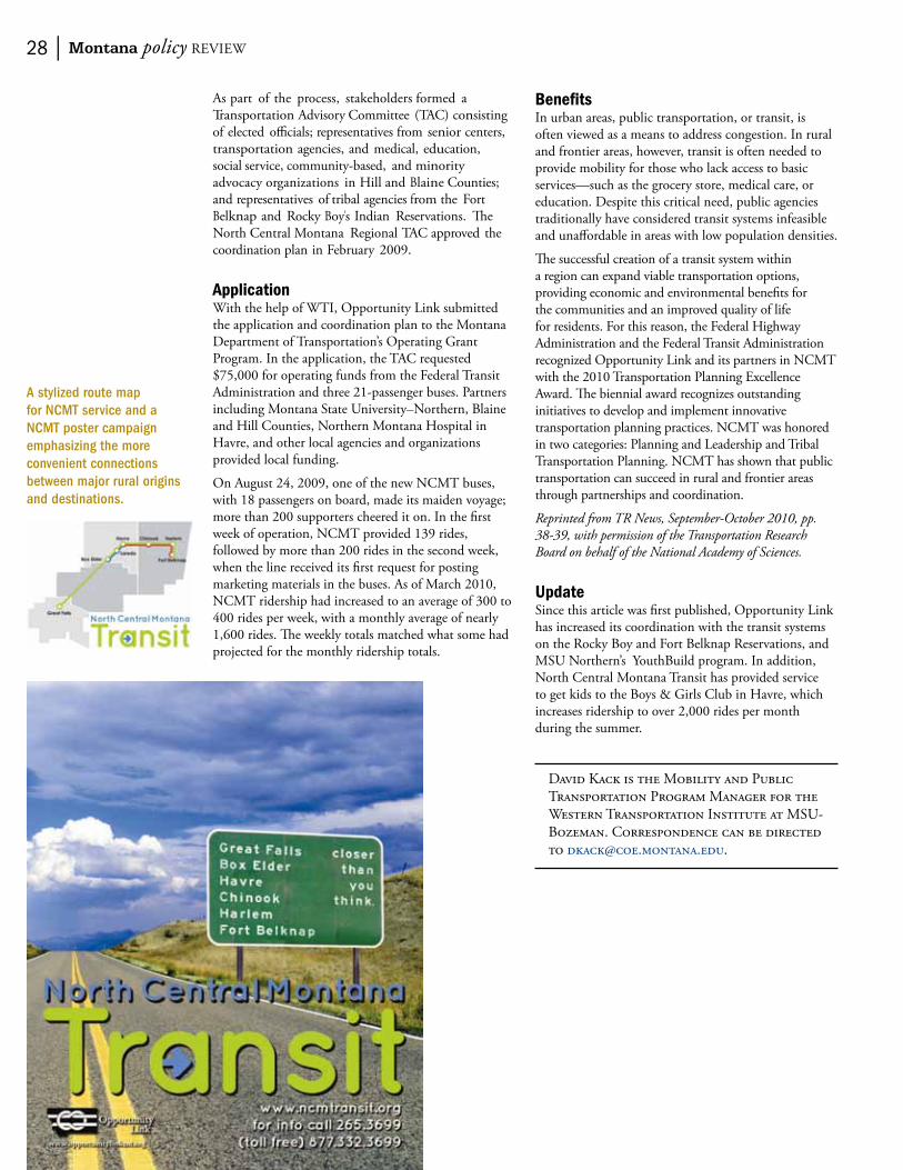
28 | Montana policy review
Benefitsin urban areas, public transportation, or transit, is often viewed as a means to address congestion. in rural and frontier areas, however, transit is often needed to provide mobility for those who lack access to basic services—such as the grocery store, medical care, or education. Despite this critical need, public agencies traditionally have considered transit systems infeasible and unaffordable in areas with low population densities.
The successful creation of a transit system within a region can expand viable transportation options, providing economic and environmental benefits for the communities and an improved quality of life for residents. for this reason, the federal Highway Administration and the federal transit Administration recognized opportunity Link and its partners in NCMt with the 2010 transportation Planning excellence Award. The biennial award recognizes outstanding initiatives to develop and implement innovative transportation planning practices. NCMt was honored in two categories: Planning and Leadership and tribal transportation Planning. NCMt has shown that public transportation can succeed in rural and frontier areas through partnerships and coordination.
Reprinted from TR News, September-October 2010, pp. 38-39, with permission of the Transportation Research Board on behalf of the National Academy of Sciences.
UpdateSince this article was first published, opportunity Link has increased its coordination with the transit systems on the rocky boy and fort belknap reservations, and MSU Northern’s Youthbuild program. in addition, North Central Montana transit has provided service to get kids to the boys & Girls Club in Havre, which increases ridership to over 2,000 rides per month during the summer.
David Kack is the Mobility and Public transportation Program Manager for the western transportation institute at MSU-bozeman. Correspondence can be directed to [email protected].
As part of the process, stakeholders formed a transportation Advisory Committee (tAC) consisting of elected officials; representatives from senior centers, transportation agencies, and medical, education, social service, community-based, and minority advocacy organizations in Hill and blaine Counties; and representatives of tribal agencies from the fort belknap and rocky boy’s indian reservations. The North Central Montana regional tAC approved the coordination plan in february 2009.
Applicationwith the help of wti, opportunity Link submitted the application and coordination plan to the Montana Department of transportation’s operating Grant Program. in the application, the tAC requested $75,000 for operating funds from the federal transit Administration and three 21-passenger buses. Partners including Montana State University–Northern, blaine and Hill Counties, Northern Montana Hospital in Havre, and other local agencies and organizations provided local funding.
on August 24, 2009, one of the new NCMt buses, with 18 passengers on board, made its maiden voyage; more than 200 supporters cheered it on. in the first week of operation, NCMt provided 139 rides, followed by more than 200 rides in the second week, when the line received its first request for posting marketing materials in the buses. As of March 2010, NCMt ridership had increased to an average of 300 to 400 rides per week, with a monthly average of nearly 1,600 rides. The weekly totals matched what some had projected for the monthly ridership totals.
A stylized route map for NCMT service and a NCMT poster campaign emphasizing the more convenient connections between major rural origins and destinations.

fAll 2011 | 29
Improving Quality of Life by Providing Transportation Options
by Lewis Kelley
Active transportation (trips made by walking, bicycling, or any other non-motorized mode) plays a unique and critical role in any transportation system, yet has remained an afterthought in many American communities’ planning processes. over the past fifteen years, however, Missoula has consistently supported and invested in the development of a well-connected active transportation system consisting of sidewalks, bike lanes, trails and traffic-calming devices designed to facilitate active transportation and ensure the safety of pedestrians and bicyclists alike.
Missoula residents envision a community where citizens can safely and conveniently reach any destination using active transportation. The Missoula Metropolitan Planning organization (MPo) recently completed a rewrite of non-motorized transportation planning policy, the 2011 Missoula Active Transportation Plan (MATP). This plan sets forth a vision for completing and improving Missoula’s active transportation network through the implementation of best practices in active transportation policy, design and outreach and educational programs. Through the implementation of the policies and designs and programs set forth in the plan, Missoula will reap the benefits of a strengthened local economy, healthier citizens, safer streets, and a more equitable, accessible community (Litman, 2011).
History of Active Transportation Success in MissoulaMissoula has made a commitment to invest in an active transportation network through policies and prioritization of funding. Active transportation infrastructure provides citizens with multiple choices to access their desired destination, and improves the overall quality of life for Missoula citizens. transportation choice reduces the number of vehicles that the roadway network must accommodate, thus reducing the costs associated with maintaining and expanding a road network. The trail network has grown from less than 15 miles in 1994 to over 45 miles in 2010, and the citywide network of bicycle lanes and routes whose installation began in 2001 is being continuously expanded.
in 2009, the City of Missoula adopted a Complete Streets resolution to ensure that all modes of transportation are duly considered and integrated during the planning and design stages of street
construction. The National Complete Streets Coalition recently recognized the Missoula policy as a model for other communities to follow. Since adopting the resolution, the City has employed innovative design best practices to implement the complete streets principles. for example, the recently completed North Higgins Streetscape integrates a raised cycle track (a physically separated path for the exclusive use of bicycles buffered from traffic by on-street parking) along a three-block section through downtown. Cycle tracks, intersection curb extensions, and other facilities provide more space for pedestrian and cyclists, thus increasing comfort level, visibility, and safety for those users. This innovative approach continues to be applied in new projects with the addition of cycle tracks along a heavily trafficked portion of road leading to The University of Montana that will be finished before the start of the 2011-2012 academic year.
The approach of combining policy and infrastructure investment has proven successful in increasing the number of people who choose to bicycle, walk, or take transit. Missoula has the sixth highest per capita percentage of people who commute by bicycle in the nation, at 8.8 percent (American Communities Survey, 2009), and has been designated a silver level bicycle friendly Community by the League of American bicyclists. transit has seen an equally impressive rise in use as Mountain Line, Missoula’s transit service, has set ridership records throughout 2010 and 2011 and is on track to surpass a million annual riders per year in the near future. integration of active transportation and transit is helpful in extending the utility of both modes and giving people more options for completing their trips.
Community Goals for TransportationMissoula citizens demonstrated a clear preference for a “focus inward” scenario for future growth during the Envision Missoula public process undertaken in 2008. The Envision Missoula study was the culmination of an extensive public involvement process that began in 2007. Public involvement included multiple visioning workshops in which the people were asked to develop potential land use and transportation scenarios that looked far enough into the future to consider the effects of a doubling of the valley’s population.
The “focus inward” scenario preserves rural character beyond Missoula’s urban fringe by directing future
A raised cycle track is a physically separated path for the exclusive use of bicycles buffered from traffic by on-street parking.

30 | Montana policy review
development, population and job growth to the already developed portions of the City of Missoula and Missoula County. furthermore, the Envision Missoula study identified the importance of land-use policies as a tool to manage regional travel demand as a key component of a “focus inward” policy. The land-use portion of Missoula’s growth management equation incorporates infill development projects, increased density in certain areas, an increased multi-family and attached single-family housing mix, and mixed-use development that places commercial, retail, and residential within the same city block or building.
The Envision Missoula study found that through a focus inward growth strategy, a total of 3.84 million vehicle miles traveled (vMt) would be saved per year as compared with a “business as usual” development strategy, a vMt reduction of 34.8 percent. Missoula’s roadway network would also experience considerably less congestion in the future through a “focus inward” development strategy, reducing the total vehicle hours traveled that are congested from 86.6 percent with “business as usual” to 40.8 percent, a decrease of time spent in congestion of 52.8 percent (wilburSmith Associates, 2008). Missoula has a long history with air quality problems and even with significant improvements in the last three decades, a large increase in vMt and associated levels of congestion pose a threat to progress made improving local air quality.
Additionally, significant financial savings would be realized in the “focus inward” scenario. The largest obstacle presented by a continuation of the “business as usual” status quo is the cost of adding additional roadway miles and the resulting strain on both local and state transportation funds. by concentrating investment within the urban core, “focus inward” can reap economies of scale, taking advantage of both increased density – i.e. providing opportunities for shorter trips that can easily be made on foot or bike – and other urban amenities to reduce overall transportation needs and increase local tax revenue through increased property values (Langdon, 2010).
More compact development patterns resulting from a “focus inward” approach require different types of transportation infrastructure as compared with a suburban setting. Higher densities and mixed-use areas encourage people to make shorter trips between destinations because destinations are specifically designed to be in close proximity. Such geographical proximity and the density of trips generated makes active transportation a more attractive option. However, active transportation will not be a safe or realistic choice without proper facilities in place to complement “inward focus” development patterns.
Building Community through Transportation Investmentstransportation is an integral part of what defines a community and is reflective of the values, choices, and character of a community. Development patterns directly affect transportation infrastructure and vice versa. Different land use types (central business district, mixed-use, suburban, exurban, etc.) and the infrastructure needed to support them greatly influence how a community organizes itself economically, how citizens access desirable services, where and how many vehicle miles are traveled, the mode share (portion of trips by different travel modes), and public health. Land use and transportation planning in tandem can achieve multiple quality of life goals and alleviate problems such as roadway congestion, poor air quality and safety issues.
The 2011 Missoula Active Transportation Plan reinforces the City and County’s intention to consider land use and transportation within the same planning and development review framework. As such, the MATP is a proposed amendment to the City and County Growth Policy, in addition to being an advisory document for transportation professionals.
A Vision for the FutureThe MATP will provide guidance for Missoula’s continued investment in a robust active transportation network. Paramount among the plan’s recommendations is new design concepts and policy guidance to improve system functionality, safety, convenience, and ease of access. The recommendations are integral in creating a livable community that maintains Missoula’s high quality of life. The infrastructure improvements recommended in the MATP emphasize human scale and sustainability with streetscapes that are attractive, safe, suitable for all modes, and provide an opportunity for social interaction. improving safety, reducing traffic noise and air pollution, and preserving environmental and cultural resources drive many of the concepts put forward in the MATP.
The implementation of the MATP will ensure a significant enhancement of Missoula’s efforts to promote active transportation. Supporting active transportation, Missoula will help to drive local economic development by promoting the visibility of local businesses, attracting creative professionals, and appealing to new businesses attracted to Missoula’s vibrant street life and strong sense
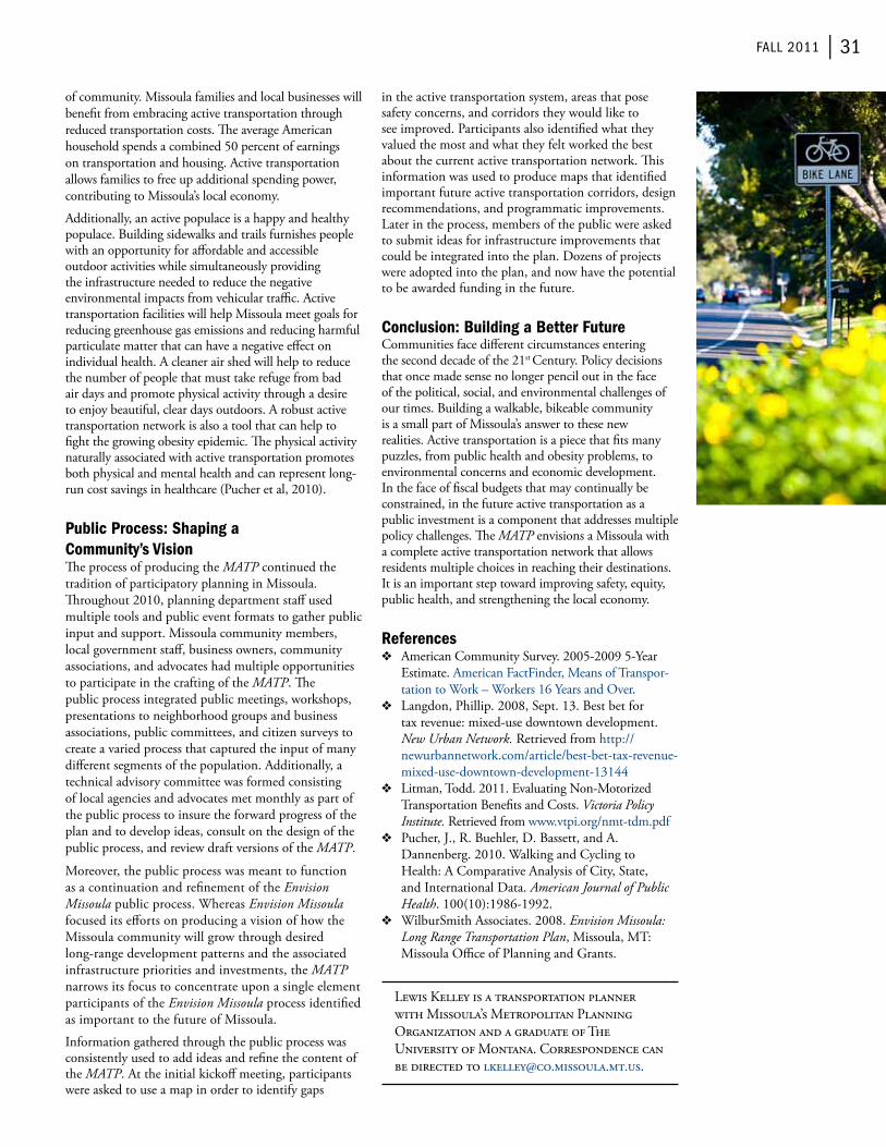
fAll 2011 | 31
of community. Missoula families and local businesses will benefit from embracing active transportation through reduced transportation costs. The average American household spends a combined 50 percent of earnings on transportation and housing. Active transportation allows families to free up additional spending power, contributing to Missoula’s local economy.
Additionally, an active populace is a happy and healthy populace. building sidewalks and trails furnishes people with an opportunity for affordable and accessible outdoor activities while simultaneously providing the infrastructure needed to reduce the negative environmental impacts from vehicular traffic. Active transportation facilities will help Missoula meet goals for reducing greenhouse gas emissions and reducing harmful particulate matter that can have a negative effect on individual health. A cleaner air shed will help to reduce the number of people that must take refuge from bad air days and promote physical activity through a desire to enjoy beautiful, clear days outdoors. A robust active transportation network is also a tool that can help to fight the growing obesity epidemic. The physical activity naturally associated with active transportation promotes both physical and mental health and can represent long-run cost savings in healthcare (Pucher et al, 2010).
Public Process: Shaping a Community’s VisionThe process of producing the MATP continued the tradition of participatory planning in Missoula. Throughout 2010, planning department staff used multiple tools and public event formats to gather public input and support. Missoula community members, local government staff, business owners, community associations, and advocates had multiple opportunities to participate in the crafting of the MATP. The public process integrated public meetings, workshops, presentations to neighborhood groups and business associations, public committees, and citizen surveys to create a varied process that captured the input of many different segments of the population. Additionally, a technical advisory committee was formed consisting of local agencies and advocates met monthly as part of the public process to insure the forward progress of the plan and to develop ideas, consult on the design of the public process, and review draft versions of the MATP.
Moreover, the public process was meant to function as a continuation and refinement of the Envision Missoula public process. whereas Envision Missoula focused its efforts on producing a vision of how the Missoula community will grow through desired long-range development patterns and the associated infrastructure priorities and investments, the MATP narrows its focus to concentrate upon a single element participants of the Envision Missoula process identified as important to the future of Missoula.
information gathered through the public process was consistently used to add ideas and refine the content of the MATP. At the initial kickoff meeting, participants were asked to use a map in order to identify gaps
in the active transportation system, areas that pose safety concerns, and corridors they would like to see improved. Participants also identified what they valued the most and what they felt worked the best about the current active transportation network. This information was used to produce maps that identified important future active transportation corridors, design recommendations, and programmatic improvements. Later in the process, members of the public were asked to submit ideas for infrastructure improvements that could be integrated into the plan. Dozens of projects were adopted into the plan, and now have the potential to be awarded funding in the future.
Conclusion: Building a Better FutureCommunities face different circumstances entering the second decade of the 21st Century. Policy decisions that once made sense no longer pencil out in the face of the political, social, and environmental challenges of our times. building a walkable, bikeable community is a small part of Missoula’s answer to these new realities. Active transportation is a piece that fits many puzzles, from public health and obesity problems, to environmental concerns and economic development. in the face of fiscal budgets that may continually be constrained, in the future active transportation as a public investment is a component that addresses multiple policy challenges. The MATP envisions a Missoula with a complete active transportation network that allows residents multiple choices in reaching their destinations. it is an important step toward improving safety, equity, public health, and strengthening the local economy.
References❖❖ American Community Survey. 2005-2009 5-Year
estimate. American factfinder, Means of transpor-tation to work – workers 16 Years and over.
❖❖ Langdon, Phillip. 2008, Sept. 13. best bet for tax revenue: mixed-use downtown development. New Urban Network. retrieved from http://newurbannetwork.com/article/best-bet-tax-revenue-mixed-use-downtown-development-13144
❖❖ Litman, todd. 2011. evaluating Non-Motorized transportation benefits and Costs. Victoria Policy Institute. retrieved from www.vtpi.org/nmt-tdm.pdf
❖❖ Pucher, J., r. buehler, D. bassett, and A. Dannenberg. 2010. walking and Cycling to Health: A Comparative Analysis of City, State, and international Data. American Journal of Public Health. 100(10):1986-1992.
❖❖ wilburSmith Associates. 2008. Envision Missoula: Long Range Transportation Plan, Missoula, Mt: Missoula office of Planning and Grants.
Lewis Kelley is a transportation planner with Missoula’s Metropolitan Planning organization and a graduate of the University of Montana. Correspondence can be directed to [email protected].

32 | Montana policy review
Transportation Triage:
rebuilDinG A 20th centurY SYStem While PrePArinG for the 21St
by John Robert Smith and Gene Townsend
Building the System We WantMontana’s communities face diverse transportation challenges. Some areas are growing rapidly without the resources to properly plan for and serve new residents. others are losing people and have high aging and low-income populations that need a variety of reliable transportation options. Many are simply reeling from decades of under investment in infrastructure and are in need of a lifeline.1
every six years or so, Congress writes the rules for spending federal transportation dollars. in the current drafting of the bill, transportation for America is calling on Congress to reorient our policy toward repairing and maintaining our 20th century transportation systems while building for the 21st century. The current federal transportation program provides scant assurance that our hard-earned tax dollars will be spent wisely and effectively and fails to adequately invest in a variety of travel options. we need federal transportation legislation that addresses and meets the needs of Montanans and all Americans.
Americans everywhere are eager for an update to our transportation programs that will expand our options. A 2010 poll conducted by a bipartisan team of pollsters found that 79 percent of rural Americans believe the United States would benefit from an expanded and improved transportation system, such as rail and buses.2 A majority of voters would like to see existing roads and bridge infrastructure maintained and rehabilitated before adding new capacity. rural transportation
1 transportation for America, http://t4america.org/resources/2010survey/
2 transportation for America, http://t4america.org/resources/2010survey/
stakeholders deserve improved rural accessibility, safety and a well-functioning transportation system that promotes health and economic vitality of communities.
Maintaining What We Have — Saving Money and Improving Safetyover the last 50 years, America has built a national highway system that connects regions and states across the country, but now much of that system is showing its age. A recent report on road conditions by taxpayers for Common Sense and Smart Growth America found that over 7,300 miles, or 25 percent of Montana’s state roads have fallen out of good condition and 7.5 percent of Montana’s bridges are structurally deficient.3 This state of affairs affects the longevity of our transportation system, costs money, and reduces the safety of our existing infrastructure.
According to the American Association of State Highway and transportation officials, every dollar spent on repair of a highway can save up to $14 down the road. Poor road conditions cost U.S. motorists $67 billion a year in repairs and operating costs-an average of $335 per motorist.4 The repair Priorities report concluded that investing too little on road repair significantly increases the state’s future financial liabilities and recommends prioritizing maintenance and rehabilitation to reduce these future liabilities, benefit taxpayers and create a better transportation system.
Negative safety impacts of poor road conditions are particularly disproportionate for rural communities. residents of small towns are more likely to be hurt or killed on the transportation system than those in urban areas. Nearly 60 percent of traffic fatalities occur on rural roads, while they carry 40 percent of the traffic and only 20 percent of the population.5
ensuring we take care of the infrastructure in which we have already invested will result in more money down the road for Montana’s transportation infrastructure, cost-savings for Montanan motorists, and help improve the safety of Montana’s roads.
3 Smart Growth America, http://www.smartgrowthamerica.org/2011/06/01/repair-priorities-transportation-spending-strategies-to-save-taxpayer-dollars-and-improve-roads/
4 report Card for America’s infrastructure, http://www.infrastructurereportcard.org/fact-sheet/roads
5 fHwA Saftey Program, http://safety.fhwa.dot.gov/local_rural/training/fhwasa10012/
Streamline is Bozeman’s area bus free bus service.
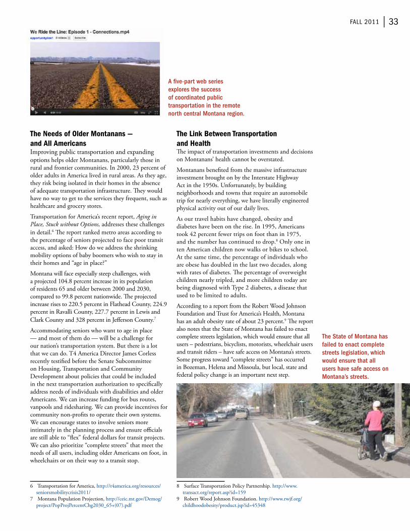
fAll 2011 | 33
The Needs of Older Montanans — and All Americansimproving public transportation and expanding options helps older Montanans, particularly those in rural and frontier communities. in 2000, 23 percent of older adults in America lived in rural areas. As they age, they risk being isolated in their homes in the absence of adequate transportation infrastructure. They would have no way to get to the services they frequent, such as healthcare and grocery stores.
transportation for America’s recent report, Aging in Place, Stuck without Options, addresses these challenges in detail.6 The report ranked metro areas according to the percentage of seniors projected to face poor transit access, and asked: How do we address the shrinking mobility options of baby boomers who wish to stay in their homes and “age in place?”
Montana will face especially steep challenges, with a projected 104.8 percent increase in its population of residents 65 and older between 2000 and 2030, compared to 99.8 percent nationwide. The projected increase rises to 220.5 percent in flathead County, 224.9 percent in ravalli County, 227.7 percent in Lewis and Clark County and 328 percent in Jefferson County.7
Accommodating seniors who want to age in place — and most of them do — will be a challenge for our nation’s transportation system. but there is a lot that we can do. t4 America Director James Corless recently testified before the Senate Subcommittee on Housing, transportation and Community Development about policies that could be included in the next transportation authorization to specifically address needs of individuals with disabilities and older Americans. we can increase funding for bus routes, vanpools and ridesharing. we can provide incentives for community non-profits to operate their own systems. we can encourage states to involve seniors more intimately in the planning process and ensure officials are still able to “flex” federal dollars for transit projects. we can also prioritize “complete streets” that meet the needs of all users, including older Americans on foot, in wheelchairs or on their way to a transit stop.
6 transportation for America, http://t4america.org/resources/seniorsmobilitycrisis2011/
7 Montana Population Projection, http://ceic.mt.gov/Demog/project/PopProjPercentChg2030_65+(07).pdf
The Link Between Transportation and HealthThe impact of transportation investments and decisions on Montanans’ health cannot be overstated.
Montanans benefited from the massive infrastructure investment brought on by the interstate Highway Act in the 1950s. Unfortunately, by building neighborhoods and towns that require an automobile trip for nearly everything, we have literally engineered physical activity out of our daily lives.
As our travel habits have changed, obesity and diabetes have been on the rise. in 1995, Americans took 42 percent fewer trips on foot than in 1975, and the number has continued to drop.8 only one in ten American children now walks or bikes to school. At the same time, the percentage of individuals who are obese has doubled in the last two decades, along with rates of diabetes. The percentage of overweight children nearly tripled, and more children today are being diagnosed with type 2 diabetes, a disease that used to be limited to adults.
According to a report from the robert wood Johnson foundation and trust for America’s Health, Montana has an adult obesity rate of about 23 percent.9 The report also notes that the State of Montana has failed to enact complete streets legislation, which would ensure that all users – pedestrians, bicyclists, motorists, wheelchair users and transit riders – have safe access on Montana’s streets. Some progress toward “complete streets” has occurred in bozeman, Helena and Missoula, but local, state and federal policy change is an important next step.
8 Surface transportation Policy Partnership. http://www.transact.org/report.asp?id=159
9 robert wood Johnson foundation. http://www.rwjf.org/childhoodobesity/product.jsp?id=45348
The State of Montana has failed to enact complete streets legislation, which would ensure that all users have safe access on Montana’s streets.
A five-part web series explores the success of coordinated public transportation in the remote north central Montana region.

34 | Montana policy review
Rural Transportation Access, Options, and Economic VitalityThe connection between economic vitality and transportation access and services in small towns and rural communities was the subject of a recent report from the rural Policy research institute (rUPri).10 The report found that increased accessibility and mobility options improve quality of life, which in turn attracts both individuals and new businesses to rural areas, increasing economic development.
rUPri found that a variety of transportation investments — including transit, vanpools, walking and biking paths, intercity bus, and roads and highways — are critical to the economic development and overall health of smaller communities and rural areas. The most beneficial investments are those that improve access to job centers and essential services, reduce cost of living, and fuel local private-sector growth by fostering communities where people want to live and work. to facilitate this, rUPri’s recommendations include: encouraging innovation and multimodal investments such as rail; coordination, cost-effectiveness and efficiency (in local street connectivity, access management, and intercity bus, for instance); and flexibility for rural areas to focus resources on investments that meet specific needs and characteristics of the community.
transportation investments that are not driven by locally identified priorities or collaborative approaches will lessen the potential to achieve key outcomes. Misdirected investments are more likely to diminish rural economic development potential and may lead to unintended negative consequences such as a reduced ability to pay for existing transportation improvements and services. Thus, some core policy recommendations included local rural stakeholder engagement in transportation planning and decision-making, integrated coordinated regional planning and implementation, encouraging innovation and integration for cost effective outcomes.
Addressing Rural Transportation Challenges: Policy Proposalover the past two years, transportation for America worked with an array of organizations around the country, including the Association of Programs for rural independent Living (APriL), the National Center for frontier Communities and the National rural Assembly, as well as a number of Montana based groups to develop a proposal to enhance rural transportation systems. we traveled to Montana to talk to people personally about their transportation needs and have specifically worked to address the transportation access, mobility, health, quality of life, and economic vitality issues that are primary concerns of rural transportation stakeholders.
10 rural Policy research institute. http://www.rupri.org/
The recommendations include:• incorporating local stakeholders in the
planning process;• improving efficiency and effectiveness of rural
transit services through development of a coordinated rural transit plan;
• Designation of a “mobility manager”—an individual who would provide capacity to adequately develop and enhance implementation of these plans;
• increasing flexibility for specialized transit operators to serve all individuals dependent on transit, including seniors and people with disabilities;
• implementing a rural transit Cost Savings program to mitigate the disproportionate impact volatile gas prices have on rural transit providers through grants to increase fuel and energy efficiency of rural transit fleets and operators;
• Providing increased flexibility to invest in additional transportation improvements — rail, local street networks, intercity bus, access management — to meet the unique needs of rural communities. The funding silos in washington often “predetermine” the best solutions for rural communities. increased flexibility will allow for outcome based investment decisions directed from the ground up;;
• improving rural safety by prioritizing the most high risk roads, aiding rural areas in meeting new federal signage requirements and maximizing funding benefits by prioritizing low-cost, high-yield safety improvements;
• Spurring innovation and revitalization of Main Street through a competitive grant program to allow small cities and towns — in non-metropolitan areas and on tribal reservations — to revitalize their existing town centers, promote economic development, leverage private dollars with public investments and provide a variety of transportation options, including car sharing, accessible walking and biking paths, intercity buses and public transportation;
• Additionally leveraging private investment in public transportation through incentives to encourage private intercity bus and commuter vanpool providers to enhance service in rural areas; and
• Helping tribes meet increased transit demand and increasing funding for the indian reservation road program
Montanans Have Key Champions in WashingtonMontana’s transportation challenges have far-reaching impacts on the health, quality of life, and economic vitality of Montana’s communities. Luckily, Montanans have a powerful champion in Senator Max baucus, who in addition to being one of the “big four” on the environment and Public works Committee is also the chairman of the Senate finance Committee, which will lead the way in determining the size and revenue source of an eventual bill. with numerous details still in the works, Montanans who want increased options and real accountability in the bill should make their preferences known to Senator baucus and his staff.

fAll 2011 | 35
Montana’s junior Senator, Jon – holds a position on the Senate banking, Housing, and Urban Affairs Committee that oversees the transit element of the bill. The Committee’s Chairman, Senator tim Johnson of South Dakota, has also taken a particular concern in the diverse transportation needs of rural Americans and tribes. in this environment, Senator tester’s position provides him unique capacity to be an advocate for rural transit and transportation in Montana. for example, in a May 19, 2011 committee hearing around priorities and challenges of the surface transportation authorization, he spoke up on the need for rural transit services and flexibility to help ensure all Montanans have access to education, jobs and health services.
ConclusionThis is indeed a crucial time for the nation’s transportation policy, as key players from the obama administration down to the relevant Congressional committees are preparing to move forward with a reauthorization of current surface transportation law. Many advocates were disappointed by House transportation and infrastructure Committee Chairman John Mica’s proposal to cut the transportation budget by 35 percent, eliminate dedicated funding for biking and walking and potentially reduce the number of roads and highways eligible for federal support.
The prospects for real investment and new options are more promising in the Senate. The environment and Public works committee is planning on moving forward with their transportation authorization proposal addressing the highway portion of surface transportation, and the Senate banking, Housing, and Urban Affairs Committee, where Senator tester sits, is currently crafting the public transportation policy.
How we get to work, the quality and safety of where we call home and the opportunity to live actively are all dependent on the investments and policy directives of the next transportation bill. Montanans can surely reap the benefits of this legislation for years to come, but only if we communicate our priorities to our leaders in washington so we can build a transportation system that will meet our needs well into the 21st Century.
Transportation for America (T4 America) is the largest, most diverse coalition working on transportation reform today. Our nation’s transportation network is based on a policy that has not been significantly updated since the 1950’s. We believe it is time for a bold new vision — transportation that guarantees our freedom to move however we choose and leads to a stronger economy, greater energy security, cleaner environment and healthier America for all of us. We’re calling for more responsible investment of our federal tax dollars to create a safer, cleaner, smarter transportation system that works for everyone.
John robert Smith is the current co-chairman of transportation for America, and current President and Ceo of reconnecting America. Correspondence can be directed to [email protected].
Gene townsend, is a lifelong resident of three forks, Mt, and is currently serving his 26th year as Mayor. Correspondence can be directed to [email protected].
One of North Central Montana Transit’s (NCMT) buses in service.

36 | Montana policy review
Safe Routes to Schoolby Taylor Lonsdale
Safe routes to School (SrtS) is a federally-funded transportation program that works to make it convenient and safe for K-8 students to walk and bike to school. SrtS was established as a program through the enactment of the 2005 federal transportation bill known as SAfteA-LU and is a 100 percent federally-funded reimbursement program requiring no local match. SrtS was the vision of rep. James oberstar. rep. oberstar’s tagline for the program is “Changing the Habits of an entire Generation”. The program was envisioned as a part of the efforts to increase physical activity for our children. SrtS strives to educate children on the benefits of an active lifestyle and demonstrate to them that daily transportation can be a part of that. The continuing trends of inactivity and the related chronic diseases that are associated with them will create a long term financial burden for the United Sates. SrtS was created to be part of a proactive solution to the growing epidemic of obesity and diabetes. The SrtS program uses a comprehensive approach that includes five “e’s”: education, encouragement, enforcement, evaluation, and engineering. by incorporating all of these approaches into a program, communities engage a wide-range of partners in building a successful program. More information is available at these websites.1
Montana is a minimum allocation state and receives $1 million in SrtS funding annually from the federal transportation budget to implement this program. The money is distributed through a competitive application process. Applications are due December 31st of each year, with the funding decisions made by a statewide
1 National Center for Safe routes to School, www.saferoutesinfo.org; Montana Safe routes to School, www.saferoutesmt.org; Safe routes to School Program, http://www.mdt.mt.gov/pubinvolve/saferoutes/
SrtS implementation committee. funding awards are announced each April and the funding becomes available at the start of the state fiscal year on July 1st. eligible applicants include schools, school districts, municipal and tribal governments, and registered non-profit organizations. infrastructure projects can apply for up to $250,000 in funding. Given the limit of $1 million that is available for the entire program, most successful projects have been in the $50, 000 to $110,000 range for infrastructure. on the non-infrastructure side of the program awards range from just $1000 to implement an program to $40,000 in larger communities such as billings, bozeman, or Great falls. Non-infrastructure awards include funding for encouragement programs such as mileage clubs or walking school buses, education programs which for 2012 includes the award of bicycles for implementing an the Journeys from Home elementary traffic education course.2
Safe Routes to School Successes
Ronan, Montana
ronan is a small rural community of approximately 2,000 people located in northwest Montana within the flathead reservation of the Confederated Salish and Kootenai tribes (CSKt).ronan was first awarded $20,000 in non-infrastructure (i.e., encouragement, enforcement, education and evaluation purposes) funding in 2009. in 2010, ronan was awarded $44,112 in infrastructure (i.e., engineering) funding for pathway construction. in 2011, ronan was awarded $118,749 for additional pathway construction and $2,500 for non-infrastructure.
ronan SrtS has grown through the years. The program has generated additional interest in the region including the adjacent community of Pablo and with the tribes. Significant synergy has also developed with the town of Arlee.
ronan Safe routes has been championed by the city Parks and recreation Department. The community has invested a great deal of effort and matching funds in developing a trail system. ronan has leveraged their SrtS funds with Montana transportation enhancement funding and worked diligently to provide input and coordination of the local trail system with the construction of the regional pathway that is part of the US 93 reconstruction.
ronan’s non-infrastructure program funds safety education to students, incentives to encourage students
2 Journeys from Home Montana, www.journeysfromhomemontana.com
Biking to school and loving it.

fAll 2011 | 37
to walk and bike to school and promotes their program throughout the year. in addition the SrtS program funds several large walking events each year including participating in international walk to School day each fall. each spring ronan, Polson, and Pablo jointly host a pathway celebration.
Shelby, Montana
Shelby is a small rural community of approximately 3,200 people located on route 2 in northwest Montana near the blackfeet reservation.Shelby began their Safe routes to School program in 2008, the first year of Montana SrtS funding. Shelby’s SrtS program is quite successful and has been used as a model for other small communities in the state.
Shelby’s Safe routes to School program has developed around their successful “walking wheeling wednes-days” program. each wednesday, students, parents, and school staff gather and walk to school together in walking School buses.3 Shelby has engendered broad community support to make this event well-supported and fun. The mayor, the police chief, and the high school mascot have all taken their turn in leading the events of a walking wheeling wednesday.
on the infrastructure side of the program, Shelby has taken a planned and measured approach. Many of the streets used by children to walk to school do not have sidewalks. based on the routes of walking wheeling wednesdays, Shelby has used SrtS funds to methodically construct sidewalks along these routes to the school.
Dillon, Montana
Dillion is a community of approximately 4,000 people located in the rural southwest corner of Montana. Dillon has a rich history in Montana agriculture and mining.
The Safe routes to School effort in Dillon was formalized in 2009 when the existing trails group applied for SrtS funding. Dillon was awarded $21,500 in non-infrastructure funds that year and hit the ground running. in 2010, they again applied for SrtS funding and were awarded $83,600 in infrastructure funds and $7,750 in non-infrastructure funds to continue the excellent program they have begun.
The Dillon SrtS program has been successful for a number of reasons but broad community support and involvement has been a critical feature. The community has come together around the SrtS program to improve health and safety for their children.
Dillon began their SrtS program with plenty of energy and built broad community support through outreach at the county fair where they distributed 140 bike helmets in their effort to ensure every child has a helmet. The SrtS group connected with an energetic group of Campus Corps volunteers from
3 walking School bus, http://www.walkingschoolbus.org/
the University of Montana-western campus.4 with the energy and dedication of these students, Dillon started a walking school bus on oct. 6, 2010 with 23 children. The bus is available everyday to and from school. in the spring of 2011 under the leadership of the Campus Corps group they have expanded to two walking school bus routes. Their infrastructure funding is to improve sidewalks and accessibility along the established walking school bus route.
Hardin, Montana
Hardin is a small rural community of approximately 3,500 people located in south central Montana at the edge of the Crow reservation.
in 2010, Hardin gathered a group to begin developing a Safe routes to School funding application. The city public works director, school district administration and staff met with the state SrtS coordinator to define goals for the SrtS program in Hardin.
in the development of the Hardin Safe routes to School program, several key concerns were identified through administration of SrtS surveys. Many parents were concerned with personal safety issues for their children on the way to school. Hardin will be using the non-infrastructure funding to look at developing a safe homes program. Hardin is also developing a program of safety education and encouragement for students and parents to promote walking and biking to school.
Another key barrier to walking and biking is missing sections of sidewalk. Hardin will use their infrastructure funding to begin the process of infilling sections of sidewalk on walking routes to the schools.
bozeman, Montana
bozeman developed a rather successful program beginning in 2006. The local taskforce began by working with one elementary school and an enthusiastic principal. Since then the program has grown to a district wide program with each school implementing different ideas toward the common goal of promoting biking and walking to school. each year the schools celebrate international walk to School Day the first wednesday in october and a bike to School Day during May which is National bike Month. This past spring Hawthorne elementary had 120 bicycles in their bike train on the way to school. More information about the bozeman program is available on the National Center for Safe routes to School website.5
Challenges: Current Needs and Available FundingMontana received $3.97 million in Safe routes
4 Montana Campus Corps, http://www.mtcampuscorps.org/5 National Center for Safe routes to School, http://www.
saferoutesinfo.org/data-central/success-stories/bozeman-montana-walk-school-month-supported-city-and-community
Families participating in Walking Wheeling Wednesday in Shelby.
Hardin will use infrastructure funding to infill sections of sidewalk on walking routes to school.

38 | Montana policy review
to School (SrtS) funding requests for 2012 ($3.34 million infrastructure and $622,046 non-infrastructure). for 2012, the SrtS implementation committee awarded $691,103 in funding ($398,242 (12 percent of requests) in infrastructure funds and $372,861(60 percent of requests) in non-infrastructure funds). A complete list of funding is located on the Montana Department of transportation’s SrtS website.6 Due to the very large need and the limits on the available funds, this left many deserving communities without funds to construct critical sections of sidewalk and pathways to their schools.
Hellgate School District, Missoula, Montana
Hellgate School Distric is a large district outside of Missoula, Montana, with 1,300 elementary and middle school students. Hellgate applied for 2012 funds to build a pathway along flynn Lane adjacent to the school. This section of pathway would have provided a critical connection from an existing pathway that serves many hundreds of homes in the district to the school. without the pathway elementary students that want to walk or bike to school from these homes will have to share the narrow roadway of flynn Lane with vehicular traffic. Hellgate is receiving non-infrastructure funds to implement an elementary and middle school traffic education program. without the connecting pathway however, it is unlikely that large numbers of students will walk or bike to school.
Scobey, Montana
Scobey is a small agricultural community near the Canadian border in eastern Montana. They received SrtS non-infrastructure funds in 2010. Using
6 Montana Department of transportation, http://www.mdt.mt.gov/pubinvolve/saferoutes/docs/fy2012_funded_list.pdf
these funds, the community started a very successful encouragement program that includes walking wheeling wednesdays. Scobey applied for 2012 funding to build sidewalks along the established route for their walking wheeling wednesday program. The SrtS group worked with the city and county to include Montana Community transportation enhancement Program (CteP) money with the requested SrtS funds. This combined project would have constructed a critical sidewalk and pathway for a community that otherwise can’t afford to build this infrastructure.
Many communities are looking to define and promote themselves economically. Policies such as Complete Streets and School Siting play a critical role in ensuring children have a safe place to walk and bike to school and also create an environment where people want to live and work. The Safe routes to School program has demonstrated success in Montana and across the country in providing safe, convenient and fun routes to school as well as educational activities for children that promote healthy and vibrant communities. Congress is beginning the process of writing the next transportation bill. This bill will likely affect our national policies for transportation for the next decade and will have repercussions well beyond that. Now is the time for all of us to let our legislators know what we want from our transportation system.
Anyone interested in learning more or in applying for funding should contact the SRTS coordinator Taylor Lonsdale, [email protected].
taylor Lonsdale is the Montana Safe routes to School Coordinator. Correspondence can be directed to [email protected].
Students that want to bike or walk to Hellgate Elementary School must share the narrow Flynn Lane roadway.
Oversubscribed MT SRTS infrastructure grant program results in this Scobey, Montana sidewalk project not being funded.

fAll 2011 | 39
Getting the Economics Right: helPinG montAnAnS imProve lAnD uSe PlAnninG AnD economic DeveloPment
by Ray Rasker and Chris Mehl
Getting the economics right is important. Planners, elected officials, business owners, and many others across Montana appreciate the importance of accurate information that will help them better understand the economic condition and trends of their region.
Unfortunately, collecting, analyzing, and most importantly utilizing local socioeconomic information is often difficult and frustrating. Problems like the lack of accurate benchmarking that make it difficult for a planner to compare his/her county to others in the region; the cost and time needed to collect and analyze information; and the difficulty of sharing this information with important audiences, all present significant obstacles to making sound economic development decisions for communities across Montana.
to help alleviate these difficulties Headwaters economics developed and designed an automated socioeconomic software, EPS-HDT (economic Profile System-Human Dimensions toolkit), to help users easily retrieve a wide variety of socioeconomic information for virtually anywhere in Montana and the United States. ePS-HDt puts accurate information into local hands that is fast, accurate, free, and easy-to-use.
Simply put, Headwaters economics created ePS-HDt so that Montana decision-makers can have better information to make better decisions. The audience is anyone—public lands managers, county planners, economic development directors, county commissioners, businesses, and others across the state—who work on land management and economic development issues.
based in bozeman, Headwaters economics has a long history of working with counties and local governments. ePS-HDt, created jointly with the United States forest Service and the bureau of Land Management, provides users with information, analysis, charts, graphs, and explanatory text on a wide variety of important indicators such as employment by industry, demographics, and land use. it also helps evaluate the importance of non-labor income, such as retirement and investment income to communities.
earlier this year ePS-HDt was significantly enhanced. The updated version of ePS-HDt remains free and user-friendly with videos and “how to” sheets to help users. it utilizes more than 2,000 federal variables (statistics from federal sources such as the bureau of economic Analysis, bureau of the Census, bureau of Labor Statistics, and others that cover population, jobs,
income, age, education, housing affordability, etc.) and is updated annually so the analysis provides accurate trend data and can be compared to any other geography in the United States.
A county commissioner in eastern Montana, for example, can compare his jurisdiction to other similar Montana counties, region of counties, or any other county across the United States. or a bozeman-based, MSU-supporting bobcat could compare their city to a certain Grizzly-supporting UM-based city some two hundred miles away.
equally important, the updated ePS-HDt now includes 14 detailed reports such as demographics or analysis of specific economic sectors such as mining, non-labor income, timber, and the importance of natural amenities for counties, regions, states, or custom aggregations of counties or states.
This comprehensive packaging allows ePS-HDt to help elected officials or land managers better understand the baseline conditions in their region. They can research the long-term trends of a specific sector’s role in the economy (such as timber), or better measure the share of retirement and investment income in a county or region.
Why Use EPS-HDT? Fast, Credible Information That’s Easy to Use and ShareAcross all audiences, one of the keys to effective public policy is providing credible information that can be shared, analyzed and understood by all stakeholders.
by providing reliable data and analysis in an easy-to-understand package, ePS-HDt is meant to provide

40 | Montana policy review
Detailed Reports
if you run a detailed report and select a number of geographies, they are compared to each other. They are also compared to the “region,” consisting of an aggregate of the lowest level of geographies (e.g., counties are aggregated together). The region is also benchmarked against the U.S.
Types of Reports• Summary is a report that compares the selected
geographies side-by-side in terms of demographics, economic sectors; land use, and other topics covered in other detailed reports. SUMMArY also is useful for an at-a-glance” to see key differences between geographies.
• Demographics uses Census data to describe the geography selected in terms of population, age distribution, race and ethnicity, poverty and income distribution, housing affordability, language, and education.
Economic Sector Reports• Agriculture covers trends in farm and ranch
employment and personal income, wages, corporate income (including revenues and expenses), farmland by type, farms by type, and land occupied by farms and ranches. farm employment is benchmarked against the U.S. and compared across geographies selected.
• Mining and Energy describes which industries comprise mining (including energy development), shows how mining has changed over time, the role of the self-employed (which can be important in this sector), mining wages, and how regional trends in mining employment compare to the US. Selected geographies are also compared to each other.
• Services are the fastest growing segment of the economy accounting for 99 percent of all jobs in the last three decades nation-wide. Services are diverse, and include everyone from doctors to lawyers, engineers, or waiters. The ServiCeS report describes the various components of the “services” sectors and how employment in these has changed over time. The report also compares wages between different service sectors. Service employment for the region is benchmarked against the U.S. and geographies selected are compared against each other.
• Travel and Tourism describes the number of jobs in industries that include travel and tourism and displays key statistics that are typical of tourism-related economies (e.g., seasonal employment and housing). wages in travel and tourism related industries are compared to the rest of the economy. The region is benchmarked against the U.S., and geographies selected are compared to each other.
valuable insights for both experts and non-specialists. each report produces detailed data, tables, charts, and interpretive bulleted information. in addition, each page now also contains a Study Guide with color-coded text to describe what is being measured, methods used, and additional resources.
ePS-HDt reports first run in excel, and any analysis can also be easily pushed into a word document, saved as a PDf, or exported to XML. This allows users to use the full report or to more easily utilize a specific chart or graph for a public meeting, presentations with stakeholder groups, or to post results to the web.
ePS-HDt also saves time and is easy to use. by automating the process of gathering and analyzing more than 2,000 variables, ePS-HDt processes all of the calculations, tables, and figures needed for a thorough analysis, while providing interpretive text to help users better understand local economies.
Getting StartedUsers can easily download and install ePS-HDt after a first-time only registration. The program, an “Add in,” then resides on the excel toolbar and can be operated any time excel is open and the computer has an internet connection.
Detailed EPS-HDT Reports: In-Depth Analysis for Your CommunityePS-HDt now offers 14 different reports. The following is an explanation of the reports available.
General Report
Socioeconomic Measures is a report on long-term trends in population, employment, personal income, income earned by industry, unemployment, and wages.
if a number of geographies are selected (e.g., counties or states) these are aggregated into one “region.” The selected geography can be compared to any custom benchmark geography selected by the user.
A sample of an EPS-HDT page in Microsoft Excel.

fAll 2011 | 41
Special Note: “travel and tourism” consists of sectors that provide goods and services to visitors to the local economy, as well as to the local population. These industries are: retail trade, passenger transportation, arts, entertainment, and recreation, and accommodation and food. without additional research such as surveys it is not known what exact proportion of the jobs in these sectors is attributable to expenditures by visitors versus by local residents.
• Government jobs can sometimes represent some of the highest paying occupations in many rural communities, and can serve as a source of long-term stability. GoverNMeNt reports the numbers and trends in public employment and personal income earned in local, state and federal employment (including military), compare wages, and benchmark the region against the U.S. Geographies selected are compared against each other.
• Non-labor income such as retirement and investment income can often represent more than a third of all income in a county. NoN-LAbor income sources include Dividends, interest and rent (investments) and transfer Payments (often age and retirement-related). The role of non-labor income in the selected geographies is explained and compared to the long-term trends of other income sources. The region is compared to the U.S., and other selected geographies are compared to each other.
• Timber describes the industries that comprise the timber industry (growing and harvesting, sawmills and paper mills, wood products manufacturing), how employment in these sectors has changed over time, how they compare to trends in the overall economy, the role of the self-employed, and wages. The region is compared to the U.S. and selected geographies are compared to each other.
Thematic Reports• Land Use describes the land ownership (private,
state, forest Service, bLM, etc.), different management of federal lands (wilderness, National Monument, etc.), land cover (forest, grassland, etc.), and residential development (change in residential acres/person, urban versus exurban development, etc.) for each of the selected geographies.
• Amenities reports a number of indicators that may point to the role public lands can play in providing recreational and scenic amenities that attract and retain people and business to nearby communities. These include: acres of federal lands, types of federal lands (National Parks, wilderness, etc.), population growth in-migration, growth of “footloose” service sectors and non-labor income (retirement, investments, etc.), travel and tourism-related industries, and residential development. The amenity indicators for the selected geography are compared against the U.S.
• Development and Wildfire describes the development of homes on lands adjacent to fire-prone forested public lands. This report shows (for the 11 contiguous western states only) the wild land urban interface (wUi), its size within each county, and what percentage has been developed with homes.
• Payments from Federal Lands can represent a significant portion of county budgets. This report shows the payments that county government receive from federal sources including Payment in Lieu of taxes (PiLt), the 25 percent fund, and the Secure rural Schools and community Self-Determination Act (SrS). where available, mineral royalty payments are also reported (Headwaters economics has been able to obtain this data only for selected states in the west). Payments are described over time; how they are distributed; whether they are restricted; and their relative importance for county and school budgets.
Making Better Decisions for Montana CommunitiesePS-HDt is meant to help a wide variety of users make better community development and land management decisions across Montana and the west. Please contact us if you have questions, suggestions, or ideas for how this program may be improved.
ray rasker, Ph.D., is executive Director of Headwaters economics. Correspondence can be directed to [email protected].
Chris Mehl is Policy Director at Headwaters economics and serves as a bozeman City Commissioner. Correspondence can be directed [email protected].
42 | Montana policy review
Six Man Townsby Sam Korsmoe
football purists may not recognize the game of six-man high school football. Aside from just six players on a side compared to 11, the rules, scoring and size of the field are also different. it is still football, but it’s not the same game. The Montana communities that play six-man high school football are not your regular kind of Montana communities either.
There are 28 six-man football communities in Montana. They are small, getting smaller, and some of their schools are getting hyphenated (just ask the reed Point-rapelje renegades or the Grass range-winnet Pirates). in reality, even the schools that play eight-man football are in the same boat. it only takes a few minutes to drive through or past these communities. They suffer from a negative ‘too___’ problem. That is, there are too few people, too little economic activity, too much vulnerability to commodity agriculture, too little tax revenue, and so on.
in the current era of cutting out as much government as possible, the challenges facing local governments of all sizes are numerous and complex. The proposed solutions to address these challenges are also numerous and equally complex. Some of them work and some don’t. However, these proposed solutions cannot easily, if at all, be applied to six or eight-man football towns. it’s not the same game.
As the economic development director for Madison County and west Yellowstone, i am acutely aware of the challenges facing rural Montana. west Yellowstone, a six-man football town, has about 1,000 residents. Madison County is still playing eight-man football in three of its high schools (a fourth high school co-opted its football program to play 11-man with a neighboring town). Madison County is the fourth largest county in Montana in terms of geographical size, but it has a population of only 7,457 residents (US Census 2009). There is not a single stop light in the entire county.
Madison County and west Yellowstone have many of the negative ‘too___’ problems. However, they also have tourism-driven economies built on abundant wildlife and Yellowstone National Park. Most rural Montana communities do not have this kind of asset base. They are old and getting older, the young leave and rarely return, and they are often stuck in commodity agriculture cycles that just don’t pay. with this kind of base demographic, what are the solutions to develop vibrant six and eight-man communities?
one approach that has had some success for Madison County and west Yellowstone is what i call economic gardening. This is not a new term or a new approach, but we use it differently. Many large communities have implemented economic gardening strategies
which focus on keeping existing businesses alive and growing. it is cheaper, more efficient, and better for the community to keep local companies viable and growing than to try to get new businesses to come in and create new jobs. The same would apply to walking trails, swimming pools, community centers, and other built-in community infrastructure that allows for a prosperous and healthy community. if it’s already there, keep it maintained and make sure it works well.
Keeping existing businesses and infrastructure healthy and happy is a no brainer. it should be the first priority for any community. However, this is not enough for six and eight-man football towns. what do you do after you’ve taken care of the things that are already working, but you’re still barely hanging on?
This is where six-man economic gardening is different. This strategy puts a basic premise of economics to work, i.e. that everybody [e.g. an individual, community, state, or nation] has a comparative advantage over someone else. Like we have done in Madison County and west Yellowstone, communities need to ask themselves a basic question, “what do we have that no one else has and how do we make it work for us?”
right off the bat, the question forces community leaders to look inward for the assets it does have and not outward for the assets it wishes it had. Neither Helena nor washington D.C. can answer this question. once answered, the community should plan an entire development strategy around these assets.
for this paper, there are three areas where i provide tangible examples of this kind of economic gardening: taxation, innovation, and partnerships.
Taxationin the mid 1980s, the infrastructure of the town of west Yellowstone was being hammered by tourists entering and leaving Yellowstone National Park. The west Gate had long been, and still remains, the most popular gate into the Park. This meant a town of a few hundred people had to build the infrastructure to host millions of pass-through tourists. Community leaders took the initiative to petition the Montana State Legislature for the right to implement a resort tax in which the revenues would stay entirely in the community and provide a financial base to maintain roadways and other basic infrastructure. it was a compelling case since the tax would be assessed mostly on visitors who were used to a sales tax and who were also creating the greatest burden on the town’s infrastructure. it passed and west Yellowstone citizens have overwhelmingly voted to renew it several times since its inception. Presently, there are resort taxes in
fAll 2011 | 43
whitefish, red Lodge, and virginia City. There are also resort taxes in the unincorporated areas of St. regis, big Sky, Craig, and Seeley Lake.
billings provides a similar example. The billings Chamber of Commerce and its Convention and visitor’s bureau knew they were losing convention business to other cities in the region (e.g. boise, Cheyenne, Spokane, etc). They argued that these cities had much larger marketing budgets to get convention business. Meanwhile billings was sending $3 million dollars per year in bed tax revenue to the general fund in Helena and getting about $200,000 back to market billings as a convention destination. working with state legislators, the billings Chamber wrote and introduced a bill to the 2007 Montana State Legislature that allowed municipalities to create their own tourism business improvement district (tbiD), an offshoot of business improvement districts (biDs) and special improvement districts (SiDs). The bill requested the right for local governments to assess a tax on occupied hotel rooms with the revenue remaining in the community for marketing purposes and managed by a board of directors comprised of local hotel owners. it passed. billings started its tbiD in 2008 followed by west Yellowstone in 2009 and several more municipalities since then.
in both cases, the communities built a tax strategy on what they had (lots of hotel rooms and a growing number of visitors) and also made sure that the money stayed in town rather than being diverted to Helena. in the case of west Yellowstone’s tbiD, and undoubtedly in many other municipalities, critics had a knee jerk reaction against a new tax. These criticisms were professionally and effectively dealt with and overcome. These tax programs are working for their communities and with support from the business sector.
InnovationThe idea of capitalizing on a comparative advantage is basic economics. for example, Silicon valley became America’s software development capitol because the developers lived there and many were educated at Stanford University. Six-man economic gardening says that the innovation needs to be centered solely on the assets that already exist rather than a desire or attempt to pull the asset into the community or build the asset from the ground up (i.e. don’t try to build another Stanford). The asset should already be in place. The challenge is to be introspective enough to recognize your assets and creative enough to capitalize on them and get something useful done.
two examples from my own work: one is small but very successful with a great future and the other is potentially very large, but still too new to know its fate.
in 2007, we wanted to create an annual event for Madison County that was based on its natural environment. The idea came from the success of the ennis on the Madison fly fishing festival (currently in its 9th year) and the Sweet Pea festival in bozeman
(currently in its 34th year). both events are based on a natural resource that does not exist anywhere else and pretty much had to be held in ennis and bozeman.
our big idea was to capitalize on a gravel road that ran the length of the Gravelly range in the beaverhead Deer-Lodge National forest in Madison County. Though i am not a runner, i thought it would be cool to run a marathon on the road. After all, how many roads are there above 9,000 feet in elevation? The event is called the Madison Marathon and we marketed it as the ‘Highest road Marathon in America’ and hoped to capitalize on the growing trend amongst extreme athletes to punish their bodies in new and creative ways. we thought running 26.2 miles at over 9,000 feet above sea level would qualify. we were right. This year’s race, the 4th Annual, sold out almost one month before race day. The runners are from 26 states, Canada, and europe. we’ll also launch the Madison Duathlon (bike/run) this year and the Madison triathlon (swim/bike/run) next year. So starting in 2012, we’ll market the Madison trifecta (marathon, duathlon, and triathlon) to extreme athletes from around the world. it all started with a brainstorming session on what we could do with a gravel road that was over 9,000 feet above sea level.
The other example is the implementation of a 20-year dream. west Yellowstone community leaders have long known that they live in the middle of one of the most unique outdoor laboratories in the world. every year, thousands of scientists, researchers, and students study in the Greater Yellowstone ecosystem (GYe). There was one missing component, a year-round facility for all these scientists to work from. for the most part, they worked out of hotel rooms, tents, and campers. There were no labs, no offices, no storage units, nor even a place to get a good wi-fi signal. The science was happening, but the scientists were homeless.
in December 2010, the west Yellowstone economic Development Council (wYeD) purchased an 11,500 square foot building in west Yellowstone with the specific goal of launching an education and research center for the scientists and students working in the GYe. The project is called the Yellowstone Studies Center. we are at the beginning stages of what is certain to be a very long journey. The facility will have offices, laboratories, classrooms, boardrooms, video conferencing, storage, and other education infrastructure. Colleges and universities and their students can just show up, move in, and get to work on their research and study of GYe issues.
wYeD has at least two end goals in mind. first, there was strong demand for such a facility and it needed to be met. if the facility were built in another gate community, west Yellowstone would lose the business. Second, west Yellowstone desperately needed to move its economy beyond its mono-economy habits of relying on tourism. Living next to Yellowstone National Park definitely has its upside. The 120-day tourist economy in the summer is fantastic for making money. Unfortunately, there are 365 days in a year and
44 | Montana policy review
the winter economy is susceptible to litigation over snowmobile use in the Park. The paradigm needed a shift and wYeD instigated the shift.
Though this project was over 20 years in the making, it could have been longer if not for the resolve of some community leaders who basically said, “Now is the time. Let’s stop talking and just do it and see what happens.”
Partnershipsin my opinion, there is one word that best describes those communities that stick to their guns and go it alone rather than joining forces with their neighbors. The word is stupid. This is unkind, but not unfair. i am a native Montanan who knows what small town rivalries are all about. when a community puts all its focus on the girls’ basketball team beating the neighboring town’s team or doing well at State, this is real. Community pride is important and often leads to positive outcomes. The danger comes when the same competitive spirit spills over to non-sports and school issues such as sharing a hospital, a community center, police force, and other infrastructure.
There really is strength in numbers and six-man towns do not have the numbers. They need to team up. This is already happening all over the state with school consolidation. Communities can get a jump start by reaching out first when considering hospitals, health clinics, jails, and senior/community center type of projects. This might make the dreaded school consolidation dilemma easier to swallow when it inevitably arrives in Montana’s smallest communities.
free trade advocates say that when there are no barriers to trade both sides benefit. These barriers are not just tariff rates and onerous regulations. They can also be cultural and historical barriers. The longer they remain in place, for all towns but especially for small towns, the longer a community remains poor. it’s hard to think outside the box if you’re determined to stay in the box.
Act On the Status QuoThere is a conservative streak in Montanans that has little to do with the conservative/liberal battles on talk radio or cable tv. This type of conservatism compels community leaders to maintain the status quo and believe that things will eventually get better if they can just hang on and work harder. for the most part, it is not republican, Democrat, or independent thinking. it is more attune to human nature and a longing for how things used to be.
At the risk of stretching the six-man football analogy a bit too far, there is one final point to be made. The best six-man football teams have six solid players with at least one player on offense who can absolutely fly. He is fast, quick, and a great open field runner. The best teams also have at least one guy on defense who is a great tackler because in six-man a missed tackle often means a touchdown. This guy is quick, can run the fastest player down, and has great instincts on which way the fast runner is going to break.
every six and eight-man town in Montana has the equivalent of the fast runner and the great tackler. in some cases, they are the mayor, town councilman/woman, county commissioner, or school principal. in other cases, it is the job of those leaders to find and employ that person rather than continuing to rely on the same old group of volunteers. This means taking on the status quo and saying to your community, “what we’re doing now is not working. Let’s change it. who’s our best player for this job?”
find your fastest runner and your greatest tackler and get started. Hopefully, some of the examples above will help. if six and eight-man towns allow the status quo to rule the day, a player from another town playing an entirely different game may end up ruling the day. when that happens, the game is over.
The views expressed in this article do not reflect the opinion of the Board of Directors of the Madison County Economic Development Council, the West Yellowstone Economic Development Council or either organization. The opinions expressed here are the independent opinions of the organization’s executive director based upon his experiences.
Sam Korsmoe is the executive director of the Madison County economic Development Council and the west Yellowstone economic Development Council as well as the race director for the Madison Marathon and Madison Duathlon. Correspondence can be directed to [email protected].

fAll 2011 | 45

Presort Standard U.S. Postage
PAID Permit No. 69
Bozeman, MT 59715
Local Government CenterP.O. Box 170535Bozeman, MT 59717-0535
First edition of Montana Municipal Officials
Handbook now available
O R D E R TO DAY
$30.00 (plus $6.00 s/h)
Contact the Local Government Center for additional information: (406) 994-6694
w w w. m s u l o c a l g o v . o r g
Montana
Municipal Officials
HandbookFirst Edition
Kenneth L. Weaver
Editor
Local Government Center