Embed Size (px)
Citation preview
2 October 2006 1
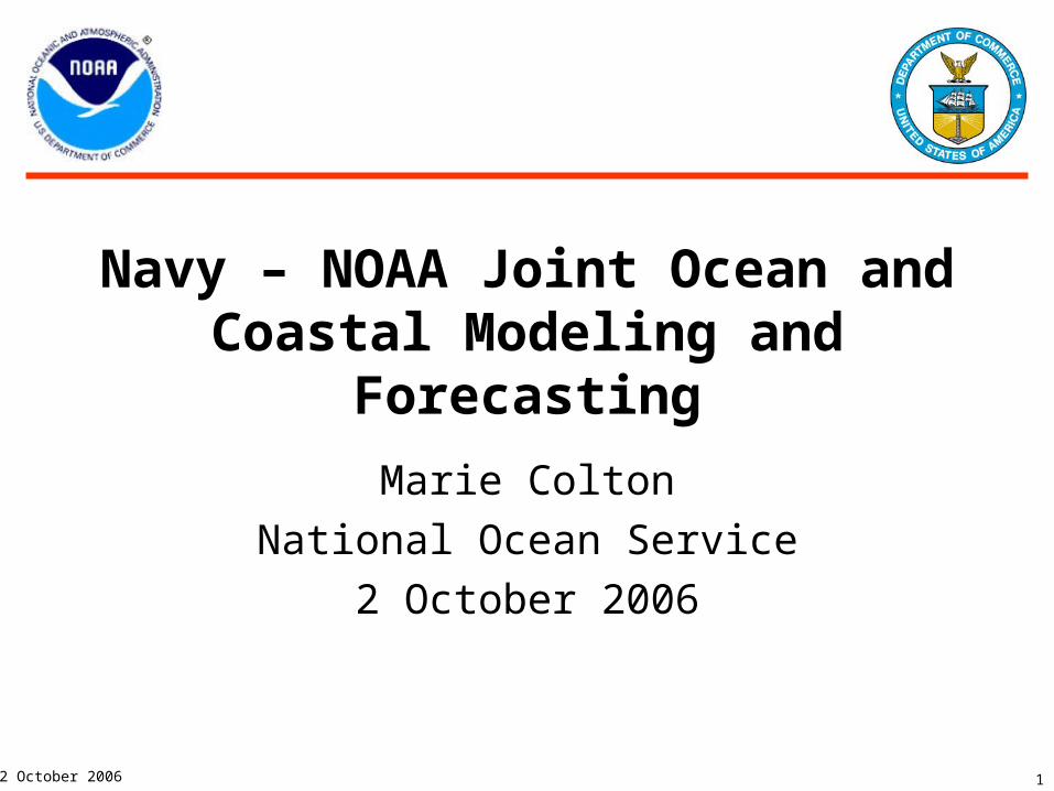
Navy – NOAA Joint Ocean and Coastal Modeling and Forecasting
Marie Colton
National Ocean Service
2 October 2006

2
2 October 2006
Outline
• Goals and Objectives• Purpose• Issue• Background• Intersecting Issues• Summary• Recommendations
3
2 October 2006
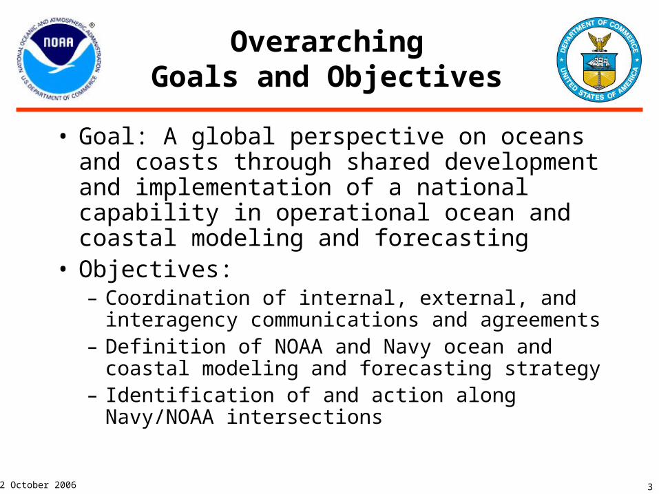
Overarching Goals and Objectives
• Goal: A global perspective on oceans and coasts through shared development and implementation of a national capability in operational ocean and coastal modeling and forecasting
• Objectives:– Coordination of internal, external, and interagency
communications and agreements– Definition of NOAA and Navy ocean and coastal
modeling and forecasting strategy– Identification of and action along Navy/NOAA
intersections
4
2 October 2006
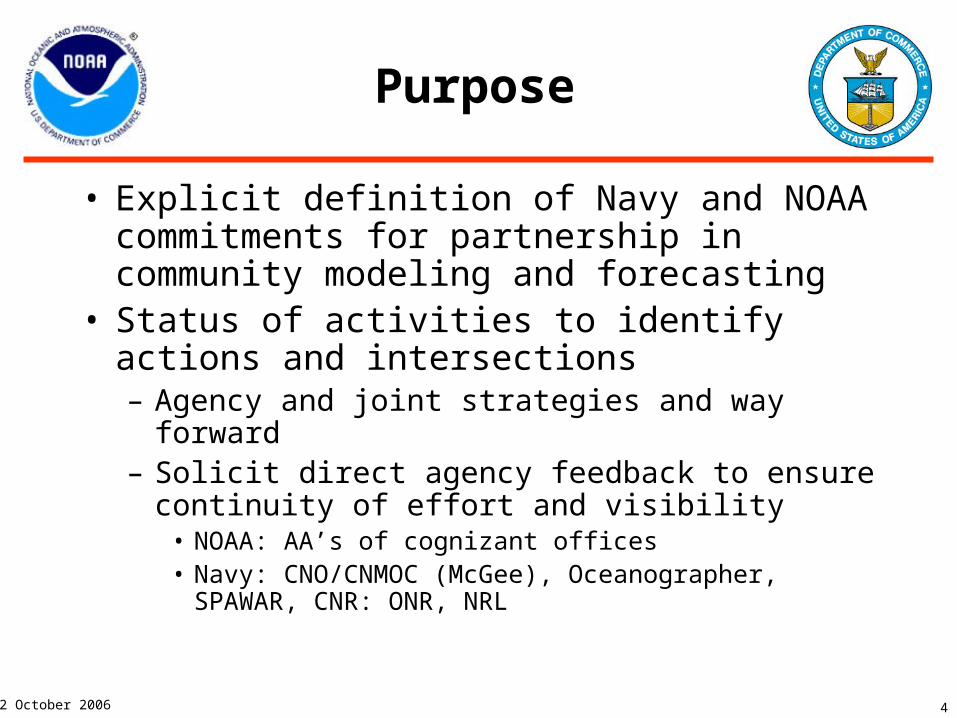
Purpose
• Explicit definition of Navy and NOAA commitments for partnership in community modeling and forecasting
• Status of activities to identify actions and intersections– Agency and joint strategies and way forward– Solicit direct agency feedback to ensure continuity
of effort and visibility• NOAA: AA’s of cognizant offices• Navy: CNO/CNMOC (McGee), Oceanographer,
SPAWAR, CNR: ONR, NRL

5
2 October 2006
Issue
• Ocean/Coastal Community Modeling Requirements Definition: Navy/NOAA– Missions remain separate– Requirement Overlaps identified for effectiveness– Common approaches developed
• Articulate and align capabilities to increase technical support for Navy and NOAA ocean/coastal forecasting– Develop system of consistent compatible ocean models that
pass information and scale from global to regional to very local
– Specific projects to quickly advance cooperation and coordination process
6
2 October 2006
Issue
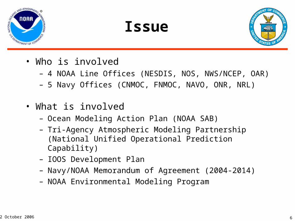
• Who is involved– 4 NOAA Line Offices (NESDIS, NOS, NWS/NCEP, OAR)– 5 Navy Offices (CNMOC, FNMOC, NAVO, ONR, NRL)
• What is involved– Ocean Modeling Action Plan (NOAA SAB)– Tri-Agency Atmospheric Modeling Partnership (National
Unified Operational Prediction Capability)– IOOS Development Plan– Navy/NOAA Memorandum of Agreement (2004-2014)– NOAA Environmental Modeling Program
7
2 October 2006
Background
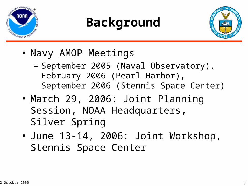
• Navy AMOP Meetings– September 2005 (Naval Observatory), February
2006 (Pearl Harbor), September 2006 (Stennis Space Center)
• March 29, 2006: Joint Planning Session, NOAA Headquarters, Silver Spring
• June 13-14, 2006: Joint Workshop, Stennis Space Center
8
2 October 2006
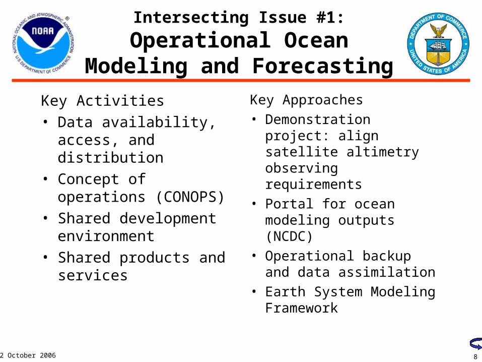
Intersecting Issue #1:
Operational Ocean Modeling and Forecasting
Key Activities• Data availability,
access, and distribution• Concept of operations
(CONOPS)• Shared development
environment• Shared products and
services
Key Approaches• Demonstration project:
align satellite altimetry observing requirements
• Portal for ocean modeling outputs (NCDC)
• Operational backup and data assimilation
• Earth System Modeling Framework
9
2 October 2006
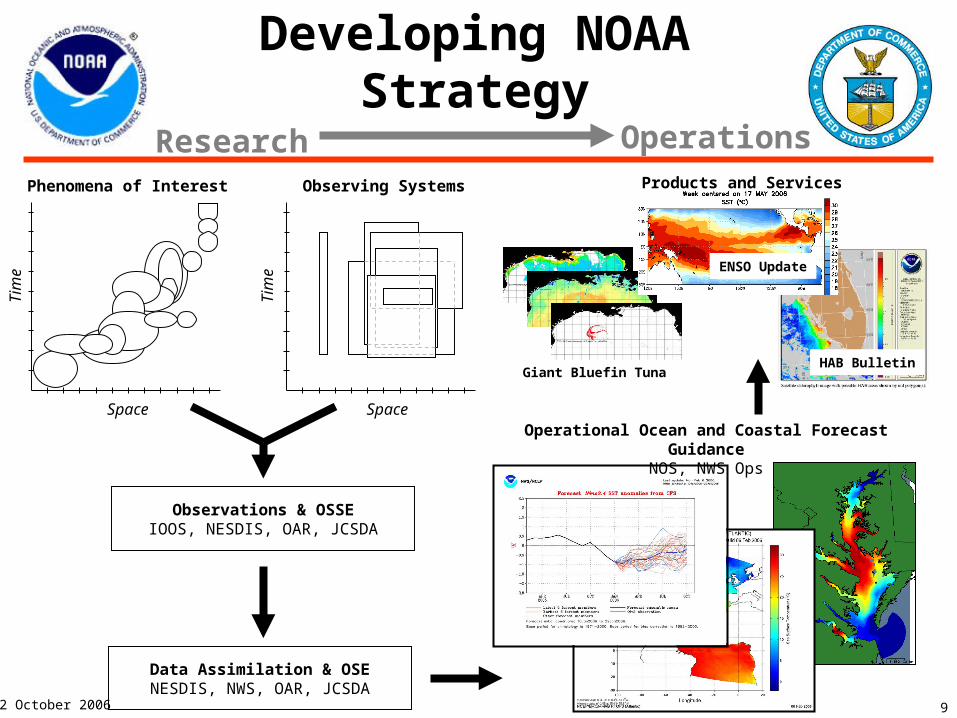
Developing NOAA Strategy
Space
Tim
e
Phenomena of Interest
Space
Tim
e
Observing Systems
Observations & OSSEIOOS, NESDIS, OAR, JCSDA
Data Assimilation & OSENESDIS, NWS, OAR, JCSDA
Operational Ocean and Coastal Forecast GuidanceNOS, NWS Ops
Products and Services
Research Operations
Giant Bluefin TunaHAB Bulletin
ENSO Update
Satellite
In situ
OCEAN DATA ASSIMILATION
MODEL ATTRIBUTES:Global to Regional Scale
MODEL ATTRIBUTES:Global to Regional Scale
OPERATIONAL OCEAN FORECASTS
Climate Forecast System Real-Time Ocean Forecast System
Shared history, coding, and data processing
OBSERVATIONS
CLIMATE FORECAST OCEAN FORECAST
http://cfs.ncep.noaa.gov/ http://polar.ncep.noaa.gov/ofs/
Coastal Ocean Nowcast/Forecast System
COASTAL OCEANBOUNDARY SPECIFICATION
MODEL ATTRIBUTES:Regional to Local
ScaleRapidly Relocatable
http://tidesandcurrents.noaa.gov/models.html
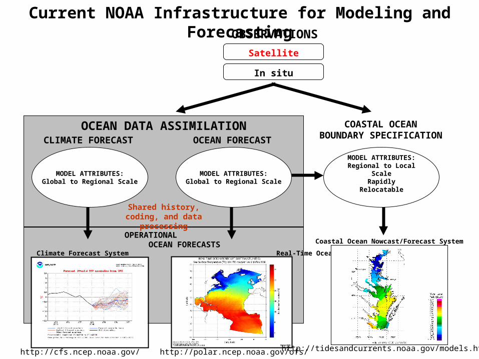
Current NOAA Infrastructure for Modeling and Forecasting
11
2 October 2006
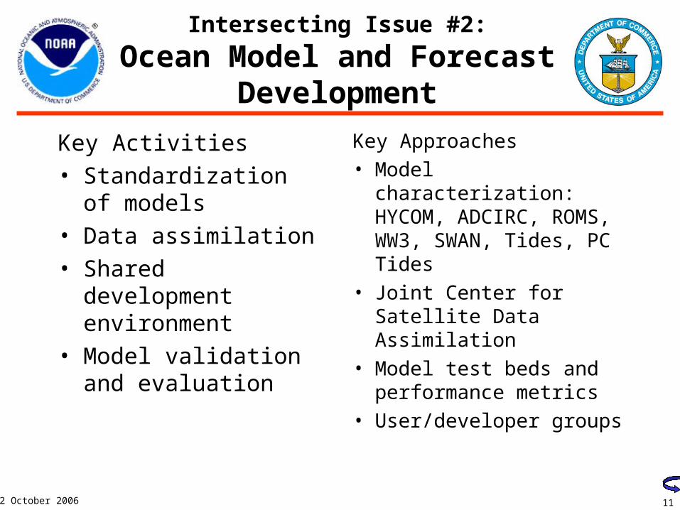
Intersecting Issue #2:
Ocean Model and Forecast Development
Key Activities• Standardization of
models• Data assimilation• Shared development
environment• Model validation and
evaluation
Key Approaches• Model characterization:
HYCOM, ADCIRC, ROMS, WW3, SWAN, Tides, PC Tides
• Joint Center for Satellite Data Assimilation
• Model test beds and performance metrics
• User/developer groups
12
2 October 2006
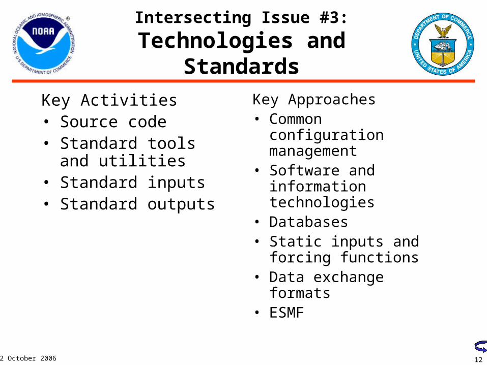
Intersecting Issue #3:
Technologies and Standards
Key Activities• Source code• Standard tools and
utilities• Standard inputs• Standard outputs
Key Approaches• Common configuration
management• Software and
information technologies
• Databases• Static inputs and forcing
functions• Data exchange formats• ESMF
13
2 October 2006
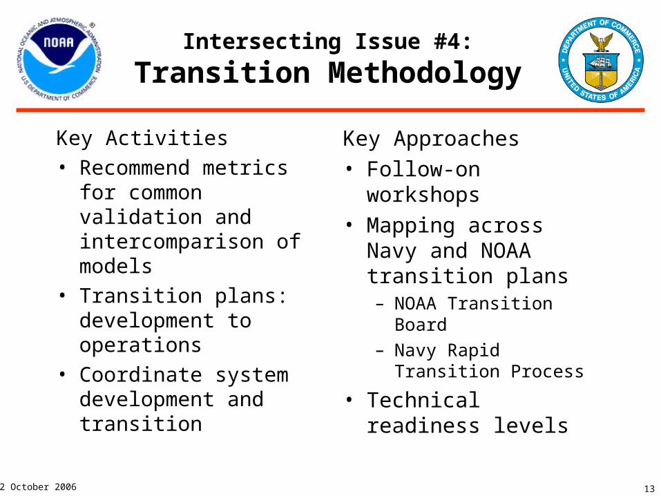
Intersecting Issue #4:
Transition Methodology
Key Activities• Recommend metrics for
common validation and intercomparison of models
• Transition plans: development to operations
• Coordinate system development and transition
Key Approaches• Follow-on workshops• Mapping across Navy
and NOAA transition plans– NOAA Transition Board– Navy Rapid Transition
Process
• Technical readiness levels

14
2 October 2006
Define Current Infrastructure for Common Modeling and Forecasting
Hardware Software Config. Management
NOAA Capabilities
Navy Capabilities
Programs
HYCOM Working group
ADCIRC Working group
WW3 Working group (Planned)
GFDL Models

15
2 October 2006
Intersecting Issue #5:
Coordination and Program
• Ensure chains of command are informed and continue to support the process
• Maintain a steady flow of results and adjust coordination accordingly
• Agreements for shared products or services or proposed joint efforts
16
2 October 2006
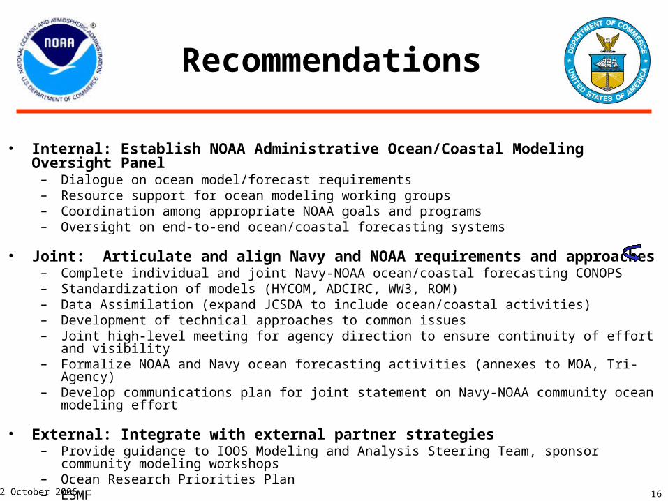
Recommendations
• Internal: Establish NOAA Administrative Ocean/Coastal Modeling Oversight Panel– Dialogue on ocean model/forecast requirements– Resource support for ocean modeling working groups– Coordination among appropriate NOAA goals and programs– Oversight on end-to-end ocean/coastal forecasting systems
• Joint: Articulate and align Navy and NOAA requirements and approaches – Complete individual and joint Navy-NOAA ocean/coastal forecasting CONOPS– Standardization of models (HYCOM, ADCIRC, WW3, ROM)– Data Assimilation (expand JCSDA to include ocean/coastal activities)– Development of technical approaches to common issues– Joint high-level meeting for agency direction to ensure continuity of effort and visibility– Formalize NOAA and Navy ocean forecasting activities (annexes to MOA, Tri-Agency)– Develop communications plan for joint statement on Navy-NOAA community ocean modeling effort
• External: Integrate with external partner strategies – Provide guidance to IOOS Modeling and Analysis Steering Team, sponsor community modeling
workshops– Ocean Research Priorities Plan– ESMF

17
2 October 2006
Alternative #1
• Ad hoc coordination with NOAA “matrix” and Navy• Pros
– No funds needed– No obligations necessary (flexible)
• Cons– Doesn’t meet urgency of need for operational ocean and
coastal modeling and forecasting – Proliferation of options to solve problems independently– Technical issues not solved efficiently– One NOAA common voice not heard– No clear message to external community– Cannot guarantee commitments or quality
18
2 October 2006
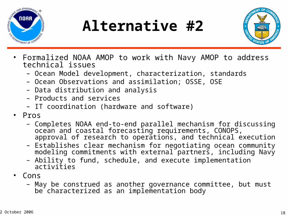
Alternative #2
• Formalized NOAA AMOP to work with Navy AMOP to address technical issues– Ocean Model development, characterization, standards– Ocean Observations and assimilation; OSSE, OSE– Data distribution and analysis– Products and services– IT coordination (hardware and software)
• Pros– Completes NOAA end-to-end parallel mechanism for discussing ocean and
coastal forecasting requirements, CONOPS, approval of research to operations, and technical execution
– Establishes clear mechanism for negotiating ocean community modeling commitments with external partners, including Navy
– Ability to fund, schedule, and execute implementation activities• Cons
– May be construed as another governance committee, but must be characterized as an implementation body
19
2 October 2006
Summary
• Navy/NOAA working together to establish common ocean and coastal modeling and forecasting frameworks for future success
• Building on mutual and unique strengths in operational oceanography and coastal services through examination of existing efforts
• Providing harmonized environmental models for external communities to focus on and provide physical basis for ecological forecasting
2 October 2006 20
Extended Discussion
Communications
NOAA Strategy
Integration
21
2 October 2006
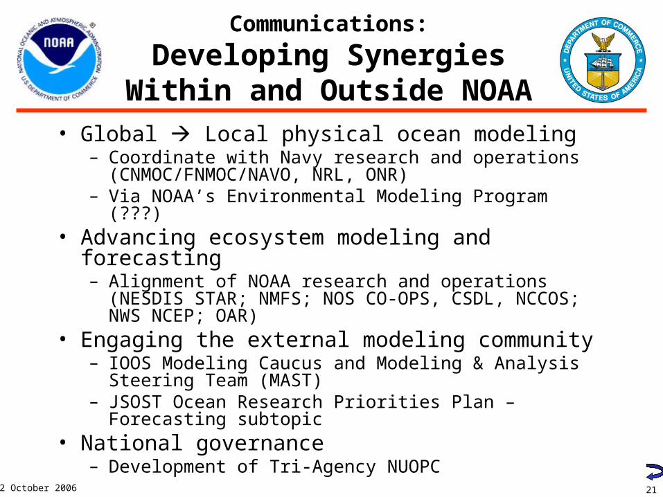
Communications:
Developing Synergies Within and Outside NOAA
• Global Local physical ocean modeling– Coordinate with Navy research and operations
(CNMOC/FNMOC/NAVO, NRL, ONR)– Via NOAA’s Environmental Modeling Program (???)
• Advancing ecosystem modeling and forecasting– Alignment of NOAA research and operations (NESDIS
STAR; NMFS; NOS CO-OPS, CSDL, NCCOS; NWS NCEP; OAR)
• Engaging the external modeling community– IOOS Modeling Caucus and Modeling & Analysis Steering
Team (MAST) – JSOST Ocean Research Priorities Plan – Forecasting
subtopic• National governance
– Development of Tri-Agency NUOPC
22
2 October 2006
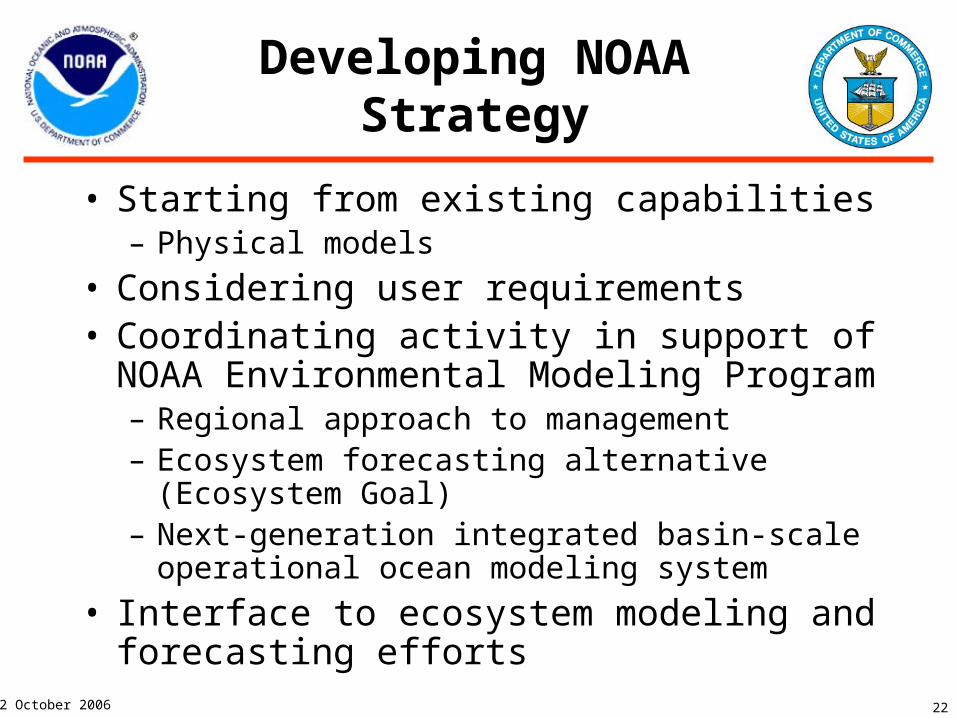
Developing NOAA Strategy
• Starting from existing capabilities– Physical models
• Considering user requirements• Coordinating activity in support of NOAA
Environmental Modeling Program– Regional approach to management– Ecosystem forecasting alternative (Ecosystem
Goal)– Next-generation integrated basin-scale operational
ocean modeling system
• Interface to ecosystem modeling and forecasting efforts
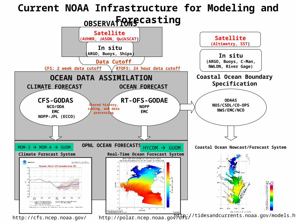
Satellite(AVHRR, JASON, QuikSCAT)
In situ(ARGO, Buoys, Ships)
OCEAN DATA ASSIMILATION
RT-OFS-GODAENOPPEMC
CFS-GODASNCO/ODA
EMC NOPP-JPL (ECCO)
OPNL OCEAN FORECASTS
Climate Forecast System Real-Time Ocean Forecast System
Data CutoffCFS: 2 week data cutoff RTOFS: 24 hour data cutoff
Shared history, coding, and data
processing
MOM-3 MOM-4 GUOM HYCOM GUOM
OBSERVATIONS
CLIMATE FORECAST OCEAN FORECAST
http://cfs.ncep.noaa.gov/ http://polar.ncep.noaa.gov/ofs/
Coastal Ocean Nowcast/Forecast System
Coastal Ocean BoundarySpecification
ODAASNOS/CSDL/CO-OPS
NWS/EMC/NCO
http://tidesandcurrents.noaa.gov/models.html
In situ(ARGO, Buoys, C-Man, NWLON, River Gage)
Satellite(Altimetry, SST)
Current NOAA Infrastructure for Modeling and Forecasting

24
2 October 2006
Current Infrastructure for Modeling and Forecasting
• Mostly physics modeling and data assimilation
• Working towards integrating ecological modeling
• Downscaling from global to regional to local models
• Need to promote existing operations within and outside of NOAA

25
2 October 2006
Developing NOAA Ocean and Coastal Modeling and Forecasting Strategy:
Ecosystems Modeling
• Starting from existing capabilities– NOS Modeling Prioritization Project
• Considering user requirements• Coordinating activity in support of NOAA Ecosystem
Goal Team– Regional approach to management– Ecosystem forecasting alternative
• Connections to Navy ecosystem modeling needs– Water quality, ocean optics, rivers and estuaries, marine
mammals
• Seamless suite of products and services
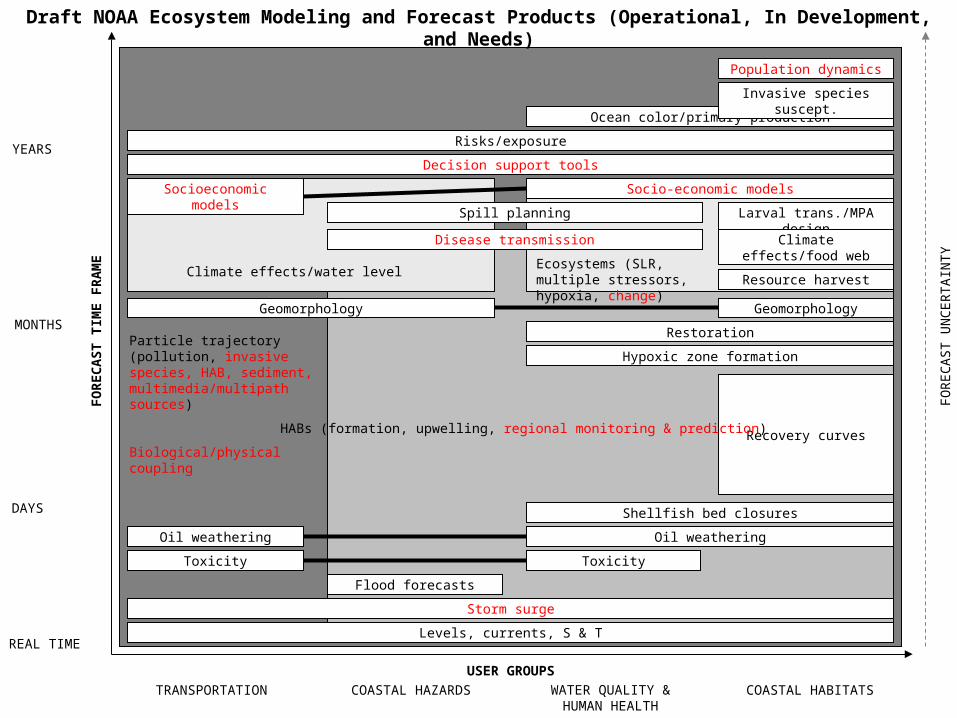
NOAA CoordinationF
OR
EC
AS
T T
IME
FR
AM
E
REAL TIME
DAYS
MONTHS
YEARS
USER GROUPS
TRANSPORTATION COASTAL HAZARDS WATER QUALITY &HUMAN HEALTH
COASTAL HABITATS
FO
RE
CA
ST
UN
CE
RT
AIN
TY
Toxicity Toxicity
Flood forecasts
Oil weathering Oil weathering
Geomorphology
Risks/exposure
Ocean color/primary production
Invasive species suscept.
Larval trans./MPA design
Climate effects/food web
Storm surge
Shellfish bed closures
Decision support tools
Population dynamics
Socioeconomic models Socio-economic models
Restoration
Geomorphology
Levels, currents, S & T
Spill planning
Resource harvest
Disease transmission
Hypoxic zone formation
Recovery curvesHABs (formation, upwelling, regional monitoring & prediction)
Particle trajectory (pollution, invasive species, HAB, sediment, multimedia/multipath sources)
Biological/physical coupling
Ecosystems (SLR, multiple stressors, hypoxia, change)
Climate effects/water level
Draft NOAA Ecosystem Modeling and Forecast Products (Operational, In Development, and Needs)

28
2 October 2006
Recommendations
• Complete NOAA, Navy, and joint CONOPS for operational ocean and coastal modeling and forecasting– Standardization of models (HYCOM, ADCIRC, WW3, ROM)
• Coordinate among appropriate NOAA goals and programs• Specify continued NOAA-wide involvement
– Resource support for working groups– Recognition of and dialogue on requirements
• Clarify IOOS roles and responsibilities in community modeling development (Modeling and Analysis Steering Team)– Resource support for community modeling workshops
• Formalize NOAA and Navy governance in ocean and coastal modeling and forecasting– Technical cooperation via annexes to MOU– Programmatic coordination via Tri-Agency NUOPC and other
means– Develop communications plan
29
2 October 2006
Schedule of Significant Events and Milestones
2 October 2006 30
Additional and Expanded Slides
31
2 October 2006
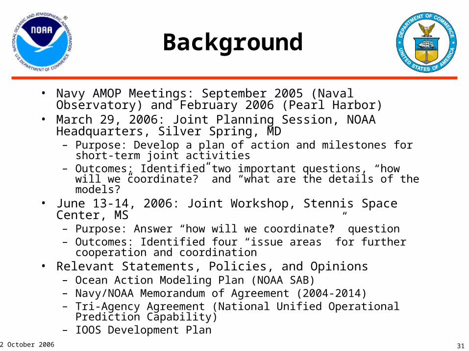
Background
• Navy AMOP Meetings: September 2005 (Naval Observatory) and February 2006 (Pearl Harbor)
• March 29, 2006: Joint Planning Session, NOAA Headquarters, Silver Spring, MD– Purpose: Develop a plan of action and milestones for short-term
joint activities– Outcomes: Identified two important questions, “how will we
coordinate?” and “what are the details of the models?”• June 13-14, 2006: Joint Workshop, Stennis Space Center, MS
– Purpose: Answer “how will we coordinate?” question– Outcomes: Identified four “issue areas” for further cooperation and
coordination• Relevant Statements, Policies, and Opinions
– Ocean Action Modeling Plan (NOAA SAB)– Navy/NOAA Memorandum of Agreement (2004-2014)– Tri-Agency Agreement (National Unified Operational Prediction
Capability)– IOOS Development Plan
32
2 October 2006
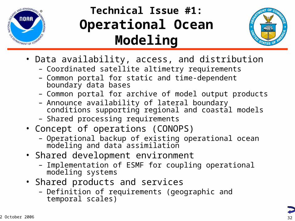
Technical Issue #1:
Operational Ocean Modeling
• Data availability, access, and distribution– Coordinated satellite altimetry requirements– Common portal for static and time-dependent boundary data
bases– Common portal for archive of model output products– Announce availability of lateral boundary conditions
supporting regional and coastal models– Shared processing requirements
• Concept of operations (CONOPS)– Operational backup of existing operational ocean modeling
and data assimilation• Shared development environment
– Implementation of ESMF for coupling operational modeling systems
• Shared products and services– Definition of requirements (geographic and temporal scales)
33
2 October 2006
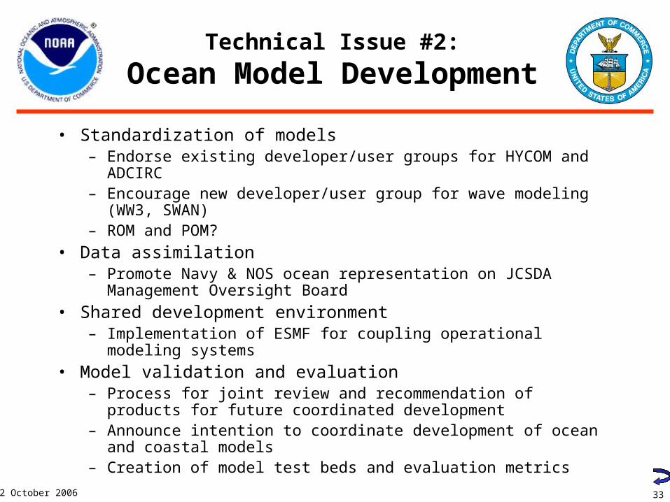
Technical Issue #2:
Ocean Model Development
• Standardization of models– Endorse existing developer/user groups for HYCOM and ADCIRC– Encourage new developer/user group for wave modeling (WW3,
SWAN)– ROM and POM?
• Data assimilation– Promote Navy & NOS ocean representation on JCSDA
Management Oversight Board
• Shared development environment– Implementation of ESMF for coupling operational modeling systems
• Model validation and evaluation– Process for joint review and recommendation of products for future
coordinated development– Announce intention to coordinate development of ocean and
coastal models– Creation of model test beds and evaluation metrics
34
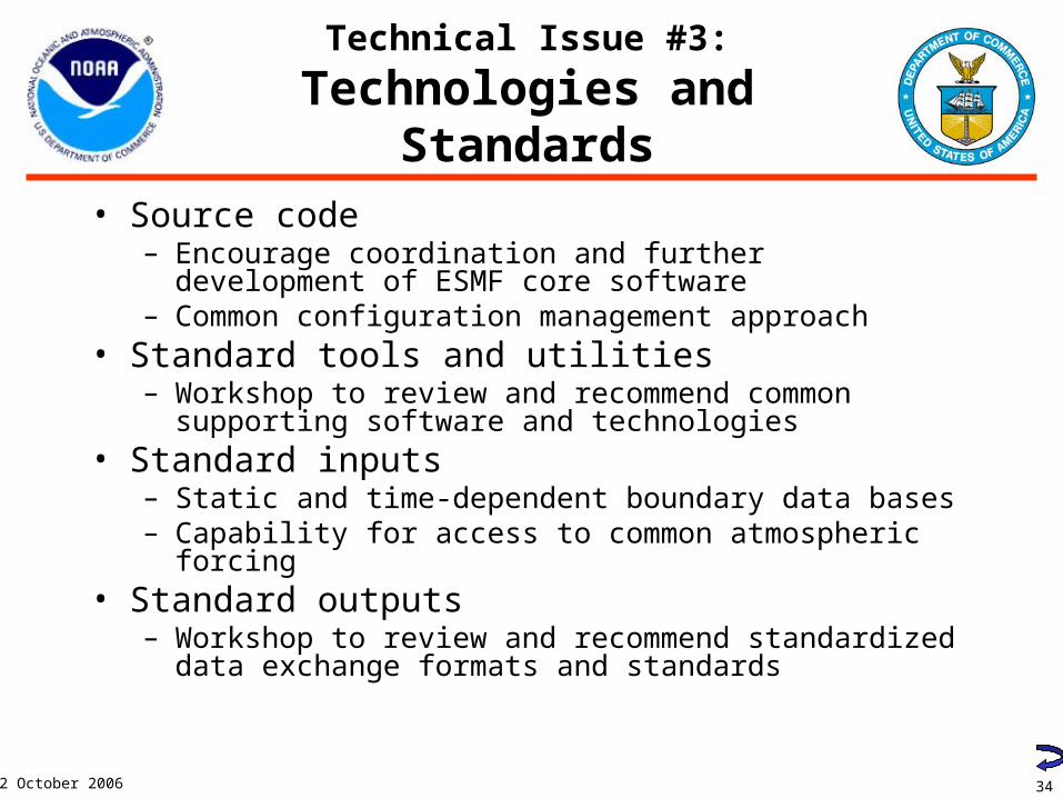
2 October 2006
Technical Issue #3:
Technologies and Standards
• Source code– Encourage coordination and further development of ESMF
core software– Common configuration management approach
• Standard tools and utilities– Workshop to review and recommend common supporting
software and technologies• Standard inputs
– Static and time-dependent boundary data bases– Capability for access to common atmospheric forcing
• Standard outputs– Workshop to review and recommend standardized data
exchange formats and standards

Fronts,Eddies, &Filaments
PlanktonMigration
Phenomena of Interest
1 sec
1 wk
1 day
1 mo
1 yr
10 yr
100 yr
10-3 m 10-2 m 10-1 m 100 m 101 m 102 m 103 m 104 m 105 m 106 m 107 m
MolecularProcesses
1 min
IndividualMovement
1 hr
TurbulentPatch Size
Surface Waves
Langmuir Cells
Inertial/Internal& Solitary Waves
InternalTides
Surface Tides
PhytoplanktonBlooms
Synoptic Storms, River Outflows, & Sediment
Resuspension
Mesoscale phenomena
Coastally trapped waves
Seasonal MLD & Biomass Cycles
ENSO
Decadal Oscillations/Fish Regime Shifts
Climate
Spatial Scale
Te
mp
ora
l Sca
le
Adapted from Dickey (2003). J. Marine Systems 40-41: 5-48.
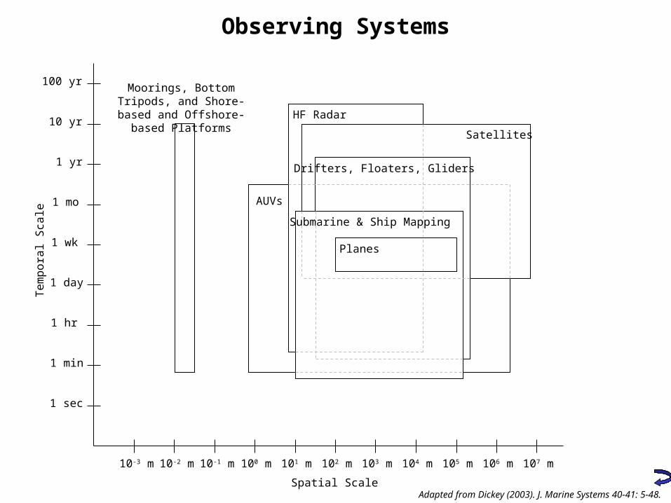
Observing Systems
10-3 m 10-2 m 10-1 m 100 m 101 m 102 m 103 m 104 m 105 m 106 m 107 m
Spatial Scale
1 sec
1 wk
1 day
1 mo
1 yr
10 yr
100 yr
1 min
1 hr
Te
mp
ora
l Sca
le
Moorings, Bottom Tripods, and Shore-based and
Offshore-based Platforms
AUVs
HF Radar
Satellites
Planes
Drifters, Floaters, Gliders
Submarine & Ship Mapping
Adapted from Dickey (2003). J. Marine Systems 40-41: 5-48.

38
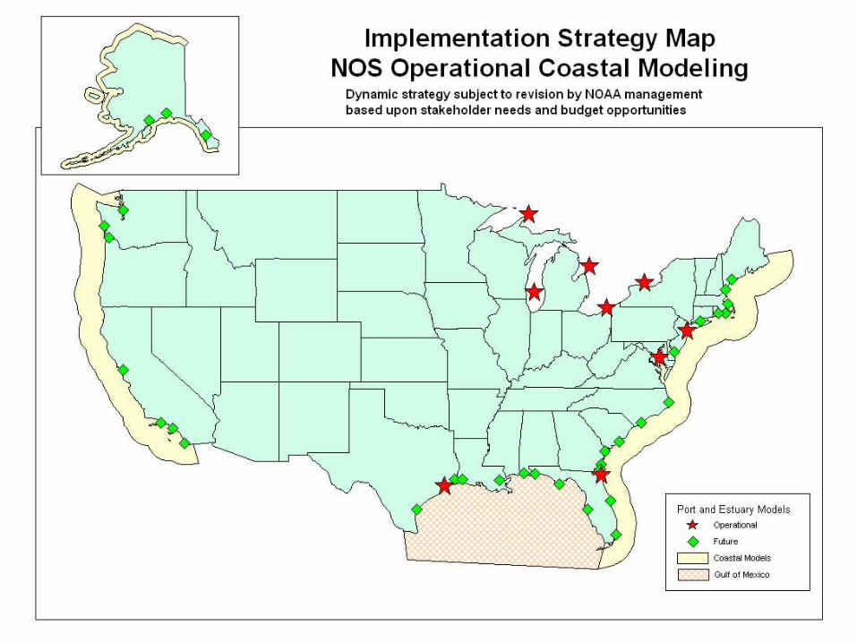
2 October 2006
High Resolution Coastal Domains(Demonstrates interface between Shelf and
Coastal models)
39
2 October 2006
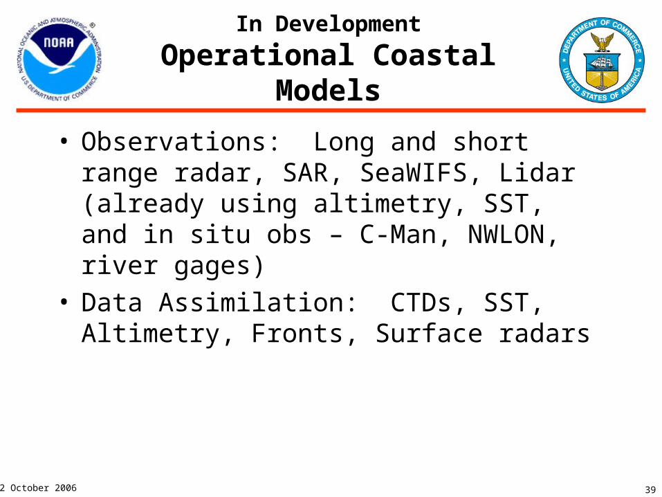
In Development
Operational Coastal Models
• Observations: Long and short range radar, SAR, SeaWIFS, Lidar (already using altimetry, SST, and in situ obs – C-Man, NWLON, river gages)
• Data Assimilation: CTDs, SST, Altimetry, Fronts, Surface radars
40
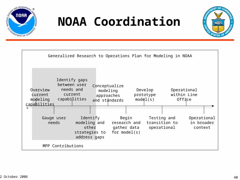
2 October 2006
NOAA Coordination
Generalized Research to Operations Plan for Modeling in NOAA
Gauge user needs
Overview current
modeling capabilities
Identify gaps between user
needs and current
capabilities
Identify modeling and
other strategies to address gaps
Conceptualize modeling
approaches and standards
Begin research and gather
data for model(s)
Develop prototype model(s)
Testing and transition to operational
Operational within Line
Office
Operational in broader context
MPP Contributions