Embed Size (px)
Citation preview

PROPOSED NATURAL RESOURCES PLAN FOR THE WELLINGTON REGION - APPEALS VERSION (2019) 14
2 Interpretation
2.1 How to use this Plan
The Plan is a combined regional air, land, water and coastal plan. This section
explains how the Plan brings these elements together in objectives, policies, rules
and methods.
Section 80(8) of the Resource Management Act 1991 (the RMA) requires
regional councils to identify the provisions in the Plan that form part of the
regional coastal plan. These provisions require ministerial approval under
section 28(b) of the RMA and are identified by an icon . Due to the
integrated nature of the Plan, the coastal icon does not mean that the provisions
marked with the coastal icon are exclusive to application in the coastal marine
area. Provisions marked with the coastal icon apply to the coastal marine area
and are also relevant to provisions managing air, land and water outside of the
coastal marine area where the regional council has jurisdiction.
2.1.1 Objectives
The first part of this document (chapter 3) identifies the resource management
objectives for air, land, water and coastal resources in the Wellington Region.
These enable Council to carry out its functions under section 30 of the RMA.
The objectives provide the direction and justification for the policies, rules and
other methods.
The objectives should be read together to gain an understanding of what the Plan
is seeking to accomplish, the natural resource management priorities for the
region and the manner in which they are to be addressed. The objectives have
been designed to work together, recognising both the complex interactions of
natural systems and the needs of resource users, decision-makers and community
to clearly understand the context in which resource use activities take place.
2.1.2 Policies
The policies are the course of action intended to achieve the objectives, as
required under section 67(1)(b) of the RMA. Policies are implemented through
other methods (rules or methods). They provide the rationale for the status that
is given to activities in the rules (i.e. permitted, controlled, restricted
discretionary, discretionary, non-complying or prohibited). As with the
objectives, the policies are intended to apply as a comprehensive suite, and must
be read and considered together.
The policy order starts with general policies which could apply to a range of
interests and values and then are grouped in relation to the regional council’s
management functions. The specific whaitua policies are in the whaitua chapters
(chapters 7 to 11) of the Plan. As noted above, this does not imply a hierarchy
and all policies of the Plan apply.
2.1.3 Rules
The rules implement the policies, as required under section 67(1)(c) of the RMA.
Commented [RS1]: Dan Riddiford
Commented [RS2]: Wellington International Airport Limited
PROPOSED NATURAL RESOURCES PLAN FOR THE WELLINGTON REGION - APPEALS VERSION (2019) 15
The rules have the force and effect of regulations in statute, which means that
they are legally binding. They determine whether a person needs to apply for a
resource consent or whether the proposed activity is permitted and does not
require consent (known as permitted activities). The rules may also make some
activities prohibited, which means there can be no resource consent application
made for that activity. An activity needs to comply with all relevant rules in the
Plan, unless the rule itself states otherwise.
Generally, the Plan does not repeat provisions from national environmental
standards or regulations – these must be read in conjunction with the Plan
provisions.
Permitted activities do not require resource consent provided they comply
with the specified conditions.
Controlled activities require resource consent so that specific assessment of
identified matters can be undertaken and resource consent conditions
imposed to manage the effects of the activity. An application for a controlled
activity must be granted.
Restricted discretionary and discretionary activities may be declined or
granted (with or without conditions) depending on the effects of the activity.
Non-complying activities may be declined or granted (with or without
conditions) depending on the effects of the activity. This activity status is
often reserved for those activities where the potential adverse effects are
great but do not necessarily warrant prohibition.
Prohibited activities are not appropriate in any circumstance, and no
resource consent application may be made for a prohibited activity.
To make it easier to apply for resource consents and to reduce the number of
separate resource consents required to undertake any particular activity, the Plan
has, where practicable, combined associated activities into one rule. The several
permissions which may be required under section 9 and sections 12 to 15B of
the RMA are included in one rule for which one application for resource consent
can be made. Note that resource consent is not required for land use activities
under section 9 of the RMA unless there is a rule in the Plan stating otherwise.
2.1.4 Other methods
Other methods also implement the policies in the Plan and are complementary
to the rules, being a non-regulatory means of achieving the objectives. These
methods include the provision of information and guidance, resource
investigations and similar programmes.
The non-regulatory other methods are set out in a separate chapter of the Plan
(chapter 6) and are referenced throughout the relevant sections of the Plan.
2.1.5 Whaitua chapters
Chapters 7 to 11 contain the whaitua catchment specific provisions. The whaitua
catchment boundaries are shown in the introductory chapter. These provisions
PROPOSED NATURAL RESOURCES PLAN FOR THE WELLINGTON REGION - APPEALS VERSION (2019) 16
will continue to be developed over time and included as plan changes and as
variations. These chapters should not be read in isolation and the region-wide
provisions in Chapters 2, 3, 4, 5 and 6 still apply.
2.1.6 Definitions, schedules and maps
The definitions in this chapter, and the schedules and maps at the end of the Plan,
provide detailed information, references and links.
The Schedules (chapter 12) are ordered alphabetically except Schedule F1 which
names rivers and streams in sub-catchments and therefore is listed from the west
of the region to the east.
The maps (chapter 13) are included for indicative purposes only. For a more
detailed complete version of the planning maps the online GIS overlay version
of the relevant map needs to be consulted. The GIS overlay may include
additional detailed information which may have implications on activities in the
area concerned and as such, the hard copy map should not be relied on
independently. The online version is available on the Wellington Regional
Council website at http://mapping.gw.govt.nz/gwrc/ and can be accessed from
the Wellington Regional Council offices or public library.
There are instructions on how to use the GIS overlay on the Wellington Regional
Council’s website. For convenience, each site has a label on the GIS overlay
which links back to the relevant schedule.
PROPOSED NATURAL RESOURCES PLAN FOR THE WELLINGTON REGION - APPEALS VERSION (2019) 17
2.2 Definitions
Definitions have the same meaning in the singular and plural.
Words that are defined as they are in the Regional Policy Statement for the
Wellington region have an asterisk * after the definition term.
Words defined in the Resource Management Act 1991 are not repeated.
Throughout the Plan reference is made to Ruamāhanga, Kāpiti and Ōtaki, the
spelling of which has been agreed through consultation with local iwi. It is
acknowledged that these are not the official names for these areas as listed in the
New Zealand Gazetteer of Place Names which are Ruamahanga, Kapiti and
Otaki respectively.
Active beach (coastal marine area)
The area from the crest of either the foredune or, top of a storm berm or, an erosion scarp or, from the toe of a cliff or, an artificial embankment or, a seawall/revetment, out to the limit of wave breaking. It includes the dry backshore, the intermittently wet and dry foreshore and the subtidal nearshore seabed below mean low water springs. The active beach experiences change on a daily, weekly, monthly and inter-annual basis as a result of coastal processes including tides, nearshore currents, wave breaking and run up, sediment transport by wind, waves, fluvial and nearshore currents, erosion and accretion, and biological activity.
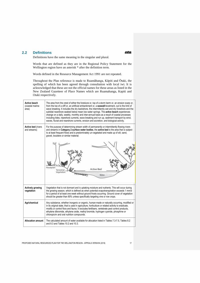
Active bed (rivers and streams)
For the purpose of determining stream width of permanently or intermittently flowing rivers and streams in Category 2 surface water bodies, the active bed is the area that is subject to at least frequent flows and is predominately un-vegetated and made up of silt, sand, gravel, boulders or similar material.
Actively growing vegetation
Vegetation that is not dormant and is uptaking moisture and nutrients. This will occur during the growing season, which is defined as when potential evapotranspiration exceeds 1 mm/d for a period of at least one week without ground frosts occurring. Ground cover of vegetation should be greater than 80% unless specifically targeting vine or row crops.
Agrichemical Any substance, whether inorganic or organic, human-made or naturally occurring, modified or in its original state, that is used in agriculture, horticulture or related activity to eradicate, modify or control flora and fauna. It excludes fertilisers, vertebrate pest control products, ethylene dibromide, ethylene oxide, methyl bromide, hydrogen cyanide, phosphine or chloropicrin and oral nutrition compounds.
Allocation amount The calculated amount of water available for allocation listed in Tables 7.3-7.5, Tables 8.2 and 8.3 and Tables 10.2 and 10.3.
PROPOSED NATURAL RESOURCES PLAN FOR THE WELLINGTON REGION - APPEALS VERSION (2019) 18
Ambient air Ambient air means the air outside building and structures. This does not include indoor air, air in the workplace, or contaminated air discharges from a source.
Animal effluent A slurry of faeces and urine from animals other than humans, including associated process water, washdown water, contaminants and sludge but excluding solid animal waste.
Anti-fouling coating
A coating applied to submerged surfaces to prevent or reduce accumulation of biofouling. Common types of anti-fouling coating are described in Appendix 2 of the Anti-fouling and in-water cleaning guidelines (June 2013) for Australia and New Zealand.
Aquatic ecosystem health
The degree to which an aquatic ecosystem is able to sustain its ecological structure, processes, functions, and resilience within its range of natural variability.
Aquifer A permeable layer of rock, sand, or earth that contains water or allows water to pass through it.
Beach recontouring
(beds of rivers)
The movement of in-situ natural river beach sediments (including gravel, rock, sand) on a river beach (part of the bed of the river not covered by water) to remove obstructions to flow or to move material to protect an eroding bank edge and includes beach ripping to loosen the upper surface (armour) layer of the beach to encourage gravel movement.
Beach recontouring (coastal marine area)
The redistribution (using hand and/or mechanical methods) of in-situ, natural beach sediments in order to reshape the beach profile for hazards management, beach or dune restoration and may involve the reshaping of an erosion scarp to reduce its gradient.
Biodiversity mitigation
Mitigation is the abatement (lessening or repair) of the adverse effects of an activity, undertaken in direct response to, and at the same location as, that activity, designed and implemented in accordance with principles set out in Schedule G1.
Biodiversity offset A measurable positive environmental outcome resulting from an actions designed to compensate redress for the residual adverse effects on biodiversity arising from an activityies after appropriate avoidance, minimisation, and remediation and mitigation measures have been taken applied. The goal of a Bbiodiversity offsets differ from mitigation in so far as offsets require the demonstration of is to achieve no net loss, and preferably a net gain, of indigenous biodiversity values and preferably a net gain. The principles to be applied when proposing and considering biodiversity offsets are provided in Schedule G2 (biodiversity offsetting).
Biofouling Accumulation of aquatic organisms (micro-organisms, plants and materials) on surfaces and structures immersed in or exposed to the aquatic environment.
Biogas A gas produced during the breakdown of biological matter.
Biosolids Wastewater sludge derived from a wastewater treatment plant that has been treated and/or made stable to the extent that it is able to be safely handled.
Bore A structure or hole in the ground constructed for the purpose of:
(a) investigating or monitoring the conditions below the ground surface, or
(b) abstracting liquid substances from the ground, or
(c) discharging liquid substances into the ground.
Break-feeding Livestock in a paddock where access to pasture or forage in a section of the paddock is controlled by the frequent movement of a temporary fence or other method to contain the livestock.
Commented [RS3]: Meridian Energy Limited
Commented [RS4]: Meridian Energy Limited
PROPOSED NATURAL RESOURCES PLAN FOR THE WELLINGTON REGION - APPEALS VERSION (2019) 19
Bulk solid material
Means materials consisting of, or including, fragments that could be discharged as dust or particulate. These materials include but are not limited to: gravel, quarried rock, quarry overburden, fertiliser, coal, flour, rock aggregate, grains, compost and woodchip.
Catchment based flood and erosion risk management activities
Structures built, controlled or maintained by a local authority and associated activities for the purpose of protecting the community from flood or erosion hazard risk in accordance with a river management scheme or flood plain management plan.
Catchment management sub-unit
The water bodies (rivers, Lake Wairarapa or groundwater) in each catchment management sub-unit row of Tables 7.3-7.5 (Ruamāhanga Whaitua).
Catchment management unit
The water bodies (rivers, Lake Wairarapa or groundwater) in:
(a) Tables 8.2-8.3 (Wellington Harbour and Hutt Valley Whaitua); and
(b) Tables 10.2-10.3 (Kāpiti Coast Whaitua), and
(c) Each catchment management unit row of Tables 7.3-7.5 (Ruamāhanga Whaitua).
Category 1 surface water body
Category 1 surface water body includes, and is limited to:
(a) outstanding water bodies identified in Schedule A (outstanding water bodies), and
(b) sites with significant mana whenua values identified in Schedule C (mana whenua), and
(c) inanga spawning habitat identified in Schedule F1b (inanga spawning habitats), and
(d) habitats for indigenous birds in rivers identified in Schedule F2a (birds-rivers)
(e) significant natural wetlands identified in Schedule F3 (identified significant natural wetlands), and
(f) estuaries identified in Schedule F4 (coastal sites), and
(g) within 1,000m upstream of a surface water abstraction site for a community drinking water supply shown on Map 26.
Category 2 surface water body
Category 2 surface water body includes, and is limited to:
(a) estuaries other than those identified in Schedule F4 (coastal sites), and
(b) within the mapped lowland areas shown on Map 29, rivers that have an active bed width of 1m or wider, and drains greater than 1m wide, and water races, and
(c) rivers and streams important to trout spawning habitat identified in Schedule I (trout habitat), and
(d) natural lakes,
but excludes any surface water body that meets the definition of a Category 1 surface water body.
Category A groundwater
Groundwater described as Category A groundwater in Table 4.1.
Category B groundwater
Groundwater described as Category B groundwater in Table 4.1.
Category B groundwater (stream depletion)
The stream depletion portion of Category B groundwater described in Table 4.1 Category B groundwater Allocation (i) and (ii)
Category C groundwater
Groundwater described as Category C groundwater in Table 4.1.
Commented [RS5]: Porirua City Council
Commented [RS6]: Minister of Conservation Carterton District Council
Federated Farmers of New Zealand
PROPOSED NATURAL RESOURCES PLAN FOR THE WELLINGTON REGION - APPEALS VERSION (2019) 20
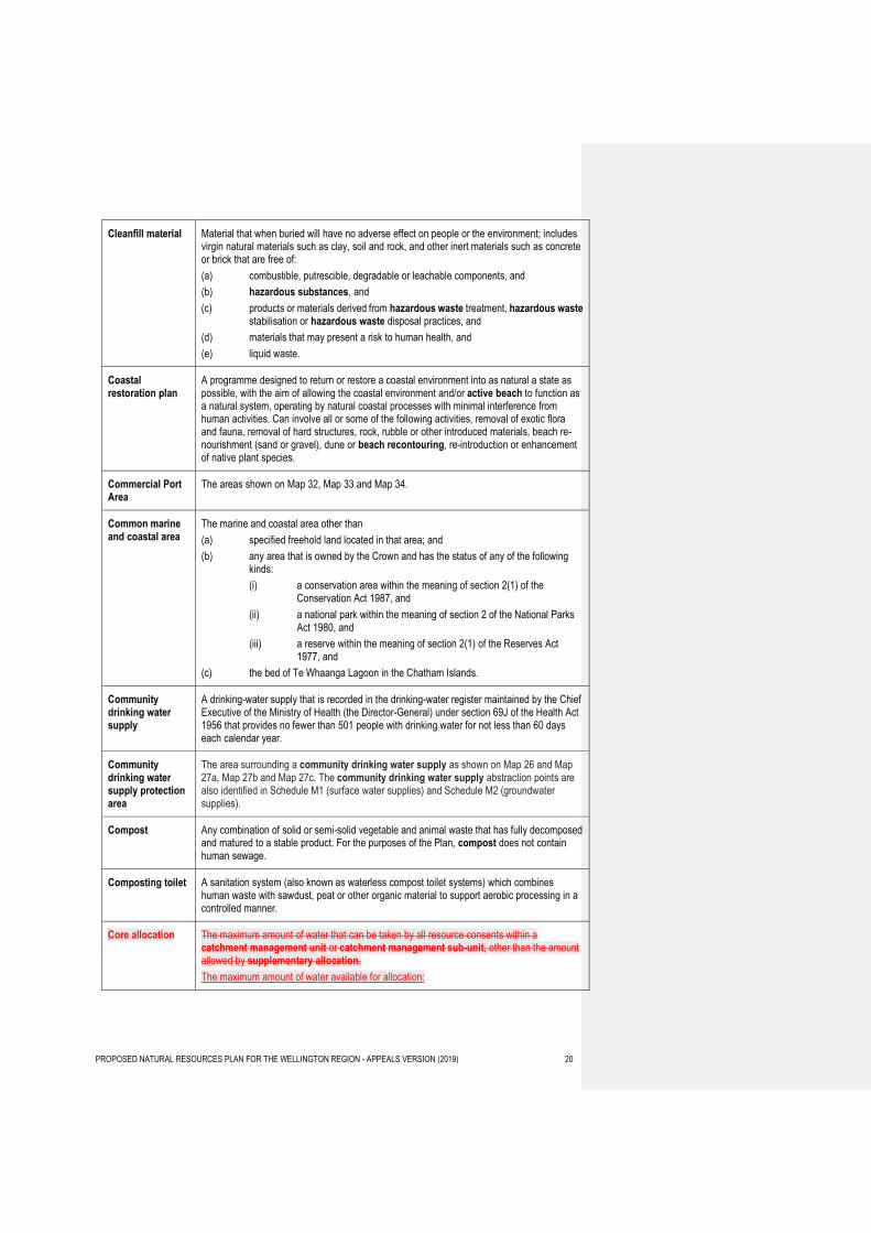
Cleanfill material Material that when buried will have no adverse effect on people or the environment; includes virgin natural materials such as clay, soil and rock, and other inert materials such as concrete or brick that are free of:
(a) combustible, putrescible, degradable or leachable components, and
(b) hazardous substances, and
(c) products or materials derived from hazardous waste treatment, hazardous waste stabilisation or hazardous waste disposal practices, and
(d) materials that may present a risk to human health, and
(e) liquid waste.
Coastal restoration plan
A programme designed to return or restore a coastal environment into as natural a state as possible, with the aim of allowing the coastal environment and/or active beach to function as a natural system, operating by natural coastal processes with minimal interference from human activities. Can involve all or some of the following activities, removal of exotic flora and fauna, removal of hard structures, rock, rubble or other introduced materials, beach re-nourishment (sand or gravel), dune or beach recontouring, re-introduction or enhancement of native plant species.
Commercial Port Area
The areas shown on Map 32, Map 33 and Map 34.
Common marine and coastal area
The marine and coastal area other than
(a) specified freehold land located in that area; and
(b) any area that is owned by the Crown and has the status of any of the following kinds:
(i) a conservation area within the meaning of section 2(1) of the Conservation Act 1987, and
(ii) a national park within the meaning of section 2 of the National Parks Act 1980, and
(iii) a reserve within the meaning of section 2(1) of the Reserves Act 1977, and
(c) the bed of Te Whaanga Lagoon in the Chatham Islands.
Community drinking water supply
A drinking-water supply that is recorded in the drinking-water register maintained by the Chief Executive of the Ministry of Health (the Director-General) under section 69J of the Health Act 1956 that provides no fewer than 501 people with drinking water for not less than 60 days each calendar year.
Community drinking water supply protection area
The area surrounding a community drinking water supply as shown on Map 26 and Map 27a, Map 27b and Map 27c. The community drinking water supply abstraction points are also identified in Schedule M1 (surface water supplies) and Schedule M2 (groundwater supplies).
Compost Any combination of solid or semi-solid vegetable and animal waste that has fully decomposed and matured to a stable product. For the purposes of the Plan, compost does not contain human sewage.
Composting toilet A sanitation system (also known as waterless compost toilet systems) which combines human waste with sawdust, peat or other organic material to support aerobic processing in a controlled manner.
Core allocation The maximum amount of water that can be taken by all resource consents within a catchment management unit or catchment management sub-unit, other than the amount allowed by supplementary allocation.
The maximum amount of water available for allocation:
PROPOSED NATURAL RESOURCES PLAN FOR THE WELLINGTON REGION - APPEALS VERSION (2019) 21
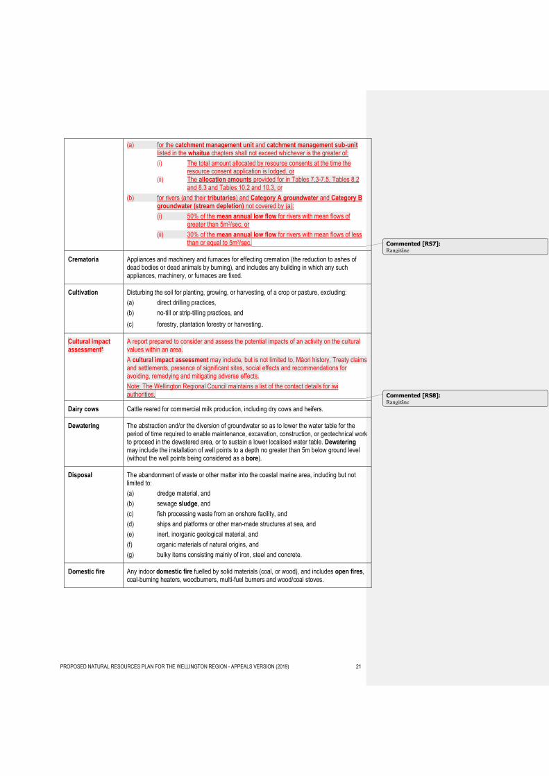
(a) for the catchment management unit and catchment management sub-unit listed in the whaitua chapters shall not exceed whichever is the greater of:
(i) The total amount allocated by resource consents at the time the resource consent application is lodged, or
(ii) The allocation amounts provided for in Tables 7.3-7.5, Tables 8.2 and 8.3 and Tables 10.2 and 10.3, or
(b) for rivers (and their tributaries) and Category A groundwater and Category B groundwater (stream depletion) not covered by (a):
(i) 50% of the mean annual low flow for rivers with mean flows of greater than 5m3/sec, or
(ii) 30% of the mean annual low flow for rivers with mean flows of less than or equal to 5m3/sec.
Crematoria Appliances and machinery and furnaces for effecting cremation (the reduction to ashes of dead bodies or dead animals by burning), and includes any building in which any such appliances, machinery, or furnaces are fixed.
Cultivation Disturbing the soil for planting, growing, or harvesting, of a crop or pasture, excluding:
(a) direct drilling practices,
(b) no-till or strip-tilling practices, and
(c) forestry, plantation forestry or harvesting.
Cultural impact assessment*
A report prepared to consider and assess the potential impacts of an activity on the cultural values within an area.
A cultural impact assessment may include, but is not limited to, Māori history, Treaty claims and settlements, presence of significant sites, social effects and recommendations for avoiding, remedying and mitigating adverse effects.
Note: The Wellington Regional Council maintains a list of the contact details for iwi authorities.
Dairy cows Cattle reared for commercial milk production, including dry cows and heifers.
Dewatering The abstraction and/or the diversion of groundwater so as to lower the water table for the period of time required to enable maintenance, excavation, construction, or geotechnical work to proceed in the dewatered area, or to sustain a lower localised water table. Dewatering may include the installation of well points to a depth no greater than 5m below ground level (without the well points being considered as a bore).
Disposal The abandonment of waste or other matter into the coastal marine area, including but not limited to:
(a) dredge material, and
(b) sewage sludge, and
(c) fish processing waste from an onshore facility, and
(d) ships and platforms or other man-made structures at sea, and
(e) inert, inorganic geological material, and
(f) organic materials of natural origins, and
(g) bulky items consisting mainly of iron, steel and concrete.
Domestic fire Any indoor domestic fire fuelled by solid materials (coal, or wood), and includes open fires, coal-burning heaters, woodburners, multi-fuel burners and wood/coal stoves.
Commented [RS7]: Rangitāne
Commented [RS8]: Rangitāne
PROPOSED NATURAL RESOURCES PLAN FOR THE WELLINGTON REGION - APPEALS VERSION (2019) 22
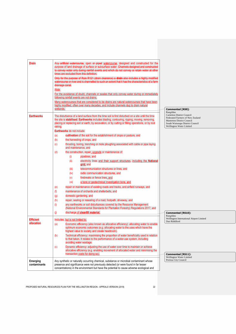
Drain Any artificial watercourse, open or piped watercourse, designed and constructed for the purpose of land drainage of surface or subsurface water. Channels designed and constructed to convey water only during rainfall events and which do not convey or retain water at other times are excluded from this definition.
Only for the purpose of Rule R121 (drain clearance) a drain also includes a highly modified watercourse or river and is channelled to such an extent that it has the characteristics of a farm drainage canal.
Note:
For the avoidance of doubt, channels or swales that only convey water during or immediately following rainfall events are not drains.
Many watercourses that are considered to be drains are natural watercourses that have been highly modified, often over many decades, and include channels dug to drain natural wetlands.
Earthworks The disturbance of a land surface from the time soil is first disturbed on a site until the time the site is stabilised. Earthworks includes blading, contouring, ripping, moving, removing, placing or replacing soil or earth, by excavation, or by cutting or filling operations, or by root raking.
Earthworks do not include:
(a) cultivation of the soil for the establishment of crops or pasture, and
(b) the harvesting of crops, and
(c) thrusting, boring, trenching or mole ploughing associated with cable or pipe laying and maintenance, and
(d) the construction, repair, upgrade or maintenance of:
(i) pipelines, and
(ii) electricity lines and their support structures, including the National grid, and
(iii) telecommunication structures or lines, and
(iv) radio communication structures, and
(v) firebreaks or fence lines, and
(vi) a bore or geotechnical investigation bore, and
(e) repair or maintenance of existing roads and tracks, and airfield runways, and
(f) maintenance of orchards and shelterbelts, and
(g) domestic gardening, and
(h) repair, sealing or resealing of a road, footpath, driveway, and
(i) any earthworks or soil disturbances covered by the Resource Management (National Environmental Standards for Plantation Forestry) Regulations 2017, and
(j) discharge of cleanfill material.
Efficient allocation
Includes, but is not limited to:
(a) Economic efficiency (also known as allocative efficiency): allocating water to enable optimum economic outcomes (e.g. allocating water to the uses which have the highest value to society and create headroom).
(b) Technical efficiency: maximising the proportion of water beneficially used in relation to that taken. It relates to the performance of a water-use system, including avoiding water wastage.
(c) Dynamic efficiency: adjusting the use of water over time to maintain or achieve allocative efficiency (e.g. enabling movement of allocated water and minimising the transaction costs for doing so).
Emerging contaminants
Any synthetic or naturally occurring chemical, substance or microbial contaminant whose presence and significance were not previously detected (or were found in far lesser concentrations) in the environment but have the potential to cause adverse ecological and
Commented [RS9]: Rangitāne
Carterton District Council Federated Farmers of New Zealand
Masterton District Council
South Wairarapa District Council Wellington Water Limited
Commented [RS10]: Rangitāne
Wellington International Airport Limited
Dan Riddiford
Commented [RS11]: Wellington Water Limited
Porirua City Council
PROPOSED NATURAL RESOURCES PLAN FOR THE WELLINGTON REGION - APPEALS VERSION (2019) 23
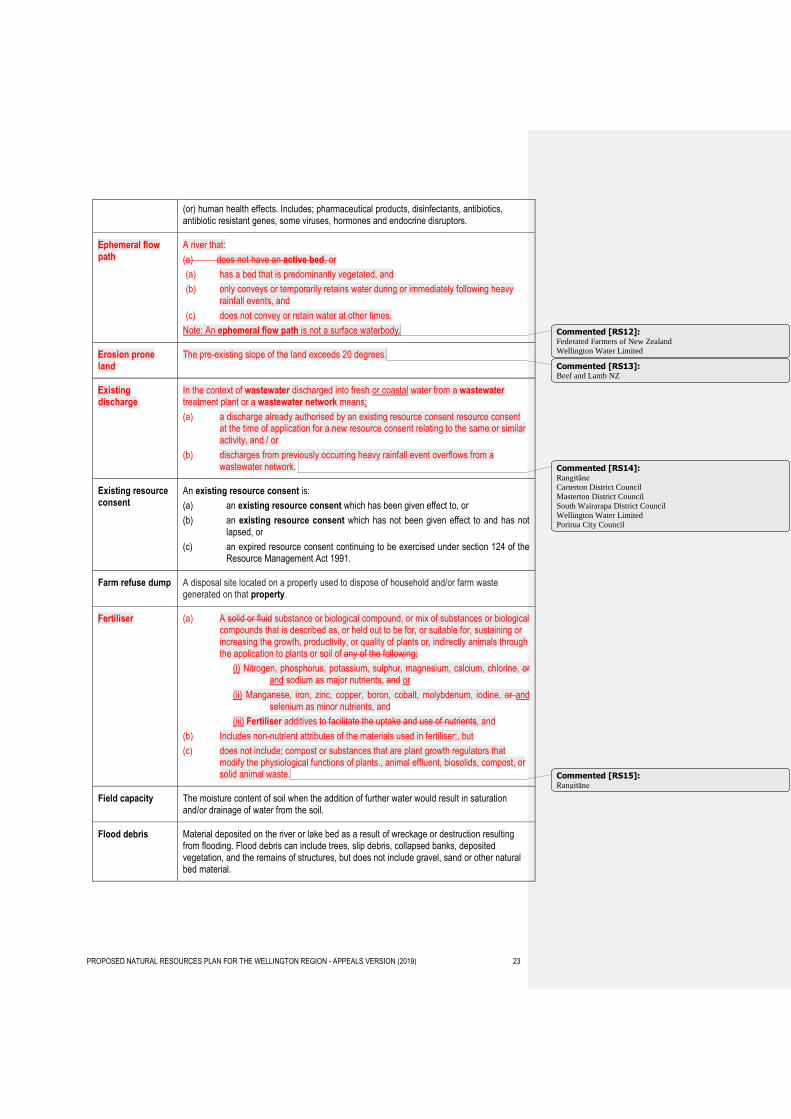
(or) human health effects. Includes; pharmaceutical products, disinfectants, antibiotics, antibiotic resistant genes, some viruses, hormones and endocrine disruptors.
Ephemeral flow path
A river that:
(a) does not have an active bed, or
(a) has a bed that is predominantly vegetated, and
(b) only conveys or temporarily retains water during or immediately following heavy rainfall events, and
(c) does not convey or retain water at other times.
Note: An ephemeral flow path is not a surface waterbody.
Erosion prone land
The pre-existing slope of the land exceeds 20 degrees.
Existing discharge
In the context of wastewater discharged into fresh or coastal water from a wastewater treatment plant or a wastewater network means;
(a) a discharge already authorised by an existing resource consent resource consent at the time of application for a new resource consent relating to the same or similar activity, and / or
(b) discharges from previously occurring heavy rainfall event overflows from a wastewater network.
Existing resource consent
An existing resource consent is:
(a) an existing resource consent which has been given effect to, or
(b) an existing resource consent which has not been given effect to and has not lapsed, or
(c) an expired resource consent continuing to be exercised under section 124 of the Resource Management Act 1991.
Farm refuse dump A disposal site located on a property used to dispose of household and/or farm waste generated on that property.
Fertiliser (a) A solid or fluid substance or biological compound, or mix of substances or biological compounds that is described as, or held out to be for, or suitable for, sustaining or increasing the growth, productivity, or quality of plants or, indirectly animals through the application to plants or soil of any of the following:
(i) Nitrogen, phosphorus, potassium, sulphur, magnesium, calcium, chlorine, or and sodium as major nutrients, and or
(ii) Manganese, iron, zinc, copper, boron, cobalt, molybdenum, iodine, or and selenium as minor nutrients, and
(iii) Fertiliser additives to facilitate the uptake and use of nutrients, and
(b) Includes non-nutrient attributes of the materials used in fertiliser;, but
(c) does not include; compost or substances that are plant growth regulators that modify the physiological functions of plants., animal effluent, biosolids, compost, or solid animal waste.
Field capacity The moisture content of soil when the addition of further water would result in saturation and/or drainage of water from the soil.
Flood debris Material deposited on the river or lake bed as a result of wreckage or destruction resulting from flooding. Flood debris can include trees, slip debris, collapsed banks, deposited vegetation, and the remains of structures, but does not include gravel, sand or other natural bed material.
Commented [RS12]: Federated Farmers of New Zealand
Wellington Water Limited
Commented [RS13]: Beef and Lamb NZ
Commented [RS14]: Rangitāne
Carterton District Council
Masterton District Council
South Wairarapa District Council
Wellington Water Limited
Porirua City Council
Commented [RS15]: Rangitāne
PROPOSED NATURAL RESOURCES PLAN FOR THE WELLINGTON REGION - APPEALS VERSION (2019) 24
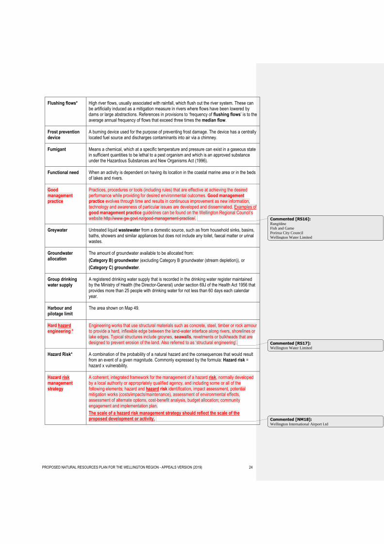
Flushing flows* High river flows, usually associated with rainfall, which flush out the river system. These can be artificially induced as a mitigation measure in rivers where flows have been lowered by dams or large abstractions. References in provisions to ‘frequency of flushing flows’ is to the average annual frequency of flows that exceed three times the median flow.
Frost prevention device
A burning device used for the purpose of preventing frost damage. The device has a centrally located fuel source and discharges contaminants into air via a chimney.
Fumigant Means a chemical, which at a specific temperature and pressure can exist in a gaseous state in sufficient quantities to be lethal to a pest organism and which is an approved substance under the Hazardous Substances and New Organisms Act (1996).
Functional need When an activity is dependent on having its location in the coastal marine area or in the beds of lakes and rivers.
Good management practice
Practices, procedures or tools (including rules) that are effective at achieving the desired performance while providing for desired environmental outcomes. Good management practice evolves through time and results in continuous improvement as new information, technology and awareness of particular issues are developed and disseminated. Examples of good management practice guidelines can be found on the Wellington Regional Council’s website http://www.gw.govt.nz/good-management-practice/.
Greywater Untreated liquid wastewater from a domestic source, such as from household sinks, basins, baths, showers and similar appliances but does not include any toilet, faecal matter or urinal wastes.
Groundwater allocation
The amount of groundwater available to be allocated from:
(Category B) groundwater (excluding Category B groundwater (stream depletion)), or
(Category C) groundwater.
Group drinking water supply
A registered drinking water supply that is recorded in the drinking water register maintained by the Ministry of Health (the Director-General) under section 69J of the Health Act 1956 that provides more than 25 people with drinking water for not less than 60 days each calendar year.
Harbour and pilotage limit
The area shown on Map 49.
Hard hazard engineering *
Engineering works that use structural materials such as concrete, steel, timber or rock armour to provide a hard, inflexible edge between the land-water interface along rivers, shorelines or lake edges. Typical structures include groynes, seawalls, revetments or bulkheads that are designed to prevent erosion of the land. Also referred to as ‘structural engineering’.
Hazard Risk* A combination of the probability of a natural hazard and the consequences that would result from an event of a given magnitude. Commonly expressed by the formula: Hazard risk = hazard x vulnerability.
Hazard risk management strategy
A coherent, integrated framework for the management of a hazard risk, normally developed by a local authority or appropriately qualified agency, and including some or all of the following elements; hazard and hazard risk identification, impact assessment, potential mitigation works (costs/impacts/maintenance), assessment of environmental effects, assessment of alternate options, cost-benefit analysis, budget allocation; community engagement and implementation plan.
The scale of a hazard risk management strategy should reflect the scale of the proposed development or activity.
Commented [RS16]: Rangitāne
Fish and Game
Porirua City Council
Wellington Water Limited
Commented [RS17]: Wellington Water Limited
Commented [NM18]: Wellington International Airport Ltd
PROPOSED NATURAL RESOURCES PLAN FOR THE WELLINGTON REGION - APPEALS VERSION (2019) 25
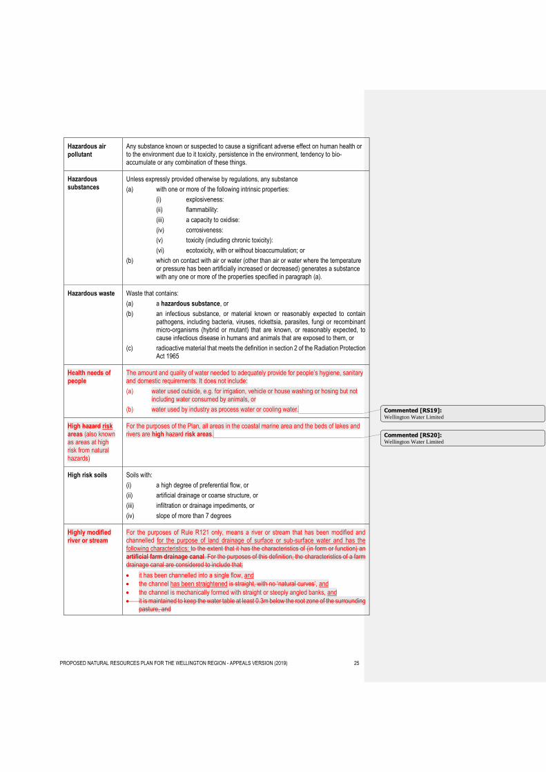
Hazardous air pollutant
Any substance known or suspected to cause a significant adverse effect on human health or to the environment due to it toxicity, persistence in the environment, tendency to bio-accumulate or any combination of these things.
Hazardous substances
Unless expressly provided otherwise by regulations, any substance
(a) with one or more of the following intrinsic properties:
(i) explosiveness:
(ii) flammability:
(iii) a capacity to oxidise:
(iv) corrosiveness:
(v) toxicity (including chronic toxicity):
(vi) ecotoxicity, with or without bioaccumulation; or
(b) which on contact with air or water (other than air or water where the temperature or pressure has been artificially increased or decreased) generates a substance with any one or more of the properties specified in paragraph (a).
Hazardous waste Waste that contains:
(a) a hazardous substance, or
(b) an infectious substance, or material known or reasonably expected to contain pathogens, including bacteria, viruses, rickettsia, parasites, fungi or recombinant micro-organisms (hybrid or mutant) that are known, or reasonably expected, to cause infectious disease in humans and animals that are exposed to them, or
(c) radioactive material that meets the definition in section 2 of the Radiation Protection Act 1965
Health needs of people
The amount and quality of water needed to adequately provide for people’s hygiene, sanitary and domestic requirements. It does not include:
(a) water used outside, e.g. for irrigation, vehicle or house washing or hosing but not including water consumed by animals, or
(b) water used by industry as process water or cooling water.
High hazard risk areas (also known as areas at high risk from natural hazards)
For the purposes of the Plan, all areas in the coastal marine area and the beds of lakes and rivers are high hazard risk areas.
High risk soils Soils with:
(i) a high degree of preferential flow, or
(ii) artificial drainage or coarse structure, or
(iii) infiltration or drainage impediments, or
(iv) slope of more than 7 degrees
Highly modified river or stream
For the purposes of Rule R121 only, means a river or stream that has been modified and channelled for the purpose of land drainage of surface or sub-surface water and has the following characteristics: to the extent that it has the characteristics of (in form or function) an artificial farm drainage canal. For the purposes of this definition, the characteristics of a farm drainage canal are considered to include that;
it has been channelled into a single flow, and
the channel has been straightened is straight, with no ‘natural curves’, and
the channel is mechanically formed with straight or steeply angled banks, and
it is maintained to keep the water table at least 0.3m below the root zone of the surrounding pasture, and
Commented [RS19]: Wellington Water Limited
Commented [RS20]: Wellington Water Limited
PROPOSED NATURAL RESOURCES PLAN FOR THE WELLINGTON REGION - APPEALS VERSION (2019) 26
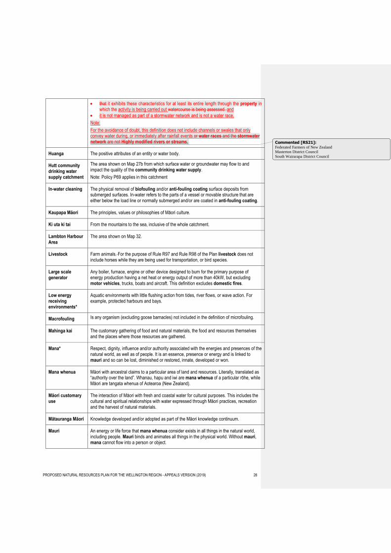
that it exhibits these characteristics for at least its entire length through the property in which the activity is being carried out watercourse is being assessed. and
it is not managed as part of a stormwater network and is not a water race.
Note:
For the avoidance of doubt, this definition does not include channels or swales that only convey water during, or immediately after rainfall events or water races and the stormwater network are not Highly modified rivers or streams.
Huanga The positive attributes of an entity or water body.
Hutt community drinking water supply catchment
The area shown on Map 27b from which surface water or groundwater may flow to and impact the quality of the community drinking water supply.
Note: Policy P69 applies in this catchment
In-water cleaning The physical removal of biofouling and/or anti-fouling coating surface deposits from submerged surfaces. In-water refers to the parts of a vessel or movable structure that are either below the load line or normally submerged and/or are coated in anti-fouling coating.
Kaupapa Māori The principles, values or philosophies of Māori culture.
Ki uta ki tai From the mountains to the sea, inclusive of the whole catchment.
Lambton Harbour Area
The area shown on Map 32.
Livestock Farm animals. For the purpose of Rule R97 and Rule R98 of the Plan livestock does not include horses while they are being used for transportation, or bird species.
Large scale generator
Any boiler, furnace, engine or other device designed to burn for the primary purpose of energy production having a net heat or energy output of more than 40kW, but excluding motor vehicles, trucks, boats and aircraft. This definition excludes domestic fires.
Low energy receiving environments*
Aquatic environments with little flushing action from tides, river flows, or wave action. For example, protected harbours and bays.
Macrofouling Is any organism (excluding goose barnacles) not included in the definition of microfouling.
Mahinga kai The customary gathering of food and natural materials, the food and resources themselves and the places where those resources are gathered.
Mana* Respect, dignity, influence and/or authority associated with the energies and presences of the natural world, as well as of people. It is an essence, presence or energy and is linked to mauri and so can be lost, diminished or restored, innate, developed or won.
Mana whenua Māori with ancestral claims to a particular area of land and resources. Literally, translated as “authority over the land”. Whanau, hapu and iwi are mana whenua of a particular rōhe, while Māori are tangata whenua of Aotearoa (New Zealand).
Māori customary use
The interaction of Māori with fresh and coastal water for cultural purposes. This includes the cultural and spiritual relationships with water expressed through Māori practices, recreation and the harvest of natural materials.
Mātauranga Māori Knowledge developed and/or adopted as part of the Māori knowledge continuum.
Mauri An energy or life force that mana whenua consider exists in all things in the natural world, including people. Mauri binds and animates all things in the physical world. Without mauri, mana cannot flow into a person or object.
Commented [RS21]: Federated Farmers of New Zealand
Masterton District Council
South Wairarapa District Council
PROPOSED NATURAL RESOURCES PLAN FOR THE WELLINGTON REGION - APPEALS VERSION (2019) 27
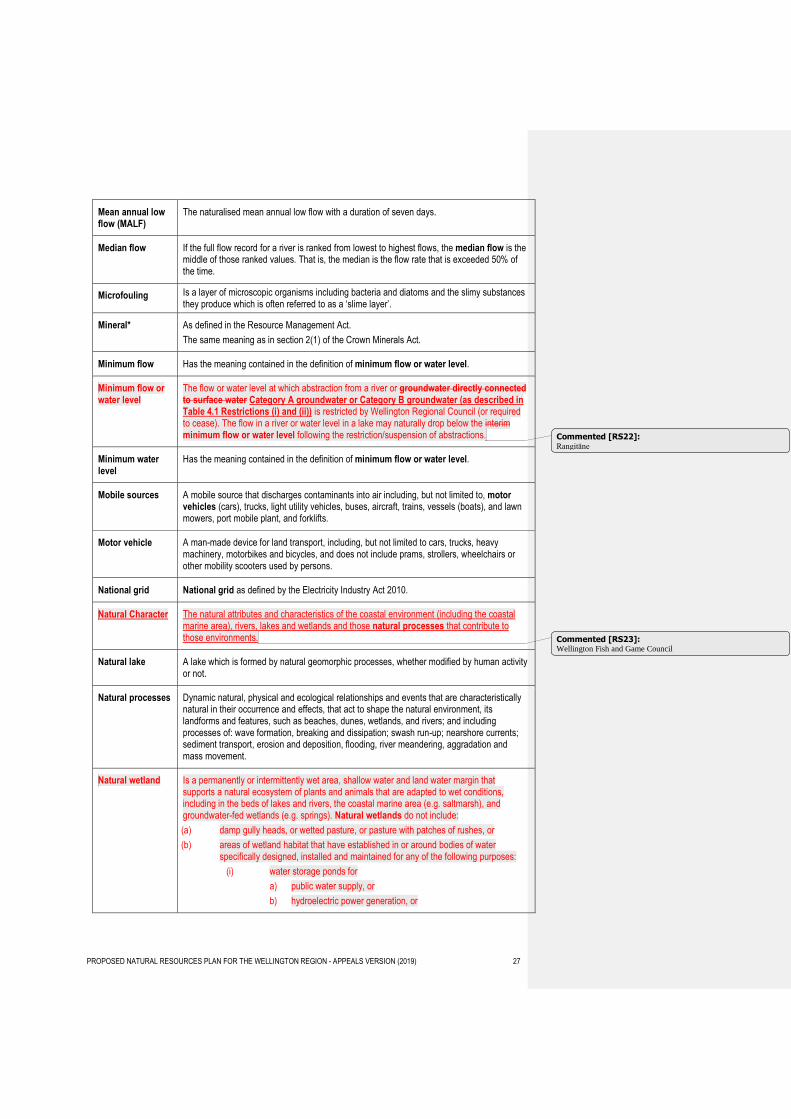
Mean annual low flow (MALF)
The naturalised mean annual low flow with a duration of seven days.
Median flow If the full flow record for a river is ranked from lowest to highest flows, the median flow is the middle of those ranked values. That is, the median is the flow rate that is exceeded 50% of the time.
Microfouling Is a layer of microscopic organisms including bacteria and diatoms and the slimy substances they produce which is often referred to as a ‘slime layer’.
Mineral* As defined in the Resource Management Act.
The same meaning as in section 2(1) of the Crown Minerals Act.
Minimum flow Has the meaning contained in the definition of minimum flow or water level.
Minimum flow or water level
The flow or water level at which abstraction from a river or groundwater directly connected to surface water Category A groundwater or Category B groundwater (as described in Table 4.1 Restrictions (i) and (ii)) is restricted by Wellington Regional Council (or required to cease). The flow in a river or water level in a lake may naturally drop below the interim minimum flow or water level following the restriction/suspension of abstractions.
Minimum water level
Has the meaning contained in the definition of minimum flow or water level.
Mobile sources A mobile source that discharges contaminants into air including, but not limited to, motor vehicles (cars), trucks, light utility vehicles, buses, aircraft, trains, vessels (boats), and lawn mowers, port mobile plant, and forklifts.
Motor vehicle A man-made device for land transport, including, but not limited to cars, trucks, heavy machinery, motorbikes and bicycles, and does not include prams, strollers, wheelchairs or other mobility scooters used by persons.
National grid National grid as defined by the Electricity Industry Act 2010.
Natural Character The natural attributes and characteristics of the coastal environment (including the coastal marine area), rivers, lakes and wetlands and those natural processes that contribute to those environments.
Natural lake A lake which is formed by natural geomorphic processes, whether modified by human activity or not.
Natural processes Dynamic natural, physical and ecological relationships and events that are characteristically natural in their occurrence and effects, that act to shape the natural environment, its landforms and features, such as beaches, dunes, wetlands, and rivers; and including processes of: wave formation, breaking and dissipation; swash run-up; nearshore currents; sediment transport, erosion and deposition, flooding, river meandering, aggradation and mass movement.
Natural wetland Is a permanently or intermittently wet area, shallow water and land water margin that supports a natural ecosystem of plants and animals that are adapted to wet conditions, including in the beds of lakes and rivers, the coastal marine area (e.g. saltmarsh), and groundwater-fed wetlands (e.g. springs). Natural wetlands do not include:
(a) damp gully heads, or wetted pasture, or pasture with patches of rushes, or
(b) areas of wetland habitat that have established in or around bodies of water specifically designed, installed and maintained for any of the following purposes:
(i) water storage ponds for
a) public water supply, or
b) hydroelectric power generation, or
Commented [RS22]: Rangitāne
Commented [RS23]: Wellington Fish and Game Council
PROPOSED NATURAL RESOURCES PLAN FOR THE WELLINGTON REGION - APPEALS VERSION (2019) 28
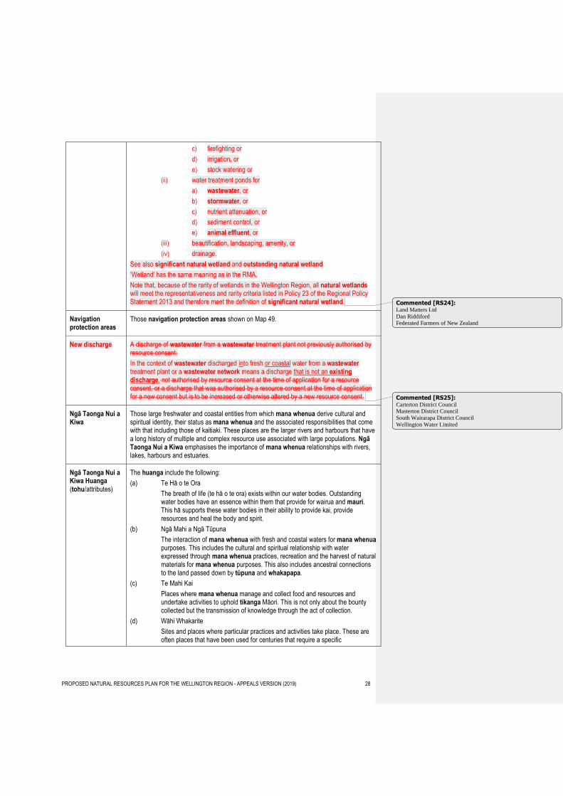
c) firefighting or
d) irrigation, or
e) stock watering or
(ii) water treatment ponds for
a) wastewater, or
b) stormwater, or
c) nutrient attenuation, or
d) sediment control, or
e) animal effluent, or
(iii) beautification, landscaping, amenity, or
(iv) drainage.
See also significant natural wetland and outstanding natural wetland
‘Wetland’ has the same meaning as in the RMA.
Note that, because of the rarity of wetlands in the Wellington Region, all natural wetlands will meet the representativeness and rarity criteria listed in Policy 23 of the Regional Policy Statement 2013 and therefore meet the definition of significant natural wetland.
Navigation protection areas
Those navigation protection areas shown on Map 49.
New discharge A discharge of wastewater from a wastewater treatment plant not previously authorised by resource consent.
In the context of wastewater discharged into fresh or coastal water from a wastewater treatment plant or a wastewater network means a discharge that is not an existing discharge. not authorised by resource consent at the time of application for a resource consent, or a discharge that was authorised by a resource consent at the time of application for a new consent but is to be increased or otherwise altered by a new resource consent.
Ngā Taonga Nui a Kiwa
Those large freshwater and coastal entities from which mana whenua derive cultural and spiritual identity, their status as mana whenua and the associated responsibilities that come with that including those of kaitiaki. These places are the larger rivers and harbours that have a long history of multiple and complex resource use associated with large populations. Ngā Taonga Nui a Kiwa emphasises the importance of mana whenua relationships with rivers, lakes, harbours and estuaries.
Ngā Taonga Nui a Kiwa Huanga (tohu/attributes)
The huanga include the following:
(a) Te Hā o te Ora
The breath of life (te hā o te ora) exists within our water bodies. Outstanding water bodies have an essence within them that provide for wairua and mauri. This hā supports these water bodies in their ability to provide kai, provide resources and heal the body and spirit.
(b) Ngā Mahi a Ngā Tūpuna
The interaction of mana whenua with fresh and coastal waters for mana whenua purposes. This includes the cultural and spiritual relationship with water expressed through mana whenua practices, recreation and the harvest of natural materials for mana whenua purposes. This also includes ancestral connections to the land passed down by tūpuna and whakapapa.
(c) Te Mahi Kai
Places where mana whenua manage and collect food and resources and undertake activities to uphold tikanga Māori. This is not only about the bounty collected but the transmission of knowledge through the act of collection.
(d) Wāhi Whakarite
Sites and places where particular practices and activities take place. These are often places that have been used for centuries that require a specific
Commented [RS24]: Land Matters Ltd
Dan Riddiford Federated Farmers of New Zealand
Commented [RS25]: Carterton District Council Masterton District Council
South Wairarapa District Council
Wellington Water Limited
PROPOSED NATURAL RESOURCES PLAN FOR THE WELLINGTON REGION - APPEALS VERSION (2019) 29
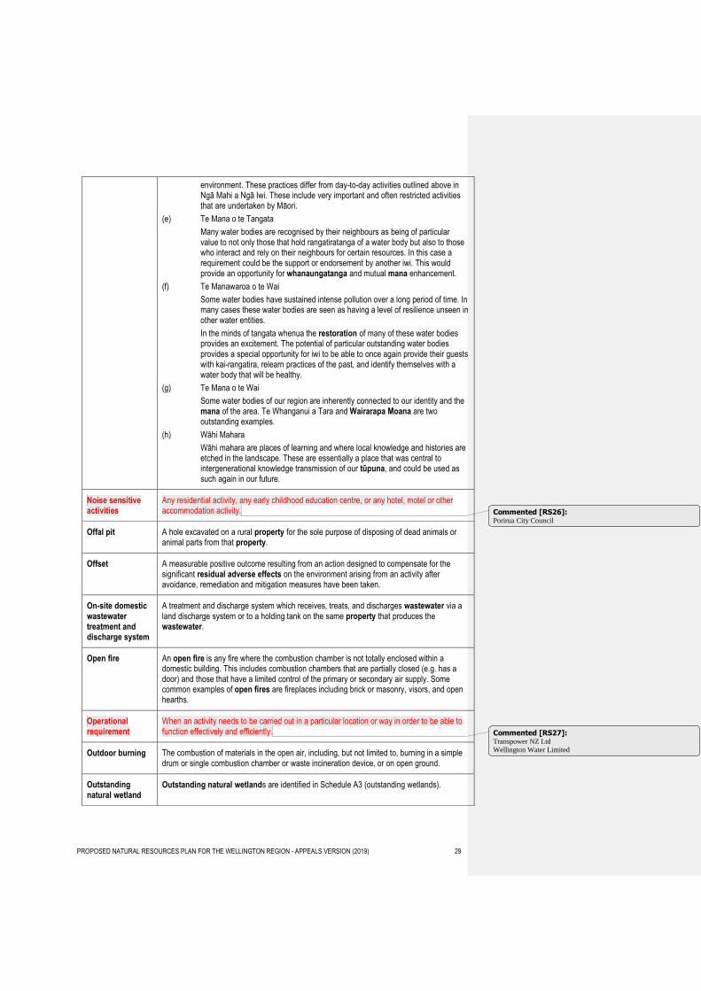
environment. These practices differ from day-to-day activities outlined above in Ngā Mahi a Ngā Iwi. These include very important and often restricted activities that are undertaken by Māori.
(e) Te Mana o te Tangata
Many water bodies are recognised by their neighbours as being of particular value to not only those that hold rangatiratanga of a water body but also to those who interact and rely on their neighbours for certain resources. In this case a requirement could be the support or endorsement by another iwi. This would provide an opportunity for whanaungatanga and mutual mana enhancement.
(f) Te Manawaroa o te Wai
Some water bodies have sustained intense pollution over a long period of time. In many cases these water bodies are seen as having a level of resilience unseen in other water entities.
In the minds of tangata whenua the restoration of many of these water bodies provides an excitement. The potential of particular outstanding water bodies provides a special opportunity for iwi to be able to once again provide their guests with kai-rangatira, relearn practices of the past, and identify themselves with a water body that will be healthy.
(g) Te Mana o te Wai
Some water bodies of our region are inherently connected to our identity and the mana of the area. Te Whanganui a Tara and Wairarapa Moana are two outstanding examples.
(h) Wāhi Mahara
Wāhi mahara are places of learning and where local knowledge and histories are etched in the landscape. These are essentially a place that was central to intergenerational knowledge transmission of our tūpuna, and could be used as such again in our future.
Noise sensitive activities
Any residential activity, any early childhood education centre, or any hotel, motel or other accommodation activity.
Offal pit A hole excavated on a rural property for the sole purpose of disposing of dead animals or animal parts from that property.
Offset A measurable positive outcome resulting from an action designed to compensate for the significant residual adverse effects on the environment arising from an activity after avoidance, remediation and mitigation measures have been taken.
On-site domestic wastewater treatment and discharge system
A treatment and discharge system which receives, treats, and discharges wastewater via a land discharge system or to a holding tank on the same property that produces the wastewater.
Open fire An open fire is any fire where the combustion chamber is not totally enclosed within a domestic building. This includes combustion chambers that are partially closed (e.g. has a door) and those that have a limited control of the primary or secondary air supply. Some common examples of open fires are fireplaces including brick or masonry, visors, and open hearths.
Operational requirement
When an activity needs to be carried out in a particular location or way in order to be able to function effectively and efficiently.
Outdoor burning The combustion of materials in the open air, including, but not limited to, burning in a simple drum or single combustion chamber or waste incineration device, or on open ground.
Outstanding natural wetland
Outstanding natural wetlands are identified in Schedule A3 (outstanding wetlands).
Commented [RS26]: Porirua City Council
Commented [RS27]: Transpower NZ Ltd
Wellington Water Limited
PROPOSED NATURAL RESOURCES PLAN FOR THE WELLINGTON REGION - APPEALS VERSION (2019) 30
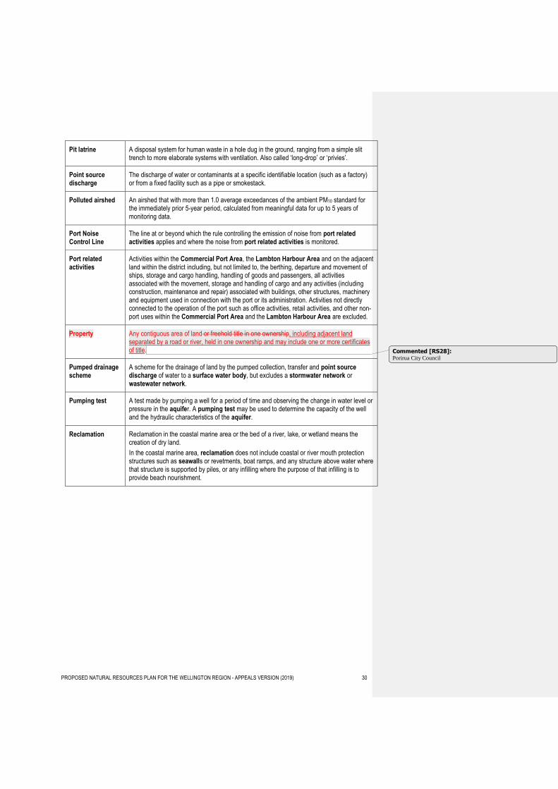
Pit latrine A disposal system for human waste in a hole dug in the ground, ranging from a simple slit trench to more elaborate systems with ventilation. Also called ‘long-drop’ or ‘privies’.
Point source discharge
The discharge of water or contaminants at a specific identifiable location (such as a factory) or from a fixed facility such as a pipe or smokestack.
Polluted airshed An airshed that with more than 1.0 average exceedances of the ambient PM10 standard for the immediately prior 5-year period, calculated from meaningful data for up to 5 years of monitoring data.
Port Noise Control Line
The line at or beyond which the rule controlling the emission of noise from port related activities applies and where the noise from port related activities is monitored.
Port related activities
Activities within the Commercial Port Area, the Lambton Harbour Area and on the adjacent land within the district including, but not limited to, the berthing, departure and movement of ships, storage and cargo handling, handling of goods and passengers, all activities associated with the movement, storage and handling of cargo and any activities (including construction, maintenance and repair) associated with buildings, other structures, machinery and equipment used in connection with the port or its administration. Activities not directly connected to the operation of the port such as office activities, retail activities, and other non-port uses within the Commercial Port Area and the Lambton Harbour Area are excluded.
Property Any contiguous area of land or freehold title in one ownership, including adjacent land separated by a road or river, held in one ownership and may include one or more certificates of title.
Pumped drainage scheme
A scheme for the drainage of land by the pumped collection, transfer and point source discharge of water to a surface water body, but excludes a stormwater network or wastewater network.
Pumping test A test made by pumping a well for a period of time and observing the change in water level or pressure in the aquifer. A pumping test may be used to determine the capacity of the well and the hydraulic characteristics of the aquifer.
Reclamation Reclamation in the coastal marine area or the bed of a river, lake, or wetland means the creation of dry land.
In the coastal marine area, reclamation does not include coastal or river mouth protection structures such as seawalls or revetments, boat ramps, and any structure above water where that structure is supported by piles, or any infilling where the purpose of that infilling is to provide beach nourishment.
Commented [RS28]: Porirua City Council
PROPOSED NATURAL RESOURCES PLAN FOR THE WELLINGTON REGION - APPEALS VERSION (2019) 31
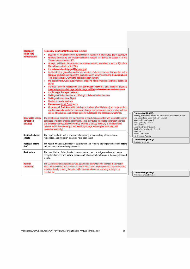
Regionally significant infrastructure*
Regionally significant infrastructure includes:
pipelines for the distribution or transmission of natural or manufactured gas or petroleum
strategic facilities to the telecommunication network, as defined in section 5 of the Telecommunications Act 2001
strategic facilities to the radio communications network, as defined in section 2(1) of the Radio Communications Act 1989
the national electricity grid National grid
facilities for the generation and/or transmission of electricity where it is supplied to the National grid electricity and/or the local distribution network., including the national grid This excludes supply within the local distribution network.
the local authority water supply network (including intake structures) and water treatments plants
the local authority wastewater and stormwater networks, and, systems, including treatment plants and storage and discharge facilities and wastewater treatment plants
the Strategic Transport Network
Wellington City bus terminal and Wellington Railway Station terminus
Wellington International Airport
Masterton Hood Aerodrome
Paraparaumu Kapiti Coast Airport
Commercial Port Area within Wellington Harbour (Port Nicholson) and adjacent land used in association with the movement of cargo and passengers and including bulk fuel supply infrastructure, and storage tanks for bulk liquids, and associated wharflines.
Renewable energy generation activities
The construction, operation and maintenance of structures associated with renewable energy generation, including small and community-scale distributed renewable generation activities and the system of electricity conveyance required to convey electricity to the distribution network and/or the national grid and electricity storage technologies associated with renewable electricity.
Residual adverse effects
The negative effects on the environment remaining from an activity after avoidance, remediation, and mitigation measures have been taken.
Residual hazard risk*
The hazard risk to a subdivision or development that remains after implementation of hazard risk treatment or hazard mitigation works.
Restoration The rehabilitation of sites, habitats or ecosystems to support indigenous flora and fauna, ecosystem functions and natural processes that would naturally occur in the ecosystem and locality.
Reverse sensitivity*
The vulnerability of an existing lawfully-established activity to other activities in the vicinity which are sensitive to adverse environmental effects that may be generated by such existing activities, thereby creating the potential for the operation of such existing activity to be constrained.
Commented [RS29]: Roading, Parks and Gardens and Solid Waste departments of Hutt City Council and Upper Hutt City Council
Meridian Energy Limited
Wellington City Council
First Gas Ltd
Masterton District Council
South Wairarapa District Council
Powerco
Porirua City Council
NZ Transport Agency
Commented [RS30]: Transpower NZ Ltd
Commented [RS31]: Wellington Water Limited
PROPOSED NATURAL RESOURCES PLAN FOR THE WELLINGTON REGION - APPEALS VERSION (2019) 32
Risk-based approach (natural hazards)
A risk-based approach takes account of the intended purpose of a development, the likelihood of natural hazard events occurring the vulnerability and exposure of the site, use or development, the severity and consequences of potential hazard events and the costs and benefits of acting or not acting. An assessment is required as part of a resource consent application in high risk areas and needs to be commensurate with the size and scale of the use or development. The hazard risk can be evaluated on a scale from low to high or acceptable to intolerable assessed on the basis of:
(a) the scale, engineering design and intended life and use for the development, and
(b) the likelihood, frequency and magnitude of natural hazard events that could potentially affect the site or development, and
(c) the vulnerability and exposure of both the development and areas around the development to natural hazards, and
(d) the severity of any physical, social, economic and environmental consequences that could arise from natural hazard events affecting both the site or development and areas around the site or development.
River class Classification of the region’s rivers based size, nature of the catchment and substrate, described as:
River class 1 Steep, hard sedimentary
River class 2 Mid-gradient, coastal and hard sedimentary
River class 3 Mid-gradient, soft sedimentary
River class 4 Lowland, large, draining ranges
River class 5 Lowland, large, draining plains and eastern Wairarapa
River class 6 Lowland, small
River classes are shown on Maps 21a-21e.
Rongoā Traditional healing plants.
Sensitive activity* Activities which suffer should they experience adverse effects typically associated with some lawful activities. For example, dust or noise from a quarry or port facility, noise in an entertainment precinct, smells from a sewage treatment facility. Activities considered sensitive include any residential activity, any early childhood education centre, and any hotel or other accommodation activity. It may also include hospitals and respite care facilities.
Seawall A hard inflexible structure between the land-water interface along river mouths, shorelines, or lake edges made up of structural materials including concrete, steel, timber or rock. A seawall is a structure and includes rock revetment, groyne or bulkhead.
Sensitive area A sensitive area includes the following:
(a) dwelling house, or marae and
(b) educational facilities, and
(c) public places, and
(d) surface water bodies and associated riparian vegetation, and
(e) non-target plants, crops, and bee hives, which are sensitive to agrichemicals, and
(f) organically certified properties, e.g. Bio-Gro, and
(g) natural wetlands, outstanding water bodies listed in Schedule A and ecosystems and habitats with significant indigenous biodiversity values listed in Schedule F.
Serious water shortage
A serious temporary shortage of water that may require a water shortage direction to be issued under section 329 of the Resource Management Act 1991.
Significant contact recreation freshwater body
A river or lake identified as having significant primary contact recreation values, identified in Schedule H1 and shown in Map 20.
Commented [RS32]: Minister of Conservation
PROPOSED NATURAL RESOURCES PLAN FOR THE WELLINGTON REGION - APPEALS VERSION (2019) 33
Significant mineral resources*
Deposits of minerals, the extraction of which is of potential importance in order to meet the current or future mineral needs of the region or nation.
Significant natural wetland
A natural wetland that meets one or more of criteria (a) to (d) listed in Policy 23 of the Regional Policy Statement 2013 being: representativeness; rarity; diversity; ecological context. Identified significant natural wetlands greater than 0.1ha from which livestock should be excluded under Rule R98 are listed in Schedule F3 (significant wetlands).
(Note - Schedule F3 lists identified significant natural wetlands that are greater than 0.1 ha for the purpose of managing livestock exclusion under Rule R97).
Silage A fermented, high-moisture stored which can be fed to ruminants.
Sludge The semi-liquid solids settled from wastewater or animal effluent storage systems.
SLUR Category III land
Land classified as Category III in the Selected Land Use Register (SLUR) for the Wellington Region, being land where there is evidence that the land has a hazardous substance in or on it that has, or is reasonably likely to have, significant adverse effects on the environment.
Soft engineering Works such as beach nourishment, dune rebuilding and riparian planting that use non-structural materials (e.g. sand, cobbles, native plants) to mimic natural coastal and riverine features that can act to mitigate the impacts from natural hazards.
Solid animal waste
Solid waste of animal origin other than humans, including excrement and associated vegetative material, but does not include dead animals or animal parts.
Source control Measures designed to prevent the generation of, and introduction of contaminants into, stormwater including by bunding or roofing high risk areas and avoiding the use of high risk contaminating products.
Commented [RS33]: Dan Riddiford
Federated Farmers of New Zealand
PROPOSED NATURAL RESOURCES PLAN FOR THE WELLINGTON REGION - APPEALS VERSION (2019) 34
Specified materials
Specified materials includes, but not limited to, the following:
(a) wood that is painted, oiled or stained, other than a minor and incidental amount, including but not limited to lead based painted wood, and
(b) wood treated with copper, chromium and arsenic (CCA) or other chemicals, and
(c) timber treated with preservatives or impregnated with chemicals, including but not limited to particleboard, MDF and chipboard, and
(d) construction or demolition waste, and
(e) all plastics, including but not limited to halogen or phosphorus-containing plastics, and
(f) paint and other surface-coating materials, and
(g) used or waste oil, and
(h) tar or bitumen, and
(i) all rubber, including but not limited to rubber tyres, and
(j) materials containing asbestos, and
(k) synthetic material, including but not limited to foams, fibreglass, and
(l) motor vehicles or motor vehicle parts, or any other combination of metals and combustible substances, and
(m) pathological, clinical veterinary or quarantine wastes or animal waste, but excluding animal carcasses or offal, other than minor or incidental amounts that are not the principal waste, and
(n) sludge from industrial processes, and
(o) municipal, commercial, institutional, domestic, or industrial waste.
This definition of specified materials excludes:
1. the burning of pyrotechnics for private or public display or military training or for their authorised disposal by the New Zealand Defence Force, and
2. the burning of materials in burn boxes authorised by the New Zealand Defence Force, and
3. the burning of animal carcasses or plant material for biosecurity purposes.
4. the burning of bee hives as required under the Biosecurity Act 1993.
5. the burning of green waste.
Stabilised The process of having made an area of disturbed soil resistant to erosion. This may be achieved by using indurated rock or through the application of base course, or grassing a surface that is not otherwise resistant to erosion. Where seeding or grassing is used on a surface that is not otherwise resistant to erosion, the surface is considered stabilised once 80% vegetative ground cover has been established over the entire area.
Stepdown allocation
A reduction in the core amount of water allocated from a river when river flows are low to protect the minimum flow.
Stock crossing point
The area of the bed or other land in a surface water body where livestock can cross from one side to the other.
Storm surge* A temporary elevation in water at the shoreline caused by a combination of low air pressure, large waves (wave set-up) and strong onshore winds (wind set-up). Storm surge can elevate water levels by over 1m. A storm tide occurs when a storm surge coincides with high tide.
PROPOSED NATURAL RESOURCES PLAN FOR THE WELLINGTON REGION - APPEALS VERSION (2019) 35
Stormwater Runoff that has been intercepted, channelled, diverted, intensified or accelerated by human modification of a land surface, or runoff from the external surface of any structure, as a result of precipitation and including any contaminants contained therein.
For the avoidance of doubt, stormwater excludes discharges associated with earthworks, vegetation clearance, break-feeding and cultivation that are managed under rules in section 5.4 of the Plan.
Stormwater management strategy
A strategic document that links stormwater asset management and land use planning with water quality outcomes. A stormwater management strategy describes how sub-catchments within a stormwater network will be managed, through time, in accordance with any relevant objectives identified in the Plan.
Stormwater network
The network of devices designed to capture, detain, treat, transport and discharge stormwater, including but not limited to kerbs, intake structures, pipes, soak pits, sumps, swales and constructed ponds and wetlands, and that serves more than one property.
Strategic Transport Network
The Strategic Transport Network comprises the following parts of the Wellington Region’s transport network:
(a) All railway corridors and ‘core’ bus routes as part of the region’s public transport network identified in the Regional Land Transport Plan 2015, and
(b) All strategic roads that are classified as a National High Volume Road, National Road, or Regional Road as part of the region’s strategic road network identified in the Regional Land Transport Plan 2015, and
(c) Any other road classified as a high productivity motor vehicle (HPMV) route identified in the Regional Land Transport Plan 2015, and
(d) All sections of the regional cycling network classified as having a combined utility and recreational focus identified in the Regional Land Transport Plan 2015.
The Strategic Transport Network is mapped in the Regional Land Transport Plan 2015.
Supplementary allocation
In addition to core allocation, an amount of water available for taking and use by resource consents at times when the river is above the median flow.
Surface water allocation
The amount of water available for allocation, excluding supplementary allocation above median flow, from:
Lakes, or
Rivers, or
Category A groundwater, or
Category B groundwater (stream depletion)
Commented [RS34]: Wellington Water Limited
Porirua City Council
Commented [RS35]: NZ Transport Agency
PROPOSED NATURAL RESOURCES PLAN FOR THE WELLINGTON REGION - APPEALS VERSION (2019) 36
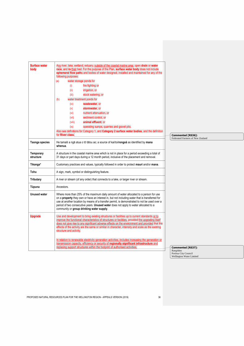
Surface water body
Any river, lake, wetland, estuary, outside of the coastal marine area, open drain or water race, and its their bed. For the purpose of the Plan, surface water body does not include ephemeral flow paths and bodies of water designed, installed and maintained for any of the following purposes:
(a) water storage ponds for
(i) fire fighting or
(ii) irrigation, or
(iii) stock watering, or
(b) water treatment ponds for
(iv) wastewater, or
(v) stormwater, or
(vi) nutrient attenuation, or
(vii) sediment control, or
(viii) animal effluent, or
(ix) operating sumps, quarries and gravel pits.
Also see definitions for Category 1, and Category 2 surface water bodies, and the definition for River class.
Taonga species He tamaiti a ngā atua o tō tātou ao; a source of kai/toi/rongoā as identified by mana whenua.
Temporary structure
A structure in the coastal marine area which is not in place for a period exceeding a total of 31 days or part days during a 12 month period, inclusive of the placement and removal.
Tikanga* Customary practices and values, typically followed in order to protect mauri and/or mana.
Tohu A sign, mark, symbol or distinguishing feature.
Tributary A river or stream (of any order) that connects to a lake, or larger river or stream.
Tūpuna Ancestors.
Unused water Where more than 25% of the maximum daily amount of water allocated to a person for use on a property they own or have an interest in, but not including water that is transferred for use at another location by means of a transfer permit, is demonstrated to not be used over a period of two consecutive years. Unused water does not apply to water allocated to a community or group drinking water supply.
Upgrade Use and development to bring existing structures or facilities up to current standards or to improve the functional characteristics of structures or facilities, provided the upgrading itself does not give rise to any significant adverse effects on the environment and provided that the effects of the activity are the same or similar in character, intensity and scale as the existing structure and activity.
In relation to renewable electricity generation activities, includes increasing the generation or transmission capacity, efficiency or security of regionally significant infrastructure and replacing support structures within the footprint of authorised activities.
Commented [RS36]: Federated Farmers of New Zealand
Commented [RS37]: Rangitāne Porirua City Council
Wellington Water Limited
PROPOSED NATURAL RESOURCES PLAN FOR THE WELLINGTON REGION - APPEALS VERSION (2019) 37
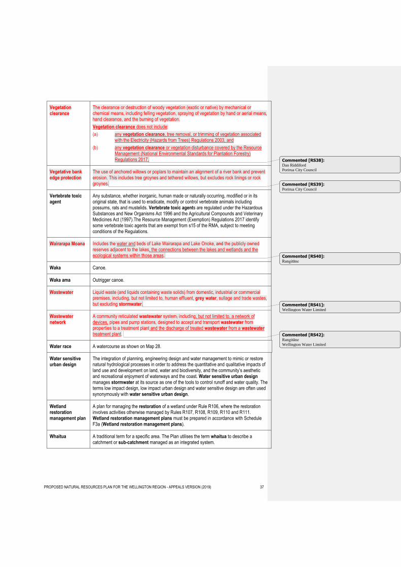
Vegetation clearance
The clearance or destruction of woody vegetation (exotic or native) by mechanical or chemical means, including felling vegetation, spraying of vegetation by hand or aerial means, hand clearance, and the burning of vegetation.
Vegetation clearance does not include:
(a) any vegetation clearance, tree removal, or trimming of vegetation associated with the Electricity (Hazards from Trees) Regulations 2003, and
(b) any vegetation clearance or vegetation disturbance covered by the Resource Management (National Environmental Standards for Plantation Forestry) Regulations 2017.
Vegetative bank edge protection
The use of anchored willows or poplars to maintain an alignment of a river bank and prevent erosion. This includes tree groynes and tethered willows, but excludes rock linings or rock groynes.
Vertebrate toxic agent
Any substance, whether inorganic, human made or naturally occurring, modified or in its original state, that is used to eradicate, modify or control vertebrate animals including possums, rats and mustelids. Vertebrate toxic agents are regulated under the Hazardous Substances and New Organisms Act 1996 and the Agricultural Compounds and Veterinary Medicines Act (1997).The Resource Management (Exemption) Regulations 2017 identify some vertebrate toxic agents that are exempt from s15 of the RMA, subject to meeting conditions of the Regulations.
Wairarapa Moana Includes the water and beds of Lake Wairarapa and Lake Onoke, and the publicly owned reserves adjacent to the lakes, the connections between the lakes and wetlands and the ecological systems within those areas.
Waka Canoe.
Waka ama Outrigger canoe.
Wastewater Liquid waste (and liquids containing waste solids) from domestic, industrial or commercial premises, including, but not limited to, human effluent, grey water, sullage and trade wastes, but excluding stormwater.
Wastewater network
A community reticulated wastewater system, including, but not limited to, a network of devices, pipes and pump stations, designed to accept and transport wastewater from properties to a treatment plant and the discharge of treated wastewater from a wastewater treatment plant.
Water race A watercourse as shown on Map 28.
Water sensitive urban design
The integration of planning, engineering design and water management to mimic or restore natural hydrological processes in order to address the quantitative and qualitative impacts of land use and development on land, water and biodiversity, and the community’s aesthetic and recreational enjoyment of waterways and the coast. Water sensitive urban design manages stormwater at its source as one of the tools to control runoff and water quality. The terms low impact design, low impact urban design and water sensitive design are often used synonymously with water sensitive urban design.
Wetland restoration management plan
A plan for managing the restoration of a wetland under Rule R106, where the restoration involves activities otherwise managed by Rules R107, R108, R109, R110 and R111. Wetland restoration management plans must be prepared in accordance with Schedule F3a (Wetland restoration management plans).
Whaitua A traditional term for a specific area. The Plan utilises the term whaitua to describe a catchment or sub-catchment managed as an integrated system.
Commented [RS38]: Dan Riddiford Porirua City Council
Commented [RS39]: Porirua City Council
Commented [RS40]: Rangitāne
Commented [RS41]: Wellington Water Limited
Commented [RS42]: Rangitāne
Wellington Water Limited
PROPOSED NATURAL RESOURCES PLAN FOR THE WELLINGTON REGION - APPEALS VERSION (2019) 38
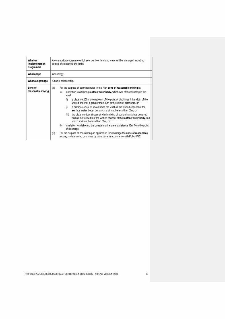
Whaitua Implementation Programme
A community programme which sets out how land and water will be managed, including setting of objectives and limits.
Whakapapa Genealogy.
Whanaungatanga Kinship, relationship.
Zone of reasonable mixing
(1) For the purpose of permitted rules in the Plan zone of reasonable mixing is:
(a) in relation to a flowing surface water body, whichever of the following is the least:
(i) a distance 200m downstream of the point of discharge if the width of the wetted channel is greater than 30m at the point of discharge, or
(ii) a distance equal to seven times the width of the wetted channel of the surface water body, but which shall not be less than 50m, or
(iii) the distance downstream at which mixing of contaminants has occurred across the full width of the wetted channel of the surface water body, but which shall not be less than 50m, or
(b) in relation to a lake and the coastal marine area, a distance 15m from the point of discharge.
(2) For the purpose of considering an application for discharge the zone of reasonable mixing is determined on a case by case basis in accordance with Policy P72.