Embed Size (px)
Citation preview
1209.0.55.001
Information Paper
Draft Mesh Blocks
Australia
2005
w w w . a b s . g o v . a u


NewIssue
AUST R A L I A N BUR E A U OF STA T I S T I C S
EMBA R G O : 11 . 30 A M (CAN B E R R A T IME ) FR I 9 SEP 2005
P e t e r H a r p e r
A c t i n g A u s t r a l i a n S t a t i s t i c i a n
Information Paper
Draft Mesh Blocks
Australia
2005

! For further information about these and related statistics, contact the NationalInformation and Referral Service on 1300 135 070 or Michael Toole on Canberra(02) 6252 7759.
I N Q U I R I E S
Produced by the Austra l ian Bureau of Stat ist ics
In all cases the ABS must be acknowledged as the source when reproducing or
quoting any part of an ABS publ icat ion or other product.
This work is copyr ight. Apart from any use as permitted under the Copyright Act
1968 , no part may be reproduced by any process without prior written permission
from the Commonwealth. Requests and inquir ies concerning reproduct ion and rights
in this publ icat ion should be addressed to The Manager, Intermediary Management,
Austra l ian Bureau of Stat ist ics, Locked Bag 10, Belconnen ACT 2616, by telephone
(02) 6252 6998, fax (02) 6252 7102, or email :
© Commonwealth of Austral ia 2005
ABS Catalogue No. 1209.0.55.001
CO N T E N T S . . . . . . . . . . . . . . . . . . . . . . . . . . . . . . . . . . . . . . . . . . . .
12Appendix 1 . . . . . . . . . . . . . . . . . . . . . . . . . . . . . . . . . . . . . . . . . . . . . .11Attachment A . . . . . . . . . . . . . . . . . . . . . . . . . . . . . . . . . . . . . . . . . . . .9How to provide feedback6 . . . . . . . . . . . . . . . . . . . . . . . . . . . . . . . . . . .7The Limitations of Draft Mesh Block Digital Boundaries5 . . . . . . . . . . . . . . . .5Creating the First Draft of Mesh Blocks4 . . . . . . . . . . . . . . . . . . . . . . . . . .4The Design Criteria3 . . . . . . . . . . . . . . . . . . . . . . . . . . . . . . . . . . . . . . .3Aims of this paper2 . . . . . . . . . . . . . . . . . . . . . . . . . . . . . . . . . . . . . . . .1Introduction1 . . . . . . . . . . . . . . . . . . . . . . . . . . . . . . . . . . . . . . . . . . .
CH A P T E R S
viiiAbbreviations . . . . . . . . . . . . . . . . . . . . . . . . . . . . . . . . . . . . . . . . . . .viiPreface . . . . . . . . . . . . . . . . . . . . . . . . . . . . . . . . . . . . . . . . . . . . . . . .
page
A B S • D R A F T ME S H B L O C K S • 1 2 0 9 . 0 . 5 5 . 0 0 1 • 2 0 0 5 v


PR E F A C E . . . . . . . . . . . . . . . . . . . . . . . . . . . . . . . . . . . . . . . . . . . . . .
Pe te r Ha rpe r
Ac t i n g Au s t r a l i a n S t a t i s t i c i a n
The Australian Bureau of Statistics (ABS) has embarked on an ambitious program of
work to establish a new approach to statistical geography which will put geographically
referenced statistics on a whole new footing in Australia.
This work has included the development of a new micro level of geography – the Mesh
Block – and a comprehensive infrastructure for assigning a house, farm, factory or
business to its correct Mesh Block based upon its street address.
This paper describes how Draft Mesh Blocks 2005, which were published in the CDROM
product ABS (cat. no. 1209.0) , were created and some of the difficulties which were
encountered.
Criteria for designing Mesh Blocks were defined by a Panel of Experts in 2003. The
criteria were published in March 2004 and were refined and amended in response to
public comments. Every attempt has been made to create Mesh Blocks true to those
criteria but even the best of national spatial databases cannot be completely authoritative
and up to date with human activity in rapidly developing parts of Australia. The purpose
of this paper is to seek comments on the Draft Mesh Blocks from statistical and spatial
data users who may have knowledge of local conditions that was not available to the ABS
during the design process.
Feedback on the draft boundaries for Mesh Blocks will be an important input to the
usability and long-term stability of Mesh Blocks. Responses should reach ABS prior to 31
December 2005.
Please address replies to:
Post:
Director, Geography
Australian Bureau of Statistics
PO Box 10
Belconnen ACT 2616
Email:
Fax:
(02) 6252 8666
A B S • D R A F T ME S H B L O C K S • 1 2 0 9 . 0 . 5 5 . 0 0 1 • 2 0 0 5 v i i
AB B R E V I A T I O N S . . . . . . . . . . . . . . . . . . . . . . . . . . . . . . . . . . . . . .
statistical local areaSLA
Public Sector Mapping AgenciesPSMA
local government areaLGA
geographic information systemGIS
Geocoded National Address FileG-NAF
Digital Cadastral Data BaseDCDB
Collection DistrictCD
Australian Standard Geographical ClassificationASGC
Australian Population AssociationAPA
Australian Bureau of StatisticsABS
v i i i A B S • D R A F T ME S H B L O C K S • 1 2 0 9 . 0 . 5 5 . 0 0 1 • 2 0 0 5

CHAP T E R 1 IN T R O D U C T I O N . . . . . . . . . . . . . . . . . . . . . . . . . . . . . . . . . . . . . . .
This paper describes the development of a new micro level geographical unit, the Mesh
Block, which is intended to become the basic building block of all statistical, political and
administrative geography in Australia.
Criteria for designing and building Mesh Blocks were first defined by a Panel of Experts
in 2003. These criteria were published in Information Paper Mesh Blocks Australia
2003, ABS (cat. no. 1209.0). The criteria were further refined in response to feedback on
that information paper. The refined criteria were published in a paper presented to the
12th Biennial Conference of the Australian Population Association (APA) held in
Canberra in September 2004. The hierarchy is reproduced in Appendix 1.
In creating 350,000 Mesh Blocks to cover all of Australia the ABS has relied heavily on the
advances made over the last decade in GIS technology and digital topographical data. In
particular the launch on 2 March 2004 of PSMA Australia's G-NAF has enabled both the
development of Mesh Blocks and the coding of address information to those Mesh
Blocks. Even the best of national spatial databases, however, cannot be completely
authoritative and up to date with human activity in rapidly developing parts of Australia.
Some Draft Mesh Blocks will inevitably have been created based on topographical
features which no longer exist or will not have allowed for major new features because
they were not represented in the PSMA national datasets at the time.
The design criteria adopted for Mesh Blocks are quite robust in that, despite the
limitations of the available spatial data on which they are based, they almost always result
in micro regions which are very good, if not ideal, for most applications. It is important
for the long-term use and stability of Mesh Blocks, however, that any major departures
from the design criteria are detected before Mesh Blocks are utilized in the 2006 Census
of Population and Housing and other major statistical collections. The ABS acknowledges
that there are many stakeholders in the Mesh Block initiative and that some of those
stakeholders have access to local information which was not available to the ABS during
the creation of the Draft Mesh Block boundaries. This paper seeks feedback from
individuals and organisations on whether the draft boundaries are true to the design
criteria in the parts of Australia which those individuals or organisations know best.
Mesh Blocks will be maintained and published on an annual basis. The normal growth of
Australia’s cities and towns and changes in land use will be captured in the annual
maintenance cycle. The intention is that once Mesh Blocks are finalised for the 2006
census, this maintenance will only involve the splitting of an existing Mesh Block into
two or more new Mesh Blocks. The ABS anticipates that for the Draft Mesh Blocks 2005,
however, there will be cases where some redesign will be required to accommodate valid
feedback from stakeholders. The intended one to many relationship between old and
new Mesh Blocks in each annual edition will only apply after the 2006 Edition.
AB O U T TH I S PU B L I C A T I O N
A B S • D R A F T ME S H B L O C K S • 1 2 0 9 . 0 . 5 5 . 0 0 1 • 2 0 0 5 1

Comments on the Draft Mesh Blocks, Australia, 2005 are welcome and are invited from
all interested parties. Responses should be in the form provided in Attachment A and
should be sent to reach the ABS prior to 31 December 2005.
Please address replies to:
Post:
Director, Geography
Australian Bureau of Statistics
PO Box 10
Belconnen ACT 2616
Email:
Fax:
(02) 6252 8666
Based on the results of this consultation, the ABS may amend, further subdivide or
aggregate the Draft Mesh Blocks to form Mesh Blocks Australia 2006 to be published in
July 2006.
RE S P O N S E S TO TH I S
PA P E R
2 A B S • D R A F T ME S H B L O C K S • 1 2 0 9 . 0 . 5 5 . 0 0 1 • 2 0 0 5
CH A P T E R 1 • I N T R O D U C T I O N

CHAP T E R 2 A I M S OF TH I S PA P E R . . . . . . . . . . . . . . . . . . . . . . . . . . . . . . .
The specific items on which the ABS seeks detailed feedback are:
1. any Draft Mesh Block which is bisected by an impassable natural or man made
feature ie. part of the Mesh Block is disconnected from other parts;
2. any Draft Mesh Block which is likely to contain between 5 and 20 dwellings;
3. any Draft Mesh Block, excluding high density residential areas, which is likely to
contain much more than 60 dwellings;
4. any major development ie. a shopping mall, major transport corridor, high rise
residential development, a school or hospital, etc, which warrants the creation of a
specific Mesh Block but has been missed in the Draft boundaries;
5. the location of pockets of population within an otherwise unpopulated Mesh
Block ie. an accommodation area within a National Park, a group of 30 or more
dwellings within an industrial area
6. any large rural Mesh Block which contains a population cluster of more than 30
dwellings which has not already detected and bounded.
I T E M S FO R FE E D B A C K
The aims of the paper are to:
! re-state the criteria against which Draft Mesh Blocks have been created;
! make clear the limitations of the Draft Mesh Blocks 2005 digital boundaries dataset
published in ABS (cat. no. 1209.0)
! seek detailed feedback on cases where, given the stated limitations, the Draft Mesh
Blocks 2005 still do not meet the stated design criteria.
Geographical boundaries can be a very emotive issue and it is very likely that a boundary
drawn anywhere or around anything will invoke some degree of dissent. In the case of
Draft Mesh Blocks every single boundary could be re-drawn to include something
previously excluded or vice versa. The ABS has used a highly automated process to
create Mesh Blocks which within the limitations of the available spatial data are true to a
given set of criteria. Those criteria were in turn developed by an independent Panel of
Experts and have been the subject of considerable consultation. The ABS is not in a
position to change the criteria at this time. Neither is it seeking to change the Draft Mesh
Block boundaries in cases where there is some degree of discretion in the application of
the criteria. Stakeholders are being asked to comment on the compliance of individual
Draft Mesh Blocks with the stated criteria.
Obviously individual stakeholders are not in a position to validate all Mesh Block
boundaries for all of Australia. Some stakeholders will however have very detailed
knowledge of small parts of Australia. Others will have knowledge of major changes to
the landscape such as the construction of a new highway or the redevelopment of a
housing or industrial area.
A I M S OF TH I S PA P E R
A B S • D R A F T ME S H B L O C K S • 1 2 0 9 . 0 . 5 5 . 0 0 1 • 2 0 0 5 3

CHAP T E R 3 TH E DE S I G N CR I T E R I A . . . . . . . . . . . . . . . . . . . . . . . . . . . . . .
The design criteria developed by the Panel of Experts were published in Information
Paper Mesh Blocks (cat. no 1209.0). After receiving feedback from interested
stakeholders these criteria were refined into an operational hierarchy on which a work
flow and software tools were developed. This hierarchy was published in a paper
presented to the 12th Biennial Conference of the Australian Population Association
(APA) held in Canberra in September 2004. The hierarchy is reproduced in Appendix 1.
It will be noted that there are different criteria for urban versus rural areas. The first
requirement in the design process was therefore to split urban areas from rural areas. In
this context however urban and rural are not defined in the same way as they are in the
ASGC ie. the Linge Criteria. When designing Mesh Blocks the urban criteria were applied
to all Urban Centres and Localities (See ASGC ABS cat. no. 1216.0 ) plus any other
identifiable cluster of more than 30 dwellings. The primary purpose is to distinguish
clustered population from dispersed population so as to design Mesh Blocks which are,
wherever possible, internally homogenous in terms of population density.
During the design and construction of the Draft Mesh Blocks every attempt was made to
adhere to the criteria shown in Appendix 1 but practical imperatives dictated that not all
criteria were able to be met at all times. In particular there was often a direct conflict
between the requirement to maintain a minimum number of dwellings (30) in each
Mesh Block versus other criteria from further down the priority list.
During the design and build it was found that only very rarely could the hierarchy of
criteria be applied beyond priority 16 in urban areas and priority 11 in rural areas (See
Appendix 1). In fact it was often found that even highly ranked criteria like rural locality
boundaries conflicted with the requirement for an urban/rural split and a minimum
dwelling count.
Where conflicts between criteria occurred a trained GIS operator ultimately made a
decision based on the order of priority of the criteria. Such decisions were often made
with little supporting evidence about dwelling numbers and land use or in the face of
conflicting evidence from multiple sources. Fortunately, however, the basic concept of a
Mesh Block is quite robust and while there may be any number of permutations and
combinations for resolving conflicting criteria any or all of them will result in Mesh
Blocks that are perfectly fit for purpose. Interested stakeholders are requested to be
mindful of this when reviewing Mesh Block boundaries. While any number of Draft Mesh
Block boundaries could be drawn differently, the magnitude of the task dictates that only
the specific items numbered 1 to 6 in Ch 2 will be incorporated in the 2006 Edition.
Please note that at the beginning of the design and build the minimum areas for water
features in urban and rural areas were amended from those published in the APA Paper
TH E DE S I G N CR I T E R I A
4 A B S • D R A F T ME S H B L O C K S • 1 2 0 9 . 0 . 5 5 . 0 0 1 • 2 0 0 5

CHAP T E R 4 CR E A T I N G TH E F I R S T DR A F T OF ME S H BL O C K S . .
Draft Mesh Blocks Australia 2005 were created using a suite of GIS software tools
developed by the ABS specifically for the purpose. The topographic data which
underpins the Mesh Block boundaries is stored in an Oracle Database and was accessed
by up to eight GIS operators using MapInfo Profession clients. The Mesh Block
boundaries and associated attributes were created initially on local hard drives before
being uploaded to a single Oracle table.
The topographic and other spatial data used were:
! PSMA Australia national datasets
! Coastline
! Roads
! Railways
! Major Water
! National Parks
! CADLITE
! Points of Interest
! Administrative boundaries - suburbs and localities
! G-NAF
! ABS SLA boundaries
! Planning/zoning scheme data for each state/territory
Planning/zoning scheme data was supplied by each state/territory in most cases by the
Planning Authority. These data were in the case of some states/territories a single fully
integrated and consistently attributed dataset while in the worst case they were provided
as separate files for each local government area with little or no consistency between
zone categories across local government areas. The ABS where necessary consolidated
the files for each state/territory then mapped the land uses to a highly generalised set of
land uses.
The ABS acknowledges that these planning data represent only a theoretical or planned
land use and there will be many cases where actual land use is quite different to the
planned land use. An alternative would have been to use the Australian Land Use
Mapping (ALUM) datasets which are available or becoming available for most
states/territories. However it was found that ALUM was not available over the major
urban areas. In rural areas it contains a lot of detail in both spatial disaggregation and
land use categories which the Mesh Block creation process was not able to deal with in a
meaningful way.
A planned or theoretical land use has several advantages over a physical land use in
terms of stability and for flagging change in the future. However, the Mesh Block
category shown in the Draft Mesh Blocks 2005 boundary dataset is not designed to
provide a definitive land use mapping. It is purely an indicator of the main planned land
TH E DA T A US E D
A B S • D R A F T ME S H B L O C K S • 1 2 0 9 . 0 . 5 5 . 0 0 1 • 2 0 0 5 5

The above data were downloaded to the operator’s computer and processed one SLA at
time. This meant that the operator physically could not create a Mesh Block which
crosses an SLA boundary. This in turn ensures that Draft Mesh Blocks 2005 aggregate
precisely to SLAs. However for logistical and data management reasons Draft Mesh
Blocks 2005 aggregate to ASGC 2006 Edition SLAs, not ASGC 2005.
Once all data for an SLA is downloaded the GIS software subsets the SLA into urban and
rural areas and then intersects the data layers relevant to each to form a first cut of Mesh
Blocks. The software then determines the estimated number of dwellings in each Block
and the operator merges the ones that are too small (less than 30 dwellings) or further
divides the large ones.
Unfortunately, everywhere except South Australia and the Sydney basin1, the only
indicators which the ABS has of dwelling numbers are:
! the dwelling count for each CD at the 2001 Census;
! the number of cadastral parcels; and
! the number of G-NAF address points.
Mesh blocks do not aggregate to CDs and the ABS has no indicators from the last census
of how the population is distributed within a CD. Neither a cadastral parcel nor a G-NAF
address necessarily represent a dwelling. In rural areas many land parcels belong to a
single owner and there are many fewer dwellings than there are parcels. G-NAF
addresses can be a home, a business or just a vacant allotment. G-NAF also includes a
large number of duplicated addresses where it has not yet been possible to link together,
as aliases, different versions of the same address.
After considerable experimentation the ABS decided to use a subset of G-NAF addresses
(only those geocoded at the parcel level) as the primary indicator of dwelling numbers.
This estimate was further refined by using the planned land use data to restrict the
dwelling count to G-NAF address points which fall in residential zones. The number of
dwellings in each Draft Mesh Block estimated in this way is, at best, unreliable and will
remain so until dwellings have been counted at the 2006 Census. For this reason the ABS
erred on the side of caution with respect to the size of Mesh Blocks. Some may prove to
be too small and will have to be merged after the 2006 Census but many are likely to be
large enough to be further subdivided once dwelling counts are known. In the mean
time, interested stakeholders who can confirm that particular Draft Mesh Blocks contain
considerably more than 60 dwellings are invited to do so.
While the initial intersection of data layers is highly automated, the aggregation of small
Mesh Blocks and the further subdivision of large ones represents approximately 8 person
years for this first edition of Draft Mesh Blocks.
CR E A T I N G ME S H BL O C K S
use for a Mesh Block. For example a Mesh Block categorized as Industrial will in most
cases contain some residential population. The planned land use category has only been
used, like the urban and rural split, to achieve greater internal uniformity of population
density ie. to separate the consistently populated area from the sparsely populated area.
TH E DA T A US E D
c o n t i n u e d
6 A B S • D R A F T ME S H B L O C K S • 1 2 0 9 . 0 . 5 5 . 0 0 1 • 2 0 0 5
CH A P T E R 4 • CR E A T I N G T H E F I R S T D R A F T OF ME S H B L O C K S
1 Planning SA (Department of Primary Industries & Resources) and Sydney Water provided their mapping ofdwellings to the ABS for the Mesh Block design.

CHAP T E R 5 TH E L I M I T A T I O N S OF DR A F T ME S H BL O C KD I G I T A L BO U N D A R I E S . . . . . . . . . . . . . . . . . . . . . . . . . . . . . . .
Every effort has been made in the construction process to eliminate gaps and overlaps
between the Mesh Blocks. These topological problems will be addressed in future
editions through a comprehensive maintenance regime currently being developed by
the ABS.
TO P O L O G Y OF
BO U N D A R I E S
As described in Ch 4, Draft Mesh Blocks 2005 were created by intersecting various data
layers largely but not entirely sourced from PSMA Australia. Other data sets such as
planning schemes do not necessarily align with the PSMA national datasets. Even within
the PSMA data, layers do not always align with each other. For example a suburb
boundary which is intended to run along the centreline of a road may not exactly
coincide in position with that road centreline. An ABS SLA boundary which is also meant
to be the centreline of the road may not coincide with either the suburb boundary or the
road centreline.
This lack of vertical topology within and between datasets requires a great deal of time
and effort to be expended to eliminate gaps and overlaps and various other artifacts from
the Draft Mesh Block boundaries. However, if Mesh Blocks are to be incorporated in the
2006 Census, stakeholders’ recommendations must be received before January 2006 and
incorporated into the Mesh Blocks boundaries before July 2006. The Information Paper:
Draft Mesh Blocks as published in (cat. no. 1290.0.55.001) are a good representation of
what the final Mesh Blocks will look like but the ABS acknowledges that they are not of
the same topological quality as other ABS digital data products.
TH E L I M I T A T I O N S OF
DR A F T ME S H BL O C K S
20 0 5 D I G I T A L
BO U N D A R I E S
The CDROM contains digital boundaries in ESRI Shape and MapInfo table formats for
Draft Mesh Blocks 2005 covering all of Australia with the exception of Other Territories
(Christmas Is, Cocos Is and Jervis Bay) and some of Rural NSW. The missing areas will
become available and will be released on the ABS website.
All Mesh Blocks are closed polygons. Attributes for each polygon are:
! MB_Code
! MB_type
! MB_Category
The data are unprojected GDA 94 latitudes and longitudes.
Also included on the CDROM is a copy of this Information Paper.
Mesh Block boundaries are intended to be free or available at the marginal cost of
transfer. They can be copied and passed on to third parties without incurring royalties to
the ABS. Where they are passed to a third party the ABS should be acknowledged as the
custodian and the boundaries should be clearly described as Draft Mesh Blocks,
Australia, 2005.
WH A T DO E S CD R O M CA T .
NO . 12 0 9 . 0 CO N T A I N
A B S • D R A F T ME S H B L O C K S • 1 2 0 9 . 0 . 5 5 . 0 0 1 • 2 0 0 5 7

The topological relationship between Mesh Blocks and other spatial data is further
complicated by the data update regime which was in place during the design and build.
In theory Mesh Blocks should align (in a vertical topological sense) to the PSMA national
datasets including CADLITE. For most state/territory government users this means that
they will also align with the spatial data sets most commonly used by state/territory
government eg. cadastre and road centrelines. However during the construction phase
(October 2004 to August 2005) the ABS received quarterly updates of most critical
datasets from PSMA Australia. In order to make use of the most recent data, Mesh Blocks
have actually been constructed from three different editions of PSMA roads, major water
and CADLITE. Within any one state/territory Draft Mesh Blocks will overlay a single
edition of the PSMA national datasets but which edition will vary from state to state.
While the above topological issues will not be visible to users who view the boundaries at
scales up to 1:5,000 or even larger, stakeholders who might use relatively sophisticated
GIS techniques to examine and validate the Draft Mesh Blocks should be alert to these
internal topology and vertical topological issues.
VE R T I C A L TO P O L O G Y
8 A B S • D R A F T ME S H B L O C K S • 1 2 0 9 . 0 . 5 5 . 0 0 1 • 2 0 0 5
CH A P T E R 5 • T H E L I M I T A T I O N S OF D R A F T ME S H B L O C K D I G I T A L B O U N D A R I E S
CHAP T E R 6 HO W TO PR O V I D E FE E D B A C K . . . . . . . . . . . . . . . . . . . . . . .
Feedback on the Draft Mesh Blocks 2005 should reach the ABS before 31 December
2005. Comments and recommendations must be provided on the form at attachment A.
The form can be faxed or e-mailed:
Post:
Director, Geography
Australian Bureau of Statistics
PO Box 10
Belconnen ACT 2616
Email:
Fax:
(02) 6252 8666
Stakeholders who wish to provide alternative boundary designs and additional spatial
data to support their recommendations can do so by providing diagrams printed on A4
sized paper clearly showing the boundaries and MB_Code of each Draft Mesh Block
affected by the proposed change and the proposed alternative boundaries.
Diagrams of proposed changes can also be provided electronically in GIF, TIF or Adobe
Acrobat .pdf format or in GIS format:
! MapInfo tables; or
! ESRI Shape files;
In unprojected latitudes and longitudes, GDA 94 datum. Unless provided in GIS format,
diagrams must include a graphic scale bar.
When examining or validating the Draft Mesh Blocks, stakeholders are asked to make
allowances for the topological issues discussed in Ch 5 and to focus on the six areas for
feedback listed in Ch 2.
Recommendations provided in digital form must be accompanied by a completed
Attachment A identifying which of the six feedback items applies to each proposed
change. Recommendations for an alternative design will only be adopted where the Draft
design, due to lack of information or operator error, has substantially departed from the
design criteria.
For practical and strategic reasons Mesh Block boundaries will in future be aligned to the
PSMA Australia national datasets. Proposals which effectively ‘shift’ Mesh Blocks to align
with a local datum or a specific spatial data resource cannot be accepted.
Recommendations in diagrammatic or GIS format should associate proposed boundaries
with the name of a topographic feature so that the ABS can adopt that feature as
represented in the PSMA national dataset. For example if a recommendation is to create
HO W TO PR O V I D E
FE E D B A C K
A B S • D R A F T ME S H B L O C K S • 1 2 0 9 . 0 . 5 5 . 0 0 1 • 2 0 0 5 9

a new Mesh Block bounded by four streets the names of the streets should be shown on
the diagram or included as attributes of the feature in the GIS data.
HO W TO PR O V I D E
FE E D B A C K c o n t i n u e d
10 A B S • D R A F T ME S H B L O C K S • 1 2 0 9 . 0 . 5 5 . 0 0 1 • 2 0 0 5
CH A P T E R 6 • HO W T O P R O V I D E FE E D B A C K
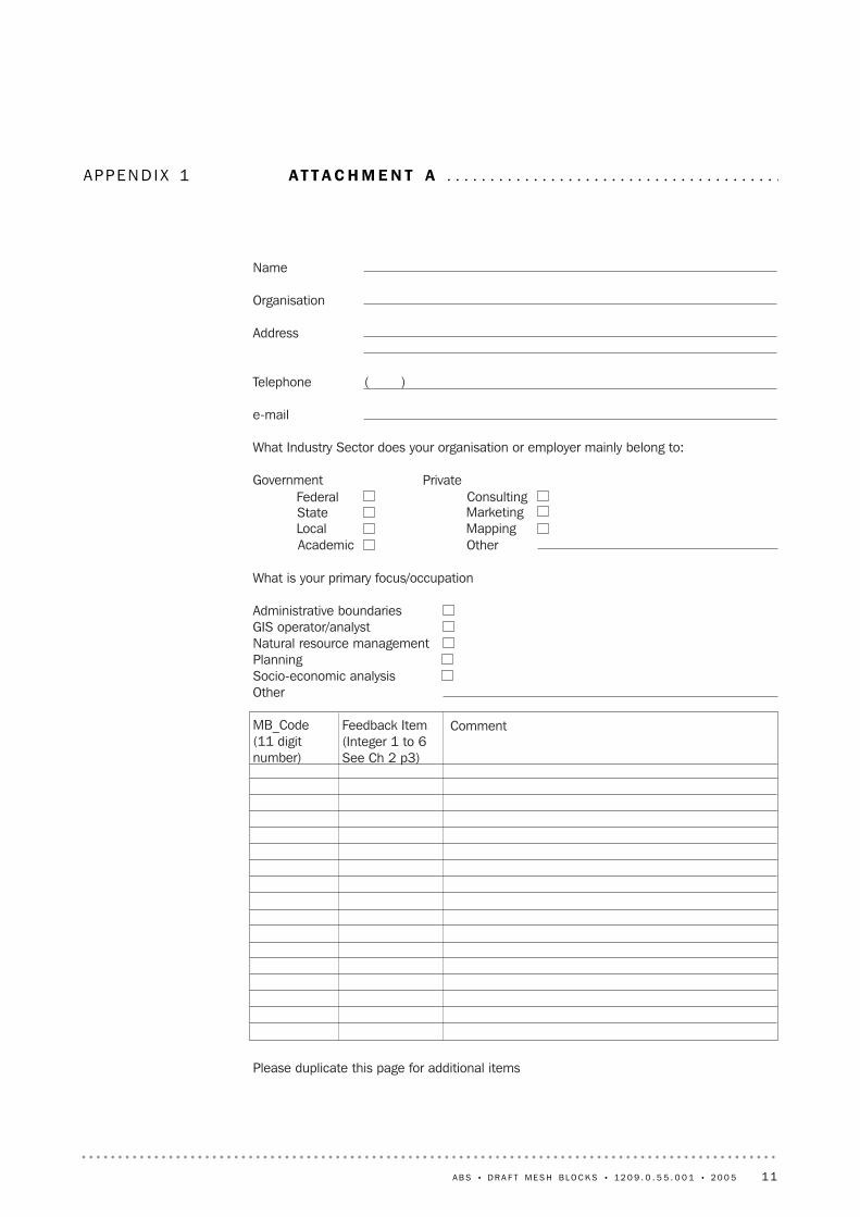
APP E N D I X 1 AT T A C H M E N T A . . . . . . . . . . . . . . . . . . . . . . . . . . . . . . . . . . . . . . .
Name
Organisation
Address
Telephone ( )
What Industry Sector does your organisation or employer mainly belong to:
Government
What is your primary focus/occupation
Administrative boundariesGIS operator/analystNatural resource managementPlanningSocio-economic analysisOther
MB_Code(11 digitnumber)
Please duplicate this page for additional items
PrivateFederalStateLocalAcademic
ConsultingMarketingMappingOther
Feedback Item(Integer 1 to 6See Ch 2 p3)
Comment
A B S • D R A F T ME S H B L O C K S • 1 2 0 9 . 0 . 5 5 . 0 0 1 • 2 0 0 5 11

APP E N D I X 2 UR B A N AN D RU R A L DE S I G N CR I T E R I A . . . . . . . . . . . . .
12 A B S • D R A F T ME S H B L O C K S • 1 2 0 9 . 0 . 5 5 . 0 0 1 • 2 0 0 5

URBAN DESIGN CRITER IA
CommentMesh Blocks will be formed by commencing with the highest priority region andsubdividing or excising other regions where they exist in the priority order shownMesh blocks should be either zero dwellings or minimum 30 dwellingsRequired for time seriesRequired for time series but minor adjustments may be made to SLA boundarieswhich are not LGA boundaries.Official gazetted boundaries onlyMBs must be a single contiguous area except for islands which may be groupedtogether but not combined with a mainland areaParkland may include any public open space and any sporting arena orfacility whether enclosed or open to the public including racecourses,golf courses and stadiums. But will not include any housing incorporatedinto a golf course, etc.Hospitals, universities etc which occupy large areas of land and extend acrossboth sides of a city street or have an in internal road network. The resulting MBswill be categorised as per Land Use below.Excluding water bodies entirely enclosed within 6 or 7 above
Road and rail may be combined into a single MB if separated only bypark/reserve or other minimal use land.Road and railway centrelines (not included in 9 Above) will be intersectedwith each other and with the higher priority polygons to form Town Blocks (Tbs).TBs will be tested for different land uses within the same TB and subdividedaccordingly. It may not be feasible to separate all land uses.The following priority will apply.
Highest priority is to separate residential from other land usesAny "reserved" land greater than 0.5 hectares in area, not included in 6 above.Where zero population MBs can be definedWhere zero population MBs can be defined.May contain population in Non-private dwellingsMixed landuse will be treated as residential
the commercial area immediately surrounding a railway station or bus depot
All MBs, with the exception of 8 above, will consist of one or more wholeland parcels plus a share of the adjacent road casement where appropriate,ie. where a parcel adjoins a road the MB boundary may include all or part ofthe road casement/reserve.Where the above subdivision of areas has occurred but a polygon can befurther divided and still meet criteria 1 the following linear features shouldbe used in priority orderSurface water management area
not being a water body as in 8 aboveto facilitate time series
Mesh blocks should adhere to the following shape criteria in priority orderthere should be no barriers to accessibility within a MB ie. all parts of the MBaccessible from within the MBfollowing significant frontages i.e. Ocean, rivers, lakes, transport corridorsHomogeneous experience of local infrastructure eg walkabilitydoughnut shapes are acceptablewhere known, eg public housing separated from private housingWhere a single apartment block, etc, containing more than 30 dwellings can beidentified the parcel or parcels containing it may be made a separate MB,subject to 19 above but where the MB is a compact shape, of homogeneousland use, not intersected by any other boundary there is no requirement tosubdivide it further even if it contains much more than the minimum number ofdwellings.
Priority
123
45
6
7
8
9
10
111213141516
1718
19
202122232425
26
2728293031
Feature (Criteria)Polygons
Confidentiality ProtectionLocal Government Areas (LGA)Statistical Local Areas (SLA)
Suburb/LocalityContiguity
Major Parkland exceeding 5hectares
Major facility
Water body exceeding 0.5hectares. Amended to 5 hectaresTransportation corridor(Freeway, rail corridor)Town Blocks
Land Use
ResidentialMinor ParklandIndustrialCommercialEducationHopsital/medical
Journey to Work Destination ZoneRailway station or other transportnode precinctLand parcel
Dividing features
River basin boundaryElectoral BoundaryRailwayRiver, creekCollector District (CD) boundaryAustralia Post Postcode boundaryShape, size and areaConnectivity
Linear/parallelCompactnessDoughnutSocio-economically homogeneousHigh density housing
A B S • D R A F T ME S H B L O C K S • 1 2 0 9 . 0 . 5 5 . 0 0 1 • 2 0 0 5 13
A P P E N D I X 2 • U R B A N A N D R U R A L D E S I G N CR I T E R I A

RURAL DESIGN CRITER IA
CommentMesh Blocks will be formed by commencing with the highest priority regionand subdividing or excising other regions where they exist in the priority ordershownMesh blocks should be either zero dwellings or minimum 30 dwellingsRequired for time seriesRequired for time series but minor adjustments may be made to SLAboundaries which are not LGA boundaries.Official gazetted boundaries onlyMBs must be a single contiguous area except for islands which may begrouped together but not combined with a mainland areaParkland may include any uninhabited land reserved or conserved for anypurpose. But will not include any housing or accommodation incorporated intoa park, etc.
Excluding water bodies entirely enclosed within 6 above
Eg , Defence sites and other Commonwealth land, major facilities, etc.
Road and rail may be combined into a single MB if separated only by park orother minimal use land. In rural areas transportation corridors will only bedelineated where they form a major accessibility barrier or are a significantarea of alternate landuse.All MBs, with the exception of 7 above, will consist of one or more whole landparcels and, where information is available, one or more whole properties (ieparcels in the same ownership), plus a share of the adjacent road casementwhere appropriate, ie. where a parcel adjoins a road the MB boundary mayinclude all or part of the road.Surface water management area. Except where a SWMA runs through a largearea of National Park or Sate Forrest, etc, the SWMA boundary will beadjusted to include whole land parcels or propertiesWhere a polygon can be further divided and still meet criteria 1 the followinglinear features should be used in priority orderGenerally IBRA but regionalisations compatible with IBRA will be consideredwhere they existMountain range (ridge top) or escapement which presents a barrier toaccessibility where not already defined by 7 above
Not being a water body as in 7 aboveWhere not already defined by 7 or 15 aboveWhere not already defined by 15 or 18 above, high or steep country should beseparated from low or level lands
Freeway, expressway or dual carriage way significant enough to form a barrierto accessibility between properties on either side.for time series
Not a cul-de-sacMesh blocks should adhere to the following shape criteria in priority orderthere should be no barriers to accessibility within a MB ie. all parts of the MBaccessible from within the MBfollowing significant frontages i.e. Ocean, rivers, lakes, transport corridorsHomogeneous experience of local infrastructure eg walkabilitydoughnut shapes are acceptable
Priority
123
45
6
7
89
10
11
12
13
14
15
16171819
2021
2223
24
25
262728
Feature (Criteria)Polygons
Confidentiality ProtectionLocal Government Areas (LGA)Statistical Local Areas (SLA)
LocalityContiguity
Parkland, nature reserve andother minimal use protectedor conserved area exceeding10 hectaresWater body exceeding5 hectares.Amended to 50 hectares.Land Use
Residential/lifestyleagriculturalother
Transportation corridor(Freeway, rail corridor)
Land parcel
River basin boundary
Dividing features
Biogeographical Regions
Topographical barriers
Electoral BoundaryRiver, creekValley perimeterHighland/lowland
RailwayMajor road
Collector District (CD) boundaryAustralia Post PostcodeboundaryMinor roadShape and areaConnectivity
Linear/parallelCompactnessDoughnut
14 A B S • D R A F T ME S H B L O C K S • 1 2 0 9 . 0 . 5 5 . 0 0 1 • 2 0 0 5
A P P E N D I X 2 • U R B A N A N D R U R A L D E S I G N CR I T E R I A

www.abs.gov.auWEB ADDRESS
All ABS publications can be downloaded free of chargefrom the ABS web site.
F R E E A C C E S S T O P U B L I C A T I O N S
Client Services, ABS, GPO Box 796, Sydney NSW 2001POST
1300 135 211FAX
1300 135 070PHONE
Data already published that can be provided within fiveminutes will be free of charge. Our information consultantscan also help you to access the full range of ABSinformation—ABS user pays services can be tailored toyour needs, time frame and budget. Publications may bepurchased. Specialists are on hand to help you withanalytical or methodological advice.
I N F O R M A T I O N S E R V I C E
This service now provides only current Consumer PriceIndex statistics call 1900 986 400 (call cost 77c perminute).
DIAL-A-STATISTIC
For current and historical Consumer Price Index data, call1902 981 074 (call cost 77c per minute).
CPI INFOLINE
A range of ABS publications is available from public andtertiary libraries Australia-wide. Contact your nearest libraryto determine whether it has the ABS statistics you require,or visit our web site for a list of libraries.
LIBRARY
www.abs.gov.au the ABS web site is the best place tostart for access to summary data from our latestpublications, information about the ABS, advice aboutupcoming releases, our catalogue, and Australia Now—astatistical profile.
INTERNET
F O R M O R E I N F O R M A T I O N . . .
2000001506615
RRP $10.00
© Commonwealth of Australia 2005Produced by the Australian Bureau of Statistics
12
09
.0
.5
5.
00
1
• IN
FO
RM
AT
IO
N
PA
PE
R:
DR
AF
T M
ES
H
BL
OC
KS
, A
US
TR
AL
IA
•
20
05


![FORTIN.CA 71.[50] A11](https://img.pdfslide.us/doc/110x75/624e5824954c333418069a19/-7150-a11.jpg)