Embed Size (px)
Citation preview
California Education and the Environment InitiativeStudent Edition
Postwar Industries and the Emerging
Environmental Movement
U.S. HistoryHistory-Social
Science Standard11.8.6.
11
California Education and the Environment InitiativeApproved by the California State Board of Education, 2010
The Education and the Environment Initiative Curriculum is a cooperative endeavor of the following entities:California Environmental Protection Agency
California Natural Resources Agency
California State Board of Education
California Department of Education
Department of Resources Recycling and Recovery (CalRecycle)
Key Partners:Special thanks to Heal the Bay, sponsor of the EEI law, for their partnership
and participation in reviewing portions of the EEI curriculum.
Valuable assistance with maps, photos, videos and design was provided by the
National Geographic Society under a contract with the State of California.
Office of Education and the Environment1001 I Street • Sacramento, California 95814 • (916) 341-6769
http://www.CaliforniaEEI.org
© Copyright 2011 by the California Environmental Protection Agency© 2018 Third Edition
All rights reserved. This publication, or parts thereof, may not be used or reproduced without
permission from the Office of Education and the Environment.
These materials may be reproduced by teachers for educational purposes.
Lesson 1 Postwar Changes in the Great Central Valley
California Connections: A Postwar Boom in the Central Valley 2
Lesson 2 Environmental Regions and Resources of North America
Environmental Regions of North America 6
Lesson 3 Tracking the Postwar Industrial Boom
Station 1: Farming of Food and Nonfood Crops 7
Station 2: Cattle, Pig, and Poultry Ranching 8
Station 3: Coal Mining 9
Station 4: Oil and Natural Gas Extraction 10
Station 5: Hydroelectric Power Generation 11
Station 6: Nuclear Power 12
Lesson 4 Effects of the Postwar Boom
Community Case Studies 13
Lesson 5 Developing Environmental Concerns
Silent Spring, Chapter 1 17
Contents
2 CALIFORNIA EDUCATION AND THE ENVIRONMENT INITIATIVE I Unit 11.8.6. I Postwar Industries and the Emerging Environmental Movement I Student Edition
California Connections: A Postwar Boom in the Central Valley Lesson 1 | page 1 of 4
A Postwar Boom in the Central Valley
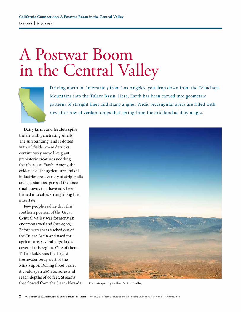
Poor air quality in the Central Valley
Dairy farms and feedlots spike the air with penetrating smells. The surrounding land is dotted with oil fields where derricks continuously move like giant, prehistoric creatures nodding their heads at Earth. Among the evidence of the agriculture and oil industries are a variety of strip malls and gas stations; parts of the once small towns that have now been turned into cities strung along the interstate.
Few people realize that this southern portion of the Great Central Valley was formerly an enormous wetland (pre-1900). Before water was sucked out of the Tulare Basin and used for agriculture, several large lakes covered this region. One of them, Tulare Lake, was the largest freshwater body west of the Mississippi. During flood years, it could span 486,400 acres and reach depths of 50 feet. Streams that flowed from the Sierra Nevada
Driving north on Interstate 5 from Los Angeles, you drop down from the Tehachapi
Mountains into the Tulare Basin. Here, Earth has been carved into geometric
patterns of straight lines and sharp angles. Wide, rectangular areas are filled with
row after row of verdant crops that spring from the arid land as if by magic.
CALIFORNIA EDUCATION AND THE ENVIRONMENT INITIATIVE I Unit 11.8.6. I Postwar Industries and the Emerging Environmental Movement I Student Edition 3
fed these lakes. Wetlands, oak woodlands, and vast grasslands surrounded them. This unique environmental region supported a wealth of wildlife, including herds of antelope and elk. Fish, otters, and waterfowl filled the lakes. Pelicans nested on an island in the middle of Tulare Lake, and the sky flickered with millions of birds that stopped here during their annual migration along the Pacific Flyway. Today, the sky is relatively devoid of birds. The great lakes are gone. In their place lies a stretch of terrain that hails as one of the driest in the state.
Resources and GrowthCalifornia Indians and
European settlers knew of the resources of the basin and used them creatively. Intensive human use of the Tulare Basin began in the 1800s, when farmers began cultivating the rich valley soils in earnest. After World War II, this region became the agricultural center of North America, and sections of the region transformed from rural to urban almost overnight. Over a decade, New Deal projects and then the war effort caused unprecedented population growth in California. Urban areas like Los Angeles expanded, pushing farmland into the open space of the Central Valley. More people required
more food resources. In order to increase the yield to feed the high demand, farmers applied chemicals developed during the war on their crops. These petroleum-based pesticides and fertilizers proved very effective, but the long-term cost of their application had yet to be revealed. By 1948, California was the largest agricultural state in the nation.
The growth of agriculture, the aerospace industry, and population led to an increase in oil exploration in the state. California’s Black-Gold Rush started in 1921, with the discovery of oil, just south of Los Angeles in Signal Hills. Demand
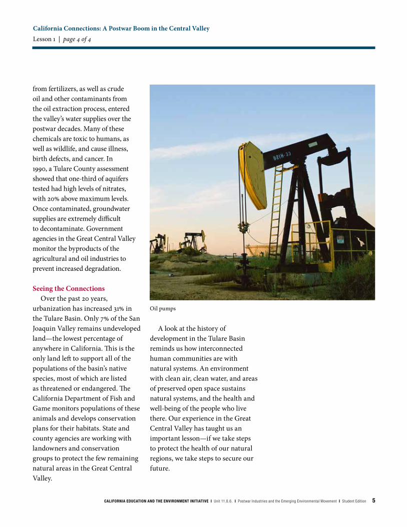
for energy and petroleum-based products was so high that all the oil derricks in the basin could not pump enough oil to serve California’s needs. During this time, California became one of the world’s top oil exporters. One of the nation’s largest oil reserves, the Kern River Oil Field, sat under the southern end of the Great Central Valley. The oil industry had tapped this reserve during World War II, but as the oil became harder to extract, the industry looked elsewhere. When the Korean War began in 1950, drilling in the Kern River Oil Fields resumed, and remains productive today.
California Connections: A Postwar Boom in the Central Valley Lesson 1 | page 2 of 4
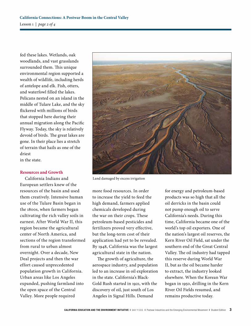
Land damaged by excess irrigation
4 CALIFORNIA EDUCATION AND THE ENVIRONMENT INITIATIVE I Unit 11.8.6. I Postwar Industries and the Emerging Environmental Movement I Student Edition
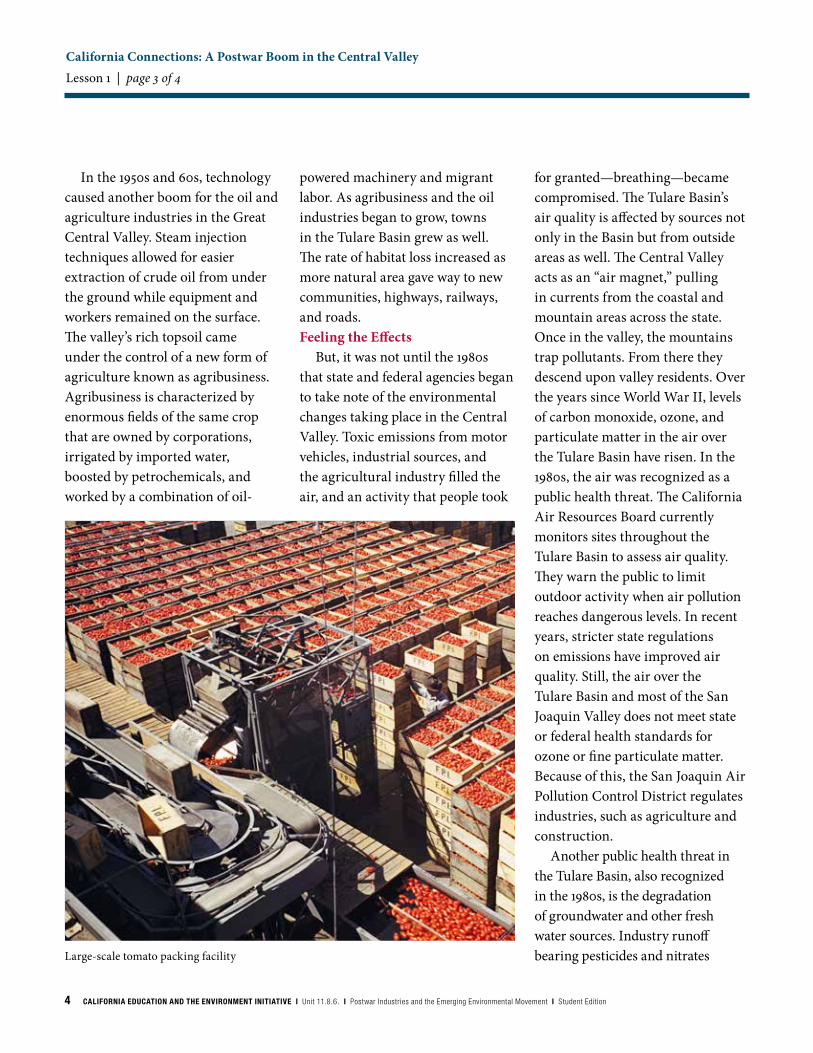
Large-scale tomato packing facility
In the 1950s and 60s, technology caused another boom for the oil and agriculture industries in the Great Central Valley. Steam injection techniques allowed for easier extraction of crude oil from under the ground while equipment and workers remained on the surface. The valley’s rich topsoil came under the control of a new form of agriculture known as agribusiness. Agribusiness is characterized by enormous fields of the same crop that are owned by corporations, irrigated by imported water, boosted by petrochemicals, and worked by a combination of oil-
powered machinery and migrant labor. As agribusiness and the oil industries began to grow, towns in the Tulare Basin grew as well. The rate of habitat loss increased as more natural area gave way to new communities, highways, railways, and roads.Feeling the Effects
But, it was not until the 1980s that state and federal agencies began to take note of the environmental changes taking place in the Central Valley. Toxic emissions from motor vehicles, industrial sources, and the agricultural industry filled the air, and an activity that people took
for granted—breathing—became compromised. The Tulare Basin’s air quality is affected by sources not only in the Basin but from outside areas as well. The Central Valley acts as an “air magnet,” pulling in currents from the coastal and mountain areas across the state. Once in the valley, the mountains trap pollutants. From there they descend upon valley residents. Over the years since World War II, levels of carbon monoxide, ozone, and particulate matter in the air over the Tulare Basin have risen. In the 1980s, the air was recognized as a public health threat. The California Air Resources Board currently monitors sites throughout the Tulare Basin to assess air quality. They warn the public to limit outdoor activity when air pollution reaches dangerous levels. In recent years, stricter state regulations on emissions have improved air quality. Still, the air over the Tulare Basin and most of the San Joaquin Valley does not meet state or federal health standards for ozone or fine particulate matter. Because of this, the San Joaquin Air Pollution Control District regulates industries, such as agriculture and construction.
Another public health threat in the Tulare Basin, also recognized in the 1980s, is the degradation of groundwater and other fresh water sources. Industry runoff bearing pesticides and nitrates
California Connections: A Postwar Boom in the Central Valley Lesson 1 | page 3 of 4
CALIFORNIA EDUCATION AND THE ENVIRONMENT INITIATIVE I Unit 11.8.6. I Postwar Industries and the Emerging Environmental Movement I Student Edition 5
Oil pumps
from fertilizers, as well as crude oil and other contaminants from the oil extraction process, entered the valley’s water supplies over the postwar decades. Many of these chemicals are toxic to humans, as well as wildlife, and cause illness, birth defects, and cancer. In 1990, a Tulare County assessment showed that one-third of aquifers tested had high levels of nitrates, with 20% above maximum levels. Once contaminated, groundwater supplies are extremely difficult to decontaminate. Government agencies in the Great Central Valley monitor the byproducts of the agricultural and oil industries to prevent increased degradation.
Seeing the ConnectionsOver the past 20 years,
urbanization has increased 31% in the Tulare Basin. Only 7% of the San Joaquin Valley remains undeveloped land—the lowest percentage of anywhere in California. This is the only land left to support all of the populations of the basin’s native species, most of which are listed as threatened or endangered. The California Department of Fish and Game monitors populations of these animals and develops conservation plans for their habitats. State and county agencies are working with landowners and conservation groups to protect the few remaining natural areas in the Great Central Valley.
A look at the history of development in the Tulare Basin reminds us how interconnected human communities are with natural systems. An environment with clean air, clean water, and areas of preserved open space sustains natural systems, and the health and well-being of the people who live there. Our experience in the Great Central Valley has taught us an important lesson—if we take steps to protect the health of our natural regions, we take steps to secure our future.
California Connections: A Postwar Boom in the Central Valley Lesson 1 | page 4 of 4
6 CALIFORNIA EDUCATION AND THE ENVIRONMENT INITIATIVE I Unit 11.8.6. I Postwar Industries and the Emerging Environmental Movement I Student Edition
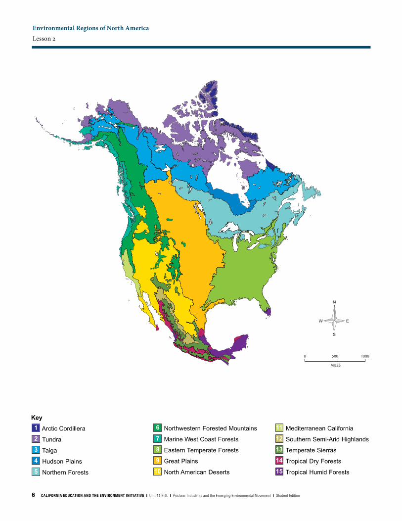
Environmental Regions of North America Lesson 2
MILES
0 500 1000
Key
Arctic Cordillera
Tundra
Taiga
Hudson Plains
Northern Forests
Northwestern Forested Mountains
Marine West Coast Forests
Eastern Temperate Forests
Great Plains
North American Deserts
Mediterranean California
Southern Semi-Arid Highlands
Temperate Sierras
Tropical Dry Forests
Tropical Humid Forests15
14
13
12
11
10
9
8
7
6
5
4
3
2
1
CALIFORNIA EDUCATION AND THE ENVIRONMENT INITIATIVE I Unit 11.8.6. I Postwar Industries and the Emerging Environmental Movement I Student Edition 7
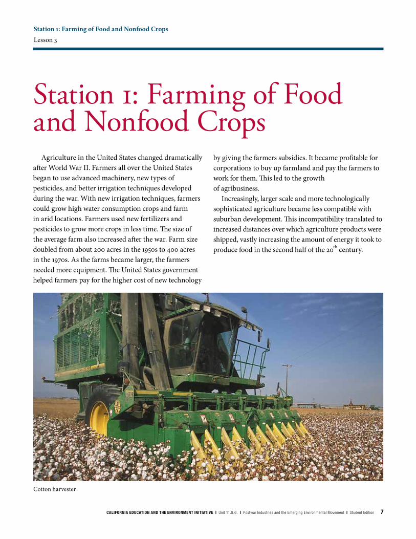
Station 1: Farming of Food and Nonfood CropsLesson 3
Agriculture in the United States changed dramatically after World War II. Farmers all over the United States began to use advanced machinery, new types of pesticides, and better irrigation techniques developed during the war. With new irrigation techniques, farmers could grow high water consumption crops and farm in arid locations. Farmers used new fertilizers and pesticides to grow more crops in less time. The size of the average farm also increased after the war. Farm size doubled from about 200 acres in the 1950s to 400 acres in the 1970s. As the farms became larger, the farmers needed more equipment. The United States government helped farmers pay for the higher cost of new technology
Station 1: Farming of Food and Nonfood Crops
by giving the farmers subsidies. It became profitable for corporations to buy up farmland and pay the farmers to work for them. This led to the growth of agribusiness.
Increasingly, larger scale and more technologically sophisticated agriculture became less compatible with suburban development. This incompatibility translated to increased distances over which agriculture products were shipped, vastly increasing the amount of energy it took to produce food in the second half of the 20th century.
Cotton harvester
8 CALIFORNIA EDUCATION AND THE ENVIRONMENT INITIATIVE I Unit 11.8.6. I Postwar Industries and the Emerging Environmental Movement I Student Edition
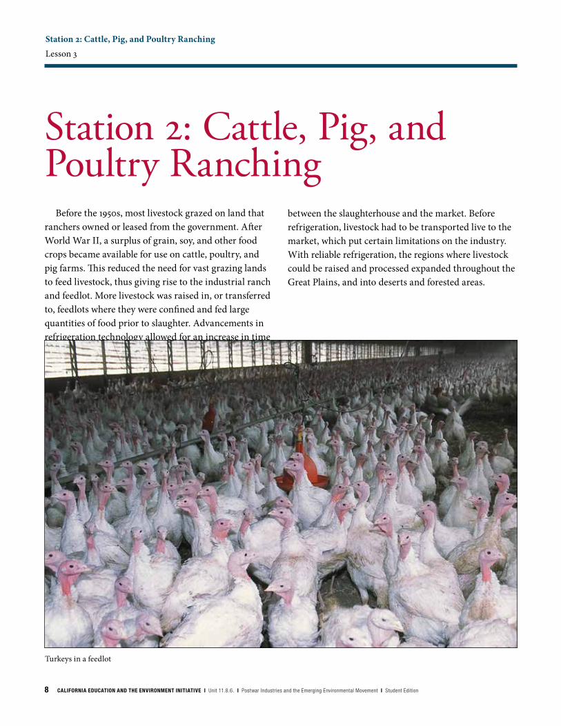
Station 2: Cattle, Pig, and Poultry RanchingLesson 3
Before the 1950s, most livestock grazed on land that ranchers owned or leased from the government. After World War II, a surplus of grain, soy, and other food crops became available for use on cattle, poultry, and pig farms. This reduced the need for vast grazing lands to feed livestock, thus giving rise to the industrial ranch and feedlot. More livestock was raised in, or transferred to, feedlots where they were confined and fed large quantities of food prior to slaughter. Advancements in refrigeration technology allowed for an increase in time
Station 2: Cattle, Pig, and Poultry Ranching
between the slaughterhouse and the market. Before refrigeration, livestock had to be transported live to the market, which put certain limitations on the industry. With reliable refrigeration, the regions where livestock could be raised and processed expanded throughout the Great Plains, and into deserts and forested areas.
Turkeys in a feedlot
CALIFORNIA EDUCATION AND THE ENVIRONMENT INITIATIVE I Unit 11.8.6. I Postwar Industries and the Emerging Environmental Movement I Student Edition 9
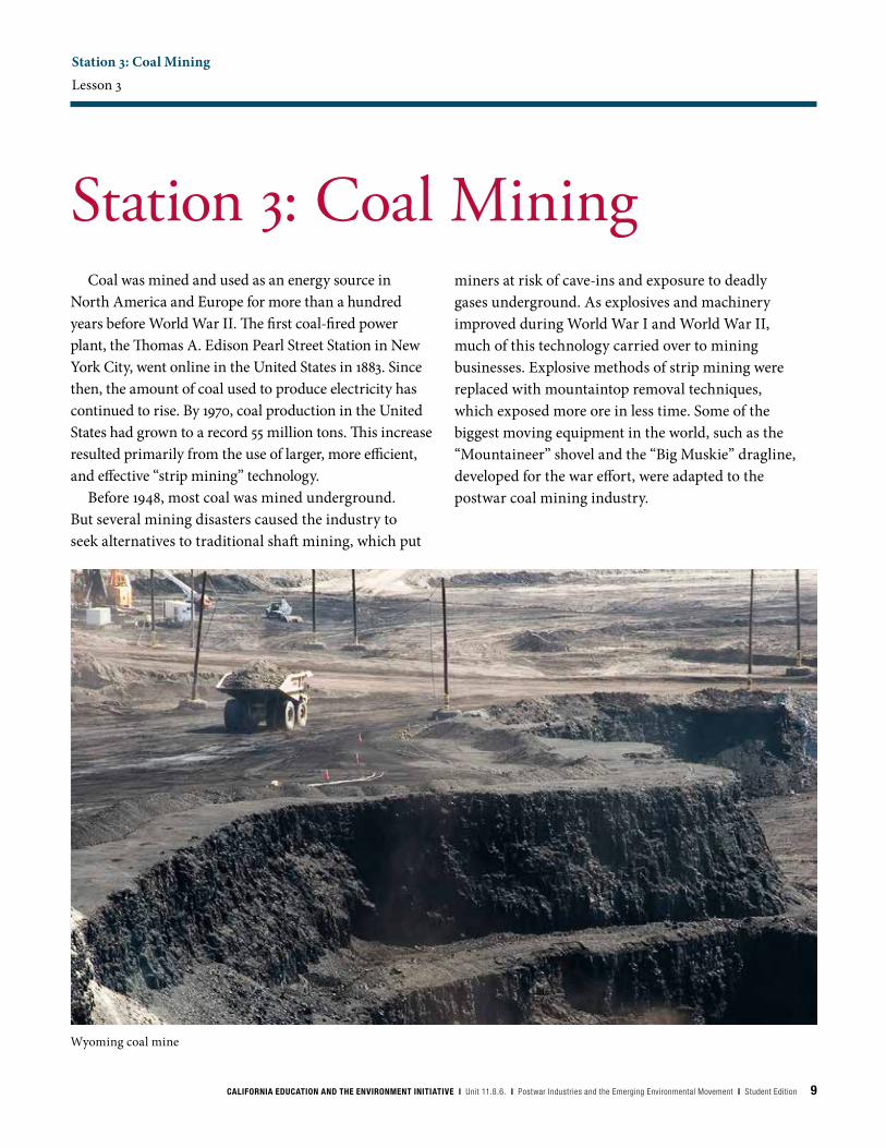
Station 3: Coal MiningLesson 3
Coal was mined and used as an energy source in North America and Europe for more than a hundred years before World War II. The first coal-fired power plant, the Thomas A. Edison Pearl Street Station in New York City, went online in the United States in 1883. Since then, the amount of coal used to produce electricity has continued to rise. By 1970, coal production in the United States had grown to a record 55 million tons. This increase resulted primarily from the use of larger, more efficient, and effective “strip mining” technology.
Before 1948, most coal was mined underground. But several mining disasters caused the industry to seek alternatives to traditional shaft mining, which put
Station 3: Coal Mining
Wyoming coal mine
miners at risk of cave-ins and exposure to deadly gases underground. As explosives and machinery improved during World War I and World War II, much of this technology carried over to mining businesses. Explosive methods of strip mining were replaced with mountaintop removal techniques, which exposed more ore in less time. Some of the biggest moving equipment in the world, such as the “Mountaineer” shovel and the “Big Muskie” dragline, developed for the war effort, were adapted to the postwar coal mining industry.
10 CALIFORNIA EDUCATION AND THE ENVIRONMENT INITIATIVE I Unit 11.8.6. I Postwar Industries and the Emerging Environmental Movement I Student Edition
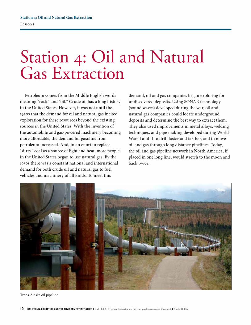
Station 4: Oil and Natural Gas ExtractionLesson 3
Petroleum comes from the Middle English words meaning “rock” and “oil.” Crude oil has a long history in the United States. However, it was not until the 1920s that the demand for oil and natural gas incited exploration for these resources beyond the existing sources in the United States. With the invention of the automobile and gas-powered machinery becoming more affordable, the demand for gasoline from petroleum increased. And, in an effort to replace “dirty” coal as a source of light and heat, more people in the United States began to use natural gas. By the 1950s there was a constant national and international demand for both crude oil and natural gas to fuel vehicles and machinery of all kinds. To meet this
Station 4: Oil and Natural Gas Extraction
demand, oil and gas companies began exploring for undiscovered deposits. Using SONAR technology (sound waves) developed during the war, oil and natural gas companies could locate underground deposits and determine the best way to extract them. They also used improvements in metal alloys, welding techniques, and pipe making developed during World Wars I and II to drill faster and farther, and to move oil and gas through long distance pipelines. Today, the oil and gas pipeline network in North America, if placed in one long line, would stretch to the moon and back twice.
Trans-Alaska oil pipeline
CALIFORNIA EDUCATION AND THE ENVIRONMENT INITIATIVE I Unit 11.8.6. I Postwar Industries and the Emerging Environmental Movement I Student Edition 11
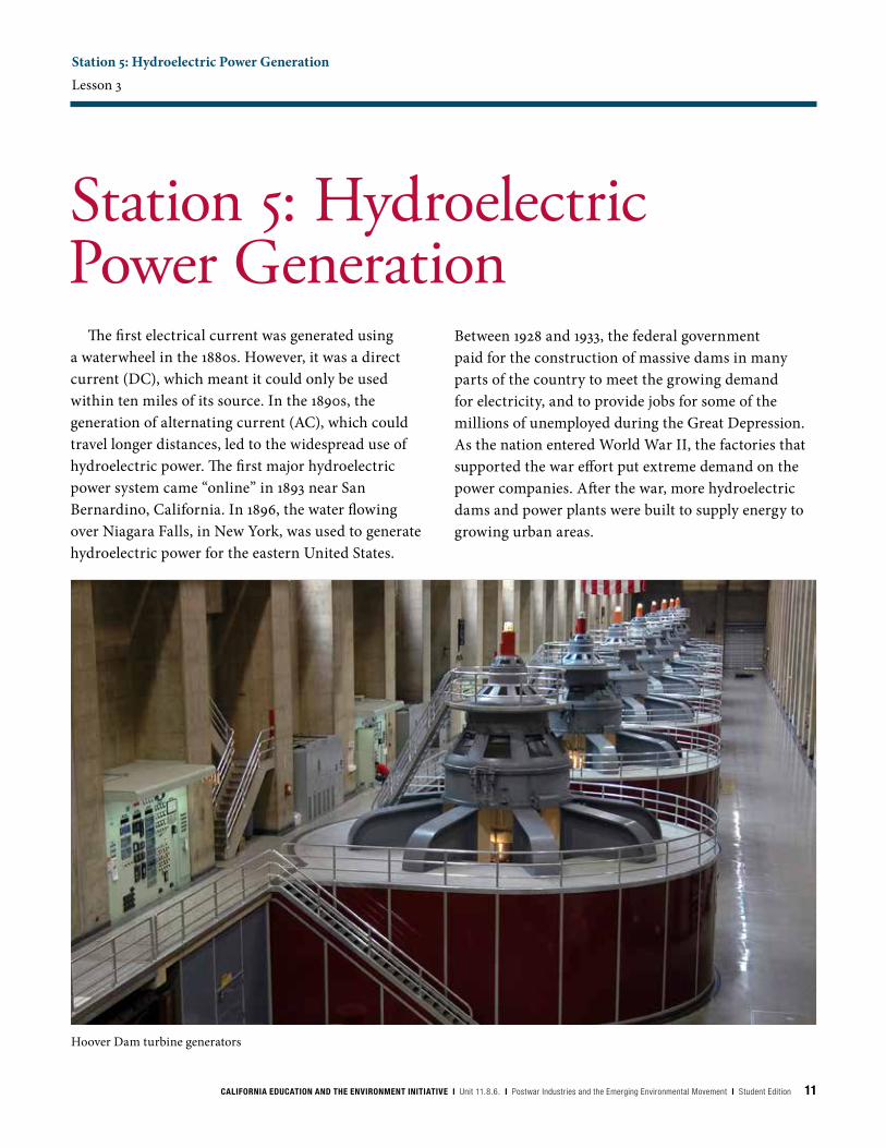
Station 5: Hydroelectric Power GenerationLesson 3
The first electrical current was generated using a waterwheel in the 1880s. However, it was a direct current (DC), which meant it could only be used within ten miles of its source. In the 1890s, the generation of alternating current (AC), which could travel longer distances, led to the widespread use of hydroelectric power. The first major hydroelectric power system came “online” in 1893 near San Bernardino, California. In 1896, the water flowing over Niagara Falls, in New York, was used to generate hydroelectric power for the eastern United States.
Station 5: Hydroelectric Power Generation
Between 1928 and 1933, the federal government paid for the construction of massive dams in many parts of the country to meet the growing demand for electricity, and to provide jobs for some of the millions of unemployed during the Great Depression. As the nation entered World War II, the factories that supported the war effort put extreme demand on the power companies. After the war, more hydroelectric dams and power plants were built to supply energy to growing urban areas.
Hoover Dam turbine generators
12 CALIFORNIA EDUCATION AND THE ENVIRONMENT INITIATIVE I Unit 11.8.6. I Postwar Industries and the Emerging Environmental Movement I Student Edition
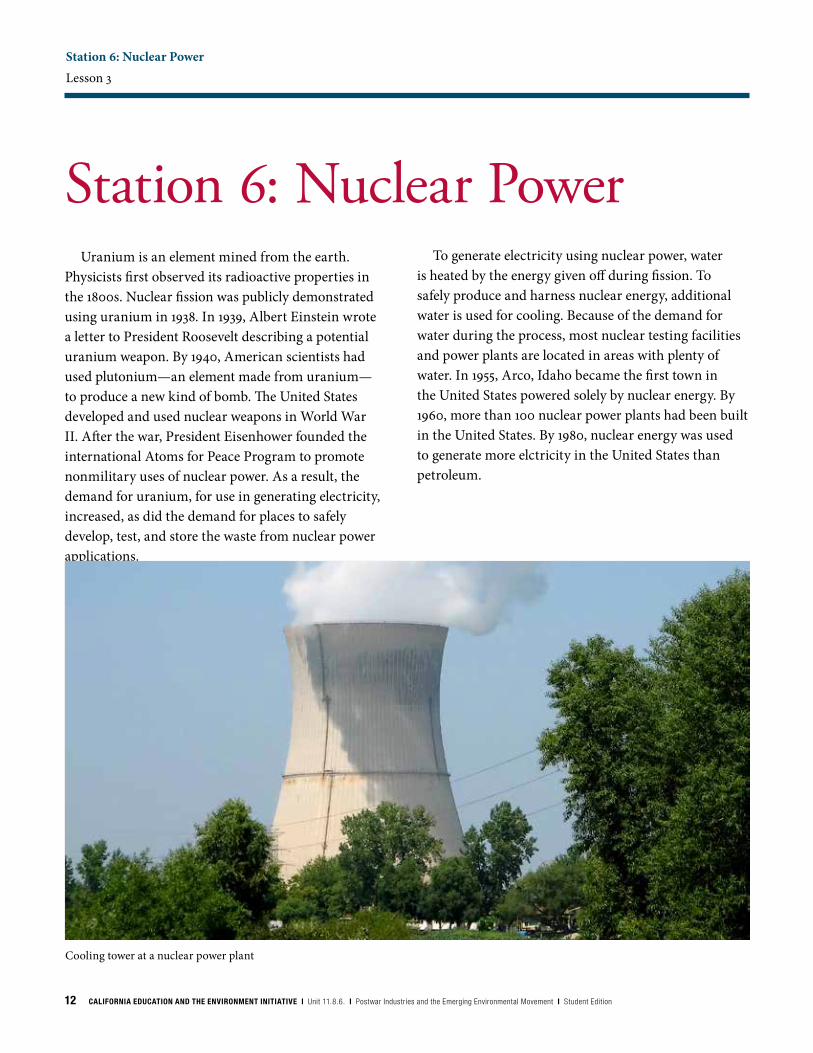
Station 6: Nuclear PowerLesson 3
Uranium is an element mined from the earth. Physicists first observed its radioactive properties in the 1800s. Nuclear fission was publicly demonstrated using uranium in 1938. In 1939, Albert Einstein wrote a letter to President Roosevelt describing a potential uranium weapon. By 1940, American scientists had used plutonium—an element made from uranium—to produce a new kind of bomb. The United States developed and used nuclear weapons in World War II. After the war, President Eisenhower founded the international Atoms for Peace Program to promote nonmilitary uses of nuclear power. As a result, the demand for uranium, for use in generating electricity, increased, as did the demand for places to safely develop, test, and store the waste from nuclear power applications.
Station 6: Nuclear Power
Cooling tower at a nuclear power plant
To generate electricity using nuclear power, water is heated by the energy given off during fission. To safely produce and harness nuclear energy, additional water is used for cooling. Because of the demand for water during the process, most nuclear testing facilities and power plants are located in areas with plenty of water. In 1955, Arco, Idaho became the first town in the United States powered solely by nuclear energy. By 1960, more than 100 nuclear power plants had been built in the United States. By 1980, nuclear energy was used to generate more elctricity in the United States than petroleum.
CALIFORNIA EDUCATION AND THE ENVIRONMENT INITIATIVE I Unit 11.8.6. I Postwar Industries and the Emerging Environmental Movement I Student Edition 13
Community Case Studies Lesson 4 | page 1 of 4
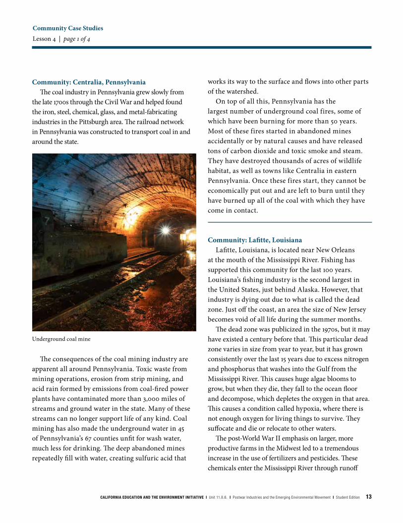
Community: Centralia, PennsylvaniaThe coal industry in Pennsylvania grew slowly from
the late 1700s through the Civil War and helped found the iron, steel, chemical, glass, and metal-fabricating industries in the Pittsburgh area. The railroad network in Pennsylvania was constructed to transport coal in and around the state.
Underground coal mine
works its way to the surface and flows into other parts of the watershed.
On top of all this, Pennsylvania has the largest number of underground coal fires, some of which have been burning for more than 50 years. Most of these fires started in abandoned mines accidentally or by natural causes and have released tons of carbon dioxide and toxic smoke and steam. They have destroyed thousands of acres of wildlife habitat, as well as towns like Centralia in eastern Pennsylvania. Once these fires start, they cannot be economically put out and are left to burn until they have burned up all of the coal with which they have come in contact.
Community: Lafitte, LouisianaLafitte, Louisiana, is located near New Orleans
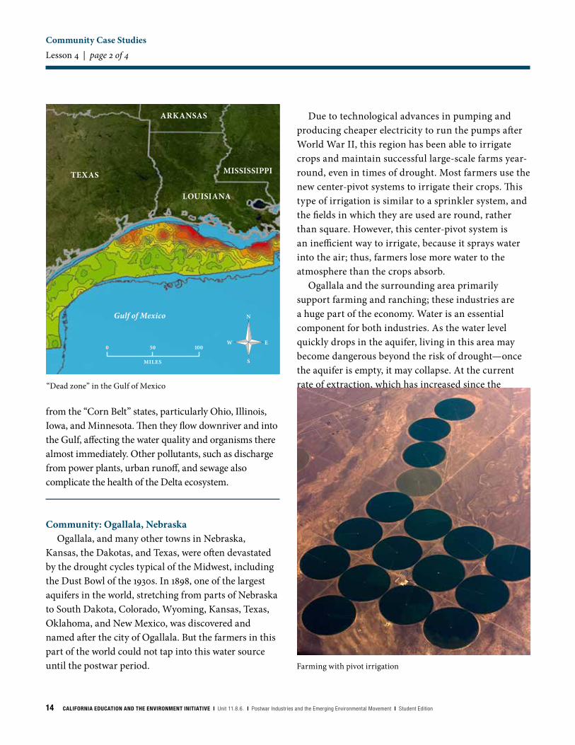
at the mouth of the Mississippi River. Fishing has supported this community for the last 100 years. Louisiana’s fishing industry is the second largest in the United States, just behind Alaska. However, that industry is dying out due to what is called the dead zone. Just off the coast, an area the size of New Jersey becomes void of all life during the summer months.
The dead zone was publicized in the 1970s, but it may have existed a century before that. This particular dead zone varies in size from year to year, but it has grown consistently over the last 15 years due to excess nitrogen and phosphorus that washes into the Gulf from the Mississippi River. This causes huge algae blooms to grow, but when they die, they fall to the ocean floor and decompose, which depletes the oxygen in that area. This causes a condition called hypoxia, where there is not enough oxygen for living things to survive. They suffocate and die or relocate to other waters.
The post-World War II emphasis on larger, more productive farms in the Midwest led to a tremendous increase in the use of fertilizers and pesticides. These chemicals enter the Mississippi River through runoff
The consequences of the coal mining industry are apparent all around Pennsylvania. Toxic waste from mining operations, erosion from strip mining, and acid rain formed by emissions from coal-fired power plants have contaminated more than 3,000 miles of streams and ground water in the state. Many of these streams can no longer support life of any kind. Coal mining has also made the underground water in 45 of Pennsylvania’s 67 counties unfit for wash water, much less for drinking. The deep abandoned mines repeatedly fill with water, creating sulfuric acid that
14 CALIFORNIA EDUCATION AND THE ENVIRONMENT INITIATIVE I Unit 11.8.6. I Postwar Industries and the Emerging Environmental Movement I Student Edition
Community Case Studies Lesson 4 | page 2 of 4
from the “Corn Belt” states, particularly Ohio, Illinois, Iowa, and Minnesota. Then they flow downriver and into the Gulf, affecting the water quality and organisms there almost immediately. Other pollutants, such as discharge from power plants, urban runoff, and sewage also complicate the health of the Delta ecosystem.
Community: Ogallala, NebraskaOgallala, and many other towns in Nebraska,
Kansas, the Dakotas, and Texas, were often devastated by the drought cycles typical of the Midwest, including the Dust Bowl of the 1930s. In 1898, one of the largest aquifers in the world, stretching from parts of Nebraska to South Dakota, Colorado, Wyoming, Kansas, Texas, Oklahoma, and New Mexico, was discovered and named after the city of Ogallala. But the farmers in this part of the world could not tap into this water source until the postwar period.
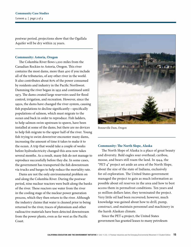
Due to technological advances in pumping and producing cheaper electricity to run the pumps after World War II, this region has been able to irrigate crops and maintain successful large-scale farms year-round, even in times of drought. Most farmers use the new center-pivot systems to irrigate their crops. This type of irrigation is similar to a sprinkler system, and the fields in which they are used are round, rather than square. However, this center-pivot system is an inefficient way to irrigate, because it sprays water into the air; thus, farmers lose more water to the atmosphere than the crops absorb.
Ogallala and the surrounding area primarily support farming and ranching; these industries are a huge part of the economy. Water is an essential component for both industries. As the water level quickly drops in the aquifer, living in this area may become dangerous beyond the risk of drought—once the aquifer is empty, it may collapse. At the current rate of extraction, which has increased since the “Dead zone” in the Gulf of Mexico
Farming with pivot irrigation
Gulf of Mexico
TEXAS
LOUISIANA
MISSISSIPPI
ARKANSAS
N
W E
S
50 1000
MILES
CALIFORNIA EDUCATION AND THE ENVIRONMENT INITIATIVE I Unit 11.8.6. I Postwar Industries and the Emerging Environmental Movement I Student Edition 15
Community Case Studies Lesson 4 | page 3 of 4
postwar period, projections show that the Ogallala Aquifer will be dry within 25 years.
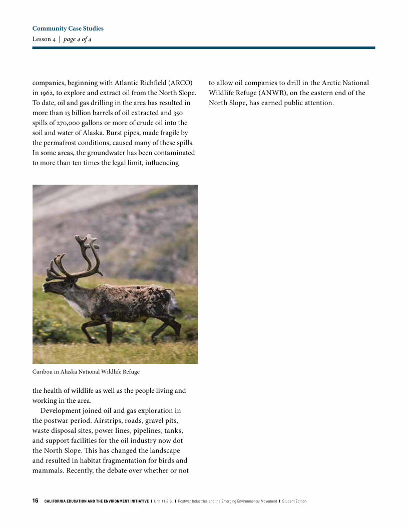
Community: Astoria, OregonThe Columbia River flows 1,200 miles from the
Canadian Rockies to Astoria, Oregon. This river contains the most dams, more than 400 if you include all of the tributaries, of any other river in the world. It also contributes about 80% of the power consumed by residents and industry in the Pacific Northwest. Damming the river began in 1932 and continued until 1973. The dams created large reservoirs used for flood control, irrigation, and recreation. However, since the 1950s, the dams have changed the river system, causing fish populations to decline significantly—specifically populations of salmon, which must migrate to the ocean and back in order to reproduce. Fish ladders, to help salmon swim upstream to spawn, have been installed at some of the dams, but there are no devices to help fish migrate to the upper half of the river. Young fish trying to swim downriver encounter many dams, increasing the amount of time it takes to make it to the ocean. A trip that would take a couple of weeks before hydroelectricity changed this area now takes several months. As a result, many fish do not manage to reproduce successfully before they die. In some cases, the government has transported the fish downstream via trucks and barges to help reduce the mortality rate.
Dams are not the only environmental problem on and along the Columbia River. During the postwar period, nine nuclear reactors were built along the banks of the river. These reactors use water from the river in the cooling stage of the nuclear power generation process, which they then return to the river. Although the industry claims that water is cleaned prior to being returned to the river, traces of plutonium and other radioactive materials have been detected downstream from the power plants, even as far west as the Pacific Coast.
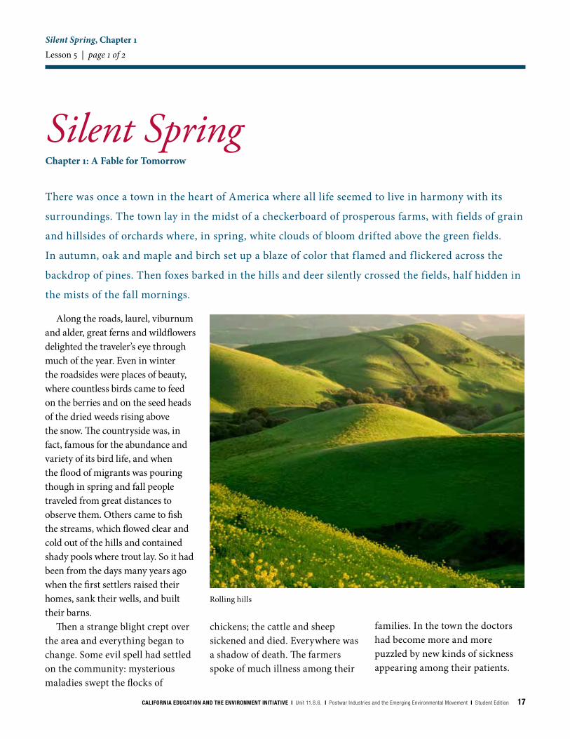
Community: The North Slope, AlaskaThe North Slope of Alaska is a place of great beauty
and diversity. Bald eagles soar overhead; caribou, moose, and bears still roam the land. In 1944, the “PET-4” project set aside an area of the North Slope, about the size of the state of Indiana, exclusively for oil exploration. The United States government managed the project to gain as much information as possible about oil reserves in the area and how to best access them in permafrost conditions. Ten years and 50 million dollars later, they terminated the project. Very little oil had been recovered; however, much knowledge was gained about how to drill, pump, construct, and maintain personnel and machinery in the harsh Alaskan climate.
Since the PET-4 project, the United States government has granted leases to many petroleum
Bonneville Dam, Oregon
16 CALIFORNIA EDUCATION AND THE ENVIRONMENT INITIATIVE I Unit 11.8.6. I Postwar Industries and the Emerging Environmental Movement I Student Edition
companies, beginning with Atlantic Richfield (ARCO) in 1962, to explore and extract oil from the North Slope. To date, oil and gas drilling in the area has resulted in more than 13 billion barrels of oil extracted and 350 spills of 270,000 gallons or more of crude oil into the soil and water of Alaska. Burst pipes, made fragile by the permafrost conditions, caused many of these spills. In some areas, the groundwater has been contaminated to more than ten times the legal limit, influencing
to allow oil companies to drill in the Arctic National Wildlife Refuge (ANWR), on the eastern end of the North Slope, has earned public attention.
Community Case Studies Lesson 4 | page 4 of 4
the health of wildlife as well as the people living and working in the area.
Development joined oil and gas exploration in the postwar period. Airstrips, roads, gravel pits, waste disposal sites, power lines, pipelines, tanks, and support facilities for the oil industry now dot the North Slope. This has changed the landscape and resulted in habitat fragmentation for birds and mammals. Recently, the debate over whether or not
Caribou in Alaska National Wildlife Refuge
CALIFORNIA EDUCATION AND THE ENVIRONMENT INITIATIVE I Unit 11.8.6. I Postwar Industries and the Emerging Environmental Movement I Student Edition 17
Silent Spring, Chapter 1Lesson 5 | page 1 of 2
Silent Spring
Along the roads, laurel, viburnum and alder, great ferns and wildflowers delighted the traveler’s eye through much of the year. Even in winter the roadsides were places of beauty, where countless birds came to feed on the berries and on the seed heads of the dried weeds rising above the snow. The countryside was, in fact, famous for the abundance and variety of its bird life, and when the flood of migrants was pouring though in spring and fall people traveled from great distances to observe them. Others came to fish the streams, which flowed clear and cold out of the hills and contained shady pools where trout lay. So it had been from the days many years ago when the first settlers raised their homes, sank their wells, and built their barns.
Then a strange blight crept over the area and everything began to change. Some evil spell had settled on the community: mysterious maladies swept the flocks of
There was once a town in the heart of America where all life seemed to live in harmony with its
surroundings. The town lay in the midst of a checkerboard of prosperous farms, with fields of grain
and hillsides of orchards where, in spring, white clouds of bloom drifted above the green fields.
In autumn, oak and maple and birch set up a blaze of color that f lamed and f lickered across the
backdrop of pines. Then foxes barked in the hills and deer silently crossed the fields, half hidden in
the mists of the fall mornings.
Chapter 1: A Fable for Tomorrow
chickens; the cattle and sheep sickened and died. Everywhere was a shadow of death. The farmers spoke of much illness among their
families. In the town the doctors had become more and more puzzled by new kinds of sickness appearing among their patients.
Rolling hills
18 CALIFORNIA EDUCATION AND THE ENVIRONMENT INITIATIVE I Unit 11.8.6. I Postwar Industries and the Emerging Environmental Movement I Student Edition
Silent Spring, Chapter 1Lesson 5 | page 2 of 2
There had been several sudden and unexplained deaths, not only among adults but even among children, who would be stricken suddenly while at play and die within a few hours.
There was a strange stillness. The birds, for example—where had they gone? Many people spoke of them, puzzled and disturbed. The feeding stations in the backyards were deserted. The few birds seen anywhere were moribund; they trembled violently and could not fly. It was a spring without voices. On the mornings that had once throbbed with the dawn chorus of robins, catbirds, doves, jays, wrens, and scores of other bird voices there was now no sound; only silence lay over the fields and woods and marsh.
On the farms the hens brooded, but no chicks hatched. The farmers complained that they were unable to raise any pigs—the litters were small and the young survived only a few days. The apple trees were coming into bloom but no bees droned among the blossoms, so there was no pollination and there would be no fruit.
The roadsides, once so attractive, were now lined with browned and withered vegetation as though swept by fire. These, too, were silent, deserted by all living things. Even the streams were now lifeless. Anglers no longer visited them, for all the fish had died.
In the gutters under the eaves and between the shingles of the roofs, a white granular powder still showed a few patches; some
weeks before it had fallen like snow upon the roofs and the lawns, the fields and streams.
No witchcraft, no enemy action had silenced the rebirth of new life in this stricken world. The people had done it themselves.
This town does not actually exist, but it might easily have a thousand counterparts in America or elsewhere in the world. I know of no community that has experienced all the misfortunes I describe. Yet every one of these disasters has actually happened somewhere, and many real communities have already suffered a substantial number of them. A grim specter has crept upon us almost unnoticed, and this imagined tragedy may easily become a stark reality we all shall know.
What has already silenced the voice of spring in countless towns in America? This book is an attempt to explain.
Carson, Rachel. Silent Spring. Boston:
Houghton Mifflin Co., 1962.
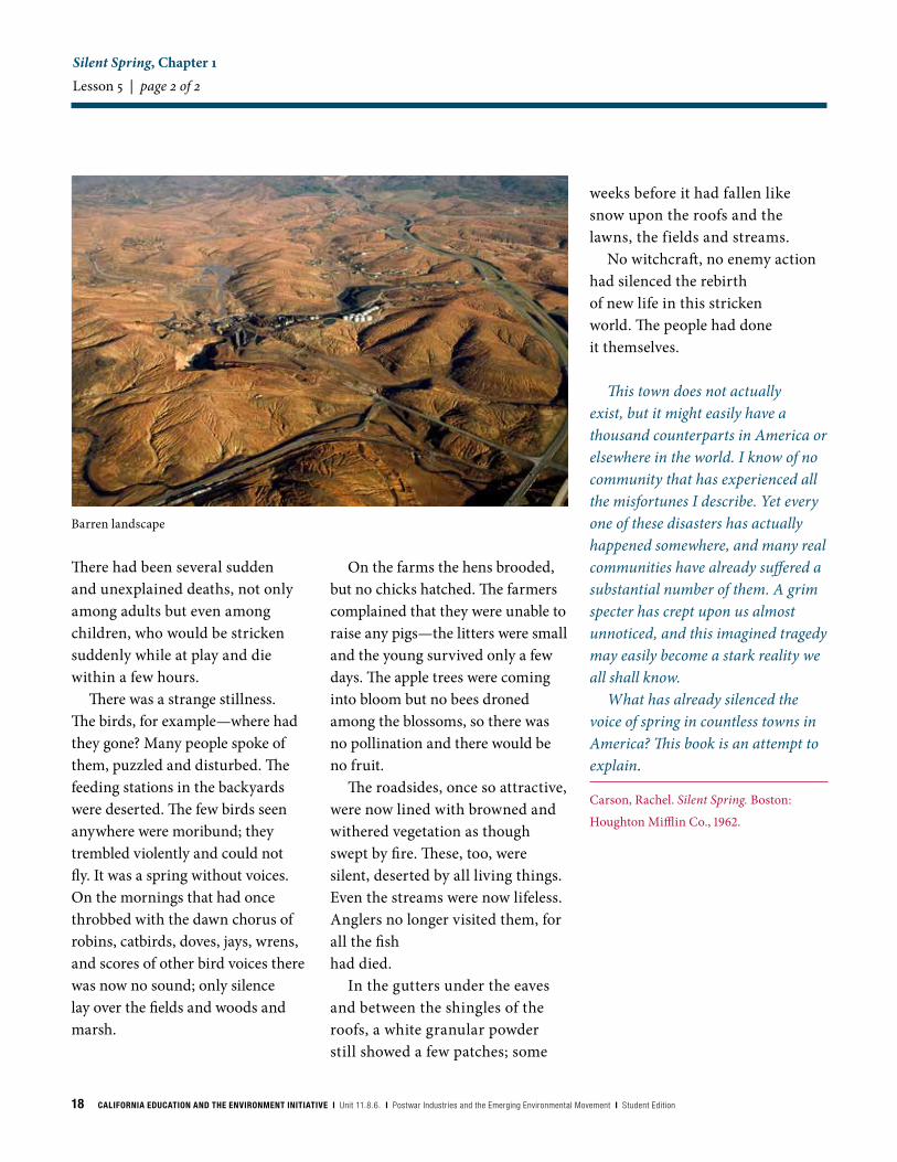
Barren landscape


California Education and the Environment InitiativePrinted on post-consumer recycled paper1186SE