Embed Size (px)
Citation preview
11
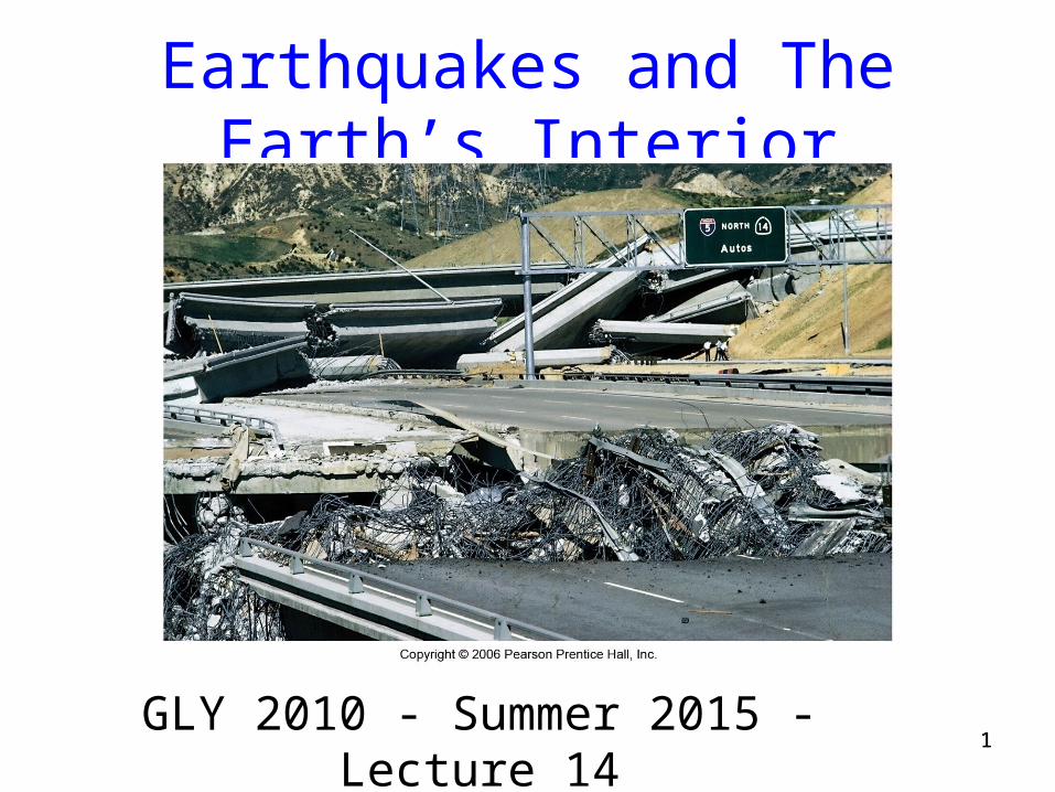
Earthquakes and The Earth’s Interior
GLY 2010 - Summer 2015 - Lecture 14
22
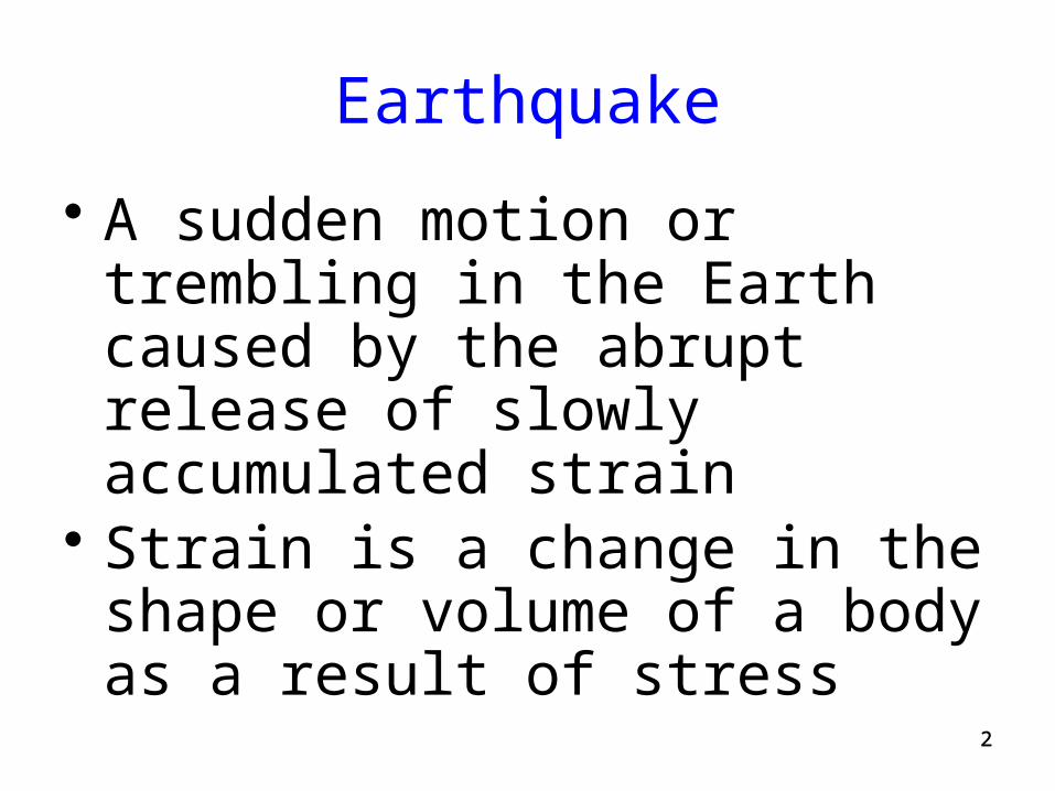
Earthquake
• A sudden motion or trembling in the Earth caused by the abrupt release of slowly accumulated strain
• Strain is a change in the shape or volume of a body as a result of stress
33
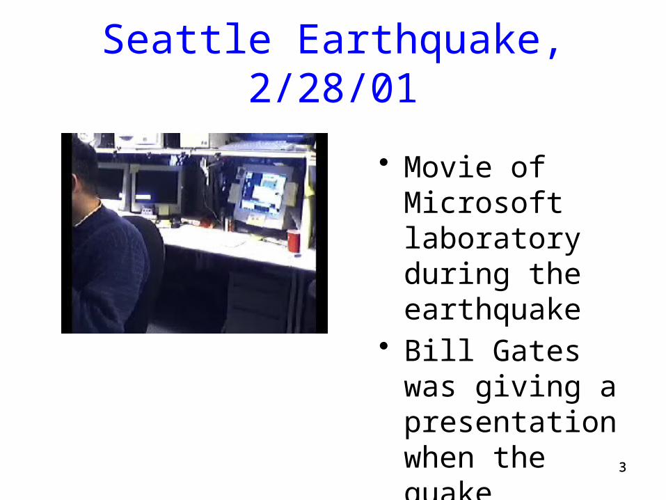
Seattle Earthquake, 2/28/01
• Movie of Microsoft laboratory during the earthquake
• Bill Gates was giving a presentation when the quake occurred
44
Focus, aka Hypocenter
• The initial rupture point of an earthquake, where strain energy is first converted to elastic wave energy
• The point within the Earth which is the center of an earthquake
55
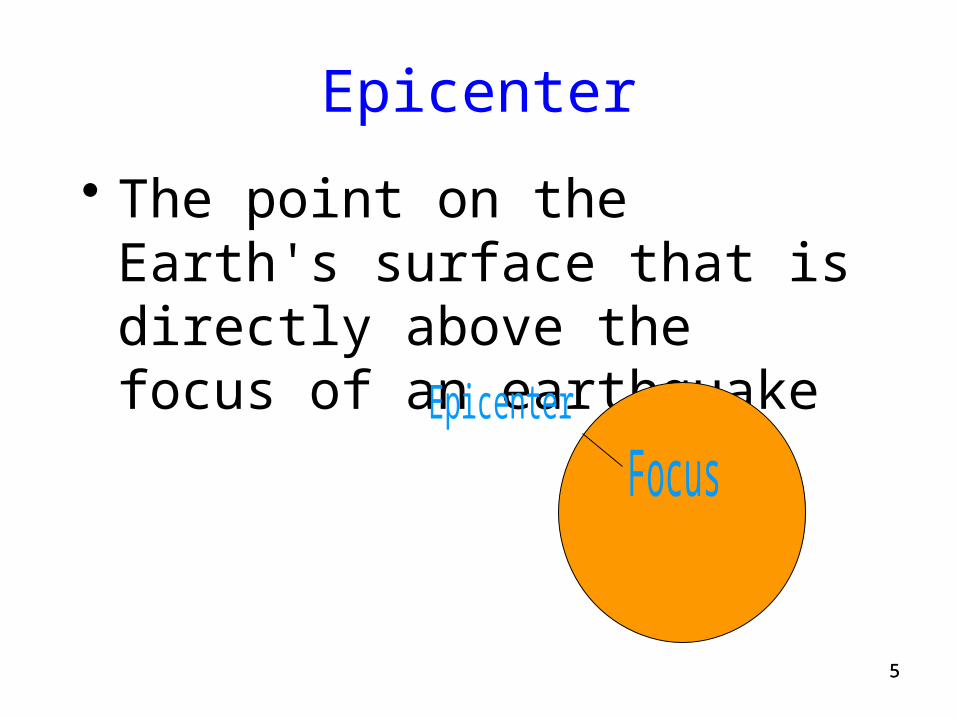
Epicenter
• The point on the Earth's surface that is directly above the focus of an earthquake
66
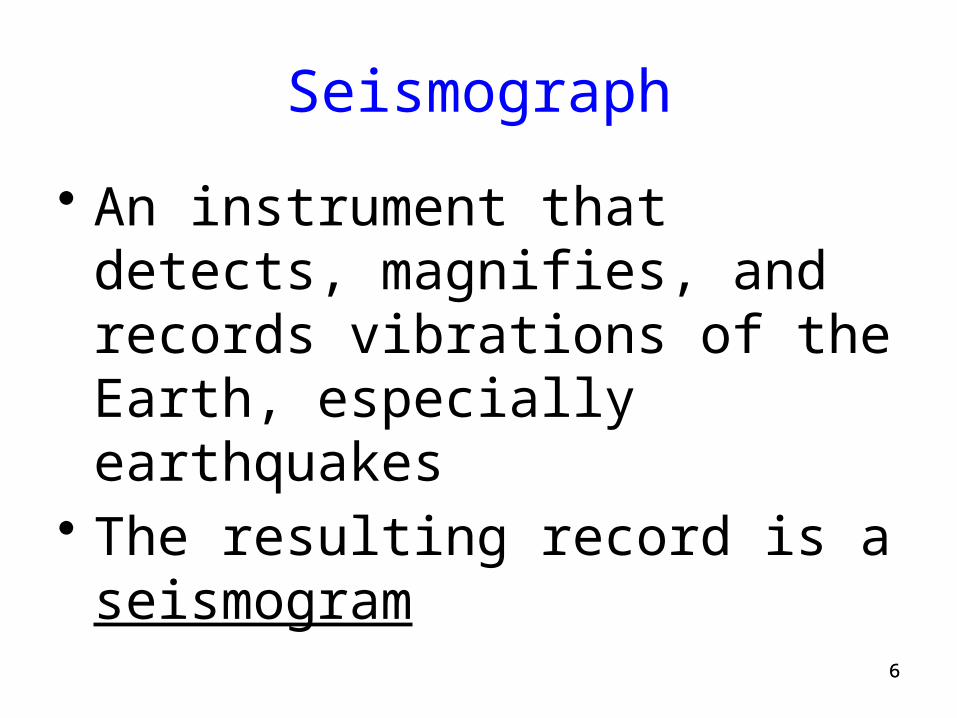
Seismograph
• An instrument that detects, magnifies, and records vibrations of the Earth, especially earthquakes
• The resulting record is a seismogram
77
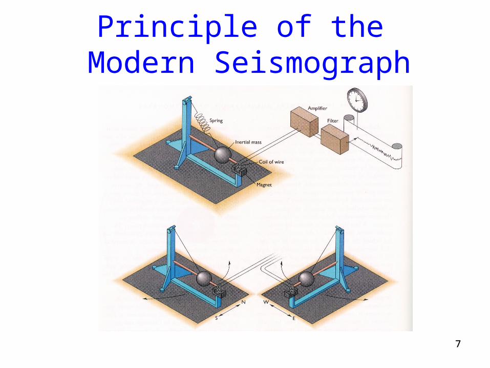
Principle of the Modern Seismograph
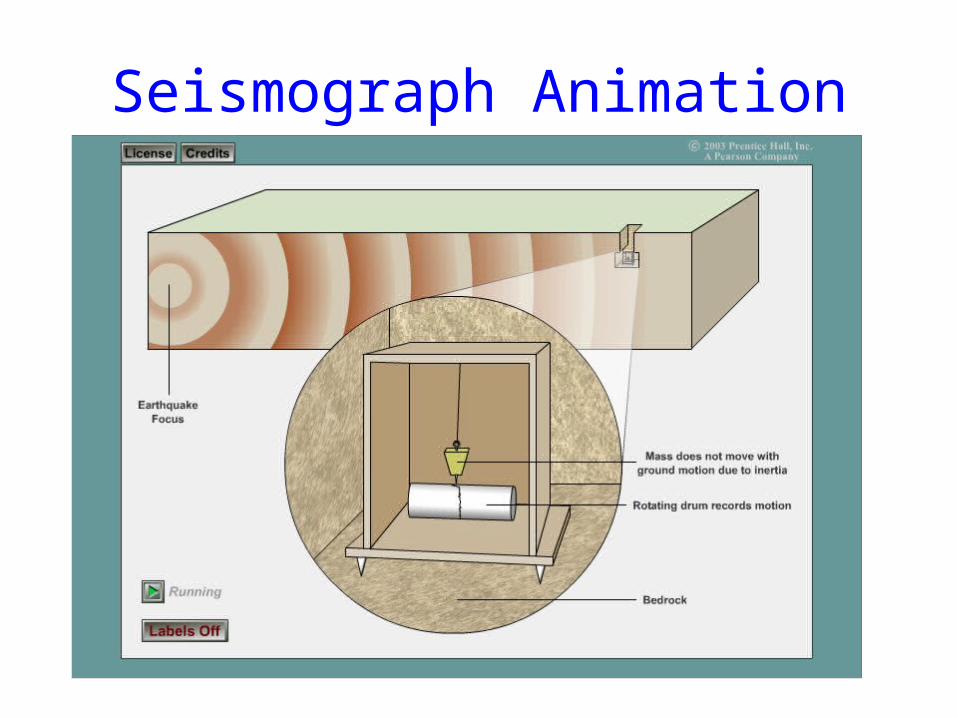
Seismograph Animation
99
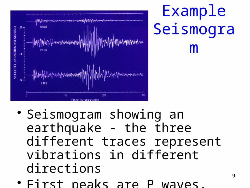
Example Seismogram
• Seismogram showing an earthquake - the three different traces represent vibrations in different directions
• First peaks are P waves, the second peaks the S waves
1010
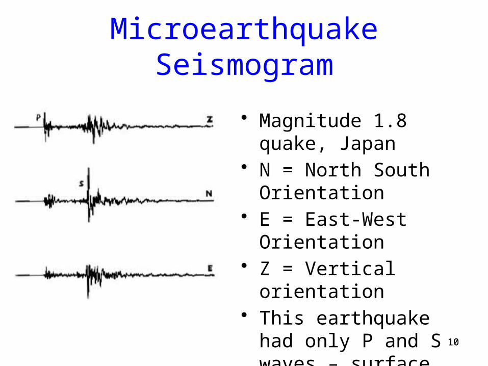
Microearthquake Seismogram
• Magnitude 1.8 quake, Japan• N = North South
Orientation• E = East-West Orientation• Z = Vertical orientation• This earthquake had only P
and S waves – surface waves did not develop
1111
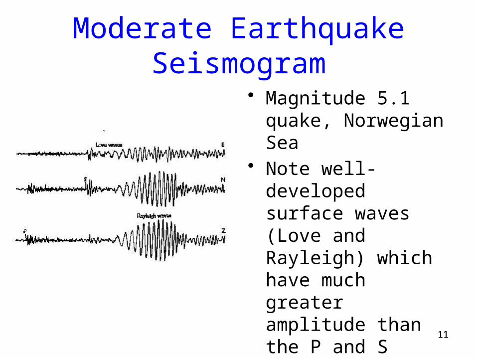
Moderate Earthquake Seismogram
• Magnitude 5.1 quake, Norwegian Sea
• Note well-developed surface waves (Love and Rayleigh) which have much greater amplitude than the P and S waves
1212
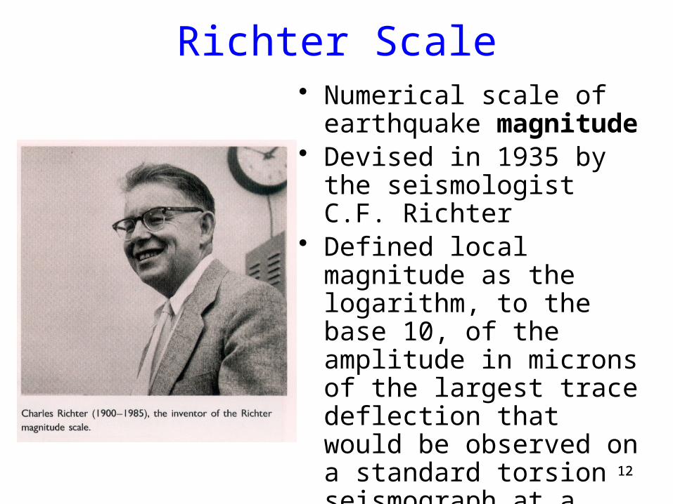
Richter Scale• Numerical scale of earthquake
magnitude• Devised in 1935 by the
seismologist C.F. Richter• Defined local magnitude as
the logarithm, to the base 10, of the amplitude in microns of the largest trace deflection that would be observed on a standard torsion seismograph at a distance of 100 km from the epicenter
1313
Richter Scale Continued
• Measures the vibrational amplitude of the earth in response to seismic waves
• Does NOT measure the energy release
1414
Mercalli Scale
• Arbitrary scale of earthquake intensity, ranging from I (detectable only instrumentally) to XII (causing almost total destruction)
• Based on human perception of the earthquake, and damage observed after the earthquake is over
1515
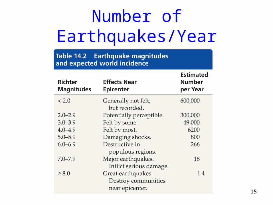
Number of Earthquakes/Year
1616
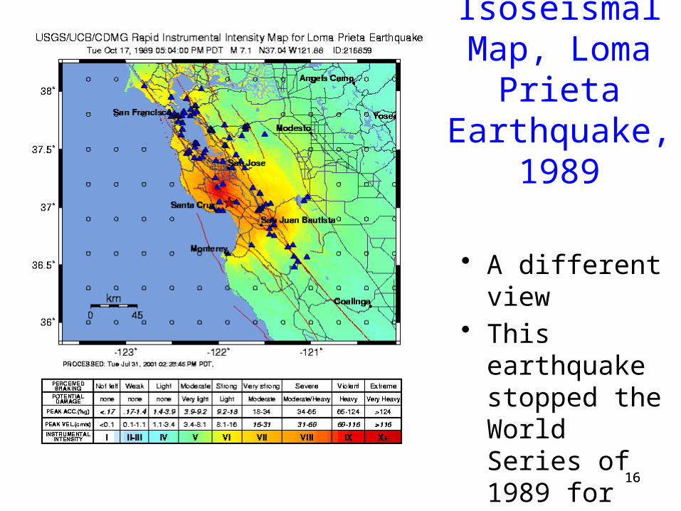
Isoseismal Map, Loma Prieta Earthquake,
1989
• A different view• This earthquake
stopped the World Series of 1989 for several days
1717
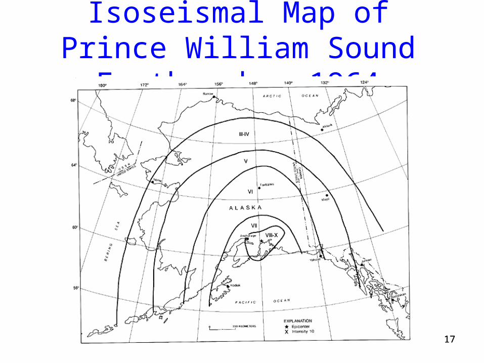
Isoseismal Map of Prince William Sound Earthquake, 1964
1818
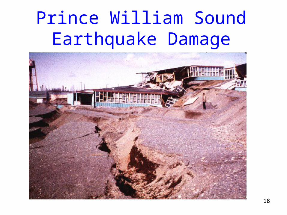
Prince William Sound Earthquake Damage

19
Anchorage Building
• J.C. Penney building• Very little damage to adjacent building, with
steel-frame construction 19
2020
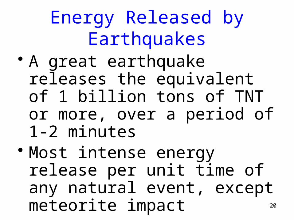
Energy Released by Earthquakes
• A great earthquake releases the equivalent of 1 billion tons of TNT or more, over a period of 1-2 minutes
• Most intense energy release per unit time of any natural event, except meteorite impact
2121
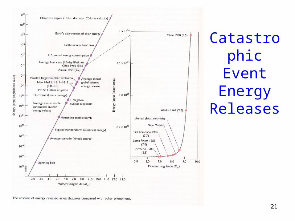
Catastrophic Event
Energy Releases
2222
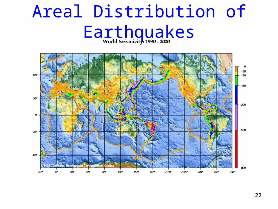
Areal Distribution of Earthquakes
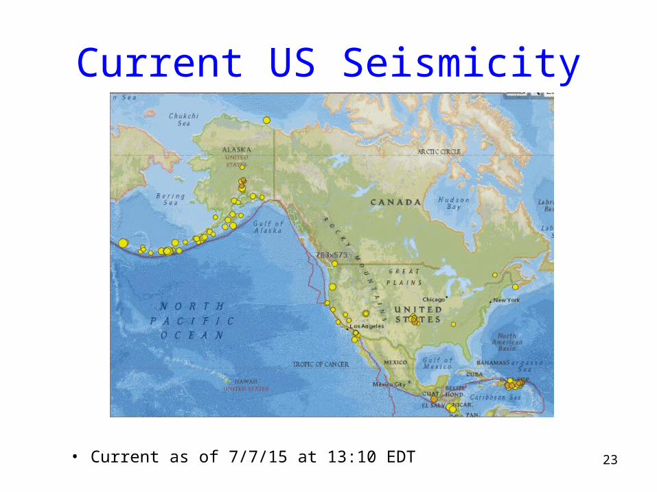
Current US Seismicity
23• Current as of 7/7/15 at 13:10 EDT
2424
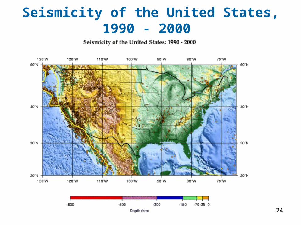
Seismicity of the United States, 1990 - 2000
2525
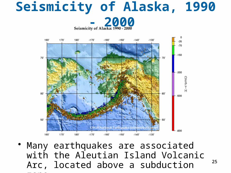
Seismicity of Alaska, 1990 - 2000
• Many earthquakes are associated with the Aleutian Island Volcanic Arc, located above a subduction zone
2626
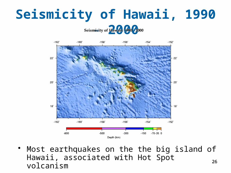
Seismicity of Hawaii, 1990 - 2000
• Most earthquakes on the the big island of Hawaii, associated with Hot Spot volcanism
2727
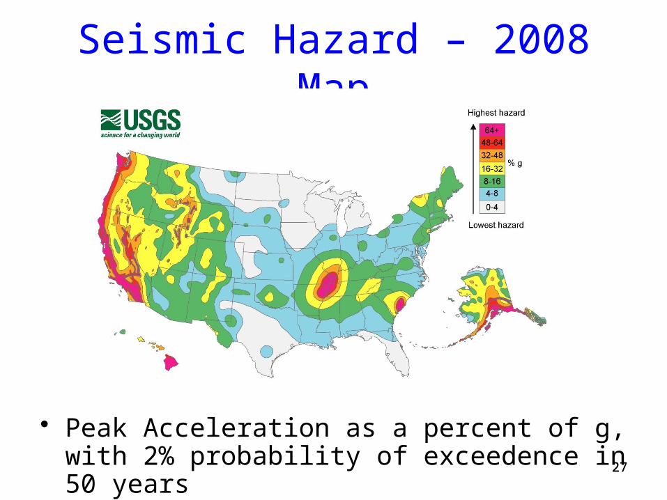
• Peak Acceleration as a percent of g, with 2% probability of exceedence in 50 years
Seismic Hazard – 2008 Map
2828
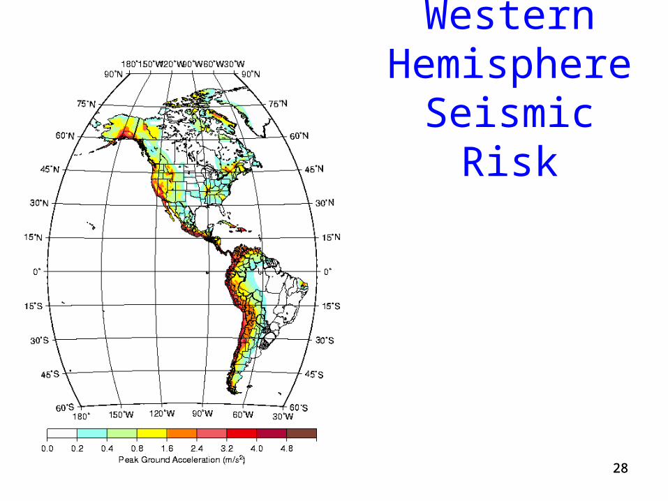
Western Hemisphere Seismic Risk
2929
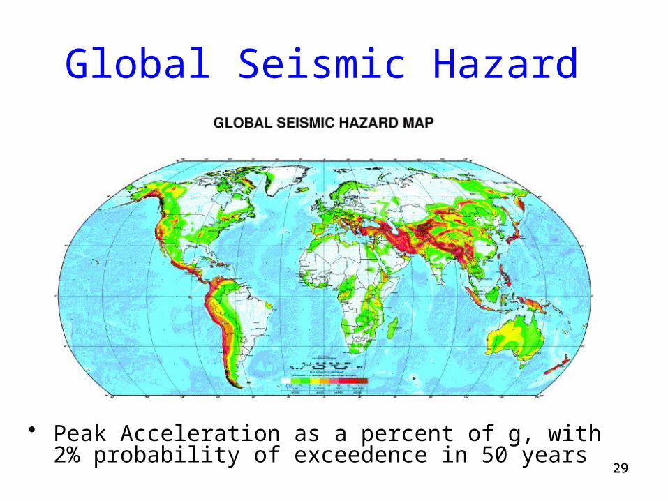
Global Seismic Hazard
• Peak Acceleration as a percent of g, with 2% probability of exceedence in 50 years
3030
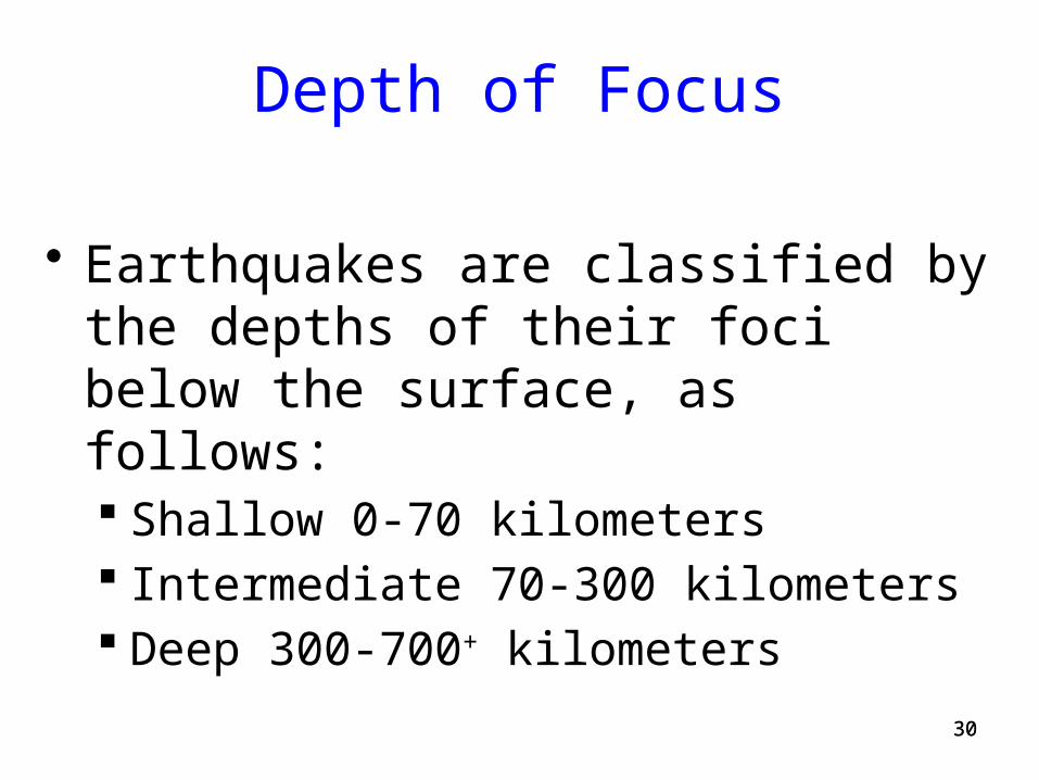
Depth of Focus
• Earthquakes are classified by the depths of their foci below the surface, as follows: Shallow 0-70 kilometers Intermediate 70-300 kilometers Deep 300-700+ kilometers
3131
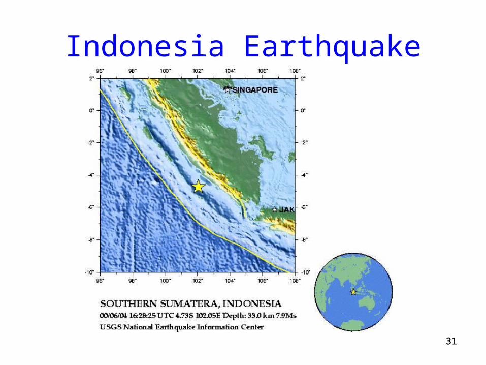
Indonesia Earthquake
3232
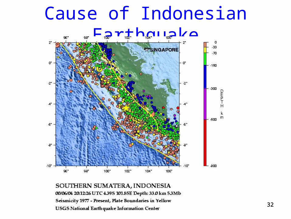
Cause of Indonesian Earthquake
3333
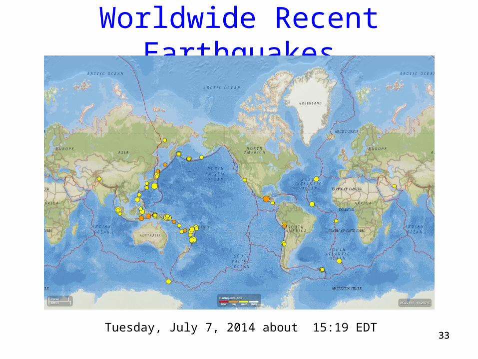
Worldwide Recent Earthquakes
Tuesday, July 7, 2014 about 15:19 EDT
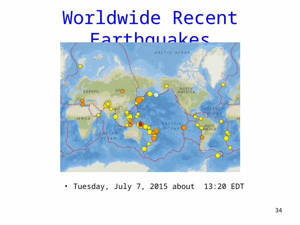
Worldwide Recent Earthquakes
34
• Tuesday, July 7, 2015 about 13:20 EDT
3535
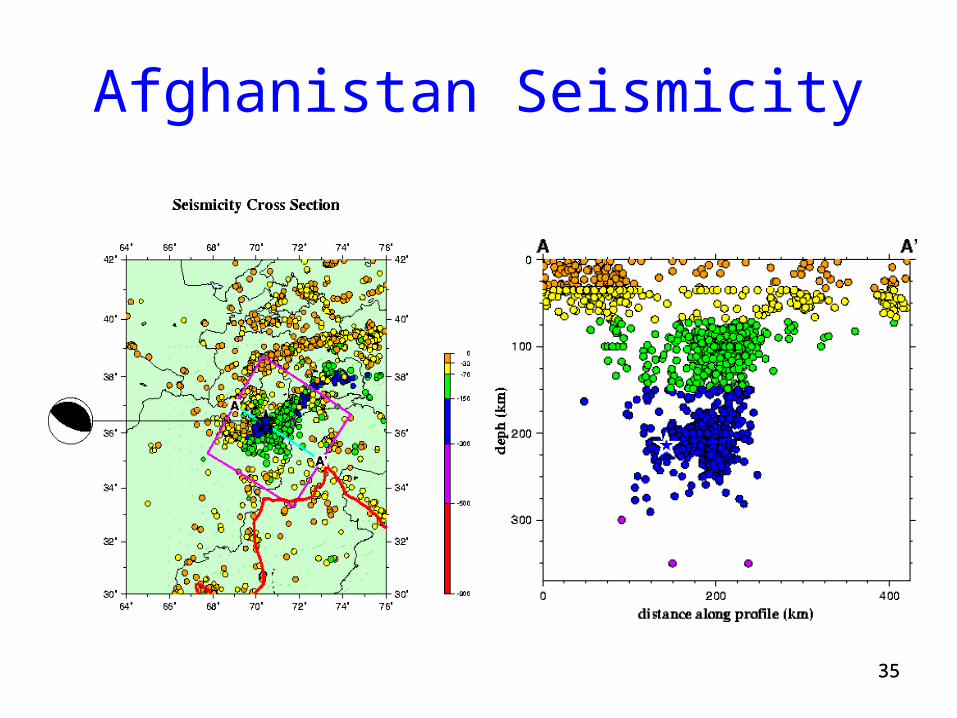
Afghanistan Seismicity
3636
Earthquake Damage
• Earthquakes can cause damage in a number of ways Building Collapse Tsunami waves Seiche waves Landslides Liquefaction Fire Disease
3737
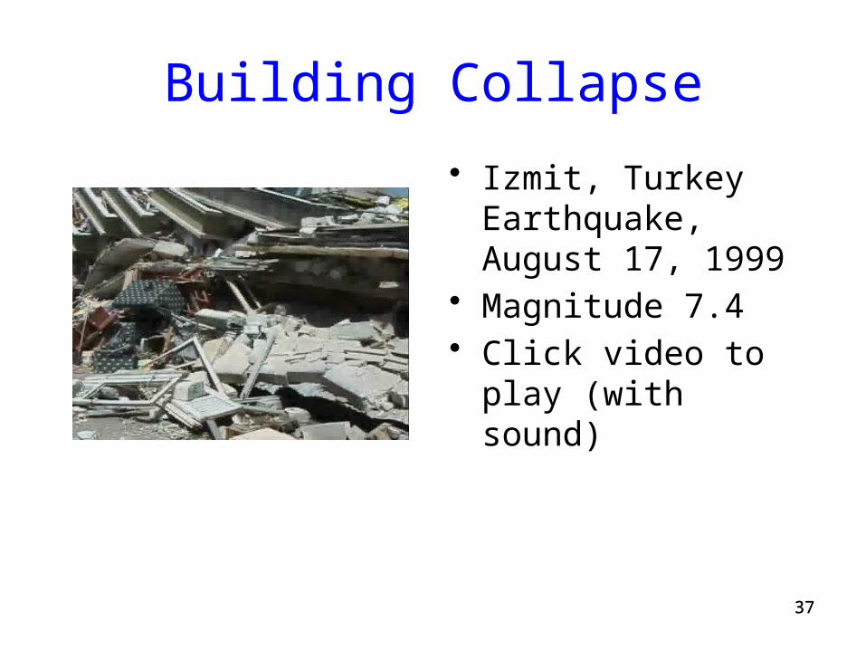
Building Collapse
• Izmit, Turkey Earthquake, August 17, 1999
• Magnitude 7.4• Click video to play
(with sound)
3838
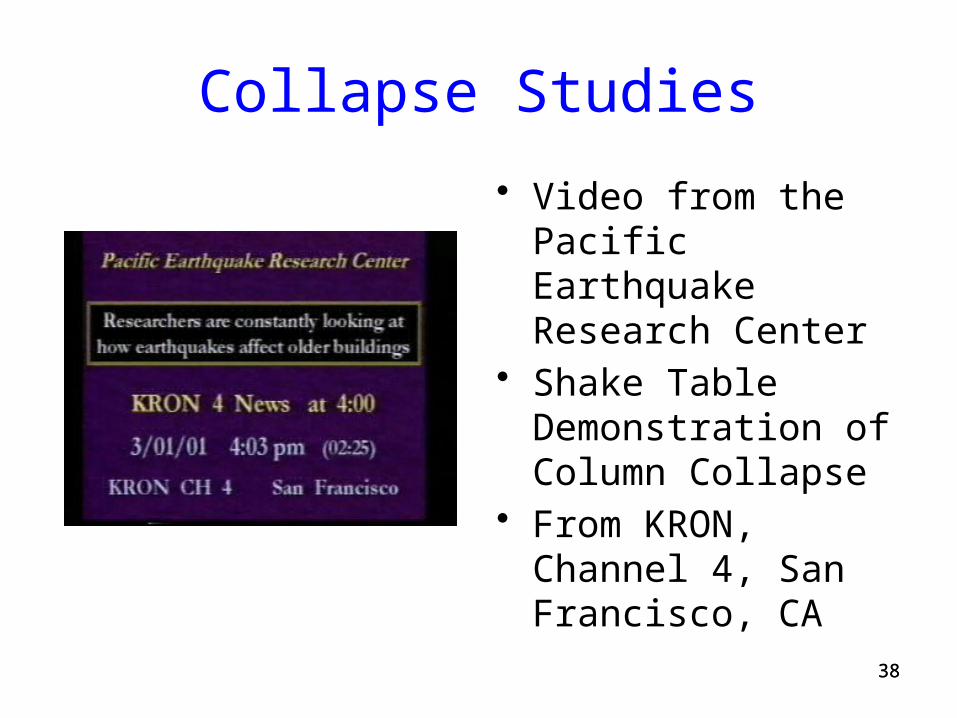
Collapse Studies
• Video from the Pacific Earthquake Research Center
• Shake Table Demonstration of Column Collapse
• From KRON, Channel 4, San Francisco, CA

3939
Tsunami
• Gravitational sea wave produced by any large-scale, short-duration disturbance of the ocean floor
• Disturbances caused principally by a shallow submarine earthquake, but also by submarine earth movement, subsidence, or volcanic eruption
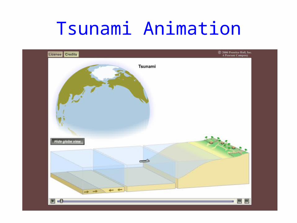
Tsunami Animation
4141
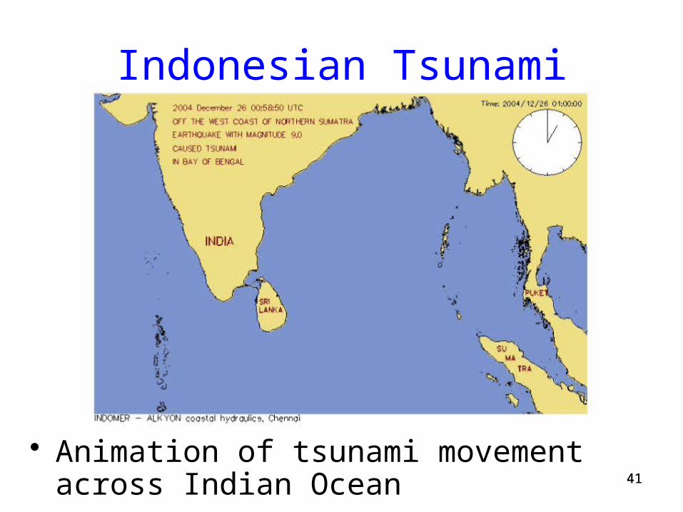
Indonesian Tsunami
• Animation of tsunami movement across Indian Ocean
42
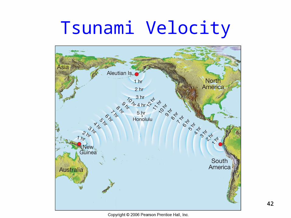
Tsunami Velocity
42
4343
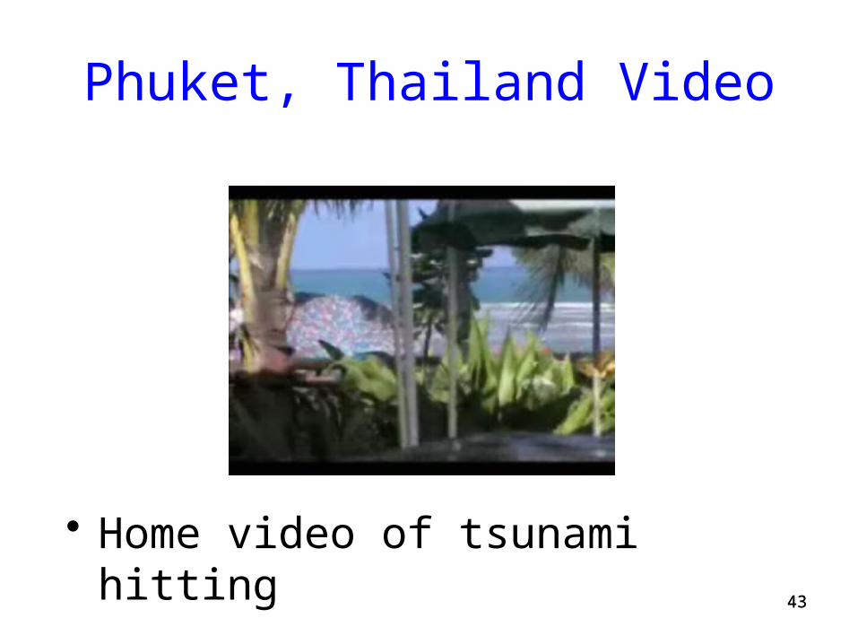
Phuket, Thailand Video
• Home video of tsunami hitting
4444
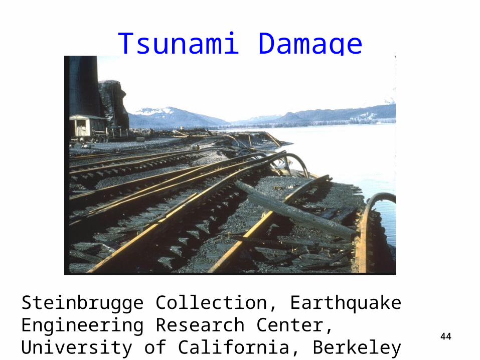
Tsunami Damage
Steinbrugge Collection, Earthquake Engineering Research Center, University of California, Berkeley
4545
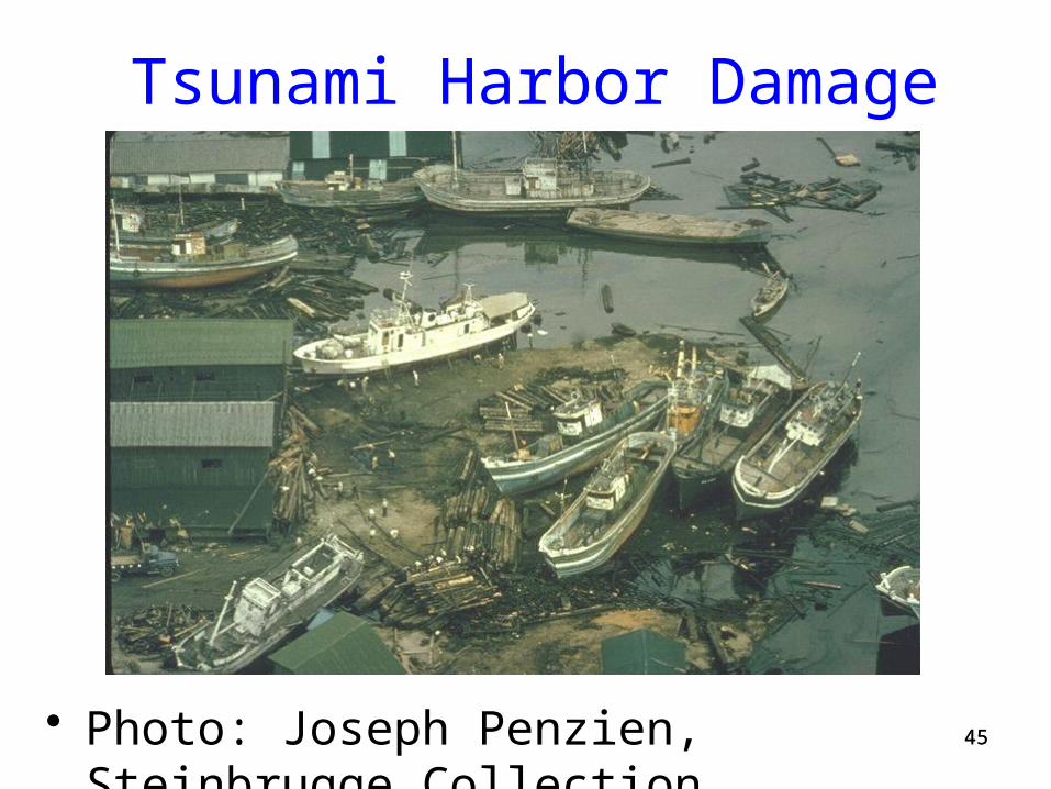
Tsunami Harbor Damage
• Photo: Joseph Penzien, Steinbrugge Collection
4646
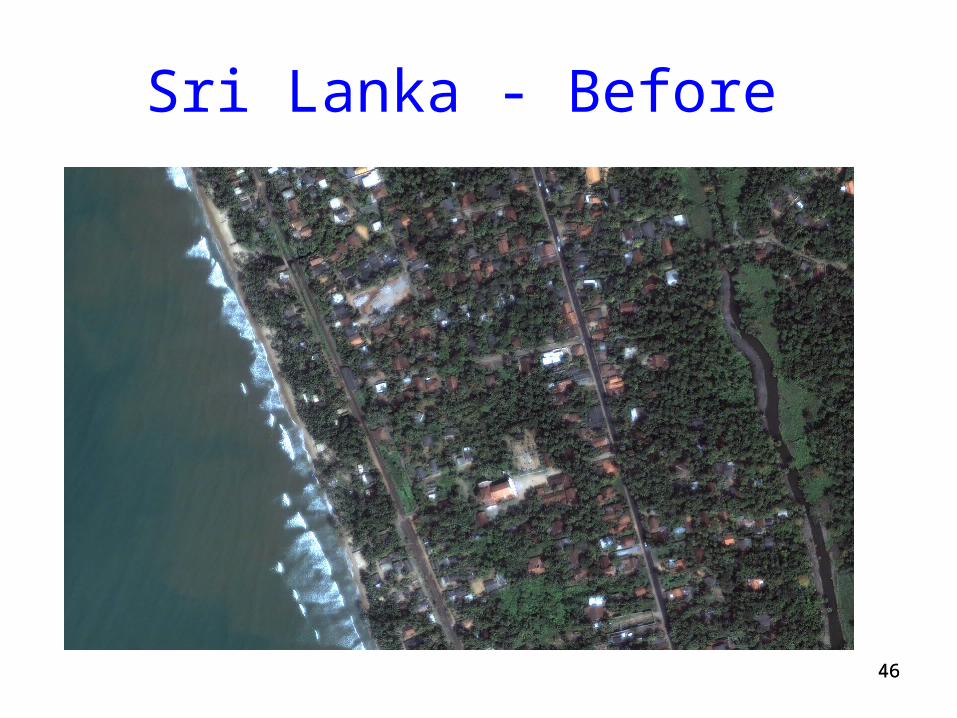
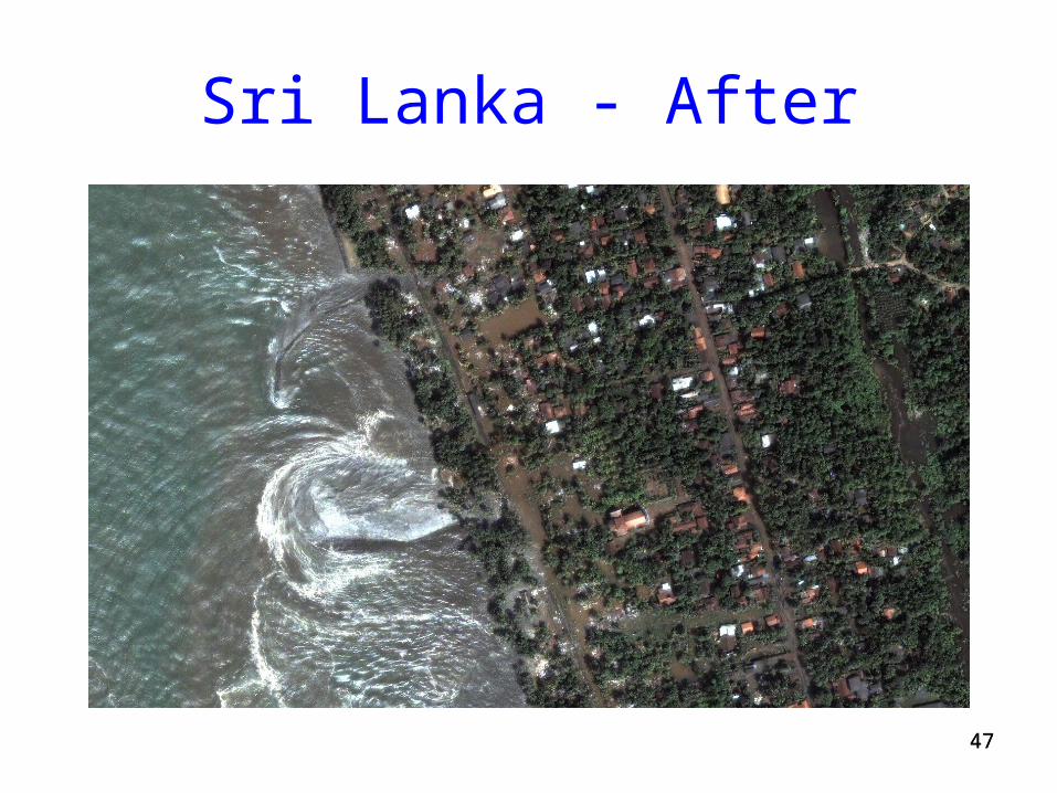
Sri Lanka - Before
4747
Sri Lanka - After
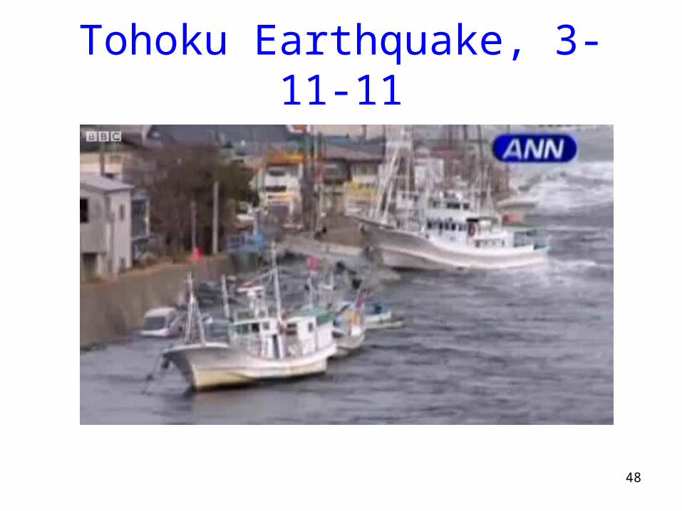
Tohoku Earthquake, 3-11-11
48
4949
Seiche
• Free or standing-wave oscillation of the surface of water in an enclosed or semi-enclosed basin (as a lake, bay, or harbor)
5050
Landslides
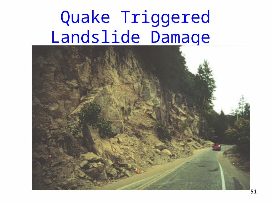
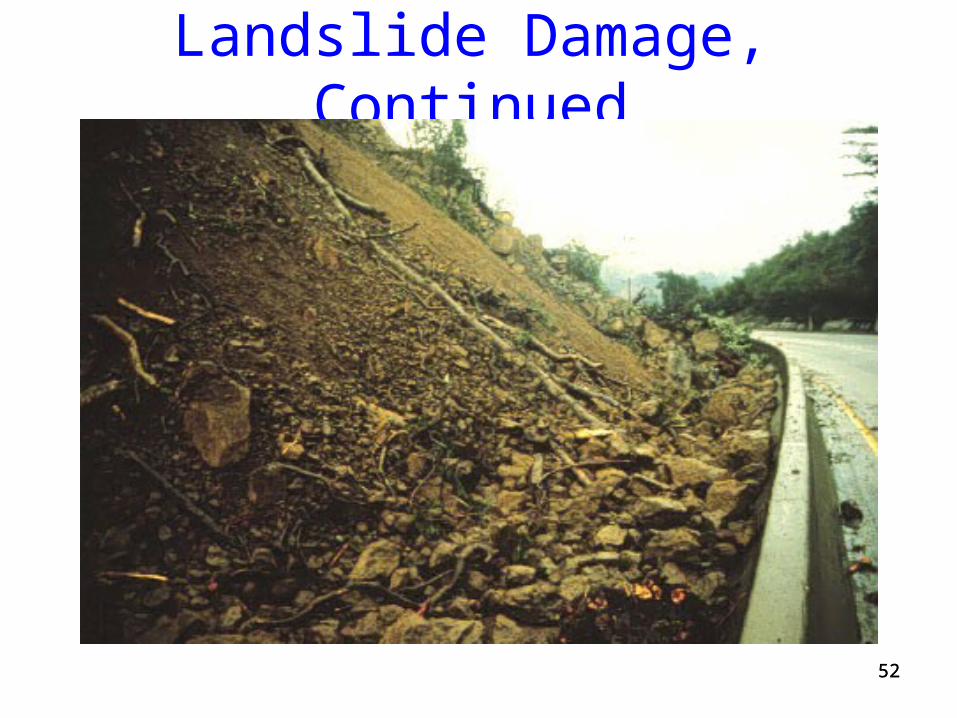
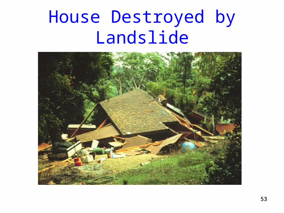
• Earthquakes may trigger mass movement of rock and sediment on unstable slopes
• Damage is most likely to occur after fire removes vegetation, or clear-cutting of forests
5151
Quake Triggered Landslide Damage
5252
Landslide Damage, Continued
5353
House Destroyed by Landslide

5454
Public Policy
• Rebuilding allowed if no immediate threat of injury or death
• Liability waiver mandatory
5555
Liquefaction
• Liquefaction is a physical process that takes place during some earthquakes that may lead to ground failure
• As a consequence of liquefaction, soft, young, water-saturated, well sorted, fine grain sands and silts behave as viscous fluids rather than solids

Liquefaction Animation

5757
Liquefaction Failure
• Steinbrugge Collection

5858
Liquefaction Failure
• Steinbrugge Collection
5959
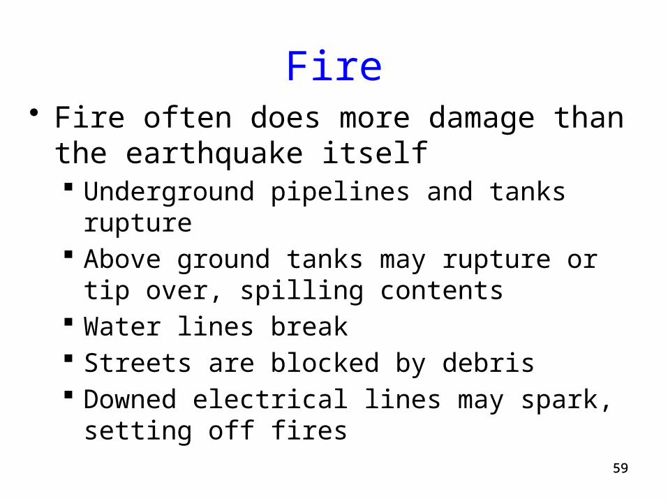
Fire• Fire often does more damage than the earthquake
itself Underground pipelines and tanks rupture Above ground tanks may rupture or tip over, spilling
contents Water lines break Streets are blocked by debris Downed electrical lines may spark, setting off fires
6060
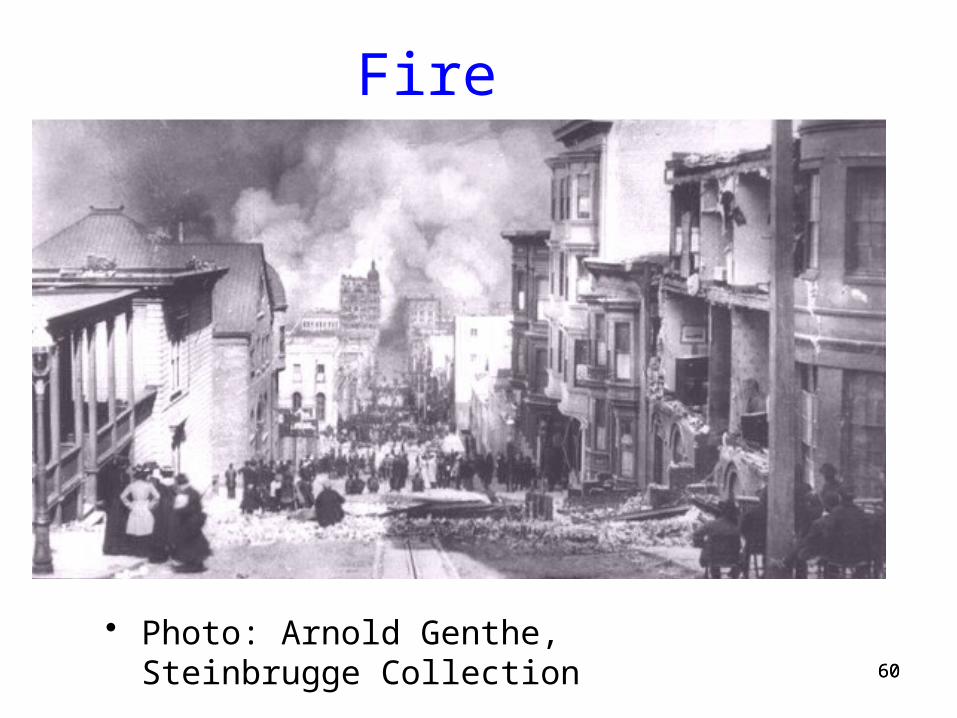
Fire
• Photo: Arnold Genthe, Steinbrugge Collection
6161
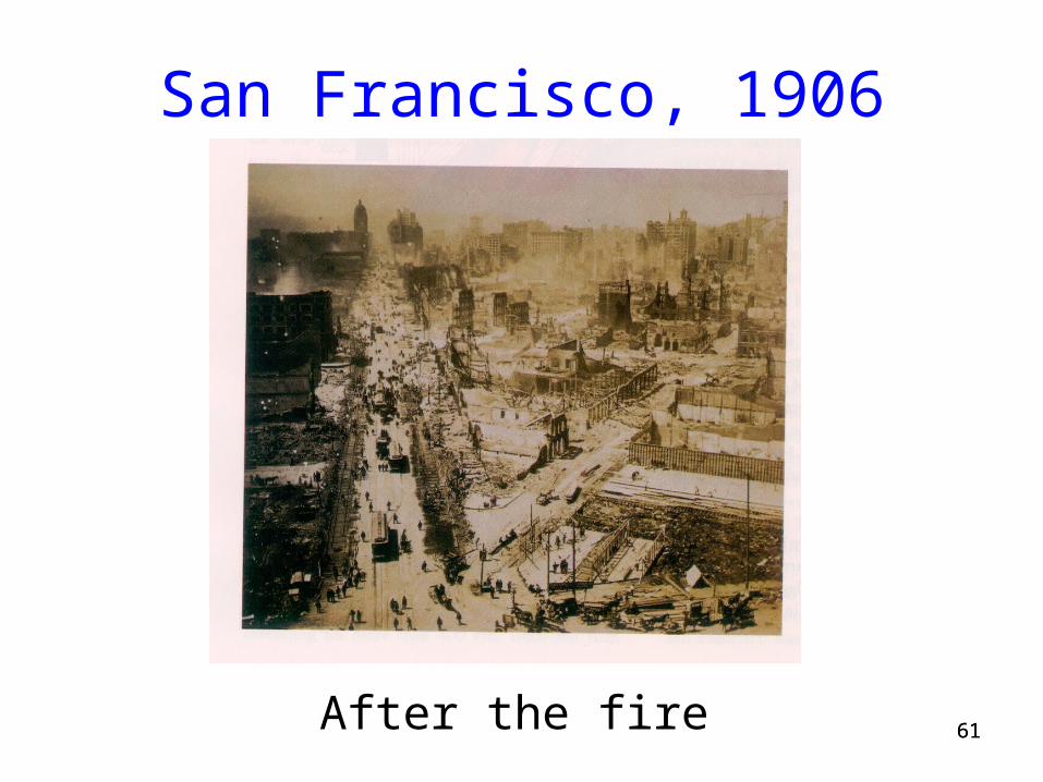
San Francisco, 1906
After the fire
6262
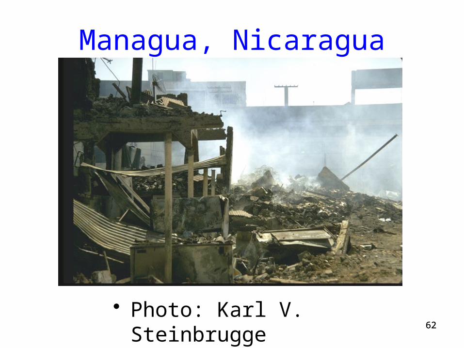
Managua, Nicaragua
• Photo: Karl V. Steinbrugge

6363
Tilted Gasoline Tank
• Steinbrugge Collection
6464
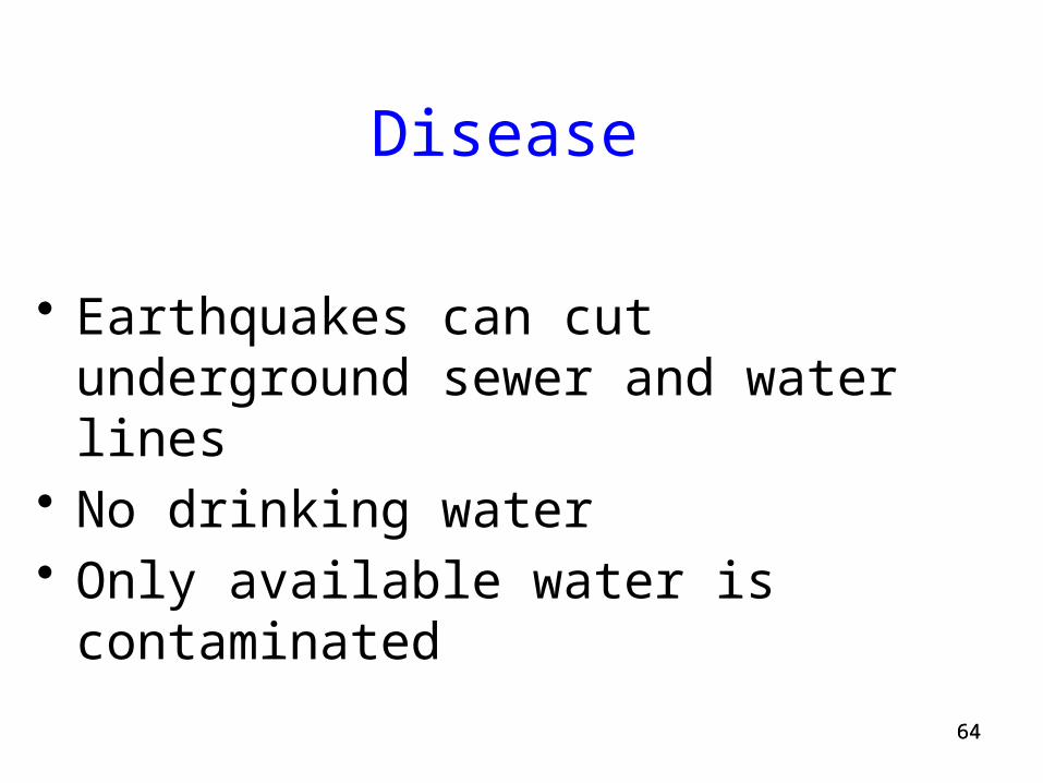
Disease
• Earthquakes can cut underground sewer and water lines
• No drinking water• Only available water is contaminated

6565
Broken Sewer Pipe, Chile
• Photo: Karl V. Steinbrugge
6666
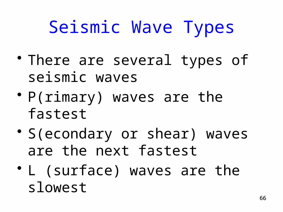
Seismic Wave Types
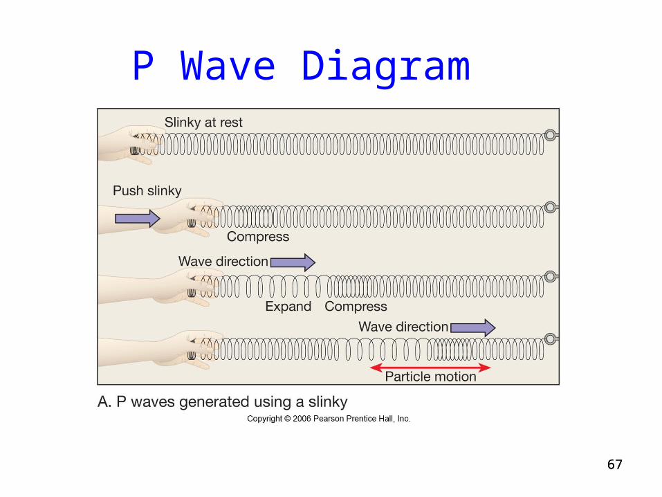
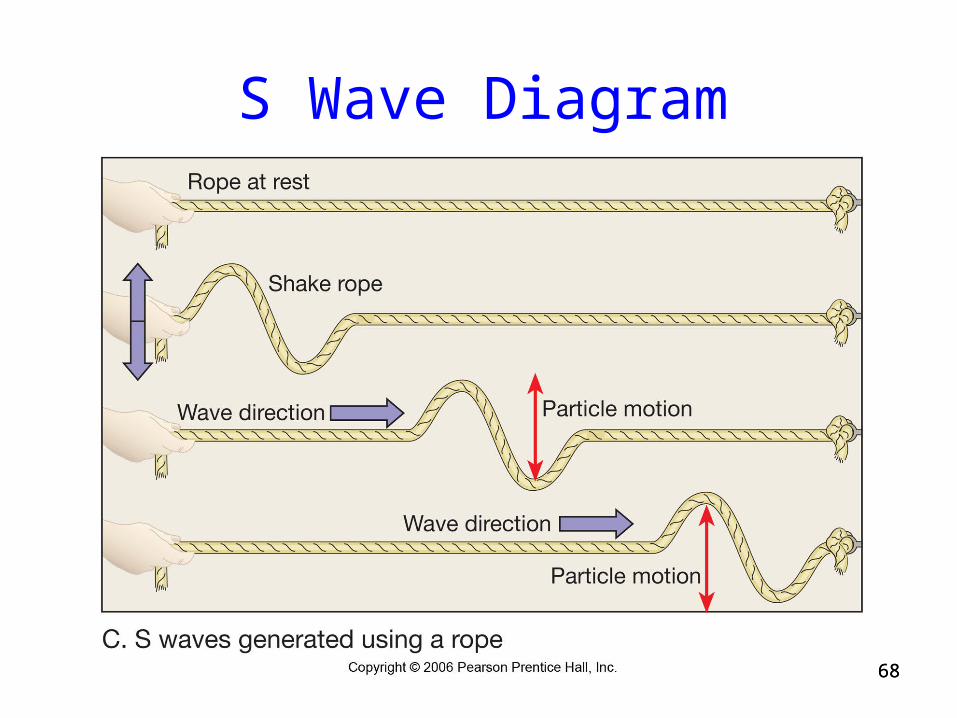
• There are several types of seismic waves• P(rimary) waves are the fastest• S(econdary or shear) waves are the next
fastest• L (surface) waves are the slowest
6767
P Wave Diagram
6868
S Wave Diagram

P and S Wave Animation
7070
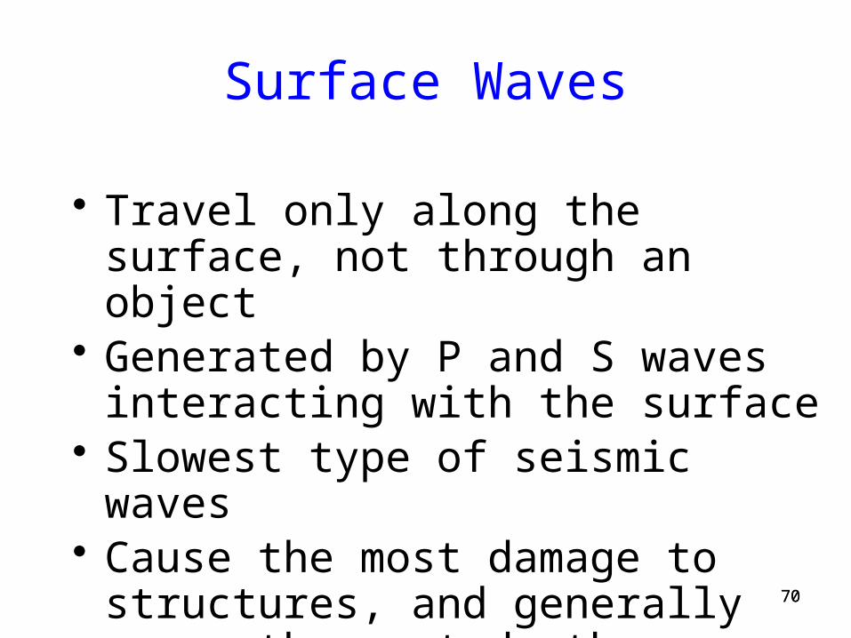
Surface Waves
• Travel only along the surface, not through an object
• Generated by P and S waves interacting with the surface
• Slowest type of seismic waves• Cause the most damage to structures, and
generally cause the most deaths
7171
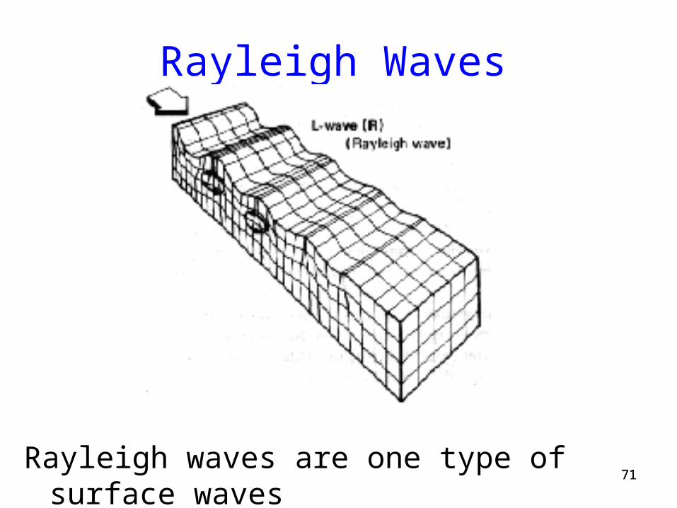
Rayleigh Waves
Rayleigh waves are one type of surface waves
7272
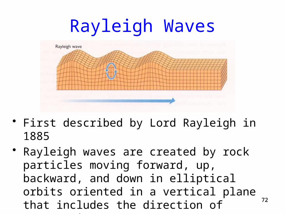
Rayleigh Waves
• First described by Lord Rayleigh in 1885• Rayleigh waves are created by rock particles moving
forward, up, backward, and down in elliptical orbits oriented in a vertical plane that includes the direction of propagation
• This produces a distinct rolling motion of the surface
7373
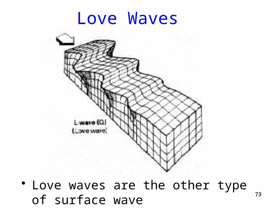
Love Waves
• Love waves are the other type of surface wave
7474
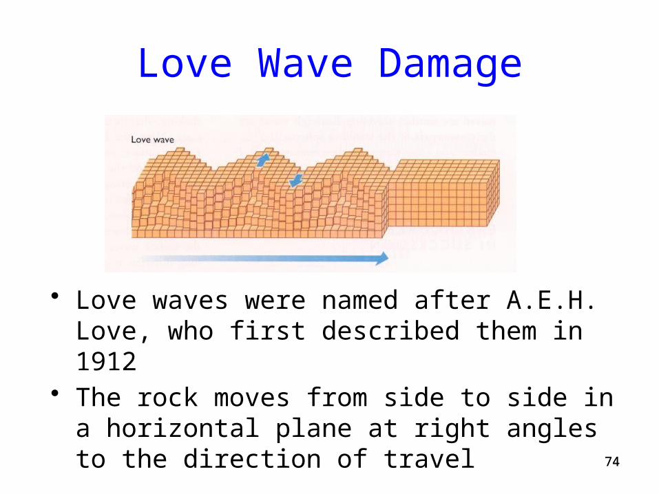
Love Wave Damage
• Love waves were named after A.E.H. Love, who first described them in 1912
• The rock moves from side to side in a horizontal plane at right angles to the direction of travel
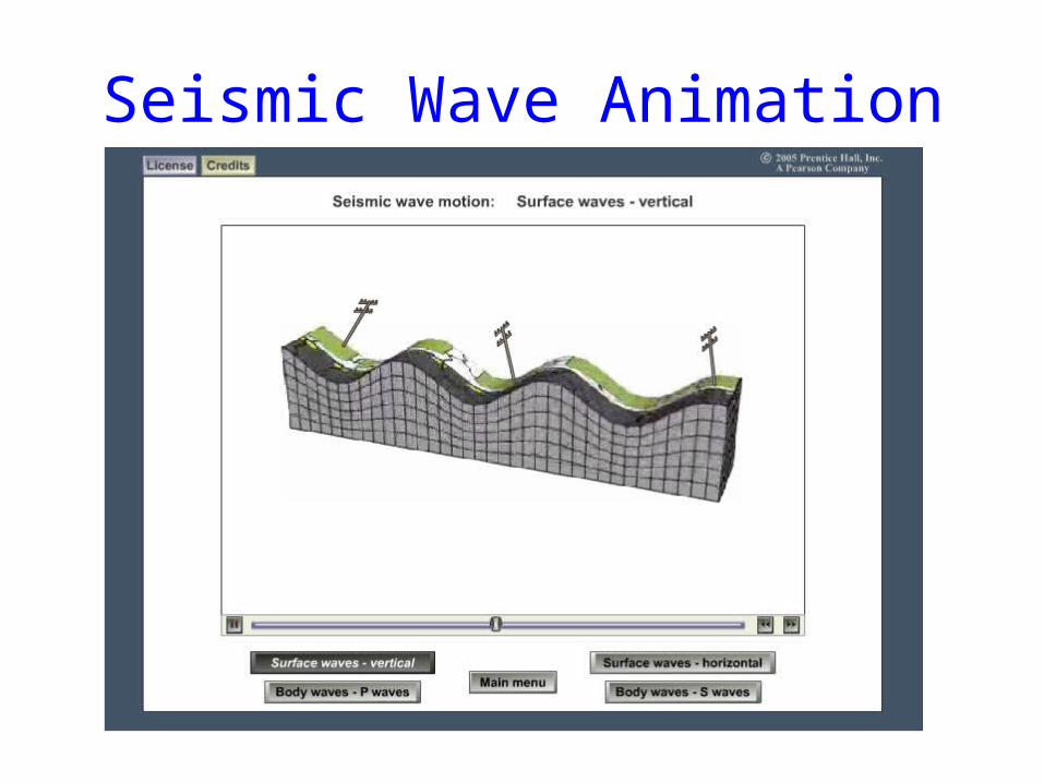
Seismic Wave Animation
7676
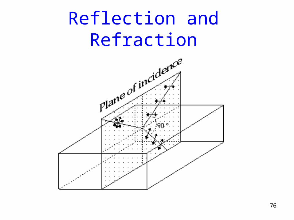
Reflection and Refraction
Wave Reflection and Refraction
77
78
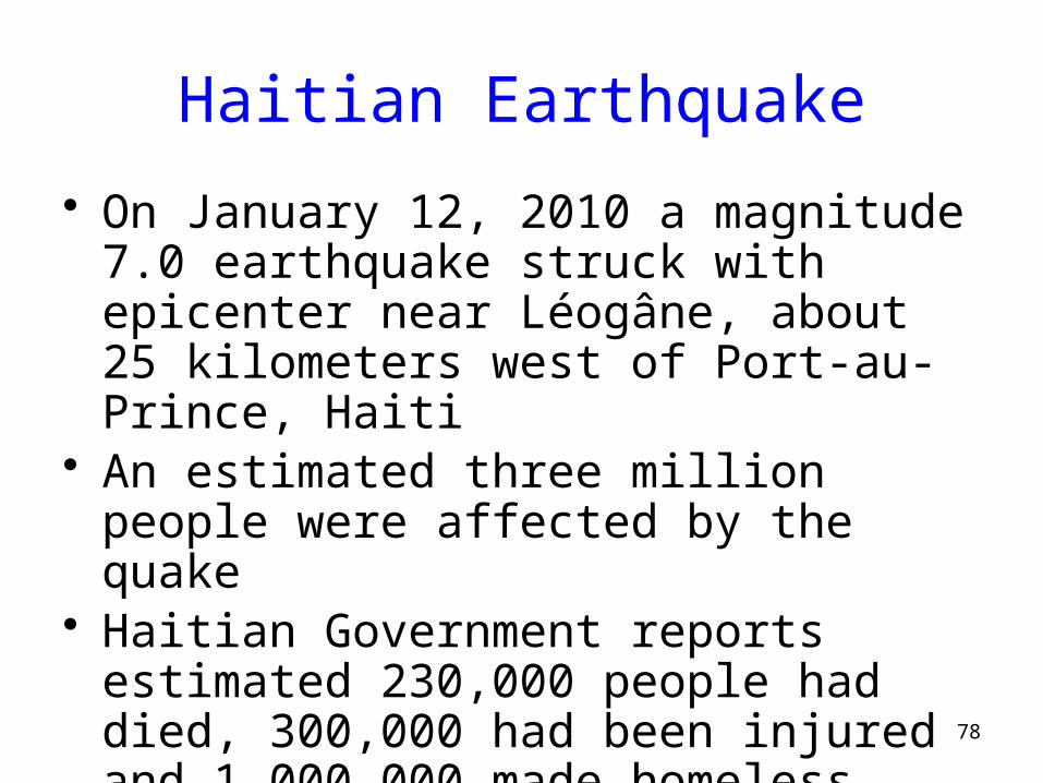
Haitian Earthquake
• On January 12, 2010 a magnitude 7.0 earthquake struck with epicenter near Léogâne, about 25 kilometers west of Port-au-Prince, Haiti
• An estimated three million people were affected by the quake
• Haitian Government reports estimated 230,000 people had died, 300,000 had been injured and 1,000,000 made homeless.
79
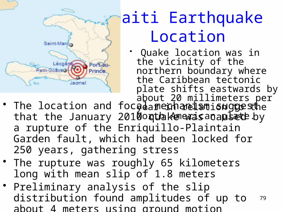
Haiti Earthquake Location
• The location and focal mechanism suggest that the January 2010 quake was caused by a rupture of the Enriquillo-Plaintain Garden fault, which had been locked for 250 years, gathering stress
• The rupture was roughly 65 kilometers long with mean slip of 1.8 meters
• Preliminary analysis of the slip distribution found amplitudes of up to about 4 meters using ground motion records from all over the world
• Quake location was in the vicinity of the northern boundary where the Caribbean tectonic plate shifts eastwards by about 20 millimeters per year in relation to the North American plate.
80
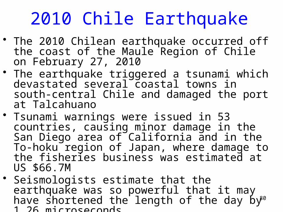
2010 Chile Earthquake• The 2010 Chilean earthquake occurred off the coast of the
Maule Region of Chile on February 27, 2010• The earthquake triggered a tsunami which devastated several
coastal towns in south-central Chile and damaged the port at Talcahuano
• Tsunami warnings were issued in 53 countries, causing minor damage in the San Diego area of California and in the To-hoku region of Japan, where damage to the fisheries business was estimated at US $66.7M
• Seismologists estimate that the earthquake was so powerful that it may have shortened the length of the day by 1.26 microseconds
• Precise GPS measurement indicated the telluric movement moved the entire city of Concepción 3.04 metres to the west.
• The latest death toll as of May 15, 2010 is 521 victims
81
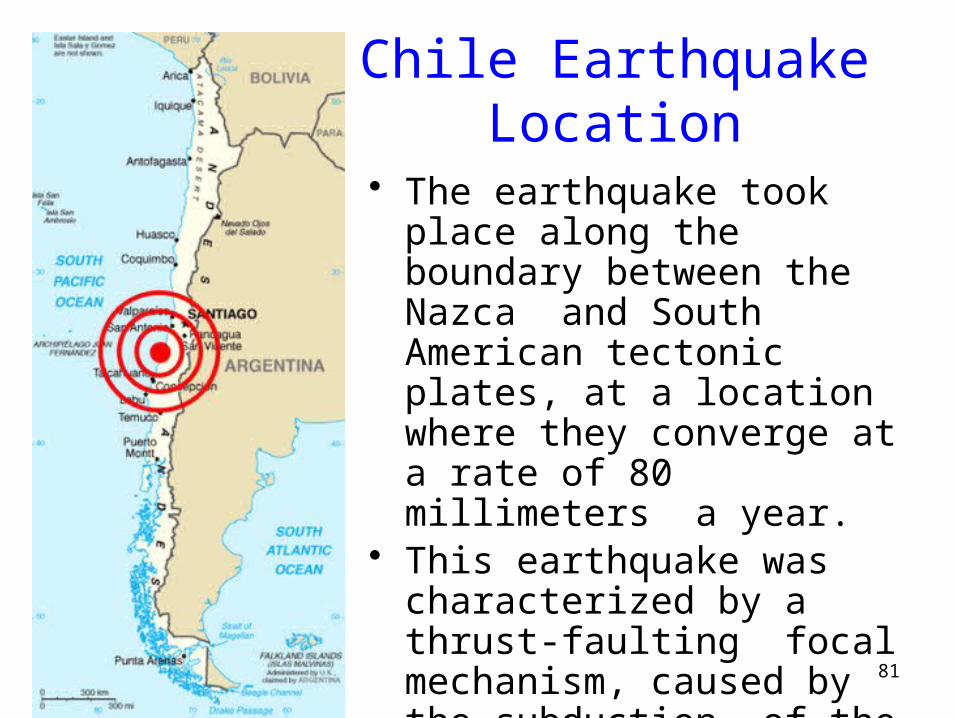
Chile Earthquake Location
• The earthquake took place along the boundary between the Nazca and South American tectonic plates, at a location where they converge at a rate of 80 millimeters a year.
• This earthquake was characterized by a thrust-faulting focal mechanism, caused by the subduction of the Nazca plate beneath the South American.

82
Chile Earthquake Effects
• Chile has been at a convergent plate boundary that generates megathrust earthquakes since the Paleozoic (500 million years ago)
• The segment of the fault zone which ruptured in this earthquake was estimated to be over 700 km long with a displacement of almost 10 meters
• GPSstudies indicate that the earthquake shifted Santiago 28 cm to the west-southwest and moved Concepción at least at least 3 meters to the west