Embed Size (px)
Citation preview
10. SITE 455: EAST SIDE OF THE MARIANA TROUGH1
Shipboard Scientific Party2
SITE 455
Date occupied: 10 April 1978
Date departed: 11 April 1978
Time on hole: 31.0 hours
Position: 17°51.26'N; 145°21.48'E
Water depth (sea level; corrected m, echo-sounding): 3465
Water depth (rig floor; corrected m, echo-sounding): 3475
Bottom felt (m, drill pipe): 3478
Penetration (m): 104
Number of holes: 1
Number of cores: 11
Total length of cored section (m): 104.0
Total core recovered (m): 31.28
Core recovery (%): 30.0
Oldest sediment cored:Depth sub-bottom (m): 104Nature: vitric sand ash mudstoneAge: early Pleistocene (0.9-1.6 m.y.)Measured velocity (km/s): 1.593
Basement:Depth sub-bottom (m): not reached
Principal results: Site 455 (SP-4D) is 54 km east of the suspectedMariana Trough spreading axis, near a bathymetric high risingabove the volcanogenic sediment apron from the active Marianavolcanic arc. The apron thins from the east from over 1 km thickto about 300 km thick at the site. Volcanic basement at Site 455should have an age intermediate between that at Site 453 (SP-4F)and Site 454 (SP-4E) to the west, if spreading has been fairlysymmetric.
Total penetration was 104 meters with a 30 per cent recoveryrate. The upper 22 meters comprises vitric mud with sandy ashlayers. Vitric nannofossil oozes are also present in some bands.From 22 to 95 meters, volcanic sand and gravel with minor nan-nofossil mud and silty tuff were cored. Volcaniclastic material in-cludes angular basalt grains, bits of basalt-glass and pumicefragments, probably from the nearby Pagan and Alamagan Is-lands. Below 95 meters sub-bottom, recovery consisted of only two
Initial Reports of the Deep Sea Drilling Project, Volume 60.Donald M. Hussong (Co-Chief Scientist), Hawaii Institute of Geophysics, Honolulu,
Hawaii; Seiya Uyeda (Co-Chief Scientist), Earthquake Research Institute, University ofTokyo, Tokyo, Japan; Rene Blanchet, Université de Bretagne Occidentale, Brest, France;Ulrich Bleil, Institut fiir Geophysik, Ruhr Universitàt, Bochum, Federal Republic of Ger-many; C. Howard Ellis, Marathon Oil Company, Denver Research Center, Littleton, Col-orado; Timothy J. G. Francis, Institute of Oceanographic Sciences, Surrey, United Kingdom;Patricia Fryer, Hawaii Institute of Geophysics, Honolulu, Hawaii; Ki-Iti Horai, Lamont-Doherty Geological Observatory, Palisades, New York; Stanley Kling, Marine Life ResearchGroup, Scripps Institution of Oceanography, La Jolla, California (present address: 416 ShoreView Lane, Leucadia, California); Arend Meijer, Department of Geosciences, University ofArizona, Tucson, Arizona; Kazuaki Nakamura, Earthquake Research Institute, University ofTokyo, Tokyo, Japan; James H. Natland, Deep Sea Drilling Project, Scripps Institution ofOceanography, La Jolla, California; Gordon H. Packham, Department of Geology and Geo-physics, University of Sydney, Sydney, N.S.W. Australia; and Anatoly Sharaskin, VernadskyInstitute of Geochemistry, U.S.S.R. Academy of Sciences, Moscow, U.S.S.R.
•5 Velocity of vitric mud from approximately 21 meters sub-bottom.
pieces of pale olive sediment. The upper piece is burrowed vitricmudstone and the lower piece is graded bedded tuff overlain bylaminated and cross-laminated vitric mudstone. These lithologiesresemble the graded bedded sequences from the early Pliocene atSite 453 and the early Pleistocene at Site 454. The oldest sedimentat Site 455 can be referred to the early Pleistocene Emiliania an-nula Subzone. The hole was abandoned with no downhole logging,because of massive caving of the sand into the hole. The ship wassubsequently moved to Site 456, about 17 km west of Site 455, in asecond attempt to meet the SP-4D objectives.
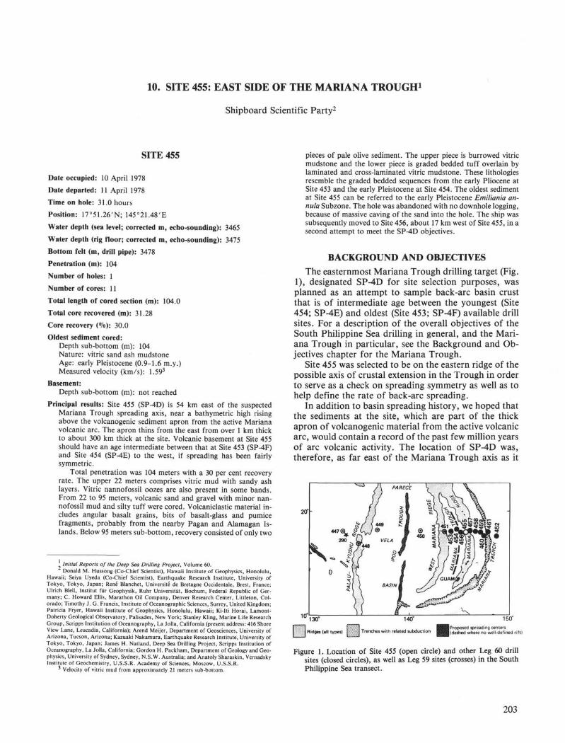
BACKGROUND AND OBJECTIVESThe easternmost Mariana Trough drilling target (Fig.
1), designated SP-4D for site selection purposes, wasplanned as an attempt to sample back-arc basin crustthat is of intermediate age between the youngest (Site454; SP-4E) and oldest (Site 453; SP-4F) available drillsites. For a description of the overall objectives of theSouth Philippine Sea drilling in general, and the Mari-ana Trough in particular, see the Background and Ob-jectives chapter for the Mariana Trough.
Site 455 was selected to be on the eastern ridge of thepossible axis of crustal extension in the Trough in orderto serve as a check on spreading symmetry as well as tohelp define the rate of back-arc spreading.
In addition to basin spreading history, we hoped thatthe sediments at the site, which are part of the thickapron of volcanogenic material from the active volcanicarc, would contain a record of the past few million yearsof arc volcanic activity. The location of SP-4D was,therefore, as far east of the Mariana Trough axis as it
ISO-
Ridges (all types)
140°
Trenches with related subduction
150°
j Proposed spreading centersI (dashed where no well-defined rift)
Figure 1. Location of Site 455 (open circle) and other Leg 60 drillsites (closed circles), as well as Leg 59 sites (crosses) in the SouthPhilippine Sea transect.
203
SITE 455
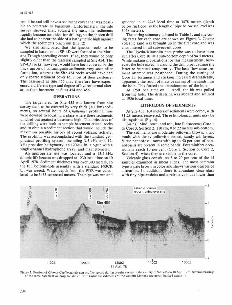
could be and still have a sediment cover that was possi-ble to penetrate to basement. Unfortunately, the sitesurvey showed that, toward the east, the sedimentsrapidly become too thick for drilling, so the chosen drillsite had to be near the side of a bathymetric high againstwhich the sediments pinch out (Fig. 2).
We also anticipated that the igneous rocks to besampled in basement at SP-4D were formed at the Mari-ana Trough spreading center. If so, they would be onlyslightly older than the material sampled at Site 454. TheSP-4D rocks, however, would have been covered by thethick apron of volcanogenic sediments very soon afterformation, whereas the Site 454 rocks would have hadonly sparse sediment cover for most of their existence.The basement at Site 455 may therefore have experi-enced a different type and degree of hydrothermal alter-ation than basement at Sites 454 and 456.
OPERATIONSThe target area for Site 455 was known from site
survey data to be covered by very thick (> 1 km) sedi-ments, so several hours of Challenger profiling timewere devoted to locating a place where these sedimentspinched out against a basement high. The objectives ofthe drilling were both to sample basement crustal rocksand to obtain a sediment section that would include themaximum possible history of recent volcanic activity.The profiling was accomplished with the standard geo-physical profiling system, including 3.5-kHz and 12-kHz precision bathymetry, an 120-cu. in. air-gun with asingle-channel hydrophone array, and magnetometer.
An appropriate site was located, and a 13.5-kHzdouble-life beacon was dropped at 1230 local time on 10April 1978. Sediment thickness was over 300 meters, sothe full bottom-hole assembly with a standard F93CKbit was rigged. Water depth from the PDR was calcu-lated to be 3465 corrected meters. The pipe was run and
spudded in at 2245 local time at 3478 meters (depthbelow rig floor, so the length of pipe below sea level was3468 meters).
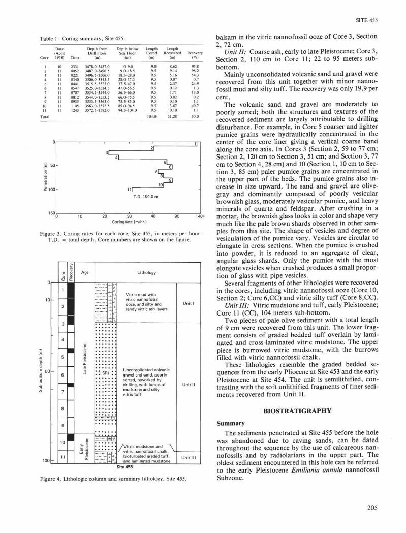
The coring summary is listed in Table 1, and the cor-ing rates for each core are shown on Figure 3. Coarsevolcanic sand was brought up in the first core and wasencountered in all subsequent cores.
The Uyeda/Kinoshita heat probe was to have beenrun after Core 10, at a sub-bottom depth of 94.5 meters.While making preparations for this measurement, how-ever, the hole caved in around the drill pipe, causing thelatter to be stuck temporarily. The heat flow measure-ment attempt was postponed. During the cutting ofCore 11, torquing and sticking increased dramatically,apparently the result of massive caving of the sands intothe hole. This forced the abandonment of the hole.
At 1250 local time on 11 April, the bit was pulledfrom the hole. The drill string was aboard and securedat 1956 local time.
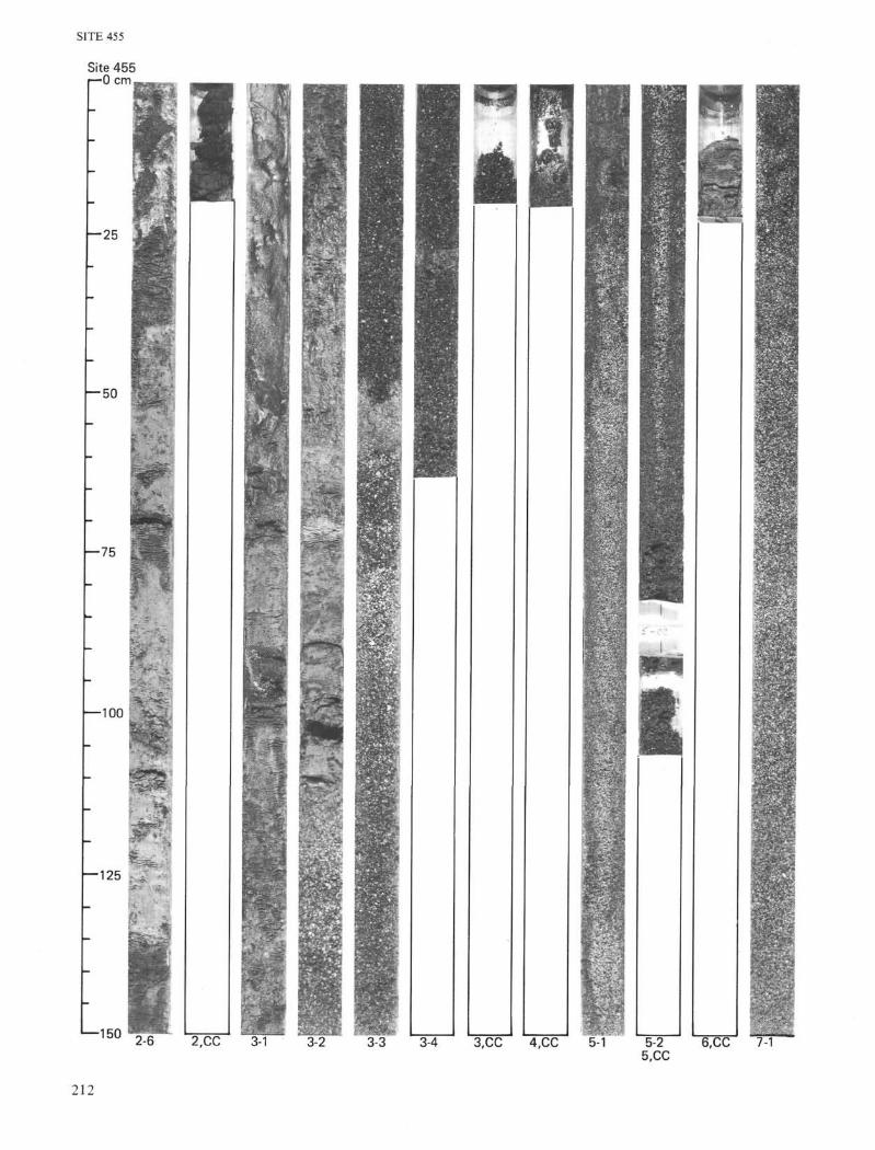
LITHOLOGY OF SEDIMENTSAt Site 455, 104 meters of sediments were cored, with
31.28 meters recovered. Three lithological units may bedistinguished (Fig. 4).
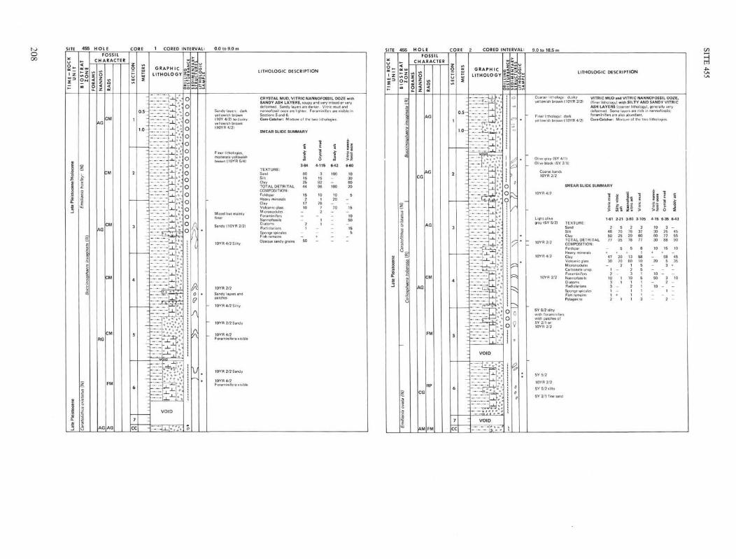
Unit I: Mud, ooze, and ash, late Pleistocene; Core 1to Core 3, Section 2, 110 cm, 0 to 22 meters sub-bottom.
The sediments are moderate yellowish brown, vitricmuds with dusky yellowish brown, sandy ash layers.Vitric nannofossil oozes with up to 50 per cent of nan-nofossils are present in some bands. Foraminifers occa-sionally reach 10 per cent (Core 1, Section 6; Core 2,Section 4), when they are visible in the core.
Volcanic glass constitutes 5 to 70 per cent of the 15samples examined in smear slides. The most commontype is pale brown in color and shows various degrees ofalteration. In addition, there is abundant clear glasswith tiny pipe-vesicles and a refractive index lower than
variable coursesrepositioning over site
- 3
I1100Z
- 7
1200Z 1300Z11 April 78
1400Z 1500Z
Figure 2. Portion of Glomar Challenger air-gun profiler record during pre-site survey in the vicinity of Site 455 on 10 April 1978. Several crossingsof the same basement outcrop are shown, with turbiditic sediments of the western Mariana arc apron banked against it.
204
SITE 455
Table 1. Coring summary, Site 455.
Date(April
Core 1978) Time
Depth fromDrill Floor
(m)
Depth belovSea Floor
(m)
LengthCored
(m)
LengthRecovered
(m)Recovery
1234
567891011
1011
11
11
11
11
11
11
11
11
11
23310052022103400441
0547
0707
08120935
1105
3478.0-3487.03487.0-3496.53496.5-3506.03506.0-3515.53515.5-3525.03525.0-3534.53534.5-3544.03544.0-3553.53553.5-3563.03563.0-3572.53572.5-3582.0
0-9.09.0-18.518.5-28.028.0-37.537.5-47.047.0-56.556.5-66.066.0-75.575.5-85.085.0-94.594.5-104.0
9.09.59.59.59.59.59.59.59.59.59.5
9.145.160.07
2.37
0.121.71
0.020.10
3.87
0.10
95.896.254.30.7
24.9
1.318.0
0.21.1
40.7
1.1
ε 50-
<x 1 0 0 -
150
1 1 1 1
7f_
1
T.D. 104.0 m
5
11
11
10 20 30 40
Coring Rate (m/hr.)
90 140+
Figure 3. Coring rates for each core, Site 455, in meters per hour.T.D. = total depth. Core numbers are shown on the figure.
10
50
100
Lithology
Vitric mud withvitric nannofossilooze, and silty andsandy vitric ash layers
Unconsolidated volcanicgravel and sand, poorlysorted, reworked bydrilling, with lumps ofmudstone and siltyvitric tuff
/Vitric mudstone and \' vitric nannof""'1 fhait Vnofossil chalk,
bioturbated graded tuff,and laminated mudstone
Unit I
Unit II
Unit III
Site 455
Figure 4. Lithologic column and summary lithology, Site 455.
balsam in the vitric nannofossil ooze of Core 3, Section2, 72 cm.
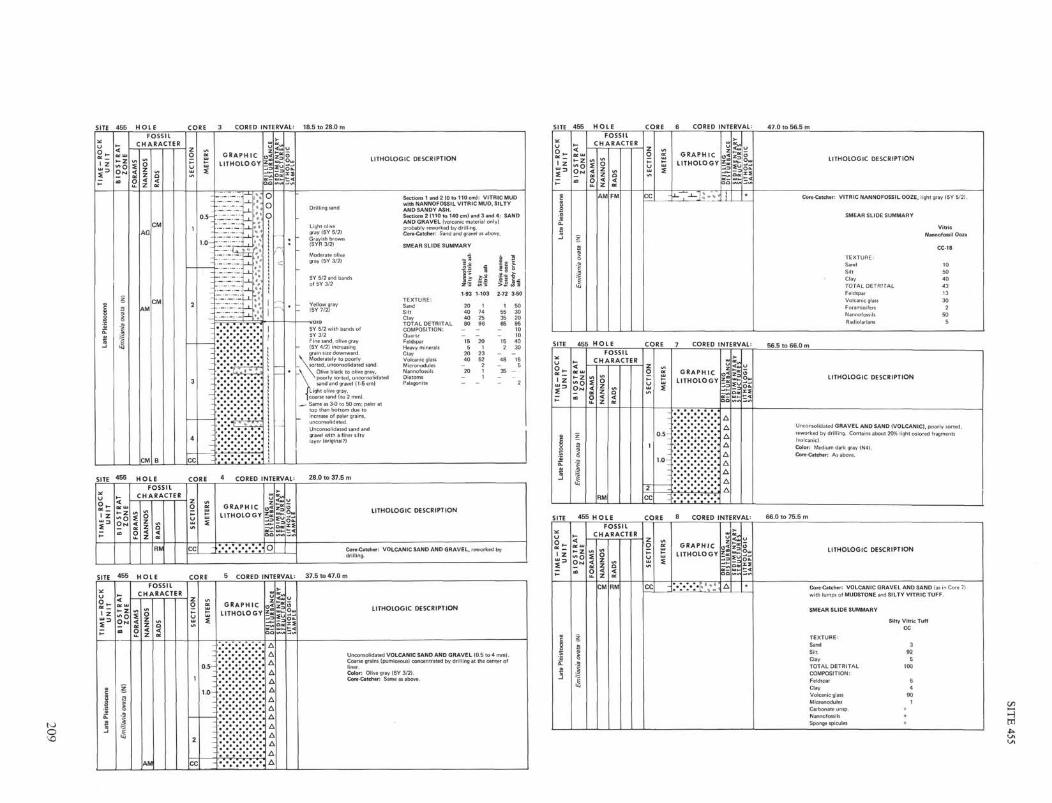
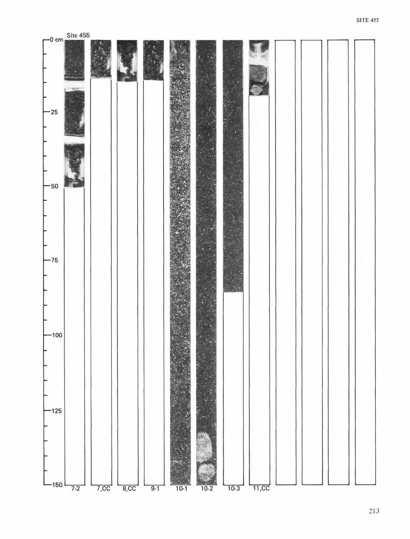
Unit II: Coarse ash, early to late Pleistocene; Core 3,Section 2, 110 cm to Core 11; 22 to 95 meters sub-bottom.
Mainly unconsolidated volcanic sand and gravel wererecovered from this unit together with minor nanno-fossil mud and silty tuff. The recovery was only 19.9 percent.
The volcanic sand and gravel are moderately topoorly sorted; both the structures and textures of therecovered sediment are largely attributable to drillingdisturbance. For example, in Core 5 coarser and lighterpumice grains were hydraulically concentrated in thecenter of the core liner giving a vertical coarse bandalong the core axis. In Cores 3 (Section 2, 59 to 77 cm;Section 2, 120 cm to Section 3, 51 cm; and Section 3, 77cm to Section 4, 28 cm) and 10 (Section 1, 10 cm to Sec-tion 3, 85 cm) paler pumice grains are concentrated inthe upper part of the beds. The pumice grains also in-crease in size upward. The sand and gravel are olive-gray and dominantly composed of poorly vesicularbrownish glass, moderately vesicular pumice, and heavyminerals of quartz and feldspar. After crushing in amortar, the brownish glass looks in color and shape verymuch like the pale brown shards observed in other sam-ples from this site. The shape of vesicles and degree ofvesiculation of the pumice vary. Vesicles are circular toelongate in cross sections. When the pumice is crushedinto powder, it is reduced to an aggregate of clear,angular glass shards. Only the pumice with the mostelongate vesicles when crushed produces a small propor-tion of glass with pipe vesicles.
Several fragments of other lithologies were recoveredin the cores, including vitric nannofossil ooze (Core 10,Section 2; Core 6,CC) and vitric silty tuff (Core 8,CC).
Unit HI: Vitric mudstone and tuff, early Pleistocene;Core 11 (CC), 104 meters sub-bottom.
Two pieces of pale olive sediment with a total lengthof 9 cm were recovered from this unit. The lower frag-ment consists of graded bedded tuff overlain by lami-nated and cross-laminated vitric mudstone. The upperpiece is burrowed vitric mudstone, with the burrowsfilled with vitric nannofossil chalk.
These lithologies resemble the graded bedded se-quences from the early Pliocene at Site 453 and the earlyPleistocene at Site 454. The unit is semilithified, con-trasting with the soft unlithified fragments of finer sedi-ments recovered from Unit II.
BIOSTRATIGRAPHY
Summary
The sediments penetrated at Site 455 before the holewas abandoned due to caving sands, can be datedthroughout the sequence by the use of calcareous nan-nofossils and by radiolarians in the upper part. Theoldest sediment encountered in this hole can be referredto the early Pleistocene Emiliania annula nannofossilSubzone.
205
SITE 455
NannofossilsAll of the samples examined from Hole 455 contain
nannofossils; however, Samples 3,CC, 5,CC, 6,CC, and7,CC are coarse-grained sands. Analytical residues ofthese coarse-grained samples were prepared by washinga portion of the sand in water and examining the result-ing wash water. The nannofossils seen in these prepara-tions may be indigenous or may have originated fromsofter sediments reworked into the sands or even fromthe drill-string water column. The samples from Cores1, 2, 9, 10, and 11 are muds and presumed to be inplace. The Holocene-late Pleistocene Emiliania huxleyiZone can be recognized in Samples 1-1, 90-91 cm and1-3, 90-91 cm. The late Pleistocene Ceratolithus cris-tatus Subzone of the Gephyrocapsa oceanica Zone canbe recognized from Sample 1-5, 90-91 cm to Sample2-4, 94-95 cm. The Emiliania ovata Subzone of the G.oceanica Zone is recognized in Samples 2-6, 90-91 cmthrough 9,CC. The early Pleistocene Gephyrocapsacaribbeanica Subzone of the Crenalithus doronicoidesZone is recognized in Sample 10-2, 136-137 cm. Theearly Pleistocene Emiliania annula Subzone of the C.doronicoides Zone is recognized in Sample 11,CC.
RadiolariansRadiolarians are well represented in Cores 1,2, and
3. They are present in Cores 4, 6, 8, and 9, but no age-diagnostic forms are recognizable. In Cores 5 and 7(CC), the radiolarian size fraction was too sparse towarrant examination. Core 10 and 11 are barren.
The Buccinosphaera invaginata Zone is representedin Cores 1 and 2, and the Collosphaera tuberosa Zone ispresent in the lower part of Core 2.
Foraminifers (V. A. Krasheninnikov)Only rare Quaternary impoverished foraminiferal
assemblages were recovered at Site 455. Samples 1-1,50-52 cm and 1-2, 50-52 cm can be assigned to the lateQuaternary Globigerina calida calida Subzone. Samples1-3, 50-52 cm through 3-2, 50-52 cm can be placed inthe undifferentiated Quaternary.
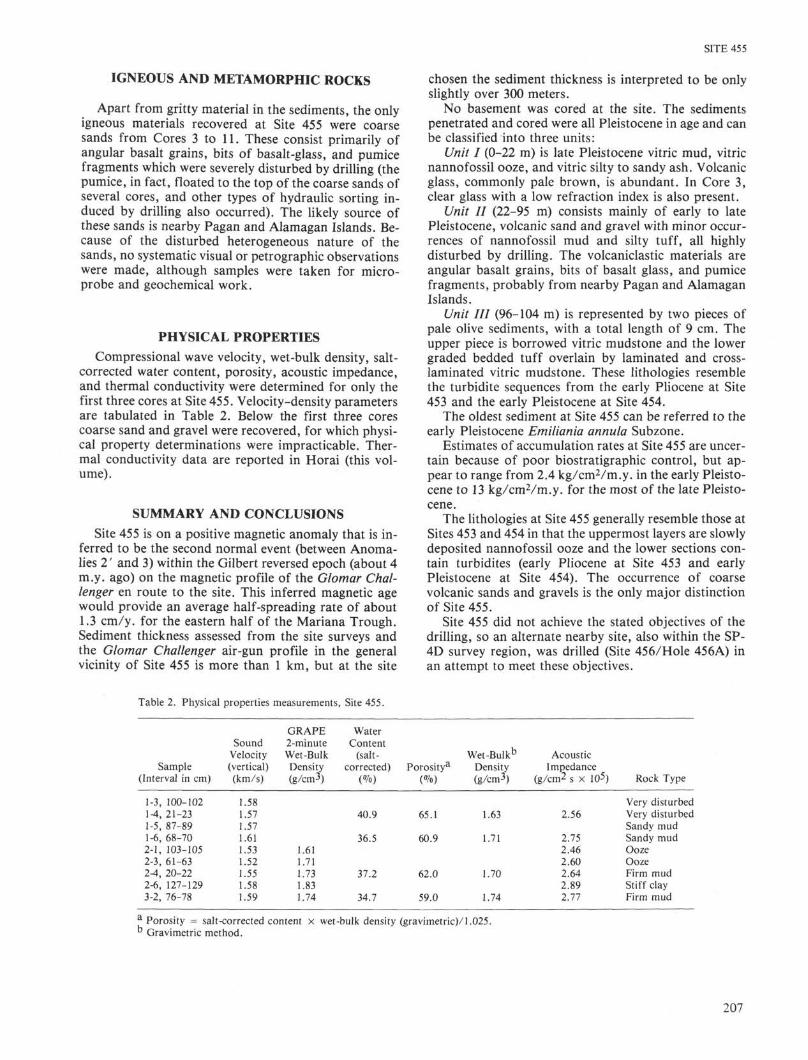
ACCUMULATION RATESThe accumulation curve (Fig. 5) has been calculated
as kilograms of water-free sediment per square centi-meter by the method outlined for Site 453 withoutaveraging. The time lines are based on the nannofossilzone boundaries.
The sequence can be divided into three segments withdiffering accumulation rates.
Site 455Age (m.y.)
1
StratigraphicUnit
1)
2)
3)
Interval
Holocene andlatestPleistocene(0-0.2 m.y.)LatePleistocene(0.2-0.9 m.y.)EarlyPleistocene(0.9-1.6 m.y.)
Depthbelow
Sea Floor(m)
0-5.4
5.4-81.8
81.8-91.3
AccumulationRate
(kg/cm^/m.y.)
3.0
13.0
2.4
10 -
20
-
-
Holocene
r
Pleistocene
Late Early
Unit I
Unit II
Unit III
Pliocene
I Error bar on boundary determination
Figure 5. Sediment accumulation rate curves (thickness accumulated
versus age), for Site 455. Ages are based on nannofossil zones and
subzones (Ellis, this volume).
The accumulation rate for Segment 1 is much lowerthan that for Segment 2. The decrease in sedimentationrate may be attributable to a decline in volcanic activity.Unlike the two previous sites, Site 455 lies on the sameside of the Mariana Trough spreading center as the vol-canic arc. Thus the arc-site distance has remained con-stant after the formation of the sea floor. Changes insedimentation rates are attributable to changes in therate of supply of sediment as a result of either changesin the level of volcanic activity or the mode of deposi-tion.
Similarly, the lower rate of deposition in Segment 3must be attributable to either changes in volcanic activ-ity or mode of deposition, or both. The evidence for achange in style of sedimentation is found in the lastmaterial recovered. Segment 3 has the bedding charac-teristics of the turbidite sequences encountered at Sites453 and 454, and may be part of a sequence of beds laiddown in the same way as redistributed ash falls. Themore rapidly deposited sediments above them could begrain flow deposits forming part of the clastic apronprograding out from the active arc.
However, there is also evidence that the low sedimen-tation rate in Segment 3 results from a decrease of arcvolcanic activity at this time. The rate of sedimentationis also lower at this time at Site 456, which is located in apond on a ridge, hence the sediment deposited fellthrough the water column.
GEOCHEMISTRYOne sample was squeezed for pore waters at Site 455
(Gieskes, this volume). The sample very nearly resemblessea water in composition, and in that respect is similarto mudline samples from Sites 452 through 454.
206
SITE 455
IGNEOUS AND METAMORPHIC ROCKS
Apart from gritty material in the sediments, the onlyigneous materials recovered at Site 455 were coarsesands from Cores 3 to 11. These consist primarily ofangular basalt grains, bits of basalt-glass, and pumicefragments which were severely disturbed by drilling (thepumice, in fact, floated to the top of the coarse sands ofseveral cores, and other types of hydraulic sorting in-duced by drilling also occurred). The likely source ofthese sands is nearby Pagan and Alamagan Islands. Be-cause of the disturbed heterogeneous nature of thesands, no systematic visual or petrographic observationswere made, although samples were taken for micro-probe and geochemical work.
PHYSICAL PROPERTIESCompressional wave velocity, wet-bulk density, salt-
corrected water content, porosity, acoustic impedance,and thermal conductivity were determined for only thefirst three cores at Site 455. Velocity-density parametersare tabulated in Table 2. Below the first three corescoarse sand and gravel were recovered, for which physi-cal property determinations were impracticable. Ther-mal conductivity data are reported in Horai (this vol-ume).
SUMMARY AND CONCLUSIONSSite 455 is on a positive magnetic anomaly that is in-
ferred to be the second normal event (between Anoma-lies 2' and 3) within the Gilbert reversed epoch (about 4m.y. ago) on the magnetic profile of the Glomar Chal-lenger en route to the site. This inferred magnetic agewould provide an average half-spreading rate of about1.3 cm/y, for the eastern half of the Mariana Trough.Sediment thickness assessed from the site surveys andthe Glomar Challenger air-gun profile in the generalvicinity of Site 455 is more than 1 km, but at the site
chosen the sediment thickness is interpreted to be onlyslightly over 300 meters.
No basement was cored at the site. The sedimentspenetrated and cored were all Pleistocene in age and canbe classified into three units:
Unit I (0-22 m) is late Pleistocene vitric mud, vitricnannofossil ooze, and vitric silty to sandy ash. Volcanicglass, commonly pale brown, is abundant. In Core 3,clear glass with a low refraction index is also present.
Unit II (22-95 m) consists mainly of early to latePleistocene, volcanic sand and gravel with minor occur-rences of nannofossil mud and silty tuff, all highlydisturbed by drilling. The volcaniclastic materials areangular basalt grains, bits of basalt glass, and pumicefragments, probably from nearby Pagan and AlamaganIslands.
Unit HI (96-104 m) is represented by two pieces ofpale olive sediments, with a total length of 9 cm. Theupper piece is borrowed vitric mudstone and the lowergraded bedded tuff overlain by laminated and cross-laminated vitric mudstone. These lithologies resemblethe turbidite sequences from the early Pliocene at Site453 and the early Pleistocene at Site 454.
The oldest sediment at Site 455 can be referred to theearly Pleistocene Emiliania annula Subzone.
Estimates of accumulation rates at Site 455 are uncer-tain because of poor biostratigraphic control, but ap-pear to range from 2.4 kg/cm2/m.y. in the early Pleisto-cene to 13 kg/cmVm.y. for the most of the late Pleisto-cene.
The lithologies at Site 455 generally resemble those atSites 453 and 454 in that the uppermost layers are slowlydeposited nannofossil ooze and the lower sections con-tain turbidites (early Pliocene at Site 453 and earlyPleistocene at Site 454). The occurrence of coarsevolcanic sands and gravels is the only major distinctionof Site 455.
Site 455 did not achieve the stated objectives of thedrilling, so an alternate nearby site, also within the SP-4D survey region, was drilled (Site 456/Hole 456A) inan attempt to meet these objectives.
Table 2. Physical properties measurements, Site 455.
Sample(Interval in cm)
1-3, 100-1021-4, 21-231-5, 87-891-6, 68-702-1, 103-1052-3, 61-632-4, 20-222-6, 127-1293-2, 76-78
SoundVelocity(vertical)(km/s)
1.581.571.571.611.531.521.551.581.59
GRAPE2-minuteWet-BulkDensity(g/cm3)
1.611.711.731.831.74
WaterContent
(salt-corrected)
(%)
40.9
36.5
37.2
34.7
Porositya
(%)
65.1
60.9
62.0
59.0
Wet-Bulkb
Density(g/cm3)
1.63
1.71
1.70
1.74
AcousticImpedance
(g/cm2 s × I05)
2.56
2.752.462.602.642.892.77
Rock Type
Very disturbedVery disturbedSandy mudSandy mudOozeOozeFirm mudStiff clayFirm mud
a Porosity = salt-corrected content × wet-bulk density (gravimetric)/1.025.° Gravimetric method.
207
oOo
SITE 455 HOLE 1 CORED INTERVAL: 0.0 to 9.0 m
FOSSILCHARACTER
GRAPHICLITHOLOGY
V
LITHOLOGIC DESCRIPTION
Sandy layers: darkyellowish brown(10Y4/2) to dusky
10YR 2/2
Sandy layers and
- 10YR 4/2 Silty
10YR 2/2 Sandy
10YR4/2
10YR 2/2 Sandy
10YR 4/2
CRYSTAL MUD, VITRIC NANNOFOSSIL OOZE vSANDY ASH LAYERS, soupy and very mixed or vtdeformed. Sandy layers are darker. Vitric mud and
Core-Catcher: Mb
SMEAR SLIDE SUMMARY
ClayTOTAL DETRITALCOMPOSITION:
Mixed but mainly
finer
Sandy (10YR 2/2)
10YR 4/2 Silty
ForaminifersNannofossils
RadiolariansSponge spicules
Opaque sandy gr
3-84 4115 6-42 6-60
SITE
2£UO _ccI Z
s 3
§
lei
α.
-J
4 5 5
<
- 2D M
_
55to
S
1g
z
3§
-ato
l,C
ei1
s
i•§
i ]
&
•S
JS
Co,
_̂
fi
11
HOLEFOSSIL
CHARACTER
<
0
O
z
<z
CG
AG
CG
A M
Q<
AG
\G
AG
CM
FM
RP
FM
CORE
Z
1
2
3
4
5
6
7
CC
ET
ER
S
S
_-
0.5-
1.0—
——
-_
-
:
-
z
zI
_
—
-
--
—
2 CORED INTERVAL:
GRAPHIC o
LITHOLOGY E
Q
— ~ . . U > ΛJ~l~Sfq==jµ** fl
._1 L* ^
_.-.- v ff lK• ; —
."i~': .~
"-~cz
.
— —._
i π r_..!?.—._
~~.ir.»
_ J _
-»-
1
T1-._^
_ 1 _
_ L
_J_
_ l _j _
—*— [
i
"TI 7 _1~ 1_. — —
17.17.17".
1717- • •
_ [ _
J _
'._ j ^
* w
" * C
•>
\ %
^1/ •*•:
= '_& '
" ^
. S E *
1 =u. .1 | _ l•f 0•^ \
17.17.ė-=4 , J' * i—frf
717171 ±1
V O I D
J --*"
*"=
V O I D
*. - *.
I
||IL
o
•—>
- ^
0
D V
0
i S
*
#
*
9.0 to 18.5 m
Coarser lithologyyellowish brown
Finer lithology:
L I T H O L O G I C DESCRIPTION
: dusky(10YR 2/2)
dark(10YR 4/2)
Olive gray (5Y 4/1)Olive black (5Y2/1)
Coarse bands10YR 2/2
10YR 4/2
Light olivegray (5Y 5/2)
~ 10YR 2/2
10YR 4/2
10YR 2/2
5Y 5/2 siltywith foraminiferwith patches of5Y 2/1 or10YR 2/2
5Y5/2
10YR 2/2
5Y 5/2 silty
5Y 2/1 fine sand
VITRIC MUD(finer lithologyASH LAYERSdeformed. Sor
Core-Catcher:
SMEAR SLIDE SUMMARY
TEXTURE:SandSiltClay
-o
i'5>
1-61
24850
TOTAL DETRITAL 77COMPOSITION:Feldspar
ClayVolcanic glaMicronodule
ForaminifersNannofossilsDiatomsRadiolarians
FiTremainsPalagonite
-
47s 30
sp. 12
1033
1
and VITRIC NANNOFOSSIL OOZE,) with SILTY AND SANDY VITRIC(coa
"alsoMixt
5
- j :
» :
2-21
5702595
5
2070
2
11
1
ser Mth
abuncjre of t
\lz ;
olo
het
ic m
udit
ri
>
y), general y vein nannofossil
wo litholog
ò
i|I |>•S
es.
is
"
idy
ash
3s
3-80 3-105 4-15 6-36 6-43
2782078
5
1360
123
1012
1
1
3376077
8
58105515111
3
10306030
10
_20
_
1050
_10
I
3257288
15
6853
32
1
2
_455590
10
4535
_10
-
I
SITE 455 HOLE CORED INTERVAL: 18.5 to 28.0 m
SITE 4 5 S HOLE CORE 4 CORED INTERVAL: 28.0 to 37.5 m
TIM
E-R
OC
KU
NIT
BIO
ST
RA
TZ
ON
E
FOSSILCHARACTER
FO
RA
MS
NA
NN
OS
RA
DS
RM
SE
CT
ION
CC
ME
TER
S
GRAPHICLITHOLOGY
DRI L
UN
GD
ISTU
RB
AN
CE
O
SE
DIM
EN
TA
RY
STR
UC
TUR
ES
LITH
OLO
GIC
SA
MP
LE
LITHOLOGIC DESCRIPTION
Core-Catcher: VOLCANIC SAND AND GRAVEL, reworked bydrilling.
SITE 4 5 5 HOLE CORE 5 CORED INTERVAL: 37.5 to 47.0 r
TIM
E-R
OC
KU
NIT
Late
Ple
isto
cene
BIO
ST
RA
TZ
ON
EEm
ilian
ia o
vata
(N
)
FOSSILCHARACTER
FO
RA
MS
NA
NN
OS
AM
RA
DS SE
CT
ION
1
2
CC
ME
TER
S
O S -
L O -
GRAPHICLITHOLOGY
::::::::: ::::
l>>
>>
>>
>>
>>
>>
>>
SE
DIM
EN
TA
RY
STR
UC
TUR
ES
LITH
OLO
GIC
SA
MP
LE
LITHOLOGIC DESCRIPTION
Unconsolidated VOLCANIC SAND AND GRAVEL (0.5 to 4 mm).Coarse grains (pumiceous) concentrated by drilling at the center of
Color: Olive gray (5Y 3/2).Core-Catcher: Same as above.
SITE
ME
-RO
CK
UN
IT
-
ë
leis
toce
α.2
Lai
4 5 5
lOS
TR
AT
ZO
NE
CO
z
fi
g
1
Em
it
HOLEFOSSIL
CHARACTER
RA
MS
O
NN
OS
|
<
A M
a
1 RA
I
FM
CORE
SE
CT
ION
CC
ME
TE
RS
-
6 CORED INTERVAL:
GRAPHICLITHOLOGY
, —*— , ~ ] s\ " ^/
ILL
ING
ST
UR
BA
NC
E
DC —
aa
1
DIM
EN
TA
R1
RU
CT
UR
ES
HO
LO
GIC
MP
LE
*
47.0 to 56.5 m
LITHOLOGIC DESCRIPTION
Core-Catcher: VITRIC NANNOFOSSIL OOZE, light gray (5Y 5/21.
SMEAR SLIDE SUMMARY
VitricNannofossil Ooze
CC-18
TEXTURE:Sand 10
Silt 50
Clay 40
TOTAL DETRITAL 43
Feldspar 13
Volcanic glass 30Foraminifers 2Nannofossils 50
Radiolarians 5
SITE
TIM
E-
RO
CK
UN
ITLa
te P
leis
toce
ne
455 HOLE
BIO
ST
RA
TZ
ON
EE
mili
ania
ova
ta (
NI
FOSSILCHARACTER
FO
RA
MS
NA
NN
OS
RM
RA
DS
CORE 7
SE
CT
ION
1
2
CC
ME
TE
RS
0.5- j *
1.0—V
.'
CORED INTERVAL:
GRAPHICTHOLOGY
::: : :
DR
ILL
ING
DIS
TU
RB
AN
CE
ΔΔΔΔΔΔΔΔΔ
SE
DIM
EN
TA
RY
ST
RU
CT
UR
ES
LIT
HO
LOG
ICS
AM
PLE
56.5 to ββ O m
LITHOLOGIC DESCRIPTION
Unconsolidated GRAVEL AND SAND (VOLCANIC), poorly sorted,reworked by drilling. Contains about 20% light colored fragments(volcanic).Color: Medium dark gray (N4).Core-Catcher: As above.
SITE
u
ME
-RO
UN
IT
-
ë88
'lei
455 HOLE
,_
IOS
TR
AZ
ON
E
cα
°
1Mj
FOSSILCHARACTER
RA
MS
|
Ou.
NN
OS
j
<z
CM
o<oc
R M
CORE
SE
CT
IO.N
CC
ME
TE
RS
-
8 CORED INTERVAL:
G R A P H I CL I T H O L O G Y
u
ILL
ING
ST
UR
BA
N
a o
Δ
2 ~
SS
HO
LOG
I<M
PIE
•
66.0 to 75.5 m
LITHOLOGIC DESCRIPTION
Core-Catcher: VOLCANIC GRAVEL AND SAND (as in Core 7)with lumps of MUDSTONE and SILTY VITRIC TUFF.
SMEAR SLIDE SUMMARY
Silty Vitric TuffCC
TEXTURE:
Sand 3
Silt 95
Clay STOTAL DETRITAL 100COMPOSITION:
Feldspar 6
Clay 4Volcanic glass 90Micronodules 1
Carbonate unsp. +Nannofossils +
Sponge spicules +
to
o
SITE 455 HOLE CORE 9 CORED INTERVAL:
TIM
E-
RO
CK
UN
IT
La
te P
leis
toc
en
e
BI
OS
TR
AT
ZO
NE
Em
ilia
nia
ova
ta
<N)
FOSSIL
CHARACTER
FO
RA
MS
NA
NN
OS
CM
RA
DS
RM
SE
CT
ION
CC
ME
TE
RS
GRAPHIC
LITHOLOGY
DR
ILL
ING
DIS
TU
RB
AN
CE
Δ
SE
DIM
EN
TA
RY
ST
RU
CT
UR
ES
LIT
HO
LO
GIC
SA
MP
LE
LITHOLOGIC DESCRIPTION
Core-Catcher: VOLCANIC GRAVEL AND SAND (as in Core 7).
SITE 455 HOLE 11 CORED INTERVAL: 94.5to104.0r
SITE 455 HOLE CORE 10 CORED INTERVAL: 85.0 to 94.5 r
FOSSIL
CHARACTER
GRAPHIC
LITHOLOGYLITHOLOGIC DESCRIPTION
VOLCANIC GRAVEL AND SAND. Pumiceous fragments up t
1 cm in diameter are concentrated by drilling in the top 50 cm.
There are also two inclusions (2-140 to 150 cm) of VITRICNANNOFOSSIL OOZE, pale olive (10Y 6/21.
SMEAR SLIDE SUMMARY
TEXTURE:
Sand
SiltClay
COMPOSITION:Feldspar
Naππofossil Ooze
2-142
10
40
50
i n
FOSSIL
CHARACTER
GRAPHIC
LITHOLOGYLITHOLOGIC DESCRIPTION
d in the Core-Ca
VITRIC NANNOFOSSIL CHALK
VITRIC MUDSTONE with a burrow
GRADED TUFF
LAMINATED VITRIC MUDSTONE
SMEAR SLIDE SUMMARY
TEXTURE:
Sand
Silt
Clay
TOTAL DETRITAL
COMPOSITION:
Feldspar
Clay
VitricMudstone
CC-13
54055
95
1065
NarVitric
lπofossil Chalk
CC-14
35
9245
520
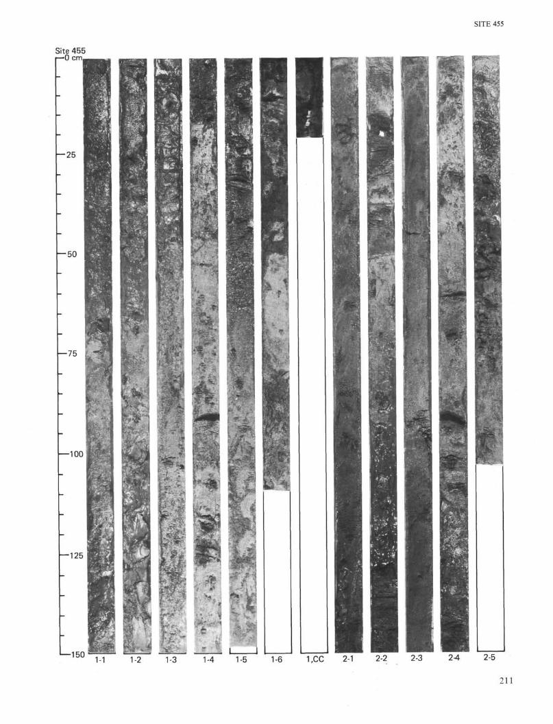
SITE 455
Site 455r— 0 cm
- 2 5
- 5 0
1—150 1-1 1-4 1-5 1-6 1,CC 2-1 2-2 2-3 2-4 2-5
211
SITE 455
- 2 5
Site 455r—0 cm
— 125
•—1503-3 3-4 3,CC 4,CC 5-1 5-2 6,CC 7-1
212
SITE 455
r—0 cmSite 455
- 2 5
— 50
—75
—100
—125
-1507-2 7,CC 8,CC 9-1 10-1 10-2 10-3 11,CC
213