Embed Size (px)
Citation preview
Salt Island is accessible to the general public by boat and bothy style accommodation is available to rent. For further details and to book the bothy, please contact Mount Stewart reception on (028) 4278 8387. Salt Island is part of the Strangford Lough Canoe Trail and the nearest access points are at Killyleagh and Delamont Country Park.
Look out for• Otters• Yellow flag iris beds.
McCutcheon’s Field, on the eastern outskirts of Groomsport, was saved from development following a campaign by the local community and was subsequently purchased by
the National Trust in 2000. It is accessible by following the North Down Coastal Path out of Groomsport. There are a range of shops, public toilets and places for refreshments in Groomsport.
Look out for• Linnets breeding in the gorse scrub.
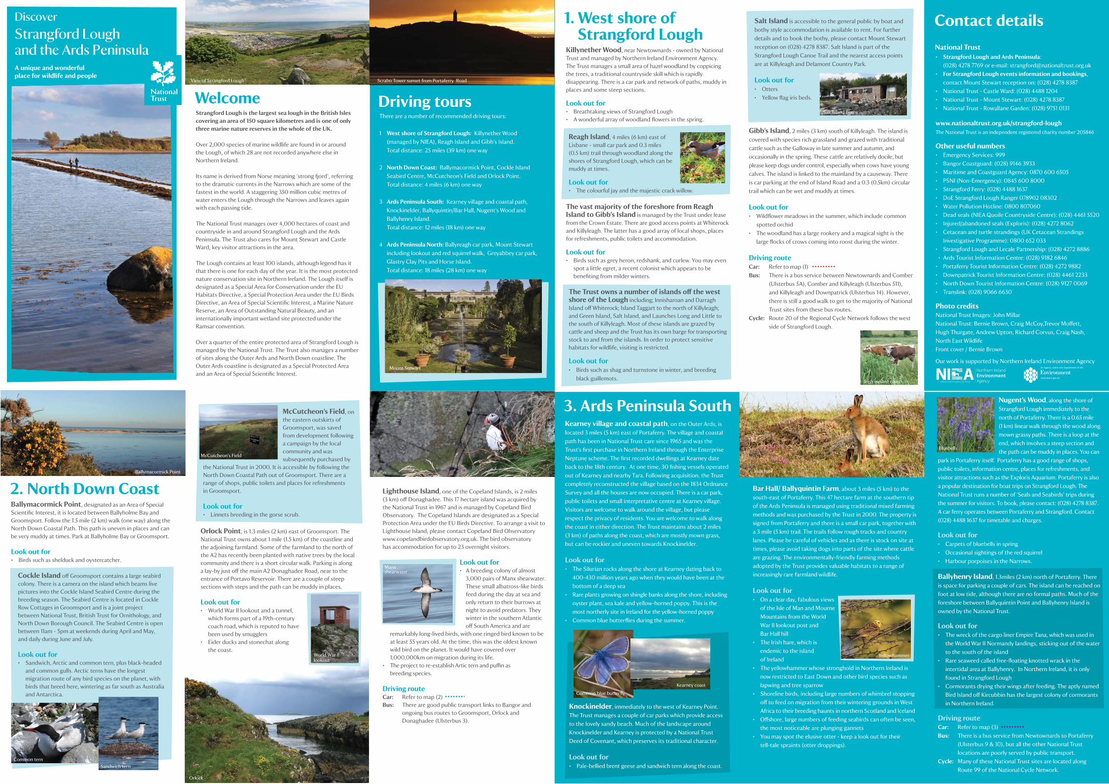
WelcomeStrangford Lough is the largest sea lough in the British Isles covering an area of 150 square kilometres and is one of only three marine nature reserves in the whole of the UK.
Over 2,000 species of marine wildlife are found in or around the Lough, of which 28 are not recorded anywhere else in Northern Ireland.
Its name is derived from Norse meaning ‘strong fjord’, referring to the dramatic currents in the Narrows which are some of the fastest in the world. A staggering 350 million cubic metres of water enters the Lough through the Narrows and leaves again with each passing tide.
The National Trust manages over 4,000 hectares of coast and countryside in and around Strangford Lough and the Ards Peninsula. The Trust also cares for Mount Stewart and Castle Ward, key visitor attractions in the area.
The Lough contains at least 100 islands, although legend has it that there is one for each day of the year. It is the most protected nature conservation site in Northern Ireland. The Lough itself is designated as a Special Area for Conservation under the EU Habitats Directive, a Special Protection Area under the EU Birds Directive, an Area of Special Scientific Interest, a Marine Nature Reserve, an Area of Outstanding Natural Beauty, and an internationally important wetland site protected under the Ramsar convention.
Over a quarter of the entire protected area of Strangford Lough is managed by the National Trust. The Trust also manages a number of sites along the Outer Ards and North Down coastline. The Outer Ards coastline is designated as a Special Protected Area and an Area of Special Scientific Interest.
2. North Down CoastBallymacormick Point, designated as an Area of Special Scientific Interest, it is located between Ballyholme Bay and Groomsport. Follow the 1.5 mile (2 km) walk (one way) along the North Down Coastal Path. This path is uneven in places and can be very muddy at times. Park at Ballyholme Bay or Groomsport.
Look out for • Birds such as shelduck and oystercatcher.
Orlock Point, is 1.3 miles (2 km) east of Groomsport. The National Trust owns about 1 mile (1.5 km) of the coastline and the adjoining farmland. Some of the farmland to the north of the A2 has recently been planted with native trees by the local community and there is a short circular walk. Parking is along a lay-by just off the main A2 Donaghadee Road, near to the entrance of Portavo Reservoir. There are a couple of steep sections with steps and the path can be muddy in places.
Look out for• World War II lookout and a tunnel, which forms part of a 19th-century coach road, which is reputed to have been used by smugglers • Eider ducks and stonechat along the coast.
Lighthouse Island, one of the Copeland Islands, is 2 miles (3 km) off Donaghadee. This 17 hectare island was acquired by the National Trust in 1967 and is managed by Copeland Bird Observatory. The Copeland Islands are designated as a Special Protection Area under the EU Birds Directive. To arrange a visit to Lighthouse Island, please contact Copeland Bird Observatory www.copelandbirdobservatory.org.uk. The bird observatory has accommodation for up to 23 overnight visitors.
Look out for• A breeding colony of almost 3,000 pairs of Manx shearwater. These small albatross-like birds feed during the day at sea and only return to their burrows at night to avoid predators. They winter in the southern Atlantic off South America and are
remarkably long-lived birds, with one ringed bird known to be at least 55 years old. At the time, this was the oldest known wild bird on the planet. It would have covered over 1,000,000km on migration during its life. • The project to re-establish Artic tern and puffin as breeding species.
Driving routeCar: Refer to map (2) Bus: There are good public transport links to Bangor and ongoing bus routes to Groomsport, Orlock and Donaghadee (Ulsterbus 3).
1. West shore of Strangford LoughKillynether Wood, near Newtownards - owned by National Trust and managed by Northern Ireland Environment Agency. The Trust manages a small area of hazel woodland by coppicing the trees, a traditional countryside skill which is rapidly disappearing. There is a car park and network of paths, muddy in places and some steep sections. Look out for• Breathtaking views of Strangford Lough • A wonderful array of woodland flowers in the spring.
The vast majority of the foreshore from Reagh Island to Gibb’s Island is managed by the Trust under lease from the Crown Estate. There are good access points at Whiterock and Killyleagh. The latter has a good array of local shops, places for refreshments, public toilets and accommodation. Look out for• Birds such as grey heron, redshank, and curlew. You may even spot a little egret, a recent colonist which appears to be benefiting from milder winters.
Driving toursThere are a number of recommended driving tours:
1 West shore of Strangford Lough: Killynether Wood (managed by NIEA), Reagh Island and Gibb’s Island. Total distance: 25 miles (39 km) one way
2 North Down Coast: Ballymacormick Point, Cockle Island Seabird Centre, McCutcheon’s Field and Orlock Point. Total distance: 4 miles (6 km) one way
3 Ards Peninsula South: Kearney village and coastal path, Knockinelder, Ballyquintin/Bar Hall, Nugent’s Wood and Ballyhenry Island. Total distance: 12 miles (18 km) one way
4 Ards Peninsula North: Ballyreagh car park, Mount Stewart including lookout and red squirrel walk, Greyabbey car park, Glastry Clay Pits and Horse Island. Total distance: 18 miles (28 km) one way
Contact details
• Strangford Lough and Ards Peninsula: (028) 4278 7769 or e-mail: [email protected]• For Strangford Lough events information and bookings, contact Mount Stewart reception on: (028) 4278 8387• National Trust - Castle Ward: (028) 4488 1204• National Trust - Mount Stewart: (028) 4278 8387• National Trust - Rowallane Garden: (028) 9751 0131
www.nationaltrust.org.uk/strangford-loughThe National Trust is an independent registered charity number 205846
Other useful numbers• Emergency Services: 999• Bangor Coastguard: (028) 9146 3933• Maritime and Coastguard Agency: 0870 600 6505• PSNI (Non-Emergency): 0845 600 8000• Strangford Ferry: (028) 4488 1637• DoE Strangford Lough Ranger 078902 08302• Water Pollution Hotline: 0800 807060• Dead seals (NIEA Quoile Countryside Centre): (028) 4461 5520• Injured/abandoned seals (Exploris): (028) 4272 8062• Cetacean and turtle strandings (UK Cetacean Strandings Investigative Programme): 0800 652 033• Strangford Lough and Lecale Partnership: (028) 4272 8886 • Ards Tourist Information Centre: (028) 9182 6846• Portaferry Tourist Information Centre: (028) 4272 9882• Downpatrick Tourist Information Centre: (028) 4461 2233• North Down Tourist Information Centre: (028) 9127 0069• Translink: (028) 9066 6630
Photo creditsNational Trust Images: John MillarNational Trust: Bernie Brown, Craig McCoy,Trevor Moffett, Hugh Thurgate, Andrew Upton, Richard Corvus, Craig Nash, North East WildlifeFront cover / Bernie Brown
Our work is supported by Northern Ireland Environment Agency
3. Ards Peninsula South Kearney village and coastal path, on the Outer Ards, is located 3 miles (5 km) east of Portaferry. The village and coastal path has been in National Trust care since 1965 and was the Trust’s first purchase in Northern Ireland through the Enterprise Neptune scheme. The first recorded dwellings at Kearney date back to the 18th century. At one time, 30 fishing vessels operated out of Kearney and nearby Tara. Following acquisition, the Trust completely reconstructed the village based on the 1834 Ordnance Survey and all the houses are now occupied. There is a car park, public toilets and small interpretative centre at Kearney village. Visitors are welcome to walk around the village, but please respect the privacy of residents. You are welcome to walk along the coast in either direction. The Trust maintains about 2 miles (3 km) of paths along the coast, which are mostly mown grass, but can be rockier and uneven towards Knockinelder.
Look out for• The Silurian rocks along the shore at Kearney dating back to 400-430 million years ago when they would have been at the bottom of a deep sea • Rare plants growing on shingle banks along the shore, including oyster plant, sea kale and yellow-horned poppy. This is the most northerly site in Ireland for the yellow-horned poppy • Common blue butterflies during the summer.
Bar Hall/ Ballyquintin Farm, about 3 miles (5 km) to the south-east of Portaferry. This 47 hectare farm at the southern tip of the Ards Peninsula is managed using traditional mixed farming methods and was purchased by the Trust in 2000. The property is signed from Portaferry and there is a small car park, together with a 3 mile (5 km) trail. The trails follow rough tracks and country lanes. Please be careful of vehicles and as there is stock on site at times, please avoid taking dogs into parts of the site where cattle are grazing. The environmentally-friendly farming methods adopted by the Trust provides valuable habitats to a range of increasingly rare farmland wildlife.
Look out for• On a clear day, fabulous views of the Isle of Man and Mourne Mountains from the World War II lookout post and Bar Hall hill• The Irish hare, which is endemic to the island of Ireland• The yellowhammer whose stronghold in Northern Ireland is now restricted to East Down and other bird species such as lapwing and tree sparrow • Shoreline birds, including large numbers of whimbrel stopping off to feed on migration from their wintering grounds in West Africa to their breeding haunts in northern Scotland and Iceland • Offshore, large numbers of feeding seabirds can often be seen, the most noticeable are plunging gannets• You may spot the elusive otter - keep a look out for their tell-tale spraints (otter droppings).
Nugent’s Wood, along the shore of Strangford Lough immediately to the north of Portaferry. There is a 0.65 mile (1 km) linear walk through the wood along mown grassy paths. There is a loop at the end, which involves a steep section and the path can be muddy in places. You can
park in Portaferry itself. Portaferry has a good range of shops, public toilets, information centre, places for refreshments, and visitor attractions such as the Exploris Aquarium. Portaferry is also a popular destination for boat trips on Strangford Lough. The National Trust runs a number of ‘Seals and Seabirds’ trips during the summer for visitors. To book, please contact: (028) 4278 8387. A car ferry operates between Portaferry and Strangford. Contact (028) 4488 1637 for timetable and charges.
Look out for• Carpets of bluebells in spring • Occasional sightings of the red squirrel• Harbour porpoises in the Narrows.
Ballyhenry Island, 1.3miles (2 km) north of Portaferry. There is space for parking a couple of cars. The island can be reached on foot at low tide, although there are no formal paths. Much of the foreshore between Ballyquintin Point and Ballyhenry Island is owned by the National Trust.
Look out for• The wreck of the cargo liner Empire Tana, which was used in the World War II Normandy landings, sticking out of the water to the south of the island • Rare seaweed called free-floating knotted wrack in the intertidal area at Ballyhenry. In Northern Ireland, it is only found in Strangford Lough • Cormorants drying their wings after feeding. The aptly named Bird Island off Kircubbin has the largest colony of cormorants in Northern Ireland.
Driving routeCar: Refer to map (3)Bus: There is a bus service from Newtownards to Portaferry (Ulsterbus 9 & 10), but all the other National Trust locations are poorly served by public transport.Cycle: Many of these National Trust sites are located along Route 99 of the National Cycle Network.
Gibb’s Island, 2 miles (3 km) south of Killyleagh. The island is covered with species rich grassland and grazed with traditional cattle such as the Galloway in late summer and autumn, and occasionally in the spring. These cattle are relatively docile, but please keep dogs under control, especially when cows have young calves. The island is linked to the mainland by a causeway. There is car parking at the end of Island Road and a 0.3 (0.5km) circular trail which can be wet and muddy at times.
Look out for• Wildflower meadows in the summer, which include common spotted orchid • The woodland has a large rookery and a magical sight is the large flocks of crows coming into roost during the winter.
Driving routeCar: Refer to map (1)Bus: There is a bus service between Newtownards and Comber (Ulsterbus 5A), Comber and Killyleagh (Ulsterbus 511), and Killyleagh and Downpatrick (Ulsterbus 14). However, there is still a good walk to get to the majority of National Trust sites from these bus routes.Cycle: Route 20 of the Regional Cycle Network follows the west side of Strangford Lough.
View of Strangford Lough Scrabo Tower sunset from Portaferry Road
Ballymacormick Point
Orlock
World War IIlookout
McCutcheon’s Field
Common ternSandwich tern
Puffin
Common blue butterfly
Manxshearwater
Kearney coast
Irish hare
Yellowhammer
Cockle Island off Groomsport contains a large seabird colony. There is a camera on the island which beams live pictures into the Cockle Island Seabird Centre during the breeding season. The Seabird Centre is located in Cockle Row Cottages in Groomsport and is a joint project between National Trust, British Trust for Ornithology, and North Down Borough Council. The Seabird Centre is open between 11am - 5pm at weekends during April and May, and daily during June and July.
Look out for• Sandwich, Arctic and common tern, plus black-headed and common gulls. Arctic terns have the longest migration route of any bird species on the planet, with birds that breed here, wintering as far south as Australia and Antarctica.
Reagh Island, 4 miles (6 km) east of Lisbane - small car park and 0.3 miles (0.5 km) trail through woodland along theshores of Strangford Lough, which can bemuddy at times. Look out for• The colourful jay and the majestic crack willow.
The Trust owns a number of islands off the west shore of the Lough including; Innisharoan and Darragh Island off Whiterock; Island Taggart to the north of Killyleagh; and Green Island, Salt Island, and Launches Long and Little to the south of Killyleagh. Most of these islands are grazed by cattle and sheep and the Trust has its own barge for transporting stock to and from the islands. In order to protect sensitive habitats for wildlife, visiting is restricted. Look out for• Birds such as shag and turnstone in winter, and breeding black guillemots.
Knockinelder, immediately to the west of Kearney Point. The Trust manages a couple of car parks which provide access to the lovely sandy beach. Much of the landscape around Knockinelder and Kearney is protected by a National Trust Deed of Covenant, which preserves its traditional character.
Look out for• Pale-bellied brent geese and sandwich tern along the coast.
Salt Island Bothy
Irish moiled cows
National Trust
Jay
Bluebells
Mount Stewart
Discover
A unique and wonderful place for wildlife and people
Strangford Loughand the Ards Peninsula
The Boretrees
Chapel MidIsland
Island South Island
y
Mid Lough
DarraghIsland
Islands
Island Taggart
Salt Island
yKillynether
Greyabbey
Ballyreagh
Ballywalter
Millisle
BallyhalbertKircubbin
Portavogie
Killinchy
Balloo
Saintfield
Ballygowan
Lisbane
Crossgar
Killyleagh
y
Newtownards
Horse Island
Cloughey
y
y
y
y
The Dorn
Castle Ward
Portaferryy
Downpatrick
Gibb’s Island
Jane’s Shoreand the Quoile
Irish Sea
North Strangford
Sloe Bushes
Glastry
Kearney
Knockinelder
Ballyhenry Island
GranaghBay
y
y
y
Green Island
Comber
Nugent’s Wood
Ogilby Island
Anne’s Point
4. Ards Peninsula North Ballyreagh Car Park, less than 1.5 miles (2 km) south-east of Newtownards town centre, along the A20 Portaferry Road. This small layby provides exceptional views across the extensive Northern mudflats of Strangford Lough, which are owned and protected by the National Trust. A big threat to the mudflats and adjoining saltmarsh is the introduced Cordgrass, more commonly known as Spartina. The Trust is currently controlling this highly invasive plant on parts of the shore it has responsibility for.
Look out for • Wintering wetland birds - over 80,000 wetland birds regularly spend the winter across the Lough making it one of the top twelve sites in the whole of the UK • Pale-bellied brent geese are the most significant, arriving en-masse each autumn from their breeding grounds in Arctic Canada. Up to 75% of the global population can be present at Strangford Lough• Other bird species include large numbers of wading birds such as golden plover, dunlin, redshank, bar-tailed godwit and knot, together with waterfowl such as pintail and shelduck.
Go enjoy!Discover amazing spaces and places around Strangford Lough and the Ards Peninsula. The diversity of landscape, the exceptional wildlife and the ever changing views make it a wonderful place to explore - for all the family.
• Put your best foot forward and step out on one of the informal walking trails. For further details of walks visit www.nationaltrust.org.uk/strangford-lough or www.walkni.com• Go rockpooling and see an underwater world full of life. Some of the best places include Kearney, Orlock and Ballyhenry Island• Relax and enjoy a leisurely picnic in enticing open spaces with breathtaking views • Look for red squirrels at Mount Stewart - one of the best places to see them in the wild • Kayak along the Strangford Lough Canoe Trail and stay overnight at the Bothy on Salt Island. For canoe trail details visit www.canoeni.com To book the Bothy or to camp overnight contact Mount Stewart on 028 4278 8387• See the birds - stop at Ballyreagh or Greyabbey and witness tens of thousands of Brent geese feeding on the mudflats of Strangford Lough in the autumn • Spot a seal from the Lookout at Mount Stewart and Granagh Bay• Go geocaching – finding hidden caches is a great way to explore Strangford Lough and learn about the area. For more details, visit: www.geocaching.com• Pedal power - one of the best ways to explore the area is by bicycle along the Strangford Lough Cycle Trail. For more details, visit www.cycleni.com
It’s time to get outdoors and closer to nature.
Mount Stewart House and Gardens, signposted from Newtownards. The wildlife Lookout information centre is in Mount Stewart car park overlooking Strangford Lough. A team of seasonal rangers are on hand to show visitors a variety of wildlife, together with a range of fascinating exhibits. Common seals are an important feature of the Lough and up to 200 animals can be present with peak numbers generally occurring in September. The Trust monitors common and grey seal populations on the Lough every month.
The Lookout is open during weekends and bank holidays fromApril to October, and daily during July and August (usuallybetween 12pm to 5pm). Admission is free.
There is a 1 mile (1.7 km) red squirrel trail within Mount Stewart gardens on well surfaced paths. Mount Stewart and the Ards Peninsula has one of the few surviving populations of red squirrels in Northern Ireland. The Ards Red Squirrel Group has been set up to protect this vulnerable population, as the non-native invasive grey squirrels are now firmly established in Newtownards and Donaghadee.
For information on opening times and admission prices to Mount Stewart House and Gardens contact Mount Stewart on 028 4278 8387 or visit www.nationaltrust.org.uk/mount-stewart
Look out for• Live pictures of nesting seabirds on a nearby island, which can be viewed in the Lookout during the breeding season • Breeding colonies of sandwich and common tern, for which the Lough is internationally important • Seals hauled up on islands, particularly at low tide • Red squirrels, one of the most iconic native mammals in Northern Ireland• Five of the eight species of bats found in Northern Ireland roost around Mount Stewart buildings. You may see them coming out in the evenings to hunt insects.
Greyabbey Car Park, on the southern outskirts of Greyabbey, along the main A20. The Trust manages a number of sites across Greyabbey Bay, including Skillen’s Wood, Mid Island, South Island and Chapel Island, as well as a substantial area of foreshore and Lough bed off Greyabbey.
Look out for• Large flocks of wintering waterfowl and wading birds• Archaeological monuments including medieval fish traps and kelp grids• Our series of guided walks which explore the wildlife and archaeology of this area. For further details contact the National Trust on 028 4278 8387.
Glastry Clay Pits, 0.65 miles (1 km) south-west of Ballyhalbert on the Outer Ards Peninsula. There is a car park in the southern half of the clay pits and a short trail along mown grass paths. The area to the north of the road includes former clay pits and an old landfill site, which has been capped and sown with a wild flower mix. The pits are affected by a number of non-native invasive aquatic plant species and the Trust is undertaking a programme to control them. The whole area is popular with anglers. To avoid injury to waterfowl, please remove fishing line or tackle. Please keep children under close supervision due to deep water within the pits.
Look out for• A variety of waterfowl throughout the year.
Driving routeCar: Refer to map (4)Bus: All these sites are along the Newtownards to Portaferry bus route (Ulsterbus 9 & 10). Cycle: Glastry Clay Pits are close to Route 99 of the National Cycle Network.
Waders on mudflats
Red squirrel
Brent geese
Code of Conduct
Strangford Lough and the Ards Peninsula
Please practice The Leave No Trace Seven Principles when visiting any of our sites across Strangford Lough and the Ards Peninsula.
• Plan ahead and prepare• Camp on durable surfaces – please note you are welcome to camp on Salt Island, but please avoid camping at other sites to protect sensitive habitats for wildlife• Take your litter home with you and clean up after your dog• Leave what you find• Be careful with fire - please note that small camp fires are allowed on Salt Island, but please do not light fires on other sites• Respect wildlife• Be considerate to other visitors.
How you can help
What will you discover?
Common seals Summer meadow
Little egret Remains of medieval fish traps
Pintail
Caring forStrangford Lough and the Ards PeninsulaThe National Trust formed its Strangford Lough Wildlife Scheme in 1966 in response to the growing demands and pressures made by people on the natural resources of the Lough. The Trust is committed to the protection of the Lough and surrounding area with an overall aim to help care for its wildlife, natural environment and historic interests.
The Trust will continue to work with others to encourage sympathetic and sustainable uses of the Lough so that this natural heritage will remain forever rich and enjoyed in so many ways, by this and future generations.
The conservation work of the Trust includes:• Active protection and management of 4,000 hectares of coast and countryside in and around Strangford Lough and the Ards Peninsula, including a range of habitats such as mudflats and foreshore, offshore islands, wetlands, meadows, hedgerows and woodland • Control of non-native invasive species where they threaten native wildlife• Conservation grazing on Trust properties through close working relationships with local farmers• The Trust administers the Strangford Lough wildfowling scheme. Please be aware that there is wildfowling on the Lough from 1 September to 31 January. We control wildfowling through a permit system and refuges • Monitoring and protection of wildlife sites, including internationally important populations of breeding seabirds, wintering waterfowl and wading birds, and common seals • Conservation of historic landscapes, vernacular buildings and scheduled ancient monuments• Protection of foreshore from encroachments and other forms of inappropriate development• Providing access to the public through the provision and maintenance of footpaths, car parks and signage, providing for a range of safe and non-damaging informal recreational activities• Working with a range of volunteers and local communities to protect, manage and monitor the natural heritage of this internationally important area• Providing information for visitors through the Lookout Information Centre, and events such as guided walks and boat trips • Liaison with landowners, wildfowlers, sailors, other Lough users, other conservation organisations, government departments, and local councils.
Orlock tree planting
Ballyquintin farm
Guided walk
Horse Island, 1.3 miles (2 km) south of Kircubbin. This area of wet grassland and saltmarsh is managed by the Trust using grazing stock, including traditional breeds of livestock. There is a small car park off the A20 Rowreagh Road. The island can be accessed by foot at low tide, although there are no formal paths to follow.
Look out for• One of the best examples of saltmarsh on the Lough• Little egrets.
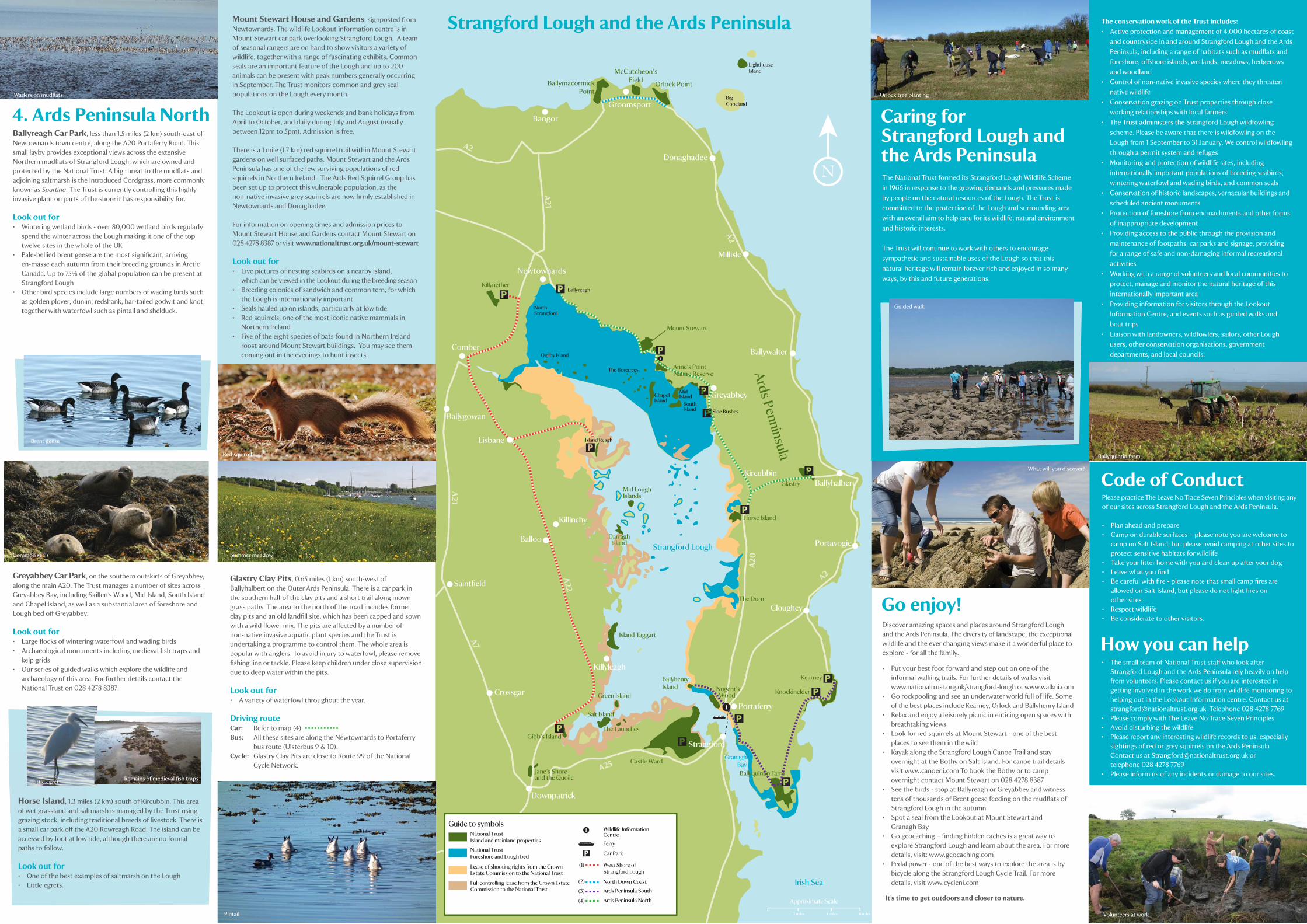
Volunteers at work
Mount Stewart
Bangor
A2
A21
A21
A7
A22
A2
A20
A25
A2
Island Reagh
BallymacormickPoint
Orlock Point
McCutcheon’sField
Nature Reserve
y
Ballyquintin Farm
i
i
LighthouseIsland
Strangford LoughArds Penninsula
Donaghadee
The Launches
Guide to symbolsNational Trust Island and mainland properties
National TrustForeshore and Lough bed
Lease of shooting rights from the Crown Estate Commission to the National Trust
Full controlling lease from the Crown Estate Commission to the National Trust
i Wildlife InformationCentreFerry
Car Park
West Shore of Strangford Lough
Ards Peninsula North
Ards Peninsula SouthNorth Down Coast
BigCopeland
• The small team of National Trust staff who look after Strangford Lough and the Ards Peninsula rely heavily on help from volunteers. Please contact us if you are interested in getting involved in the work we do from wildlife monitoring to helping out in the Lookout Information centre. Contact us at [email protected]. Telephone 028 4278 7769• Please comply with The Leave No Trace Seven Principles• Avoid disturbing the wildlife • Please report any interesting wildlife records to us, especially sightings of red or grey squirrels on the Ards Peninsula Contact us at [email protected] or telephone 028 4278 7769• Please inform us of any incidents or damage to our sites.
y
Groomsport
(1)
(2)
(3)
(4)
2 miles 4 miles
Approximate Scale
6 miles
Strangford
y