Embed Size (px)
Citation preview
1 of 52
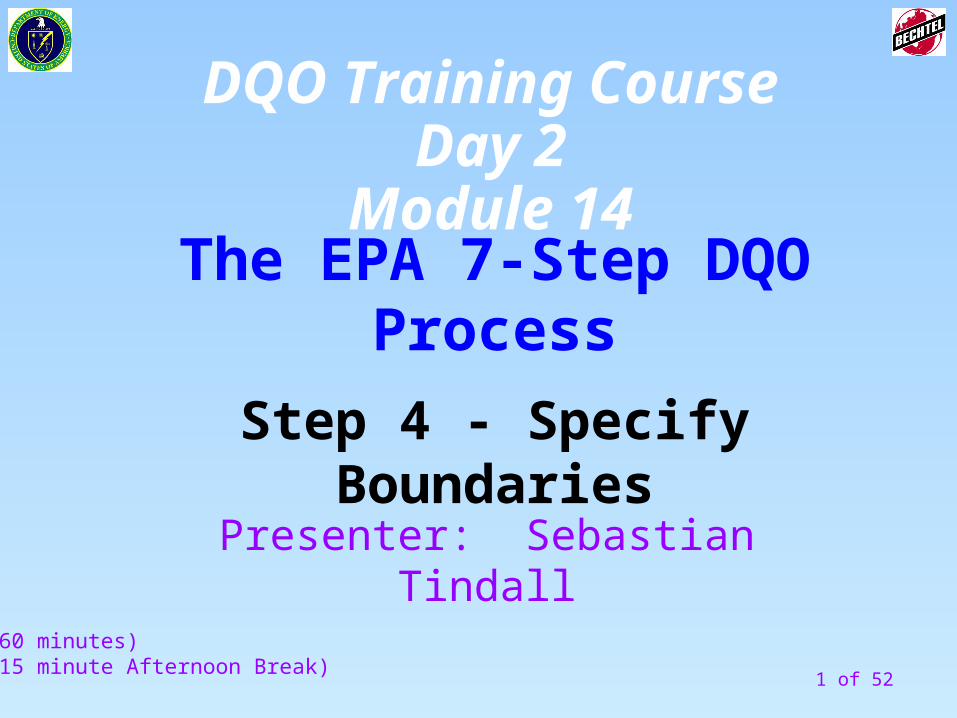
The EPA 7-Step DQO Process
Step 4 - Specify Boundaries
(60 minutes)(15 minute Afternoon Break)
Presenter: Sebastian Tindall
DQO Training CourseDay 2
Module 14
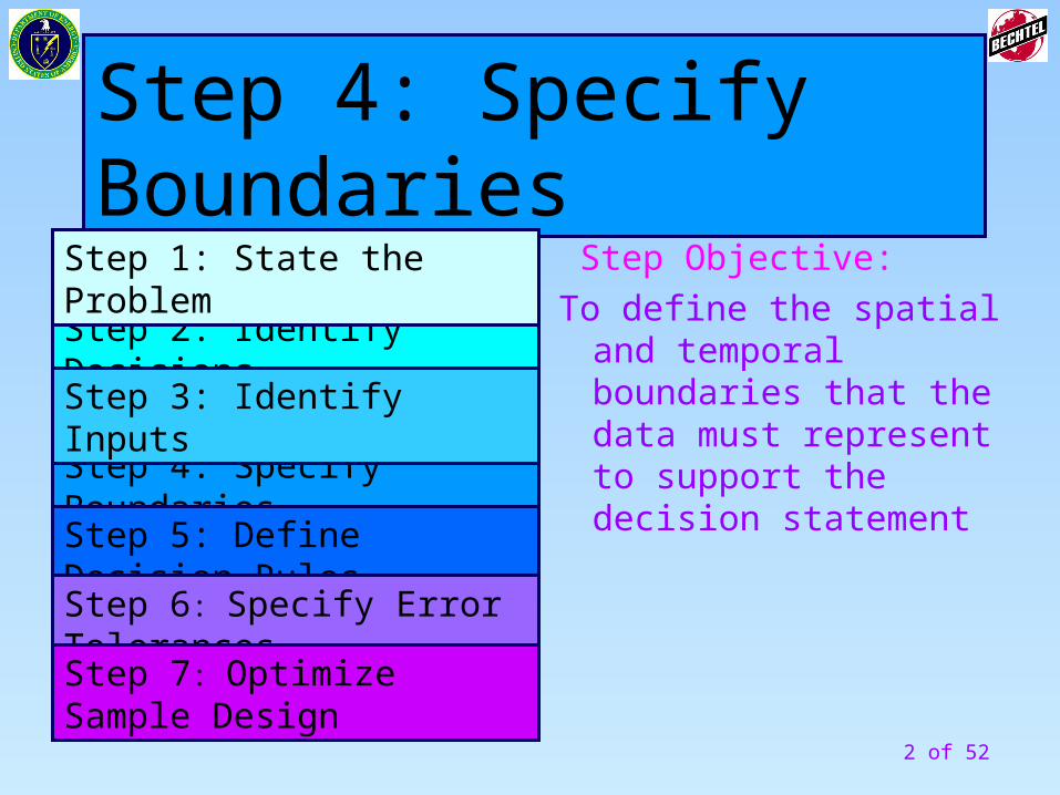
2 of 52
Step Objective:
To define the spatial and temporal boundaries that the data must represent to support the decision statement
Step 4: Specify Boundaries
Step 4: Specify Boundaries
Step 2: Identify Decisions
Step 3: Identify Inputs
Step 1: State the Problem
Step 5: Define Decision Rules
Step 6: Specify Error Tolerances
Step 7: Optimize Sample Design

3 of 52
Information IN Actions Information OUT
From Previous Step To Next Step
Define the spatial boundaries of the decision statement
Step 4- Specify Boundaries
Unit of Decision Making
Define the temporal boundary of the problem
Define the scale of decision making
Identify any practical constraints on data collection
Information Needed to Resolve Decision
Statements
Define the population of interest
4 of 52
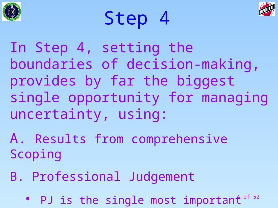
In Step 4, setting the boundaries of decision-making, provides by far the biggest single opportunity for managing uncertainty, using:
A. Results from comprehensive Scoping
B. Professional Judgement
• PJ is the single most important skill a project can bring to bear in the DQO Process
Step 4
5 of 52
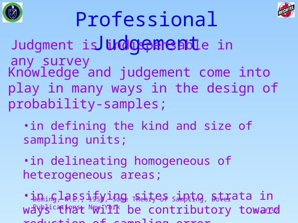
Knowledge and judgement come into play in many ways in the design of probability-samples;
•in defining the kind and size of sampling units;
•in delineating homogeneous of heterogeneous areas;
•in classifying sites into strata in ways that will be contributory toward reduction of sampling error.
Professional Judgement
Deming, W.E., 1950, Some Theory of Sampling, Dover Publications, New York
Judgment is indispensable in any survey
6 of 52
Professional Judgement
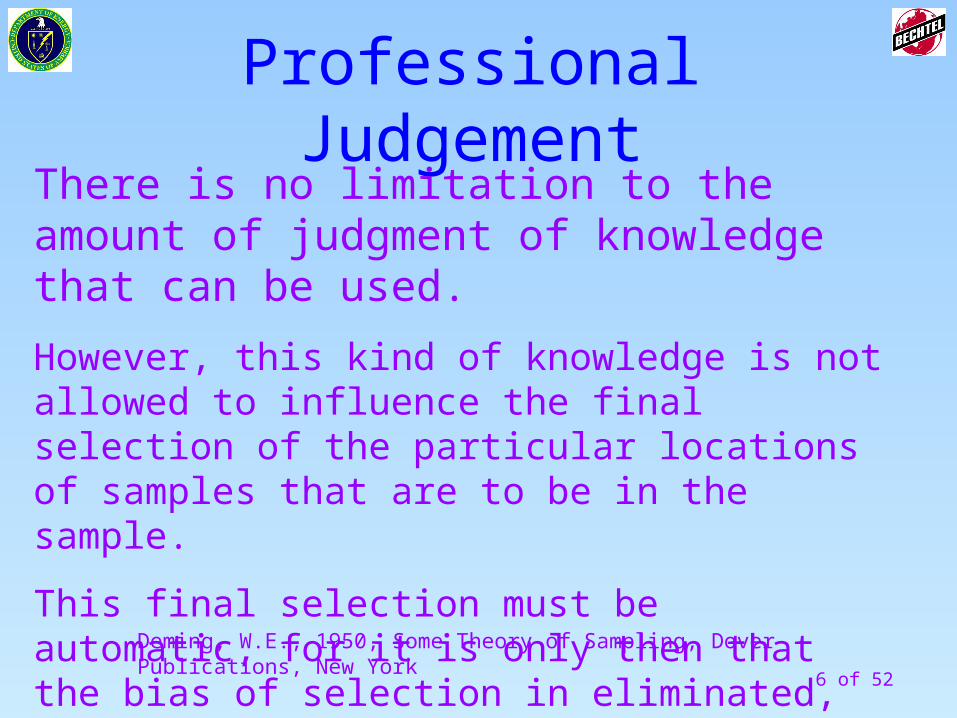
There is no limitation to the amount of judgment of knowledge that can be used.
However, this kind of knowledge is not allowed to influence the final selection of the particular locations of samples that are to be in the sample.
This final selection must be automatic, for it is only then that the bias of selection in eliminated, and the sampling tolerance will be measurable and controllable.
Deming, W.E., 1950, Some Theory of Sampling, Dover Publications, New York
7 of 52
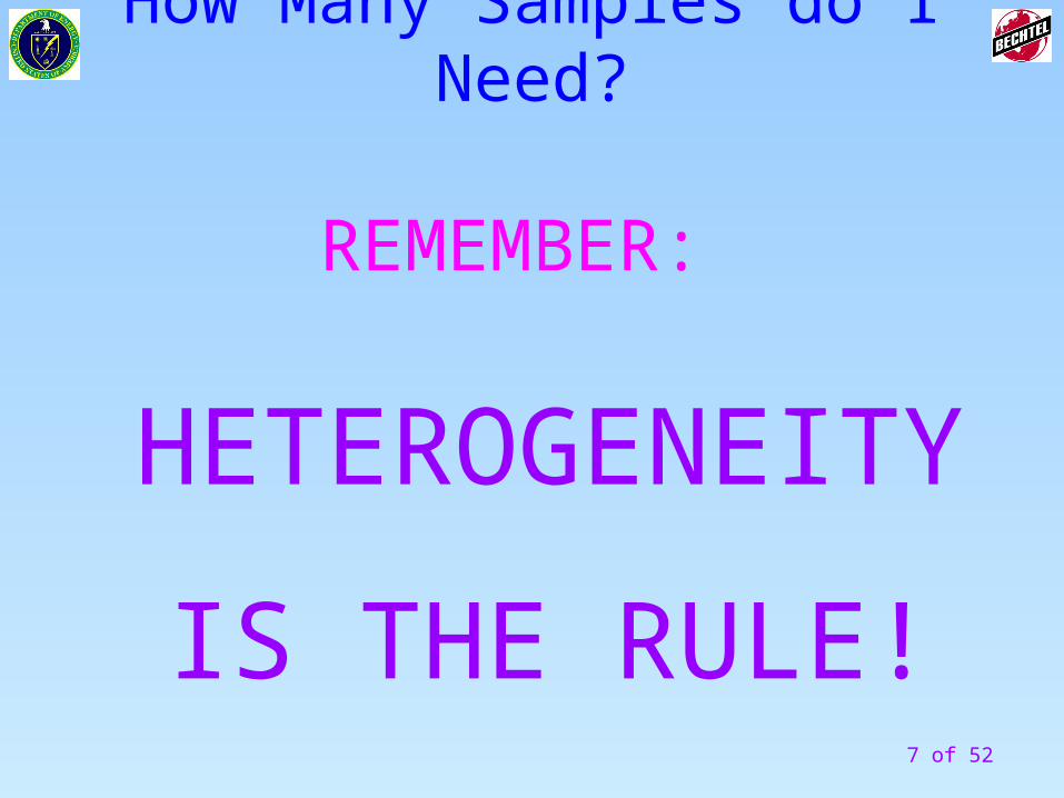
How Many Samples do I Need?
REMEMBER:
HETEROGENEITY
IS THE RULE!
8 of 52
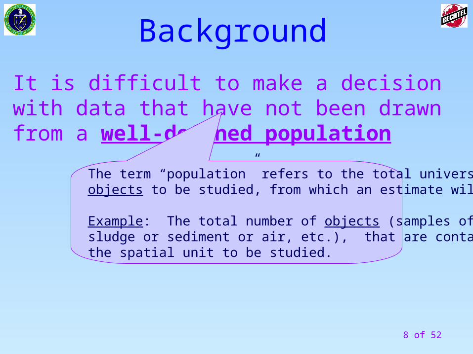
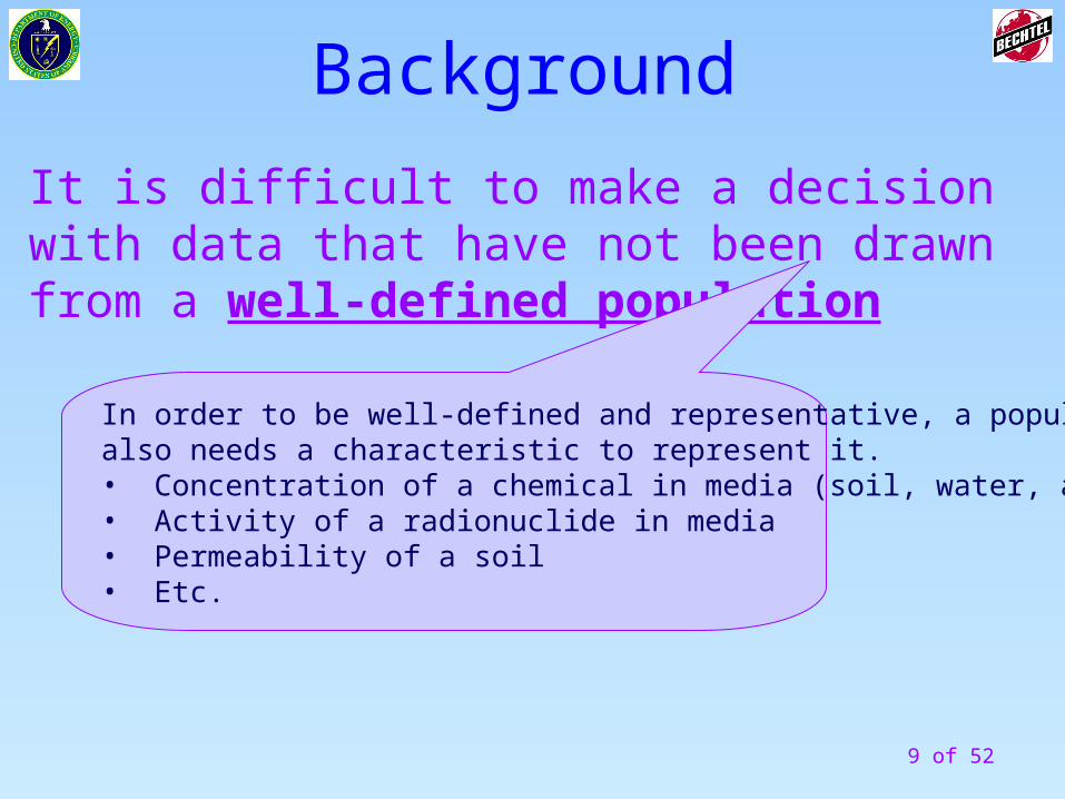
Background
It is difficult to make a decision with data that have not been drawn from a well-defined population
The term “population” refers to the total universe ofobjects to be studied, from which an estimate will be made.
Example: The total number of objects (samples of soil or sludge or sediment or air, etc.), that are contained within the spatial unit to be studied.
9 of 52
Background
It is difficult to make a decision with data that have not been drawn from a well-defined population
In order to be well-defined and representative, a populationalso needs a characteristic to represent it.• Concentration of a chemical in media (soil, water, air, etc.)• Activity of a radionuclide in media• Permeability of a soil• Etc.
10 of 52
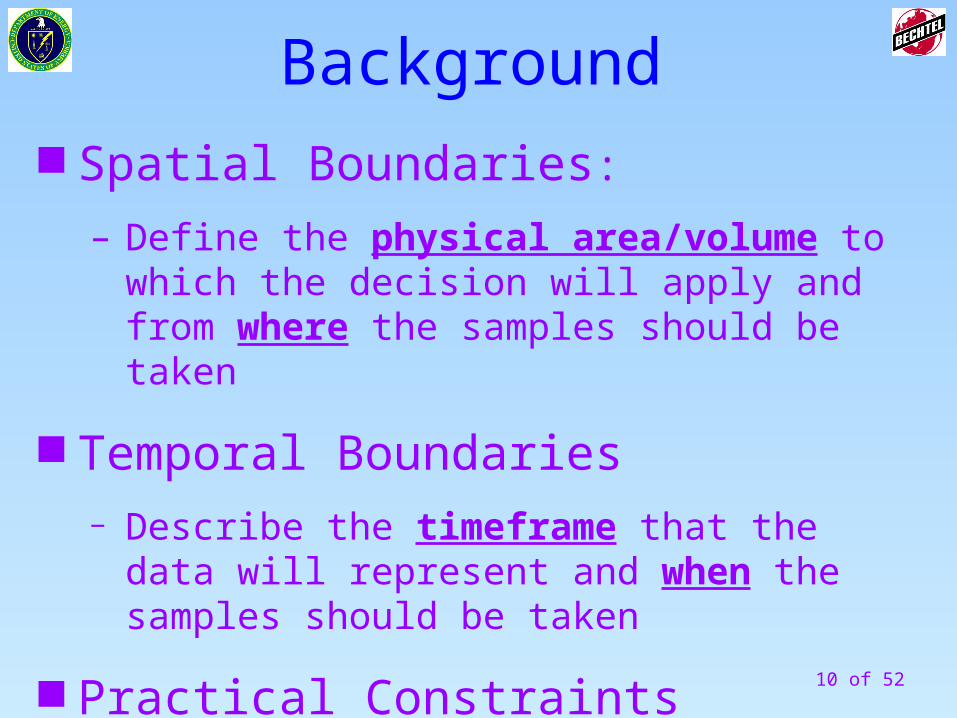
Spatial Boundaries:
– Define the physical area/volume to which the decision will apply and from where the samples should be taken
Temporal Boundaries− Describe the timeframe that the data will represent
and when the samples should be taken
Practical Constraints
Background
11 of 52
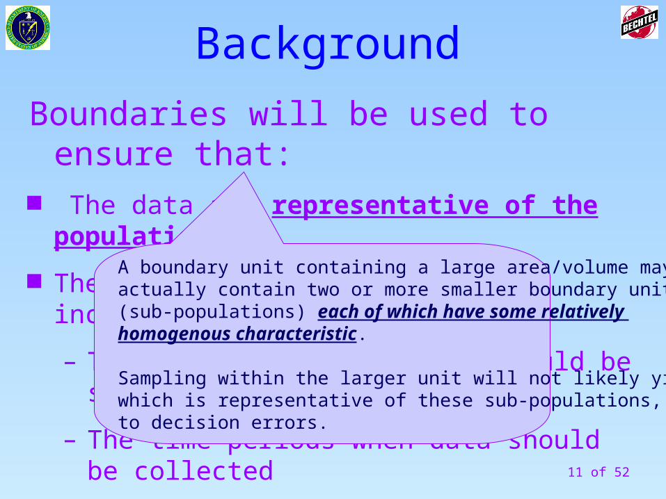
Boundaries will be used to ensure that: The data are representative of the population
The data collection design incorporates:
– The areas or volumes that should be sampled
– The time periods when data should be collected
Background
A boundary unit containing a large area/volume may actually contain two or more smaller boundary units (sub-populations) each of which have some relatively homogenous characteristic.
Sampling within the larger unit will not likely yield datawhich is representative of these sub-populations, leading to decision errors.
12 of 52
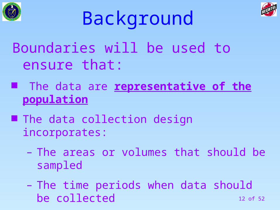
Boundaries will be used to ensure that: The data are representative of the population
The data collection design incorporates:
– The areas or volumes that should be sampled
– The time periods when data should be collected
Background
13 of 52
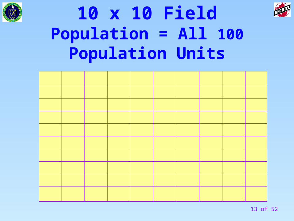
10 x 10 FieldPopulation = All 100 Population
Units
14 of 52
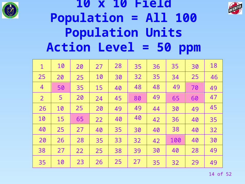
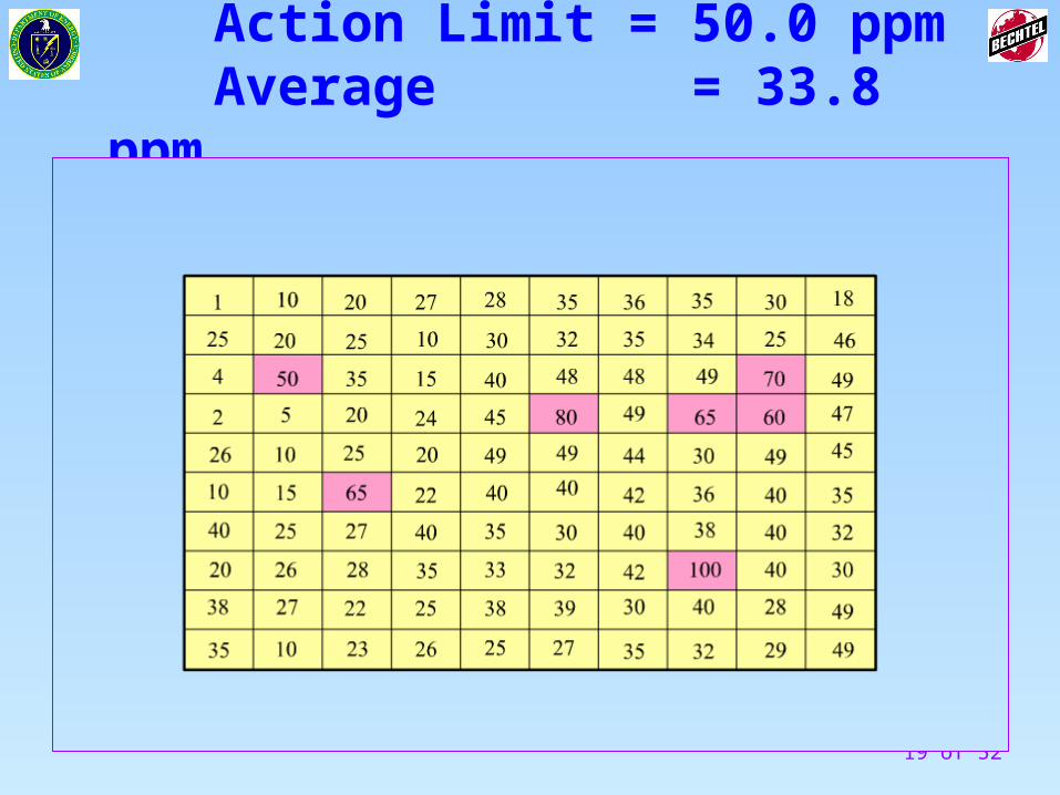
10 x 10 FieldPopulation = All 100 Population Units
Action Level = 50 ppm
100
80
65
70
65 60
50
29
28
40
40
40
49
25
30
49
49
30
32
35
45
47
49
46
18
32
35
35
30
42
40
42
44
49
48
35
36
32
38
36
30
49
34
35
40
27
25
38
33
35
40
49
45
40
30
28
39
27
32
30
40
49
48
2227
26231035
38
20
40
10
26
2
15
102520
4
25
1 10 20
35
10 25 20
22
27
5
40
20
35
24
25
15
25
2826
15 of 52
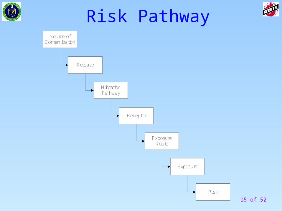
Risk PathwaySource of
Contamination
Release
MigrationPathway
Receptor
ExposureRoute
Exposure
Risk
16 of 52
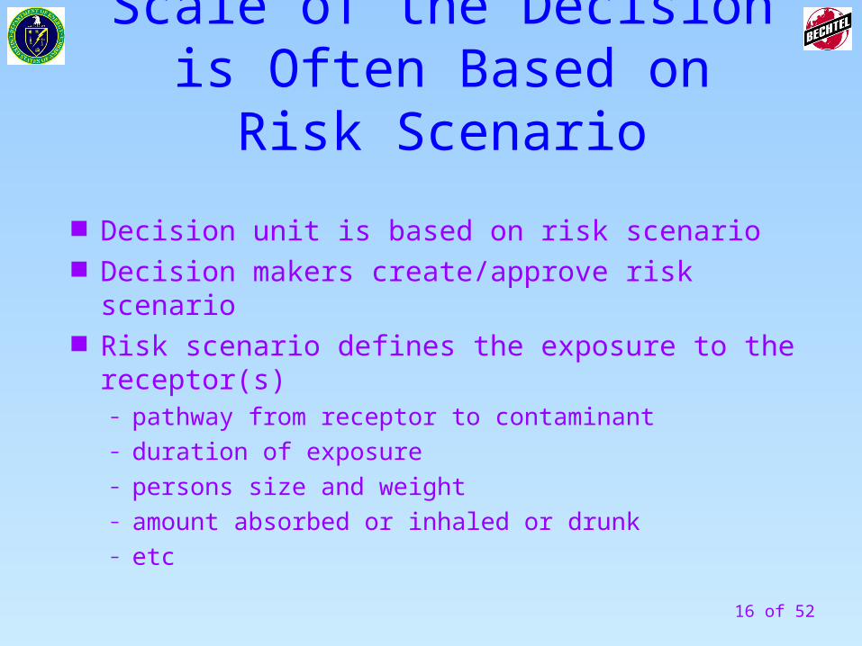
Scale of the Decision is Often Based on Risk Scenario
Decision unit is based on risk scenario Decision makers create/approve risk scenario Risk scenario defines the exposure to the receptor(s)
– pathway from receptor to contaminant– duration of exposure– persons size and weight– amount absorbed or inhaled or drunk– etc
17 of 52
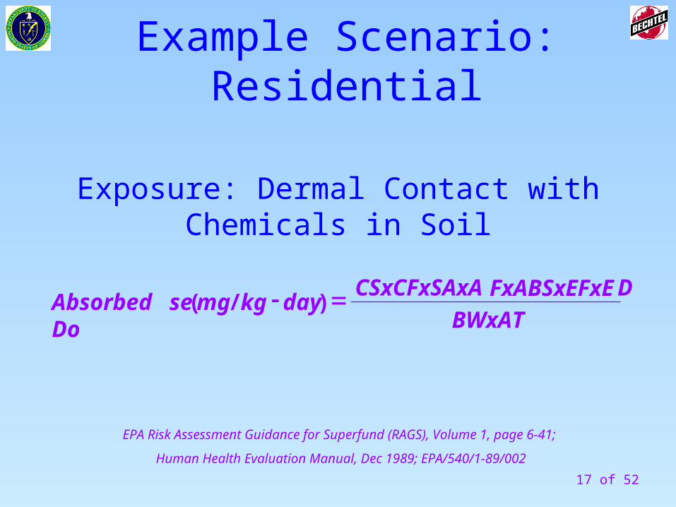
EPA Risk Assessment Guidance for Superfund (RAGS), Volume 1, page 6-41;
Human Health Evaluation Manual, Dec 1989; EPA/540/1-89/002
BWxAT
DFxABSxEFxECSxCFxSAxAdaykgmgseAbsorbed Do )/(
Example Scenario: Residential
Exposure: Dermal Contact with Chemicals in Soil
18 of 52
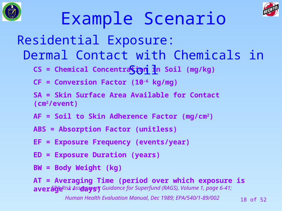
EPA Risk Assessment Guidance for Superfund (RAGS), Volume 1, page 6-41;
Human Health Evaluation Manual, Dec 1989; EPA/540/1-89/002
CS = Chemical Concentration in Soil (mg/kg)
CF = Conversion Factor (10-6 kg/mg)
SA = Skin Surface Area Available for Contact (cm2/event)
AF = Soil to Skin Adherence Factor (mg/cm2)
ABS = Absorption Factor (unitless)
EF = Exposure Frequency (events/year)
ED = Exposure Duration (years)
BW = Body Weight (kg)
AT = Averaging Time (period over which exposure is average -- days)
Example ScenarioResidential Exposure:
Dermal Contact with Chemicals in Soil
19 of 52
Action Limit = 50.0 ppmAverage = 33.8 ppm
20 of 52
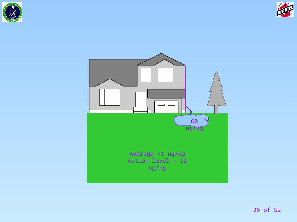
60 ug/kg
Average <1 ug/kgAction level = 10 ug/kg
21 of 52
Practical Constraint:
Any hindrance or obstacle that may interfere with the full implementation of the data collection design
Background
22 of 52
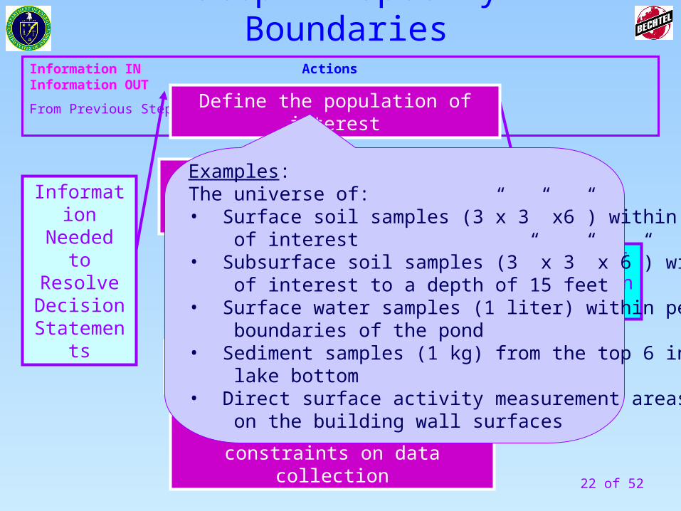
Information IN Actions Information OUT
From Previous Step To Next Step
Define the spatial boundaries of the decision statement
Unit of Decision Making
Define the temporal boundary of the problem
Define the scale of decision making
Identify any practical constraints on data collection
Information Needed to Resolve Decision
Statements
Define the population of interest
Examples: The universe of:• Surface soil samples (3”x 3” x6”) within the area of interest• Subsurface soil samples (3” x 3” x 6”) within the area of interest to a depth of 15 feet • Surface water samples (1 liter) within perimeter boundaries of the pond• Sediment samples (1 kg) from the top 6 inches of lake bottom• Direct surface activity measurement areas (100 cm2) on the building wall surfaces
Step 4- Specify Boundaries
23 of 52
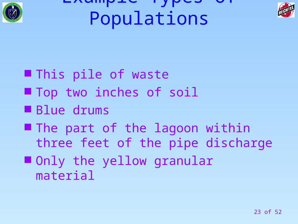
Example Types of Populations
This pile of waste Top two inches of soil Blue drums The part of the lagoon within three feet of
the pipe discharge Only the yellow granular material
24 of 52
Information IN Actions Information OUT
From Previous Step To Next Step
Define the spatial boundaries of the decision statement
Unit of Decision Making
Define the temporal boundary of the problem
Define the scale of decision making
Identify any practical constraints on data collection
Information Needed to Resolve Decision
Statements
Define the population of interest
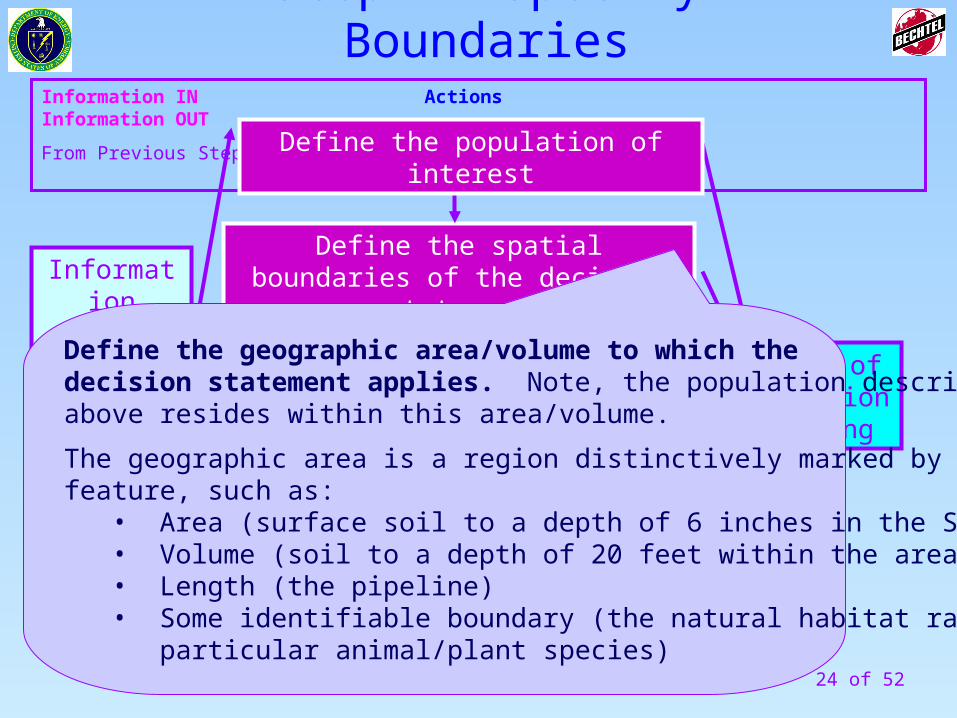
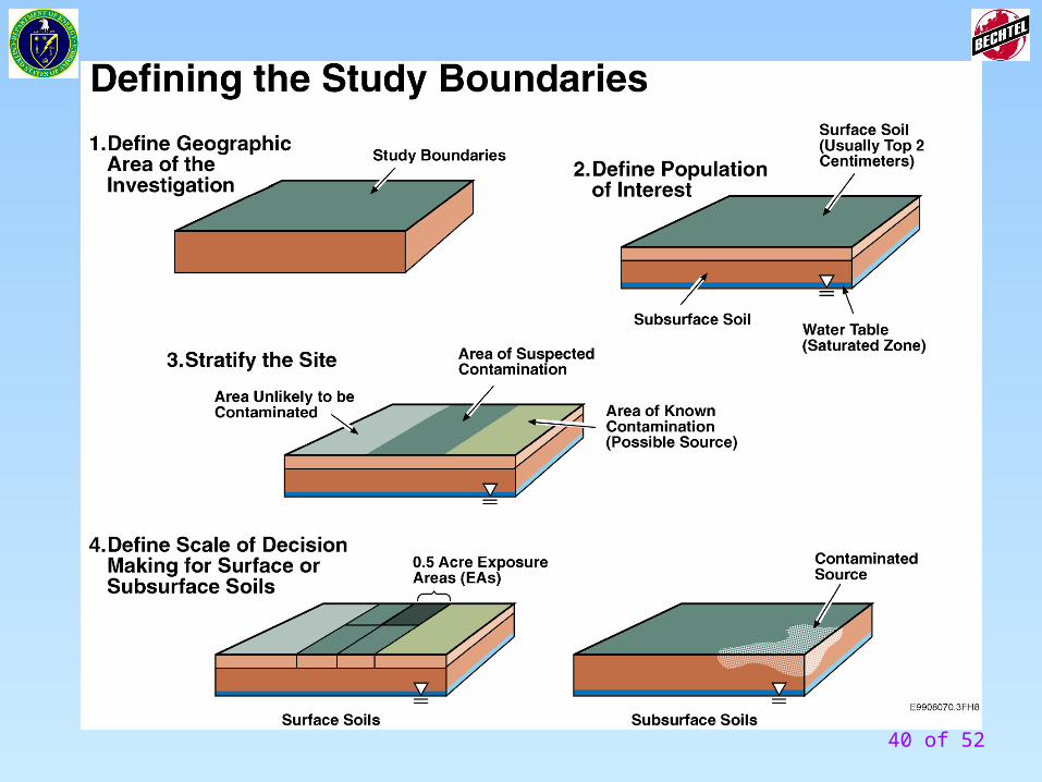
Define the geographic area/volume to which the decision statement applies. Note, the population describedabove resides within this area/volume.
The geographic area is a region distinctively marked by some physical feature, such as:
• Area (surface soil to a depth of 6 inches in the Smith’s backyard) • Volume (soil to a depth of 20 feet within the area of the waste pit)• Length (the pipeline)• Some identifiable boundary (the natural habitat range of a particular animal/plant species)
Step 4- Specify Boundaries
25 of 52
Information IN Actions Information OUT
From Previous Step To Next Step
Define the spatial boundaries of the decision statement
Unit of Decision Making
Define the temporal boundary of the problem
Define the scale of decision making
Identify any practical constraints on data collection
Information Needed to Resolve Decision
Statements
Define the population of interest
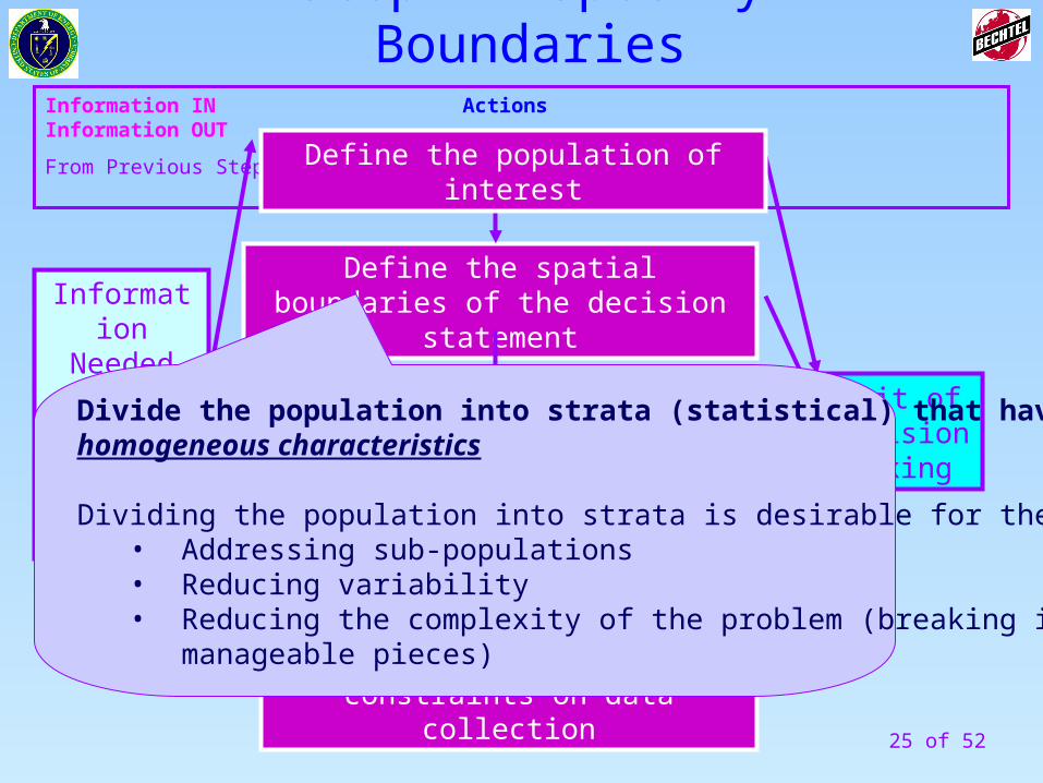
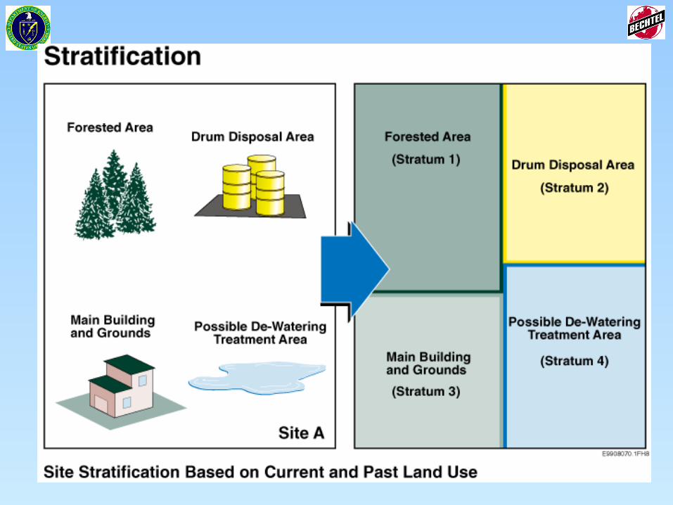
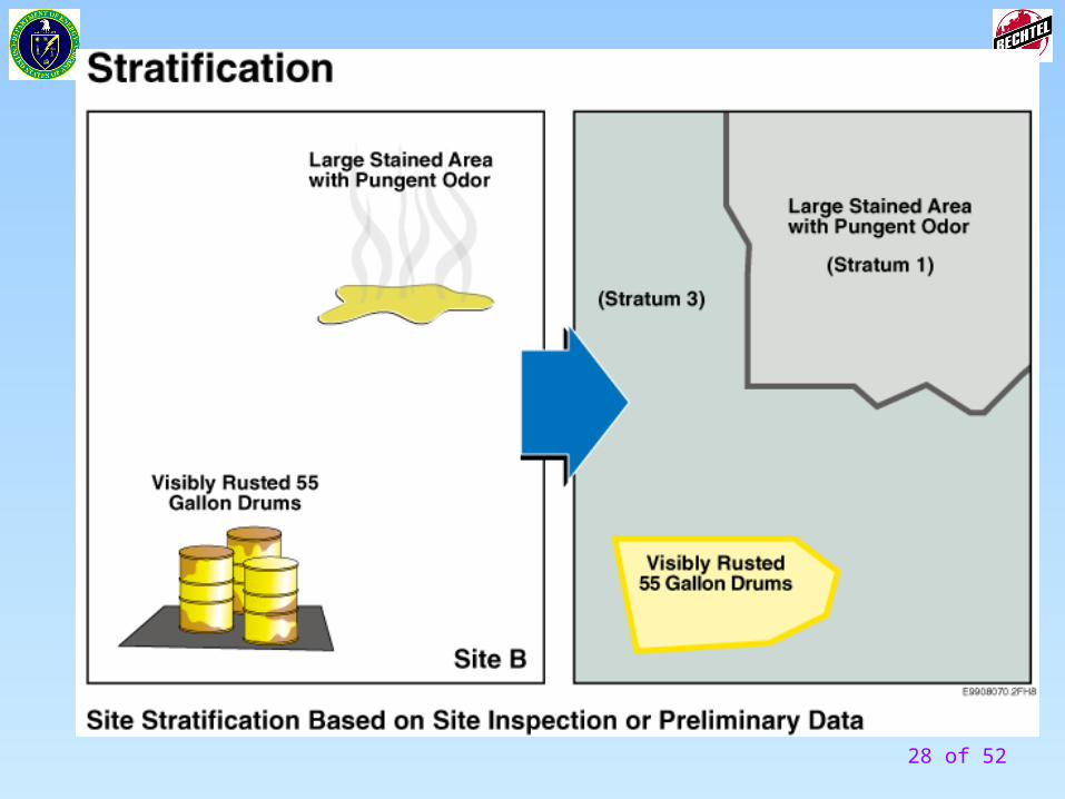
Divide the population into strata (statistical) that have relativelyhomogeneous characteristics
Dividing the population into strata is desirable for the purpose of:• Addressing sub-populations • Reducing variability• Reducing the complexity of the problem (breaking it into more manageable pieces)
Step 4- Specify Boundaries
26 of 52
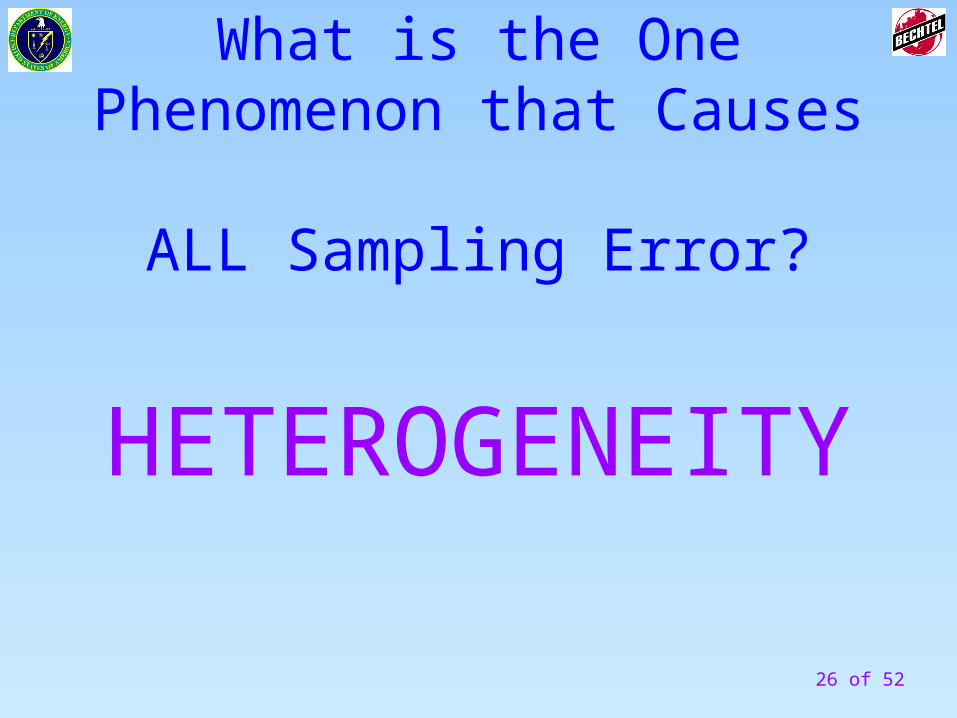
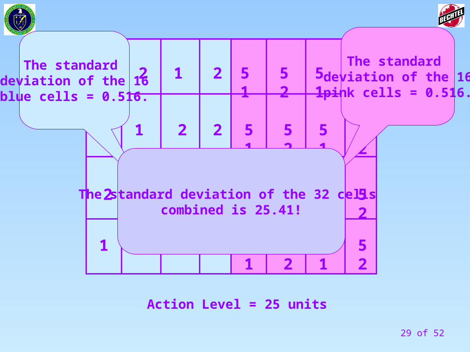
What is the One Phenomenon that Causes
ALL Sampling Error?
HETEROGENEITY
27 of 52
28 of 52
29 of 52
1
1
1
1
12 2
2
2
2
2
2
2
1 1
1
51 51 5252
51 51 5252
51 51 5252
51 51 5252
The standard deviation of the 16blue cells = 0.516.
The standard deviation of the 16pink cells = 0.516.
The standard deviation of the 32 cells combined is 25.41!
Action Level = 25 units
30 of 52
How Many Samples do I Need?
REMEMBER:
HETEROGENEITY
IS THE RULE!
31 of 52
Information IN Actions Information OUT
From Previous Step To Next Step
Define the spatial boundaries of the decision statement
Unit of Decision Making
Define the temporal boundary of the problem
Define the scale of decision making
Identify any practical constraints on data collection
Information Needed to Resolve Decision
Statements
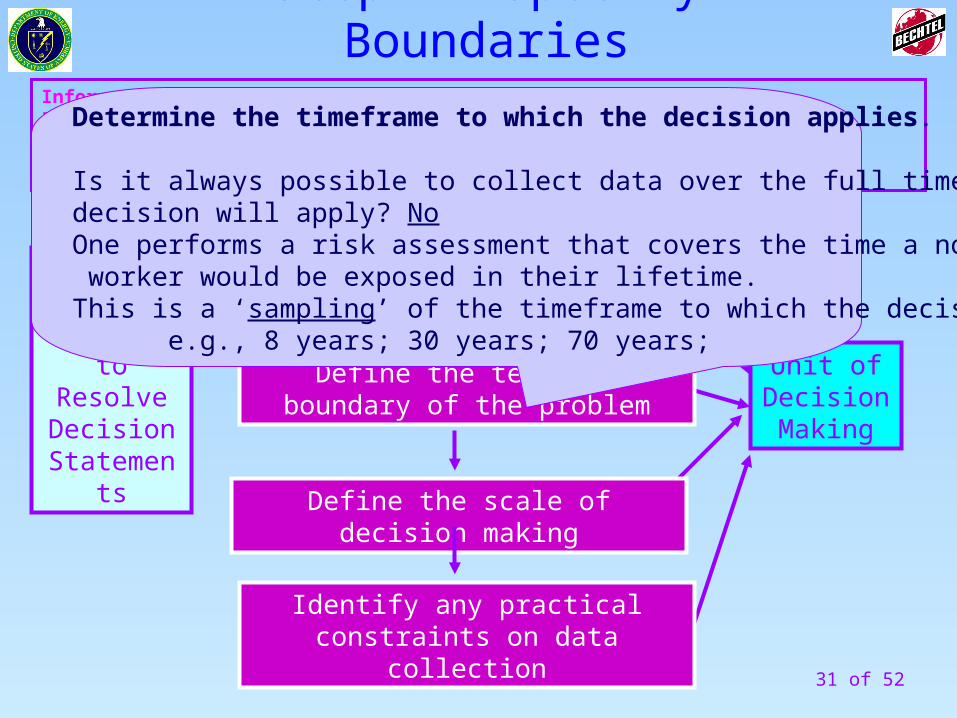
Define the population of interestDetermine the timeframe to which the decision applies.
Is it always possible to collect data over the full time period to which thedecision will apply? No One performs a risk assessment that covers the time a normal resident or worker would be exposed in their lifetime.This is a ‘sampling’ of the timeframe to which the decision applies.
e.g., 8 years; 30 years; 70 years;
Step 4- Specify Boundaries
32 of 52
Information IN Actions Information OUT
From Previous Step To Next Step
Define the spatial boundaries of the decision statement
Unit of Decision Making
Define the temporal boundary of the problem
Define the scale of decision making
Identify any practical constraints on data collection
Information Needed to Resolve Decision
Statements
Define the population of interest
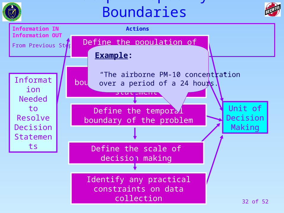
Example:
“The airborne PM-10 concentration over a period of a 24 hours.”
Step 4- Specify Boundaries
33 of 52
Information IN Actions Information OUT
From Previous Step To Next Step
Define the spatial boundaries of the decision statement
Unit of Decision Making
Define the temporal boundary of the problem
Define the scale of decision making
Identify any practical constraints on data collection
Information Needed to Resolve Decision
Statements
Define the population of interest
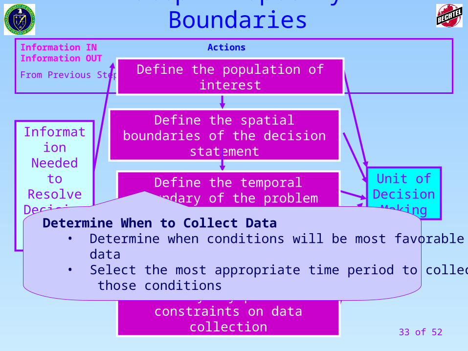
Determine When to Collect Data• Determine when conditions will be most favorable for collecting data • Select the most appropriate time period to collect data that reflect those conditions
Step 4- Specify Boundaries
34 of 52
Information IN Actions Information OUT
From Previous Step To Next Step
Define the spatial boundaries of the decision statement
Unit of Decision Making
Define the temporal boundary of the problem
Define the scale of decision making
Identify any practical constraints on data collection
Information Needed to Resolve Decision
Statements
Define the population of interest
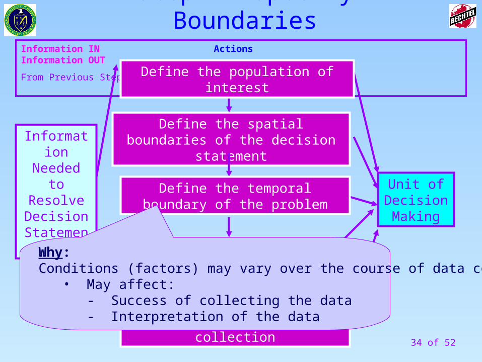
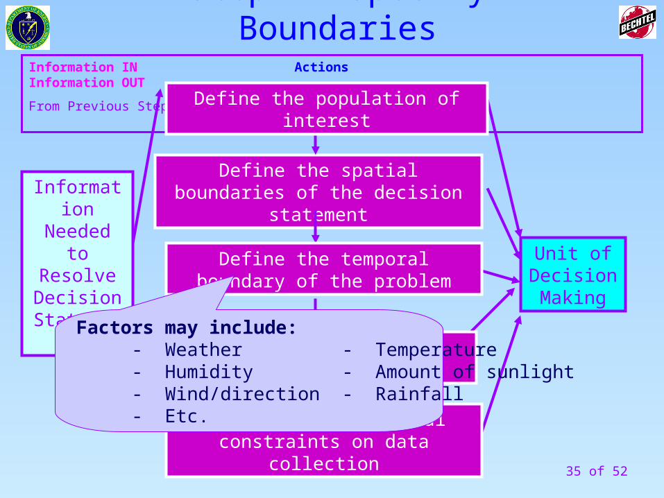
Why:Conditions (factors) may vary over the course of data collection.
• May affect: - Success of collecting the data- Interpretation of the data
Step 4- Specify Boundaries
35 of 52
Information IN Actions Information OUT
From Previous Step To Next Step
Define the spatial boundaries of the decision statement
Unit of Decision Making
Define the temporal boundary of the problem
Define the scale of decision making
Identify any practical constraints on data collection
Information Needed to Resolve Decision
Statements
Define the population of interest
Factors may include: - Weather - Temperature - Humidity - Amount of sunlight - Wind/direction - Rainfall - Etc.
Step 4- Specify Boundaries
36 of 52
Information IN Actions Information OUT
From Previous Step To Next Step
Define the spatial boundaries of the decision statement
Unit of Decision Making
Define the temporal boundary of the problem
Define the scale of decision making
Identify any practical constraints on data collection
Information Needed to Resolve Decision
Statements
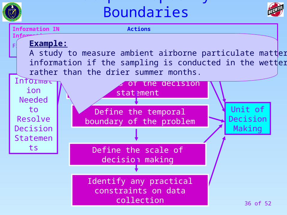
Define the population of interestExample:A study to measure ambient airborne particulate matter may give misleadinginformation if the sampling is conducted in the wetter winter monthsrather than the drier summer months.
Step 4- Specify Boundaries
37 of 52
Information IN Actions Information OUT
From Previous Step To Next Step
Define the spatial boundaries of the decision statement
Unit of Decision Making
Define the temporal boundary of the problem
Define the scale of decision making
Identify any practical constraints on data collection
Information Needed to Resolve Decision
Statements
Define the population of interest
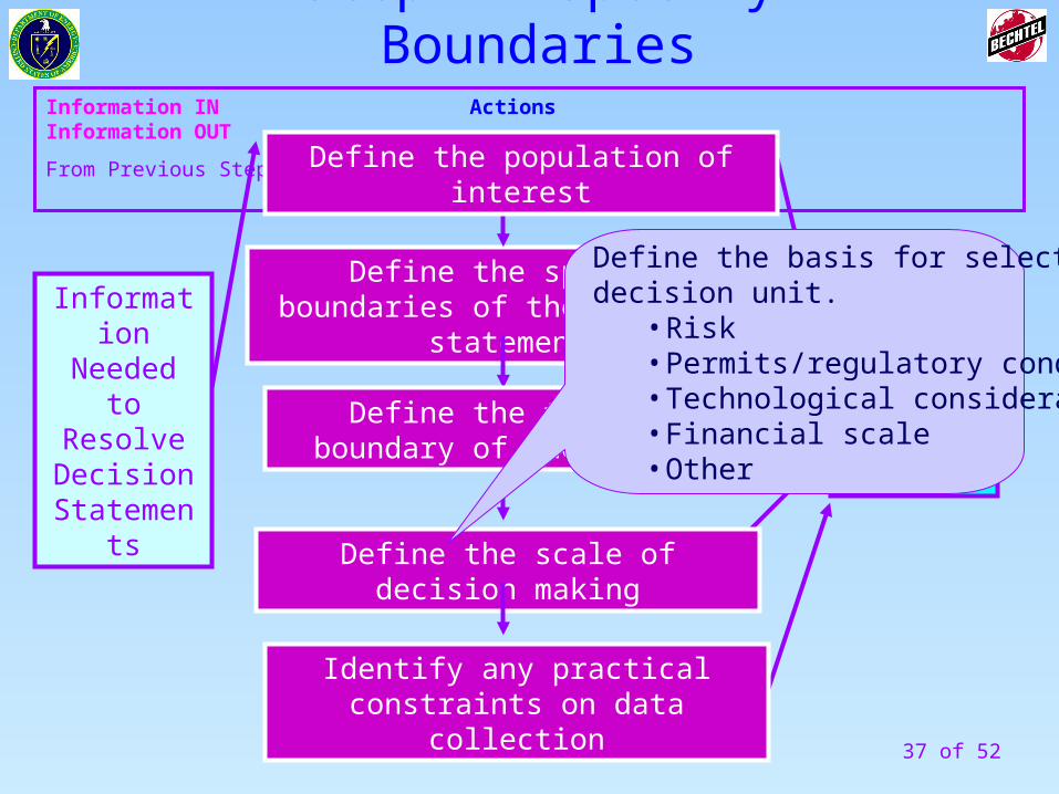
Define the basis for selecting thedecision unit.
• Risk• Permits/regulatory conditions• Technological considerations• Financial scale• Other
Step 4- Specify Boundaries
38 of 52
Information IN Actions Information OUT
From Previous Step To Next Step
Define the spatial boundaries of the decision statement
Unit of Decision Making
Define the temporal boundary of the problem
Define the scale of decision making
Identify any practical constraints on data collection
Information Needed to Resolve Decision
Statements
Define the population of interest
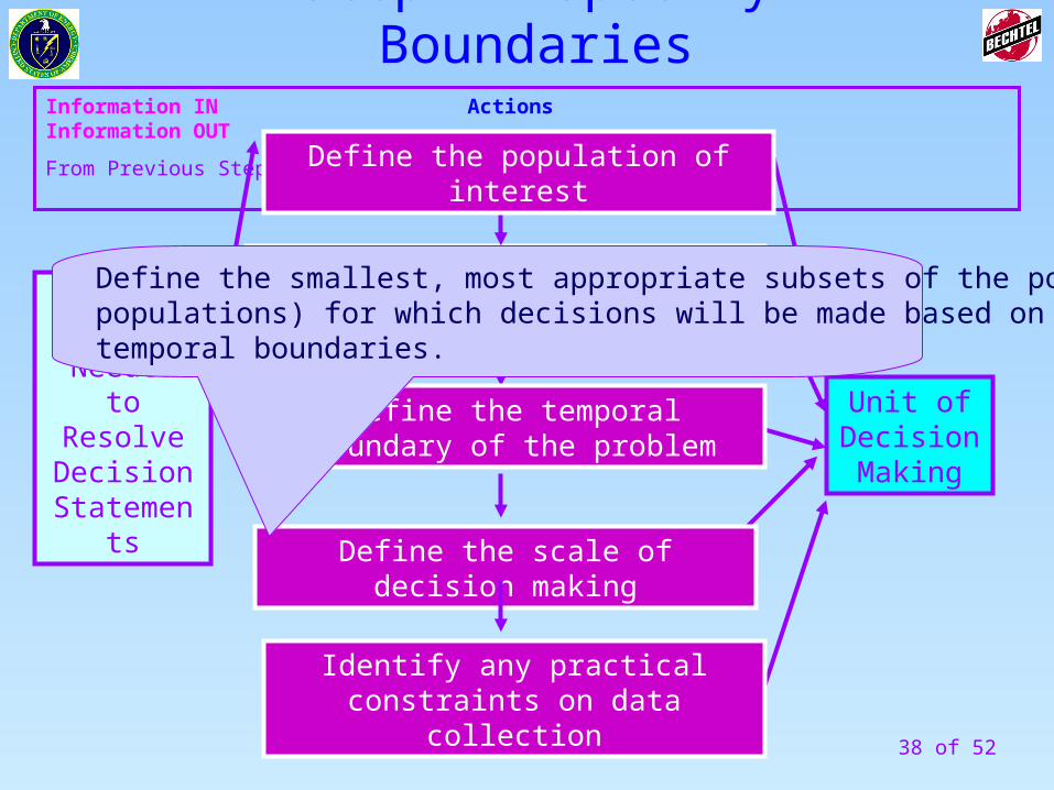
Define the smallest, most appropriate subsets of the population (sub-populations) for which decisions will be made based on the spatial ortemporal boundaries.
Step 4- Specify Boundaries
39 of 52
Information IN Actions Information OUT
From Previous Step To Next Step
Define the spatial boundaries of the decision statement
Unit of Decision Making
Define the temporal boundary of the problem
Define the scale of decision making
Identify any practical constraints on data collection
Information Needed to Resolve Decision
Statements
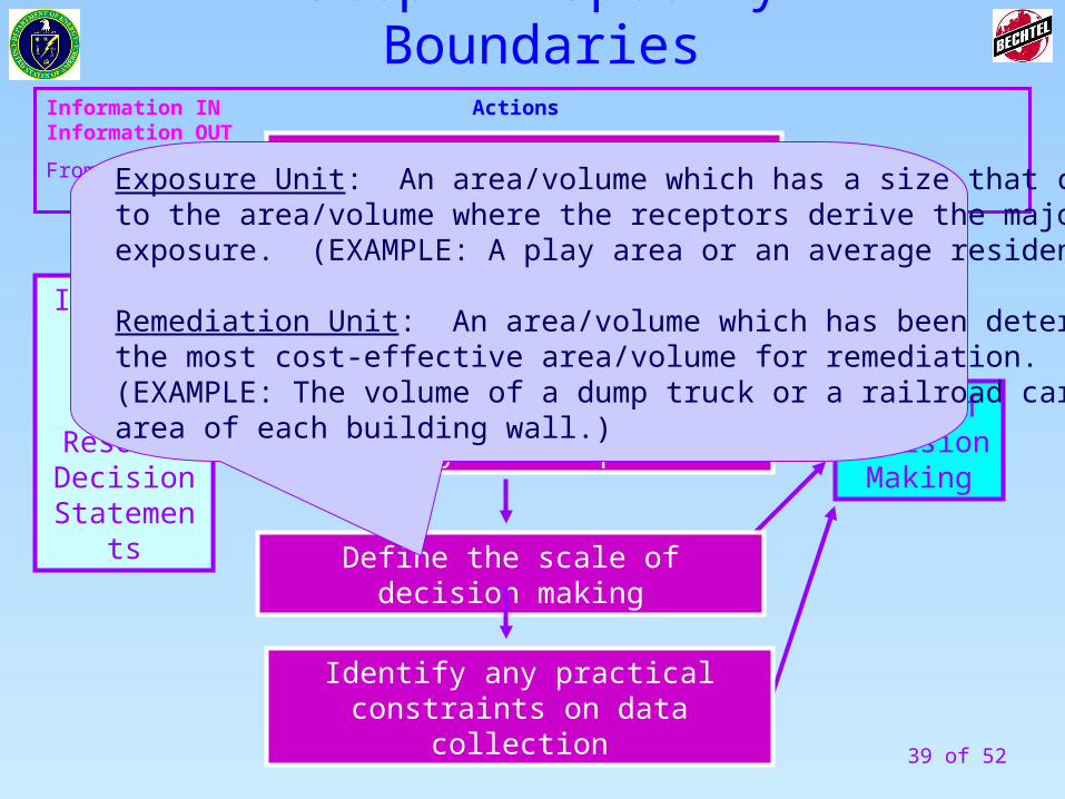
Define the population of interestExposure Unit: An area/volume which has a size that correspondsto the area/volume where the receptors derive the majority of theirexposure. (EXAMPLE: A play area or an average residential lot size.)
Remediation Unit: An area/volume which has been determined to be the most cost-effective area/volume for remediation. (EXAMPLE: The volume of a dump truck or a railroad car, the surface area of each building wall.)
Step 4- Specify Boundaries
40 of 52
41 of 52
How Many Samples do I Need?
REMEMBER:
HETEROGENEITY
IS THE RULE!
42 of 52
Information IN Actions Information OUT
From Previous Step To Next Step
Define the spatial boundaries of the decision statement
Unit of Decision Making
Define the temporal boundary of the problem
Define the scale of decision making
Identify any practical constraints on data collection
Information Needed to Resolve Decision
Statements
Define the population of interest
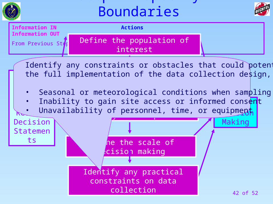
Identify any constraints or obstacles that could potentially interfere withthe full implementation of the data collection design, such as:
• Seasonal or meteorological conditions when sampling is not possible• Inability to gain site access or informed consent• Unavailability of personnel, time, or equipment
Step 4- Specify Boundaries
43 of 52
Information IN Actions Information OUT
From Previous Step To Next Step
Define the spatial boundaries of the decision statement
Unit of Decision Making
Define the temporal boundary of the problem
Define the scale of decision making
Identify any practical constraints on data collection
Information Needed to Resolve Decision
Statements
Define the population of interest
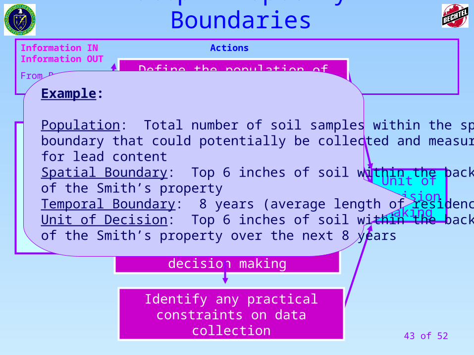
Example:
Population: Total number of soil samples within the spatial boundary that could potentially be collected and measured for lead contentSpatial Boundary: Top 6 inches of soil within the backyard of the Smith’s propertyTemporal Boundary: 8 years (average length of residence)Unit of Decision: Top 6 inches of soil within the backyard of the Smith’s property over the next 8 years
Step 4- Specify Boundaries
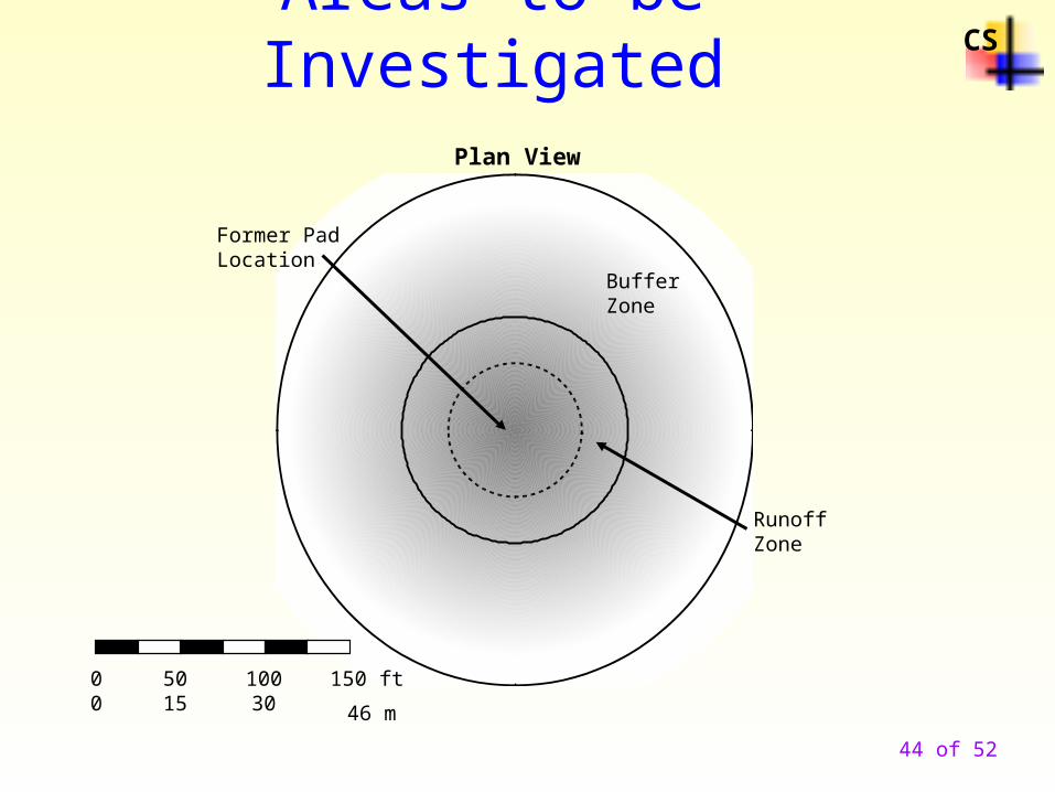
Areas to be InvestigatedCS
Plan View
Former PadLocation
RunoffZone
0 50 100 150 ft 0 15 30 46 m
BufferZone
44 of 52
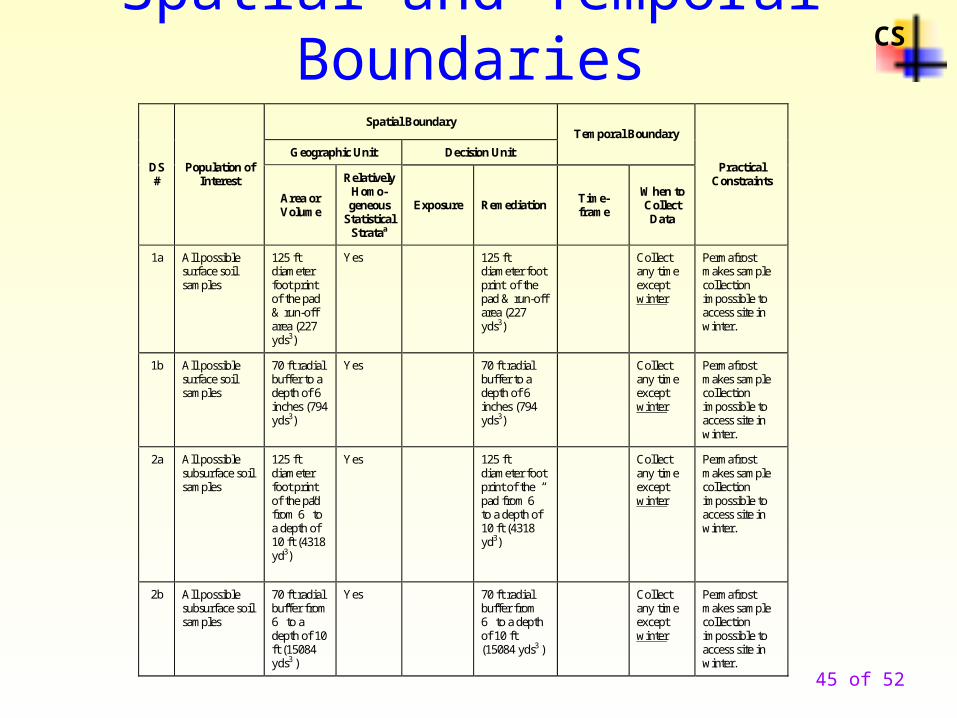
Spatial and Temporal BoundariesCS
Spatial Boundary
Geographic Unit Decision Unit
Temporal Boundary
DS #
Population of Interest
Area or Volume
Relatively Homo-geneous
Statistical Strataa
Exposure Remediation Time- frame
When to Collect Data
Practical Constraints
1a All possible surface soil samples
125 ft diameter foot print of the pad & run-off area (227 yds3)
Yes 125 ft diameter foot print of the pad & run-off area (227 yds3)
Collect any time except winter
Permafrost makes sample collection impossible to access site in winter.
1b All possible surface soil samples
70 ft radial buffer to a depth of 6 inches (794 yds3)
Yes 70 ft radial buffer to a depth of 6 inches (794 yds3)
Collect any time except winter
Permafrost makes sample collection impossible to access site in winter.
2a All possible subsurface soil samples
125 ft diameter foot print of the pad from 6” to a depth of 10 ft (4318 yd3)
Yes 125 ft diameter foot print of the pad from 6” to a depth of 10 ft (4318 yd3)
Collect any time except winter
Permafrost makes sample collection impossible to access site in winter.
2b All possible subsurface soil samples
70 ft radial buffer from 6” to a depth of 10 ft (15084 yds3 )
Yes 70 ft radial buffer from 6” to a depth of 10 ft (15084 yds3 )
Collect any time except winter
Permafrost makes sample collection impossible to access site in winter.
45 of 52
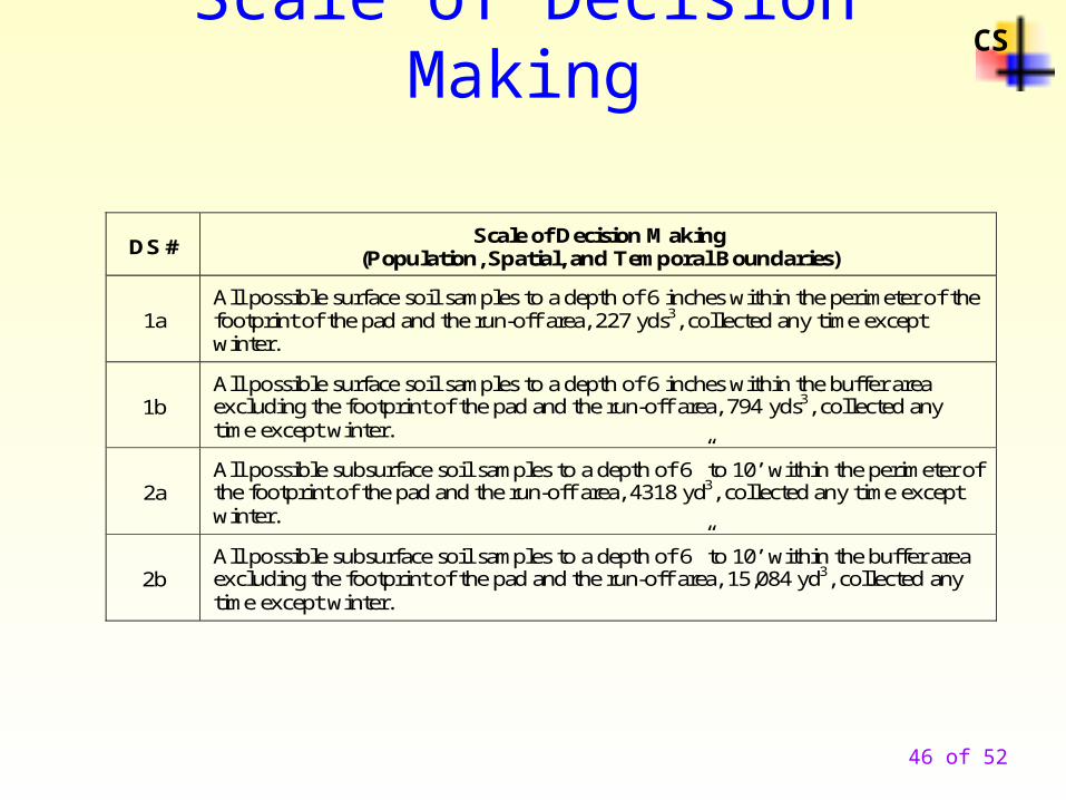
Scale of Decision MakingCS
DS # Scale of Decision Making
(Population, Spatial, and Temporal Boundaries)
1a All possible surface soil samples to a depth of 6 inches within the perimeter of the footprint of the pad and the run-off area, 227 yds3, collected any time except winter.
1b All possible surface soil samples to a depth of 6 inches within the buffer area excluding the footprint of the pad and the run-off area, 794 yds3, collected any time except winter.
2a All possible subsurface soil samples to a depth of 6” to 10’ within the perimeter of the footprint of the pad and the run-off area, 4318 yd3, collected any time except winter.
2b All possible subsurface soil samples to a depth of 6” to 10’ within the buffer area excluding the footprint of the pad and the run-off area, 15,084 yd3, collected any time except winter.
46 of 52
47 of 52
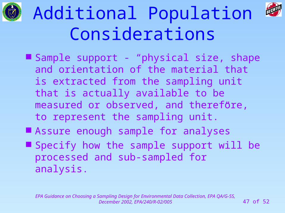
Additional Population Considerations
Sample support - “physical size, shape and orientation of the material that is extracted from the sampling unit that is actually available to be measured or observed, and therefore, to represent the sampling unit.”
Assure enough sample for analyses Specify how the sample support will be
processed and sub-sampled for analysis.
EPA Guidance on Choosing a Sampling Design for Environmental Data Collection, EPA QA/G-5S, December 2002, EPA/240/R-02/005
48 of 52
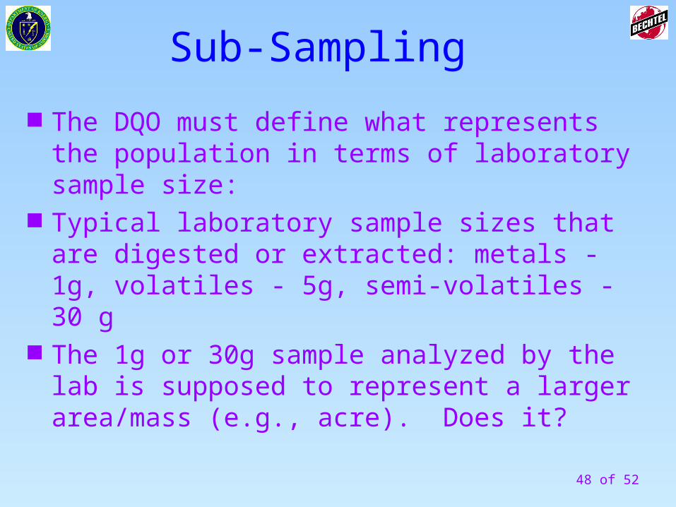
Sub-Sampling
The DQO must define what represents the population in terms of laboratory sample size:
Typical laboratory sample sizes that are digested or extracted: metals - 1g, volatiles - 5g, semi-volatiles - 30 g
The 1g or 30g sample analyzed by the lab is supposed to represent a larger area/mass (e.g., acre). Does it?
49 of 52
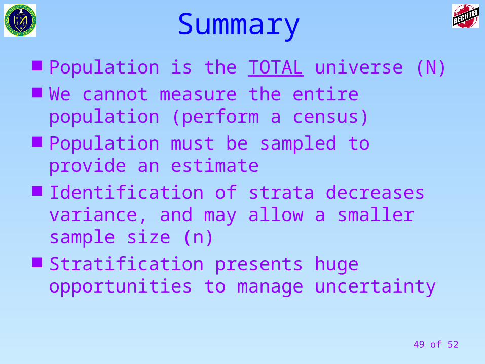
Summary Population is the TOTAL universe (N) We cannot measure the entire population
(perform a census) Population must be sampled to provide an
estimate Identification of strata decreases variance, and
may allow a smaller sample size (n) Stratification presents huge opportunities to
manage uncertainty

50 of 52
Step 4, setting the boundaries of decision-making, provides by far the biggest single opportunity for managing uncertainty, using:
A. Results from comprehensive Scoping
B. Professional Judgement
• PJ is the single most important skill a project can bring to bear in the DQO Process
Summary
51 of 52
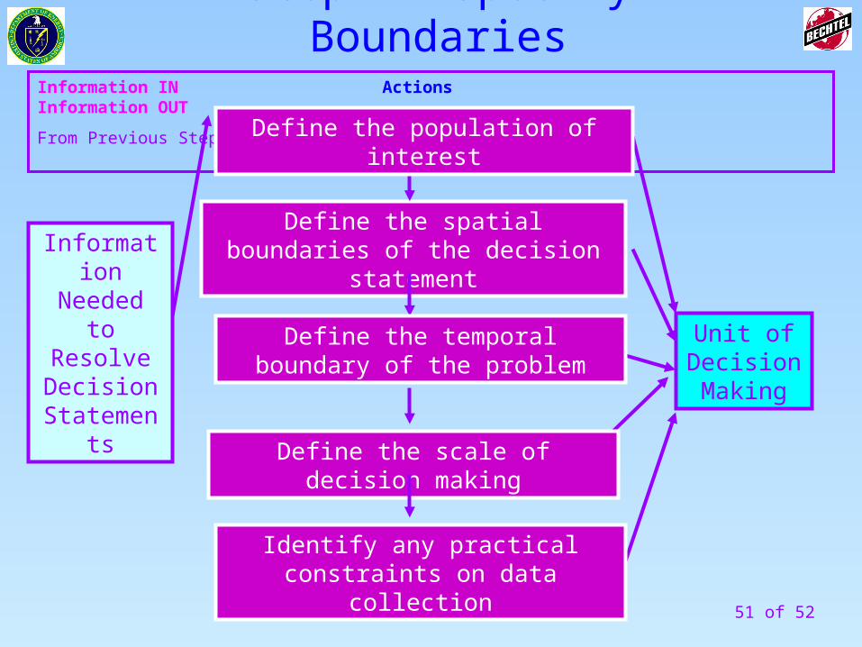
Information IN Actions Information OUT
From Previous Step To Next Step
Define the spatial boundaries of the decision statement
Unit of Decision Making
Define the temporal boundary of the problem
Define the scale of decision making
Identify any practical constraints on data collection
Information Needed to Resolve Decision
Statements
Define the population of interest
Step 4- Specify Boundaries
52 of 52
End of Module 14Thank You
Questions?
We will now take a
15-minute Afternoon Break.
Please be back in 15 minutes